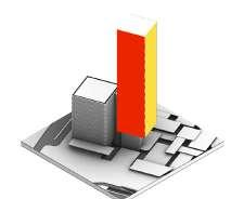
Berk Bingol PORTFOLIO selected
works


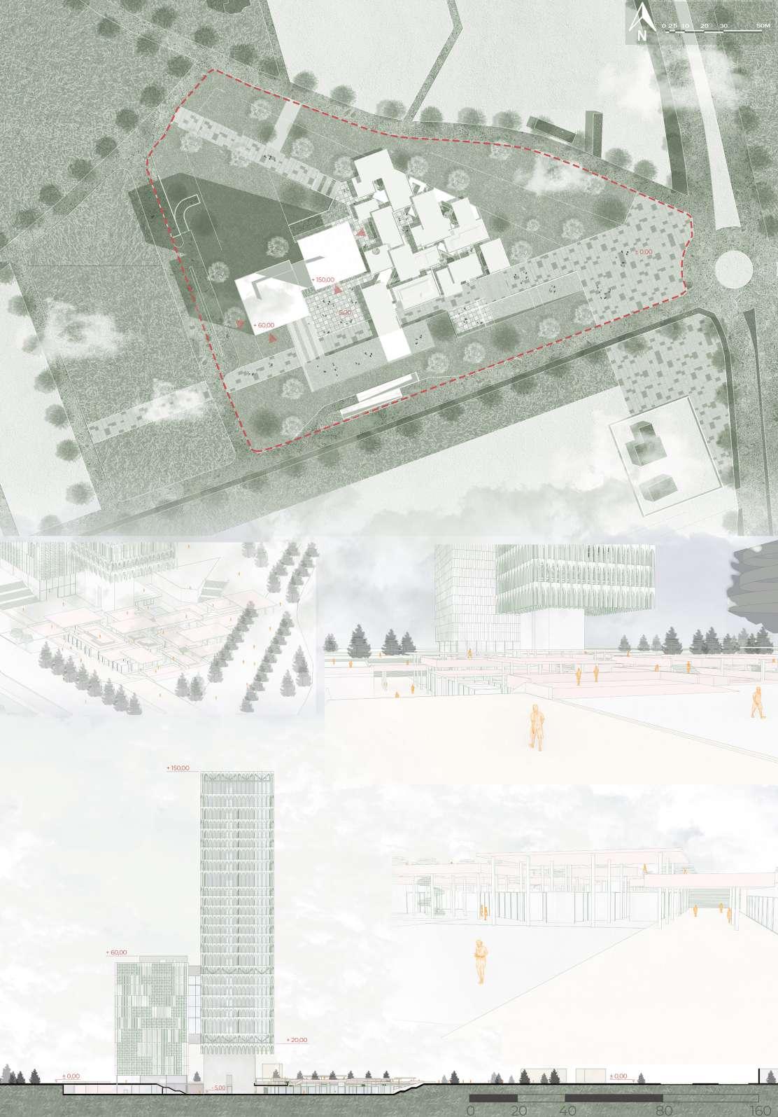
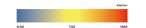
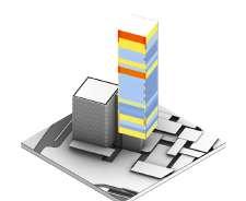
Date: 10/2020 - 12/2020
Award: Purchase Prize
Location: Bursa, Turkey
Team: +FREA
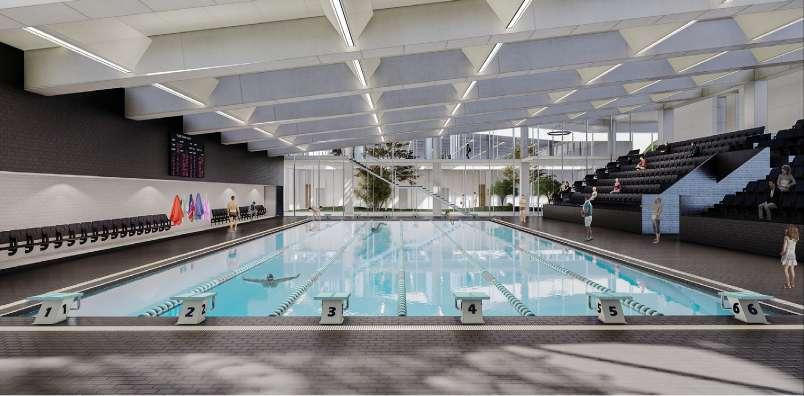
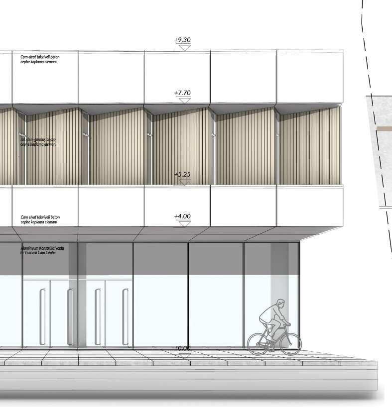
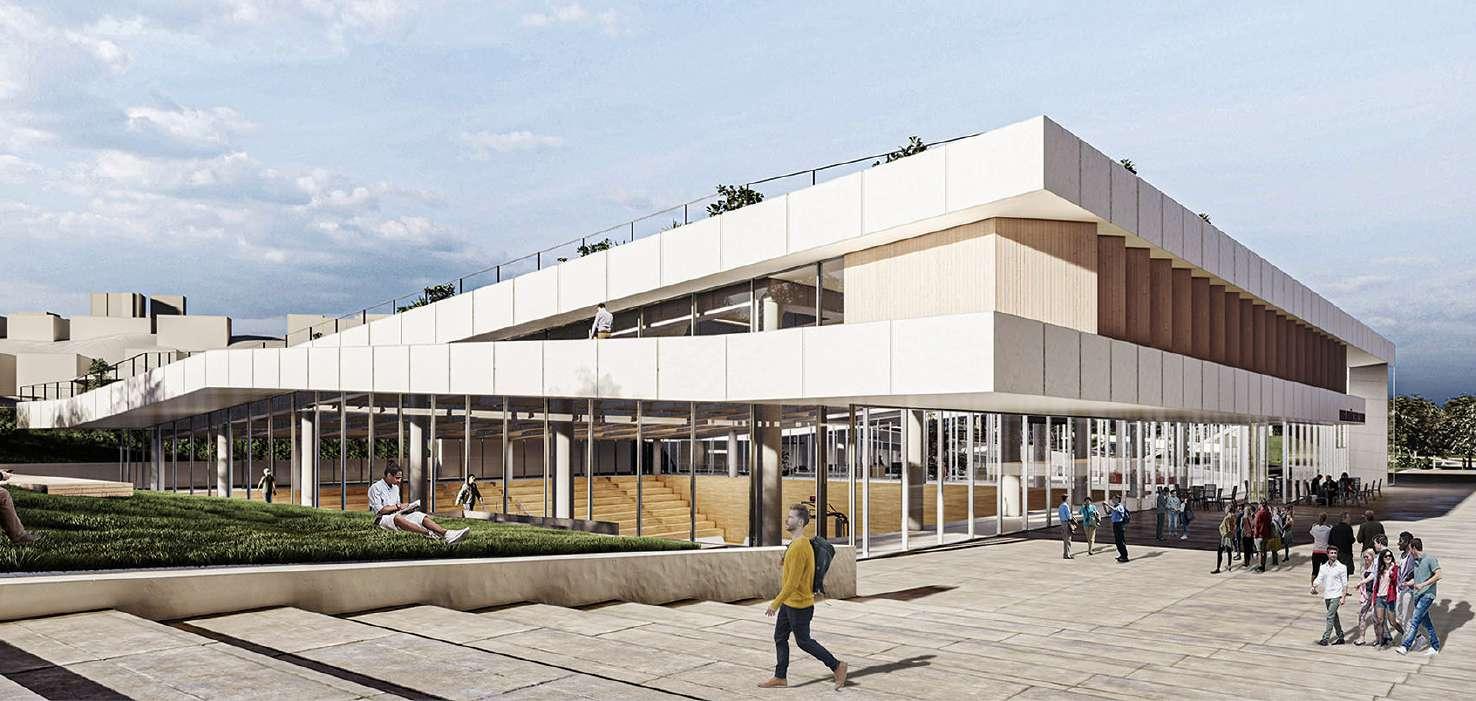
Project Type: Sports Hall Concept Project
Role in the Project:
From the very beginning, the development of the project was on my duty. Under the spot of the head architects, I was in charge of providing conceptial analyses, further diagrams, designing and presentation management. Presentation elements and visuals were produced cooperatively by a teamwork.
Project Description:
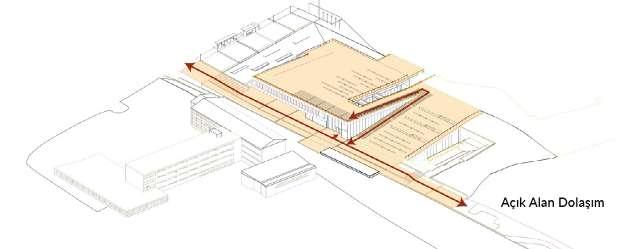
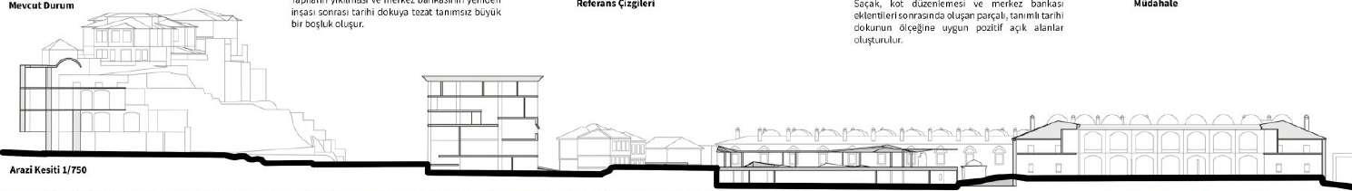
The concept was to establish relations between different urban modes, integrate the urban event space with the building, and reconstruct the memory of the place which will be demolished by creating urban continuities.
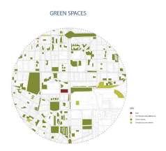
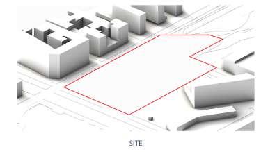
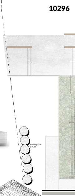
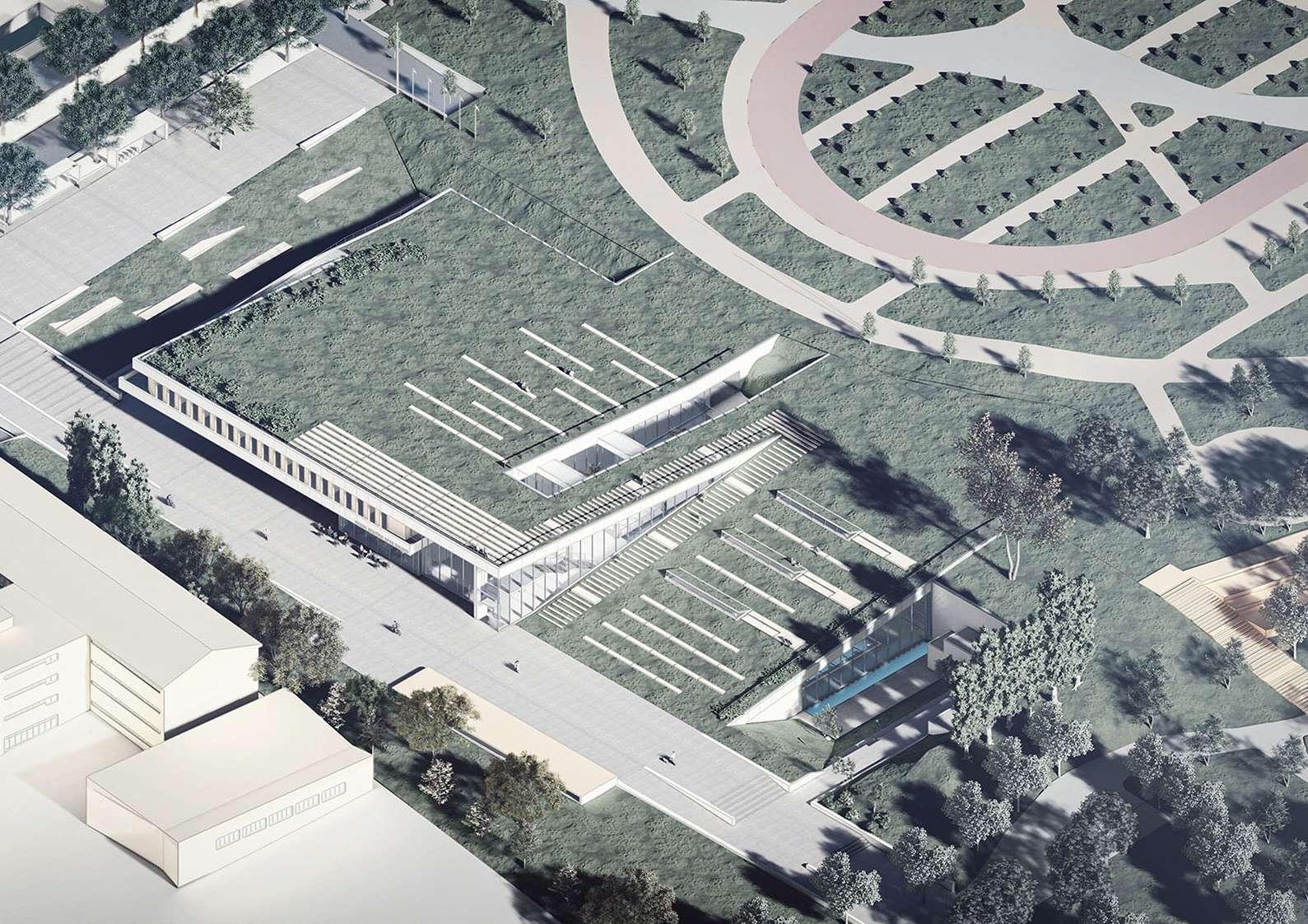
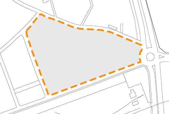
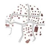
The project area, which is on the threshold of transition from Uludağ slopes to Bursa Plain, has been the subject of many discussions in the recent past. Although it is an important memory place in the identity of the city and its citizens, after the demolition of the Stadium and Sports Hall structures, which interrupted the experience of topographical continuity, a brand new spatial repair opportunity emerged. Being able to make this ‘place’ located on the periphery of Kültürpark a part of the existing green texture again constitutes the starting point of the project. Gazi Stadium is the name of the first facility built on the Beylikbahçe berry farm, opened on June 3, 1932, with a 300-person indoor tribune. Although the building, which was named Bursa Atatürk Stadium with the additions made over the years, has now taken the Beylikbahçe Mulberry from us, this place has turned into an urban memory place where countless memories are accumulated for the citizens of the city.
The main idea of our project is to try to reconstruct the holistic green texture of the Beylikbahçe berry or Vakıf Bahçe region before the destroyed Bursa Atatürk Stadium. The proposal was handled with a setup that fits in its location, creates space for all possible pedestrian movements and flow, establishes relationships between different urban modes, and offers functionally refined and clear solutions.
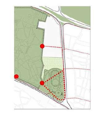
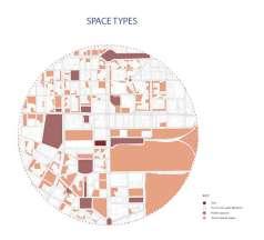
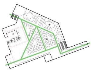
Current State
- Pedestrian paths from the city to the park
- Limited accesibility due to fencings
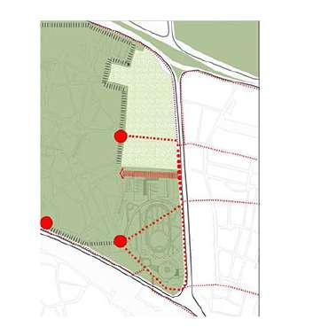
Proposal
- Alternative pedestrian path to the park
- Removing the fencings in the competition area
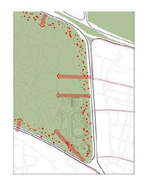
Further Step
- All fencings removed, direct connection between the city and the park
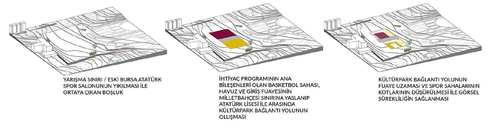
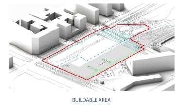
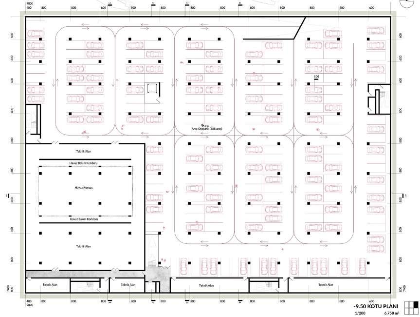
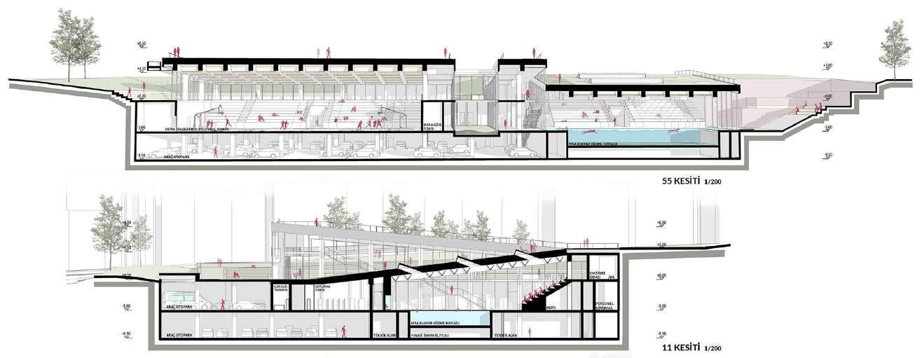
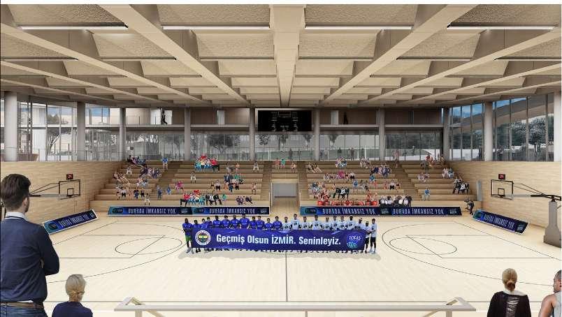
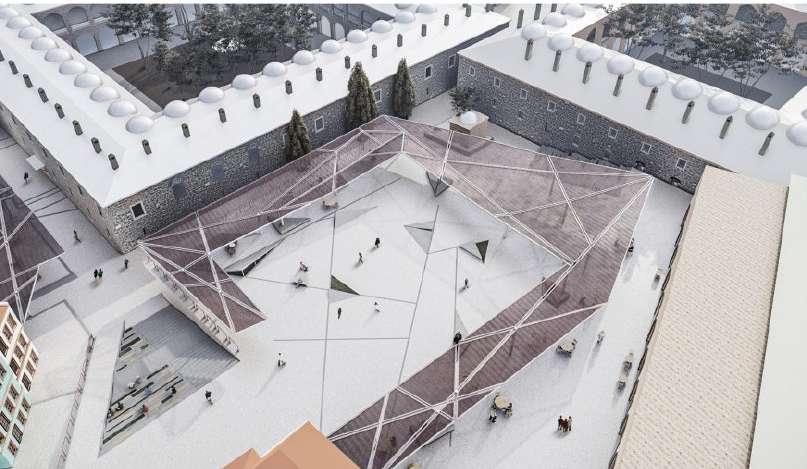
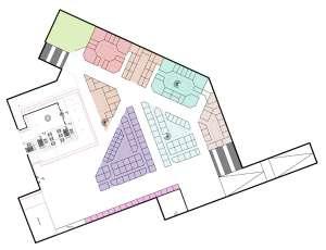
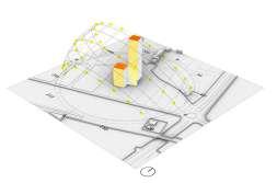
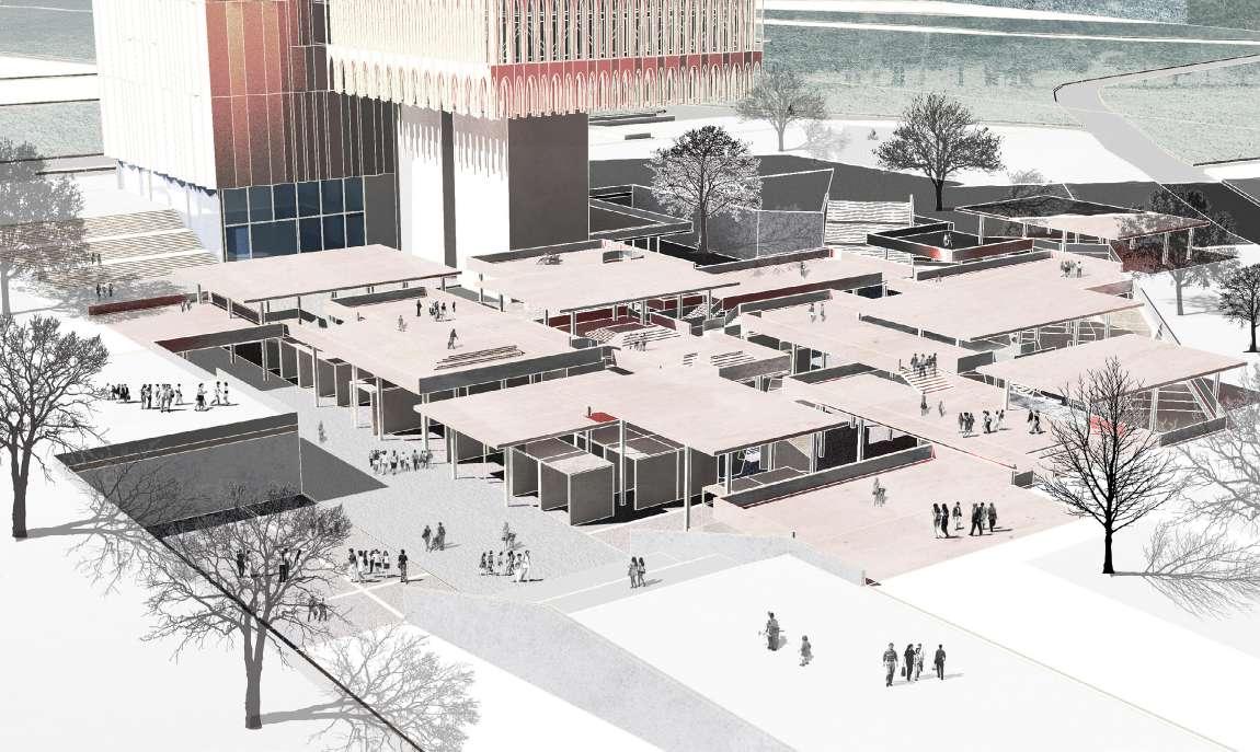
- Competition Area
- Unfunctioned urban void after demolishing of the old Bursa Ataturk Sport Hall
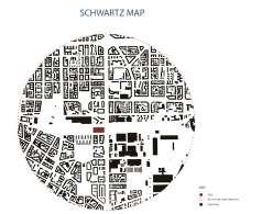
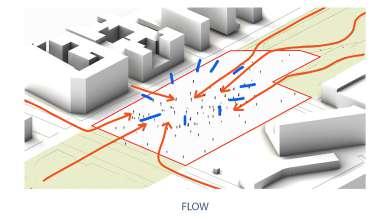
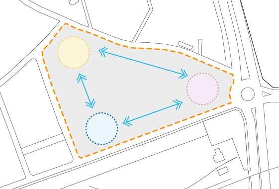
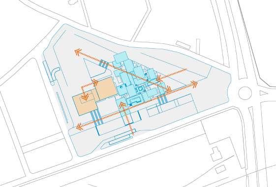
Placing volumes of the basketball court, the foyer and the swimming pool at one side and creating a pedestrian path for public at the other side
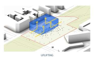
For visual continuation, lowering the leves of sports halls
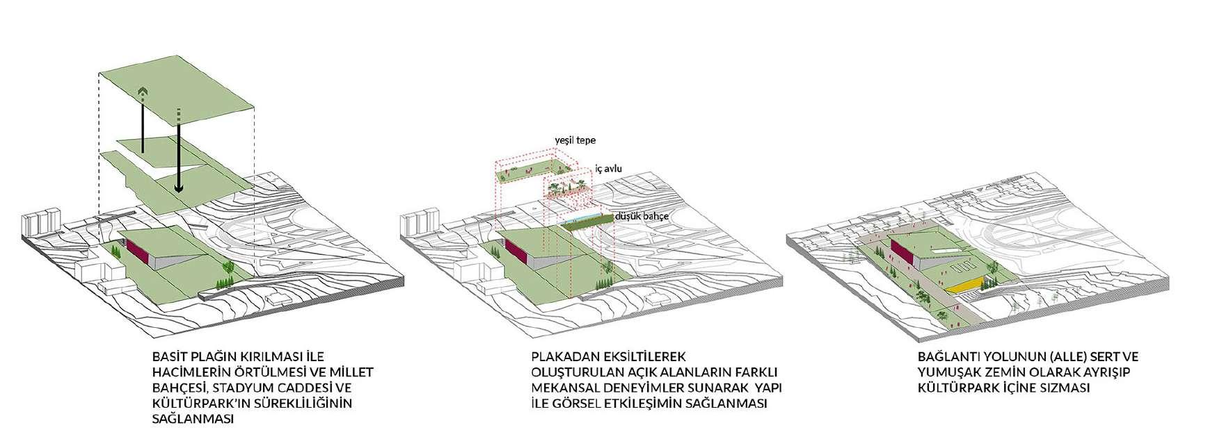
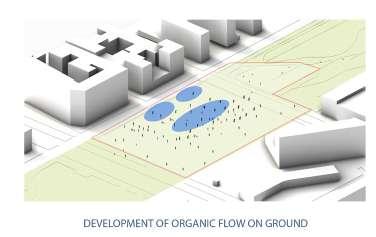
Like folding a flat plate to cover up the volumes for providing continous flows between different levels
Forming open air areas by cutting the plate for different space experiences
Differentiating the pedestrian path as soft and hard surface and penetration of it into the park
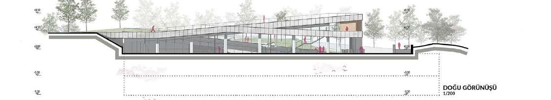
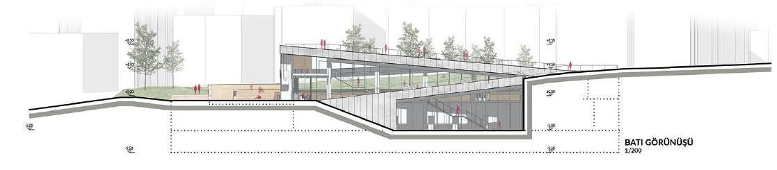
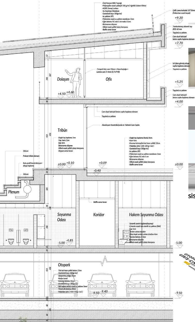
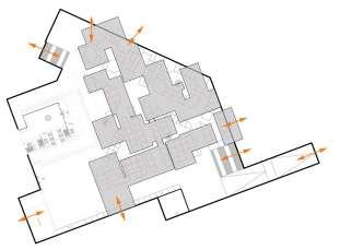
Based on the fact that the ground level of the national garden, which was built after the demolition of the stadium, is the same as the field level of the stadium, a fiction that does not go higher than this level was adopted. In a sense, it was aimed to preserve the continuity of green in the view of the plain from Cekirge street. For this, it was aimed to dissolve the difference in elevation between the Atatürk High School garden and the old Atatürk Sports Hall Ground and to strengthen the relationship between the school garden and the gym. The connection to Kültürpark, where the existing trees were preserved and made a part of urban life, became the main periphery where the building opened and established urban relations. At the level of the public garden, life would continue and the gymnasium and its spaces would be formed under the continuity of the ground. By increasing the urban activity ground, it would join the garden level and the spaces of the building would open itself to the city.
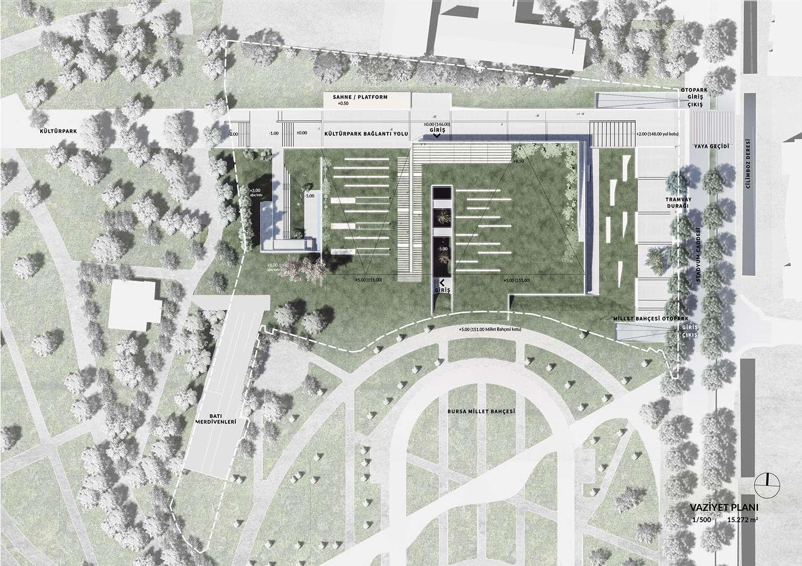
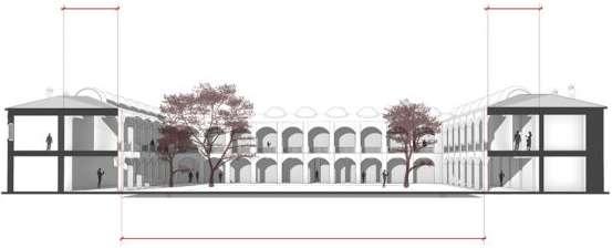
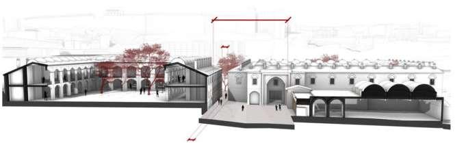
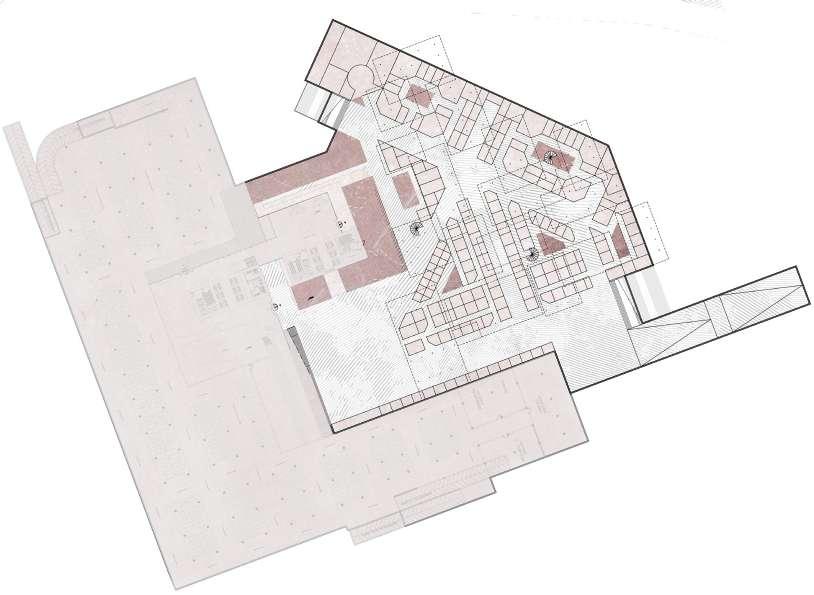
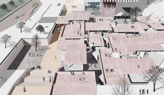
The program components, which were covered with a simple plaque, were gathered in two main parts. For the Basketball Hall, which opens its face to the city, and the Pool, which moves away from Stadium Street and approaches Kültürpark and tries to remain a little more secret, the top cover is articulated to provide the existing denim relations. In this way, sloping surfaces both opening to the National Garden and overlooking the Atatürk High School garden emerge. The volumes defined by these covering surfaces, which are the continuation of the garden floor, also observe the volumetric qualities and standards required by the program.
The Kulturpark Connection Road extending in the East-West direction provides the connection of the city to Kulturpark. The main program components of the structure are also arranged on this axis and directly relate to the axis. Located between the Basketball Hall and the Pool, the Foyer functions as both a separating and connecting space and opens directly to the Kulturpark Connection Road. Administrative units are located on the north wall under the eaves in the gap formed by the slight elevation of the plaque covering the Basketball Hall towards the north. The interior garden, which is proposed in order to establish a visual connection with the upper landscape and to bring natural light into the space, also defines the entrances of the Basketball Hall. With the help of the bridges passing through the inner garden, the host and away entrances to the stands can be taken from separate points. The southern end of the foyer ends with an axis that opens directly to the Stadium street. This axis is also considered as the entrance of the away spectators when necessary.
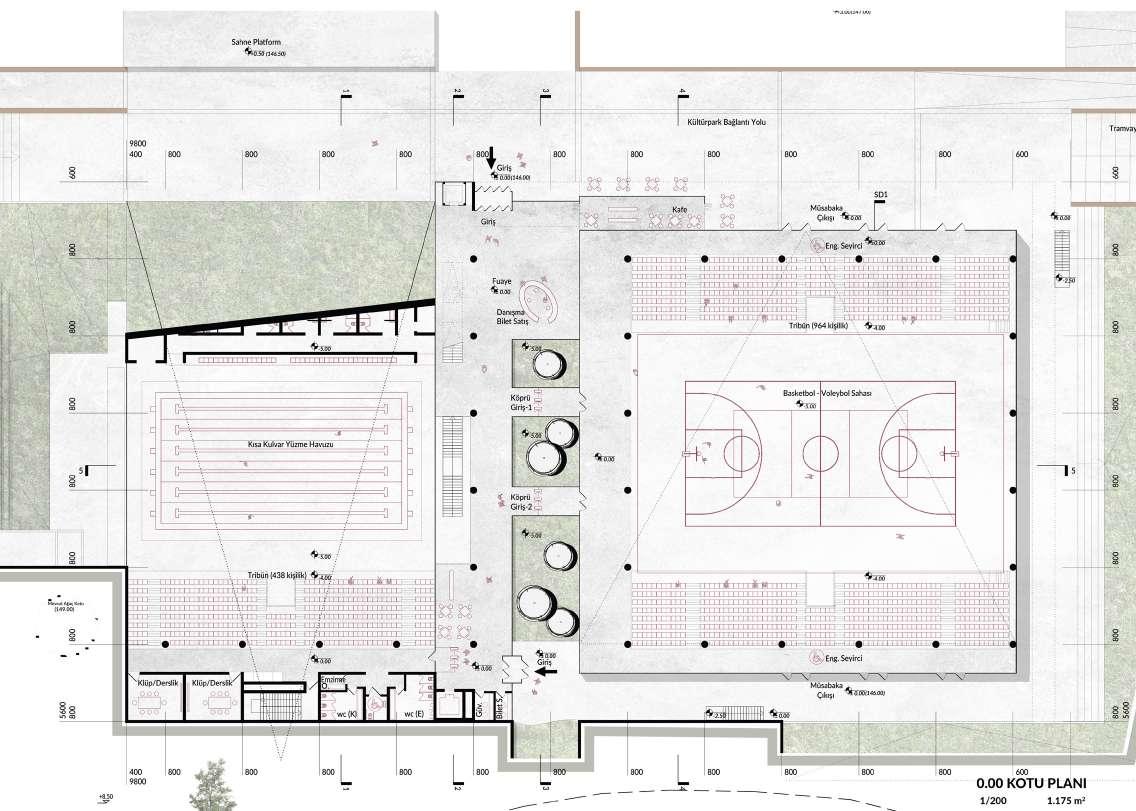
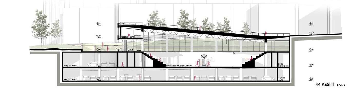
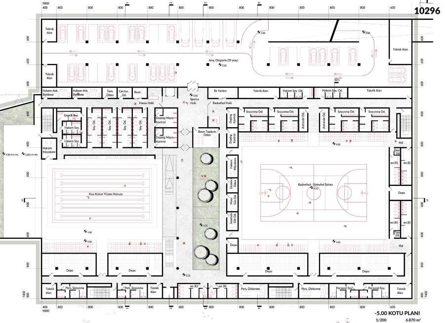
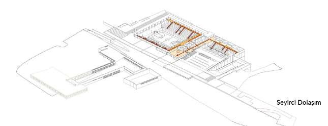
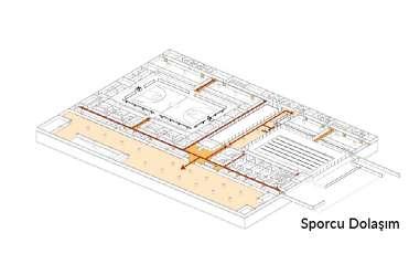
While the entrances of the athletes arriving on foot are provided from the foyer level, the team buses can approach the athlete entrance designed on the 1st basement floor. The Athlete Entrance Hall, located at the same level as the Field and the Pool, functions as both a separating and unifying space at this level. First aid and athlete health centers can also be opened to this place, providing direct access to the ambulance.
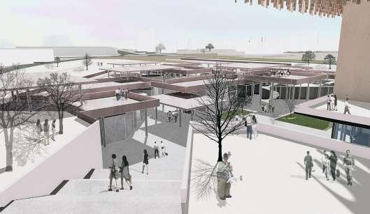
The roof plate covering the pool is the architectural element that provides the most important connection to the exterior. In this way, while the garden and Kültürpark Connection Road are strongly connected, it is also enriched with an urban use. The plaque covering the Basketball Hall rises towards the north and shows its face to the city. The gaps opened in the roof plate have different functions. The spaces through which the people’s garden flows into the building are spatial instruments that bring natural light to the interior while establishing a visual relationship with the building from the garden level.
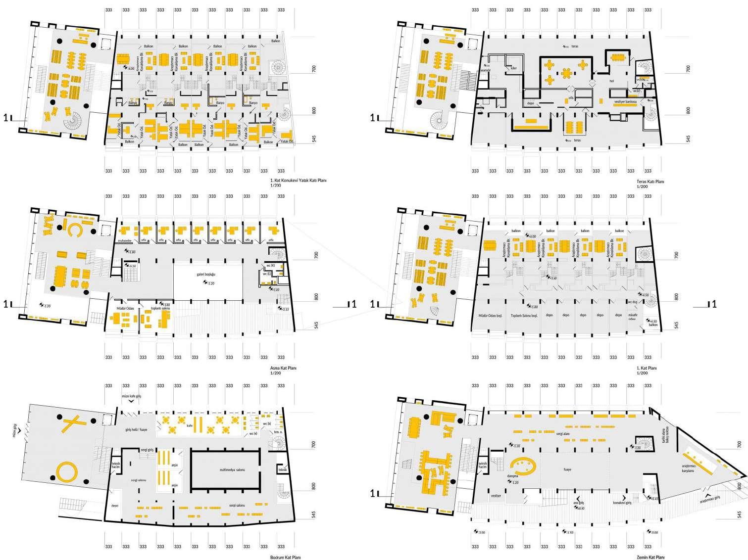
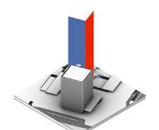
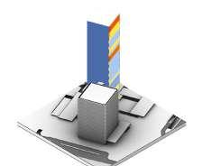
Date: 09/2020 - 01/2021
Award: 3rd Prize
Location: Bursa, Turkey
Team: +FREA and Promim
Project Type: Renovation, Refunctioning and Urban Project
Role in the Project:
Joined the project from the middle phase. I was in responsible of 3D modelling and in the team of architectural design of the new additions and existing buidings, and took a small part in urban design decisions. Presentation elements and visuals were produced cooperatively by a teamwork.
Project Description:
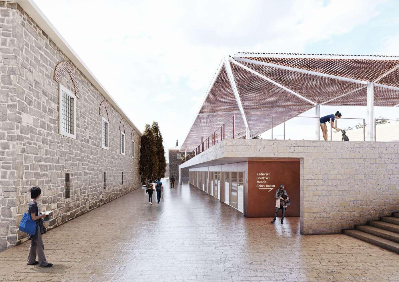
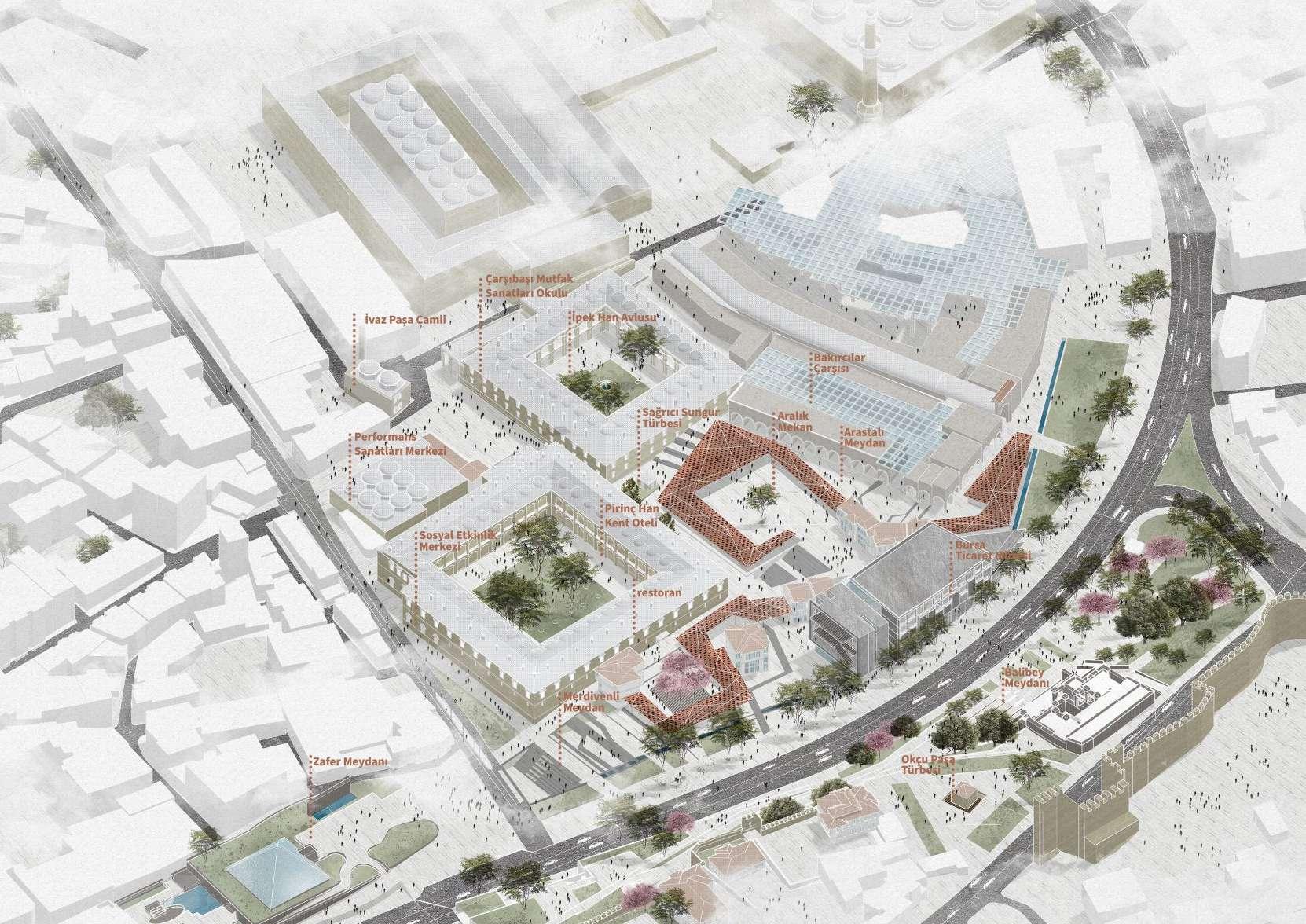
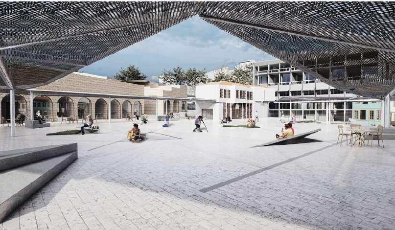
An urban design project aiming to bring back the social and economic importance of the region to our lifes today.Taking care of the area by refunctioning the historic “Hans” while also creating new urban scale spaces for the city.
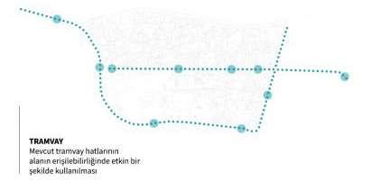
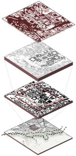
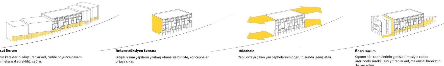
TRANSPORT AND ROAMING SCENARIO
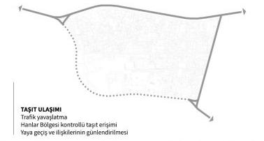
Hanlar District is located in a very accessible location in the city center of Bursa. In this sense, it would not be wrong to say that it is at a strong point of access. But it also remains in a heavy traffic. In particular, the perceptibility of historical inns, fortifications and examples of civil architecture, and the discovery of identity through the human eye stand in a very important place in the transportation and circulation scenario. In this context, a pedestrian-oriented fiction has been created in the project, which is supported by public transportation. Accordingly, the hanlar area was evaluated as a pedestrian area and public transport stops such as trams, buses and minibuses were increased along the roads surrounding the area. In order to prevent the area from being adversely affected by traffic and to strengthen the relationship between the Walls and the Hanlar District, Cemal Nadir Street was converted into a route where traffic was slowed down by reducing the number of lanes and widening the sidewalks. The underpass culture, which is in the character of the Bursa hanlar district, was re-evaluated through the existing underground relationship of Zafer Plaza and an underpass was proposed at the end of Cumhuriyet Street. In order to increase pedestrian mobility along Cemal Nadir Street, 3 important square structures have been adopted within the project area. These squares also allow you to glide into the Han District.
The city lives between two parts of the city (Hisar-Hanlar Region), between two streams (Gökdere and Cilimboz), between the old and the new, between the two han duvans, between the two porticoes, between the two elevations, between the erguvans, in the intervals that emerge with a new formation each time. Therefore, the scale is not fixed either. The symbol of the area produces different intervals even again, which is the main element in han architecture. Just like an alloy wall, sometimes brick. But no repetition will ever be the same as the last. The mapping shows that the range in Çarşıbaşı is shaped by the threads that connect to each other and the differences that occur between them. The proposal project proposes a monolithic, fluid, connecting and multiplying, intertwined and separate, but above all, contemporary range with the present, with the aim of making this unique quality the basic principle of the design approach. The concept of modernity here starts from the definition established by Giorgio Agamben by associating it with disconnection and displacement. According to Agamben (2009), “those who truly belong to their time are those who neither perfectly match it nor adapt themselves to what it requires.” The time of interval takes the form of an elusive threshold between ‘not yet’ and ‘no more.’” (Agamben, 2009). In this context, December-space defines the relationship between the commercial, cultural and social center that is “about to be” in Çarşıbaşı and the adjacent civil architectural texture that no longer exists. It breaks free from the walls of the body and expands the field of vision, and with its flexible and mobile structure, it proposes new encounters, mergers, gatherings and sometimes ruptures. While doing this, it reinterprets the alloy construction technique that we read vertically in the field in two dimensions and this time takes it on the horizontal plane. While providing the comfort of the habitual, it becomes the difference itself, and these differences suggest a new experience every day, every time you go to the field.
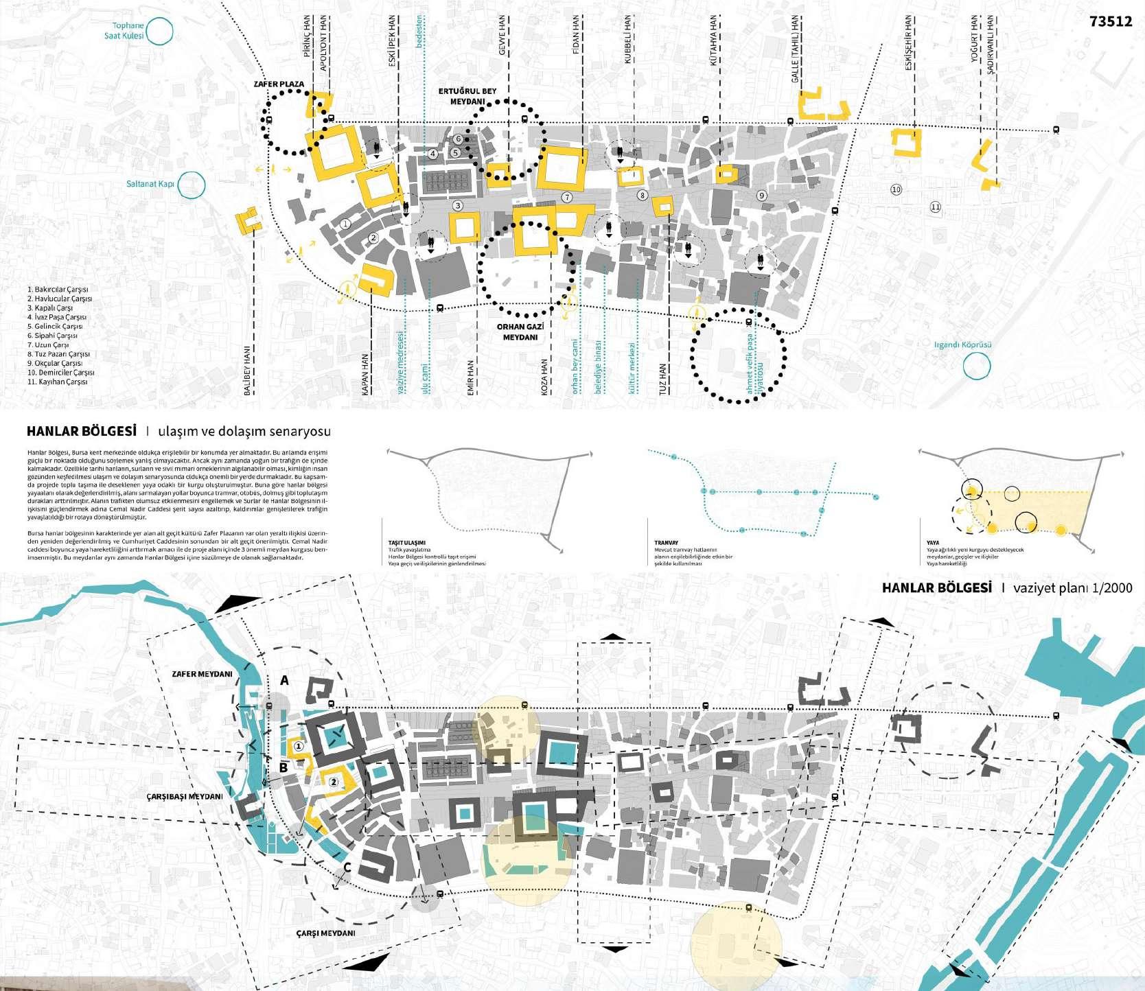
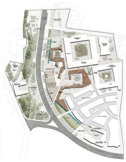
existing site plan
Project; With reference to the reading on Bursa and the range, it produces programmatic and spatial design proposals that are activated at multiple scales, through three (3) basic conceptual strategies:
One of the main questions posed by the competition is the creation of the void that emerged in Çarşıbaşı after expropriation as an urban space with new program and design proposals. Addressing the spatial disconnection between Hanlar District, Hisar interior, Tophane slopes and Tophane Clock Tower with creative design solutions will be possible by reinterpreting the resulting space with reference to the original texture. Instead of wide openings, the Hanlar Area, which consists of intertwined and narrow spaces, is the need to control the space exhibits the reference system heard.
The project, which reads Bursa and Hanlar region through intervals in different scales and historical layers; proposes a new range to define the exposed gap. Spacing-space produced by interpreting the mass-space relationship of the original texture; It is a space proposal that connects it with its linear structure and produces new continuity and closures.
Taking reference from the local architectural texture and proportions of the Hanlar District, the system creates its own spatial typology and creates an effective human-scale spatial setup of Çarşıbaşı. The system, which produces spaces with different permeability according to the environment it passes through, produces its own unique morphology as an urban space that both connects and multiplies.
Carsibasi and Hans Area are invisible as a result of intense structural interventions experiencing its original texture from multiple frames; and recommended needs of different user groups that will be included in the field with new programs. The shower provides a common ground.
The unique value of the Hanlar region, the feeling of being lost and chance encounters makes the pattern permanent.
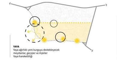
The proposal project, which deals with Çarşıbaşı and Hanlar District in its broad context with many cultural and natural values, is based on a fluid and continuous design setup. In the experience of the broad context, transportation, circulation and accessibility scenarios (for pedestrian, bicycle, electric scooter) come to the forefront, which will enable exploration traces at multiple scales.
Currently, pedestrian access to Hisar İçi, Hisar slopes and Tophane has been lost spatial solutions to slow down flatan vehicle traffic and bus stops relocation proposal, along Cemal Nadir Street (eastwest
It provides a pedestrian-oriented spatial continuity.
Open spaces and squares at different levels, created with reference to the slope of Çarşıbaşı and Hanlar District, allow the spatial diversity of the existing texture to continue in continuity.
The proposed project creates new traces of discovery through the relationships that the spontaneously formed tourist routes in the area will establish with urban and ecological intervals in the wider context (see Landscape Design Approach). The traces of discovery that multiply, lengthen and reproduce will offer routes that are part of daily life, in which not only those who visit the city, but also Bursa residents can be involved.
FLEXIBLE and VARIOUS
The competition area, where the proposal project is read through intervals, is intertwined. It contains traces and spaces at scales. However, this togetherness presents a singular and familiar physical environment that hides its diversity. The use of the area based on a single program makes the spatial potential of the Hanlar Region and Tophane slopes unnoticeable. It creates an environment that responds to the expectations of a limited variety of user groups in a limited time frame. The re-functioning program proposed in the project meets the needs of Çarşıbaşı.
It will enable flexible and diverse programmatic and spatial editing.
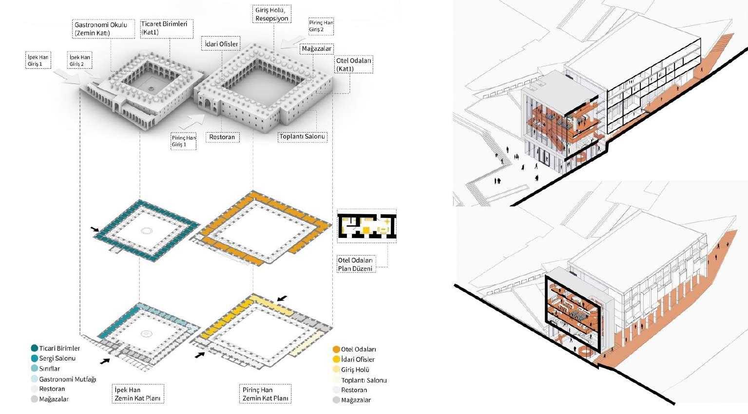
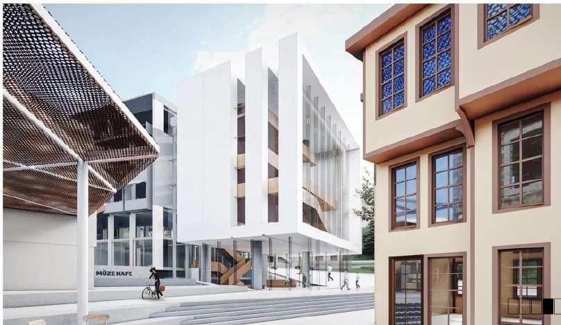
Proposing the Central Bank as a museum and research center that archives and exhibits Bursa’s commercial memory while preserving it; Re-functioning of Brass Han as a city hotel and Ipek Han as a school of culinary arts, will produce the programmatic, spatial and social diversity that the area needs.
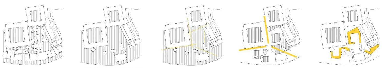
current state keeping only registered historical buildings possible intervention directions creation of alternative intemediate spaces in a similar way with the existing urban tissue
Proposal of a ‘Shelter’ to create a main and sub places in relation with the registered buildings.
recent years, the historic central bank
current state, lack of its context
expanding its dead facades
refunctioning it as a museum and a common work space
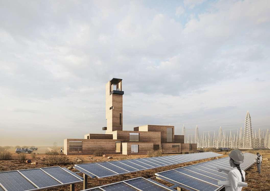
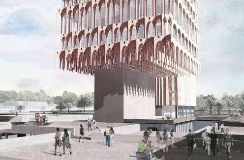
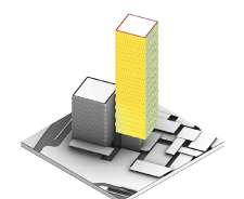
Date: 11/2020 - 03/2021
Award: Honorable Mention
Location: Konya, Turkey
Team: +FREA and studio im
Project Type: Office, Exhibition
Role in the Project:
Joined the project from the middle phase, in designing/plan solving process. Presentation elements and visuals were produced cooperatively by a teamwork.
Project Description:
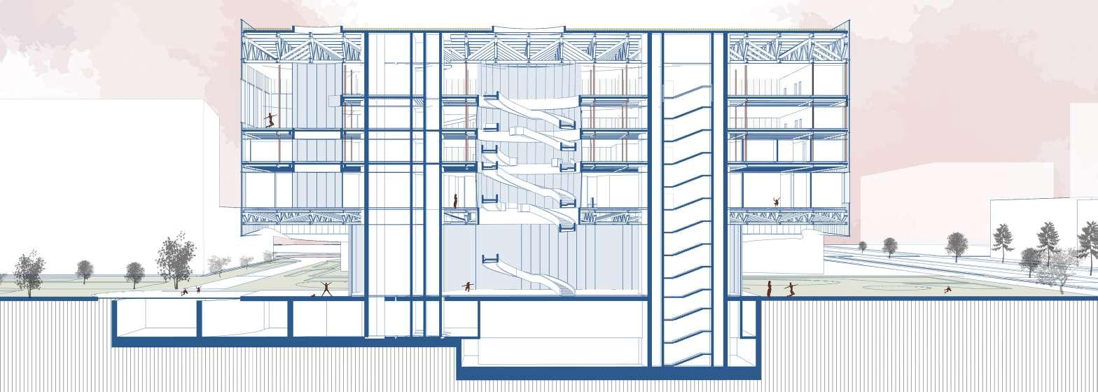
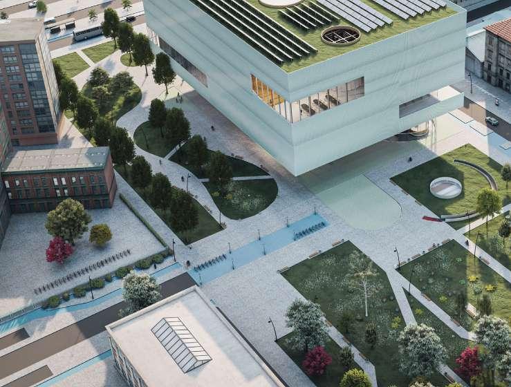
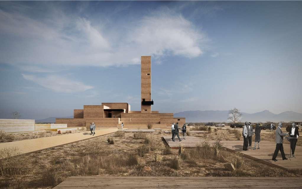
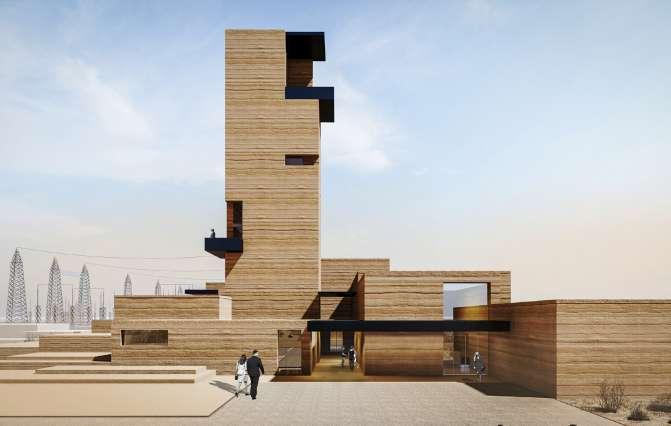
A new headquarters office for the largest energy plant field of Turkey.
Energy Layer PV panel/ 20million m²
Terrain layer Karapınar Ovası / Desert Teknology Layer Underground spaces / Climate preventions
Design principles;
- Competible with the geography, climate and user
- Avoiding from the features of the “Anthropocene” age
- Not “consume and repair” but “plan correctly, consume less”
- Integrated Design Approach
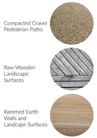
It is obvious that sustainable design should not be an “improvement” effort provided only by technological solutions specific to today. The basis of this multi-layered design approach lies in belonging to the “place”, taking its reference from the “place”. In Anatolia, which has hosted the oldest settlements in history, there are countless architectural examples in harmony with its environment, in a correct relationship with climatic conditions, using the topography efficiently, and valuing the local materials.
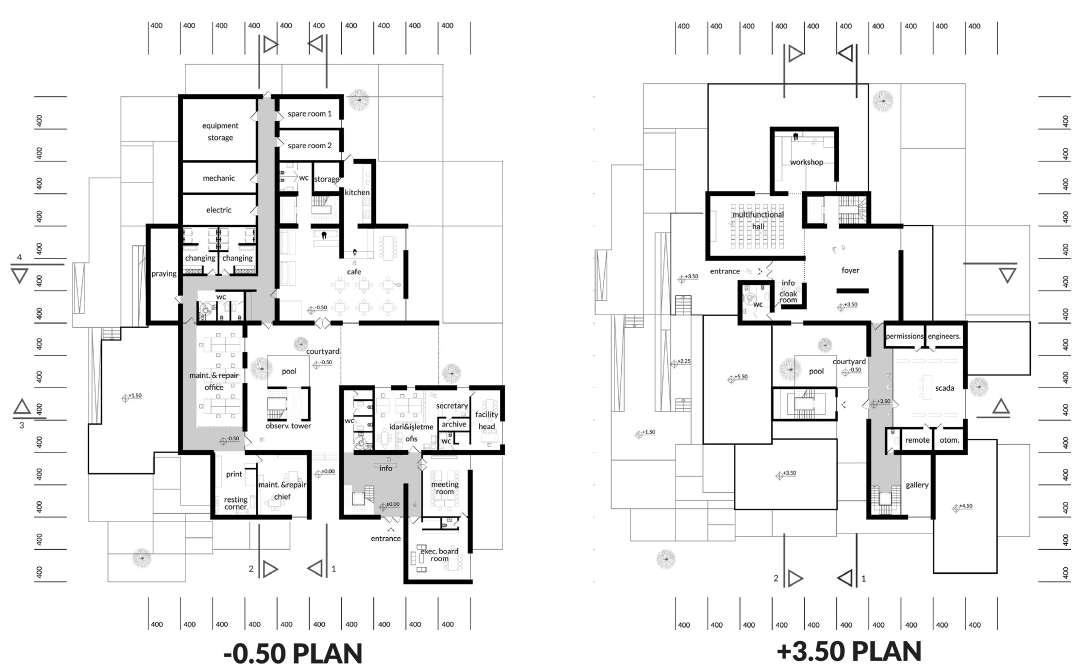
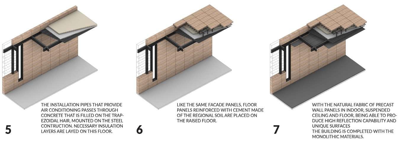
With reference to this point, it was important to construct the context of the SCADA Building over the “place” where it belongs. The aim is almost zero carbon emission (nZEB) for the structure, with the approach that will consume less energy thanks to passive design features taking climatic inputs into account, and will keep the environmental impact at the minimum level by the use of local materials.
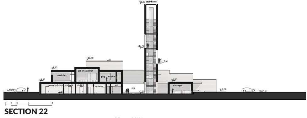
While creating a plan scheme that meets all the needs of employees in operational terms, the visitor experience and relationship was also established.
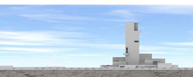
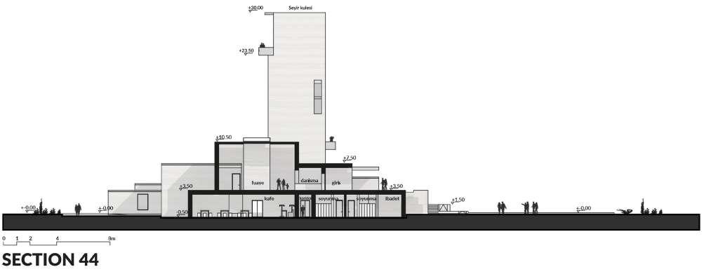
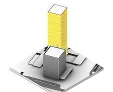
The building, designed with a partially introverted organization by considering the strong climatic conditions, creates a threshold image with this massive/closed effect.
The building tectonics were created mainly horizontally, while in the design process, functional units formed their own individual masses by stacking on top of each other, creating a new topography in the flat site.
locating the building upright to the main approach to create a threshold with the PV panel field

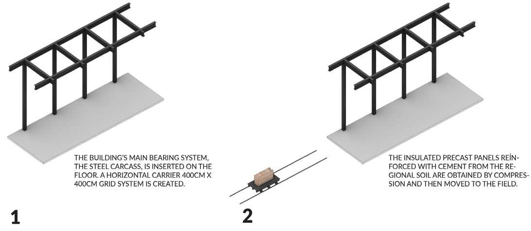
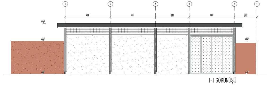
The grid system has been manipulated and based on the spatial definition of both program components and landscape design, and at the same time formed in the carrier system of the building. (400cm * 400cm)
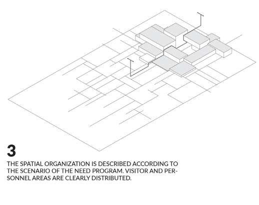
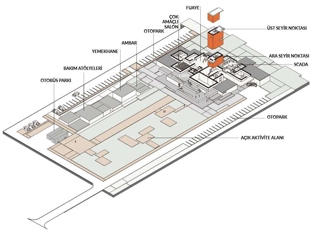
The spatial organization according to the scenario of the need program. Visitor and personal areas are clearly distributed.
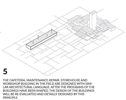
The cafeteria, maintenance-repair, storehouse and workshop building in the field are designed with similar architectural language. After the programs of the buildings have been shaped, the design of the buildings will be re-evaluated and detailly designed by this principle.

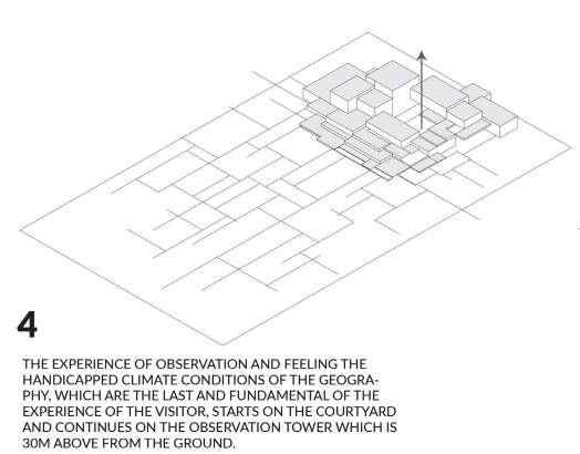
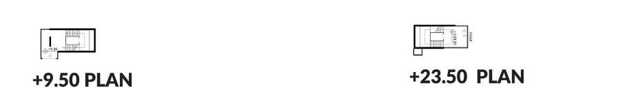
The experience of observation and feeling the handicapped climate conditions of the geography, which are the last and fundamental of the experience of the visitor, starts on the courtyard and continues on the observation tower which is 30m above from the ground.
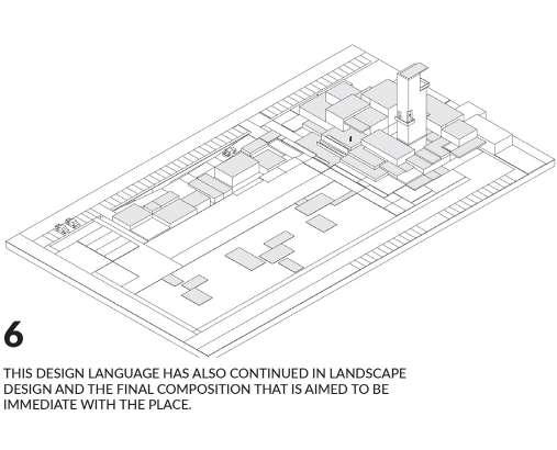
The design language has also continued in landscape design and the final composition aimed to be immediate with the place.
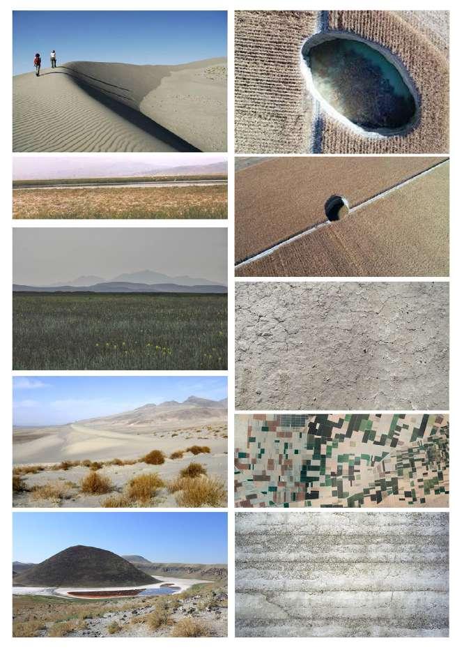
The climatic and geographical features of Karapinar region;
- The only region of Turkey, having desert features - Severe erosion and corrosive effects of wind - Extraordinary terrain changes are experienced with dune movements and pothole formations
- Arid - Fragile georaphy

a timber structure highland house, Ayder / Rize - no use of any nails, lap joints technique
Hobby work
Exploring the vernacular architecture in the highlands of Rize, Turkey at the 1600m altitute
timber / stone combination technique large family house
- stones placed in between posts & lintels at one side
only timber boards used with lap joint technique at he other side
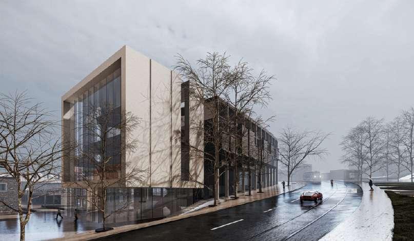
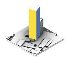
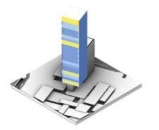
Date: 02/2021 - 08/2021
Project Status: Ongoing Construction
Location: Istanbul, Turkey
Team: +FREA and Mdesign(urban)
Project Type: Renovation, Refunctioning and Urban Project
Role in the Project:
I joined the project after the competition phase and I was the coordinator of it under the spot of the Head Architect. I took part in all phases from the conceptial design level to semi technical-drawing level, until the end of my contract between the office.
Project Description:
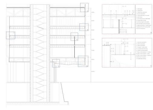
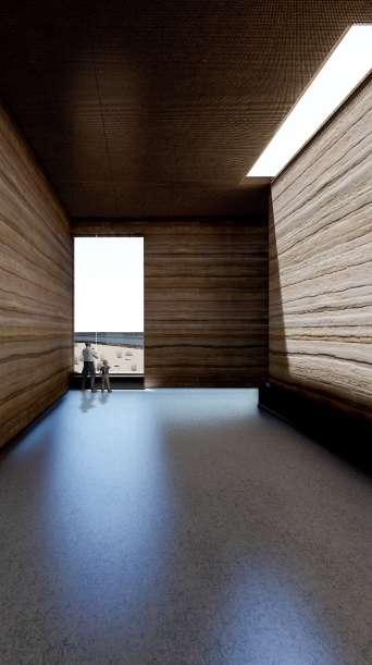
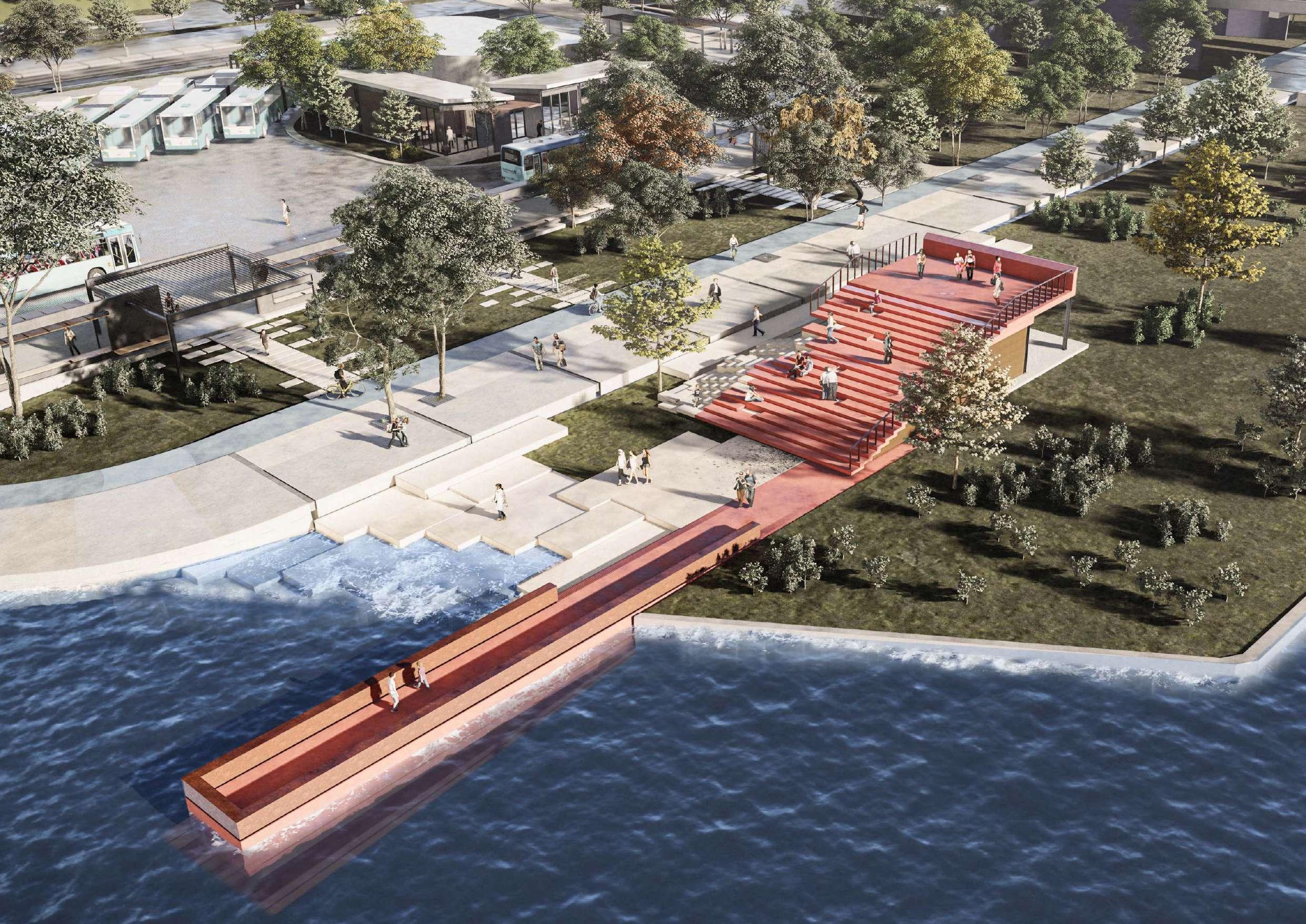
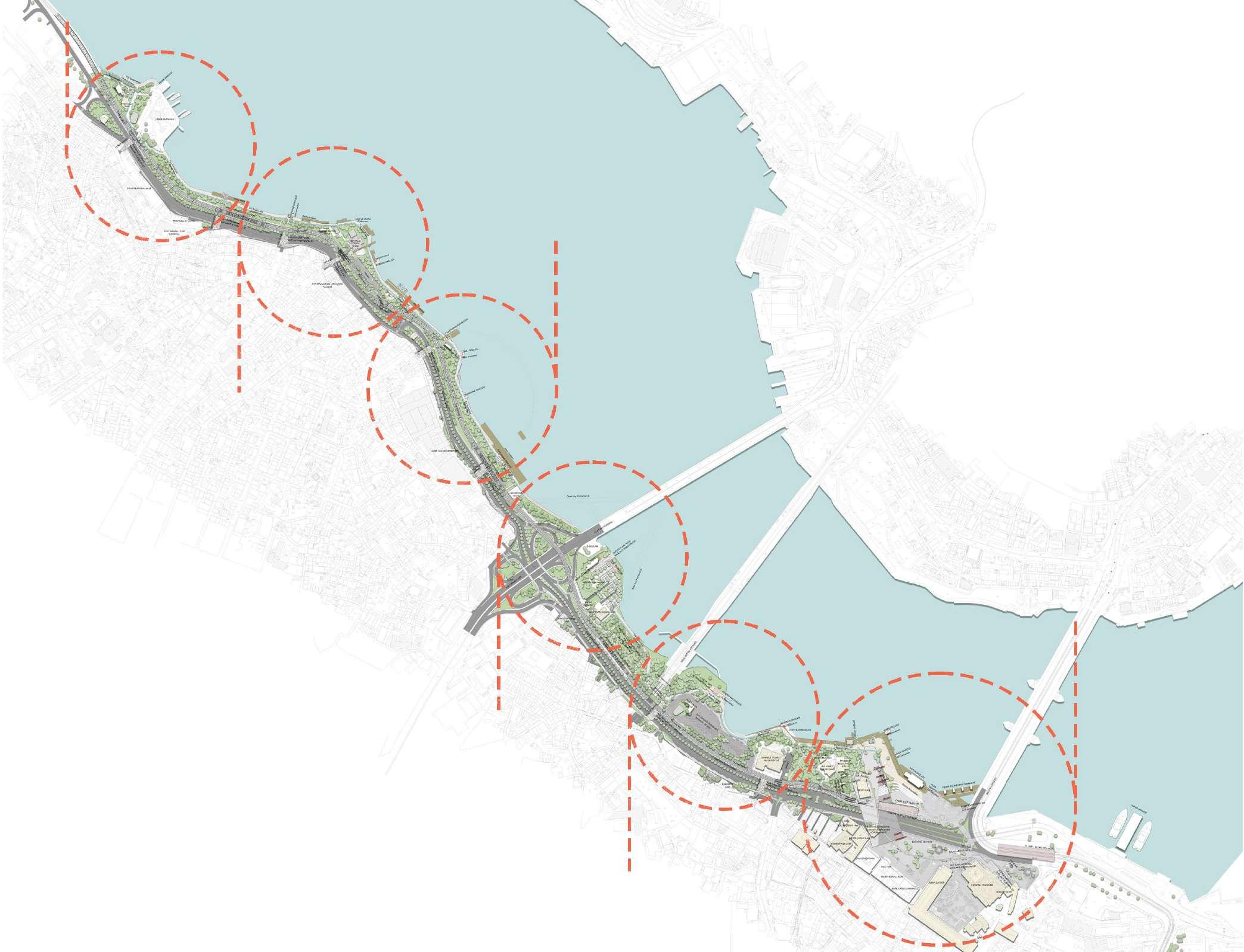
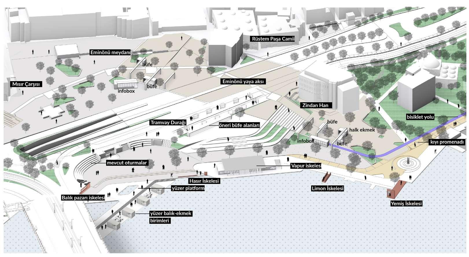
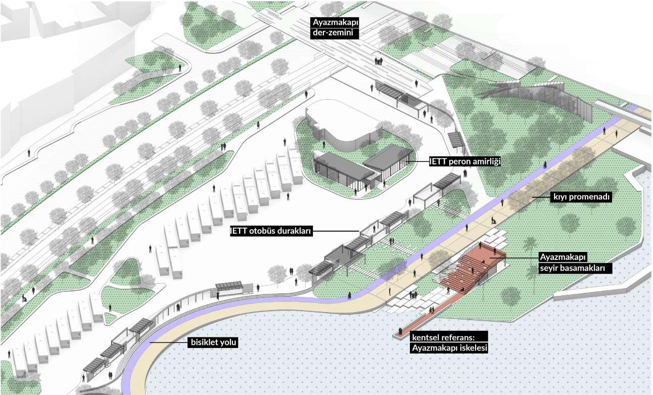
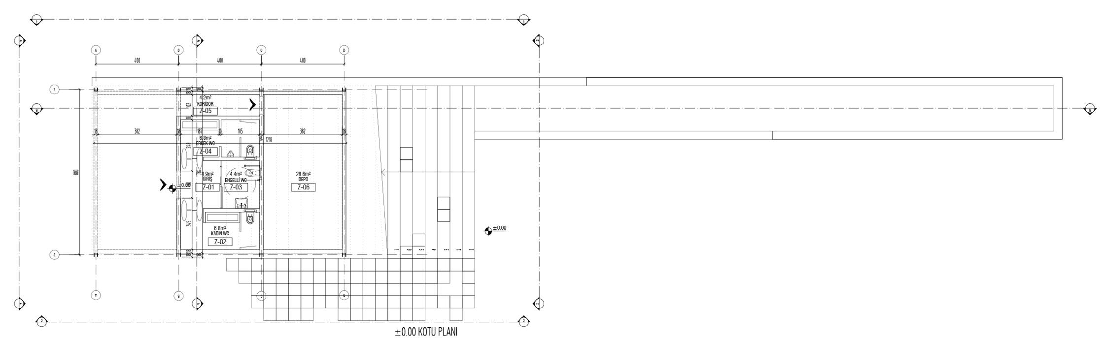
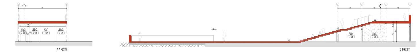
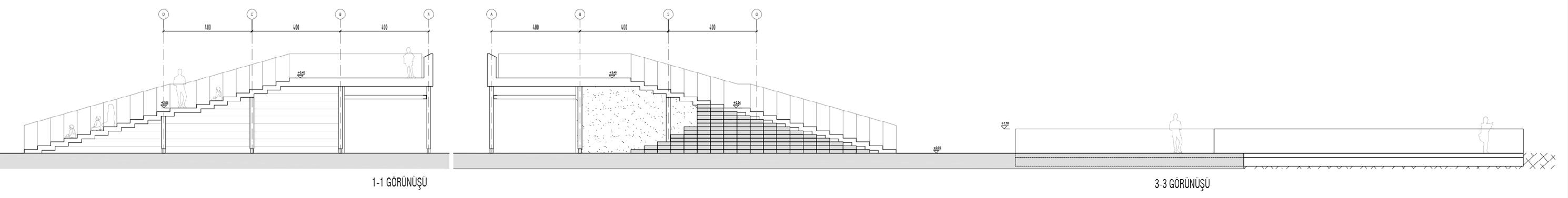
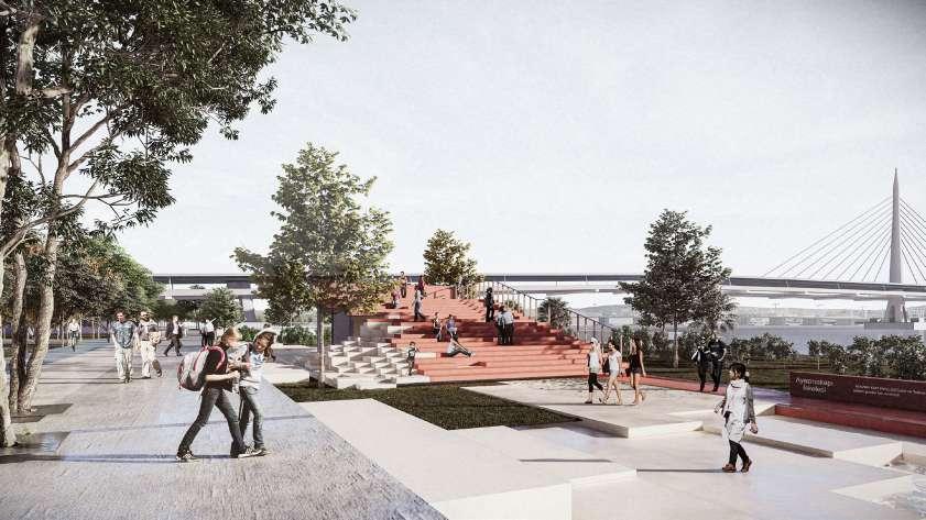
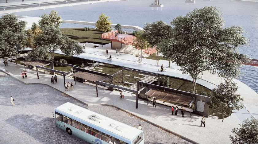
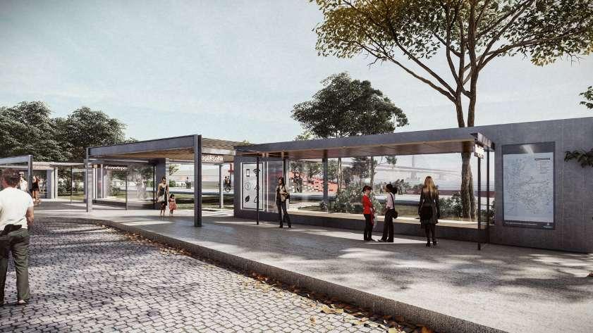
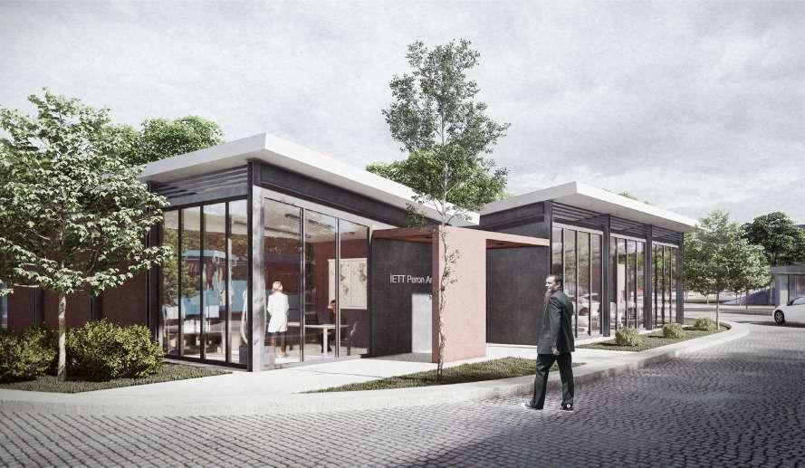
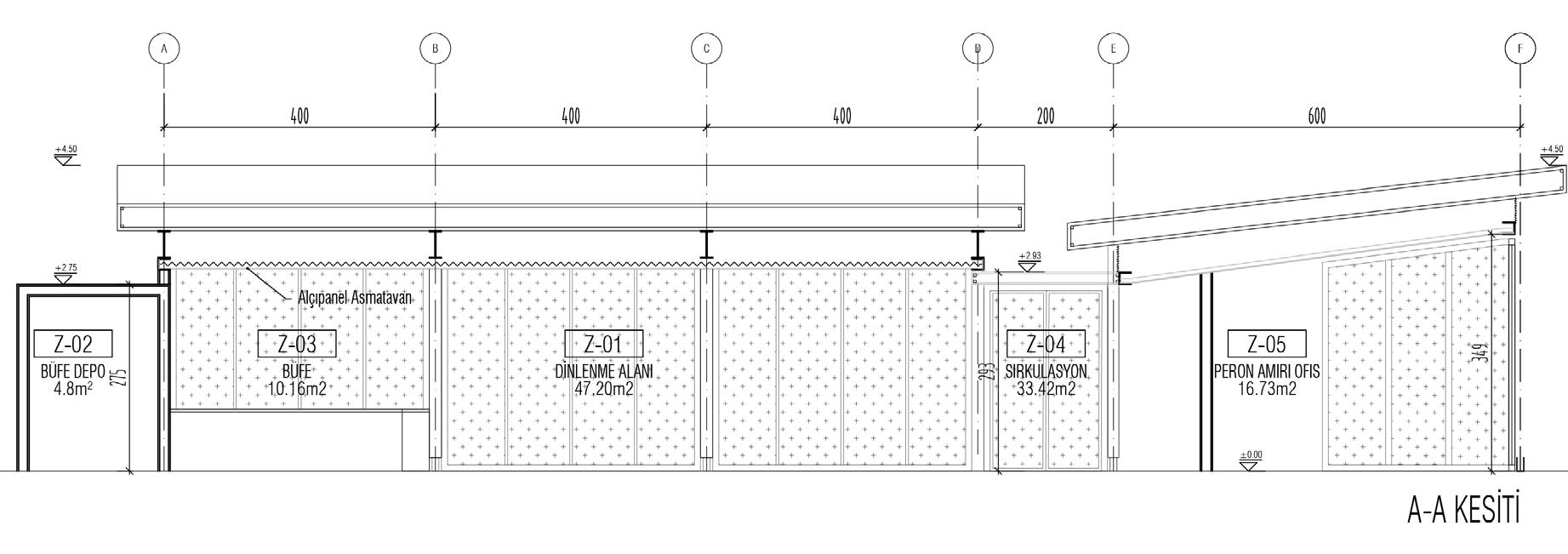
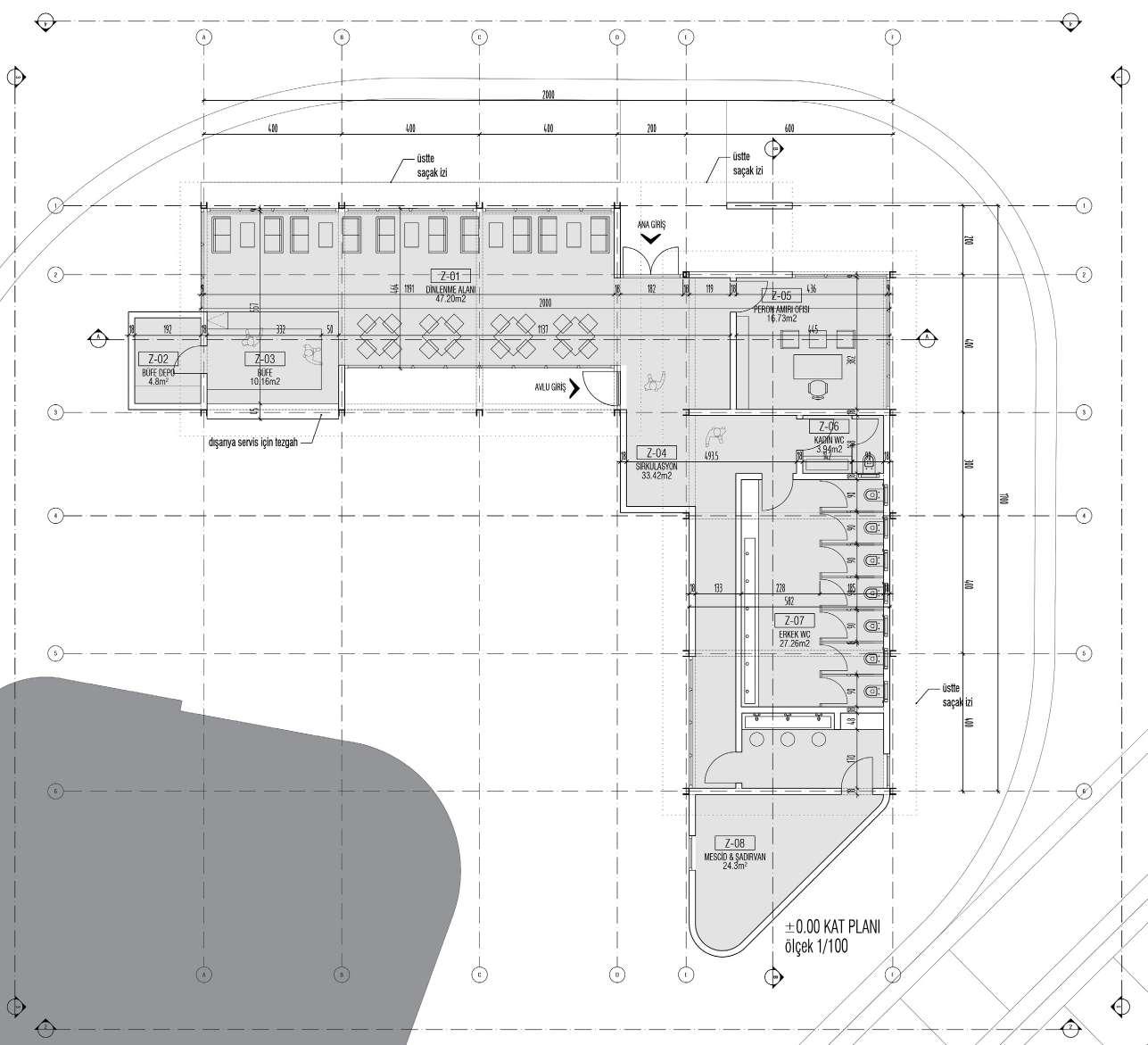
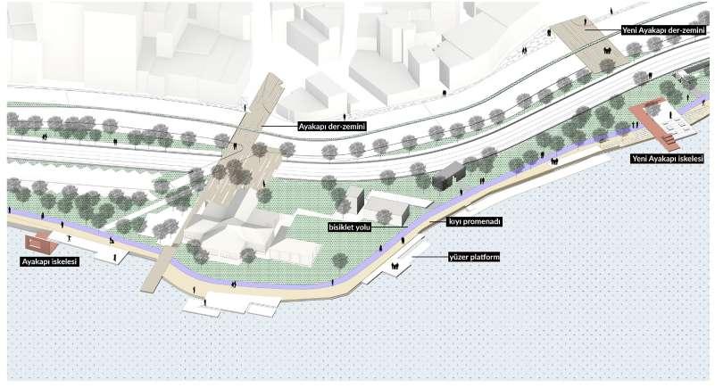
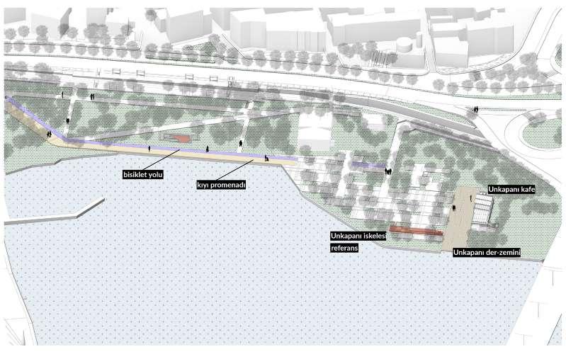
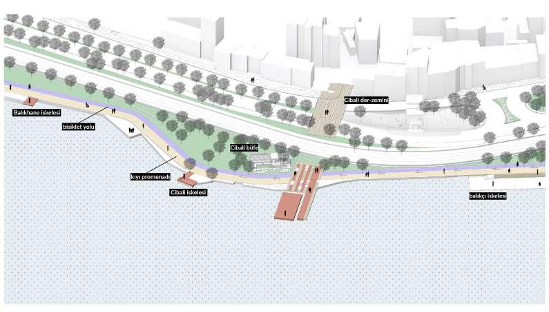
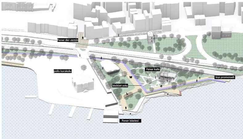
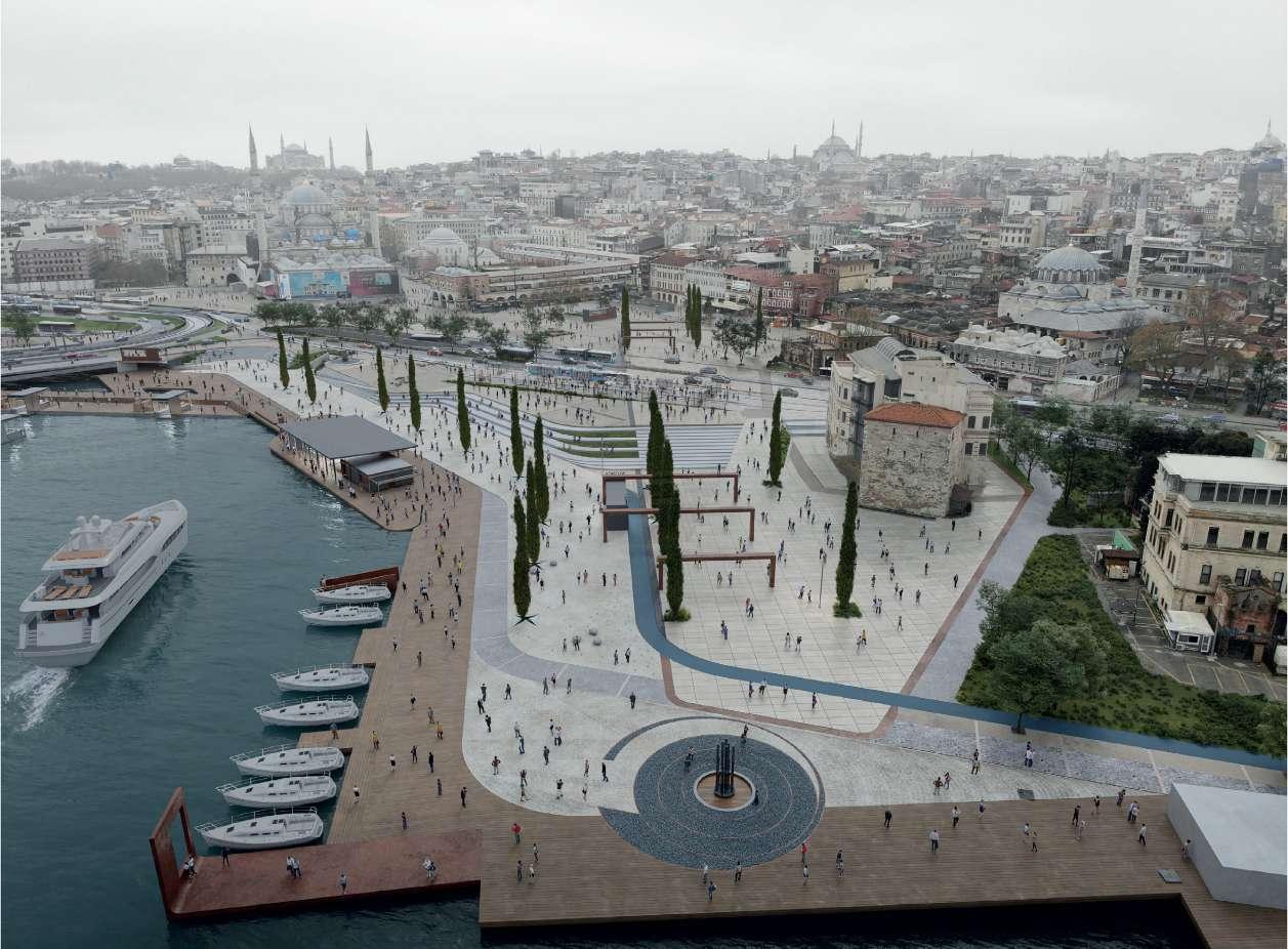
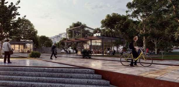
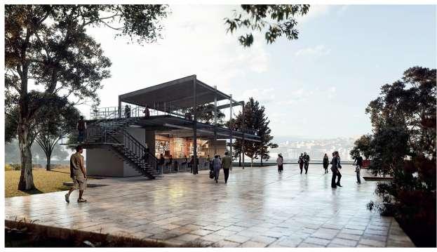
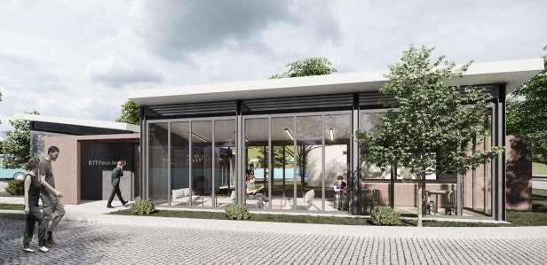
Designing of variously functioned buildings and interactive structures on the 3km long Halic shore
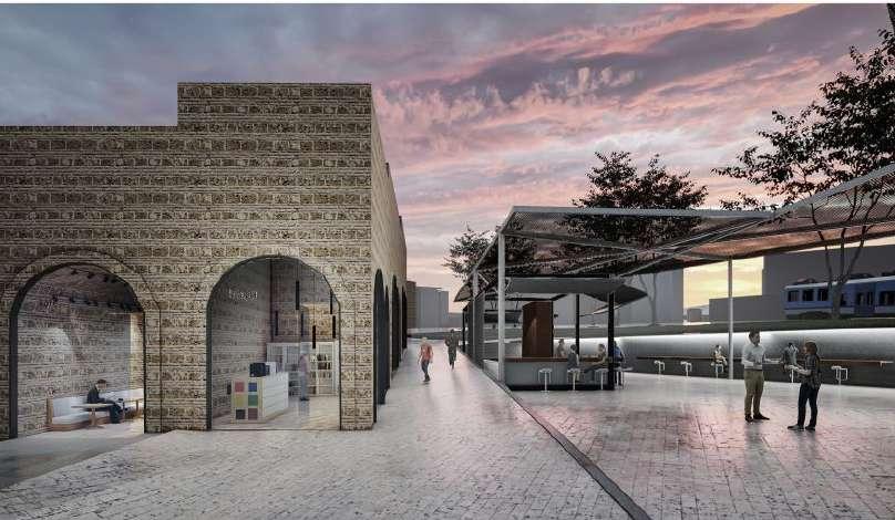
They are the passages/entries where the threshold turns into a corridor and breaks the continuity of the wall. These deep openings, which are repeated at regular intervals and differentiated by their structural features, operate on several planes at the same time: On the one hand, they serve as representation, on the other hand, they become the expression of commerce, shopping, accessibility and accessibility. While being the organizer of the temporal flow, it becomes the mediator of velocity and relative motion. It generates perspectives and encounter tactics for all parties, giving way to new things/actors/options and new unforeseen scenarios, whether internally or externally involved. While opening the inside to the outside, it filters the outside and takes it in. He adds transparent, transitive, transparent definitions to the perception of the wall he has pierced. To quote Jorge Luis Borges, they are polyhedral intervals that “offer the possibility of entering or returning to the world.”
According to the definition of urban mobility to which the gates are connected, it is the interface, both water and land, that extends along the gate to which it approaches. The first step of the outsider is, by definition, the place where more and more “things” pile up each time.
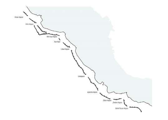
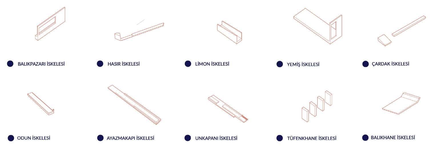
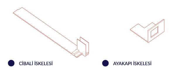
Throughout history, the piers in the Golden Horn have worked as a sea extension of the city gates. The pier, which was used in Eminönü since the foundation of Byzantine Istanbul in the 4th century, served for the boats connecting the Galata shore with Eminönü until the first Galata Bridge was built in 1844 (Kömürciyan, 1988, p. 138). In addition to this area, the Yemiş Pier (Van Millingen, 1899, p. 216) in the continuation of the Dungeon Gate, timber piers on both sides of the wood gate (Kömürciyan, 1988, p. 17), Tüfenkhane Pier and Unkapanı Pier on both sides of Unkapanı, followed by Cibali Pier and Fener Pier is also the pier in the area.
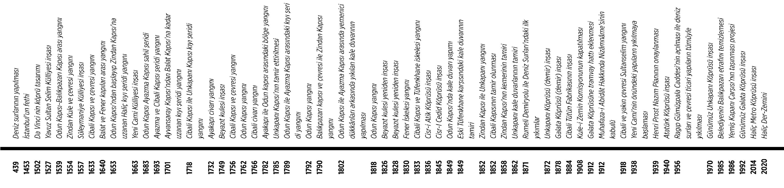
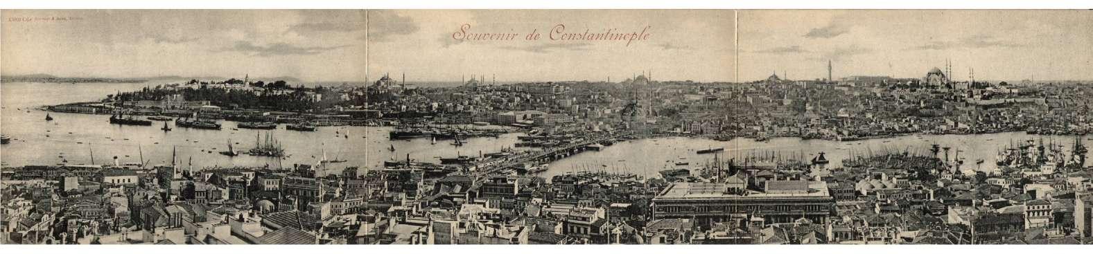

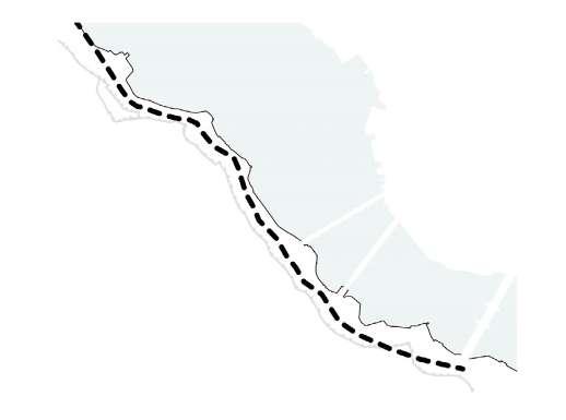
The Golden Horn has been tried to be analyzed with a fragmentary tendency, taking into account the narrow limits of interaction until today. The inner border formed by this approach; road, coast and topography have created a serious threshold. It is important to develop the Golden Horn Coastal Area by integrating it with the existing city.
Therefore;
- Arrangement along the coast of the Golden Horn in a way that respects the historical and industrial structures, which was effective along the coastline in the past, but is currently re-establishing the connection of the points that lost their impact with the coast,
- Saving the Historic Peninsula from private automobile traffic and producing solutions to support public transportation,
- Especially the buildings along Ragıp Gümüşpala Street and the openings to this street.
suggesting functions that support the use of the coast by the streets,
- To include traditional production and commercial functions,
- By rearranging the coastline, it becomes living and living spaces,
- It is necessary to strengthen the human-history-nature relationship by preserving the historical values of the Golden Horn.
Socio-spatial design parameters:
- Producing easy-to-move environments suitable for a healthy life,
- Protection of monuments, images and symbols that will enable citizens to create memory spaces and creating new ones,
- development of aesthetic values,
- development of public spaces that provide free socialization opportunities for young people, - local commercial enterprises and local production preservation and preservation of its forms. Design parameters for the application:
- attached-disassembled,
- flexible,
- producing light and portable units
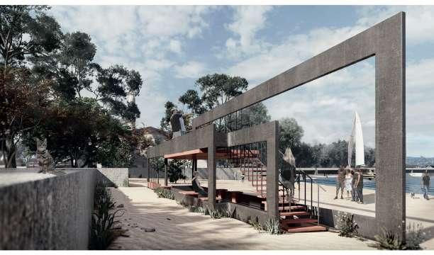
Interpretation of historic piers of Halic Coast with differentiated functions
- view points
- resting spots
- picture frames
- piers

The Golden Horn has been tried to be analyzed with a fragmentary tendency, taking into account the narrow limits of interaction until today. The inner border formed by this approach; road, coast and topography have created a serious threshold.
It is important to develop the Golden Horn Coastal Area by integrating it with the existing city.
- Re-establishing the connection of the points that lost their impact with the coast,
- Saving the Historic Peninsula from private automobile traffic and producing solutions to support public transportation,
- Especially the buildings along Ragıp Gümüşpala Street and the openings to this street.
suggesting functions that support the use of the coast by the streets,
- To include traditional production and commercial functions,
- By rearranging the coastline, it becomes living and living spaces,
- It is necessary to strengthen the human-history-nature relationship by preserving the historical values of the Golden Horn.
- designing of a villa
- choice of the structural system
- calculations of beams, columns, mass center and stiffness
related link for all calculations, plans§ions: Presentation


Architectural Design Studio for Complex Constructions (PoliMi)
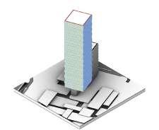
Date: 02/2022 - 07/2022
Location: Fez, Morocco
Team: +Elio Moussa, Harshika Sharma, Sihan Wang, Shufen Tao
Project Type: Tall Building, Hotel, Office
Role in the Project:
Took part in all process of the project from the scratch, and all presentation elements and 3D visuals were produced with a teamwork.
Project Description:
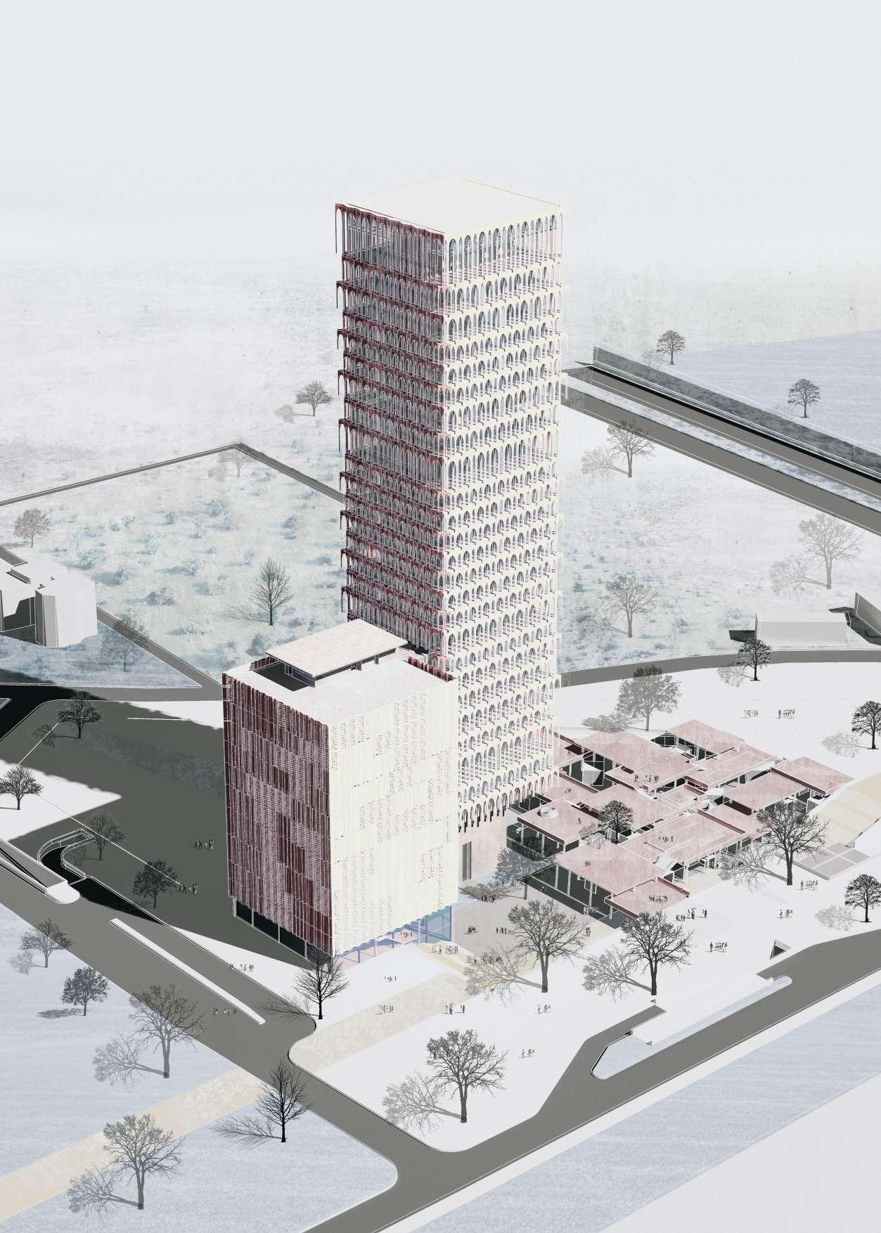
A complex tall building project including the sustainability and bim parameters
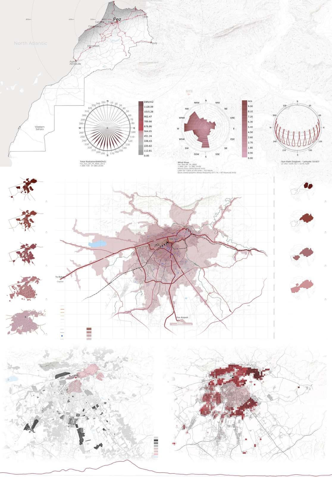

Radiates a singular aura, it is the imperial, the custodian of thirteen centuries of Moroccan history. It is an open-air museum. Its medina and the remains of royal palace have earned it a UNESCO World heritage site. Inside the medieval walls of the wonderfully chaotic medina, narrow streets- largest car-free urban area in the world, and they tower of spices, traditional handicrafts- tiles, lamps, hammams, and tanneries. The past is alive here…
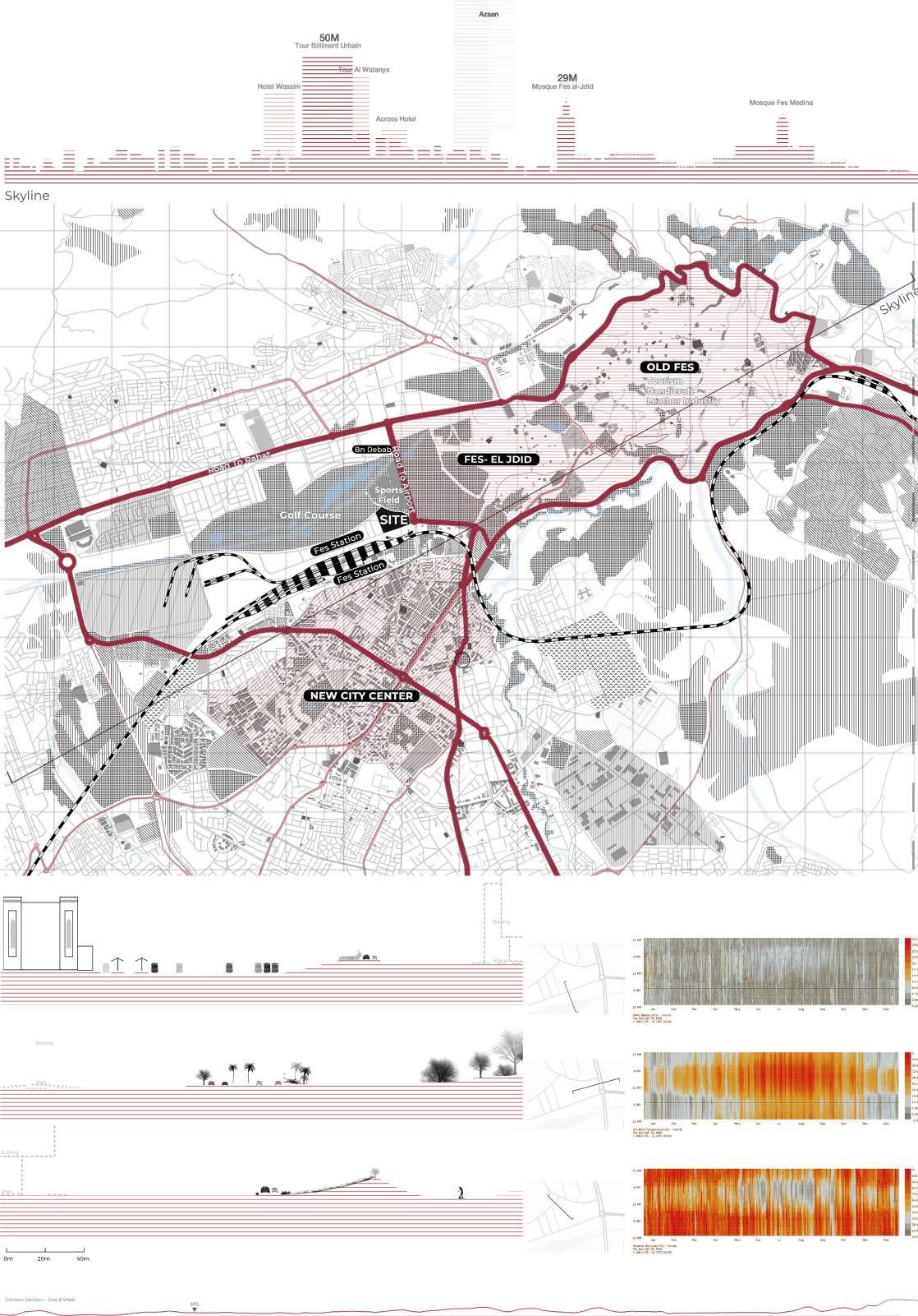
Our site is located at a prominent node of the city on the Primary road connecting to Rabat. The location provides us with old city on its east and new city on the south within walkable distance of 15min. With sensory views of all the three parts of the city- old , new and the far off hills in the background.
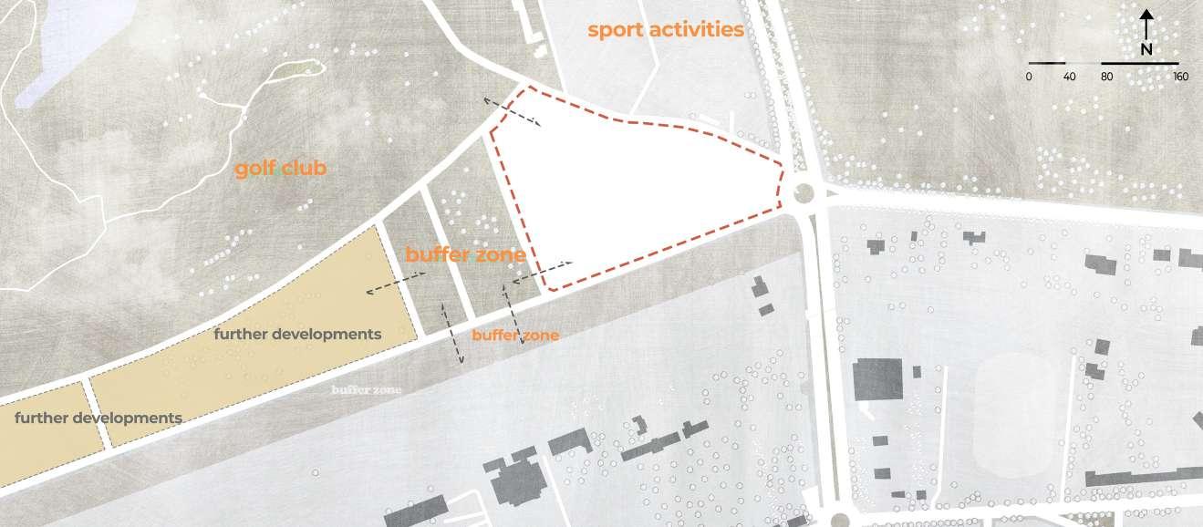
At micro level – site edge conditions, the site is accessed through a round-about separating the ways towards new city, old city and our site. Which is adorned with a golf course- Oues fez golf club and a sports complex on the north and has a hustling railway station on the southern site edge. On the west lies new generation integrated Tourist and Residential Development Zone concept. Which aims to encourage tourist investment within the Region of Fez and thus contribute to the strengthening of the city’s infrastructure.
A Green land is encompassed in between our project and the proposed development zone which acts as a public space, providing interaction areas amidst both the projects and an access to the railway station.
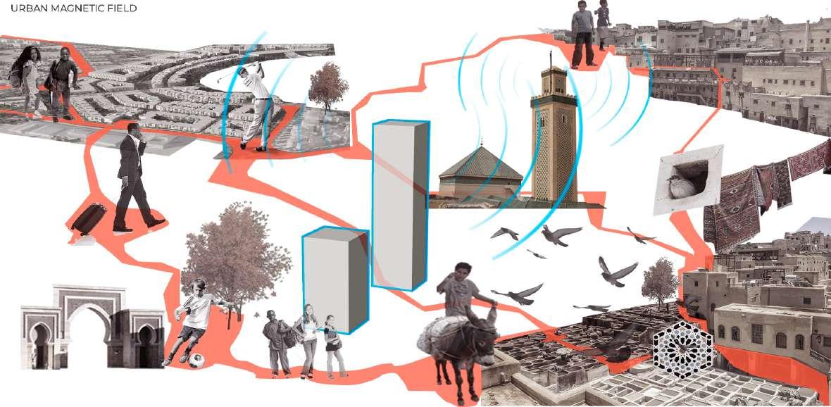
Based on the access points, We proposed two Public interactive zones on the site .One At the triangular access point of the site, further providing a pedestrian access to the souk area and connecting it to the second interactive zone, close to the north part of the site in proximity to the golf course and sports complex.
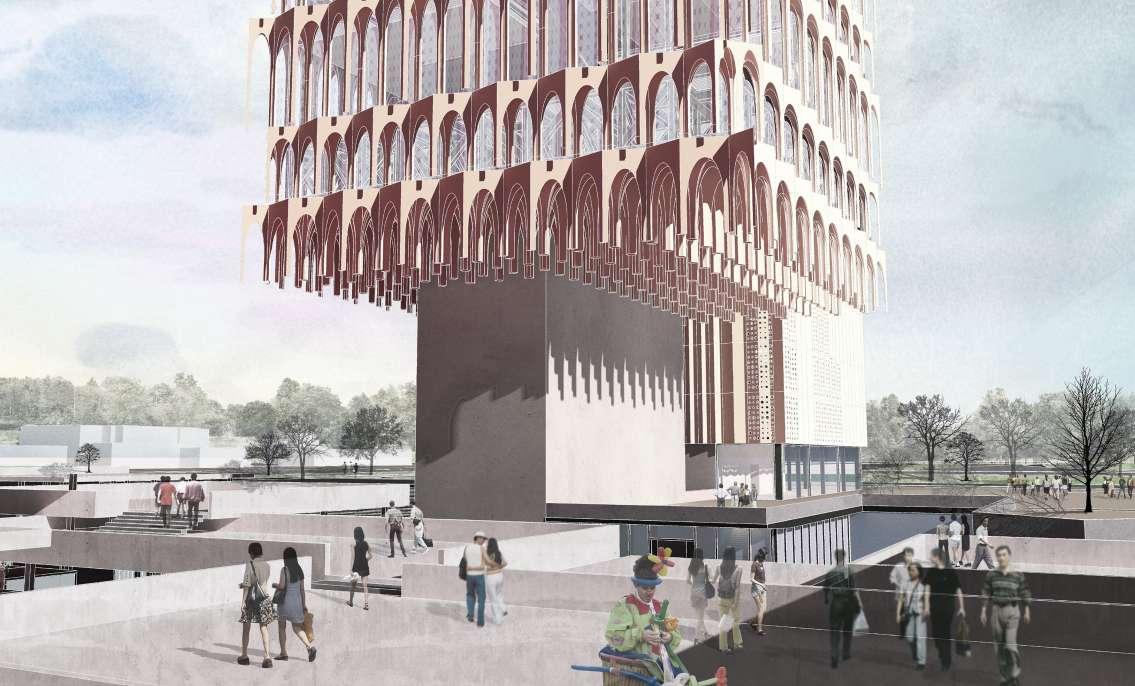
Respecting the site conditions and adjacent site edges we rendered a curvilinear movement to the interactive zones along the site, having an element of surprise, further having a linear access to the souk area and linear visual access to the the tall building. We intend to present the abstract version of the” minaret” that appeals to broader audience, calling people towards it.
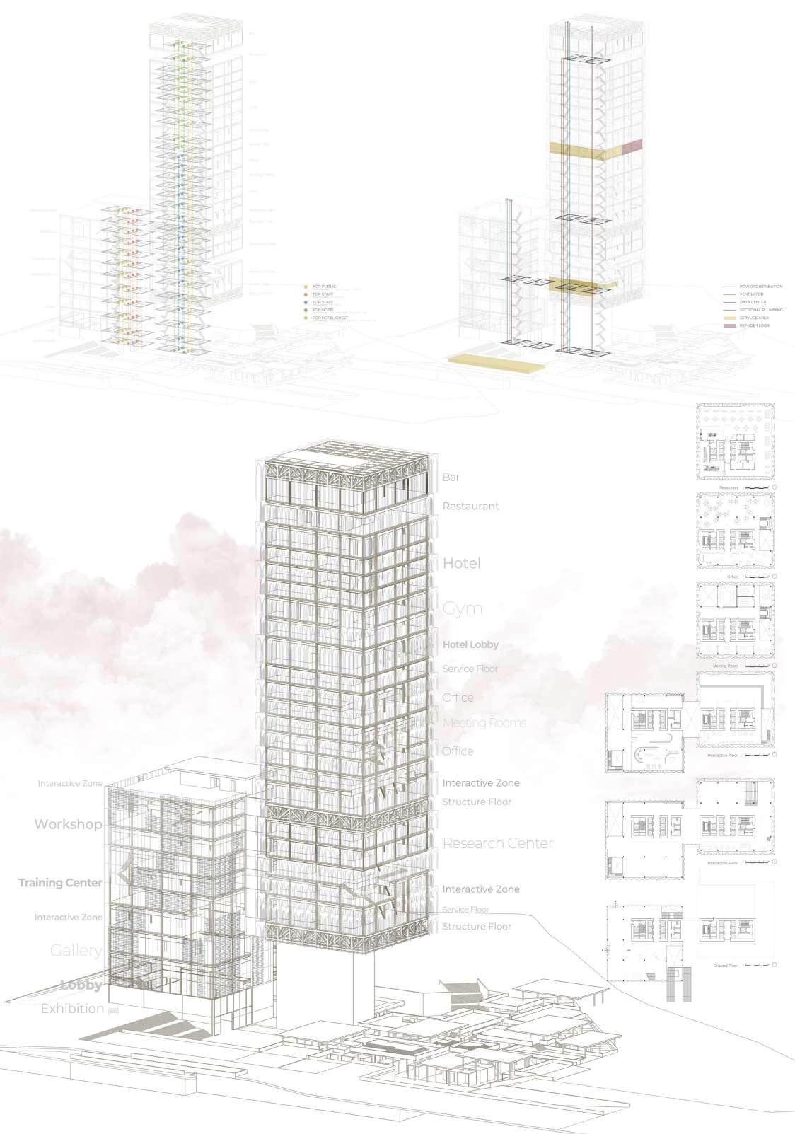
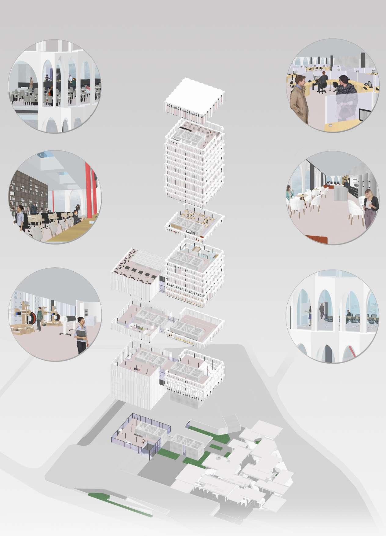
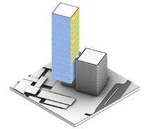
Two building masses- division based on the functions, the short one acting as a strong base, uplifting and balancing the Tall mass “minaret”. Beneath that we propose a souk- rendering the idea of an abstract version of our interpretation of moroccon heritage into the project.
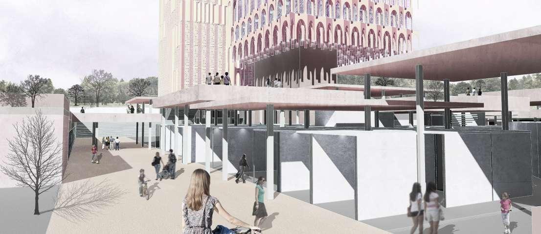
Inspired by the traditional architecture of the Souk this scheme aims to reinvent the market place, giving the city a new civic heart.
Like the traditional souk, there are different experiences are brought together in an architecture of dappled sunlight, bright colours and fountains, with a changing rhythm of squares, courtyards and alley ways.
The function of the building are divided as follows:
Art & Research centre housed in the short building component.Workshop & Training Areas are aligned along these functions in the tall component to facilitate the ease of access and movement within the two connecting functions.
Further, the middle floors are dedicated to the Offices and the top floors comprises of a Boutique hotel with the roof top bar accessible to all.
Souk areas inspired by the traditional Moroccon market is housed in the underground level of the structure.


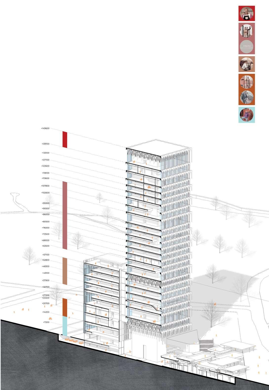


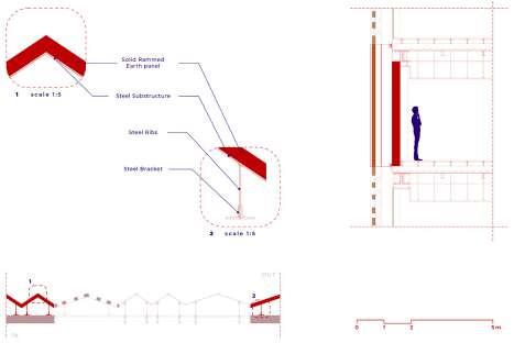
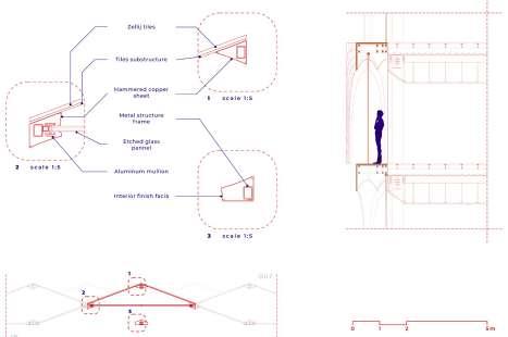
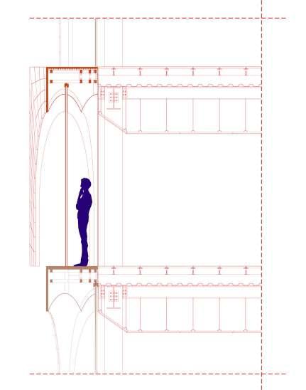


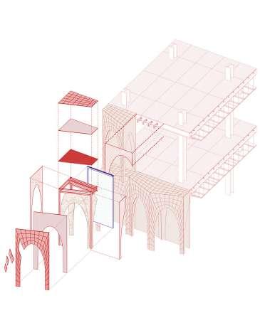


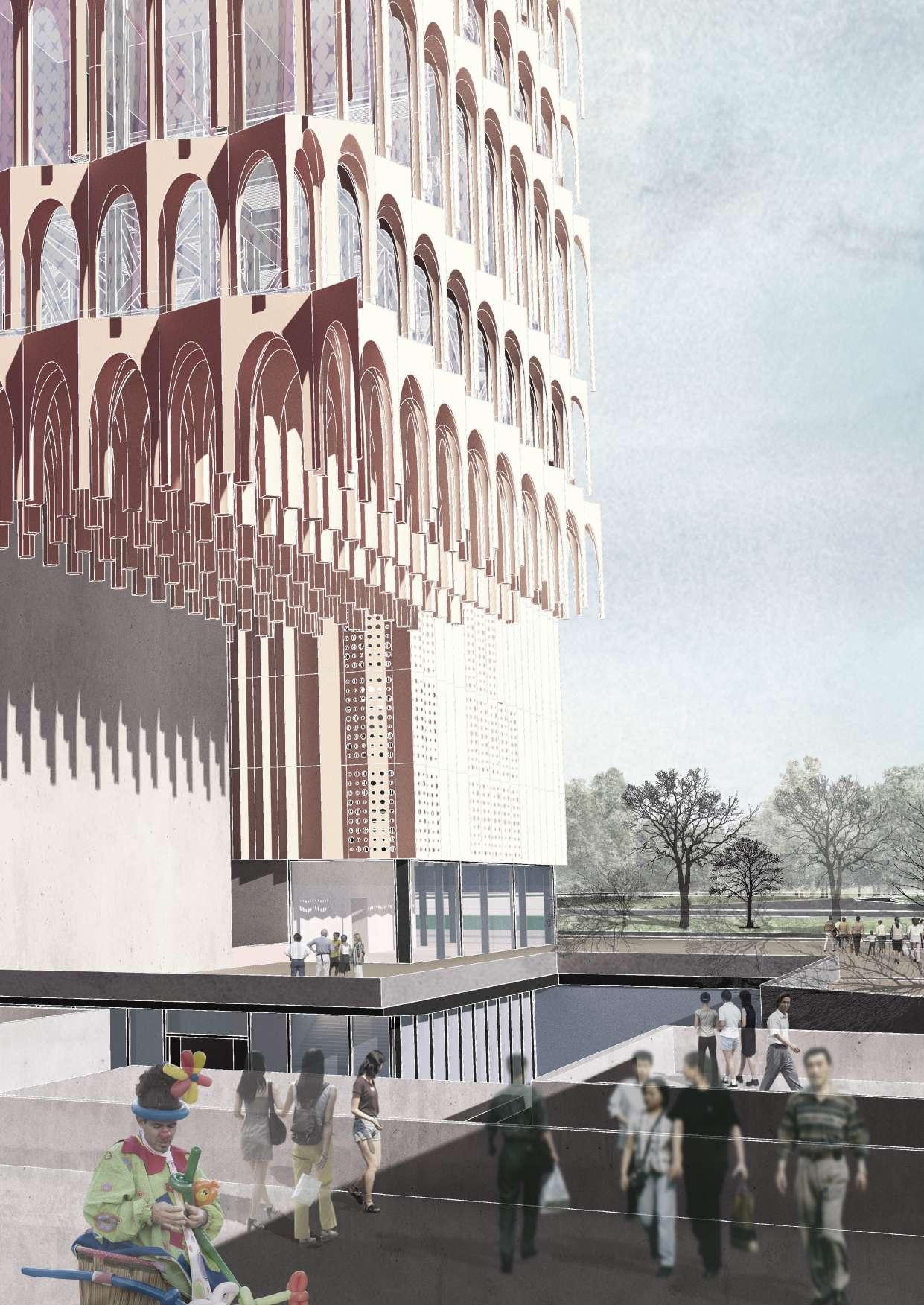
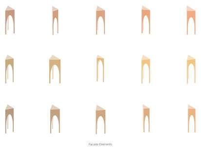
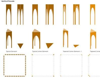
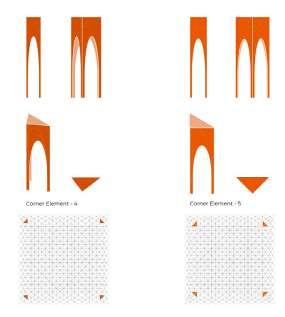
As the building reflects the culture of Fes, the elevation must dialogue at multiple levels with the context, if it being, social, cultural or even esthetical. Hence the idea of adopting the muquarnas as an element of choice to ornate the tallest volume overlooking the city. The muquarnas was transformed into a module, and repeated throughout the facade to create a seamless crystalline aspect to the new minaret of the city.
In Fez, it is characterized by a pleasant climate during the year. Pleasantly cool during the winter months and bearably hot during the summer, Fez witnesses occasional peaks in temperature counterbalanced by a drop in the relative humidity.

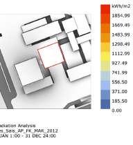
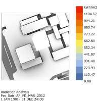


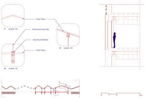
One important characteristics of the building is the choice of the transparent elements. The building has various functions in different levels, where also various privacy and transparency levels are needed. Our solution is the choice of using sandblasted glass
The patterns are designed in consideration of the local oriental patterns, which help us to form the language of the facade design.
programını tamamlamış
öğrencilerin aday öğrenciler ile
içinde edindikleri tecrübelerini paylaşmasını hedefler.
sonrası kokteyl
organizasyonu ile aday öğrencilerin tecrübeli öğrenciler
tarafından cevaplanır.
Focuses on the fields of ‘design and architecture’; It was founded on the goals of supporting the professional, intellectual, and social development of its members and generating innovative ideas in a collective environment. In this context, the majority of its members are students of the Faculty of Architecture within our university.
Its yearly calender consists of various events such as interviews, workshops, lessons, architectural trips. It also aims to create an archive for the faculty of architecture and its yearly products of the students by publishing a magazine named “The Kesit”


Öğrencilerin iletişimini ve etkileşimini arttıracak
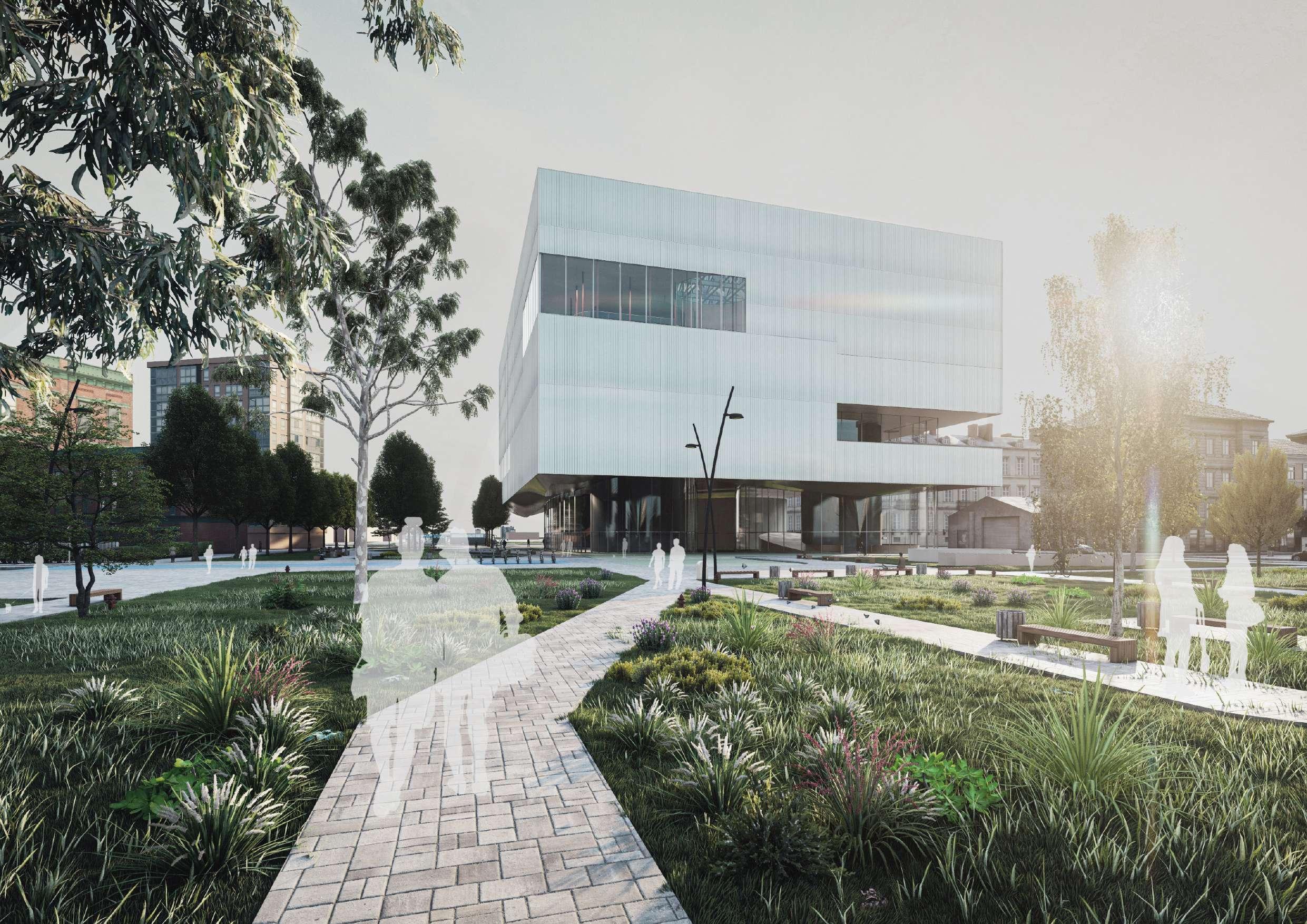
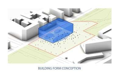
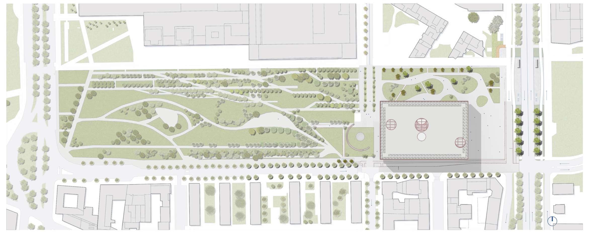
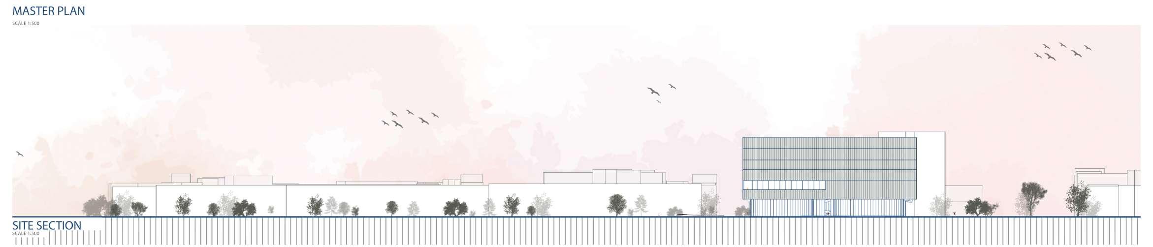
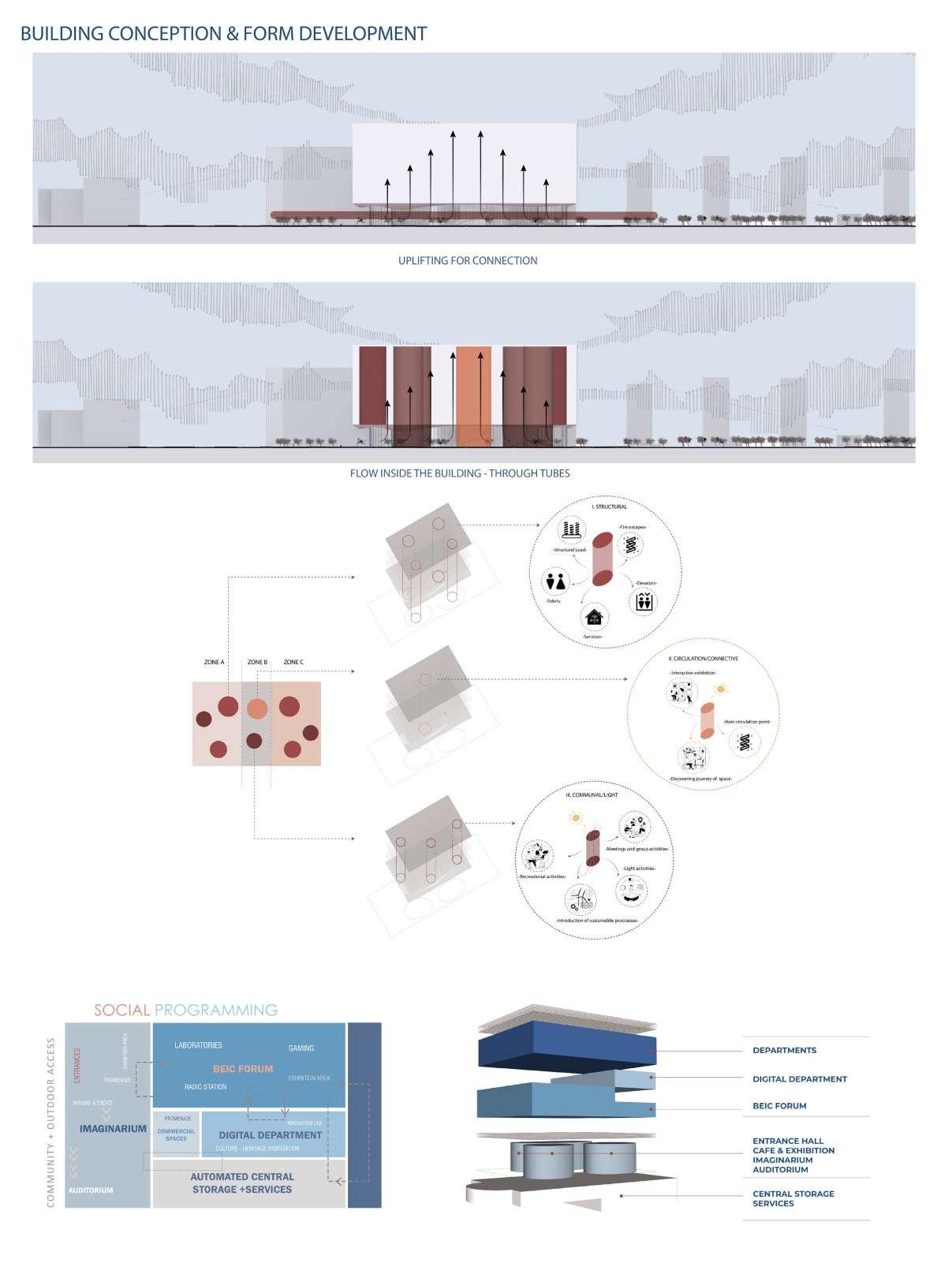
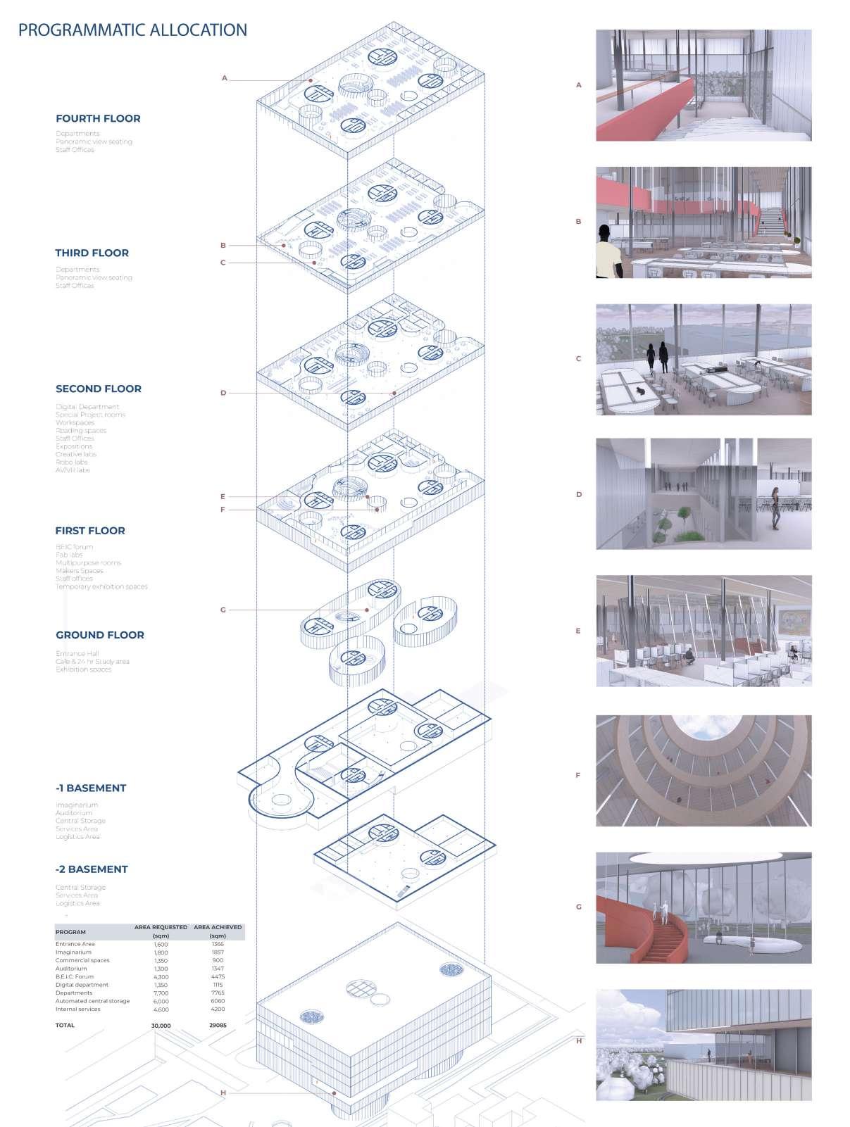
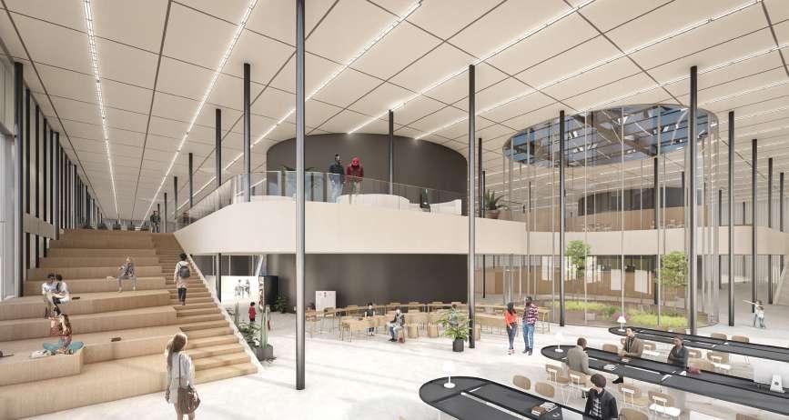
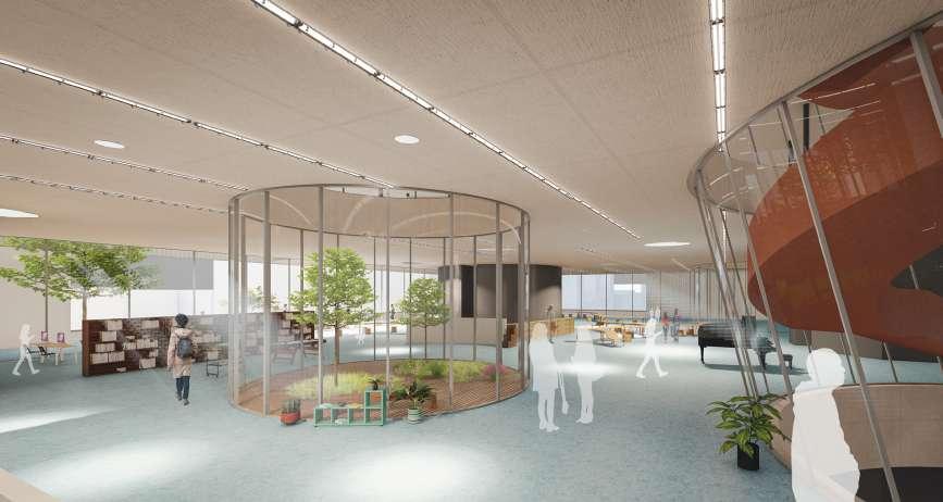
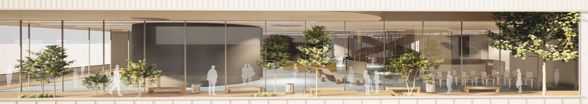
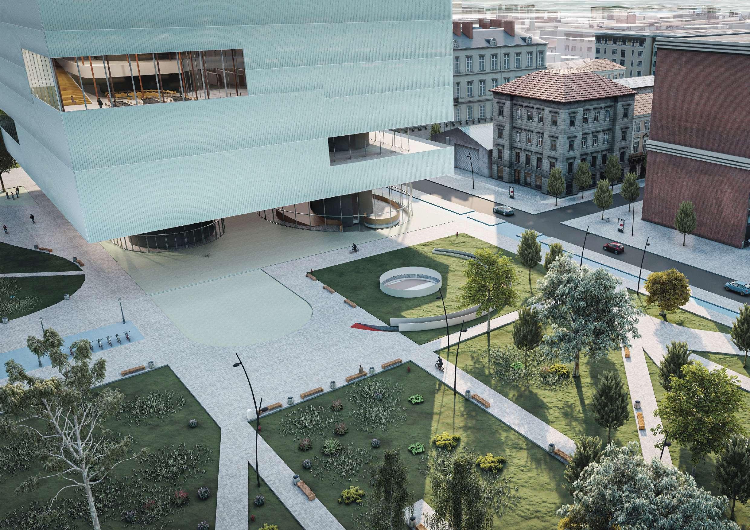
Shaping of New BEIC library in Milano
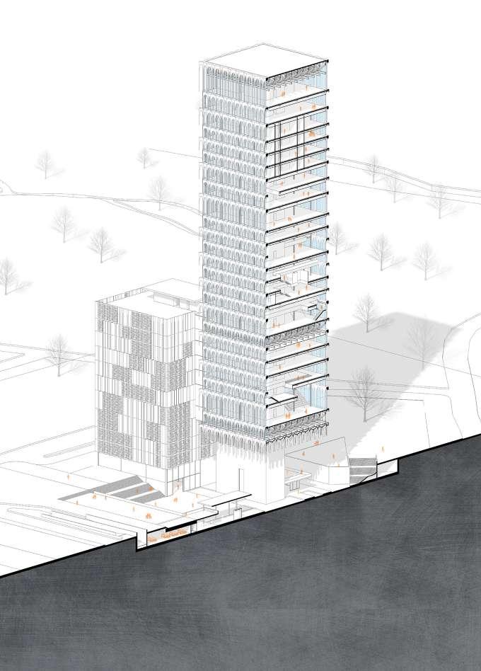
Architectural Design Studio for Complex Constructions 2 - Thesis Project (PoliMi)
Date: 02/2023 - 06/2024
Location: Milan, Italy
Team: + Harshika Sharma, Teodora Matei
Project Type: Public Building, Library
Role in the Project:
Took part in all phases of the project from the scratch, and all presentation elements and 3D visuals were produced with a teamwork.
Project Description:
A complex library project guided by the brief of an already resulted competition.
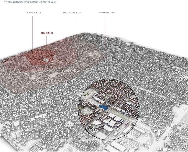
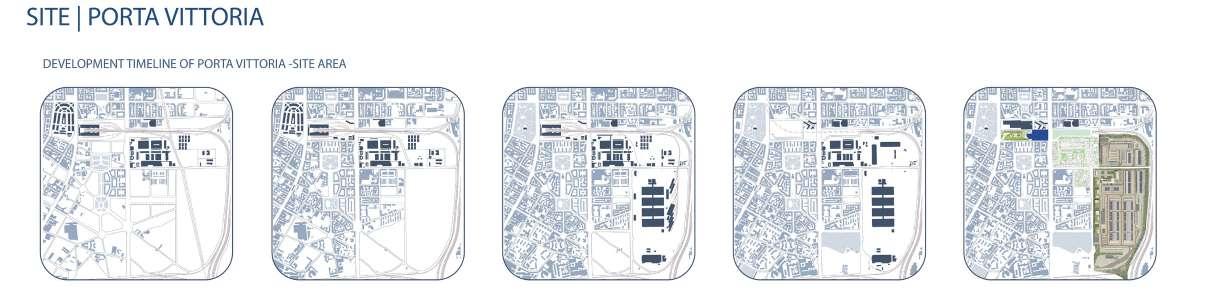
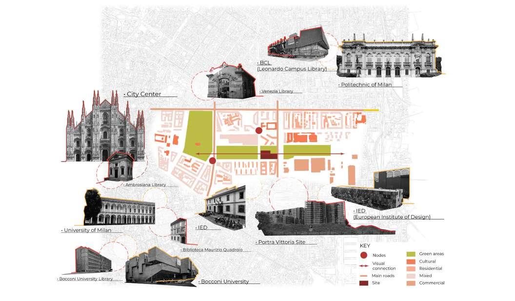
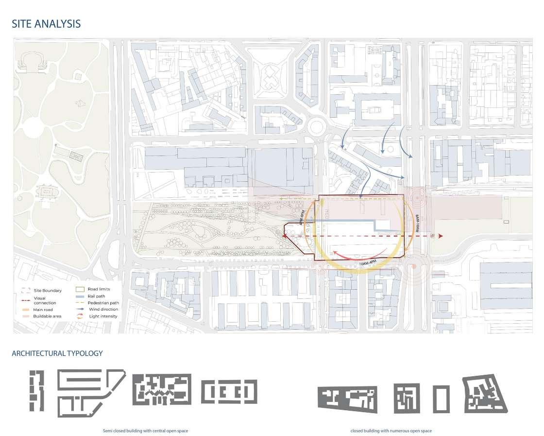
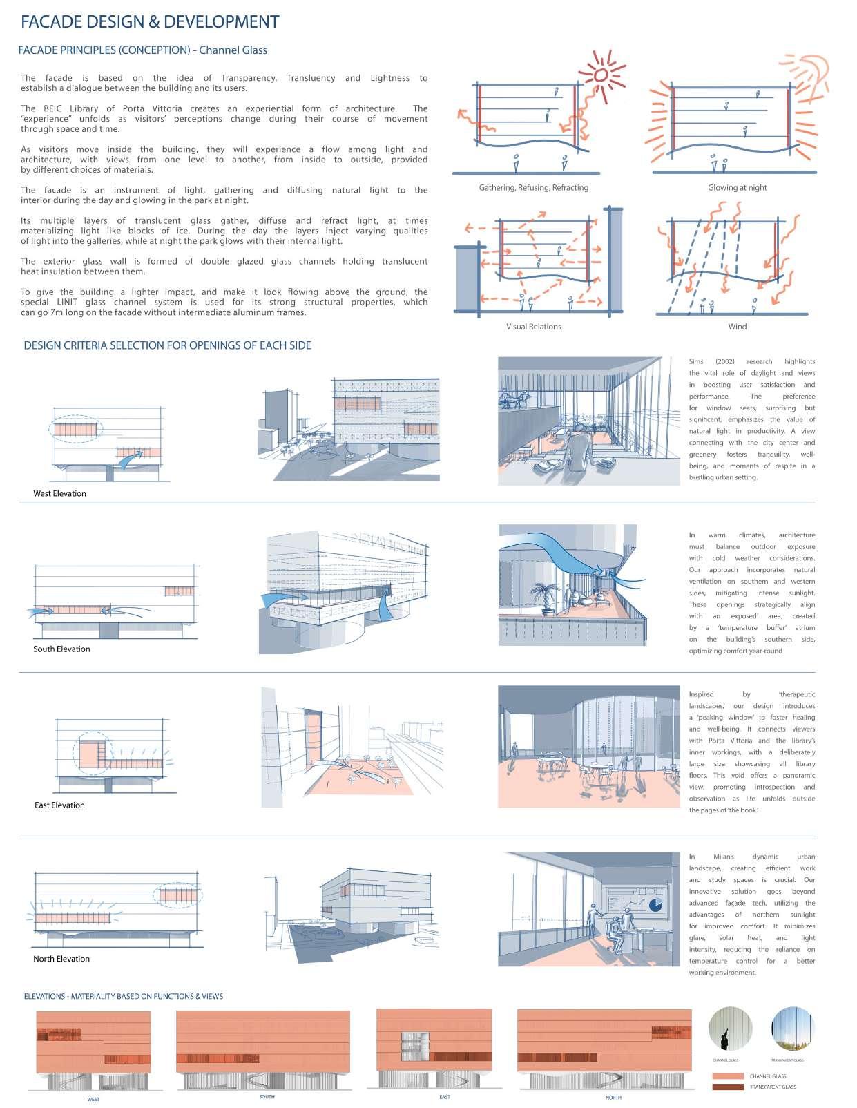
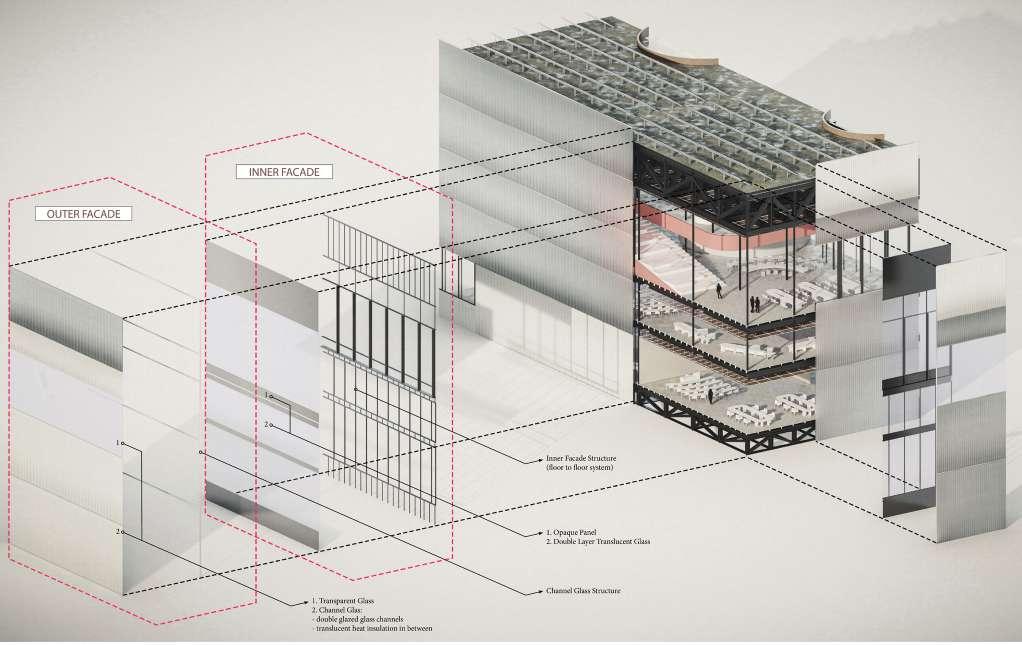
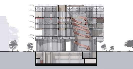
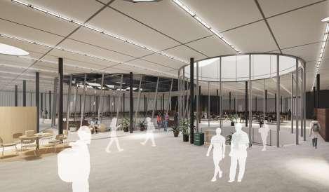
Milan is a well-known resource of inspiration when it comes to arts and culture, with its vast historical treasures. Due to its importance and raw architectural beauty, the city has kept its essence through the years, even in its journey to time transition. Its uban design has continued to develop slowly in order to preserve the spirit of the city, leading to today’s moment, when further steps into contemporary era. Urban design can vastly improve the status and value of space, which may stimulate the local economy, attract tourists to the area and improve the quality of life for locals.
Our site, Porta Vittoria, is in the proximity of Duomo, ‘the living room’ of Milan, where most of the activities are held. It is a great opportunity to connect it to the site are, it currently being developed, and lacking in a landmark for Porta Vittoria zone.