
TANJA SIEMS
Birkhäuser Basel


Birkhäuser Basel
Foreword from Barbara Campbell-Lange 7
Culture as shared basis for collective action
11
15
“Common Ground”, Matadero Madrid 17
“Identifying characteristics” using urban design tools
Thames Gateway Assembly Project, London 23
“Shared discovery” – exploring the city with analytical methods
Cologne-Ehrenfeld: A festival for the district 25
“Shared experience” through interdisciplinary workshops
“Re-Dial”: An event in Hackney, London 27
Generating sustainable effects and “enduring creations” Covent Garden, London 29
A participatory implementation project Brussels 31
Genius loci: The place and issues to be addressed 33
Urban development methods and participatory procedures in the planning phases 35
Buildings and sub-projects as initiators of participation 47
The after-effect – a summary 51
Urban development and participatory approaches in the planning process 53
Application of the methods during the four planning-phases 55
Integrative adaptive reuse concepts
Wuppertaler Tafel food bank in Barmen 61
Analytical approaches for the development of sustainable urban strategies 63
Developing comprehensive design concepts 66
Urban design strategies for the mobility transition Berlin 71
Development of infrastructural concepts in combination with architectural design principles 73
Discourse on expanding the mobility alliance: Crafting a line of argumentation using urban design method maps 79
Informal planning in the urban design process “act not react”
Düsseldorf 83
Integrated urban design studio for the main station district of Düsseldorf 85
The deliberation on informal processes within a creative design process 89
Generating sustainable densification while simultaneously strengthening social infrastructure 91
Systematic design phases and steps: an explanation 95
Analysis phase: application of urban design methods and tools 99
Evaluation phase: systematic procedure 107
Concept phase: generating urban strategies 115
Detail phase: development of architectural concepts with illustration methods and tools 121
The region as an experimental research lab “Bergisch Project” 129
Teaching and research – “urban lab”
Wuppertal’s old train station Mirke 132
Interdisciplinary teaching lab – “creative lab” Birker Bad, Solingen 135
Learning and communication – “nano lab”
Storefront in Remscheid 137
Learning by teaching and researching on site – a summary 139
A place for communicative action: the development of a participatory spatial construct 141
Matrix of temporary participatory spaces 142
Mediating spaces as platforms for bringing people together 146
Urban programming and architectural spatial concept 148
Participatory outlook: an interdisciplinary conversation on collective initiatives 151
APPENDIX
-Masterplanduring competition phase
Workshop +- 8H
Poll / Survey / Interview Focusgroups
Idea workshop (Schools) Idea workshop (Associations)
Children / Seniors
Conference +- 4H Departments/Experts
Organisied walks Conferences with large groups


Strategic focus: Tra c
Forum +-2H
Participatory Pavilion
-Masterplanthrough Participation


Organised walks Working groups (selected) Idea workshop (open) Focusgroups
Young people / Seniors
Idea conference Departments/Experts
Working groups (selected)

Strategic focus: Urban
Panel: Future visions
Poll / Survey / Interview Interest Groups
Stakeholder
Workshops +- 8H Conference +- 4H Forum +-2H Interest Groups
Citizen parliament Prospect workshop
Stakeholder
-Street furniture-
Focusgroups
Workshop +- 8H
World Cafe Working groups Idea workshop (open)


Departments/Experts
Conference +- 4H
Research group (selected) Idea conference Working groups
Focus: Landscape
Forum +-2H
Urban quarter Workshop Citizens’ Jury (Presentation) I nterest Groups

Stakeholder
Architecture -Bus and Tram Stops-
Focusgroups
Research group (selected) Idea workshop (selected)
Young people / Seniors
Departments/Experts
Urban quarter Workshop Citizens’ Jury (Presentation) Interest Groups Workshop +- 8H Conference +- 4H Forum +-2H


Working groups (selected) Idea conference Working groups (open)
Focus: Architecture
Stakeholder
proposals offered by the group. Our task as designers and planners was to evaluate the entire group’s ideas and visions and to check them for their potential feasibility. This can be done using a kind of points system that makes it clear to all participants which contributions can be adopted in the ongoing planning and design process.
In contrast to the open walkabouts carried out by ourselves, the tours around the neighbourhood guided by the experts informed the participants about the planned urban development and infrastructure concepts. Similar to the open walkabouts, these tours were followed up with direct questions to the group regarding their impressions, comments, and suggestions. We then recorded these. The open walkabouts and the expertguided tours were intended to provide information that was still lacking, and to further encourage dialogue between the participants.
This method of “onsite reconnaissance” with the help of interviews, surveys, walkabouts, and tours supports the collection of information, the aim of which is to obtain a better feeling for the place and its genius loci, and also to encourage all participants to identify with the place. We carried out these local inspections with the help of committed residents, for example those who were very active in various associations. In this way we were able to obtain information about the neighbourhood, which we would not have obtained to this degree using the purely classical survey method.
With the help of this informal information, and using other information from photo documentation, existing plans

and maps, as well as studies, guiding images, statistics, and cadastres, our planning team was now able to produce clear and easyto read plans and drawings. In turn, these plans supported us in the next planning steps in the organisation of productive participatory workshops. We were able to use this material not only as a planning device, but also as a device to support mediation in the continuing events involving residents and stakeholders as members of the ongoing focus and interest groups.


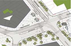
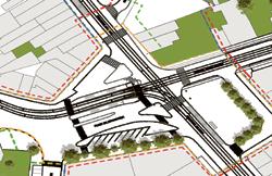
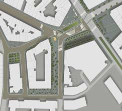
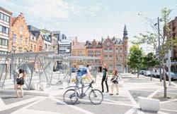
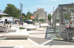
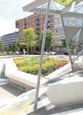
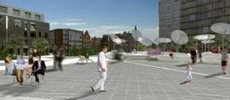
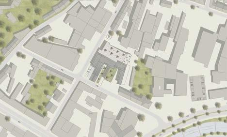
In the following workshops, working groups, and conferences, the further evolution of the urban development strategy and the master plan, as well as the architectural design of the various items of street furniture and spatial elements, were put up for discussion. The design of the four areas involved, i.e. Water Garden (Nos. 1 to 4), La Plazza (Nos. 11 to 14), Orchard (Nos. 6 to 8) and Forum (No. 16), was also continually checked against the urban strategy and the master plan developed therefrom. The terraced Water Garden with its fountains and water features creates a tranquil and restful area; La Plazza, with its cafés, restaurants, and the tram station, invites people to take an active part in what is happening. The Orchard is a flexibly usable parking place that provides areas for stationary vehicles as well as for
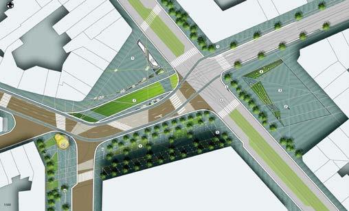
temporary market stalls during the weekly market. The Forum, with its interactive mediation pavilion, invites citizens to actively participate in the master plan and its implementation.
The elements designed for the master plan, such as seating areas, planters, streetlamps, and lights integrated in the paving, set the overall design framework for the whole of Dr.SchweitzerSquare and the adjoining neighbourhood. These elements were designed in a way that revitalises the area, not only by day but also by night. They were put up for discussion in the focus groups during the workshops involving school classes, young people, and local employees as well as retirees. Within these creative workshops, imaginative and unusual ideas and solutions were generated by the focus groups using playful processes. In the individual workshops, each focus group broke into small groups and worked through the following three phases: (1) Discussion of the urban development and architectural designs, as well as the overall concept. (2) Creative solutions to be developed from the critique and evaluation, as well as a review of the results in terms of realistic implementation. (3) At the end of these subjectrelated workshops, the solutions produced were recorded and documented with the help of a supporting expert using sketches, cognitive maps, or physical models. Our planning team then upgraded these in terms of graphics to make the material suitable for technical and designrelated evaluation, and to make it possible to arrive at a comprehensive summary for revision of the master plan.

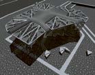
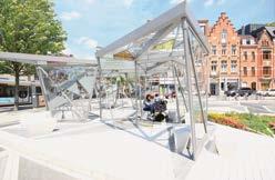
The media installation at the Forum that we developed in the context of the master plan was intended, as an interactive mediation space, to virtually demonstrate to interested citizens the future development of Dr.SchweitzerSquare even before its implementation, and to illustrate the various steps of the development and the resulting construction phases using an easyto operate digital platform. In the ongoing work with the interactive media installation, it became clear in the workshops with the different age groups that this installation should not just be used as a participation element. For this reason we developed a pavilion that, in its design and form, visually reflects the entire square as a walkin model. In this way it was possible to three dimensionally simulate the planned development of the traffic intersection, as well as the individual areas on site, as part of the overall planning and implementation process. The pavilion as a participation element was a three dimensional structure that showed the citizens the designed space to scale. The photo shows our first mockup of the pavilion, which we erected at the square as a test installation during an earlier phase of the master plan preparation, and which remained there for several months.
Once the master plan had been substantially revised by our interdisciplinary planning team, with the help of the participants’ suggestions, we invited the different interest groups as focus groups to more ideas and planning work
0.30m
0.10m 0.45m
1.11m
1.11m
0.39m 0.67m 0.84m 0.84m
2.00m
0.70m 0.70m
0.84m 0.39m 0.87m
for the further development of the master plan within the workshops revolved around materials and scale. For these workshops we developed planning documents that contained the details of the design elements.
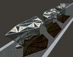
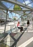
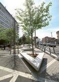
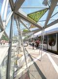
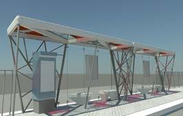
The first plan level shows the horizontal level of the square in its entirety, including the materials we selected. At the next plan level, the small, round, mostly standalone seats are shown, which are made of light coloured concrete at the right height for seating. The next plan level details the street furniture with its integrated planters, which were aimed at enhancing the overall design quality of the square. The shape and height were chosen to ensure that the seating areas and the backrests are in ideal proportion to each other. The trough planters are behind the backrests and function as dividers between the seating. The fourth plan level contains a scale representation of the proposed bus and tram stops, and the participation pavilion. For the next workshops in the following planning phase, the structure of the participation pavilion was completed to ensure that it could be erected at Dr.SchweitzerSquare as a three dimensional manifestation
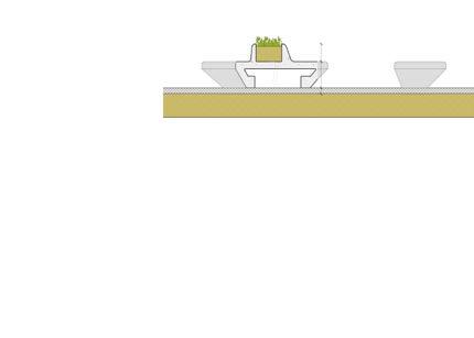
and be used to drive the discussion relating to design questions.

The focus group workshops in particular supplied extensive suggestions for developing the street furniture and installations within the context of the master plan. The compiled views and statements were discussed, summarised, and evaluated, and we compared the results with the more advanced ideas produced by the different working groups during their workshops; they could then be directly incorporated in the third planning phase – the development of the street furniture. Most of the participants agreed that this made it possible to actually perceive the different scales of the square’s design elements. By using a uniform pattern for the setting of the different areas, it was possible to create a new framework in the overall design. This sample pattern was then to be replicated in the design and the selected materials, thereby providing stimulating input for the working groups.
The third planning phase focused primarily on the revision of the design of the street furniture and the tram stops. By determining the new pattern for the square as a new framework it was possible to clarify many design questions that had previously remained unanswered – for example, how to handle the design of barrier freedom and street furniture. The design of the square pattern was based on the calculation of triangular angles by the mathematician, Ludwig
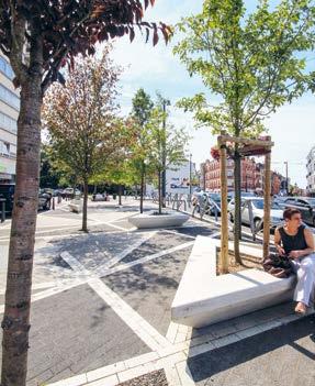
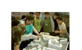
Workshop with schoolchildren – here with the analogue model
Danzer. With the help of this mathematical concept it was possible to devise a wide range of design patterns for the paving of the entire square, and to calculate the size and proportionality of the seating and pavilion. Each element fits into the next larger component, which means that the small seating elements can be inserted directly into the paving pattern, and the triangles of the seating elements can be found again in the pavilion.
β
ψ ψ
θ = 180 / 7 ψ = 360 / 7 β = 540 / 7 φ = 720 / 7
θ θ c c b b
a c
a a
Architectural design of elements enhances the character of the square
c ψ 45
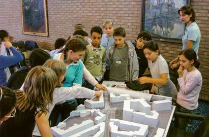
ent ages were selected as test subjects in order to be able to respond specifically to the different requirements in the working groups. The architectural design and the further development of the technical details were tested with these test subjects, using mockups and simulations. With the help of the analogue simulation of the newly evolving public space it was possible to test behavioural patterns in order to discover dayto day problems, such as a sense of inadequate safety and, at the same time, to create familiarity with the place. With the help of the constructed temporary prototypes, the proportions of the different planned architectural elements were tested within the ideas workshops. Thus it was possible to test whether the smaller and larger seats functioned in terms of form and material, and whether the stops and the pavilion worked as protective areas for people.
Once these different ideas workshops involving both young and older people had been carried out, our planning team was able to, once again, incorporate the results in the architectural details. The results of this were then used in the next step to check these new details for their usability in further workshops with working groups consisting of experts and actors. Following these workshops, which took place in the context of the conferences and district workshops, our interdisciplinary design and planning team was able to finally incorporate all concerns of the urban actors and stakeholders in the master plan, including the architectural details. At the end of this very focused participation process it turned out that, with all the dialogues, discussions, and idea findings, the entire participatory process that we had accomplished is comprehensive in the overall design of the Dr.SchweitzerSquare.

This chapter explains the detailed design and planning strategies with its description of the urban development participation principles, the individual architectural parameters are now set out within the planning process. Of special importance here is how built mockup elements can function as initiators of participation. In many cases, affected parties may lack an adequate understanding of a planned urban project because there was no process of making the planning process and the planned designs tangibly comprehensible and visible. In larger urban development projects in particular, the population is mostly only presented with the plans of the finished design at a location that is far away from the actual place. Hence, it is not possible to achieve participation that promotes a process that leads to the best quality and potential development of the design. However, if the aim is to achieve open participation during which the involved groups can actually have an influence, it is imperative to prepare the process and design at an early stage so that it can be easily comprehended. In practice, this is mostly done with the help of visualisations; however, care must be taken to avoid idealising or beautifying the image of the planned proposal.

Very often the ability of participants and affected parties to understand the quality and atmosphere of urban develop
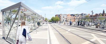
ment proposals depends on the detail. Not infrequently, items such as street furniture, pavilions, but also public works of art, which collectively account for this quality, are only devised or added at the very end of the development. In that case, the planned project development is already set out before and hence an effective and informed participative process can be established. So what happens when one reverses this process and produces prototypes, sub projects, and details of the design at an early stage, and uses these actively for the purpose of illustration and as active tools of participation? In the best case, these tangible elements make it possible for the participants to form an objective idea at the location. The result would be that the size, quality, and materials of the design – as well as the atmosphere of the place – can be experienced and can thus be illustrated and conveyed in detail for the participatory processes. In the simplest form, these early efforts to show details can take the form of display cases in the case of residential developments, or threedimensional details of facades such as is common practice in construction. As already mentioned, however, it is very important for the design process that these elements contribute to active participation at the location by providing areas of shared creation and development.

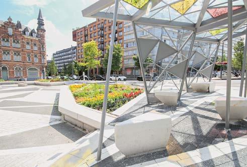
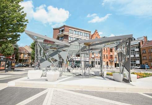
For this complex urban development project in Brussels at every level we prioritised open and intensive discussions with all actors and planning departments in order to drive an integrative process over a longer period. In this context, our planning group felt that it was especially important to convince the city and municipal authorities not to waste funds on public sculptures – which would not be usable by the residents in an active and participative way – as had been planned, but to use the money to create a participation pavilion which, from the beginning, would inform the population about the plans for the entire neighbourhood and what would be happening locally over the coming years.
In addition, we felt it was very important to integrate the different citizen groups – to consider them right from the start and ensure their participation on an equal footing, especially those groups that are frequently disadvantaged in the urban development process because of language barriers or other obstacles. With the help of the participation methods described above we managed to bring together and consistently involve different interest and focus groups from a wide range of social strata and age groups – including children and young people; pupils, apprentices, and students; employees primarily representing local businesses; and also older people who had not yet been involved in the planning process. During the workshops our team noted, with increasing frequency, that those participants with little experience of urban developments and participatory processes usually put forward much more interesting suggestions and more suitable proposals for the development of the square than we received from some professionals.
The involvement of the focus groups in the creative decisionmaking processes within our ideas workshops was very helpful to us for developing the urban strategy, as well as for designing the architectural elements. This involvement process requires very intensive preparation and support at an early stage from the planning staff and moderators, but is an effective procedure for successfully driving the planning process. These participating groups are still very actively involved today in local matters. They organise gettogethers, such as neighbourhood parties and markets, and in this way maintain the communication and exchange of ideas that we initiated. In this context, the urban elements – such as the different areas, the street furniture and the participation
pavilion that we designed and further developed with the local actors in the participation process – are used extensively.
What can we learn from the classic as well as the new, virtual participation methods to be able to pursue a comprehensive approach within the planning process with all participants in an analogue or digital setting? What tools exist or have to be developed to make this possible? At the present time it can be noted that in the virtual participatory online formats harbour similar obstacles, hurdles, and problems to those in the analogue formats: the challenge is to overcome them. How can underrepresented groups such as older people and children whose mother tongue is not French, Flemish, German, or English be involved in this process? How is it possible to prevent a situation in which it is always the same groups making themselves heard due to their privileged position or situation, whereas other groups don’t have a say? Existing virtual communication platforms can manage the technical side of this, but there always has to be a moderator or mediator accompanying the process. Furthermore, it is imperative to collect background data and information to ensure that experts and laypeople can always be involved on an equal footing. This is another and extremely interesting field of research. The subject of virtual working methods is explored in greater detail in Chapter 2, “Learning from pedagogy and education”, using the examples in which our participation methods were applied.
It is important to note that, in spite of the intuitive approach of our planning team within the participation workshops, a comprehensive exchange has taken place, and that the ideas and suggestions of the participants were worked into the design process on an ongoing basis. At a later point, Katharina Simon and I undertook a scientific study to investigate these participatory and analytical methods and to systematically assign them to the different planning steps. They are illustrated in detail in the digram named “Urban development and participatory approaches in the planning process”, which can be used by planning professionals and actors as reference material. It is important to note that the participatory processes are not only carried out in the classic way “on site”, but also from a number of different, virtual platforms in an online dialogue. This was evident during the pandemic, but now also beyond this period. The method made it possi



Wuppertaler Tafel food bank in Barmen . Wolfgang Nielsen, co-founder and director
Participating partners and institutions
BUW Chair of Urban Design – Urban Scape: Elli Börgener, Tanja Siems, Katharina Simon Food bank visitors and local district actors
The Wuppertaler Tafel food bank was founded in 1995, received a new real estate grant in 2010, area: 8,700 square metres; area of the vacant building intended for redesign: 3,500 square metres


Development of innovative adaptive reuse concepts for a building complex These important research questions are related to design strategies: how to create affordable housing (problem of retirement poverty)? What does a dwelling or shelter look like that addresses addiction comprehensively (problem of gambling addiction)? Can a comprehensive functional programme counteract eating disorders, obesity, and malnutrition in children and adolescents?
Analysis and development phase: investigation of the situation, proposal of urban design strategies and architectural concepts (0 .5 years)
Construction phase: building remodelling (1 .5 years)
In many projects, participation and cooperation are considered add ons that either accompany or support the actual process. Typically, this is based on the assumption that the developmental process of projects is linear and homogeneous, often related to bureaucratic structures and longterm, static planning measures. Thus, many advancements and initiatives are overlooked. Situated in singular and isolated positions within existing structures, they do not possess the necessary political assertiveness in order to develop in an exponential manner. Correspondingly, their results lag behind their actual potential in terms of design oriented and societal impact. In an increasingly networked world, it has become a central task of planners to detect and interlink precisely such initiatives and use them to develop projects that impact society in a sustainable and tangible way. This is necessary to address urgent tasks in the context of a changing social and natural environment, with broad support from the very beginning of a planning process.
The work of planners is, therefore, not limited to providing solutions to existing tasks. They also need to research
which existing forces possess the potential for amalgamation, in order to develop outcomes that are greater than the sum of their parts. A necessary precondition for a sustainable impact of related initiatives is a broad understanding of their potential among planners in particular and society in general. Therefore, conveying and communicating this approach becomes an essential part of pedagogy as well as societywide education.
The “Wuppertaler Tafel” food bank is a suitable example of how initiatives are combined. Within this project, a very diverse set of initiatives, social issues, and planning converged within creative projects that began to combine and advance ideas and approaches. The expanding scope of providing basic services to an increasingly diverse society against the background of increasing migration and resulting support mechanisms requires solutions. The same is true for the urgent question on the spatial expansion of urban structures, which requires answers that conventional approaches are incapable of providing. Only close collaboration between all actors involved allows the production of sustain
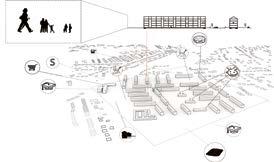
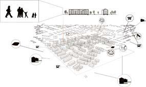
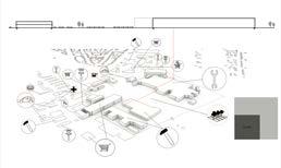
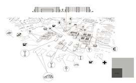


The design task was to advance the development of the Teltow district near Berlin. In terms of an intensive deliberation on infrastructural issues with regard to the expansion of the ecological mobility alliance, Teltow offers a fundamental precondition, due to its location and its infrastructural connection to the city centre of Berlin, that is highly interesting from an infrastructural viewpoint. Formulating principles for the development of alternative traffic modes played a particular role to us in this design project. Additional use of water transportation within the scope of public transport services and the realisation of a bicycle expressway against the background of the still provisional existing bicycle network were potentially of specific importance to the many commuters.
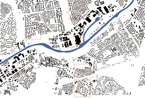
The area under investigation reaches from the Zehlendorf district of Berlin to the bordering municipality of Teltow. Unfortunately, during previous decades the development of the two communities predominantly occurred independently from one another. Teltow Canal, originally part of a superregional waterway network, now constitutes a barrier. As of today, both settlement spaces are only connected by two bridges. The bordering landscapes reinforce this effect. The area under investigation is thus characterised by different fragmented settlement spaces and landscapes. It also included industrial and commercial sites as well as service centres, residential neighbourhoods, sites for allotment gardening, open spaces, and nature reserves. Remainders of the historical industrial and commercial uses still existed along Teltow Canal. Within the concepts under development, the residual urban and commercial sites and landscapes along Teltow Canal were supposed to be reorganised and, at the same time, fragments of settlement space in the Teltow and Zehlendorf districts were to be interconnected in a better way. Beyond that, the students identified potential sites for residential development and redensification, and this was proposed later on in their urban strategies.
To comprehend the distribution of structures and functions in the districts of Teltow, south of the canal, and Zehlendorf, north of the canal, the students created a profile and typological model in order to test the district structure, including residents and workforce, parallel to establishing maps. Specific plots that were considered representative of the entire planning area were selectively researched. The selected plots measured 500 metres by 500 metres and contained the structural typologies of residential, commercial,
and service functions, while also featuring striking green and open spaces, making them suitable for an analytical comparison. The evaluated urban design criteria of the different plots were specified and illustrated in a legible manner for purposes of demonstration and possible comparison within profile maps. The selected criteria and parameters for comparison indicated the distribution of builtup areas in contrast to the entire plot, as well as residential, production, and retail functions and spaces used by restaurants, administration, and associations, according to individual typologies and age distribution among the population. As a result, precise statements could be made regarding differences and commonalities, deficiencies and qualities of the selected plots of the district. Consequently, these characteristics could be integrated into the urban design scheme and embedded conceptually.
In the selected Zehlendorf plot, predominantly comprised of linear slab buildings, association housing defines the character of the district. At first, following the Second World War, very small apartments were realised within this specific housing typology. Fifty years later, the same apartments were subject to extensive renovation measures. Setback rooftop additions and new extensions to the lateral building sides supported the creation of larger apartments, including tenant gardens, and the transformation of the structures into high quality, low energy buildings. In parallel, the selected Teltow plot predominantly features linear slab housing types realised as a “new residential city”, similar to the association housing buildings in Zehlendorf in 1962. The apartments and facilities for everyday household needs in the centre of the area include childcare institutions. Following German reunification, the linear slab buildings were redensified by creating rooftop additions and additional smaller building units. The two selected plots intended for comparing nodal building typologies were planned and built for single family or multifamily residential use, both in Teltow and in Zehlendorf. The difference between the two is the degree of densification of the urban structure. In Zehlendorf, the 500 metre by 500 metre plot features 12,000 square metres of builtup area. In comparison, Teltow comprises only 1,000 square
guments for the evaluation of the proposed theory. In parallel, traffic networks are mapped, to illustrate the relation between streets for motorised traffic and bicycle pathways, the catchment areas of the public transport stops, as well as the distance and time required for different modes of mobility to reach certain destinations. In addition to maps, students developed a survey intended to access public interest in riding bicycles to work. The results show that nearly half of all commuters who live in Teltow are willing to consider switching from motorised individual transport to bicycles. In a third step, to propose concrete identification and delineation of problems, and thus their definition, students conducted a SWOT analysis. It shows strengths, weaknesses, chances, and risks of the project and, therefore, demonstrates why cycling as a mode of mobility poses advantages, as opposed to motorised individual transport or local public transport.
After completion of the analytical procedures preceding each of the first three steps, the proposed measures were tested with regard to individual acceptance. The students
initiated a working group to evaluate specific ideas for a bicycle expressway and discuss them in public. The working group as a platform for discussion worked very well and accompanied the entire design process to follow. To test the data collection and initial conceptual ideas in a targeted manner, simulations of traffic flows in the existing and planned street network were undertaken. The bridges crossing the Teltow Canal once more proved to be areas that are prone to traffic jams. For the current commuter flows to Berlin, these bridges neither exist in sufficient numbers, nor are they dimensioned sufficiently. Within this step, the commuter flows to Berlin and Potsdam were analysed in a targeted manner. Distances and travel time of different modes of transport were illustrated using diagrams. The results of the simulation and the verification of the infrastructural concepts derived from it were supported by using a preference matrix and a costbenefit analysis (project team: Vassilissa Airaudo, Daniel Branchereau, Moritz Scharwächter).
A sustainable effect resulted from the use of method maps within the individual design steps: prior to the design, the supervisor team selected method maps from the diverse set of scientific methods and pre emptively assigned them to the individual phases within the planning and design process, in order to allow students to test and evaluate them
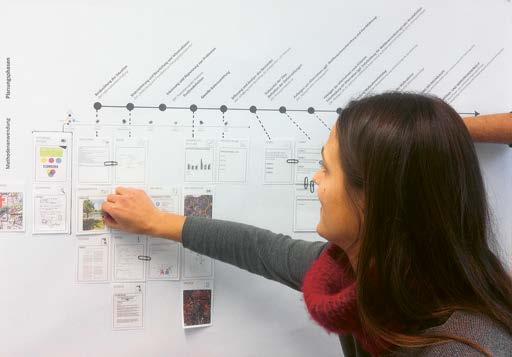
within a case study. As a result of this case study, urban design methods including mapping, photo documentation, brainstorming, working groups, scenarios, and simulations proved to be essential and particularly productive. Further methods for generating and substantiating the urban strategy include flow diagrams, preference matrices, targetactual comparisons, costbenefit and cause effect analyses, as well as the use of mental maps.
The research questions developed within dialogues were further refined within this process and, as a result, were allowed to develop further in the urban design strategies. They are conclusively specified by the individual groups within a
catalogue of measures relevant to the design and presented in a detailed manner within the architectural design concept. This procedure demonstrates how a comprehensive urban design analysis serves to generate a research question and, as a result, elaborate an individually formulated task and an individual functional programme. What needs to be considered is that a targeted retrieval of urban design methods should not lead to neglecting an individual and mostly intuitive approach that would otherwise lead to decisionmaking without relying on the method catalogue. For this purpose, it is important to draw some inspiration from the method toolbox, while not becoming overwhelmed by it.
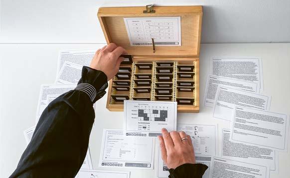
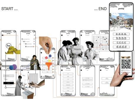
goal oriented manner. Based on this methodical approach, the extensive beginnings of information collection can quickly facilitate a goal oriented gathering of data and lead to useful results within the limited time available in a semester. Beyond that, the relevance of employing new digital teaching methods during the pandemic became particularly apparent in this seminar, considering the pedagogic aim of creating a virtual platform for participatory processes. The design of an app for the communication of content relevant to the students’ work indicates the necessity of a general redesign of communication pathways, given the limitations also experi
enced during the pandemic period. Online meetings have become everyday practice in the business realm, as well as for teaching courses. Lectures, counselling, and even examinations can be conducted spontaneously and without requiring physical presence in virtual space. Given that a field of study such as architecture is particularly shaped by presentation, communication, and interaction formats, students adopted the new task of elaborating the “final result” of their work within a digital presentation that was also suitable for use after the fact.
The urban designrelated centrality of train stations and a general trend towards living in the city turn train station districts into contemporary urban places that are equally attractive to municipalities and their residents, as well as real estate investors and developers. In the proximity of main train stations, new neighbourhoods for living and working are under development which are leading to a valorisation of the structure of districts that have developed over the course of decades of urban planning. For the urban design assignment in cooperation with Tim Lukas in the context of his research project on security in train station districts, we inquired on the degree to which more attractive and secure housing could be realised for new residents in environments considered centres of criminal activity. How could urban design strategies prevent the existing population of train station districts from being displaced from their accustomed sociospatial context, due to increasing valorisation pressure?
To propose a comprehensive neighbourhood development concept in the vicinity of Düsseldorf Main Station, the students were required to examine and evaluate a diverse set of urban developmentrelated criteria. This included an intensive analytical deliberation on the area surrounding the station and the bordering urban neighbourhoods, as well as a comprehensive evaluation of the urban designrelated examination, in order to generate an urban and architectural concept. Within the urban design assignment, the reorganisation of the social and trafficrelated infrastructure can sustainably improve the characteristics and qualities of the urban spaces and their local interrelations across the entire district. In recent years, many municipalities and cities attempted to upgrade central locations adjacent to train stations through retail and residential functions. Such urban designrelated developments often cause new problems and potential for conflicts as for example the gentrification of the
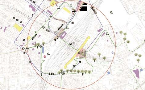
inhabited area of homeless individuals and for longterm residents of train station districts alike.
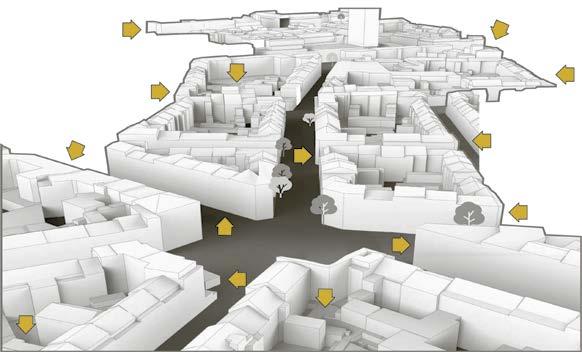
In the context of the hierarchical structure of urban districts and neighbourhoods, the Düsseldorf train station district does not constitute a distinct spatial entity. Corresponding to the socio spatial structure of the city of Düsseldorf, the area under observation consists altogether of five distinct social spaces that cover roughly 1.7 square kilometres surrounding the main station, and thus about 0.8 per cent of the entire area of the city. The predetermined social spaces are located in the direct vicinity of the train station and, in spatial terms, border Mintropplatz and the Handelszentrum commercial centre. While the train station districts in other cities are often characterised by retail functions and their immediate proximity to inner city cores, a specific characteristic of the Düsseldorf train station district is its mixeduse structure that encompasses a significant number of residential units in the train station surroundings. About 30,000 people live in the Düsseldorf train station district. In comparison with the entire city, this indicates a very high population
density. Settlement density is particularly high in the social space Am Bahndamm, comprising multistorey slab housing. In contrast, the social space “train station and commercial centre”, due to generous green spaces and extensive office and hotel complexes, displays the lowest population density of the district. In the south and north of Düsseldorf Main Station, the development of new residential quarters is being planned. The intent is to offer housing in the middle range price segment. The construction tasks are supposed to create surroundings that connect mobility with retail and residential functions and valorise the train station district as the city’s first address. The design assignment poses the question of how to improve the quality of the district, while preserving the existing social infrastructure and the availability of affordable housing. The design goal was to generate urban designrelated measures and concepts for action that identify the specific characteristics of the urban spaces in the train station district and the existing actors on site, to sensitively integrate them into the urban and architectural design concepts.
The planning area is located near Düsseldorf Main Station and thus immediately next to an infrastructural hub relevant to the entire urban fabric. The degree of fluctuation near the train station and the fast pace of urban life is, as expected, very high. The high number of individuals who depart, change trains, or arrive and immediately move on to their workplaces in the inner city, to their homes, or to socialise, or to briefly stay at the train station, characterise this urban space. The districts in the centre of Düsseldorf and at the direct border to the train station are defined by a high degree of unemployment and are a place of refuge for many homeless individuals, as well as those addicted to drugs and alcohol. For most parts, these individuals are living on the street.
As a result, the train station district in Düsseldorf features numerous social services and a good infrastructure for people with addictions. The following design concept’s aim is to integrate them better into urban life.
Located in the area northeast of the train station, the “Maghreb quarter” features Arabic restaurants, grocery stores, hairdressing salons, and other services. It thus offers cultural diversity that benefits the entire quarter. The building structure and the relation between building height and street width create public spaces that permit active communication and familiar exchange between residents. The urban strategies devised by the students reinforce local communities within design concepts oriented on urban space. By doing so, the existing degree of interaction is supported and establishing new contacts is simplified.
Against the background of ongoing social change in the train station district, one student group designed a diverse set of cultural services in the groundfloor areas, aimed at balancing mixed uses within the building configuration. For their urban design concept “Corpus Urbis”, the students designed a market hall for the planning area southeast of the
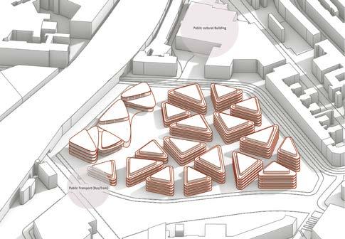
planners across Europe. In 1748 the engineer and architect Giovanni Battista Nolli was the world’s first cartographer who did not orient his “great plan of Rome” eastwards, as had been customary. Instead, he oriented his plan towards the north, in order to show how open spaces were shaded by surrounding buildings. Beyond that, in this urban plan, a typical figure ground plan of its era, he made a distinction between urban structure, roads, and pathways – and in particular, private and public areas – by graphic means. As a result, it was possible to use this map as a planning basis for the future development of Rome.
A century later in 1854, Dr. John Snow created a list of cholerarelated disease cases in London’s Broad Street within an urban map. By integrating medical information into an urban map of Soho that displayed technical infrastructure, he was able to ascertain that the disease was not transmitted by respiratory infection, but by the water supply and contaminated local urban water pumps. This targeted superimposition of gathered information on the disease patterns, in combination with cartography, allowed John Snow to make a statement on a medical problem by using an urban design method. In this way, he was able to propose a technical approach to solving the problem that influenced the entire future planning of the city.
In the same era, in the year 1869 Charles Joseph Minard presented his map of Napoleon’s failed 1812/13 invasion of Russia. With this method, he attempted to show the reasons why the campaign had resulted in such an extreme loss of life. Of the 423,000 soldiers who had joined the campaign in June 1812 at the river Niemen, only one thousand returned one year later. In his map illustration, Minard not only showed the spatial and topographic situation of the campaign, but also the size of the army, its marching directions, and its respective location in terms of longitude and latitude and how this was related to time and temperature. He was able to explain that the loss of the army did not occur due to strategic or technical advantages of the Russian army, or due to unfavourable geographical conditions. The majority of soldiers were killed because of the fact that prevalent temperatures measured nearly minus 30 degrees centigrade and that extreme cold had led to the extreme reduction of the army and the failure of the campaign. The graphic methods Minard selected are very close to a contemporary “diagrammatical” means of illustration. By creating a map in this manner, he was able to relate existing data and facts of the army to the geographical and natural conditions, thereby correlating them. He fundamentally changed the cartographic approach to illustrating plans.
During the same era, the engineer LouisLéger Vauthier used the mathematical method of illustration offered by topographic contour maps to show the population numbers of Paris in 1874. This geographical means of illustration was
further developed by Vauthier in a manner that no longer showed geographical conditions by using contour lines, but instead, visualised purely statistical data. As a result, planners gained the opportunity to compare population numbers, not only in numerical, but also in graphic terms, and correlate them.
In his 1930 atlas on Society and Economy, Otto Neurath used graphic means to bundle different data on population development, international trade relations, and the global accessibility of resources, and through his illustrative methods, correlated them. In one hundred diagrammatical illustrations, the atlas shows the means of production, and the types of societies, cultures, and lifestyles of the early twentieth century: “This seminal work of visual statistics titled Society and Economy represents the first attempt to systematically visualise a colourful image of contemporary human civilisation and its development on the basis of diligent processing and linking of existing data and all manners of combination thereof.”
In the 1960s Kevin Lynch went even further than the previously mentioned, purely analytical plan illustrations of urban design layers and their basic elements in his theoretical work on The Image of the City. In his maps, he captured spatial structural elements of cities and correlated them with the perceptions of individuals, thereby displaying the connections between human perception and the type and quality of the city’s physical form. The city can, therefore, be understood as more than merely a built manifest structure with its infrastructures related to construction, traffic, technology, and open spaces. Instead, it permits illustration as a farreaching space of perception. These types of mapping are described as mental maps: they comprise cognitive charts that present a mental image of the city and its atmospheres. This type of cartography allowed Lynch to directly include the citizens and their perception of the city into planning processes.
Further theories of the 1970s and 1980s deal with participative strategies and democratic planning processes. The motto of “the citizens build the city” guides an initiative to construct imaginary buildings for freedom and equality. They are connected to existing urban structures, to reconcile tradition and utopia. To display them in an effective manner, the utopian designs are implemented using a diverse set of illustration methods. A suitable method of illustration includes montage or collage techniques, in order to visualise planning ideas or design constructs and their utopian appeal in an easily accessible manner. Beyond that, building tangible models and testing planning ideas by using related models gained increasing importance during this era, also as a scientific approach. For instance, Constant Nieuwenhuys experimented with collages, models, drawings, and paintings in the course of his development of a visionary city model.
Methods: Tools and Products: Phases:
Phase Leporellos and Exploration diagrams
Phase 3: Concept • Strategy developed from Phase 1 + 2 Evaluation • Generating design for architectural and urban concepts
Within different test sequences spanning two decades he attempted to evaluate his urban future strategy “New Babylon” by using these illustrative techniques and further develop it in a sustainable manner.
Phase Scale of Plans 1:200 to 1:50 Scale of Models 1:500 to 1:200 Floor plans, Elevations and Sections Terrainsection and cross-sections of Streets
Scale of Plans 1:1000 to 1:500 Storyboard Film Scale of Models 1:2000 to 1:1000
2D/3D Renderings and Visualisation Log-Book
Diagram Log-Book: Decisionevaluation Phase 4: Detailing • Creating comparable architectural concepts • Detailing the concept through the urban strategies and leading to an architectural detail • Designing environmental objects for the concepts • Speci cation of speci c task and wider elds as for example energy and water sensitive concepts
same time, offer its citizens free and flexible options for self expression. In an interview with Hans Ulrich Obrist, Constant Nieuwenhuys described his urban model on the occasion of the exhibition of his strategy concept during the Documenta 11 in 2002 as follows: “New Babylon was, from the bottom up and to the level of details, planned as a flexible Mappings Axonometry urban Layer + Superposition Explosiondiagram Process-Model Analysescards e.g. SWOT-Card
Matrix of Floor plans
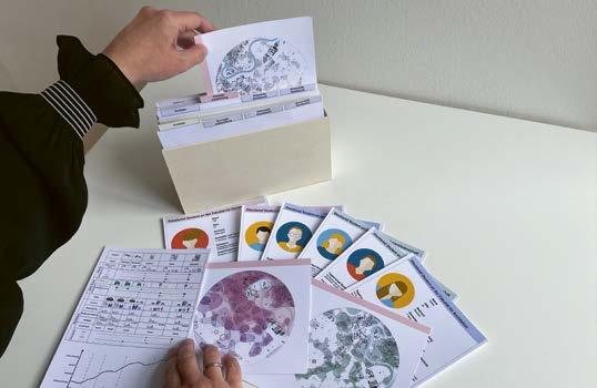
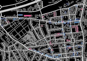
Mapping serves to specify the individual aspects under examination in the area under deliberation and visualise them within maps. For this purpose, several common analytical mapping methods are available. The common types of illustration include figure ground plans, zoning plans, infrastructure or green openspace maps, as well as maps showing demographic characteristics or traffic emissions. Further and ever new criteria and types of illustration can be developed that are tailored to specific tasks. The intention of maps is to display information in an impartial manner. As such, they do not produce qualitative or quantitative statements. Instead, their purpose is to make urban specificities and peculiarities evident and communicate which of them will be subject to detailed analysis and evaluation in a following step. Within this design phase, suitable scales, depending on the size of a neighbourhood, quarter, or district, range from 1:50,000 to 1:5,000 or from 1:10,000 to 1:2,000.
In the context of the mapping method, physical and geographical situations, such as structure, infrastructure, and openspace design are first captured by graphic means. These large scale phenomena can be complemented by depicting more specific categories and themes within maps, such as the identity of place, vacancies, building classes, need for or degree of renovation, or empty plots.
When open spaces and green spaces are mapped, they are depicted as active or passive regions according to private,
semipublic, and public areas. Plant and animal life can also be visualised with graphic means, in relation to temporal changes, by illustrating plant and animal species, depending on the processual and operational phases. For the most part, diagrammatic illustrations serve this purpose, as well as mapping techniques originating in landscape planning. In the context of traffic infrastructure, mobility networks can be displayed within urban design plans as line drawings for different mobility types, as well as different travel distances between public transport stops, stationary parking, and bicycle parking. This can also include trafficrelated emissions, such as traffic noise levels, featuring corresponding decibel ranges that can be displayed comparatively.
Mapping the existing flat roof structures in an urban quarter may not be particularly relevant in the first phase. However, within the concept phase it can offer a suitable basis for strategic deliberation. Related maps can, for instance, serve as a basis for argumentation within a sustainable structural densification strategy: they provide the opportunity to determine areas for redensification within a district that are suitable for rooftop additions. In addition, flatroof structures can be assigned as areas for green roofs to provide space for balanced plant and animal life. This makes it possible to counteract urban heat island effects within existing heat areas and improve the urban climate in its entirety by means of planning. This is only one example, but it shows how maps that are set aside at an early stage can become relevant during a successive stage in the design process.
Distribution of functions for the development of an urban functional programme
Mapping infrastructure to generate sustainable traffic systems
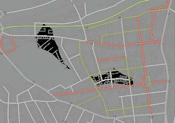
Green open-space map for the evaluation of recreational areas
In the context of the analysis phase, in addition to the scientific approach guided by the motto “get out of the lab!”, we conduct field trips to the planning area, in order to undertake reallife field studies on site, beyond an exclusive remote analysis of data. In this way, the previously achieved results from the urban design analysis can be directly tested and new characteristics or situations on site can be elicited. During a field trip, it is sensible to look at other architectural
and urban design projects beyond the planning area. Following field research, a renewed evaluation of the gathered information takes place, as well as a review of the catalogue of criteria regarding their suitability as possible design parameters.
In the application of the different analytical methods within the investigation phase, a set of tools is relevant for successive steps and the development of results. As previously mentioned, these include typical mapping methods, two and three dimensional sketches, diagrams, or tables. In
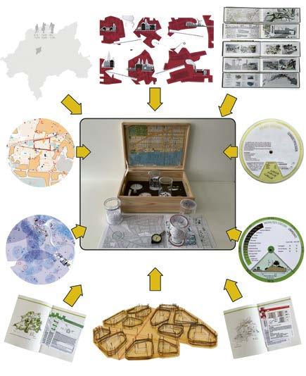
this phase, generating a matrix, compiling profile maps, or conducting surveys or interviews are also appropriate.
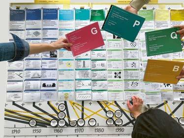
Simple lists or tables are often the basis for the representation of data and facts. For the most part, they serve to capture, sort, clearly display, and categorise data and information. The displayed content can be depicted by different types of media and contains text, numbers, and symbols, as well as drawings and diagrams. Different from a table, a matrix juxtaposes content sorted according to specific categories with additional categories. By expanding a table accordingly, interrelations between individual elements can be created and analysed.
A functional matrix permits conclusions from these interrelations to be drawn, which can become important to the evaluation. In an urban design context, for instance, a matrix is used in the examination of ratios of sizes and functions. This allows different functions and the area they require to be compared. Based on their ratios, differences and discrepancies can become visible and support the drawing of conclusions for the existing demand and the efficiency or feasibility of measures.
Aside from the systematic mode of illustration, the analysis phase also includes dynamic tools, such as two or threedimensional sketches. Sketches are understood very intuitively, and thus can visualise ideas in an unfiltered manner. The depicted content can, in an urban context, be highly
multifaceted and encompass the analysis of social situations and the illustration of objects or technical processes. In this way, sketches become an integral part of the investigation process and the related conversation: a sketch is not intended to be a permanent or precise representation, but instead serves to inspire argumentation and enable a continuous development within a specific discourse. The immediate flexibility and spontaneity of illustrations are the basic preconditions for a sketch. However, sketches are required to fulfil a purpose, regardless of whether they are created by using a pencil on paper, as objects resembling models, or as computergenerated prototypes.
Surveys and interviews are further important instruments used to retrieve and record dynamic data on public opinion and involved actors. Surveys are intended to gather statistical, quantitative, or qualitative data. They are used to research the dissemination of particular aspects, key figures, or characteristics, which opinions are prevalent, or how public opinion changes over time. Interviews go beyond a survey or questionnaire on public opinion. They serve to ask targeted questions to help elicit individual answers that are honest in terms of the content. The results can be evaluated and qualified within selected frameworks. Questions can be precisely formulated within a research or design assignment by using an interview guideline. Based on this, an interview can
way, the linking of all urban elements and their influence on the totality are made visible in an evaluative manner. In the complex urban fabric, the interplay of individual elements can reveal deviations and weak spots, as well as obstacles, dominant elements, and transformative strengths.
The targeted superimposition of mapping already created in the analysis phase can, by using this method, serve to draw new conclusions on the urban designrelated and infrastructural situation. During this design step, the evaluation of the different types of superimposition and layering gen
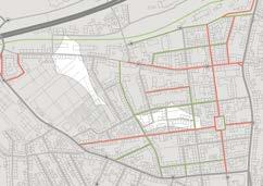
erate a new characterisation of the area under deliberation. Depending on which mapping is layered, new information can be elicited which, in return, is potentially helpful to the development of the urban strategy.
A superimposition of mapping of vacancies and those of separate building classes can, for instance, by indicating renovation needs, lead to the creation of a new map that can become relevant to the design and the development of related concepts at a later point. Such mapping can display buildings that are subject to renovation measures due to their age
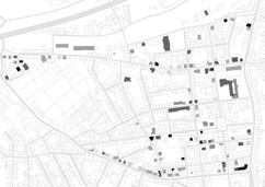
and vacancy and which are intended to receive a new functional programme. The renovation map identifies all buildings that are supposed to undergo necessary renovation measures. A renewed site visit and study of the building structure allows repeated testing and revision of this map. A further superimposition, for instance, of the newly compiled renovation map and a zoning plan can, as a result, generate a landuse conversion map. Correspondingly, the potential options for differentuse conversion can be displayed and employed to develop a future oriented, urban adaptive reuse strategy.
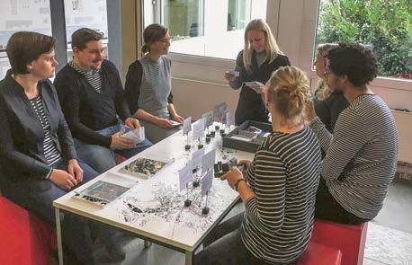
Other types of superimposition within mapping can produce statements on infrastructural planning needs. Linking maps on topography and traffic networks can, for instance, lead to conclusions on barrierfree access. In the first step of the superimposition, barriers within the street network map are identified and flagged, for instance kerbs without drops or cuts. This allows maps to display that the opportunity for a barrierfree transition from pavement to street, such as one for a crossing, does not exist. If mapping of the topography is included for purposes of evaluation, it becomes clear that a barrierfree transition between other areas within the neighbourhood, quarter, or district are not guaranteed: places are displayed clearly that do not adhere to the maximum 6 per
cent slope for wheelchairs or wheeled walkers. The urban design strategy and the architectural concept can allow designers to demonstrate how design can address these deficiencies. The method of superimposition of maps thus creates a basis for new solutions to existing problems through design. The design itself can specifically show how overcoming the barriers can take place in terms of planning and construction and how a concept for districtwide, barrierfree access can be realised as part of the strategy.
In sum, it is necessary to display the existing structures of the separate urban layers of the urban system in a restrained manner. Too much information inhibits the ability to make clear statements on urban design within the strategy and the concept. Diagrammatic means of illustration within the evaluation phase support the management of the enormous amount of data through consolidating and scaling down information on data and facts from the analysis phase.
In conclusion of the evaluation phase, the conducted evaluations of the existing urban conditions and situations, as well as illustrating these within the evaluating maps, support the formulation of initial concept ideas. The illustration of, and deliberation on separate urban layers permit the complex urban system as an urban design and infrastructure related fabric to be communicated and conveyed in a comprehensible manner. The comparison and layering of these structures can lead to an understanding of new comprehensive urban systems that can be sustainably advanced within a neighbourhood, quarter, or district.
Translation German into English: Mark Kammerbauer, Hartwin Busch
Copyediting: Patricia Kot
Project management: Alexander Felix, Katharina Kulke
Production: Anja Haering
Layout and typesetting: hawemannundmosch
Cover design: Anja Haering
Image Editing: Repromayer GmbH, Reutlingen
Printing: Grafisches Centrum Cuno GmbH & Co. KG, Calbe
Paper: Magno Natural, 140 g/m²
Library of Congress Control Number: 2022949310
Bibliographic information published by the German National Library
The German National Library lists this publication in the Deutsche Nationalbibliografie; detailed bibliographic data are available on the Internet at http://dnb.dnb.de.
This work is subject to copyright. All rights are reserved, whether the whole or part of the material is concerned, specifically the rights of translation, reprinting, re use of illustrations, recitation, broadcasting, reproduction on microfilms or in other ways, and storage in databases. For any kind of use, permission of the copyright owner must be obtained.
ISBN 9783035624120 (Softcover)
ISBN 9783035624137 (Hardcover)
e ISBN (PDF) 9783035624182
German PrintISBN 9783035624106 (Softcover)
German PrintISBN 9783035624113 (Hardcover)
© 2023 Birkhäuser Verlag GmbH, Basel
P.O. Box 44, 4009 Basel, Schweiz
Part of Walter de Gruyter GmbH, Berlin/Boston
9 8 7 6 5 4 3 2 1
www.birkhauser.com