HEALTHY PEOPLE//HEALTHY ECOSYSTEMS: A SMALL PARK’S ROLE IN RIPARIAN APPRECIATION
MAPPING TERRITORY:
URBAN GREENSPACE ACCESSIBILITY IN CHICAGO
UPPER WHITE RIVER ECOLOGICAL CENTER
WISCONSIN RIVER KAYAK LAUNCH
BORN LEARNING TRAIL: POLLINATOR GARDEN
LEE HEALTH FORT MEYERS HOSPITAL
HEALTHY PEOPLE// HEALTHY ECOSYSTEMS: A SMALL PARK’S ROLE IN RIPARIAN APPRECIATION
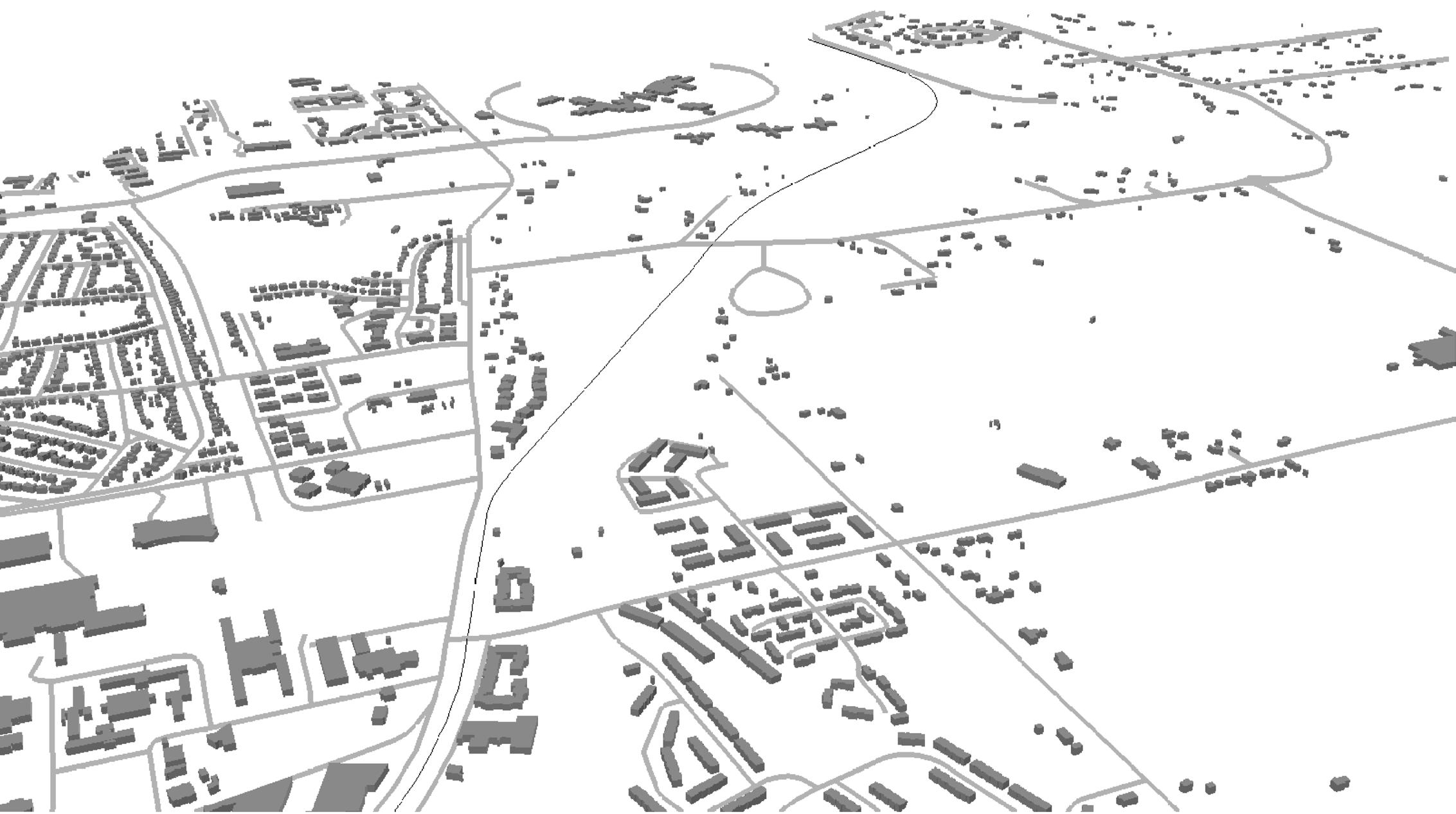
Peninsular Park and Greenway is a project that envisioned creating a 1-mile linear park system in Ypsilanti, Michigan by addressing the removal of a non-critical aging in-channel dam. The project focused on a small park adjacent to the dam and creatively proposed new uses for the reclaimed land after the water levels lowered. This project was used to fulfill graduation requirements for my Master of Landscape Architecture degree. The overall research intent of the project sought to tie creating a place of passive and active recreation for the local community with increased habitat and biodiversity, and then discussed potential outcomes. Throughout the process of the project, various expert opinions were consulted, specifically, concerning the removal of the dam and the impact on the watershed downstream.
Regional Context
Paper Co. + Site (blue)
+ Historic Mill Power House
River after dam removal
River before dam removal
Existing Recreation Networks
PROJECT LOCATION
EXISTING COUNTY-WIDE TRAIL
EXISTING BLUE TRAIL
EXISTING IN-CHANNEL DAM
CITY BOUNDARY
RIVER
Existing Site Images
Site Analysis
Research Concept
Final Concept - Designing the Ecotone
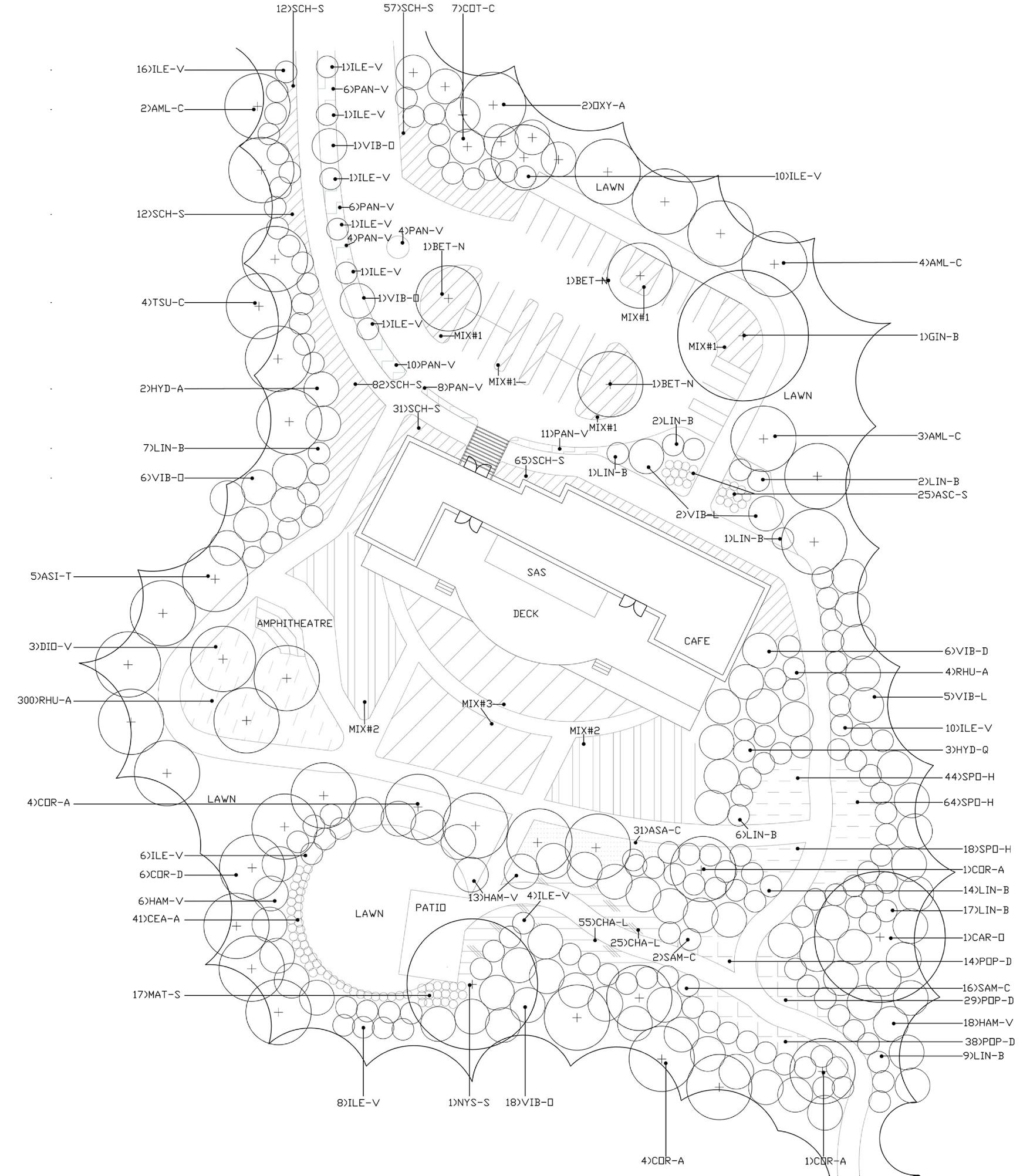
Master Plan - Penninsular Park
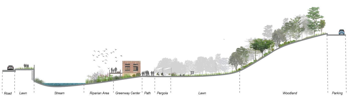
Section A-A1
Section B-B1
Tall-grass Pergola
Greenway Center
Stonefly Garden Area
Spotted Turtle Wetland Area
Launch
Darters’s
MAPPING TERRITORY: URBAN GREENSPACE
ACCESSIBILITY IN CHICAGO
This student project looked at park distribution in Chicago, Illinois as a means to study and locate areas where new park spaces might be needed most. The analysis process began with mapping park space and population, and then analyzed park accessibility in the most impoverished areas of the city. Various techniques were used: kernal density, joining census data, thiessen polygons and building a network analysis layer from the road system.
Greenspace & Building Footprints
1 Dot = 50 people Park Location
Park Density
1000ft from CTA Stops
1000ft From Bike Lanes
Thiessen Polygon Analysis for Park Distribution
After assessing the distribution of parks in the City of Chicago, the areas of the City with the highest densities of poverty were identified and then park access was analyzed using network analysis with the roads in the City. While many of the areas with the highest densities of poverty do have adequate access to park space, there are three notable areas that do not have access within a mile.
Location Allocation Network Analysis [2-mile selections; maximum coverage] (Based on most impoverished areas with the least park space)
Vacant Lot Distribution
Vacant Lot to Pocket Park Concepts
UPPER WHITE RIVER ECOLOGICAL INTERPRETATIVE CENTER
This project was initiated as part of a alternative to the new construction of a dam that was proposed on the White River outside of Indianapolis, Indiana. The intent of the Center was to serve as a resource celebrating the ecological importance of the watershed and would have sat along a bike route, acting as a rest area for bikers. As a student project, it involved creating and placing a building footprint, as well designing and illustrating the landscape masterplan. Additionally, the project was used for a semester long exercise in learning about SITES credits in a separate course.
a. Entrance
b. Lobby
c. Auditorium
d. Offices
e. Greenhouse
f. Restrooms
g. Classrooms
h. Cafe
Building Layout
Illustrative Master Plan
Entry View
Walking Trail View
Back of Building View
MILWAUKEE RIVER KAYAK LAUNCH
This small project was an opportunity to design a kayak launch for a village outside of Milwaukee, WI. The design permits greater user access to the river for kayak and canoe recreation using simple granite steps and stone pavers. The bank was stabilized using mix of flood tolerant native plants and ornate boulders.
MILWAUKEE
View of Launch
BORN LEARNING TRAIL:
POLLINATOR GARDEN
This garden was designed for a community park in Milwaukee, WI. The project budget permitted several varieties of plants that were installed and maintained by the local community. Using native cultivars, the design reflects midwest natives and provides seasonal interest, while providing food for a variety of pollinators species.
Proposed Plantings Planting
BERGAMONT
PURPLE CONEFLOWER
BLAZING STAR
LITTLE BLUE STEM
BLACK-EYED SUSAN
LEE HEALTH FORT MEYERS HOSPITAL
Currently under construction, Lee Health Fort Meyers Hospital is a new campus posed to bring medical care and new jobs to the Fort Meyers community. This project is part of multi-phased masterplan with the main hopsital and central energy plant being the initial construction.