

PROJECT TEAM


Students


Zach Andre Cactus Wren Campylorhynchus brunneicapillus


William Glockner Red-tailed Hawk Buteo jamaicensis
Krista Planinac Lesser Goldfinch Spinus psaltria
Waverly Brown Curved Billed Thrasher Toxostoma curvirostre
Blake Caldarera Broad-billed Hummingbird Cynanthus latirostris
Will Leipold Cooper’s Hawk Accipiter cooperii


Jessica Eppard Gambel’s Quail Callipepla gambelii


Selenne Yescas Common Raven Corvus corax

2 | INTRODUCTION
& STUDIO OVERVIEW
Nadia Sarneyzehdoost Anna’s Hummingbird Calypte anna
Cordell Lee Western Screech Owl Megascops kennicottii
Oscar Rodriguez Ponce Black-chinned Hummingbird Archilochus alexandri
PROJECT TEAM
Community Partners


SIERRA ESTATES COMMUNITY MEMBERS
First and Last
TUCSON AUDUBON SOCIETY

Kari Hackney, Urban Habitat Restoration Manager
Olya Weekley, Community Science Coordinator
CITY OF TUCSON


Steve Kozachik, City Council Member, Ward 6
Nadia Ispiani, Council Aide
TUCSON CLEAN & BEAUTIFUL

Nichole Casebeer, Green Infrastructure Program Manager
Faculty, Guest Instructors & Reviewers


Mackenzie Waller, Studio Lead Assistant Professor, M.Arch + PLA
Kenneth Kokroko, Assistant Professor, PLA
Dr. Shujuan Li, Associate Professor
Erik Schmahl, Lecturer + Designer
Bret Smith, Materials Lab Manager
Kenny Wong, Lecturer, MUP
Jacqueline Jean Barrios, Assistant Professor Public & Applied Humanities

Kathleen Prudic, Assistant Professor Citizen and Data Science
Greg Corman, Artist, Designer, Botanist
Catherine De Almeida, Assistant Professor, Department of Landscape Architecture, College of Built Environments
Harley Pan, Marketing Videographer and Multimedia Designer, College of Education

INTRODUCTION & STUDIO OVERVIEW | 3
As part of their mission to protect birds and their habitat, the Audubon Society recommends policies and conservation practices that protect, enhance, and expand the places birds need. The field of landscape architecture has the potential skills and knowledge to both participate in and lead these efforts.
During this studio, students engaged in designing for urban bird habitat to create designs that are functional while also prompting curiosity and wonder from their human neighbors (see II. Speculative Site Designs). Their designs offer site based solutions that connect to larger regional challenges driven by climate change and urbanization. The students worked in teams to provide near term, lower cost designs that will be passed to Tucson Clean & Beatiful to be vetted through community feedback, budget, and time constraints in their design efforts (see IV. Preliminary phase designs).
Students used research based design strategies in their work, and used mapping as a tool at many scales (see I. Site Inventory & Analysis) Additionally, they designed and fabricated ‘bird - sized’ prototypes for installation and possible residential use to expand bird habitat beyond the public realm (see III. Designing for native birds).
The studio focused their work in the Sierra Estates neighborhood of Tucson, actively engaging in design proposals for the new Burns Park that is slated to be opened to the public. Sierra Estates neighbors, the Tucson Audubon Society, Greg Corman, and Tucson Clean & Beautiful supported their efforts with their expertise and feedback throughout.
4 | INTRODUCTION & STUDIO OVERVIEW
“Birds are early responders to climate change and can be important indicators of large-scale ongoing and future ecological change. [The Audubon Society] found that 41% of Arizona’s 302 bird species are vulnerable to climate change across seasons.
A rapidly changing climate could lead to population declines and local extinctions if species are not able to adapt”
- National Audubon Society, Survival By DegreesNational Audubon Society. 2014. Survival by Degrees: 389 Species on the Brink. Arizona State Report. Eds. Brooke Bateman.
TABLE OF CONTENTS
PROJECT OVERVIEW
PROJECT PARTNERS 6
PROJECT TIMELINE 8
I. SITE INVENTORY & ANALYSIS 10
REGIONAL 13
URBAN SCALE 29
NEIGHBORHOOD SITE 39
II. SPECULATIVE SITE DESIGNS 65
III. DESIGNING FOR NATIVE BIRDS 135
IV. PRELIMINARY PHASE DESIGNS 175

MATERIALS PALETTE 176
TYPOLOGIES: TRAFFIC CALMING 178


TYPOLOGIES: GREEN STORMWATER INFRASTRUCTURE 180


DESIGN 1: SIERRA CIRCUIT 182
DESIGN 2: A PATH TO WONDER 188
DESIGN 3: METAMORPHOSIS 204
INTRODUCTION & STUDIO OVERVIEW | 5
core study + design site
PROJECT PARTNERS
Our research has been possible thanks to several foundations. The collaboration among these organizations has allowed the University of Arizona to brainstorm based on these collaborations. Tucson Ward 6 is in charge of park access and Burns Park can be reopened for use. Tucson Water, allowed Green Stormwater Infrastructure Fund to redistribute funds throught Tucson Clean and Beautiful (TCB). TCB have the stormwater infrastructure research backing to apply concept plans. The University of Arizona acts as a research team to compare and contrast different stormwater management and traffic calming methods in the area.
The College of Architecture Planning and Landscape Architecture (CAPLA) research was catered to four audience groups. There are long-time residents, young families, wildlife, and high school students. It was important to use the neighborhood meetings and walks around the site as an anecdotal foundation for project goals. Young families are the most recent inhabitants of the area. It is important to cater to the young children that these families have, a recent shift in the user groups of the site. The wildlife population greatly addresses preserving existing hawk populations. The High Schools both house Rincon High students and University High School students. A particular traffic calming aspect that needed to be addressed was when schools are opening and closing for the day, increasing traffic flow at two specific hours of the day. Tucson Ward 6 released a mini grant to TCB for storm water management and traffic calming. CAPLA created an inventory and analysis study based on the grant constraints, utilizing green infrastructure oppurtunities which is the focus of section IV of this document.
LONG TIME RESIDENTS
YOUNG FAMILIES
IMAGE ABOVE: Organizations involved within Sierra Estates 2022 project. The collages reflect user groups of the space that will be within the site, their desires and transporation habits were involved within design process.


6 | INTRODUCTION & STUDIO OVERVIEW
PRESERVE HABITAT

HIGH SCHOOL STUDENTS
REFERENCES, SOURCES & RECOMMENDED RESOURCES: https://capla.arizona.edu/research-practice, https://tucsoncleanandbeautiful.org/, https://www.tucsonaz.gov/gsi Dutton, S., Davison, C. M., Malla, M., Bartels, S., Collier, K., Plamondon, K., & Purkey, E. (2019). Biographical Collage as a Tool in Inuit Community-Based Participatory Research and Capacity Development. International Journal of Qualitative Methods, 18. https://doi.org/10.1177/1609406919877307 https://www.tucsonaz.gov/gsi https://www.tucsonaz.gov/gsi

INTRODUCTION & STUDIO OVERVIEW | 7
PROJECT TIMELINE
Below is a brief overview of project partners and engagment on exploring green stormwater infrastructure, Burns Park designs, and the leadership of an active and involved neighborhood.
PROJECT TIMELINE
» City owned Burns Park until mid-70’s. Gangs and homelessness were stated as disruptive measures to the nearby schools. The City of Tucson and Ward 6 ceded ownership to Tucson Unified School District (TUSD) with the stipulation of remaining open and accessible to the public. Years later the schools fenced in the park without public access.
» The neighborhood residents’ efforts and Ward 6 Representative Steve Kozachik’s requested that the park be opened again for public access to meet the agreement stipulations.
» Ward 6 approved traffic calming and flood mitigation methods to be implemented in the neighborhood. Tucson Clean and Beautiful invited to explore opportunities to install Green Stormwater Infrastructure (GSI) projects with support of active neighbors through TCB’s GSI Mini Grant Program to help neighbors envision and fund residential GSI solutions. Grants can help create multi-functional, green neighborhood assets.
IMAGE ABOVE: Displaying which organizations were interacting with the site and overall sequence.

8 | INTRODUCTION & STUDIO OVERVIEW


INTRODUCTION & STUDIO OVERVIEW | 9


SITE INVENTORY & ANALYSIS


12 | SITE INVENTORY & ANALYSIS
REGIONAL ANALYSIS
SITE INVENTORY & ANALYSIS | 13
WATER (STORM, SUPPLY & USE) CLIMATE CHANGE IMPACTS OVER TIME


Precipitation 1981 vs 2021


2021
Temperature mean 1981 vs 2021


2021


Changes in climate will also affect where precipitation falls due to changes in air temperatures and circulation patterns. In some regions, such as the American West, Southwest, and Southeast, it is predicted that it will become drier. Similarly, the northern U.S. and Midwest regions will see more rain


When the temperature rises, what happens? As the Earth warms, the global water cycle speeds up, involving water exchange between the oceans, the atmosphere, and land. As temperatures rise, evaporation increases, and the soil gets drier faster. In general, more rain or snow will fall as the amount of water in the atmosphere increases. There are signs that the water cycle is changing. It has increased by about 6% since the beginning of the century that the United States experiences an average of six inches of precipitation a year. Meanwhile, there have been an average of twenty percent more intense precipitation events (heavy downpours of more than two inches per day) during the same time period. During such an event, flooding can occur, soil can be eroded, and even people may lose their lives. Due to increased evaporation in some midcontinental areas, drought has resulted because heavy rains fell elsewhere.
REFERENCES, SOURCES & RECOMMENDED RESOURCES: https://prism.oregonstate.edu/recent/ | https://www.mapsofthepast.com/mm5/graphics/00000001/magic/AZZZ0015A_800x669.jpg | https://i.etsystatic.com/6006374/r/il/bea0f7/401896423/ il_1588xN.401896423_i02p.jpg


| https://news.climate.columbia.edu/2019/09/23/climate-change-impacts-water/


14 | SITE INVENTORY & ANALYSIS
1981 1981
Projected Changes in Water withdrawals
Dry weather is predicted to intensify and persist in the Southwest, the southern Great Plains, and the Southeast, according to the National Climate Assessment
Water demand is anticipated to increase significantly throughout much of the United States due to climate change, primarily as a result of increasing temperatures and evapotranspiration. According to the maps, the projected water demand from 2005 to 2060 will vary by assuming (a) changes in population and socioeconomic conditions, but no changes in climate, or (b) assuming population, socioeconomic conditions, and climate change (gradual reductions in emissions beginning around mid-century).

REFERENCES, SOURCES & RECOMMENDED RESOURCES: https://clintonwhitehouse4.archives.gov/Initiatives/Climate/last100.html
Nadia SarneyzehdoostSITE INVENTORY & ANALYSIS | 15
WATER (STORM, SUPPLY & USE) ANALYSIS


REFERENCES, SOURCES & RECOMMENDED RESOURCES: https://www.arizonawaterfacts.com/water-your-facts


https://coloradoriverbasin-lincolninstitute.hub.arcgis.com/datasets/lincolninstitute::major-cities-that-use-colorado-river-water/explore?location=29.179094%2C-42.092487% https://www.arcgis.com/home/item.html?id=8500221922864c16972f0aa2ea462fec 2C3.22 https://uagis.maps.arcgis.com/home/item.html?id=3a8e2012227c4a64832e6365507035a6


https://gisdata2016-11-18t150447874z-azwater.opendata.arcgis.com/datasets/azwater::well-registry/explore?location=34.243382%2C-114.839771%2C7.00


16 | SITE INVENTORY & ANALYSIS
Water demand in 2019
REFERENCES, SOURCES & RECOMMENDED RESOURCES:


https://prism.oregonstate.edu/recent/ https://www.mapsofthepast.com/mm5/graphics/00000001/magic/AZZZ0015A_800x669.jpg https://i.etsystatic.com/6006374/r/il/bea0f7/401896423/il_1588xN.401896423_i02p.jpg https://news.climate.columbia.edu/2019/09/23/climate-change-impacts-water/


 Nadia Sarneyzehdoost
Colorado River :


A major source of renewable water for Arizona is the Colorado River.
Colorado River water can be used by Arizona in the amount of 2.8 million acres. There are data points included here for major cities that consume Colorado River water, both within and outside the Colorado River Basin.


(left top map)


In-State Rivers:


Arizona’s most significant renewable resource is water from rivers. We have a desert climate, so surface water availability varies by season, by year, and even by location. Surface water can be efficiently used throughout the state by building storage reservoirs and delivery systems.


(right top map)
Reclaimed Water:


Agricultural irrigation, golf courses, parks, industrial cooling, or wildlife conservation areas can benefit from reclaimed water. A growing population will result in more wastewater being treated in Arizona.
(left bottom map)


Groundwater:


Aquifers are underground reservoirs of groundwater. These reservoirs have held water for millions of years. Groundwater Management Acts were signed into law in 1980 to protect water users and reduce the State’s reliance on unsustainable groundwater supplies.Aquifers are underground reservoirs of groundwater. These reservoirs have held water for millions of years. Groundwater Management Acts were signed into law in 1980 to protect water users and reduce the State’s reliance on unsustainable groundwater supplies. The depth of wells in Arizona is determined by this layer of data. The data is provided by spatial interpolation in Arc GIS Pro, which estimates a continuous surface
SITE INVENTORY & ANALYSIS | 17
TUCSON WATER & RECHARGE EFFORTS


Legend


References: Pima County water information; https://www.tucsonaz.gov/files/water/docs/rclmnews08.pdf;


azwater.gov/news/articles/2016-02-11; https://wrrc.arizona.edu/sites/wrrc.arizona.edu/files/BB-avoided-costs-presenta tion-4-19-17.pdf; https://storymaps.arcgis.com/stories/99ebdfb058554b5b9c4cdac4059988f8


18 | SITE INVENTORY & ANALYSIS
https://new.
Sierra Estates
TUCSON’S RECLAIMED WATER NETWORK


Tucson is a national leader in use of reclaimed water, having one of the oldest and largest recycled water systems in the country. There are nearly 200 miles of pipe in the reclaimed water system and 15 million gallons of surface storage in enclosed reservoirs. Tucson’s Grade A reclaimed water irrigates golf courses, parks and schools. Using reclaimed water instead of drinking water for irrigation saves enough water every year for more than 60,000 families.

https://www.tucsonaz.gov/files/water/docs/rclmnews08.pdf; https://new. https://wrrc.arizona.edu/sites/wrrc.arizona.edu/files/BB-avoided-costs-presentahttps://storymaps.arcgis.com/stories/99ebdfb058554b5b9c4cdac4059988f8


References: Pima County water information; https://www.tucsonaz.gov/files/water/docs/rclmnews08.pdf; https://new. azwater.gov/news/articles/2016-02-11; https://wrrc.arizona.edu/sites/wrrc.arizona.edu/files/BB-avoided-costs-presentation-4-19-17.pdf; https://storymaps.arcgis.com/stories/99ebdfb058554b5b9c4cdac4059988f8

SITE INVENTORY & ANALYSIS | 19
CAP
TARP Reclaimed Water Rainwater
Tucson’s Water Supply
CAP
TARP Reclaimed Water Rainwater
HISTORICAL IRRIGATION PRACTICES AS PRECEDENT FOR MODERN WATER USE


Ancient Irrigation Canal Network Used in present-day Arizona
first used by the Spanish in Tucson
Acequias
Present-day Implications in Local Water Use
Traditional vs. modern water Principles
The network of reclaimed water is the modern day equivalent of intelligent water infrastructure. The sustainable use of water has been paramount since humans began cultivating land in the Santa Cruz River Valley at least 4000 years ago. Rewatered areas restore habitat for bird species, and bird species richness in correlated with riparian areas in Arizona.

A reclaimed water success story. The Santa Cruz River Heritage Project and the Sweetwater Wetlands are two examples of reclaimed water being returned to nature to invigorate the local ecosystem. These projects set a precedent for what people can continue to do to restablish bird habitats affected by the loss of water. The city of Tucson treats wastewater (graywater and some blackwater) to become reclaimed water. Once this water has been filtered to a grade deemed safe for human contact and livestock consumption, it is returned to the Santa Cruz to supplement natural river flow.
References: David Abbott; Archaeology in Tucson Letter (1995); https://www.tucsonaz.gov/water/SCRHP

20 | SITE INVENTORY & ANALYSIS
The Santa Cruz River following the introduction of reclaimed water
The Santa Cruz River Heritage Project
CONNECTING WATER & HABITAT
The Habit-Water Connection
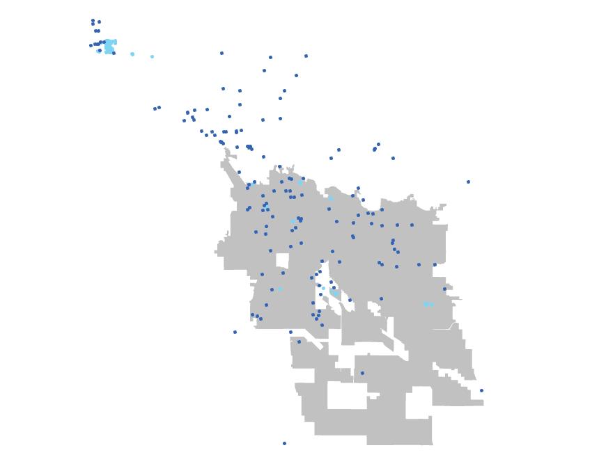
Considering the success of bird species in restored habitats such as the Santa Cruz, these maps were developed to explore correlations between urban greenspaces and popular bird viewing areas within the North-Central area of Tucson.


Audubon Climate - Threatened Bird Species Richness
According to the 2022 State of the Birds Report for the U.S., birds are declining in almost every habitat. The above map visually presents a the EPA’s Biodiversity Metric based upon bird species richness threated by climate change. As you can see, many areas in arizona and the Southwest are at a particularly high threat

Location of Urban Bird Spots
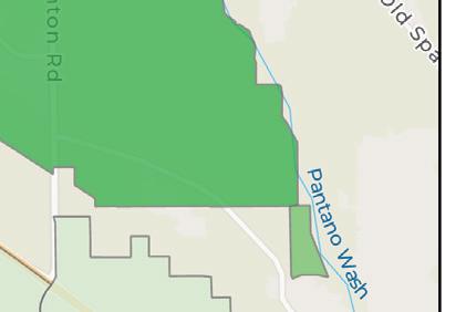
These two maps highlight spots on the Tucson Birding Trail identified by Tucson Audobon Society and the City of Tucson. The majority of these urban birding spots are located on or in closeproximity to either park spaces or washes. From the maps, we can see a correlation between urban bird spot frequency, the reclaimed water main line, and park spaces. The location of the Sierra Estates neighborhood lies within an area which has a lower density of bird spots.
Legend
Urban Bird Spots

Urban Bird Corridor

Tucson City Limits
Area of Potential

Park Spaces
Reclaimed Water


Washes & Streams
Sierra Estates
References: Tucson Water Reclaimed Water Annual Report, Tucson Birding Trail Map, https://www.usgs.gov/media/images/epa-s-enviroatlas-biodiversity-metric; https://news.cornell.edu/stories/2022/10/ birds-report-finds-losses-all-habitats-except-wetlands#:~:text=Key%20findings%20include%3A,a%2034%25%20loss%20since%201970.; https://www.stateofthebirds.org/2022/
SITE INVENTORY & ANALYSIS | 21
Reclaimed Water And Urban Bird spots
Proximity of Urban Bird Spots to Parks and Washes
High Threat Low Threat
URBAN BIRD CORRIDORS
Urban Corridors Have the Potential to Support Important Bird Areas
Tucson Holds Great Potential for Bird Habitat Wildnerness in the Santa Catalinas and Sauguaro National Park have been identified as Important Bird Areas (IBAs) by the Adobon Society. The city of Tucson lies in between these two IBA wilderness areas. Tucson’s various parks and washes can be seen as a dotted corridor of connectivity which has been fragmented by urbanization. In order to increase connectivity between these areas and mitigate the effects of habitat fragmentation, Tucson can invest in its urban greenspaces to create rich park spaces, much in the same way it has returned water to the Santa Cruz River.
Saguaro National Park
Saguaro National Park is considered to be an Important Bird Area by the Audobon Society

Important Bird Area
Sierra Estates Neighborhood

References: Google Earth; Adobon Society: https://www.audubon.org/important-bird-areas/state/arizona


22 | SITE INVENTORY &
ANALYSIS
Reid Park
The Santa Catalinas
DRYWELLS & RECLAIMED WATER USE IN PARKS

Drywells & Reclaimed Water Can Turn Parks into a Thriving Bird Corridor
Drywell Locations in Tucson

Legend
Bird Trail Spots


Tucson City Limits
Area of Potential Park Spaces
Reclaimed Water


Washes & Streams

Sierra Estates
Drywell Locations in Phoenix


Bird Habitat & Urban Greenspaces Both begin with one thing: Water Arizona Department of Environmental Quality (ADEQ) regulates the number use of drywells in Arizona. Drywells are structured boreholes which return rainwater back to the groundwater supply. As you can see in the two maps to the left, Phoenix has a significantly higher density of drywells than Tucson. Tucson can follow in the footsteps of Phoenix and add more drywells in parks and urban greenspaces, not only to manage stormwater, but also to recharge groundwater stores. In conjunction with Tucson’s large and ever-expanding reclaimed water network, intelligent water use can be used to support bird habitats in urban parks. The areas in purple above are areas in the city lacking in frequent urban birding spots. As such, they can be considered high priority areas to implement water conscious design to support vegetation growth for birds.

References: https://www.epa.gov/uic/stormwater-drainage-wells; ADEQ geodata


SITE INVENTORY & ANALYSIS | 23
RISING TEMPERATURES CONSTRICT WILDLIFE HABITAT TO HIGHER ELEVATIONS


The Santa Catalina Mountain Range began forming due to faulting in the Earth’s crust 1.65 billion years ago. Magma deposits of Oracle Granite and other minerals over millions of years have contributed to a diverse geological arrangement. As the continent has shifted, the crust along the Catalina Fault has gradually separated, allowing the newly formed granite to slowly push beyond the surface in the shape of a dome. For this reason, the summit of Mt. Lemmon is rounded and moderate in slope. A combination of other geologic processes, most notably flash flood events, have carved deep canyons and sculpted dramatic slopes along the Catalina mountain range. Seasonal streams flow through these canyons and provide a valuable resource for riparian species and wildlife.


As global temperatures continue to rise, wildlife habitat is forced up in elevation to cooler climates. The result is less land and fewer resources for birds and other wildlife species.
Six of Merriam’s Biotic Life Zones are represented from Tucson to the summit of Mt. Lemmon, each providing a distinct habitat for the residing wildlife. Up to about 4,000 feet in elevation, the Sonoran Desert zone is easily recognized by saguaro cactus and desert shrub. By 5,000 feet, the Chaparral zone brings evergreen oak trees and more leafy vegetation which brings of sense of lushness to the landscape. Higher up, The Pine-Oak Woodland has noticably cooler temperatures and higher annual precipitation than the valley. These conditions are suitable for ponderosa pine trees, which establish a much denser shade canopy. At over 9,000 feet, Mount Lemmon’s summit occupies the Mixed Conifer Forest Zone, which consists of more coniferous plus aspen trees. This habitat is most similar to that found in the Rocky Mountains and even as far north as Canada.
REFERENCES, SOURCES & RECOMMENDED RESOURCES:
Bezy, J. V. (2016). A Guide to the Geology of the Santa CatalinaMountains, Arizona: The Geology and Life Zones of a MadreanSky Island. Down to Earth - Arizona Geological Survey, 22. Explore Mt. Lemmon’s life zones near Tucson. Tucson HiddenGems. (n.d.). Retrieved November 13, 2022, from https://tucsonshiddengem.com/mt-lemmons-life-zones/ Brusca, R. C., Wiens, J. F., Meyer, W. M., Eble, J., Franklin, K.,Overpeck, J. T., & Moore, W. (2013). Dramatic response to climate change in the southwest: Robert Whittaker’s 1963 Arizona Mountain Plant Transect revisited. Ecology and Evolution.ttps://-doi.org/10.1002/ece3.720DSMile_, & DSMile_. (2021, December 12). 8K detailed mountain landscape 5 3D model. Turbo Squid. Retrieved November 14, 2022, from https://www.turbosquid. com/3d-models/8k-detailed-mountain-landscape-5-3d-model-1826887


& ANALYSIS

24 | SITE INVENTORY
Cenozoic (Catalina Granite)
0.01 - 57 MYA 63.8 - 155 MYA 280 - 580 MYA 0.7 - 1.65 BYA Catalina Detachment Fault Line Rocks pushed above Fault Line Alluvial Fill Upper Sonoran Desert Semi-Desert Grasslands Oak Woodland & Chaparral Pine-Oak Woodland Ponderosa Pine Forest Mixed Conifer Forest
Biotic
Mesozoic (Mural Limestone) Paleozoic (Bolsa Quartzite) Proterozoic (Oracle Granite)
Merriam’s
Life Zones
Habitat Restoration Projects in Tucson


To reverse some of the habitat loss caused by urbanization and climate change, Tucson must provide artificial wetlands and restoration projects in a way that methodically establishes a network of natural resources and repairs some of the lost wildlife connections. Urban stepping stones like Burns Park are crucial to restore wildlife connections through the city. Some of these projects have already been completed, however, more must be done to repair the broken network.
The majority of restoration projects use treated wastewater effluent in washes or rivers, which is beneficial for many of the wildlife species that need the water as a supplemental resource. The washes can sustain riparian species and allow for a diverse biotic environment. The Santa Cruz and Rillito River projects have provided valuable connections for wildlife species around the city of Tucson. This map map illustrates where more restoration projects must be done in order to strengthen the wildlife connections to the sky islands and other surrounding natural resources.


Rillito River Park
Key
Completed
Restoration Project
Pending

Restoration Project
Future
Restoration Project
Urban
Stepping Stone
Recommended
Wildlife Corridor
Sky Island
Wildlife Habitat
Sweetwater Wetlands
El Rio Medio Project

Santa Cruz River Park
West Branch
Evergreen

Tucson Botanical Gardens
Reid Park
Lincoln Park
Sabino Creek
Case Natural Resource Park
Rincon Mountains
Black Wash


Cienega
Cienega
REFERENCES, SOURCES & RECOMMENDED RESOURCES:

Pima County Board of Supervisors. (n.d.). SonoranDesert Conservation Plan - Pima County, AZ.Riparian Projects. Retrieved November 18, 2022,from https://webcms.pima.gov/UserFiles/Servers/Server_6/File/Government/ Flood%20Control/Public%20Outreach/brochure-riparian-proj.pdf


SITE INVENTORY & ANALYSIS | 25
South Houghton Restoration Project
Burns Park
Tohono Chul Kino Wetlands
Creek Natural Preserve
Creek Streamflow Restoration
North Simpson Restoration Project
Big Wash Restoration Project
Cortaro Mesquite Bosque
Mount Lemmon
Rillito River Restoration Project
TRANSPORTATION AND BIRD HABITAT


REFERENCES, SOURCES & RECOMMENDED RESOURCES:
dipitem delesseditam ut mo con cullentur? Lestrup tatiame volorepmpor re ipsam nonsed et laccatiis sit ea dipsam, quodis expliquas utecaborum Hillesciatur modicia nimaionseque nos es ulluptas sed ut et erio tem eat quati aut alit endiorit que odigni tescias sunto dolore ipsus sin rere as aborentium faccaes edicit, sitiur aniate nis adis doluptae precesendis a vid et et optatiis di dolores equamus veliqua spidita simendebis rerum aut quiam, et ande restis asi resequid estius.
26 | SITE INVENTORY &
ANALYSIS
OVERLAND ROUTES, 1860

As the density of American habitation reached a critical level in 1860, wildlife on the eastern half of the United States began to experience the affects of a new form of human settlement characterized by heavy resource extraction and mechanical, powered transportation. As the avenues of ‘progress’ spread across the country, the nation’s wildlife was thrown into a new paradigm characterized by mass extinctions and a changing world. As the metaphorical ground zero for collision with modern society, the eastern United States is home to one of the earliest major bird extinctions in 1878, the Labrador duck. By 1901 humanity will have dropped the numbers of the passenger pigeon from around 3 billion individuals to 0 in a just over a hundred years. Welcome to the Anthropocene Era.
AUTOMOBILE ROUTES, 1907

REFERENCES, SOURCES & RECOMMENDED RESOURCES: dipitem delesseditam ut mo con cullentur? Lestrup tatiame volorepmpor re ipsam nonsed et laccatiis sit ea dipsam, quodis expliquas utecaborum Hillesciatur modicia nimaionseque nos es ulluptas sed ut et erio tem eat quati aut alit endiorit que odigni tescias sunto dolore ipsus sin rere as aborentium faccaes edicit, sitiur aniate nis adis doluptae precesendis a vid et et optatiis di dolores equamus veliqua spidita simendebis rerum aut quiam, et ande restis asi resequid estius.
Since then, remarkably little innovation has taken place in the American street--until recently. Complete streets offer a unique benefit over conventional street design: environmental restoration. Complete streets can offer continuous green space that forms key natural corridors allowing the city landscapes to better share this world with other natural creatures. Continuous habitat and natural corridors are essential in allowing animals to co-exist with humans in cities. Research has suggested that wild bird populations must be able to access patches with roughly 67% of their original, pre-disturbance foliage to experience population gains in an urban region. Complete streets offer a new, continuous planting corridor that can be easily managed with restoration goals in mind. 234birds.org, gao.gov/managing-federal-lands-and-waters, nenature.com/Nesting/red-tailed-hawk-nesting.htm, birdfact.com/articles/what-do-red-tailed-hawks-eat, birdweb.org/birdweb/bird/red-tailed_hawk, sacramentoaudubon.org/kids-corner/meet-the-red-tailed-hawk, knockoutpestcontrolandtermite.com/676/ground-squirrel-control-temecula/, onlyzoology.com/do-hawks-eat-snakes-how-do-hawks-eat-snakes/, birdsphere.com/what-do-hawks-eat/, birdfact.com/articles/red-tailed-hawk-nesting,birdfact.com/articles/how-long-do-red-tailed-hawks-live, sciencing.com/adaptations-redtailed-hawk-8651668.html, allaboutbirds.org/guide/Red-tailed_Hawk/sounds, birdfact.com/articles/juvenile-red-tailed-hawks#howLongDoJuvenileRedTailedHawksStayWithTheirParents, birdfact.com/search/results?q=red+tail+juevinile, Esri, FAO, NOAA, USGS, CONANP, Esri, HERE, Garmin, Foursquare, SafeGraph, FAO, METI/NASA, USGS, Bureau of Land Management, EPA, NPS, City of Glendale, City of Phoenix, Esri, HERE, Garmin, FAO, NOAA, USGS, Bureau of Land Management, EPA, NPS
SITE INVENTORY & ANALYSIS | 27
maps.lib.utexas.edu, ocw.mit.edu, mapofus.org, www.nps.gov 0 330 660 Mi. N
maps.lib.utexas.edu, ocw.mit.edu, mapofus.org, www.nps.gov 0 330 660 Mi. N
28 | SITE INVENTORY & ANALYSIS
URBAN SCALE ANALYSIS


s
WATER (STORM, SUPPLY & USE) CRITICAL CARTOGRAPHY & FUTURE EFFECTS


Save


Tucson
30 | SITE INVENTORY
& ANALYSIS the nature by managing the runoff water
REFERENCES, SOURCES & RECOMMENDED RESOURCES: https://www.arizonawaterfacts.com/water-your-facts https://coloradoriverbasin-lincolninstitute.hub.arcgis.com/datasets/lincolninstitute::major-cities-that-use-colorado-river-water/explore?location=29.179094%2C-42.092487% https://www.arcgis.com/home/item.html?id=8500221922864c16972f0aa2ea462fec 2C3.22 https://uagis.maps.arcgis.com/home/item.html?id=3a8e2012227c4a64832e6365507035a6
PRECEDENTS
CREATIVELY DESIGNED NATURAL FILTRATION SYSTEM PROTECT A TREASURED NATURAL RESOURCE


21st Street, by SvR Design Company and Cannon, in the City of Paso Robles, California.
REFERENCES, SOURCES & RECOMMENDED RESOURCES: https://data.globalchange.gov/figure/projected-changes-in-water-withdrawals

SITE INVENTORY & ANALYSIS | 31
Nadia Sarneyzehdoost
Sylvan Shores Stormwater Management System
ANALYZING URBAN HEAT


EXPERIENCING HEAT


This collection of photos to map the feelings of different forms of heat within the city

Right map illustrates how heat severity correlates to race. Hispanic population was used here because it represents a large portion of the
These maps together demonstrate that factors of heat severity and where is felt most is linked to social factors rather than density


32 | SITE INVENTORY & ANALYSIS
HEAT
Green space Reduce reflective heat Spaces in shade Green infrastructure Low VS high albedo Reflective heat Impervious materials
HIGH
LOW HEAT
HISTORY AND GROWTH THEN NOW
With these photos we can see glimpses of historic Tucson and compare to today. We can see the increase in pavement and impervious materials that hold heat.

We can also see the sprawl of the city over time, with the map showing the historic city districts compared to the current city limits.


Image Refrence: “Then and Now Photos of Tucson (2020).” Arizona Daily Star, 23 Oct. 2022


“54 historical then and now photos of Tucson.” Arizona Daily Star, 4 July. 2019


SITE INVENTORY & ANALYSIS | 33
1963 2020 1955 2020 1891 2019 1953 2019
A l l s t a t s t i c a l r e s u t s a r e a g g r e g a t e d f o r t h e l i s t e d p r o j e c t a r e a s a n d t h e i r s e r v i c e a r e a s S e r v c e a r e a s a r e b a s e d o n 1 0 - m i n u t e ( 1 / 2 m e ) w a k t m e s f r o m p r o j e c t a c c e s s p o i n t s d e fi n e d f o r e a c h p r o j e c t a r e a a n d b a s e d u p o n t h e w a k a b l e n e t w o r k
C u r r e n t
City : Tucso n, A Z
T o t a l P o p u l a t i o n S e r v e d P o p u a t o n P e r c e n t S e r v e d
L e g e n d
C ty B oun da ry Pa rks Serv ce Area s Prio rity a reas fo r new pa rks
Very hig h p rio rit y
Hi gh p rio rity
According to the research conducted by the Trust for Public Land, 64.3% of the Tucson population has access to a public park a 10-minute walk away.
6 , 2 1 1
ECONOMICS, CAPITAL, AND LABOR: PARK ACCESS IN TUCSON IN RELATION TO DEMOGRAPHICS, INCOME, AND UNEMPLOYMENT
5
5 5 , 5 1 6
3 5 7 3 0 5

6 4 3 %
Oscar A. Rodriguez
Graphic credit: Trust for
Th s re po t was crea e d on No vember 8 2022 us ng he ParkSe ve n erac ve mapping s e I s o r nform at ona purpos es o n y The prov ders o f h s epor disc a m any and a wa rant e s expre ss o r mp ed nc ud ng ne ss or a part cu ar pu pose or m erchan ab ty and make no re pres enta on that he re po t s com p ete accurate o e rro ree Use and re ance on h s epor is a the so e isk of the par y us ng same © 2 0 2 2 T r u s t o P u b l c L a n d
Although this percentage is better than the national average, much of the Tucson community does not have easy access to public parks.
Many of the priority areas for new parks they identified are located in minority-majority neighborhoods, with lower incomes and higher unemployment rates.
In few circumstances, priority areas overlap with areas that are economically well-off, such as in the far east and far west of the city. Considering the severity of extreme heat in Tucson and the ever-increasing effects of climate change, the interplay between these factors make these communities particularly vulnerable

REFERENCES, SOURCES & RECOMMENDED RESOURCES: City of Tucson GIS Open Data


Trust for Public Land. (2022). Tucson, AZ - City Level Report (TPL ParkServe, p. 2). Trust for Public Land. https://parkserve.tpl.org/mapping/index.html
Neighborhood Demographics and

Racial Makeup
Neighborhoods with a White Majority Population
Economics
Most minority-majority neighborhoods are concentrated around central, south, and west Tucson, coinciding with some of the


Median
$0.00 - $23,200.00
$23,200.01 - $46,400.00
$46,400.01 - $69,600.00
$69,600.01 - $92,800.00
Coincidently, many of these areas have low
Unemployment Rate
0% - 3% 4% - 6% 7% - 12% 13% - 18% 19% - 24%
Similarly, the unemployment rate, is higher in more impoverished areas, with some
34 | SITE INVENTORY & ANALYSIS
C i t y S t a t i s t i c s P a r k A c r e s T u c s o n , A Z - C i t y L e v e l R e p o r t
Mod erate p rio rit y
$92,800.01 - $116,000.00
ECONOMICS, CAPITAL, AND LABOR: TUCSON’S INEQUITABLE ACCESS TO GREENERY

The Tree Equity Score considers multiple factors to determine how equitable the access to tree canopy cover is in a given neighborhood, allowing us to draw conclusions whose answers can be found in the local history of a region.


In Tucson, most neighborhoods with low scores are found in the southern, western, and central areas of the city, whereas those with the highest scores are concentrated on the north and east of Tucson These patterns reflect a long history of discriminatory planning, housing, and real estate practices and policies that facilitated the segregation and neglect of minority communities.


This paved the way for the forceful displacement of thousands of people and left a legacy of inequitable access to public amenities for much of the Tucson community.
Timeline


1880

Railroads arrive to Tucson, bringing other minorities that join the established Mexican-American population due to the exclusion of non-whites from white residential districts
For decades, the Southern Pacific railroad defined a threshold between the older parts of the city (mostly inhabited by minorities) and the suburbs, where most investment and population growth were taking place
1942
Tucson Regional Plan identifies “blighted areas” in the city’s core and south for redevelopment, citing “evidence of inability to attract profitable investment”. These areas were characterized by their older buildings, large minority populations, and mixed-use, dense development


1945-50’s
After WWII, thousands of Black veterans move to central Tucson Federal housing policy and real estate lobbying continue to push development away from the city center, reinforcing segregation
1961-1971
Urban Renewal begins with the demarcation of areas that are deemed unattractive for investment, such as Old Pueblo.

Despite the opposition of the locals, the city cleared 80 acres, forcibly displacing ~1,200 residents


1971-Present
Old Pueblo is replaced with government buildings, office complexes, hotels, and the Tucson Convention Center. Over time, increased demand for housing near downtown brought substantial investment and new affluent residents, causing more residents to gradually move out due to the increase in property prices

REFERENCES, SOURCES & RECOMMENDED RESOURCES:


SITE INVENTORY & ANALYSIS | 35
Oscar A. Rodriguez
Bristol, W., Fitzpatrick, Q., Fry, A., Griffee, J., Jellen, D., Jensen, S., Porell, L., Quarles, A., Romaniello, L., Xu, Y., & Adkins, A. (2020). Tucson Displacement Study—A Planning Study of Tucson Neighborhoods and Displacement. University of Arizona College of Architecture, Planning, and Landscape Architecture. City of Tucson GIS Open Data
Gourley, J. (1992). The Pueblo and the public: Urban realities in counterpoint. https://repository.arizona.edu/handle/10150/186054
Tree Equity Scores 0 - 20 21 - 40 41 - 60 61 - 80 81 - 100
Manser, J. (2012, February 4). The 1960s: Urban Renewal and Barrio Destruction. Zocalo Magazine - Tucson Arts and Culture. http://www.zocalomagazine.com/the-1960s-urban-renewal-and-barrio-destruction/Old Pueblo in 1946 Cleared area after the construction of the Convention Center in
1971
ECONOMICS, CAPITAL, AND LABOR: UNDERSERVED BY PARKS
CRITICAL STANCE:
In Tucson, extreme heat and habitat loss are the climate change effects that have the greatest adverse impacts on human and animal populations.


Public parks are one of the tools that landscape architects can provide to alleviate climate change impacts in the built environment, creating wildlife habitat and open space for our communities.
The need for parks in Tucson is most evident in areas where


Habitat Recreation
Outside the grasp

Unemployment Rate
Median Household Income
Highest Priority Areas
REFERENCES, SOURCES & RECOMMENDED RESOURCES:
Bureau, U. C. (2021, September 14). Income, Poverty and Health Insurance Coverage in the United States: 2020. Census.Gov. https://www.census.gov/newsroom/press-releases/2021/income-poverty-health-insurance-coverage.html City of Tucson GIS Open Data


Leichenko, R., & Silva, J. A. (2014). Climate change and poverty: Vulnerability, impacts, and alleviation strategies. WIREs Climate Change, 5(4), 539–556. https://doi.org/10.1002/wcc.287
The Trust for Public Land ParkServe Database

36 | SITE INVENTORY & ANALYSIS
of nature Reflected heat
Lack
BRINGING PARKS TO THOSE WHO NEED THEM MOST
Advancing previous research, 18 of the 197 high priority areas for new parks in Tucson are highlighted as the areas in most immediate need of parks for their communities based on their adverse economic conditions and exposure to extreme heat, as well as their availability of land for new construction.
As illustrated in the mapping to the right, these areas either overlap or are surrounded by areas where Urban Heat Islands are the most


Why are UHIs dangerous?
• Lower water quality due to higher stormwater runoff temperatures, threatening aquatic ecosystems and the wildlife that depend on these habitats
• Strained and unreliable energy infrastructures due to higher energy demands
• Increased air pollution, leading to a higher risk of respiratory disease
• Increased risk of heat-related deaths

For low-income communities, these risks signify an even lower quality of life and greater vulnerability to the adverse effects of climate change, not to mention the impossibility of experiencing nature in a
For wildlife, Urban Heat Islands threaten the already limited supply of habitat in urban areas, worsening conditions for animals and plants on which species like birds depend on and further limiting water
Highest Priority Areas for New Parks
Medium UHI Severity

High UHI Severity
Highest UHI Severity
REFERENCES, SOURCES & RECOMMENDED RESOURCES:
City of Tucson GIS Open Data

Leichenko, R., & Silva, J. A. (2014). Climate change and poverty: Vulnerability, impacts, and alleviation strategies. WIREs Climate Change, 5(4), 539–556. https://doi.org/10.1002/wcc.287 Trust for Public Land. (2022). Tucson, AZ - City Level Report (TPL ParkServe, p. 2). Trust for Public Land. https://parkserve.tpl.org/mapping/index.html The Trust for Public Land ParkServe Database US EPA. (2014, June 17). Heat Island Impacts [Overviews and Factsheets]. Heat Islands. https://www.epa.gov/heatislands/heat-island-impacts Yu, C., & Hien, W. N. (2006). Thermal benefits of city parks. Energy and Buildings, 38(2), 105–120. https://doi.org/10.1016/j.enbuild.2005.04.003

SITE INVENTORY & ANALYSIS | 37
38 | SITE INVENTORY & ANALYSIS
SITE SCALE ANALYSIS


SITE INVENTORY & ANALYSIS | 39
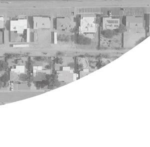
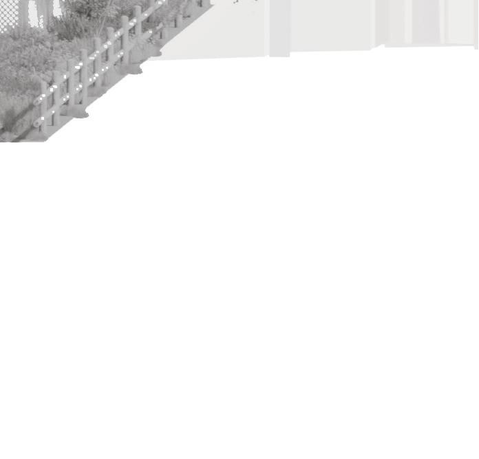
SITE PHOTOS
Burns Park

Linear Walking Path


IMAGES ABOVE: Various images shown to display current conditions and the opportunities that exist.


40 | SITE INVENTORY & ANALYSIS
SITE TOPOGRAPHY


SITE INVENTORY & ANALYSIS | 41
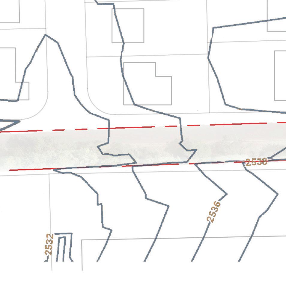
IMAGE ABOVE: Topographic map of the Sierra Estates neighborhood. High point is 2536’ in the Southeast corner to 2520’ in the northwest corner of the map. 2’ contours
STREETS: EXISTING CONDITIONS
Room to Chicane
The section drawings to the right illustrate the vertical and horizontal dimensions of streets running through and adjacent to the Sierra Estates neighborhood.
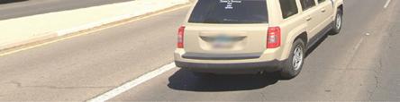
As per the typical Tucson neighborhood, most of the streets in Sierra Estates are wider than necessary. This excess of asphalt contributes to the urban heat island, reduces stormwater permiation, and encourages vehicular speeding.
PROBLEM
The expanse of land dedicated to the automobile not only caters to driver’s needs above all others, but wide streets significantly reduce the safety of the pedestrian. With more room dedicated to the vehicle, drivers receive the illusion of an open road with few hinderances or reason to slow down.
SOLUTION
Traffic chicanes encourage drivers to use more caution by alternating the roadway in a less predictable manor so drivers are more altert when passing through. Two proposed chicanes along N Mountain View Ave will extend the curbs into the roadway to slightly alter traffic patterns and discourage speeding. The chicanes will also provide designated planting space and absorb some of the stormwater from N Mountain View Ave.
42 | SITE INVENTORY & ANALYSIS
A A’ F F’ C C’ C’ C E E’ D’ D C’ C E’ E B’ B


SITE INVENTORY & ANALYSIS | 43 E 8th st 34’ Private Yard 25’ Sidewalk 20’ Rincon / University High Schools Sidewalk 5’ E Burns st 34’ Private Yard 35’ Burns Park Rincon / University High Schools Sidewalk 5’ Sidewalk 5’ 112’ E 10th st 20’ Private Yard 35’ Sidewalk 9’ Linear Walking Park 20’ N Arcadia Ave 24’ Sidewalk 5’ E 9th st, E 10th st, N Avenida Carolina, TYP. 30’ Private Yard 15’ Front Yard 30’ Sidewalk 5’ Sidewalk 5’ N Mountain View Ave 40’ Private Yard 15’ Private Yard 30’ Sidewalk 5’ Sidewalk 5’ Swan Blvd 108’ Sidewalk 5’ Burns Park 500’ City Well 40’ Private Yard 15’ 100’ 50’ 25’ 0’ 40’ 20’ 10’ 0’ A-A’ B-B’ C-C’ D-D’ E-E’ F-F’ E Burns St (A-A’) N Mountain View Ave (B-B’) E 8th St (D-D’) E 9th, E 10th, N Avenida Carolina TYP. (C-C’) Swan Blvd (F-F’) E 10th St (E-E’)
BROADWAY CRAYCROFT AREA PLAN SUMMARY
CITY OF TUCSON PLANNING
THE BROADWAY CRAYCROFT PLAN (BCP) (1988)
was developed over the course of 15 months by the Broadway-Craycroft steering committee, after a plan was drafted, community meetings were held in order to incorporate input from stakeholders not present in the drafting processes.
The plan was largely based on rezoning.
This dated planning document covers a much larger area than Sierra Estates, but some information is relevant if only to understand the past neighborhood development.
Generally in the plan low density residential is encouraged in the interior of neighborhoods, medium to high density residential is encouraged on arterial and certain streets.
“The residential policies are intended to ensure that new residential development is designed in harmony with existing neighborhoods” (BCP)
“Broadway Boulevard is recognized as a major east-west transportation corridor with potential for intense nonresidential development.” (BCP)
“Locate new commercial and low rise office development on the parcel at the southwest corner of Broadway and Rosemont” (BCP)
“Design and buffering subgoal”
Selected goals
“Policy 4: encourage the use of perimeter WALLS in new development that is adjacent to existing lower intensity uses.”
“Design walls to enhance new development and complement existing, adjacent uses.” (BCP)
REFERENCE:
Tucson Planning Department. “Broadway-Craycroft Area Plan.” (1988).
Definition - Buffer, provides a barrier between areas with different land use.
44 | SITE INVENTORY & ANALYSIS
PUBLIC / PRIVATE
CITY OF TUCSON PLANNING
Parcel ownership in the city of Tucson revolves around public easements, public, semi-public, private, and semi-private spaces. The surrounding land use of the Sierra Estates neighborhood is composed of a central mixture of establishments such as the USPS, Rincon and University high schools, restaurants, hotels, and apartment complex.
zoning ownership depicted in color blocks


semi-public
public
semi-private
private
SITE INVENTORY & ANALYSIS | 45
PUBLIC SPACE KEY
DIAGRAM ABOVE: land ownership
MAP ON RIGHT: land use
LAND USE
CITY OF TUCSON PLANNING

Understanding the surrounding land usability is key to a final site design. Land use can determine the designs purpose and impact the efficacy and usage of the site. Here, ownership and land use were assesed to synthesize key aspects of the land that would determine the design of the Sierra Estates Burns park, chicanes, and linear path.
commercial
residential education
government
46 | SITE INVENTORY & ANALYSIS
REFERENCES, SOURCES & RECOMMENDED RESOURCES:
Tucson maps (2022). Pima maps ownership and land use. Maps. retrieved from: https://pimamaps.pima.gov/ Yescas, S. & Rodriguez O. (2022). Land ownership. Ownership zoning spaces. Tucson, Az Yescas, S. (2022). Land use. Zoning land use. Tucson, Az


SITE INVENTORY & ANALYSIS | 47
E BROADWAY BLVD
E 5TH STREET
N SWAN ROAD
SITE CIRCULATION Public Transit

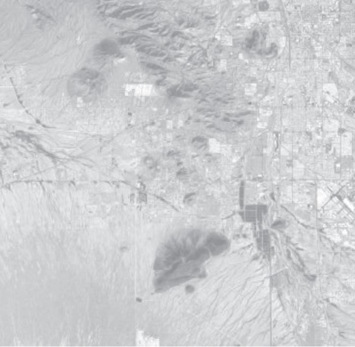
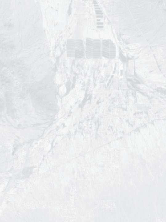
The Sierra Estates Project site is situated in East Tucson at the intersection of two key streets, North Swan St and East Broadway Blvd. The site is composed of three different pieces: the northwest Burns Park, the central Chicanes, and the southeastern Linear Walking Park. The total site stretches across two suburban blocks and each of the three sub-components is bordered by neighborhood roads. Many Residents Have reported intense speeding on Mountain View. In addition to the close proximity to street and private automotive circulation, the site is located nearby essential public infrastructure such as bike boulevards and public bus stops.
BUS OPPORTUNITY
The site has a bus stop located on the Southwest corner of Burns Park suggesting that the site could easily cater to mass transit users and become a hub of activity for community engagement.
SIDEWALK OPPORTUNITY
Many of the sidewalks are in a poor condition with incomplete curb lines and, in some instances, stop entirely with no destination. The Linear Walking Park sub-component has no sidewalk in its current state representing both a hazard and a lack of accessibility oriented design.
BIKE BOULEVARD OPPORTUNITY

Although many residents cited anecdotal evidence that their is not a large biking group of students, there is a dedicated Bike Boulevard directly adjacent to the sites’ neighboring schools. Therefore, it may be prudent to explore bike oriented site infrastructure to further encourage and cater to existing bike users.

POTENTIAL DIRECTIONS
» Buss stop integration with site


» Bike parking // bike racks // bike lanes
» Ramp connectivity improvements


» Complete street design


» Curb restoration
IMAGE ABOVE:

A series of pastel colors to help illuminate how different traffic patterns flow through and around the Sierra Estates Project highlighting existing public circulation patterns.

48 | SITE INVENTORY & ANALYSIS N SWAN E BURNS ST E NINTH ST E TENTH ST N MOUNTAIN VIEW N AVENIDA CAROLINA N ARCADIA AVE N ARCADIA AVE E EIGHT ST E TENTH ST
Two key BUS ROUTES with a bus stop at the site


Linear Walking Path has no SIDEWALK for residents


Intersection of MAJOR STREETS causes high speed traffic


BIKE BOULEVARD offers opportunity for bike storage

SITE INVENTORY & ANALYSIS | 49 REFERENCES, SOURCES
RECOMMENDED RESOURCES: Esri, Airbus DS, USGS, NGA, NASA, CGIAR, N Robinson, NCEAS, NLS, OS, NMA, Geodatastyrelsen, Rijkswaterstaat, GSA, Geoland, FEMA, Intermap and the GIS user community
&
SITE CIRCULATION
Pedestrian Experience


This walk shed analysis is a graphic that is developed from data from the arcgis online website.

It takes into account obstructions in the walking path, such as Rincon High School and a wall that runs along 10th st and Arcadia street.


The walking times are delineated using an opacity gradient, with the darkest area being most accessible and being within a ten minute walk of Burns park, the intermediate area being a 15 minute walk and the lightest shading, the maximum “walk-able” distance at an estimated twenty minutes.
Also relevant to the walk ability of Burns Park is the fact that a major arterial Swan Way is directly to the west of the park.
SWAN WAY IS A MAJOR ARTERIAL RUNNING ADJACENT TO THE SITE
RINCON HIGH BLOCKS PEDESTRIAN TRAFFIC TO THE NORTH OF PARK
A WALL ALONG 10TH AND ARCADIA CREATES AN UNTRAVERSABLE LINE

50 | SITE INVENTORY & ANALYSIS
IMAGES ABOVE: Obstructions and concerns for area walkability.
B
A
C
DATA SOURCE: arcgis.com


20 Mintutes From Burns Park
15 Mintutes From Burns Park
10 Mintutes From Burns Park
Burns Park
This graphic displays estimated commute times from Burns Park. The darkest area in the center represents a ten minute walk time, the next lightest area a fifteen minute, and the outer lightest area is an estimated twenty minute walk.


SITE INVENTORY & ANALYSIS | 51
B A C
SITE ECOLOGY
Ecological Overview
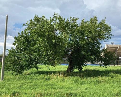
Tucson, Arizona is located in the Upper Sonoran Desert biotic community where hot summers and sparse rainy seasons make a hostile climate for most species. With that said, Sierra Estates already has some substantial greenspace established in Burns Park thanks to the supplemental stormwater that gets directed there.
Tall, riparian tree species such as Aleppo pine and Arizona sycamore currently thrive in the park and are essential to maintaining the beloved hawk habitat. However, Burns Park mostly stands alone as a green oasis within the urban sprawl. The nearest neighboring greenspace functions as a wildlife corridor through one of Tucson’s stormwater washes, located over a quarter-mile to the east of Burns Park. There are a few other city parks and minor greenspaces in the area, but otherwise, the strongest connection Burns Park has to other significant greenspace would be the Reid Park golf course, which is about a mile southwest of Sierra Estates.
Burns Park provides relatively substantial Green Space in a heavily urbanized landscape
5th St
Rincon/ University High School
Aleppo Pine Pinus halepensis
Wildlife Corridor enables mobility for a wider variety of animal species and acts as a stormwater conduit
School activities and traffic cause recurrent disturbance
HUMAN DISTURBANCE
Aleppo Pine Pinus halepensis
Cooper’s Hawk Accipiter cooperii
Wildlife Corridor enables mobility for a wider variety of animal species and acts as a stormwater conduit
Busy streets pose as a barrier to wildlife movement
Sierra Estates is a quiet neighborhood, but human activity must still be taken into account for the function of the site’s greater ecological context.
BROADWAY BLVD
School activities and traffic cause recurrent disturbance
The Sierra Estates neighborhood is bordered on the north, south, and west sides by three major roadways: 5th St., Broadway Blvd., and Swan Rd. These busy streets are not only a safety concern to human pedestrians, but they pose as a dangerous boundary for animal species to cross as well.
SWAN RD
Proximity to Reid Park allows for movement of bird species
Cooper’s Hawk Accipiter cooperii

Fringed Trinevine Sarcostemma cynanchoides
KEY:
Green/Open Space
BROADWAY BLVD
Vehicular traffic on the neighborhood streets usually stays fairly minimal, except during morning and afternoon hours while school is in session. During these times, students and parents cut through Sierra Estates to get to the high schools just north of the neighborhood. This has caused safety concerns from the residents, and chicanes have been proposed as traffic calming measures.
Wildlife Corridor
Heavy Traffic/Wildlife Barrier
Neighborhood parks and open space support minimal nearby wildlife
KEY:
Recurrent School Traffic
Fringed Trinevine Sarcostemma cynanchoides


Twinevine
Funastrum cynanchoides
Green/Open Space
Wildlife Corridor
Heavy Traffic/Wildlife Barrier
Site Boundary
Opportunity Constraint
52 | SITE INVENTORY & ANALYSIS
Rincon/ University School
St
0’ 2000’ 1000’ 500’ N
Burns Park provides relatively substantial Green Space in a heavily urbanized landscape
Busy streets pose as a barrier to wildlife movement

Proximity to Reid Park allows for movement of bird species
Neighborhood parks and open space support minimal nearby wildlife
Wildlife Corridor enables mobility for a wider variety of animal species and acts as a stormwater conduit
School activities and traffic cause recurrent disturbance


KEY:


Green/Open Space


Wildlife Corridor Heavy Traffic/Wildlife
Recurrent School Site Boundary


Opportunity

SITE INVENTORY & ANALYSIS | 53
Constraint
Rincon/ University High School 0’ 2000’ 1000’ 500’ N BROADWAY BLVD 5th St SWAN RD
Cooper’s Hawk Accipiter cooperii Trinevine
Aleppo Pine Pinus halepensis Fringed
Sarcostemma cynanchoides
SITE ECOLOGY
Ecological Inventory
In terms of ecology, Sierra Estates is rich in opportunity, giving us many options to further enhance the rich habitats that exist on the site. Going back to the importance of water, the numerous rainwater harvesting opportunities within our focus areas allow us to increase canopy cover in the Linear Walking Park and Burns Park, besides of supporting vegetation in the chicanes (Lancaster, n.d.). In turn, this brings other benefits, such as the expansion of habitat for songbirds and smaller animals, not to mention a plethora of pollinators, such as hummingbirds and bees, who could feed on plants that replace problematic species such as the Oleander shrubs and invasive grasses such as Buffelgrass.
Refocusing our attention on Burns Park, we realize that it has its own idiosyncrasies and with them, potential for improving its conditions for wildlife and human users. The existing chainlink fence could serve as a massive trellis for vines to grow, serving as a food source for pollinators and birds. Healthy large trees, such as Eucalyptus, Pines, and Arizona Sycamores, serve as critical habitat for hawks and larger birds (15 Hawks In Arizona– Picture And ID Guide, 2021; Morgan, 2021, p. 1), aside from providing significant shade and a mild microclimate for understory vegetation and park users. Circling back to the importance and potential of water, enhancing the swale in the park, and utilizing the water that otherwise pools outside of the park could allow for more of these trees to prosper, creating a better environment for the hawk population and the Sierra Estates community.
» Rainwater harvesting opportunities

» Hawk habitat: Pine, Eucalyptus, and Sycamore trees

» Songbird habitat: Mesquite, Palo Verde, and Desert Willow trees

» Habitat and cover for smaller species provided by shrubs

» Pollinator food source: Fringed Twinevine

54 | SITE INVENTORY & ANALYSIS
Existing swale


Overgrown grasses
Chainlink fencesupport for vines


Riparian sycamore trees

Ponding water
Poisonous oleander shrubs
Bermuda grass


Sparse canopy cover
Cut in wall


REFERENCES, SOURCES & RECOMMENDED RESOURCES:


Diagram elaborated by Oscar Rodriguez with supporting data from Jessica Eppard. 15 Hawks In Arizona– Picture And ID Guide. (2021, December 31). https://www.birdadvisors.com/hawks-arizona/ Lancaster, B. (n.d.). Stormwater & Street Runoff Harvesting. Rainwater Harvesting for Drylands and Beyond. Retrieved September 21, 2022, from https://www.harvestingrainwater.com/water-harvesting/harvests-of-different-waters/stormwater-street-runoff-harvesting/ Morgan, J. (2021, December 14). How Long Do Hawks Stay In One Area? Birdwatching Buzz. https://birdwatchingbuzz.com/how-long-do-hawks-stay-in-one-area/


SITE INVENTORY & ANALYSIS | 55
Chicanes 75’ 150’ 300’
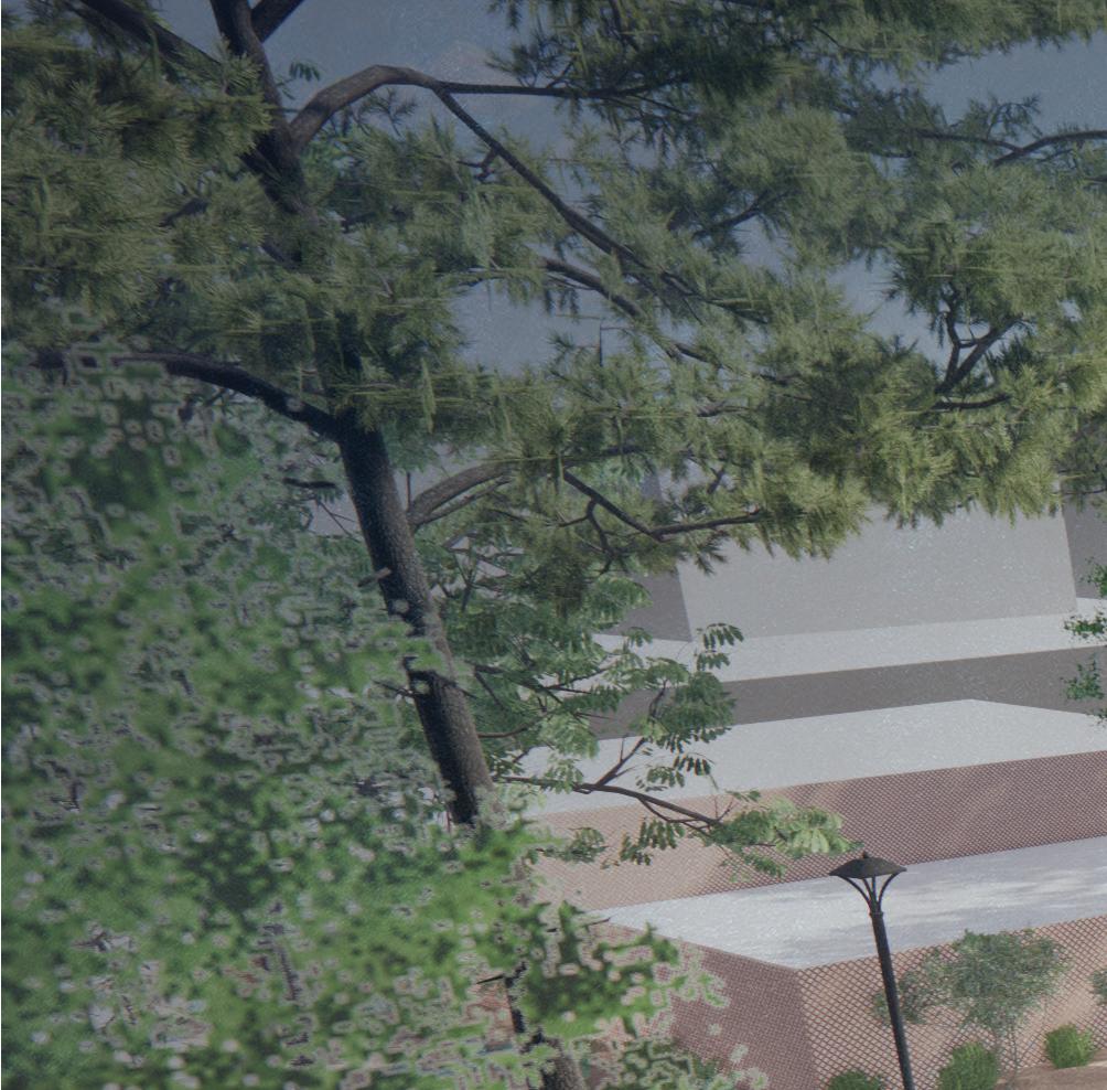
SITE ECOLOGY
Tree Species Inventory
The existing trees in the neighborhood are healthy and well established, the largest trees can be found in Burns Park, with species like Aleppo Pine, Ghost Gum Eucalyptus, and Arizona Sycamore. These trees are higher water use, especially the Arizona Sycamore which is a riparian species. From this we can confirm that Burns Park receives a lot of water, as these trees are not on irrigation. Burns Park is where the majority of the understory vegetation can be found. Currently, a large percentage of this understory is composed of invasive species such as Buffelgrass (Cenchrus ciliaris) and Bermuda grass (Cynodon dactylon). This has been addressed in part since the start of the project through the mowing of the site. These are not as prolyfic in the Linear Walking Path, but still present. There are prodominately Mesquite species in the Linear Walking Path, with a few Blue Palo Verde and Desert Willow. This is true throughout the neighborhood as well that provide some shade.


Species LIST and quantity
» Aleppo Pine (4)
» Arizona Sycamore (2)
» Ghost Gum Eucalyptus (5)
» Blue Palo Verde (2)
» Mesquite spp. (28)
» White Mulberry (1)
» Desert Willow (2)
IMAGES ABOVE: (From left to right) Aleppo pine (Pinus halepensis), Arizona Sycamore (Platanus wrightii), Ghost Gum Eucalyptus (Corymbia aparrerinja), Blue Palo Verde (Parkinsonia florida), Mesqite spp. (Prosopis spp.), Desert Willow (Chilopsis linearis) and White Mulberry (Morus alba). All photos taken on site by Jessica Eppard

56 | SITE INVENTORY & ANALYSIS


SITE INVENTORY & ANALYSIS | 57 REFERENCES, SOURCES & RECOMMENDED RESOURCES: Inventory
75’ 150’ 300’
diagram of the tree species around the existing site.
SITE ECOLOGY
City of Tucson Tree Equity Score
The tree equity score of the Sierra Estates neighborhood is 84, and ranks 134th out of 405 block groups in Tucson (within the top 35%). This neighborhood currently has conflicting information about canopy cover, with Tree Equity Score stating it as 8% tree canopy cover, with a goal of 15% tree canopy cover, and the Storm to Shade website listing it as 14% existing canopy and 18% as the goal. They data agrees however that the canopy cover is below what it should be. The immediately surrounding census blocks are all 84 or higher, but the larger area has a range from 68 to 100. While these lower scores are more frequent in the Southern side of Tucson, low scores can be found throughout the city.
METHODOLOGY
Tree equity is determined by looking at several metrics. A canopy coverage goal is determined in relation to population density and the vegetation type. The canopy gap is the existing canopy subracted from the goal determined above. The priority index is determined from 6 equally weighted factors: Income, Employment, Race and Ethnicity, Age, Climate and Health. This weighted score from 0-100 determines the priority to close the tree canopy gap.
CITYWIDE CONTEXT
It is important to acknowledge that within Tucson and South Tucson the tree equity scores range from 39-100. The lower scores are more frequent in the Southern portion of the city, and should be addressed.
IMAGE ABOVE: Tree equity scores and indicatorts from treeequityscore.org of Tucson, AZ

58 | SITE INVENTORY & ANALYSIS
Score indicators Priority index People of color % 57% Health Index 28 Temperature 100° Unemployment % 7% Children (0-17) % 13% Seniors (65+) % 5% People in poverty % 59% Canopy Cover: 15% Current canopy cover: 8%

SITE INVENTORY & ANALYSIS | 59 REFERENCES, SOURCES & RECOMMENDED RESOURCES: Tree equity score. Tree Equity Score. (n.d.). Retrieved September 20, 2022, from https://treeequityscore.org/map/#14/32.22167/-110.89111 City of Tucson. (n.d.). Storm to Shade. Storm to Shade . Retrieved September 20, 2022, from https://climateaction.tucsonaz.gov/pages/gsi 84 84 87 84 95 100 84 92 88 91 84 91 72 67 95 82 70 83 85 68 88 89 83 95 98 62 96 89 87 79 88 92 76 84 91 83 78 81 74 90 87 86 85 91
SITE HYDROLOGY
Stormwater
HOW MUCH WATER IS THERE?
The Sierra Estates Project site is relatively rare for the amount of vegetation and greenery on site. The site has some of the most healthy looking Aleppo Pines and some incredibly dense grass. A common expression is, “Where there is smoke, there is fire” and, in our work, the expression could be, “Where there is greenery, there is water.”
Residents anecdotally reported up to 3’ foot flooding and a comprehensive stormwater analysis found that the site is part of a substantially large watershed that equals roughly 1,042,000 sq. ft in total. The watershed includes roughly 2/3 of the Sierra Estates neighborhood, the entire commercial center for Viscount Suites, water from East Broadway Blvd, and more. After breaking down the numbers and accounting for various surface permeability coefficients, researchers found that a 95% storm event (0.08 ft/day) results in a water runoff volume of 57,095 cu. ft or, in other words, roughly 65% of an Olympic Swimming Pool.
KEY NOTE
Although the total water that reaches our site is 57,095 cu.ft, that does not mean that our site must handle all 57,095 cu. ft. Water from rain that lands directly on our site only accounts for 2,424 cu.ft of the total water that reaches our site. The reason the watershed number is so high is because our site is at a relative low-point for the surrounding area.
WALL CUTOUT EXPLAINED
Although their appears to be a wall between the commercial Viscount Suite and our site, their is a stormwater cutout that allows all stormwater from the Viscount Suite’s parking lot and building to drain to our site.
POTENTIAL DIRECTIONS
» Storm water management
» Rain gardens // detention basins
» Creative usage of swales
REFERENCES, SOURCES & RECOMMENDED RESOURCES: Esri, NOAA, FEMA, and the GIS user community


60 | SITE INVENTORY & ANALYSIS Site Area Streetscape Area Residential Area Commercial // Parking 86022 200325 288639 Terrain Type- Infiltration Landscape 85591.89 216479.25 Terrain Type- Infiltration Roof 72159.75 Terrain Type- Pavements 430.11 200325 Total Watershed Area 1041634 *Note total watershed area DNE runoff surface Infilitration Coef. [c] Area [a] Runoff Calc. [c*a] Roof 0.9 184155.27 165739.743 Pavements 0.8 550741.11 440592.888 Landscape 0.35 306737.62 107358.167 Total Runoff surface area (sqft) 713690.798 95th Percentile storm (inches) 0.96 From NOAA analysis: downloaded zip code storm 95th Percentile storm (feet) 0.08 Cubic feet of runoff water [inches/12 by total sqft] 57095.26384 Site Area Streetscape Area Residential Area Commercial // Parking Area 86022 200325 288639 466648 Terrain Type- Infiltration Landscape 85591.89 216479.25 4666.48 Terrain Type- Infiltration Roof 72159.75 111995.52 Terrain Type- Pavements 430.11 200325 349986 Total Watershed Area 1041634 *Note total watershed area DNE runoff surface area Infilitration Coef. [c] Area [a] Runoff Calc. [c*a] Roof 0.9 184155.27 165739.743 Pavements 0.8 550741.11 440592.888 Landscape 0.35 306737.62 107358.167 Total Runoff surface area (sqft) 713690.798 95th Percentile storm (inches) 0.96 From NOAA analysis: downloaded zip code storm data screened out '0' rain events 95th Percentile storm (feet) 0.08 Cubic feet of runoff water [inches/12 by total sqft] 57095.26384
IMAGE ABOVE:


A map that highlights what geographic regions contribute to the total watershed and their respective permeability. The more blue, the more water runs off in a storm event!

SITE INVENTORY & ANALYSIS | 61
SITE HYDROLOGY Water Analysis
Water is an essentail consideration within the Sierra Estates neighborhood. Neighbors have voiced concerns of flooding issues in the street towards the East end of Burns park. Due to the volume of water moving through the park during the monsoon season, this presents an opportunity to incorporate design strategies which will capitalize on water use. The following outlines general hydrological considerations.
ALVERNON WASH
The above map displays hydrologic GIS data related to the Sierra Estates neighborhood. The area showed is part of the greater Alvernon Wash. To the East and the West of the site are floodplains. A minor wash less than 500 fps runs South to North, down Mountain View Ave. and directly through Burns Park. The water infiltration capacity of the soil is described as moderately permeable (Group C) and poorly permeable (Group D) as showcased with the tan backdrop. From the graphic, we can see abundant water infiltration already present on our site.
WELL REGISTRIES
As our Watershed map suggested, Burns Park holds a decent amount of groundwater. Since 1950, two wells have been dug in the Southeast corner of the site. The first well was in commission from 1950 to 1982 and had a depth of 303’. The second well was used from 1979 to 2012. It is unlear if the well has been in use since 2012, as Tucson Water is no longer responsible for taking DTW (depth to water) measurements.
KEY POINTS
» A wash runs directly through the Sierra Estates neighborhood
» Burns Park offers an opportunity to infiltrate large amounts of rainwater during the monsoon season
» the depth to water (DTW) has been generally increasing since the wells were dug, suggesting less groundwater availability


» since 1998, there has been a slight increase in DTW
Washes & Floodplains
Well Hydrographs
REFERENCES, SOURCES & RECOMMENDED RESOURCES:
Pima Maps: Survey, PC-Hydro, RFCD Floodplains, DFIRMs-FEMA Floodplains


Arizona Department of Water Resources: Groundwater Inventory Site Inventory, Well Registry


USDA NRCS: National Engineering Handbook Part 630: Hydrology, Chapter 7 - Hydrologic Soil Groups


62 | SITE INVENTORY & ANALYSIS
IMAGE BOTTOM: This hydrograph is taken from Arizona Department of Water Resources
IMAGE TOP: This graph represents a compilation of hyrdologic, watershed, and floodplain data privided by Pima Maps GIS
Water Movement
MINOR FLOOD ZONE
The junction of N Mountain Avenue and 8th street experiences large pools of water (reportedly up to 3’) during heavy rain events
KEY WATER FACTORS
» large healthy trees supported by groundwater reserves
» rainwater infiltration opportunities
» 2 wells are present on site

» flooding issues present
IMAGE ABOVE: Water moves throught the Sierra Estates Neighborhood primarily down Mountain View Ave. and through Burns Park from East to West until it joins Swan Rd. This water reaches a drain in the Northwest corner of the site, where it joins the municipal water drainage under Swan.


SITE INVENTORY & ANALYSIS | 63


SPECULATIVE SITE DESIGNS


HUMANING
BIRDS EYE VIEW
People exist on a spectrum of introverted to extroverted. Bird habitat exists on a continuum from wilderness to urban. Depending on species, birds may display different preference or tolerance for urban environments and people.
However, human and bird behavior are not fixed, both exist in a dynamic with each other and other influences. In addition to species and individual personality patterns each will develop behavior patterns based on experience and expectations, and these elements can be passed on culturally. This design is developed to foster a novel environment, where birds and humans can interact in a safe and supportive environment.

Design Goals

-Allow birds to observe humans in a place where they will not feel threatened.
-Increase human understanding of bird behavior.


-Develop openness to new interspecies dynamics.


66 | SPECULATIVE SITE DESIGNS
APATHY AWARENESS INTEREST RESPECT HUMANS BIRDS BIRDS HUMANS INTROVERT EXTROVERT DYNAMIC HEALING SECLUSION OBSERVATION INTERACTION HOUSE URBAN CENTER WILDERNESS ECOLOGY NEST FEAR CURIOSITY LEARNING
Birds see ultraviolet light, what else might they percieve that people do not?


It is just like man’s vanity and impertinence to call an animal dumb because it is dumb to his dull perceptions.


 Mark Twain
SPECULATIVE SITE DESIGNS | 67
INTROSPECTION


68 | SPECULATIVE SITE DESIGNS 45’ 112’
OPENNESS
BIRD SIGHT LINES


HUMAN SIGHT LINES


OPEN HUMAN RAVEN OBSERVATION TOWER EXISTING TREES


MESQUITE
SECLUSTION HUMAN SHELTER
NEW NATIVE CACTUS PLANTINGS


SECLUSTIONINTROVERSIONWILDERNESS

SPECULATIVE SITE DESIGNS | 69
OPENNESSINTERACTIONURBAN
1” = 60’
TucsRouken: The Oak Woodlands Stroll Park
Tucsrouken seeks to distract people from the day to day stresses and myriad challenges they face by offering a tranquil respite full of natural folliage with ample sitting spaces, pocket gardens, and places for private contemplation. The gardens form was inspired by Kenrokuen, an iconic Japanese stroll park from the Edo Period (1603-1868) and draws heaviliy from the 6 principles of garden design from this era. The six core principles are spaciousness, seclusion, artifice, antiquity, elaborate use of water, and panorama. These six principles became the 6 goals for the TucsRouken stroll park.
Water: Artfully manage storm-water with swales

Artifice Avoid straight paths to limit wayfinding
Antiquity: Preserve the existing pine tree species
Panorama: Keep tree trunks out of key sight lines
4 6


1 2 3 5


Seclusion: Ensure 6 private sitting spaces on site
Spaciousness: Use canopy trees to create sense of scale
Sources: https://www.gao.gov/managing-federal-lands-and-waters, http://www. nenature.com/Nesting/red-tailed-hawk-nesting.htm, https://birdfact. com/articles/what-do-red-tailed-hawks-eat, https://www.birdweb. org/birdweb/bird/red-tailed_hawk, https://www.sacramentoaudubon. org/kids-corner/meet-the-red-tailed-hawk, https://www.knockoutpestcontrolandtermite.com/676/ground-squirrel-control-temecula/, https://onlyzoology.com/do-hawks-eat-snakes-how-do-hawks-eatsnakes/, https://birdsphere.com/what-do-hawks-eat/, https://birdfact. com/articles/red-tailed-hawk-nesting, https://birdfact.com/articles/ how-long-do-red-tailed-hawks-live, https://sciencing.com/adaptations-redtailed-hawk-8651668.html, https://www.allaboutbirds.org/ guide/Red-tailed_Hawk/sounds, https://birdfact.com/articles/juvenile-red-tailed-hawks#howLongDoJuvenileRedTailedHawksStayWithTheirParents, https://birdfact.com/search/results?q=red+tail+juevinile
TucsRouken: Plan


SPECULATIVE SITE DESIGNS | 71
TucsRouken: Isometric Section View
Passerines


People
Plants
The park is meant for all beings to witness and enjoy eachothers company. By offering passerines, people, and plants the chance to comingle the designers hope to provide users a unique stroll park that encourages self reflection, internal healing, and the chance to perceive harmony within the world


72 | SPECULATIVE
SITE DESIGNS
TucsRouken: Plan


SPECULATIVE SITE DESIGNS | 73 AA 0' 7.5' 15'
TucsRouken: Water


The parks center swale line has a slope of ~2% and winds throughout the site. Although the swale will usually not have water in it, monsoon runoff will be slowed down and directed across the park in an artistic fashion.


74 | SPECULATIVE SITE DESIGNS
TucsRouken: Spaciousness

To help keep the site feeling spacious, the designers included numerous canopy level pine tree species. Although these types of trees usually do not thrive in Tucson, the amount of water at this site has allowed several existing pines to thrive.


SPECULATIVE SITE DESIGNS | 75
TucsRouken: Panorama
The park should avoid placing tree trunks along key panoramic sight lines to keep the park feeling vast. The site uses contrasting, interwoven patches of soil, red gravel, and grass to provide a pleasant blend of textures and colors across sightlines.


76 | SPECULATIVE
SITE DESIGNS
TucsRouken: Antiquity


The established pines are able to remain with the parks new design and lend an air of history to the site. These dramatic pines are both massive and healthy thus instantly setting the park as a dramatic forested escape from everyday life.


SPECULATIVE SITE DESIGNS | 77
THE EPHEMERAL ESSENCE OF PLANT + PLACE


78 | SPECULATIVE SITE DESIGNS
Krista Planinac
THE EPHEMERAL ESSENCE OF PLANT + PLACE
Design Statement + Goals
Plant and Place is a habitat garden in Tucson, Arizona, that transforms an obsolete park into a restorative and resilient landscape that serves all forms of life. Using hyper-local plants that are climate adaptive, the design is intended to mimic the wild landscape of the desert. This is about flora, fauna and humans and how we connect to one another.
I II III
Provide an artistic representation of the regional landscape to an urban population
Create associations between locally found bird species to provide ecological benefits, including habitat structure and food provisioning throughout the year
Respect the plants by allowing them to make certain design decision and resist the determination to control them, regardless of the season
SPECULATIVE SITE DESIGNS | 79
Krista Planinac
THE EPHEMERAL ESSENCE OF PLANT + PLACE


Materiality Study

Exploration of organic plant material and how colors, textures and forms move through time as it relates to the five seasons experienced in Tucson, Arizona.


SPRING SUMMER MONSOON FALL WINTER
late February - mid May May - early July mid July - early September September - November December - February
80 | SPECULATIVE SITE DESIGNS
Krista Planinac
SPRING
THE EPHEMERAL ESSENCE OF PLANT + PLACE

Seasonality Study
Exploration of plant palette that will exist within the designed site and how they move through time as it relates to the five seasons experienced in Tucson, Arizona.


FALL

SPECULATIVE SITE DESIGNS | 81
Krista Planinac
MONSOON
late February - mid May May - early July mid July - early September
SUMMER
WINTER
September - November December - February
THE EPHEMERAL ESSENCE OF PLANT + PLACE

Habitat Study

Exploration of the three habitats that will be found within the site. These habitats are specific to the region, with the plant palette for each taking inspiration from the Sonoran Desert.
Local bird species that find food, water, shelter and safe passage within each habitat were researched in an effort to accurately depict the relationships the flora and fauna have with one another.

Canopy
mesquite, desert willow, catclaw acacia, Cooper’s Hawks, Red-tailed Hawks

Understory
shrubs, grasses, desert hackberry, microphyllous lowland plants, Broadbilled Hummingbirds, Vermilion Flycatchers
Krista Planinac82 | SPECULATIVE SITE DESIGNS
BOSQUE
Shrub
beargrass, mountain yucca, sotol, fairy duster, bee bush, soaptree yucca, creosote bush, Lesser Goldfinches, Verdins, Lucy’s Warblers
THE EPHEMERAL ESSENCE OF PLANT + PLACE

DESERT GRASSLAND
Shrub


ocotillo, brittlebush, catclaw acacia, annuals, perennials, staghorn and jumping cholla, prickly pear, milkweed, desert globemallow, Gambel’s Quails, Hooded Orioles, Anna’s Hummingbirds, Cactus Wrens
SONORAN DESERTSCRUB

SPECULATIVE SITE DESIGNS | 83
Krista Planinac
THE EPHEMERAL ESSENCE OF PLANT + PLACE
Plan
The designed plan for the site. The habitat plan is included to show where they take place within the park. These habitats are fluid, with edges naturally occurring throughout.


84 | SPECULATIVE SITE DESIGNS
Krista Planinac
DESERT GRASSLAND DESERT GRASSLAND DESERT GRASSLAND
DESERT GRASSLAND DESERT GRASSLAND BOSQUE BOSQUE
BOSQUE BOSQUE
SONORAN DESERTSCRUB
SONORAN DESERTSCRUB
SONORAN DESERTSCRUB
THE EPHEMERAL ESSENCE OF PLANT + PLACE


SPECULATIVE SITE DESIGNS | 85
Krista Planinac
PARKLET PALETTE

DESIGN CONCEPT

Shifting the use on s te that is currently parallel parking into a linear park that connects the space to the residents, birds storm water runoff and high school students on site
USER GROUPS


These areas were seleted on the r oppurtunities that are w thin the expanded street widths Readapt ng th s impervious surface into engaging space allows for more users of the space
SIERRA ESTATES PARKLET PROPOSED LOCATIONS
D) BIRDS

A) HIGH SCHOOL
GOALS
DURABLE LANDSCAPES
BIRD HABITAT
ADAPTIVE REUSE
FOSTER COMMUNITY IDENTITY


OBJECTIVES

STORM WATER MANAGEMENT THROUGH CHICANES
READAPT UNUSED SIDE STREEET INTO NARROW PATHWAY HUGGED WITH DENSE FOLIAGE
STREET ADAPTATION FOR VARIED USES
SHIFT PEDESTRIAN EXPERIENCE FROM SIDEWALK TO SHADED LINEAR PARK
PHASE 2 WOULD EXPAND THE MOST ENGAGED WITH PARKLET ACROSS THE SITE
Increase chicanes on North to South
Dense foliage with grow over time
BIRDS


HIGH SCHOOL STUDENTS
Expanding parklets across all street parking, activating neglected space.
Tactical urbanism methods such as street painting, murals, and street furniture
RESIDENTS, DOGS


PARTI
THE PARTI IS AN ABSTRACT EXPLORATION WITH


RESIDENTS, YOUNG FAMILIES
B) RESIDENTIAL DOGS

B) RESIDENTIAL YOUNG FAMILIES


The parklet examples shown are small versions of what could be app ied to this large site With the right fund ng S erra Estates could become a desert oasis The water that fal s on site can be redirected recaptured and recharged within the ground This wi l ncrease the lush desert greenery we hope for

Sierra Estate Neighborhood in Tucson, Arizona is conducting stormwater management, green infrastructure & environmental restoration within Burns Park. This Design focuses on the surrounding


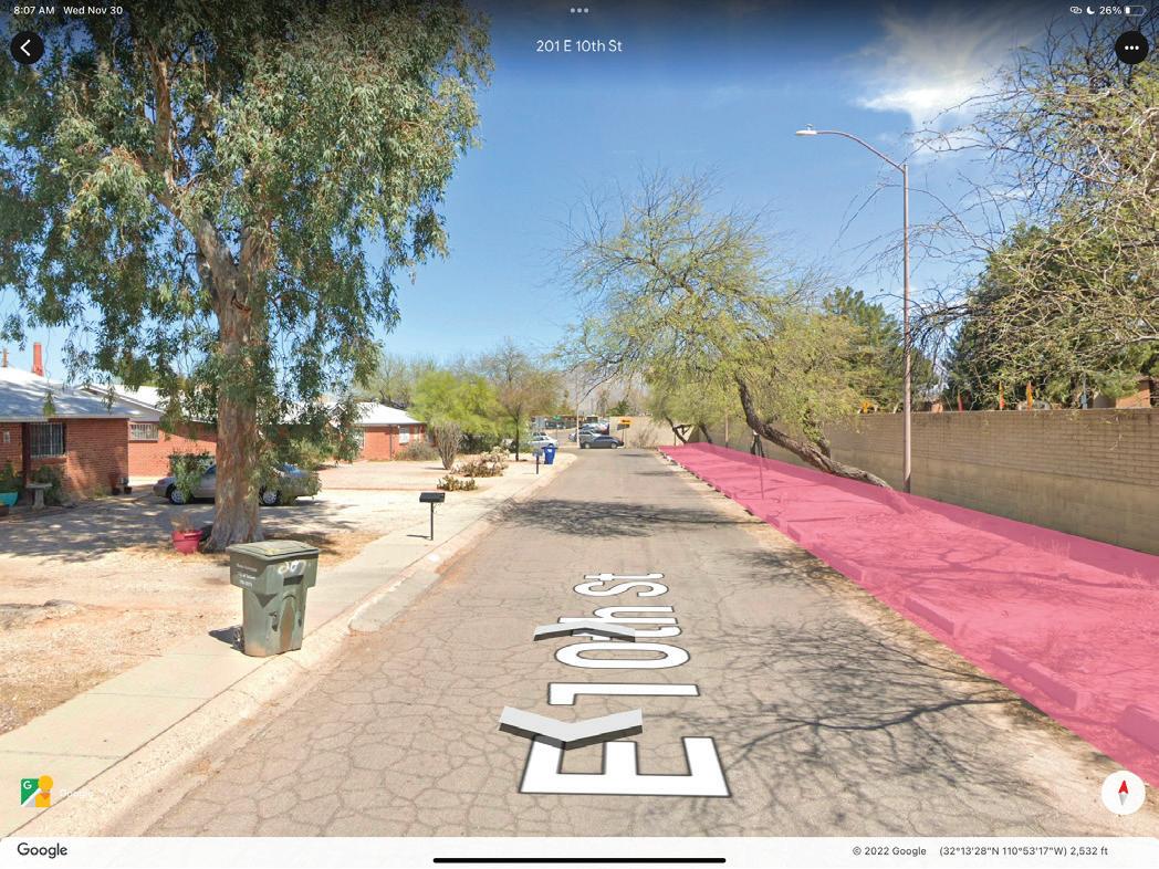


86 | SPECULATIVE SITE DESIGNS
Park et des gns for four d fferent user types Wh
for of
most? These
make use of al street park ng on site w th the most
park et
Four
ch
adaptive street reuse w ll be engaged with the
are short term proposals for aud ence or ented parklets Long term adaptaptions of this project would
desireable
programming
REPRESENTATION OF
GOALS
LEAVES FABRIC
GLUE A durab e andscape can be reflected in a Sonoran desert Ol ve Tree These mature trees use a ot of water to ga n their asting roots Like the many threads woven together to formt his fabric, a neighborhood ntertwines social and environmental h story nto the foundat on of the site Adapt ve reuse comp les what is existing nto something new ust as thread sinches a desired result A community identity cannot be checked off a ist the va ues and emotions of the residents s unpredicab e Just as g ue was when t was poured over the piece
FOUR MATERIALS AS A
MY
OLIVE
THREAD
The most simple parklet that is designed for the least amount of human engagement. Ornamental shurbs are within the planters in the surrounding parklets whereas cholla and wolfberry are within the water basins. This is to encourage bird nesting within a landscape that is clearly not for human interaction.


HIGH SCHOOL STYLE CHALKBOARD SHADING SEATING OPTIONS


University High and Rincon High exit from this South gate. Creating an area that has a choice of seating, ample shade as well as the oppurtunity to gather and see others is impotant.
N e e c n m o e


REFERENCES, SOURCES & RECOMMENDED RESOURCES:


dipitem delesseditam ut mo con cullentur? Lestrup tatiame volorepmpor re ipsam nonsed et laccatiis sit ea dipsam, quodis expliquas utecaborum Hillesciatur modicia nimaionseque nos es ulluptas sed ut et erio tem eat quati aut alit endiorit que odigni tescias sunto dolore ipsus sin rere as aborentium faccaes edicit, sitiur aniate nis adis doluptae precesendis a vid et et optatiis di dolores equamus veliqua spidita simendebis rerum aut quiam, et ande restis asi resequid estius.


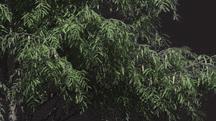


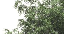


SPECULATIVE SITE DESIGNS | 87
SITE SECTION STORMWATER DESIGN CONCEPTS Waverly Brown 1 ’ 5 ’ - 5 ” 8 ’ - 5 ” 6 ’ 2 ’ - 5 ” N n s m n W h g d h x w ow e h e n o h w p n p o a w n o n d b p a ow n m e w e e b c k e d d h e w h o ow d wn n e C p a w h n e c e w m d g 2 ’ 3 / 4 ’ 1 ’ 3 / 4 ’ 2 ’ S oped er a n o wa er capture and er aced p an ng Mass Shrub P an ng Mass Shrub P an ng Depressed area o swa e apex o water capture S oped ter a n or water capture and ter aced p an ng St ee S de Awn ng or shaded gathe ng a ea Ra ed p nt r o c ea e p v cy Casua rea Hexagon oo ng for v sua n e es Nat ve p ants w th n p anters se ng a Bui t n Bench Tab e surrounding planters d e Zone Bui t n ounge cha r P anter
1 ’ 5 ’ - 5 ” 8 ’ - 5 ” 6 ’ 2 ’ - 5 ”
W h n d w e e x e w h d p T d b h w a e o a a d k d p d o d w h h h w n e a n w om p a m n ’ 3 / 4 ’ 1 ’ 3 / 4 ’ 2 ’ S oped te r n or wa er cap ure and er aced p an ng Ma s Sh ub P ant ng Mas Sh ub P ant ng Depres ed a ea of w e apex o wa er ap ure S oped te ra n or wa er cap u e and te raced p ant ng S ree S de Awn ng fo haded ga he ng area Ra ed p an r t c e t p v cy Casua seat ng a ea Hexagon f oo ng o v sua nte e t Na ve p an s w h n p ante s Bu lt n Bench Table surround ng p anters dle Zone Bui t in lounge chair P anter H20 & NESTING STYLE
GREEN
NATIVE PLANTINGS
to separate dren from cars
PLAYSET


NATIVE PLANTINGS


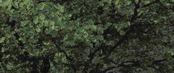


Wide walkways for strollers
WOODEN BENCHES


layset for young children here are benches for adults to sit behind swing and push their children.
Wa l to separate ch ldren from cars
for stro lers


P ayset for young ch ldren There are benches for adu ts to sit behind swing and push their children

Young families are a priority within Sierra Estates, a small playset is included on the East side. The other half of the parklet is a planter lined walking path with dense foliage for bird nesting oppurtunities.

Native pollinator landscaping to increase children's exposure to insects


All planters have bui t n benches to ncrease commun ty assembly


SITE SECTION

Nat ve po linator andscap ng to increase children s exposure to insects


Built in bench wit native planter back

88 | SPECULATIVE SITE DESIGNS
1 5 ’ - 4 ” 8 ’ - 3 ” 3 ’ 1 3 ’
in bench with native planter back rest Planters Lined Pathway
Playset for young children in background
Built
Bench
Wide wa kways
1 5 ’ - 4 ”
RESIDENT STYLE SITE SECTION
SITE SECTION
DOG GATHERING STYLE
Fenced in unleash dog zone

Vine


with arched pedestrian walkway


Many Sonoran birds nest 2’-5’ off the ground in dense foliage. It is important to dedicate the main nesting zones away from the dogs. A gated unleashing zone is oriented on the South side of Sierra Estates.


SITE SECTION

SPECULATIVE SITE DESIGNS | 89
CONCEPTS
DESIGN
TURF LINED GATED
PLANTER LINED
4 8 ' - 6 "
BUILT IN WALL
3 1 ' - 0 "
Turf covered gated area for unleashed dogs
5 ' - 9 "
2 6 ' - 3 "
Vertical edible plants
Gate
Public seating, gathering area
Vertical edible garden
Gate
Turf
Benches
trellis


90 | SPECULATIVE SITE
DESIGNS DESIGN CONCEPTS PERSPECTIVE VIEWS DOG GATHERING STYLE


SPECULATIVE SITE DESIGNS | 91 HIGH SCHOOL STYLE PERSPECTIVE VIEWS DESIGN CONCEPTS


92 | SPECULATIVE
BIRD
SITE DESIGNS PERSPECTIVE VIEWS DESIGN CONCEPTS
STYLE


SPECULATIVE SITE DESIGNS | 93
DESIGN CONCEPTS RESIDENT STYLE
PERSPECTIVE VIEWS
AN ABRUPT PAUSE
BY CORDELL LEEDesign Statement and Parti
The philosophical consequences of ones reaction to what is natural and what is artificial depending on the organism, invoked a need to conceptualize the history of humans effects on nature through lifetimes by creating a sustainable site with two distinct areas where two organisms can further observe each others homes and their effects on them, which in this instance, are birds and people.


As a reader, the inspiration for this park concept came from the book “A Psalm for the Wild Built” (by Becky Chambers), where in this dystopian future, humans owns creations revolt against them and a peace is made between the species with the agreement that they would live in the wilderness beyond the bounds of human design. The idea of even our own creations longing to return to that of which is natural, inspired a vision for this park that would allow for birds and people to respect and enjoy each others company in distinct areas of the park. Stormwater management, as well as natural flourishing habitats for birds will be focal points in this poetic take on humans nature to leave with more than what we need.
Goals
1. Create an abundance of available homes for birds through the use of dense vegetation for wildlife, and in turn, create a unique experience where both humans and wildlife can co-exist in peace and abundance.

2. Create a moderate-strong transition between hardscape and softscape to give the users either the opportunity to surround themselves with a more urban environment, or a more earth rooted environment.
3. Manage flooding on site through the use of different ground materials as well as implementing stormwater management strategies that would benefit both the people and the birds within the park.
4. Despite both areas being clear with their intentional use (one for activities, one for serenity), a subtle need for peace and relaxation will be naturally implemented through various activity spaces.
94 | SPECULATIVE SITE DESIGNS
Site Plan Concept


The plans below shows the programs underneath the shaded areas, and what it would look like with the shade overhead:
An abundance of vegetation as well as hardscapes allow both organisms to thrive in their respective or others habitats with ease and minimal discomfort due to placement of each others species in subtle places.

SPECULATIVE SITE DESIGNS | 95
Shaded gathering space
Passive “forest” trail
Steps and walking trail
Main plaza
Seating steps and splash pad area
Playground
Seating/library reading area
Smaller plaza
Hardscape shades
A Section A Description:


This section shows that the back of the park looks like towards the left area. Here people are able to walk along the stair path that is elevated from the ground, and can also witness the wildlife that is occuring throughout the site at ease and at their own pace.


B B Section B Description:

This section is within the same path however now includes a look at the plaza. The placement of the plaza here was purposefully done so people using the park could meet and commune with each other in a densely vegetated area whilst also being able to witness their children play in the splash pad or playground.


C C Section C Description:
This section now shows the end place of this path where the smaller plaza is located. Here, people can talk and play whilst enjoying the scenery.


Section D Description:

In this section, we are in the heart of the “forest” area where all paths are passive and completely free to choose from. Here, people make their won paths, and they can enjoy the daily life and habits of birds occupying this space.


96 | SPECULATIVE SITE DESIGNS
C C D D
D D
BY CORDELL LEE
AN ABRUPT PAUSE
A A
B
B
AN ABRUPT PAUSE

Perspective 1


The library reading area allows for leisure as well as the ability for birds to move into our environment and enjoy our presence and company as much as we enjoy theirs.


Section E Description:
In this section, I wanted to show why the name of this park is given its name. The transition from forestry to man made is not smooth, but instead ‘abrupt’ and clean.
Section E Description:


And lastly, in this section, we can see the use of the shade structure as well as the library it supports below. These seating areas are dips that can also be used to evenly spread rainwater out in the soil if it were to rain on site.


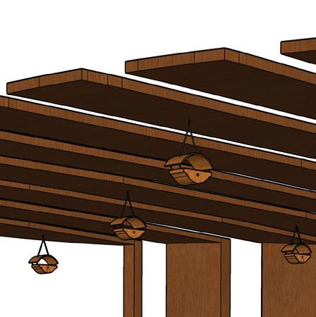

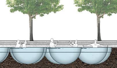

Perspective 2

And lastly, with this perspective, we can see how abundant the vegetation would be within the “forestry” area. Here, people will be able to be in the heart of the wildlife space where they can be surrounded by the sound and visual cues of the wildlife present.


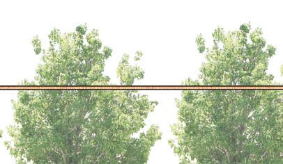


SPECULATIVE SITE DESIGNS | 97 F F
BY CORDELL LEE E E
E F F
THE PASSAGE OF FLIGHT
By Oscar Rodriguez Ponce
98 | SPECULATIVE SITE DESIGNS
View of Songbird Habitat and rest area in a peaceful morning
THE PASSAGE OF FLIGHT
By Oscar Rodriguez PonceDesign Statement & Concept

Inspired by the symbolism of circles and bird’s overlapping habitats and interactions, this research-driven design reactivates Burns Park as a haven for our native birds and a treasure for all wildlife lovers. The redesigned park and streetscape provide functional and captivating spaces for people to enjoy while allowing birds to thrive and coexist with visitors, establishing new standards for nature-based community spaces that utilize sustainable design principles and elements.
GROUND DWELLERS
MIGRATORY BIRDS
BIRDS OF PREY
HUMMINGBIRDS
CACTUS DWELLERS
SONGBIRDS
GOALS
1. Create and preserve habitat for a variety of native bird species and allow for nourishing human-wildlife interactions
2. Utilize Green Stormwater Infrastructure to address flooding issues, beautify the streetscape, and support native vegetation for bird habitat and human comfort in the park
3. Creatively utilize Sonoran & Chihuahuan Desert plants to make distinctive habitat zones that are both aesthetically pleasing and ecologically valuable
SPECULATIVE SITE DESIGNS | 99
Proposed Crosswalks


THE PASSAGE OF FLIGHT
By Oscar Rodriguez PonceIllustrated Plan & Diagrams

Streetside Green Infrastructure

Stormwater


Management Diagram


As an integral part of the design, stormwater runoff is collected along the sidewalk and inside the park to support native vegetation and work as a resource to birds.


Bird Habitat Diagram


Habitats are placed and designed based on vegetation type, presence of water, and bird behavior.
One example being the hummingbird habitat, the only one that is fully open to people due to their social nature.
SITE DESIGNS


Ground Dwellers - Open space Dense plants


Birds of Prey
-
Tall trees
Sparse understory
HummingbirdsMid-size trees

Flowering plants

Cactus DwellersDense & spiny plants

Migratory BirdsTall riparian trees
SongbirdsDense trees & shrubs

Proposed total capture of 28,800 gallons of stormwater runoff, up to 576,000 gallons in a year with average rainfall.


Most species jump between habitats as needed. Edge plantings were chosen to visually depict this overlap.


100
SPECULATIVE
|
25’ 50’ 100’
Wooden Pergolas Sheltered Bus Stop Rest Area & Art ExMain EnSecondary EnSWAN RD BURNS ST
Layered succulent gardens
THE PASSAGE OF FLIGHT
By Oscar Rodriguez PonceSection View - Western Habitats

Birds of Prey - > 40 feet
Cactus Dwellers - < 20 feet


Ground Dwellers - < 10 feet

Circular pergola with seating and trees
Section A-A’ shows the diversity of plantings in three distinct habitats, reflecting the different needs of different birds.
Visitors can enjoy the birds under comfortable shade in environments reflective of their spaces in nature, connecting people to the desert through these interactions.

Desert Scrub garden & basin

SPECULATIVE SITE DESIGNS | 101
5’ 10’ 20’
A’
A
THE PASSAGE OF FLIGHT
By Oscar Rodriguez PonceSection View - Eastern Habitats
Swale and planting area Birding platform
Section B-B’ shows a different facet of the park, one with more private seating spaces, multiple pathways to navigate the site, and taller vegetation due to the close proximity of the woodland and riparian areas, where birds like Finches, Warblers, Hawks, and certain species of Hummingbirds are likely to be around.

Seating and forest area
Migratory Birds - > 40 feet
Songbirds - < 30 feet
102 | SPECULATIVE SITE DESIGNS
B B’ 5’ 10’ 20’
THE PASSAGE OF FLIGHT
By Oscar Rodriguez Ponce
SPECULATIVE SITE DESIGNS | 103
View of the Hummingbird Garden in a sunny afternoon
A River Runs Through It

Goals & Objectives

Design Statement:


To connect humans & birds through the management of one of our most precious resources: water. By irrigating in ways appropriate for Tucson’s climate, we can support greener parks & thriving bird communities together.
I. Move & conserve water on site to create bird habitat.
+ Set up a network of rain gardens which support plants with moderate moisture needs

+ Construct a modest, flowing water feature to attract birds & a sense of calm for people
+ Triple the number of trees & plant flowers to be irrigated with reclaimed water
II. Incorporate low-maintenence, locally-appropriate water conduits in the landscape using a hybrid approach of modern technology & traditional water practices
+ Install culverts to direct water under walking paths to rain gardens
+ Install a drywell to return excess water to the underground well below the site


+ Depress areas of the open landscape to manage stormwater runoff from the street
+ Harvest monsoon season rainwater from the roof of a gathering shelter on site

+ Set a precedent for neighborhood water use
III. Create educational opportunities for the community, prioritizing the topics of water conservation, water technology, and irrigation history in the Southwest
+ Manage traditionally irrigated vegetable planters with students from the nearby school
+ Hold water technology education classes in the sheltered gathering space
+ Build wood structures for humans to play on & birds to use as habitat
SPECULATIVE SITE DESIGNS | 105
Burns Park Reimagined

Water utility


Water feature

Rain gardens


Biofilter drywell


Depressed lawn
Gathering space
Depressed basin
Water catchments

Well C-32
Eucalyptus snag
106 | SPECULATIVE SITE DESIGNS
50’ 100’ 25’
Vegetation

Circulation
Water Movement


SPECULATIVE SITE DESIGNS | 107


108 | SPECULATIVE SITE DESIGNS
Rock Garden
Trickling Stream
2’ max depth Water Feature
Shallow Pool


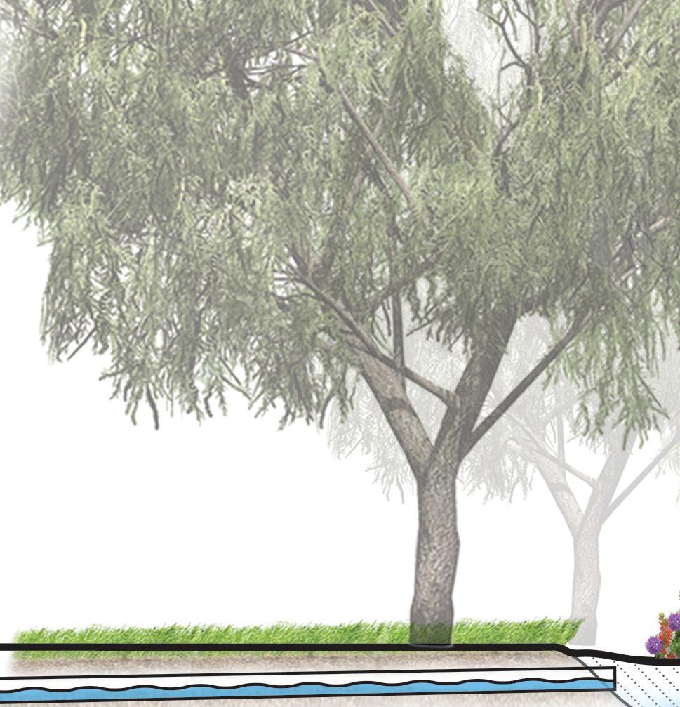


SPECULATIVE SITE DESIGNS | 109
Rain Gardens
Culverts under paths
Depressed planter beds


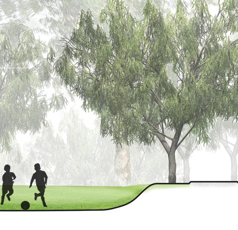
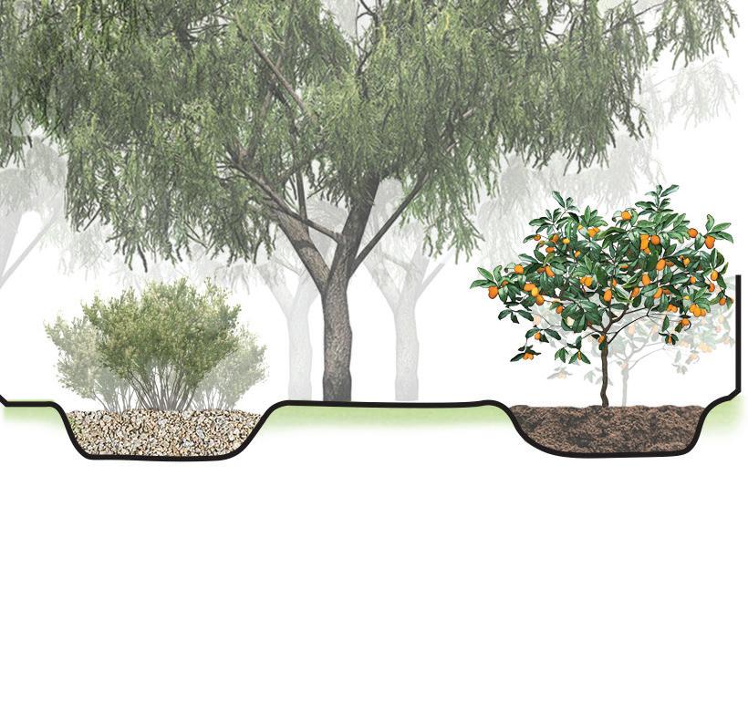


110 | SPECULATIVE SITE DESIGNS
Lawn Section
Flood control basin & open play space
Rain garden Edible garden
Water Technology: Drywell


Drywells present an opportunity to (1) manage excess stormwater and (2) recharge groundwater over time.
A stand pipe allows all of the water to seep to the bottom after trickling through layers of biofiltration. Filtered water may be recirculated back to the water feature or discharged into the drywell. Any excess water that this basin cannot handle will overflow into the municipal drain.


Water enters a basin in the corner terminus of the water conduit. Here, vegetation and earthen filters mechanically filter the water.

SPECULATIVE SITE DESIGNS | 111
Swan Boulevard Habitat Restoration
The Swan Boulevard Habitat Restoration Project will be the first link in what is eventually to become a city-wide conduit network for human and wildlife travel.

Goals

Dedicate a linear greenway and median to the movement of wildlife species using a portion of the existing boulevard

Redirect stormwater to supplement the newly restored habitat and reduce street flooding


Prioritize pedestrians over vehicular traffic by improving safety accommodations and slowing drivers with constricted lanes, visual cues, and vertical speed control elements


112 | SPECULATIVE SITE DESIGNS
Image capture: Apr 2022 © 2022 Google Street View Apr 2022 Tucson, Arizona Google Imagery ©2022 Google, Imager ©2022 CNES / Airbus, Maxar Technologies, U.S. Geological Sur ey USDA/FPAC/GEO Map data ©2022 50 ft Swan Blvd 108’ Sidewalk 5’ Private Yard 15’


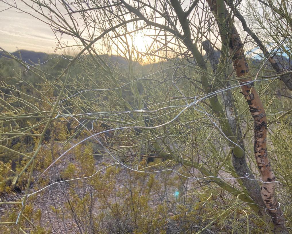


SPECULATIVE SITE DESIGNS | 113 West Branch Santa Cruz River Park South Houghton Restoration Project Burns Park Tucson Botanical Gardens Sabino Creek Reid Park Lincoln Park Evergreen Tohono Chul Kino Wetlands Black Wash Cienega Creek Natural Preserve Cienega Creek Streamflow Restoration Sweetwater Wetlands El Rio Medio Project North Simpson Restoration Project Big Wash Restoration Project Cortaro Mesquite Bosque Mount Lemmon Rincon Mountains Rillito River Restoration Project Key Completed Restoration Project Pending Restoration Project Future Restoration Project Urban Stepping Stone Recommended Wildlife Corridor Sky Island Wildlife Habitat Case Natural Resource Park Rillito River Park 0 2.5 5 Miles N
Riparian Habitat
Aleppo Pine
Arizona Sycamore
Desert Broom
Mexican Elderberry
Net-Leaf Hackberry
Wolfberry
Desert Habitat
Blue Palo Verde
Creosote Bush
Desert Willow
Ironwood
Purple Prickly Pear
Velvet Mesquite
Plan Key .
Raised Crosswalk 1
Sidewalk 2
“HAWK” Beacon Pedestrian Signal 3
New Bicycle Boulevard 4
Riparian Habitat Zone A
Sonoran Desert Habitat Zone B
Narrowed sight lines and amplified pedestrian accommodations force drivers to slow down
New sidewalks improve pedestrian circulation and Frontage Road redesign allows for the establishment of new Bicycle Boulevards
Stormwater is redirected to the median to supplement Riparian species

114 | SPECULATIVE SITE DESIGNS
Burns Park
1
1
Rincon University High Schools
3 3 4 A B B B 2 2
Sierra Estates Community
Burns St. Burns St.
Swan Blvd. Frontage Rd. 0 25 50 N
E 8th St.
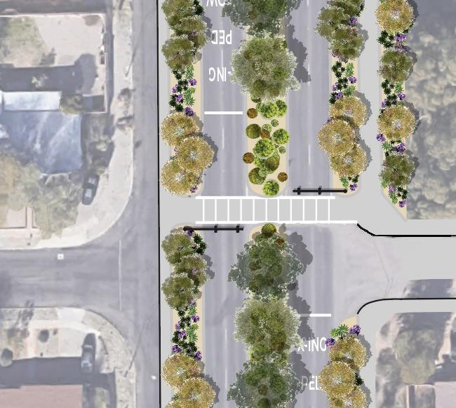


SPECULATIVE SITE DESIGNS | 115 0 10 20 N Frontage Road 12’ Private Yard 25’ Swan Blvd 22’ Swan Blvd 22’ Riparian Habitat 22’ Sidewalk 5’ Desert Habitat 18’ Desert Habitat 15’ Burns Park 500’
Revive Connections
It is a potential place that could create a nice visual sense for the neighborhood by creating a linear park. This is a spot that can be revitalized and can bring happiness, enjoyment, and comfort with the right design. Besides offering comfortable seating for friends and family, the design also incorporates interactive activities for your children to keep them occupied. Another consideration in this design is solving problems such as fast drivers or parking spots.

Current Situation
almost abandund and useless site


used as a parking lots mostly by students ( not preferable for neighbors)


Driving fast on side streets
Loss of connections with neighborhood

116 | SPECULATIVE SITE DESIGNS
A series of colour palettes and materials inspired by an artistic model. This model is a collection of colors and materials that can be found on the site or in the city of Tucson.


SPECULATIVE SITE DESIGNS | 117 Main Pattern Active and rest area Site Plan Access
Offering a sense of joy and comfort to the site and providing an aesthetic solution to the problems Make more unique shape of swings and playground equipment Access Active Area Land form Playground Benchs Pavilion Rest Area Provide a variety of sitting area for all ages Elder Youth Kids Different style of Benchs and pavilions to bring COMFORT To attract children to parks and keep them away from their computers ENJOY Playing Sitting 2 Main Actions
Revive Connections


Features


Different types of gathering areas that can be used by a variety of groups


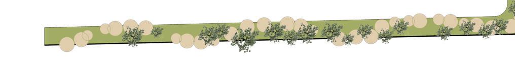
118 | SPECULATIVE SITE DESIGNS
This material can be used for other elements of design, A beautiful shadow and light concept is brought by the brick’s pattern in the design such as benches


Nadia Sarneyzehdoost


SPECULATIVE SITE DESIGNS | 119
Revive Connections


Features


On both the designed and existing walls, flower pods were placed to provide visual appeal and food for hamingbirds


120 | SPECULATIVE SITE DESIGNS
Nadia Sarneyzehdoost


Water runoff in the site base on the slope


In this design, there are steps on the waterway so you can hear the sounds of water for a few months of the year. In addition to humans, hummingbirds are attracted to this feature as well.


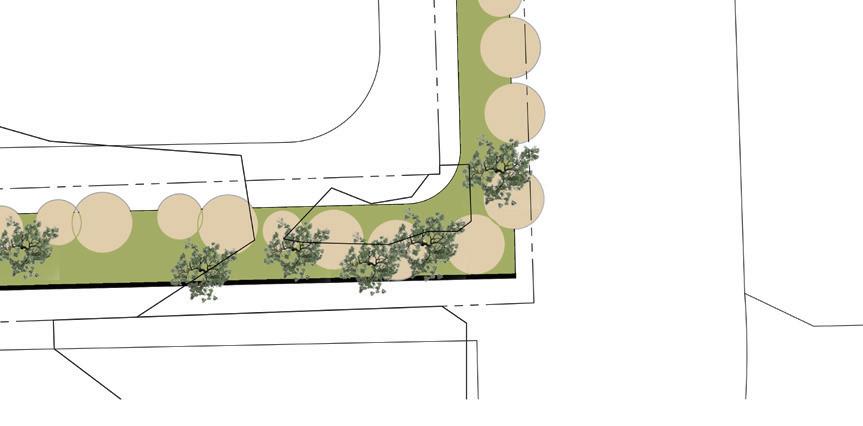


SPECULATIVE SITE DESIGNS | 121
Slop direction High Slop direction
Revive Connections


Features
Bring children’s attention to the playground by designing interactive games


122 | SPECULATIVE SITE DESIGNS
Nadia Sarneyzehdoost
The linear park is designed to extend 6 feet along both sides of E 10th Street and along N Arcedia Avenue. Chicanes have been added to the west area in order to enhance the traffic calming effects. By breaking the wall along E 10th Street, 6 feet of pedestrian path was added to the linear park to provide more area and connect both sides.


SPECULATIVE SITE DESIGNS | 123
E 10th Street N Arcadia Ave Linear Park Removing North_SouthWall P Path P Path Extented chicanes 6’ 12.5’ 25’ 50’ 0 Extented chicanes 6’
Nadia Sarneyzehdoost
Section
RIBBON ROAD
This project focuses on the linear walking path within the Sierra Estates neighborhood. This space should create a fun and playful space for people to enjoy while functioning to bring vegetated space back to inner Tucson. It will manage storm water from the neighboring hotel. It will give people a place to walk and gather together as a community.

GOALS
- Provide places to gather
- Manage storm water
- Reduce effects of urban heat island
- Increase habitat

124 | SPECULATIVE SITE DESIGNS
ILLUSTRATED PLAN


The redesigned linear walking path would preserve the existing trees while adding in an under story to provide habitat for wildlife Vines* would cover corten steel ribbons so that they would not hold heat. Basins would dominate the western side of the park to manage the water runoff from the Viscount hotel. The street width was decreased on the west side of 10th street to maximize planed area while discouraging speeding in the area.
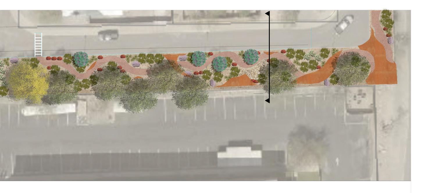


*Vines omitted for clarity

SPECULATIVE SITE DESIGNS | 125
Jessica Eppard
ILLUSTRATED SECTION A-A’


The full section shows how the vegetation would interact with the corten ribbons.


The blown up section-elevation shows the small gathering area at the southern corner, with the vines shown spilling over the edge.
SITE DESIGNS

126 | SPECULATIVE
A’ A
SECTION A-A’
Jessica Eppard
ILLUSTRATED SECTION B-B’


This section shows the interaction between the basins, the path, and the street. Here the street is 20’ rather than the 28’ it is currently.


SPECULATIVE SITE DESIGNS | 127 E 8th st 34’ Private Yard 25’ Sidewalk 20’ Rincon / University High Schools Sidewalk 5’ E 10th st 20’ Private Yard 35’ Sidewalk 9’ Linear Walking Park 20’ N Arcadia Ave 24’ Sidewalk 5’ Swan Blvd 108’ Sidewalk 5’ Burns Park 500’ City Well 40’ Private Yard 15’ 100’ 50’ 25’ 0’ E-E’ E 10th St (E-E’) IMAGES TAKEN FROM GOOGLE
B’ B EXISTING SITE SECTION 28’
Jessica Eppard
Streets
Reinterpreting Neighborhood Streets, shifting traditional street design for living spaces
With the increasing temperatures from climate change and urbanism, spaces for people and living organisms in neighborhoods have declined. As a result, this design aims to reconcile the issues reflected on neighborhood design by reinterpreting the connection between people, place, and streets.
Implement rainwater management techniques for year round use
+ by merging bioswales and raingardens with streets and sidewalks
+ with plants that thrive under flooding and drought circumstances
+ for traffic calming
MODEL CONCEPT //
1 materials & textures / exploring landscape design at neighborhood scale


2 model expoloration of landscape connection between people, bird habitat, and climate change
3 conceptual model reflects the relationship between colors, textures, and materials for the land


4 spatially merging forms

Connect people with place
+ by implementing street pocket gathering areas and expanded living streets
+ through shared spaces open for neighbordhood block parties, reflection areas, and interpretive experiences.
+ for community rapport and support
Provide shared spaces at a neighborhood scale,
+ by rethinking street and sidewalk traditional use
+ to share with neighbors and other living organisms
+ for outdoor living experiences
REFERENCES, SOURCES & RECOMMENDED RESOURCES:
Yescas.S (2022). Reinterpreting Neighborhood Streets, shifting traditional street design for living spaces.
SITE DESIGNS


128 | SPECULATIVE


SPECULATIVE SITE DESIGNS | 129
Design
RESPECTING STREETS //
1 slowing down for lived human experiences


2 addressing stormwater runoff with bioswales or raingardens that are preserved year round for street aesthetics


3 street reduction for increasing

130 | SPECULATIVE SITE
DESIGNS
BURNS PARK PLAN //


1 intentionally expanding spaces to share with the essence of the place and with oneself

2 non linear paths to connect with, reflect, and explore
3 detaining water through basins, bioswales, and permeable surfaces SHARING E 10TH ST //
1 merging the neighborhood with living streets


2 identity spaces that come together for respect, experience, and protection
3 invitation extended for anyone and everyone to diversify streets
SPECULATIVE SITE DESIGNS | 131
Design


132 | SPECULATIVE SITE DESIGNS
Existing road dimensions
Proposed road dimensions
Existing linear park dimensions


Proposed linear park dimensions


Existing E Burns road dimensions


Proposed E Burns road dimensions
SPECULATIVE SITE DESIGNS | 133


DESIGNING FOR NATIVE BIRDS


DESIGNING FOR NATIVE BIRDS | 135
ANNA’S HUMMINGBIRD


URBAN
NESTING

136 | DESIGNING FOR
NATIVE BIRDS
REFERENCES, SOURCES & RECOMMENDED RESOURCES: https://www.itis.gov/servlet/SingleRpt/SingleRpt?search_topic=TSN&search_value=178036#null https://www.birdnote.org/listen/shows/annas-hummingbirds-winter-north https://www.allaboutbirds.org/guide/Annas_Hummingbird/overview https://www.audubon.org/field-guide/bird/annas-hummingbird ADAPTATION
DIET VOCALS CONSERVATION CORVUS CORAX
INDIVIDUAL HABITAT
ECOSYSTEM ROLE


Range map provided by www.allaboutbirds.org


KEY MARKS


REFERENCES, SOURCES & RECOMMENDED RESOURCES: https://www.thespruce.com/annas-hummingbird-387220 https://www.adirondackcouncil.org/page/blog-139/news/10-facts-about-hummingbirds--and-other-interesting-tidbits-1101.html https://www.desertmuseum.org/kids/oz/long-fact-sheets/Anna%27s%20Hummer.php http://bryanmharris.com/hummingbird/index.html#natural


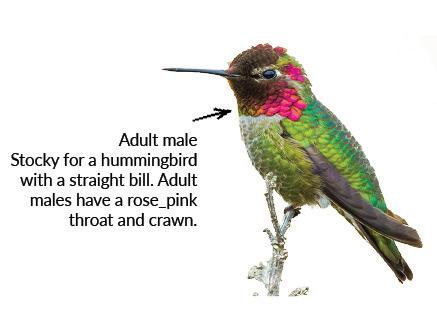
ECOLOGICAL ROLE


DESIGNING FOR NATIVE BIRDS | 137
MIGRATION CALENDAR
HABITAT PROTOTYPE : ANNA’S HUMMINGBIRD

Less harm to tree trunk

Easily to assemble
Inspired by Anna’s hummingbird movement
Can be installed around landscape lighting


It is common for females to nest on horizontal branches of trees or shrubs that are between 6 and 20 feet high (sometimes higher), preferably near a nectar source. By understanding birds’ preferences and providing a suitable angle of a sentetic branch and a cup that provides a suitable nesting area, we can ensure more birds will visit our landscape.

Selected model
Initial models
REFERENCES, SOURCES & RECOMMENDED RESOURCES: https://audubonportland.org/wp-content/uploads/2020/05/Photo-2-1024x652.jpg
https://media.istockphoto.com/photos/female-hummingbird-with-two-baby-in-the-nest-picture-id1219649975?k=20&m=1219649975&s=612x612&w=0&h=5w_BrRZYSmlRaHCDo_LPsqAqku-5opvBiFLstem25lk= https://www.allaboutbirds.org/guide/Annas_Hummingbird/lifehistory

138 | DESIGNING FOR NATIVE BIRDS
Fir wood

Hammering the pattern on surface of copper Inspired by smooth movment of anna’s hummingbird


Copper sheet


14 X 1-1/2” ZXL
Tapping Woodbinder Metal Roofing Screw
3 Screw each side - 6 in totall


DESIGNING FOR NATIVE BIRDS | 139
Copper sheet 2” x 2’-8”
Representational symbol of tree trunk
PLAN
AXONOMETRIC
FRONT ELEVATION
SECTION A-A
SECTION B-B
Fir wood 10” x 2” x 1.5”
BLACK-CHINNED HUMMINGBIRD

URBAN ADAPTATIONS
Willing to live in an urban environment
Able to survive comfortably in urban environments.
Common in its range

Able to utilize non-native plant species to survive
Gets nectar from exotic plants and has been seen nesting on non-native trees

Known to nest in urban structures

Prefers to nest in trees, but is known to use nesting platforms attached to walls
Willing to eat from a feeder
Able to use hummingbird feeders
Benefits from urban habitat compared to natural habitat
Urban environments offer more food choices and nesting resources at times when they are scarce in nature
Breeding call (chip-chip)
Chase call (pri-pri-prii)
EGG


Black-chinned hummingbirds are omnivorous birds. They prefer nectar as their primary food source, but they will also rely on sugar water from feeders Urban Low Desert Open Woodland Riparian Forest NOT TO SCALE


Nectar Insects
0.5-0.6”

EGG Size (L & W): 0.5-0.6” x 0.3” Clutch Size 2 eggs Description White NEST Size (L & W): 1.5” Shape Cup Material Plant fibers, spider webs, leaves
Chase call (pri-pri-prii)
-Breeding style: Polygamy


-Solitary; females live with offspring

-Young leave nest once fledge

REFERENCES, SOURCES & RECOMMENDED RESOURCES: CONABIO. (2022, July 7). *Áreas protegidas*. Biodiversidad Mexicana. [https://www.biodiversidad.gob.mx/region/areasprot](https://www.biodiversidad.gob.mx/region/areasprot)
Cornell University Lab of Ornithology. (n.d.). *Black-chinned Hummingbird Overview, All About Birds, Cornell Lab of Ornithology*. Retrieved October 4, 2022, from [https://www.allaboutbirds.org/guide/Black-chinned_Hummingbird/ overview](https://www.allaboutbirds.org/guide/Black-chinned_Hummingbird/overview)

DESIGNING FOR NATIVE BIRDS


Nectar Insects
Spiders

140 |
NESTING URBAN ADAPTATION BIOLOGY INDIVIDUAL HABITAT DIET COURTSHIP CONSERVATION Archilochus alexandri
2.3-4.9g 0.1-0.2oz SIZE RANGE 3.5”4.3” kingdom animalia phylum class order family genus species chordata aves apodiformes trochilidae Archilochus alexandri
Oscar A. Rodriguez
Size (L & W):
Males fly back and forth in a wide U-shaped arc and buzz back and forth in short flights in front of perched female (shown above) x 0.3”
NEST Size (L & W): 1.5” Shape Cup Material: Plant fibers, spider webs, leaves
Clutch Size: 2 eggs Description: White
style Polygamy
Solitary
live with offspring
fledge
-Breeding
-
; females
-Young leave nest once
Breeding call (chip-chip)
Males fly back and forth in a wide U-shaped arc and buzz back and forth in short flights in front of perched female (shown above)
DIET - Flowers -
Black-chinned hummingbirds are omnivorous birds. They prefer nectar as their primary food source, but they will also rely on sugar water from feeders as well as insects and spiders to feed themselves and their chicks.
least concerned never threatened vulnerable endangered critically endangered
Insects & Spiders
Nectar from flowers
ECOSYSTEM ROLE ECOLOGICAL
Competes for territory and food
Uses plant down for nests

Uses spiderwebs for nests

Uses grasses for nests


FOOD RESOURCES REPRODUCTION


Hybridizes with Anna’s Hummingbird

Hybridizes with Costa’s Hummingbird

Hybridizes with Lucifer Hummingbird

Hybridizes with Broad-tailed Hummingbird


Graphic credit: All About Birds
KEY MARKS

Males migrate earlier than females to procure territory, competing with others in early spring

1st level carnivorous consumer, consuming insects and spiders to supplement its nectar diet Hunted by larger birds, reptiles, and cats

Uses Fremont Cottonwood seed fluff to build nests and the branches for nesting


Uses Desert Willow as a nectar source and for nesting


Greeney, H. F., & Wethington, S. M. (2009). Proximity to Active Accipiter Nests Reduces Nest Predation of Black-Chinned Hummingbirds. *The Wilson Journal of Ornithology*, *121*(4), 809–812. [https://doi.org/10.1676/08-174.1](https://doi.org/10.1676/08-174.1)


Mayntz, M. (2022, March 29). *Black-Chinned Hummingbird—Black Chin and a Purple Necklace*. The Spruce. [https://www.thespruce.com/black-chinned-hummingbird-387227](https://www.thespruce.com/black-chinned-hummingbird-387227)


National Audubon Society. (2014, November 13). *Black-chinned Hummingbird—Audubon Field Guide*. Audubon. [https://www.audubon.org/field-guide/bird/black-chinned-hummingbird](https://www.audubon.org/field-guide/bird/black-chinned-hummingbird)
US Geological Survey. (n.d.). *Protected Areas | U.S. Geological Survey*. Protected Areas. Retrieved October 11, 2022, from [https://www.usgs.gov/programs/gap-analysis-project/science/protected-areas](https://www.usgs.gov/programs/gap-analysis-project/science/
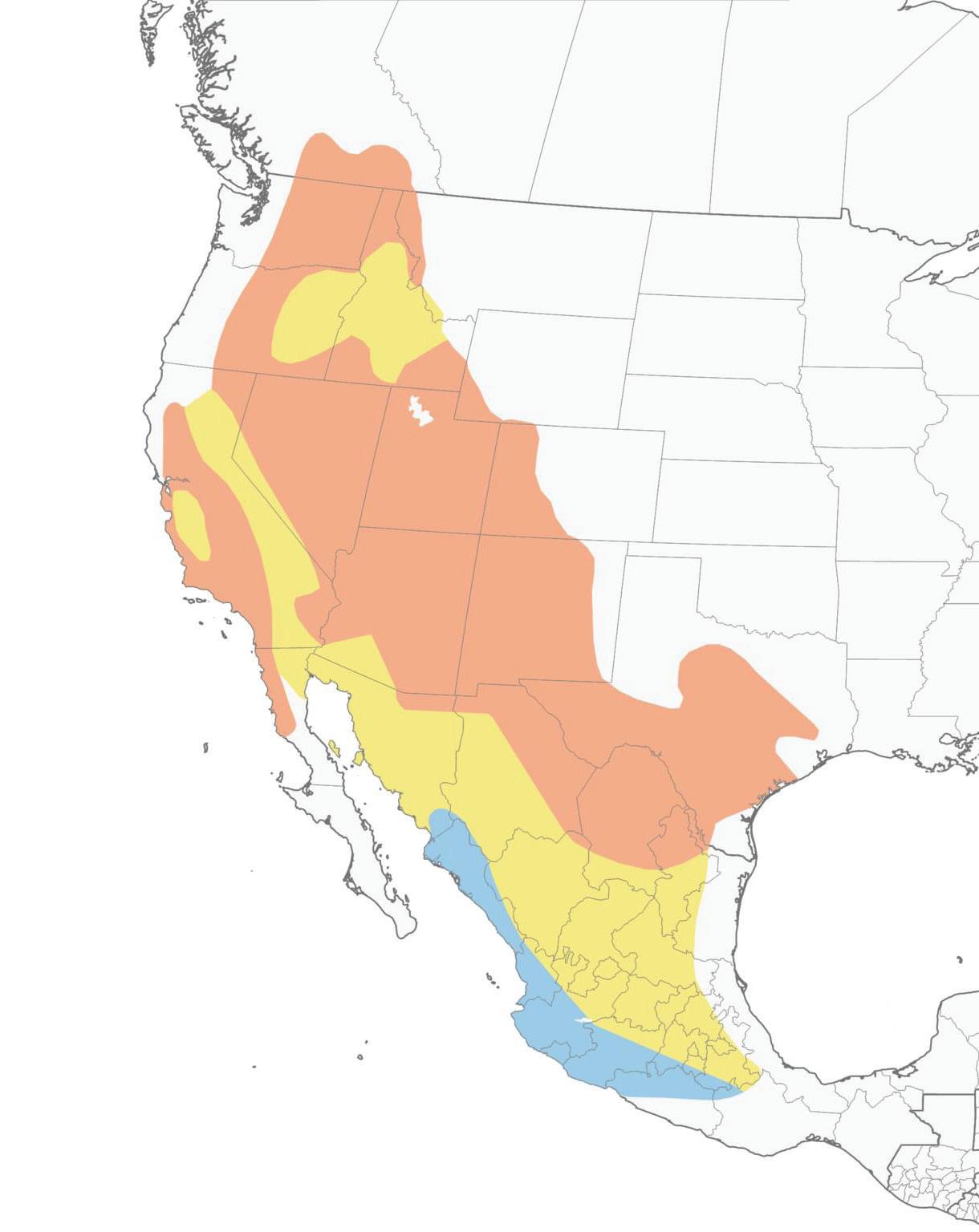
DESIGNING FOR NATIVE BIRDS | 141
MIGRATION CALENDAR
ROLE
JAN FEB MAR LIRPA YAM ENUJ YLUJ TSUGUA TPES OCT NOV DEC 12:am 6 : a m mp:21 6 : p m Torpor yadllataE esahC i n t r u ders Breed s M a r c h setargiM ot rehgih niatnuomstatibah Wintersin West Mexico or GulfCoast
least concerned never threatened vulnerable endangered critically endangered
either way)
HABITAT PROTOTYPE : BLACK-CHINNED HUMMINGBIRD


Inspired by the bird’s courtship dances, whose trajectories resemble a parabola and partial triangle. this feeder prototype is formed by a shell consisting of two laser cut patterns attached to a frame, forming a lattice reflective of the bird’s dramatic movement.

The gaps resulting from these lines create opportunities for spider habitat, which the bird can utilize as a food and nesting resource.

142 | DESIGNING FOR NATIVE BIRDS
Oscar A. Rodriguez
11"
SECTION CUT 2 SCALE: 1" = 2"
PLASTIC ATTACHMENT
1/4" STEEL WIRE S-HOOK RESERVOIR PLASTIC CAP
FRONT ELEVATION
3 SCALE: 1" = 2"
BACK ELEVATION
4 SCALE: 1" = 2"
ATTACHMENT
1/4" STEEL WIRE S-HOOK RESERVOIR PLASTIC CAP
1" 1/4"
The prototype is designed to fit in urban landscapes and backyards, being built of treated plywood (after being laser cut), hard plastics, and steel to withstand outdoor conditions.
STRAW CONNECTOR HOLE THROUGH PLYWOOD TO FIT AND STOPPER
WASHER TO CONNECT PETALS FLOWER CENTER FIT)
SECTION CUT
1/8" ALUMINUM FLOWER FEEDING PORTS
The steel feeding ports are designed drawing inspiration from the Claret Cup Cactus flower, a known food source for this species in its Southwestern range.
6 RESERVOIR AND FRAME DETAIL
SCALE: 1/2" = 1"
SCALE: 1" = 2" 3 SCALE: 1" = 2"
PLASTIC FEED RESERVOIR ATTACHED WITH STRAPS
STEEL NAIL TO CONNECT FRAMES (COVER WITH WOOD FILL)
4 FL OZ PLASTIC FEED RESERVOIR
RESERVOIR AND FRAME DETAIL
PLASTIC STRAW ATTACHED TO FEED RESERVOIR (INSERTED INTO HOLE; SEALED WITH RESIN) PLAN
STEEL NAIL TO CONNECT FRAMES (COVER WITH WOOD FILL)
PLASTIC STRAW ATTACHED TO FEED RESERVOIR (INSERTED INTO HOLE; SEALED WITH RESIN)
PLASTIC ATTACHMENT
6 1" 1/4" 11" 11" 1"
SECTION CUT 2 SCALE: 1" = 2"
1/4" PLASTIC TUBING AND STRAW CONNECTORS 1/4" PLYWOOD FRAME AND PATTERN (LASER CUT)
AXONOMETRIC VIEW
7 SCALE: 1" = 2"
1/4" STEEL WIRE S-HOOK RESERVOIR PLASTIC CAP
4 FL OZ PLASTIC FEED RESERVOIR
1/8" ALUMINUM FLOWER FEEDING PORTS
PLASTIC STRAW CONNECTOR 1/4" HOLE THROUGH PLYWOOD TO FIT TUBING AND FEED STOPPER
1/4" PLASTIC TUBING AND STRAW CONNECTORS 1/4" PLYWOOD FRAME AND PATTERN (LASER CUT)
STEEL WASHER TO CONNECT PETALS TO FLOWER CENTER (SNUG FIT)
FEEDING PORT DETAIL
SECTION CUT 2 SCALE: 1" = 2"
1/8" ALUMINUM FLOWER FEEDING PORTS SCALE: 1/2" = 1" SCALE: 1/2" = 1"
SCALE: 1" = 2" AXONOMETRIC VIEW
RESERVOIR AND FRAME DETAIL
FRONT ELEVATION
3 SCALE: 1" = 2"
1"
DESIGNING FOR NATIVE BIRDS | 143
1
2
PLAN VIEW
SCALE: 1" = 2"
4 5
6
2" 1/4" 1/2"
11" 1/4"
10"
:: BIRD SCALE DESIGN CONSTRUCTIONS DETAILS :: HUMMINGBIRD HABITAT PROTOTYPE
1
::
FRAME AND PATTERN
CUT)
(LASER
VIEW 1 SCALE:
2
1" = 2"
3
5
6
1" 1/4" 2" 1/4" 1/2" 10" 1/2" 1 1/4" 1/4"
PLASTIC
:: BIRD SCALE DESIGN CONSTRUCTIONS DETAILS :: HUMMINGBIRD HABITAT PROTOTYPE :: :: OSCAR RODRIGUEZ PONCE :: TUCSON, AZ :: OCTOBER 28, 2022 :: 1 1/4" 5/8"
PLASTIC FEED RESERVOIR ATTACHED WITH STRAPS 2
7
5 6
FRONT ELEVATION 4 SCALE: 1" = 2" BACK ELEVATION
4 FL OZ PLASTIC FEED RESERVOIR
1/4" PLASTIC TUBING AND STRAW CONNECTORS 1/4" PLYWOOD FRAME AND PATTERN (LASER CUT)
SCALE: 1/2" = 1"
el cuervo común
Cynanthus latirostris
BIOLOGY


INDIVIDUAL HABITAT

DIET
Broad-billed hummingbirds are omnivorous. The bulk of their diet consists of flower nectar, but they can also be observed eating small insects,
REFERENCES, SOURCES, & RECOMMENDED SOURCES: https://www. audubon.org/field-guide/bird/broad-billed-hummingbird; https://animaldiversity.org/ accounts/Cynanthus_latirostris/; https://www.fs.usda.gov/detail/r3/plants-animals/ wildlife/?cid=FSEPRD571060; https://www.sdakotabirds.com/species/broad_billed_ hummingbird_info.htm; https://birdfeederhub.com/hummingbird-nests/; https://arizona-birds.com/index.php/broad-billed-hummingbird
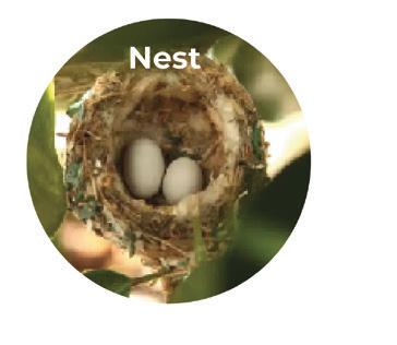


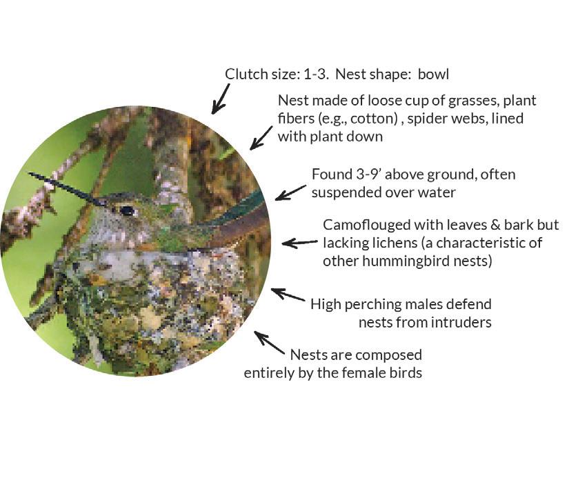

144 | DESIGNING FOR NATIVE BIRDS
NESTING URBAN ADAPTATION
COURTSHIP CONSERVATION
BROAD-BILLED
HUMMINGBIRD
ECOSYSTEM ROLE

MIGRATION CALENDAR


ECOLOGICAL ROLE
KEY MARKS
REFERENCES, SOURCES & RECOMMENDED RESOURCES: dipitem delesseditam ut mo con cullentur? Lestrup tatiame volorepmpor re ipsam nonsed et laccatiis sit ea dipsam, quodis expliquas utecaborum Hillesciatur modicia nimaionseque nos es ulluptas sed ut et erio tem eat quati aut alit endiorit que odigni tescias sunto dolore ipsus sin rere as aborentium faccaes edicit, sitiur aniate nis adis doluptae precesendis a vid et et optatiis di dolores equamus veliqua spidita simendebis rerum aut quiam, et ande restis asi resequid estius.
SOURCES, & RECOMMENDED SOURCES:


https://birdsoftheworld.org/bow/species/brbhum/cur/introduction; https://charismaticplanet.com/broad-billed-hummingbird; https://birdsoftheworld. org/bow/species/brbhum/1.0/introduction; https://www.hummingbirdsplus.org/species/broad-billed/

DESIGNING FOR NATIVE BIRDS | 145
Sketch Model 10/19
Materials Tests
A common glass jar with a screw-on lid will be ideal for the sugar water containtainer. This part will need to be secured to a tree with a wire hanger and a nail.

Leather is too flimsy to serve as the helical structure for the bird’s nest. This will be replaced with a thin metal such as aluminum which can be bent easily but will remain rigid. The metal will be sealed to reduce glare and buffer heat conductivity.


The white metal wire represents some type of narrow plastic tubing which runs the length of the helical metal structure. The model will be 5’ long.
The red terminus of the line serves as a flower attractant made of recycled plastic.
146 | DESIGNING FOR NATIVE BIRDS
will hold the sugar water Feeding attractor
Leather represents nest surface area Wire represents tubing
Jar
DESIGNING FOR NATIVE BIRDS | 147
CACTUS WREN

Campylorhynchus brunneicapillus
BIOLOGY
URBAN ADAPTATION
Species is willing to live in an urban environment
Yes the Cactus Wren will live in cities provided that there is native vegetation.


Species is able to utilize non-native plant species to survive

This bird prefers native vegetation.

Species is known to nest in urban structures

No, Cactus Wrens make nests among cactus, mesquites and yucca.


Species benefits from urban habitat compared to natural habitat
No, Cactus Wren populations are declining and this in largley due to habitat loss.

Species is willing to eat from a feeder
Possibly Cactus Wrens will eat fruit, howver their main diet is insects.
Species has adapted specialty trait to survive in urban environments

Cactus Wrens will make use of synthetic materials for nest building and will also scavenge bugs from car radiators.
INDIVIDUAL HABITAT
VOCALIZATION/COURTSHIP
-Breeding style: Monogamy , may mate for life.

-Pairs greet each other with open display spreading their wings and tail.

-Live in pairs, may forage in family groups


-Young leave the nest at around three weeks.
Eggs are .5x1”, pink
2-7 eggs
Nest are made with a narrow opening to prevent predation.
Nest are typically made among jumping cholla
Nest are built by both parents.
Source: https://www.audubon.org/field-guide/bird/cactus-wren
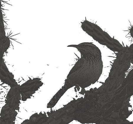
148 | DESIGNING FOR NATIVE BIRDS
1.4 oz SIZE RANGE 7.17.5” Kindom Animalia Phylum Class Order Family Genus Species Chordata Aves Passeriformes Troglodytidae Campylorhynchus brunneicapillus
-Call are raspy and compared to a car trying to start.
ECOSYSTEM ROLE RANGE


FOOD
Insects Some Plant Matter


RESOURCES


Nest among cactus particularly jumping cholla
Also utilizes mesquite and yucca


Lines nest with feathers.


Appreciates sagebrush and buckwheat habitat.

Yellow eye color in young adults then red for older adults
CONSERVATION
KEY MARKS


Top side is a bit blue on males, greyer on females


least concerned never threatened vulnerable endangered critically endangered
REFERENCES, SOURCES & RECOMMENDED RESOURCES: www.allaboutbirds.org/guide/Cactus_Wren/id, www.audubon.org/field-guide/bird/cactus-wren, www.desertmuseum.org/kids/oz/long-fact-sheets/Cactus Wren.php


Long tail rounded at tip


DESIGNING FOR NATIVE BIRDS | 149
CALENDAR JAN FEB MAR LIRPA YAM ENUJ YLUJ TSUGUA TPES OCT NOV DEC IntheNest DuskUntilDawn skees HniedahStae 12:am 6 : a m mp:21 6 : p m Breed s M a r c henuJ D o e s not Migrate
HABITAT PROTOTYPE : CURVED BILLED THRASHER


Cholla Nest Design
The objective of the design was to create a protected nest that was easy for a human to drop into a cactus. The nest was inspired by weaving sticks with one another to mimic a bird best. Within a cactus, the nest has an extra p[rotection layer from the spines. This nest was created to sink 2’-5’ feet off the ground within a cholla, with room for the birds to add sticks and twigs. Curved billed thrashers often find cactus wren nests and will build ontop of them. Allowing the bird to add onto the foundation of the nest, while creating the oppurtunity for humans to interact with nesting.

Design considerations;
» Females shade their young, create nest with one taller edge, propped on west side for shaind young.
» Thrashers like to add onto existing nests, mimic woven shape to allow bird interaction with human adaptation of their habitat.
» 3-5 baby birds in nest at a time, create wide depressed area ready to be lined with feathers.
» To be left within cholla, have a triangle like bottom to restrict sinking into cactus.
150 | DESIGNING FOR NATIVE BIRDS
IMAGE ABOVE: Shape exploration, abstraction or nest. IMAGE ABOVE: Woven nest addition for shade perch.
IMAGE ABOVE: Beta model with weatherized wood in cactus.
RAISED WOVEN SECTION FOR FEMALE TO SHADE YOUNG
WIDTH OF TRIANGLES COVERAGE
WOVEN MATERIAL TO ENCOURAGE ADDED TWIGS & BRANCHES
MINIMIZE MANMADE NEST FEATURES, ALLOWING NEGATIVE SPACE FOR BIRDS TO NEST
WEAVING DETAIL
NEST TO BE RESTED IN CHOLLA OR PRICKLY PEAR
WEAVING HEIGHT
WEAVING WIDTH
TRIANGLE REST HEIGHT & WIDTH
CURVED BILLED THRASHER NEST-REST
DESIGNING FOR NATIVE BIRDS | 151 3 Section A Scale: 3” 1' 6 Back Elevation Scale: 3” 1' 5 Weave Pattern Detail Scale: 3” 1’ 4 Placement Detail Scale: 3” 1' 2 Plan View Scale: 3” : 1' 1 Axonometric Scale: 3” 1' 7 Front Elevation Scale: 3” 1' 3 A 5 2" 2" 2" 2"
scale: 3”=1' 2C 610
WAVERLY BROWN 526 LAR BIRD SCALE DESIGN CONSTRUCTION DETAILS
3.0"
HABITAT PROTOTYPE : CACTUS WREN PLAY SCULPTURE
METAL HANGER AND BASE DETAIL
3/8" HOLE TO ACCEPT STEEL RINGS
AXONOMETRIC VIEW
WELDED CONECTION
MATERIAL IS 1/4" THICK
X2" WIDE SHEET STEEL
RINGS CUT FROM 1/4" STEEL SHEET STEEL
152 | DESIGNING FOR NATIVE BIRDS
Plan View
1'-6 1/2" 1/4"
5"
This sculpture is designed with the cactus wren in mind. Cactus wren are playful and curious, they will interact playfully with objects in their environment. Cactus wren nest close to the ground and spend most of their days kicking about on the ground and searching for food. The primary inspiration for this sculpture was informed by the fact that cactus wren can sometimes be observed gleening dead insects from the grills of cars.

The opportunism, the resourcefulness and curious playfullness of these wrens was a such a lucky inspiration for this project. After cycling through a few forms and materials, the final design was determined. This is designed to be set into the ground, all five inches of the concrete base.


The glass tops would be just at grade, allowing lights installed from underneath to shine during the night, attracting insects, some of which would no doubt still be around in the morning for the wrens to enjoy. The metal rings provide movement and interest for the playfull birds and the entire installation is attractive, particularly when lit at night, for human observers.


DESIGNING FOR NATIVE BIRDS | 153
COMMON RAVEN


The raven is omnivorous. Can also be seen eating from human landfills, to small mammals, berries, and are also considered scavangers.


REFERENCES, SOURCES & RECOMMENDED RESOURCES:


Berg, R. 1999. Corvus corax. Animal Diversity Web. Retrieved from: https://animaldiversity. org/accounts/Corvus_corax/


Breeding. (2017). Listen to the Sweet, Soft Warble Common Ravens sing to their Partners. Audobon. Retreieved from: https://www.audubon.org/news/listen-sweet-soft-warble-common-ravens-sing-their-partners Songs and Calls. (ny). Retrieved from: https://www.audubon.org/field-guide/bird/common-raven


154 | DESIGNING
FOR NATIVE BIRDS
NESTING URBAN ADAPTATION BIOLOGY INDIVIDUAL HABITAT DIET COURTSHIP CONSERVATION
corax SCALE SIZE NTS woodlands rocky areas campgrounds human adapted sites urban areas -Breeding style: Monogamy may mate for life. -Pairs greet each other with open display spreading their wings and tail. -Live in pairs, may forage in family groups -Young leave the nest at around three weeks. -Call are raspy and compared to a car trying to start. Source: https://www.audubon.org/field-guide/bird/cactus-wren Nest are made with a narrow opening to prevent predation. Nest are typically made among jumping cholla Nest are built by both parents. 2-7 eggs Eggs are .5x1”, pink
Corvus
ECOSYSTEM ROLE


FOOD

insects rodents lizards garbage


RESOURCES

enemies: owls, hawks and eagles


nesting materials: branches, natural elements (mud, bones, wires) trash


location: utilizes tree branch, cliffs, power line towers, bridges, high areas
nest shape: creates a basket for nesting

REPRODUCTION
monagamous lovers
REFERENCES, SOURCES & RECOMMENDED RESOURCES:
https://www.audubon.org/field-guide/bird/common-raven?adm1=AZ&country=US#bird-cli-


KEY MARKS


Ecosystem role source: https://www.audubon.org/field-guide/bird/common-raven?adm1=AZ&country=US#bird-climate-vulnerability Migration map: https://www.audubon.org/field-guide/bird/common-raven?adm1=AZ&country=US#bird-climate-vulnerability Calendar: https://www.audubon.org/field-guide/bird/common-raven?adm1=AZ&country=US#bird-climate-vulnerability


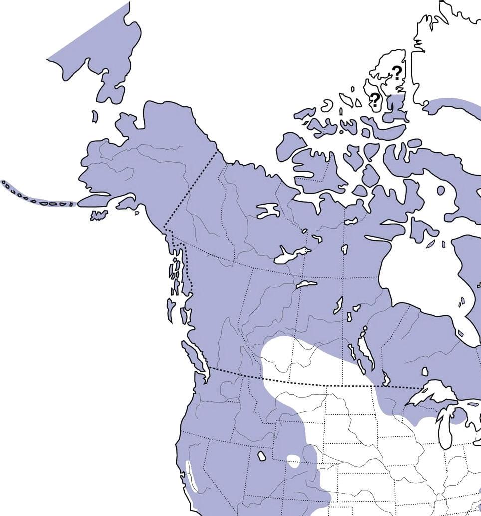

DESIGNING FOR NATIVE BIRDS | 155
ECOLOGICAL ROLE MIGRATION CALENDAR
HABITAT PROTOTYPE : COMMON RAVEN


The habitat prototype was inspired by the complexity that the common raven has in their everyday life. These birds are complex species that enjoy playing, stealing, and most of all scavanging. What better way to put their characteristics in play than to have them contribute to their ecosystem and society while being rewarded. When the raven finds a trinquet or a piece of garbage, the box will dispense a few pebbles of food as a reward. The maze in the box represents the complexity that these birds attain while also encouraging the human component in urban areas
REFERENCES, SOURCES & RECOMMENDED RESOURCES:


Model Details. Fall 2022. Habitat Prototype Details for the Common Raven, produced by Selenne Yescas.


156 | DESIGNING FOR NATIVE BIRDS
REFERENCES, SOURCES & RECOMMENDED RESOURCES: Model Prototype. Fall 2022. Habitat Prototype Model for the Common Raven, built by Selenne Yescas.


DESIGNING FOR NATIVE BIRDS | 157
COOPER’S HAWK
Accipiter cooperii

BIOLOGY
URBAN ADAPTATIONS
URBAN ADAPTATIONS
Willing to live in an urban environment
Cooper’s Hawk can survive comfortably in suburban areas and some cities have reported growing populations

Able to utilize non-native plant species to survive
Cooper’s Hawk prefers to nest in tall canopies of non-native trees
COURTSHIP CONSERVATION
Benefits from urban habitat compared to natural habitat
Cooper’s Hawk can thrive in both urban and natural habitat. However, prey can be more abundant in urban locations.
Nest Height: (25-50 ft.)
Food Source: (5-25 ft)
Predator risk: (0-10 ft.)
INDIVIDUAL HABITAT DIET
Cooper’s Hawk feeds mainly on medium-sized birds. They will also consume small rodents and reptiles on occasion. Typically, Cooper’s Hawk kills its prey by squeezing it to death with their sharp talons.


least concerned never threatened
vulnerable endangered
critically endangered
NESTING
Nest are built by both sexes, usually made of sticks and lined with bark
Nest are built by both sexes, usually made of sticks and lined with bark


Located 25’-50’ above the ground, towards the top of tall deciduous or evergreen trees
Located 25’-50’ above the ground, towards the top of tall deciduous or evergreen trees

Abandoned nests of other large birds or clumps of mistletoe can be used as a foundation
Breeding Call:
(cak cak cak)
Breeding Call: cak cak cak
Breeding style: Monogamy
Breeding style: Monogamy
REFERENCES, SOURCES & RECOMMENDED RESOURCES:
Diet: https://birdfact.com/articles/what-do-coopers-hawks-eat Biology: https://www.itis.gov/servlet/SingleRpt/SingleRpt?search_topic=TSN&search_value=175309#null


Abandoned nests of other large birds or clumps of mistletoe can be used as a foundation
Cooper’s Hawk attracts mates using flight displays and vocal calls
Cooper’s Hawk attracts mates using flight displays and vocal calls
Cooper’s Hawks are solitary birds until they mate Chicks leave the nest and become independent around 2 months of age
Cooper’s Hawks are solitary birds until they mate Chicks leave the nest and become independent around 2 months of age
(cak cak cak) is also used for defending the nest
(cak cak cak)
is also used for defending the nest
158 | DESIGNING FOR NATIVE BIRDS
INSERT COMMON NAME OF YOUR BIRD SPECIES WHERE IT SAYS “SPECIES”
10-24 oz SIZE RANGE: 15”18” WINGSPAN: 29” - 37” kindom animalia phylum class order species chordata aves accipitriformes accipiter
Rodents and Small Reptiles
Small Birds Large Spiders and Scorpions
ECOSYSTEM ROLE

FOOD
Medium Sized Birds
Small Rodents & Reptiles

RESOURCES
Competes with other hawks for territory

Sticks and tree bark for nests


KEY MARKS


Yellow eye color in young adults then red for older adults


REPRODUCTION
Monogamous


https://www.allaboutbirds.org/guide/Coopers_Hawk/maps-range rounded at tip


Top side is a bit blue on males, greyer on females


ECOLOGICAL ROLE
Generally considered a quaternary consumer, Cooper’s Hawk has few natural predators in the ecosystem and they help maintain the population levels of smaller animal species

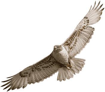

REFERENCES, SOURCES & RECOMMENDED RESOURCES:


Calendar: https://www.wild-bird-watching.com/coopers-hawk-habits.html


Nesting: https://www.audubon.org/field-guide/bird/coopers-hawk#:~:tet=Feeds%20mainly%20on%20medium%2Dsized,Sometimes%20eats%20reptiles%2C%20insects.

DESIGNING FOR NATIVE BIRDS | 159
MIGRATION CALENDAR
JAN FEB MA R LIRPA YAM ENUJ YLUJ TSUGUA PES T OCT NOV DEC 12:am 6 : a m 21 mp 6 : p m ActiveHunti n g a t nwaD edahSskeeS- -taeHgniruD Aitc ev H u n t ing a tDusk Rest, Low Activity Breed s i n M a r c h Migrates over Winter Season
HABITAT PROTOTYPE : COOPER’S HAWK
Cooper’s Haven was designed to provide an inclusive perch and nesting platform for Cooper’s Hawk in urban and suburban habitats. Hawks look for the highest vertical point in the landscape to make their nest, they do not want any enclosed or overhead shelter. This design uses adjustable hose clamps to fit on top of a typical utility pole from three to six inches in diameter. Once the platform is secured around a utility pole, real desert willow branches in combination with the wood fins provide a secure foundation for hawks to build their nest. More branches woven across the lower part of the design act as perching points where a hawk can seek refuge from the sun or high winds, and is still free to scan the world beneath them.
Adjustable Joint
Elevation View Axonometric View
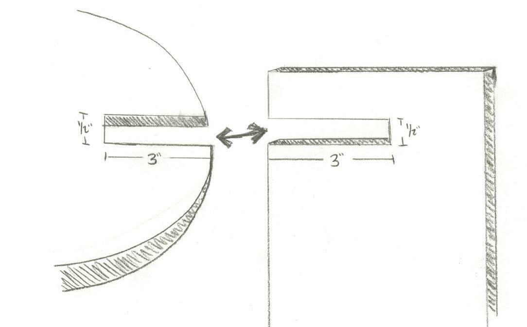
160 | DESIGNING FOR NATIVE BIRDS
D East Elevation Scale: 1/4” = 1” C Plan View Scale: 1/4” = 1” 2' 0" 2' 0" 2' 0" 9" 9" 1.5” 1” 1/2" 1.5” Nesting Platform Branches through Wood Fin Hose Clamp Perching Branch Nesting Branch Nesting Branch Nesting Platform Nesting Platform Wood Fin Wood Fin Perching Branch Hose Clamp TYP. Utility Pole 3-6” Dia.


DESIGNING FOR NATIVE BIRDS | 161
GAMBEL’S QUAIL


Callipepla gambelii
BIOLOGY

INDIVIDUAL HABITAT
DIET
Primarily ground foraging species. Eat Seeds from trees, shrubs and grasses as well as grass leaves and stems, and cactus fruits and berries when available. Insects mostly consumed in mating season and by chicks, as they only eat animal matter the first few days after they hatch
URBAN ADAPTATION

COURTSHIP CONSERVATION

As breeding season nears, males will call from an elevated perch. Once courting, males perform a ritualized foraging display called “tidbitting” to attract a mate, including extending his legs, fanning his tail, and stands with his head near the ground and tail in the air


COURTSHIP
-Breeding style: Monogamous, with both sexes raising chicks


-Live in Coveys, usually a breeding pair and their young that stay together through the winter in their home range then will leave to find new coveys.

-Only time they are aggressive to others is breeding season when they pair up.
REFERENCES, SOURCES & RECOMMENDED RESOURCES:

https://www.allaboutbirds.org/guide/Gambels_Quail/lifehistory https://www.audubon.org/field-guide/bird/gambels-quail https://wildbirdsonline.com/blogs/news/gambels-quail https://nri.tamu.edu/blog/2018/march/meet-the-gambels-quail/

162 | DESIGNING
FOR NATIVE BIRDS
Image: Feederwatch.org
Right Image: City Sun Times
ECOSYSTEM ROLE

FOOD RESOURCES
Primary foods are seeds and leaves from grasses

Chicks feed only on insects for the first days after hatching
Uses dense shrubs or cactus to protect nest


Grasses to line nest

MIGRATION
CALENDAR

ECOLOGICAL ROLE
Feathers to line nest
REPRODUCTION
Adults mate for life
Chicks leave the nest with parents within a day of hatching

Has hybridized where range overlaps with California Quail, not common


NESTING
Map Source: All About Birds
KEY MARKS

https://commons.wikimedia.org
REFERENCES, SOURCES & RECOMMENDED RESOURCES:
https://www.iucnredlist.org/species/22679609/138721794#habitat-ecology


Images: allaboutbirds.org

https://www.desertmuseum.org/kids/oz/long-fact-sheets/gambel%27s%20quail.php#:~:text=Average%20life%20expectancy%20for%20 a,for%20up%20to%20four%20years.&text=Mature%20birds%20average%20eleven%20inches,(160%20to%20200%20grams.)


DESIGNING FOR NATIVE BIRDS | 163
ebird.org
HABITAT PROTOTYPE : GAMBEL’S QUAIL


These construction documents detail how I would build my idea for a quail habitat in a public space. The structure, modeled after a prickly pear cactus, which they already use in the wild, would provide cover for the quail to take refuge under. These would be wood, fitted together with at least 1” notches. The bottom would be set in concrete to counterbalance it so it would stay standing. There would be several pads that would be bowls to provide water for the birds, and it would be at least 6’ tall so the males could call from the top during breading season.
164 | DESIGNING FOR NATIVE
BIRDS
L.01 5 AXONOMETRIC Scale: 2 " : 1' L.01 2 ISSUE OCT 26 2022 DRAWN BY JE CLIENT Mackenzie Waller PROJECT Studio 610 Gambel's Quail PROJECT NO. 02 COMPANY NAME University of Arizona L.01 Gambel's Quail Habitat 5" E M B E D 4" 2" 3'-0" 10" 2'1" 2 " MIN 2x12x12 carved bowl 1/2" plywood paddles Height and width vary, descending with height (2) 1/8"x2"x4" steel angle (2) 1/4"Ø x 1" machine screw w nut & washer (4) 1/4"Ø x 6" machine screw w nut & washer 1/2" L.01 4 DETAIL 2- TYP PADDLE CONNECTION Scale: 4" : 1' L.01 2 L.01 1 DETAIL 1- GROUND CONNECTION Scale: 4" : 1' L.01 4 SECTION Scale: 2 1' L.01 1 PLAN VIEW Scale: 2 1' L.01 2 EAST ELEVATION Scale: 2 " 1' L.01 3 NORTH ELEVATION Scale: 2 " 1' L.01 1


DESIGNING FOR NATIVE BIRDS | 165
Image credits: Mackenzie Waller Images of a portion of the habitat, built to scale.
LESSER GOLDFINCH
- 1-3 broods per year
- 3-6 eggs per brood
- 1.5-1.6 cm x 1.1-1.3 cm


- incubation: 12-13 days
- nestling: 12-14 days
KEY MARKS


stub-billed

bright yellow underparts (m), dull yellow underparts (f)


NESTING
1-3 broods per year
3-6 eggs per brood
1.5-1.6 cm x 1.1-1.3 cm incubation: 12-13 days
nestling: 12-14 days

VOCALS
black tails with white patches
plaintive, kittenlike (tee-yee) song is similar to American Goldfinch frequently imitates other species’ call

CONSERVATION
DIET
INDIVIDUAL HABITAT
low concern
Spinus psaltria BIOLOGY
gregarious in nature, forming large flocks at feeding sites and watering holes
Centaurea melitensis, is a primary food source
REFERENCES, SOURCES & RECOMMENDED RESOURCES:

- https://www.allaboutbirds.org/guide/Lesser_Goldfinch/overview
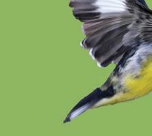


- https://www.audubon.org/field-guide/bird/lesser-goldfinch
DESIGNING FOR NATIVE BIRDS


found in fork of branches, concealed by leaves
cup form, constructed of leaves, bark, yucca fibers, spiderwebs found 4’-8’ off ground on slender twigs


*built by female
majority of diet at all seasons consists of seeds; especially favors those of the daisy family, such as thistle and wild sunflower
Lesser Goldfinches cling to the seed heads of tall plants, bending the stem down so that it can end up hanging upside down while


166 |
SIZE RANGE 3.5 –4.7 in. 0.28 – 0.41 oz WEIGHT
ECOSYSTEM ROLE

PREFERRED HABITAT PLANTS
RESOURCES


COURTSHIP
MIGRATION
all seasons - common breeding - common a permanent resident in much of range, summer resident only in some inland parts of the West north of the desert regions; very rare stray east of normal range

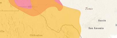


URBAN ADAPTATION
Willing to eat from a feeder
OCT
CALENDAR SEP


NOV DEC 7 years is oldest known age MARCH - OCTOBER


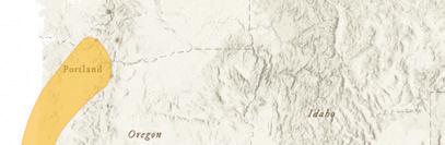
urban structures
plant species to survive


REFERENCES, SOURCES & RECOMMENDED RESOURCES:


- https://www.allaboutbirds.org/guide/Lesser_Goldfinch/overview


- https://www.audubon.org/field-guide/bird/lesser-goldfinch
will utilize feeders as they eat many kinds of seeds from the sunflower family
almost never nest in human structures
such as parks and gardens
DESIGNING FOR NATIVE BIRDS | 167
Napa Thistle seeds
FOOD
Beebrush (Aloysia)
Amaranth flowers
yucca fibers
catkins
male feeds female
perch together
= months in which bird is most likely to be viewed JAN FEB MAR APR MAY JUN JUL AUG
HABITAT PROTOTYPE : LESSER GOLDFINCH


Spinus psaltria

A very lightweight bird, the lesser goldfinch often hangs on the tips of soft branches of plants such as Aloysia and Amaranth. Known to sway and bounce as they feed, the focus for the habitat was a feeder that enabled movement and inspire kinetic activity on another part of the structure.

Shrub structure was explored here, with delicate branches and foliage to offer protection being

CONCEPT SKETCHES
MODEL SKETCHES


a.


a. spring force = kinetic energy

168 | DESIGNING FOR NATIVE BIRDS
PLANINAC
KRISTA


DESIGNING FOR NATIVE BIRDS | 169 KRISTA PLANINAC BUILT
MODEL IMAGES
RED-TAILED HAWK

Buteo jamaicensis
BIOLOGY


INDIVIDUAL HABITAT
DIET
The red-tailed hawk is carnivorous, and not a picky eater. Red-tail hawks most common prey are small mammals and ground fowl; however, they


URBAN ADAPTATION


CONSERVATION


VOCALS

NESTING


170 | DESIGNING FOR NATIVE BIRDS
ECOSYSTEM ROLE


MIGRATION CALENDAR

Misc. Mammals Misc. Birds Misc. Reptiles
Misc. Amphibians


RESOURCES
Stalks Bird Feeders Searching For Prey
Uses Sticks & Twigs As Nest Materials


KEY MARKS

Renovates Same Nest Yearly With Bark Prefer Tall Trees With Commanding Views

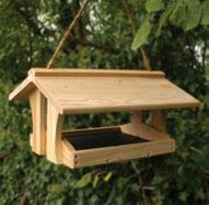
REPRODUCTION

Red-tail Hawks Mate For Life


ECOLOGICAL ROLE

DESIGNING FOR NATIVE BIRDS | 171
FOOD
HABITAT PROTOTYPE : RED-TAIL HAWK

The objective of the design was to create a sky platform fitting for the king and the queen of the sky: The Red-tail Hawk. The platform was inspired by the angular forms of a bird in flight merged with the coiling snake forms inspired by one of the birds key prey. The overall design should be foreboding and intimidating and inspire a sense of majesty.


172 | DESIGNING FOR NATIVE BIRDS


DESIGNING FOR NATIVE BIRDS | 173


PRELIMINARY PHASE DESIGNS


PRELIMINARY PHASE DESIGNS | 175
MATERIALS PALETTE
Approved for Phase 1
TCB FUNDING
Examples of materials and elements that are approved for the initial phase of the project. The City’s GSI Program and TCB’s Program can only directly fund stormwater management features including the following things:
earthworks, scuppers / culverts
permeable surface coverings

rockwork / boulders


plants, plants, and more plants
irrigation
bollards, vatical markers, solar blinkers
compacted / stabilized dg pathways
boulder seating areas
recycled materials from on site

RECOMMENDED VENDORS
Use of local vendors and contractors are recommended:
Acme Sand & Gravel


Civano Growers

176 | PRELIMINARY PHASE DESIGNS
rockwork + boulders $0.17/lb river pebbles $80/T chat $30/T rip rap $59/T wood chips $45/T decomposed granite $42/T
railroad ties $30/ea
Potential Future Phases


ADDITIONAL FUNDING

A few examples of the types of elements and materials that would require additional funding in the future:
playgrounds


cement, concrete
lighting paving


fences


shade structures


PRELIMINARY PHASE DESIGNS | 177
Prosopis glandulosa honey mesquite
Acacia greggii catclaw acacia
Tecoma capensis cape honeysuckle
Sphaeralcea ambigua desert globemallow
Euphorbia rigida gopher plant
Calliandra californica
Salvia clevelandii chaparral sage
PRELIMINARY DESIGN EXPLORATIONS

Typologies: Traffic Calming


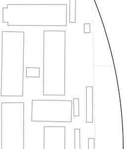


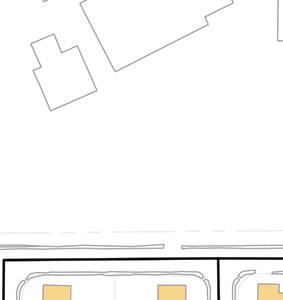


The following traffic calming typologies are potential design solutions for the Sierra Estates community to pursue in the future. Only the chicanes were part of the preliminary designs that the student groups developed.


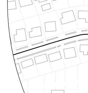


The first typology is the reduction of lane widths to discourage speeding (National Association of City Transportation Officials, 2013). As shown on the map, this is primarily recommended on Burns Street, although this is applicable to the other roads in the community.

The following typologies are more specific ways of achieving lane width reductions while expanding the pedestrian space of the street. Chicanes are curb extensions designed to make drivers slow down by following a curved path, and thus can provide additional walking space for pedestrians, vegetative buffers, or both (City and County of San Francisco, 2011). Another option is to widen sidewalks and add vegetative buffers to them. Due to the amount of higher speed traffic along Swan, this typology would be the most impactful there, but would be beneficial in the rest of the neighborhood as well. Curb extensions are recommended on Burns Street to shorten the crossing distance for kids to get to the park more safely.


The last two typologies focus on increasing pedestrian safety on Swan. One improvement that could benefit SunTran users is the addition of shelter at the Burns Park bus stop, as the current one is exposed to the elements for much of the day. Finally, a series of improvements to make the intersection between Swan and Burns safer and more accessible include the addition of street trees, prominent crosswalks, and ADA ramps.

178 | PRELIMINARY PHASE DESIGNS
75’ 150’ 300’
Reduced lane widths discourage speeding

Chicanes slow drivers down and manage stormwater runoff

Wider, buffered sidewalks improve walkability

Curb extensions shorten crossing distances


REFERENCES, SOURCES & RECOMMENDED RESOURCES:


Sheltered bus stop on Swan for added thermal comfort and safety
Street trees, prominent crosswalks, and ADA access ramps to make Swan-Burns intersection safer and accessible
Diagrams edited by Oscar Rodriguez. Reference map elaborated by Oscar Rodriguez. City and County of San Francisco. (2011, December 25). Chicanes. SF Better Streets. https://www.sfbetterstreets.org/find-project-types/pedestrian-safety-and-traffic-calming/traffic-calming-overview/chicanes/ National Association of City Transportation Officials. (2013). *Urban Street Design Guide*. Island Press.

PRELIMINARY PHASE DESIGNS | 179
PRELIMINARY DESIGN EXPLORATIONS


Typologies: Green Stormwater Infrastructure


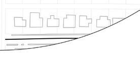


The following green stormwater infrastructure typologies are potential design solutions for the Sierra Estates community to pursue in the future. Tucson Clean & Beautiful and the City of Tucson Storm to Shade program will take lead on assessing which solutions are appropriate for Burns Park and the Sierra Estates neighborhood.


BIORETENTION BUMPOUT
“A bumpout is a vegetated curb extension that protrudes into the street at mid-block or at an intersection. The system is composed of a layer of stone topped with soil and plants. An inlet or curb-cut directs runoff into the bumpout structure where it can be stored, infiltrated, and absorbed by the plants. Excess runoff is permitted to leave the system and flow to an existing inlet. The vegetation of the bumpout will be short enough to allow for open sight lines of traffic. Aside from managing stormwater, bumpouts also help with traffic calming. When located at crosswalks, they provide a safety benefit by reducing the pedestrian crossing distance” (Philadelphia Water Department 2022).

180 | PRELIMINARY PHASE DESIGNS
BIORETENTION PLANTED AREA WITH SWALE
Bioretention parks allow for stormwater infiltration through a large surface capacity to capture, treat, and manage stormwater runoff from the street (NACTO 2017).

REFERENCES, SOURCES & RECOMMENDED RESOURCES:
National Association of City Transportation Officials. (2017). Urban street stormwater guide. Island Press. Philadelphia Water Department https://water.phila.gov/

PRELIMINARY PHASE DESIGNS | 181
Team 1
182 | PRELIMINARY PHASE DESIGNS
Zach Andre Cactus Wren Campylorhynchus brunneicapillus
Blake Caldarera Broad-billed Hummingbird Cynanthus latirostris
Will Leipold Cooper’s Hawk Accipiter cooperii


PRELIMINARY PHASE DESIGNS | 183
SIERRA CIRCUIT
Provide various options for users to gather and play

Goal 1
Restore resident access and accommodate opportunity for outdoor recreation with low impact development
INTENTIONAL WITH THE FLOW
Feature educational opportunities with interprative signage

Integrate an open trial network for greater greenspace immersion


Integrating stormwater management strategies to foster community education and appreciation
Artistically integrate storm-water management features
Goal 3
Revitalize existing greenspace and ecological functions
Protect existing habitat and increase planting
Harvest water from N Mountain View Ave. into landscaped area
Goal 2
Resolve street flooding issues by redirecting stormwater and increasing absorbtion on site
Route stormwater to supplement vegetation
 IMAGE ABOVE: graphic by Will Leipold
IMAGE BELOW: artwork by Blake Caldarera
IMAGE ABOVE: graphic by Will Leipold
IMAGE BELOW: artwork by Blake Caldarera
SIERRA CIRCUIT


PROGRAM


This program slide presents the human use areas and also shows the rain garden areas, one of the important reasons for displaying them on this graphic is because the raingardens areas are not accessible for pedestrian traffic, these depressed areas are the topography around which the human use programming was initially developed.


CIRCULATION


The Sierra Circuit was designed to improve the walkability of the Sierra Estates neighborhood with the addition of several new walking paths through Burns Park and the linear walking path. The curvilinear pathways provide an immersive experience within the bountiful green space and rain gardens, while allowing the user a variety of options to casually explore the park or just pass through.
WATER UTILITY


As stormwater moves through Burns Park from East to West, a water conduit system intelligently infiltrates stormwater runoff into planter spaces. Six rain gardens, connected by a series of subgrade culverts, transport the water, allowing percolation into the wide depressed earthen basins. At a depth of six inches, the rain gardens are capable of storing 440,422 cubic feet of stormwater, which amounts to 7.71% of the total neighborhood watershed. The path meanders through the site, enhancing water integration, and adding an organic visual flow to the park’s planter space.

PRELIMINARY PHASE DESIGNS | 185 RAIN GARDENS PLANTING AREAS OPEN FEILD AREA SHADED OUTDOOR CLASSROOM RAIN GARDEN MINOR ENTRANCE MAJOR PATH MAJOR ENTRANCE MINOR PATH OVERFLOW WATER RE-ENTERS RAIN GARDEN CULVERT FLOOD WATER INFLOW
SIERRA CIRCUIT
Section View of Burns Park
Burns Park
The existing Burns Park space offers some great advantages for residents in the Sierra Estates neighborhood: it is a green space with ample water integration during monsoon season; it has a nice balance of open lawn space and areas shaded by large trees; and it is in close proximity to a school. As such, activating this space will be as simple as opening the gates and maintaining the property’s vegetation. Where this design will enhance the existing conditions is three-fold. The primary design element, a meandering rain garden will (1) increase the park’s beauty (2) utilize an excess of stormwater runoff, and (3) provide a point of ecological education for people of all ages.
RAIN GARDENS
A rain garden is a depressed area of land which functions to slow stormwater during a monsoon event and facilitate its percolation into the soil. These areas are not traverable and are typically filled with plants that thrive with a higher water intake. The rain gardens can be noted in the plan view above as the dark purple shpes on the graphic. As water enters the site from the north, a series of culverts (underground water pipes) directs water from one rain garden basin to


PHASE DESIGNS


IMAGE ABOVE: OUTDOOR CLASSROOM

CROSS-GENERATIONAL EDUCATION
The shaded tree space in the Eastern section of the site will be ideal for holding oudoor classes and nature-based programs for school kids. Additionally, interpretive signage can be dotted throughout the part to foster curiosity and engagement with visitors.

KEY ELEMENTS


» interpretive signage on wildlife
» meandering rain gardens
» open field for sports, play, & pets
» shaded outdoor classroom area

186 | PRELIMINARY
<
Section graphic by Blake Caldarera
SIERRA CIRCUIT
Section View of the Linear Walking Path
The linear walking path has two distinct sections, the east-west portion has a swale and is planted beautifully, the north-south is sparsely planted, and sometimes used for parking.
On the north-south portion , the new design for this area is minimalistic yet gives the space a more expansive feel. As the space currently stands, the space is hardly noticeable, as the eye is drawn instantly toward the wall over the sparse ground. Inviting native and desert adapted plantings activate and draw people into the space. Plantings replace the concrete parking blocks as a way to secure the area from cars.
In the east-west portion of this area, a new meandering path crisscrosses the swale, highlighting the beauty of the existing plantings. These improvements to the space create a true waking path and give the neighborhood a qualitatively different area to walk through, a shaded natural path.
PRELIMINARY PHASE DESIGNS | 187
Team 2

188 | PRELIMINARY PHASE
DESIGNS
William Glockner Red-tailed Hawk Buteo jamaicensis
Krista Planinac Lesser Goldfinch Spinus psaltria
Waverly Brown Curved Billed Thrasher Toxostoma curvirostre
Jessica Eppard Gambel’s Quail Callipepla gambelii
A PATH TO WONDER
PRELIMINARY PHASE DESIGNS | 189
A PATH TO WONDER
Parti
The idea behind the design
The foundation of the design is a nonlinear line with various points of interest.

To wonder is to explore the unknown, the unfamiliar.
A path that curves and hugs the landscape in its organic form, with unexpected focal points along the way allows us to do just that.
Goals
The why behind the design
Provide a space for all who visit to wander through, experiencing a path filled with moments of wonder.
1. Encourage exploration of park through open space and guided play.
2. Redirect water through existing stormwater infrastructure.
3. Introduce traffic calming strategies to ensure neighborhood safety.
4. Preserve existing habitat and vegetation.
190 | PRELIMINARY PHASE
DESIGNS
IMAGE
Charcoal on trace paper, 14” x 17” Krista Planinac
ABOVE:
A PATH TO WONDER Illustrated Plan
IMAGE ABOVE: A graphic rendering depicting the A Path to Wonder design concept.

PRELIMINARY PHASE DESIGNS | 191
A PATH TO WONDER
Sections


192 | PRELIMINARY PHASE DESIGNS
A A’ B’ B
IMAGES ABOVE: Section A-A’ looking East across Burns Park Section B-B’ looking West across Burns Park
Section A-A’
Section B-B’
Sections
These hand drawn sections are meant to help the viewer experience the moments our group was trying to create within the site.
LINEAR WALKING PATH
Sections of the full Linear Walking Path with the proposed basins and paths. They were taken to give an understanding of how the space interacts with the greater context of the street and the opposite sidewalk. They also help to understand how big the space for the Linear Walking Path is, highlighting the opportuities present in the space.


BURNS PARK
Section A-A’ shows a section through the middle of the park. It was taken to show the interactions between the open play space and the adventure play. It depicts the difference between a ‘path’ and a ‘trail’. In this design, a path would be well marked with decomposed granite, where a trail would be less obvious, and would feel like you were creating your own way. It also shows the difference in depth between the rain gardens and the basins, and illustrates the grouping of the vegetation where the water would accumulate.
Section B-B’ shows a section through one of the entrances to the site. It also shows the existing well, which was outside of the parameters of the site. The section highlights one of the tall aleppo pines, that are important habitat to the local hawk population that the residents wanted to protect. It also shows a person playing on one of the bolders that were invisioned around the site to encourage adventure play.

PRELIMINARY PHASE DESIGNS | 193
IMAGES ABOVE: Section C-C’ looking North along the proposed Linear Walking Path Section D-D’ looking East along the proposed Linear Walking Path
Section D-D’
D D’ D D’
Section C-C’
A PATH TO WONDER
Proactively Managing Water
Since Sierra Park Estates is part of such an extensive community watershed, water management is essential. Designers prioritized harnessing rain fall to mitigate flooding and create a sense of site character. The design calls for a series of connected detention basins on the north side of Burns Park, the middle of the chicanes, and the far south west side of the Linear Walking Path. In these regions, the detention basins are roughly 8 inches deep and are separated by a series of check dams to help slow the water down and give water time to percolate into the ground. Each of the detention basins is densely vegetated and reinforced with rock lining to help prevent erosion from quickly damaging the basins. The site also has several 6 inch rain gardens located at strategic points to help capture runoff that lands on site and nearby street overflow runoff.
WHY MANAGEMENT MATTERS
The total watershed generates over 57k cu.ft of water runoff after the neighborhoods infiltration has been accounted for 95% storm events. The runoff is equivalent to 65% of an Olympic Swimming Pool. Therefore, water management is an essential piece for the site’s design. Although 57k cu.ft is a large amount of water, it does represent the cumulative runoff for the entire neighborhood. The stormwater runoff that occurs at just the Burns Park, Chicanes, and Linear Walking Park sites is a much more modest 2,424 cu.ft.
WATER OPPORTUNITIES // TOOLS
» Detention basins
» Rain gardens
» Permeable path material
» Dense vegetation
» Check dams
» Culverts
» Swales
WATERSHED:
57,095 cu.ft.
Total Runoff: Proposed Capture: 8,602 cu.ft. Amount Managed: 15 %
JUST SITE: Total Runoff: 2,424 cu.ft.
Amount Managed: 355 %
Proposed Capture: 8,602 cu.ft.
IMAGE ABOVE:
Graphic shows an outline of some of the proposed sites detention basins, rain gardens, and swales. The diagram also includes the percent of water capture for proposed site.
194 | PRELIMINARY PHASE DESIGNS
LINEAR WALKING PATH


PRELIMINARY PHASE DESIGNS | 195 REFERENCES, SOURCES & RECOMMENDED RESOURCES: NOAA, Google Maps, AUTOCAD, Esri, University of Arizona MLA Program, and the GIS user community
BURNS PARK
A PATH TO WONDER

Circulation: Main Site

A core objective of the design was to use the circulation to draw users around the full Sierra Estates Project site and towards the sub-component of Burns Park. The designers hoped to connect all three sub-components so that the entire site felt like one cohesive story as opposed to three separate sites. The other core objective was to create a series of curated moments where a user’s sight-line would be guided towards a particularly nice vista or a wonderfully placed tree. By establishing a default route, designers were able to convey a sense currated wonder that draws inspiration from historical Japanese stroll garden. In addition to the main path through the site, the site features many optional side trails that are less defined and programmed. The less programmed spaces enable users to create thier own adventures and foster their own sense of wonder.


MEANT TO MEANDER
Designers prioritized a natural feel to the path where it would continuously curve just out of a user’s sight to ensure the path always felt engaging and a touch mysterious. Moreover, the path was meant to wind around existing foliage to preserve the large tree species already present on site. The site has a uniuqely high density of healthy, large tree species that is uncommon to Tucson and worthy of preservation.


OTHER PRIORITIES
» Enhance safety
» Dog Friendly
» Include painted cross walks


» Engage across multiple visits


IMAGE ABOVE:


The images on the right depict site circulation. The red-pink solid lines and the secondary paths are indicated with dashed lines. Site circulation images are NTkS


196 | PRELIMINARY PHASE DESIGNS
150 75 300 0
Burns Park
E BROADWAY N SwAN
Linear Walking Park
BURNS PARK
REFERENCES, SOURCES & RECOMMENDED RESOURCES: Google Maps, Esri, University of Arizona MLA Program, and the GIS user community


LINEAR WALKING PATH


PRELIMINARY PHASE DESIGNS | 197
A PATH TO WONDER
Water Run Off


Once water hits the pavement, it is mixed with pollutants. The oil and other vehicular runoff attach to the road, only to be ushered down the street to collect more unless it is stopped. The water must be redirected off the street into a permeable setting. Allowing the water to recharge the groundwater and reduce street flooding events. The amount of water captured on sight will differ with each concept design. With the varied amount of water harvesting methods to use, the amount of water captured will differ as well.

There are no stormwater drainage or redirection methods on the site currently. With more stormwater management practices there will be less polluted street runoff and more water being recharged into the aquifer. The proposed methods for traffic calming and stormwater management will vary within each concept.


IMAGE ABOVE: Absraction displaying grey water that is polluted rainwater after roadway contact. Creating more permiable spaces within streetscape with be replenishing vegetation with green infrastructure.

198 | PRELIMINARY PHASE DESIGNS
Data Sources: Puget Sound Partnership Vital Signs, National Hydrography (NHD) Stream Data Incorporating the Green Infrastructure Handbook - Dibble (dibblecorp.com)


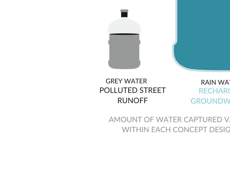


PRELIMINARY PHASE DESIGNS | 199
Chicane Stormwater Drainage
Chicane Stormwater Drainage
A PATH TO WONDER

Stormwater Drainage
The main flooding concern on site is at the north end of N Mountainview Avenue. It is important to recharge the groundwater with this polluted water, that would be otherwise unused. Chicanes were chosen as the preferred water capture method. The natural slope creates security within the water capture of the site, playing into the natural drainage on site. The chicanes are curb extensions that slow traffic speeds significantly.
The main flooding concern on site is at the north end of N Mountainview Avenue. It is important to recharge the groundwater with this polluted water, that would be otherwise unused. Chicanes were chosen as the preferred water capture method. The natural slope creates security within the water capture of the site, playing into the natural drainage on site. The chicanes are curb extensions that slow traffic speeds significantly.
The main flooding concern on site is at the north end of N Mountainview Avenue. It is important to recharge the groundwater with this polluted water, that would be otherwise unused. Chicanes were chosen as the preferred water capture method. The natural slope creates security within the water capture of the site, playing into the natural drainage on site. The chicanes are curb extensions that slow traffic speeds significantly.
The Linear walking path is an underutilized portion of the property. The area is proposed to be densely planted with a natural path meandering through the vegetation. The increased tree canopy in this area improves walkability concerns while also expanding exploratory play areas. The native desert species will also expand habitat preservation on site. By expanding the critter’s and insects’ natural habitat the healthier their ecosystem will be.
The Linear walking path is an underutilized portion of the property. The area is proposed to be densely planted with a natural path meandering through the vegetation. The increased tree canopy in this area improves walkability concerns while also expanding exploratory play areas. The native desert species will also expand habitat preservation on site. By expanding the critter’s and insects’ natural habitat the healthier their ecosystem will be.
The Linear walking path is an underutilized portion of the property. The area is proposed to be densely planted with a natural path meandering through the vegetation. The increased tree canopy in this area improves walkability concerns while also expanding exploratory play areas. The native desert species will also expand habitat preservation on site. By expanding the critter’s and insects’ natural habitat the healthier their ecosystem will be.
The first section reflects the street view of the chicane expansion. Chicanes allow for increased pedestrian safety. Not only are pedestrians further from vehicular traffic, but there is indeed a barrier of tree trunks separating the walker from the road. The plan view of the illustrated plan gives an overhead perspective of how much of the road would be readapted for planting. The second section illustrates the 8” depth of the basin capturing water as well as how pedestrian access shifts once the curb has been extended. Four precedent images reflect existing chicanes within the Rincon Heights neighborhoods. The images reflect a corner chicane, a traffic calming chicane, a median chicane and a chicane during the monsoon season. It is important to plan for the chicane to endure all seasons, not only monsoon.
The first section reflects the street view of the chicane expansion. Chicanes allow for increased pedestrian safety. Not only are pedestrians further from vehicular traffic, but there is indeed a barrier of tree trunks separating the walker from the road. The plan view of the illustrated plan gives an overhead perspective of how much of the road would be readapted for planting. The second section illustrates the 8” depth of the basin capturing water as well as how pedestrian access shifts once the curb has been extended. Four precedent images reflect existing chicanes within the Rincon Heights neighborhoods. The images reflect a corner chicane, a traffic calming chicane, a median chicane and a chicane during the monsoon season. It is important to plan for the chicane to endure all seasons, not only monsoon.
The first section reflects the street view of the chicane expansion. Chicanes allow for increased pedestrian safety. Not only are pedestrians further from vehicular traffic, but there is indeed a barrier of tree trunks separating the walker from the road. The plan view of the illustrated plan gives an overhead perspective of how much of the road would be readapted for planting. The second section illustrates the 8” depth of the basin capturing water as well as how pedestrian access shifts once the curb has been extended. Four precedent images reflect existing chicanes within the Rincon Heights neighborhoods. The images reflect a corner chicane, a traffic calming chicane, a median chicane and a chicane during the monsoon season. It is important to plan for the chicane to endure all seasons, not only monsoon.


Section displaying water capturing method used on site.

IMAGE ABOVE: dipitem delesseditam ut mo con cullentur? Lestrup tatiame volorepmpor re ipsam nonsed et laccatiis sit ea dipsam, quodis expliquas utecaborum
IMAGE ABOVE: dipitem delesseditam ut mo con cullentur? Lestrup tatiame volorepmpor re ipsam nonsed et laccatiis sit ea dipsam, quodis expliquas utecaborum

200 | PRELIMINARY PHASE
DESIGNS
IMAGE ABOVE:


PRELIMINARY PHASE DESIGNS | 201
A PATH TO WONDER
Program
Burns Park
The emphasis of programable spaces is found within burns park. The reopening of Burns Park has activated the space for new users. While in the planning stage, we have th ebaility to program for the activites that cater to multi-generational engagement. The program is a way to phyiscally place goals within the site. Abstractly forming spaces within our site to achieve our goals. The full site program shows how the two different sections are threaded rtogether in a cohesive plan. Our goals were chosen to reflect the mini-grant parameters of green infrastructure baswed on traffic calming and stormwater management methods. The program is also addressing the user groups we are desuigning for, chosen within the inventory process. The objectives are tangible ways of how we would achieve our programs. There are also precedent images to display our ideas through existing examples.
Linear Walking Path
Utilizing the linear walking path to increase vegetation will expand green infrastructure throughout the site. The increased canopy coverage will address waslkability concerns while also expanding open exploratory play areas. Green infrastructure play setting strucures natural play settings fixed with logs and boulders.
Preserve
Habitat
Residents emphasized the protection of the hawk population. Habitat preservation within this area will preserve exisiting tall canopies and infiltrate smaller microecosystems on the ground level to help pollinators and criters.

Guided Play

Green infrastructure play setting structured, natural play setting, allows exploration and discovery for childre n.

Green Chicane
» Stormwater collection systems redirect street runoff


» Acting as a curb extension to slow traffic speeds.

202 | PRELIMINARY PHASE DESIGNS


PRELIMINARY PHASE DESIGNS | 203
Team 3
204 | PRELIMINARY PHASE
DESIGNS
Nadia Sarneyzehdoost Anna’s Hummingbird Calypte anna
Oscar Rodriguez Ponce Black-chinned Hummingbird Archilochus alexandri
Selenne Yescas Common Raven Corvus corax
Cordell Lee Western Screech Owl Megascops kennicottii
PRELIMINARY PHASE DESIGNS | 205
METAMORPHOSIS
METAMORPHOSIS Programming

Inspired by a caterpillar’s metamorphosis from a cocoon to a butterfly, our design proposal is to rejuvenate the Sierra Estates neighborhood. By activating a publicly accessible burns park, the addition of vegetated chicanes and a linear path to achieve the following goals for the community


The programming and the design of this neighborhood was mainly determined based on the comments, suggestions, opinions and feelings of the residents. Given the programming agenda, the residents had the pleasure of assisting in the design progress. Impactful feedback included the use of green spaces, water management, and traffic.
DIAGRAM


the program diagram is a graphic explanation of the goals intended for the program design of the Sierra Estates neighborhood. It captures a synthesized idea of what the main goals can be to tackle on the constraints and opportunities determined during the inventory and analysis phase.
CONTEXT MAP


context maps are helpful to give the viewer a better view of the spaces being described. here, a monochrome map with black arrows is simple, yet an effective representation of the spaces circulation.


GOALS


» increase vegetation

» reuse elements
» implement traffic calming features
TRAFFIC CALMING
Implement green infrastructure for traffic calming and to address water issues.
INCREASE VEGETATION
Increase the presence of drought tolerant and native vegetation for thermal comfort and wildlife habitat.


REUSE ELEMENTS


Reutilize and organize existing element materials on site. Such as vegetation, soil, rocks, etc.


206 | PRELIMINARY PHASE DESIGNS
DIAGRAM ABOVE: representation of programming goals diagram MAP ON RIGHT: the monochromatic context map is a visualization for location purposes.
REFERENCES, SOURCES & RECOMMENDED RESOURCES:


Yescas, S. (2022). Context map. Space context map visual. Tucson, Az


Yescas, S. (2022). Program diagram. Programming. Tucson, Az

PRELIMINARY PHASE DESIGNS | 207
BURNS PARK CHICANE LINEAR
PATH
METAMORPHOSIS

Burns Park
Group 3’s design proposal for Burns Park focuses on creating multiple spaces for a variety of uses and user group, emphasizing safety and comfort. A fenced pet area allows users to let their dogs run free without worrying about them interacting with children or running to the street. The central area accommodates community activities and non-guided play for children, including many seating options. Lastly, the recreation area can be equipped with makeshift exercise machines or used for other activities. All of these spaces are connected by accessible trails, and stormwater management is reserved mostly to the far north of the site for ease of maintenance and safety. The entire park remains fenced for safety reasons and is to be open to the public during the day.


208 | PRELIMINARY PHASE DESIGNS
A
IMAGE ON LEFT: Context map with site limits, illustrated plan, and section
100’ 19’ 5’
vine-covered school fence recreation area bus stop sidewalk


PRELIMINARY PHASE DESIGNS | 209
REFERENCES, SOURCES & RECOMMENDED RESOURCES:
Section elaborated by Oscar Rodriguez. Referenced plan designed and rendered by Nadia Sarneyzehdoost and Selenne Yescas.
115’
192’ 86’ 64’ east entrance picnic area gathering / play area pet area
Linear Path and Chicanes


The following section shows how space is utilized in the wider portion of the Linear Walking Park. Conceived as a space for dog walking, running, and strolling, main feature is the large walking path that intermittently narrows down because of vegetative buffers, but still allowing for multiple people to use it at once. The swale is placed closer to the wall and helps convey stormwater to the rain garden at the east corner. A planting area softens the presence of the monolithic wall and utilizes the stormwater that flows through the swale, providing more canopy cover for the comfort of users.


The following section shows how space is broken down in the chicanes. Designed for traffic calming and stormwater management, the chicanes extend from the sidewalk and include planted stormwater detention basins at a depth of 8”. Water enters through a curb cut on the right side of the chicane and flood the basins inside. There is enough separation from this curb cut to the basins to prevent accidents and to keep vegetation from extending beyond the curb. Minimal edging was added to the sidewalk for the safety of wheelchair users, providing a physical barrier to the basins.


210 | PRELIMINARY PHASE DESIGNS
METAMORPHOSIS
IMAGE ON LEFT:
A
south wall swale
A’
5’ 11’ 5’ 1’ 3’ planting planting walking path
IMAGE ON RIGHT: Context map with chicanes site limits


PRELIMINARY PHASE DESIGNS | 211 A
8’
20’
20’ road
A’
curb cut sidewalk planted stormwater detention basin
METAMORPHOSIS
Circulation and space
The circulation of the site is highly important as these spaces give the viewer a sense of place within these major spaces. Within the space hierarchy the diagram represents major spaces designated to the sites design.

CIRCULATION SPACES
The diagram with orange circulation paths was created with the procreate app for a more dramatic effect and visualization of how the residents can meander through each site- Burns park, linear path, and chicanes.


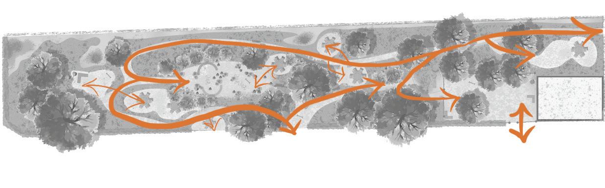
SPACE DEVELOPMENT
bubble diagrams represent the space hierarchy and importance of designated areas for a design to develop into a plan. The bubles in green represent vegetation, bubbles in blue represent water, and the darker unfilled bubbles represent the major spaces designated for this design.
212 | PRELIMINARY PHASE DESIGNS
DIAGRAMS ABOVE: the orange arrows on the diagrams represent the circulation process through the major spaces in the Sierra Estates neighborhood.
DIAGRAM ON RIGHT: space diagram development and relativity of spaces on site
blue bubbles: water
green bubbles: vegetation


darker bubbles: major resident spaces
REFERENCES, SOURCES & RECOMMENDED RESOURCES:


Reid, G.W. (2002). Lanscape graphics - plan, section, and perspective drawing of lanscape spaces, revised edition. Conceptual diagramming (pg. 52). Crown publishing group, New York. Yescas, S. (2022). Circulation. Space circulation paths. Tucson, Az


Yescas, S. (2022). Conceptual diagramming. Space bubble diagrams. Tucson, Az


PRELIMINARY PHASE DESIGNS | 213
METAMORPHOSIS
Stormwater managment

Within the design, a key aspect to solve issues along the site, the team proposed capturing stormwater thoughout the site to address the issues of flooding in the neighborhood.
CALCULATIONS


determined based on the area cubic feet of Burns park, linear path, and chicanes. these calculation proposals capture 2,107 cu. ft., manage 4% of water on the site, and has a runoff total of 57,095 cu. ft.
WATER PLANS
the water plans of the Burns park, linear path, and chicanes were placed on a monochromatic map to give a better visual representation of where the water is being disbursed and captured.


Burns park: 892 cubic feet of stormwater detention
Proposed Capture: 2,107 cu.ft.

Chicanes: 778 cubic feet (389 cu ft on each chicane)
Percent Managed: 4%

CIRCLE DIAGRAM: stormwater management calculations


214 | PRELIMINARY PHASE DESIGNS
Total Runoff: 57,095 cu.ft.
Linear path: 437 cubic feet


REFERENCES, SOURCES & RECOMMENDED RESOURCES: Rodriguez, O. (2022). Stormwater management. Bubble diagram calculations. Tucson, Az Yescas, S. & Sarneyzehdoost N. (2022). Stormwater management. Water plan on Burns park, chicanes, and linear path. Tucson, Az

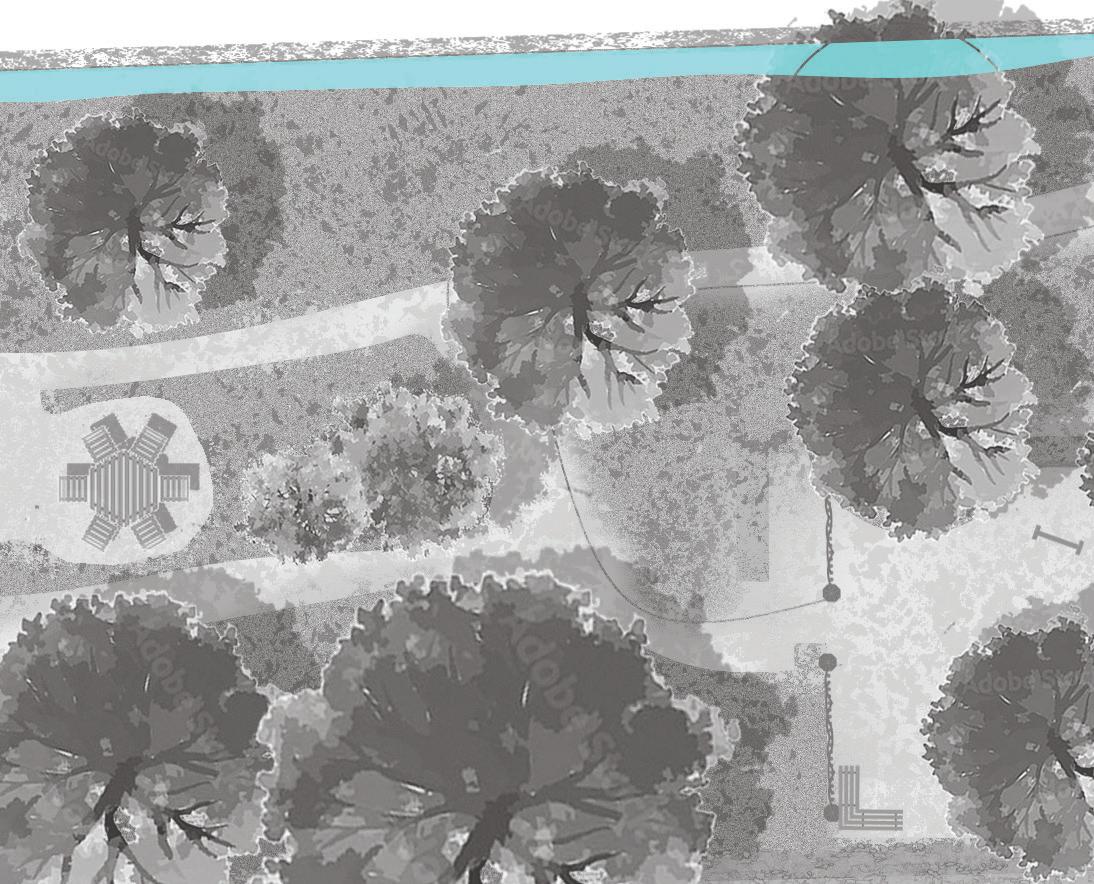


PRELIMINARY PHASE DESIGNS | 215
METAMORPHOSIS Imagine

The purpose of imagining a space design in the metamorphosis concept before executed onto the landscape is to gather the key elements that will give it its personality with time.


SKETCH UP MODELS


perspective sketch up models are a great representation created by students to showcase the designed spaces with near to scale people. this creates a sense of place for the viewer.


REPRESENTATIVE IMAGERY

the take away from utilizing images that could represent the space being designed is that it would not be identical to the image, rather it creates a visual representation in the eye of the beholder. the idea is that our creative minds have the capacity of mimicking spaces such as those in the images to fit our own environments while acknowledging the different ecosystems.
KEY ELEMENTS TO VISUALIZE

» natural textures

» native desert vegetation


» wildlife conservation
» no hardscape


» soft walking paths


» canopy shade

» rocks and gravel
» water

IMAGES ABOVE: sketch up models - top perspective of Burns Park, middle perspective of chicanes, bottom perspective of linear way


216 | PRELIMINARY PHASE DESIGNS
Burns park gathering/play space
Linear path South East corner
Chicanes - residents walking on sidewalk
REFERENCES, SOURCES & RECOMMENDED RESOURCES:


Lee, C. (2022). Sketch Up software - Perspective images created by student Cordell Lee. sketchup.com Representative images of spaces. (2022). retrieved from pinterest.com/selenneyescas

PRELIMINARY PHASE DESIGNS | 217
chicane curb representation
Lady well Fields by BDP
Dry river beds - Native Landscape Creations
CBD Raingardens project in Bellingham Washington
Roberto Burle Marx, Rooftop Garden, Ministry Of Education And Public Health
One-lane chicane _ Source: Flickr Photose Bliss Garden Design - Designer Tish Treherne Stormwater BMP Design _John Burroughs School
UNIVERSITY OF ARIZONA COLLEGE OF ARCHITECTURE, PLANNING, AND LANDSCAPE ARCHITECTURE


