17 minute read
Final Comprehensive Plan
15 Final Comprehensive Plan
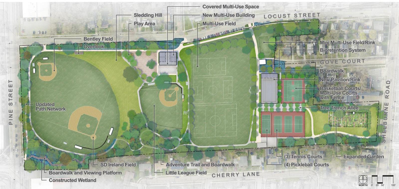
Final Comprehensive Plan rendering, for a full size version of all comprehensive plan renderings, enlargements and diagrams, refer to Appendix D. Final Comprehensive plan
Advertisement
Feedback provided by the community through the concept menu provided direction on which elements to include and where, layered with plan goals to develop a final comprehensive plan. This plan was presented to the public at the third virtual workshop for review and feedback. A full-size copy of the plan, along with enlargements of key areas, can be found in Appendix D. The following summary of improvements included in the comprehensive plan is organized by the project goals.
Circulation / Entrances
The comprehensive plan includes a formalization of paths to encourage connections to the site from the surrounding streets, improve accessibility within the site, provide safe routes through the site for pedestrians and cyclists, and provide new passive recreation opportunities within the park. A hierarchy of path types is proposed with primary routes providing 8- to 10-foot-wide paths with ample room for multimodal transportation, and secondary 4- to 6-foot-wide paths within the park to provide passive recreation and accessible connections to site elements. To work towards these objectives, the comprehensive plan proposes the following updates: + Add a short strip of sidewalk on the south side of Locust Street to create a safe connection between Pine St and the lowest terrace of the park. A retaining wall will be needed on the park side to carve out a space for the new sidewalk. + A rerouted and regraded pathway, referred to in the comprehensive plan as an East-West connection, links the lower terrace all the way east past the parking lot to create a continuously paved connection along Locust Street. This path will need a series of approximately 9 accessible ramps (30’ each with 5-foot landings between and handrails on both sides) to provide an accessible route up the side of the steep slope from the lowest terrace.
+ Formalize all existing paths and connections throughout the park and add additional routes to create a looping path network to enhance accessibility. + Create an entrance to connect the southwest corner of the park to Pine Street via a boardwalk through the wetland and a second path from Pine Street via a sloped walkway up to the lower fields. + Provide steps and a sloped path to connect the middle and upper terrace, near the tennis courts and multi-use field.
+ Add a path and steps to connect to Shelburne Road where the slope is steep. + Add an accessible path around the west side of the little league field. A retaining wall and guard rail will be needed to expand the flat area at the top of the hill and make the path accessible.
+ Formalize the woodland paths and develop an accessible exploration trail.
Final Comprehensive Plan 16
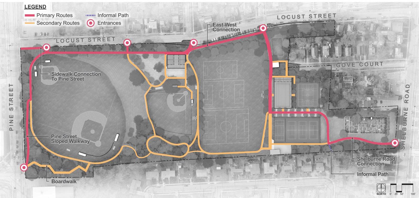
Calahan Park Comprehensive Plan - Proposed Circulation
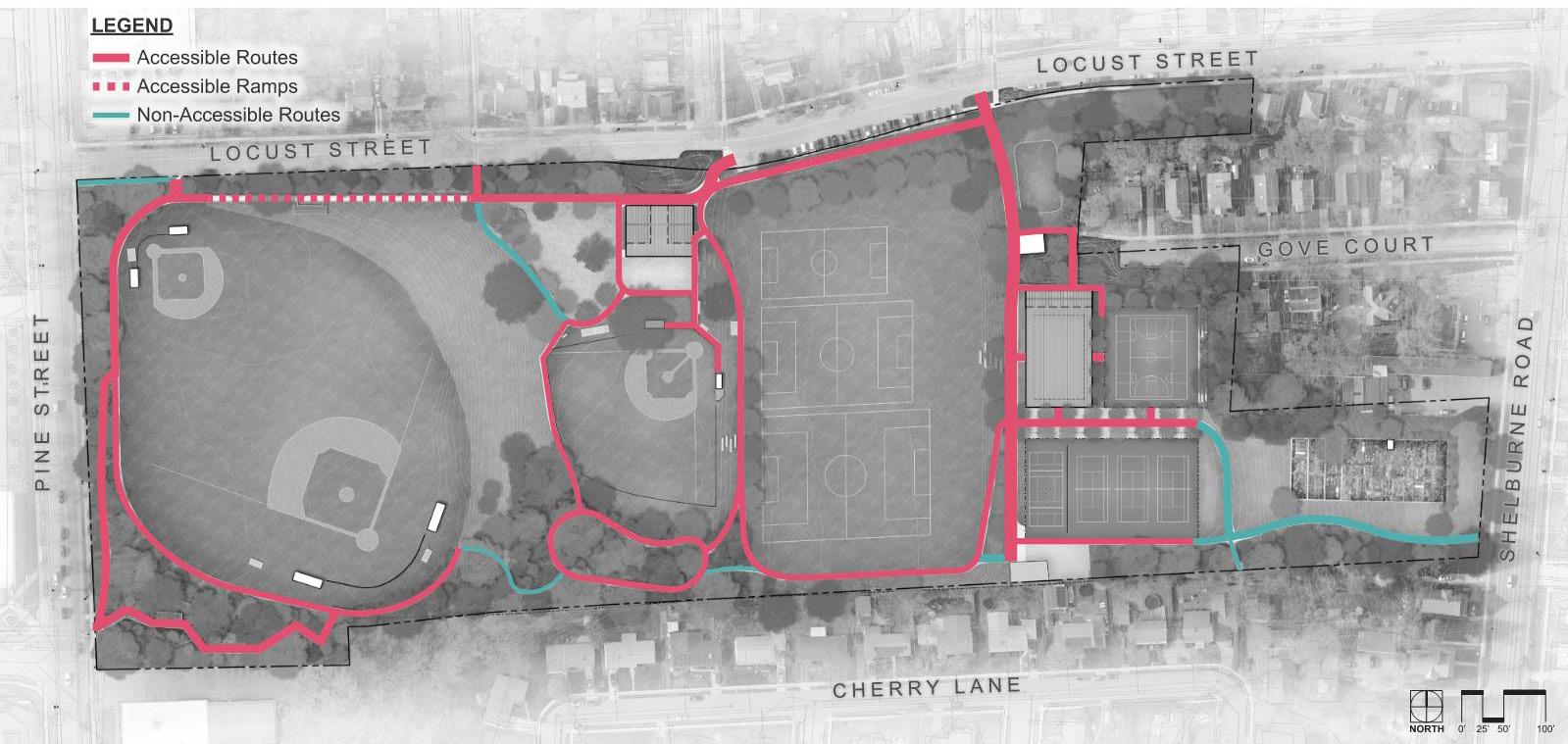
Calahan Park Comprehensive Plan - Proposed Accessibility
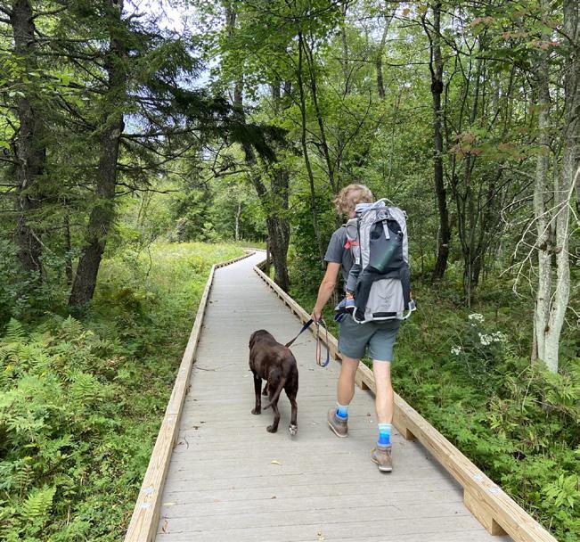
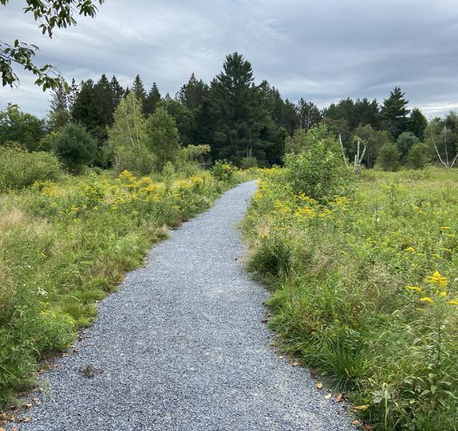
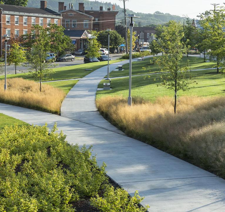
Potential accessible path surfacing. From left to right: boardwalks in wet areas, stabilized stonedust, and paved concrete. Image source left to right: Offshoots, Offshoots, Wagner Hodgson Landscape Architecture
17 Final Comprehensive Plan
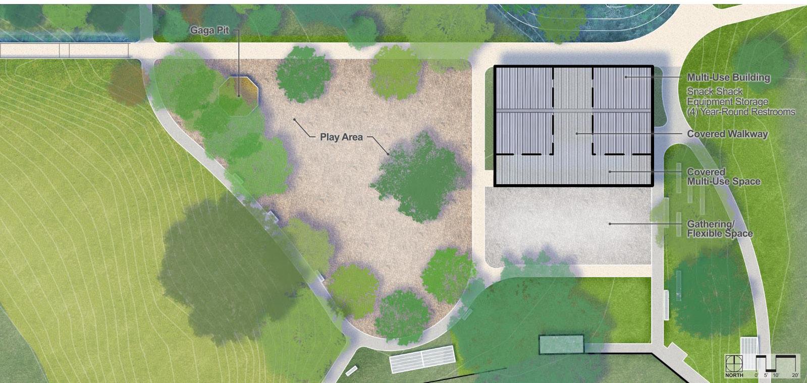
Calahan Park Comprehensive Plan - Proposed Multi-Use Building amd Proposed Playground location and phasing strategy Path materials have not been selected but pervious surfaces are preferred where possible, except for the primary pathways which are intended to be concrete paths for accessibility and longevity. Using pervious surfaces where appropriate will allow stormwater to infiltrate into the site and reduce water being added to the combined sewer overflow system. While not explicitly located in the comprehensive plan, the design team recommends adding a hierarchy of park signs consistent with the BPRW signage package. At a minimum, the following locations should be considered for signage to improve wayfinding at park entries and within the park: + Park entrances to north and south of parking lot + Shelburne Road walkway + Pine Street – Southwest Entry + Pine Street – Northwest Entry
Pavilion
Structures
Multi-Use Building:
The new multi-use structure will have an 80’ x 45’ footprint, with a covered 16’ deep terrace facing south. The program is similar to the existing structure, with space assigned to a concession area, equipment storage, and restrooms. To increase visibility from the street, there is a proposed covered 20’ wide ‘dog trot’ between two equal volumes. In its current iteration, the building has a 4,880 SF footprint, with 2,650 SF of interior space, 2,230 SF of covered exterior space. The location is intended to allow for good solar exposure with photo-voltaic panels to make the building net-zero energy. The comprehensive plan recommends (4) non-gendered, single-use restrooms. Code requires that 50% of these restrooms will need to meet accessibility requirements. However, BPRW has a goal to provide four fully accessible restrooms in this location with at least one adult/versatile change table. The plan recommends the building be insulated and conditioned for year-round use, though some components may not require the same conditioning as the restrooms. Equipment storage for example, may not need year-round heating and cooling.
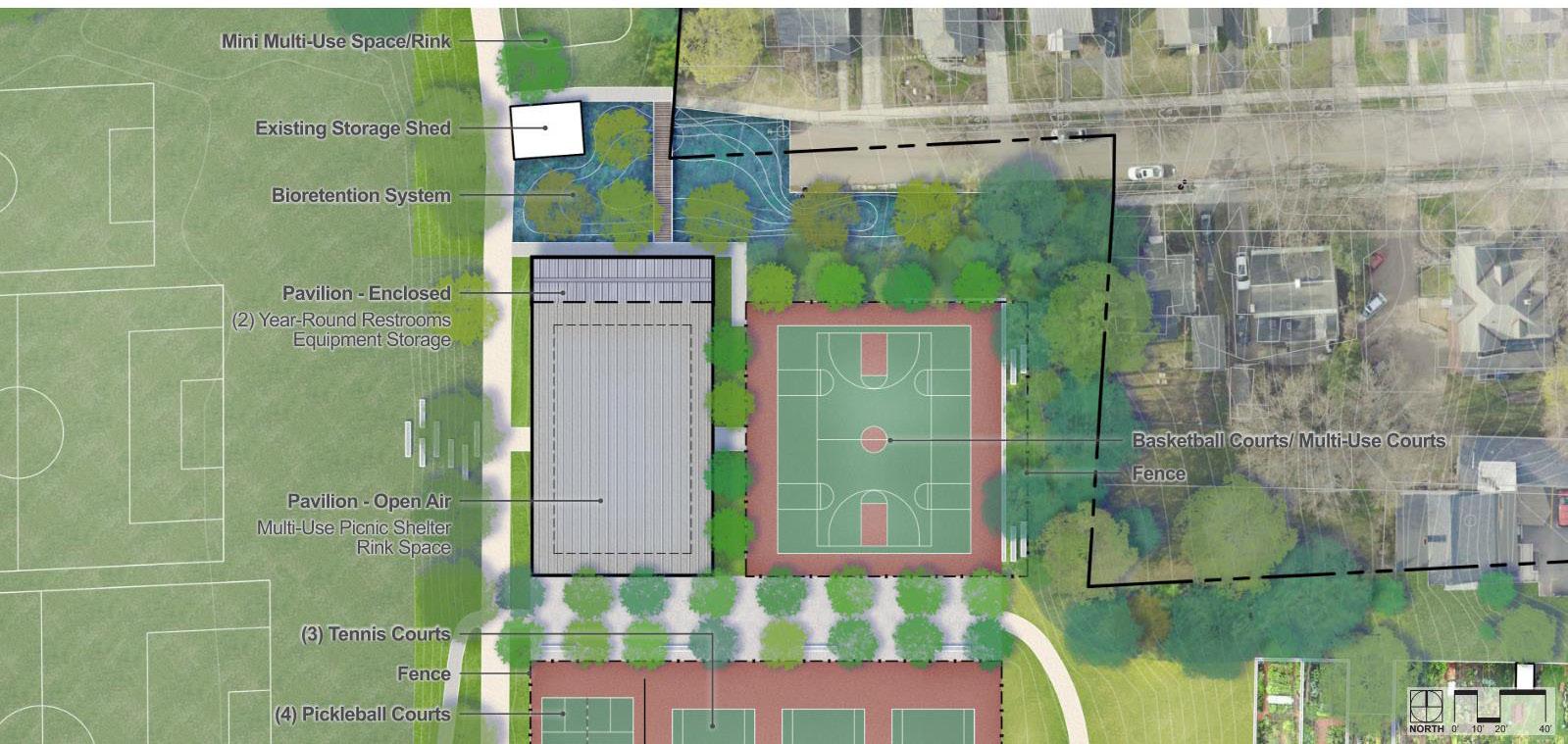
The pavilion structure is 80’ x 140’, with an 80’ x 20’ enclosed space along its northern elevation. The structure is for covered outdoor space in the summer and an opportunity for a covered ice rink in the winter. The enclosed space would contain (2) non-gendered, single-use restrooms, conditioned for yearround use. The remainder of the space would be used to store equipment associated with the pavilion (rink maintenance, etc.), or for equipment storage for the adjacent basketball, tennis and pickleball courts.
Playground:
The comprehensive plan includes a proposed playground. The community requested a combination of traditional play equipment like slides, swings, and climbing structures, as well as more natural materials and potential for nature play elements. Locating the playground next to the proposed building provides easy access to the year-round restrooms and covered area for shelter from the elements. The location of the playground was shifted to the top of the sledding hill, creating potential to integrate the playground into the slope of
Final Comprehensive Plan 18
Calahan Park Comprehensive Plan - Proposed Pavilion
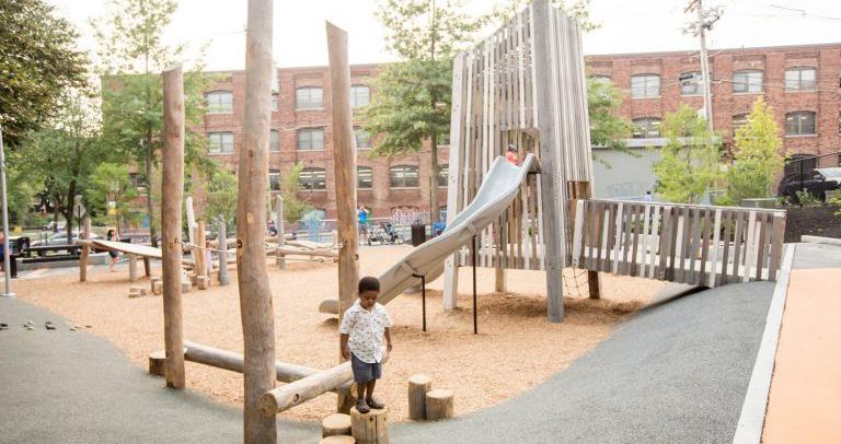
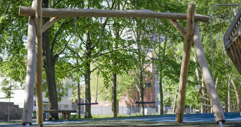
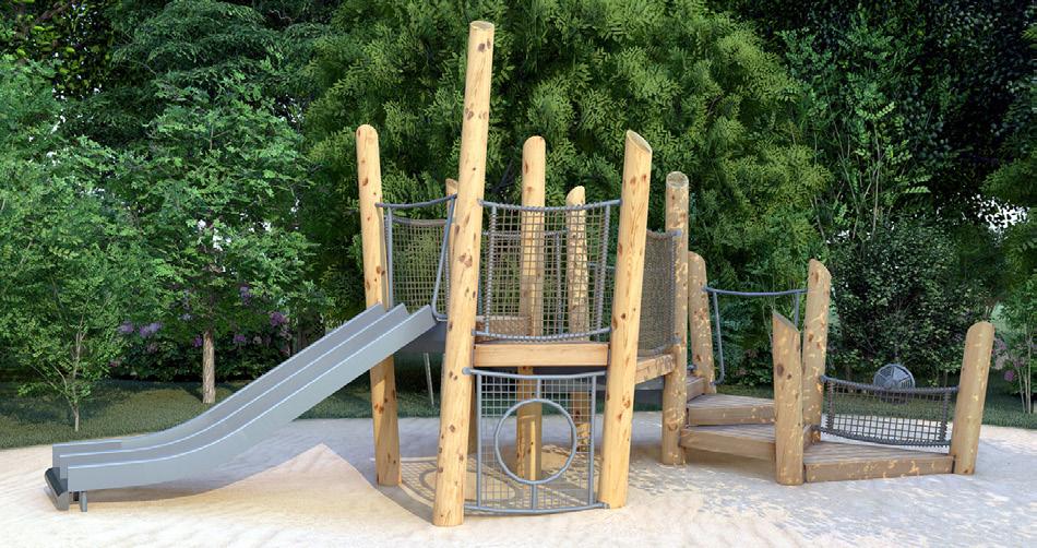
Public feedback indicated hybrid equipment with both natural and traditional elements should be prioritized. Photos sourced from Columbia Cascade and Earthscape playground equipment manufacturers. the sledding hill (re: embankment slides, climbing routes etc.) and to capitalize on the view west towards the lake. This shift also creates a buffer space between Locust Street, the parking lot and the play space which will include play equipment for all age groups in one central location.
In order to accommodate the initial playground renovation slated for fiscal year 2022 prior to the full comprehensive plan implementation, a Phase One playground will be constructed in a zone that will not impact future adjacent comprehensive plan revisions to the building and walkway. A Phase Two will be added in the future to expand the play area into the large open space at the top of the sledding hill which will be created when the existing building is removed. In addition to the formal playground, the adventure trail and boardwalk are included on the south side of the park to provide additional opportunities for STEAM (Science, Technology, Engineering, the Arts and Mathematics) exploration and nature play on an ADA accessible route through the existing woodland. This trail is intended to provide access to a series of natural elements and play opportunities.
Athletic Resources:
The park’s athletic facilities are recommended to be updated in a phased approach. Phases will be determined by the City as funds allow and will be coordinated with the overall comprehensive plan layout.
Fields
The baseball fields all remain in their existing locations with the following proposed updates:
19 Final Comprehensive Plan
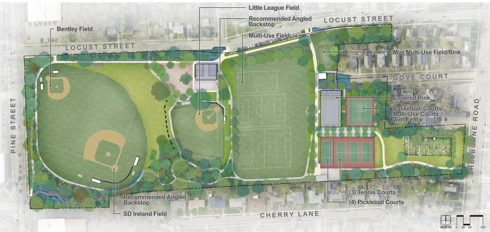
Calahan Park Comprehensive Plan - Proposed athletic resource improvements + When due for replacement, all fields will receive angled backstops instead of the existing straight backstops to help minimize foul ball trespass. + Foul-ball safety netting will be provided between the Little League field and the playground to reduce risk of foul balls entering the play space or adjacent flexible-use space. + S.D. Ireland and Bentley Fields, on the lower terrace, will receive updated stormwater management practices, refer to proposed stormwater practices for additional information.
+ An accessible spectator viewing deck platform along the ramped walkway will provide an on overlook at
Bentley and S.D. Ireland Fields
The two multi-use fields have not been identified as needing any large updates at this time. Paths along both size of the large multi-use field have been delineated in the plan to create an accessible loop within that terrace, as well as the potential for terraced seating built into the slope on the east side. If the field undergoes future work there are stormwater practice recommendations that should be considered, described in the stormwater section.
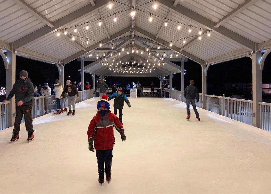
A picnic pavilion transformed into a winter ice rink at the T.B. Hanna Station in Raymore, MO. Source: Raymore, MO Parks and Recreation. The basketball courts will be relocated to the east of their existing location to allow room for the Pavilion, as seen on the enlargement on page 18. In their new location, the courts will be resized to meet regulations and a new fence added around their perimeter to help retain balls within the space. The courts can optionally be surfaced as multi-sport courts to create a more flexible use area. A retaining wall will be needed along the northeast and east sides of the court, which can be incorporated into slope seating along the edge of the courts.
Courts
The tennis courts will be shifted to allow room for updated pathways and a tree trench for court surface stormwater management. The new courts will include three tennis courts separated from four pickleball courts by appropriate screening, and the entire court surface will be fenced in.
Rinks
A permanent location for the larger ice rink will be created within the covered pavilion. A proposed 60’ x100’ dedicated rink space is suggested to be included with the pavilion design process. This location will allow a concrete surface suitable as a base, access to water for pouring the rink, and the covered space will reduce the demands of rink maintenance for this
Final Comprehensive Plan 20
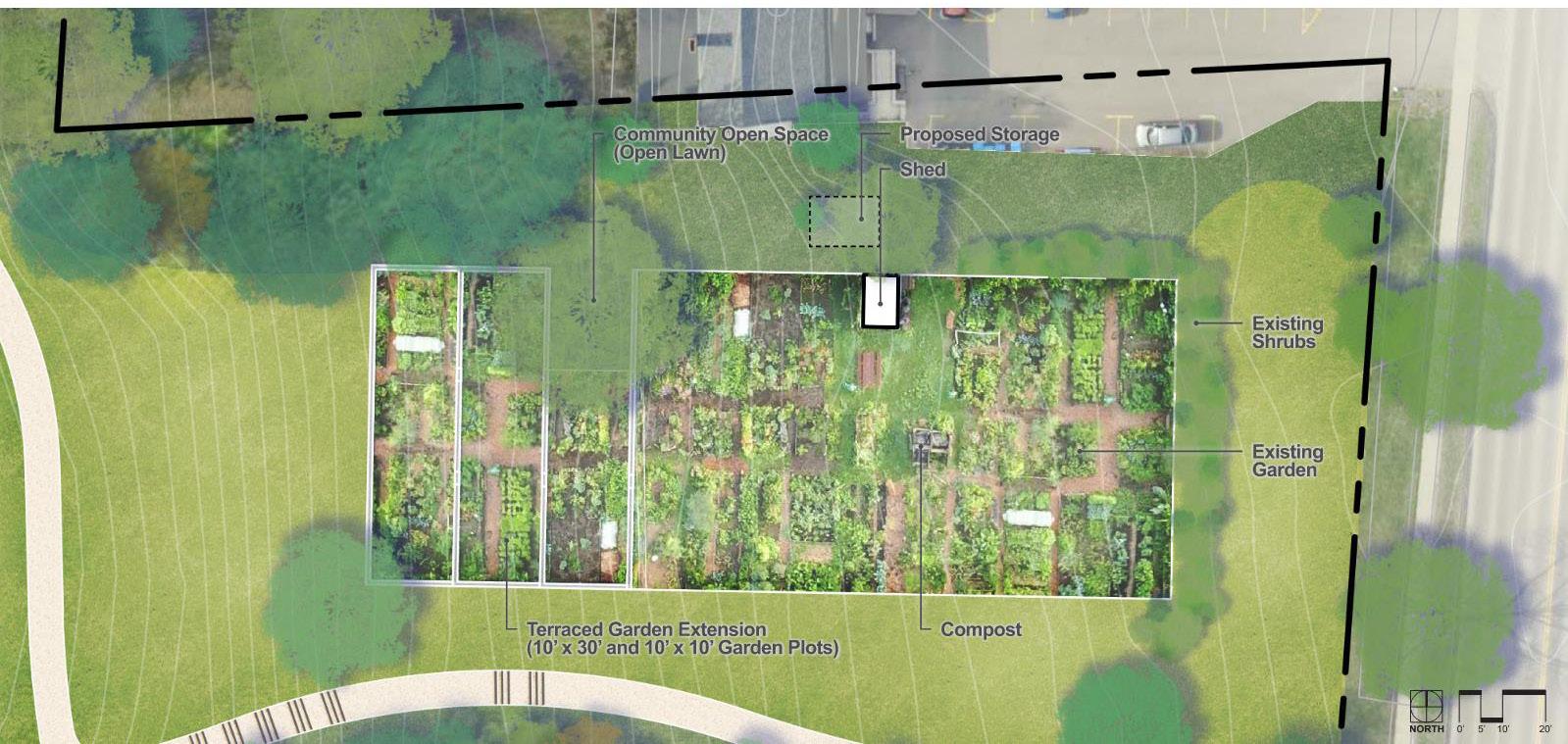
Calahan Park Comprehensive Plan - Proposed community garden expansion
community-run amenity. Additionally, the open space just north of the existing shed will continue to function as a mini multiuse field and ice rink space ideal for younger skaters.
Gathering Spaces
Throughout the park there will be many new opportunities to gather in large or small groups. The new covered multiuse space at the multi-use building and the pavilion will be formalized gathering that can be rented out for events and also be used by the community on a day-to-day basis. Many informal gathering spaces can be found throughout the park as well, examples include: + Benches along the shaded tree trench allée for watching games on the courts, overflow seating for events at the pavilion, or sunset views down to the lake
+ Terraced seating built into the slope at the flexible use space adjacent to the multi-use building
+ Terraced seating to the east of the multi-use field and west of the pavilion (overflow) + Benches along the top of the sledding hill
+ An overlook along the path to watch games on Bentley and S.D. Ireland fields + The wetland overlook on the boardwalk
+ The community garden informal open space
Community Garden
The community garden expansion design is directly influenced by a plan drafted by the community gardeners themselves. It features a terraced expansion to the west and will create space for approximately 10-14 additional families to have plots at the park. An open space around an existing tree will remain as an informal gathering space. Materials storage is proposed to shift to the north side of the garden, near the parking spaces, in order to allow space for the new path down the slope from Shelburne Road.
Site Utilities
Along with updates to surfacing and site furnishings, the plan proposes that the park be updated to provide the community with access of additional utility-based amenities such as Wi-Fi, charging stations, and water bottle refill stations. These amenities will benefit all park users including unhoused neighbors. Additionally, site lighting updates are proposed throughout the park to create safe pedestrian routes along the primary corridors and at athletic resources to elongate the seasons. Updated lighting will be especially beneficial in the winter months to expand site accessibility and use into the early evening hours. See diagram on page 21 as well as the full-size diagram in Appendix D for an overview of the proposed site lighting of athletic areas, buildings, and primary pedestrian walking routes
Views
Preserving and celebrating views west to the lake was a key feature of the park identified during the planning process.
21 Final Comprehensive Plan
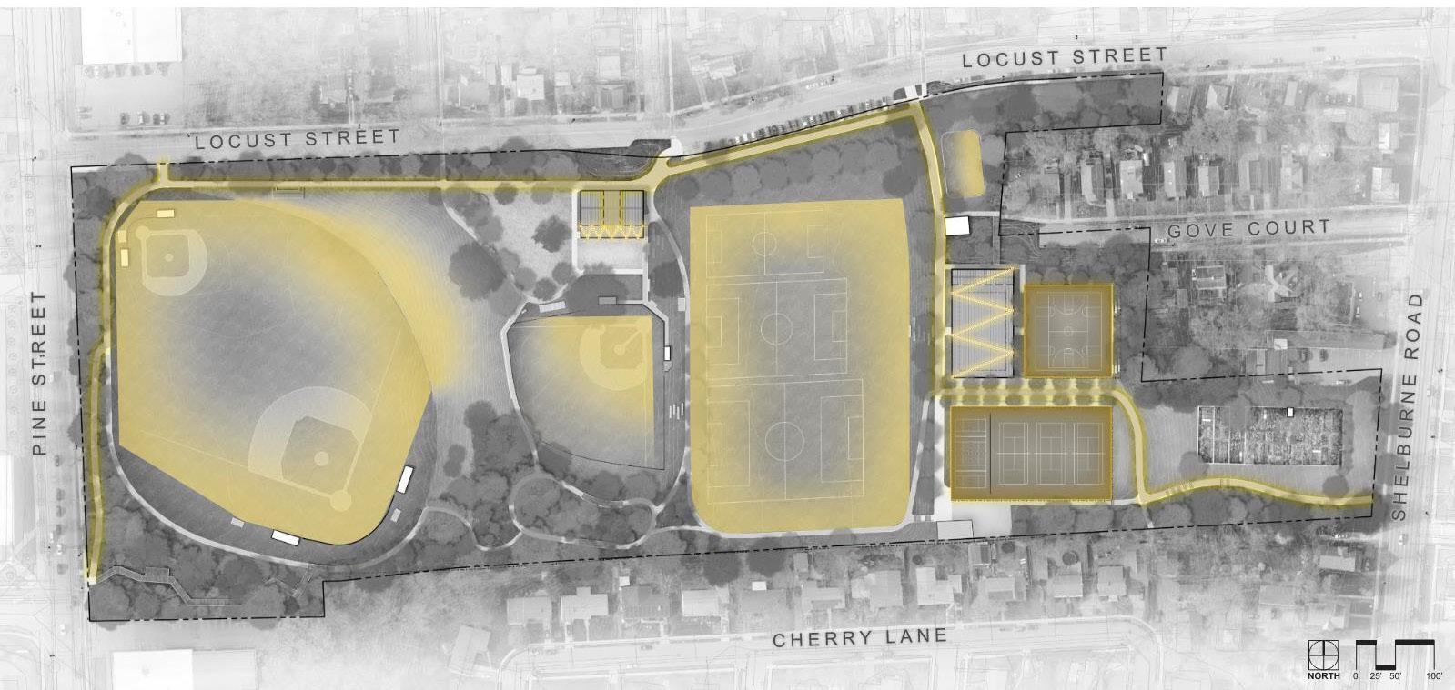
Calahan Park Comprehensive Plan - Proposed lighting on primary paths, athletic resources, and buildings
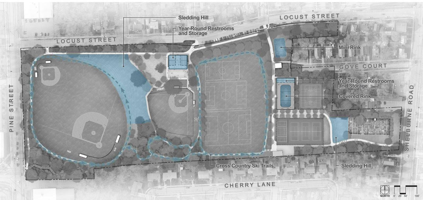
Calahan Park Comprehensive Plan - Seasonal program expansion Several site elements are placed at key viewsheds to capitalize on the views including the playground, tree allée (tree trench), and covered pavilion. Each of these elements, also created to function as gathering spaces, will provide visitors with a stunning view west. New buildings were carefully located to maintain existing views and block sight lines within the park.
The comprehensive plan focuses on creating spaces with more than one function to capitalize on the available space. The multi-use building located north of the Little League field features amenities including a snack shack, equipment storage, year-round restrooms, and a covered patio for shelter from the elements. Similarly, the covered flexible-use pavilion can be an event space, picnic shelter, yoga studio, etc. in the summer and can transform into a covered rink in the winter months.
To provide a year-round public amenity, the comprehensive plan focuses on providing additional shoulder season and winter opportunities. The proposed dedicated rink space within the pavilion will provide a consistent winter activity on site, as do the preserved sledding hills. The improved circulation proposed offers snowshoeing and cross-country ski routes within the park. Finally, updated site lighting on the pedestrian routes, athletic resources, and buildings will elongate the
Final Comprehensive Plan 22
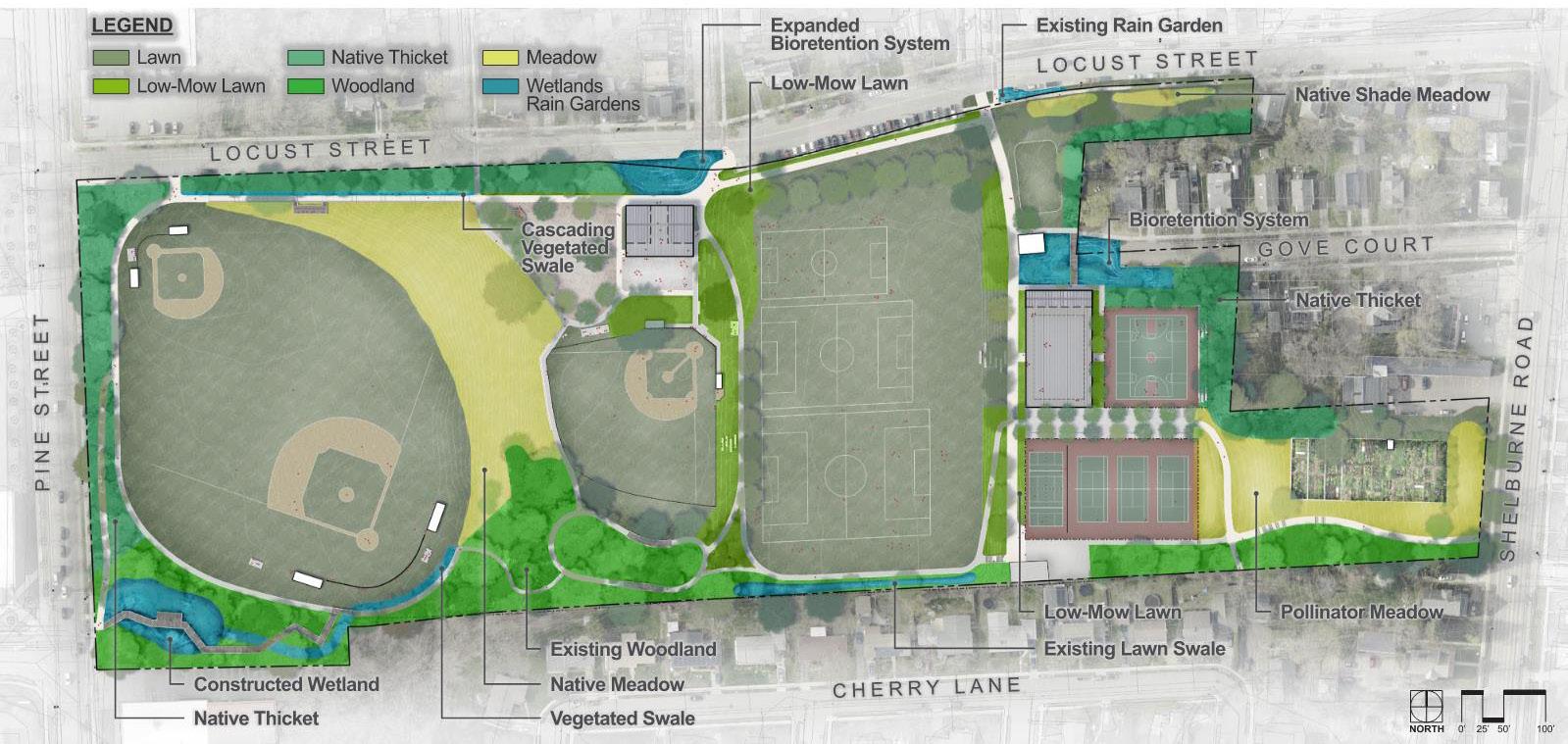
Calahan Park Comprehensive Plan - Proposed plant communities existing sport seasons and increase available hours for outdoor recreation in the winter months.
Site Ecology - Vegetation
In the spaces between the programmed areas, there is an opportunity to improve the ecological value of the site by shifting the maintenance practices and vegetation types over time. The comprehensive plan identifies opportunities at the groundcover layer, understory, and tree canopy to provide additional ecological and wildlife benefits.
Groundcover Layer:
As the park is updated, key areas for intervention include: converting most sloped areas between the park’s terraced fields from traditional lawn turf to native meadows, pollinator meadows, and low-mow lawn. This transformation will reduce the maintenance required and supports biodiversity by providing habitat and food sources for insects and wildlife.
Understory:
Along Locust and Pine Streets, a thicket, or dense understory shrub planting, is recommended to provide a vegetative buffer from the streets. This planting will provide habitat and food for wildlife and can provide phytoremediation benefits by cleaning particulate matter from vehicular traffic out of the air.
Canopy:
Any new tree plantings should be native species with high wildlife value and be provided in a variety of heights to promote species and tree age diversity. Per the Vermont Department of Forestry, example species include Quercus alba, Quercus bicolor, Quercus rubra, Fagus grandifolia, Amelanchier laevis, Acer rubrum, Nyssa sylvatica, and Populus tremuloides.
Site Ecology - Stormwater
Calahan Park is located within a highly developed neighborhood with varying soils providing limited space to absorb and treat rainfall. Consequently, rainfall is quickly converted into surface runoff. The site runoff which causes erosion and localized drainage problems also transports sediments, nutrients, bacteria, and other contaminants to the City’s Combined Sewer Overflow (CSO). Stormwater overflow discharges from both CSOs and the storm sewer system contribute the impairment of the water quality of Lake Champlain. Increased runoff volume entering into the combined sewer system contributes to unnecessary additional wastewater treatment (usually at a lower treatment efficiency) or discharges of raw sewerage to the lake. Flooding from overwhelmed storm sewer systems can also cause damage to homes, businesses, and property. Therefore, as part of the proposed park improvements, the incorporation of Green Stormwater Infrastructure (GSI) is an integral part of the overall plan. Not only can the GSI improvements solve localized drainage problems, provide better pedestrian connectivity and improve recreational amenities, but they can also improve local water quality. The stormwater management approach can accomplish the following major objectives:
+ Better manage stormwater in the park to reduce existing ponding and erosion and maximize useability.
23 Final Comprehensive Plan

Calahan Park Comprehensive Plan - Proposed stormwater management + Provide treatment and encourage groundwater recharge to the greatest extent practicable. + Limit site impervious cover, direct water off pathways and hardscaping into stormwater management areas and increase buffer plantings and tree canopy. + Minimize runoff to the Pine Street CSO.
These objectives are met in the comprehensive plan using the following stormwater management measures: + Bioretention System (rain gardens) + Subsurface Tree Trench (Tree Allée)
+ Underground Infiltration System road runoff into the GSI. This location, between the mini rink and the covered rink would create a stormwater feature with educational opportunities and pedestrian boardwalk through the feature.
Overflow during larger rain events from the tree trench and the bioretention area would be collected via a closed pipe system and directed to underground infiltration chambers located beneath the soccer fields. This approach would take advantage of the well-draining soils in this area as the chambers would store and infiltrate overflow water from the uphill areas of the park. The existing swale in the southeastern corner of the soccer fields would be enhanced to improve drainage, directing water from the slope to the east away from the fields.
+ Permeable Surfaces
+ Constructed Wetland
Starting from the top of the hill by Shelburne Street and moving down to Pine Street, surface runoff from the community garden area and tennis and pickleball courts would be collected and directed into a subsurface tree trench below the multi-use space previously identified as the tree trench allée. The trench would store and infiltrates water in a subsurface gravel reservoir under the tree planting soil to allows root to grow down and access the water. Stormwater from the basketball courts/multi-use courts and covered skating rink as well as Gove Court would be directed into a bioretention area at the end of Gove Court. This bioretention area would be a planted depression that would hold and filter stormwater. To achieves this, a portion of the paved area at the end of Gove Court would need to be reclaimed for this practice, reducing impervious surface and directing The enhanced grass swale along the southern edge of the park would continue to direct water into the wooded area. Pathways would be designed to be elevated or use boardwalks to ensure safe circulation. Erosion control and additional swale retrofits would help direct the water through this area downhill where it would flow into another vegetated swale, directing water into the large wet area at the southwestern corner of the park.
The existing wooded depression would be converted to a constructed wetland, which would store and filter water through a constructed series of deep and shallow pools with wetland plantings. This nature-based system would provide water quality improvements and also potentially detain stormwater prior to discharge into the city’s closed drainage system. These updates would create a unique area in the park and an opportunity to create an entrance into the park from Pine Street.


