KNOW
THE MARINE PROTECTED AREAS (MPA


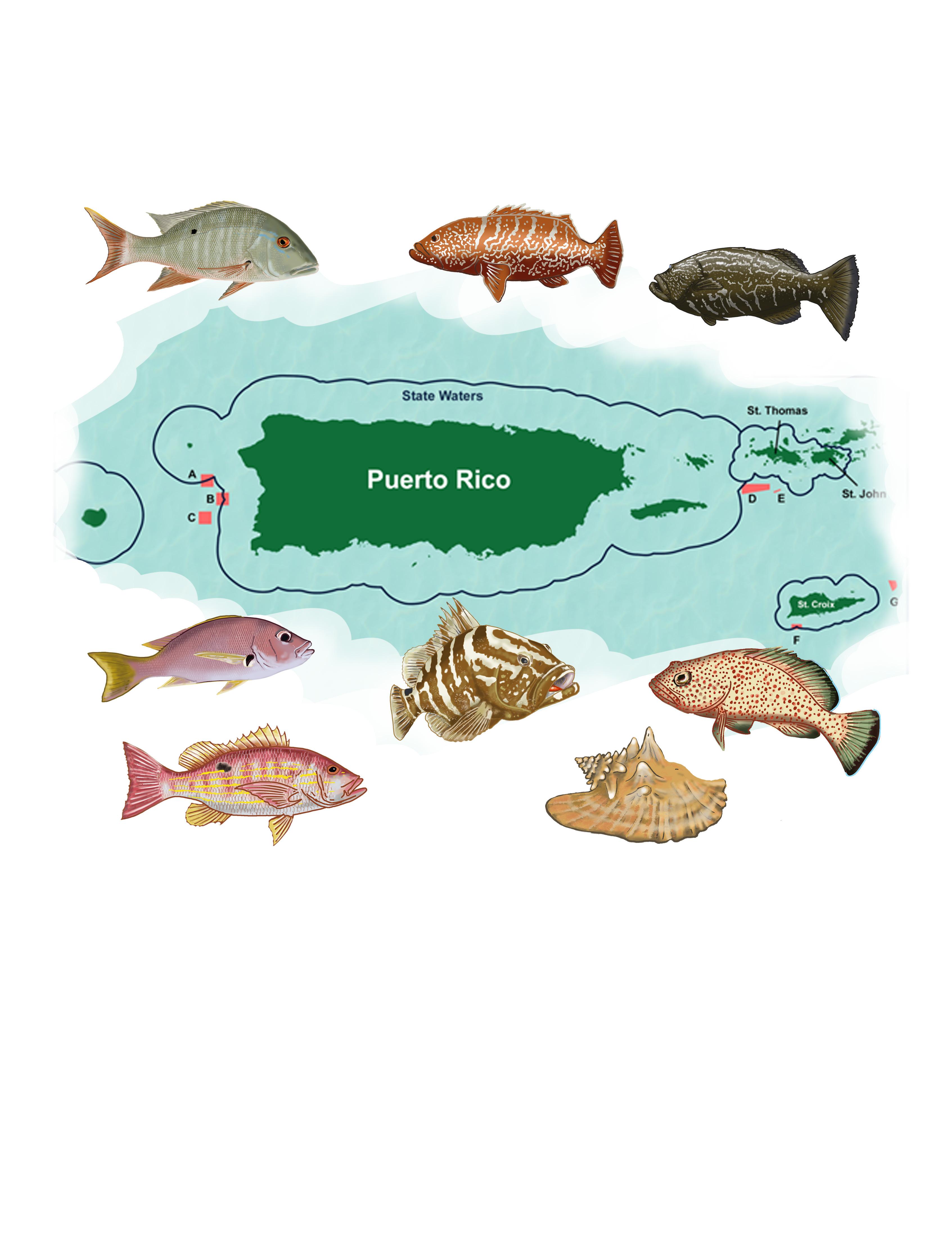
The CFMC objective with this illustrated booklet is to familiarize the stakeholders-fishers, consumers, and communities- in easy-to-understand language and illustrations with the processes and the objectives in the designation of the MPAs in the U.S. Caribbean, their importance for the sustainability of the marine fisheries ecosystem and the management of the fishery.
You will know more about the MPAs within the CFMC jurisdiction and those under territorial jurisdiction. Their locations, their biodiversity, especially the managed species found in these MPAs, and the fishing regulations applied in each MPA. Not all the MPAs will be covered, but you can consult the PR-DNER and the USVI-DPNR websites for more information.
List of acronyms
APC – Areas of Particular Concern
CFMC – Caribbean Fishery Management Council
EEZ – Exclusive Economic Zone
EFH – Essential Fish Habitat
IUCN – International Union for the Conservation of Nature
MCD – Marine Conservation District
MPA – Marine Protected Area
MSSA – Mutton Snapper Spawning Aggregation Area
NMFS – National Marine Fisheries Service
NOAA – National Oceanographic and Atmospheric Administration
NTZ – No Take Zone
O & E – Outreach and Education
PR-DNER – Puerto Rico Department of Natural and Environmental Resources
STXEEMP – St. Croix East End Marine Park
US – United States
USVI-DPNR – United States Virgin Islands Department of Planning and Natural Resources

The marine protected area (MPA) is one of the most powerful and effective methods for protecting fisheries resources and ocean life.
The National Oceanographic and Atmospheric Administration (NOAA) and The International Union for the Conservation of Nature (IUCN) define the MPA as “a clearly defined geographical space, recognized, dedicated, and managed, through legal or other effective means, to achieve the long-term conservation of nature with associated ecosystem services and cultural values.”
The Executive Order 13158 of May 26, 2000, Marine Protected Areas defines ‘‘marine protected area’’ as any area of the marine environment that has been reserved by federal, state, territorial, tribal, or local laws or regulations to provide lasting protection for a part of all the natural and cultural resources therein.
Many MPAs are established to protect a particular feature, like a canyon, a sea mount, a hard-bottom reef, a fish-spawning/breeding or feeding area for important species.

Ecological connectivity within the MPA networks can provide corridors for shifting species and habitats and promotes resilience to climate change and other impacts.
By maintaining vibrant and healthy ecosystems, MPAs support coastal communities and economies through opportunities for recreation and tourism, research, and education. Most MPAs in the US also allow fishing. Using MPAs to protect natural and cultural resources ensures that the benefits and services they provide are available for future generations to enjoy.
ARE ALL THE MPAs THE SAME IN TERMS OF THE HABITATS AND SPECIES PROTECTED?

Not all MPAs are created equal. A lot of people think MPA means an area where all fishing and other methods of extraction are banned, but that is not correct.
Fully protected MPAs, also called “NO TAKE AREAS” or marine reserves, typically allow human access, but prohibit extraction or significant destruction of natural and cultural resources.
Highly protected areas have been shown to produce stronger conservation outcomes than areas where more extractive uses are allowed. Multiple-use MPAs allow a range of activities, such as fishing, diving, and boating.
NOAA’s marine protected areas inventory classifies MPAs by level of protection, as well as by the IUCN protected area classification categories.
WHAT ARE THE DIFFERENT CATEGORIES OF MPAs: IUCN, NOAA, TERRITORIAL AREAS
In the United States, MPAs include many federal and state categories, such as:
NATIONAL MARINE SANCTUARIES
NATIONAL PARKS
NATIONAL MARINE MONUMENTS

NATIONAL WILDLIFE REFUGES
NATIONAL ESTUARINE RESEARCH RESERVES
IN PUERTO RICO AND THE U.S. VIRGIN ISLANDS THERE ARE:
NATURAL RESERVES
MARINE RESERVES
MARINE CONSERVATION DISTRICTS
MARINE PARKS, SPAWNING AGGREGATION AREAS.
The CFMC manages MPAs in the EEZ in PR and the USVI. NOAA manages some marine protected areas directly.
Natural Reserve
Bajo del Sico Bank
Natural Reserve
Tourmaline Bank
Natural Reserve
Abrir la Sierra Bank
Red Hind Bank Marine Conservation District
Grammanik Bank
Seasonal Closure
Mutton Snapper Spawning
Red Hind (Lang Bank)
NOAA manages the National Marine Sanctuaries Program, and it works with states to manage the national estuarine research reserves. NOAA also manages the National Marine Monuments, like the Department of Natural and Environmental Resources manages the MPAs in P.R. from the coast to 9 miles into the sea. The USVI-DPNR manages the MPAs in the local jurisdiction.
Desecheo Island
Marine Reserve
Marine Ext. Mona and Monito
Natural Reserve
Tres Palmas Marine Reserve
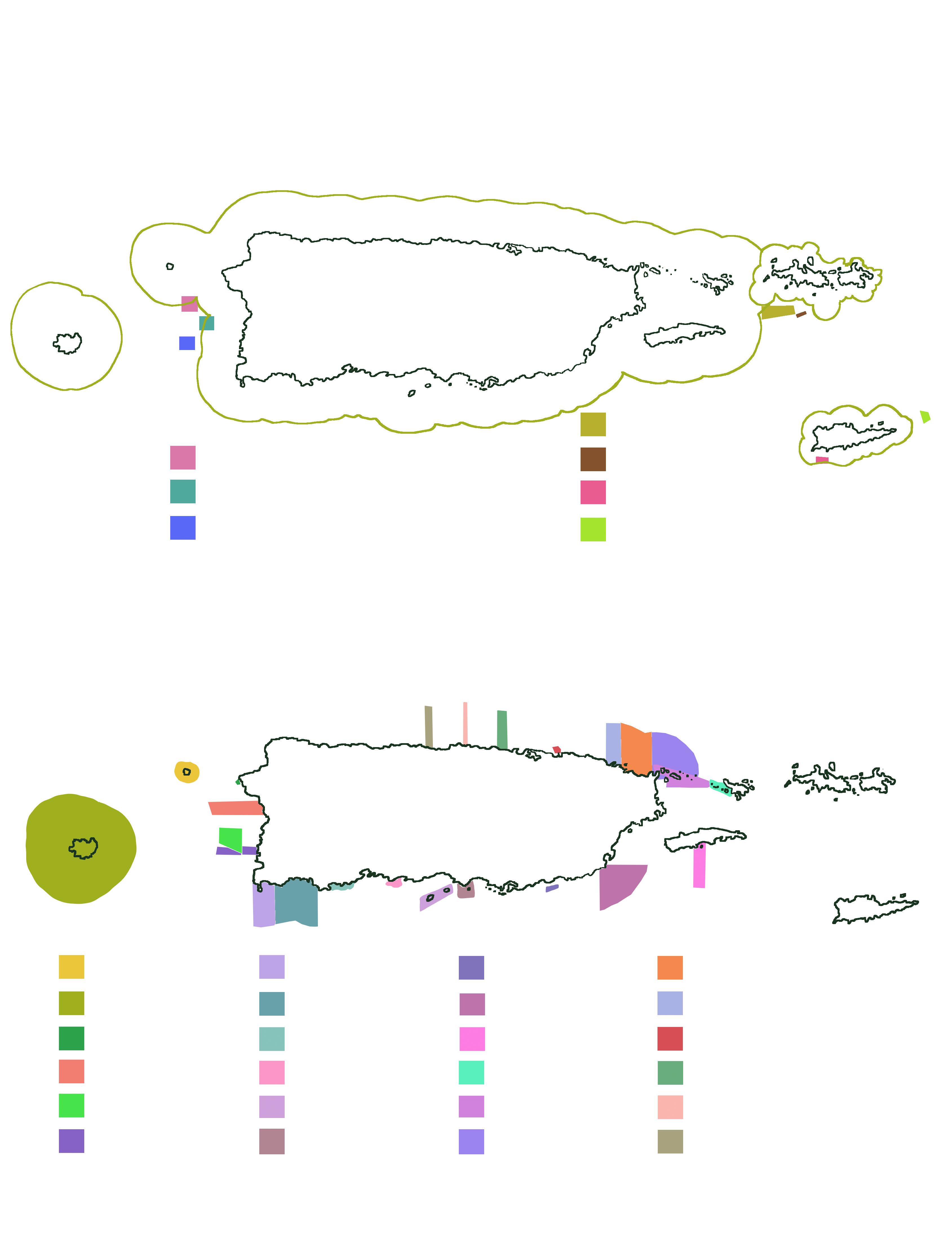
Marine Ext. Caño la Boquilla
Natural Reserve
Tourmaline Coral Reef
Natural Reserve
Marine Ext. Belvedere Farm
Natural Reserve
Marine Ext.
Boquerón State Forest
Marine Ext.
La Parguera Natural Reserve
Marine Ext.
Guánica State Forest
Marine Ext. Punta Cuchara
Natural Reserve
Marine Ext. Caja de Muerto
Island Natural Reserve
Marine Ext. Punta Petrona
Natural Reserve
Guayama Reef
Natural Reserve
Marine Ext.Punta Yeguas
Natural Reserve
Vieques Bioluminescent
Bay Natural Reserve
Luis Peña Channel
Natural Reserve
Cordillera Reef
Natural Reserve
Marine Ext. Las Cabezas de San Juan Natural Reserve
Marine Ext. Corredor Ecológico del Noreste Natural Reserve
Marine Ext. Espíritu Santo River
Natural Reserve
Isla Verde Coral Reef
Marine Reserve
Marine Ext. Playa Larga
El Paraiso Natural Reserve
Marine Ext. Pantano de Cibuco Natural Reserve
Marine Ext. Hacienda
La Esperanza Natural Reserve
St. Thomas - St. John
St. Croix
TERRITORIAL MPAs
USVI-DPNR
Virgin Islands National Park
Virgin Islands Coral Reef National Monument
TERRITORIAL MPAs
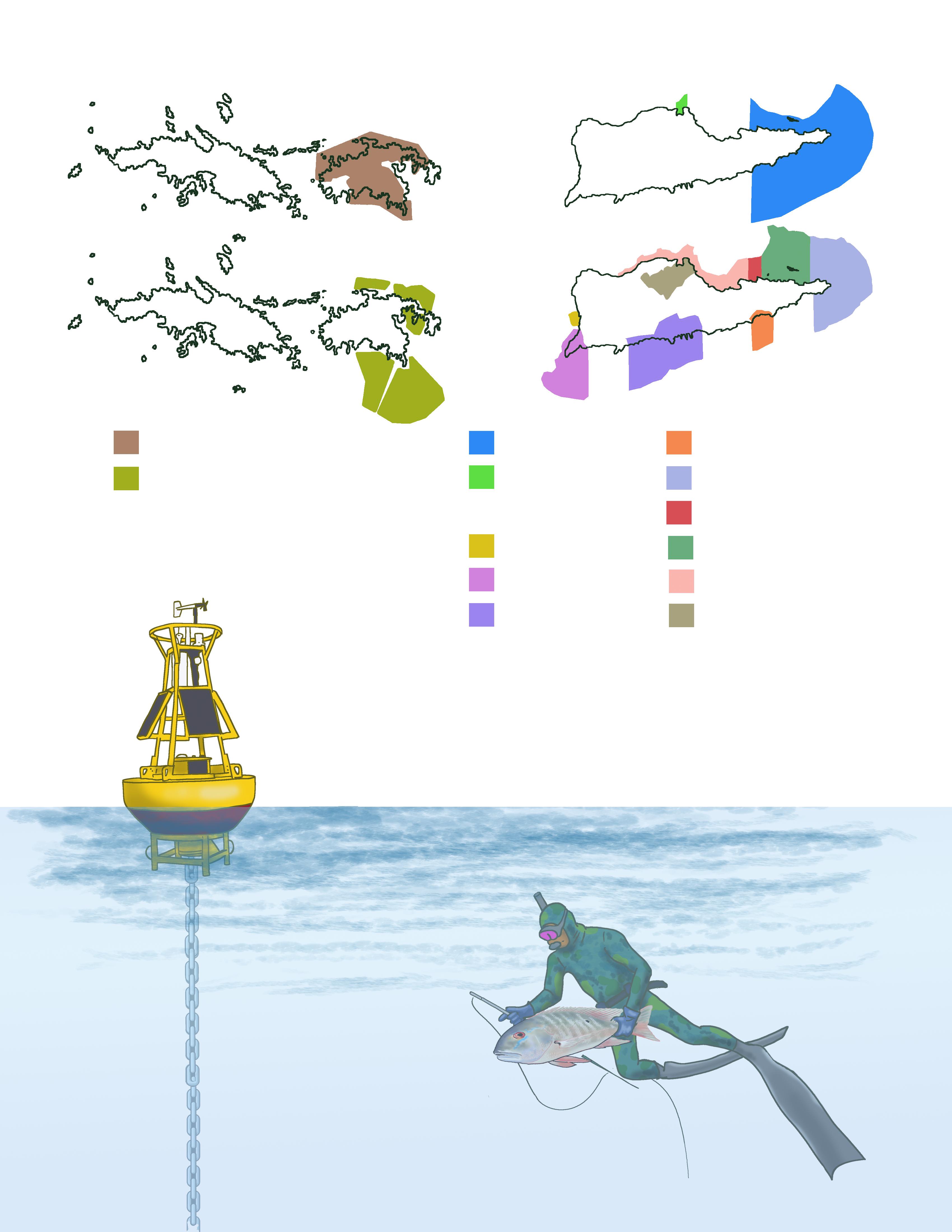
East End Marine Park
Salt River MSWR
APCs
Frederiksted APC
Sandy Point APC
Southshore Industrial APC
APCs
Great Pond Bay APC
East End APC
Southgate Pond/Chenay Bay APC
St. Croix Coral Reef System APC
Christiansted APC
Salt River/Sugar Bay APC
Managing agencies rely on ocean science, such as marine ecology, marine chemistry, and oceanography to understand the ecological importance of certain areas.
Also, the social science, understanding the economics of marine management, and the sociology and anthropology to understand how people interact with these places.
Management measures in MPAs may include regulations such as: fishing gear regulation, closed seasons, and prohibition for any kind of fishing all year around.
These measures depend on the objectives of the MPA…
Is it a breeding site for the species, does it sustain critical species, are species under risk of extinction?
NO-TAKE zones are marine protected areas that do not allow any fishing, mining, drilling, or other extractive activities. As a result, fish in no-take zones can age and grow to large, healthy sizes.

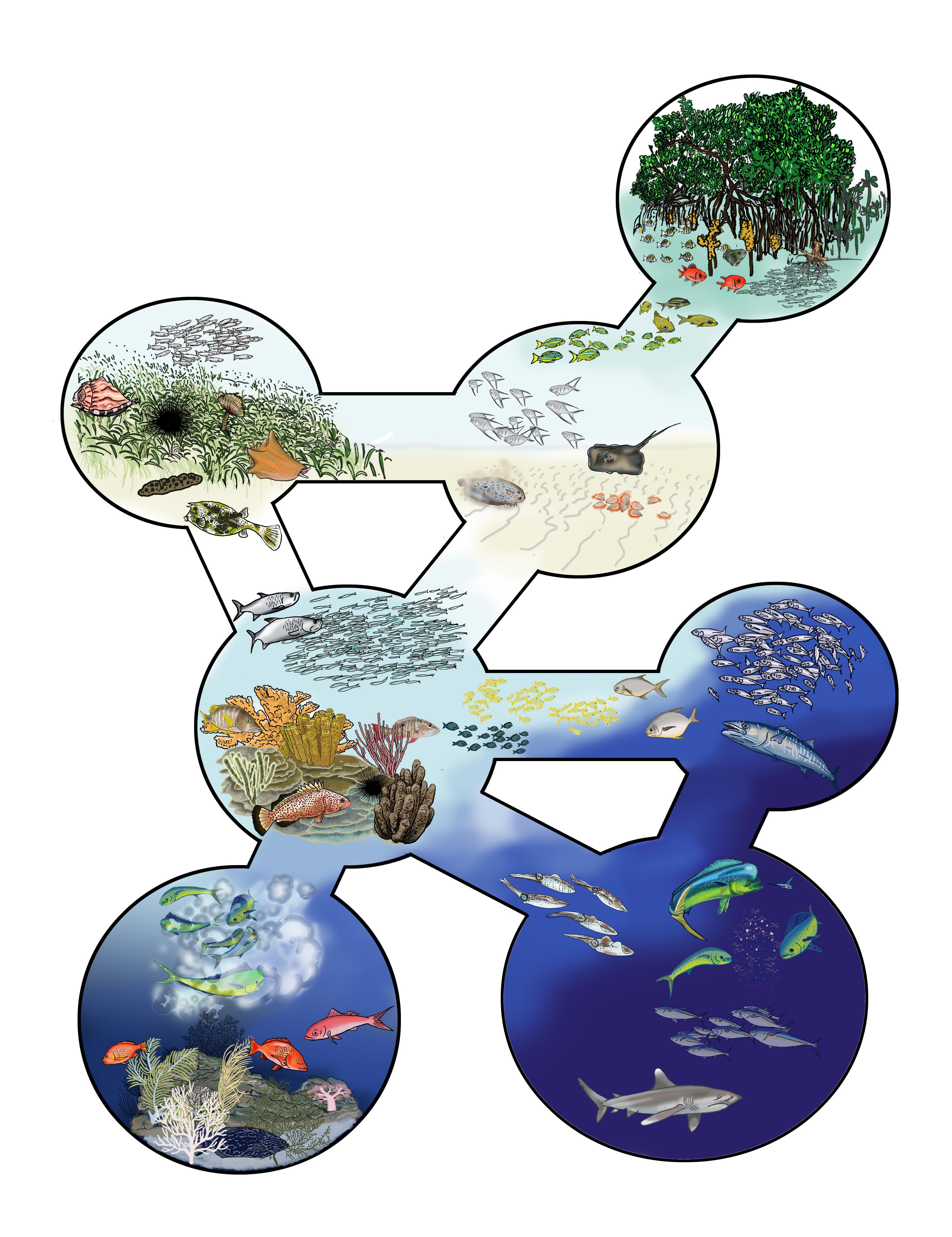
Connectivity is a very important aspect within the MPAs. Besides protecting the species present in the area, their sites for feeding, reproduction and growing, the MPAs secure the area where they can move and thus protects the biodiversity in the wider range. This include, besides the managed species, other invertebrates, algae and seagrasses that are part of the ecosystem.
BAJO DE SICO is a seamount, with a flattened peak and coral-rich slopes, located in Mona Passage, in the west coast of Puerto Rico. There is a seasonal closure in the vicinity of Bajo de Sico to protect the red hind (Epinephelus guttatus) and the Nassau grouper (Epinephelus striatus) spawning aggregations. In addition, at Bajo de Sico seasonal closure there is a 6-month closure and a prohibition for fishing and possession of Caribbean reef fish in or from the Exclusive Economic Zone (Federal Register 2010). Fishing regulations by NOAA and CFMC establish a seasonal no-take zone, a fishing closure from October 1 to March 31. Marine bottoms are protected year round; all gears that might harm the benthic habitats are forbidden (NOAA/CFMC/PR-DNER. Bajo de Sico is the preferred area for local and international sport fishers to catch migratory species such as: wahoo (Acanthocybium solanderi), dolphin fish (Coryphaenidae), tuna (Scombridae) and billfish, such as blue marlin (Makaira nigricans).
TOURMALINE BANK is in the west, on the border of the Puerto Rican shelf, offshore Bramadero bay (Cabo Rojo). Five main habitats present between 30 and 50 m depth have been described: sandy substrate, scattered patch reefs surrounded by sand; colonized pavement; algal rhodolite reef deposits; and a rocky slope wall. Tourmaline Bank seasonal fishing closure area (December 1 to February 28) protects and conserve the highly exploited reef fish resources of Puerto Rico. It is located in both, the EEZ and the PR territorial waters, and has a total area of 31.4 km2. Tourmaline Bank is governed by the CFMC, NOAA, and the PR-DNER.
ABRIR LA SIERRA seasonal fishing closure area is a shelf-edge reef within the EEZ with a total area of 29.5 km2, located 23.5 km west off Punta Guaniquilla, Cabo Rojo, on the western border of the puerto rican insular shelf. The no-take area within Abrir la Sierra is also 29.5 km2 and was established by NMFS via the Magnuson-Stevens Act in 1996, to improve fisheries management, emphasizing protecting spawning aggregations of red hind (Epinephelus guttatus) and the Nassau grouper (Epinephelus striatus) by prohibiting fishing in these areas during the spawning season. Abrir la Sierra is a seasonal NO-TAKE zone with a closure from December 1 to February 28.
 Bajo de Sico
Tourmaline Bank
Abrir la Sierra
FofoJorge García
FofoJorge García
ISLA VERDE MARINE RESERVE includes the coral reef that surrounds the islet of Isla Verde and its coastline. It has a shallow water coral reef rich in biodiversity despite the urban water impact that it receives. It is in an area of intense tourism, commercial, residential and air development, in the sector known as the Isla Verde of the Autonomous Municipality of Carolina. The reserve is considered the first marine reserve designated in an urban area in Puerto Rico.
TRES PALMAS MARINE RESERVE has an area of 204 acres. It has been a protected no-take marine reserve since 2004. It is home to many endangered species, including elkhorn coral (Acropora palmata), staghorn coral (Acropora cervicornis), and hawksbill sea turtle (Eretmochelis imbricata). Many other reef fishes, invertebrates, and corals can be found in the reserve. The rich thickets of shallow water elkhorn coral support a vast amount of biodiversity and make it a splendid place for snorkeling or diving.
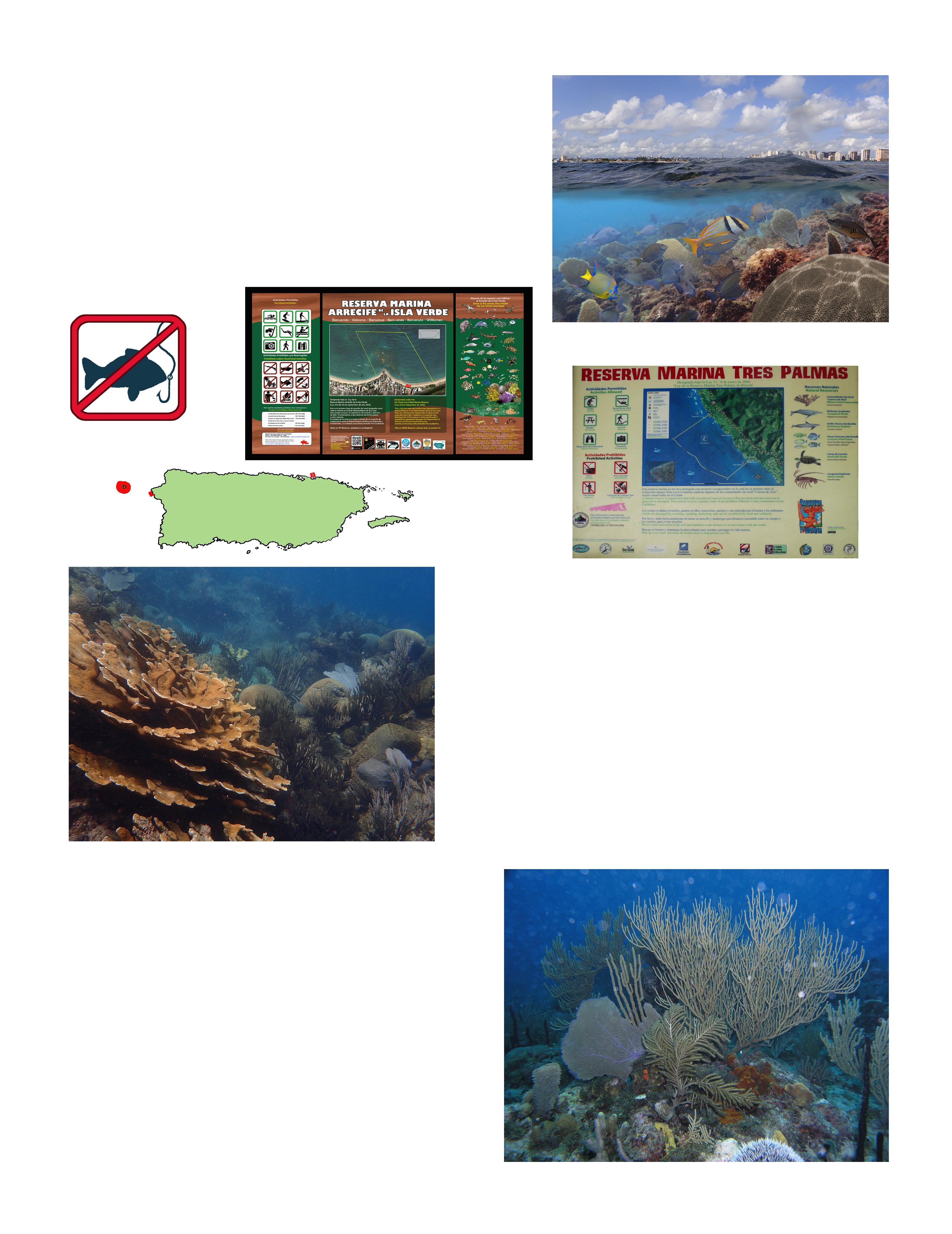
Fishing regulations: NO-TAKE zone year around.
DESECHEO ISLAND NATURAL RESERVE is an island designated as a natural reserve since 1999. It is located about 12 nautical miles from the municipality of Rincón, on the northwest coast of Puerto Rico. The surrounding depths of the island range between 400 and 900 meters, increasing abruptly towards the north of the reserve, where one of the edges of the Puerto Rican trench is found.
Consists of a chain of small islands, cays, rocky islets, and coral reefs located off the east-northeast coast of Puerto Rico, covering about 18 nautical miles and a total area of 120 kilometers squares. Of these formations, Las Cucarachas stand out due to their size, The Farallones, Cayo Icacos, Cayo Ratones, La Blanquilla, Cayo Diablo, The Hermanos and Barriles Reefs and Palominitos Island.
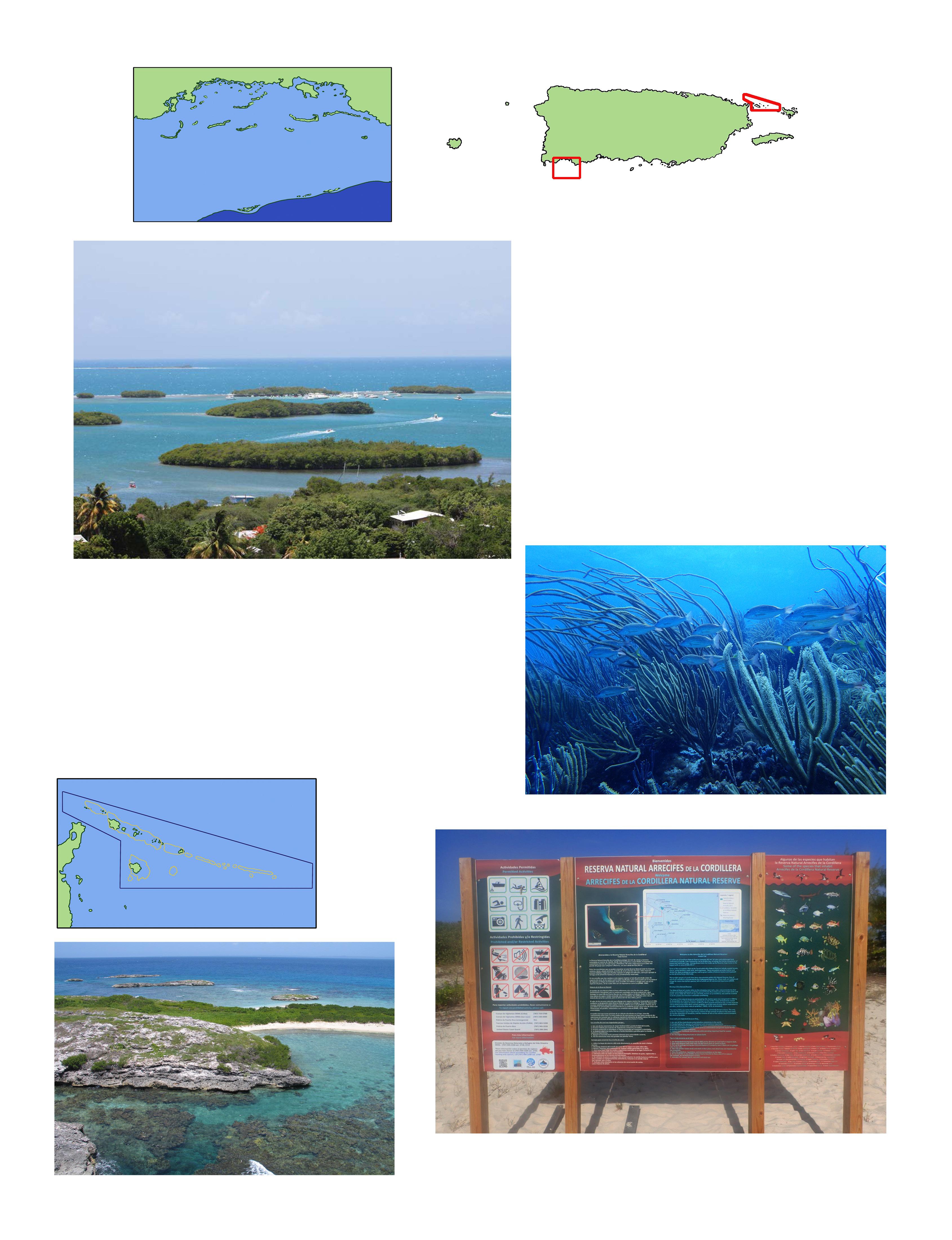
LA PARGUERA NATURAL RESERVE
is located in la Parguera, a fishing village in the town of Lajas on the southwest coast of Puerto Rico. It has about 30 cays and islets, is a multi-use area that spans the continental shelf from the extensive mangrove forests fringing the shoreline to the complex shelf edge coral reefs that support a diverse and productive fish community. The reserve was created to protect all these natural treasures and it is currently managed by PR-DNER.
Fofo - Alfredo Montañez Letrero Cayo IcacosTHE GRAMMANIK BANK is a submerged area located 14 km south, on the south shelf edge of St. Thomas USVI. It runs east/west for 1.5 km and is 500 m wide. The Grammanik Bank benthic habitat is primarily composed of a mesophotic reef at depths between 30-60 meters. This is the only location in the U.S. Caribbean where researchers (Nemeth, 2005) have found signs of Nassau grouper (Epinephelus striatus) recovering from overfished condition in the 1970 and the possibility of its population restoration in the near future. In 2005, it was designated by the CFMC as a no take zone (NTZ) from February 1 to April 30 within the exclusive economic zone (EEZ). This means that no fishing or possession of any species of fish is allowed during the closure. Fishing with pots, traps, bottom longlines, gill or trammel nets is prohibited year-round. The prohibition does not apply to highly migratory species.
THE ST. THOMAS
END RESERVE (STEER) is located at the southeastern end of St. Thomas, and encompass 9.6 km² of significant coastal, marine and fisheries resources, including mangrove forests, salt ponds, lagoons, reefs, and cays.

STEER is thought to be one of the most valuable fish nursery areas in St. Thomas. Many species of fish and shellfish, including important commercial and sport fisheries resources, spend a portion of their life protected in the shallow mangrove and seagrass beds while feeding and growing before populating other marine habitats in the area.
A Marine Conservation District (MCD) is a discrete geographical area of special value and significance to the marine ecosystem that is to be maintained in its natural state. The purpose of the MCD is to conserve and manage representative samples of marine habitats and ecosystems and to maintain marine biodiversity. This is especially important for the protection, conservation, and management of economically important species. Their primary objective is to protect older and larger fish. The Hind Bank MCD, south of St. Thomas, was established by the CFMC in 1990 as a seasonal NTZ, to protect spawning aggregations of red hind (Epinephelus guttatus). The MCD extends 12 km westward along the southern edge of the Puerto Rican Bank into the southern extent of the Virgin Passage. It is the largest known mesophotic coral reef complex in the U.S. Caribbean. Fishing and anchoring by fishing vessels are prohibited throughout the year. Today, the red hind represents one of the most common reef fish in the St. Thomas commercial fishery.
THE LANG BANK RED HIND SPAWNING AGGREGATION AREA was established in 1993 (Federal Register 1993) as a seasonal closure to protect the red hind (Epinephelus guttatus) spawning site to improve fisheries management. It has a total area of 11.7 km² and is in the EEZ offshore eastern of St. Croix. It is governed by the CFMC/NOAA. It is a seasonal NO-TAKE ZONE from December 1 to February 28.
THE MUTTON SNAPPER SPAWNING AGGREGATION AREA (MSSA) is an offshore shallow reef located 4 km off the southwestern point of the island of St. Croix (USVI) with an area of 8.9 km 2. The habitat types present within this marine management area are coral limestone, gorgonian plains, dense algae, sparse algae, algae on sand, algae and invertebrates, sand invertebrates, sand no ripple and sand ripple. Coral limestone habitat corresponds with a spur and groove coral reef dominated by the boulder star coral (Orbicella spp.). The NMFS established the MSSA in 1993 as a part of a rule that intended to protect and conserve the highly exploited mutton snapper (Lutjanus analis) populations. MSSA is governed by the CFMC, NOAA, and USVI-DPNR. MSSA is a seasonal NO-TAKE zone with a closure from April 1 to June 30.

THE ST. CROIX EAST END MARINE PARK (STXEEMP) was established to protect territorially significant marine resources, and promote sustainability of marine ecosystems, including coral reefs, sea grass beds, wildlife habitats and other resources, and to conserve and preserve significant natural areas for the use and benefit of future generations. It is the U.S. Virgin Islands’ first territorially designated and managed marine protected area (MPA).
BUCK ISLAND REEF NATIONAL MONUMENT is most notable for its coral reef ecosystem and the small tropical island that it encircles. The monument supports a large variety of terrestrial and marine plants and animals, including endangered and threatened species. Buck Island’s elkhorn coral (Acropora palmata) barrier reef is unique within the U.S. waters. The monument contains significant evidence of thousands of years of human activity, both on the land and in the water. Private vessels must obtain an anchoring permit from the National Park Service headquarters in Christiansted prior to anchoring at west beach or in the lagoon to moor at the underwater trail or scuba locations.

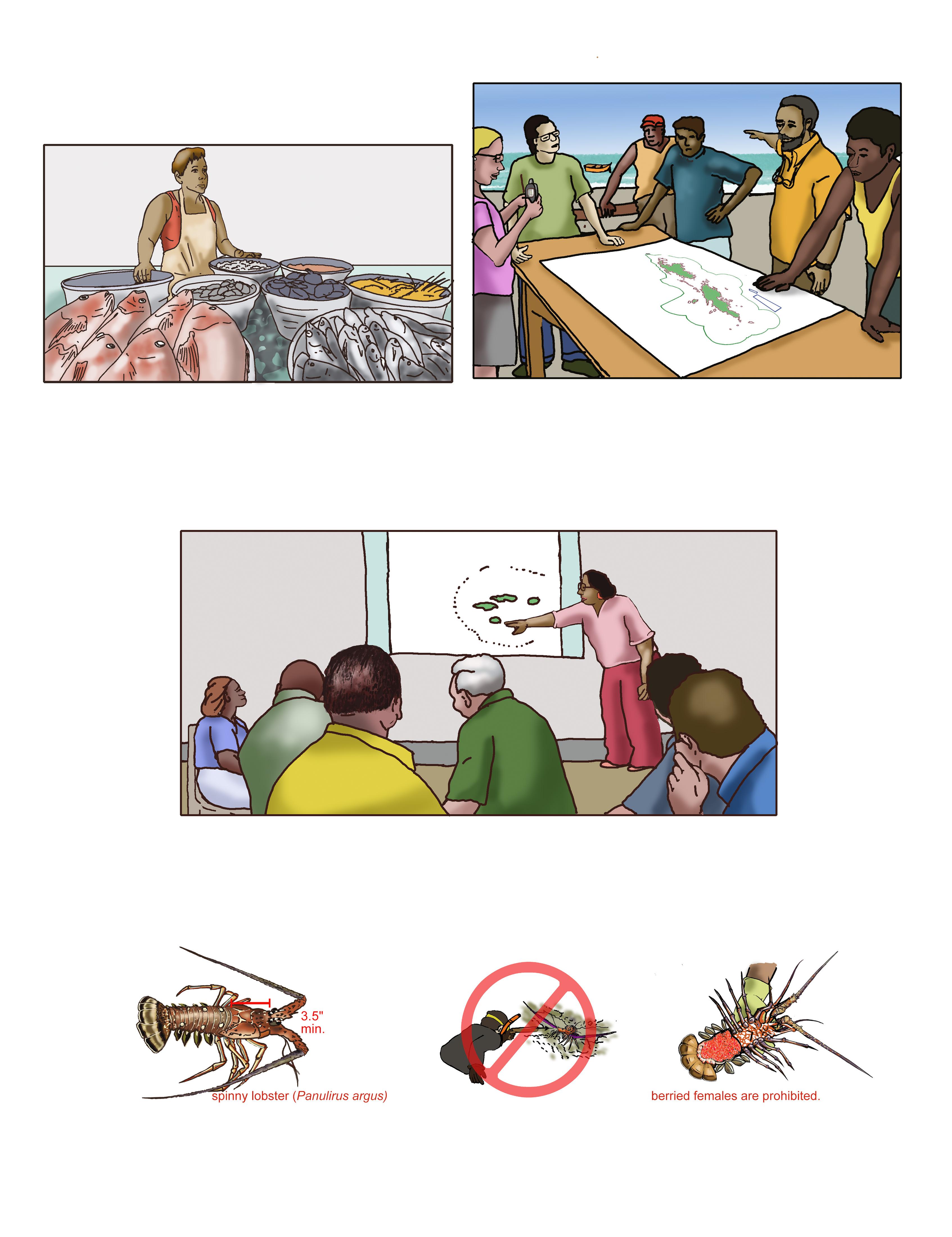
1. Community participation from the very beginning of the designation of an MPA in a particular site. Community includes fishers: commercial and recreational, fish markets, seafood dealers, restaurants, local government, community organizations, schools, etc. O & E can create products: fact sheets, booklets, videos to inform the stakeholders and facilitate their participation. When the information comes from the government, the communities get suspicious of the real value of the proposed MPA.
2. Since the MPA is of great importance for fisheries protection and conservation, the knowledge about the fisheries in the MPA should be inserted in the education curriculum from elementary to higher grades in an interdisciplinary approach to include marine sciences, social sciences, environmental sciences, art, history, etc. All disciplines are open to include MPA issues. O & E is an excellent tool to explain the science concepts in the MPA to the educational community.
3. Promote use of the MPAs as laboratories to stimulate the development of new fishers and fishery scientists in collaboration with high degree learning institutions in the area.
Editor - Diana Martinó
Acknowledgements to: Graciela Garcia-Moliner, Vanessa Ramirez, Edgardo Ortiz Corps, Marcos Hanke and Miguel Rolón for their helpful comments.
For more information on Know the Marine Protected Areas (MPAs) go to: www.caribbeanfmc.com www.noaa.gov/fisheries.html
Grant # NA20NMF4410008
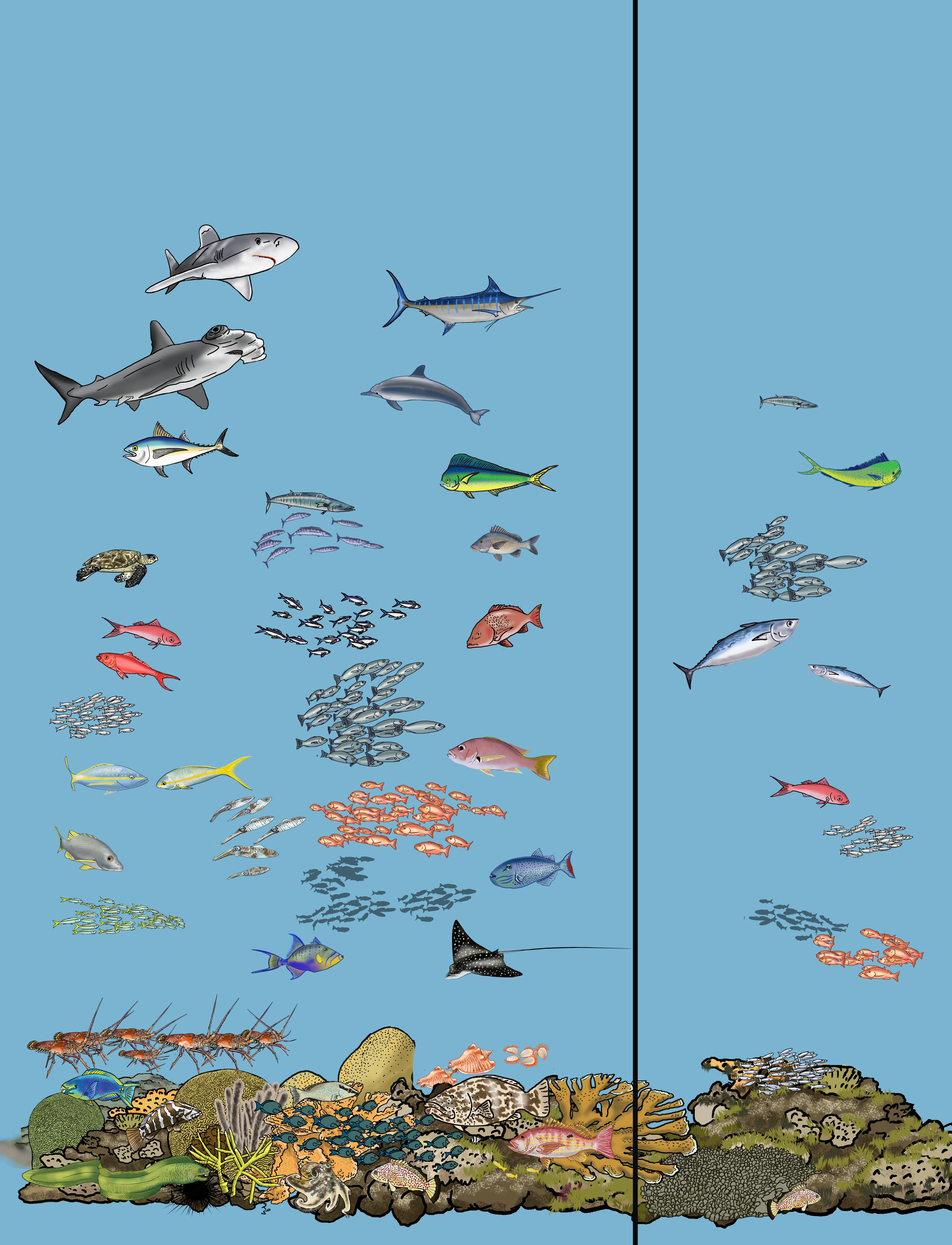
 State Jurisdiction
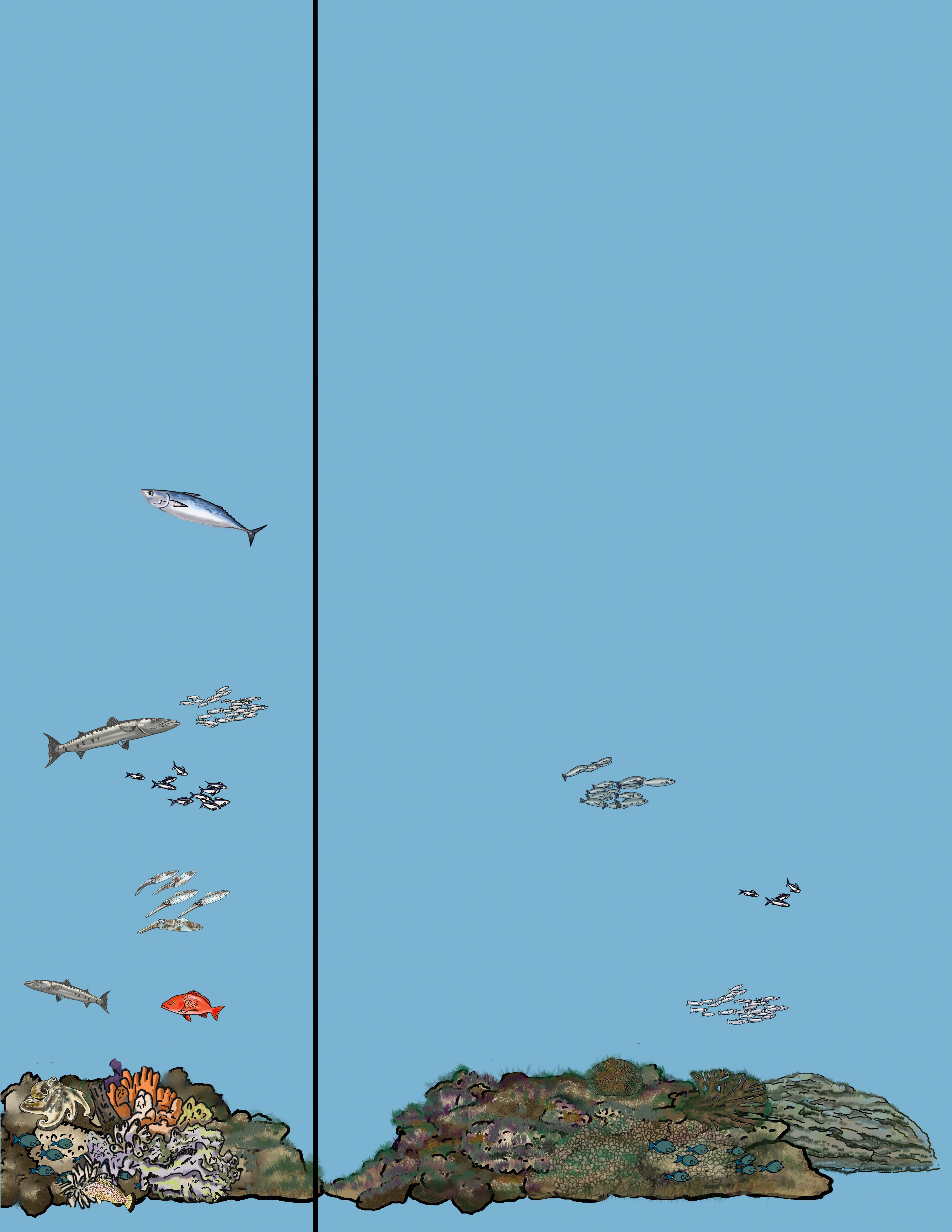
Caribbean Fishery Management Council Jurisdiction