

7 destinations
Safe & Strong
A proud inclusive community that unites, celebrates and cares
Supporting Plans, Action Plans and Policies cover such themes as being a child friendly City, children’s services, community safety and crime prevention, inclusiveness, community services, universal access, reconciliation,ageing, community harmony and youth.
Clean & Green
A cool, clean and sustainable city with healthy waterways and natural areas
Clean & Green Supporting Plans, Action Plans and Policies cover such themes as managing our catchments and waterways, natural resources, hazards and risks, emergency management, biodiversity and corporate sustainability.
Prosperous & Innovative
A smart and evolving city with exciting opportunities for investment and creativity
Supporting Plans, Action Plans and Policies cover such themes as revitalising our centres, employment, investment, being SMART and creative, and providing opportunities for cultural and economic growth.
Moving & Integrated
An accessible city with great local destinations and many options to get there
Supporting Plans, Action Plans and Policies cover such themes as accessibility, pedestrian and cycling networks, pedestrian and road safety, transport hubs, and asset management.
Healthy & Active
A motivated city that nurtures healthy minds and bodies
Supporting Plans, Action Plans and Policies cover such themes lifelong learning, active and healthy lifestyles, and providing quality sport and recreation infrastructure.
Liveable & Distinctive
A well designed, attractive city which preserves the identity and character of local villages
Supporting Plans, Action Plans and Policies cover such themes as preserving the character and personality of centres, heritage, affordable housing, and well managed development.
Leading & Engaged
A well- governed city with brave and future focused leaders who listen
Supporting Plans, Action Plans and Policies cover such themes as open government, managing assets, improving services, long term funding, operational excellence, monitoring performance, being a good employer, civic leadership, and engaging, educating and communicating with our community.
1
Strategic Planning Framework Summary
The Strategic Planning Framework (SPF) maps out the role of all current and future Council strategies and plans that work to deliver the vision for the City. The framework works from the highest level of strategic direction from the Community Strategic Plan through to more detailed plans that will eventually drive works, projects and programs on the ground. The framework is comprised of the following levels:
The COMMUNITY STRATEGIC PLAN (CSP) is our highest level plan and translates the community’s desired outcomes for the city into key destinations. The CSP includes community suggested actions which can be tested in the development of all other plans.
SUPPORTING PLANS identify broad works projects and programs required to deliver on these actions. Supporting plans include indicative costing and resourcing requirements and delivery timeframes.
2
3
DETAILED ACTION PLANS take actions from SUPPORTING PLANS and identify specific works projects and programs required to deliver on these actions. Supporting plans include detailed costing and resourcing requirements and delivery timeframes.
GUIDELINES, POLICIES AND CODES provide detailed information, rules for activities or guidance for specific works on Council or other lands.
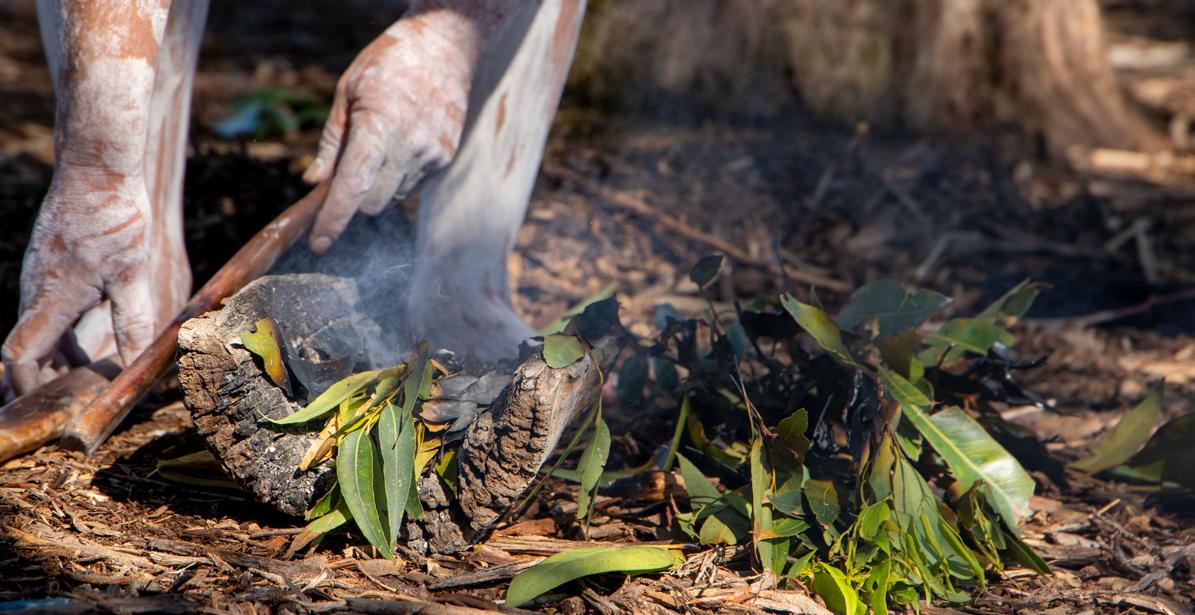
The City of Canterbury Bankstown acknowledges the traditional custodians of the land, water and skies of Canterbury-Bankstown, the Darug (Darag, Dharug, Daruk, Dharuk) People. We recognise and respect Darug cultural heritage, beliefs and relationship with the land. We acknowledge the First Peoples’ continuing importance to our CBCity community.
1.0 Message from the City
The City of Canterbury Bankstown is surrounded by the Georges, Cooks and Duck Rivers. The catchment areas for these river systems and their tributaries cover the whole 110 square kilometres of the local government area.
The Catchment and Waterways Strategic Plan (The Plan) will guide Canterbury-Bankstown on the journey to becoming a water sensitive city, delivering benefits to enhance sustainability, liveability, resilience and productivity.
Our community has told us they want a City that is Clean and Green, a cool, clean and sustainable city with healthy waterways and natural areas. To support this vision, Canterbury-Bankstown’s Local Strategic Planning Statement, Connective City 2036, prioritises the City’s waterways by planning for three healthy, clean and living river systems returned to their natural state. As a Council, we recognise the role of water in our lives and celebrate water within both our urban and natural landscapes.
This Plan will guide Council’s approach to the management of floodplains and waterways within the City of Canterbury Bankstown.
The Plan promotes the idea of total water cycle management, with stormwater harvesting, water recycling and reuse maximised to create a resilient, liveable and sustainable CanterburyBankstown. Likewise, Water Sensitive Urban Design (WSUD) practices are promoted to reduce stormwater runoff, improve stormwater quality and achieve healthy waterways. The Plan focuses on the City’s natural environment, ensuring environmental values are enhanced to maintain the integrity of the catchment. Finally, the Plan establishes a platform for collaboration and enhancing coordination with State Government, neighbouring Councils and industries to ensure consistency and a whole of catchment approach.
Water is a valuable resource. As we look to the future, Council must consider the impacts of development on water quality, pollution, ecology and flooding in local areas. In an urban landscape like Canterbury-Bankstown, water is critical to quality of life, and through this Plan we establish a framework to restore our waterways to be ecologically functional and liveable places.
2.0 Introduction
Catchment and waterway stress is not unique to Canterbury-Bankstown. Human intervention on the natural flow of waterways has placed increasing pressure on catchments around the world. Increased impervious surface areas, erosion, sedimentation, littering, contamination, reduced tree canopy and ageing drainage infrastructure are the main causes for catchment degradation within Canterbury-Bankstown.
Canterbury-Bankstown is home to about 372,000 people with a projection for this to grow to 500,000 by 2036. With a considered and careful approach to catchment and waterway planning, Council has the opportunity to not only mitigate the impact of population growth, but also work towards restoring our river systems to be clean, healthy and living.
This Plan supports a vision to be a water sensitive City through four focus areas:
• Floodplain and flood risk management;
• Urban water management and waterways health;
• The natural environment; and
• Governance.
A Water Sensitive City
Water is integral to the urban landscape and plays a key role in cooling and greening a city. Canterbury-Bankstown consists of three river systems, and the way people interact with the water is constantly changing. In a water sensitive city, the community interacts with the urban water cycle in ways that:
• Enhance and protect the health of waterways and wetlands and the surrounding floodplains;
• Provides for water security through appropriate management and efficient use of water resources;
• Mitigates flood risk and damage;
• Creates spaces that collect, clean and recycle water;
• Include Water Sensitive Urban Design in both public and private development;
• Use water in the urban landscape to increase public amenity and reduce urban heat; and
• Ensures a whole of catchment management approach through collaboration with other councils, government agencies and other relevant stakeholders.
Our City
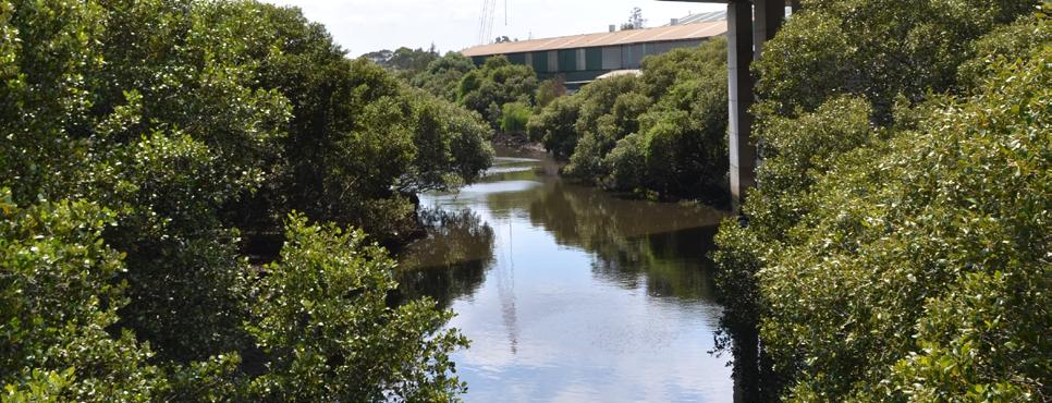
Canterbury-Bankstown is surrounded by rivers, creeks and wetlands. They provide habitat for flora and fauna, recreational facilities and a place to connect with our environment.
3
total length of rivers and creeks in CBCity 115km River catchments
15
sub-catchments
7 boat ramps viewing platforms 17 91 gross pollutant traps
28 parks 623 bridges 151 of boardwalk 5.7km of natural wetlands 98ha constructed wetlands
113
8 stormwater harvesting schemes biofilters
3.0 Strategic context
This Plan is the first Strategic Plan for Canterbury-Bankstown Council aimed at guiding the future management of catchments and waterways. This Plan has been developed with consideration of the following regional and local planning documents.
State
Flood Risk Management Manual
The NSW Flood Risk Management Manual (2023) and the Flood Prone Land Policy guide local government in managing flood risk in their communities. The main objective of the Flood Prone Land Policy is to reduce the impact of flooding and flood liability on owners and occupiers of flood-prone property and reduce public and private losses.
Marine Estate Management Strategy
The Marine Estate Management Strategy 20182028 was developed by the Marine Estate Management Authority on behalf of the NSW Government. It reaffirms their commitment to maintaining and improving the holistic management of the marine estate as one continuous system. It outlines how threats to environmental assets will be managed and the social, cultural and economic benefits the community derives from the marine estate.
Coastal Management Framework
The goal of the Coastal Management Framework is to improve the way coastal development is planned for and assessed. we plan for and assess coastal development, protect coastal and marine environmental assets and manage coastal hazards. It includes legislation, planning policies and funding to protect lives, infrastructure and property while sustaining diverse, complex and dynamic ecosystems.
Regional
A Metropolis of Three Cities: The Greater Sydney Region Plan
A 40-year strategic land use plan for the greater Sydney developed by the Greater Sydney Commission. It emphasises the need to improve the health of catchments and waterways and enhance liveability by improving and managing access to waterways for recreation, tourism and cultural events. It also highlights the need to reinstate more natural conditions in highly modified urban waterways.
The South District Plan
A 20-year plan to manage growth in the context of economic, social and environmental matters to achieve the 40-year vision for Greater Sydney. The South District Plan aims to protect and improve the health and enjoyment of the District’s waterways. It also supports a vision to deliver high quality open spaces with increased urban tree canopy cover and green grid connections.
Botany Bay and Catchment Water Quality Improvement Plan
The Botany Bay and Catchment Water Quality Improvement Plan sets targets for pollutant load reductions (in terms of total nitrogen, total phosphorus and total suspended sediment) required to protect the condition of Botany Bay, its estuaries and waterways. The Botany Bay Catchment consists of two major waterways, the Georges and Cooks River, that comprise the vast majority of the Canterbury-Bankstown LGA.
Local
CBCity 2036 Community Strategic Plan
The Community Strategic Plan identifies seven destinations for our future City, including being Clean and Green, a cool, clean and sustainable city with healthy waterways and natural areas. Key to achieving this will be improving the health of our waterways and becoming a water sensitive city.
Connective City 2036 Local Strategic Planning Statement
A 20-year planning statement for land use and managing change into the future. The Statement prioritises achieving three healthy, clean and living river systems within the City, by aiming to return rivers to their natural state.
It celebrates water within CanterburyBankstown by recognising the community’s cultural, social and recreational connection to the three rivers.
It supports the implementation of water sensitive urban design and appropriate planning provisions and sets ambitious targets for our waterways in 2036.
50%
10
B-C grade
Accessible waterways foreshore
Access points to the river for water sports and boating
Water quailty rating for aquatic flora and fauna habitats
2
Wadable sites in waterways
Targets outlined in Connective City 2036
4.0 What you have told us
Council is committed to ongoing and meaningful engagement with our community and stakeholders. Engaging with our communities helps Council to:
• Identify and understand what is important to our communities – their needs, priorities and aspirations;
• Ensure that our services best meet the range of community needs – inclusive of cultural and social backgrounds;
• Identify shared values, benefits and outcomes and how Council and community can work together to realise our goals; and
• Manage risks by understanding and anticipating issues before they escalate.
Across many forums, the community has told Council our rivers and creeks are a valued asset in the City. The community has told us they value waterways for:
• Providing “life-affirming”, well-being qualities;
• Offering opportunities to connect with nature and wildlife;
• Supporting biodiversity;
• Maintaining views which are a key attraction of living in and visiting the area; and
• Preserving the natural heritage of the area.
However, the community has also told us the current state of our rivers and creeks was a cause for concern, due to littering and poor water quality.
Waterways and wetlands are recognised by the community as places with huge potential and opportunity. These opportunities stem from the recognition of waterways as places of significance for biodiversity. The restoration and naturalisation of existing waterways is seen as a high priority to connect areas of habitat, as well as an opportunity to create a series of recreation experiences.
In community surveys conducted for the development of the Local Strategic Planning Statement, Connective City 2036 – 82% of participants said they would like to see more links to natural spaces, creeks and rivers.
When asked to identify the top three environmental priorities for the City, four of the top seven priorities linked to waterways and how the City manages its catchments.

What you have told us
“More bank naturalisation.”
“Great place for some bird watching. Egrets, Cormorants, Herons and Spoonbills are some of the birds that can be seen here.”
“The swamp area has a lot of local wildlife which need conservation. There is a lot of garbage seen at the river during low tide. The Boardwalk here is deteriorated and have certain sections underwater at high tides.”
“Restore natural river processes, aquatic habitats and improve water quality.”
“Please restore this creek back to its former beauty.”
“Unlike nearly every other creek and river in the wider area, Wolli Creek was not channelised. For this reason, it is a significantly important waterway and bush area.”
“One of my favourite places in all of Sydney!”
“The boardwalk from Lambeth Reserve to Carinya Road is an absolute gem.”
“Improve access to water frontage and walkability.”
“The shared paths here are great! More of these along Salt Pan Creek would hopefully create more sense of stewardship of the creek, rather than a dumping ground for effluent and plastic bags.”
“We need more cafes and greenery along the river.”
“Restore Boat Harbor with an endangered Saltmarsh community to improve amenity, biodiversity and safety whilst activating storm and flood buffers.”
5.0
What are our challenges
Across Canterbury-Bankstown, the natural environment associated with waterways has been impacted by the clearing of bushland, saltmarsh and mangroves that once offered habitat and water cleansing processes. Fragments of natural vegetation remain and while some wildlife has adapted, much has been lost.
The City’s waterways are under pressure from past and existing development, catchment disturbance, hydrological modification, landuse transformation and large-scale vegetation changes. Projected growth, the associated development and climate change may also significantly impact upon water quality, liveability and recreational use of waterways unless all stakeholders within the catchment take appropriate action to manage these issues.
Urban development results in significant modification to soils, topography, catchment imperviousness and vegetation. Surface runoff volumes and pollutant concentrations from urbanised catchments are typically elevated above natural conditions and without mitigation have the potential to convey elevated pollutant loads to receiving waterways.
Soil contamination can lead to the degradation of land as well as the connected waterways. The presence of toxic contaminants in the soil can pose a significant health risk to humans, water quality and other ecological systems.
Unrestricted development on floodplains can cause negative impacts in riparian areas that includes erosion, a reduction in bank stability, reduced water quality, creek siltation, reduced regeneration of native vegetation and an increase in the amount exposed bare ground. In addition to this, climate change and sea level rise may also contribute to further altering water quality dynamics.
With a new approach to water management, our urban waterways can be restored as ecologically functional and liveable places. This will require multiple funding sources, partnerships with key land managers, promoting behaviour change and community education and a whole-of-city approach to value water in the landscape.
6.0 What we will do
The Catchment and Waterways Strategic Plan will guide the management of floodplains and waterways within Canterbury-Bankstown. Under the Plan, four focus areas have been identified, each containing actions to be undertaken in order to lead Canterbury-Bankstown towards becoming a water sensitive city.
These focus areas are:
• Floodplain and flood risk management;
• Urban water management and waterways health;
• The natural environment; and
• Governance.
These focus areas and associated actions have been developed to prioritise investment and resourcing over the next ten years. The timing to implement each action will be dependent upon agreed priorities, the complexity of the action and availability of resources. Actions in this Plan have been categorised as:
• High – actions that act as a catalyst for future initiatives, have high impact or immediate benefit.
• Medium – actions that are dependent on other initiatives or require greater planning or resources.
• Ongoing – initiatives that form part of Council’s ongoing program of support for the local community.
Throughout the implementation of the Plan, Council will utilise an adaptive management and approach to allow the Plan to transform, adapt, and re-prioritise as necessary. Catchment and waterways implementation works will be monitored and reviewed to measure progress and identify future priorities and milestones, ensuring the proposed actions remain current and able to respond to the latest challenges and knowledge.
6.1 Floodplain and flood risk management
Sustainable floodplain management with effective measures to reduce flooding risk to the community and properties.
Canterbury-Bankstown is built on the Georges, Cooks and Duck River catchments. These catchments comprise a vast network of creeks and wetlands that create significant mainstream and overland flooding in some parts of the catchment. The potential damage to life and property because of flooding can be high due to the extent of development on the floodplain, despite the extensive flood mitigation works Council has undertaken.
River/Parramatta River/Sydney Harbour Catchment
Floodplain risk management considers the consequences of flooding as it relates to the community and business occupation of the floodplain. Council follows the guidelines of the NSW Government’s Flood Risk Management Manual 2023 in the floodplain risk management process.
Flood Risk Management Committee
Data collection
Flood study
Floodplain Risk Management Study
Floodplain Risk Management Plan
Implementation of Plan
Committee to oversee the floodplain management process, provide local input and a link between the local community and Council.
Compilation of existing data and collection of additional data.
Modelling of existing flood conditions.
Determines options to manage flood risk taking into consideration social, environmental and economic factors.
Preferred options to manage flood risk are publicly exhibited and may be modified based on feedback before adoption by the Council.
Implementing adopted mitigation works including planning controls, flood warnings, flood readiness and response plans by Council.
The Canterbury-Bankstown Council Flood Risk Management Committee (FRMC) assists Council in implementing the NSW Government’s Flood Prone Land Policy and oversees the development and implementation of Council policies and strategies to manage flood risk.
The Committee does not consider specific development proposals or applications but focuses on broader catchment-wide management issues, Council policies and strategies affecting flood prone lands. The Committee consists of local Councillors, Council staff members, representatives from Government agencies, other councils, State Emergency Service personnel, and community and business representatives.
A summary of the floodplain risk management process of the different river catchments of CanterburyBankstown Council is presented in Table 1.
Table 1: Present status of floodplain risk management process of different catchments in CanterburyBankstown
1 Duck River Wolumba Completed 2010 Completed 2012 In progress Duck River Completed 2009
2 Salt Pan Creek Davies Road Completed 2010 Completed 2013 2023
Fairford Road Completed 2010
Padstow Completed 2010
Salt Pan Creek (West) Completed 2009
Salt Pan Creek (East) Completed 2011 Completed 2015
3 Mid Georges River East Hills Completed 2009 Completed 2017 2027
Kelso Creek Completed 2009
Little Salt Pan Creek Completed 2009
Lucas Road Completed 2010
Morris Gully (Morgans Creek) Completed 2011
Milperra Completed 2015
Picnic Point Completed 2011
4 Prospect Creek Georges Hall Completed 2013 In progress In progress Lansdowne Completed 2013
Miller Road Completed 2013
Villawood Completed 2009
5 Cooks River Greenacre Park Completed 2009 To commence in 2025 Punchbowl Completed 2012
Rookwood Road Completed 2010
Cooks River Completed 2012
Coxs Creek Flood studies are in progress
Campsie
Ashbury
Hurlstone Park In progress.
Cup and Saucer Creek
Wolli Creek
1. Duck River Catchment
Duck River Catchment consists of a small portion (approximately 8%) of the Canterbury-Bankstown LGA. Although the catchment covers a small area of the LGA, the estimated risk of flood damage highlights the importance of implementing recommended actions in the Floodplain Risk Management Study and Plan (FRMS&P) to reduce flooding risk to the community and businesses.
The FRMS&P estimated flood damages at $28 million and $72.2 million respectively for a 100-year and Probable Maximum Flood (PMF) events, with the average annual damage estimated at $925,870.
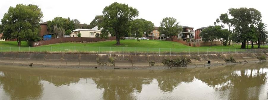
2. Salt Pan Creek Catchment
Salt Pan Creek is a tributary of the Georges River and drains water from a catchment area of 26km2. Flooding problems have been reported within the catchment on a number of occasions, including major floods that occurred throughout the lower Georges River and Salt Pan Creek Estuary in 2020, 1988 and 1986.
The catchment is highly urbanised, containing a mix of residential, commercial and industrial development. The Bankstown Central Business District (CBD) is located within the Salt Pan Creek catchment and has also experienced significant flooding problems in the past. Development in the Bankstown CBD may change the characteristics of flood and the impact from flooding.

Photo: Salt Pan Creek at (P.C. Riverwood’s resident Arash Zamani)
3. Mid Georges River Catchment
The Mid Georges River has seven sub-catchments covering an area of about 30km2. Some parts of these catchments, such as Milperra, Bankstown Aerodrome and East Hills are significantly affected by mainstream and overland flooding, including the recent 2022, 2021 and 2020 floods. Stormwater flood studies have been carried out on all seven sub-catchments and provides detailed information on the extent and depth of inundation for a range of design floods. The estimated flood damage within the Mid

4. Prospect Creek
Prospect Creek is a tributary of the Georges River and drains water from four sub-catchments: Georges Hall, Lansdowne, Villawood and Miller Road. The catchment area is 12km2. Significant floods have occurred in the Prospect Creek catchment including the recent flooding in 2020.

Photo: Georges River from boardwalk near Lambeth Reserve, Picnic point (P.C. Local resident Stephen Russell)
5. Cooks River Catchment
Cooks River drains water from a catchment area of 39km2. While a number of studies have been conducted in the past, a consistent floodplain risk management process with aligned modelling assumptions is required. Council is in the process of undertaking drainage network surveys to accurately identify all pits, pipes and network gaps (if any). Accurate drainage data is also important for catchment planning, flood modelling, and flood risk management planning in the Cooks River Catchment.

Opportunities for mitigating risk
Throughout the process of undertaking Flood Risk Management Studies and Plans, a variety of actions in respect to emergency response, property modification and flood mitigation can be undertaken to reduce flood risk towards people and properties. As part of the process, Council works with technical experts to identify the most appropriate options specific to each catchment. A list of potential options are outlined in Table 2.
Table 2: Potential options for improving flood risk management
Response modification
Community awareness
Community preparedness
Flood prediction and warning
Flood Emergency Plans
Evacuation arrangements
Recovery plans
Land use zoning
Flood proofing buildings
Building and development controls
Voluntary house raising
Voluntary purchases
Flood access
Flood control dam
Levees
Channel improvements
Retarding basins
Bypass floodways
Flood gates
Photo: Cooks River at Beaman Park, Earlwood (P.C. Local resident Josie Vecchio)
The traditional approach to managing the impact of flooding has focused on reactive practices to reduce exposure to flooding and susceptibility to flood damage, mainly through structural measures. Over the course of time these ad-hoc interventions proved to be only partially effective, shifting rather than mitigating flood risk. Acknowledging the limitations of this approach, it is now considered best practice and necessary to implement a wider multi-disciplinary approach, which has shifted from flood control to flood management.
Flood management promotes the coordinated management of water resources in order to optimise economic and social welfare without compromising the sustainability of the ecosystem. Integrated Flood Management (Figure 5) endorses this idea, aiming at maximising the net benefits from floodplains, while minimising loss of life and property. Council is aiming to implement integrated flood management practices in all future flood risk management studies and plans.
LandUseManagement
INTEGRATED FLOOD MANAGEMENT
Water ManagementResource
Risk Management
The NSW Government has made changes to development requirements on flood prone land across NSW in response to serious flooding that has occurred in recent times. These changes require Council to alter what properties were identified as flood affected and require Council to carefully consider the impact of development in low flood risk areas by stipulating new planning requirements.
Specifically, the Environmental Planning and Assessment Amendment (Flood Planning) Regulation 2021 (under the Environmental Planning and Assessment Act (1979) requires identification of land below the flood planning area (1% Annual Exceedance Probability (AEP) plus 0.5m freeboard) as well as the probable maximum flood (PMF). However, Council’s existing maps only extend to the 1% AEP and PMF events.
Integrated Flood Management framework
The following actions are recommended to manage Canterbury-Bankstown floodplains to reduce flooding risk to the community and properties; Ref Actions
6.1.1 Carry out condition assessment of pits and pipes. Plan and prioritise maintenance and upgrade work through capital works program.
6.1.2 Complete flood studies and floodplain risk management studies and plans for the Cooks River Catchment.
6.1.3 Review of flood study and flood risk management study and plan in the Duck River and Salt Pan Creek Catchments.
6.1.4 Status review and prioritisation of non-implemented actions in the flood risk management studies and plans for Mid Georges River, Salt Pan Creek and Duck River Catchments.
6.1.5 Assessment of flood planning area in the Canterbury-Bankstown LGA for risk management in flood prone lands in accordance with the NSW Government Planning Circular on “Considering flooding in land use planning: guidance and statutory requirements”.
Systems and Planning
City
and Transformation
Asset
and Planning
and Transformation Asset
and Planning
Asset Systems and Planning
Plan and Transformation
City
and Transformation Asset Systems and Planning
6.1.6 Incorporate climate change and sea level rise impact into future flood studies and flood risk management studies and plans. City Plan and Transformation
Asset Systems and Planning
6.2 Urban water management and waterways health
Sustainable and safe urban water management with targets to achieve improved water quality, reduce stormwater runoff towards Canterbury-Bankstown’s three rivers and make the rivers liveable.
Urban water management is a complex and challenging issue. The effective management of urban water is a shared responsibility, requiring the active involvement of many State Government agencies, local councils, land developers, building contractors, industries and individuals. As a result, there is no single answer to urban water management problems, with innovative management approaches that incorporate a mix of strategies, required to improve waterway health.
The preparation of stormwater management plans provides an opportunity to involve all stakeholders in the development of an appropriate and coordinated mix of strategies to address the specific management issues of a catchment. The primary goal is to maximise ecological sustainability and the social and economic benefits of sound stormwater management practices. Stormwater management plans:
• Identify the existing and future values of a catchment;
• Derive stormwater management objectives to protect these values;
• Identify problems and issues that may compromise these objectives; and
• Detail a suite of non-structural and structural management practices to address these problems and issues which have been agreed between all stormwater managers within a catchment.
These plans highlight the significant shift that has occurred in stormwater management, focusing on issues that affect the health and amenity of our waterways rather than solely on flood mitigation and drainage. Many of the solutions will be found by looking upstream to find ways we can manage a range of day-to-day activities, rather than focusing on managing the downstream impacts.
Some of the measures that Council can undertake to improve waterway health include:
• Adopting water quality targets and taking a proactive approach to measuring our progress for long-term waterway health;
• Recognising the different features in each subcatchment that may impact waterway health and developing a micro approach to meet the macro goals;
• Implementing planning controls that enhance the function, design and amenity of development;
• Engaging with and educating our local community as partners in water management; and
• Taking a water sensitive approach to urban planning to support a more resilient, productive, sustainable and liveable City.
Pollution source
Waterways can be polluted by a variety of substances, such as sediments, gross pollutants, pathogenic microorganisms, organic waste, fertilisers, chemicals, petroleum etc. In densely populated urban areas like CanterburyBankstown, the impact of these pollutants can be incredibly detrimental to the ecological and aesthetic value of waterways. Council’s endeavor is to identify potential sources of pollution, existing management devices and areas of focus for investigating pollution management through pollution source scoping studies. The goal of the pollution source study is to compare the current capacity and allocation of resources of Council against the need for pollution control according to obligations and targets.
Water quality monitoring
Water quality is widely used as an indicator for the heath of an aquatic ecosystem and the local catchment. Water quality is affected by all activities and management practices within the catchment. The Botany Bay Catchment consists of two major waterways: the Georges and Cook Rivers, as well as substantial foreshore areas of the Bay itself. The Botany Bay Water Quality Improvement Program (BBWQIP) was developed to provide direction for future land use and water quality management decisions in the Botany Bay Catchment. Formally adopting the targets outlined in the BBWQIP for the Georges and Cooks River Catchment located within the Canterbury-Bankstown LGA would set us in the same direction as our partners across the broader catchment.
Sub-catchment planning
Planning at a sub-catchment level allows Council to identify actions, operations and projects within a specific drainage area to improve the ecological condition of the broader catchment. Sub-Catchment Action Plans allow for the prioritisation of work and could include initiatives such as restoration of degraded waterways, naturalisation of concrete channels, bank stabilisation of rivers and streams, installation of gross pollutant traps and implementation of Water Sensitive Urban Design devices.
Planning controls
Council’s Local Strategic Planning Statement (LSPS), Connective City 2036, celebrates Canterbury-Bankstown’s three waterway systems: the Cooks, Georges and Duck Rivers. The Plan seeks to herald a new era for water management in the City through establishing waterway health as one of the essential considerations in guiding planning and development. Introducing best practice water sensitive urban design planning controls for development into Council’s planning and strategic documents is a high priority action.
Recycling wastewater
Recycling is the use of treated wastewater for use other than drinking water, such as irrigation of parks and sports fields, domestic garden watering and toilet flushing. The volume of wastewater available for recycling is aligned with population growth, thus, Council can capitalise on this opportunity with the provision of water recycling facilities in future major developments. While this will require a coordinated approach with Sydney Water, there are significant economic benefits in using recycled water as well as the redirection of nutrient loads from local waterways.
Community engagement
Involving the community in waterways through education, citizen science, partnering with schools and community groups, events and interactive technologies engages the community as key contributors to the management of waterways, as well as supporting increased community enjoyment of these spaces. The community has the opportunity to not only participate in bush regeneration, litter clean up and species monitoring, but also act as guardians of the River.
Communities are becoming more water literate and engaged. The Georges River and Cooks River communities are advocating for their river to provide water recreation and swimming opportunities. There is increased demand for the incorporation of water into urban developments, with riverside living and lifestyle becoming a focus of urban development.

Photo: Cooks River Clean Up and Paddle Against Plastic organised by the River Canoe Club
Water sensitive urban design (WSUD)
A water sensitive approach to urban planning supports more resilient, productive, sustainable and liveable cities. WSUD allows efficient use of the diversity of water resources available within a city to enhance and protect the health of urban waterways and mitigate flood risk. Several inner Sydney precincts already utilise recycled water and water harvesting to create high quality irrigated open spaces including green walls and green roofs. Integrating water management into the urban landscape through urban planning and design creates more vibrant and liveable places that support higher population density.
In natural environments rainwater is mostly absorbed into the ground and used by plants before evaporating back into the atmosphere. In urban areas, hard surfaces such as roofs, pavements, roads, driveways and paths stop water being absorbed by the ground and create stormwater runoff. As stormwater travels over surfaces it picks up pollutants including litter, nutrients, metals, hydrocarbons from roads, garden waste, bacteria and sediments. Some pollutants may not be toxic on their own, but in large quantities they can overwhelm natural systems and have significant environmental impacts. Pollutants in urban stormwater runoff are a significant contributor to the degradation of urban waterways.
WSUD aims to improve the ability of urban environments to capture, treat and re-use stormwater before it has the chance to pollute and degrade creeks and rivers. WSUD can provide an array of benefits to our community and environment including:
• Improvement of waterway health by filtering, reducing and slowing the rate of stormwater before it flows into local waterways;
• Protecting and restoring creeks and rivers;
• Enhancement of flora and fauna habitat;
• Improved visual amenity of streetscapes and other open spaces;
• Establishment of more green spaces to help reduce urban heat; and
• Reduced reliance on drinking water, as harvested stormwater can be used as an alternative resource for activities such as irrigation and toilet flushing.

Although we have seen unprecedented levels of rainfall in 2022, predicted changes to climate including longer dry periods and less rainfall, means it is important to make the most of all alternative water supplies such as stormwater.
To maximise the potential of stormwater as an alternative water supply, it is important to prevent stormwater pollution to ensure the water is fit for the intended purpose and poses no risk to public health or the environment. Harvesting of urban stormwater complements other approaches to sustainable urban water management such as demand management, rainwater tanks, and the reuse of effluent and greywater.
Stormwater harvesting and reuse schemes can be developed for existing urban areas or new developments and are mainly suitable for non-potable (non-drinking) purposes such as:
• Irrigating public areas;
• Residential uses;
• Industrial uses;
• Ornamental ponds and water features; and
• Aquifer storage and recovery.
Fig: Natural, Urban and WSUD water balance (Source: Hoban and Wang, 2006)
Fig: Example of a stormwater harvesting system (Source- Melbourne Water)
Council recognises the importance of stormwater management and has identified opportunities for more widespread implementation of WSUD across the City. Development of a suite of standard WSUD typologies with concept designs is one way Council can create consistency across the LGA, continuously improve through refinement of successful initiatives, support private developers to implement WSUD initiatives as part of new developments.
Reuse Tank Store for Cleaning
The construction of artificial wetlands at Cup and Saucer Creek near Heynes Reserve, Canterbury, significantly improved biodiversity and habitat in that area and contributed towards clean stormwater runoff in the catchment and more broadly the goal to achieve a healthy Cooks River.
Before

After

Stormwater offset proposal
Supporting the long-term operation and maintenance of WSUD assets is a challenging and costly task. To achieve maximum benefit from WSUD assets, it is important to ensure a maintenance schedule is applied. Securing additional funding to ensure the long-term maintenance of WSUD infrastructure will give Council greater confidence in their operation.
The following actions are recommended to improve the management the City’s water resources and waterways health;
Ref Actions
6.2.1 Investigate suitability of adopting the Botany Bay Water Quality Improvement Plan as a standard for CBCity.
6.2.2 Review, prioritise and implement the recommendations and outcomes of the pollution source scoping study.
6.2.3 Develop an ongoing water quality monitoring program.
6.2.4 Lead implementation of recommendations from Council’s Sub-Catchment Action Plan.
6.2.5 Review and update planning controls for water conservation, sustainable water use, stormwater flow management, wastewater, pollution, sedimentation and water quality improvement devices.
6.2.6 Implement recommendations of stormwater harvesting system audit report.
6.2.7 Deliver education and engagement programs to improve waterway health and water conservation collaborating with schools, business and residents.
6.2.8 Prepare a Stormwater Management Plan.
6.2.9 Investigate and prioritise feasibility studies for new WSUD devices across the LGA.
6.2.10 Develop standard design principles that include WSUD controls.
6.2.11 Develop an audit and maintenance program for open water bodies and natural biofilter systems on Council assets.
6.2.12 Create a registry of standard WSUD typologies with concept designs to be included in Council’s DCP.
unit
City Plan and Transformation
Sustainable Future
Asset Systems and Planning
Sustainable Future
Asset Systems and Planning
City Plan and Transformation
Sustainable Future
City Plan and Transformation
Asset Systems and Planning
Sustainable Future
City Strategy and Design
Sustainable Future
City Plan and Transformation
Asset Systems and Planning
Asset Systems and Planning
Sustainable Future
Sustainable Future Ongoing
City Plan and Transformation
Asset Systems and Planning
Asset Systems and Planning
City Plan and Transformation
City Plan and Transformation
Asset Systems and Planning
Sustainable Future
Asset Systems and Planning
Sustainable Future Ongoing
Asset Systems and Planning
Sustainable Future
City Strategy and Design
6.3 Natural environment
The natural environment will be managed to ensure sustainable development, aiming to enhance biodiversity and maintain the integrity of the catchment.
The natural environment across CanterburyBankstown has been significantly modified by industrial and urban development. Urban waterways have the potential to be restored as ecologically functional and liveable places. This requires multiple funding sources, partnerships with key land managers and a whole-of-city approach to value water in the landscape.
Most of the drainage channels across the City and the upper parts of the Cooks and Duck Rivers are currently made of concrete. This is a historical legacy dating back to early settlement when areas surrounding the Duck and Cooks Rivers were farmed, industrialised and more heavily urbanised. During this period the waterways suffered significant damage. Along the river and creeks, clearing channelling, and dredging was undertaken to reclaim unusable watercourse edges, to reduce flooding by encouraging fast flowing and unobstructed water flows from suburban areas to the ocean.
However, this resulted in the loss of much of the rivers’ natural value and habitat. Many of our waterways have been identified to contain key fish habitat. These aquatic habitats are important to the sustainability of recreational fishing, the maintenance of fish populations, and the survival and recovery of threatened aquatic species. Council has an important role in protecting and enhancing these aquatic habitats through the improvement of water quality, conservation of aquatic and riparian habitat and development assessment.
Some sections of concrete channel within the City are now in poor condition and need replacement which has provided an opportunity for Council, in partnership with Sydney Water, to look at options for naturalising these sections. The impact of riverbank naturalisation is significant. As demonstrated on the Cooks River at Sixth Avenue, Campsie, riverbank naturalisation has significantly improved the environmental, ecological, aesthetic, safety and recreational values of the foreshore area whilst maintaining its hydraulic function.

Riparian land is land which adjoins, directly influences, or is influenced by a body of water. Revegetating or managing native vegetation on the riparian areas (as demonstrated through the Cooks River riverbank naturalisation) can help to protect waterways through improving water quality, reducing erosion, providing habitat for both aquatic and terrestrial plants and animals and reducing the risk of weed infestations. In a highly urbanised area like Canterbury-Bankstown, riparian vegetation remains under pressure.
Council’s Urban Bushland and Biodiversity Strategic Plan also outlines strategic actions focused on protection and extension of all vegetation types in the local government area.
Development along rivers can also change the hydraulic character of the river, leading to further impacts to the riparian corridor
through increased erosion in the upper reaches and deposition in the lower reaches. Erosion is generally related to factors such as tidal undercutting, flooding, boat wash, wind waves and stormwater runoff.
Erosion has caused significant issues in the Georges River Estuary, including the degradation of water quality, sedimentation, impacts to threatened ecological communities and the loss of flora and fauna species habitat. Shoreline erosion and recession and sediment management has been identified as an area of concern in both the Georges River Coastal Management Program and Cooks River Coastal Management Program. With a significant network of valuable open space along our rivers and creeks, these assets need to be protected and sustained through riparian restoration and bank stabilisation.
Riparian vegetation along the Cooks River at Earlwood (Photo credit: Hurlstone Park local resident Joe Bardsley)
Erosion on the banks of the Georges River, Deepwater Park, Milperra

Wetlands are shallow water environments that are dominated by hydrophytic (water loving) vegetation. This distinguishes them from deep water habitats that are dominated by large areas of open water. Wetlands use sedimentation, fine filtration and biological uptake processes to remove pollutants from runoff and can also play a role in reducing the frequency and
intensity of floods by acting as natural buffers, soaking up and storing a significant amount of floodwater. Despite the immense benefits of natural wetlands, the natural wetlands across Canterbury-Bankstown are currently an untapped resource. Connective City 2036 (Council’s Local Strategic Planning Statement) identifies working with the relevant authorities, such as Sydney Water, to enhance and improve access to Yana Badu Wetlands as a Cityshaping project.

In addition to restoring waterways to their natural condition, Council can work to mitigate the ongoing pressure of development by focusing on a more sustainable approach moving forward. Initiatives such as Green Factor Tools could be utilised to help landscape designers, architects, planners and developers benchmark and address sustainability, ecosystem services and environmental factors in new developments.
With over 900 kilometres of roads across the City, taking a more strategic approach to how the public domain on streets is managed can also impact the quality of our waterways. Replacing paved areas with green cover increases the amount of water that can soak into our landscape and reduce excess stormwater runoff. Careful consideration in tree species through the
selection of less water demanding native plants for revegetation in Council parks and gardens can help improve tree canopy without relying on irrigation during periods of drought and water restrictions.
There are a number of gaps in our understanding of the current condition of waterways, riverbanks and riparian corridors within CanterburyBankstown. Conducting waterway asset mapping and condition assessments for all the waterways across the City in collaboration with relevant State agencies will allow Council to plan, prioritise and understand the opportunities for future improvement. It will also improve Council’s understanding of waterways at a sub-catchment level, to develop a better understanding of the impact of specific developments and initiatives on water quality.
Yana Badu wetlands, Chullora
The following actions have been developed with a focus on taking a sustainable approach to water management.
6.3.1 Provide support to Sydney Water in identifying and prioritising channel naturalisation opportunities in the City.
6.3.2 Develop an Action Plan for revegetation and improving health of riparian vegetation.
6.3.3 Plan and prioritise bank stabilisation, erosion and sedimentation control and sediment removal work across all waterways in the City, in partnership with external agencies.
6.3.4 Restore natural wetlands for benefits including stormwater management and biodiversity.
6.3.5 Investigate the suitability of developing a Green Factor Tool to rate new developments based on sustainability, ecosystem services and other key environmental factors.
City Plan and Transformation
Asset Systems and Planning
Sustainable Future
City Plan and Transformation
Asset Systems and Planning
Sustainable Future
Asset Systems and Planning
City Plan and Transformation
Operations
Asset Systems and Planning
Open Space
City Plan and Transformation
Asset Systems and Planning
City Strategy and Design
Effective collaborative partnerships will be established to enhance coordination among neighbouring councils, State and Federal Government agencies to ensure consistency across catchments and whole- of- catchment management.

6.4 Governance
Water governance is one of the most critical areas to improve the sustainable development of water resources and services. The United Nations (UN) recognises that across the world how communities choose to govern their water resources and services can have profound impacts on people’s livelihood and the sustainability of water resources. In CanterburyBankstown, the community has told Council they want a city that is Clean and Green; a cool, clean and sustainable city with healthy waterways and natural areas.
Effective governance provides a framework for the coordination of policy, planning, funding, investment and knowledge processes that are the foundation of catchment and waterway management. Governance will ensure actions are implemented in an efficient and effective manner by establishing the processes that are required for a coordinated approach.
This Plan seeks to build collaborative working relationships across organisations and the community that share a common interest in catchment and waterways management. This will involve data sharing to build a best practice knowledge set across catchments, allowing each organisation to work collaboratively towards the common goals of protecting properties and communities from the impacts of flooding, and achieving healthy catchments and waterways.
One of the challenges faced by Council is the lack of data currently available on specific assets. Council’s asset register currently contains data on Gross Pollutant Traps (GPTs), and work is underway to include constructed biofilter and stormwater harvesting devices. However, todate Council does not have any information on natural waterways, private WSUD assets and natural resources.

For example, as a natural asset, mangroves are a great resource for improving water quality. However the lack of data of their extent and of land ownership of natural areas across the City, presents challenges for Council in managing and maintaining sites. This Plan recommends the development of a business process to record, store and manage information on public and private WSUD assets and natural water bodies.
Urban development often results in significant modification to soils, topography, catchment imperviousness and vegetation. Council recognises the role private developments can play in contributing to catchment wide outcomes and supports the use of a variety of water quality improvement devices (WQID) on private land to achieve water quality targets. Identifying sources of contaminated soils, on both public and private land, and understanding their potential impact on catchments and waterways will also allow Council to manage development appropriately.
To protect communities and properties from flood risk and to achieve healthy catchments and waterways it is important to undertake continuous research to understand how flow patterns change with development. The implementation of the recommendations from this research needs to be driven by Council, private landowners and the State Government. Securing continuous and reliable funding for implementation is a challenge, however as demonstrated in the 2022 floods, inaction, and the failure to plan appropriately for flooding can be expensive in itself.
A key role for Council also includes educating the community so they can understand the risk and respond accordingly. Council will continue to partner with volunteer organisations, community groups, schools and the public to develop inclusive and diverse educational opportunities that will support healthy catchments and waterways.
The following actions have been developed with a focus on improving the policy and planning process.
6.4.1 Develop and maintain collaborative relationships with other councils, government agencies, and the private sector to improve waterway health. City Plan and Transformation
6.4.2 Continue to support catchment groups such as Georges Riverkeeper, Cooks River Alliance and Parramatta River Catchment Group.
6.4.3 Establish a partnership with Water Sensitive Cities Australia.
6.4.4 Determine ownership of our creek and waterways assets, such as mangroves, in partnership with the relevant State Government agencies.
6.4.5 Develop a business process to record, store and manage information on public WSUD assets, natural waterways and natural biofilter assets.
City Plan and Transformation Sustainable Future
City Plan and Transformation Sustainable Future
City Plan and Transformation
Asset Systems and Planning Development
City Strategy and Design
Information Communication and Technology
6.4.6 Develop a business process to record, store and manage information on private WSUD assets.
6.4.7 Establish a register of Water Quality Improvement Devices (WQID) located on private land that will assist Council to monitor functionality and impacts on the broader catchment.
6.4.8 Develop a map of known contaminated sites and the impacts these sites may have on the catchment.
6.4.9 Develop a funding strategy for sustainable catchment management.
6.4.10 Advocate with the State Government to increase funding available for stormwater management.
Asset System and Planning
Information Communication and Technology
Development Assessment
Asset Systems and Planning
Information Communication and Technology
Sustainable Future Roads Operations
City Plan and Transformation
City Plan and Transformation
7.0 Get involved
Your input shapes our City’s future. We welcome your input and feedback through our community engagement platform. CBCity is committed to consulting with you. You can have your say at cb.city/HaveYourSay
If you would like to provide feedback about the condition/maintenance of our waterways or have questions about mitigating flood risk with development, this can be directed at any time to our Customer Service Team.
Phone: 9707 9000
Email: council@cbcity.nsw.gov.au
Postal address: P.O Box 8 Bankstown NSW 1885
Online: https://www.cbcity.nsw.gov.au/onlineservices/customerservice-request
In person: Monday to Friday, 9am-4pm
Bankstown Customer Service Centre
Upper Ground Floor, Bankstown Civic Tower
66-72 Rickard Road (Corner of Jacobs Street) Bankstown NSW 2200
Campsie Customer Service Centre
137 Beamish Street Campsie NSW 2194
