


Urban Design Study
GREENACRE COMMUNITYPLACE
Final Report
Prepared by Studio GLfor Cityof Canterbury Bankstown May2024


Final Report
Prepared by Studio GLfor Cityof Canterbury Bankstown May2024
The City of Canterbury Bankstown engaged Studio GLto undertake an Urban Design Studyand develop a framework to guide future outcomes for the Community Place Precinct located in Greenacre.
This work builds on the planning work that has been previously undertaken for the Community Place Precinct.
The scope of work for the Urban Design Study was to include the following:
• Identification of constraints and opportunities for the site including activation, amenity, pedestrian and vehicular access, safety and traffic.
• Preparation of a community infrastructure needs analysis to identify community needs for the locality, both for the immediate GreenacreTown Centre and broader local area.
• Identification of open space outcomes to support the function of the GreenacreTown Centre and broader local area.
• Identification of opportunities for improved vehicular access and carparking to support the function of Community Place Precinct and GreenacreTown Centre and anyproposed future uses.
• Provide recommendations for statutory planning controls and development controls.
• Development of a framework to guide future planning requirements for a recreational facility, to be delivered as part of a future Expression of Interest process.
The contents of this report include:
• Introduction – This chapter provides an overview of the brief, the site context and local context.
• Strategiccontext–Thischapterprovidesanoverviewofapplicable Council strategies and statutory documents.
• Analysis and design principles – This chapter includes a community infrastructure needs analysis, assessment of opportunities and constraints to inform development of a framework to guide future outcomes of the site.
• Recommendations -This chapter includes the framework to guide futureoutcomesonthesiteincludingrequiredchangestostatutory planning controls and development controls.
The site is located in the suburb of Greenacre, located within the Darani (Bankstown) Ward of the Canterbury-Bankstown Local GovernmentArea (LGA).
Contextually, Greenacre is located approximately 28km to the south-west of Sydney's CBD, adjoining suburbs including Bankstown, Chullora, Lakemba, Mt Lewis and Strathfield. The study area is located approximately 1.1 kilometres south of the Hume Highway and 1.2 kilometres east of Stacey Street.
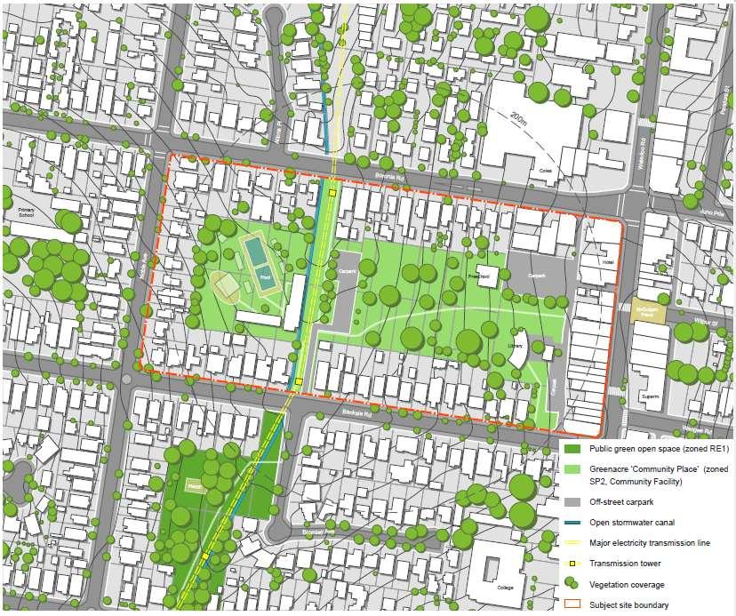
The study area is rectangular in shape, approximately 469 metres along the northern boundary and 214 metres along the western boundary.The studyarea is bound by Boronia Road to the north, Waterloo Road to the east, Banksia Road to the south and NobleAvenue to the west.
The study area incorporates a section of the main retail shopping area fronting Waterloo Road, as well as public parkland, community buildings such as a library, childcare centre and public toilet, car parking and the site of the former Greenacre Leisure andAquatic Centre.
The perimeter of the study area is predominantly bounded by residential dwellings west of Waterloo Road.

The main retail shopping area for the Greenacre Village Centre lies along Waterloo Road which follows a local ridge.
East of Waterloo Road, the land falls away rapidly, providing distant views to the east.
The retail opportunities range from a number of specialtystores, food and drink premises, and larger retailers including Coles.
Keycommunity facilities along Waterloo Road include the Greenacre Citizens Centre in the north and the proposed new multipurpose facility at Roberts Park (currently in design phase).
Within close proximityto the GreenacreTown Centre are a number of public and independent educational and religious facilities.

Community Place is located at the centre of the Community Place precinct which provides a large green open space, a library, public toilets, car parking, a pre-school, an early childhood health centre and the site of the former GreenacreAquatic and Leisure Centre.
Amajor electricity transmission line and an open stormwater channel intersect the site from north to south.
The Community Place Precinct has a regular grid layout with larger block sizes.
This area is surrounded by residential properties with frontages on surrounding streets, limiting views and opportunities for passive surveillance into Community Place.
Boronia Road to the north is a Classified Road, while Banksia Road and NobleAvenue to the south and west respectively are local roads.
Vehicular access to Community Place is limited to a one-way laneway (north to south movement) on the eastern side of the Community Place Precinct, and access from Banksia Road to the carpark associated with the former GreenacreAquatic and Leisure Centre.

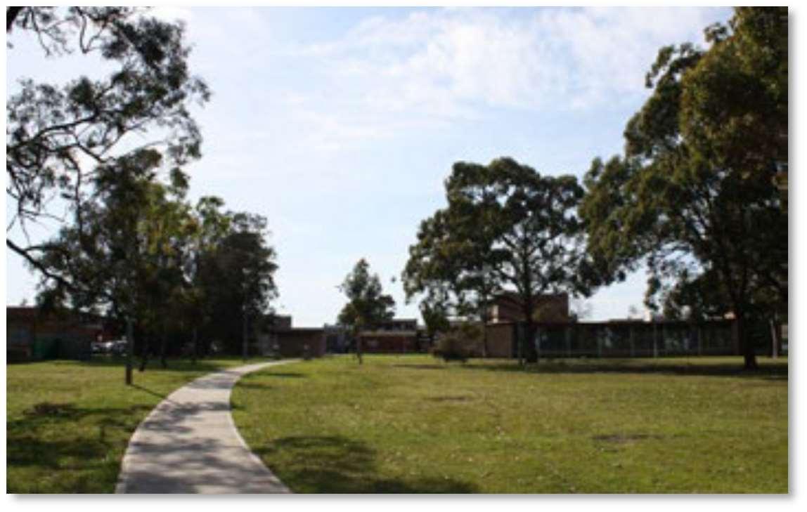

Waterloo Road is located along the eastern boundary of the study area and has street planting and public art which improves the amenity and attractiveness of the streetscape.

The large open area in the centre of the study area has a number of tall trees and provides a pedestrian route through the park linking the GreenacreTown Centre and the former Greenacre Aquatic and Leisure Centre.

Pedestrian access from the main retail uses along Waterloo Road to Community Place is limited.

The current public library is located adjoining the central area of Community Place and behind the early childhood health centre. The public library will be relocated into the new multipurpose facility at Roberts Park.
Civic places include a plaza and playspace on the eastern side of Waterloo Road.
Boronia Road along the northern boundary of the study area is a Classified Road and is a major vehicle thoroughfare that connects the Hume Highway (A22) and Roberts Road (A3).
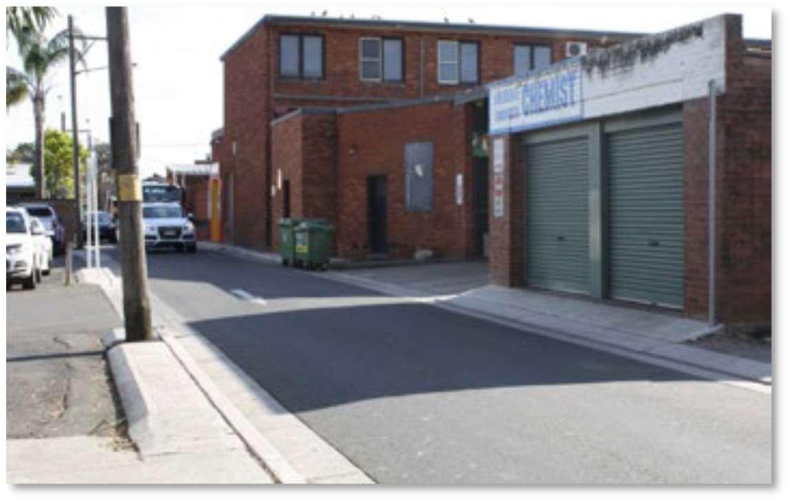


Community Place is a lanewaythat facilitates servicing of commercial properties fronting Waterloo Road.
Pedestrian infrastructure is limited.

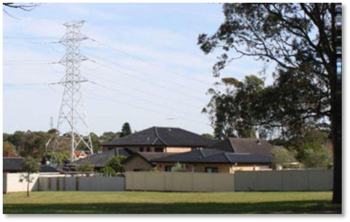
Two high voltage transmission towers and power lines bisect the site in a north south direction to the west.

Redevelopment in the area is occuring but largely limited to semi-detached dwellings.
The GreenacreTown Centre includes a number of commercial uses including retail and food and drink premises.
Adrainage easement bisects the site in a north south direction to the west parallel to the high voltage lines.
Residential properties are accessed from surrounding roads with the rear of properties facing Community Place limiting opportunities for passive surveillance.


CBCity 2036 is Canterbury-Bankstown’s Community Strategic Plan, which guides Council on a range of high-level goals, strategies and outcomes around community wellbeing and quality places and spaces.These high-level goals are represented in a series of seven destinations.
Two of the key destinations relevant to the CommunityPlace Precinct are outlined below:
HealthyandActive

Safe and Strong

Connective City 2036 is Canterbury-Bankstown’s Local Strategic Planning Statement, which provides a comprehensive land use strategy for the City. It aims to build on the City’s attributes as one of the most diverse communities inAustralia.
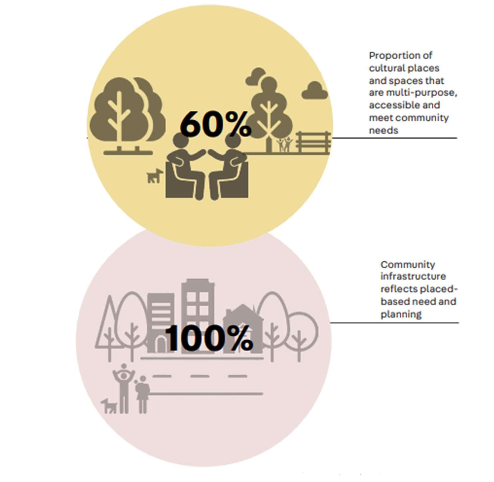
It identifies the following relevant priorities and indicators for CanterburyBankstown to 2036:


This Plan is the first of this type for CBCity, and will be used by Council to inform planning, funding and prioritisation for the delivery of Council’s community infrastructure. It will also inform where Council will look for opportunities with external partners for the provision of newfacilities, including delivery, shared used of facilities, to ensure it meets demand from the existing and incoming population.
This work is underpinned by a catchment-based planning philosophy for community infrastructure that takes a nuanced approach to understanding community needs based on the defined geographical areas.
Sixcatchments weredeveloped and analysed as part of this work, with the CommunityPlacePrecinctlocated in Catchment 4. High level recommendations for the Cityinclude:

• Where appropriate, cluster or co-locate community infrastructure in town centres and adjoining civic or open space.
• Advocate with external partners including Schools, Universities, TAFE, Registered and Licenced Clubs, PCYC for shared use of spaces to cater for a variety of different users, including communityaccess to halls, meeting rooms.
• Provision of new community infrastructure to align with the recommendations of various Council strategies and plans including:
- Disability InclusionAction Plan;
- YouthAction Plan;
- Bankstown PositiveAgeing Strategy and CanterburyPositiveAgeing Strategy; and
- SmartCity Roadmap.
• Where possible, consolidate community infrastructure into integrated multipurpose facilities/hubs in each of the catchment areas.
• Where possible locate community spaces near civic and passive open areas.
• Seek to increase access to non-Council community space for the general public through shared and joint use arrangements.
• Consolidate existing youth facilities within multipurpose youth hubs.
• Where possible co-locate youth facilities with other recreational facilities.
• Supportandadvocateforprovisionofspacesforusebyothergovernmentandcommunityorganisationsthatprovideservicestothecommunity to be managed in accordance with the Community Facilities Policy (under development).
An extract of recommendations for Catchment 4, which includes the Community Place Precinct, is provided below:

Note:At the time of writing, the draft Community InfrastructureStrategic Plan 2050 has undergone community engagement but not has not been adopted by Council.
Council is currently preparing a new Open Space Strategic Plan, it is the first combined plan for the City which will replace the Bankstown Open Space Strategic Plan 2012 and the Canterbury Open Space Strategy 2017.
The aim of the Plan is to make recommendations for future open space provision by providing an in in-depth study of all current land uses and ownership patterns across the City. The Plan also responds to the strategic objectives of the Community Strategic Plan – CBCity2036, the Local Strategic Planning Statement – Connective City 2036 and aligns with Council’s relevant supporting plans and detailed actions plans.
The Plan will identify the priorityactions to enhance community access to a range of open space experiences and ensure we are able to service the future demands of an increasing population.
Akey consideration of the new plan is to ensure there is adequate provision of the open and civic space to support the GreenacreTown Centre and needs of the Greenacre community.
The YouthAction Plan guides Council in its work with young people, the community, youth service providers and other stakeholders.
The Plan outlines objectives and actions under the following seven key priorities:
• Services and programs;
• Youth friendly places and spaces;
• Health and wellbeing;
• Education and employment;
• Cultural diversity;
• Civic participation; and
• Inclusion.
Objective:Youth Friendly places and spaces
Relevant actions include:
• Identifyopportunitiestoimproveexistingyouthrecreationareas(e.g.skateparks,multipurpose courts, murals, and/or street art), that include collaboration with schools and artists.
• Identify locations for additional multipurpose courts that are located within walking distance of town centres and major public transport stations so that young people can access them, including through joint use partnerships with schools.
The Sports Facilities Strategic Plan supports Council’s vision to provide a range of diverse sports facilities that positively contribute towards Canterbury-Bankstown's vibrancyand sense of place whilst promoting an active and healthy community. The Plan recognises that indoor sports are varied and provide diverse opportunities for entertainment and exercise.
Indoor sports facilities within Canterbury-Bankstown differ in use, with strong participation in a variety of sports represented. Currently, facilities are not keeping up with demand, with participation being capped at some facilities due to capacity issues.
The following trends are emerging in indoor sports in Canterbury-Bankstown, NSW and more broadly across the sporting sector nationally:
• Significant increase in social sports inAustralia, the majorityof which are undertaken in indoor facilities.
• Indoor sports centres are seen as social hubs within communities and usuallyoffer a range of sports and services, particularly targeting intergenerational use.
• Indoor sports centres are adaptable over time, accommodating a range of uses and are therefore more likelyto meet changing market and participation trends.
• Larger multi-purpose facilities show resilience in commercial viability to their adaptability.


Land Zoning
The following land use zones apply to the precinct:
• R2 LowDensity Residential
• SP2 Infrastructure (CommunityFacility)
• B2 Local Centre zone
Note: Community Facility is defined as follows
Community facility means a building or place— a) owned or controlled by a public authority or non-profit community organisation, and b) used for the physical, social, cultural or intellectual development or welfare of the community, but does not include an educational establishment, hospital, retail premises, place of public worship or residential accommodation.

Building Heights
Maximum building heights for the site range from 9 – 20 metres.
• 9 metres applies to the residential area and a predominant part of the SP2 Infrastructure zone.
• 14 metres to eastern part of SP2 Infrastructure zoneand B2Local Centrezone fronting Boronia Road.
• 20 metres to B2 Local Centre zone fronting Waterloo Road.
Note: Storeys generally
• 9 metres equates to 2 storeys
• 14 metres equates to 3 storeys

• 20 metres equates to 6 storeys Floor Space Ratio Floor space ratio controls range from Nil –2.5:1.
• SP2 Infrastructure Zone – Nil
• R2 LowDensity Residential – 0.5:1
• B2 Zone fronting Boronia Road – 1:1 • B2ZonefrontingWaterlooRoad–2.5:1
The following needs analysis focuses on community infrastructure that is generally provided by Council. It does not include an analysis of infrastructure provided by others, including State Government (such as schools and hospitals) and the private sector (such as registered clubs)
The analysis also builds on the Council strategies previously outlined in Chapter 2.
Needs according to keydemographic groups


Provide increased access into and across the site. Improved vehicle access will enable easy access to the facilities and amenities offered within the site.

Utilise parcels within the site for development, to help activate the area, improve activity levels, and support increased safety and surveillance.

Provide improved pedestrian permeability, both east west and north south, to encourage the local community to walk to facilities within the site.

Improve and strengthen the visual and pedestrian connection between the site, Waterloo Road and McGuigan Place.

The provision of improved vehicular and pedestrian access will increase surveillance across the site, resulting in reduced antisocial behaviour and improved safety and security.
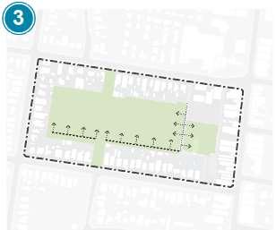
There are three keyopen space zones, each of which has specific characteristics.Anyfuture built development would need to consider the impact on remaining open space.

Provide an improved drainage channel to enhance the presentation of this infrastructure and to encourage biodiversity and improved ecological outcomes.

Consideration of site acquisitions to enable the site access objectives. Location of access is optional.

Recommendations
Taking into account the various Council strategies and the following communityneeds have been identified for the broader area that can be considered for the Community Place Precinct.
Facility Council Strategic Justification
Open space to support the function of the GreenacreTown Centre.
Indoor recreation facility incorporating at least two or more indoor courts.
Youth focused facility (that can be incorporated as part of an indoor recreation space).
Indoor recreation facility (Healthy andActive)
Subsidised spaces.
Note: The above facilities may include ancillary uses includingfood and drink premises.
• Bankstown Open Space Strategic Plan
• Sports Facilities Strategic Plan
• YouthAction Plan
• Draft Community Infrastructure Strategic Plan
• Community Strategic Plan – CBCity 2036
• Draft Community Infrastructure Strategic Plan
The framework establishes the direction for Council owned land within the Community Place Precinct.Anyfuture proposals on the site will be required to be accompanied by a review of the applicable planning controls and be supported by a site specific development control plan to ensure orderly development of the precinct.
Planning document
Canterbury Bankstown Local Environmental Plan 2023
Canterbury Bankstown Development Control Plan 2023
Recommended review/provisions
• Land Zoning
• Height of building controls
• Setbacks (including interfaces with the residential zone)
• SolarAccess
• Car parking rates and provision
• Traffic Study
• Road cross sections
• Flood Study
• Acoustic Study
• Crime Prevention through Environmental Design (CPTED)
Comment
The RE1 Public Recreation wholly or for part of the site will better reflect the intended uses than the current SP2 Infrastructure zone.
Indoor recreation facilities require minimum floor to ceiling heights to accommodate various indoor sports.The 9 metre maximum height of building controls will need to be reviewed.
Site specific development controls to ensure orderly development of the proposed land uses.

