Hello, I'm Chia-Yu, a 27-year old urban designer from Taiwan. Thank you for having an interest in my portfolio of selected student works. In this portfolio you'll find projects shifting in scales, with a focus on social and environmental sustainability. Please contact me if you have further questions.
As an urban designer, I recognize my role is to make the city a better place as a result of my presence, and to make sure that the impact I create lasts in my absence. Therefore, I'm looking to learn and work more with the topics such as sustainable mobility, climate-adaption design, nature-based solutions, social cohesion and community-oriented development.
I'm looking forward to joining a team that put these values into practice. I'm a proactive and reliable person who would like to create something longlasting and beneficial for our environment and society. At the same time, I am a diligent and result-oriented team player, as well as an open-minded listener. I believe I can bring contribution to the team with my skills and knowledge.
Thank you for your time reviewing my work, and I hope to hear from you.
Chia-Yu Chang (Jessica)
WORK EXPERIENCE
08/2023 - 06/2024
10/2020 - Present
Malmö, Sweden chiayuchang1023@gmail.com +46 766358668 Chia-Yu Chang
Henning Larsen
A globally renowned Danish architecture design company
Urbanism Intern
Copenhagen, Denmark
• Contributed to diverse projects including Bremore Port master plan, highway covering research, central Riyadh regeneration competition, and La Paz aquaculture center preconcept competition, ect.
• Played a key role in project Gaudi to do research and develop a new strategic plan with my team, successfully convincing the municipality and satisfying the client's desire.
• Responsible for creating comprehensive space plans, diagrams, 3D modeling, and physical models.
Urban Planning International
06/2019 - 08/2019
06/2018 - 08/2018
Part-time Editor
A national academic journal of overseas urban planning in China remote
• Written 100+ Nordic urban development news, each of which has 500+ views.
• Done 3 case studies of Nordic countries' projects
AECOM, Taipei Office
Intern of Buildings & Places
A world-leading infrastructure consulting firm Taipei, Taiwan
• Made space plans and diagrams for Zhengzhou cultural park urban design competition, winning the second place out of 6 firms
• Headed 5 interns to propose an urban design plan for Lingzhan brownfield redevelopment workshop and did the final presentation, winning the first place out of 5 intern teams
• Accomplished 5 independent researches of night economy, smart city, proportion of greenness, etc.
Professor Zhai Guo Fang’s studio
EDUCATION
08/2020 - 06/2022
Intern of Resilience Planning
A studio of Prof. Zhai, an expert at disdster prevention planning Nanjing, China
• Assessed Xiamen's disaster-preparedness capability by ArcGIS and proposed advices on its disaster prevention planning with my team
SKILLS
09/2015 - 06/2020
Lund University, Sweden
Sustainable Urban Design, master degree
• Thesis design: A bayside urban living room
Nanjing University, China
Urban and Rural Planning, bachelor degree
• Thesis design: Rebirth of Zouying veteran village
Cultural Landscape, Historical Legacy, Urban Revitalization
June 2020
The Confluence Loop of Hengqin
Social Sustainablity, Connectivity, Public Life
September 2022 p5 - p12
A Bayside Urban Living Room
Urban Renewal, Community Development, Public Life
May 2022 p13 - p18 p19 - p26
Recreational Greenway Planning Based on GIS:
A Case Study in Nanjing Central Area
GIS, AHP, Greenway
January 2018
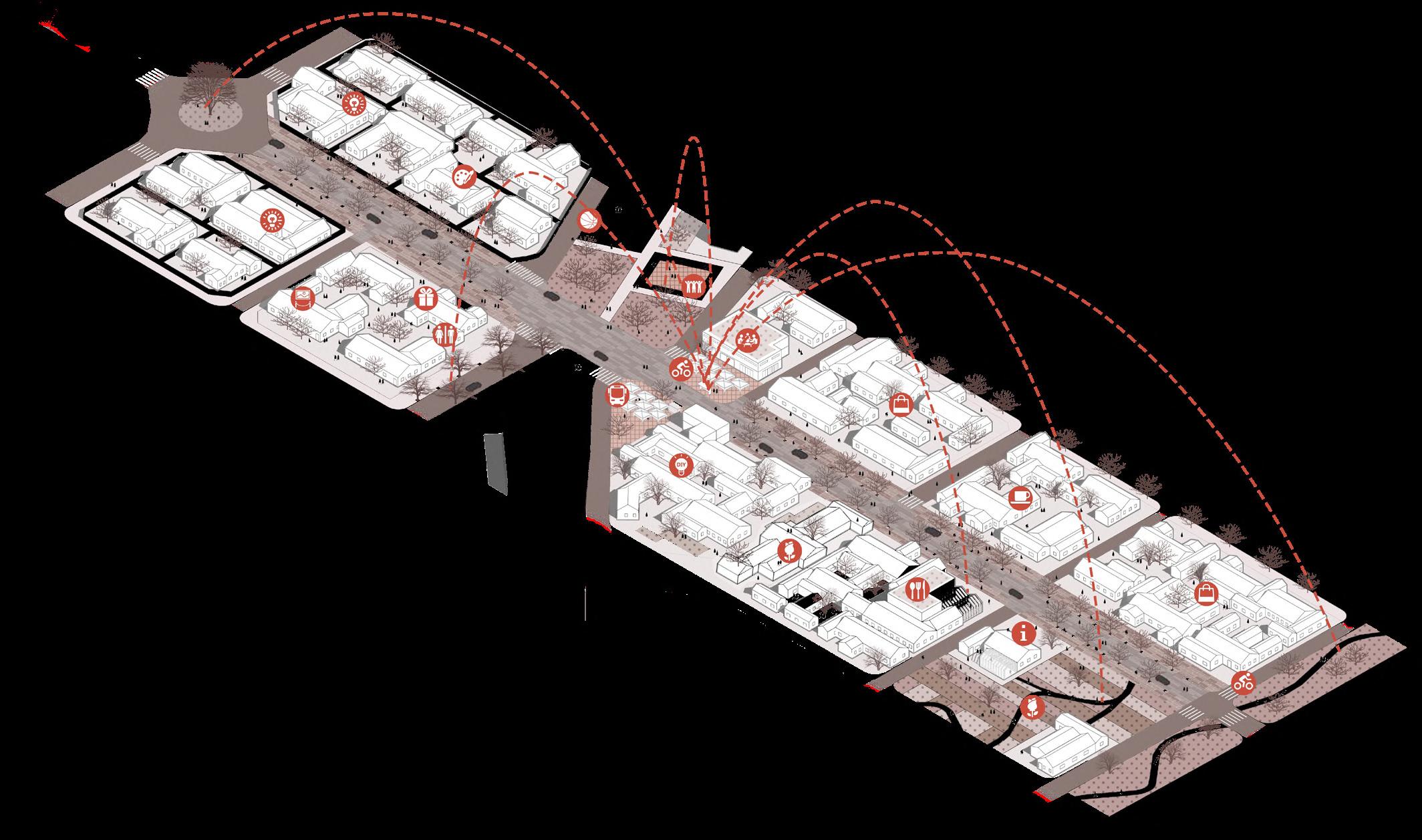
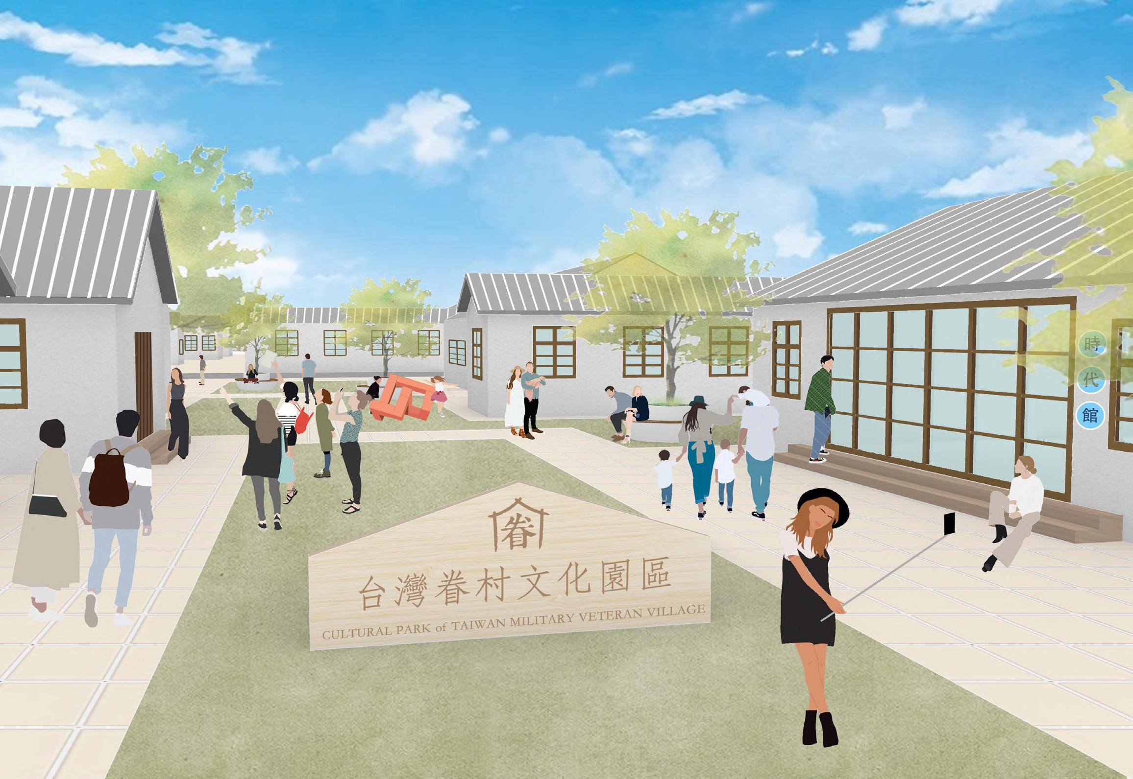
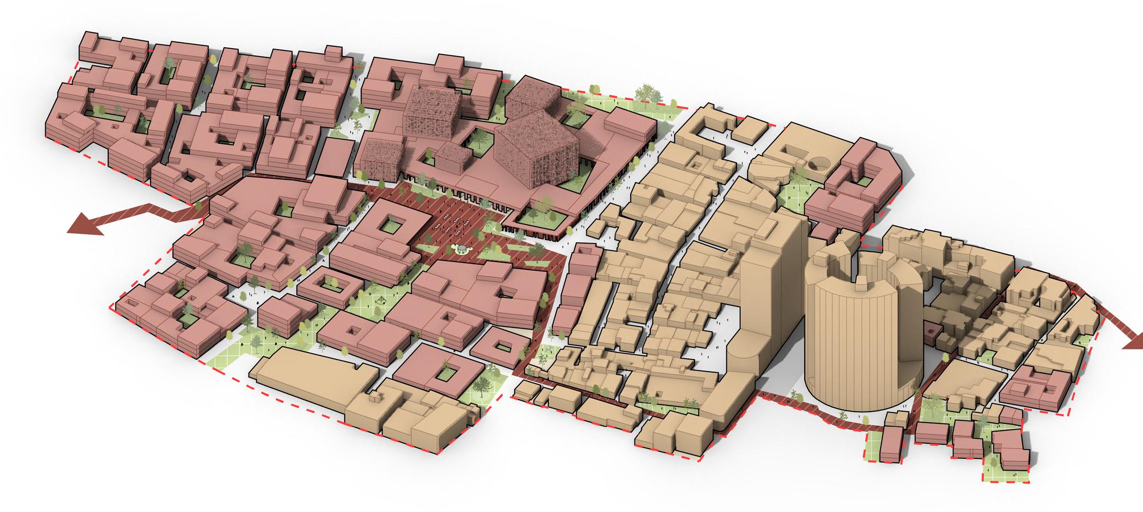
Rebirth of Zouying Veteran Village
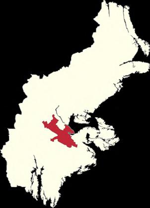
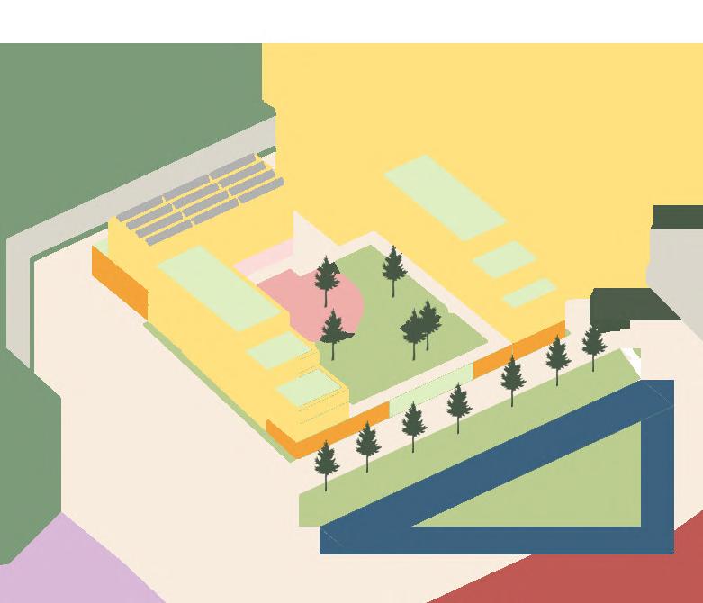
Period: March 2020 - June 2020
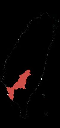
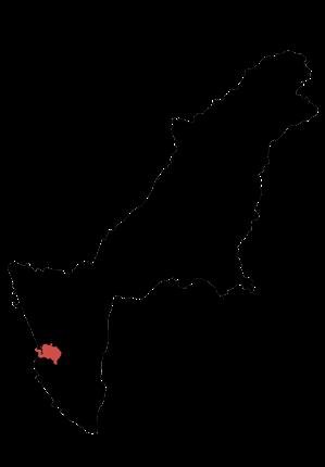
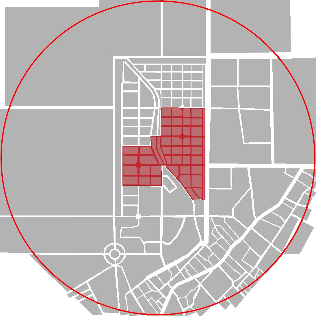
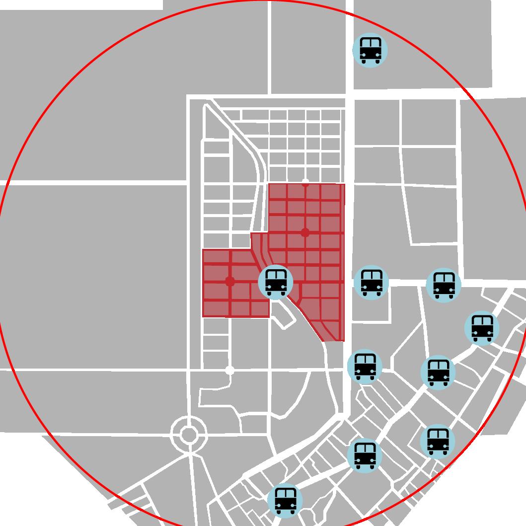
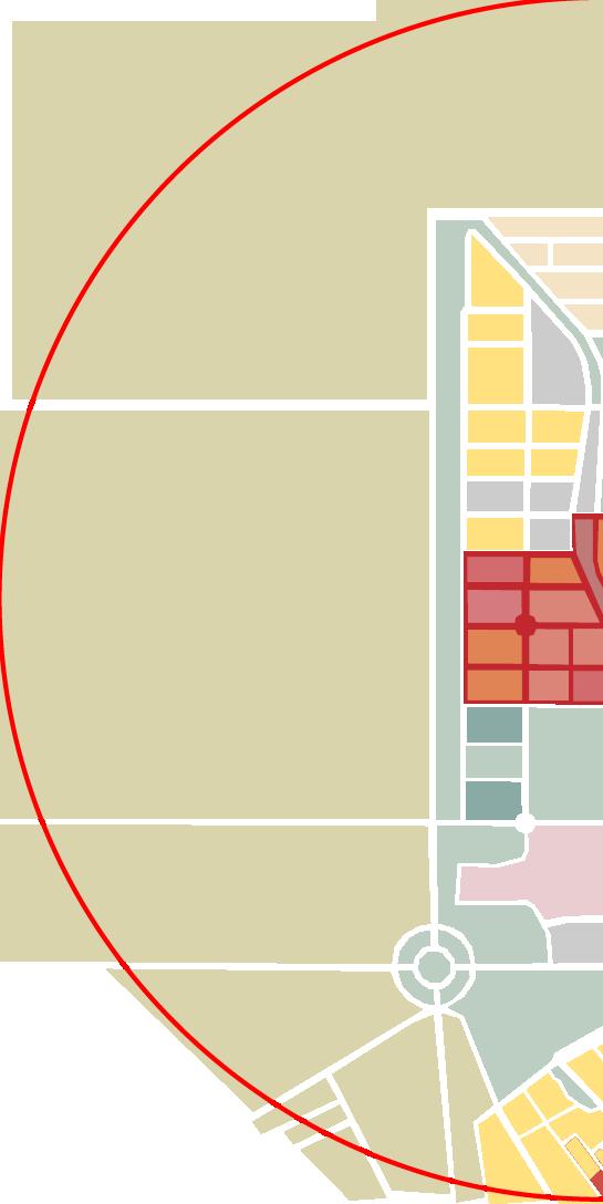
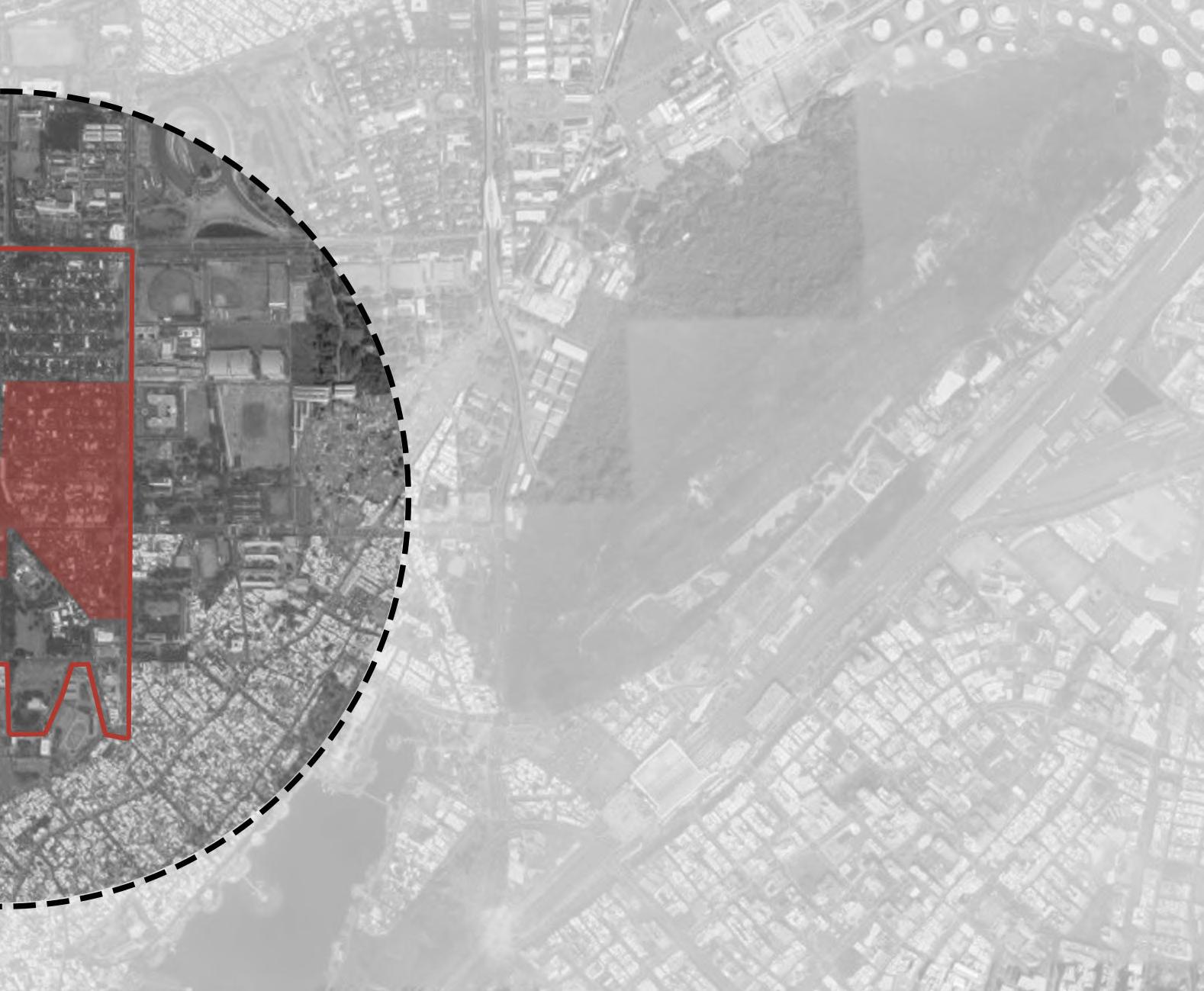
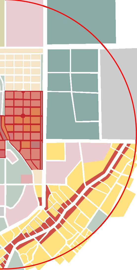
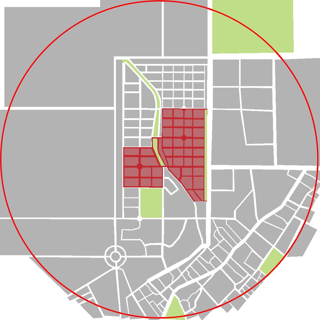
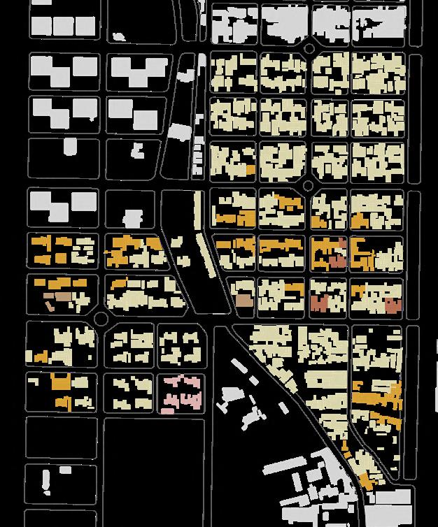
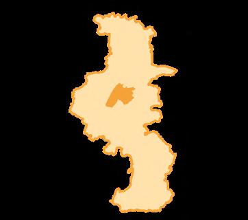
Location: Zouying District, Kaohsiung City, Taiwan Site Area: 19.3ha
Type: Bachelor thesis design (individual work) Award: Second Prize of Yuanye Awards International Competition
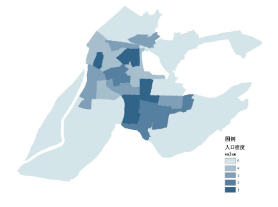
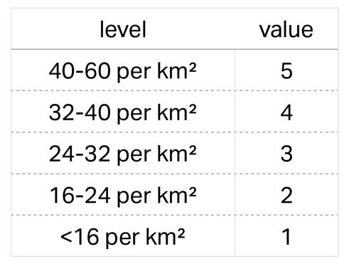
Demography
Number
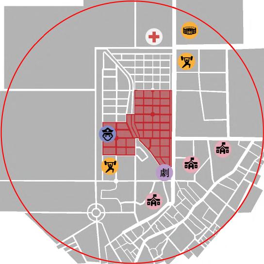
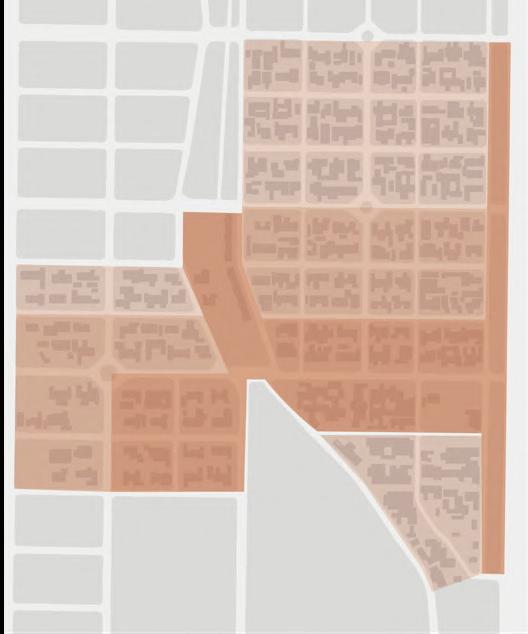
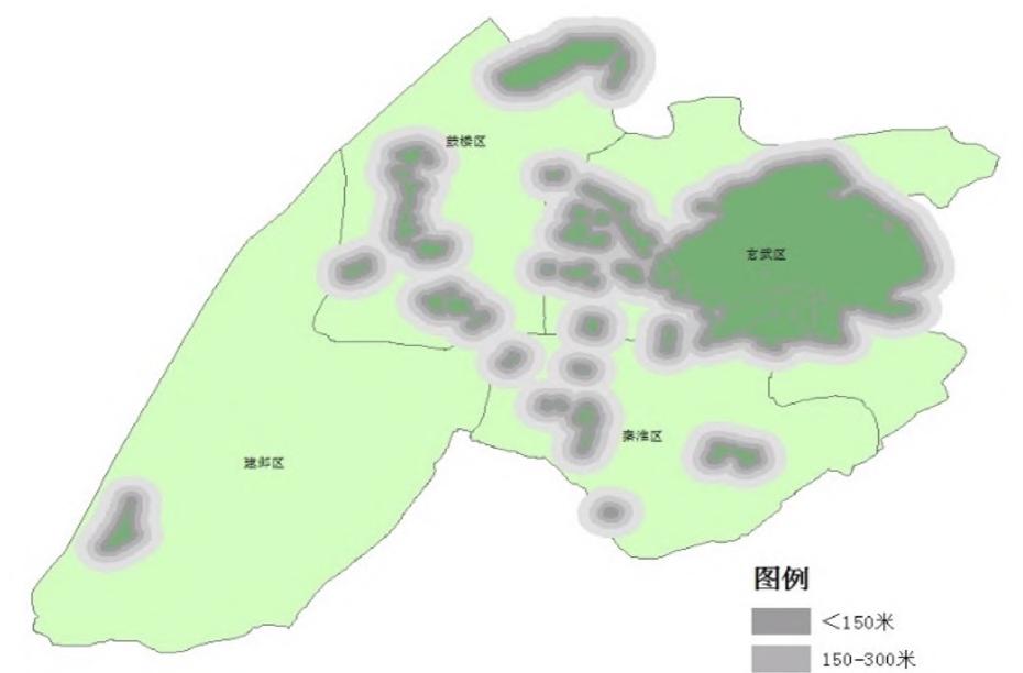
SURROUNDINGS
Kaohsiung City Zouying District
Mingde
ABSTRACT
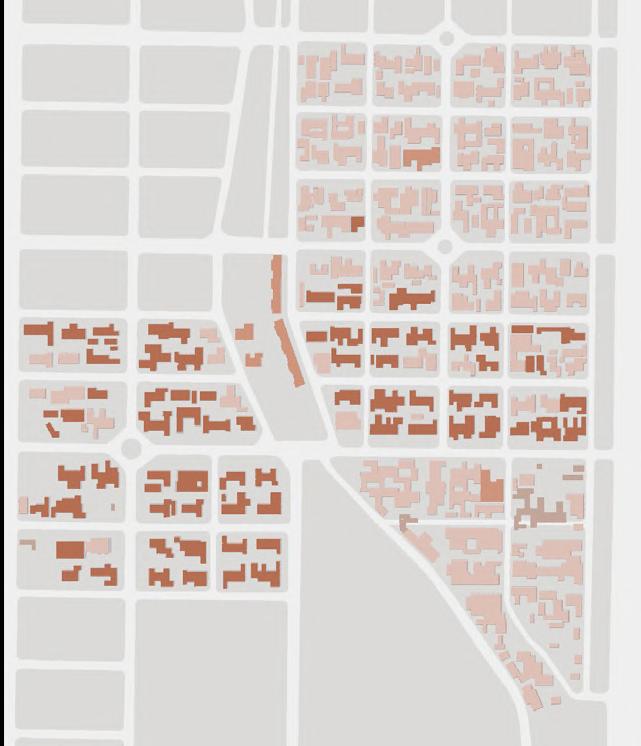
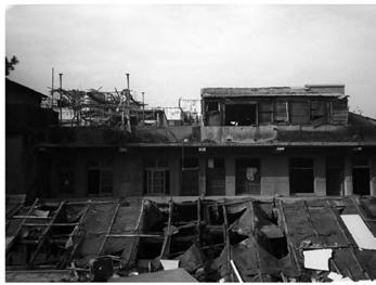
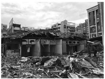
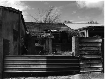
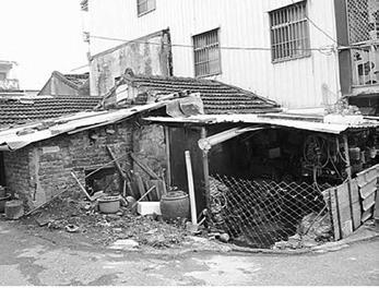
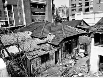
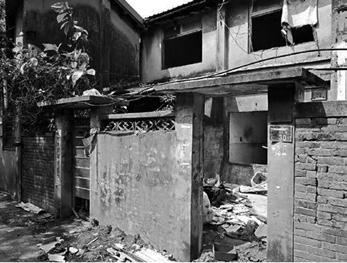
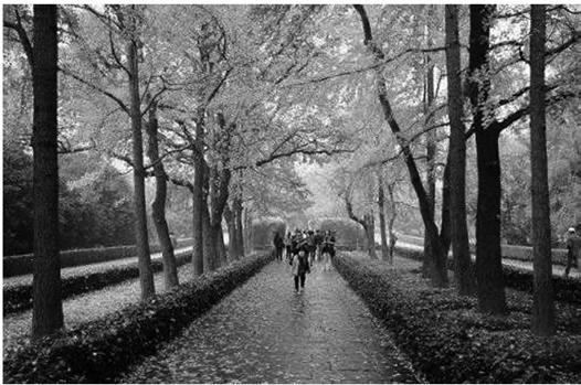
The veteran village is a unique urban landscape in Taiwan, it refers to the settlement of the Kuomintang soldiers and their families who came from China to Taiwan after 1949. Because of its special population composition, the veteran village has developed a lot of unique cultural and spatial characteristics, and has become one of the most representative cultural space of immigrants in Taiwan. However, because of the policies and the urban development process, a large number of veteran villages had been destroyed and many residents had moved out after 1987.
Zuoying Veteran Village is currently the most complete and largest veteran village in Taiwan, and there are still some original residents living in, so it is quite unique and precious. However, although it has been registered as a cultural landscape by the government and wouldn't be demolished, its built environment and culture have been quickly falling into decay due to the lack of fund, manpower, policies and public attention to its preservation.
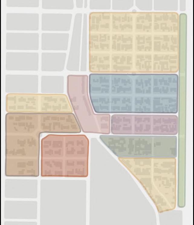
This project selects two areas (Mingde and Jianye) in the veteran village as the site. From the perspectives of preservation, development and operation, it pictures a possibility of revitalizing the village, aiming to promote the sustainable development and reach the win-win situation for the government, locals, academia and tourists.
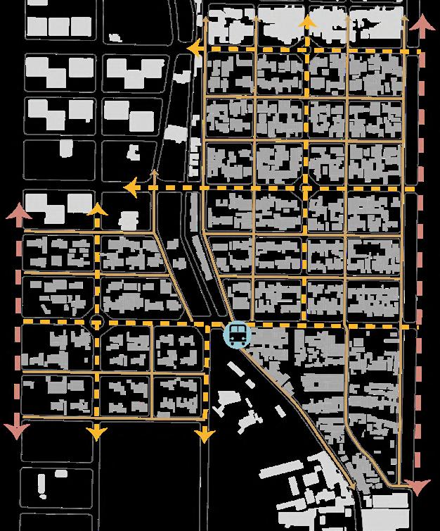
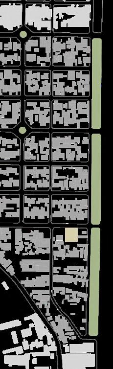
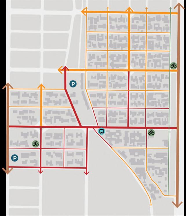
Road network
INTERVIEW
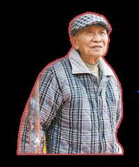
I hope the convenience of daily shopping here can be improved.
veteran
The cultural park is a nice place for a weekend trip, but I hope it could be bigger.
professor of architecture, Kaohsiung University
I hope we can connect the locals to make it a living veteran village.
DEVELOPMENT
tourist
director of cultural affairs, Kaohsiung mulnicipality
I hope we can gradually implement the "preserving by living" policy.
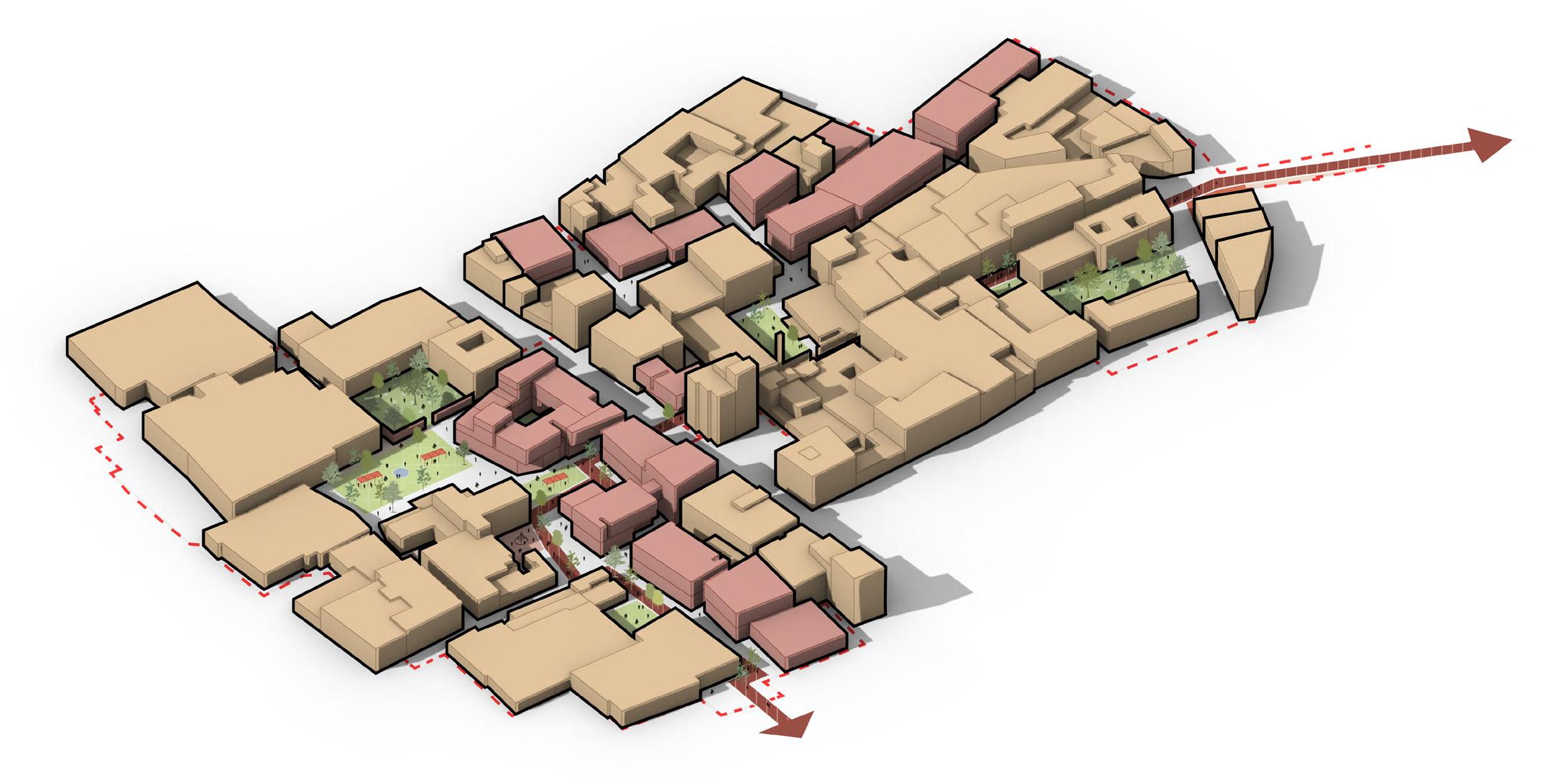
Ruined buildings and faded memories
Although Veteran Village is saved from demolition, there are still lenges to revitalization: many residents have already moved municipality has very limited funds for the veteran villages, and willingness to participate is low, making it difficult for both spatial preservation. On the other hand, although some revitalization been implemented, they had only limited effects. Lack of manpower attention, as well as insufficient funds and inefficient measures, predicament of preservation, much more revitalization.
Question
How to revitalize Zuoying veteran village through community-oriented while attracting more public attention to the preservation and future veteran village?
Vision
Create an eco-museum with a sustainable community network cultural preservation, everyday life, tourism and innovation, gradually towards a win-win situation for the municipality, the locals and tourists
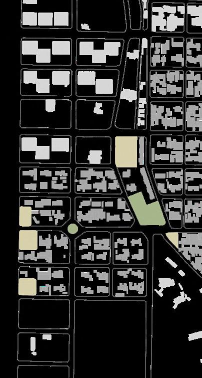
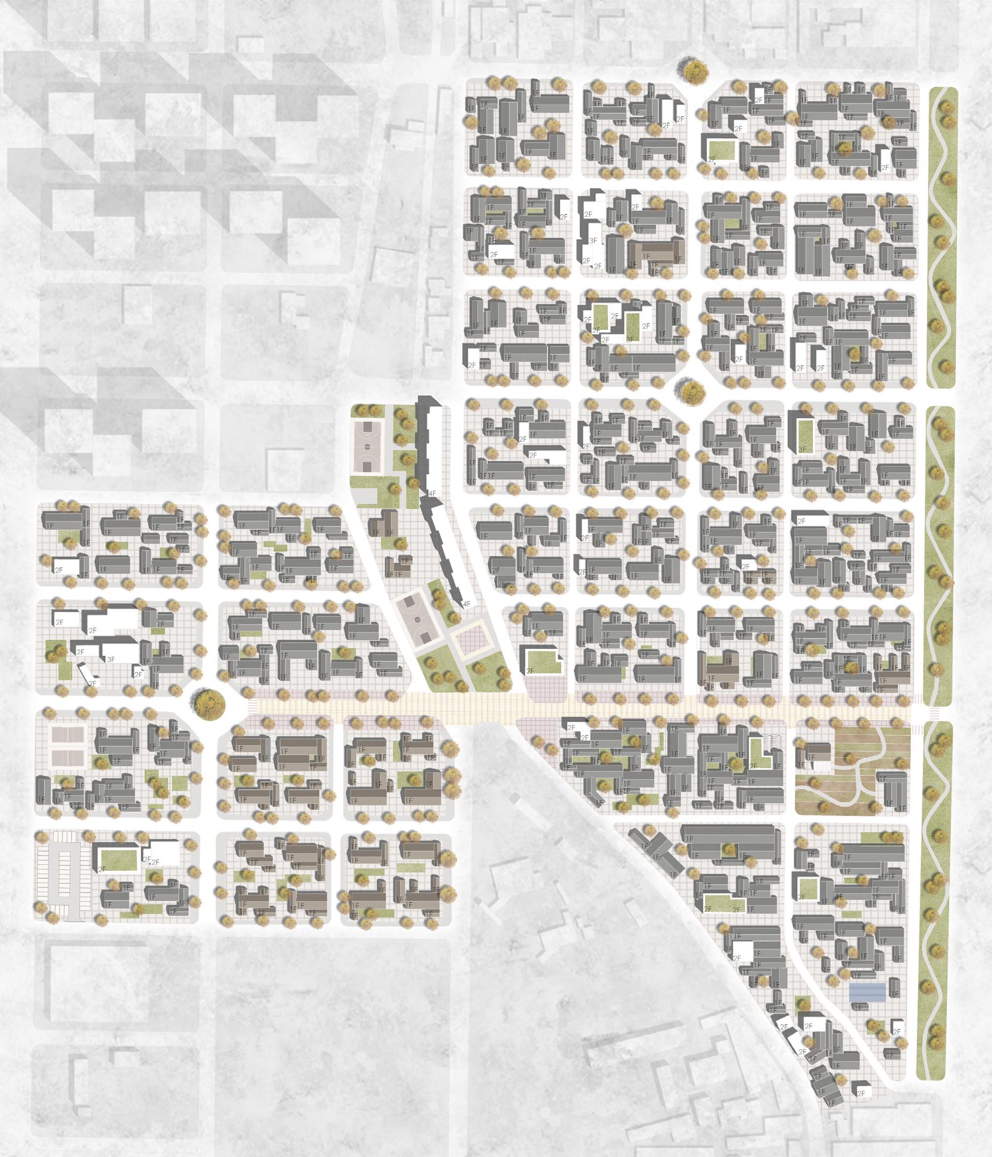
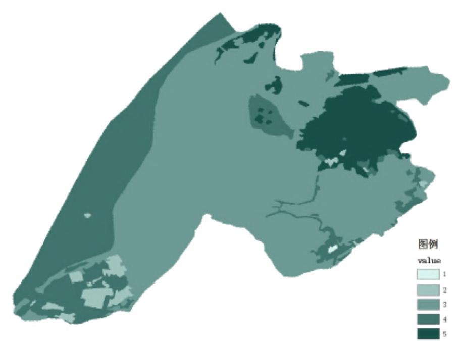
MASTER PLAN
community-oriented measures future of the that integrates gradually moving tourists still many chalout, while the and the public’s spatial and cultural measures has manpower and public resulting in the gradually "preserving
Figures
Function
Demolish
bank of building materials
Repair
recycle & reuse for repairing other building & making furnitures
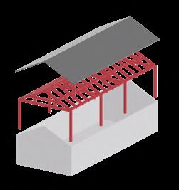
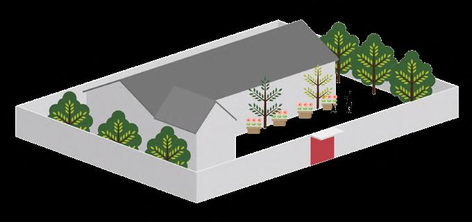
INTERIOR REDESIGN
PRESERVATION STRATEGY OF COURTYARDS
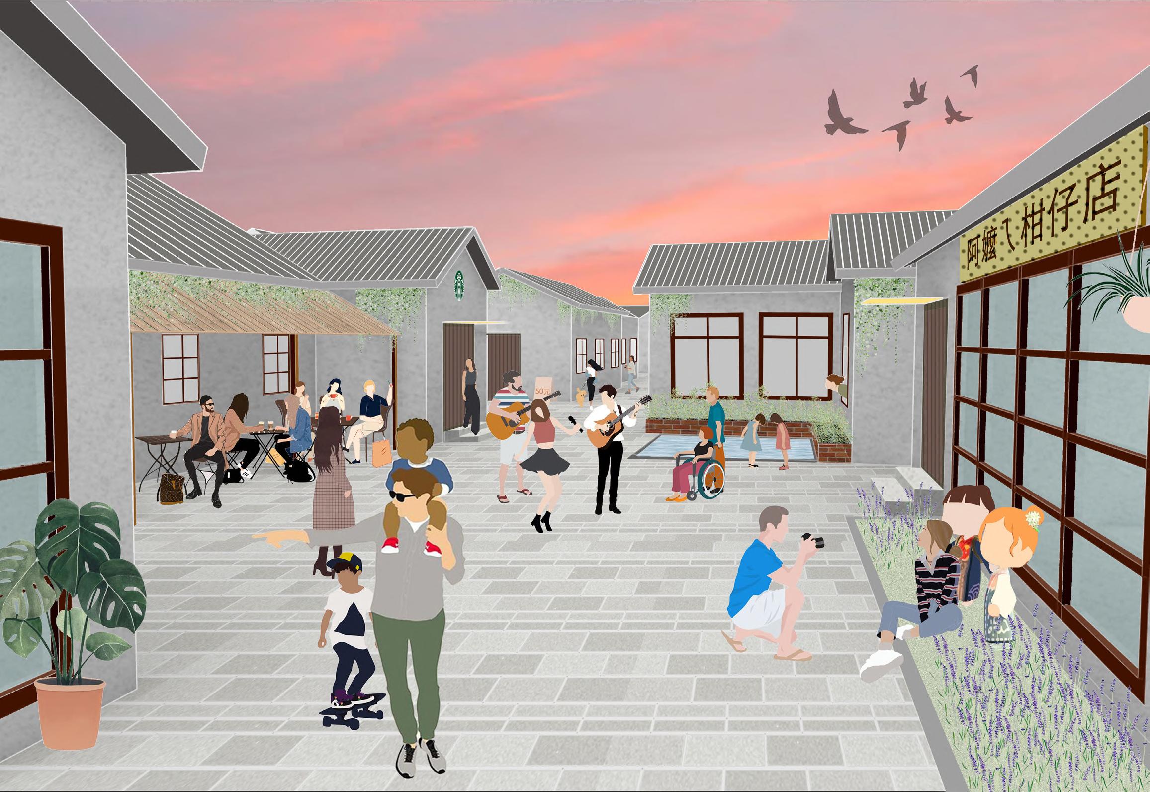
On the premise of respecting the pattern of traditional buildings, the courtyard reconstruction is proposed to better play the functions based on different uses.
Renovation
the municipality helps to enhance the structure open for new residents to live but have to maintain the buildings
propose for other functions
integrate modern design but keep its characteristics
a lots of plants grow messily in the abandoned house with high walls
the demaged part of the walls in blocks for creative and hostel purposes can be repaired by materials with strong visual permeability
Open
the walls should be opened up in blocks with commercial and cultural uses
Quiet
yards of residential buildings should be maintained, and the residents should decorate the courtyards by themselves.
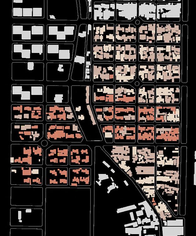
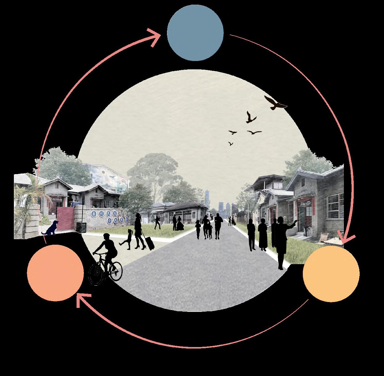
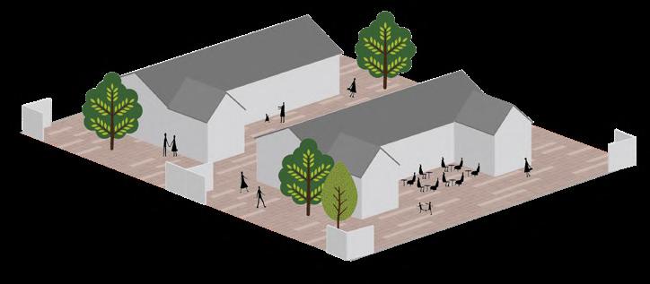
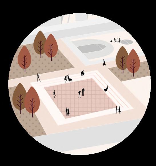
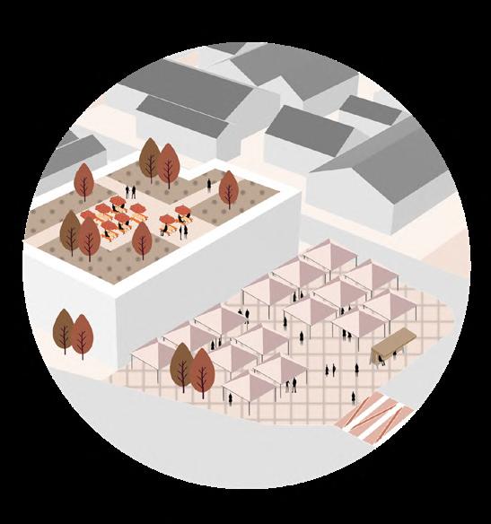
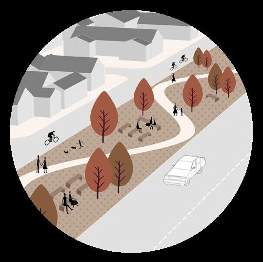
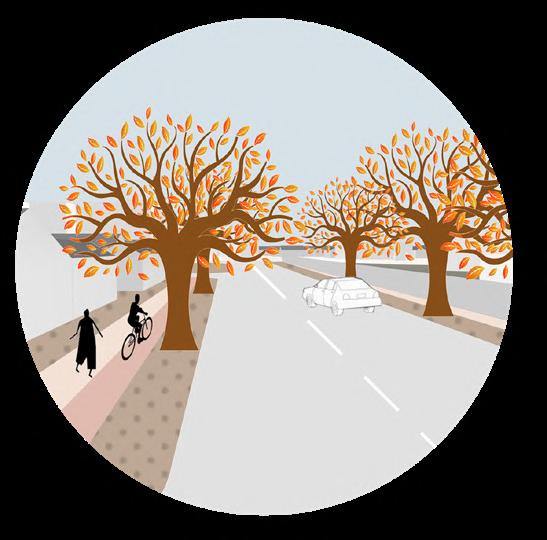
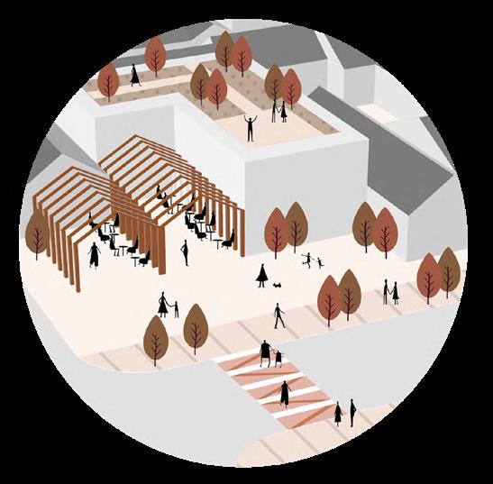
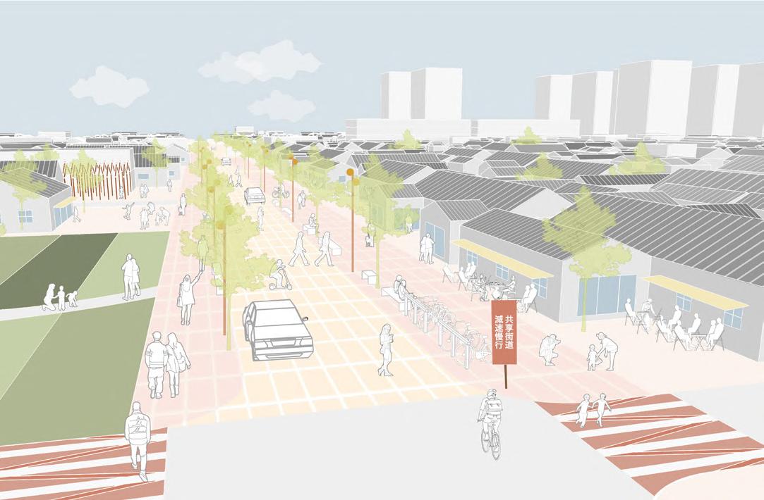
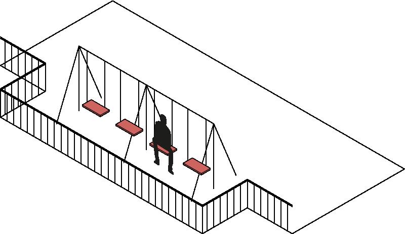
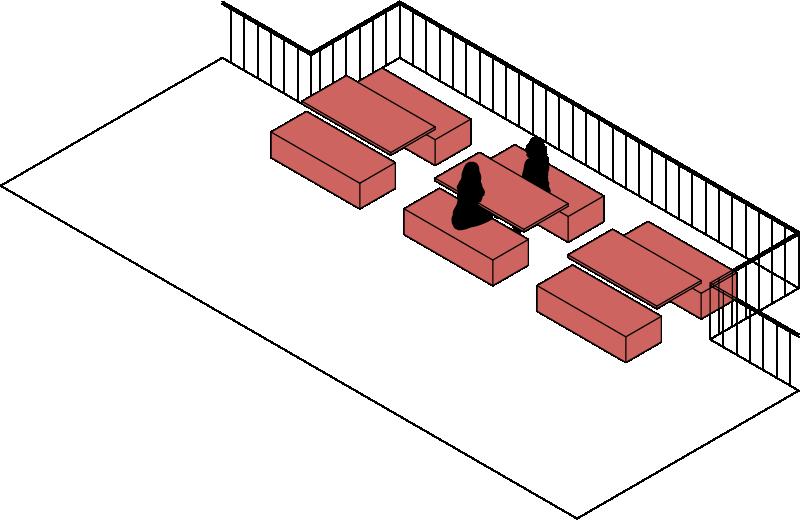
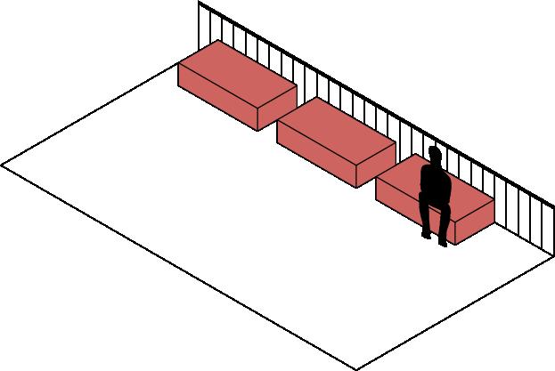
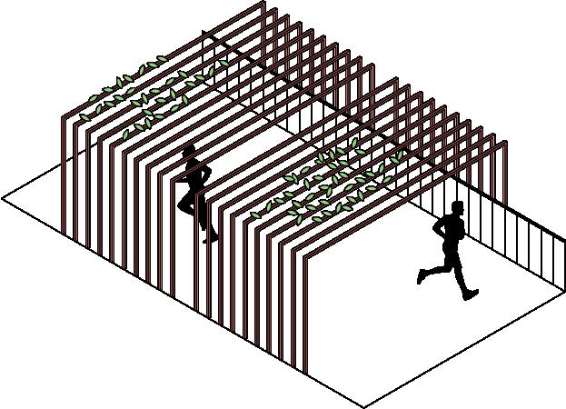
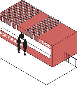
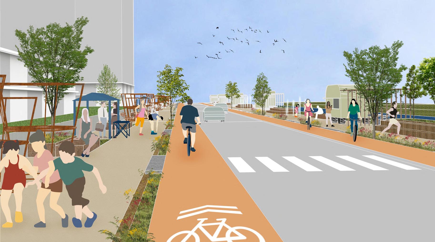
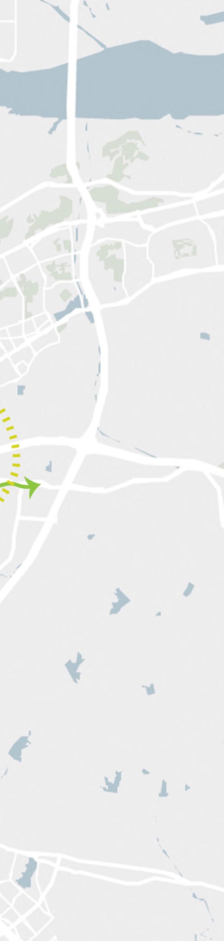
The development in the early-term is around Haigong Road, which is located in the middle of the site and has less traffic. Therefore, after the early-term development, Haigong Road is planned to become a shared steet with multilevel public spaces, which could accommade various pop-up activities and promote a vibrant atmosphere, so that people can experience the historical heritage and vitality of this area.
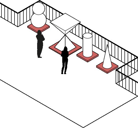
colorful zebra crossing bike sharing stop different pavings for pedestrian and shared area
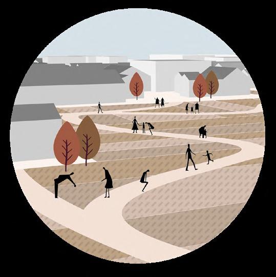
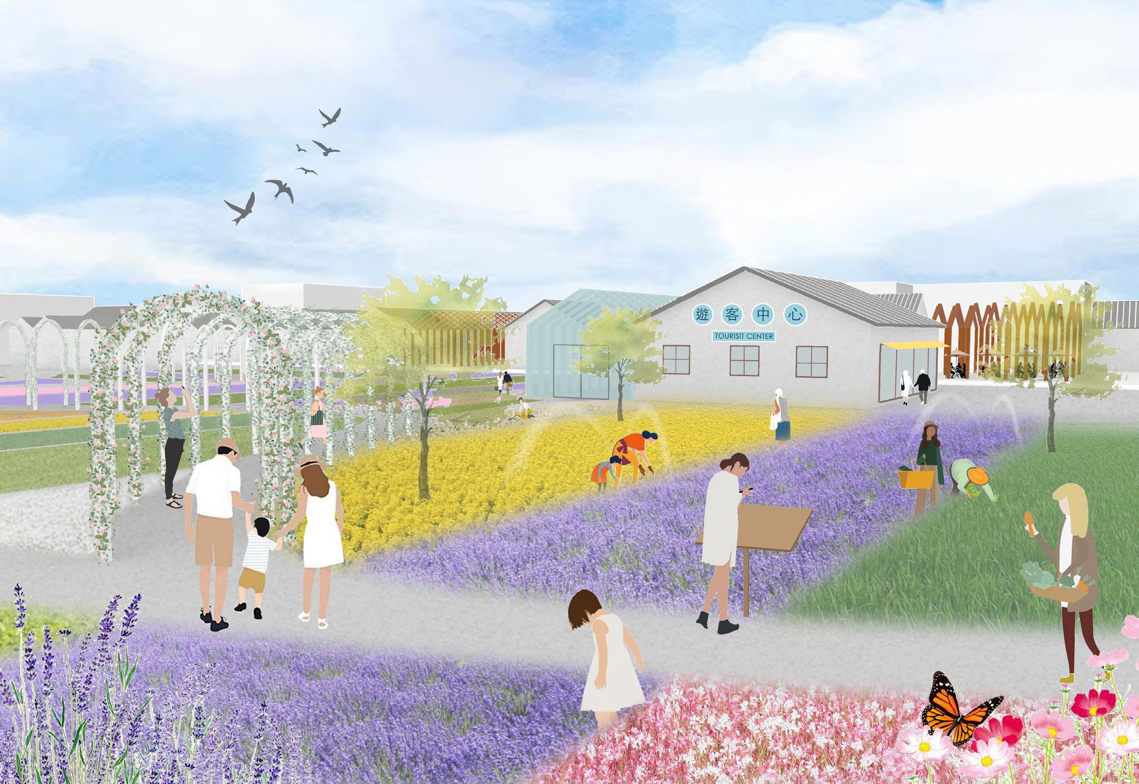
Commercial street
Community park
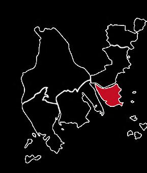
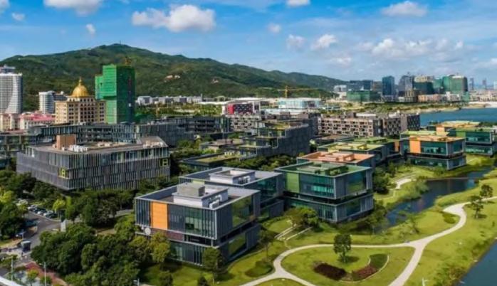
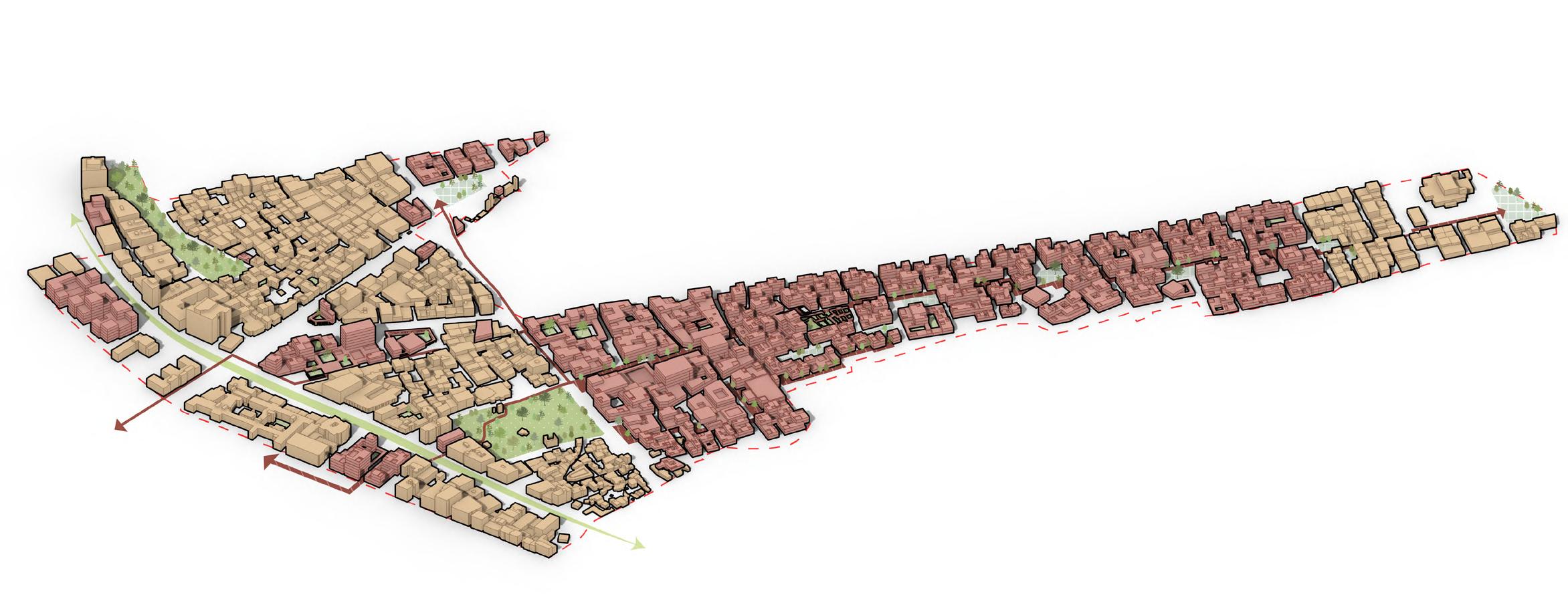
The Conflunce Loop of Hengqin
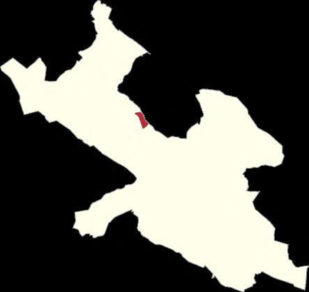
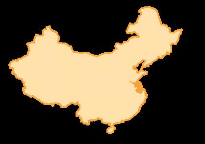
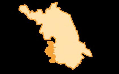
Period: August 2022 - September 2022
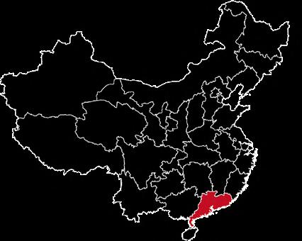
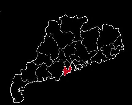
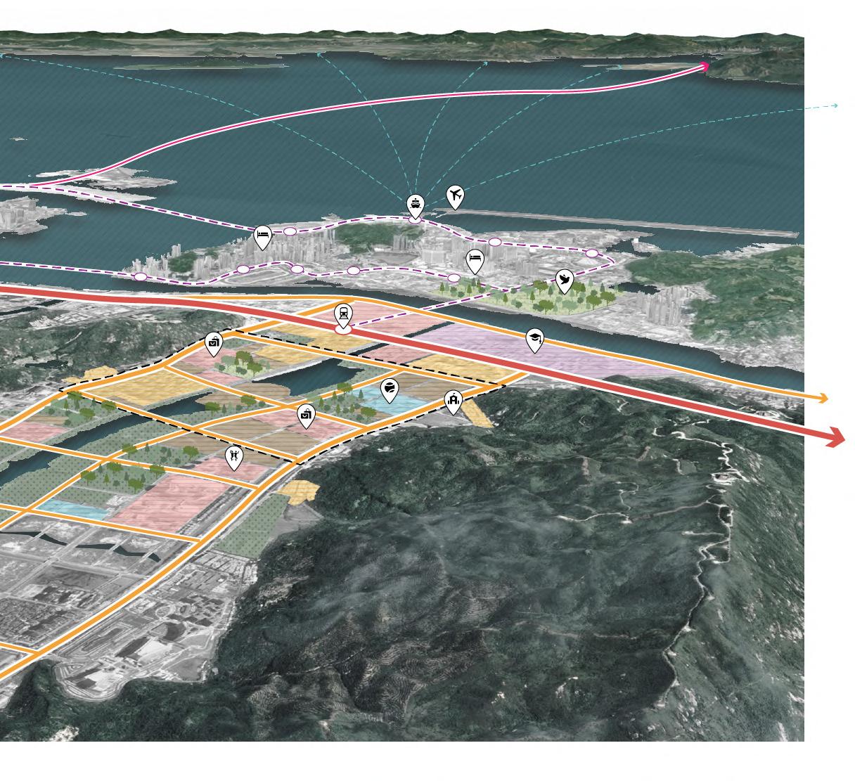
Location: Hengqin, Zhuhai, Guangdong Province, China
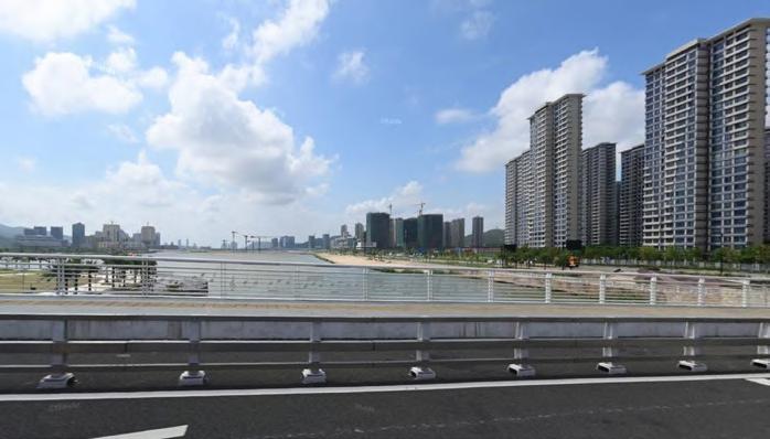
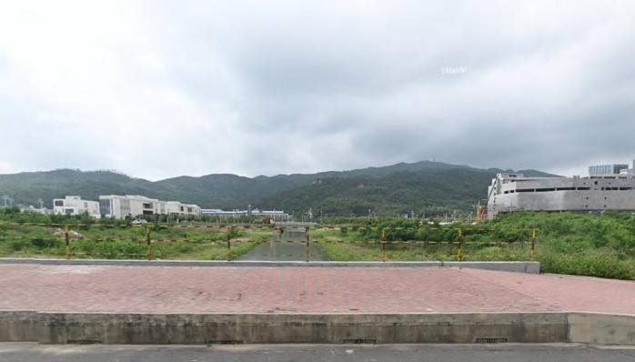
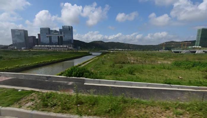
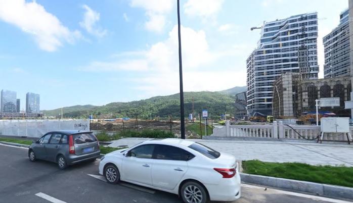
Hengqin was a sleepy rural community across the river from the worldclass gambling city, Macao. As the unprecedented Covid-19 pandemic has dealt a serious blow to the gaming industry, Macao and Guangdong are eager to seek new paths for economic diversification -- Hengqin's location, therefore, makes it an ideal hinterland that matches Macao's ambition for expansion.
Consequently, Hengqin is “leased” by Mainland China to provide a new space to facilitate more convenient conditions for Macao residents to study, find employment, start a business, and live in an environment that is convergent with Macao.
However, there are clearly physical and social gaps for the newcomers in the site since the new master plan has limited considerations for the public infrastructures and the conveniences of life. How can we intervene the buffer between the changes and the existing context during the speeding development of Hengqin?
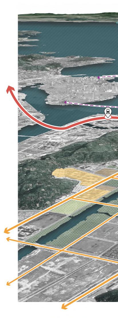
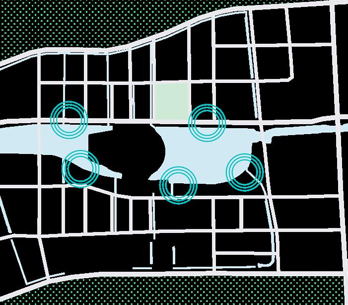
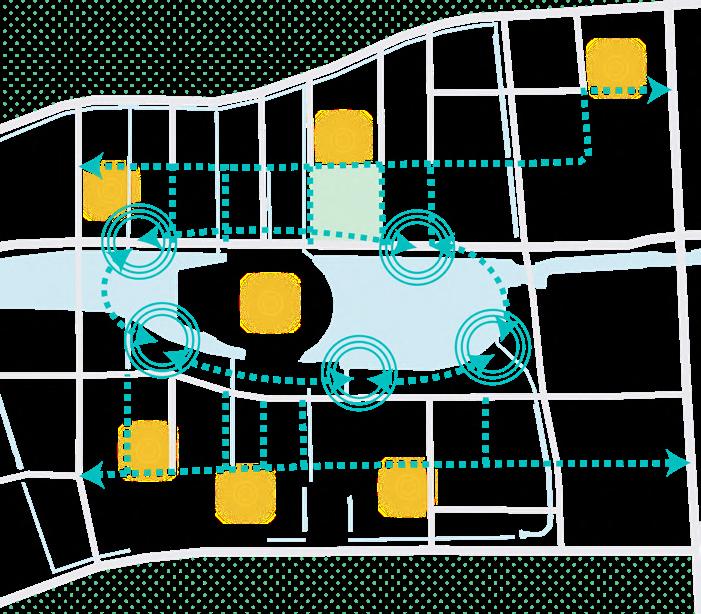
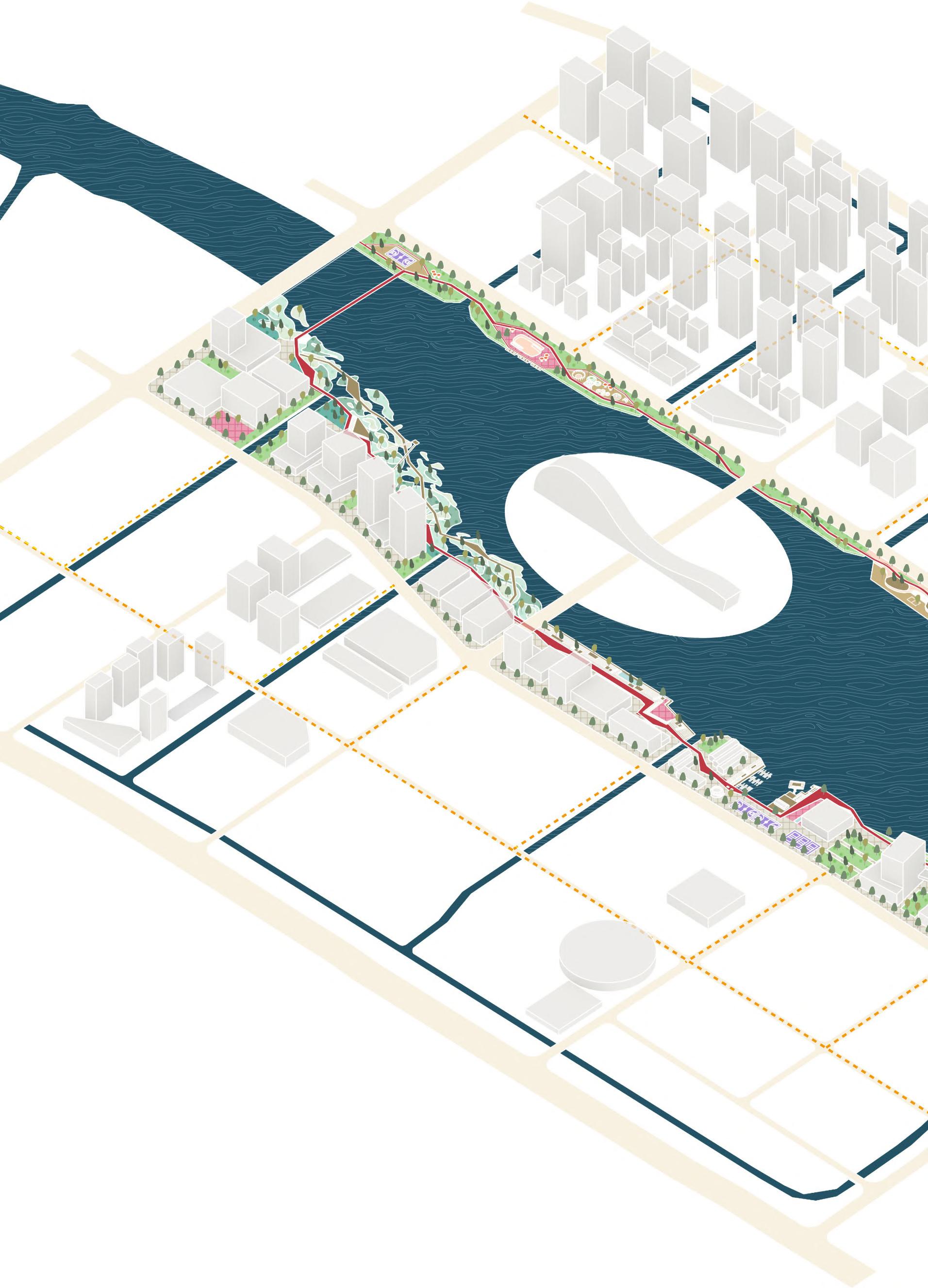
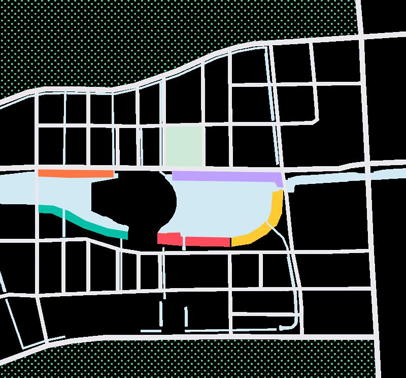
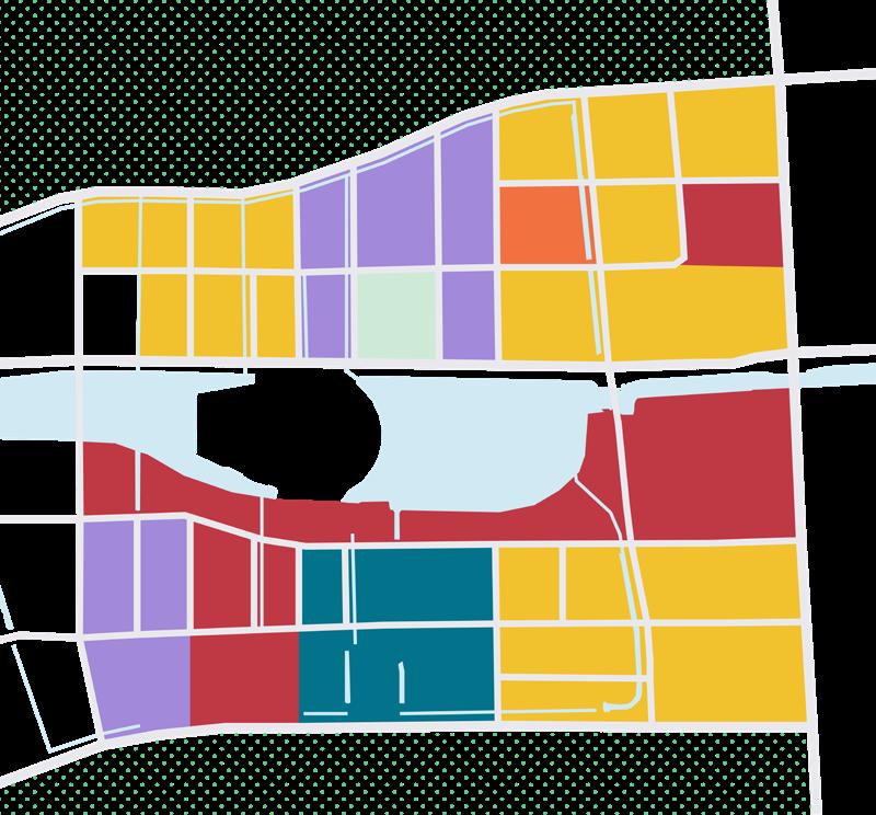
The active use of public spaces as a place for social interaction and community building is considered essential for social sustainability. Therefore, our proposal would like to help newcomers build social connections in the neighborhoods with three strategies: a core of public spaces along the river, an active loop, and human-oriented streets.
By doing so, the gaps of the life that the master plan hasn't accounted for could be plugged. Isolated neighborhoods and important nodes in this area could be connected by a series of public spaces which could accommodate a multitude of outdoor, pop-up and retail activities. People would be able to enjoy a better and more convenient life and build connections to the neighborhoods, which leads to social sustainability.
China
Guangdong Provine Zhuhai City
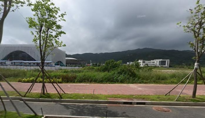
VIBE
New residential buildings along the river
An undeveloped field with some traditional buildings and mountains A field with a ditch and big office buildings
Hrngqin
North Macao Shenzhen
Hengqing North Station
Create a core of public space along the river to offer attractive spaces of diverse experiences for all generations of residents, rebuilding the relationship between people and the water.
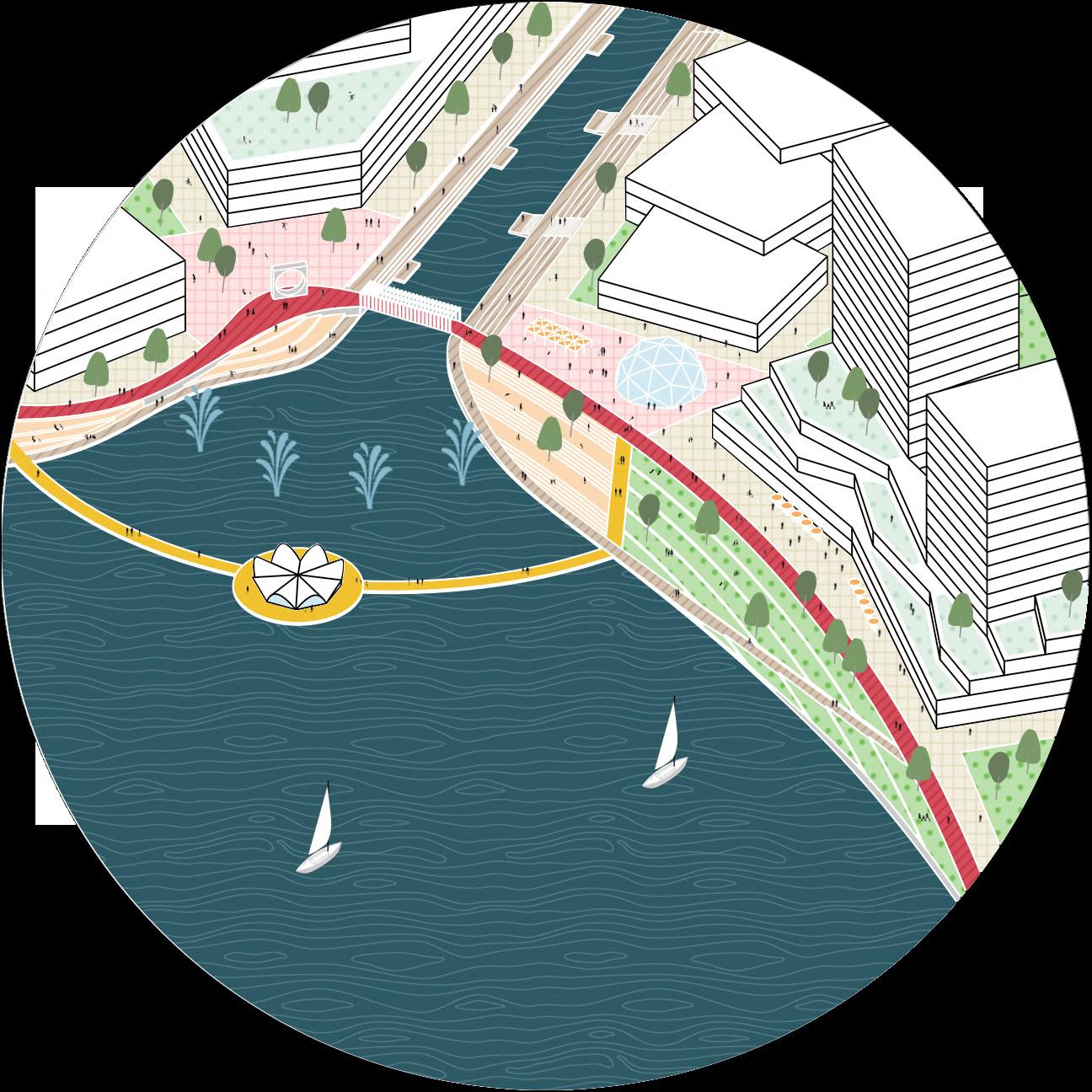
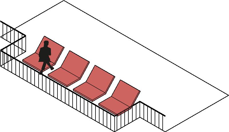
Connect all the waterfront public spaces through a welcoming loop with multiple urban furniture and elements. People can enjoy differents scenarios walking along the loop.
Human-oriented streets will connect the core and the loop to rest of the site, providing flexible and small-scale public spaces and enhancing the accessibility of public transport.
Zhuhai - Airport Intercity Railway
South Macao
Hongkong
Macao University
Taipa Ferry Terminal Macao Airport
Kong-Zhuhai-Macao Bridge
wetland
DESIGN DIAGRAMS
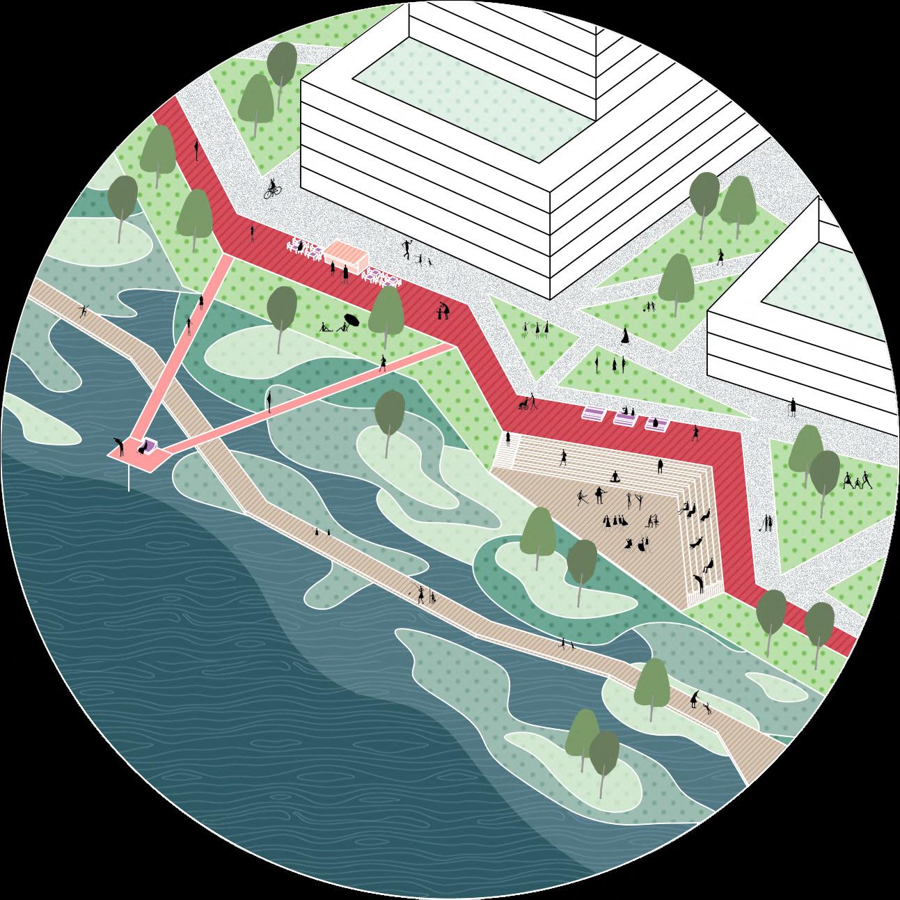
Perspective view at the loop
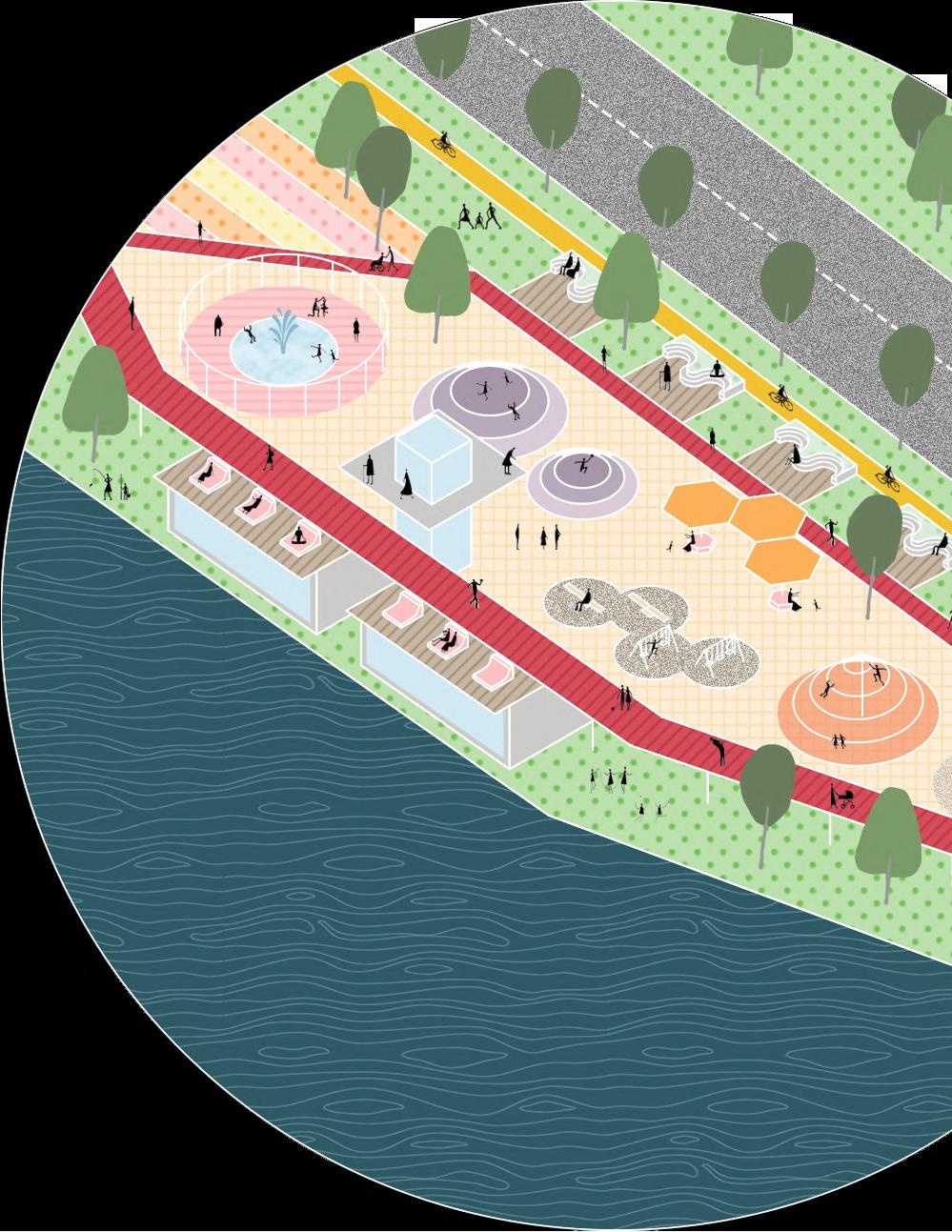
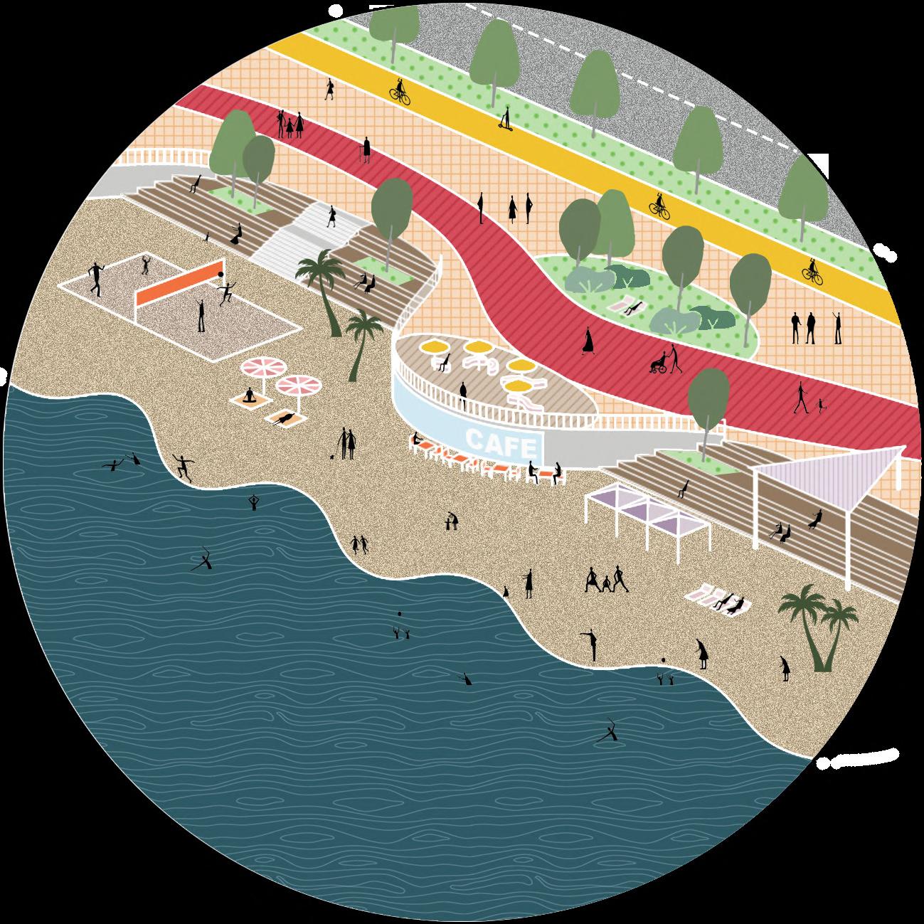
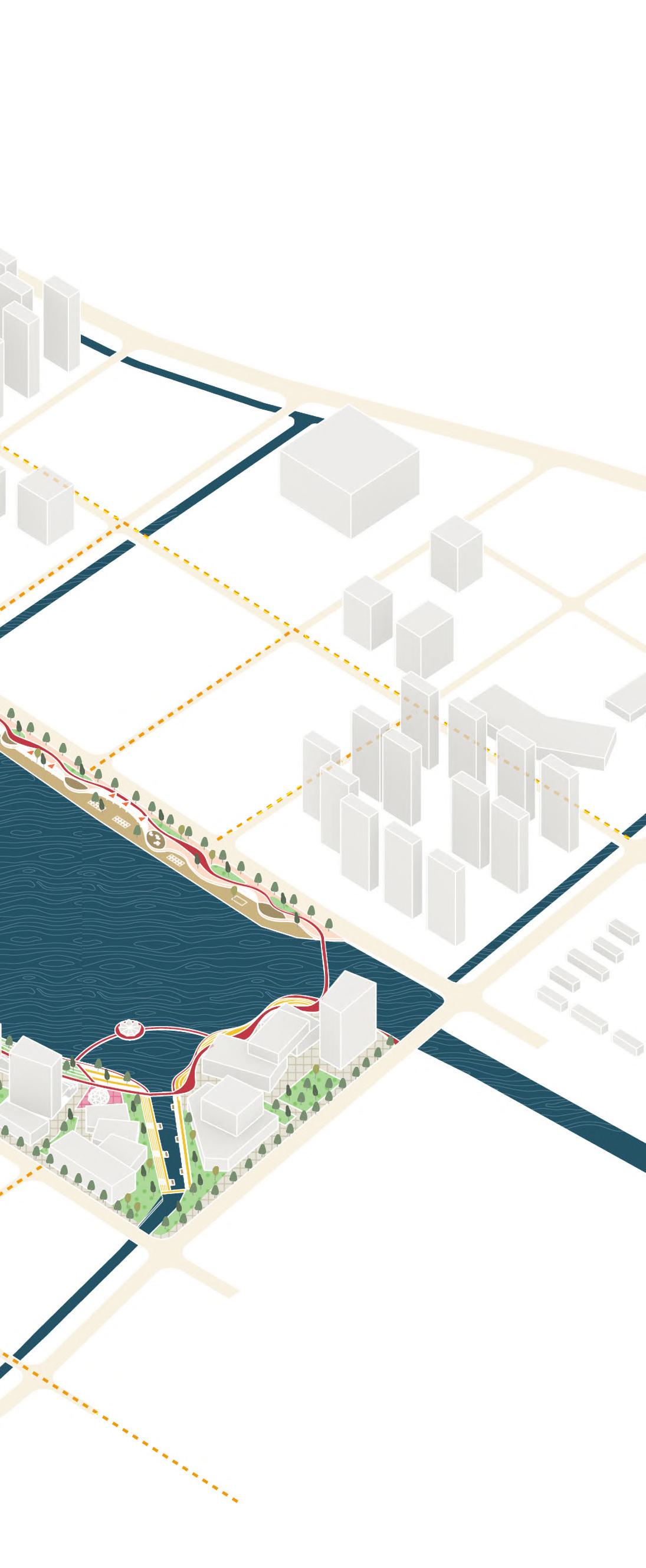
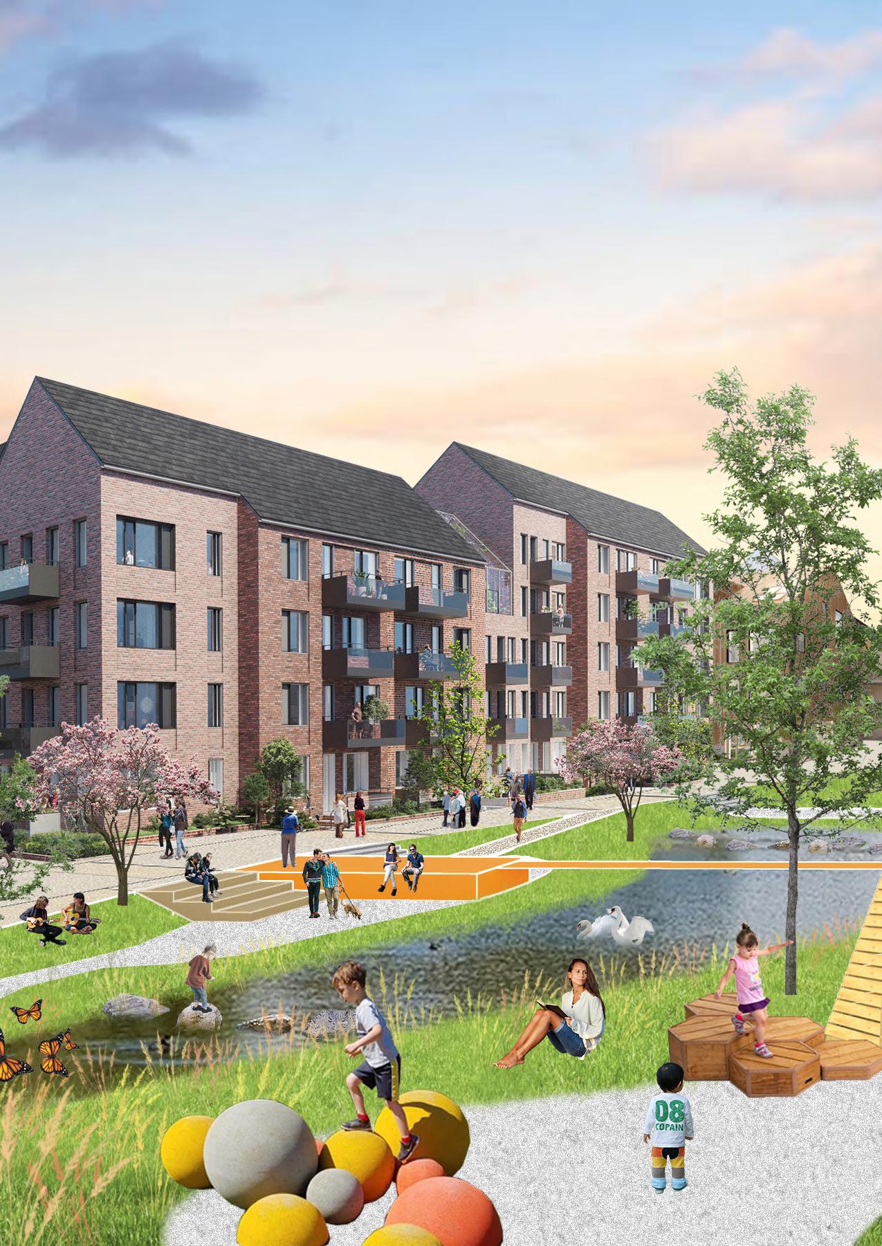
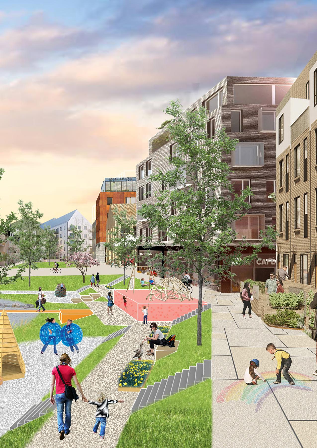
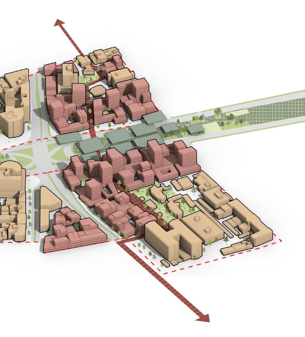
A Bayside Urban Living Room
Period: Febuary 2022 - May 2022
Location: Bromma, Stockholm, Sweden
Site Area: 58 ha
Type: Master thesis design (individual work)
ABSTRACT
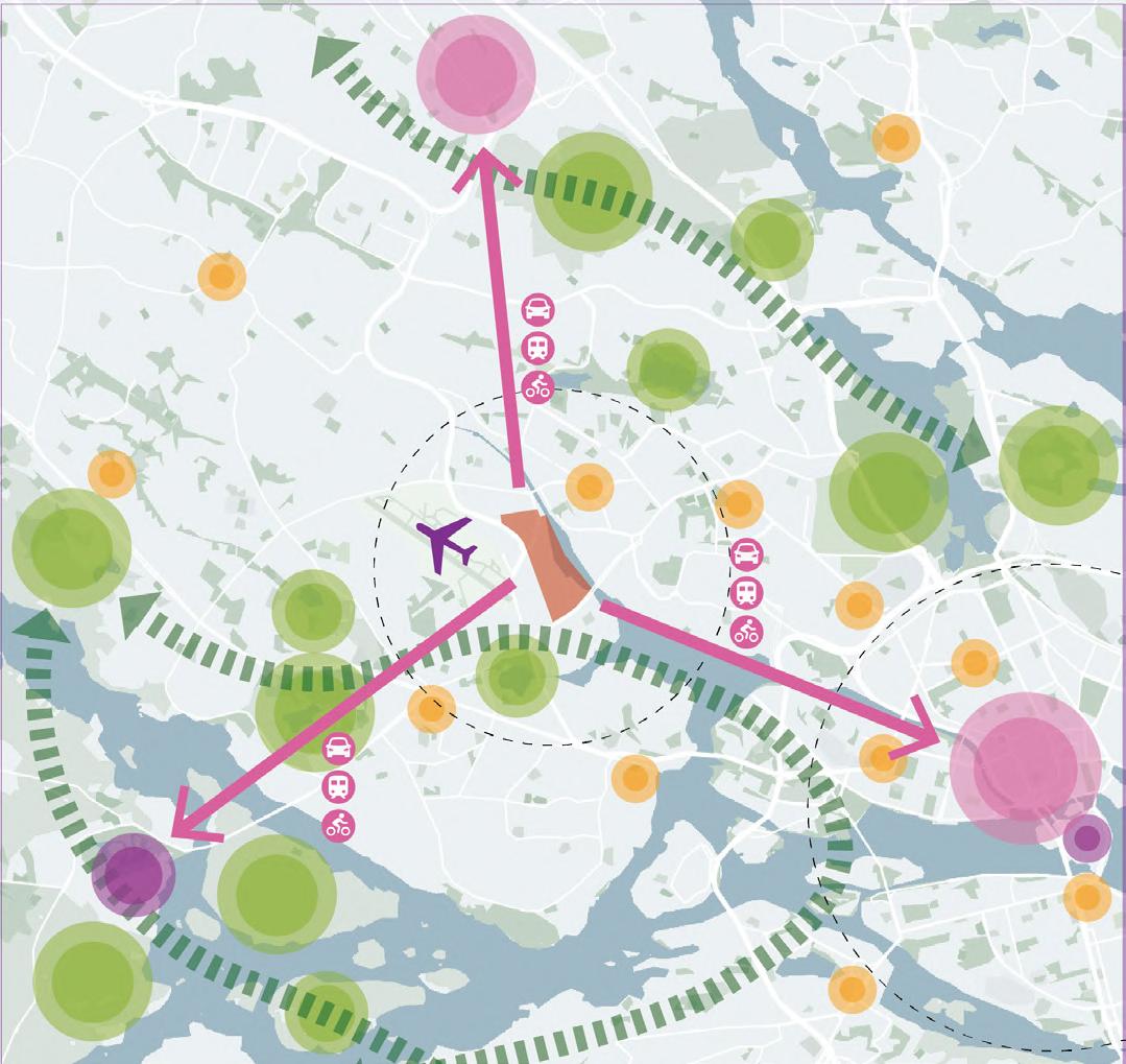
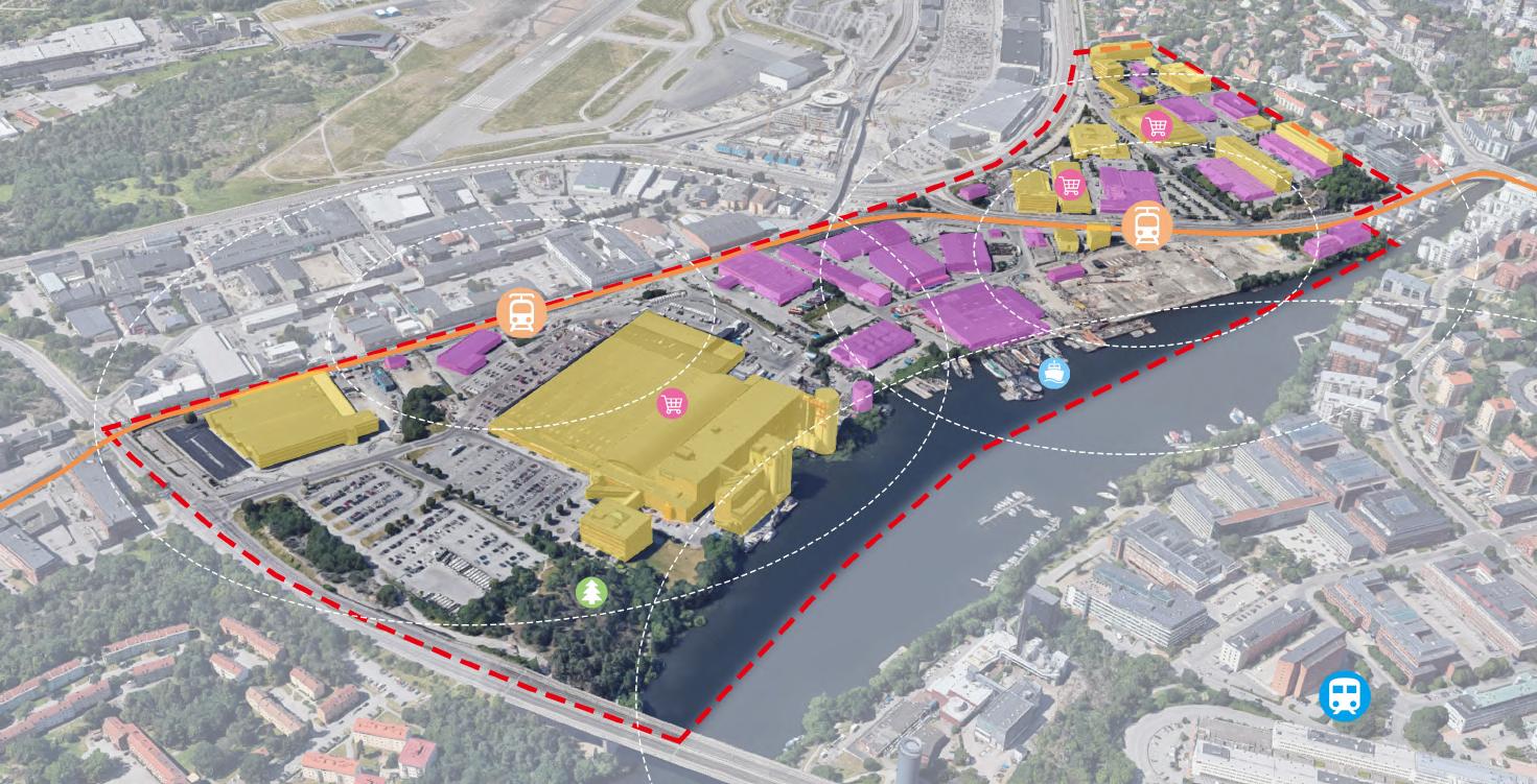
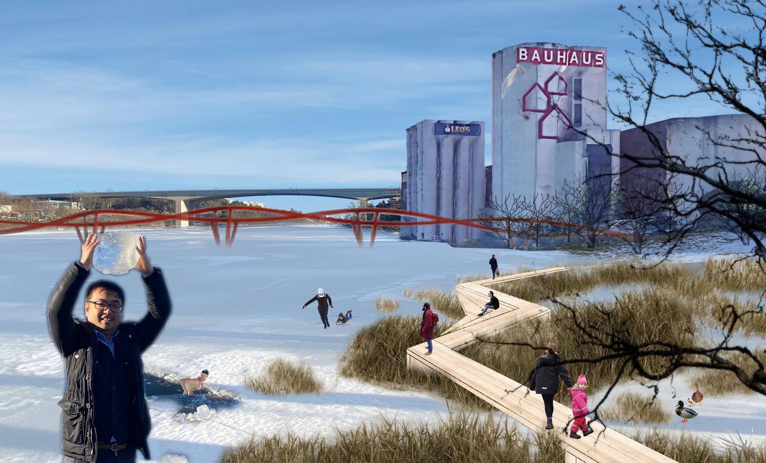
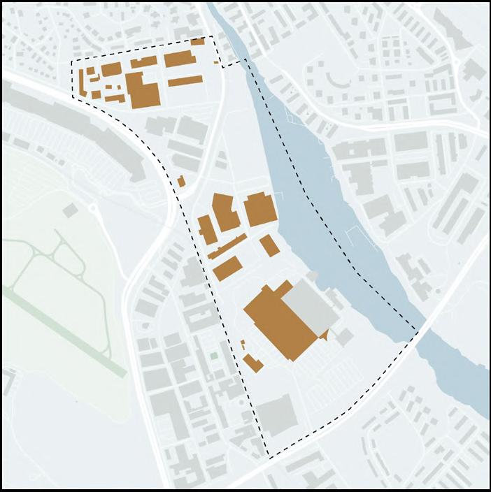
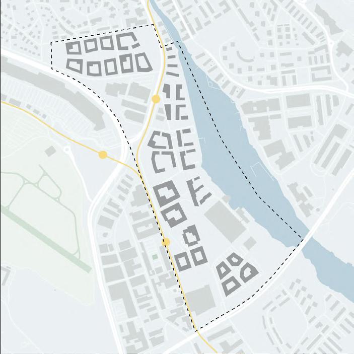
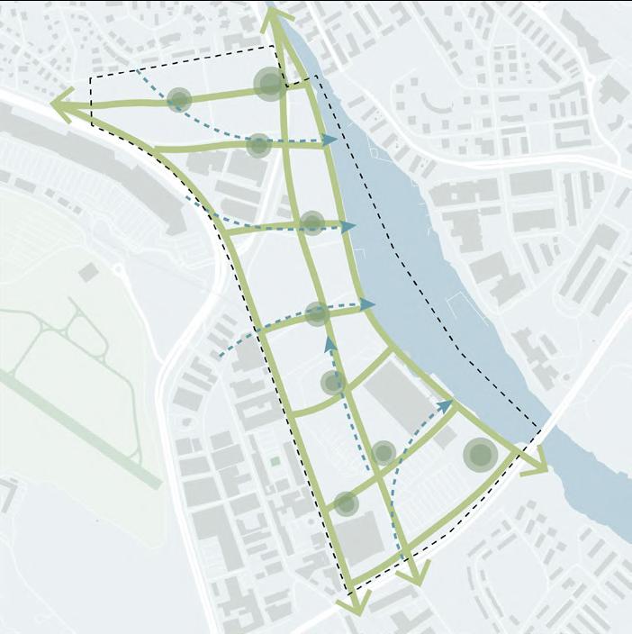
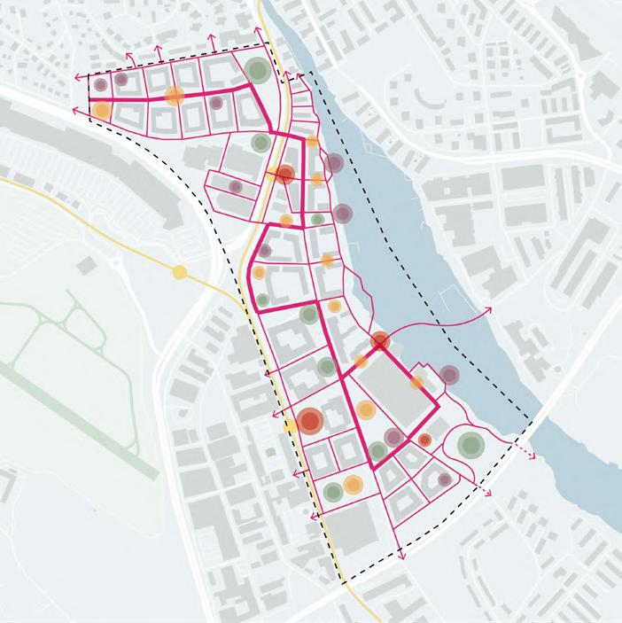
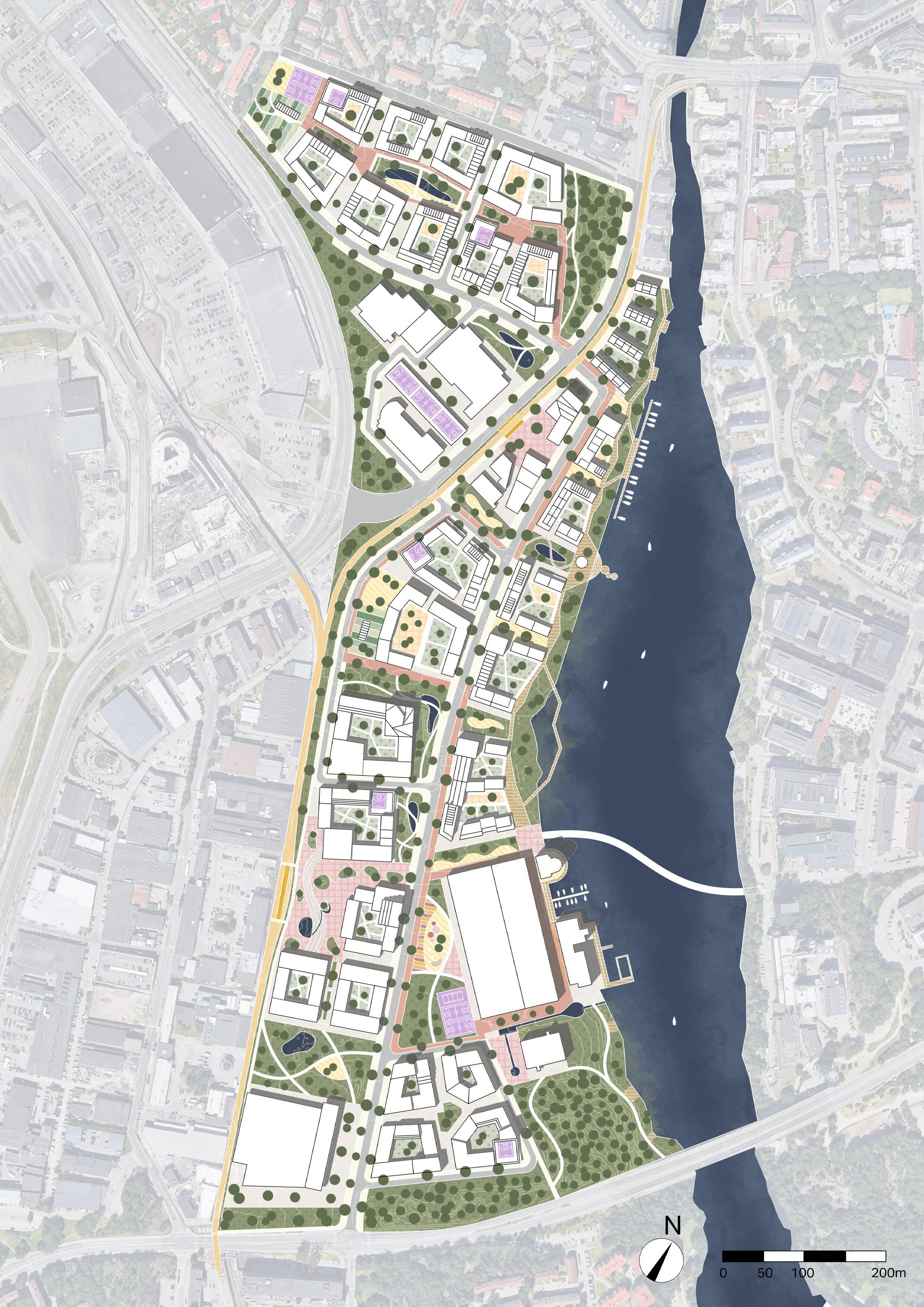
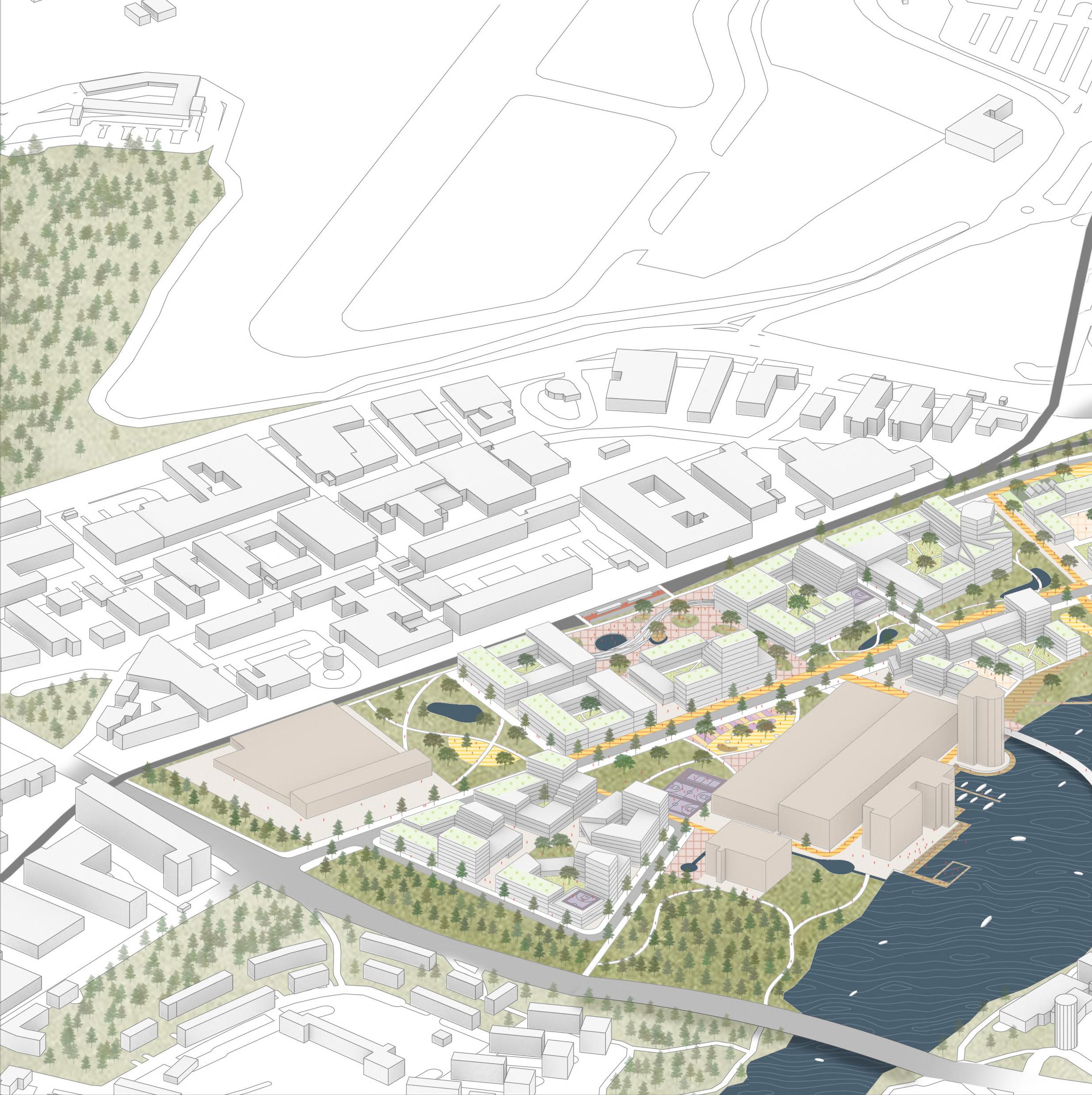
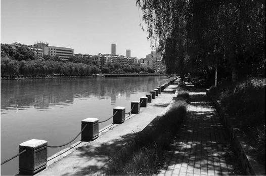
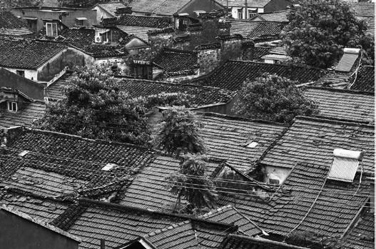
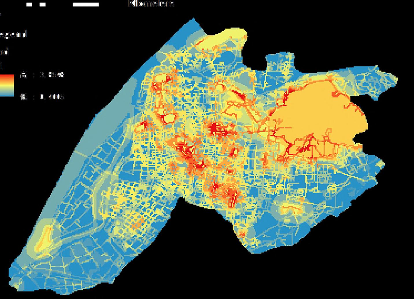
Bällsta harbor area is a part of Ulvsunda industrial area, located on the east side of Bromma airport in Stockholm. It has been an industrial area for nearly 80 years, with a lot of factories, automobile workshops, materials stores, and supermarkets. It is now surrounded by residential areas, Bromma airport, and Bällsta bay, forming a special landscape that looks like a missing puzzle piece from a satellite map.
Today, as the housing shortage in Stockholm, the debate over the closure of Bromma Airport, the renovation of Pripps Brewery, and the plan to extend the tram line are bringing new opportunities to Bällsta harbor for redevelopment, I hope to propose an urban renewal plan that can respond to Stockholm’s present and future challenges and offer new perspectives on the ongoing planning process.
Therefore, this proposal aims to bring a diverse mix of uses, pedestrian-oriented and children-friendly public spaces, greater coherence and connectivity to the nature and the waterfront, and a resilient environment against flooding. The plan will promote a rich public life, establish strong connections between local and regional destinations, as well as create a close relationship with the nature and water.
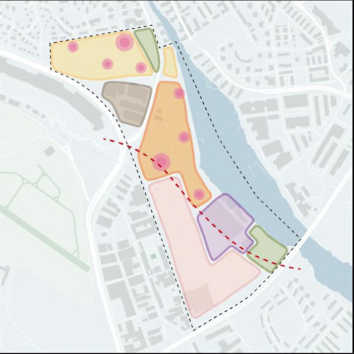
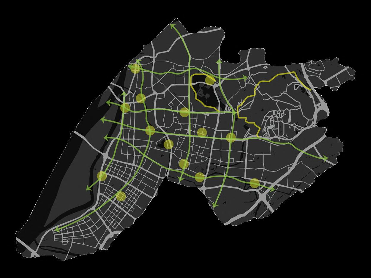
In order to reach this vision, I propose 4 strategies: MOVE, STAY, RELAX, and PLAY. By knitting it all together, the plan shows how to bring nature to the city, provide transportation choices, create places to linger and gather, and establish nice environment for Stockholmers to live.
FIELDWORK
VISION
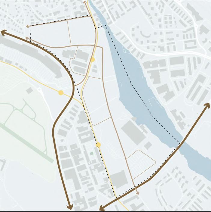
Facing the future challanges of Stockholm and current problems of the site, how can we transform this waterside industrial area to a vibrant community while matching Stockholm's ambition to become a cohesive and resilient city?
As a response, I think the site could become an "urban living room" where has a rich public life, an inclusive environment, as well as a close relationship with the nature.
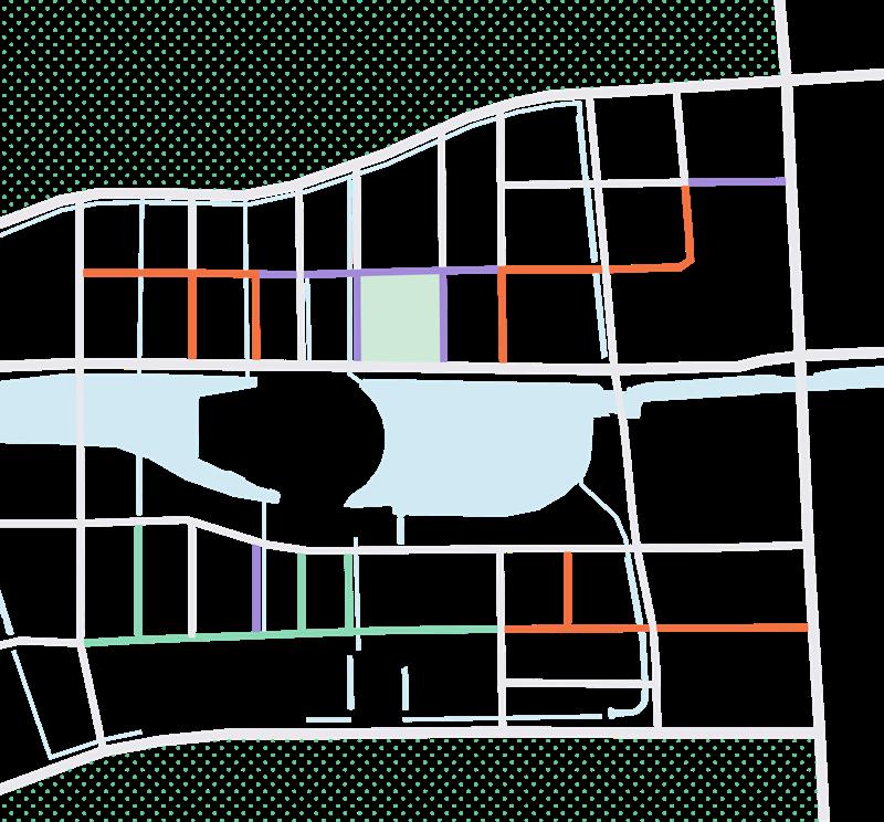
DESIGN IDEA
& preserve Road network
Green area
Demolish
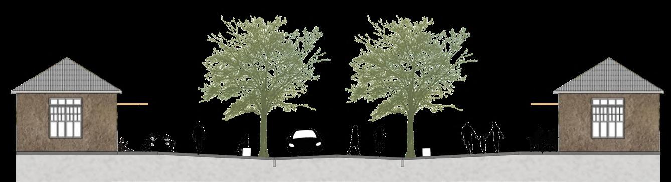
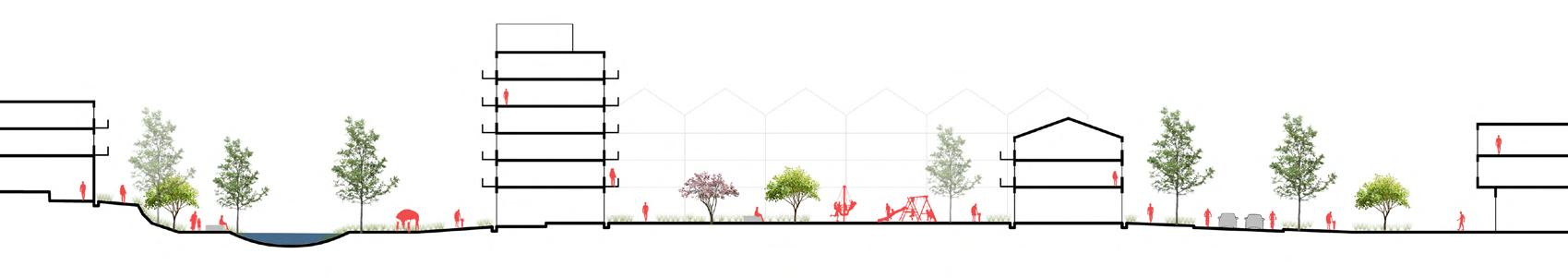
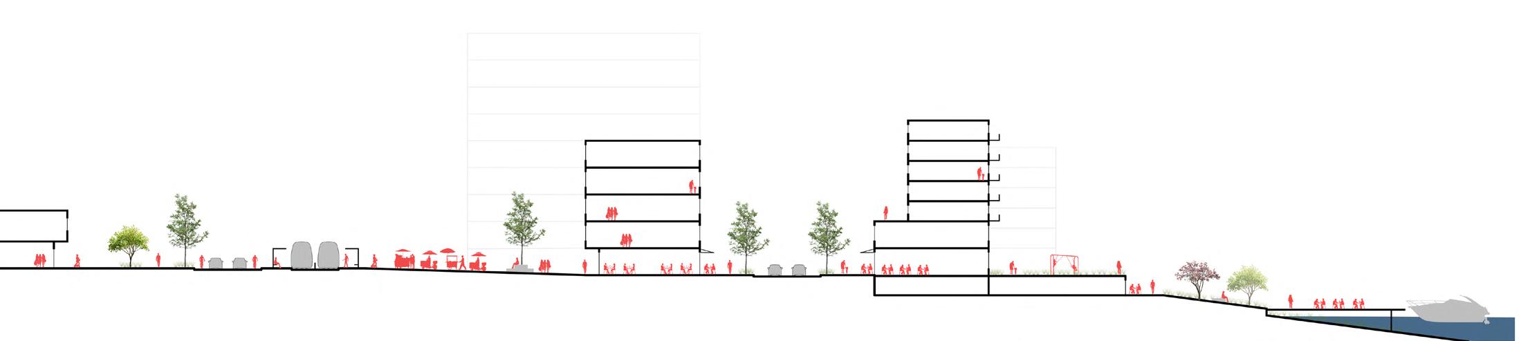
Section B-B'
Section C-C'
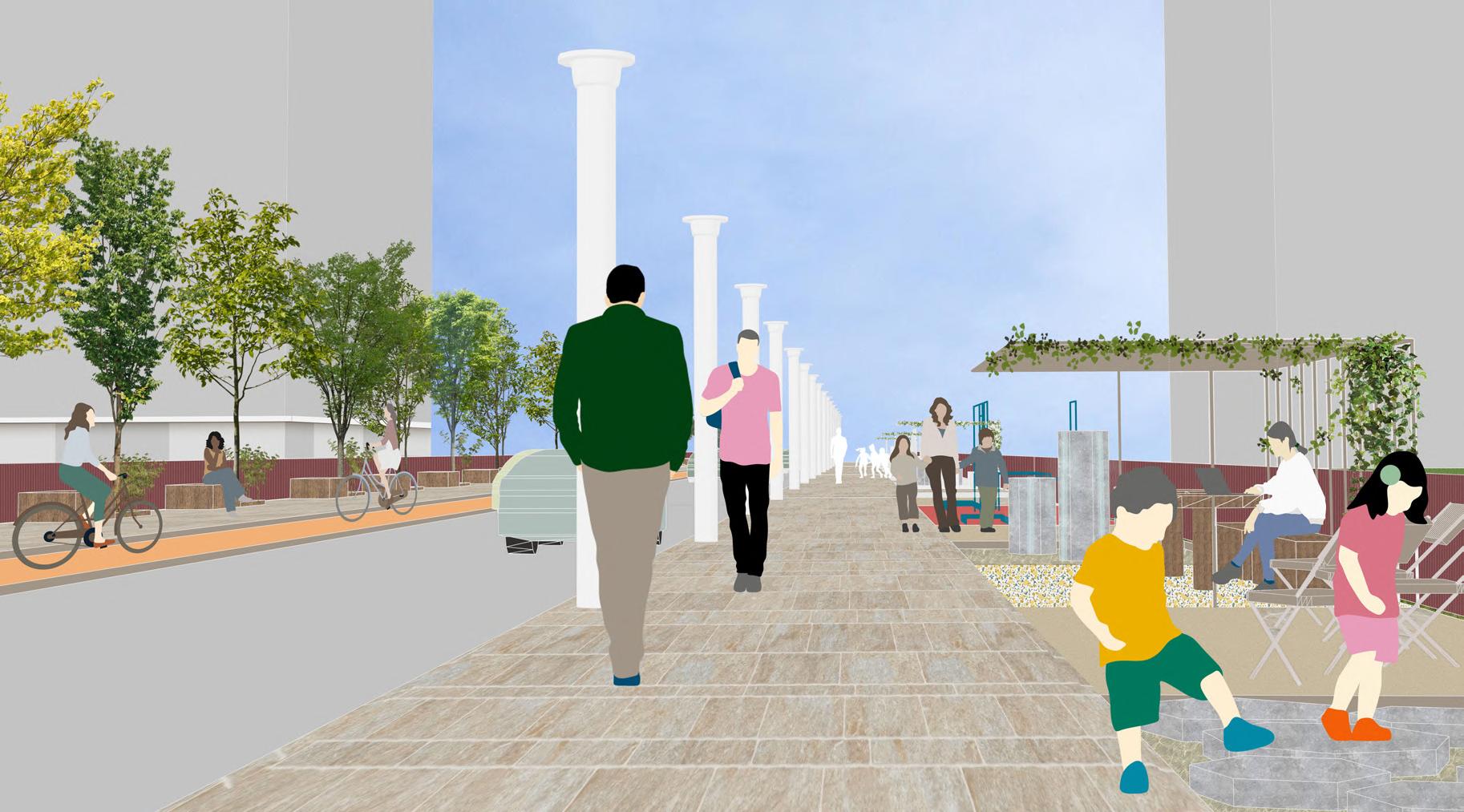
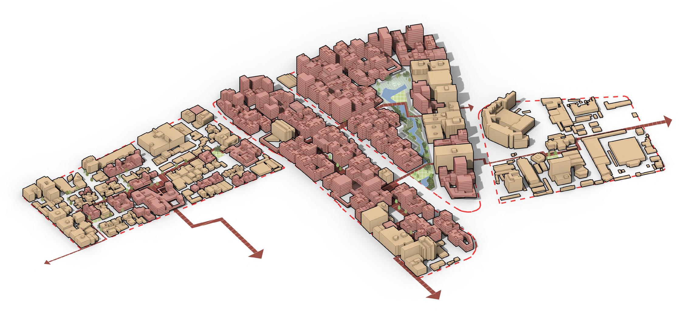
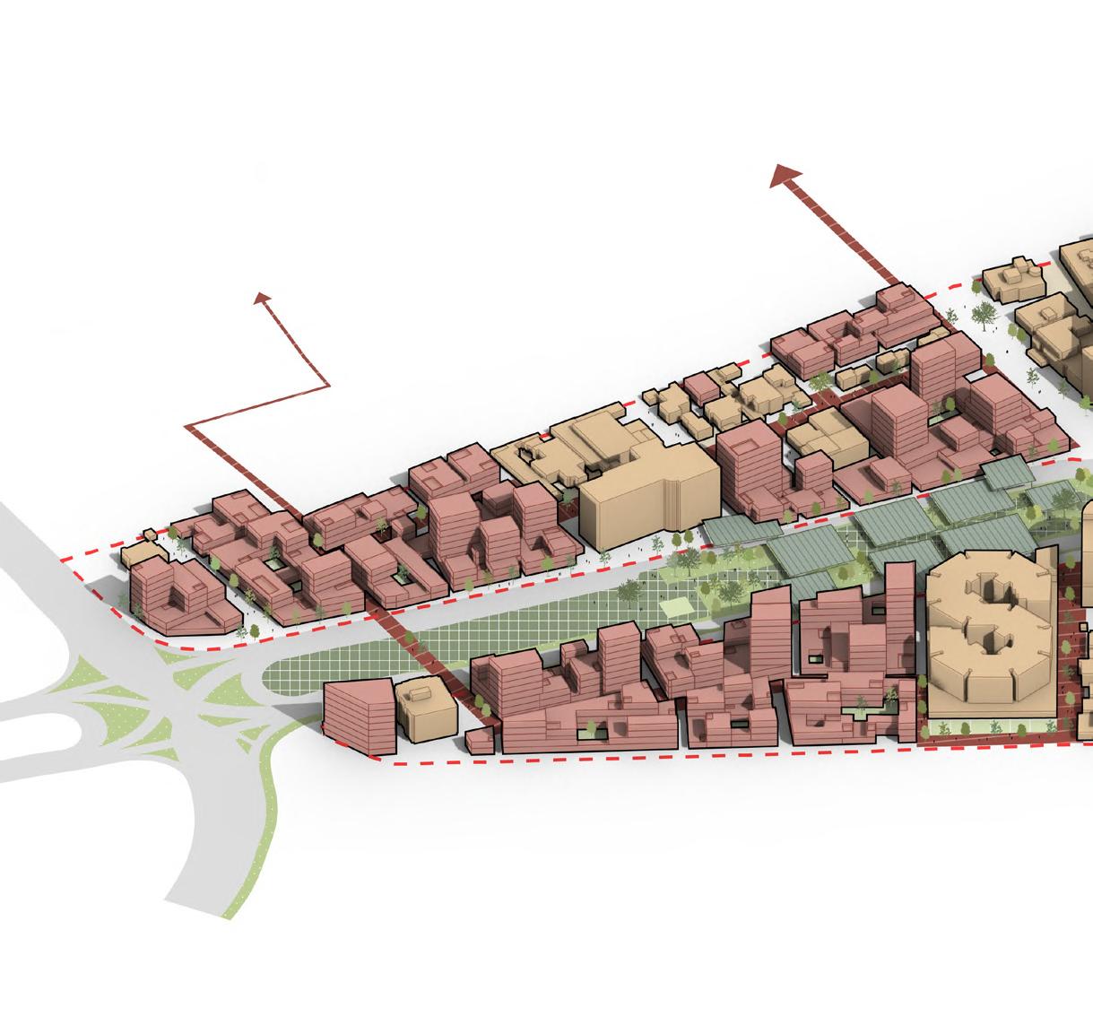
Norra Ulvsunda station plaza
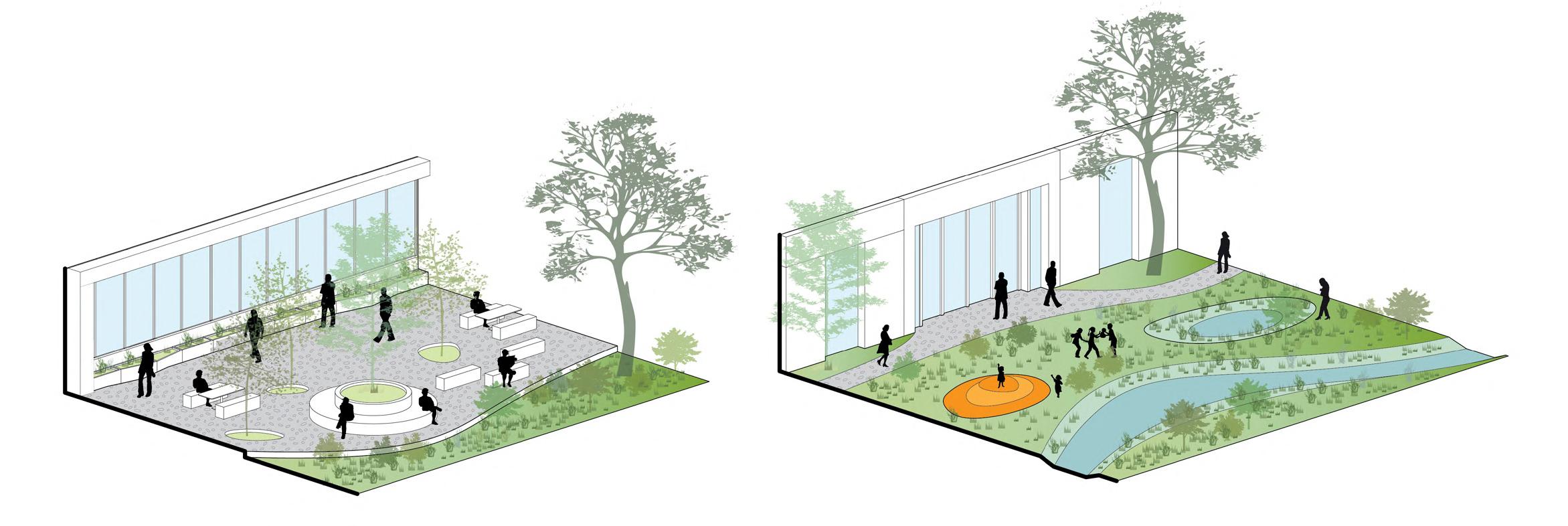
Mix-use block with active ground floor, roof garden, public service and playground.
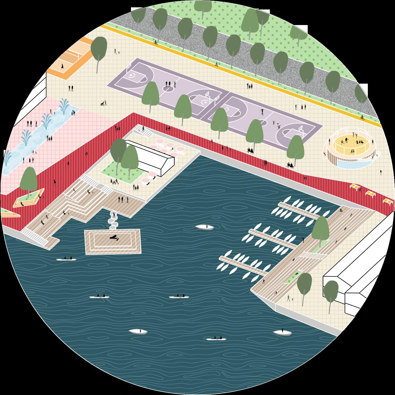
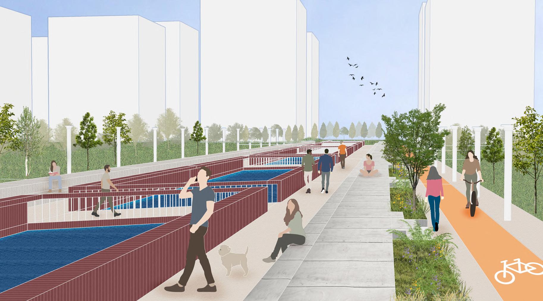
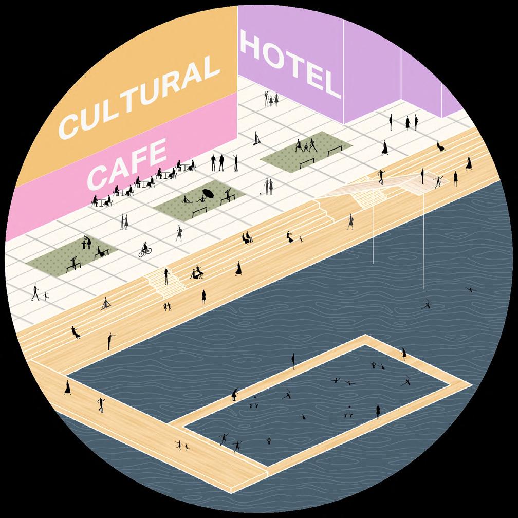
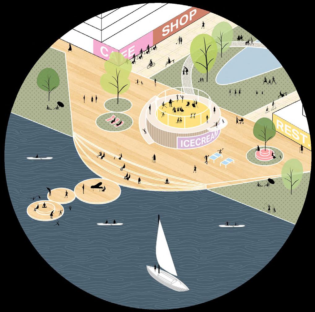
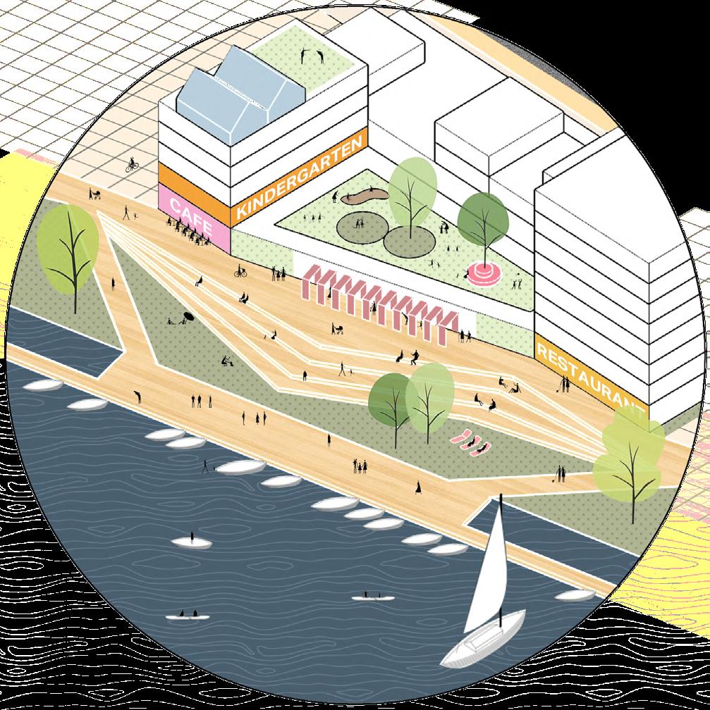
PUBLIC SPACE
Apartments which can form a sense of symmetry with the buildings on the other side of the river.
Facing to the bay, the mix-use buildings has good water view and privacy against the people walking along the waterfront.
Waterside Promenade
Platform
Office building with retails on the ground floor. In order to keep its flexibility to transfer to residential use in the future, the building structure is controlled.
Commercial building facing to a plaza, with the function of retail, office, hotel and public uses.
Parking house with a playground on the roof.
Dock
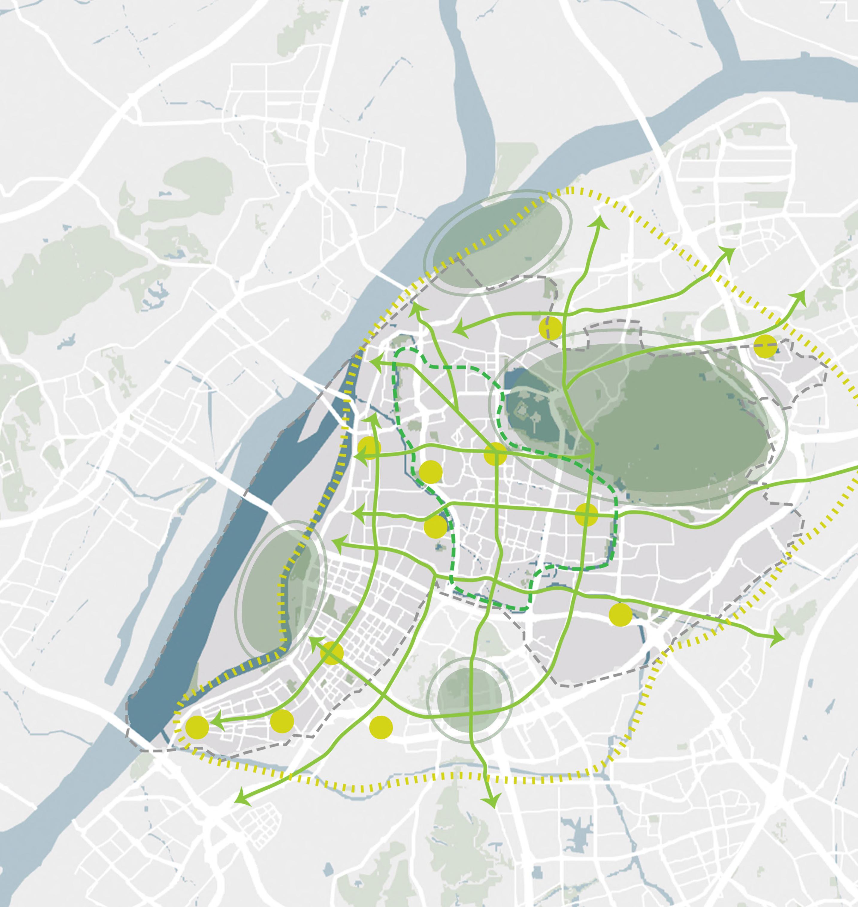
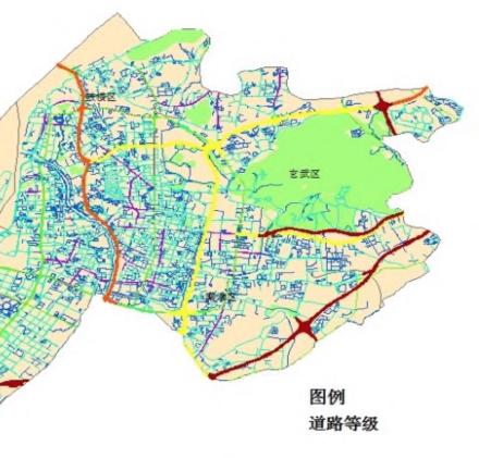
Rereational Greenway Planning Based on GIS: A Case Study in Nanjing Central Area
Period: September 2017 - January 2018
Location: Nanjing City, Jiangsu Province, China
Site Area: 266 km²
Type: Project of the course Urban Ecology And Environment (individual work)
ABSTRACT
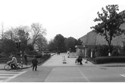
Greenway has corridor connecting cultural landscape of the main types connects the main parks in the city, people's leisure
This study takes which is rich in but lack of systematic area. Based on study evaluates the potential recreational and then improves and old communities, system planning recreational, social,
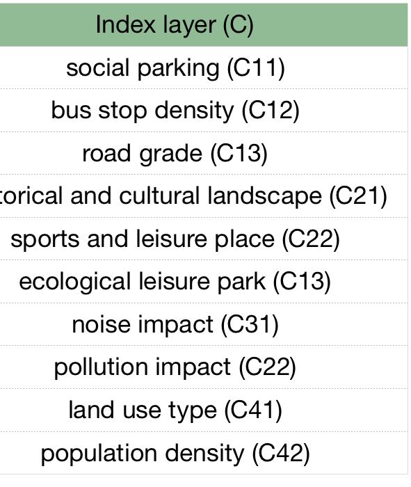
EVALUATION INDEX SYSTEM
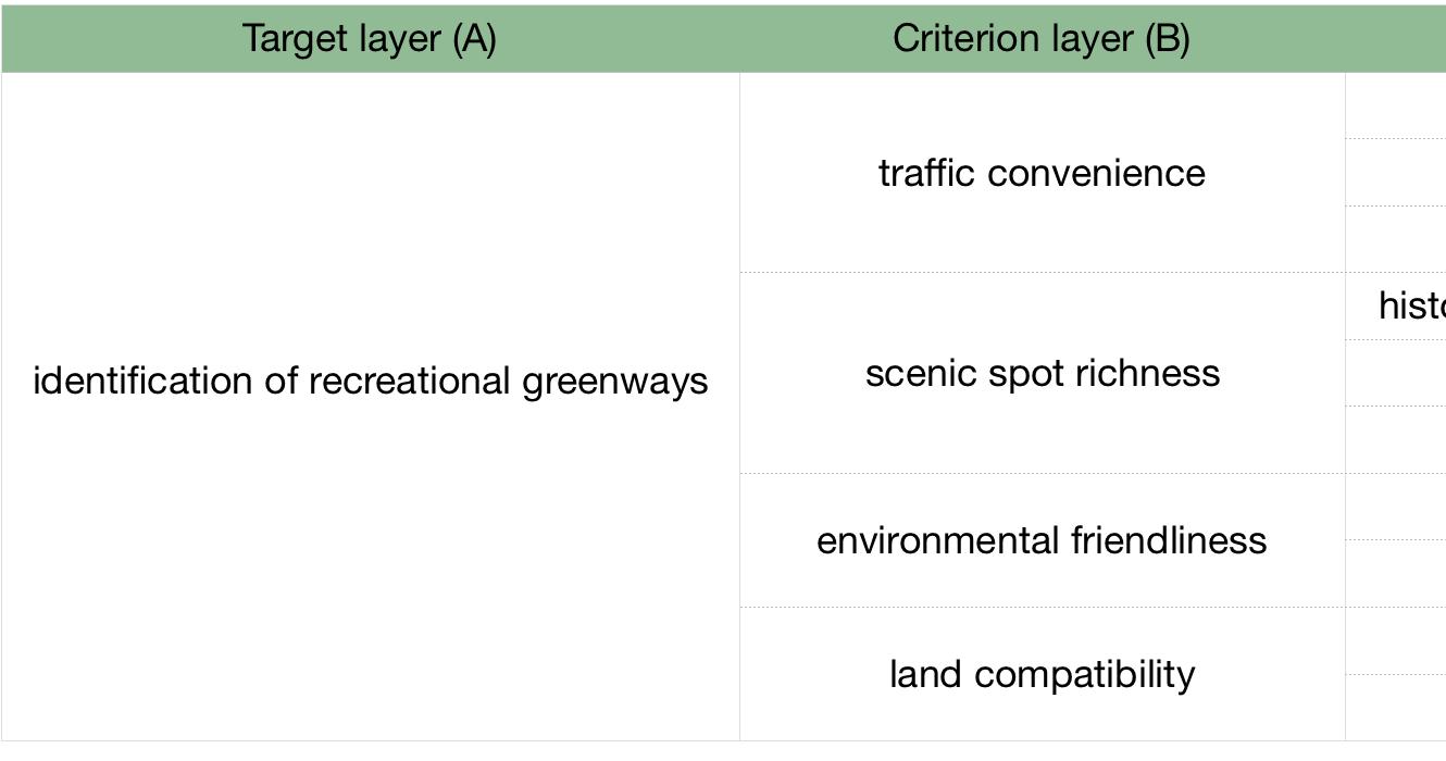
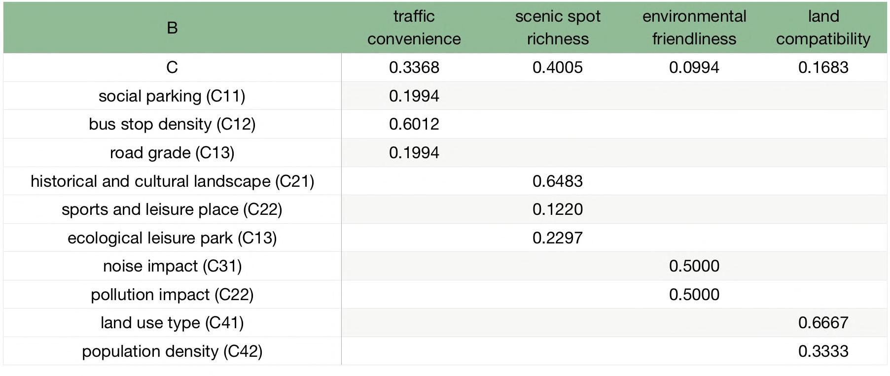
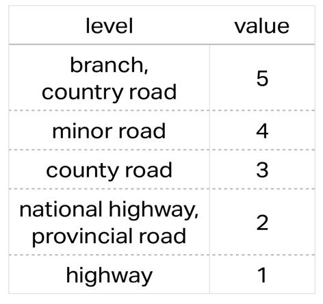
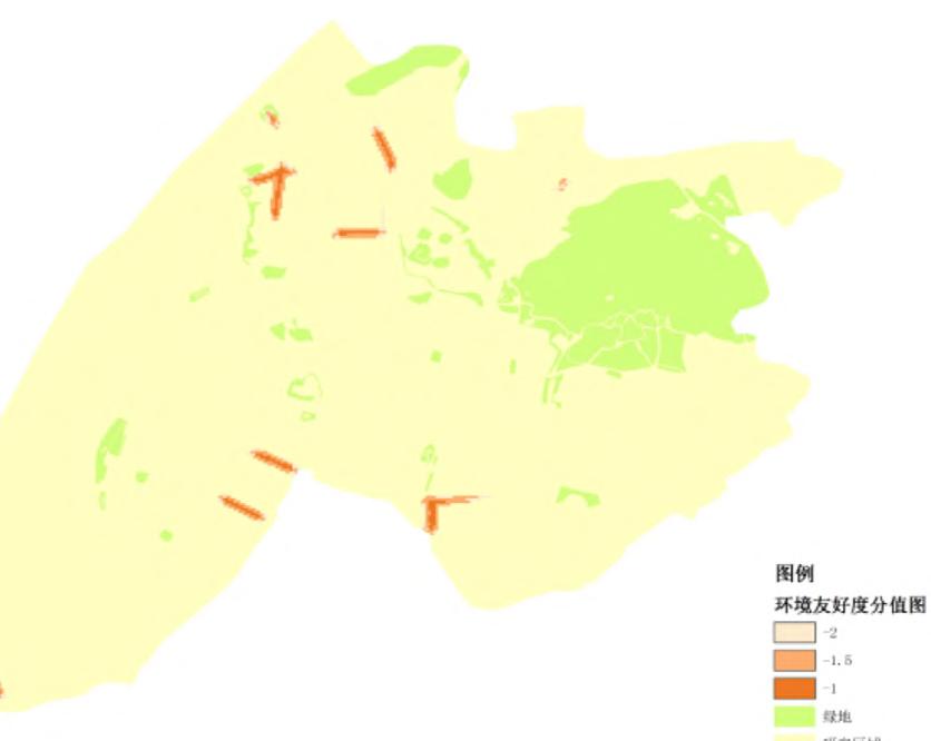
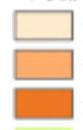
Analytic hierarchy process (AHP) is to determine decision scope and target according to the investigation, the factors contained in the problem, the interaction among various factors, and then form a hierarchical structure composed of target layer, criterion layer and index layer.
After setting up the evaluation system and factors, the weights of each index layer can be calculated by AHP. In this study, the target layer is the identification of recreational greenways (A). The criterion layer includes transportation convenience (B1), scenic spot richness (B2), environmental friendliness (B3) and land compatibility (B4). Under the criterion layer, there are 10 indexes in index level (C).
Evaluation Index System of Recreational Greenway
suitability evaluation of recreational greenway
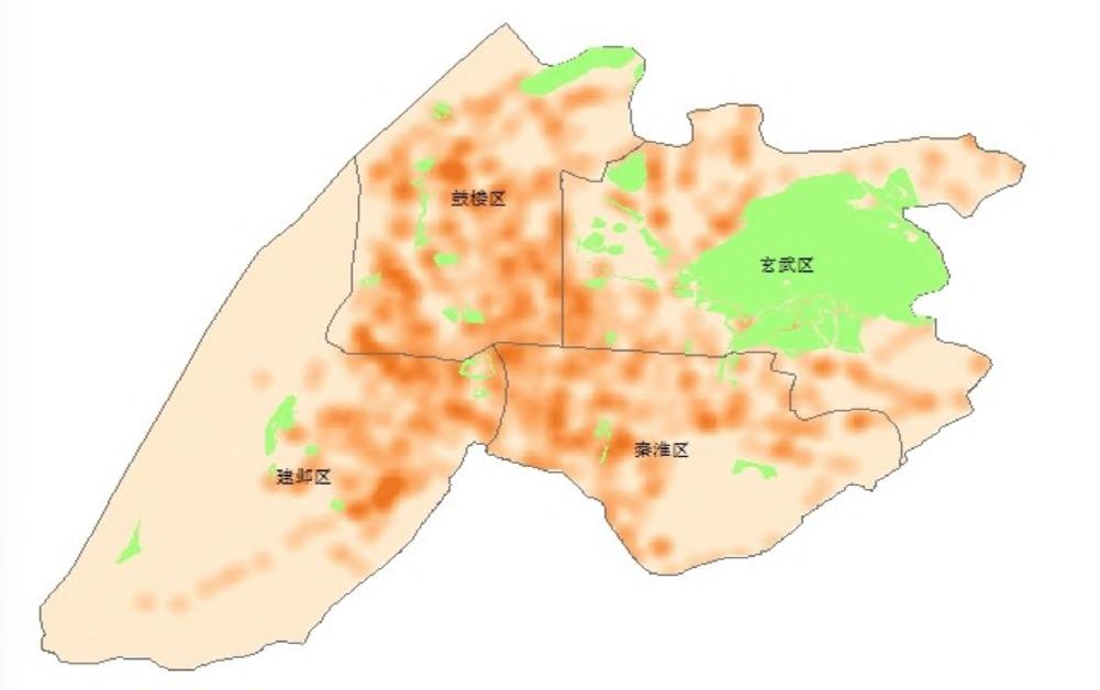
China Jiangsu Province Nanjing City
Muyan Scenic Area
Xuanwu Lake - Zhongshan Scenic Area
Jiajiang Scenic Area
Yuhuatai Scenic Area
Green structure of Nanjing
become an indispensable linear connecting natural landscape resources and landscape resources in modern cities. As one types of greenway, recreational greenway main open space, tourist attractions and city, providing an enjoyable space for and recreation life.
takes the main urban area of Nanjing, historical and recreational resources systematic green spaces, as the research analytic hierarchy process (AHP), the the construction suitability to identify recreational greenways by ArcGIS, improves the space between greenways communities, hoping to help greenway planning in Nanjing achieve a broad range of social, and sustainable goals.
found the following problems of green
1. Poor systematicness and equality
2. Scattered and discontinuous
3. Recreational green space is mainly concentrated in the mountains and near the water, while the general green space has weak leisure function.
Weights of Each Index Layer
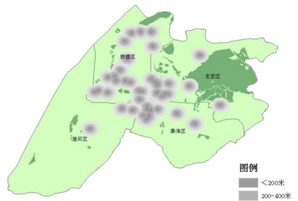
Main green patches
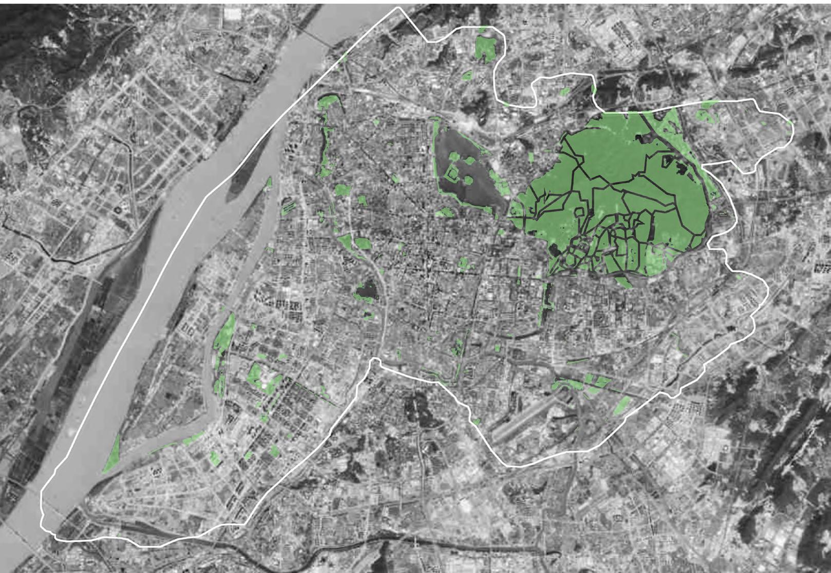
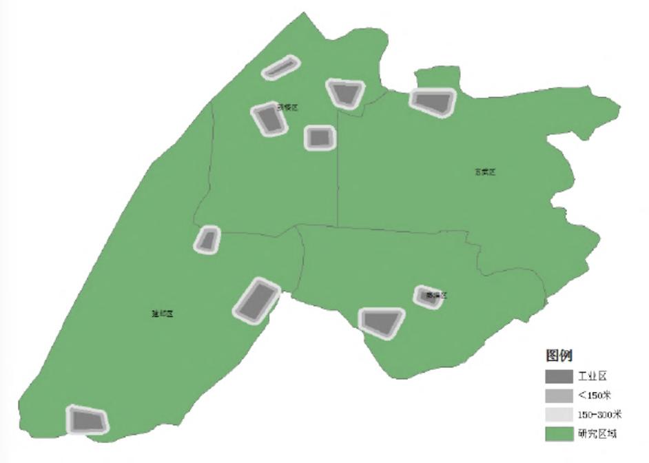
The area of main green patches in the region is about 4752 ha. Through the satellite map and fieldwork, I
space:
GIS
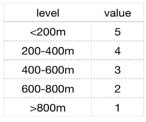
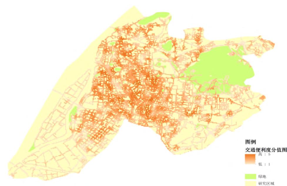
The main GIS spatial analysis methods used in this study are multi-ring buffer analysis, density analysis and weighted superposition analysis. Based on the planning and practical experience of Nanjing, each index is sorted and graded.
Traffic convenience:
Scenic spots richness:
Then the index layer (C) is weighted and superimposed by GIS to obtain the score of the criterion layer (B). This application is similar to McHarg's "layer cake", which can consider all relevant factors comprehensively and effectively, supporting quantitative research on recreational greenway identification.
Historical
(C21)
Sports
(C22)
(C23)
The traffic convenience is closely related to the commuting time and commuting cost of residents. It is mainly used to reflect the accessibility of recreational greenways, showing the capacity of different levels of urban roads and the convenience of related transportation facilities.
The scenic spots richness mainly measures the number of different types and levels of recreational spots and open spaces connected with greenways, reflecting that the diversity of functions and elements determines the space vitality of the place.
Traffic convenience (B1)
Scenic spots richness (B2)
Environmental friendliness:
Environmental friendliness reflects the ecological quality landscape quality of greenways.
land compatibility reflects the integration degree of recreational greenways and existing planning, and whether it meet people's leisure needs.
RESULT
By weighted-stacking four criterion layers, the evaluation map of the target layer (A) could be output.
Suitability evaluation of recreational greenway (A)
According to the result of the suitability evaluation and the actual situation, a proposed recreational greenway system can be formed. Connecting the major scenic spots, historical resources and important green space, the planning reflects Nanjing's characteristics and recreational value.
Proposed recreational greenway system
Selected Internship Works at Henning Larsen
Strategy diagrams of Central Riyadh Regeneration Urban Design Competition in UAE.
These diagrams show how the 3 strategies, Introduce (pink), Enhance (yellow), and Reintroduce (green), intergrate with each other in 5 design areas.
I was responsible for drawing some diagrams in this project.
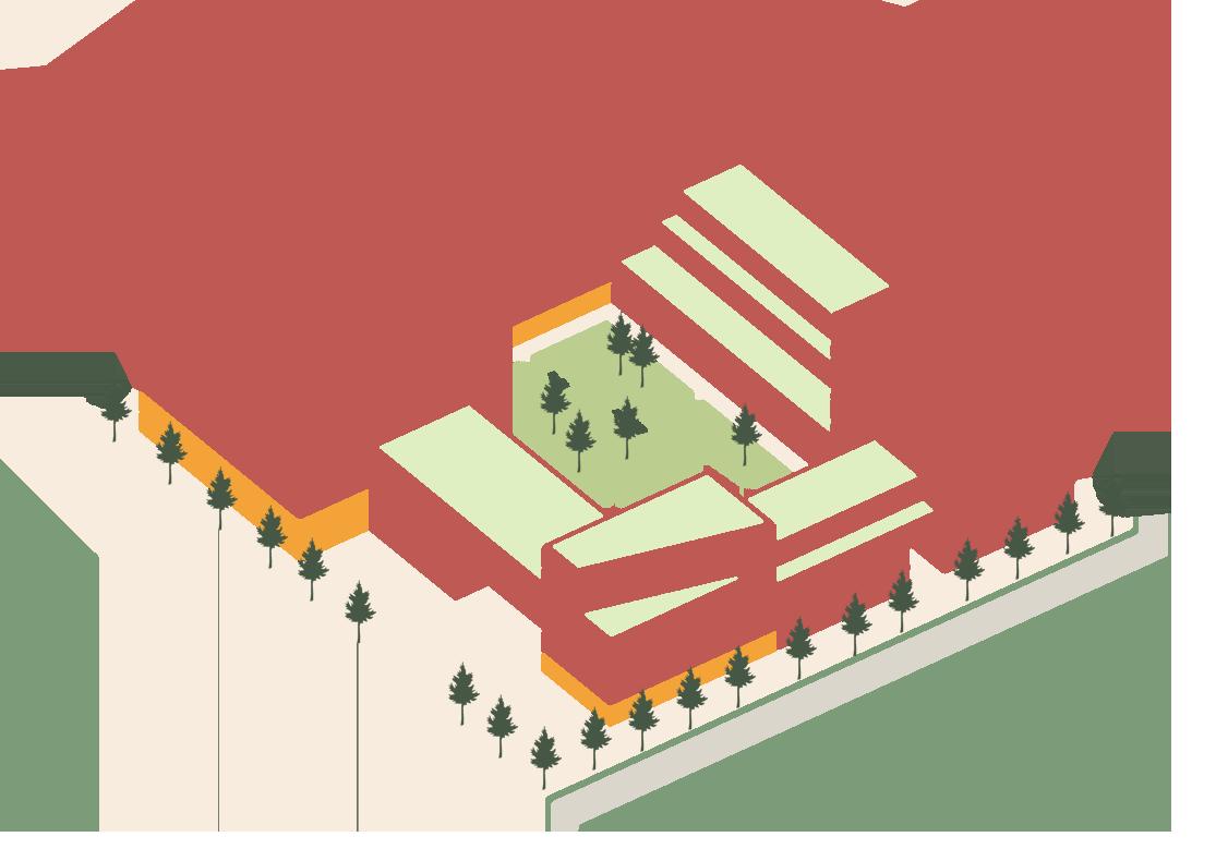
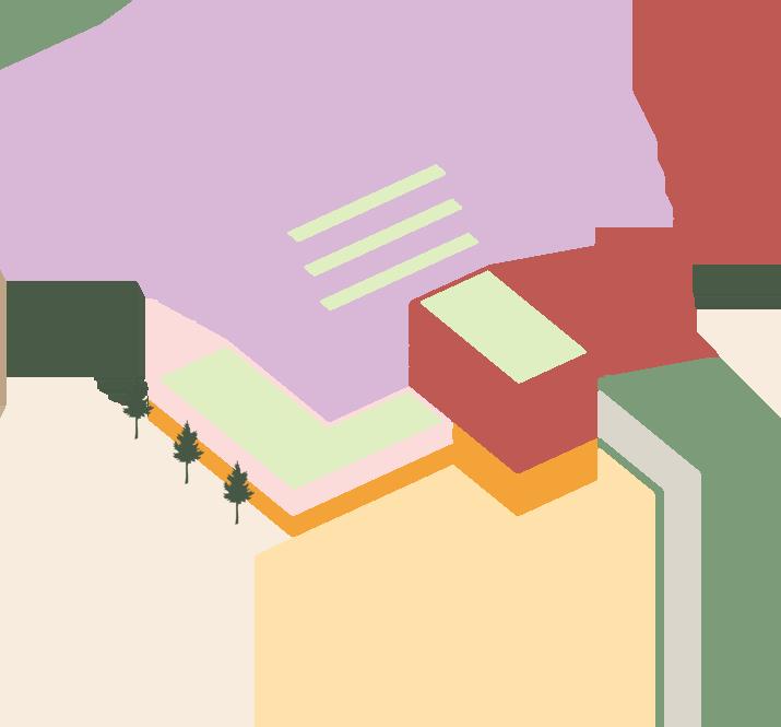
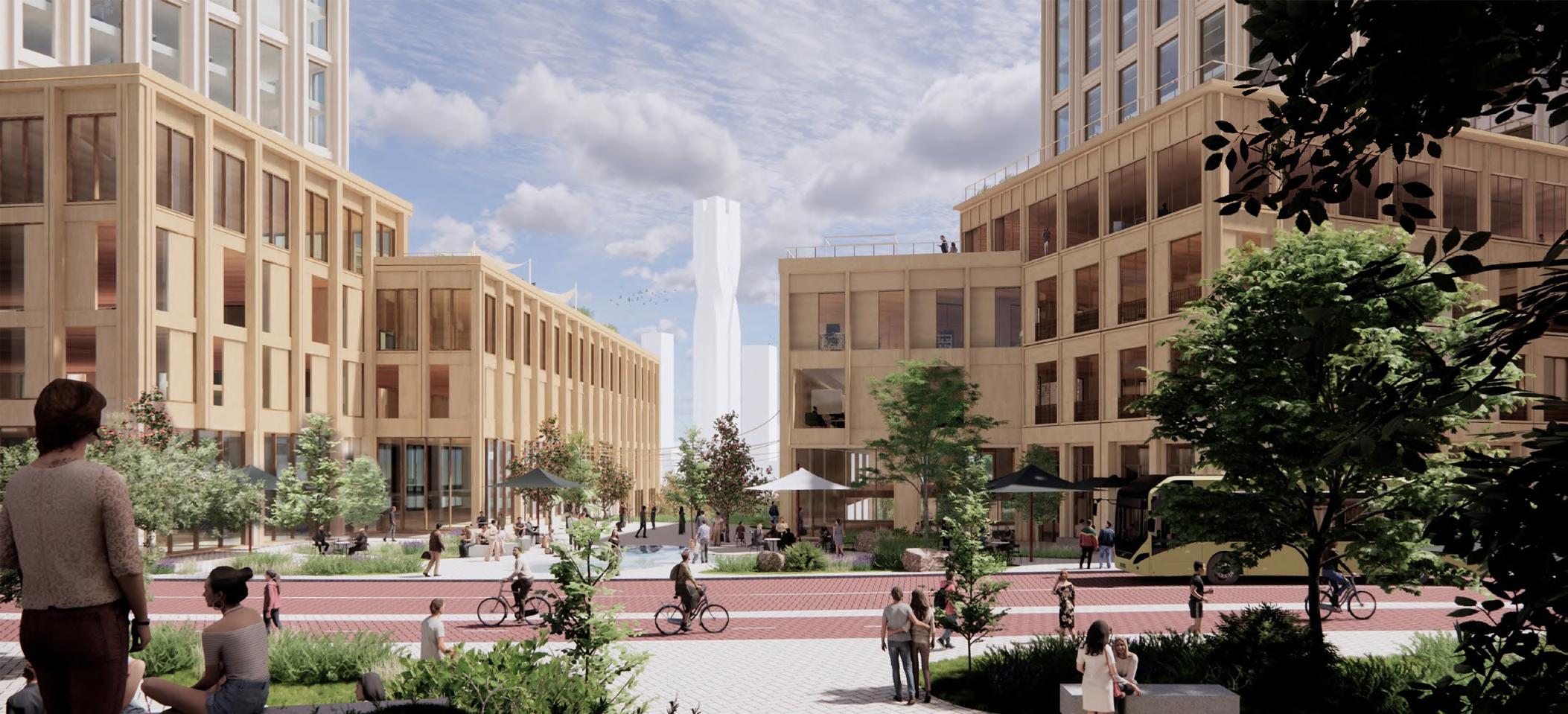
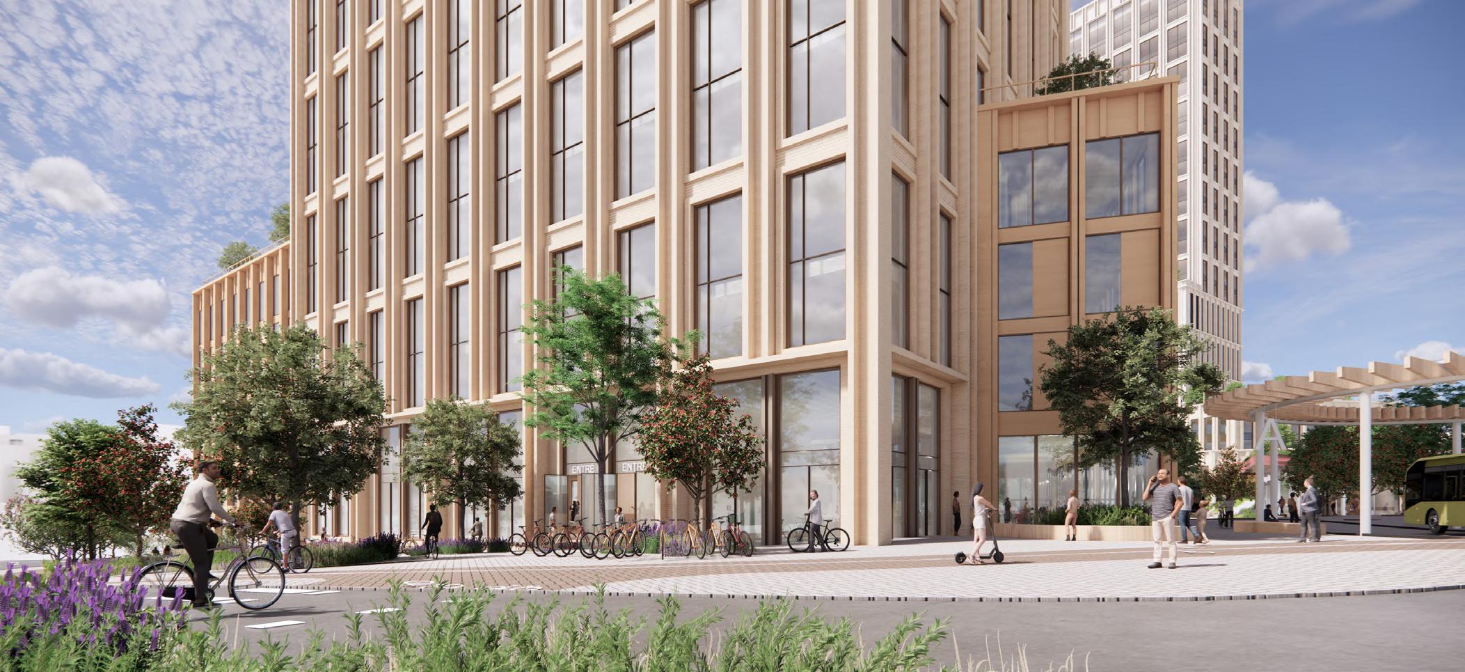
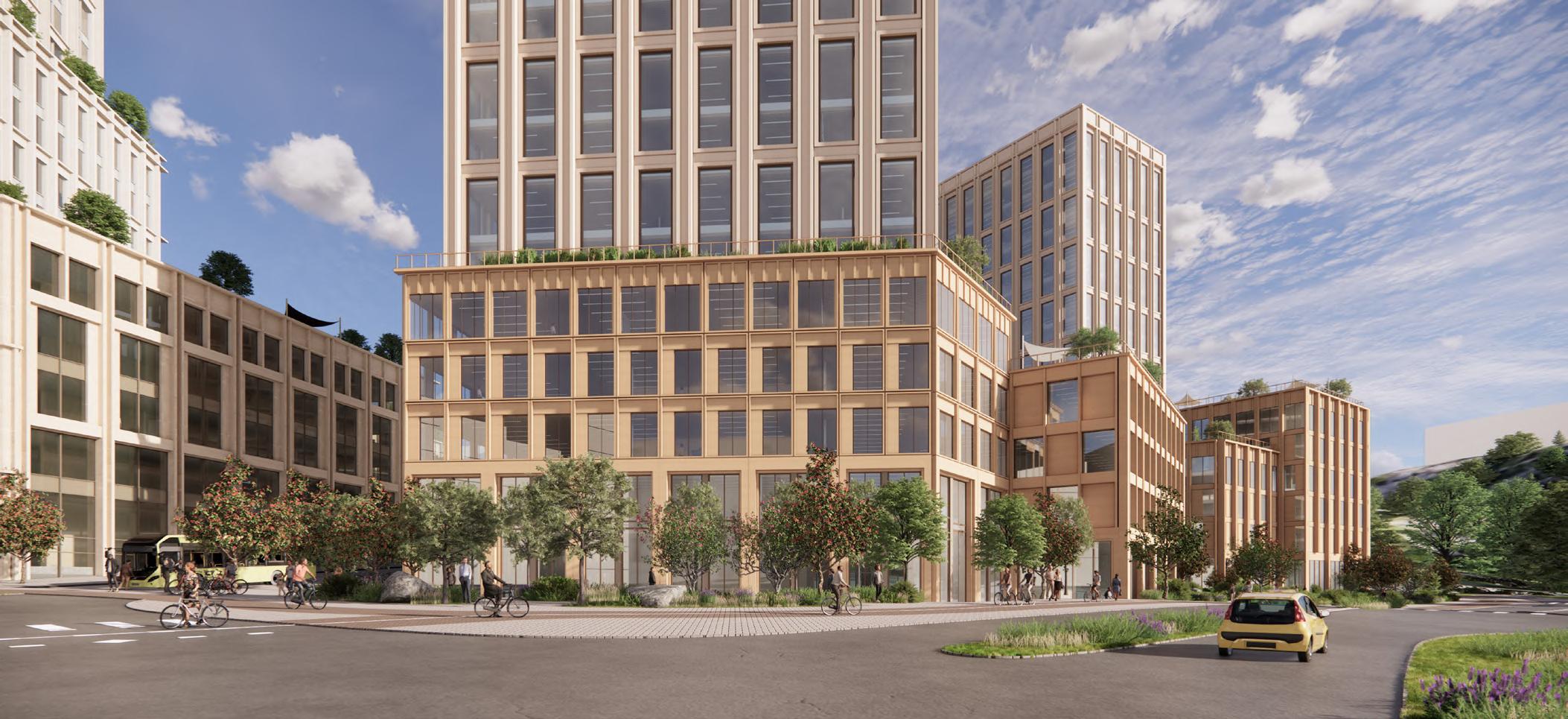
Renders of Project Campus Lundby in Sweden. The renders show how the complex looks from different angles. I was responsible for 3D modeling and renders in this project.
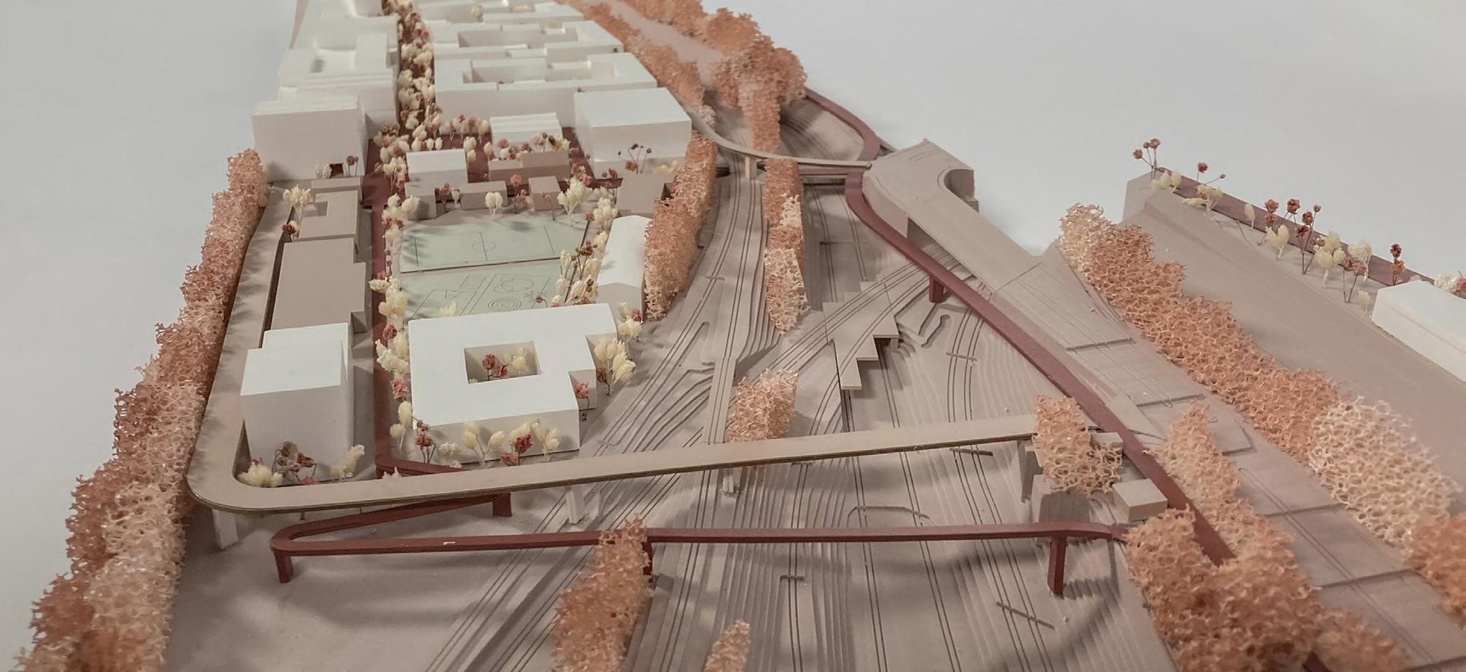
Model of an West Berlin City Entrance Urban Design Compertition in Germany. The pictures show the relationship between the buildings, roads and public spaces. I was responsible for the making the whole 1:1000 physical model.
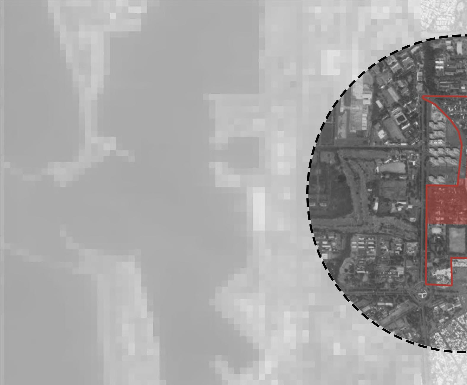
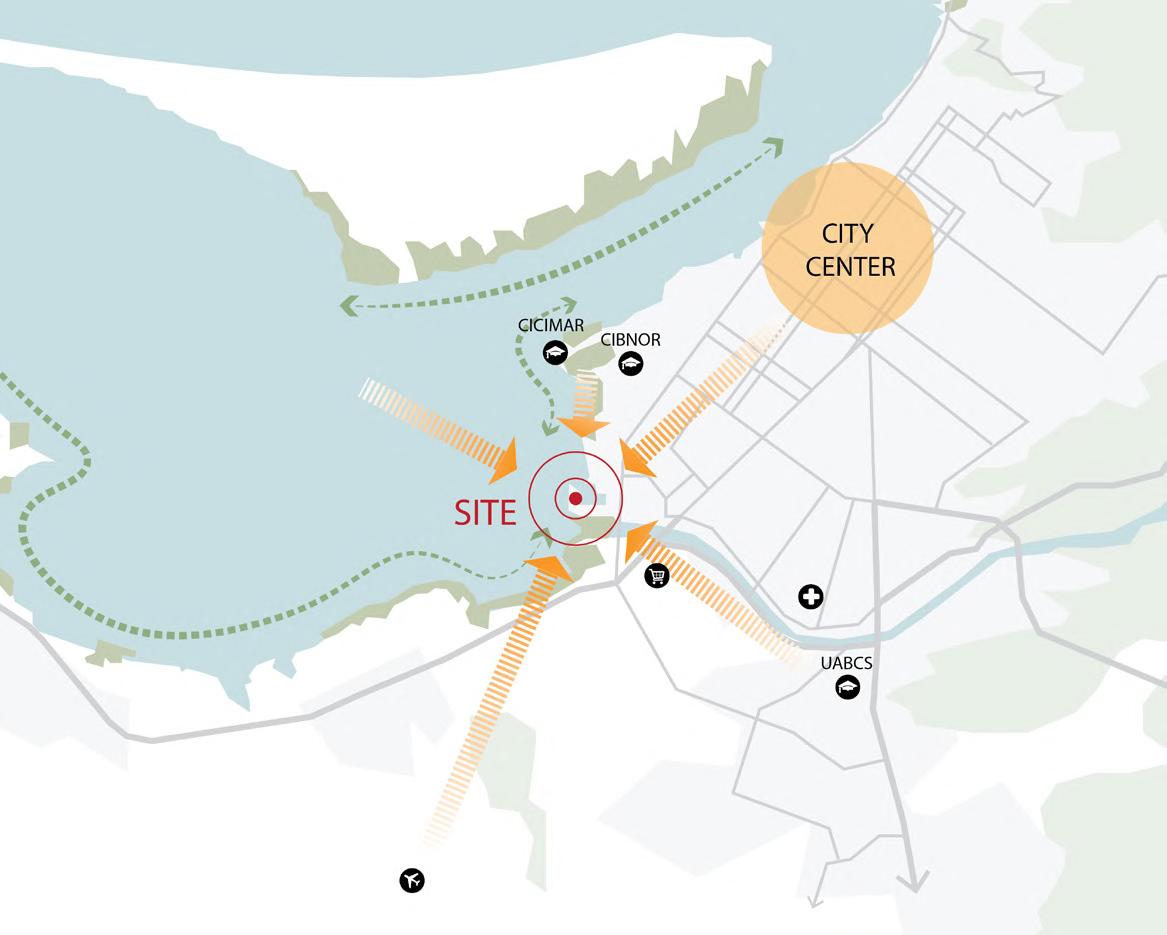
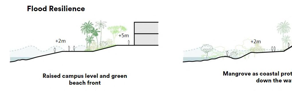
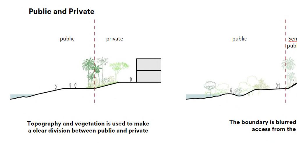
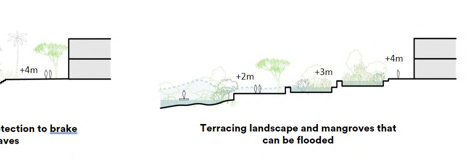
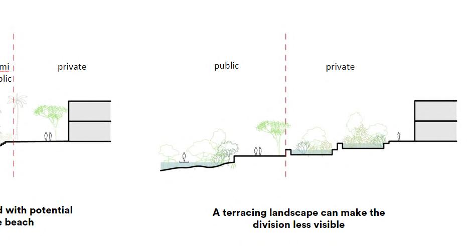
Location diagram and sections of La Paz Aquaculture Innovation Center Competition in Mexico.
The diagram shows the relationship between the site, the city, and the nature. The sections show the landscape strategies of flood resilience and the public/ private relationship.
I was responsible for 3D moedeling, sections and diagrams in this project.
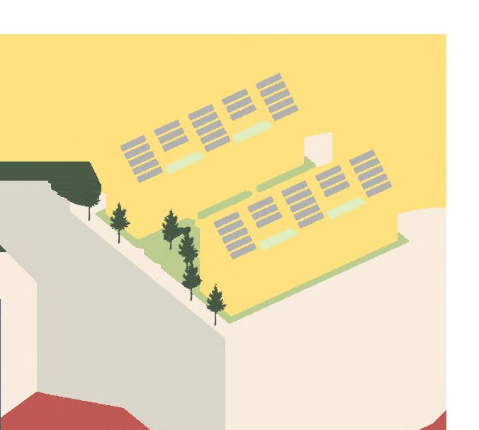
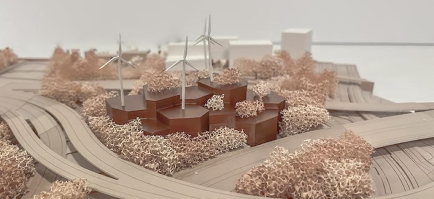
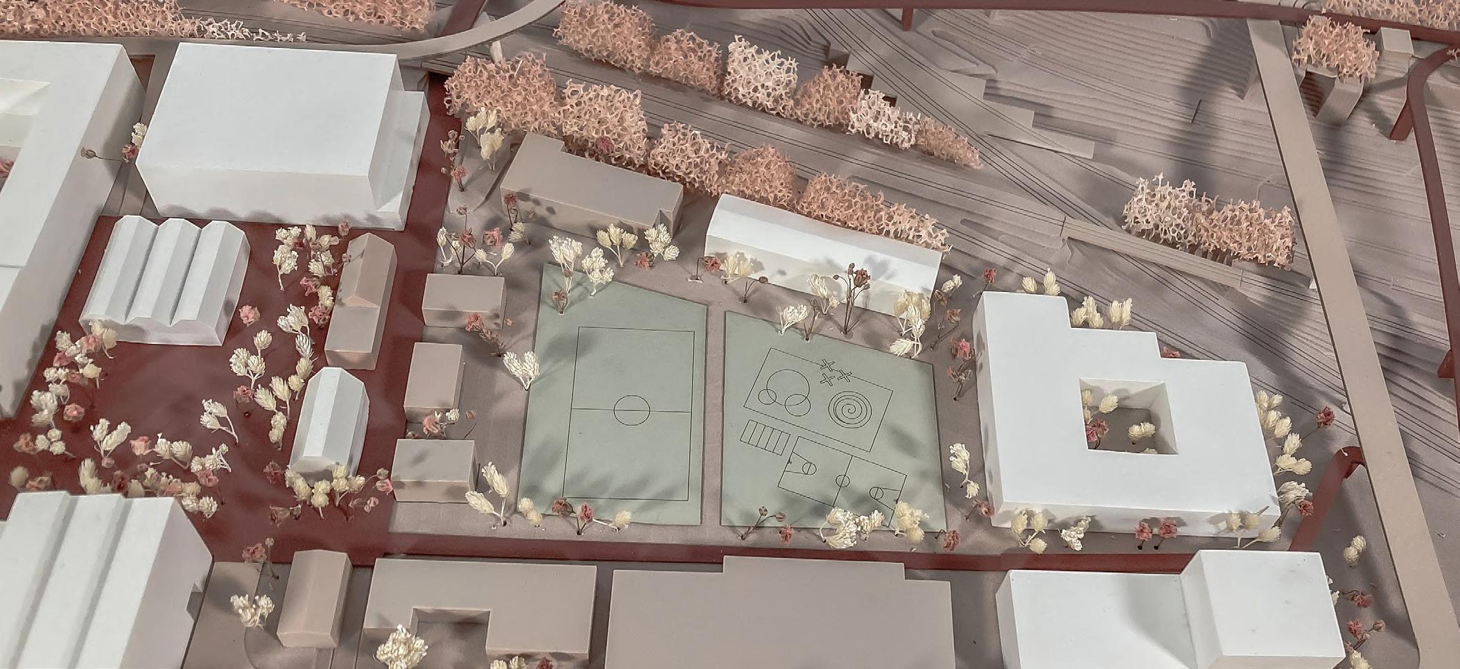
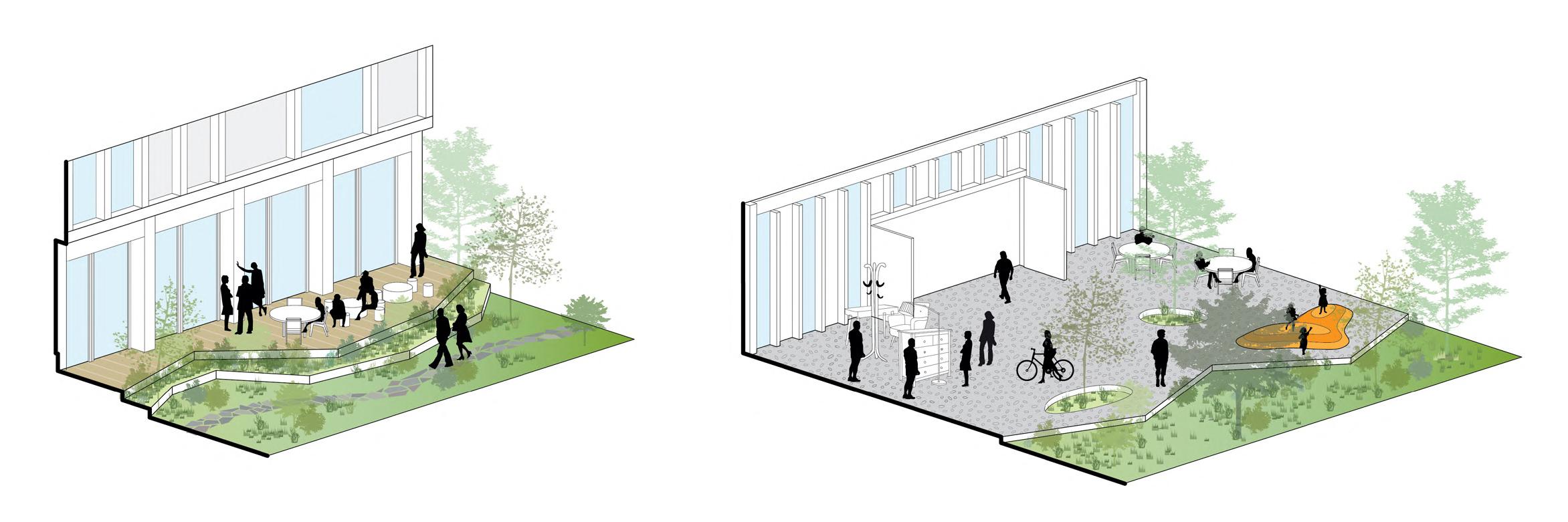
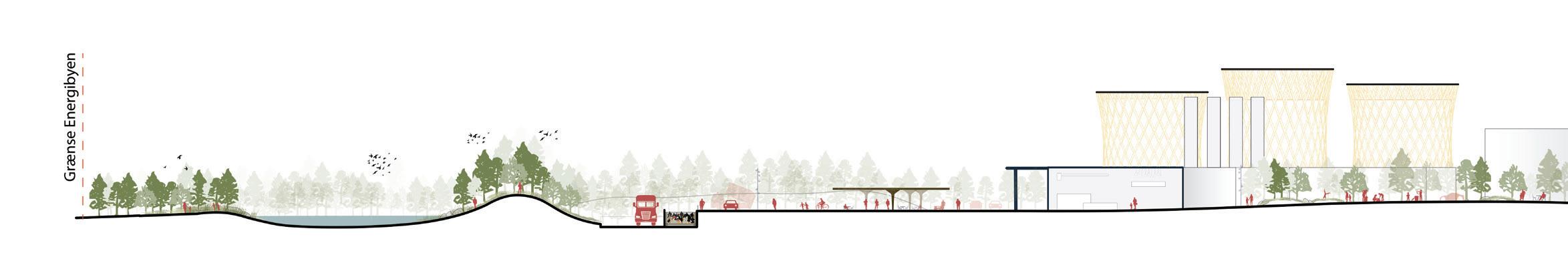
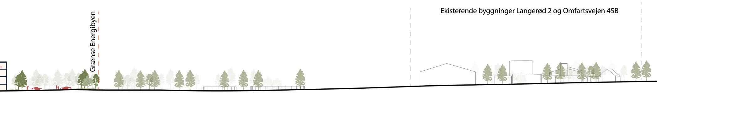
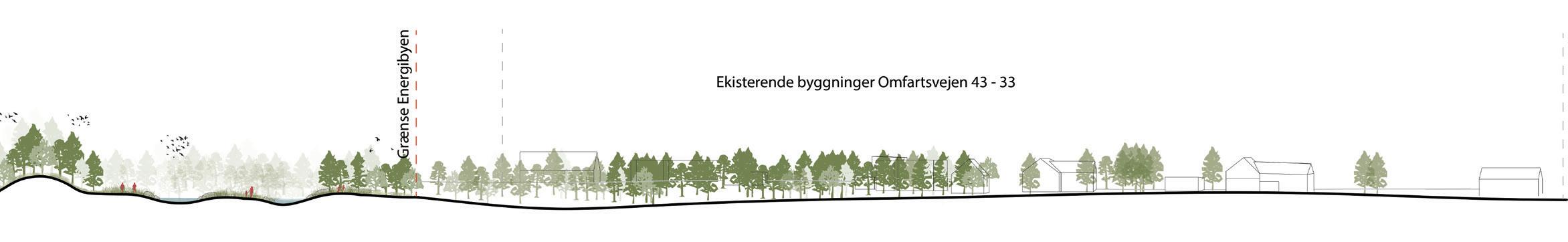
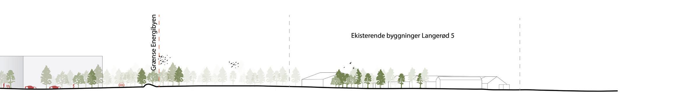
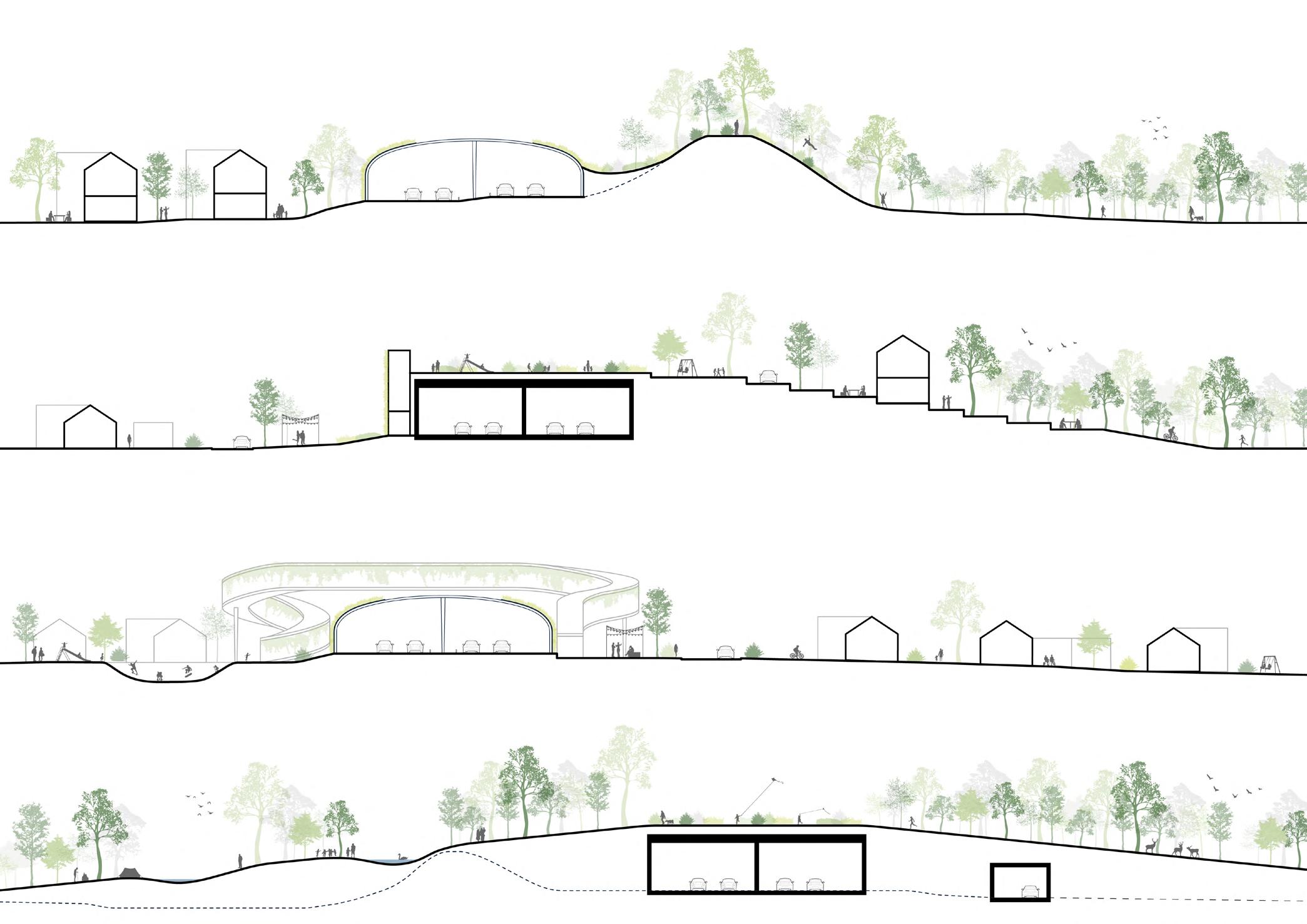
Axo-section diagrams and sections of Project Fors Energy in Denmark.
The diagrams show the relationship between the facades of 4 buildings and the courtyard. The sections show the relationship between the buildings, public spaces, and the context.
I was responsible for 3D moedeling, sections, diagrams, and some visuals for the public hearing.
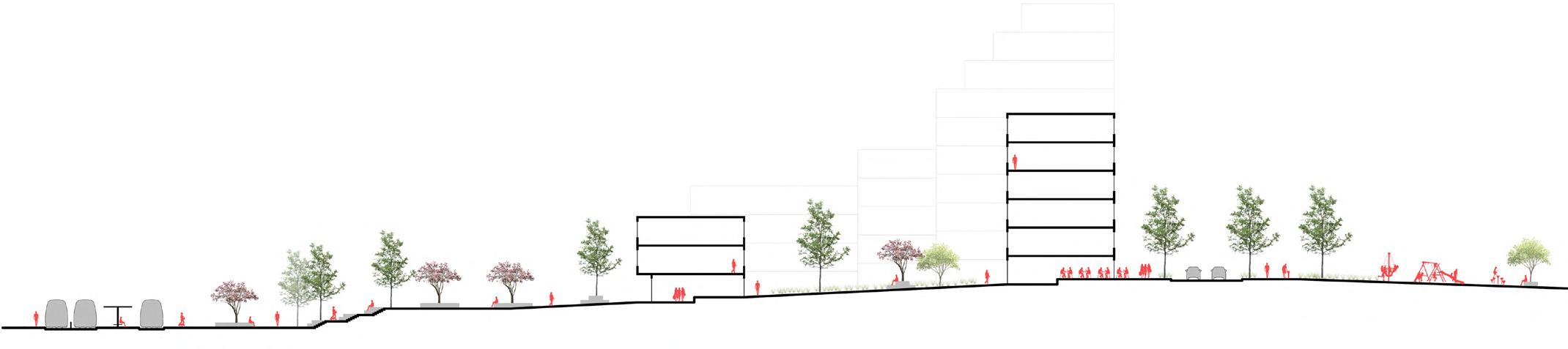
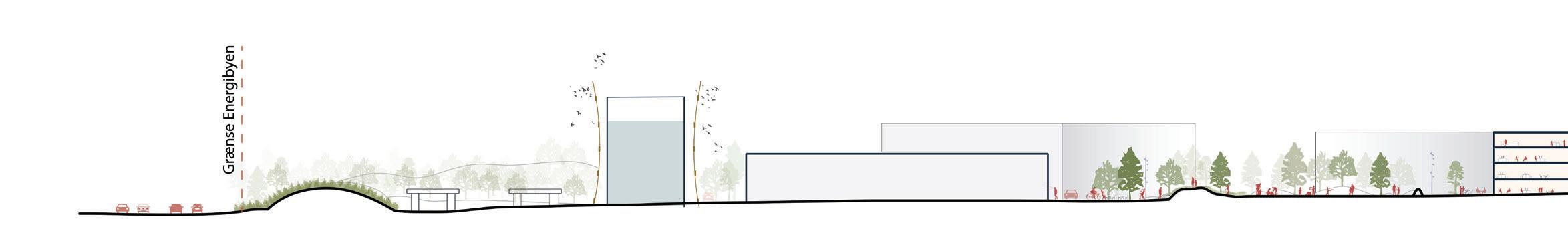
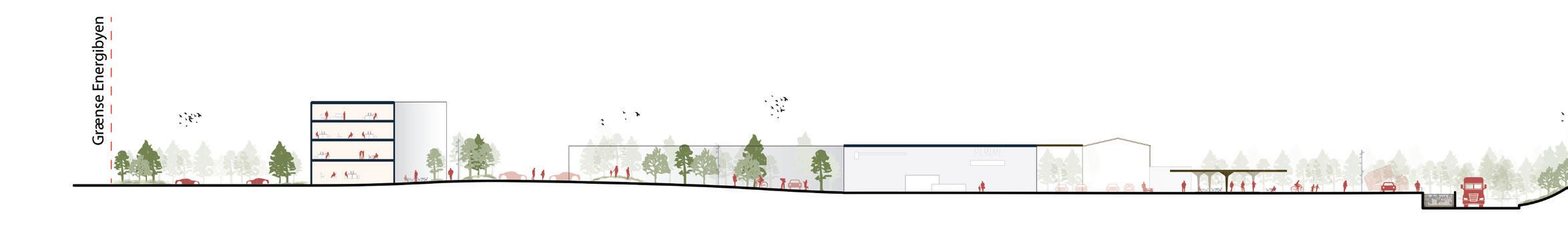
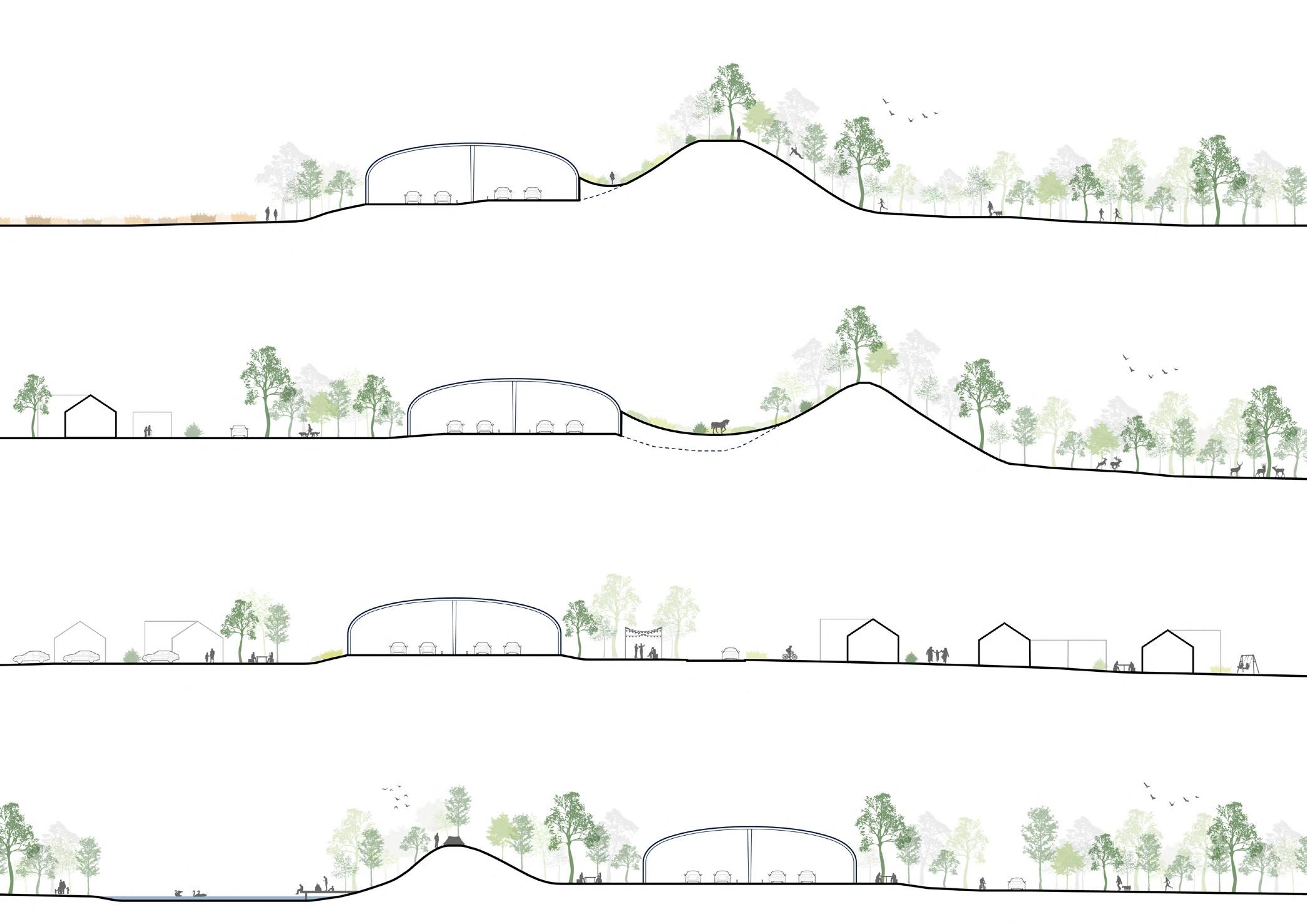
Sections of Covering of Mortorways Research in Denmark. These diagrams show how the existing highways could be "covered" and how the new spaces could be created and utilized. I was responsible for drawing many sections and some diagrams in this project.
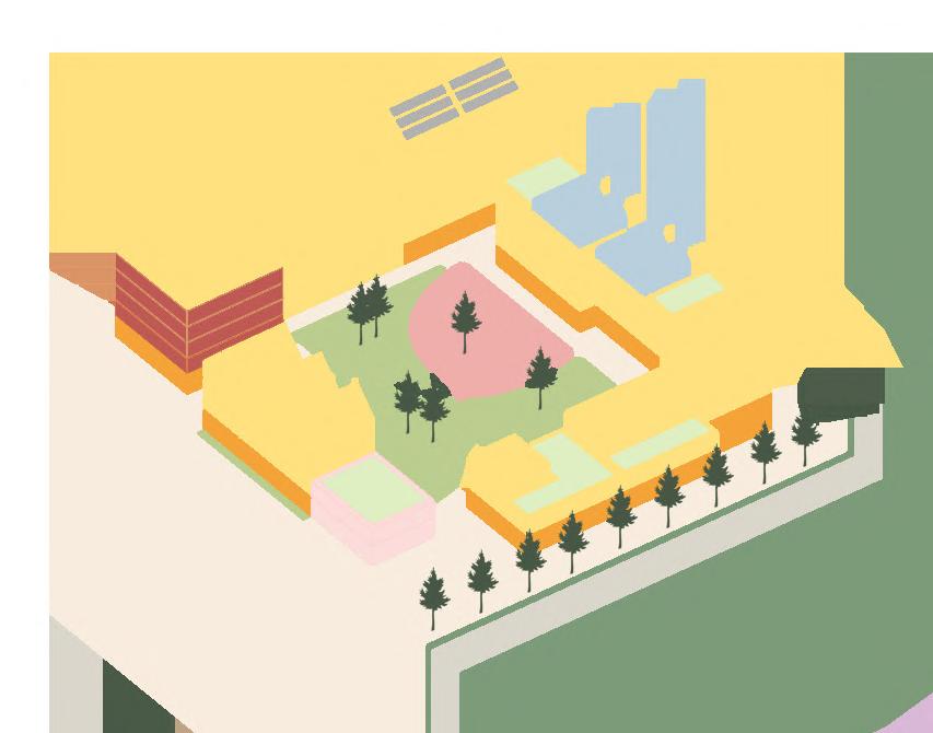
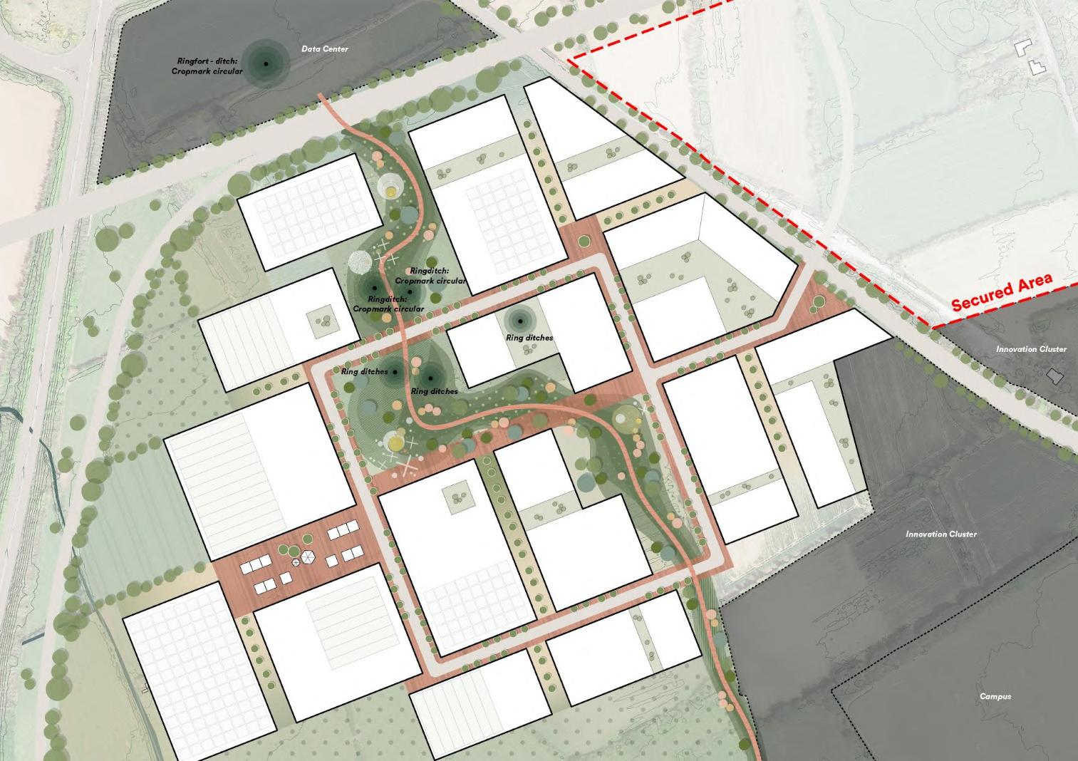
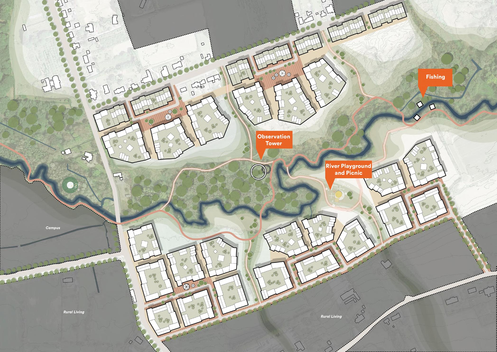
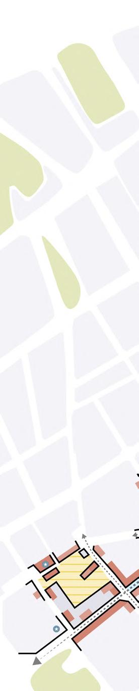
River Living area site plan of Bremore Port Masterplan in Ireland. The plan shows the overview of the new complexes, public spcaes, the nature and the surroundings in the River Living area. I was responsible for drawing plans and diagrams in this project.
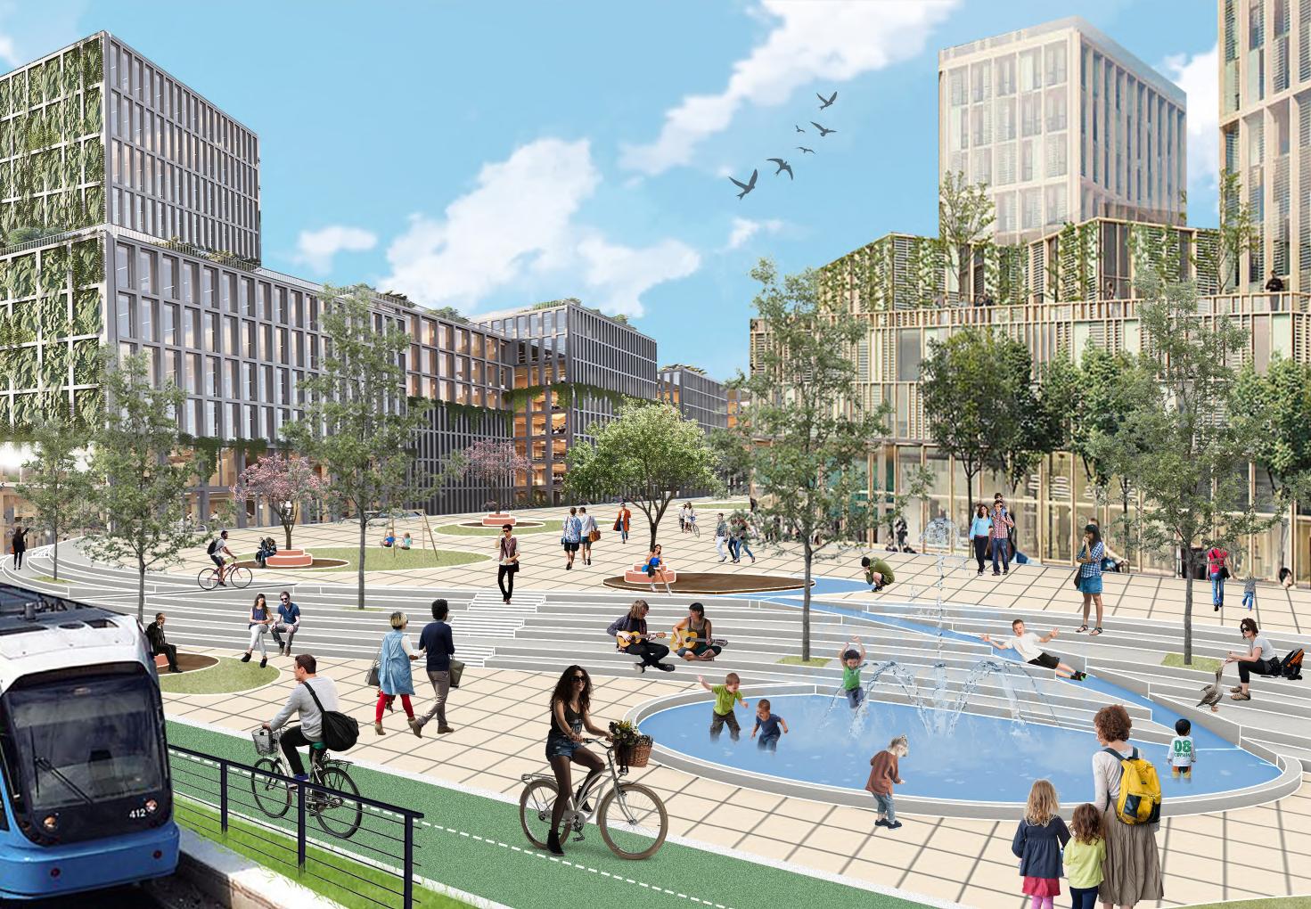
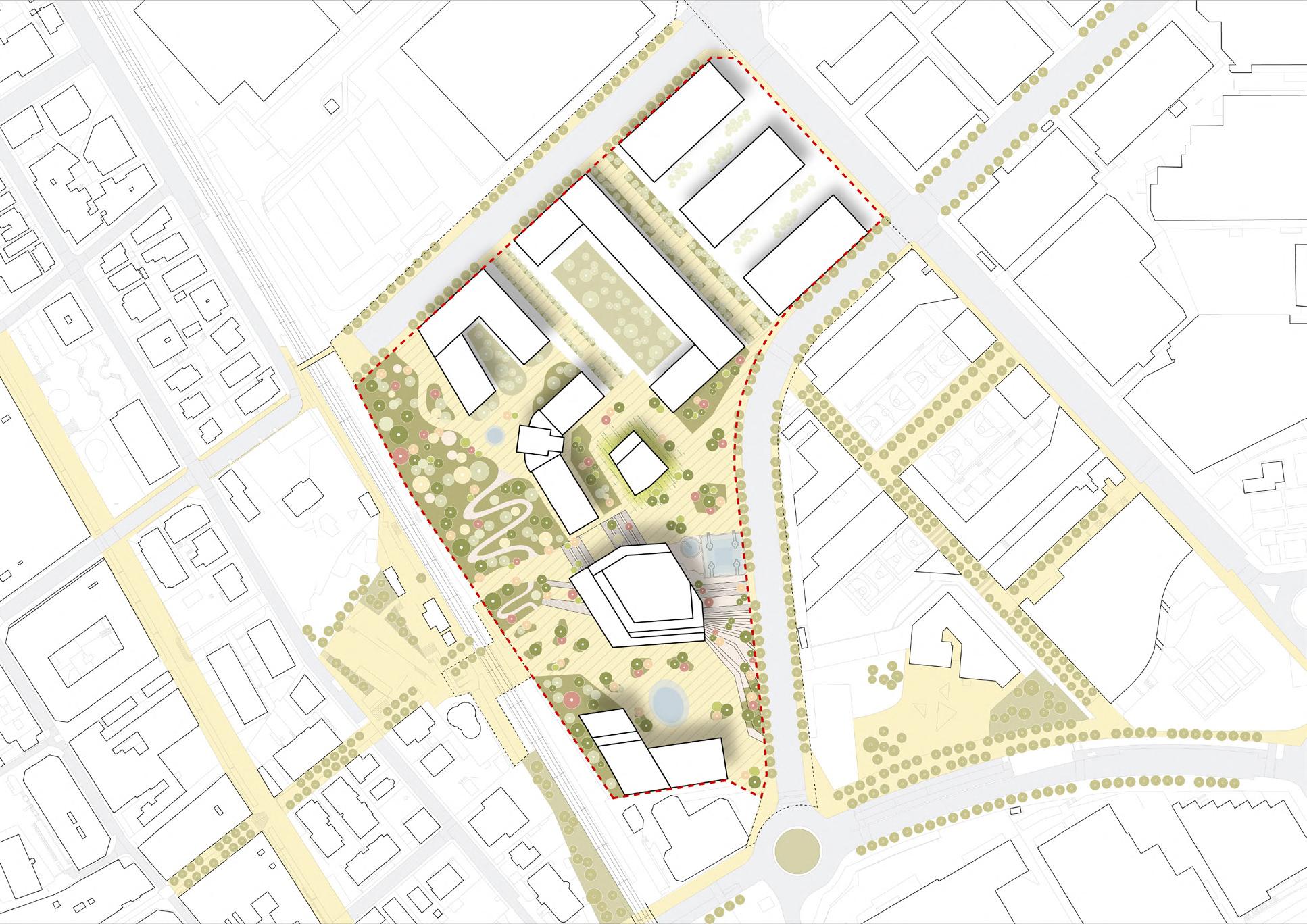
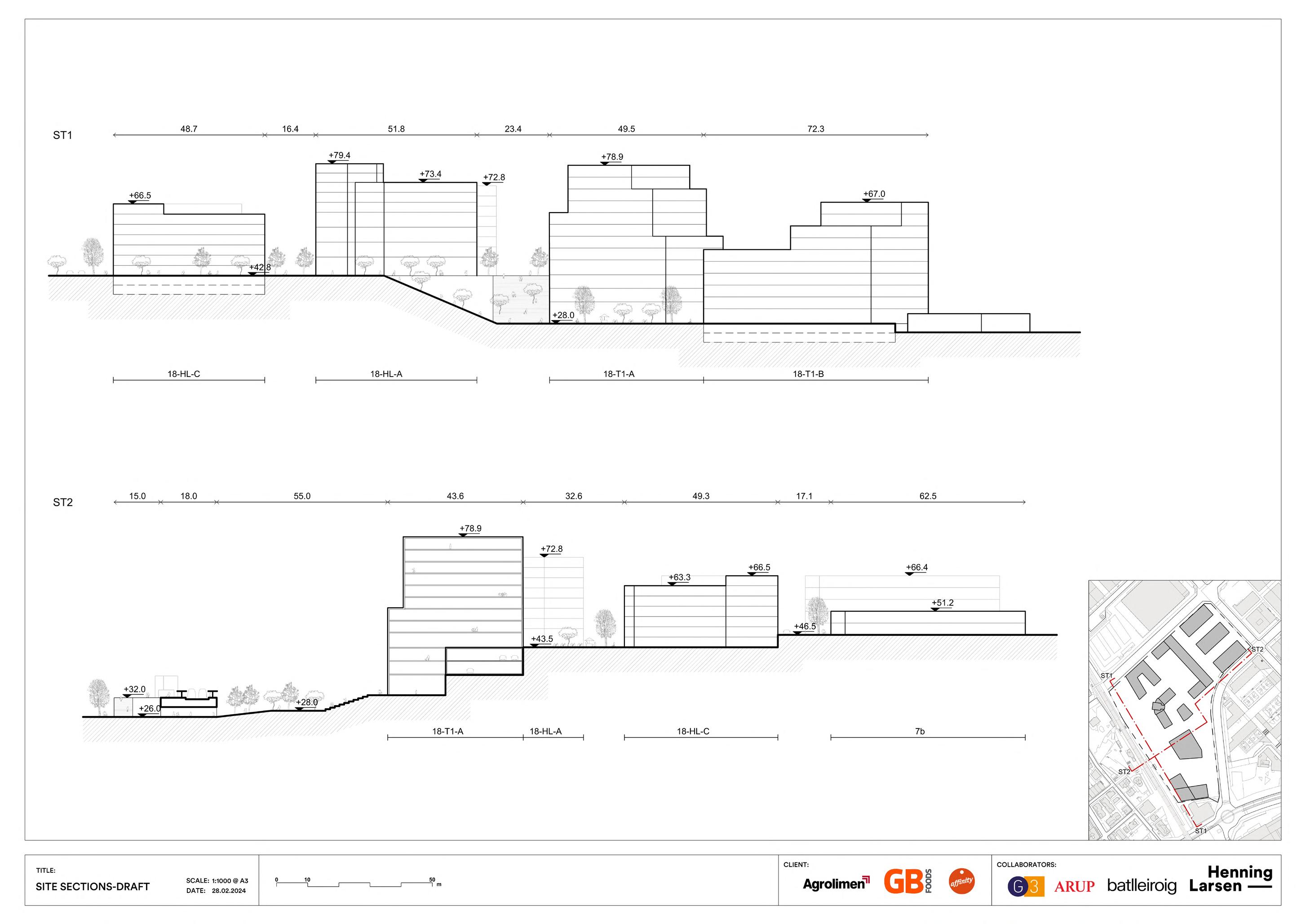
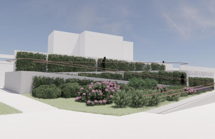
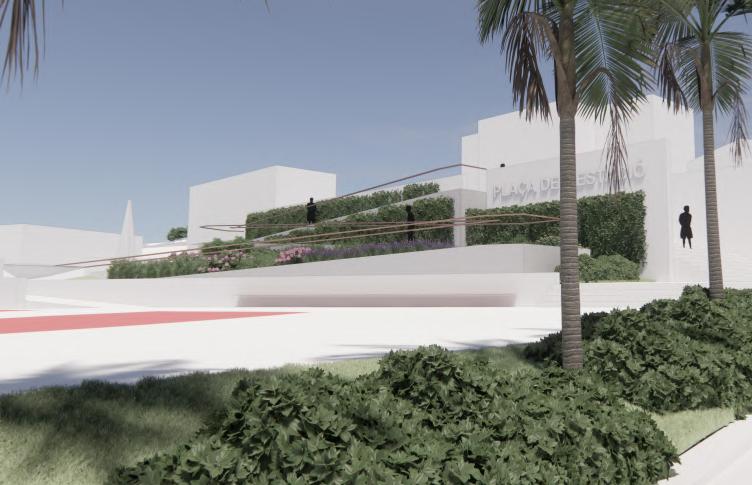
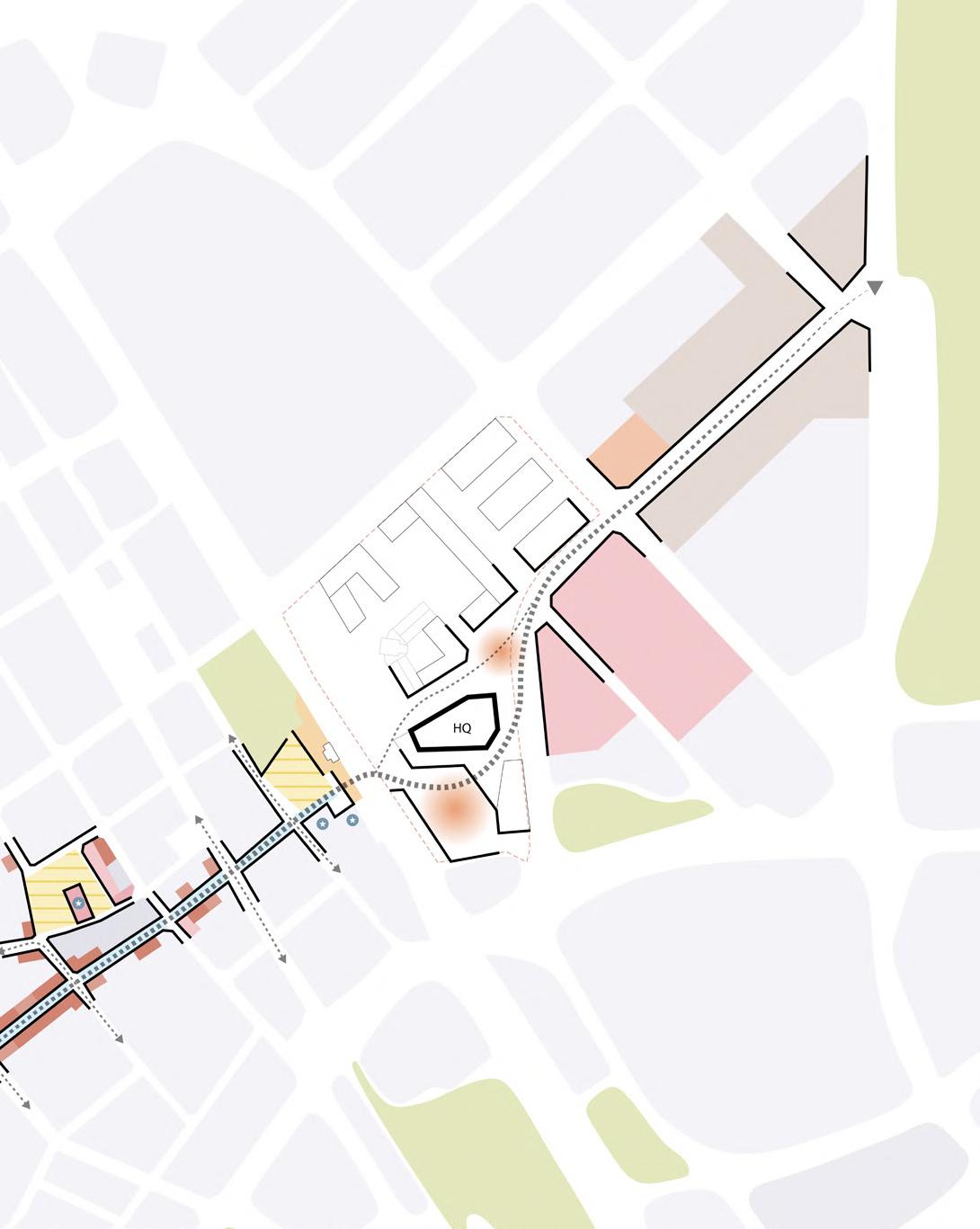
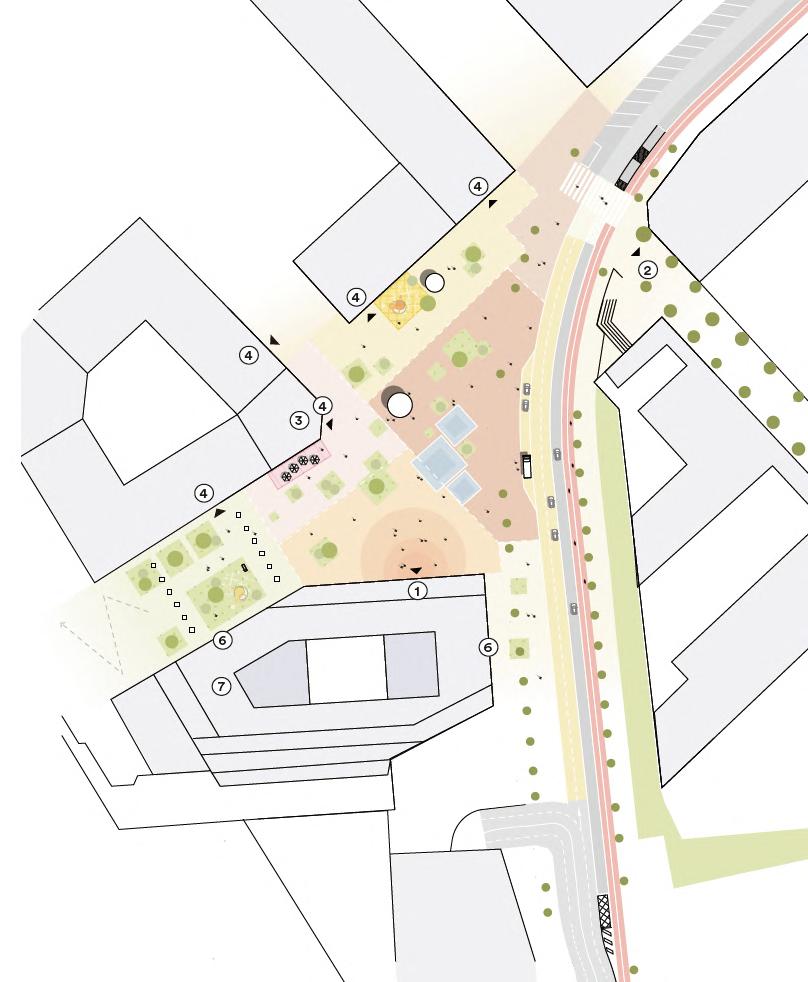
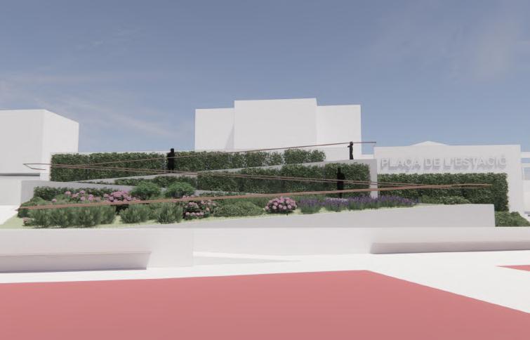
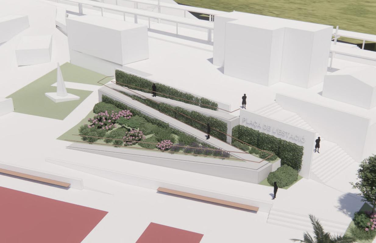
Site plan, diagrams, sections and renders of Project Gaudi HQ design in Spain.
The plan shows the proposal of updating master plan in municipality's style.
One diagram shows the how the spine of the area can connect with the site and extend to the city park; the other diagram shows how the upper plaza can be broken down to smaller scale areas with different identities
The sections show the relationship between the new buildings and the context, and how the design can embrace the topo. The renders show a ramp design option in front of the train station. I was responsible for 3D modeling, physical model, design option testing, many kinds of graphics (mappings, diagrams, plans, renders, etc.), as well as urban and material researches in this project.