B- 504, Saileela, Near Mysore Colony, RCF Company Road, Chembur, Mumbai - 400074 FOUNDATION STUDIO + NEIGHBOURHOOD DESIGN STUDIO + URBAN EXPANSION STUDIO C E P T U R B A N D E S I G N W O R K 9545269244ar.chetansodaye@gmail.com
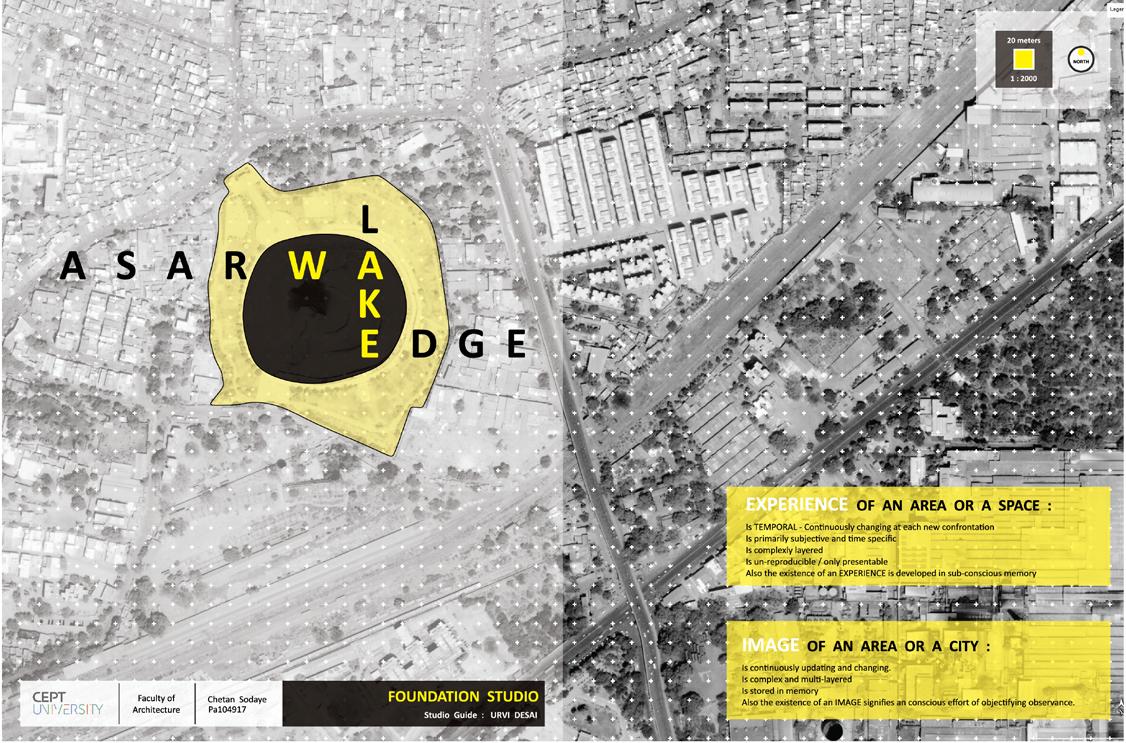
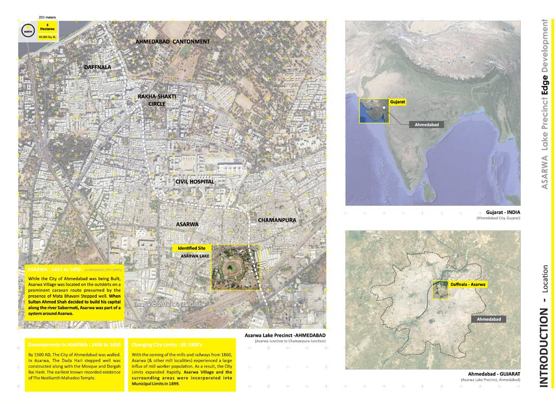
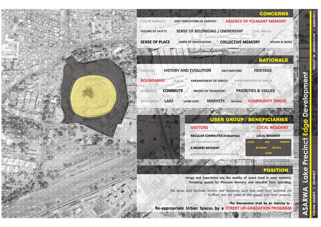
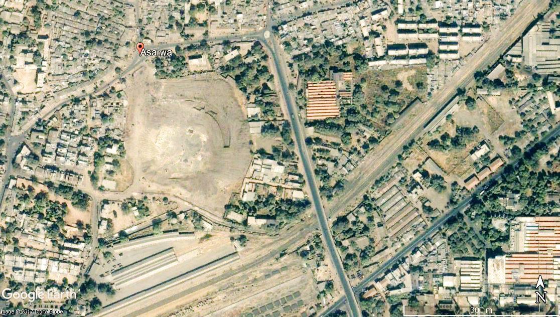
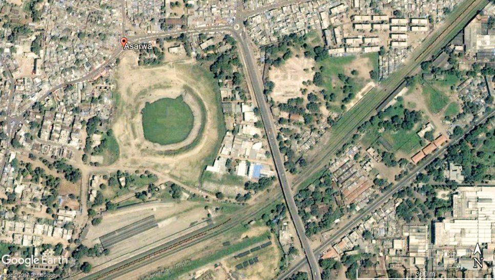
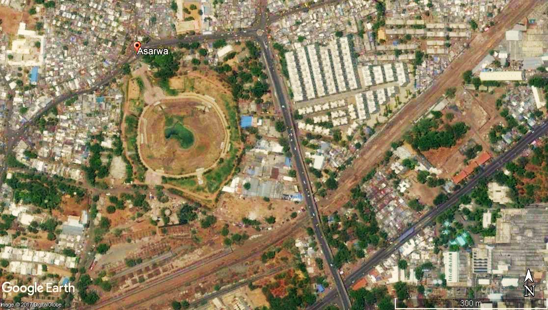
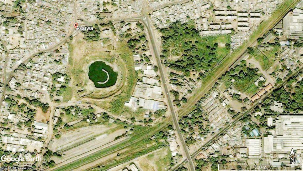
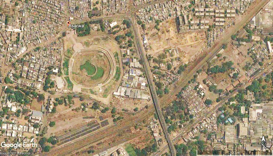
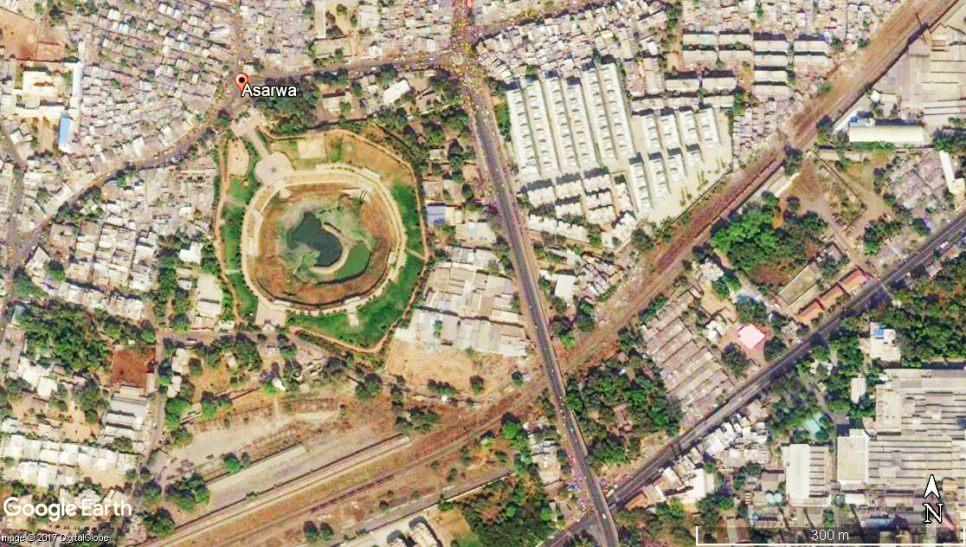
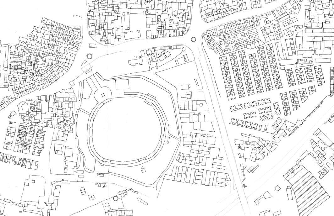
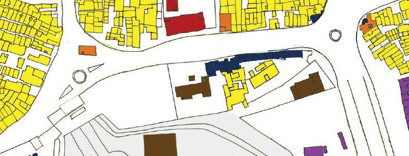
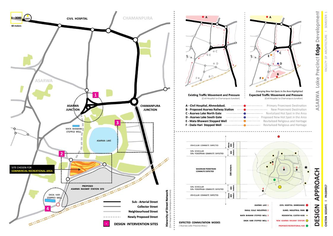
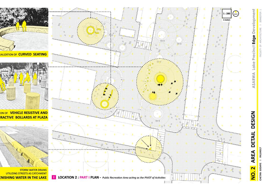
01 FOUNDATION STUDIO ASARWA LAKE EDGE DEVELOPMENT SEMESTER


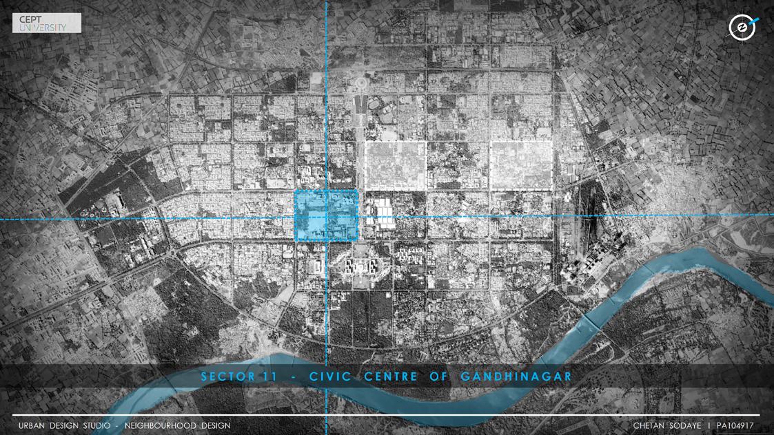
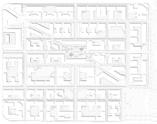
02 NEIGHBOURHOOD DESIGN SEMESTER MASTER PLANNING SECTOR 11 - GANDHINAGAR
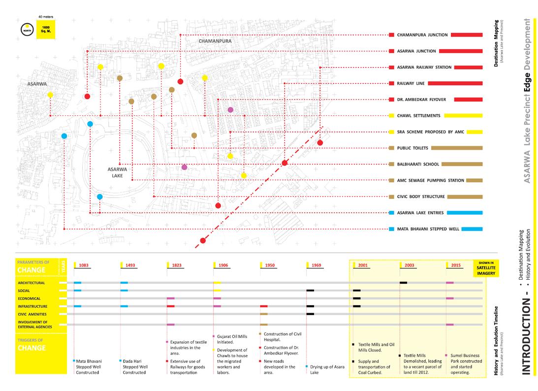
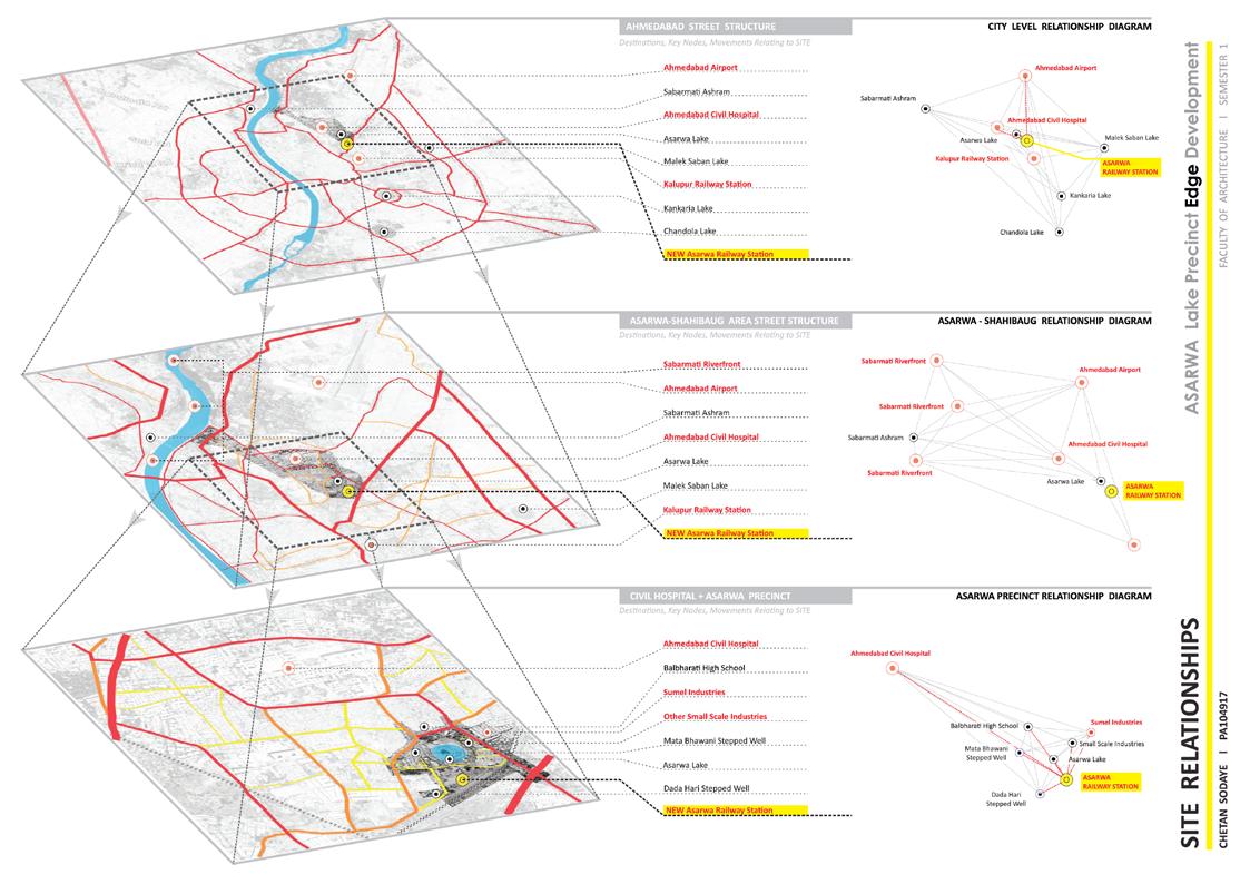
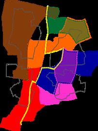
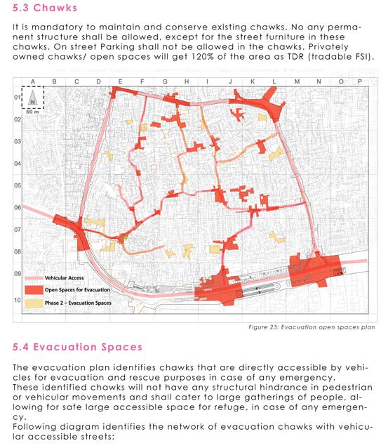
NODES
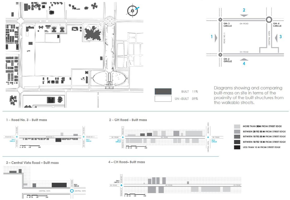
The nodes become a strong point to connect to for orientation, and having 3 prominent Nodes becomes a good opportunity to explore.

1. GH 3
2. GH 4
CH 2
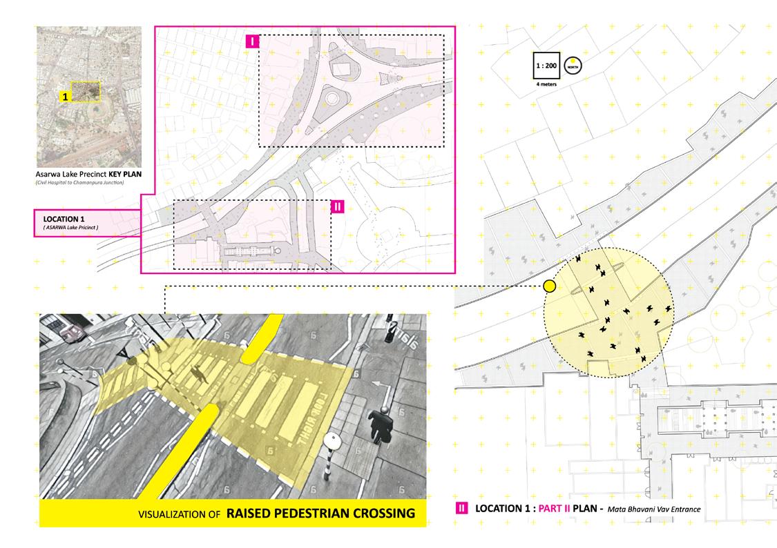
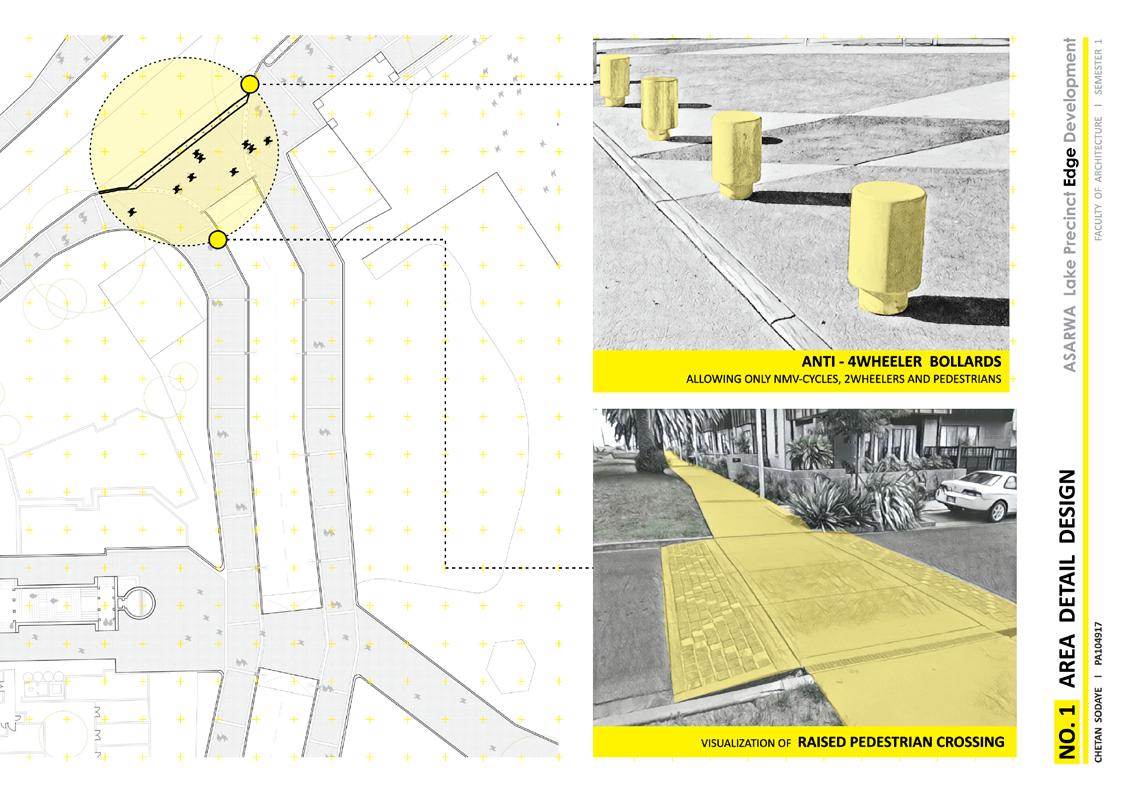
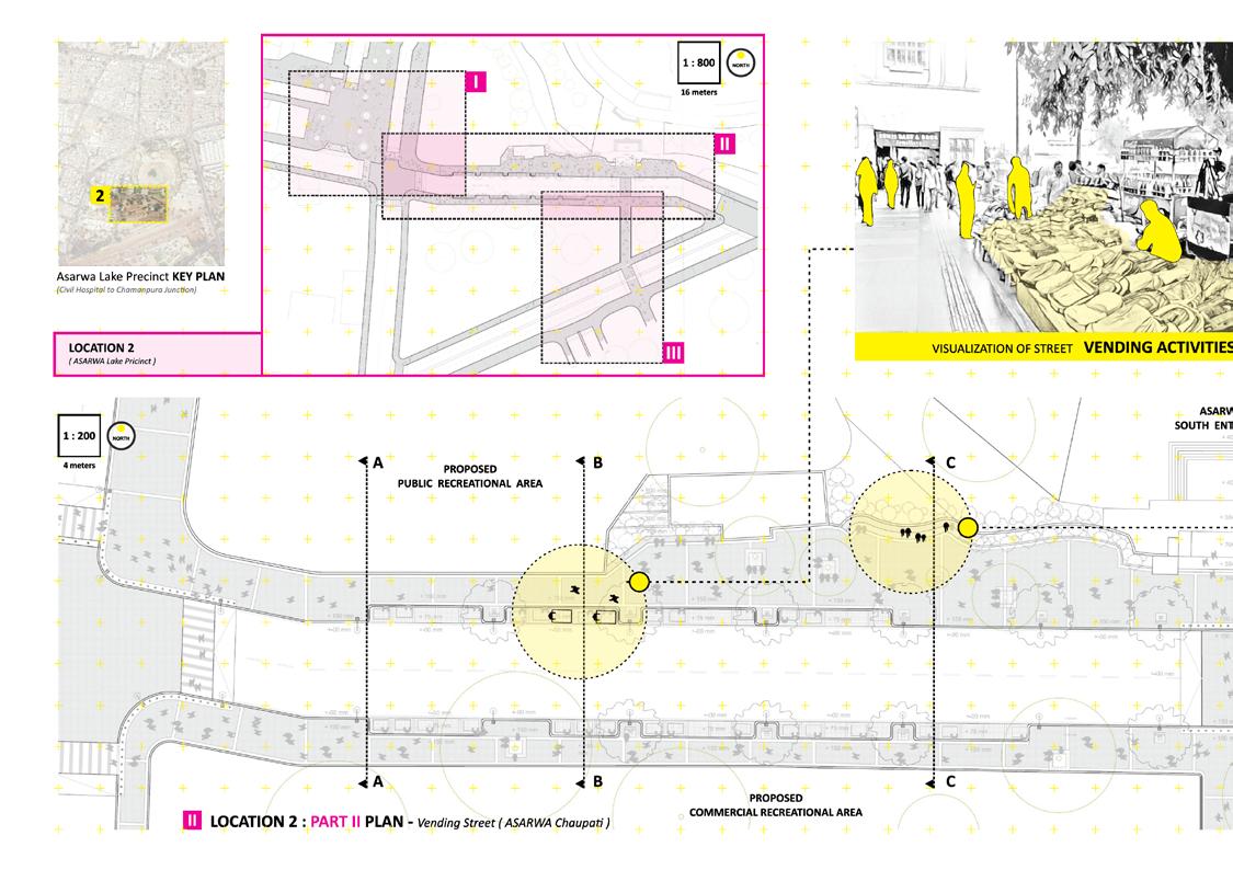
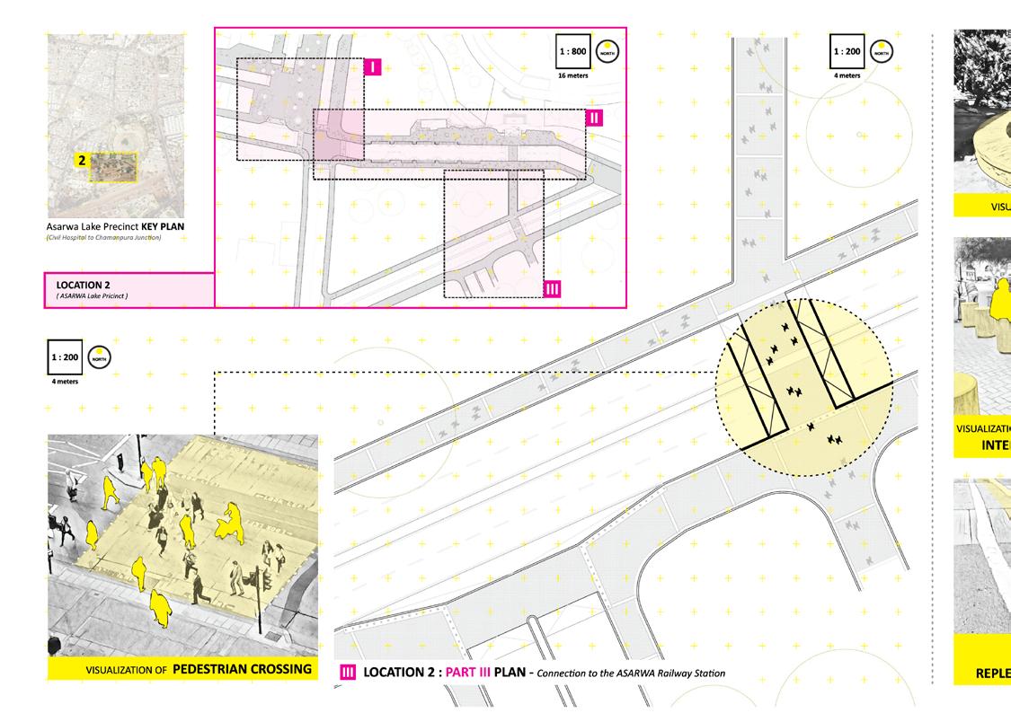
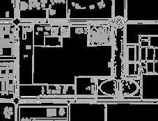
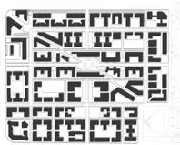
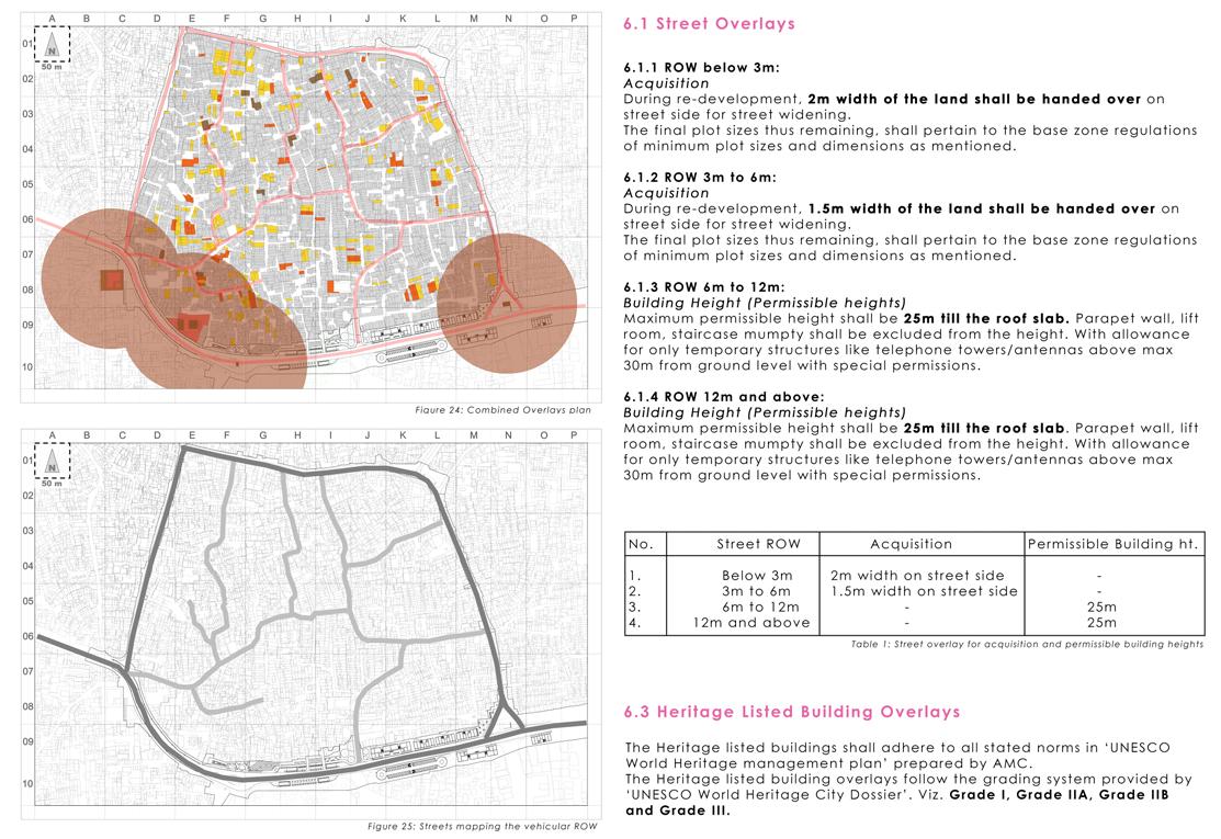
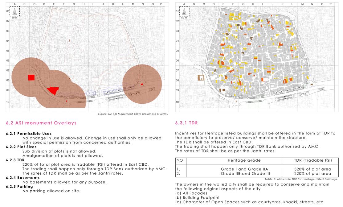
DETAIL PLANS
DETAIL PLANS
ADJACENT LAND USES
The adjacent land uses build a strong context and variety for the development within the sector.
CONSTRAINTS
EXISTING LANDMARKS
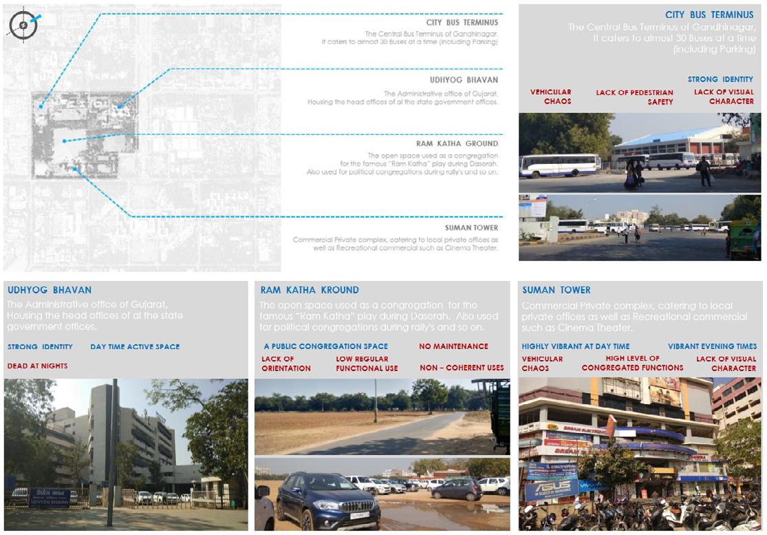
The City bus stand as a transportation hub and the Udhyog bhavan in the sector act as key constraints.
GREEN BUFFERS AND ACCESS POINTS
Green tree buffers that restrict permeability is a big constraint.
1. Civil Hospital
DETAIL PLANS
DETAIL PLANS
Gujarat Education Board
Central Axis
Sachivalay
Govt. Offfices
Colonies
While the available access to the neighboring sectors become gateways for interaction.
Limited Accesses to the interior of the sector is also a constraint.
DETAIL PLANSDETAIL PLANS
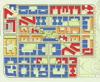
INSTITUTIONAL RESIDENTIAL COMMERCIAL MIXED USE PUBLIC OPEN SPACE ROW INSTITUTIONAL RESIDENTIAL COMMERCIAL MIXED USE OPEN SPACE ROW
G+11 TO G+15 G+8 TO G+10 G+4 TO G+7 G TO G+3 INSTITUTIONAL RESIDENTIAL COMMERCIAL MIXED USE PUBLIC OPEN SPACE ROW UNBUILT BUILT G+11 TO G+15 G+8 TO G+10 G+4 TO G+7 G TO G+3
OPPORTUNITIES
3.
2.
3.
4.
5.
6. Residential
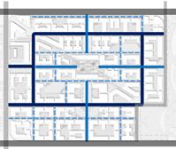
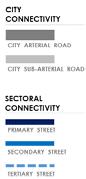
IMP. JUNCTIONS 1 2 3 1 2 3 45 6
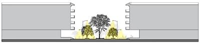
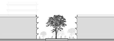
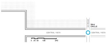
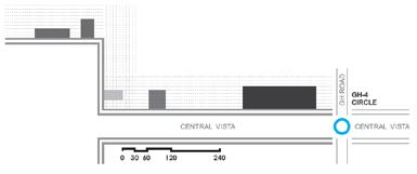
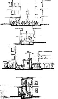
SECTIONS FOR PRIMARY STREETS
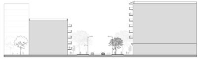
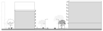

ROW 24 Meters
Carriage Way 6m + 6m
Footpath 6m + 6m
Front Margins 5m + 5m
Total Usable Space 24m + 10m
M
SECTIONS FOR SECONDARY STREETS
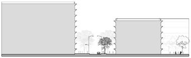
ROW 20 Meters

Carriage Way 6m + 6m
Footpath 4m + 4m
Front Margins 5m + 5m
Total Usable Space 20m + 10m
18M TO 30 M
Realm
SECTION

ROW
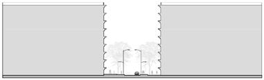
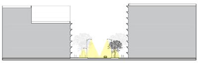
SECTIONS FOR TERTIARY STREETS
ROW 12 Meters
Carriage Way 3m + 3m
Footpath 3m + 3m
Front Margins 5m + 5m
Total Usable Space 12m + 10m
16M TO 22 M Public Realm
SECTION AT SECTION AT SECTION AT F HG
C D E SECTION AT C SECTION AT D SECTION AT E
20 M 0 5 15 30 Parking Parking 30 M 20 M 20 M
Public
A B
AT A SECTION AT B 34 M 0 5 15 30 ROW 24 M 24
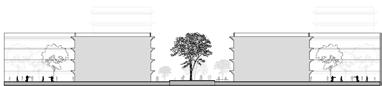
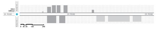
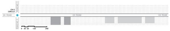
Public Realm BUILT MASS Periphery Massing perceived on site BUILT MASS Internal
Internal Massing perceived on site
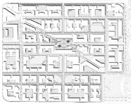
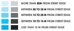
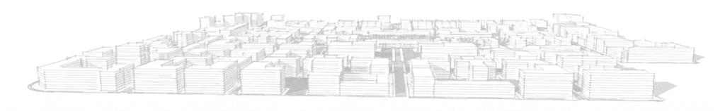
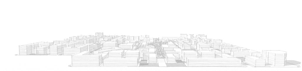
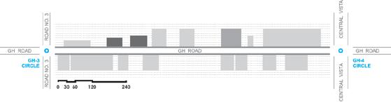
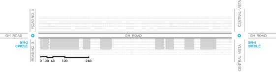
Diagrams showing and comparing built mass on site in terms of the proximity of the built structures from the walkable streets.
Here the diagram is comprehensive and is further divided in two parts as per the sector, Peripheral Massing and Internal Massing


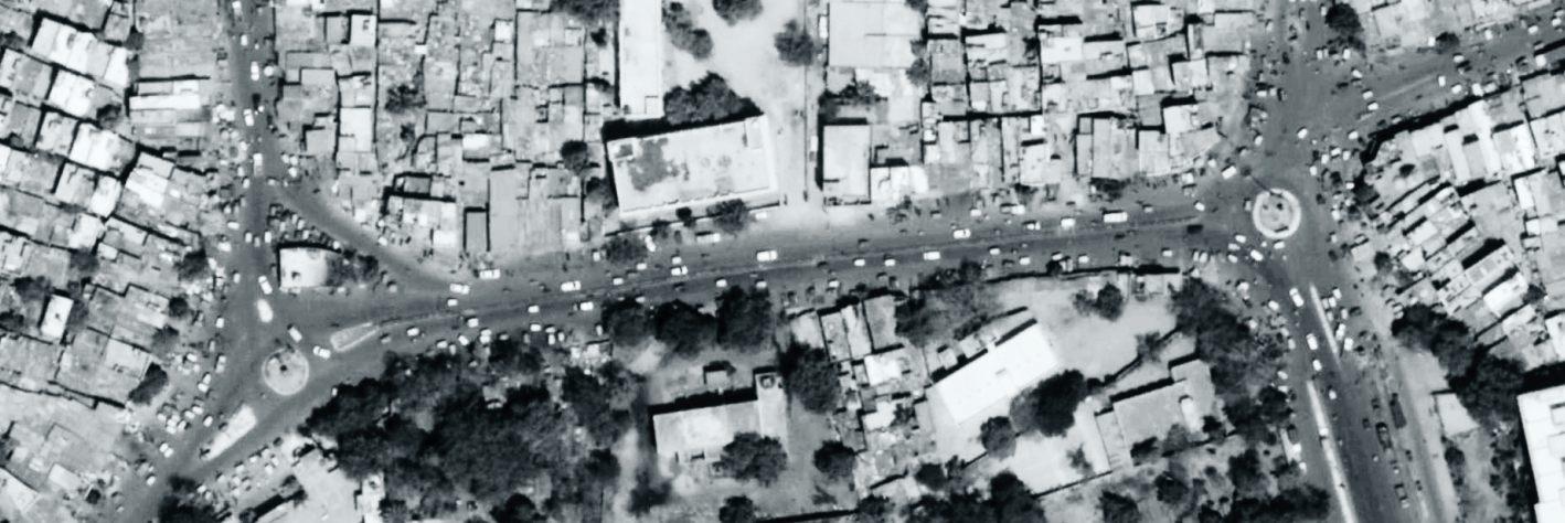
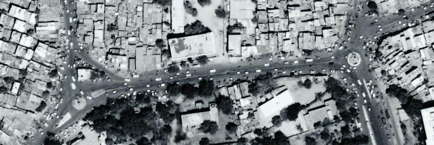
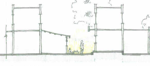
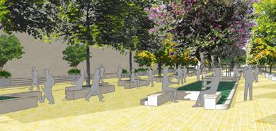
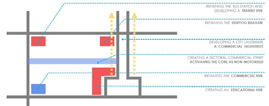
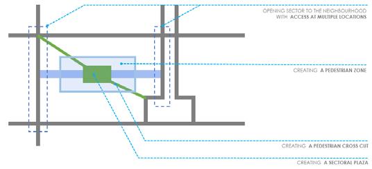
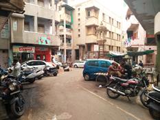
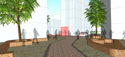
This shopping arcade acts as the activating node for the entire sector.
May it be the morning office going person having snacks and tea, having fun food in the noon or the evening stroller out for a leisure walk, everyone finds a place for themselves.
It offers a vibrant colourful street arcade to shop, eat and hop onto on leisure weekends.
A perfect promenade for a City Dweller.
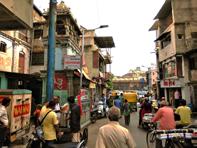
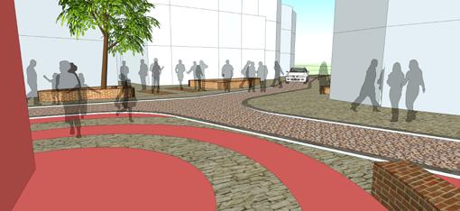
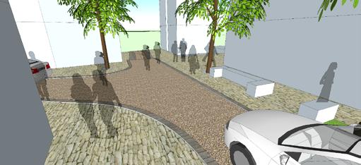
This pedestrian cut through connects the Govt. and Private Offices to the transit hub at the corner of the Sector.
Also it connects the Residential and Educational parcels to the Central Vista ( Swarnim Park ).
It offers a calm shaded street to stroll through even in the hot sunny afternoons, making access to the Public Transit Enjoyable and memorable.
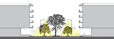
 SECTIONS FOR THE PUBLIC REALM
SECTIONS FOR THE PUBLIC REALM
SECTIONS FOR THE PUBLIC REALM
AT F AT G AT H ROW 12 M 0 5 15 30 22 M
SKYLINE

 Metro Station Central Bus Station Govt. Residential Colony
Commercial Mall
Public / Civic SpineCity Mall City Park
Metro Station Central Bus Station Govt. Residential Colony
Commercial Mall
Public / Civic SpineCity Mall City Park
AND LANDMARKS EXISTING BUILTMASS PROPOSED BUILTMASS
 Commercial Mall Commercial Complexes Educational Institute
Public / Civic Spine
City Mall City Park
Commercial Mall Commercial Complexes Educational Institute
Public / Civic Spine
City Mall City Park
EXISTING BUILTMASS PROPOSED BUILTMASS
AND LANDMARKS
 High End Shopping Promenade
Udyog Bhavan
Commercial Complexes
High End Shopping Promenade
Public / Civic Spine
City Admin HubCity Commercial Street
High End Shopping Promenade
Udyog Bhavan
Commercial Complexes
High End Shopping Promenade
Public / Civic Spine
City Admin HubCity Commercial Street
SKYLINE
EXISTING BUILTMASS PROPOSED BUILTMASS
EXISTING BUILTMASS

PROPOSED BUILTMASS
 Udyog Bhavan
Government Offices Commercial Complex Commercial Complexes
City Admin Hub Commercial complexPublic / Civic Spine
Udyog Bhavan
Government Offices Commercial Complex Commercial Complexes
City Admin Hub Commercial complexPublic / Civic Spine
VISION
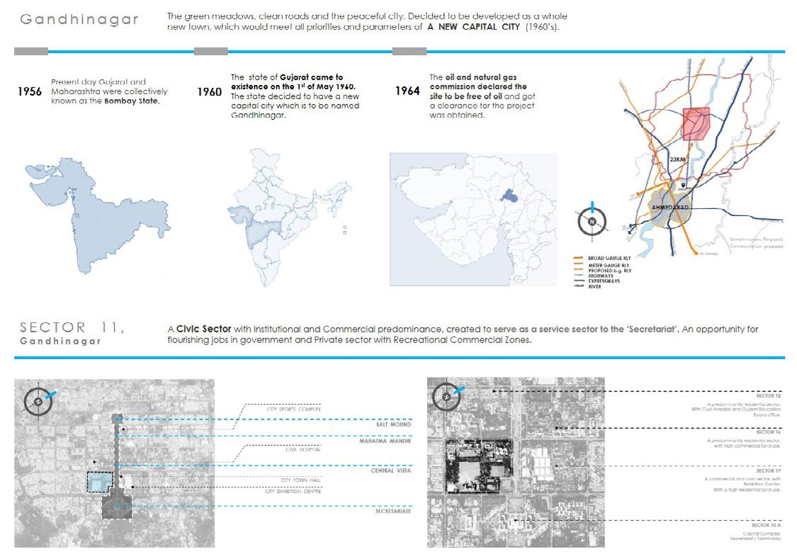
To create a Civic Centre for the City of Gandhinagar, A New Capital of the prosperous state of Gujarat.
GOALS
Creating an image for the city.
Developing a resource enhancing development.
Developing a focal point for Cultural, Ceremonial and Community Activities.
COMPONENTS
• Community and Recreational open space
• City Museum
• City Library
• City Transportation Hub
• Government Offices
• Commercial Developments
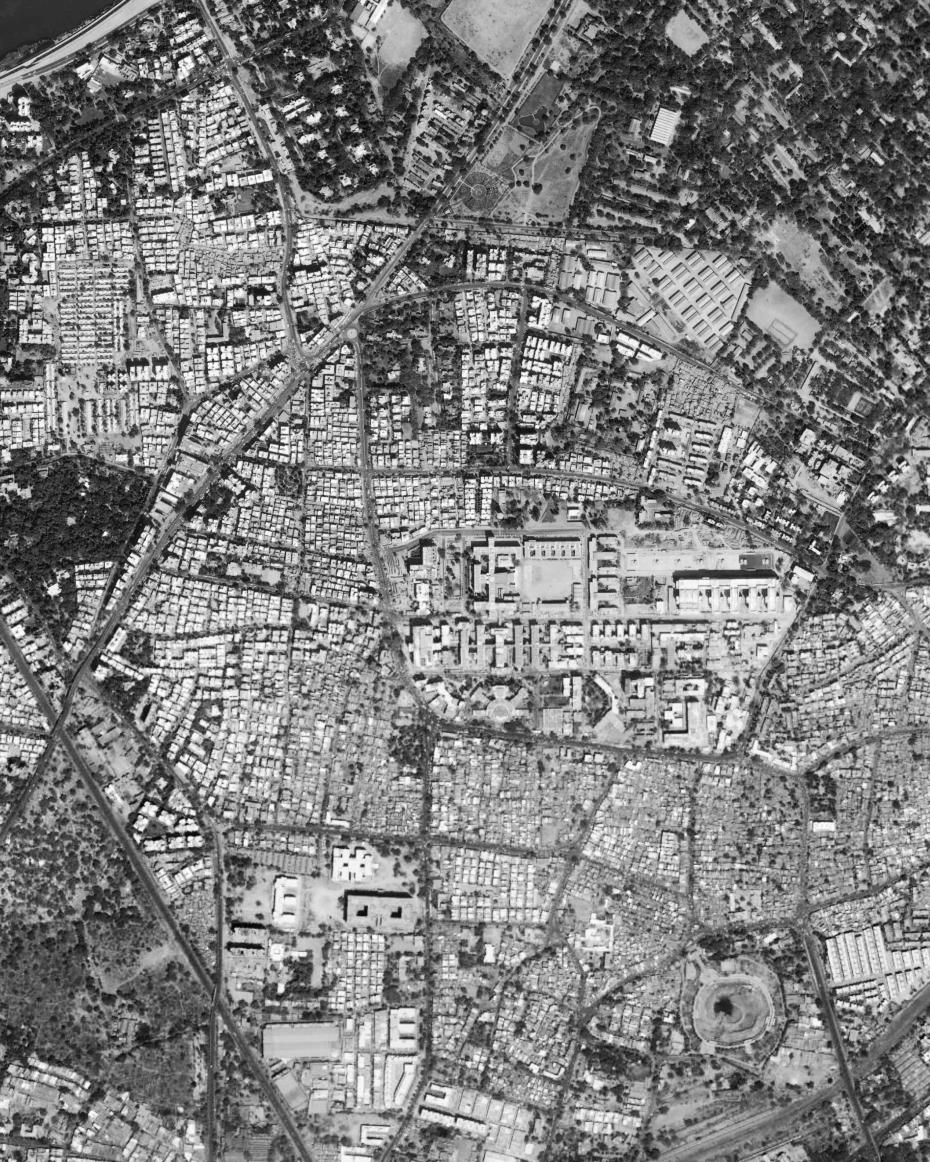
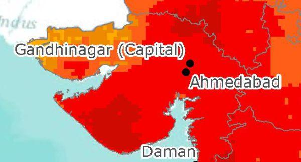
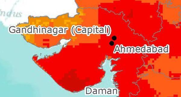
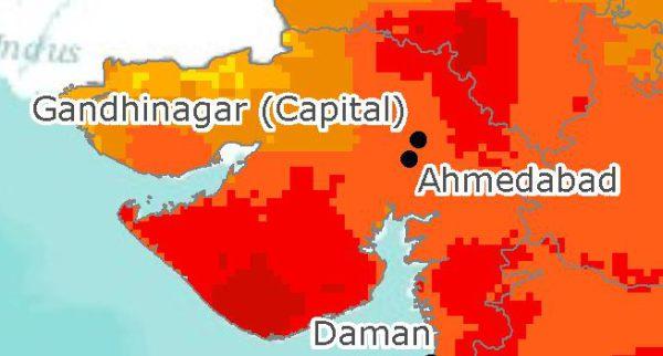
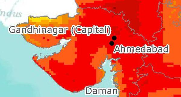
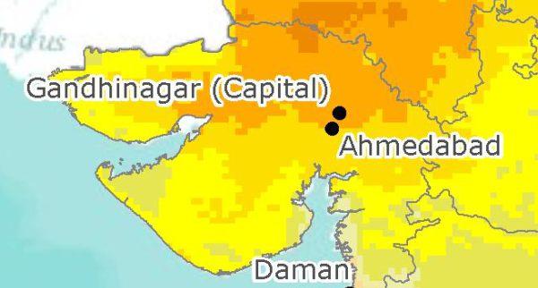
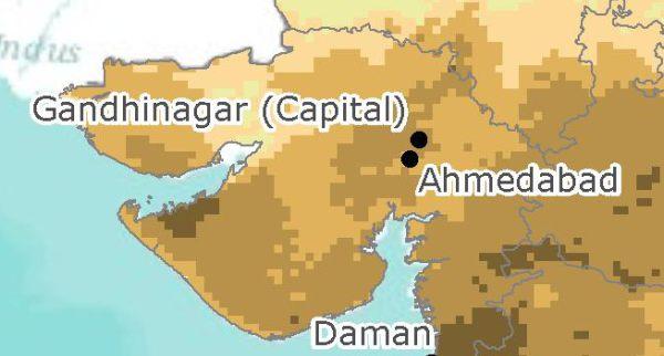
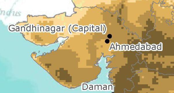
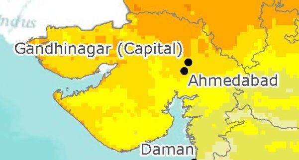
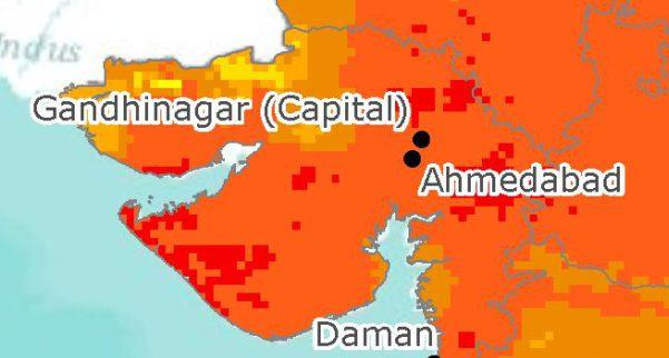
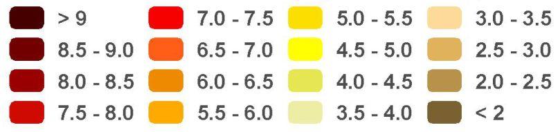
GANDHINAGAR - ANALYSIS
SECTOR 11 - ANALYSIS
FROM THE YEAR OF INCEPTION POPULATION DENSITY SEEMS SIGNIFICANTLY LOW
LANDUSE SEEMS VERY DISINTEGRATED
REDENSIFICATION OF GANDHINAGAR NECESSARY
NEEDS MIXED APPROACH FOR GROWTH AND SUSTAINABILITY
WEAK NODES WITH NO IDENTITY, CREATES LOSS OF ORIENTATION
CREATION OF NODES AS LANDMARKS FOR ORIENTATION
CONTINUOUS LANDUSES WITH NO BRAKES CAUSING MONOTONY IN THE EDGE
MAKING BLOCKS SMALLER THAN 200M FOR DIVERSITY AND POROSITY ALLOWING INTERACTION WITH THE BUILTMASS
OWNERSHIP RATIO IS VERY SKEWED
LAND OWNERSHIP REQUIRES REVISIT FOR MARKET VIABILITY
EMPTY CENTRE CAUSING LOSS OF LIFE IN THE CORE
CREATING COHERENT BUILTMASS WITH AN ACTIVE CORE PROVIDING FOR ACTIVITY INDUCING FUNCTIONS
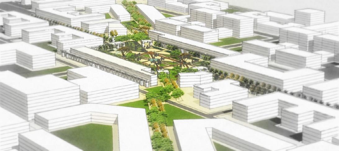
TRANSFORMATION
BEFORE AFTERThe Civic Sector was a blank site. Under Utilised, lacking Identity and a place with no rememberance.
The developed Civic Center offers for a vibrant Sector with Equal opportunities for all. Loaded with nodes, junctions, activities and confrontations which makes it a Place.
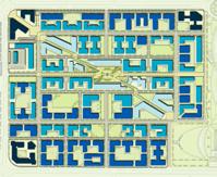
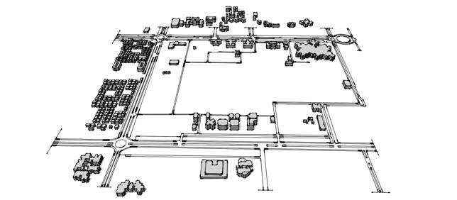
METRO STATION (INTER CITY)
NEAR TRANSIT PUBLIC SQUARE
BUS STATION
BUSSES PARKING AND BOARDING
CITY MUSEUM
CITY LIBRARY GOVT. RESIDENTIAL COLONY
PUBLIC GROUND / OPEN SPACE
PUBLIC SCHOOL
COMMERCIAL OFFICES
CITY MALL
COMMERCIAL COMPLEXES
UDYOG BHAVAN
PARKING LOT
PUBLIC GROUND / OPEN SPACE

MIXED USE RESIDENTIAL
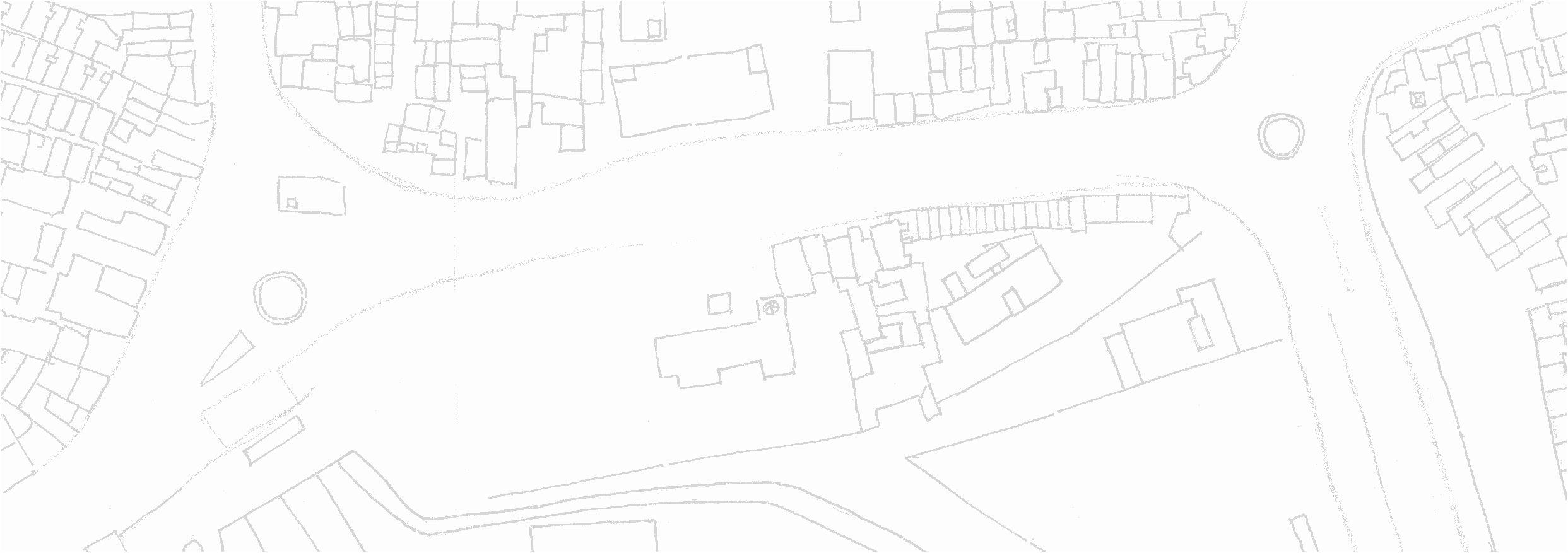
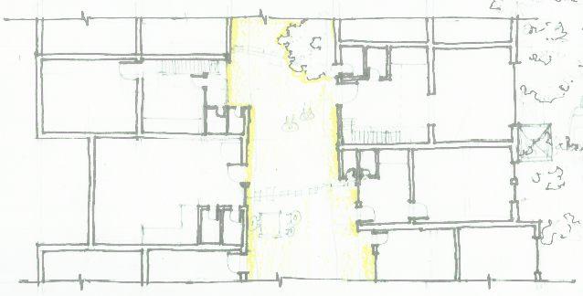
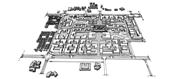
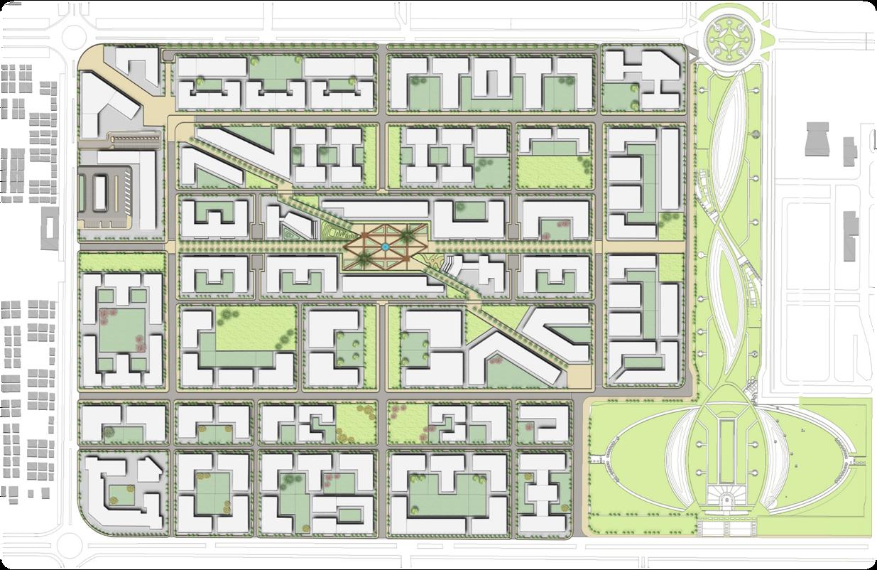
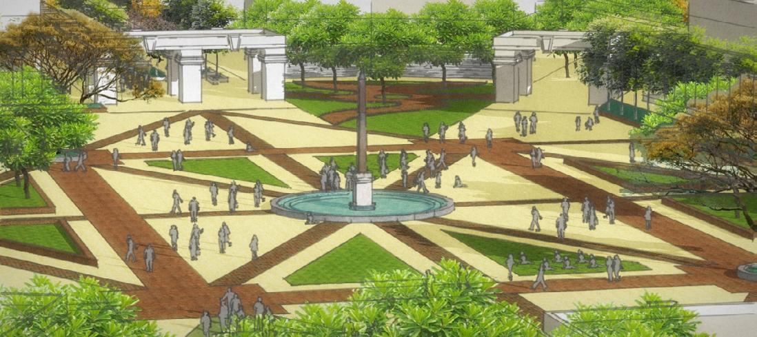
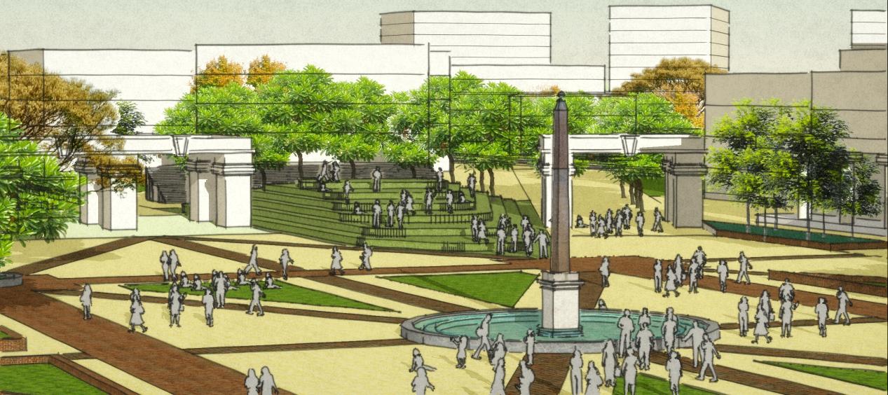
SECTOR 11 - PUBLIC PLAZA
PUBLIC SQUARE
PARKING LOT
PUBLIC SQUARE
EDUCATIONAL INSTITUTE
MIXED RESIDENTIAL COMPLEX
CITY MUSEUM
PUBLIC TOILET + ATM + AVM
COMMERCIAL SHOPPING COMPLEX
COLLONADE SHOPPING COMPLEX
MIXED RESIDENTIAL COMPLEX
SHOPPING ARCADE WITH FIXED VENDING
SHARED CROSSINGS FOR VEHICLES + PEDESTRIAN

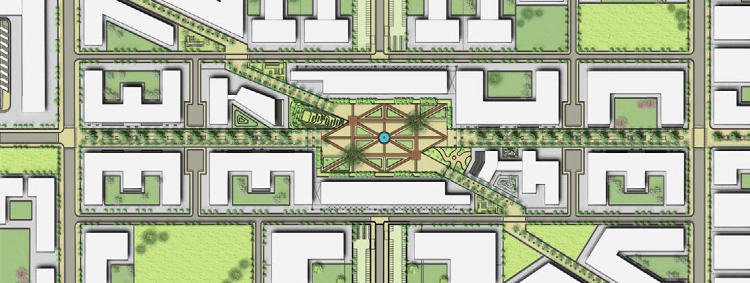
SHOPPING ARCADE WITH FIXED VENDING
MIXED RESIDENTIAL COMPLEX
PUBLIC ADDRESSAL PLATFORM
COLLONADE SHOPPING COMPLEX
COMMERCIAL SHOPPING COMPLEX
PUBLIC TOILET + ATM + AVM
CITY LIBRARY
0 500250125
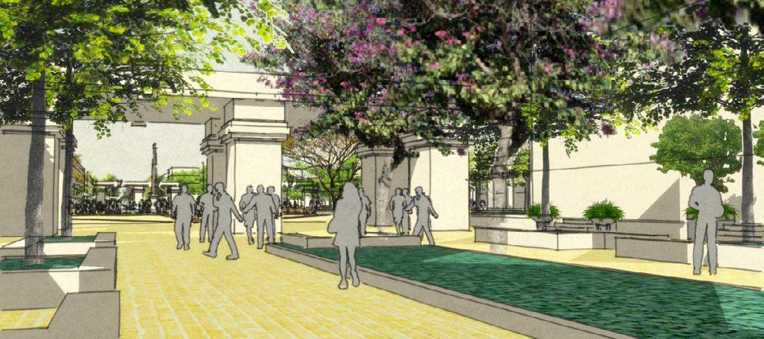
The pedestrian cut through that connects the Govt. and Private Offices to the transit hub at the corner of the Sector. Also it connects the Residential and Educational parcels to the Central Vista ( Swarnim Park ).
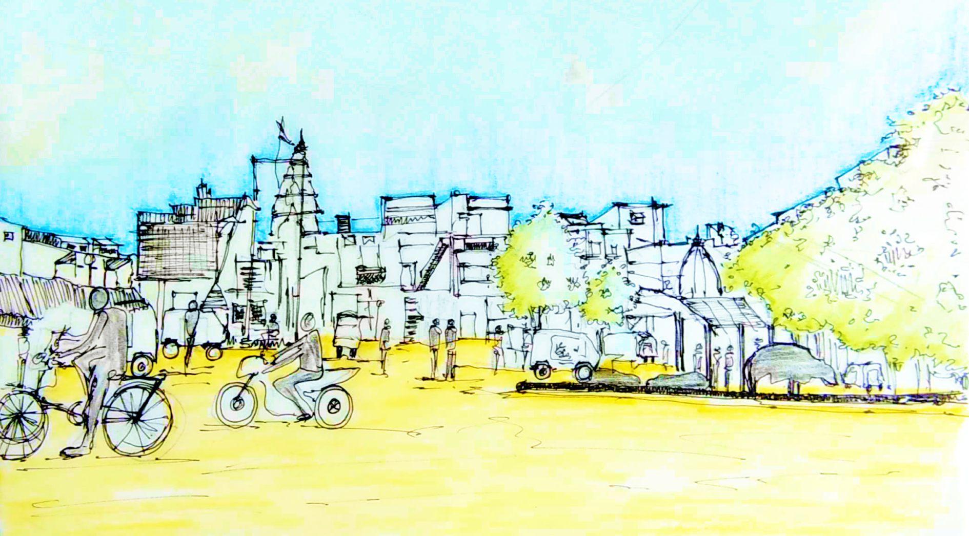
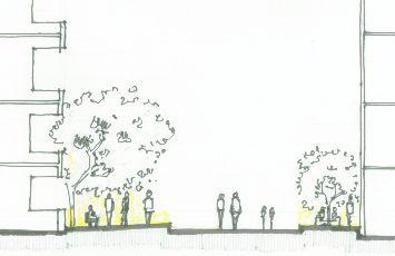
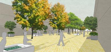
The plaza : This shows how people from different ethnicity and arrangements can utilize the plaza. Office people walking to commute, couple mingling, kids sitting in the lawn, while others just observing.
The Shopping Arcade : Just before entering the Plaza. The ARCH makes a welcoming gesture to the wanderer. Making the people want to enter the Plaza with joy and expectation to be retrieved by the community with warmth.
The Plaza:
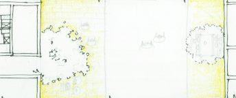
View of the Addressing Platform. And on other days just a slope and seating to sit on. This view also shows the scale of the built-mass around giving a fair relatable understanding of orientation.
03 URBAN EXPANSION STUDIO SEMESTER URBAN CONSERVATION OF KHADIA - II - AHMEDABAD
KHADIA II – A LIVING HERITAGE PRECINCT PROJECT BY CHETAN SODAYE GUIDED BY PROF. PURVI BHATT
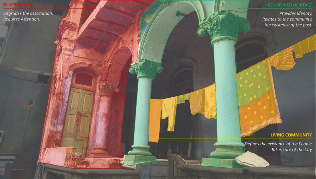
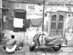
LOCAL LIVING COMMUNITY – It is the live component of the Walled City of Ahmedabad, that accounts for the largest contribution towards acquiring the nomination of the first ‘Indian World Heritage City’. It acts as the activator of the heritage and conserves its existence. Community is the care taker of the city customs, values, traditions all the tangibles and the intangibles.
Resident Local Community thus becomes the primary component of Khadia, that needs to be conserved and provided with Healthy, Livable, Uncompromised space with allowance to acquire the aspirations as and when it continues to grow and mature.
KHADIA – A LIVING HERITAGE PRECINCT
AIM TO ACHIEVE GOOD QUALITY OF
METHODOLOGY CONSERVING
SITE OF INTERVENTION THE EXISTING
OBJECTIVE TO FACILITATE AND ALLOW FOR CONTEMPORARY
URBAN LIFE - HERITAGE CITY - SPACES - CHANGES
URBAN LIFE - HERITAGE CITY - SPACES - CHANGES
Community Employment
Amenities
Public Spaces
Identity
Built Heritage Monuments
Listed Buildings
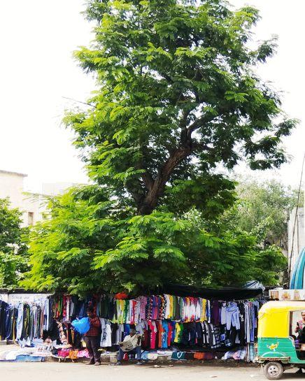
Streets Chowks Open Spaces
Religious Institutions
Pubic Institutions
Economic Changes (Employment)
Lifestyle Contemporary (Modern) Amenities Contemporary Associations
Achieving urban life in the heritage city by redefining spaces that adapt to the contemporary changes
URBAN
KHADIA
TRANSITION SPACES
TRANSITION SPACES – THE PUBLIC TO PRIVATE INTERFACE
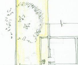
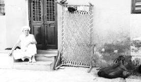
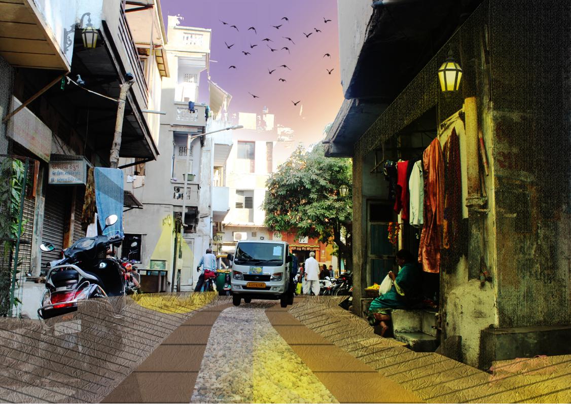
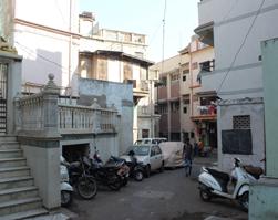
Walled City of Ahmedabad characterized by a particular built typology Pol Houses and their peculiar arrangements forming Pols, Dehlu, Sheri, Khancho, Khadki and Chowk.
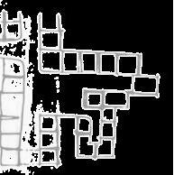
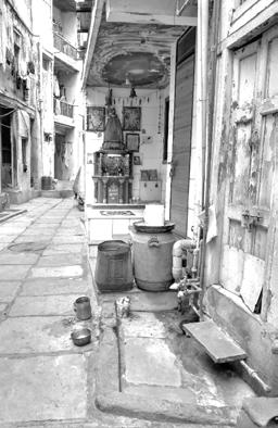
There are various elements of the Pol house that made the peculate and particular module of this typology resilient. The Otla, courtyard, Tank contribute to this resilient structure.
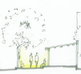
OTLA offers the transition, a ledge between the private and the public.
• Entrance Door / Porch
• Movable Furniture Khat
• Cattle Seating Space
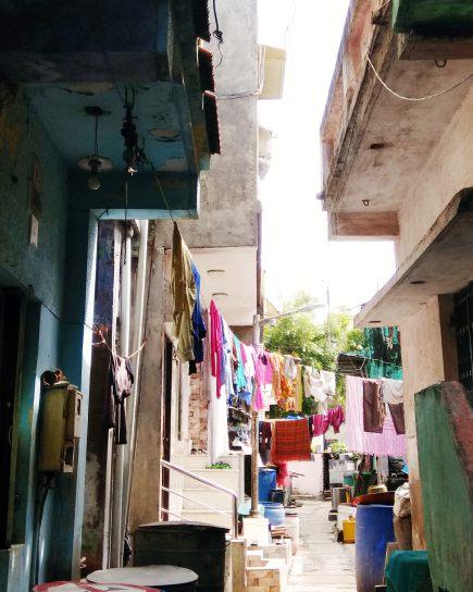
• Clothes Drying Space
• Utensil and Clothes Washing Space
• Vehicle Parking
Typical Pol ArrangementKey Plan
Typical section Typical Plan
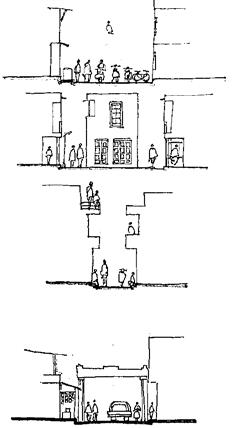
 Tank
Tank
–
KHADKI KHANCHO DEHLU CHOWK POL SHERI
1 2 3 4 5 6 7 8 1 2 3 4 5 6 7 8
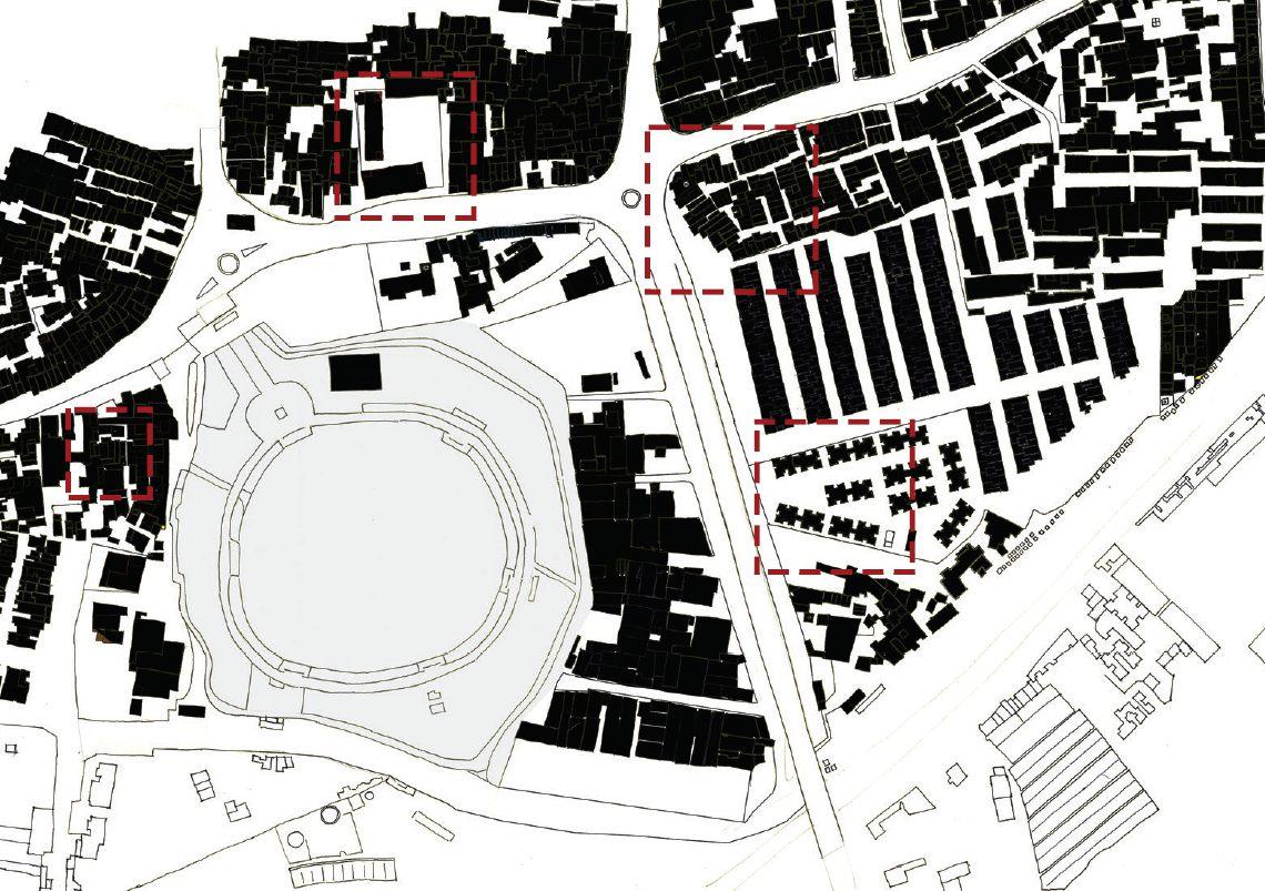
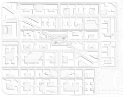
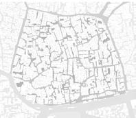
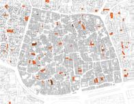
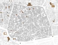
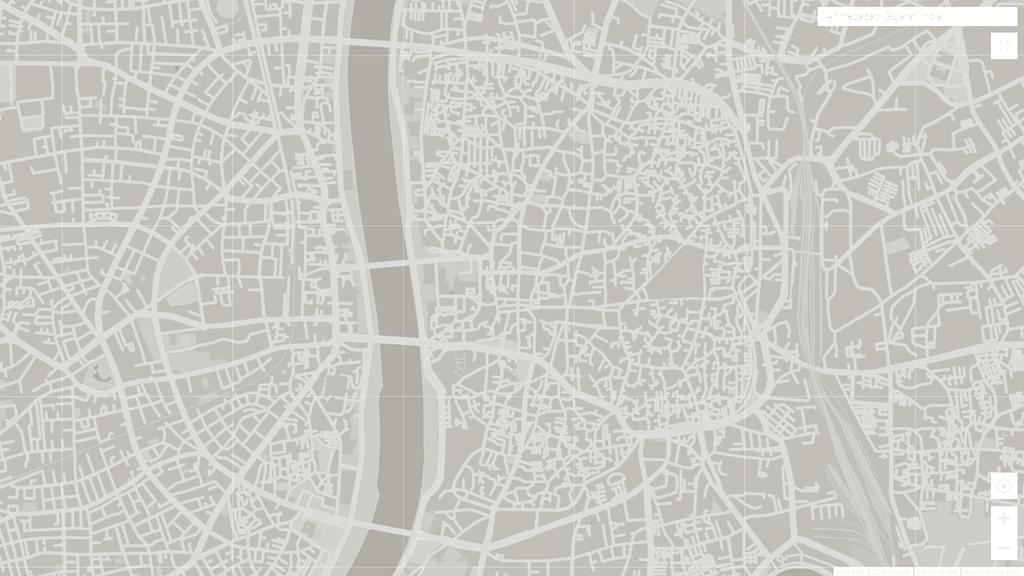
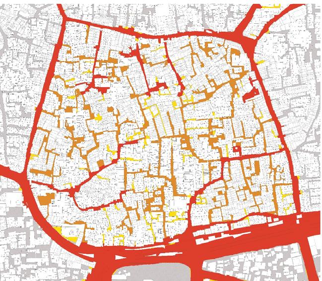
SITE STUDY AND ANALYSIS
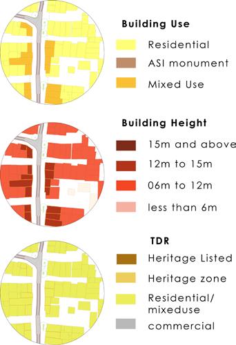
CONDITION MAPPING OF HERITAGE STRUCTURES
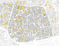
Total structures - 13
Abandoned 00%
Dilapidated 23% 3
Gentrified 07.50%
In use 69.50%
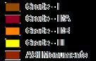
Grade llA
Total structures - 62
Abandoned 06.50%
Dilapidated 21% 13 Gentrified 06.50%
In use 66.%
Grade llB
Total structures - 193
Abandoned 03%
Dilapidated 23% 44
Gentrified 04.50%
In use 69.50%
Total
Dilapidated
Structures
Structures
Grade lll
Heritage
- 60
Heritage
– 300Total Structures – 6000 300
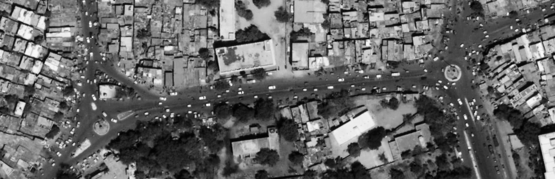
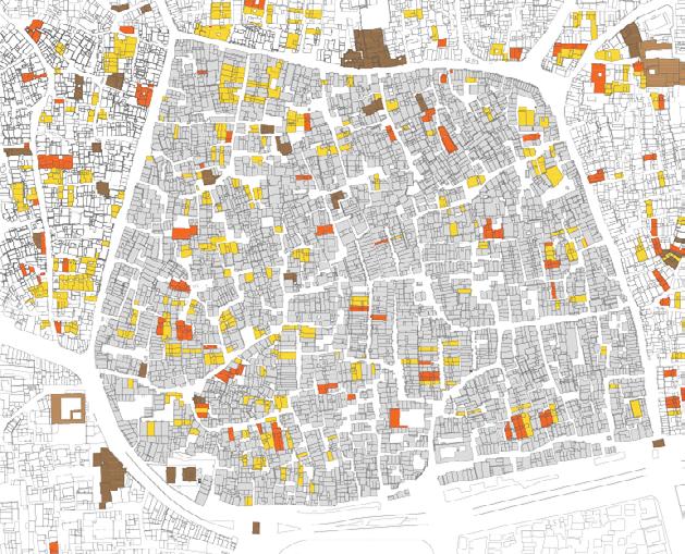
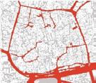
SITE
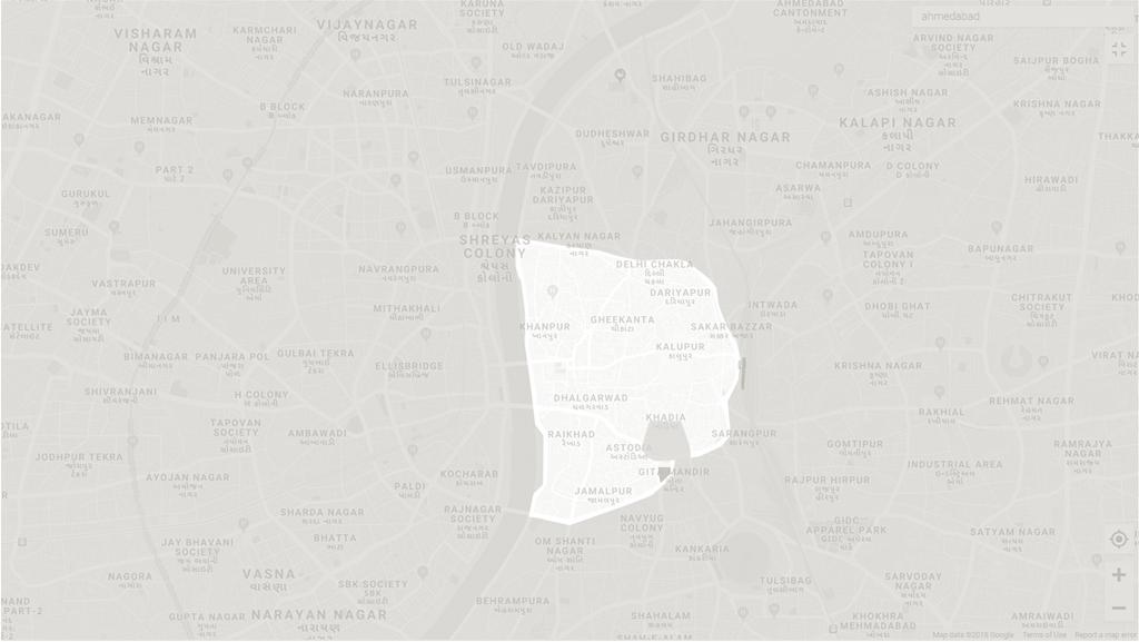 KALUPUR RAILWAY STATION
GITA MANDIR INDUSTRIAL AREA
EDUCATIONAL
KANKARIA LAKE
EAST CBD
WEST
CIVIL HOSPITAL
TOWN
BHADRA FORT
KALUPUR RAILWAY STATION
GITA MANDIR INDUSTRIAL AREA
EDUCATIONAL
KANKARIA LAKE
EAST CBD
WEST
CIVIL HOSPITAL
TOWN
BHADRA FORT
PRECINCT
CBD
HALL M J LIBRARY AMC
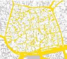
V S HOSPITAL CITY WIDE RAPID CONNECTIVITY: Existing BRTS Route with Existing Stations Proposed new METRO Routes
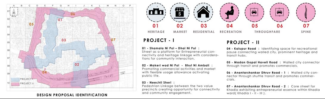
INTRODUCTION KHADIA II
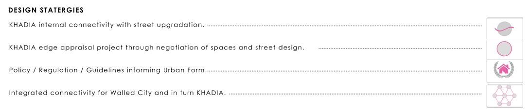
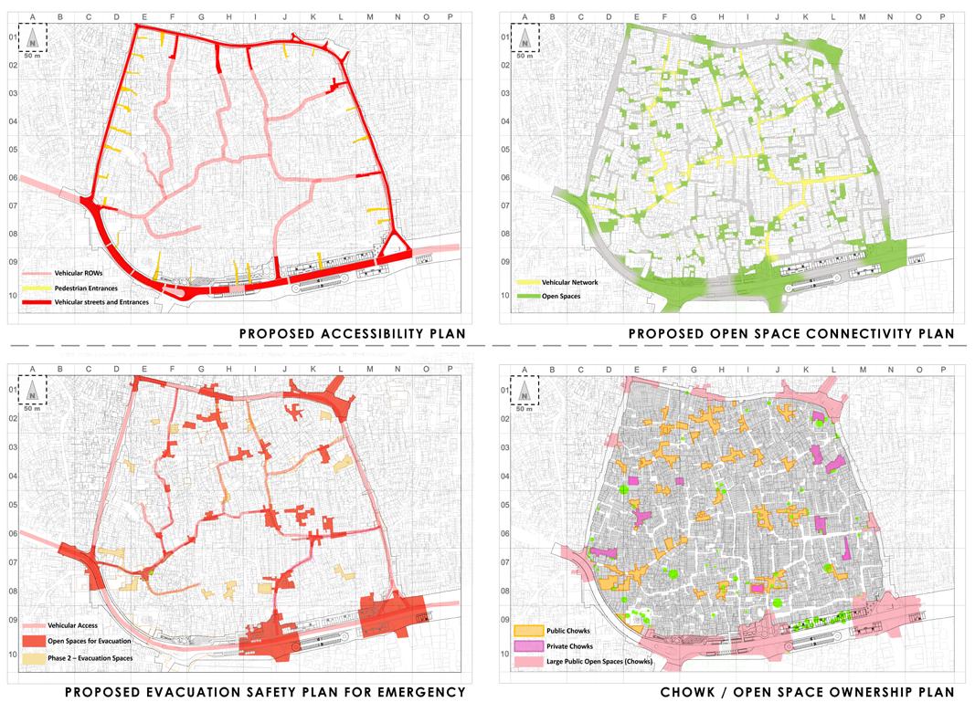
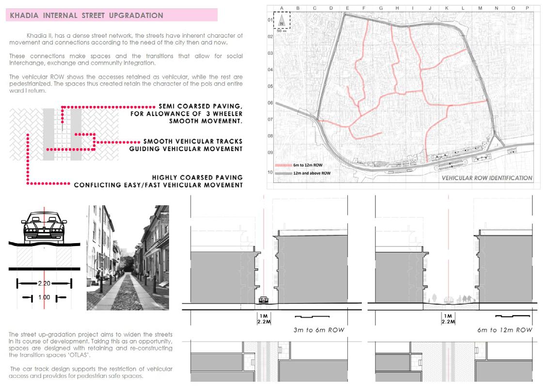
DESIGN STRATEGIES
MOBILITY PLAN
SHUTTLE SERVICE :
Every demarcated route has at least 1 Metro Connection and 1 BRTS Connection

Every route is a strategy to make easy access to PT services allowing for multiple chances for the user.
DESIGN STRATEGIES
WALLED CITY CONNECTIVITY
SHUTTLE SERVICE :
Every demarcated route has at least 1 Metro Connection and 1 BRTS Connection
Every route is a strategy to make easy access to PT services allowing for multiple chances for the user.
DESIGN STRATEGIES

MOBILITY PLAN
Proposed Mobility Routes
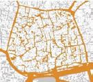
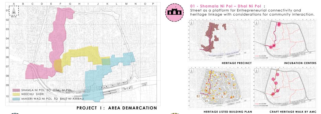
Identified Heritage Precinct
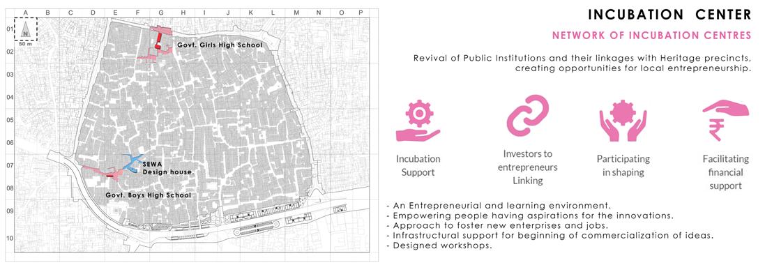
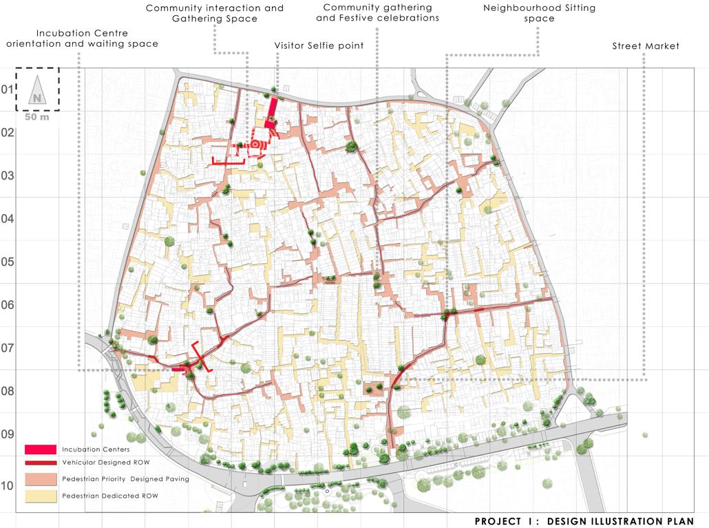
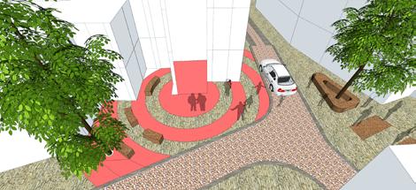
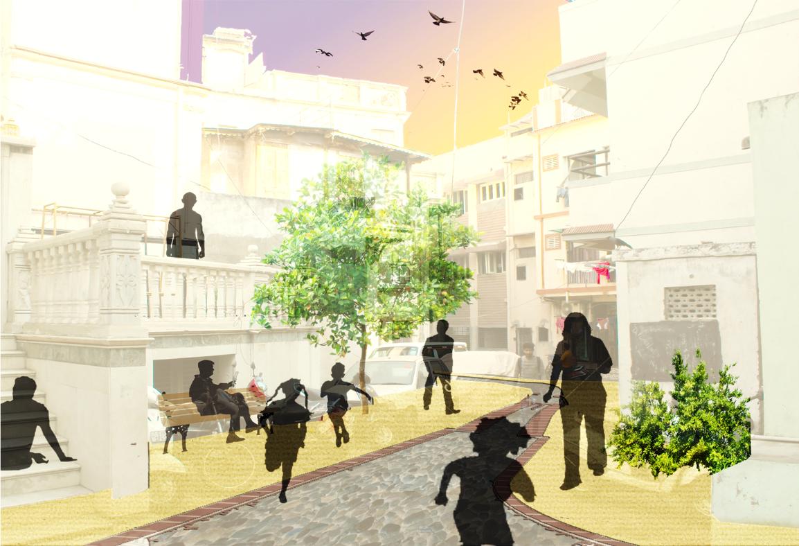
Incubation centers not only act as agents of activation for local businesses. The frontages of the same are designed as gathering spaces and pause points. Interaction spaces for the community, visitors and tourists.
Heritage walk hence conceived will have start point identified at this, demarcating point of focus for various events.
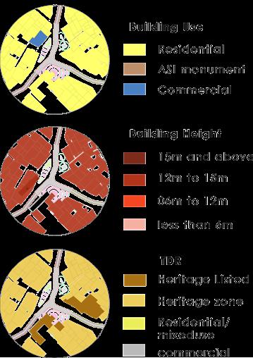
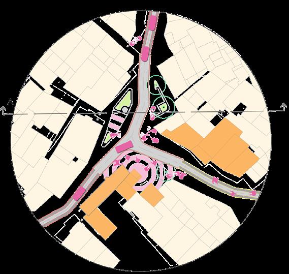
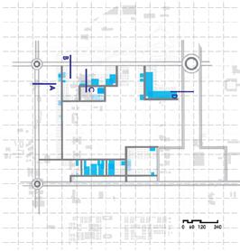
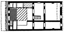
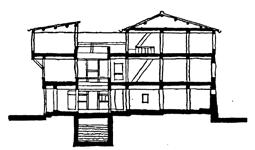
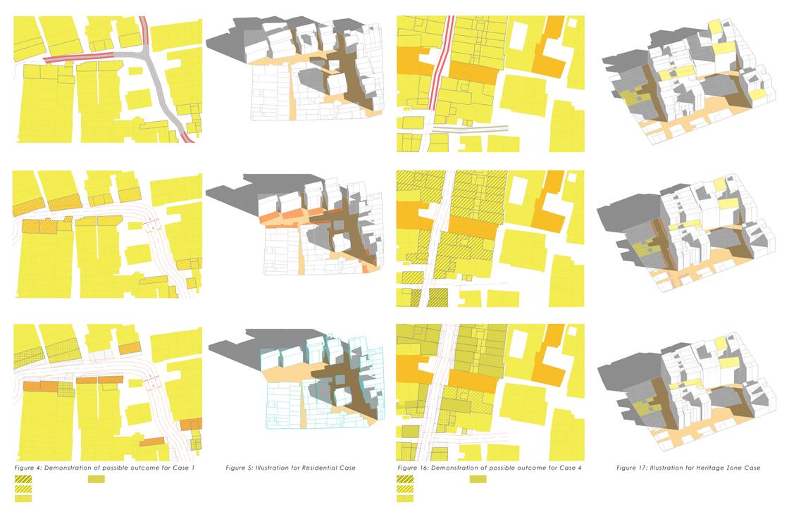
BUILT FORM ILLUSTRATION – HERITAGE ZONE DETAIL PLAN AT ‘A’ SECTION AT AA’
USE ZONE
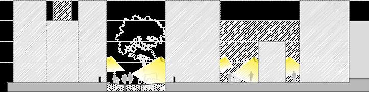
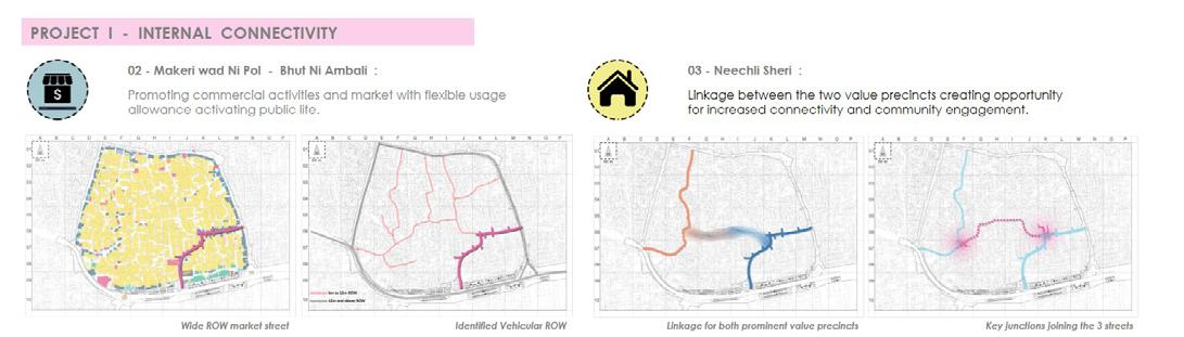
Market spaces and mixed use environment requires easy movement possibilities, the design demarcates permissible vehicular movement providing for safer pedestrian movements.
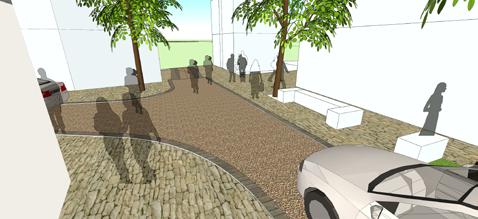
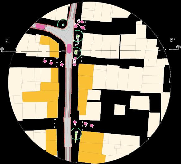
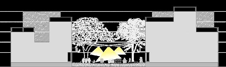
Seating spaces with ideal locations for trees, allow for shade and introduction of lost elements that will instigate communal bonding and interaction.
Safer walking environments also make streets chirpy and exciting avenues for kids rising the liveliness in the vicinity
BUILT FORM ILLUSTRATION – MIXED
DETAIL PLAN AT ‘B’ SECTION AT BB’
13
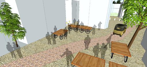

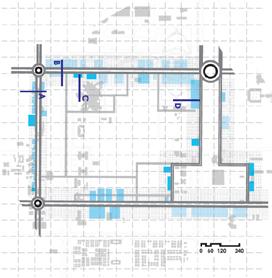
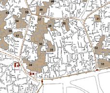
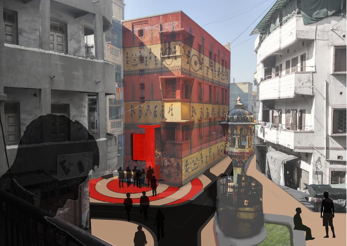
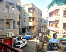
 RASIK CHOWK Incubation Centre
RASIK CHOWK
Gathering and Sitting Space in front of Incubation Centre
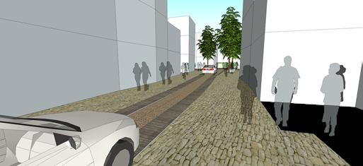
MIXED USE–Vehicular ROW
RESIDENTIAL Vehicular ROW Restriction on narrow lane
MIXED USE Market and Chowk
RESIDENTIAL Vehicular ROW Vehicular ROW and Chowk
RASIK CHOWK Incubation Centre
RASIK CHOWK
Gathering and Sitting Space in front of Incubation Centre
MIXED USE–Vehicular ROW
RESIDENTIAL Vehicular ROW Restriction on narrow lane
MIXED USE Market and Chowk
RESIDENTIAL Vehicular ROW Vehicular ROW and Chowk
DESIGN & BUILT FORM ILLUSTRATION
B- 504, Saileela, Near Mysore Colony, RCF Company Road, Chembur, Mumbai - 400074 Knowledge has no value unless you put it into practice - Anton Chekhov 9545269244ar.chetansodaye@gmail.com
