P O R T F O L
selected works 2022
I O
CHIARA COLICCHIO


CHIARA COLICCHIO chiaracolicchio@virgilio.it +39 3884455050

2021/2022
CREAM estudio
-Public works and interior renovation projects.
06-2021 V.110L
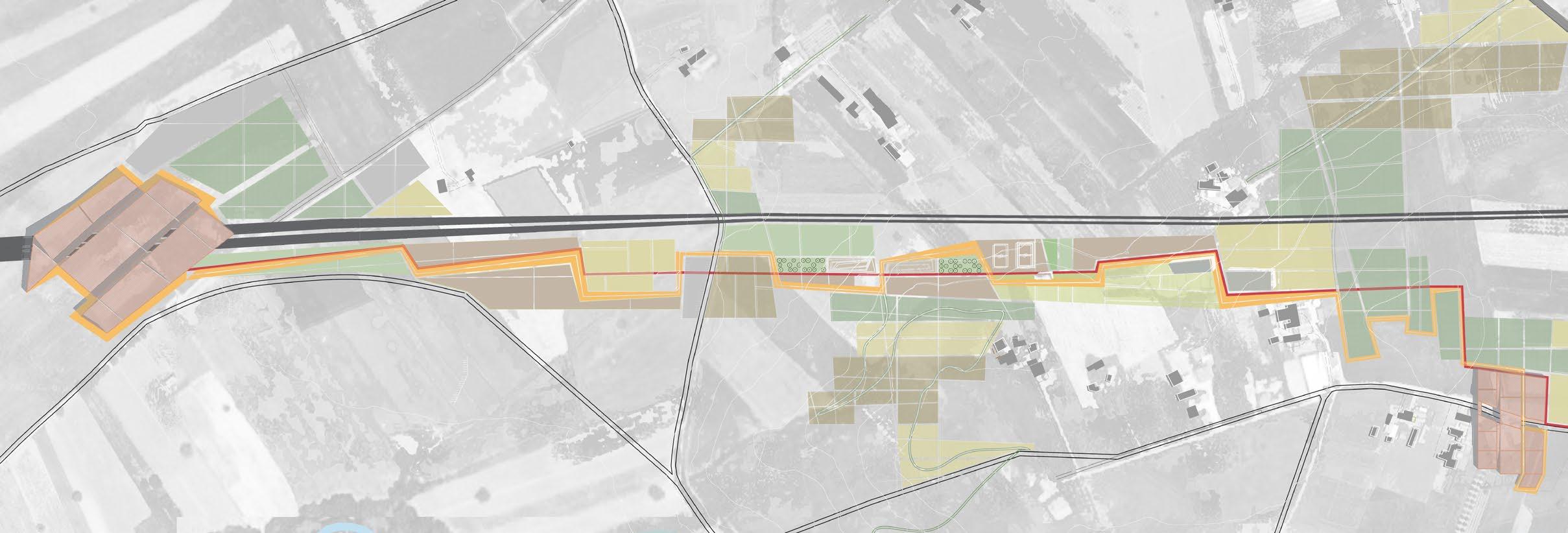
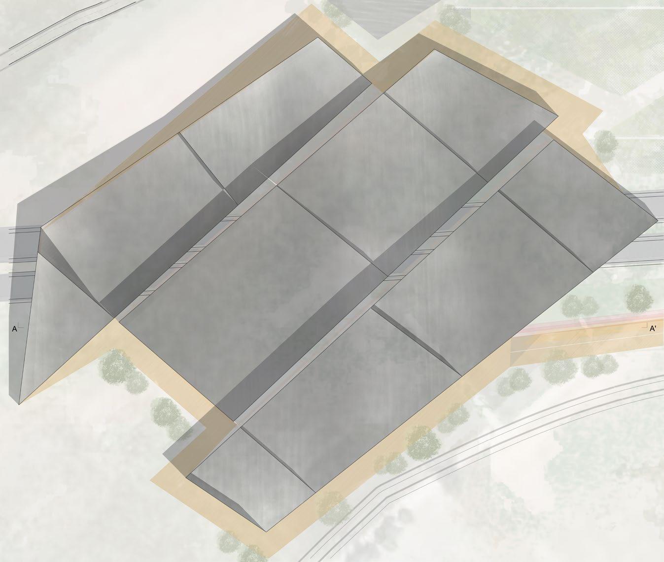
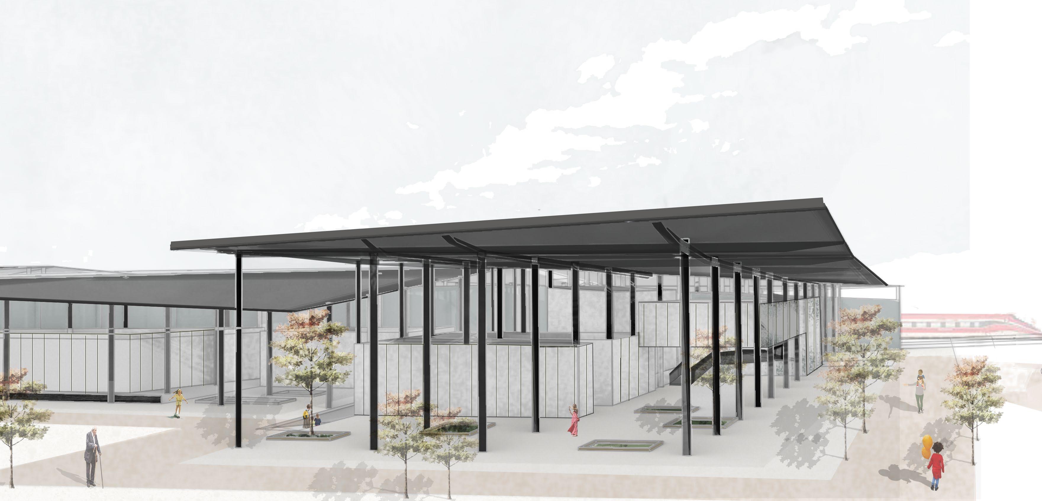
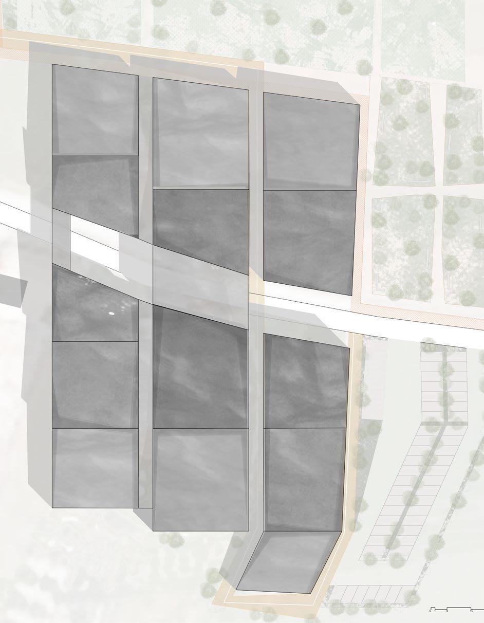
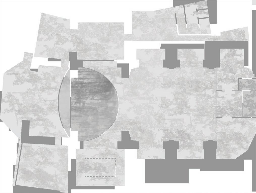
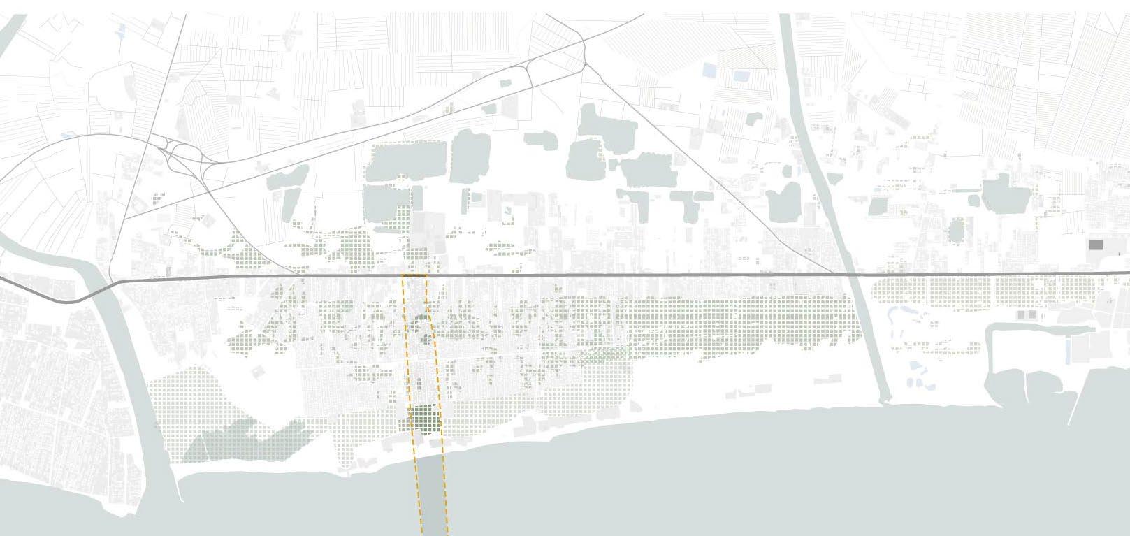
-Landscape and Architectural design of the Hirpinia station and the archaeological park in the area of Fioccaglie, Flumeri
Prof. Pasquale Miano
Arch. Francesca Coppolino
02-2021
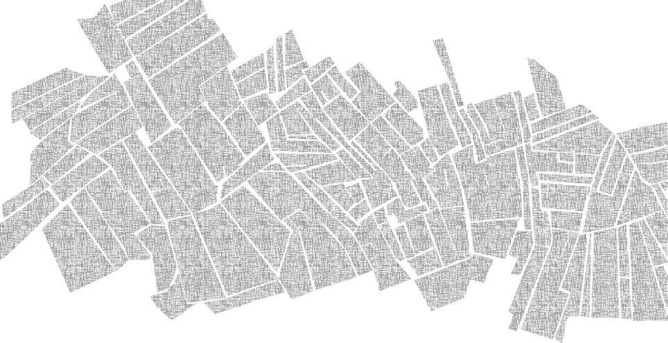
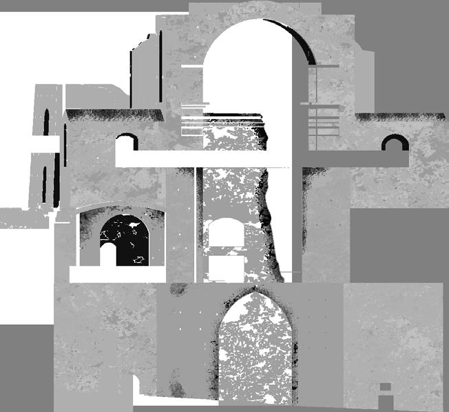
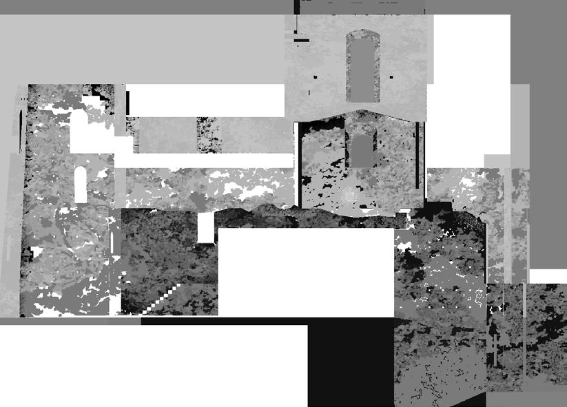
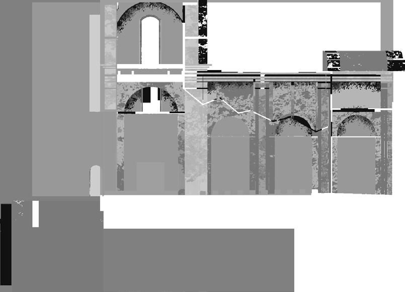
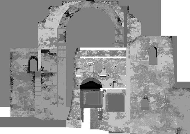
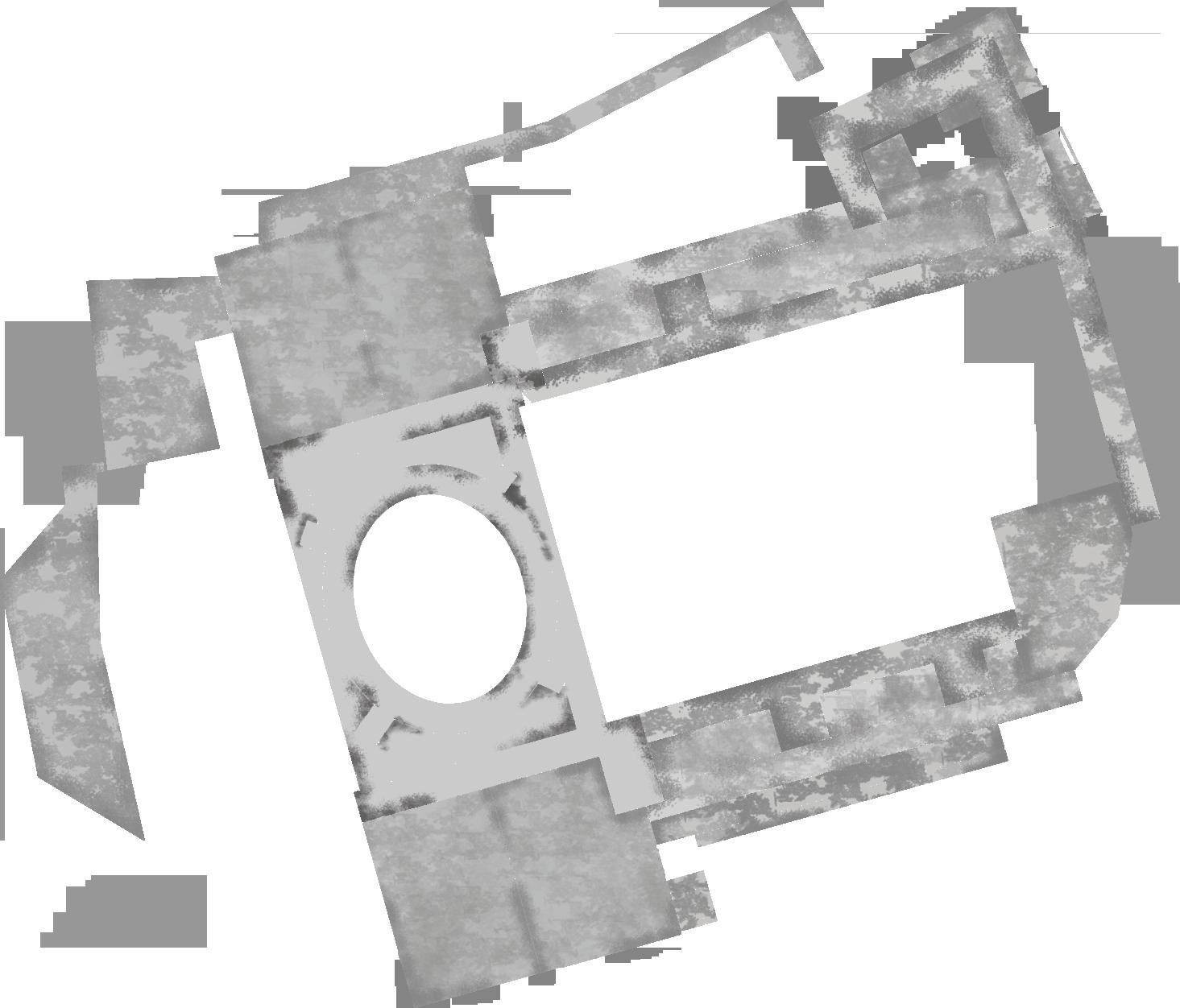
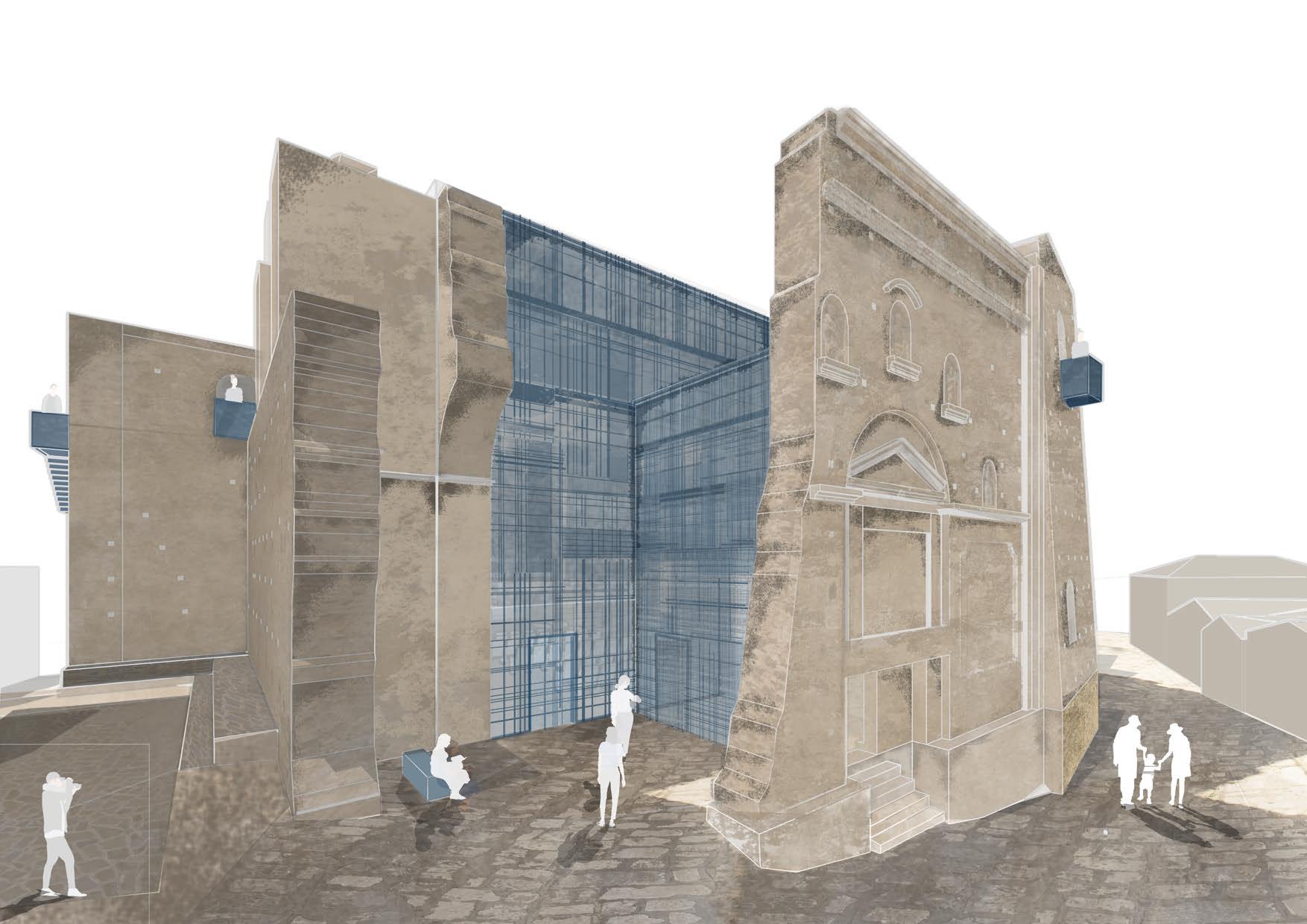
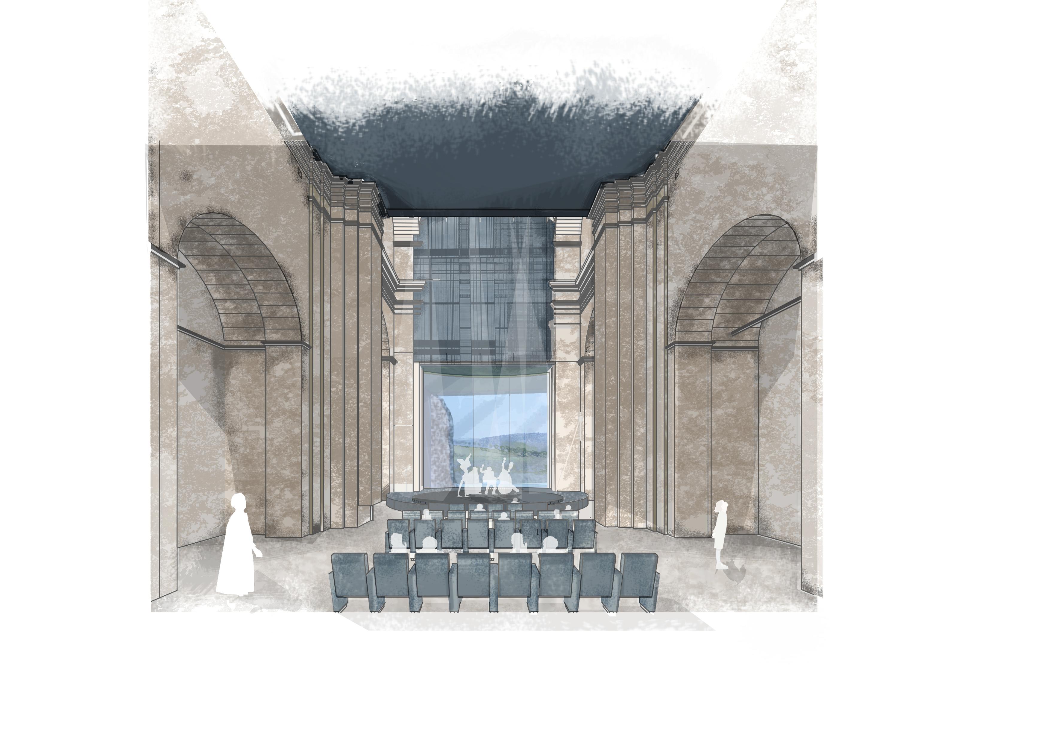
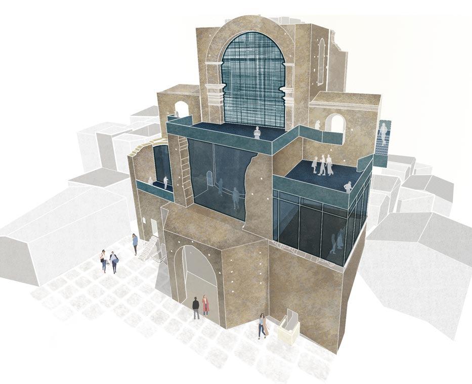
-Architecture competition and exhi bition on the reuse of the Fallen Church (Chiesa Diruta) of Grottole, Matera.
Arch. Jaquelin Chiarastella Buono Arch. Greta Caliendo Arch.Chiara Colicchio Arch. Amalia Colonna
A.A 2019-2020
-Revival project of Catel Volturno Prof. Pasquale Miano
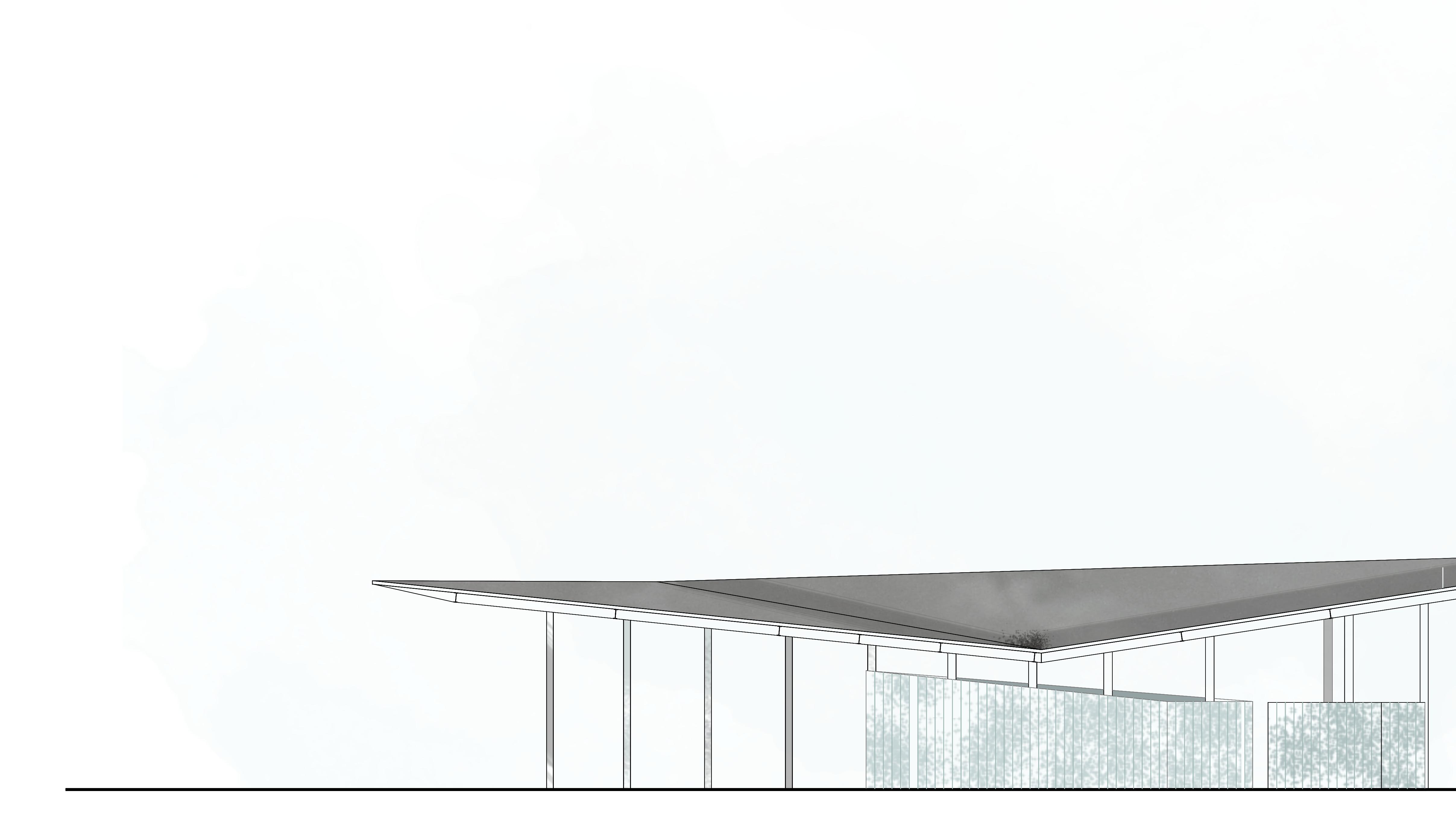
design of the Hirpinia station and the archaeological park in the area of Fioccaglie
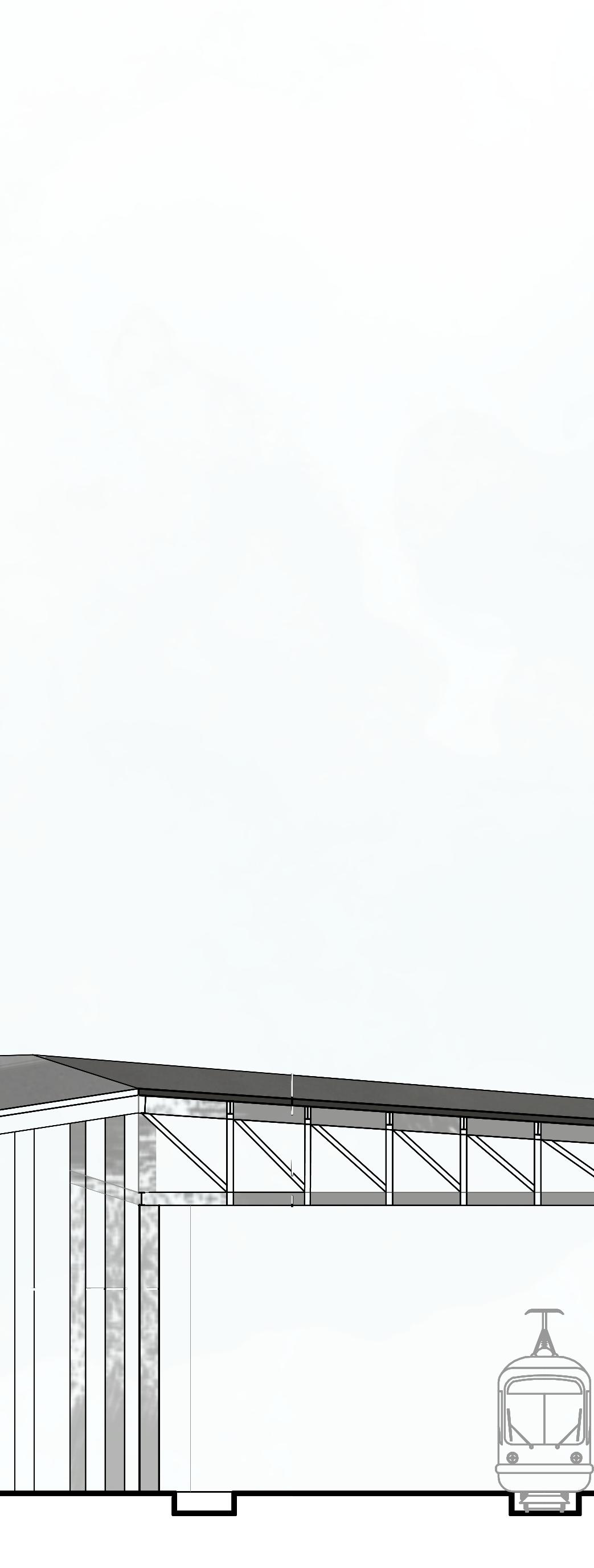
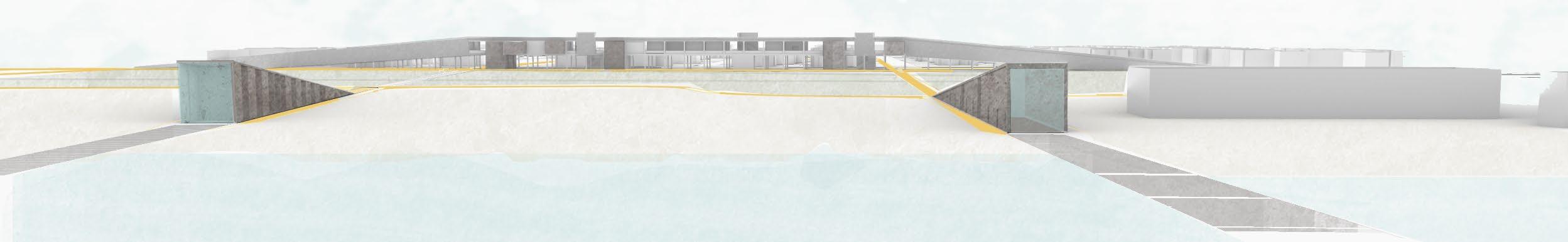
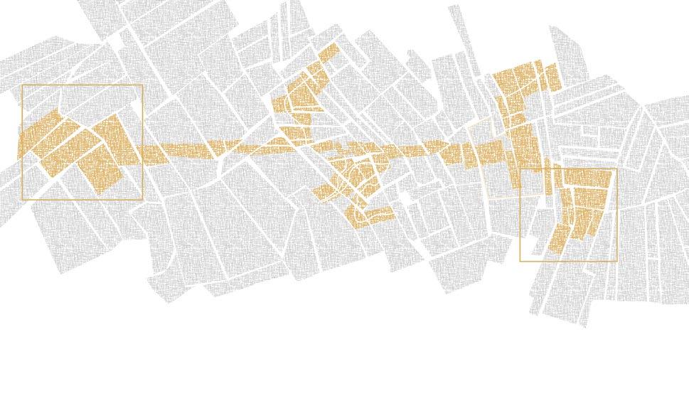
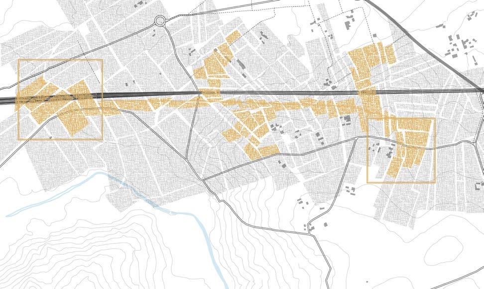
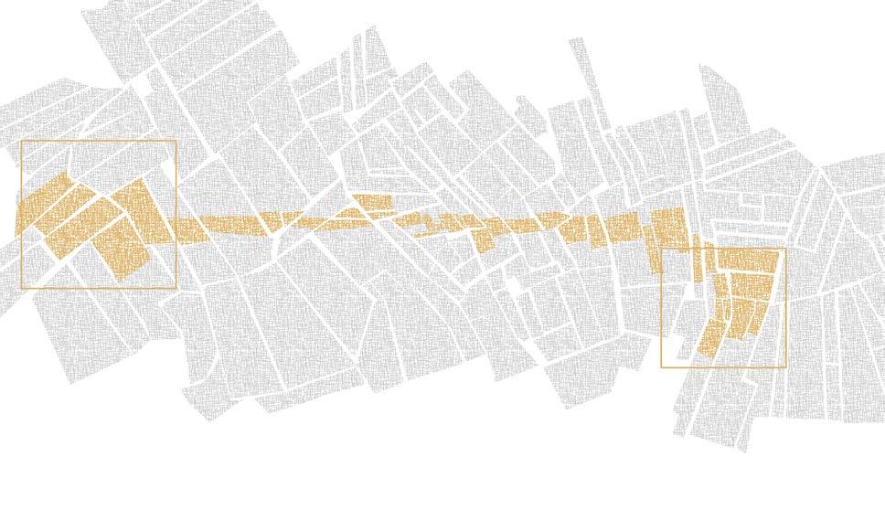
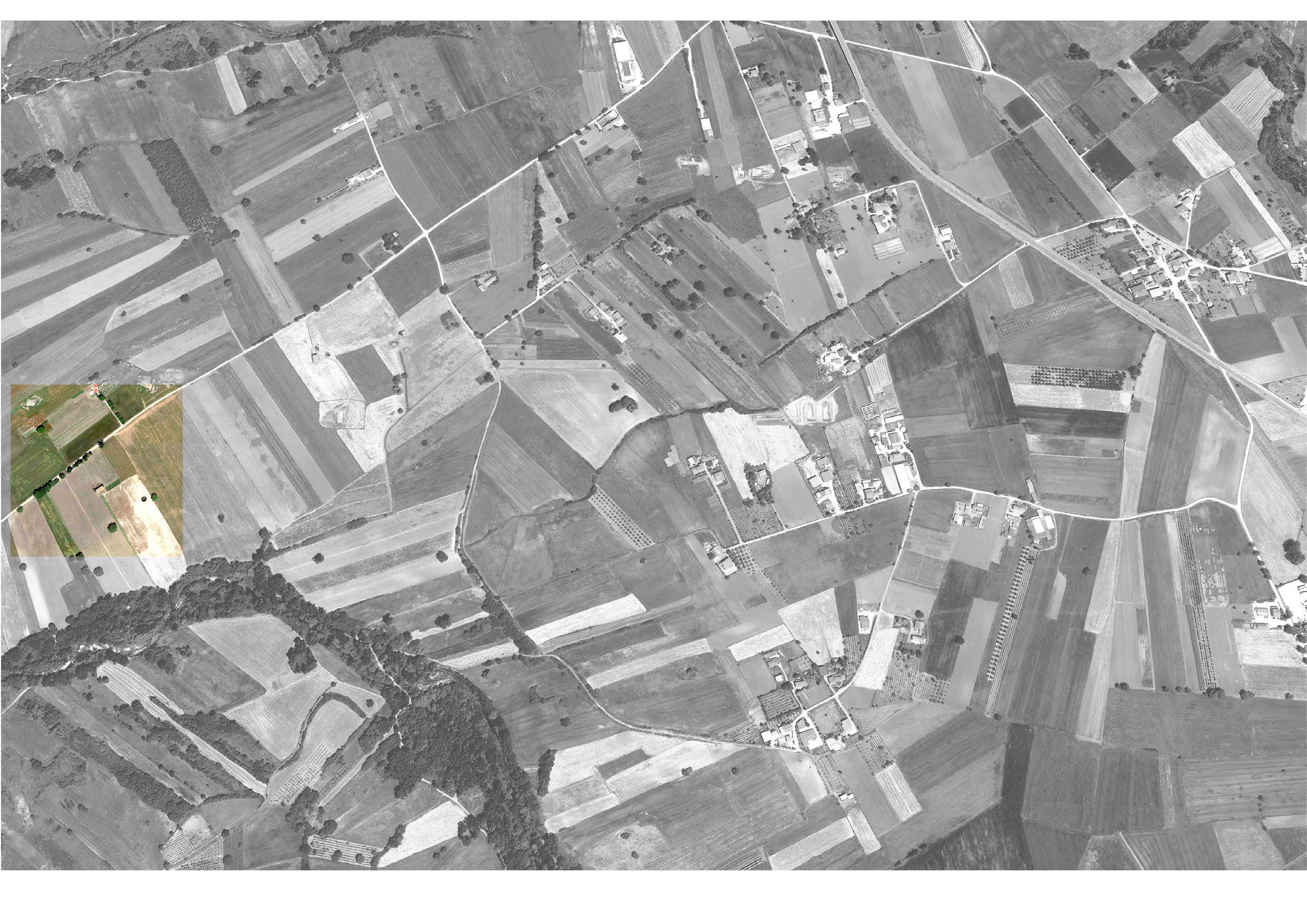
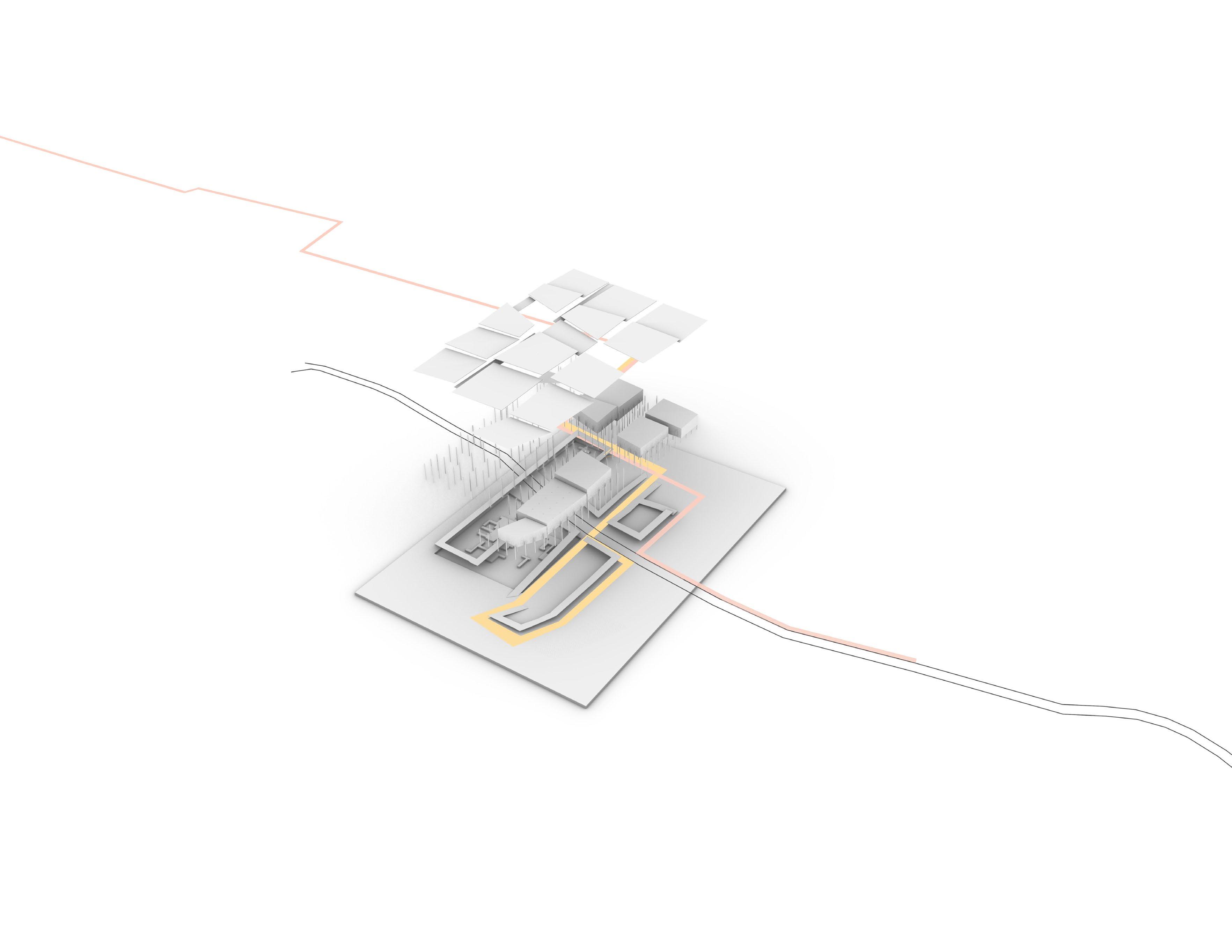
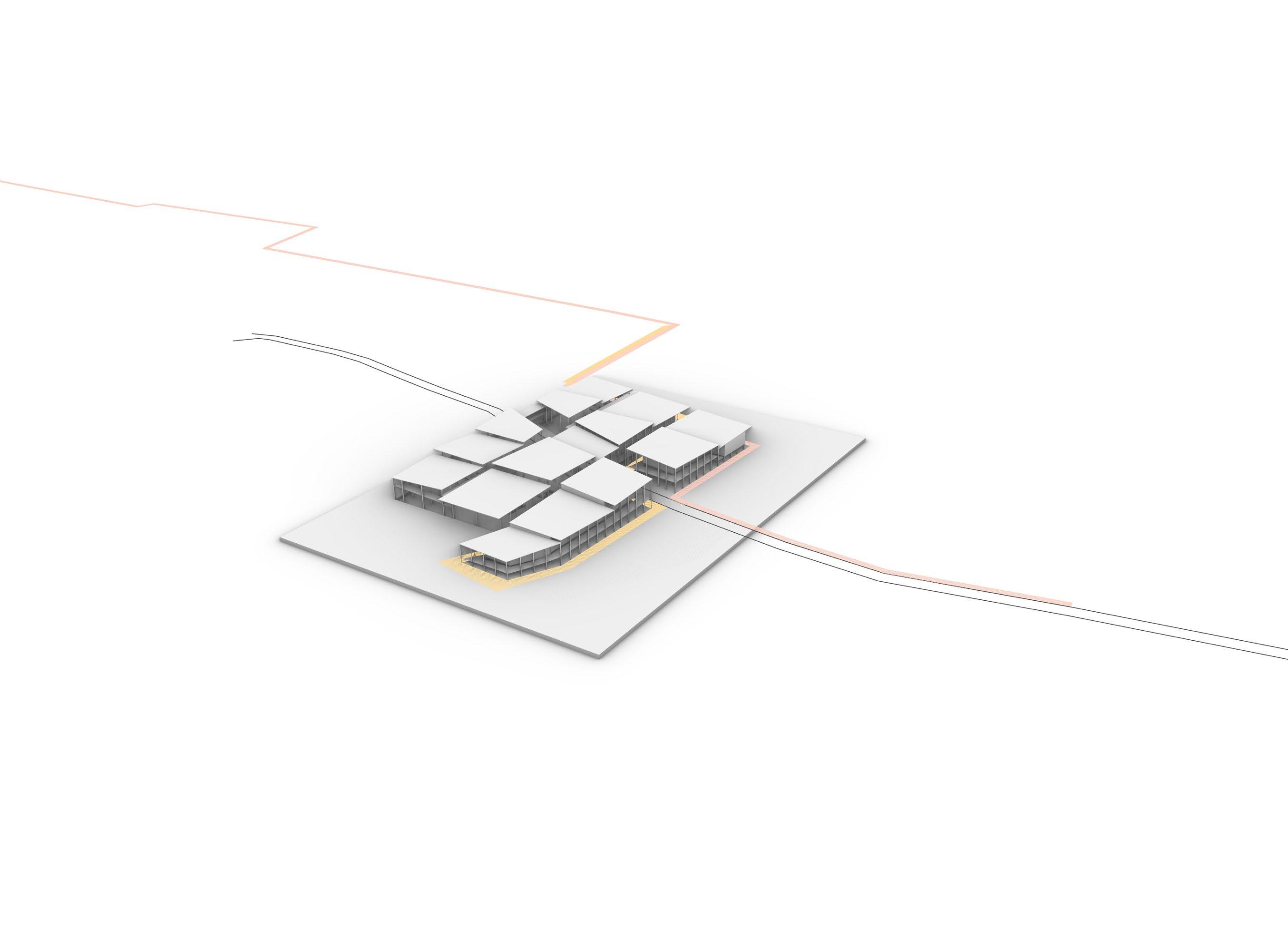
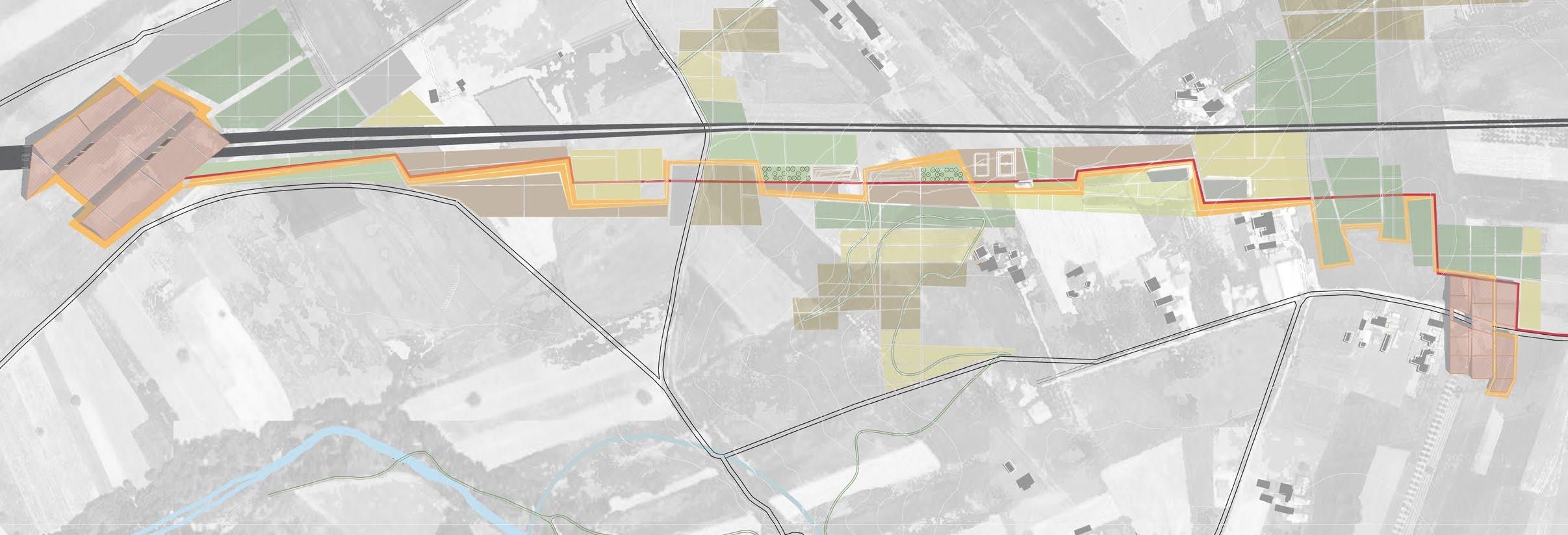
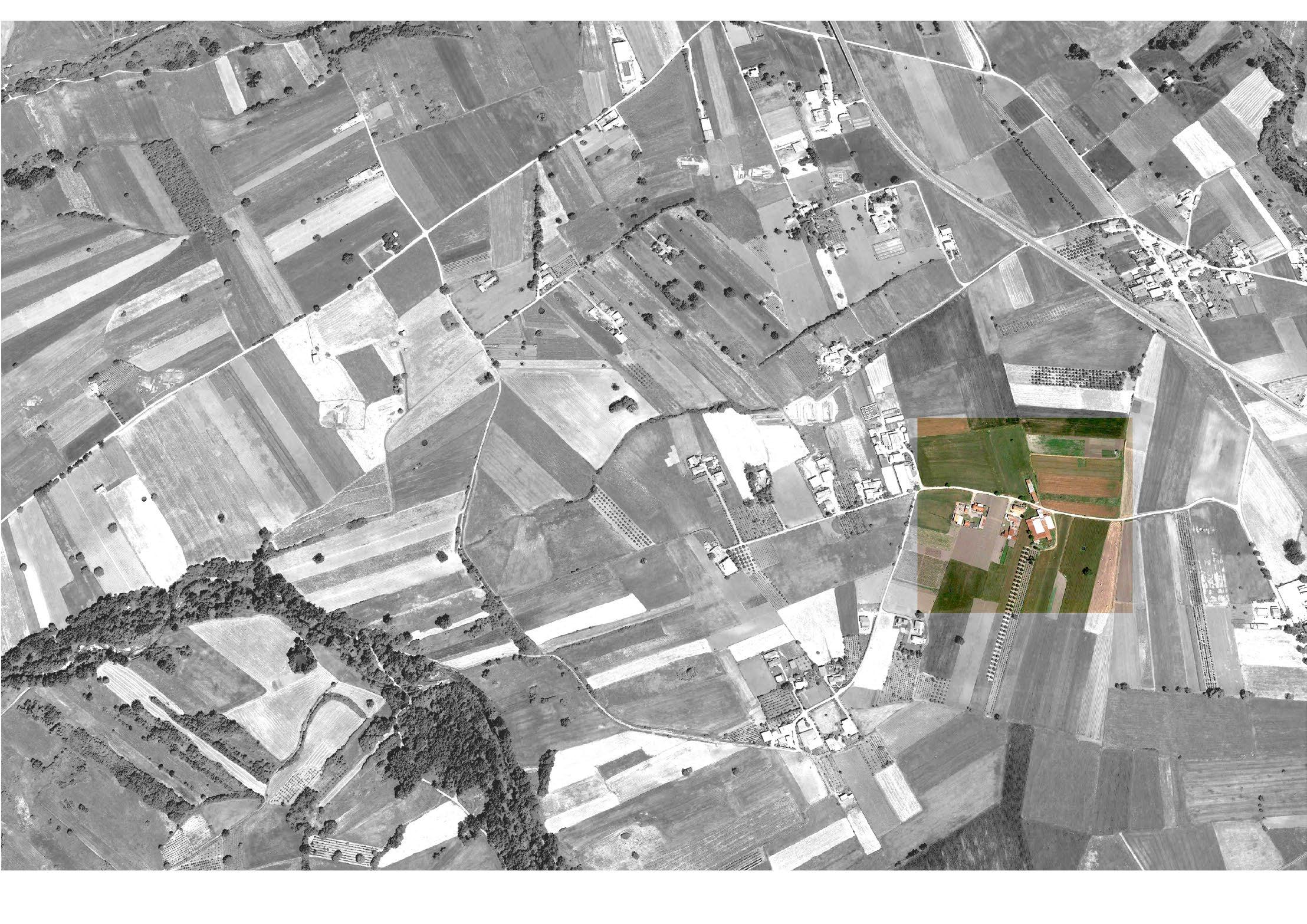
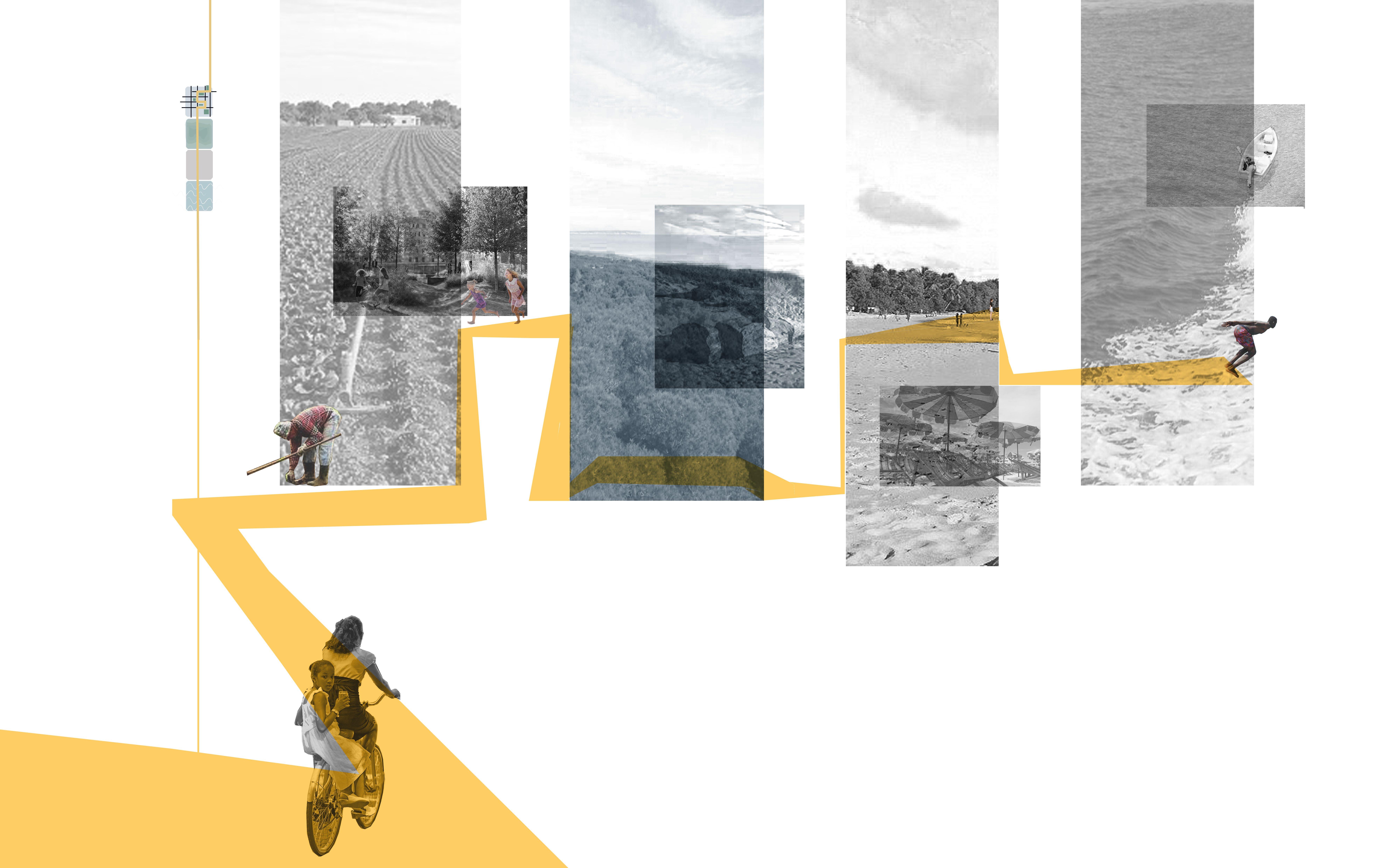
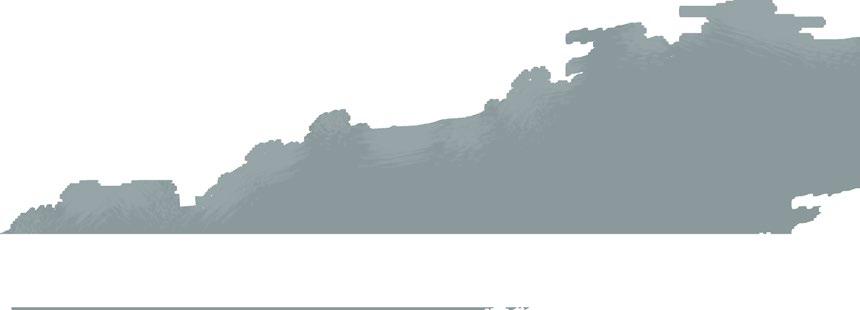
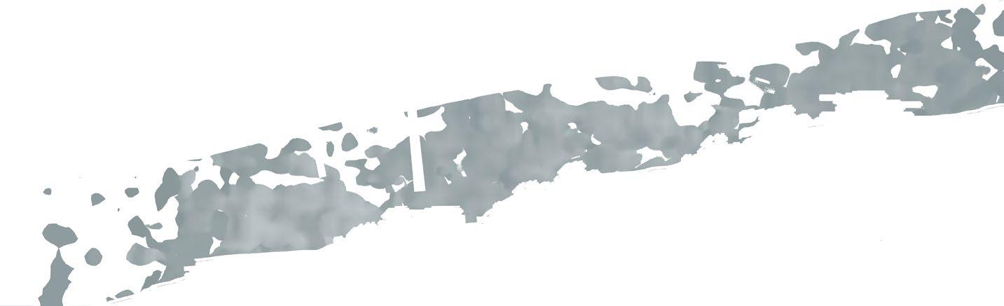
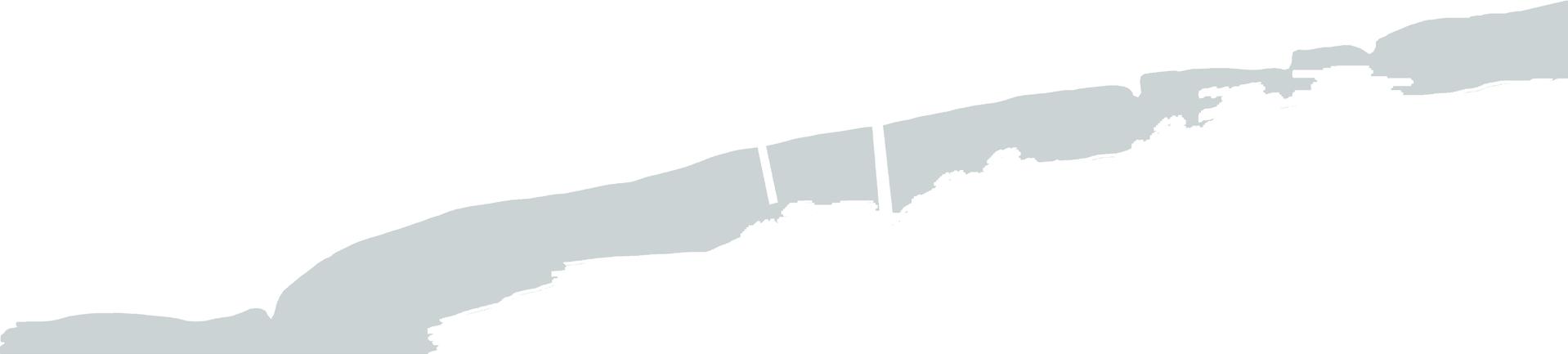
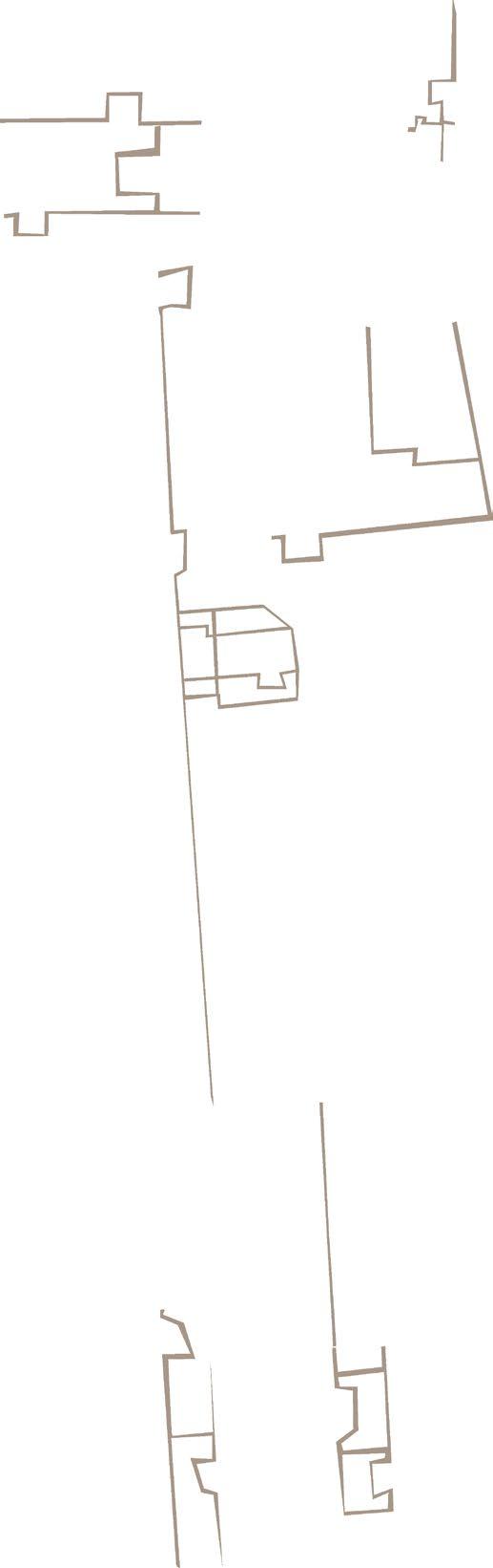
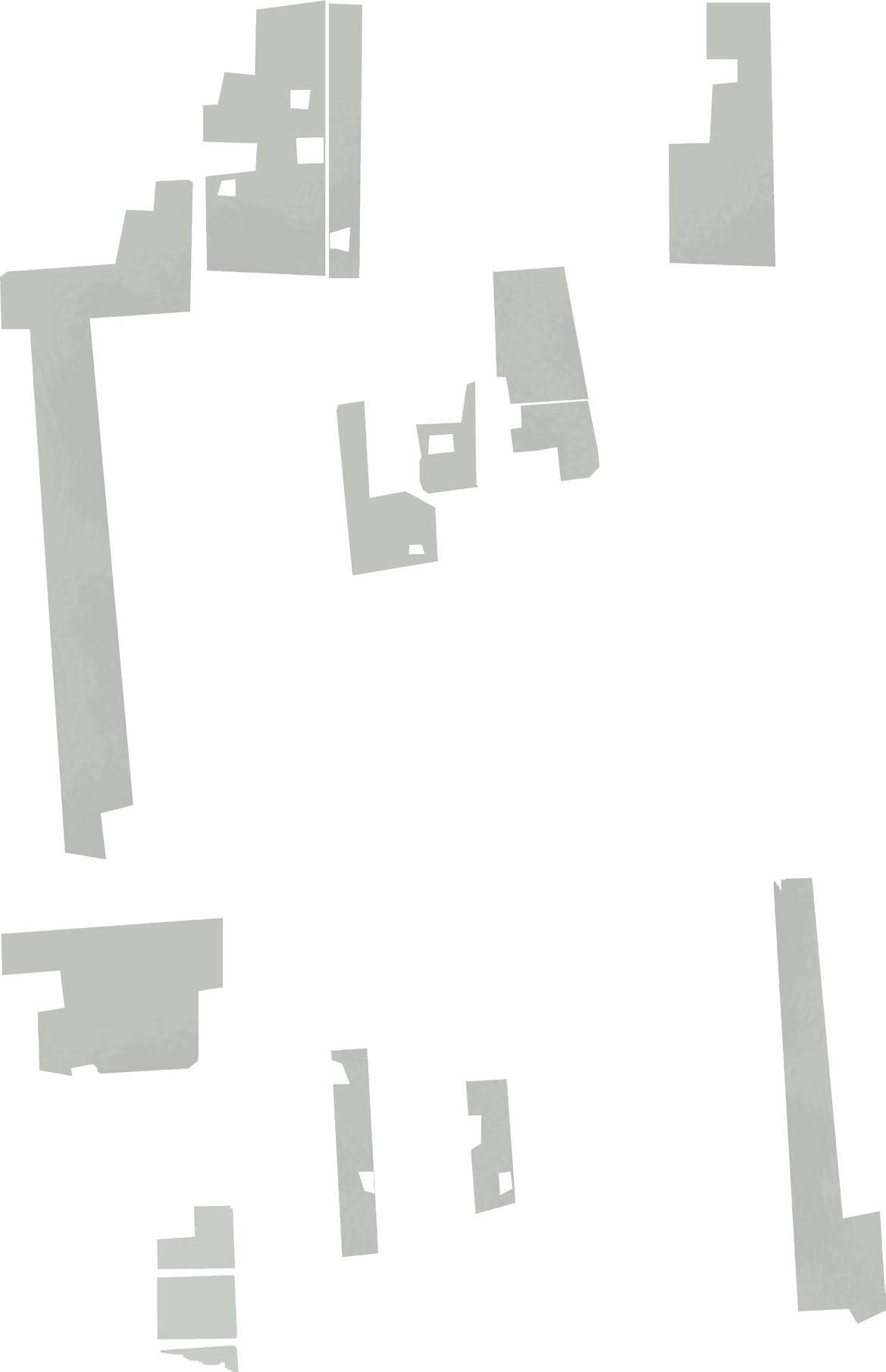
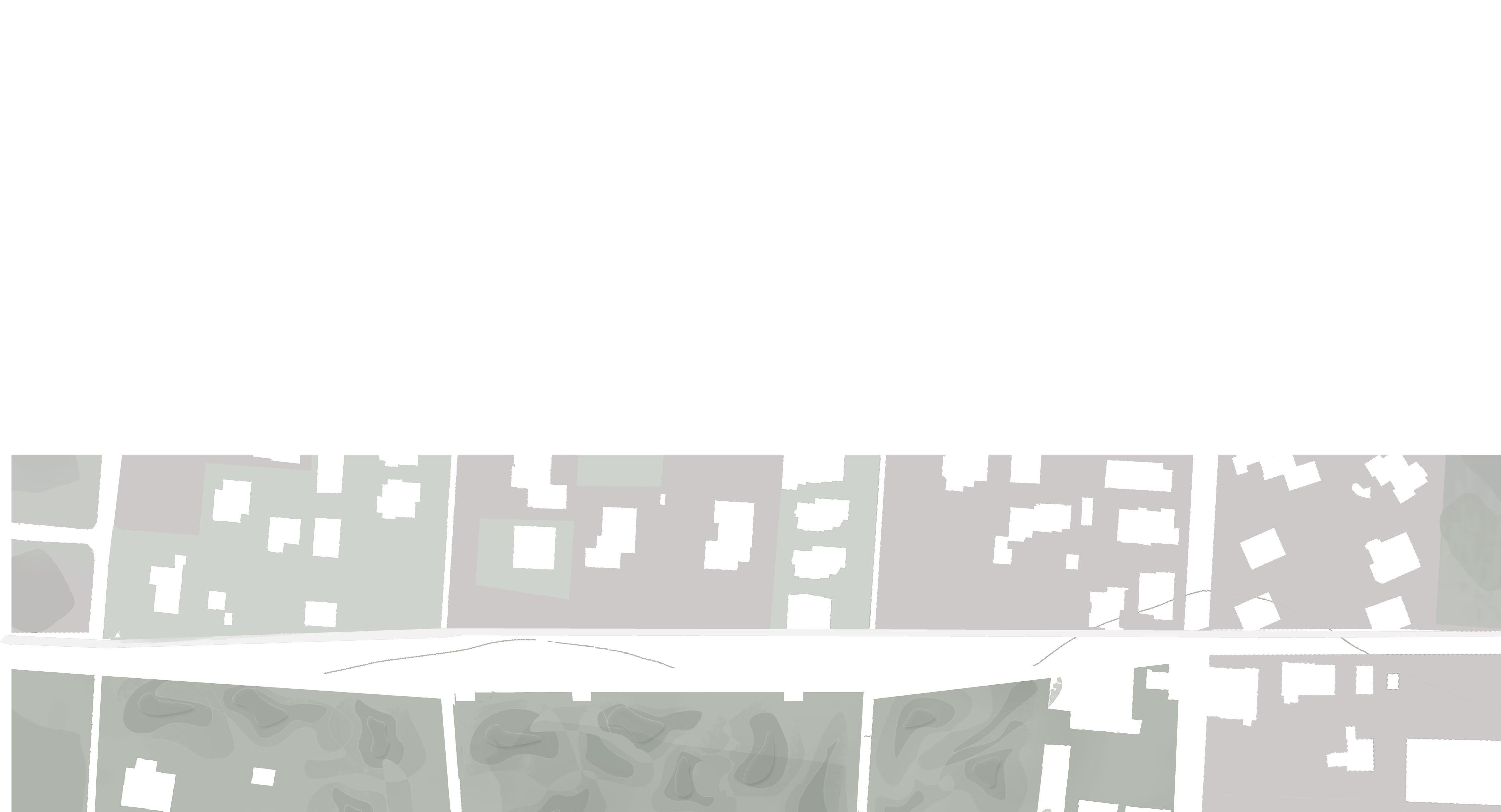
We are in the province of Avellino, in the territory of Irpinia, or rather in the Ufita mountain community, an area with a lar ge territorial, agricultural and wooded area to which it corresponds, however, a low population density and the presence of small settlements sedimented and poorly connected with each other and with larger cities. Despite the criticality, the territory has much potential linked to the landscape value of the area, its agricultural vocation and the presence of numerous archa eological remains, to be revalued. In particular the territory of Flumeri, a town located in the center of Irpinia, represents a promising infrastructure and landscape node, given the presence of archaeological remains on the nearby hill of Fioccaglia.


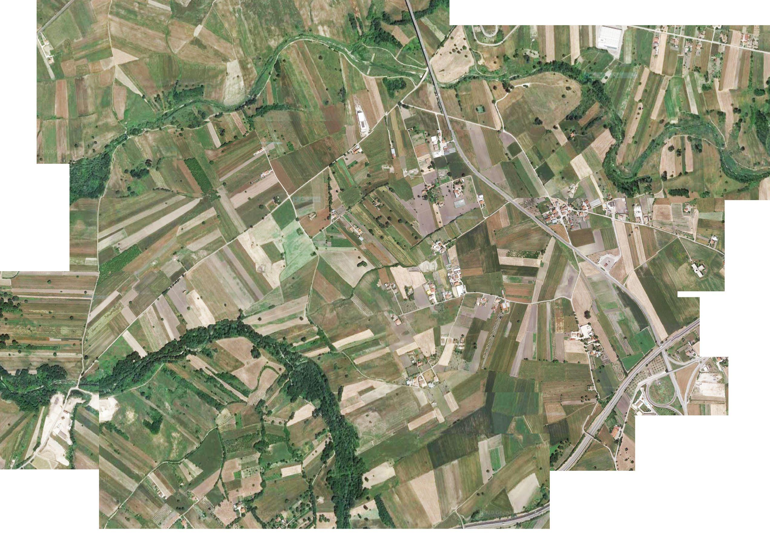
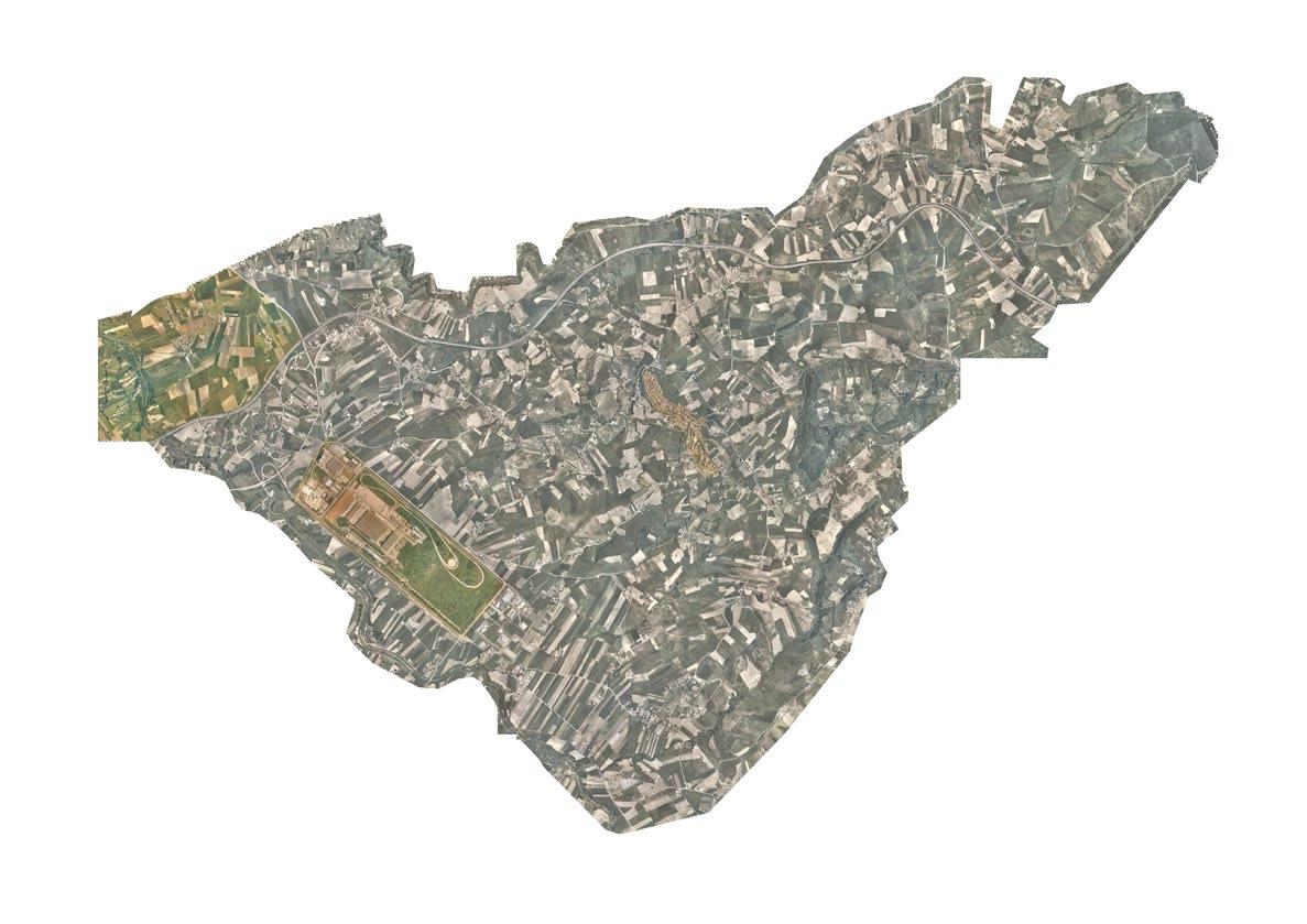

The Municipal Planning Plan of Flumeri provides in this area the new railway station Naples-Orsara and the archaeological park, which could become the tool to ensure the economic and cultural development of the territory.
The project strategy aims to make the traces that define and mark the territory of Irpinia the design tool.
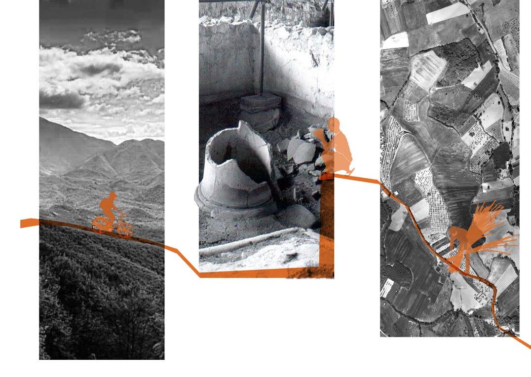
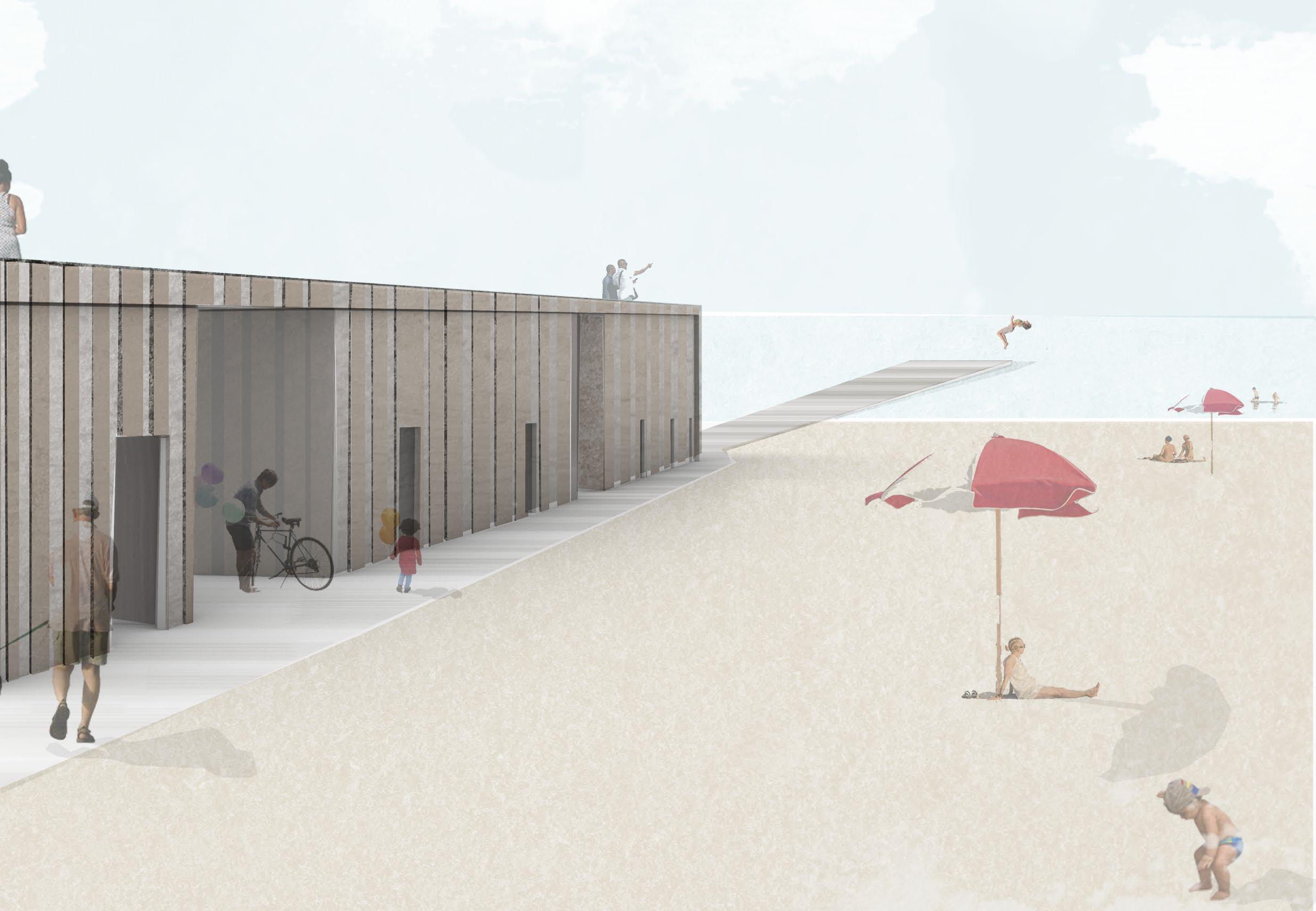
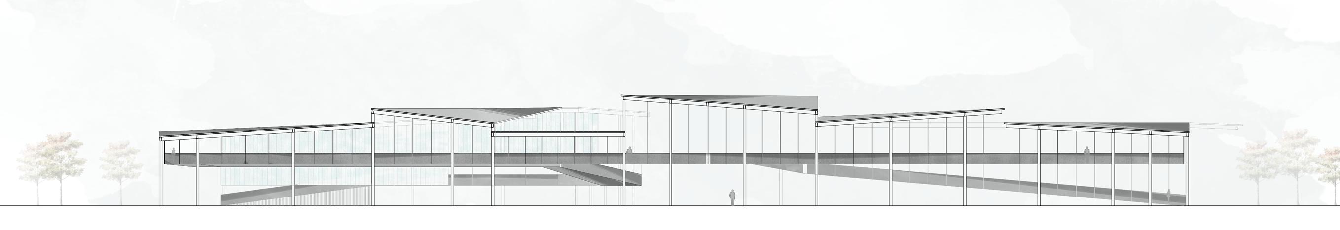
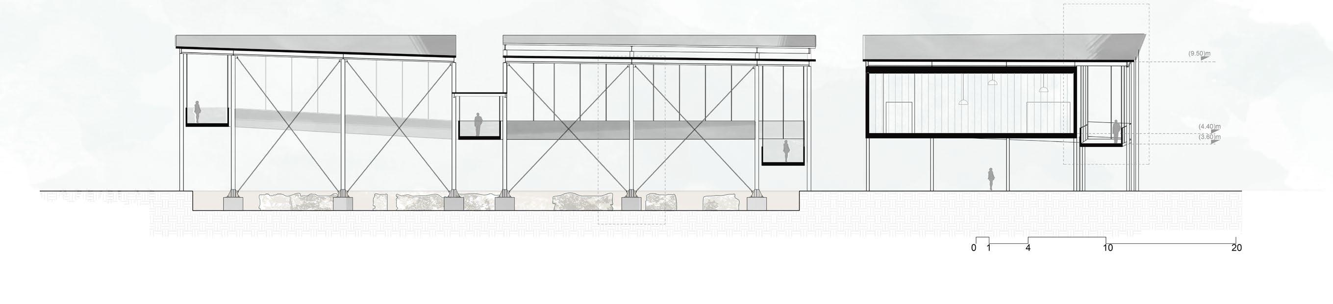
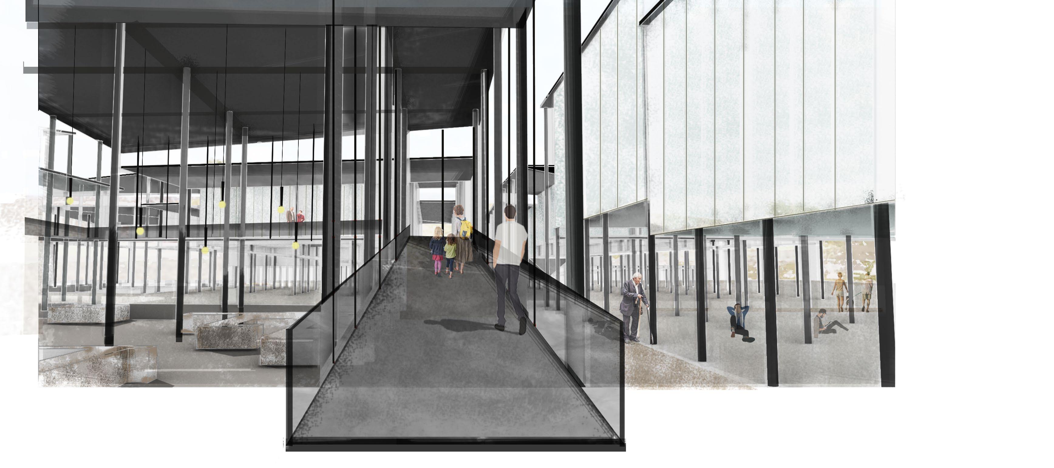
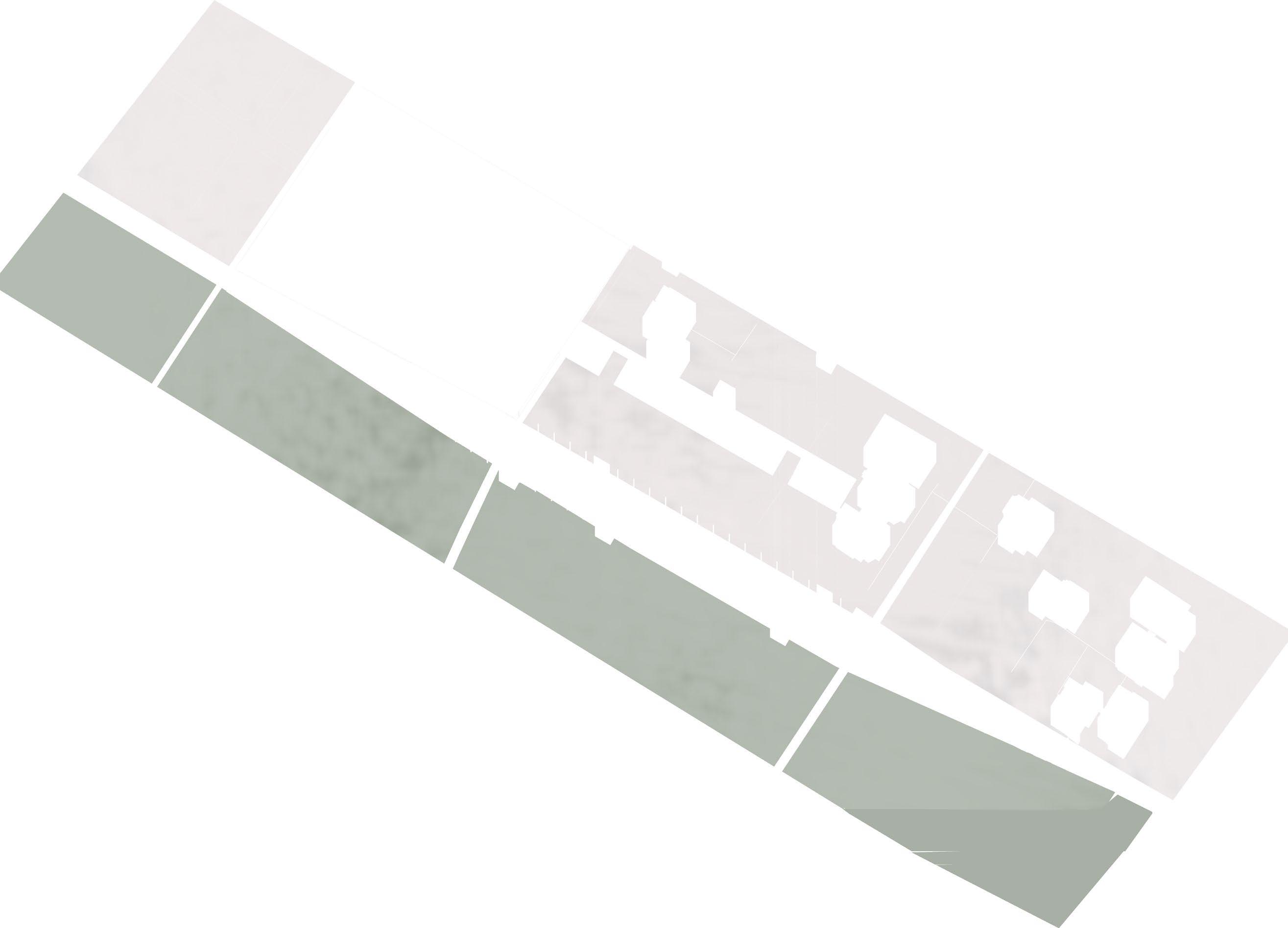
The idea is based on the connection between the new railway station, the future archaeological park and the neighboring vil lages(?) by means of a large linear park, which takes up the shape of the agricultural fabric, winding through the existing lots, and which would not only connect the two heads of the project but also enhances the agricultural vocation of the area. The railway station and the covering of the archaeological park take up the traces of the Irpinian pennata and the hill that led to define the common themes of the two projects: the thin laminar roof, the structure in piles, the relationship between full and empty and with the ground. My thesis work starts from the assumption that every territory can be saved and stems from the will to enhance my land. Irpinia has distinctive and unique landscape, historical and archaeological features that can be used as thestrategic tool for the realization of a node of territorial development.

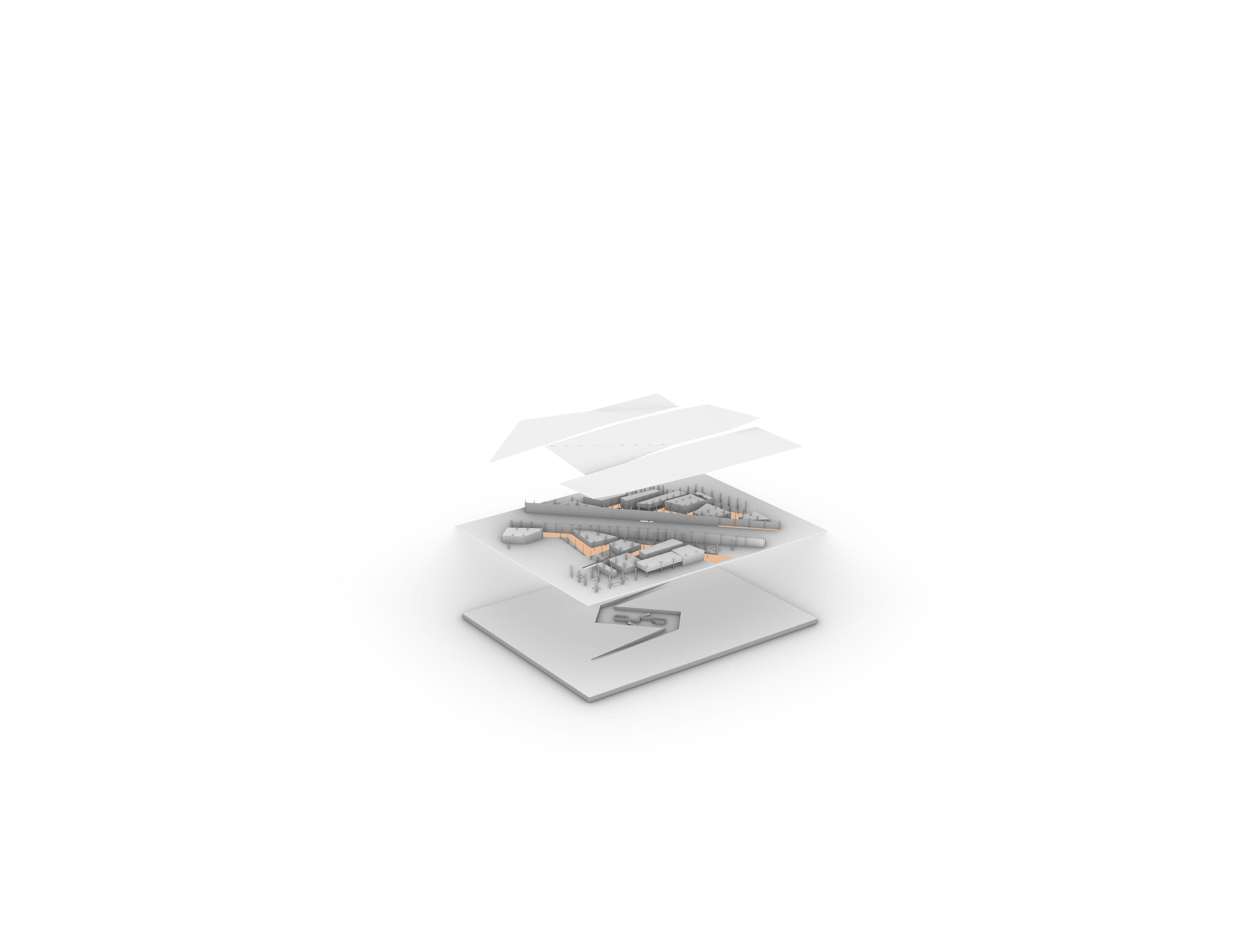
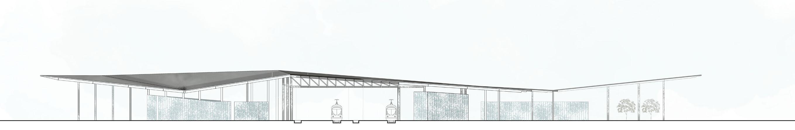
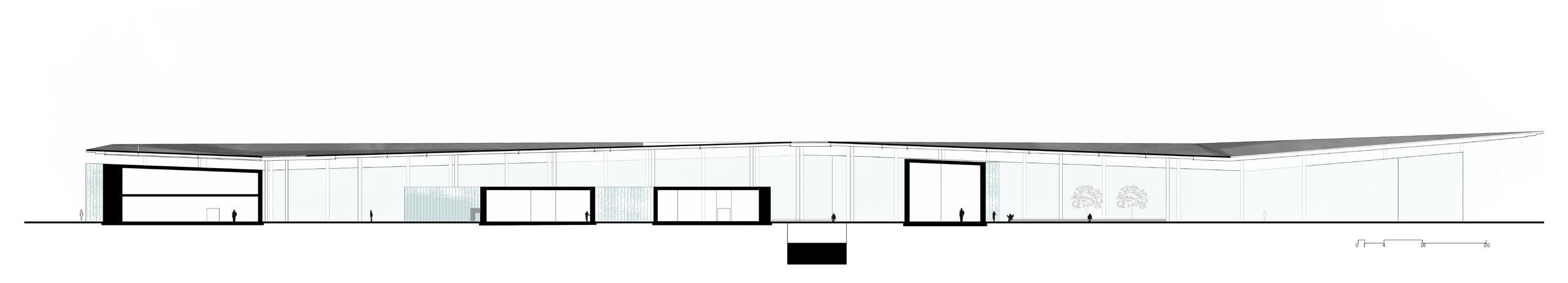
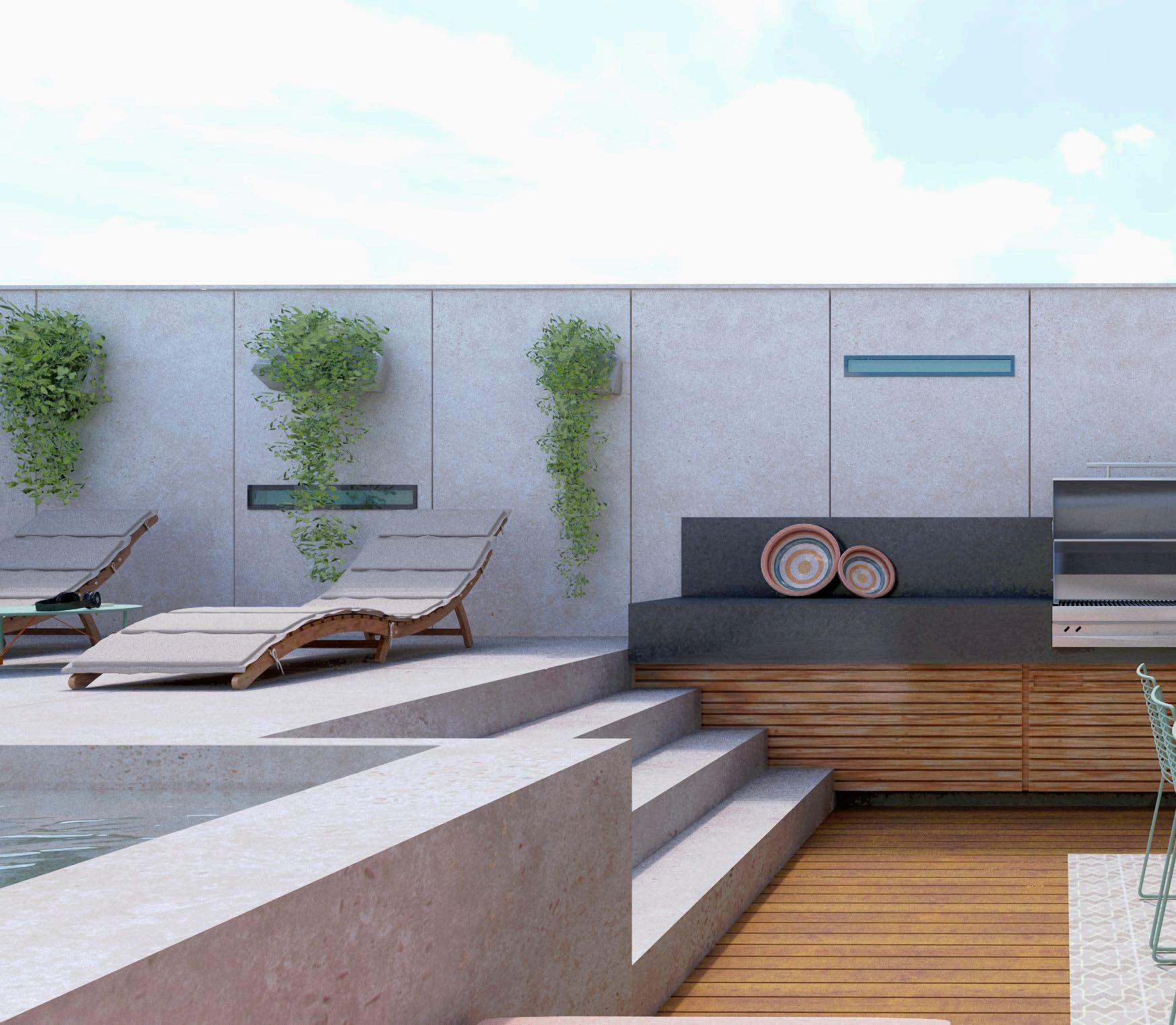
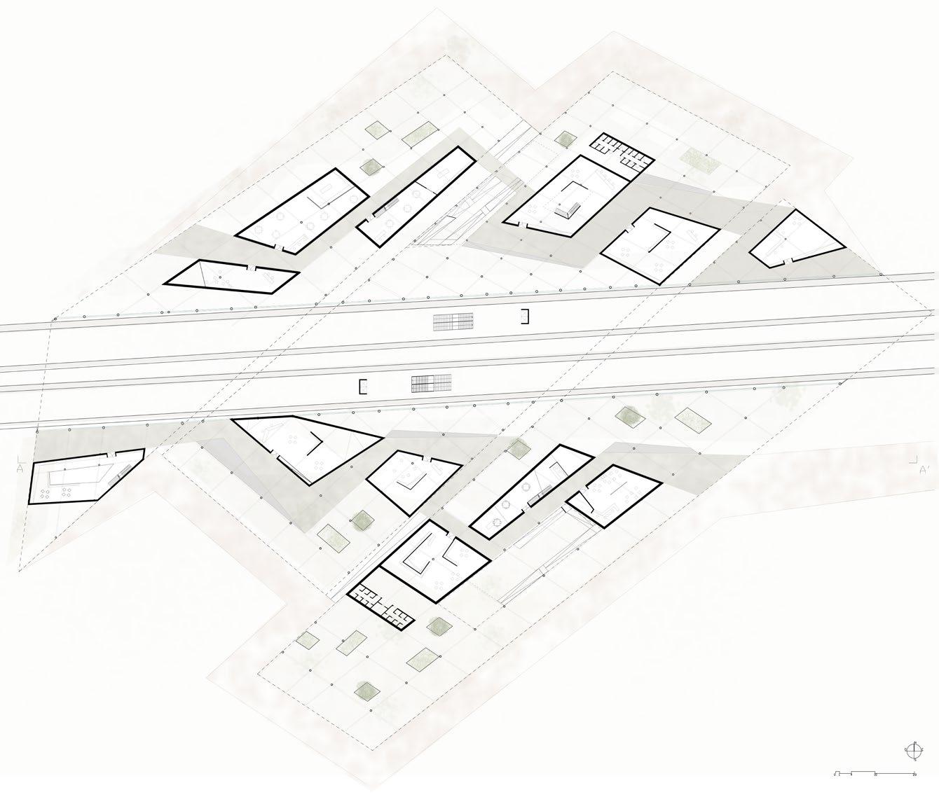 infopoint Sottopassaggio per il raggiungimento delle banchine
Ristoranti con prodotti km0
coffee book shop shop bnb
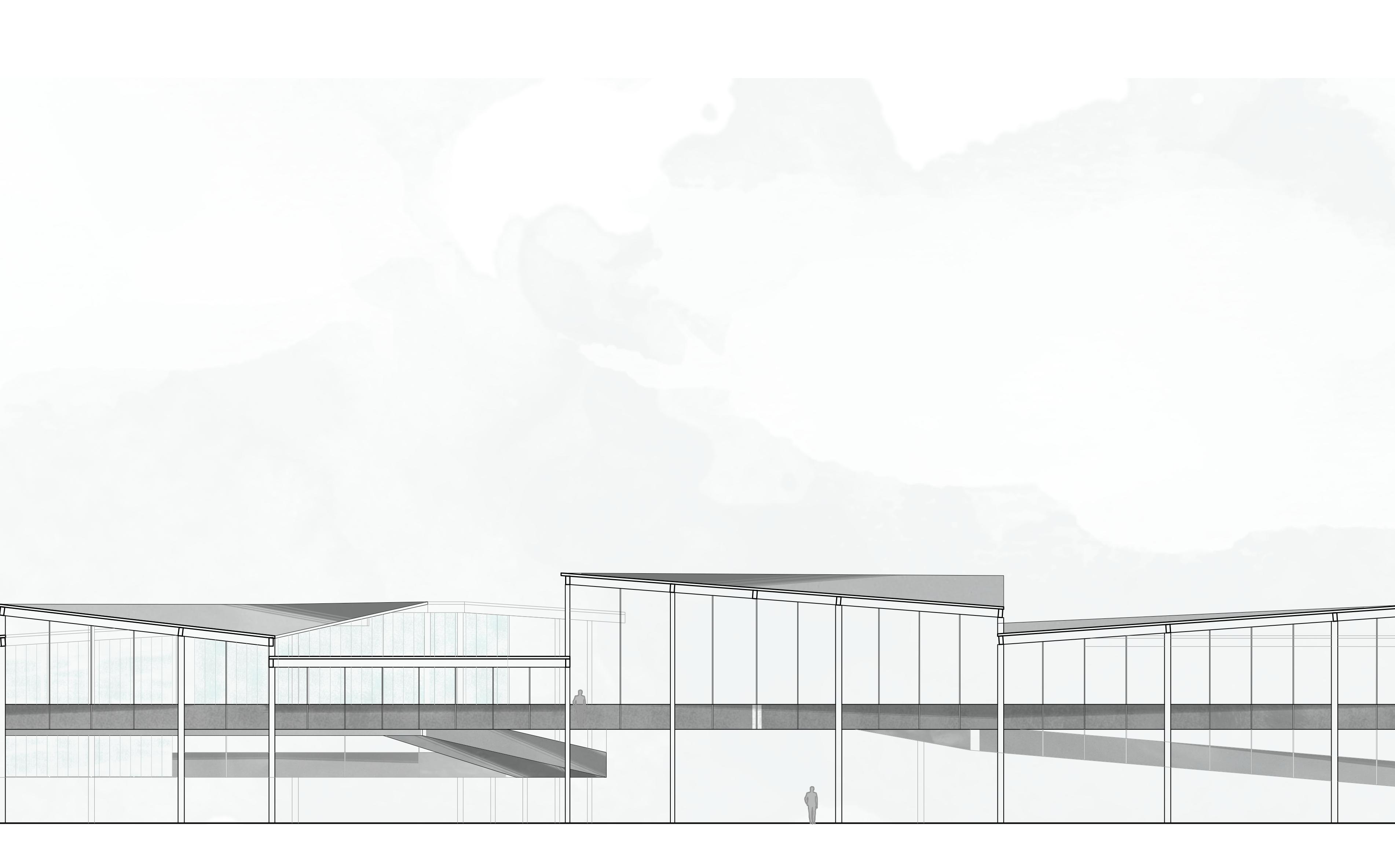
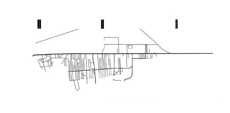
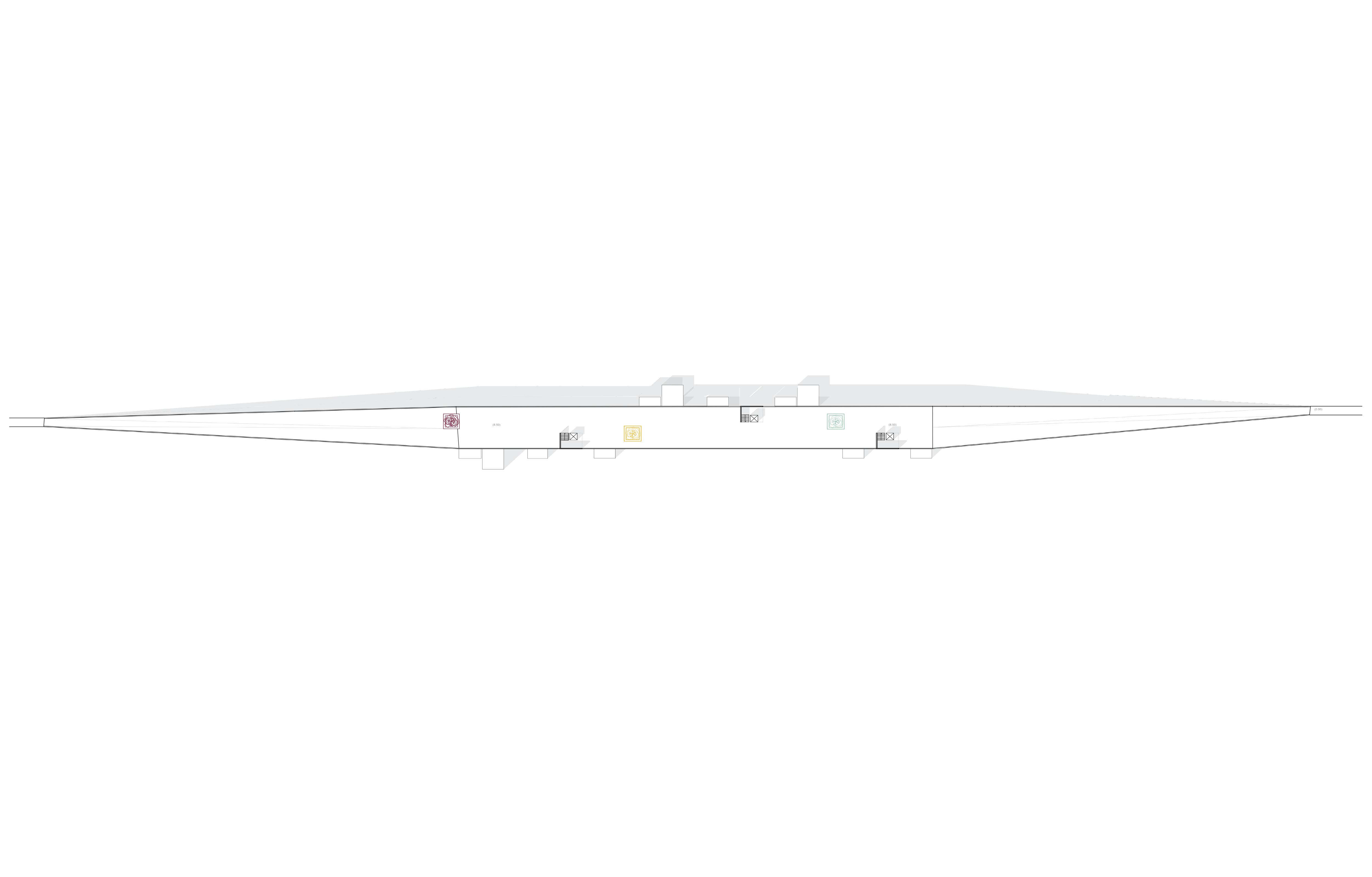
section west elevation
rooftop first floor funcional scheme
infopoint Sottopassaggio per il raggiungimento delle banchine
Ristoranti con prodotti km0
coffee book shop shop bnb
section west elevation
rooftop first floor funcional scheme
rooftop first floor funcional scheme
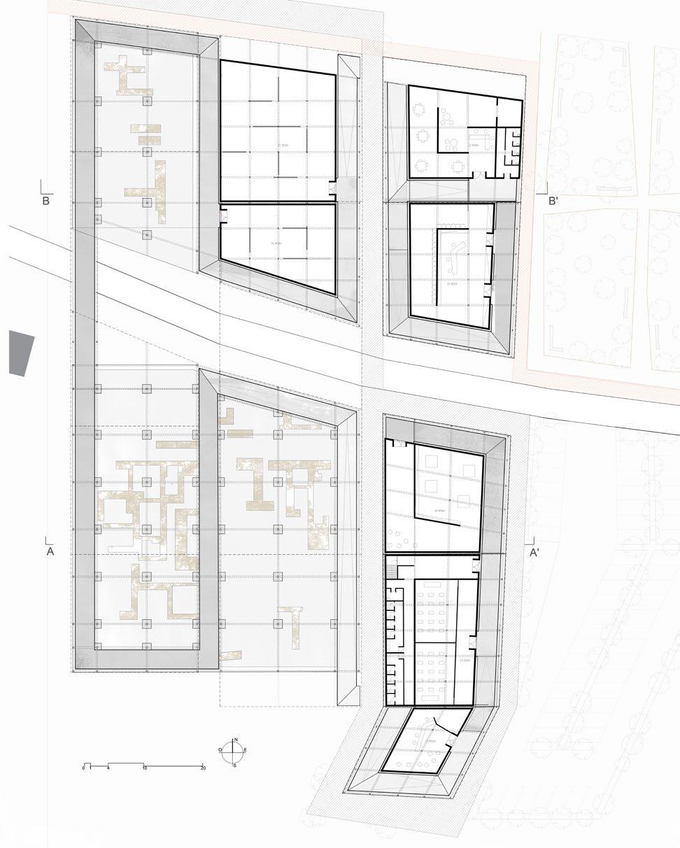
Museo dei resti zona ristoro biblioteca laboratorio di restauro aule di didattica info point section
elevation
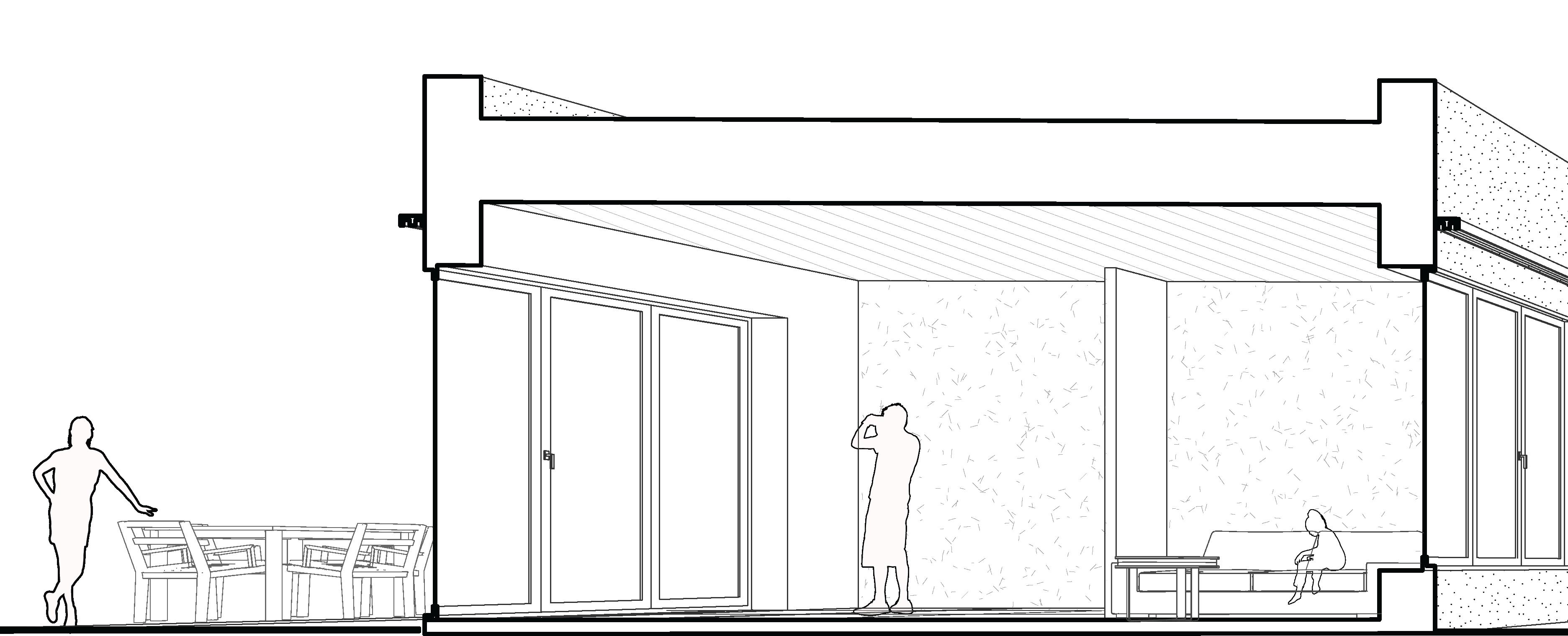
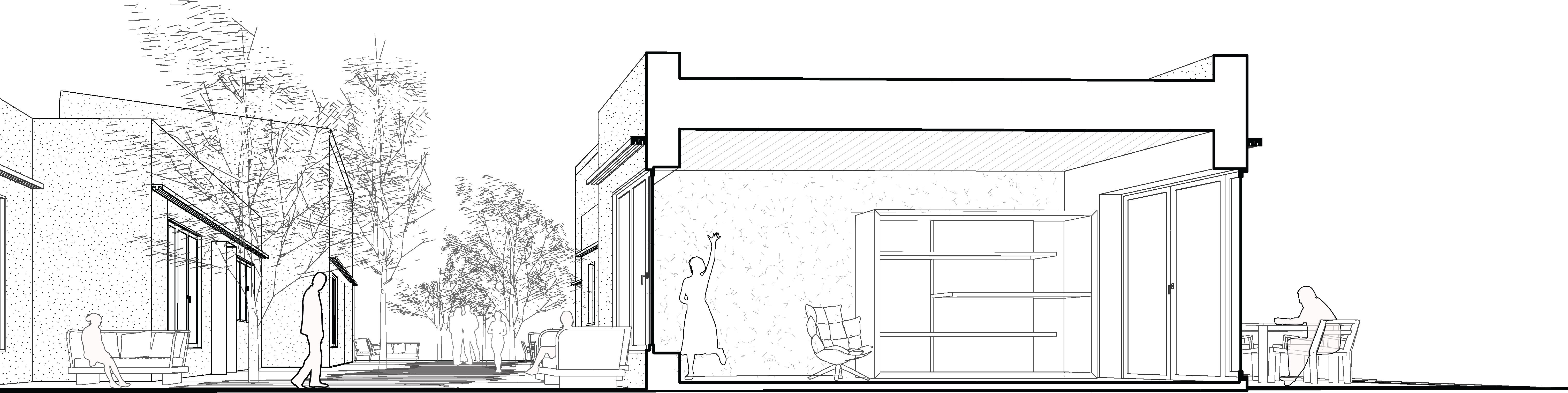
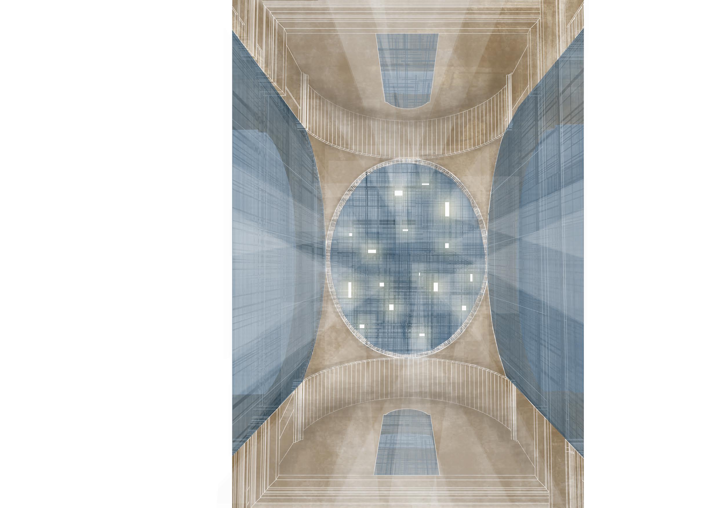
The aim of this proposal is to celebrate and to preserve the decaying beauty of the Fallen Church: the respect of the pre-existing building is the leitmotif of a series of design actions aimed at emphasizing the void, which becomes theprotagonist of the design. The void remains empty and indeed becomes an architectural element. The design of new architectural elements is conceived like slight roofs which attach to the solid walls of the Church. The result is a variety of spaces characterized by different heights, which allows to have the perception of the church space at diverse elevations, but also of the surrounding landscape. The designed components are made of steel and glass structure covered by perforated panels. The chosen material allows the joining between designed and pre-existed elements, because of its perforated steel weave which goes from less to more dense and filters lights. The new parts and the church are linked together by the path that goes through indoors and outdoors spaces and enfolds the entire project. Treading this path the visitors have the possibility to enjoy a complete view of the church and of the panorama. The stage space is located under the dome, to enhance it, and at the same time it is enhanced by beams of light projected from the panel above the dome. Moreover, the view, behind the stage space, becomes the theatrical frame of the performance.


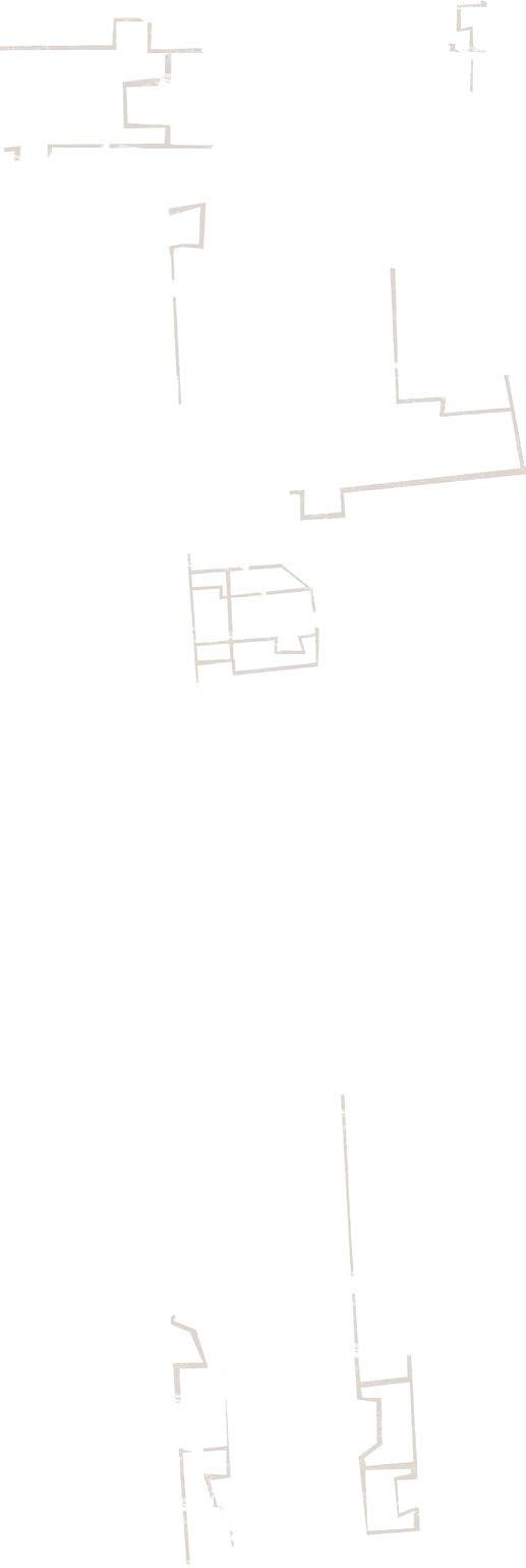
 Castello Sichinulfo Chiesa di Santa Maria la Gro a
Chiesa del Purgatorio
Chiesa Madre Parrocchia Santa Maria Maggiore
Castello Sichinulfo Chiesa di Santa Maria la Gro a
Chiesa del Purgatorio
Chiesa Madre Parrocchia Santa Maria Maggiore
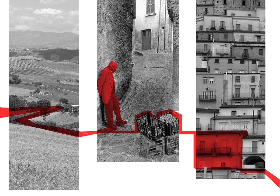
connection architecture for the revaluation of castel volturno
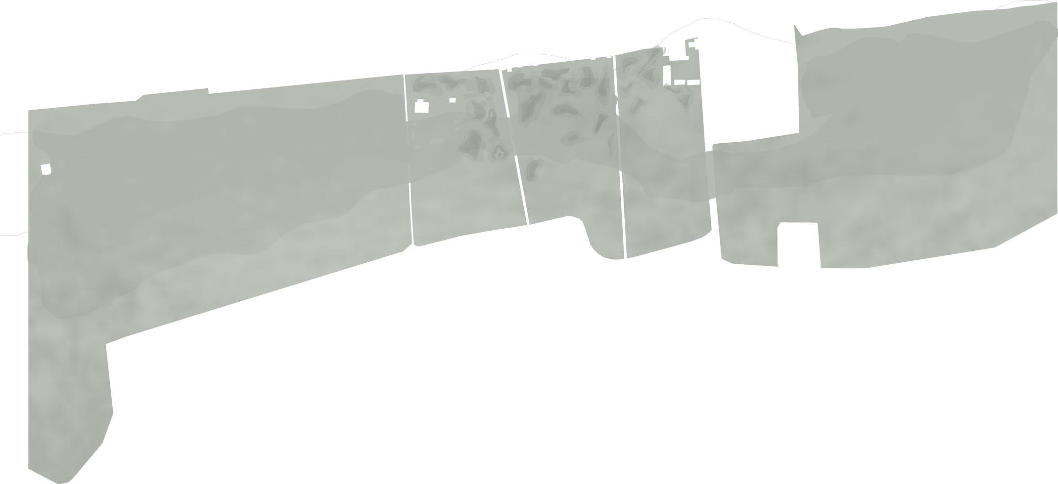
In a territory rich of natural and cultural resources such as Castel Volturno, in which many potential ities have become criticalities due to neglect and degradation, points of strength must be found in order to start redevelopment.
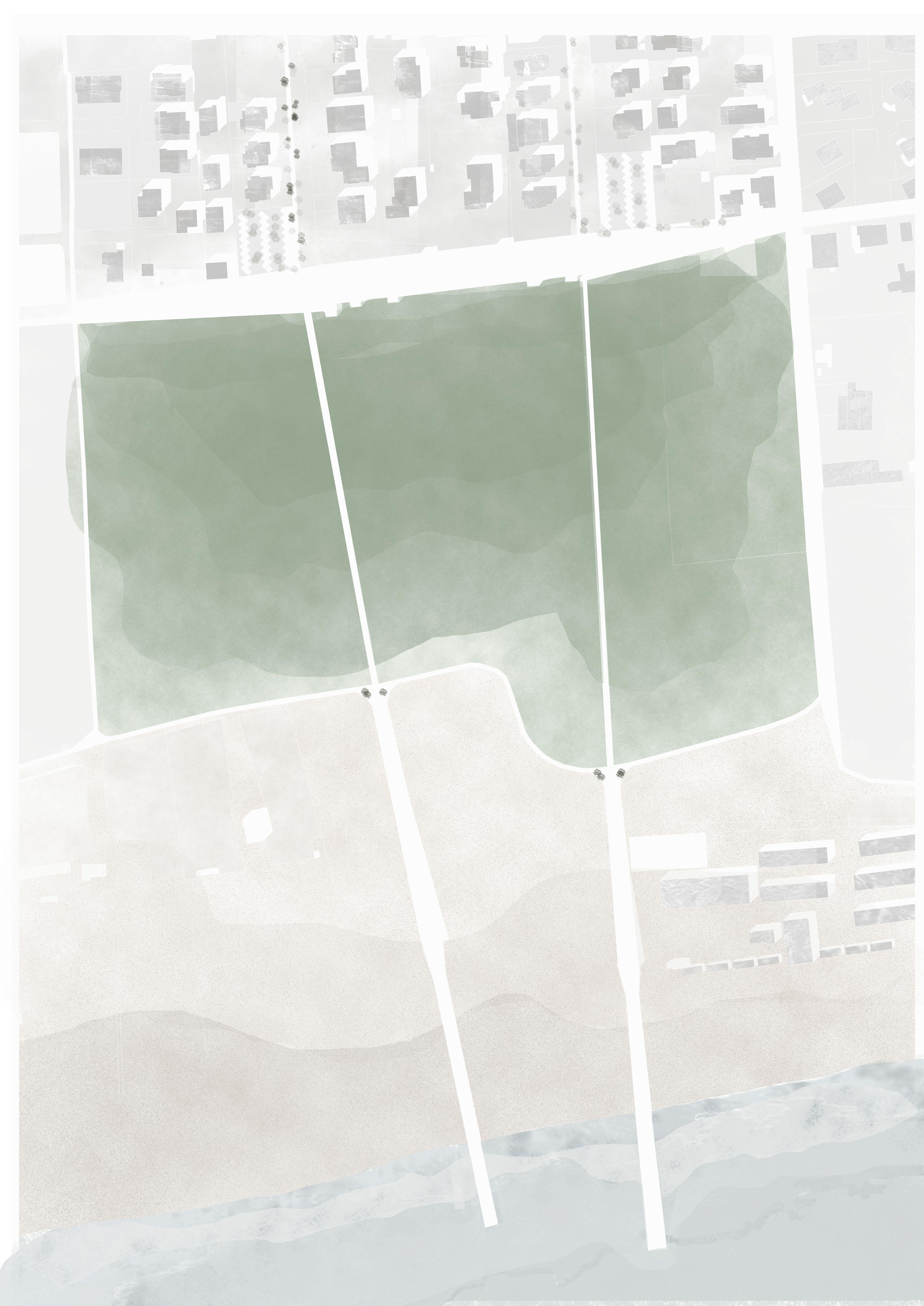
Baia Verde, located on the shoreline of Castel Volturno, is a neighborhood organized into par allel strips: the lakes, the ‘’Domiziana’’ road, the housing fabric, the dunes, and the sea. These strips are separated from one another and work more like barriers than integrated urban parts.


Thanks to a preliminary fieldwork, it has been possible to identify a major contrast in the area: in the urban fabric there is a widespread presence of green abandoned areas (both private and public) and the lack of public spaces properly designed and managed as such.
The main goal of the project is to CONNECT the ‘’strips’’ starting from the Domiziana up to the sea, providing new public spaces and green areas.


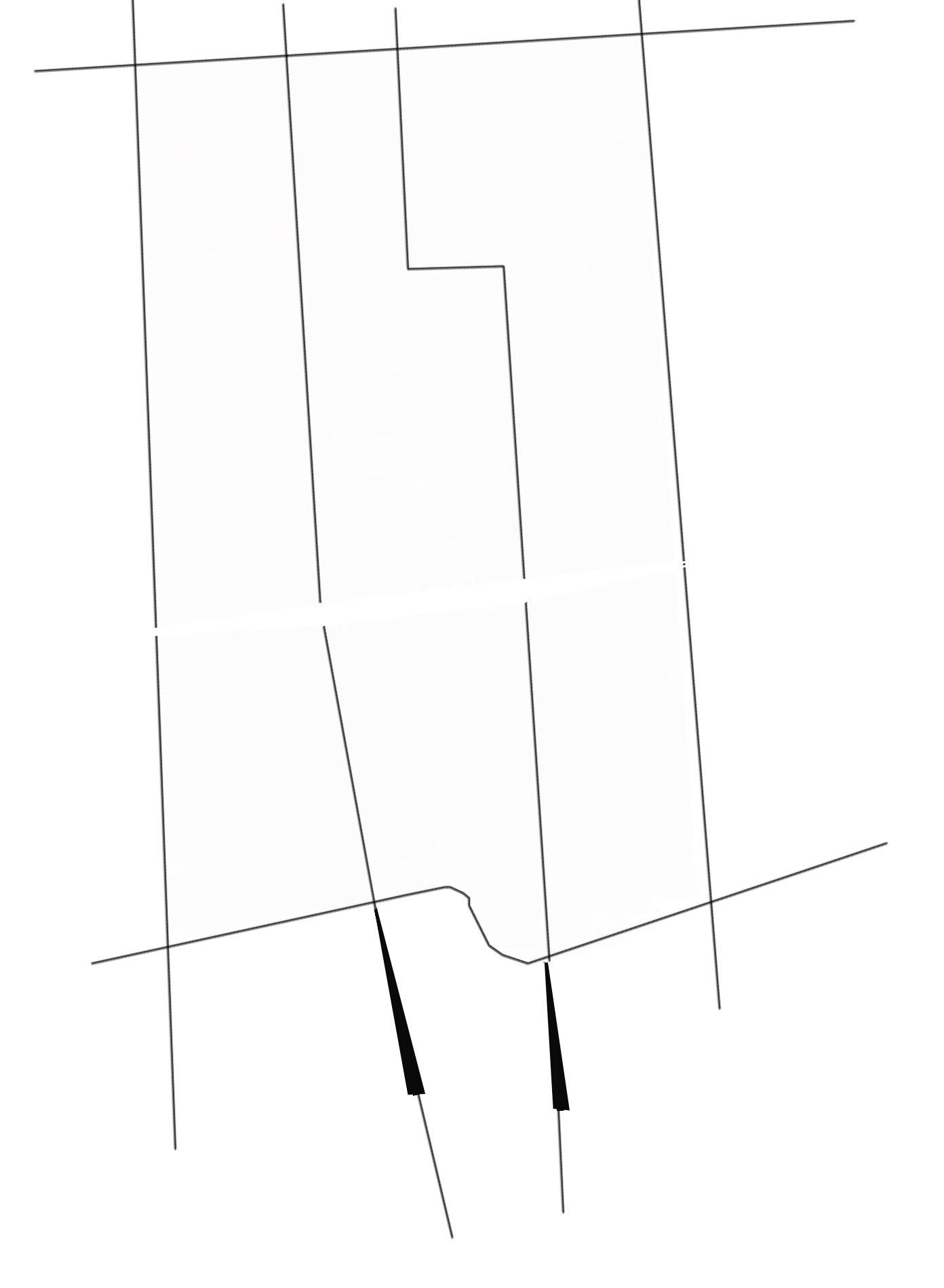
Starting from the main road, a series of pedestrian and cycle paths have been designed to connect the green areas, the shore and the sea. The proj ect focuses, more specifically, on one block, cho sen as an example to be extended to the whole area. The path web changes depending on the context that it intercepts.
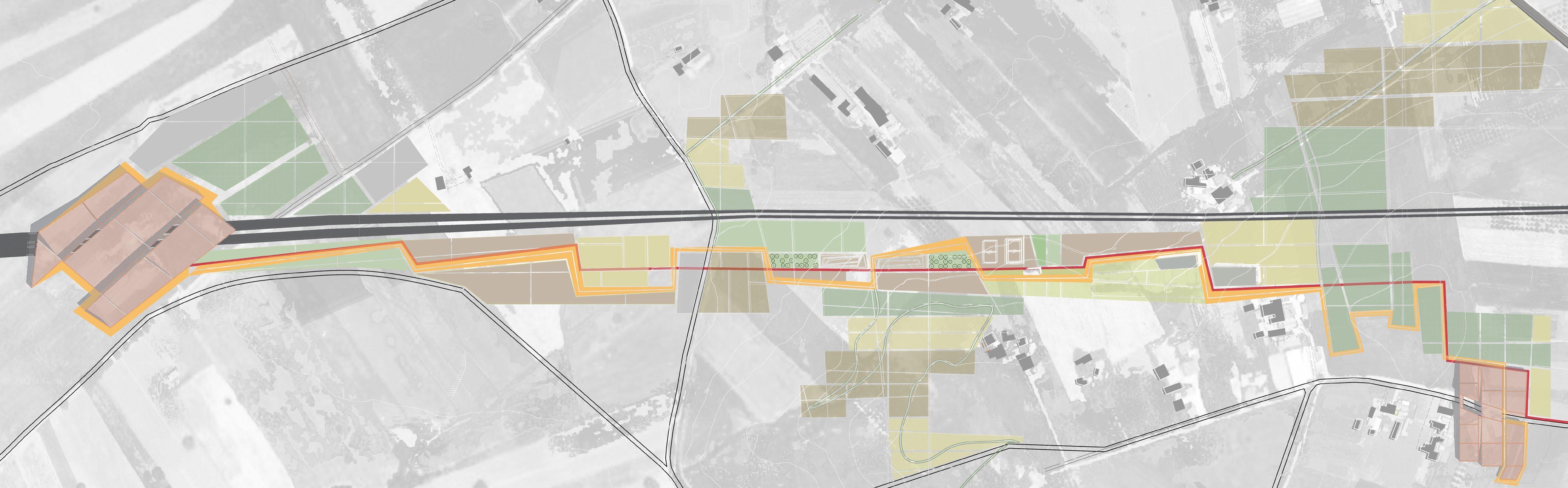
Analysing the morphological characters of the area two main elements, one natural and one artificial, have been identified: the lakes and the irregular urban fabric. The merging of these two figures provides the matrix of the project: a line that serves as a pedestrian and cycle path running along canals that, entangled with green spaces, re duce the risk of flooding in the urban area. Mov ing on, across the urban fabric and the dune, the vertical paths intersect the horizontal ones coming from the Variconi’s oasi (one of the well consol idated green areas); between the two strips the path becomes a building, generating an expansion of the road. The building is made up of a main steel
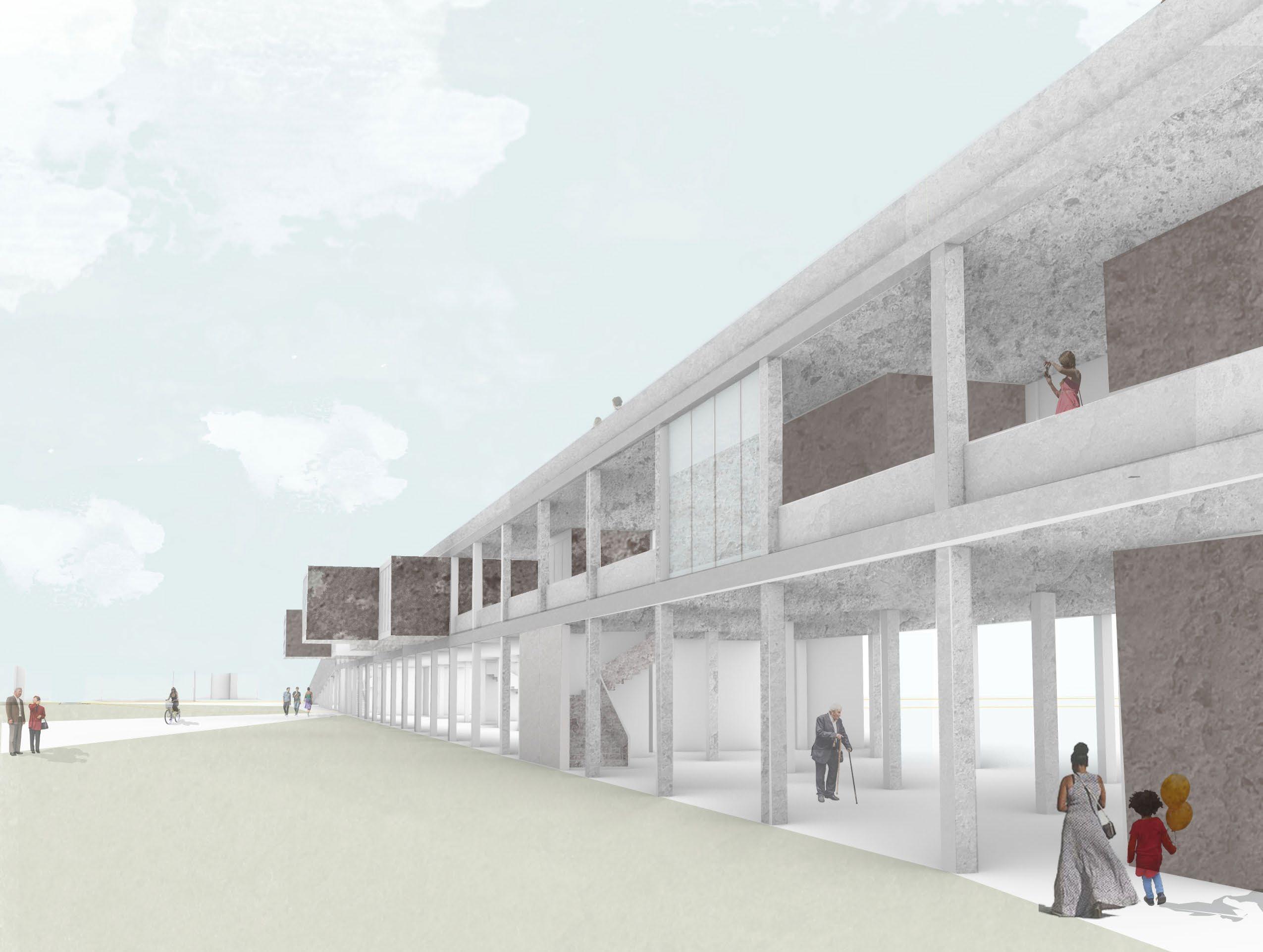
structure covered in concrete, that follows the road line, while in the central part perpendicular to the main North-South axis some prefabricated cubes are inserted in the main structure.


The building is organized in three levels, the ground floor is permeable, marked by the pillars network of the main structure and by some cubes that reach the ground floor. Here there is the restaurant area and some local product stores. At the extremities of the building, there are the main entrances, that lead through a ramp to the first floor. On the first floor the main functions of the building are displayed, dealing with basic services to the local community provided by volunteer associations: health care, sport and culture. These three functions enter the building like separate and autonomous bands, characterized by the pre fabricated blocks. The connection between each function is a path that meets along its way the stairs blocks located between any band.
At the ground floor the structure is crossed by pedestrian and cycle paths that lead from the ur ban fabric to the dune. Above the dune the path becomes a suspended walkway, to minimize the impact on the natural environment. When it meets the shore, the path becomes a terrace overlooking the sea while underneath on the sand there are some bathing facilities. In the end the path be comes a pier, finally reaching the sea.
first floor plan
1
2
+(9.00) +(8.50) +(4.80) +(0.00)
1Stratificazione parete opaca
corten-camera d'aria-intonaco-cartongesso-barriera al vapore-isolante-isolante-cartongesso-camera d'aria-cartongesso-intonaco
2Stratificazione solaio di copertura
intonaco-cartongesso-cartongesso-isolante-camera d'aria-trave IPE-lamiera grecata-cls-barriera al vapore-guaina-lastra in fibrocemento-isolante-camera d'aria-trave IPE-Lamiera grecata-cls-barriera al vapore-masse�o-guaina-pannelli in
6.00 6.00
A

1.4 1.3 1.3 1.3
(4.80)
21090 21090
90
210 90
1.7
12.5
1.2
3Stratificazione solaio controterra
pavimentazione-so�ofondo-barriera al
17.9
1 2 3 18.3
A B C D
5.4 5.7
S' S' S'' S'' S'''
ipe-isolante-cartongesso-barriera al vapore-isolante-cls-lamiera