Portfolio


Portfolio
selected works
2016 - 2022
BA Landscape Studies '22
The University of Hong Kong
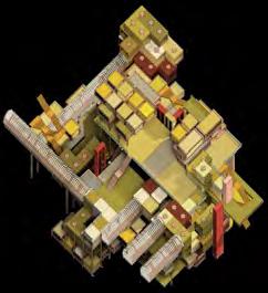
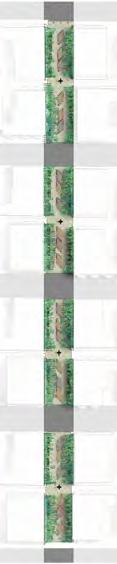
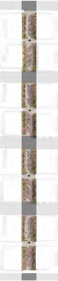
Strategic appropriation of the infrastructures of ecotourism in a Laos protected forest
HKU Landscape Design Studio 6
Selected for HKU Landscape Degree Show '22
Selected for HKU Landscape Public Review '22
Abstract
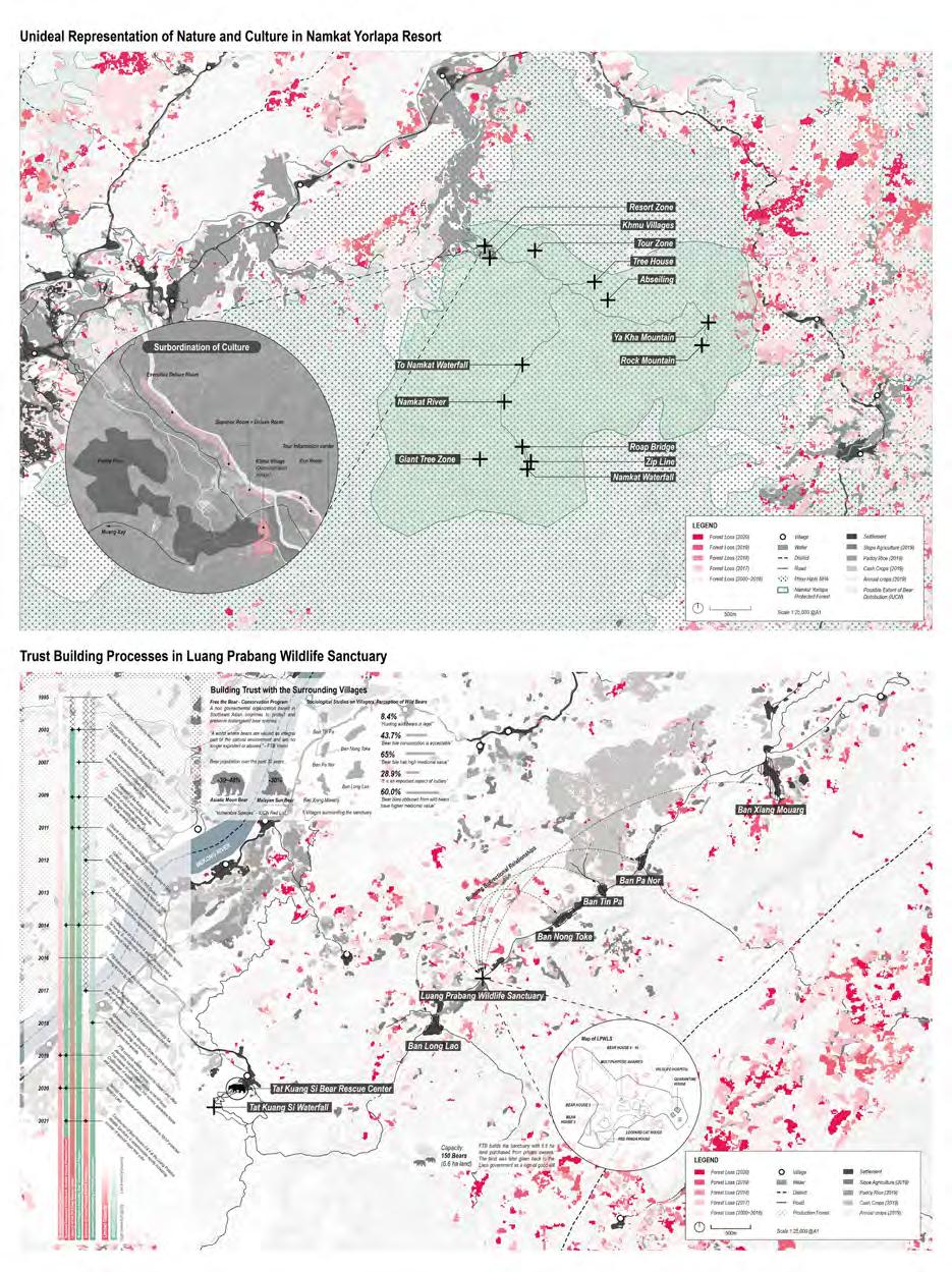
The project reinforces the capacity to conserve released wildlife in Namkat Yorlapa Protected Forest in Northern Laos through the transformation of ecotourism infrastructures into a monitoring system with a basis on trust building processes with the surrounding villages.
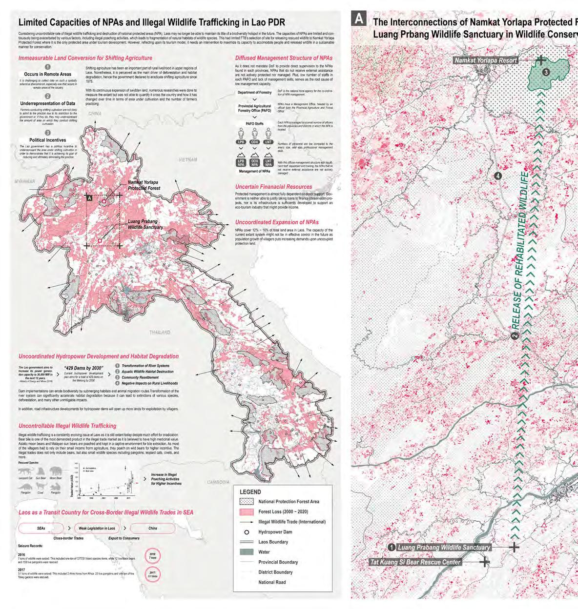
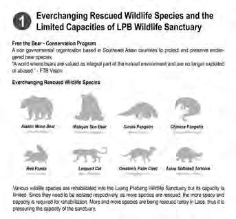
Laos has long suffered from the fight to eradicate illegal wildlife trafficking that still occurs under the radar today. The number of species that are illegally poached and rescued is everchanging, and this includes Asiatic moon bears, Malayan sun bears, pangolins, leopard cats, tortoises, and more. They are believed to have high medicinal values and are very demanded and highly valued products in illegal markets. The phenomenon is consequential to a rapid cutdown of wildlife populations, and today they are in danger of extinction.
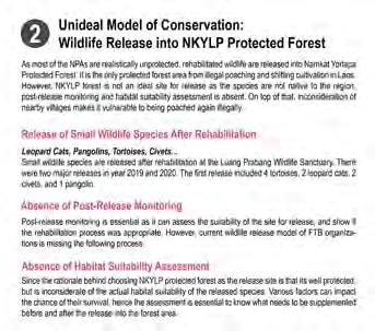
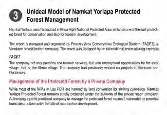
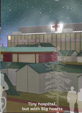
Free The Bears (FTB) organization had been actively involved in rescuing poached wildlife species and rehabilitate them at Luang Prabang Wildlife Sanctuary. After a certain period of rehabilitation, small wildlife species are released back to nature. Two major release events were held in year 2019 and 2020 by FTB, mainly featuring pangolins, leopard cats. The current released site is Namkat Yorlapa Protected Forest, situated in Pho Hiphi National Protection Area, is one of the very few protected forest areas in Laos. Most protection areas – including NPAs, are unprotected owing to the rapid expansion of slash and burn agriculture coverage and imprecise boundaries for protection and conservation. In addition, given that 8.4% of the surveyed villagers in Luang Prabang believe that hunting wildlife is legal, it can be interpreted that unattended forest areas are vulnerable to poaching. However, the current wildlife release process is not an ideal model of conservation as it is solely protected by Namkat Yorlapa resort, a private ecotourism company. There is a misrepresentation of both nature and culture in the site. Wildlife release in Namkat Yorlapa was not an option, but rather can be understood as a “symptom”.
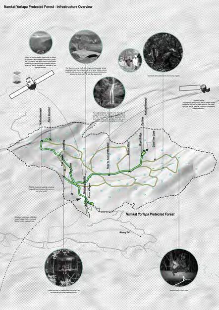
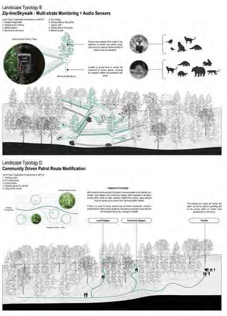
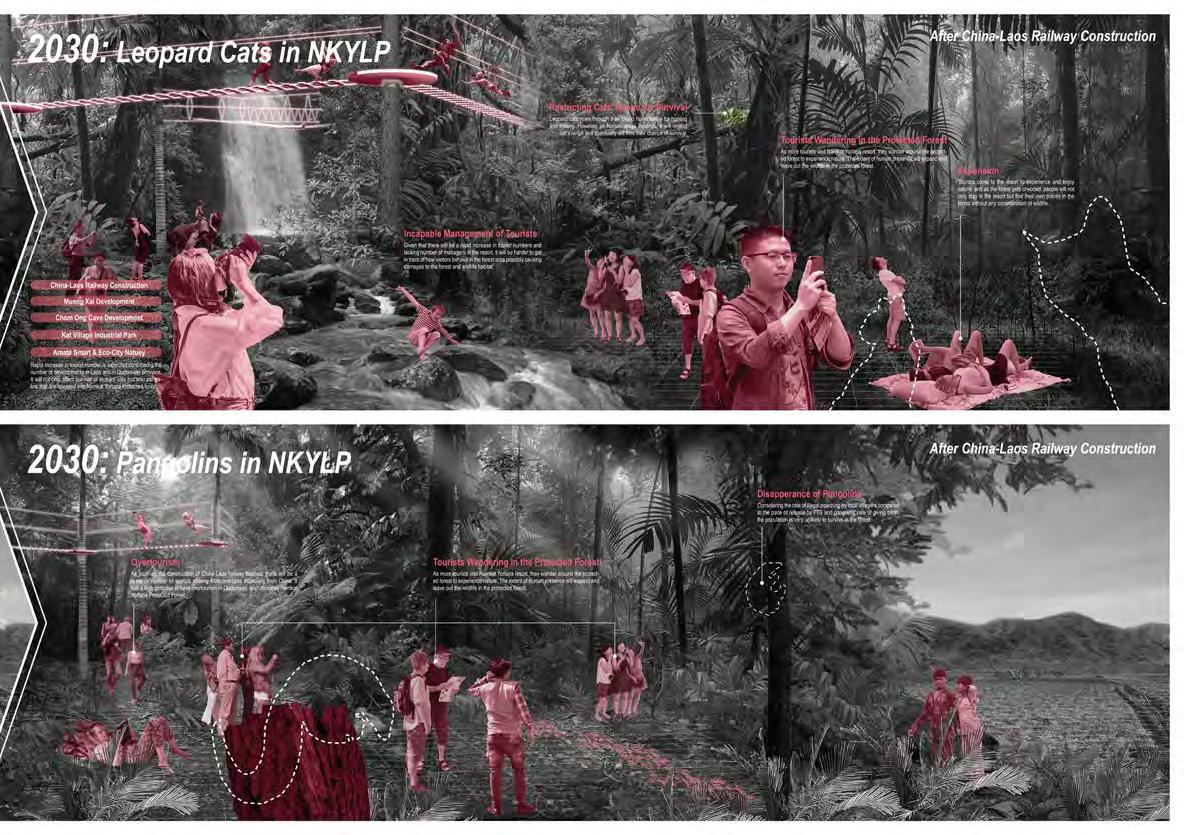
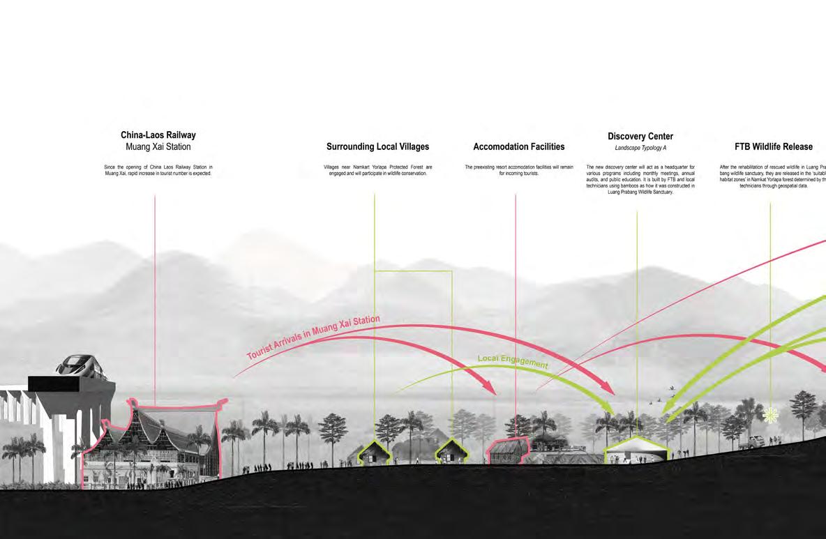
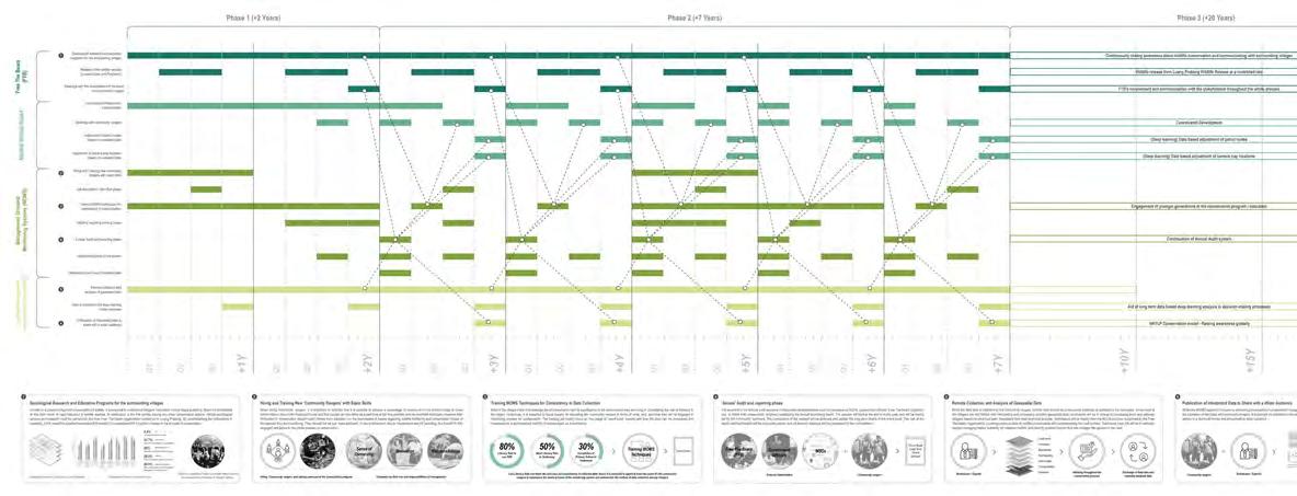
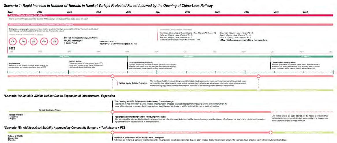
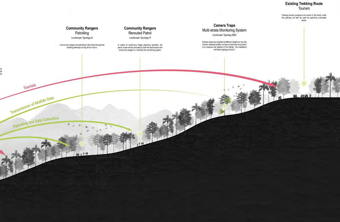
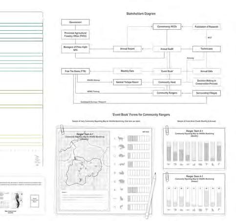
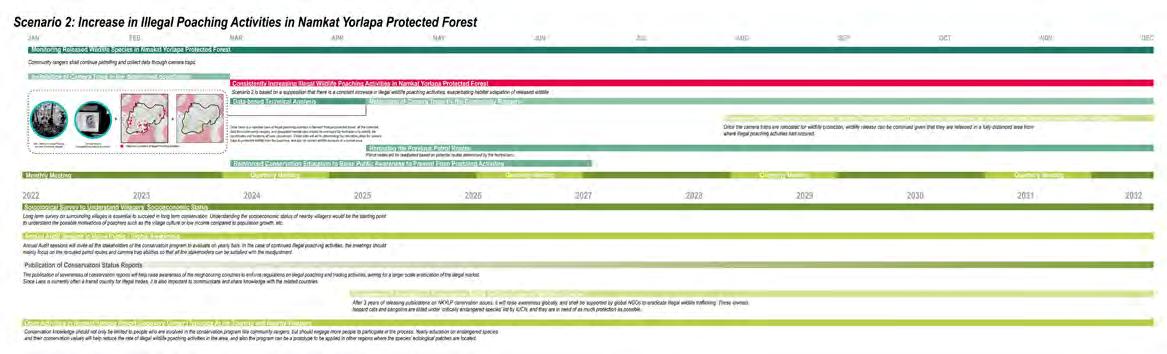
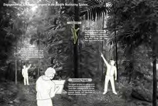
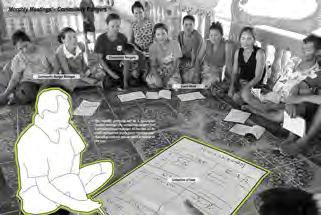
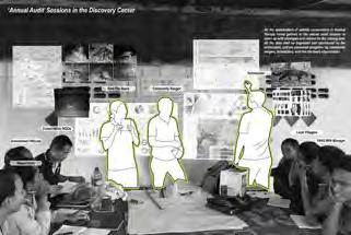
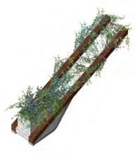
The strategies of the project incorporate ethical, technical, and infrastructural interventions to expand the forest capacity for conservation. The intervention starts with sociological surveys on surrounding villages to understand their circumstances, and positioning trust building processes that was carried out in Luang Prabang Sanctuary to reinforce long-term capacity of the conservation program at Namkat Yorlapa Protected Forest. The preexisting ecotourism infrastructures are transformed and adapted to four different landscape typologies, incorporating community driven management system, multi-strata monitoring camera traps, a co-built discovery center, and panoramic camera trap technology. Community driven approach plays a significant role in bringing long-term success in conservation, and the strategies strongly urge to grow their capacities for a resilient management system. It resiliency is tested through two scenarios of continued illegal wildlife trafficking and rapidly increasing tourist numbers in Namkat Yorlapa Resort by the opening of China-Laos railway. A potential limitation of implementing technologies and assigning community rangers can possibly objectify wildlife and human, however, its avoidance should be prioritized through preparatory education and understanding ethics of wildlife conservation.

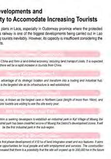
Wildlife conservation is a serious issue in Laos owing to severe habitat degradation and illegal wildlife trafficking. Free The Bears organization is rescuing and releasing widllife species into Namkat Yorlapa Forest, the only protected forest area in Laos. However, the forest is managed by a private tourism company, and there is a danger of privatizing nature, which not only leaves out the principles guiding how nature or culture should be represented, but also effective land use controls surrounding the protected forest. Moreover, absence of trust building processes with local villagers reduces its capacity for long term success in conservation. Hence the release of rescued wildlife into this forest was not an option but is rather understood as a "symptom".
Species' Ecological Niche and Increasing Tourists
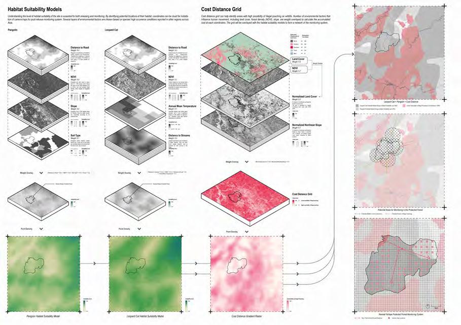
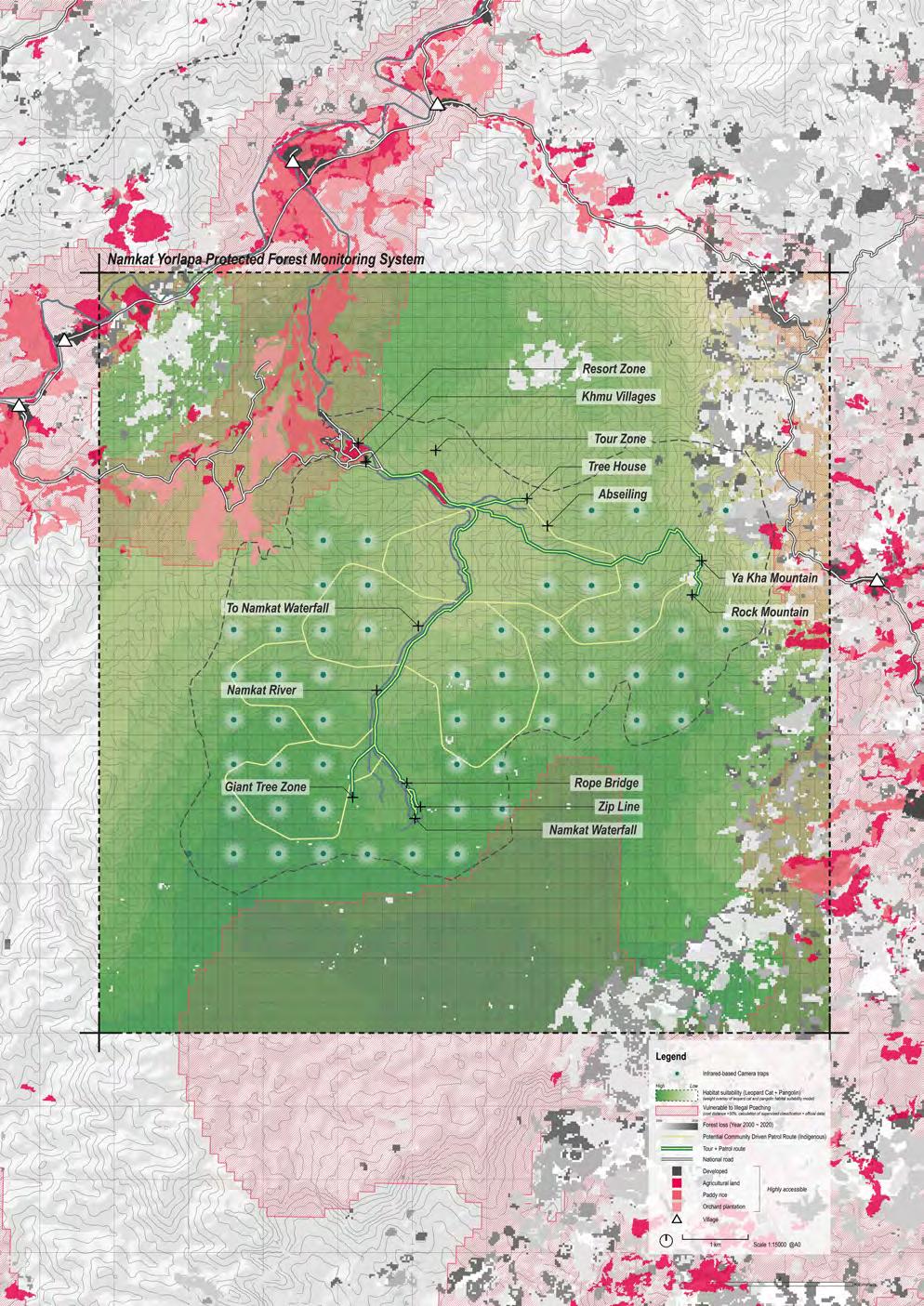
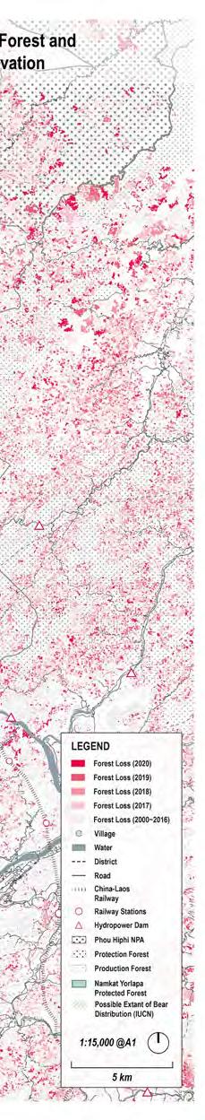
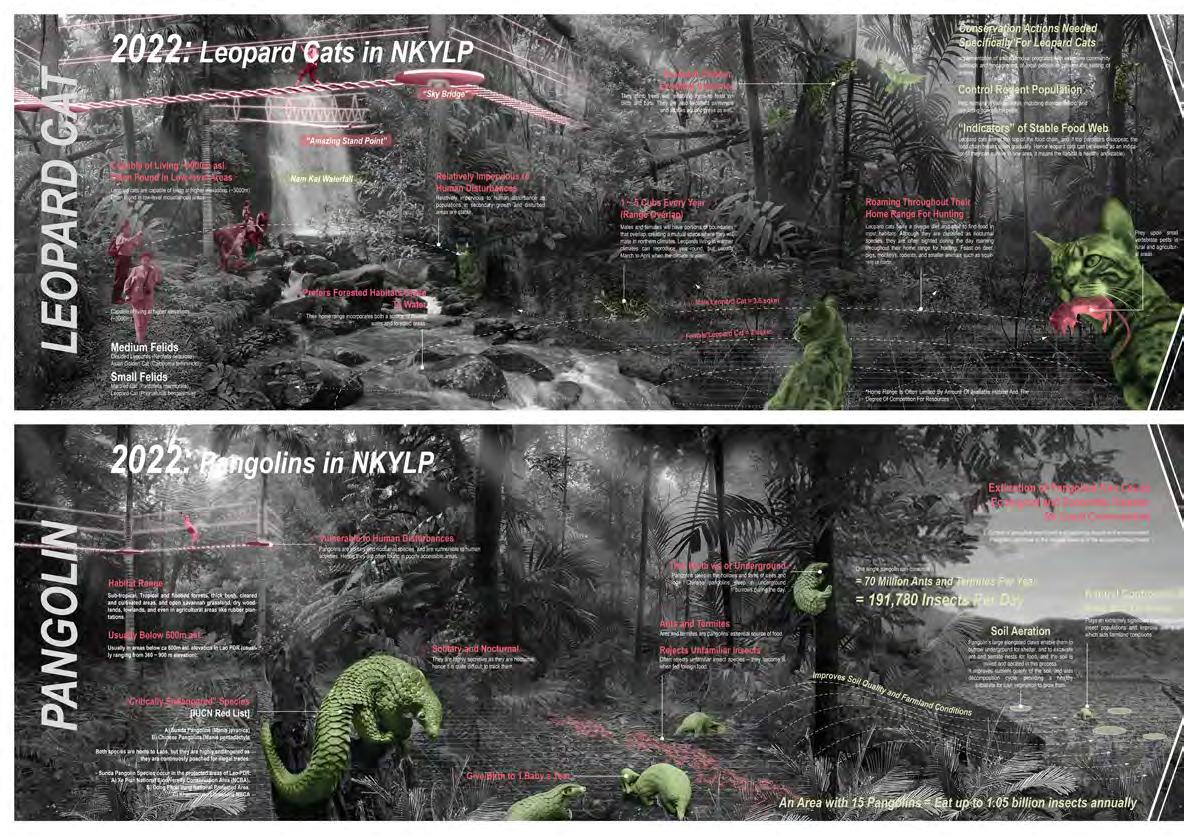
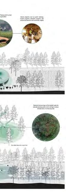
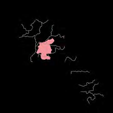
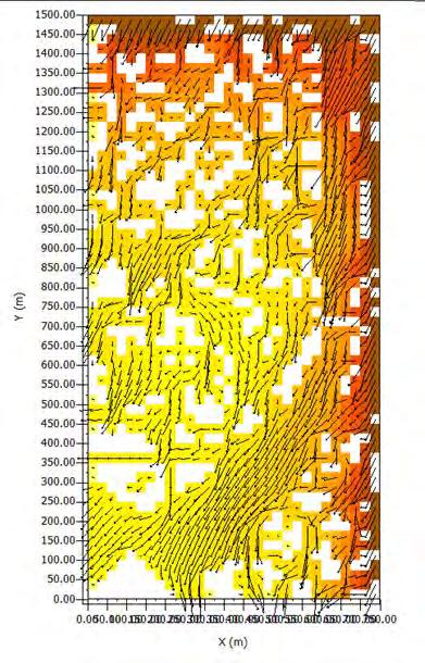
Understanding of the ecological niche of released species in the protected forest is essential for building its capacities for resiliency. Given that there will be a rapid increase in tourist number over the next decade due to China Laos railway construction and provincial development projects, a strategic framework is necessary to ensure habitat stability of released wildlife species, mainly pangolins and leopard cats, in Namkat Yorlapa Protected Forest.
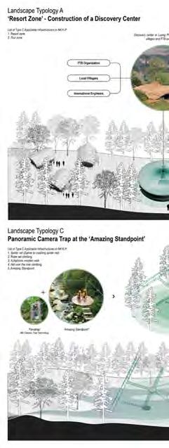
Habitat suitability model of the wildlife species and cost distance grid are overlayed with respective weightings to identify potentially vulnerable areas to illegal wildlife poaching activities. Based on the analysis, infrared camera traps are installed. Four landscape typologies are applied to the existing tourism infrastructure, reinforcing the forest capacities for pose-release monitoring of the wildlife species.

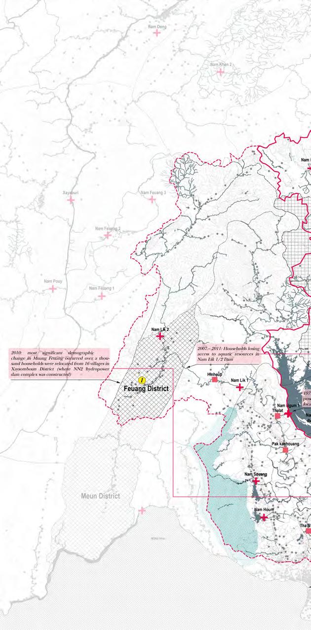
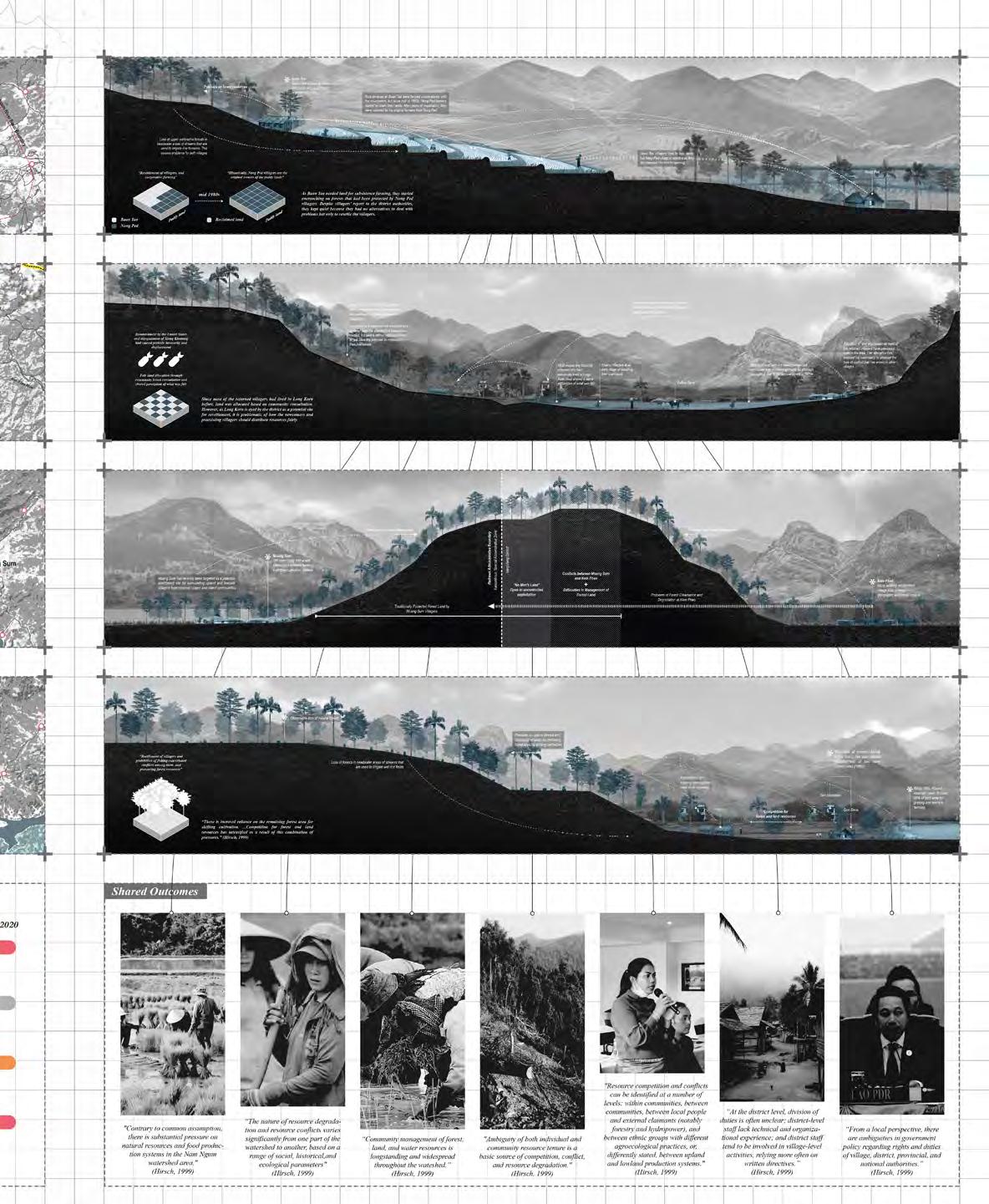
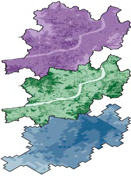
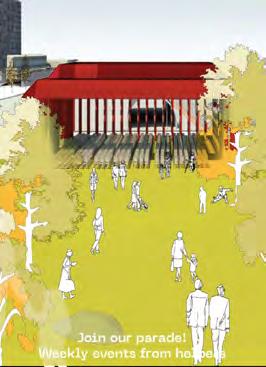
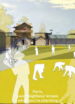
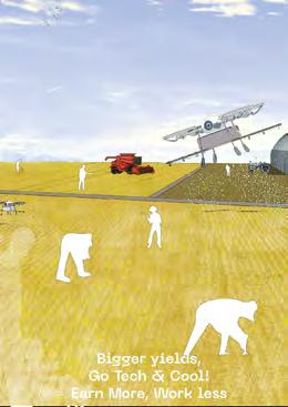
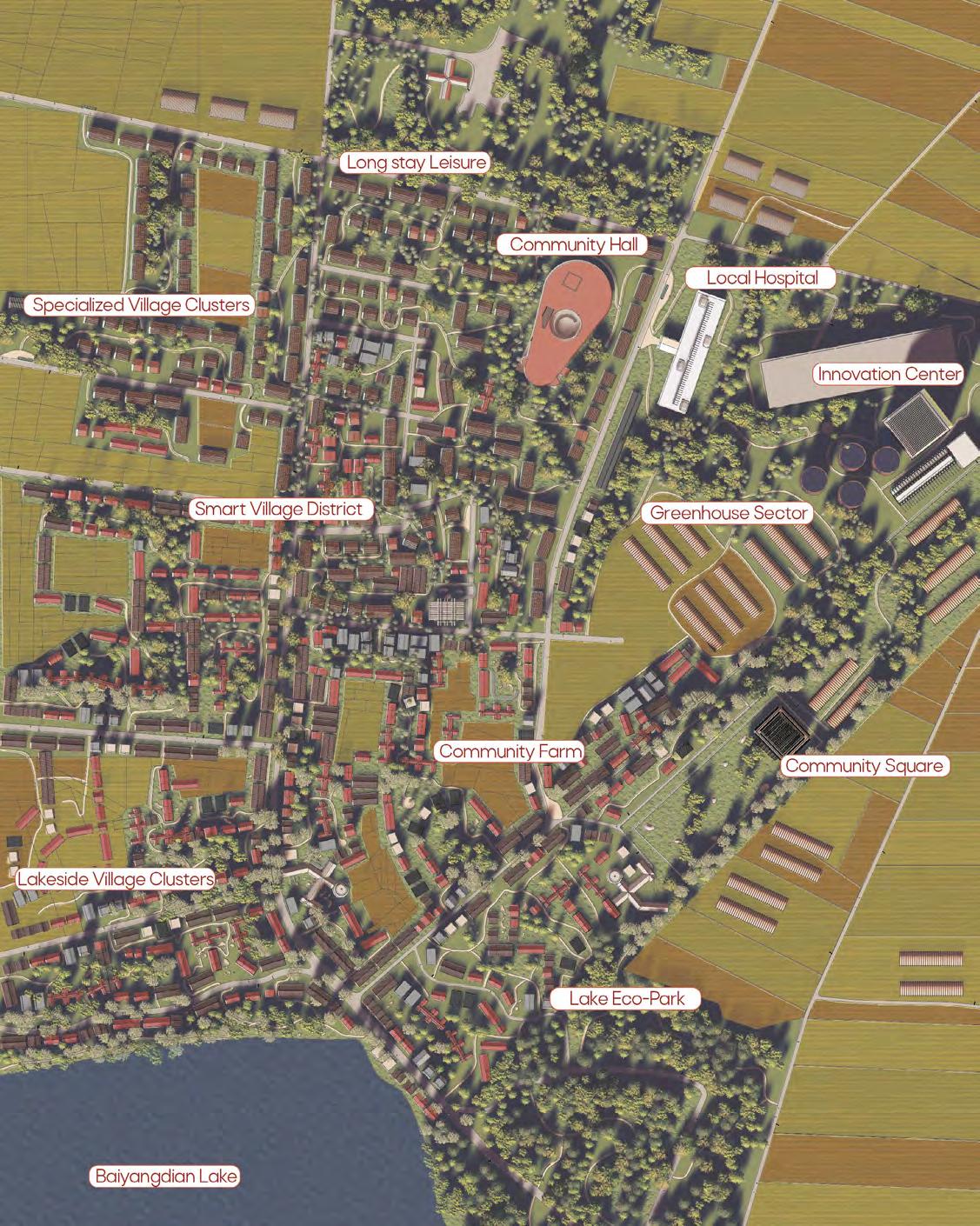
'Resourfication' occurs as natural features are judged as useful in relation to human wants (Fujita, 2014). Rapid and uncoordinated development of hydropower dams along the Nam Ngum Basin had a significant impact on the villages at Laos in terms of settlement, economy and resource management.
The initial timeline is drawing attention to the key events occured in the last 3 decades, including the perpetuation of Poverty of Nam Ngum 2 Hydropower Resettlement Project, the reductiveness of Government Policies in Nan Ngum River Development, and ineqitable access to land and resources in Nam Ngum and Nam Lik. The reductiveness of government policies reveals the essentiality in the process of understanding village scale approach in regards to ethinicity, tradition, culture, and livelihood.
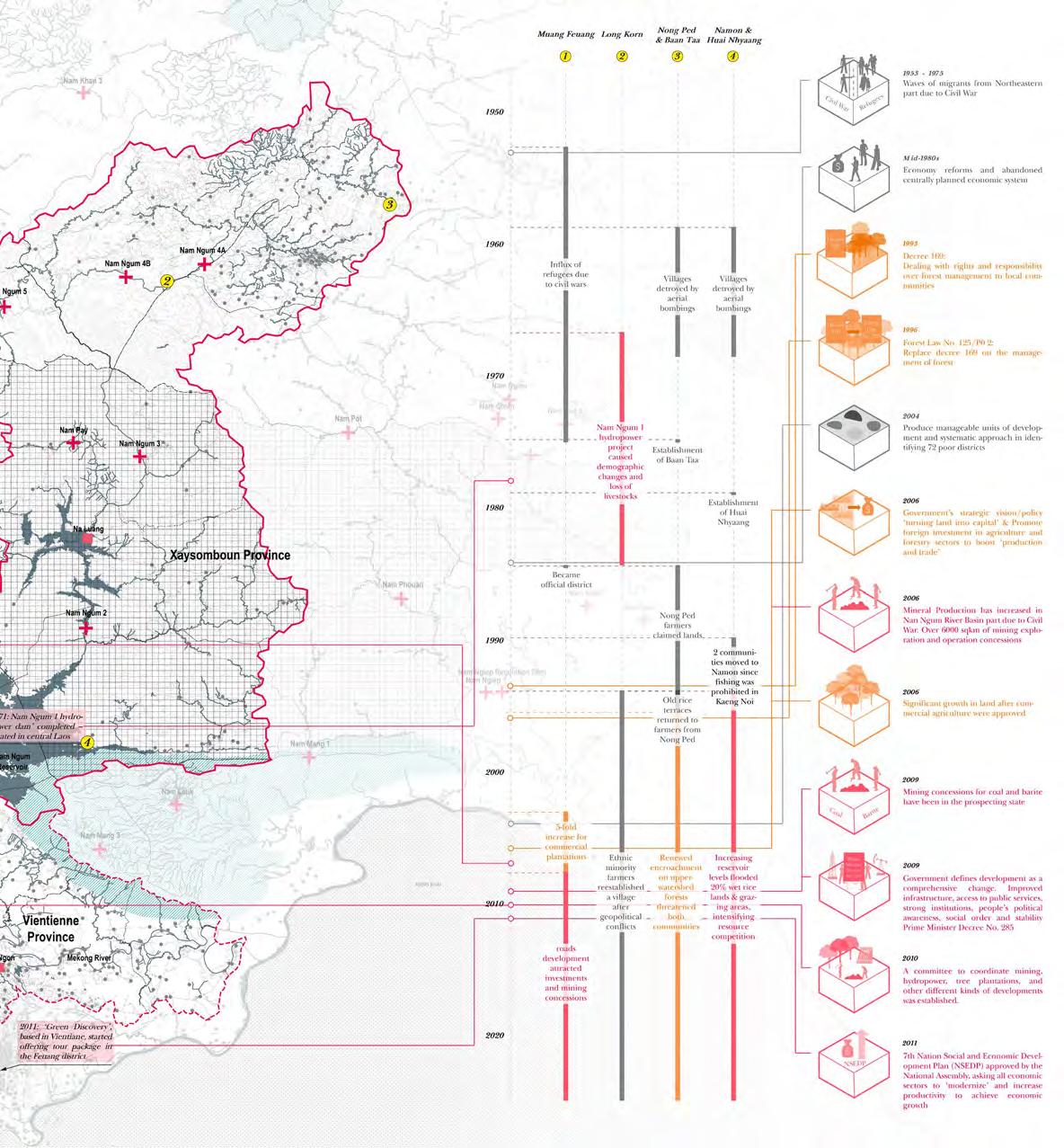
Emergence of new governmental policies were followed up by the “resourcification” process support livelihood of villagers and to manage natural resources in a more sustainable manner. needs at village-scale, in fact, they are exacerbating villagers’ livelhood, agriculture, and disclose the various consequences after the enforcement of new policies
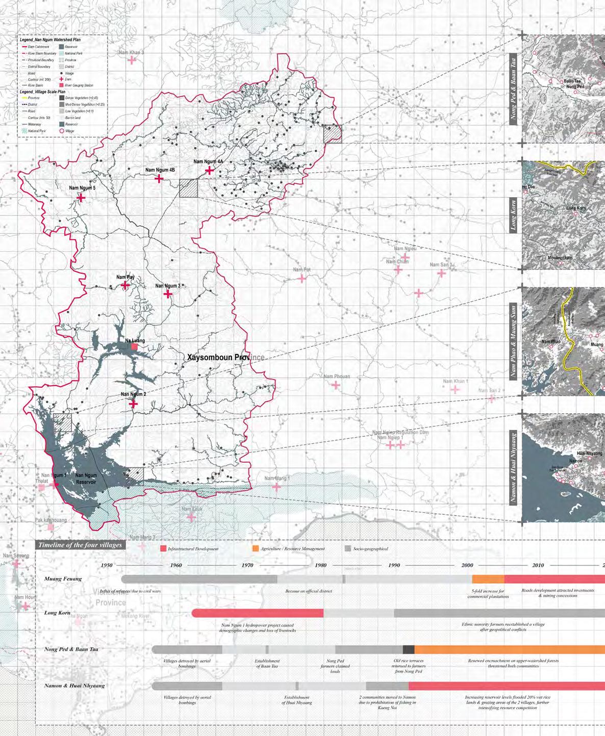
Policies in Nan Ngum River Basin Development
process along the Nan Ngum River Basin in Lao PDR. The new policies mainly aimed to manner. However, owing to its reductiveness and lack of scalability, it fails to meet the actual and their competition for natural resources among villages. Case study of the four villages policies including resettlement, Decree 169, and Forest Law No.125/P0.
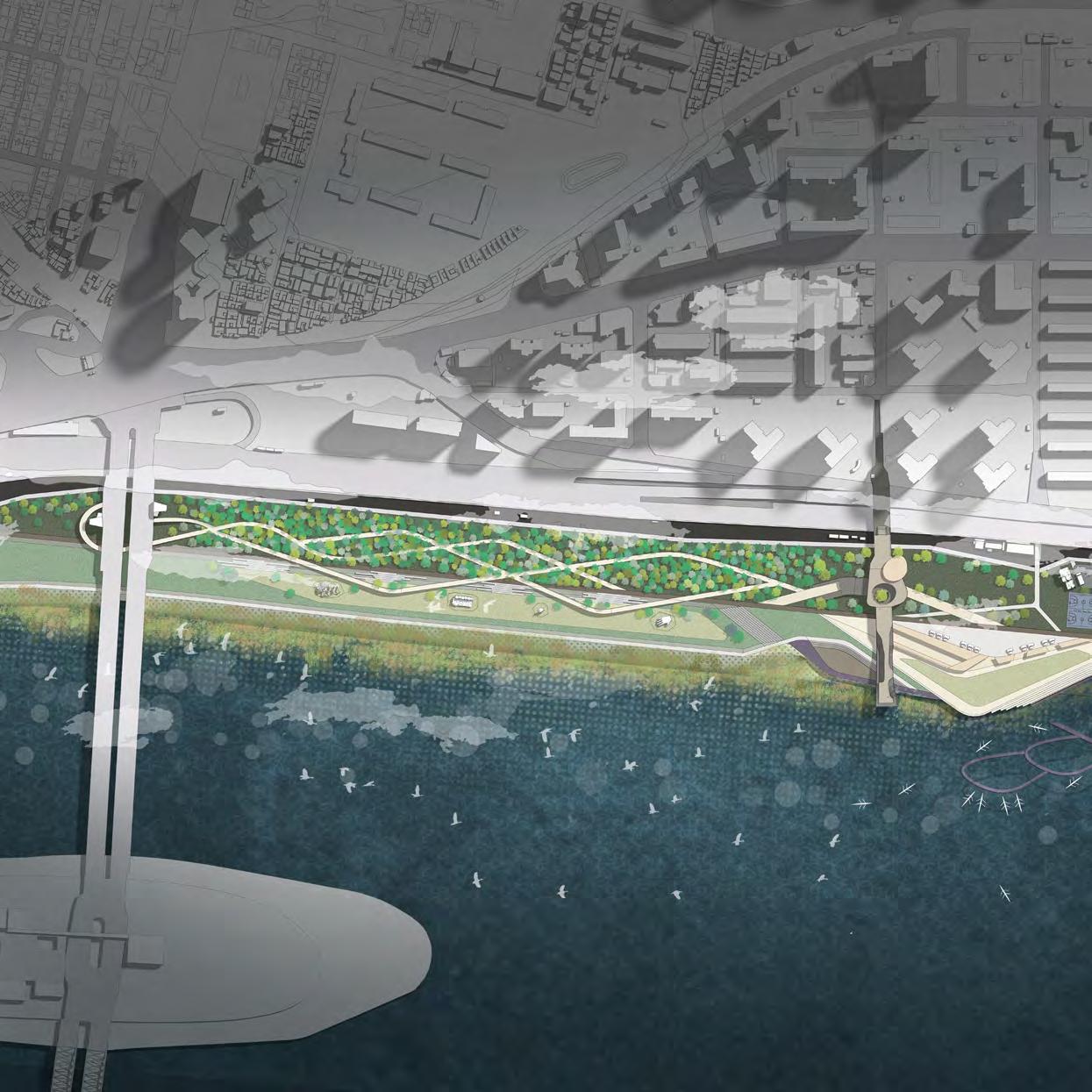
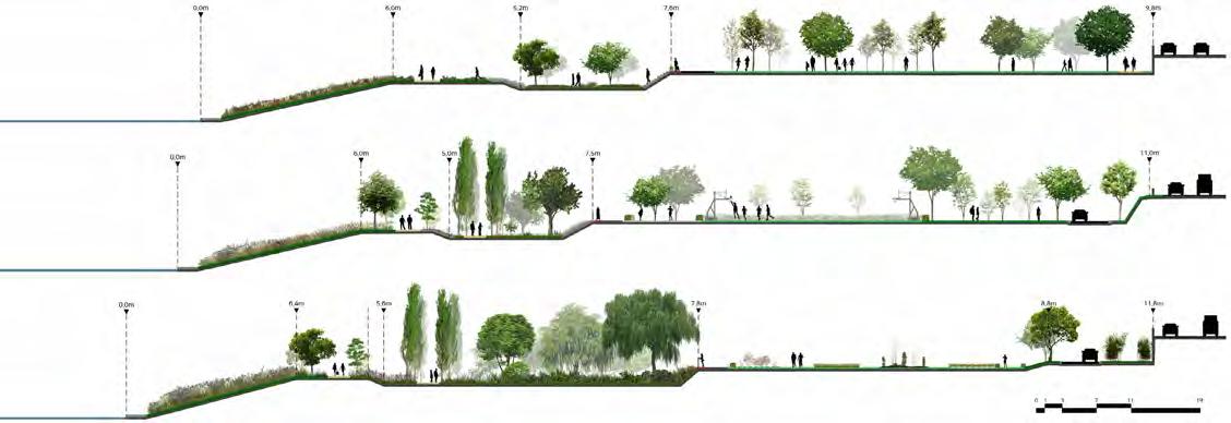
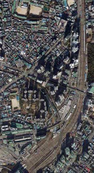
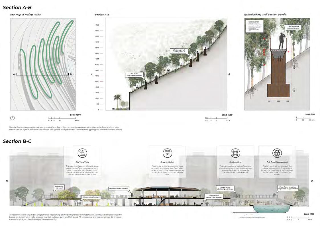
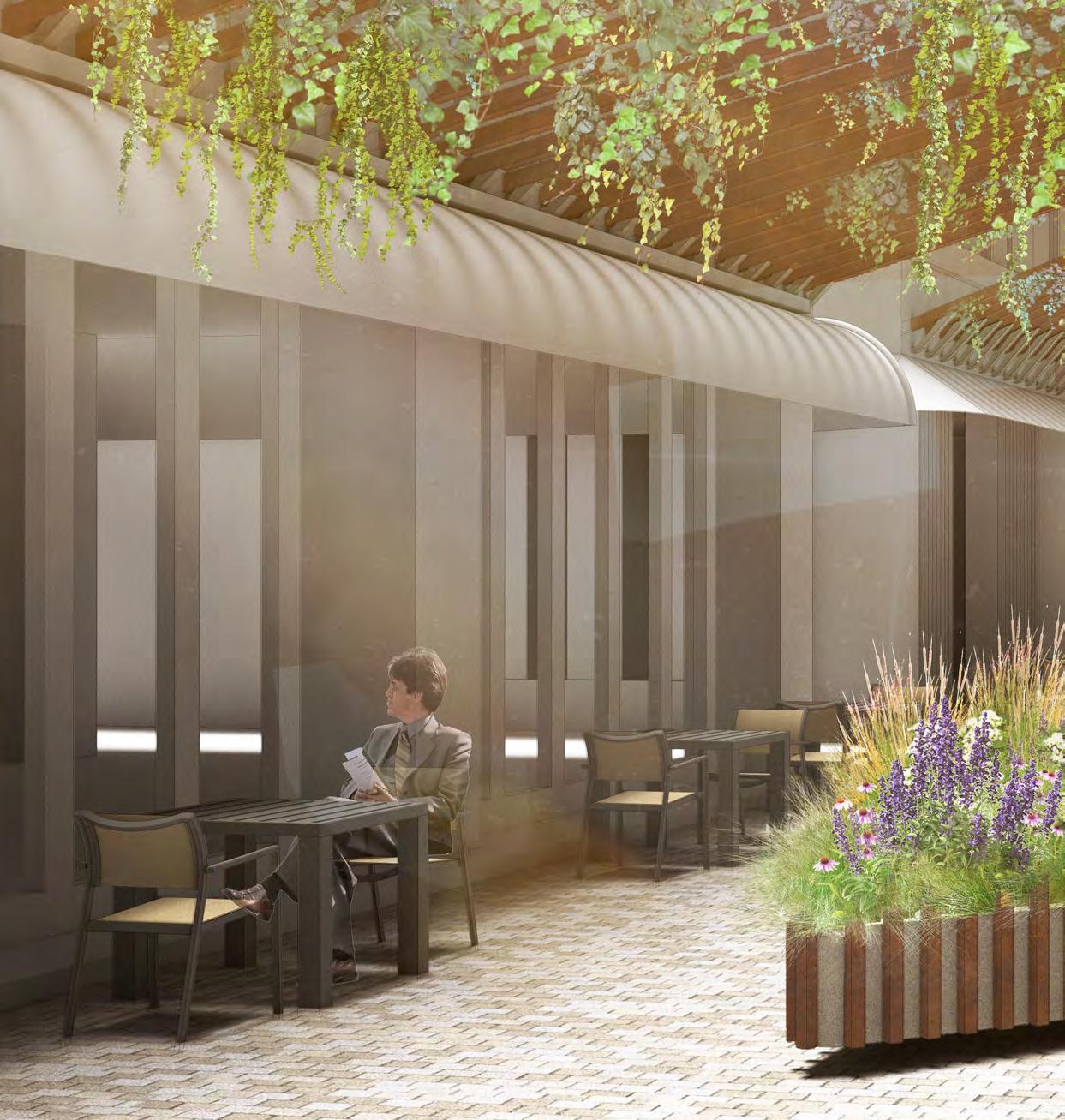
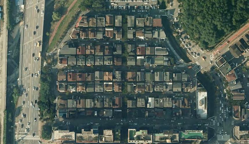
Ichon Hangang riverside park had been perceived as one of the largest riverside park positioned in the central point of the Han river stream, but unfortunately it is not as often visited as other parks by local communities. The project attempts to revitalize and reveal the hidden values of the site and starts by understanding them through field research.
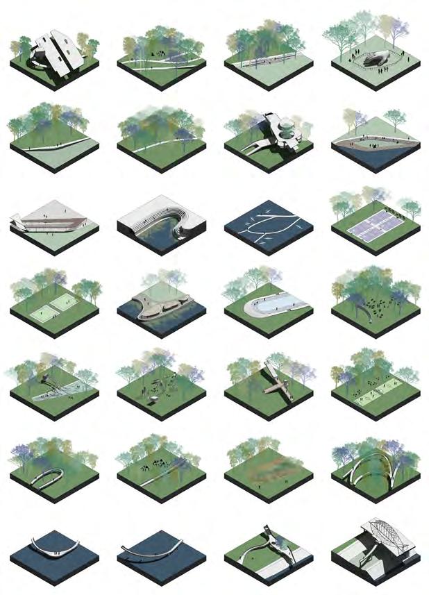
The project incorporates and reinforces the preexisting programs and elements of the park by intervening physical infrastructures named 'Connectors'. They allow bridging of programs with the surrounding urban context, paired with three main 'scapes' blended together through reconfigured planting scheme and experiential pathways.
Ichon Hangang Park has the highest ecological value in Yongsan-district and has the potential to become an ecological hub as it is located in the central area of Seoul.
Despite its favourable location and size as a central ecological park for Yongsan-gu, it is the least visited park along Han-river because of its obstructed viewpoints, lack of accesibility, and unmanaged overgrown plants.
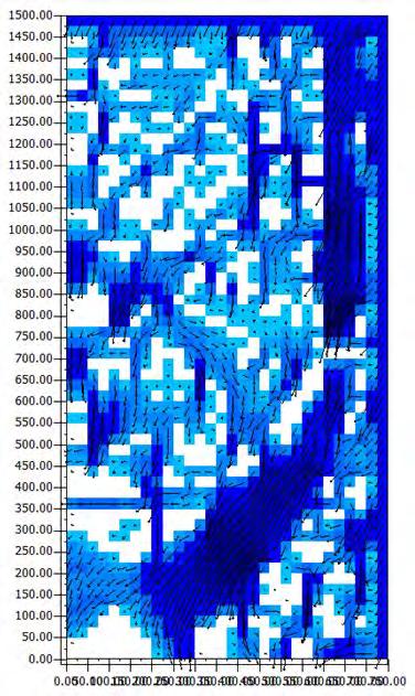
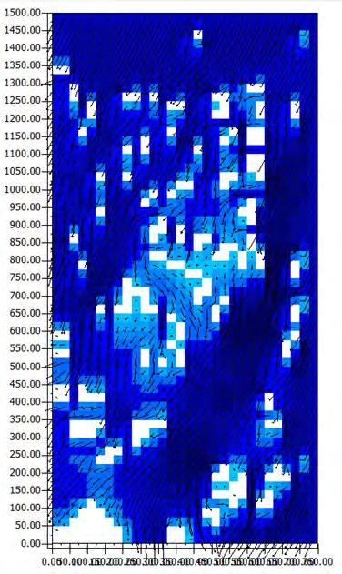

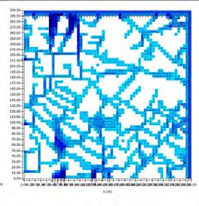
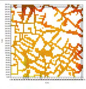
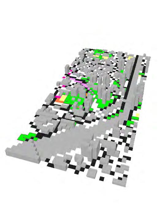
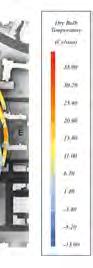
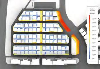
ENVI-MET Simulation was carried out on two typical residential blocks in the district. It aimed to search for an associable wind corridor that considered in the design to alleviate high LST symptoms in Yongsan district.
 ENVI-MET SPACE MODELING
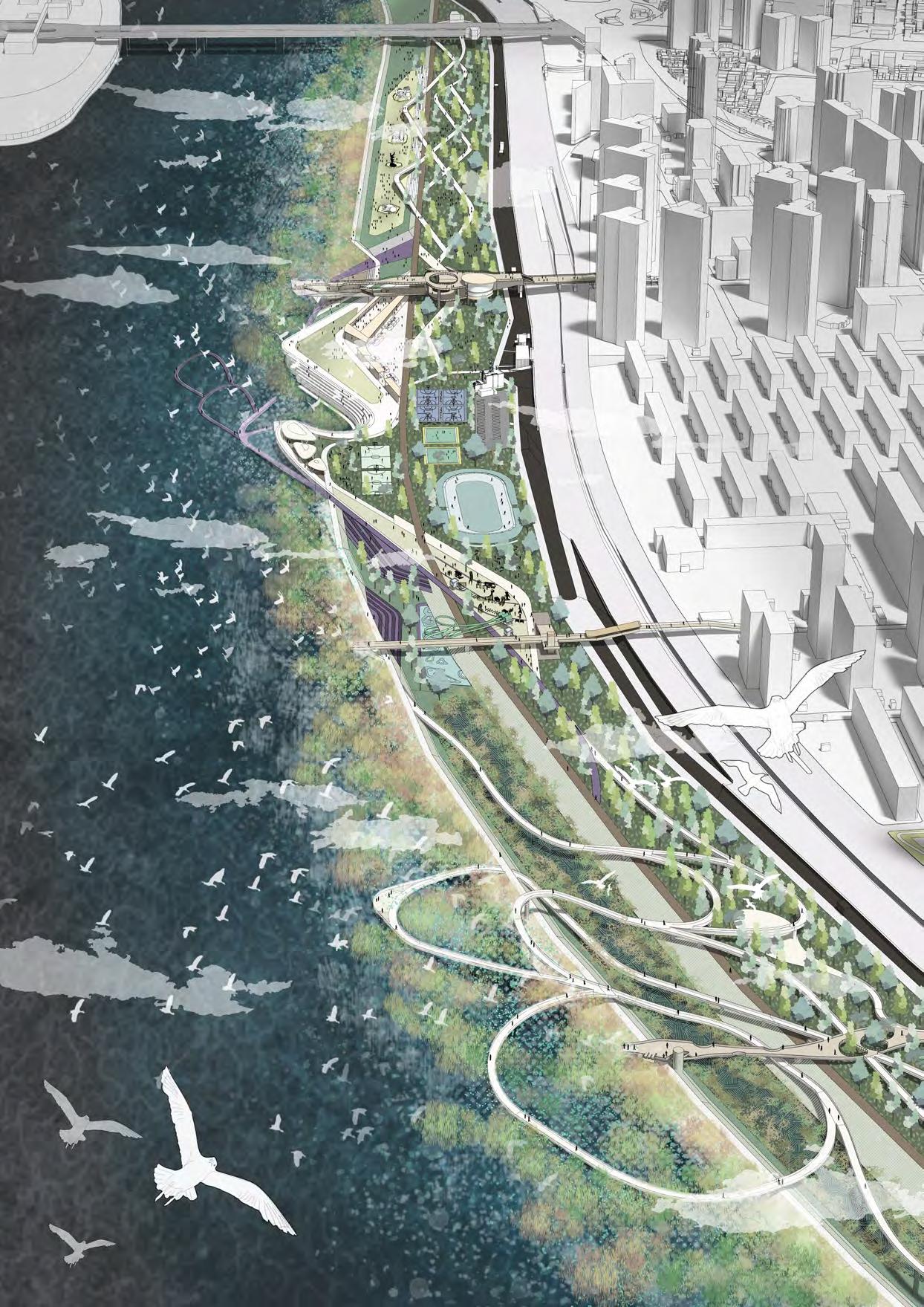
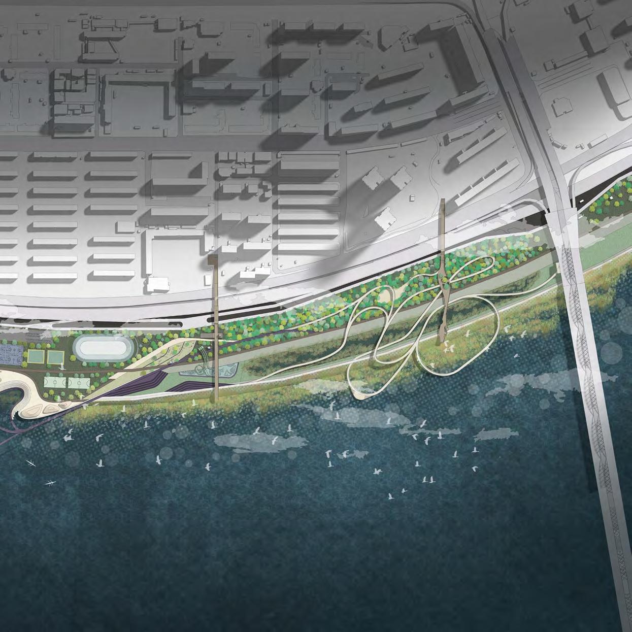
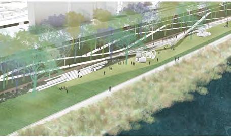
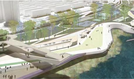
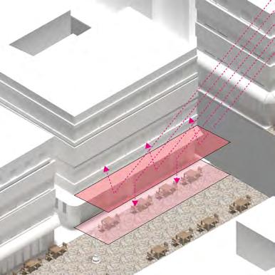
Connector T-1 blends the park with one of the densest commercial district in Yongsan-gu by connecting the commercial street, with cafes and restaurants, into the park and providing new platforms to enjoy them with a panoramic view of Han-river.
Connector T-2 connects to the school zone of Ichon-dong, and aims to blend with existing playscapes and sport facilities situated in schools. Since it is expected that students be the main user, safety canopies are installed along the platform.
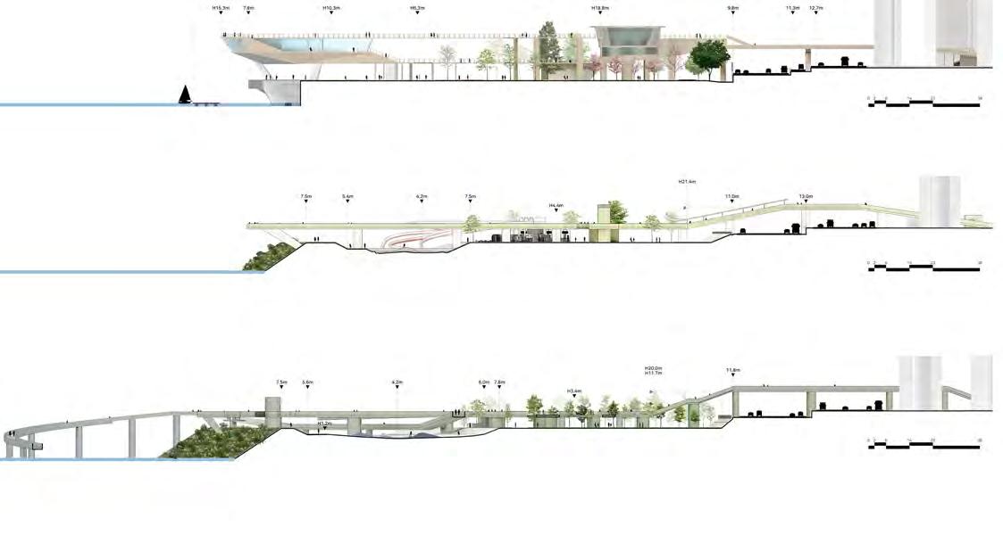
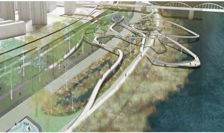
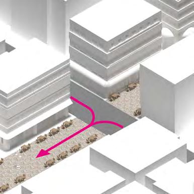
Connector T-3 break throughs above the highway and connects to an adjacent park located in the innerside of the urban area, connecting green patches together to form a 'green' network in Yongsan-gu. The path leads to the dynamic elevated walkway that allows direct experience and observation of han-river ecology which had been disabled in the past.
"NEIGHBOR + PLAY + ECO"
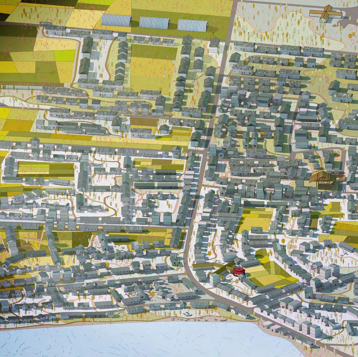
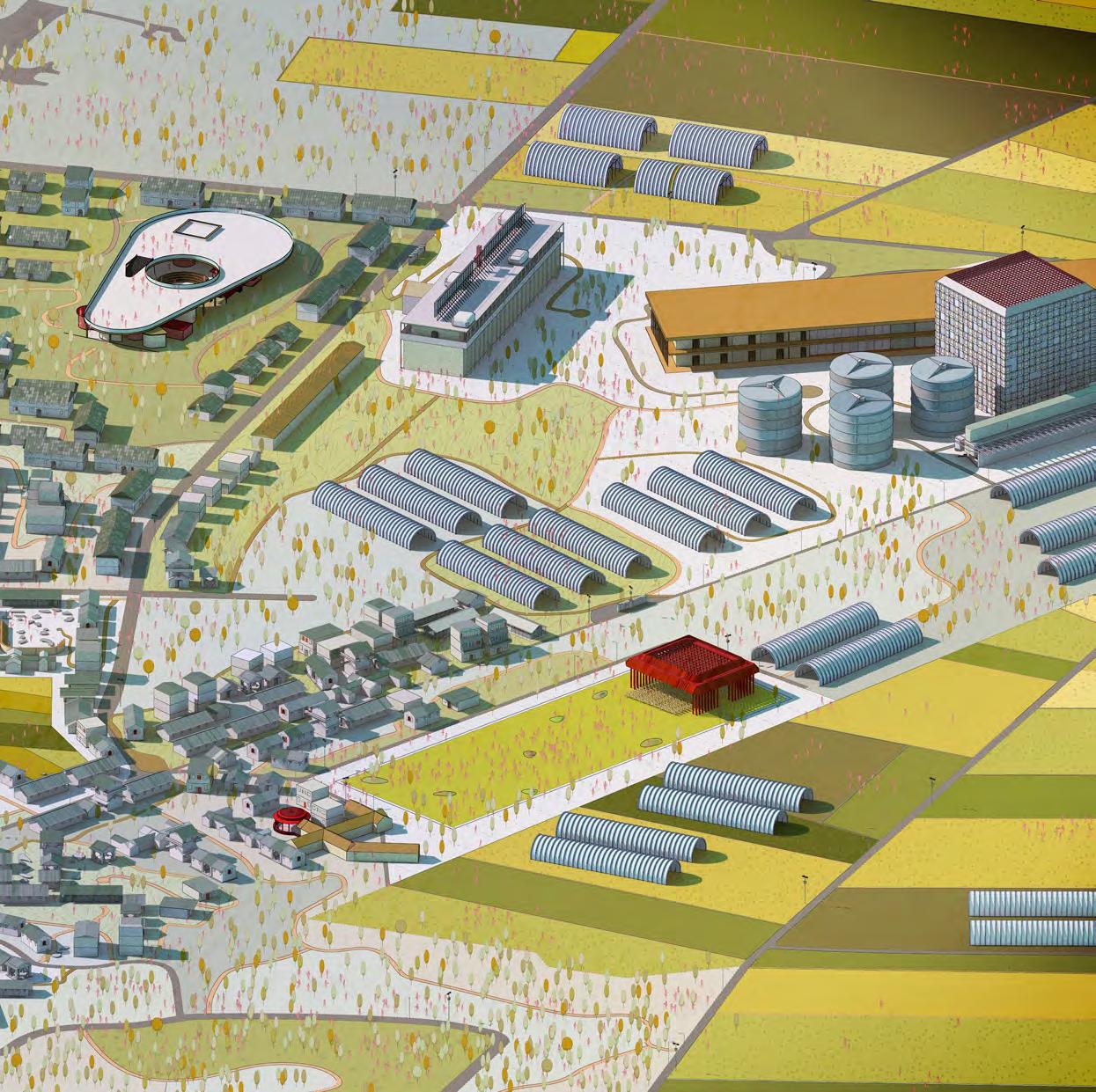
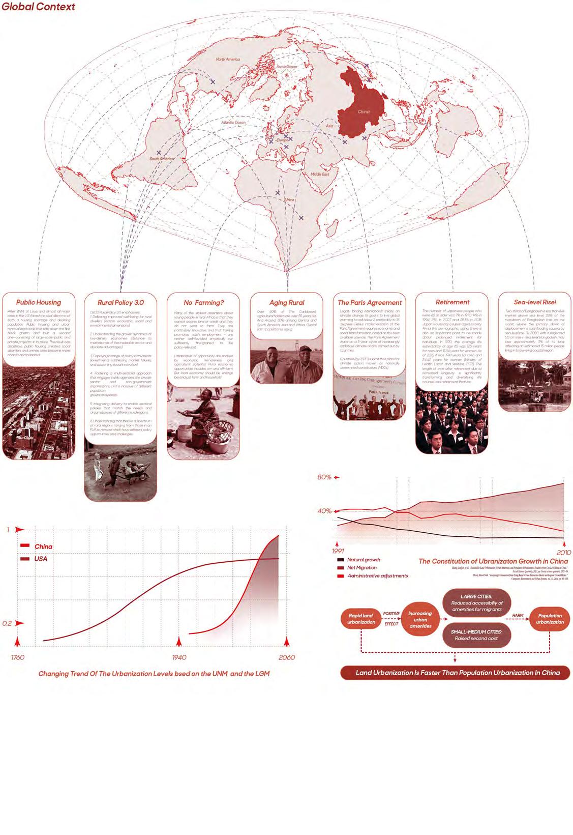
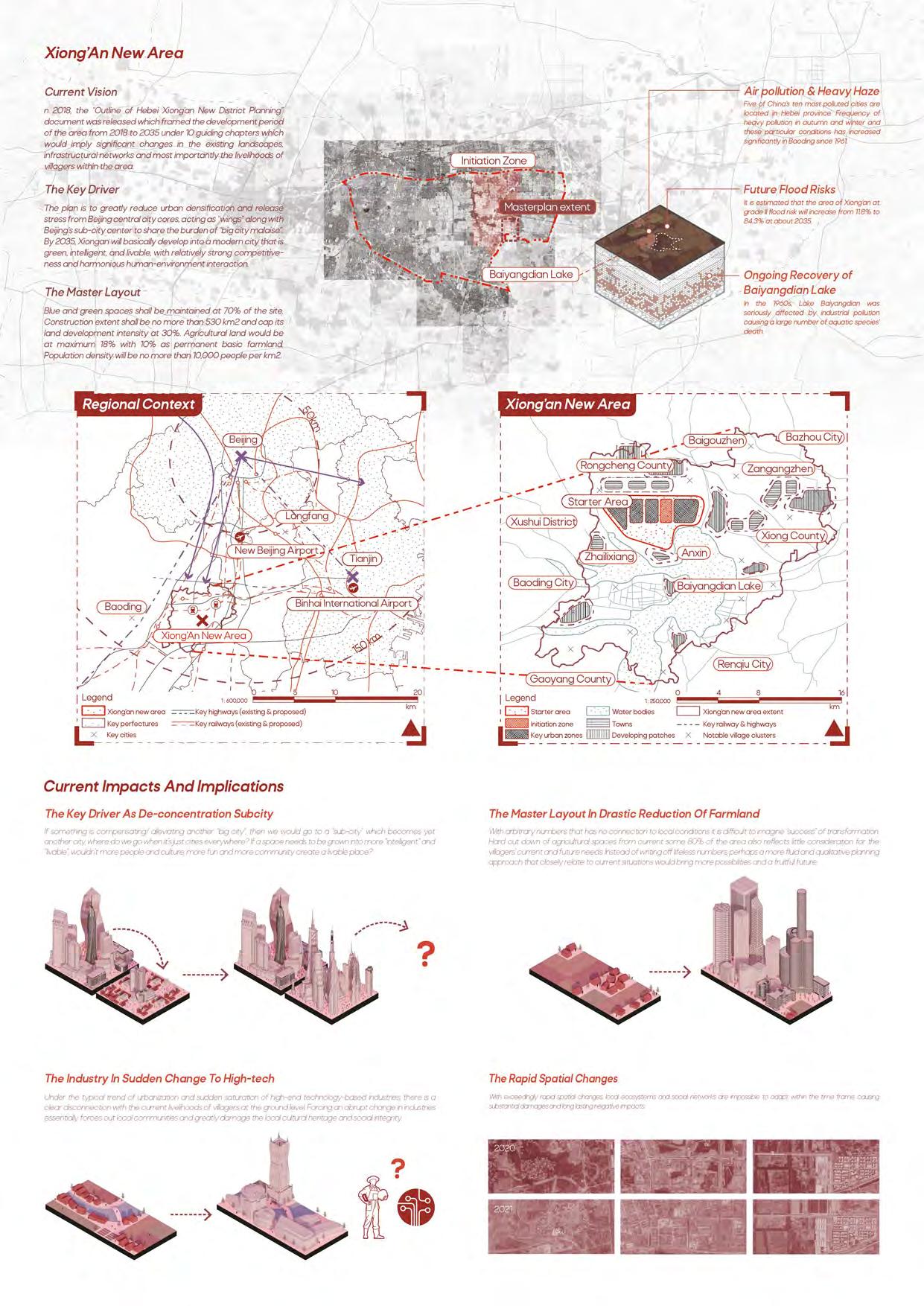
With global trends of rural urbanization, China is no stranger to this process. Since 2014, the Chinese central government has pointed out an intention for integration of 3 major sectors (Beijing, Tianjin, Hebei). As part of the larger plan, Xiong’an of Hebei was identified as a desirable location for intense urban development and would become a national-level new area serving as a development hub for the Beijing-Tianjin-Hebei economic triangle. The main task of the new district is to become "Beijing's non-capital function de-concentration center."
But how has the fast approach of “build and ask questions later” impacted the people? In an alternative, can we go slow? Or perhaps a bit of fast and a bit of slow, like an elegant dance.
Rapid Urbanization
Megacities have been our way-out, but the cost of outrageous plans were often endured by the rest of our planet: global warming, sea-level rise, air & soil pollution, depleting natural resources, overpopulation and aging community and more unsolved issues. Many of these problems were well discussed and debated, but where’s the act?
A film with only climax is no fun to watch. A phone that never recharges will run off its battery. Instead of having everything going fast, can we go slow?
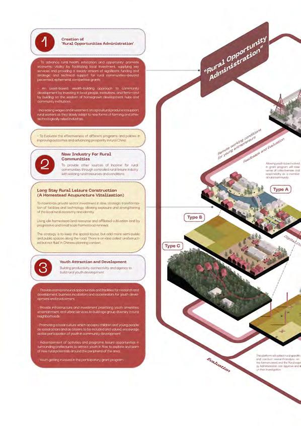
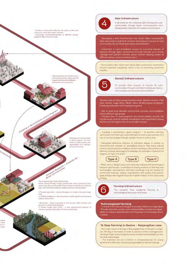
 Integration of 6 design strategies into Xiong'An New Area initial development site, enforcing the 'soft power' with local villagers and raising sense of ownership in the process of development.
HKU Landscape Design Studio IV
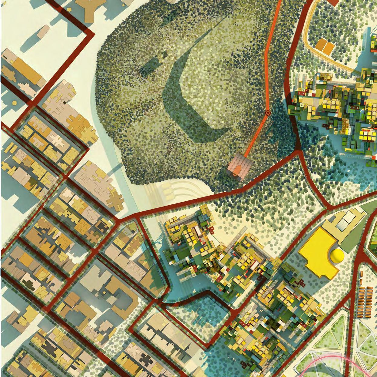
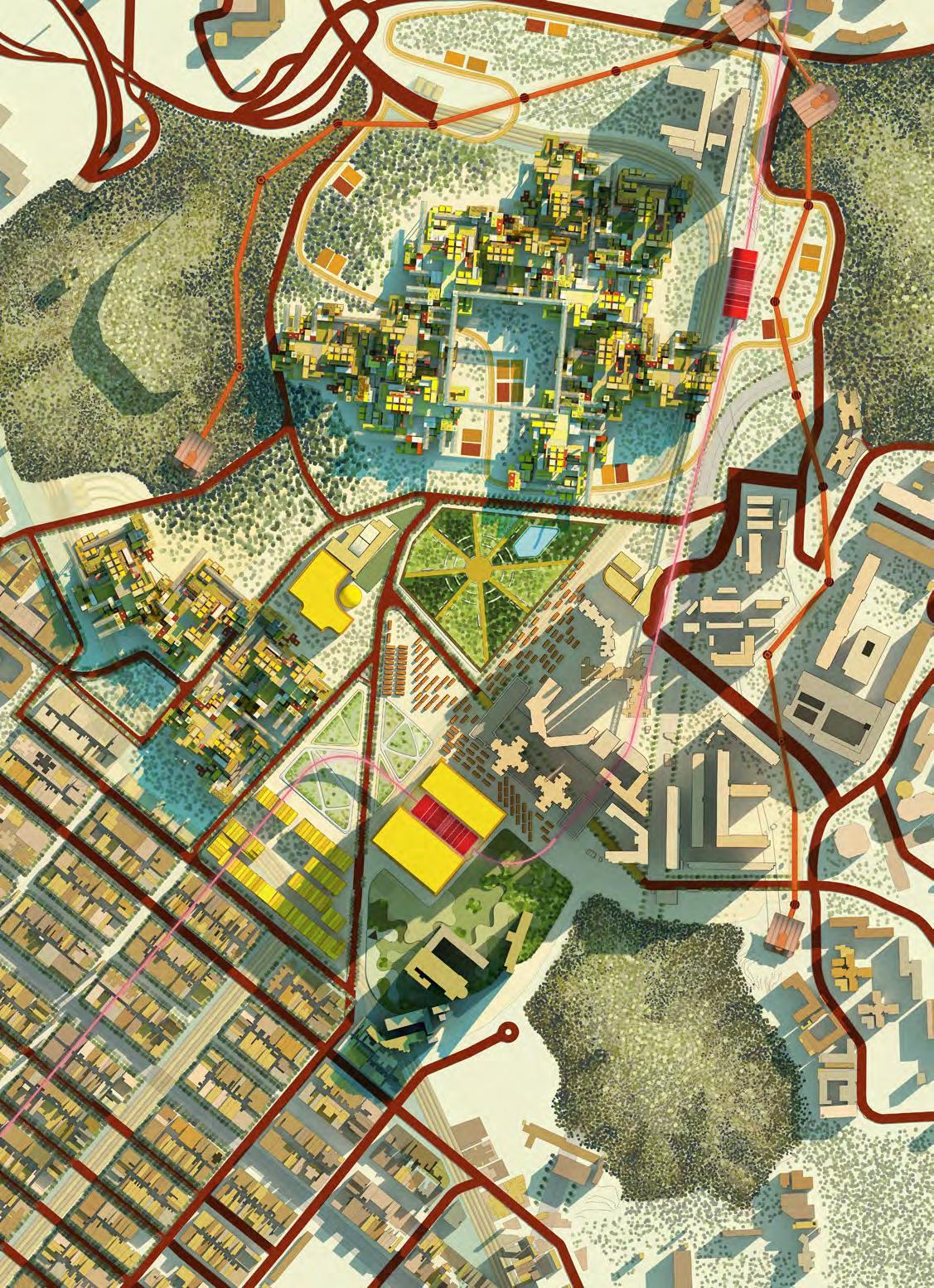
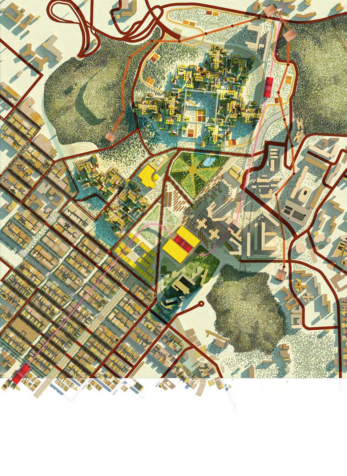
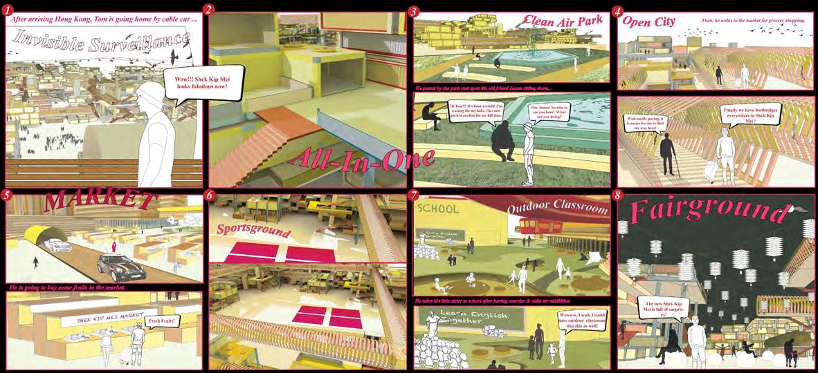
The concept of masterplan proposal, inspired by 'Open City' - Richard Senett, aims to draw out a vision for possible future development at Shek Kip Mei Region based on four systems. The opening of groud level and moving vehicular roads underground enable public ownership in spaces, enhancing public cohesion. Those spaces will also integrate more vegetations, allowing a wider scale for the ecological patch, and stabilizing the ecological corridor between the preexisting urban hills. The new public ghetto structure allows diversification of residential, public, and commercial areas. For instance, it allows people to create their own spaces for urban farming at the roofs. It will remove the unused buildings and convert them into public parks with native tree and shrub species.
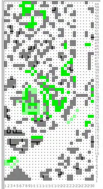
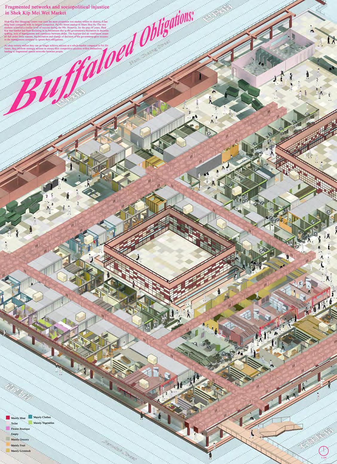
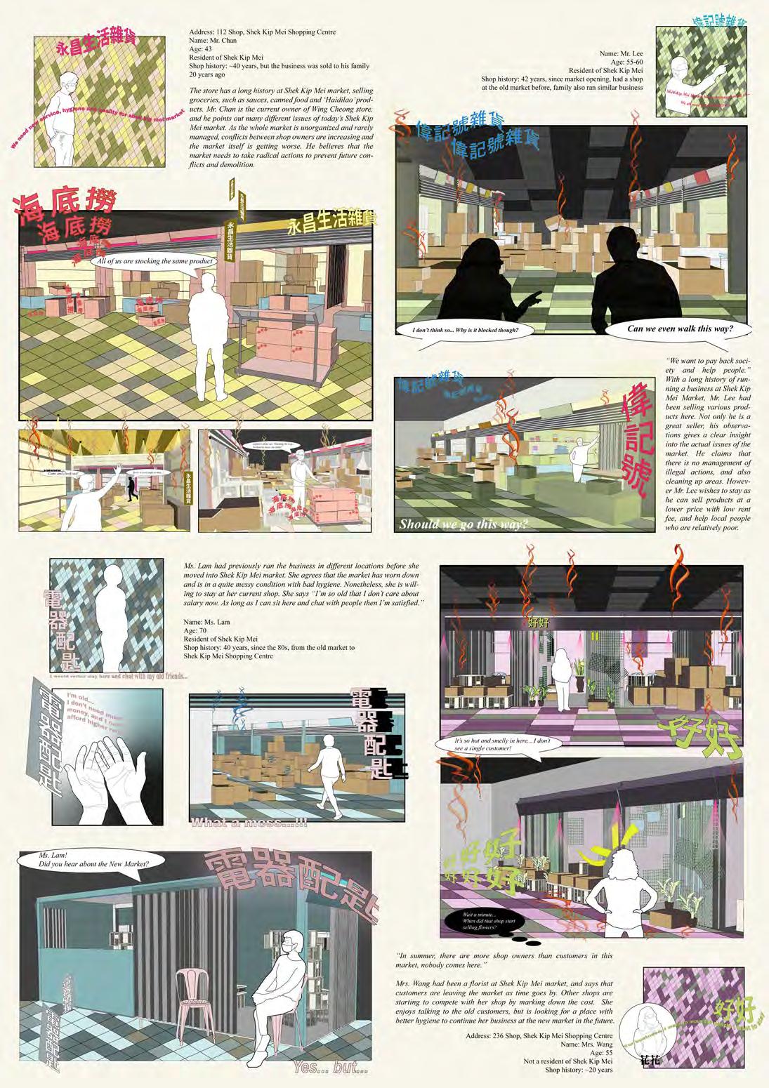
Fragmented Networks and Sociopolitical Injustice in Shek Kip Mei Wet Market
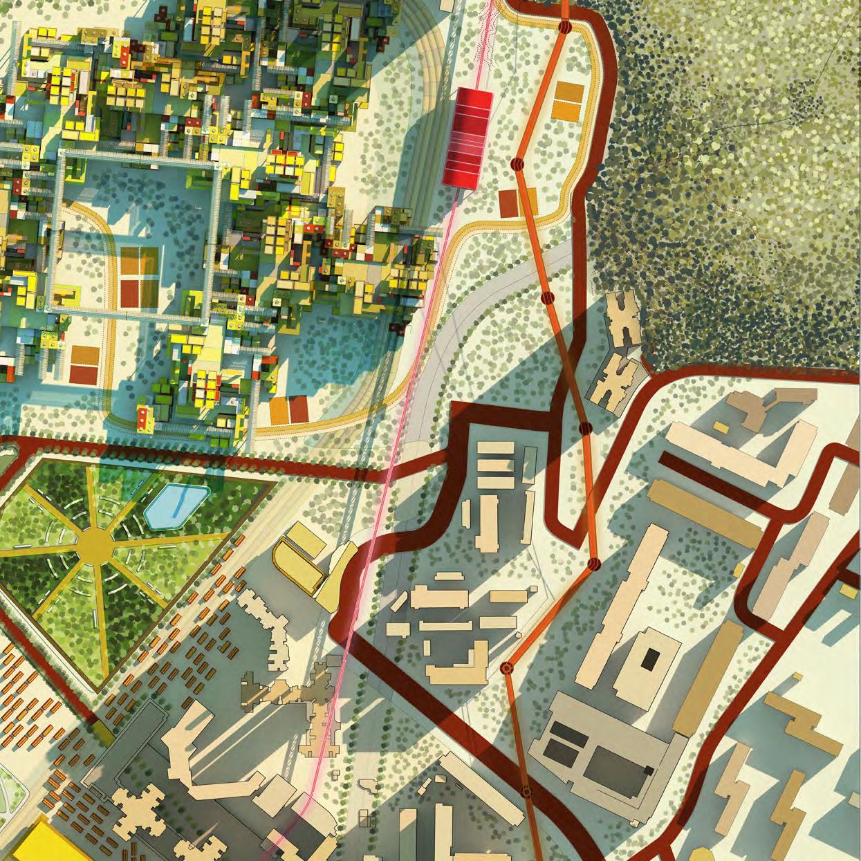
SKM 2070
50 Years Visualization of Shek Kip Mei District
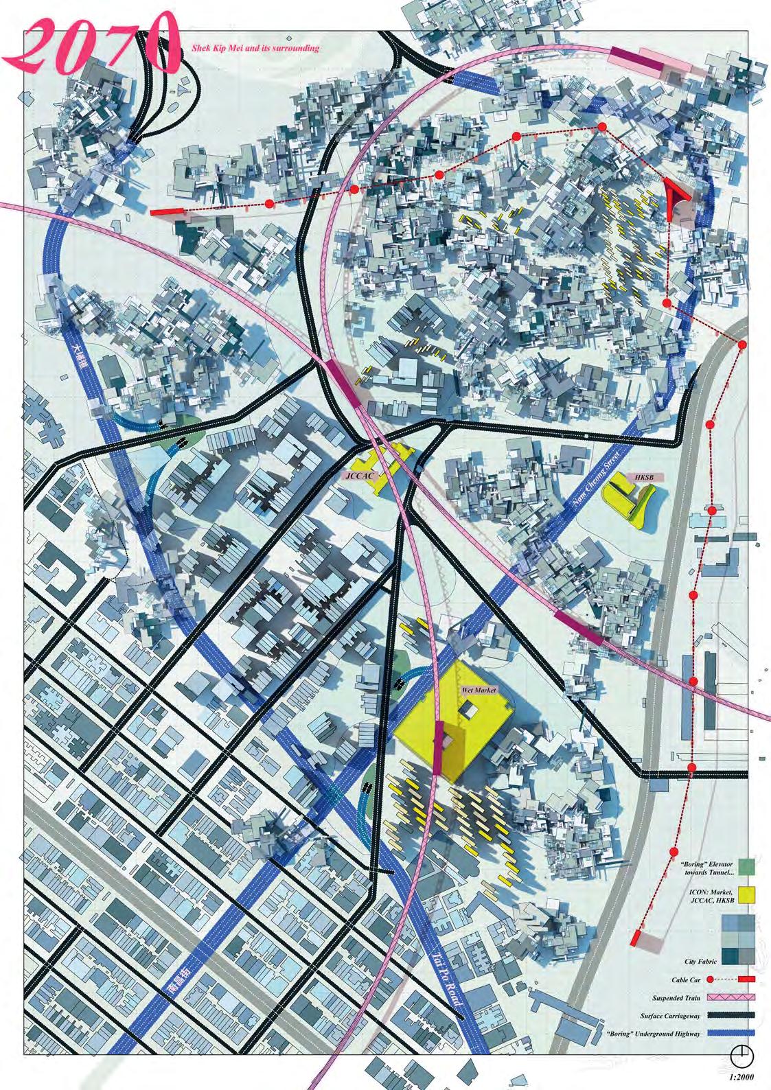
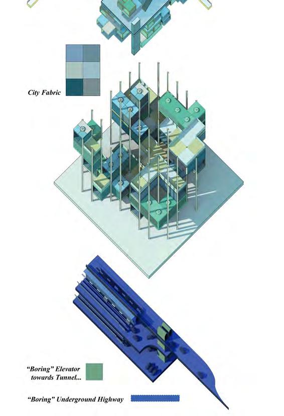
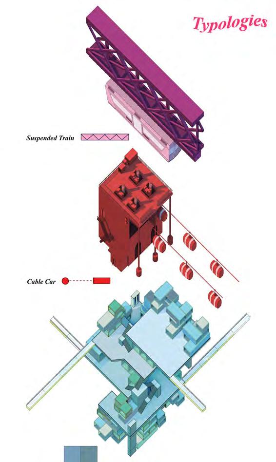
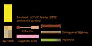
Infrastructure Typologies
Thorough research and interpretation of flow at Shek Kip Mei had further led to 3 major conceptual interventions, which are 'Free Ground', 'Invisible Surveillance', and 'The Public Ghetto'. The intervention incorporates the beauty of informality, openess and fluid interpersonal interactions from the concept of "open city" by Richard Sennett.
All ground level circulations within the district will be dominated by social activities and pedestrian movement. By that, all vehicular paths are to be rerouted underground and overground through series of elevators and underground piping.
The suspended train and cable car are two similar renditions of the public bus and tram transportation. Mass transportation up on sky allows passengers to wander with their eyes, as well serving themselves as a surveying agency, merely “god-mode”, spectating activities on ground in Shek Kip Mei. T
The public “ghetto” is a new form of public housing. Unlike the formal verticular envelope, ghetto preserves a certain amount of publicity within our private spaces - this means that human interaction and neighbouring confrontations are unavoidable and that people are asked to communicate in order to fit their needs.
50 Years Visualization of Shek Kip Mei District

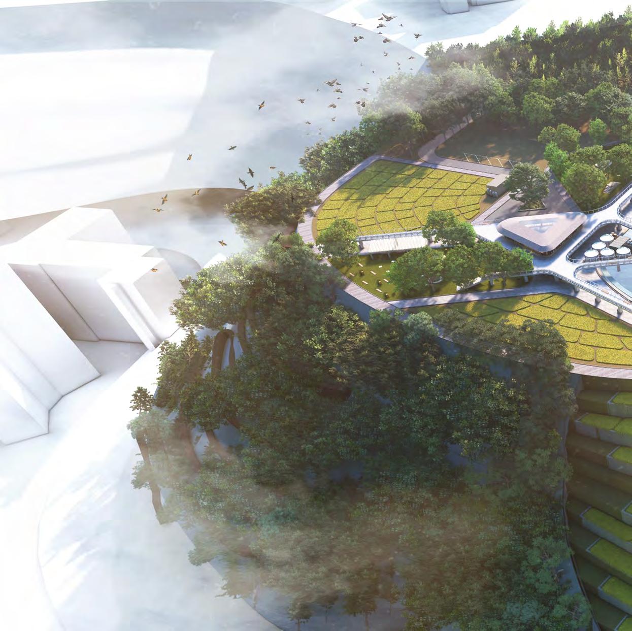
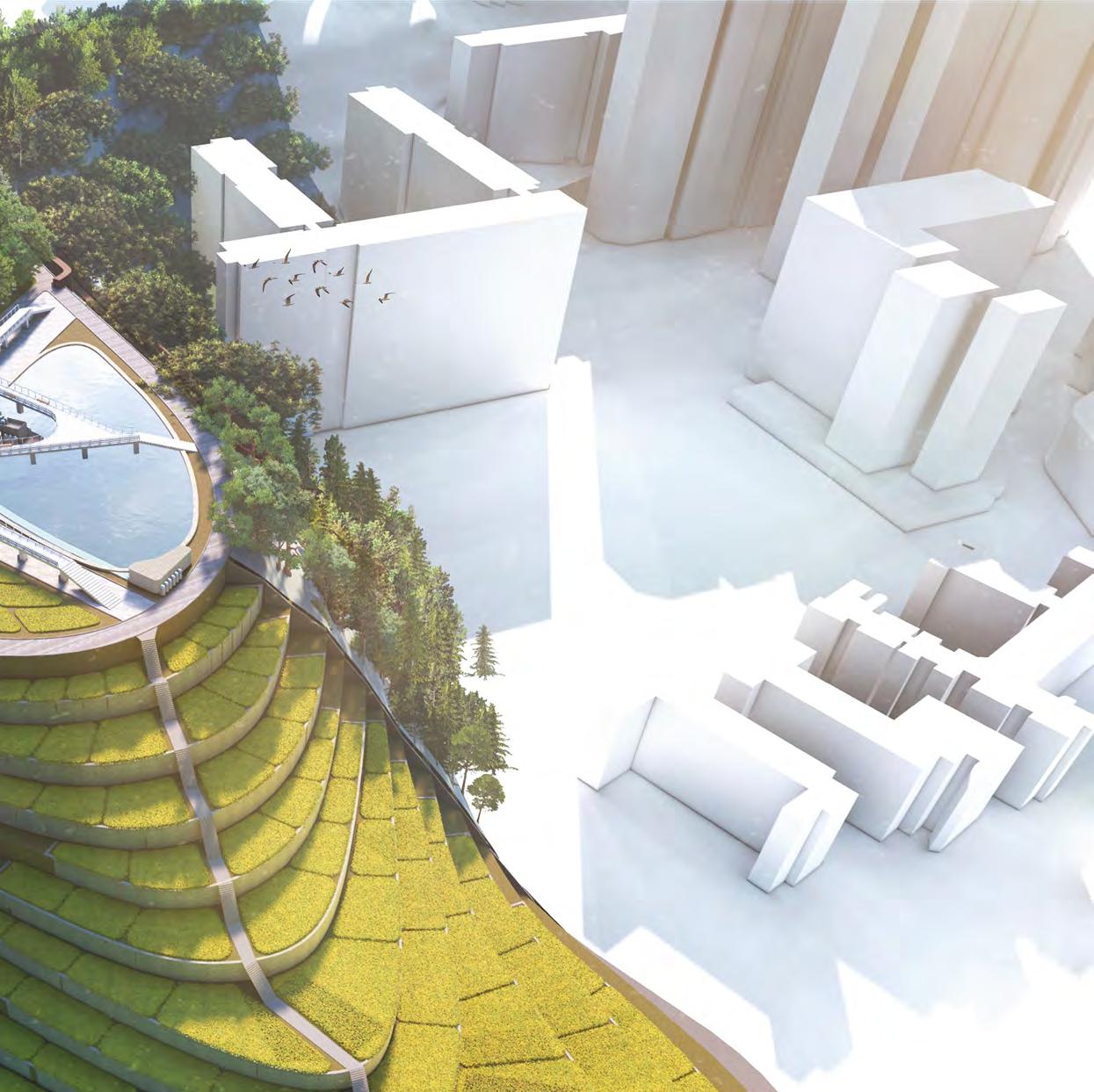
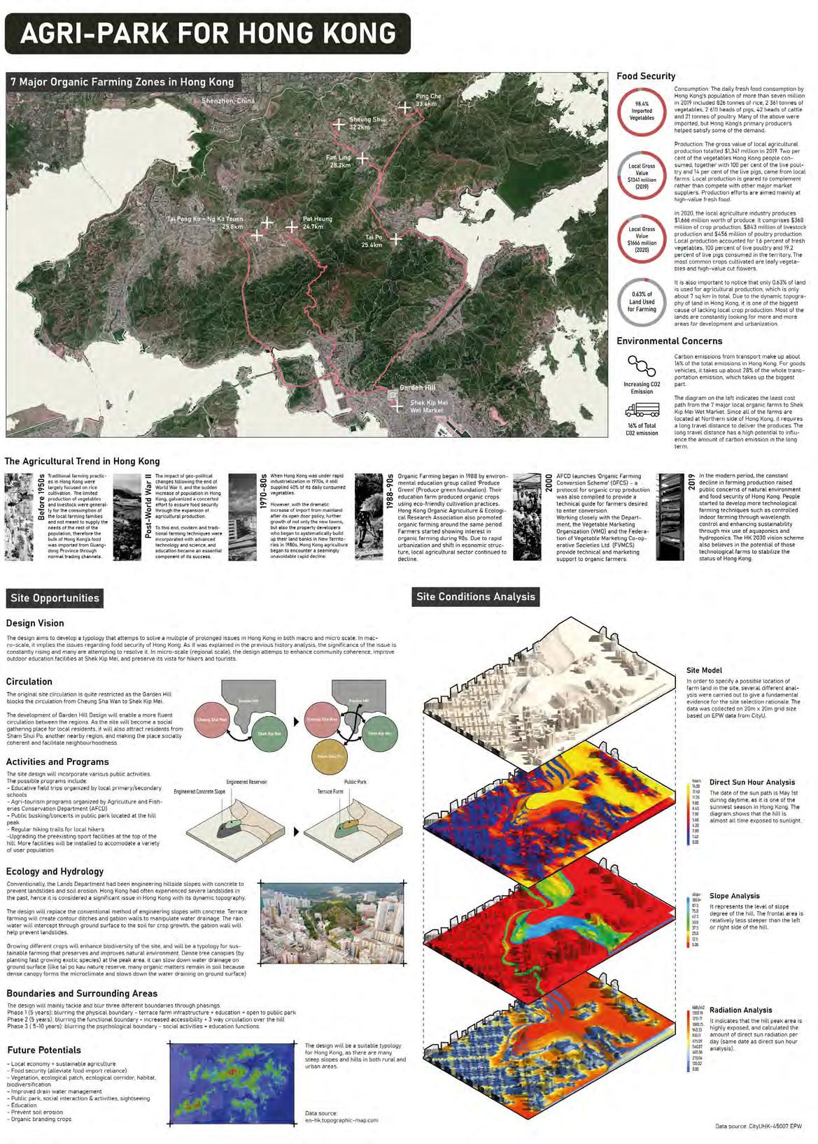
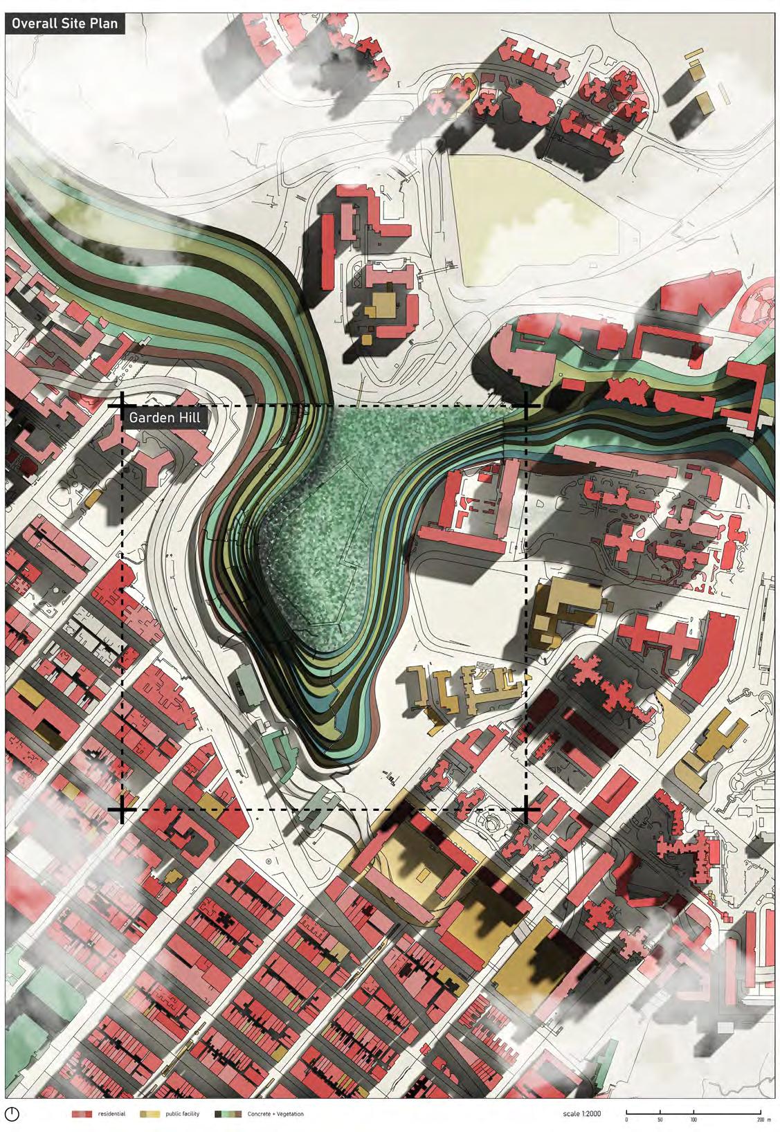
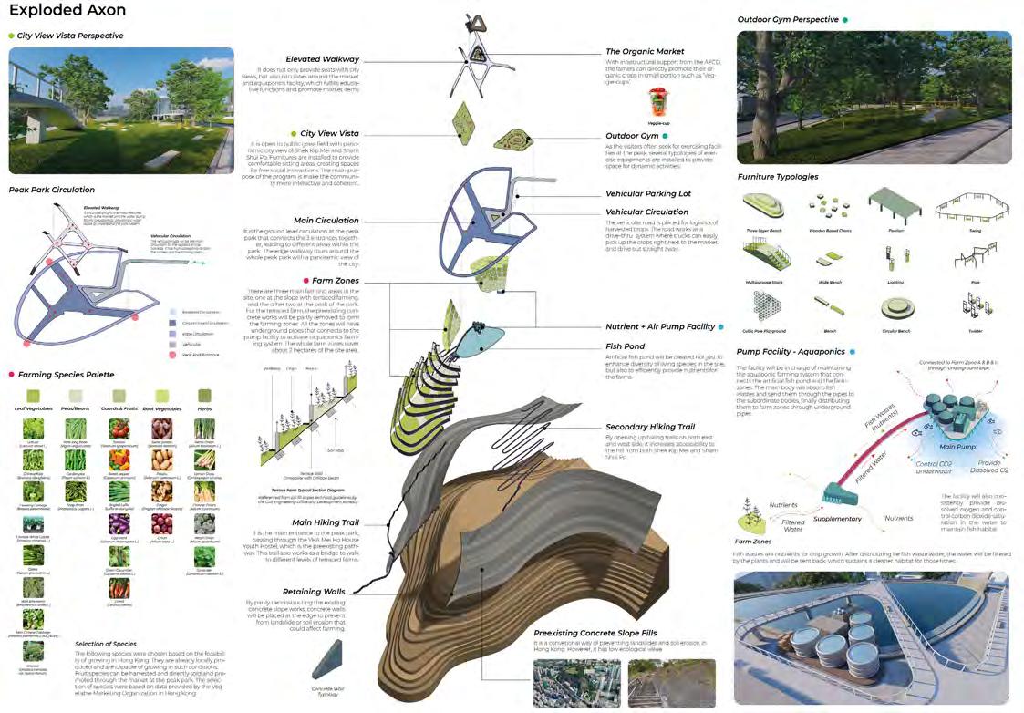
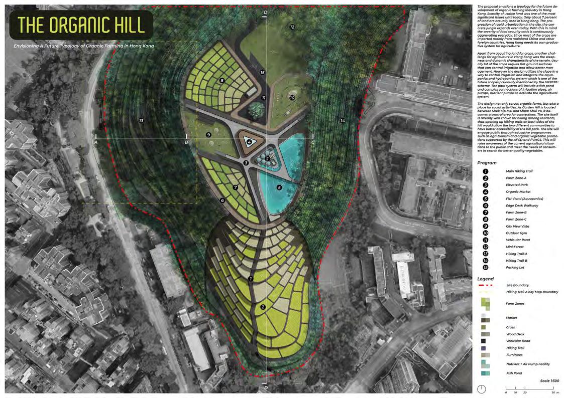
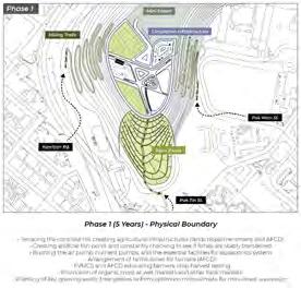
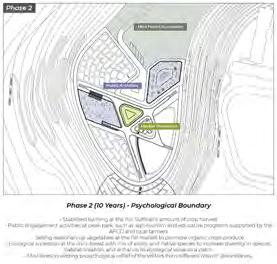
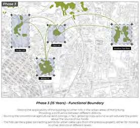
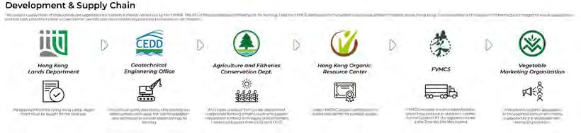
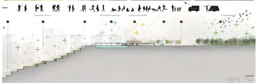
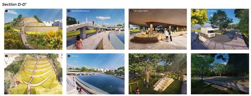
The project aims to develop a typology of a sustainable agri-park for numerous urban hills in Hong Kong that can enhance social cohesion and food security through crop production, and incorporating activities that can facilitate conviviality among different communities.
The site is located between Sham Shui Po and Shek Kip Mei which has the potential to supply both districts while creating a confluential point for social interactions. Considering its steep slope, the design utilizes it as a way of irrigation, and also supplmenting filtered water supply through aquaponics. There will be increased engagement of the public through educative programmes such as agri-tourism and city scale organic vegetable promotions supported by the AFCD and NGOs.
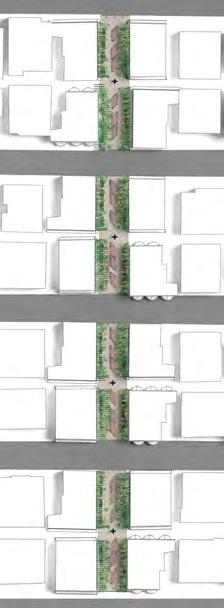
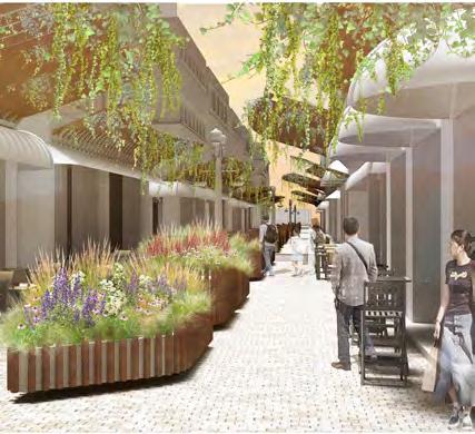
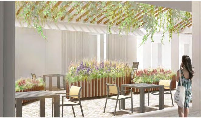
The project aims to reinvigorate typical narrow streets in urban areas through site-specific furnitures with a planting design. Linear parks and narrow streets are prevalent in our modern urban infrastructure, but they are often left out in cities. Nowadays a lot of design schemes include physical transformation but pays less attention to the ecological and planting aspect, such as considering plants' ecological suitability. Hence the scheme serves as a prototypical design for typical linear spaces found in our daily life in urban areas that need interventions for social and spatial vibrance.


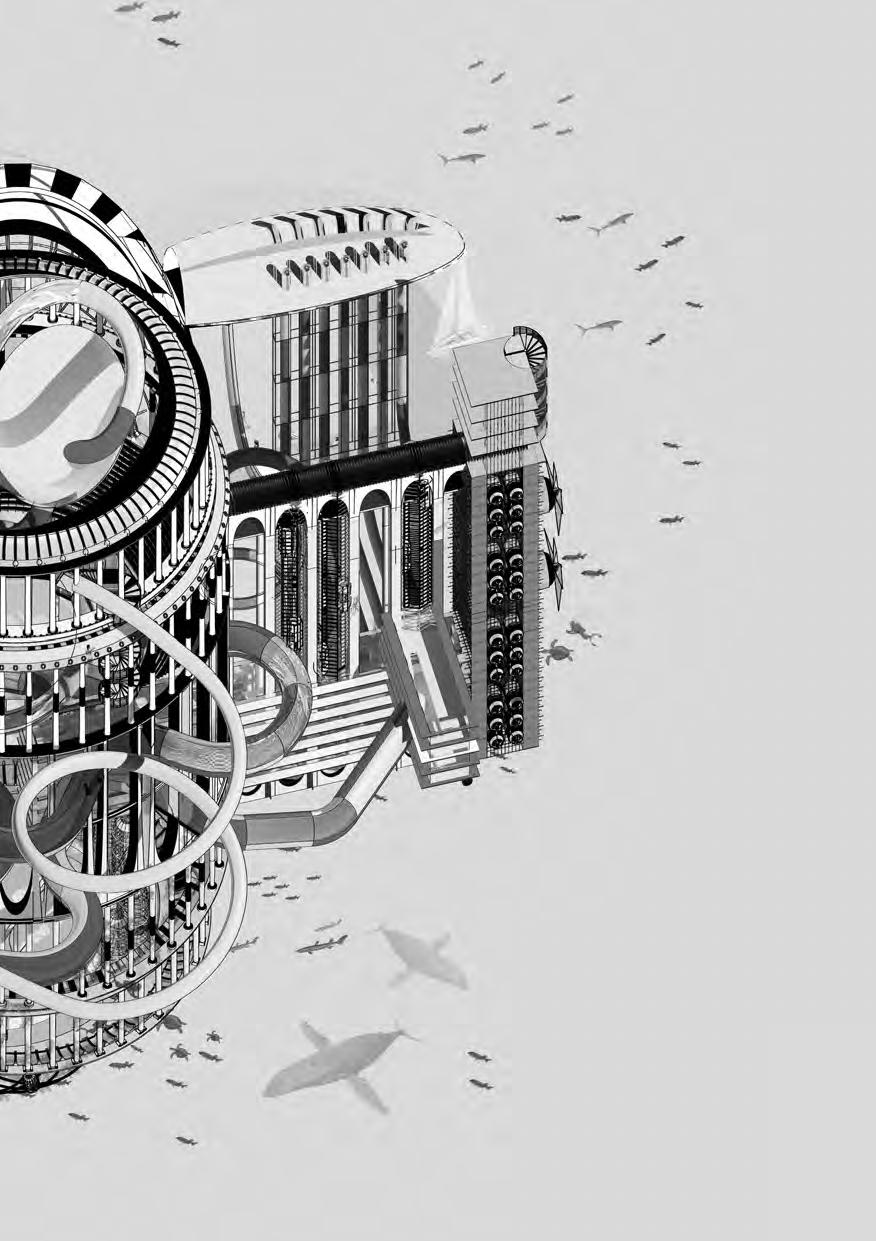
08 BABYLON EXPRESS
A Dystopian Pseudo-Water Park as a Response to Sea-Level Rise

72H Axo-Battle: Water Park Competition 2021
Editorial Pick
Sponsor: Non Architecture Competitions
Babylon Express is a project responding to the global sea-level rise as a dystopian pseudo-water park happening underwater. The complex comprise of residence, water entertainment, restaurant & bars, as well as arcades and a centre (Palladio) dome, restructured in a metal framework. It strives to study structure potentials for the future multi-purpose spaces that adapts to global scale changes such as climate change, sea-level rise, and their impact on landscape systems. The design features a a various number of productive structures that utilize tidal forces as an energy source, making the structure self-generative and independent. Cages at the bottom side will hold oyster shells to attract and enhance biodiversity, suiting the needs for the nature at the same time.
Randomization of variables to determine eco-corridor: Script-assisted annotations:
import rhinoscriptsyntax as rs import random
##Variance in Least-Cost-Path Analysis (friction value, total length)
RouteA = [["RouteA NDVI LCP", [234,121,0]], ["2.52km", [234,116,0]]]
RouteB = [["RouteB Cross Road LCP", [189,264,0]], ["2.48km", [189,259,0]]]
RouteC = [["RouteC Light Pollution LCP", [173,169,0]], ["2.37km", [173,164,0]]] for i in range(2):
rs.AddText(RouteA[i][0], RouteA[i][1])
rs.AddText(RouteB[i][0], RouteB[i][1])
rs.AddText(RouteC[i][0], RouteC[i][1])
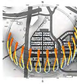
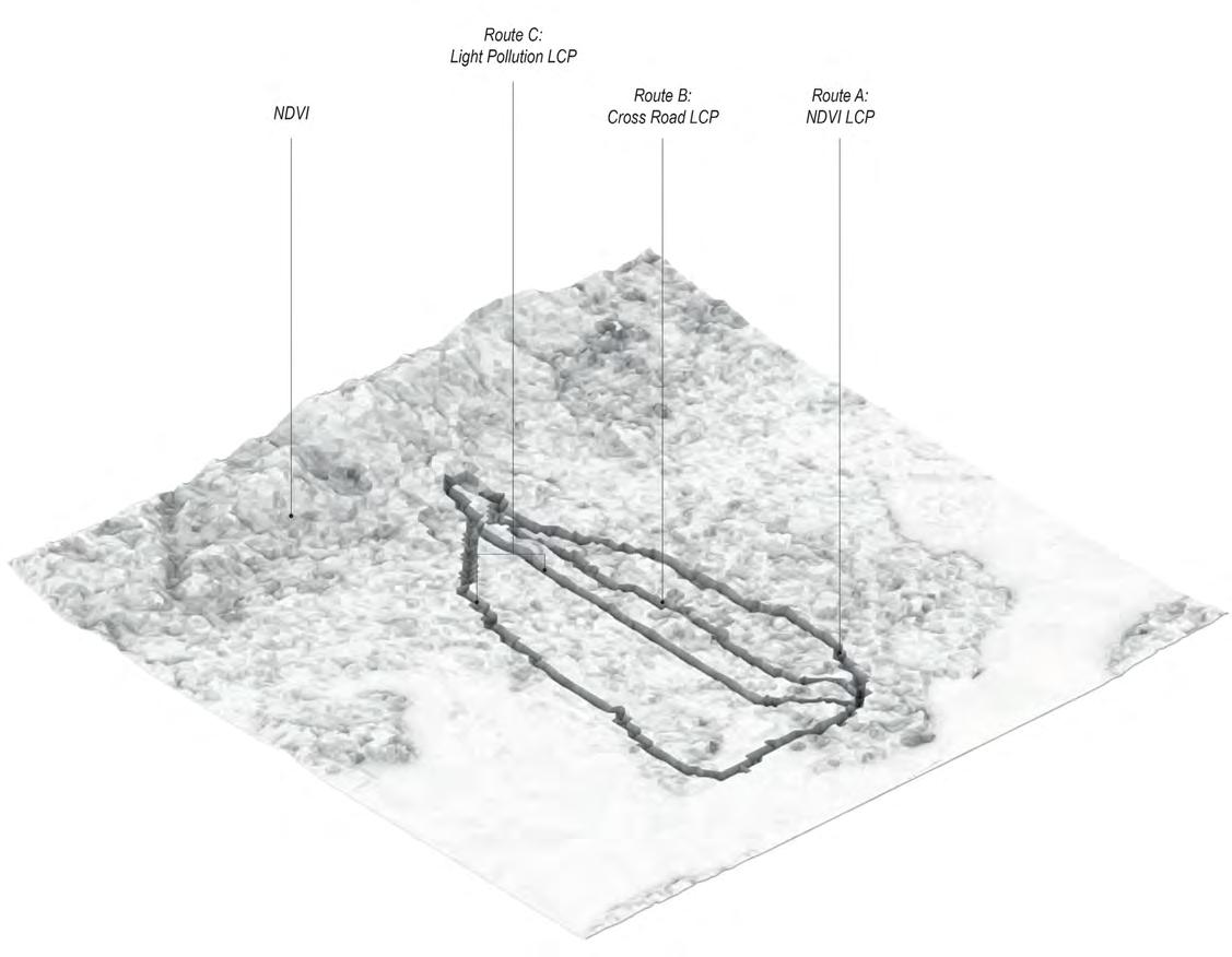
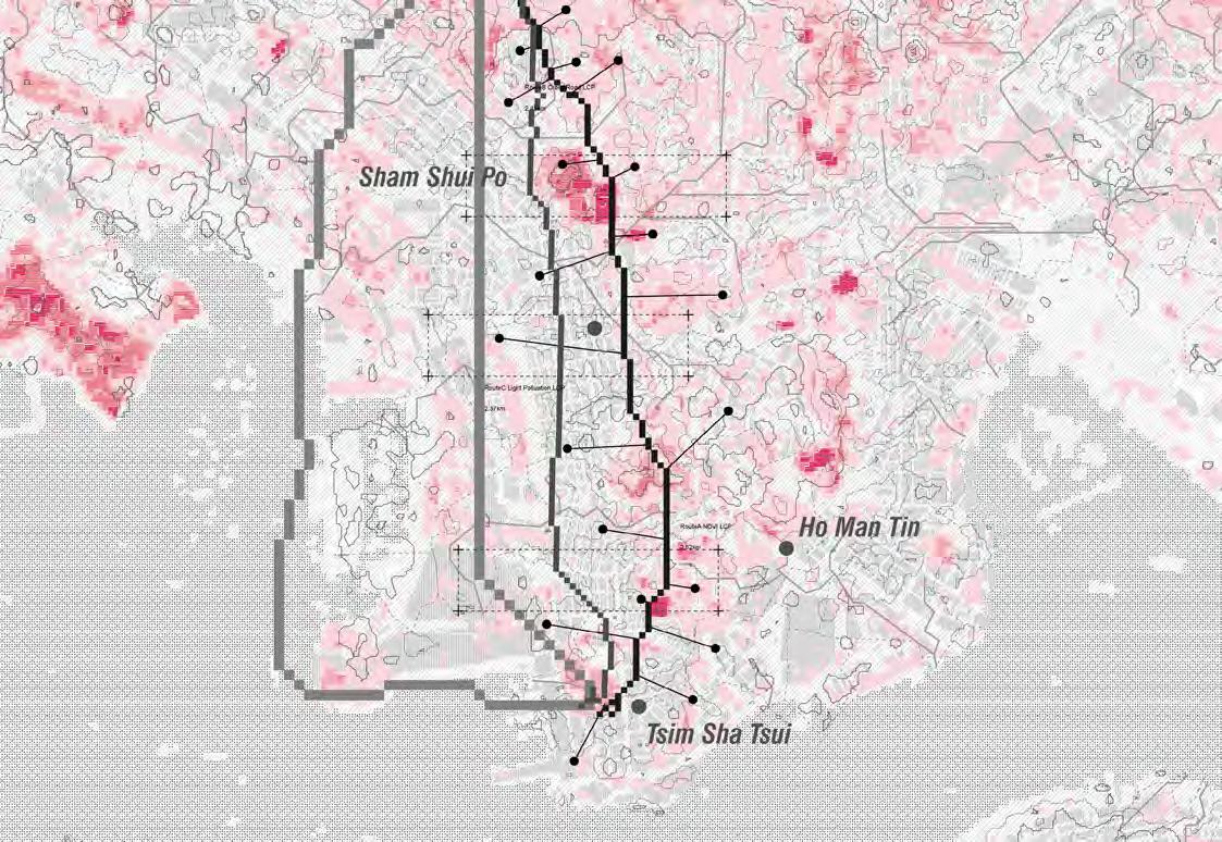
Existing Habitat Fragmentation and Avian Least Cost Paths in Kownloon Peninsula
In the reading “Assessing avian habitat fragmentation”, tree cover was valued as a factor for assessing birds’ travel route across Kowloon. Extending from the reading and based on two other researches, 3 least cost paths from Eagle’s Nest to Kowloon Park were created. The three LCPs were generated using different imagery and data to explore the impact of pixel size on carriageway classification and LCPs.
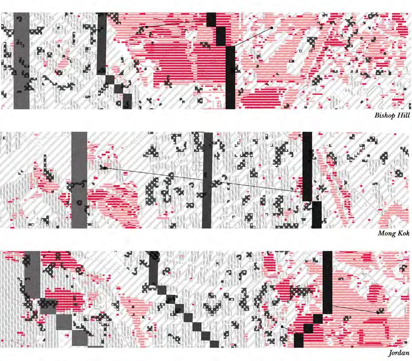
Comparison series:


The comparison series show a classification of tree cover and grass in a smaller pixel size than the NDVI generated in regional plan. Areas with strong light pollution is included to show the cost raster Path C relies on.
1. The selected site of Bishop Hill shows that Path A relies largely on the vegetation at Bishop Hill and Tai Hang Tung Recreation Ground. While Path B avoids crossing Tai Po Road, which is a 16 meters four-lane carriageway.
2. In the selected site of Mong Kok, Path C avoids intersecting with the developed residential and commercial area around Nathan Road where light pollution is more severe.
3. As Path B and C do not overlap with Path A, it suggests that only valuing tree cover when assessing avian’s habitat is not enough. Therefore, we used Path A as a basis and generated a potential ecological corridor so that most of the paths are included inside, also considering that birds not only travel across North and South but East and West as well.
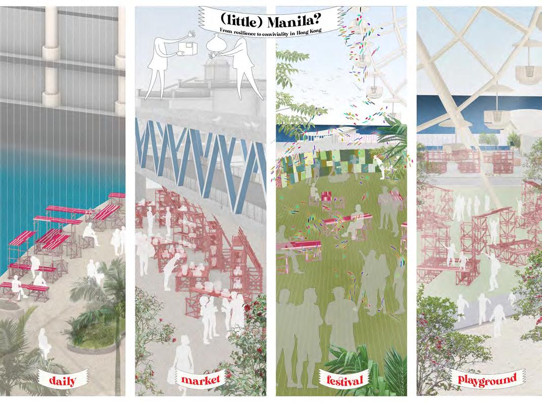
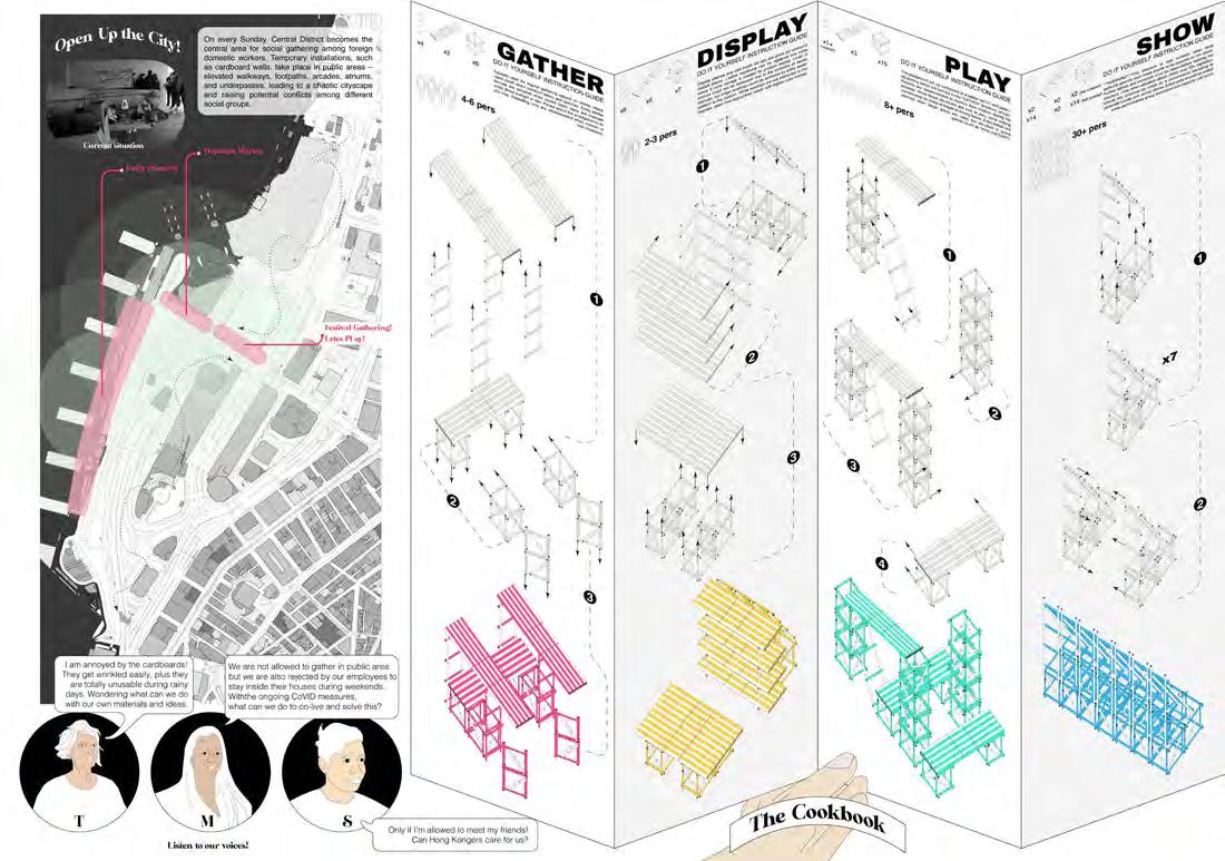
"Cookbook" for Spatial Democratization of Foreign Domestic Helpers in Hong Kong
10 Tactical
Group work of 2 members
While the central district in Hong Kong is well known for wealth, prosperity and luxury, a prolonged transformation of the cityscape occurs every Sunday, called “Little Manila”. Thousands of foreign domestic workers from the Philippines had been moving into Hong Kong in search of better income and economic freedom for their family. Nonetheless, foreign domestic workers are under absolute governance and supervision in every aspect as they are required to stay in an assigned room by their employer, losing their power to determine their lifestyle and behavior. Sundays are the only day off work and would gather at Central pier side in reminiscence of their real home. Hence on every Sunday, urban public spaces transform into a gathering place with temporary installations, which is often seen as a nuance for other people.
The project aims for a tactical intervention utilizing the traditional Filipino spirit called “Bayanihan” as a mechanism of communal unity, asserting the rights of freedom in their actions. The “Cookbook” suggests four main possibilities of constructing structures for their choice of events with three modular structures using recycled bamboo. It is not only an environmentally friendly material in terms of recycling them from scaffolds in Hong Kong, but also a material used for “Bahay-Kubo”, a traditional type of Filipino house, providing “Homeness” through materiality. The act of constructing will be an expression of themselves and to connect to the locals with a space of social freedom.
 Finalist Sponsor: Terraviva
HSBC Building
1 Queen's Road Central, Hong Kong
Wan Chai Elevated Walkway
145 Lockhard Road, Wan Chai, Hong Kong
Finalist Sponsor: Terraviva
HSBC Building
1 Queen's Road Central, Hong Kong
Wan Chai Elevated Walkway
145 Lockhard Road, Wan Chai, Hong Kong