

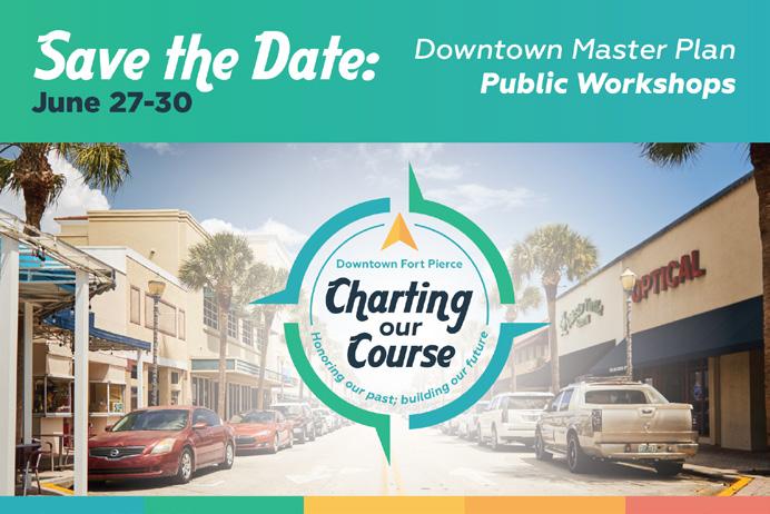
NOVEMBER 2022
DOWNTOWN
MASTER PLAN
This Plan honors the City staff, residents, businesses, and visitors of Fort Pierce that dedicated time and provided insights that will help shape the future of the City.


This Plan honors the City staff, residents, businesses, and visitors of Fort Pierce that dedicated time and provided insights that will help shape the future of the City.
Linda Hudson, Mayor
Arnold S. Gaines, City Commissioner
Curtis Johnson, Jr., City Commissioner Jeremiah Johnson, City Commissioner Thomas K. Perona, City Commissioner
Nicolas C. Mimms, City Manager
Shyanne Harnage, Economic Development Manager
Miriam Garcia, Redevelopment Specialist
Audria Moore-Wells, Special Projects Coordinator
Michael Brown, Jr. Al Johnson Daniel Lee
Carolyn Mann-Lurry Hoyt Murphy, Jr. Brandon Nobile Sabrina Taylor Phil Thompson
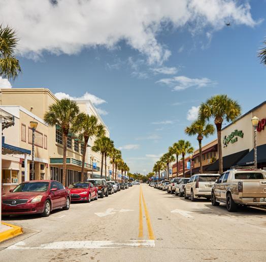
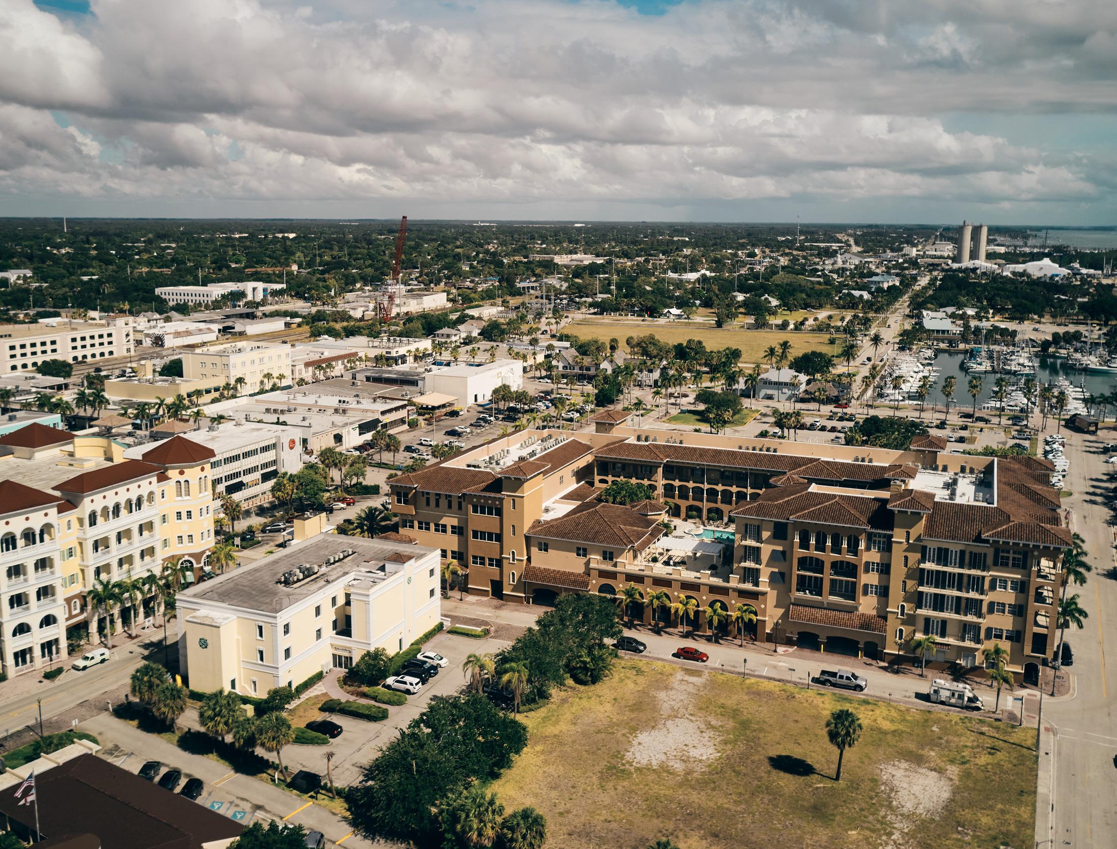
Downtown Fort Pierce offers location, historic character, waterfront accessibility, and affordability. The confluence of these attributes place the City in prime position to capitalize on 21st century development trends and revitalize the Downtown.
The time is now.
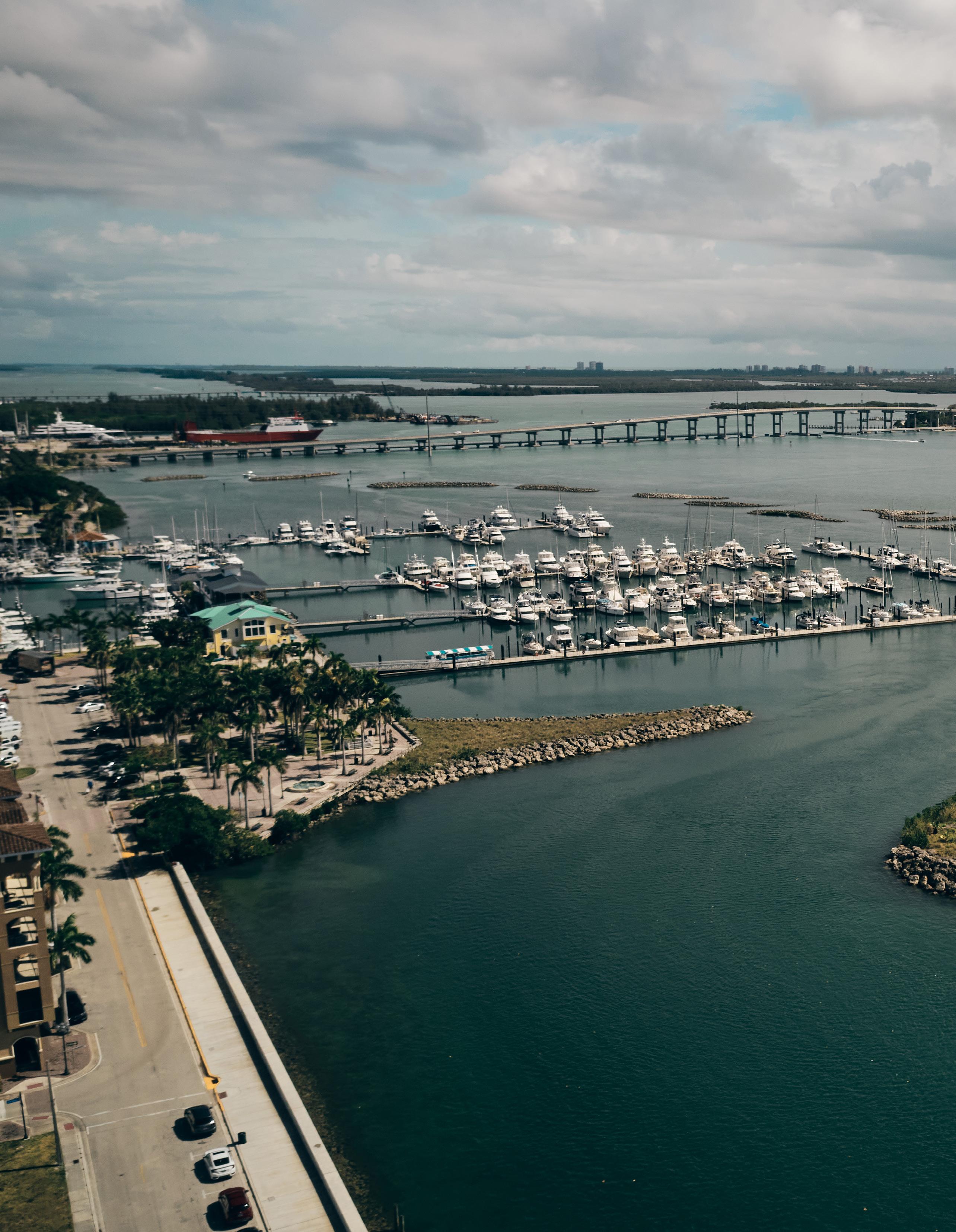
The City of Fort Pierce is in close proximity to the metro areas of Orlando, West Palm, Fort Lauderdale, and Miami; all located within 130 miles. Today, they are easily accessible by automobile and in the future could be connected via Brightline Train service, with a Downtown Fort Pierce Station. Boaters enjoy the City’s direct access to the Atlantic Ocean, just 20 nautical miles to the Gulf Stream and 83 miles to West End, Bahamas.
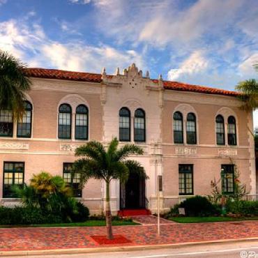
Fort Pierce was incorporated in 1901, making it one of the oldest cities in Southeast Florida. While the City is now home to more than 45,000 residents, it has maintained a small-town feel and charm. Fort Pierce’s modest growth pattern is in stark contrast to the growth in counties further south.
As shown in Figure 1, both St. Lucie County and the City of Fort Pierce have experienced a more modest growth rate over the last 40 years as compared Palm Beach, Broward and Miami-Dade counties.

Figure 1: Population of Fort Pierce & Surrounding Counties for Years 1980 Through 2020
Median Sale Price Single Family Homes
Figure 2 Median Sale Price- Single Family Homes
Population increases often generate higher home prices and rents, which has been the case in Palm Beach, Broward, and Miami-Dade Counties as shown in Figure 2. Conversely, Fort Pierce has maintained relative affordability.
For the last 50 years, Fort Pierce has been a well-kept secret among Florida natives and boating enthusiasts.
The City has been a destination for visitors seeking an authentic Florida village in close proximity to the fish-rich waters of the Gulf Stream. However, as Florida continues to grow Fort Pierce’s charm is no longer a secret.
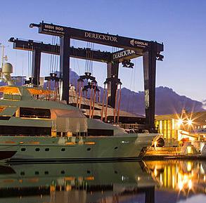
While agriculture and commercial fishing have historically served as the foundation for the local economy, Downtown Fort Pierce has seen significant new investment over the last few years. Derecktor Shipyards has revolutionized the Port of Fort Pierce with the construction of a 1,500-ton mobile boat hoist, making the City an international destination for megayachts and large-sailing yachts. Audubon Development was selected to redevelop the former H. D. King Power Plant with plans for a $140 million mixed-use project named King’s Landing. Additionally, in August of 2022, Florida Governor Ron DeSantis awarded the City a $2.7 million infrastructure grant intended to help spur the City’s Downtown redevelopment efforts.
While the City may have “missed” the population boom experienced in other regions of Florida, it has retained its historic character and relative affordability. As technology and remote/hybrid work options have become more prevalent in the post-pandemic era, small towns that offer a compelling combination of affordability and high quality-of-life are well positioned to advance strategic redevelopment efforts that enhance both community character and economic growth.
For Downtown Fort Pierce, the time is now. After decades of visioning sessions and long discussions of potential, capital investment have arrived in Fort Pierce. This implementation-focused Downtown Plan provides a clear roadmap for strategic investments over three phases spanning the next 20 years.
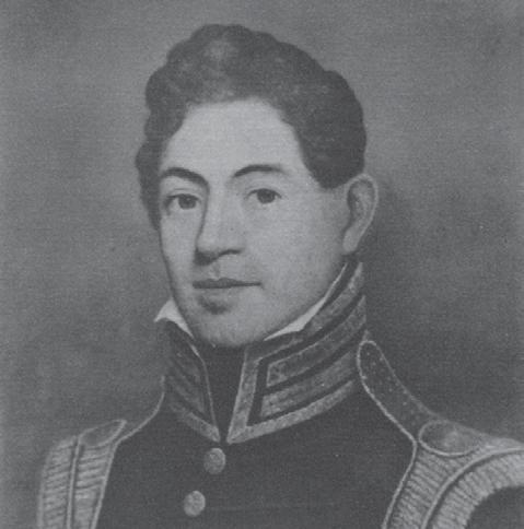
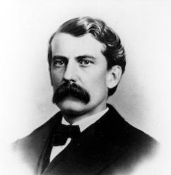
The Fort Pierce Army Post was established during the Second Seminole War, and named after Benjamin Kendrick Pierce, a career US Army Officer and brother of US President Franklin Pierce
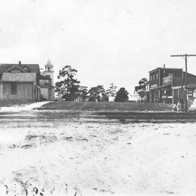
City of Fort Pierce, named after a local Second Seminole War military fort of the same name, was first incorporated

Construction of local rail stations spurred a boom in population and development
Hurricanes Charley, Frances, and Jeanne blasted the City within two months, causing immeasurable damage, devastating the marina

Ms. Zora Neale Hurston, renowned author and scholar, begins two-year engagement at the Fort Pierce Chronicle (newspaper) as a columnist and writer
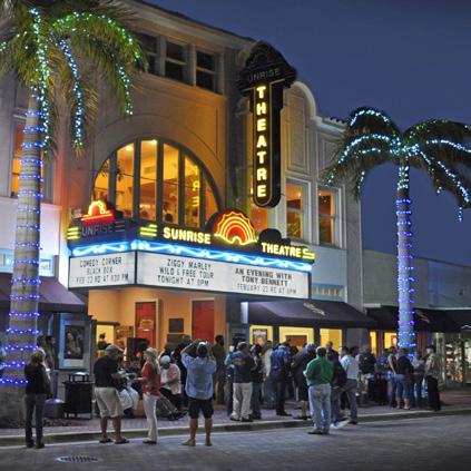
Sunrise Theatre purchased by St. Lucie Preservation Association for restoration activities
Sunrise Theatre closes after falling into disrepair after decades of neglect
Redevelopment and site preparation begins for former H.D. King Power Plant Site
Fort Pierce was named one of USA Today’s Most Idyllic and Historic Main Streets in America
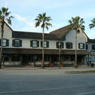
P.P. Cobb Building (Cobb House) opened as a trading post
Henry Flagler purchased several shortline railroads that would later become known as the Florida East Coast Railway that connected Jacksonville to Fort Pierce along the Florida’s Atlantic coast
Sunrise Theater built by C.E. Cahow in Mediterranean Revival Style. The theatre is the greatest and largest cultural facility in he state of Florida at the time
Active Naval Combat Training Facility is built and boosts population. Fort Pierce training center becomes home to elite units of US armed forces including the Scouts and Raiders, US Army Rangers, and “frogmen” (later known as US SEALs/UDT)
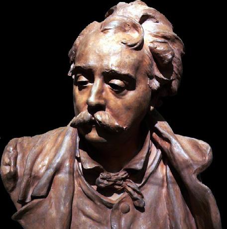
American artist and painter Albert Ernest “A.E.” Backus is born. AKA Beanie Backus, became famous for vivid Florida landscape paintings and initiating and mentoring artists in the “outsider art” Florida Highwaymen painters school
American recession halted investments and development in the City
City established the Fort Pierce Redevelopment Agency (FPRA) to help guide physical and economic development in the Downtown area
City Commission expanded the boundaries of the Redevelopment Area (south of Atlantic Avenue to Citrus Avenue and Delaware Avenue)
Sunrise Theatre reopens for events and shows
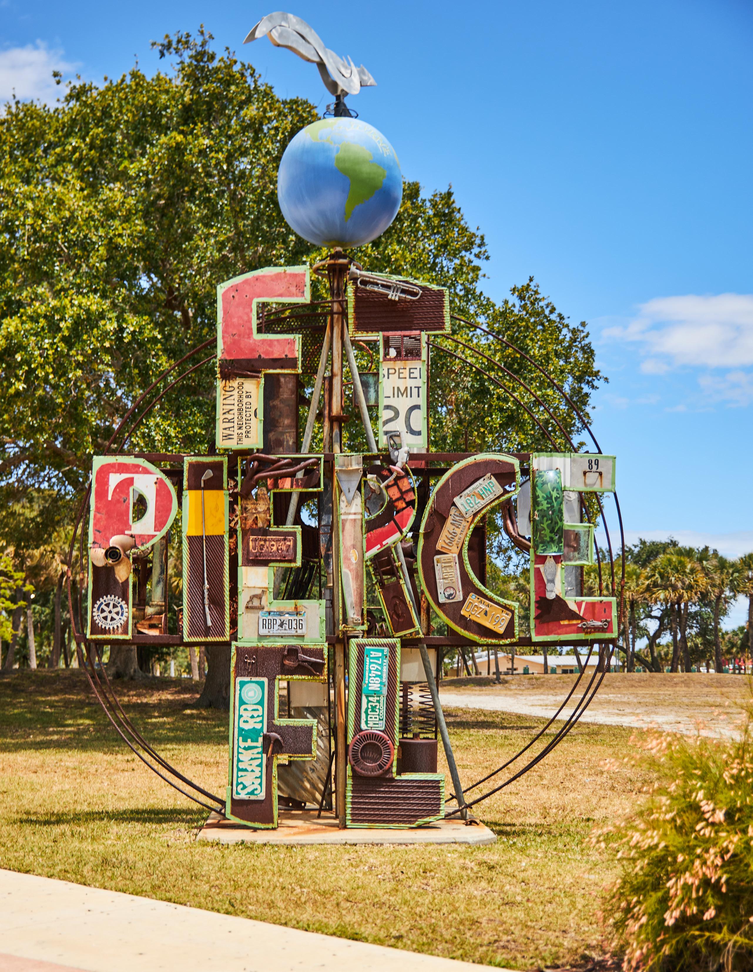
Pierce
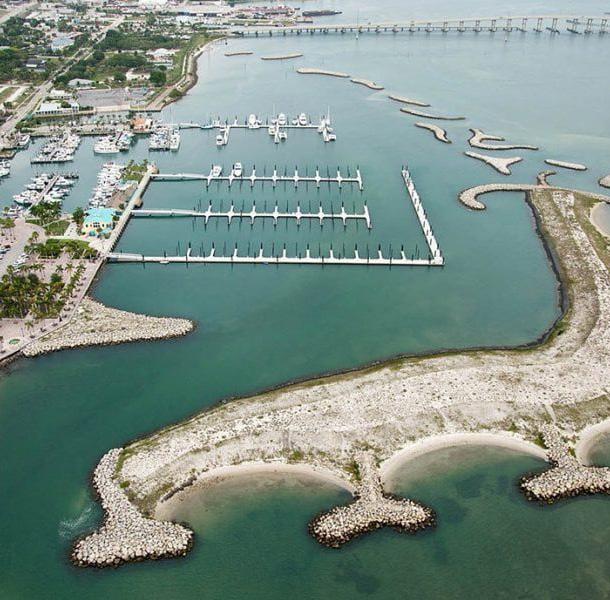
City of Excellence Award by the Florida League of Cities Fort Pierce Marina rebuilt with 12 protective artificial barrier islands at a cost of $18M
COVID-19 Pandemic
Governor discusses $2.7 million state grant to redevelop the 8-acre King’s Landing site
This master planning process was designed to be both strategic and community-driven. Through an evaluation of existing conditions, the team was able to identify existing assets to connect and leverage.
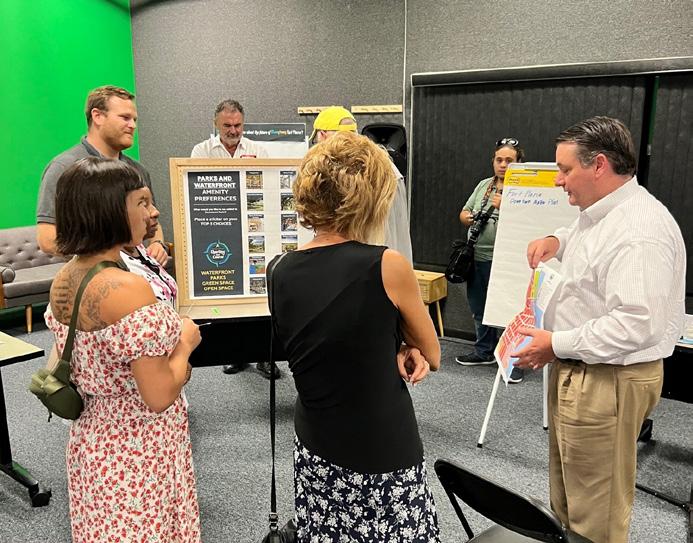
Parallel to this effort, was an inclusive public engagement process that included both in-person events and an interactive project website.
The project team commenced this planning effort with a comprehensive review of existing entitlements, previous studies/reports, GIS layers, and field observations within Downtown Fort Pierce. This effort included review of the Future Land Use, Zoning and Edgartown Ordinance, 2020 FPRA Community Redevelopment Plan, 2021 Parking Study Update, 2021 City of Fort Pierce-A Comprehensive Market and Retail Feasibility Study and Retail Strategic Plan, 2020 Port of Fort Pierce Master Plan, and 2008 Fort Pierce Downtown Waterfront Charrette.
Quantitative and qualitative data obtained from this research were organized into frameworks of Parks & Open Space System, Existing Parking Analysis, Mobility and Connectivity, and Infrastructure for analysis. The following pages of this plan provide a visual summary of the framework findings.
A retail market analysis was conducted to identify the existing supply of and demand for specific retail industry sectors in Downtown Fort Pierce. The methodology of this analysis included an evaluation of the market conditions within three areas; the 5, 10, and 15-minute drive times around Fort Pierce, as shown on the map included on the next page. The utilization of drive times to define market areas is the industry-standard, with the 15-minute drive time as the primary market area limit. Distances longer than a 15-minute drive are considered to be outside the local market area as consumers are less inclined to make a “special trip” that is longer than 15 minutes.
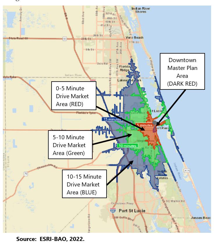
The 5-minute drive area has a low median household income level at $30,234, which is below the median household income for St. Lucie County ($62,791 ) and Florida ($65,438). Income levels and the number of households increase significantly from the 5-minute drive area to the 10 and 15-minute drive area as shown in the figure on the next page.
Downtown Fort Pierce is a destination that is developing at a comfortable pedestrian-oriented scale that is generally focused on the waterfront. Capital investments in the waterfront and special event programming have made Downtown Fort Pierce a compelling place to visit. Planned and programmed mixed-use and residential projects will increase the full-time resident ratio in the Downtown district and will increase economic and resident activity.
The 2021 Retail Strategic Plan identified a Tier One and Tier Two list of targeted potential retail tenants for Downtown Fort Pierce that are based on the Retail Market Analysis and Demographic evaluation. These targeted retail sectors include cultural, entertainment, and hospitality type uses that attract residents and appeals to visitors and tourists. These sectors include art galleries, brew pubs, restaurants, and experiential retail. With greater population and disposable income available in the 10 and 15-minute drive areas, improving Downtown Fort Pierce as a compelling waterfront destination could spur redevelopment across a variety of industry sectors.
' Hotels
' Full-service restaurants
' Bars/pubs
' Coffee shops
' Quick service restaurant (QSR)
' Clothing, shoe, and accessories stores
' Jewelry stores
' Cosmetics, beauty-supply, and perfume stores
' Hair and nail salons
' Fitness centers/gyms
' Martial arts, dance, and yoga studios
0-5 Minute Drive
Population 20,105
Households 6,874
Median HH Income $30,234
5-10 Minute Drive
Population 38,963
Households 14,713
Median HH Income $38,914
10-15 Minute Drive
Population 31,752 Households 12,417
Median HH Income $48,186
Created a project website on Social Pinpoint

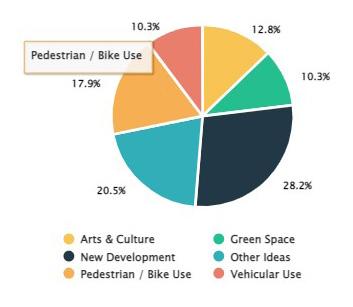
Through public workshops, surveying, site visits, stakeholder interviews, public spending vision game, and an interactive map comment platform, the following key themes emerged from the public’s input:
' Optimize parking in Downtown
' Increase restaurants and event amenities
' Improve bicycle and pedestrian safety/experience
' Increase housing options and affordability
Developed a Social Media Campaign
Hosted a four-day design workshop that included multiple stakeholder interviews and three public meetings
' Increase interactive public arts, recreation, and waterfront access
' Brightline Station Development
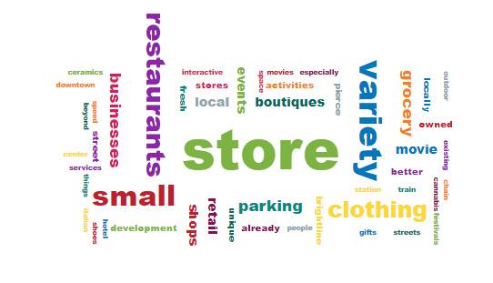
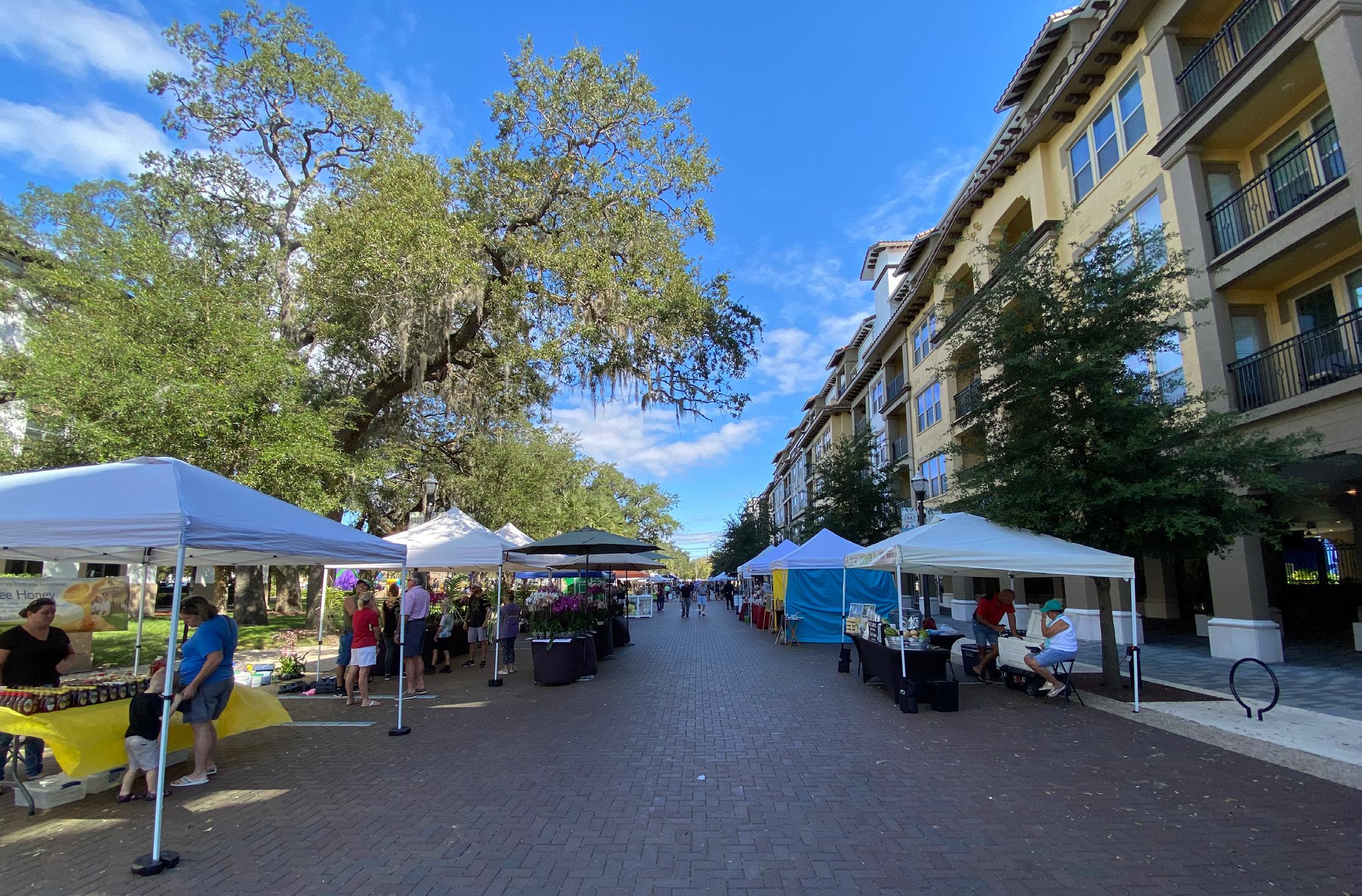
Most people who visit Fort Pierce’s downtown do so for access to restaurants, the farmers market, and local events. However, more people shared they would come downtown more often if there were engaging family-friendly activities, a train station, more events and event amenities, and even more restaurant options. Areas in which Downtown Fort Pierce’s business environment received some negative feedback was the number of businesses offered, business variety, and the operation hours. Key opportunities for enhancing downtown include increasing activities and events, more restaurants, and additional residential development.
Distributed flyers at local events, local businesses, churches, the Incubate Neighborhood Center (INC), and the Fort Pierce Farmers Market
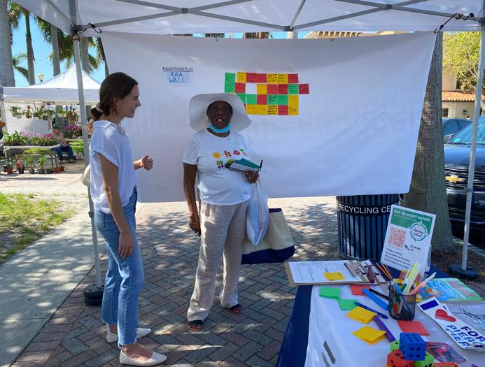
Offered public engagement materials in English, Spanish, and Haitian Kreyol (Creole)
Hosted a pop-up public engagement activity session at the Farmers Market
The findings of the framework analyses were evaluated along with the findings of the retail market analysis and public engagement to establish the opportunities and constraints of the study area. This important exercise provided the foundation for the downtown redevelopment strategy.
Public access to navigable waterways is a hallmark of many of the world’s greatest cities. Acquisition of privately-owned waterfront property is difficult and expensive. Fort Pierce has significant waterfront land holdings, from the South Bridge to Marina Square. The City should maintain ownership, improve access, and enhance the overall experience of these important community assets.

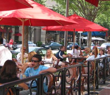
Downtown Fort Pierce should be vibrant from sunrise to after sunset, seven days a week and all twelve months of the year. The plan should attract new year-round residents and provide a wide and diverse range of opportunities to live, work, and play in Downtown Fort Pierce.
Parking facilities are essential infrastructure for urban mixed-use districts, however an abundance of surface parking lots undermine character. A thoughtful parking strategy in conjunction with a compelling redevelopment plan can foster more activity, increased accessibility, and enhanced character in Downtown Fort Pierce.
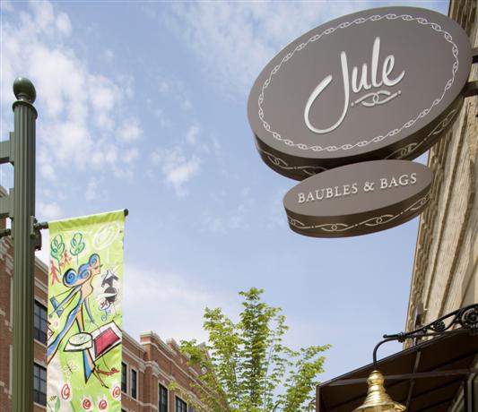
Fort Pierce should leverage its existing strengths. The afterfive energy of 2nd Street, the potential of city owned waterfront property, and the activity that will be generated by the King’s Landing project should be connected and leveraged through enhanced streetscapes and improved walkability.
The lack of materialization from previous planning and visioning efforts should not stymie optimism for this plan. Fort Pierce is already seeing unprecedented investment in its Downtown, the time is now.
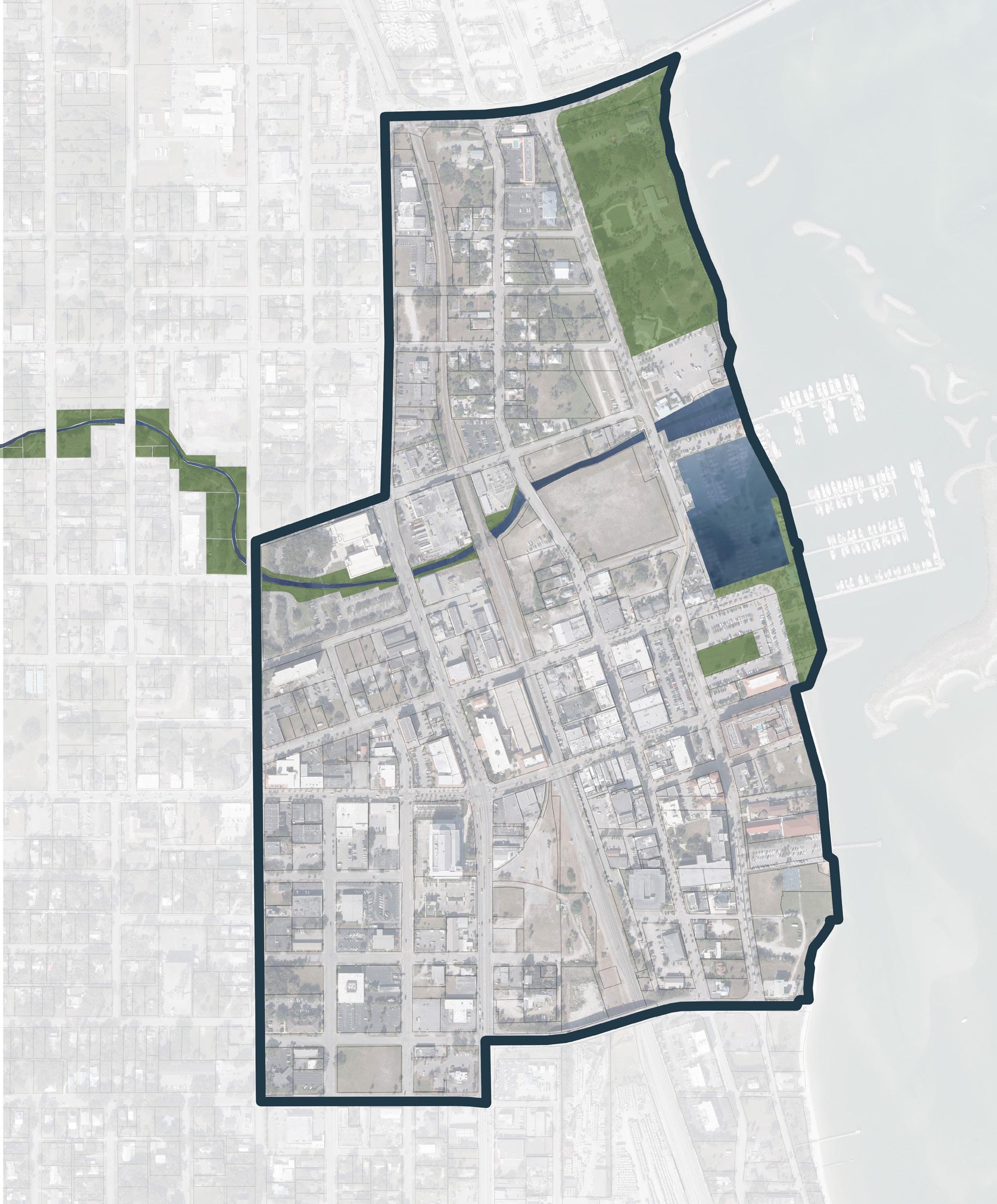
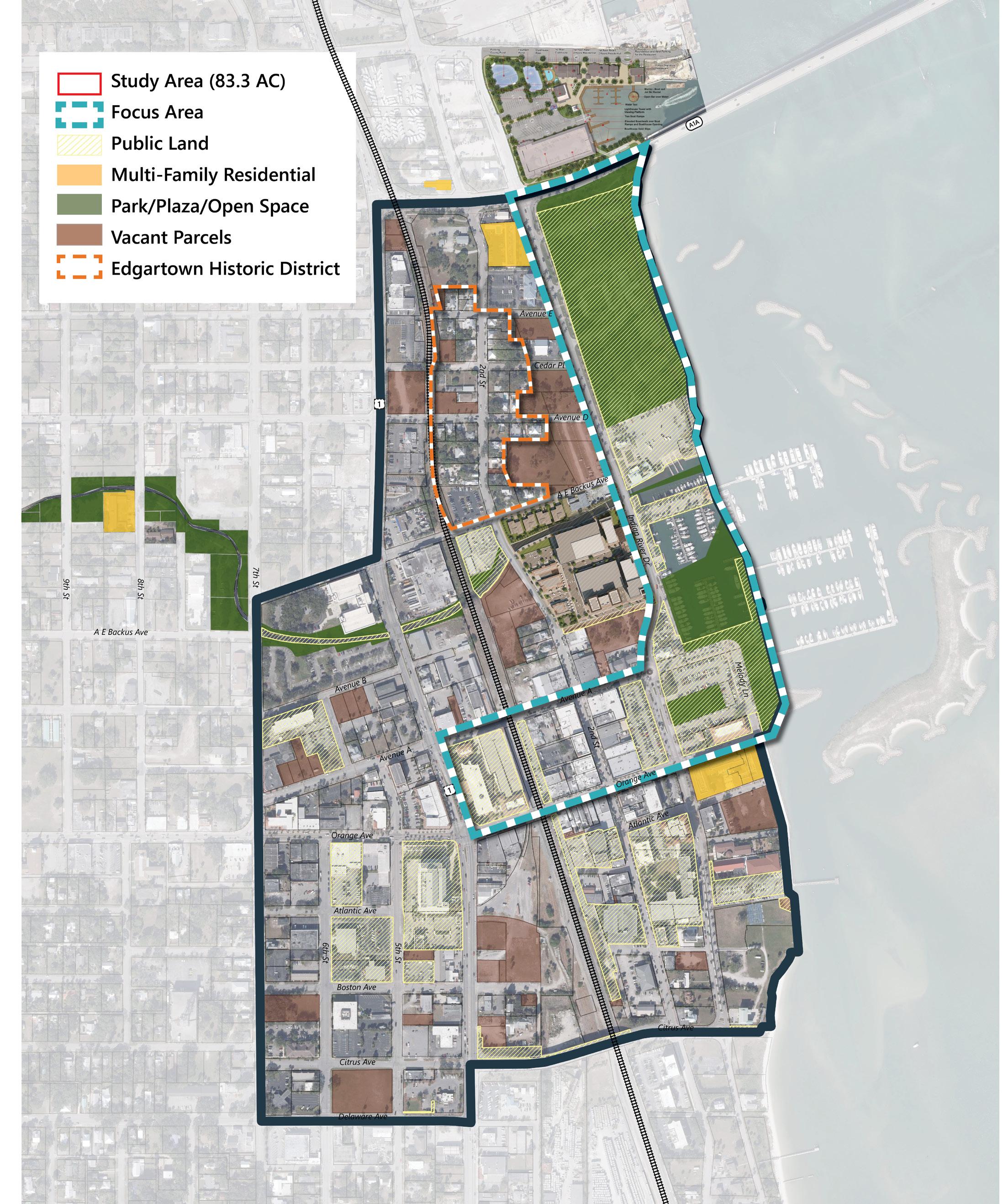
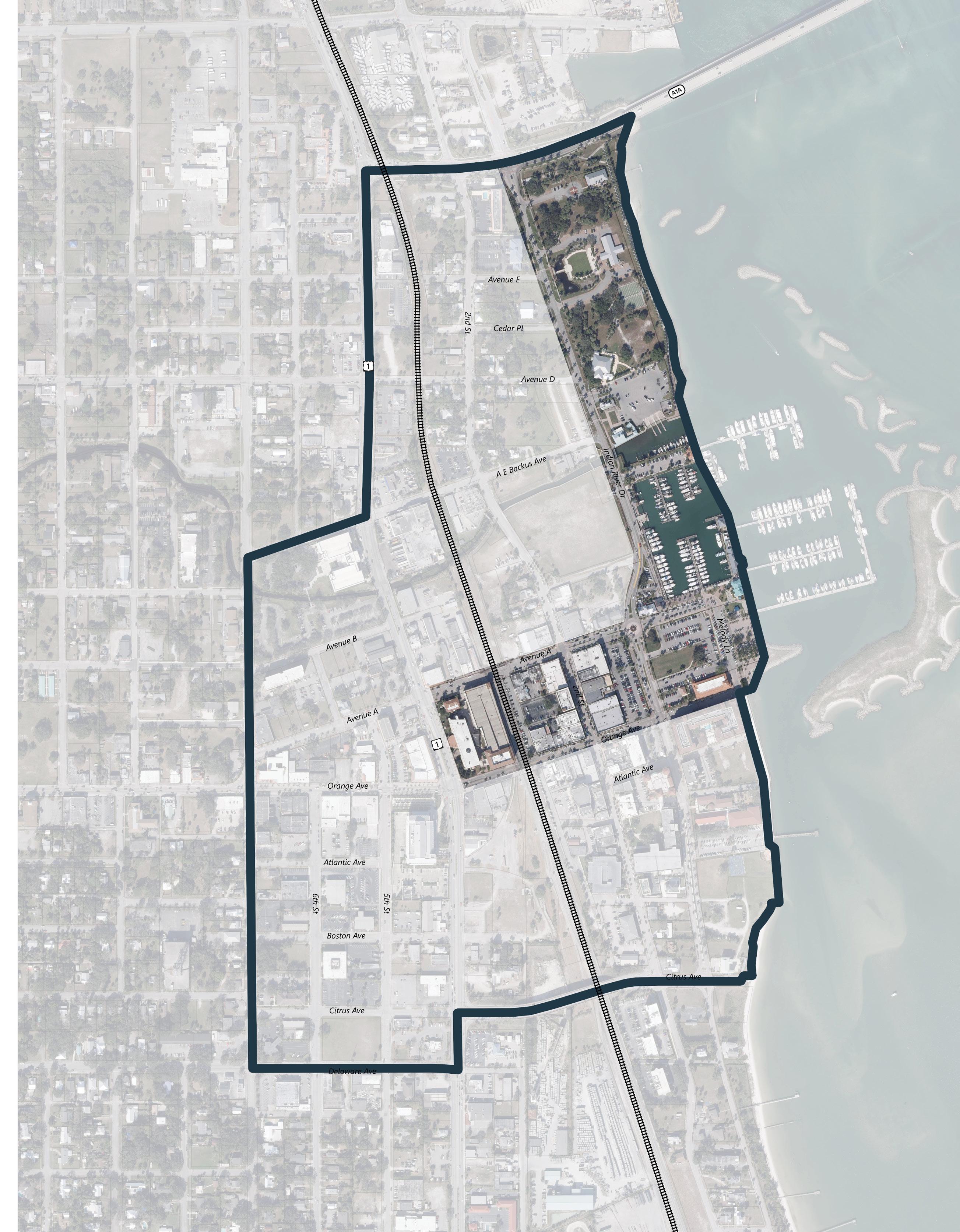
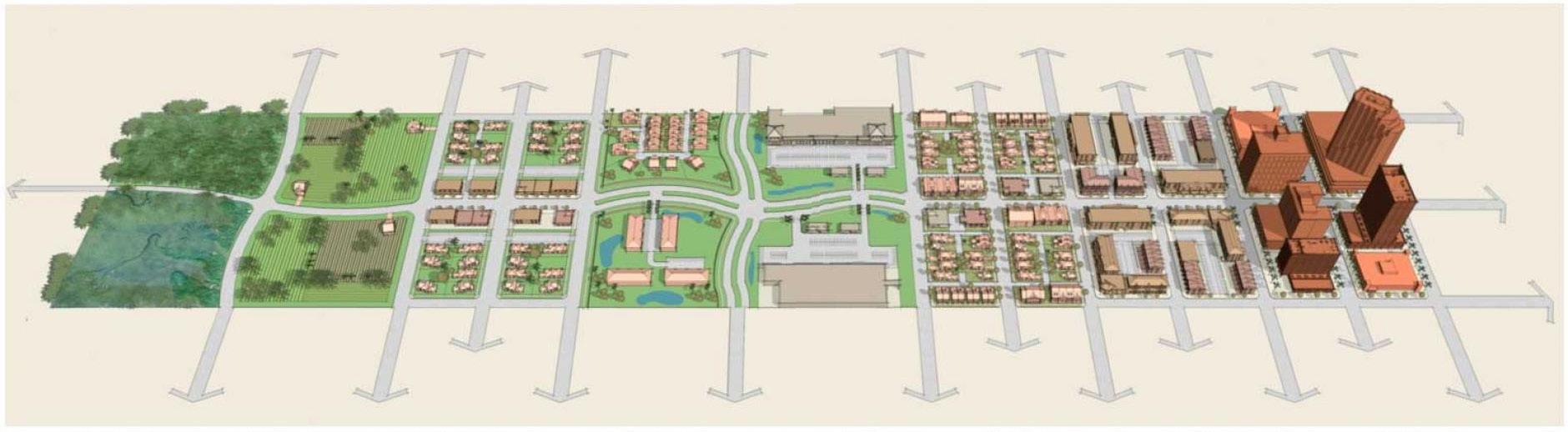
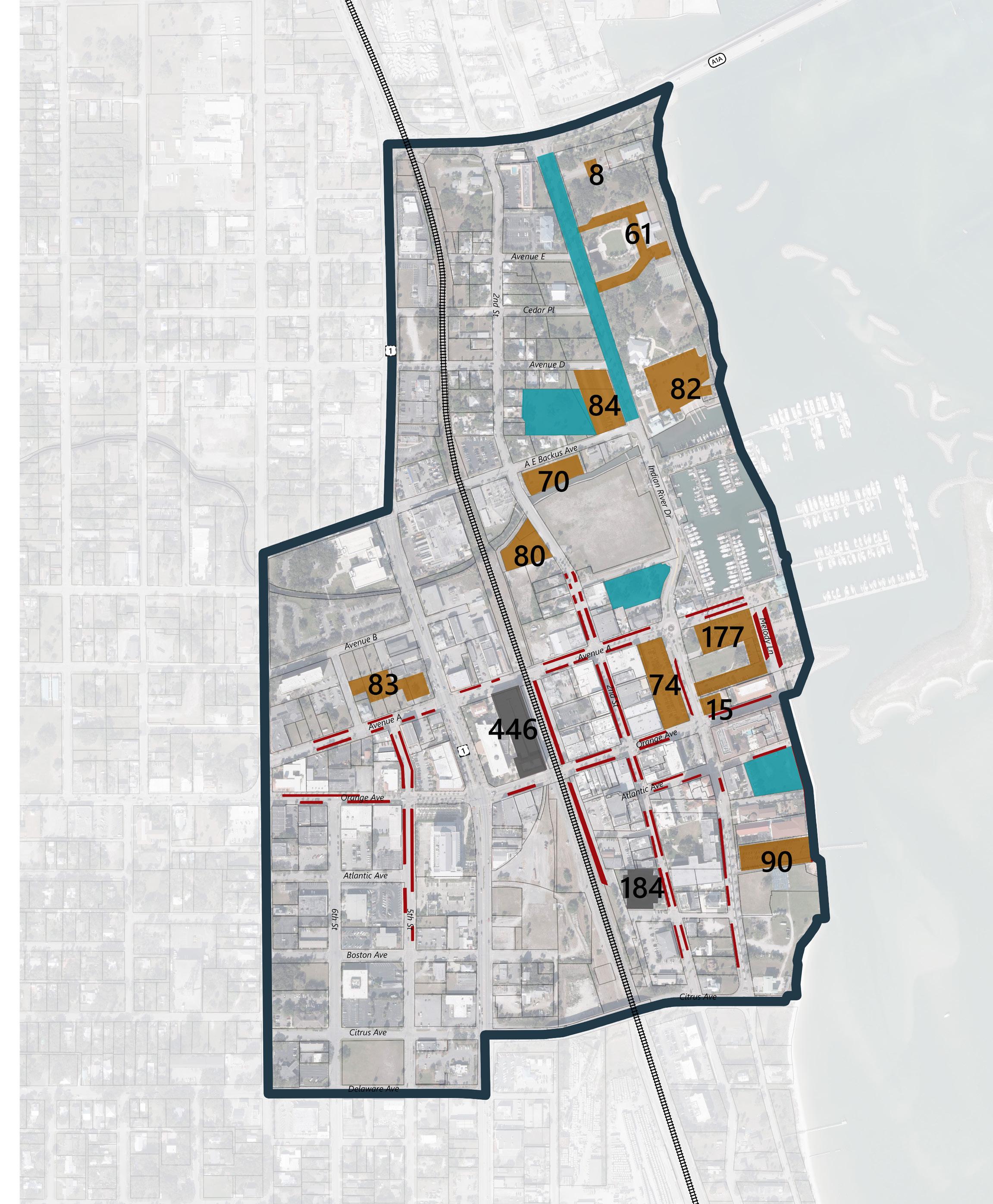
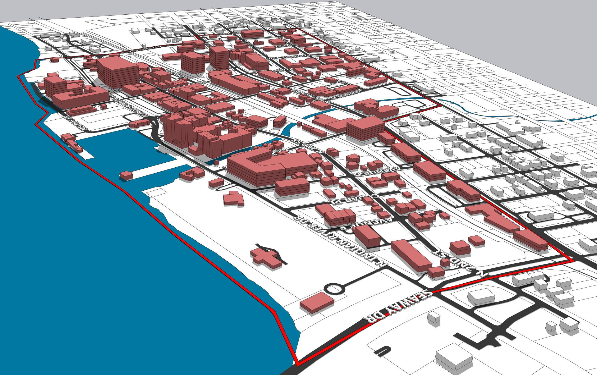
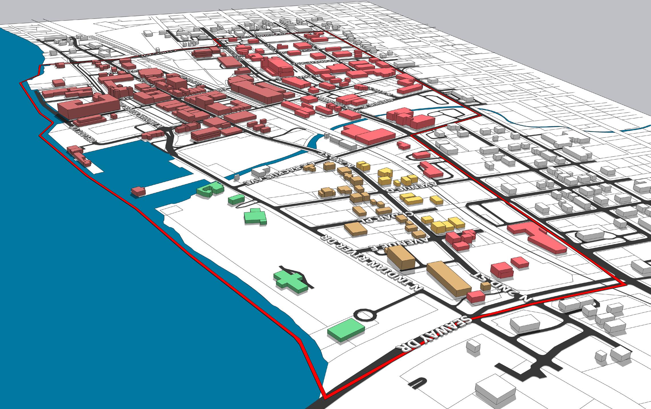
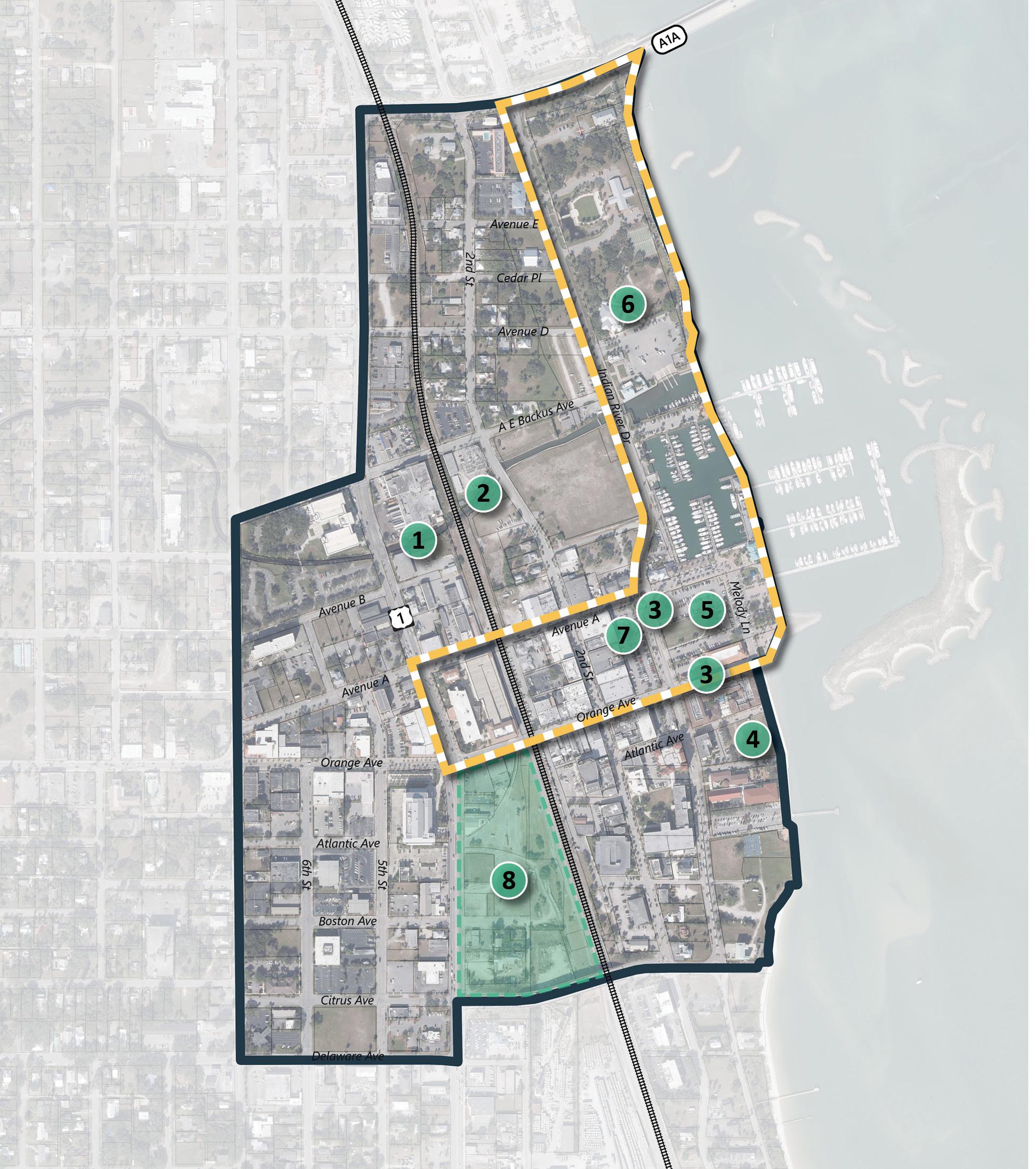
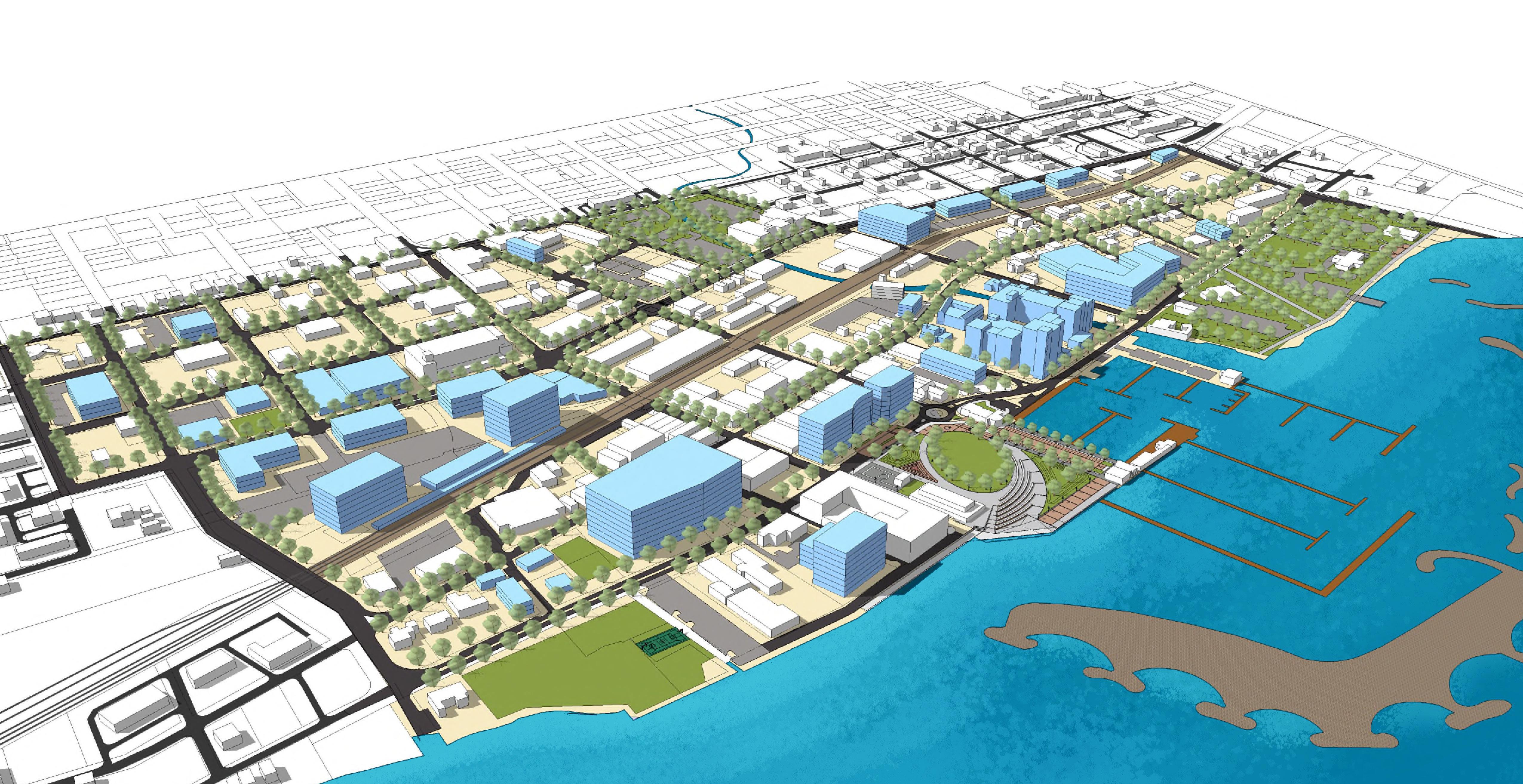
While this Downtown Plan includes a long-term vision for the entire project area, a successful downtown revitalization strategy requires the identification of a smaller area to focus the limited initial capital funds for the greatest catalytic effect. The Focus Area was established by identifying Downtown Fort Pierce’s greatest existing assets and opportunities to connect.
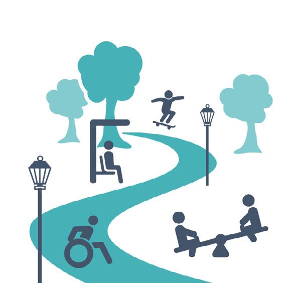
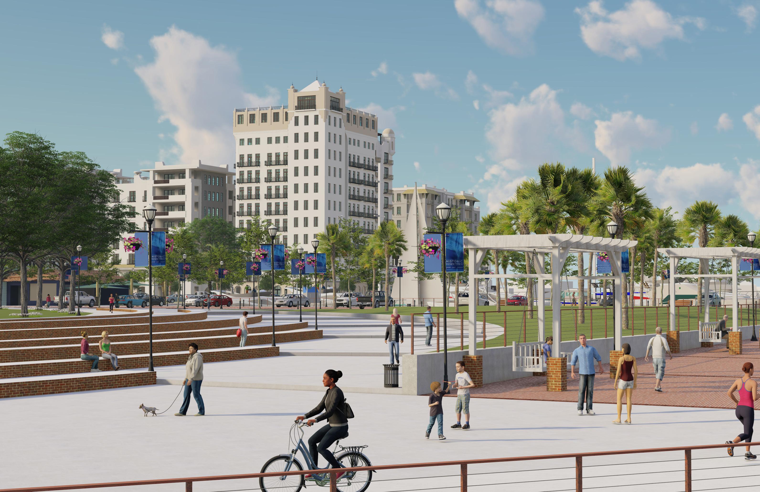
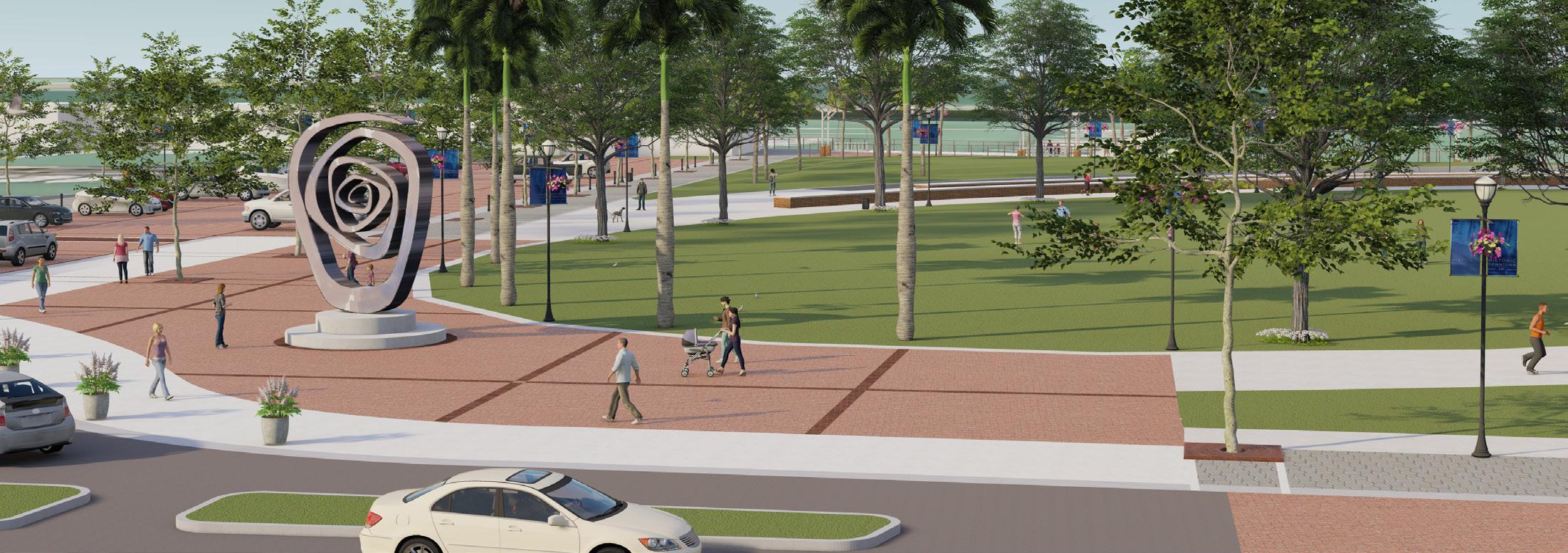
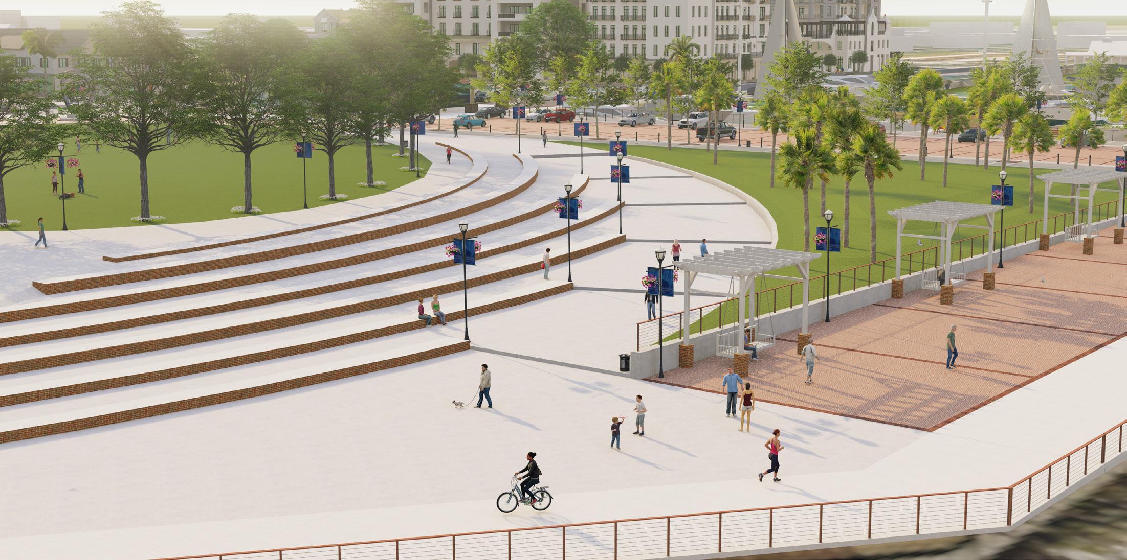
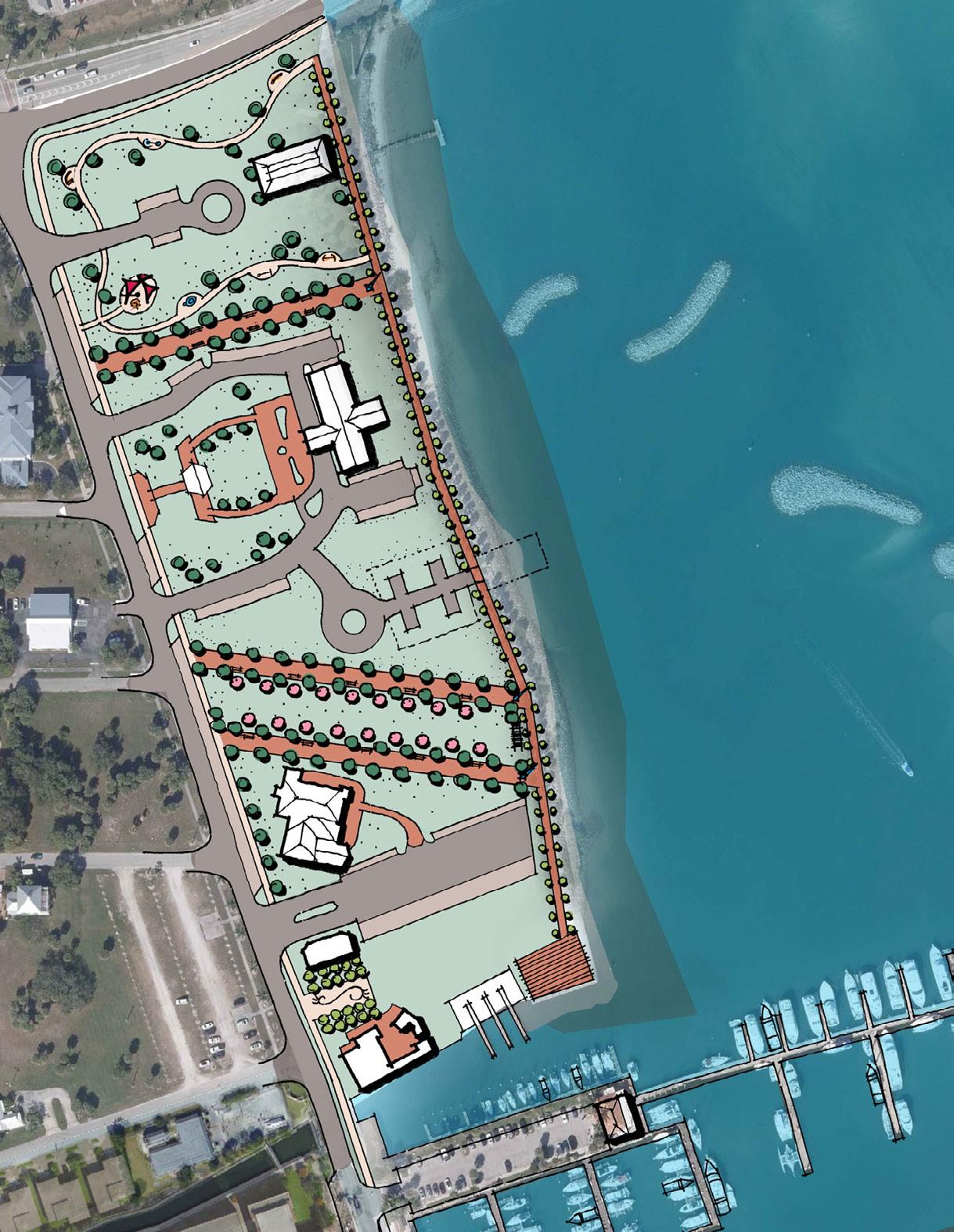
Marina Park will be a dynamic civic space offering a variety of experiences for users of all ages and abilities and interests. This waterfront park will be an iconic and defining civic space for the City of Fort Pierce.
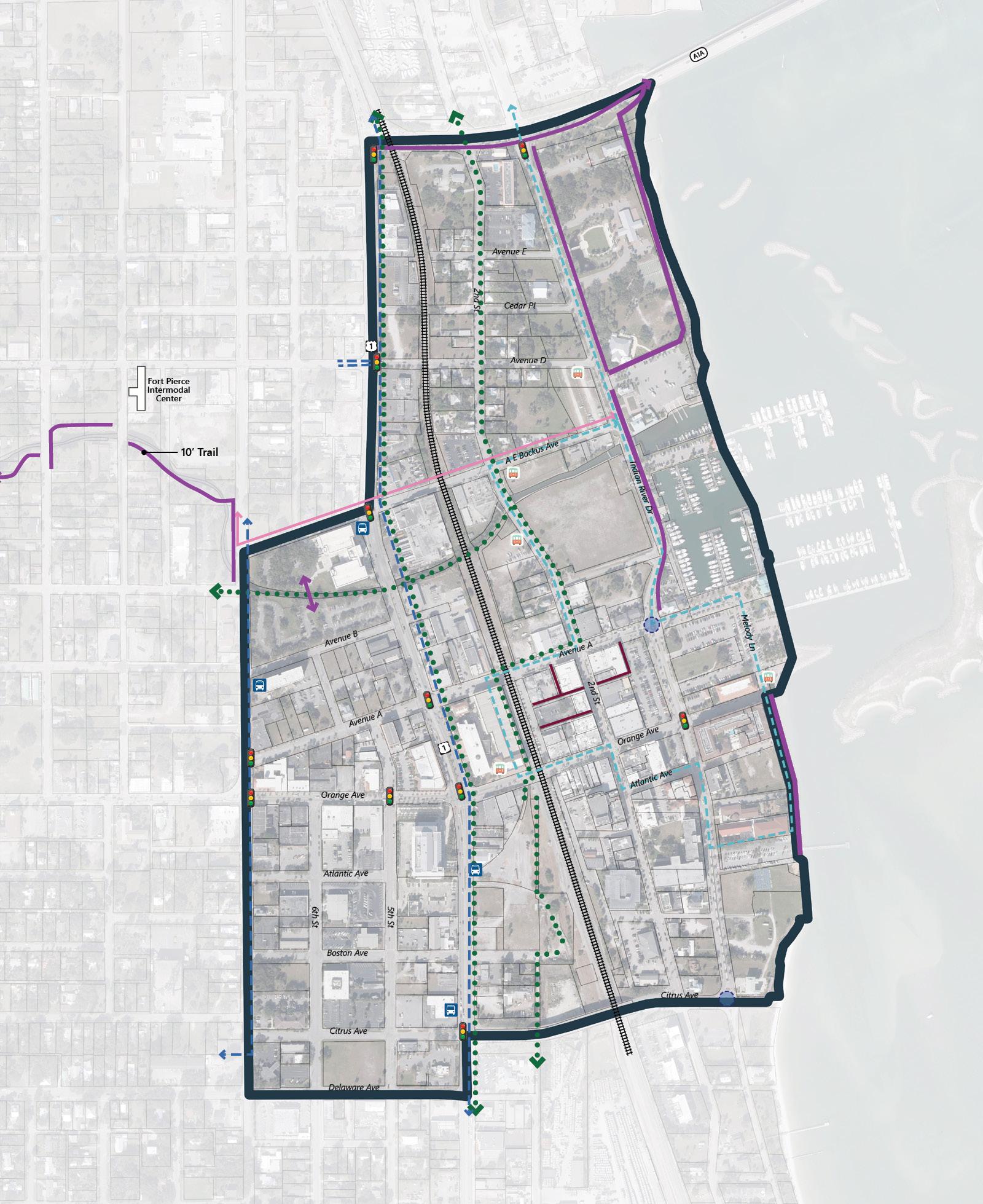
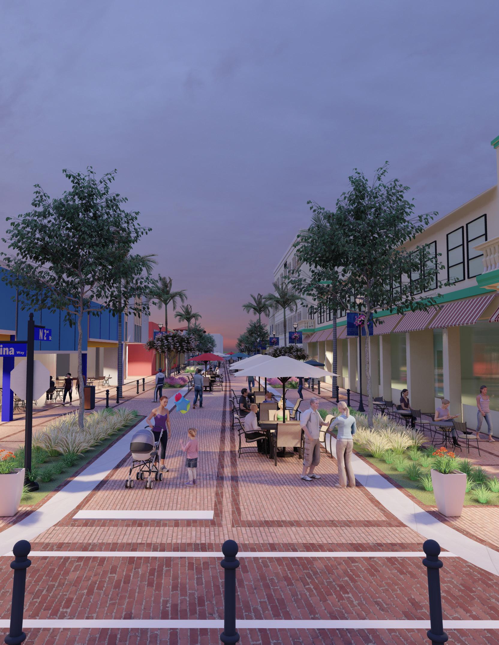
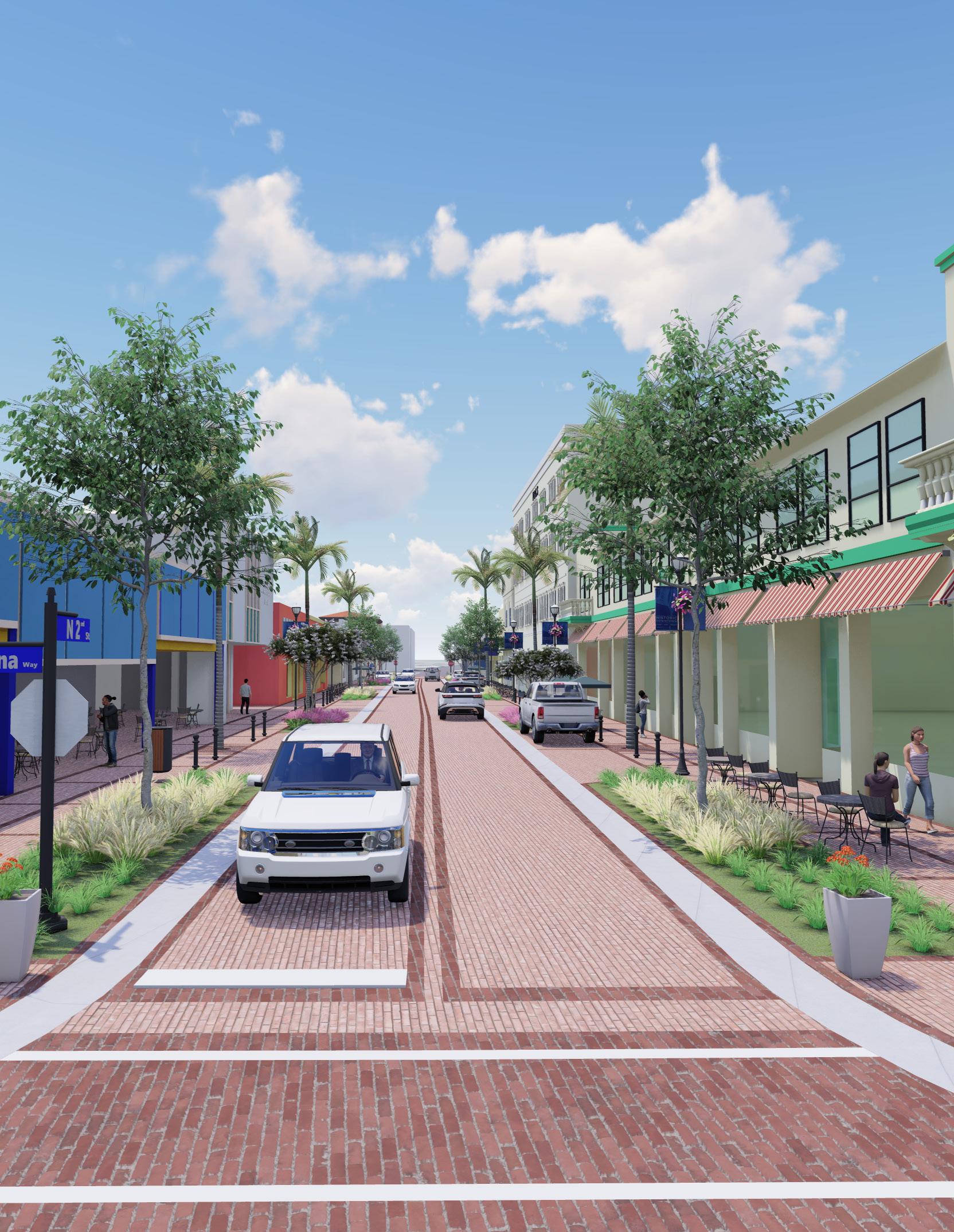
Streets are an important part of the civic realm. Curbless festival streets provide flexible infrastructure that serves both transportation and community needs.
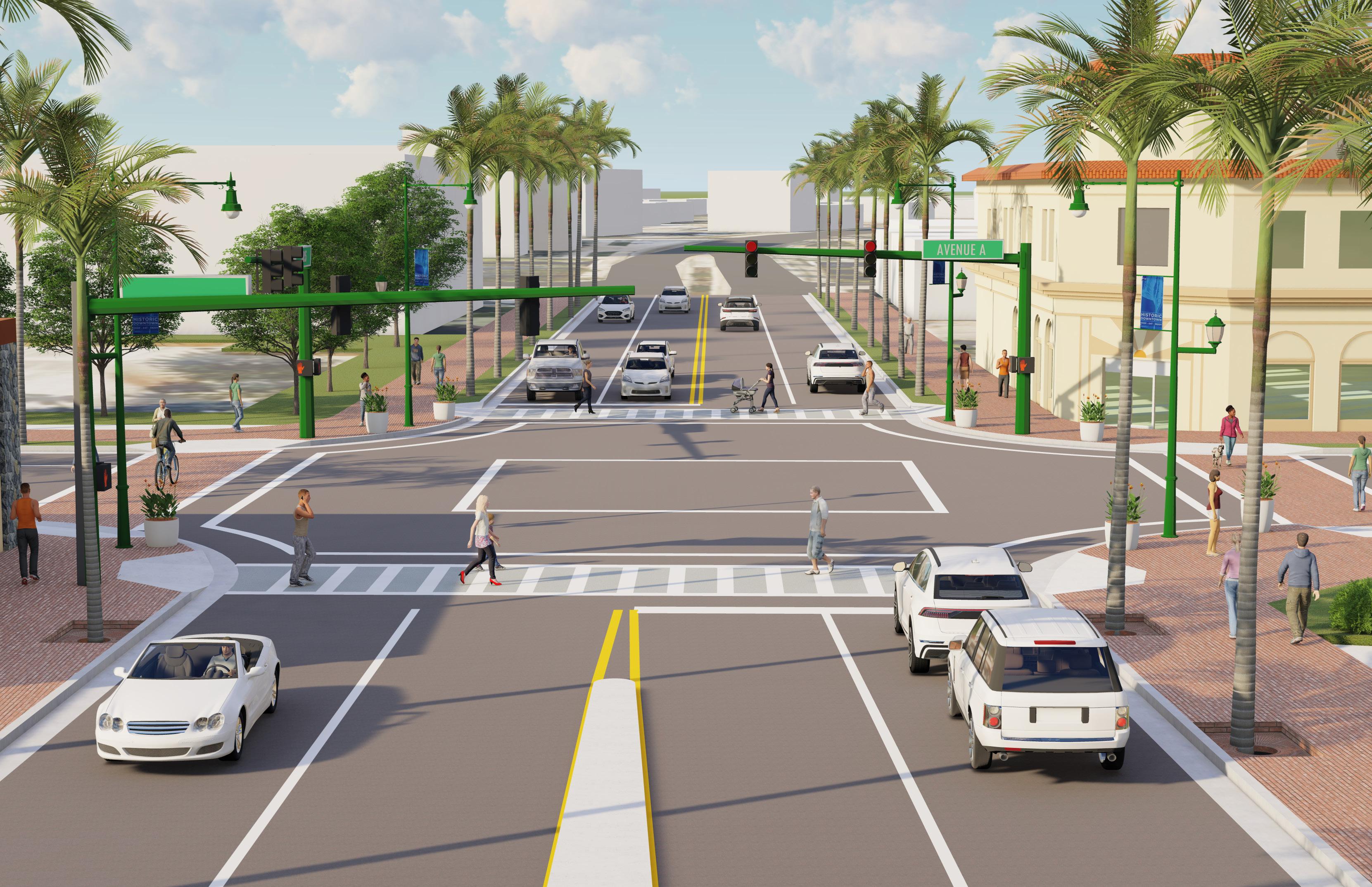
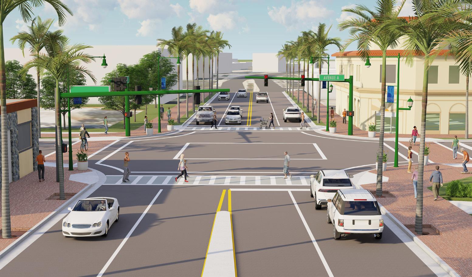
Intersection improvements will include the removal of the left-turn lanes, both northbound and southbound, at the intersection of Avenue A and US 1. This will provide a pedestrian gateway into Downtown and will serve to improve east-west connectivity across US 1.
The ultimate metric of success for this master plan is more than a policy recommendation or design concept, but rather what gets implemented and built over time.
Perhaps the most difficult aspect of any ambitious undertaking is identifying where to begin. Therefore, Phase 1 implementation is of particular importance in creating momentum within the City’s built environment and for realizing the vision for the Downtown.
A thoughtful and strategic first phase is essential to implementation and the realization of the goals and direction expressed in the 2043 Vision Plan. These Phase 1 improvements seek to leverage and connect the City’s existing assets including an emerging entertainment district, vacant/ underutilized city-owned properties, a large public waterfront, and marine-related industries and commerce.
The Phase 1 Improvements are predominantly located within the Focus Area. The strategy for this initial phase is to design and construct improvements to advance a vibrant and walkable Waterfront District in Downtown Fort Pierce. These targeted public improvements are designed to foster investment and redevelopment consistent with the history and character of Fort Pierce. The Sunrise City will retain its connection to the water, as well as its fishing village heritage, as it ushers in a new era for its Downtown as an urban, mixed-use district.
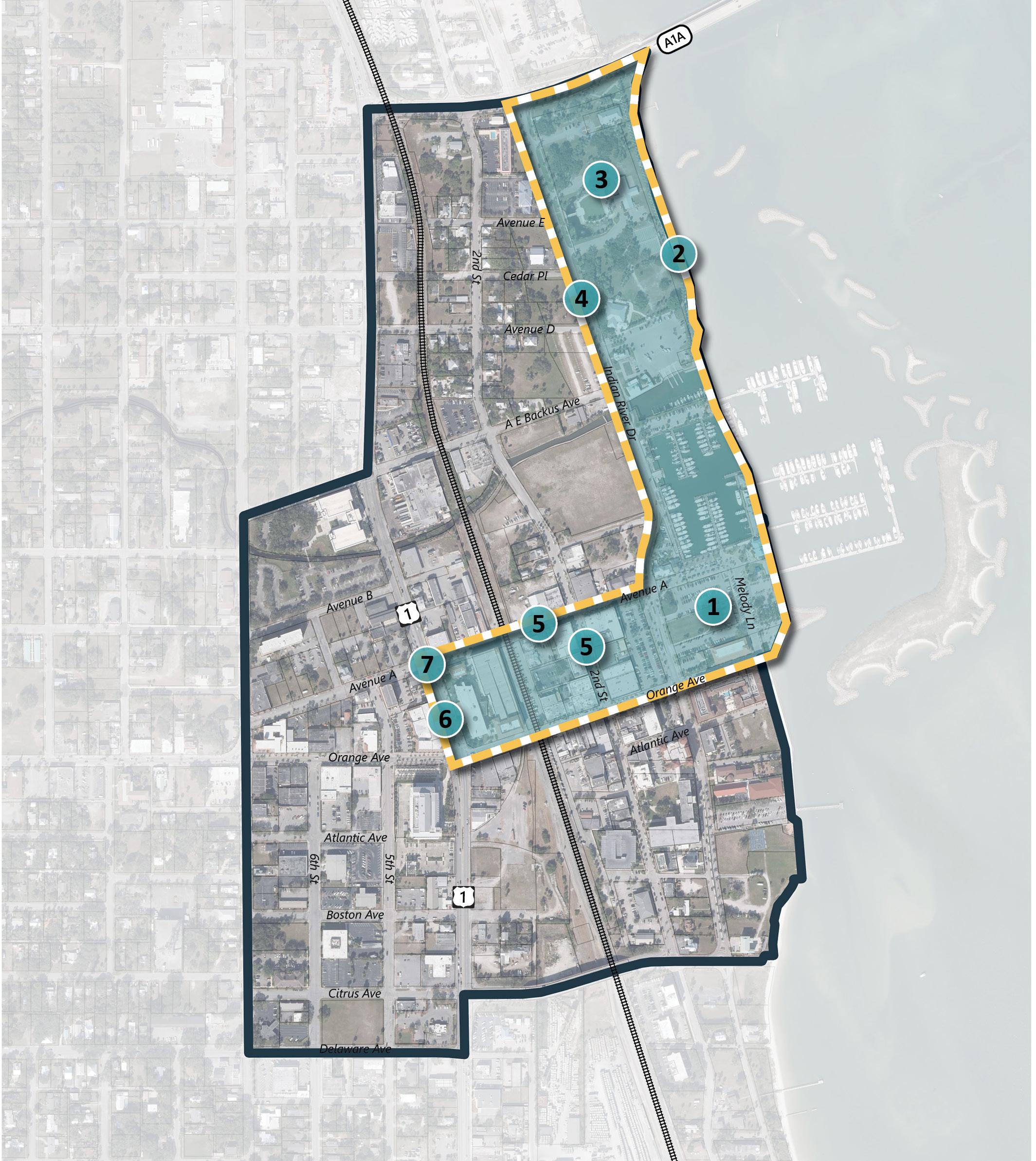
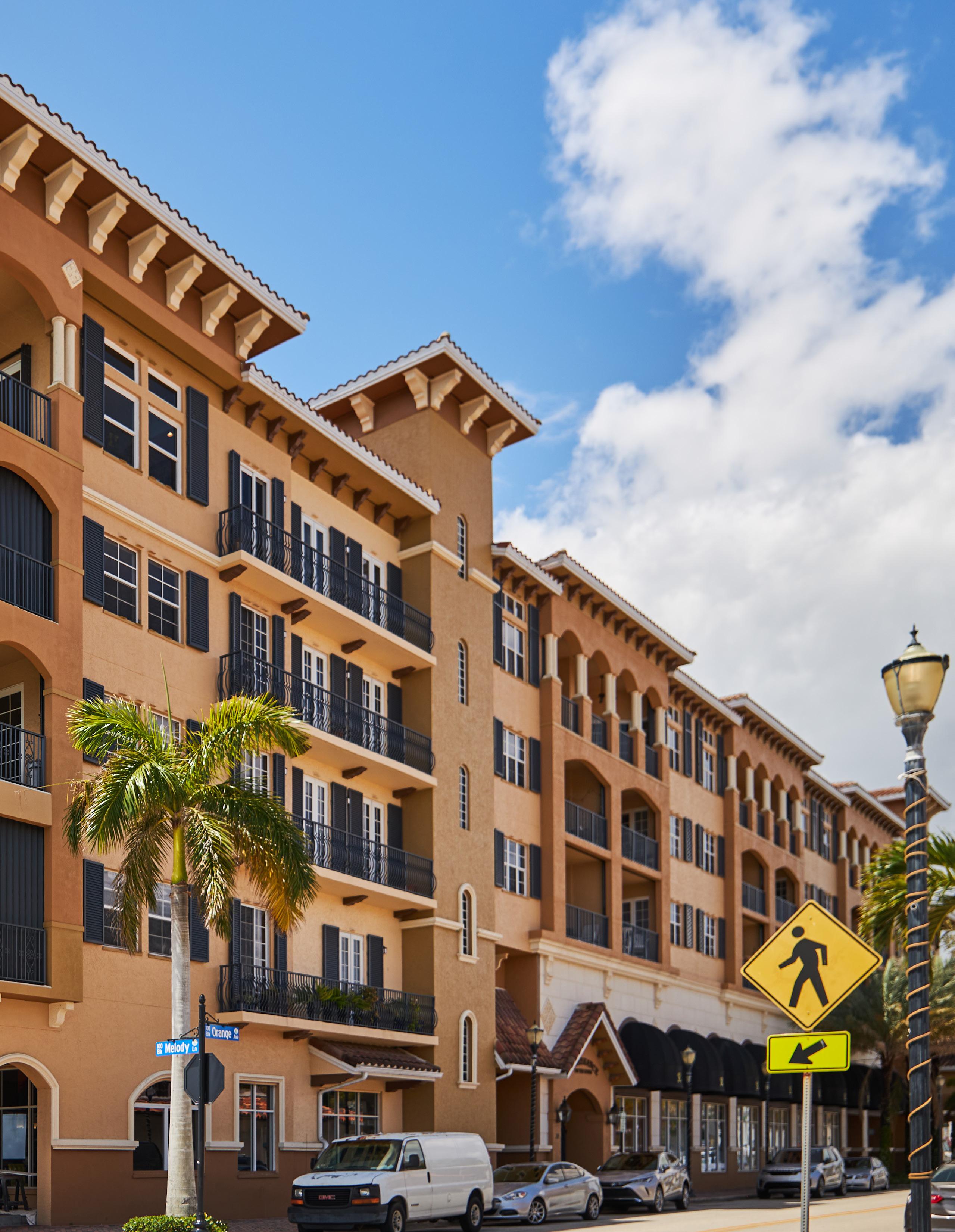
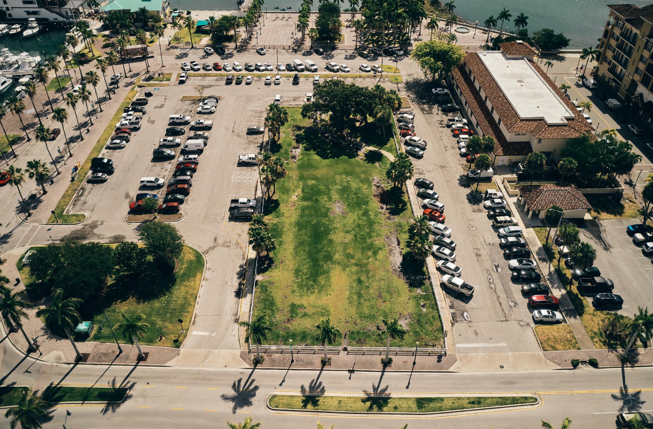
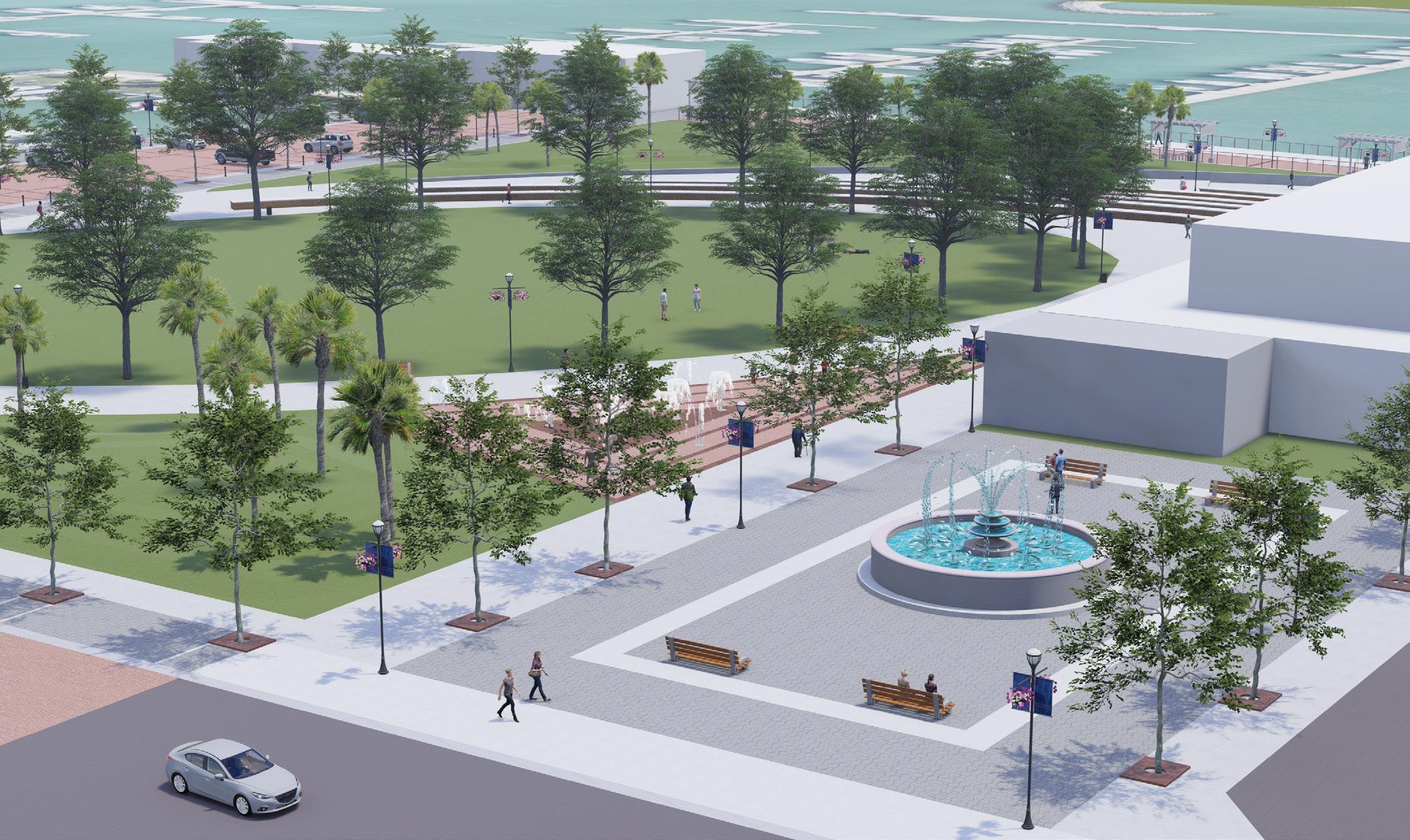
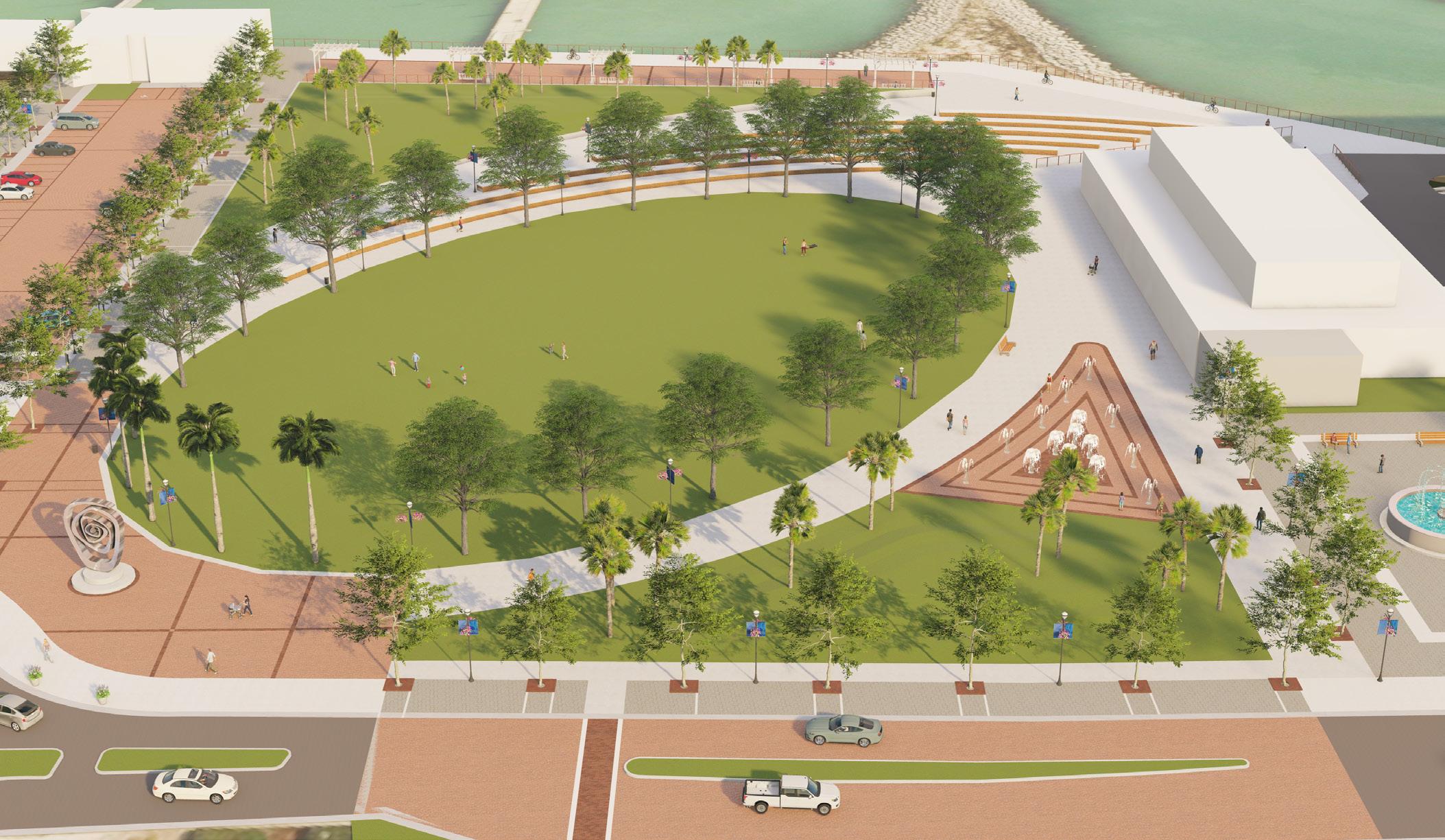
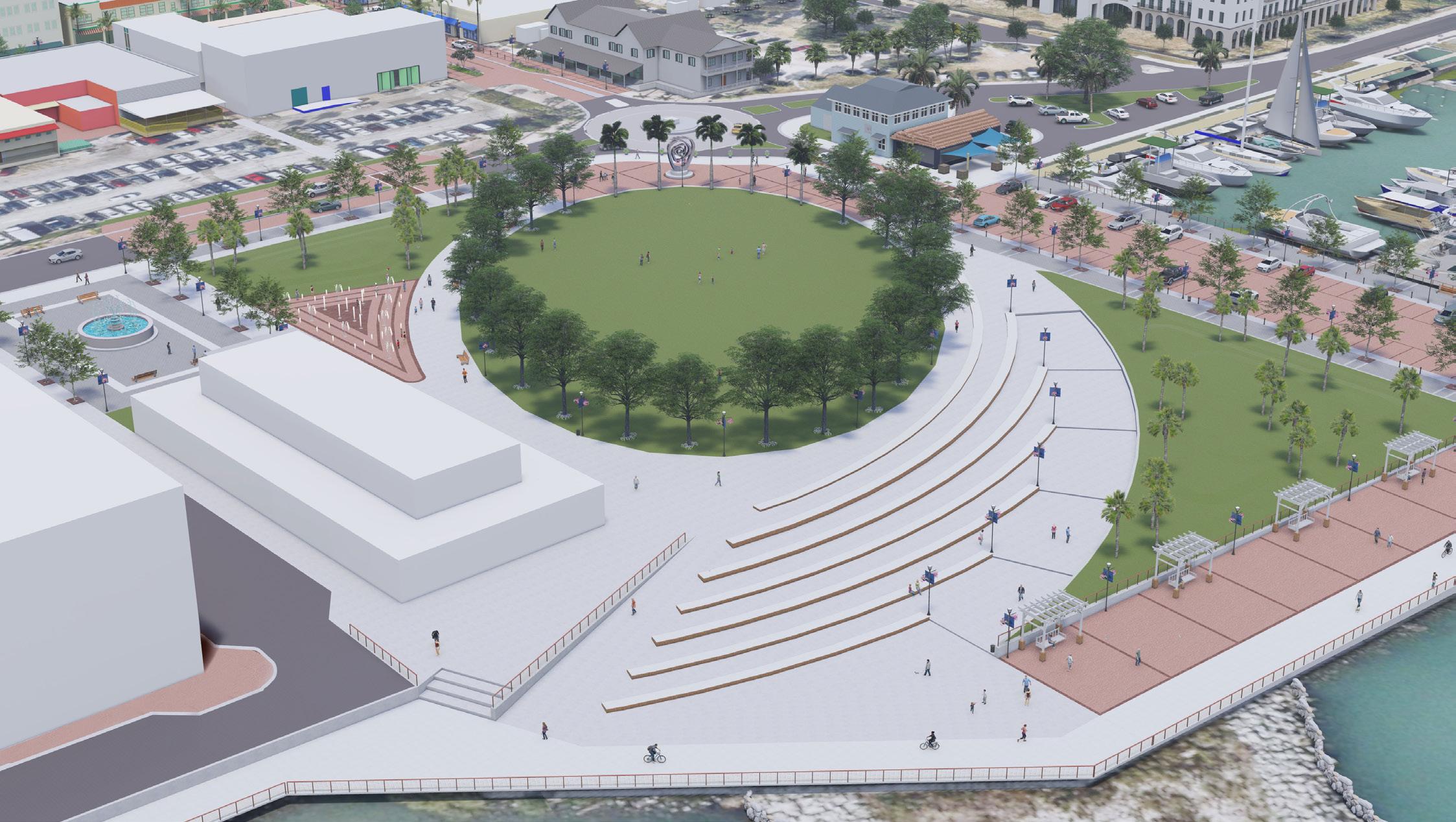
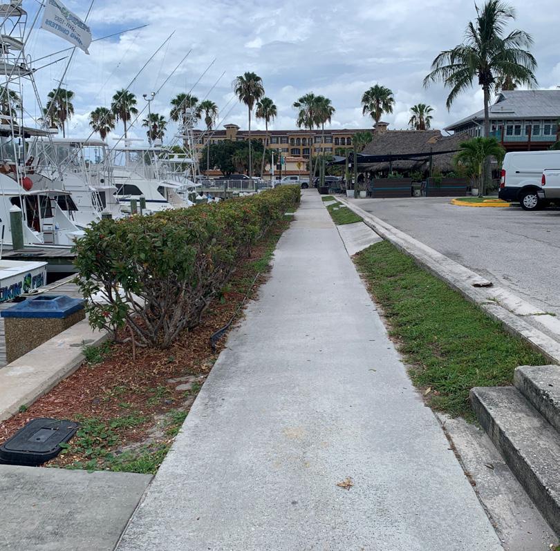
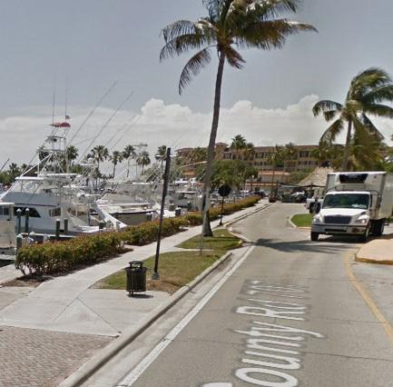
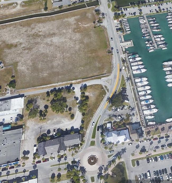
Marina Square is 6.3-acres of publicly-owned land located along the City’s waterfront. It is the focal point of Downtown’s two busiest streets - Avenue A (Marina Way) and Orange Avenue. It also hosts some of the City’s most popular events including the Downtown Farmers Market. However, Marina Square is mainly utilized currently as surface parking and the site provides approximately 175 offstreet parking spaces and additional angled, on-street parking along Melody Lane. Based on input received during the public workshops and stakeholder interviews, it is clear that surface parking is not the highest and best use of this valuable piece of prime waterfront property.
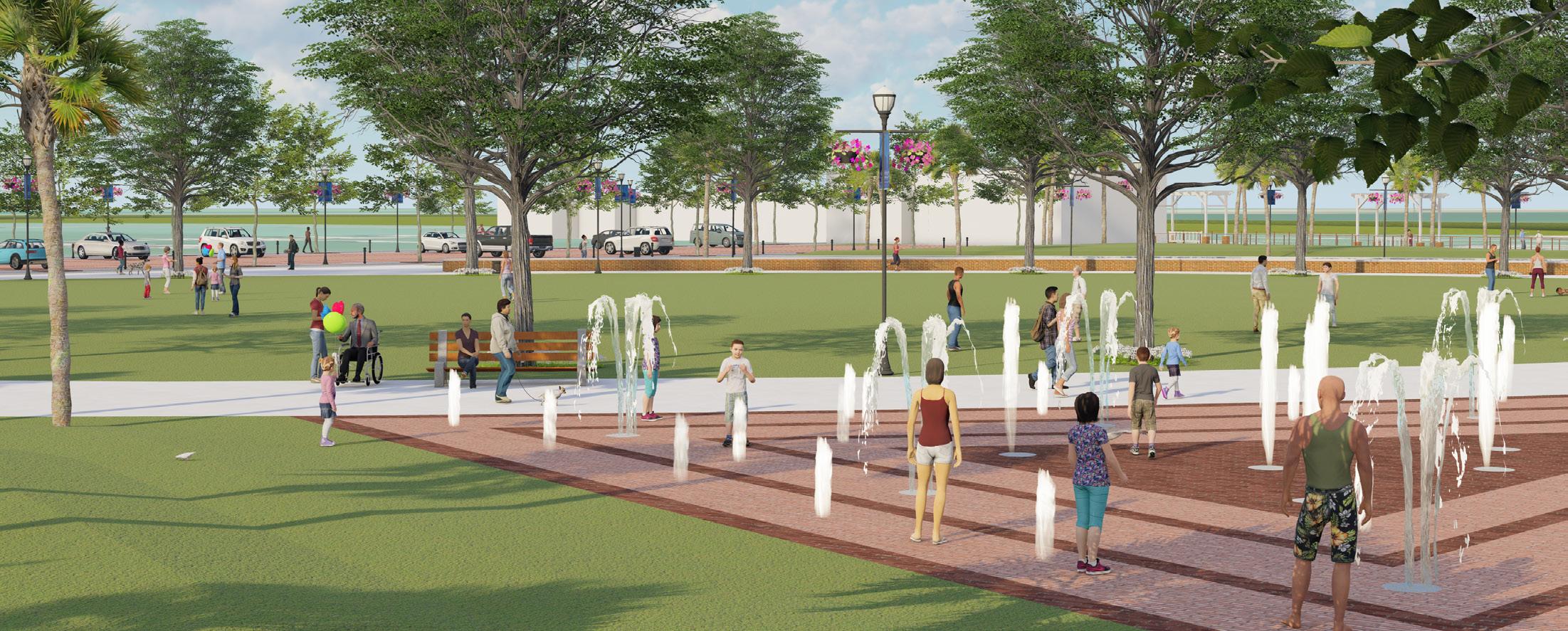
The vision for Marina Square is to transform this utilitarian space into a vibrant waterfront park that provides public access to the water as well as a functional and beautiful open space for the community. Design elements for the proposed park include closing off Melody Lane to vehicular traffic, transforming Avenue A into a festival street with accent pavers, providing a multi-use pathway that connects to the north and south, creating overlooks along the shoreline to capitalize on waterfront views, and providing a flexible open lawn with an adjacent terraced area which can also be used as an amphitheater for special events. The goal of the design is to create spaces that accommodate a variety of uses and are highly flexible, intended for a wide range of community events. We believe this exciting transformation of Marina Square into Marina Park should be the top priority, as it will stimulate increased private redevelopment within the Downtown.
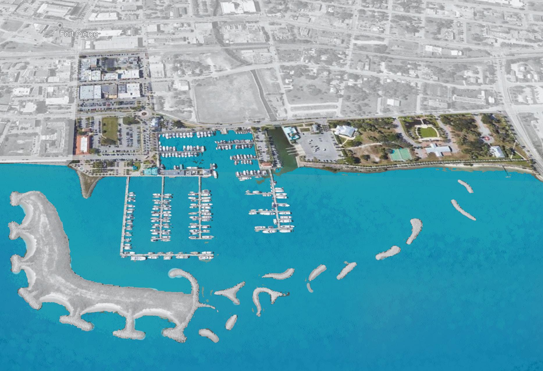
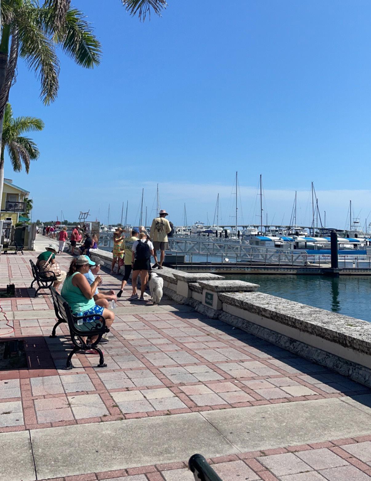
River Walk Park is located in Downtown Fort Pierce and includes a beautiful waterfront promenade lined with palm trees that stretches from A1A/Seaway Drive to Boston Avenue. South of the Manatee Observation and Education Center, the City owns and controls more than a quarter mile of waterfront. These land assets provide the City with an opportunity to transform this Plan’s Focus Area into an iconic Waterfront District. The District would link River Walk Park to a newly created Marina Park and connect to the commercial heart of Downtown between Avenue A and Orange Avenue with walkable streets.
Iconic spaces along the waterfront will showcase the City’s identity and celebrate local character. This District should be distinctively branded and provide a variety of event venues and indoor and outdoor recreational, cultural, and environmental education activities for residents and visitors. By creating a series of open spaces and event venues – including festival streets, parking plazas, and an event lawn – the Downtown will provide year-round activity for users of all ages and abilities.
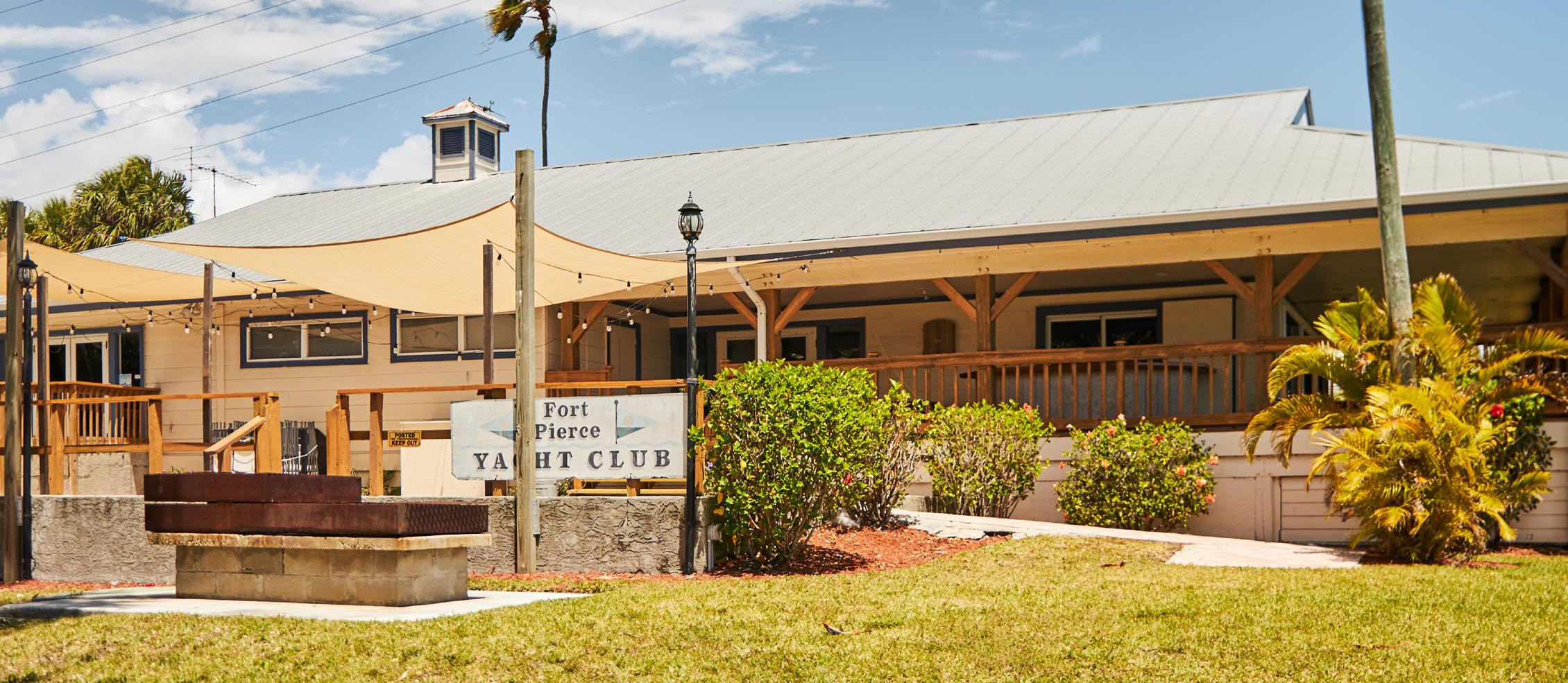
The River Walk Park campus houses five civic buildings – the Manatee Observation and Education Center, the Seven Gables Historic House, the A.E. Backus Museum & Gallery, the River Walk Center, and the Fort Pierce Yacht Club. All of these are unique historical and cultural landmarks within the City of Fort Pierce. In addition, the campus includes Veterans Memorial Park, a fishing pier, and a proposed seaplane launch. However, the park campus is struggling with the lack of cohesiveness with each individual building having separate vehicular drives and separated parking along with a large, paved area to serve the boat ramp (which is only operational 6 months out of the year due to conflicts with the manatee population). Currently, the total vehicular use area of the park campus makes up approximately 30% of the entire area. Pedestrian connectivity is lacking between the buildings and there is also a lack of pedestrian access from the buildings and from Indian River Drive to the waterfront promenade. The public ownership of the entire park campus provides the opportunity to create an integrated, family-friendly, cultural, and environmental destination along the scenic waterfront.
The conceptual design should take the following into consideration - parking consolidation, additional programming, public access to the water, and pedestrian connectivity. Park amenities such as an outdoor fitness loop and family-friendly activities such as a natural playscape and interactive water features can bring additional activity and functionality to the park. Educational and interpretive signage, an outdoor classroom, and other park features can promote this park as a place for environmental education which ties into the cultural buildings that make up the campus along the scenic waterfront.


Part of the creation and redesign of the Waterfront District includes street improvements along Indian River Drive to promote increased connectivity to and from the proposed Marina Park and the core of Downtown. Proposed improvements include on-street angled parking and a 12’ multi-use trail along the east side of the road to promote strong pedestrian and bicycle connectivity along the corridor from Moore’s Creek to A1A/ Seaway Drive.
The addition of more than 90 on-street parking spaces will allow for the removal of some of the surface parking within the campus and provide a more cohesive public open space. These parking spaces will also serve to pull activity north from Marina Park into River Walk Park. The multi-use trail will connect across the causeway and into the City’s Downtown.
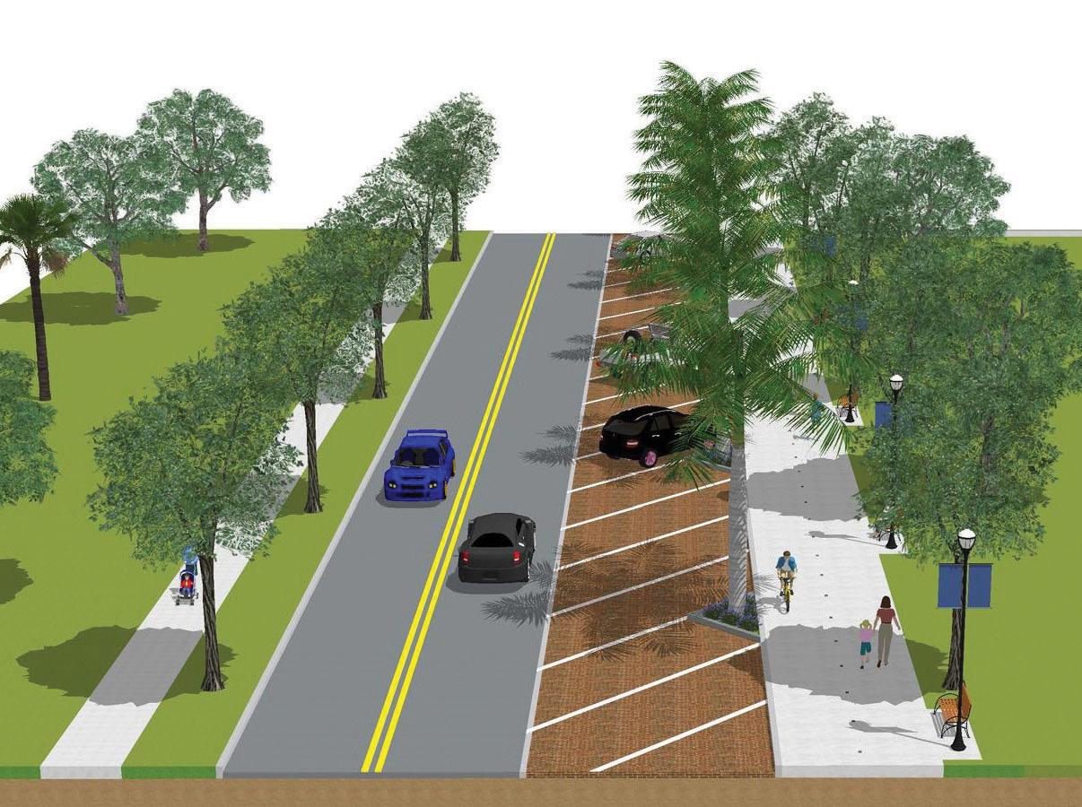
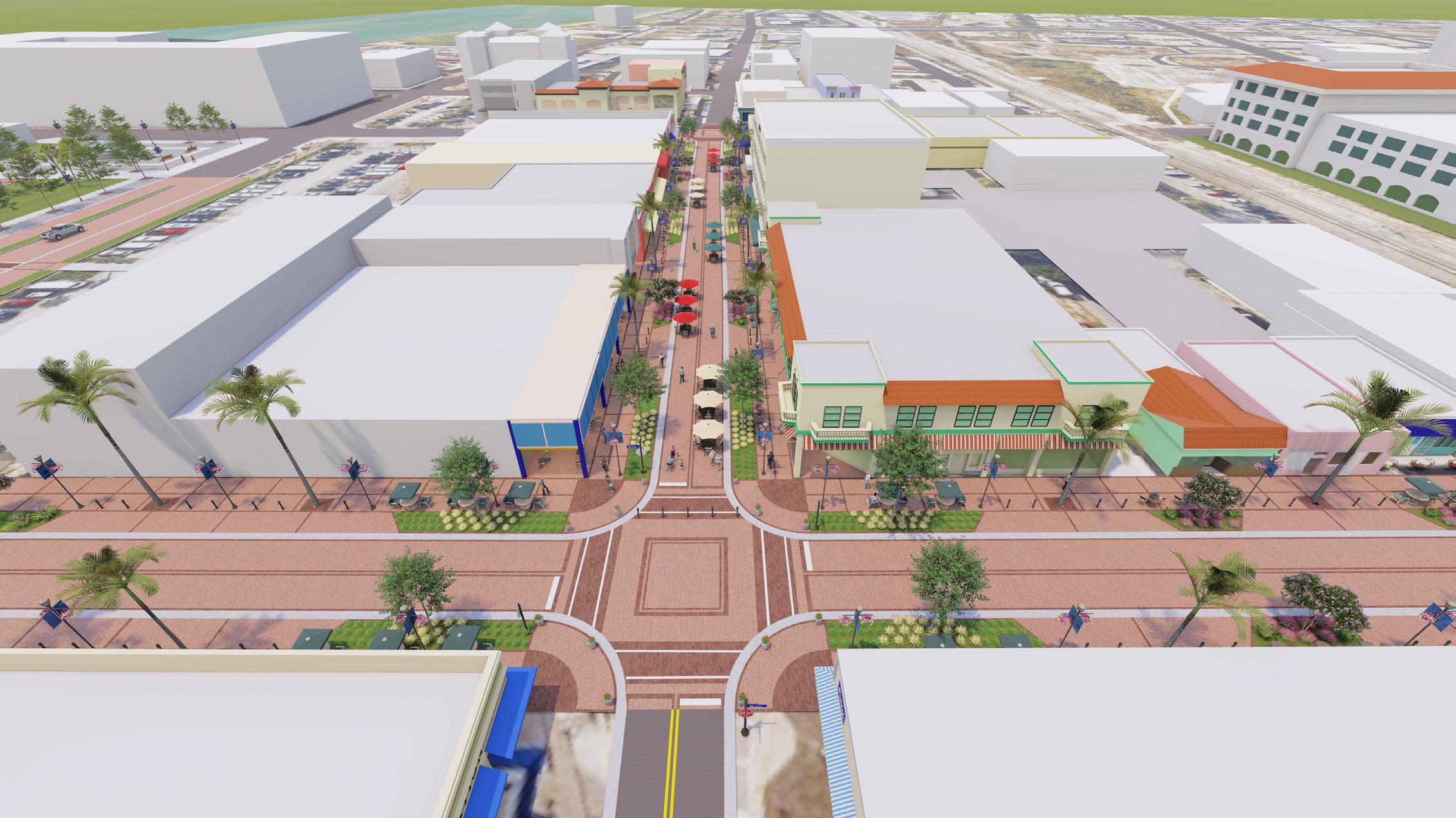
The festival street transformation projects include a curbless streetscape environment with bollards and planters to delineate pedestrian spaces from vehicular spaces. Removable bollards at intersections allow for portions of the street to be closed on evenings or weekends for special events. Other streetscape improvements include street trees, landscape areas, site furniture such as benches and bike racks, decorative streetlights, hanging baskets, planter pots, and wayfinding signage. The festival street improvements provide additional event venues within Downtown and within the newly created Waterfront District and will serve to promote continued redevelopment along these corridors by improving connectivity and walkability.
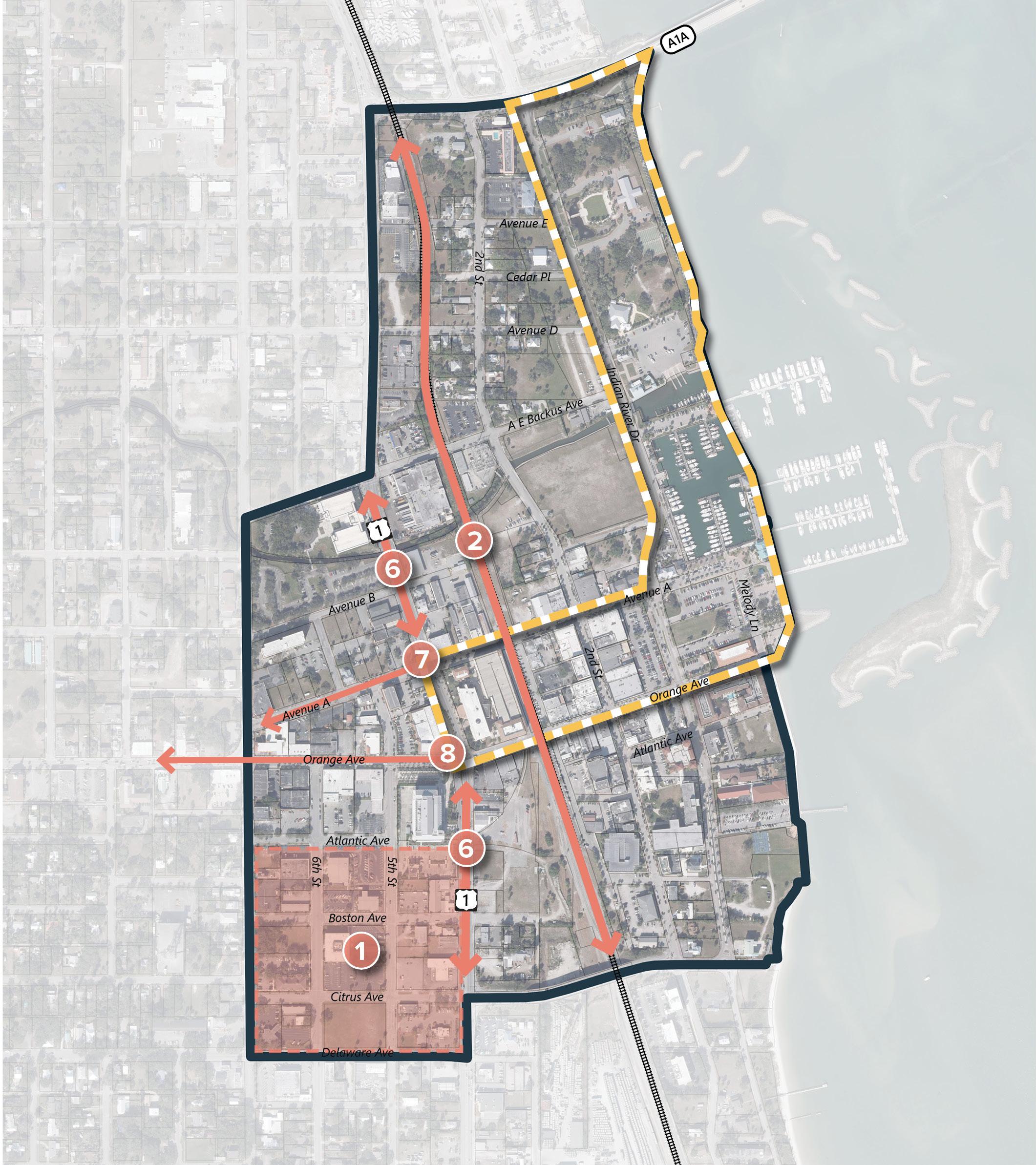
Avenue A (Marina Way) is one of the main business corridors in Downtown Fort Pierce. The proposed improvements for the initial phase is a 2-block segment from the City Hall public parking garage to the roundabout at Indian River Drive. Providing visitors with a sense of arrival as soon as they walk out of the parking garage, developing a cohesive and pedestrian-friendly corridor along Avenue A, and connecting into Marina Park will increase the use of the public parking garage and also provide stronger linkage between City Hall and the Waterfront.
2nd Street is also a main corridor within downtown where many of the popular restaurants are located. The proposed improvements for the initial phase is a one-block segment between Avenue A (Marina Way) and Orange Avenue.
The segment of US 1 through Downtown Fort Pierce is classified as C3C under FDOT’s context classification system. The 3C3 designation is intended for ‘Suburban Commercial’ land uses and is inconsistent with the City’s vision for Downtown. The reclassification of this major arterial in downtown to C5 – Urban Center will promote and provide for a more pedestrian and multi-modal oriented corridor. The C5 classification is defined as ‘a mix of uses set within small blocks with a well-connected roadway network, typically concentrated around a few blocks and identified as part of a civic or economic center of a community, town or city’. The C5 classification will allow for lower speeds – as low as 25 mph – through this area of downtown. This classification will also allow for vertical deflections such as speed tables at the intersections and other speed management design features to be utilized along the corridor. The City should commence discussions with FDOT District 4 regarding the reclassification of this segment of US-1. Initial steps toward this reclassification include acceptance of this Downtown Master Plan by the City Commission, followed by the adoption of amendments to the Future Land Use Element and Land Development Code consistent with this Plan. A formal traffic analysis will also be required as part of this reclassification effort.
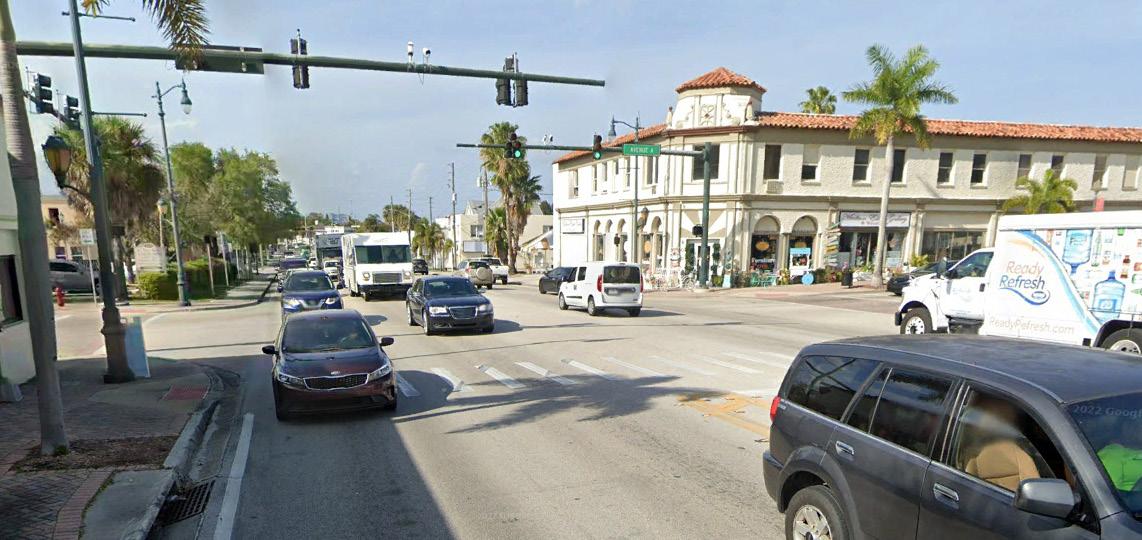
As part of the master planning process, Avenue A was identified as the preferred pedestrian crossing at US 1 into Downtown and the Waterfront District. This intersection will serve to re-connect East and West Fort Pierce and function as a pedestrian gateway into Downtown and the waterfront.
The current crossing distance, with 4 travel lanes and a turn lane, is approximately 56 feet. The proposed design eliminates the left turn lanes to reduce this crossing distance to 44 feet. Other intersection improvements should include accent pavers at the crosswalks, enhanced hardscape and landscape treatments, and other streetscape features such as planter pots and site furnishings.
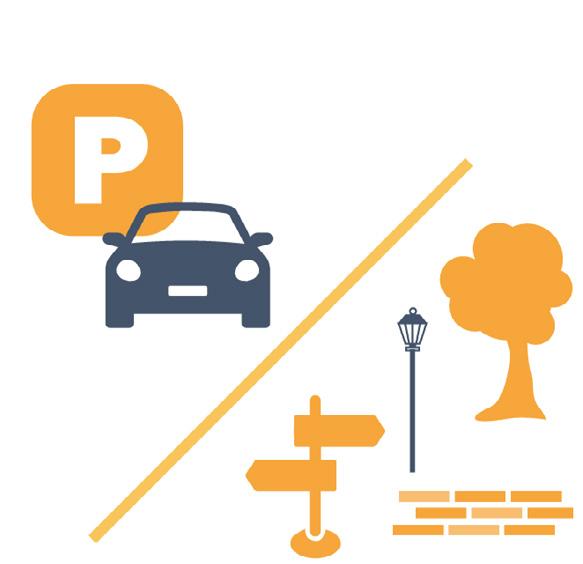
Downtown Fort Pierce was developed before the era of suburban or automobile-centric development trends. Over the years, like many historic cities, Fort Pierce businesses left their original urban downtown addresses for malls or strip centers that included expansive surface parking lots. In response to these trends, many downtowns attempted to retrofit for modern times by increasing the number of parking spaces. Unfortunately, suburban development forms including curb-cuts, drive-thrus, and surface parking lots undermine the historic urban character of Downtowns. The successful revitalization of Downtown Fort Pierce requires an understanding of the need to balance parking demand with community character through a thoughtful parking strategy.
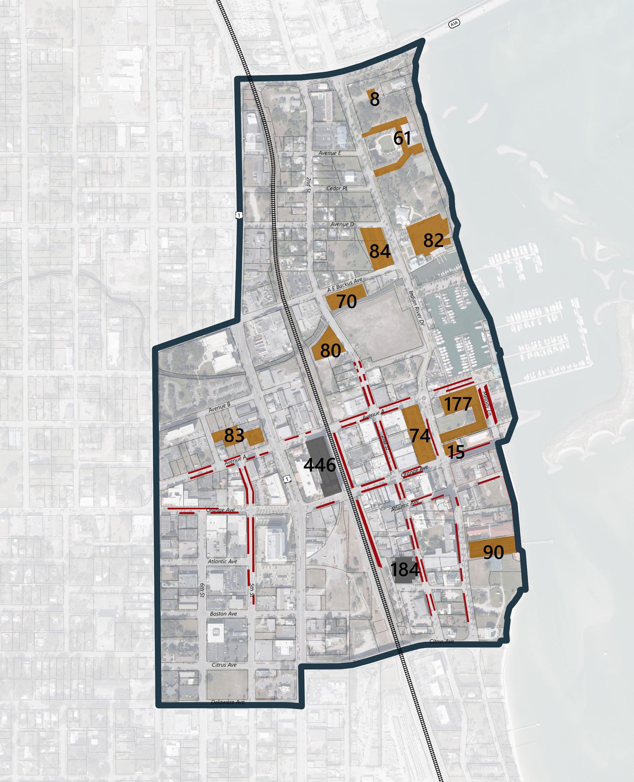
Parking infrastructure is needed to accommodate existing and future development. Within an urban context is important to develop a district strategy that includes improved walkability and a range of parking choices throughout downtown. While the creation of Marina Park will displace approximately 230 spaces, the City has identified multiple locations for parking that would increase the overall supply.
Promoting market-based pricing of prime parking locations within Downtown would encourage higher parking turnover in prime locations and generate revenue for the City. The City garage and other non-prime parking locations could remain free so that residents have the choice to pay for prime parking locations or to enjoy free parking that entails walking a block or two to your destination. Other parking strategies include improved pedestrian connectivity, enhanced signage and wayfinding of available public parking, alternative non-automobile travel options including city bus and trolley services, and creation of a day and night shared-parking program.

The creation of a walkable, bikeable, Waterfront District will require improved bicycle and pedestrian connectivity from Marina Park along Indian River Drive to the north side of Moore’s creek – connecting into the River Walk Park campus. This important connection will unify the District and help promote activity extending north from Marina Park and the core of downtown. Currently a narrow sidewalk, the proposed connection should be a minimum 10’ wide multi-use path that can accommodate cyclists and pedestrians. The future SUN Trail will be located at the intersection of Indian River Drive and Seaway Drive and the proposed multi-use path improvements along the east side of Indian River Drive will connect into this future trail system.
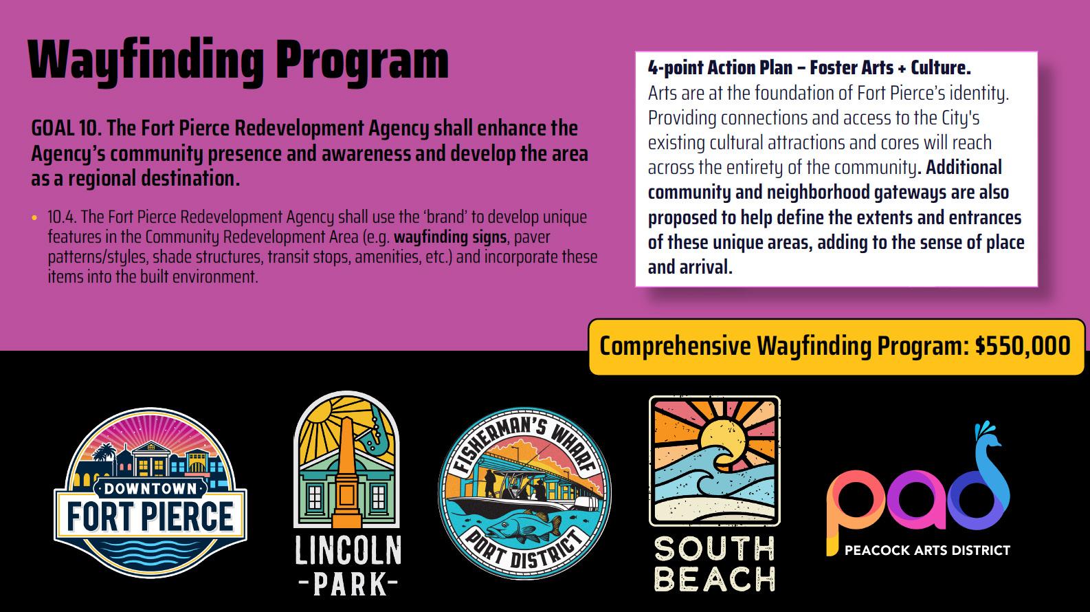
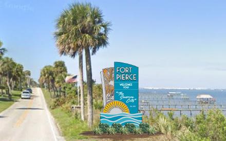
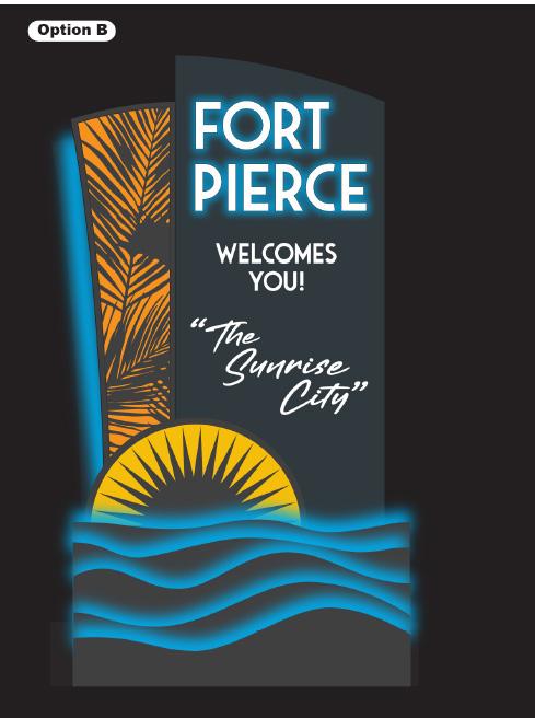
To capitalize on the character and history of Downtown Fort Pierce, the City can establish a gateway treatment program throughout the Study Area, including signage, landscape treatments, and other elements to promote and celebrate the City. Gateway features such as signage, monuments, and banners do more than just identify an area or activity center. They are critical for establishing a sense of place, communicating a community’s identity, and conveying the character of a place. This Plan proposes to implement gateway features at strategic and highly visible locations within the Study Area which announce to residents and visitors alike they are entering a thriving Downtown community rich with shops, restaurants, history, culture, and amenities.
The Land Development Code and Zoning Map are some of the most important tools for implementing the vision for Downtown. The creation of a single land use and zoning classification of Central Business District (CBD) across downtown is currently being proposed and this plan supports that strategy moving forward.
Medium Density Residential (6.5-12 DU/AC)
High Density Residential (12-18 DU/AC)
General Commercial (15 DU/AC, 1.0 FAR)
Central Business District (30 DU/AC, 3.0 FAR)
Industrial (1.5 FAR)
Conservation & Open Space

In addition to the traditional regulatory tools for development, this plan proposes that a Form Based Code (FBC) be established to help achieve a cohesive, urban form within the Downtown. The intent of the FBC will be to preserve the existing character of the Downtown, while promoting quality infill and redevelopment in a walkable and mixeduse urban environment. The new FBC will streamline the current development review process and provide developers with a more predictable and transparent process for development. Implementation of a FBC would also lead to greater interest of developers within the City prompting new investment, increased redevelopment, and economic growth.

The FBC may also include standards for building architecture, including exterior colors. If the City desires to adopt a building color palette, it should specify which colors are appropriate based on each architectural style present in the downtown (e.g., Mediterranean buildings typically use earth tones but may use cool colors such as blue or green for trims and accents) and specify which tones are allowed for the primary surface versus trims and accents. A list of prohibited colors (e.g., black, neon or fluorescent colors) should also be developed. It is recommended that the adopted color palette refer to Pantone color references as commercial paint names/numbers change over time (see samples below).
The Moore’s Creek corridor and linear park is one of the community’s most valuable assets. It connects multiple residential neighborhoods in the western part of the City. There are existing trails on both sides of the creek from N 15th St to N 7th St. With multiple well-marked, at-grade crossings. The Fort Pierce Intermodal Transit Station, which serves as a hub for regional bus services, is located just north of the Creek at N 8th St. The approved development plan of King’s Landing from N 2nd St. to Indian River Dr. has incorporated trails and improvements along the creek.
However, there is a gap in the linear park from N 7th St and N 2nd St that includes several barriers to connectivity – N 7th Street, a pedestrian bridge at the Florida Department of Juvenile Justice building, US 1, the railroad track, and N 2nd Street. It is essential to bridge these gaps in order to provide a continuous pedestrian connection that links the western neighborhoods into the City’s Downtown and Marina Park. A connectivity and feasibility study of this gap will delineate options for crossings at each area (either at-grade or belowgrade). These options can be refined to produce a preferred concept with associated opinions of probable cost which can then be incorporated into the City’s budget over the next few years as the City works toward implementation and connecting this important corridor into Downtown.
Following the connectivity & feasibility study, this plan identifies the implementation of the Moore’s Creek Linear Park and Greenway that will close the existing gap east of N 7th Street and improve multimodal connectivity into the Downtown from nearby neighborhoods. Many cities have transformed underutilized linear water features into public park spaces that have become major catalysts for growth and redevelopment. Implementing the final stretch of Moore’s Creek Linear Park will elevate the City’s downtown amenities and has the ability
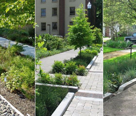
to offer huge environmental benefits. Linear park amenities will include a multi-use trail, landscape improvements, canopy trees, benches and other site furnishings, small pavilions or picnic areas, littoral plantings along the creek, and green infrastructure features such as rain gardens or bioswales.
Another important implementation project will be continuing the festival street treatment along Orange Avenue, building off the previously implemented portions of Avenue A and 2nd Street. The transformation of Orange Avenue into a festival street is proposed to extend from US 1 to the Waterfront/Melody Lane. Existing retail spaces on the ground floor of the 4-story mixed-use building (Renaissance On the River) are struggling due to lack of foot traffic and activity and these streetscape improvement projects will support the continued revitalization of Downtown.
Additionally, this plan proposes extending the festival street treatment along Avenue A from the City parking garage to US 1. The City may also evaluate a festival street treatment for Indian River Drive between Avenue A and Orange Avenue. These streetscape improvements – at Avenue A, 2nd Street, and Orange Ave. – will provide a comfortable and cohesive feel to the City’s downtown street network and will provide a pedestrian-friendly experience throughout.
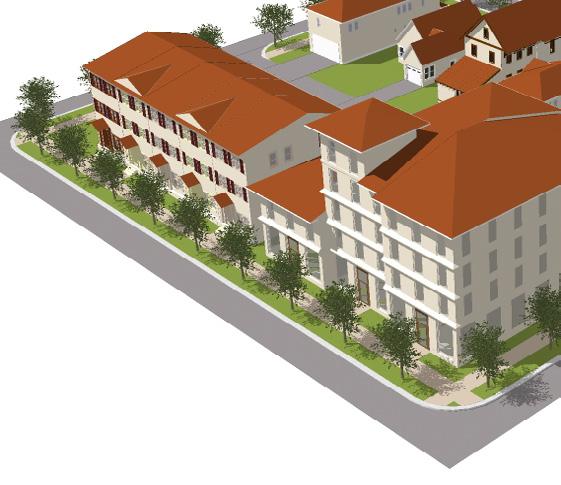
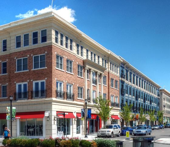
A successful downtown is made up of a variety of destinations to facilitate living, working, and playing that all support a vibrant district. The City of Fort Pierce looks to build upon the current redevelopment occurring in the Downtown to drive activities throughout the area during the daytime and evening hours as well as during weekdays and weekends. Currently, only two multi-family residential developments exist within the study area. The lack of affordable housing options was identified as an issue by multiple stakeholders during the
public engagement process. This plan has identified a number of vacant sites that can be developed as mixed-use with retail/commercial/restaurant on the ground floor and apartment or condo units above. This type of development supports the market demand and reinforces the pedestrian-scale activity and vibrancy that contribute to the downtown character.
Future implementation for Marina Park is also recommended as part of the phase two project priorities. The initial implementation phase for Marina Park should include all infrastructure and utility improvements including the festival street/ parking plaza along the north side of the park, sidewalks, event lawn, and terrace area. Future phases can include additional amenities such as the interactive water features, landscape berms, swing benches, additional site furnishings, and landscape improvements.
Following the development of the conceptual design for River Walk Park, this plan proposes that implementation of the design be phased over time based on funding. Infrastructure improvements including roadway and streetscape enhancements along Indian River Drive should take priority and are included as part of the phase 1 implementation projects. Initial phases of the River Walk Park implementation should include infrastructure and utility improvements as well as consolidated parking areas, sidewalks, and hardscape features. Future phases can include additional amenities such as a natural playscape, outdoor classroom, an interactive water feature, educational and interpretive signage, as well as landscape enhancements.
The City-owned property across Indian River Drive from the newly formed Marina Park (parcel: 2410503-0060-000-7) is currently a surface public parking lot and provides back-of-house functionality for restaurants along 2nd Street. However, the site location provides a substantial development opportunity for a high rise, mixed-use tower with an associated parking garage. The long-term vision for this parcel could include a mix of retail, restaurants, and commercial uses on the ground floor with upper floors as residential which could include apartments or condos. Its close proximity to the new Marina Park and Waterfront District, as well as prime waterfront views, will support a high-end residential product.
Utilizing the design vision of the Downtown Master Plan, the City of Fort Pierce is well-positioned to be selected as a location for a Brightline Station within Treasure Coast. There are several parcels of underutilized and vacant property directly adjacent to the rail corridor in between Orange Avenue and Citrus Avenue that could provide a location for the future Brightline Station as well as provide redevelopment opportunities for transit-oriented and mixed-use development.
The Civic District is proposed between Atlantic Ave. and Delaware Ave. to the north and south and between US 1 and 7th Street to the east and west. This portion of downtown has several vacant and underutilized property and would provide the opportunity for the City to create a vibrant Civic District that could house the St. Lucie County Courthouse, Law Library and other civic buildings and facilities. By locating these services in a central area, the district could provide associated amenities such as pocket parks and plazas and the daily influx or employees would support a range of restaurant and retail developments in and around the district.
The development of a linear greenway along the rail corridor would provide an important northsouth, multi-modal connection through the center of downtown. This greenway could connect into the Moore’s Creek Greenway and provide important connectivity to residential areas on the north side of downtown into the Waterfront District and future Civic District.
As the Downtown grows and develops over time, this plan promotes redeveloping surface and temporary parking lots to encourage increased urban infill. The downtown should promote mixeduse development.
As vacant and underutilized sites are redeveloped, the City should encourage mixed-use development with restaurants and retail spaces on the ground level and residential units on the upper levels. This will stimulate the development of needed residential units in and around the downtown area.
As the downtown grows over time, the City should encourage another hotel development in addition to the hotel project at King’s Landing which has been approved but not yet built.
Continued streetscape improvements along US 1 will promote pedestrian connectivity in and around Downtown. Improvements should include a separation between the sidewalk and travel lane, street trees, enlarged sidewalks, and other beautification.
Continued streetscape improvements along Avenue A will promote pedestrian connectivity into Downtown. Improvements should include a separation between the sidewalk and travel lane, street trees, enlarged sidewalks, and site furnishings. Festival streets to the west of US 1 may also be considered.
Continued streetscape improvements along Orange Ave will provide a gateway treatment as you enter into Downtown from the west. Improvements should include a separation between the sidewalk and travel lane, street trees, enlarged sidewalks, and site furnishings. An off-street multi-use path may also be a consideration for improved multi-modal access.
This page is intentionally left blank.
As Fort Pierce nears its sesquicentennial anniversary, and twenty years after formal acceptance of the Downtown Master Plan, many more people live in the 34950. Downtown Fort Pierce is a vibrant mixed-use district but its history and character as an Old Florida fishing village remain visible to all.
River Walk Park, City Marina, and Marina Park provide a vast and dynamic public waterfront that serves as the City’s front porch overlooking the Atlantic Ocean and underscoring Fort Pierce’s reputation as the Sunrise City.
Brightline Train service serves as a catalyst for downtown redevelopment efforts, connecting Fort Pierce to the cities of Orlando, West Palm Beach, Fort Lauderdale, and Miami as well as fostering transit-oriented development around the Fort Pierce Station.
King’s Landing is now one of the older mixed-use developments but still revered as a pioneering effort that brought many new residents and a firstclass hotel to Fort Pierce. The vacant parcels and surface parking lots that were once a prominent feature of Downtown have been replaced with mixed-use buildings. The flexible streetscape designs of 2nd Street and Orange Avenue work in concert to promote local commerce including restaurants, experiential retail shops, and other entertainment-based businesses.
Downtown Fort Pierce is a model of civic beauty and walkable urbanism; a desirable Florida destination for businesses, residents, and visitors.