4 minute read
Precinct 1: Homebush Bay to Brays Bay
Map 11 - Precinct 1 opportunities and constraints CONNECTS TO MEADOWBANK Wire fence at SYDNEY OLYMPIC PARK SYDNEY OLYMPIC PARK AND PARRAMATTA WHARF Cycle and walking routes through trailer parking area and no through road John Whitton Bridge F shoreline with sign: “no trespassing, violators will be prosectued” Future Wentworth Point Peninsular Park c d O1 Ryde Bridge Wentworth CONNECTS TO WENTWORTH POINT Bennelong Bridge Point Bennelong Bridge a Formal pathway b Rhodes East Master Planned Precinct Future Leeds St Foreshore Park (currently industrial) C2 Residential barrierLlewellyn StConcord Rd C1 O4 C1 Steep slope with direct access to shoreline. Old timber steps down, informal dingy storage on slope

Advertisement

Overview
HOMEBUSH BAY
BRAYS BAY
Recent residential development along the entire western Rhodes Peninsula has enabled the delivery of publicly accessible, high quality foreshore paths.
The Rhodes East Master Planned Precinct is also set to deliver foreshore access park between John Whitton Bridge and Ryde Bridge.
The only gap in access along the foreshore is along Llewellyn Street, between Ryde Bridge and McIlwaine Park, where private properties are built up to the waters edge.
Strategic importance Access to and along the foreshore in this precinct is extremely important due to extent of current and future high density
Formal pathway
O2
T
Homebush Bay Circuit
O3
Rhodes Waterside McIlwaine
Park e
O5
residential communities.
Brays Bay Reserve
Narrow, overgrown goat track running between council car park and mangrovesKOKODA TRACK MEMORIAL WALKWAY f
g Therefore, the strategic opportunities in this precinct are focused on: – wayfinding improvements where access along the foreshore can’t be granted, or from public transport stops to the water – Connecting across infrastructure barriers – Connecting into recreational trails around Sydney Olympic Park and
Wentworth Point.
RIVENDELL SCHOOL AND HOSPITAL
Walking route directed through hospital car park Map Key Formal foreshore path Informal foreshore path
TRAIL LEADS BETWEEN CONSTRUCTION FENCING AND AN OLD BARBED WIRE FENCE ON THE FORESHORE SIDE Flooded pathway No foreshore access possible (until a time when sites undergo future re-development) Existing bike routes Existing Pathway through park Planned foreshore path upgrade Opportunity for on-street connection improvement (where continuous access is not possible) Homebush Bay Circuit Rhodes East Master Plan Area Rhodes East new foreshore park
Opportunities O1 Rhodes East new foreshore park and access
– The Rhodes East Planned Precinct will deliver the Leeds St Foreshore Park in the early redevelopment project.
O2
O3
O4
O5
Rhodes Station pedestrian bridge
– Support a future pedestrian bridge over Concord Road to connect to McIlwaine Park identified for Rhodes East Planned Precinct by DPIE – Investigate opportunities to improve wayfinding from Rhodes train station to Bennelong Bridge and the foreshore walk
Connection into Homebush Bay Circuit and Wentworth Point
– The Homebush Bay Circuit Wayfinding Strategy identifies opportunities to improve the foreshore path including shared path upgrades at from
The Corso to Bicentennial Park through Lewis Berger Park as well as road cycling network upgrades in Rhodes, public artwork and lighting improvements. – Opportunity for Rhodes Waterside to be included as an urban destination along the circuit track, with improved access to the foreshore. – Promotion of foreshore walking around Wentworth Point and Rhodes
Peninsula via Bennelong Bridge, once Wentworth Point Peninsula Park is completed.
Improve on street connection via Llewellyn Street
– Improve wayfinding along Llewellyn Street along existing bike route between McIlwaine Park and Ryde Bridge – Improve pedestrian access and wayfinding from Llwewllyn Street, underneath Ryde Bridge, to future Leeds St Foreshore Park (once precinct is re-developed)
Brays Bay River Access & McIlwaine Park Foreshore Upgrade
– The recent master plan funded by the Department of Planning, Industry and Environment has identified major upgrades to McIllwaine Park, including the opportunity to provide significant amenity upgrades and a 2.5m shared path along the foreshore at McIlwaine Park.
Constraints C1 Eastern peninsula (Rhodes)
– Private properties along the entire foreshore between Ryde Bridge and
McIlwaine Park are unlikely to be redeveloped in the future, indicating that this section of the foreshore will remain privatized into the foreseeable future.
C2 Pedestrian barriers
– Concord Road and the heavy rail corridor present a barrier to foreshore access for residents living west of the rail line
C3 Steep slope to foreshore
– Steep slope from end of Llewellyn Street down to foreshore and under
Ryde Bridge to connect to eastern side of peninsula
Precinct extent (approx) Public Ferry Terminals Bus stop
a Site photo location Fences
Site Photos
a
Photo descriptions
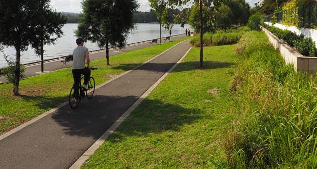
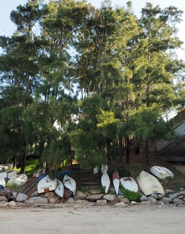
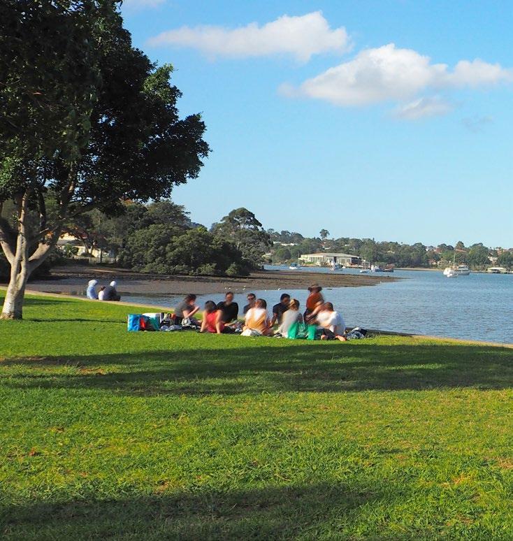
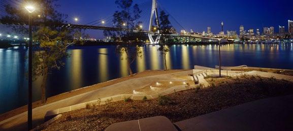
a. Rhodes Eastern peninsula foreshore park and access b. Shared pedestrian/cycleway along Rhodes East c. High quality public domain, including a pedestrian/cycle path at John Whitton Reserve d. Steep stair access from Llewellyn Street to foreshore, underneath Ryde Bridge e. Pedestrian pathway through the Kokoda Trail f. Large group having a picnic in McIlwaine Park


b

c d

f


