City of Grande Prairie P.O. Bag 4000 Grande Prairie, AB Canada T8V 6V3
Attention: Mike Harvard, P.Eng., M.ASc. – Development Engineer
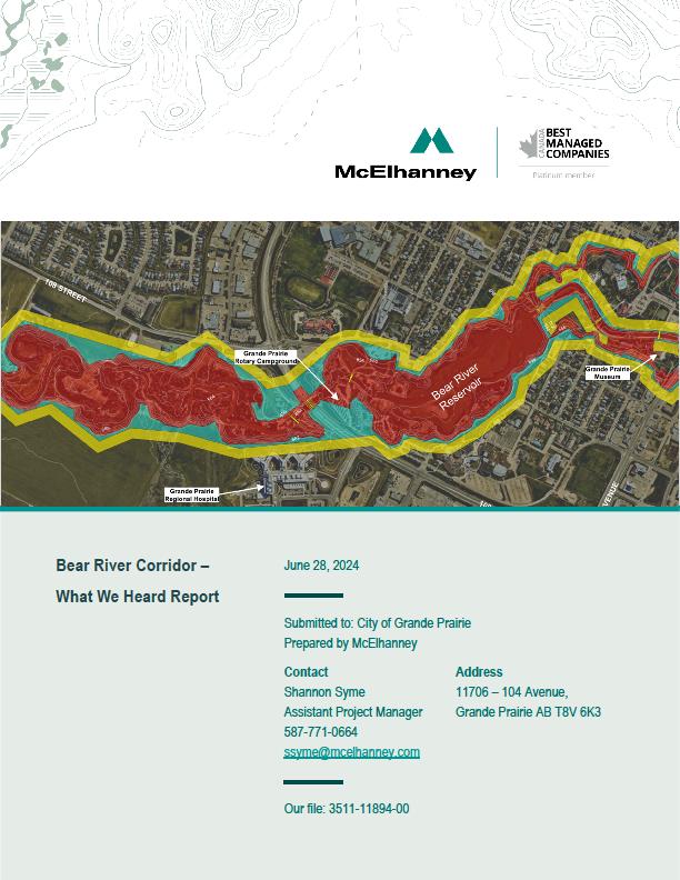
Bear River Corridor Assessment Report
McElhanney Ltd. (McElhanney) is pleased to submit the Bear River Corridor Assessment Report.
We have incorporated City of Grande Prairie staff feedback received thus far from the previous submissions and comments received through on-going discussions.
We trust this report provides the necessary information.
This report has been prepared for the City Grande Prairie and may be updated by the Design Team according to the progress of the work. All changes are to be recorded below with updated documents distributed as shown.
Version Date of Submission Prepared By: Approved by:
30% DRAFT March 10, 2023
90% DRAFT October 2, 2023
100% DRAFT January 30, 2024
Dickieson
Braun
Syme
100% DRAFT R1 April 1, 2024 S. Syme
FINAL August 29, 2024 S. Syme
McKee
McKee
McKee
McKee D. Johnston
McKee
Johnston
Bear River Corridor Assessment | 3511-11894-00 Prepared for the City of Grande Prairie Page iii
REPORT SIGNATURE
This report is prepared exclusively for the City of Grande Prairie. No duplicates or replications of any kind have been made by McElhanney or its employees to any party not affiliated with the City of Grande Prairie. The information provided in this Report represents McElhanney’s best professional judgment based on the knowledge available to McElhanney during the time of its preparation.
Please direct any questions and / or concerns regarding the contents of this report to the team members listed below who prepared this report.
Josh Braun, EIT Water Resource Hydrologist jbraun@mcelhanney.com
Reviewed by:
Reviewed By:
Jack McKee, P.Eng. Water Resource Engineer jmckee@mcelhanney.com
Doug Johnston, P.Eng. Senior Water Resources Engineer djohnston@mcelhanney.com
Bear River Corridor Assessment | 3511-11894-00
Prepared for the City of Grande Prairie Page iv
Figures
Figure 1: Bear River Corridor Study Area.......... ........................................3
Figure 2: Bear River Watershed .................... ............................................9
Figure 3: Annual Hydrographs for WSC Station 07GE007 – Bear River near Valhalla Centre..................10
Figure 4: Annual Hydrographs for WSC Station 07GE003 – Grand Prairie Creek near Sexsmith ............10
Figure 5: Monthly Climate Normals from Environment Canada (1980-2010) for Precipitation (in mm in the right axis) and Temperature (in °C in the left axis) for Grande Prairie........................................................11
Figure 6: LiDAR DEM Before (left) and After (right) Merging with Interpolated Bathymetry ......................14
Figure 7: Study Area/Hydraulic Model Domain (outlined in red).................................................................15
Figure 8: Example of the Calculation Mesh with Refinement Regions and Breaklines..............................16
Tables
Table 1: Information Obtained and Reviewed......... ...................................4
Table 2: Bear River Major Tributaries – Physical Characteristics.................................................................8
Table 3: Predicted Flows at Various Locations along Bear River based on Flood Frequency Analysis & Scaling........................................... ........12
Table 4: Manning’s “n” Values Based on LiDAR Point Cloud Classifications.............................................17
Table 5: Return Period Flows......................................................................................................................17
Table 6: Manning’s “n” Values for the Landcover Types Used to Test Model
Table
Table 12 – Priority Ranking
Table 13 - Riparian Setback Policies of Other Alberta
Table 14 - Slope Stability Setback Policies of Other
Appendices
Appendix A: Statement of Limitations
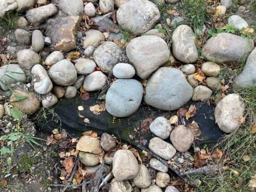
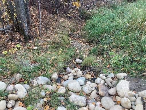
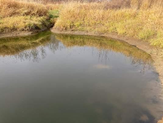
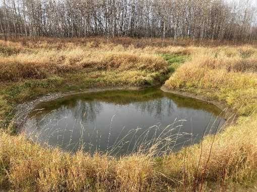
Appendix B: Model Calibration Photos
Appendix C: Flood Hazard Maps
Appendix D: Inundation Mapping
Appendix E: Outfall Location Map
Appendix F: Outfall Inspection Reports
Appendix G: Stakeholder Engagement Summary
Appendix H: Top of Bank Development Zone Maps
Bear River Corridor Assessment | 3511-11894-00 Prepared for the City of Grande Prairie
1. Introduction
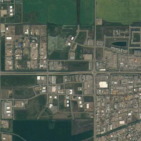
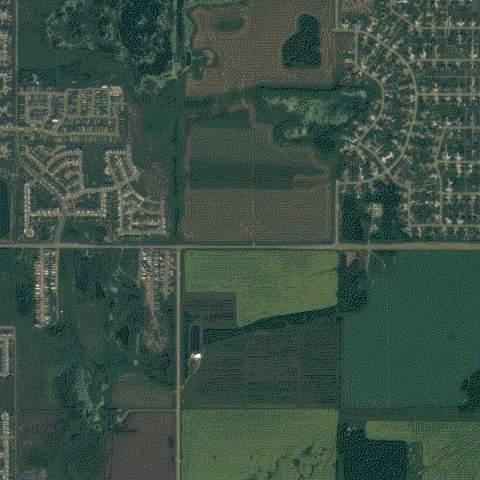
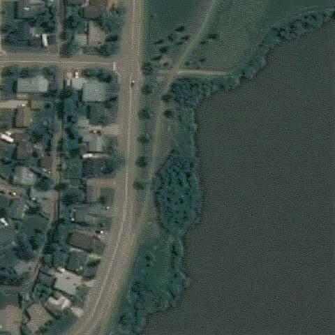
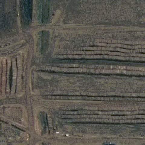
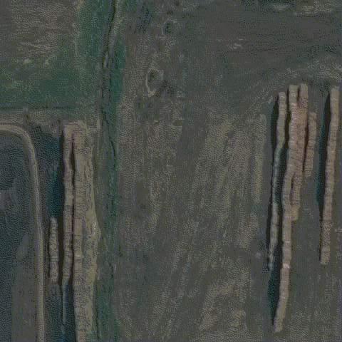
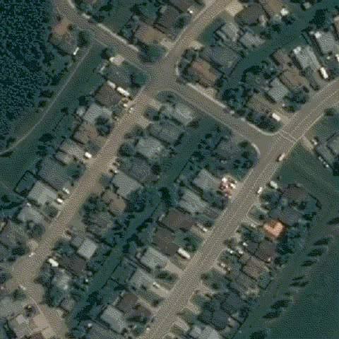
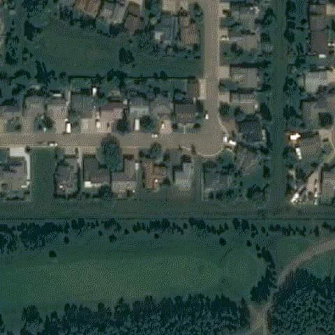
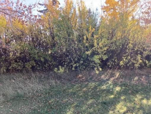
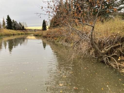
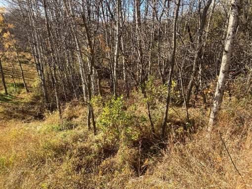
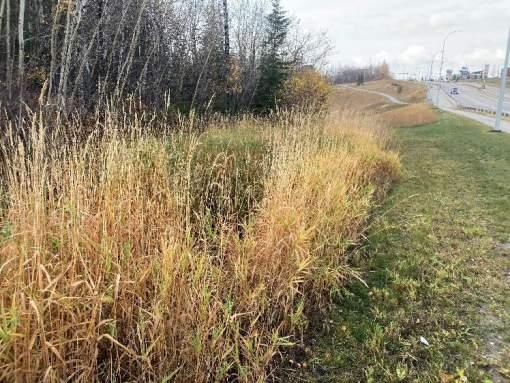
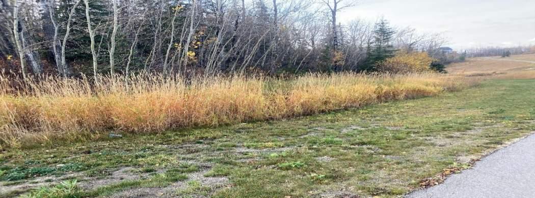
The Bear River is a valuable natural amenity resource for the City of Grande Prairie (the City). The Bear River Corridor is home to recreation opportunities for residents, provides aquatic habitat, and serves as a key wildlife corridor between the Wapiti River valley to the upland watershed. The City of Grande Prairie is centered on the Bear River, with infrastructure and transportation networks integrated throughout the corridor. Where our built environment interacts with the Bear River, careful planning and assessment is required to maintain the ecological function of the river while protecting our infrastructure from risks associated with flooding and natural slope stability mechanisms. Flooding in communities has significant consequences to the people who live there. Damage to public and private property and infrastructure results in economic, social, and environmental losses that can take a community years to recover from. However, these damages can be prevented and/or mitigated through proactive flood and hazard planning. A primary planning tool for proactive flood planning is current and accurate flood mapping.
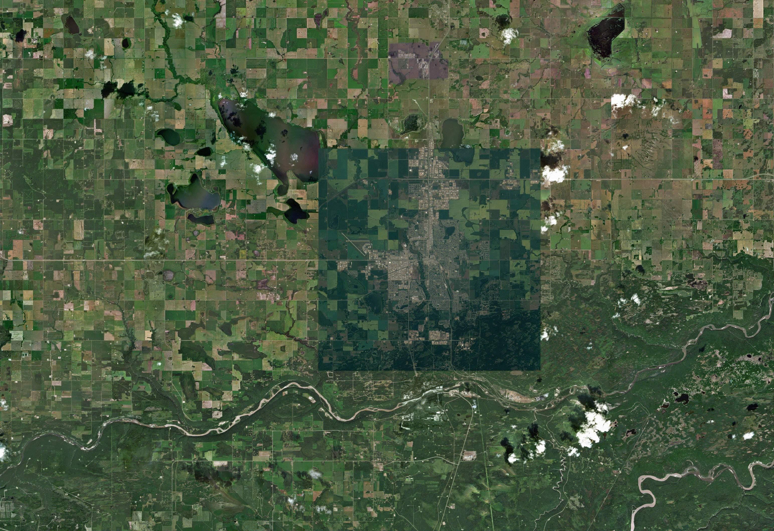
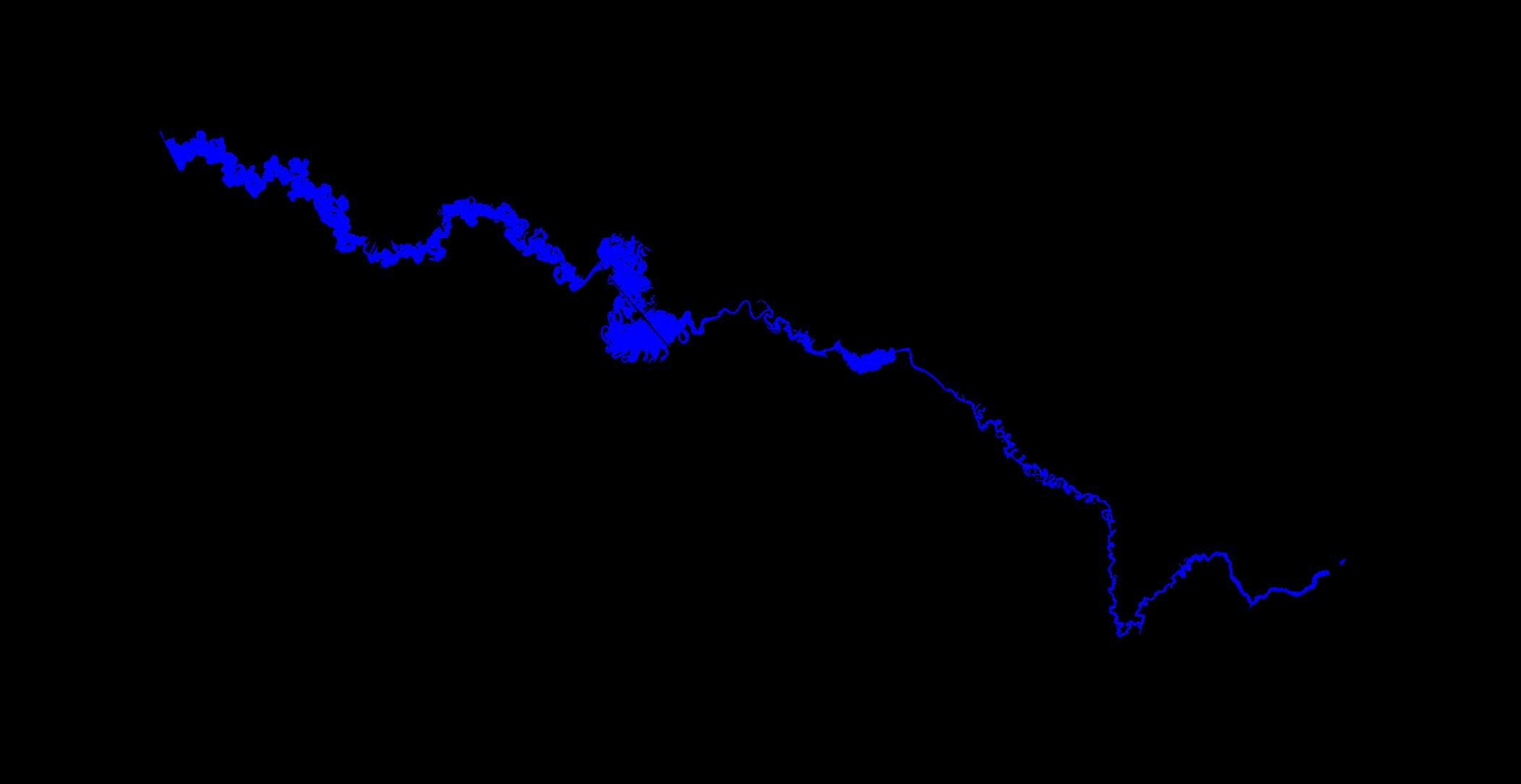
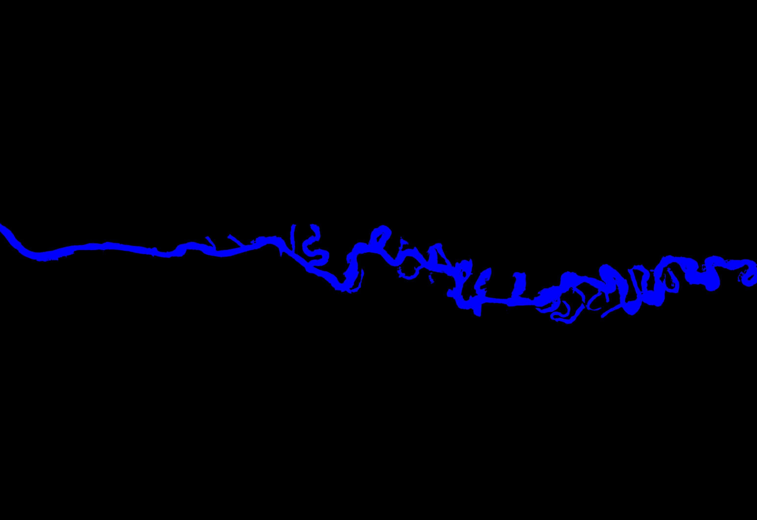
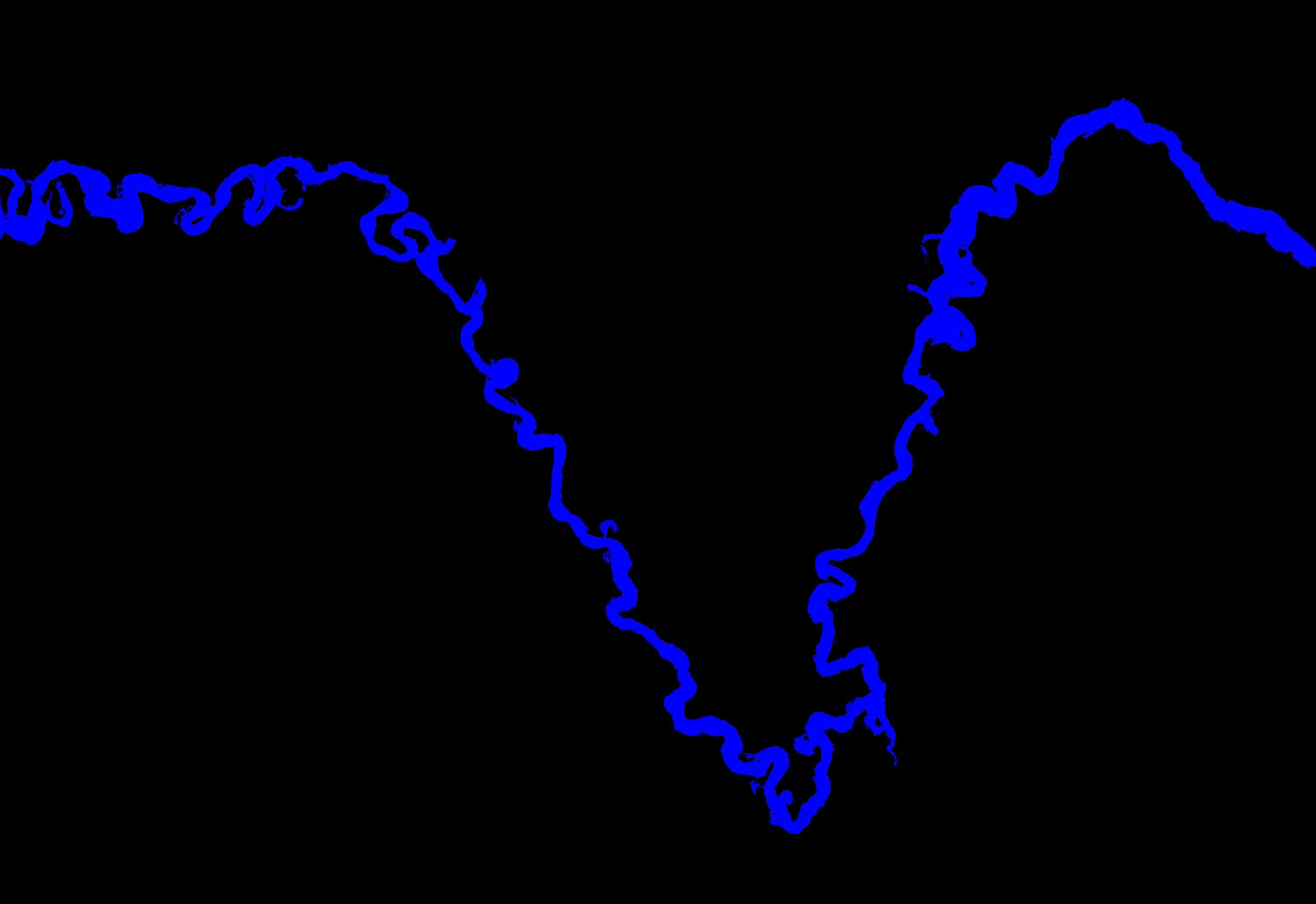
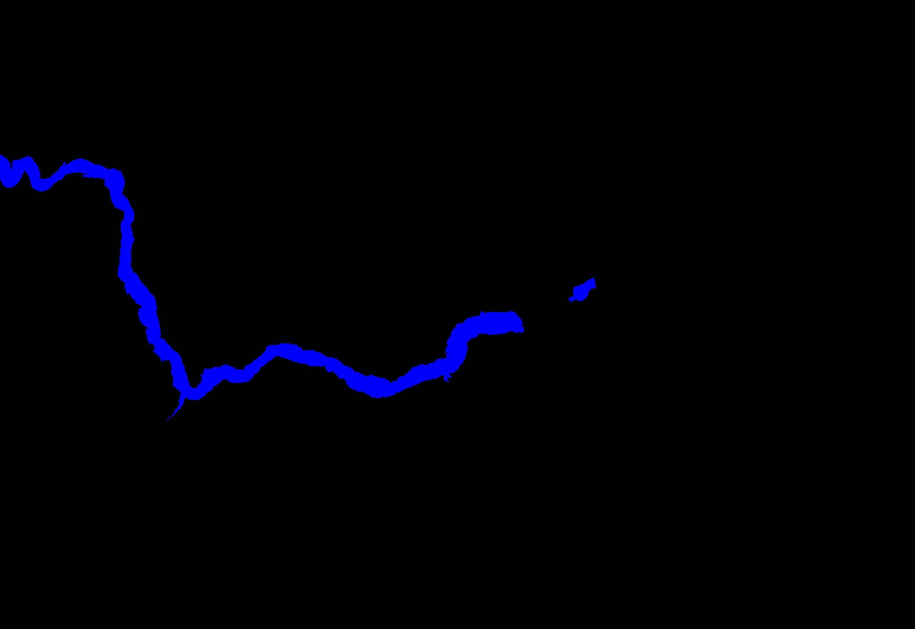
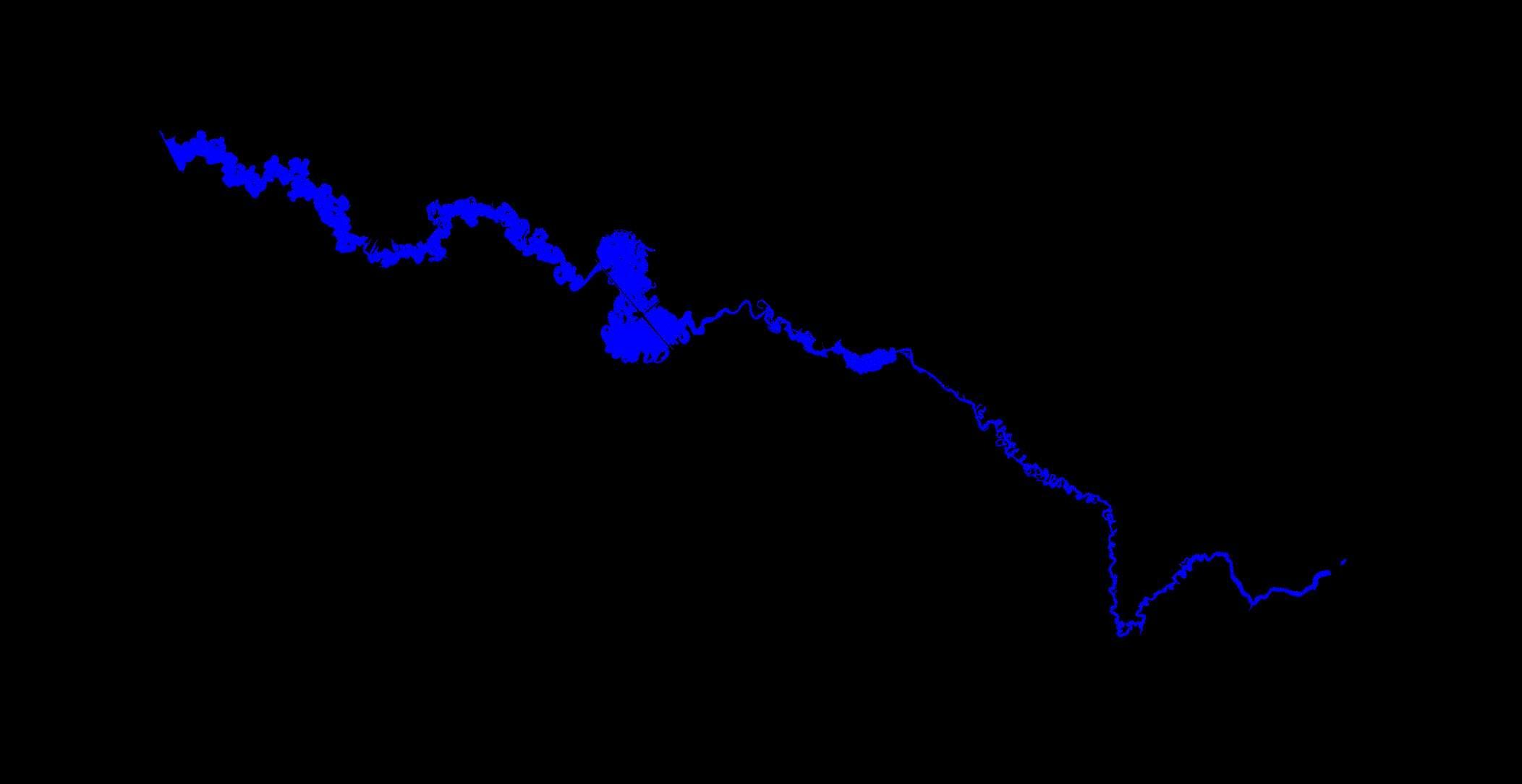
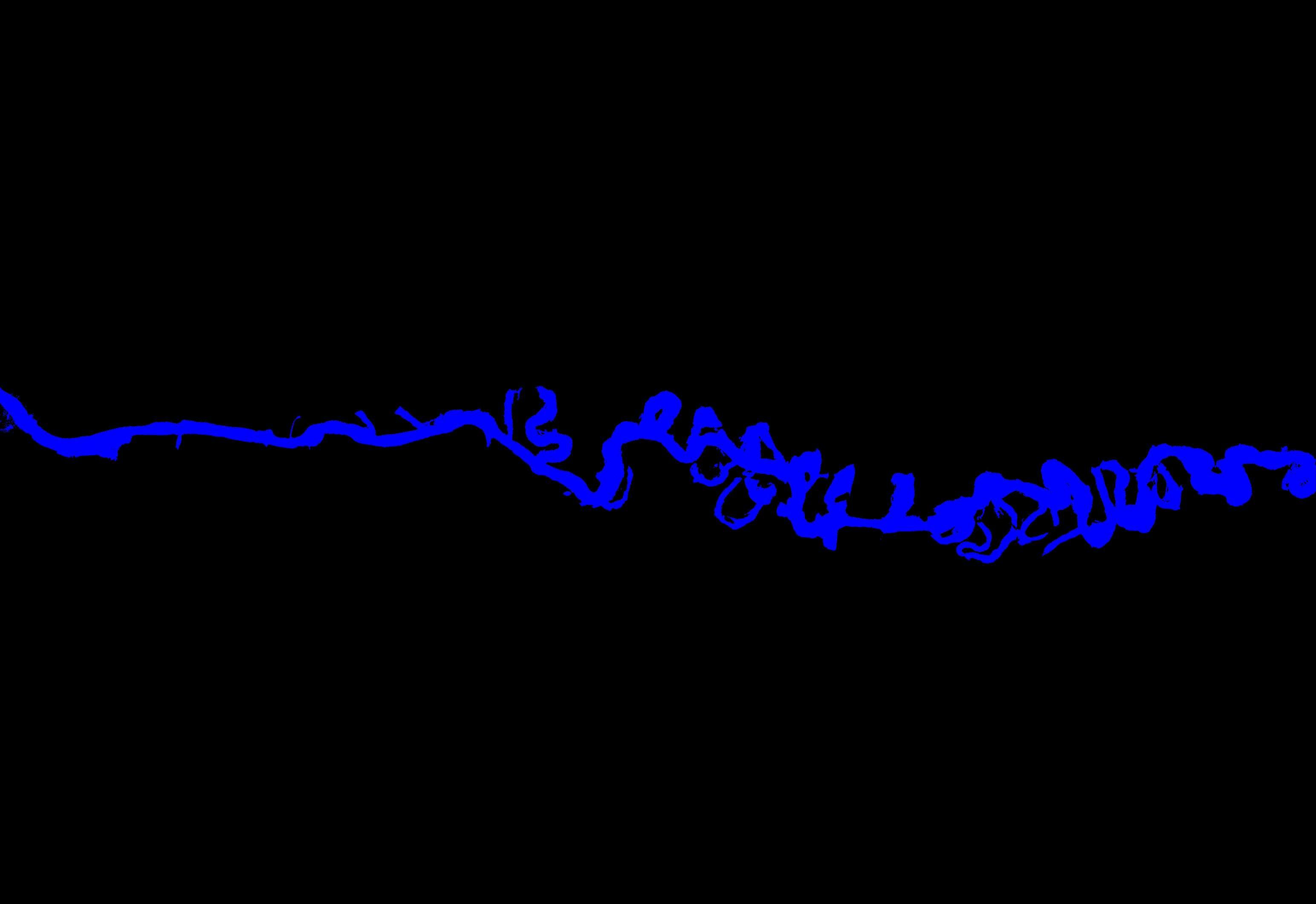
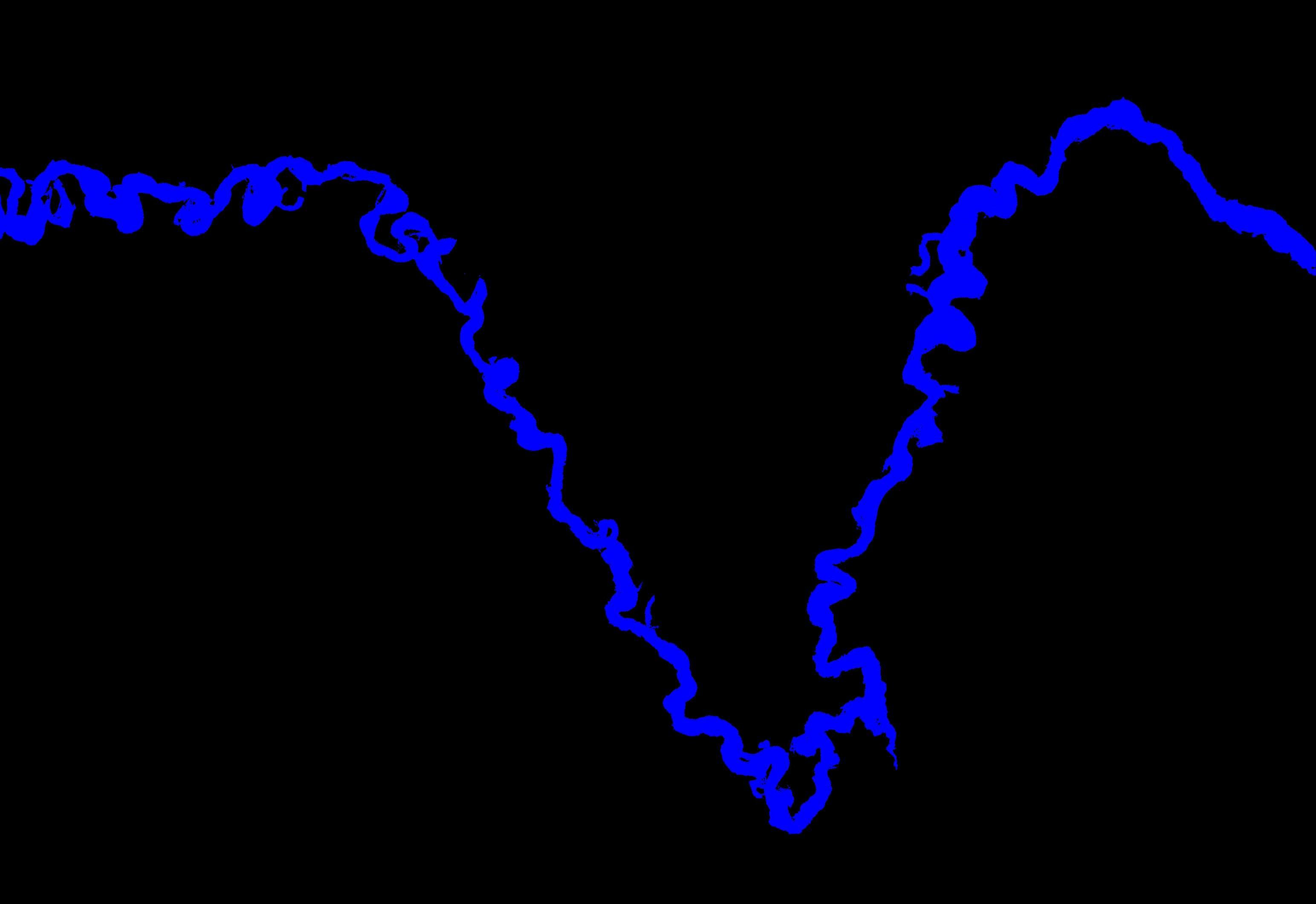
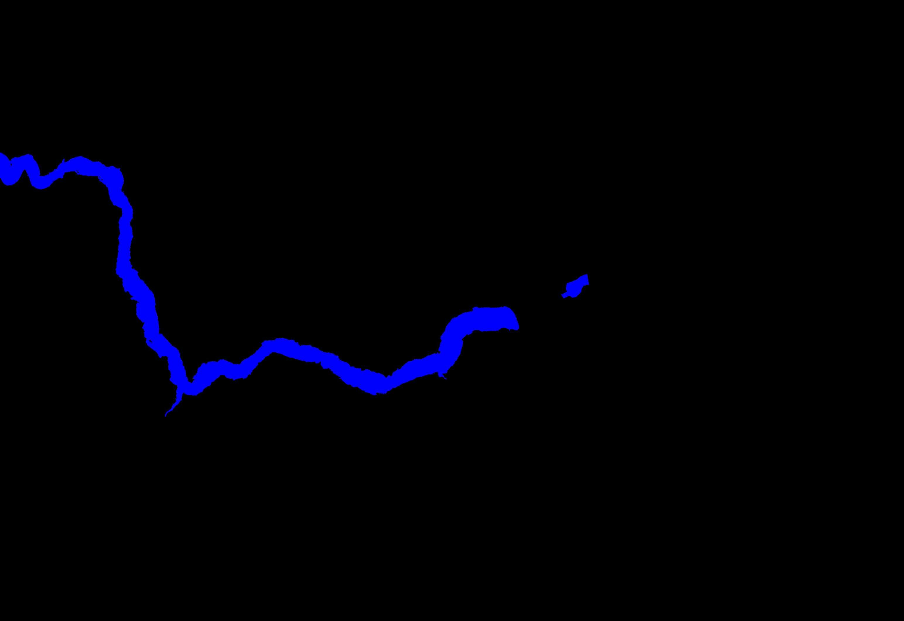
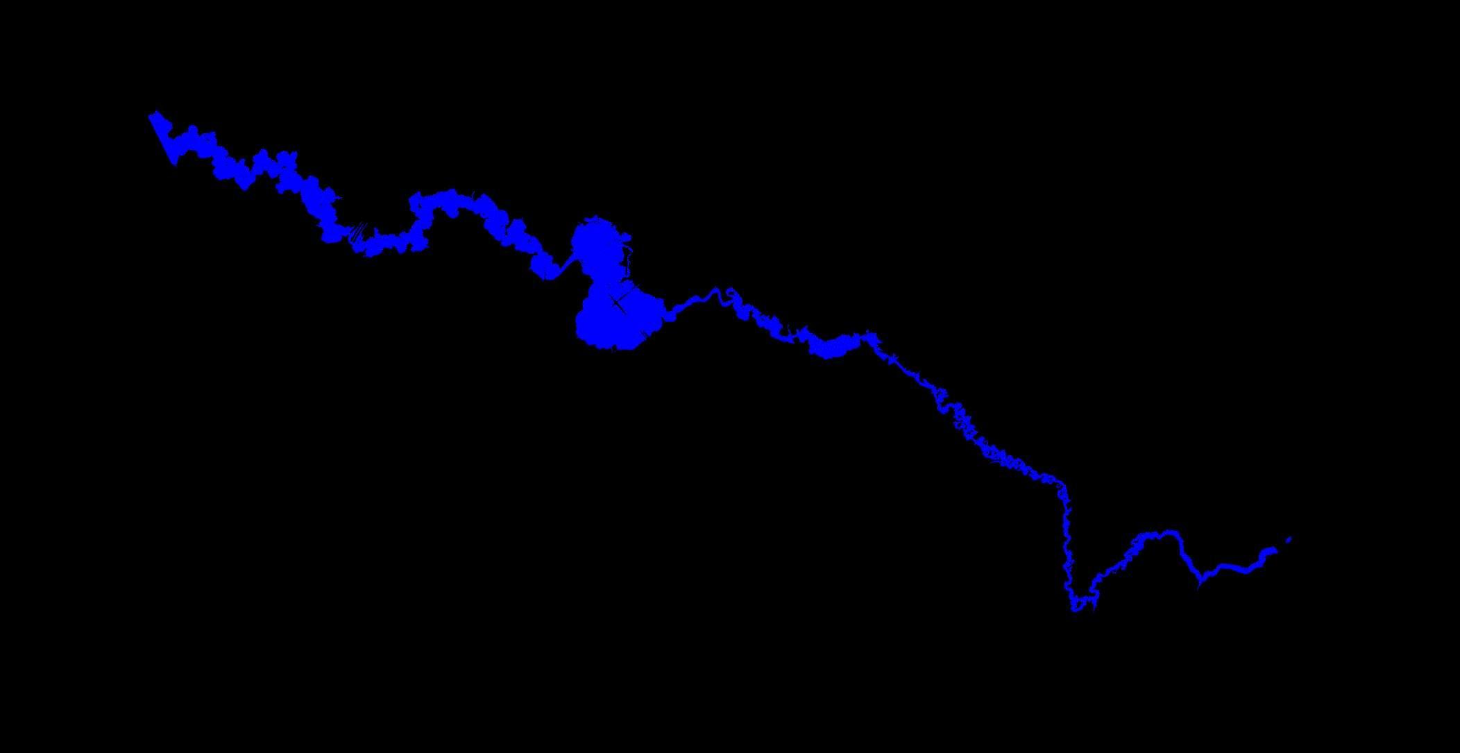
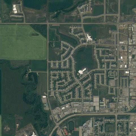
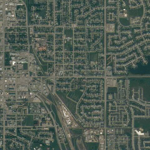
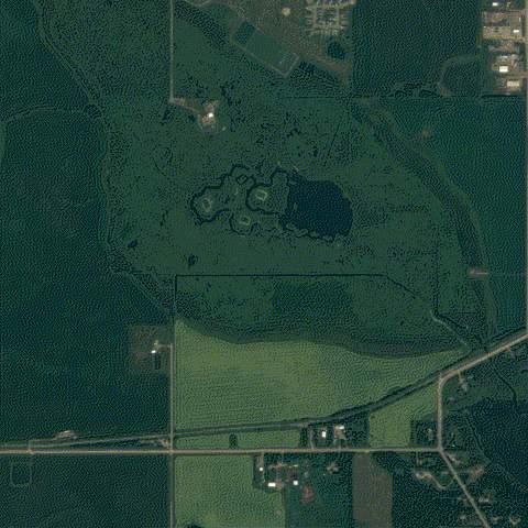
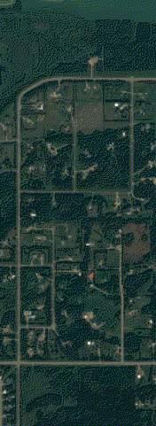
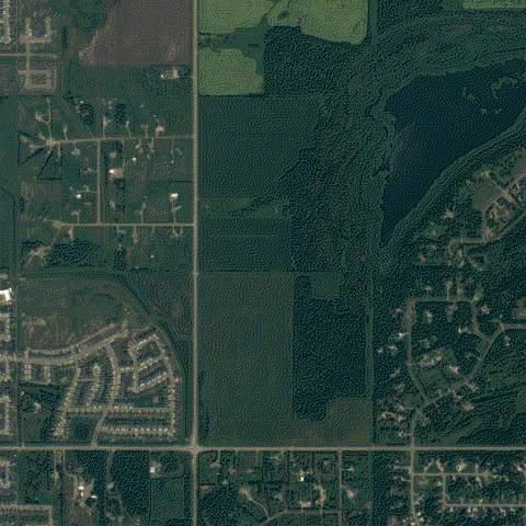
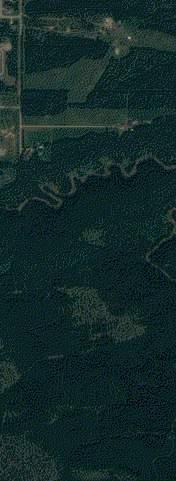
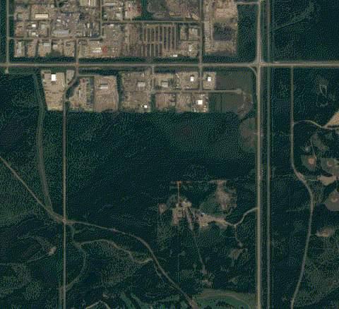
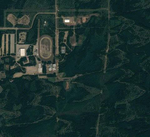
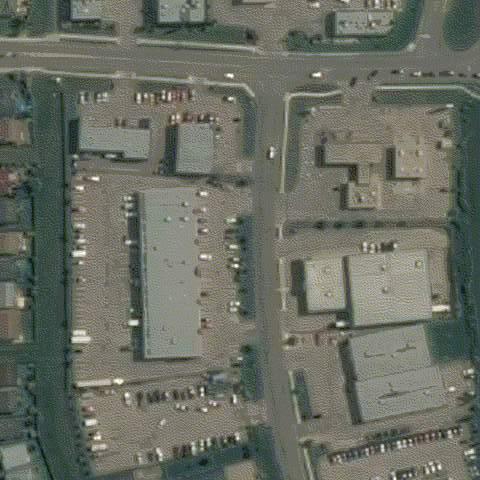
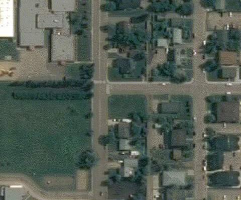
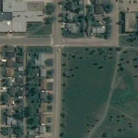
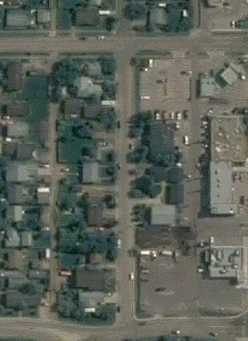
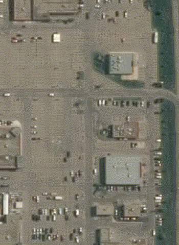
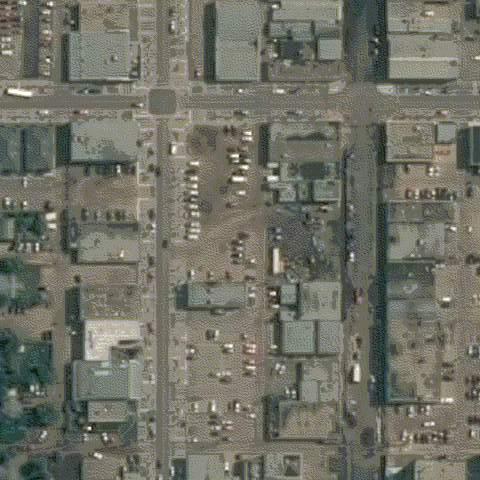
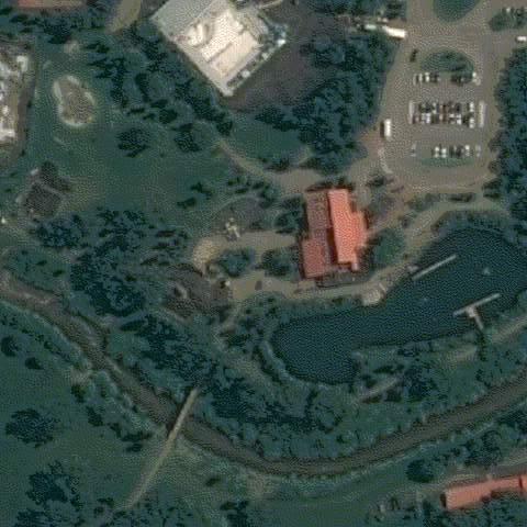
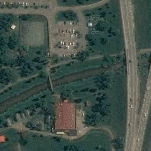
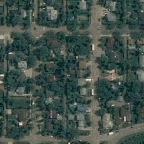
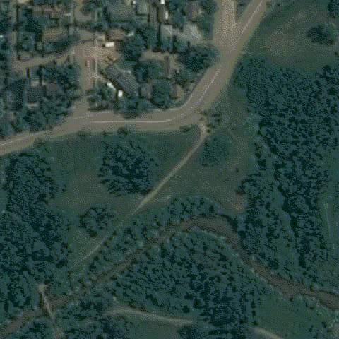
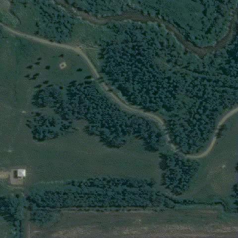
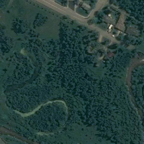
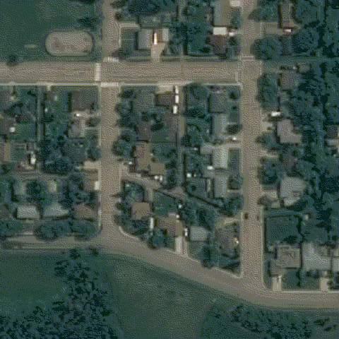
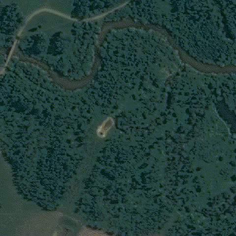
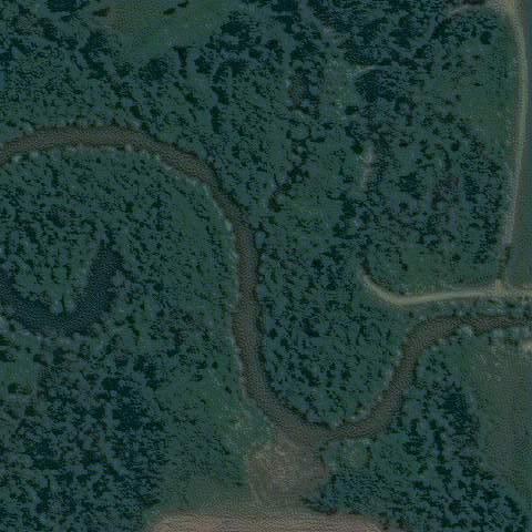
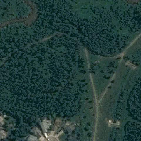
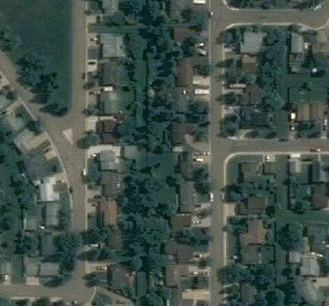
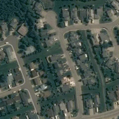
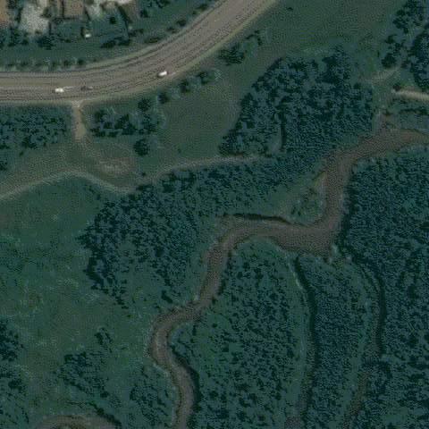
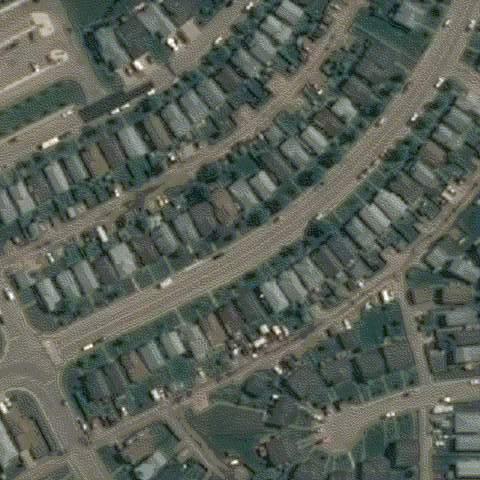
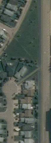
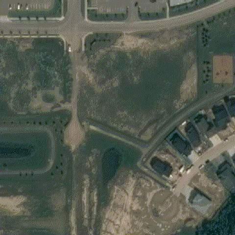
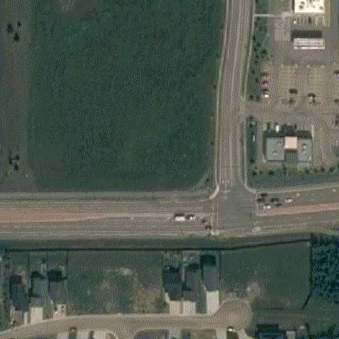
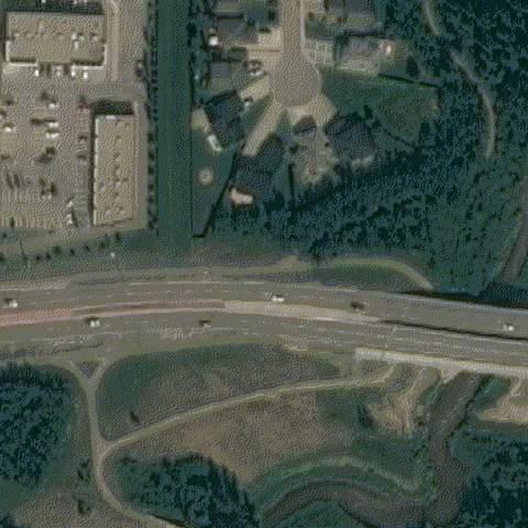
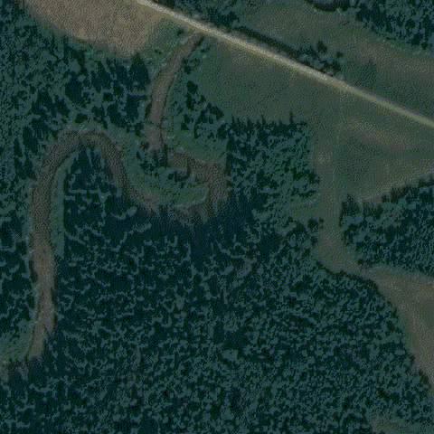
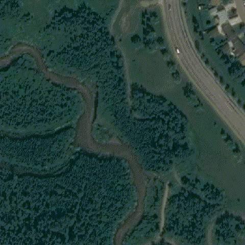
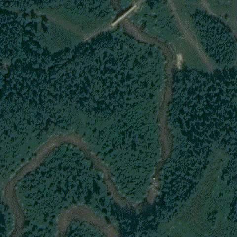
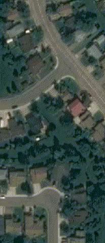
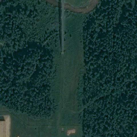
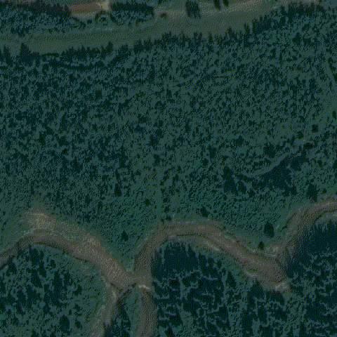
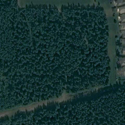
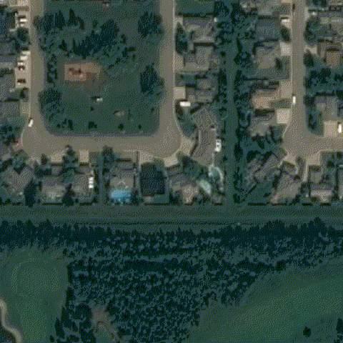
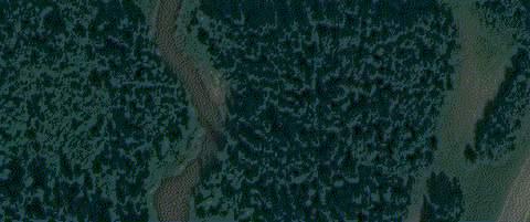
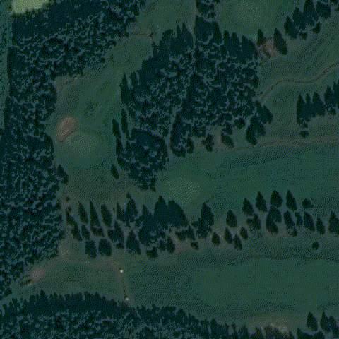
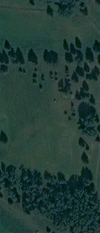
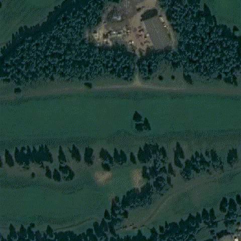
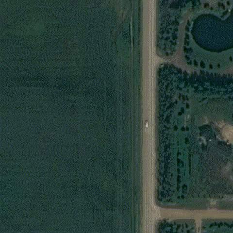
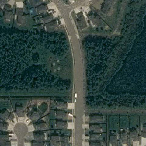
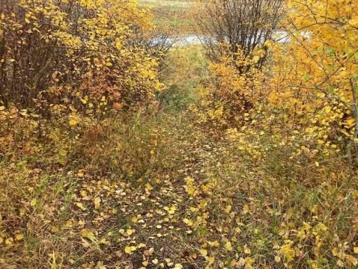
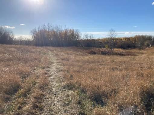
McElhanney Ltd. was retained by the City to undertake the 2023 Bear River Corridor Assessment. The study area for the corridor assessment extends from the outlet of Bear Lake (west of Range Road 70) to the southern City limits near the Wedgewood neighbourhood as seen in Figure 1.
The objective of the corridor assessment is to establish setbacks for development from the Bear River. By establishing setbacks, the risk of harm to the public and environment from flooding and natural slope stability mechanisms can be reduced.
The primary components of this assignment include the following:
• Flood inundation and flood hazard mapping for the Bear River throughout the City of Grande Prairie. Flood hazard assessment and mapping provides additional information to traditional flood (inundation) mapping. Hazard ratings consider flood water depth, water velocity and mobile debris loads. The deeper, faster moving, and larger potential for mobile debris, the greater the flood hazard. The Province of Alberta employs flood hazard maps that delineate the floodway and flood fringe areas for the 1:100 design flood. These maps are typically used for long range planning and to make local land use decisions. Flood hazard maps are available to all levels of government and the public to help build resilient communities.
• Stormwater outfalls inspection and prioritization for all stormwater outfalls discharging to Bear River and one discharging to Flyingshot Creek. The assessment provides a prioritized ranking of outfalls which require replacement, repairs, or monitoring. The rankings are based on a risk evaluation developed from a condition assessment.
• Slope Geohazard Assessment of slopes along the Bear River corridor. McElhanney has partnered with ParklandGEO to complete the slope stability assessment throughout the Bear River
Corridor. Geohazards are rated based on several factors, including probability of failure, impact to infrastructure, and public safety. High risk items with immediate concern for public safety, have been communicated to the City. The outcome of the assessment is generalized setback lines that identify potential risk to developments and existing structures.
• Top of Bank Framework assessment and recommendations for riparian, wetland, and slope related setbacks to be adopted by the City. The setbacks are established based on a combination of the flood hazard mapping and slope geohazard assessment.
Bear River Corridor Assessment | 3511-11894-00
Prepared for the City of Grande Prairie Page 2
2. Background
2.1. PREVIOUS STUDIES
The City seeks to undertake an updated assessment of the Bear River Corridor every five years. As part of the ongoing assessment program, the Bear River Corridor through the City has been previously studied, most recently in 2018. In addition, further studies have been completed within the corridor including the following:
• Inundation Study and Dam Safety Review (SNC Lavalin, 2020)
• Bear Creek Corridor Assessment (Matrix Solutions Ltd., 2018)
• Grande Prairie Reservoir Feasibility Study (Golder, 2012)
• Bear Creek Corridor Geohazard Slope Stability and Erosion Assessment (ParklandGEO, 2011)
• Bear Creek Corridor Outfall Inspection Report (ParklandGEO, 2010)
• Grande Prairie Flood Risk Mapping Study (Northwest Hydraulics Consultants (NHC), 2007)
• Bear Creek Watershed Study (Marshall Macklin Monaghan, 1984)
2.2. AVAILABLE INFORMATION
Available relevant information was obtained and reviewed by the project team. This included previous reports completed for the area, historic flood mapping, GIS information, flow and climate data, and historic aerial imagery. Relevant data sources are shown in Table 1
Table 1: Information Obtained and Reviewed
Information
CityofGrandePrairieGIS Data
WaterSurveyofCanada HydrometricData
Date Content
Various LiDARdata,ortho-imagery,spatialdata forroads,bridges,culverts,outfalls
Various Annualpeakinstantaneousandannual peakaveragedailyflowandlakelevel datasets;
Previousreports(listedabove) Various Previousoutfallsinspectionreports, previousmodelingandhydrology assessmentsfortheBearRiverCorridor andWatershed.
Aerial Light Detection and Ranging (LiDAR) was acquired for the study area by the City in May 2022. LiDAR collections from 2018 and 2014 were previously acquired by the City. These LiDAR datasets were provided to the project team in October 2022 as full-feature point clouds.
Bear River Corridor Assessment | 3511-11894-00
Prepared for the City of Grande Prairie Page 4
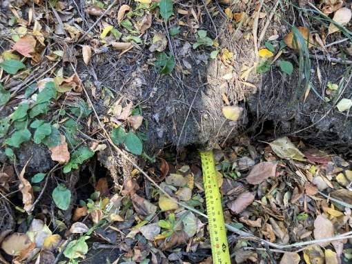
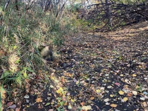
To acquire channel information for the Bear River in the study area, bathymetric cross sections were collected in October 2022 by McElhanney survey crews.
A structure survey was completed for all structures crossing the Bear River through the study area. This included all roadway bridges, pedestrian bridges, culverts and railway bridges. The following information was collected as part of the structure survey.
• Abutment location and elevation
• Pier location
• Lower Chord Elevation
• High Chord Elevation
The collected bathymetric survey cross sections were relied upon to develop an accurate and reasonable representation of the channel geometry for the Bear River. The representative channel geometries were interpolated upstream and downstream of the surveyed cross sections to create a continuous interpolated channel geometry which was then exported as a digital elevation model (DEM) grid.
The LiDAR and channel bathymetry surfaces were combined into a comprehensive terrain model using GIS. The resulting surface was exported as a DEM at a 0.5 m x 0.5 m grid.
Bear River Corridor Assessment | 3511-11894-00 Prepared for the City of Grande Prairie
3. Flood Hazard Assessment
Flood hazard maps build on inundation mapping and present the flood intensity characteristics. Maps can be prepared to show variations in water depths and water velocities for a given event. Although there are no specific hazard classifications for flood hazard ratings specific to Canada at this time, hazard can be classified as a function of water depth, water velocity, and the potential for floating debris, primarily based on the consideration of the direct risks to people exposed to floodwaters. The premise for flood hazard is simple: the deeper the water, the faster moving the water, the greater the hazard to life and property. This classification can be used by the City to inform emergency planning procedures and identify areas where resources may be needed in the event of a flooding situation.
3.1. METHODOLOGY
The flood hazard assessment was completed using the following methodology:
• Collect and review existing information related to flooding and required for analysis;
• Acquire LiDAR and bathymetric information and combine the date into a comprehensive DEM of the study area;
• Complete a scoped hydrologic assessment to estimate the flows, for various return periods, in the study area;
• Develop a 2-dimensional (2-D) hydraulic modeling for the Bear River;
• Validate the 2-D model based on previous flood events, calibrate parameters where required;
• Complete a sensitivity analysis of the 2-D model to understand the sensitivity of model results;
• Produce flood inundation maps and flood hazard maps for the study area.
A brief description of the methods employed is provided below. More detailed descriptions are provided in the relevant sections of this report.
Collection and Review of Available Information
Available relevant information was obtained and reviewed by the project team. This included previous reports completed for the area, historic flood mapping, GIS information, flow and climate data, and historic aerial imagery. To develop a comprehensive DEM, aerial LiDAR acquired in 2014, 2018, and 2022 was provided by the City. Bathymetric survey information for the Bear River and was collected in October 2022 by McElhanney survey crews.
Scoped Hydrologic Assessment
McElhanney completed a scoped hydrologic assessment. We reviewed and updated available hydrometric data from Water Survey of Canada’s (WSC) hydrometric gauges used in the previous City of Grande Prairie Flood Risk Mapping Study (NHC, 2007). The scoped assessment is intended to identify any distinct changes to the flow regime in the Bear River since the previous study.
Bear River Corridor Assessment | 3511-11894-00 Prepared for the City of Grande Prairie
Hydraulic Modeling
A two-dimensional (2D) computational hydraulic model was developed for the Bear River from the outlet of Bear Lake (west of Range Road 70) to the southern City limits near the Wedgewood neighbourhood using the Hydrologic Engineering Center – River Analysis System (HEC-RAS) v6.3. Developed and maintained by the US Army Corps of Engineers. The HEC-RAS software is recognized as an industry standard and is freely available to the public.
Primary inputs of the 2-D hydraulic model include:
• A DEM of the channel and surrounding ground surface that was generated using the topographic survey, bathymetric survey and 2022 LiDAR obtained from the City.
• Flow information, in the form of input hydrographs, for the upstream extents of the model (upstream boundary condition) for various scenarios examined.
• The downstream boundary condition, and hydraulic roughness (Manning’s “n”) for areas in the model domain.
Using the primary inputs, the model performs a series of calculations over the model domain to predict the water surface elevation, water depths, water velocities, and direction of flow (current vector) for areas within the model domain.
Flood Map Production
The results of the hydraulic modeling were used to develop the flood inundation maps and flood hazard maps for the area . Flood inundation mapping was completed for all design return periods and the flood hazard mapping, delineating the floodway and flood fringe were defined based on the 1:100-year flood as per the Province of Alberta Flood Hazard Mapping Guidelines (Alberta Environment and Parks, 2021).
3.2. BEAR RIVER WATERSHED OVERVIEW
3.2.1.Physiography
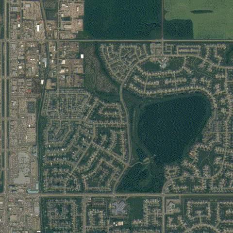
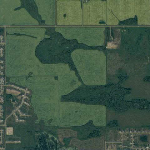
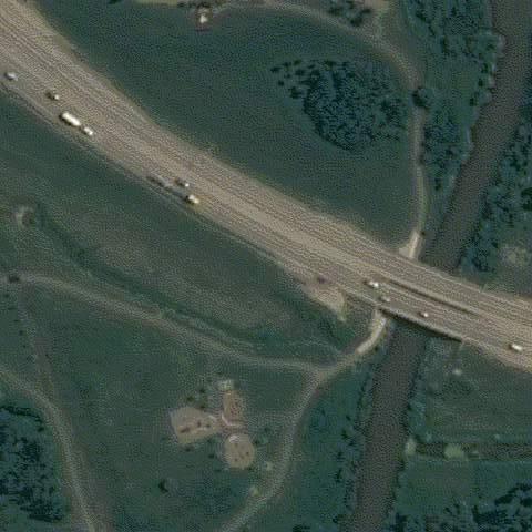
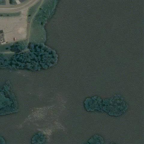
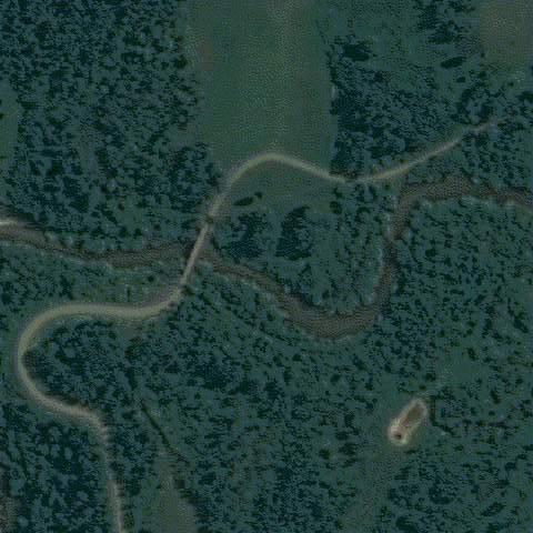
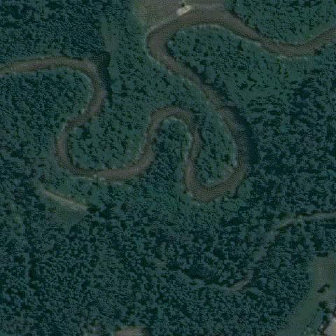
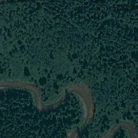
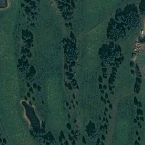
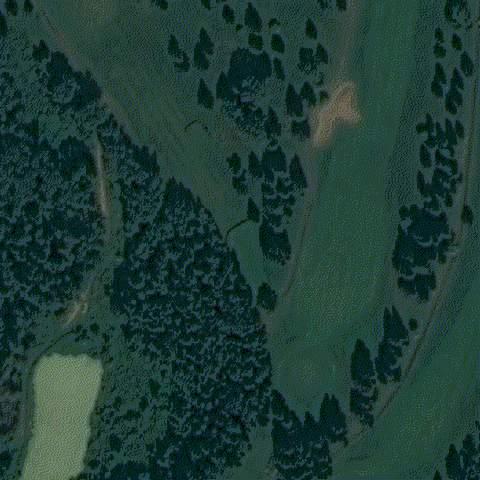
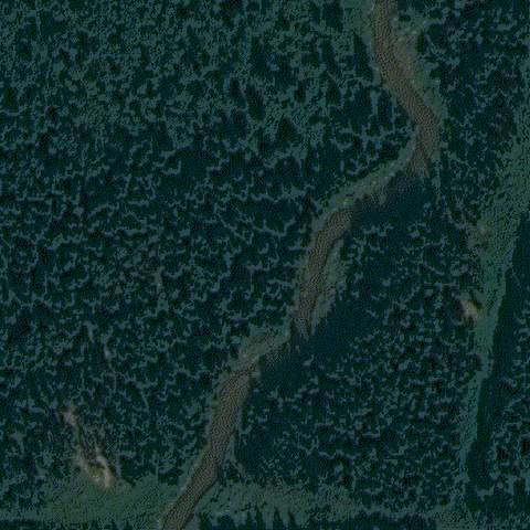
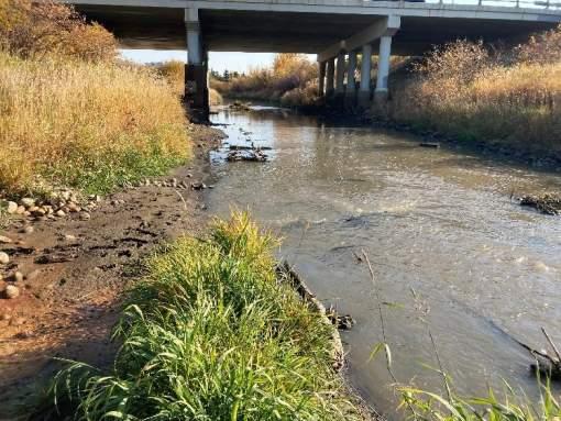
The Bear River watershed is approximately 2,028 km2. The Bear River originates on the south side of the Saddle Hills and flows eastwards through La Glace Lake and Bear Lake before flowing through the City of Grande Prairie. Within the City, Bear River flows through the City’s dam-controlled water supply reservoir. The Bear River control structure includes the concrete spillway and the earthen dam. Upstream of Grande Prairie, the topography of the catchment is generally uniform in overland slope and land cover characteristics. The Bear River flows southeast, eventually discharging into the Wapiti River approximately 20 km southeast of the City as seen in Figure 2
Major tributaries of the Bear River upstream of the study area include Anderson Creek, Webber Creek, Mulligan Creek, Fish Creek, Niobe Creek, Grande Prairie Creek, and Flyingshot Creek. Table 2 shows the predominate land use within the upstream watersheds is agricultural. The Bear River watershed has an average overland slope of 2.3%.
Bear River Corridor Assessment | 3511-11894-00 Prepared for the City of Grande Prairie
Bear River Corridor Assessment | 3511-11894-00 Prepared for the City of Grande Prairie
Table 2: Bear River Major Tributaries – Physical Characteristics
3.2.2.Hydrology
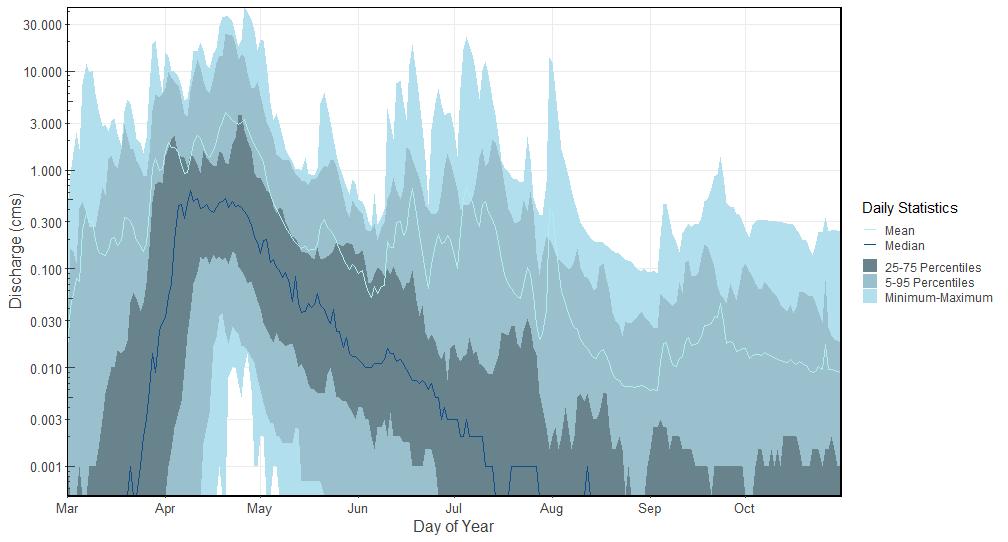
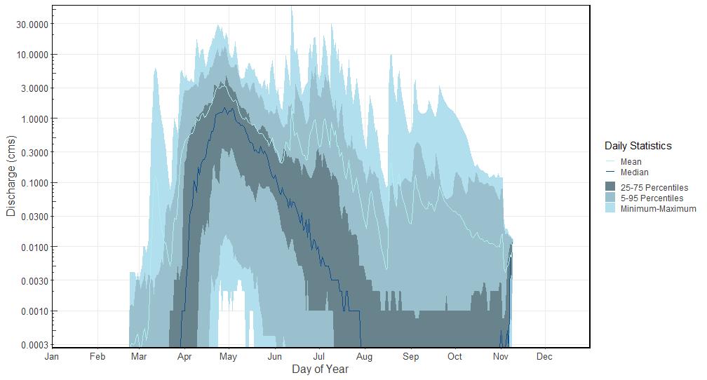
The Bear River is a nival-pluvial watershed (hybrid watershed where flood events are dominated by a combination of snowmelt and rainfall) with peak flows generally occurring between April and early May due to rainfall or rain-on-snow events. Figure 3 and Figure 4 shows the annual hydrographs for the upper reach of the Bear River (Valhalla Centre) and for the Grande Prairie Creek. It should be noted that these hydrographs only display the discharge from March to October, as these are intermittent stations that do not record flow in the winter months (November to February).
Bear River Corridor Assessment | 3511-11894-00
Prepared for the City of Grande Prairie Page 10
Figure 3: Annual Hydrographs for WSC Station 07GE007 – Bear River near Valhalla Centre
Figure 4: Annual Hydrographs for WSC Station 07GE003 – Grand Prairie Creek near Sexsmith
3.2.3.Climate
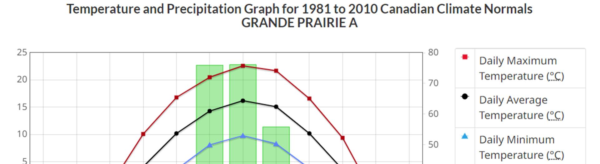
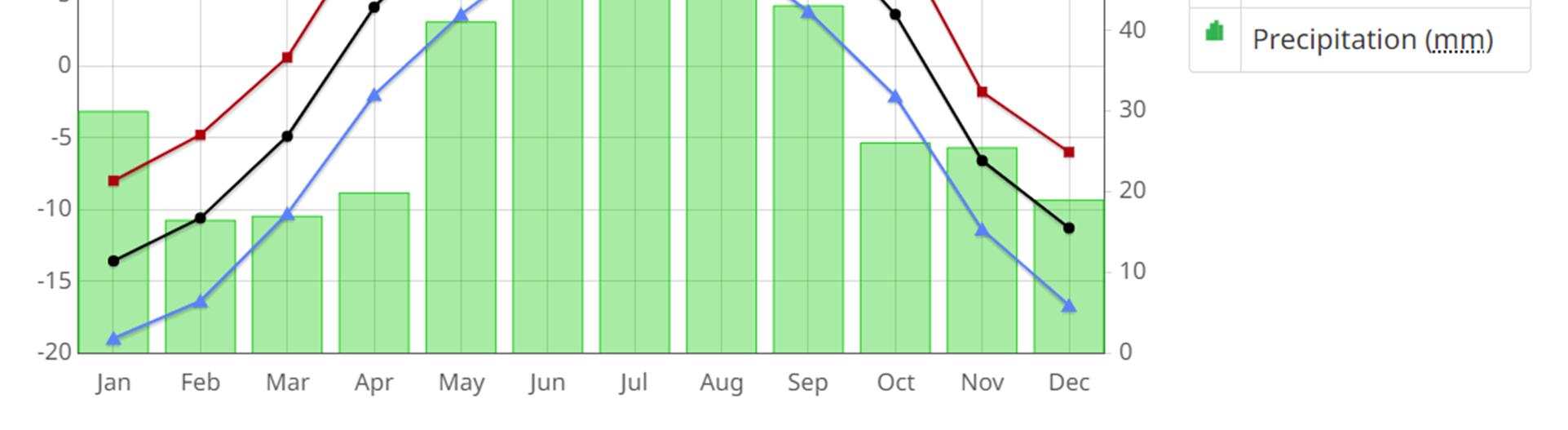
The Grande Prairie area has a continental climate with an average summer temperature of 15.2 °C and an average winter temperature of -11.8 °C. It receives an average of 320 mm of rainfall a year and 154 cm of snowfall a year (EC station 3072920). Figure 5 shows the monthly temperature and precipitation climate normals for Grand Prairie for the period of 1981-2010 (ECCC, 2023).
Figure 5: Monthly Climate Normals from Environment Canada (1980-2010) for Precipitation (in mm in the right axis) and Temperature (in °C in the left axis) for Grande Prairie
3.3. HYDROLOGIC ASSESSMENT
The purpose of the hydrologic analysis is to estimate flows, for various return periods, in the Bear River through the study area. To develop the various return period flows for this assessment, the 2006 hydrologic study completed as part of the Grande Prairie Flood Risk Mapping Study, Bear River Hydrology Report (NHC, 2007) was reviewed and updated.
The 2006 hydrology study relied upon a flood frequency analysis of the WSC Gauge 07GE003 on Grande Prairie Creek (GPC) near Sexsmith to predict flows used in the hydraulic assessment. The study also compared the timing of peak annual flows in GPC to peak lake levels in Bear Lake and concluded that peak flows downstream of Bear Lake are governed by GPC flows. Approximately 1,200 km2 of the Bear River watershed flows through Bear Lake, which, due to its size and relatively restricted outflow, provides significant attenuation of these flows. McElhanney reviewed the flows from GPC and lake levels and developed similar conclusions in that extreme flows in Bear River are governed by GPC.
According to the 2006 study, flow reversals from the GPC into Bear Lake have been observed during periods of high water. This effect is expected to reduce peak flows from the GPC into the Bear River
Bear River Corridor Assessment | 3511-11894-00
Prepared for the City of Grande Prairie Page 11
downstream of the confluence. McElhanney completed preliminary hydraulic modeling which included the discharge from Bear Lake and the confluence with GPC. The modeling indicated that backwatering from GPC to Bear Lake occurs during flood events, reducing the overall discharge within the Bear River through the study area. Based on the analysis completed, when Bear Lake has an average peak annual water level of 663.96 m, the backwatering from GPC starts to occur between a 2 and 5 year return period event.
Therefore, it was concluded that the flooding downstream of Bear Lake is governed entirely by the GPC. Consequently, a set of factors that could be applied to the frequency analysis of GPC WSC gauge (07GE003) developed from the 2006 NHC study were updated in order to calculate the corresponding flows for Bear River in the study area.
These factors and the corresponding flows are shown in Table 3
Table 3: Predicted Flows at Various Locations along Bear River based on Flood Frequency Analysis & Scaling
A 2-dimensional (2D) hydraulic model was developed for the study area. We employed the Hydrologic Engineering Center – River Analysis System (HEC-RAS) v6.3 computational hydraulic modeling software for this assignment. Developed and maintained by the US Army Corps of Engineers, the software is recognized as an industry standard and is freely available to the public.
Primary inputs for the 2-D hydraulic model included a DEM of the channel and surrounding ground, flow information developed in the hydrologic assessment, in the form of input hydrographs, and hydraulic roughness (Manning’s “n”) for areas within the model domain.
Bear River Corridor Assessment | 3511-11894-00 Prepared for the City of Grande Prairie Page 12
Using the primary inputs, the model performs a series of calculations over the model domain. Based on these calculations, the model predicts the water surface elevation (and water depth), water velocities, and direction of flow for all areas within the model domain.
The upstream boundary condition location was identified in the model at the outlet of Bear Lake just upstream of Range Road 70. The input hydrograph was created based on hydrologic flows from GPC.
The downstream boundary condition is located downstream of the City limits near the Wedgewood Subdivision. The boundary condition is located approximately 50 m upstream of the culverts crossing Resources Road.
3.4.1.Model Structures
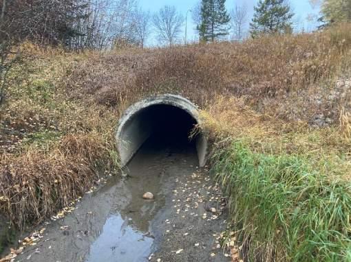
To simulate the various bridge, culvert, and road crossings along Bear River in the study area, we employed the use of SA/2D connections in HEC-RAS. SA/2D connections in HEC-RAS refer to the connections between the 1-D and 2-D flow modeling capabilities within the software. In this project, the SA/2D connections were used at the following locations:
• Bridge crossings (to define the effect of the bridge on the channel geometry and hydraulic conveyance of the river)
• Culvert crossings (to define the flow path under roads)
• Bear River Reservoir (to define the impact of a control structure at the outlet of the reservoir, modelled as a weir)
Information for these crossings (i.e. elevations, lengths, etc.) were determined using record drawings
3.4.2.Model Terrain Development
The 2-D model relies on a DEM to assign elevation data to each grid cell within the model domain calculation mesh. The model terrain was developed using the City of Grande Prairie 2022 LiDAR data and cleaned to remove any clear anomalies such as bridges.
The bathymetric cross section data collected was imported into HEC-RAS as 1-D cross sections. Interpolated cross sections perpendicular to the centerline of the river were then generated between each surveyed cross section at 1-metre intervals to avoid sharp elevation differences upstream and downstream of the cross-sections. The interpolated cross sections were then exported as a DEM surface that captured the interpolated bathymetry of the river.
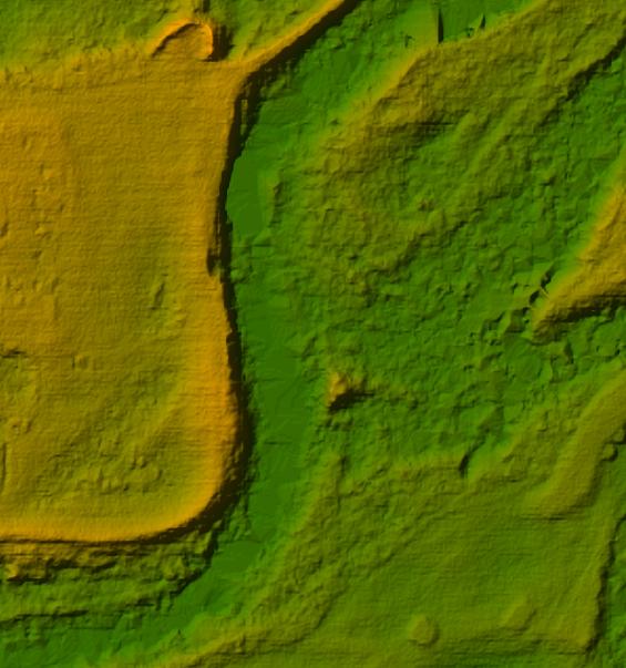
The LiDAR DEM was merged with the interpolated bathymetry DEM to create a single composite terrain that included both the LiDAR data of the floodplain and bathymetric data of the channel (Figure 6).
3.4.3.Model Domain and Calculation Mesh
The model domain, shown in Figure 7, represents the area, including channels and floodplain, over which the model performed the hydraulic calculations. The model domain is limited to areas where potential flooding can occur to reduce the computational intensity and time required to run the model. The modeled Bear River length is approximately 26 km. The total area captured in the model domain is 15.3 km2.
Bear River Corridor Assessment | 3511-11894-00
Figure 6: LiDAR DEM Before (left) and After (right) Merging with Interpolated Bathymetry
3.4.4.Calculation
Meshes and Regions
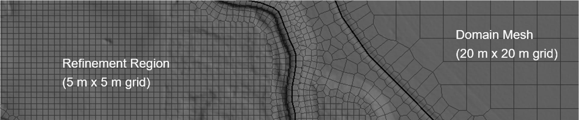
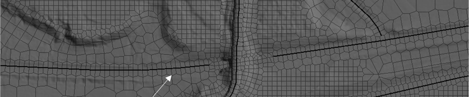
A 2-D hydraulic model uses a calculation mesh. The mesh, which is comprised of cells in regular and irregular grids, is used to calculate water surface elevation, water velocity, and flow direction within the model. Hydraulic calculations are completed for each cell. HEC-RAS allows further refinement of the calculation mesh by having different sized meshes within the model domain.
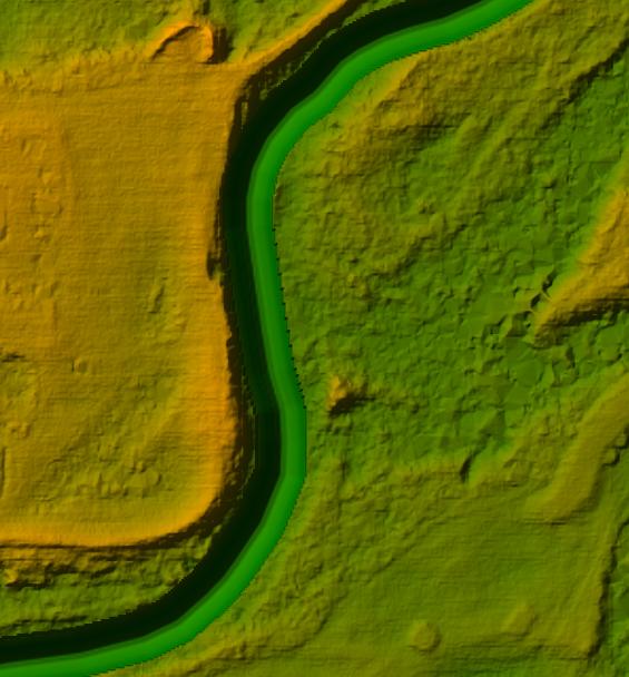
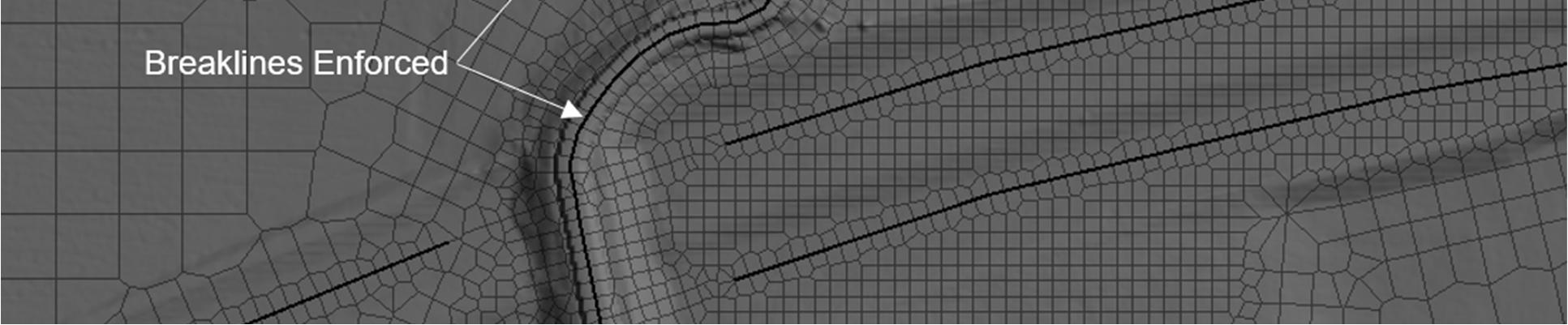
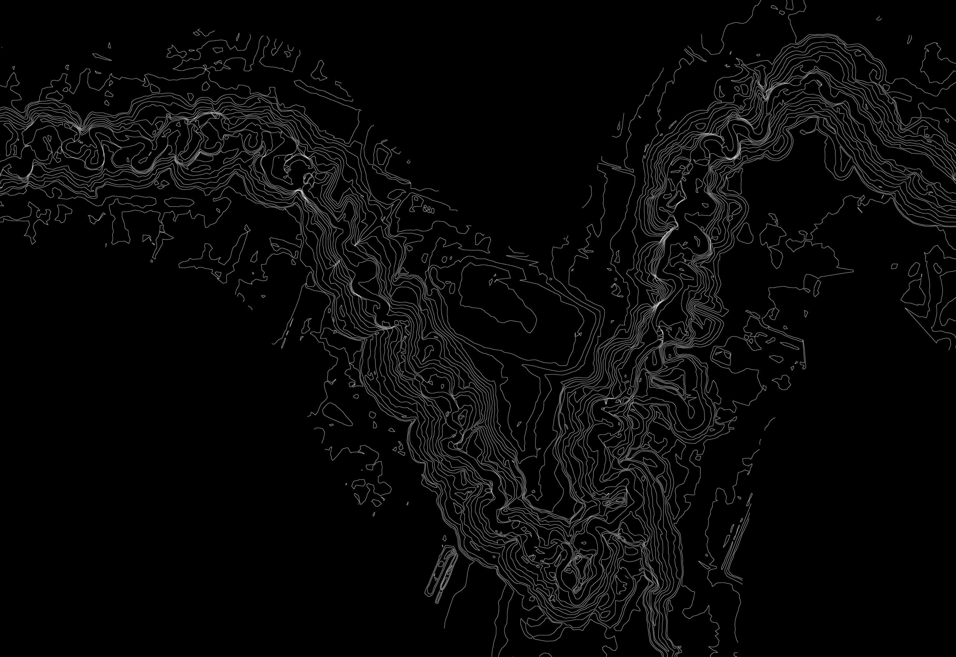
These are referred to as regions. For the Bear River model, we assigned an overall mesh size of 20 m x 20 m (the “domain mesh”). For the main channels (bank to bank) and flood plains of the Bear River, the mesh size was set to 5 m x 5 m, with the exception of the Bear River reservoir which retained the domain mesh size. Break lines were manually digitized for features like riverbanks, roads, berms, and local heights of land to ensure a division of computational cells at that location. Figure 8 shows an example of the calculation mesh, the channel refinement region, and enforced break lines superimposed on the DEM.
3.4.5.Hydraulic
Roughness
The hydraulic roughness, expressed as a Manning’s “n” value, is used to characterize the physical resistance that a surface exerts on flowing water. The 2D model allows for multiple hydraulic roughness values to be assigned over the model domain.
The base hydraulic roughness layer was assembled using the 2022 LiDAR point cloud, which classifies land cover types based on the intensity of the signal that is returned to the LiDAR sensor during
Bear River Corridor Assessment | 3511-11894-00 Prepared for the City of Grande Prairie
Figure 8: Example of the Calculation Mesh with Refinement Regions and Breaklines
measurement. Land cover classifications such as bare earth, vegetation, water, buildings, and roads are defined in the LiDAR data and were confirmed through visual inspection of the orthophotos.
The LiDAR land cover classifications were each assigned Manning’s “n” values based on published values for similar land cover and adjusted during model calibration. Table 4 outlines the selected Manning’s values.
Table 4: Manning’s “n” Values Based on LiDAR Point Cloud Classifications
3.4.6.Flow Scenarios
The inflow hydrograph is designed to produce a quasi-steady state model by holding each return period flow for an extended time period. The inflow hydrograph starts at zero and gradually increases from one return period to the next, pausing at each return period flow to allow the model to completely fill and reach steady flow.
The following table, Table 5, outlines the return periods and corresponding flow that was used in the inflow hydrograph at the upstream boundary of the model.
Table 5: Return Period Flows
Bear River Corridor Assessment | 3511-11894-00 Prepared for the City of Grande Prairie Page 17
3.4.7.Model
Run Parameters
The 2-year annual peak instantaneous flow for the Bear River in the study area and representing the upstream boundary condition for the model was run in a 24-hour model simulation. The results of the model were saved as a “re-start” file for all subsequent model runs. The restart file provides initial water surface elevations (based on the 2-year return period in this case) for subsequent model scenarios. This approach reduces the overall model run time and reduces the modeling instabilities associated with initial start-up of a “dry” model.
For all subsequent model scenarios, the model runs were 24-hours in duration. The upstream boundary condition started with their respective annual peak instantaneous 2-year flow (the restart file condition), and the flow was increased to the maximum flow for the scenario (Fall 200-year return period peak instantaneous flow, for example).
The downstream boundary condition (the Bear River downstream of the City limits near the Wedgewood Subdivision) was set to Normal Depth with a channel slope of 0.1% for all scenarios.
The model timestep was permitted to vary based on the Courant number. The starting timestep was 60 seconds and the model was permitted to reduce to 1.88 seconds if required. Results of the model was reported every 1 hour (simulation time).
3.5. MODEL VALIDATION
Calibration is the process of systematically adjusting model parameters in order to match the modeled results with observed results within the study area. The main parameter that can be adjusted in a 2D hydraulic model is the hydraulic roughness (Mannings n) for the various land cover. The roughness value is a comprehensive number for hydraulic energy losses, which includes turbulence. Often, calibration relies on water surface elevation measurements at hydrometric station(s) within the study area. Although there is one hydrometric station within the study area (Bear River at Township Rd 722 GP-04), data recording for the station only began during the winter of 2020/2021. Therefore, there are no hydrometric stations within our model domain that were present during a flood event.
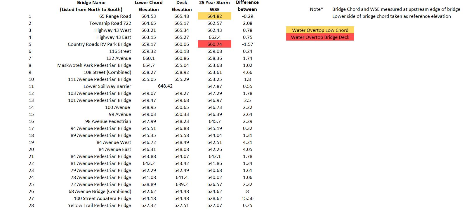
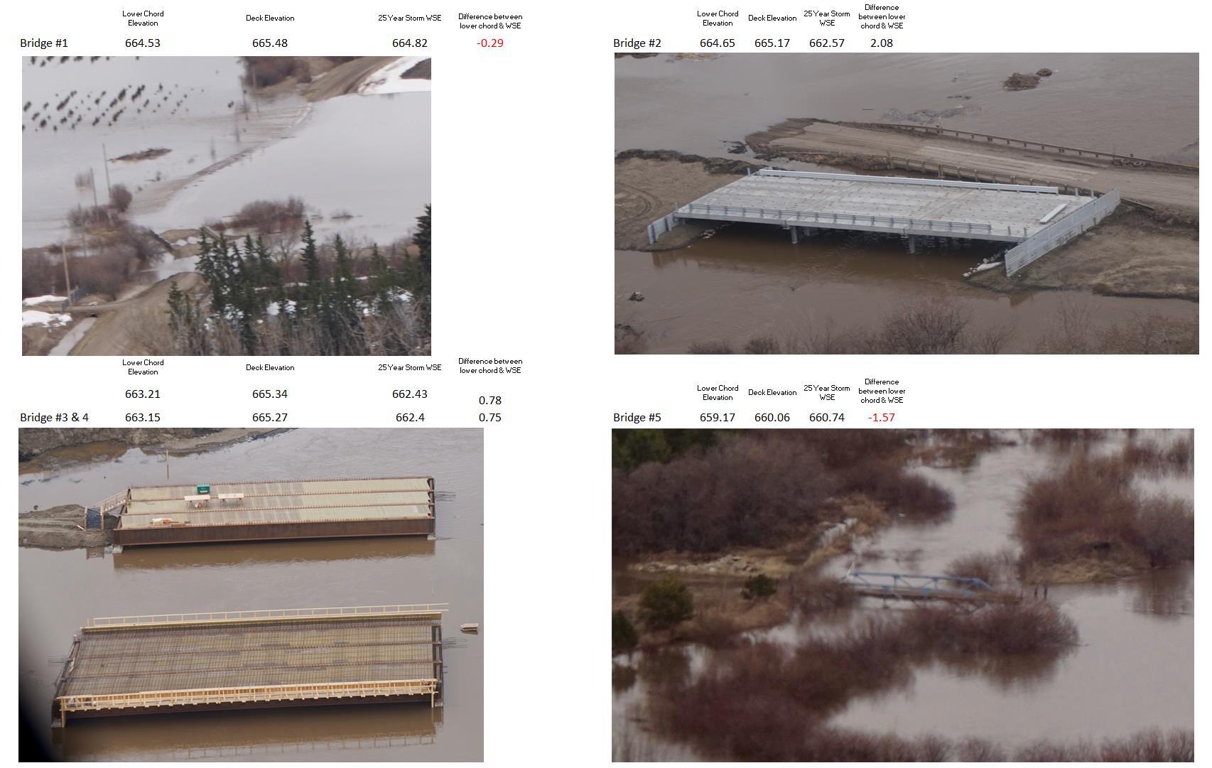
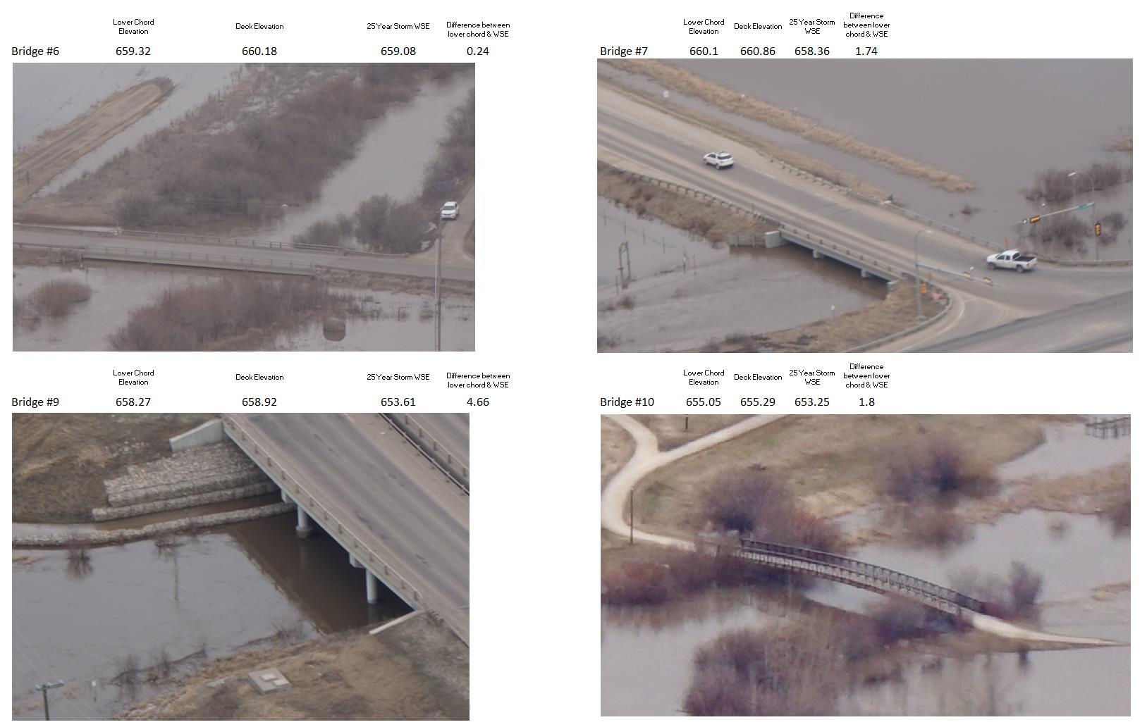
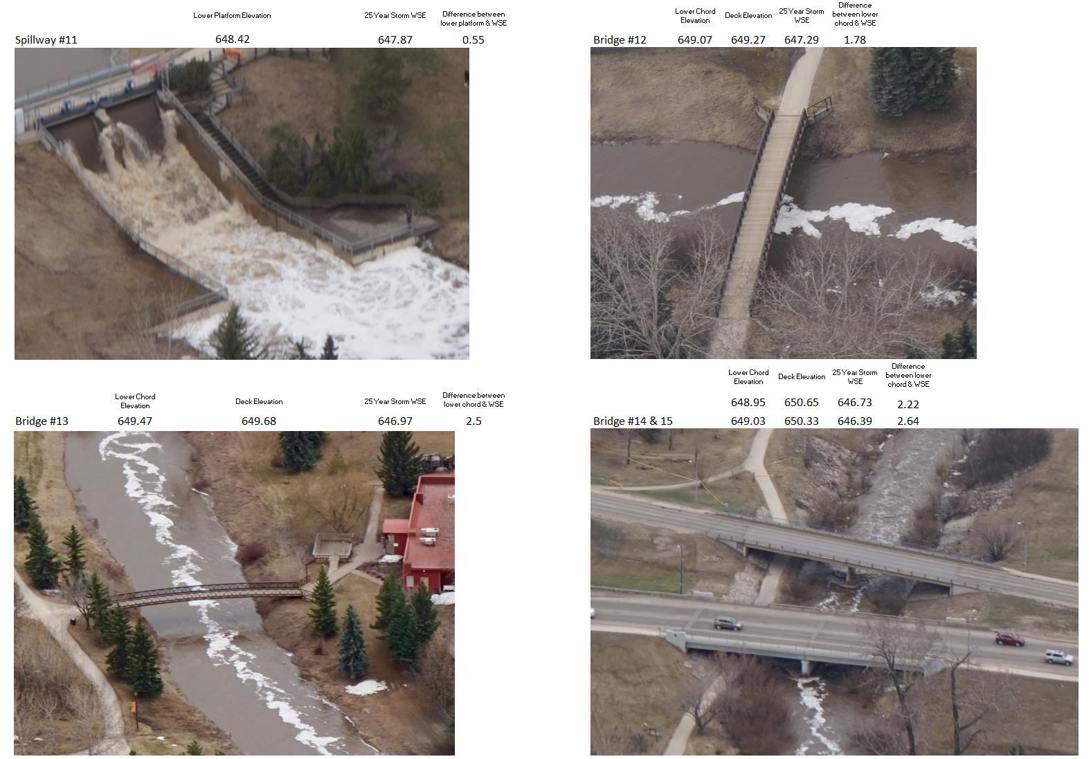
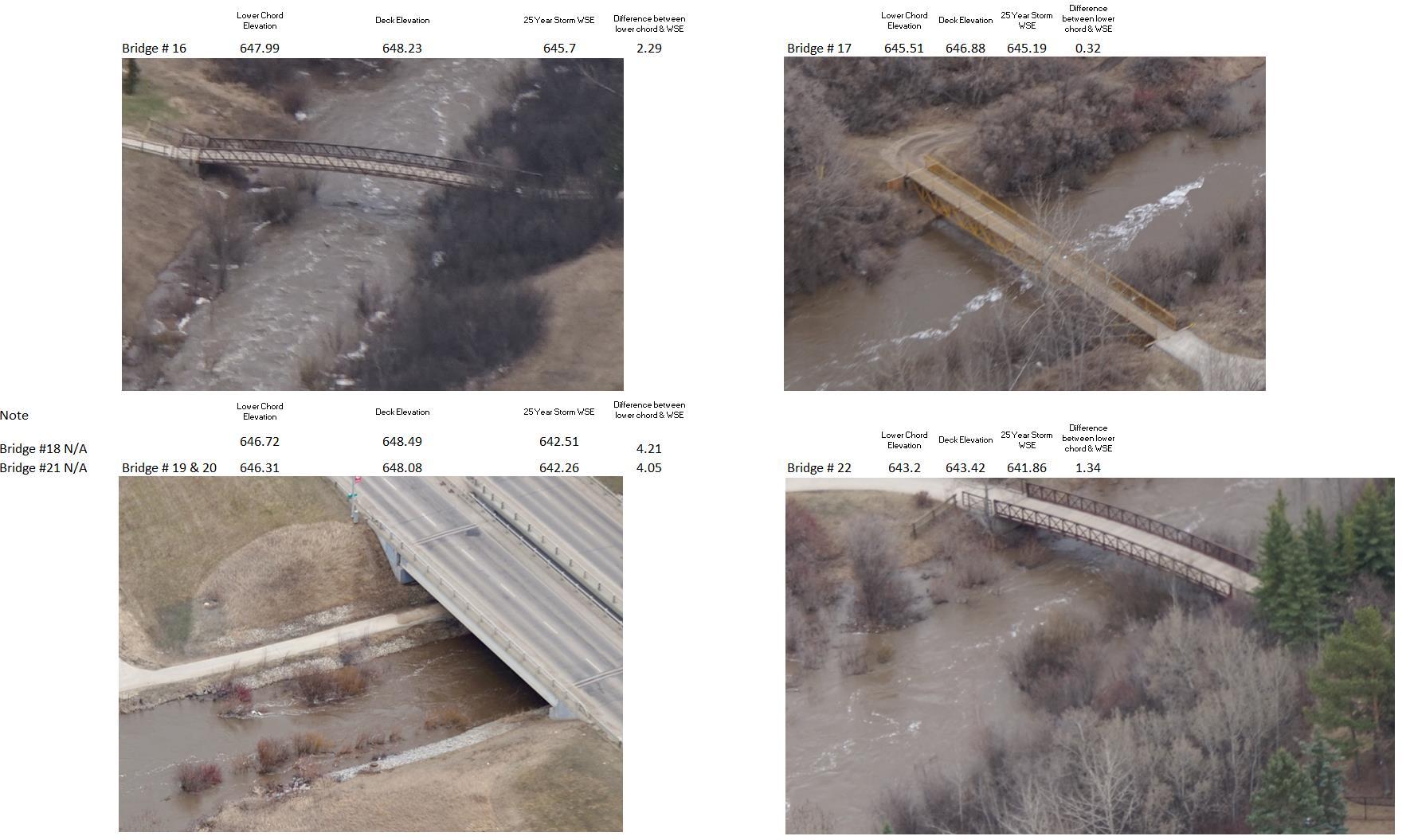
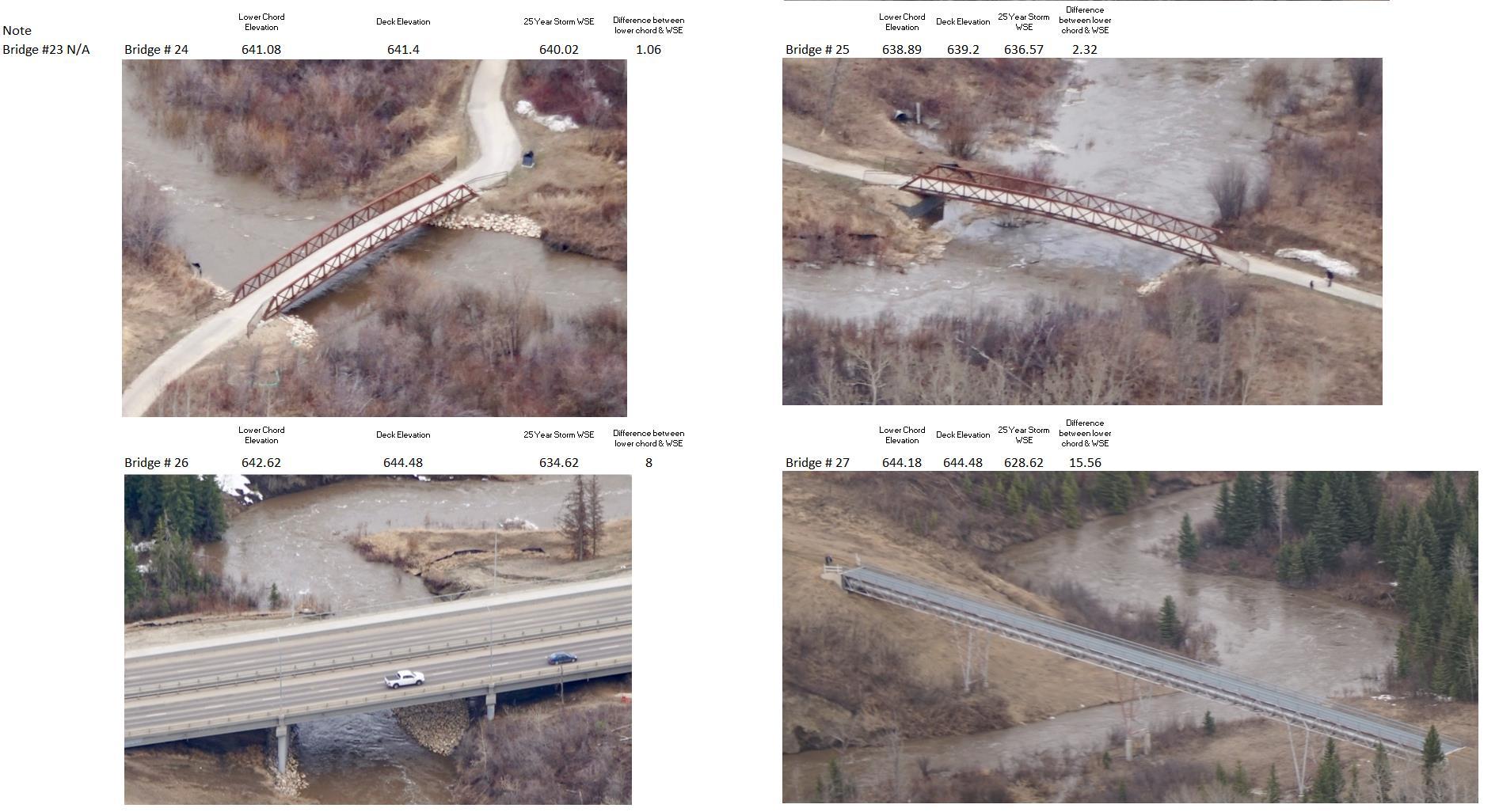
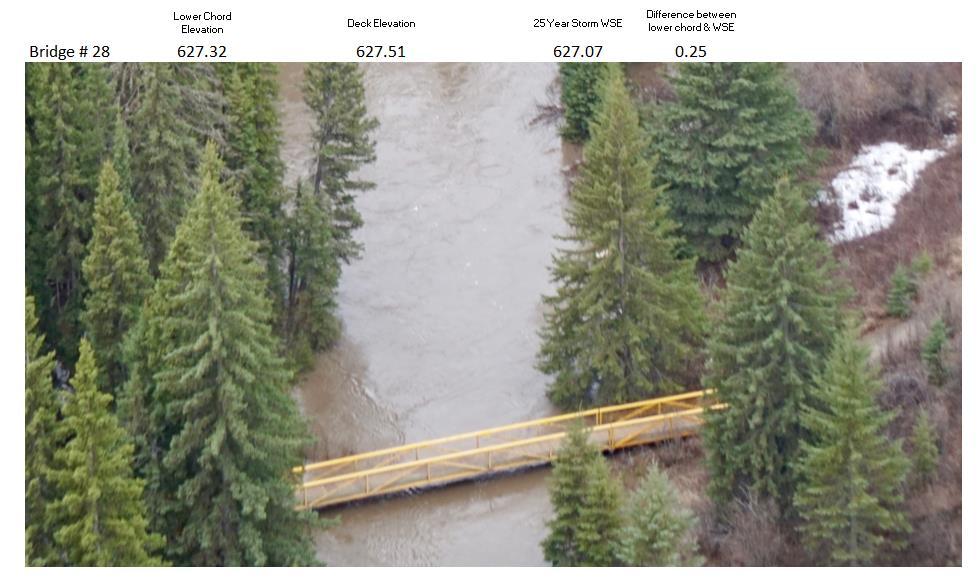
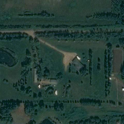
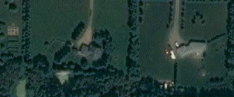
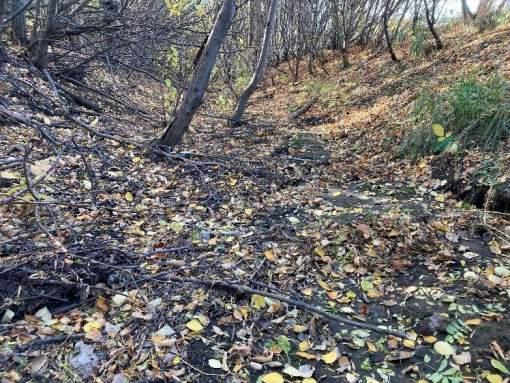
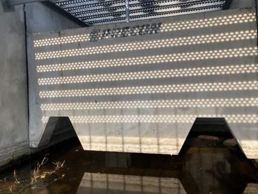
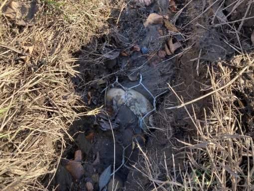
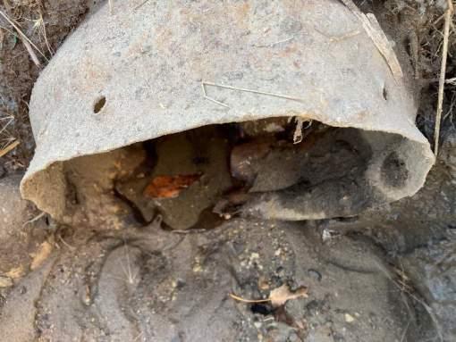
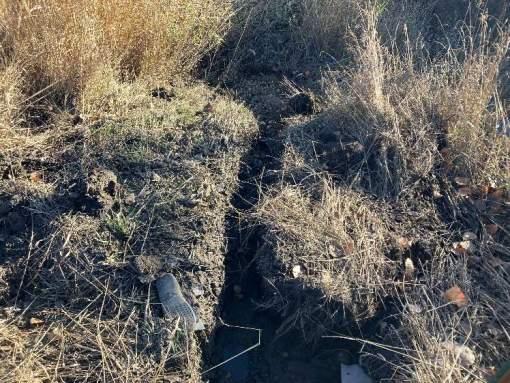
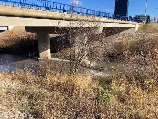
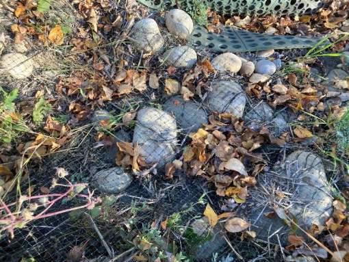
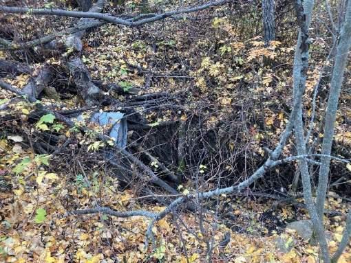
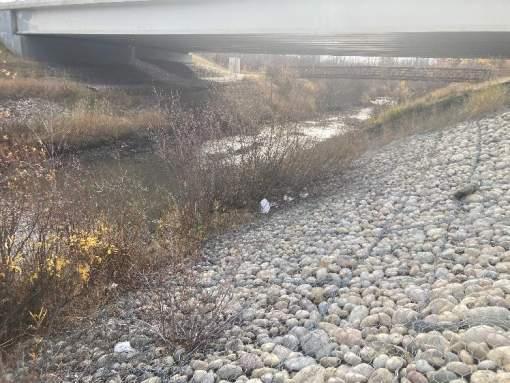
A common approach to flood model calibration is to rely on photographs/imagery taken during flood events. The April 2018 flood experienced in Grande Prairie has a large photographic dataset. Peak flood conditions occurred at the Grande Prairie reservoir between 5:00 pm and 8:00 pm on April 28th, 2018. A helicopter flight was taken at noon the following day (April 29th) by City staff to capture the extents of the flooding. By the time the flight was conducted, water levels at the reservoir had dropped approximately 0.3 m from peak levels. Over 200 photographs of the project area were taken during the flood event at structures throughout the study area, representing a comprehensive record of the flood near its peak. The photos used in model calibration are included in Appendix B
The bridges throughout the study reach were used as reference landmarks to compare the modelled and photographed flood events. By using surveyed bridges as a series of “datums”, it was possible to compare easily identifiable locations/elevations against both the modelled water surface and the 2018 flood photos. Photos of 22 different bridges were logged for comparison. The greatest emphasis during the calibration
3511-11894-00
was placed on the bridges that were closest to being inundated. This reduced human error when evaluating the distances between the lower chord of the bridges and the water surface in the photos.
When comparing the modeled results to the photographs, it was found that the flood levels from the April 2018 event had a reasonable resemblance to the modelled 1:25-year flood event, with water elevations being within approximately 0.3 – 0.5 m of each other. Although it has not been possible to confirm the results with a hydrometric station, the model aligns with the qualitative data, confirming that the 2018 flood appeared to be the largest event since the June 1990 flood.
3.6. MODEL SENSITIVITY
Model sensitivity testing is a process used to assess how changes in input parameters or conditions of a model affect its outputs or results. It involves systematically varying one or more input parameters while observing the corresponding changes in the model’s outputs. The goal of sensitivity testing is to understand the relationships between input parameters and model outcomes. If the model were highly sensitive to input parameters (i.e. the model’s outputs are strongly affected by changes to input values), the model will, in general, tend to magnify the effects of changes in input parameters. Even minor adjustments in input values can result in noticeable and sometimes unpredictable shifts in the model’s predictions. Furthermore, models that are highly sensitive to inputs are often more vulnerable to uncertainties in input data or measurements. If input values are not precisely known, the model’s outputs might exhibit significant variations, making predictions less reliable.
In this analysis, the sensitivity of the model was tested by systematically changing the base Manning’s “n” values by approximately +20% and -20%. The model was then run for the 1:100 year flood event and the WSEs for the three runs were compared at each bridge within the study area. The Manning’s “n” values used in the runs are shown in Table 6
Table 6: Manning’s “n” Values for the Landcover Types Used to Test Model Sensitivity
value
By modifying the roughness values +/- 20%, it was found that the average WSEs for the design 100-year event varied between -0.17 m to +0.21 m from the original WSE values. This variation in WSE is equivalent to an approximate 0.03% average change. This change is minor relative to the magnitude of the system
Bear River Corridor Assessment | 3511-11894-00 Prepared for the City of Grande Prairie Page 19
and the originally predicted WSEs. In the most extreme locations (at 103 Avenue Pedestrian bridge and at 101 Avenue Pedestrian Bridge), the change in WSEs vary approximately between 0.3 m to 0.4 m. The larger disparity between WSE values is reflective of the higher relative velocities experienced at these locations.
In general, higher velocities in hydraulic systems are more sensitive to changes in roughness values due to the complex interactions between flow dynamics and roughness. Furthermore, higher velocities amplify the effects of changes in land use which leads to more pronounced alterations in flows and WSEs. Overall, it can be deduced that variations to the Manning’s “n” values in the Bear River system are minimal and the model results are not highly sensitive to input parameters, reducing uncertainty in the modeled results.
Bear River Corridor Assessment | 3511-11894-00 Prepared for the City of Grande Prairie
4. Floodplain Mapping
The definition of flood mapping, flood inundation mapping and flood hazard mapping presents a source of confusion for professionals and the public alike. The following are working definitions for the types of flood mapping referenced. They agree with the definitions adopted by the Alberta Environment and Parks Flood Hazard Identification Program Flood Study Technical Guidelines.
Flood Mapping, Floodplain Mapping and Flood Inundation Mapping:
We will consider all three names to mean the same thing; a map that identifies areas that may be inundated under a flood with a specified discharge or probability of occurrence, such as the 1:100-year flood. Flood mapping illustrates where flood water is present during a flood but does not provide any other context to the relative hazard of the flood, such as the water velocity or depth.
Flood Hazard Mapping:
Flood hazard mapping provides additional information to traditional flood (inundation) mapping. Hazard ratings consider water depth and water velocity. The deeper and faster moving the flood water, the greater the flood hazard.
Bear River Corridor Assessment | 3511-11894-00 Prepared for the City of Grande Prairie
5. Flood Hazard Mapping
The flood hazard assessment builds on the inundation mapping, characterizes the flood process, and determines the flood intensity characteristics. Flood hazard maps can be prepared to show variations in water depths and water velocities for any given return period to help delineate relatively high hazard areas from low hazard areas.
In Alberta, the Alberta Environment and Parks (AEP) guidelines delineates the floodplain into two distinct regions including.
• Floodway – area of highest flood hazard where flows are deepest, fastest, and most destructive The floodway typically includes the main channel of a stream and a portion of the adjacent overbank area. New development is typically discouraged in the floodway; and
• Flood Fringe – areas of the flood hazard area outside of the floodway. Water in the flood fringe is generally shallower and flows more slowly than in the floodway. New development in the flood fringe may be permitted in some communities and should be flood-proofed.
AEP is currently in the process of implementing a new approach to mapping floodways and hazard maps in order to balance flood adaptation and resilience priorities to enhance public safety and inform local decision-making. In this approach, additional areas within the flood hazard maps are identified including the following.
• High Hazard Flood Fringe – areas within the flood fringe with deeper or faster moving water than the rest of the flood fringe;
• Protected Flood Fringe – areas that could be flooded if dedicated flood berms (engineered barriers that keep water from entering and flooding an area) fail or do not work as designed.
For the purpose of this report, we developed flood hazard maps under the existing AEP guidelines which defines areas of high-flood hazard by delineating the floodway and flood fringe. Use of the AEP guidelines allows for consistency of approach when compared to other jurisdictions. The floodway is defined using the 1:100-year design flood and is determined based on the following.
• Areas where the depth of water exceeds 1 m or the flow velocities exceed 1 m/s;
• Exceptions may be made for small backwater areas or ineffective flow areas; and
• The main channel of the river.
Although there are no specific hazard classifications for flood hazard ratings specific to Canada at this time, flood hazard ratings are used in other jurisdictions such as British Columbia and Ontario. This rating system characterizes hazard as a function of water depth, water velocity, and the potential for floating debris, primarily based on the consideration of the direct risks to people exposed to floodwaters. The premise for
Bear River Corridor Assessment | 3511-11894-00 Prepared for the City of Grande Prairie
flood hazard is simple: the deeper and faster moving the water, the greater the hazard to life and property. This approach can be used by the City to inform emergency planning procedures and identify areas where resources may be needed in the event of a flooding situation.
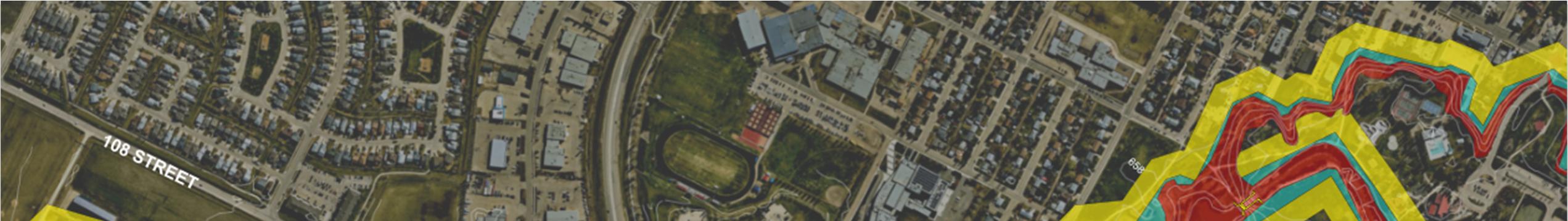
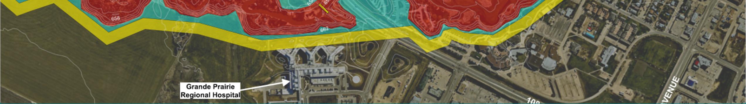
The flood hazard maps and flood inundation maps developed for the study area are provided in Appendix C and Appendix D, respectively.
5.1. DISCUSSION OF FLOOD HAZARD (1:100 YEAR RETURN PERIOD)
The flood hazard maps show the flood hazard relative to the Bear River floodplain within the City extents. River channels and the adjacent overbank areas will usually be categorized as the floodway as this is where water flows the fastest and deepest. Whereas locations where the flooding is relatively shallow and is not moving quickly is categorized as the flood fringe. Hazard becomes more applicable to community planning when the hazard areas encroach on a community’s culturally and environmentally important areas, structures, infrastructure, and people themselves.
To provide more context of the possible flood encroachment as it relates to the City, a summary of flood hazard areas are provided below, listed from upstream to downstream.
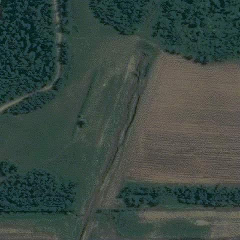
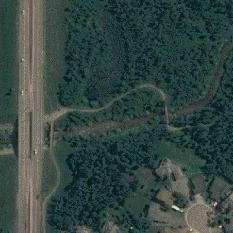
• Within the first approximate 7.8 km of the upstream end of the study area, starting at the intersection of Township Road 724 and Range Road 65, various agricultural properties are within both the floodway and flood fringe. Due to the flat nature of this area, inundation is to be expected. Furthermore, there appears to be overtopping of the bridge (1 km south of the Township Road 724 and Range Road 65 intersection) and overland flow over a 320 m section of the road, south of this bridge. This may be an indication of a low point in the road, creating another flood path for water to overtop during larger events.
• At the intersection of Bear River and Highway 43, there does not appear to be overtopping of the road at the three bridge crossings because they are constructed to a higher elevation relative to surrounding land. However, the flood fringe extends along either side of the roadway, indicating that the bridge crossings are close to their maximum capacity when conveying the 100-year event.
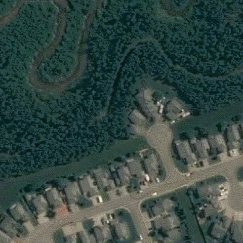
• In the residential area (2.2 km east of the Highway 43 and Bear River crossing), there are various locations of minor inundation in neighbourhoods adjacent to the main channel. The bridge at this location is also overtopped, with a preferential flow path south of the crossing. This area is of higher hazard due to the properties located in closer proximity to the Bear River.
• Just west of the Range Road 63 and Township Road 720 intersection, a 1.1 km section of Township Road 720 is overtopped. Despite this inundation, this location is of low risk, because the remaining three roads at this intersection are not inundated. As such, there will still be access and emergency services available for residents that live in this area.
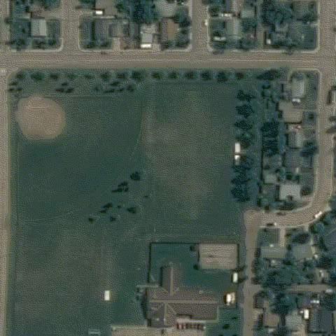
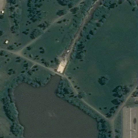
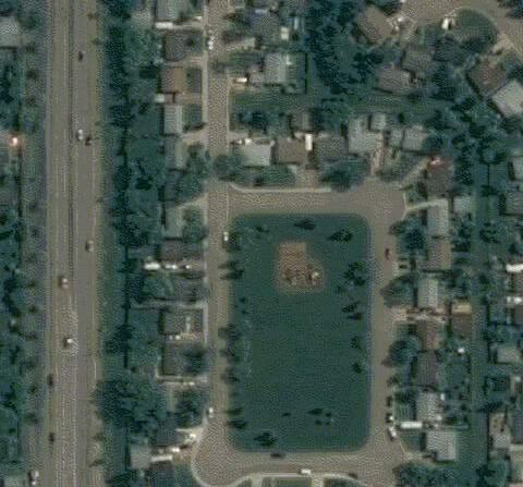
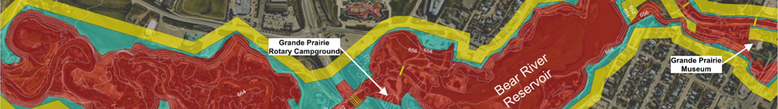
• East of the intersection of Bear River and 108 Street, the Grande Prairie Rotary Campground is located within the flood fringe. As a location of recreational use, this campground is in a high-risk location due to it’s proximity to the banks of Bear River.
Bear River Corridor Assessment | 3511-11894-00
Prepared for the City of Grande Prairie Page 24
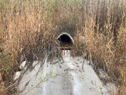
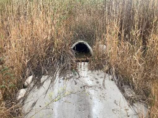
6. Stormwater Outfalls Assessment
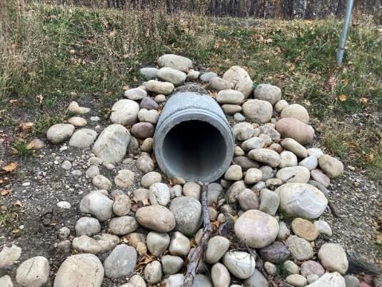
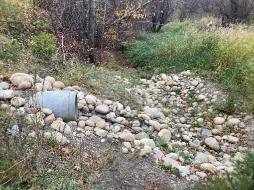
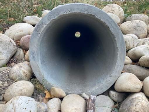
6.1. OUTFALL INSPECTIONS
Condition assessments for stormwater outfalls are an important monitoring tool for the City to help plan and prioritize the repair and replacement of their stormwater outfall assets.
Previous outfalls inspection reports are available from the 2009 Bear Creek Corridor Outfall Inspection Report (ParklandGEO Ltd.), and the 2018 Bear River Corridor Study (Matrix Solutions Inc.). Since the 2009 and 2018 reports, numerous outfalls have been repaired or replaced by the City as part of their regular replacement program.
6.2. INSPECTION METHODOLOGY
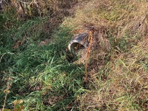
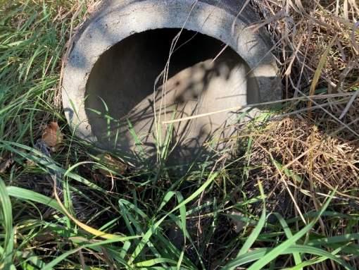
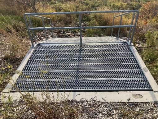
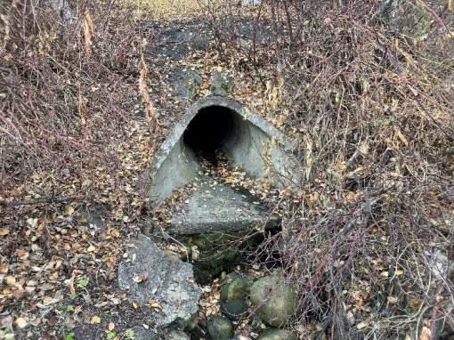
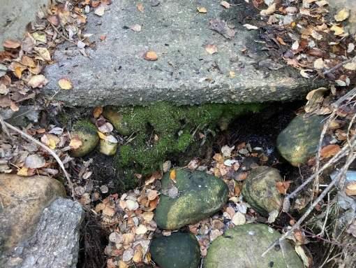
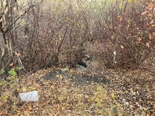
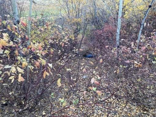
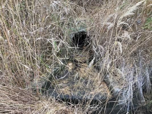
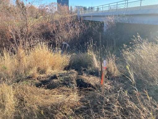
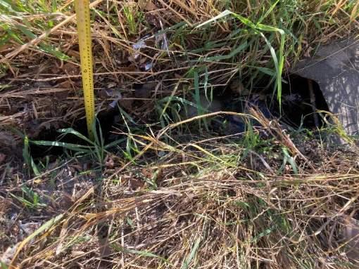
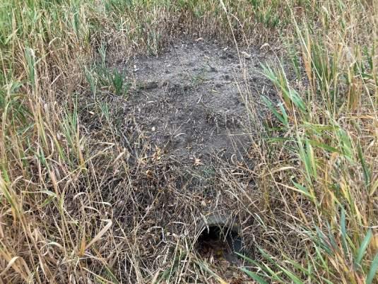
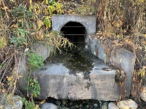
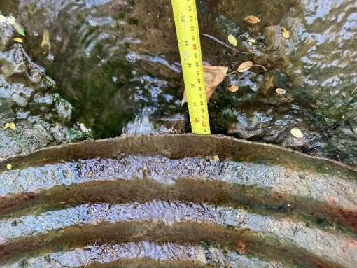
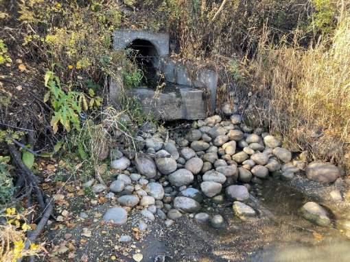
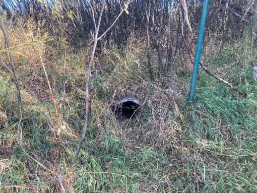
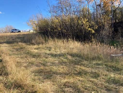
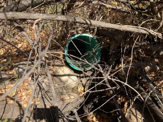
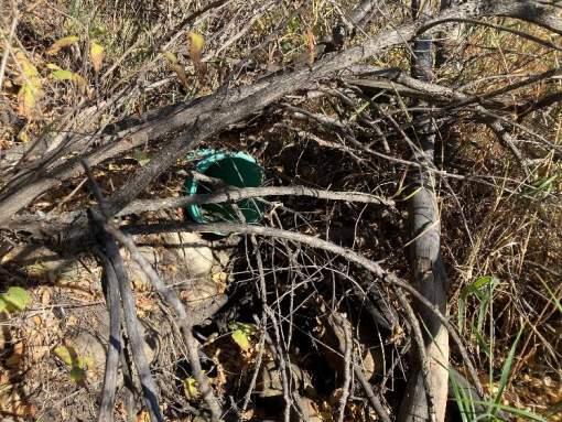
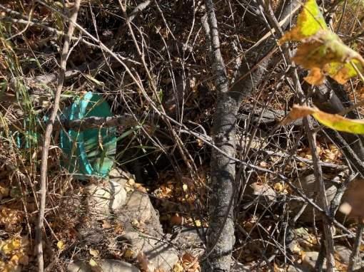
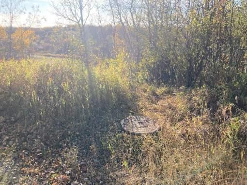
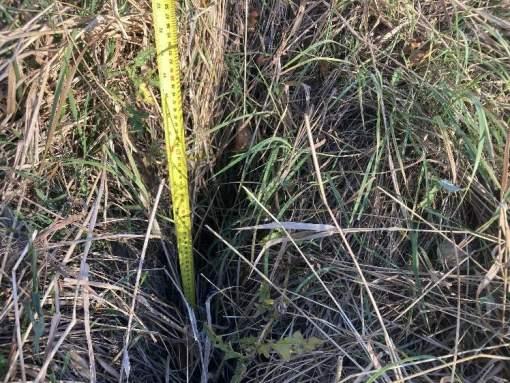
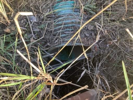
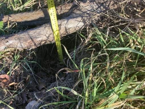
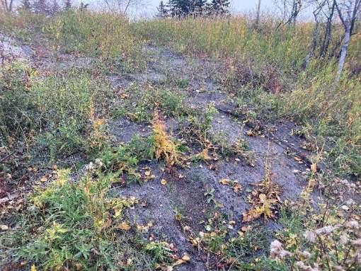
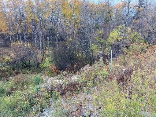
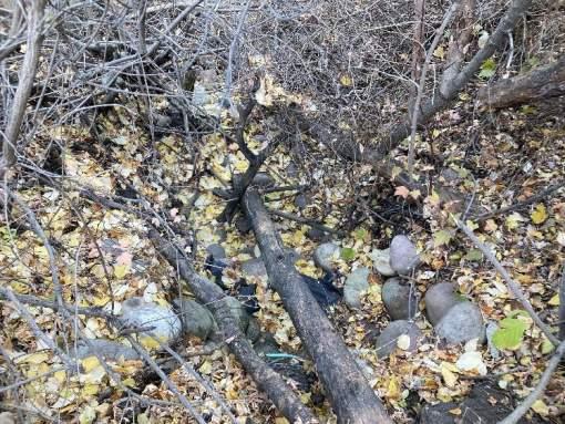
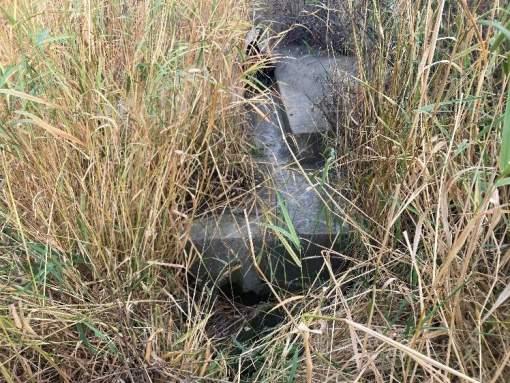
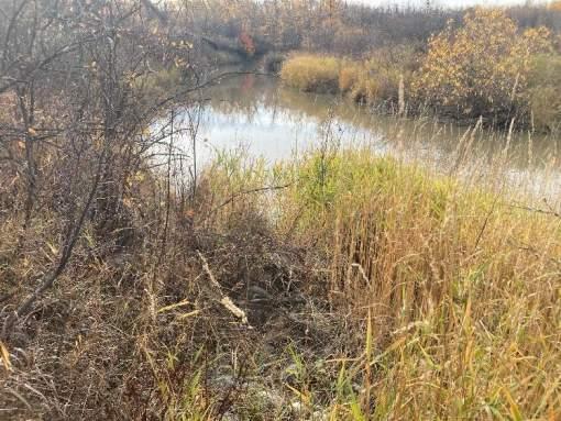
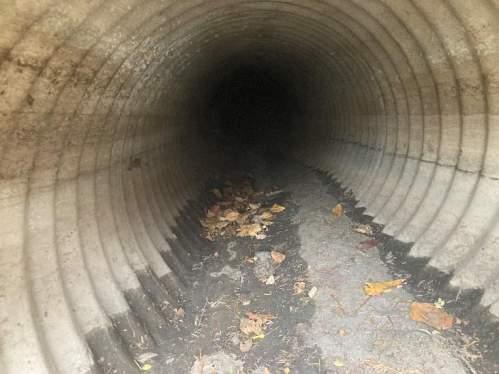
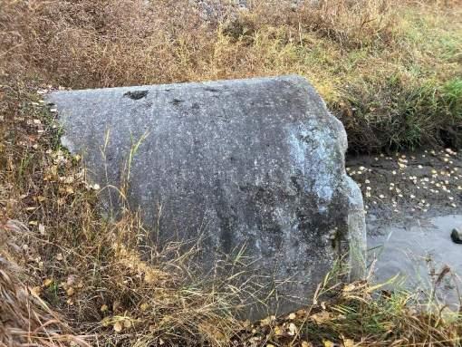
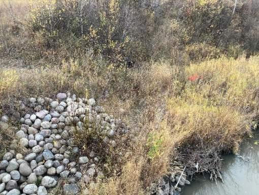
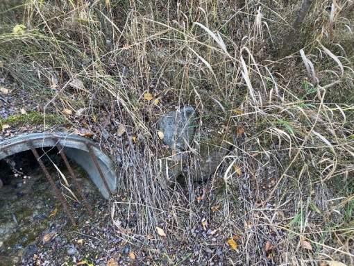
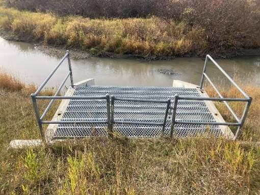
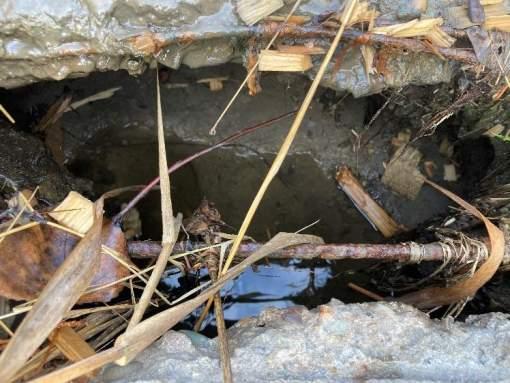
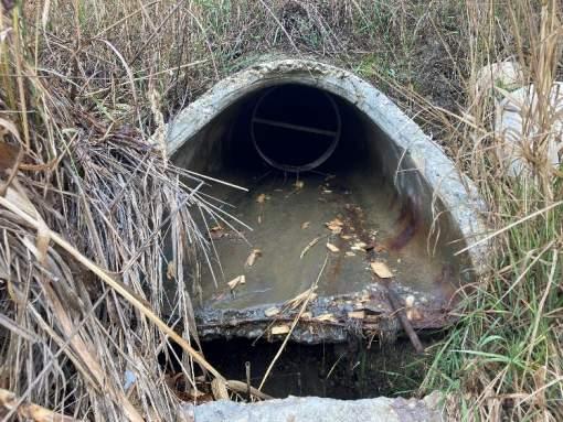
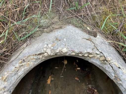
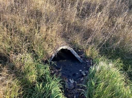
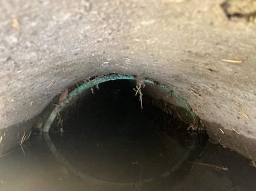
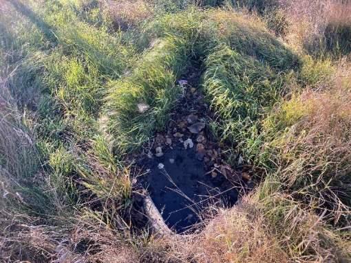
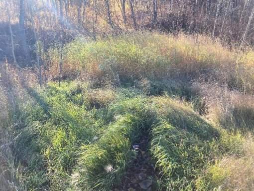
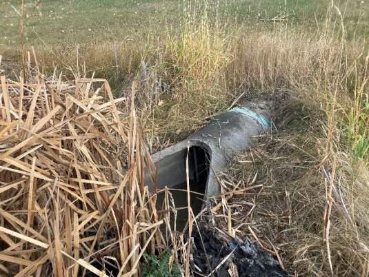
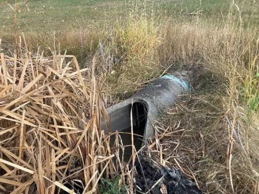
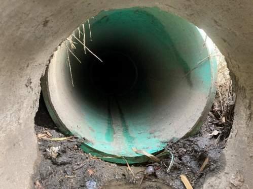
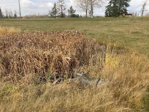
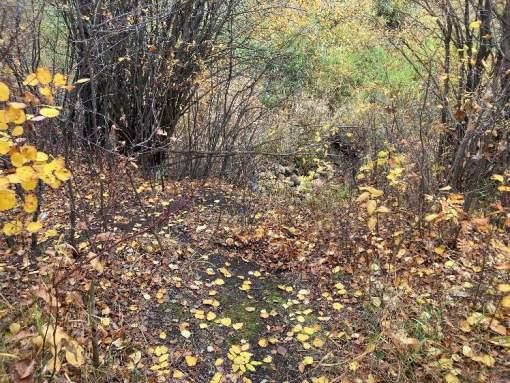
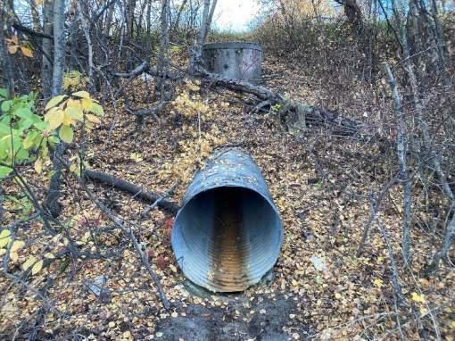
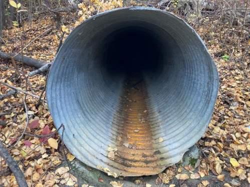
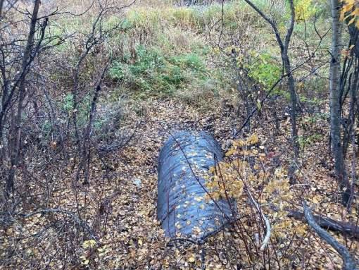
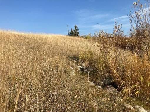
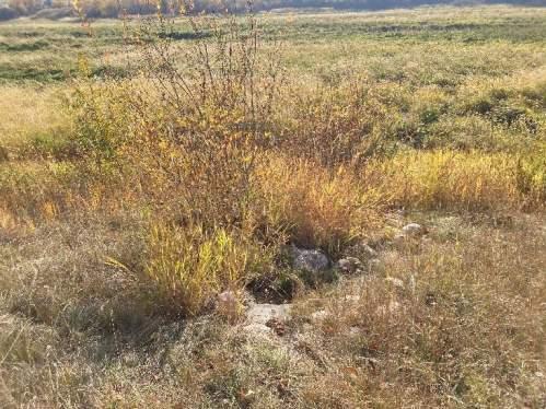
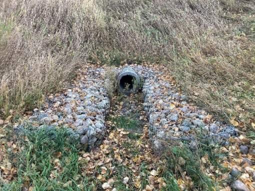
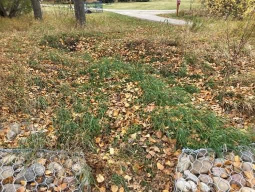
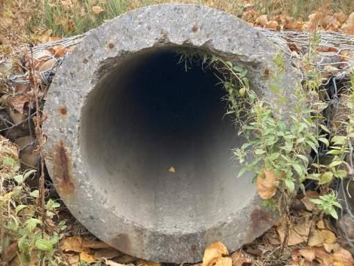
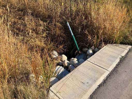
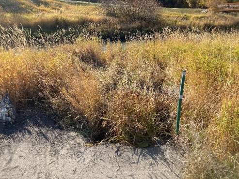
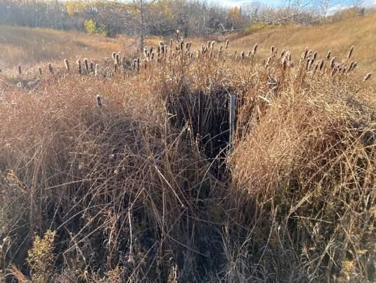
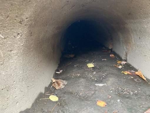
Stormwater outfall inspections were undertaken at 59 stormwater outfalls discharging to Bear River and one discharging to Flyingshot Creek as part of the assessment. The outfalls inspections were undertaken by McElhanney staff between October 17 and October 29 of 2022.
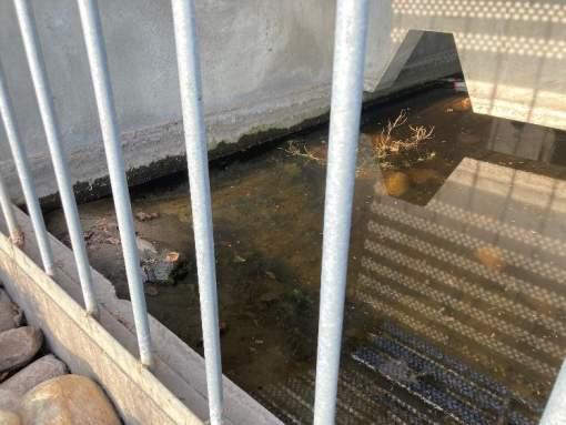
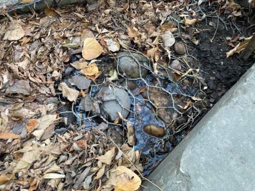
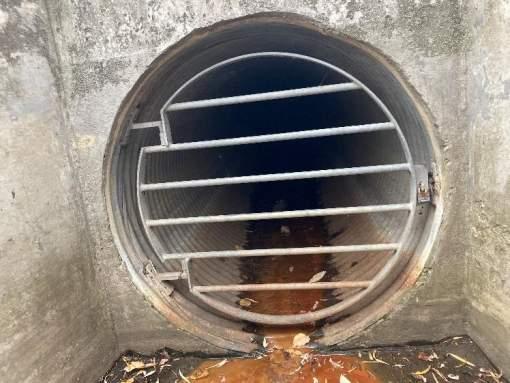
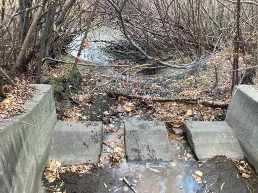
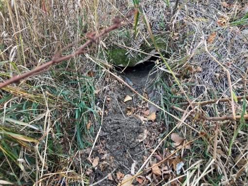
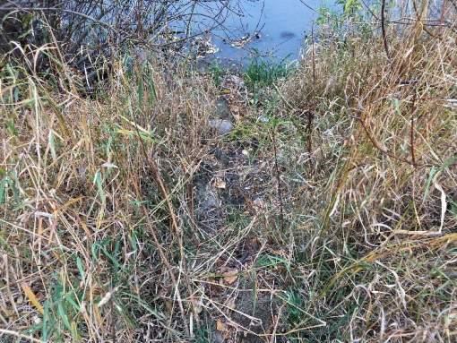
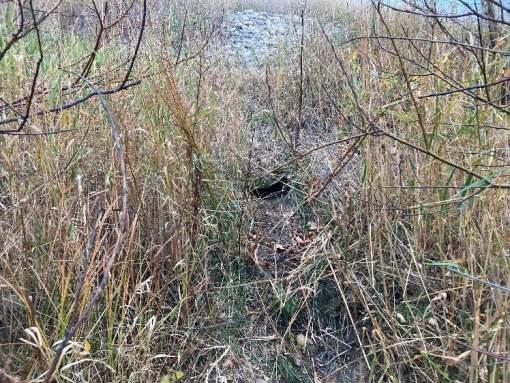
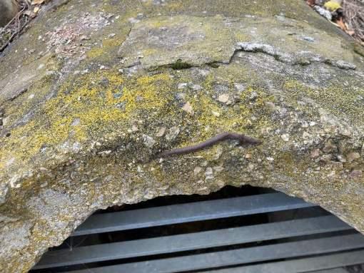
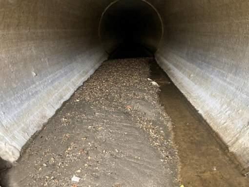
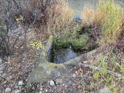
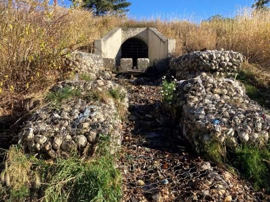
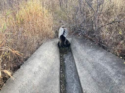
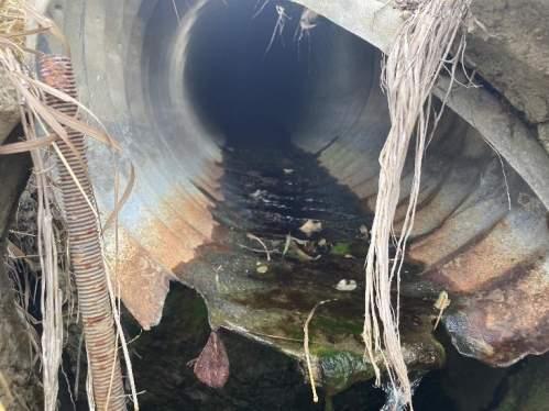
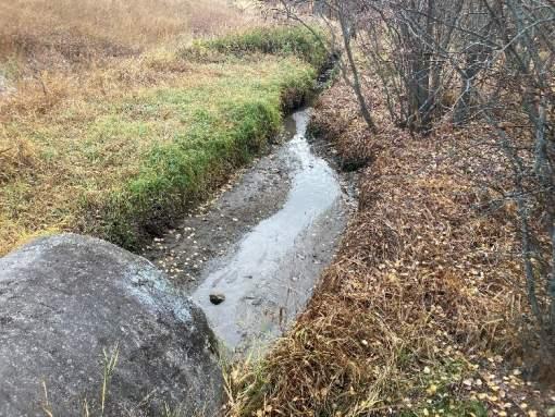
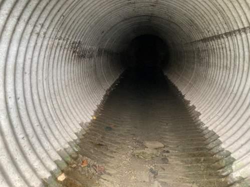
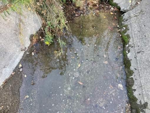
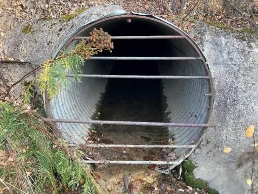
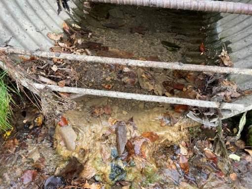
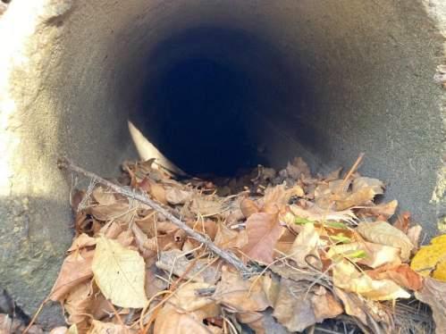
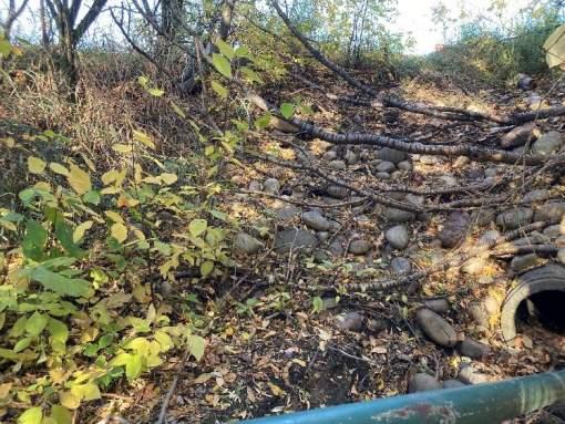
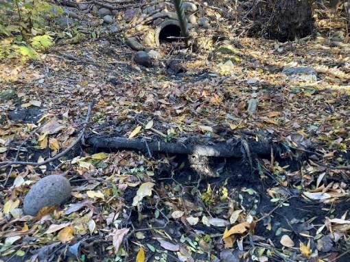
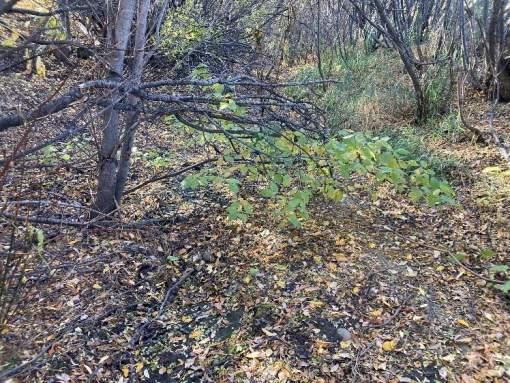
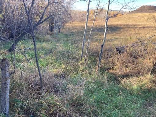
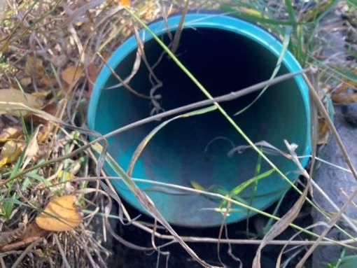
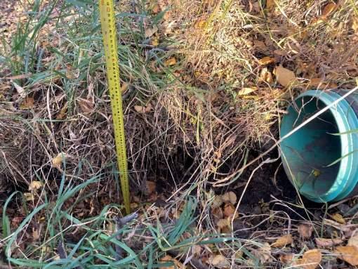
The inspection notes were collected using a Survey123 form having the same entry fields as the 2018 study in order to maintain consistency between the inspections. The outfalls were inspected for the material condition of the outfall structure and the storm sewer leading to the outfall, the condition of the outlet channel or apron, and the overall condition of the site including the upland vegetation coverage, slope steepness, and condition of the nearby river channel. The outfall inspections were observational and non-destructive.
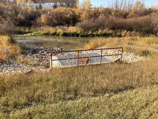
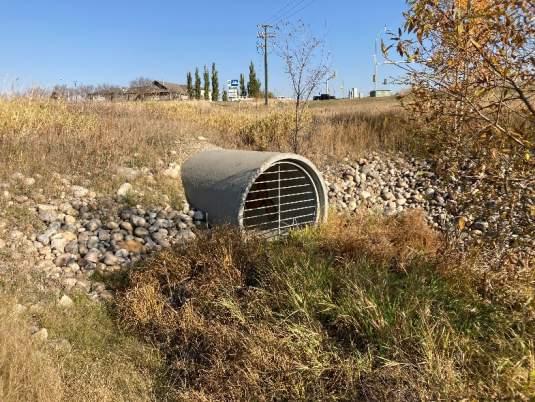
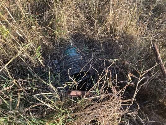
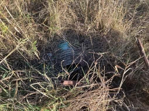
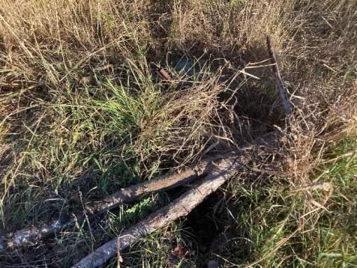
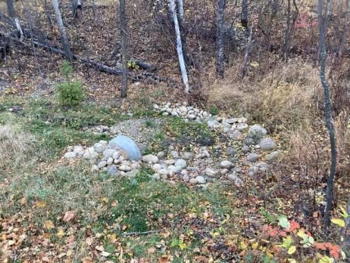
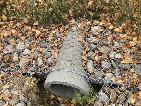
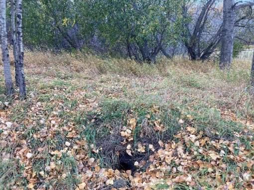
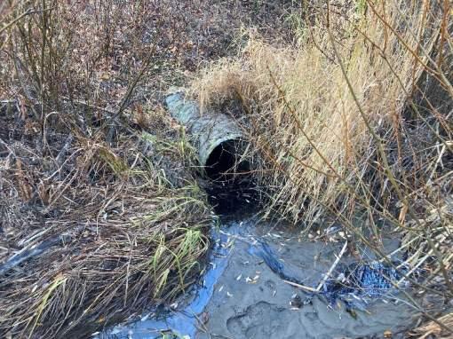
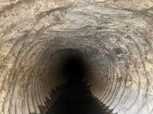
An outfall location map is included in Appendix E, and detailed outfall inspection reports as well as photos for each outfall are included in Appendix F.
6.3. OUTFALL PRIORITY RANKINGS
All stormwater outfalls inspected during this assignment have been ranked based on priority both overall and divided by required activity, being monitor, repair, or replace. The priority ranking was completed using various assessment criteria categories, including level of damage to the outfall, risk to infrastructure, impact to the environment, risk to public safety, and the frequency or severity of flow. A weighting factor was assigned to each category based on importance of that category in relation to the others.
The priority rankings use a numerical score for each category, based on the level of severity that is assessed. The following sections discuss the assessment criteria, detail the ranking criteria matrix, and summarize the priority ranking results.
6.3.1.Assessment
Criteria
The assessment categories and relative implications to the priority rankings are discussed in this section.
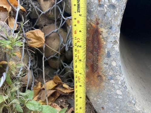
Level of Damage
The level of damage to the outfall or associated storm sewer components is classified based on the structural condition of the outfall, condition of the storm sewer, and the condition of the outlet channel. Damage to the outfall can be a direct hindrance to the performance of the storm sewer system and contributes to other risk factors such as public safety and impacts to the environment. Damage to the outfall is assessed by looking at all components of the system, including the outfall structure, storm sewer, and outlet channel.
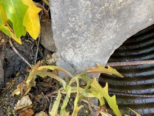
Damage to the outfall structure may include the following:
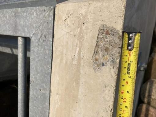
• cracking, spalling, or corrosion of concrete;
• settlement, leaning, or displacement of outfall structure;
• settlement, leaning, or displacement of headwall or wingwall;
• undermining or outflanking of structure.
Damage to the storm sewer may include the following:
• surface corrosion or scouring of pipe;
• damage to exposed pipe end section;
• collapse or ovalized pipe cross section;
• disconnected sewer joints or disconnection from outfall structure;
• excess sedimentation in pipe.
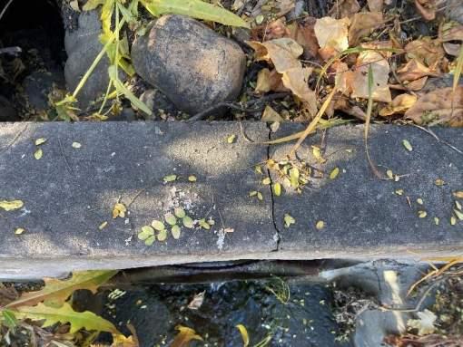
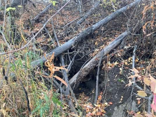
Damage to the outlet channel may include the following:
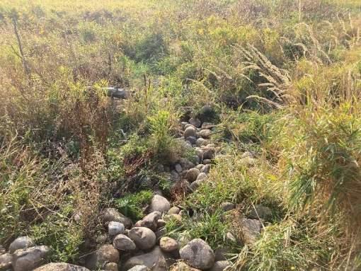
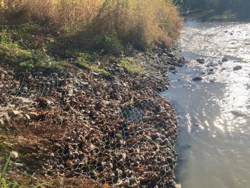
• displacement of armouring (i.e. riprap, gabions);
• downcutting erosion of channel;
• bank erosion and over steepened side slopes;
• scour hole development.
No Damage
Outfalls with no damage are noted to be currently functioning as designed with no observable deficiencies.
Minor
Outfalls identified to have minor damage have deficiencies that are relatively easier to repair. The outfall and its critical components are noted to be generally functioning well and there are no concerns for immediate failure if action is not taken in the short term. Outfalls with minor damage may have small maintenance tasks identified, such as cleaning out garbage or debris from the grate, or clearing of vegetation from the outlet channel. Outfalls with minor damage are recommended to be monitored for changes.
Bear River Corridor Assessment | 3511-11894-00 Prepared for the City of Grande Prairie
Moderate Damage
Outfalls with moderate damage will exhibit a high level of damage to one or more components, however, the outfall is still functional or mostly functional. Outfalls with moderate damage will likely worsen in condition if no remedial action is taken in the short term. Outfalls with moderate damage may also be vulnerable to further damage during large flow events and may exhibit severe damage following a large event.
Severe Damage
Outfalls with severe damage have critical components that are not functioning or are partially functioning. Severe damage indicates that the outfall has failed or is likely to fail in the immediate future without intervention. Outfalls exhibiting severe damage may already be impacting adjacent infrastructure (i.e. pathways, roadways) and may be posing a risk to public safety by creating unsafe conditions. Severely damaged outfalls may also pose a risk to the environment through increased erosion and sediment load on the receiving waterbody.
Risk to Infrastructure
The level of risk to infrastructure for each outfall is classified based on the potential impact to other key infrastructure that may occur in the event of a failure. Outfalls that are damaged or functioning poorly may have the potential to erode riverbanks and become unstable, which can harm surrounding property and infrastructure including utilities, roads, sidewalks, and pathways. Additionally, during times of heavy rain, outfall failures could block storm drains, compromising both public and private property as well as public safety.
The assessed risk to infrastructure is relative based on the proximity to adjacent infrastructure, and the type of infrastructure that may be impacted.
No risk
Outfalls with no risk to infrastructure. Outfalls adjacent to open lands including natural areas and open spaces that do not feature recreational amenities or other infrastructure.
Minor
Outfalls with minor risk to infrastructure or lower priority infrastructure such as recreational amenities. Recreational amenities are commonly found throughout the Bear River corridor and in areas where stormwater outfalls are located. Recreational amenities include trails, pathways, sports fields, park tables and benches. Recreational amenities are valuable resources but not critical infrastructure.
Moderate
Outfalls with moderate risk to infrastructure include outfalls near private property or critical infrastructure. Private property in residential, commercial, or industrial forms are located along the Bear River corridor and are often serviced by the storm sewer network and associated storm outfalls. Outfalls may pose a risk to
private property when they are in close proximity and can impact the overall stability of the area or decrease the capacity of the storm network.
Severe risk
Outfalls that are located in very close proximity or have the potential to impact property or critical infrastructure in the case of a failure. Critical infrastructure includes utilities, roads, and bridges that provide the public with critical services and transportation. Utilities can include gas, communications, water and wastewater services. There are high economic costs associated with risks to these infrastructure systems.
Impact to Environment
Damaged outfalls can have environmental impacts through excessive erosion and sediment loading on the downstream waterbody. Failed outfall systems may experience undermining and soil loss from around the outfall structure and storm sewer network. Outfalls with noted water quality concerns, such as excessive sedimentation or evidence of contaminants (i.e. oil sheen) have been identified, however, these issues are commonly indicative of catchment-level water quality issues and not of the outfall itself.
No Risk
Outfalls that are currently operating properly and do not have any observable signs of failure.
Minor
Outfalls that show some signs of erosion and evidence of early failure modes, but otherwise are in good operating condition.
Moderate
Outfalls that are in a stage of active erosion or reduced performance. Outfalls are not in immediate danger of failure, however, the exhibit signs of progressing erosion or other environmental concerns that need to be mitigated or monitored.
Severe
Outfalls that have failed or are at an immediate risk of failure that could cause excessive erosion and soil loss. Outfalls classified as severe are unmitigated risks to the environment and require immediate attention.
Risk to Public Safety
Outfalls are commonly in public areas that are informally accessible to the public from nearby walking trails or paved multi-use pathways. When outfalls are severely damaged or eroded, hazards are created for the public from trips and falls, injuries from debris or sharp materials, or drowning.
Bear River Corridor Assessment | 3511-11894-00
No Risk
Outfalls that are in good condition and have appropriate safety provisions in place, such as fencing and grates. The surrounding uplands area is stable and free of trips and fall hazards, and the outlet channel is intact with no major scour holes or hazards.
Minor
Outfalls having minor public safety concerns such as tripping hazards due to uneven ground but do not pose an unusual risk for the setting in which the outfall is located.
Moderate
Outfalls with moderate safety risks such as loose materials and debris that could be sharp or otherwise hazardous, moderate rough terrain such as steep slopes and uneven ground, or moderate scour holes that may pose an entrapment risk to small children.
Severe
Outfalls with severe safety risks have prominent hazards that the general public is subjected to, such as unguarded fall hazards in close proximity to formal pathways, outfalls in remote locations with hazardous terrain, steep banks or unstable slopes, and hazardous structures.
Frequency and Severity of Flow
The relative frequency or severity of flow is based on observed baseflow or catchment size and contributes to the outfall prioritization. Outfalls with large catchment areas and subsequently large flow volumes may exacerbate other issues, such as erosion and instability, and should therefore be prioritized ahead of outfalls with smaller catchments that may receive less flow more infrequently. Some outfalls were observed to have near-constant flow through baseflow, which is indicative of a large catchment area and other factors such as groundwater infiltration or foundation drain connections.
Infrequent Flow / Small Catchment
Outfalls with infrequent and less severe peak flows may drain a small catchment area less than 5 hectares and may only experience large peak flows during the most extreme rainfall events. These outfalls are often found to be completely dry outside of wet periods.
Frequent Flow / Large Catchment
Outfalls with frequent or near-constant flow generally have larger catchment areas and experience larger peak flows during intense rainfall events. Outfalls in this category may have baseflow even during dry periods which is indicative of a large catchment area and other factors such as groundwater infiltration or foundation drain connections. These outfalls are a high priority due to the total volume of water and potential for large peak flows that can contribute to various outfall failure mechanisms.
Bear River Corridor Assessment | 3511-11894-00 Prepared for the City of Grande Prairie
REPAIR
OVERALL RANKING by TOTAL SCORE
OVERALL
7. Slope Stability Assessment
A slope stability assessment has been undertaken by ParklandGEO to assess previously identified geohazards and new areas of concern utilizing the LiDAR data provided by the City. A detailed summary of their assessment is provided in a separate report titled “Bear Creek Corridor Geohazard Assessment” dated January 15, 2023 (hereafter referred to in this document as Geohazard Assessment Report).
Bear River Corridor Assessment | 3511-11894-00 Prepared for the City of Grande Prairie
8. Top of Bank Matrix
8.1. BACKGROUND
A top of bank setback framework is a key tool for municipalities and regulators to provide guidelines for private development for reasonable setbacks to safeguard from expected slope stability and erosion hazards. A riparian setback framework is established to provide a buffer to ecologically significant features such as watercourses and wetlands. In urban areas, properly vegetated buffers can be critical to filtering pollutants and maintaining water quality.
The Top of Bank Setback Framework combines riparian and slope stability setback recommendations into one document. The framework provides a clear and enforceable process to follow for establishing development setbacks along the Bear River Corridor. This framework may be applicable to other watercourse corridors within the City, however further study would be required to determine specific parameters for the other locations.
McElhanney and ParklandGEO have developed an updated Top of Bank setback matrix, accounting for slope stability setbacks and riparian setbacks in accordance with current regulatory and industry standards. Several other jurisdictions were investigated to determine setbacks and setback approaches used throughout Alberta. The information collected is shown in the respective slope stability and riparian sections below.
8.2. STAKEHOLDER ENGAGEMENT
Stakeholder engagement was undertaken as part of this assignment to support the recommendations of the top of bank matrix. Stakeholder engagement is an important tool for municipalities to give impacted parties an opportunity to learn about the assessment, the processes that went into the assessment, and give feedback directly to the project team. Stakeholder engagement strengthens our recommendations because it gives the project team the opportunity to hear feedback from a variety of perspectives.
An engagement session by invite was completed on April 24, 2024 for internal City of Grande Prairie departments and developers. The contents of the stakeholder engagement session, as well as feedback received is documented in the What We Heard Report located in Appendix G
8.3. RIPRARIAN SETBACK
Stepping Back from Water, a 2012 publication by the Government of Alberta, provides a good foundation for criteria related to riparian buffer zones. It outlines identifying riparian lands and functions, how setbacks can be utilized to create effective buffers, and managing erosion and pollutants from new developments. The recommended criteria are as follows:
• Water quality function of riparian area;
• Slope impact on effectiveness of vegetation filters;
• Risk of groundwater contamination;
• Flooding;
• Shoreline migration;
• Bank stability;
• Aquatic and terrestrial habitat, wildlife corridors, and rare species.
The recommended setback distance is determined based on type of water body affected, potential for contamination, substrate, bank slope profile, floodplain, and riparian habitat.
Table 13 outlines setbacks adopted by other jurisdictions in Alberta.
Bear River Corridor Assessment | 3511-11894-00
Table 13 - Riparian Setback Policies of Other Alberta Jurisdictions
Erosion and migration of riverbanks is a continuous natural process. Based on the type of substrate and bank soils, erosion will create undercut banks which may result in landslides. The appropriate set back to protect new developments considers slope stability, toe erosion, and bank migration. The stability of the Bear River embankments have been assessed for erosion potential (e.g. High erosion potential on outside meander bends), slope grades, and unstable ground.
Table 14 outlines setbacks adopted by other jurisdictions in Alberta due to slope stability.
Bear River Corridor Assessment | 3511-11894-00 Prepared for the City of Grande Prairie
Table 14 - Slope Stability Setback Policies of Other Alberta Jurisdictions
Jurisdiction Policy/ Document Year Published Slope StabilitySetback
Setback limits for future development along the Bear River corridor have been developed based on a combination of the flood hazard assessment and slope stability assessment. The riparian zone of the river is within the other no development parameters such as geotechnically established top of bank, the flood hazard zone, and the flood fringe. As such, the riparian zone does not govern for placement of the No Development Zone at any point along the corridor. The setback limits identified along the Bear River Corridor are based on our interpretation of the assessment results and best management practices within the Province of Alberta.
The objective of the setback limits is to aid the City in mitigating hazards associated with development along the Bear River corridor. Three regions are provided based on the setback limits, the regions include:
Bear River Corridor Assessment | 3511-11894-00 Prepared for the City of Grande Prairie
• Areas where development should not occur.
o Region includes all areas within the Floodway and Slope Stability Setback. Based on the City of Grande Prairie Municipal Development Plan (Bylaw C-1462), no development is to occur within the Flood Fringe, and therefore, all Flood Fringe areas are no development areas for this study.
• Areas of restricted development.
o Region includes all areas within the Slope Stability Setbacks.
• No restrictions on development.
o Includes all areas outside of the setback limits.
From these areas, several zones were developed with varying requirements for development and are detailed below. The zone extents are presented in Appendix H.
No Development Zone
• Areas within the Floodway, Flood Fringe, and Top of Bank established in the Geohazard Assessment Report where no development should occur.
Restricted Development Zone 1
• Areas outside of the No Development Zone but within the Estimated Development Line established in the Geohazard Assessment Report.
• Any development in this zone must adhere to the guidelines and requirements of Section 6.2.2 Risk Zone 2 and Table 4 of the Geohazard Assessment Report as summarized below:
o Establishment of the top-of-bank line by an experienced geotechnical engineer, at sufficient points along the proposed development to avoid ambiguity. The top-of-bank line must be surveyed by a qualified legal surveyor, and the location marked with suitable monuments and the line registered on title.
o A topographic survey including: the top-of-bank, upland area extending a suitable distance away from the slope, and downslope at sufficient locations that the geotechnical engineer will be able to establish worst-case and typical slope inclinations. All surveys should extend down to the river. For large areas, slopes too steep to safely survey by a crew or where tree cover will render GPS or total station surveys impractical, LiDAR data coupled with ground-level verification would be recommended.
River Corridor
| 3511-11894-00
o A detailed aerial photograph review which should assess the proposed site at sufficient time intervals to understand historical landslide activity over the entire period of available aerial photograph coverage for the site.
o A comprehensive intrusive field investigation must be conducted that may take several forms, and may use various techniques, including boreholes, CPT, wet rotary coring or geophysics. The number of sampling locations will depend on the development size, but should be of sufficient scope to provide coverage along the entire length of the study area, and determine the soil stratigraphy both parallel and perpendicular to the slope, and to a sufficient depth below the base of any expected slide, or to a depth of 130% of the slope height. Samples for high quality laboratory testing must be collected from representative soil strata along the length of the development.
o Groundwater elevations must be obtained from multiple locations on more than one date to verify that stabilized levels have been determined.
o A comprehensive laboratory investigation would be required that must include advanced testing of high-quality soil specimens, and should at a minimum define the soil strength properties, specifically internal angle of friction and cohesion, at both peak and residual strain conditions. At least two samples per stratigraphic unit that have a direct and significant impact on the stability of the slope should be subjected to advanced strength testing. Direct shear or triaxial testing is preferred. The number of advanced tests conducted should be appropriate to the size of the development, but a series of samples collected at between 150 to 250 m spacing along the creek length is suggested.
o All investigations should include routine field and laboratory tests for soil index properties and soil strength. Routine index testing for grain size, plasticity and soil sensitivity is the recommended means to identify and characterize soil, and correlate these to soils subjected to more advanced tests which would include site specific testing for the project and available published test data for the area. Routine field and laboratory strengths tests, including pocket penetrometer, Tor Vane and unconfined compressive strength tests are not a suitable substitute for high quality laboratory tests such as direct shear or triaxial testing.
o A suitable numerical modeling assessment, coupled with an engineering evaluation should be prepared by a qualified geotechnical engineer. It would be expected that examples of the supporting analyses be provided that demonstrates a reasonable factor of safety for the proposed development. The analyses and engineering evaluation should consider a range of soil strengths, groundwater conditions, and the potential impacts of residual strength on slope regression.
o Development setback lines referenced to the top-of-bank line should be presented for lot lines, building location setback, and water features restrictions. The City of Grande Prairie has previously recommended a minimum factor of safety of 1.5 to the building setback. The minimum report submission requirement is for a full geotechnical report prepared by a qualified geotechnical engineer. The report must include the items listed in Section 6.2.2 of the Geohazard Assessment Report.
Restricted Development Zone 2
• Areas outside of the No Development Zone and Estimated Development Line but within the 40m Upslope of Estimated Development Line established in the Geohazard Assessment Report.
• Any development in this zone must adhere to the guidelines and requirements of Section 6.2.3 Risk Zone 3 and Table 4 of the Geohazard Assessment Report as summarized below:
o Establishment of the top-of-bank line by an experienced geotechnical engineer, at sufficient points along the proposed development to avoid ambiguity. The top-of-bank line must be surveyed by a qualified legal surveyor, and the location marked with suitable monuments and the line registered on title.
o A topographic survey including the top-of-bank, upland area extending a suitable distance away from the slope, and downslope at sufficient locations that the engineer will be able to establish worst-case and typical slope inclinations. All surveys should extend down to the river. For large areas, slopes too steep to safely survey by a crew or where tree cover will render GPS or total station surveys impractical, LiDAR data coupled with ground-level verification would be recommended.
o An aerial photograph review over as long of a time frame as coverage allows should be included.
o An intrusive field investigation must be conducted with the number of sampling locations depending on the development size, but should be of sufficient scope to provide coverage along the entire length of the study area, and determine the soil stratigraphy both parallel and perpendicular to the slope, and to a sufficient depth below the base of any expected slide, or to depth of 120% of the slope height. Samples for high quality laboratory testing must be collected from representative soil strata along the length of the development.
o Groundwater elevations must be obtained from multiple locations on more than one date to verify that stabilized levels have been determined.
Bear River Corridor Assessment | 3511-11894-00
o Advanced testing of high quality soil specimens is required, and should at a minimum define the soil strength properties, specifically internal angle of friction and cohesion, at both peak and residual strain conditions. At least one sample per stratigraphic unit that has a direct and significant impact on the stability of the slope should be subjected to advanced strength testing. Direct shear or triaxial testing is preferred. The number of advanced tests conducted should be appropriate to the size of the development, but a series of samples collected at between 200 to 400 m spacing along the creek length is suggested.
o All investigations should include routine field and laboratory tests for soil index properties and soil strength. Routine index testing for grain size, plasticity and soil sensitivity is the recommended means to identify and characterize soil facie, and correlate these to soils subjected to more advanced tests which would include site specific testing for the project and available published test data for the area. Routine field and laboratory strengths tests, including pocket penetrometer, Tor Vane and unconfined compressive strength tests are not a suitable substitute for high quality laboratory tests such as direct shear or triaxial testing.
o A suitable numerical modeling assessment, coupled with an engineering evaluation should be prepared by a qualified geotechnical engineer. It would be expected that suitable examples of the supporting analyses be provided that demonstrate a reasonable factor of safety for the proposed development. The analyses should consider a range of soil strengths, and the engineering evaluation should consider the potential impacts of residual strength on slope regression.
o Development setback lines referenced to the top-of-bank line should be presented for lot lines, building location setback, and water features restrictions. The City of Grande Prairie has previously recommended a minimum factor of safety of 1.5 to the building setback.
o The minimum report submission requirement is for a full geotechnical report prepared by a qualified geotechnical engineer. The report must include the items listed in Section 6.2.3 of the Geohazard Assessment Report.
9. Closing
The assessment has been prepared by McElhanney for the benefit of the City of Grande Prairie. The information and data contained herein represent McElhanney’s best professional judgement in light of the knowledge and information available to McElhanney at the time of preparation.
McElhanney denies any liability whatsoever to other parties who may obtain access to this report for any injury, loss or damage suffered by such parties arising from their use of, or reliance upon, this document or any of its contents without the express written consent of McElhanney and the City of Grande Prairie.
We thank you for the opportunity to work on this project. Please do not hesitate to contact us if you have any questions.
Bear River Corridor Assessment | 3511-11894-00 Prepared for the City of Grande Prairie
APPENDIXA
Statement of Limitations
Statement of Limitations
Use of this Report. This report was prepared by McElhanney Ltd. ("McElhanney") for the particular site, design objective, development and purpose (the “Project”) described in this report and for the exclusive use of the client identified in this report (the “Client”). The data, interpretations and recommendations pertain to the Project and are not applicable to any other project or site location and this report may not be reproduced, used or relied upon, in whole or in part, by a party other than the Client, without the prior written consent of McElhanney. The Client may provide copies of this report to its affiliates, contractors, subcontractors and regulatory authorities for use in relation to and in connection with the Project provided that any reliance, unauthorized use, and/or decisions made based on the information contained within this report are at the sole risk of such parties. McElhanney will not be responsible for the use of this report on projects other than the Project, where this report or the contents hereof have been modified without McElhanney’s consent, to the extent that the content is in the nature of an opinion, and if the report is preliminary or draft. This is a technical report and is not a legal representation or interpretation of laws, rules, regulations, or policies of governmental agencies.
Standard of Care and Disclaimer of Warranties. This report was prepared with the degree of care, skill, and diligence as would reasonably be expected from a qualified member of the same profession, providing a similar report for similar projects, and under similar circumstances, and in accordance with generally accepted engineering and scientific judgments, principles and practices. McElhanney expressly disclaims any and all warranties in connection with this report.
Information from Client and Third Parties. McElhanney has relied in good faith on information provided by the Client and third parties noted in this report and has assumed such information to be accurate, complete, reliable, nonfringing, and fit for the intended purpose without independent verification. McElhanney accepts no responsibility for any deficiency, misstatements or inaccuracy contained in this report as a result of omissions or errors in information provided by third parties or for omissions, misstatements or fraudulent acts of persons interviewed.
Effect of Changes. All evaluations and conclusions stated in this report are based on facts, observations, sitespecific details, legislation and regulations as they existed at the time of the report preparation. Some conditions are subject to change over time and the Client recognizes that the passage of time, natural occurrences, and direct or indirect human intervention in the study area may substantially alter such evaluations and conclusions. Construction activities can significantly alter flooding conditions in the area. McElhanney should be requested to re-evaluate the conclusions of this report and to provide amendments as required prior to any reliance upon the information presented herein upon any of the following events: a) any changes (or possible changes) to the study area upon which this report was based, b) any changes to applicable laws subsequent to the issuance of the report, or c) new information is discovered in the future.
Independent Judgments. McElhanney will not be responsible for the independent conclusions, interpretations, interpolations and/or decisions of the Client, or others, who may come into possession of this report, or any part thereof. This restriction of liability includes decisions made to purchase, finance or sell land or with respect to public offerings for the sale of securities.
Bear River Corridor Assessment | 3511-11894-00 Prepared for the City of Grande Prairie
APPENDIXB
Model Calibration Photos
APPENDIXC
Flood Hazard Maps
APPENDIXD
Inundation Mapping
APPENDIXE
Outfall Location Map
APPENDIXF
Outfall Inspection Reports
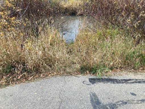
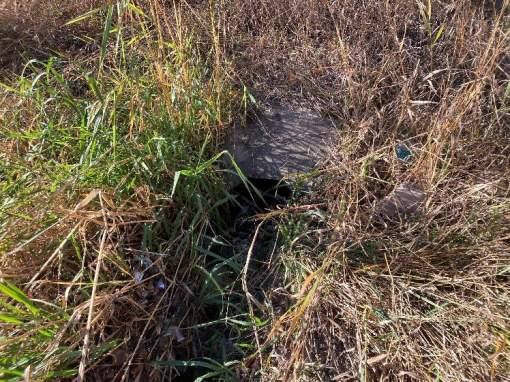
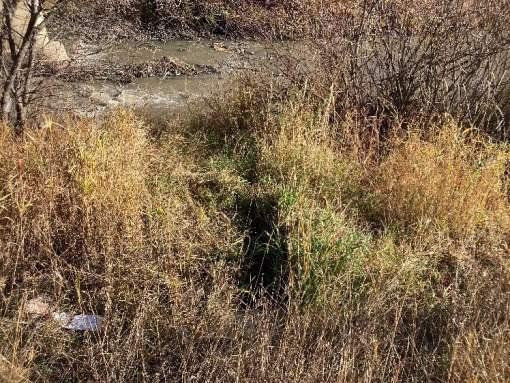
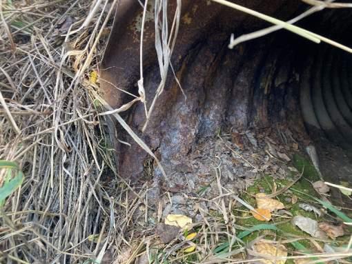
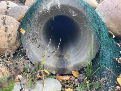
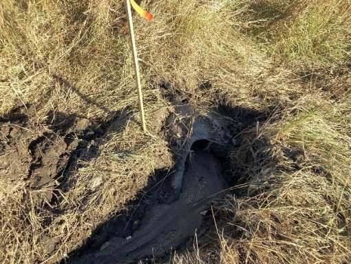
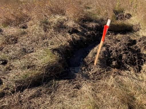
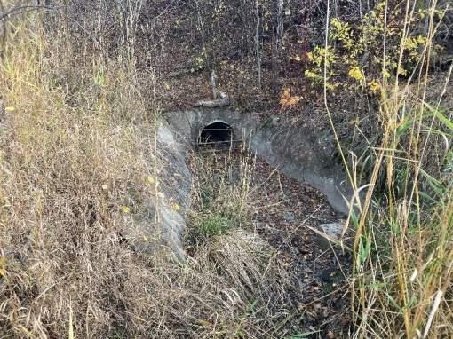
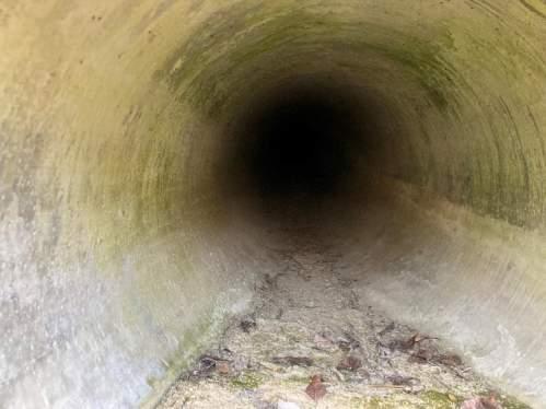
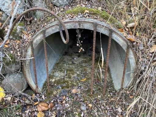
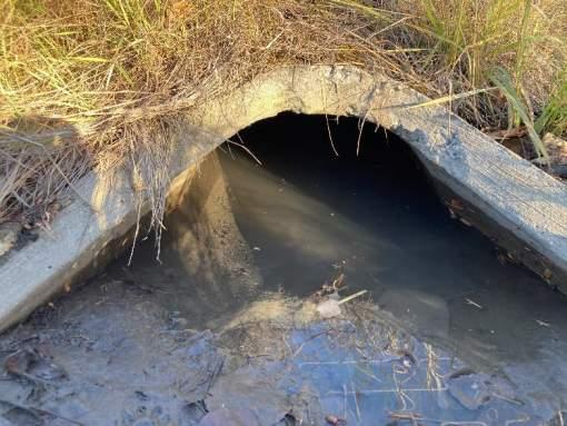
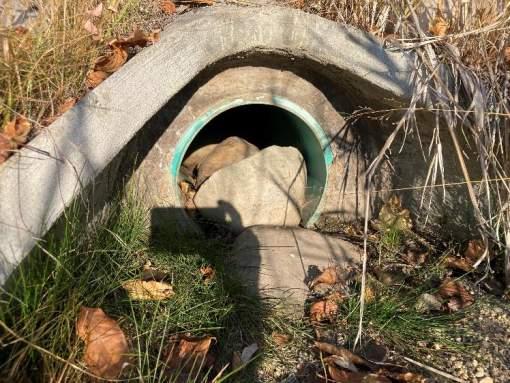
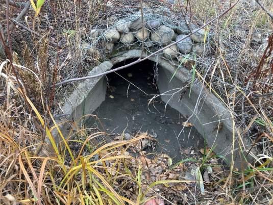
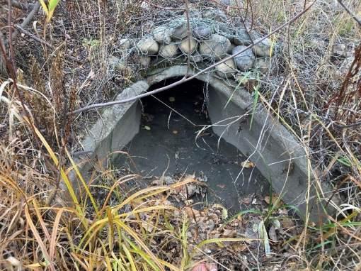
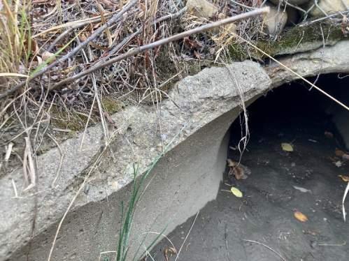
STORMWATER OUTFALL INSPECTION
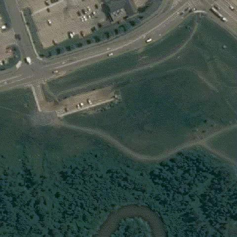
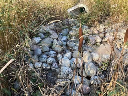
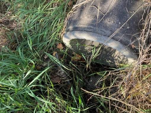
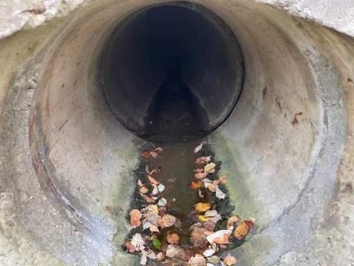
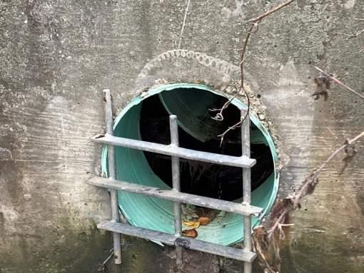
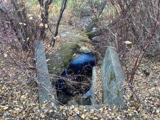
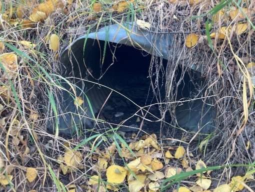
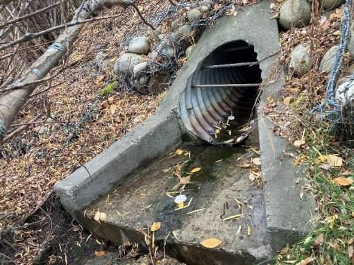
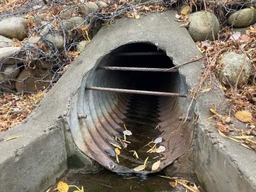
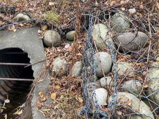
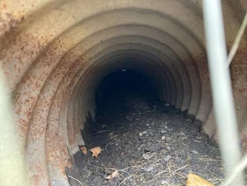
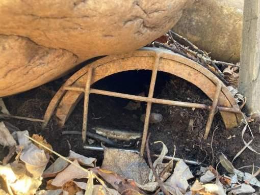
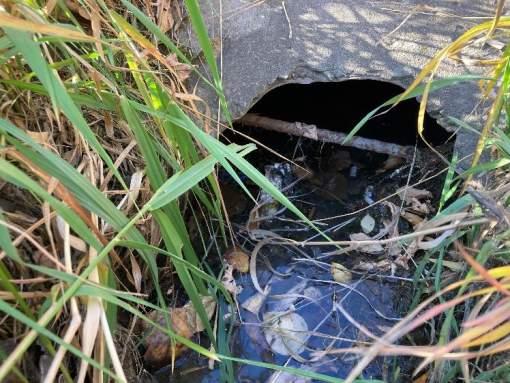
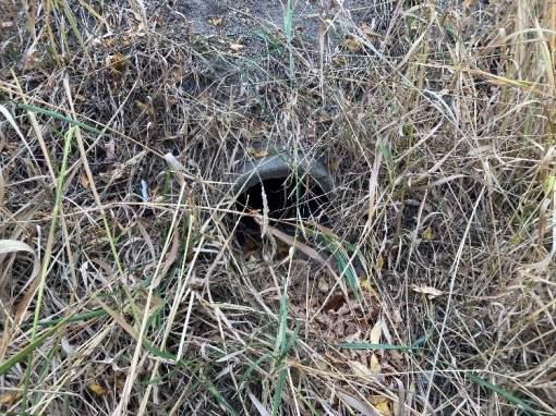
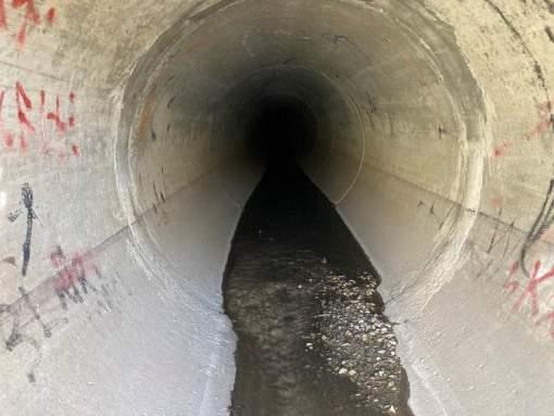
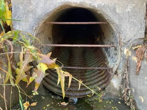
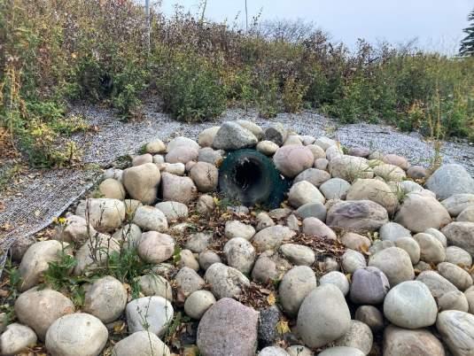
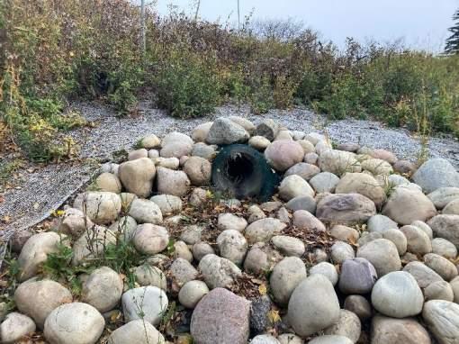
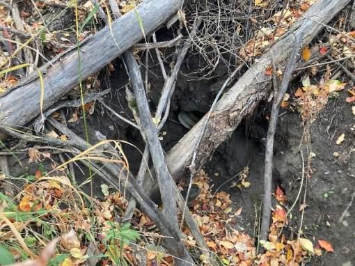
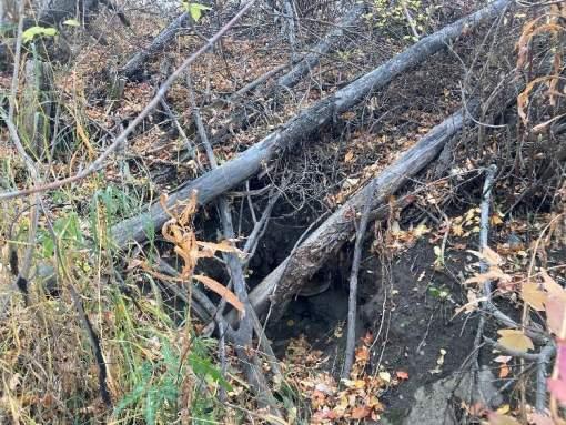
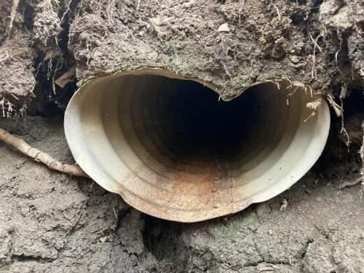
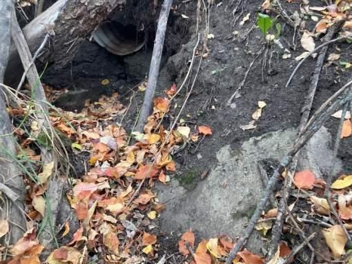
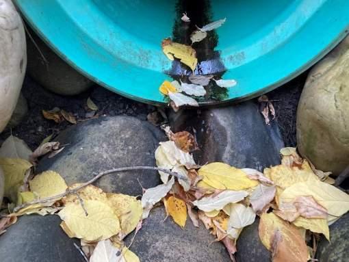
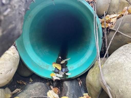
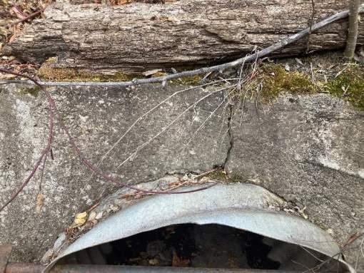
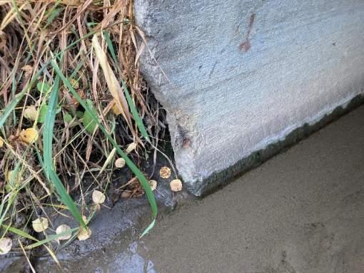
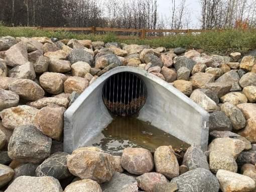
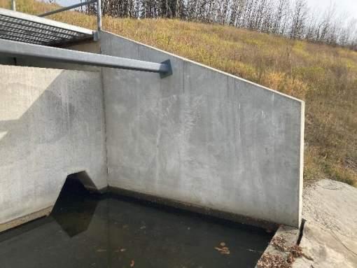
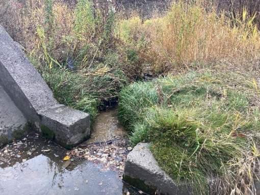
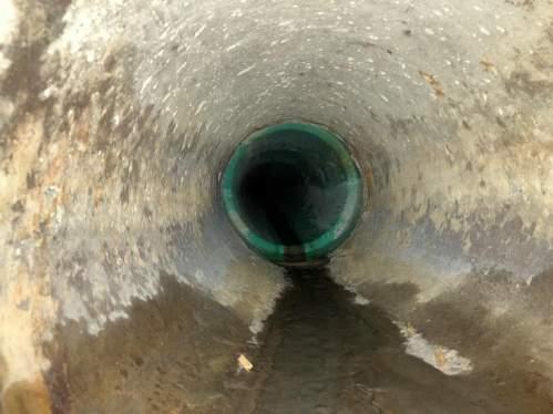
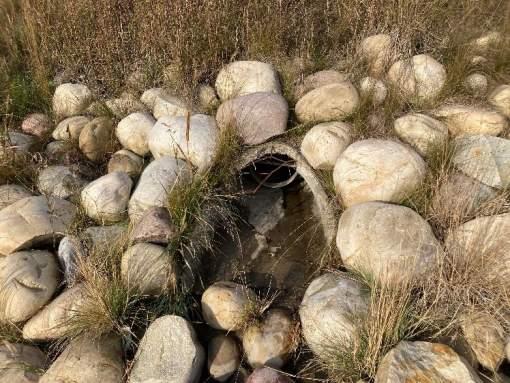
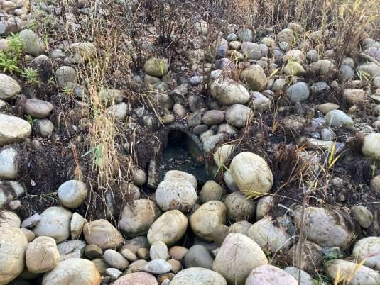
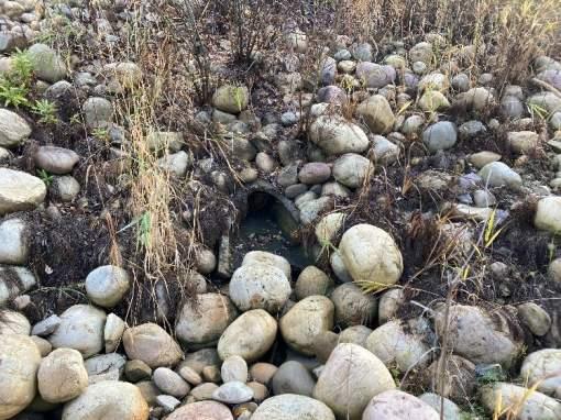
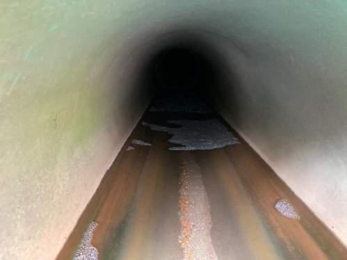
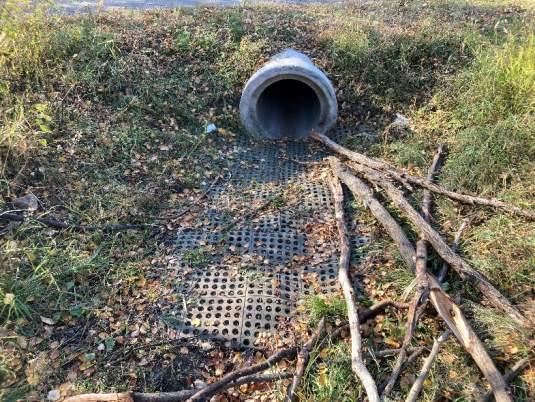
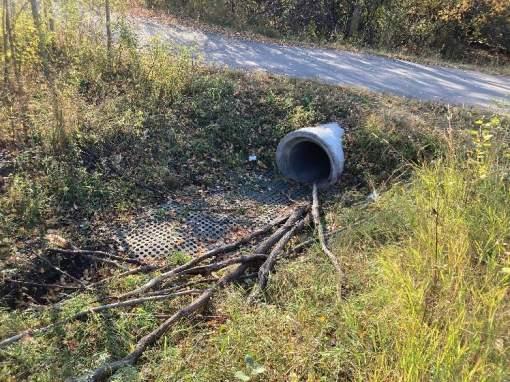
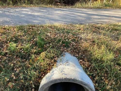
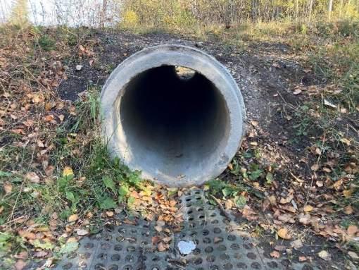
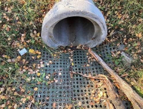
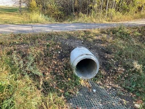
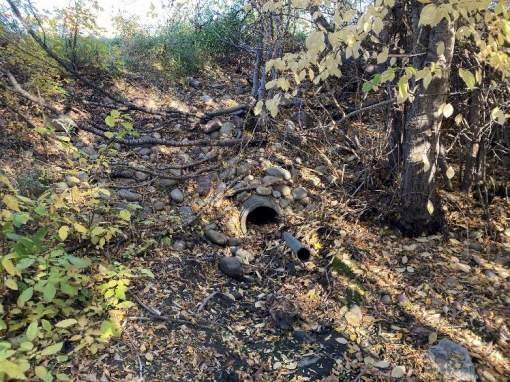
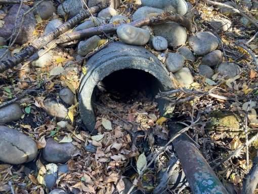
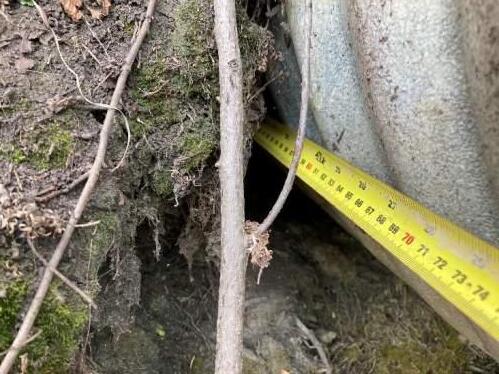
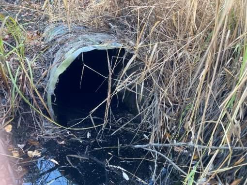
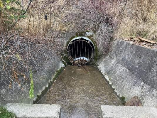
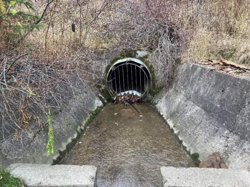
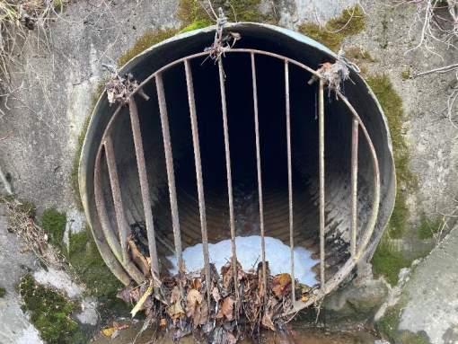
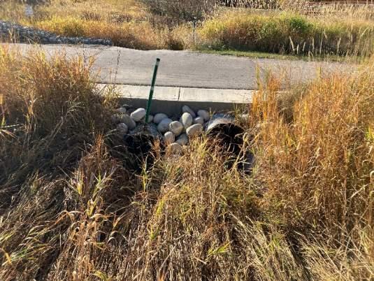
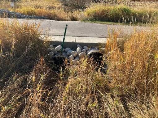
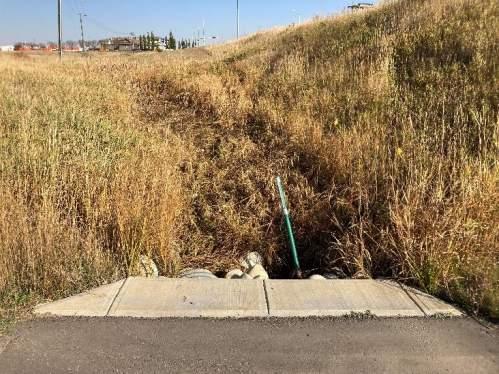
Outfall BR-1
Date Inspected: 10/17/2022 Last Inspected: 2017
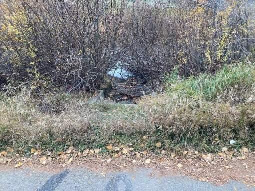
Location Description:
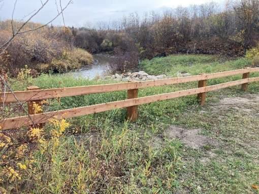
West side of Bear River - 150m north of 108 Street/116 Avenue bridge.
General Information
Ownership City
Constructed 2017
UTM Easting 383967
UTM Northing 6116625
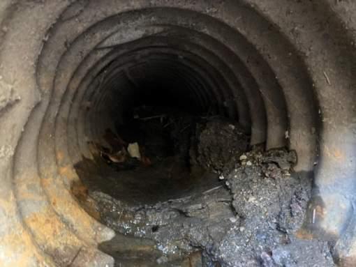
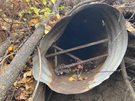
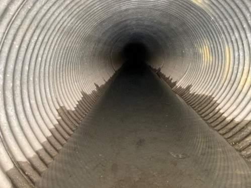
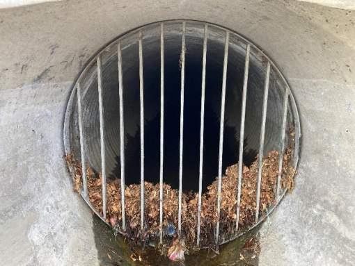
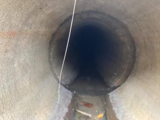
Pipe Size 1500
Pipe Material: CSP
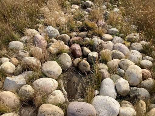
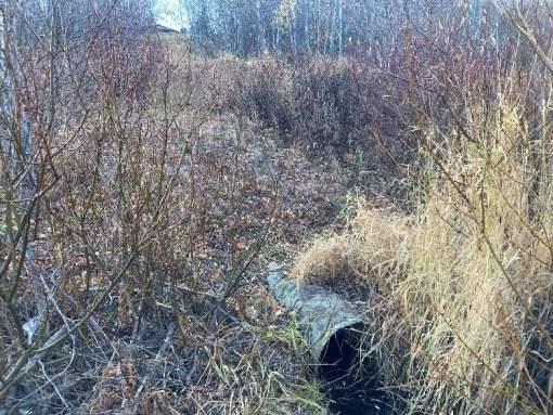
Site Conditions
Access Good - Gravel access road adjacent to outfall.
Sign NA Handrail Good - steel
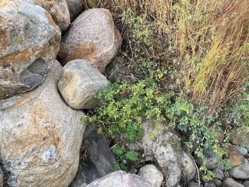
Upland Vegetation Good – Grassed and shrubs on slope.
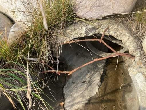
Outfall Structure and Sewer Conditions
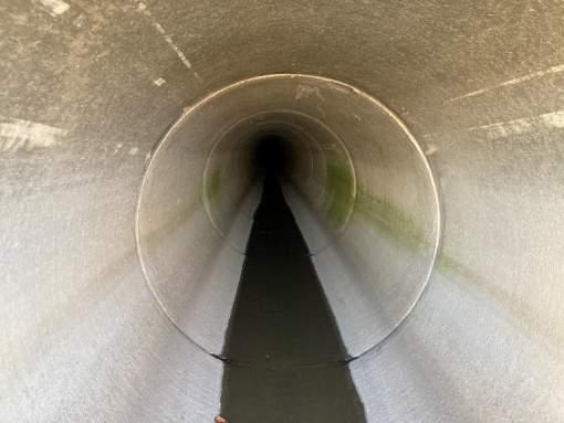
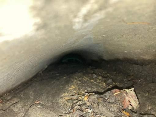
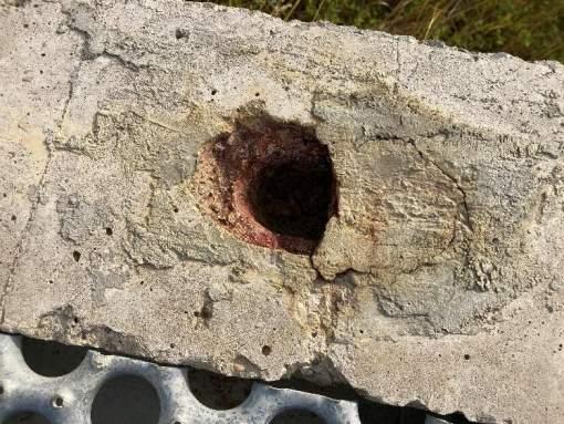
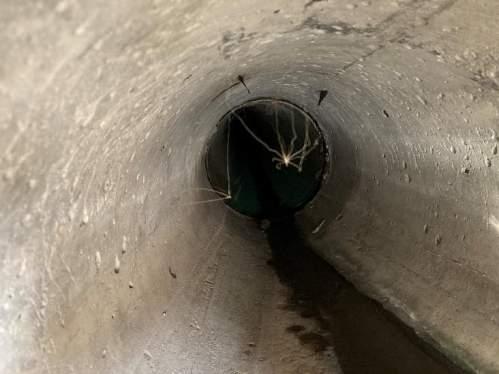
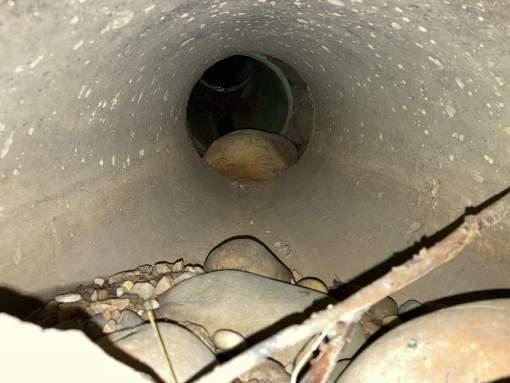
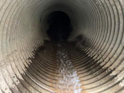
Pipe Condition Pipe inaccessible.
Pipe Exposed NA
Pipe Buried Minor sedimentation in settling basin.
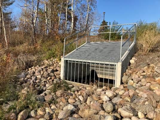
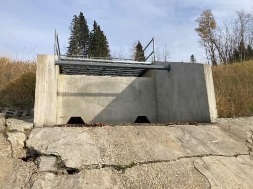
Structure Condition Good - New baffle structure.
Headwall Good - Precast impact baffle.
Wingwall Good - Precast impact baffle.
Retaining Wall NA
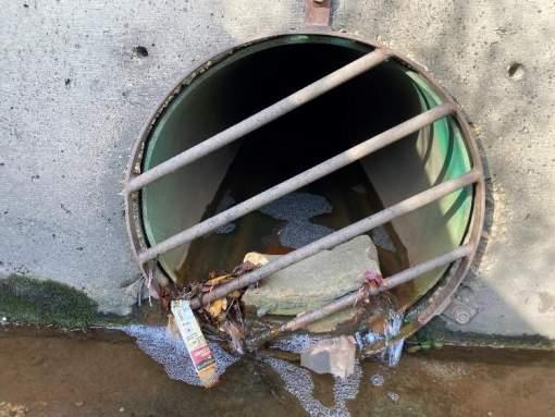
Grate Condition Good – Bolted
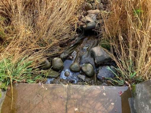
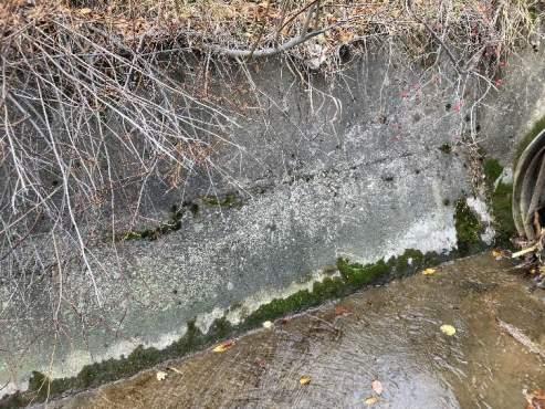
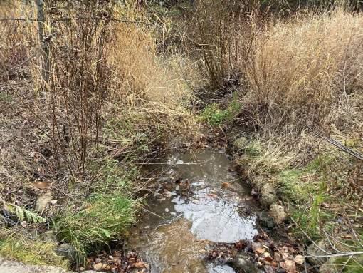
Outlet Channel and Receiving Watercourse
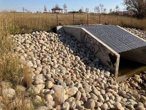
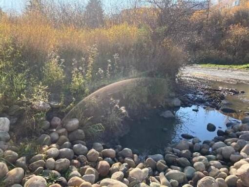
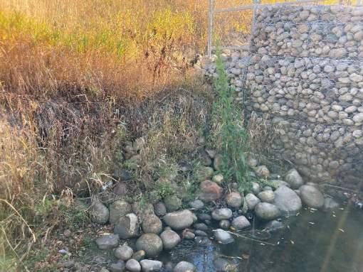
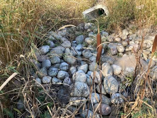
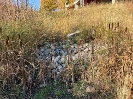
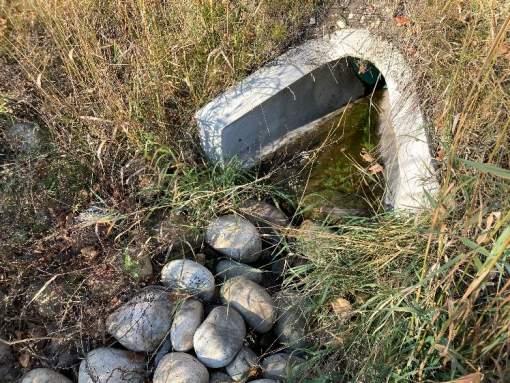
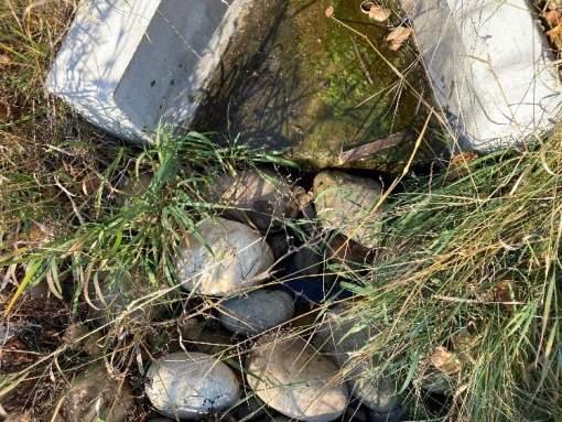
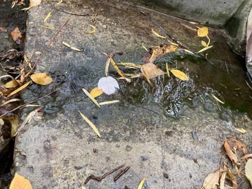
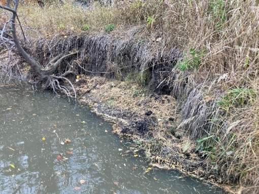
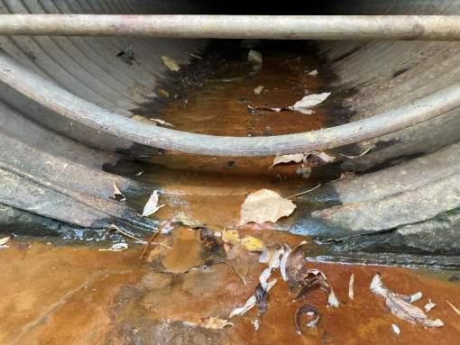
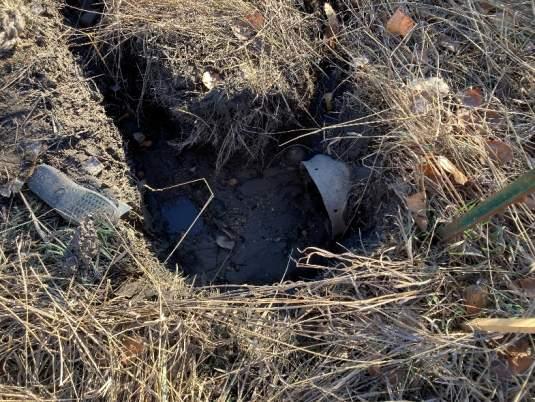
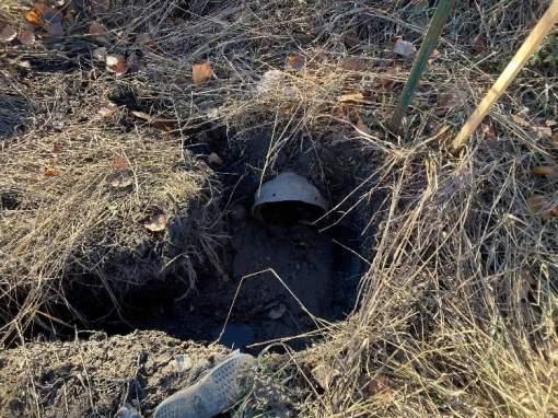
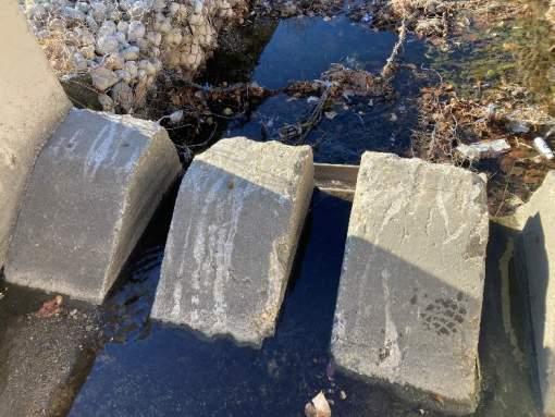
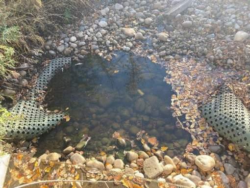
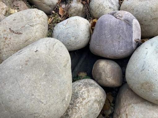
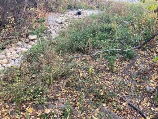
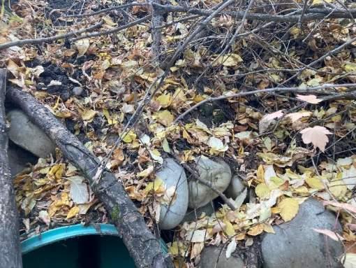
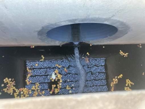
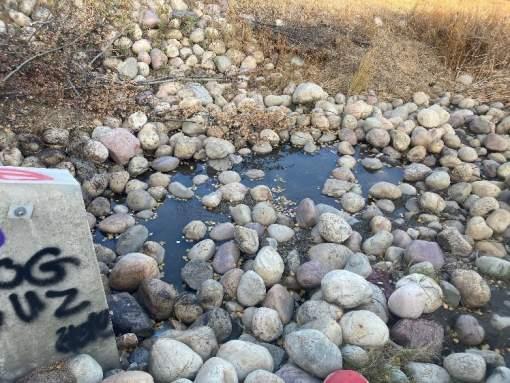
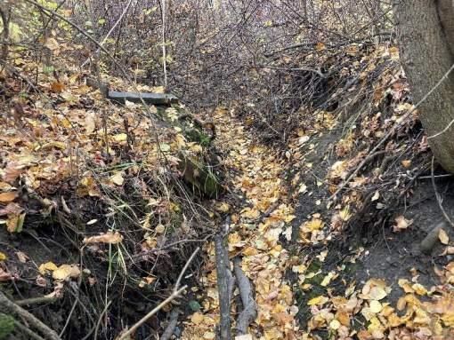
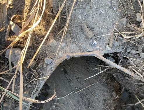
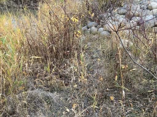
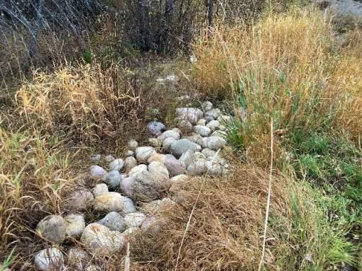
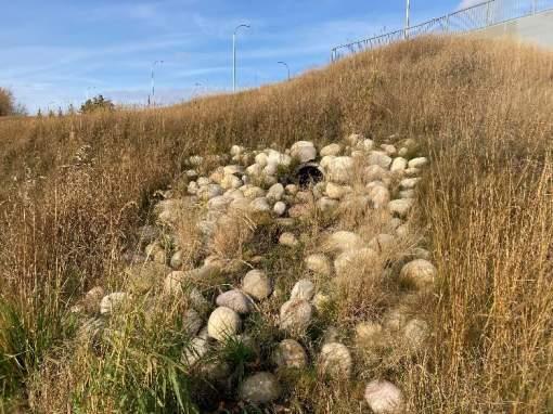
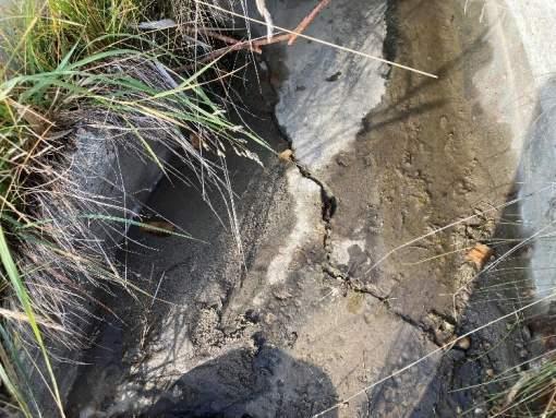
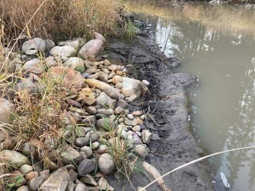
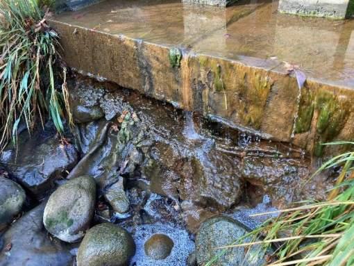
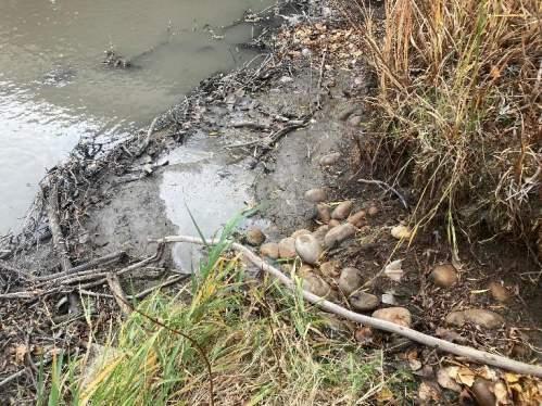
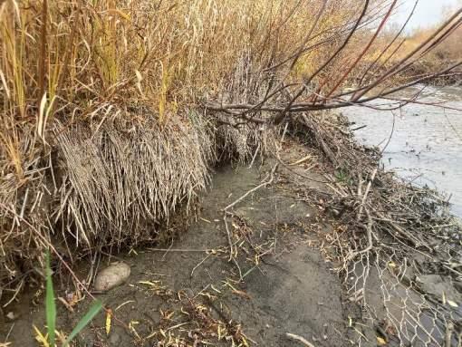
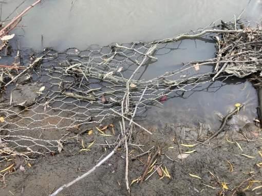
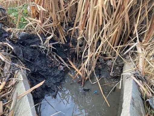
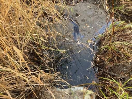
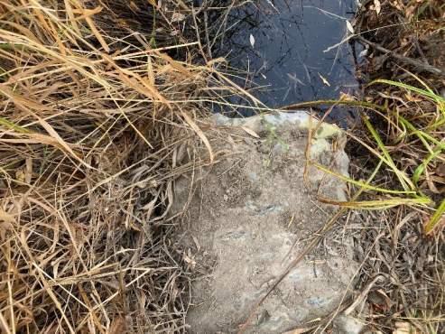
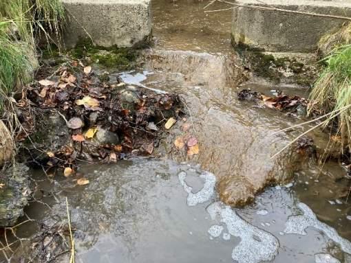
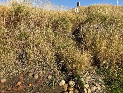
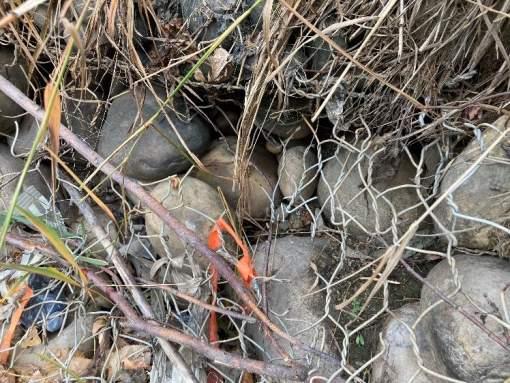
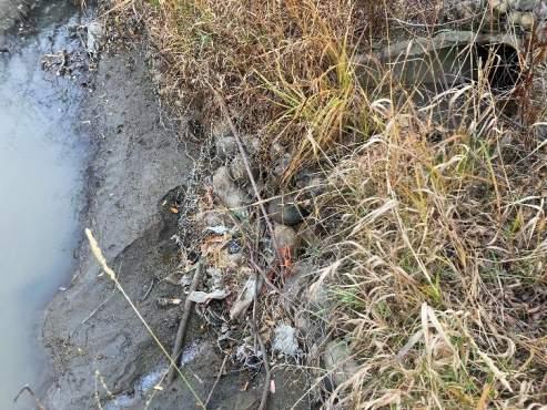
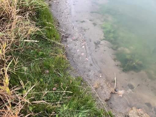
Riprap Condition Good - Riprap apron intact. Slight scour pool developed immediately downstream of baffle sill, does not impact hydraulics. Concentrated channel developing on left side of apron. Flow generally on surface of riprap apron. Class 1.
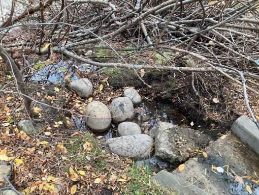
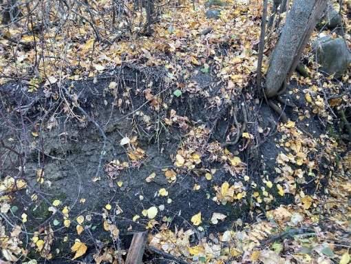
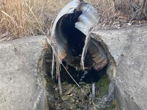
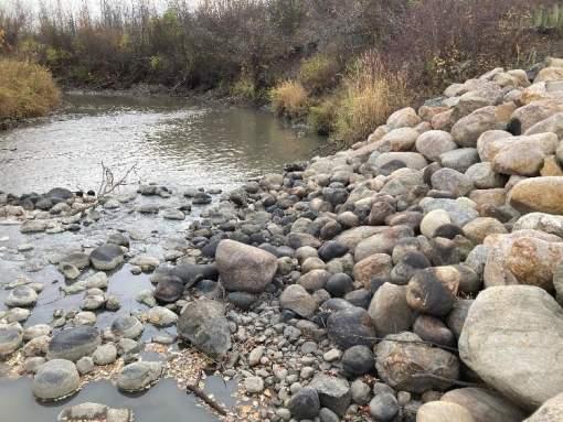
Bank Erosion Moderate - Upstream and downstream of apron. Exposed soils on banks and undercutting of river bank present.
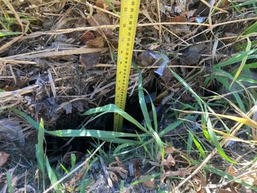
Scour Hole Minor - 15cm
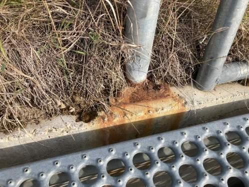
Erosion by Sewer Moderate - Flow concentration on downstream side of outfall eroding into the native river bank.
Erosion by River Minor - Slight displacement of riprap apron by creek flow.
Hazards and Damage
Safety Hazard Low
Level of Damage Minor
Type of Failure Sewer Erosion, River Erosion
Comments
• Concrete baffle in good condition.
• Riprap flanking sides of baffle structure in good condition - no evidence of overland flow issues.
• Apron shifting downstream by creek, directing sewer flow to left bank causing undercutting.
Recommendations
• Monitor riprap apron for further movement and ongoing river bank erosion.
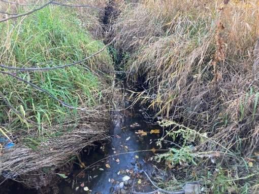
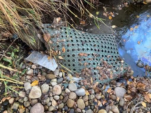
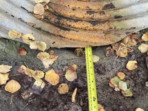
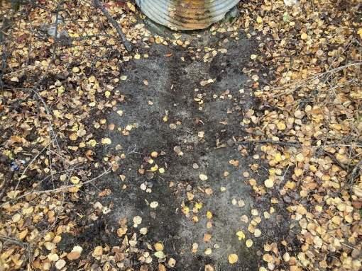
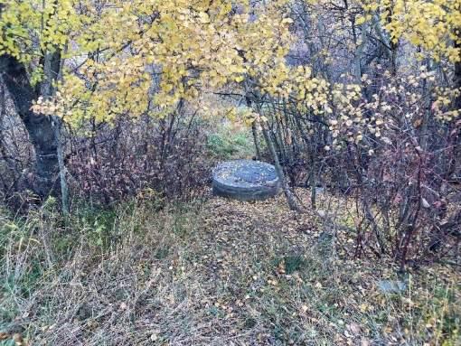
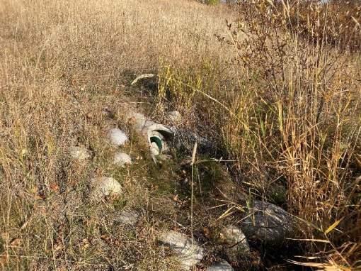
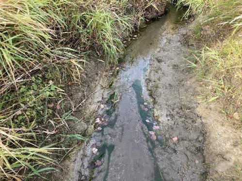
INSPECTION PHOTOS
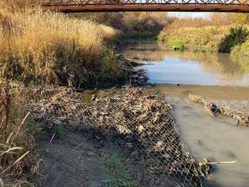
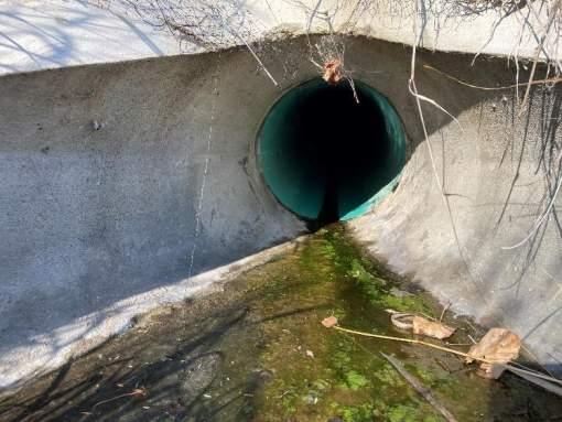
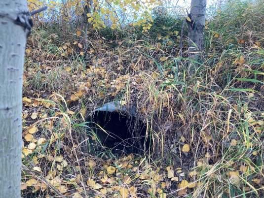
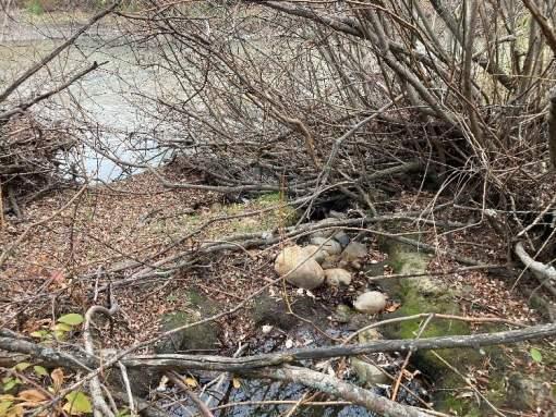
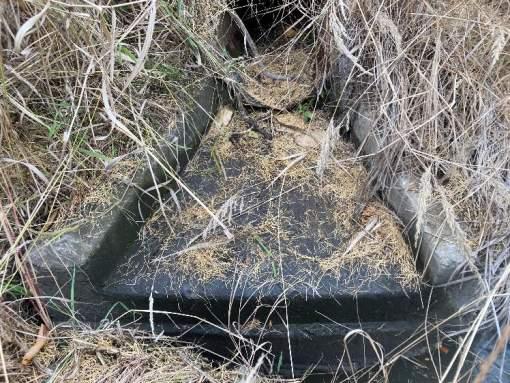
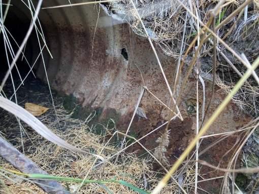
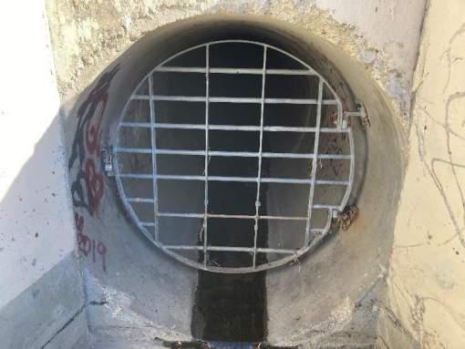
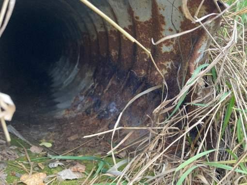
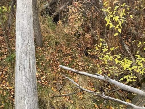
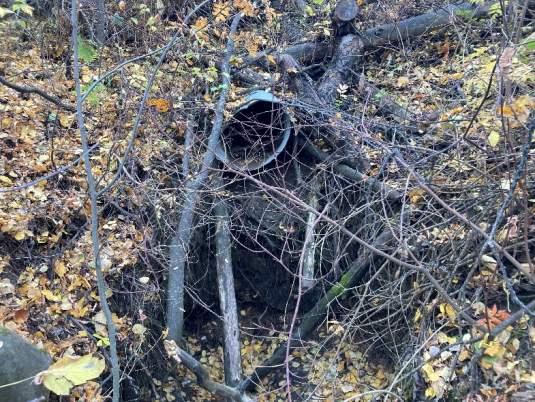
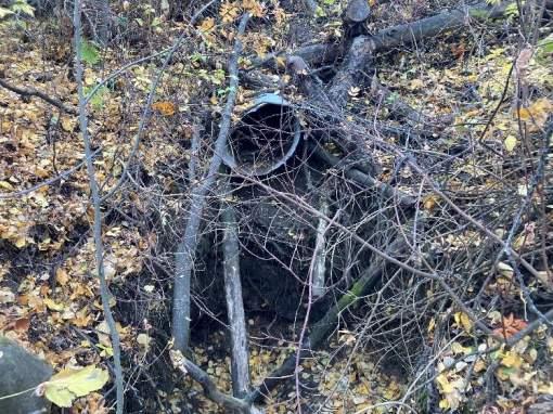
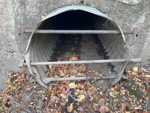
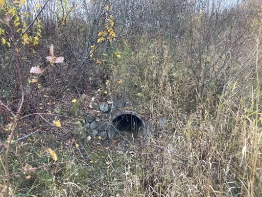
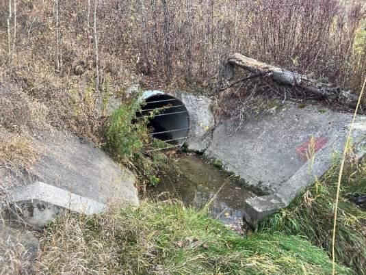
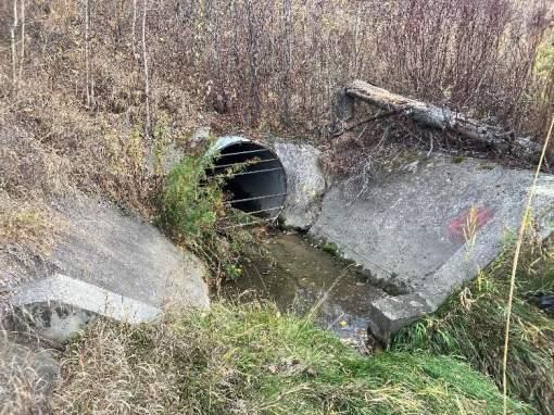
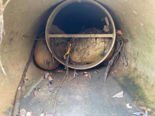
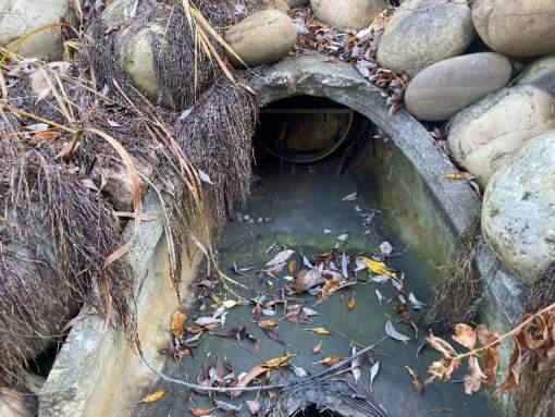
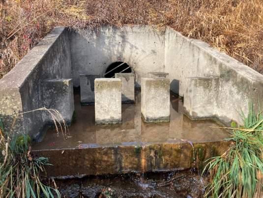
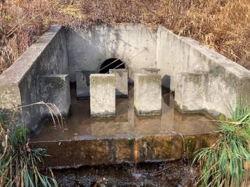
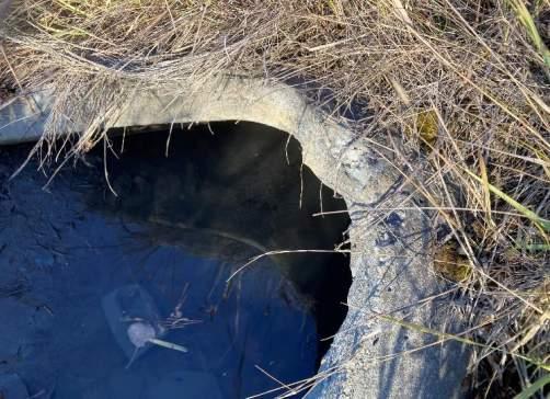
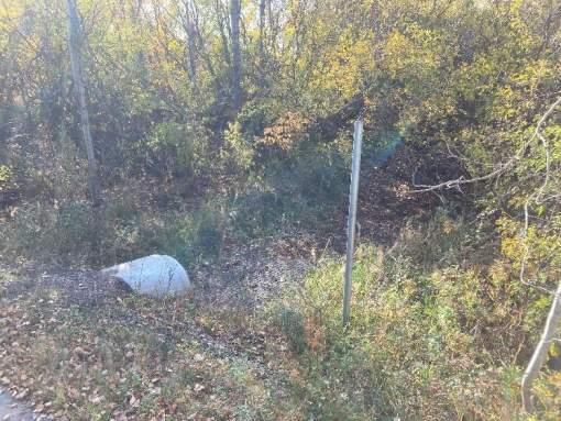
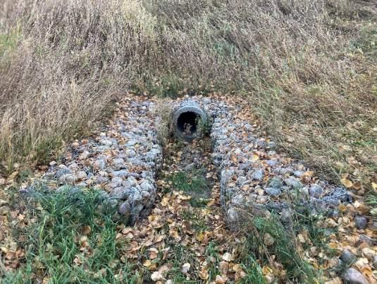
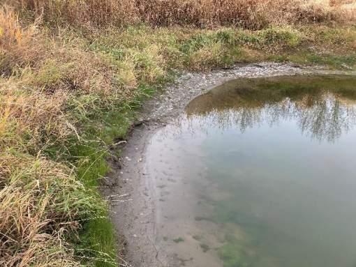
STORMWATER OUTFALL INSPECTION
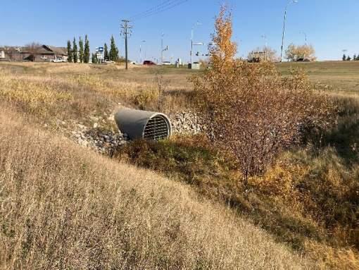
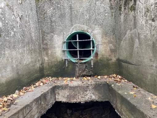
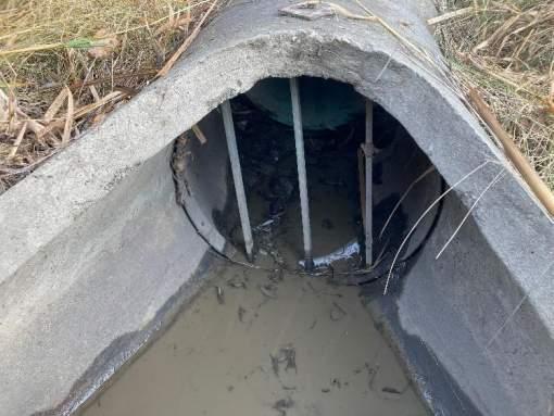
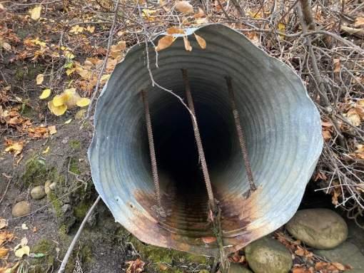
Outfall BR-2
Date Inspected: 10/17/2022 Last Inspected: 2017
Location Description:
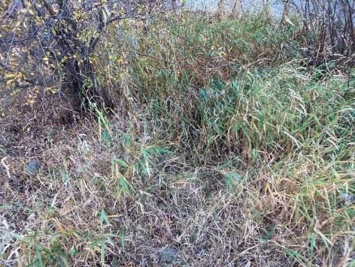
East side of Bear River - 40m north of 116 Ave. Outfall discharges into channel upstream of Bear River.
General Information
Ownership City
Constructed 1996
UTM Easting 384142
UTM Northing 6116686
Pipe Size 1800
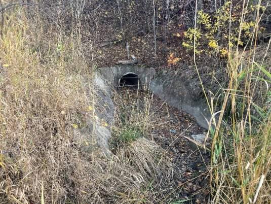
Pipe Material: Concrete
Site Conditions
Access Good - Adjacent to gravel access road.
Sign NA
Upland Vegetation Good - Grassed slope.
Outfall Structure and Sewer Conditions
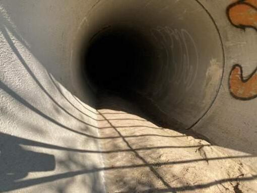
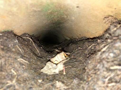
Handrail NA
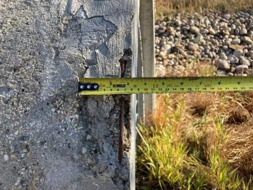
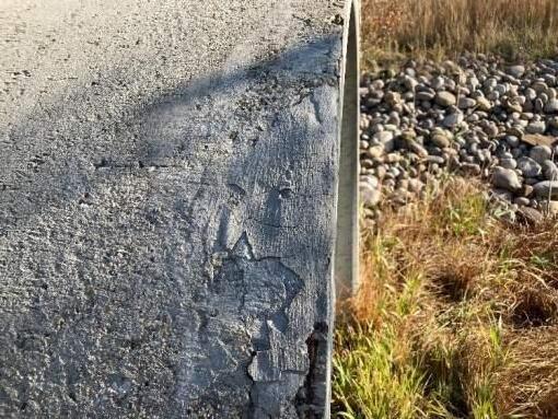
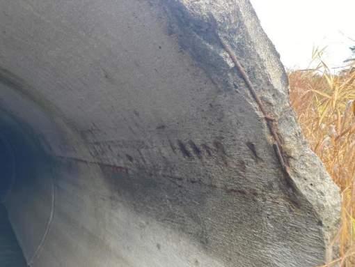
Pipe Condition Fair - Minor spalling on exposed edge, reinforcing steel exposed in small areas (15cm), appears to have been patched previously. Exposed joint on top of pipe at first segment.
Pipe Exposed Pipe protruding from bank.
Pipe Buried Moderate sedimentation in pipe - 15cm.
Structure Condition NA
Headwall NA
Wingwall NA
Retaining Wall NA
Grate Condition Good – Bolted
Outlet Channel and Receiving Watercourse
Riprap Condition Good - Riprap on channel banks - Class 1A/1.
Bank Erosion Minor - Slight erosion from overland flow on left side of outfall.
Scour Hole None
Erosion by Sewer None – Deposition of sediment in outlet channel.
Erosion by River None
Hazards and Damage
Safety Hazard None
Level of Damage Minor
Type of Failure None
Comments
• Concrete pipe discharging to constructed outlet channel.
• Concrete pipe showing signs of spalling on outside edge only.
• Pipe and outlet channel sedimented.
• Minor overland flow erosion present on left side of outfall.
Recommendations
• Monitor sedimentation in pipe and outlet channel.
• Clearing of downstream ditch in maintenance cycle.
INSPECTION PHOTOS
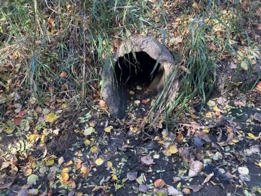
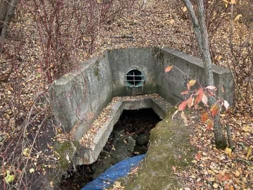
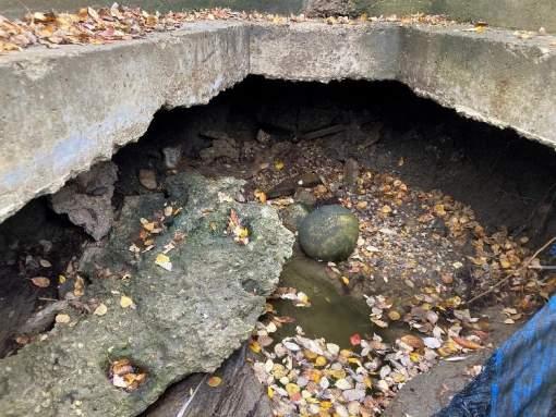
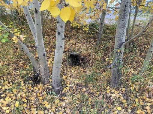
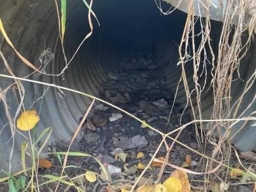
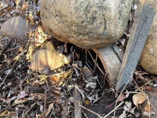
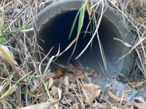
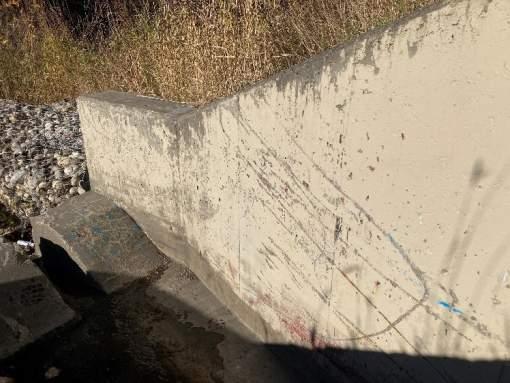
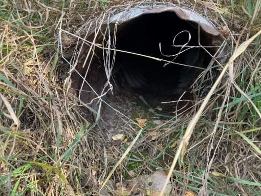
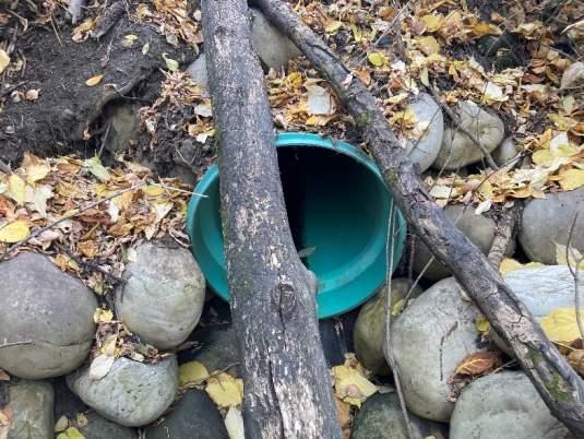
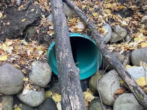
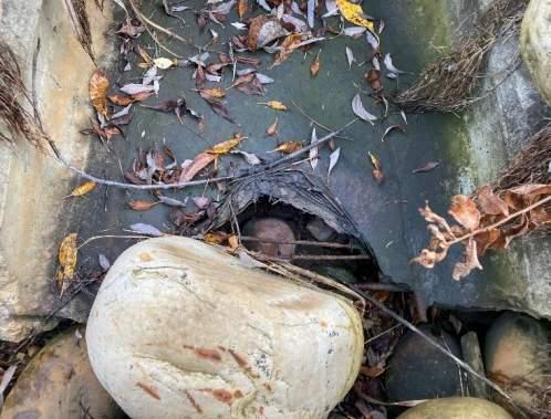
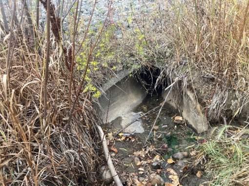
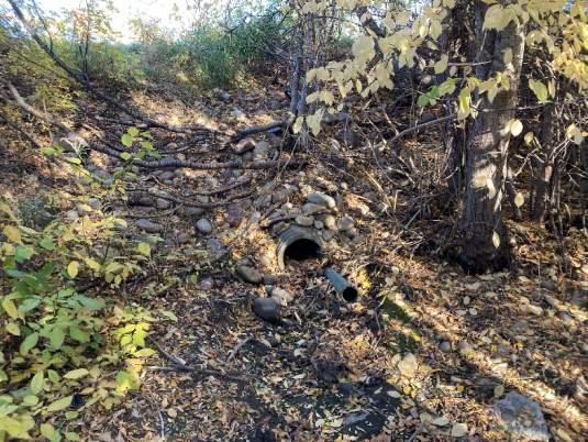
STORMWATER OUTFALL INSPECTION
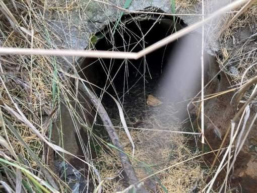
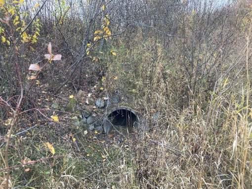
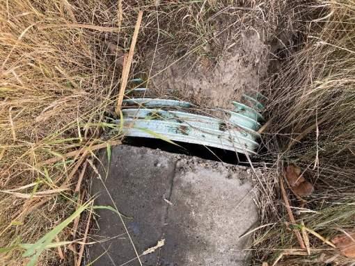
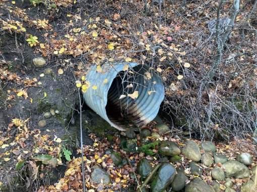
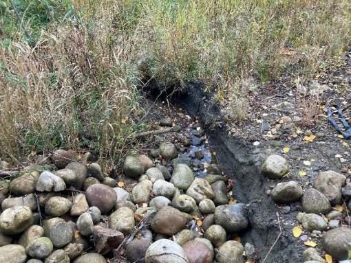
Outfall BR-3
Date Inspected: 10/17/2022 Last Inspected: 2017
Location Description:
West side of Bear River - 30m west of 108 Street. Outfall discharges into channel upstream of Bear River
General Information
Ownership City
Constructed 1996
UTM Easting 384035
UTM Northing 6116431
Pipe Size 1650
Pipe Material: Concrete
Site Conditions
Access Good - Adjacent to asphalt pathway.
Sign NA Handrail Fair - Chain link fence intact.
Upland Vegetation Good – Grassed slope
Outfall Structure and Sewer Conditions
Pipe Condition Fair
Pipe Exposed Pipe protruding from headwall.
Pipe Buried Pipe perched above apron.
Structure Condition NA
Headwall Fair - Gabion headwall not exhibiting signs of leaning, wire mesh appears to be in sound condition.
Wingwall Poor - Gabion wingwall on right of outfall bulging/leaning.
Structure Condition Poor - Concrete apron scoured 50mm at outlet. Pipe is undermined 40cm at apron, flow is getting behind headwall.
Headwall Poor - Full section cracking and reinforcing steel showing on edges.
Wingwall Fair
Retaining Wall NA
Grate Condition Fair - Steel bars
Outlet Channel and Receiving Watercourse
Riprap Condition Poor - Riprap displaced from bottom of apron and concrete rubble exposed at edge of River.
Bank Erosion Moderate - Undermining on creek banks adjacent to outfall structure.
Scour Hole Minor - 30cm
Erosion by Sewer Severe - Scouring of concrete apron, undermining of outlet structure and riprap displaced below outlet.
Erosion by River Minor - River flow likely contributing to riprap apron displacement.
Hazards and Damage
Safety Hazard Low
Level of Damage Severe
Type of Failure Sewer Erosion, Structural Damage
Comments
• Steep CSP pipe to concrete outfall structure with wingwalls and headwall at base of slope.
• Concrete apron is scouring and flow is entering behind the headwall, undermining the structure and causing sinkhole above headwall.
• Riprap apron displaced, and 600mm drop from outlet
• Likely influenced by seasonal flows from river.
Recommendations
• Replace outfall structure and riprap apron.
STORMWATER OUTFALL INSPECTION
Outfall BR-26
Date Inspected: 10/20/2022 Last Inspected: 2017
Location Description:
East side of Bear River - 30m west of 102 Street at end of 96 Avenue. Outfall at bottom of slope in trees.
General Information
Ownership City
Constructed 1960
UTM Easting 385210
UTM Northing 6114867
Pipe Size 400
Pipe Material: CSP
Site Conditions
Access Fair - Adjacent to grassed access road.
Sign NA Handrail NA
Upland Vegetation Good - Grassed and treed slope.
Outfall Structure and Sewer Conditions
Pipe Condition Poor - Heavy corrosion at outlet, section loss at invert.
Pipe Exposed Pipe protruding from bank.
Pipe Buried Minor sedimentation in pipe - 2.5cm.
Structure Condition NA
Headwall NA
Wingwall NA
Retaining Wall NA
Grate Condition NA
Outlet Channel and Receiving Watercourse
Riprap Condition NA
Bank Erosion None
Scour Hole None
Erosion by Sewer None
Erosion by River None
Hazards and Damage
Safety Hazard Low
Level of Damage Moderate
Type of Failure Structural Damage
Comments
• CSP outlets to well vegetated grass lined channel.
• CSP end section in poor condition and is heavily corroded at outlet.
• CSP outfall not shown on City GIS mapping, may be abandoned.
Recommendations
• Confirm operational status and decommission if abandoned.
INSPECTION
STORMWATER OUTFALL INSPECTION
Outfall BR-27
Date Inspected: 10/20/2022 Last Inspected: 2017
Location Description:
East side of Bear River - 5m from top of slope west of 102 Street at end of 94 Avenue. Outfall at mid-slope.
General Information
Ownership City
Constructed 2011
UTM Easting 385185
UTM Northing 6114691
Pipe Size 300
Pipe Material: PVC
Site Conditions
Access Poor - Heavy vegetation
Sign NA
Upland Vegetation Good - Grassed and treed slope.
Outfall Structure and Sewer Conditions
Pipe Condition Good
Pipe Exposed Pipe protuding from bank.
Pipe Buried Pipe perched above ground - 45cm.
Structure Condition NA
Headwall NA
Wingwall NA
Retaining Wall NA
Grate Condition NA
Handrail NA
Outlet Channel and Receiving Watercourse
Riprap Condition Fair - Riprap present at outlet in degraded channel
Bank Erosion None
Scour Hole Moderate - 40cm at outlet.
Erosion by Sewer
Moderate - Scour hole and outlet channel downcutting on slope. Riprap settled in bottom of channel and informal flow path down slope.
Erosion by River None
Hazards and Damage
Safety Hazard Low
Level of Damage Minor
Type of Failure Sewer Erosion
Comments
• PVC outlet mid slope to informal outlet channel down slope.
• Erosion at outlet channel and poor riprap protection with no defined path down slope.
• Flow may seep underground as sinkhole found 10m downslope of outfall.
• Small catchment area with infrequent flow.
Recommendations
• Repair riprap armouring (hand place) to mitigate scouring and immediate erosion.
• Monitor slope for degrading condition and further erosion concerns.
STORMWATER OUTFALL INSPECTION
Outfall BR-28
Date Inspected: 10/20/2022 Last Inspected: 2017
Location Description:
East side of Bear River - 5m from top of slope west of 102 Street at end of 94 Avenue. Outfall at mid-slope.
General Information
Ownership City
Constructed 2021
UTM Easting 385177
UTM Northing 6114535
Pipe Size 600
Pipe Material: CSP
Site Conditions
Access Good - Grassed 3:1 slope.
Sign Post without sign Handrail NA
Upland Vegetation Poor - Exposed erosion control blanketing.
Outfall Structure and Sewer Conditions
Pipe Condition Fair - Surface discolouration at invert.
Pipe Exposed NA
Pipe Buried NA
Structure Condition Good - Precast outlet structure
Headwall Good - Precast concrete
Wingwall Good - Precast concrete
Retaining Wall NA
Grate Condition NA
Outlet Channel and Receiving Watercourse
Riprap Condition Fair - Riprap lined plunge pool in good condition, riprap partially mobilized and displaced downstream.
Bank Erosion Severe - Bank of receiving channel eroding - shoremat displaced and loose.
Scour Hole Minor - 30cm at outlet.
Erosion by Sewer
Severe - Riprap apron and shoremat lining displaced at outlet, downstream channel has severe bank erosion and undercutting.
Erosion by River None
Hazards and Damage
Safety Hazard Moderate
Level of Damage Moderate
Type of Failure Sewer Erosion
Comments
• CSP pipe with new headwall and wing wall structure
• Scour pool developing with smaller sized riprap displaced downstream.
• Shoremat lining undermined and loose.
• Receiving channel significantly eroded with undercut banks.
Recommendations
• Restore riprap apron and shoremat system at outfall.
• Topsoil and seed on upland area and channel banks to establish vegetation.
• Remove and dispose of excess erosion control blanket netting.
STORMWATER OUTFALL INSPECTION
Outfall BR-30
Date Inspected: 10/20/2022 Last Inspected: 2017
Location Description:
East side of Bear River - 30m west of 102 Street at end of 92 Avenue - Outfall near bottom of slope in long grass below cluster of bushes.
General Information
Ownership City
Constructed Unknown
UTM Easting 385271
UTM Northing 6114476
Pipe Size 300
Pipe Material: PVC
Site Conditions
Access Good - Grassed 3:1 slope.
Sign NA Handrail NA
Upland Vegetation Good - Grassed slope
Outfall Structure and Sewer Conditions
Pipe Condition Fair - Minor damage of exposed end.
Pipe Exposed Pipe protruding from bank.
Pipe Buried Pipe flush with ground.
Structure Condition NA
Headwall NA
Wingwall NA
Retaining Wall NA
Grate Condition NA
Outlet Channel and Receiving Watercourse
Riprap Condition NA
Bank Erosion None
Scour Hole None
Erosion by Sewer Moderate - Downcutting outlet channel in grass.
Erosion by River None
Hazards and Damage
Safety Hazard Moderate - Tripping hazard in long grass.
Level of Damage Minor
Type of Failure None
Comments
• PVC pipe protruding from slope.
• Lots of vegetation and debris at outlet.
• Small catchment with infrequent flows.
• Informal outlet channel has been formed by flows on exposed soils within well vegetated area.
Recommendations
• Clear woody debris and excess vegetation from outfall.
• Monitor for excessive vegetation growth.
STORMWATER OUTFALL INSPECTION
Outfall BR-33
Date Inspected: 10/21/2022 Last Inspected: 2017
Location Description:
East side of Bear River - 20 west of 102 Street at end of 90 Ave - Outfall at mid-slope.
General Information
Ownership City
Constructed 2021 (Replaced)
UTM Easting 385302
UTM Northing 6114267
Pipe Size 250
Pipe Material: Concrete
Site Conditions
Access Good - Grassed 3:1 slope.
Sign Post without sign Handrail NA
Upland Vegetation Poor - Exposed erosion control blanketing.
Outfall Structure and Sewer Conditions
Pipe Condition Good
Pipe Exposed Pipe protruding from bank.
Pipe Buried Pipe flush with ground.
Structure Condition NA
Headwall NA
Wingwall NA
Retaining Wall NA
Grate Condition NA
Outlet Channel and Receiving Watercourse
Riprap Condition Good - Steep riprap lined outlet channel with no signs of mobilization.
Bank Erosion None
Scour Hole None
Erosion by Sewer None
Erosion by River None
Hazards and Damage
Safety Hazard Low
Level of Damage Minor
Type of Failure None
Comments
• Concrete pipe protruding out of bank with riprap lined outlet spillway to base of slope.
• Riprap (Class 1) in good condition with some areas of filter fabric visible.
• Slope adjacent and above outlet poor vegetation uptake with exposed erosion control blanket.
Recommendations
• Fill voids in riprap (hand place) spillway where geotextile is visible.
• Add topsoil and reseed where vegetation coverage is poor.
• Remove excess netting from erosion control blanket
INSPECTION PHOTOS
STORMWATER OUTFALL INSPECTION
Outfall BR-34
Date Inspected: 10/21/2022 Last Inspected: 2017
Location Description:
East side of Bear River - 10m west of 102 Street at end of 89 Ave - Outlet at mid-slope in trees, north of outfall 35.
General Information
Ownership City
Constructed Unknown
UTM Easting 385332
UTM Northing 6114212
Pipe Size 300
Pipe Material: CSP
Site Conditions
Access Poor - Heavy vegetation and steep slope.
Sign NA Handrail NA
Upland Vegetation Good - Grassed and treed slope.
Outfall Structure and Sewer Conditions
Pipe Condition Poor - End of pipe collapsed (50%).
Pipe Exposed Pipe protruding from bank.
Pipe Buried Pipe perched above ground.
Structure Condition NA
Headwall NA
Wingwall NA
Retaining Wall NA
Grate Condition NA
Outlet Channel and Receiving Watercourse
Riprap Condition NA
Bank Erosion Moderate - Exposed soils eroding in vicinity of outfall.
Scour Hole Minor - 15cm at outlet
Erosion by Sewer Moderate - Scour hole and downcutting at outlet in bare soil, minor downcutting along flow path to base of slope.
Erosion by River None
Hazards and Damage
Safety Hazard Low
Level of Damage Severe
Type of Failure Sewer Erosion, Structural Damage
Comments
• CSP pipe protruding from slope.
• Pipe is collapsed at outlet and bank is eroding adjacent to outlet.
• Scour pool developed in bare soil.
• Flows disperse at base of slope into wooded area.
• Outfall may be abandoned.
Recommendations
• Confirm operational status, and decommission if abandoned.
INSPECTION PHOTOS
STORMWATER OUTFALL INSPECTION
Outfall BR-35
Date Inspected: 10/21/2022 Last Inspected: 2017
Location Description:
East side of Bear River - 10m west of 102 Street at end of 89 Ave - Outlet near top of slope in trees.
General Information
Ownership City
Constructed Unknown
UTM Easting 385331
UTM Northing 6114179
Pipe Size 500
Pipe Material: PVC
Site Conditions
Access Poor - Heavy vegetation and steep slope.
Sign NA Handrail NA
Upland Vegetation Fair - Grassed slope with exposed soils adjacent and above outfall.
Outfall Structure and Sewer Conditions
Pipe Condition Good
Pipe Exposed Pipe protruding from bank.
Pipe Buried Pipe perched above ground.
Structure Condition NA
Headwall NA
Wingwall NA
Retaining Wall NA
Grate Condition NA
Outlet Channel and Receiving Watercourse
Riprap Condition Fair - Steep riprap lined outlet channel with some displacement noted and filter fabric visible.
Bank Erosion Moderate - Exposed soils eroding in vicinity of outfall, root structure helping to retain soil.
Scour Hole Minor
Erosion by Sewer Moderate - Riprap displaced at outfall and downcutting in outlet channel.
Erosion by River None
Hazards and Damage
Safety Hazard Low
Level of Damage Minor
Type of Failure Sewer Erosion
Comments
• PVC outlets 3m below top of bank mid-slope to riprap lined channel.
• Woody debris prevalent in channel and some displacement of riprap noted.
• Steep outlet channel exhibiting some downcutting beyond riprap lining.
Recommendations
• Monitor outlet channel for erosion and vegetation/debris accumulation.
STORMWATER OUTFALL INSPECTION
Outfall BR-37
Date Inspected: 10/20/2022 Last Inspected: 2017
Location Description:
West side of Bear River - Canfor ditch outlet.
General Information
Ownership City
Constructed 2015
UTM Easting 385084
UTM Northing 6114071
Pipe Size 1200
Pipe Material: PVC
Site Conditions
Access Good - Adjacent to grassed access road.
Sign NA Handrail Good - steel
Upland Vegetation Good - Grassed slope
Outfall Structure and Sewer Conditions
Pipe Condition Good
Pipe Exposed NA
Pipe Buried NA
Structure Condition Good - Impact baffle, minor section loss at edge of sill concentrating flow.
Headwall Good - Precast impact baffle.
Wingwall Good - Precast impact baffle.
Retaining Wall NA
Grate Condition Good - Impact baffle grate.
Outlet Channel and Receiving Watercourse
Riprap Condition Good - Minor displacement evident, flow is on surface with voids filled with gravel, bank riprap vegetated and in good condition. Mix Class 1 and Class 2.
Bank Erosion Severe - Receiving channel has significant bank erosion.
Scour Hole Minor
Erosion by Sewer
Moderate - Riprap apron in good condition with minor movement. Downstream channel bank erosion, 1.8m high straight banks and undercut.
Erosion by River None
Hazards and Damage
Safety Hazard Low
Level of Damage Minor
Type of Failure Sewer Erosion
Comments
• Impact baffle structure discharging to outlet channel.
• Riprap banks are stable and vegetated.
• Minor scour hole developing at outlet and 600mm drop from sill of impact baffle to bottom of hole.
• Constant flow.
• Downstream receiving channel has heavy erosion, channel may stabilize to the increased flows from catchment via widening over time.
Recommendations
• Monitor riprap at base of outlet for further movement.
• Monitor ongoing receiving channel degradation.
INSPECTION PHOTOS
Outfall
STORMWATER OUTFALL INSPECTION
Outfall BR-38
Date Inspected: 10/21/2022 Last Inspected: 2009
Location Description:
East side of Bear River - Outfall near top of slope at end of 85 Avenue in trees.
General Information
Ownership City
Constructed 1972
UTM Easting 385290
UTM Northing 6113733
Pipe Size 450
Pipe Material: CSP
Site Conditions
Access Poor - Heavy vegetation
Sign NA
Upland Vegetation Good - Grassed and treed slope.
Outfall Structure and Sewer Conditions
Handrail NA
Pipe Condition Poor - Moderate corrosion, end damaged and ovaled pipe.
Pipe Exposed Protruding from bank.
Pipe Buried Pipe perched above ground - 1.5m.
Structure Condition NA
Headwall NA
Wingwall NA
Retaining Wall NA
Grate Condition Poor - Steel bars broken.
Outlet Channel and Receiving Watercourse
Riprap Condition NA
Bank Erosion Severe - Steep slope with exposed soils.
Scour Hole 1.5m
Erosion by Sewer Severe - Large scour hole developed at outlet and downcutting and undercutting of outlet channel down steep slope.
Erosion by River None
Hazards and Damage
Safety Hazard Low
Level of Damage Severe
Type of Failure Sewer Erosion, Structural Damage
Comments
• CSP outfall discharging mid-slope in heavily wooded area.
• Large scour hole and steep incised outlet channel down slope with tree root structures helping retain soil.
• Outlet is undermined.
• Small drainage catchment with infrequent flows.
• Outfall was not found during last study and has very difficult access.
Recommendations
• Decommission outfall and re-direct drainage catchment, or
• Replace damaged CSP end section with appropriate outlet channel erosion protection.
STORMWATER OUTFALL INSPECTION
Outfall BR-39
Date Inspected: 10/21/2022 Last Inspected: 2017
Location Description:
East of Bear River - 200m west of 102 Street - outfall is culvert crossing asphalt pathway.
General Information
Ownership City
Constructed 2021
UTM Easting 385209
UTM Northing 6113799
Pipe Size 450
Pipe Material: Concrete
Site Conditions
Access Good - Adjacent to asphalt pathway.
Sign Post without sign Handrail NA
Upland Vegetation Poor - Exposed soils on pathway embankment on downstream side.
Outfall Structure and Sewer Conditions
Pipe Condition Good
Pipe Exposed Protruding from bank.
Pipe Buried Pipe flush with ground.
Structure Condition NA
Headwall NA
Wingwall NA
Retaining Wall NA
Grate Condition NA
Outlet Channel and Receiving Watercourse
Riprap Condition Fair - Upstream riprap with sediment and gravel deposit from incoming flows. Downstream steep apron with erosion and visible filter cloth at end of riprap.
Bank Erosion Moderate - Upstream erosion of incoming channel from outfall 64. Downstream bank ongoing erosion due to overland flow from pathway.
Scour Hole None
Erosion by Sewer Minor - Erosion downstream of riprap treatment.
Erosion by River None
Hazards and Damage
Safety Hazard Low
Level of Damage Low
Type of Failure Sewer Erosion
Comments
• Concrete pipe crossing pathway with riprap end treatment at each side.
• Incoming flow from outfall 64 causing erosion in upstream channel.
• Downstream riprap good condition with localized erosion at transition to natural channel.
• Overland flow erosion on downstream side of pathway.
Recommendations
• Hydro mulch pathway embankment.
• Formalize upstream channel from outfall 64 to mitigate erosion.
• Armour spillway for overland flows from pathway to mitigate erosion of embankment.
• This outfall is actually a culvert along the flow path from BR-38 and should be re-classified as a culvert.
INSPECTION PHOTOS
STORMWATER OUTFALL INSPECTION
Outfall BR-40
Date Inspected: 10/21/2022 Last Inspected: 2017
Location Description:
East of Bear River - 15m south of 84 Avenue. Outfall at mid-slope of road embankment.
General Information
Ownership City
Constructed 2000
UTM Easting 385179
UTM Northing 6113627
Pipe Size 450
Pipe Material: PVC
Site Conditions
Access Fair - Grassed 3:1 slope
Sign NA
Upland Vegetation Good - Grassed slope
Outfall Structure and Sewer Conditions
Handrail NA
Pipe Condition Poor - Pipe separated from flared end.
Pipe Exposed NA
Pipe Buried Pipe fully buried, exposed by City.
Structure Condition Poor - Concrete flared end damage and section loss, exposed rebar.
Headwall NA
Wingwall NA
Retaining Wall NA
Grate Condition NA
Outlet Channel and Receiving Watercourse
Riprap Condition NA
Bank Erosion None
Scour Hole None
Erosion by Sewer None
Erosion by River None
Hazards and Damage
Safety Hazard Low
Level of Damage Moderate
Type of Failure Sedimentation
Comments
• Concrete flared end discharging mid-slope.
• Outfall completely buried and exposed by City.
• Infrequent flows from 84 Avenue road surface.
Recommendations
• Remove sedimentation from outfall and establish apron to base of slope.
• Repair concrete flared end and exposed rebar.
• Flush and inspect pipe and outfall condition.
INSPECTION PHOTOS
STORMWATER OUTFALL INSPECTION
Outfall BR-41
Date Inspected: 10/21/2022 Last Inspected: 2017
Location Description:
East side of Bear River - at end of 80 Ave. Outfall at bottom of slope near river bank.
General Information
Ownership City
Constructed 1981
UTM Easting 385299
UTM Northing 6113225
Pipe Size 450
Pipe Material: CSP
Site Conditions
Access Poor - Heavy vegetation
Sign NA
Upland Vegetation Good - Grassed and treed slope
Outfall Structure and Sewer Conditions
Pipe Condition Poor - Corrosion and damaged end.
Handrail NA
Pipe Exposed Pipe exposed and separated from flared end.
Pipe Buried Pipe perched above concrete apron.
Structure Condition Poor - Concrete flared end separated from pipe and shifted.
Headwall NA
Wingwall NA
Retaining Wall NA
Grate Condition NA
Outlet Channel and Receiving Watercourse
Riprap Condition Poor - Riprap displaced at base of flared end and sloughed towards river.
Bank Erosion Severe - Sloughing of river bank adjacent to outfall.
Scour Hole Severe - Scouring at base of flared end towards right side outfall along river bank.
Erosion by Sewer
Severe - Separated CSP from flared end causing flow behind and below flared end actively undermining, constant flow at outfall.
Erosion by River Severe - River flow likely contributing to bank instability and sloughing.
Hazards and Damage
Safety Hazard Moderate - Sloughing slope and scour hole.
Level of Damage Severe
Type of Failure Sewer Erosion, River Erosion, Slope Stability
Comments
• Outfall perched on river bank at base of slope.
• Flared end separated from CSP and active undermining occurring.
• Right side of outfall slope sloughing into river and riprap apron displaced.
Recommendations
• Assess slope stability in area.
• Replace outfall and apron.
• Explore opportunities to decommission outfall / relocate.
INSPECTION PHOTOS
STORMWATER OUTFALL INSPECTION
Outfall BR-42
Date Inspected: 10/21/2022 Last Inspected: 2017
Location Description:
East side of Bear River at end of 79 Avenue - Outfall at edge of water adjacent to gravel pathway.
General Information
Ownership City
Constructed 1980
UTM Easting 385253
UTM Northing 6113156
Pipe Size 600
Pipe Material: CSP
Site Conditions
Access Poor - Heavy vegetation and steep slope.
Sign NA Handrail NA
Upland Vegetation Good - Grassed and treed slope.
Outfall Structure and Sewer Conditions
Pipe Condition Fair
Pipe Exposed NA
Pipe Buried Moderate sedimentation in pipe - 10cm.
Structure Condition Fair - Minor cracking and surface wear, apron surface covered in sediment.
Headwall Poor - CIP concrete cracked at crown of pipe - 5mm width.
Wingwall NA
Retaining Wall NA
Grate Condition Good - Steel bars
Outlet Channel and Receiving Watercourse
Riprap Condition NA - Riprap not visible - sedimented and vegetated.
Bank Erosion None
Scour Hole None
Erosion by Sewer None
Erosion by River None
Hazards and Damage
Safety Hazard Low
Level of Damage Minor
Type of Failure None
Comments
• CSP storm to concrete flared end.
• Outlet sedimented and vegetated.
• Adjacent river bank and slopes in good condition.
Recommendations
• Flush and inspect storm pipe.
• Remove accumulated sediments and excess vegetation from flared end and outfall area.
INSPECTION PHOTOS
STORMWATER OUTFALL INSPECTION
Outfall BR-43
Date Inspected: 10/22/2022 Last Inspected: 2017
Location Description:
West side of Bear River - 60m south of Michaelis Boulevard. Outfall discharges to constructed outlet channel adjacent to asphalt pathway.
General Information
Ownership City
Constructed 1981
UTM Easting 384892
UTM Northing 6113270
Pipe Size 1800
Pipe Material: Concrete
Site Conditions
Access Good - Adjacent to ashpalt pathway.
Sign NA Handrail NA
Upland Vegetation Good - Grassed slope
Outfall Structure and Sewer Conditions
Pipe Condition Poor - End section damaged and exposed reinforcement, separated and deflected pipe at 3rd segment from outlet.
Pipe Exposed Pipe protruding from bank.
Pipe Buried Moderate sedimentation in pipe - 40cm.
Structure Condition NA
Headwall NA
Wingwall NA
Retaining Wall NA
Grate Condition NA
Outlet Channel and Receiving
Watercourse
Riprap Condition Good - No riprap visible within outlet channel, gabion lined channel banks in good condition.
Bank Erosion None
Scour Hole None
Erosion by Sewer
None - Active sedimentation and vegetation established in outlet channel, narrowing and meandering further downstream.
Erosion by River None
Hazards and Damage
Safety Hazard Low
Level of Damage Minor
Type of Failure
Comments
Structural Damage
• Concrete sewer outlet to constructed outlet channel.
• Heavy sedimentation and sewer buried.
• Outlet channel well vegetated, active deposition in bed and on banks.
Recommendations
• Inspect sewer for condition.
• Repair concrete ends and patch exposed rebar.
• Monitor condition and replace final few segments of pipe as required.
• Monitor outlet channel for sedimentation, clear vegetation and dredge to reestablish profile as required.
INSPECTION PHOTOS
STORMWATER OUTFALL INSPECTION
Outfall BR-44
Date Inspected: 10/21/2022 Last Inspected: 2017
Location Description:
West side of Bear River - 150m east of 102 Street at end of 75a Avenue. Outfall at mid-slope adjacent to asphalt pathway.
General Information
Ownership City
Constructed 2021 (Replaced)
UTM Easting 385283
UTM Northing 6112886
Pipe Size 1200
Pipe Material: CSP
Site Conditions
Access Good - Adjacent to asphalt pathway.
Sign NA Handrail Good - cedar post and rail fence
Upland Vegetation Fair - Grassed slope
Outfall Structure and Sewer Conditions
Pipe Condition Good
Pipe Exposed NA
Pipe Buried NA
Structure Condition Good - Concrete flared end
Headwall NA
Wingwall NA
Retaining Wall NA
Grate Condition Good - Blocked with leaves and debris.
Outlet Channel and Receiving Watercourse
Riprap Condition Good - No displacement, many areas where filtercloth is visible below riprap - Class 2.
Bank Erosion None
Scour Hole None
Erosion by Sewer None
Erosion by River None
Hazards and Damage
Safety Hazard Low
Level of Damage None
Type of Failure None
Comments
• New outfall constructed in 2021.
• Side ditch to south of outfall with poor vegetation uptake.
Recommendations
• None
INSPECTION PHOTOS
STORMWATER OUTFALL INSPECTION
Outfall BR-45
Date Inspected: 10/21/2022 Last Inspected: 2017
Location Description:
West side of Bear River - 250m east of 102 Street. Outfall to bottom of slope north of pedestrian bridge crossing.
General Information
Ownership City
Constructed Unknown
UTM Easting 385546
UTM Northing 6112415
Pipe Size 750
Pipe Material: Concrete
Site Conditions
Access Fair - Adjacent to asphalt pathway.
Sign NA Handrail NA
Upland Vegetation Good - Grassed and treed slope.
Outfall Structure and Sewer Conditions
Pipe Condition Fair
Pipe Exposed Pipe protruding from bank.
Pipe Buried Moderate sedimentation in pipe - 20cm.
Structure Condition NA
Headwall NA
Wingwall NA
Retaining Wall NA
Grate Condition Poor - Steel bar grate broken.
Outlet Channel and Receiving Watercourse
Riprap Condition NA - None visible, outlet to grass lined channel.
Bank Erosion None
Scour Hole None
Erosion by Sewer None
Erosion by River None
Hazards and Damage
Safety Hazard Low
Level of Damage Minor
Type of Failure Sedimentation
Comments
• Concrete pipe protruding out of slope into overbank area.
• Outfall is not shown on City GIS Map and reported to be adandoned in previous inspection.
Recommendations
• Confirm abandoned status.
• Formally decommision for safety.
INSPECTION PHOTOS
STORMWATER OUTFALL INSPECTION
Outfall BR-46
Date Inspected: 10/21/2022 Last Inspected: 2017
Location Description:
East side of Bear River - 200m west of 100 Street and 75 Avenue. Outfall at edge of water.
General Information
Ownership City
Constructed 2015
UTM Easting 385425
UTM Northing 6112820
Pipe Size 900
Pipe Material: PVC
Site Conditions
Access Fair - Grassed 3:1 slope
Sign NA
Upland Vegetation Good - Grassed slope
Outfall Structure and Sewer Conditions
Pipe Condition Good
Pipe Exposed NA
Pipe Buried NA
Structure Condition Good - Impact baffle
Headwall Good - Precast impact baffle
Wingwall Good - Precast impact baffle
Retaining Wall NA
Grate Condition Good - Impact baffle grate
Handrail Good - steel
Outlet Channel and Receiving Watercourse
Riprap Condition NA
Bank Erosion Minor - Slight displacement of erosion control blocks at base of slope.
Scour Hole Moderate - 1m deep pool at base of outfall spillway could be natural thalweg of river.
Erosion by Sewer Severe - Flow entering under concrete slab spillway and undermining slab.
Erosion by River Minor - River flow likely contributing to displacement of toe armoring.
Hazards and Damage
Safety Hazard Low
Level of Damage Moderate
Type of Failure Structural Damage
Comments
• Impact baffle with steep concrete apron spillway.
• Concrete spillway in poor condition, cracked and heaved and separating from impact baffle sill.
• Visible voids below concrete spillway and undermining from sewer flow.
• River bank toe protection showing signs of damage.
• Damage noted from previous (2017) inspection.
Recommendations
• Replace concrete apron with reinforced slab on adequate foundation to prevent further settlement and undermining.
INSPECTION PHOTOS
STORMWATER OUTFALL INSPECTION
Outfall BR-48
Date Inspected: 10/21/2022 Last Inspected: 2017
Location Description:
East side of Bear River - 125m west of 100 Street and 72 Avenue. Outfall at bottom of slope on south side of pedestrian bridge.
General Information
Ownership City
Constructed 1977
UTM Easting 385598
UTM Northing 6112404
Pipe Size 1500
Pipe Material: CSP
Site Conditions
Access Fair - Adjacent to asphalt pathway.
Sign NA Handrail NA
Upland Vegetation Good - Grassed and treed slope.
Outfall Structure and Sewer Conditions
Pipe Condition Fair - Discolouration along invert.
Pipe Exposed Protruding from bank with CIP concrete headwall.
Pipe Buried Pipe perched above concrete apron.
Structure Condition Poor - Headwall section loss at crown of pipe, crack in headwall / wing wall transition and crack in apron 30mm.
Headwall Poor - CIP concrete
Wingwall Poor - CIP concrete
Retaining Wall NA
Grate Condition Fair - Bolt on steel bar grate with debris blockage
Outlet Channel and Receiving Watercourse
Riprap Condition Poor - Gabion lined outlet channel with large voids in gabion with loose steel mesh, displaced riprap at end of outlet channel.
Bank Erosion
Scour Hole
Erosion by Sewer
Moderate - Outlet channel bank erosion and undercutting ongoing.
Severe - 90cm scour pool at end of gabion.
Severe - Large scour pool developed and bank undercutting of outlet channel downstream of gabion drop structures. Constant sewer flow.
Erosion by River None
Hazards and Damage
Safety Hazard Moderate - steep slope and deep scour hole
Level of Damage Moderate
Type of Failure Sewer Erosion, Slope Stability
Comments
• CSP storm outfall with CIP concrete outlet structure.
• Gabion lined outlet channel in poor condition with narrow and steep banks.
• Large scour pool with undercut banks downstream of gabion lining.
• Appears to have frequent or constant baseflow.
Recommendations
• Replace concrete outlet structure.
• Replace gabion lined channel to river.
• Explore energy dissipation options to mitigate erosion due to constant flow and drop from outfall to creek.
INSPECTION PHOTOS
STORMWATER OUTFALL INSPECTION
Outfall BR-50
Date Inspected: 10/22/2022 Last Inspected: 2017
Location Description:
East side of Bear River - 10m south of 68 Avenue and 150m east of Bear River. Outfall near top of slope in long grass adjacent to asphalt pathway.
General Information
Ownership City
Constructed 2002
UTM Easting 385539
UTM Northing 6111996
Pipe Size 400
Pipe Material: Concrete
Site Conditions
Access Good - Adjacent to ashpalt pathway.
Sign NA Handrail NA
Upland Vegetation Good - Grassed slope
Outfall Structure and Sewer Conditions
Pipe Condition Unknown - Pipe submerged.
Pipe Exposed Pipe submerged.
Pipe Buried Pipe fully submerged with water.
Structure Condition NA
Headwall NA
Wingwall NA
Retaining Wall NA
Grate Condition NA
Outlet Channel and Receiving Watercourse
Riprap Condition NA
Bank Erosion None
Scour Hole None
Erosion by Sewer None
Erosion by River None
Hazards and Damage
Safety Hazard Low
Level of Damage Moderate
Type of Failure Sedimentation
Comments
• Concrete sewer protruding from slope to sedimented and overgrown outlet.
• Pipe partially dug out and is fully submerged.
• Sediment accumulation at outlet has fully blocked free flowing outlet.
Recommendations
• Expose sewer and regrade outlet to allow for free draining outlet.
• Flush and inspect sewer and exposed pipe.
INSPECTION PHOTOS
STORMWATER OUTFALL INSPECTION
Outfall BR-51
Date Inspected: 10/22/2022 Last Inspected: 2017
Location Description:
East side of Bear River - 30m south of 68 Avenue and 70m east of Bear River. Outfall at mid-slope of roadway embankment.
General Information
Ownership City
Constructed 2002
UTM Easting 385464
UTM Northing 6111987
Pipe Size 300
Pipe Material: PVC
Site Conditions
Access Poor - Grassed 2:1 slope
Sign NA Handrail NA
Upland Vegetation Good - Grassed slope
Outfall Structure and Sewer Conditions
Pipe Condition Poor - Pipe separated from flared end.
Pipe Exposed NA
Pipe Buried NA
Structure Condition Poor - Concrete flared end cracking and section loss with exposed rebar, poured concrete apron separated from flared end and 40cm undermining.
Headwall NA
Wingwall NA
Retaining Wall NA
Grate Condition Fair - Steel grate bolted to top of flared end.
Outlet Channel and Receiving Watercourse
Riprap Condition Good - Class 1 riprap from flared end to base of slope.
Bank Erosion None
Scour Hole None
Erosion by Sewer Severe - Pipe separated from flared end leading to undermining of flared end and concrete apron.
Erosion by River None
Hazards and Damage
Safety Hazard Low
Level of Damage Severe
Type of Failure
Comments
Structural Damage
• Concrete flared end discharging mid slope to concrete apron and riprap spillway.
• Pipe separated from flared end causing undermining below flared end.
• Concrete apron separated from flared end causing underming below apron.
• Concrete flared end in poor condition.
• Riprap beyond apron in good condition.
Recommendations
• Remove and replace flared end and apron.
INSPECTION PHOTOS
STORMWATER OUTFALL INSPECTION
Outfall BR-52
Date Inspected: 10/22/2022 Last Inspected: 2017
Location Description:
West side of Bear River - 20m south of 68 Avenue. Outfall near top of slope adjacent to asphalt pathway.
General Information
Ownership City
Constructed 2018 (Replaced)
UTM Easting 385359
UTM Northing 6111997
Pipe Size 300
Pipe Material: PVC
Site Conditions
Access Good - Adjacent to ashpalt pathway.
Sign NA Handrail NA
Upland Vegetation Good - Grassed slope
Outfall Structure and Sewer Conditions
Pipe Condition Fair
Pipe Exposed NA
Pipe Buried NA
Structure Condition Poor - Concrete flaired end, cracked base and broken top with rebar exposed.
Headwall NA
Wingwall NA
Retaining Wall NA
Grate Condition Fair - Steel grate bolted to top of flared end.
Outlet Channel and Receiving Watercourse
Riprap Condition Fair - Riprap lined spillway discharges to grass.
Bank Erosion None
Scour Hole None
Erosion by Sewer Minor - Erosion in grassed slope below riprap spillway. Flow intercepted by silt fence and eroding along fence. Outfall directs flow to steep banks downstream of 68 Avenue bridge.
Erosion by River None
Hazards and Damage
Safety Hazard Low
Level of Damage Severe
Type of Failure Sewer Erosion, Structural Damage
Comments
• Flared end discharging mid-slope.
• Flared end in poor condition.
• Riprap apron working to protect slope but active erosion occurring beyond riprap.
• Silt fence at top of river bank helping intercept and disperse water, no formal outlet channel or spillway to river.
Recommendations
• Replace flared end and provide riprap spillway to river bank or flow spreader to flatter grassed areas.
• Outfall flow will contribute to river bank erosion if not formalized.
INSPECTION PHOTOS
STORMWATER OUTFALL INSPECTION
Outfall BR-53
Date Inspected: 10/22/2022 Last Inspected: 2017
Location Description:
East side of Bear River - 100m south of 68 Avenue. Outfall at bottom of slope adjacent to sanitary bridge.
General Information
Ownership City
Constructed 2018 (Replaced)
UTM Easting 385325
UTM Northing 6111940
Pipe Size 300
Pipe Material: PVC
Site Conditions
Access Fair - Grassed 3:1 slope
Sign NA Handrail NA
Upland Vegetation Good - Grassed slope
Outfall Structure and Sewer Conditions
Pipe Condition Poor - Pipe separated from flared end.
Pipe Exposed NA
Pipe Buried NA
Structure Condition Poor - Flared end broken at end and rebar exposed.
Headwall NA
Wingwall NA
Retaining Wall NA
Grate Condition Poor - Blocked by riprap rocks in pipe.
Outlet Channel and Receiving Watercourse
Riprap Condition Good - Riprap lined oultet channel discharges to river.
Bank Erosion None
Scour Hole None
Erosion by Sewer None
Erosion by River None
Hazards and Damage
Safety Hazard Low
Level of Damage Severe
Type of Failure Structural Damage
Comments
• Flared end outletting to riprap lined bank.
• Outfall adjacent to recent slope / erosion mitigation.
• Riprap lined outlet channel in good condition and no erosion concerns to report.
• Pipe separated from flared end and riprap blocking pipe.
Recommendations
• Remove and replace flared end and reconnect to pipe.
INSPECTION PHOTOS
Outfall
STORMWATER OUTFALL INSPECTION
Outfall BR-54
Date Inspected: 10/22/2022 Last Inspected: 2017
Location Description:
West side of Bear River - 150m south of 68 Avenue. Outfall at bottom of slope adjacent to sanitary bridge.
General Information
Ownership City
Constructed 2010
UTM Easting 385276
UTM Northing 6111925
Pipe Size 600
Pipe Material: PVC
Site Conditions
Access Fair - Grassed 3:1 slope
Sign NA
Upland Vegetation Good - Grassed slope
Outfall Structure and Sewer Conditions
Pipe Condition Good
Pipe Exposed NA
Pipe Buried NA
Handrail NA
Structure Condition Fair - Precast outlet structure, minor cracking along apron base and headwall.
Headwall Fair - 1mm width crack above pipe, spalling at edge around pipe.
Wingwall Good
Retaining Wall NA
Grate Condition Fair - Bolt on steel grate with debris build up and concrete block in pipe.
Outlet Channel and Receiving Watercourse
Riprap Condition Poor - Class 1 riprap displaced at end of concrete apron, large sections of filtercloth exposed.
Bank Erosion Fair - Banks adjacent to outfall in good condition.
Scour Hole None
Erosion by Sewer Moderate - Outlet channel downcutting and riprap displacement with exposed and damaged geotextile, banks steepened and undercut by flows.
Erosion by River Moderate - River flow likely contributing to undercutting of outlet structure.
Hazards and Damage
Safety Hazard Low
Level of Damage Moderate
Type of Failure Sewer Erosion
Comments
• Concrete outfall structure outletting above river bank.
• Riprap outlet spillway failed at brink of outfall and flow currently on exposed filtercloth.
• Outfall appears to have frequent or constant baseflow.
• Outfall structure in good condition minor concrete wear.
Recommendations
• Remove and replace riprap spillway and flatten side slopes.
• Repair concrete cracking and spalling around pipe.
• Remove concrete block behind grate.
INSPECTION PHOTOS
Outfall
STORMWATER OUTFALL INSPECTION
Outfall BR-56
Date Inspected: 10/21/2022 Last Inspected: 2017
Location Description:
East side of Bear River - 25m south of 84 Avenue. Outfall near bottom of road embankment.
General Information
Ownership City
Constructed 2000
UTM Easting 385299
UTM Northing 6113620
Pipe Size 375
Pipe Material: Concrete
Site Conditions
Access Fair - Grassed 3:1 slope
Sign NA
Upland Vegetation Good - Grassed slope
Outfall Structure and Sewer Conditions
Handrail NA
Pipe Condition Poor - Pipe separated from flared end.
Pipe Exposed NA
Pipe Buried Severe sedimentation in pipe and on flared end.
Structure Condition Fair - Concrete flared end, surface wear and minor section loss on top edge.
Headwall NA
Wingwall NA
Retaining Wall NA
Grate Condition NA
Outlet Channel and Receiving Watercourse
Riprap Condition NA
Bank Erosion None
Scour Hole None
Erosion by Sewer None
Erosion by River None
Hazards and Damage
Safety Hazard Low
Level of Damage Minor
Type of Failure Sedimentation
Comments
• Concrete flared end discharging mid slope to grassed area.
• Flared end heavily sedimented (50%) with vegetation established at outlet.
• Infrequent flows from 84 Ave road surface.
Recommendations
• Clear outlet of flared end of accumulated sediment and establish apron to formally disperse flow into grassed/ wooded area.
• Flush and inspect sewer condition.
INSPECTION PHOTOS
Outfall
STORMWATER OUTFALL INSPECTION
Outfall BR-57
Date Inspected: 10/21/2022 Last Inspected: 2017
Location Description:
West side of Bear River - 15m north of 84 Avenue bridge. Outfall at edge of water.
General Information
Ownership City
Constructed 1988
UTM Easting 385053
UTM Northing 6113679
Pipe Size 450
Pipe Material: Concrete
Site Conditions
Access Fair - Grassed 3:1 slope
Sign NA
Upland Vegetation Good - Grassed slope
Outfall Structure and Sewer Conditions
Handrail NA
Pipe Condition Poor - Pipe separated from flared end.
Pipe Exposed NA
Pipe Buried Pipe flush with ground.
Structure Condition Fair - Concrete flared end, minor surface wear.
Headwall NA
Wingwall NA
Retaining Wall NA
Grate Condition NA
Outlet Channel and Receiving Watercourse
Riprap Condition Poor - Loose riprap at outlet to river edge, gabion basket damaged at flared end.
Bank Erosion Moderate - River banks adjacent to flared end undercut and eroding due to river flow.
Scour Hole None
Erosion by Sewer Minor - Constant flow on mix of exposed soils and loose riprap.
Erosion by River Minor - River flow likely contributing to displacement of riprap and undercutting of adjacent river banks.
Hazards and Damage
Safety Hazard Low
Level of Damage Moderate
Type of Failure River Erosion, Structural Damage
Comments
• Concrete flared end set at west river bank.
• Sparse riprap apron to edge of river.
• River banks and gabion baskets eroding and in poor condition.
• Wire mesh broken and loose in multiple places.
Recommendations
• Inspect sewer condition and repair separated flared end.
• Establish riprap apron and toe protection at river edge.
INSPECTION PHOTOS
Outfall
STORMWATER OUTFALL INSPECTION
Outfall BR-58
Date Inspected: 10/22/2022 Last Inspected: 2017
Location Description:
East side of Bear River - Outfall is inlet to storm pond south of 68 Avenue west of 100 Street.
General Information
Ownership City
Constructed 2022 (Replaced)
UTM Easting 385672
UTM Northing 6111933
Pipe Size 600
Pipe Material: PVC
Site Conditions
Access Good - Grassed 5:1 slope
Sign NA
Upland Vegetation Good - Grassed slope
Outfall Structure and Sewer Conditions
Handrail NA
Pipe Condition Poor - Pipe separated from flared end.
Pipe Exposed Pipe exposed at top and sides.
Pipe Buried Pipe flush with ground.
Structure Condition Fair - Concrete flared end, minor surface wear.
Headwall NA
Wingwall NA
Retaining Wall NA
Grate Condition Good - Bolted
Outlet Channel and Receiving Watercourse
Riprap Condition NA
Bank Erosion None
Scour Hole None
Erosion by Sewer None - Heavy sedimentation and vegetation at outlet
Erosion by River None
Hazards and Damage
Safety Hazard Low
Level of Damage Moderate
Type of Failure Structural Damage, Sedimentation
Comments
• Flared end outfall into storm pond.
• Pipe fully separated from flared end and soil loss around end of PVC.
• Vegetation and sediment build up within pond and at outlet 300mm partially blocking flow.
Recommendations
• Remove and reinstall flared end to sewer pipe and clear outlet from excess sediment and vegetation.
• Increase cover on pipe and establish vegatation.
INSPECTION PHOTOS
Outfall
STORMWATER OUTFALL INSPECTION
Outfall BR-59
Date Inspected: 10/18/2022 Last Inspected: 2019
Location Description:
East side of Bear River - 100m west of 106 Street. Outfall is culvert crossing behind ELKS Hall.
General Information
Ownership City
Constructed 2021 (Replaced)
UTM Easting 384342
UTM Northing 6116262
Pipe Size 600
Pipe Material: Concrete
Site Conditions
Access Good - Adjacent to asphalt pathway.
Sign Post without sign. Handrail NA
Upland Vegetation Fair - Sparsely grassed slope.
Outfall Structure and Sewer Conditions
Pipe Condition Good
Pipe Exposed Pipe protruding from bank.
Pipe Buried NA
Structure Condition NA
Headwall NA
Wingwall NA
Retaining Wall NA
Grate Condition NA
Outlet Channel and Receiving Watercourse
Riprap Condition NA
Bank Erosion Minor - Poor vegetation coverage, exposed soils.
Scour Hole None
Erosion by Sewer Minor - Shoremat apron upstream and downstream, no vegetation established.
Erosion by River None
Hazards and Damage
Safety Hazard Low
Level of Damage Minor
Type of Failure None
Comments
• Newly constructed culvert crossing pathway. Construction occurred following last inspection.
• Poor vegetation coverage on downstream side of culvert.
• Shoremat aprons upstream and downstream intact but not vegetated.
• Concrete pipe in good condition.
Recommendations
• Topsoil and seed to establish vegegation.
• This outfall is actually a culvert along the flow path from BR-6 and should be re-classified as a culvert.
INSPECTION PHOTOS
STORMWATER OUTFALL INSPECTION
Outfall BR-60
Date Inspected: 10/17/2022 Last Inspected: 2017
Location Description:
East side of Reservoir - 25m west of 106 Street. Outfall to ravine upstream of outfall 6.
General Information
Ownership City
Constructed 1968
UTM Easting 384423
UTM Northing 6116284
Pipe Size 300
Pipe Material: Concrete
Site Conditions
Access Poor - Heavy vegetation
Sign NA
Upland Vegetation Good - Grassed and treed slope.
Outfall Structure and Sewer Conditions
Handrail NA
Pipe Condition Fair - Minor wear on exposed edge.
Pipe Exposed Pipe protruding from bank.
Pipe Buried Minor sedimentation and debris in pipe.
Structure Condition NA
Headwall NA
Wingwall NA
Retaining Wall NA
Grate Condition NA
Outlet Channel and Receiving Watercourse
Riprap Condition Good - Riprap end treatment of outlet pipe in good condition.
Bank Erosion None
Scour Hole None
Erosion by Sewer Minor - Erosion of gabion channel lining at outlet, wire mesh showing signs of corrosion and voids developing. Riprap on apron in place.
Erosion by River None
Hazards and Damage
Safety Hazard Low
Level of Damage Minor
Type of Failure None
Comments
• Outfall discharges to channel in trees.
• No erosion concerns to report.
• Outlet channel is lined with gabion mattress and well treed and vegetated.
• Outfall appears to have small catchment and infrequent flows.
Recommendations
• Monitor for pipe condition and vegetation / sediment accumulation.
STORMWATER OUTFALL INSPECTION
Outfall BR-61
Date Inspected: 10/19/2022 Last Inspected: 2019
Location Description:
West side of Reservoir - 30m from asphalt pathway. Outfall at base of slope and edge of water.
General Information
Ownership Northwestern Polytechnic
Constructed 1982
UTM Easting 384616
UTM Northing 6115814
Pipe Size 600
Pipe Material: CSP
Site Conditions
Access Poor - Heavy vegetation and steep slope.
Sign NA Handrail NA
Upland Vegetation Fair - Steep treed slope with some exposed soils.
Outfall Structure and Sewer Conditions
Pipe Condition Fair - Suface corrosion along invert of pipe.
Pipe Exposed Pipe protruding from bank.
Pipe Buried Pipe perched above riprap - 50cm.
Structure Condition NA
Headwall NA
Wingwall NA
Retaining Wall NA
Grate Condition Poor - Steel bars corroded.
Outlet Channel and Receiving Watercourse
Riprap Condition Fair - Riprap intact at base of outfall, settled into downcut outlet channel.
Bank Erosion Moderate - Over steepened slope and poor vegetation coverage.
Scour Hole Moderate - 60cm at outlet.
Erosion by Sewer
Erosion by River
Scour hole and outlet channel downcutting due to perched outfall and low tail water condition from low reservoir levels.
Minor - Reservoir water levels likely contributing to bank undercutting at outfall, 60cm deep into bank at CSP.
Hazards and Damage
Safety Hazard Moderate - Steep banks
Level of Damage Minor
Type of Failure None
Comments
• CSP outlet to reservoir at base of slope.
• CSP corroded along invert.
• Base of outfall riprap not displaced but lowered due to scour pool development.
• Steep slope adjacent to outfall with poor access.
• Poor vegetation directly adjacent to outfall.
• Outfall likely influenced by normal reservoir water levels.
Recommendations
• Discourage public access to outfall area via plantings / naturalization.
• Monitor CSP pipe for condition.
INSPECTION PHOTOS
STORMWATER OUTFALL INSPECTION
Outfall BR-62
Date Inspected: 10/19/2022 Last Inspected: 2019
Location Description:
West side of Reservoir - 20m from asphalt pathway. Outfall at base of slope and edge of water.
General Information
Ownership Northwestern Polytechnic
Constructed 1983
UTM Easting 384393
UTM Northing 6115858
Pipe Size 900
Pipe Material: CSP
Site Conditions
Access Fair - Treed 3:1 slope
Sign NA Handrail NA
Upland Vegetation Fair - Treed slope with some exposed soils.
Outfall Structure and Sewer Conditions
Pipe Condition Fair - Corrosion at invert on inside surface.
Bank Erosion Minor - River bank adjacent to flared end well vegetated.
Scour Hole None
Erosion by Sewer None - Deposition of sediment in outlet channel.
Erosion by River Minor - River flow likely contributing to displacement of riprap and undercutting of adjacent river banks.
Hazards and Damage
Safety Hazard Low
Level of Damage Moderate
Type of Failure River Erosion, Structural Damage
Comments
• Concrete flared end outlet at river edge across from Outfall 57.
• Gabion slope treatment settled over top of storm line and pathway has been patched.
• Heavy sediment in pipe likely due to river tailwater.
• Outlet plunges 60cm to river.
Recommendations
• Flush and inspect concrete storm line.
• Replace flared end and pull outlet away from river edge.
• Establish new outlet apron.
INSPECTION PHOTOS
STORMWATER OUTFALL INSPECTION
Outfall FS-1
Date Inspected: 10/29/2022 Last Inspected: Unknown
Location Description: East side of Flyingshot Creek. Outfall of storm pond.
General Information
Ownership City
Constructed 2013
UTM Easting 382919
UTM Northing 6111038
Pipe Size 1050
Pipe Material: HDPE
Site Conditions
Access Good - Adjacent to asphalt pathway.
Sign NA Handrail NA
Upland Vegetation Good - Grassed slope
Outfall Structure and Sewer Conditions
Pipe Condition Unknown - Pipe submerged
Pipe Exposed Pipe submerged
Pipe Buried Minor sedimentation in pipe - 5cm.
Structure Condition NA
Headwall NA
Wingwall NA
Retaining Wall NA
Grate Condition NA
Outlet Channel and Receiving Watercourse
Riprap Condition NA
Bank Erosion None
Scour Hole None
Erosion by Sewer None
Erosion by River None
Hazards and Damage
Safety Hazard Low
Level of Damage None
Type of Failure None
Comments
• Submerged pond outfall discharging to Flyingshot Creek.
• Outlet pool showing some signs of bank erosion and poor vegetation uptake likely due to fluctuating water levels.
• No riprap visible or noted.
• Outlet pipe appeared to be below creek level.
Recommendations
• Monitor sedimentation at outlet and vegetation establishment at outlet pool and channel to creek.
INSPECTION PHOTOS
APPENDIXG
Stakeholder Engagement Summary
Your Challenge. Our Passion.
1. Introduction
In September of 2022 the City of Grande Prairie retained McElhanney Ltd. to provide engineering services to undertake the Bear River Corridor Assessment. The objective of the corridor assessment was to establish a framework for development setbacks from Bear River and reduce the risk of harm to the public and environment from increased flooding hazards and slope stability concerns.
Relevant studies were provided to the project team to understand the history and current condition of the river corridor. Based on the existing information provided as well as LiDAR scans, hydrologic assessments, and hydraulic modeling, the project team developed a framework for determining undevelopable lands along the Bear River.
2. Top of Bank Setback Framework
To aid the City in mitigating hazards associated with development along the Bear River Corridor, a setback framework was developed based on the geotechnical and hydrogeological assessment results and best management practices within the Province of Alberta called the Top of Bank Setback Framework. The Top of Bank Setback Framework outlines 3 specific setback zones with varying degrees of restriction based on the hydrogeological and geotechnical modeling performed as part of the Bear River Corridor Assessment as well as existing policy in the current Municipal Development Plan.
No Development Zone
Areas within the Floodway, Flood Fringe and Top of Bank established in the Geohazard Assessment Report where no development should occur.
Restricted Development Zone 1
• Areas outside of the No Development Zone but within the Estimated Development Line established in the Geohazard Assessment Report.
• Any development in this zone must adhere to the guidelines and requirements of Section 6.2.2 Risk Zone 2 and Table 4 of the Geohazard Assessment Report as summarized below:
Establishment of the top-of-bank line by an experienced geotechnical engineer.
A topographic survey.
A detailed aerial photographic review
A comprehensive intrusive field investigation and laboratory investigation that may use various techniques. The number of sampling locations will depend on the development size but may include samples collected at between 150m to 250m spacing along the bank and to a depth of 130% of the slope height.
Groundwater elevations must be obtained from multiple locations on more than one date to verify that stabilized levels have been determined.
All investigations should include routine field and laboratory tests for soil index properties and soil strength.
A suitable numerical modeling assessment, coupled with an engineering evaluation should be prepared by a qualified geotechnical engineer.
Development setback lines referenced to the top-of-bank line should be presented for lot lines, building location setback, and water feature restrictions. The City of Grande Prairie has previously recommended a minimum factor of safety of 1.5 to the building setback. The minimum report submission requirement is for a full geotechnical report prepared by a qualified geotechnical engineer. The report must also include the items listed in Section 6.2.2 of the Geohazard Assessment Report.
Restricted Development Zone 2
• Areas outside of the No Development Zone and Estimated Development Line but within the 40m Upslope of Estimated Development Line established in the Geohazard Assessment Report.
• Any development in this zone must adhere to the guidelines and requirements of Section 6.2.3 Risk Zone 3 and Table 4 of the Geohazard Assessment Report as summarized below:
Establishment of the top-of-bank line by an experienced geotechnical engineer.
A topographic survey.
A detailed aerial photographic review
A comprehensive intrusive field investigation and laboratory investigation that may use various techniques. The number of sampling locations will depend on the development size but may include samples collected at between 200m to 400m spacing along the bank and to a depth of 120% of the slope height.
Groundwater elevations must be obtained from multiple locations on more than one date to verify that stabilized levels have been determined.
All investigations should include routine field and laboratory tests for soil index properties and soil strength.
A suitable numerical modeling assessment, coupled with an engineering evaluation should be prepared by a qualified geotechnical engineer.
Development setback lines referenced to the top-of-bank line should be presented for lot lines, building location setback, and water feature restrictions. The City of Grande Prairie has previously recommended a minimum factor of safety of 1.5 to the building setback.
The minimum report submission requirement is for a full geotechnical report prepared by a qualified geotechnical engineer. The report must also include the items listed in Section 6.2.3 of the Geohazard Assessment Report.
3. Engagement
As part of the consultation process, McElhanney established a number of methods of engagement to gather feedback from a variety of internal and external interested parties.
As part of the consultation process, McElhanney implemented a comprehensive strategy to collect feedback from a broad spectrum of both internal and external stakeholders. To consider a wide range of perspectives and insights, the firm developed two engagement methods designed to facilitate communication and gather input effectively.
Both digital and in-person engagement methods were used. By utilizing both methods, opportunities for engagement were extended to a variety of stakeholders, considering differing levels of accessibility, both physical and digital. This approach endeavored to be a thorough and inclusive consultation process. The variety of methods used helped to accommodate the different preferences and constraints of stakeholders, enriching the quality and comprehensiveness of opportunities for engagement.
3.1. OBJECTIVE
Determining the appropriate level of engagement based on anticipated stakeholder needs, based on the International Association of Public Participation spectrum of participation. The objective for this public engagement was to Inform and Consult. The engagement activities sought to provide balance and objective information to support the understanding of the project and obtain feedback on the analysis, report, and mapping.
3.2. ENGAGEMENT ACTIVITIES
Various engagement activities were used to provide a variety of opportunities to provide feedback:
3.2.1.Project
Website
McElhanney submitted detailed information about the project to the City to provide relevant data and updates available for public access. This information was used by City Administration to create and launch a dedicated project-specific webpage on the City's official website. The webpage served as a central hub for all project-related information, offering easy access to updates, documents, and announcements.
In addition to the project-specific webpage, McElhanney provided the city with a specialized crowdsourcing mapping link. This interactive tool was embedded on a survey allowing community members to actively participate in the project by sharing their insights and feedback directly on the map. This feature enabled users to pinpoint specific locations, highlight areas of concern or interest, and provide detailed comments. Along with the mapping tool, the survey included a question asking respondents to identify themselves as either a public stakeholder or a developer. A comment box was also provided for general and open-ended submissions.
The crowdsource mapping link empowered the focused parties to engage with the project in a more dynamic and meaningful way. It allowed participants to visually communicate their thoughts and suggestions, fostering a collaborative and transparent consultation process. This interactive platform enhanced public participation by making it easier for the community to contribute their input and see how their feedback influenced the project.
3.2.2.Engagement Session
McElhanney facilitated an invite-only engagement event on Wednesday April 24, 2024, from 10:00am12:00pm at the Ernie Radbourne Pavilion in Grande Prairie. The invitation was sent to a targeted list of stakeholders, inviting them to participate and provide feedback on the Bear River Corridor Assessment and respective modeling. This email also included a link to the City website for the engagement including the survey mapping tool. To provide an engagement session that was informative and engaging, McElhanney prepared a variety of materials. These included a project overview information sheet, visual mapping displayed within the space, and supplementary maps that provided further information for attendees. The materials were designed to be easily understandable for attendees to quickly grasp the essential aspects of the project regardless of their background knowledge. The informal nature of the engagement session was a deliberate choice to create a welcoming and accessible environment. Unlike formal presentations or structured meetings, the drop-in format allowed community members to engage with the project team at their own pace. Attendees could arrive at any time during the event, brows materials, and initiate one-on-one conversations with project representatives.
Attendees had the opportunity to ask questions, express concerns and provide feedback directly to the project team. Various members of the project team, including City staff and Consultant team members were available to answer questions and guide participants through the framework. The approach facilitated meaningful exchanges of information, enabling the project team to address specific issues and gather diverse perspectives from the community.
4. Results of Engagement Activities
As outlined above, a number of engagement opportunities were provided for targeted stakeholders and the public stakeholders. Engagement results associated with the activities of consulting with and collecting feedback from the invited engagement participants and the project website are summarized below.
4.1.1.Project
Website
Minimal interest was displayed throughout the engagement activities on the project website, including the interacting mapping tool and the associated survey question asking respondents to identify themselves.
4.1.2. Engagement Session
Five people attended the open house event on April 24, 2024, from 10:00am to 12:30pm at the Ernie Radbourne Pavilion. While no written feedback was collected at the open house, oral conversations with the project team were facilitated and included the following:
• How the updated study varied from the 2018 study of the Bear River corridor
• Differences between the new “no development zone” and previous restrictions
• How the framework will be used
• Likelihood of the framework becoming City policy and the restrictions impacting the developability of land along the Bear River corridor
• Process for implementing framework
Additionally, specific landowner/developer questions were raised during the session regarding their particular lands, which were responded to by identifying that the landowner/developer should schedule a meeting with the City to discuss any specific site.