1 minute read
2.2.2 Agricultural Land Use Designations
2.2.2 Agricultural Land Use Designations
Protecting agricultural land for farm use is key to ensuring that food can be produced locally. The Agricultural Land Reserve (ALR) designation protects land for agricultural uses. Agricultural zoning within a municipality or regional district also protects land for agricultural use.
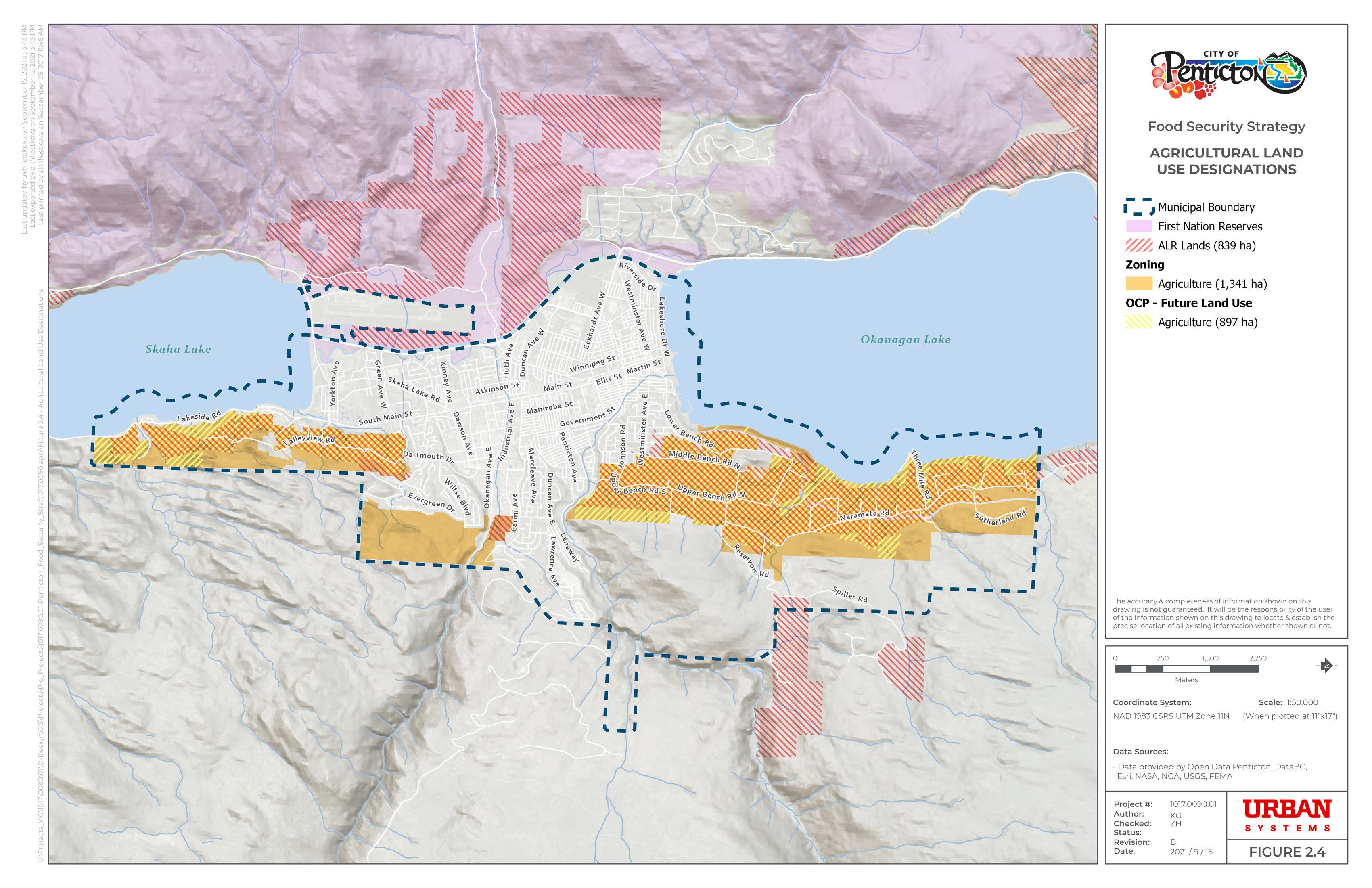
Within the Penticton city boundaries, 839 hectares are within the ALR, 1,341 hectares are zoned agricultural, and 897 hectares have Agriculture as a future land use according to the OCP. The number of hectares designated for future agriculture use in the OCP is considerably less than the area currently zoned agricultural, although it is still higher than the area within the ALR. Part of the reason for the reduction in Agriculture as a future land use is aiming to align this area more closely with the arable land footprint. A portion of land along the eastern edge of the agricultural properties along Naramata Road is less adequate for agricultural activities. Much of this area has a future land use of Rural Residential. Rural Residential land uses are residential and agricultural. Parcels have a one-hectare minimum lot size and have modified services, such as septic systems and wells.
Figure 2.3 shows agricultural land use designations within the City of Penticton, including zoning, future land use from the Official Community Plan, and Agricultural Land Reserve parcels, with First Nations reserves added for context.


