Managing complex, coevolving socialecological systems for sustainability requires the ability to cope with adapt to and shape change without losing options for future development It requires resilience - the capacity to bu self-organize learn and adapt
Urban growth boundaries
In contrast to greenbelts, urban growth boundaries are not intended to be permanent instead they are periodically evaluated and, if necessary , expanded Groundwater recharge Besides better management recharge zones the development recharge projects like recharge injection wells are proposed
RESILIENT WATERFRONT ARCHITECTURE AND PLANNING TO CURB URBAN SPRAWL ON WATER BODIES
The Case of the Weija Reservoir
WEIJA RESEVOIR’S ECOLOGICAL CENTRE
Cornelius Kyei Boateng
15 15 16 18 N Site Plan 1 1000
45m 20m 45m 30m Folke and Carpenter 2002
The evidence of water storage dams can be traced back to about 3000BC from ruins from Egypt and Mesopotamia. The primary uses of dams from years past have been to regulate river flow, for irrigation and for water supply (Selge & Gunkel, 2013).
Studies have showed that reserved lands meant to protect water bodies continues to face the deterioration.

The task is to design a research centre to foster collaborations among parties involved in the development and management of the Weija waterfront.

Developing mixed used communities,higher density regional centres,protecting agricultural, watershed and wildlife,investing in quality pedestrian, bicycle and public transportation with shared connectivity and information.

Karlenzig, (2010)
To physically bring together all the stakeholders to promote sustainable waterfront management and development.
To help waterfront community understand best practices involved in water front development through education trainig and research
DESIGN OBJECTIVES USERS


BACKGROUND Accra
Central, Ga Mashie Traditional Area and Makola Market area
In the direction of Mankessim, Cape Coast and subsequently Takoradi
ACCRA-KASOA
In the direction of Accra, Tema and subsequently the GhanaTogo border at Aflao
TRADE ROUTE,
N1
Old KASOA market
0km 1.5km 3km 6km DAMS _ history,uses
ORIGIN
RESEARCH _ Degree of sprawling into reservoir’s buffer. WEIJA DAM _ timelines and statistics ROAD MAP _ problem solution Feasibility study on the Weija dam creaton Construction of the Weija Dam completed The Feasibility Study* on the Weija Reservoir prepared by Tahal in November 1966 recommends the construction of a storage reservoir at Weija on the Densu River, which will store 9,500 mg (35,000 acre ft) at a NWL of 38 ft, to supply 4Q mgd of water to the Accra-Tema area. Plan for compact/resilient growth while preserving natural ecologies, agrarian landscapes, and cultural heritage sites Make transit desirable, affordable, accessible and ubiquitous Reserve and Shape public space open space for community and ecology Create mixed-use and mixed-income neighborhoods Extent of encroachment in the current buffer determined with ARCGIS 10.7 software. Construction of new KASOA market begins under Pres. J.A Kuffour
Municpality is split to get the Ga south Municipality Formulation of the Riparian buffer policy to protect vegetation along water bodies Construction of the KasoaAmasaman Road 1966
RIDE
MIX
1977 2001 2007 2013 2017 2021 2022
Kasoa - Amasaman Road
PROBLEM
Sprawling.
The Weija Gbawe
PRESERVE
SHARE
The way forward
-Collaborate -Educate -Manage -Develop -Invest -Protect -Train -Build -Adapt -Building and development research -Development planning -Capacity building -Natural resource preservation -Planners -Architects -NGO’s -Trainees -Interns -Community
Peter Calthorpe
Institutions Community Developers WEIJA DAM Total Population of Ga South Municipality, 350,121 Close down of Toll booth Source Author .Image credit Open Street maps Source Author .Image credit - Open Street maps Water supply Fishing Irrigation
TASK
DESIGN
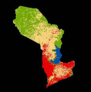
FID Class_name BUFF_DIST Area(Ha) Percentage 0 Bare land 90 14.837458 5.7% 1 Built-up Area 90 34.234463 13.23% 2 Greenery 90 206.797134 79.9% 3 Water Bodies 90 2.873628 1.12% 258.742683 90m Buffer Sustainable development against urban spraw 2 Cornelius Kyei
Master of Architecture Thesis Rev. Fr. Dr. Victor Quagraine Arc. Adu-Nyarko Weija Reservoir’s Ecological Centre Supervisors: corneliusbtng@gmail.com 2022 PG2665320 Department of Architecture KNUST
Boateng
PRECEDENT STUDY
Wetland
// design apppraisal

Conference and Exhibition block
// project details
• Architects: Atelier Z+
• Area : 4092 m²

• Year : 2019
• Photographs :Hao Chen
Enlightened by the “shack with a double pitched roof” in Wang Meng’s painting, the architects turned the double-pitched roof over, made a “Y-shape” cantilever structure, juxtaposed these two “Y-shape” independent units, and created a new double Y shape space (YY) creating new spatial meanings.
site
The site is situated in a restored reed wetland in the northeast of the Nature Reserve, where the water and the sky merge in one colour, few people tread, flocks of birds perch.

// main blocks
Five buildings of different volumes including;


• a conference and exhibition,
• a canteen,
• a research,
• two dormitory
• zigzag trestle bridge.
// structure
Section - Conference and Exhibition space
Drawing Credits - Atelier Z+
Research block
shared
utility spaces;
// concept / ideas effecient
Limited circulation around Research space. Research block also positioned further away from other blocks.
"Wetland Research and Education Center Atelier Z+" 16 Dec 2021. ArchDaily. Accessed 12 Apr 2022. <https://www.archdaily.com/973638/wetland-research-and-education-center-atelier-z-plus> ISSN 07198884


Cornelius
Positioning of openings to maximize daylighting

Reinforced concrete is selected to build with the simplicity of tectonics. Building A, B, C were built by a Y-shaped cantilevered reinforced concrete bent frame structure with crisscross section and partial folded-plate. The exhibition hall was partly designed with steel mezzanine; buildings D and E were constructed with concrete folded-plate structure.

Blocks comprise rectangular and square shaped spaces characterised with minimum obstructions making it easier for users to freely navigate the spaces.
geometry & spatial organisation Circulation
Compartmentalisation of staircase area
Fire control room access positioned away from other spaces
Contextualisation
All the “valleys” bottom on the roof was covered with slightly undulating soil and low-maintenance planted miscanthus and shrubs.
For the purpose of environment integration and sustainable recycling in the future, all the pitched roofs trimmed with titanium-zinc sheets were covered with indigenous reed straw reaped and processed under the supervision of local experienced reed weavers.
1. Cafe 2. Main entrance 3. Entrance hall 4. Lavatory 5. Rest 6. Multi-purpose hall 7. Foyer 8. Exhibition 9. Fire control room 10. Storage 11. Reference room 12. Courtyard 13. Equipment 3

Research
Center //
and Education
//
Source
for servicing common spaces
Research space
Image credit - Hao Chen
View from Dining block
Roof valley Image credit - Hao Chen
Minimum influence on site through pedestrianization
Kyei Boateng Master of Architecture Thesis Rev. Fr. Dr. Victor
Arc. Adu-Nyarko Weija Reservoir’s Ecological Centre
corneliusbtng@gmail.com 2022 PG2665320 Department of Architecture KNUST
Strategic positioning of washrooms and other services
Quagraine
Supervisors:
PRECEDENT STUDY
// Site layout
// project details

Location: Baraboo, Wisconsin
Architect/engineer: The Kubala Washakto Architects


Project type: New Construction
Project size: 109,000 SF
// concept / ideas
// Notable description
World’s first carbon-neutral building and becoming the first building in Wisconsin to achieve LEED – Platinum status.
There are few people who can claim such a legacy as the one Aldo Leopold has left in the environmental movement. The Aldo Leopold Legacy Center was designed to encapsulate and preserve that legacy, sharing his love for the outdoors with visitors for generations. The center comprises a cluster of buildings totaling an area just shy of 12,000 SF, located near Leopold’s trademark shack.

The ALF campus is a 12,000 sq.ft. complex of three buildings. The 10,000 sq.ft. main building contains office space, meeting rooms, exhibit space and a document archive. The other two buildings contain a seed sorting facility, workshops, a garage, and a lecture hall. Only the main building is fully condition e d and even there, many of the occasional-use spa c es are minimally conditioned by traditional means. Surrounding the center is a network of 2.5 miles of trails through oak, savanna, wetlands and dry prairie remnant, overlooking the Wisconsin River Valley.
// Architectural design strategies
• Bioclimatic design
• Natural ventilation in all occupied zones
• Double code insulation levels
• Passive solar heating
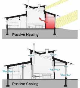
• Shade windows during summer Passive Cooling
• Daylight all occupied zones
// Lessons learnt
• sustainable design and construction,
• carbon-neutral building
• zero net energy building that produces its energy needs.

ALDO LEOPOLD LEGACY CENTER
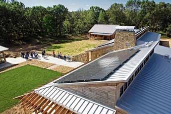
Ariel view showing photovoltaic panels on roof
Use of local materials in construction
4
An aqueduct conveys stormwater from the roof to a raingarden
Rev.
Weija Reservoir’s Ecological Centre
Cornelius Kyei Boateng Master of Architecture
Thesis
Fr. Dr. Victor Quagraine Arc. Adu-Nyarko
corneliusbtng@gmail.com 2022 PG2665320 Department of Architecture KNUST
Supervisors:
PRECEDENT STUDY


RIO NUEVO MASTER PLAN

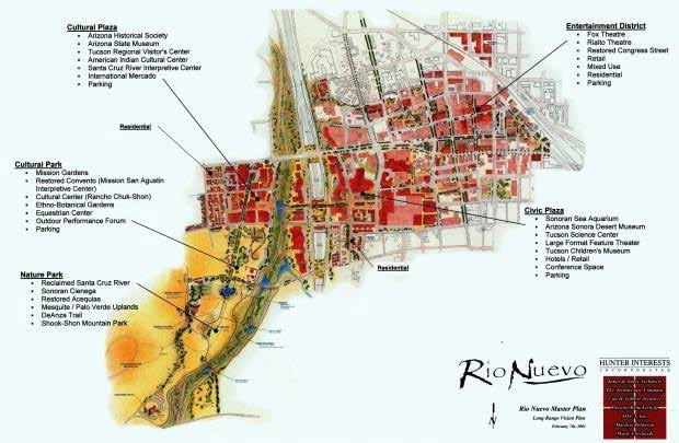
The plan approaches the project from an economic, cultural, and environmental sustainability perspective by healing and restoring the natural systems and cultural heritage of the disrupted areas.
The vision begins with restoring the river and reweaving the eastern and western neighborhoods together.
Reconstructed islands, sandbars, and natural terraces slow the water to a more even and natural pace, providing resting places for fish, birds, and other wildlife.
Design of weirs contribute to water retention and habitat reclamation, accelerating the process of healing the river.
Banks and restored terraces support new plantings of indigenous riparian trees and shrubs.
BELLE GLADE

The Belle Glade plan was developed by integrating environmental science with urban and regional design principles

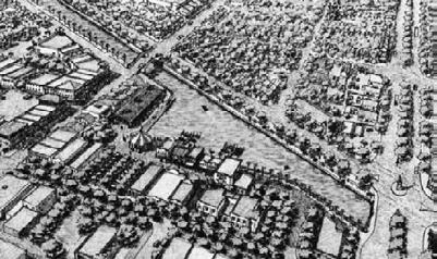

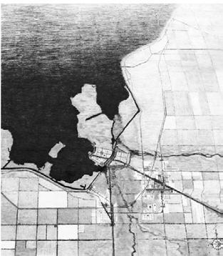
This design connected water-pollution abatement with smart-growth patterns while restoring healthy, naturalsystem functions and civic amenities.
The conceptual base for this project included the regional hydrological patterns and historic flows of surface water in Everglades National Park. this knowledge generated a plan that included protection of the natural system and provision for a new agricultural economy based on seasonal hydration and rebuild- ing of depleted soils.
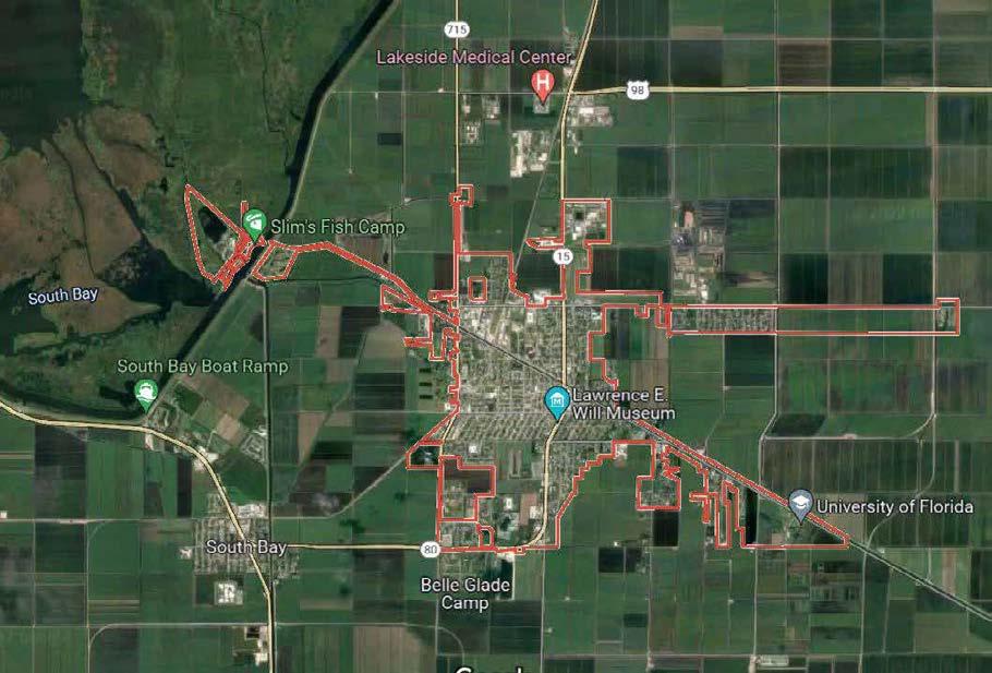 Belle Glade, inextricably connected to Lake Okeechobee, the regional lake system.
Long-established communities have a pattern based on the natural energies and resources that exist in the locale. Reconnecting with that pattern starts with an analysis of the past integrated into the desires of the future.
New Belle Glade visually reconnects with Lake Okeechobee, while the lake’s hydrological system rebuilds the soils and creates an opportunity for ecotourism.
Design Team The Glades Community Development Corporation—GCDC The MacArthur Foundation Center for Community and Neighborhood Design, University of Miami, Miami, Florida
Scan QR for studies relating to RIO NUEVO MASTER PLAN Scan QR for image source Image source Sustainable urban and community designDaniel Williams
New Belle Glade visually reconnects with Lake Okeechobee, while the lake’s hydrological system rebuilds the soils and creates an opportunity for ecotourism.
Conceptual reconnection of east and west communities for socially, economically, and environmentally benefits.
Image source - Sustainable urban and community design
Source Google maps Scan QR to zoom in map Rio Nuevo Master Plan map
5
Connecting the new town to the historic town with urban canals and a celebration of the agricultural heritage
by Daniel Williams
Belle Glade - Florida -USA (2022)
Master of Architecture Thesis Rev. Fr.
Weija Reservoir’s Ecological Centre Supervisors: corneliusbtng@gmail.com 2022 PG2665320 Department of Architecture KNUST
Cornelius Kyei Boateng
Dr. Victor Quagraine Arc. Adu-Nyarko
SPECIAL AND TECHNICAL STUDY
AND TECHNICAL STUDIES
// Storm water management (Permeable pavement)
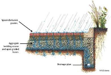
Permeable pavements help reestablish a more natural hydrologic balance and reduce runoff volume by trapping and slowly releasing precipitation into the ground instead of allowing it to flow into storm drains and out to receiving waters as effluent


// Micro solar farm (Alternate power source)
Solar PV plants with a capacity of <75 kWn are classified as microgeneration

Due to their size, microgeneration plants require simple permitting procedures, don't impact the grid and are easy to connect, are modular, and are easily scalable.

// Mechanical control rooms
Mechanical room is a space that houses mechanical equipment and its associated electrical equipment, as opposed to rooms intended for human occupancy or storage.

Underneath this filter layer is a uniformly-graded gravel course to store water, which ultimately penetrates into the ground.
// Grey water recycling system

Greywater is created from the potable water received from the utility provider but after being used in showering or bathroom uses then contains heavy surfactants and other contaminants which give it a ‘grey’ colour.
Mechanical room typically houses air handlers,boilers,chillers,boilers,heat exchange, water pumpss,electrical power back up, elevator machinery among others.

Importance
Demand on conventional water supplies and pressure on sewage treatment systems is reduced by the use of greywater. Re-using greywater also reduces the volume of sewage effluent entering watercourses which can be ecologically beneficial. In times of drought, especially in urban areas, greywater use in gardens or toilet systems helps to achieve some of the goals of ecologically sustainable development.
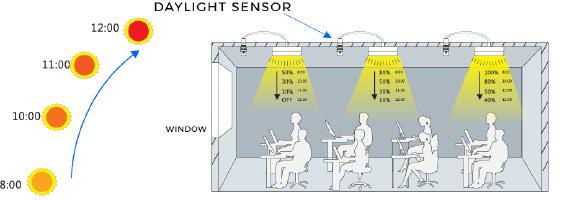
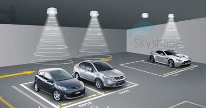
The daylight harvesting system employs light sensors, also known as photocell sensors, to detect the prevailing light level in the environment. It then sends the intensity of light received to a controller, which is connected to the lighting control system. The control system in turn adjusts the electric lights automatically according to the measured light level.
Basements are susceptible to the ingress of moisture and contaminants from the ground. For this reason, a waterproofing system will usually be required.
key notes to consider in water tank design
-Continuous linking of water proofing below ground and damp roof.

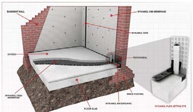

-Good construction joints
-Simplicity of design
-The use of vertical service penetrations

-Quality construction material
-Free lime control
SPECIAL
6
Department of Architecture KNUST PG2665320 2022 corneliusbtng@gmail.com Master of Architecture Thesis Rev. Fr. Dr.
Arc. Adu-Nyarko Supervisors: Weija Reservoir’s Ecological Centre
Cornelius Kyei Boateng
Victor Quagraine
3d section of porous pavment profile
2d section of porous pavment profile
Parts grey water recycling machine
Typical grey water recycling machine and operation flow
// Daylight harvesting
3d illustration of permeable pavment
Typical solar panels with dimensions
Solar power generation diagram
Illustration of a daylight harvester used in basement
Illustration of the principle on how daylight sensor works
Typical layout of mechanical room
// Basement Water tank damp proofing
NB:
Detail of watertank damp proofing
6
Detail of watertank damp proofing
Thesis Rev. Fr.
Arc.
Weija Reservoir’s Ecological Centre Supervisors: corneliusbtng@gmail.com 2022 PG2665320 Department of Architecture KNUST
Cornelius Kyei Boateng
Master of Architecture
Dr. Victor Quagraine
Adu-Nyarko
PHILOSOPHY AND CONCEPTS
PHILOSOPHY AND CONCEPTS
// CONTEXTUALISM
Contextual architecture refers to architecture that reflects the forms, details, and regional qualities of a building’s surrounding landscape. It means relying on that setting to create a home that fits into its environment, not building something that contrasts


Contextual architecture is usually divided into three categories: vernacular architecture, regional architecture, and critical regionalism all of which also inform the complementary architecture movement
Features of Contextualism
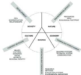
- Climate
- Topography
- Simplicity of design
- Urban texture
- History
- Culture
-Material
// Venicular Architecture
Vernacular architecture is a style of building that is specific to a region and period. It relies on the use of local materials and knowledge to construct buildings.
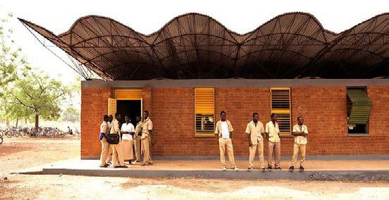
Features of venicular Architecture
-Provides bioclimatic characteristics

- Use of local materials

- Represents local culture
// TROPICAL MODERNISM
Tropical Modernism is an architectural style of wide open spaces connected to sprawling outdoors that is unique to the Indian Ocean island of Sri Lanka. At its core is a focus on local resources and knowledge of indigenous builders.
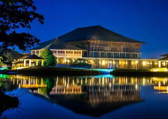
The style differs greatly from the more widely known and contemporary International Style, which embraces minimalism and takes a methodical approach to buildings through a logical use of new materials and asymmetrical compositions where form shapes function.
Features of tropical modernism
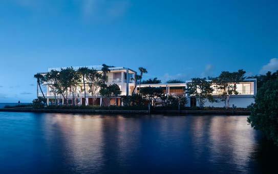

- Light
- Shade
- Simplicity of design
- Ventilation and views
- Seamless space
Notable Tropical modersim buildings
6
Department of Architecture KNUST PG2665320 2022 corneliusbtng@gmail.com Master of Architecture Thesis Rev.
Weija Reservoir’s Ecological Centre
Cornelius Kyei Boateng
Fr. Dr. Victor Quagraine Arc. Adu-Nyarko Supervisors:
Falling waters design depicting contextualism
Dano Secondary school in Burkina Faso by Kere Architecture
Senegal elementary school (Use of venecular Architecture) The use of Venicular architecture in design
Luxury waterfront kome in Miami (Tropical modernism use in design)
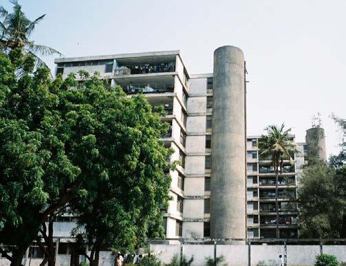
Kwame Nkrumah residential tower in Accra, Ghana
Sri lanka Parliament building
JN house in Brasil (Tropical modernism use in design)
7
Thesis Rev. Fr.
Weija Reservoir’s Ecological Centre Supervisors: corneliusbtng@gmail.com 2022 PG2665320 Department of Architecture KNUST
Cornelius Kyei Boateng Master of
Architecture
Dr. Victor Quagraine Arc. Adu-Nyarko
BRIEF DEVELOPMENT
DESIGN COMPOSITION

MAIN SPACES
GENERAL BRIEF

MAIN FACILITY SUPPORTING FACILITIES
• Entrance
• Receptionist
• Offices
• Laboratories
• Multipurpose hall (training and education)
• Exhibition
• Conference rooms
• Workshop
• Lounge/breakroom
• Washrooms
• Storage
• Mechanical room
• Kitchen
• Cafeteria
ACCOMMODATION SCHEDULE
LABORATORY 1(Light lab) has a work space of 16sqm, one storage and two study cells: a total floor area of 58sqm.
• Parking space
• Service area
• Garden
SUPPORTING FACILITIES
A minimum of 15sqm per car for vehicular parking lots. 5sqm for mortocycles 2sqm for
OFFICE TYPOLOGIES
Type 1(single office)
Descrption: For Institutional representitives; 9sqm per person.
Type 2 (workstations)
Descrption: Workstations for 2-3 trainees, 8sqm per person.
Office module 1 - 60sqm
Office type 1 (2x)
Office type 2
Recepton desk
Conference room
Office module 2 -80sqm
Office type 1
Office type 2(2x)
Recepton desk
Conference space
LABORATORIES
• Cleaning
• Work space
• Storage
• Lobby
• Study cells
• Changing room
Office module 3 - 120sqm
Office type 1
Office type 2(3x)
Recepton desk Conference room
*Additional consideration for storage, printing and plotting devices.
Forest Resource Commmision
Water Resource commision
Hydrological Department
Material Engineering
Planning department
Architectural department
Research
Departmental Offices
Research, Exhibition
Laboratory, Storage, Mechanical
Arrangement of spaces to be based on degree of activities and equipments involved. More heavy equipment on the lower levels.
Departmental Offices
Manufacturing and laboratories contract printing and research facilities 1 space per 1000sqf = 93sqm 2000 sqm . 15 percent circulation.
Natural Resource Management Building and development research Community Involvement
Office Module 1 Laboratory 1 Laboratory 2 Office Module 2 Office Module 3 ‘DEPARTMENTS - SPACE’ ARTICULATION VERTICAL COMPOSITION PARKING STANDARDS TOTAL 2500sqm
bycicle
SPACES QTY AREA (sqm) TOTAL (sqm) Entrance and lobby 1 40 40 Receptionist 1 16 16 Offices: Module 1 Module 2 Module 3 1 1 3 60 50 74 60 50 222 Laboratories: Type 1 Type 2 2 1 60 80 120 80 Multi-purpose hall/Training space 1 400 400 Exhibition 1 100 100 Conference room 3 30 90 Workshop 1 60 60 Lounge 3 12 36 Washrooms* 2 20 40 Storage 2 6 12 Mechanical room 1 9 9 Kitchen 1 25 25 Cafeteria 2 20 40 Security 1 20 20 1405sqm SPACES QTY AREA (sqm) Total (sqm) Cleaning or washing 1 9 9 Changing room 1 9 9 Work space 1 50 50 Storage 2 6 12 Lobby 1 6 6 Study cells 3 6 18 104sqm SPACES QTY AREA (sqm) Parking space - Cars Motorcycles Bicycles 30 15 5 450 75 10 Service area 30 565sqm SPACES QTY AREA (sqm) Office 1 16 Store 1 9 Change room 1 16 Power room 1 30 Lab 1 500 500sqm
2 (Heavy lab) WATER TREATMENT WORKSHOPS PARK WATER TREATMENT TRAINING OFFICES PARKING MEETING SPACES SERVICES LABORATORIES 8 Cornelius Kyei
Master of Architecture Thesis Rev. Fr. Dr. Victor Quagraine Arc. Adu-Nyarko Weija Reservoir’s Ecological Centre Supervisors: corneliusbtng@gmail.com 2022 PG2665320 Department of Architecture KNUST
LABORATORY
Boateng
SITE OVERVIEW
LOCATION

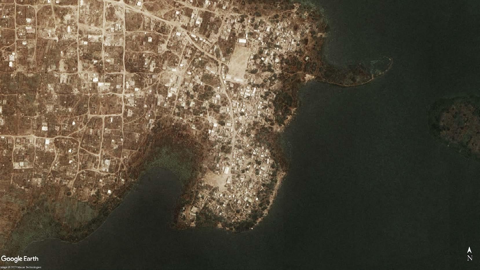
Tomefa is predominantly filled with the Ada tribe. The Ada people first migrated from Sudan, then to Nigeria in a town called Ile-Ife, through Benin among the Fon People then to Togo, and finally to Big Ada in the Greater Accra Region (present day Ghana).

The highest relative humidity ranges from 89 to 93 percent, while the minimum ranges from 41 to 72 percent

CLIMATIC CONDITIONS SITE A SITE B
Cooling Design Conditions
Hottest month: March
Hottest week: 3/29 - 4/ 4
Typical summer week: 5/17 - 5/23
Annual CDD for 10 °C is: 6,353

Design temperature 99.6%: 33.5 °C
It is hottest in March/April (320C) and in August temperatures are cool at about 230C.
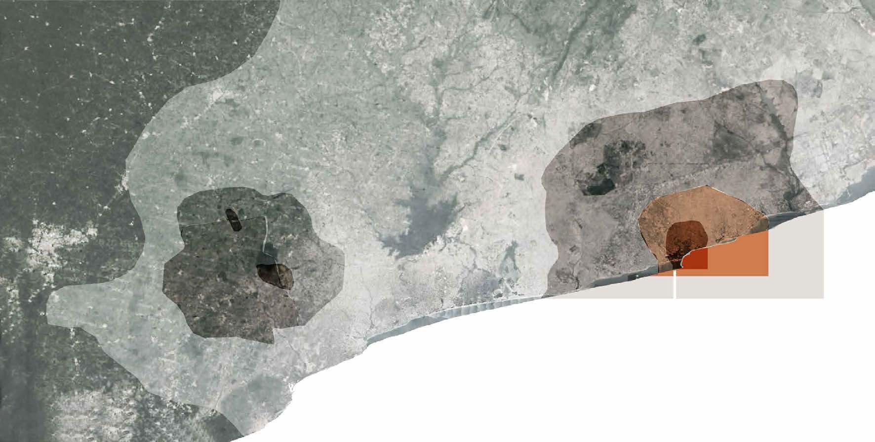
Sites were selected taking into consideration degree of sprawling to the Weija reservoir’s buffer.

Heating Design Conditions
Coldest month: August
Coldest week: 9/ 1 - 9/ 7
Typical winter week: 10/ 6 - 10/12
Annual HDD for 18 °C is: 0
Design temperature 0.04%: 23 °C

The area is low lying and undulating with isolated ridges. The Weija Reservoir is 14 km long, 2.2 km wide and has total surface area of 38 km2 with mean depth of 5 m.
The area is low lying and undulating with isolated ridges. The Weija Reservoir is 14 km long, 2.2 km wide and has total surface area of 38 km2 with mean depth of 5 m.
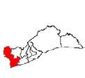
Greater Accra Region
Amate, C.OC. [“The Making of Ada”], 1999. Ga South District Ghana Africa 1 5 1 5 1 5 2 0 SELECTED SITE B A PREVIOUS SETTLEMENT TOMEFA Tomefa Island
https://c8.alamy.com/comp/G30HP5/actual-vintage-political-map-of-africa-with-flags-G30HP5.jpg
SITE SELECTION CRITERIA Humidity Wind direction Design conditions Sun path Temperature -0.3906 X -0.358 5.5609 Y 5.5839 15 15 15 15 15 15 15 15 20 20 20 20 25 25 25 30 30 30 35 35 Closeness to community Proximity to activities Land Size Accessibility Proximity to reservoir Historical connection Area(ha) Bare land Built up area Greenery Water Bodies 9 Cornelius Kyei Boateng Master of Architecture Thesis Rev. Fr. Dr. Victor Quagraine Arc. Adu-Nyarko Weija Reservoir’s Ecological Centre Supervisors: corneliusbtng@gmail.com 2022 PG2665320 Department of Architecture KNUST 60° 30° 10 Accra-Kotoka.Intl.AP Sep 23 12:00 NE NW SE SW NW Entire Year Whole Day Calm m/s - 38°C 0% - 100% humidity Accra m/s 0 0.3 1.6 3.4 5.5 8 10.8 13.9 17.2 HISTORY
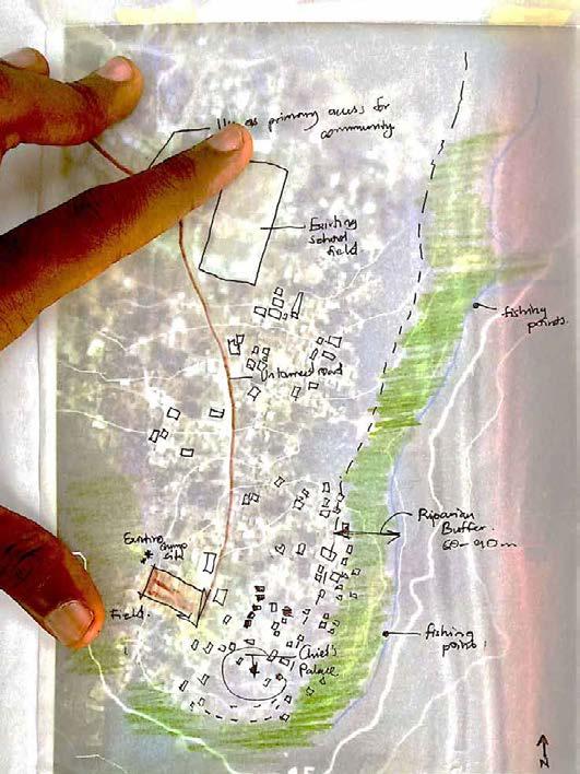
Although housing at tomefa is informal, there is an implicit “urban structure” that gives an hierarchy to the entire system. It’s clear how everything is based on a main axis, which connects the community to the reservoir front.


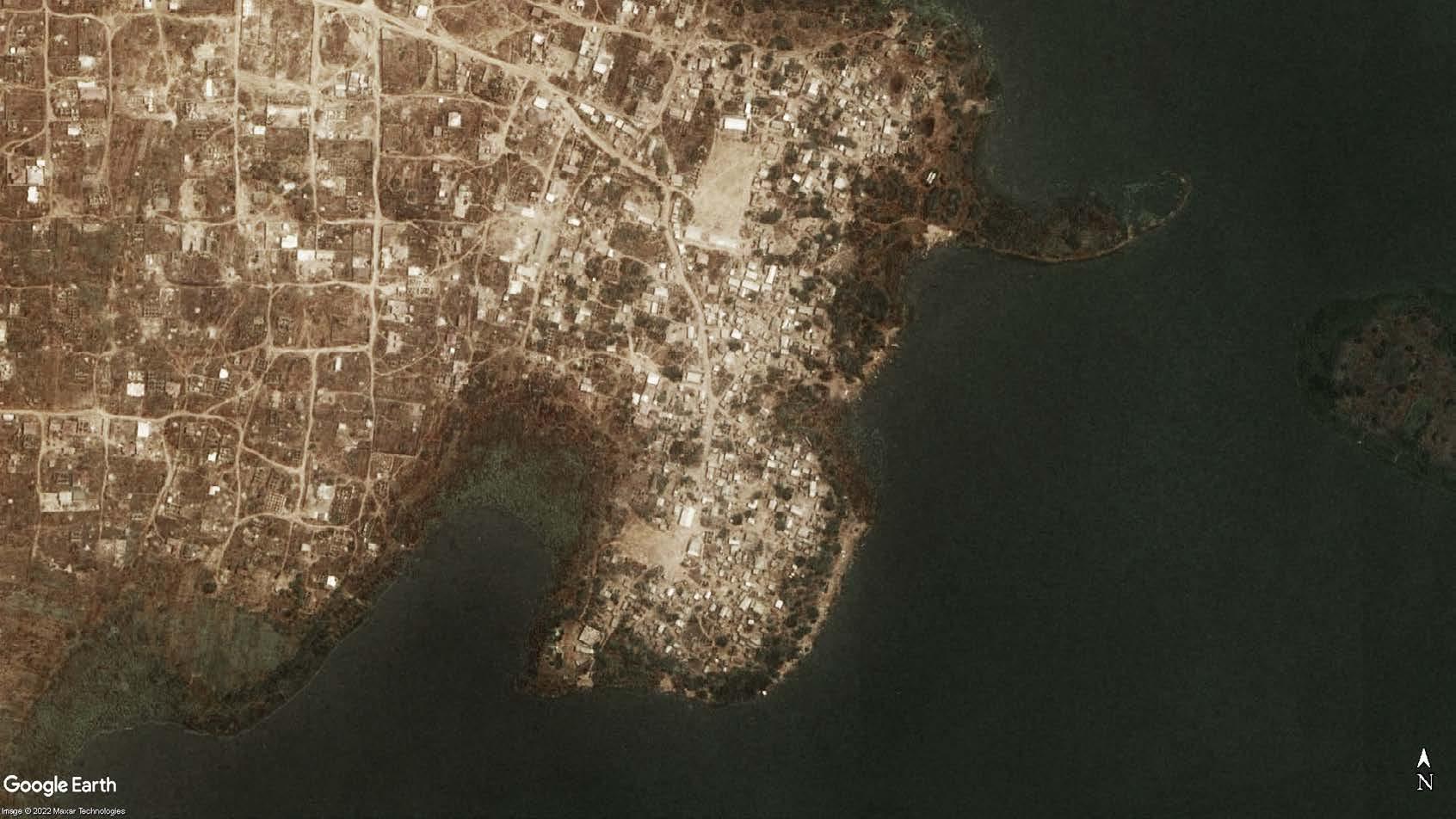

Guess what happens when it rains?
Actions of the inhabitants has led to the reduction in water quality and high cost for treatment.


• The main road to the community is a two way untarred street ending at an open field.

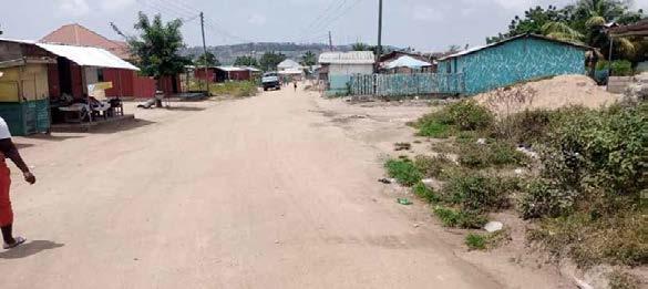
• There is very low traffic on the street with about two vehicles pasing every 15 - 20 minutes.
• First view to the site is from the untarred road

Having settled in their present location for about 50 years, the character of the builidings in Tomefa ranges from mud houses and block house with every other building material in-between.
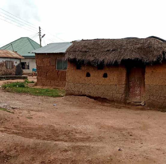
primary ecconomic activity of the people of Tomefa and other riparian towns is fishing. Fishing communities are a mix up of inhabitant and temporal workers from Winneba and Tema.


The vegetative cover of the Weija reservoir amidst the economic activities sees reduction.

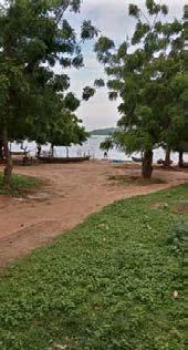
Loss of grass and shrubs has increased run offs into the reservoir.

1 5
Tomefa Waterfront activities WATERFRONT ACTIVITIES BUILT-UP CHARACTER ECONOMY VEGETATION ACCESSIBILITY
The
Scan QR to read more on the relation of land use changes to surface water quality in the Densu Basin Source Field survey (2022) Site Boundary Buffer boundary 10 Cornelius Kyei
Master of Architecture Thesis Rev. Fr. Dr. Victor Quagraine Arc. Adu-Nyarko Weija Reservoir’s Ecological Centre Supervisors: corneliusbtng@gmail.com 2022 PG2665320 Department of Architecture KNUST Untarred Road
Boateng
Fishing
Legend
Fishing point
point
Site
Area : 2.8 acres
All contour lines are heights from sea level obtained from GPS visualiser



Need to develop attractive entrance Good view to the Weija reservoir
B B Site Area : 2.8 acres SUN PATH
Provide shade against Hot afternoon sun Typify buffer region and plant types suitable for the buffer region Relocaton of affected houses Lowest portion of the site. Potential for rainwater run off collection and treatment for use by facility and the community 80° 70° 60° 30° 10° 10 14 15 Accra-Kotoka.Intl.AP Sep 12:00 N NE SE S SW W NW
• Introduction of transport terminals to facilitate pedestrianization witin community
Connect community to resevoir front. Reservoir has tourism potential
• Located fishing points could be combined to minimize impact of economic activities hence enhancing vegetation growth at the Weija waterfront.
• Obsere buffer and still connect to reservoir


Reolocate

STRENGTH
• Presence of vegetation on site (trees, shrubs).



















• Views into the site from the main access route.
• Site has access to electricity.
• Proximity of site to majority of the community.



OPPORTUNITY THREAT Legend

• Reservoir can be treated for use for the facility and community.
• Site has tourism potential at the reservoir front which can be use as a source of revenue for the community
• Absence of potable drinking water from GWCL to the community.
• Lack of drainage systems close to the site to aid in the drainage of liquid waste.


• Presence of animals that may pose threat to community and tourists as biodiversity of the waterfront is improved.

SITE ANALYSIS
15 1 5 15 15 15 N
Boundary
wind direction Buffer boundary Primary arrival view View to reservoir Slope/ natural run off SECTION C-C SECTION B-B SITE PROGRAM
Site
Prevalent
SITE TOPOGRAPHY
17m 15m 2.5 5 10 15m 17m 15m 2.5 5 10 15m 15.6m 15m 2.5 10 15m 120,281 80,529 108,274 60,408 94,747 107,666 15 16 17 16 17 16 2 16 4 16 6 16 8 1 8 5 6 15 6 5 8 16 17 7 4 16 2 16 4 16 16 8 15 6 15 8 15 15 4 15 2 14 8 14 6 14 4 17 7 2 17 16 m 10 20m Scal 11 Cornelius Kyei Boateng Master of Architecture Thesis Rev. Fr. Dr. Victor Quagraine Arc. Adu-Nyarko Weija Reservoir’s Ecological Centre Supervisors: corneliusbtng@gmail.com 2022 PG2665320 Department of Architecture KNUST 15 1 5 A A C
WEAKNESS C SECTION A-A
Riparian buffer dileanation for the Weija reservoir according to the riparian buffer policy of the Ministry of Water Works and Housing
affected
houses
“As the mixture of uses in a community declines, travel time and distance for those who live or work there increase.”

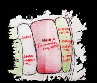
There are attempts to minimize this characteristic of sprawl.
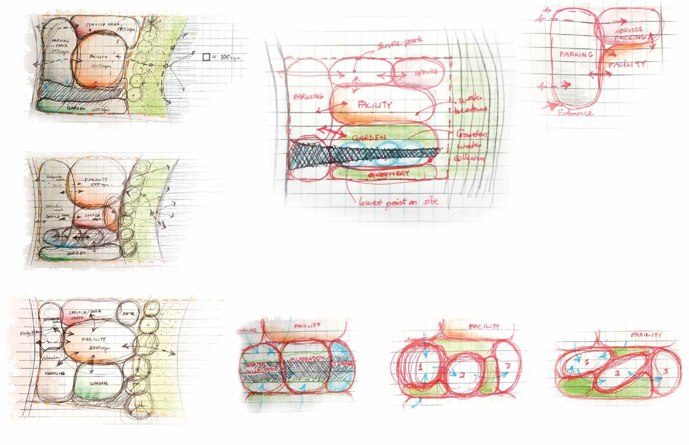
In creating mixed-use development, building blocks function best when located in close poximity to road. Parking spaces and green spots serve as transition spaces between the road and the blocks.

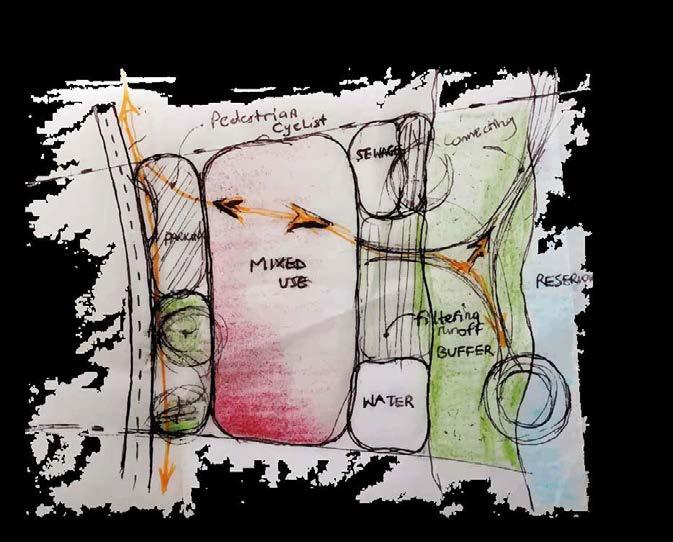
The difference sets in when development is close to the reservoir’s buffer. The need for filtering run-off, sewage positioning and accessibility to the waterfront arises. Option 1 above has parking & recreational spaces close to the road.
Option 2 moves blocks relatively closer to the road with the parking and recreational areas sandwiched between two blocks.
In both cases (B1,B2), development close to the reservoir has tourism potential and should have connection from the community to the reservoir’s front.



CONCEPTUAL SITE PLANNING COMMUNITY
12
SCALE BUILDING SCALE
of
Thesis Rev. Fr. Dr.
Arc. Adu-Nyarko Weija Reservoir’s Ecological Centre Supervisors: corneliusbtng@gmail.com 2022 PG2665320 Department of Architecture KNUST
Cornelius Kyei Boateng Master
Architecture
Victor Quagraine
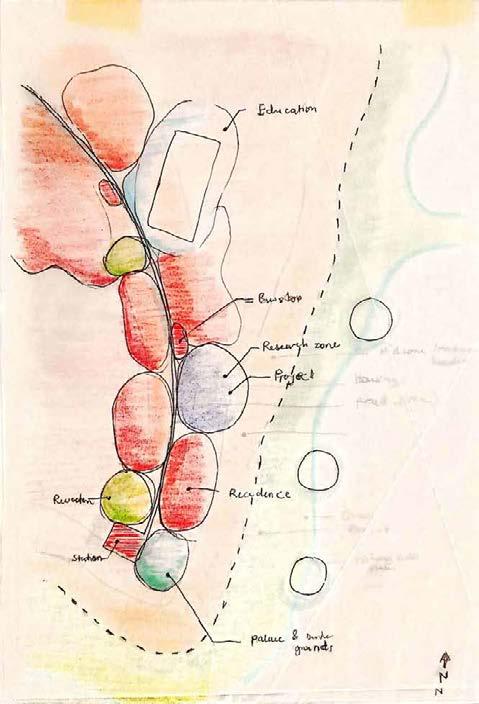
Palace Durbar grounds Taxi rank Mixed-use(B) Mixed-use(B) (B1) (B2) Mixed-use(A) Mixed-use(A) Mixed-use Direction of expansion Mixed-use
At the community scale, there is an attempt to collect run-off water from buildings, roads and pavers to the site to be treated for use by the centre and the community at large.
PARKING

Locating general parking space and service parking close to each other reduces amount of vehicular circulation and hence hard impervious surfaces.
Options A and C provide ample distance (minimum distance should be 15m) between waste collected from the facility and the run-off water collection zone.


RAINWATER GARDEN - TRAPPING RUNOFF WATER
A rain garden is located at lowest point of the site and is to be designed to catch, slow, and store runoff. The garden includes soil layers, mulch, and plants, to filter rainwater collected from the community.
Scan QR to read more on how to manage runoff water. CONCEPTUAL SITE PLANNING SITE
13
Master of Architecture Thesis Rev. Fr. Dr. Victor Quagraine Arc. Adu-Nyarko Weija Reservoir’s Ecological Centre Supervisors: corneliusbtng@gmail.com 2022 PG2665320 Department of Architecture KNUST
Cornelius Kyei Boateng
With the parking and the facility positioned, the service area and the run-off water collection area is studied.
(A) (B) (C)
TYPICAL USER-SPACE CORRELATION


FUNCTIONAL DIAGRAMS
14
Thesis Rev. Fr.
Arc. Adu-Nyarko Weija Reservoir’s Ecological Centre Supervisors: corneliusbtng@gmail.com 2022 PG2665320 Department of Architecture KNUST
Cornelius Kyei Boateng Master of Architecture
Dr. Victor Quagraine
CONCEPTUALS

CONNECTIVITY
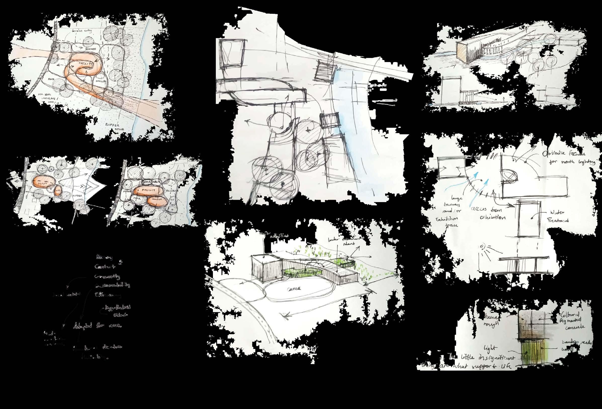
Inspired by the coexistence of natural elements . The idea of the centre aims at serving as a condusive place for education, research and community empowerment for successful human-nature mutual coexistense.
There is the attempt to represent rparian vegetation as the basics to the survival of ecosystems depicted as what supports the structure. A strenght often ignored by humans
 Cornelius Kyei Boateng Master
In ensuring the continuous use of the Weija reservoir, research showed the need for collaboration among stakeholders. Making known the relevance of riparian ecology becomes a necessity
in fostering sustainable development and reserve management around the reservoir. Questions that drive the design then includes the hows of creating awarenes and fostering collaboration among stakeholders responsible for the existence of the reservoir’s ecology.
The form(s) takes cues from the basic unit material used for construction and the nearest vegetation close to the reservoir.
15
of Architecture Thesis Rev. Fr. Dr. Victor Quagraine Arc. Adu-Nyarko Weija Reservoir’s Ecological Centre Supervisors: corneliusbtng@gmail.com 2022 PG2665320 Department of Architecture KNUST

CONCEPTUALS 16
Thesis Rev.
Weija Reservoir’s Ecological Centre Supervisors: corneliusbtng@gmail.com 2022 PG2665320 Department of Architecture KNUST
Cornelius Kyei Boateng Master of Architecture
Fr. Dr. Victor Quagraine Arc. Adu-Nyarko
MASTER PLAN
Managing complex coevolving socialecological systems for sustainability requires the ability to cope with adapt to and shape change without losing options for future development It requires resilience - the capacity to bu self-organize learn and adapt

Urban growth boundaries
In contrast to greenbelts urban growth boundaries are not intended to be permanent; instead they are periodically evaluated and if necessary expanded
Groundwater recharge
Buildable Besides better management of natural recharge zones the development of arti recharge projects like recharge pounds and injection wells are proposed
N Site Plan 1 1000 0 100m 200m 300m 400m 500m 100 m 2 00 m 3 00 m 4 00 m 5 00 m
45m 20m 45m 30m 8m Folke and Carpenter 2002
1- Road (Spine) 2- Ecological Centre 3- Taxi_bus station 4- Durbar ground 5- Palace 6- Community centre 7- Recreational area 8- Housing 9- Bus stand 10- Walkway 11- Water re-charge zone 12- Waterfront walkway 13- Deck 14- Native tree species 15- Grass and shrubs 1 2 3 4 5 6 13 7 9 8 11 12 14 15 11 17 Cornelius Kyei Boateng Master of Architecture Thesis Rev. Fr. Dr. Victor Quagraine Arc. Adu-Nyarko Weija Reservoir’s Ecological Centre Supervisors: corneliusbtng@gmail.com 2022 PG2665320 Department of Architecture KNUST
SUSTAINABLE ZONING LEGEND
BLOCK PLAN


LEGEND 7 3 2 18 2 1 4 10 8 11 9 14 15 12 1- Vehicular access 2- Parking 3- Main entry to facility 4- Water fountain 5- Service 6- Basement entry II 7- Solar panel 8- Bar 9- Solar farm 10- Walkway 11- Semi extensive green roof 12- Walkway 13- Deck 14- Native trees 15- Grass and shrubs 16- Maintenance Unit 17- Infirmary 18- Parking 13 6 10 17 5 18
Master of Architecture Thesis Rev. Fr. Dr. Victor Quagraine Arc. Adu-Nyarko Weija Reservoir’s Ecological Centre Supervisors: corneliusbtng@gmail.com 2022 PG2665320 Department of Architecture KNUST
Cornelius Kyei Boateng

SITE LAYOUT X X X IN OUT Chlorine Injection Filteration Pump connected to tank below Pressure tank Carbon Filter Treated water pumped up Servery Multi-purpose training space 85 Foyer 61 m Reception 58 m Exhibition Gathering space 276 m Lobby 10 m WR Kitchen Eatery 45 Kitchen m Male 12 Female lobby Terrace 27 m lobby Storage 11 Storage 34 Security 10 Janitor Circulation 66 m 27 10 Entry Store Room Room 18 Room Circulation 45 m Meter room WR Terrace Terrace 55 m Water Treatment 93 Water Treatment Disinfection Change Lobby 19 Office 11 Terrace 48 Terrace 37 Terrace 19 lobby N Ground Floor 1 100 19 Cornelius Kyei Boateng Master of Architecture Thesis Rev. Fr. Dr. Victor Quagraine Arc. Adu-Nyarko Weija Reservoir’s Ecological Centre Supervisors: corneliusbtng@gmail.com 2022 PG2665320 Department of Architecture KNUST

BASEMENT PLAN X3 X3 145 m2 V 751 42 22 m Construction material testing Lab 263 m Storage 36 m Study 223 m V 402 04 m 372 V 670 10 m Meter Y X X X2 X2 Y2 Y2 Y3 Y3 S S N N Basement 1 100 20 Cornelius Kyei Boateng Master of Architecture Thesis Rev. Fr. Dr. Victor Quagraine Arc. Adu-Nyarko Weija Reservoir’s Ecological Centre Supervisors: corneliusbtng@gmail.com 2022 PG2665320 Department of Architecture KNUST
GROUND FLOOR PLAN

X3 X3 Y Y X X Y2 Y2 Y3 Y3 S S Chlorine Injection Filteration Pump connected Pressure tank Iron ����� Treated pumped up Servery 8 m Multi-purpose training space 85 m2 Foyer 61 Reception 58 Store Exhibition & Gathering space 276 Lobby 10 WR Kitchen Eatery 45 m Kitchen 9 Male Female lobby Terrace 27 m2 lobby 7 battery storage 11 Storage Janitor s store 9 Circulation 66 Maintenance 27 WR 10 Entry 11 m Store 17 Room 17 Room 18 Circulation 45 m 21 Meter 8 WR 5 WR WR 6 WR Terrace 5 Terrace Terrace 55 m Water Treatment 93 Reception 31 14 m Change Lobby 22 Office 9 8 Terrace 48 Terrace 37 Terrace 19 m lobby N N Ground Floor 1 100
21 Cornelius Kyei Boateng Master of Architecture Thesis Rev. Fr. Dr. Victor Quagraine Arc. Adu-Nyarko Weija Reservoir’s Ecological Centre Supervisors: corneliusbtng@gmail.com 2022 PG2665320 Department of Architecture KNUST

X3 X3 Y Y X X Y2 Y2 Y3 Y3 S S Male 12 m Female Accounts & Records 31 Conference 84 Facility Manager 45 m Circulation 50 Circulation 36 Kitchen Store 6 lobby 5 lobby 7 m Planning Office Director Office 2 Store 11 2 Planning Office 107 Cafeteria 46 Terrace 8 Terrace 26 Store 13 Roof garden tools Mechanical room 14 Circulation 67 m F N First Floor 1 100 FIRST FLOOR PLAN 22 Cornelius Kyei Boateng Master of Architecture Thesis Rev. Fr. Dr. Victor Quagraine Arc. Adu-Nyarko Weija Reservoir’s Ecological Centre Supervisors: corneliusbtng@gmail.com 2022 PG2665320 Department of Architecture KNUST

X3 X3 Y Y X X Y2 Y2 Y3 Y3 12 m Female lobby 5 lobby 7 m Office 31 Terrace 15 Circulation 44 m WR Forestry 107 Roof top Interactive garden 222 Bar 8 m Control Breakout Terrace Discussion 76 m N Second Floor 1 100 SECOND FLOOR PLAN 23 Cornelius Kyei Boateng Master of Architecture Thesis Rev. Fr. Dr. Victor Quagraine Arc. Adu-Nyarko Weija Reservoir’s Ecological Centre Supervisors: corneliusbtng@gmail.com 2022 PG2665320 Department of Architecture KNUST

X3 X3 Y Y X X Y2 Y2 Y3 Y3 Solar farm GIS Laboratory 74 Conference 100 m Terrace 119 m2 Roof Terrace 44 m Lounge 58 m2 A 15 m Storage 9 lobby N Third o 1 100 THIRD FLOOR PLAN 24 Cornelius Kyei Boateng Master of Architecture Thesis Rev. Fr. Dr. Victor Quagraine Arc. Adu-Nyarko Weija Reservoir’s Ecological Centre Supervisors: corneliusbtng@gmail.com 2022 PG2665320 Department of Architecture KNUST
Page intentionally left blank

GSEduca������������ D-01 D-02 ±0 +4,000 +7,150 +8,150 ±0 +4,000 +7,150 +9,965 -3,600 +750 +7,250 Construction material testing Lab Exhibition Facility Manager Void Multi purpose training space Planning department Office Conference room Terrace Entry Foyer Bar Operable D-03 D-04 -3,742 +75 +4,000 +7,150 +10,300 +13,450 -1,550 -500 +6,200 Exhibition space Constrruction material testing Lab Discussion zone Bar GIS Lab Terrace Section X2-X2 1 100 Section Y3-Y3 1 100 SECTIONS 25 Cornelius Kyei Boateng Master of Architecture Thesis Rev. Fr. Dr. Victor Quagraine Arc. Adu-Nyarko Weija Reservoir’s Ecological Centre Supervisors: corneliusbtng@gmail.com 2022 PG2665320 Department of Architecture KNUST

±0 +4,000 +7,150 +10,300 +50 +3,300 +5,152 +5,600 +8,350 +15,375 Conference room Chlorine Injection Filteration Pump connected to tank below Pressure tank Iron Carbon Filter Treated water pumped up Reception Change Water treatment Mechanical room Roof garden tools Semi-intensive green roof Water puri s D-05 -1,500 +50 +4,000 +5,200 +3,300 +8,150 Semi-intensive green roof Water treatment Section Y-Y 1 100 Section X3-X3 1 100 SECTIONS 26 Cornelius Kyei Boateng Master of Architecture Thesis Rev. Fr. Dr. Victor Quagraine Arc. Adu-Nyarko Weija Reservoir’s Ecological Centre Supervisors: corneliusbtng@gmail.com 2022 PG2665320 Department of Architecture KNUST

SECTIONS Construction material testing Lab Exhibition Solar panel battery Lounge Terrace Conference room Control room Office Discussion zone Forest commission Circulation Lobby Breakout Planning Accouts and records Cafeteria Section Y2-Y2 1 100 Section S-S 1:100 Section X-X 1 100 27
Thesis Rev. Fr. Dr. Victor
Arc. Adu-Nyarko Weija Reservoir’s Ecological Centre Supervisors: corneliusbtng@gmail.com 2022 PG2665320 Department of Architecture KNUST
Cornelius Kyei Boateng Master of Architecture
Quagraine


ELEVATIONS 28
Thesis Rev. Fr.
Arc. Adu-Nyarko Weija Reservoir’s Ecological Centre Supervisors: corneliusbtng@gmail.com 2022 PG2665320 Department of Architecture KNUST
Cornelius Kyei Boateng Master of Architecture
Dr. Victor Quagraine


ELEVATIONS 29
Thesis Rev. Fr.
Arc. Adu-Nyarko Weija Reservoir’s Ecological Centre Supervisors: corneliusbtng@gmail.com 2022 PG2665320 Department of Architecture KNUST
Cornelius Kyei Boateng Master of Architecture
Dr. Victor Quagraine


ELEVATIONS 30
Thesis Rev. Fr.
Arc. Adu-Nyarko Weija Reservoir’s Ecological Centre Supervisors: corneliusbtng@gmail.com 2022 PG2665320 Department of Architecture KNUST
Cornelius Kyei Boateng Master of Architecture
Dr. Victor Quagraine


 Belle Glade, inextricably connected to Lake Okeechobee, the regional lake system.
Long-established communities have a pattern based on the natural energies and resources that exist in the locale. Reconnecting with that pattern starts with an analysis of the past integrated into the desires of the future.
New Belle Glade visually reconnects with Lake Okeechobee, while the lake’s hydrological system rebuilds the soils and creates an opportunity for ecotourism.


