3 minute read
Inch
Inch
Location and Context
Inch is located only 8km from Ennis on the R474 (Ennis to Miltown Malbay) road and is identified as a Small Village in the Settlement Hierarchy of this Plan. The school and church at the centre of the village provide the nucleus around which the settlement has developed.
The landscape in the area is relatively robust with rolling hills and mature trees and hedgerows. The lands fall away to the southwest of the village and this area is more exposed with views across the countryside.
Water is supplied by the Inagh-Kilmaley Group Water Scheme and is adequate to serve the population target set out in the Core Strategy. There is no public wastewater treatment in the village. Any future development, including alterations to existing commercial or employment generating development, will require private wastewater treatment subject to suitable sitespecific conditions and must ensure they comply with the EPA Code of Practice for On Site Wastewater Treatment Systems in order to ensure that there are no significant long-term effects on the Inch (Clare) River which is currently at ‘moderate status’.
General Objectives
• To consolidate the existing village, support the tourism industry in the area and encourage the development of a range of amenities and services for both permanent residents and visitors to the area, subject to the requirements of the Habitats Directive; • To ensure that future growth is balanced and sustainable and is relative and appropriate to the scale, size and character of the existing village; • To provide for residential development to cater for a permanent population in the area; and
• To support the provision of infrastructure to allow for future growth.
Economic Development
Agriculture remains an important part of the local economy in the smaller settlements near Ennis. In order to support economic development, the Council will facilitate and encourage farm enterprise and agri-tourism in the village. The Council will also support home-based economic activity where feasible. Proximity to Ennis and Shannon provides employment and educational opportunities within a short commuting distance.
Strategy for Growth and Sustainable Communities
The strategy for the sustainable growth of the village and its community is through consolidation and regeneration that promotes compact sequential growth and supports and
__________________________________________________________________________________ Draft Clare County Development Plan 2023-2029

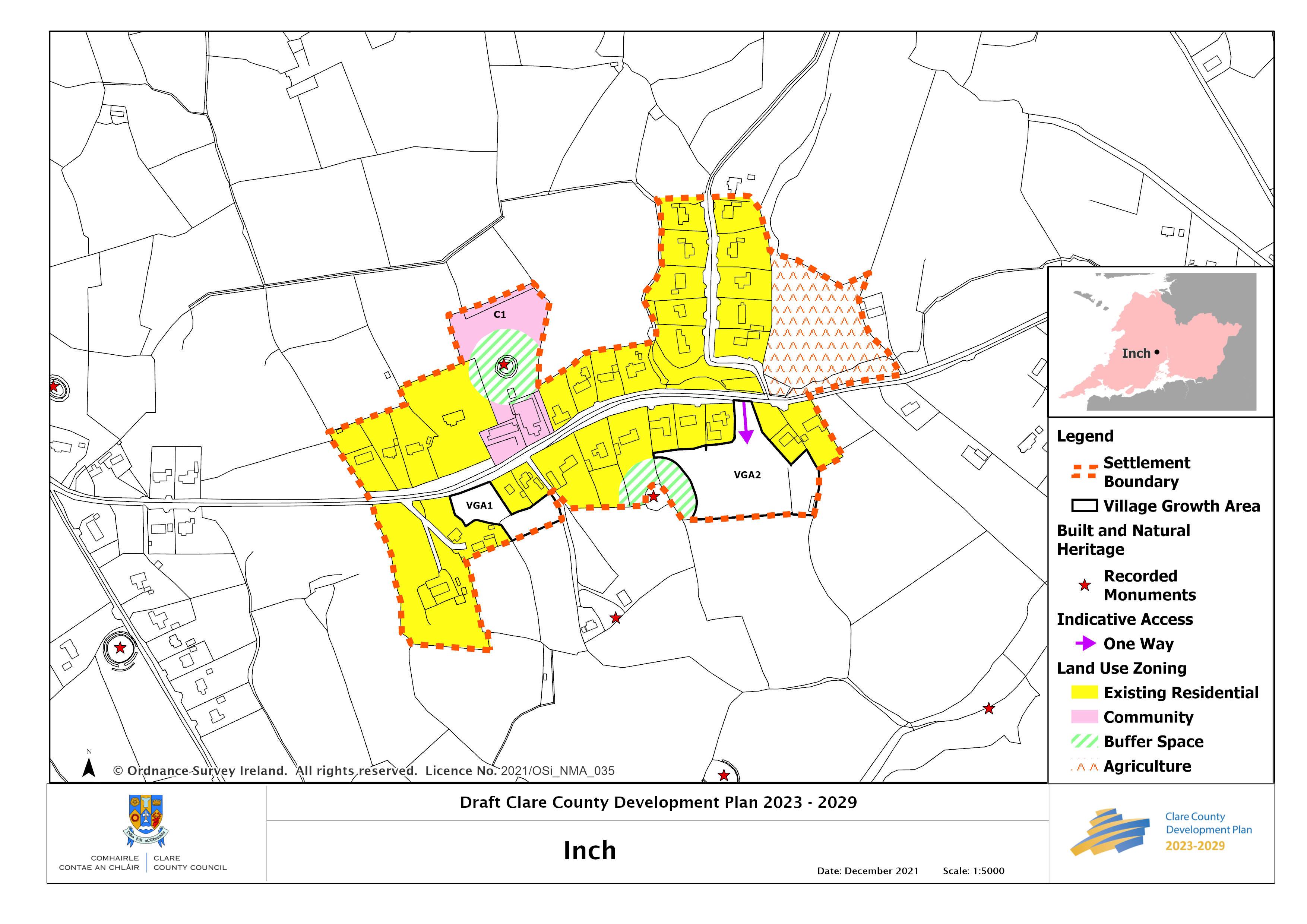
strengthens a sustainable village community and its rural hinterland. This will be achieved by encouraging small scale growth in areas which make a positive contribution to the overall enhancement of the village and sustains it into the future. In line with this approach and to promote vibrant rural villages, village growth areas have been identified which provide opportunities and choice for development, including small scale commercial, enterprise, community, services/facilities as well as small scale cluster housing, all of which offer a viable and attractive option for rural living within a village community and setting.
VGA 1 Lands to the Southwest
Any future development on VGA1 lands must not restrict access to lands to the rear of the site.
Transport, Active Travel and Connectivity
Clare Local Link provides a bus service to Ennis on alternate days. This service provides an alternative to the private car and could help encourage a modal shift to a more sustainable transport option.
There is a small stretch of public footpath opposite the school and church at the centre of the village. The extension of the public footpath to link existing residences to the village core is supported in this Plan. In addition, the enhancement of and provision for green infrastructure such as walking and cycling routes would promote active recreation and sustainable travel in the village and its environs.
Place Making and Regeneration
Due to the linear form of the settlement, identifiable gateways are required on main approaches to announce the entry points to the village to give a sense of arrival and to calm traffic travelling through the village. The public realm is well maintained with flowers and planting along roadside verges and open spaces.
Flooding and Flood Risk
The Strategic Flood Risk Assessment (Volume 10(c)) accompanying this Plan advises that the proposed residential zoning in Inch can be developed, providing building footprints are located within Flood Zone C. Thresholds should be set a minimum of 0.5m above the bank top height.
__________________________________________________________________________________ Draft Clare County Development Plan 2023-2029


