25 minute read
4.4. Environment


Living in harmony with a well managed natural environment. For Council and the community to value, respect and actively participate in the care, protection and management of the Clarence’s natural and built environment for current and future generations
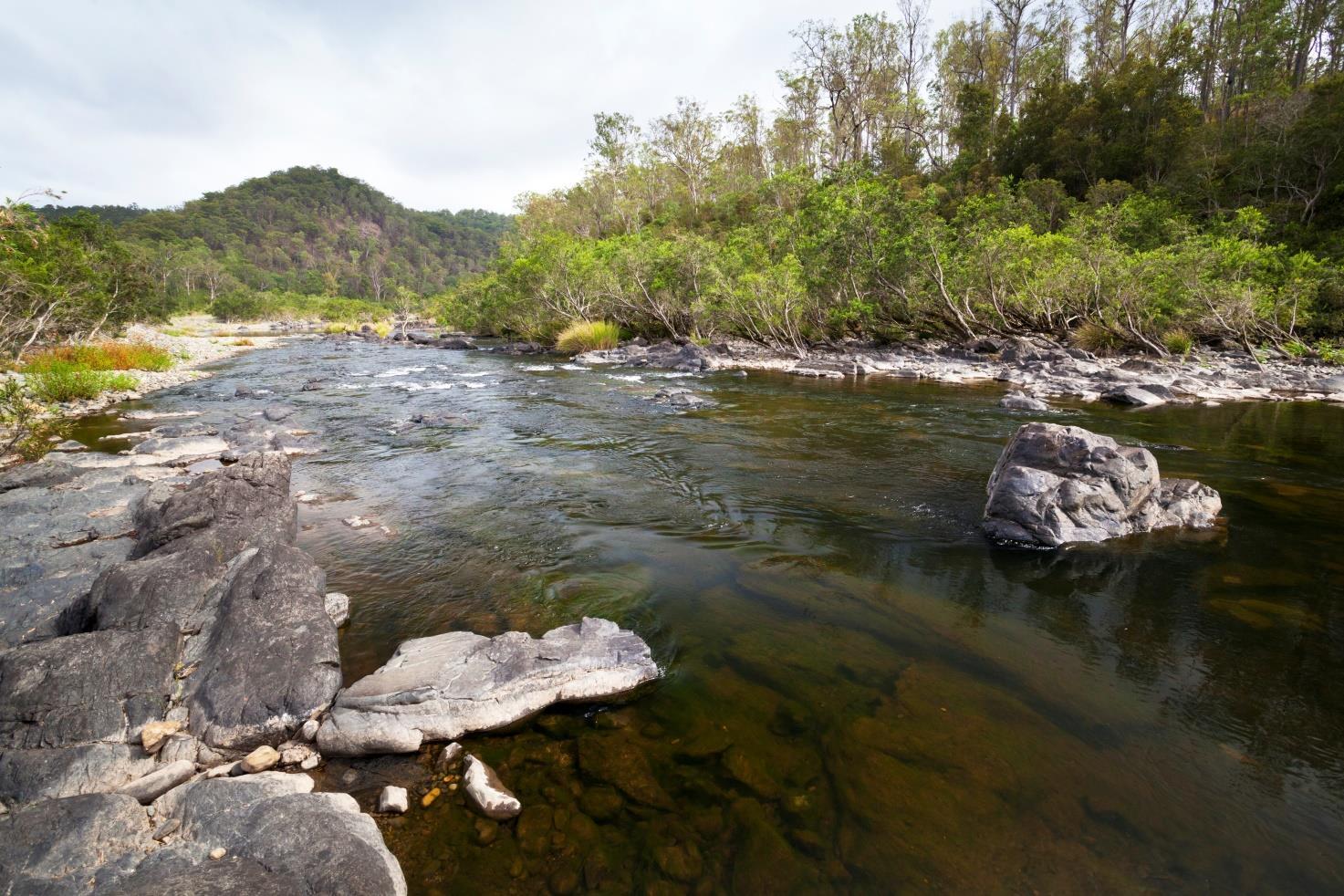
The Clarence Valley community places a high value on the natural environment and biodiversity. This is not surprising given that the natural environment underpins not only many of the region’s key industries like agriculture, forestry, aquaculture and tourism, but also the wellbeing of our residents and cultural connections to place. We live in the most stunning environment in NSW, and also the most biodiverse region. Around 50% of our local government area is national park or state forest, and the Solitary Islands Marine Park borders our southern coastal villages between Sandon and Wooli. Wetlands, lakes, beaches and national parks are the main feature of our coastal areas, including Iluka Nature reserve which is part of the World Heritage Listed Gondwana Rainforests of Australia.
The Clarence River has the largest catchment and is the longest river on the NSW east coast, and our big river or Breimba/Breembia, is our greatest natural asset. There is a diversity of vegetation types and wildlife habitats and the catchment is home to many endangered species including the last viable populations of the Eastern Freshwater Cod.
The economic and social benefits of biodiversity are considerable. For example, the recreational fishing industry in Australia is worth an estimated $2.9 billion per year. Similarly, national parks are Australia’s biggest tourism asset — more than 40% of all international visits include a trip to a national park.
In the Clarence Valley, the economic value of biodiversity is hard to quantify, but most of our large industries — such as horticulture, agriculture, aquaculture, tourism and forestry — rely on a healthy environment. The natural areas of our coast and hinterland are what people love about this area. Maintaining water quality, protecting biodiversity, retaining and managing our natural areas and the links between rare remnants of ecosystems is critical to our social, economic and cultural well being.
The vision of our draft Biodiversity strategy 2020 is for Council and the community it represents to understand and value the biodiversity of the region, working together to implement policy and actions, so biodiversity can be protected and enhanced for future generations. The LSPS and planning framework is one of the key tools we have to ensure biodiversity is protected and enhanced.
The priorities of our Biodiversity strategy are to:
1. Protect habitat and wildlife corridors
2. Have appropriate clearing controls and vegetation management
3. Be proactive about pest and weed management
4. Ensure the landscape is managed for bushfire and other impacts of natural hazards on the environment and human activity
5. Protect and improve aquatic habitat
6. Promote awareness and community education
7. Adapt to our variable and changing climate cycles
The successful implementation of the biodiversity strategy, in tandem with land use planning, will involve a collaborative approach between Council, the community, landholders and other government agencies to manage biodiversity now and into the future. It will increase in the amount of effective connectivity in habitats, increase landowner involvement in biodiversity conservation programs, maintain and improve populations of threatened species and improve water quality and overall river health.
The management of natural hazards, such as flooding, bushfire, coastal erosion and extreme heat, also rely on healthy and well managed natural areas, healthy ecosystems and natural assets. Land use planning has a role to play at the strategic level, determining where and how development occurs across the valley, and the broader impacts on biodiversity, the risk of natural hazard and the amenity and intrinsic values of natural areas.
Development in the Clarence has generally taken a risk informed approach to sustainable development. We know all too well about floods and bushfires, but that doesn’t mean we are immune to their effects. Determining an acceptable level of risk needs to be done with the community and with knowledge and input from the insurance industry, emergency management and others. Re-evaluating risk, considering historic

and more recent disasters in the Clarence, and across NSW and Australia, needs a strong evidence base and mature conversation with everyone involved.
Sustainable communities are ones that are distinctive, diverse, adaptable and resilient in a changing environment. To deal with complex problems such as maintaining ecosystems and accommodating a growing population, will involve a collaborative process with the community and with relevant authorities and people, such as NPWS, LLS, RFS, SES, RMS, LALC, land holders and others.
Maintaining the integrity of the natural environment is critical to the Clarence Valley’s future prosperity and sustainability. Biodiversity will be enhanced and vegetated areas of the LGA will continue to provide benefits to the community including high quality water and pristine environments that are resilient to natural disturbances. Future needs will include planning holistically for high demand areas to ensure that they do not impact adversely on the LGA’s important natural assets.

The Clarence Valley is blessed with an abundance of natural areas, biodiversity and areas of high environmental value. We are surrounded by 5 major national parks and almost half (450,000 ha) of the Clarence Valleys total land area (1.044 million ha) is either National Park or State Forest. The Council will need to work closer with NPWS and State Forests to ensure they are a good neighbor when it comes to natural hazard and pest management for adjoining property owners, and to ensure the other half of the Clarence in disparate ownership is managed for the benefit of the entire ecosystem and social and economic prosperity.
The Solitary Islands Marine park hugs our coastline from Sandon to Wooli (and beyond to Coffs Harbour) and the Sandon and Wooli rivers are some of the most pristine in NSW. Water quality in the Clarence catchment is also essential to maintain our natural environment and support social, cultural and economic activity. The Clarence floodplain management project, weeds control and many other strategies already manage and improve the floodplains ecosystems.
The Clarence Valley LGA is home to 113 threatened fauna and 113 plants. The LGA also supports 18 threatened ecological communities and 3 endangered populations. Over 450,000 ha of the Clarence Valley are included in the formal reserve system. It is a stronghold for populations of a number of species, including the endangered Coastal Emu, Black-necked Stork and the Coastal Giant Butterfly.
Residents and visitors of Clarence Valley understand the important role biodiversity values play in our identity, livability and attractiveness. As more people come to the Clarence Valley to live or visit, and as more people use waterways and our natural areas for recreation, these assets will need to be carefully managed so as to ensure that they can continue to sustainability support a wide range of activities. The Clarence Valley is also renowned for its ecologically significant wetlands, including over 25,000 ha of nationally important wetlands.

Figure 5 - Simplified fauna corridors and habitats map for the Clarence Valley
The protection of the environment and its values is already managed through existing planning controls which are an important ongoing management tool. The Biodiversity Conservation Act 2016 provides a framework and tools to avoid, minimise and offset impacts on biodiversity through the planning and development assessment process. A range of tools are also available to protect biodiversity on private land including biodiversity stewardship agreements, conservation agreements and wildlife refuge agreements. However, further mapping of areas of environmental importance and detailed studies to determine appropriate planning policy response and actions is needed.
Strategic planning and mapping at a local level will allow identification and protection of biodiversity assets, to ensure that development is placed appropriately to avoid adverse impacts on the region’s biodiversity. This should include work with adjoining Councils to identify corridors, areas of importance and where appropriate to align the actions and activity of Councils and state government regarding biodiversity protection and implementation of our Biodiversity strategy.
Koalas are an iconic species that require increased attention to ensure their long-term survival. Clarence Valley currently has a Koala Plan of Management for Ashby, Woombah and lluka, and the recommendations have been adopted into our DCP’s for these localities, along with Waterview Heights. We currently have a koala register which is gathering location data on this iconic species across our Clarence which will then feed into a Council wide koala management plan, which is currently with the state government for approval. A strategic approach to identify and protect areas to support viable koala populations is important to help sustain their long term viability, and inform land use decisions.
Building on existing incentives - landholders, community groups and government will be supported to continue to improve their management of high priority biodiversity sites and to protect and enhance native vegetation communities. Programs such as the biodiversity awareness program could be delivered across the Clarence, to strengthen efforts to protect and enhance biodiversity. A key aim will be to build the capacity of the community to contribute actively to the preservation of our natural assets.

Aboriginal people were, and in numerous cases still are, reliant upon plants, animals and ecological processes because bush foods, medicines and materials are components of Aboriginal economies, personal identity and culture. Examples of areas where Aboriginal people combine traditionally derived and Western solutions have seen significant rehabilitation of flora and fauna. Enterprises based on natural resources for rehabilitation of vegetation, production of artefacts and niche foods or bush medicines are important to many Aboriginal groups. These enterprises rely upon a diversity of species.
Actively engaging with the local Aboriginal communities to protect and restore a range of high conservation value assets could be of long-term benefit to the Clarence Valley environment and our communities. Proactively engaging with and learning from traditional owners, and involvement in environmental stewardship, fire management, food production and historic accounts of natural hazards and cultural practices would all enrich our wider community.
Priority 15. Preserve and enhance our natural environment
Actions
15.1 Take a strategic approach to land use planning, informed by our biodiversity strategy and strategic environmental goals, particularly for corridors and areas of high environmental value
15.2 Engage with traditional owners and aboriginal communities to enable their cultural traditions and connection to country to be included in the planning for environmental outcomes. Timeframe ongoing
ongoing
15.3 Ensure that water quality and aquatic biodiversity impacts are considered in planning decisions, and the planning framework aligns with our coast and estuary management plans. 15.4 Continue to protect water supply catchments from development and activity that could compromise drinking water supply, including for Shannon Creek dam, Lake Hiawatha and Lake Minnie Water.
ongoing
ongoing
Partner
Community
Traditional owners; CVAAC; community BCD; Community
Community
Clarence Valley’s landscape beauty, biodiversity and natural resources are recognised nationally and internationally. Coastal places, such as Iluka, Yamba, Angourie, Brooms Head, Sandon, Minnie Water and Wooli provide an enviable lifestyle for residents and visitors, where the environmental assets are essential to their character and the communities wellbeing and quality of life - in fact, many are entirely surrounded by National Parks.
The natural environment of our river valleys and backdrop of the escarpment ranges provide the foundation for the character of our urban areas.
There are significant opportunities, through strategic land use planning and good urban design, to create places where people want to spend time, enjoy social interaction, access services and contribute to the local economy. Utilising the value of the natural environment, whether that is street trees or riverside links in urban areas, natural stormwater management, amenities in parks and natural areas, and larger scale strategic approach to managing the landscape and land use across the valley, can all provide ways positive outcomes.
Improving sustainability will involve incorporating natural landscape features into the urban environment; protecting and managing natural systems; cooling the urban environment; innovative and efficient use and re-use of energy, water and waste resources; and building the resilience of communities to natural and urban hazards, shocks and stressors.
Urban development, particularly new housing and employment land, is needed to support our growing population. This growth is not mutually exclusive with maintaining our natural environment.
A ‘place-making’ approach, where we think carefully about the location of new urban development to create places that respect and integrate with the natural environment, will continue to make the Clarence Valley a community full of opportunities.
Rural residential development and other forms of urban development that utilise land will be investigated to ensure we provide a diversity of housing types without impacting on the natural environment. A Rural Residential Strategy should be explored, to also consider impacts on biodiversity.
Managing development pressure and maintaining the green breaks between our unique villages, linking important ecological communities and improving the blue-green grid across our area and links with other Council areas is important. These measures will help differentiate and separate the distinctive character and lifestyle of each village, protect the landscape and its cultural heritage and preserve opportunities for outdoor recreation and healthy lifestyles of residents.
Priority 16. Foster a balance between sustainable development and the environment Actions Timeframe 16.1 Initiate projects and surveys that will provide more detailed, local scale vegetation and habitat mapping. short
16.2 Develop and maintain relevant biodiversity mapping layers, including fauna corridors and linkages, to inform strategic planning for urban development, infrastructure and other planning purposes, including with adjoining Councils. 16.3 Implement an agreed approach for the Biodiversity Strategy 2020 and application through assessing planning proposals and development applications 16.4 Ensure land use planning decisions contribute to management policies and practices that protect and increase the amount of land covered by native vegetation and minimise potential climate change impacts on biodiversity by increasing the resilience of natural ecosystems and landscapes. 16.5 Ensure that land use and development decisions contribute positively to bushfire management in a way that maintains, or does not compromise, the ecological integrity of areas of native vegetation or the health and safety of people, and contributes to the resilience of the economic, social and cultural aspirations for the Clarence Valley.
16.6 Implement actions in adopted estuary management plans (including the Clarence, Wooli, Sandon and Lake Cakora estuaries) which contribute to protection, enhancement and promotion of biodiversity and disaster risk reduction. 16.7 Update relevant sections of the regional and local planning framework to implement actions of the Biodiversity Strategy 2020, including: Determine priority areas to conserve and repair reaches and sub-catchments for the freshwater rivers and creeks Map habitat corridors across all land tenures and identify areas of greatest conservation significance Adopt a Council wide Koala Plan of Management (KPoM), with supporting detailed maps and priorities for land use planning Develop a factsheet delineating allowable activities and decision pathways for clearing of native vegetation and increasing native vegetation cover, for use by planning staff and developers
medium
medium
medium
medium
medium
medium
Partner BCD
BCD, adjoining Councils
Community
Community
Community, RFS, BCD
community
community
The Clarence Valley has a diverse landscape from the coast to the rural hinterland. We have responsibility for more than 70km of coastline, 50% of the area is state forest or national park, the Clarence River is the largest easterly flowing river in NSW and we have the largest agricultural sector on the north coast.
While this gives the Clarence Valley stunning scenery and enviable natural assets, it also means communities in the Clarence Valley are exposed to a wide range of natural hazards.
These hazards mostly present themselves and impact on communities in line with Australia’s various climatic cycles of dryer years which produce drought, heatwaves, bushfire and consequent impacts; and wetter years when east coast lows, flooding, storm surge and coastal erosion are more prevalent. However, the potential impacts of natural hazards can impact on our people and economy at any time.
Severe wind, hailstorms, flash flooding and other environmental hazards such as acid sulfate soils, landslip, invasive weeds and pests, infrastructure failure and electro-magnetic variance (EMV) all have the possibility of impacting communities. The State Level Emergency Risk Assessment (SLERA), and processes at a state government level deal with many hazards, however land use planning to make our local community safe is a core responsibility of Council.
The Clarence river catchment is a huge 22,716 km2 and stretches from the Queensland border to the Doughboy Range in the south. The river itself is greater than 430km in length with 10 rivers flowing into it. Since flood records commenced in 1839, Grafton has been subject to over 120 floods - the highest being in January 2013 at 8.08m. There has been limited research on pre-European settlement, but research from other catchments indicates that significantly bigger floods have occurred and can occur in the Clarence catchment. Modelling of floods indicates that our settlements can be impacted by flood, and while levees have provided some protection to recent floods, larger floods have the potential to impact on Grafton and our other settlements on the floodplain.
“Land use planning is perhaps the most potent policy lever for influencing the level of future disaster risk.”
Productivity Commission Report into Natural Disaster Funding Arrangements, 2015
The NSW Flood Development Manual provides an analysis of the likelihood of different floods happening within a lifetime. The table below illustrates that there is a 50% chance of a 1:100 year flood occurring within any given 70 year timeframe (within a lifetime). This gives strong credence to the idea of a longer term planning time horizon for land use strategy and development decision-making. Recent floods in Grantham, Townsville and other places around Australia have been up to a 1:1000 chance per year event.
Size of flood (chance of occurrence in any year) (ARI/AEP)
1 in 10 (10%) 1 in 20 (5%) 1 in 50 (2%) 1 in 100 (1%) 1 in 200 (0.5%)
Probability of Experiencing the given flood in a period of 70 years
At least once (%) 99.9 97.0 75.3 50.3 29.5 At least twice (%)
99.3 86.4 40.8 15.6 4.9
The state governments Planning for Bushfire Protection 2019 provides development standards for designing and building on bushfire prone land in NSW. It requires a more strategic approach to ensuring that bushfire is considered at the earliest possible phase of the development process, from regional plans, land use planning, zoning, masterplans, subdivisions to individual building applications. Big picture decisions regarding where we put more houses, employment land and infrastructure across the Clarence Valley must consider bushfire and risk to life, property and amenity, along with biodiversity impacts of clearing for development and asset protection. These considerations need to work alongside on-going management regimes, such as our bushfire management plan and climatic extremes that can be experienced. A more strategic landscape management approach, rather than ad hoc development applications, is needed.
Historic settlement patterns and decisions have meant that some communities are exposed to fire hazard. Planning for new urban development and infrastructure needs to ensure we take a precautionary approach to avoid hazards, alongside potential impacts of asset protection and hazard reduction on biodiversity and environmentally sensitive areas.
Rural residential development and development in bushfire prone areas, primarily rural zones of our valley, need to be informed by landscape scale bushfire considerations, including evacuation routes, ember attack, smoke and emergency response considerations. We require a better approach to hazard reduction. These considerations may mean that some land will be unsuitable for development, and new development that creates additional risk to life or property needs to be addressed.
Established homes and infrastructure in bushfire prone areas would not normally come in contact with planning processes, however, Council will explore ways to ensure that we don’t ‘plan and forget’, and checking of compliance with development conditions, appropriate asset protection and vegetation and property maintenance to protect emergency personnel, the life of occupants and neighbours, and protect property and amenity should be explored with RFS, DPI, LLS, NPWS and other agencies.
Land use planning leaves the longest legacy for the community. Decisions made now about where homes, businesses and infrastructure are located will stay with us for generations. This means that they need to be located and designed to avoid unacceptable risks from the potential exposure to natural hazards.
Working across sectors, technical disciplines and through the whole cycle of - prevent, prepare, respond, recover - is essential for land use planning at the prevention phase, but also for recovery and long term resilience.
Priority 17 –Plan for safer, more disaster resilient communities
Actions
17.1 Ensure that decision making helps create safer, more disaster resilient communities, with particular regard to the longterm social and economic costs of the potential effects of natural hazards, and issues relating to risk to life and evacuation capacity. 17.2 Update mapping of bushfire prone land, in accordance with Planning for bushfire protection 2019 and in collaboration with NSWRFS and DPIE. 17.3 Ensure that the Clarence Valley Floodplain Management Plan is updated in line with any amendments to the NSW Floodplain Development Manual and that our LEP, DCPs and other planning processes reflect best practice
17.4 Update the Grafton flood evacuation plan to consider future growth and recent developments, such as the new Grafton Bridge, to ensure the community is prepared for potential flood events and breaches of the levee wall, and to support sustainable development and vitality of the Grafton CBD and North and South Grafton. 17.5 Promote the use of flood resilient building practices for development in areas at risk of flooding in the Clarence up to Probable Maximum Flood and explore the economic feasibility and implications of planning controls.
17.6 Advocate to state government for critical infrastructure development, such as hospitals, highways and other government funded projects to be resilient and sustainable to promote the resilience of communities within the Clarence Valley. 17.7 Support the development of a Clarence Valley Resilience Strategy with relevant stakeholders at local and regional levels, focussed on providing a strategic approach to management of natural hazards across our landscape and settlement patterns and aligning Council activity and funding opportunities from external sources, particularly government funding for resilient communities. Timeframe
short
Short-medium
medium
short
short
medium
Short-medium
Partner
RFS, SES, DPIE, community
RFS & DPIE
SES, community
SES, community
SES, DPIE, community
State government agencies
OEM, community, all agencies
Priority 17 –Plan for safer, more disaster resilient communities 17.8 Work with local SES, RFS, OEM and relevant state agencies to secure funding to proactively promote and visit high priority rural and rural residential areas to ensure that properties are prepared for bushfires, floods and other hazards across the Clarence Valley. 17.9 Review and update floodplain risk, bushfire and coastal management mapping to manage risk, particularly where urban growth is being investigated. 17.10 Incorporate new knowledge on regional climate projections and related cumulative impacts in local plans for new urban development.
On-going
medium
medium
SES, RFS, OEM & community
DPIE, FMA, RFS, & community DPIE
Priority 18 – Promote a low-carbon community
The Clarence Valley Council Sustainability Initiative 2006 was an award winning process that identified actions that could be taken to achieve the vision of creating a culture of living sustainably in the Clarence Valley. The guiding principles and key elements of the Initiative are still relevant today and important to this LSPS.
Taking a strategic approach to planning can help contribute to living more sustainably. This includes how we plan our settlement patterns across the valley and sub region, forms of transport we use, the design of communities and infrastructure, and of course detailed design and energy use in buildings, amoung others. Many other actions sit outside of planning controls.

Where possible and economically feasible, going beyond minimum requirements in state based legislation, such as guidelines for BASIX and reducing greenhouse gas emissions will have commensurate benefits for achieving goals set by Council.
Opportunities to develop ‘exemplar’ sustainable buildings and sustainable communities could be explored. Work with local architects, the Green Building Council of Australia and willing developers or business owners could provide an example for the Clarence community of how to develop cost effective and efficient buildings suited to our climate. Promoting existing buildings that use passive heating and cooling and other sustainability initiatives should also be explored.
Council has joined a number of other councils world wide that have recognised the urgency needed to implement actions to mitigate and adapt to projected climate change impacts and acknowledged a ‘climate emergency’.
We have actioned the climate emergency by fast tracking a strategy of cutting Council emissions by 40% and increase the use of renewables to 50% well before 2030. Council adopted a five-point resolution aimed at addressing climate change urgently, including making “climate change” a sub heading in all council reports and continuing to carry out actions in an earlier “100% Renewables” strategy.
Council has been proactive on both mitigation and adaptation to our climate.
As outlined above our plans include measures to plan for resilience to natural hazards. Ensuring we consider floods, bushfire, coastal erosion and other hazards when making decision about land use, and any modelled increase from a changing climate is important to adaptation. Other measures such a implementing the Biodiversity strategy, ensuring our economy is resilient, implementing streetscape strategies to shade and
cool urban areas, and identifying public heat refuges and other strategies will provide for better places for the community to enjoy, and also living with our variable climate.
Considered planning, informed by a robust evidence base and taking a precautionary approach to hazards is needed to ensure people, property, and infrastructure are able to respond to changing conditions. Adaptation strategies will be needed for existing built up areas that are at risk or will become at risk in the future.
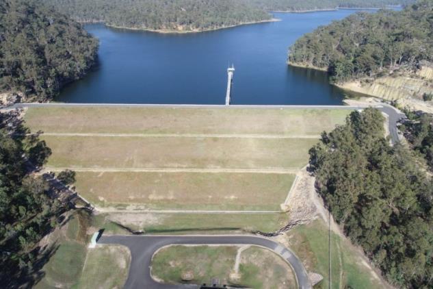
Shannon creek dam provides urban water security to support a growing population, but the current drought and devastating bushfires should remove any complacency regarding future water security. It is important to plan ahead and ensure this region, including Coffs Harbour, is resilient and maintain confidence for investment and growth. Drought has a devastating impact on our agricultural sector and economy and highlights the need to support sustainable agriculture initiatives.
There are a number of important actions regarding water security that need to continue, including: Implementing the Regional Water Efficiency Strategic Plan; monitoring regional water supply; ensuring new development is water wise; and, that planning for new urban areas considers water security, infrastructure costs and efficiency.
Planning to be more water efficient, and ensuring that the Clarence river catchment retains its natural attributes and avoids the development of future dams in other locations across our valley is essential for the economic, social, cultural and environmental sustainability of our valley.
As well as water availability, water quality is a key consideration across the catchment. Land use planning needs to ensure that our waterways and productive rivers remain clean and usable for urban uses, agriculture, recreation and ecosystem services. Innovative approaches to water conservation include largescale water efficiency measures such as water sensitive urban design and water reuse. Protecting wetlands,
riparian corridors and other features across our catchment will maintain a well functioning catchment and is an important responsibility of land use planning.
Potential exists to incorporate more sustainable energy generation options and projects and the Clarence Valley is already well placed to utilise renewable energy generation, both through private houses and larger scale renewable generation. However, while renewable energy such as solar and hydro have identified potential within the Clarence Valley, large scale land use change to solar or wind farms would only be progressed where they do not impact on agricultural land, the environment or existing or future communities.

Attracting investment for renewable energy projects within the Clarence Valley could help position us as a ‘region of excellence’ for alternative energy technologies. Investigating opportunities for green industries such as bottle recycling plants and reuse of waste strategies will not only assist in management of energy use and reduction of waste generation but also has the potential for significant economic benefits in terms of employment generation.
Ensuring that planning considers health impacts from a warming climate, building resilience to deal with damaging storm events and promoting initiatives to reduce emissions from transport are attached to Actions in other sections of the LSPS.
Priority 18. Promote a low-carbon community
Actions
18.1 Update relevant planning controls to ensure that areas for investigation for urban or employment land must also consider energy efficiency, infrastructure efficiency and sustainability impacts through the planning process 18.2 Plan for an ‘exemplar’ sustainable development within the Clarence, and investigate working with the Green Building Council of Australia and willing developers or businesses to incorporate and promote best practise sustainable design.
18.3 Ensure strategic planning and development proposals consider the regional water efficiency strategic plan and best practice water sensitive urban design
18.4 Work with state government agencies and large scale developments to promote sustainability initiatives that go beyond minimum statutory requirements. Timeframe short
medium
short
medium
18.5 Develop a valley wide carbon emission reduction plan
medium
18.6 Promote the installation of electric vehicle charging stations and develop policy to include charging stations in new development
18.7 As part of development of a Resilience Strategy (Action 17.7), identify and support a network of extreme heat refuges, and increase the urban tree canopy and plant life along retail streets, carparks and other urban areas.
short
Partner
DPIE, community
DPIE, private sector & community
DPIE, community
DPIE, private sector & community DPIE, community
DPIE, private sector & community DPIE, private sector & community


