URBAN ANALYSIS: BARCELONA 2022
JACKSON Directed Studies 8900 with Dr. Hala Nassar
RACHAEL

00 INTRODUCTION 01 URBAN ANALYSIS CITY EVOLUTION HISTORY TIMELINE DEMOGRAPHICS ECONOMICS EDUCATION CRIME STATS CIRCULATION COVID RESPONSE 02 ENVIRONMENTAL ANALYSIS TOPOGRAPHY BUILDING HEIGHTS VEGETATION WILDLIFE WATER SYSTEMS AIR POLLUTION NOISE LEVELS ENERGY SOURCES CLIMATE CHANGE 03 COGNITIVE MAPPING LYNCH INTRODUCTION EDGES DISTRICTS PATHS NODES LANDMARKS 04 SWOT STRENGTHS WEAKNESSES OPPORTUNITIES THREATS 05 REFERENCES TABLE
CONTENTS
OF
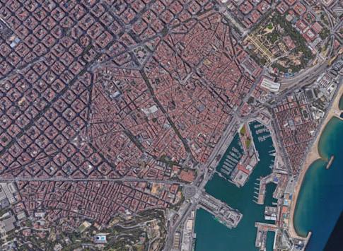
101.9 km² City Area 636 km2 Metroploitian Area 7,726 km² Provence Area

4
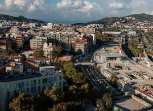
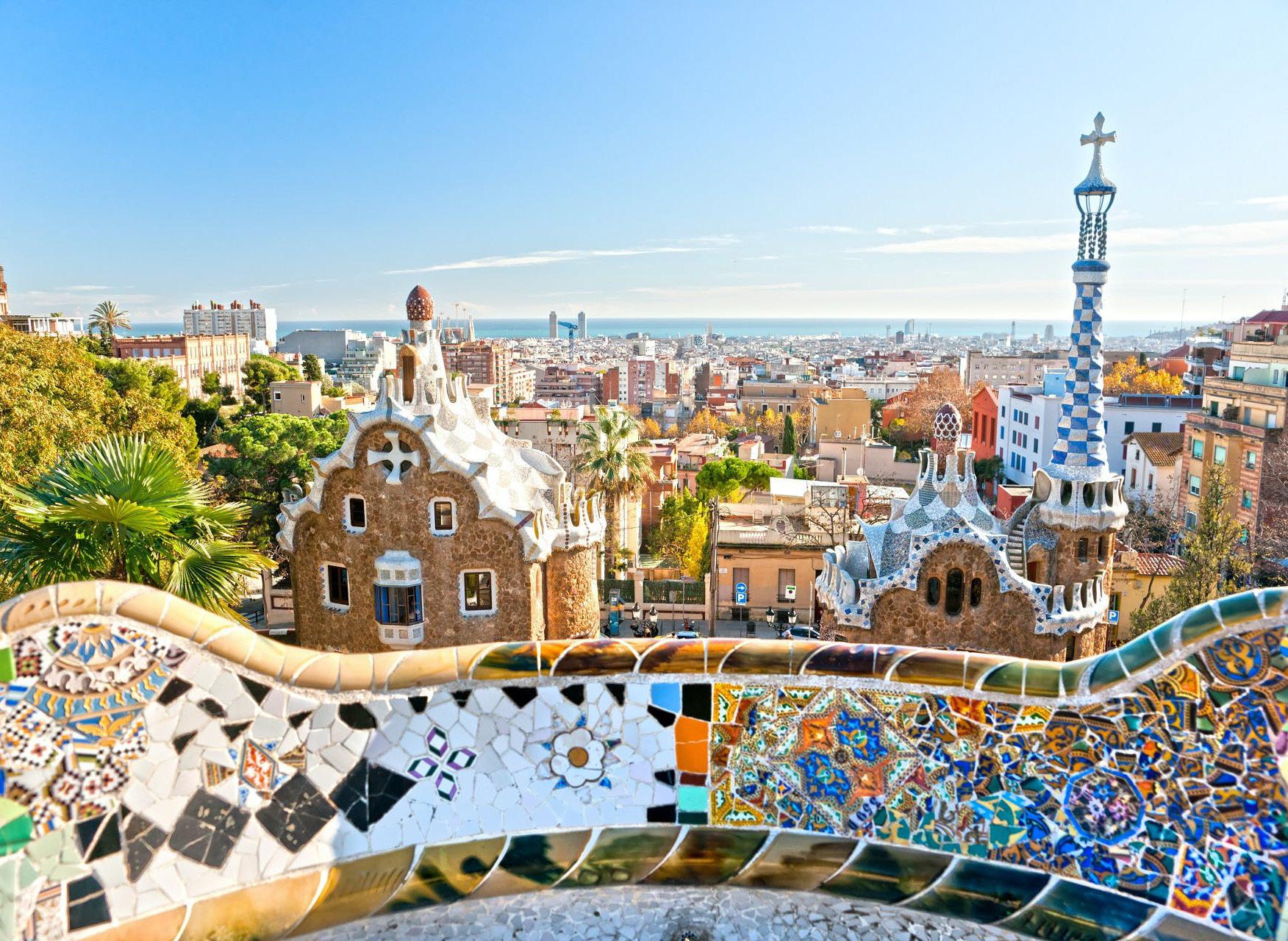
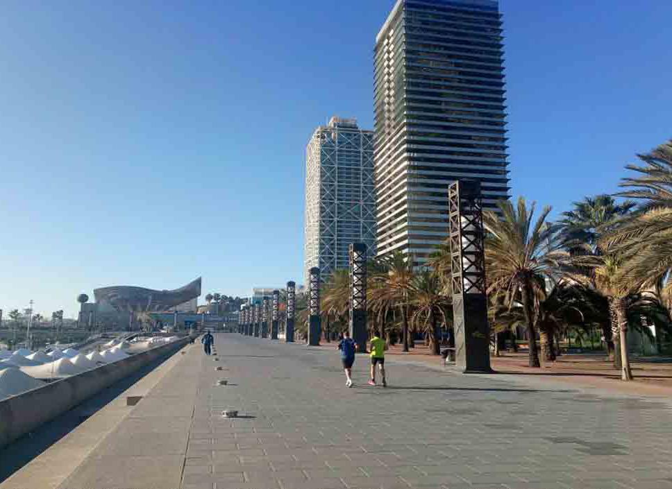
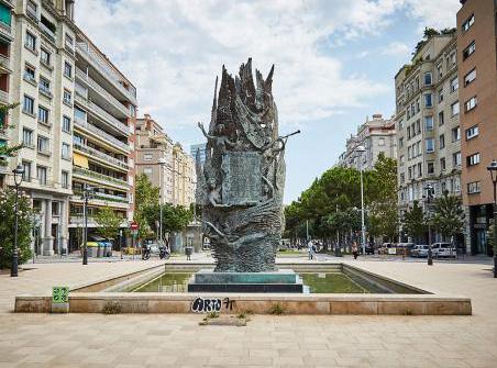
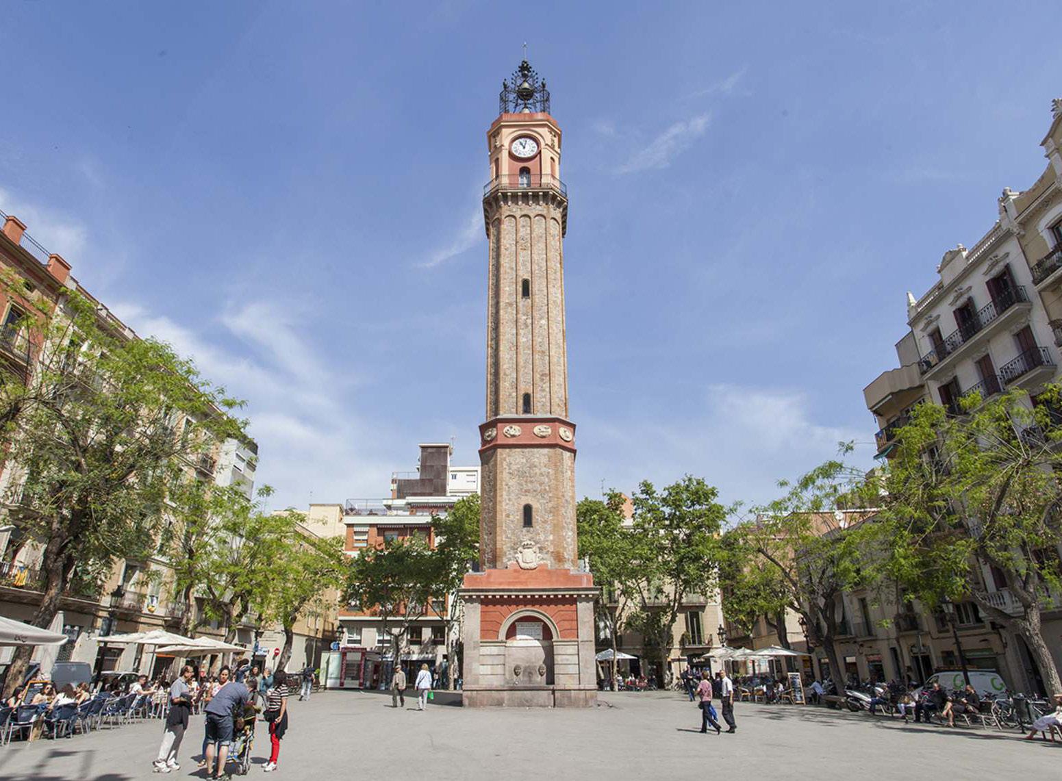
Urban Analysis of Barcelona
Urban Analysis
Barcelona has a long history from roman times, and many different people have helped shape the city today. Some historical figures include Emperor Augustus, Antoni Gaudi, Josep Puig I Cadafalch, and important events like the World Fair of 1929 and the 1992 Olympics.
These have turned Barcelona into the 3rd most visited city, famous for its architecture, beaches, and vibrant nightlife. It is an international city with a diverse population and a mixture of many different cultures and languages, creating the perfect place to visit or study.
So what is urban analysis? Urban analysis looks at the social, demographic, and economics of a city. We can determine a city’s strengths, weaknesses, opportunities, and threats by seeing these components. With these observations, we can start understanding a city and design solutions for its threats and weakness by taking advantage of its strengths and opportunities.
By looking at the city’s history, demographics, economics, education, crime rate, circulation, and response to covid-19, we can understand Barcelona at a deep level of more than just a tourist.
5
SUMMERY OF WHAT IS GOING ON IN BOOK AND HOW TO LEARN FROM INFO GATHERED
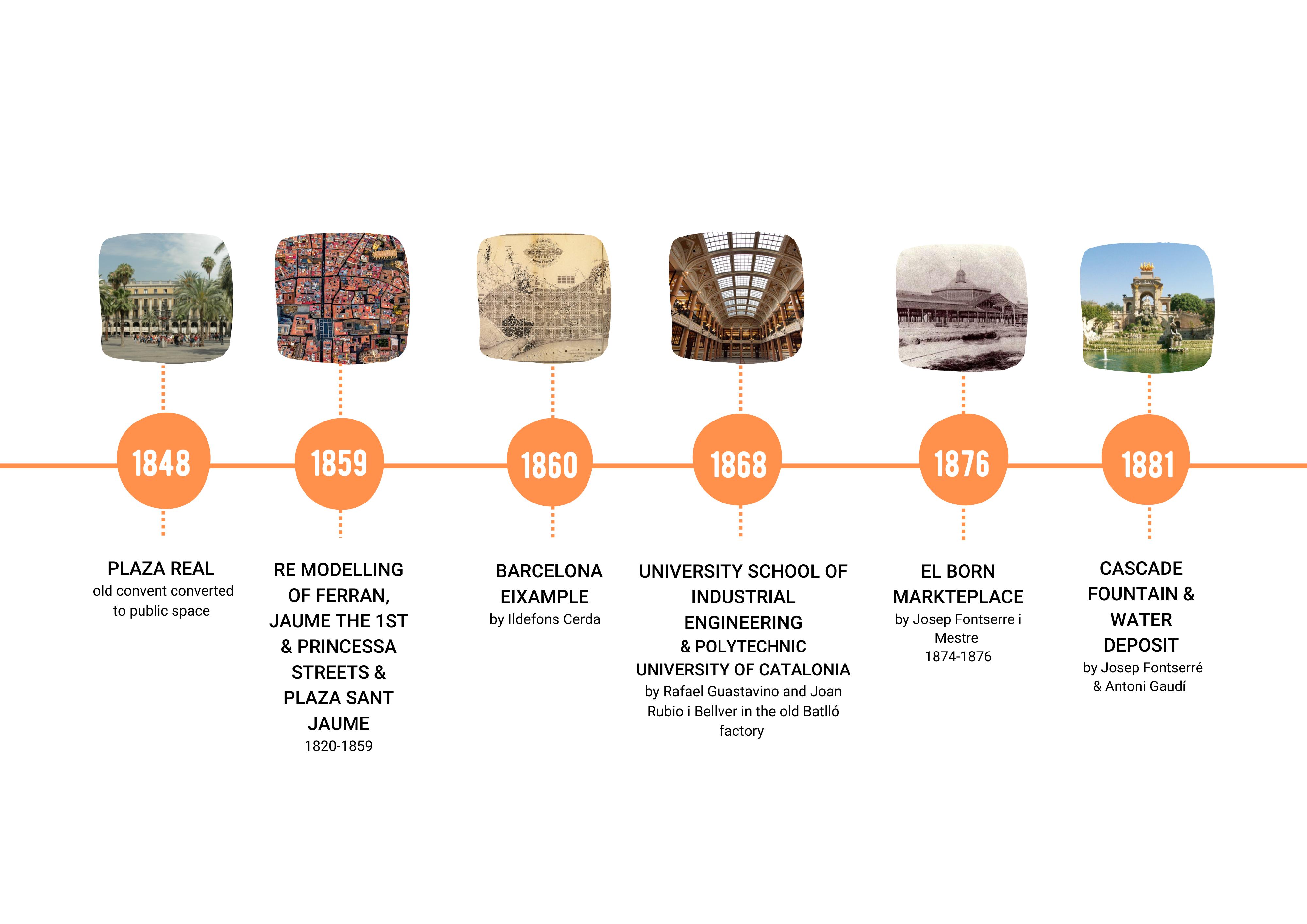
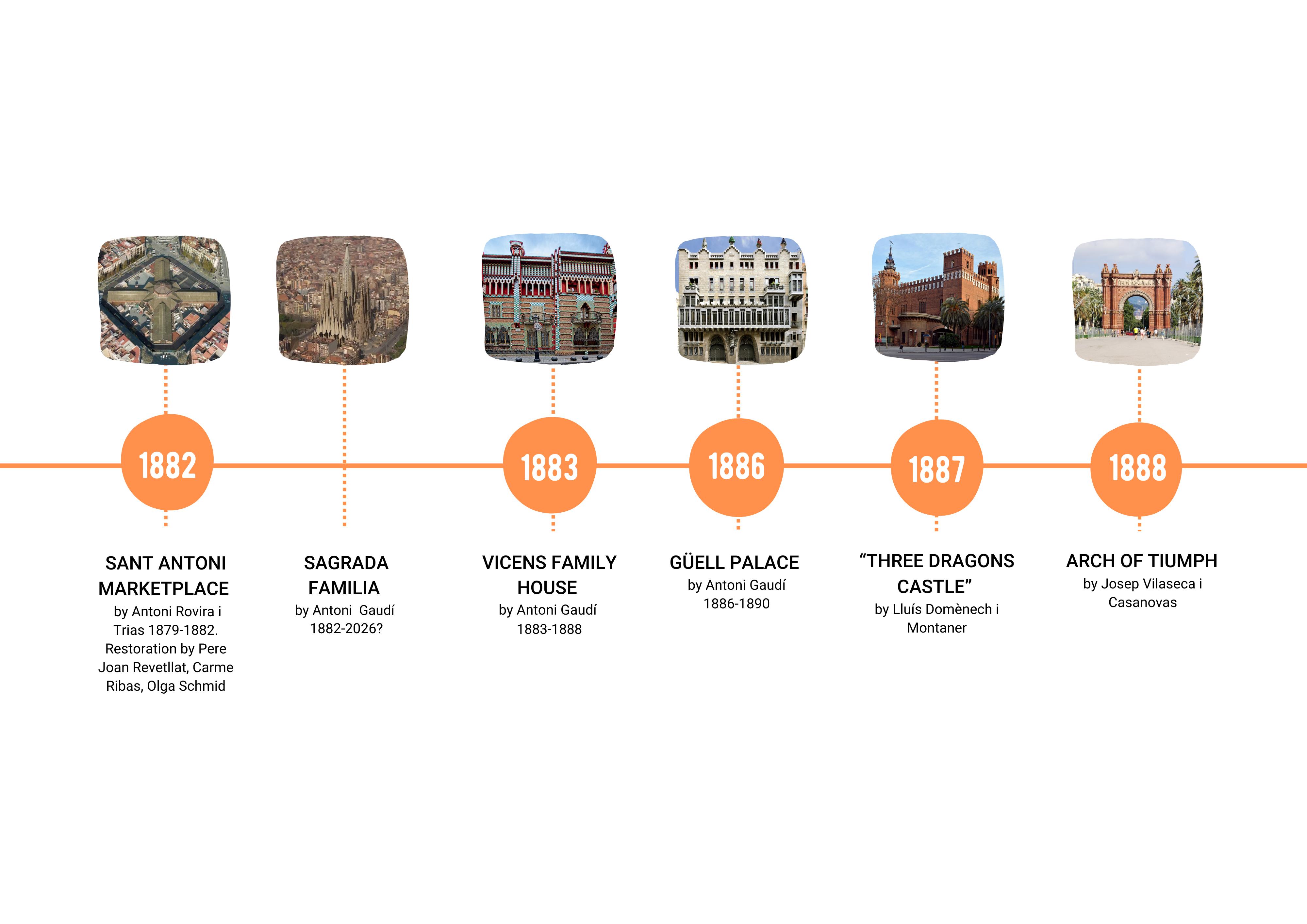
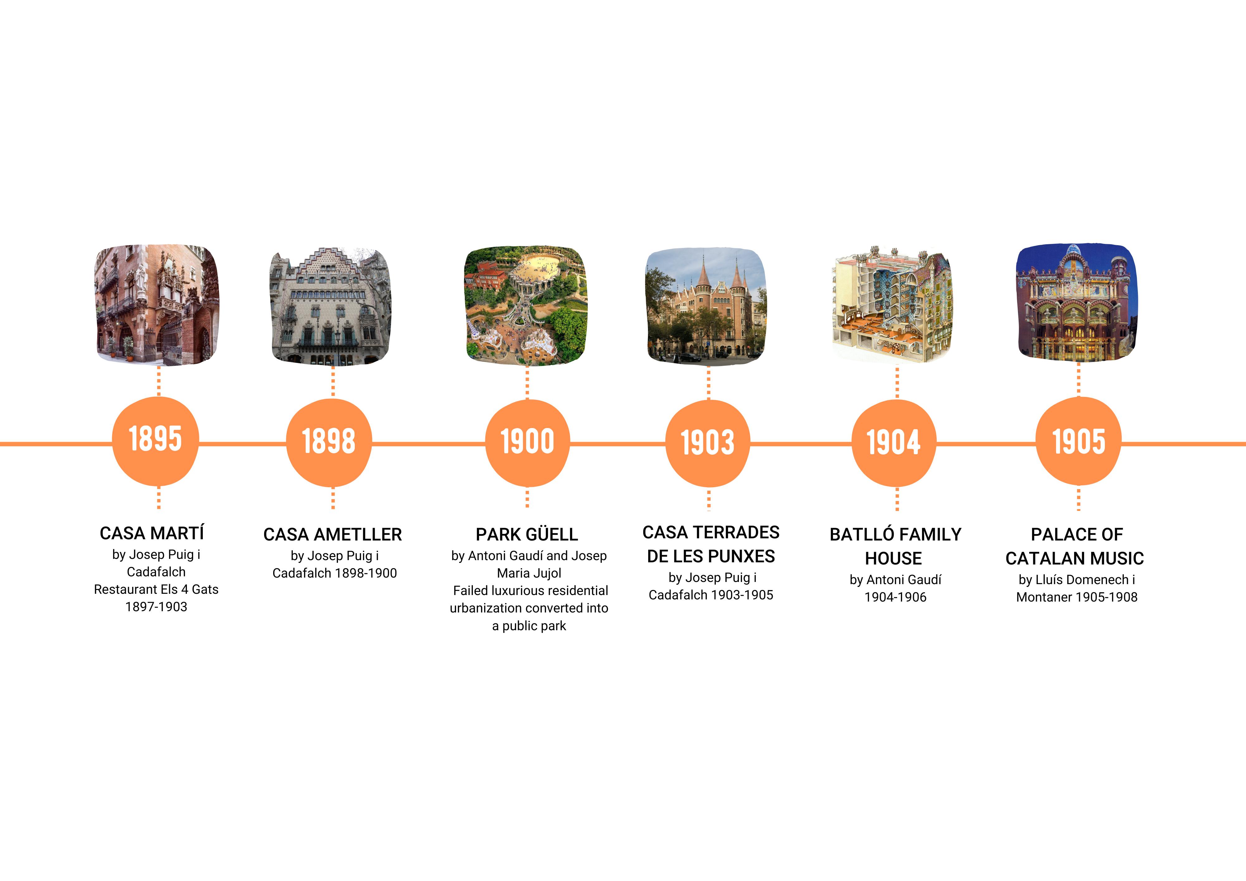
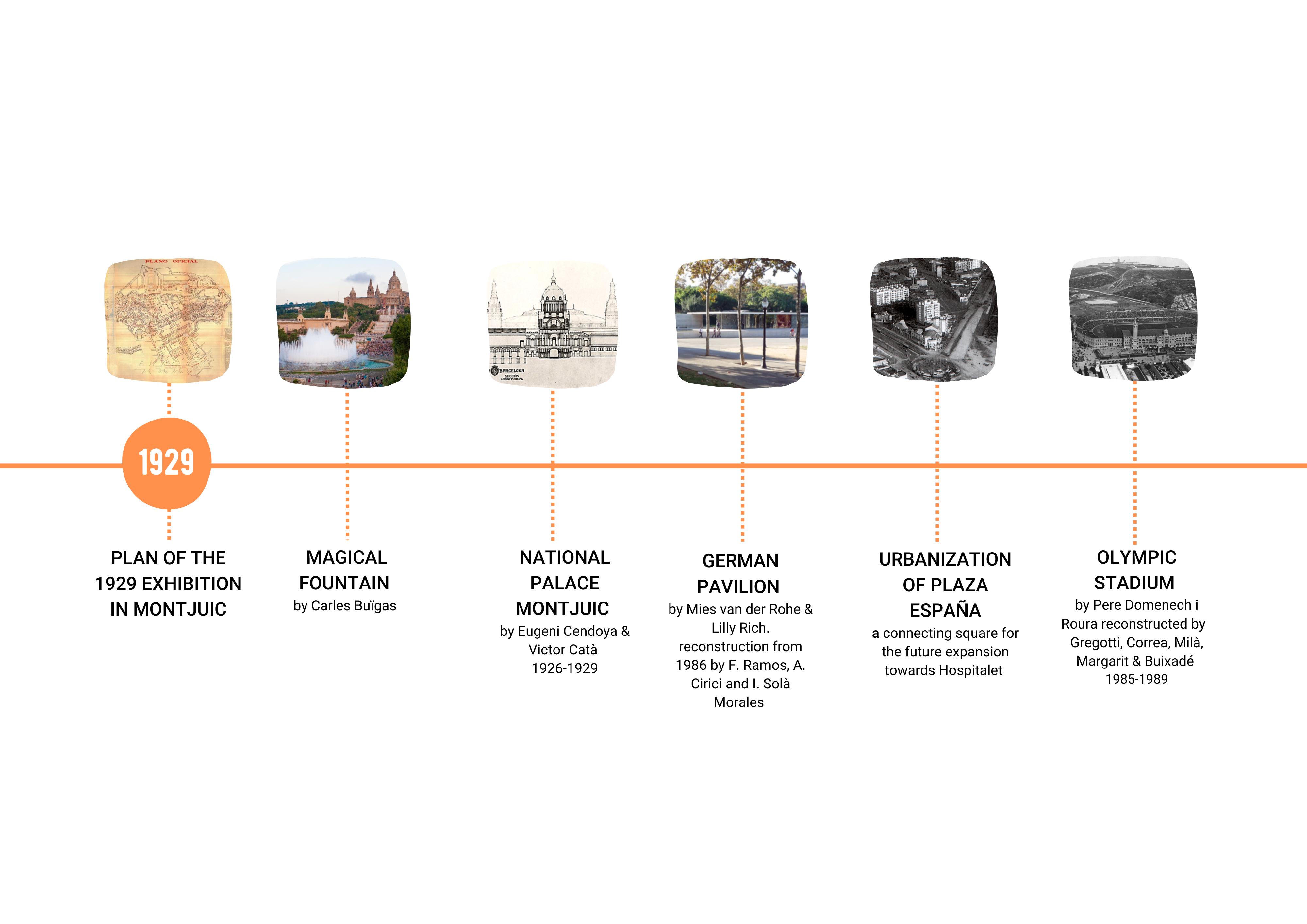
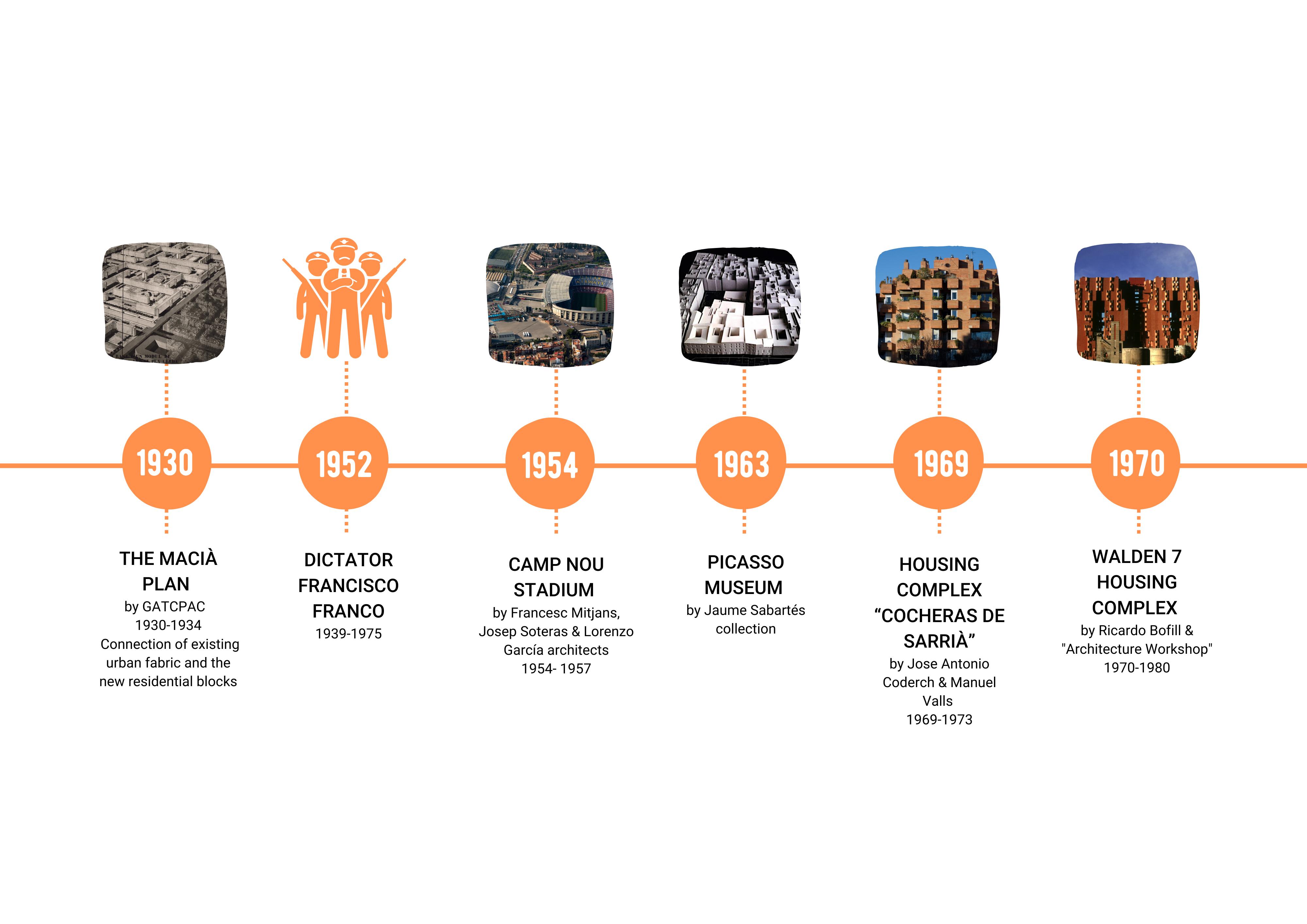
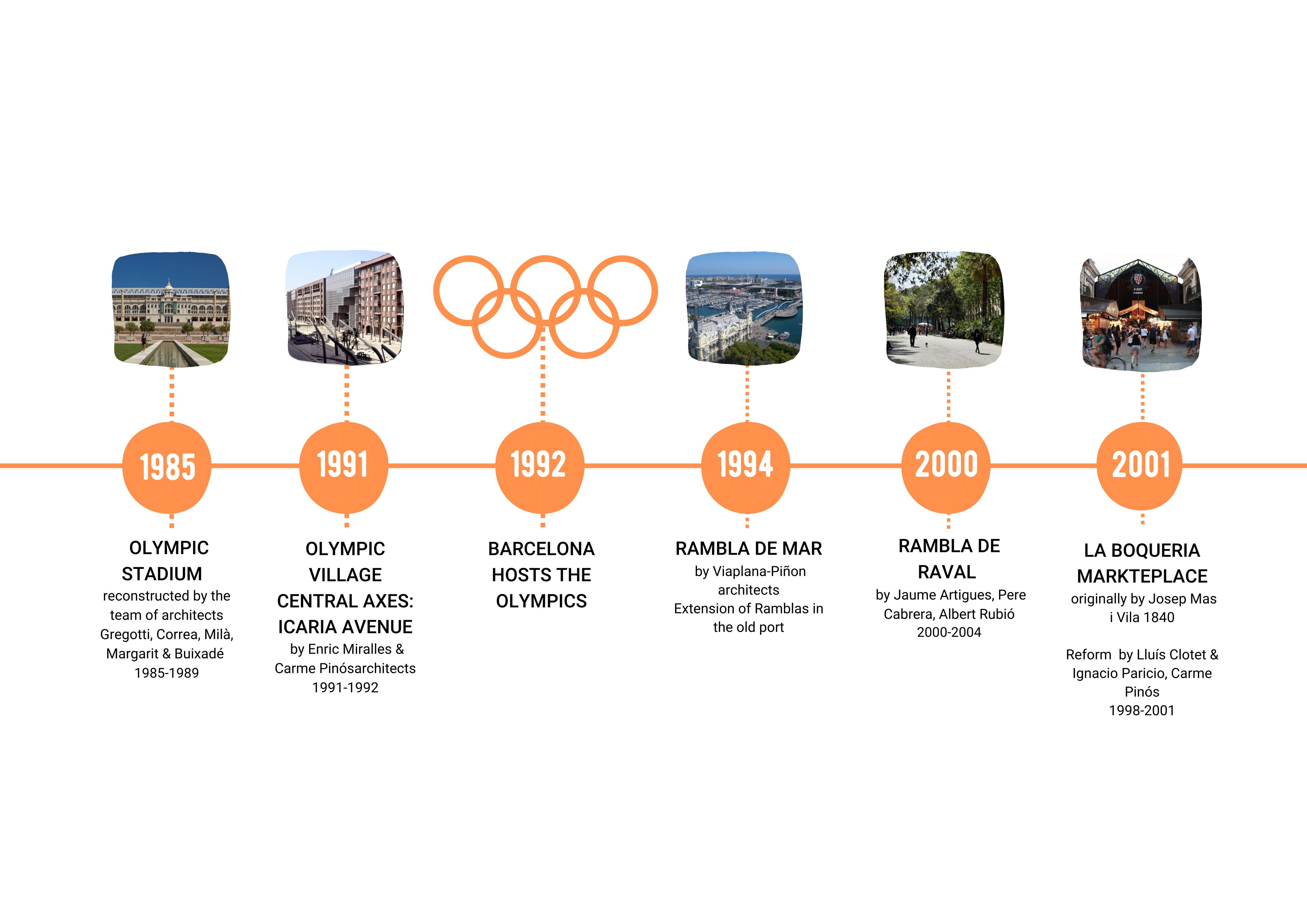
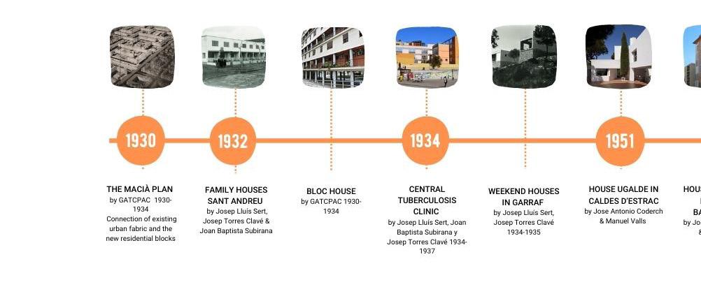
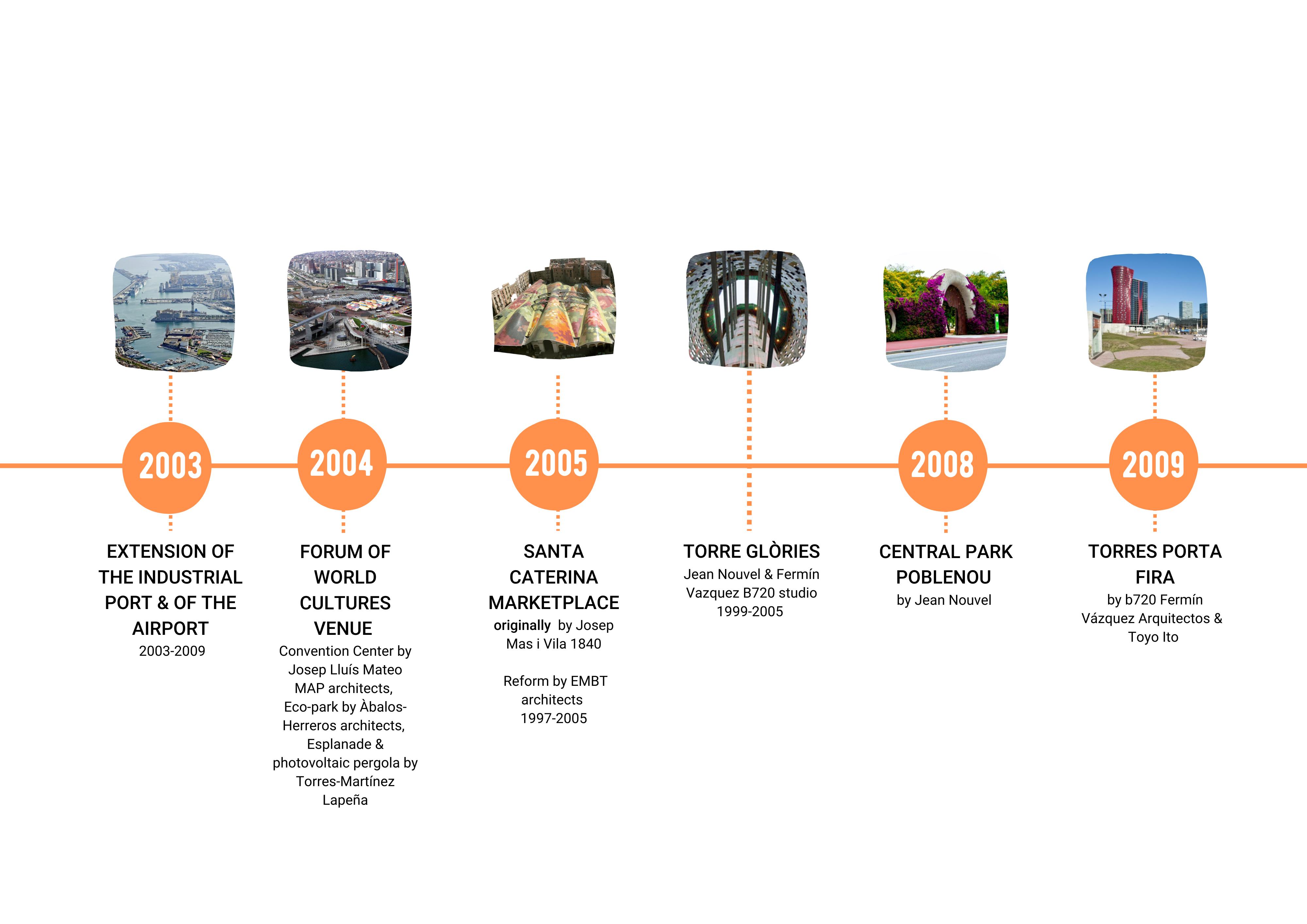
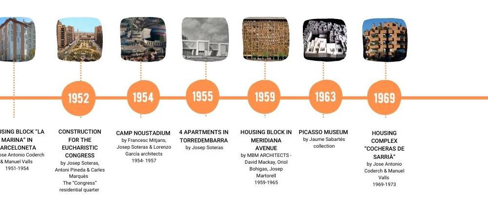
CITY EVOLUTION
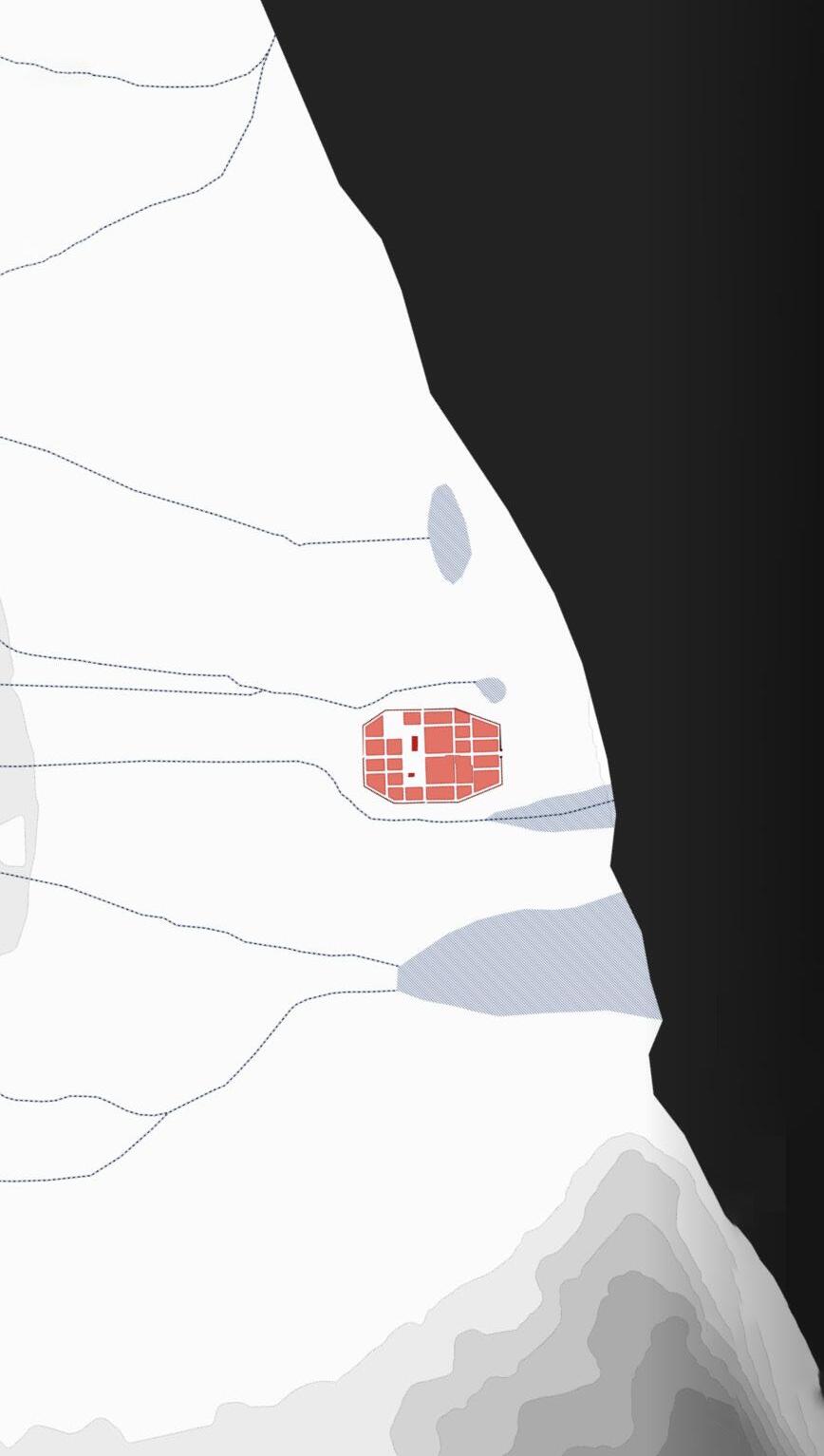
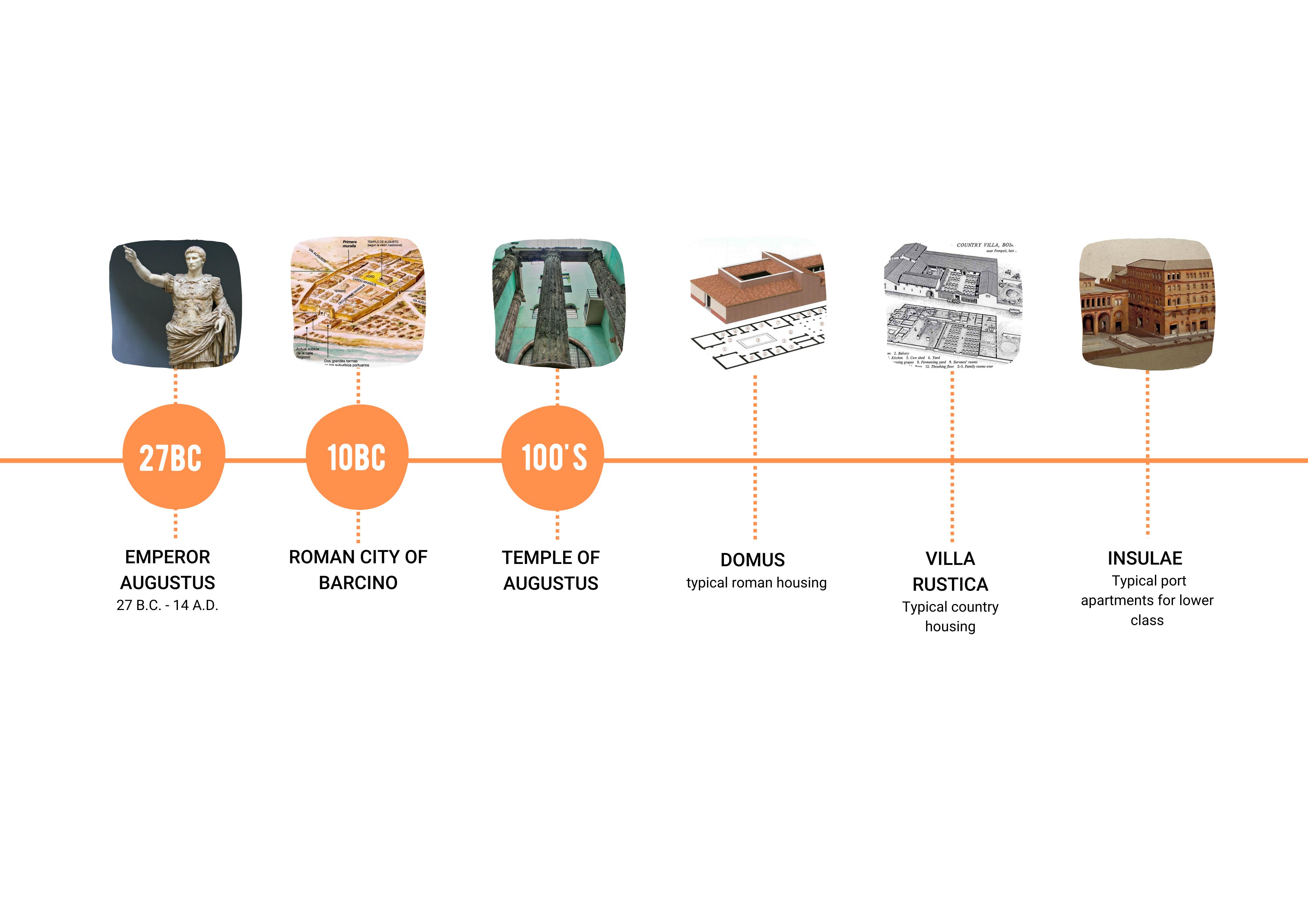
10 B.C.: Roman City of Barcino
Founded under the rule of Augustus, Barcino was a Roman city set up to control trade on the land and sea. It’s form is based on the typical Roman system of centuriation.
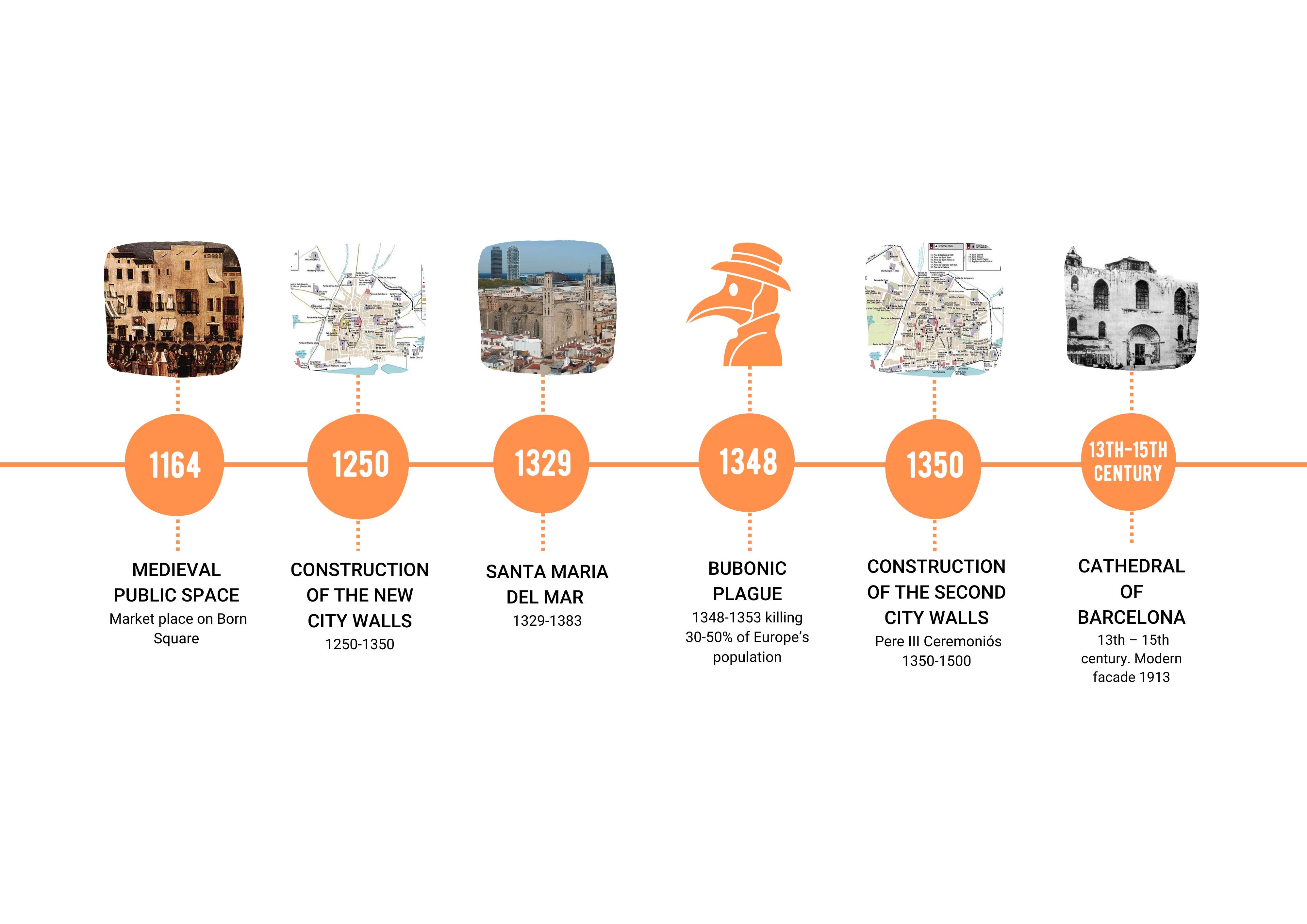
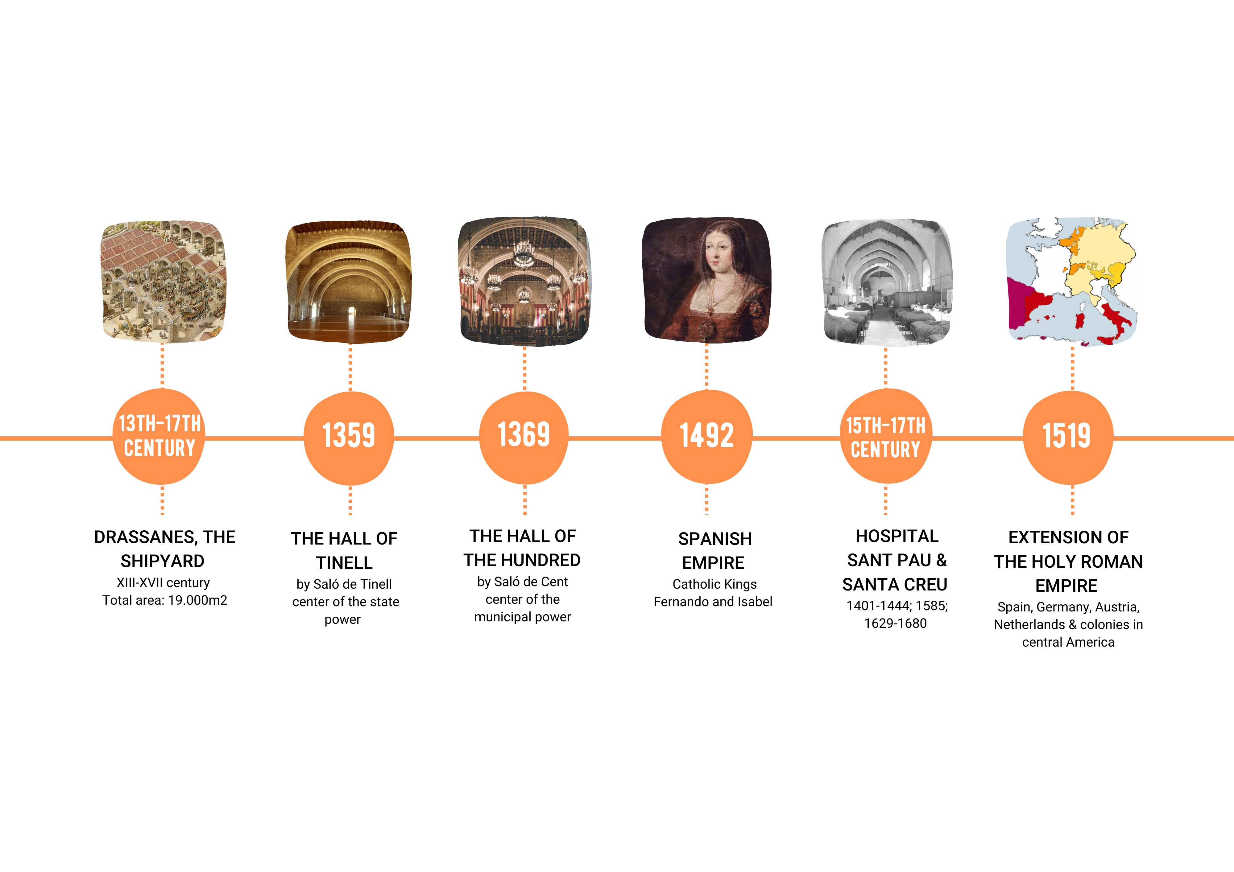
1400: A New Perimeter
New city walls were built to extend and protect the new city limits, including Raval, convents, and new ship yards. The old Roman city wall was absorbed by new buildings over years of new construction.
6
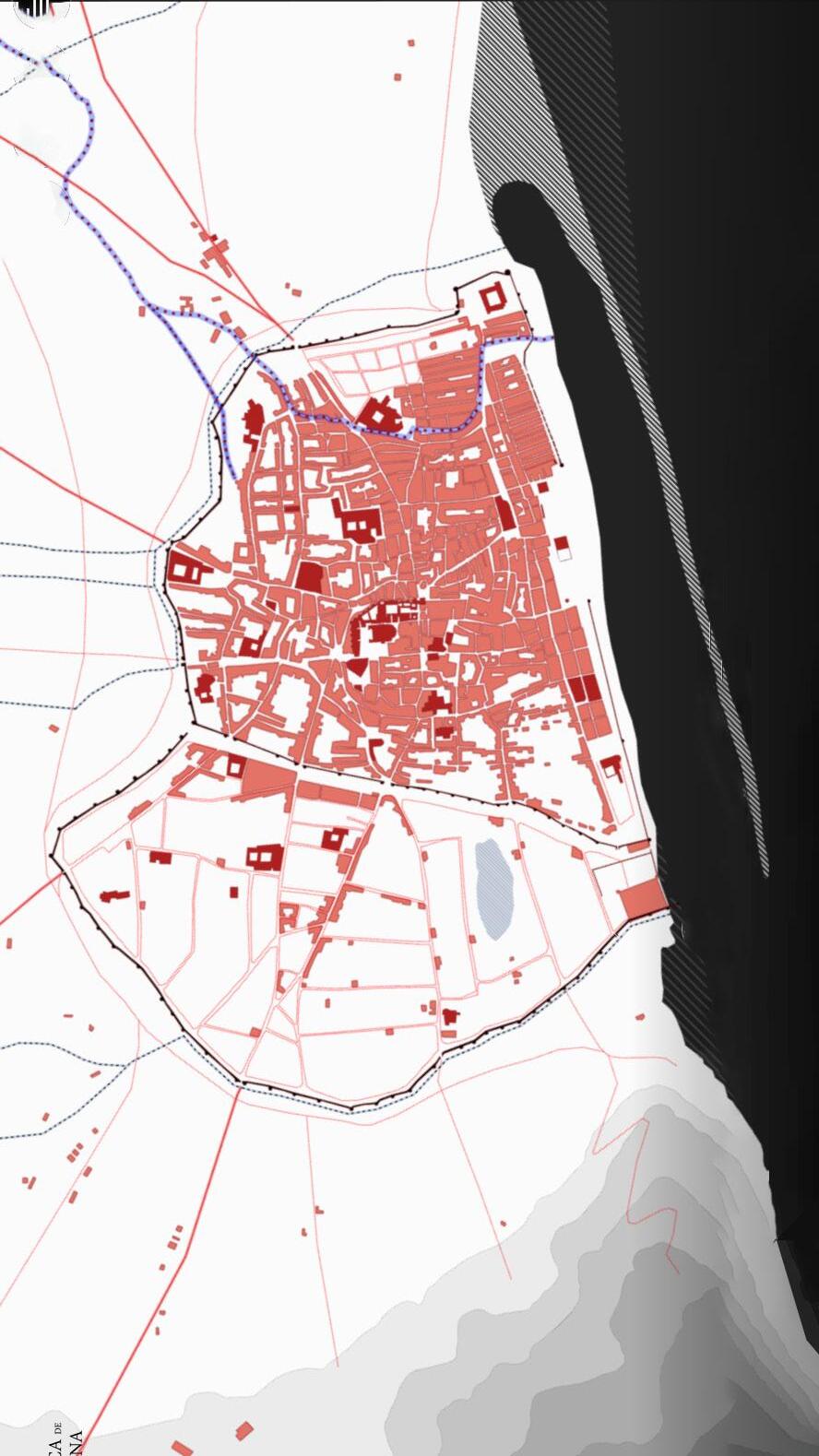
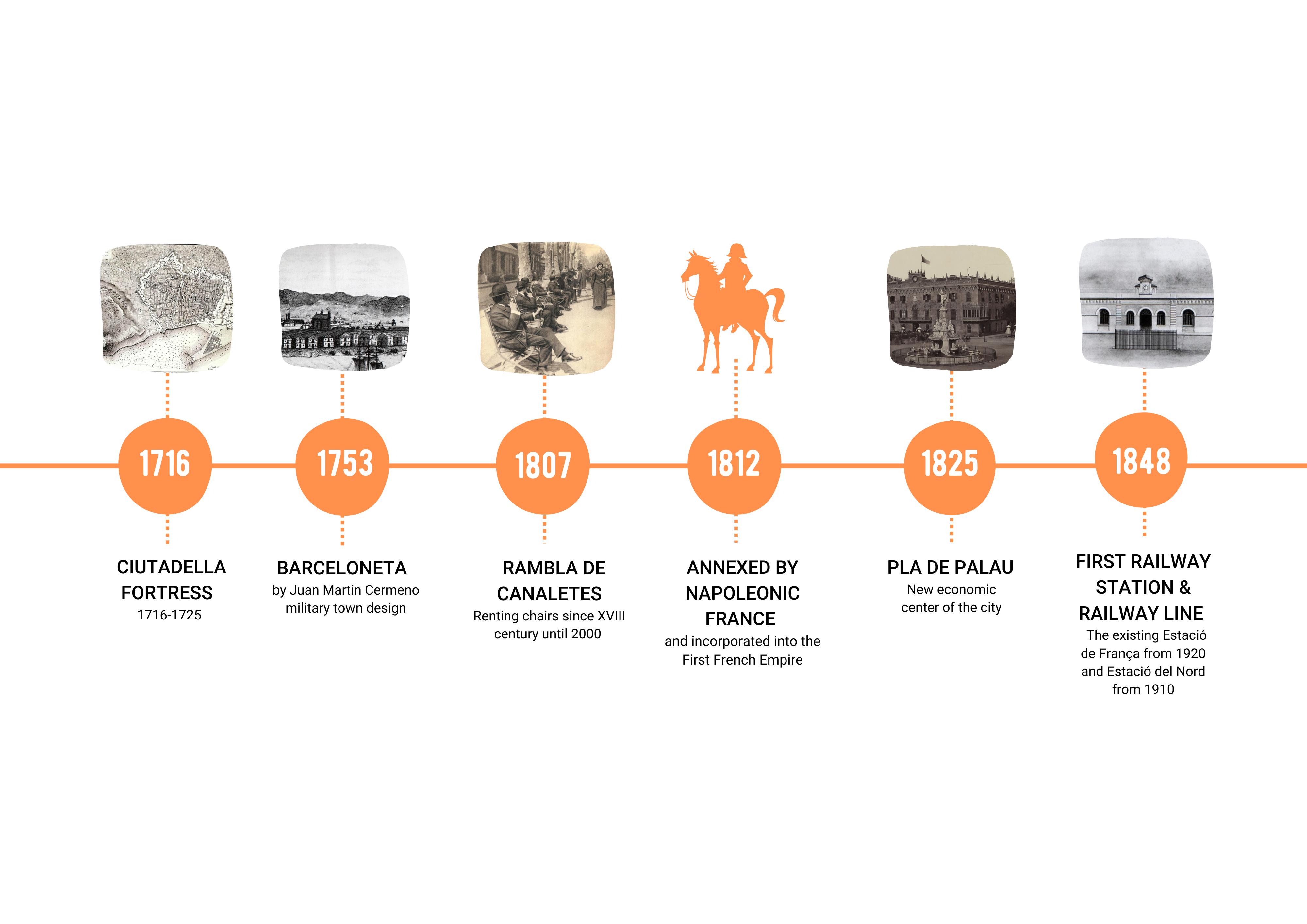
1890: Growth of the Eixample
Rather than the narrow, winding streets of old construction Barcelona adopts a new grid system that allows for wide and navigable streets as the city expands and absorbs small surrounding villages.
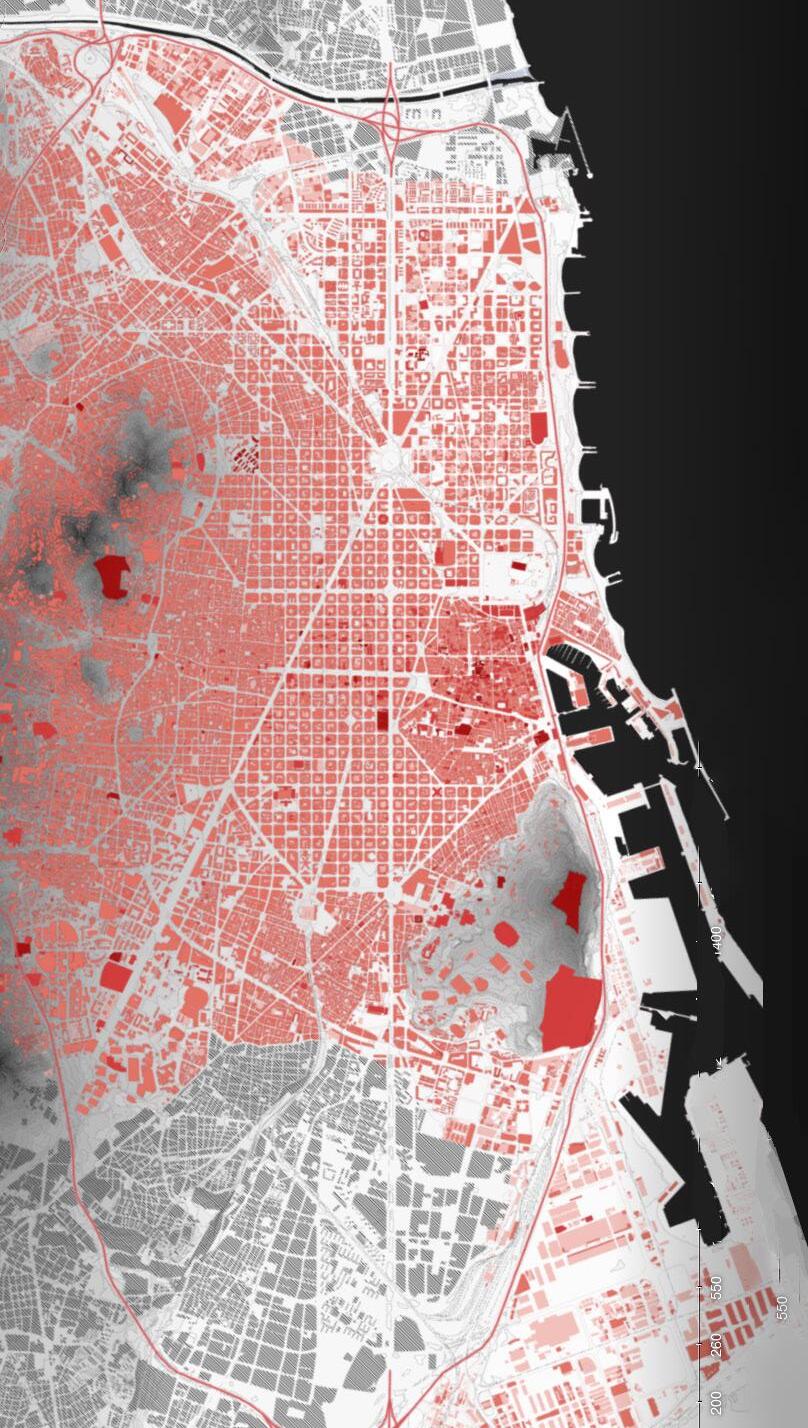
Present Day: Remodeling & Growth
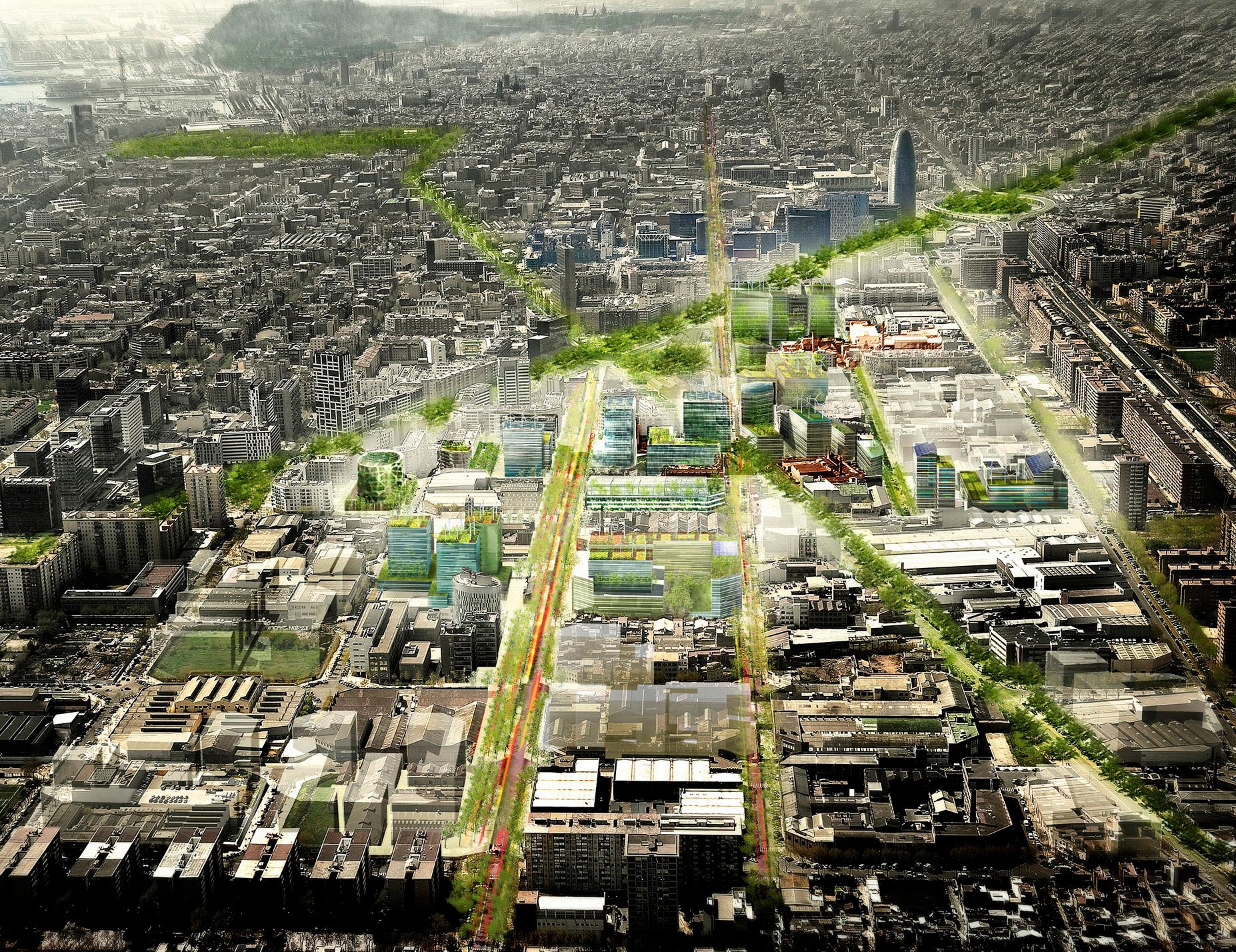
Growth in the Eastern sectors of the city continues as population and density increases. New efforts to give back roads to pedestrian use and increase greenscape dominate development plans for the future.
7
HISTORY OF BARCELONA
8
9
10
11
12
13
14
15
16
17
18
19
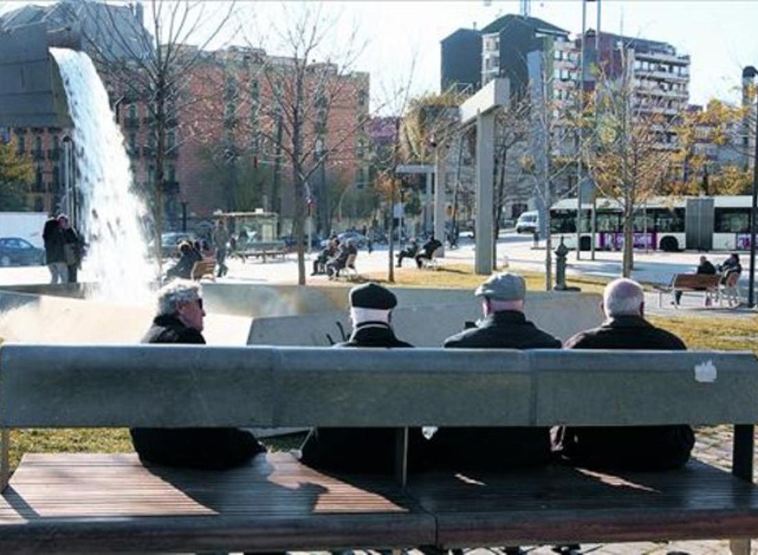
High Density
DEMOGRAPHICS
Low Density
2 Languages: Spanish & Catalan


20-30 Years Old Average Immigrant Age 40-45 Years Old Average Age Overall
Barcelona is made up of a wide variety of people and languages. Throughout the streets, you will hear almost every language as there are many tourists and immigrants from all over, but there are two official languages, Spanish and Catalan. The immigrant population keeps increasing with more and more students studying abroad in the city, with more universities accepting international students.
20
101.9 km²
People per Km2 52.7% 47.3% 2017
1.62 million Inhabitants
15,992
21 Italy Ecuador Pakistan Bolivia Peru China Morocco France Columbia 14.2% 12.7% 11.9% 9.6% 9.1% 8.9% 9.2% 8% 8.2% 8.6% Nationals Foreign Nationals NonNationals 20.7% 61.7% 17.6% Christian 68.6% Islam 9.6% Buddhism 6.1% Other 8% Jehovah’s Witness 5.8% Spain joins the EU 1986 Open University of Catalonia 1995 Barcelona Institute of International Studies 2004 Covid 19 2020
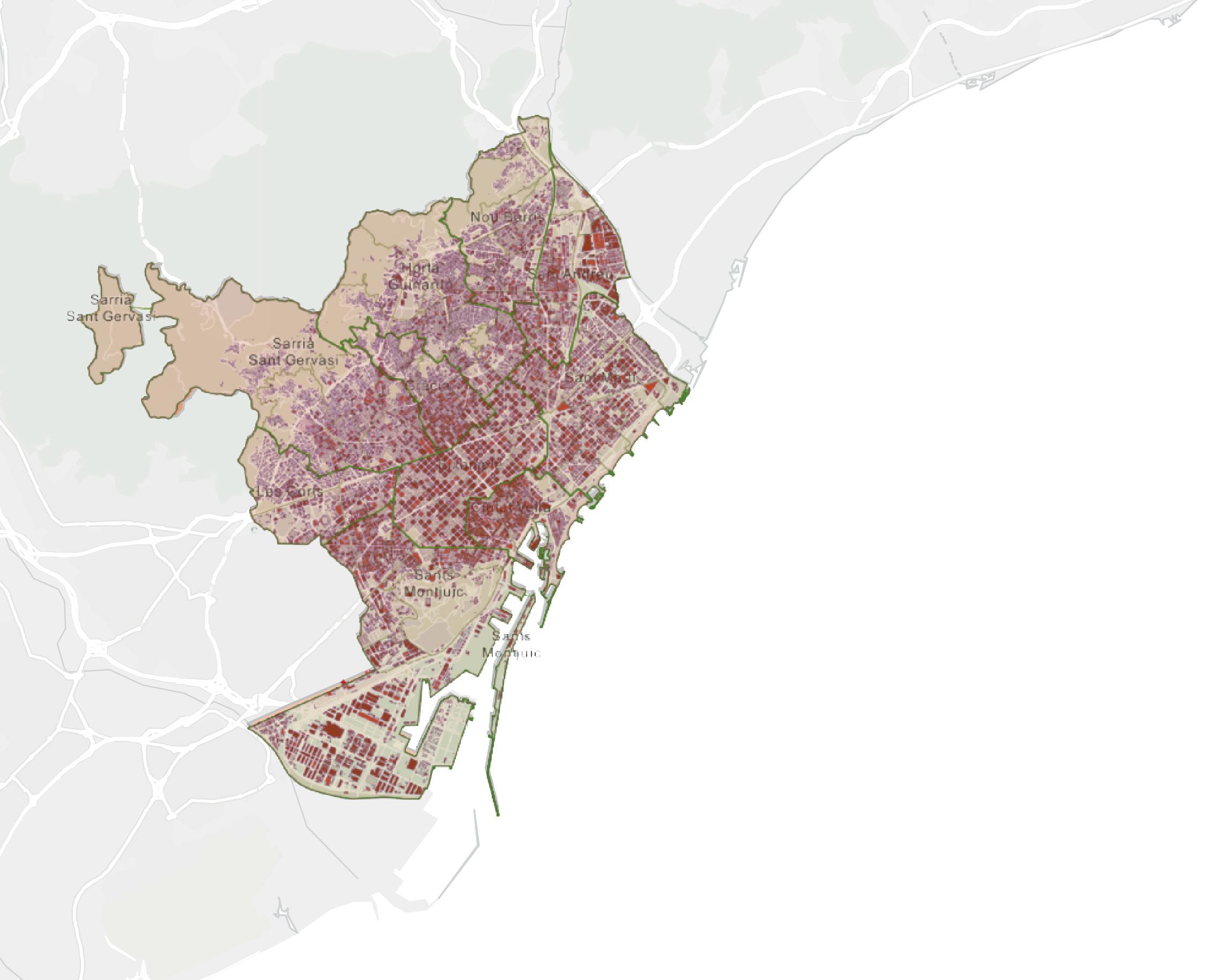
High Crime Rate
Sants-Montjuic
Low Crime Rate
Crime Rate Map
54.68
2019 Crime Rate
Barcelona is a relatively safe city but does have its more sketchy parts. The old Gothic quarter and immediate surroundings have higher crime rates than the rest of the city. However, most of the crime within the city is nonviolent, such as pickpocketing. Being aware of your surroundings and not putting your wallet in your back pocket can help prevent being a victim.
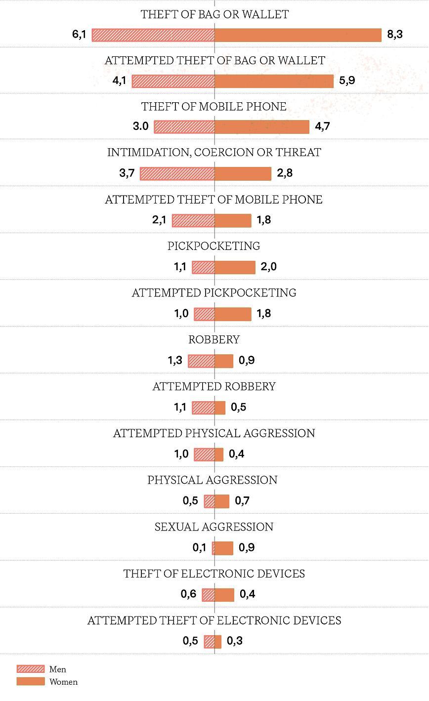
22
L’Eixample
Sant Marti
Ciutat Vella
Les
Corts Sarria-Sant Gervasi
Horta-Guinardo Gracia Nou Barris Sant Andreu
CRIME
EDUCATION
Education is one of the main reasons many foreigners are in the city. Barcelona has seen a growing population of international students after many universities have opened up their international programs and teaching classes in English. Many residents in the city seek to continue their education after compulsory school (ages 6-16) and continue to learn a trade at a professional school or university.
23
62% 38% University 37.8% 18% 19.3% 20.9% 3.8% Secondary Professional Secondary General Compulatory Less
1. ESADE Universitat
2. EADA Business School
3. Universitat Internacional de Catalunya
4. Universitat Ramon Llull
5. Universitat Politècnica de Catalunya
6. Barcelona Graduate School of Economics
7. Universitat de Barcelona
8. Universitat Oberta de Catalunya
9. Barcelona Technology School (BTS)
10. Barcelona School of Economics (BSE)
11. Barcelona IED
1 2 3 4 5 6 7 8 9 10 11 12 Gender in Higher Education Breakdown Education Level of Total Population Breakdown
12. Universitat Pompeu Fabra
4,700+ Homeless Population 2022
€77,605,000 2015 GDP 74.4%
€19,335 Disposable household income
19.2% Risk of poverty
11.6% Unemployment Rate
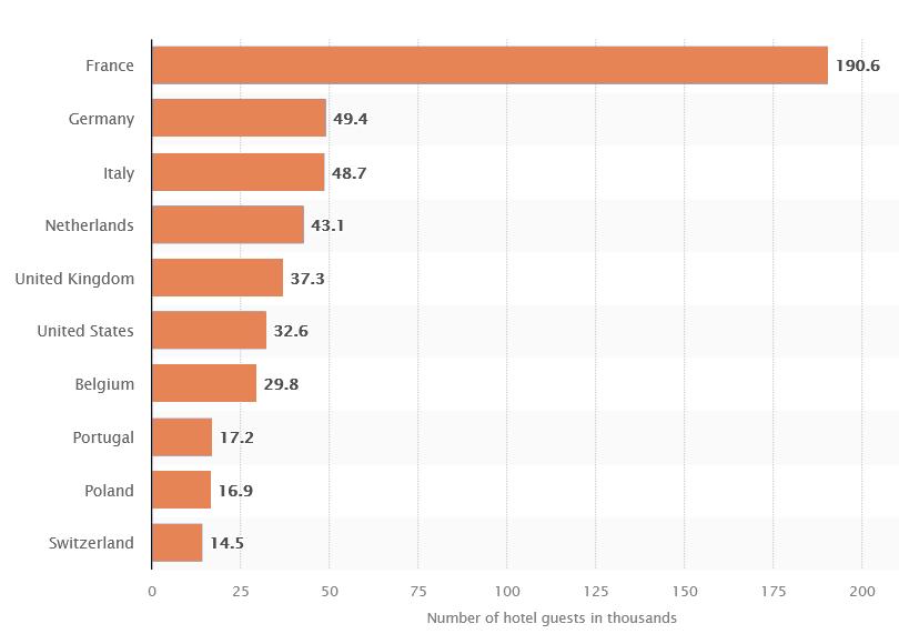
Barcelona’s economy is one of the most flourishing in Spain. While many sectors are flourishing, tourism also plays a prominent role. It makes up 18% of Barcelona’s revenue annually, and 1/4 of jobs are in the service industry. Millions of visitors from Spain and other countries spend millions of euros each day and millions of nights in hotels every year.
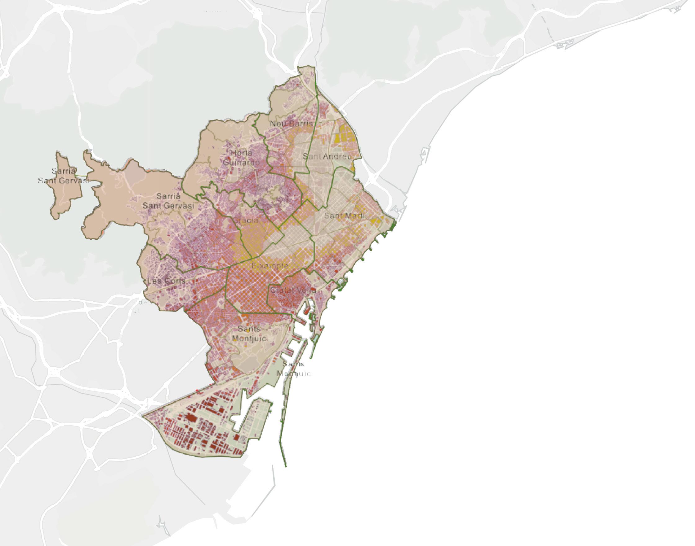
24 Sant Marti 10.5% L’Eixample 24.6% Ciutat Vella 11.6% Sants-Montjuic 9.7% Les Corts 12.3% Sarria-Sant Gervasi 12.3% Horta-Guinardo 5.9% Gracia 9.2% Nou Barris 5.4% Sant Andreu 5.4% ECONOMICS
Employment Rate
% Of Social & Solidarity Economy Companies By District
9,500,000+ Tourists in 2019 18% of the entire revenue of the commercial sector
TOURISM
21,348,430
Overnight stays in 2019
8,503,334 Tourists in hotels 2019
€22,000,000 spent per day 100,000 jobs generated
25
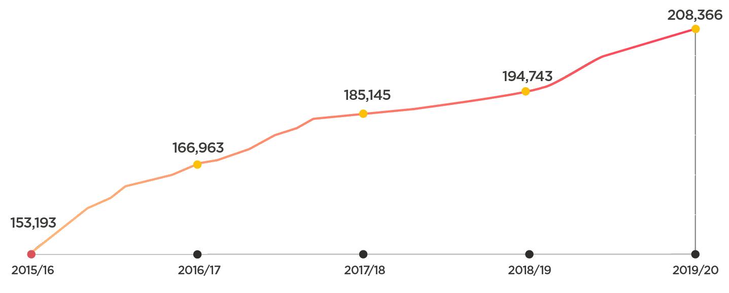
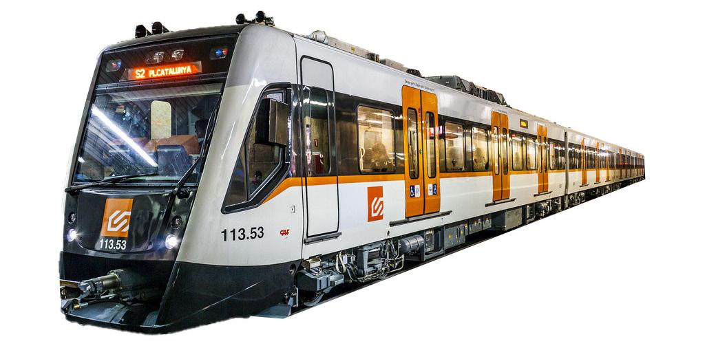
PUBLIC TRANSPORTATION
52,686,314 Passengers in 2019
RondadeDalt
8,040,000 Journeys per day
18,874,896 Passengers in 2021
RondaLiteral
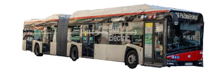
Public transportation is very reliable in Barcelona. There are many forms of travel within the very walkable city, such as biking, car, tram, metro, and bus. Most public transit is punctual and frequent. Travel to other countries and regions is also readily available with the metro and bus connecting to the airport and train and bus stations.
26
de Sants
Estación de Francia Estación
Parallel Tarragona GranVia
Diagonal Meridiana Gracia Rambla Marina
Josep Tarradellas Barcelona -El Prat Airport
CIRCULATION
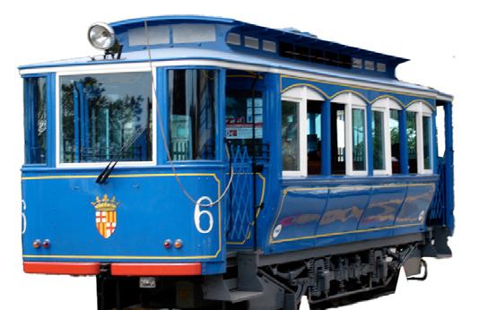


27 Horse-drawn trams 1872 Steam trams 1877 Funicular del Tibidabo Railway 1901 Buses in the city 1922 Formation of TMB, FGC and TramMet 1958 Metro & Tram lines expanded 1990’s BCN Open 2004 Bicing bikeshare program launched 2007 Barcelona Metro line 9 connecting to the airport finished 2016
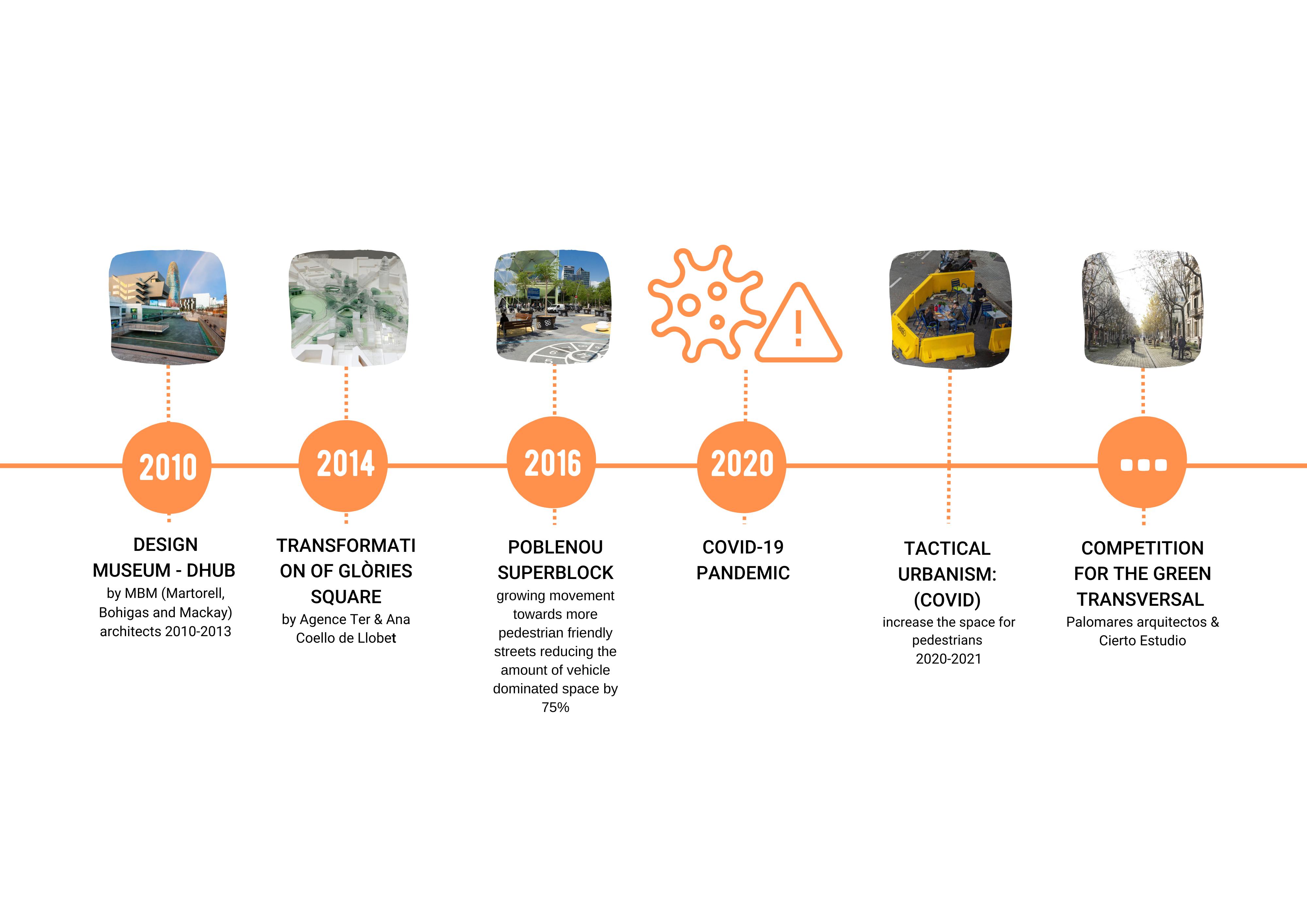
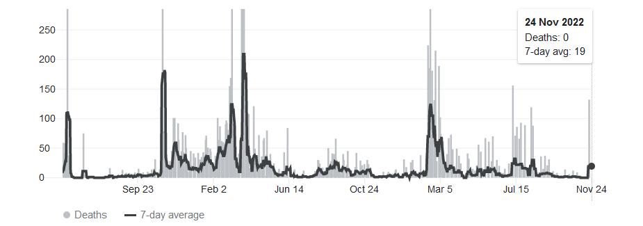
COVID RESPONSE
20,782 Deaths 2.66M Covid Cases
Features of Tactical Urbanism
Quick Cheap
Temporary Change of function
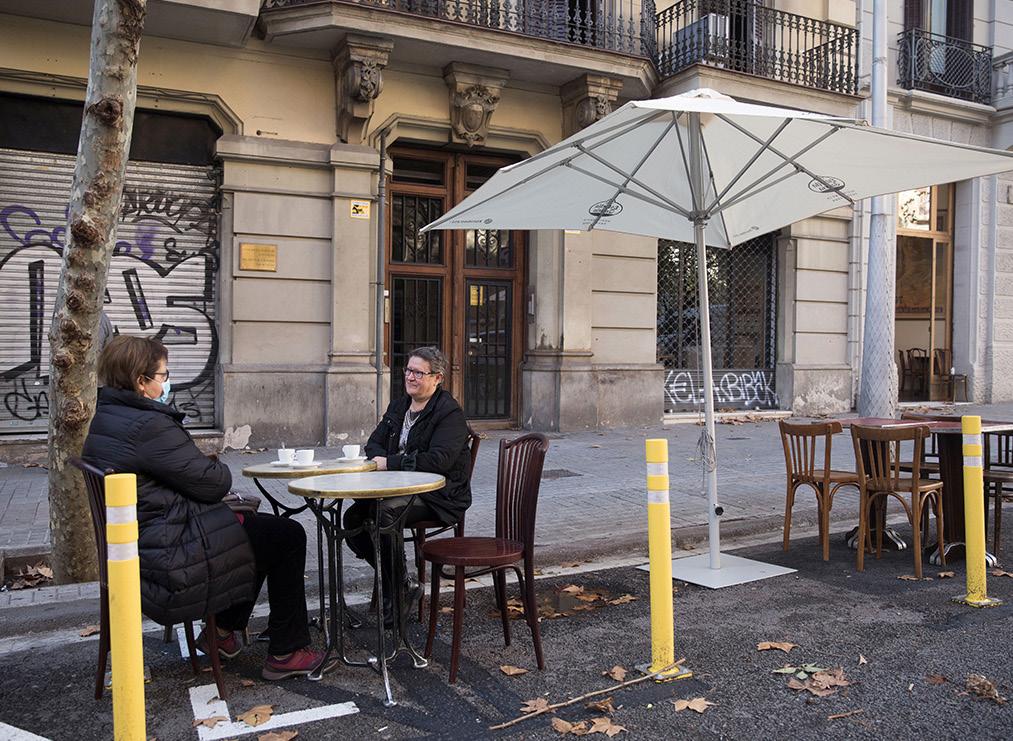
Covid-19 hit Barcelona hard in 2020, the first case was in January, and their first lockdown began that March. Millions of cases broke out within the city, and thousands died. The city looked to a fast, cheap, and temporary solution to keep the city functioning while allowing for social distancing in the densest of streets. They began what is known as Tactical Urbanism.
By transforming a car lane into a pedestrian space, they created more walking and dining space for people to maintain social distancing and keep restaurants in business by allowing more than a few tables. This intervention has largely been removed, but a few examples remain scattered around the city.
28
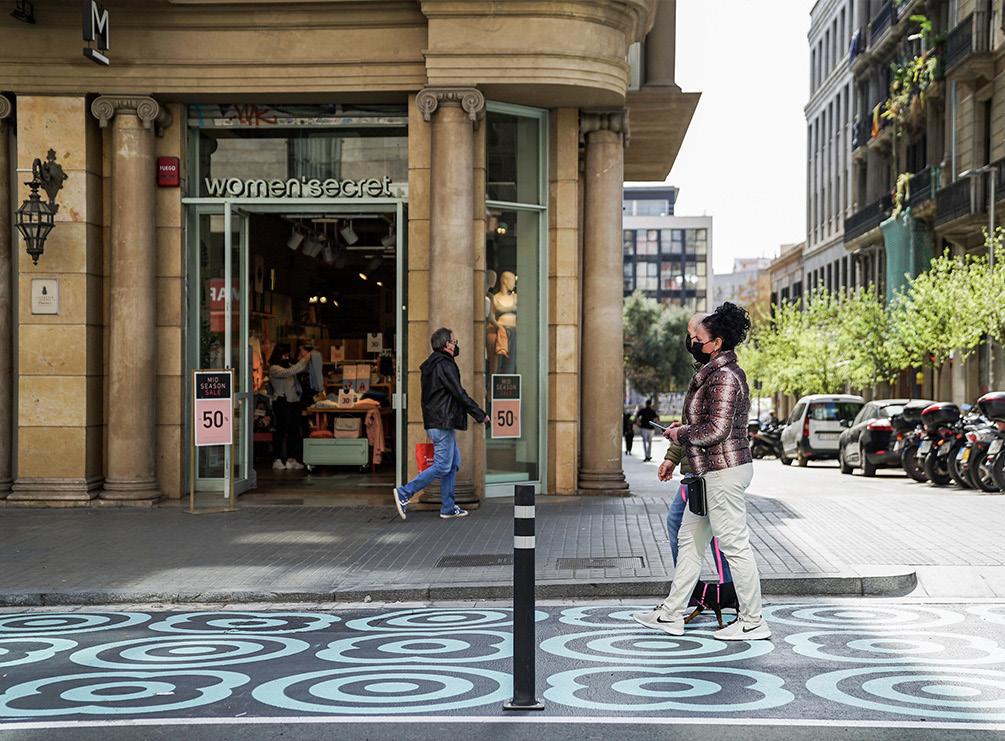
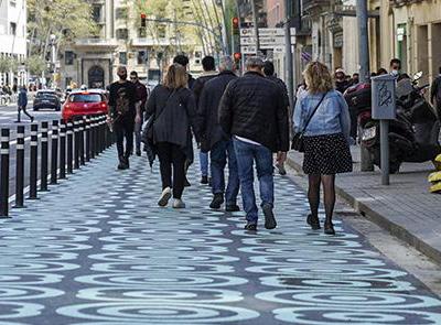
Colorfully painted streets taking over to increase social distancing for pedestrains
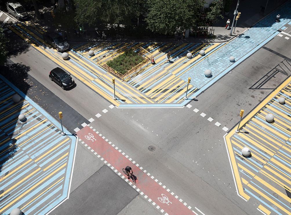
Car lanes temporatly closed in order to increase outdoor seating of cafes and restuarants during covid lockdowns.
Steets doubled in width in order to more easily maintain social distancing.
Car lanes blocked and painted to double pedestrain walkways on very busy streets.
29
INTRODUCTION Enviromental Analysis of Barcelona
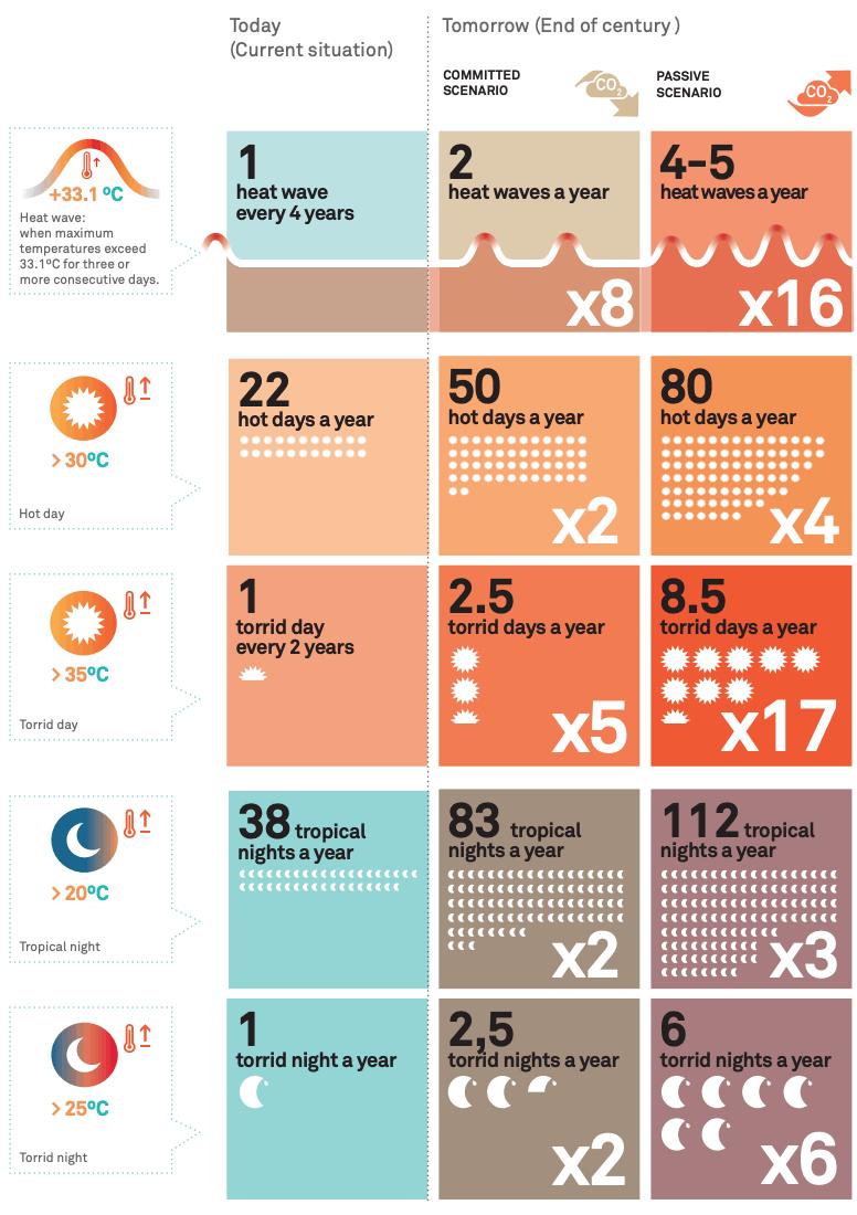
Barcelona is on the Mediterranean sea and has a Mediterranean climate. This climate typically has mild, rainy winters and hot, dry summers, with temperatures not getting extremely hot or cold throughout the year. While this climate has been favorable in the past, there are rising concerns about increasingly hot and dry summers because of worldwide climate change. In 2022 Barcelona had one of its hottest summers, with drought causing wildfires to break out around the city. Because of this growing concern, the city has made a climate action plan to avoid the city turning into an uninhabitable place in the next century.
In addition to climate change, Barcelona faces more environmental challenges such as pollution, excessive noise levels, and the urban heat island effect as a rather large, dense city. These challenges affect not only the city’s residents but also the vegetation and remaining wildlife. Looking at all of this information can help us draw conclusions about Barcelona’s environment and how it can be improved in the future.
31
TOPOGRAPHY STUDY
65 m
Average Elevation
5% Average Slope
507 m
Maximum Elevation -1 m
Minimum Elevation
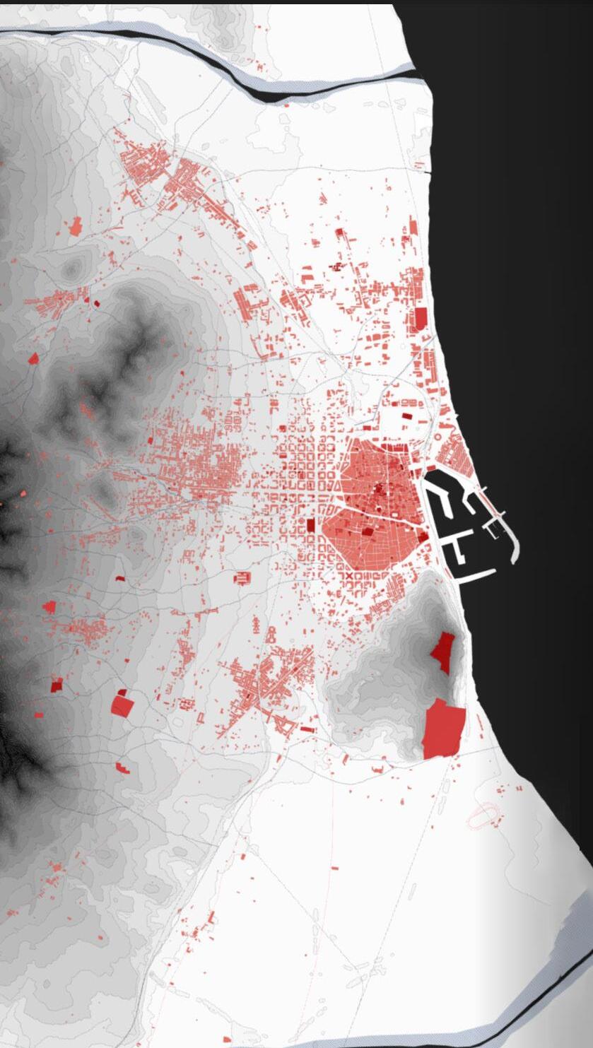
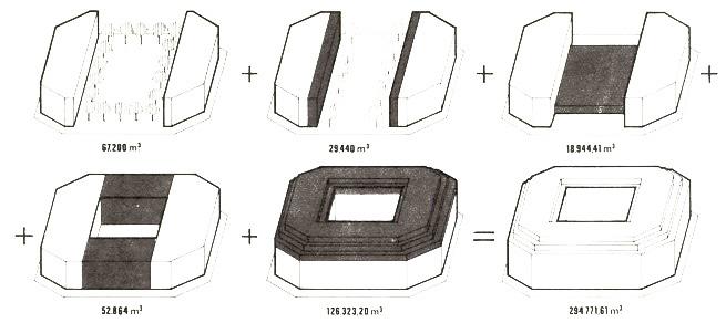
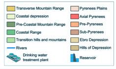
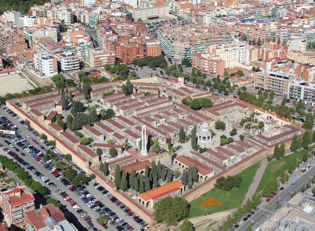
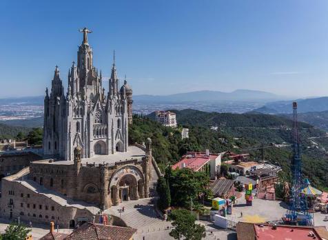
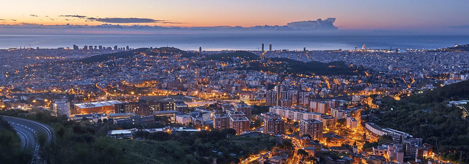
Barcelona has a variety of topography ranging from the flat beaches by the sea to the tall peaks of MountJuic and Collserola. The building types are largely high-density residential, primarily in the Eixample, with regulated building forms and heights; however, the density and regulations thin out towards the city’s edges. The mountains and sea offer the city many natural resources to use fo trade and consrution such as stone, clay, and steel.
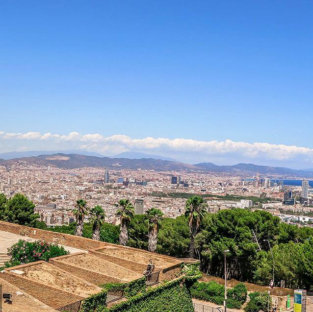
 View from Mountjuic
View from Collserola
View from Mountjuic
View from Collserola
Land Use
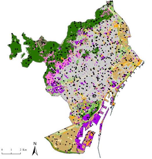
Natural Green
Urban Green
Low-density Residential
High-density Residential
Institutional Commercial
Intensively used areas
Transportation
Building Height Restrictions
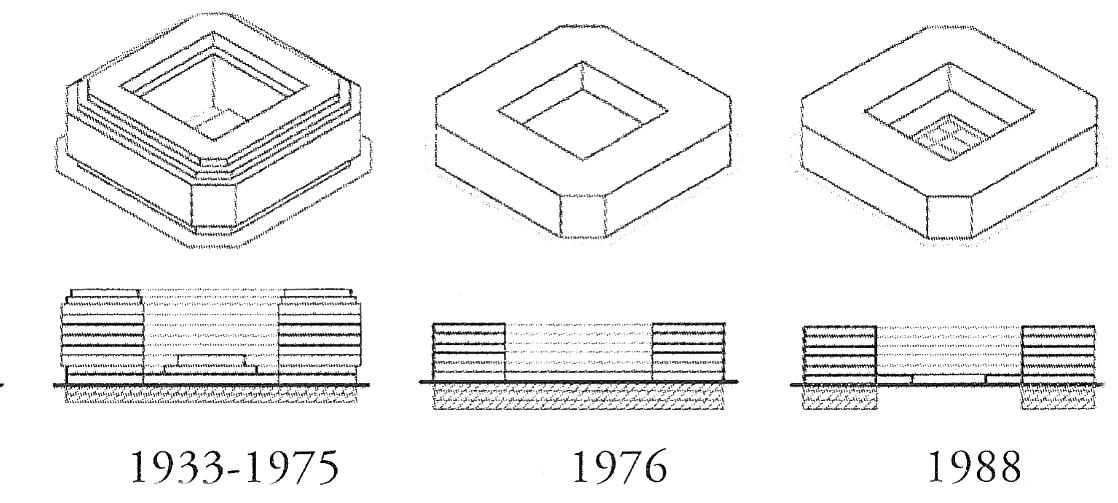
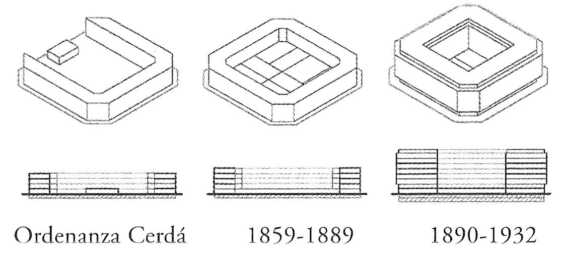
Building Height Evolution Diagram
33
VEGETATION
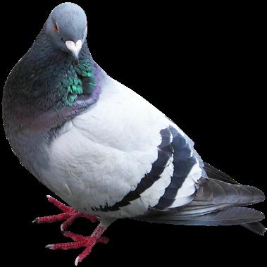
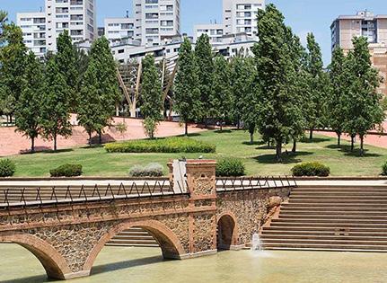
Greenspace in the city is easy to find. There are many plazas, trees, and large parks to relax in within Barcelona, and many hiking options around Montjuic and Collserola. The vegetation is often not very diverse within the Eixample’s green streets, leading to a minimal variety of wildlife easily seen within the streets other than pigeons.
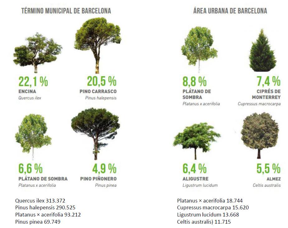
34 Public Green 29.8% Private Green 20.5% Green Forest 49.7%
28.32 km2 greenspace
Citidell park: large central greenspace open to the public with vegitation and
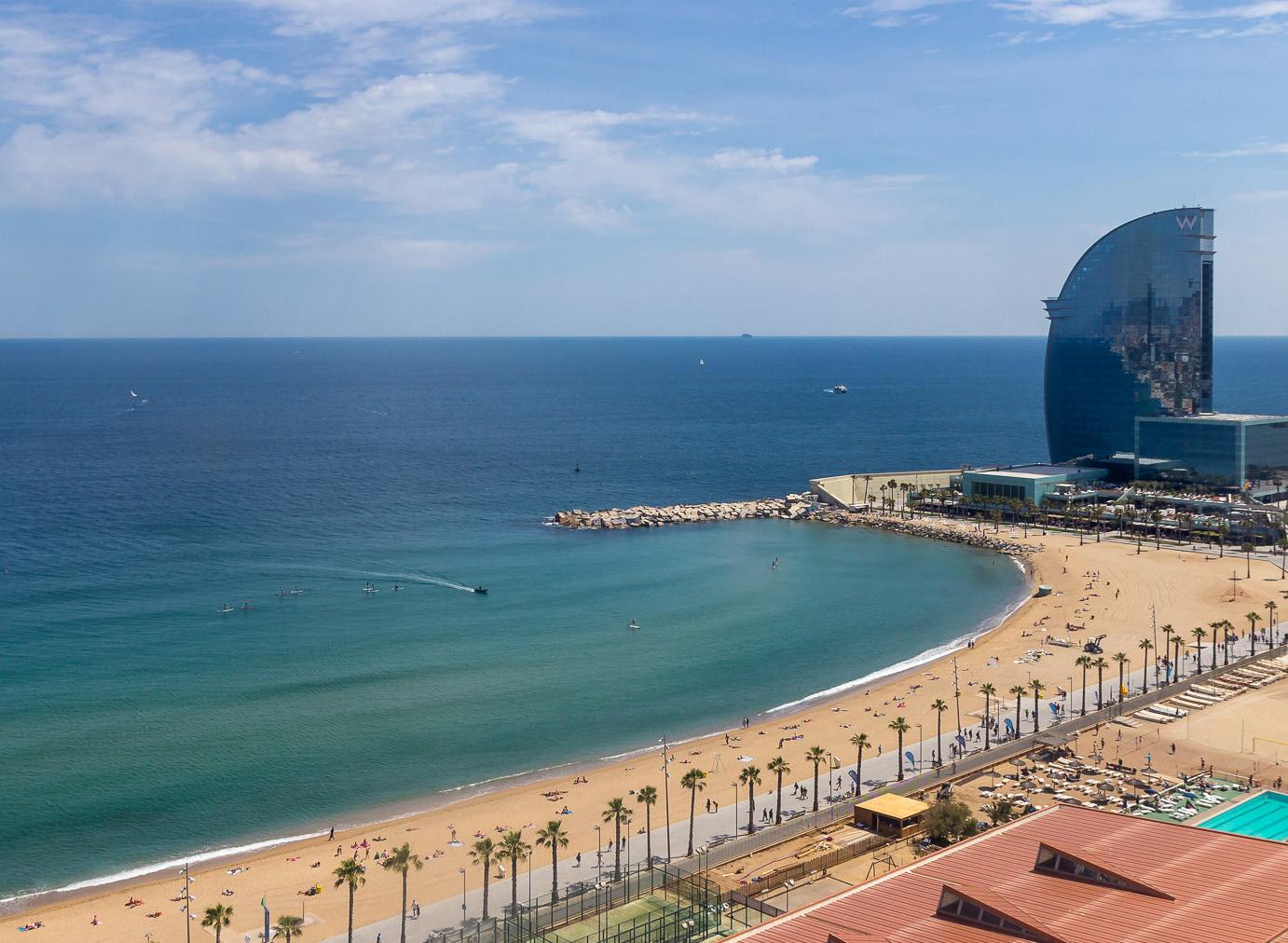
Public beaches for locals and tourist to enjoy the coast. Full of sand and restraunts
35
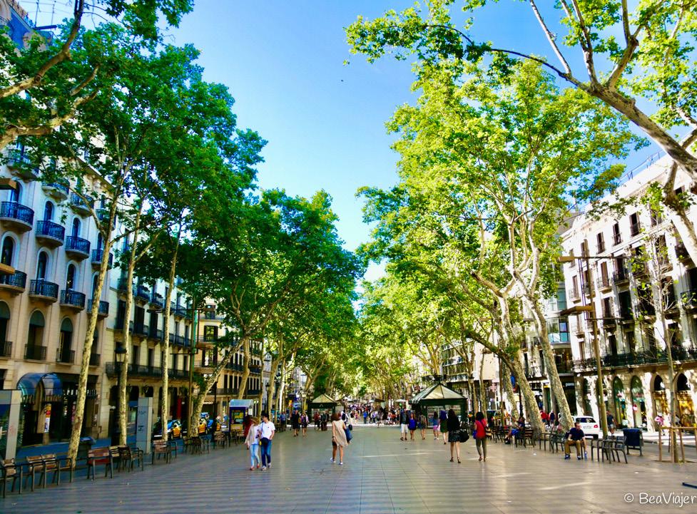
La Rambla: a wide, green pedestrian street with ample tree cover and seating
Olympic park: large green park located on mount juic accessible to the public with steep topography
large water features
WILDLIFE
Habitats of Barcelona
Forests
Shrubland
Herbaceous Vegetation
Herbaceous Wetalnd
Cropland
Built Up
Permanent Water Body
Although much of Barcelona is now built up, a variety of wildlife still calls the city its home. There are many protected species in the city and a few invasive species threatening the city.
36
PROTECTED
Barcelona has many protected species: 55 birds, 2 amphibians, 8 reptiles, and 7 mammals. Many of these habitats have been threatened due to the expansion and build-up nature of the city.
100 native species of invertebrates
75 common birds
55 protected birds 7 protected mammals
2 protected amphibians 8 protected reptiles

INVASIVE
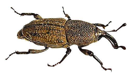
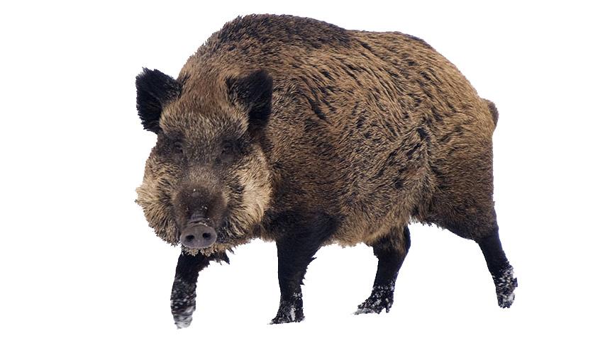
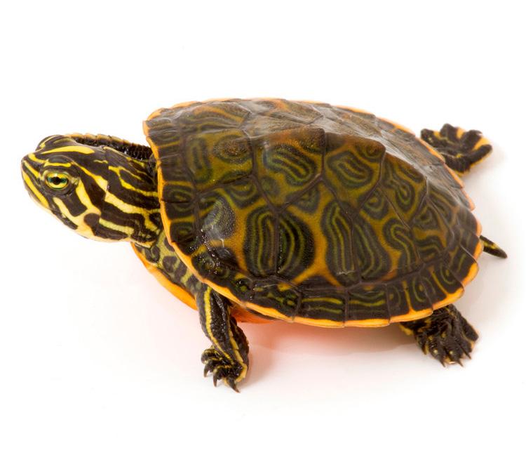
Barcelona has a few invasive species threatening its native wildlife. Some of these include quaker parakeets, Rose-ringed parakeets, Japanese nightingales, Florida redbelly turtles, and mosquitofishes.
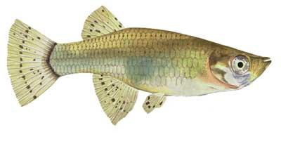
Other noninvasive animal populations are trying to be controlled, so they do not run out of control, including pigeons, cats, wild boars, parakeets, turtles, fishes, and weevils


37
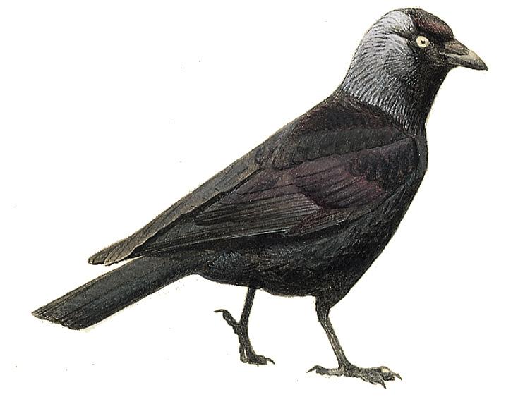
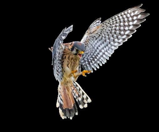
Mosquitofishes Quaker Parakeets Florida Redbelly Turtles
Pigeons Weevils Central European Boars
Peregrine Falcons Euproctus Jackdaws
Blue Whale
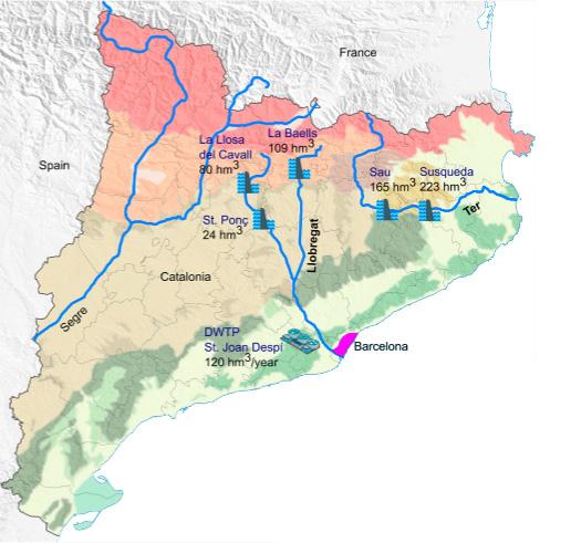
WATER SYSTEMS
587 mm Annual average rainfall (23.1 inches)
162.5 L of water/person/day
Water systems in Barcelona mostly come from the Pyrenees. Mountain water flows down and is collected for drinking or through the two rivers surrounding the city, Besos and Lleborgat. Most of Barcelona’s drinking water comes from Ter and Llobregat and Europe’s largest desalinization plants, covering 20% of the city’s needs. Although the city’s tap water is safe to drink, it is not the best tasting, and many residents prefer bottled water.
AIR POLLUTION & NOISE LEVELS
2.08 CO3 Emitted person/year
39 ug/m3
NO2 Annual Average
35 AQI Average air quality

Deaths attributed to air pollution by concentration of suspended particles
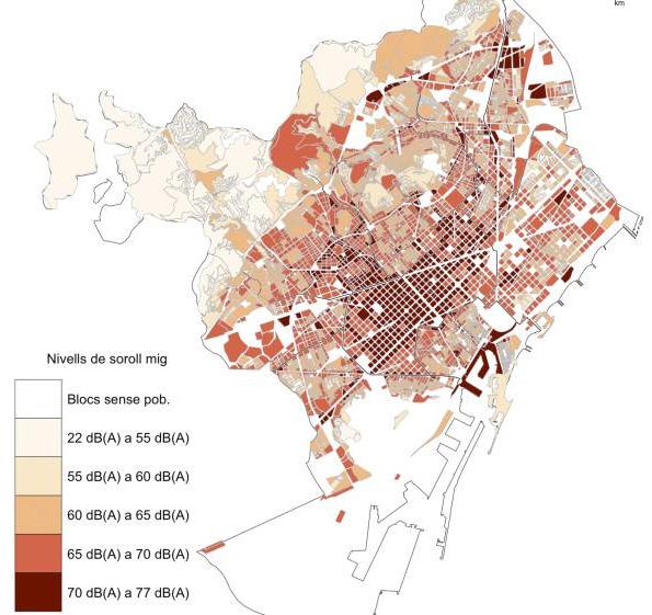
As a densely populated city, Barcelona struggles with air pollution and excessive noise levels. This pollution comes from the need for urban transportation, ships, and port activity, and millions of tourists visit the city each year. Air pollution is visible in the sky at night with pink clouds, and hundreds of deaths are attributed to it each year. It is at its worst in the city center on Gran Via and towards the port.
39
AIR
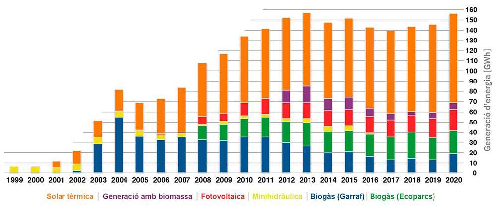
ENERGY SOURCES
2,857 hours of sun a year
13,222 GWH a year consumed
9.35 MWH of energy consumed person
1,229 GWH Energy produced from renewable sources
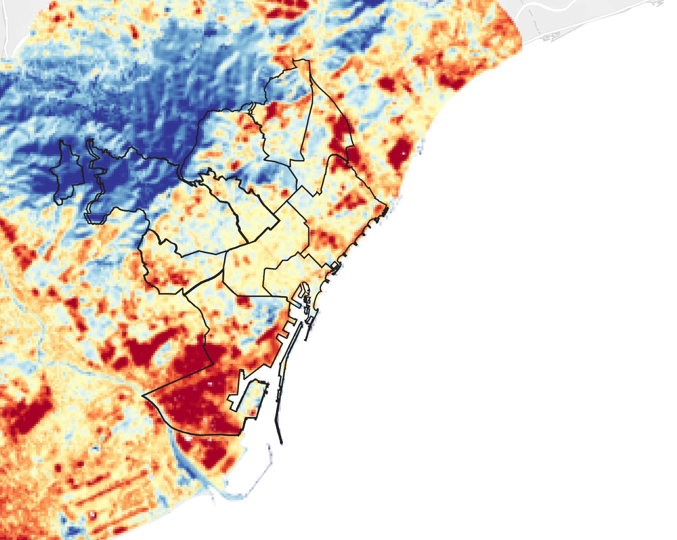
Very High Potential
High Potential
Medium Potential
Low Potential
Solar Power Potential Map
Because of Barcelona’s sunny Mediterranean climate, it has the potential for much more solar and wind power. Currently, only a tiny percentage of the city’s energy consumed is from renewables, with most energy coming from nuclear or fossil fuels. If the city expanded its solar usage to cover more rooftops with solar panels, it could reduce its reliance on fossil fuels and be more self-sustainable.
Very High Potential
High Potential
Medium Potential
Low Potential
Renewables
41 Fossil Fuels 47.24% Nuclear 47.08% 5.68%
Hydro 3.69% Wind 1.61% 0.27% Municipal & Industrial Waste 0.11% Wind Power Potential Map 3-22 m/s Average Wind Speed Commercial 33.4% Domestic 33.36% Transport 22.1% Industrial 11.9% Energy Consumption Energy Production
CLIMATE & CHANGE
14.30 - 280
Average Temperature Range (57.74 - 82.4)

587 mm annual average rainfall (23.1 inches)
70% Average Relative Humidity
Barcelona is on the Mediterranean sea and has a Mediterranean climate. This climate typically has mild, rainy winters and hot, dry summers, with temperatures not getting extremely hot or cold throughout the year. While this climate has been favorable in the past, there are rising concerns about increasingly hot and dry summers because of worldwide climate change. Because of this growing concern, the city has made a climate action plan to avoid the city turning into an uninhabitable place in the next century.
Industry
8.6%
Sectors Contribution by CO2 Emissions
Pillers Of A More Sustainable Barcelona
Healthy Active living, clean air, quality public spaces, people’s health
Low-Carbon
Becoming less reliant on fossil fuels for energy and products
Socially Fair
Considering social, economic, gender and cultural diversity when creating policies
Habitable & Safe Quality green areas that create safe and comfortable spaces for everyone
Efficient & Renewable sustainable mobility and using local resources with closed cycles
A City That Learns trying new solutions every day, keep progressing and keep learning
43 Services 18.7% Transport 29.9% Domestic 20.1% Waste Treatment 10.4% Port & Airport 10.4%

44
LYNCH STUDY OF BARCELONA
Kevin Lynch (1960) was a renowned urban planner who pioneered urban cognitive maps in his book “The Image of the City”. These maps showed how people perceive their environments and their mental image of the city. Using these maps can help understand and assist in designing cohesive city layouts. Elements of these maps reveal how people orient themselves and navigate within a city as they carry out their daily lives.
The five elements of Lynch’s cognitive mapping are paths, edges, districts, nodes, and landmarks. Paths are how one walks and experiences the city while traversing streets, canals, or railways. Edges are the city boundary, physical or social, between two regions or districts. These boundaries could be shores, mountains, and walls. Districts are areas that have a similar defining character. Nodes are points of interaction between neighbors and friends. They are spaces where people naturally gather and make connections. Landmarks are physical objects familiar to users in an area, such as a tree seen from a distance or a local statue in the town square. These can act as wayfinding for those that live within the space and help orient others when describing the location of a new coffee shop, for example.
5 Elements: Edges
Districts Paths Nodes
Landmarks
45
EDGES
Collserola
Lleborgat
Besòs Mediterranean
“Edges are linear elements not considered as paths: they are usually, boundaries between two kinds of areas. They act as lateral references. Those edges seem strongest which are not only visually prominent, but also continuous in form and impenetrable to cross movement”
(Lynch, 1960, p. 62)
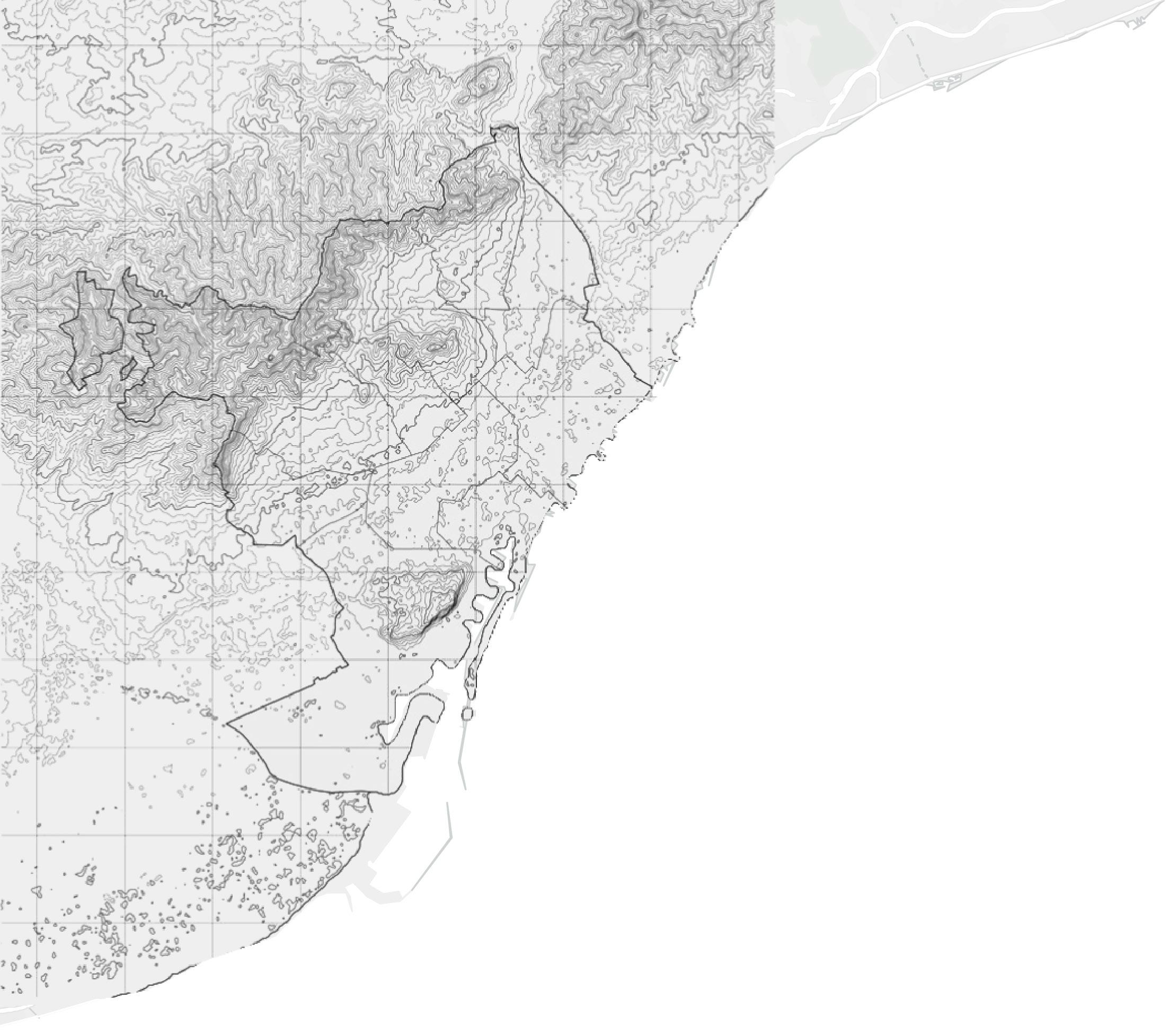
Barcelona has four natural edges defining its boundaries : Collserola mountain, Besos river, Lleborgat river and the Mediterranean sea.
46
47
Mediterranean Sea to the east
Lleborgat river to the south
Besos river to the north
Collserola Mountain to the west
DISTRICTS
DISTRICTS
L’Eixample
Sants-Montjuic
“Districts are the relatively large city areas which the observer can mentally go inside of, and which have some common character.”
(Lynch, 1960, p. 66)
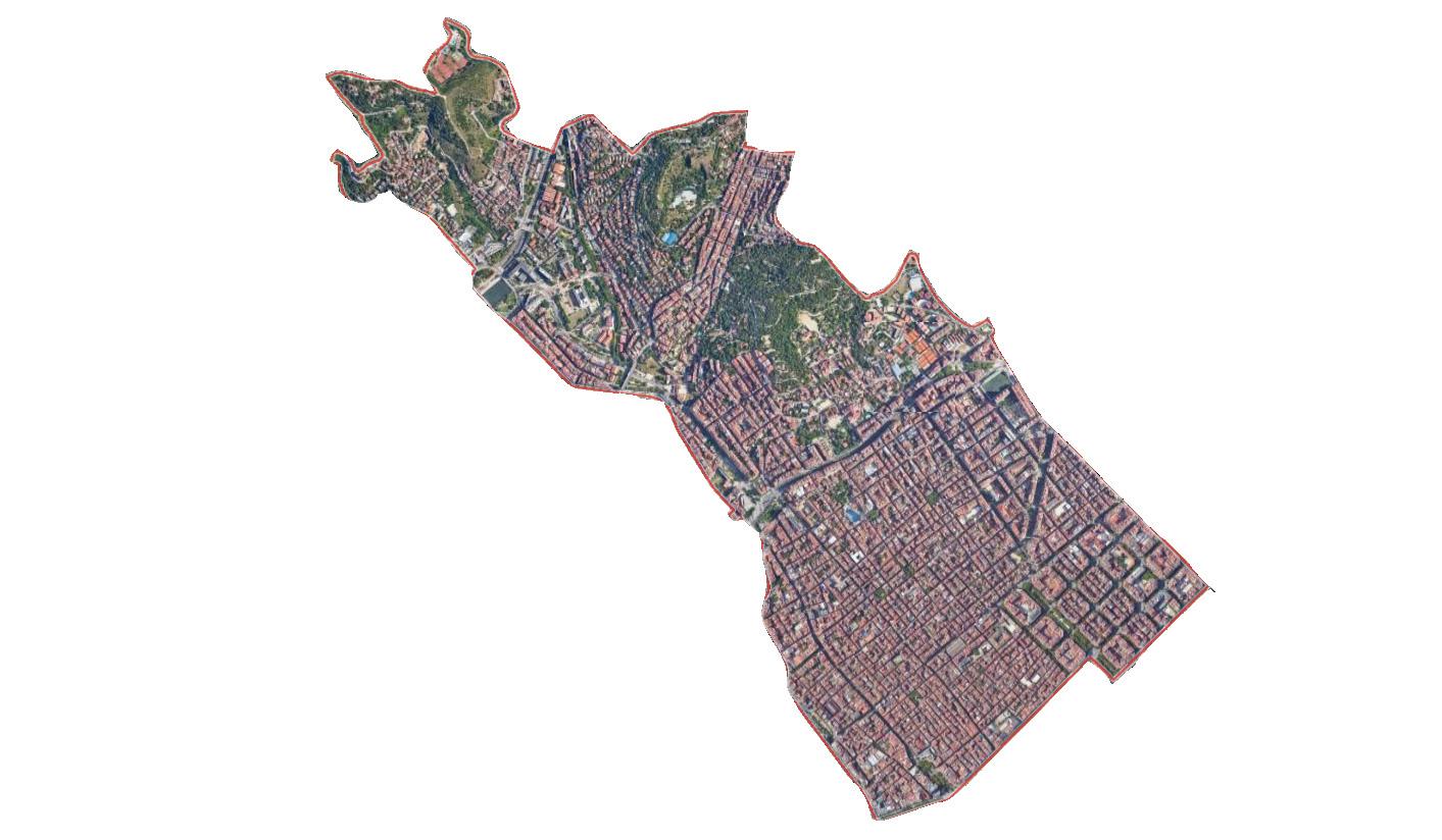
Barcelona is made up of 10 large districts with each having their own neighborhoods and character. In the following pages I with go over each district and its highlights briefly.
48
Sant Marti
Ciutat Vella
Les Corts
Sarria-Sant Gervasi
Horta-Guinardo Gracia
Nou Barris Sant Andreu
Nou Barris
Area: 8 km²
Population: 166,310
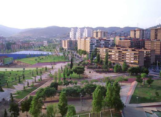
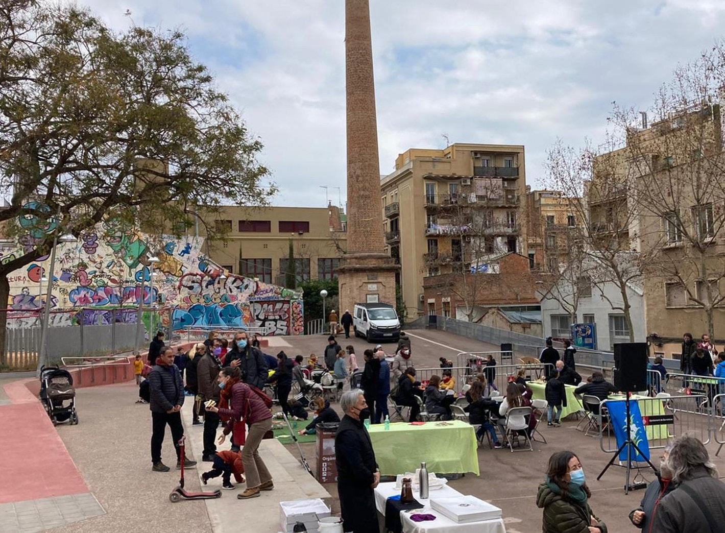
Nou Barris is located at the city’s north end at the foot of Collserola. It is a district full of substantial green spaces, including the Parc de la Guineueta, the Parc del Turó de la Peira, and the Parc de l’Aqüeducte. The population is a mixture of locals who have lived there for years and a large population of immigrants, including individuals from Romani, Ukraine, and Ecuador.
49
Parc Central de Nou Barris aerial
Parc Central de Nou Barris
Bidó de Nou Barris
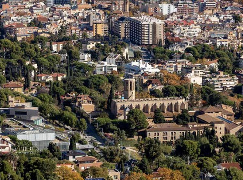
Horta-Guinardo
Area: 11.9 km²
Population: 172,199
The district of Horta-Guinardó is a quiet residential area that offers mostly historical Country houses, green spaces, such as the Parc del Laberint d’Horta, and multiple viewing points to offer beautiful views of the city. It hosts many different biking and hiking trails through the Collserola mountain range.
50
Parque de atracciones Tibidabo, Barcelona’s amusement park at the top of mount Collserola, built in 1899 is one of the oldest in the world
Parc del Laberint d’Horta
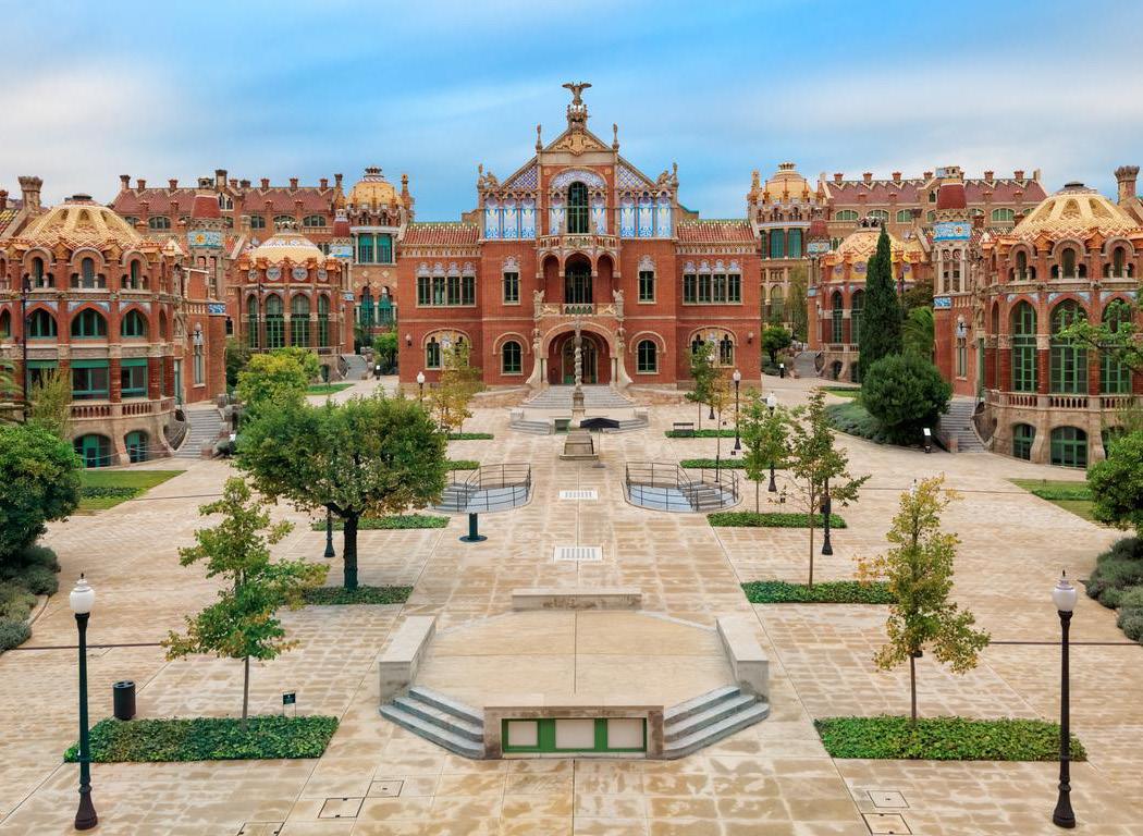
Hospital de Sant Pau
Sant Andreu
Area: 6.56 km²
Population: 147,732
The district of Sant Andreu is known for its history of rural and industrial workers. Two examples of its most famous sites are the Fabra i Coats complex and Casa Bloc. Cases barates served as worker’s dwellings in Bon Pastor but have mostly disappeared as the district beings to move away from that model and modernize with its growth.
51
Sant Andreu Comtal transportation
Cemetery Sant Andreu
Esglesia de Sant Andreu de Palomar
Gracia Area: 4.19 km²
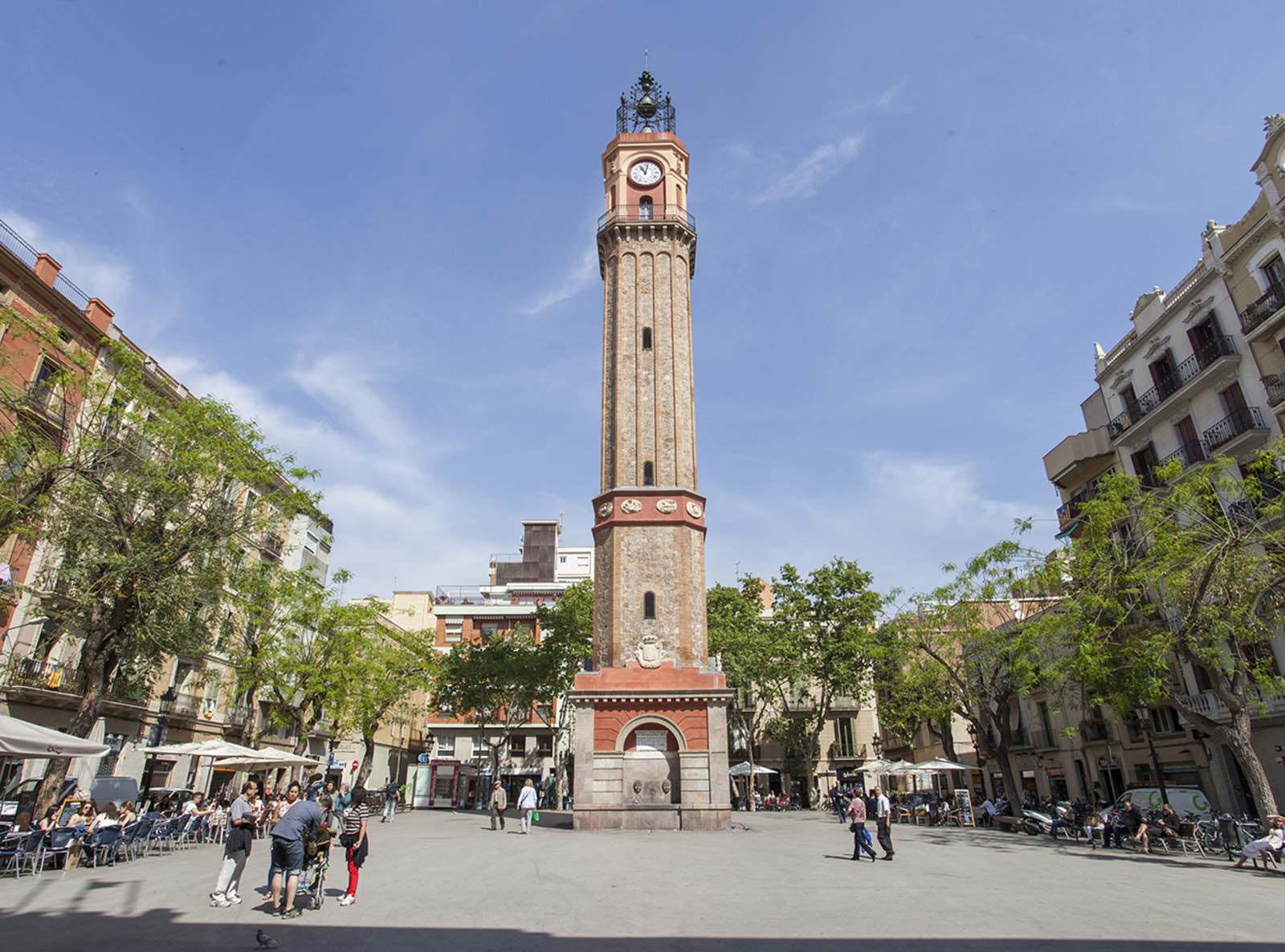
Population: 121,789
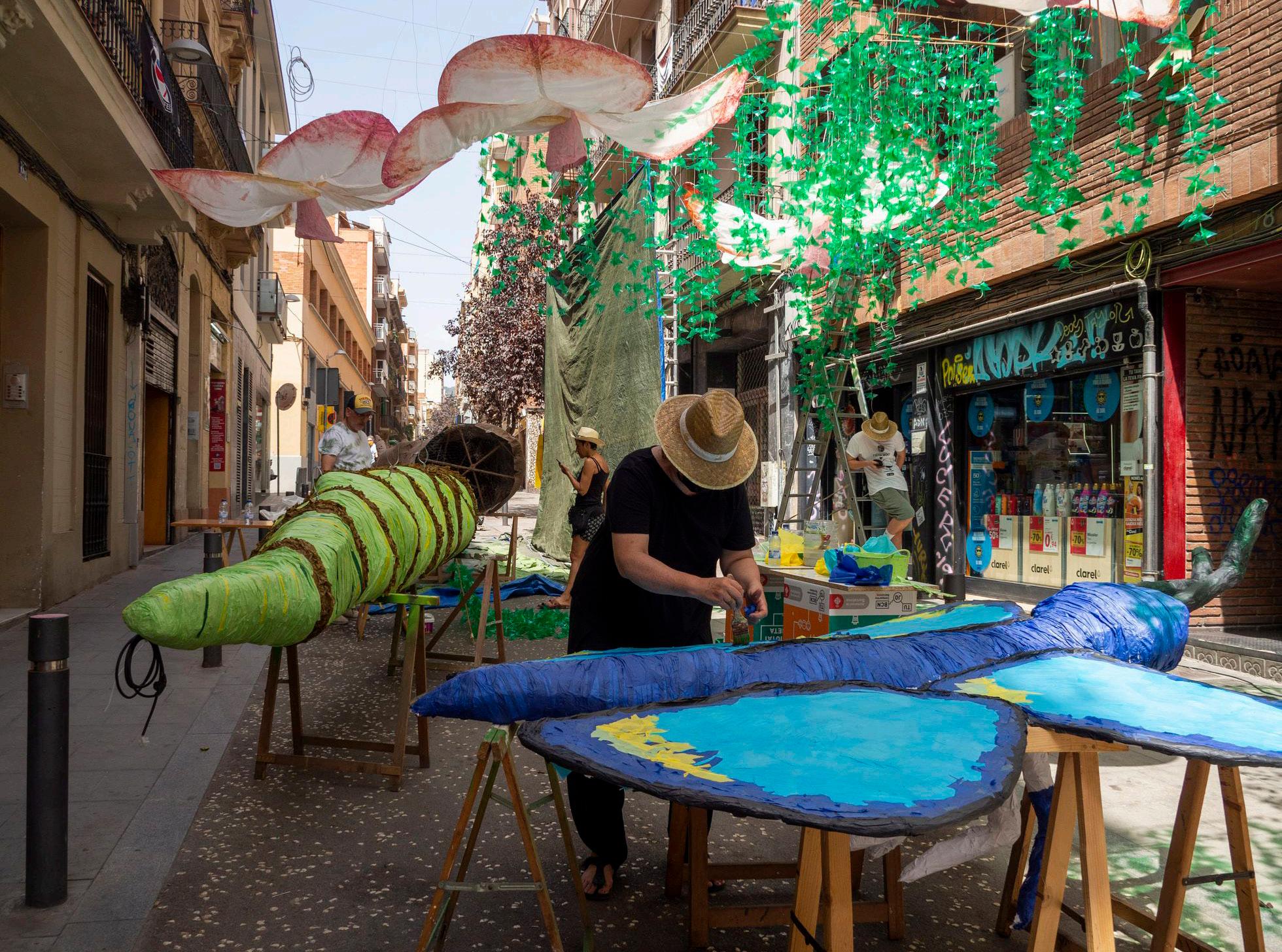
Gràcia is home not only to residents who have spent their whole lives there but also to students and immigrants from around the world. Originally an independent village of workers before the 1890 expansion of the Eixample, Gracia still maintains its independent nature from Barcelona. The district is full of artisans and food from all cultures found in small holes in the walls within its narrow streets and open plazas for people to interact with their neighbors. Annually the district attracts over a million visitors during their Festa Major every August, with the streets decorated with colorful decorations made by locals to show their neighborhood pride.
52
Park Guell by Antoni Gaudi, one of the districts most famous tourist attractions.
Locals preparing for the Festival of Gracia, an event held annually that locals decorate their streets in a district wide festival/competition.
Place de la Ville de Gràcia, the main plaza of Gracia connecting to passage de gracia and the rest of Barcelona.
Sarria-Sant Gervasi
Area: 20.09 km²
Population: 148,000
Sarrià - Sant Gervasi is one of Barcelona’s most expansive districts, including some village-like residential areas within the Collserola mountain range with some of the cleanest air within the city, along with areas that more closely resemble the dense streets of the city center. The district is mainly known for its mansions and stunning views of the whole city of Barcelona.
53
Parque de atracciones Tibidabo, Barcelona’s amusement park at the top of mount Collserola, built in 1899 is one of the oldest in the world
Views from Mount Collserola overlooking all of Barcelona to the Mediterranean sea.
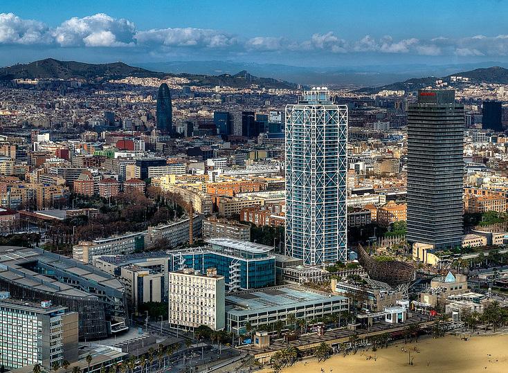
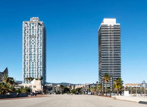
Sant Marti
Area: 10,8 km2
Population: 221,029
The Sant Martí district is home to the beaches of Barcelona, 22@ district, and the Olympic Village. The neighborhood was transformed from an industrial sector of the city, filled with factories and warehouses, to a known for its green spaces and innovation centers after the 1992 Olympics, including Plaça de les Glòries Catalanes, with the Museu del Disseny.

54
Aerial view from the coast across Sant Marti
Plaça de les Glòries Catalanes and Torre Glories
The waterfront walkways
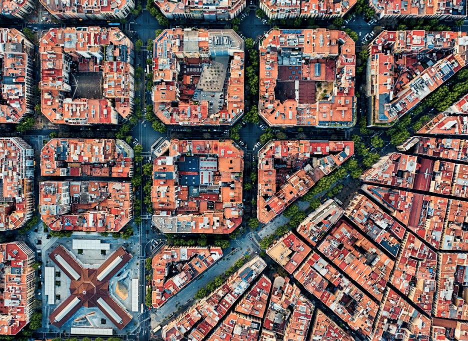
L’Eixample
Area: 7.48 km²
Population: 266,874
The Eixample was built as an extension of the city based on a plan devised by Ildefons Cerdà in 1890. Its streets are organized by a grid system with octagonal-shaped city blocks and wide avenues. It is home to the heart of the city, Plaza Catalunya, which links the modern city to the gothic quarters and is always teaming with tourists. This is the most iconic and recognizable district, home to many famous tourist attractions of Barcelona.
55
Aeriel view of L’Eixample grid layout
Average street layout within L’Eixample
Views to Sagrada Familia by Antoni Gaudi
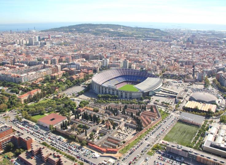
Les Corts
Area: 1.411 km²
Population: 29,511
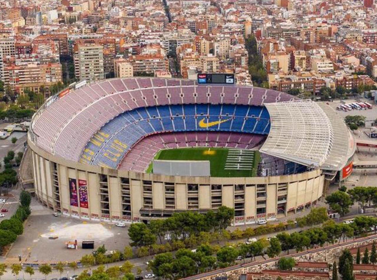
Les Corts district is located west of the city and was originally most farmland until the 1900s. Currently, it is primarily residential with gardens from its agricultural past and is home to Barca’s soccer stadium Camp Nou which is the main draw for visitors to this district. The stadium can hold 99,354 people a game, and on average more than 2 million people visit annually.
56
Aerial view of Les Corts
Parc del Turó
Aerial of Camp Nou
Ciutat Vella
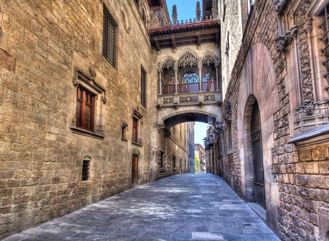
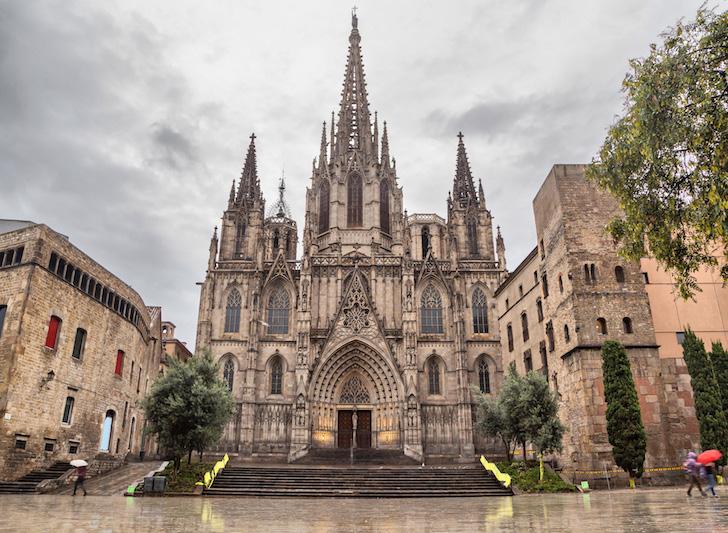
Area: 4.37 km²
Population: 102,347
The district of Ciutat Vella is home to the historical, Gothic quarter full of narrow winding streets with architecture ranging from Roman times to modern buildings. La Rambla divides the district between the super touristy side of the Gothic quarter and the sketchy streets of Raval. There are countless things to do in this district and plenty of museums to see, including the Picasso museum and the new MOCO museum.
57
Aerial view of Ciutat Vella
Gothic Quarter Streets
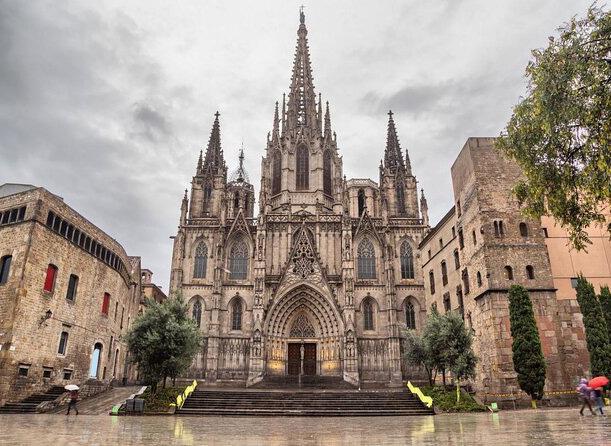
Catherdal of Barcelona
Sants-Montjuic
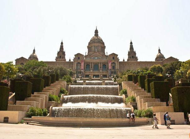
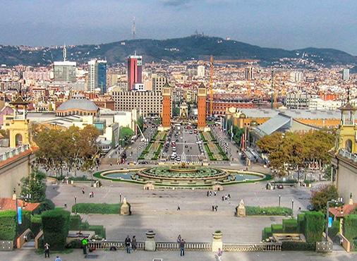
Area: 21.35 km²
Population: 183,120
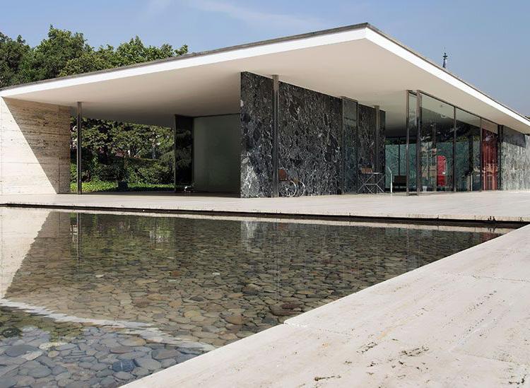
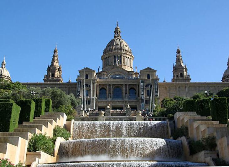
Sants-Montjuïc district is known for Plaza Espana, Montjuic, and being the center of the industrial sector of Barcelona. It is the first district many people see in Barcelona as they take a taxi from the airport to the city. The 1929 world expo was held in Plaza Espana and hosted post-modern and neoclassical architecture and the German Pavillion by Mies van der Rohe. In 1992 the Olympic games were hosted on Montjuic in the stadiums and pools on the mountain overlooking the city.
58
View of Plaza Espana
German Pavillion by Mies van der Rohe
View to the Montjuïc National Palace
PATHS
“Paths are the channels which the observer moves. They can be streets, walkways, transit lines, canals and railroads.”
(Lynch, 1960, p. 66)
Barcelona has many ways to travel through it but this path shows the most common ways to travel to the city center from the airport and train stations in the city.
59 PUBLIC CirculationTRANSPORTATION
RondaLiteral
Parallel
Gracia Rambla Marina
NODES - GRACIA
Gracia is a diverse neighborhood with many nodes for neighbors to interact in. The four highlighted spaces are where locals collect to listen to music, hold festivals, or sit down to chat with each other.
60
1. Plaza de la Villa de Gracia
2. Plaça de la Revolució
3. Plaza del Pueblo Gitano
1 2 3 4
4. Plaza de Lesseps
“Nodes are the strategic foci into which the observer can enter, and which are the intensive foci to and from which he is traveling. They may be primarily junctions, places of a break in transportation, a crossing or convergence of paths.”
(Lynch, 1960, p. 47)
61 1 2 3 4
LANDMARKS
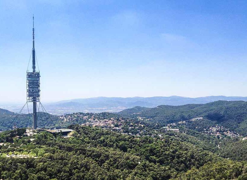
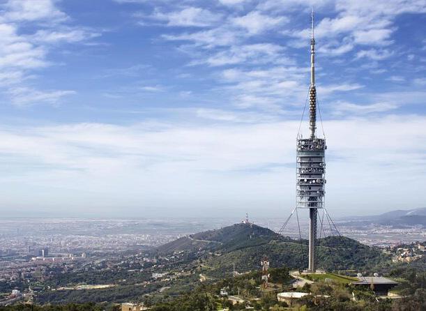
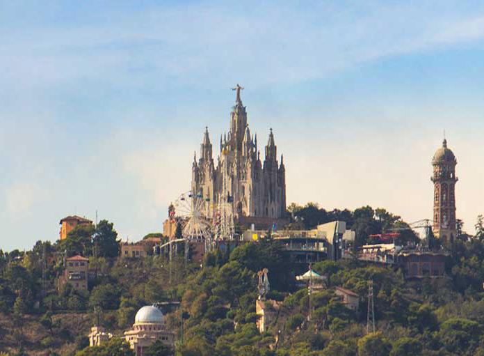
Barcelona has a variety of landmarks that can be used to navigate the city. Many you can see from almost any part of the city, such as Torre de Collserola. In contrast, others are only visible turning a corner in the gothic quarter, like the cathedral of Barcelona.
62
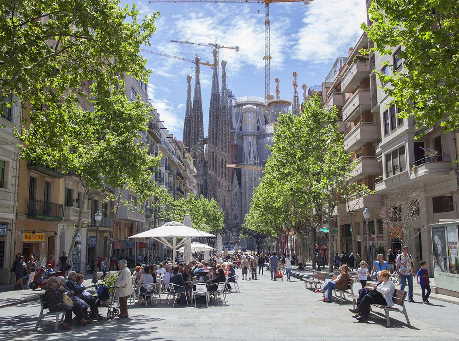
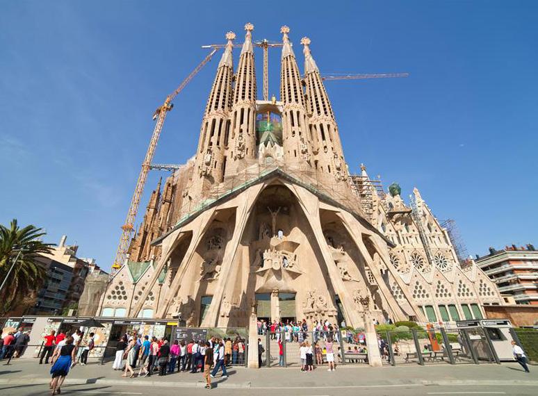
1. Sagrada Familia
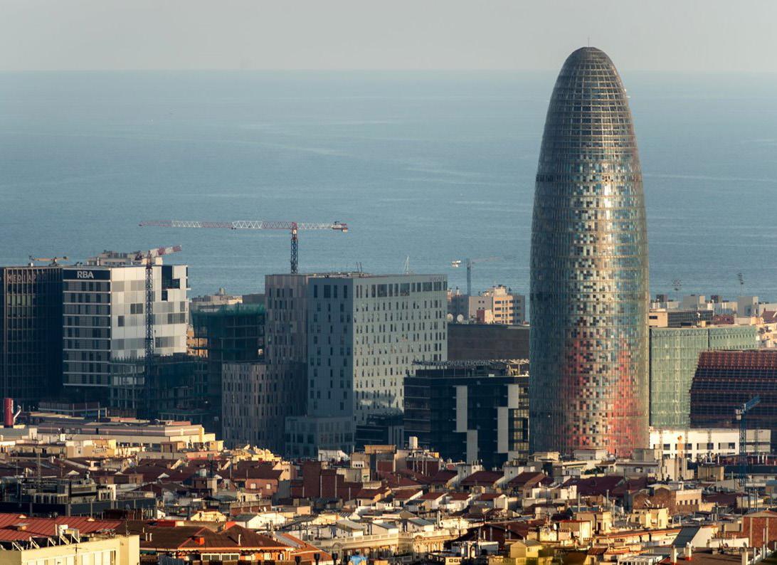
2. Torre Glòries
3. Hotel Arts & Mapfre Tower
4. Torre de Collserola
5. Barcelona Catherdal
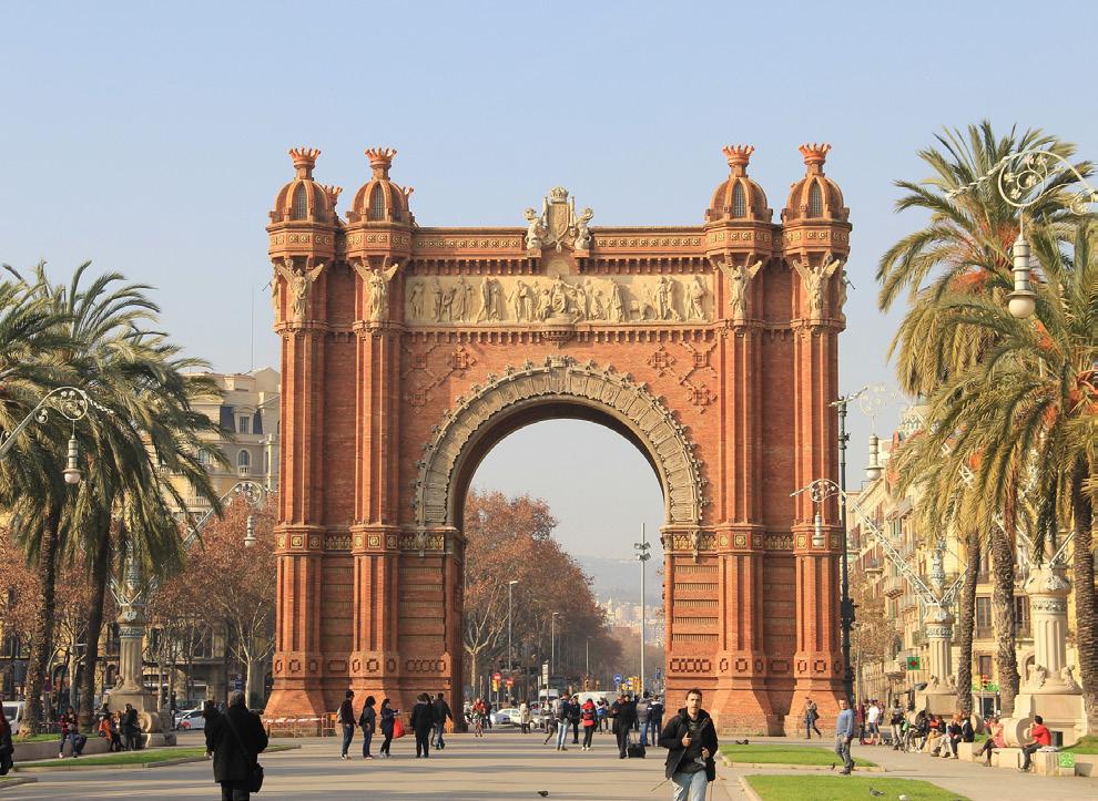
6. Arc de Triomf
7. Camp Nou
8. Mount Juic - Palau Nacional
1 2 3 4 5 6 7 8 9
9. Parque de atracciones Tibidabo
“Landmarks are point references considered to be external to the observer. They are more easily identifiable, if they have a clear form; if they contrast with their background; and if there is some prominence of spatial location”
(Lynch, 1960, pp. 78–79)
63 1 2 3 4 5 6 7 8 9
SWOT SWOT ANALYSIS
W S
64
T
O
Swot Analysis
What is SWOT analysis? SWOT analysis analyzes the urban context’s strengths, weaknesses, opportunities, and threats. It can help one understand what areas a city is thriving in, where it could use some help, growing concerns, and how to use its current resources to propose well-thought-out design solutions.
How are a city’s strengths determined? This analysis chooses strengths because the city is already doing them well. For example, strength would be walkability in a city with many wide sidewalks and pedestrian streets.
Weaknesses are determined by what the city is struggling with. This could be a high crime rate in a city or reliance on fossil fuels for energy production.
Opportunities are chosen as emerging projects or potentials for the city. Examples of this could be a climate action plan or a movement to increase public green space.
Threats are emerging problems within a city. These could be apparent widespread problems such as climate change or more black-and-white issues such as tourism.
65
STRENGTHS Strengths
Population - diverse, highly educated, and skilled craftsmen
Education- many public universities offer a variety of programs and bring in thousands of international students annually.
Ease of travel- many options to travel outside of the city with the airport, ferries, train stations, and bus stations.
Rich in art, architecture, and culture.
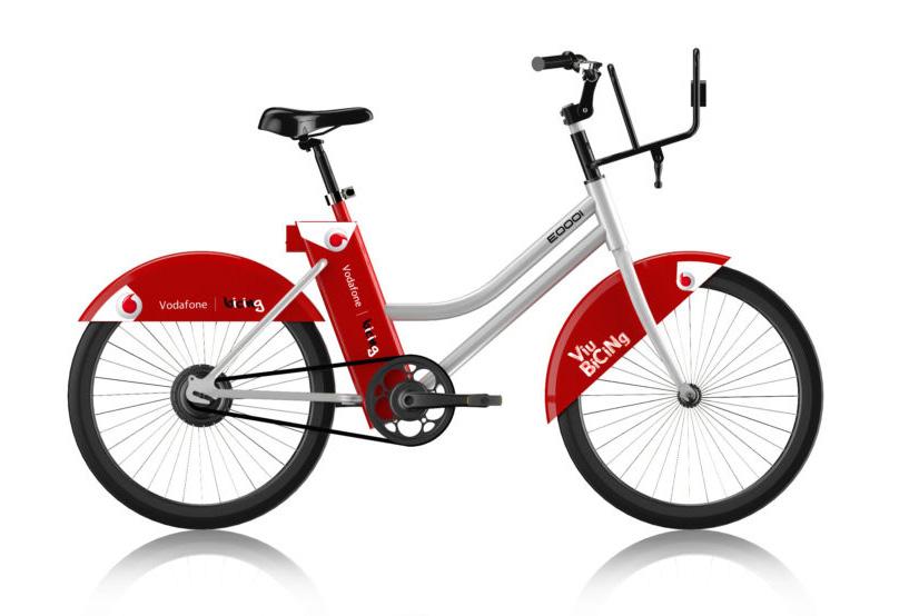
Public transportation- fast, frequent, and reliable with many forms such as metro, bus, tram, and a bike share system.
Bikable- many bike lanes throughout the city
Walkable- tons of pedestrian streets, plazas, and wide sidewalks allow a lot of natural light and ventilation outdoors and indoors.
Greenspaces- many public plazas and parks distributed throughout the city and various hiking trails on the coast and surrounding mountains.
Water- many water sources for the city and Europe’s largest desalination plant capable of providing for 20% of the city’s water needs.
66
S
WEAKNESSES STRENGTHS Weaknesses
Crime rate- high pretty crime rate, mainly pickpocketing, plagues the most touristy areas within the city.
Economy- high risk of poverty and unemployment.
Energy- currently, only a tiny fraction of energy produced in the city is renewable; half of the power consumption relies on fossil fuels.
Pollution: low air quality from transportation emissions and large amounts of waste from plastic bottles.
Noise: high noise levels all over the city from high levels of transportation, nightlife, and dense population.
Wildlife- much of the city has been built up, eliminating much of the wildlife’s natural habitat and invasive species to thrive
67
W
OPPORTUNISTS STRENGTHS Opportunities
Population- growing young population of highly educated students attracting big innovation companies to the area.
Superblocks and Tactical Urbanism- a growing movement to give the streets back the pedestrian and decrease pollution by using efficient temporary solutions to increase walking and outdoor dining space.
Potential for Solar and Wind- the city has the potential for more solar and wind power my utilizing the roof tops of the built-up center of the city to provide more space for renewable energy production.
Barcelona’s Climate Action Plan 2018 - 2030 - plan to decrease pollution and reliance on fossil fuels and increase the quality of public spaces for the health of its residents through pillars of a more sustainable Barcelona
68
O
THREATS STRENGTHS Threats
Declining local population- the local population is getting older and smaller as they only comprise 61% of the total population.
Tourism- is a curse and a blessing, it generates a lot of money and jobs, but 1/4th of jobs rely on tourism, they generate pollution, and locals are losing their spot in the city as airbnbs take over.
Climate change- increasing temperature throughout the year and drier summers causing wildfires on the outskirts of the city
Invasive species- taking over the city, with large populations of pigeons and parakeets growing larger each year.
69
T
REFERENCES
Barcelona. https://urbanresiliencehub.org/city-population/barcelona/. Accessed 8 Dec. 2022.
Barcelona - The People | Britannica. https://www.britannica.com/place/Barcelona/The-people. Accessed 8 Dec. 2022.
“Barcelona Explains Its New Economic Model for 2030.” POLITICO, 7 Mar. 2022, https://www.politico.eu/sponsored-content/barcelona-explains-its-new-economic-model-for-2030/.
“Barcelona in Numbers: Crimes, Victims and Safety | Barcelona Metròpolis | Barcelona City Council.” Barcelona Metropolis, 11 Apr. 2019, https:// www.barcelona.cat/metropolis/en/contents/barcelona-numbers-crimes-victims-and-safety.
Barcelona Population 2022. https://worldpopulationreview.com/world-cities/barcelona-population. Accessed 8 Dec. 2022.
“Barcelona, Spain - Intercultural City - Intercultural Cities Programme - Publi.Coe.Int.” Intercultural Cities Programme, https://www.coe.int/en/web/ interculturalcities/barcelona. Accessed 8 Dec. 2022.
C40 Knowledge Community. https://www.c40knowledgehub.org/s/article/Barcelona-s-Climate-Action-Plan-2018-2030?language=en_US. Accessed 8 Dec. 2022.
Crime in Barcelona. https://www.numbeo.com/crime/in/Barcelona. Accessed 8 Dec. 2022.
History of Barcelona. https://www.barcelona.de/en/barcelona-history.html. Accessed 8 Dec. 2022.
In What Way Are We Vulnerable? | Barcelona for Climate | Ajuntament de Barcelona. https://www.barcelona.cat/barcelona-pel-clima/en/how-doesclimate-change-affect-us/what-way-are-we-vulnerable. Accessed 8 Dec. 2022.
Kassam, Ashifa. “Goats and Sheep Deploy Their Appetites to Save Barcelona from Wildfires.” The Guardian, 15 Aug. 2022. The Guardian, https://www. theguardian.com/world/2022/aug/15/goats-and-sheep-deploy-their-appetites-to-save-barcelona-from-wildfires.
Lowry, Tom. “Barcelona Looks for Balance When Welcoming Post-Covid Tourism.” Skift, 24 June 2022, https://skift.com/2022/06/24/barcelona-looksfor-balance-when-welcoming-post-covid-tourism/.
Lynch, Kevin. The Image of the City. 33. print, M.I.T. Press, 2008.
Nearly half of homeless people in Barcelona have lived on streets for over two years. Catalan News. (2022, May 31). Retrieved March 29, 2023, from https://www.catalannews.com/society-science/item/nearly-half-of-homeless-people-in-barcelona-have-lived-on-streets-for-over-two-years
70
“Nou Barris.” Meet Barcelona, https://www.meet.barcelona/en/points-interest-city/nou-barris. Accessed 8 Dec. 2022.
“Points of Interest in the City.” Meet Barcelona, https://www.meet.barcelona/en/visit-and-love-it/points-interest-city. Accessed 8 Dec. 2022.
“Spain, Germany Battle Wildfires amid Unusual Heat Wave.” AP NEWS, 19 June 2022, https://apnews.com/article/wildfires-barcelona-evacuations-spain-beb7e9181d3e8317f25baab03af9b017.
Stott, Harry. “Barcelona Past: The Carta Històrica.” (Barcelona-Metropolitan.Com), 1 Aug. 2019, https://www.barcelona-metropolitan.com/api/content/2c366588-b159-11e9-bcee-12f1225286c6/.
“Tactical Urbanism.” Urbanisme Tàctic, https://www.barcelona.cat/urbanismetactic/en/tactical-urbanism. Accessed 8 Dec. 2022.
Top Companies to Work for in Barcelona. https://tracxn.com/d/discover/top-hiring-companies-in-barcelona/. Accessed 8 Dec. 2022.
Urban Analysis - Huddersfield by Kamila Kudlata - Issuu. https://issuu.com/kamila_kudlata/docs/urban_20analysis_20-_20huddersfield. Accessed 8 Dec. 2022.
71
