4 minute read
Project Overview & Goals
Setting the Scene
The island of Martha's Vineyard, or Noepe in Wampanoag, is located three miles off the coast of Cape Cod. The Vineyard is home to roughly 17,000 year-round residents and is known for its scenic beaches, picturesque towns, and booming seasonal tourism industry. Martha's Vineyard and the neighboring island of Nantucket mark the southernmost extent of the Laurentide ice sheet, and are formed of sandy glacial outwash and stony, mixed moraine deposits. The town of Aquinnah sits at the southwestern corner of the Vineyard. The town is accessible only by State Road, which runs between two bodies of water–Menemsha and Squibnocket Ponds–separating Aquinnah from the rest of the island. As the most geographically isolated town on the island and with the smallest population, Aquinnah is akin to an "island within an island" (MVC, 2018). The town is famous for its colorful clay cliffs and lighthouse at Aquinnah Circle on the western end and characterized by gently rolling hills, stone walls, scenic vistas, and a rich cultural history. Aquinnah, until recently known by its colonial name, Gay Head, has been the home to the Wampanoag people for over 10,000 years. The Wampanoag Tribe has a rich history of whaling, fishing, and traditional agriculture, lifeways that were appropriated by Europeans in the late 1600s as the Wampanoag's ancestral lands were colonized.
The giant Moshup catches a whale at the Aquinnah Cliffs, mural by Stanley Clark.
Two sovereign governments make up the town's government, the Wampanoag Tribe and the Town of Aquinnah. These groups make joint land use planning decisions. As of 2016, Aquinnah was home to roughly 600 year-round residents, roughly a quarter of whom are tribal members. Aquinnah's population expands to over 2,100 residents each summer, and the livelihoods of the town's year-round residents rely heavily on this influx of summer workers, residents, and visitors. Aquinnah's year-round retired population is growing most quickly, and the town is also home to over 90 children under the age of thirteen.
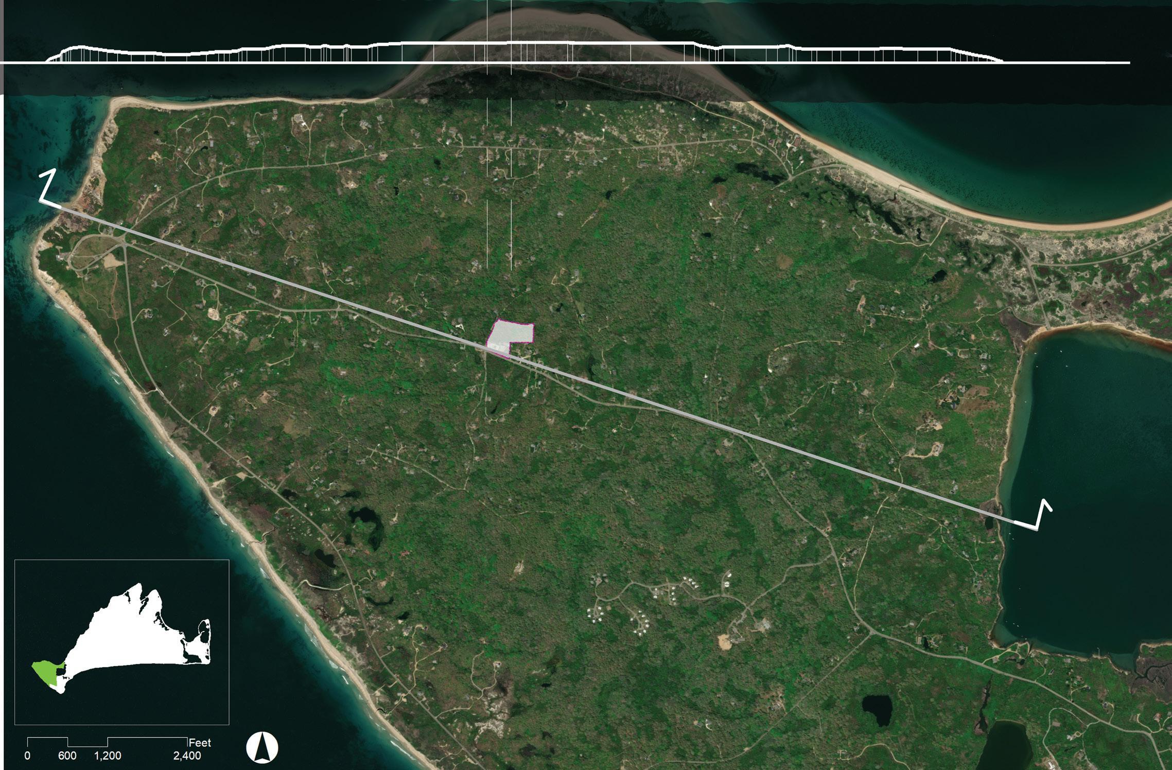
A A'
A Aquinnah Circle & Cliffs

S t a t e R o a d

Project Site
Menemsha Pond
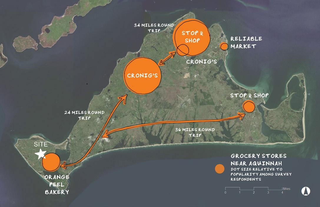
Most of the residents who responded to the public survey reported driving 24 to 36 miles, round-trip, to purchase groceries, and most families do not keep food gardens at home.
Community & Client Team
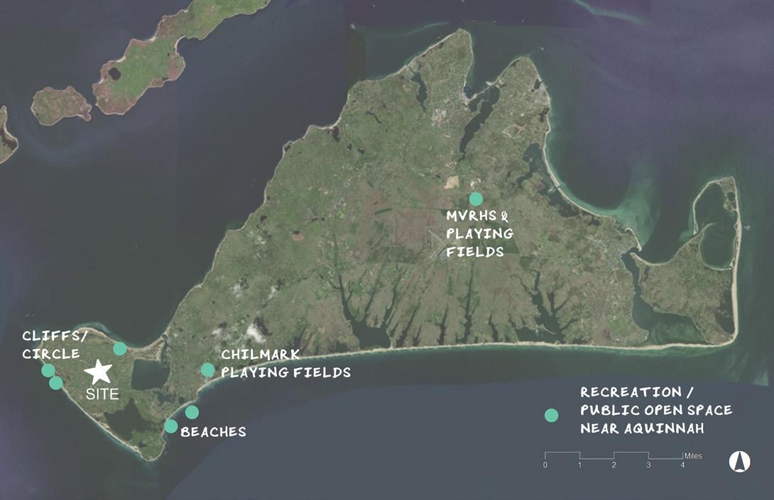
Municipal authorities have identified an important community need for more affordable rental housing, and the project site was identified as a suitable location for affordable housing in Aquinnah's "Community Development Plan" (2004) and again in the "Housing Production Plan" (2018). Efforts to expand public facilities and site affordable rental housing have been ongoing on the site for fifteen years. Though famous for its scenic cliffs and beaches, Aquinnah lacks active recreational spaces for children and families. The nearest playgrounds and athletic fields are part of the public schools in the neighboring town of Chilmark. In the first community meeting (May 7, 2020) and public survey (May 6 - 25, 2020) conducted as part of this project, respondents expressed an interest in an updated, naturebased play area with gathering spaces, walking paths, and comfortable resting places for adults. The discussion of affordable housing and improved play and gathering spaces has recently been reinvigorated by a newly formed project committee, whose interests now include the design of a new playground and the planting of a community forest garden to grow perennial foods to supplement the town's emergency food supply. Many residents travel out of town to buy groceries, and as more of the island has been developed for seasonal housing and fewer families garden, some residents feel that the connection to the land and food has been lost.
A'
Tribal Housing
Squibnocket Pond
Aquinnah's Community Preservation Act tax allowance with state-matched funding fueled the formation of the project committee to lead the master planning process. The project committee includes the following community members: • Derrill Bazzy, Community Preservation Committee • Mike Hebert, Housing Committee • Jeffery Madison, Town Administrator • Noli Taylor, Food Forest Working Group • Juli Vanderhoop, Selectboard and Parks & Recreation

Project Goals
Site up to four new affordable rental units on the site, to provide year-round rental housing for local residents.
Site up to two duplexes, each with one single-bedroom and one two-bedroom unit, with vehicle access from State Road, parking for seven cars, and a septic system sized for these buildings and possible future housing and town office expansion. Create a clear division of public and private spaces both around the homes and within the site as a whole. Provide accessible walkways from parking spaces to building entrances.
Design a nature-based play area with accompanying multi-generational gathering spaces and paths.
Design a new play and gathering space removed from State Road with shaded gathering space, accessible paths, and parking for ten vehicles nearby. Ensure safe, clear, and accessible pedestrian linkages from new play spaces to existing restrooms and public amenities.
Design a community food forest (or a "forest garden"), which functions as an educational space for sharing traditional ecological knowledge and supplements the town's emergency food supply.
Integrate a perennial food forest into the public open space. Designate locations for informational, educational, and wayfinding signs for visitors. Include short- and long-term installation and maintenance plans to be implemented by volunteer groups and individuals.


