2009-2024
CRISTIÁN BAS SILVA
ARCHITECTURE PORTFOLIO
Architect Licensed in Chile
Master in Landscape Architecture ‘22
Harvard University
AIA - ASLA Associate
LEED GA
bascristian90@icloud.com
+1 857 206 9964 Cambridge, MA


2009-2024
Architect Licensed in Chile
Master in Landscape Architecture ‘22
Harvard University
AIA - ASLA Associate
LEED GA
bascristian90@icloud.com
+1 857 206 9964 Cambridge, MA

BOLDLY LIVING WITH WATER
[HOUSTON: EXTREME WEATHER, ENVIRONMENTAL JUSTICE AND THE ENERGY TRANSITION]
Resilient Infrastructure during climate disasters
GSD - OPTION STUDIO Spring ‘22- Matthijs Bouw
THE MANGROVES
[MIAMI REMIX]
Affordable Housing in floodable site near Miami River
GSD - OPTION STUDIO Fall ‘21- Elizabeth Whittaker & Corey Zehngebot
CARVE IN - CARVE OUT
Re-naturalization of Boston’s Seaport District waterfront
GSD - CORE STUDIO IV Spring ‘21 - Belinda Tato
THE GREAT BELT
Stormwater purification infrastructure for Boston’s wetlands
GSD - CORE STUDIO III Fall ‘20 - Danielle Choi
CASAS BLACK
[Black Houses] Design and construction of 12 houses near the Chilean coast
PROFESSIONAL WORK ‘19-’21
PARQUE MAITENCILLO
[Maitencillo Park] Design of a masterplan for a new gated-community
PROFESSIONAL WORK ‘15-’18
NEK MATANZAS
4 boutique houses-hotel development in an oceanfront site in Matanzas Beach
PROFESSIONAL WORK ‘17
PLANETARY LAKE LANDER
NASA’S STATION AT THE ANDES
Final project and Thesis for Bachelor’s degree
UFT [CHILE] FINAL STUDIO ‘14

Academic | Urban Design | Landscape | Residential Community Kashemere Gardens | Houston, Texas | USA
*GRADUATE SCHOOL OF DESIGN - HARVARD UNIVERSITY DISTINCTION
FACULTY
Matthijs Bouw
TEAM
Cristian Bas - Wanjiku Ngare
Known as Bayou City, water is a core part of Houston’s identity. But events like Hurricane Harvey are a brutal reminder of water’s power when it isn’t given space in a landscape filled with features where land and water are deeply intertwined - bayous, wetlands, deltas, and marshes, most catastrophically impacting communities such as Kashmere Gardens.
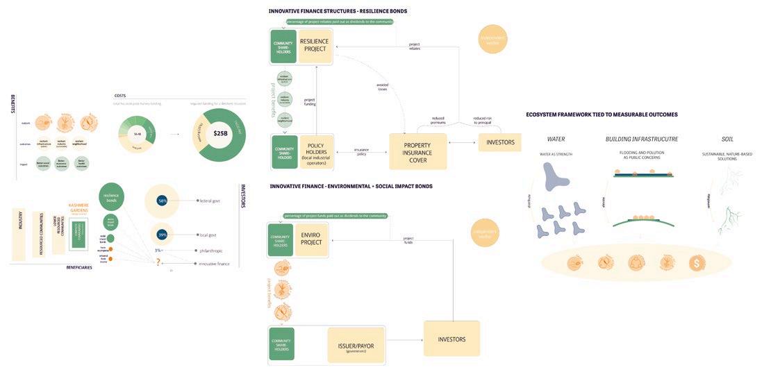
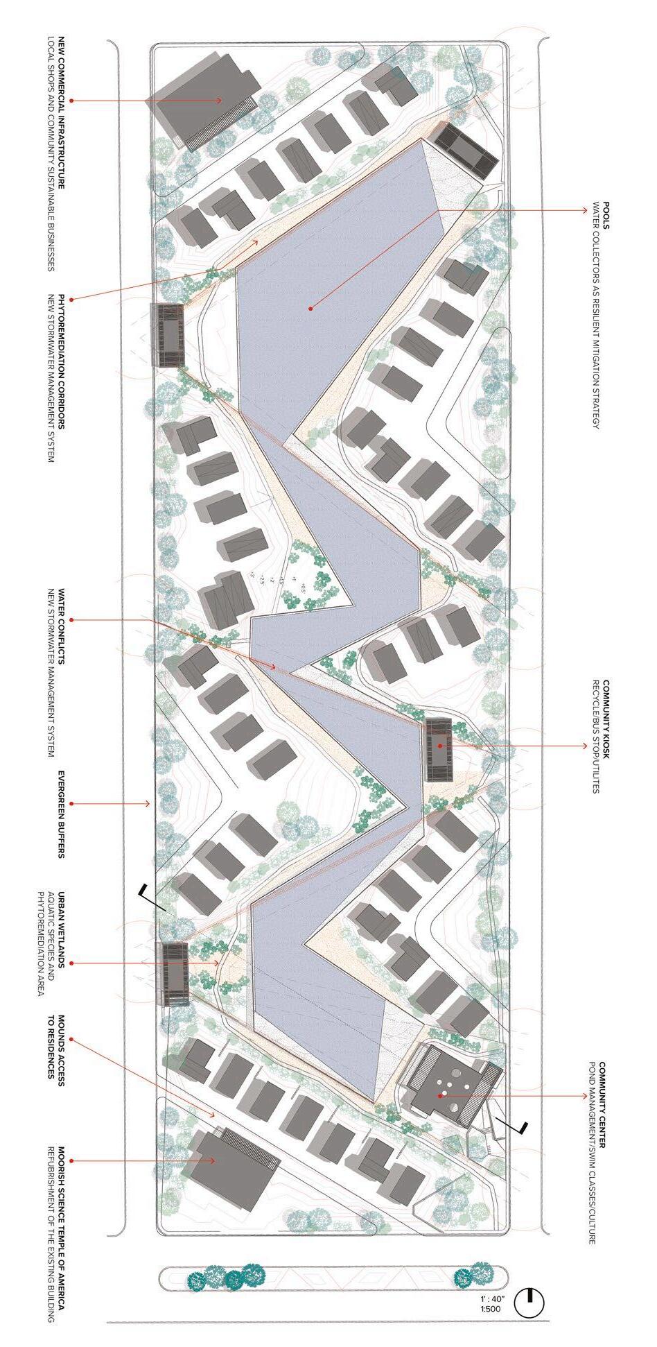
What if Bayou City’s planning and design decisions boldly embraced the water, elevating pollution and flooding to public concerns as opposed to private burdens? How might outcomes be different for the most vulnerable communities? And how might the value created through planning and design interventions be monetized to directly benefit the existing community? We propose an integrated landscape and planning approach tested and applied to the Kashmere Gardens neighborhood context.
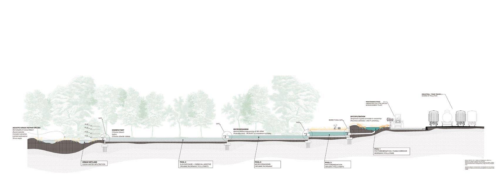
From an ecosystem perspective, we employ a three-systems framework at the water, building infrastructure, and soil levels. We distribute the necessary detention capacity throughout the neighborhood at a block-by-block scale, based on our analysis of conflict points where water pools during a pluvial event, leading to flooding. We elevate all housing and community infrastructures at the block level on mounds, eliminating the need for individual interventions such as concrete paving, and housing elevation on stilts - thereby creating more equity in the process. We remediate the soil through complex, nature-based phytoremediation processes. Each of these ecosystem interventions can be directly tied to more positive health, environmental, economic, and infrastructure outcomes, making their value monetizable and financeable

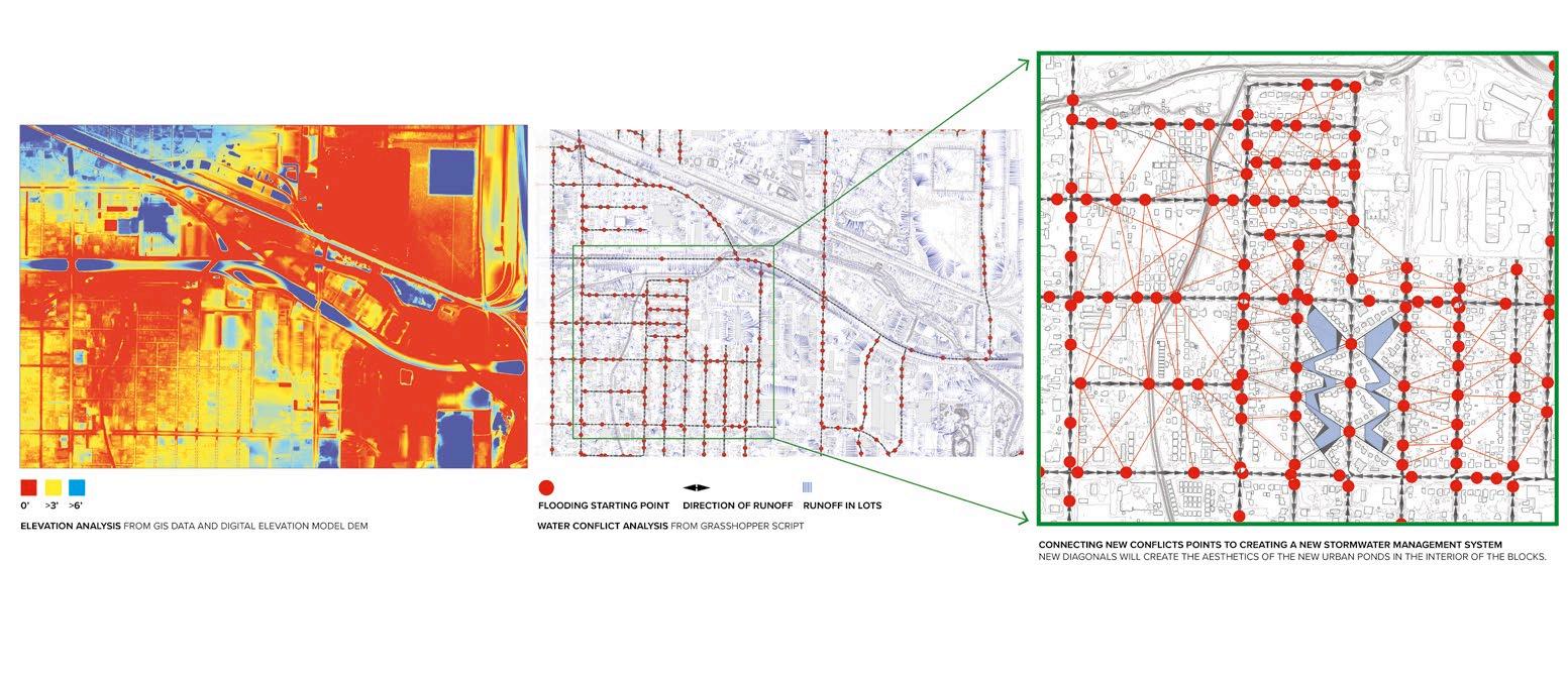
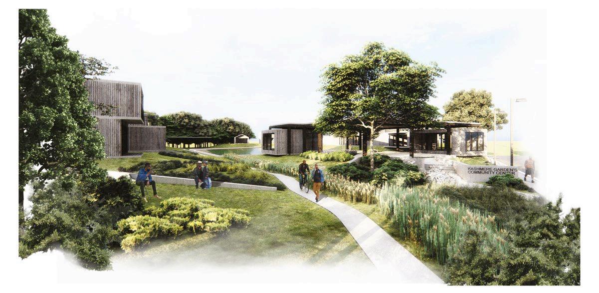
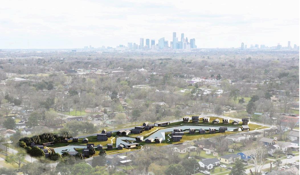
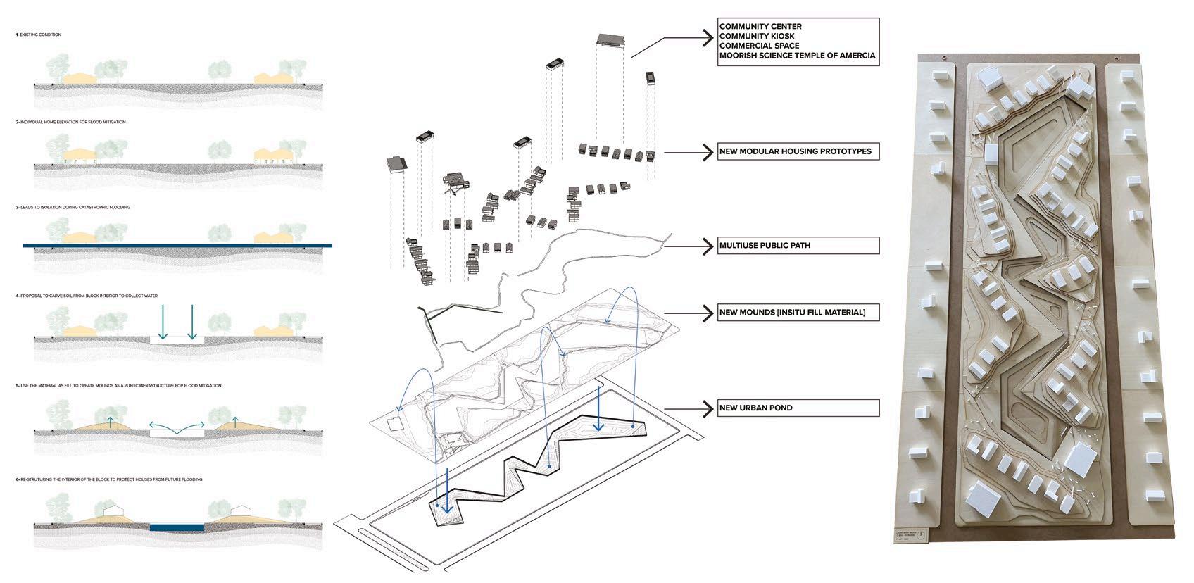
•Pluvial water collector ponds as intertwined mitigation infrastructure with the existing stormwater management system
•Phytoremediation patches placed in key areas of runoff conflict points of existing streets slopes.
•Using soil that was carved to create the new ponds to build mounds as part of the new landscape to support houses in elevated points safe from flooding.
•Densifying each block by offering a new lot distribution in favor to existing owners
•Placing crucial community spaces to connect residences with the pond as a public element.
Academic | Architecture | Landscape | Residential Community
Allapattah | Miami, Florida | USA
*GRADUATE SCHOOL OF DESIGN - HARVARD UNIVERSITY DISTINCTION
FACULTY
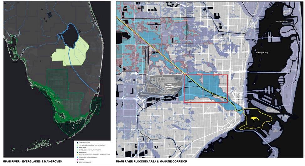
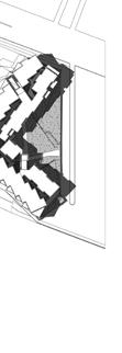
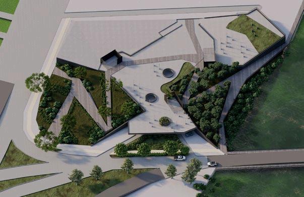
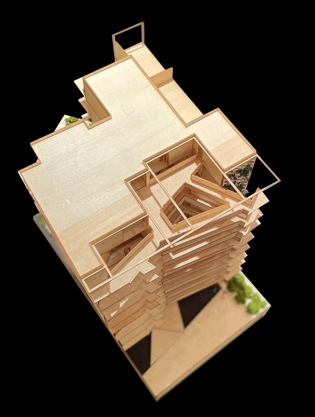
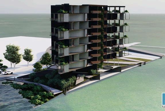
Elizabeth Whittaker & Corey ZehngebotA 2.24 acre site near the Miami River with an inminent flood threat due to Climate Change. Moreover, in 2001 the Miami River commission started an urban public path project along the river. However, it has never been built. The general guidelines for this project are to create concrete walls that could support this new public path.
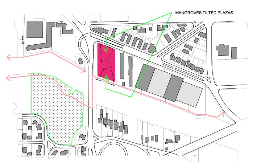
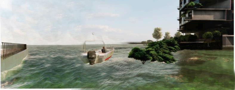
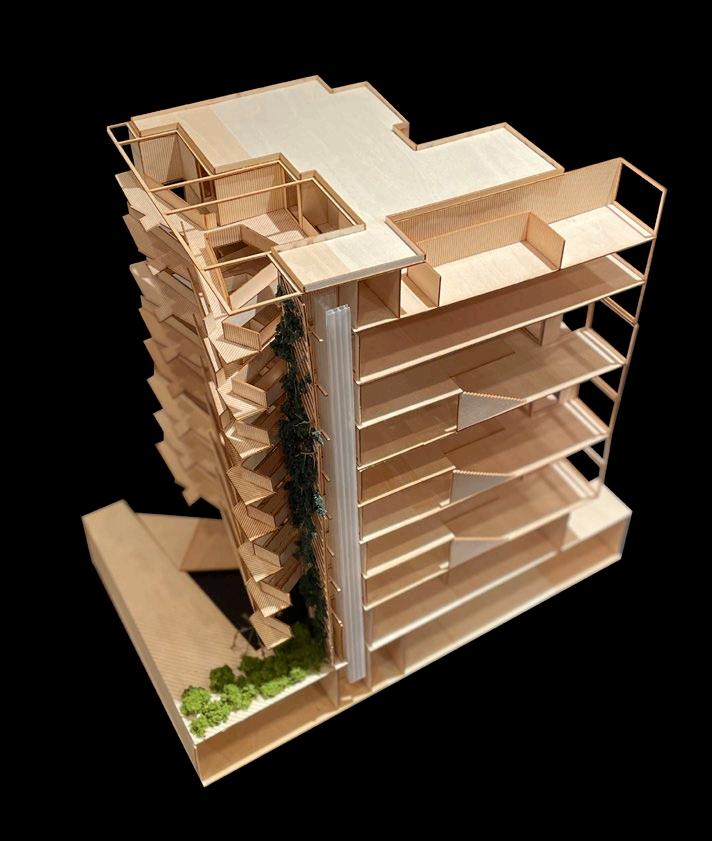
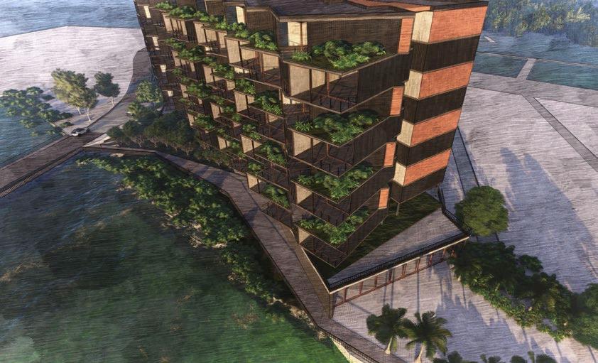
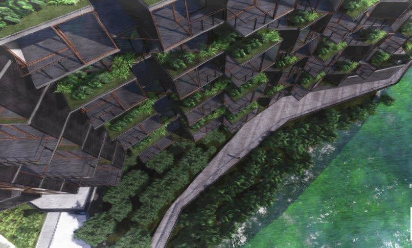
This new residential proposal merges landscape and architecture in three different strategies. First, its ground level is lifted to contain a church, a cultural center, and a parking area, as well as two tilted plazas that will let the water in. Both new plazas will have mangroves to create a natural buffer refugee for manatees, threatened by the river’s pollution and boat traffic. This elevated platform will create a new public space, prepared for the tide changes that Miami will experience in the future.
Above this new public space, the residences are CLT modular constructed and connected with the landscape by a vertical forest placed in the three structural core elements of the building. In addition to this, the residences are stacked and turned from each floor, letting gardens grow. The building will have a vibrant facade, proper for this tropical climate with these strategies. All this new natural vegetation added to the building will be irrigated from the collection of rainwater from the roof, creating a new cycle that merges landscape and architecture in one project.

















Academic | Landscape | Resiliency
Boston | Massachusetts | USA
*GRADUATE SCHOOL OF DESIGN - HARVARD UNIVERSITY
FACULTY
Belinda Tato
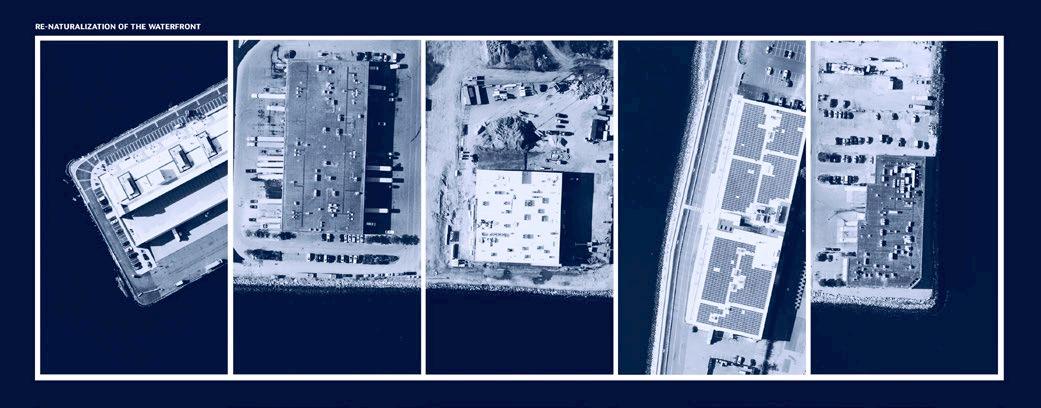
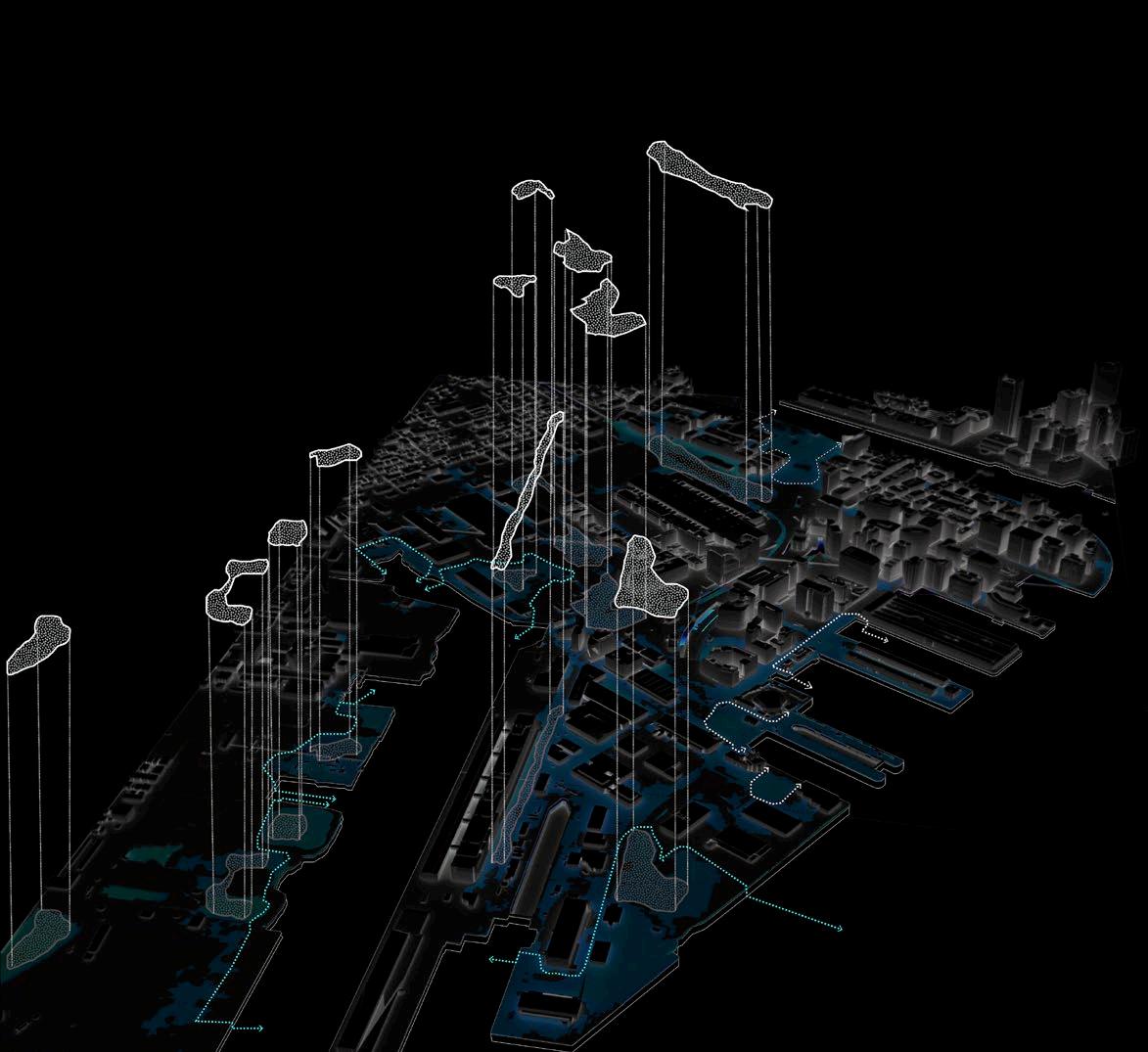
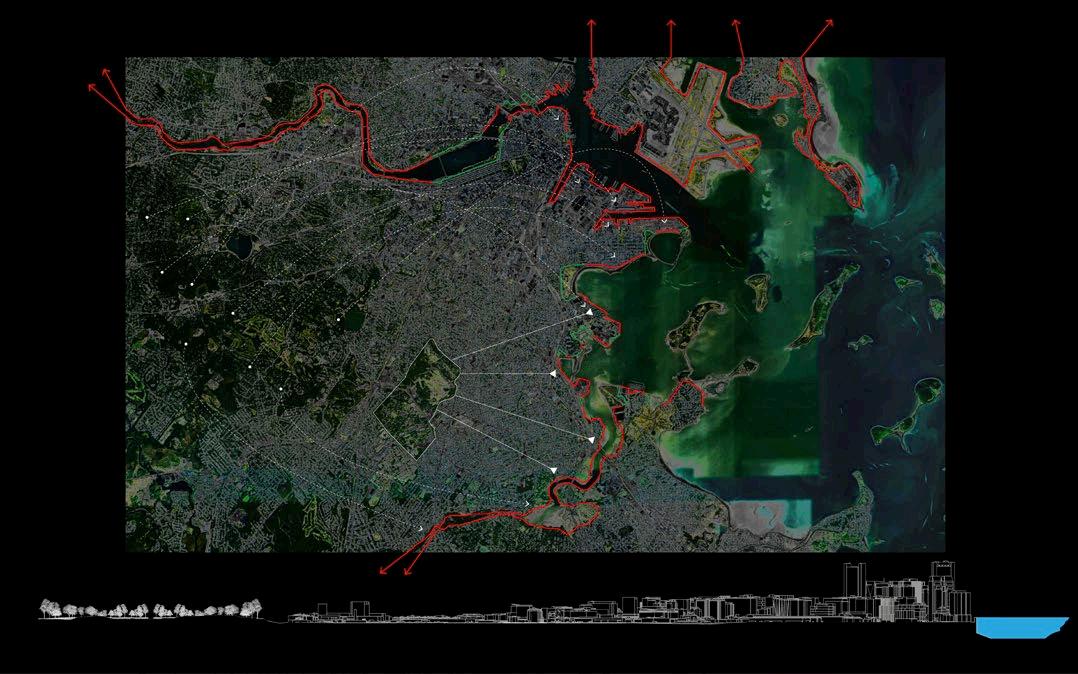
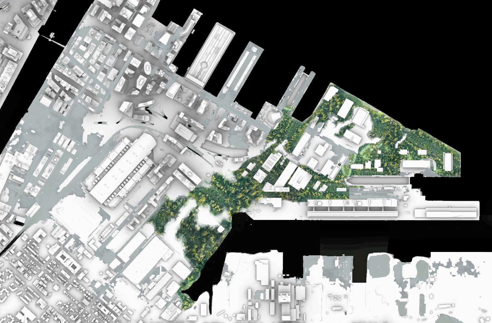
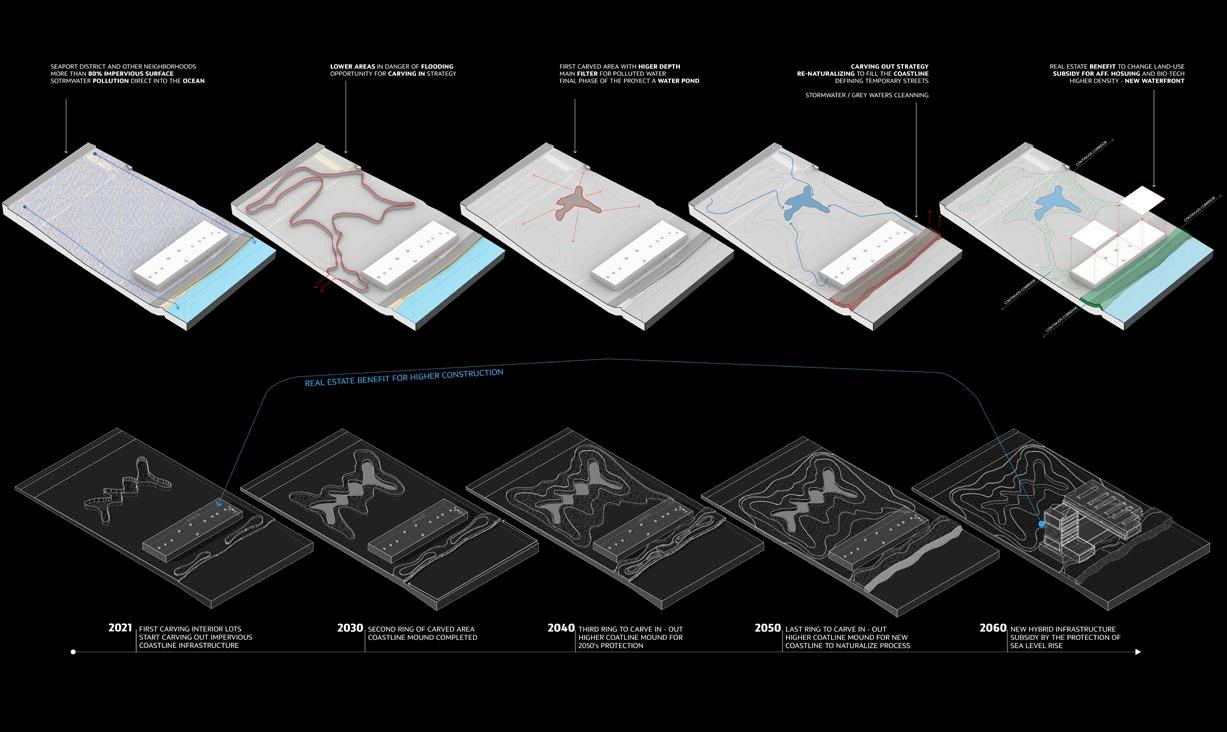
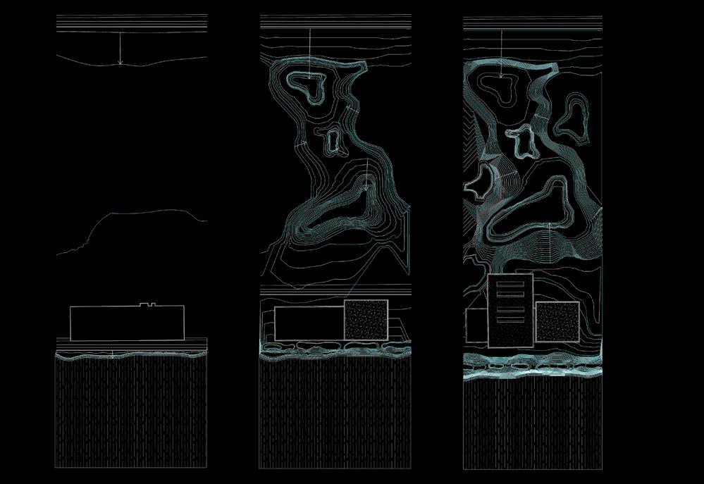
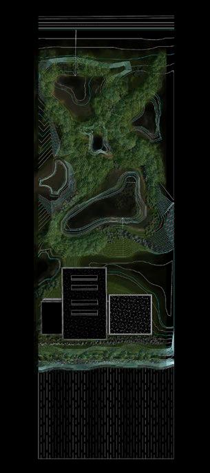
The proposal of a new strategy to protect the waterfront due to the inminent flooding in the future. Many parking lots and obsolete infrastructure in the Seaport district are crucial elements in creating a natural buffer that could prevent the water from coming in. The ‘carve in and carve out’ strategy to get soil from those extended areas and break down the imperviousness of areas like this could save soil extraction away from natural places. The process will be in stages and enable the water to come in slowly in specific areas for public access and vegetation to grow, bringing a new ecosystem to this sterile district. The carved material will be placed as a natural mound near the coastline to create a natural buffer and a new public path.
We could break the paradox of oceanfront access in the Seaport District and many other places in the US and protect our city from sea-level rise.




Academic | Landscape | Resiliency
Boston | Massachusetts | USA
*GRADUATE SCHOOL OF DESIGN - HARVARD UNIVERSITY
FACULTY
Danielle Choi
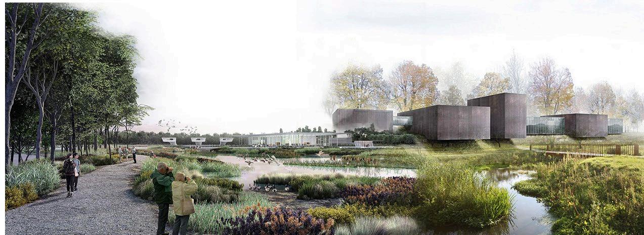
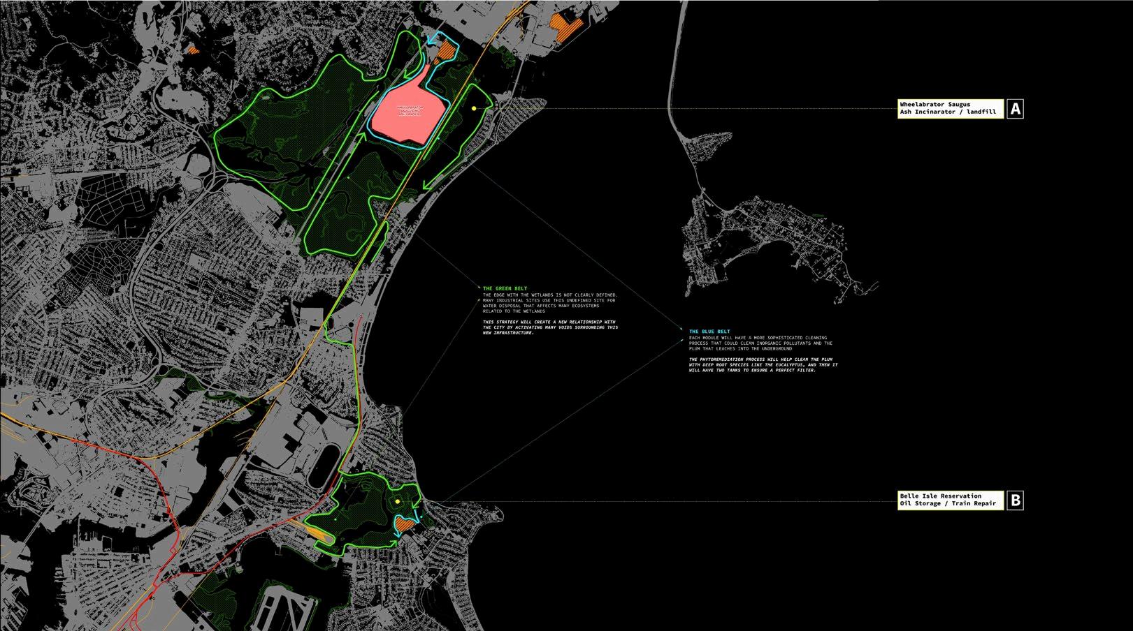
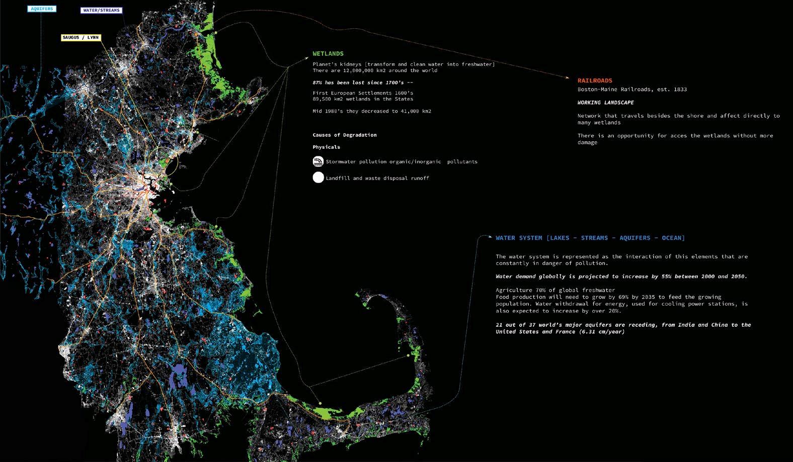
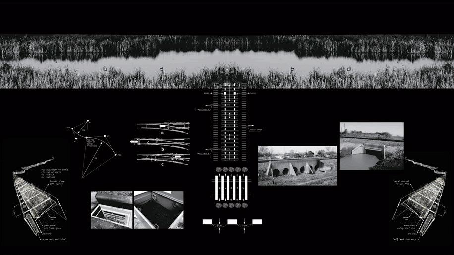
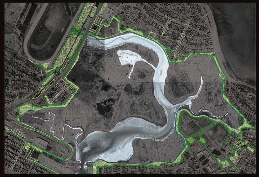
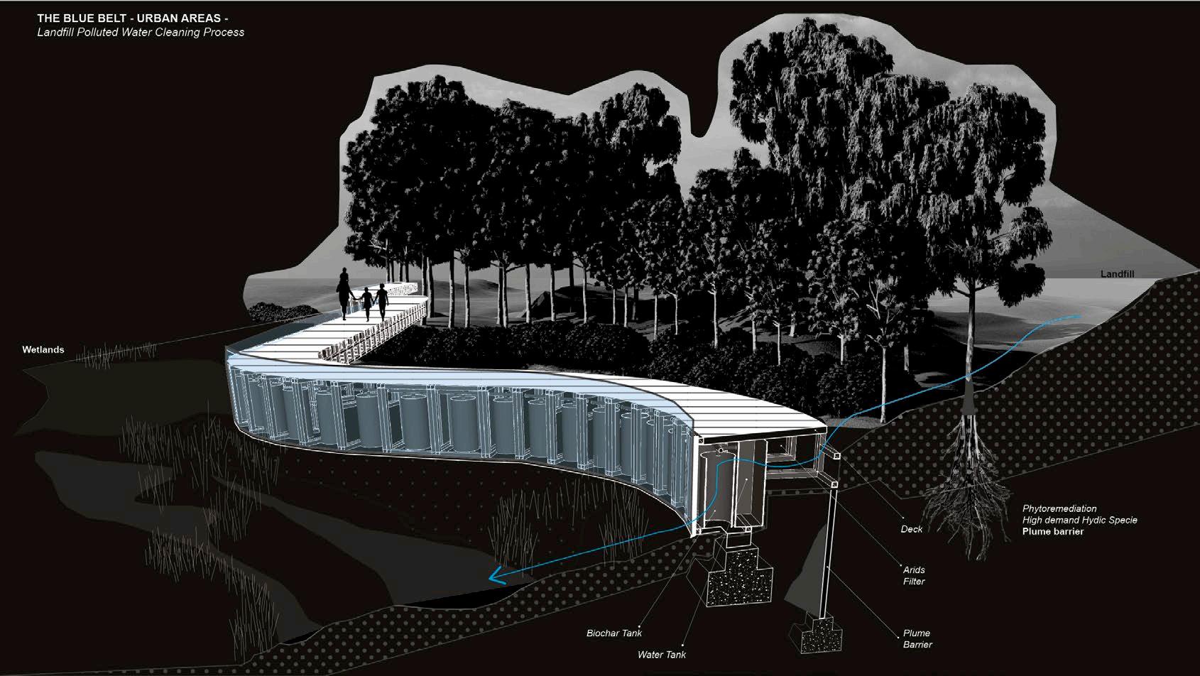
In Massachusetts, many aquifers and wetlands are constantly being polluted by the stormwater in landfills and rail infrastructure. Inorganic chemicals are discharged every rain season in cities like Boston. The proposal of a new modular infrastructure with a simple phytoremediation process and biochar filters in its interior could be used as a public path—a border between nature and the city.
The phytoremediation area of the module could evolve into a living nursery as a new buffer between the city and the fragile ecosystem. With time, that new border starts to blur. While the biochar filter will need maintenance in the future, they could become part of the railway system operation as a new preservation process and ecological awareness for the city.




Professional | Modular Prototype | Technology | Residential Puchuncavi | Valparaiso Region | Chile

*PROJECT PROTOTYPE DESIGN AND DEVELOPMENT [12 houses $4MM managed]
PROJECT TEAM
Cristián Bas [head of Architecture] | Macarena Bas [head of Design]
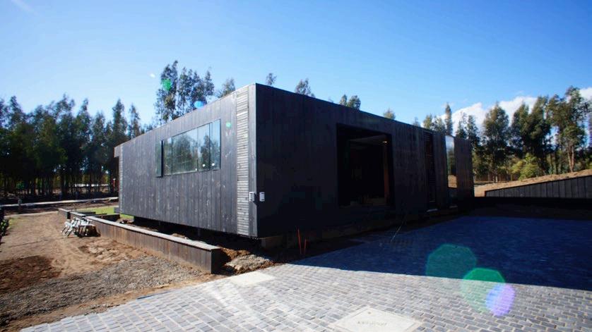
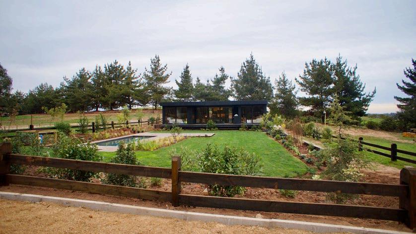
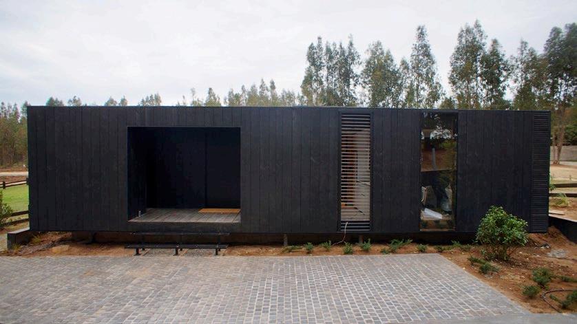
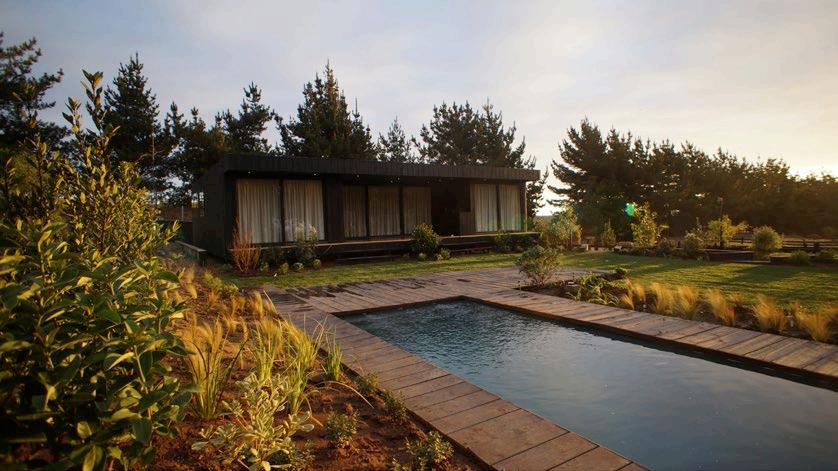
A 1,800 sqft modular eco-friendly prototype with a fast construction process. I was in charge of the whole project development (design, management, construction, and real estate business.)
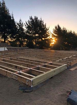
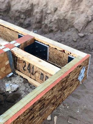
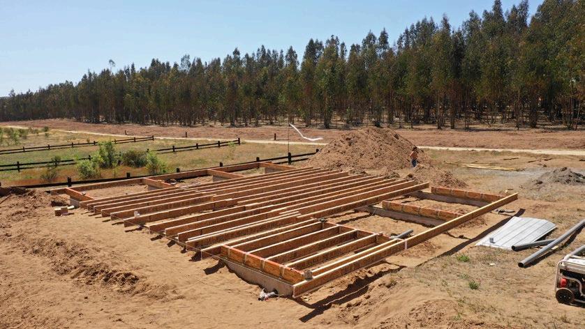
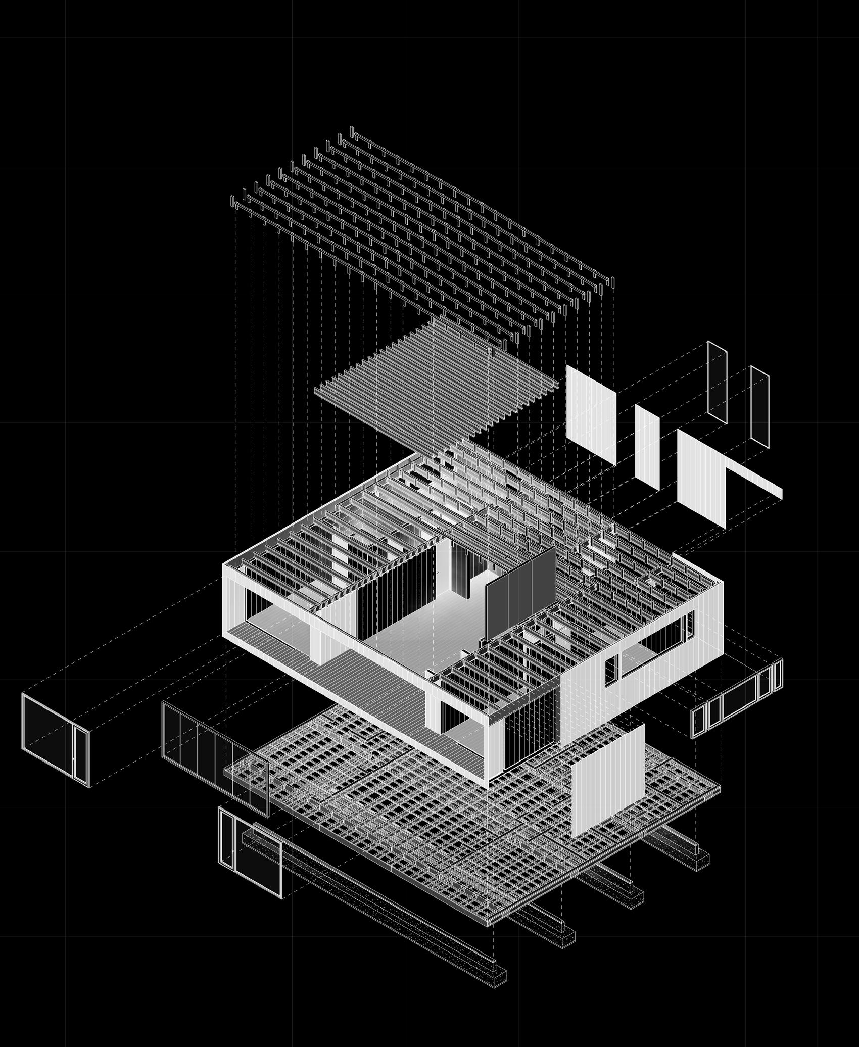
Concrete foundations lifted the volume to encourage ventilation and easy access for utilities. The whole structure and walls separated from the exterior finishes of the house creates an air chamber to increase insulation.
We designed an underground grey-water recycle system to reutilize water to irrigate the garden. The house does not need any AC equipement and BIM technology was a key element to develop its efficency.
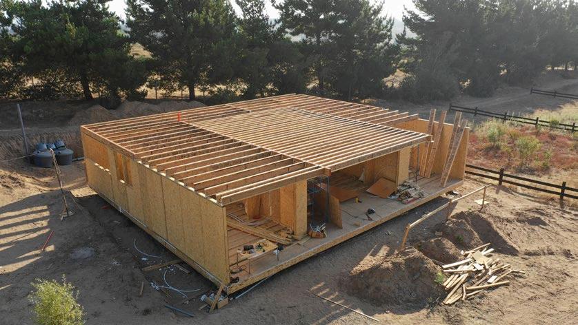
The prototype was built-in in 6 months, and after one and a half years, we were able to sell and build 12 homes.



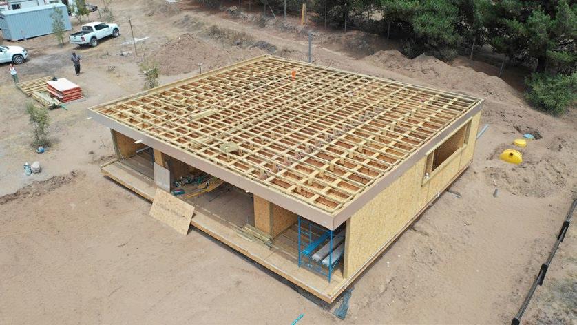 .- NORTH VIEW
.- STRUCTURAL ESSENTIALS PARTS AND PIECES
.- WALKING RING CONNECTED TO THE CENTER VOID OF THE HOUSE
.- CONSTRUCTION PROCESS
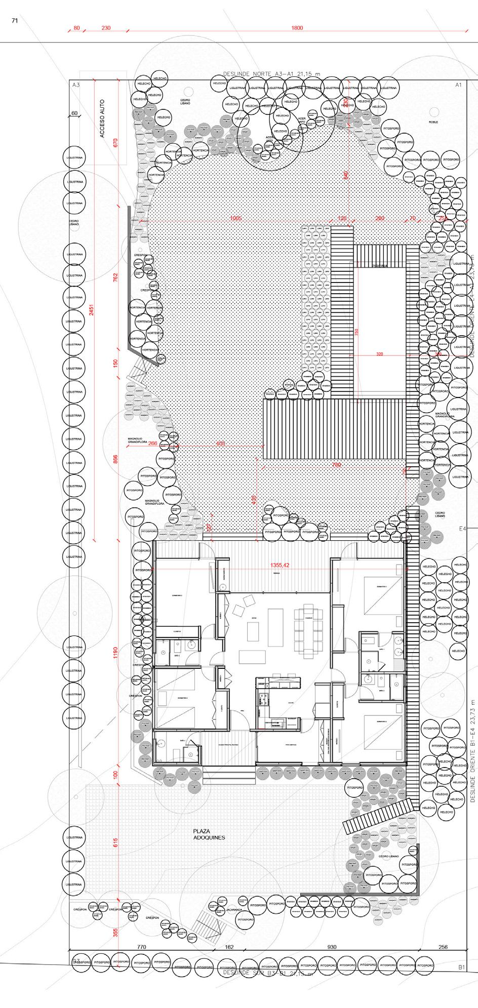


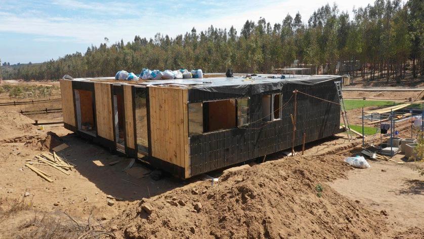

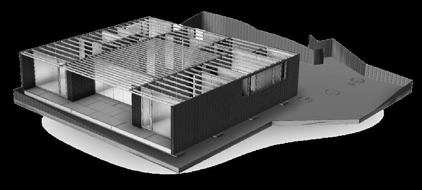

The model served as a guide for project management and as a tool during the construction of the first prototype. Our first experience let us realize that many decisions needed to change for the future success of the project.
Professional | Urban Planing | Landscape | Residential Community
Puchuncavi | Valparaiso Region | Chile

*PRIVATE AWARD WINNER FOR REAL-STATE PROJECT PROPOSAL
PROJECT TEAM
Cristián Bas [head of Architecture] | Macarena Bas [head of Design]
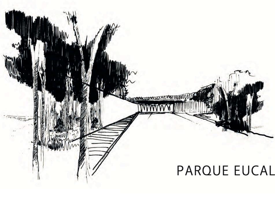
As the first strategy, the seventeen acres of land, filled with eucalyptus trees that dry out the water resources of its context, will be replaced over time by native species. Second, we proposed a walking ring surrounding the project’s perimeter –to connect every private unit inside this new community. Third, we refurbished an intermittent ravine into a public area for residents as the heart of the project.
The main access building was designed with the same appearance as ‘Casas Black,’ and the area was defined by diagonal lines that carved in the property to create distance from the public street. Stack stone walls and dark wood finishes were crucial materials to create the soul of the project.


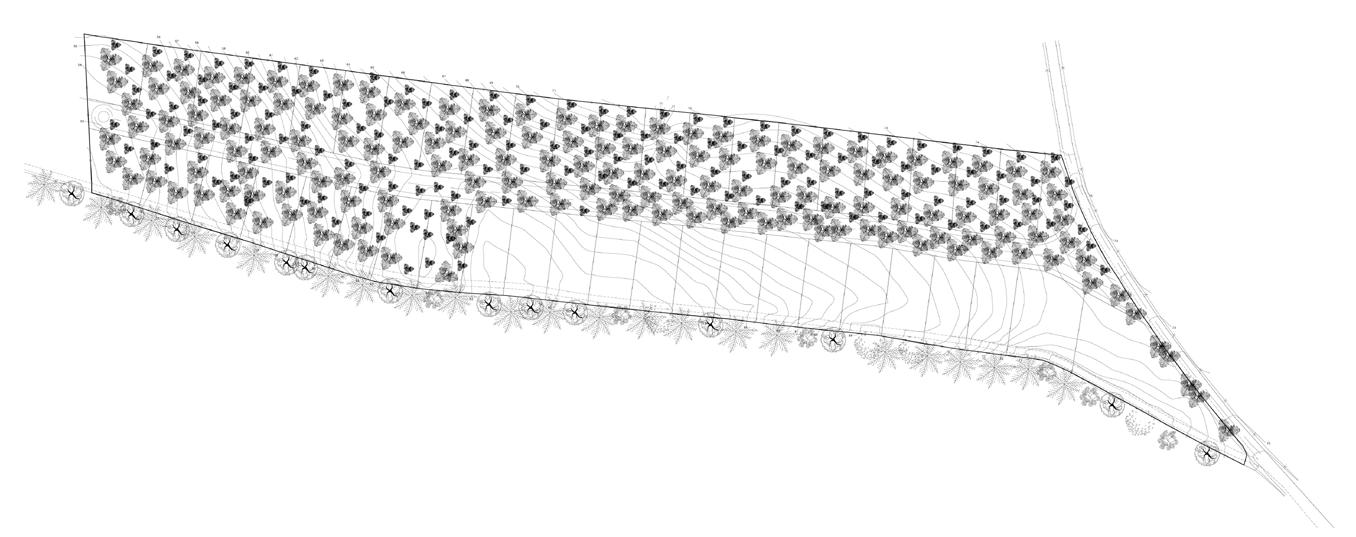

 .- WALKING RING SECTION TYPE
Professional | Landscape | Hotel
Matanzas | O´Higgins Region | Chile

*PRIVATE AWARD WINNER FOR PROJECT PROPOSAL
PROJECT TEAM
Cristián Bas [head of Architecture] | Macarena Bas [head of Design]
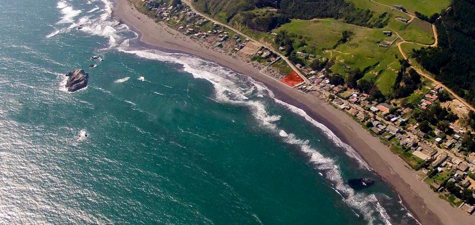
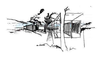
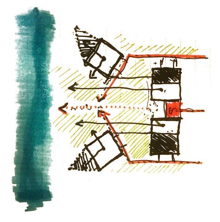
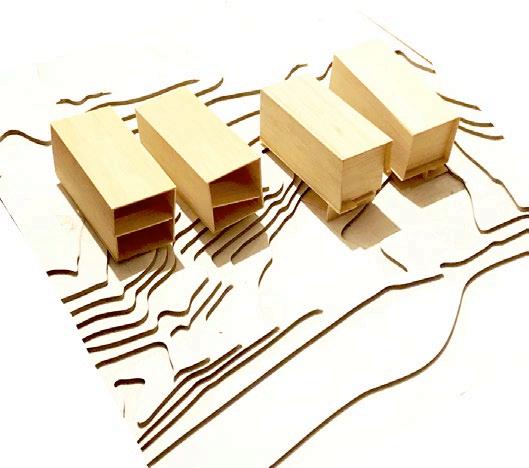
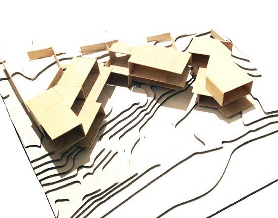
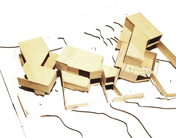
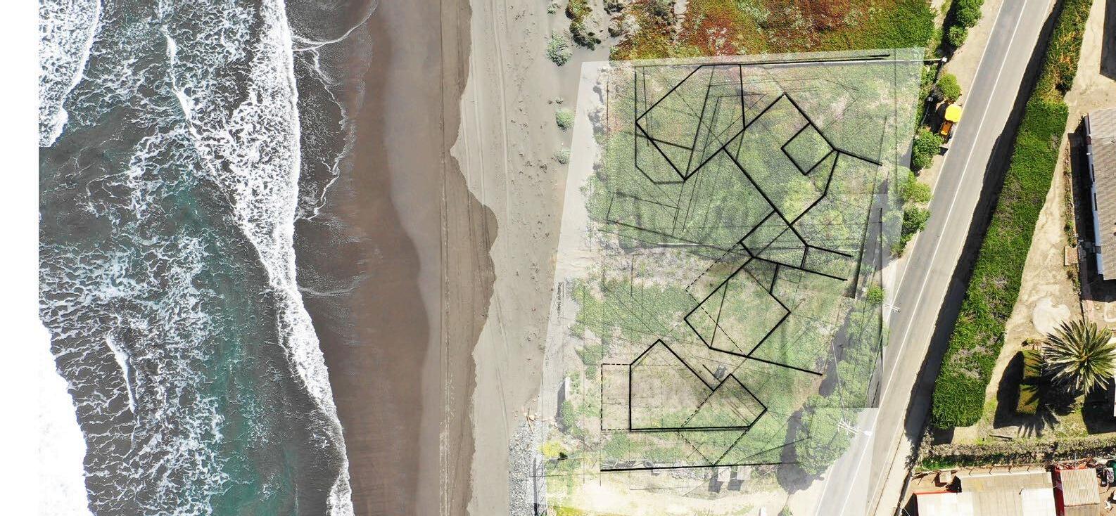
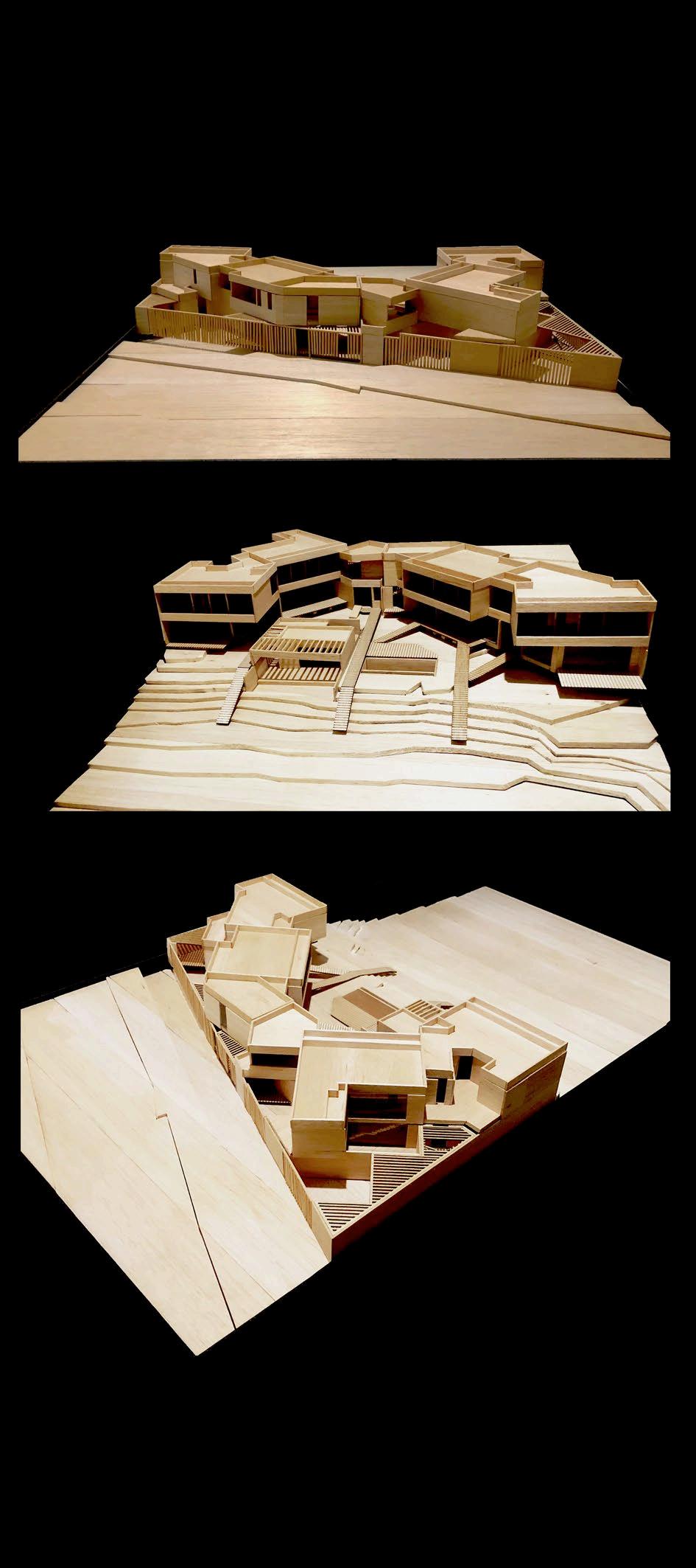
Two oceanfront landowners needed a proposal for a boutique Hotel contained in four cabins and two services areas, it was mandatory to have a clear ocean view. Its facade needed to be continuous for city hall obligations; however, each volume had its way of living the project in a private relationship with the ocean. Everything design in a 17,000 sqf lot.
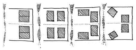

 .- DECOMPOSITION SCHEME
.- MODELS EVOLVING TO FINAL PROPOSAL
.- PROPOSAL SCHEME
.- ROCKS
.- PROJECT DIAGONALS


Academic | Landscape | Masterplan | Science | Investigation Center
San José de Maipo | Metropolitan Region | Chile
FACULTAD DE ARQUITECTURA - FINIS TERRAE
*BEST ARCHITECTURE FINAL PROJECT IN 2015 HIGHEST DISTINCTION
FACULTY
Dr. Cristina Felsenhardt | Maria Teresa de la Barra | Pamela Zúñiga
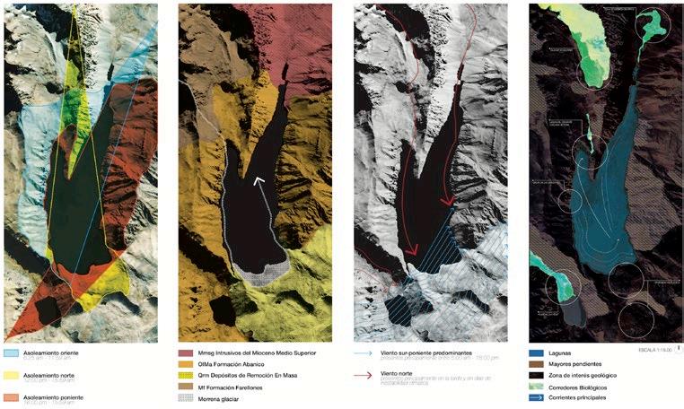
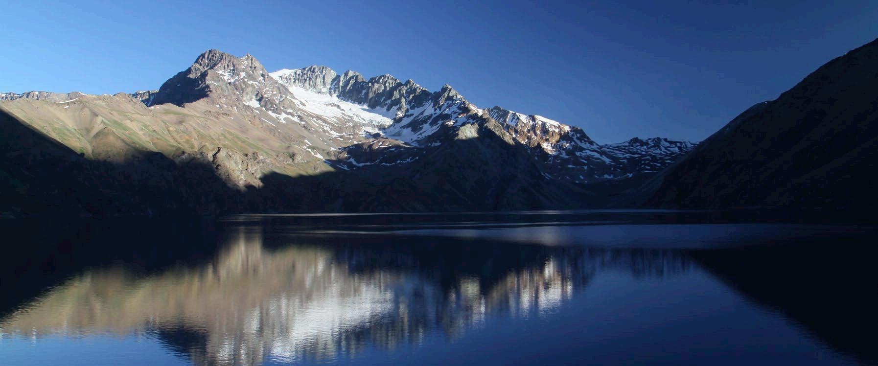
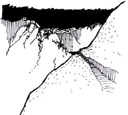
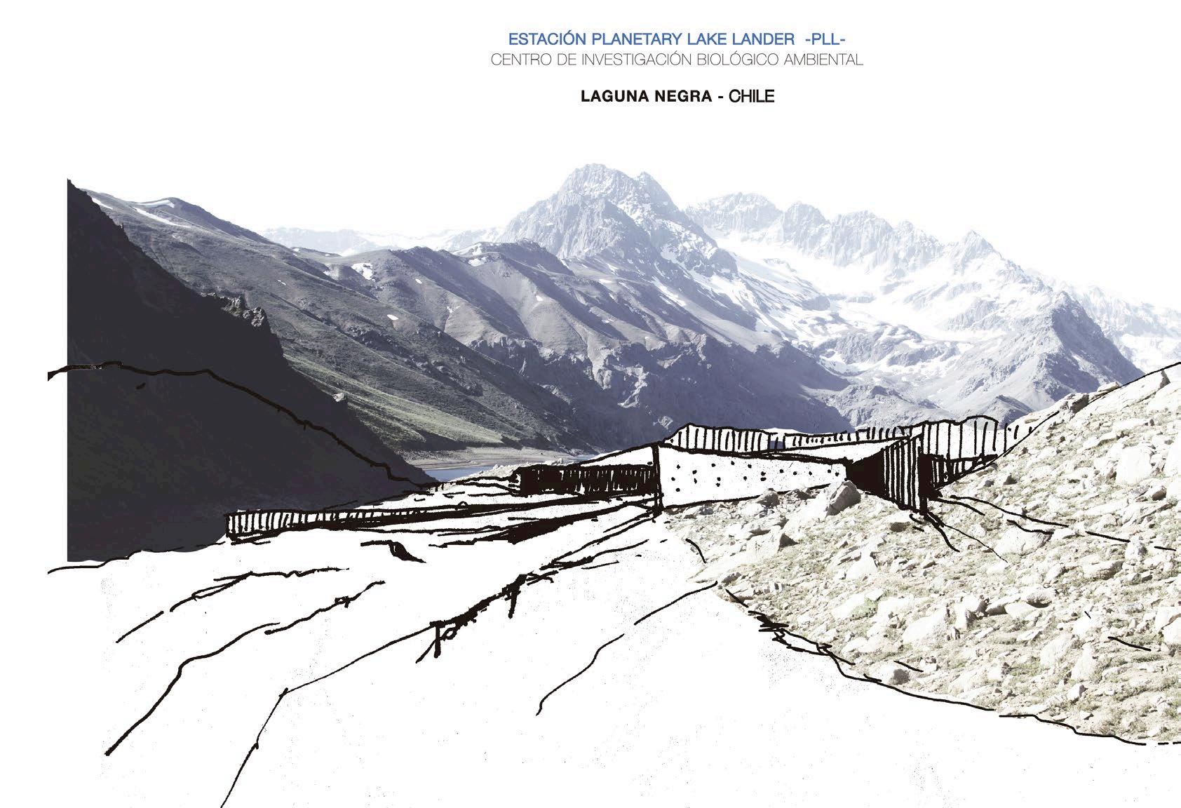
Laguna Negra’s discovery, around 130 years ago by the first Chilean explorers, is still protected because it is the most extensive water resource of the Chilean capital.
Due to climate change, the Glacier has been melting faster than before, transforming many microbiological resources in the lagoon.
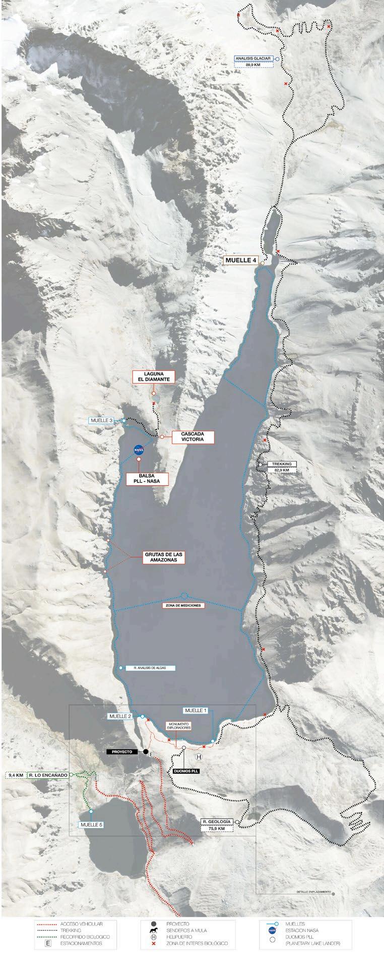
NASA has been researching that process since 2011 by testing robots and other technological prototypes that will be used in the future Planetary Lake Lander mission to search for life in the moons of Saturn.
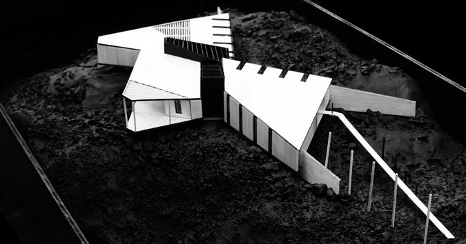
The proposal is to consolidate the area as a protective research scientific park and construct a modular and sustainable laboratory for the scientist.




 .- VIEW FROM THE CAMPING SITE

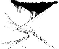


.- THE FIRST EXPLORERS THAT TRAVELED TO THE UNKNOWN
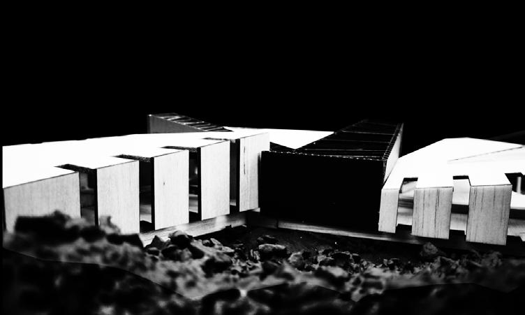
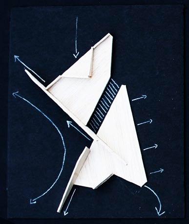
The new lab sets a limit, which defends nature from the Anthropocene. The building features three volumes that emerge from the rocks - like an alien construction. The walls extend to the exterior as they were roots that connect the park with the project’s interior.
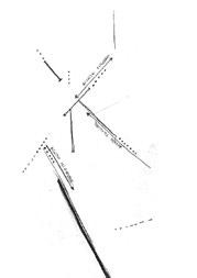
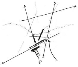


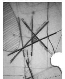
 .- PROJECT SITE MORPHOLOGY
.- LAB SCHEMES
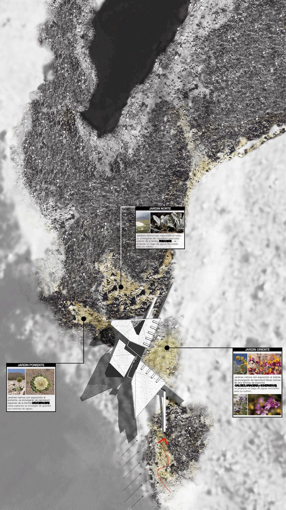

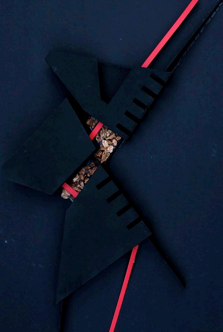

 The red element is a lifted runway platform that connects the three volumes
CONSTRUCTION PROCESS
BIM development for construction stages to efficiency and transportation


FOUNDATIONS
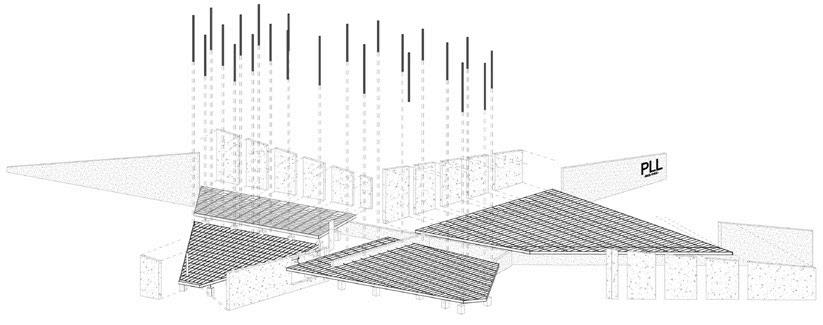
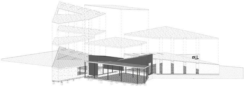


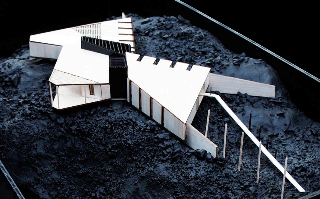
Modular, fast assembly, and is capable of producing its energy. ‘The project is a rock that unfolds itself in the territory, colonizing the exterior with walls that approximate landscape.’

 PILARS


