10 minute read
Part Three – Salisbury Plain
Salisbury Plain
PART THREE
Part 3 – Salisbury Plain Stonehenge to Chirton
200m
100m
0m
0km 10km 20km 33km
Distance: 33km Ascent: 344m
300m
200m
Highlights
• Never ending skies and views. • Splendid isolation. • Incredible prehistory. • Easy, mostly flat riding.
• Tank and helicopter spotting. • Diversions to deserted villages with holes in. • Lots of different route/surface options.
Be aware
• Very large, fast, heavy, almost blind green things appearing from anywhere at any time. • Things that might go bang lying about on the ground. • People dropping out of the sky near Orcheston. • The exposed nature of the Plain means little shelter from wind and weather. On a sunny day with a southerly tailwind that’s bliss, but wet and windy conditions from the north will make it a test of character and clothing choice.
Navigation
While the open landscape makes visibility excellent (in good weather at least), the similarity of the routes and multiple options in places (particularly around Tilshead) can make navigating tricky. The consequences of getting lost are potentially more serious too, so please pay attention to your map and/or GPS.
100m
It’s a war zone 0m 0km 5km 10km 15km We can’t emphasise this enough. Salisbury Plain is genuinely a war zone and has been for over a century. Yes, it’s a ‘pretend’ war 300m zone, but the shells and rockets being fired 200m live or lying forgotten are very real. When 100m red flags are flying that means a Ministry 0m of Defence exercise is in progress and 0km 20km 40km 60km 86km you should NEVER ride past a red-flagged stop point. They are there for a deadly serious reason. 200m It’s potentially dangerous even when the 100m flags aren’t flying too as it’s still an active 0m military training area. You’re sharing it with 0km 53km20km 40km 75-tonne Challenger tanks travelling at up 300m to 60km/h with very limited crew vision 200m as well as other, even faster vehicles. 100m It’s surprising how hard the sound of vehicles 0m is to locate in the rolling landscape too 0km 10km 20km 27km and how quickly they can appear seemingly out of nowhere. That means you need to be extremely vigilant for vehicles and 300m where they might appear from at all times. 200m The route skirts around the edge of the firing 100m range areas, so provided you stick to it rather 0m than straying onto tank roads, you shouldn’t find your way blocked by red flags. If you stop 0km 32km10km 20km for a puncture or a picnic, make sure you do it somewhere safe and out of the way. Don’t 200m go wandering off into restricted areas with 100m your flask and sandwiches though, and definitely don’t kick or pick up anything 0m ‘interesting’ you might find either. 0km 20km 40km 50km
You can check MoD firing times on Salisbury Plain on the UK Government website: www.gov.uk/government/publications/ salisbury-plain-training-area-spta-firing-times

When red flags are flying that means a Ministry of Defence exercise is in progress and you should NEVER ride past a red-flagged stop point. They are there for a deadly serious reason.
Area introduction and route summary
The Salisbury Plain area is a unique blend of modern military landscape and truly ancient landscape and the two work incredibly well together. That’s because while the army do blow some things up, the things they don’t are left utterly untouched and wild. So, if there’s not a tank going past you or a helicopter overhead, the Plain is a magical area of solitude, endless skies and the memories of ancient ancestors.
While there is some rise and fall in the landscape and some sections of singletrack and deeply rutted double track, the riding is mostly well-surfaced and gently rolling. That makes it easy to skim through at speed, but it’s also very easy to just sit and spend an hour listening to the skylarks and grass-whispered stories of past worlds that have played out here. There are also several diversion options depending on whether the red flags are flying or the remarkable village of Imber is open for visitors. You will eventually climb onto the White Horse Trail at the northern edge, but the reward is incredible views back across the Plain or over the Vale of Pewsey, before you drop off this truly otherworldly plateau and into the warm welcome of traditional English villages.
Stonehenge to Tilshead
From Stonehenge, the route rolls north along a well-surfaced track over the mysterious cursus monument that predates the circle by 1,000 years. The military town of Larkhill wouldn’t win any beauty contests, but it’s useful for supplies and takeaway food options before you head out onto the Plain where refuelling options are few and far between.

Stonehenge Cursus
At 3km long and 100-150m wide, this Neolithic (New Stone Age) cursus is one of the largest and earliest in the UK. The irregular side ditches and banks create a solstice alignment and radiocarbon dating of finds puts it several hundred years earlier than the first phases of Stonehenge. Its purpose is unknown though with religious, territorial and cattle-herding usage all potentially possible.

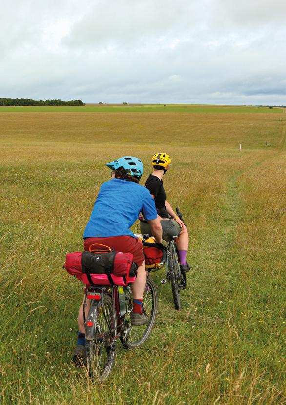
Ancient monuments are never far away for the next few legs of your journey. You leave Larkhill westwards past several barrows before sidestepping onto the bridleway alongside the road. You can stay alongside the road as you turn north at Rollestone Camp, but be aware of the large hardstanding section which can be used for anything from helicopter landings, tank refuelling, parking or other army activities that particular day demands. You follow the north side of the road as it turns left again at the Bustard junction (OS grid ref: SU 091 461) but you’re running alongside one of the main tank roads for a while here, so be prepared for something very heavy and loud thundering up behind you surprisingly fast. Make sure you don’t miss the singletrack turn off south to Orcheston at the red flag gate in any clouds of dust that get kicked up. You stay threading across the countryside on narrow trails for a while too, with high singing skylarks in summer and all sorts of furry residents scurrying and hopping into the rich grassland as you or a tank approaches.
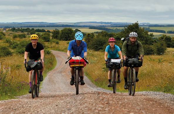
While there are no shops in Orcheston, Shrewton just a kilometre to the south has pubs and local shops and there’s a pub in Tilshead which you’ll come to after crossing the A360 and looping north on bridleways. These double track sections have very deep ruts that need some careful navigating though, and the more open sections of tank road can be very heavygoing in wet conditions too. You can short-cut this section by heading straight to Tilshead from the Bustard around Westdown Camp if the red flags aren’t flying.
It’s definitely worth taking the off-road loop if you can though, as you’re still deep in the prehistoric fabric of the land here, especially as you ride right past the Neolithic ‘White Barrow’ and several Bronze Age linear earthworks just south of Tilshead. If you continue a few hundred meters west on the trail from Orcheston towards the woods on the skyline, you can get a glimpse of the purpose-built army training village of Copehill Down (OS grid ref: SU 017 453), complete with burnt-out cars and other decorative touches.
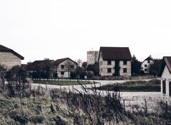
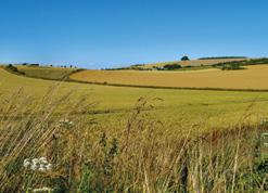
This was also the area used for filming the movie 1917 and the ridge is the designated drop zone for parachute training, so keep checking above you as well as trying to stay straight in the ruts.
Imber
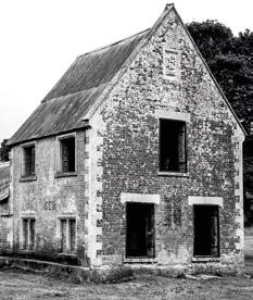
From 967 when it was first mentioned by the Saxons until 1943, Imber was a pretty, but isolated village hidden away in a valley in the middle of Salisbury Plain. It had a stream down the middle, thatched cottages, a church and chapel, a pub and a shop. The Ministry of Defence had been buying up surrounding land and properties since the 19th century. That came to a head on November 1st 1943 when the 150 residents were told they had 47 days to leave their homes so that the US Army could use the village for combat training, but they could return after six months. That never happened though, and the area has been retained for training ever since. The 12th century church of St Giles is open once a year and the village is occasionally open to the general public.
Imber Range Perimeter Path
This 50km route is a collaboration between Cycling UK, the Ministry of Defence, Wiltshire Council and the British Horse Society turning the previous walking route into an off-road multi-user trail around the western end of Salisbury Plain. It includes the mock German village of Copehill Down, Iron Age hill forts

at Battlesbury and Scratchbury Hills and views from above the Westbury White Horse. It shares some of the King Alfred’s Way route between Tilshead and Gore Cross Farm, but riding conditions are more mixed and potentially challenging so a mountain bike is advised in winter.
Tilshead to Chirton
Unless you want to pop into the pub or grab a vending machine coffee or other supplies from the petrol station, you actually skirt round the edge of Tilshead. More barrows and earthworks dot the landscape as you head north up a wide-open valley along the Imber Range Perimeter Path just east of the tree-lined A360. Again, this section can get really gloopy after prolonged bad weather, but while you could shift across onto the road to get more speed, be aware that it is the north-south link across the Plain and likely to be busy. Whichever way you get there, you’ll be glad you’re onto a faster footing as you turn onto old military roads at Gore Cross Farm and climb up White Horse Trail onto the spine of the Wessex Ridgeway. From here, the track is gravelly tank road but you’ve got fantastic views over the Vale of Pewsey to the north with West Lavington and Market Lavington villages at your feet and Devizes in the distance. Look right and the Plain scrolls away over the Black Heath artillery ranges and impact bunker sites towards Stonehenge where you started this section. Keep your eyes peeled for the singletrack off the ridge and then hang on as it fires you down a deeply rutted chute towards Chirton. Take particular care in summer as it’s likely to be heavily overgrown and the wildflower banks mean the trail is often frequented by sunbathing
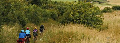
butterflies. If you pause and look straight ahead before you drop down though, you can see Alton Barnes White Horse on the hillside to the north. We’ve stopped this section here as it’s an obvious geographical break, but also because West Lavington, Market Lavington and Urchfont have good shops and facilities for refuelling or an overnight stop before the climb up and over to Avebury.

