MASTER PLANNING AND URBAN DESIGN PROJECT PORTFOLIO +62 857-1529-9544 dinifauzh@gmail.com issuu.com/dinifauziah 2 0 2 1 DFA
My interest in Urban Planning and Urban Design is multi-faceted, as explored in the following aspect of my project experiences:
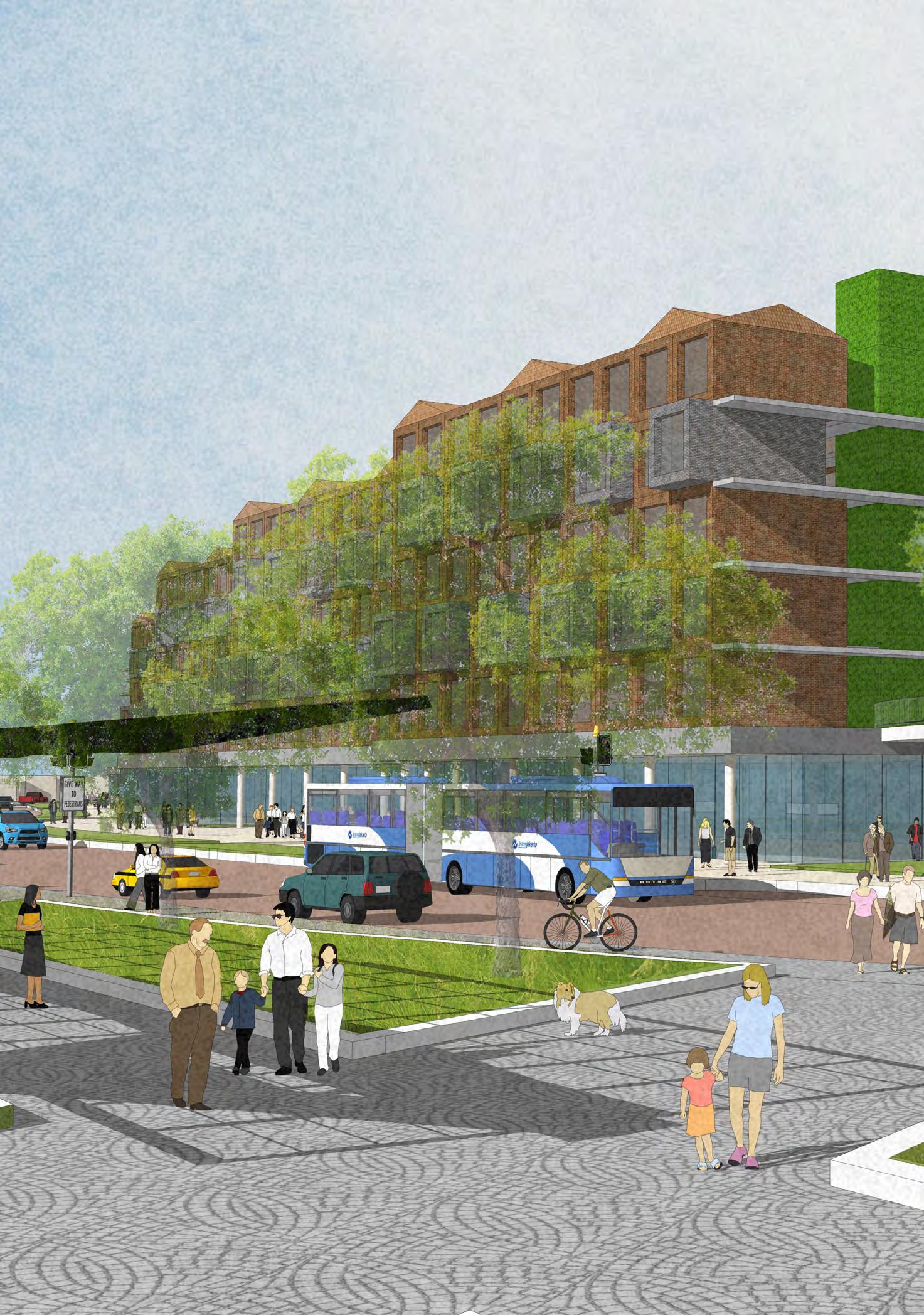
The project shapes public realms to maximize shared value by paying particular attention to the physical, cultural, and social identities, transforming the space, and strengthening the sense of place through three primary planning-design principles of memorability, sustainability, and economic feasibility.

(p.09-16)
Planning and Design Versatility

The all-aroundness of master planning projects integrates multiple collaborations to provide a complete solution. This includes long-term financial analysis, resilient landscape, environmental strategy, transportation scheme, and precise infrastructure calculation, which are required to support the planning and design.
(p.01-08)
Equity Journey

Iteration and exploration process to discover the new forms of collective life, where the urban planning and design is not meant to dictate, but to celebrate the local value. All of the above, maintaining an equitable urban development, especially to meet the needs of underserved communities.
(p.17-22)
Empowering Placemaking
Table of Content 00 |
South Bandung Flood Mitigation Master Plan
Scope : Visioning Master Plan

Location / Year : South Bandung, West Java / 2019 Scale : 1,186 ha
Project Type : Professional Work (URBANE Indonesia) Contribution : - Project manager, coordinate urban design , architecture, and infrastructure team - A ssist lead designer in research, analysis, and presentation - Master plan design and illustration
Status : Proposal to West Java Government Goal : Providing infrastructure solutions and development framework to mitigate the highly flood prone area in South Bandung City
Project Summary
The South Bandung regency has been infamous for the seasonal floods that severely cover three subdistrict, namely Dayeuhkolot district, Baleendah District, and Bojongsoang District. This phenomenon is part of the impact of the Citarum River’s overflowing. The topography under the river adds to the frequent flooding, especially in the rainy season.
The development is part of the professional initiative to conduct a development study to create a harmonious living space between the people and water by understanding and nurturing the ecosystem. The plan’s focus is on weaving together people, the environment, and infrastructure with sustainable water planning.
|
Urban Planning and Design Versatility
Source : URBANE Indonesia
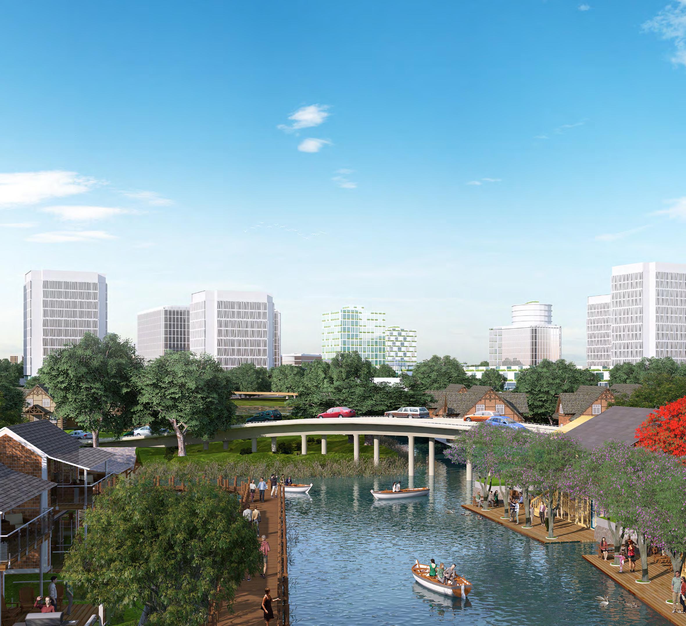
Lakeside Village Illustration
01
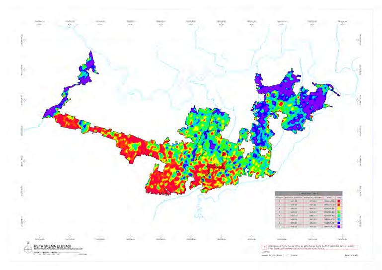
The study area is first determined by overlaying the topographic, hydrologic, and existing land coverage (regulatory maps) with the infrastructure delineation that has been produced previously. The outcome then formulates the recommendation and strategy to mitigate the flood risk and accommodate future development.

The vision plan focuses on the ecological restoration of a highly flood-risk area and proposes a denser urban-village life to tackle the issues. By delving deeper into the cultural value and local story, the visioning process also infiltrates the concept of Dayeh (city) and Dadali (eagle) as a habitat that brings unity.

The plan will work around the existing settlement and maximize the resilient strategy by implementing a modern agricultural ecosystem, including food production, research, and development for agricultural-related industries. Besides, all the residential areas will be positioned close to the water and public spaces. With the government’s future infrastructure and transportation plan, this vision will be ample to revitalize, reconnect, activate, and transform the once highly potential floods to be resilient conurbation.
Cisangkuy River

Source : URBANE Indonesia
A. Natural Gateway District B. Urban Gateway District C. Ecological Campus D. South Park Drive District E. Waterfront Commercial F. Lakeside Village G. Islamic Center H. Countryside District I. Landed Residential J. Public Facility K. Aviary L. Sport Center
Analysis A B C J J J K D E F L G H I I I Existing Condition Geographic Information System Analysis Bird Eye View of Master Plan South
Flood Mitigation Master Plan 02 |
Flood Prone Area Cikapundung River High Tension Line Floodway Cisangkuy
Project
Bandung
Planning and Design Strategy
In general, the lake constellation dominates the development area to control the flood in the municipality. The infrastructure strategies inspire the planning and design concept, consisting of three characteristics: Blue Identity, Green Ecology, and Red Nodes.
The Blue identity emphasizes water processing and utilization as the primary element of the overarching development. The green ecology is used to enhance the “food resiliency” concept, using the endless possibility of the green area provided. Meanwhile, the red nodes are the center of human activities, focusing on the tourism aspect in the beginning. The location will be supported by other essential programs, including residential, commercial, mixed-use, public facility, and university.


All the blue, green and red programs are interconnected to provide a social connector, water sensitive urban design, aquaculture, nursery, and seed production strategy in each designated spot.
In the 60% of the land use designated to be green and blue area, will be modified to be wetland treatment, lawn terraces, nursery and farmland, riparian corridor, cleansing biotope and community garden.
The landscape network is visioned to provide a nutrient and sediment buffer from the farmland, enhance water quality, and provide habitat for a diverse ecosystem. The economic value of the larger community will also be impacted and resulting in a more resilient development.
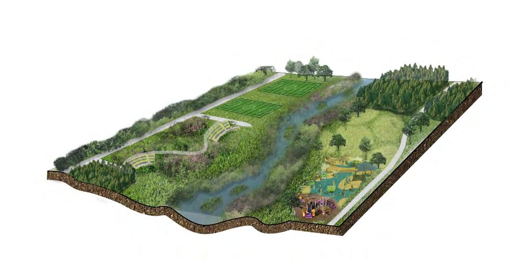
| Sports Field Outdoor Theatre Great Lawn Tree Nursery Jogging / Cycling Path Green Roofs Food Productions Irrigation Channels Green House Community Farm Tree Nursery Aquaculture
Wetland Terrace Riparian Corridor Maintenance Path
Riparian Edge Riparian Island Flood Plain Lawn Tree Nursery
Fisheries Riparian Edge Pedestrian Boardwalk
Farm Blue Identity:Cleansing Water Corridor Green Ecology: Food Resiliency for Human and Wildlife Red Nodes: Activating Social Connector
Strategy Illustration Urban Planning and Design Versatility03
Cleansing Biotope
River
Community
Landscape


Countryside Distrcit Aerial View Illustration
Natural Gateway Section
Source : URBANE Indonesia South Bandung Flood Mitigation Master Plan 04 | Skywalk Riparian Edge Lake Wetland Valley River Promenade River Promenade River Promenade River Promenade Recreation Lake River Creeks Highway Mound Landscape Floating Island Section 3 Section 2 Section 1
Urban Gateway Section Lakeside Village Section
The East of Sidoarjo
Scope : Visioning Master Plan

Location/Year : Sidoarjo, East Java / 2017
Scale : 4,536 ha
Project Type : Professional Work (URBANE Indonesia)
Contribution : - A ssist lead designer in research, analysis, and presentation
- Master plan design and illustration
- Provide technical document and report Status : Proposal to Government Goal : Enhancing the emerging development in Sidoarjo Regency by providing vision guidelines and strategies
Project Summary
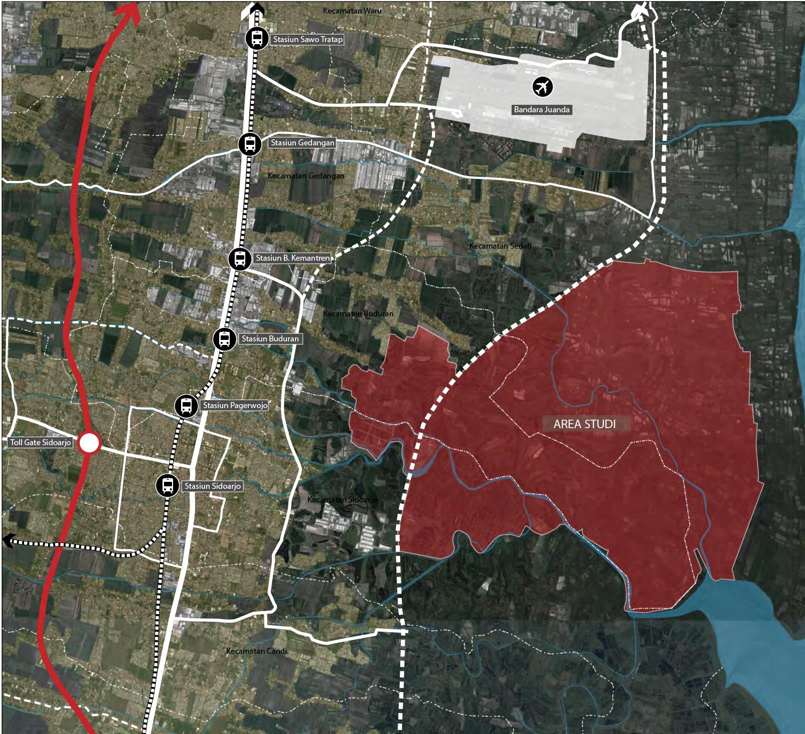
Plans for constructing the east outer ring road at Sidoarjo Regency will inevitably encourage and attract other regional development in the east part of Sidoarjo Regency, which most are currently dominated by aquaculture and industrial area. The development pattern continues to sprawl and expands around the urban center of Sidoarjo without an ultimate plan to guide and regulate this area. To prevent similar development patterns occurring in the area around the construction plan, a regional master plan and study of design and development direction are needed to be a guideline and design tool for the future development of Sidoarjo Regency.
|
Source : URBANE Indonesia
Sidoarjo Regency Character
Versatility05
Urban Planning and Design
Sawo Tratap St.
Juanda Airport Gedangan St. Kemantren St. Buduran St.
Pagerwojo St. Sidoarjo St.
Study Area
Project Analysis


Sidoarjo Regency is located in East Java, precisely south of the capital city of East Java Province, Surabaya City, which is also the second-largest city in Indonesia. Its strategic location to Surabaya City is a distinct advantage for Sidoarjo Regency, especially in terms of connectivity through the land, air, and sea transportation networks.
Sidoardjo regency is located within the National Activity Center Gerbangkertasusila, which holds multifunction of agricultural development, farm, horticulture, forestry, fishery, livestock, mining, trading, service, education, health, tourism, transportation, and industry.

The city characteristic of Sidoarjo Regency is dominated by housing and industrial area. The housing facilities are spread evenly in Sidoarjo, and the industrial region is primarily concentrated in the northern part of Sidoarjo. Besides that, Sidoarjo also has two tourism destinations: mangrove forests and Tanggulangin craft centers. These regions have become supporting facilities for the residential and industrial areas.
The study area is divided by the future outer ring road defined by two regional characters, an Industrial Zone and an Integrated Coastal Zone. The Industrial Estate planned on the west side of the ring road was designated in response to the existing Industrial area that has already developed on the east part of this new industrial estate. The connection between these two regions is expected to create an integrated industrial zone in Buduran urban areas.
The area on the east part of the outer ring road is proposed to be an Integrated Coastal Zone which will be consisted of coastal programs and functions: aquaculture, fisheries processing industry, research center and fisheries development, pond & coastal tourism, and other supporting facilities: education, health, worship facilities and so on.
The East of Sidoardjo is the energy that will conduct as a guideline and strategies for the study area to enhance the development of Sidoardjo Regency. The plan will focus on the coastal, fishery, and industrial program to create a modern processing industrial center, fishery district with research and development center, commercial hub, also coastal living and tourism.

Source : URBANE Indonesia
Modern Processing Industrial Center Fishery District and R&D Center Commercial HubCoastal Living and Tourism City Center • Residential • Commercial • Education • Government Existing Industry • Processing • Warehouse • Supporting Facility Industrial Area • Processing • Warehouse • Residential • Commercial Sidoarjo Mixed Use Area • Residential • Warehouse • Industry Sedati Mixed Use Area • Residential • Commercial • Education Juanda Airport BUDURAN - SEDATI - SIDOARJO CITY DEVELOPMENT CORRIDOR STUDYAREA PLANNED OUTER RING ROAD RAILWAY FUTURE RAILWAY TOLL ROAD Integrated Coastal Area • Aquaculture • Fisheries Processing Industry • Coastal Tourism • Residential • Supporting Facility BUDURAN - SEDATI - SIDOARJO CITY DEVELOPMENT CORRIDOR
Regional Context Development Positioning Toll Road Future Toll Road Arterial Road Railway City National Activity Center Regional Activity Center The East of Sidoarjo 06 |
Development Program
Regional Competitiveness
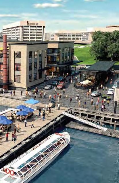
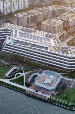
KBPA Town Center Development is based in competitive strategy to compete with strong character and attraction of neighboring city, Bandung
New Model for Campus District Development

Planning Principle


KBPA Campus District will be leading model for other campus development to come in Indonesia
Urban and Nature
Destination Development to Increase Overall Property Value
Distribution of Destinations
Transit Oriented Development
Rich natural character will carefully integrated with new urban structure
KBPA Town Center will have strong destinations as development agent in which will generate increasing overall property value
Destination development will be located strategically with strong connectivity to ensure possibility to develop in stages
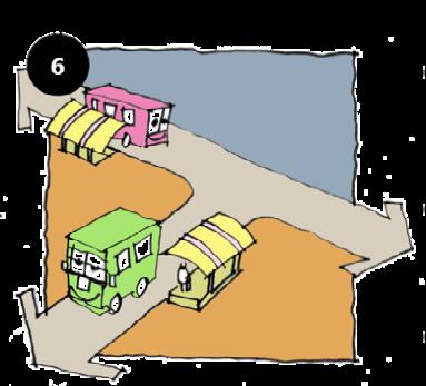
Endorsing pedestrian friendly community by providing easy access to activity nodes with mass public transport
Regional Competitiveness
Sidoarjo Town Center Development is based on the competitive strategy to compete with the strong character and attraction of the neighboring city, Surabaya.
Creative and Vibrant Programs
Sidoarjo district will have mixed programs to support future enhancement and development.
Green Spine Illustration
Section 2

“Green Spine”
Urban Water Edge Illustration

Urban and Nature
The rich natural character will be carefully integrated with the new urban structure.
Increase Overall Property Value

The Town Center will have strong destinations as a development agent that will generate increasing overall property value.
Distribution of Destinations
Destination development will be located strategically with solid connectivity to develop in stages.
Transit-Oriented Development
Endorse pedestrianfriendly community by providing easy access to activity nodes with mass public transport.
|
Source : URBANE Indonesia
Versatility07
Urban Planning and Design
Planning and Design Strategy
There are three main generator programs for each study area. Integrated industrial areas are consist of the industrial processing center, residential facility, and industrial business park. Meanwhile, the integrated coastal area will be supported by a fishery research and development center, a residential facility, and coastal tourism programs.

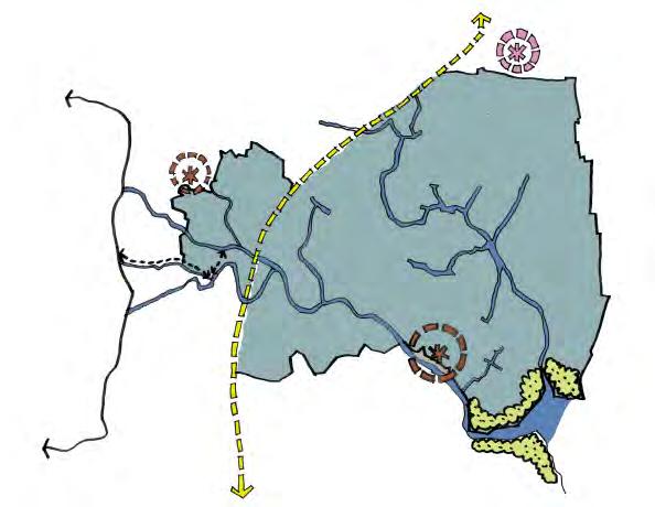
The physical strategy are:
1. Identify the existing gateway, central development area, and potential mangrove forest.
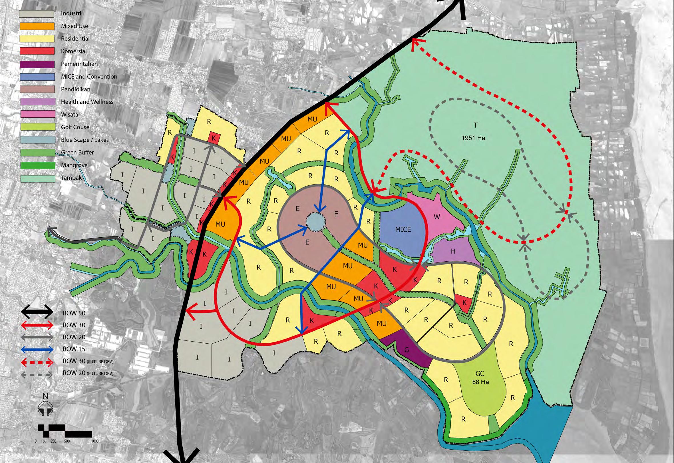
2. Connect the existing mangrove forest with future Sedati and Buduran aquaculture centers.
3. Create three development areas with supporting distinct programs and characters.
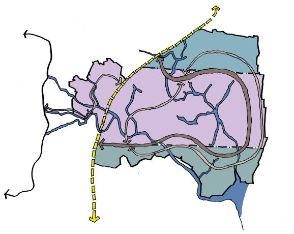
4. Connect all the development areas with looping and scening road.
50% max. for industrial activity 30% for infrastructure, green, and public facility 10-25% for residential 10-17% for commercial
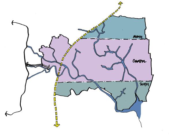
Source : URBANE Indonesia 1 3 2 4
50% 10% 10% 30%
Industry Mixed Use Residential Commercial Government Convention Education Tourism Golf Course Lake Green Buffer Mangrove Forest Fishpond Health & Wellness Structure Plan Design Framework The East of Sidoarjo 08 |
Aimas Sorong Public Realm Revitalization

Scope : Detailed Engineering Design Master Plan
Location/Year : Aimas City, Sorong Regency, Papua / 2018
Scale : 15 ha
Project Type : Professional Work (URBANE Indonesia) Contribution : - Coordinate urban design and engineering team for detailed drawing
- Assist lead designer in research, analysis, and presentation - Master plan design and illustration
Status : Constructed (2021)
Goal : Improving the public realms of Aimas City to support and enhance the social and economic activity of the community.
Project Summary

Sorong Regency, one of the most isolated regions in Indonesia, has been developing its area with infrastructure and tourism programs. Along with the emerging growth, the government plans to establish a good public realm with several focal points or priorities in its city center, Aimas.
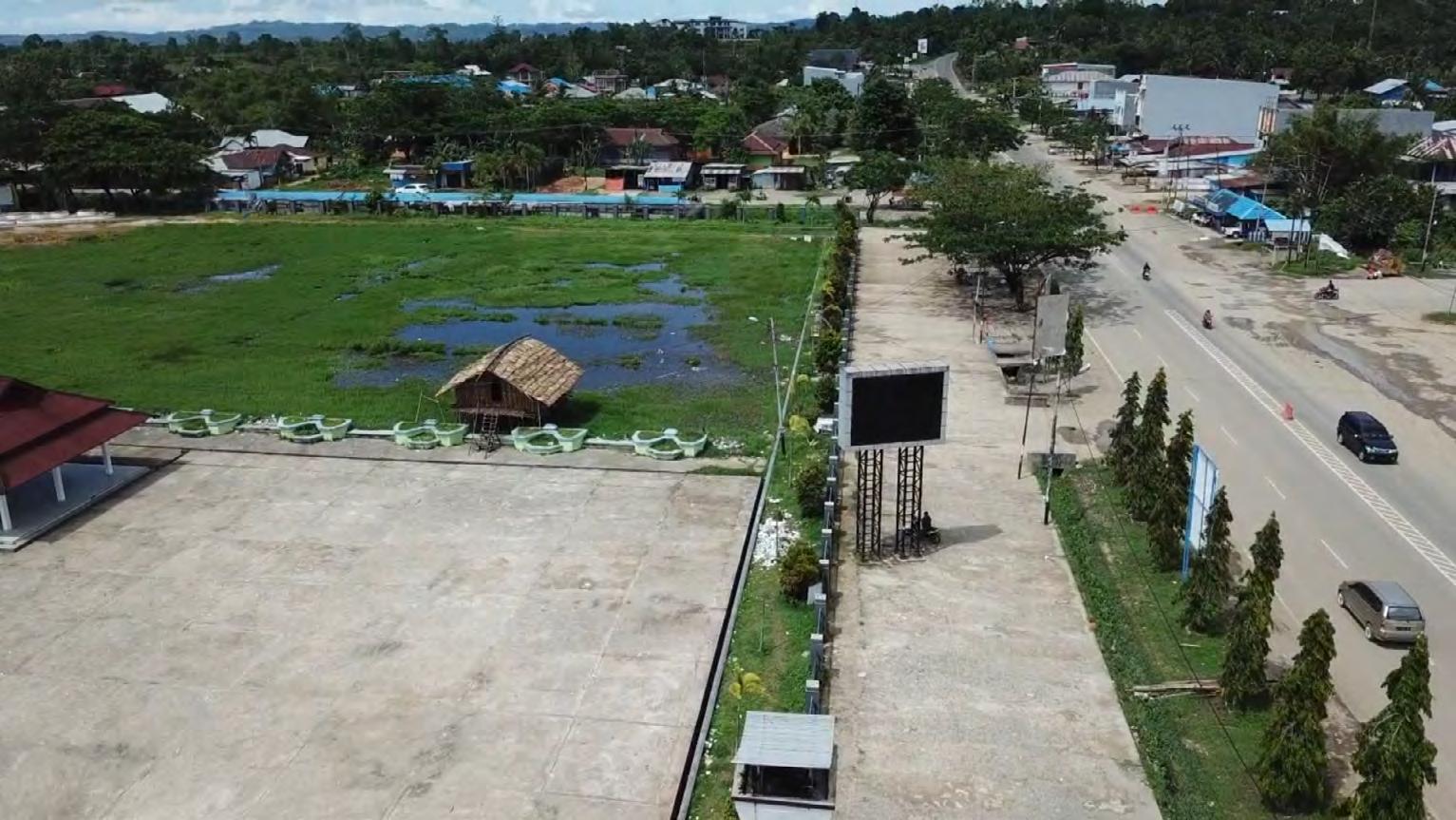
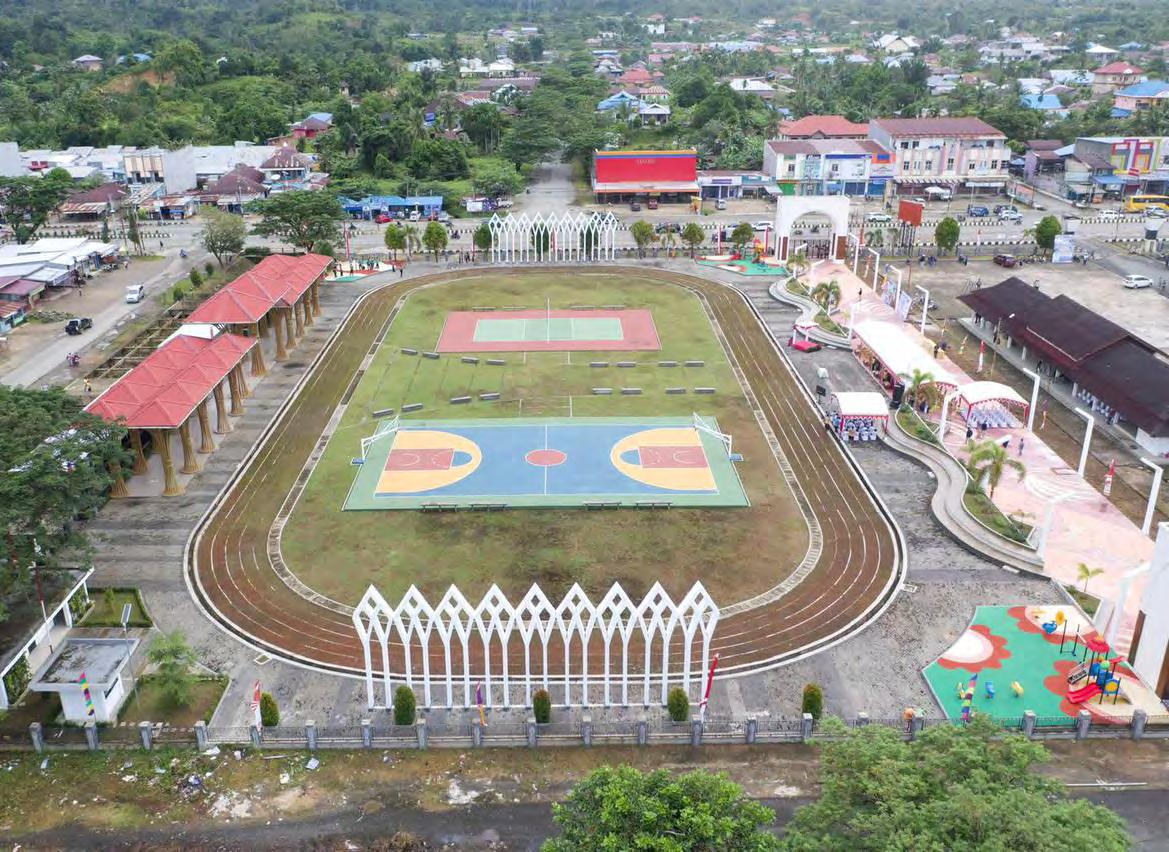
The project aims to improve the existing public realms of Aimas City that include the city square ( alunalun ), streets, junctions, and riverside.
By injecting some programs in the study area, the future public open space can be conducted as a place for interaction, landmarks, green open space, and enhancing the road safety of the street.
|
Source URBANE Indonesia Aimas Square - Documentation (2021)
Empowering Placemaking09
Source : URBANE Indonesia
Project Analysis
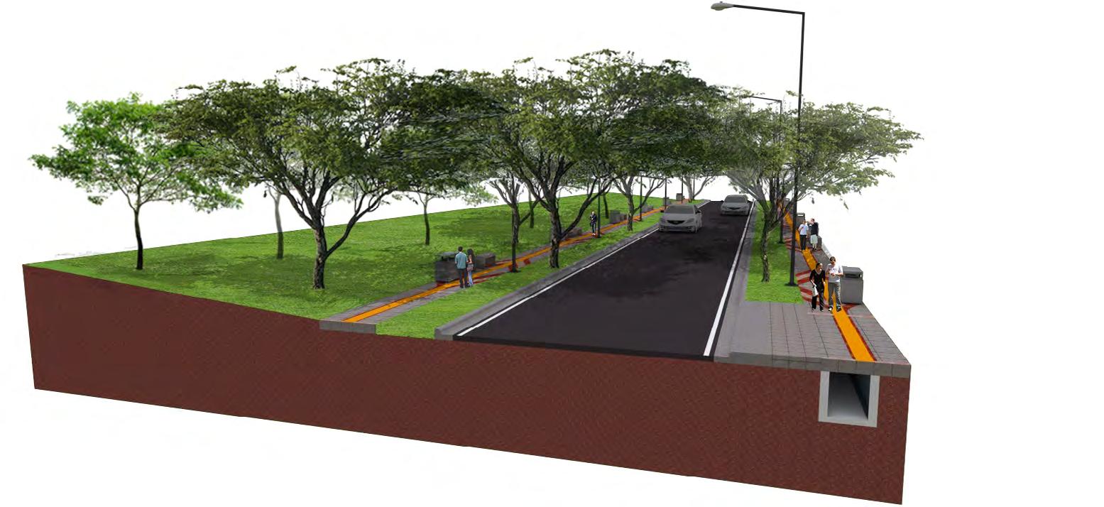
The whole development is consist of 5 study areas with each challenge and objective as follows:
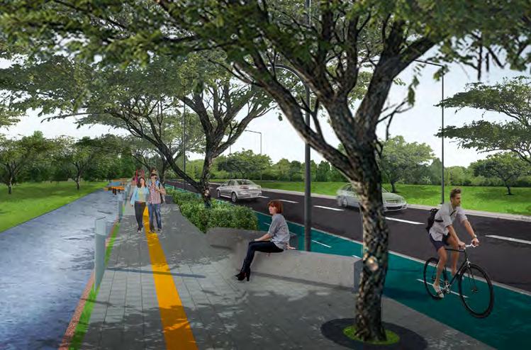
1. Sorong Raya Street - Improve pedestrian path, landscape, and road safety.

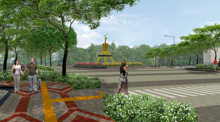
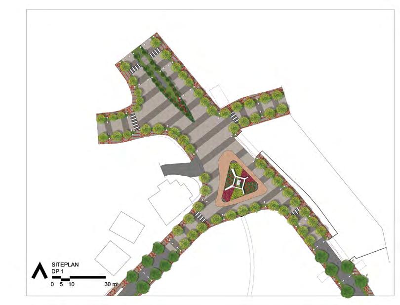
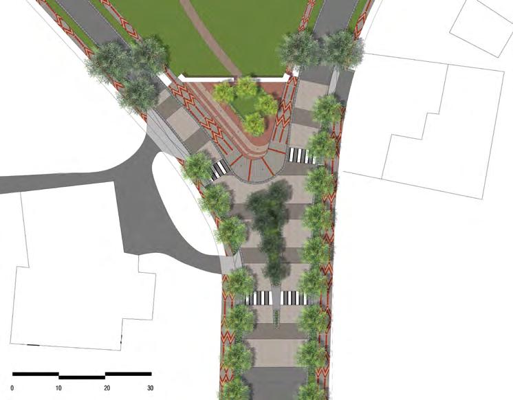
2. Pawbili Monument - Improve connectivity and landmark statement.
3. Klamono Junction - Improve connectivity, signage, and open space.
4. Tourism Canal - Improve the riverside and pedestrian connectivity.
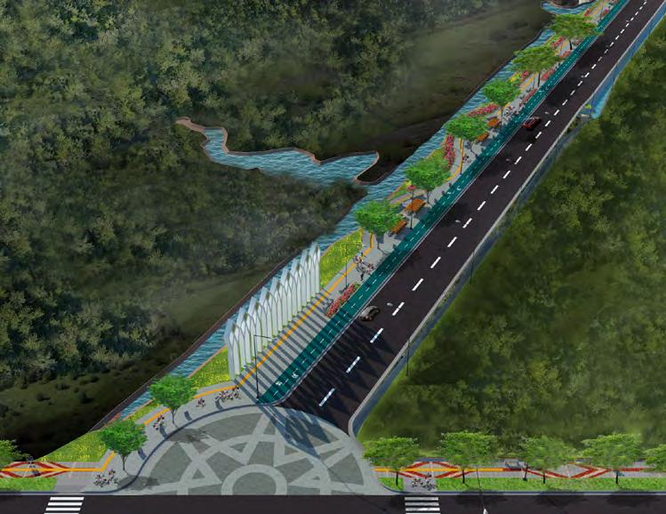
5. City Square - Improve the public space, landscape, and supporting program.
 Source : URBANE Indonesia
5. Alun-alun (City Square)
2. Pawbili Monument
3. Klamono Junction
4. Tourism Canal (Riverside Walk)
1. Sorong Raya Street Conceptual Section
010 |
Aimas Sorong City Center
Revitalization
Planning and Design Strategy
To create a safe and comfortable public realm, the planning and design strategies focus on pedestrian connectivity and landscape elements between the study areas and their surroundings. Adding dedicated programs and activities such as an impromptu market, sports field, and seating area would create the public space to be festive and vibrant to the community.
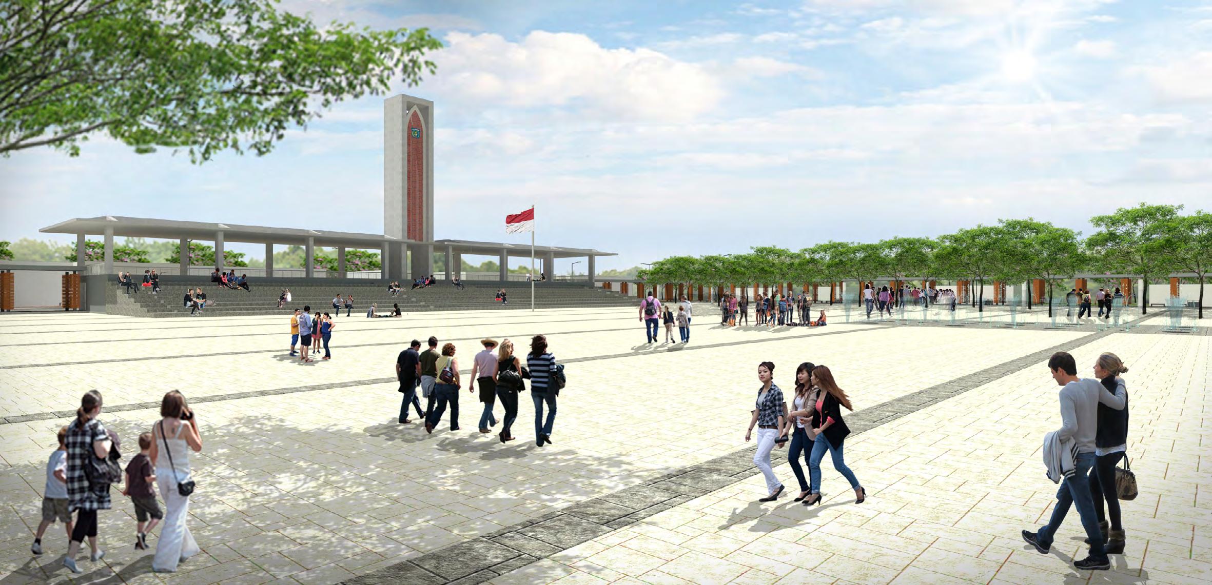

The local culture is infiltrated through the elements of paving pattern, sculptural landmark, shelter’s structure and facade, street furniture, and also the selection of local plantations. Besides, the main program of each space intends to accommodate the community to celebrate the local ceremony, event, and daily activity.
|
Alun-alun (City Square) Field
Alun-alun (City Square) Ceremony Hall
Source : URBANE Indonesia
Existing Condition (Before)
Empowering Placemaking 11
After Construction (2021)
Main Gate and Perimeter

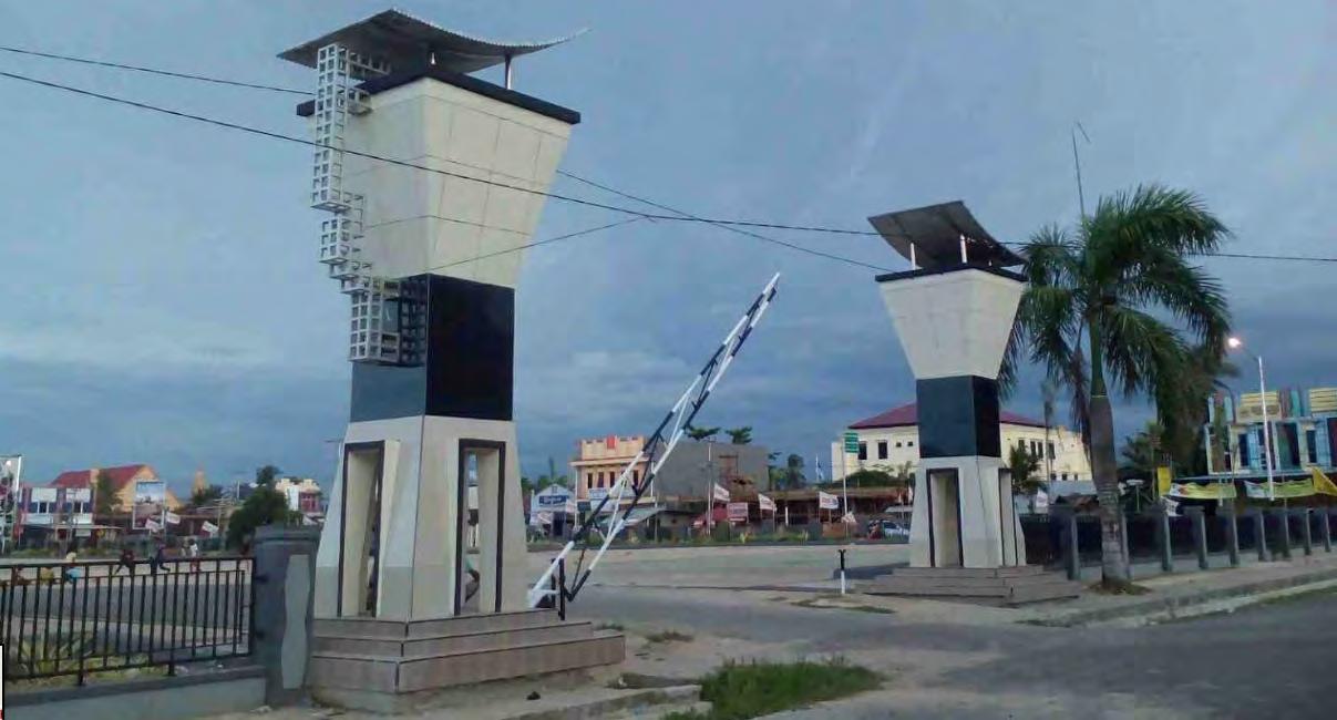
Improve the main gate statement and square perimeter to be more open and seamless to its surrounding.
Community Market
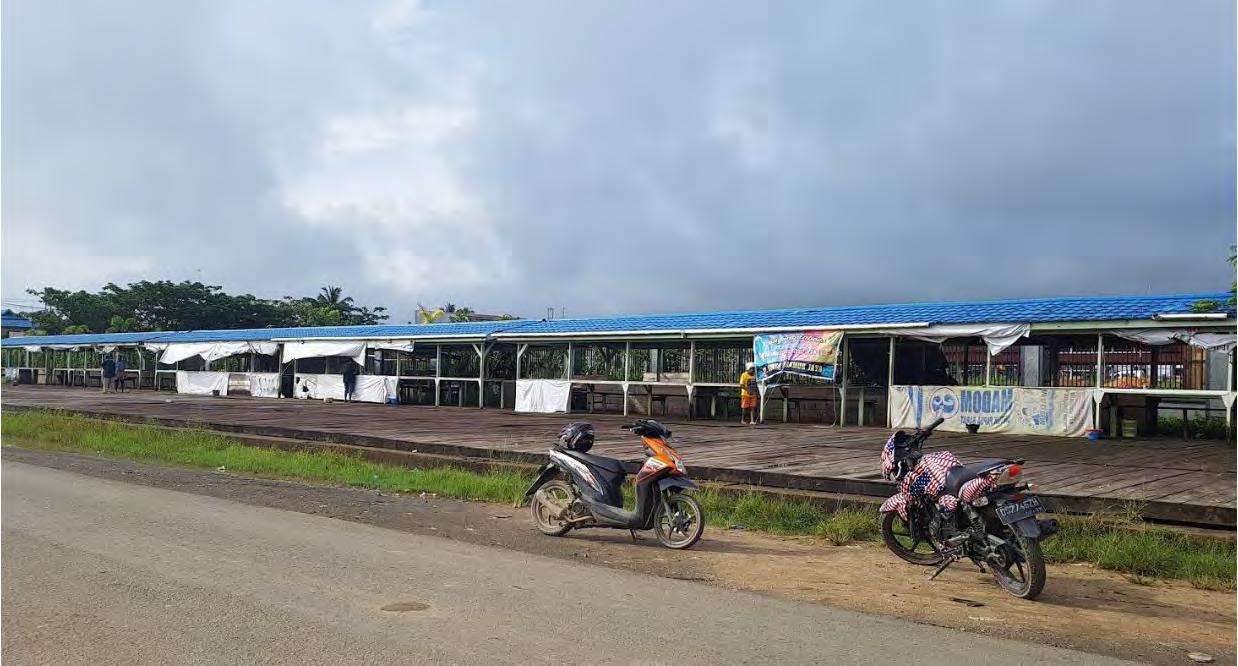
Improve the community organic trading space by providing shelter and landscape treatment along the riverbank.
Pedestrian Path
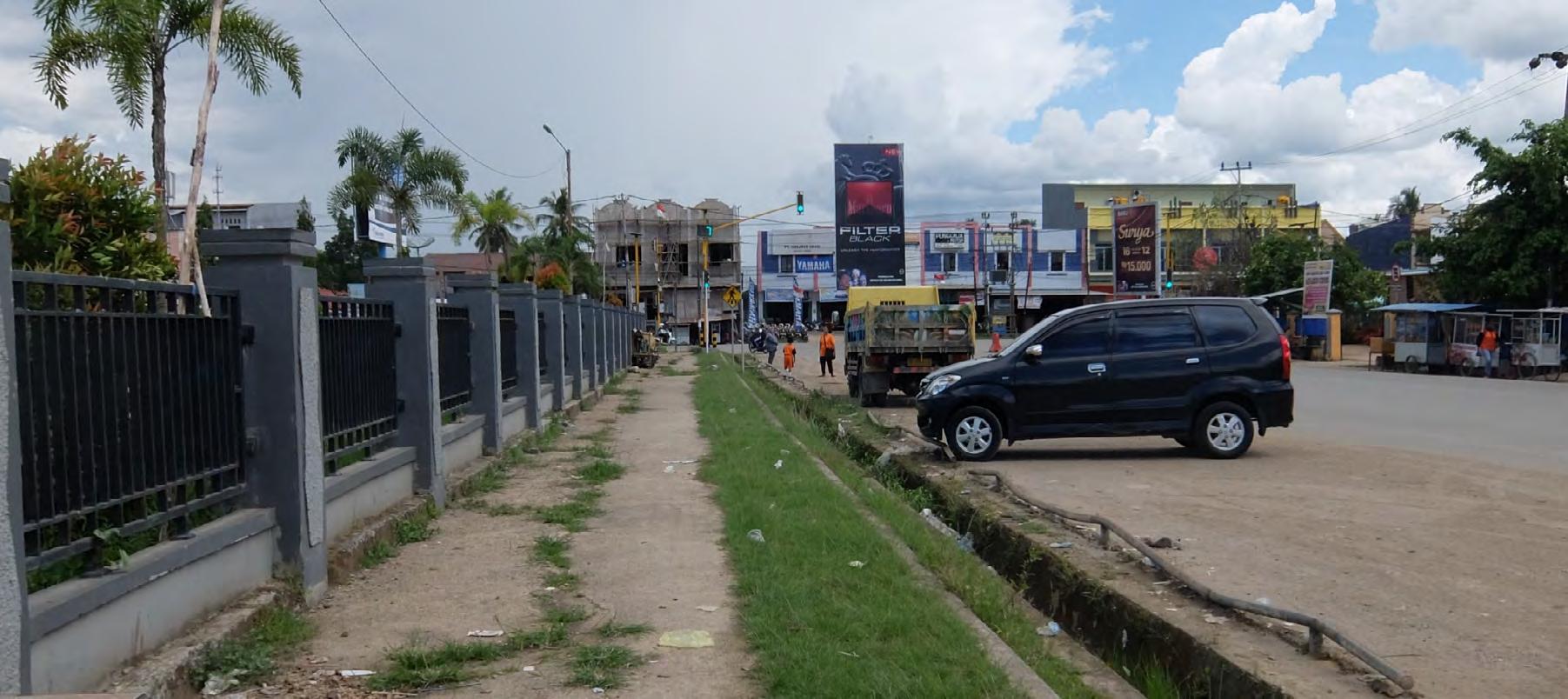
Improve the public realm with the concept of a city “living room” by creating a safe and comfortable space for pedestrians.

 Source : URBANE Indonesia
12 |
Aimas Sorong City Center Revitalization
National Monument Square Revitalization
Scope : Conceptual Master Plan
Location/Year : Jakarta / 2019
Scale : 100 ha
Project Type : Planning and Design Competition (with URBANE Indonesia) Contribution : - Coordinate urban design and architecture team for conceptual design and drawing
- Assist principal in research, analysis, and presentation
- Master plan design and illustration
Status : 2nd Place Winner (among 115 participants) Goal : Revitalize the public realms of National Monument to support and enhance the nature-urban connection with strong historical value.
Project Summary

Medan Merdeka Area and Merdeka Square, where the National Monument of Indonesia is standing, have gone through various layers of history and different forms of intervention. Begin with the intention to establish a national symbol, the life of National Monument has been characterized by developments and changes following the interests of times.
The achievement of PUNARBHAWA is then carried out based on the principle of minimum intervention on existing conditions through two design strategies, namely as Enhancing the Green and Reviving the Urban.
|
Empowering Placemaking13
Source : URBANE Indonesia
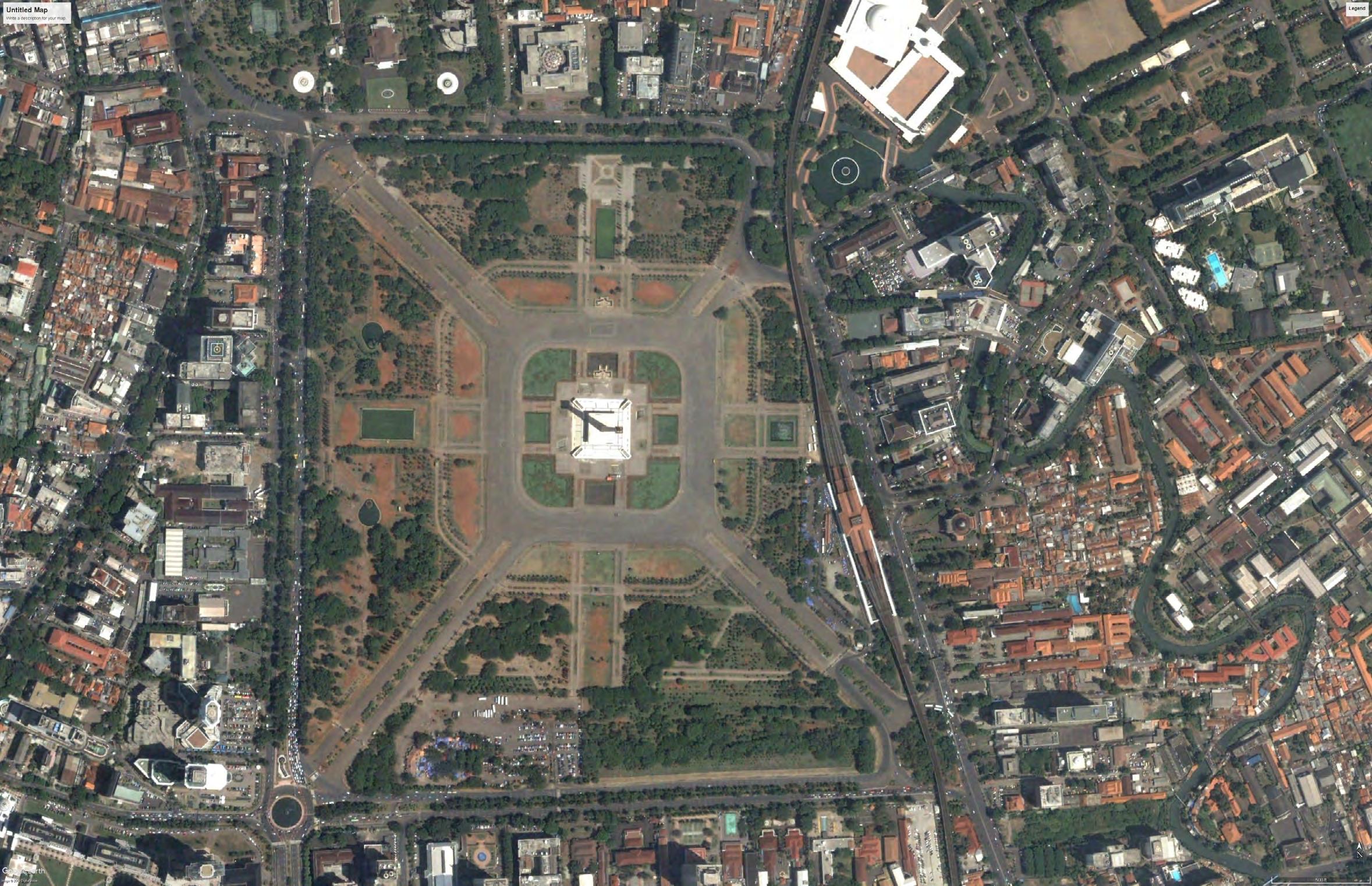
On the other hand, several positive experiences already exist and need to be encouraged and facilitated in the development, including the ones that were conducted through observation as follow:
• The historical value of the national symbol has been part of people’s collective memories.
• The existing vegetation is an asset to the city’ s lungs, reducing pollution and noise in the “city forest.”
• Located right in the city center, the square is surrounded by notable government offices and public facilities, positioning the square as the center of public life.
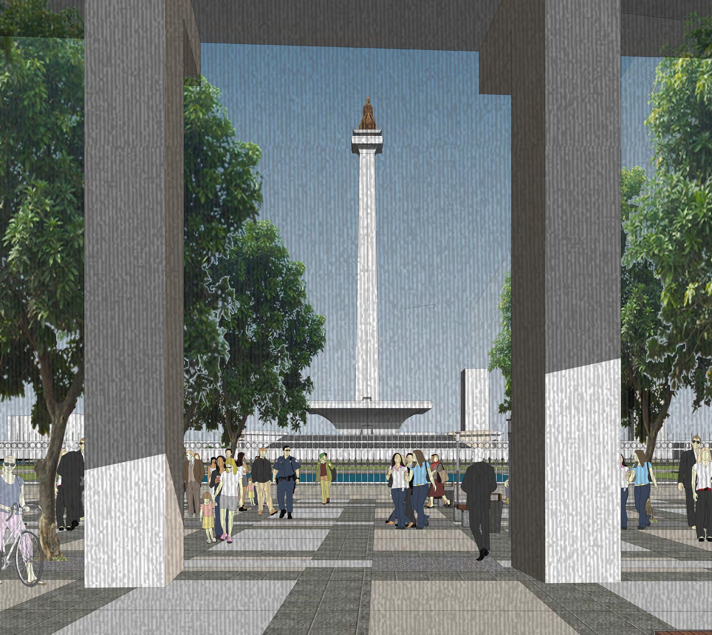
The recent developments in some conditions do not reflect the city’s livability and present the public space well. Green spaces are made for people and should be an integral part of the city’s everyday life instead of being placed behind a high iron fence for control that creates paranoid feelings. An evolutionary rebirth is needed for presenting National Monuments that should be open to the public, which at the same time saves the environment, keeping the existing hierarchical space and order, and still considering the control and management issue of the most critical part of the monument.
By combining the natural and urban elements, the reincarnation of public life in Medan Merdeka Square thrives through green enhancement and urban revival strategies.

Project Analysis
The negative experiences that were conducted through observation are:
• High fences on the perimeter, resulting in low permeability and accessibility to the square.
• The square surface is dominated by asphalt, creating an abundant heat island on the area and an inconvenient microclimate.

• Underused plazas due to the limited access and low maintenance.
• Unintegrated pedestrian connection to the surrounding, particularly to the railway station
Planning and Design Strategy
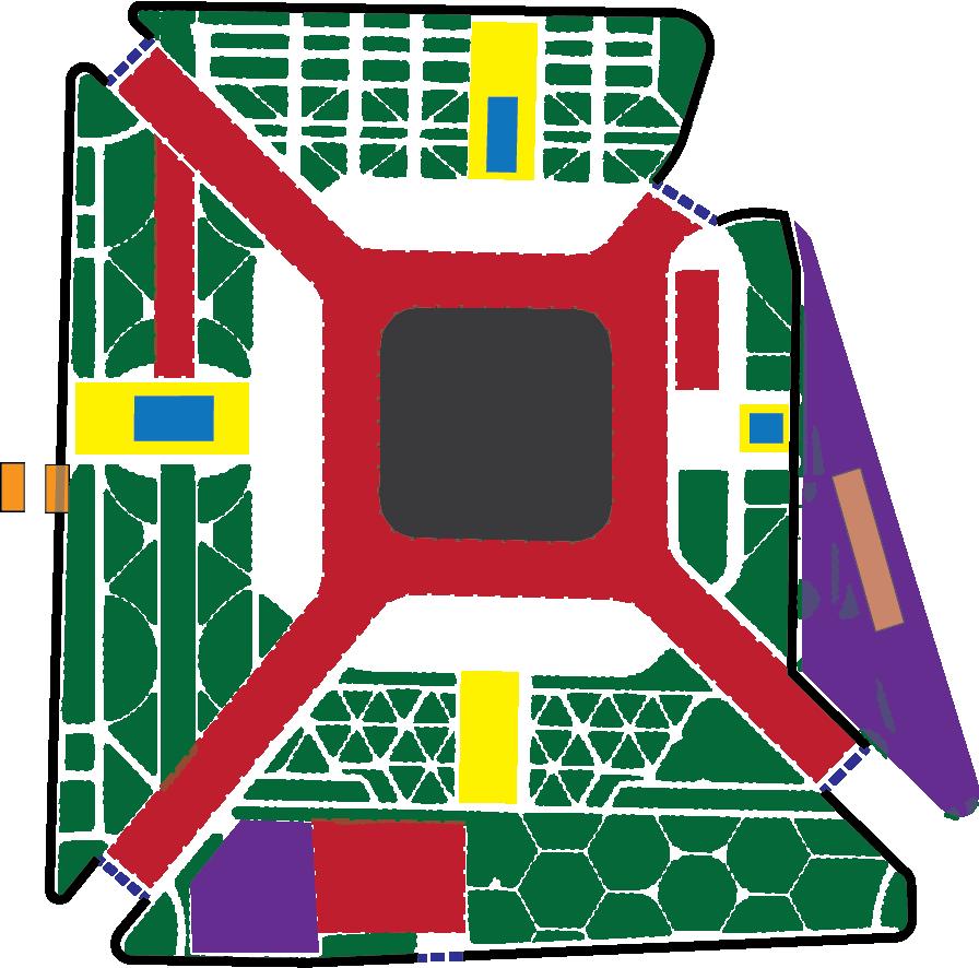
Maintain the existing and add more green through Green Enhancement strategy.
Improve the connectivity and permeability to the surroundings and encourage vibrant urban activity through Urban Life Revival strategy.
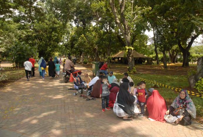
Source : URBANE Indonesia
Outer Fence Heat Island Underused Plaza Green Cover
Water Pond National Monument Transportation Node
Abundant Heat Island
Lack of Public Shelter and Facility
National Monument Square Revitalization 14 |
Underused Plaza and Lack of ‘Urban Life’
Design Concept
“Enhancing the green” design strategies:
• Expand the green shade areas by planting trees in empty field areas;
• Minimize pavement on internal circle roads around the monument courtyard and replace it with green fields;


• Adding water elements around the monument to create passive cooling and ecological functions as water tendons. This water is also reflected as the life-carrying element, a symbol for unifying the islands of the Indonesia archipelago.
“Reviving the urban” design strategies:
• Push-inside the peripheral border of green space to become an open belt of public space to create an inviting ambiance;
• Integrate the existing plazas into the public space belt as a place for urban community activities (art, ceremony, market);
• Reduce the scale of the internal crossroad to be more pedestrianfriendly;
• Integrate Gambir Station into the public space belt and other transportation modes;
• Create a new public market in Gambir Station as a form of reincarnation of Lenggang Jakarta’s (the old market).
|
Source : URBANE Indonesia
Empowering Placemaking15
National Symbol and Jakarta City’ Lung
Maintain and elevate trees and greeneries elements in supporting city microclimate through archipelago forest inside the square.

Public Space Belt
Integrate green park from the inside to the pedestrian area on the perimeter, creating a public park belt that accommodates daily community activities and connects to the surrounding facilities.


Improve the plazas on every side of the square by designated theme and supporting facilities to accommodate culture festival or national ceremony that requires ample outdoor space.

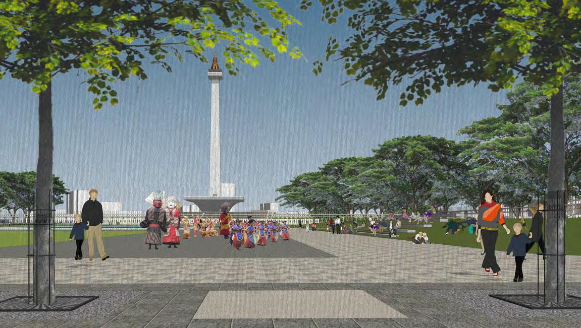 Plaza of Fight for National Ceremony and Historical Remembrance
Footbridge Connection to Surrounding Amenities
Plaza of Creation for Celebration and Cultural Event
Amphitheater At Central Park As Part Of The Sacred Space
Source : URBANE Indonesia
Indonesia Archipelago Forest Reflected On Small Islands Inside The Square
16 |
National Monument Square Revitalization
Java Forest
Papua Forest
Maluku Forest
Sumatera Forest
Kalimantan Forest
Sulawesi Forest
Archipelago Pond Bali & Lombok Forest
Nusa Tenggara Forest
Jakarta Slum RevitalizationCase of Manggarai
Scope : Conceptual Plan Competition
Location / Year : Jakarta / 2021
Scale : 12 ha
Project Type : Planning and Design Competition by Indonesian Association of Urban and Regional Planners ( IAP)
Contribution : - Lead designer, coordinate and guide team members on design aspect - Master plan design and 3D illustration
- Provide framework, diagram, and visual presentation

Status : 3rd Place Winner (among 100 participants)
Goal : Unslumming Jakarta City through smart, resilient, and community oriented post-pandemic development
Project Summary
Kampung has become a multidimensional settlement that covers the physical and attached to people’s social, economic, and culture. Urban kampung , dominated by the low-income community, is often perceived as slum or squatter because of its lack of basic service.
Kampung Manggarai is one of the 200 kampung /informal settlements in Jakarta that has been established over a generation but still struggling with unhealthy and prone to disaster environment. Covid 19 has brought the issue even more urgent. On the other hand, this area will be captured as a strategic future development with high land capture value adjacent to the railway station. Hence, the revitalization is needed to iterate a model of postpandemic development which is smart, resilient, and community-oriented.
|
Source : Author
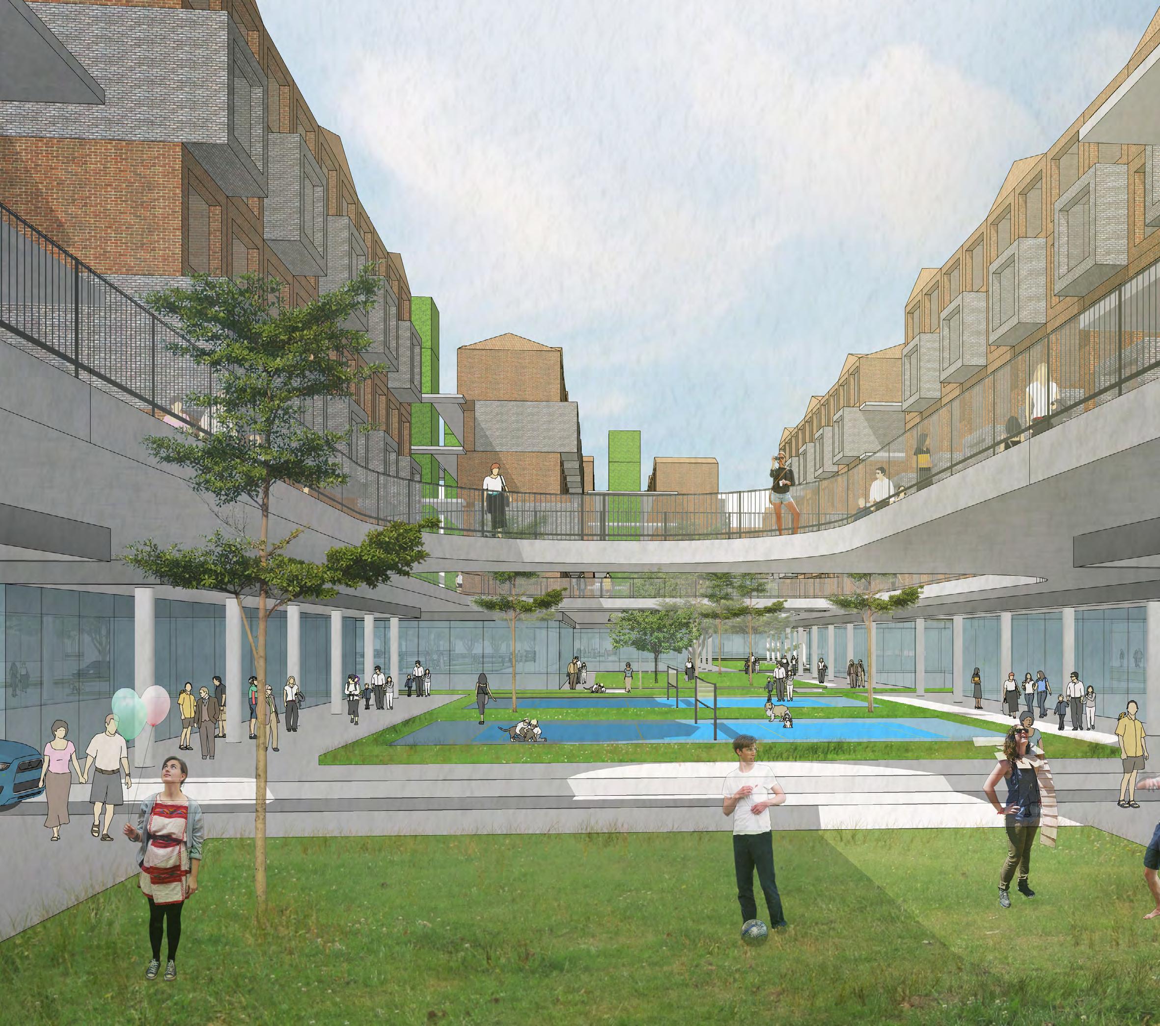
Open Green Public Space on the ground floor
Equity Journey17
Project Analysis
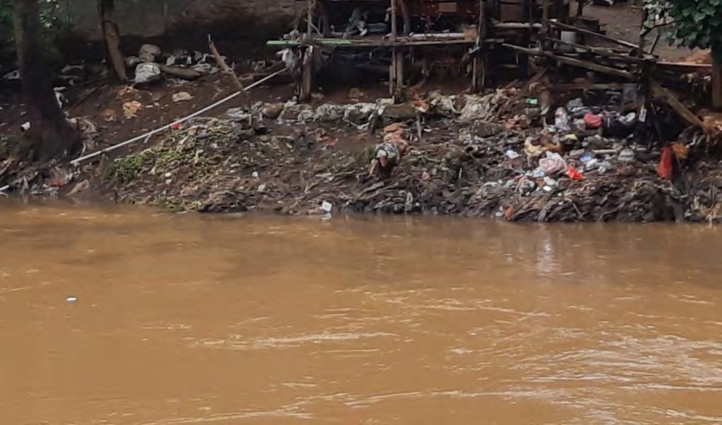
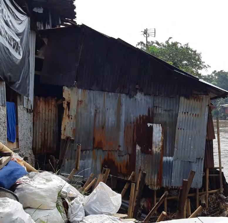
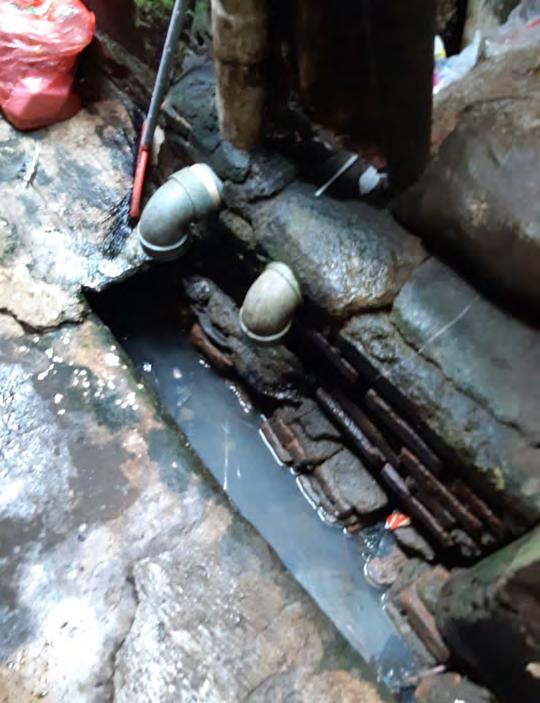
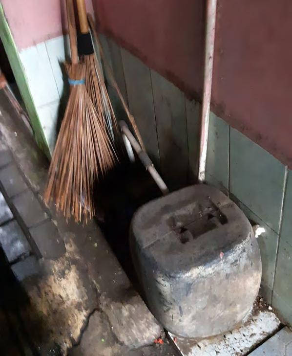
The issues and potential are uncovered through mapping and survey methodology. The limited government funding, weak financial source, prone to disaster, poor infrastructure are the issues that need to be addressed. Referring to Ministerial Regulation of Public Affair Number 14 in 2008 on Prevention and Quality Improvement of Slum Housing and Settlement, six physical indicators shall be referred to in the slum revitalization plan. The indicator includes:


Clean water and drinking water
The survey and mapping result shows that around 70% of the housing lack the basic service mentioned above.
On the other hand, the district holds a handful of potential on its solid social bond, micro-enterprise activities, strategic location-future transportation node, and riverfront development for a high land value capture.
2.
3.
4.
5.
6.
1. Road network
Drainage and wastewater
Standard housing space and structure
Solid waste/garbage
Fire protection
Source : Author Survey
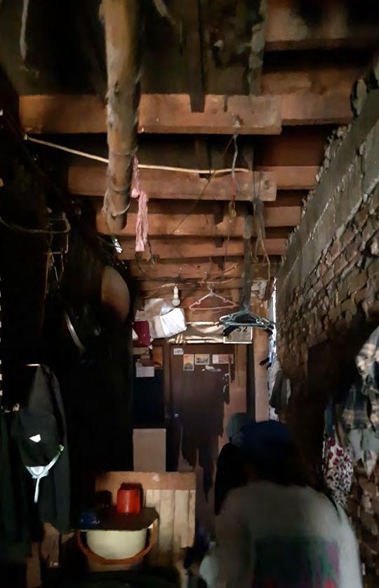
1. Narrow and dark alleyway 2. Limited clean water resource 3. Poor drainage and sanitation 4. Insufficient and temporary structure 5. River as garbage dump 6. High vulnerability to fire DKI Jakarta Slum Revitalization Competition 18 |
and Interview Documentation
All the issues and potentials are categorized to be solved or enhanced through non-physical and physical strategies. The smart community, smart governance, and smart economy are part of the non-physical strategy. At the same time, the smart environment, smart mobility, and smart living become the physical strategy. Each element is broken down into a stringing diagram, as illustrated beside.

The non-physical strategy starts with community empowerment through the educate-organize-transform process. The collaboration can be obtained by stakeholder mapping, including the role of the decision-maker, accountable, responsible, consulted, and informed. In addition, to support sustainable livelihoods, a circular economy concept is funded by injecting new economy space and activities such as cloud kitchens, offices, co-working, and study space.


The physical strategy is developed through the concept of water-sensitive development, climate-responsive design, disaster-resilient environment, and waste management. Smart mobility supports constant connectivity by implementing the walkable and shared street community within the transitoriented development area. A smooth and efficient construction, along with the indoor-outdoor space configuration, supports the smart living strategy to achieve a healthy community.

|
SMART GOVERNANCE SMART COMMUNITY Education Program Participatory Planning Grow SMART ECONOMY Organization Formation Technology Support Access to Inclusive Economy Saving Scheme Multi actor Collaboration Infrastructure and Facility Provision Land Consolidation Public Prive Third Sector Involvement SMART ENVIRONMENT Digital Economy Circular Economy Citizen’s Cooperative Neighborhood Upscale Resilient Environment Transit Oriented Development Slow City: People First Shared Street, Pedestrian Path, Bike Lane SMART MOBILITY Mix Use Development SMART LIVING Green Open Space Addition Unit Increasment Unit Upgrade Standard Living Space Natural Light and Ventilation Health Safe Alternative Financing Start Source : Author Vision and Strategy Framework Issues and Potentials Analysis
Potentials Vision Strong social capital Experience in social program implementation Limited resources on settlement revitalization from both community and individual Limited government fund Inadequate public support Low financial capital of the community Suboptimal economic opportunity Prone to hazards and disaster Lack of open space and water infiltration space Poor riverbank Suboptimal land usage of transportation node Lack of basic infrastructure Low sanitary housing and environment Irregular housing form Technology access to public service External and private fund potential Existing micro, small, medium enterprise Potential new economic activities Riverfront development High land value capture Strategic location for an integrated TOD development Consolidation strategy Public facility and utility upgrade Smart Community Smart Governance Smart Economy Smart Environment Smart Mobility Smart Living Physical Strategy Non-Physical Strategy Equity Journey19
Issues
Non-Physical Strategy
The stakeholders mapping is needed as part of the participatory approach, building a strong foundation of long-lasting community organization and supporting the development.
Decision Maker
• DKI Jakarta Government
• Resident (Land Owner)
Accountable
• Office of Public Housing and Settlements
Responsible Consulted Informed
• Developer
• Office of Communication, Information and Statistic
• Fiber Network Provider
• Medical, Transportation and tehnology startup
• Resident (Tenant)
• Regional Development Planning Body
• Office of Creation, Spatial Planning, and Land Registry
• Professional Association
• Indonesian Railways Company (PT. KAI)
• DKI Jakarta Citizen, particularly the public facility users around the study area
OPD and Stratup Role as Tech-Enabler M ultiple Colaborations with the digital service provider as the responsible actor for development acceleration
Public Participatory
Facilitate and support resident’s participation and input
• JAKI Jakarta Smart City
• Qlue
• Nodeflux
• Cityplan
Physical Strategy
Internet Network
Provide the internet connection to support the digital activity
• Indihome
• Indosat
• Megavision
• Firstmedia
Health Service
Support the medical service through the digital platform
• Halodoc
• Alodokter
• GoodDoctor
• Doktersehat
Co-Work & Study Space
Facilitate the remote working and studying
• Cohive
• Wework
• Well Space
• Gowork
• Estubizi
Digital Economic Support the access and development to the community economic activity
• Tokopedia
• Yummy Kitchen
• Bukalapak
• Shopee
• Hangry
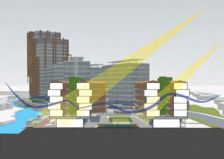
The physical framework creates optimal land usage for efficient living space and water and climate-responsive planning and design.
Smart Mobility on Master Plan Framework


Smart Environment Strategy on GreenBlue Connection
Smart Living on Building Configuration
Source : Author
• Biznet
• Klikdokter
DKI Jakarta Slum Revitalization Competition 20 |
Planning and Design Strategy
The district is divided into several blocks following its small neighborhood with different characters and intensity. The low-rise residential block takes up the most area to consolidate the original community. A mid-rise and high-rise development is located on the southern part with a significant green node in the middle to enhance and maximize the area.
The neighborhood will be interconnected through green spines and small retail/ commercial stripes between the building blocks. The riverside area is developed to be the frontage of the building, creating a more vibrant and resilient community that responds the water and climate-sensitive issues.

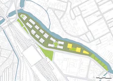
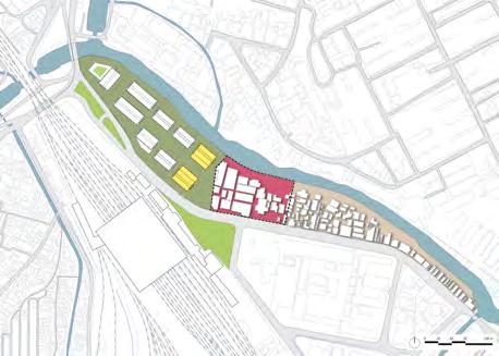
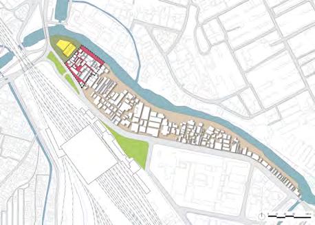

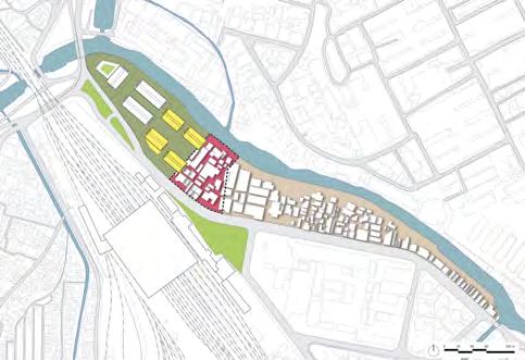


With the constrain of limited vacant land, the development is divided into seven phases, starting from the most overcrowded neighborhood on the north to the less-dense district in the south. The affected community is facilitated through the consolidation and institutional financing scheme with aid from the government, CSR, and developers.
The expected outcome is to regenerate a healthy, resilient, and sustainable city through this participation and collaborative actions. The bigger, more impactful goal can be achieved starting from a small neighborhood model that provides adequate basic service and celebrates local value alongside community empowerment.
Action Plan
Development Phasing
|
Source : Author Traditional Market and Low-Rise Residential Low-Rise Residential and Commercial Mid-Rise Residential and Public Facility Center High-Rise Residential and Commercial
Preparation and Planning (Participatory survey, mapping and planning)
Construction (Financing collaboration, residential construction)
1 4 6 2 5 7 3
After Construction (Development management, micro small medium enterprise capital)
Connection to Public Transportation
Equity Journey21
Riverside Enhancement
Kampung Manggarai , to be a model for slum revitalization/ unslumming urban settlement in Jakarta City through public participation approach, collaborations, and development acceleration, which transform not only the space but also the people.


Source : Author
Competition
DKI Jakarta Slum Revitalization
EDUCATE - ORGANIZE - TRANSFORM 22 | EDUCATE - ORGANIZE - TRANSFORM
THANK YOU dinifauzh@gmail.com issuu.com/dinifauziah +62 857-1529-9544


 Source : URBANE Indonesia
5. Alun-alun (City Square)
2. Pawbili Monument
3. Klamono Junction
4. Tourism Canal (Riverside Walk)
1. Sorong Raya Street Conceptual Section


 Source : URBANE Indonesia


 Plaza of Fight for National Ceremony and Historical Remembrance
Footbridge Connection to Surrounding Amenities
Plaza of Creation for Celebration and Cultural Event
Amphitheater At Central Park As Part Of The Sacred Space
Source : URBANE Indonesia
Indonesia Archipelago Forest Reflected On Small Islands Inside The Square


