URBAN DESIGN PORTFOLIO SELECTED PROFESSIONAL AND ACADEMIC WORKS
Index
1.
2. Lot subdivision options for residential land
3.
4.
5.
Draft Mill Park Place Framework
Structure Plan, Box Hill
Urban Food Systems, Docklands
Gleadell Street Square, Richmond
1. Draft Mill Park Place Framework
November 2023
Project description - Creating a place framework for the suburb of Mill Park using data analysis, community and stakeholder consultation.
Role - Collecting background information, creating opportunities and challenges report, preparing the place frameowrk, commmunity engagement.
Status - Document to be put up for endorsement in early 2025.
Skills - Data was analysed using GIS softwares, collated on Illustrator and published using Indesign. The process involved designing a number of workshops with community members and translating their feedback into actionable outcomes, and aligning with ongoing and proposed projects.
More information and full document can be found via City of Whittlesea’s Engage Page
Thumbnail hand sketches created on paper and retraced on illustrator used for the community consultation materials.
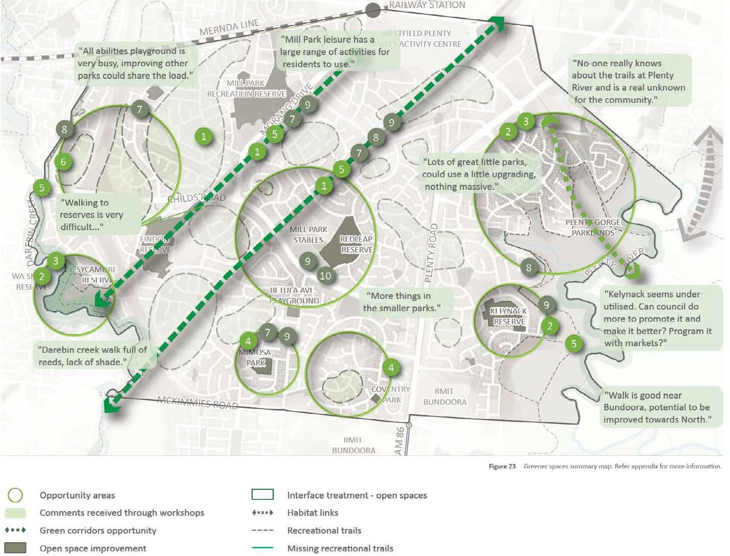
Opportunities and challenges under the ‘greener spaces’ theme.
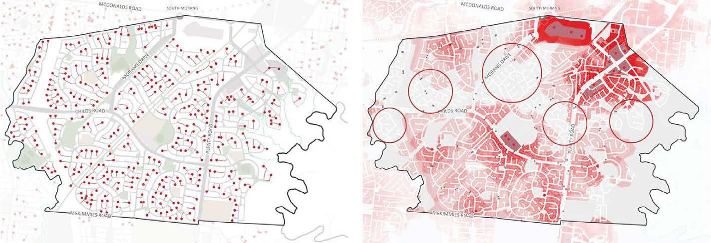
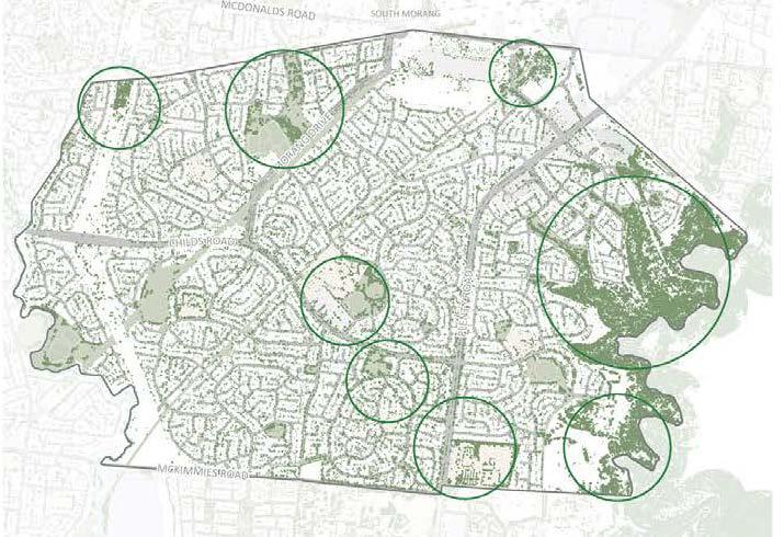
Sample analysis maps used for the framework
Canopy cover map
Location of cul-de-sacs
Town centre walkable catchment
2. Neighbourhood Design Manual
August 2022 - June 2023
Project description - Creating design guidelines to be used by council officers. The document can be viewed on the CoW website
Role - Reviewing exisiting policies and identifying gaps, creating and refining illustrations, layout and formatting.
Status - NDM guidelines are widely used by CoW to support referrals and is being considered for incorporation into the plannig scheme.
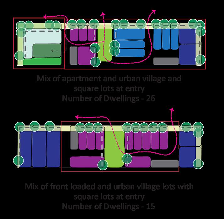
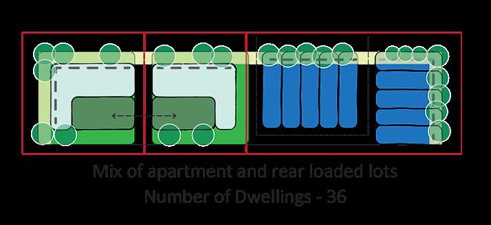
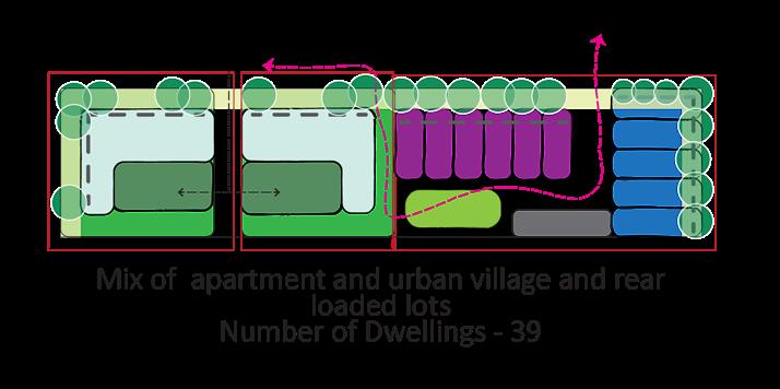
Lot Subdivision options for residential land
November 2023
Project description - Creating options to demonstrate the various configurations for development of Council land adjacent to a reserve and a local town centre.
The intent was to increase dwelling density and diversity while exploring council’s role and involvement in the development to varying degrees.
Role - Creating conceptual subdivisions, testing iterations graphical representation of the options under guidance of senior officer.
Status - Project idea presented to ELT as a council-led deveopment and is slated for further investigation in FY 2025-26.
Skills - Quick illustrations made to scale on illustrator. RESIDENTIAL DEVELOPMENTS
Enhance safety and quality of adjacent public realm
DEVELOPMENTS
Guidelines
[a] When buildings front the street, ensure their main entries are facing the primary frontage.
[b] Create well-articulated building entries with canopy covers and landscaping to ensure visibility, provide weather protection and promote social interaction.
[c] Orientate buildings to face the front and rear when primary living spaces are provided on upper levels.
RESIDENTIAL DEVELOPMENTS
Objective W21
RESIDENTIAL DEVELOPMENTS
• Orientating balconies to the front and rear ensures passive surveillance, enhances perception of safety in the neighbourhood, and reduces the need for privacy screens.
[d] Orientate windows, balconies and habitable rooms to front the public realm.
• Maximise the number of windows, balconies and habitable rooms fronting the public realm to enhance passive surveillance.
Create simple and well-proportioned built form
• Provide windows to both streets on corner dwellings to address the corner.
[e] Use low fences or plants along public realm to maximise passive surveillance.
• Avoid providing Secluded Private Open Space (SPOS) within the front setback to facilitate low fences and passive surveillance.
[f] Minimise provision of blank walls.
• Blank walls contribute to poor public realm quality, anti-social behaviour and perceived lack of safety. Objective W23
• A simple form without unnecessary modulation results in a clean presentation to the streets.
• Complex roof forms increase cost and maintenance.
[b] Create depth to articulate the
• For example: by incorporating balconies, recesses, extruded
• Accentuate change
• Avoid flat
RESIDENTIAL DEVELOPMENTS
Thomastown Lalor Place Framework
August 2022 - Ongoing
Project description - A place framework was created for the suburbs of Thomastown and Lalor following extensive stakeholder and community enagement.
Role - Supporting role under the supervision of a senior team member. Assissted with the community consultation process, revised document after consultation and currently undertaking the implementation process.
Status - Docuement endorsed by Council, implementation underway. More information can be found on CoW Engage Page
ACADEMIC WORK SAMPLES
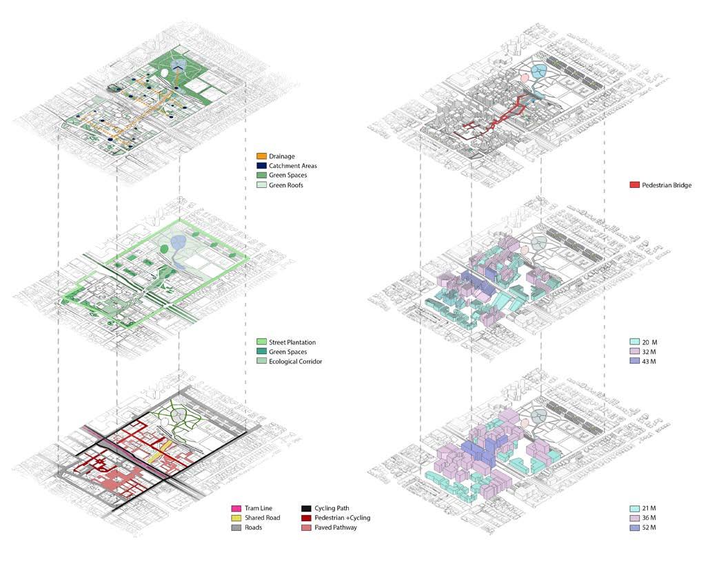
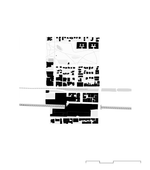
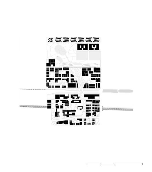
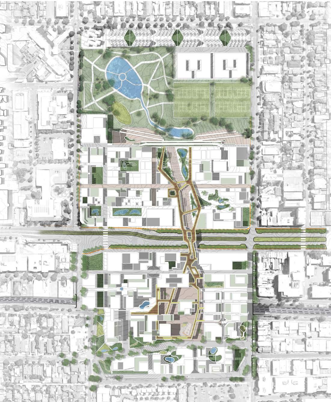
3. Structure Plan
Box Hill, Melbourne
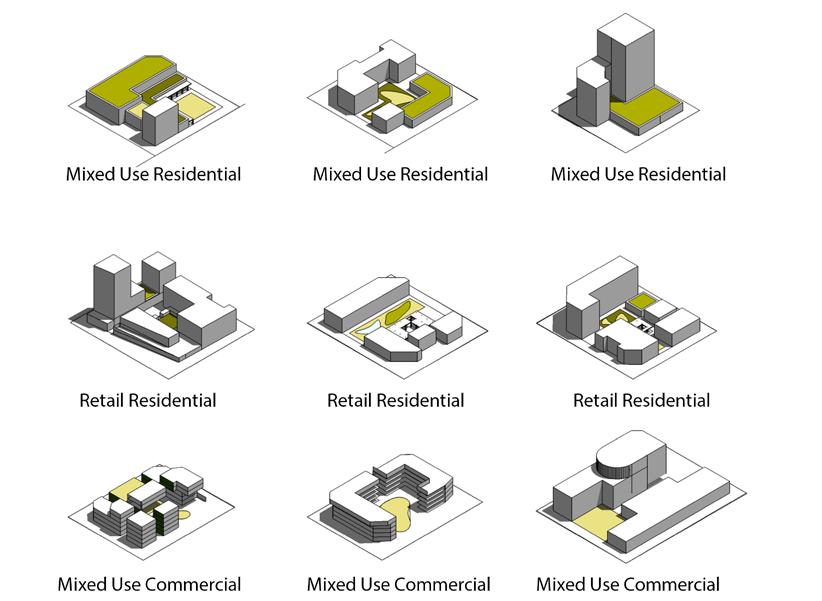
Project Description - Developed an alternate structure plan for Box Hill Railway Station Precinct with a team of architects and landscape architects.
The methodology involved rigoirous testing of built form typologies and envelopes ensuring solar access to public spaces, capture and treatment of rainwater and creation of civic spaces.
The result was a pedestrian spine stretching across the precinct providing pedestrian and cycling access from the railway station to Box Hill Gardens.
Skills - Block typlogies testing using sketchup to compare FAR and site coverage.
Hydrological analysis, solar fan and solar envelope testing using Rhino and Grasshopper plugins.
Final outcome was designed in collaboration with all three team members and various combinations of Autocad, Sketchup and Adobe suite were used to generate graphics.
More information can be found here.
Proposed built form around Box Hill station
Proposed civic lounge near Box Hill Station
Figure ground showing the difference between existing and proposed footprint. Example of typologies proposed for the precinct.
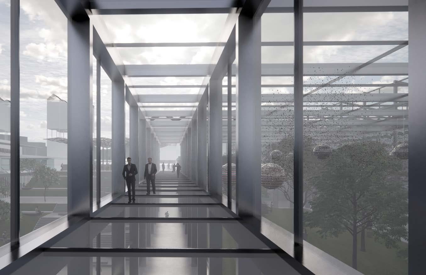
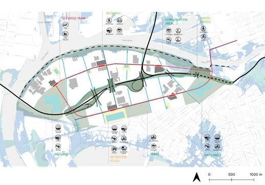
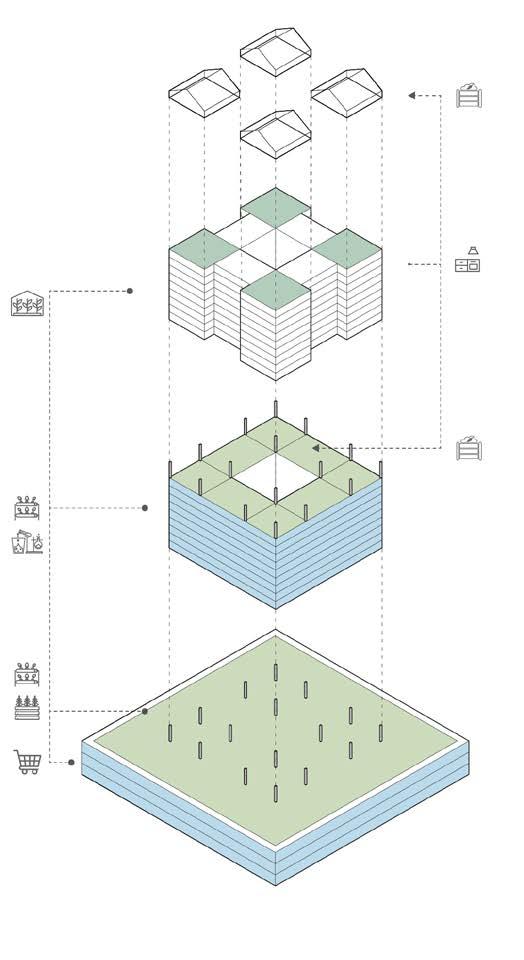
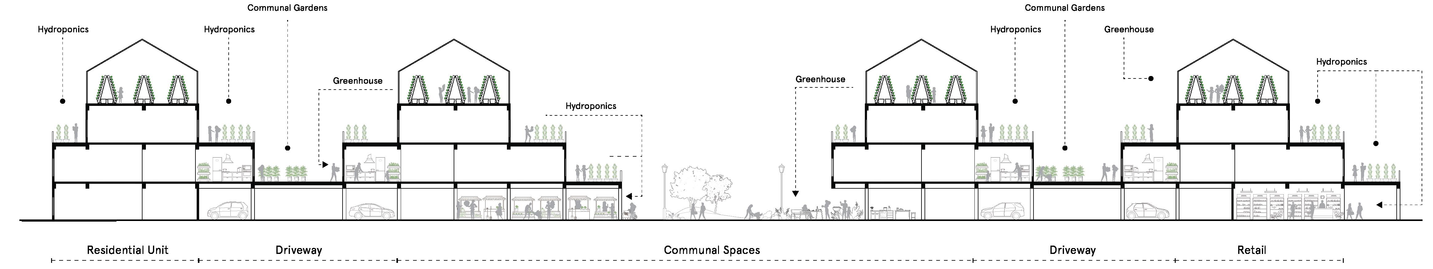
4. Urban food systems
Docklands, Melbourne
Project description - The thesis project reimagined the development and growth at Fishermans Bend considering food security in an era of rapid climate change. It proposed new built form typologies consisting of synergistic relationships between the cultivation and consumption of food. It also focused on adapting to the flooding in the precicnt.
Skills - An urban design framework was created to envision the precincts, their roles and functions using GIS data, Rhino, Enscape and Illustrator. Block types were created to respond to each of the precincts requirements such as food production and adaptation to future flooding while maintaining movement through elevated pedestrian and transport corridors. More details can be found here
Enscape render of pedestrian bridge through insect farm.
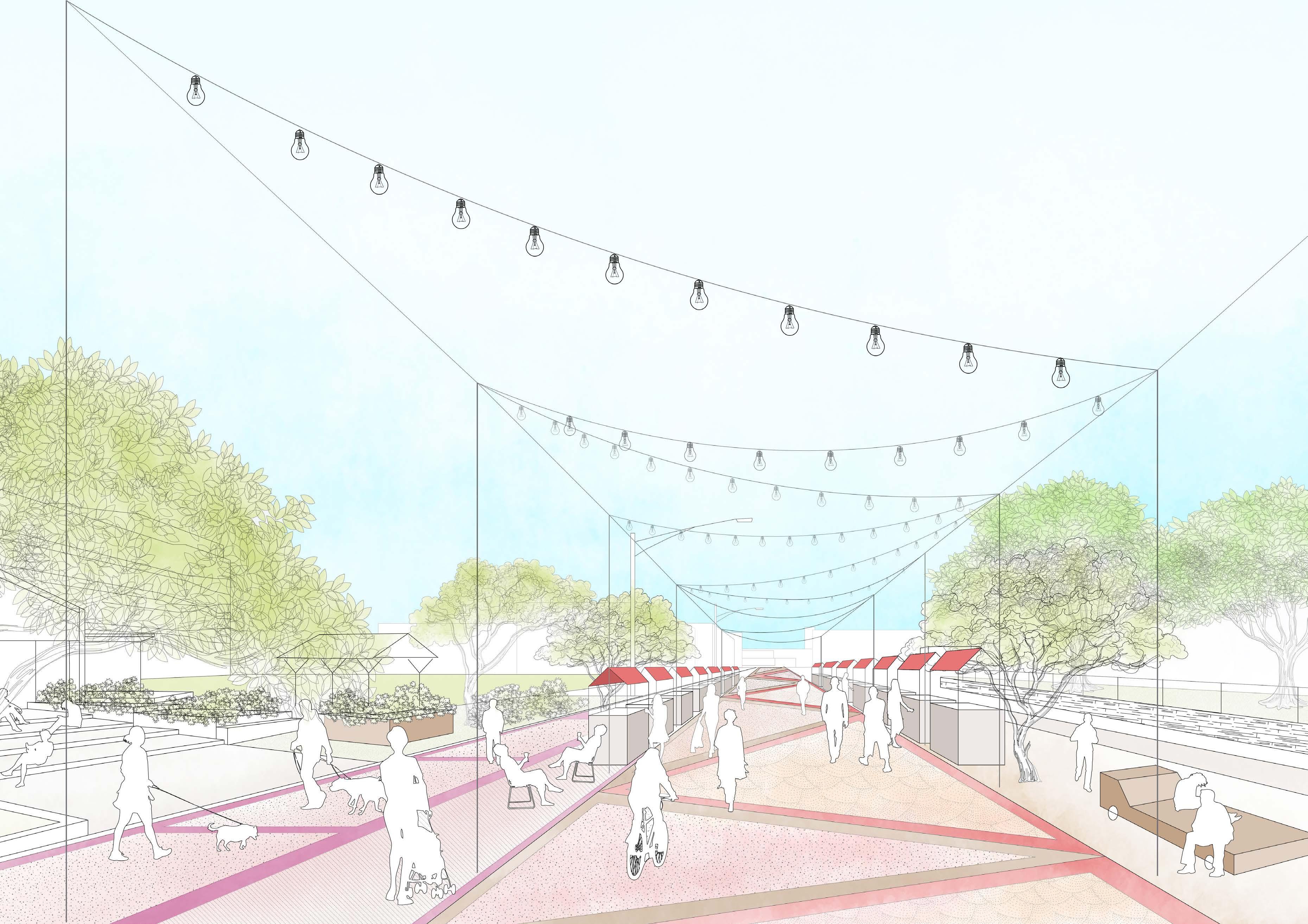
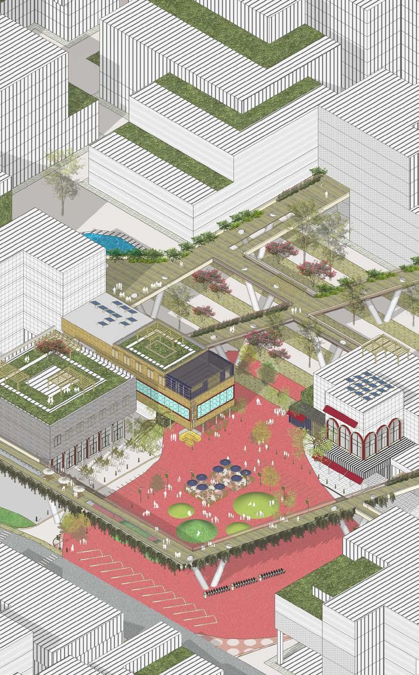
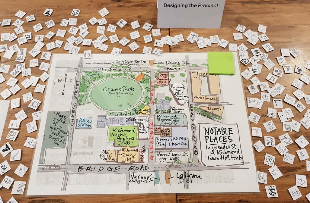
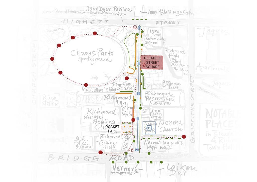
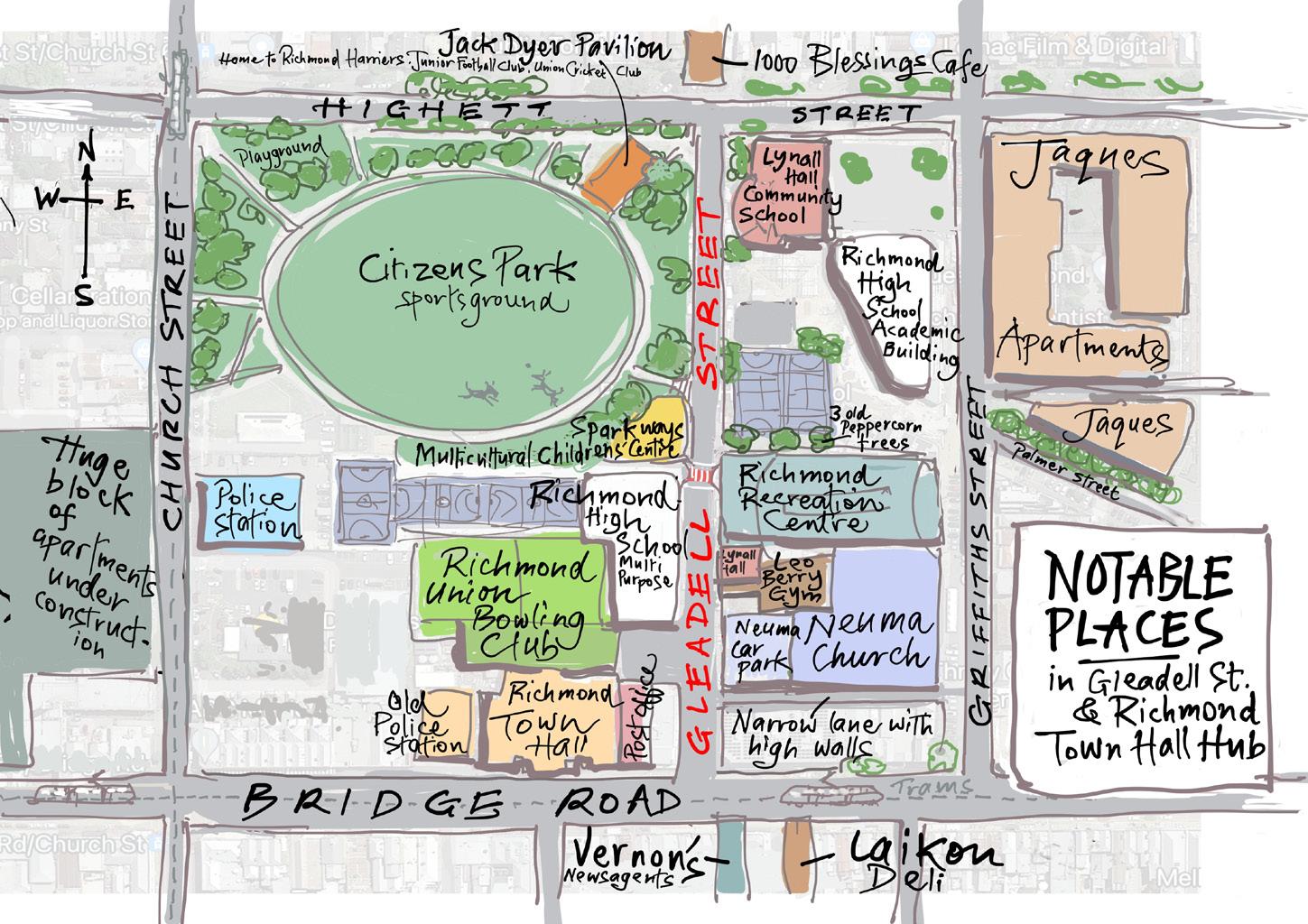
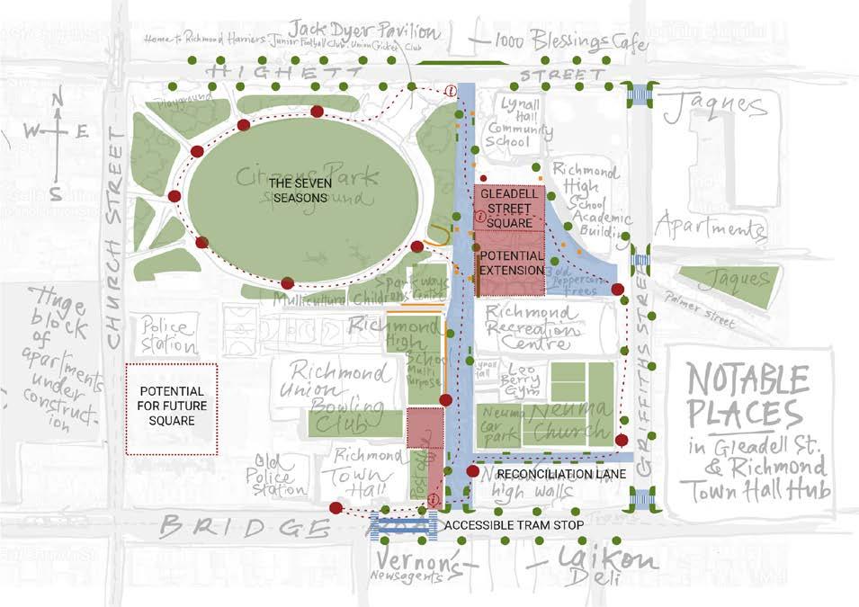
5. Gleadell Street Square
Richmond, Melbourne
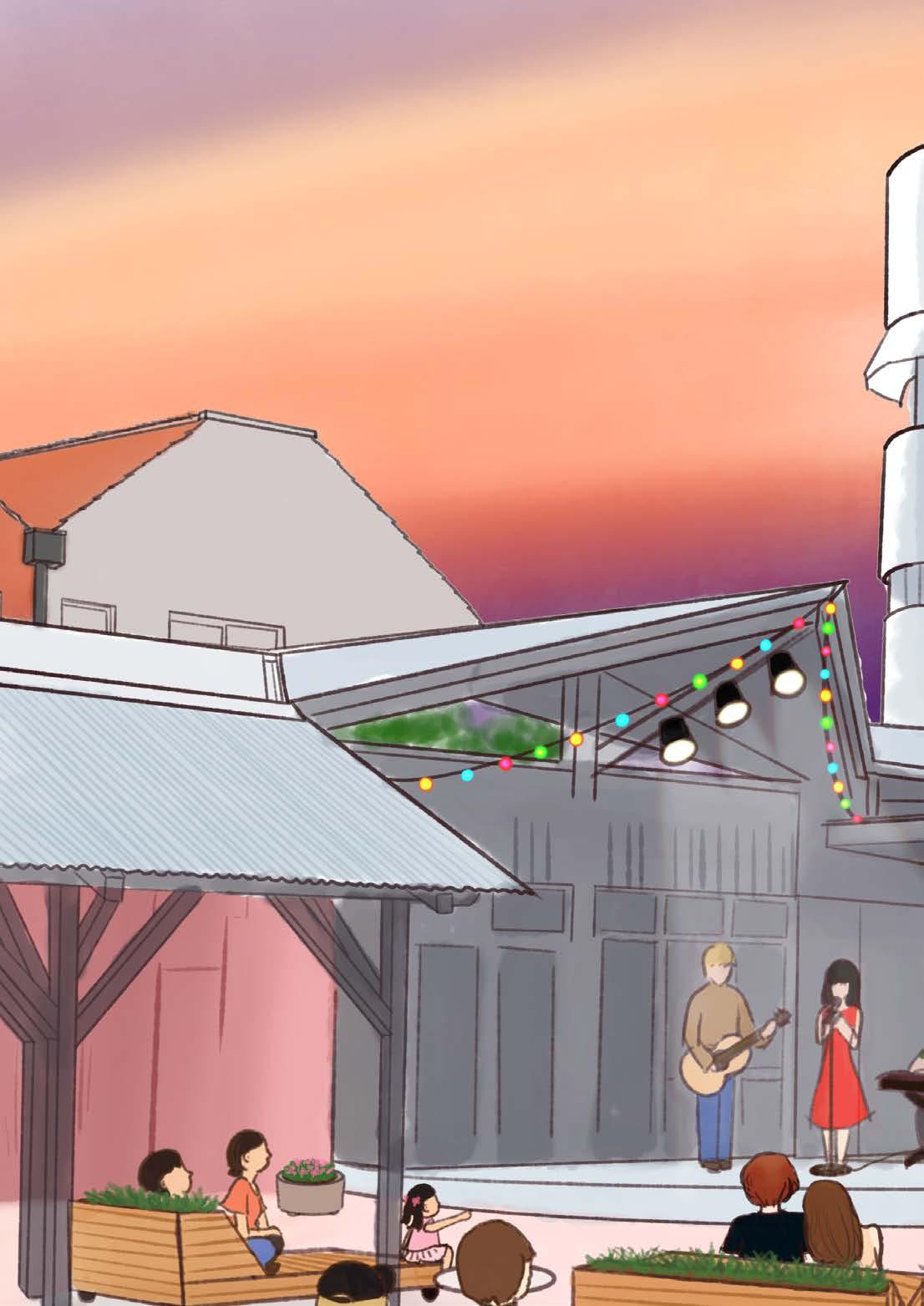
The project was to make Gleadell Street Square a meeting place at the heart of Richmond.
A greener, cooler village centre, opening out into a biodiverse and resilient Citizens Park and greater precinct that plays host to year round community events and activities.
Site analysis, case studies and design were done in a multidisciplinary group of architects, landscape architects and planners. Community engagement session and presentations were conducted with the community and stakeholders interested in adopting the project.
More information can be found via ‘Go Gleadell’ website or through this video by Place Agency.
Community Consultation Session
the short-term goal. The contestation of the Citizens Park and the parking, as well as the market’s success, meant the resources should be aimed at a new space. Taking into account the budget provided for Summer 2022, a sum of $10,000, it was decided that providing a village centre in the short-term would be an efficient, temporary and cost effective way to activate the entire street in the long run. Gleadell Street Square is to become a community hub that stimulates ongoing momentum, usership and awareness, for the mid-term and longterm strategies to be put in place.
Lynall Hall Community School is located on Gleadell Street and usually runs classes for students from Monday to Friday. Site observations and community recommendations suggested the vacant car park was an underutilised weekend space. The school is located next to the Saturday market and holds potential to be a resting space for market goers, a place for conversation or to meet with friends. As a starting point, we propose to utilise the school’s parking lot to accommodate various social events that are to be conducted on the weekends. These activities include: Saturday Night Music Festivals and a
Place activation strategy developed in collaboration with the community
IV. GLEADELL STREET SQUARE, RICHMOND
1-2 years of community & council collaboration
success of Gleadell Street Square and the Gleadell Precinct relies on a community relationship and active engagement. Place governance to establish stewardship is integral, as well as an ethos of collaboration Wurundjeri, Council and schools.
Ice breaker table. Several views of the street are provided and people allowed to draw anything they want to see on the street on the picture. A series of representative icons including natural elements, facilities, activities are prepared, individuals are asked to attach the icons that interest want to see in the future to a map of the street. Questions related to their are asked. A slide about the initial proposal is presented to the people to communicate our ideas and to get feedback from the community.