PORTFOLIO ARCHITECTURAL

DOMINIK STOSCHEK
SELECTED WORKS
2018 - 2023


DOMINIK STOSCHEK
SELECTED WORKS
2018 - 2023

EDUCATION
SEPTEMBER 2020 -
JANUARY 2023
M.SC. ARCHITECTURE, URBANISM AND BUILDING SCIENCES
TU DELFT, THE NETHERLANDS
OCTOBER 2016 -
JULY 2020
B.SC. ARCHITECTURE AND URBAN PLANNING
UNIVERSITY OF STUTTGART, GERMANY
WORKING EXPERIENCE
AUGUST 2021 -
MARCH 2022
AUGUST 2019 -
FEBRUARY 2020
MVRDV, ROTTERDAM, NETHERLANDS
ASSISTANT DESIGNER WITH CHRISTINE SOHAR
WHITE ARKITEKTER, STOCKHOLM, SWEDEN
ARCHITECTURAL INTERN WITH ANDERS ARVIDSSON

I believe that architecture is the most powerful tool for giving shape to our human-built environment. Nevertheless, I don’t consider architecture to be the sole protagonist of our environment. I oppose the idea of architecture being the problem-solver for every problem possible. Rather, I see nature and our built environment to be close collaborators in tackling today‘s social and environemntal challenges. The responsible handling of our sustainable limits of our planet is at the core of my design thinking.
be which was crucial in order to be preparedtocopewithtoday’semerging global challenges. In my works, I aim to adress theoretical matters as well as a practical approach and try to pave the way for taking speculative risks with ground-breaking ideas, pushing the limits of what architecture is and how it is defined.
APRIL 2019 -
AUGUST 2019
JUNE 2016 -
AUGUST 2018
INSTITUTE FOR BUILDING MATERIALS, UNIVERSITY OF STUTTGART
RESEARCH ASSISTANT FOR PROF. PETER SCHÜRMANN
ZG ARCHITEKTEN GMBH, ULM, GERMANY
WORKING STUDENT FOR HANS-GEORG ZIEGLER / ULRICH GERHARDT
During my studies at the TU Delft and the University of Stuttgart, I obtained an advanced understanding about our contemporary built environment, about what architecture is and what it could
PORTFOLIOANDCOPYRIGHT
The following portfolio consists of 6 projects (4 academic, 2 professional) varying in scale and field of subject. Unless otherwise stated, am the author of the shown drawings. Therefore, all images and texts on this site are subject to copyright protection. Anyone intending to use works or parts of works from these pages should pleasecontactmeortherespectiveowner.


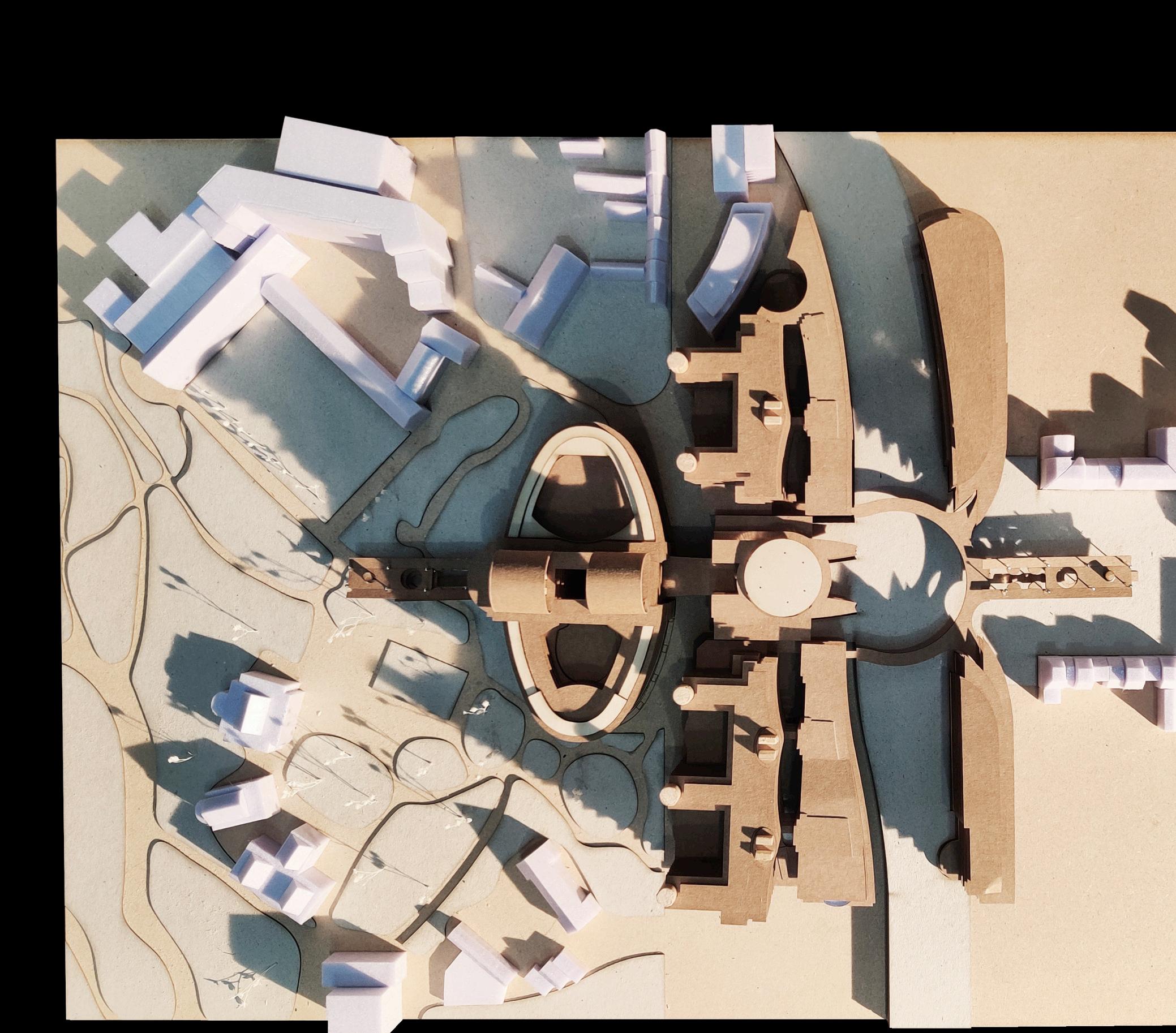
 Prof. Georg Vrachliotis + Dennis Pohl Theory of Architecture and Digital Culture, TU Delft Brussels, Belgium
At the EU Parliament in Brussels, deliberation and decision-making processes are stuck in an everturning hamster wheel designed to reach unanimous compromises. The architecture of the so-called Consensusland provides spatial settings exclusively designed for the
purposeofreachingcompromisesand not offering room where discussions and conflicts can be discussed openendedly. What is supposed to be a building for exchange and deliberation rather nourishes an atmosphere of complete consensus.

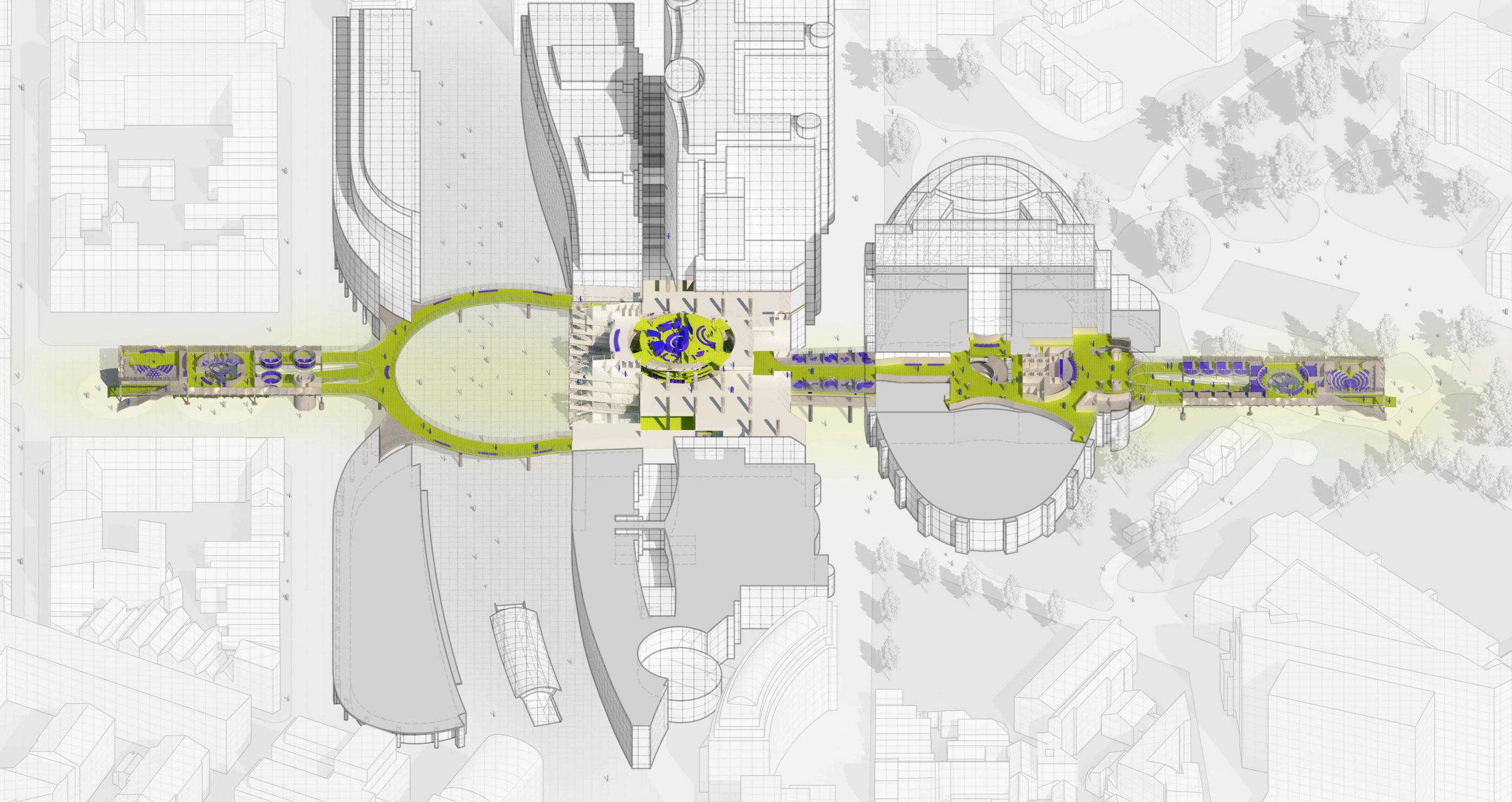
TheLineofDissentoffersboth,anurbanistic andarchitecturalapproachtoinstitutionalize a citizen’s assembly integrated into the existing parliament’s complex. By exploring different spatial settings and sequences, a myriadofassemblyandinformationspaces is being created. Here, the participants of thecitizen’sassemblyareenabledtocome upwiththoughtsandideasonthefutureof theEUwhereanarchitecturecharacterised by transparency and openness nourishes an atmosphere of dissent. The design seeks to blur the borders between the public and the political realm to enhance the permeability of both spheres and to eventually lower the threshold for citizens willing to engage in the decision-making processesonanEuropeanlevel.

ASSEMBLYHALL


GROUPCONVERSATIONS
TALKINGPODS
ECHOCHAMBERSDISCUSSIONSTAGESDATAARCHIVES


Just like the legislative process of the EU is a complex, multi-staged procedure, the structure of the citizens assembly is in the same way a spatial sequence where the persons participating in the citizens’ assembly are gradually introduced to new forms
of debating cultures by spatially going through different discussion rooms.
The programming of this linear structure has similarities to the configuration of a circuit board, whose many individual parts are arranged and connected in such a way that, together with the
circuit board in which these elements are inscribed, they produce a consistent circuit diagram.
The middle part here serves as the intersectionlevelwherenotonlydifferent functions such as entry points, security gates and gathering zones overlap but
also the paths of different person cross, politicians working in the rest of the building, pedestrians going through the parliament to reach either Park Léopold or Place du Luxembourg and of course the citizens taking part in the citizens assembly.
In this regard, the role of the public interferes with these processes as well: While architecture serves as the breeding ground for the political, it acts as a gatekeeper for the public. Built structures in their very essence are space dividers, keeping people in or out of enclosed spaces.
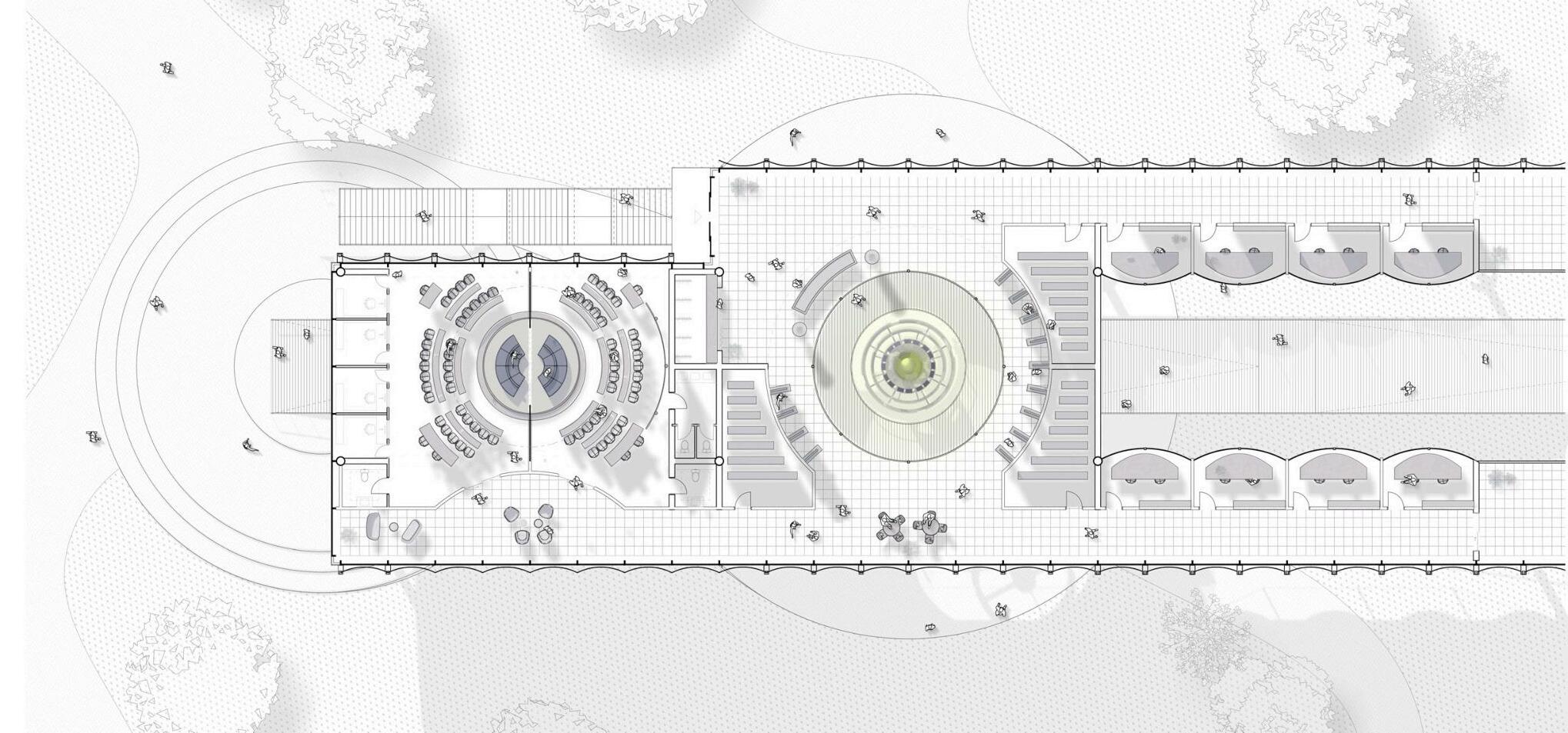
Therefore, the narrow urban fabric of the EU quarter in Brussels and the heaviness and inertia of the existing parliament complex consisting of more than four single buildings asked for an intervention which, on the one hand, deals carefully and cautiously with the given situation and does not add yet another inconsiderate building block to the quarter. On the other hand, it is necessary to counter the parliament building with a visible point of contrast that stands out from the existing structure and thus also attempts to shake up the existing political system architecturally.

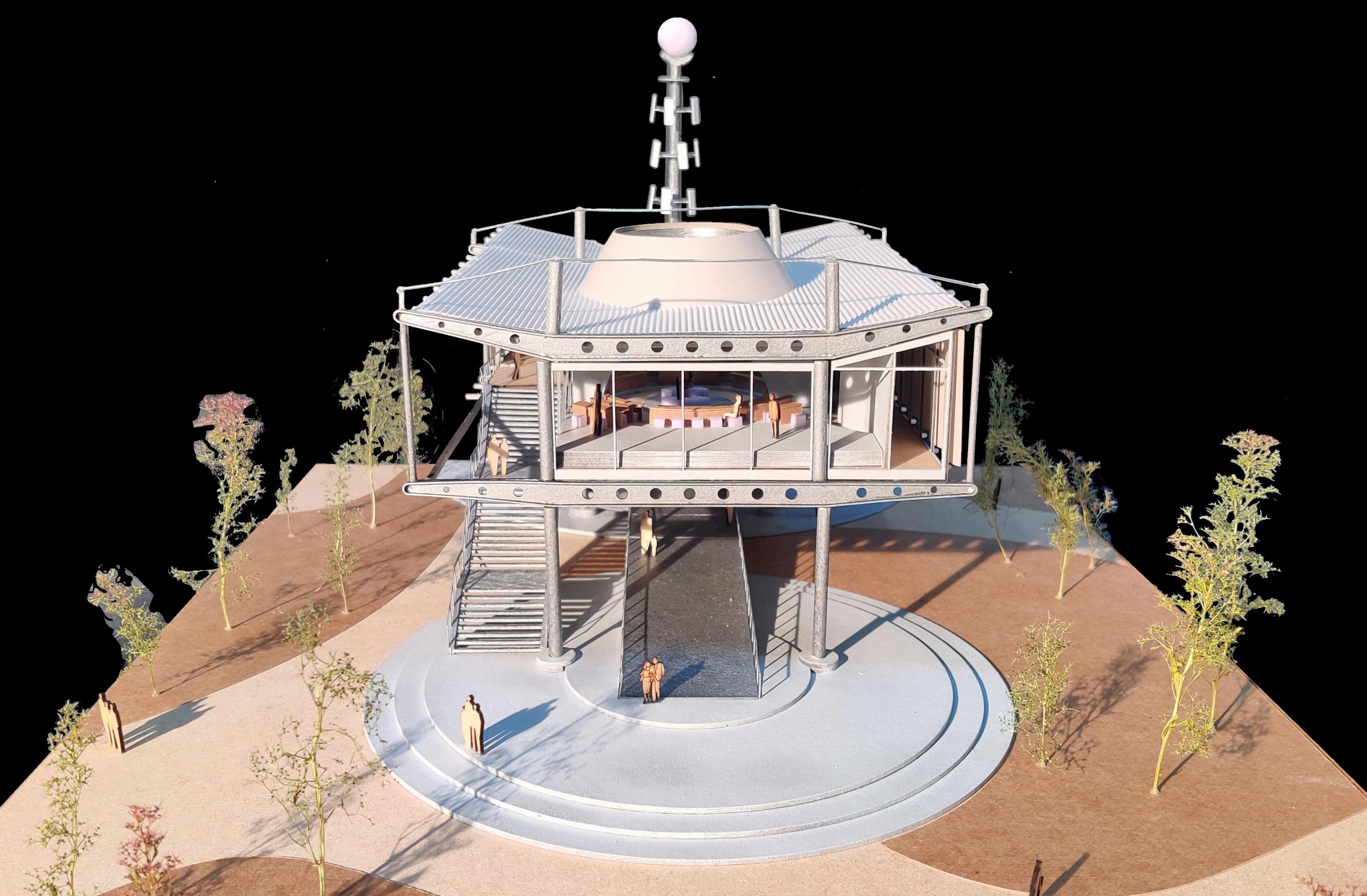




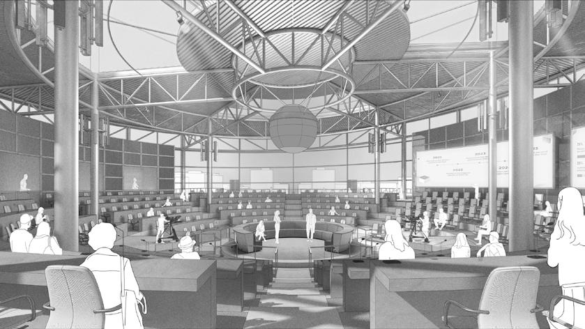
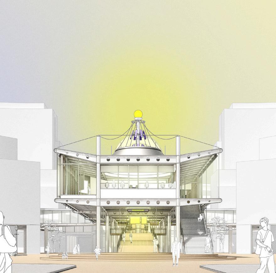
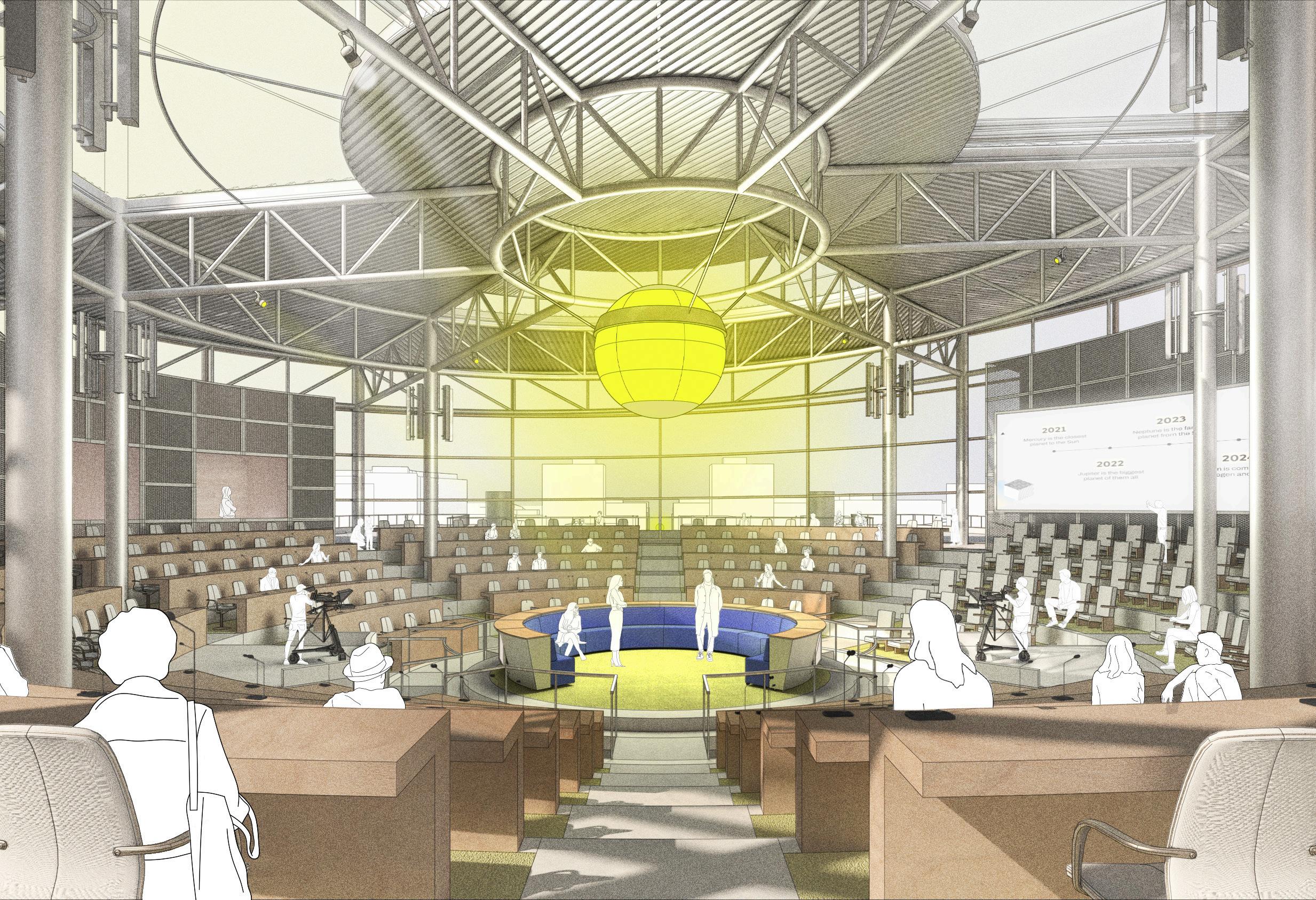
Here, in the multimedia plenary hall, the previously negotiated positions and ideas are presented to a larger audience. The spatial setting resembles a TV studio designed for maximum mediatisation of the preceding processes. Thus, the proposals to be negotiated in a TV debate are made tangible and comprehensible to the publicnotonlyforthephysicalaudience, but also for the people in front of their home screens and other end devices. Thisisdonewithamultitudeofmonitors and an omnipresent sphere hanging in the middle of the hall, which as a visual indicator clearly and dynamically reflects results of polls, moods, volume levels, etc.
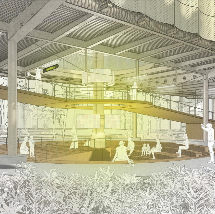
In that space it becomes visible that is important that in all these processes there are certain spaces kept open for interpretation but also for multi-




modal use. That it is not predetermined by protocols how the process in these spaces work here. Therefore, this space isambiguousinitsdesign,sinceitisnot only conceived for an audience listening to a person in front of a lectern, but can also be used as an interview zone, as a broadcasting zone etc. It is exactly this ambiguity about these spaces of deliberation that lowers the threshold for citizens willing to engage in this decision-making processes to in the end eventually open up that whole process to the public realm so that in the end what this project tries to offer is the integration of the public, a public realm that tries to mediate between the informal and the institutional, allowing for friction and dissent in order to create a functioning democracy will have citizenswhoknowhowtomakedecision together.
With an exponential growth rate of 33% a year, e-waste comes as the most impactful type of waste on a global level. Data-waste however, despite its invisible character generally tends to pollute long before the ‘final’ landing of the components into any type of landfill. Trashcomputing,asanecessarycorollary to most digital actions however, finds itself in the trouble of getting rid of its own bugs from the moment it becomes barely operational, as soon as it leaves the factory. In that sense it comes as an ubiquitous and rampant yet barely visible production which extends throughout the
object life-cycle, user and beyond. The latest aspectresults in complex life-cycle sur-impressions that are to be analysed andstudiedinparallel.
This project proposes a spatial investigation into the D+E afterlives of a single digital device. E-waste as one physical outcome of the entity is to be traced in parallel to Data-waste. Such exploration, with waste as a focal point seeks to unfold and manifest the way modern-day tensions as entangled geographies come together to build the objectofstudy.

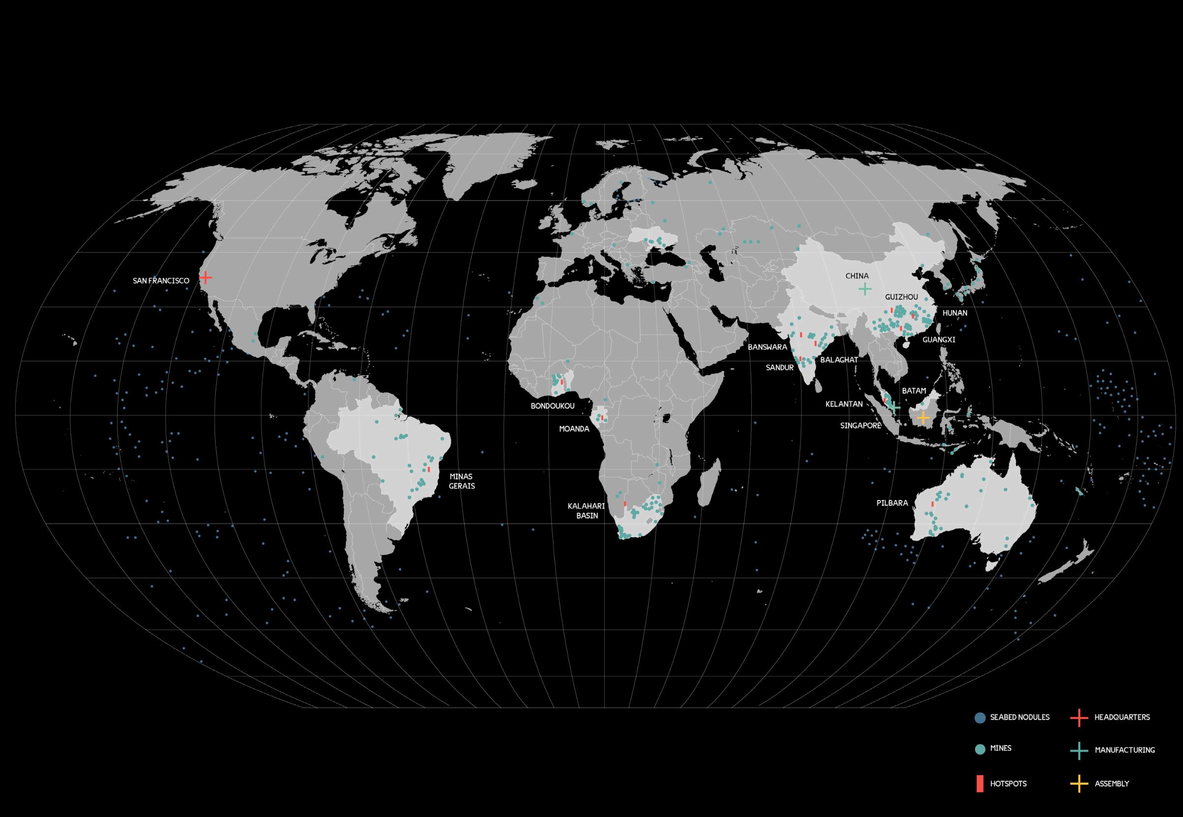

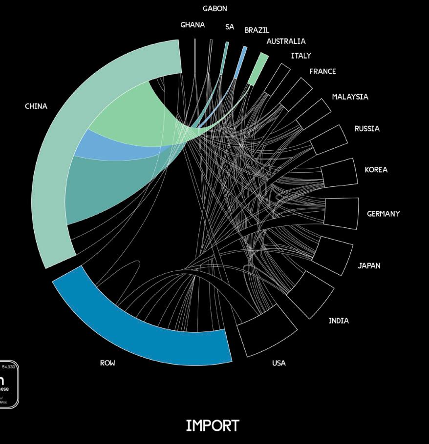
In the process of manufacturing the battery for a Fitbit, high-grade and high purity manganese is preferred to ensure increased performance in the battery. This high-grade manganese is found in twoforms-theFerromanganeseandthe Silica-manganese. Both these types of manganeseareproducedprimarilyinthe Mamatwan mine of the Cape Province in South Africa where 80% of the world’shigh-grademanganesesourceis located.Ofallthecountriesthatproduce manganese, South Africa, Australia, Brazil and China control the market which is why manganese becomes such a highly geopolitical interest. What’s furthermore fascinating to point out is that China and other Southeast Asian countries, where the Fitbit battery is manufactured, import a large amount of this high-grade manganese from countries like South Africa, Australia and Brazil. China does not produce high-grade manganese and exports the majority of its low-grade manganese production to the country of the global
south while it imports high-grade manganese from countries like South Africa. So with manganese predicted to be an in-demand metal, how do we deal with its geopolitical concentration in a few continents? If manganese is a vital element towards a low carbon future, how do we mine this resource without instigating political tension? Before addressing these questions, how much waste is produced in mining manganese for a Fitbit?


Fitbit Inc.’s self-imposed slogan ‘Make everybeat’ countisasubtle,buteffective attempt to convey to the customer that - assuming the monitoring of his health-related data is literally an affair of the heart - an evaluation of the state of health is only possible if a permanent and uninterrupted data collection and analysis take place, which ensures that the user can be eased into a sense of security by the Fitbit at any time.
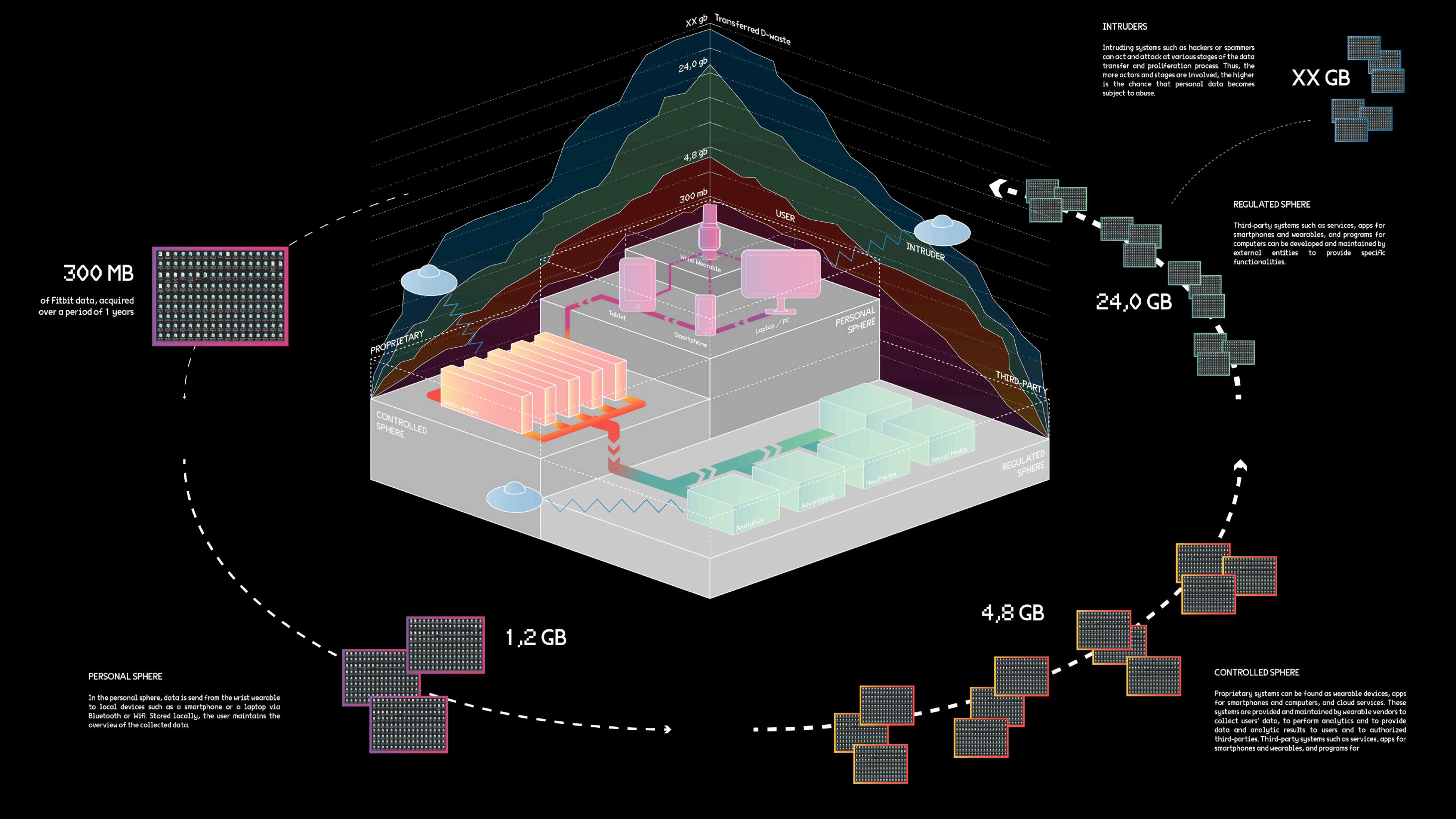
Once the raw data is collected by the Fitbit, it is sent to other servers where it is processed and analyzed, thus leaving the domain of the user and bringing about the multiplication of that data. With every personal device connected to a Fitbit wearable, it again naturally adds up to the proliferation of data. Locally stored on three different devices, this would already mean a tripling of data. With the data now in the public domain, multiple, partially unknown actors start to harvest this data for analytics, advertisement, and
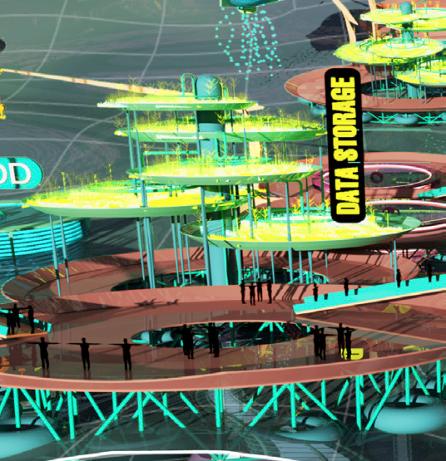
other services, thus creating dozens of redundantcopies.Whileaccidentaldata redundancycanbetheresultofcomplex backup processes or inefficient coding, intentional data redundancy is used to leveragethemultipleoccurrencesofdata for disaster recovery and quality checks. Furthermore, intentional redundancy extends the data value chain beyond its initial purpose of providing the user with insightful analysis of the data collected. With more and more actors coming into the fray, this naturally opens a backdoor for hackers to illegally mine this data. With data centres as breeding grounds for data proliferation and redundancy, are data centres the new global landfill? Is the business model of using a central repository to store information inefficient andthusoutdatedduetolimitedstorage capacities, huge energy consumptions, and an accompanying high emission of CO2 and exuberating maintenance costs?
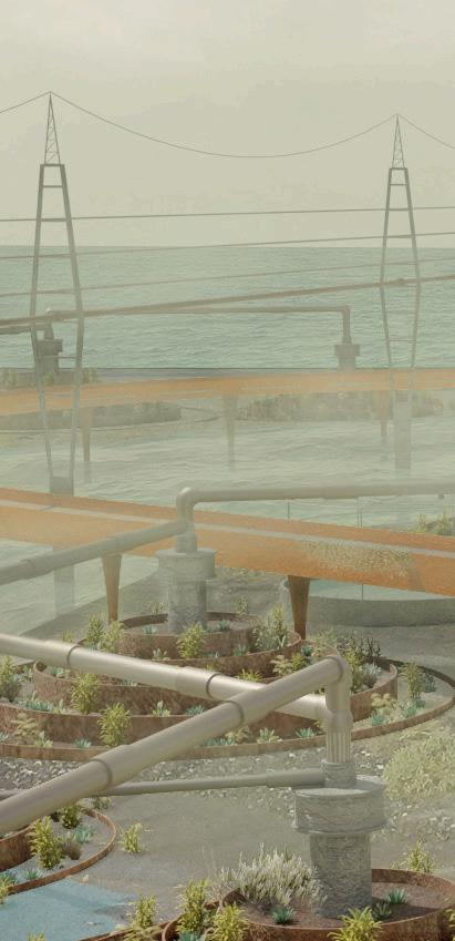
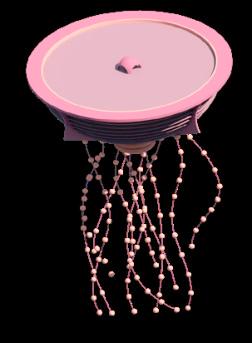
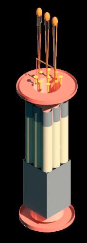
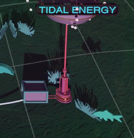
Oscillating between land and sea, bridging current and post-e-waste processing sites, the project consists of moving filtering entities in search of toxic and scarce mineral spills performed by non-humans. While part of the scenario speculates on multispecies collaboration to gracefully treat e-waste, the other side of the proposal consists in enacting data filtration of digital surplus content. This way, guaranteeingtheuseratemporarygrave
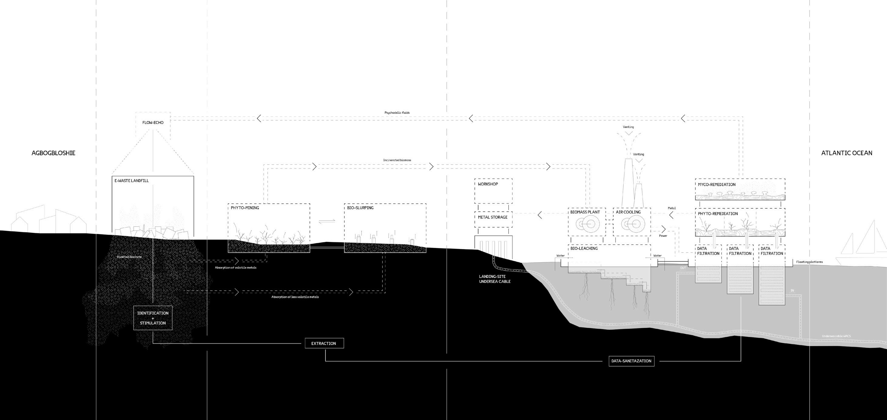
to its cloud.
Putting ‘out of place substances’ such as toxic minerals, metals as well as other types of data waste at the core of the proposal required for them to be foreseen and thus traced in the first part of the approximately 10 years long process as a pre-requirement for such a place to become a garden.
Micro (de)gradation of e-devices are in the meantime made visible through ceremonies of transformation within the
proposed composition, which is meant forthebereavedhumansfirsttomeditate to then celebrate renewal finally. Thestructureismaintainedandinhabited by over a thousand (D+E) Sacristans (former e-recyclers), ensuring that the filtration and ritualistic celebrations will go on this. From time to time, we hear them singing to the fluid rhythms of the structure, dictated by ancestral games.

GRACEFUL-(DE)GRADATION - NOR A GARDEN, NOR A GRAVE




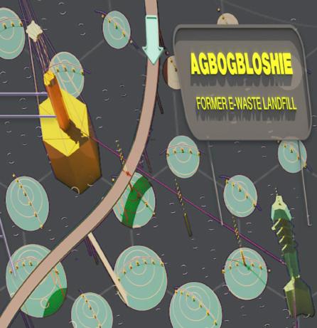
Withthis10yearprocess,thelandscape of Agbogbloshie has changed. Ready for a new life. A new beginning. These formermachiniclandscapesarereplaced with a post-anthropocene rainforest that gradually degrades while the soils and water bodies are rejuvenated. The final image of the project depicts the D-(DE) system four years after it has been implemented. In the center of the image
the ritual pathway unfolds on the entire landscape. On the foreground the grave sit on the low seabed of 800 meters away from the shoreline. Underwater, new hot data is about is aggregated and absorbed to be filtered by the structure. Further up on land, above the Odaw delta micro metal compounds are treated gradually by means of a range of specific objects and plants. G-(DE),

lives under the protective eyes of Mami Water. The structure is maintained and inhabited by over a thousand (D+E) Sacristans former e-recyclers, ensuring that the filtration and ritualistic celebrations will go on this time. From timetotime,wehearthemsingingtothe fluid rhythms of the structure, dictated by ancestral games.






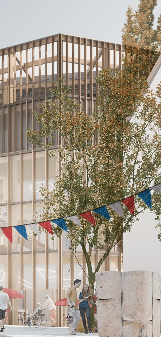
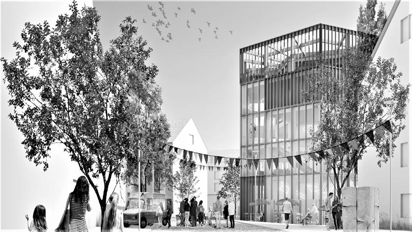
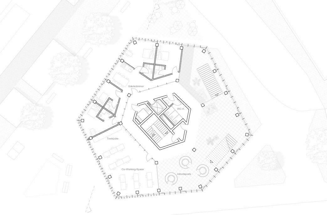
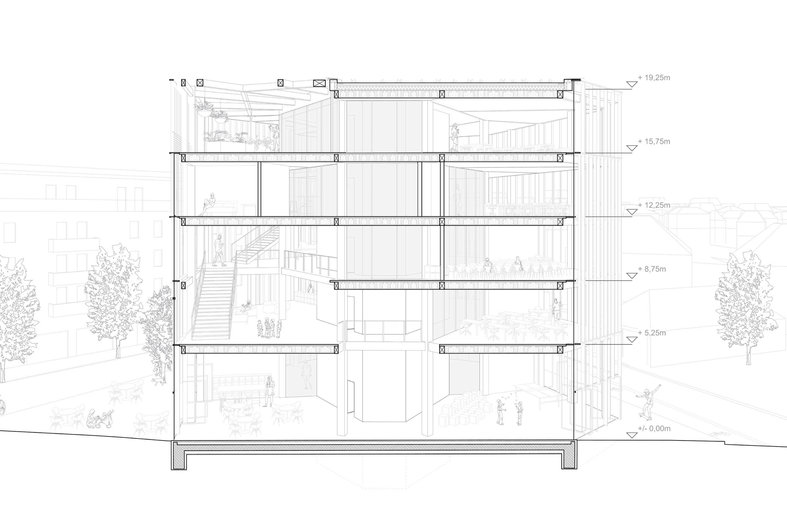
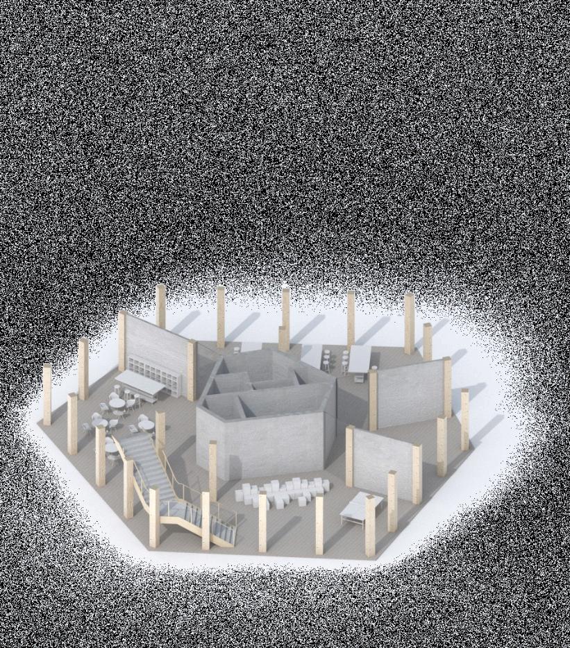
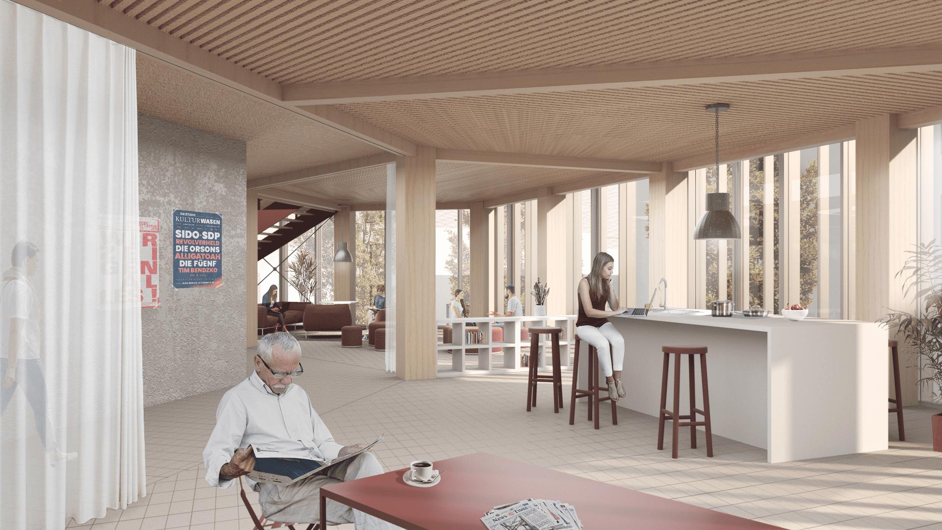
The phenomenon of social isolation, especially in urban centres, has increased enormously in recent years. In Germany, only one person lived in around 41% of all households in 2016. By 2040, every fourth person in Germany will live alone. A Finnish study found that the likelihood of developing depression within eight years is increased by almost 80 per cent for people living alone. In early 2018, the UK launched a Ministry for Loneliness. British Prime Minister Theresa May justified the move with
the “sad reality of modern life” that affects millions of people. But there are helpers: digital apps such as Nebenan.de and Nachbarschaft.net are supposed to help people escape the anonymity of cities. The trend is towards outsourcing everyday domestic life - on the one hand due to space problems, on the other hand for reasons of practicality. Work is done in the café next door, the bicycle can be repaired at the mobile workshop and the parcel is picked up at the parcel shop.



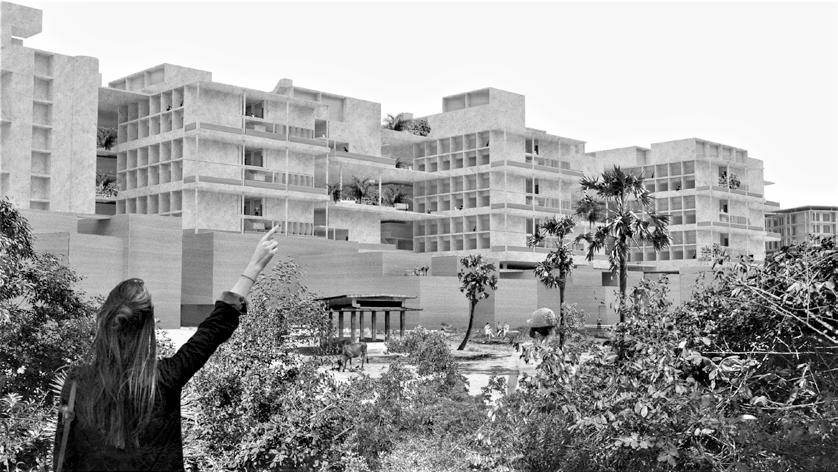
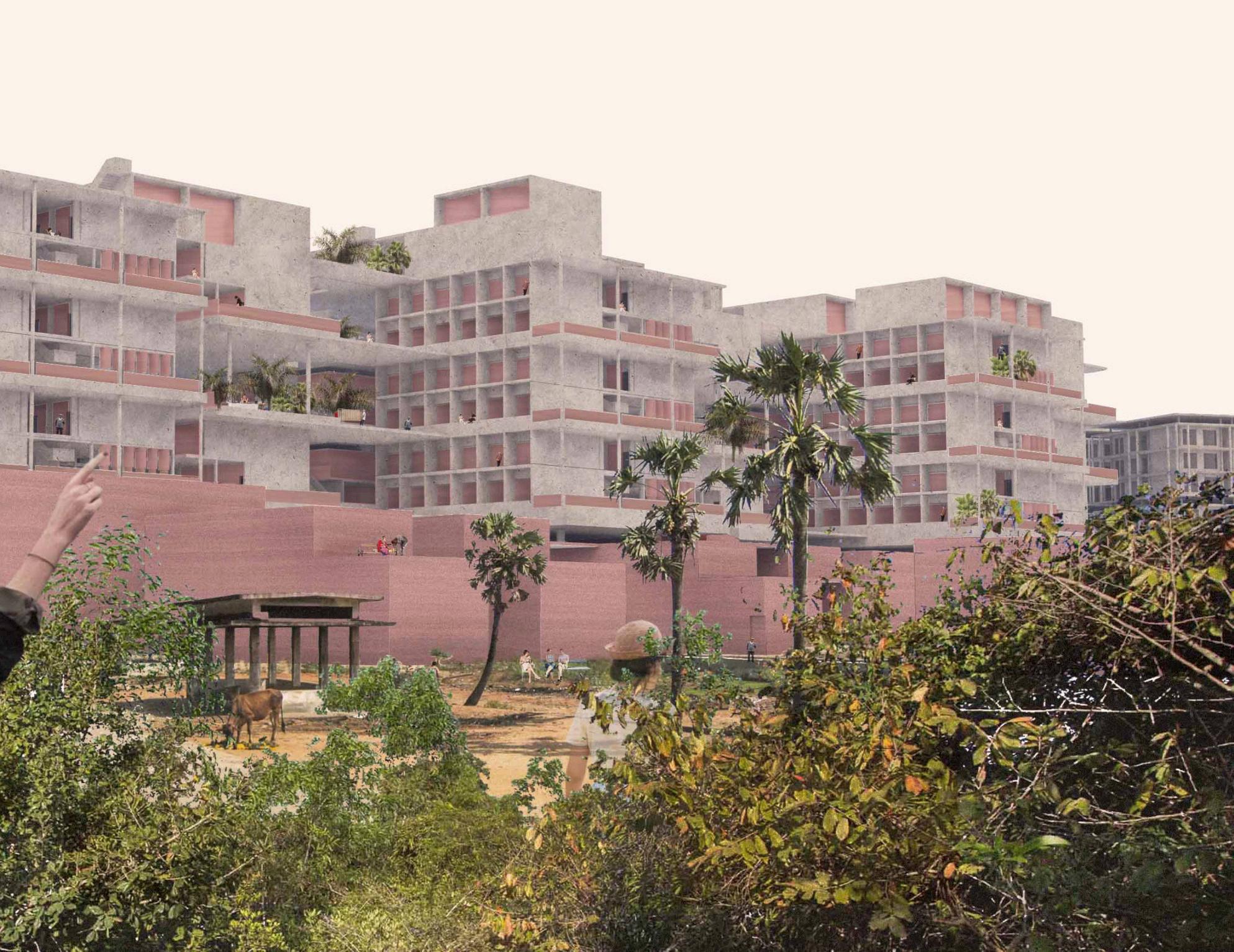
Auroville is a planned town, founded byphilosopher-yogiSriAurobindoand his French-born spiritual collaborator Mirra Alfassa, with around 3.000 people from around the world which is now under development in southeast India.
In its current state, Auroville finds itself on the threshold into a new chapter of urbanization. It is going into a phase of massive change where the inhabitants of Auroville are forced to take the next step towards a new scale of housing and living - towards the urban scale of a city. Auroville
as a community needs to rethink its current situation regarding how they interact as a community. Therefore the Line of Goodwill, part of Auroville’s masterplan, needs to be developed in order to cope with several occurring fields of problems regarding the social interactions amongst the residents and the handling of visitors. Further it faces the challenge of uniting a multitude of different functions in one building mass without losing identity.
LINE OF GOODWILL
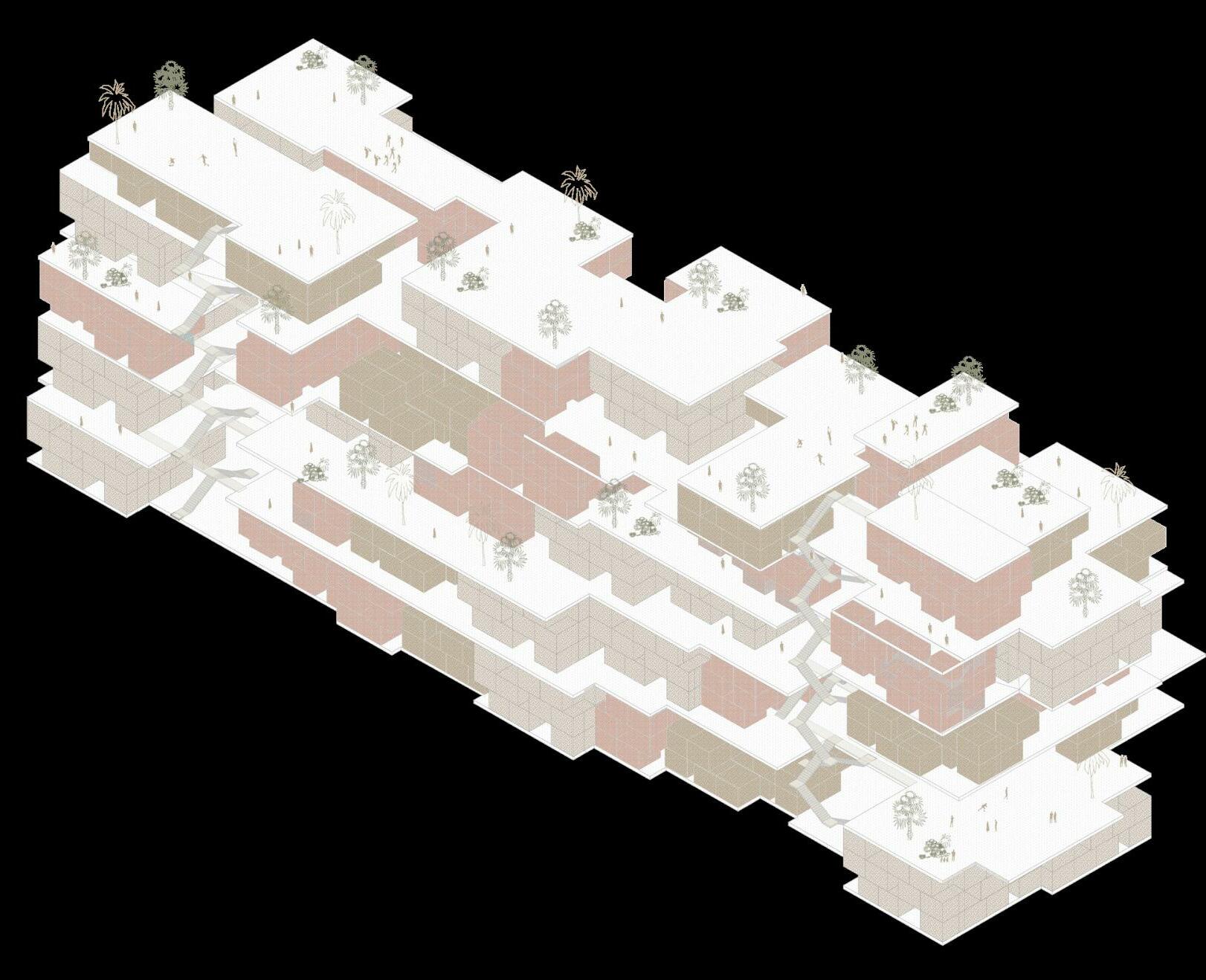
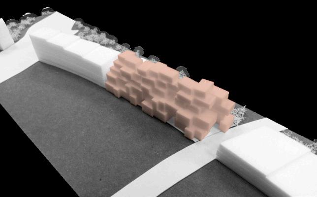
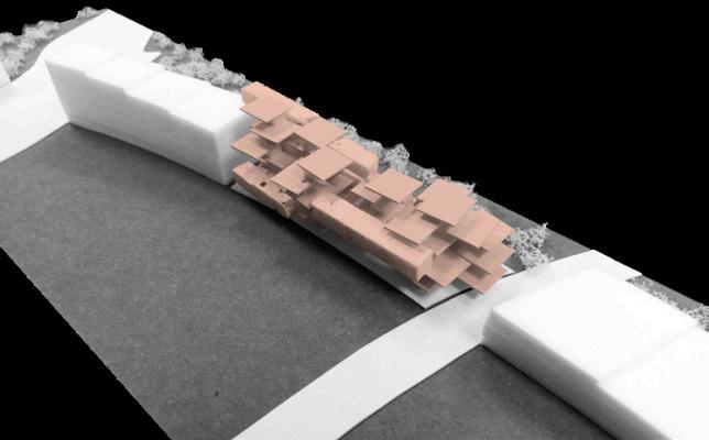
Auroville is divided into four functional zones. The Line of Goodwill (LOG) is located at the transition zone from the residential to the international zone. To minimize the massive appearance of the Line of Goodwill, the structure is divided into two vertical main elements, the
Red and the White Mass. The Red Mass should be constructed out of low tech materials and is connecting the structure to the earth. It is highly publicandformstheurbanspace.The White Mass is “floating” over the Red Mass and should be constructed out of light-weight high-tech materials.



Furthermore, it is providing space for communities, public functions and green space which are connected by different levels.

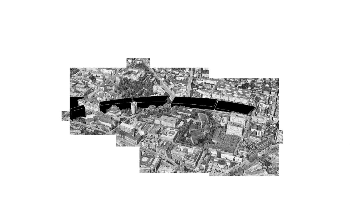
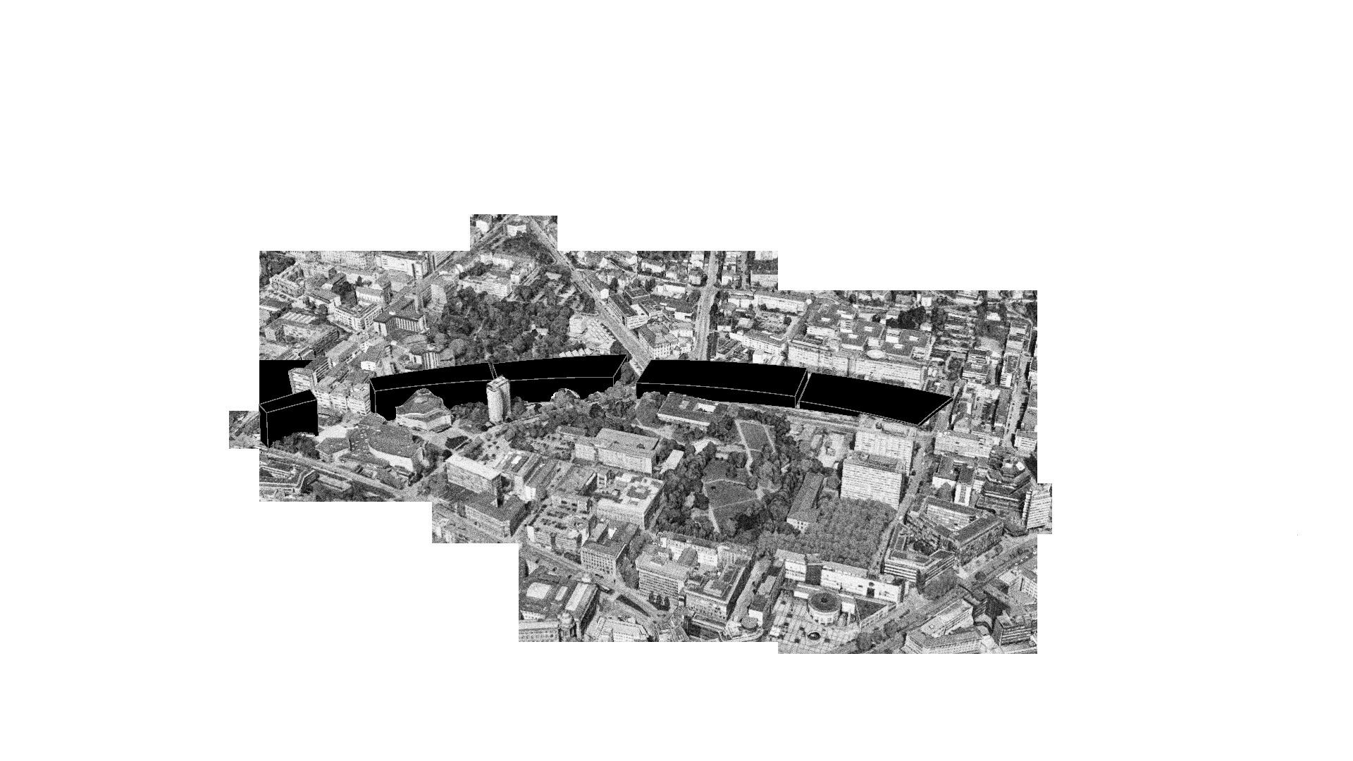
In order to get a feeling for the size and scale of the LOG, the volume has been compared both in numbers and spatial dimensions to exisiting structures.


In the urban context of of Auroville, the Line of Goodwill is perceived as the transition from exterior to interior, from urban to calm, from public to private which is decisive in order to provide the inhabitants a proper living environment. Aiming to connect
typologies of different scales and dissolving the threshold between intimate spaces and exposed public areas is the main goal of the project. This inevitably leads to the question of how to implement the idea of cohousing into an urban, vertical scale.



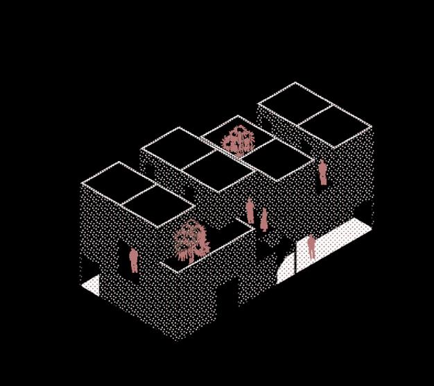
That type of cell is organised on two levels, where the single bedrooms are aligned on the top floor with pushed-in split levels to provide a retreat from the social area on the bottom floor. Access to the bedrooms from outside of the cell cluster is possible.

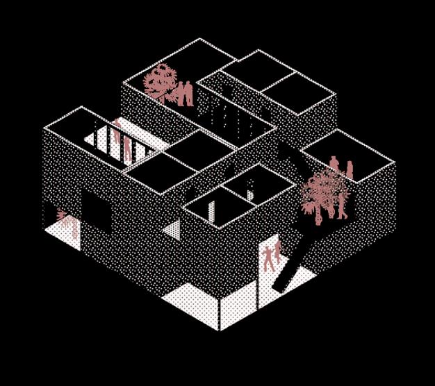
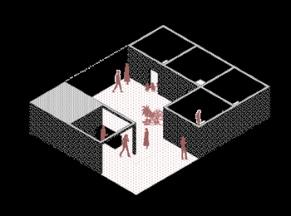
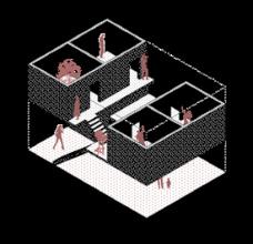

Typ B is designed as a three-storey cell cluster where all the bedrooms are arranged on different levels to provide multiple vistas and a sense of fluctuation where the common area serves as a place of relaxation.
The flat which is designed for groups of a stronger relationship, e.g. families and is arranged on one floor to prevent social exclusion due to vertical segregation. The bedrooms are aligned around an open space, serving as a common area for living and eating
The floor provides the inhabitant with different viewing points and spots for recreation, such as cafés and sport areas.


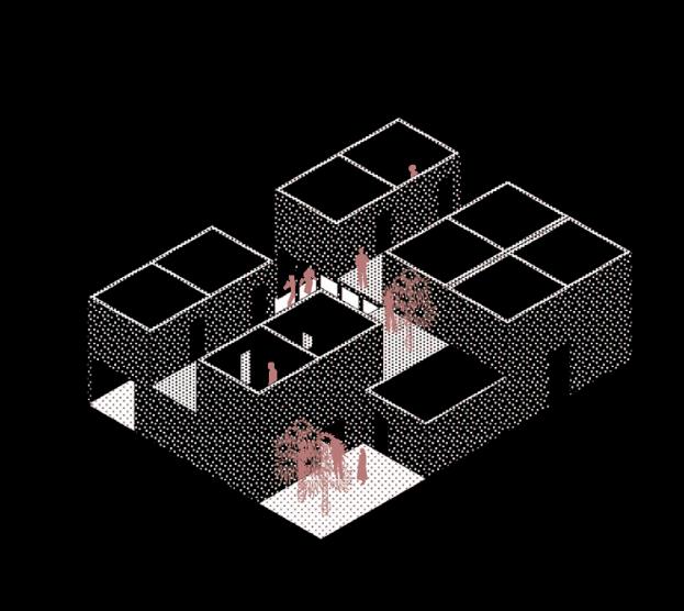
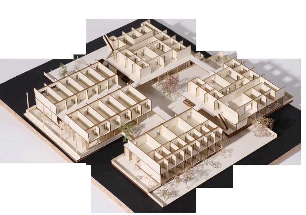
Four different housing typologies are allocated around a central yard, serving as a meeting point for the cluster community. Four units housing around 20 to 30 people are arranged on two levels.
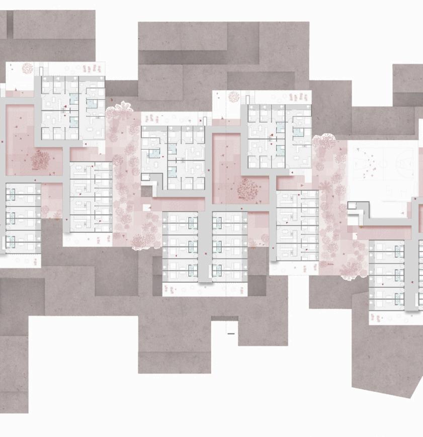
On the upper floor another level is connecting the units, serving as a second development for the private rooms. By this, it is possible to enter the private rooms from outside of the units as well as from inside the community room.
The heart of the cluster serves as the meeting point, where the people of the unit can come together and join into different activites.
The first impression of the building visitors get is designed as a urban and lively hotspot, arranged on three levels to achieve a gradual transition to the upper floors.



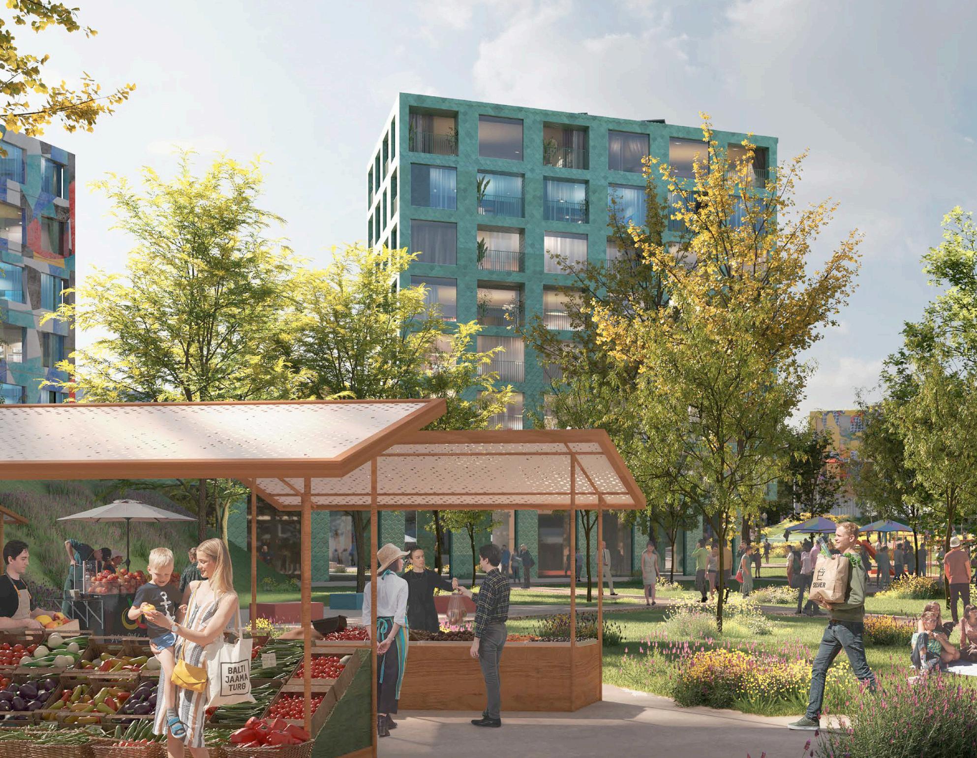
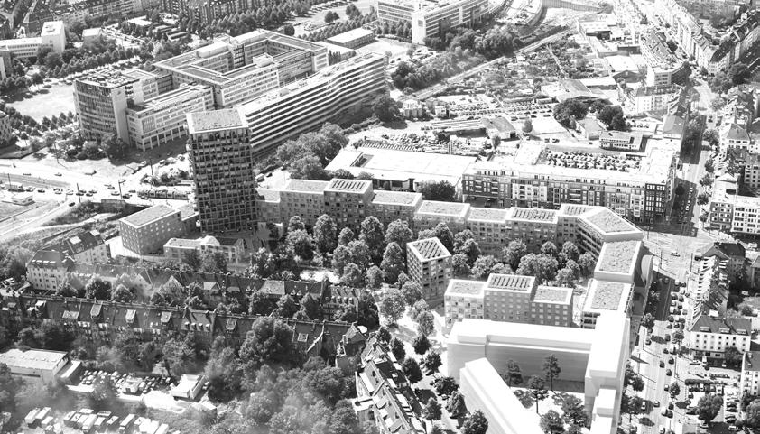
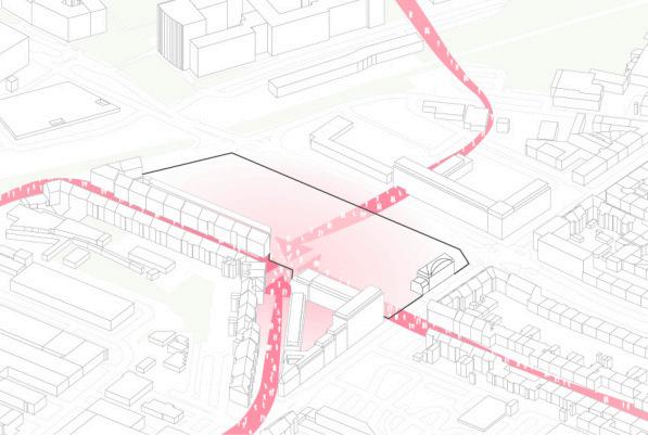
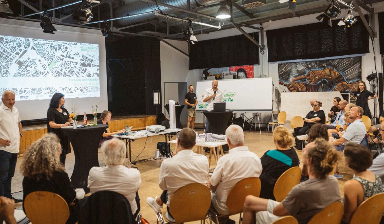
In order to find the best solution for the neighbourhood and to meet the complex requirements of the location in Flingern-Süd, the renowned planning teams of MVRDV and LOLA Landscape Architects from Rotterdam developed a sustainable and high-quality new planning in close collaboration with citizens, the owner, the city
administration, planners and with the constant involvement of politics. In a multi-stage, cooperative planning process, the framework conditions, utilisation programme, urban development, open space and mobility were developed. In the process, the citizens of Düsseldorf had the opportunity to actively shape the use and urban development.
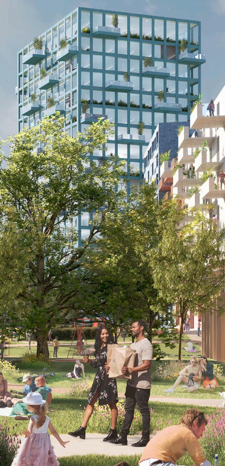
Based on three scenarios, the green heart was selected through a series of workshops. This proposal is based on a basic concept that takes into account a differently designed development on the base area of around 23,000 square metres, which in addition to 41,000 square metres of living space also provides more than 24,000 square metres for offices and commerce. Local supply is to be secured by integrating the existing Lidl store. A


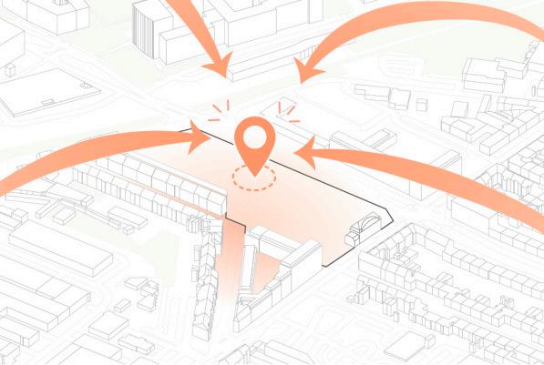
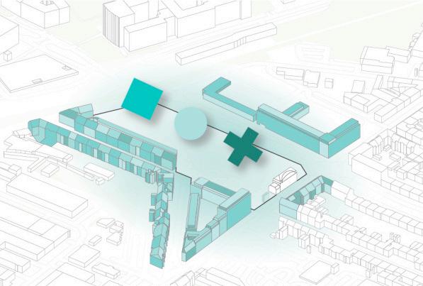
day-care centre, areas for cultural activities and facilities for senior citizens are also included in all scenarios.


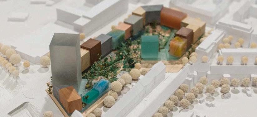
Thegreenheartisdominated by a large park, which is shielded by a U-shaped structure facing Erkrather Strasse and Werdener Strasse. This is dominated by an office tower up to 60 metres high, which has received critical feedback from politicians. On the other hand, the heights of the other buildings are lower
and there is more space for a nearnatural design of the large open space. This would create a park that could be linked to existing green spaces and offer opportunities for sports and recreation.
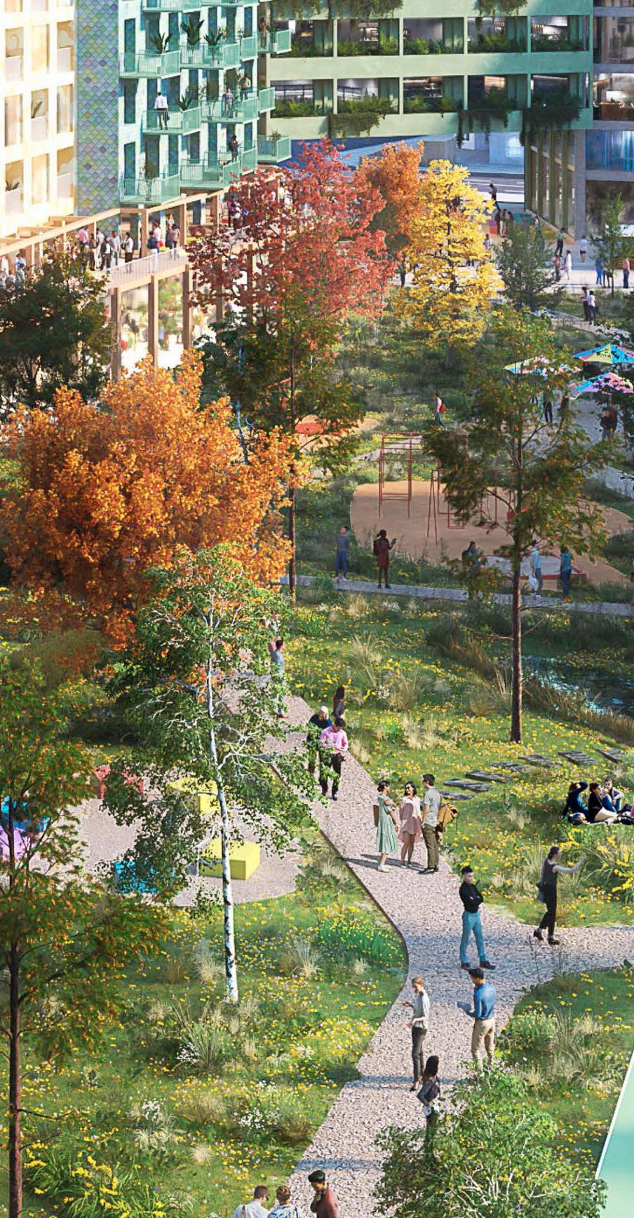
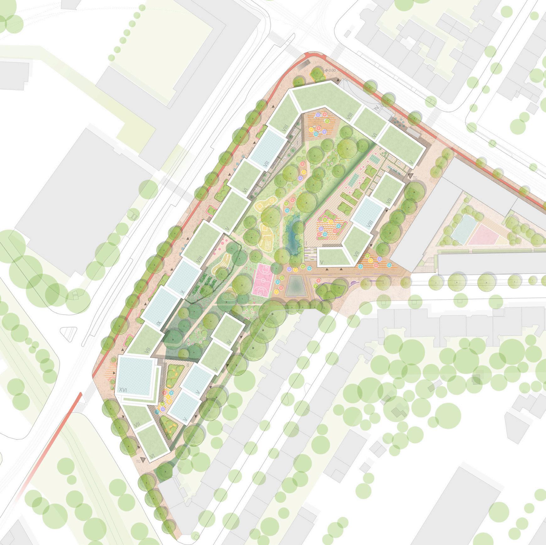
Thedesignenvisagesanoise-protecting perimeter block development on the almost 23,000 m2 site, which encloses an inner area that can be used in a variety of ways. This area will contain both natural public and private green spaces as well as play, exercise and recreation facilities. A high-rise at an intersection marks the new quarter. The topic of sustainability is particularly central to the plans, and 60% of the currently completely sealed land will
become a continuous green space, which is of high climatic importance, especiallyfortheinner-citylocationhere. Further measures include photovoltaic systems on the roof surfaces, green roofs, near-natural green spaces in the inner courtyard and a possible ecological use of the façades through nesting boxes and greenery.


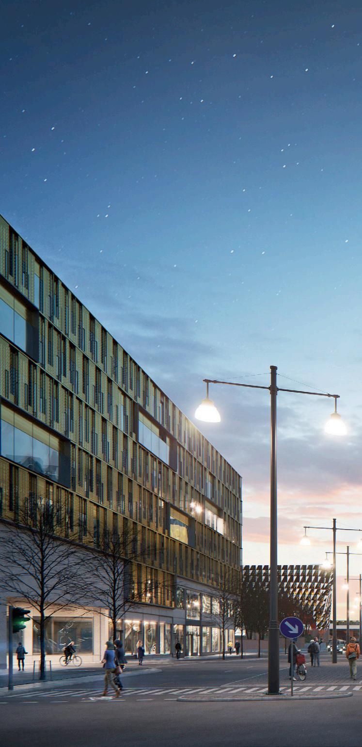
Hagastaden is Stockholms new epicentre for Life Sciences. Surrounded by the Karolinska Hospital and the Karolinska Institute for Life Sciences, the “Forskaren” (Swedish for “researcher”) becomes the third major node in the new quarter. The client was looking for an office building which meets the tough requirements of the masterplan but also tries to challenge it and aims for an innovative, future-orientated building. As a prominent landmark in the new quarter, the “Researcher” plays a major role in mediating
between the different building typologies and styles in the area.
The process of the competition has been divided into three stages in which each competitor had to present their approach and first results. We worked in a core team of 5 persons. I wasafullpartofthecompetitionteam, engaged in every phase and decisionfinding and mainly responsible for research and studies in the beginning and 3D-detailing and model-making at the end of the process.

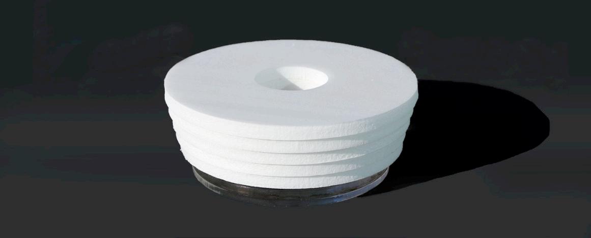
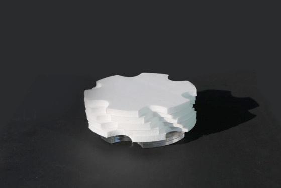


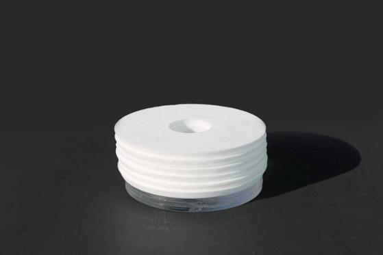


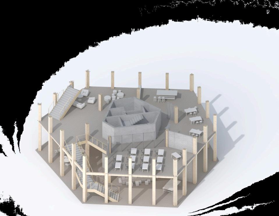
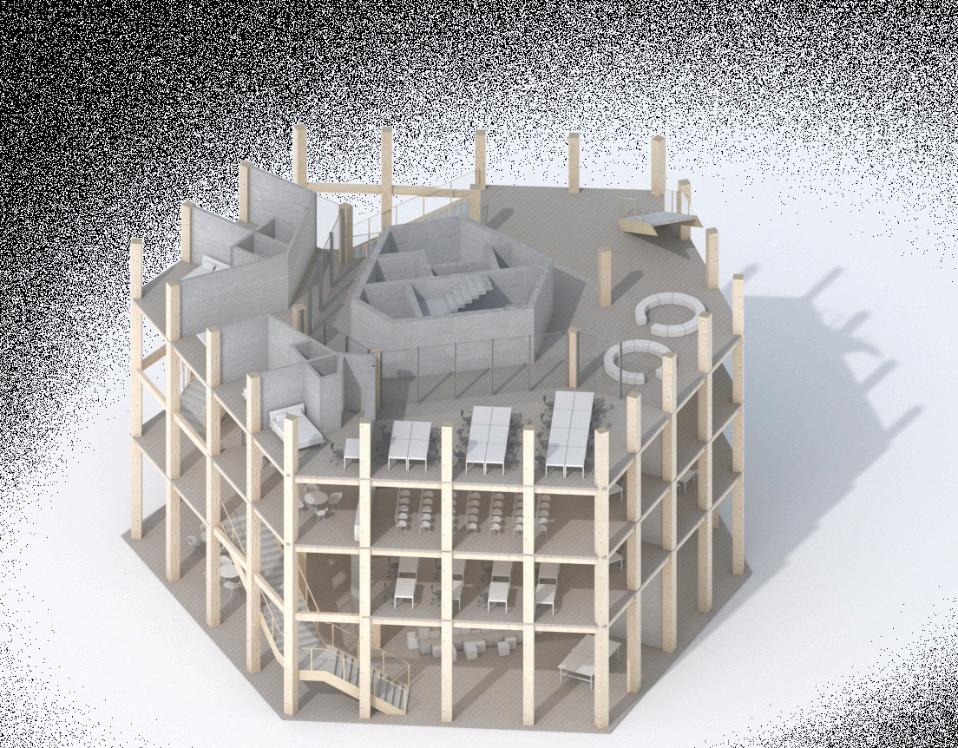
The masterplan describes a round building with 6 floors and an arcade around the ground floor. Each floors needs to have a stepping of 1 meter which inevitably leads to the shape of a funnel.

By dividing the volume into 12 segments, equivalent in size, it allows for a flexible distribution of area and functions.
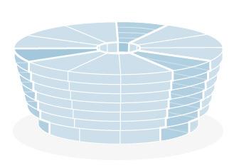

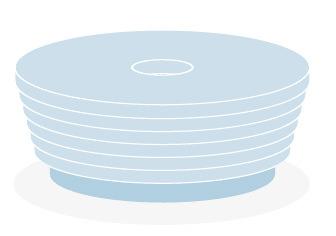
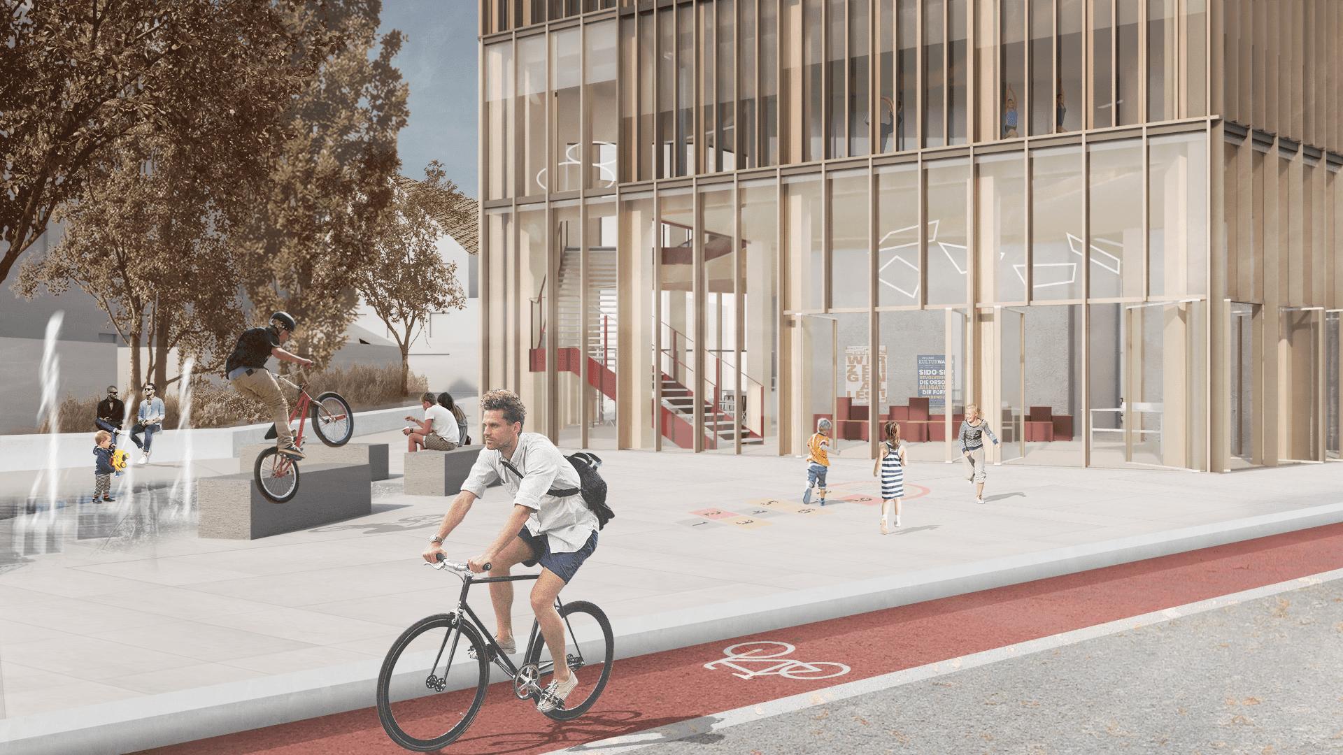
Three segments of the volume mark the entrances to the building. Their transparent appearance and defined orientation lead to a clear and wellpositioned building volume
To make the building stand out and make it recognisable as a prominent landmark in Hagastaden, the façade is given a structure reminiscent of a snowflake. Volume diagrams
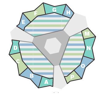
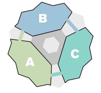
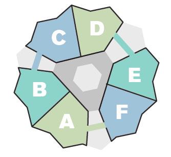
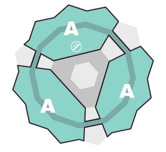
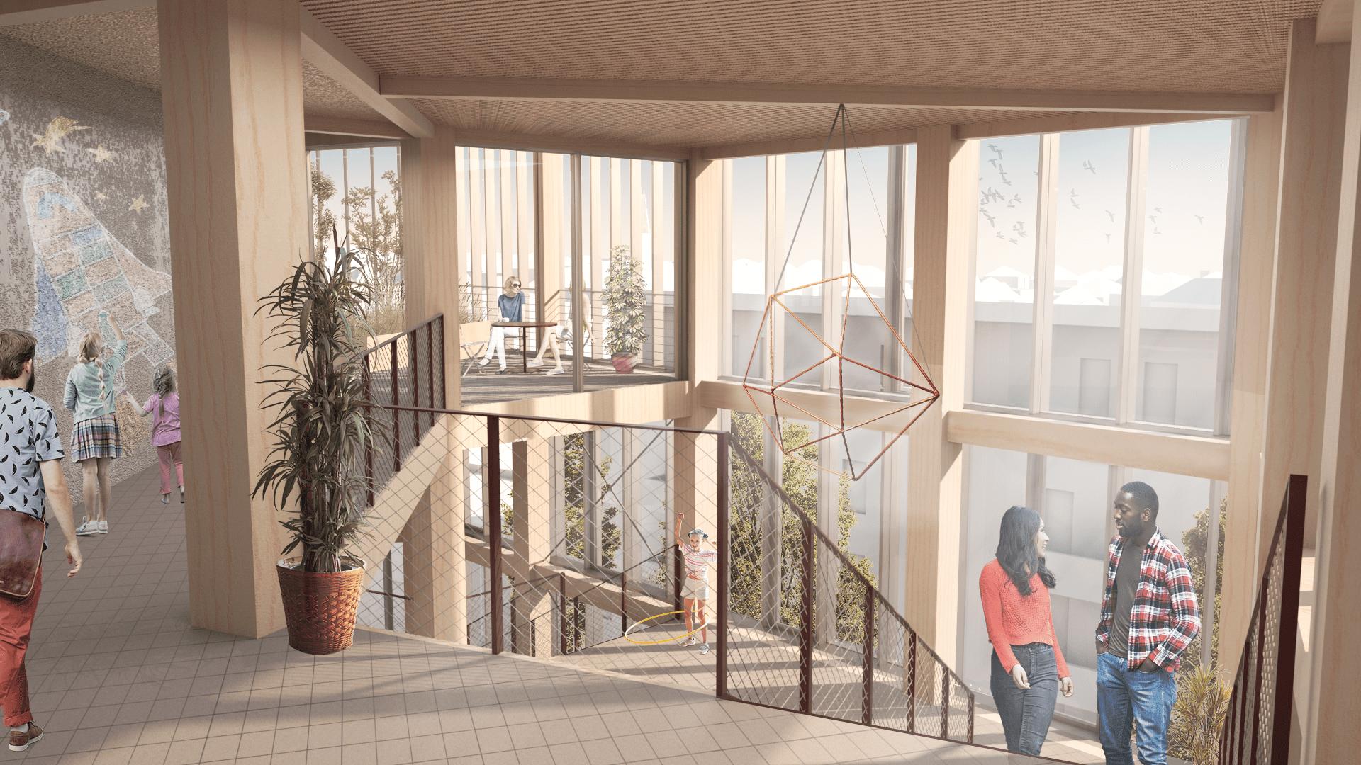
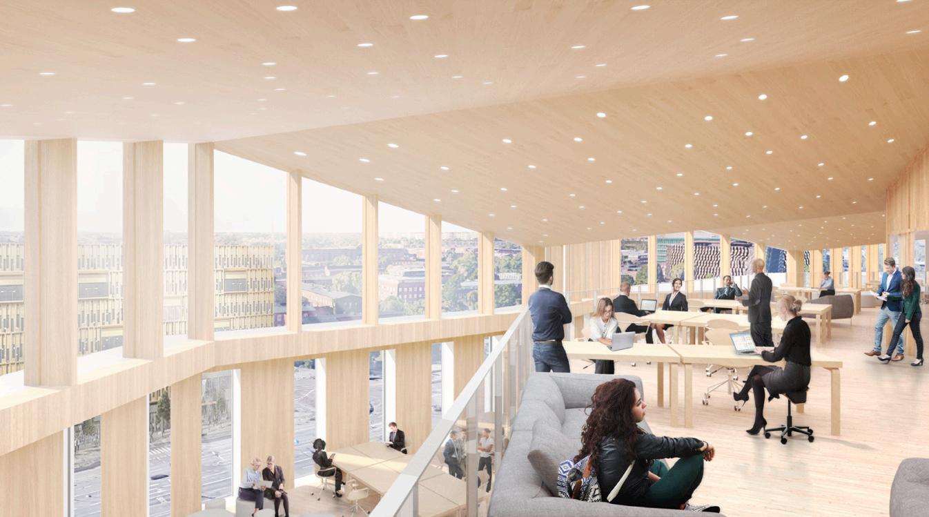
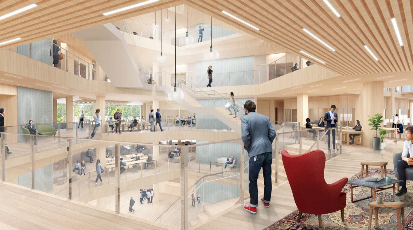
The buildings space is open from the ground floor and upwards and it extends from the middle towards the three entry points. The three arms, which have different widths, extend out towards the facade which creates spatial dynamics and views from the workplaces. The arms also mediate contact between the plan and introduce daylight far into the building. Balconies and meeting places populate the room even higher up and form a part of the rentable area. Central to the building, the room becomes narrower and more intimate. Thecentralflowthatbroughteveryone can spontaneously encounter each other. Adjacent to the stairs there are also furnished balconies that support the meetings that can then occur.


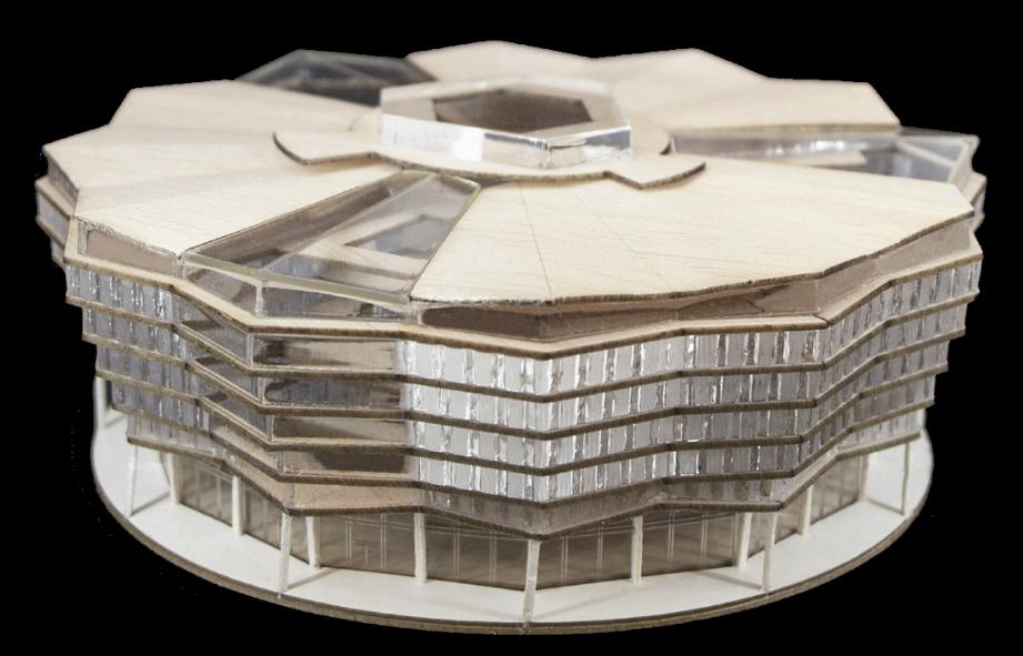
 Physical model, balsa wood and plexiglass
View from the top floor mezzanin (White Arkitekter)
SELECTED WORKS
2018 - 2023
