It ’ s the end of the LAKE publishing schedule for 2024 and publisher David Hohendorf talks about the start of the magazine’s schedule for 2025 with the first issue in March
9
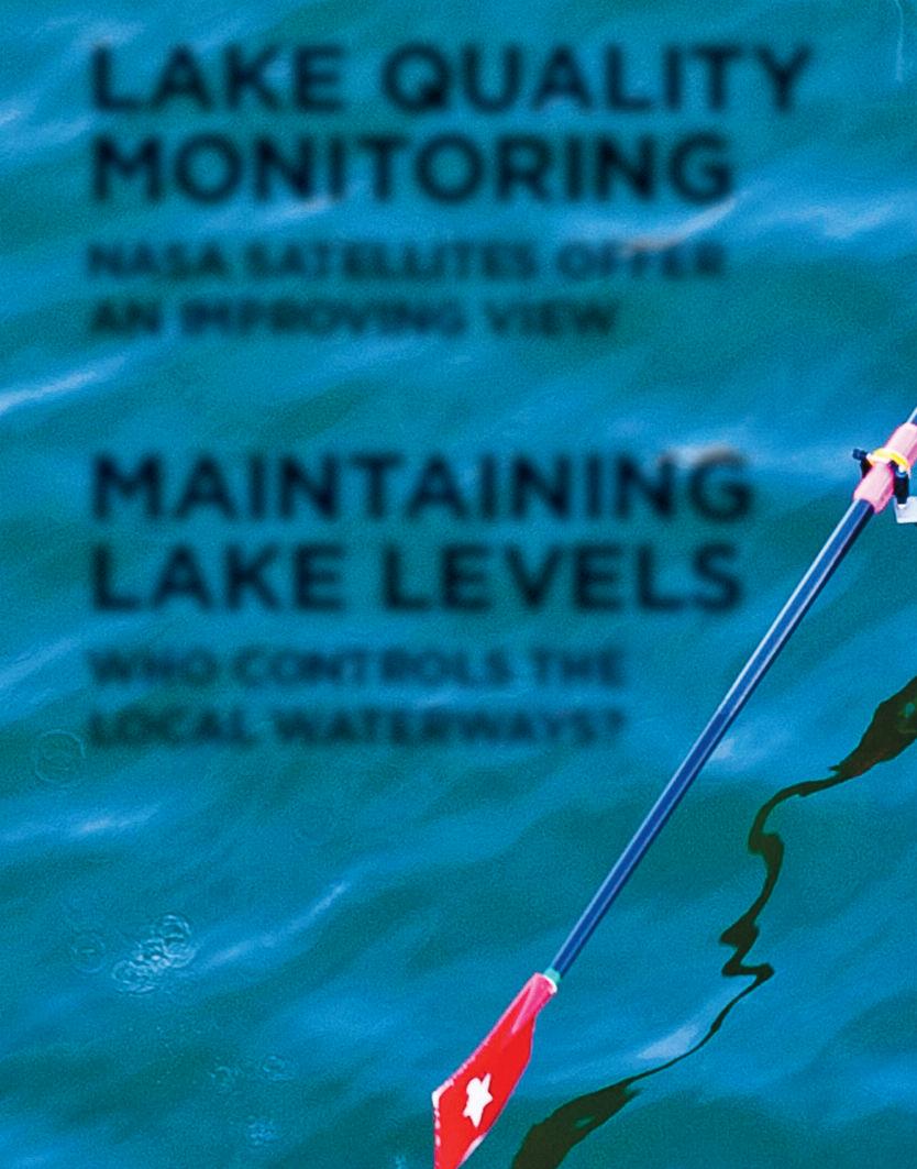
Maintaining lake levels
Legal lake levels can help manage water level fluctuations and have many benefits, both for recreational boating and protection of shoreline properties. Here’s how lake levels are determined and set.
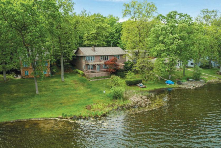
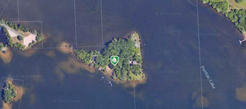
20 View from above
An aerial view of Duck Lake in Highland Township.
22
Monitoring lake quality from space
Science is just at the forefront of where satellites, when equipped with special spectral sensors to photograph inland lakes, are providing ever clearer images that can inform environmental, public health officials and local lake managers about potential problems 31 Threatened Planet
Short notes on what ’ s happening on the warming planet front here and around the world
Looking back over the decades that my family lived on the lakes in Oakland County, we generally star ted winding down our weekday boating activity when we hit the mid-September period, which is when this October issue of LAKE magazine is ar riving in 17,000 lakefront homes in Oakland County
A few mor nings of the week I would still get a sunrise workout sculling on Long Lake in Commerce Township or White Lake in White Lake Township, but with school and af ter school activities consuming most ever yone ’ s life in the fall, the speed boat only lef t the hoist on the weekends We still would focus on outdoor projects around the home and the lakefront, but most energies were focused on putting the summer lifestyle into offseason mode for the winter and then planning projects for the next season
For the business community, our thanks for the suppor t And, as always, our strong recommendation that readers of LAKE magazine tur n to you for your products and ser vices
As for our publishing group, we will spend a couple of weeks talking to lake-related businesses about their marketing plans for next year and then retur n our ad sales focus at the star t of the year to this publication The 2025 publishing schedule is now posted in the About Us section of our website at lakemagazine.media
Over on the editorial side, we have already star ted planning stories for the coming year Our brand of longfor m jour nalism requires us months in advance to plan stor y topics and then weeks of research on our par t before we star t working with sources so that as stor ytellers we can bring you something of substance with each issue
I suspect that same patter n is followed in most homes on the water ways of Oakland, which is why when we launched LAKE magazine it was decided to only publish the magazine eight months of the year So for the 2024 season, this will be the last issue of this year
LAKE magazine will retur n in mid-Febr uar y of next year with the March issue That issue will mail on Febr uar y 16 just af ter the annual boat show at the Huntington Place (for merly the Cobo Center for us old timers) which star ts Febr uar y 1, and a couple of weeks ahead of the boat show at the Suburban Collection Showplace in Novi which star ts on March 13
Although there is still some limited activity during the winter months (think ice fishing and snowmobiling), our publishing schedule is timed to coincide with the more active lake-focused months of most residents and, of course, when we project most of the lakerelated businesses are priming to launch another season Af ter all, it is the suppor t of the business community that allows us to bring you the monthly issues of LAKE magazine from March through the October edition which mails in mid-September, as with this issue
So watch for the retur n of LAKE magazine next Febr uar y
Water front dining director y: My personal thanks to those readers who sent me email recommendations in the last month in response to my request for the names of any restaurants that are on the lakefronts or across the street of the lakes of Oakland County We are tr ying to develop a complete director y of lakefront restaurants and bars But the infor mation is not readily available So if your lake has such an establishment, please send me an email with the restaurants name and on which water way it is located
Cover contributions: Yes, we are still looking for lake residents to send us photos they think would make good covers for LAKE magazine If you think you have captured something great that you would like to share, send your photos to LAKEphotos@downtownpublications com If we use one of your photos for a cover, you will get credit and a check for $100
David Hohendor f Publisher DavidHohendor f@DowntownPublications com
a MeMber of dowNtowN PubliCatioNs
Publisher David Hohendorf
News editor Lisa Brody
News staff/CoNtributors
Hillary Brody Anchill | Dana Casadei | Tracy Donohue | Stacy Gittleman | Austen Hohendorf Jeanine Matlow | Gigi Nichols | Susan Peck | Mark H. Stowers
advertisiNg direCtor
David Hohendorf
advertisiNg sales
Pat Collins
graPhiCs/it MaNager
Chris Grammer
offiCe
970 E Maple Road / Ste 3, Birmingham MI 48009 248 792 6464
MailiNg PO Box 1630 Birmingham MI 48012-1630
doWNtoWN PUBLIcAtIoNS GoALS/MISSIoN
The personnel at Downtown Publications bring a special commitment to the publishing effort Our mission dictates that we strive to provide a solid news and advertising product that local residents look forward to reading. Our goal is to build a community of informed citizens through the efforts of our passionate team We are innovators producing products that go well beyond what others offer
dIStrIBUtIoN/SUBScrIPtIoNS
LAKE magazine is mailed monthly at no charge to over 17,000 lakefront homes in Oakland County
For those not receiving a free mail copy, paid subscriptions are available To secure a paid subscription, go to our website (lakemagazine media) and click on “subscriptions” in the top index and place your order or scan the QR Code here
INcoMING/rEAdEr FEEdBAcK
We welcome feedback on both our publication and general issues of concer n Opinions can be sent via e-mail to news@downtownpublications com or mailed to Downtown Publications, PO Box 1630 Birmingham MI 48012-1630 If you are using the mail option, you must include a phone number for verification purposes.
MULtIPLE AWArd-WINNEr FroM SocIEty oF ProFESSIoNAL JoUrNALIStS
Af ter a massive rain, the Edenville Dam in mid Michigan broke on May 19, 2020. The catastrophic event damaged thousands of homes and businesses and led to a proper ty loss of over $250 million. Several lawsuits are pending regarding the event. But it all could have been prevented, according to a 502-page repor t released two years af ter the event. The catastrophe was investigated by five engineers and their conclusion: it could have been prevented if different actions had been taken over decades, especially in the days leading up to the failure.
The repor t included, “If, many years before the May 2020 failure, the dams had become publicly owned or a public-private par tnership had been established, sufficient funds would have been available to upgrade the spillway capacity to pass an extreme flood, and therefore the rise of the lake in May 2020 would have been limited and the failure would almost cer tainly have been prevented ”
LAKE LEVELS
LEGAL PROTOCOL IN PLACE TO WATCH
OVER, PROTECT AND MAINTAIN LAKES
BY MARK H. STOWERS
When the near-centur y old str ucture collapsed, the contents of Wixom Lake r ushed down the Tittabawassee River through Midland and Saginaw counties Floodwaters over whelmed the Sanford Dam and caused record flooding in Midland A federal cour t r uled last October that the dam’s owner ignored known weaknesses that led to the May 2020 collapse and “ one of the worst environmental disasters that the state of Michigan has ever experienced ” The judge also cited that the dam owner violated Michigan’s Natural Resources and Environmental Protection Act Had the privately owned dam followed guidelines under Michigan lake levels, the disaster could possibly have been prevented
MICHIGAN INLAND
lakes have been a precious resource for the Mitten State for generations
According to the Michigan Lakes and Streams Association (MLSA), there are 62,798 Michigan inland lakes that measure one-tenth of an acre and larger Of those, over 11,000 are five acres and larger and more than 6,500, 10 acres or more Oakland County is home to 1,400 of those lakes as well as numerous streams
But only 54 of those are mandated by the cour ts to have a legal “lake level ”
A lake level, as defined by law is “the level or levels of the water of an inland lake that provide the most benefit to the public; that best protect the public health, safety and welfare; that best preser ve the natural resources of the state; and that best preser ve and protect the value of the proper ty around the lake "
The nor mal level is not defined as the highest level attainable for a lake Lake levels move up and down according to the season and weather with rains and snowfall To attain a lake level, a legal protocol must be followed First, a petition signed by two -thirds of the lakefront proper ty owners – those whose land abuts the lake, not backlot owners – must be submitted to the cor responding
county board of commissioners The board will initiate action by passing a resolution to star t the proceedings to deter mine the nor mal level of the lake This action is the preparation of a preliminar y feasibility study by a licensed professional engineer The board may require a cash payment from the petitioners to cover the cost of the study or $10,000, whichever is less
Residents who live on the lake may also petition a circuit cour t judge to set a legal lake level Once the cour t goes through all the proper legal protocol, it deter mines the nor mal level of the lake and the cor responding county depar tment may maintain it Devices like dams, weirs, bar rages or augmentation wells can be used to maintain the level
Legal lake levels can help manage water level fluctuations and have many benefits, such as recreational boating by maintaining a higher water level in the summer Shoreline proper ties benefit by the reduction of ice damage in the winter Dramatic changes in water level can also impact shoreline uses, recreational activities, erosion and aquatic plants
To star t the lake level process, a feasibility study is conducted to deter mine the nor mal level A sample of the items the study considers include historical lake levels and seasonal fluctuations, location of septic tanks, sea walls, docks and other physical features, downstream impacts, fisheries and wildlife habitat protection and watershed hydrology
The process of establishing a lake level can get quite expensive but par t of the process is configuring the special assessment that is passed onto the lake landowners This cost is added to winter taxes and is nor mally under $100
level management in Michigan has been guided by state regulations and local ordinances In Oakland County, many of the lakes are managed through local lake associations or proper ty owners' associations, which of ten work with county authorities to monitor and regulate water levels
At present there are 54 lakes within Oakland County that have an established nor mal level The Water Resources Commissioner is the delegated authority to maintain the nor mal levels of these lakes The lakes are in five watersheds: 34 in the Clinton, 13 in the Huron, two in the Rouge, three in the Shiawassee and two in the Flint
An Oakland County staff engineer, Ryan Woloszyk, heads the lake level program, which involves the operation and maintenance of 36 lake level control str uctures and eight lake level augmentation pumps In some cases, the level of more than one lake is controlled from a single str ucture There are three lake level control technicians assigned to monitor the lake levels and per for m the day-to -day operation of the str uctures
The regulation of a lake level provides for flood control, enhanced recreational use and protection of proper ty values The Water Resources Commissioner's Office is available to help facilitate the process of establishing a nor mal lake level with literature and technical exper tise
TOakland County has a range of lakes and water ways, and managing lake levels is a key aspect of maintaining these bodies of water for ecological balance and recreational use Lake levels in this region can fluctuate due to a variety of factors including rainfall, evaporation and human activities Historically, lake
HE INTRODUCTION OF
for mal lake level management involves several steps beginning with assessment and monitoring Local agencies or associations assess cur rent lake levels and historical data to understand the typical fluctuations and impacts Monitoring helps to detect any significant deviations from nor mal levels that might affect the ecosystem or proper ty
Based on assessments, regulations or control measures might be implemented This could involve setting maximum and minimum water levels, controlling inflow and outflow through dams or weirs, and establishing guidelines
for managing water front proper ty
Maintaining the infrastr ucture that controls lake levels, such as dams and pumps, is a cr ucial next stop Regular inspections and maintenance ensure these systems function cor rectly and mitigate potential issues
Local residents and lake associations of ten play a key role in lake level management They might be involved in decision-making processes, repor t issues, and par ticipate in effor ts to protect and preser ve lake environments
In recent years, there has been increased awareness about the impact of lake levels on both the environment and local communities This has led to more sophisticated approaches to management, including improved data collection and more collaborative approaches involving local stakeholders
water quality Proper lake levels help prevent shoreline erosion, which can affect water quality by increasing sediment and nutrient r unoff Extreme fluctuations can contribute to the growth of har mful algae blooms, which can degrade water quality and impact aquatic life Lake levels also have a community and economic impact, as stable lake levels can help maintain proper ty values by preventing flooding and ensuring that water front proper ties remain desirable
WANTING A LAKE LEVEL IS
be the one responsible for the water control str ucture, then there's nor mally going to be a lake level established that gives the county the jurisdiction to do that,” she said “If a lake association owns the dam and not the county, then there's not nor mally a set lake level through the statute that we deal with But if the county takes it over because the type of repairs that it might require is too much for a lake association to have the exper tise to handle or the financing capabilities to do so they tur n it over to the county ”
Maintaining and monitoring lake levels is cr ucial locally for several reasons First is ecological balance Stable lake levels are essential for the health of aquatic ecosystems Many fish, plants and other organisms depend on consistent water levels for breeding, feeding, and habitat Fluctuating water levels can affect wetlands and shoreline habitats, which ser ve as cr ucial buffers for water quality and suppor t diverse wildlife
Lake levels help with proper ty and infrastr ucture protection, notably with flood prevention Monitoring lake levels helps prevent flooding of adjacent proper ties and infrastr ucture Sudden rises in water levels can lead to proper ty damage and erosion Lakes with controlled levels reduce the risk of damage to infrastr ucture such as docks, seawalls and water treatment facilities
Stable lake levels are impor tant for recreational activities as well Low water levels can impede boating and fishing, while excessively high levels might lead to unsafe conditions and proper ty damage Next would be beach access Consistent levels ensure that beaches remain accessible and enjoyable for residents and visitors
Additionally, lake levels help with
simple but establishing a lake level is a complex and legal issue One that Stacy Hissong, attor ney for Fahey Schultz, Burzych Rhodes based in Okemos, has plenty of experience She ser ves as general counsel for the Michigan Association of County Drain Commissioners, representing more than 40 drain commissioners A practicing attor ney since 1996, she has more than a decade of experience representing clients on issues relating to stor mwater and inland lakes and streams, working on projects involving county and intercounty drains, lake levels, lake improvement boards, sewer authorities, and county public works offices
“I grew up over by the Pere Marquette River and I feel ver y lucky that I get to do this type of work as a lawyer and help I feel like I make a difference It's a super fulfilling job to have,” Hissong explained “Our law fir m represents not only the Michigan Association of County Drain Commissioners but we also represent about 60 different county drain offices In the drain commissioner association capacity, I help with legislation involving lakes And then in my individual representation of those offices, the drain commissioners are of ten the delegated authority for the counties when there are lake levels established by the cour t And there are about 400 of those across the state ”
Establishing a lake level is like no other legal procedure in Michigan
“If the county board has to petition the circuit cour t to set one there has to be a study and then ever y riparian owner and the lake is invited to circuit cour t to testif y as to what they think the level should be,” Hissong said “ Then the circuit cour t has to take that evidence as well as from engineers and (The Depar tment of Environment, Great Lakes and Energy) EGLE and then and then come up with a lake level ”
That can be an easy process or a quite contentious one at times
“ The county can set up a special assessment district in the circuit cour t sets the boundaries of what that district is The circuit cour t isn't involved at that level in any other type of public infrastr ucture Because lake owners can have such var ying opinions, they decided that a cour t inter vention just from the ver y beginning is a good idea,” she pointed out
LAKE LEVELS DATE
BACK TO the 1920s but Michigan statutes were all updated in 1994, when recodification of all Michigan statutes took place
The statute is par t of the Natural Resources Environmental Protection Act (NREPA) which took all the environmental laws except for the drain code and put them in NREPA in different par ts The Inland Lake Level Act, which was already there, was recodified in 1994
Regarding lake levels, “Ever y lake doesn't have to have an established lake level but if the county is going to
“ The statute had been updated several times and then they allowed for special assessment districts in the
1960s, but the cour t has always been involved in it,” Hissong explained “I've probably par ticipated in maybe just shy of a hundred of these lake level proceedings ”
WITH NEARLY 400 lakes already having their lake level set, Hissong noted, “ There's probably only a handful, less than 10, that are in the process of getting a lake level established for the ver y first time Now, when the circuit cour t takes jurisdiction, it has continuing jurisdiction, so that means if the district needs to change or the level needs to change, the case can be reopened and there's probably a dozen or more of those cur rently open right now ”
The county board has jurisdiction and then EGLE requires inspections of those water control str uctures ever y three years They work with the lake associations and riparian owners to make sure ever ybody's satisfied as they can be
“But with the Midland Dam breaks, there's a much more public awareness State gover nment is becoming much more sensitive to making sure that all the safety and condition of the str uctures are satisfactor y and there is a lot more communication between EGLE and the counties ”
As a lawyer, Hissong consistently sees and represents both sides of the lake level argument It’s a constant balancing act
“I see it completely differently than ever ybody else And there are lots of var ying opinions on the same lake depending on where you are on the lake One person may say, ’I want it higher so I don't have to have as many sections on my dock to get my boat out ’ And right across the lake from them, ‘I need it lower because I'm having erosion issues on my seawall ’ Or somebody else, ‘I'm having problems with my septic so I need it lower ’ But ‘I want it higher because I like to fish in the fall ’ It just depends,” she said “ We tr y to balance all of these various needs and work with the cour t to set a level that makes sense
for ever yone We're not making ever ybody happy ”
She also added that the issue with lakes can become more personal with generations of families attached to the lake
“ With lakes, people love their proper ty but with Michigan's Great Lakes or inland lakes – those are generational and hold such memories Different feelings come out of people when they're talking about their lakes and their memories of their childhood They're ver y passionate about the condition of their lake and ver y much more involved than other public infrastr ucture projects that I'm involved in There's just a lot more passion and interest in the ver y minute specifics of how something happens A regular proper ty owner doesn't want to know the intimate specifics of the sanitar y or the wastewater treatment plant, but they do on a lake ”
level to maintain but Michigan legislators entered the fray to fix the problem
“An appeals cour t r uled that it had to be exactly at that level at all times and with physics it's impossible This new legislation allowed a cer tain leeway, which since the beginning has been how it's done, especially in the winter We lower the lakes in the winter because people aren't boating and because in the spring when it rains, it could other wise have an issue That's how that kind of has r un for a ver y long time ”
Nash fur ther explained, “ This legislation really allows more to be done It also makes it easier for communities ”
LShe noted the impor tance of taking care of Michigan lakes is of the utmost impor tance
“ The lakes are a big par t of our tourism and we need to take care of them ”
Focusing on Oakland County, there are more established lake levels than any other county in the state Jim Nash, the Oakland County Water Resources Commissioner, and his office are the delegated authority with staff specifically dedicated to lakes “Lake levels are something that's been going on for a ver y long time,” Nash said “ When Michigan was initially settled, they recognized that it was a giant swamp To make far mland, they had to drain the proper ties That's when drain commissioners were bor n, and over time it's expanded to other things ”
He noted that each lake level lake “has a str ucture on it that either relieves water or brings it in from an upstream source A lot of these lakes are in chains ”
A recent cour t r uling regarding Higgins Lake where the county wanted to stop its lake level but citizens sued and the cour t r uled that the county must maintain the lake's nor mal level That led to an exact
AKE PROPERTY OWNERS
foot the bill for the lake level process and over time, when str uctures have to be maintained, replaced or improved, “ They have to be charged again for that But this is set through petition to circuit cour t And so, it's all done on a ver y strict schedule ”
Some of the str uctures involved in maintaining a lake level include an augmentation well
“In a war m, low rain summer, when the lakes get too low, we can augment them, pump water from the ground into them,” Nash said
The variance level is a percentage of a foot, according to Nash Ten to fif teen percent of a foot can be an inch or two in lake level
“Beyond that the state can cite you Whenever you're doing these things, you're doing it with the folks that live on that lake paying for it We have to make sure the funds are there ”
In Oakland County, Nash said, “Most of our str uctures are in ver y good shape, and we have a really good record of keeping them in a proper slot Over time, there have been issues We replaced a str ucture on the Middle Straits Lake a couple of years ago because it was having issues It was a ver y old str ucture and it would allow lake water out We put in a much more moder n piece there ”
All of the lake level str uctures are inspected annually or ever y two years, depending on the age of the str ucture
There are Oakland County staff that check on the str uctures weekly to make sure they are working properly
“For the county board, we do an inspection of dams and water str uctures all over the county – even those that aren’t ours, ” Nash said “ There's a lot that are privately owned or owned by parks and other entities But we do repor t back to the county This was af ter the big mid-Michigan dam collapse We keep an eye on all the dams around Oakland County ”
Nash said the inspection teams look for two things – the potential for failure and then the results of failure
“If it’s a strong str ucture it has a low failure rate But if it’s on a place that could really flood a neighborhood and cause damage, then that would be something we keep a higher level on ”
In addition to the “old school” str uctures as dams, weirs and augmentation wells, new technology is being put in place
“Right now, we ’ re looking at a watershed-wide network of sensors that can tell different things like speed of water level and water level We can even do tests for things like oxygen levels – dissolved oxygen in the water In the future, we ’ re looking to track things in the watershed more remotely so we can get better data at a larger scale ”
NASH ALSO EXPLAINED
that Oakland County is for tunate to “have a lot of areas that still have wetlands and places that can absorb flooding A lot of places don't have that ”
Ryan Woloszyk is a professional engineer for the state of Michigan and works with the Oakland County Water Resources Commissioner ’ s office
“ When I came on board with the Water Resources Commissioner's office, I just took an interest in lakes I live on a lake I have a background in hydrology It's something I really enjoyed doing,” Woloszyk said “Once I took that interest, I just took a hold of it and am involved throughout the state and with our lake level program for all of the county drain commissioners and involved with the legal aspect of it and mostly managing our lakes here in
Oakland County and protecting our residents ”
Hydrology, explained Woloszyk, “is rainfall and how water moves around once it actually hits the ground going through the various dams, streams, lakes, rivers and stor mwater systems ”
Woloszyk also touched on the Higgins Lake situation He helped craf t the wording of the legislative resolution
water comes down, it slows down naturally and will eventually stop A gate, if lef t open, could lead to ver y low lake levels if we did not go and shut that ”
W“Higgins Lake sued the county/stream commissioner because their lake wasn't being maintained The cour t r uled that how it was written, it must specifically maintain that exact level at all points in time Let's say a big rainstor m; comes through there's no way we can move all that water through instantaneously We would flood ever yone downstream It's just not responsible management To target how it's written, essentially gives the ability to say, ‘Are they operating that dam with the intent of getting to the target?’ You wouldn't be in compliance with the law if it rains If you lef t it shut and the same thing goes on the other side if it was shut but it's not raining We understand that you're doing what you can to maintain the level of your lake The target language is essentially our solution to the judge’s r uling that that number must always be maintained ”
Woloszyk said of the Oakland County lake level str uctures, the “majority of ours are weir str uctures, so basically as the water rises it just flows over a weir It's the simplest and easiest way to maintain them, because that way the higher the water gets the more water that flows out During events we have three lake level techs that are always on, they're always out checking them, doing maintenance, etc But during rain events, we may have two or even three of them specifically out making adjustments to either pull some boards so we can get more water out of those lakes and keep it moving downstream, or on the other end when we're dr y, we're just basically buttoning ever ything up as much as possible More complex would be gate str uctures but they act ver y similar They're just under water, so we have to monitor them a lot more A weir, as the
ITH OAKLAND COUNTY
being at the top of several watersheds the less complex technology is primarily used “Most of our lakes are in a river chain We do have some kettle lakes where they're either the top of the chain or they don't have a lot of water coming into them During dr y periods, we'll play a balancing act between them a little bit Typically, it's easier to get the water out there just to get it in We do have eight augmentation wells, but those are on some of our kettle lakes During dr y seasons, we will r un those to essentially pump ground water into the lakes to tr y and maintain our levels,” Woloszyk said
He explained “that inspections are conducted by an engineer, legally licensed in the state of Michigan, just to ensure that the dams are up to where they should be with maintenance and repair Repair wise in Oakland County, we do have some that are in poor shape However, they're probably smaller than the desk you work at Some of these str uctures, in ter ms of them failing, there isn't a large concer n of mass damage or issues with those We don't have an issue maintaining the level We work within our bounds to tr y and keep our residents happy and make sure that we're not over taxing them for something that doesn't necessarily need to happen There's a balancing act when you've got lakes with a ver y low number of people, especially nor ther n county lakes They bought a lake house in a small community and a thousand- or two -thousand dollar bill might bankr upt them We always tr y and keep our special assessment at under $100 a resident unless I have something major going on that that needs to be addressed ”
The engineer doesn’t design the str uctures as they are bid out He does oversee and review them “I've got a new one we're looking at taking on right now, so I'm heavily involved I've got my maintenance items that I want
in there and influencing the design to make sure I have that and I'm getting the right hydrology through it Then we will typically pass that along to an actual design engineer or str uctural engineers to go through the design process for it ”
A lake level case he is cur rently involved in Bloomfield Hills covers a dam that is in poor shape
“ The dam was privately owned and the residents got together and put a petition for ward We did our study We're waiting in cour t right now to move for ward to get a new dam completely designed and built there for them,” he said “It’s a 14-acre lake ”
The cost for that lake level process has hit $40,000 with the study por tion and engineering for cost estimates
WOLOSZYK EXPLAINED that his par ticular job is “the only one in the state because we have quite a few lakes under management Most drain commissioners or water resources commissioners may have five or six employees Most of the time those offices are significantly smaller In Lapeer County, for example, it's the drain commissioner and two secretaries That's the entire staff ”
He fur ther explained there are no hydro -dams – electric power producing – in Oakland County
“ There are some for mer hydro dams but I do not believe that there is any cur rently active We've got five different watersheds in Oakland County, and with us being the top, we don't necessarily have that mass flow that you would see when you want a hydroelectric project like up in Midland and that area where those hydros are operating We have ver y small watersheds, so when it rains here, up on our end, our lake levels go up, it comes down fairly quickly and there's not a lot of water feeding it,” Woloszyk said
He ser ves the entire state as a point of contact for lake level questions
Rex Vaughn, a board member with the Michigan Lakes and Stream Association, has long been involved in lake level matters Vaughn is a riparian
with proper ty on Cedar Lake in Alcona County He’s become quite familiar with the centur y-plus lake level process across the state
“As an example, my lake got their legal lake level in 1954 I know that Higgins and Hawthor ne, two big lakes in the central par t of the state, as well as Houghton Lake, got their levels in the 1920s and 30s The law in some for m has been around for decades,” Vaughn said
Cour t ordered lake levels are refer red to as “Par t 307 Lakes,” according to Vaughn
up on our winter tax bill And for us, I think it was $138 a year for eight years ”
If a county doesn't have a drain commissioner because of its population size, then the responsibility falls on the local county road commission to act as the drain commissioner when it comes to matters relating to the legal lake level
V“ They're monitored and they have a cour t- ordered legal lake level It's the circuit cour t judge who is empowered under Par t 307 to set that level, and then it's up to the county to have a designated authority manage that level and manage the dam,” he said “If the county went through the process cor rectly at the time that they petitioned the cour t for the cour t order, they would ask the judge to also approve the special assessment district that is used to fund the improvements and then maintain and operate the dam
“ The people that derive the most benefit, from the control of the lake level, usually are the lakefront proper ty owners They would pay into a special assessment that the delegated authority will use then to operate the level control str ucture, maintain the level control str ucture and receive occasional maintenance from the county ”
Vaughn explained Cedar Lake, where his proper ty is, didn’t have any “dedicated funds to take care of it When the str ucture deteriorated to the level that it was at risk of failure, we star ted working on implementing a special assessment district in 2016 That's when the project was approved A group of proper ty owners contacted the counties and got working on a project And in 2018, the case finally got to the cour t They reestablished the lake level and then put in place a special assessment district
Constr uction star ted then in 2020 to rebuild our str ucture There's an eightyear special assessment district that was set up to pay for the $600,000 it took to replace that str ucture It shows
AUGHN EXPLAINED MORE of the benefits of having an established lake level “ There’s the risk of flooding, both to the flooding from sur face water floods but also for those that have basements or crawl space foundations around lakes Water does move through the ground out of a lake and if you know what the legal lake level is, you can then design and build your home with a foundation that's not going to get flooded or a crawl space that fills up with water in the spring because of excessively high lake levels ”
He also touched on the disaster in Midland
“Before the dam failed, when the hydro plant operator had his license pulled by the Federal Energy Commission because of his lack of maintenance and compliance with federal regulations, a group of proper ty owners on those four lakes got together and petitioned both counties to establish legal lake levels with the intention of the counties taking over ownership of the four dams,” Vaughn said “ That also set the framework in place to allow the counties, through their delegated authority, to rebuild those dams And it's known as the Four Lakes Task Force Because the four dams all generated power, they had federal regulations on lake level tied to their hydro dam operating per mits Once the operating per mit was pulled by the feds, those lake level controls that were in federal regulations went away and the folks in the Four Lakes Task Force quickly organized and got legal levels established through Par t 307 for all four lakes, and then began working on plans to repair and upgrade those dams so that they could comply with the legal levels and also the dam safety regulations in the state of
Michigan And not long af ter they got star ted is when the big rain event and the destr uction of the four dams came about But they had their legal levels in place before the failure ”
In the af ter math of the Midland disaster, Vaughn explained, “ They ’ ve done a pretty good job of documenting their histor y and who they are, what they, did, how they did it, what the obstr uctions to success have been Now unfor tunately, they've got a small group of proper ty owners that have tangled them up in both state and federal cour t challenging the legality of the legal lake level and the special assessment district, and it's a pretty big mess This small group of about 50 folks is holding up about a $600 million project I'm a believer that lake level is beneficial to those that live on lakes and those that use lakes and could be affected by lakes Lake level is not free You go to the people that derive the benefit end up paying for it And the r ules on how to do it are pretty straightfor ward ”
LUKE TRUMBLE, super visor of the Dam Safety Unit for EGLE, added more to the Edenville Dam Disaster stor y line “ The inspection requirements are actually more frequent for the federally regulated hydropower dams,” Tr umble said “It had been inspected and some of the issues that the dam had were pretty well known It was that the dam owner had been promising to make improvements for years and years and years, and those never materialized ”
Without those improvements being made, the dam became a disaster waiting to happen
“ The big flood that we all feared could damage the dam happened It hadn't happened in the previous 100 or so years that the dam had been in operation and it happened in May of 2020,” Tr umble said “I think that prior to the failure, when the regulator y jurisdiction switched hands af ter the license got revoked, Gladwin and Midland counties were stepping in and were in the process of purchasing the dams Setting up what's called a special assessment district, which
would have taxed the folks around the lakes to help fund repairs for the dam And they were planning $30 to $50 million wor th of upgrades to the dams Edenville and Secord being the first two priorities, and then Sanford and Smallwood being slightly lower priorities because they were in better shape and had some upgrades already completed But those were planned to be completed by 2023 There was a plan in place, it just didn't come to fr uition before the dam failed ”
Now post-disaster, Tr umble is par t of the rebuilding process
“ We're (EGLE) the regulator y agency at the state level We do the per mitting and design review That's my involvement We do have some funding and actually manage some grants that have been awarded to the locals to rebuild the dam We're not directly involved with the design or constr uction, but we are involved with the design review and per mitting ”
He said lake levels had been established in May of 2019 before the May of 2020 dam failures
“All four lakes have cour t- ordered lake level and special assessment districts set up for them through the tax assessments to fund, repair and maintenance of the funding gap They've received over $250 million –but that's still about only half the money they need, so the rest presumably would be taxed back to those 9,000 parcel owners spread out over 30 to 40 years All the framework has been in place since 2019 ”
those big crest str uctures Those were the ones we were super wor ried about when the Higgins Lake decision came down that a lake level needed to be maintained The majority of the lake level str uctures in the state have what's called an uncontrolled spillway, which means they have no moving par ts, no gates, no stop logs, no valves or anything that that could be opened or closed to regulate flows Basically, when it rains, the lake level is going to rise When it doesn't rain, the lake level is going to drop and the counties have no control over that The str uctures are pretty much at or near what the lake level is, but then nature takes care of the rest There will be fluctuations up and they will be fluctuations down ”
THE LESS COMPLEX
str uctures include steel sheet pilings where water flows over at a set elevation or even a culver t set at a specific elevation
As for lake level cases across the state, Tr umble’s office is involved early in the chain of events “My office handles comments from both EGLE and DNR staff All the folks that would be reviewing proposed lake levels, all the comments come through my office There are 352 Lake Level str uctures in the state of Michigan,” he said Those str uctures are both simple and complex, ranging from large hydropower dams to simple weirs and culver ts
“ There's a lot and ever ything in between Some are steel weirs, some are concrete weirs, some have stop logs or no moving par ts – we call
“ The most advanced on a lake level is Glen Lake up in nor thwest Lower Peninsula That one has fully automated gates – it's called SCADA, System Control and Data Acquisition Equipment, that reads the level of the lake and the water below the dam, and then will automatically open and close the gates incrementally to regulate the lake level We call it telemetr y data, where it's constantly reading the levels and then adjusting to that,” Tr umble said “ These are automated but to make sure, we really want a human to be checking at least once a day or even more to confir m the data For ever y piece of telemetr y equipment that you have recording lake levels, it could shoot an er roneous level and then it could open up a gate or close a gate and the lake levels could be rising or falling because it's reading bad data We always want there to be some type of backup with humans are putting eyes on it ” With so many str uctures in place across the state, the majority are locked and gated for protection There are fines and punishments for anyone who tampers with any of the lake level str uctures
Duck Lake
Duck Lake, a 253-acre all- sports lake in Highland Township, Michigan, offers residents of its many waterfront homes the perfect blend of tranquility and recreation This private Oakland County lake boasts a depth of 31 feet and a unique shape that creates numerous secluded coves for boating and fishing
On August 2, 2014, nearly half a million people in Toledo, Ohio, woke to ominous news: Do not tur n on your tap. The water supply was not safe to drink, bathe in, br ush one’s teeth or even touch. Boaters out on the water recall a musty smell and obser ved a slimy neon green mess floating on the sur face of Lake Erie that stuck to the underbelly of their boats. Toledo residents drove hours away in search of cases of bottled water. The order lasted for nearly three days A few weeks later, residents of Pelee Island, Ontario, faced a similar crisis which lasted nearly two weeks.
The Toledo Water Crisis of 2014 was caused by a toxic algal bloom of a har mful algae known as cyanobacteria, scientifically known as a Har mful Algal Bloom (HAB). Each year Lake Erie and the other Great Lakes are susceptible to HABs The threat grows as the lakes war m due to climate change and other factors such as nutrient r unoff and other pollutants.
Algae covers a broad spectr um of species. Each organism in the species emits a distinct hue within the blue-green color spectr um Though the worst of their kind get the most attention for tainting drinking water and r uining a day at the beach, most of these species are single-celled algae called phytoplankton. This is the beneficial algae which is the main source of food for fish and aquatic life and which makes up half of the photosynthetic activity on Ear th
Then there are the har mful cyanobacteria – which derives its name from its neon blue-green color cyan. Cyanobacteria have the potential to produce toxins har mful to fish, humans and other animals. Under cer tain conditions, algae populations can grow explosively, such as in the 2014 Toledo water crisis This har mful species emits chlorophyll and fluorescent light at various points in their life cycles.
According to the United States Environmental Protection Agency (EPA), cyanobacterial blooms are of ten confused with green algae Both can produce foul-smelling dense mats that can put a damper on aquatic recreational activities and in severe cases, deplete a lake of its life-giving oxygen.
Unlike cyanobacterial blooms that can produce potent cyanotoxins, green algae are plants, not bacteria, and do not produce toxins
Because Lake Erie has become perennially susceptible to har mful algae blooms for the past decade, the EPA, working with other gover nment agencies, has established a por tal to track the potential and existence of the blooms.
One of those agencies is the National Aeronautics and Space Administration – known as NASA. For decades, those pictures taken of the Ear th from NASA satellites high above have been offering researchers and environmental officials ever-more-accurate data to forecast and monitor har mful algae blooms. A combination of satellite imaging (for bloom location and extent), and toxicity from field samples provide a power ful tool for har mful algae bloom forecasting and mitigation.
Though the use of remote sensing images from space has become routine for keeping an extrater restrial eye on the planet’s largest bodies of water, what if the same technology could be used to watch over changes in a neighborhood lake or the nearest public swimming hole?
Science is just at the forefront of where satellites, when equipped with special spectral sensors to photograph inland lakes, are providing ever clearer images that can infor m environmental and public health officials, and eventually local lake managers when and where to directly sample and test waters for any lurking cyanotoxins
High above the ear th, a constellation of NASA and European satellites have been photographing the sur face of the ear th with a progression of evermore-sophisticated remote sensors Scientists and researchers are just beginning to har ness the power of this data to predict and monitor algal bloom patter ns by making quantitative measurements of the color of the water, which is directly related to the absorption of light by the pigments that algae use in photosynthesis They can also measure water ’ s sur face temperature and estimate the amount of suspended matter and dissolved organic matter that water contains Generations of NASA Landsat have been sending back images of the ear th from space for 50 years Administered by NASA and the United States Geological Sur vey (USGS) for research, Landsat sensors continuously and repeatedly take photos of the ear th’s sur face in a 10–12-day orbit
American researchers are also able to access data from the European Space Agency ’ s Coper nicus Sentinel-2 and Coper nicus Sentinel-3 satellites which keep improving their highresolution imager y of a specific color in the spectr um that indicates cyanobacteria The USGS is also working on developing sensors with the U S Space Station that more clearly distinguish algal compositions from one another
The cur rent satellites being used are the Sentinel 3A and 3B, which have a spatial resolution of 300 meters per pixel These satellites car r y sensors designed to detect a variety of pigmentations of chlorophyll, an indicator of algal growth in bodies of water This allows NASA and other researchers to monitor hundreds of larger lakes across the US
Newer satellites like Sentinel 2A and 2B have even higher spatial resolution, around 10-20 meters per pixel This allows them to potentially monitor smaller inland lakes and rivers However, they cur rently lack the spectral infor mation to
distinguish cyanobacteria from other algae
In Febr uar y 2024, NASA launched the Plankton, Aerosol, Cloud Ocean Ecosystem (PACE) satellite and began to send data back to ear th – infor mation which is available to the public PACE is a hyperspectral satellite with the enhanced ability to detect specific wavelengths associated with cyanobacteria
Scientists and researchers then compare what they see in satellite images to see if they match up with the water sampling they take from a lake back on Ear th
On the ground, levels of cyanobacteria and algal blooms are measured on the Trophic State Index TSI, as the word trophic means “relating to nutrition ” Traditionally, TSI levels are measured in situ, or in person Water samples are taken from a Secchi depth, a measure of water clarity using an eight to 12-inch, black and white disk named for Angelo Secchi who invented it in 1865 A simple device, professional and citizen scientists lower the Secchi disk attached to a pole into a body of water, and the depth at which the disk is no longer visible is known as the Secchi-Disk Transparency (SDT) From this depth, water samples are taken and measured for counts of nitrogen, phosphor us, and/or chlorophyll a
In 2016, the United States Geological Sur vey (USGS), working with the Michigan Depar tment of Environmental Quality (DEQ), released a study that measured the health of 4,000 of the state’s 11,000 inland lakes based on data from 1999 to 2013 The lakes were selected because, at a minimum of 20 acres, they were the largest in the state
The study divided Michigan into five distinct ecoregions with southeast Michigan considered the Huron/Erie Lake Plains Region The smallest ecoregions, located in the souther n Lower Peninsula of Michigan, had mostly eutrophic lakes and more hypereutrophic lakes than the other ecoregions The study deter mined that most of Michigan’s inland lakes fell under the mesotrophic TSI class
The 2016 study concluded that a long-ter m regional and spatial picture for lake managers can be created using different monitoring programs for Michigan’s inland lakes Although in situ data is a valuable resource, it is not physically and economically feasible to consistently measure thousands of lakes
Michigan's Depar tment of Environment, Great Lakes and Energy (EGLE) incorporated this study, combined with water sampling data, to make
trophic state and water quality standard assessments in the Integrated Repor t it must submit to the EPA in even years according to the Clean Water Act In its latest repor t, submitted to the EPA in 2024, EGLE stated that satellite imager y, when combined with other methods, proved to be a useful tool in understanding if complaints called in about blooms in a cer tain inland lake have occur red in consistent patter ns over time The repor t said that EGLE since 2016 has used this method to monitor blooms along the shoreline of Saginaw Bay
The 2024 repor t stated: “Aerial imager y may be useful in cor roborating whether blooms have occur red historically The specific time frame of the images used should be available for perspective when relating to other available infor mation Other, more frequently obtained images, such as those used in various forecasting effor ts by NOAA, are useful in their ability to aid in the evaluation of both extent and duration of blooms ”
One researcher working with EGLE, who specializes in the trophic stages of a waterbody and how it becomes a potential breeding ground for har mful algae blooms, is Michael Meyer of the USGS
From space, Meyer said detectable lakes come in colors of brown, blue and green He spends his time cor relating satellite imager y data with in situ data to deter mine if those colors mean a healthy body of water or if there is trouble For example, the greening of a lake could mean there is healthy vegetation or wetlands, or a potential algal bloom A browning of a lake might indicate the presence of wetlands
Meyer said while remote satellite sensing imager y is coming along, it will never eliminate the need to physically test the water for contaminants
“Satellites will not replace local (water sampling) anytime soon because of all the optical challenges we have from space, ” Meyer said “First, clouds get in the way and obscure the data Most satellite imager y sensors are designed to study land topography and not water because water absorbs so much light NASA satellites can capture only a small fraction of light that scatters back up into space So, one area we are working on is creating different cor rection algorithms in our computing to extract the water ’ s reflectance From a water
Determining the health of lakes
On the ground, levels of cyanobacteria and algal blooms are measured on the Trophic State Index (TSI), as the word trophic means “relating to nutrition ”
Ranked from 1 to 100, the TSI rates sur face waters such as lakes, ponds and reser voirs based on biological productivity in the water Generally, the lower the TSI, the healthier the water
Oligotrophic – 30 or below These lakes have little algal productivity This water is suitable for drinking and is ideal for water spor ts These lakes exhibit clear water with good visibility but may not provide the necessar y nutrients and algae to maintain a healthy environment for fish and wildlife
Mesotrophic – between 30 and 45 TSI Lakes have a mid-range of nutrients and enough nutrients to suppor t algae, aquatic plants, and wildlife
Eutrophic – between 46 and 70 Lakes have good or sufficient nutrients and have fairly high productivity Their nutrients can suppor t an abundance of algae, aquatic plants, and wildlife
Hypereutrophic – between 71 and 100
TSI When lakes rise to this ranking, they have an overabundance of nutrients and the potential to suppor t the highest level of biological productivity (e g , an abundance of algae, aquatic plants, birds, fish, insects and other wildlife ) These water bodies have the greatest potential for widely ranging dissolved oxygen conditions, which can have a detrimental effect on native plants and animals
management perspective, satellite images can offer a historical perspective of picking out trends of when lakes experience a bloom, how long the bloom lasted, and if it occur red at cer tain times of the year and under what conditions Though we cannot pinpoint smaller lakes, we can detect emerging patter ns and trends of algal blooms within a cer tain watershed in the months when they are expected to bloom – from May to October, for example ”
An aquatic ecologist by trade, Meyer said that cyanobacteria of ten get a bad rap It is a wide species and many are not the culprits of toxic blooms The presence of cyanobacteria does not always spell bad news for a lake
“ The goal of satellite data is to find proxies for when a high presence of cyanobacteria might be a signal for a situation when they could produce toxins down the road,” Meyer emphasized “Just because a satellite identifies something that could be a bloom, there remain a lot of unknowns The only way to confir m a bloom is with in situ data ”
EGLE spokesperson Hugh McDiar mid Jr said from the fisheries perspective, he expects that these statewide data will provide an impor tant complement to our existing water quality data
“It will help to infor m assessments of eutrophication, cold water fish habitat in the face of climate change as well as the increasing presence of nutrients for fish productivity modeling,” McDiar mid said “I anticipate that as we bring on additional inland lakes research capacity within our Institute for Fisheries Research and through the USGS Coop established with MSU, it will be a dataset that we can leverage into the future ”
Michael Sayers is a research scientist with Ann Arbor ’ s Michigan Tech Research Institute (MTRI), which synergizes sensor and infor mation technology for practical applications Among his projects, Sayers worked with Russian researchers and developed a new algorithm to study coastal and inland waters to estimate levels of chlorophyll, dissolved organic carbon and suspended minerals Sayers and other MTRI researchers have provided data to the federal Great Lakes Restoration initiative based on satellite imager y
In recent applications, MTRI coupled satellite imager y data with field studies to analyze this summer ’ s algal blooms in Muskegon Lake In another study with NASA, Sayers is using imager y from European satellites to examine lakes and reser voirs in wester n states suffering from algal blooms as a result of wildfires which erode the soils
and cause nutrient r unoff into waterbodies
Though the images come in handy for examining the Great Lakes from space, Sayers said it’s much harder to cull accurate infor mation about smaller lakes
“ The challenge in examining our smaller bodies of water is in the pixel size of the satellite images,” Sayers said “If the pixelation can be made smaller, we can get images of smaller targets, so right now we do have some gaps in our data when it comes to smaller lakes ”
All this will change as the imaging technology gets better, Sayers hinted
He is encouraged by the progression the NASA PACE satellite technology is taking to detect those small spectral differences between the greens of healthy algal vegetation versus har mful algae blooms
Sayers hopes that MTRI will also have access to imager y from a constellation of satellites which will be launched this fall by the European Space Agency and will also feature hyperspectral capabilities
“ These satellites will give us ever higher resolution images capable of seeing even smaller targets,” Sayers said “ The satellites being launched right now will unlock more abilities to pixelate smaller, inland lakes We have already worked with images from existing satellites to examine the buildup of submerged vegetation that is becoming a problem in the Great Lakes ”
He continued: “ We are on the forefront of satellites having hyperspectral sensing capabilities This will be an exciting and impor tant development to detect small changes to pick up multiple shades of blue and green We are on a research team to validate the instr umentation and I believe it will give us a lot more confidence in the data which will more accurately distinguish between non-har mful and har mful blooms ”
Researchers in states with an abundance of lakes like Minnesota and Wisconsin are collaborating with Michigan researchers as well as EGLE to create a broader regional imager y of inland lakes and how to monitor, maintain and improve their quality Leif Olmanson, a remote sensing specialist at the University of Minnesota, leads a team of researchers who have leveraged high-resolution Landsat-derived images to create digital maps with thousands of datasets for water quality analysis
The project is called the Minnesota LakeBrowser, an online interactive lake water quality monitoring tool that includes over 10,500 lakes measured nine
times from 1975 to 2015 From 2017 onward, LakeBrowser has used an automated imager y processing system to integrate all available Sentinel 2 imager y to measure clarity, chlorophyll and colored dissolved organic matter regularly between May and October
Now, Olmanson and the USGS are about to complete a project funded by EGLE to create a similar tool for Michigan
"The satellite imager y gives us a comprehensive, statewide view of lake conditions that we could never get from just field sampling alone," Olmanson explained "We can see trends developing over time and get an early war ning system in place for har mful blooms "
One thing all researchers using this data agree upon is that the Great Lakes region has ver y few cloud-free days Those clouds, among other atmospheric disturbances such as aerosol, smog and notably the smoke from last year's Canadian wildfires, can gunk up an image Therefore, Olmanson’s team has created an automated process to cor rect each image by r unning an algorithm that identifies clouds and other atmospheric obstr uctions so researchers are lef t with cleaner images of the land and bodies of water
Olmanson explained the process
“Satellite images allow us to obser ve wide swaths of land and water and obser ve changes over years and decades,” Olmanson said “But these images are taken above the atmosphere so we must clean up and nor malize the imager y We can automatically identif y and remove all the clouds When we are done, we have clear pixelation of a lake Then we star t making our models by linking up the thousands of data points from the cleaned satellite images with in situ data from water samples taken from lakes to check for consistency ”
Once the imager y is cleaned, that data is layered into the digital map Pristine healthy lakes show up as blue in more r ural areas, and any possible contamination of algal blooms shows up as red or yellow to indicate pollution in populated areas or agricultural nutrient r unoff from far med regions
Detecting and predicting that potential for contamination with conventional, land-based methods would be akin to looking for a needle in a haystack, explained Olmanson Most states just do not have the resources for that manpower, he added
“ You have lots of areas of blue here that typically do not have blooms, but from these images taken monthly, one can see the satellites have picked up
some algal activity,” Olmanon said ”These are ver y remote lakes that are hardly monitored if they are monitored even at all from the land ”
Aside from scientific and environmental applications, Olmanson said the satellite data repor ting on lake health trends is also proving helpful to casual users Real estate agents in Minnesota are using the water quality infor mation to advise clients, while recreational companies are adjusting their operations based on bloom predictions Olmanson used his data before he purchased his own lakeside home
And for lake managers and environmentalists at the state level, Olmanson said this wealth of data can be invaluable for algal bloom forecasting and response effor ts – if they have the computing power
"EGLE has been ver y suppor tive and is excited about receiving the data, which will be ver y beneficial for Michigan,” said Olmanson “Being able to see the whole picture across wide areas and even remote lakes that would require an environmental monitoring team to travel and manually take samples will help EGLE identif y problem areas and allocate resources more effectively We can target our monitoring and outreach to the lakes most at risk, so we can get ahead of blooms before they become a public health issue "
Just as in Minnesota, as access to satellite imager y becomes more widespread, researchers at federal and state levels are creating online mobile and laptop applications for public use
Bridget Seegers is a research scientist with NASA’s Ocean Ecology Lab and par t of the Cyanobacteria Assessment Network (CyAN), a project star ted in 2015 CyAN is a collaboration between NASA, the USGS, the National Oceanographic and Atmospheric Agency (NOAA) and the EPA to provide an ar ray of users with constantly updated infor mation on the presence of cyanobacteria in 2,000 lakes across the countr y that are larger than one kilometer in diameter and have a geographical name These lakes include the largest lakes in Oakland County
"I grew up on a small lake in Wisconsin, so I know firsthand how impor tant lake water quality is to so many people," Seegers said "That's a big par t of what motivates my work – using the best available technology to help monitor and protect these vital natural resources "
Seegers said CyAN created computer programs to cr unch satellite obser vations from Sentinel-3, NASA supercomputers produce weekly repor ts on
the color – and other water quality infor mation
All of this infor mation can be accessed by the public through a downloadable web-based app that was launched in 2019 In July 2024, researchers began testing an experimental forecasting computing model to produce weekly forecasts
CyAN users can mark a par ticular lake with a pin – which will appear as green if the lake appears bloom-free, yellow if algae are present but below a cer tain threshold of concer n, or red, indicating that a bloom is likely present
"Water managers can use the app to quickly identif y lakes with high cyanobacteria levels, so they can send crews to collect samples or even close beaches if needed," Seegers explains "But it's also great for people planning a day on the water You can check the app and see which lakes are safest for swimming, boating or fishing "
However, Seegers notes that the satellite data does have some limitations Aside from only being able to detect lakes larger than one kilometer, cloud cover can obscure the most accurate data collection
"We're constantly working to improve the technology and provide the most comprehensive, up-to -date infor mation possible," says Seegers "But even with those challenges, I'm proud of what the CyAN project has accomplished to empower people to make infor med decisions about their local lakes "
One local lake included in CyAN that had some significant counts of cyanobacteria is Judah Lake in Orion Township The private lake is 115 acres and is populated by many water front homes As of August 10, the app indicated that the lake’s cyanobacteria count measured at 586,138 cells per milliliter (ml) This was up from a July 27th reading of 75,633 cells/ml
In contrast, according to the app, Walnut Lake in West Bloomfield in Febr uar y 2024 had a reading of over 255,000 cells/ml but dropped to around 100,000 cells/ml two weeks later Readings from Pontiac Lake recreation area at the end of March were measured at 28,000 cells/ml
What do those numbers mean? What does this quantification tell the average user of when it is safe to go in the water?
According to Sarah Holden, environmental quality specialist within EGLE’s Water Resources Division, Michigan does not have water quality standard thresholds for cyanotoxin concentrations or assessment methods that use a cyanobacteria cell counts as a threshold to deter mine water quality standard attainment
Holden stated that EGLE works with the
Michigan Depar tment of Health and Human Ser vices (MDHHS) and local health depar tments on issues related to the recreational use of sur face water and public advisories
When assessing a lake for recreational uses, EGLE deploys a variety of factors, including actual water quality data Water will be sampled from a Secchi depth for phosphor us and chlorophyll a and the water will be monitored for frequency, intensity, and duration of algae blooms – both green algae and cyanobacteria
Holden said EGLE couples this data with highresolution satellite imager y to identif y blooms and to cor roborate whether blooms have occur red historically
Speaking at a federal level, Amalia Handler, a biologist with the EPA’s Pacific Ecological Systems, admits that there is not yet an exact science in quantif ying har mful thresholds of the toxins that have the potential to spur n har mful algae blooms
Holden was the lead scientist of a 2023 study that identified over 2,000 lakes across the countr y, including 126 lakes in Michigan at risk of toxic cyanobacterial blooms utilizing satellite imager y and field sur veys Included in this list were Orchard, Pine, and Long lakes in Oakland County Handler relied on the World Health Organization’s (WHO) 1999 guidelines which list counts of 20,000 cells per ml and over put human and aquatic health at moderate risk and 100,000 per ml and over at an acute risk Since the study was published, Handler said the WHO had migrated away from this measurement and instead recommends paying attention to visual cues
“ This is something that we as researchers are str uggling with,” Handler said “Measuring at cells per milliliter is one of the less technologically intensive ways of quantif ying cyanobacteria in the water It requires taking water samples and is one of the most used methods for understanding cyanobacteria counts But the challenge is that cyanobacteria is a broad set of organisms Not all of them are har mful or potentially toxin-producing The best advice the WHO and the EPA are giving now is to look for visual cues such as the color and clarity of the water rather than quantif ying chlorophyll counts to deter mine the presence of toxic algae The field is still in the process of coalescing around what these thresholds should be And thresholds for drinking water versus using water recreationally are different ”
While a human may not think to drink water from a lake, their four-legged best friend will lap it
up without hesitation Handler lives in Oregon, where a series of deaths of other wise healthy dogs who swam in inland lakes prompted the Oregon Depar tment of Environmental Quality to create thresholds and resources for cyanobacteria counts and the presence of har mful algae blooms in 2020 Handler said that Oregon maintains their application that pulls in cyan imager y and sets individual thresholds for lakes with bloom potential Handler ’ s study stated that remote sensing has “vastly expanded data on lake cyanobacteria, yet there is still acute need for tools that identif y which waterbodies are at-risk for toxic cyanobacterial blooms Algal toxins cannot be directly detected through imager y but monitoring toxins associated with cyanobacterial blooms is critical for assessing risk to the environment, animals, and people ”
The purpose of the study was to develop a computer modeling system that combined satellite imager y with field sur veys to deter mine and predict algal blooms
Of the lakes sur veyed, Handler and other scientists included said they sympathize with people from lakeside residents to state and county environmental regulators over what can be done with all this remote sensing imager y and said they are looking to federal authorities for guidance
“Just because cyanobacteria are present, it may not necessarily be har mful to people or pets,” Handler said “Unfor tunately, we can't tell by looking at a bloom on its own to understand whether it contains toxins Most states I am working with have the motto of: ‘ When in doubt, stay out ’ If you see something that looks like scum on the sur face of the water, humans and pets should stay out and come back another time "
Patrick Hanly is research program coordinator for the Depar tment of Fisheries and Wildlife at Michigan State University His work has been instr umental in the development of the LAGOS-US Landsat project – a broad, long-ter m water quality study and database that combines remote sensing water quality estimates from satellite imaging data with in situ data examining 136,777 lakes in the United States from 1984 to 2020 Hanly said increasing access to the rapid growth of cloud computing capabilities to researchers will make it easier to cr unch thousands of points of satellite data
“In the past five years, there has been a huge boom in cloud computing and processing,” Hanly said “ This enables scientists and researchers to compile satellite data that stretches back several decades ”
The amount of data is vast Hanly said each highly pixelated satellite image can be close to a gigabyte of data
“ When a researcher receives a new Lansat image ever y 16 days, you are talking about the need for storage capacity r unning in the petabytes (A petabyte is 1 million gigabytes) The way we receive these images over the inter net is a stark comparison compared to the early 2000s when we (as researchers) would have to order a disk from NASA in the mail that would only contain a few images of one small geographical region Now, with all this processing power, we can take decades wor th of images and go back in time so we can make better predictions for lake conditions in the future ”
Hanly said it was also immensely advantageous to consolidate decades of data into one system “In the past, you would have a lake manager recording Secchi data like chlorophyll or other nutrient data in a disjointed record-keeping system Data would be stored here and there Now, with LAGOS, we have compiled decades of all this in situ and satellite data into this one product ”
The LAGOS Lakes platfor m provides a comprehensive dataset for understanding longter m changes in lake health Hanly explained that the platfor m enables researchers to match up satellite imager y with in-lake measurements, allowing them to make predictions about water quality in lakes that don't have regular monitoring Hanly stresses that scientists still do not fully know what causes HABs – because they can show up in cold waters as well as war m waters – and the difference between the appearances of beneficial and har mful algae can be extremely subtle But there is no such thing as too much data, whether it comes from the skies above or at the ear th’s sur face
“In the next couple of years, with the kind of real-time cloud processing we are going to have available, people are going to be able to explore what is going on in their lake right now or look back on occur rences over the past year We are going to see the pipeline moving faster when satellites from space will be flying over your lake ever y few days to take data-rich images, assuming it is not a cloudy day ”
T H R E AT E N E D P L A N E T
Threatened Planet is a newsletter of curated information gleaned from over 30 print and online news sources where reliable information is provided on the health of the environment and the efforts to remedy problems facing the planet We constantly monitor a diverse list of sources – the major daily newspapers in the country and in Europe, a variety of scientific journals and government websites, along with newsletters from environmental groups, as well as a wide-ranging list of other reliable print and online news outlets For those concerned about the environment, we do the legwork by aggregating relevant information from a wide swath of sources and attempt to offer links mostly to those sources not restricted by a paywall Those interested can sign up for the newsletter at ThreatenedPlanet com
Research and composition of the Threatened Planet newsletter is the work of Austen Hohendorf
The U S Ar my Corp of Engineers is transpor ting and storing Manhattan Project nuclear waste at a disposal site in Belleville, Michigan (Elinor Epperson/Bridge MI)
A new study shows landfills contain and emit large amounts of PFAS or so called forever chemicals (Cristen Hemingway Jaynes/EcoWatch)
The hottest place on Ear th - Death Valley, Califor nia - just recorded the hottest month ever obser ved on the planet (Dan Stillman/The Washington Post)
Ear th’s war ming could trigger sweeping changes in the natural world that would be hard, if not impossible, to reverse (Raymond Zhong, Mira Rojanasak ul/New York Times)
The U S will suppor t a global treaty calling for a reduction in new plastic production each year in a major policy shif t (Valerie Volcovici/Reuters)
The Biden Administration announced $2.2 billion in grants to boost the U S power grid by increasing capacity and building more clean energy projects (Jeff St John/Canar y Media)
A group of U S House Republicans now war n against repealing Biden’s Inflation Reduction Act tax credits, war ning it could upsend investment in the alter native energy sector (Ari Natter/Bloomberg)
▾
The Depar tment of Agriculture will provide $400 million to pay wester n far mers to reduce water consumption while continuing to produce commodities in an effor t to combat historic droughts (Rachel Franzin/The Hill)
▾
For the first time, wind generated more energy than coalbur ning power plants for two consecutive months (Minho Kim/The New York Times)
WIRED investigates how some electric car brands are losing nearly 50 percent of their value in one year and how you can take advantage (Alistair Charlton/WIRED)
▾
Cor n sweat is amplif ying heat and humidity in the Midwest (Christopher Cann/USA Today)
▾
The latest annual impact repor t from the Global Foodbanking Network finds food banks prevented an estimated 1 8 million metric tons of carbon emissions last year (Frida Garza/Grist)
▾
A new poll shows climate change is becoming a “deal breaker” issue for young voters in the next election (NBC News Now)
▾
Climate change is blamed for hundreds of tons of dead fish washing up on the shores of Greece (Niki Kitsantonis/The New York Times)
▾
A new study finds four billion people - more than half of the people on Ear th - lack access to safe drinking water (Cristen Hemingway Jaynes/EcoWatch)
▾
The state of Califor nia hit a climate milestone using 100 percent carbon-free renewable electricity for 100 consecutive days at least a par t of each day (Alejandro Lazo/CalMatters)
▾
Research shows that greenhouse gas emission cuts may begin slowing the rate of global war ming (Andrew Freedman/Axios)
▾
The U S National Parks are receiving a record-high $100 million donation, the largest in its histor y (Patrick Whittle/The Associated Press)
▾
The Biden Administration is awarding $521 million in grants to build out EV vehicle charging and install more than 9,200 charging por ts nationwide (David Shepardson/Reuters)
▾
The Environmental Protection Agency (EPA) announced it’s solidif ying the use of $27 billion in climate funds designated by the Inflation Reduction Act (Rachel Franzin/The Hill)
▾
Canada’s 2023 wildfires produced more emissions than fossil fuels in most countries, according to a new study just released (Manuela Andreoni/The New York Times)
▾
Then there’s this
The Old Far mer ’ s Almanac released its extended fall outlook, predicting a colder and wetter season for states like Michigan (Mike Snider/USA Today)
Metro Intelligencer is a monthly column devoted to news stories, tidbits and gossip items about what's happening on the restaurant scene in the metro Detroit area Metro Intelligencer is reported/ created each month by Gigi Nichols who can be reached at GigiNichols@DowntownPublications com with news items or tips, on or off the record.
A sweet tooth’s dream
A new over-the-top ice cream and sweet shop has opened in downtown Bir mingham Choco Mania, located at 280 E Mer rill Street, is owned and operated by the Safar family Family member Dani Razooqui said the Safars successfully launched their first store in Sterling Heights in 2019 and scouted a location in Bir mingham due to the fact that the city was lacking in desser t shops Razooqui describes Choco Mania as a European style café offering sweet creations from around the world Their signature treat is rolled ice cream – a unique desser t, popular in Thailand that is created when liquid ice cream is frozen on a cold metal plate then scraped, rolled and filled with a number of decadent toppings such as Nutella, cheesecake bites, or Oreos French crepes can be ordered 20 different ways The Dulce de Leche Crepe features tres leche cake and dulce de leche milk The Ice Cream Crepe is ser ved with vanilla ice cream, strawber ries, bananas, wafer and chocolates Another popular inter national sweet is the Dubai Bar – a milk chocolate bar filled with shredded phyllo dough and pistachio sauce The menu also offers an ar ray of pastries, fresh squeezed juices, smoothies, coffees, bubble teas and acai bowls 280 E. Mer rill Street, Bir mingham
The Culinary Collective
Detroit’s Oak & Reel continues its popular three-series Culinar y Collective featuring nationally acclaimed chefs and offering guests a world-class meal without having to leave the city of Detroit Chef Anita Lo is closing out the series on September 26 and 27 Lo, who grew up in Bir mingham, is a French-trained chef and cookbook author based in New York City She is best known for her work at Annisa, a contemporar y American fine dining restaurant in the West Village which she owned and operated for 17 years and which received a three-star rating from the New York Times and a Michelin star Lo was recently knighted to the Order of Agricultural Merit from the French gover nment and was the first female chef to collaborate for a state dinner at the White House under the Obama Administration She has appeared on numerous television shows and films, including Top Chef Masters, Iron Chef America and The Heat Lo is cur rently working with the Tour De Forks, hosting culinar y tours around the planet The Culinar y Collective event includes a six-seven course dinner with beverage pairings, including a non-alcoholic beverage pairing option Tickets to the event are $250 per person with a percentage of ever y ticket sold going towards Oak & Reel’s newly founded scholarship fund with Downtown Boxing Gym The scholarship will help nur ture the next generation of culinar y ar tists and hospitality professionals from within our community Reser vations can
be made by visiting Oak & Reel’s website 2921 East Grand Boulevard, Detroit oakandreel com
Bandit Tavern and Hideaway closes
Bandit Taver n and Hideaway had a stellar location in the hear t of Royal Oak at Fif th and Main, but has called it quits af ter operating for just eight months The restaurant, owned by the Mission Restaurant Group, was the for mer home of Jolly Pumpkin – also owned by Mission Restaurant Group which oversees several brands in Michigan including Nor th Peak Brewing Co , Grizzly Peak Brewing Co , Avalon Cafe and Baker y and Blue Tractor BBQ & Brewer y. The establishment was known for its craf t beers and lower level “Hideway,” which hosted holiday-themed pop-ups In a statement to Downtown, David Ritchie, president, Mission Restaurant Group said, “ We are proud to have ser ved the Royal Oak community for two decades, employed thousands of people, introduced 11 unique restaurant concepts, and made lifelong friends Unfor tunately, cur rent market conditions have forced us to focus our attention and resources in other areas We are working with staff to place as many people as possible at other locations within our group We sincerely appreciate the suppor t we received over the years and will miss operating in Royal Oak ” 419 S Main Street, Royal Oak
Celebrity partnership
Standby, a staple in Detroit’s Belt Alley and renowned for its inventive cocktails, has announced Canadian chef and restaurateur, Matty Matheson, as a new par tner Matheson, a New York Times best-selling author is known for his awardwinning restaurants and his star ring role and executive producer credits on The Bear (on FX) As par t of the collaboration, Matheson launched a new menu at Standby, marking the first venture in the United States for Matheson and his Our House Hospitality Company, hinting at more future projects with the Standby team “Our vision for Standby has always been to evolve and grow with the times,” said Joe Robinson, Standby owner and operating par tner “ We want Standby to be a place that outlives us, and that requires embracing change, innovation, and bold moves We’re absolutely thrilled to be par tnering with Matty and his incredible team, not only for their culinar y talents but also because they ’ re genuinely wonder ful people ” Standby ’ s new menu features a range of dishes designed to complement its extensive beverage program with Matheson’s signature style of bold, hear ty flavors Highlights include coconut shrimp and jerk mayo; mor tadella sliders; Alabama BBQ grilled wings; steak frites au poivre, and a variety of taquitos The menu, craf ted with Matheson’s characteristic flair, promises to bring the same level of excitement to the food that ever yone has come to expect from the cocktails “I grew up in a border town, and I loved it,” said Matheson “I would go over to Buffalo to eat at old diners and hot dog stands or watch punk shows I believe that Detroit and Buffalo share many similarities – both are quintessentially American, workingclass cities renowned for their storied food culture I have a
lot of respect and admiration for cities like that, and I’m excited to add to the fold of what makes Detroit such an iconic city ” 225 Gratiot Ave, Detroit, MI 48226 standbydetroit com
The two Morries close
The Mor rie had two locations, one in Royal Oak and one in Bir mingham, and both have closed Both locations have transitioned to new ownership as Aaron F Belen, owner of AFB Hospitality Group, moves on to focus on his real estate development business The Bir mingham City Commission approved The Mor rie’s ownership change at 260 N Old Woodward Avenue during a commission meeting in August The new owner is Randy Foumia of Old Woodward, STA LLC The name of the new restaurant is Ter ra Kitchen + Cocktails The concept will be quite different from The Mor rie, offering a more family-friendly atmosphere No opening date has been announced The Mor rie’s Royal Oak location at 511 S Main Street will become the new home of a moder n Latin and sushi infusion restaurant named Blind Owl In a statement, Belen said, “ The Mor rie has been ver y popular since opening in 2016, but we ’ re now ready to pass the torch to Blind Owl’s Nicolas Andreasson. Since purchasing the building in 2015, Blind Owl will be my first tenant in the space, and I look for ward to suppor ting their success ” Andreasson, who was bor n in Romania and moved to Michigan in 1996, specializes in inter national fusion cuisine The varied menu includes street tacos, shawar ma nachos, lamb braised Bir ria, a huge selection of sushi and rolls along with American comfor t foods like chicken wings, boom shakalaka cheeseburgers and grilled cheese sandwiches Blind Owl will offer a full bar, including cocktails, wine options, along with a wide selection of draf t beers A midSeptember opening is planned
CityFest at The Whitney
The Whitney ’s ninth annual “CityFest: A Celebration of Spirited Dining,” r uns from September 6-15 at the iconic Detroit mansion-tur ned-restaurant CityFest is a series of unique events designed to celebrate food and drink while exploring ever y par t of the 1894 mansion’s proper ty The events emphasize local products and raise funds for local charities and social ser vice agencies CityFest 2024 events include: September 6: Back East Feast, a mouth-watering lobster bake September 7: Autumn and Apples Tea, hosted in The Whitney ’ s beautiful gardens by Tea Director Phyllis Barkey September 8: Detroit by Design, presented by Detroit Design Center and hosted by the Nordin Brothers September 10: The Honeybee Dinner to benefit Bees in the D September 12: A Special Edition Garden Par ty featuring crooner Ben Sharkey September 13: Dinner with The Whitneys – For mal cocktail and hors d’oeuvre reception and three delicious courses with historical tour of the estate September 15: Ultimate Bloody Mar y Tailgate Par ty September 15: CityFest concludes with a spirited wining, dining and discover y event “Special Edition Paranor mal Dinner Adventure” which includes remote dining throughout the mansion compliments of an in-depth paranor mal experience guided by The Haunt Investigators of Michigan For fur ther infor mation or to purchase tickets please visit TheWhitney com 4421 Woodward Avene, Detroit thewhitney.com
WATER RESOURCES
The water resources specialists at Progressive Companies have helped communities across Michigan develop workable solutions to complex lake and watershed management problems.
A) Oxford Multi includes: Cedar, Clear, Long, Squaw, Michelson & Tan Lakes
B) Waterford Multi includes: Cemetery(Middle), Dollar, Greens, Maceday, Lotus, Lester, Van Norman, Williams, Mohawk, Wormer, Schoolhouse, Silver, Upper Silver & Loon Lakes
C) The Loon Lake control structure also controls Mohawk, Wormer, Schoolhouse Silver & Upper Silver Lakes
D) The Van Norman control structure also controls Green, Maceday, Lotus & Lester Lakes
E) Lake Angelus, Huron River, and Clinton River levels are not under the jurisdiction of this office
F) The Dawson Mill Pond and Sylvan-Otter Lakes are controlled by the Price Dam
G) Crystal Lake is controlled by the Walter Moore Dam
H) Lake Louise and Huff Lake are controlled by the Ruth Johnson Dam
I) Waumegah Lake reading in N.G.V.D (1983)
J) Some Winter Levels are set by Court Order Others reflects customary drawdown
Spectacular contemporary o ers a nicely landscaped lot with a large paver stone patio, composite deck, seawall, and dock. Open oor plan o ers over 3,900 SF of living space, 4 Bedrooms, 4 full Baths, Great Room & Dining with hardwood oor, Granite Kitchen & Nook with French door leading to the deck. LL Walkout includes a Family Room with replace, Rec Room with French door to patio, Bedroom, Bath and Laundry Room. 1st Floor Bedroom Suite with Bath plus a 2nd oor Owner’s Suite with a walk-in closet, large Bath, Sitting Room with replace and door to balcony! $949,000
PRIVATE & PRISTINE!
Nestled among the trees, this wonderful Ranch features a nished walk-out and 74’ of shoreline! Association Social Membership provides access to Lakelands Golf & Country Club, Beach, Beach House, Playground and more. Open plan o ers over 2,800 SF of living space, a Formal Dining Room, Great Room with cathedral ceiling, large Island Kitchen & Nook with all appliances and French doors leading to the upper deck. Owner’s Suite features a Dressing Area, walk-in closet and jet tub Bath. Lower Level Family Room with wet bar and door to lower deck, Bedroom and Bath. 1st Floor Laundry and attached Garage. $649,900
THE RIGHT HOME THE RIGHT REALTOR THE RIGHT PUBLICATION
Fish where the fish are biting, as the saying goes.
If selling / searching for lake proper ty, then look to the publication with readership on the water ways of Oakland.
Reaching by direct mail over 40,000 lakefront homeowners. Quality editorial content.