4 minute read
SPATIAL DATA
Advertisement
Anne Robertson Head of Services EDINA
Janet Roberts Director EDINA
Delivering to the UN Sustainability Development Goals: Why interpreting the ‘where’ of spatial data has never been more important.
Given the ubiquitous nature of google maps, the ease of looking at maps and data presented spatially, has probably never seemed easier.

However, the pace and combination of technology changes – the speed to send large amounts of data that has hugely increased, as has the amount of data that an individual can store and use on a laptop, combined with the advances of cube satellites and Internet of Things (IoT) sensors, that can deliver near earth observation data at a fraction of the previous cost, means that these data - that we can now access much more easily, have the potential to make possible, some amazing differences to all our lives.
Of course we have had these data and have been understanding our world through them for many years, however, this interpretation has primarily been in the control of governments, space agencies and research bodies. Indeed, we are already building our smart cities – with rubbish trucks being efficiently routed to only the full bins, saving on fuel and costs for public authorities. Green infrastructure mapping of areas is a powerful approach to understanding the biodiversity scoring of neighbourhoods providing quantifiable evidence of a community’s access to green space, recognised as being critical for ensuring positive societal mental health outcomes.
The changes that we are seeing now, mean that an increasing number of organisations, public bodies, communities and individuals in the very close future, should be able to access and interpret near real-time data, and through understanding that effect, have more control over change on their society: The success with which we are able to realise these changes will, to an extent depend on our ability to train and educate all of our societies in the use and interpretation of spatial data. This means that geospatial data analysis can not only be in the domain of the geographer – but must be taught across all our disciplines.
Communities will be able to become citizen scientists, complementing any “static” data record with near real time data from sensors and satellites, adding data on biodiversity, vegetation, air pollution etc. to better understand, respond and manage changes in their locality.
When war or climate change causes the displacement of people or communities from rural to urban areas, satellite data to track population movement, will enable aid agencies to efficiently deliver the supply of all kinds of resources - from water to vaccines, to the right place at the right time, in order to support and sustain lives.
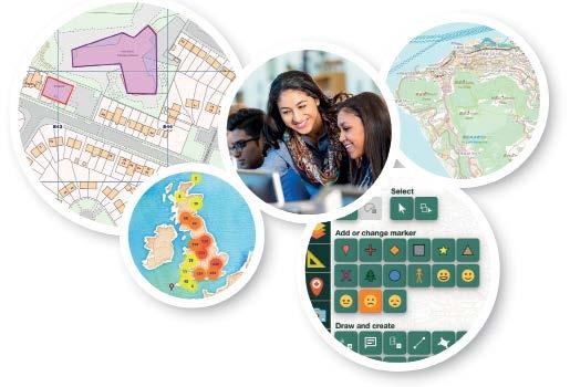
The importance of teaching children as young as five how to understand and interpret data spatial has been a mission for EDINA for over a decade, as it has developed its Digimap for Schools service: a simple intuitive tool that any user can start to look at data and add their own to understand it better through seeing its location - and in doing so think more critically about what they see is telling them. Our passion is to ensure that these are not exclusive skills and we work hard to make sure that any teacher or student – whatever, their skill level will be able to easily use the service, providing CPD training and learning resources to enhance the service.
When school children capture data with sensors in their playground and map and compare them, they will be able to understand the local impact of choices they and their parents and governments are making e.g. monitoring nitrogen dioxide levels at school gates may encourage parents to stop car engine idling or even consider alternative sustainable transport options. In addition we recognise that the complement to managing the data is to have the coding skills to interrogate it. With this in mind we are developing a computational notebook service that will also support learners- whatever their skill set, to develop coding skills to manipulate and visualise geospatial data.
ABOUT THE AUTHORS
Anne Robertson BA and MSc GIS, Head of Services, EDINA. Anne has worked in geospatial consultancy and geospatial policy in Australia, and designed and led on the service creation of Digimap for Schools.

Digimap for Schools delivers an engaging, fun interface for learners to interact with real world data. It is free for schools to access until the 31st July 2020: www.digimapforschools.edina.ac.uk
ABOUT EDINA
EDINA is a centre of excellence at the University of Edinburgh, with a mission to contribute to education – in the UK and Internationally, to enable the widest possible access to learning through technology, providing students with the 21st century IT skills they need to be successful in their studies, their careers and their lives. Fundamental to this is our emphasis on widening access and inclusion: ensuring that everyone, whatever their background, or location, has access to the skills, technology and services they need, in order to learn.
Janet Roberts BA Hons. MBA. Director of EDINA. Janet previously worked in overseas development with Oxfam GB, as well as in finance, conservation and education before joining EDINA as Director.
THE EDUCATIONAL COLLABORATIVE FOR INTERNATIONAL SCHOOLS
24 Greville Street London EC1N 8SS +44 (0)20 7824 7040 www.ecis.org ecis@ecis.org


