ABOUT ME CONTENTS
eco-district | systematic site design
ykhor@uw.edu

(206) 419-0180

Coming from a background studying the Japanese Language and literature, I am intrigued by the concepts of Wabi and Sabi, which emphasized the harmonious coexistence of nature beings. I firmly believe to fulfill the euphonious world, systematic thinking toward a site and the design for livings are important for facing unpredictable climate change, which are the values I want to bring to every project.
05
15-minute city mapping
Spline
Waterfront | Systematic Design | Streetscape
Group Work | 3 month | City of Bellingham, WA
SCAN Design Foundation Studio | Instructor: Nancy Rottle
Rhino Building | iPad Drawing | Adobe Suite

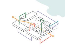
The Bellingham waterfront is characterized by severe environmental degradation beginning when this land was formed through the dredging of the Whatcom canal, followed by a century of industrial pollution. We see this project as an opportunity to mend the green and blue ecology of this space through the creation of a Living Industry eco-district.
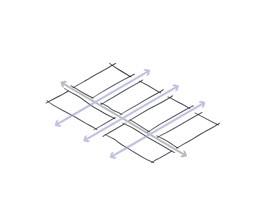
A spline is a woodworking joint where a secondary wood is inserted between two unmatched surfaces resulting in the strengthening of disparate parts. We envision green industry as a spline that joins and strengthens the ecologies of land and water allowing us to address our three primary historical challenges: i. single-use industry ii. separation of people from the waterfront area. iii. environmental degredation.

We bring our vision to life by expanding on the existing area plan and context. Just south of the planned housing, green space and hotel areas, this industry district requires lowered noise and accessible spaces that are healthy for people and the environment.
The group agreed with the concept together, then each of us take on different part of focus area: Akeo Maifeld-Carucci focus on the system of the site, Lauren Corn focus on the Hawk Hill, , Seyyada Burney focus on the Tidal Garden, I focus on the middle symbiosis district area, the Spline, also researching on phytoremediation methods and vegetation, and the flow of the industry.

Strategies
Multi-modal ‘spline’ path centers access, moving the train to its historic line along bluff


We lift the bluff side and drop the water edge, reducing train noise and connecting the city to the waterfront


This creates a palette on which we build our symbiotic living industry


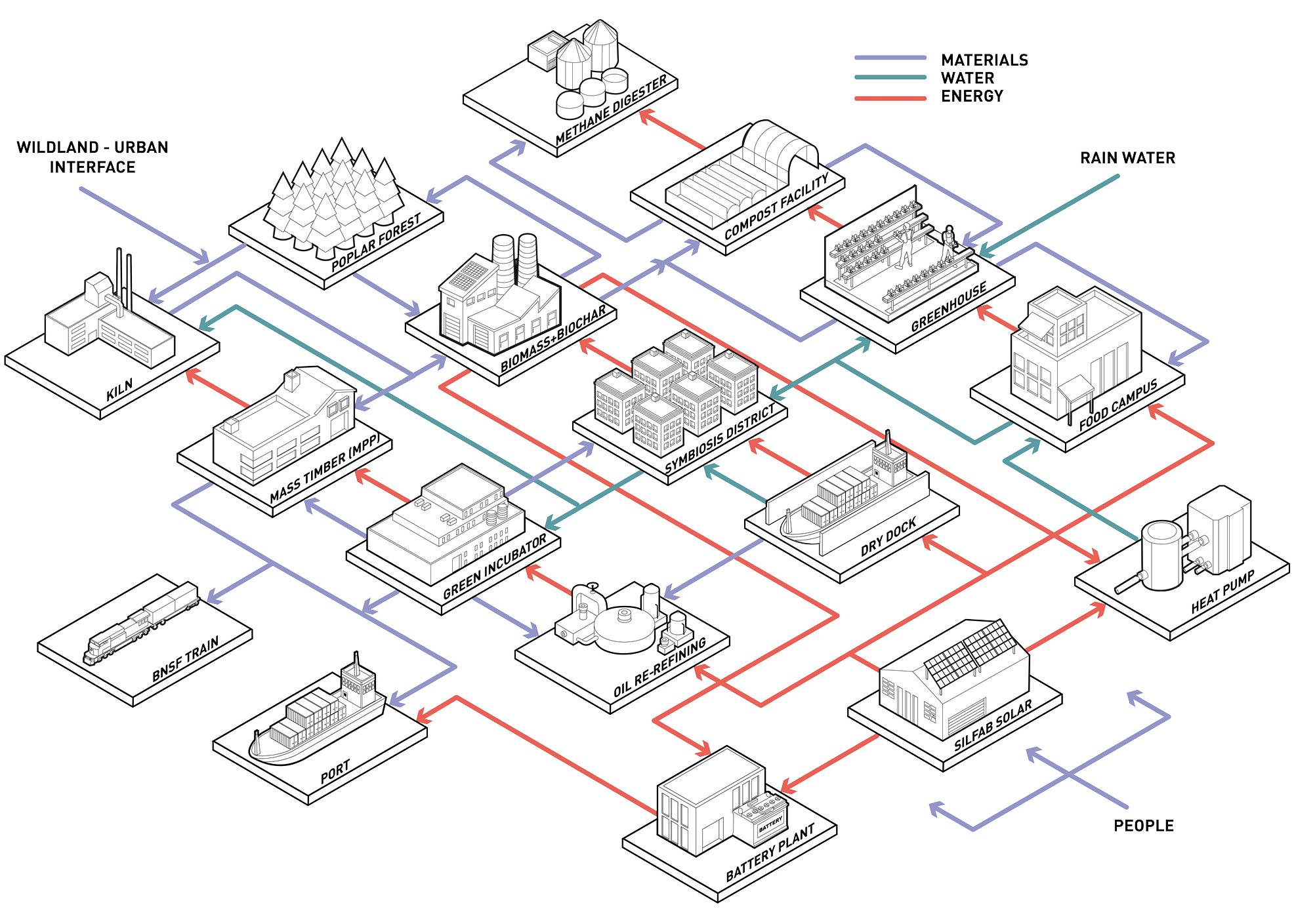
External Flow Diagram
Our proposal uses our conceptual Land, Industry and Water stakeholders to create three overlapping regions, joined and strengthened by our industrial spline:
i. Hawk Hill covers the train, contains and remediates contaminated soil, while adding connection to the waterfront.

ii. The central industry spline, creates a lively working zone where symbiotic industry connects land and water in an experiential public space.
iii. The Tidal Garden processes stormwater and dry-dock effluent to release clean water into a softened, resilient shoreline.
ykhor@uw.edu
The view southwest down the multi-modal spline path from in between the Food Campus and Green Incubator. Railroad planter beds on the left and open display windows connect people to the past and current industry.

Carbon sequestration


 Camassia quamash Roemer’s fescue Lupinus polyphyllus
Prairie Planting Palette
Populous nigra
Forest Planting Palette Helianthus annuus
Carbon sequestration potential
View from next to the Greenhouse looking in between the Food Campus and Office through the semi-public worker’s space and up at Hawk Hill and Bellingham. Yi-Lin Khor
(Section Drawing Credit to Corn)


 Looking from the spline across at Footprint Plaza, the education center and the Mass Timber plant behind. The Plaza is shown being used for a mass timber demonstration and a temporary food truck stop.
Layer / Lair
Cultural Heritage | Contested Landscape
Individual Work | 3 month | Taipei City, Taiwan
Advanced Studio | Instructor: Jeff Hou and Selina Chiu
Rhino Modeling | Illustrator & Photoshop Rendering | Model Making
Layer/Lair is a project to re-envision the previous military dictator memorial space, Chaing Kai-Shek Memorial Hall (CKS Memorial Hall), by transforming the site’s narrative from homogenous to heterogeneous. Layers act as spaces for breathing air from the supreme authority, distractions for the admiration underlying the design of the main building, and provide welcoming areas for new thoughts of usage in the future.

The etymology of the word, Layer, has long been argued to be a respelling of an obsolete agricultural use of lair. The old English of the word, Lair, origins in Germanic origin, means a resting or sleeping place.
Layer/Lair can mean “layer-layer”, to arrange a single thickness of the material covering a surface in order. Or it can means layer lair, to arrange the layers of different resting places. Although the authoritarian rule has ended in Taiwan, the Chiang Kai-Shek Memorial Hall remains in the center of Taipei City and has become one of the main tourist spots. The evidence of authoritarian existence has lived in one’s memories ever since.after years of democratic transition, the story of CKS Memorial Hall is no longer just to commemorate a past ruler. Instead, it has become a place where people gather for demonstrations and protests. Stories with more diverse voices are being told here. Now, a chance to reform the narrative of the space is given, yet there are still untold stories lying beneath.
Strategies
Historical Contexts and Issues

The platforms provide more usages toward the surrounding vacant space and given more breathing for people who want to showcase their thoughts.


Groove Park
Stormwater Treatment | Park

Group Work | 3 month | City of Seattle, WA
Design Implementation | Instructor: Aaron Luoma
Handdrawing | Grading & Drainage | CAD Drawing
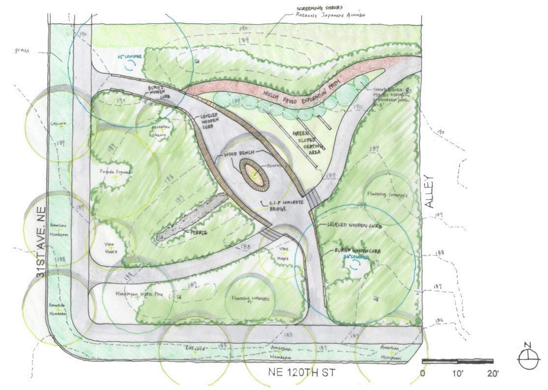
The site locates at 12004 31st Ave. NE, Seattle City, WA 98125. The project is a site improvement and demonstration area for stormwater treatment. Given the premise that in a team of two, we are an imaginary company hired by the Seattle Public Utilities & Seattle Parks & Recreation. The goal is to solve the significant flows of untreated stormwater directed to the Thornton Creek to the south, and the site is selected to capture a large portion of water to store and treat the water before naturally infiltrating.
Other requirements such as a low-maintenance design with a planting scheme that is relatively drought-tolerant, 40% of the site area is an accounted for stormwater treatment, two large conifers trees are preserved on-site, and a minimum of one ADA compliant pedestrian connection between 31st Ave. NE to NE 120th St.
The park design aims to create as much habitat for the urban creature as possible by bridging the main crossing pathway. Moreover, viewpoints and experiences when transferring through the site are also considered in the design. The pedestrian bridge comes with two sides seating benches. In addition, the middle area is designed for more seating areas with canopy from the tree planted beneath. Visitors can either rest and enjoy the rain garden view when facing southwest or enjoy the sun in the lawn area at the northeast of the pedestrian bridge.
Perspective View Drawing looking from the 31st Ave. NE path toward the pedestrian bridge. Yi-Lin Khor


 Idea Sketch of relationship between space created by pedestrian bridge and the sidewalks on both sides
15-min city
Mapping
Individual Work | 2 weeks | Seattle, WA
Mapping of the Duwamish | Instructor: Julie Parret
Mapping
South Park neighborhood have endured lack of accessibilities from public transits and safe pedestrian walkways historically, being seperated by route 99. The aim for this short project is to showcase the 15 minute accessibility in the neighborhood, with red indicates the bus and people footage.

Daniel Winterbottom: Sketching as Witness
Exhibit Design | Installation


Individual Work | Jan-Feb 2023 | In-person in Seattle, WA
Work Experience | Daniel Winterbottom
Model Making | Video Shooting | Adobe Suite
This exhibit features the sketches and watercolor works of Daniel Winterbottom from his neighborhood wanderings and observations of pandemic life: “deserted streets, businesses closing overnight, and a dramatic increase of homeless encampments.”


 Yi-Lin Khor
