
Covered Bridge

SPRING 2024 EDITION
A Publication of the Whether you are looking for adventure, relaxation, or an educational experience, we have you covered!


Veteran’s Monument

Elizabethton and Carter County are home of two state parks – Roan Mountain and Sycamore Shoals. Both parks feature a bevy of activities for the general public during the year.
Outdoor
Home to some of the most picturesque terrain in the United States, check out the different outdoor and recreation activities offered in the community.
Civil
Shop, Dine & Play.................................22
Watauga
The Watauga River is 78.5 miles (126.3 km) long with its headwaters on the slopes of Grandfather Mountain and Peak Mountain in Watauga County, North Carolina.
Community
All across Elizabethton and Carter County, the general public can visit all the different community parks to spend times with family and friends.
Steeped in tradition, the historical aspects of Elizabethton and Carter County allow the public to step back in time and see how the community came to where it is today.
Events
Never a dull moment in the area, be sure to check out the different events and festivals offered in Elizabethton and Carter County.

Carter County
Geography Quick Facts:
Land Area, 2020: 341.26 Square Miles
Population per square mile, 2020: 165.1
Metropolitan or Micropolitan Statistical Area: Johnson City, Tenn., Metro Area
Climate:
Average Temp - Monthly High: Jan. 42°F July 84°F
Average Temp - Monthly Low: Jan. 22°F July 60°F
Annual: 57°
Annual Avg. Precipitation: 46”
Annual Avg. Snowfall: 13”
People Quick Facts:
Population Estimates, July 1, 2023: 57,022
Age & Sex
Persons under 5 years, percent: 4.2%
Persons under 18 years, percent: 17.6%
Persons 65 years and over, percent: 23.1%
Female persons, percent: 50.5%
Population Characteristics
Veterans, 2018-2022: 3,944
Housing:
Housing Units, July 1, 2022 (V2022): 28,148
Owner-occupied housing unit rate, 2018-2022: 73.3%
Median value of owner-occupied housing units, 20182022: $145,000
Median selected monthly owner costs – with mortgage, 2018-2022: $1,060
Median selected monthly owner costs – without mortgage, 2018-2022: $353
Median Gross Rent, 2018-2022: $727
Families & Living Arrangements:
Households, 2018-2022: 23,940
Persons per household, 2018-2022 2.29
Living in same house 1 year ago, percent of persons age 1 year+, 2018-2022 89.9%
Language other than English spoken at home, percent of persons age 5 years+, 2018-2022: 2.9%
Education:
High school graduate or higher, percent of persons age 25 years+, 2018-2022: 87.4%
Bachelor’s degree or higher, percent of persons age 25 years+, 2018-2022: 21.1%
Economy:
In civilian labor force, total, percent of population age 16 years+, 2018-2022: 52.6%
In civilian labor force, female, percent of population age 16 years+, 2018-2022: 49.3%
Income & Poverty:
Median household income (in 2022 dollars) 2018-2022: $47,994
Per capita income in past 12 months (in 2022 dollars), 2018-2022: $28,321
Persons in poverty, percent: 18.3%
Businesses:
Total employer establishments, 2021: 737
Total employment, 2021: 8,774
Total annual payroll, 2021 ($1,000): 316,687
Total nonemployer establishments, 2021: 3,569
Elizabethton
Geography Quick Facts:
Land Area, 2020: 9.55 Square Miles
Population per square mile, 2020: 1,523.1
Metropolitan or Micropolitan Statistical Area: Johnson City, Tenn., Metro Area
People Quick Facts:
Population Estimates, July 1, 2022 14,244
Age & Sex:
Persons under 5 years, percent: 5.9%
Persons under 18 years, percent: 20.8%
Persons 65 years and over, percent: 19.8%
Female persons, percent: 52.7%
Families & Living Arrangements:
Households, 2018-2022: 5,616
Persons per household, 2018-2022: 2.32
Living in same house 1 year ago, percent of persons age 1 year+, 2018-2022: 88.2%
Language other than English spoken at home, percent of persons age 5 years+, 2017-2022: 3.7%
Education:
High school graduate or higher, percent of persons age 25 years+, 2018-2022: 87.7%
Bachelor’s degree or higher, percent of persons age 25 years+, 2018-2022: 24.3%
Economy:
In civilian labor force, total, percent of population age 16 years+, 2018-2022: 50.5%
In civilian labor force, female, percent of population age 16 years+, 2018-2022: 46%
Income & Poverty:
Median household income (in 2022 dollars) 2018-2022: $44,252
Per capita income in past 12 months (in 2022 dollars), 2018-2022: $26,827
Persons in poverty, percent: 20.6%

Sycamore Shoals State Historic Area
Sycamore Shoals State Historic Area is located in Elizabethton. The state park preserves the history of not only the community but events that helped to shape the state and nation.
Sycamore Shoals was the site of the first permanent American settlement outside of the original 13 colonies and was the site of the first government formed independently of the British crown in the new country. The Watauga Association, the first majority-rule system of American democratic government, was founded here in 1772.

Displays in the museum at Sycamore Shoals State Historic Park share the stories of some of the area’s first residents, including notable figures the Reverend Doak and gunpowder maker Mary Patton.
Prior to the American Revolution, Sycamore Shoals served as the site of the largest private real estate transaction in the history of the nation — The Transylvania Purchase.
The Transylvania Purchase occurred on March 14, 1775,

when Richard Henderson, a North Carolina land speculator, met with Cherokee representatives at Sycamore Shoals near the present site of Elizabethton. Henderson wanted to purchase a tract of land in what is now Kentucky and Middle Tennessee, where he planned to establish a fourteenth colony. The venture posed several problems: the Cherokees held the strongest among competing claims to the region, and there was no guarantee of British recognition of the purchase since it represented a violation of the Proclamation of 1763. Nevertheless, Henderson had spent the previous year organizing the Transylvania Company and conducting negotiations with the Cherokees. Four days after the conference began, the Cherokees agreed to the Sycamore Shoals Treaty, whereby they transferred to the Transylvania Company a tract of 20 million acres lying north of the Cumberland
A replica of Fort Watauga stands on the grounds of Sycamore Shoals State Historic Area.

Militia members raise a new flag representing America and its states over Fort Watauga during the Independence Celebration.
River, southeast of the Ohio River, and west of the Cumberland Mountains, with a narrow access route extending from Sycamore Shoals to Cumberland Gap. In exchange, the Cherokees received trade goods valued, according to some scholars, at approximately ten thousand British pounds.
During the American Revolution, Sycamore Shoals served as the mustering point for the Overmountain Men, a militia that formed in the fall of 1780 in response to a threat from British Major Patrick Ferguson. Ferguson had arrived in North Carolina in early September 1780 to recruit troops for the Loyalist militia and protect the flank of British General Lord Charles Cornwallis’ main force. Ferguson issued a challenge to the rebel militias to lay down their arms, or he would cross the mountains and “lay waste to their country with fire and sword.” The Overmountain Men militia gathered in response to Ferguson’s threat and began marching over the mountains. The Overmountain Men defeated Ferguson’s forces at the Battle of Kings Mountain, South Carolina, in a victory that has been called a turning point in the Revolutionary War by many noted historians.
Sycamore Shoals State Historic Area features a Visitor’s Center with an interactive museum sharing the stories of both the Cherokee who lived here, the settlers who

moved here over the mountains, and the significant events that took place here. The park also features a recreation of Fort Watauga, which was constructed on the farm of the Talbott family and used by early settlers to survive raids and sieges by Cherokee warriors during the American Revolution.
The grounds of the park feature picnic areas, gardens, and a walking trail that roams through the park and along the banks of the Watauga River.
Throughout the year, Sycamore Shoals hosts numerous living history events with a resident group of re-enactors who portray life on the American frontier.
One of the largest events hosted by the park each year is the annual production of “Liberty! The Saga of Sycamore Shoals,” which is performed the last three weekends in July each year. Liberty! is the Official Outdoor Drama of Tennessee and is presented by a volunteer cast and crew to share the stories of Sycamore Shoals, those who lived here, and the events that transpired.
Sycamore Shoals State Historic Area has two historic homes that serve as satellite campuses for the Park — The Historic John & Landon Carter Mansion and Sabine Hill. These historic homes have been preserved and restored to depict what life was like at different points in the community’s history.
Roan Mountain State Park

Roan Mountain State Park features thousands of acres dominated by a rich hardwood forest along rugged ridges to accommodate any outdoor enthusiast.
Named the 2016 State Park of the Year by Tennessee State Parks, Roan Mountain State Park offers a variety of activities and lodging opportunities throughout the year. The facility features 30 cabins along with RV and tent camping at the 107 site campground. Each cabin has a front porch with rocking chairs, an

outfitted kitchen, full bath, wood burning stove, and gas/electric
heat. Each campsite features a grill and picnic table, and is located
near a bathhouse with hot showers. Fishing tends to be a popular activity at the park with the majestic Doe River winding its way through the center of the park with a healthy population of trout.
Roan Mountain State Park also features multiple trails to allow the public to enjoy the beauty of wildflowers and other pieces of the environment. The park also offers a variety of activities through the year, including the annual Rhododendron Festival.


Outdoor & Recreation


Watauga Lake
The local name of the Watauga Reservoir created by the Tennessee Valley Authority with the 1948 completion of the Watauga Dam. Fed by the Watauga and Elk Rivers, the lake has an average depth of 52 feet, and covers 10 square miles of a valley that was once the town of Butler, Tennessee. It is stocked by the Tennessee Wildlife Resources Administration with Walleye, Rainbow Trout, Largemouth Bass, Bluegill and more. The Cherokee National Forest surrounds Watauga Lake in some of the most beautiful country in the Tennessee River watershed. The original town of Butler, Tennessee, now sits at the bottom of Watauga Lake.“New” Butler was relocated to higher ground above the summer pool edge of the TVA reservoir. According to lake expert Holly C Ward, Watauga Lake is the third cleanest in the country. More than half of Watauga Lake’s shoreline lies within the Cherokee National Forest and cannot be developed. Recreational uses include boating, fishing, water-skiing, and camping. There is no horse-power limit or speed limit for boats operating on the lake. Several fee-based public and private boat launch ramps provide access on the Hampton side of the reservoir. The release of impounded water from both TVA Watauga Dam and TVA Wilbur Dam provides additional downstream river recreational opportunities such as whitewater rafting, trout fishing, and kayaking on the Watauga River, and several Cherokee National Forest recreation areas are located along its shores.
Cardens Bluff Campground

Boasting 40 sites, Cardens Bluff Campground looks out over Watauga Lake. Opportunities for swimming, fishing, and boating in the pristine waters of the Watauga Lake are located nearby. Access to the campground is located right off of Highway 321 in Carter County.
Frost Bite Race
Sail boat enthusiasts hit Watauga Lake on New Year’s Day to take part in the Frost Bite Sail Boat Race, which takes it name from the frigid conditions that can sometimes be expected on the lake at that time of year.


Jones Falls
Jones Falls is on a small tributary of the Elk River and during the winter months is a sight no less impressive than Elk River Falls. It is located just inside the Carter County line between Roan Mountain and Elk Park, N.C.
The falls are located about 1.7 miles from the Elk River Falls parking area.
The waterfall drops 100 feet down the rocks in many different directions.
A good portion of the hike to the falls is through the woods on the old forest road with not much scene. Once you reach the river, it is a beautiful area which takes you through a grassy meadow and along the river. The path to the falls will take hikers a short distance on the Appalachian Trail before reaching Jones Falls.
It can be a great hike if you combine it with a hike to Elk Falls.

Dennis Cove
Located in Hampton, the Dennis Cove Recreation area is a campground and picnic area nestled beside Laurel Fork Creek. The secluded campground is ideal for camping during the summer months due its altitude and forest surroundings. With 15 campsites, Dennis Cove is a great option for a group to reserve the whole campground for retreats and other events. Along with camping, Laurel Fork Creek is stocked with rainbow trout below the campground.
The Blue Hole
The Blue Hole is a series of four waterfalls located on Holston Mountain in the Stoney Creek community of Carter County.
The falls’ name, Blue Hole, comes from the deep blue pool in front of the third waterfall, which is the main fall in the series.
Nestled in the crags of Holston Mountain, the Blue Hole Falls are an outdoorsman’s treasure.
The falls also feature a swimming hole, popular with local residents in the summer.
The Blue Hole is located at the base of Holston Mountain near Stoney Creek. It’s reached by turning on to Panhandle Road off Hwy 91. Shortly after the pavement turns into a gravel Forest Service road, there is a small parking area on the left. Walk down the hill and you can’t miss it. This is a popular local gathering spot in the summer and best visited at off peak times. For an adventurous drive, the gravel road will take you to the top of Holston Mountain which reaches 4,285 feet.
Watauga Dam
Campground
Located in Carter County, the Watauga Dam Campground is located on the Watauga River far from heavy vehicle traffic. The campground has 29 RV sites, some located right on the river making it perfect for fishing trips.
The main falls at The Blue Hole

Watershed Bike Trails
Ranging from easy to difficult, the Watershed Bike Trails in Hampton are perfect for riders of any skill level. The bottom loops are ideal for novice and intermediate riders, while more seasoned riders can hit the challenging upper loop known as The Cat’s Pajamas. The trails cut through forests that open to beautiful river and mountain views.
Coon Den Falls
Located in the Dennis Cove area of the Cherokee National Forest, a steep and rocky trail follows Coon Den Branch for nearly 1.5 miles to the Appalachian National Scenic Trail. The 15-foot cascading falls lie halfway up the trail and are best viewed after the leaves begin to fall.
To reach the falls, at Hampton turn left onto Dennis Cove Road for approximately 4.2 miles passing the Dennis Cove Appalachian Trailhead on the left. Continue on Dennis Cove Road for .3 miles to trailhead on right.
It is a relatively short trail (1/2 mile) and is moderately difficult. The trail is .6 miles past the trailhead/parking area for Laurel Falls.
Ripshin Lake
A much smaller nearby lake that is not part of the TVA system is located 6 mi (9.7 km) SW of Roan Mountain. Although this is not the place for a family outing or a picnic, it is a wonderful place to drive through and admire the scenery. This peaceful but restricted area is almost completely privately owned land and is patrolled periodically by local owners. However, a main road passes within just a few feet of the lake and especially in the fall of the year, lends itself to some incredible photo opportunities. The road parallels “Roaring Creek” which is a beautiful mountain stream that winds down the mountain with one small waterfall after another. The creek cannot be seen in the summer due to the foliage but when the leaves fall, the views are spectacular.

Laurel Falls
Most people who frequent Dennis Cove are there to hike to Laurel Falls or to go to the Dennis Cove Campground. It is one of the most visited areas in the Cherokee National Forest. Located in the designated Pond Mountain Wilderness, Laurel Falls is popular with hikers because of its immense size — 40 feet wide and 50 feet high. The falls are also located in a very picturesque setting.
The hike to the falls can be challenging, but very refreshing on a summer afternoon.
There are two preferred routes for reaching the falls: either by way of the nearly 5.5 mile Hampton Blueline/ Laurel Falls Trail (#501) combined with a hike along the Appalachian National Scenic Trail (#1), or the more moderate route along the Appalachian Trail from Dennis Cove (approximately 2.6 miles roundtrip.)
The hike to the falls is rated moderate and the trail is primarily used for hiking, walking, running, and camping and is best used from May until December.
Twisting Falls
Twisting Falls is located in the Elk Mills area near the border of Carter County with North Carolina. It is a popular place to visit in the summer. It is estimated to be at least 30 feet high, but some put its height much higher.
The falls are also known as Compression Falls or Twisted Falls.
The trail to and from the falls is primarily used for hiking and is best used from May to October. It is one of the more remote trails in the county and is hard to find. It has a very challenging descent to river.
The falls can be reached by turning right onto Poga Road, just before US 321crosses Elk River. After a right turn on Clawson Road, the falls can be reached by turning right on Dark Ridge Road, which ends in a dirt road and a parking lot to the falls.
For those who love rugged hiking and climbing over rocks, the hike to Twisting Falls will prove challenging, but also picturesque.
Appalachian Trail is hiker’s paradise
Carter County is criss-crossed with numerous hiking trails, including some of the most beautiful and challenging sections of America’s crown jewel, the Appalachian Trail.
The Appalachian Trail in Carter County winds along the Tennessee/North Carolina border and over 6,285foot Roan Mountain before descending to Watauga Lake at 1,959 feet. After crossing 318-foot-high Watauga Dam, it heads up the spine of Iron Mountain, with breathtaking views of the lake almost 1,500 feet below. It’s challenging, and hikers must be prepared for long, steep climbs and descents, rough terrain, and rapidly changing weather in the high elevations. Snow has been recorded in every month on Roan Mountain, where temperatures falling into the mid-30s in mid-summer are not unheard of. But the reward is some of the most spectacular scenery on the entire trail, including a visit to Roan Mountain’s world famous Rhododendron Gardens.

the highest mountains along the Trail, including several above 6,000 feet.
The hike from Carvers Gap to Roan High Knob on the trail is a moderate two-mile round trip and features the highest shelter on the trail.To reach the trail, take Highway 19E from Elizabethton to the village of Roan Mountain, turn right on Route 143 to Carvers Gap, which has a parking lot on the TN/NC border. Carvers Gap to Grassy Ridge is a moderate 5.2 round trip and mostly follows the Appalachian Trail. Grassy Ridge is the largest open bald in the Roan Highlands and branches of the Appy Trail.
The Roan Highlands is noted as one of the most scenic regions of the Southern Appalachians. Other trails in the Highlands include the Overmountain Victory Trail,Yellow Mountain, Hump Mountain, Little Hump Mountain, and Roan High Bluff.
Of particular interest to long-distance hikers, the village of Roan Mountain is now an Appalachian Trail Community! You’ll find a warm welcome, good food, a comfortable bed, hot showers and everything else a foot-sore traveler needs.
Tennessee’s stretch of the A.T., with its sun-dappled forests, broad unobstructed balds and high elevation summits carpeted in native grasses, helped inspire the Trail’s congressional designation as a National Scenic Trail.
There are 94 miles of the A.T. in Tennessee, but the trail runs along the Tennessee/North Carolina border for 160 additional miles. As the trail ascends to the High Country of the state line, hikers traverse
Perhaps one of the more scenic sections of the Appy Trail follows the shore of Watauga Lake to the Watauga Dam.The trail travels over the top of the dam affording views of the lake and surrounding mountains.
To travel this part of the trail, take 19E from Elizabethton to Hampton, turn left at Hampton on Highway 321 to Watauga Lake and Shook Branch Picnic Area.
Not all of Carter County’s hiking is so strenuous, though, and hikers of all skill and fitness levels will find a trail to enjoy. Many quiet walks through the woods and along mountain streams await you. There are plenty of access points, campgrounds and back-country camping areas, and hiker-friendly services are readily available.

Doe River Gorge offers outdoor family adventures
Doe River Gorge, located in Hampton, has a historic ring to it as many years ago the beloved Tweetsie traveled the gorge on its way to Roan Mountain and western North Carolina. Today it is owned and operated by Doe River Gorge Ministries and is located along the Doe River.
River Gorge Ministries is a Christian organization that invites guests to leave the pressures and business of the world behind by offering outdoor camps for all age ranges. At over 370 acres, Doe River Gorge offers plenty of space for adventure-based activities as well as summer youth camps and leadership retreats.
The property includes a 4.9 mile hiking trail which is open to the public from October until March. Additionally, permission to hike the trail must be obtained prior to the trip from Doe River Gorge Ministries. Each person (or family) will need to fill out and sign a visitor release form and drop it off in the train mailbox at the front of the offices.
Doe River Gorge includes over one mile of railroad track and an antique steam engine, 40 acres of pastureland, cabins, a zipline, a riverfront recreation area, a vertical challenge course, horse arena, sand volleyball court, paintball, rifle range, and climbing tower, among other things.
Scenic rail trips into the Doe River Gorge are part of summer Day Quest Saturday programs. Also, fall excursions are also usually

popular with leaf peepers. A corn maze is generally popular with locals during the month of October.
The gorge is also open for hiking and fishing, however, guests must check-in. To hike there you will need to plan your visit during the Doe River Gorge Ministries’ off-season from October to March, and you will also need to call ahead for permission and to sign a waiver at the main office, which you will drop off in a kiosk outside of that office.
The hiking trail is the railway of the historic ET&WNC Railroad, and is considered an “easy” hike. The trail includes two tunnels in the Doe River Gorge. Not only does this hike provide amazing views of soaring cliffs and a whitewater river, but it has historical railroad significance, along with tales from bygone days. It is an easy
five-mile round-trip that can be enjoyed by beginner and expert hikers alike.
The trail (which is the railroad) begins at the small lake near the main office. From here, you’ll simply follow the tracks into the gorge, almost immediately entering one of the two tunnels on this hike.
However, hiking in the Gorge does have its challenges.
The Doe River Gorge section is extremely rugged and seated deeply between Cedar and Fork mountains in Carter County. The cliffs on the south face of Cedar Mountain are vast, imposing, and elevated. And the twisting river down in the ravine below flows along large rocky cascades with rapids and waterfalls. It is an exceptionally picturesque area. When you hike in this gorge, you’ll gain a
great appreciation of what an amazing engineering feat it was to carve a rail line through this rugged area, especially in the late 1800s. The 2.5 miles of trail have several very large retaining walls, two tunnels, man-made gaps with high rock walls and an enormous old trestle. Railroad enthusiasts will also enjoy walking along the narrow gauge rails that once carried trains full of iron ore through the gorge on their journey between North Carolina and Northeast Tennessee. Add in some fall colors, and this hike is a winner for beginners and seasoned hikers alike.
For fishing, the Doe River is stocked annually. A Tennessee fishing license is required as all Tennessee waterways are state property, even when they flow through private property.

Joe LaPorte Recreation Facility

Elizabethton Linear Path
The public can take in the sheer beauty of Elizabethton by walking the Elizabethton Linear Path. The roughly sixmile path spans from East Side Elementary to Sycamore Shoals State Historic Area. The Linear Path follows the scenic Doe River through the heart of Elizabethton and follows the Watauga River westward downstream to the historic area. The path features great fishing spots, bike racks, picnic tables and benches.
The City of Elizabethton’s Joe LaPorte Recreation Facility is a 3.9-acre facility that is home to the Olympic-size Franklin Pool, acres of grass area for lounging and two covered pavilions inside a gated facility. Franklin Pool features two diving boards with the pool and a newly-constructed splash pad. The pool opens Memorial Day weekend and closes in the fall. Pavilions are for rent by contacting the Parks & Rec department.


Elizabethton Golf Course
A treasure for any sports enthusiast is the Elizabethton Golf Course.
Located on Buck Van Huss Drive near the west end of the City of Elizabethton, the 18-hole, par 72 course, spanning 6,470 yards allows patrons to experience the natural beauty of the community while fulfilling every golfing need. The facility, owned by the City of Elizabethton and operated by Hampton Golf, offers a variety of needs for any golfer. Elizabethton Golf Course offers a fully-stocked Pro Shop, practice amenities and regularly serves as a hub for various fundraising activities within the region.


Tweestie Trail
A rail-trail that follows the former ET&WNC (“Tweetsie”) Railroad rightof-way for 9.5 miles. It begins at Alabama Street in Johnson City and continues east through Elizabethton and the city’s downtown. It ends on Stateline Road near the Betsytowne Shopping Center. The trail has a compacted stone surface, a relatively flat grade, and crosses seven bridges. Along the way, travelers can rest and enjoy its beautiful, natural surroundings on several benches. A “trail extension” stretching all the way to Roan Mountain carries on from the end of the “Tweetsie” at Hatcher Lane in Elizabethton. Parking is available in Johnson City at the Memorial Park Community Center, Cardinal Park, and the Municipal and Safety Building (City Hall). In Elizabethton, parking is available at Elizabethton High School.


Elizabethton/Carter County Historical Train Exhibit
The glory days of the railroad in Carter County and Elizabethton are told through the stories of the North American Rayon Steam Engine, the Tweetsie boxcar, and a caboose from the Southern Railway. The ET & WNC Railroad (Tweetsie) operated in Elizabethton from 1881-1951; the Southern from 1911-1940 ; and the NAR Steam Engine from 1936-1992. The Elizabethton/Carter County Historic Train Display is a tangible reminder of an era when the railroad played a prominent role in the economic development of the community -when lumbering, mining, and rayon were vital industries.

Horseback Riding

The Hinkle Branch Trailhead leads to 36 miles of interconnected trails (old road beds, single track trails, and Forest Service gated roads). Large, easily accessible parking lot. Directions: Elizabethton, TN off Highway 91. Heading away from Elizabethton the trailhead is just past Unaka Elementary School. Look for the large brown Forest Service trailhead sign on your left. Other trails include a six-mile long gated road with

approximately two miles of single-track connector trail. Parking for about five trucks and trailers is available. There is also a connector to the Little Stoney Creek Jeep Trail (ca. 3 miles long).Directions: From Elizabethton, take Highway 91 towards Stoney Creek, look for the large brown Forest Service sign which directs you to turn left onto Rainbow Circle.

The Overmountain Victory National Historic Trail
The Overmountain Victory National Historic Trail (OVHT) is part of the U.S. National Trails System. It recognizes the Revolutionary War Overmountain Men, Patriots from what is now East Tennessee who crossed the Great Smoky Mountains and then fought in the Battle of Kings Mountain in South Carolina.
The OVHT follows the route from Abingdon, Virginia at the Abingdon Muster Grounds, fording the Watauga River at Sycamore Shoals through present day Elizabethton, Tennessee, crossing the Doe River twice near both Hampton, Tennessee and Roan Mountain, Tennessee, and ascending over the steep Great Smoky Mountains of Tennessee and North Carolina, on through South Carolina to the site of the Battle of Kings Mountain now within Kings Mountain National Military Park.


state highways and, in some stretches, actually travels over the old historic roadway.
The Overmountain Victory National Historic Trail is a cooperative effort of the National Park Service, the U.S. Forest Service, the U.S. Army Corps of Engineers, the Overmountain Victory Trail Association, local governments, local citizens’ associations, local historical societies and the states of Virginia, Tennessee, North Carolina, and South Carolina.


Fifty-seven miles (92 km) of OVHT are officially developed for public use, and development continues on the remaining sections. The official sections of the trail were established through agreements with current landowners and often have overlapping designations. All officially certified segments are identified through the use of signs displaying the trail logo (an Overmountain man in profile on a brown and white triangle) or a white triangular blaze.
A parallel Commemorative Motor Route travels along


In 2017, the National Park Service placed a special marker at Sycamore Shoals marking it as a significant site along the National Historic Trail honoring the muster, march, and victory of the Overmountain Men during the American Revolution.


Civil War Trails
A great way to tour the area is to follow the Tennessee Civil War Trails, a historic marker program that identifies both great campaigns and lesser-known Civil War places. TheTrail includes interpretive markers and an online statewide driving tour, and links Tennessee’s sites to Trails programs in Virginia, West Virginia, Maryland and North Carolina. Sites in and near Carter County include: Roan Mountain State Park, where Samuel P. Carter, a Union general, raised troops in the area and participated in burning railroadbridges in the area. Elizabethton, near the home of Admiral and General Samuel P Carter, the only officer to wear two stars in both the U.S. Army and Navy. Carter remained with the Union when war broke out and served in east Tennessee. He later commanded the XXIII Corps during the 1863 Knox ville Campaign. Here turned to naval service after the war. Blountville Three Tennessee Civil War Trails signs describe the action here at the Battle of Blountville Sept. 22, 1863, during a battle for control of the vital Virginia and Tennessee Railroad.
Trail signs are located at the Union and Confederate positions and at the Sullivan County Courthouse, the interior of which was burned during this action.Other related Blountville sites are at the Old Deery Inn site at 3400 Block of Highway 126, and Cannonball House at 3382 Highway 126, in Blountville. Women and children sought shelter at the Old Deery Inn when the fighting broke out. One early his torian wrote that they were in more danger than the soldiers. The Cannonball House house stood between the lines as fighting swirled around it during the battle.
While many buildings in the area were destroyed, this one survived, still bearing the scars of the battle. In Johnson City, the Tipton-Haynes Historic Site was the home of Landon Carter Haynes, a Confederate senator and supporter of states’ rights in an area laced with strong pro-Union sentiment. He served in the Confederate congress 1862-1865. Af ter the war he was pardoned by President Andrew Johnson but moved away, fearing reprisals from local citizens.


Discover Historic Downtown
Elizabethton
Welcome to Downtown Elizabethton, where every stroll feels like a journey through time and every corner holds a new discovery. Picture yourself leisurely wandering the streets, with a gentle breeze kissing your skin and the sunlight casting enchanting patterns on the historic storefronts.
As you meander, be sure to pop into the charming boutiques and stores that line the streets, each offering a treasure trove of unique finds exclusive to the Tennessee mountains. And when hunger strikes, satisfy your cravings at one of the diverse restaurants that dot the downtown landscape.
After a delicious lunch, immerse yourself in history at the iconic Bonnie Kate Theater,

or take a leisurely stroll to the Historic Covered Bridge, where the trickling Doe River beckons for a tranquil walk along its banks. Watch as kids splash joyfully in the shallow waters, embracing the simple pleasures of mountain life.
On Saturday evenings, don’t miss the electrifying atmosphere of Covered Bridge Jams, a free concert held in Covered Bridge Park from May through September. Experience the vibrant pulse of live music echoing through the historic surroundings, a true testament to the spirit of our mountain town.
Explore Downtown Elizabethton and immerse yourself in the sights and sounds of the southern Appalachian Mountains. With its picturesque architecture, quaint storefronts, and vibrant community events, our downtown offers a unique blend of nostalgia and modern charm.
For convenient parking, parallel spaces line the streets or opt for public parking areas nearby. And be sure to mark your calendar for the beloved Covered Bridge Celebration, 4th of July festivities, Octoberfest, Trick or Treating, Christmas Parade, and Cruise-In car show, held every Saturday at 5 p.m. from May through October, where vintage cars take center stage along the downtown streets and more.
For a calendar of upcoming events and celebrations go to mainstreetelizabethton.com.
Join us in Downtown Elizabethton, where every visit is a journey to remember.


Watauga River serves many purposes in Carter County
The Watauga River is 78.5 miles (126.3 km) long with its headwaters on the slopes of Grandfather Mountain and Peak Mountain in Watauga County, North Carolina.
The river rises from a spring near the base of Peak Mountain at Linville Gap in Avery County, North Carolina. The spring emanates from the western side of the Tennessee Valley Divide, which is, at this location, congruent with the Eastern Continental Divide. On the other side of the divides at Linville Gap are the headwaters of the Linville River in the Upper Catawba Watershed. Waters of the Linville River eventually reach the Atlantic Ocean, whereas waters of the Watauga River reach the Gulf of Mexico; hence the Eastern Continental Divide. The river then flows across Watauga County, North Carolina crossing the Tennessee state line (River Mile (RM) 55.1) at Johnson County, then into Carter County, Tennessee and ends at its confluence with the Holston River’s South Fork (RM 0) on the Washington/Sullivan County border.
Recreation
Whitewater rafting, kayaking, canoeing, fly fishing, and angling with fishing reels are all popular recreation activities pursued on the Watauga River. Rainbow trout, brown trout, and striped bass are all caught in the Watauga River.
Whitewater
The Watauga River downstream of the TVA dam draws commercial rafting outfitters from both northeast Tennessee
and western North Carolina during the summer months and commercial fishing guides throughout the year. The picturesque Class II+ Bee Cliff Rapids on the Watauga River (also referred to as the “Anaconda Rapids” by some North Carolina-based rafting companies) are found downstream between Wilbur Dam and the Siam Bridge, southeast of Elizabethton, Tennessee.[14]
For commercial whitewater rafting and kayaking on the Watauga River, the most popular Carter County “put-in” is immediately downstream of the TVA Wilbur Dam, and the most popular “take-out” is 2 to 2-1/2 hours downstream (depending upon the volume of the reservoir release and other factors) at the Blackbottom riverside portion of the city linear trail park in Elizabethton.
The distance afloat for paddlers from the put-in at Wilbur Dam to the Blackbottom take-out is approximately seven miles, with landmarks along the Watauga River providing a good estimate of time and distance traveled.
• Wilbur Dam to Bee Cliff Rapids - 15 minutes.
• Wilbur Dam to Siam Bridge - 30 minutes.
• Wilbur Dam to Hunter Bridge (TWRA put-in/take out) - 60 minutes.
• Wilbur Dam to Gilbert Peters Bridge at US 19-E in Elizabethton - 90 minutes.
• Wilbur Dam to Bristol Bridge in Elizabethton - 120 minutes.


The Watauga River also has a section of Class IV-V whitewater popular with expert kayakers, upstream of Watauga Lake and across the state line in North Carolina.[15] This section requires significant rainfall to bring it up to runnable levels. It features continuous steep boulder bed rapids dropping up to 150 feet per mile (28 m/km), and several falls and ledges only runnable by expert paddlers.


TVA recreation areas
The Tennessee Valley Authority maintains a self-service public campground below Watauga Dam. Amenities and recreational opportunities at the TVA Watauga Dam Tailwater Campground include 29 campsites with electric hookups, restrooms with heated showers and flush toilets, dump station, public phone, picnic tables and grills, canoe access, boat ramps above and below dam, lake and river fishing, hiking trail, walking trail, wildlife viewing area, and birdwatching.[16]
Restaurant Guide
J’s Corner
102 South Lynn Ave.
Elizabethton, TN 37643
Phone: (423) 547-3300
Dine-In - Carry OutDoordash.com
See our ad on page 23

Homestyle
256 Hwy 91N. Suite D
Elizabethton, TN 37643
Phone: (423) 474-3268
Dine-In - Carry Out -
Breakfast Served All Day
See our ad on page 32

900 Elizabethton Hwy (Old 19E) Bluff City, TN
(423)538-7543
Dine-In - Carry Out
See our ad on page 2

Steak/Seafood
Mayflower Seafood
1733 US 19E
Elizabethton, TN 37643
Phone: (423) 542-3667
Dine In - Carry Out
See our ad on page 17

444 E Elk Ave.
Elizabethton, TN 37643
Phone: (423) 542-3438
Dine-In - Carry Out
See our ad on page 24

Elizabethton, TN 37643
Phone: (423)543-6128
Dine In - Carry Out
See our ad on page 25

Community Parks

Harmon Park
Located on US Highway 19E beside the Elizabethton/ Carter County Chamber of Commerce, Harmon Park offers 1.9 acres of family-friendly fun. The neighborhood park hosts two large play areas, pavilions, picnic areas, a track and a multi-use field for any type of community event. In 2018, the City of Elizabethton constructed new pavilions and a restroom facility for the public. Pavilions are available for rent by contacting the Parks & Rec department.

Kiwanis Park
Located at the intersection of West G Street and Carter Boulevard, Kiwanis Park offers 3.1 acres of various activities to the public. The park has playground equipment, swings, a multi-use field, a basketball court, two pavilions with picnic tables. The larger pavilion – the Don Tetrick Pavilion – includes a large-multi purpose area with kitchenette and restrooms. The park serves as the home site for the Parks & Rec flag football league. Pavilions are for rent by contacting the Parks & Rec department.
Cat Island Park
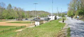
Located along US Highway 19E in the eastern half of the City of Elizabethton, Cat Island Park is a 12.5 acre park that has two ball fields that host the Elizabethton/Carter County Youth Baseball and Softball Association, a tennis court facility, three pavilions and three separate playground areas.
A popular area for birthday parties and other celebrations, Cat Island Park also features various walking trails and is near the Elizabethton Linear Path. Pavilions are for rent by contacting the Parks & Rec department. The park is also located near East Side Elementary School.

Edwards Island
Edwards Island is a 3.2 acre park located along the Doe River just north of Covered Bridge Park. One of the key attractions of the park is Rotary Pavilion. Located in downtown, the small island that makes up this mini-park is one of the ten parks along the Elizabethton Linear Path. The park serves as a popular destination for various community and family events. The pavilion is available for rent by contacting the Parks & Rec department.

Lions Field
Lions Field is located near Elk Avenue on the western part of Elizabethton. With 12 acres of land, the park is a host of the Elizabethton/Carter County Youth Baseball and Softball Association. The facility also serves as an entrance or exit for the Tweetsie Trail and includes parking and restrooms.
Mill Race Park
Mill Race Park is located along the Doe River with Riverside Drive to the east and the Broad Street Bridge to the north. Just over .5 acres, this mini-park is another stop along the Elizabethton Linear Path.


The Laurels Picnic Area
Part of the Cherokee National For est, The Laurels has been a popular area since the early days in East Tennessee.

The site is named for the native Rhododendron that thrives in the area, locally called “laurel.” The Civilian Conservation Corps helped construct the current facilities in the early 1930s. Today, it is a popular dayuse area, providing a nice shady place for family picnics and group gatherings.
There are pavilions and picnic areas available for use. The area is for day use only and no overnight camping is allowed.
The Laurels Picnic Area is located off of Laurels Road in the western portion of Carter County.

Race Street Park
Race Street Park is located near the intersection of Race Street and Pine Street. This 1.3 acre park is along the Elizabethton Linear Path.
Dixon Street Park
Dixon Street Park is a 1.4 acre park bordered by Dixon Street and the Tweetsie Trail. There are no facilities located at this open grass park.

Riverside Park
Nestled beside the Watauga River, Riverside Park is 6.8 acres and features playground equipment, a pavilion and picnic tables. The Riverside Pavilion is located right behind Joe O’Brien Field and features a large covered shed that houses picnic tables, grills and electrical hooks. The park features plenty of green space for the public to enjoy on nice days. The pavilion is available for rent by contacting the Parks & Rec department.

Walter Curtis Memorial Park
Walter Curtis Memorial Park is located beside the Elizabethton Senior Citizens Center and the Carter County/Elizabethton Health Department along H Street and Holston Avenue. The 1.6 acre park includes two shuffleboard courts, walking paths, a pavilion and various benches.
Covered Bridge Park
Nestled beside the historic Covered Bridge, the city’s Covered Bridge Park is a 2.25 acre park that features a small fountain, two pavilions, a gazebo, picnic tables and multi-use stage. The picturesque park is located in downtown Elizabethton and provides a lunch-break getaway for citizens during hot summer days while attracting the public with different events and concert series.
The pavilion and gazebo are for rent by contacting the Parks & Rec department.

Douglas Park
Located at the intersection of Watauga Street and Church Street, historic Douglas Park offers 3.7 acres worth of fun. The neighborhood park has playground equipment, a basketball court, a large pavilion and a multiuse field. The Blue Grays Field, used for youth baseball, received historical designation from the state in 2016 for its historic impact with Negro League Baseball.

History

The Covered Bridge
Immerse yourself in the rich history and picturesque beauty of Carter County with a visit to the Doe River Covered Bridge, a true gem dating back to 1882.
As the oldest covered bridge in Tennessee still in daily use, the Doe River Covered Bridge offers a captivating glimpse into the past while providing a delightful destination for visitors of all ages. Whether you’re looking for a leisurely stroll, a serene spot for a picnic by the river, or simply a chance to admire its rustic charm, this historic bridge promises an unforgettable experience.
Recognized as the Top Covered Bridge in the United States by readers of USA Today in 2016, the Doe River Covered Bridge has captured the hearts of travelers far and wide. Spanning 134 feet across the Doe River, this architectural marvel stands as a testament to craftsmanship and ingenuity, with its original wooden construction and sturdy stone abutments.
With its inclusion in both the Tennessee Historical Commission marker and the national Registry of Historic Sites, the Doe River Covered Bridge stands as a proud symbol of Carter County’s rich heritage and enduring legacy. Don’t miss the opportunity to explore this beloved landmark and create cherished memories in the heart of Tennessee’s mountain country.


Situated in front of the Carter County Courthouse at what was once the heart of downtown Elizabethton, a towering white obelisk that has stood for more than 100 years serves as a monument to the veterans of all wars.
The Carter County Veterans Monument is one of Elizabethton’s more recognizable landmarks. With its position at the intersection of East Elk Avenue and Main Street, The Monument, as it is commonly referred to, is typically either the first or the last thing visitors to downtown see.
But the Monument is more than just a landmark in the historic district, it is a lasting tribute to the hundreds of Carter County residents who have donned a uniform in service to their country.
Construction on the Monument began in the spring of 1912 and finished in 1913. The cost to construct the monument was around $500, money that was donated by individuals in the community. The Monument was designed to be similar to an Egyptian obelisk. The Monument was made of river rock and hand-mixed concrete. The outer surface was covered with smooth plaster to resemble granite.

Elizabethton Walking Tour
With such a long history and a community dedicated to preserving it, there are many important historical structures still in use in Elizabethton.
From the homes of some of the towns notable citizens in days gone by to places of worship, and from the seat of county government to buildings where children were educated, there are many historic buildings to see.
The Elizabethton Walking Tour provides visitors and locals alike the chance to walk in the footsteps of history as they learn the stories of some of the town’s oldest buildings. The Elizabethton Walking Tour is self-guided. Stop by the Elizabethton/Carter County Chamber of Commerce to pick up your brochure and map and get ready to start your adventure.
Veterans Monument


The Miller Farmstead at Roan Mountain State Park
Nestled away atop Roan Mountain is a little farm with a big history. The Dave Miller Farmstead, part of Roan Mountain State Park, serves as a living museum to a past age — a time when farming and raising livestock was how many people lived.
The farmstead was first settled by Dave and Louisa Miller and their family in 1870. The farmhouse which currently stands on the site was built by Dave Miller and his son Nathaniel “Nat” Miller in 1908.
The farmstead is now used as an interpretive site by the Roan Mountain State Park to educate visitors on the lifestyles of the people of this area of the Appalachian Mountains. The Miller Farmstead is open Wednesday through Sunday from Memorial Day through Labor Day and then on weekends in October.
In 2014 the Miller Farmstead was added to both the State Register of Historic Places and the National Register of Historic Places.


The Historic John & Landon Carter Mansion
Built between 1775-80 by John and Landon Carter, the Carter Mansion is the oldest standing frame house in the state of Tennessee. Both John and Landon were strong business, political and military leaders in the Watauga Settlement in the late 18th century. The interior of the home is noted for it’s elaborate architecture which include hand carved panels, crown molding, and chair railing. Considered the oldest paintings known in the state, two over-mantle paintings can be seen over the fireplace in Carter’s office and upstairs in the master bedroom.
Prior to Carter’s arrival, Native Americans lived at this site as documented by archaeological studies in 1923,
the 1970’s, and more recently in the Fall of 2016. Three centuries before Carter’s arrival, evidence suggests that there was a thriving town and community here. For thousands of years before that, Native Americans used this land for seasonal camp sites.
The Carter Mansion is managed by Sycamore Shoals State Historic Park and offers tours and special events throughout the year, which include Christmas at the Carter Mansion in early December and the Carter Mansion Celebration in the spring.
The Carter Mansion is a satellite campus of Sycamore Shoals State Historic Area. For more information, call Sycamore Shoals at 423-543-5808.


Veterans Walk of Honor and War Memorial
Located in Historic Downtown Elizabethton, the public can take a walk through history to remember the men and women that have served in the United States armed forces. The Veterans Walk of Honor features a walk beside engraved bricks highlighting local community members that served in a variety of ways to protect the country. Right across the road is the War Memorial with names of veterans that served in each war time era. Both areas are maintained by city officials and volunteers to showcase the veterans in a beautiful and respectable manner.


Sabine Hill
Sabine Hill was built around 1818 by Mary “Polly” Patton Taylor, the widow of Brigadier General Nathaniel Taylor.
In 1809, Nathaniel bought 381 acres of land from Joseph Tipton Sr., which included the site of Sabine Hill.Taylor continued to purchase land in the area, and at one point he and Mary owned around 3,000 acres, which they named “Happy Valley.”
Nathaniel quickly became a leader in the community as well as on the business front. He was appointed as a Justice of the Peace when the community was still part of North Carolina, and he holds the distinction of being the first Sheriff of Carter County. Nathaniel became one of the wealthiest men in Carter County with business ventures that included the manufacture of bar iron, flour, and gunpowder.
In addition to his local commitments, Nathaniel also served in the military and was promoted to the rank of Brigadier General in 1804 and commanded a regiment of Tennessee Troops. During the War of 1812, he and the East Tennessee Militia served under General Andrew Jackson in Mobile, Ala. Sadly, Nathaniel passed away in February of 1816.
As Nathaniel was involved in local politics, so too were many of his descendants — perhaps most notably brothers Robert (Bob) Love Taylor and Alfred (Alf) Alexander Taylor. In 1886, the brothers ran against each other in seeking election to the Governor’s seat in a political campaign which became known as the “War of the Roses.”
The home was placed on the National Registry of Historic Places in 1974 and in 2017 was designated as a State Historic Site. Sabine Hill is now a satellite campus of Sycamore Shoals State Historic Area.
Events & Festivals

On the first Friday of each month in May, June, July and August, the streets of downtown Elizabethton will come alive. Participants will be able to explore local boutiques, vintage shops and art-centric spaces and enjoy performances and live music in the streets throughout downtown.
‘First Fridays’ focuses on music, shopping, dinning and
fun
On the first Friday of each month in May, June, July and August the streets of downtown Elizabethton come alive for an amazing community event.
More engaging activities throughout downtown have been added, such as live demonstrations on the sidewalks, samples of new products at restaurants, and games and activities at businesses.
It is suggested that participants explore local boutiques, vintage shops and art-centric spaces as well as enjoy performances and live music in the streets throughout downtown.
First Fridays are presented by Main Street Elizabethton, City of Elizabethton Parks and Recreation Department, Elizabethton-Carter County Public Library and Carter County Tourism.
Each month, Bean’s office will release information and details for each Friday event. For more information about First Fridays’ events, visit MainStreetElizabethton. com/FirstFriday or Downtown Elizabethton on Facebook to join in. You may also contact Courtney Bean at (423) 213-0090 or by email at cbean@cityofelizabethton.org.

Carter County Car Club Cruise In
Discover the charm of Historic Downtown Elizabethton with the Carter County Car Club, a cherished tradition that has been delighting visitors since the 1980s.
From May through the last Saturday in October, downtown comes alive with the vibrant sights and sounds of classic cars as enthusiasts from all corners of the country gather to showcase their prized vehicles. It’s a wonderful opportunity for families to immerse themselves in the beauty of yesteryear while strolling through the historic streets.
Before the car show kicks off, why not indulge in a delicious meal at one of the many restaurants nestled in the heart of downtown? Afterwards, explore the eclectic array of shops and boutiques, where you’ll find unique treasures and souvenirs to commemorate your visit.
What’s more, your participation in the car show directly contributes to a worthy cause, as donations support children’s charities in the local community. So come join us for a day filled with classic cars, family fun, and philanthropy in Historic Downtown Elizabethton.


Events & Festivals
Covered Bridge Celebration
Welcome to the annual Covered Bridge Celebration in downtown Elizabethton, a beloved tradition that draws thousands of visitors each September, courtesy of the Elizabethton/Carter County Chamber of Commerce.
Held against the picturesque backdrop of Elk Avenue Bridge and Covered Bridge Park, this event, organized during the month of September, promises a delightful blend of entertainment, music, and local vendors.
Prepare to be serenaded by award-winning musicians, indulge in delectable treats from various vendors, and peruse an array of unique crafts and goods. As you explore, be sure to visit the children’s area, where young

ones can delight in activities specially tailored for their enjoyment.
Join us for a day of family-friendly fun and festivities at the Covered Bridge Celebration, where the charm of downtown Elizabethton comes alive in the heart of summer.


Events & Festivals
Covered Bridge Jams Summer Concert Series


Welcome to Covered Bridge Jams, a summer concert series presented by the Elizabethton Parks and Recreation Department. Held at the picturesque Covered Bridge Park, this music extravaganza offers a delightful blend of sounds and rhythms to enchant visitors of all ages. Here’s everything you need to know to make the most of your experience:
Event Details:
What: Covered Bridge Jams Summer Concert Series
Where: Covered Bridge Park, Elizabethton, Tennessee
When: Every Saturday evening from June to August 7-9 PM (unless otherwise noted)
Concert Schedule:
June 8: Thursday Night
Boys
June 15: Bluegrass


Jamboree featuring Stem Winder, Hollow Ground, Tim Decker & TN River, Joe Mullins & The Radio Ramblers, and Authentic Unlimited (Starts at 12 PM)
June 22: The Lauren Cole Band
June 29: Dan Harrell & The Troubadour’s
July 4: Independence Day Celebration featuring Spank the 80’s
July 13: From the Edge
July 20: Lost Creek Bluegrass Band
July 27: Bullseye Band
August 3: Tennessee Backroads
August 17: Victor
Lawson n’ Boogie Chillen
August 24: Rockin’ on the Doe featuring On The Border - The Ultimate Eagles Tribute (Starts at 5 PM)
August 31: Dimestore Cowboys
Admission: All Cov-
ered Bridge Jams concerts are free to the public, offering an affordable and enjoyable way to spend your summer evenings.
Contact Information: For more information about Covered Bridge Jams or the Elizabethton Parks and Recreation Department, please call 423-547-6441.
Plan Your Visit:
Arrival: Arrive early to secure your spot and explore the beautiful surroundings of Covered Bridge Park.
Parking: Ample parking is available near the park entrance for your convenience.
Seating: Bring along blankets or lawn chairs for comfortable seating during the performances.
Refreshments: Feel free to bring your own snacks and beverages, or

enjoy delicious treats from local vendors.
Enjoyment: Sit back, relax, and soak in the magical atmosphere as talented musicians take the stage to entertain you.
Don’t miss out on the excitement of Covered Bridge Jams! Join us for an unforgettable summer filled with music, community, and fun.
From the Edge
Hollow Ground
Bullseye Band
Tim Decker and TN River
Dimestore Cowboys
Dan Harrell & The Troubadour’s
StemWinder

Liberty! The Saga of Sycamore Shoals
Each year, during the last three weekends of July, Sycamore Shoals State Historic Area goes back in time as a volunteer cast of actors and crew members present Liberty! The Saga of Sycamore Shoals. This annual production is the Official Outdoor Drama of the State of Tennessee.
Liberty! tells the stories of the earliest settlers in the region and some of the important historic events that transpired here. Nationally significant events that helped to shape the future of our nation


before, during, and after the American Revolution are presented in an engaging, exciting, and entertaining fashion.
The drama is set in front of the full-scale replica of Fort Watauga on the grounds of Sycamore Shoals State Historic Area.
Liberty! tells the stories of these important days of American history as well as demonstrating the life of pioneers in a frontier settlement. Moreover, it gives faces to the names we see on many of our street signs and other local area designations.

Liberty! runs Thursdays-Saturdays during the last three weekends of July.
For more information, contact Sycamore Shoals State Historic Area at 423-543-5808 or check out the website www.TheLibertyDrama. com.

Native American Festival
Each year in June, Sycamore Shoals State Historic Area hosts a weekendlong festival celebrating the history and culture of the Native Americans who lived here before European settlers came to the region.
This educational event provides the opportunity for our visitors to experience many facets of Native American culture, particularly that of the Cherokee. This weekend-long festival features traditional and contemporary arts and crafts, traditional Native American song and dance, Cherokee storytelling and legends, Native American flute, Cherokee language workshops, and craft demonstrations and sales.
A unique feature of the Native American Culture festival is our educational/ demonstration area, located within Fort Watauga. The dance circle is located in the center of the fort, where the popular traditional dance and drum performances take place. In addition, flute music, storytelling, lectures, and so much more take place within the circle, which share native culture and history with our visitors.
For more information, contact Sycamore Shoals State Historic Area at 423-543-5808.


Annual Rhododendron Festival in Roan Mountain

Each year in June, members of the Roan Mountain Citizens Club host a two-day event to celebrate one of the most gorgeous displays of natural beauty available in the country — the blooming of the Rhododendron Gardens atop Roan Mountain.
The Rhododendron Festival takes place the third weekend of June in Roan Mountain State Park. The Citizens Club first hosted the festival in June 1947 and over the years the event has continued to grow. Originally they held the festival at the top of the mountain at the Rhododendron Gardens but as the event grew it moved to Roan Mountain State Park to accommodate the growing festival.


The two-day event features handmade crafts, food, and a variety of traditional music plus an array of old-time folkway demonstrations of traditional arts and skills. Over 100 arts and crafts vendors. A variety of food available. Visit the world’s largest natural rhododendron gardens atop 6000-ft Roan Mountain. Hike the Appalachian Trail as it runs along the border of Tennessee and North Carolina. Learn about our nation’s history as you relax beside cool streams. Camp or stay in a rustic cabin. Swim. Play tennis. For more information, visit the Roan Mountain Citizens Club website at www.roanmountain.com.


BBQ, Blues and Brews Festival
Hosted by the Elizabethton/Carter County Community Foundation, the event brings in vendors, music and other types of fun for the public at Covered Bridge Park. Area restaurants attend the event to go for the “Best in Show” competition. Select craft beers are also available throughout the event. Proceeds raised from the event go to benefit the local Bonnie Kate Theater.
Naturalist Rallies


During each season, outdoor enthusiasts are invited to make the drive to Roan Mountain State Park for the annual Naturalist Rallies. Organized by the Friends of Roan Mountain, different programs are hosted across the park to encourage the love of outdoors. Different agencies also stop by during the events to offer information and other details about the area. Youth rallies are also offered over the year. Visit friendsofroanmtn.org to learn more about the different events.
Elizabethton River Riders
The Elizabethton River Riders is a premiere summer collegiate team in the Appalachain League. The regular season begins in June. A fun, affordable family experience where you can see the stars of tomorrow, today.


Farmers Markets
Roan Mountain and the City of Elizabethton offers Farmer’s Market during the warmer months as a way to encourage healthier lifestyles and give local farmers a chance to sell their products. Roan Mountain’s event is held at the Roan Mountain Community Park while the Elizabethton event is held in downtown Elizabethton.
Information on both markets are available on social media.
Fourth of July Boat Parade


Every year around the Fourth of July, local boat owners dress their vessels in patriotic decorations as they participate in the Watauga Lake Fourth of July Boat Parade. Spectators line the shore to watch the boats pass by.


Roan Groan Bicycle Race

Boasting the only category 1 finish in the Eastern United States, the Roan Groan is a grueling race that draws cyclists from around world to Roan Mountain and Elizabethton. Featured in the spring, the race has riders traversing downtown Elizabethton before taking off towards Carver’s Gap, located atop Roan Mountain. The race’s path covers over 6,000 feet of climbing and finishes at one of the prettiest views in Carter County.
Fat Tire Omnium Road Race

The race is in June and requires the closing of several downtown streets in a box, which begins on Hattie Avenue, down Sycamore Street to East E Street, then east on North Riverside Drive to Hattie Avenue, on on Hattie back to Sycamore.
The othe two stages of the Omnium will be held on a Saturday. They include the Roan Groan, which begins in Elizabethton and takes Simerly Creek Road to Roan Mountain. The top classes do a double loop of Simerly Creek and ride for 80 miles, climbing a total of 9,747 feet. The race is followed by the Ballad Health Time Trail in Erwin.

Downtown Christmas Parade
Organized by the Elizabethton/Carter County Chamber of Commerce, floats descend upon downtown Elizabethton for the annual holiday parade. The Christmas Parade serves as the unofficial kickoff for Christmas in Elizabethton.


Elizabethton
Christmas
Tree Lighting
Elizabethton’s annual Frasier Fir tree lighting helps usher in the holiday season. Community groups come together to celebrate the upcoming Christmas season.
Roan Mountain Christmas Tree Lighting


Citizens from Roan Mountain celebrates Christmas by joining together at Roan Mountain Community Park for the annual community tree lighting.


