EMILY TA
Bachelor of Architecture (B. Arch) California State Polytechnic University, Pomona

Bachelor of Architecture (B. Arch) California State Polytechnic University, Pomona
Extending 51-mile in length, the history of the LA River focuses on two central narratives: the devastating floods of the 1930s
and the rapid development in the first half of the 20th century that led the US Army Corps of Engineers and the LA County Flood Control District to channelize and line LA’s main inland waterway.
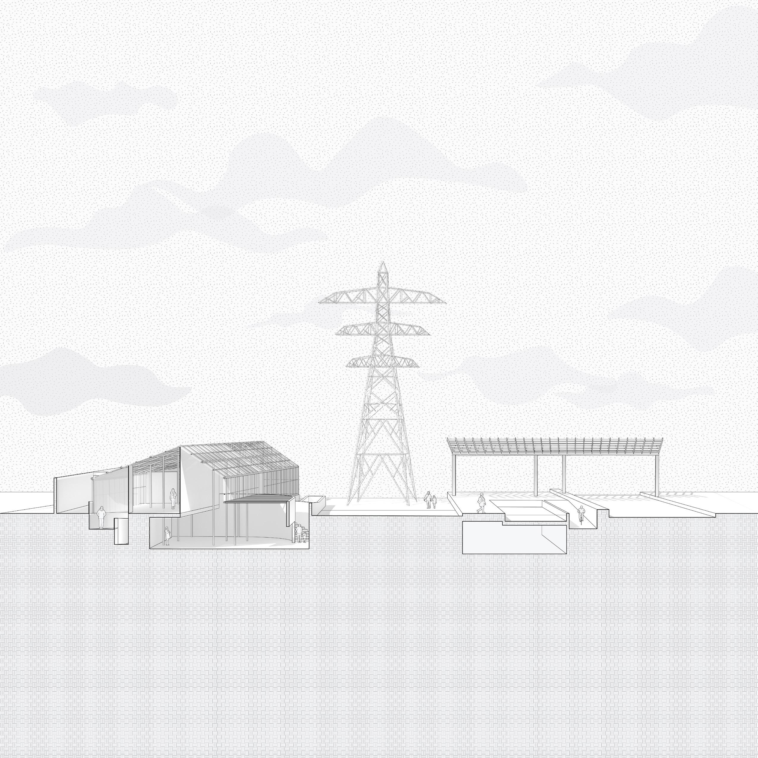
Out of the 450 Parcels, 98 were selected and combined into potential projects sites. And of the 98 project sites selected, more than 70% are recognized as utility right-of-way corridors. As a way to reimagine the river as a connector of culture, water, and green open space, this project aspires to implement a Utility Park Promenade in Central Plain: Parcel #13 to incorporate a natural, recreational park and equitable educational community center. The Utility Park Promenade recognizes the field of transmission line easements as a cadence for space-making and corridor connectivity. In turn, the familiarity of the utility easements throughout the region replaces the river as the project. The utility infrastructure sustains growth, but it is woefully underutilized.
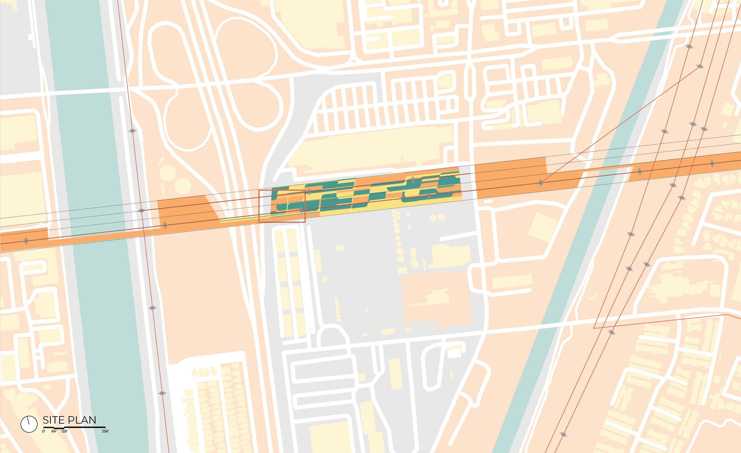
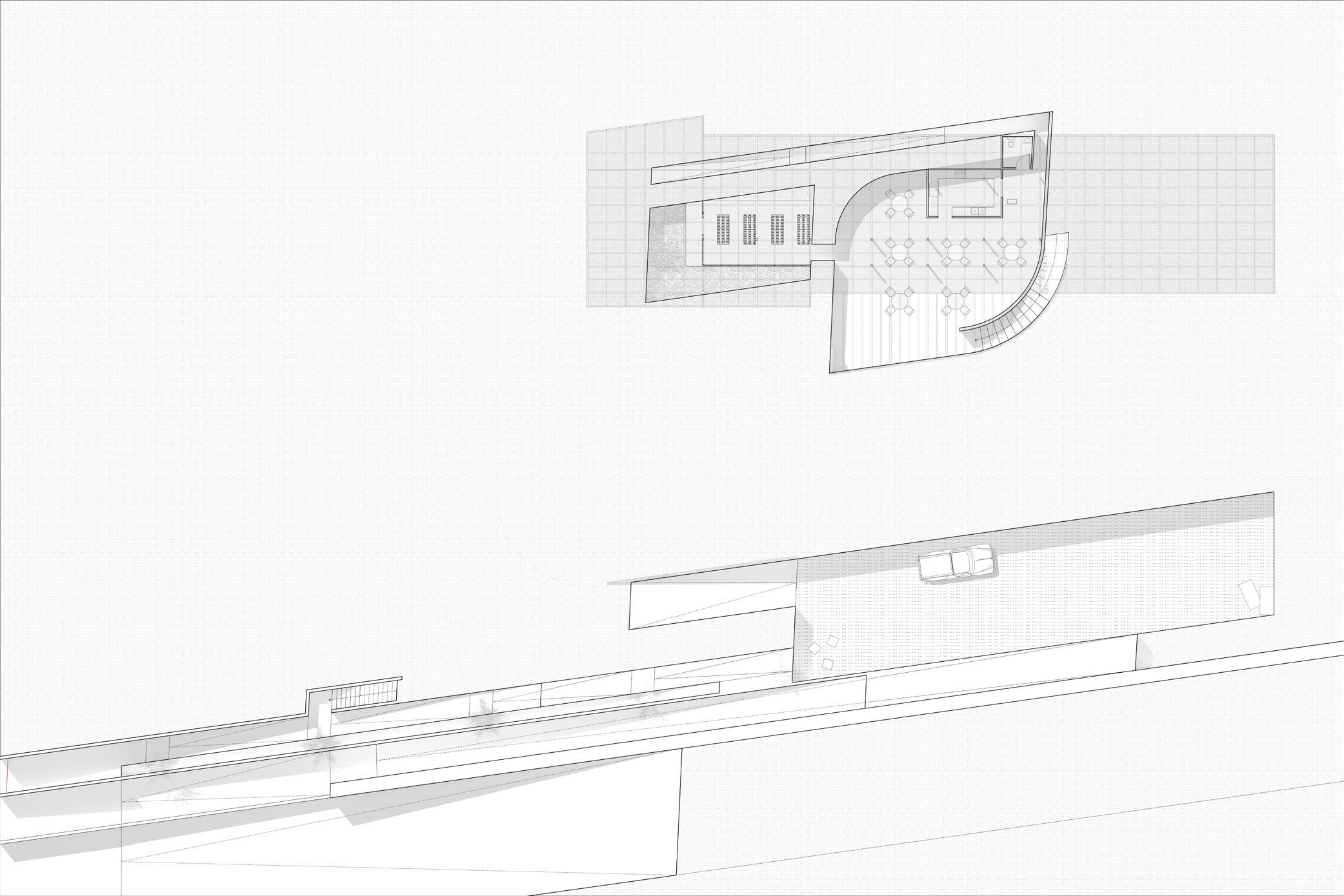
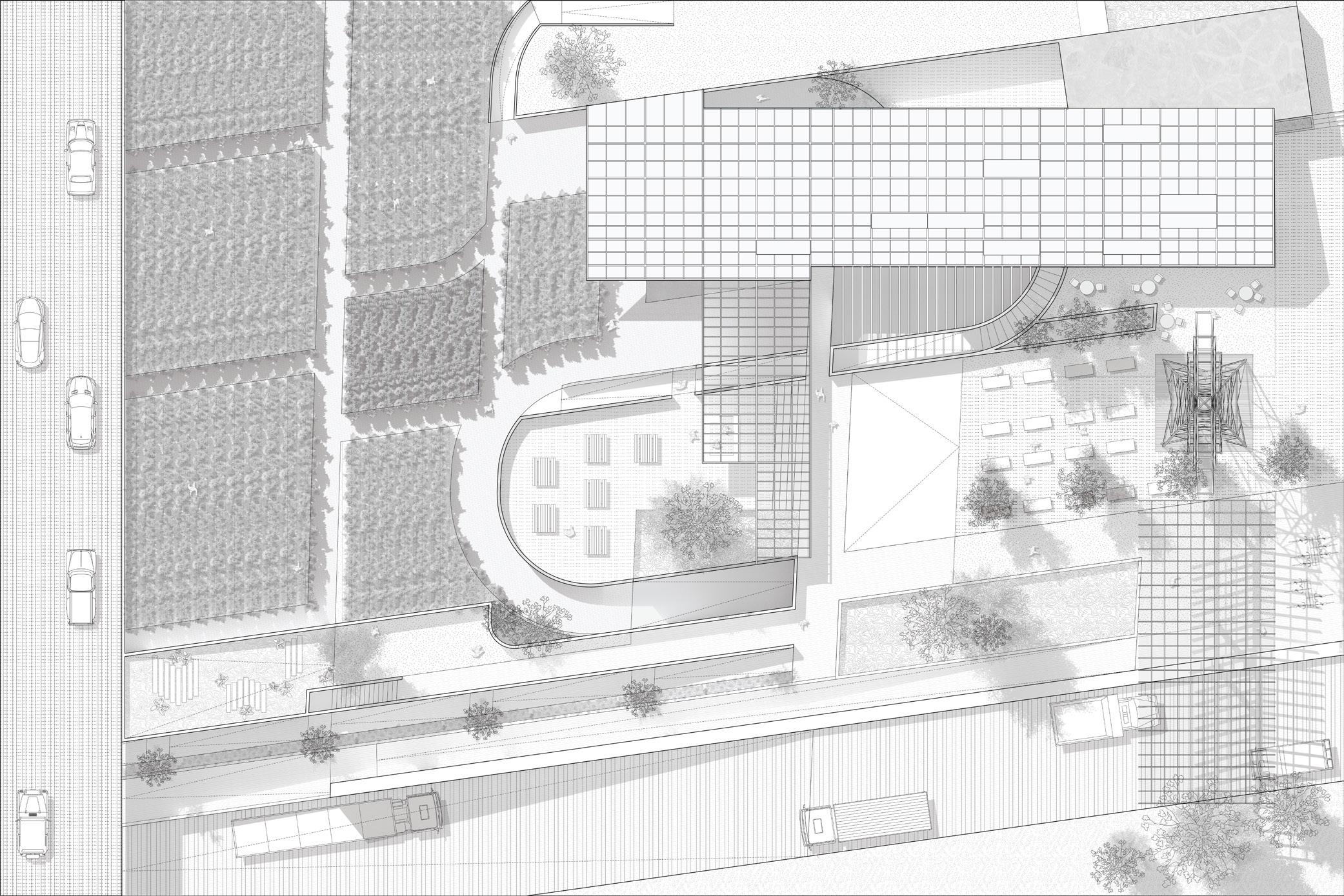
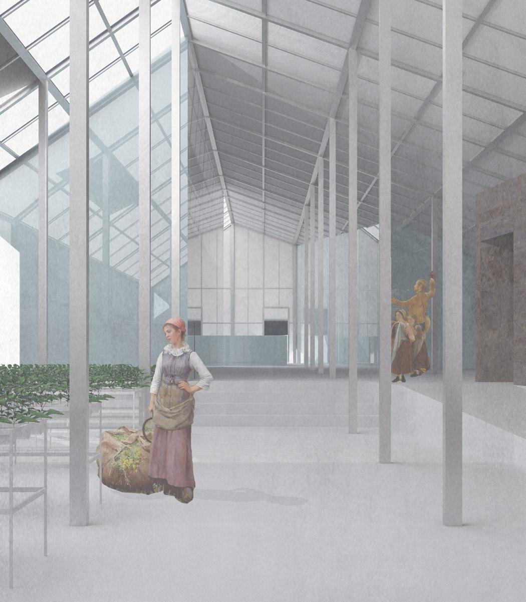
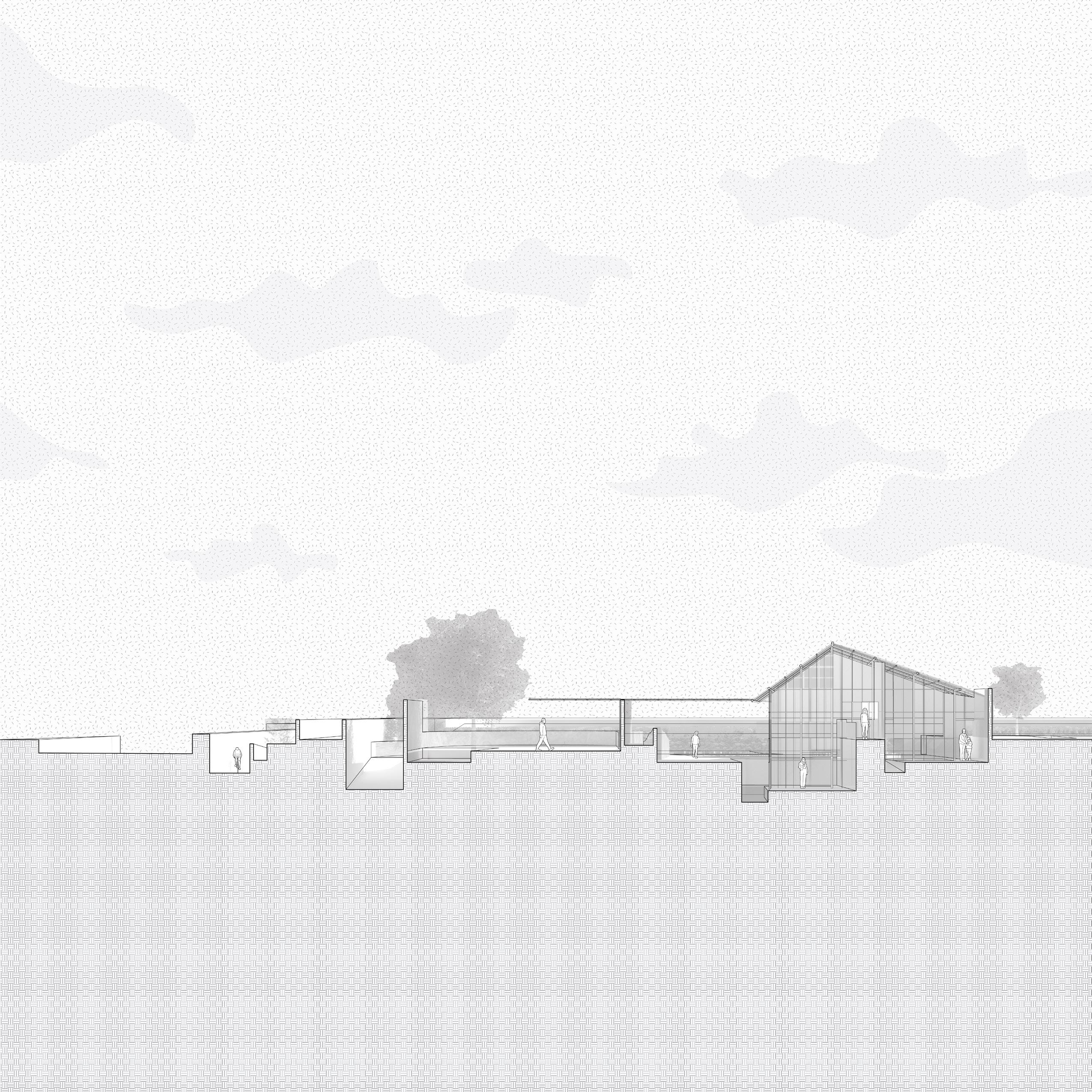
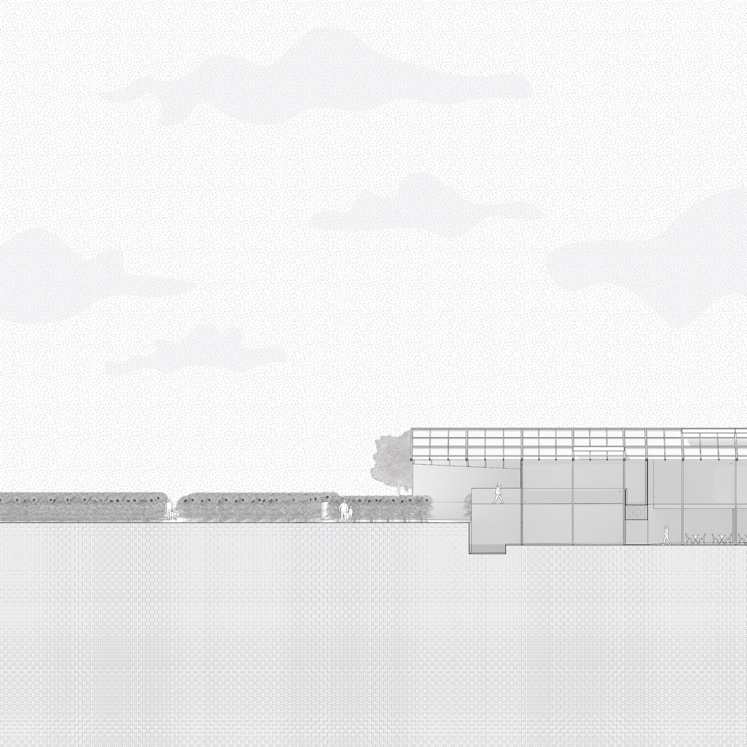
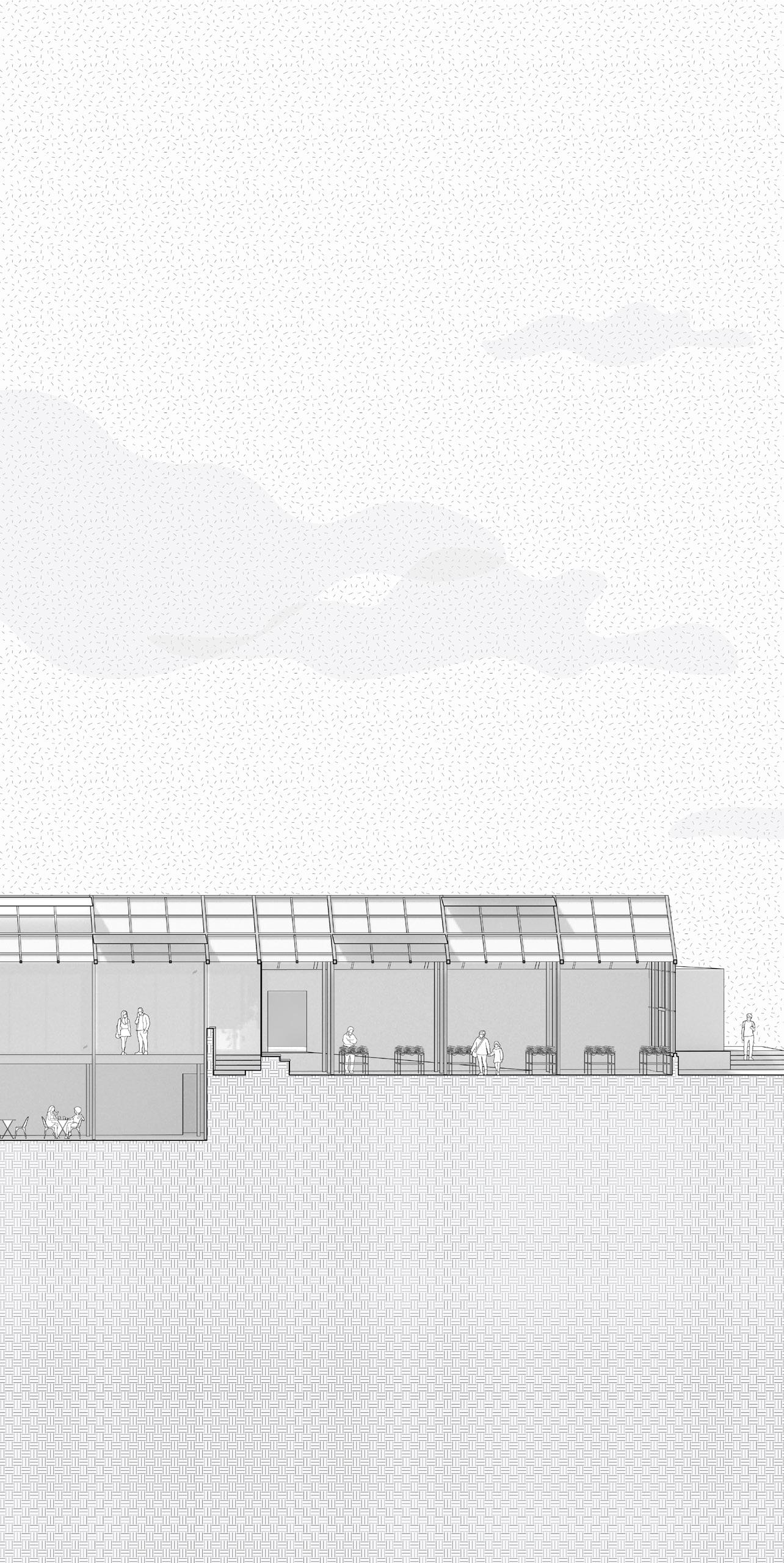
Located between the intersection of the I-710 Freeway and Garfield Ave, Not a SunFlower Farm focuses on remediating and rehabilitating, and reclaiming what was abandoned along the Utility Park Promenade through the tension of soil repair versus agriculture. While this project is cropped in its true cardinal direction, this site is rotated by the 8th degree to sit perpendicularly with the LA River and Long beach freeway. This lacing of directionality offers potential for two types of growing: one externally in the ground for remediation and the other internally in the greenhouse through permaculture farming and a closed hydroponic system for edible plants.
“The fascination with the dramatic, either in the program (murder, sexuality, violence) or in the mode of representation (strongly outlined images, distorted angles of vision - as if seen from a diving airforce bomber), is there to force a response. Architecture ceases to be a backdrop for actions, becoming the action itself.” -
Fall 2021
Bernard Tschumi | Spaces and Events
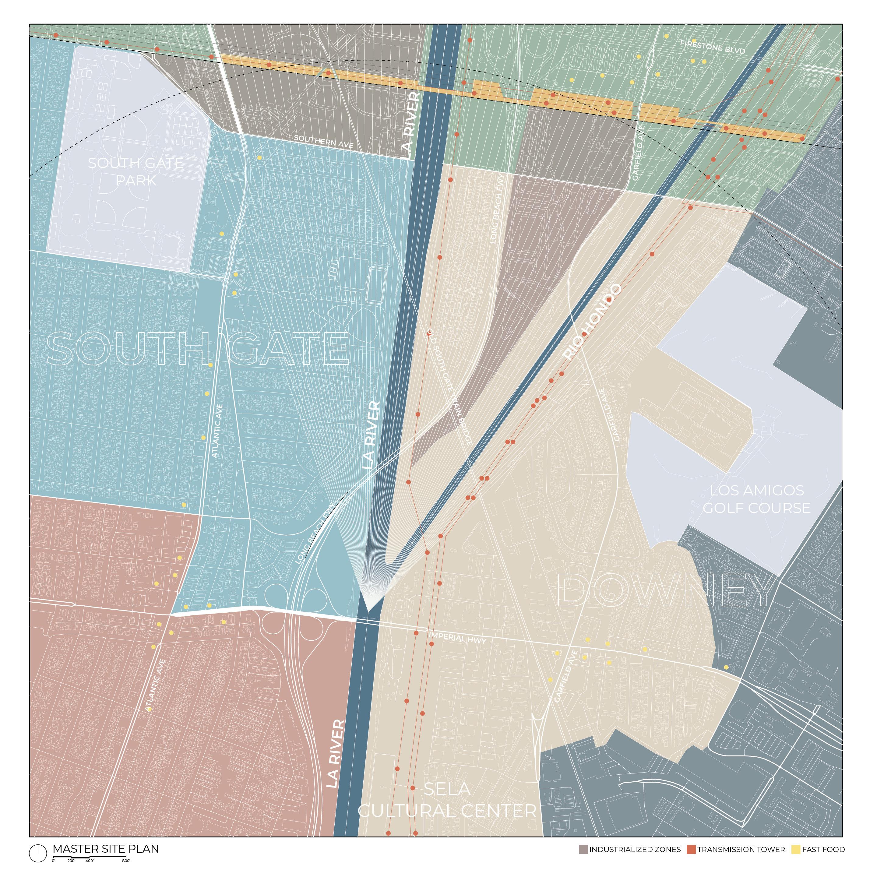
While the LA River historically resulted in division, segregation, and fragmentation, the Utility Park Promenade seeks to connect adjacent communities along its banks. Adjacent to the neighborhoods of Bell Gardens, Downey, Lynwood, Cudahy, and South Gate, the designated site lies perpendicularly between the Los Angeles River and Rio Hondo River, crossing the former as it extends to the east and meeting the bank of the latter to the west; this piece of the urban fabric is further layered by the intersecting Interstate 710 and Firestone Boulevard (Route 42), providing the main point of access to the site. Not too far downstream from the site, the SELA Cultural Center is located at the confluence where the two rivers meet. This, together with Hollydale Regional Park, forms a cultural and recreational complex which the project upstream wishes to react to and be a part of this influential sphere of activities, pivoting on the organizational and symbolic locus of the confluence. With the confluence of two rivers as the focal point, this project aims to remediate and rehabilitate what was abandoned, while reclaiming the opportunities to transform this site into a meeting ground of community life, urban access, waterway, and natural systems.
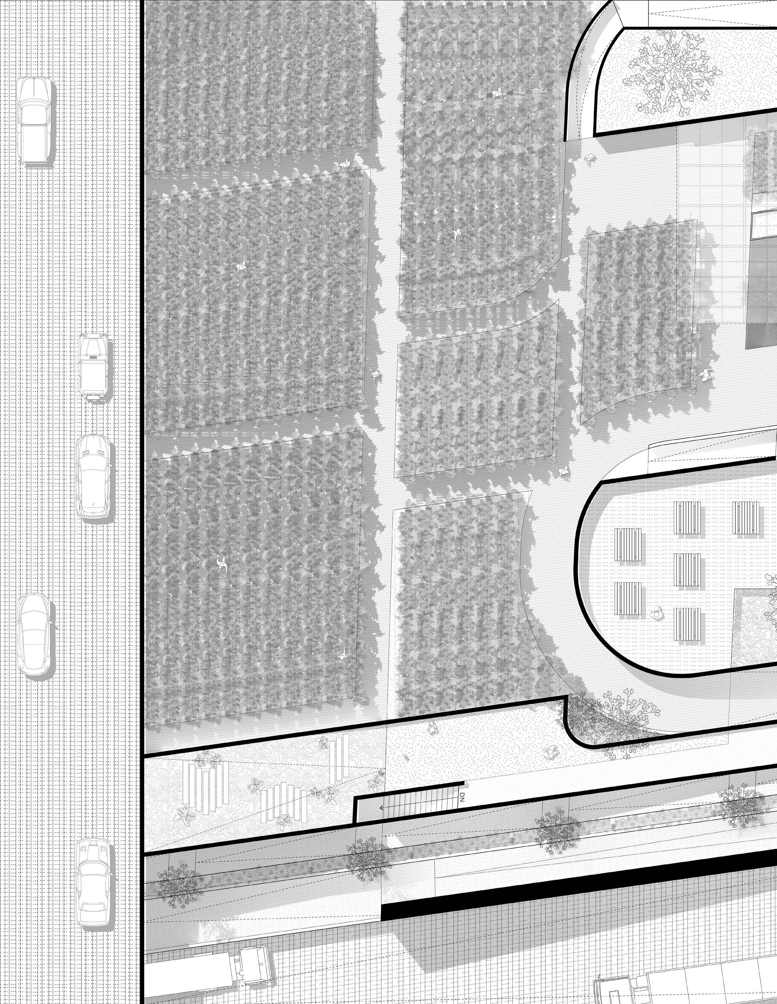
KEY
1. SUNFLOWER FIELD REMEDIATION VISITOR CENTER
2. COMPOSTING WORKSHOP & MAKERS’ SPACE
3. SPROUTS WORKSHOP
4. FARMERS’ MARKET
5. EDIBLE GARDEN
6. OUTDOOR CAFE
7. DEMONSTRATION SPACE
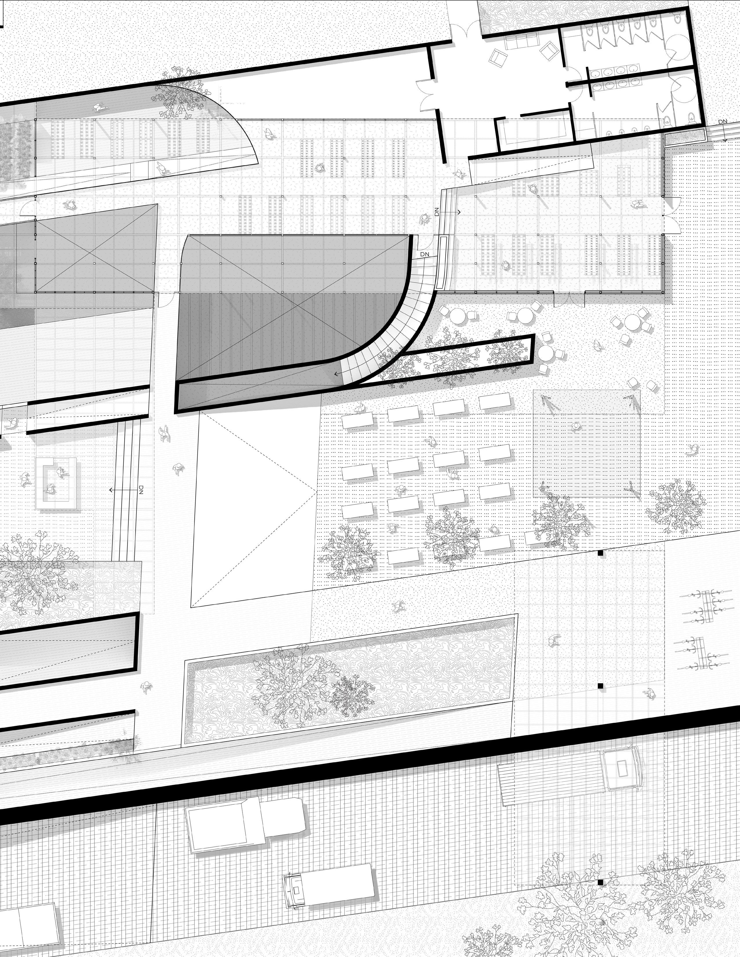
8. VEGETARIAN RESTAURANT
9. GREENHOUSE CLOSED HYDROPONIC SYSTEMS
10. WATER FEATURE
11. RESTROOM
12. STORAGE
REMEDIATION: an agricultural space for phytoremediation and nitrogen-fixing plants that simultaneously heal and nurture the environment
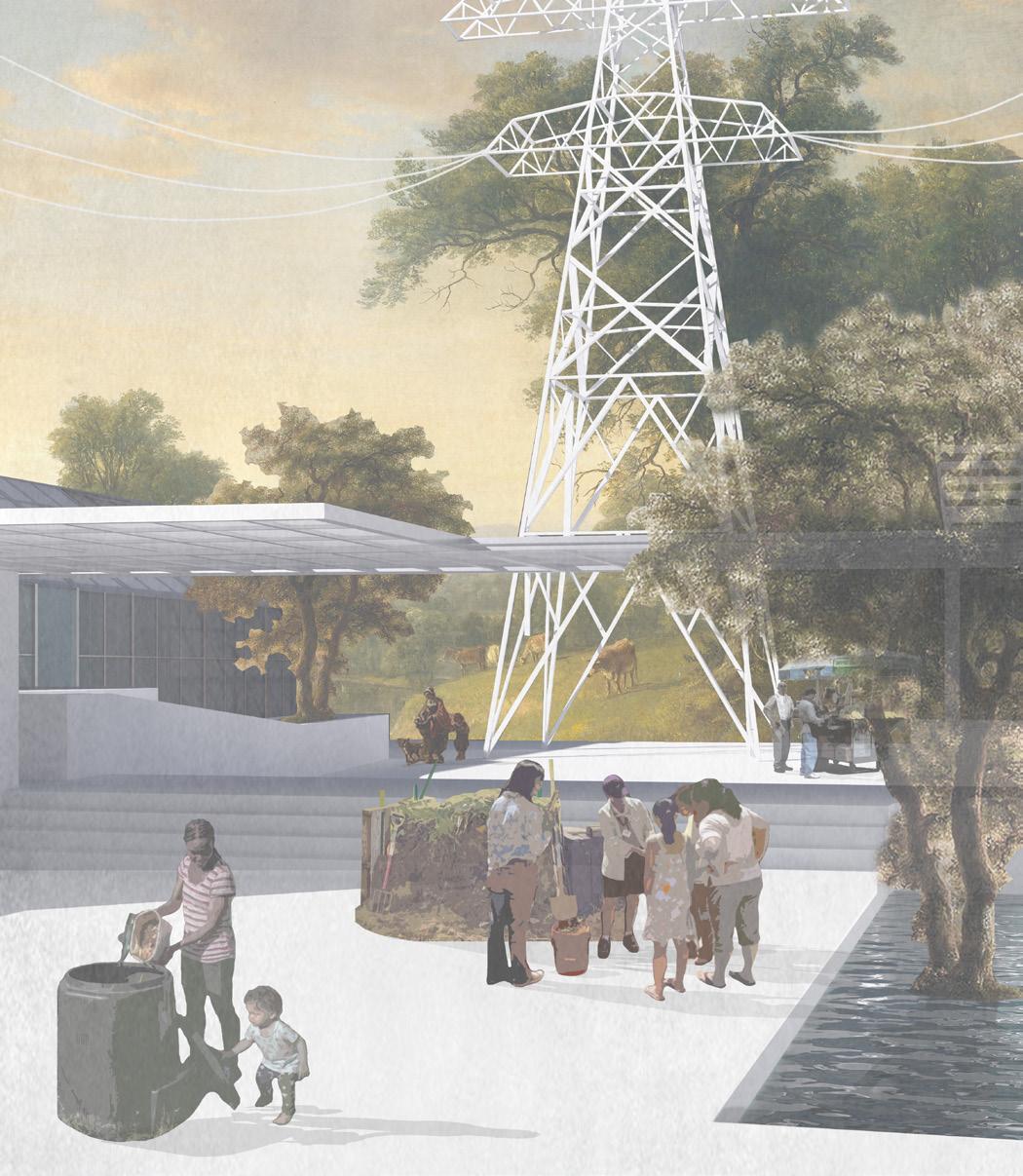
EDUCATION & PRESERVATION: foster a continued community engagement in the practice of harvesting knowledge through education of ecology & composting/ sprouts workshops relational to the edible & medicinal plants used to treat the site
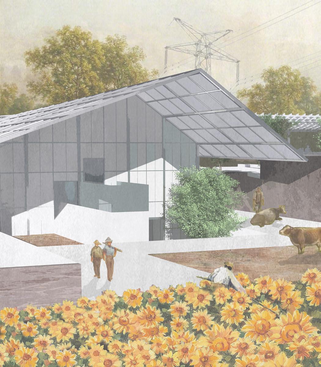
CONSERVATION & REHABILITATION: re-introducing native flora & fauna in water & land acknowledgment to the Indigenous Peoples (Fernandeño Tataviam, Gabrieleño Tongva, and Ventureño Chumash) that have stewarded this land for 1000s of years
GROWING: community becomes interconnected with the conservation of biodiversity in ecosystems at a larger context of the river; people are given knowledgeable access to the river corridor by merging science, art, and community involvement in research
KEY
1. SUNFLOWER FIELD REMEDIATION VISITOR CENTER
2. COMPOSTING WORKSHOP & MAKERS’ SPACE
3. SPROUTS WORKSHOP
4. FARMERS’ MARKET
5. EDIBLE GARDEN
6. OUTDOOR CAFE
7. DEMONSTRATION SPACE
8. VEGETARIAN RESTAURANT
9. GREENHOUSE CLOSED HYDROPONIC SYSTEMS
10. WATER FEATURE
11. RESTROOM
12. STORAGE
KEY
1. SUNFLOWER FIELD REMEDIATION VISITOR CENTER
2. COMPOSTING WORKSHOP & MAKERS’ SPACE
3. SPROUTS WORKSHOP
4. FARMERS’ MARKET
5. EDIBLE GARDEN
6. OUTDOOR CAFE
7. DEMONSTRATION SPACE
8. VEGETARIAN RESTAURANT
9. GREENHOUSE CLOSED HYDROPONIC SYSTEMS
10. WATER FEATURE
11. RESTROOM
12.
“What does it mean when we live someplace where the economic value of two urban blocks of healthy organic soil is zero?” - Lauren
Bon | Metabolic Studios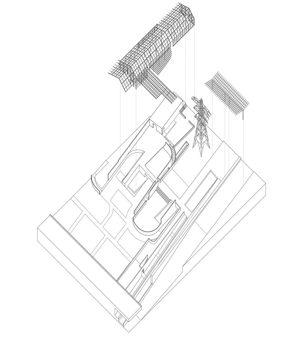
Land within the LA River watershed has historically been occupied by industrial and commercial businesses that have introduced contaminants into the soil and groundwater beneath the property. This strip of land sits on top of a highly industrialized wasteland limited by industrial and residential development, transmission easements, and access disconnection. As a result, before anything can be done with the land, toxicity from the soil must be removed first.
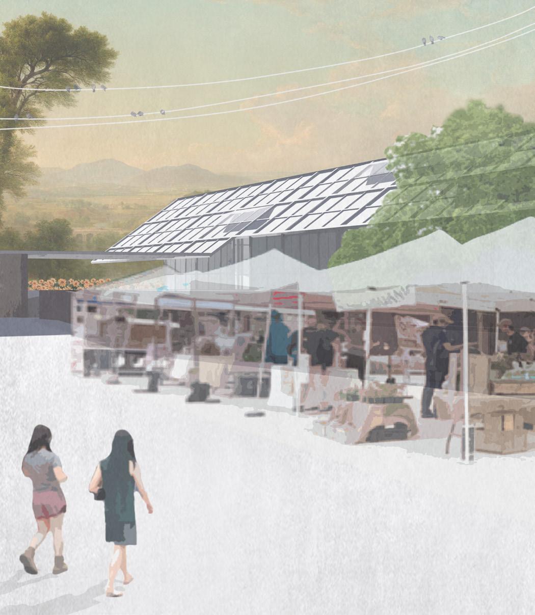
Not a Sunflower Farm along the Utility Park Promenade is a long-term proposal that doesn’t have to just end at this corridor but seeks potential to extend along the whole utility grid of the LA River, channelizing a multifaceted opportunity to make the tangible and equitable growth of the dispersed community become a woven reality; it seeks greater potential in becoming the confluence center for collaborative trade knowledge networks in communicating issues of sustainable development across the discipline. Not a SunFlower Farm instills movement and directionally throughout the site engaging visitors through pockets of spaces and events. Inevitably, this synergetic relation enhances opportunities to celebrate local arts and culture in an inclusive environment open to a festival of agriculture, farmers markets, cafes, restaurants, hand-crafts, etc.
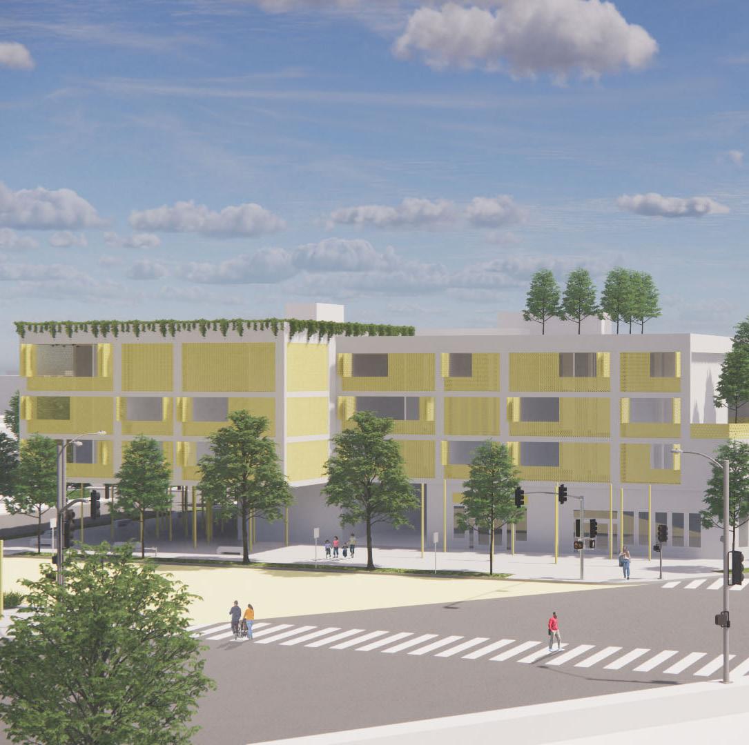
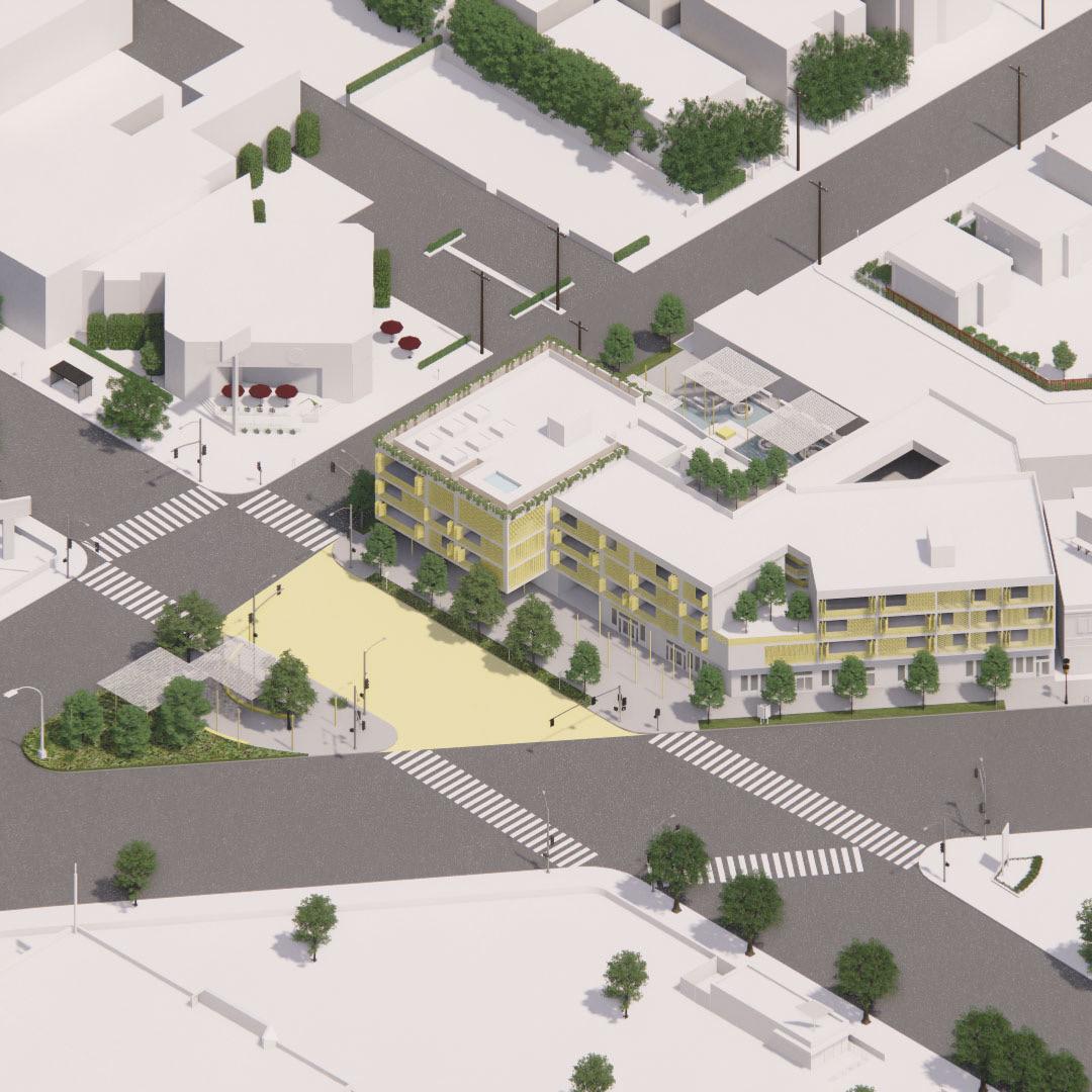
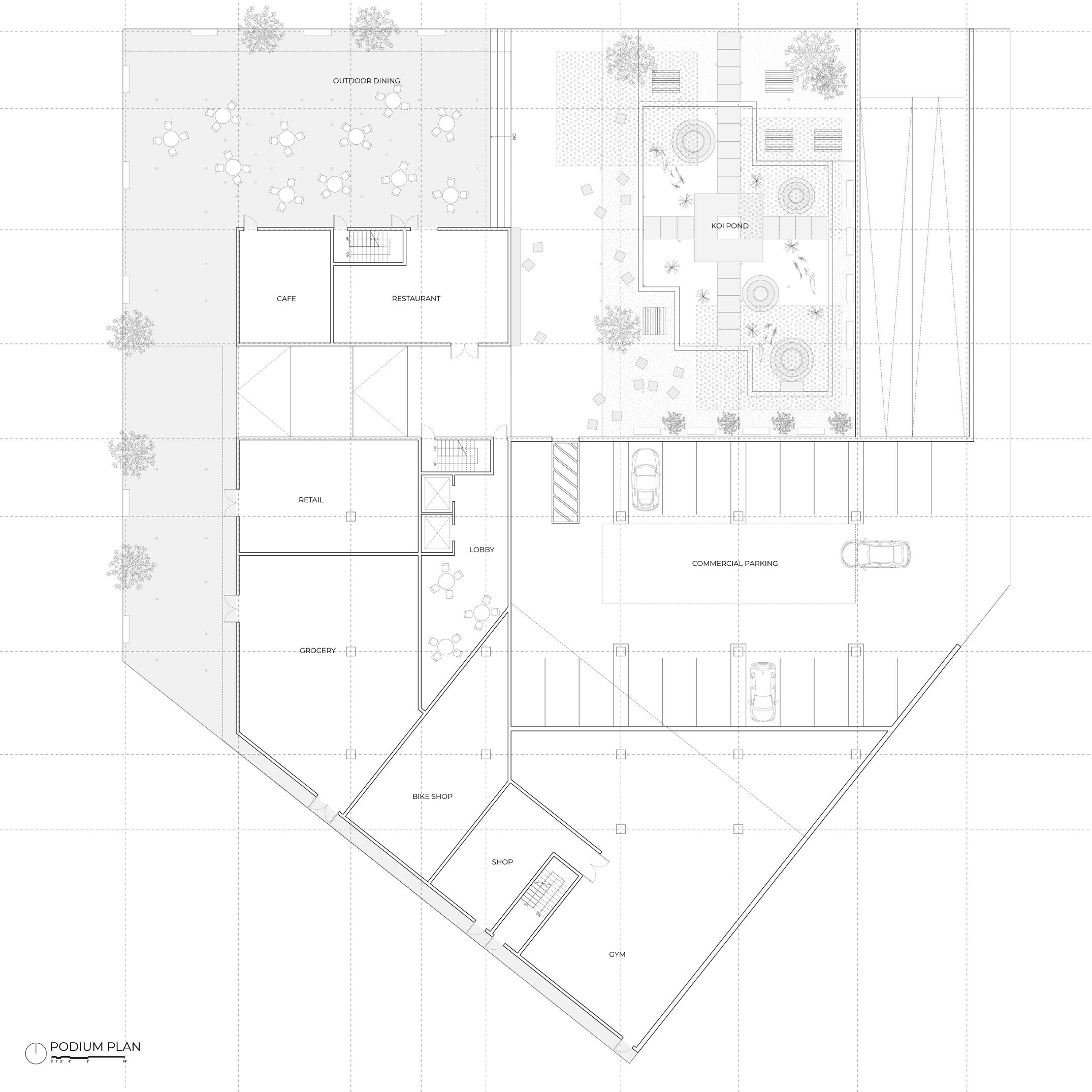
MIXED-USE HOUSING ON HOLLYWOOD BOULEVARD
Located at a dense and bustling intersection of Vermont Ave and Hollywood Blvd, this housing project aims to find
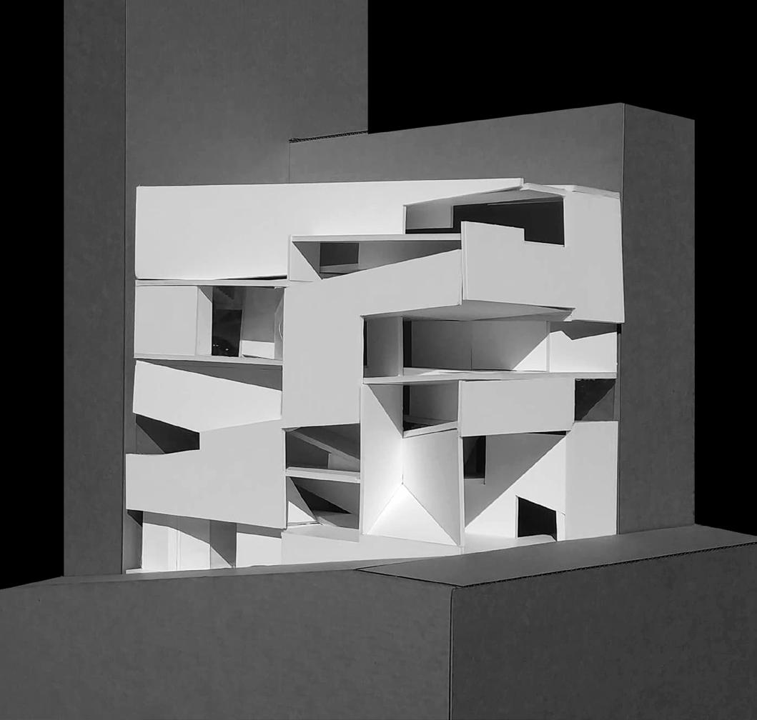
tranquility within the lively city, in response to the existing pedestrian community. By having a light building footprint and ample outdoor spaces (with the residential space floating above the commercial), the site becomes an urban center that caters to the busy flow and lives of surrounding young professionals. The overall massing hugs the corner street, leaving open gestures that lead pedestrians through the commercial spaces to discover a quiet koi pond that drowns out the humming of the city. As a result, the circulation becomes interconnected from the retail level to the miniature park across the street, and back up to the pond again. Yellow columns are planted throughout the project, in a grid, that functions as a poetic installation and shading device that anchors the programs to the site.
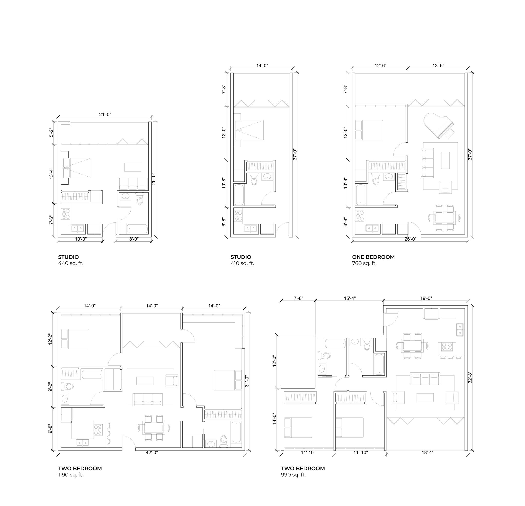
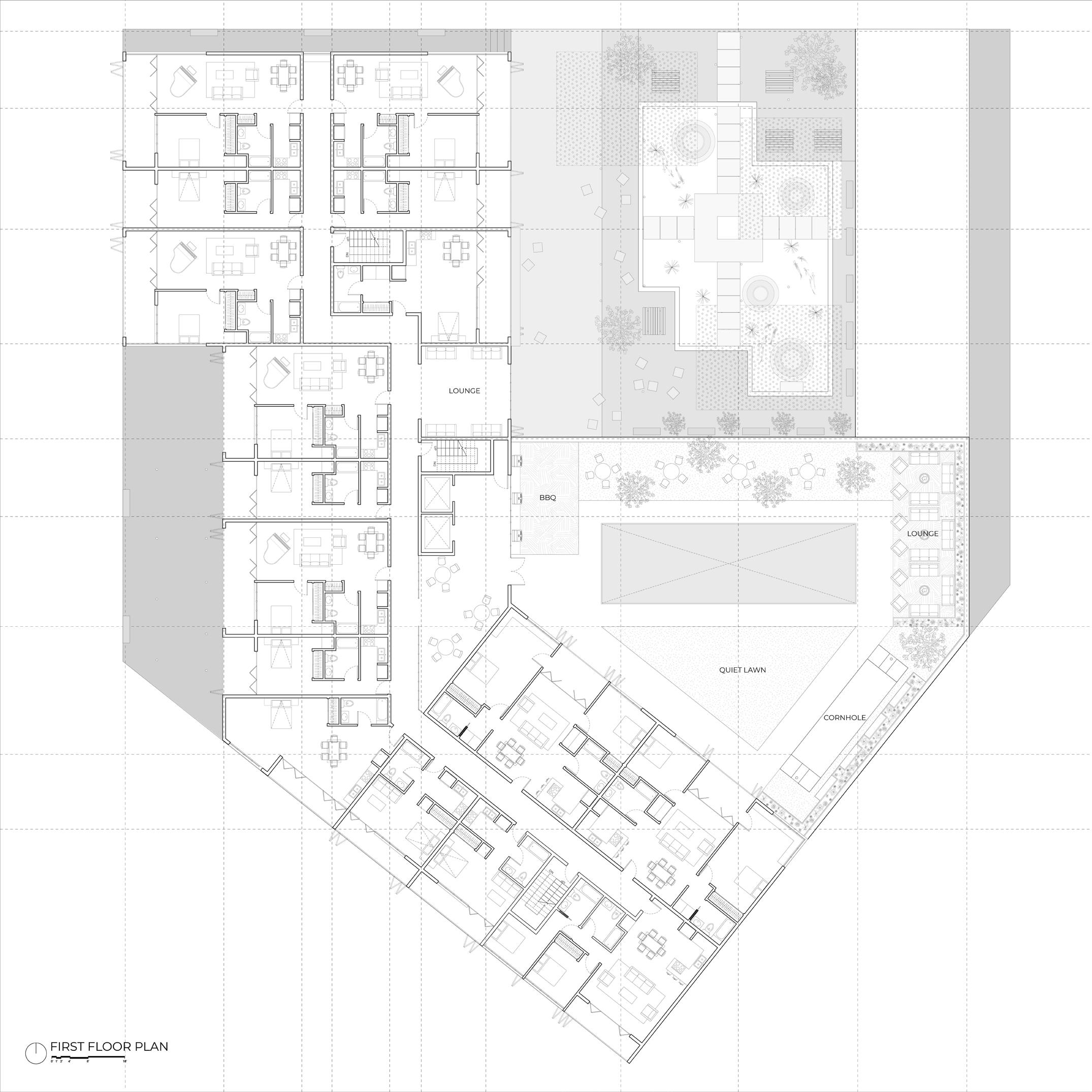
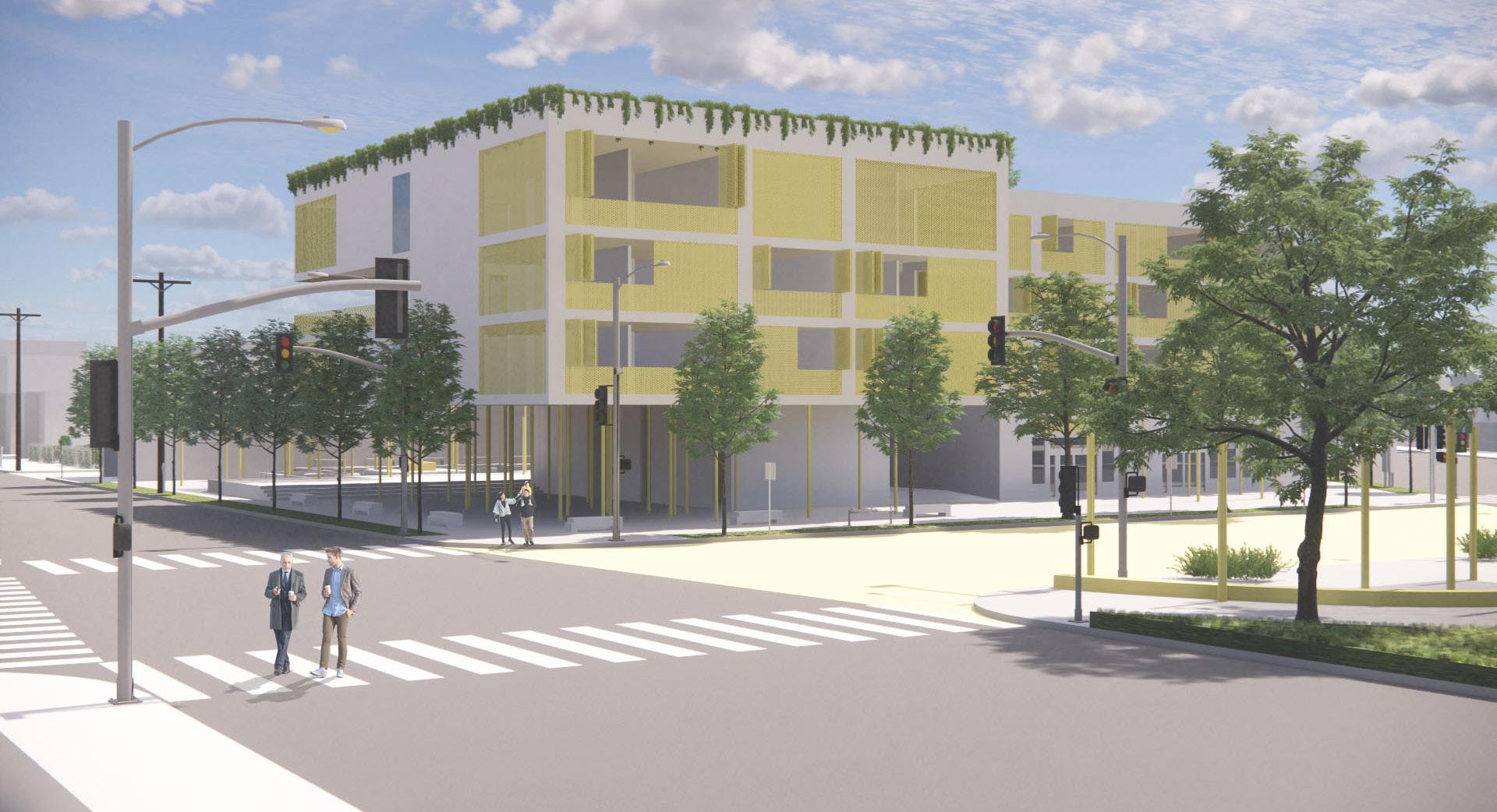
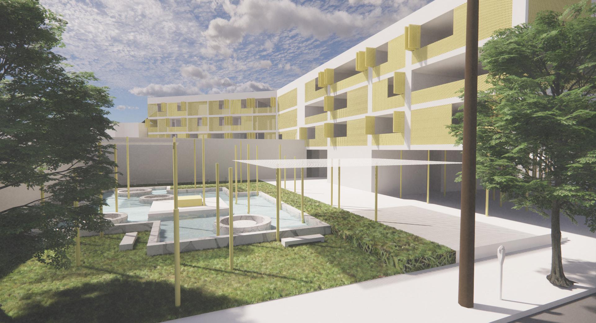
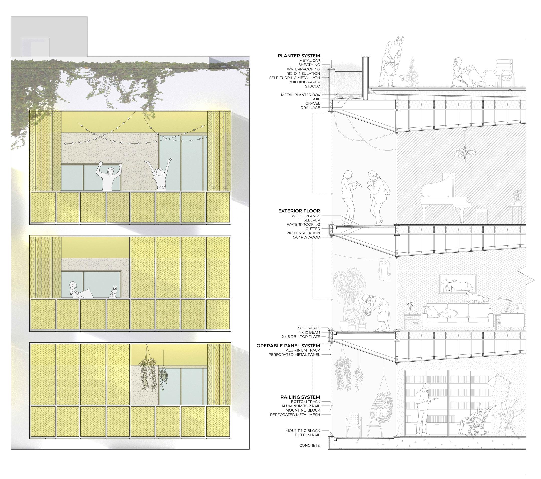
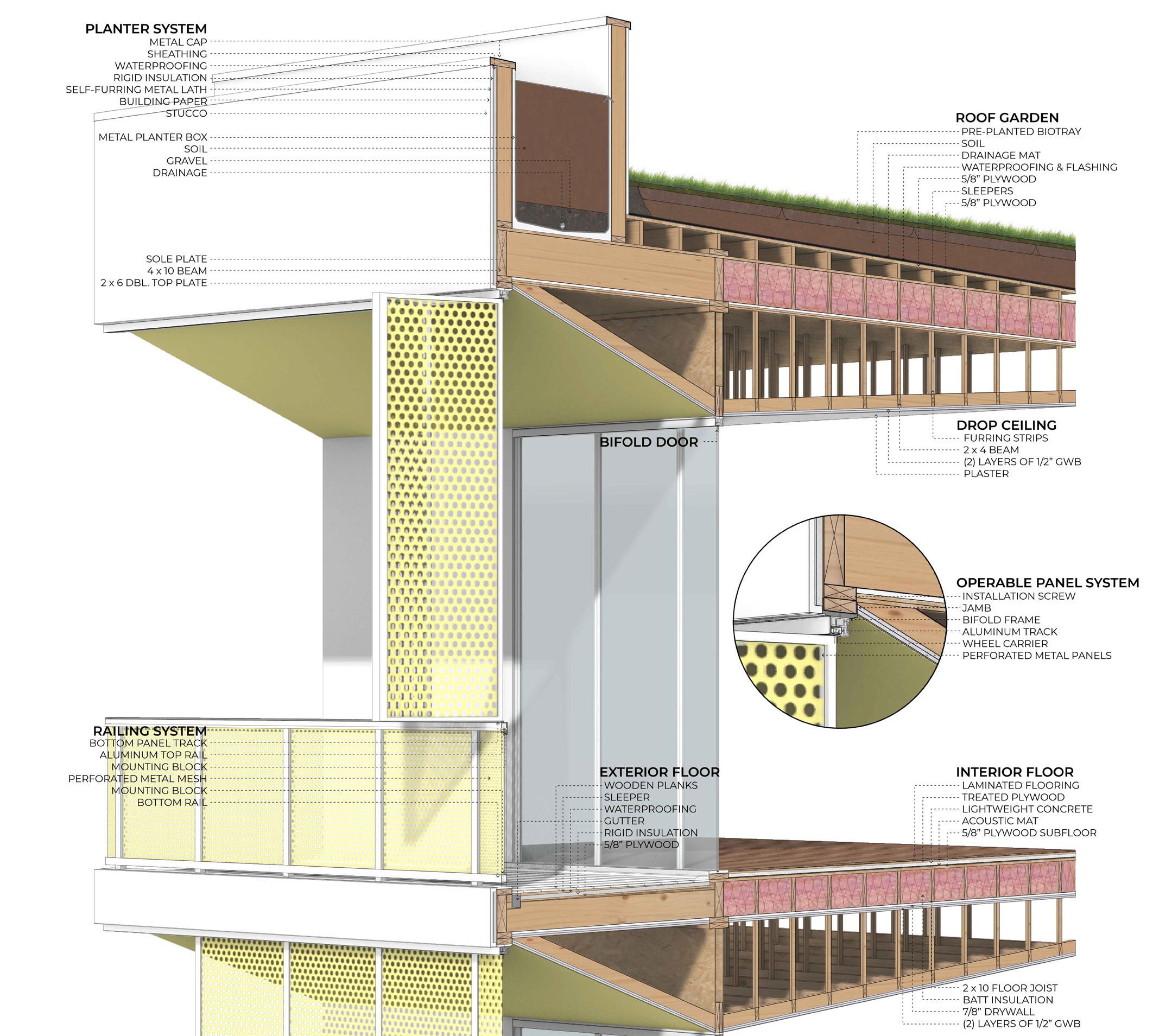
Overseeing the iconic view of Los Angeles, Los Feliz Housing continues the existing datum and color palette of neighboring buildings, while also incorporating operable metal panels to add to the resident’s level of personalization. Because of this flexibility, it creates a fluid motion of the building’s identity in that it is always changing with the city. Contrastingly, the railings of each balcony remain stagnant and grounded to the elevation of the project. In the interior, each individual unit reveals its own identity in the change of ceiling heights and shapes in space. The compact units spatially unfold into larger rooms. By manipulating gable and shed ceiling characteristics, it gently guides the residents towards the outdoors, reemphasizing the holistic ideas of creating a flexible indoor and outdoor relationship through moments of compression and decompression. Light and playful in nature, this project focuses on creating flow and finding peace in a busy urban landscape.
Spring 2021




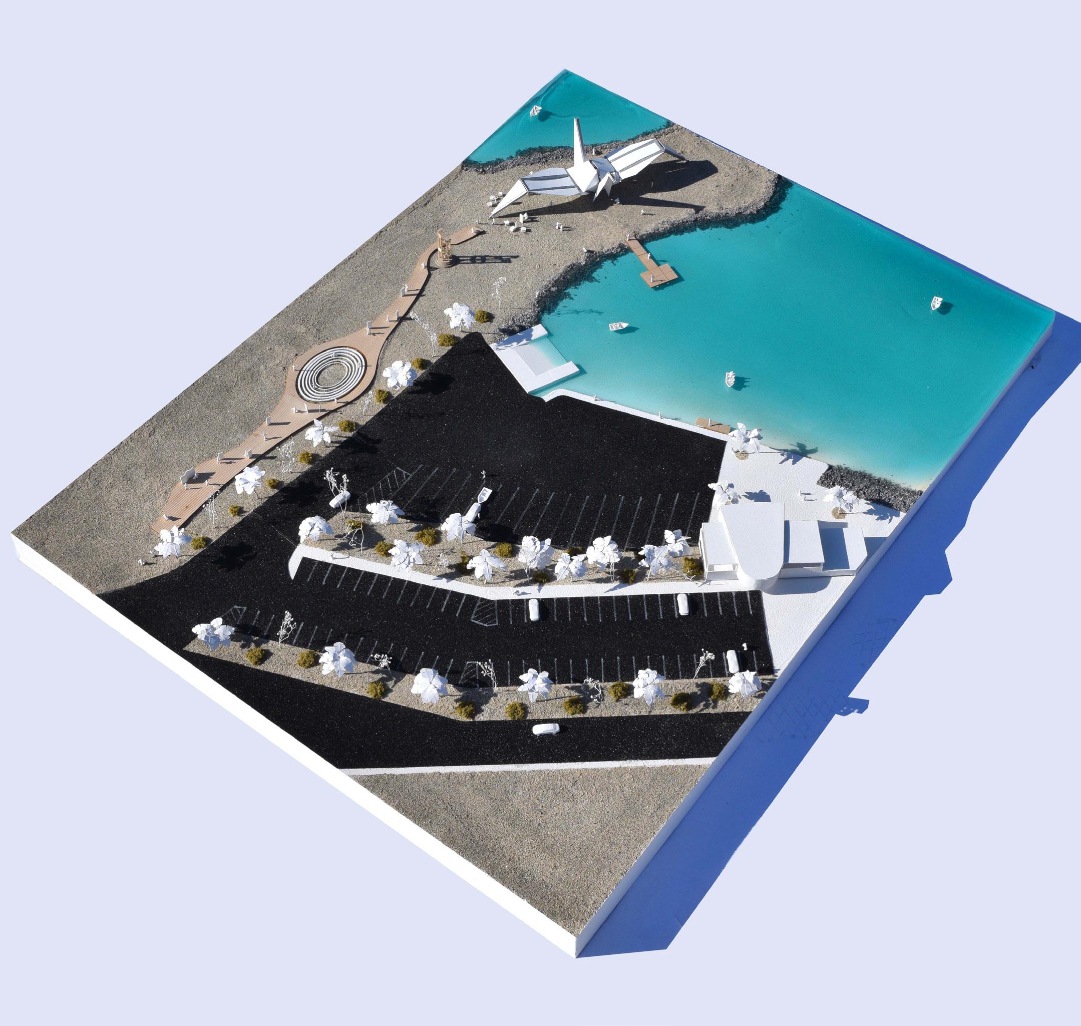
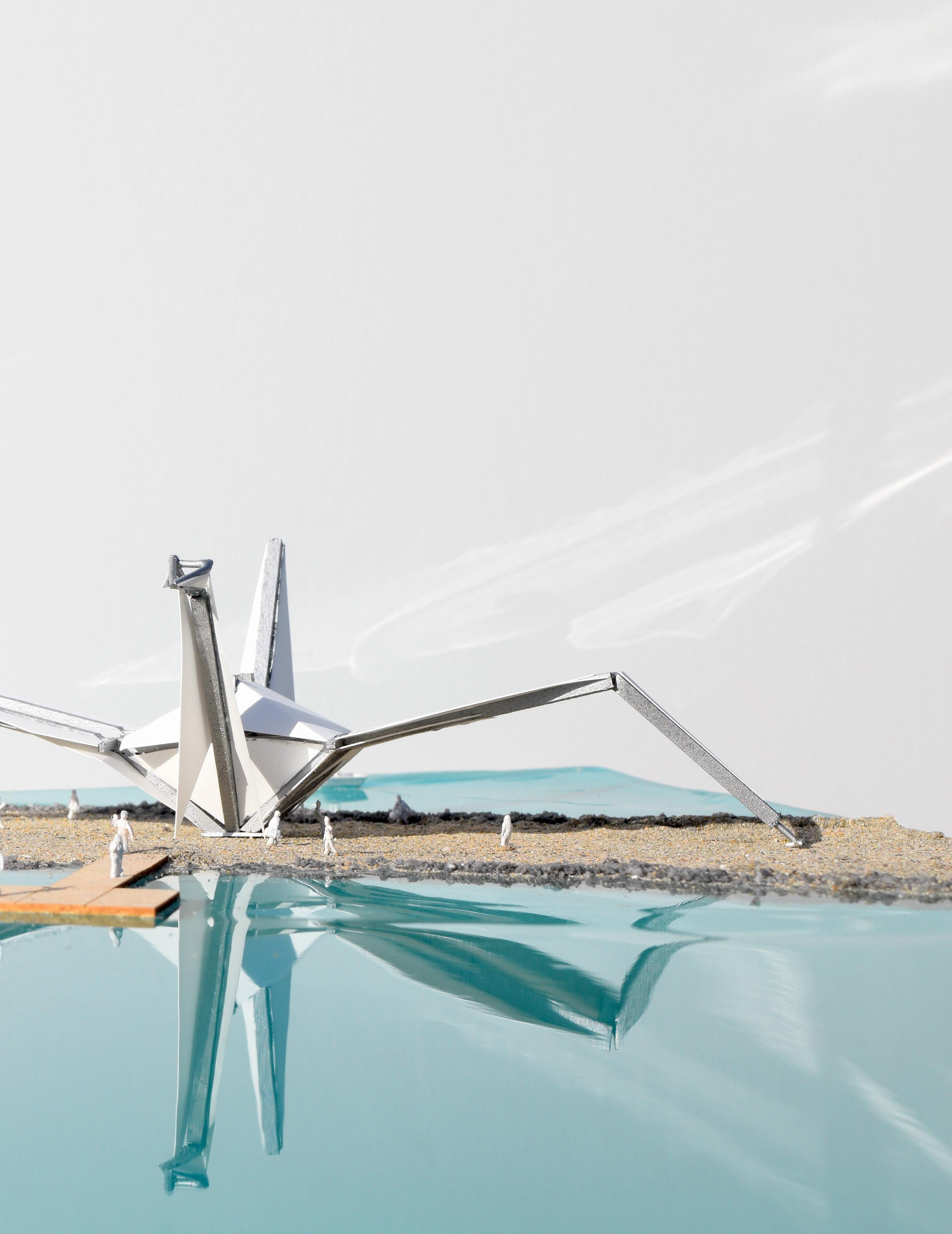
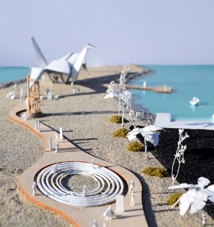
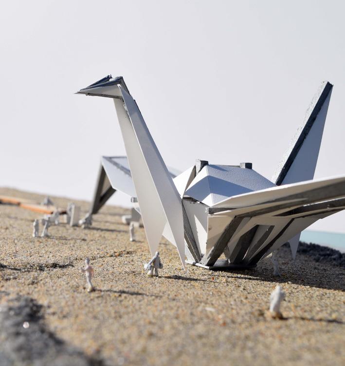
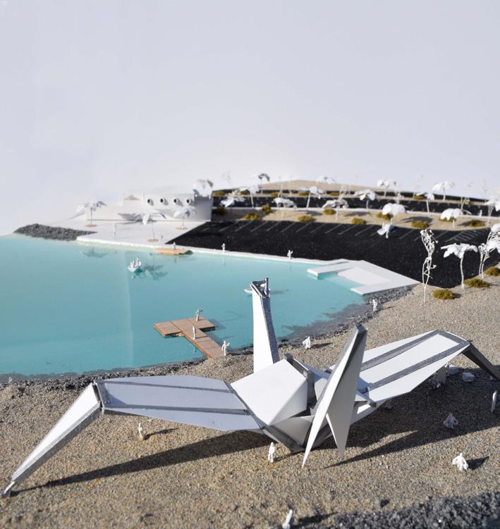
In efforts to revitalize the North Shore Beach & Yacht Club (designed by Albert Frey and built by

developers Ray Ryan and Trav Rogers in 1959) by the Salton Sea, this memorial explores the different understandings of peace as seen through different cultures. Like many other notions, peace means different things to different people. How is peace defined? Is peace just the absence of war, or is it created by the deliberate actions of individuals?
Inspired by the ancient art of origami, Ascension (also known as COCO created by the Crimson Collective) depicts a crane at its first moments of flight. It is intended as an inspiration for thought and action. And it stands as a symbol of hope and a prelude to ascension through awareness and understanding.
The different interpretations and symbols of peace are distilled into their core concepts and depicted on a series of concrete tablets along a path. Each of these tablets depicts different elements and motivations, as well as the specific actions that foster Peace that are not limited to hope, forgiveness, promise, liberty, security, nuclear disarmament, and victory. Interspersed with these tablets are also other design elements that are meant to instill a feeling of calm and tranquility. These elements and experiences aid in the manifestation of inner peace and stillness as an inspiration and motivation for outward action such as the meditation garden and bell tower.
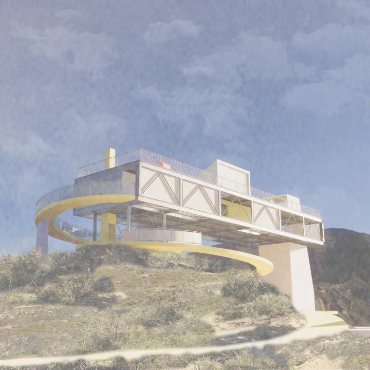
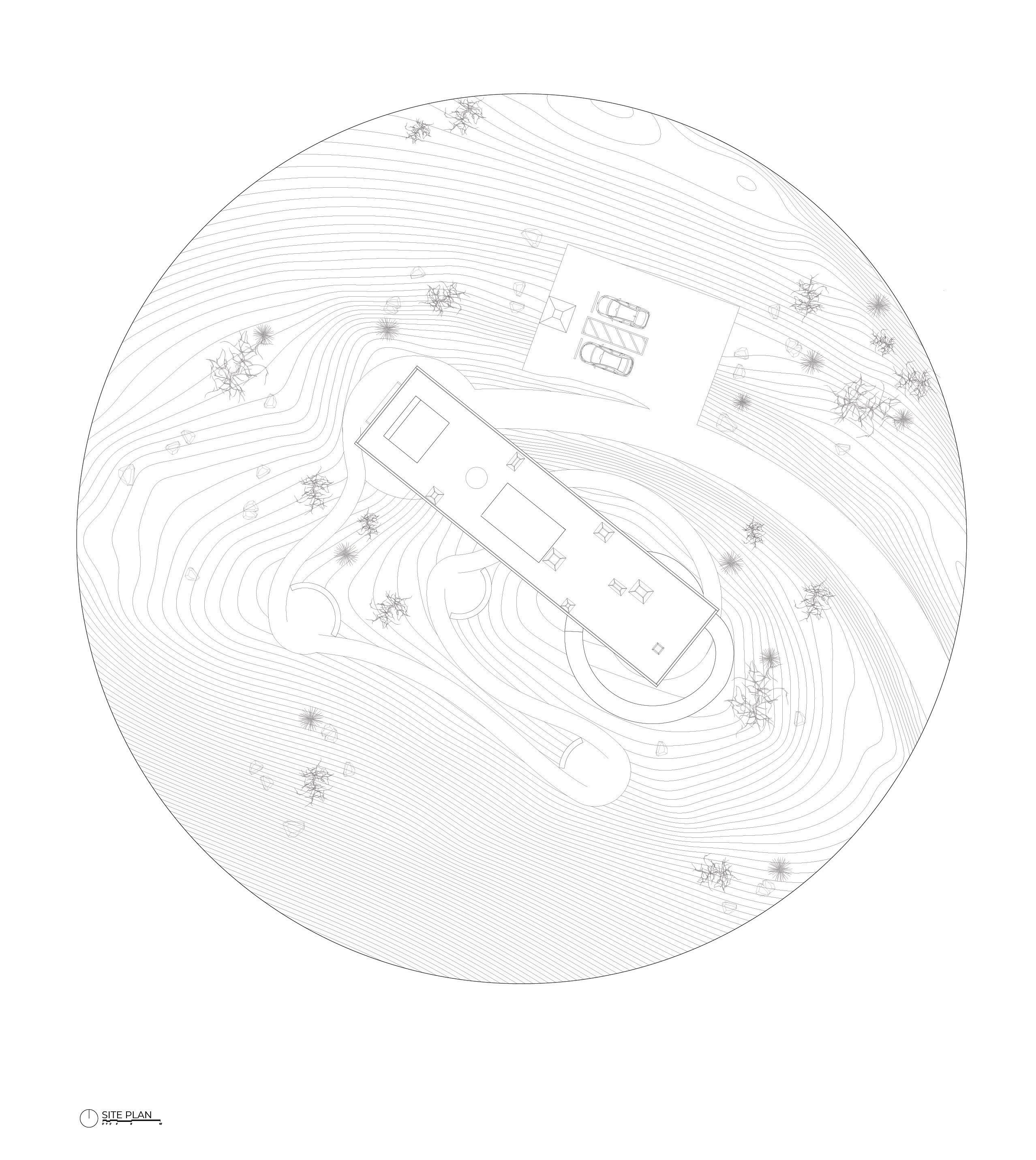
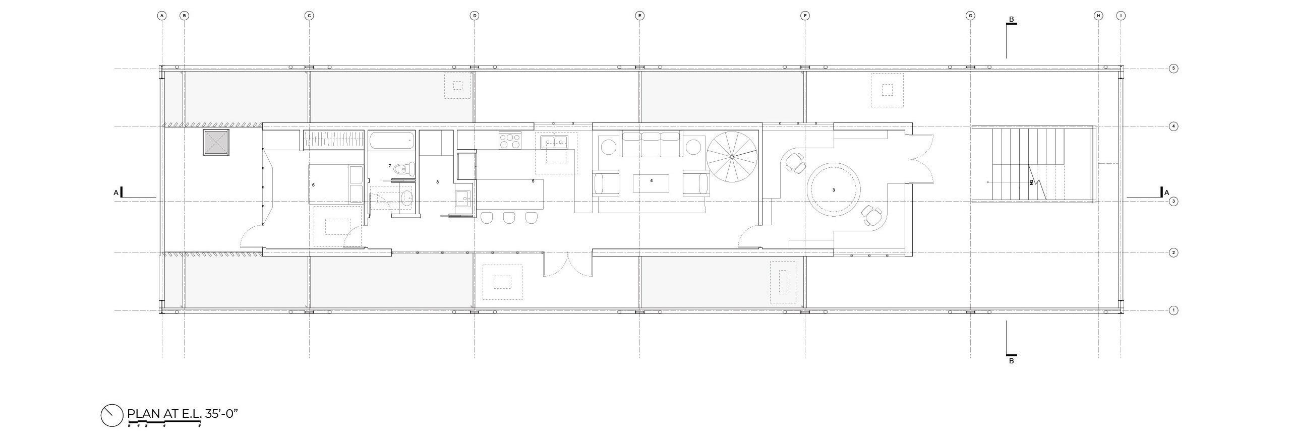
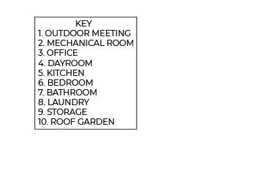
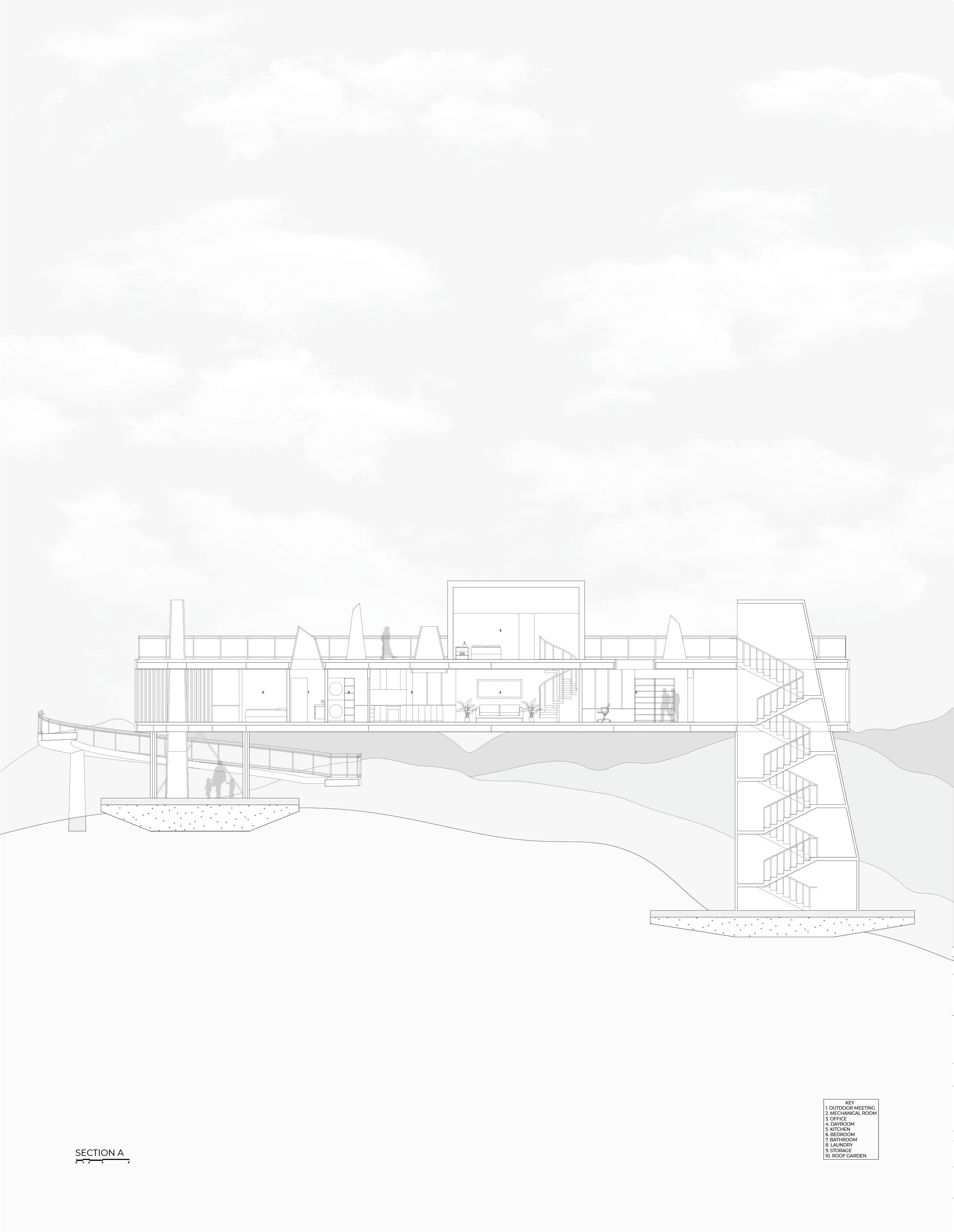
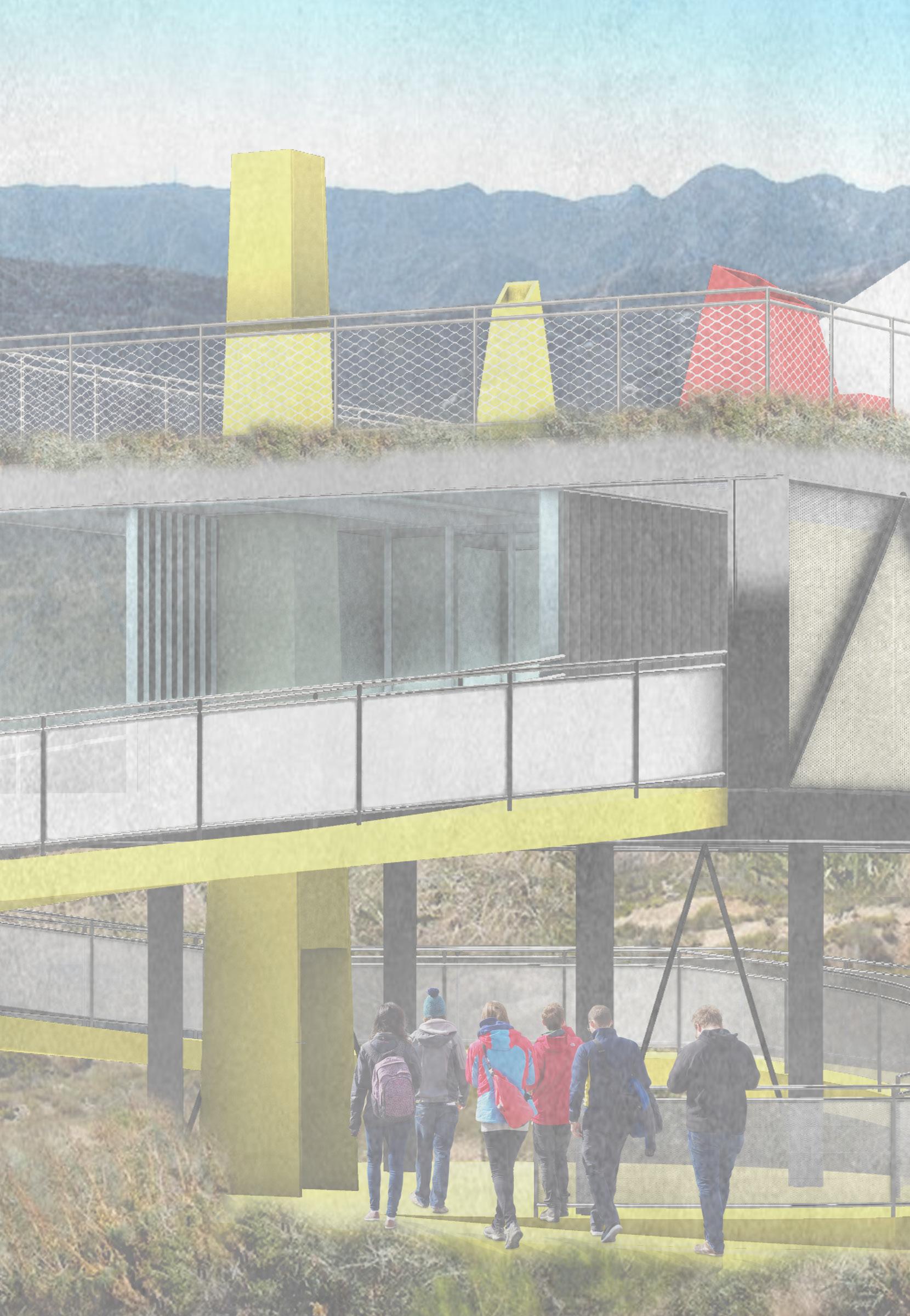
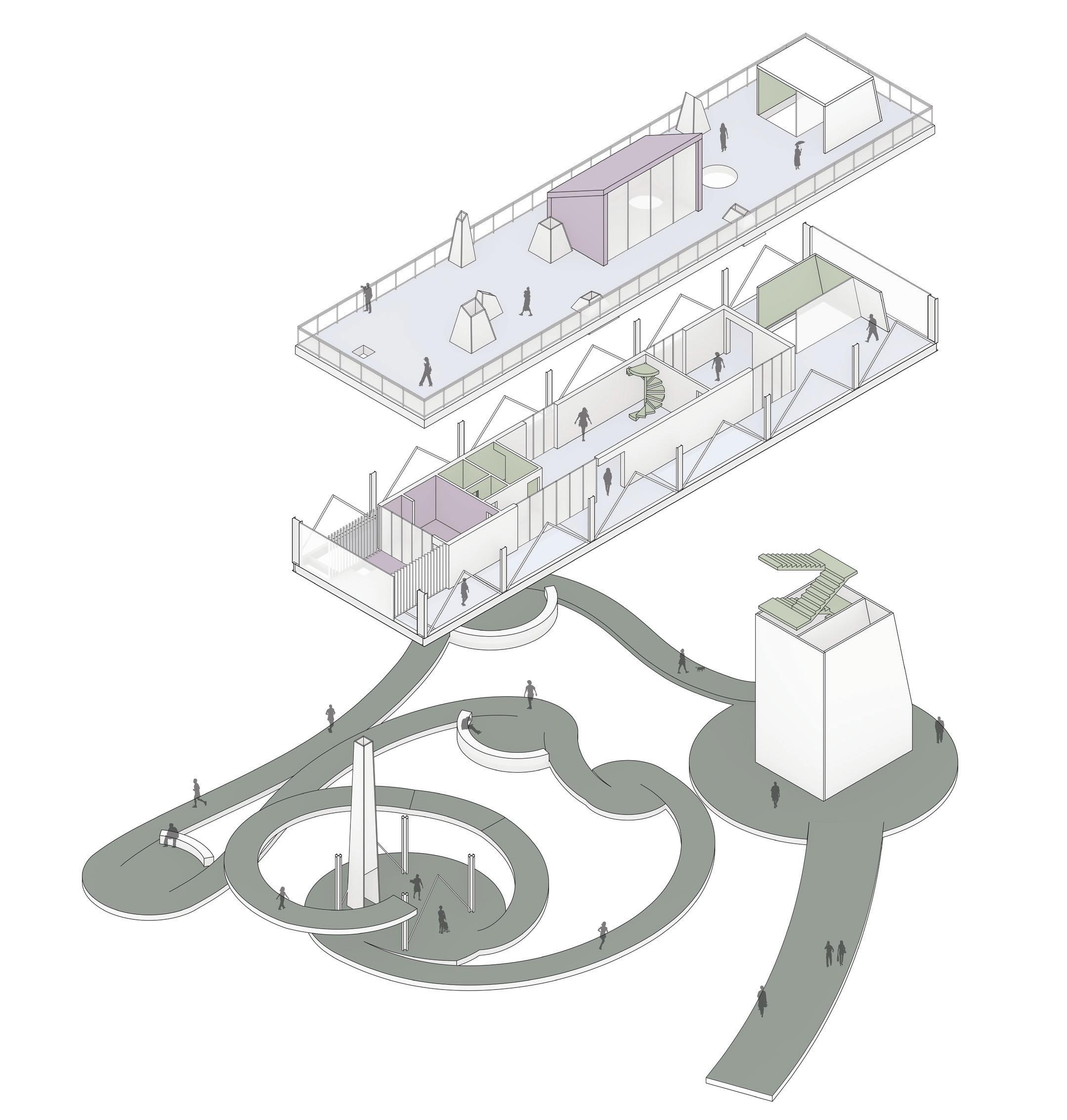
Located on top of Mount Vetter overlooking the San Gabriel Mountains within the Los Angles National Forest,
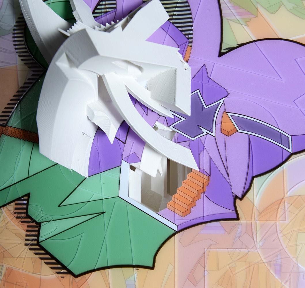
the scientist’s retreat will be used mostly by astronomers and also serve as an education center open to the general public, visitors, and weekenders interested in astronomy. Upon arrival, the facility renders a mass of intersecting geometric volumes that encapsulate a semi-enclosed and enclosed space. Mimicking the topography, a path embraces the natural environment in a fluid language with rest stops and seating areas directed at scenic views. From Vetter Mountain visitors can look west across Upper Big Tujunga Canyon toward Strawberry Peak, north across the Alder Creek drainage toward Mount Pacifico and Mount Hillyer, or northeast toward Mount Waterman and Twin Peaks. Beyond those peaks, directly east, is the iconic form of Mount Baldy.
Capturing the natural environment, the steady path is meant to frame the panoramic views. The circulation continues from the path and floats up into a ramp, highlighting the outdoor meeting space and guiding visitors up to a bridge with programmed spaces. The long, curvilinear path emerges from the ground and continuously extends, lifting the public towards the sky. Multiple viewing tubes interrupt the floors and frame the ceiling above as visitors move through the spaces. Alternating between moments of exposure through skylights, glass flooring, and perforated metal screens, this project aims to create a constant movement of the eye. With astronomy as the center of interest, it is only appropriate to focus the retreat’s attention to gaze up at the sky through the field of sculptural viewing tubes. Each astronomer is given their own privacy for quiet thoughts and study as well as shared office space for collaboration. Although the bridge allows for semi-public access to glimpse at the scientists’ research, only the astronomers living there have full privacy and access to the roof garden in which they will spend most of their nights conducting studies. The overall scientist retreat design concept focuses on the exploration of light and spatial movement.
Fall 2020

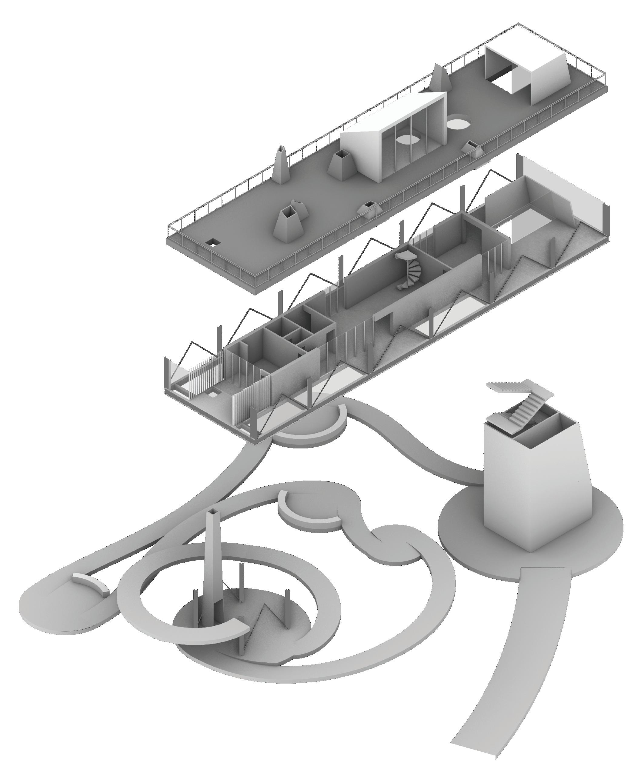

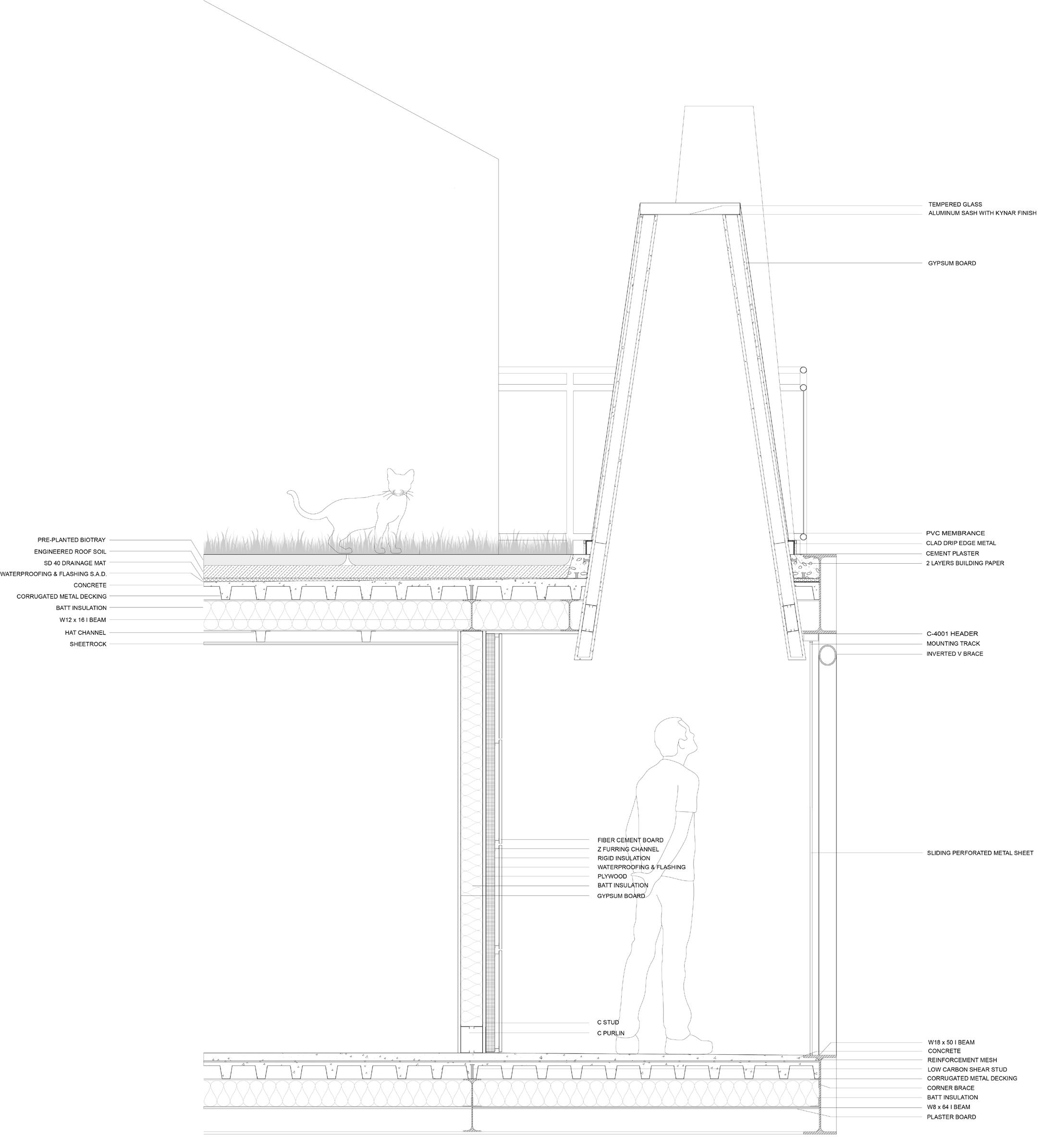
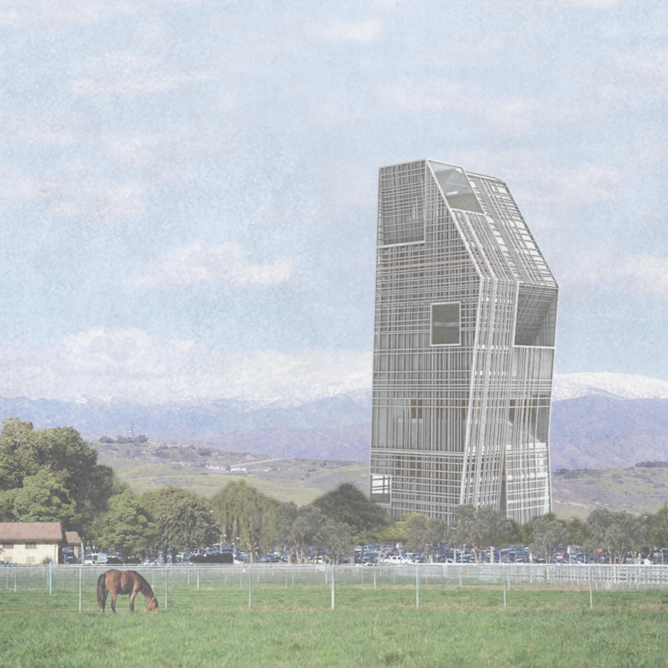
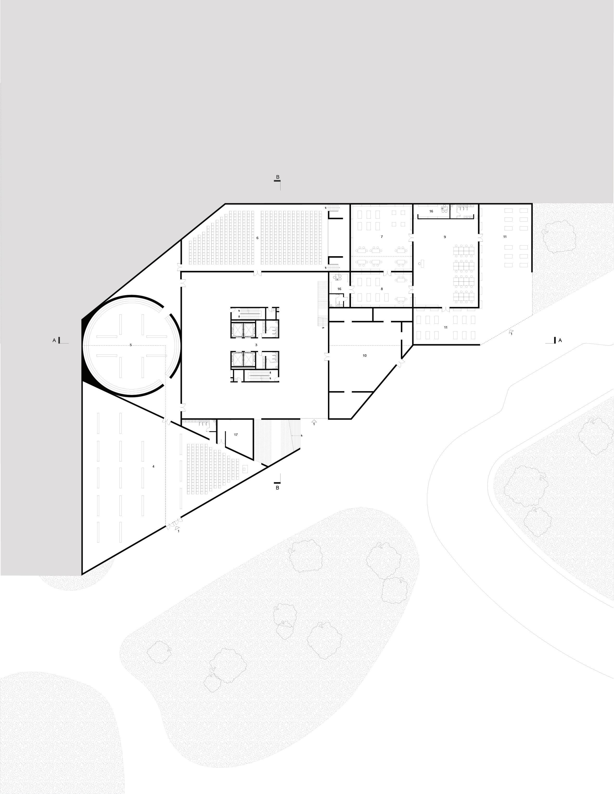
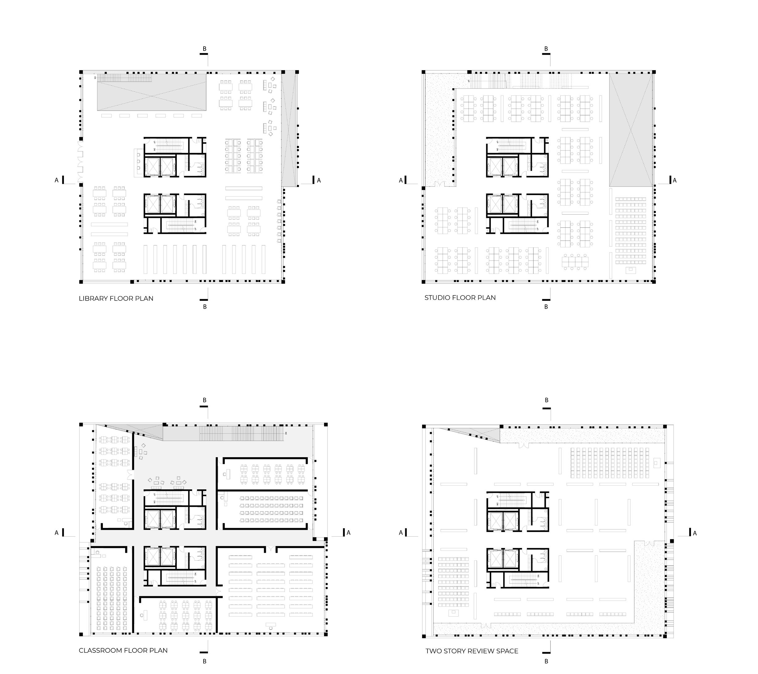
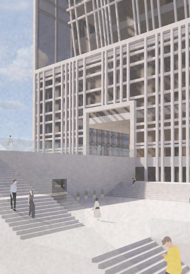
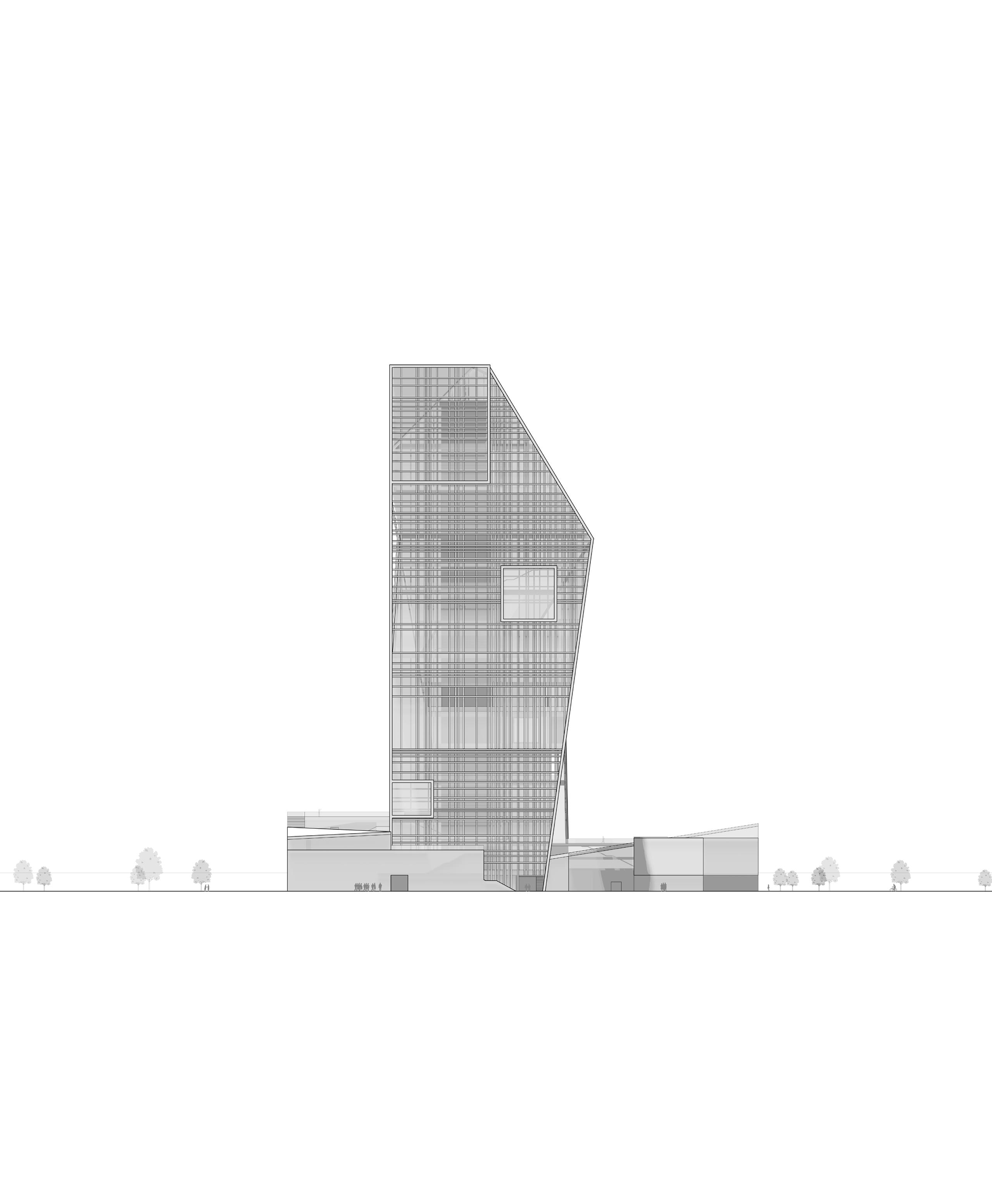
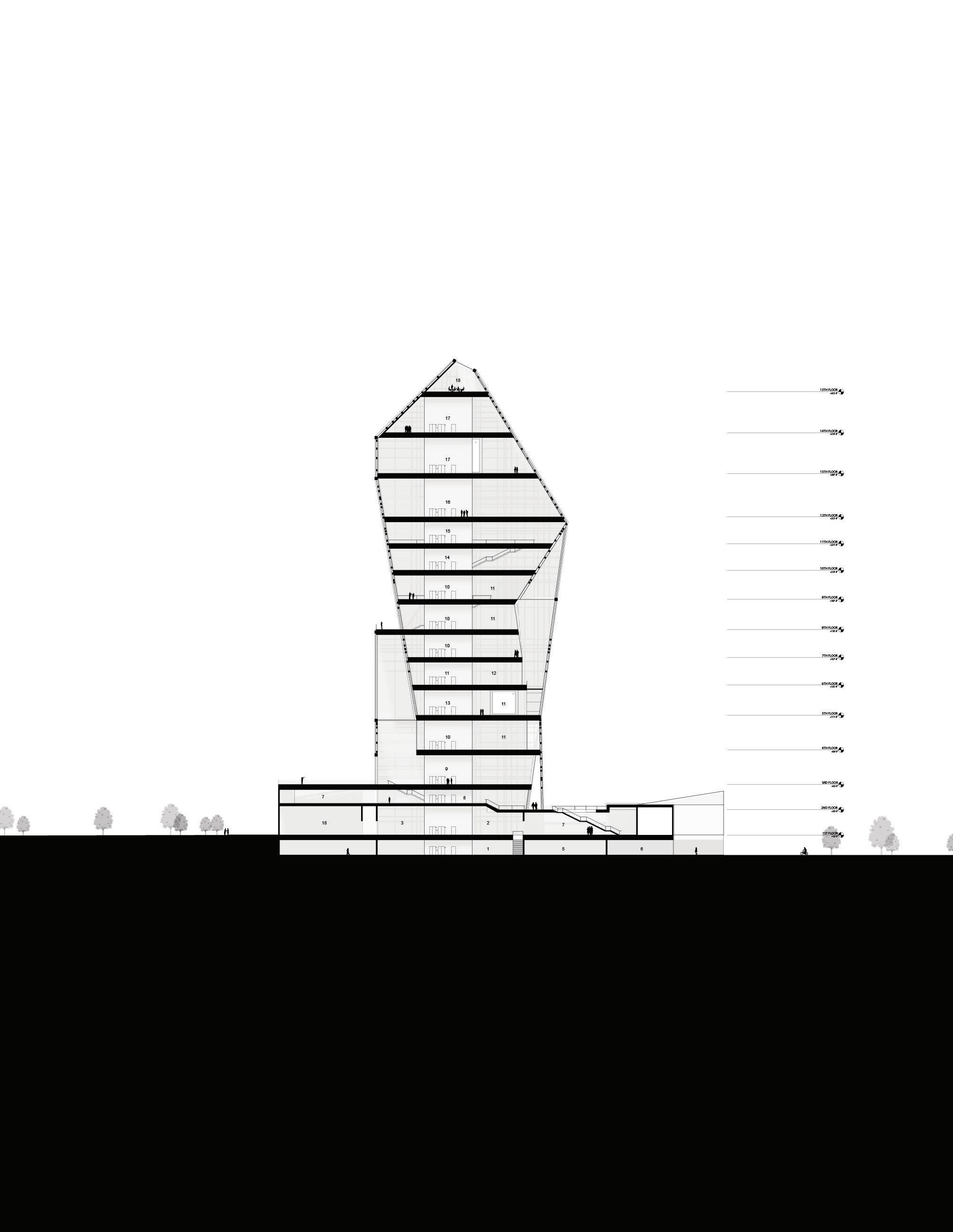
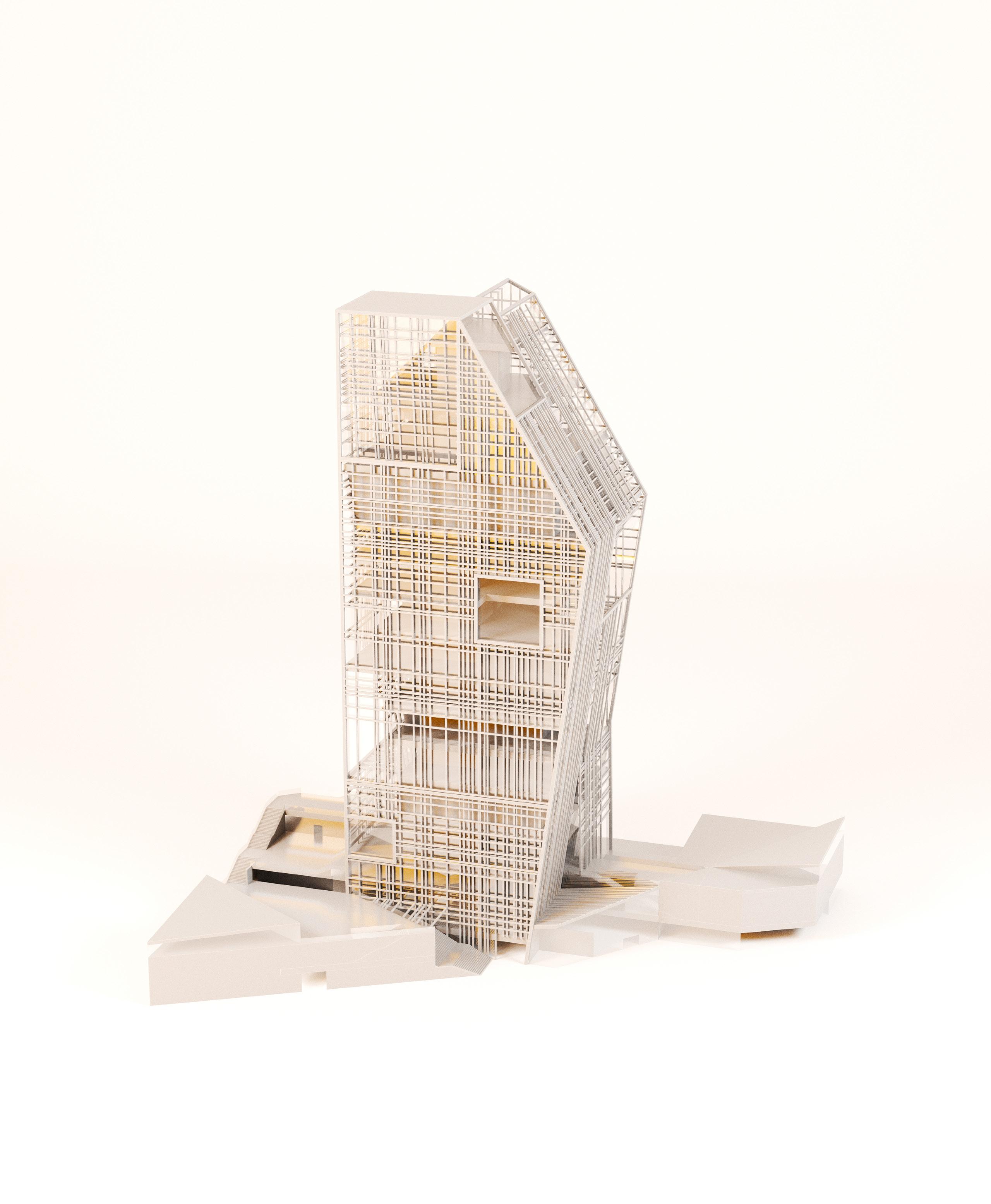
Given a more agricultural site context at Cal Poly Pomona, the School of Architecture stands alone as a beacon of light that
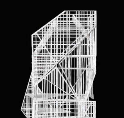
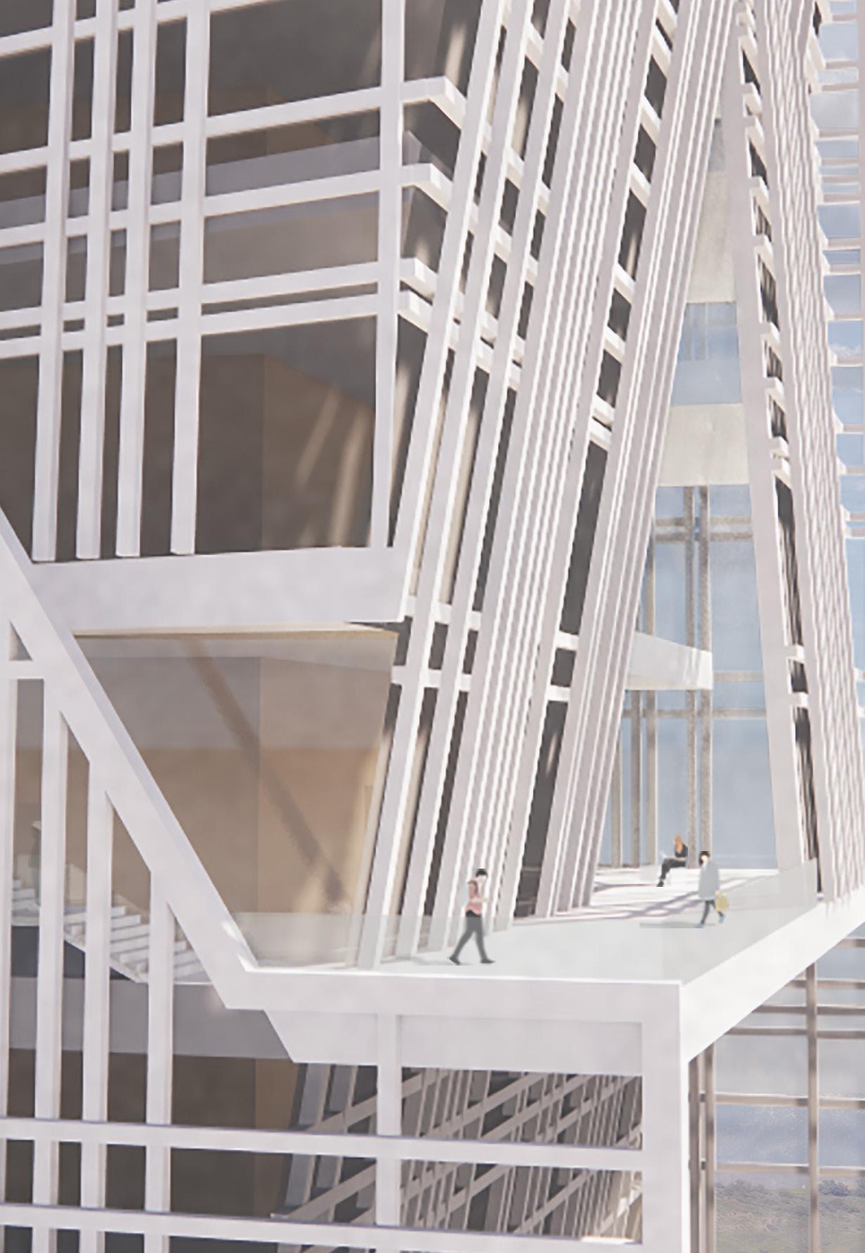
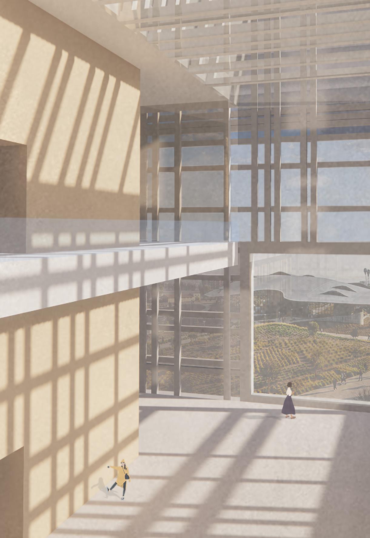
lures and welcomes the public. The tower is a simple rectangular extrusion, which through a series of cuts and folds of different types and scales were used to achieve an overall expression and posture with sequences of semi-outdoor spaces in section. Folds along the grain of the facade were used to deliberately allow light to enter and emphasize different programmatic spaces throughout the day. When night falls, the tower is brightly lit with interior lighting that has been generated during the day. In other words, light from the tower is being absorbed during the day, while at night it turns into a lantern that illuminates the campus.
The posture of the tower is heavily influenced by the circulator path of the sun as a mechanism to passively control heat gain. Relatively, the tower facade is made from a finely curated grid with its variable density and moments of overlap to filter light throughout space. As a sustainability and passive feature, the grid is layered accordingly to have horizontal overhangs on the south facade and vertical fins on the east and west facade; this is to protect the tower from the temperate climate.
The grid also offers potential as a structural element and a visual aesthetic, breaking down the dramatic scale of the tower and helping organize the programmatic spaces. Furthermore, the grid dubs as a railing system on each floor that contains a semi-exterior balcony space that was an intentional result of the interstitial spaces created from the openings of the folds. In contrast to the tower, the plinth is tectonic in nature. It is orientated to connect the campus and tower with a direct path that runs straight through to facilitate public circulation. Similarly, this circulation is mimicked in the upper levels of the towers; semi-exterior staircases run right against the facade and are enclosed between the tower’s double skin layer for people to experience the uncrowded scenaries of the campus.
Spring 2020
Urban density is a measure of compactness that can describe a range of actors and conditions in the city.
Therefore, it is a dynamic and diverse product of change – within people, cultures, and the environment – in time. Adaptive reuse is uniquely posed to mediate these changes with existing spaces by adapting the built environment to shifting conditions
As a result, adaptive reuse comes into perspective as a viable alternative to reimagine existing spaces that are no longer beings used or have outlived their original purpose. The concept of adaptive reuse serves as connectivity to revitalize and optimize urban blight and ignite social change through the preservation and reinterpretation of architectural and cultural heritage
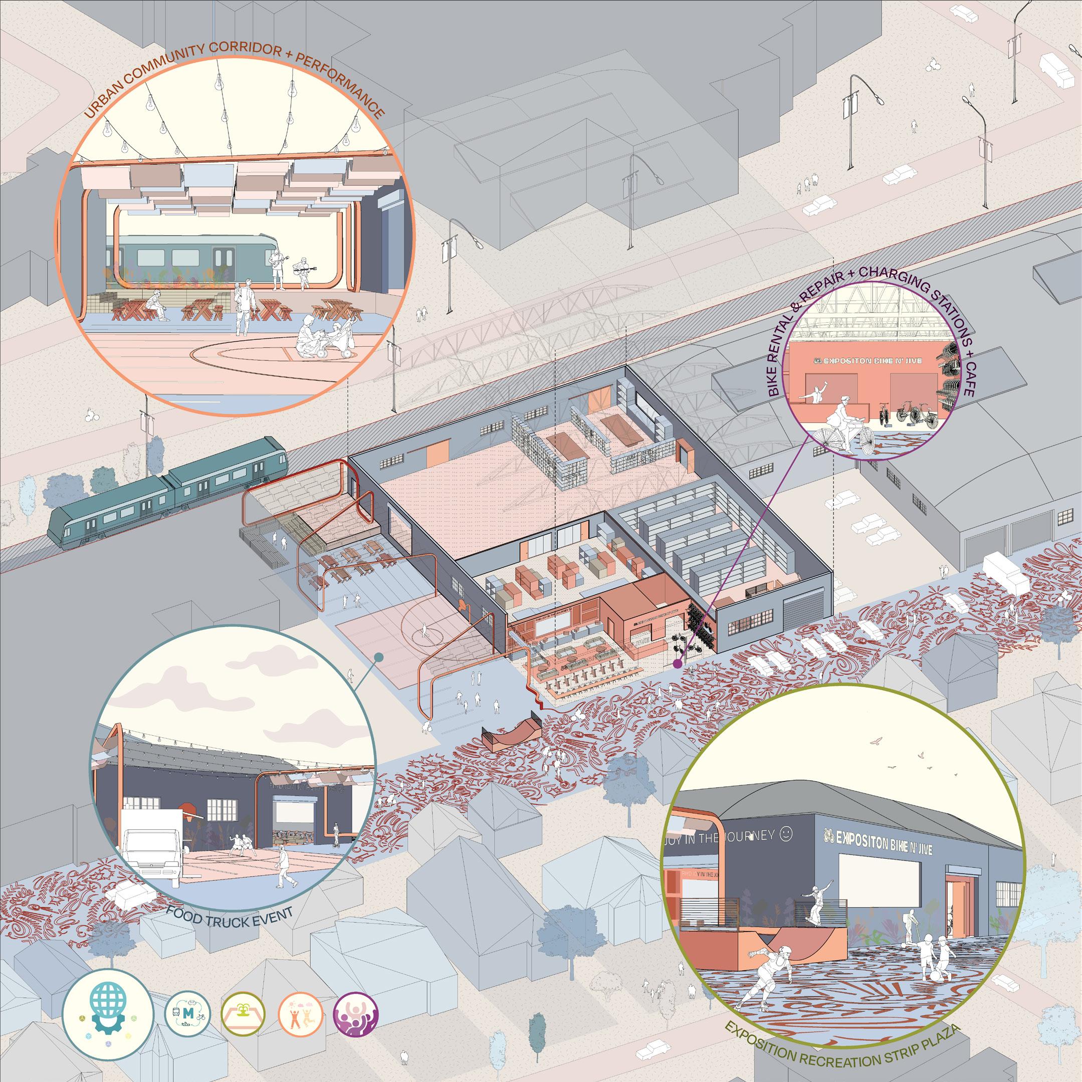
This research hypothesizes how adaptive reuse can begin to change the vocabulary of Los Angeles. Contextualizing the location of the RIOS’s office within the broader demographic, industrial, and infrastructural make-up of Los Angeles, the city is understood as a mosaic of communities, ecologies, and building topologies. Adaptive reuse strategies, particularly those applicable to old warehouses in formerly industrial sites, present an opportunity to engage with this diverse fragmentation. Data collection provides a foundation of understanding of our city as it sits today – identifying areas of attention. Host sites are uncovered in the process and used to speculate how the context, demographic, and use of the space could change if adaptively reused based on local needs.
Through the lens of Urban Transit, this diagram of community spaces including performance and recreation areas dives into the role adaptive reuse plays in the current evolution of densifying cities; it uncovers overlapping layers of complexity that adaptive reuse can bring, touching upon the social, economic, environmental, and metaphysical understanding of space.
