New Zealand Heritage List / Rārangi Kōrero - Report for a Wāhi Tapu Area Te Araaka, Oke Bay (List no. 9854)

Name of author: Dennis Ngāwhare
DRAFT: 21/06/2021
Heritage New Zealand Pouhere Taonga
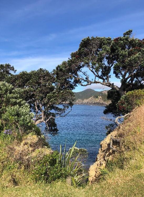
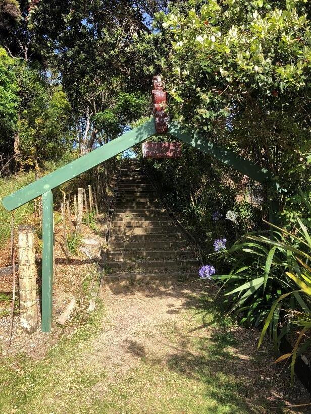
(Image taken by Dennis Ngāwhare, 08/12/2020, HNZPT)
Please note that entry on the New Zealand Heritage List/Rārangi Kōrero identifies only the heritage values of the property concerned and should not be construed as advice on the state of the property, or as a comment of its soundness or safety, including in regard to earthquake risk, safety in the event of fire, or insanitary conditions.
Archaeological sites are protected by the Heritage New Zealand Pouhere Taonga Act 2014, regardless of whether they are entered on the New Zealand Heritage List/Rārangi Kōrero or not. Archaeological sites include ‘places associated with pre-1900 human activity, where there may be evidence relating to the history of New Zealand’. This List entry report should not be read as a statement on whether or not the archaeological provisions of the Act apply to the property (s) concerned. Please contact your local Heritage New Zealand office for archaeological advice.
SUMMARY
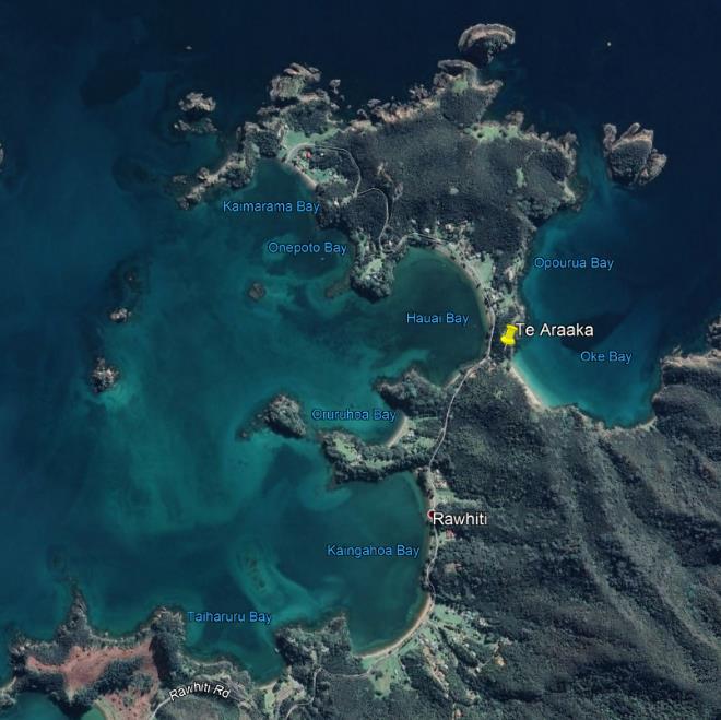
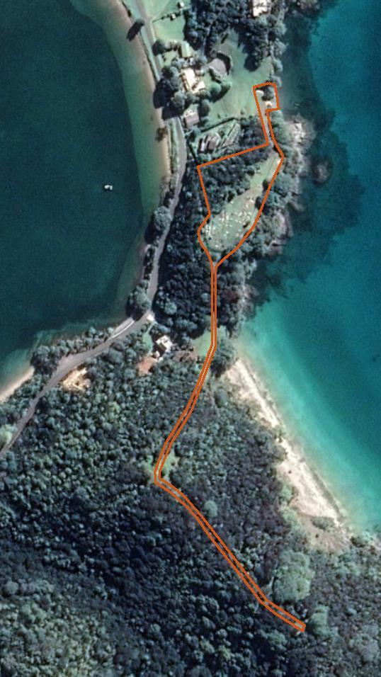
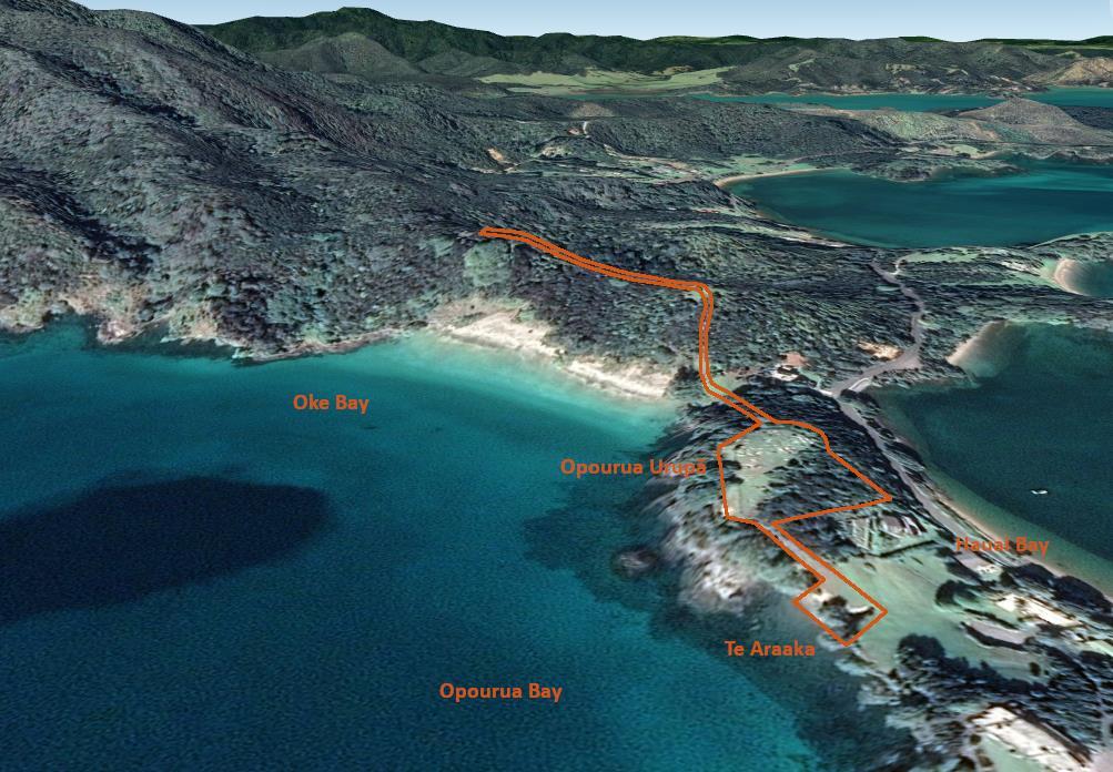
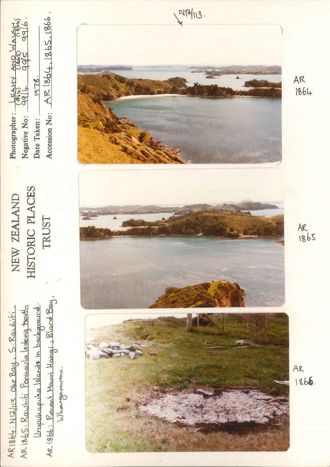
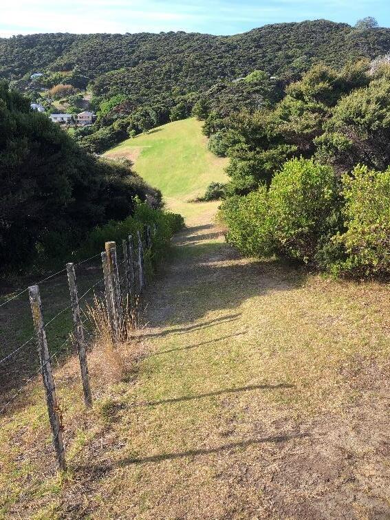
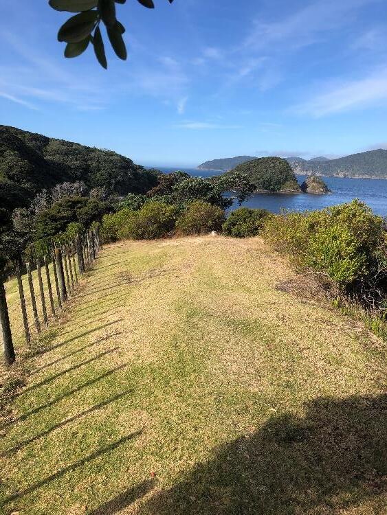
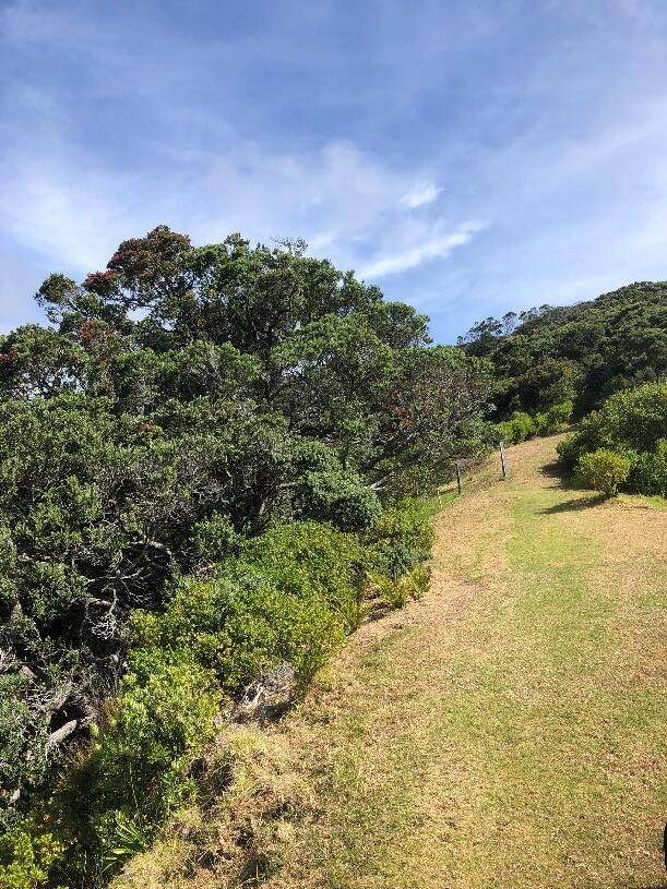
Te Araaka refers to the pathway taken by the tūpuna of Ngāti Kuta and Patukeha when interring tūpāpaku in the burial caves of Pukehuia on the Rakaumangamanga ranges Ope tauā returning from journeys to the south would halt at Oke Bay when arriving back to the rohe Tūpāpaku were then lifted by aka vines up the cliff to where they would lie in state on the flats at Hauai Bay, giving the literal name ‘The Path of Vines’ to the walkway. After final preparations, the tūpāpaku would be carried along the trail following the ridgeline and up into the burial caves of Pukehuia As part of the wider cultural landscape, Te Araaka was a section of a longer tribal walkway that connected inner Pēwhairangi (Bay of Islands) to Te Rāwhiti and Rakaumangamanga. The Opourua urupā (also called Te Araaka) is situated on the site of an older ridge pā and maintains the intergenerational mana and tapu of the walkway. Te Araaka is therefore an ancestral connection between the current urupā and the ancient rua kōiwi of the hapū of Ngāti Kuta, Patukeha, and the wider Ngāpuhi collective. Te Araaka covers part of the current Cape Brett Track, which leads from Oke Bay up and over Rakaumangamanga.
1. IDENTIFICATION1
1.1. Name of Wāhi Tapu Area
Te Araaka
Te Araka
Opourua Urupā
Cape Brett Track (part)
Scenic Reserve Oke Bay (Part)
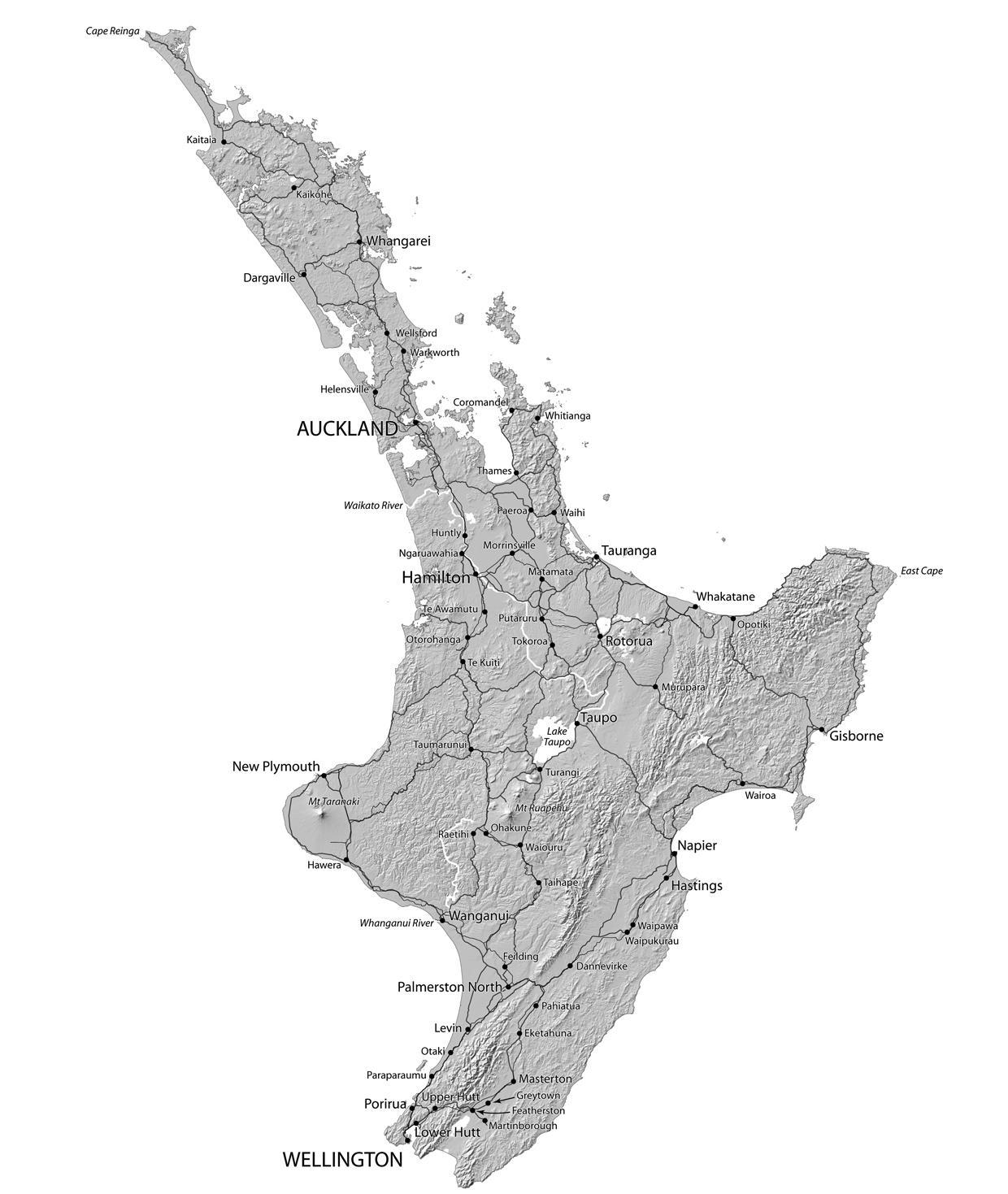
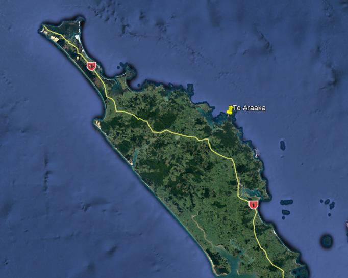
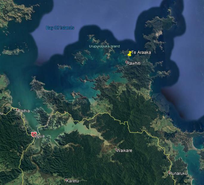
1.2. Location Information
Address
Oke Bay
Rawhiti Bay of Islands
Additional Location Information
-35.226810, 174.264281
NZMG X: 2,625,918.47; NZMG Y: 6,662,889.21
1 This section is supplemented by visual aids in Appendix 1 of the report.
Iwi/hapū
Ngāti Kuta, Ngāti Patukeha
Ngāpuhi
Local Authorities
Far North District Council, Northland Regional Council
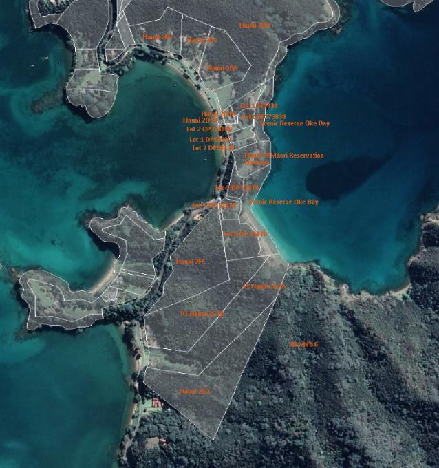
1.3. Current Legal Description
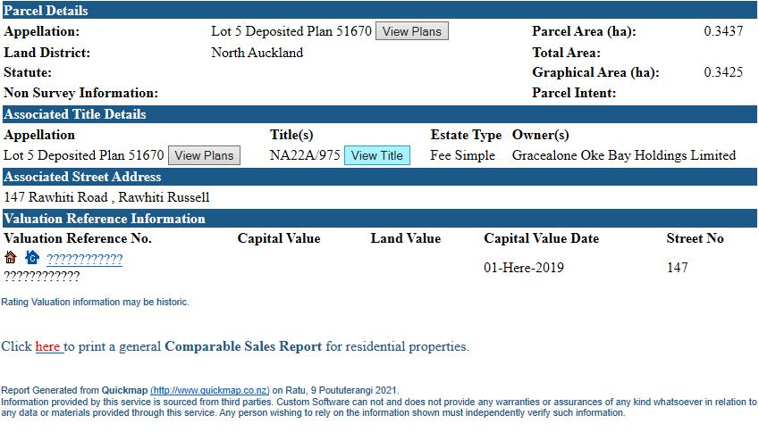
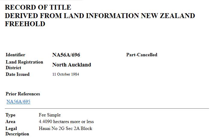
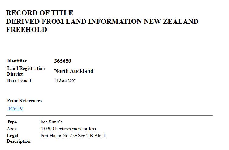
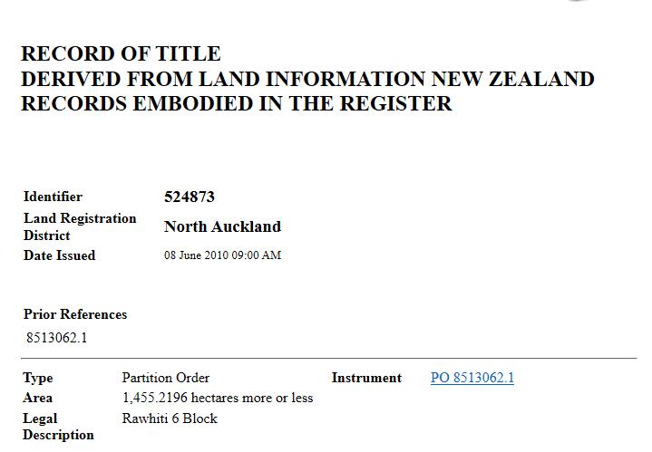
Lot 8 DP 58339 (NZ Gazette,1987, p5093), Lot 9 DP51670 (NZ Gazette, 1987, p5093); Hauai 2E Māori Reservation Opourua Cemetery (NZ Gazette, 1992, p1175); Lot 5 DP 51670 (CT NA22A/975), Lot 6 DP 51670 (CT NA7C/1440), Hauai 2G2B (CT 365650), Hauai 2G2A (CT NA56A/696) and Rawhiti 6 (CT 524873)
1.4. Extent of Wāhi Tapu Area
Extent includes the land known as Lot 8 DP 58339 (Scenic Reserve Oke Bay), Hauai 2E Māori Reservation Opourua Cemetery, Lot 9 DP51670 (Scenic Reserve Oke Bay), and including parts of land known as Lot 5 DP 51670, Lot 6 DP 51670, Hauai 2G2B, Hauai 2G2A and Rawhiti 6 following the Department of Conservation’s Cape Brett Track
These features are interconnected.
Reserve
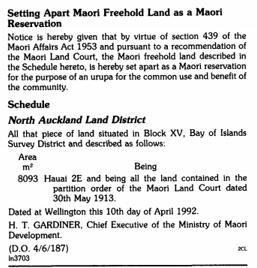
The parcel known as Hauai 2E is part of a Māori reservation for the purpose of an urupā (NZ Gazette 1992, p1175).
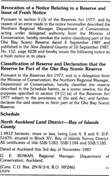
The parcel known as the Scenic Reserve Oke Bay, Lot 8 DP 58339 (NZ Gazette, 1987, p4238) and Lot 9 DP51670 (NZ Gazette, 1987, p5093)
New Zealand Archaeological Association Site Recording Scheme
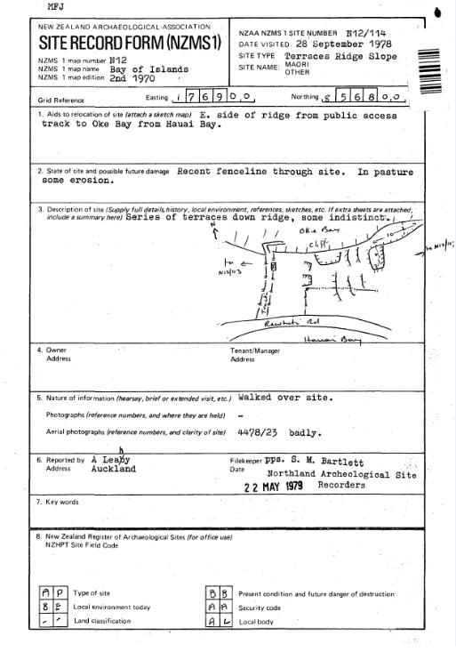
Imperial N12/114; NZAA Id: Q05/151
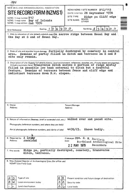
Imperial N12/115; NZAA Id: Q05/150
1.5. Uses
[Māori] [Ara Purahourua: Sacred Pathway]
[Māori] [Urupā]