The Pads of North Lecale


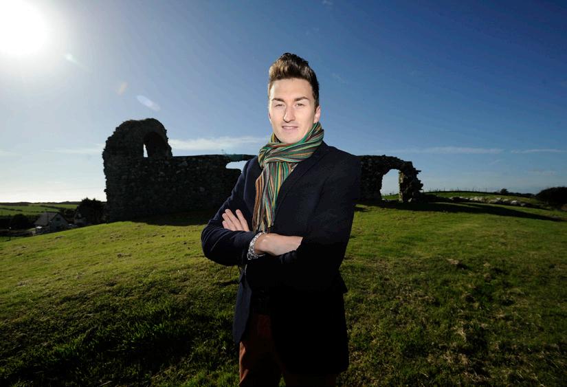
By Councillor Cadogan Enright and Duane Fitzsimons


By Councillor Cadogan Enright and Duane Fitzsimons
MAURICE DENVIR, Chair Kilclief Residents Association
I am delighted to introduce the first edition of this booklet mapping local rights of way –described locally as ‘Pads’.
During the process of drawing up the Kilclief Village Plan, there was a clear and overwhelming demand from local residents to map out where traditional rights of way were and to see if we can create safe walking routes locally. People wanted to see how these walks could be integrated into the wider networks like the Ulster Way, Lecale Way, Coastal Walking Route or Saint Patrick’s Way for the benefit of locals and visitors alike.

• Links to The Coast ............................................... 1
• Kilclief 2-3
• Strangford Village 4-5
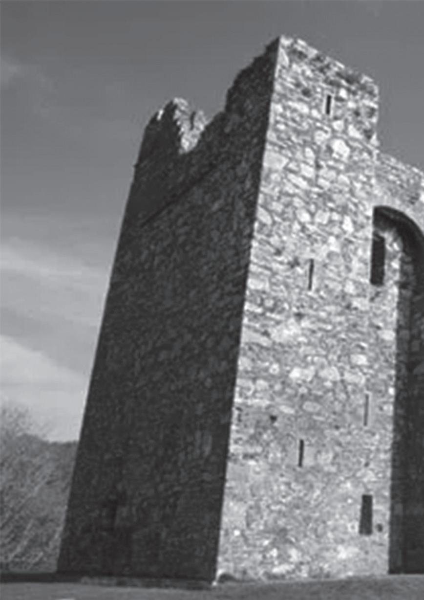
• The Real Game of Thrones 6-7
• Ballyculter and Legnagoppage .......................... 8-9
• Carlin, Walshestown & Raholp 10-11
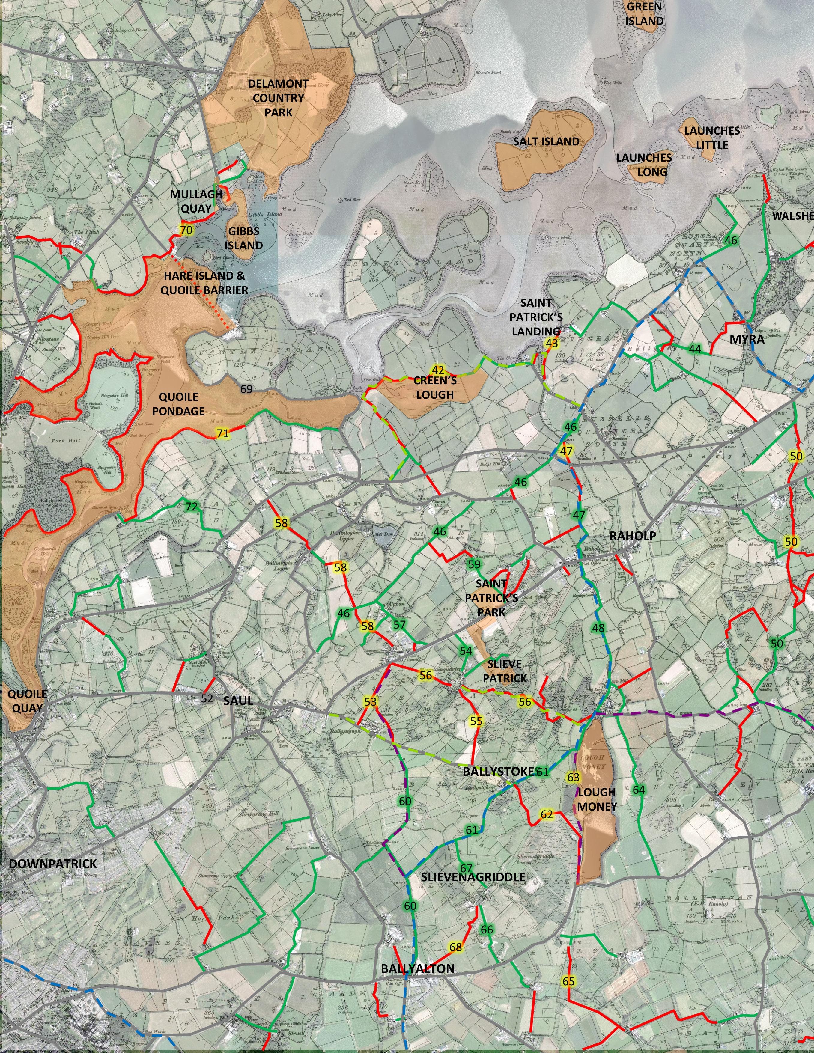
• Saul & Ballystokes 12-13
• Ballyalton & Loughmoney 14-15
• Satelite Map .................................................. 16-17
• Downpatrick - linking it all together 18
• Delamont, Castleward, Downpatrick 19
• Mound of Down, Inchabbey, Hollymount Wood ...... 20
• Linking the tourism hub to Saint Patrick’s Way .. 21
We were fortunate that we had two people locally with the interest and ability to tackle this job.
Councillor Cadogan Enright and Duane Fitzsimons undertook this difficult task and have done their best to include all traditional routes. If you see a route we have missed, or any other error of mapping or fact please let us know. We hope that future editions can both improve the content and mapping of North Lecale and cover the Lecale Coastline all the way to Dundrum Bay.
COUNCILLOR CADOGAN

ENRIGHT has represented the Lecale Coast and Downpatrick areas for over 12 years. He is passionate about the future of sustainable development in the countryside. Working with local farming organisations on renewable energy projects and with community groups in local villages. Cadogan has written brochures for Tourism NI on the Lecale Coast, a historical walking guide for the Ardglass area and a History of Lecale.
“It was a pleasure to be asked to take on this job. An important first step in tackling the issue of loss of rights of way we have seen in recent decades is recording where they were, making people aware of what the law is, and their rights in addressing the problem. I hope this will be a useful step in that direction.”
• Ulster Way Downpatrick & Killyleagh to Strangford 22-23
• Ulster - Way Kilclief to Strangford ................. 24-25
• Is it Legally possible to block a Right of Way? 26-27
• Waymark Trails in Lecale 28
• Rules of Walking ................................................ 29
DUANE FITZSIMONS is a wellknown local walking guide. He brings Saint Patrick’s Country to life and tells of the history through folklore and unique original sources. Duane runs a Lecale-based tourism company called ‘Walk The Lecale Peninsula” and a website aimed at bringing visitors to our area (www. lecalepeninsula.com) . Duane has been recording local traditions and folklore for posterity.
“It is important to record the memories of older members of the community if we are to preserve local walking routes for the benefit of future generations. In time these will be linked to improving walking trails. Hopefully this booklet will motivate individuals and communities alike to take steps to protect and recover the important parts of their own local walking heritage”.
Commissioned by the Kilclief Residents Association and funded by Newry Mourne and Down Council as part of their community funding programme.

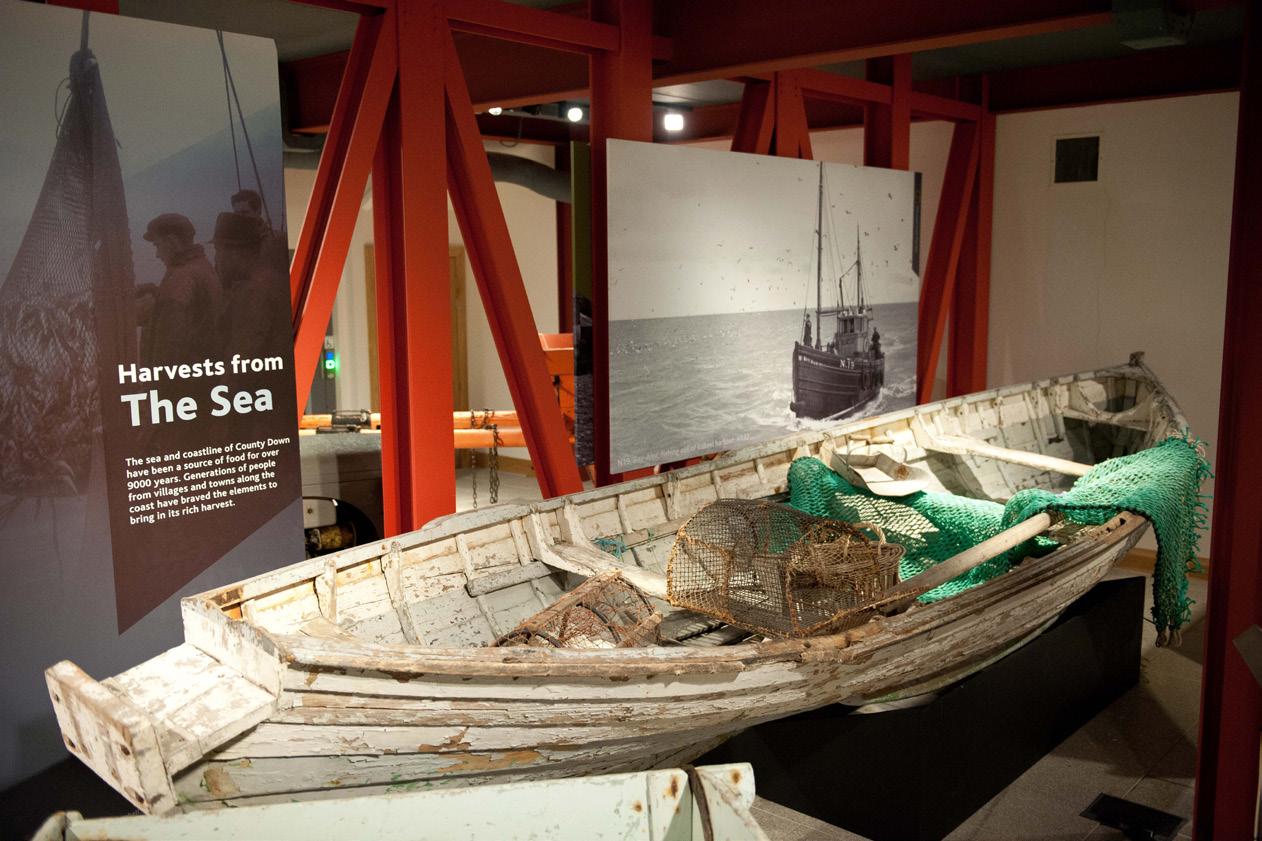
Many traditional Pads in Lecale led to the coast for fishing, collecting creels, seaweed for fertilizer or access to islands, for grazing or recreation. There was widespread ownership of small working boats all round Lecale.
Kilclief’s Old Harbour. If you start opposite the Castle where the Kilclief Beach car park is today, you can follow what was known as the ‘Sandy Loney’ north around the coast past where the sewerage outfall is located until you reach Kilclief’s Old Harbour. This was where the men of Kilclief kept their boats.
The boats would have been locally built. Joe Murnin built boats directly on the Narrows and the slipway can still be seen there to this day. Joe also built a boat for raffling at the Parish Christmas draw.
There was a long tradition of boat building in the area including Jim McCormack’s at Mill Quarter, and before him there was Fitzsimons’ of Ballyarret whose farm was landlocked but had access to the Turkish River floodplain which ran to Mill Quarter where boats were tested. JJ Swail at Castle Ward and Nicky Curran built others.
Boats were 14 to 20 foot clinker-built punts for rowing and many with working sails. Trawls were made for the boats by Tom King whose forge was where Maurice Denvir lives now. The men used to row up the Loch trawling for clams and come back with the tide. In the late 40s and 50s boats were raced between Swan Island, Bank Mór and Portaferry when larger sails were fitted. Yacht clubs in Strangford and Portaferry came about from these races.
Terry Swail said “It was not easy work. Up past the Black Islands towards Strangford was known to rowers as ‘pull or be damned.’ My Uncle Pat Swail died in his boat of a heart attack, but he had the presence of mind to lay down on the beam, so when his boat was eventually found and towed back in, he was still in it and could be buried. There was a name on every rock and hole and I could tell you them all as far as Tyrella. At low tide you could go fishing for stranded lobsters in places like three hole Rock’ past the point at Killard or North End by Rock Angus.
There was a pad leading down to the Killard banks which had a boathouse on it which is now washed away between Cruc Cara on the landward side and Cruc Saoite on the Killard side”.
(Authors note “cruc” is the Ulster pronunciation of cnóc or ‘hill’ and Saoite is monk, learned man or poet.)
Murnin’s slipway Picture shows a Murnin-made boat in Down Museum

Kilclief’s Old Harbour
Georgetown Sinks. I remember the Georgetown going down off Killard Point in 1946. After it was abandoned myself and the McCormack brothers went down to see what we could get in the next low tide. The lads from Portaferry had raided before us and were unloading anything of value they could find.


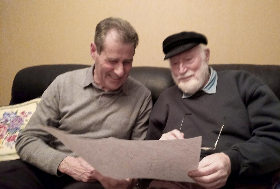
“This Country is riddled with Pads. I grew up around here and shot over the whole area and know where they all are”, said Terry. He went on to give us the names of them all, and more we did not know about. He told us of banshees and ghosts that patrolled the Pads at night-time. “People were a lot more superstitious in those days”.
1. School Pad. This went south from Kilclief, opposite Glebe House, to the Southern edge of the school on Kilclief Road. It appears to be mostly still there. On the opposite side it ran from along the lane in Carnashoke through fields to 2. Ballywooden School Pad. School kids would come from Turkish along this pad, which linked onwards to Ballyhornan.
3. Whinney Park to junction of Ballycotton and Glebe Road. This was a handy pad to take you from Whinney Park to the top of the Village near Maurice. It is mostly still there.
4. Campbell’s Lane. This loney takes you from the village down toward Caffrey’s Beach from the village and is one of the few properly preserved and maintained in the area thanks to the Campbell Family.
5. Sharvin’s Corner to Castle Flannan. A stile gave access to the field where the sandpit was. This was where sand was drawn for building houses in the area.
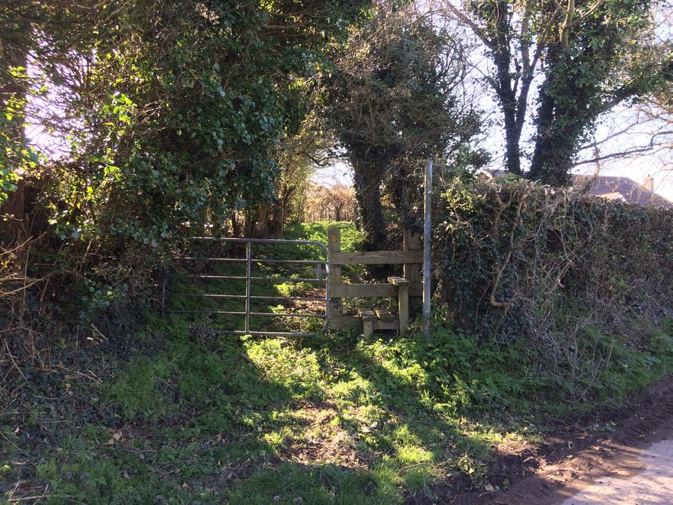
6. Carravanish Loney. This well-trodden pad is still in use today as part of the Glebe Walk. This route was used by children from Drumroe to get to school. After crossing the stream it becomes a footpath with a couple of stiles.
7. Mass Loney. This route ran from Cargagh Chapel to Kilclief Chapel. The Mass rock was moved when the old chapel was built in Kilclief by Fr. John Fitzsimons. The route ran from Drumroe Road to Ballynarry where it picked up the 8. Ballynagarrick Lane. Mid way a footpath diverted off to Kilclief Chapel crossing over the stream using a footstick.
9. Carriff Loney. A network of off road lanes and pads. If you start from Glebe Road you can head over from Carriff Loney to the old Hibernian Hall on Blackcauseway Road. From the Hibernian Hall a path connected to Ballyculter (page 8). Staying on the lane would lead to the Riasc and also come out below Saint Malachy’s Park. A footpath used to run across from the new community park in Kilclief to Carriff Loney.
10. Raisc Loney. (Gaelic for ‘marsh’) . The Raisc went in where the caravan park is today and ran up to two fields called ‘The Raisc’. From these fields you could

connect back to Carriff Loney, Kilclief, Ballyculter and the lands around.
11. Sandy Loney. This ran along the edge of what is now the carpark at the beach. This path was used by many Kilclief people to get access to the old harbour between the rocks and Island near Kilclief point.
12. Lane to the Old Gaelic Pitch
13. Kilclief Cottage Loney. This lane ran from Kilclief cottage on the Shore Road to Ardglass Road. From here a footpath connects across to Ballycotton.
14. Castle Flannan. This is an asserted right of way from Kliclief Beach to Cafferys Beach.
15. Carriff Court to Terry Swail’s House
16. Whinney Park to Shore Road
17. True Harvest Seeds to Brian Black’s House


NOTE: Council gives priority to paths connecting to other settlements, to waymarked trails, strategic routes and paths that would create safe off road circular routes around a settlement.

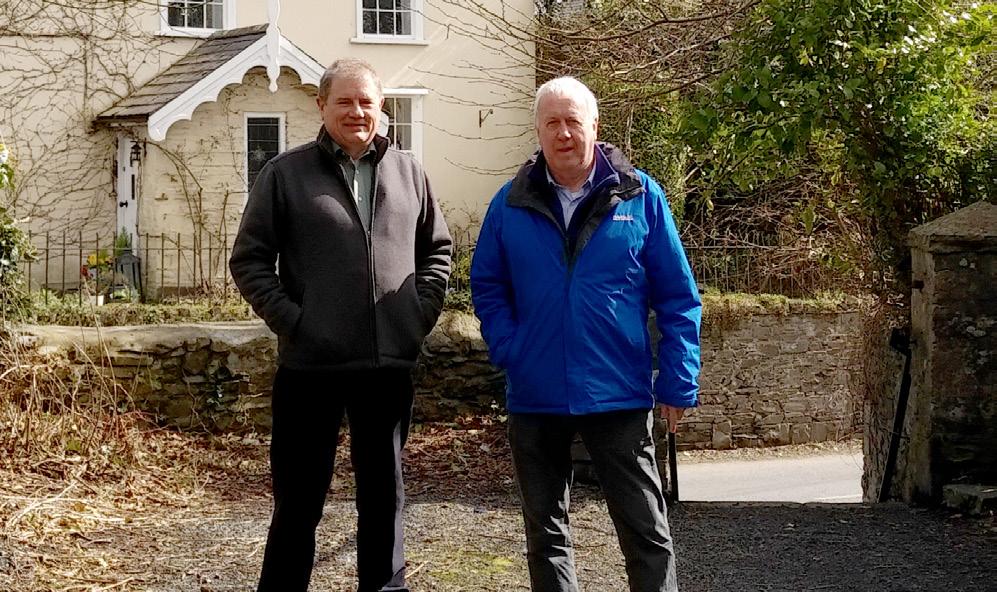
Councillor Cadogan Enright and retired Countryside Development Manager Lenny Lawson at Dufferin Ave.
Strangford was once a bustling port. Back in the 1600s it boasted a third of all Irish grain exports to the continent. By the 1940s it had dwindled away, but left a maritime legacy as a draw to visitors. The path network around the village provides attractive walking options for tourists and locals alike. This network was secured by the Community working with Council (see article opposite) and is an example of what can be achieved. In the 1970s the village was designated as a hub on the Ulster Way, “somewhere for the weary walker to pause and rest for the night” – but this status has waned with Councils seeming inability to protect the Eastward routes to Downpatrick (page 18), Delamont and Killyleagh and the failure to develop a safer passage between Strangford and Kilclief (page 20).
At the moment Strangford is a minor loop off the major waymarked trails.


of Ulster Way still remain
The Squeeze Gut was commissioned by Dudley FitzGerald de Ros in 1846 as part of a famine relief project for the people of Strangford. The original route ran through the estate. The new path enabled locals to discreetly pass through the estate without disturbing the gentry. When the tide was against boats coming down the lough they would dock at Chapel Point and walk through the estate farm to the village. Livestock from the estate would also be driven down the path to the Horse Ferry Slip. The route also served as an access to Old Court Chapel.
In the late 1990s, the Old Court Estate decided to close access through the farm. Working in partnership with Down District Council they delivered
a new path way to ensure the right of way could be preserved from Chapel Point. The Woodland Trust planted Pond Wood to connect the Squeeze Gut to Compass Hill and back to Dufferin Avenue. It remains part of the Lecale Way.
This route to Old Court House had become run-down by 1811, but by the 1840s became the service lane for Old Court Farm when the new manor house was built, emerging onto the road at Quarry Hill. The avenue was levelled and planted as a wedding gift to Dudley in 1853 by Lord Dufferin of Clandeboye. In the 1860s the volume of goods going to and from Strangford’s quays triggered Council to lower the Downpatrick Road to help the passage of horse and carts. Thereafter the lane was accessed by steps.
Lady’s Walk was created in 1869 to allow carts to access Dufferin Avenue after the road was lowered at Quarry Hill. Present-day Down Lodge was constructed in 1980 after the 111-year-old gate lodge was demolished. The Old Court Estate more recently created a new gated vehicle access, leaving the Lady’s Walk reserved for pedestrians.
21. Strangford Path
Access along the shore is provided by the Strangford Path. This path was used for fishing and collecting of seaweed from the foreshore. This Path connects to the present Lecale Way loop around Strangford.
22.Pad to Isle O’ Valla
Isle O’ Valla was built as a Charter School around 1817. In 1832 the charter was recinded following the introduction of the National School system. The farm was then leased to the Rev. Samuel Livingstone who started his own school for local children. The pad ran across the fields almost parallel with the Blackcauseway Road to the school. Local Historian George McKibben recalls, ‘horses were trained at Isle O’ Valla for the Boer War.’ Today this path is hard to trace.
23.Murnin’s Loney
This route runs from the Blackcauseway Road to the Black Islands at Isle O’ Valla and was a seaweed hauling path. Council is currently investigating a blockage in this route.
Retired Council Countryside Development Manager Leonard Lawson was born and bred in Portaferry and worked for many years on countryside access issues in the Lecale Barony. In an interview with Cadogan Enright he described how Council’s powers to assert rights of way was used positively and flexibly in the Strangford area.
“This was a typical stand off between the Strangford Community Association (SCA) who wanted to open up footpaths for recreational benefits and as a tourist attraction and a landowner who did not want to offend local residents but wished to protect his and his tenants privacy. Both had the best intentions, and did not want to offend the other, but had no agreement on the way forward. The Chairman of the Village committee came to me, in my capacity as the Council’s Countryside Development Officer, and asked me for assistance.

“There was an existing, footpath that took you from Castle Street, Squeeze Gut, through the landowners estate which included some woodland, around some shoreline, on to the Downpatrick Road and back into the Village locally known as Squeeze Gut. There were other walks within the estate that the village committee also wanted asserted as rights of way namely access to a well-known local landmark, Church Point.
“Access to this location followed an alleged right of way that local fishermen would have used when tidal conditions in the Lough were against them. Here they temporally beached their boats and walked through the landowners estate, returning when conditions were right to get their boats back to the village. This right of way would have taken them right through the landowner’s farm and adjoining buildings. The landowner disputed the claim and for reasons of privacy did not want the route made into a public footpath.
“I met with the landowner and the Chairman of

SCA and offered them another solution to divert an unattractive section of the existing route through woodland to a viewing point at Compass Hill and over a field to an attractive area of woodland, complete with its own pond. From here the route joined the existing path back to the Village. The new route also contained a spur that took you to Church Point. From there you had to retrace your footsteps back to the existing path and back to the village.
“By using the Access to the Countryside Legislation powers of diversion in a creative way it was possible to get a win-win solution to a very complicated and emotive problem.
The agreement was further cemented when the Woodland Trust approached me as Countryside Development Officer to identify locations within the Council area where they could involve landowners and the local community in planting Millennium Woodland called “Pond Wood”.

I contacted both parties and they agreed that the newly formed walk could be further enhanced by some additional woodland and in 2000, Village school children, the Council and the landowner, who kindly donated the land, helped plant up the new Millennium Wood.”
Author’s Note:
Flexible solutions of this kind could transform walkways in villages across Lecale.
Lecale’s history is too scary for dragons.
The Gaelic Kingdom of Ulaid moved their capital to Downpatrick from 450AD following the destruction by the Oirghialla of their ancient 700BC capital Eamhain Macha in Armagh and losing N.W. Ulster to the O’Neills. 600AD saw Lecale-based Ulaid chiefs High Kings of Ireland and Scotland, driving the Northumbrians from Mann, Scotland, Cumbria and Leinster.
637 saw the largest battle in Irish History at Moira. Ulaid’s Congal was defeated by Domnall O’Neill despite having more cavalry and infantry including vassal Scots, Picts, Anglo-Saxons and Britons. Disastrously, this was coupled with the destruction of the Ulaid fleet at the Battle of the Mull of Kintyre by the O’Neills. O’Neill forces occupied Antrim and cut off Ulaid from their strength in Scotland. Henceforth the O’Neills were dominant in Ulster and normally High Kings. The Ulaid, based in Lecale, ruled from Carlingford to Antrim in the East, renowned for their centres of learning and infrastructure. Belfast is named for one of their Bridges.
784 saw Ulaid fleets preeminent and Ulaid central to Gaelic culture in Ireland and Scotland. From 795 they were weakened by 200 years of war with the Vikings. Mann and Western Scotland were lost. The Ulaid epic poem ‘Tháinig Na Ulaid’ celebrated the 9 naval victories over the Vikings culminating with the sea-borne invasion and destruction of Viking Dublin in 1026 under Lecale King Niall O’Haughey.
The 1177 DeCourcy Norman Invasion of Lecale finished Ulaid as an independent KIngdom. Early success for the Anglo Norman colony was checked by the O’Flynns in Ards and the O’Carrolls and Kearneys of the Oirghialla in Newry. O’Neill Kings variously in alliance with Scots, Kings of the Isles and surviving Ulaid Chiefs like Magennis and MacArtan fought to expel the English from their Lecale base seven times between 1260 and 1433 when Lecale was briefly part of the MacDonald Kingdom of the Isles. 1471 saw the O’Neills Kings of all Ulster. Remaining Norman Lords adopted Brehon Law, Gaelic culture and education, even marrying into leading Gaelic families contrary to English Law. Efforts were made to re-assert English control in 1523 and in 1538 when Downpatrick was sacked, Down Cathedral destroyed and local monasteries suppressed. An unsuccessful English sea-borne invasion via Strangford and Ardglass in 1564 provoked the O’Neills to attack ‘The Pale’ – the colonial enclave around Dublin.
Bernard Ward was one of the first ‘New English’ landlords, acquiring land from the Earl of Kildare in 1570 at a time of turmoil in Lecale. Ulster’s King Thurloch O’Neill was fighting to expel a particularly savage colonial army from North Down. Local Gaelic Chiefs like Magennis and MacArtan rallied to protect the population in Mid and South Down. Ardglass was one of the 2 primary ports in Ulster at the time. In 1578 it was seized from the O’Neills by the Queen’s Marshal Tomas Bagenal who installed a strong garrision and declared ‘Marshal Law’ across Lecale. Fresh incursions into Ulster aimed at the McMahons in Monaghan, the O’Farrells in Longford, the O’Reilly’s in Cavan and the Maguires of Fermanagh united the Gaelic Chiefs behind Hugh O’Neill in the 1590s in the 9 years war. Bagenal died when his army was crushed at Yellow Ford in 1598, but the garrision in Ardglass held out for an epic 3 years until relived by Lord Deputy Mountjoy in 1601 following the defeat of the Ulster Chiefs at the Battle of Kinsale. This opened the door to a new ‘Plantation’ of Ireland.
Bernard’s son, Sir Robert, was a key figure in planning the new Plantation of Ireland. He lived in a fortified tower house by the sea to enable a quick escape. Much of the ordinary population of Lecale was protected from the excesses of plantation by the extensive land holdings of the Earl of Kildare.
The religious nature of the plantation triggered rebellions in 1641 and 1689 when the local ‘Old English’ gallicised Anglo Norman Lords joined the returning Gaelic Chiefs in rebellion forcing the Wards to flee. However the aftermath of the rebellions profited the Wards who acquired lands from the Audleys and confiscated Russell lands in Killough.
In the early 1700s Michael Ward built a new road to join his estates nine miles in length, with few corners, enabling horses to get up to speed and avoid ambush. With the title ‘Viscount Bangor’, the Wards were prominent among the 108 families that owned almost all the land in County Down. The ‘Ascendency’ and ‘penal law’ period lasted until the 1830s. The rebellion in 1798 persuaded Westminster to take control of Ireland from the Ascendency class with the Act of Union in 1801.
Catholic Emancipation from the 1830s led to the Irish Parliamentary Party often holding the balance of power at Westminster to 1914. Mass civil disobedience over ownership of land was
NOTE: If you want to dig deeper into Lecale’s history, visit www.discoverardglass.com/ history. This site was developed by Cadogan & Duane for the Ardglass Development Association.

28. Old Pack Horse Trail
Goods for Strangford’s quays arrived by horse which was difficult from the Ballyculter direction due to the tidal nature of the Black Causeway prior to the new road across the tidal wall. Horses had to go back the Blackcauseway Road for a quarter of a mile. This Old Pack Horse Trail linked to Ballyculter and onwards through to Downpatrick via the Ballyculter Road. This loney winds uphill to Carrowcasey and emerges at the lane which runs by the Alms Houses.
29. Dam Pads
This route ran along the Mill Race from Great Dam to Ballyculter. Used primarily to open the sluice at the edge of the Dam, the route was used by children from Carrowcarlin and Ballintlieve to get to school

condition, partly in service as farm tracks.
31. Lady’s Walk and the shore trail
Lady’s Walk runs through the screen planted on the shore between Black Causeway and the farmyard. It continues past the lead mines to Audley’s Field. The route was used by miners to get to work from Strangford. Part of the original Ulster Way from Strangford to Killyleagh, it remains as part of the Lecale Way which means that it can be walked at all times and not subject to restriction by the National Trust.
32. Toberdoney Lane
Leads to the shore west of the Cairn.
The Wards rebuilt Ballyculter with a school, church and almshouses. It was a major settlement up to the turn of the 20th Century, boasting a mill, workers cottages, post office and lead mines. The school served a wide area with numerous pads linking it to villages around Lecale to get to school, work, for packhorse trains or driving cattle.
The quintessentially English style church was built on the site of the original dedicated to local Saint Malachy. Designed by Sir Thomas Drew. It has witnessed some spectacular history. In the 1770s the curate was the Rev. Edward Smyth who persuaded John Wesley to break from the Church of England in 1783. Many Methodist churches locally owe their foundation to him.
Legnagoppage river (hollow of the nettles) is located to the east of the village and was tidal as far as Drumroe. Several pads cross it to reach the coast at Cloghy Rocks or towards other settlements.
33. School Road
From Ballyculter walking past McKibben’s to Keaghy’s Big Field crossing the stone bridge, this route came up into Robert John Denvir’s yard. He emigrated to the States in the 1800s but his name remains attached to it to the present day. Crossing the Blackcauseway Road the route comes into Johnston’s yard, down the side of a field and went down to the right coming into Tully farm, emerging onto the Strangford Road.
34. Pad to Englishtown
The townland is named for the settlement of retainers brought in by the Wards in the 1700s.
From Carrowcasey there was an old pad which was used by John Coates to get to school. This joined
the lane at the Turn House at the Castle Ward end of the village. Today this is a farm track connecting to the lane running south from the Alms Houses. John Coates was an astute character who was mechanically minded. He had an old Citroen car into which he put a gearbox to give him reduction gears. With this he was able to cut what was the steep field known as the Hanging Brae on the pack horse trail with the binder. The car’s body was removed, and a box built on the back to give him a fully functioning tractor.
35. Pad from the Mill to the Alms Houses
This route was used as a shortcut by the people living at the mill to get to the Old Pack Horse Trail (No. 28). Before reaching the Almshouses the pad cuts through Englishtown. This place was named after the workers introduced by the Wards following the rebellions of 1641and 1689.
36. Hibernian Hall to Ballyculter school
Teresa and Dennis Magee lived on the Glebe Road and walked to Ballyculter School along the Legnagoppage River. Cutting across from the Hibernian Hall through John Creen’s yard and his threshing machines. Here they followed the river to McKibben’s Bog Field and passing the Loney Field before joining the lane to Ballyculter. Here, a foot plank bridge over the river was made from an old taxi belonging to William Conway. He stripped it back to the chassis and laid big long stones on it.
The area they were passing through was Isle McCricket so-named because the high tide came up to Lowe’s Bog near Cargagh Church . Across the bog, in the McKibben Farm, was Isle O’Neill. At high tide the O’Neill family could arrive at Ballyculter Church having come downstream on a punt. At Blackcauseway end there was a tidal mill.


37. Cargagh Lane
NOTE: Pads in the Ballyculter Area are particularity important as they link up most other areas and villages.
This loney connects Drumroe Road and Churchtown Road. It was blocked off a few years ago when a landowner bulldozed part of the Drumroe end. The lane was used up until this point by school children to get from Drumroe to catch the bus to Downpatrick. It was also used for driving cattle and made a nice circular walk for locals. The case has been taken by Newry, Mourne and Down District Council to the High Court for restoration.
At the Churchtown Road end of the lane there was a pad from Loughkeeland Road connecting to a lane from Castlemahon used by people on the Ballyculter Road to get to Saint Patrick’s Church.
38. Ballylenagh Chapel Pad
A second pad to Saint Patricks can be traced directly opposite the church. This pad was used by the Seeds and Polleys.
39. Drumroe Pad
This pad ran through McMullan’s farm and crossed the Lagnagoppoge River using stepping stones. The shortcut avoided Cargagh Lane, emerging above Cargagh Chapel. Here, an old Tuberculosis hospital resulted in the name ”Wheezle Bray”.
40. Acre McCricket Pads
Joining to the Carriff Loney in Kilclief this created a short cut to the Blackcauseway Road near to the School Road. This is now largely farm tracks used by the Conway family.
41. Pad from Murnins to Cloghy
An historic pathway used to pass from where Murnins launched their boats to where the carpark for Cloghy Rocks is located. This was along the top of the cliffs and is believed to have been used by fishermen.


Bridge over the river to Legnagoppage. Council has declared an interest in reasserting this route once Cargagh Lane action has been resolved.


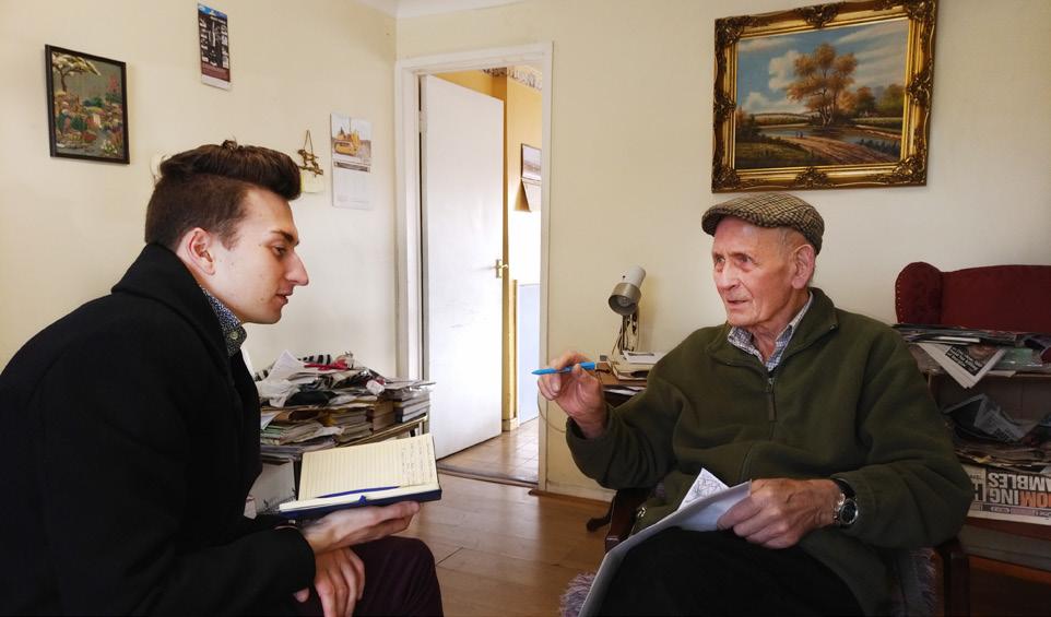
Centred on the old Saul to Walshestown Road this area was greatly altered by the building of the (New Line) road to Strangford in the 1840s. Today’s Myra Road evolved from this and changes in Walshestown. There is a wide network of paths across this area including links to the shore for harvesting seaweed which would be cut and laid on rafts for later floating in at high tide.
Vincy said “I know all the pads in these parts and used them all my life. It is important to preserve them. It’s annoying when ‘Private’ signs go up on public rights of way or when Council does not protect them or maintain them. Even the way-marked pad outside my house going to Saul over Fiddlers Bridge is not being properly maintained.”
Barney agreed and said “I gathered spuds when I was young in these parts and can even name most of the individual fields. It’s important that this folklore is passed on.”
42. Causeway Loney
‘The townland of Ballintogher is the biggest in this country’, explains Vincy. “The name means townland of the causeway and is between Nell’s Island and Creen’s Lough for Castle Island”. Barney proceeded to pull out a first edition of the Ordnance Survey which proved his point.
“The only way to access the farm in the middle of Nell’s Island was to go through the farm at the Shore and follow the lane along the shore. It was only after the building of the sluice gate near Castle Island that it became a through route. This enclosed ‘Creen’s
Lough’ which is now misnamed ‘Queen’s Lake!”. Vincy’s son Barney stated that this used to be walked annually on Saint Patrick’s Day.
Barney explains that the route through to the farm at Ringbane was along the banks of the Slaney at the Shore. The current lane was built to replace the original. This was the route followed by Alan Warner when he wrote his book on the Ulster Way.

Entering the lane to Ballyregan brings you through the yard to the field which had the lint hole. Past the lint hole there were stiles bringing you to the house near the castellated gates to Myra which are known locally as Corriskin (thought to be the name of the lake which belongs to Tommy Quail). ‘My da lived in that house from he was three’ explains Barney. Barney showed us the right of way came across the garden, ‘the stiles are still there. The house is known as the Half Acre and was four houses originally for the workers on the estate.’
Vincy explained, ‘You would never get a fish in the lint hole, but you would get one in the bog.’ This land was very important to local farming. It was here that marl was first extracted for use as a fertiliser and the lanes would have granted access for carts. The first quarry for marl was beneath the bank where the New Line meets the Audleystown Road in Carlin.
45. Round the bog
The Crangles farm at the Rock was very much cut off from Strangford. Before the New Line was built it was tied to Carlin. This link was retained in the chapel pad which has been preserved from the New Line to Carlin. Coming down the bank the pad comes around the loch and out near the junction of Audleystown Road and Downpatrick Avenue.
46. The Old Road
An important medieval route connecting Saul with the Anglo-Norman settlements at Walshestown and Audleystown. It is covered in Saul on page 15.
47. Scra Pads
The path from Raholp to Fiddlers Bridge is known as the ‘Scra’ Pads. ‘Don’t ask me how to spell it,’ explains Barney, ‘but that is what we knew it as.’ The pads follow the lane opposite Roneystown and go all the way to the river. These pads are part of the Lecale Way connecting old road between Walshestown and Saul. The last part of this pad is blocked with the stile removed and walkers forced onto the ‘New Line’ main Strangford Road for two hundred metres.
During our walk of the Scra Pads, several blockages were found, including two fallen trees and a hoarding over the stile.
48. Roneystown Loney
50. Craigaphuile Chapel Pad
From Craigaphuile clachan on the Banaghan Road there is an old chapel pad to Saint Tassach’s Carlin. It crosses Banaghan Road and Arthur Watterson’s Farm down the lane to the New Line to the chapel.
South of this the pad runs down the other side of the hill joining the lane to Carrownacaw.
51. Slievemoyle Chapel Pads

Running from the old mills at Lough Money all the way to Raholp, used by carts for corn after the harvest. It passes Roneystown Clachan named after a Captain Roney who moved his family to these parts from Cork.
Today this pad is a part of the Lecale Way and the route is well used and protected. It passes through the Hampton Farm at the Lough Head giving people an authentic rural experience.
49. Slieveboyan Loney
From Saint Tassach’s at Carlin there is an old pad which follows Slieveboyan Loney all the way to Vint’s Field. The pad crosses Vint’s Field to the Three Gates and comes in to the yard at Myra.

‘People living in Slievemoyle would use these old pads to walk for Mass in Carlin,’ explained Vincy. Brian Fitzsimons who lives on the Ballintlieve Lane (Pad 51a) said ‘I mind they would walk these routes to go to peoples houses but if you are looking for the names of the pads you are probably a generation too late.’ Slievemoyle Lane (Pad 51b) and some of the pads are walked Annually as part of the Saint Patrick’s Day Walk from Castle Ward.

Brian Fitzsimons at Ballintlieve


After landing at the mouth of the River Slaney in 432, Patrick was granted a barn (Gaeilge ‘Sabhall’) by Ulaid sub-chief Dichu to found his first church before embarking on his mission to the people of Ireland. The importance of the area declined after the Reformation. A new chapel was built on the original site in 1700.
The largest open space in Saul is Slieve Patrick, given to the nation in 1932 to mark the 15th Centenary of Patrick’s Landing. It has the tallest statue of Saint Patrick in the World carved in Granite from Kilcoo. The likeness of Patrick is taken from Charles Frederick D’Arcy, the Anglican Archbishop. He is dressed in the robes of the Catholic Archbishop to reflect the intertwined shared culture of Patrick’s legacy.
Some of the Saint Patrick’s Way is way-posted and provides a popular walk with walking and rambling clubs taking in Saul, Ballystokes and Raholp. In uncovering the heritage of the area we have been greatly assisted by Cassie and Harry Hampton, and Patsy Fitzsimons.
52. The Mearing Well
Believed to be the first spring blessed by Saint Patrick. Dichu’s daughter is said to have been the first person baptised in its waters. Located in Mearne Lodge’s garden where two large stones on the path supposedly bear Patrick’s knee print. The well’s name indicates it was used for binding wounds and sores. The local pronunciation ‘mear’n’’ gives the name to the road. A right of way was protected by the creation of a walled enclosure in the garden.
53. Doran’s Pads
Doran’s Pads connect the Green Loney (see pages
16/17) to Saul Chapel. There is an asserted right of way over the pads, however the route is not serviceable due to the removal of stiles and a hedgerow.
54. Mountain Quarter Loney
The clachan at Mountain Quarter is accessed from a lane on Saint Patrick’s Road. This settlement was at the nucleus of a series of interconnected paths..
55. The Bridge
Cassie explains, “We walked to school through Mountain Quarter along what was called ‘The Bridge.’” Arriving in the clachan they followed the Mountain Quarter Loney down to Saint Patrick’s Road. The path’s name was from the concrete bridge on Slieve Patrick across a farm track from Mountain Quarter. Patsy Fitzsimons recalls walking this route to get to the huge outdoor Masses on Slieve Patrick for Saul Sunday. “We would walk to Mountain Quarter and go up the track to the bridge. There’s still a gate into Slieve Patrick there.”
Leaving the Mearne Road The Bridge passed below Higgin’s Downfall. Legend says that Higgins fell from his horse to his death off the cliff edge. The landowner has removed many of the stiles here.

This Mass path from Carrownacaw and Lough Money skirted the bottom of Slieve Patrick. The route went through Mountain Quarter directly to the gates of the chapel at Ballysugagh. This path was developed by Down District Council into Saint Patrick’s Way, a network of pathways centering on Lough Money and are noted as such on the current OS Map.
Further opportunities presented by the route include an off-road connection to Slieve Patrick at the concrete bridge once used by pilgrims on Saul Sunday. Council has let these paths deteriorate in recent years.
46. The Old Road
Today all trace of this section has gone.
It is part of the Lecale Way and was inspected for this book. The majority is passable until you reach the hollow which is sodden underfoot due to poor maintenance of the sheughs. When the bridge was eventually reached it was discovered that this has recently been destroyed while clearing the river bed of fallen debris. (Council maintenance and enforcement of the Lecale Way was found to be sorely lacking everywhere during research for this booklet.)

From the corner at the entrance to the Ringbane Loney ((No. 43) see Carlin, Walshestown, and Raholp) there is a stile and gate for the Lecale Way. This was part of the old road to Saul from Walshestown. The route crosses over the River Slaney and goes up the hill crossing the New Line near Fiddlers Bridge

before being blocked. Historically, on reaching the Ballintogher Road it crossed over passing near Cavan before going all the way to McCormick’s Bog, emerging onto the Ballintogher Road again near Saul.

This was an important medieval road which connected the Anglo-Norman settlements at Walshestown Castle and Audleystown. Today the present Myra Road does a sudden dog-leg towards the gates at Corriskin. The old line was greatly altered by the building of a walled garden for the estate which blocked the through route from Walshestown Castle via Slieveboyan Loney ((No. 49) see pages 10 and 11) and onward to Audleystown.
57. Cavan Loney
This lane now forms part of the entrance to Saint Patrick’s Primary School. It still exists but is connected to The Old Road.
58. Lisboy Chapel Pad
This old chapel pad came into the graveyard at the rear of Saul chapel. It crosses the ‘New Line’, Ballintogher Road, and The Old Road.
59. Tullynear Loney
This lane has a network of paths branching off. The paths enabled children to walk to Saul School.
Lough Money is the source of the River Slaney and the landscape around is entwined with the heritage of Lecale. At the highest point on the Lecale peninsula, the Slieve-na-Griddle to Castlemahon ridge has a concentration of Neolithic dolmens, court cairns, stone circles, and standing stones.
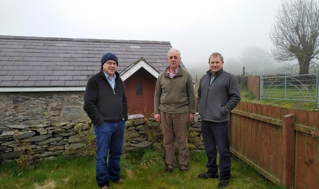
We met with Cassie and Harry Hampton in Ballystokes, and Patsy Fitzsimons and Fr. Derek Kearney at Slieve na Griddle, to discover the heritage of the area.
Cassie can recall, “Loughmoney was owned by the Hampton’s who live at the head of the lough. This was used by the hospitals in Downpatrick as a reservoir”. Afterwards it was sold to Downpatrick Council to act as a reservoir for the town in periods of drought. NI Water now runs it as a place for recreation, the main activities are licensed fishing, walking and swimming. It is regularly topped up with new stock.
Patsy can recall Slieve na Griddle as the place to go for a Sunday Picnic and where he played as a child. There was a story of there being a cave near the quarry in which lived Robin Mass. This mysterious figure would drag children into his lair.
60. Green Loney
A mass path exists from the end of the Ballynagross road in Ballyalton to the Mearne Road in Saul where it is also known as Annabella’s Loney, “after Annabella Doran who had a wee house along it,” Cassie informs us. The route continued across Doran’s Pads (See

Fr Derek, Patsy Fitsimons and Cadogan Enright at Slieve-na-Griddle
page 14 and 15) to the chapel at Ballysugagh.
Cassie and her brother Harry recall people using it going to Mass from Ballyalton. It is also a bridleway for horse riders in the area who are able to make a circular loop with the Ballystokes Loney. Today, part of this route forms the Lecale Way from Ballyalton, as far as the junction of Ballystokes Loney.

This bridleway runs from the Green Loney through Ballystokes to Loughmoney where it connects to the lane to Carrownacaw and Roneystown. Before reaching Ballystokes the lane passes Jack’s Rocks which goes up Slieve na Griddle. This clachan was badly hit in the famine. Ballystokes was also once a clachan of thirty-two houses . One of those remaining belongs to Croskery’s with a date stone of 1761. A well served many of these homes, it was also where the Croskery’s kept their butter.
A nearby field has a stone with Neolithic ring marks. Ballystokes Loney forms a section of the Lecale Way connecting Ballyalton and Raholp.
62. Griddle Pad
This pad skirts the mountain from the south end of Loughmoney and crosses the fields to Ballystokes. Harry Hampton used this pad as a way of walking to his farm in Ballynagross. The route passes the quarry in the side of the mountain which started when the contracts went out for RAF Bishop’s Court. Paddy Fitzpatrick of Mount Panther had just bought the land. It is said within the first week he had made back the cost of buying it by supplying infill for the new runways.
63. Lough Money Pad
The Lough Money Pad connects the Griddle Pad to the clachan at Carrowvanny. This path was originally created when the lough was made into a reservoir. The route enables vehicle access to the pumping station on the island in the lough. At the junction with Ballystokes Loney a stone stile enables access around the gate. There are fishing stands along the route for anglers.
64. Lough Money Loney
This lane joins Carrowvanny to the Ballyculter Road. It is largely used by farm machinery but is also a bridleway. (Authors’ Note: We have not finished investigating the path on the eastern bank.)

65. Porter’s Lane to Ballynagross.
Harry Hampton used this to walk from his home at Ballystokes to his farm at Ballynagross. Having taken the Griddle Pad to Loughmoney the route follows the old road below the present Ballyculter Road, following hedgerows, the route picks up the lane behind the houses at Ballynagross.
66. The Griddle Lane
This serves six households remaining from the


original mountaintop clachan off the Ballyculter Road which was devastated by the famine in the 1840s. The farmland would have originally been worked communally. At Fr. Derek Kearney’s house is an old common where the cows were rested during milking. The wall of an old horse walk outside the barn has been retained.
67. Jack’s Rocks
At the corner of the old common is the top of Jack’s Rocks, an old lane to Ballystokes Loney. Patsy recalls going out this lane with Sammy Craig to thresh corn at Ringbane. Bringing home the corn by cart required a second horse for the incline up Jack’s Rocks. As the name suggests the surface is exposed rock. At Lousy Corner on Jack’s Rocks in the Round Field there is a well with a canopy over it. The lane has become blocked. Residents would be in favour of reinstating it if a suitable kissing-gate was put in place to enable a short looping walk connecting the carpark at Lough Money Pad with Ballystokes Loney, Griddle Lane and the Ballyculter Road.
68. Pad down the fields
From Ballyalton to the clachan at Slieve na Griddle a path runs through the fields. This crossed Patsy Hanna’s land. It passed over Wallace’s Hill which had a slide on the rockface. Patsy Fitzsimons recalls tearing the backside out of a pair of trousers on it.
We are currently working Chapeltown, Ardglass, marked trails, Downpatrick circle. If you know any help this project then please
Most of our settlements many lack a safe off-road started North Lecale first Strategic issues highlighted

working on the villages of Ballyhornan, Killough and Ballykinler with links to wayDownpatrick and landmarks like Ballynoe’s stone knowledgeable senior citizens who would please write to cadogan@enright.ie .
settlements have links to way-marked trails - but off-road circular route for walking locally. We first because of an urgent need to address highlighted on pages 18 to 25.


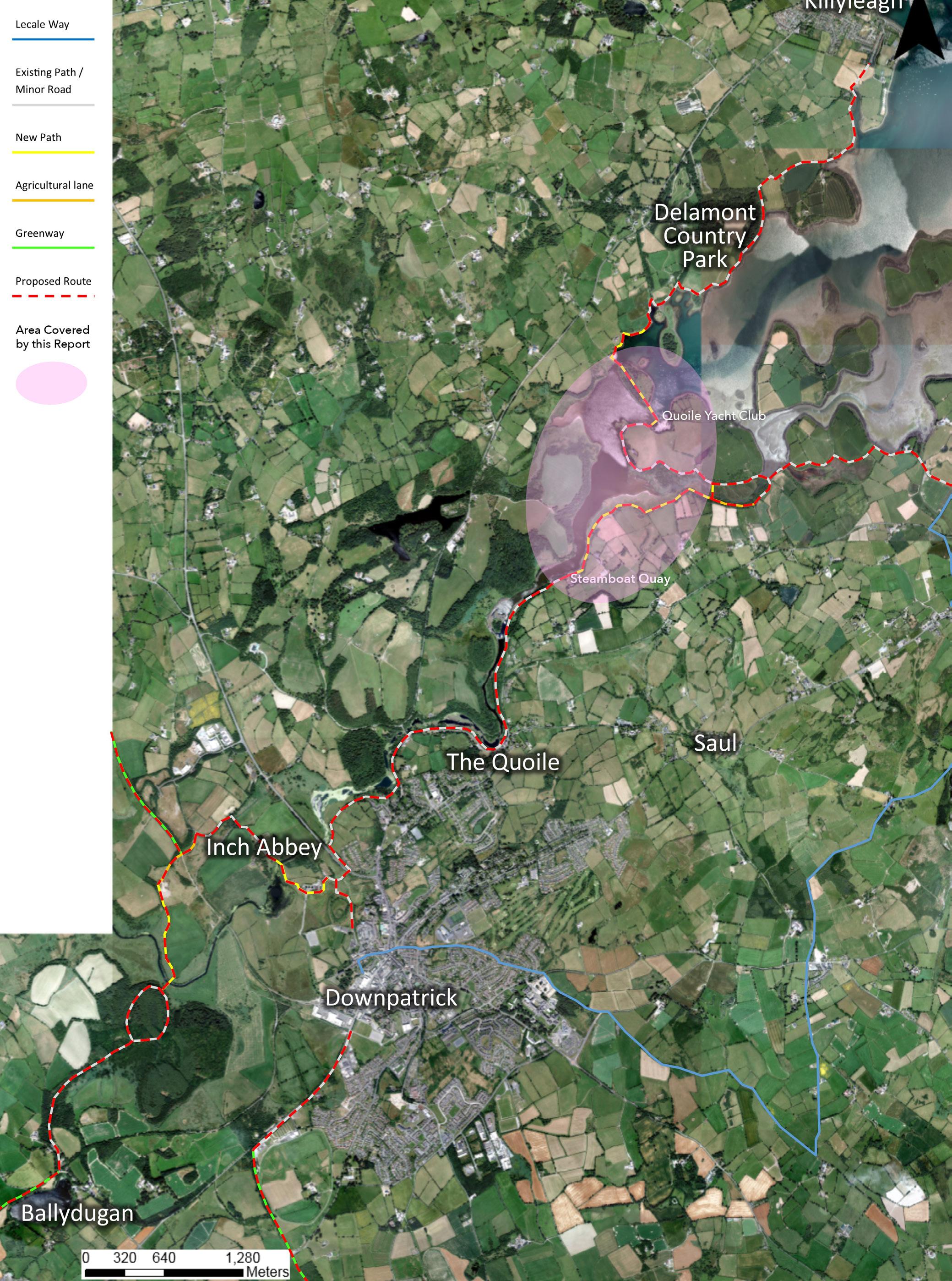
Residents Associations in Downpatrick working in consultation with The Ulster Federation of Rambling Clubs secured Council funding to commission a report on how Lecale in general, and Downpatrick in particular, can be linked to all the major way-marked trails in Ireland. This satellite image-based diagram summarises the recommendations.
It proposes links from the existing 4 kilometer Quoile River Walk East to Strangford, North East to Killyleagh, West to Dundrum and via the Mournes to the Republic and Armagh. Finally North West from above Inch Abbey Railway Station to the Comber Greenway.
This plan also links the Staint Patricks Centre off road to the original Patrician shrines and locations around Saul and Raholp.
Using Department of Agriculture Environment and Rural Affairs land and three short sections of boardwalk with some other minor works would allow the restoration of the Lecale Way off-road from Strangford to.Downpatrick and also to Delamont and Killyleagh. Once this was achieved, securing the return of ‘Ulster Way’ status for Dowateick and Killyleagh should be a formality.

Barbed wire fencing intrudes onto DAERA land at the Quoile Yacht Club. A section of boardwalk from the layby would bypass the wire to Hare Island and the barrier.
A 200 meter section of hedging may be required to hide walkers from seasonal wading birds so as not to create disturbance.
A short section of boardwalk will reconnect the Quoile River walk to the old right of way north of Steamboat Quay

Using one of the 7 DAERA Causways at this point plus a short section of boardwalk will create safe access to Castle Island road.
Continuing the Quoile River Walk westward to link these three key sites also results in linking to the two Greenways without intruding on the Downpatrick and County Down Railway track system between Ballydugan, Downpatrick and Inch Abbey.
This plan would link the network of paths to Annacloy, Ballynahinch and the Comber Greenway to Belfast heading North from Inch Abbey Railway Station.
The Greenway along the old railway track to Dundrum is particularly critical, as it provides Downpatrick with the essential off road link it needs to complete the Saint Patrick’s way to Armagh and the Republic via Clough and the Mournes.

This plan would require two footbridges over the Quoile.

Mound of Down & Saint Patrick Centre

During the recording, mapping and walking of the routes in this book, it has become obvious that our Tourism Hub in Downpatrick around the Saint Patrick Centre can be linked off road to the traditional Saint Patricks Way East of Downpatrick. Visiting all the Patrician Shrines, places and Churches so important to generations past in Lecale.
Most of the sites are NIEA owned and managed and most of the rest are traditional paths and way-marked trails. This route could be copper-fastened with an Article 12 declaration by Council following mapping, consultation and minor works.


A good example of how just one well-informed person can make a difference is the work of Bill Corry in collecting evidence to restore this route. Bill has helped people fill in the evidence forms required to force action by Council in restoring rights of way over this route. He has received support from local ramblers, members of the Killyleagh Wildfowlers, the Quoile Anglers, residents and local environmentalists.
In an interview with Cadogan Enright, Bill said; “Since the 1980s past and present Councils have been talking about restoring this link that is critical to joining up several other local walking routes. After decades of failure I decided to take action myself before all those who knew the route passed.
I remember the Quoile barrier being built and finished in 1957, and I often walked from Mullagh Quay across the barrier to Castle Island Road for recreational purposes. I started work for the Department of Agriculture in 1958, and was appointed Inspector for the Lecale area around Downpatrick in 1960 to run the ‘Farm Improvement Scheme’. I lived in the townland of Mullagh near Mullagh Quay around this time.
In my work I cycled everywhere and there is hardly a farm, a lane or a track in the Lecale area that I do not know. I helped to map boundaries and advised farmers in the area for 40 years. I am familiar with most of the paths and lanes highlighted in this booklet.
My Cousin Elspeth Barnes was a founder member of the ‘Ulster Society For The Preservation of the Countryside’ along with Wilfred Capper. I joined shortly afterwards. I was a member in the 1970s

Bill Corry (right) with Cadogan Enright and leaders of local angling, wildfowling and environmental Groups at Mullagh Quay near Delamont.
when Wilfred, as an officer of the society, finally realised his vision of the Ulster Way when he was also the ‘Footpaths Officer’ for the Sports Council. It was at this time that Alan Warner wrote his book on the Ulster Way. This followed Capper’s route linking Strangford Village with Killyleagh over the Quoile Barrier.
From personal experience I can attest that the route from Castle Island Road along the barrier to Mullagh Quay and present-day Delamont was accessible from the day the Barrier was finished, and that it was on the original route of the Ulster Way.
The Quoile Yacht Club had been established in 1954 near Downpatrick’s old Quays. It was moved up to the seaward side of the barrier in 1957 where it was given a lease on that land. It was poorly sited near the Southern side of the barrier path. The club gradually built gates and fencing outwards and forward, making walking access increasingly difficult. In time, barbed wire was extended down to the coastal strip owned by the Department of the Environment blocking access entirely. I have supplied Council with maps of land ownership for this area to backup our official complaints.
On the Northern side, a gate with a lock has gone up at Mullagh Quay beside the stile making it difficult to access moorings and launch kayaks and canoes. Also on the Northern side, a fence has been established on the shore to well below the low tide mark between the Quay and the barrier as well in front of what used to be Eddie Rea’s house. The foreshore up to the high tide mark is managed by the National Trust on behalf of the Crown estate and they have not given permission for this fence to be erected.”

“Council has failed to protect the Ulster Way between Castleward and Delamont Park, not once but twice.
After the route over the barrier was blocked, Council did not challange it. Instead the Sports Council (Now Sport NI), Tourism NI’s predecessor and old Down Council, attempted to keep the Ulster Way going by way of the Lisban Path to Steamboat Quay on the Quoile in Downpatrick and hence to the Old Belfast Road Bridge to Killyleagh. This route was way-marked in 1989 but was lost by inept and untimely work by Council in asserting both this route and/or the alternative offered by the land owner.
In my view Council has a legal duty to re-assert this route. It links key locations like Killyleagh, Strangford and Downpatrick to the Ulster Way. In the short term obvious obstructions should be removed immediately. In the medium term the Council has a legal duty to contact the DoE and the National Trust to agree to re-establish the route over the barrier once again over public lands which extend in an unbroken line from Downpatrick to Delamont”.

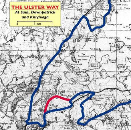
When the Ulster Way was originally planned in 1946 there was far less traffic on the roads. The beautiful panoramic coastal aspect of the Narrows was the key feature of the route from Strangford to Kilclief with Strangford as a major ‘node’.
In 2009 when the Ulster Way was revised this route was deemed too hazardous to walkers and a ‘quick fix’ diversion plotted along Blackcauseway Road and Glebe Road, reconnecting with the coastal path via Kilclief.
There has been no action by Council to remedy either this situation since 2009, nor to address the loss of the Ulster Way from Strangford to Downpatrick and via the Quoile to Delamont Park and Killyleagh.
The sections of the Ulster Way/Lecale way South and West of Kilclief are in relatively good order from Killard to Ballykinler and Clough. Issues do exist along the South Lecale Coast like inaction by Council over a blockage with removal of stiles between Sheepland and Ardglass and the obvious need to install a footbridge over the old railway bridge at Coney Island in order to avoid the dangerous section of road between Ardglass and Killough.

Original Ulster Way

There is a clear danger that Council inertia and inaction will also lose this ‘quick-fix’ section of the Ulster Way along the Blackcauseway Road. The nature of the on-road element of the diversion means that this section is no longer desirable for promotion by Tourism NI. It is not regarded as being ‘fit for purpose’.
This route has no verges and is subject to sudden oncoming traffic so walkers can still find themselves in danger. More crucially though, the original coastal aspect of the walk has been lost. This was the most important visual part of this section of the Ulster Way.
The loss of off-road links to Downpatrick, Delamont and via Killyleagh and to the ‘Capper Trail’ to Newtownards (see pages 18 and 19) has triggered the complete loss of those sections of the Ulster Way to East Down. This has also resulted in Strangford Village losing its key status as a node on the Ulster Way. Today Strangford is a minor loop off the Way with the official guide recommending public transport to re-connect with the Ulster Way in North Down.
East Down appears to be the only area in the UK and Ireland where way-marked trails have steadily declined over the last 40 years. Everywhere else they have burgeoned and are now a key component of the local leisure scene and tourism industry.
If urgent action to address and reverse these difficulties is not taken, it is highly likely that in the next revision of the Ulster Way East Down could lose the Ulster Way entirely. This will have impacts on tourism and employment locally.


Cadogan with Margaret Ritchie and Mark H. Durkan.
Reviewing proposed Ulster Way upgrade.
In 2015/16 an application for funding an environmental impact study and for costing the route between Kilclief’s picnic area and Kilclief Beach under the ‘Plastic Bag Levy –Challenge Fund’ by Cadogan Enright was jointly sponsored by the Strangford Community Association and Kilclief Residents Association. The project won support from then MP Margaret Ritchie and Minister Mark H Durkan.
‘Pre-planning’ meetings were had with the local planning department on the foot of this study, and community groups have since been seeking funding for this section of the route. It is probable that any such route would have to be established using Article 12 of Council’s powers – see page 24.
Subsequent studies by Council itself have also found this section to be feasible. In the meantime, Kilclief / Ben Dearg GAA have won grant funding and independently delivered a large section of what would be this route within their own grounds.

Subsequent to the project below, additional funding was won under the ‘Down Your Street / Live Here Love Here’ funding programme to design and cost the rest of the link from the Council picnic area in Kilclief to Strangford Village in the 2017/18 financial year.
The study focussed on the need for a cyclepath / footpath on the landward side of the main road. This pathway would have 2 main purposes;
■ To service the local population and enable non-car access for the facilities shared between the 2 villages along the narrow and winding A2 road.
■ To safely open up the Southern Link from Strangford to the Lecale Coastal villages and beaches to tourists, cyclists and ramblers and secure the future of the Ulster Way in East Down.
Given the difficult geography of the Narrows at this point, a coastal path would be prohibitively expensive for about 60% of this route – so the study focused upon the original line of the Ulster Way along the A2.
This project would require Transport NI to agree to make some minor road re-alignments along the A2 to make it safer, and to facilitate the passage of the cyclepath along one side of the road only.It may also require TNI’s ability to make timely compulsory purchases to bring the project to completion in a reasonable timescale.

1.88 Miles or 3.03 km of cycle track/ footpath
Kilclief Picnic Area


If a public right of way exists over a path then it cannot be closed by a person erecting a ‘Private’ sign, bulldozing the lane or pathway or by blocking it with rubble or planting. The maxim is : once a highway, always a highway.

If the path has already been asserted as a public right of way by the Council then obviously the Council is aware of the status of that particular path and can quickly react. A site visit is normal in following up such a complaint and Council will, if necessary, take proceedings against the landowner.
If a path is closed that Council has not yet got around to asserting, then a concerned citizen would need to inform the Council of any blockage. Council would then need to investigate the status of the path to ensure that it was actually a public right of way, prior to any further action.
If a particular path becomes blocked that might have originally been a public right of way, and no one complains about any blockage, then there may be instances where historical public rights of way may be closed to the public to use. This is common in our area. However, in law they will remain public rights of way if they were originally public rights of way, unless and until they are legally extinguished by a vote of the local Council.
If you believe a public right of way is being blocked then it should be brought to the attention of the Council as the access authority under the Access to the Countryside (NI) Order 1983. Council is legally
obliged to investigate reports of loss of rights of way, and to enforce rights of way. The Council employs ‘Countryside Access Officers’ for this purpose. Council may agree to consider alternate routes with landowners (see Strangford page 5). But in the final analysis there is an onus on Council to keep them open.
It must be borne in mind that the Council has limited resources to investigate alleged public rights of way. Due to the ongoing work in asserting rights of way, investigations may be prioritised based on urgency, or level of usage, or strategic nature of the right of a particular way in linking other rights of way.
For further information see the Government website at www.nidirect.gov.uk/articles/public-rights-way But as you will note it is local Councils who are tasked with dealing with public rights of way.
Anyone wishing to make a complaint regarding asserted or alleged public rights of way may contact the Council at the following address:info@nmandd.org and the complaint will be passed onto the relevant person. Complaint forms are also available from Council venues.
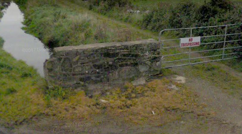
Assertion means that the Council has identified and spoken to all landowners to determine their views on the matter, gathered witness evidence and other documentary evidence. Then based on the balance of probabilities has come to the conclusion that a

public right of way exists at a particular location. The assertion of any public right of way is also open to challenge through the courts.
The old Down Council had been systematically ‘asserting’ rights of way in East Lecale, starting with the most obvious ones. But many remain as yet unasserted. This does not mean these aren’t rights of way. Community pressure helps to free more Council resources to assert more rights of way. If your local community can collect witness statements for Council, it makes the work easier.
Where the landowner disputes the assertion of a right of way and is prepared to defend the closure in Court, it can take several years and many steps before the case finally comes to the High Court as evidenced with the dispute in Cargagh lane between Churchtown Road in Ballyculter and Drumroe Road.

All OSNI maps have a disclaimer that ‘The representation on this map of a Road, Track or Path is no evidence of the existence of a public right of way’. The only public rights of way clearly shown as such on any OSNI maps are ones which the Council has asserted, for example the Lecale Way or Saint Patrick’s way. Outdoor Pursuits maps also show the
paths which have been asserted by Council. OSNI has no authority to determine which paths may or may not be public rights of way.That is a duty of Council. OSNI is effectively saying that the simple depiction of a path on a map does not mean that the path is a public right of way. But these images (especially older editions) are often used as part of a file of evidence to assert a right of way.
Council has an excellent digital record of historical maps, many of which could be used as evidence in asserting that a right of way exists. Old deeds are often useful too.
The key evidence comes from local people who can make witness statements based on their own experience of using the rights of way to get to school, for exercise, as a walkway between 2 villages, to access a beach etc.
As time goes on, the assertion of public rights of way can become more difficult due to the loss of older members of the community who used these paths before they became blocked. Thus creating a record now with older members of the community is an important part of bringing rights of way back for use by local communities.
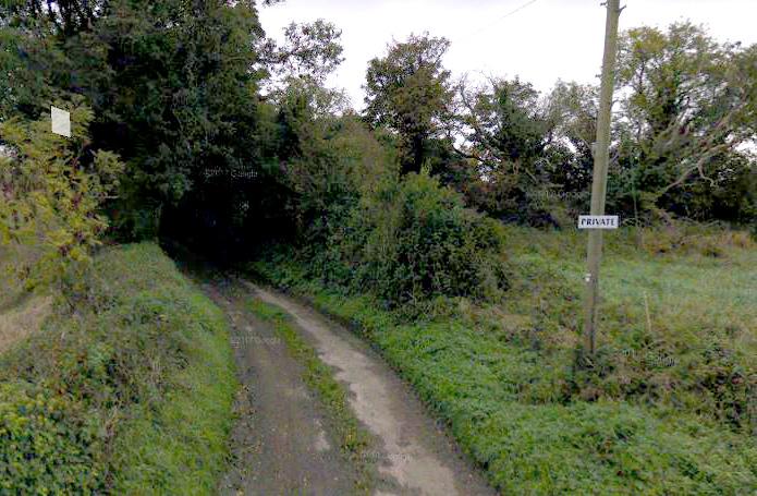

World-wide waymarked trails have been expanding dramatically over the last 40 years as governments and local authorities realise their benefits for tourism and economic development and their role in providing leisure opportunities for a healthy and active local population. Over the same period, waymarked trails in Lecale and East Down in general have seen a dramatic decline. During the first four years of the new “Super Council” waymarked trails in East Down were not being maintained. During the writing of this book, Cadogan Enright was able to reinstate an annual Council maintainance programme starting summer 2018.
All Scottish settlements have been pro-actively provided a Core Path Plan under the 2003 Land Reform Act. This gives residents off-road access to green spaces, nearby villages, and bridleways. Every village has multiple walking routes with on-line guides, maps, reviews, and recommendations for visitors. These have been linked to make long-distance way marked trails. See example here www.walkhighlands.co.uk
Originally planned as the link on the Ulster Way connecting the Mourne Way at Newcastle to the ‘Capper Trail’ North of Killyleagh, the Lecale Way connects most settlements on the Peninsula. It has suffered from a lack of pro-active development work. Failure by Council to preserve off-road paths around Downpatrick and Killyleagh resulted in the Lecale Way around the Southern and Eastern sides of Strangford Lough being excluded from the Ulster Way. Subtantial development work is needed on the Kilclief to Strangford section, the Sheepland to Ardglass coastal section has unauthorised blockages and the section between Coney Island and Killough needs a safe passage over the old railway bridge
Saint Patrick’s Way has been badly affected by lack of maintenance leading to overgrowth and blockages. It remains popular with walking clubs who include it as part of their programmes. Several spurs to the Lecale/Ulster Way lie undeveloped. The Way has the potential to become a significant tourism product in the area. The sections which have been allowed to lapse would enable people to make much more of their visit to Slieve Patrick.
Gerry Hynds Said; “Saint Patricks Way is at the heart of Saint Patrick’s Country, it is part of who we are and where we live” Gerry’s family own 2 farms along the Lecale Way. He is better known as the proprietor of Bargainland in Downpatrick. Gerry pointed out that these waymarked trails are about tradition and heritage, but are also an important element of the economic and social infrastructure we preserve for future generations. “Council has a duty to maintain and develop these routes” Said Gerry.

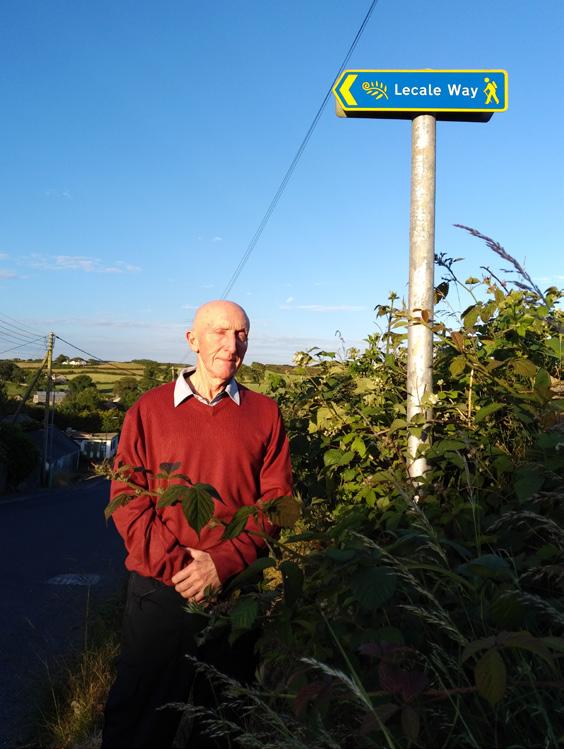
Council’s duties under the ‘Access to the Countryside Order’ (1983) are most extensive. They include ;
• assertion, protection and keeping open and free from obstruction or encroachment any public right of way. This also includes the right to take over the maintenance of a public right of way (Article 3)
• after consultation, erecting signage and waymarkers for and along the public right of way (Article 4)
• ensuring that the maintenance of stiles, gates, bridges and other infrastructure is undertaken (Articles 5&6)
• ensure that a public right of way across a field is restored after ploughing (Articles 7&8)
• issue fines to landowners that keep bulls in fields which a public right of way crosses (Article 9)
• issue fines to landowners who erect signage to deter the use of a public right of way (Article 10)
• creation of public paths by means of an ‘agreement’ with a landowner (Article 11)
• creation of a public path where there is a strategic need, or an agreement cannot be met (Article 12)
When in the countryside it is important to be friendly and polite to residents. If you meet others on your route don’t be afraid to say hello.
It is best practice to follow established rights of way or way marked trails. If you are crossing private land knowingly, get permission before doing so. If you are approached by an aggrieved landowner remain calm and polite. Follow these seven simple principles to enjoy countryside recreation:
1. Be prepared and plan ahead. When travelling to the start of a walk be courteous and drive slowly and park with care and consideration for local road users. Be respectful of designations and warning signs. Car share or use public transport where possible. Agree a point of contact for emergencies and ensure your group is trained and prepared. Check the weather forecast and have clothes suitable for inclement weather.
2. Be considerate of the rural population and farm animals.
Respect those who work and live in the countryside. Take care not to damage property including fences, walls and crops. Fasten all gates behind you. Do not distress livestock and keep to paths across farmland. If dogs are permitted ensure that you have proper control at all times. Always ensure that you have a lead with you and clean up after your dog.
3. Respect wildlife. Dogs must always be on leads where seal colonies are present. EG
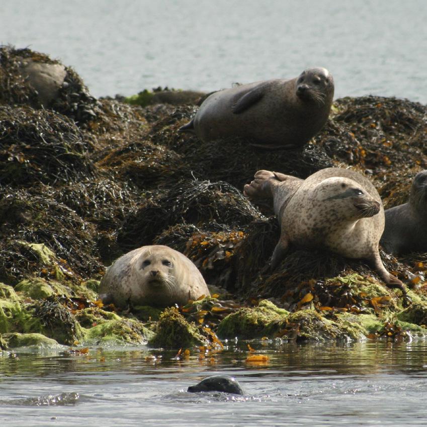
Ballykinlar, Minerstown, and the outer Quoile Estuary. Approaching closer than 400 meters panics mother seals and may cause pups to be abandoned.
Avoid bird nesting areas on shingle beaches.
Keep distance between yourself and flocks of grazing geese and over-wintering birds.
4. Leave what you find. This idea applies to natural objects – if everyone takes a memento, there will be nothing left.
5. Dispose of waste correctly. Litter poses a hazard to wildlife and can be carried long distances by wind. It will end up in our seas where it becomes a blight and poses an even greater environmental hazard. Bring litter home with you and try and collect any litter you find. Your two-minute beach clean has a lasting impact.
6. Walk and camp on durable ground. When walking avoid adding to erosion. Take all equipment and refuse with you.
7. Minimise the effects of fire. Guard against all risks of fire. If you light a campfire, ensure that you have control of it at all times. Where possible you should only burn wood. Do not destroy any fences or other property for use as kindling.
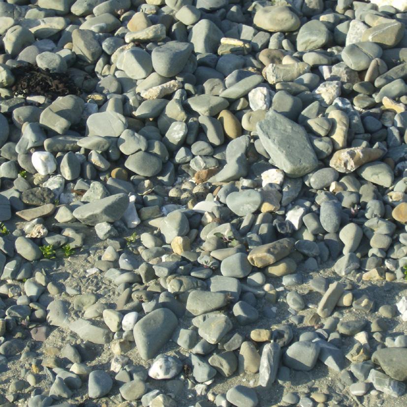
Can you spot the Plovers Eggs?



By Councillor

