

FAIRBANKS NORTH STAR BOROUGH PARKS & RECREATION
Main Office: 1920 Lathrop Street, Fairbanks, AK
Hours: Monday-Friday, 8:00 AM —5:00 PM
Website: http://parks.fnsb.gov
Phone: (907) 459-1070


Fairbanks North Star Borough Parks & Rec
FNSB_Parks_and_Rec
FNSB Parks and Recreation
Contact the Trails Coordinator at 907-459-7401. Check the Trails Office webpage for MAPS and INFORMATION! Follow the FNSB Parks & Recreation Facebook Page for updates.

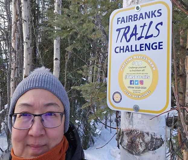
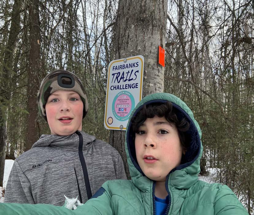
You must register for this program on the FNSB Parks and Recreation website. Your FREE registration helps us track participants and keep you in the know about important updates and trail closures.
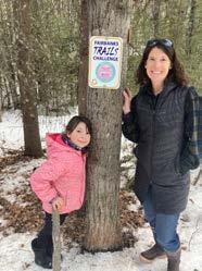
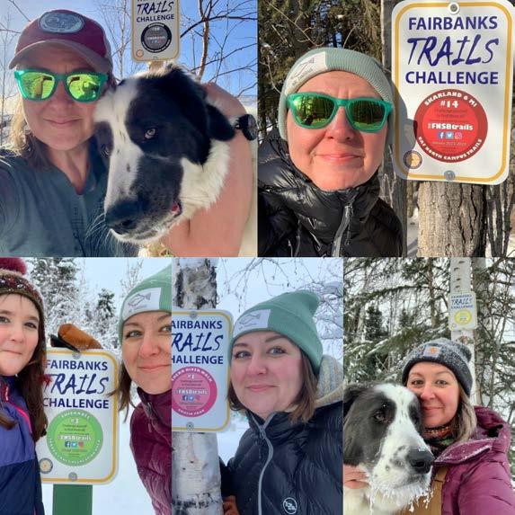
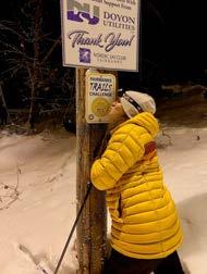
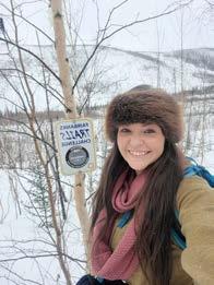
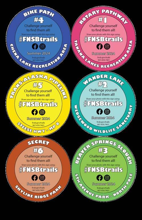
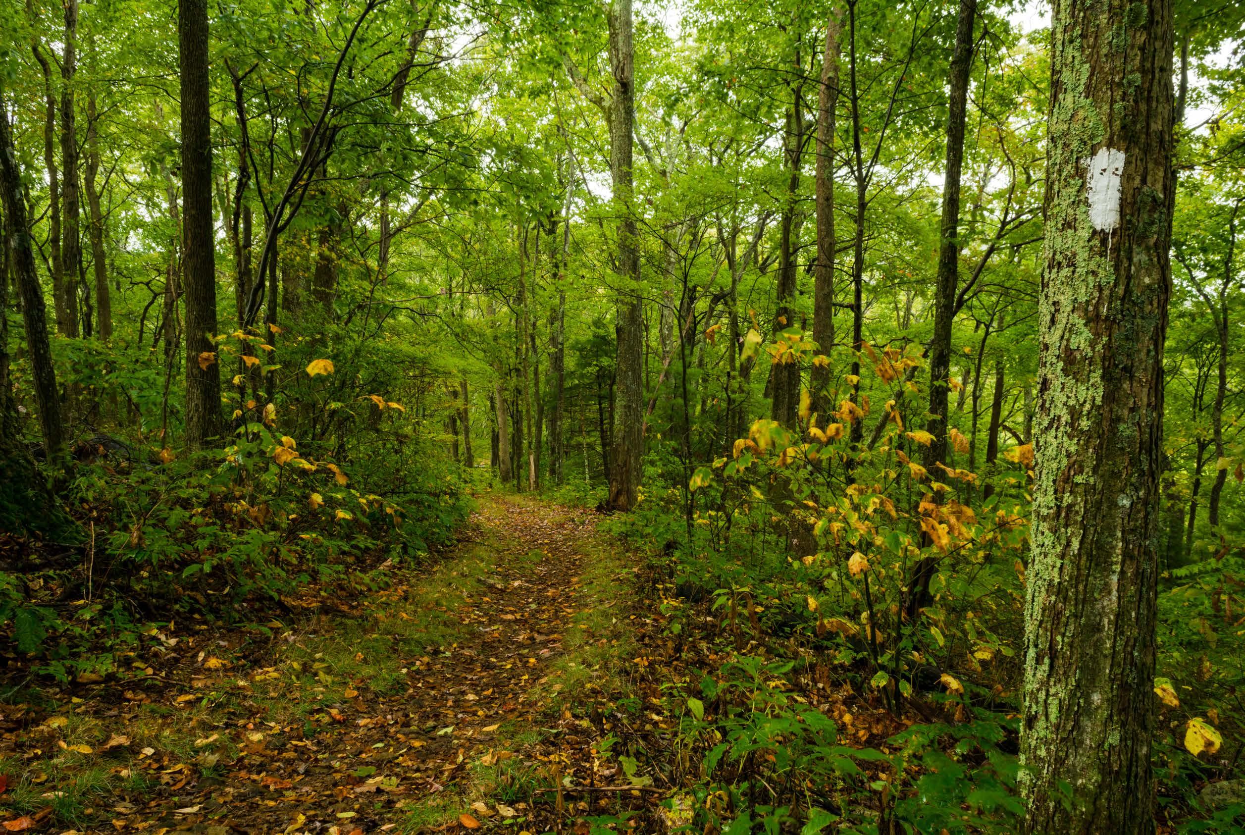
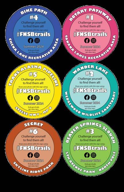
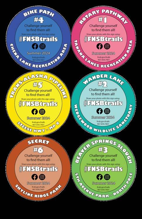
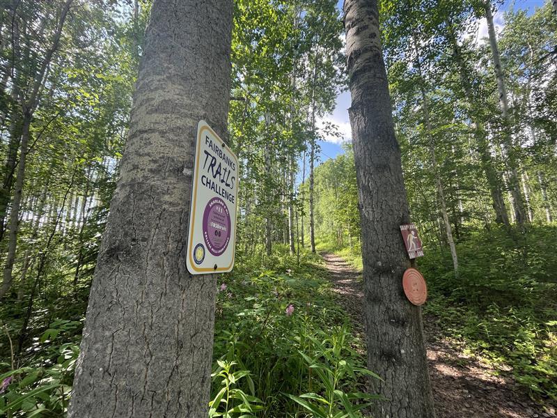
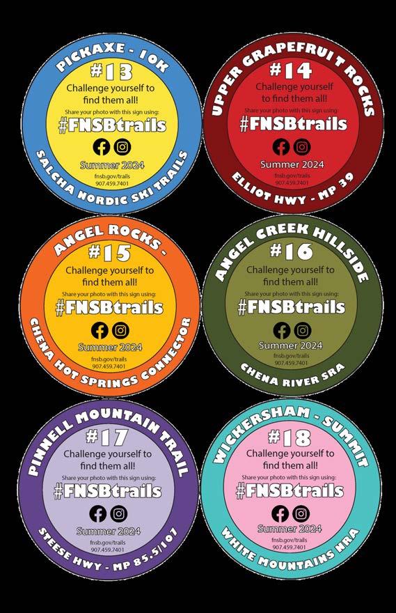
Twenty signs are located somewhere along the trails on the list. Keep an eye out for orange trail markers — the sign will be near! Snap a PHOTO with the signs to celebrate that you made it!

2) Email your photos to trails@fnsb.gov.
1) Post your photos on Facebook or Instagram and type “#FNSBtrails” in your post!
(Note: Posting and emailing photos is not a requirement, but it's still a fun way to share your trail triumphs and you might be featured in our next guide!) REGISTER for free at fairbanksak.myrec.com.


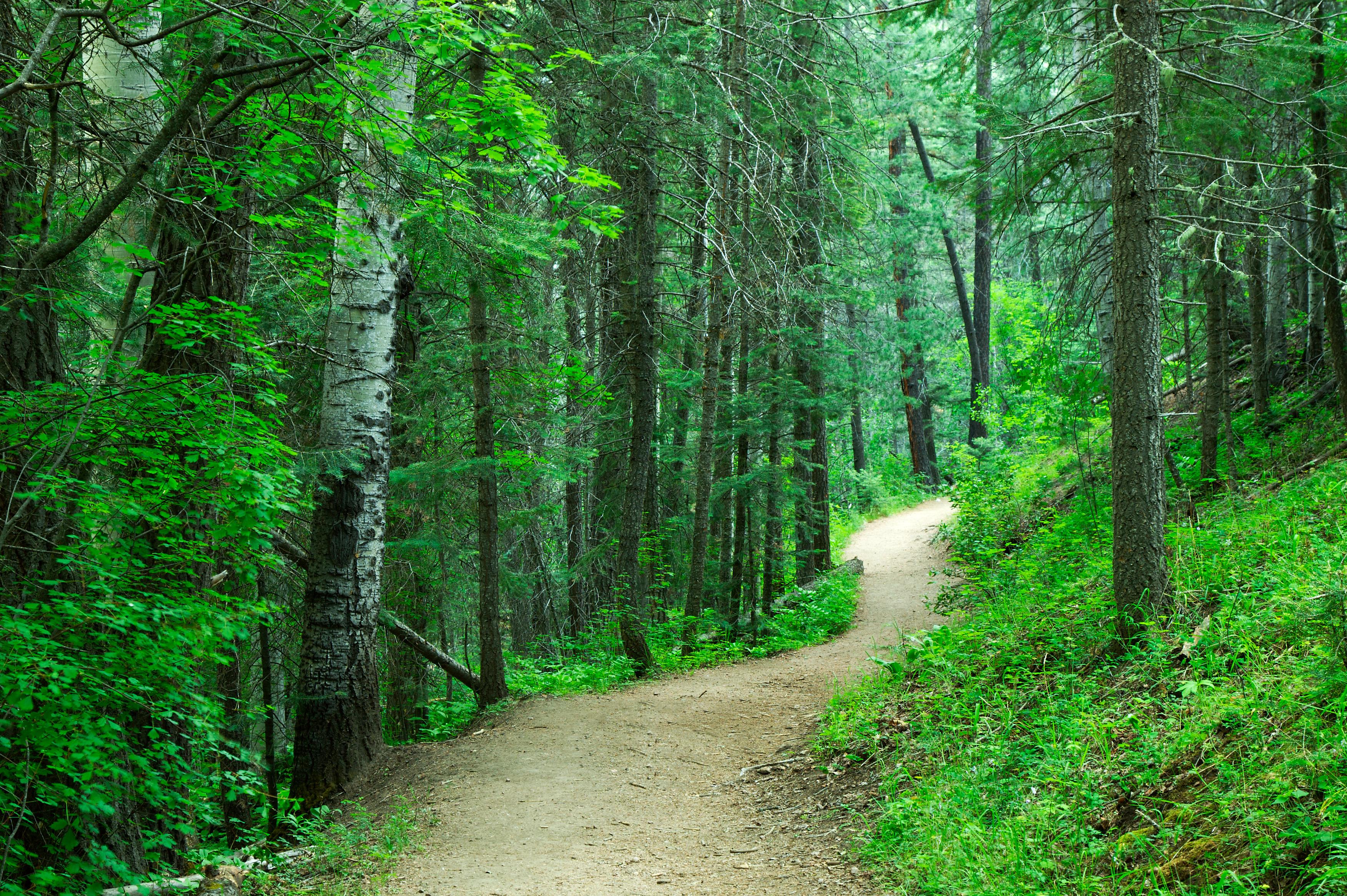
Everyone was new to these trails at one time. Here are some tips to make your first couple trails as enjoyable as possible:
1.
Start SMALL. Choose the right trail for your fitness level and experience level. Plan a hike that is suitable for everyone in your party and let the slower person set the pace.
2.
KNOW where you GO. Familiarize yourself with the trail. Review maps and talk to someone who has done the trail before.
4.
Check the weather. Weather can be unpredictable so remember to dress accordingly and pack extra layers.
3. Leave a PLAN. Tell someone where you are going. If you don’t make it back when you expect to, this person can alert your emergency contact.
5. Bring water. Drink often to stay hydrated and your pack will get lighter throughout the day!
PACE yourself. If you start out too fast you’ll tire out. Take your time and smell the roses!
6. Protect from the SUN & BUGS. Bring sunscreen, bug spray, and clothing to protect your skin, even on cloudy or cold days.
8.
7. Bring FIRST AID. Inspect and replace missing items from your first aid kit before each hike.
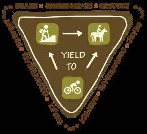
YIELD signs like the one here describe what to do in specific encounters, but always stick to the GOLDEN RULE: PRACTICE COMMON SENSE AND COURTESY!
Typically you should yield to the passerby who has least stopping control. Always yield to dog teams and horses and give the animals plenty of space.
Motorized trail users should slow speeds when encounters are possible.
Hikers can usually step aside more easily than other users.
Local trails cross a variety of types of terrain, land ownership and regulation. When out on the trails, remember:
Plan ahead to know where you go and who owns the land. Respect private and public property by staying in the public trail corridor.
Obey signage and land use rules such as allowable trail uses. Prevent damage by avoiding wet trails during spring break-up and heavy rains. Many good winter trails cross frozen bogs and cannot sustain summer use.

Your furry friends need exercise too! Here are some things to remember when bringing your pets on a trail walk: You are responsible for your actions and the actions of your dog.
Always keep your dogs properly restrained with a leash (FNSB code Title 22.28.010).
Pick up any pet waste (FNSB Code Title 22.28.020).
Yield the right-of-way to other trail users trying to get around your pet.
Avoid disturbing wildlife and provoking dangerous encounters.
Individual PDF maps of many Borough trail systems are now available for download on our web page: fairbanksak.myrec.com.
Find maps under General Info > Trails Office.
Some maps are designed for use on your GPS-enabled mobile device and can be displayed on any PDF reader. When viewed in an installed mobile application, each map will show your location on screen in real time. Cool!
These maps can also be printed or viewed without using a special app.
Georeferenced map applications allow you to navigate using your mobile device’s GPS even without cellular reception! There are a variety of georeferenced PDF apps available for Apple and Android devices. Consult your preferred mobile app’s instructions for complete information. We use an application called AVENZA MAPS, though other apps also work. Upload maps to the AVENZA app from Dropbox or your device storage.

Download the map onto your device BEFORE leaving cell reception! (Data rates may apply.) Enable Location Services so the mobile map application can show your location on the map. In areas with no cellular reception, phone battery life significantly decreases. Cold weather can also drain batteries! Using airplane mode will improve battery life and will not interfere with GPS tracking.
File sizes for georeferenced maps may be very large. AVENZA recommends users connect to a WiFi network when downloading.
Like all GPS technology, your device’s accuracy will be compromised by cloudy weather, cliff walls, canyons, tall buildings, or other obstructions. GPS is no substitute for preparedness! Research your destination. Plan, pack and dress accordingly!


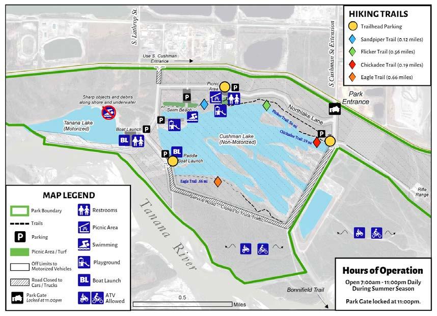
Get there: The Rotary Pathway and Playground is south of/across from the swim beach. There is designated parking for the pathway off of Westlake Lane.
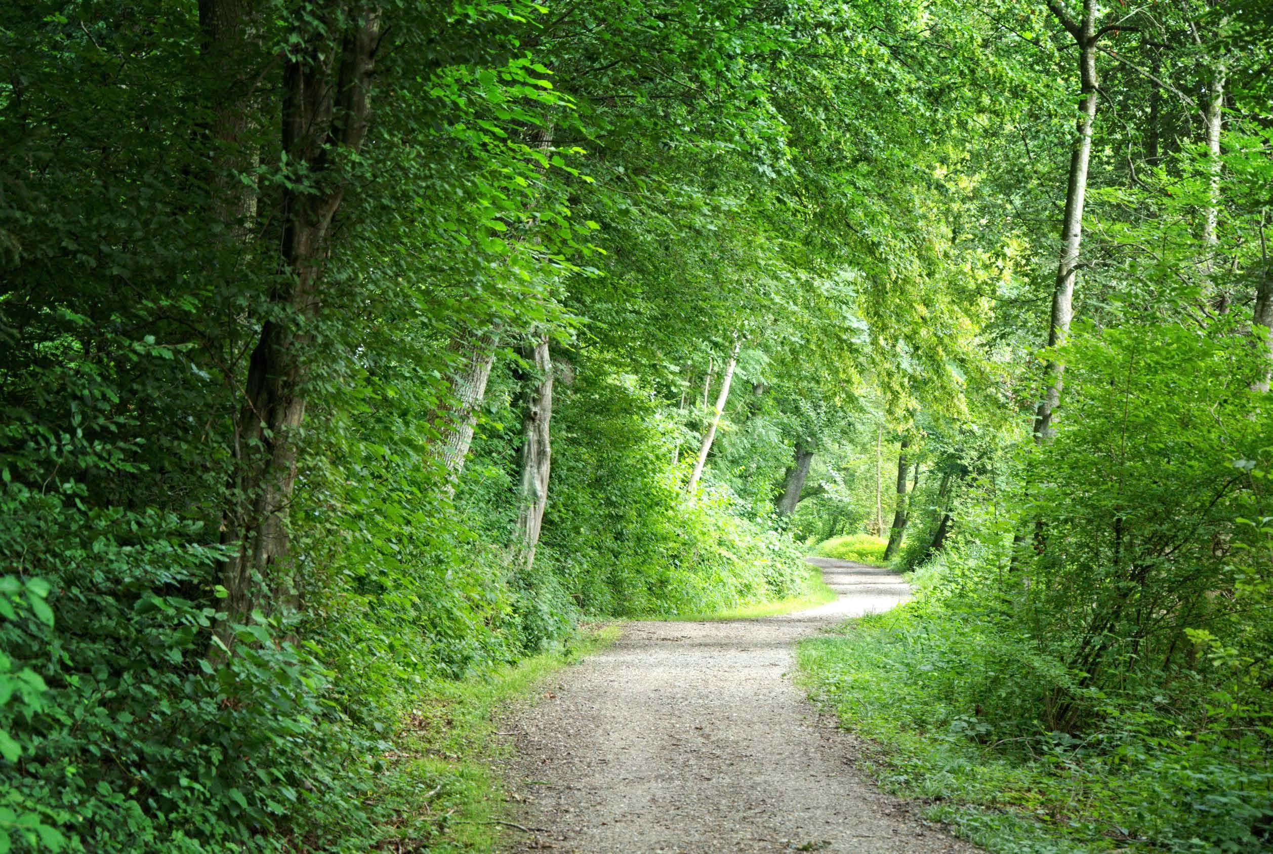
Tips: This is a non-motorized, paved pedestrian path that is stroller-friendly. Please leash all dogs and clean up pet waste out of respect for other trail users. The path tends to be busy so please be aware of others.
Bonus: Bhe Rotary Club of Fairbanks is a non-profit service club focused on making Fairbanks, the State of Alaska, and the world a better place to live. The Rotary Club of Fairbanks worked with the Fairbanks North Star Borough to execute their vision of providing an accessible, inclusive play park that invited exploration, cooperation, and discovery at the Tanana Lakes Recreation Area. The project was a multi-year effort, completed in 2024, and represents the largest local Rotary Club project to date with a value of just over $550,000 in donations raised from the community.
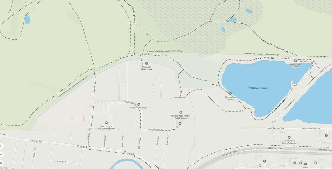
@ fountainhead wedgewood wildlife sanctuary
Get there: From the downtown area, follow Illinois street, and take a left onto College Rd. Take a right on Margaret Ave. The most accessible place to park is Joy Community Center. To access the trails, enter the opening in the northeastern corner of the fence. Cross the pedestrian bridge into Creamer’s Field and turn right. Parking is also available at Fountainhead Antique Auto Museum.
Info: Wedgewood Wildlife Sanctuary is private property reserved by Wedgewood Resort. FNSB Parks and Recreation has received permission to feature this trail in the Trails Challenge. Please be respectful of private property and pay attention to regulations. These are non-motorized trails, and both bikes and dogs are not allowed
Tips: This sign can be found about a mile from the Joy Community Center parking area. Hint: You may have to take shelter on a short side trail to find the sign. Wander Lake is a 1.5 mile loop. Trailhead Coordinates:
Get there: Parking for the Beaver Springs Nature Trail is at the 5th Avenue Park in North Pole, off E 5th Avenue between Santa Clause Lane and the Richardson Highway. Find information on the Beaver Springs Trail and 5th Avenue Park at this link.
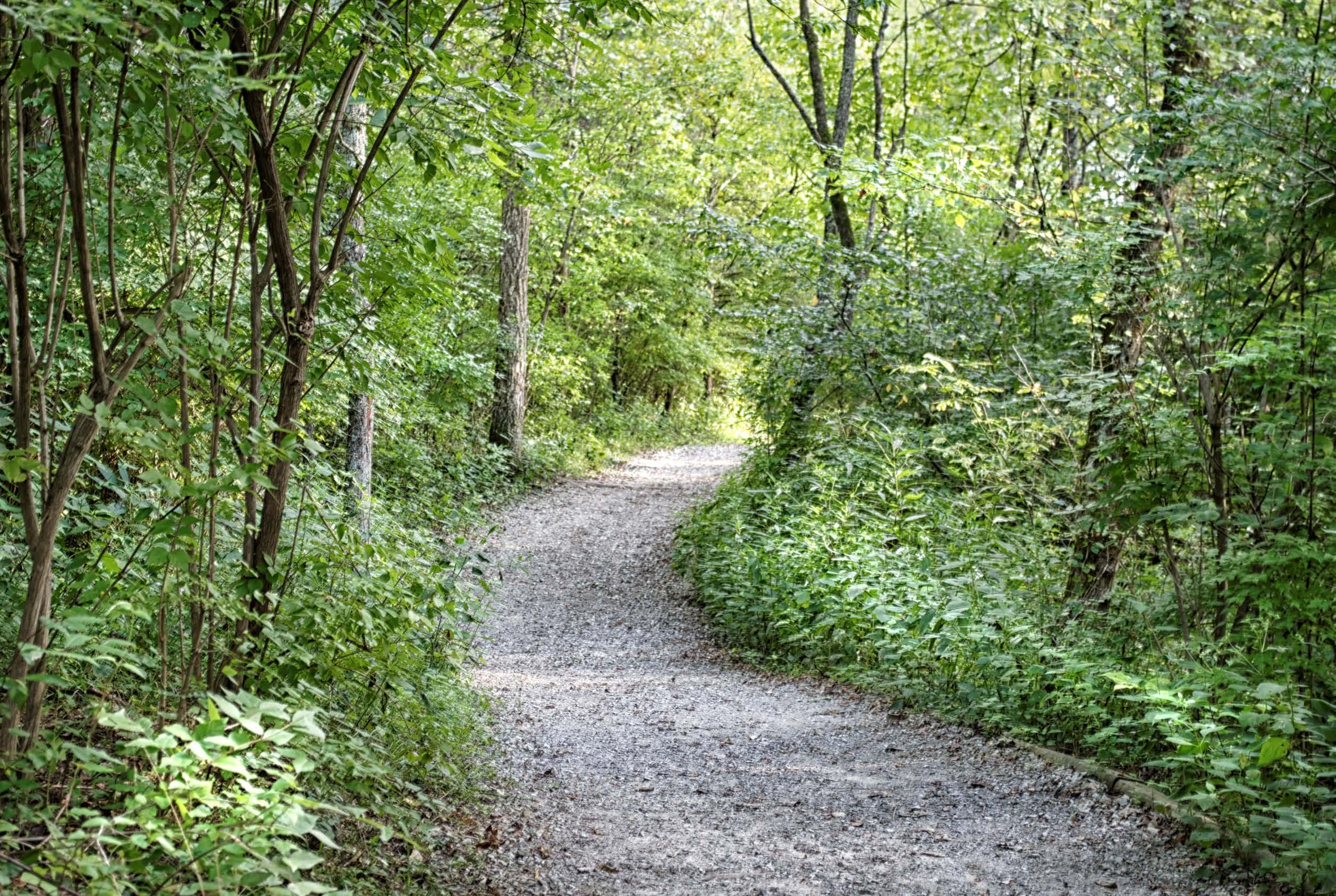
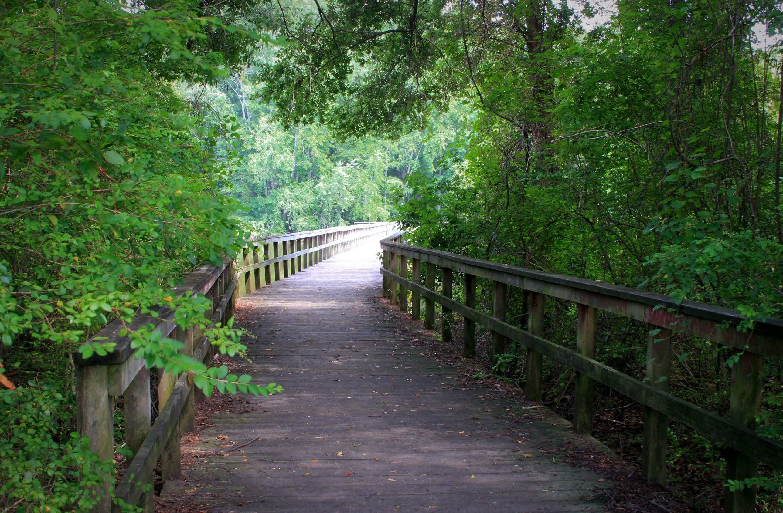
Tips: Check out the 5th Avenue playground, then head to the left/west side and cross over the bridge onto the nature trail! The trail is flat and is stroller and wheelchair accessible.
Trailhead Coordinates: 64.751084, -147.345093

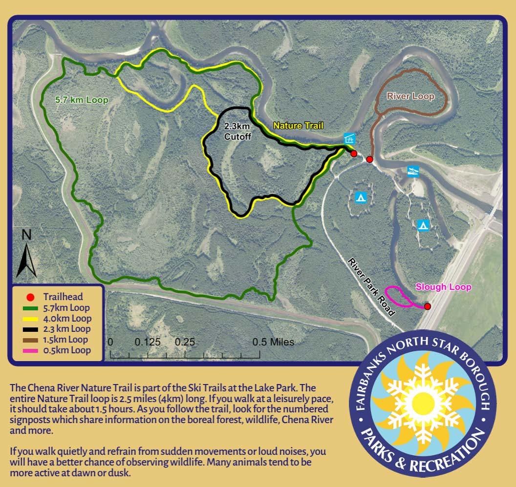
Get there: Enter Chena Lake Recreation Area and continue taking Laurance Road past the Lake Park sign and down to the River Park. Please be mindful of construction as you go. Follow the dirt road to find the first parking lot on the left. The trailhead will be near the pavilion.
Tips: This trail is non-motorized with the loop being about 3.5 miles long. Start clockwise around the 5.7k loop. Trails may be muddy!
Trailhead Coordinates: 64.794444, -147.197778

Get there: Parking can be found on the north side of the Steese Highway near mile point 8. Follow a paved path to find informational displays about the pipeline and an example of a pig, the device used to clean and inspect the inside of the pipeline. A permit is required to recreate on the gravel pipeline access road. Inquire with Alyeska Pipeline Service Company at (907) 787-8099 for details on obtaining a permit.
Tips: This trail is non-motorized.


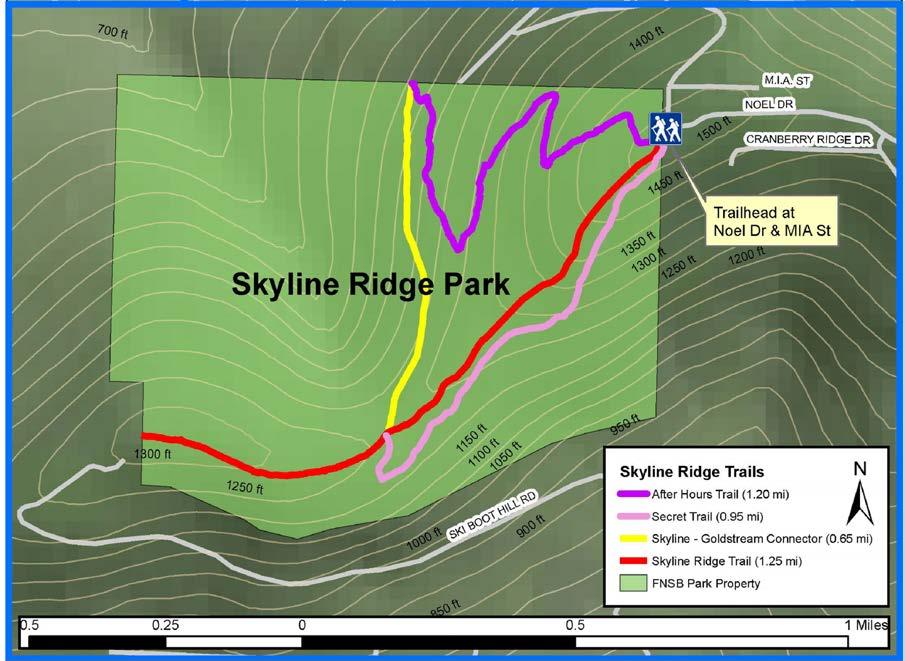
Get there: From Farmer’s Loop Road, take Summit Drive to Cranberry Ridge, or Skyline Drive to Crestline Drive. Follow Cranberry Ridge uphill to Noel Drive. Public access to the park is at the Skyline Ridge Trailhead at the intersection of Noel Drive and Mia Street. Parking is limited.
Info: You can find the sign less than a mile from the parking lot, but take Secret to Skyline-Goldstream Connector to After Hours for a 3 mile loop!
Tips: All the trails at Skyline Ridge are nonmotorized in the summer. Parking at the trailhead is limited; please park courteously. Secret trail is the first footpath on your left off of the main arterial Skyline Ridge Trail. Secret Trail is narrow and rooty. Come prepared with bug spray!
Trailhead Coordinates: 64.920189, -147.744612

Get there: Free parking is available off of West Tanana Drive. You’ll cross West Tanana Drive to find the trailhead. Viereck Nature Trail allows for a self-guided nature walk, featuring signs that identify native plant species. This trail is named after Les Viereck whose contributions to boreal forest ecology were enormous, defining the roles of wildfire, flooding, and glaciers in plant succession and the patterns of community diversity that develop in response to these disturbances.
Tips: Follow the Equinox Marathon signs - they’ll lead you to Viereck Loop.
Trailhead Coordinates: 64.860585, -147.870620

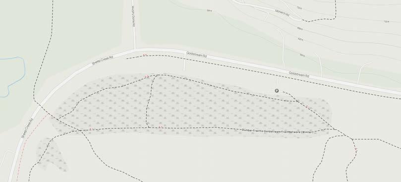
8) peat ponds wildlife area @ goldstream creek
Get there: Follow Sheep Creek Road north from Fairbanks. Peat Ponds is on the right just after the Murphy Dome Road intersection. There is a small parking lot, so park courteously. Follow the trail west along the ponds.
Info: Peat Ponds is owned by the Interior Alaska Land Trust. To read more about the land’s history IALT’s mission, click here.
Trailhead Coordinates: 64.911497, -147.934719
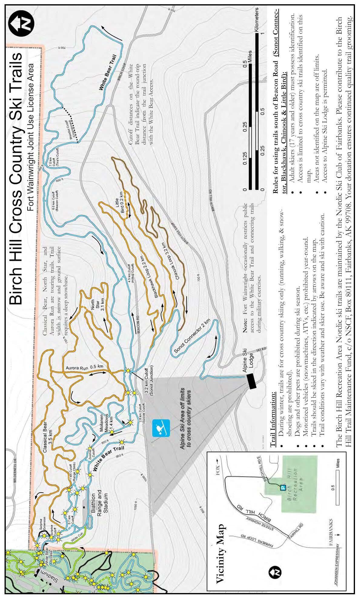
9) white bear @ birch hill recreation area
Get there: Parking for the Jim Whisenhant trails is at the Birch Hill Recreation Area and Ski Center, located at 101 Wilderness Drive. White Bear is on U.S. Army Ft. Wainwright lands. Register for your Recreation Access Permit at this link.
Tips: You’ll find this sign near Heartrate Hill.
Trailhead


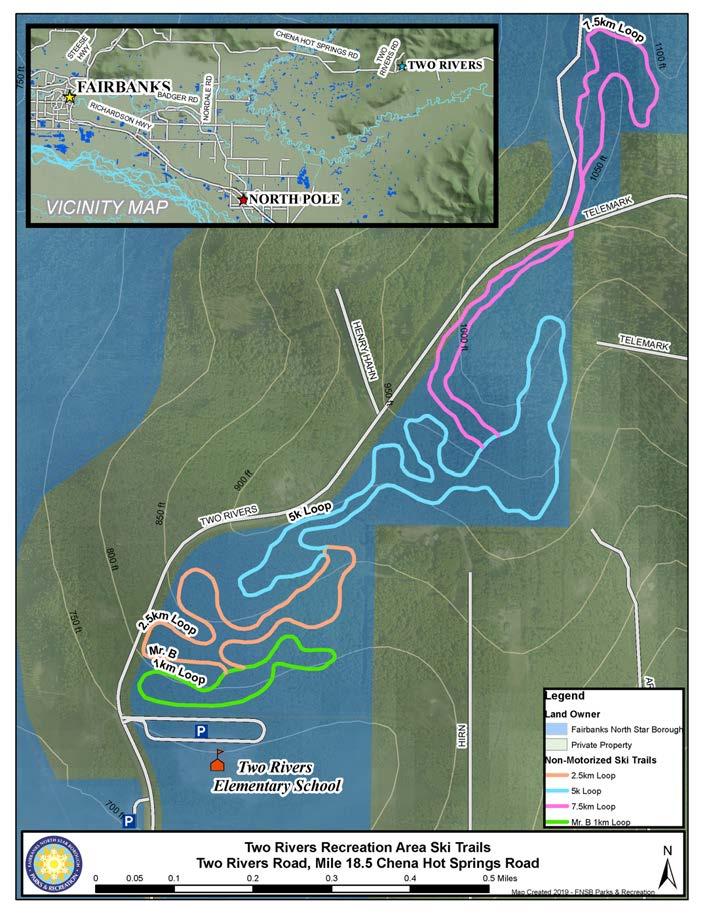
Get there: The Two Rivers Recreation Area trails are adjacent to Two Rivers Elementary School. Drive to mile 18.5 on Chena Hot Springs Road and turn onto Two Rivers Road. Parking is at Two Rivers Elementary School. Drugs, alcohol, tobacco, and firearms are prohibited on school property.
Trailhead Coordinates: 64.877863, -147.038398

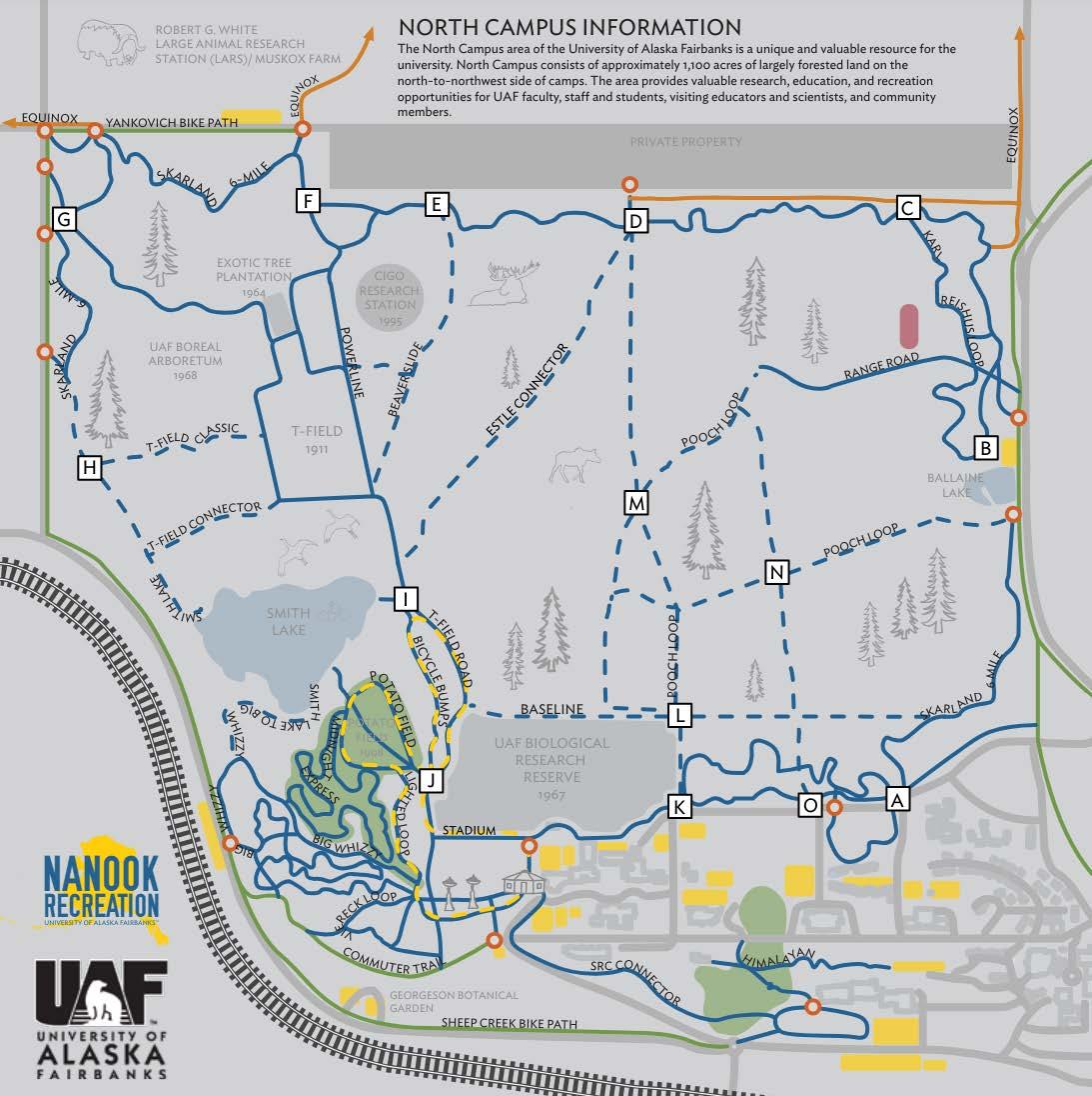
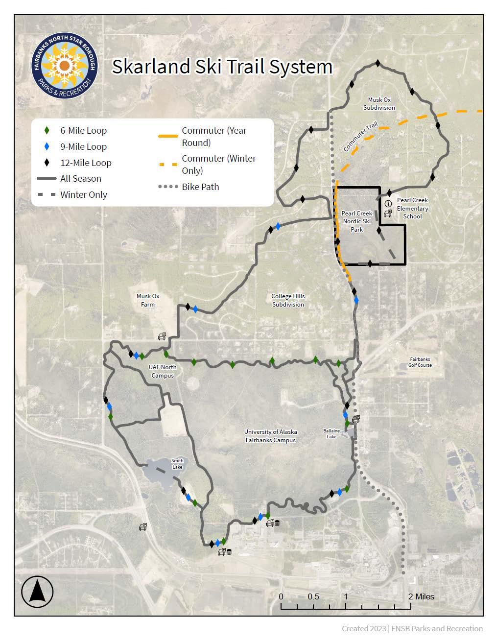
Get there: This trail traverses neighborhoods north of the UAF Campus trails and Pearl Creek School. The nearest parking optionis at the UAF Large Animal Research Station (LARS) off Yankovich Road. Enter the trail on the east side of the LARS parking lot.
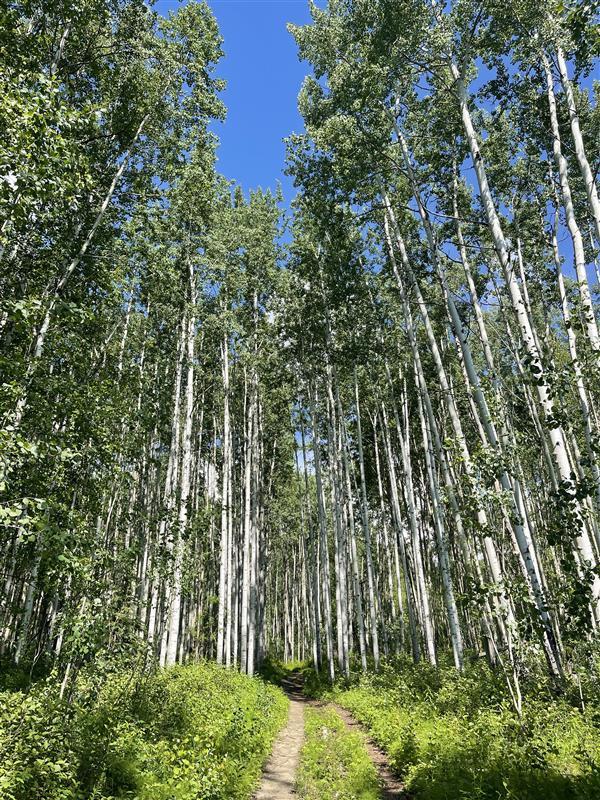
Tips: The trail sign is within the first two miles from the Large Animal Research Station parking lot located on Yankovich Road. You can also access the trail from other parking lots. This is a non-motorized trail originally built for skiing by the the UAF ski team. You may be familiar with the six-mile loop within the UAF North Campus trails. Two extensions, the 9-mile loop and the 12 mile loop, were added north of the current campus by the ski team in the 1950's and 1960's. Since then, residential development has surrounded the trail, but a public trail easement still exists through these private neighborhoods. It is important to respect the private properties, stay on the main trail (avoid unmarked social trails), and keep dogs leashed so they don't wander into people's backyards. The trail is informally groomed in the winter for classical skiing.

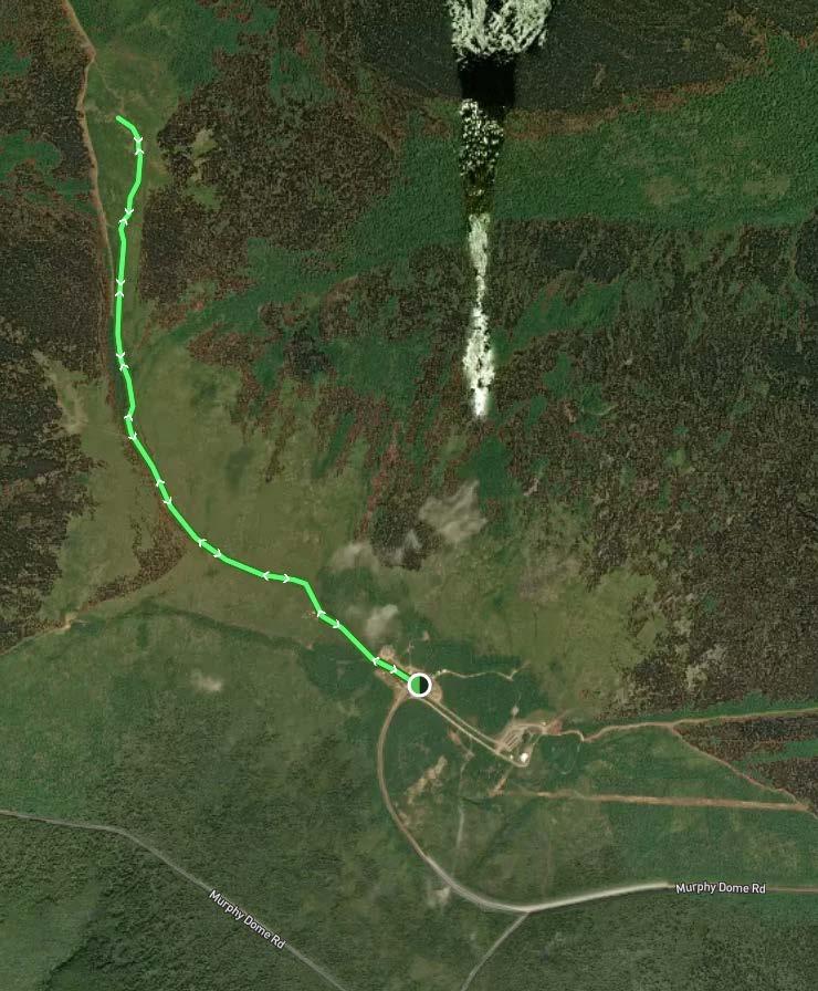
Get there: From Fairbanks, head North on the Parks Highway. Turn right (then an immediate left) onto Sheep Creek Road. Follow Sheep Creek Road approximately 5 miles to Murphy Dome Road. Turn left onto Murphy Dome Road. Continue for 15 miles until you reach the top.
Tips: Trail access is on the west side of the parking lot. There are numerous social trails you might find yourself at an intersection of. Follow the main route along the ridge toward the farthest rock outcropping. Sections of this trail are extremely rutted and can be muddy.
Trailhead Coordinates: 64.954426, -148.365528


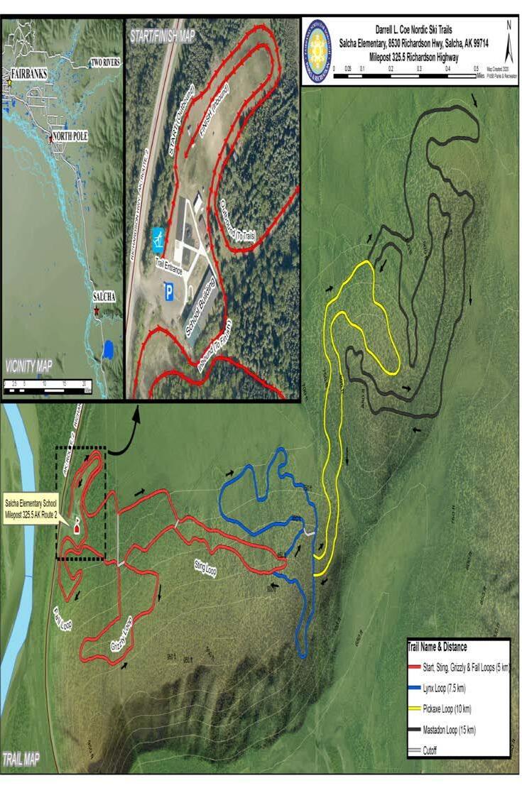
Get there: Parking for the Salcha Trails is at Salcha Elementary, 8530 Richardson Hwy. Look for the trail map on the side of the shed to the left of the parking lot. Drugs, alcohol, tobacco and firearms are prohibited on school property.
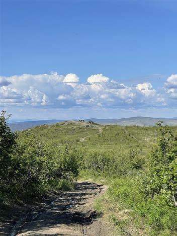
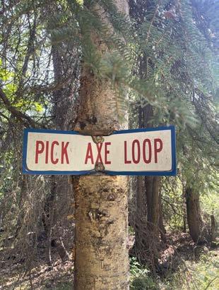
Tips: These trails are ski-only. Check the Salcha Ski Club Facebook page for trail condition updates. Find the outbound entrance behind the storage buildings, and follow the yellow trail markers for the 10km loop. If you're eager for a challenge, try one of the longer loops. Don't miss the Pickaxe Loop on the way back!

Get there: These large rock outcrops visible from the highway are a popular site for rock climbers. A short hike will lead you to the top with panoramic views.
Tips: There are several social trails that lead to climbing spots. Red circles mark the main trail but aren’t present at every intersection. Keep heading uphill! Some sections of the trail are shared with climbing areas. Please respect those who are climbing and belaying by communicating your need to pass through and stepping over (not on) ropes!
Trailhead Coordinates: 65.289837, -148.169703
KNOWBEFOREYOUGO:VISITORSSHOULDSTAYTUNEDTOFIREACTIVITYAT AKFIREINFO.COMANDCHECKFORBLMALASKAFIRERESTRICTIONSWEBSITEFOR CURRENTORDERS. STAYINFORMEDDURINGFIRESEASONANDCHECKBEFORE HEADINGOUTTOEXPLORE.

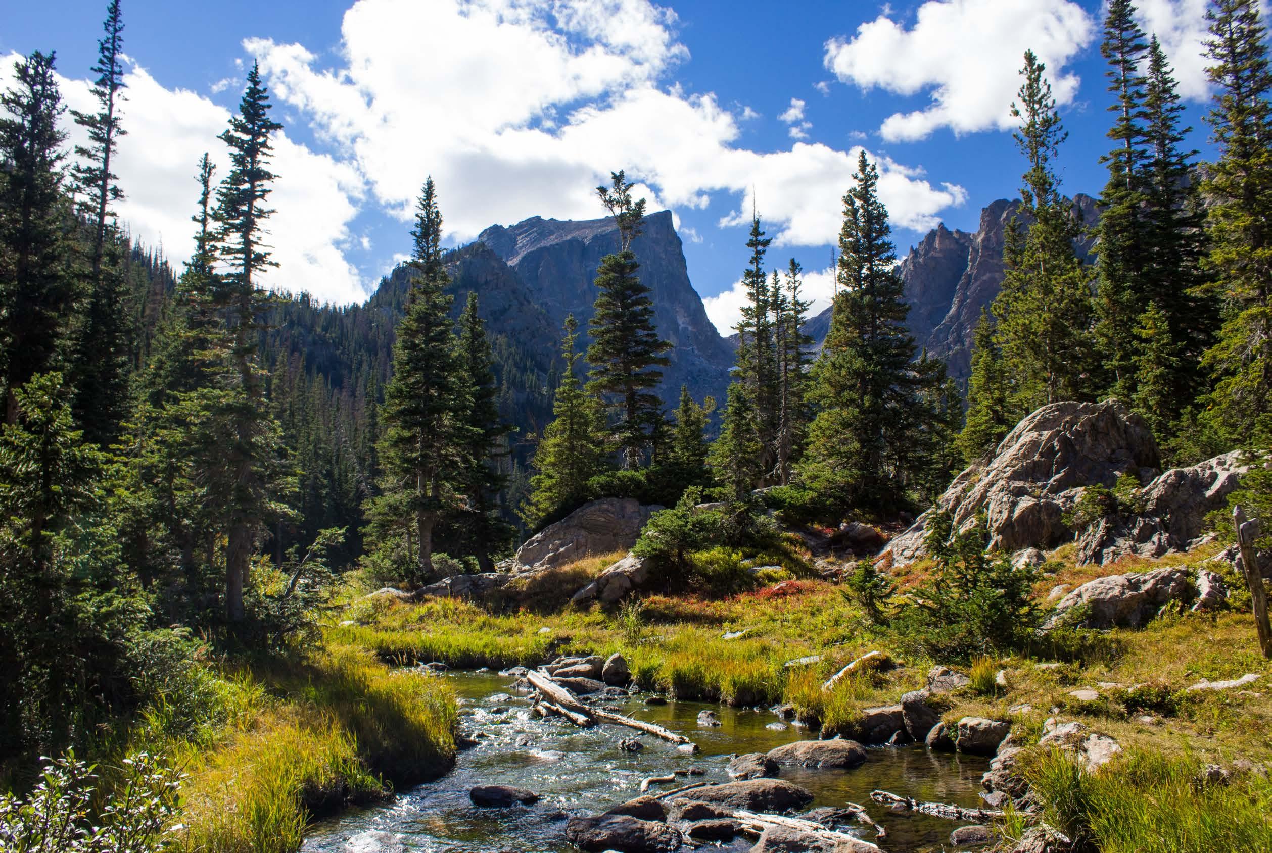
Get there: Drive Chena Hot Springs Road to mile 48.9. The trailhead will be on the right, just before crossing the bridge.
Tips: The trail leaves the parking area and parallels the Chena River for 0.8 miles until you reach the upper and lower loop junction. Stay right for the shortest route up. When you’ve reached the top, there will be a sign directing you to turn right for the Chena Hot Springs Connector.
Trailhead Coordinates: 65.011456, -146.219090

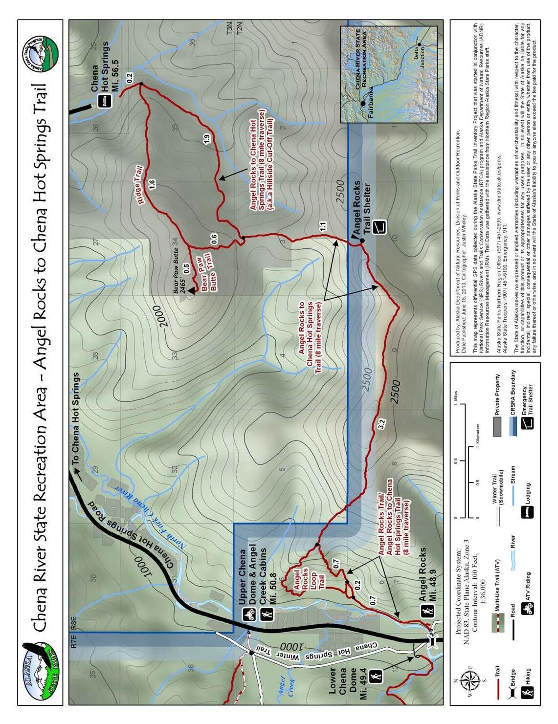
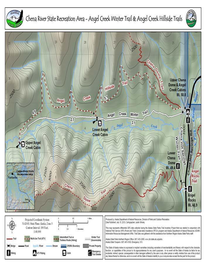
Get there: Drive to mile 50.5 on Chena Hot Springs Road and park at the Angel Creek/Upper Chena Dome trailhead on the left.
Tips: Reserve the one of the Angel Creek cabins for the night with Alaska State Parks! This is a wide ATV trail in great shape - enjoyable for motorized use or a moderate mountain biking route. Trailhead Coordinates: 65.034593, -146.219032


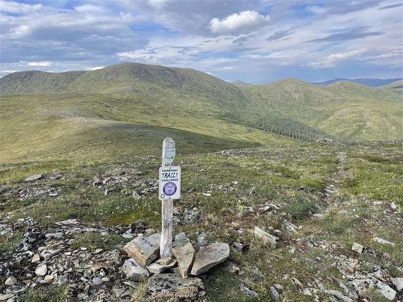
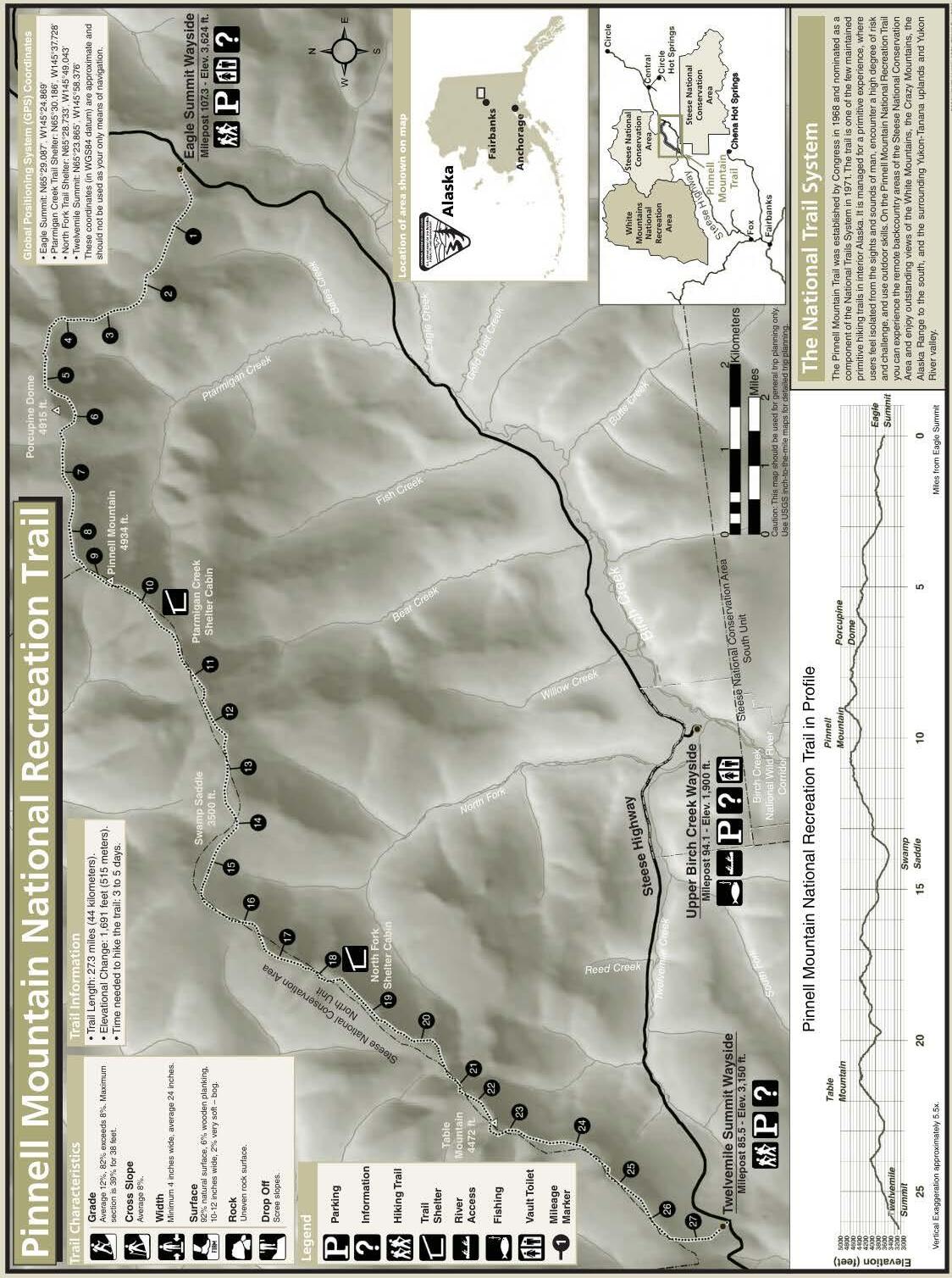
Get there: Located 100 miles (161 km) northeast of Fairbanks, the Pinnell Mountain Trail is easily reached via the Steese Highway, a maintained gravel highway leading northeast from Fairbanks to the Yukon River. Trailheads are located at Eagle Summit (MP 107) and Twelvemile Summit (MP 85.5). The distance to the sign listed here is from the Twelvemile Summit trailhead.
Tips: Pinnell Mountain Trail is a National Recreation Trail designated in The full trail is 27 miles (44 km) long with two shelter cabins at miles 10.1 and 17.8. The trail traverses a series of alpine ridge tops entirely above timberline. This is a nonmotorized corridor and the trail was built for hikers but is open to all forms of non-motorized use. Drinking water can be hard to find along the trail later in the summer when snow fields and small ponds dry up, but the two shelters utilize a catchment system so chances are good water is present there.
Trailhead Coordinates: 65.397912, -145.971941

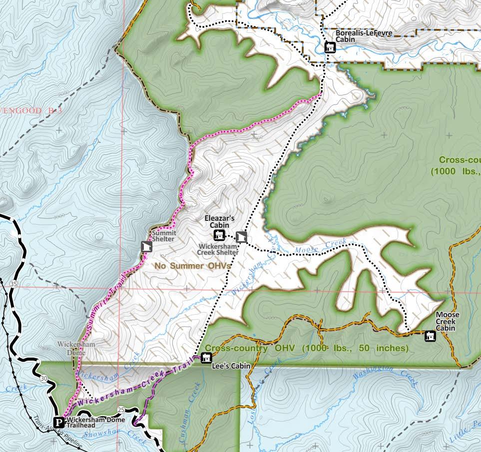
Get there: The Wickersham Dome Summit Trail begins at the Wickersham Dome Trailhead at MP 28 of the Elliot Highway. The Summit Trail shares a trailhead with the motorized Wickersham Creek Trail so make sure you read the signage and start on the correct trail! The Summit Trail entrance is on your left as you enter the parking lot.
Trailhead Coordinates: 65.178329, -148.076610
KNOWBEFOREYOUGO:VISITORSSHOULDSTAYTUNEDTOFIREACTIVITYAT AKFIREINFO.COMANDCHECKFORBLMALASKAFIRERESTRICTIONSWEBSITEFOR CURRENTORDERS. STAYINFORMEDDURINGFIRESEASONANDCHECKBEFORE HEADINGOUTTOEXPLORE.


Get there: The Compeau Trailhead is at MP 31.6 Chena Hot Springs Road.
Tips: This is a fun ATV ride that gets you to some high ridgetop views and public recreation cabins, but makes for a adventure on bike or foot as well! The trail is usually in good shape and not too technical, but there is a lot of elevation gain. This trail connects with the Mike Kelly Trail where another trails challenge sign can be found!
Trailhead Coordinates: 64.891893, -146.687612
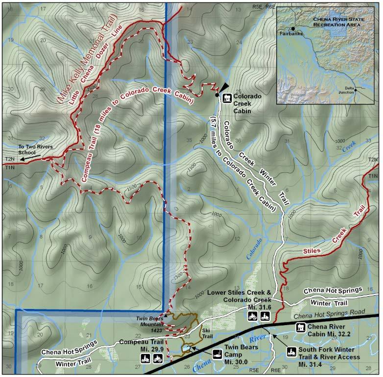
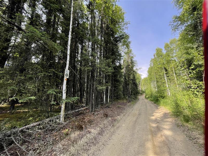
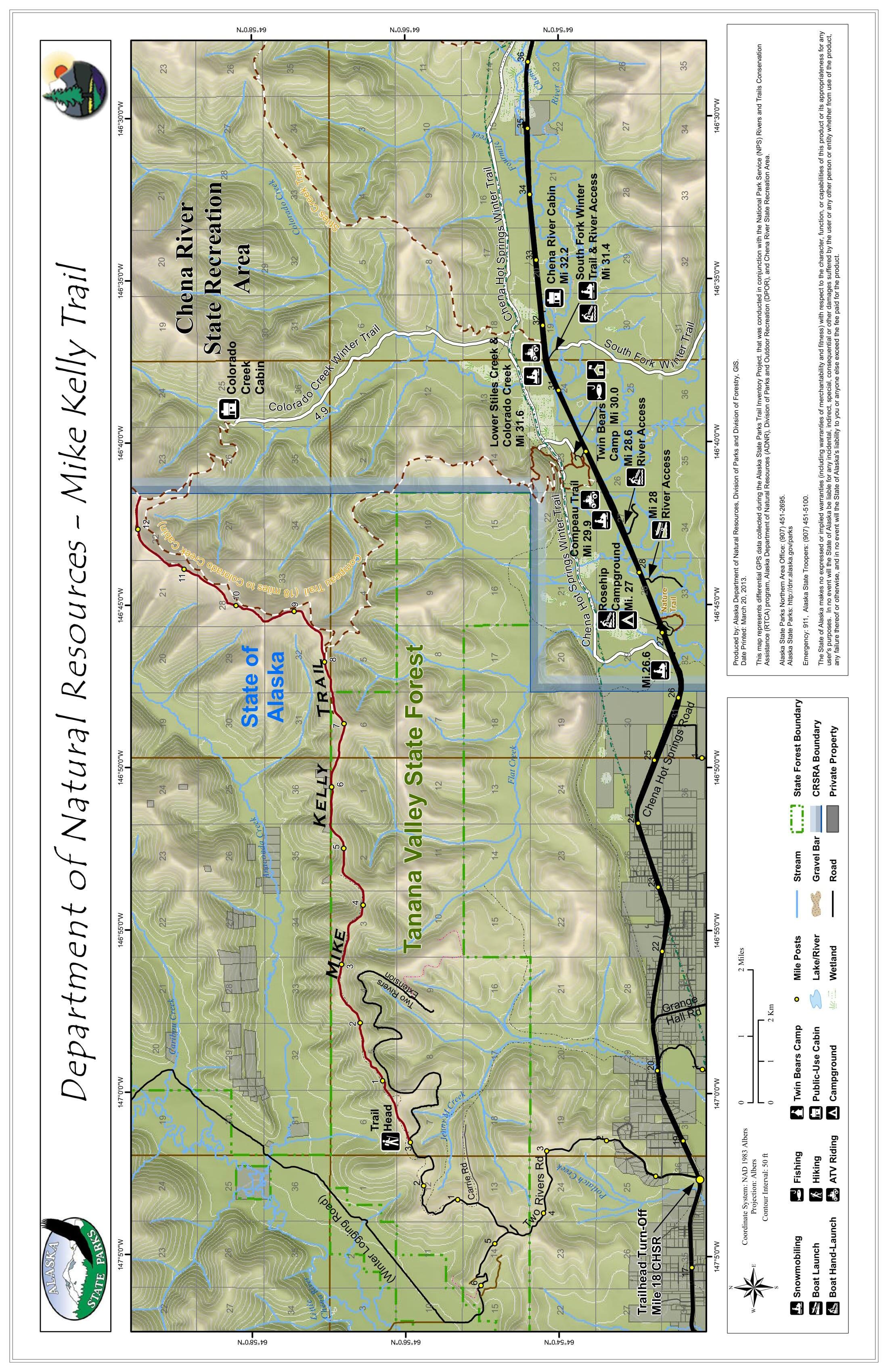
Get there: You can access the Mike Kelly Trail and this trails challenge sign from two locations: the Two River Woodcutting Road off Two Rivers Road at mile 18.5 Chena Hot Springs Road, or from the Compeau Trailhead at mile 29.9 Chena Hot Springs Road.
Tips: The full trail is about 13 miles. Be prepared for a very long day, or multiple days without support. The trail is extremely rutted in some spots.