

TREKKING
ESPLORA LA NATURA:
UNA SELEZIONE DI PERCORSI A PIEDI
EXPLORING NATURE: A SELECTION OF HIKING ROUTES
DIE NATUR ERKUNDEN: EINE AUSWAHL VON WANDERROUTEN
LE ZONE DEL FRIULI VENEZIA GIULIA
AREAS OF FRIULI VENEZIA GIULIA
DIE GEBIETE VON FRIAUL-JULISCH-VENETIEN
Alpi e Prealpi carniche
Dolomiti Friulane e montagna pordenonese
LEGENDA DELLA GUIDA / SYMBOLS KEY / ZEICHENERKLÄRUNG
GRADO DI DIFFICOLTÀ / DIFFICULTY / SCHWIERIGKEITSGRAD
T = Turistico / Tourist / Spazierwege
E = Escursionistico / Hiking / Wanderung
EE = Per escursionisti esperti / For experienced hikers /Für erfahrene Wanderer
LUNGO IL PERCORSO / ALONG THE PATH / ENTLANG DER ROUTE
Segnavia / Signposts / Wegweiser
Lunghezza / Lenght / Länge
Tempi di percorrenza / Average time / Dauer
Dislivello in salita / Height difference / Aufstieg
Alpi e Prealpi Giulie
Pedemontana gemonese e collinare
Valli del Torre e del Natisone
Carso Collio Goriziano
UN’APP, INFINITE
POSSIBILITÀ
Tutti i percorsi di trekking e in bicicletta, con informazioni e suggerimenti utili per le tue escursioni a portata di smartphone. Con l’app FVG OUTDOOR puoi scoprire un intero territorio attraverso gli occhi e i consigli di chi lo vive. Che tu sia un ciclista esperto o un escursionista alle prime armi, un amante dei villaggi pittoreschi o della natura incontaminata, sulla nostra mappa interattiva troverai tutto quello che cerchi… e anche di più.
ONE APP, ENDLESS POSSIBILITIES
All the trekking and cycling routes, with useful information and suggestions for your excursions within reach of your smartphone. With the FVG OUTDOOR app you can discover an entire territory through the eyes and advice of those who live it. Whether you are an expert cyclist or a novice hiker, a lover of picturesque villages or of unspoilt nature, on our interactive map you will find everything you are looking for... and more.
EINE APP, ENDLOSE MÖGLICHKEITEN
Alle Wander- und Fahrradrouten, mit nützlichen Informationen und Vorschlägen für Ihre Ausflüge in Reichweite Ihres Smartphones. Mit der FVG OUTDOOR-App können Sie ein ganzes Gebiet mit den Augen und Ratschlägen derer entdecken, die es leben. Ob Sie nun ein erfahrener Radfahrer oder ein Anfänger beim Wandern sind, ob Sie malerische Dörfer oder unberührte Natur lieben, auf unserer interaktiven Karte finden Sie alles, was Sie suchen... und mehr.


DOWNLOAD
APP FVG OUTDOOR
PERCORSI DI TREKKING IN FRIULI VENEZIA GIULIA
GAMBE IN SPALLA, SI PARTE!
Natura incontaminata, dalle Alpi al mare, per tutti i gusti e tutti i livelli. Lasciarsi sorprendere dalla varietà di paesaggi del Friuli Venezia Giulia, esplorando paesaggi incontaminati, vette, boschi, radure, massicci, malghe e rifugi, per poi scoprire le antiche tradizioni di alcuni dei borghi più belli d’Italia. Dalle montagne pordenonesi con le Dolomiti Friulane patrimonio Unesco e l’omonimo Parco naturale, alle catene montuose di Alpi e Prealpi Carniche, passando per le Alpi e Prealpi Giulie al confine con l’Austria e la Slovenia, Si scende verso la pedemontana e poi ancora a sud, dove si estende al confine il Collio Goriziano e si incontra il Carso, l’altopiano a picco sull’Adriatico. Questa regione è davvero in grado di mettere tutti d’accordo.
TREKKING ROUTES IN FRIULI VENEZIA GIULIA: BE READY FOR THE ADVENTURE
Unspoiled nature, from the Alps to the sea, for all tastes and levels. Be surprised by the variety of landscapes of Friuli Venezia Giulia, exploring unspoiled landscapes, peaks, forests, glades, massifs, mountain pastures and refuges, and then discover the ancient traditions of some of Italy’s most beautiful villages. From the Pordenone mountains with the UNESCO World Heritage Friulian Dolomites and the nature park of the same name, to the mountain ranges Carnic Alps and Pre-Alps, passing through the Julian Alps and Pre-Alps on the border with Austria and Slovenia, descending to the foothills and then to the south, where the Collio Goriziano stretches to the border with Slovenia, and descending towards the sea, the Karst plateau overlooking the Adriatic, this region is truly capable of bringing everyone together.
TREKKINGTOUREN IN FRIULI
VENEZIA GIULIA: SEI BEREIT FÜR DAS NÄCHSTE ABENTEUER
Unberührte Natur, von den Alpen bis zum Meer, für alle Geschmäcker und Ansprüche. Lassen Sie sich überraschen von der Vielfalt der Friaul-Julisch-Venetien und entdecken Sie unberührte Landschaften, Gipfel, Wälder, Lichtungen, Massive, Malgas und Hütten und entdecken Sie die alten Traditionen einiger der schönsten Dörfer Italiens. Von den Pordenone-Bergen mit dem UNESCO-Welterbe Friaulische Dolomiten und dem gleichnamigen Naturpark über die Karnischen Alpen und Voralpen, über die Julischen Alpen und Voralpen an der Grenze zu Österreich und Slowenien hinunter ins Vorgebirge und dann in den Süden, wo sich der Collio Goriziano bis zur Grenze zu Slowenien erstreckt, und hinunter zum Meer, der Karsthochfläche an der Adria, ist diese Region wirklich in der Lage, alle Menschen zusammenzubringen.

REGOLE E BUONE PRATICHE
1. Scegliere l’itinerario adatto alle proprie capacità fisiche e tecniche, raccogliendo prima le informazioni necessarie sulla zona da visitare.
2. Dotarsi di abbigliamento e (se necessario) equipaggiamento adeguati all’escursione; all’interno dello zaino è preferibile dotarsi di un mini kit di pronto soccorso in casi di emergenza.
3. Controllare le previsioni meteo, tenendo conto che temperatura e condizioni atmosferiche possono variare di molto in montagna. È fondamentale accertarsi dell’effettiva percorribilità dei sentieri scelti.
4. Riportare gli eventuali rifiuti a valle. Rispettare flora e fauna. Se si avvistano alcuni animali lungo il percorso mantenersi a distanza e non disturbare la loro quiete. Evitare di raccogliere fiori, piante o erbe spontanee senza la supervisione di una guida o un esperto nel settore, Se si porta il proprio animale domestico durante l’escursione mantenerlo sempre al guinzaglio.
5. Si suggerisce di avere sempre con sé una mappa e/o dispositivi che consentono di accedere al percorso e/o alla traccia
RULES AND GOOD PRACTICES
1. Choose a route suited to one’s physical and technical abilities, gathering the necessary information about the area to be visited.
2. Equip yourself with suitable clothing and (if necessary) equipment for the excursion; inside the backpack it is preferable to have a mini first aid kit in case of emergency.
3. Check the weather forecast, bearing in mind that temperature and weather conditions can vary greatly in the mountains. It is essential to ascertain the actual practicability of the chosen trails.
4. Take any rubbish back to the valley. Respect flora and fauna. If you spot animals along the route, keep your distance and do not disturb their peace. Avoid picking up flowers, plants or wild herbs without the supervision of a guide or an expert in the field. If you take your pet with you on the hike, always keep it on a leash
5. It is suggested that you always carry a map and/or devices that allow you to access the route offline from apps
REGELN UND BEWÄHRTE PRAKTIKEN
1. Wählen Sie eine Route, die Ihren körperlichen und technischen Fähigkeiten entspricht, und informieren Sie sich über das zu besuchende Gebiet.
2. Rüsten Sie sich mit geeigneter Kleidung und (falls erforderlich) Ausrüstung für den Ausflug aus; im Rucksack sollte ein kleiner Erste-Hilfe-Kasten für Notfälle vorhanden sein.
3. Informieren Sie sich über die Wettervorhersage und bedenken Sie, dass die Temperatur- und Wetterbedingungen in den Bergen stark schwanken können. Es ist wichtig, sich über die tatsächliche Begehbarkeit der gewählten Wege zu vergewissern.
4. Nehmen Sie Abfälle mit ins Tal. Nehmen Sie Rücksicht auf Flora und Fauna. Wenn Sie auf der Strecke Tiere sehen, halten Sie Abstand und stören Sie nicht ihre Ruhe. Vermeiden Sie das Pflücken von Blumen, Pflanzen oder Wildkräutern ohne die Aufsicht eines Wanderführers oder eines Experten auf diesem Gebiet. Wenn Sie Ihr Haustier mit auf die Wanderung nehmen, nehmen Sie es immer an die Leine.
5. Es wird empfohlen, immer eine Karte und/oder ein Gerät mit sich zu führen, mit dem Sie die Route offline über Apps abrufen können.


Alpe Adria Trail - Tarvisiano
PERCORSI A TAPPE IN FRIULI VENEZIA GIULIA
Per i desiderosi di intraprendere un trekking, in Friuli Venezia Giulia una varietà di percorsi a tappe: Sono 7 gli itinerari iscritti al registro dei cammini religiosi, dalla montagna al mare (Cammino Celeste, Cammino delle Pievi, Cammino di Sant’Antonio, Cammino di San Cristoforo, Cammino delle 44 chiesette votive, Cammino Via Flavia e Romea Strata)
3 PERCORSI TRANSFRONTALIERI TEMATICI:
· Alpe Adria Trail (AAT) si snoda lungo il confine unendo i tre paesi, Italia, Austria e Slovenia in un percorso di 750 km, dalla catena del Großglockner a Muggia. Per maggiori info: www.alpe-adria-trail.com/it/trail
· MADE si sviluppa in quota lungo la dorsale carnica, un percorso di 144 km che lega Sappada a Tarvisio. Per maggiori info: www.madeinalps.eu
· Walk of Peace unisce i luoghi segnati dai conflitti bellici lungo Isonzo, Brda e Carso. Per maggiori info: www.thewalkofpeace.com/it
ITINERARIES IN FRIULI VENEZIA GIULIA
For those eager to embark on a trek, there is a variety of walking routes in Friuli Venezia Giulia: There are 7 routes registered under the religious paths, from the mountains to the sea (Cammino Celeste, Cammino delle Pievi, Cammino di Sant’Antonio, Cammino di San Cristoforo, Cammino delle 44 chiesette votive, Cammino Via Flavia and Romea Strata)
3 THEMATIC CROSS-BORDER TRAILS:
· Alpe Adria Trail (AAT) runs along the border uniting the three countries, Italy, Austria and Slovenia in a 750-km route, from the Großglockner mountain range to Muggia. For more info: www.alpe-adria-trail.com/it/trail/
· MADE runs at high altitude along the Carnic ridge, a 144-km route linking Sappada to Tarvisio. For more info: www.madeinalps.eu/
· Walk of Peace combines places marked by wartime conflicts along Isonzo, Brda and Carso. For more info: www.thewalkofpeace.com/it/
FÜR ALLE, DIE EIN
POSTKARTEN-ABENTEUER SUCHEN
Für diejenigen, die sich auf eine Wanderung begeben möchten, bietet Friaul-Julisch Venetien eine Vielzahl von Routen in Etappen an: Im Register der religiösen Wanderwege sind 7 Routen eingetragen, die von den Bergen bis zum Meer führen (Cammino Celeste, Cammino delle Pievi, Cammino di Sant’Antonio, Cammino di San Cristoforo, Cammino delle 44 Chiesette votive, Cammino Via Flavia und Romea Strata)
3 THEMATISCHE GRENZÜBERSCHREITENDE WANDERWEGE:
· Der Alpe Adria Trail (AAT) verläuft entlang der Grenze, die die drei Länder Italien, Österreich und Slowenien auf einer 750 km langen Strecke verbindet, von der Großglocknerkette bis nach Muggia.
Weitere Informationen: www.alpe-adria-trail.com/it/trail/
· MADE verläuft in großer Höhe entlang des Karnischen Kammes, eine 144 km lange Strecke, die Sappada und Tarvisio verbindet. Für weitere Informationen: www.madeinalps.eu/
· Walk of Peace verbindet die von den Konflikten des Krieges gezeichneten Orte entlang des Isonzo, der Brda und des Karst.
Für weitere Informationen: www.thewalkofpeace.com/it/
DOLOMITI FRIULANE
E MONTAGNA PORDENONESE

LO SAI CHE...
Il Parco Naturale delle Dolomiti Friulane non è l’unico sito UNESCO in regione. Ce ne sono altri quattro e sono l’area archeologica e la basilica patriarcale di Aquileia, la fortezza veneziana di Palmanova, il sito longobardo di Cividale del Friuli e il sito palafitticolo di Palù di Livenza.
DID YOU KNOW THAT...
The Friulian Dolomites Natural Park is not the only UNESCO site in the region. There are four others and they are the archaeological area and the patriarchal basilica of Aquileia, the Venetian fortress of Palmanova, the Lombard site of Cividale del Friuli and the pile-dwelling site of Palù di Livenza
WUSSTEN SIE SCHON...
Der Naturpark Friaulische Dolomiten ist nicht die einzige UNESCO-Stätte in der Region. Es gibt noch vier weitere vier, und zwar das archäologische Gebiet und die Basilika von Aquileia, die venezianische Festung von Palmanova, die langobardische Stätte von Cividale del Friaul und die Pfahlbaufläche von Palù di Livenza
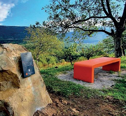
Malghe in Piancavallo, Collalto
PER CHI CERCA UN’AVVENTURA DA CARTOLINA
Il Parco Naturale delle Dolomiti Friuliane, patrimonio UNESCO e fiore all’occhiello della regione, è un paradiso della wilderness e meta ideale per escursionisti, trekker, alpinisti e climber Racchiude in sé, come uno scrigno, la Valcellina, la Valle del Tagliamento e la Val Tramontina.
I tesori lì custoditi sono innumerevoli: dalle meraviglie naturali di alta montagna come il Campanile di Val Montanaia, guglia di roccia alta 300 metri, passando per i luoghi mozzafiato della pedemontana pordenonese, come le Pozze Smeraldine e le Grotte di Pradis, fino ai borghi dalle architetture tradizionali, come
Frisanco, Poffabro e Toppo. Sia che si tratti di un trekking più articolato, come l’Anello delle Dolomiti Friulane e l’Alta Via di Forni, o di un’escursione in giornata, come al Lago di Barcis, dove esplorare la Riserva naturale della Valcellina, sarà un’avventura all’insegna dell’outdoor e dei paesaggi da cartolina. FOR THOSE WHO SEEK
The Natural Park of the Friulian Dolomites, a UNESCO and flagship of the region, is a paradise of wilderness and an ideal destination for hikers, trekkers, mountaineers and climbers. It encloses within itself, like a treasure chest, the Valcellina, the Tagliamento Valley and the Tramontina Valley.
The treasures housed there are countless: from the natural wonders of the high mountains such as the Campanile di Val Montanaia, a rock spire 300 meters high, passing to the breathtaking places of the Pordenone piedmont, such as the Pozze Smeraldine and the Pradis Caves, to the villages with traditional architecture, such
FÜR ALLE, DIE EIN POSTKARTEN-ABENTEUER SUCHEN
Der Naturpark der Friaulischen Dolomiten, ein UNESCOKulturerbe und Aushängeschild Aushängeschild der Region, ist ein Paradies der Wildnis und ein ideales Ziel für Wanderer, Trekker Bergsteiger und Kletterer. Es umschließt wie eine Schatztruhe das Cellina-Tal, das TagliamentoTal und das Tramontina-Tal. Die dort bewahrten Schätze sind
unzählig: von den Naturwundern des Hochgebirges wie dem Glockenturm des Val Montanaia, einer Felsspitze 300 Meter hoch, vorbei zu den atemberaubenden Orten der Pordenone Vorgebirge, wie die Pozze Smeraldine und die Grotten von Pradis, zu den Dörfern mit traditioneller Architektur, wie Frisanco, Poffabro und Toppo. Egal, ob es sich um eine längere
as Frisanco, Poffabro and Toppo. Whether it is a more articulated trek, such as the Ring of the Friulian Dolomites and the Alta Via di Forni, or a day hike, such as to Lake Barcis, where you can explore the Valcellina Nature Reserve, it will be an outdoor adventure and postcard-perfect scenery.
Wanderung handelt, wie den Ring der Friauler Dolomiten und den Höhenweg von Forni, oder um eine Tageswanderung, wie zum Barcis-See, wo man den Naturpark Valcellina erkunden kann, es wird ein Abenteuer in der freien Natur und in einer postkartenreifen Landschaft sein.

Lago di Barcis
PERCORSI CONSIGLIATI
SUGGESTED ROUTES / EMPFOHLENE ROUTEN

SENTIERO DEL DINT
Semplice itinerario che permette di esplorare, attraverso tre punti panoramici, i dintorni del Lago di Barcis.
Simple itinerary that allows you to explore the surroundings of Barcis Lake from three scenic points.
Eine einfache Route, die es Ihnen ermöglicht, die Umgebung des Barcis-Sees aus drei Blickwinkeln zu erkunden.
Difficoltà / Difficulty / Schwierigkeitsgrad T
Segnavia CAI / CAI signposts / CAI Wegweiser 997
Lunghezza / Length / Länge
4,3 km
Durata / Average time / Dauer
1,35 h
Dislivello / Height difference / Aufstieg 215 mt


ANELLO DELLE MALGHE DI COLLALTO
Percorso che porta ad esplorare le Malghe di Collalto, dove ammirare le famose fioriture e i punti panoramici sulla pianura friulana.
Circular route that leads to explore the Malghe di Collalto, where you can admire the famous blooms and viewpoints over the Friulian plain.
Eine Rundtour, die zur Erkundung der Malghe di Collalto führt, wo man die berühmten Blüten und Aussichtspunkte über die friaulische Ebene bewundern kann.
Difficoltà / Difficulty / Schwierigkeitsgrad E
Segnavia CAI / CAI signposts / CAI Wegweiser
985
Lunghezza / Length / Länge
8,7 km
Durata / Average time / Dauer
2,45 h
Dislivello / Height difference / Aufstieg
316 mt


ANELLO DI COL DE POST DAL RIFUGIO PUSSA
Itinerario ad anello a Claut partendo dal Rifugio Pussa verso una casera immersa nelle Dolomiti Friulane.
Circular itinerary in Claut starting from Rifugio Pussa to a casera nestled in the Friulian Dolomites.
Eine Rundwanderung in Claut, die von der Pussa-Hütte zu einer Käserei in den friaulischen Dolomiten führt.
Difficoltà / Difficulty / Schwierigkeitsgrad E
Segnavia CAI / CAI signposts / CAI Wegweiser 364 - 366a
Lunghezza / Length / Länge
6,5 km
Durata / Average time / Dauer 2,40 h
Dislivello / Height difference / Aufstieg
410 mt

PERCORSI CONSIGLIATI
SUGGESTED ROUTES / EMPFOHLENE ROUTEN

CAMPANILE
DI
VAL
MONTANAIA E BIVACCO PERUGINI
Itinerario verso il simbolo delle Dolomiti Friulane, l’imponente campanile di pietra che svetta circondato da cime e torrioni dolomitici.
Itinerary to the symbol of the Friulian Dolomites, the Campanile di Val Montanaia, the towering stone bell, surrounded by dolomite peaks and towers. Wanderung zum Symbol der friaulischen Dolomiten, dem imposanten steinernen Glockenturm (Campanile di Val Montanaia), der sich inmitten der Dolomitengipfel und -türme erhebt.
Difficoltà / Difficulty / Schwierigkeitsgrad E
Segnavia CAI / CAI signposts / CAI Wegweiser
353
Lunghezza / Length / Länge
6 km
Durata / Average time / Dauer
5 h
Dislivello / Height difference / Aufstieg
827 mt


TROI DAI SCLOPS E FORCELLA URTISIEL
Itinerario impegnativo ad anello nelle Dolomiti Friulane, seguendo il percorso Troi dai Sclops (Sentiero delle genziane) passando dal Rifugio Giaf e Casera Valbinon.
Challenging circular itinerary in the Friulian Dolomites, following the Troi dai Sclops (Gentian Path) route via Rifugio Giaf and Casera Valbinon.
Anspruchsvolle Rundwanderung in den Friauler Dolomiten, die über die Giaf-Hütte und die Casera Valbinon dem Troi dai Sclops (Enzianweg) folgt.
Difficoltà / Difficulty / Schwierigkeitsgrad E
Segnavia CAI / CAI signposts / CAI Wegweiser 362 369A 369 361 346
Lunghezza / Length / Länge 13,5 km
Durata / Average time / Dauer 7,30 h
Dislivello / Height difference / Aufstieg 1.236 mt

Dolomiti Friulane
ALPI E PREALPI CARNICHE

LO SAI CHE...
In Carnia c’è un borgo conosciuto come il “paese degli orologi”. Tra le vie di Pesariis si snoda il cosiddetto Percorso dell’Orologeria Monumentale, che tocca ben 15 orologi peculiari e di pregio artistico, e permette di vivere un’esperienza insolita nel cuore della Val Pesarina.
DID YOU KNOW THAT...
In Carnia there is a village known as the “village of clocks.” Among the streets of Pesariis there is the so-called Route of the Clockmaking Monumental, which touches as many as 15 peculiar clocks of artistic value, and allows you to an unusual experience in the heart of the Val Pesarina.
WUSSTEN SIE SCHON...
In Carnia gibt es ein Dorf, das als das “Dorf der Uhren” bekannt ist. Durch die Straßen von Pesariis verläuft die so genannte Monumentaluhrmacherstraße Monumental, die bis zu 15 Uhren von besonderem künstlerischem Wert berührt, und ermöglicht Ihnen ein ungewöhnliches Erlebnis im Herzen des Val Pesarina-Tal.
Monte Coglians
PER SOGNATORI, PER SPORTIVI, PER STACCARE
LA
SPINA
Scoprire la Carnia, un territorio fiero e ancorato alle tradizioni, lasciandosi guidare da innumerevoli percorsi che attraversano le cinque vallate principali, Val Tagliamento, Val Degano, Val Lumiei, Valle del But e Valle del Chiarsò. Sono luoghi ricchi di siti archeologici, borghi e meraviglie naturali, come il Monte Coglians, la cima più alta della regione, che svetta sui panorami circostanti, con i suoi 2.780 metri di altitudine. E come
non citare il Tagliamento, il “re dei fiumi alpini” che nasce dal Passo Mauria nei pressi di Forni di Sopra, al cospetto delle Dolomiti Friulane e delle Alpi Carniche. Il fiume scorre lento e solca le vallate della Carnia, raggiungendo la pianura friulana e sfociando nel Mar Adriatico. La Carnia è una terra dalle molteplici sfaccettature, dove praticare sport estremi o concedersi un weekend lento, all’insegna dei sapori autentici e della
FOR DREAMERS, FOR SPORTLOVERS, FOR UNPLUGGING
Discovering Carnia, a proud territory anchored in tradition, by letting yourself be guided by countless routes that cross the five main valleys, Val Tagliamento, Val Degano, Val Lumiei, Valle del But and Valle del Chiarsò. These are places rich in archaeological sites, villages and natural wonders, such as Mount Coglians, the highest peak in the region, towering over the surrounding landscape at 2,780 metres above sea level.
And how can we fail to mention the river Tagliamento, the “king of Alpine rivers” that rises from the Mauria Pass near Forni di Sopra, in the presence of the Friulian Dolomites and the Carnic Alps. The river flows slowly through the valleys of Carnia, reaching the Friulian plain and flowing into the Adriatic Sea.
Carnia is a land of many facets, where you can practice extreme sports or indulge in a slow weekend of authentic flavours and mountain
FÜR TRÄUMER, FÜR SPORTLER, ZUM ABSCHALTEN
Entdecken Sie Carnia, ein stolzes und traditionsreiches Gebiet, und lassen Sie sich von den unzähligen Routen führen, die durch die fünf Haupttäler Val Tagliamento, Val Degano, Val Lumiei, Valle del But und Valle del Chiarsò führen. Diese Täler sind reich an archäologischen Stätten, Dörfern und Naturwundern wie dem Monte Coglians, dem höchsten Berg der Region, der mit seinen 2.780 Metern über die Landschaft ragt. Nicht zu vergessen der Tagliamento, der „König der
Alpenflüsse“, der am MauriaPass in der Nähe von Forni di Sopra entspringt, in der Nähe der friaulischen Dolomiten und der Karnischen Alpen. Die Flusse langsam durch die Täler Karniens fließt, bis es die friaulische Ebene erreicht und in die Adria mündet. Carnia ist ein Land mit vielen Facetten, in dem man Extremsportarten ausüben oder sich ein langsames Wochenende mit authentischen Geschmäckern und der Ruhe der Berge gönnen kann. Zwischen Freilichtmuseen,
tranquillità della montagna. Tra musei all’aperto, itinerari immersi nella natura e antichi sacrari, rivive la memoria della Grande Guerra, grazie a una pluralità di sentieri da esplorare a piedi. Opportunità sia per camminatori alle prime armi, che possono scegliere vie più tradizionali e facili percorsi di fondovalle, che per i più esperti, che possono dedicarsi ai trekking impegnativi, dove la fatica viene ripagata dal panorama che si gode in vetta.
tranquillity. Among open-air museums, itineraries immersed in nature and ancient shrines, the memory of the Great War lives again, thanks to a plurality of paths to explore on foot Opportunities both for novice walkers, who can choose more traditional and easy routes along the valley floor, and for the more experienced, who can devote themselves to demanding treks, where the effort is repaid by the panorama at the summit.
Wanderwegen in der Natur und antiken Heiligtümern lebt die Erinnerung an den Ersten Weltkrieg wieder auf, dank zahlreicher Wanderwege. Es gibt sowohl Möglichkeiten für Anfänger, die sich für traditionelle und leichte Routen entlang der Talsohle entscheiden können, als auch für erfahrene Wanderer, die sich anspruchsvollen Touren widmen können, bei denen die Anstrengung durch das Panorama auf dem Gipfel belohnt wird.
PERCORSI CONSIGLIATI
SUGGESTED ROUTES / EMPFOHLENE ROUTEN


SENTIERO NATURALISTICO TIZIANA WEISS
Facile itinerario ad anello nell’altopiano di Pani, vallata caratterizzata da pascoli, boschi di faggi e piccoli borghi di pietra.
Easy circular route in the Pani Highland, a valley characterized by pastures, beech forests and small stone villages.
Leichter Rundweg auf der Hochebene von Pani, einem Tal mit Weiden, Buchenwäldern und kleinen Steinsiedlungen.
Difficoltà / Difficulty / Schwierigkeitsgrad T
Segnavia CAI / CAI signposts / CAI Wegweiser 221
Lunghezza / Length / Länge
6,3 km
Durata / Average time / Dauer 2,20 h
Dislivello / Height difference / Aufstieg 262 mt

Itinerario naturalistico che si sviluppa a cavallo delle creste del Monte Tinisa, tra la conca di Sauris e la valle del fiume Tagliamento.
Nature trail that straddles the ridges of Mount Tinisa, between the Sauris basin and the valley of the river Tagliamento.
Naturlehrpfad über die Kämme des Mount Tinisa, zwischen dem Sauris-Becken und dem Tagliamento Flusstal.
Difficoltà / Difficulty / Schwierigkeitsgrad E
Segnavia CAI / CAI signposts / CAI Wegweiser 215 - 223
Lunghezza / Length / Länge 9 km
Durata / Average time / Dauer 4,30 h
Dislivello / Height difference / Aufstieg 690 mt

ANELLO CONCA DI PANI


IL MONTE TAMAI, ARVENIS E LE MALGHE DELLO ZONCOLAN
Partendo in quota, l’itinerario sale verso due cime panoramiche del comprensorio, il Monte Arvenis e il Monte Tamai, esplorando quattro malghe tipiche dello Zoncolan.
Starting at high altitude, the route climbs to two scenic peaks in the area, Mount Arvenis and Mount Tamai, exploring four typical Zoncolan huts.
Die Route beginnt in großer Höhe und führt zu zwei der schönsten Gipfel der Gegend, dem Berg Arvenis und dem Berg Tamai, wobei vier typische zoncolanische Hütten besucht werden.
Difficoltà / Difficulty / Schwierigkeitsgrad E
Segnavia CAI / CAI signposts / CAI Wegweiser 170 - 166
Lunghezza / Length / Länge 13,8 km
Durata / Average time / Dauer 5,15 h
Dislivello / Height difference / Aufstieg 739 mt

PERCORSI CONSIGLIATI
SUGGESTED ROUTES / EMPFOHLENE ROUTEN

LAGHI D’OLBE E SAPPADA
Itinerario panoramico che conduce ai Laghi d’Olbe, tre bacini di origine glaciale immersi nel silenzio delle Alpi Carniche.
Panoramic itinerary leading to the Olbe Lakes, three basins of glacial origin immersed in the silence of the Carnic Alps. Panoramastrecke zu den Olbe-Seen, drei Gletscherbecken drei Becken eiszeitlichen Ursprungs inmitten der Stille der Karnischen Alpen.
Difficoltà / Difficulty / Schwierigkeitsgrad E
Segnavia CAI / CAI signposts / CAI Wegweiser 135
Lunghezza / Length / Länge
4,6 km
Durata / Average time / Dauer 3 h
Dislivello / Height difference / Aufstieg 937 mt


CASERA VALMEDAN ALTA E MONTE TERSADIA
Itinerario escursionistico che conduce al Monte Tersadia, un balcone panoramico sospeso tra la Val del But (Pontaiba) e il Canale d’Incarojo (Valle del Chiarsò).
Hiking route leading to Mount Tersadia, a panoramic balcony suspended between the But Valley (Pontaiba) and the Incarojo Canal (Chiarsò Valley).
Wanderweg, der zum Berg Tersadia führt, einem Panoramabalkon zwischen dem Val del But (Pontaiba) und dem Canale d’Incarojo (Valle del Chiarsò).
Difficoltà / Difficulty / Schwierigkeitsgrad E
Segnavia CAI / CAI signposts / CAI Wegweiser 409
Lunghezza / Length / Länge 13,4 km
Durata / Average time / Dauer 6,30 h
Dislivello / Height difference / Aufstieg 915 mt


Giro delle malghe di Sauris
ALPI E PREALPI GIULIE

LO SAI CHE...
La Riserva di Biosfera Alpi Giulie è stata istituita nel 2019 e comprende 11 Comuni del territorio montano del Friuli Venezia Giulia. Nata su iniziativa del Parco naturale delle Prealpi Giulie, si tratta di un’area di oltre 700 kmq che scende dai Monti Montasio e Canin, fino al limite nord della pianura friulana, unendo il mondo latino a quello slavo.
DID YOU KNOW THAT...
The Julian Alps Biosphere Reserve was established in 2019 and encompasses the territory of 11 municipalities in the mountainous region of Friuli Venezia Giulia. Created on the initiative of the Parco naturale delle Prealpi Giuli, it covers an area of over 700 square kilometres that descends from the Montasio and Canin Mountains to the northern edge of the Friulian plain, uniting the Latin and Slavic worlds.
WUSSTEN SIE SCHON...
Das Biosphärenreservat Julische Alpen wurde 2019 eingerichtet und umfasst das Gebiet von 11 Gemeinden in der Bergregion Friaul-JulischVenetien. Entstanden auf Initiative des Parco naturale delle Prealpi Giulie, es umfasst ein Gebiet von über 700 Quadratkilometern, das von den Montasio- und Canin-Bergen bis zum nördlichen Rand der friaulischen Ebene abfällt und die lateinische und slawische Welt vereint.

A CACCIA DI LEGGENDE TRA UNA VETTA E L’ALTRA
Un paesaggio mozzafiato incastonato in una catena di vette imponenti, un balcone naturale di 1800 metri che domina sulle rocce eterne del Jôf di Montasio, del Jôf Fuart e del Mangart: è il Monte Lussari. Qui pellegrini, amanti della natura e del trekking, si mettono in viaggio sul sentiero nel bosco che risale la montagna, portando all’omonimo santuario e al villaggio più alto della regione, dove lo sguardo si
estende oltre confine.
Il Monte Canin è il massiccio più elevato delle Alpi Giulie, che segna il confine tra l’Italia e Slovenia e rivela sempre nuovi, interessanti scenari, per chi ama addentrarsi nei meravigliosi abissi e nella scoperta delle bellezze rocciose scolpite dall’acqua. Tra cascate e grotte, si scopre l’area protetta del Parco Naturale delle Prealpi Giulie, che rapisce cuore e sguardo con la sua straordinaria
HUNTING FOR LEGENDS BETWEEN PEAKS
A breathtaking landscape set in a chain of majestic peaks, a natural balcony 1800 metres high dominating the eternal rocks of Jôf di Montasio, Jôf Fuart and Mangart: this is Mount Lussari. Here pilgrims, nature lovers and trekkers set out on the forest path that climbs the mountain, leading to the sanctuary of the same name and to the highest village in the region, where the gaze extends beyond the borders.
Mount Canin is the highest massif in the Julian Alps, marking the border between Italy and Slovenia and always revealing new, interesting scenarios for those who love to delve into the marvellous abysses and discover the rocky beauty sculpted by water. Between waterfalls and caves, you will discover the protected area of the Julian Pre-Alps Nature Park, which enraptures the heart and eye with its extraordinary biodiversity.
biodiversità. La Val Resia, gemma rara del territorio, stupisce con la sua lingua, la ricchezza di tradizioni e un folclore unici al mondo Insieme alla Riserva naturale della Val Alba, costituisce anche il cuore della Riserva della Biosfera MaB Unesco Alpi Giulie un vero e proprio scrigno di cascate, boschi, malghe e rifugi straordinari
Val Resia, a rare gem of the area, amazes with its language, rich traditions and unique folklore Together with the Val Alba Nature Reserve, it also forms the heart of the Julian Alps MaB Unesco Biosphere Reserve, a veritable treasure trove of waterfalls, forests, alpine pastures and extraordinary refuges
AUF DER SUCHE NACH LEGENDEN ZWISCHEN DEN GIPFELN
Eine herrliche Landschaft, eingebettet in eine Kette von stattlichen Gipfeln, ein natürlicher Balkon in 1800 Metern Höhe, der die ewigen Felsen von Jôf di Montasio, Jôf Fuart und Mangart beherrscht: das ist der Berg Lussari. Hier begeben sich Pilger, Naturliebhaber und Wanderer auf den Waldweg, der den Berg erklimmt und zur gleichnamigen Wallfahrtskirche und zum höchstgelegenen Dorf der Region führt, wo der Blick über die Grenzen hinausgeht.
Der Berg Canin ist das höchste Massiv der Julischen Alpen, das die Grenze zwischen Italien und Slowenien markiert und immer wieder neue, interessante Landschaften für diejenigen offenbart, die gerne in die wunderbaren Abgründe eintauchen und die vom Wasser geformte Felsenschönheit entdecken
Zwischen Wasserfällen und Höhlen entdecken Sie das geschützte Gebiet des Naturparks Julische Voralpen, das Herz und Auge mit seiner außergewöhnlichen Artenvielfalt verzaubert. Das Reschental, ein seltenes Juwel der Region, verblüfft mit seiner Sprache, seinen reichen Traditionen und seiner einzigartigen Folklore. Zusammen mit dem Naturpark Val Alba bildet es auch das Herzstück des UnescoBiosphärenreservats Julische Alpen MaB, eine wahre Fundgrube an Wasserfällen, Wäldern, Almen und außergewöhnlichen Schutzhütten.
PERCORSI CONSIGLIATI
SUGGESTED ROUTES / EMPFOHLENE ROUTEN


In Val Resia il Ta Lipa Pot, “la bella strada” in lingua resiana, è fra gli itinerari più affascinanti del Parco naturale delle Prealpi Giulie.
In Val Resia, the Ta Lipa Pot, ‘the beautiful road’ in the Resian language, is one of the most fascinating routes in the Julian Pre-Alps Nature Park. Im Resia-Tal ist der Ta Lipa Pot, „die schöne Straße“ in der Resian-Sprache, eine der faszinierendsten Routen im Naturpark der Julischen Voralpen.
Difficoltà / Difficulty / Schwierigkeitsgrad T
Segnavia / Signposts / Wegweiser
TABELLE INDICATIVE
FOLLOW TRAIL SIGNS / WEGWEISER FOLGEN
Lunghezza / Length / Länge
5,5 km
Durata / Average time / Dauer
1,45 h
Dislivello / Height difference / Aufstieg
152 mt

Itinerario che unisce i due bacini di origine glaciale, i magnifici Laghi di Fusine circondati dalle vicine catene montuose, la dorsale delle Ponze e del Mangart.
Itinerary combining the two basins of glacial origin, the magnificent Fusine Lakes surrounded by the nearby mountain ranges, the Ponze and Mangart ridge. Diese Route verbindet die beiden Becken eiszeitlichen Ursprungs, die herrlichen Fusine-Seen, die von den nahe gelegenen Gebirgsketten, dem Ponze- und dem MangartKamm, umgeben sind.
Difficoltà / Difficulty / Schwierigkeitsgrad T
Segnavia / Signposts / Wegweiser
TABELLE INDICATIVE FOLLOW TRAIL SIGNS / WEGWEISER FOLGEN
Lunghezza / Length / Länge
5,7 km
Durata / Average time / Dauer
1,45 h
Dislivello / Height difference / Aufstieg
200 mt

TA LIPA POT
ANELLO DEI LAGHI DI FUSINE
PERCORSI CONSIGLIATI
SUGGESTED ROUTES / EMPFOHLENE ROUTEN


Escursione ad anello del Monte Forno, chiamato anche Monte dell’Amicizia, dovuto alla sua posizione al confine tra Slovenia e Austria.
Circular hike of Mount Forno, also called Friendship Mountain, due to its location on the border between Slovenia and Austria.
Rundwanderung um den Monte Forno, der wegen seiner Lage an der Grenze zwischen Slowenien und Österreich auch Monte dell’Amicizia (Berg der Freundschaft) genannt wird.
Difficoltà / Difficulty / Schwierigkeitsgrad E
Segnavia CAI / CAI signposts / CAI Wegweiser
522
Lunghezza / Length / Länge
18,4 km
Durata / Average time / Dauer
6,40 h
Dislivello / Height difference / Aufstieg
628 mt

Itinerario che risale la Val Bartolo, percorso immerso nella natura del Tarvisiano.
An itinerary going up the Val Bartolo, a route immersed in the nature of the Tarvisio area.
An itinerary going up the Val Bartolo, a route immersed in the nature of the Tarvisio area.
Difficoltà / Difficulty / Schwierigkeitsgrad T
Segnavia / Signposts / Wegweiser
TABELLE INDICATIVE FOLLOW TRAIL SIGNS / WEGWEISER FOLGEN
Lunghezza / Length / Länge
9,9 km
Durata / Average time / Dauer 2,50 h
Dislivello / Height difference / Aufstieg
293 mt

MONTE FORNO DA TARVISIO
VAL BARTOLO


FORAN
DAL MUS – SELLA NEVEA CANIN
Immerso in un paesaggio carsico d’eccezione, il sentiero geologico Foran dal Mus esplora i fenomeni carsici della parte più elevata del massiccio del Canin.
Nestled in an exceptional karst landscape, the Foran dal Mus geological trail explores the karst phenomena of the highest part of the Canin massif.
Inmitten einer außergewöhnlichen Karstlandschaft erkundet der geologische Lehrpfad Foran dal Mus die Karstphänomene im höchsten Teil des Canin-Massivs.
Difficoltà / Difficulty / Schwierigkeitsgrad E
Segnavia CAI / CAI signposts / CAI Wegweiser 632 632/a
Lunghezza / Length / Länge 8 km
Durata / Average time / Dauer 4 h
Dislivello / Height difference / Aufstieg 518 mt

PEDEMONTANA GEMONESE E COLLINARE

LO SAI CHE...
La Riserva Naturale Regionale del Lago di Cornino, tra i comuni di Forgaria nel Friuli e Trasaghis, ha sviluppato un progetto internazionale per la conservazione dell’avvoltoio grifone. Il percorso ad anello del lago si affaccia su acque color smeraldo ed è l’ideale per gli appassionati di birdwatching, assieme agli altri sentieri che si diramano dal Centro visite
DID YOU KNOW THAT...
The Cornino Lake Regional Nature Reserve, between the municipalities of Forgaria nel Friuli and Trasaghis, has developed an international project for the conservation of the griffon vulture. The lake loop trail overlooks emerald waters and is ideal for birdwatchers, along with the other trails that branch off from the Visitor Center
WUSSTEN SIE SCHON...
Das regionale Naturreservat des Cornino-Sees, zwischen den Gemeinden von Forgaria nel Friuli und Trasaghis, hat ein internationales internationales Projekt zur Erhaltung des Gänsegeiers entwickelt. Die Ringstraße des Sees überblickt smaragdgrüne Gewässer und ist ideal für Vogelbeobachter, zusammen mit den anderen Wanderwege, die vom Besucherzentrum abzweigen.
Cascata del torrente
PERCORRENDO ANTICHE VIE, TRA SENTIERI
E RELAX
Un paesaggio caratterizzato da morbidi rilievi, panorami d’eccezione e borghi dalle innumerevoli storie. È la pedemontana gemonese, attraversata dal fiume Tagliamento, ricca di sentieri e percorsi per amanti delle attività outdoor, ma anche del turismo slow. L’area, sovrastata dalle montagne, è un gioco di
colori e intrecci, apprezzabili da diversi punti panoramici. Scoprire il gemonese significa passeggiare nella storia, tra borghi antichi come Venzone e la stessa Gemona, e scorgere vette come il Monte Cuarnan e il Monte San Simeone nelle Prealpi Giulie o il Monte Cuar, il Monte Ragogna e il Monte Prat nelle Prealpi Carniche.
Itinerari tematici e vari sentieri permettono di esplorare a piedi l’area pedemontana, con uno sguardo fino al collinare e alla vasta pianura, dove non mancano elementi naturali, come riserve, cascate, boschi e radure immersi nel verde.
WALKING ANCIENT PATHS, AMONG TRAILS AND RELAXATION
A landscape characterised by smooth rises, exceptional panoramas and villages with countless stories. This is the Gemona piedmont, crossed by the Tagliamento river, rich in trails and paths for lovers of outdoor activities, but also of slow tourism. The area, overlooked by the mountains, is a play of colours
and intertwining, which can be appreciated from various vantage points.
Discovering the Gemona area means strolling through history, among ancient villages such as Venzone and Gemona itself, and seeing peaks such as Mount Cuarnan and Mount San Simeone in the Julian Pre-Alps or Mount
Cuar, Mount Ragogna and Mount Prat in the Carnic Pre-Alps. Thematic itineraries and various trails allow you to explore the piedmont area on foot, with a glimpse of the hills and vast plains, where there is no shortage of natural features, such as reserves, waterfalls, woods and clearings surrounded by greenery.
AUF ALTEN WEGEN, ZWISCHEN PFADEN UND ENTSPANNUNG
Eine Landschaft, die sich durch leichte Landschaften, außergewöhnliche Ausblicke und Dörfer mit unzähligen Geschichten auszeichnet. Das ist das Piemont von Gemona, das vom Fluss Tagliamento durchflossen wird, reich an Wegen und Pfaden für Liebhaber von OutdoorAktivitäten, aber auch von langsamem Tourismus. Das Gebiet, das von den Bergen überragt
wird, ist ein Spiel aus Farben und Verflechtungen, das man von verschiedenen Aussichtspunkten aus bewundern kann. Das Gebiet von Gemona zu entdecken bedeutet, durch die Geschichte zu spazieren, zwischen alten Dörfern wie Venzone und Gemona selbst, und Gipfel wie den Berg Cuarnan und den Berg San Simeone in den Julischen Voralpen oder den Berg Cuar, den Berg Ragogna und
den Berg Prat in den Karnischen Voralpen zu sehen.
Thematische Routen und verschiedene Wege machen es möglich, das das Vorgebirgsgebiet zu Fuß zu erkunden, und dabei einen Blick auf die Hügel und die weiten Ebenen zu werfen, wo es an Naturschönheiten wie Naturschutzgebieten, Wasserfällen, Wäldern und Lichtungen im Grünen nicht mangelt.
PERCORSI CONSIGLIATI
SUGGESTED ROUTES / EMPFOHLENE ROUTEN

Itinerario che porta a una delle cime più panoramiche delle Prealpi Giulie, dominando Gemona e la pianura friulana.
Itinerary leading to one of the most scenic peaks in the Julian PreAlps, overlooking Gemona and the Friulian plain.
Circular itinerary between the valley of the Orvenco stream and the forested ridges of Mount Faeit, where there is no shortage of waterfalls and natural and artificial pools of a thousand shades.
Difficoltà / Difficulty / Schwierigkeitsgrad E
Segnavia CAI / CAI signposts / CAI Wegweiser
717 - 715 - 714
Lunghezza / Length / Länge
4,9 km
Durata / Average time / Dauer
2,30 h
Dislivello / Height difference / Aufstieg
400 mt


ANELLO MONTE CUARNAN


TROI DE CASCADES – SENTIERO DELLE CASCATE
Itinerario tra la valle del torrente Orvenco e le dorsali boscate del Monte Faeit tra pozze e cascate nel Gemonese.
Itinerary between the valley of the Orvenco stream and the wooded ridges of Monte Faeit between pools and waterfalls in the Gemona area.
Route zwischen dem Tal des Orvenco-Baches und den bewaldeten Bergrücken des Monte Faeit zwischen Becken und Wasserfällen im Gebiet von Gemona.
Difficoltà / Difficulty / Schwierigkeitsgrad E
Segnavia / Signposts / Wegweiser
TABELLE INDICATIVE FOLLOW TRAIL SIGNS / WEGWEISER FOLGEN
Lunghezza / Length / Länge
8,9 km
Durata / Average time / Dauer
3,40 h
Dislivello / Height difference / Aufstieg 495 mt

Itinerario incastonato nella Val Venzonassa, che prende il nome dall’omonimo torrente, un paesaggio frutto di erosione fluvio-glaciale.
Itinerary set in the Venzonassa Valley, named after the stream of the same name, a landscape resulting from fluvio-glacial erosion.
Die Route führt durch das Venzonassa-Tal, das seinen Namen vom gleichnamigen Bach hat, einer Landschaft, die durch fluvio-glaziale Erosion entstanden ist.
Difficoltà / Difficulty / Schwierigkeitsgrad E
Segnavia CAI / CAI signposts / CAI Wegweiser 705 - 705/a
Lunghezza / Length / Länge
9,8 km
Durata / Average time / Dauer
5,15 h
Dislivello / Height difference / Aufstieg 788 mt

ANELLO DELLA VAL VENZONASSA
PERCORSI CONSIGLIATI
SUGGESTED ROUTES / EMPFOHLENE ROUTEN

ESCURSIONE AL MONTE FESTA
Itinerario panoramico al Monte Festa dalla Sella di Interneppo, con una visione sul lago dei Tre Comuni e il fiume Tagliamento.
Panoramic route to Mount Festa from the Interneppo Saddle, with a view of lago dei Tre Comuni and the Tagliamento River.
Panoramarundweg zum Monte Festa von der Sella di Interneppo aus, mit Blick auf den Lago di Tre Comuni und den Tagliamento.
Difficoltà / Difficulty / Schwierigkeitsgrad E
Segnavia CAI / CAI signposts / CAI Wegweiser 838
Lunghezza / Length / Länge
13,7 km
Durata / Average time / Dauer 6,45 h
Dislivello / Height difference / Aufstieg 803 mt


ANELLO DI MONTE PRAT
Itinerario circolare da Sompcornino (frazione di Forgaria nel Friuli) sul Monte Prat circondato dal Monte Cuar e il Tagliamento.
Circular route from Sompcornino (hamlet of Forgaria nel Friuli) on Mt. Prat surrounded by Mt. Cuar and the Tagliamento.
Rundweg von Sompcornino (Ortsteil von Forgaria nel Friuli) auf dem Monte Prat, umgeben vom Monte Cuar und dem Tagliamento.
Difficoltà / Difficulty / Schwierigkeitsgrad E
Segnavia CAI / CAI signposts / CAI Wegweiser 817- 816 - 818
Lunghezza / Length / Länge 15,4 km
Durata / Average time / Dauer 6,15 h
Dislivello / Height difference / Aufstieg 816 mt


Forte del Monte Festa
VALLI INASPETTATE

L’IDEA IN PIÙ
Scendere verso Cividale del Friuli, perla dei Colli Orientali, e scoprire un borgo unico, patrimonio UNESCO. Dai Romani ai Longobardi, dalla Repubblica di Venezia fino ai giorni nostri, un miscuglio di sapori e tradizioni sono giunti sino a noi in una cornice che pare ferma nel tempo
DISCOVER MORE
Descend toward Cividale del Friuli, pearl of the Colli Orientali, and discover a village unique UNESCO heritage site. From the Romans to the Lombards, from the Republic of Venice to the present day, a mixture of flavors and traditions have come down to us in a setting that seems to stand still in time
MEHR ENTDECKEN
Fahren Sie hinunter nach Cividale del Friuli, der Perle der Colli Orientali, und entdecken Sie ein Dorf einzigartiges UNESCO-Erbe. Von den Römern zu den Langobarden, von der Republik Venedig bis zum heutigen Tag, eine Mischung aus Geschmäckern und Traditionen in einer Umgebung, die in der Zeit stehen geblieben zu sein scheint
Grotta Chiesa San Giovanni d’Antro
LA MERAVIGLIA E IL RICORDO
Là, dove l’Italia finisce e sfuma nella storia e nelle tradizioni slave, si trovano le Valli del Torre e del Natisone Crocevia di culture, sapori e lingue, questa porzione delle Prealpi Giulie ha visto susseguirsi popoli e battaglie, dagli antichi Romani alla Grande Guerra, e ne conserva i ricordi scolpiti in paesaggi mozzafiato. Le montagne, eterne guardiane del confine, offrono dalla sommità una visione straordinaria sulle Alpi Giulie e Carniche fino al Mar
Adriatico, in particolare nelle Valli del Torre dalla catena del Gran Monte, dal Bernadia e dal Monte Joanaz. Ricca di corsi d’acqua che hanno modellato le vallate, la Val Torre custodisce torrenti e cascate suggestivi, tra cui il rio Boncic nella piana di Campo di Bonis oppure il rio Cornappo che, puntellato da pozze e cascatelle, discende dal Gran Monte. Nelle Valli del Natisone la natura regna sovrana e il silenzio del paesaggio s’intreccia con le tradizioni
WONDER AND REMEMBRANCE
Where Italy ends and fades into Slavic history and traditions, lie the valleys of the Torre and Natisone. A crossroads of cultures, flavors and languages, this portion of the Julian Pre-Alps has seen a succession of peoples and battles, from the ancient Romans to the Great War, and preserves its memories carved in breathtaking landscapes.
The mountains, eternal guardians of the border, offer from the summit an extraordinary view over the Julian and Carnic Alps
all the way to the Adriatic, particularly in Valle del Torre from the chain of the Gran Monte, from the Bernadia and Mount Joanaz. Rich in watercourses that have shaped the valleys, the Val Torre holds torrents and waterfalls suggestive, including the rio Boncic in the plain of Campo di Bonis or the rio Cornappo that, dotted with pools and small waterfalls, descends from the Gran Monte. In the Natisone Valleys, nature reigns supreme and the silence of the landscape is intertwined with
WUNDER UND ERINNERUNG
Wo Italien endet und in der slawischen Geschichte und Tradition verschwindet in slawischer Geschichte und Tradition, liegen die Täler von Torre und Natisone. Ein Kreuzungspunkt von Kulturen, Geschmäckern und Sprachen, hat dieser Teil der Julischen Voralpen hat eine Reihe von Völkern und Völker und Schlachten, von den alten Römern bis zum Ersten Weltkrieg, und bewahrt die Erinnerungen, die in atemberaubenden Landschaften. Die Berge, ewige Wächter der Grenze, bieten vom Gipfel aus
einen außergewöhnlichen Blick über die Julischen und Karnischen Alpen bis hin zur Adria, vor allem in den Tälern des Torre vom Gran Monte, vom Bernadia und vom Berg Joanaz. Reich an Wasserläufen, die die Täler modelliert haben, bewahrt das Val Torre Wildbäche und Wasserfälle, darunter der Bach Boncic in der Ebene von Campo di Bonis oder der Bach Cornappo, der, gespickt mit und Wasserfällen, die vom Gran Monte herabfließen. In den NatisoneTälern regiert die Natur, und die Stille der Landschaft verbindet
religiose, anche inaspettate, del Santuario della Madonna di Castelmonte, del centro buddista di Polava, della Grotta d’Antro con la sua chiesa incastonata nella roccia e del cammino delle 44 Chiesette Votive.
Imperdibile una passeggiata all’insegna della biodiversità tra i pendii del Monte Matajur, simbolo delle Valli del Natisone, le Cascate di Kot, lungo il sentiero di terapia forestale e poi fino ai Prati del Planino a Tribil di Sopra.
the religious traditions, some of them unexpected, of the Sanctuary of the Madonna of Castelmonte, the Buddhist centre of Polava, the Antro Cave with its church set into the rock and the path of the 44 Votive Churches. Not to be missed is a biodiversity walk on the grades of Mount Matajur, the symbol of the Natisone Valleys, the Kot Waterfalls, along the Forest Therapy Trail and on to the Planino Meadows at Tribil di Sopra.
sich mit den religiösen Traditionen, von denen einige unerwartet sind: die Wallfahrtskirche der Madonna von Castelmonte, das buddhistische Zentrum von Polava, die Grotte von Antro mit ihrer in den Fels gehauenen Kirche und der Weg der 44 Votivkirchen. Nicht versäumen sollte man eine Wanderung zur Artenvielfalt an den Hängen des Berg Matajur, dem Wahrzeichen der NatisoneTäler, zu den Kot-Wasserfällen, auf dem Waldtherapiepfad und weiter zu den Planino-Wiesen in Tribil di Sopra.
PERCORSI CONSIGLIATI
SUGGESTED ROUTES / EMPFOHLENE ROUTEN

ANELLO ALTA VAL TORRELUSEVERA
Itinerario che si snoda sugli antichi sentieri di collegamento tra alcune frazioni della vallata di Lusevera.
Itinerary that winds on the ancient paths connecting several hamlets in the valley of Lusevera.
Route entlang der alten Verbindungswege zwischen mehreren Weilern im Lusevera-Tal.

PRATI TRIBIL DI STREGNA
Itinerario nella Valle di Stregna lungo un percorso botanico semplice dove apprezzare natura e biodiversità.
Itinerary in the Stregna Valley along an easy route where you can appreciate nature and biodiversity. Wanderung im Stregna-Tal auf einer leichten Strecke, auf der man die Natur und die biologische Vielfalt genießen kann.
Difficoltà / Difficulty / Schwierigkeitsgrad
T
Segnavia / Signposts / Wegweiser
TABELLE INDICATIVE
FOLLOW TRAIL SIGNS / WEGWEISER FOLGEN
Lunghezza / Length / Länge
4,2 km
Durata / Average time / Dauer
1,30 h
Dislivello / Height difference / Aufstieg
164 mt
Difficoltà / Difficulty / Schwierigkeitsgrad
T
Segnavia / Signposts / Wegweiser
TABELLE INDICATIVE
FOLLOW TRAIL SIGNS / WEGWEISER FOLGEN
Lunghezza / Length / Länge
8,4 km
Durata / Average time / Dauer
2,45 h
Dislivello / Height difference / Aufstieg
356 mt


VALLE DEI MUSI
Sentiero natura Valle dei Musi si presenta come un itinerario di fondovalle accessibile, che attraversa l’Alta Val Torre.
Musi Valley Nature Trail is presented as an accessible valley floor trail through the Upper Torre Valley.
Der Sentiero natura Valle dei Musi (Naturlehrpfad MusiTal) präsentiert sich als begehbarer Talbodenweg durch das obere Torre-Tal.
Difficoltà / Difficulty / Schwierigkeitsgrad T
Segnavia CAI / CAI signposts / CAI Wegweiser
719 - 737
Lunghezza / Length / Länge
9,5 km
Durata / Average time / Dauer 4 h
Dislivello / Height difference / Aufstieg
436 mt

Itinerario che conduce alla dorsale de La Bernadia nell’Alta Val Torre, tra estesi panorami sulla pianura friulana, grotte e borghi silenziosi.
Itinerary leading to the ridge of La Bernadia in the Upper Torre Valley, among extensive views of the Friulian plain caves and quiet villages.
Die Route führt zum Kamm von La Bernadia im Alta Val Torre, inmitten einer weiten Aussicht auf die Höhlen der friaulischen Ebene und die stillen Dörfer.
Difficoltà / Difficulty / Schwierigkeitsgrad E
Segnavia / Signposts / Wegweiser TABELLE INDICATIVE FOLLOW TRAIL SIGNS / WEGWEISER FOLGEN
Lunghezza / Length / Länge
16,1 km
Durata / Average time / Dauer
6,15 h
Dislivello / Height difference / Aufstieg
751 mt

ANELLO
ANELLO DEL MONTE BERNADIA

ANELLO DEL MONTE MATAJUR
Itinerario in quota per apprezzare uno fra i paesaggi più suggestivi delle Valli del Natisone.
High-altitude itinerary to appreciate one of the most striking landscapes of the Natisone Valleys.
Höhenwanderung, um eine der eindrucksvollsten Landschaften der Natisone-Täler zu genießen.
Difficoltà / Difficulty / Schwierigkeitsgrad E
Segnavia CAI / CAI signposts / CAI Wegweiser
736 - 750a - 749 - 725 - 736 - 750
Lunghezza / Length / Länge
6,7 km
Durata / Average time / Dauer
2,45 h
Dislivello / Height difference / Aufstieg
486 mt


COLLIO GORIZIANO

UN’AUTENTICA ATMOSFERA DI CONFINE
Il Collio Goriziano, conosciuto anche come Collio, è situato all’estremità settentrionale al confine con la Slovenia, è compreso tra i fiumi Isonzo a est e Judrio a ovest. In questo lembo di territorio si respira un’aria mitteleuropea, un vero “melting pot” dove si incrociano le culture europee latina, slava e germanica. Bellezza per gli occhi, ma non solo. L’incantevole paesaggio caratterizzato da dolci colline è costellato da una distesa di vigneti: il Collio si presenta con un microclima a sé stante, unico per ventilazione ed escursione termica che rendono il terreno ideale per la coltivazione della vite. Natura ed enogastronomia si sposano perfettamente, producendo tra i vini più pregiati al mondo in un paesaggio pittoresco.
AN AUTHENTIC BORDER ATMOSPHERE
The Collio Goriziano, also known as Collio, is located at the northern end of the border with Slovenia and lies between the rivers Isonzo to the east and Judrio to the west. In this strip of land, one breathes a Mitteleuropean air, a true ‘melting pot’ where Latin, Slavic and Germanic European cultures meet. Beauty for the eyes, and more. The enchanting landscape characterised by gentle hills is dotted with an expanse of vineyards: the Collio has a microclimate all its own, unique in terms of ventilation and temperature range that make the terrain ideal for growing vines. Nature and food and wine combine perfectly, producing some of the world’s finest wines in a picturesque landscape.
AUTHENTISCHE ATMOSPHÄRE AN DER GRENZE
Der Collio Goriziano, auch Collio genannt, befindet sich am nördlichen Ende der Grenze zu Slowenien und liegt zwischen den Flüssen Isonzo im Osten und Judrio im Westen. In diesem Landstrich atmet man mitteleuropäische Luft, ein wahrer „Schmelztiegel“, in dem lateinische, slawische und germanische europäische Kulturen aufeinandertreffen. Eine Schönheit für die Augen, aber nicht nur. Die bezaubernde, von sanften Hügeln geprägte Landschaft ist von ausgedehnten Weinbergen durchzogen: Das Collio hat ein ganz eigenes Mikroklima, das in Bezug auf Belüftung und Temperaturschwankungen einzigartig ist und das Terrain ideal für den Weinanbau macht. Die Natur, die Gastronomie und der Wein gehen hier eine perfekte Verbindung ein und bringen einige der besten Weine der Welt in einer malerischen Landschaft hervor.

PERCORSI CONSIGLIATI
SUGGESTED ROUTES /EMPFOHLENE ROUTEN

LA
VALLE DEL RIO SNIERDAR
Itinerario nei boschi del Collio, dove scorre il Rio Snierdar, che scende dai rilevi dietro al Monte Quarin e scorre nel fondovalle ai piedi del monte e del Monte Mò.
Itinerary through the woods of Collio, where the Rio Snierdar flows, which descends from the foothills behind Mount Quarin and flows into the valley floor at the foot of the mountain and Mount Mò.
Eine Wanderung durch die Wälder des Collio, wo der Rio Snierdar fließt, der von den Ausläufern hinter dem Berg Quarin herabfließt und am Fuße des Berges und des Berg Mò in den Talboden mündet.
Difficoltà / Difficulty / Schwierigkeitsgrad E
Segnavia / Signposts / Wegweiser
TABELLE INDICATIVE FOLLOW TRAIL SIGNS / WEGWEISER FOLGEN
Lunghezza / Lunghezza / Lunghezza 10 km
Durata / Average time / Dauer
3 h
Dislivello / Height difference / Aufstieg
222 mt

PERCORSI CONSIGLIATI
SUGGESTED ROUTES / EMPFOHLENE ROUTEN


IL GEOSITO DEL COLLE
RUSSIZ SUPERIORE
Itinerario ad anello tra fossili, vigneti e panorami alla scoperta delle tracce del geosito fossilifero.
Circular route among fossils, vineyards and panoramas to discover the traces of the fossiliferous geological site.
Rundweg zwischen Fossilien, Weinbergen und Panoramen zur Entdeckung der Spuren der geologischen Fossilienfundstätte.
Difficoltà / Difficulty / Schwierigkeitsgrad T
Segnavia / Signposts / Wegweiser
TABELLE INDICATIVE FOLLOW TRAIL SIGNS / WEGWEISER FOLGEN
Lunghezza / Length / Länge 4 km
Durata / Average time / Dauer 1,10 h
Dislivello / Height difference / Aufstieg 93 mt

Itinerario completo che si snoda tra boschi, colline e vigneti fra i più alti del Collio al confine tra Italia e Slovenia.
A complete itinerary that winds through forests, hills and vineyards among the highest in the Collio region on the border between Italy and Slovenia.
Eine vollständige Route, die sich durch Wälder, Hügel und Weinberge, die zu den höchsten der Region Collio an der Grenze zwischen Italien und Slowenien.
Difficoltà / Difficulty / Schwierigkeitsgrad T
Segnavia / Signposts / Wegweiser TABELLE INDICATIVE FOLLOW TRAIL SIGNS / WEGWEISER FOLGEN
Lunghezza / Length / Länge 14 km
Durata / Average time / Dauer 4 h
Dislivello / Height difference / Aufstieg 258 mt

SENTIERO DELLE VIGNE ALTE

PERCORSO DELLE PANCHINE ARANCIONI DI OSLAVIA
Itinerario panoramico tra vigneti e paesaggi transfrontalieri alla scoperta del paese di Oslavia. A panoramic route through vineyards and cross-border landscapes to discover the village of Oslavia.
Eine malerische Strecke durch Weinberge und grenzüberschreitende Landschaften, um das Dorf Oslavia zu entdecken.
Difficoltà / Difficulty / Schwierigkeitsgrad T
Segnavia / Signposts / Wegweiser
TABELLE INDICATIVE FOLLOW TRAIL SIGNS / WEGWEISER FOLGEN
Lunghezza / Length / Länge
5,6 km
Durata / Average time / Dauer
1,40 h
Dislivello / Height difference / Aufstieg 169 mt

Itinerario bucolico immerso nel verde tra prati stabili e dolci rilievi collinari che attraversa una rete di strade e carrarecce.
A bucolic route immersed in greenery amidst stable meadows and gentle hills that crosses a network of roads and cart tracks.
Eine ländliche Route im Grünen, inmitten von stabilen Wiesen und sanften Hügeln, die in ein Netz von Straßen und Feldwegen durchquert.
Difficoltà / Difficulty / Schwierigkeitsgrad T
Segnavia / Signposts / Wegweiser TABELLE INDICATIVE FOLLOW TRAIL SIGNS / WEGWEISER FOLGEN
Lunghezza / Length / Länge
13,9 km
Durata / Average time / Dauer
3,20 h
Dislivello / Height difference / Aufstieg 25 mt

LA PIANA DEL PREVAL
ASPRO PROMONTORIO: IL CARSO

DA NON PERDERE...
Dove l’arancio dei tramonti sfuma nel blu dell’Adriatico, è il Sentiero Rilke, adatto a tutte le età e gradi di preparazione, è un percorso che offre una vista mozzafiato sulle falesie di Duino, fino a giungere a Sistiana, a pochi chilometri da Trieste.
NOT TO BE MISSED...
Where the orange of the sunsets fades into the blue of the Adriatic, is the Rilke Trail, suitable for all ages and levels of training, is a route that offers breathtaking views of the cliffs of Duino, all the way to Sistiana, a few kilometres from Trieste.
NICHT ZU VERPASSEN...
Dort, wo das Orange der Sonnenuntergänge in das Blau der Adria übergeht, befindet sich der Rilke-Wanderweg, der für alle Altersgruppen und Fitnessgrade geeignet ist und einen atemberaubenden Blick auf die Klippen von Duino bietet, bis nach Sistiana, wenige Kilometer von Triest entfernt.
Sentiero Rilke
UN PROMONTORIO, INFINITE SFUMATURE
L’impervio Carso, addolcito da fantastiche leggende e falesie a picco sul Mare Adriatico, è un gioiello naturalistico e storicoculturale.
Un aspro promontorio che è soprattutto un territorio prezioso sotto diversi profili: quello naturalistico, con varietà
e specie vegetali che trovano spazio in questo lembo di terra, e quello geomorfologico Il suo mondo sotterraneo, costituito da grotte, doline e valli scavate nella roccia, ne costituisce l’anima più profonda. La Grotta Gigante e le Torri di Slivia, assieme alle
A PROMONTORY OF INFINITE SHADES
The impervious Karst, softened by fantastic legends and cliffs overlooking the Adriatic Sea, is a naturalistic and cultural-historical jewel. It is a rugged promontory that is, above all, a precious territory in several respects: the naturalistic one, with plant varieties and
species found in this strip of land, and the geomorphological one. Its underground world, made up of caves, dolines and valleys carved into the rock, constitutes its deepest soul. The Grotta Gigante and the Slivia Towers, together with the limestone rocks of the Val Rosandra
EIN VORGEBIRGE MIT UNENDLICHEN FARBEN
Der zerklüftete Karst, der von fantastischen Legenden und Klippen über der Adria umrahmt wird, ist ein naturwissenschaftliches und kulturhistorisches Juwel. Es handelt sich um ein zerklüftetes Vorgebirge, das vor allem in mehrfacher Hinsicht ein wertvolles Territorium ist: in
naturwissenschaftlicher Hinsicht mit den in diesem Landstrich vorkommenden Pflanzenarten und -sorten und in geomorphologischer Hinsicht. Die unterirdische Welt, die aus Höhlen, Dolinen und in den Fels gehauenen Tälern besteht, ist seine tiefste Seele. Die Grotta Gigante und die Slivia-Türme
rocce calcaree della Riserva naturale della Val Rosandra, sono solo alcuni dei tesori naturali da esplorare con percorsi a tappe, cammini e trekking, come Walk of Peace, la Via Flavia e l’Alpe Adria Trail, dai quali godere di magnifici panorami sul blu del Golfo.
Nature Reserve, are just some of the natural treasures to be explored by means of stage trails, walks and treks, such as Walk of Peace, the Via Flavia and the Alpe Adria Trail, from which to enjoy magnificent views of the blue Gulf.
sowie die Kalksteinfelsen des Naturparks Val Rosandra sind nur einige der Naturschätze, die auf Wanderwegen, Spaziergängen und Trekkingtouren wie Walk of Peace, der Via Flavia und dem Alpe-AdriaWeg erkundet werden können, von denen aus man einen herrlichen Blick auf den blauen Golf hat.

PERCORSI CONSIGLIATI
SUGGESTED ROUTES / EMPFOHLENE ROUTEN

MONTE HERMADA
A cavallo tra il Golfo di Trieste, i luoghi della Grande Guerra e il magico ambiente del carso triestino, dove lingue, culture e tradizioni si incontrano.
Between the Gulf of Trieste, the sites of the Great War and the magical environment of the Trieste Karst, where different languages, cultures and traditions meet.
Am Golf von Triest, an den Schauplätzen des Ersten Weltkriegs und in der magischen Umgebung des Triester Karsts, wo verschiedene Sprachen, Kulturen und Traditionen aufeinandertreffen.
Difficoltà / Difficulty / Schwierigkeitsgrad
E
Segnavia CAI / CAI signposts / CAI Wegweiser
008
Lunghezza / Length / Länge
5 km
Durata / Average time / Dauer
1,20 h
Dislivello / Height difference / Aufstieg
270 mt


Un sentiero attraverso la Riserva che rappresenta tutte le caratteristiche paesaggistiche dell’altopiano carsico tra boschi ben conservati e muretti a secco.
A trail through the Reserve that represents all the landscape features of the karst plateau among wellpreserved forests and dry-stone walls.
Ein Weg durch das Naturschutzgebiet, der alle landschaftlichen Merkmale der Karsthochebene zwischen gut erhaltenen Wäldern und Trockenmauern darstellt.
Difficoltà / Difficulty / Schwierigkeitsgrad T
Segnavia CAI / CAI signposts / CAI Wegweiser 003 - 005
Lunghezza / Length / Länge 6,9 km
Durata / Average time / Dauer 1,5 h
Dislivello / Height difference / Aufstieg
250 mt

ANELLO DEL MONTE LANARO

VAL ROSANDRA
Un percorso tra il torrente Rosandra, la natura e il tipico borgo carsico di Botazzo alla scoperta del Carso.
A trail between the Rosandra stream, nature and the typical karst village of Botazzo discovering the Karst.
Eine Route zwischen dem Rosandra-Bach, der Natur und dem typischen Karstdorf Botazzo, auf der Entdeckung des Karsts.

ANELLO DOBERDÒ DEL LAGO E PIETRAROSSA
Un percorso ad anello per visitare i laghi attraversando paesaggi carsici con panorami, trincee della Grande Guerra, il Colle nero e il Centro visite Gradina.
A loop trail to visit the lakes while crossing karst landscapes with views, Great War trenches, the Black Hill, and the Gradina Visitor Center.
Ein Rundweg zu den Seen durch Karstlandschaften mit Ausblicken, Schützengräben aus dem Ersten Weltkrieg, den Schwarzen Hügel und das Besucherzentrum Gradina.
Difficoltà / Difficulty / Schwierigkeitsgrad
T
Segnavia CAI / CAI signposts / CAI Wegweiser
013
Lunghezza / Length / Länge
1,7 km
Durata / Average time / Dauer
45 min
Dislivello / Height difference / Aufstieg
243 mt
Difficoltà / Difficoltà / Difficoltà
T
Segnavia CAI / CAI signposts / CAI Wegweiser
77 - 78 - 82 - 81 - 72
Lunghezza / Length / Länge
10,7 km
Durata / Average time / Dauer
4,36 h
Dislivello / Height difference / Aufstieg
155 mt


SENTIERO NATURA 9
Da un incantevole bosco, attraverso vigneti e scalinate rurali, i caratteristici pastini e panorami sul golfo di Trieste, si discende al mare.
From a charming forest, through vineyards and rural steps, the characteristic pastini and views of the Gulf of Trieste, you descend to the sea.
Von einem herrlichen Wald, durch Weinberge und ländliche Schritte, die charakteristischen Pastini und Blick auf den Golf von Triest, steigen Sie zum Meer hinunter.
Difficoltà / Difficoltà / Difficoltà T
Segnavia CAI / CAI signposts / CAI Wegweiser
009
Lunghezza / Length / Länge
1,9 km
Durata / Average time / Dauer
1 h
Dislivello / Height difference / Aufstieg
240 mt


Carso
IN AUTO
BY CAR
MIT DEM AUTO
Autostrade:
A4 Torino/Trieste
A23 Palmanova/Udine/Tarvisio
A28 Portogruaro/Conegliano
A27/A4 Trieste/Belluno
IN AEREO BY PLANE
MIT DEM FLUGZEUG
Airport of Trieste www.triesteairport.it
40 km da Trieste e Udine
80 km da Pordenone
130 km da Venezia
120 km da Lubiana
Inquadra il qrcode e scopri molto altro ancora in Friuli Venezia Giulia
Scan the qrcode and find out so much more about Friuli Venezia Giulia
Geben sie den QR-code ein, um noch viel mehr in Friaul-Julisch Venetien zu entdecken
IN TRENO BY TRAIN
MIT DEM ZUG www.trenitalia.it www.italotreno.it
IN BICI BY BIKE
MIT DEM FAHRRAD
www.alpe-adria-radweg.com www.adriabike.eu
Edizione dicembre 2024
ELENCO DEGLI INFOPOINT PROMOTURISMOFVG
PROMOTURISMOFVG TOURIST OFFICES
TOURISMUSBÜROS PROMOTURISMOFVG
Arta Terme Infopoint
Via Nazionale,1 - 33022 Arta Terme (UD) Tel. +39 0433 929290 | Cell.+39 335 7463096 info.artaterme@promoturismo.fvg.it
Aquileia Infopoint
Via Giulia Augusta, 11 - 33051 Aquileia (UD) Tel. +39 0431 919491 | Cell. +39 335 7759580 info.aquileia@promoturismo.fvg.it
Cormons Infopoint
Piazza XXIV Maggio, 15 – 34071 Cormons (GO) Tel. +39 0481 386224 | Cell. +39 335 7697061 info.cormons@promoturismo.fvg.it
Forni di Sopra Infopoint
Via Cadore, 1 - 33024 Forni di Sopra (UD) Tel. +39 0433 886767 | Cell. +39 335 1083703 info.fornidisopra@promoturismo.fvg.it
Gorizia Infopoint
Corso Italia, 9 - 34170 Gorizia Tel. +39 0481 535764 | Cell. +39 335 1084763 info.gorizia@promoturismo.fvg.it
Grado Infopoint
P.zza XXVI Maggio, 16 - angolo Portanuova, 26 34073 Grado (GO)
Tel. +39 0431 877111 | Cell. +39 335 7705665 info.grado@promoturismo.fvg.it
Lignano Pineta Infopoint (stagione estiva)
Via dei Pini, 53 - 33054 Lignano Pineta (UD) Tel. +39 0431 422169 | Cell. +39 331 1435222 info.lignanopineta@promoturismo.fvg.it
Lignano Sabbiadoro Infopoint
Via Latisana,42 - 33054 Lignano Sabbiadoro (UD) Tel. +39 0431 71821 | Cell. +39 335 7697304 info.lignano@promoturismo.fvg.it
Marano Lagunare Infopoint (stagione estiva)
Piazza Cristoforo Colombo - 33050 Marano Lagunare (UD) Cell. +39 334 6835248 info.marano@promoturismo.fvg.it
Miramare Infopoint
Porta della Bora, adiacente all’ingresso del Viale dei Lecci
34121 Trieste
Cell. +39 333 6121377 info.miramare@promoturismo.fvg.it
Muggia Infopoint
Piazza Marconi, 1 - 34015 Muggia (TS)
Tel. +39 040 9571085 info.muggia@promoturismo.fvg.it
Palmanova Infopoint
Borgo Udine, 4 - 33057 Palmanova (UD)
Tel. +39 0432 924815 | Cell. +39 335 7847446 info.palmanova@promoturismo.fvg.it
Piancavallo Infopoint
(stagione invernale ed estiva)
Via Collalto, 1 - 33081 Piancavallo - Aviano (PN)
Tel. +39 0434 655191 | Cell. +39 335 7313092 info.piancavallo@promoturismo.fvg.it
Pordenone Infopoint
Palazzo Badini
Via Mazzini, 2 - 33170 Pordenone
Tel. +39 0434 520381 | Cell. +39 335 1516948 info.pordenone@promoturismo.fvg.it
Sappada Infopoint
c/o Borgata Bach, 9 - 33012 Sappada (UD)
Tel. +39 0435 469131 | Cell. +39 335 1085932 info.sappada@promoturismo.fvg.it
Sistiana Infopoint (stagione estiva)
Sistiana 56/B - 34011 Duino - Aurisina (TS)
Tel. +39 040 299166 | Cell. +39 335 7374953 info.sistiana@promoturismo.fvg.it
Tarvisio Infopoint
Via Roma, 14 - 33018 Tarvisio (UD)
Tel. +39 0428 2135 | Cell. +39 335 7839496 info.tarvisio@promoturismo.fvg.it
Tolmezzo Infopoint
Via della Vittoria, 4 - 33028 Tolmezzo (UD)
Tel. +39 0433 44898 | Cell. +39 335 7747958 info.tolmezzo@promoturismo.fvg.it
Trieste Airport Infopoint
Via Aquileia,46 - 34077 Ronchi Adei Legionari (GO)
Tel. +39 0481 476079 | Cell. +39 334 6430667 info.aeroportofvg@promoturismo.fvg.it
Trieste Infopoint
Piazza Unità d’Italia, 4/b - 34121 Trieste
Tel. +39 040 3478312 | Cell. +39 335 7429440 info.trieste@promoturismo.fvg.it
Udine Infopoint
Piazza I Maggio,7 - 33100 Udine
Tel. +39 0432 295972 | Cell. +39 335 1088307 info.udine@promoturismo.fvg.it
CREDIT
Archivio PromoTurismoFVG
Bagaglio leggero
N. Brollo / Fivestudio.it
U. Da Pozzo
F. Gallina
S. Giacomuzzi
M. Maiulini
A. Michelazzi
S. Pellizon
Rete Prime Alps
Wildroutes
Archivio Parco Naturale delle Prealpi Giulie
INFO
PromoTurismoFVG
Strategies, Development, Operations for Tourism Villa Chiozza - Via Carso, 3 33052 Cervignano del Friuli (UD) info@promoturismo.fvg.it