
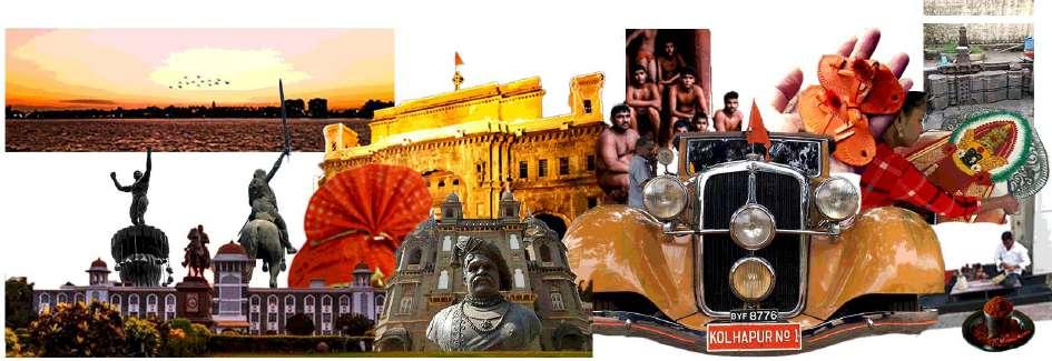
| Architecture | Urban Conservation | Gaurish Deshpande selected works 2020 - 2022 P O RTF O LI O

| Architecture | Urban Conservation | Gaurish Deshpande +91 - 8975610681 | gaurishdeshpande2123@gmail.com

2020-2022
Masters in urban conservation
| K.R.V.I.A. Mumbai University Of Mumbai
SAHEC studio
Mumbai
2023 | Jnr Urban Conservation Architect
2014-2019
Bachelor of architecture
| B.K.P.S. C.O.A. Pune
Savitribai Phule Pune University
Vikas Dilawari Architects
Mumbai
2022-2023 | Jnr Conservation Architect
2014-2012
Intermediate | S.M. Lohia junior college
Freelance projects
Kolhapur
2002-2012
Kolhapur H.S.C. High school
| Seventh Day Adventist Higher secondary school, Kolhapur I..C.S.E.
2020-2022 | Architect
Eco-Solutions pvt. ltd.
Pune
2019-2020 | Green Architect
Beri Architects and Engineers pvt. ltd.
Kolhapur
2018 | Intern
Srujan research planning foundation
Pune
2017 | Summer internship
Vijay Sahadev Architects
Latur
2016 | Summer internship
Navkar Architects
Pune
2015 | Summer internship
Project credits :
Masters in urban conservation | Semester IV | 2022
Thesis project - [Re]thinking the cultural integrities in historic urban center Guide - Ar. Vikram Pawar, Ar. Apoorva Iyengar
Site location :
About project :
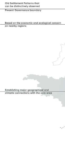
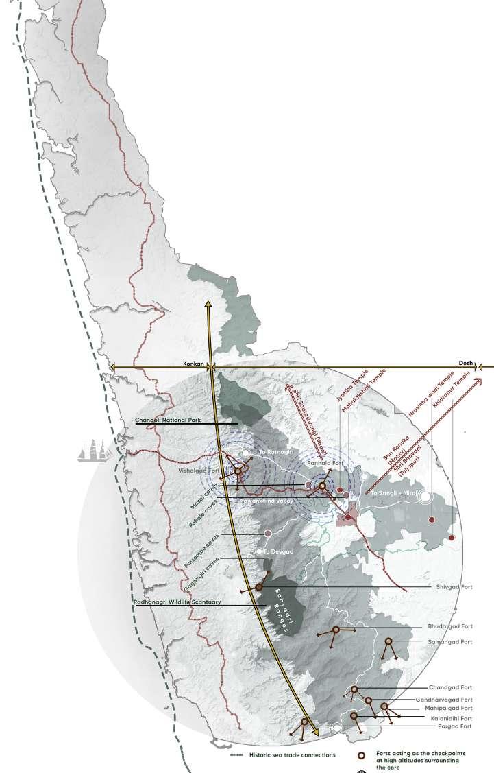
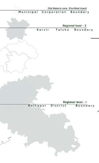
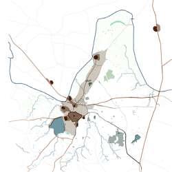
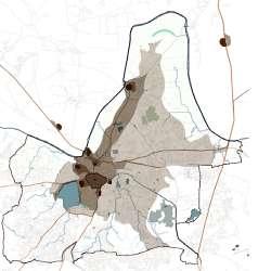
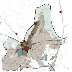
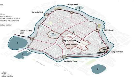
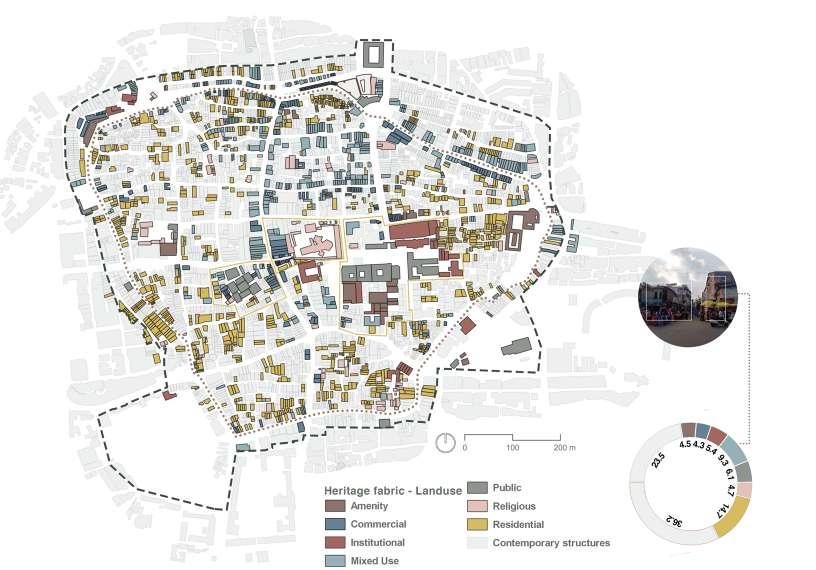
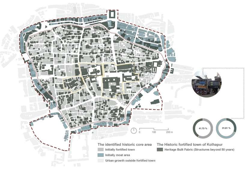
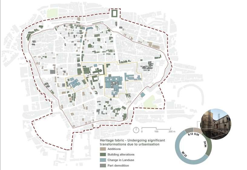
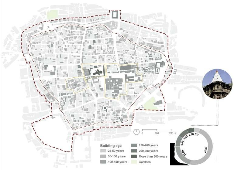
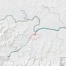
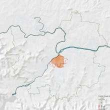
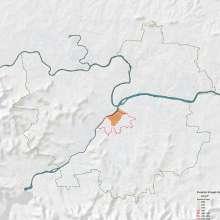
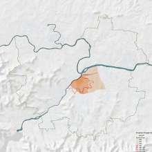
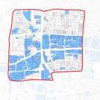
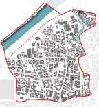
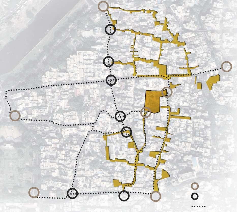
Historic core of Kolhapur
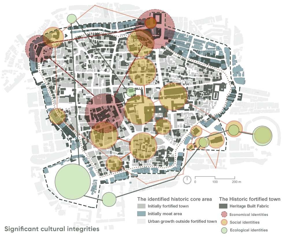
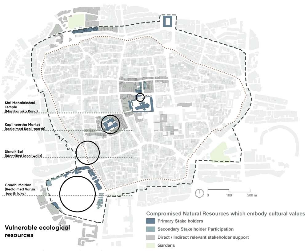
The historic urban areas of Indian cities are experiencing higher gentrification and urbanization pressures causing rapid urban transformations. The tansforming natural resources and traditional livelihood patterns of these historic areas are compromised in the planning processes. The increasing insensitive urban redevelopments is hampering the built character resulting in the cultural disintegration.
There is an utmost need to integrate the cultural dimension in the sustainable development process of such historic areas by utilizing the social, economic and environmental identities of the city. This thesis intends to explore the workability of a dynamic concept of cultural integrities which can precisely cover the larger context of the cultural dimension in sustainable development of a city.
This study elaborates on the UNESCO’s recommendation on Historic Urban Landscape framework (2011) applicable for historic cities. It highlights the idea of extensive sustainable conservation of the transforming significant cultural heritage by evaluating, valuing and structuring the tangible and intangible cultural resources. This methodology can possibly strengthen the interlinked social structures and fundamental inter-relations between the nature - culture - people.
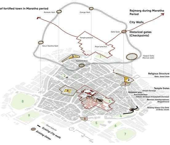
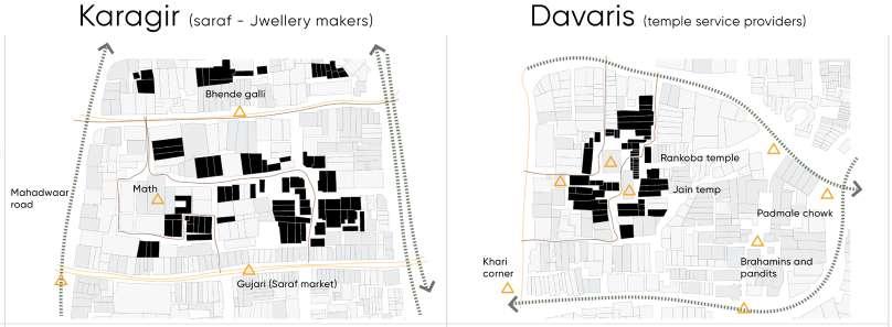
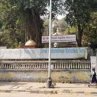
The significant historic core of Kolhapur city is chosen for this study which comprises of fortified town in the Karveer region and Shri Mahalakshmi temple as a significant pilgrimage centre which play an important role in establishing the unique cultural identities of the historic core.
Keywords :
Urbanization, cultural dimension, cultural integrities, historic urban landscape, sustainable conservation, community resilience and interlinked social structures.
Research question :
How can we effectively integrate the significant cultural identities and the collective cultural heritage in the sustainable conservation of historic urban center?
Framework :
Economical dimension
Social dimension
Sustainable Development
Cultural dimension
Significant attributes :
Historic lakes
Environmental dimension
Heritage skylines New developments
Sports
Chatrapati Shivaji University
Historic structures
Karvir Sansthan
People
Cultural identities
Traditional communities
Cultural integrities
Traditional livelihood patterns
Transforming natural resources
Archaeological sites in heritage core
Food and attires Art
Traditional communities
Culture driven products
Festivals
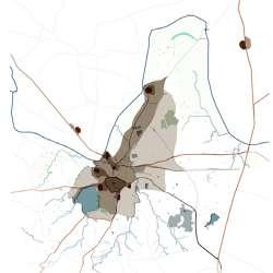
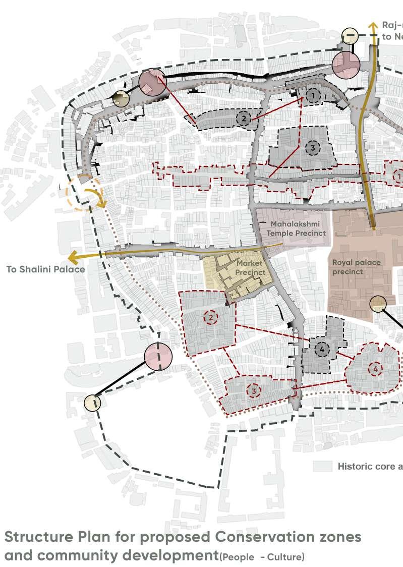
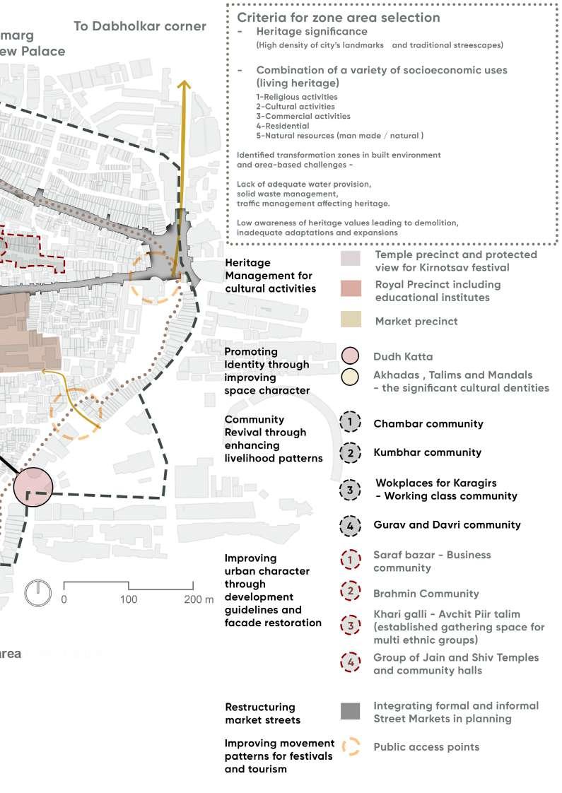

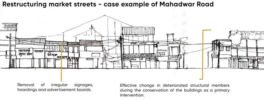
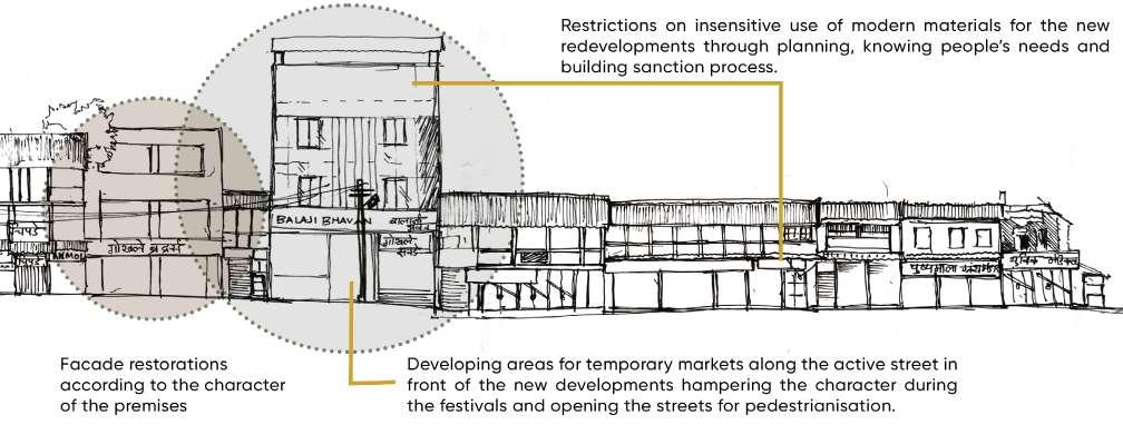
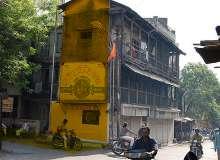
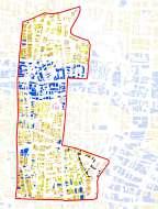
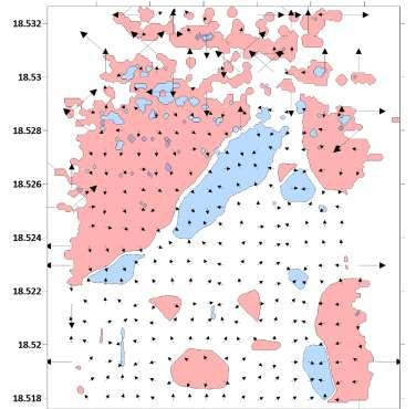
| Illustrating the loss of character along primary streets which comprise of cultural markets and traditional community engagements
Interventions along primary market streets
Historic urban cores
Project credits :
| Pune city 02
Cultural resilience in the historic core of metro city
Associated team :
Masters in urban conservation | Semester III
Urban design studio -Local Area Planning in historic cores | 2021
Teaching staff -Ar. Aneerudha Paul, Ar. Vikram Pawar, Ar. Jamshid Bhiwandiwalla, Ar. Ketaki Tare, Ar. Sanaeya Vandrewala
Urban conservation -Madhura Zamre, Rajeshwari Sawant, Krutika Rathod
Urban design -Himanshu Deshpande, Anirudh Bhambure, Swapna Jadhav
Role :
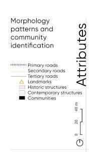
Team co-ordination, data collection, interviews of field experts, questionnaire surveys, GIS mapping, on-site field mapping, analysis issues and concerns, mapping vulnerabilities, executing structure plan, individual interventions.
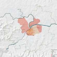
Site location :
About project :
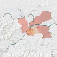
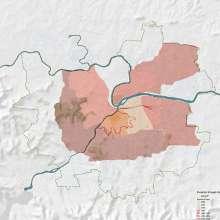
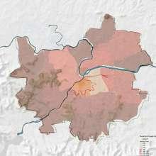
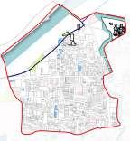
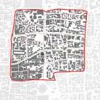
Historic core of Pune
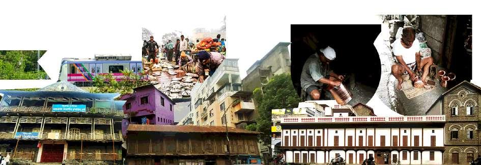
The diverse and vibrant traditional communities populate existing neighbourhoods in the core areas that are crucial to the local economy. They represent a variety of cultural identities adding up to a distinct character in these fast growing cities. These livelihoods must be involved in the integrated planning process seeking for resilience through sustainable development.
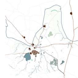
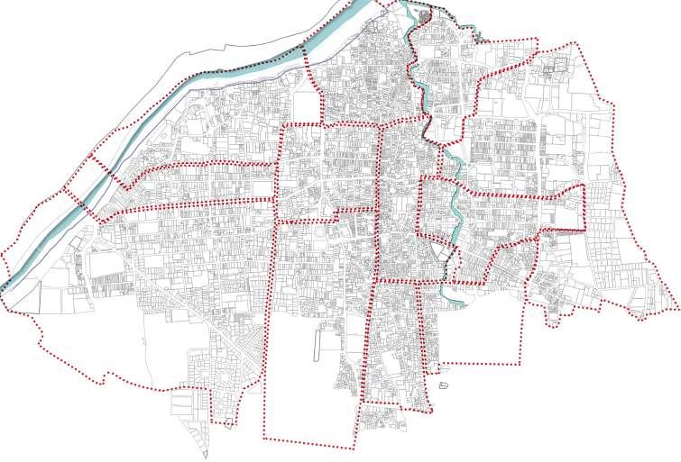
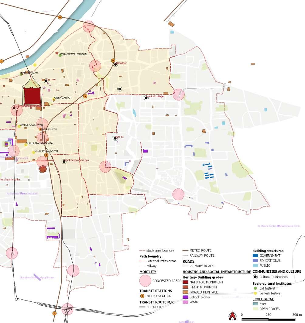
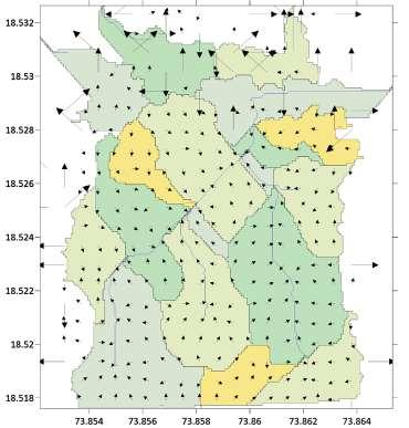
The old core of Pune is not confined with any boundary wall, hence the first step was defining the extent of the study area. The study area is delineated according to the administrative divisions of the city which comprises of three wards Kasba peth, Bhavani peth and Vishrambaug ward.
The potential attributes that represent the distinct character of the core along with their vulnerabilities due to the urban transformations, man made or natural disasters were studied in the significant Peths. They comprised of Kasba peth, Raviwar peth, and Budhwar peth.
Keywords :
Local area planning, traditional communities, cultural identities, resilience, sustainable development.
Research question :
Cultural Resilience - How resilient are the traditional communities in historic core areas of Indian metro cities ? How can they be integrated in local area planning process using heritage as a significant tool ?
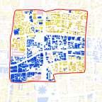
Tangible heritage
Framework :
Local area plan
Heritage inclusive development
Intangible heritage
Significant attributes :
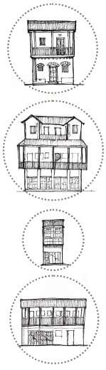
Heritage graded structures
Traditional cultural markets facing developments pressures
Metro project from historic core area
Invisible city
Loss of character
Compromised public spaces around heritage
Cultural Resilience
Heritage walks and increasing mobility patterns
Heritage walks
Vulnerable livelihood patterns
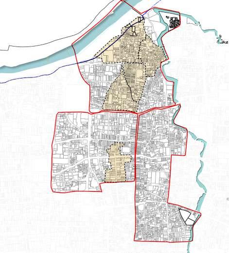
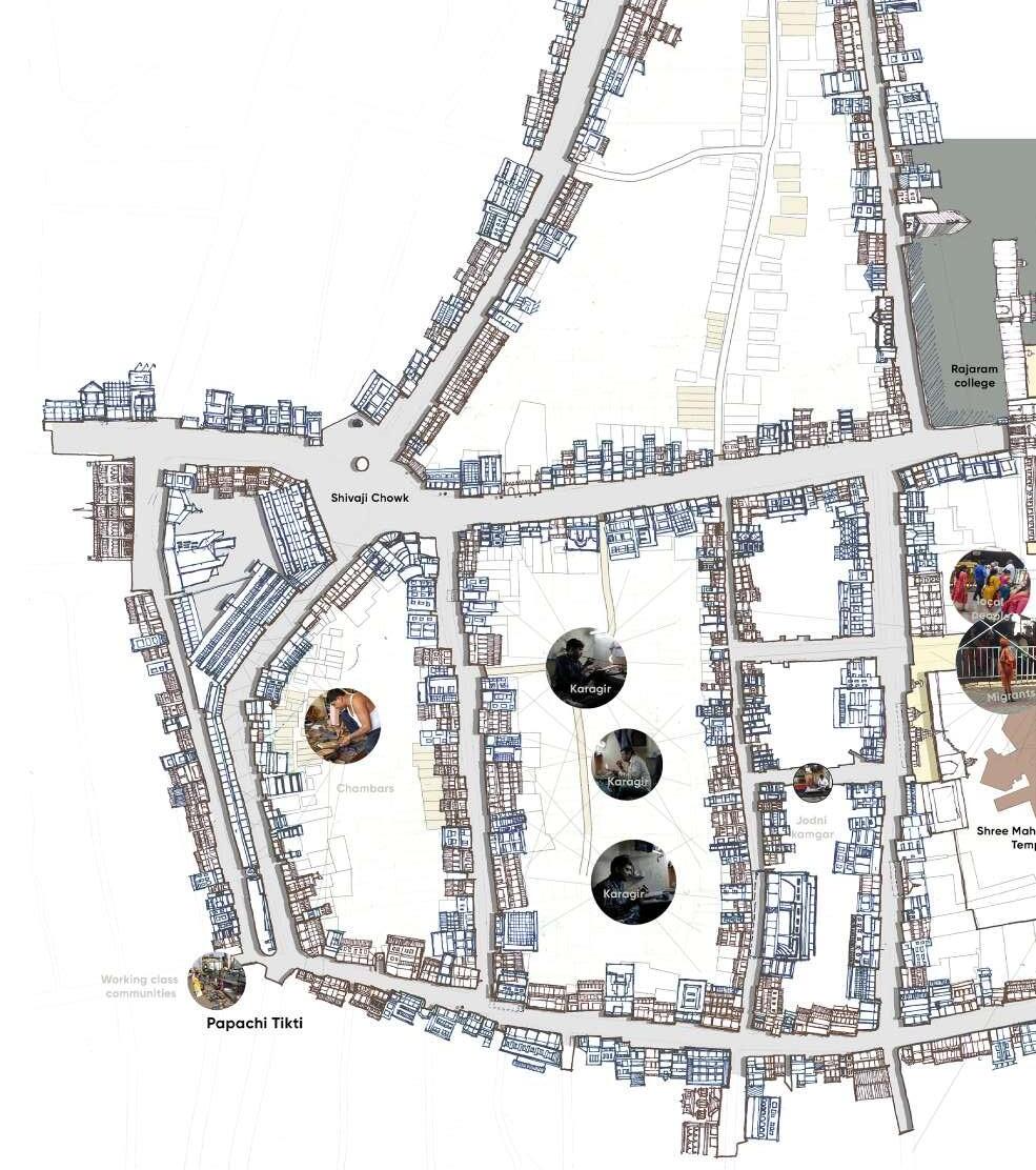
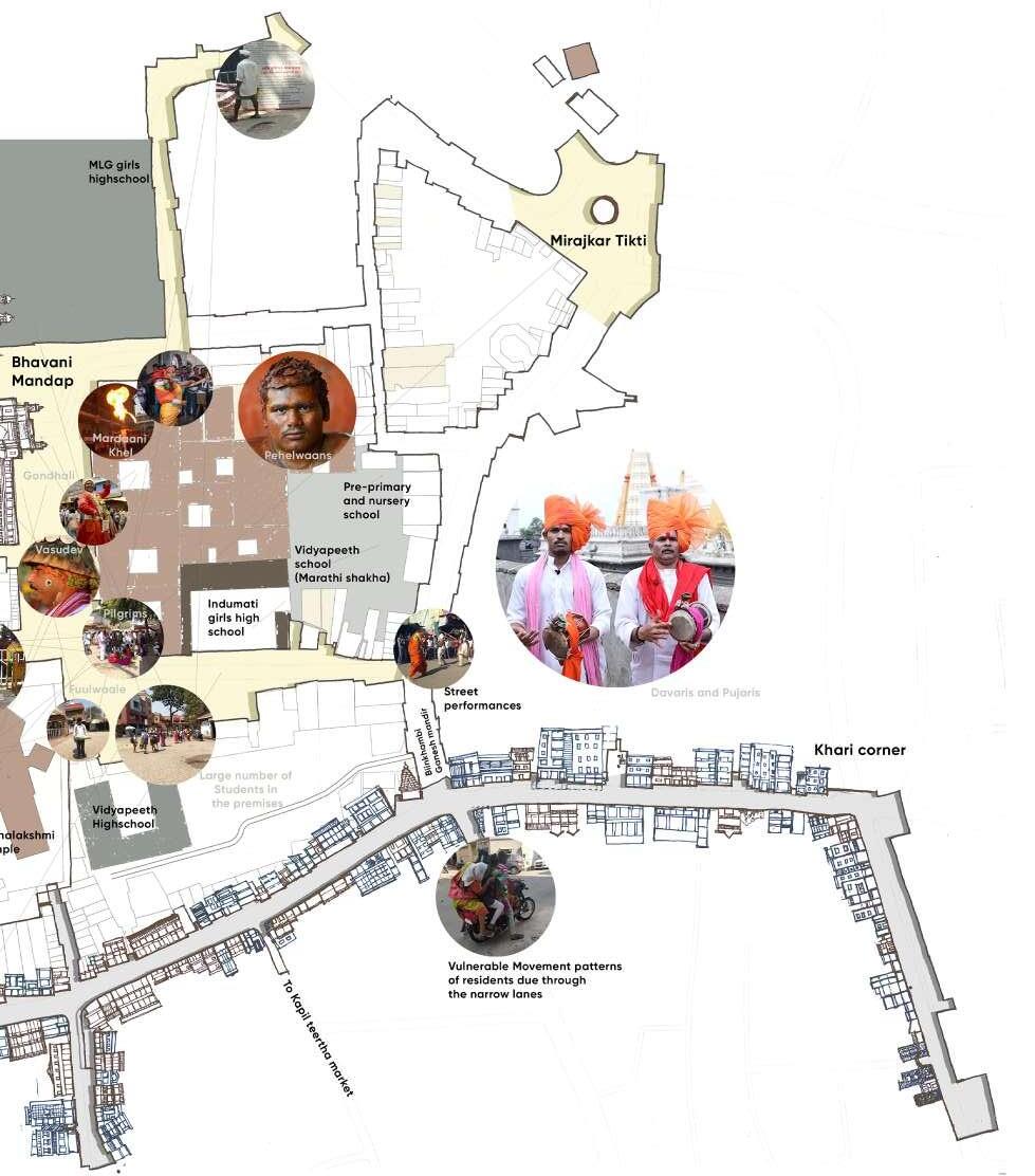
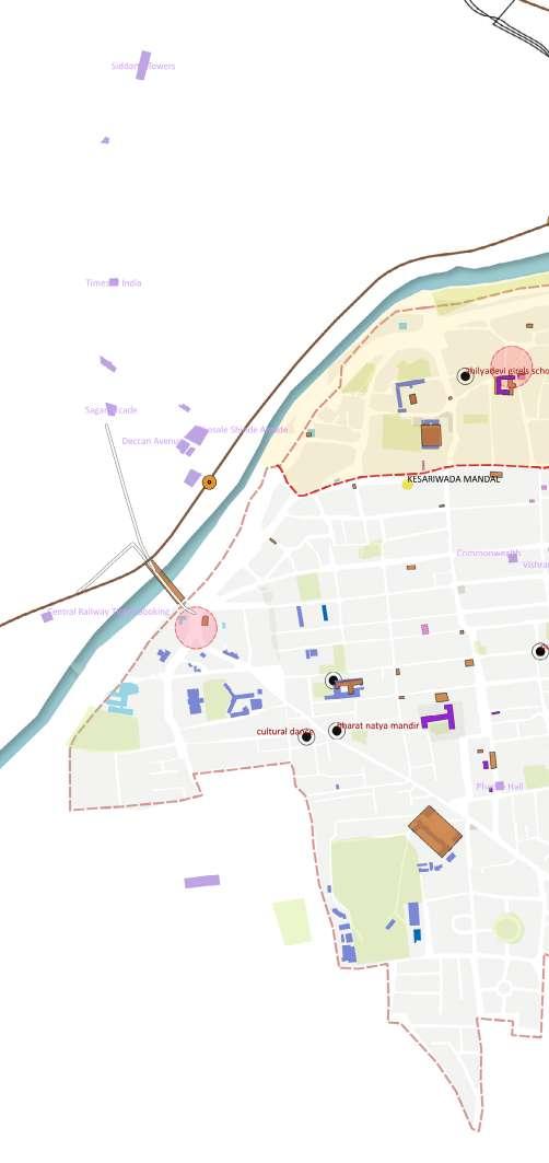
The Kasba peth is the oldest and most vulnerable Peth of Pune that have witnessed rapid transformations from the old core of Kasbe Pune consisting of fishermen, farmers and potters in during Mughal sultanate to Peshwa period suceeded by British empire.

The traditional settlement is along and across the varied physical terrain connecting different small social congregation spaces and common service areas. The Kasba Peth appears to be unplanned in terms of disaster management in the worst climate change situations. Its tiny streets are prone to disaster during rush hour. These tiny streets add up to the character of the area as it is comprised of variety of old wadas and vernacular structures.
The small alleys connecting the common public utility spaces, small temples and residential units can be used in celebratory way by including into the planning process.
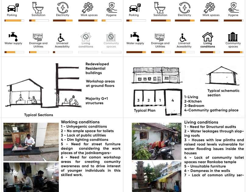
• To identify and establish the traditionally resilient communities patterns, based on occupation and skillsets.
• Determining the local issues and vulnerabilities that threaten the living conditions. Strengthen their living conditions and social spaces. Identifying social spaces promoting the economy of those livelihoods.
• To preserve and promote social cohesion between the ecosystem, and current businesses of livelihoods based on traditional occupations and skillsets, which represent the intangible heritage of core area of Pune.
• To promote social wellbeing and developing shared community spaces in order to enhance the living conditions of those traditional communities.
• Restoring a direct B2C buying and selling business plans in order to enhance the economic conditions of traditional markets in the Kasba peth by planning better infrastructure and allocating respective temporary market spaces.
• Revitalization of the heritage and social spaces along the heritage setting can act as an effective way to meet the demands of the changing times.
• Improving market conditions as per post covid period guidelines can generate healthy spaces in the crowded areas of Kasba peth.
• Decentraised and customised temporary markets promoting products with cultural innovations.
• Adressing covid regulations design strategies in core areas.
• Restored interdependencies of heritage structures and livelihood patterns.
• Communtity skillsets promoted for experimental works.
• Cohesive work environment promoting community involvement and establishing P-P-P development model
• Cultural development and educating traditional knowledge systems.
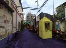
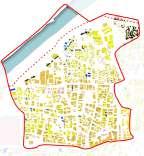
Developing heritage inclusive street edges along the planned pathway
Including community livelihood patterns in the heritage walks
| Identified transitional spaces for setting up cultural markets
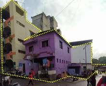
A - Exhisting street edge condition along heritage structures.
B - Illuminating street edges considering the heritage facades
C - Propoer drainage of surface water runoff.
| Upcoming metro station
| Expected increase in pedestrian movement along main streets towards metro station
| Identified transitional community spaces along narrow streets
| Utilising transitional spaces along the streets for traditional community markets
Major traffic
Congestion points
Mobility network
D - Rainwater recharge pits at strategic locations.
E - Community markets along street edges improving the street character and local engagement.
F - Landscaping along the street edge.
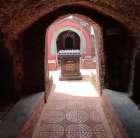
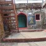
Architectural conservation
Project credits : Associated team :
Role : Site location : Objectives :
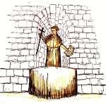
Academic work | Conservation science | 2021. Madhura Zamre.
Measured drawing, condition and defect mapping, issue identification, proposal drawings.
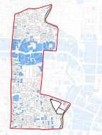
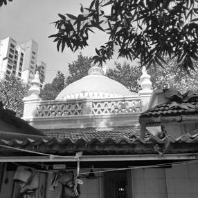
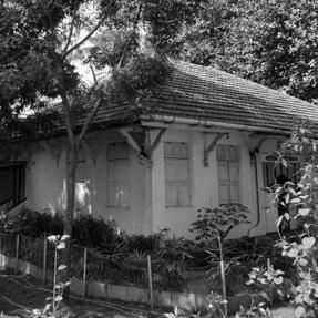
Ward G south-II, CS No. 137, Dr. Annie Besant Road, Mumbai.
• To identify the structural defects of the temple.
• Tocarryouttheconditionassesmentbyobservingandanalysingthematerialquality.
• Proposals for needful tests for interventions.
Project specifications : (Inventory survey)
Site area - 843.9 sq. m.
Built up area - 530.3 sq. m.
Built in - 1832 C.E.
Ownership status - Trust owned
Present use - Religious
Past use - Religious Usage - Regular use
Value classification
A(arc), A(his), A(cul), B(uu), C(seh), E, J Grade - II B
Architectural significance
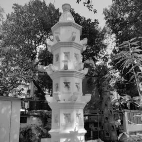
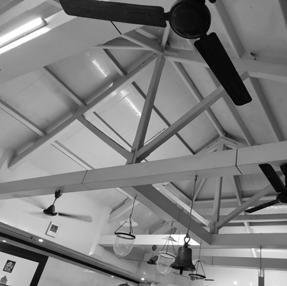
A small scale vernacular style temple with mangalore tiled hip roof supported on carved wooden brackets. The structure does not have much ornamentation on facade and exhibits Vernacular temple architecture of the early 19th century.
Internally the Garbhagriha is made of black basalt stone masonry. The structure has brick Shikhara. The plot is densely wooded and has Deepstambha, Samadhi etc. The Deepstambha made in Black Basalt stone is a striking feature of the temple.
Construction details
• Timber framed structure with load bearing walls.
• Wall footing - 2.5 m deep stone masonry (presumption)
• 0.6m. high basalt stone coursed masonry plinth
• The walls are brick load bearing walls.
• The floor on the temple complex is in vitrified tiles.
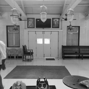
Existing Photos :
Existing ground floor plan
| Preliminary case for conservation :
a - Site clearance.
b - Surface cleaning.
c - Removing algae growth and scraping. out the cement plaster and oil paints.
d - Exposing the wooden structural members.
e - Repairing water gutters.
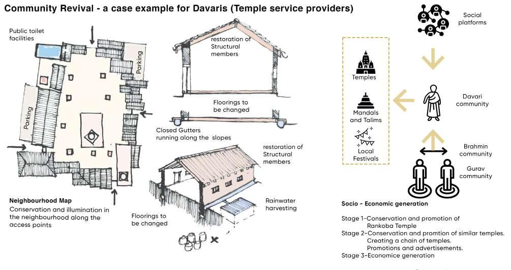
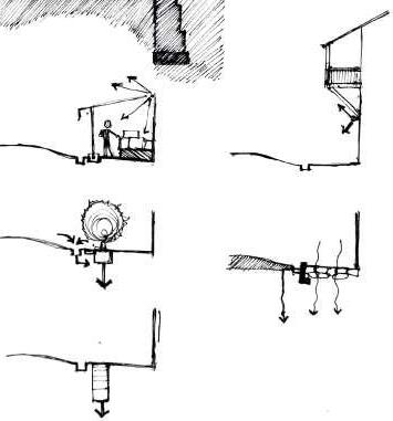
| Proposed restoration changes :
1. Restoring roof structure - replacing degraded structural members, adding waterproofing aluminium sheets, degraded mangalore tiles
2. Removal of additional walls and openings along the original wooden posts in Sabha Mandap
3. Demolition - Storage area, common toilet block, cement frame of compound wall, unwanted steps, gate and cement paver blocks.
4. Removal of redundant materials - Marble flooring, wall tiles, paints on internal surfaces, unnecessary electrical wiring, plumbing lines, cement plaster, cement paver blocks, etc.
Existing plan as per required changes Front
Removal of unwanted signages and boards
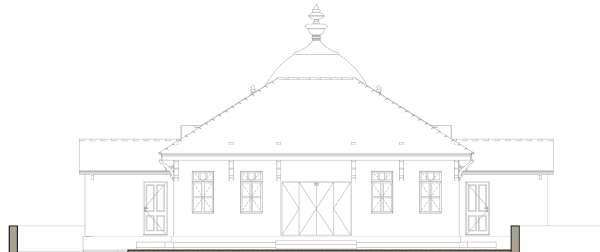
| Proposed changes in the structure :
1. Extension of the roof structure with additional valley rafters on both ends. Additional roof at the entry point of the service quaters.
2. Designed combined toilet blocks and utility for the pandit’s family.
3. Addition of wooden brackets, arches and railing along the facade of Sabha mandap.
4. Restorating wall cracks and plinth damages by using grouting and repointing methods as per need. Adding extended plinth along the external walls inorder to prevent wall dampness.
5. Replacement of contextual / traditional materials and finishes such as lime plaster, kotah stone flooring, organic wall paints, laterite paving blocks, laterite copiing for compound walls, etc.
6. New electrical and plumbing layouts as per the changes in the service locations.
7. Provision of storage area along with common toilet block using contextual materials.
8. Provision of katta and paar for trees along the circulation paths as seating arrangement.
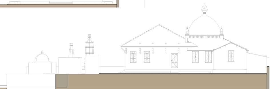
Section S-02 : Proposed changes
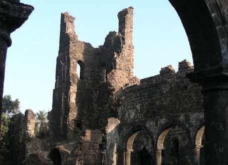
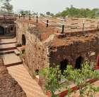
Fort conservation
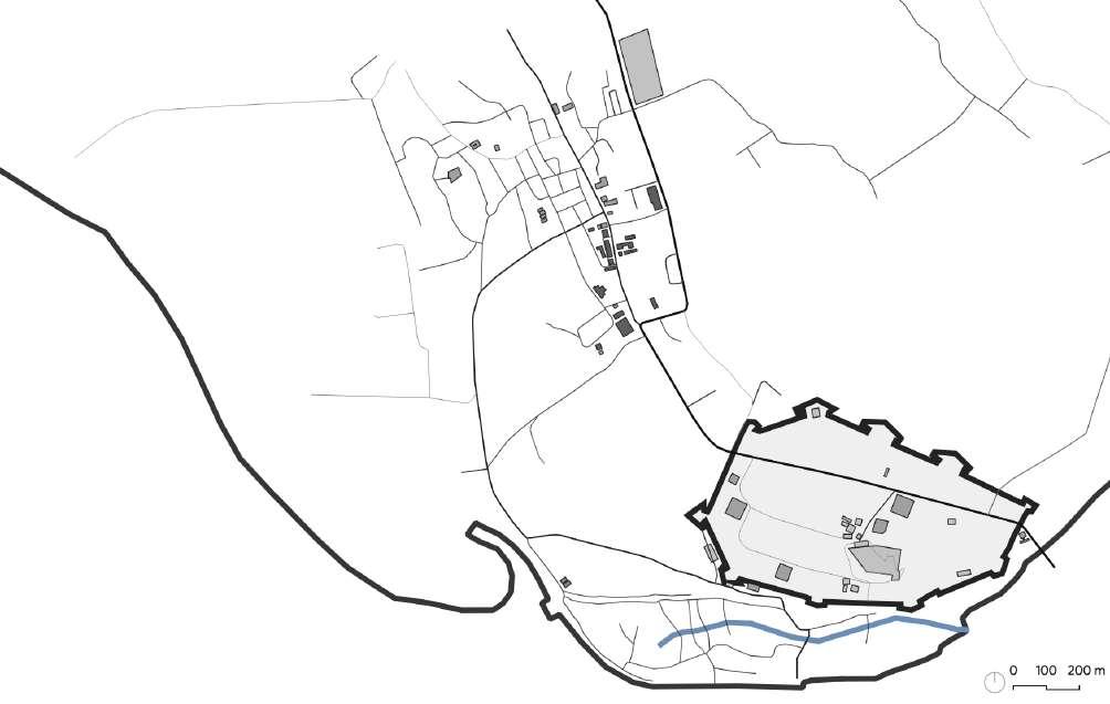
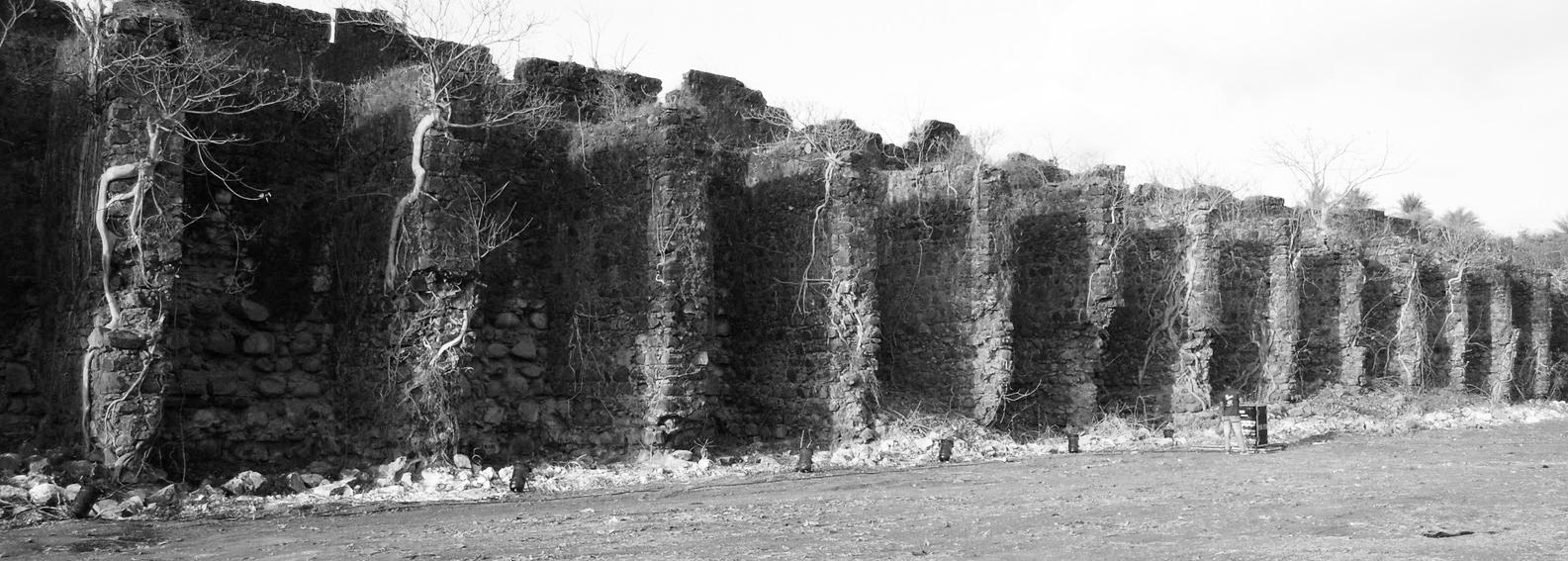
| Vasai 04
Bassein fort
Project credits : Associated team :
Role :
Site location :
Objectives : Historical evolution :
Academic work | 2021.
Madhura Zamre, Shalaka Kolwadkar, Shifa Sheikh.
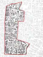
Tourism management plan, design development and report presentation. Vasai, Mumbai.
• To identify and analyse the opportunities for tourist development.
• To strengthen the tourist infrastructure through promoting local culture, product and services.
600 A.D. - 1432 A.D. - Pre Portuguese rule
1432 A.D. - 1533 A.D. - Gujarat Sultanate
1534 A.D. - 1739 A.D. - Portuguese Empire
1737 A.D. - 1739 A.D. - Siege of Vasai
1739 A.D. - 1818 A.D. - Maratha rule
1818 A.D. - 1857 A.D. - British rule ( Treaty of Bassein - 1802 A.D. )
1857 A.D. - Till date - Archaeological Survey of India
Methodology :
Heritage identification
Mapping
Valuing
Risk assesment
Human cause
Design strategies
Tourism activities
Significance
Illumination
Signages
Murals Seatings
Design elements
Natural cause
Formulating policies
Case for conservation
Circulation and zoning
Case for conservation :
1 Preservation in its present state.
2 Surface cleaning and defect treatments as per structural requirements.
3 Repairing cracks on walls and floors.
4 Reducing vehicular movements.
5 Preventing vandalism and setting up monitoring systems.
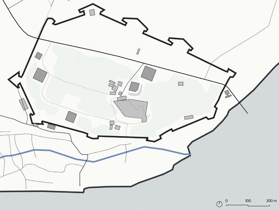 1 Open parking area.
2 Ticketing counter and security quarters.
3 Fort information center + admin office.
4 MTDC Canteen and toilet facilities.
5 Temporary fish markets.
6 Open ground with planned workshops by Koliwada community and permitted public activities.
7 Feast day celebration area.
8 Tourist points with guide services.
1 Open parking area.
2 Ticketing counter and security quarters.
3 Fort information center + admin office.
4 MTDC Canteen and toilet facilities.
5 Temporary fish markets.
6 Open ground with planned workshops by Koliwada community and permitted public activities.
7 Feast day celebration area.
8 Tourist points with guide services.
Community awareness about the heritage significance and need for controlled human cultural activities.


Public-Private Partnership (PPP) assumes greater significance in the conservation and management of our monuments and this can be encouraged. Local communities to be taken into decision making processes.
Preparing for structural audits and reports in order to define the carrying capacities for each monument. Visitor management to be controlled according to the structural capacity of the monuments.
Fort conservation
Project credits : Associated team :
Role :
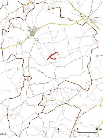
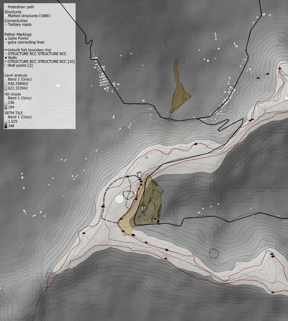
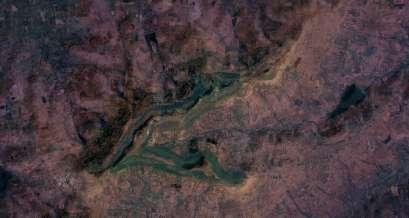
| Gadhinglaj 05
Samangad fort and cultural landscapes of Omkar pathar
Proffessional work | I.I.A. Kolhapur | 2022 Ar. Vijay Korane (Head), Prof. Vandana Pusalkar (SPSMBH’s COA), Ar. Kalyani Rawal
On-site documentation of cultural resources, measured drawings and site inventories, interviews and questionaire surveys, conservation and tourism management plan, design development, block estimates and report presentation.
Site location :
Objectives :
Gadhinglaj city, Kolhapur district, Maharashtra.
• To identify and study the cultural heritage at the regional level.
• To analyze salient features and architectural character inorder to [Re]store the historic fabric of the Samangadh fort and Omkar Pathar.
• To integrate heritage conservation and tourist infrastructure in the sustainable development through promoting local culture, product and services.
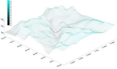
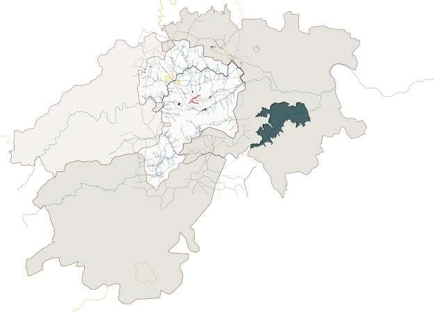
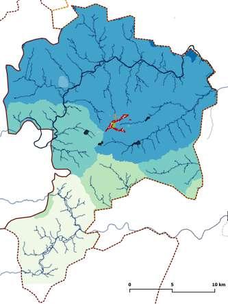
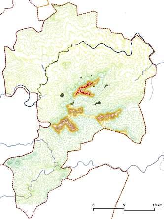
| Larger basins and watershed with respect to stream orders | Contour mapping demonstrating nearby hills
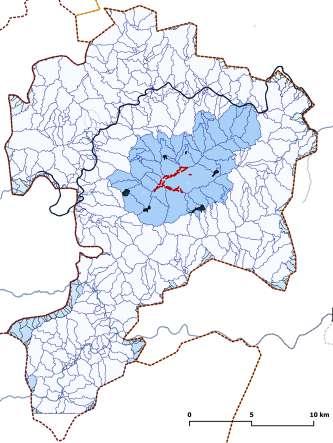
| Buffer zone comprised of relevant water bodies and smaller basins around the ridge line
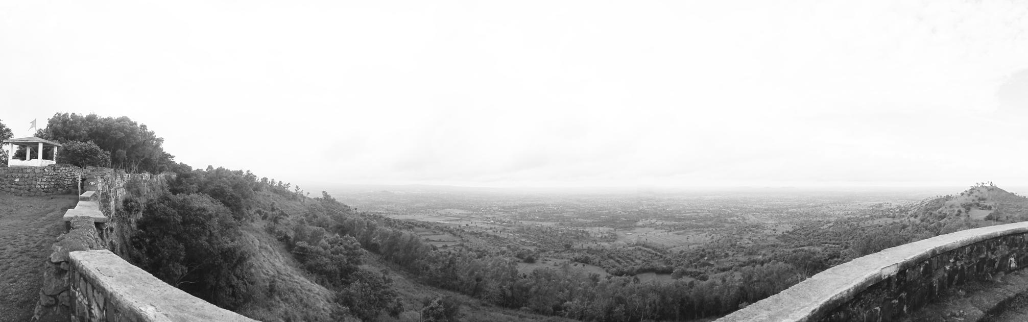
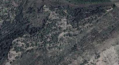
 Panaromic view from Sondi buruj
 | Old settlement of Chinchewadi village
| New settlement of Chinchewadi village
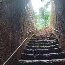
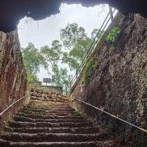
| Pathway through stairs
| Identified site for tourism development
| Identified site for cultural development
| Old settlement of Chinchewadi village
| New settlement of Chinchewadi village
| Pathway through stairs
| Identified site for tourism development
| Identified site for cultural development
| Identified view points providing cultural or historical significance
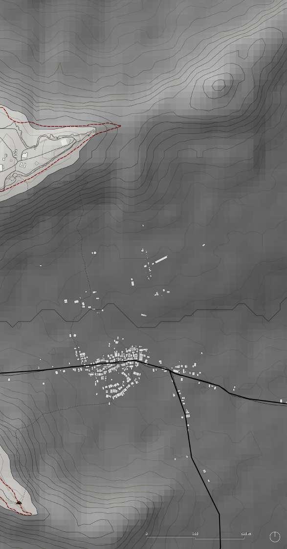
| To Sankeshwar
14.
17.
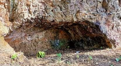
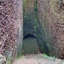
01. Entry point 02. Zhenda buruj 03. Vetal buruj 04. Sondi buruj 05. Gateway 06. Andhaar kothdi 07. Saat kaman vihir 08. Sakhar vihir 09. Gola barud satha 10. Chor khind 11. Sauch kup 12. Uttar khaan + Vihir 13. Mughal tekdi Shiv mandir guha 15. Bhimsasgiri talao 16. Omkar shila Foundation wall of the unbuilt fort 18. Bhimshappa matha 19. Hanuman mandir | Naukud village settlement | Proposed nature trail along the caves locations | Core area| Comparitive material tests identified for differently sized stone samples of all the structures:
1 Colour analysis -Based on Munsell system.


2 Wet chemical test -Mineral composition.
3 UV Floroscence test -Weathering process.
4 Compressive strength test -for different sized stones.
5 Water absorption test -Through total immersion.
6 Flexural strength -Three point bending test.
7 Water permeability -Water vapour transmission.

2 inch cubes - ( 5 nos. at different locations ) - per structure selected at 5 different levels.


A stone cutting machine with a 4inch diamond disc water cooled blade. After being cut, the samples to be briefly washed to eliminate any surface soil wash and the sun dried completely before being testing.
( Based on expert opinions and case study examples )


1 Preservation in its present state.


2 Surface cleaning and defect treatments as per structural requirements.


3 Removal of redundant materials using traditional methods.
4 Demolition of existing non contextual pavements, cement plaster work, tile work, metal staircases and bridges for all significant structures
5 Rainwater and stormwater management.
6 Restoring tehalni paths and fortification walls based on risk assesment and structural analysis report.
7 Expert investigations including geologists, archaeologist, historians, environmentalist, biologist, etc.
8 Establishing traditional trade routes and cultural linkages based on the available historical evidences.
9 Water purification in the vihir and khaan using appropriate biological resources.


Framework :
Cultural Heritage
Sustainable tourism
Natural Heritage
Phase - 4
Phase - 5
Phase - 6
Tangible
Intangible
Festivals Conservation ( C )
Social practices
Cultural practices
Village development ( V )
Tourism development ( T )
Tangible
Fort components
Archaeological sites
| Strategies and visions
C-1 | Fort conservation
C-2 | Caves conservation
Natural resources
Religious sites
C-3 | Preservation of the site components in their present state
C-4 | Ecological conservation
C-5 | Biodiversity conservation
C-6 | Heritage conservation
V-1 | Community awareness and networking
V-2 | Developing basic village facilities
V-3 | Green energy development


V-4 | Developing sustainable water resources
V-5 | Promoting organic and traditional agricultural practices
V-6 | Native tree plantations
T-1 | Establishing signages, information boards, GIS mapping
T-2 | Establishing various kinds of tourism trails
T-3 | Creating brochures and information documents. Tourism marketing
T-4 | Tourism facilities through tourist facility centers

T-5 | Promoting cultural festivals, practices, cuisines, lifestyles, local food, etc
T-6 | Heritage and tourism management