CANYON
VIEWS
VOL.29, NO. 1 S P R I N G | S U M M E R 2 0 2 2
A P U B L I C AT I O N O F G R A N D C A N YO N C O N S E R VA N C Y
Canyon Views is published by Grand Canyon Conservancy (GCC). As the official philanthropic and collaborative partner of Grand Canyon National Park, GCC’s mission is to inspire generations of park champions to cherish and support the natural and cultural wonder of Grand Canyon. You can make a difference at Grand Canyon! For more information about Grand Canyon Conservancy, please visit grandcanyon.org. Board of Directors: Mitchell Walker, Board Chair; Shantini Munthree, Board Vice Chair; Lizabeth Ardisana; Ann Becker; Randall Brown; Awenate Cobbina; Jason Coochwytewa; Aaron Craft; Ann West Figueredo; Nigel Finney; Deborah Gage; Charlie Galbraith; Teresa Gavigan; Teresa Kline; Alejandra Lillo; Carissa Rollins; Stan Sutherland; Merl Waschler; Tyson Winarski Chief Executive Officer: Theresa McMullan Chief Philanthropy Officer: Danielle Segura Director of Marketing & Communications and Canyon Views Editor: Mindy Riesenberg Printing and Graphic Design: Prisma Copyright © 2022 Grand Canyon Conservancy Cover photo courtesy of Scott Thomsen Images
From the CEO DEAR FRIENDS, When I look over the rim at the vast landscape of Grand Canyon and see all the beautiful rock, it’s hard to imagine the importance of water. However, the Colorado River has been carving the canyon for over five million years. Along with the seeps and streams, it’s the lifeblood of the canyon. But our changing climate and its impact on water threatens the future of Grand Canyon as it exists today. That’s why we’ve dedicated this issue of Canyon Views to water. Grand Canyon Conservancy is working closely with the National Park Service to mitigate the consequences of a changing environment. When it comes to water, your generous support is funding scientific research to monitor the quality and quantity of water in the Colorado River and its tributaries, preserving areas of cultural significance, and resto ring native fish and habitats. This work goes straight to our mission of inspiring generations of park champions to cherish and support the natural and cultural wonder of Grand Canyon. Without this work, the park may look like a very different place in the future. Thank you for your support! I hope you enjoy this issue of Canyon Views.
Grand Canyon Conservancy P.O. Box 399 Grand Canyon, AZ 86023-0399 (800) 858-2808 grandcanyon.org
Theresa McMullan Chief Executive Officer
In this Issue 04 02
Introduction by Superintendent Ed Keable
04
Paa’tuuwa’qatsi: The Water-World of the Grand Canyon Landscape
08
The Future of the Colorado River in Grand Canyon
08
12 The Grand Canyon Aquifer and Springs 18 Designing a Water System for the Future 22
Too Much of a Good Thing?
28
Member Spotlight: Linda and Bob Shadiow
29
90 Years of Grand Canyon Conservancy/ Construction is Underway at Desert View
30
14th Annual Celebration of Art
31
Create A Grand Legacy Through Planned Giving
32
Take the Trip of a Lifetime with Grand Canyon Conservancy’s Field Institute
33
Shop Grand Canyon Conservancy
12 18
22
32
2 | C A N YO N V I E W S
Introduction by Ed Keable, Grand Canyon N at ional Park Superintendent
3
O
ver the past two years, I’ve been engaging with park staff and all our friends about how amazing Grand Canyon National Park is and how lucky I am to be the Superintendent. At the heart of the canyon, often called the canyon’s lifeblood, is the Colorado River. I’ve spent time over the past year on the rivers, both the Colorado and the Green River, understanding the dynamics of the ecosystem and big river systems. I’ve also learned a lot about our local hydrology, the park’s waters, seeps, and springs, and the uniqueness of the aquifer.
This issue of Canyon Views highlights the range of issues related to water, from Colorado River flows and diminishing water supplies in the Colorado River basin to effects of flows to both natural and cultural resources in the system. The significance of water is all around us and this issue brings light to the range of perspectives I consider as we work to preserve and protect the park’s resources. Photos courtesy NPS.
One thing I learned last summer from one of the academics on a Green River trip was that we are no longer in a long-term drought. Instead, it is a period of “aridity.” This is heating and hardening the soils in the basin, which then absorbs rainwater and snowmelt rather than allowing it to flow into the river system. This is creating devastating impacts on the habitats of threatened fish, including the humpback chub and the razorback sucker in the park. The low water levels in Lake Powell and Lake Mead present many major management challenges. The Glen Canyon and Hoover dams generate hydroelectric power for significant parts of the southwest as well as providing water for municipal and industrial uses in this area. The lower the volume of stored water in these dams, the more these vital services are at risk. Low water levels are also threatening the water recreation capacity for those bodies of water, which is a multi-milliondollar industry in this area and an important part of the mission for
these two National Park Service units. Closer to home, we all rely on water; it is the lifeblood of Grand Canyon and all of us in the desert west. We are in the process of replacing aging Grand Canyon water lines and infrastructure. It will be a long and costly series of projects and I know you will be thankful when the construction is done, and water flows through the new trans-canyon waterline. I know I will be, as will our staff. In a few years, I won’t be telling you about the pipeline breaks; instead, I’ll be sharing with you the success of the projects as we bring the infrastructure of the park into the 21st century. There are many complicating factors on managing water locally and within the Colorado River basin. I hope that you will learn a lot about the issues at hand through the pages of this issue of Canyon Views.
4 | C A N YO N V I E W S
Paa’tuuwa’qatsi: The Water-World of the Grand Canyon Landscape B y Ly le Balenq uah , Independent Hopi Arc haeologist
“ We are of water, and t he water is of us . W hen water is t hreatened , All li v ing t hing s are t hreatened . W hat we do to water, We do to our sel ves .” –Tra d it iona l Hop i Per s p ec t i ve
Photo: Little Colorado River confluence, by Alan English.
5
F
rom the perspective of the canyon rim, it seems the only natural water source in these depths is the Colorado River, located far below and colored green (sometimes brownish-red). However, once you descend below the rim, you may encounter one of the many side tributaries where perennial water flows, or one of the thousands of springs that miraculously emerge from dry desert stone. Each of these water sources is unique, and from a birds-eye view, the surrounding plant-life grows verdant, leading to the Grand Canyon sometimes described by Hopi people as “Ong’tupqava Sakw’tala,” which is a metaphor referring to the bluegreen “light” that exists along the waterways and in riparian zones. I consider myself fortunate to have visited some of the naturally occurring springs found throughout the Grand Canyon landscape. Some, like Vasey’s Paradise and Blue Springs in the Little Colorado River gorge, have specific Hopi names, “Yam’taqa” (Place of the EverFlowing Water) and “Sakwa’vaahu” (literally, Blue Springs), respectively. The former has a specific story
associated with it, perhaps from the 16th century, that tells of an overbearing Catholic priest who demanded Hopi men to make the trek to Vasey’s from the Hopi mesas for his drinking water. The priest did so because he did not like the taste of the water from springs found near the Hopi villages, forcing these men on a journey of over 100 miles and many days. Hopi men still visit Yam’taqa, where we retell this history and remember the sacrifices of our ancestors. We drink directly from its flow, and now, we collect water for ourselves. Springs are considered to be living entities that breathe and exhale moisture, a metaphysical connection between the spiritual world of ancestors and the natural world of their descendants. The phenomena of naturally occurring springs are proof to Hopi people that greater forces exist in the physical world we inhabit. Therefore, the importance of springs within Hopi culture cannot be understated. The life-sustaining waters that issue forth are a precious resource, allowing Hopi people and their ancestors to survive within a desert environment.
Vasey’s Paradise. Photo courtesy Schnoebelen/Elliott family archives.
Photo of Lyle Balenquah by Deidra Peaches.
Hopi people believe that water, under the ground, has much to do with rain clouds. Everything depends upon the proper balance being maintained. The water under the ground acts like a magnet attracting rain from the clouds, and the rain in the clouds acts as a magnet raising the water table under the ground to the roots of our crops and plants. The granting of life from one world to another is commemorated with ceremonial offerings left at springs, which formally acknowledge our ancestors’ existence, as they acknowledge ours. Due to this importance, many springs are formally consecrated
6 | C A N YO N V I E W S
7
with religious shrines, obtaining ritual significance that is recalled in Hopi oral history, song, prayer, and ceremony. The riparian environment associated with springs and other water sources are also considered culturally important. Specific springs are often visited to collect flora, fauna, minerals, and pigments, which are used in ceremonies, as medicine, or as utilitarian items. In ancestral and historic times, springs drew people together, often being the place where villages were built, such as my home village of Paaqavi, or “Reed Springs place” located on Third Mesa. When a prolonged drought occurred across the southwest in the late 12th century, many ancestral Hopi clans migrated to areas where more reliable springs could be found, including the southern Black Mesa area, where the Hopi villages are located. In recent years, when some of these springs began to dwindle in output, or even completely dry up, Hopi people considered this a manifestation of a much larger issue.
Activities such as the pumping of underground aquifers for over 40 years by Peabody Western Coal Company on Black Mesa, 50 miles north of the Hopi villages, were blamed for the depletion of the springs output. While the mining and groundwater pumping has ceased, the effects of this extractive industry will be felt for decades to come. There are some Hopi people who believe these impacts are not solely relegated to the Black Mesa region, but also reach as far as the springs and underground aquifers located in the Grand Canyon, including the aforementioned Blue Springs. Sakwa’vaahu, located along the Little Colorado River near the Confluence of the Colorado River, is one of thousands of springs that exist within the ancestral Hopi homeland. The sensitive details of its religious context remain with Hopi practitioners, however due to its proximity to Sipaapuni, the Hopi Emergence point—a spiritual and cultural genesis—its significance takes on added meaning. It is akin to holy
Top: Vasey’s Paradise. Photo courtesy Schnoebelen/Elliott family archives. Left: View downriver towards confluence, by Alan English.
water within a Catholic church. The geographic area around Blue Spring and the Sipaapuni is also imbued with the essence of departed Hopi ancestors, who visit their Hopi relatives in the form of clouds and other moisture. Accordingly, the Blue Spring’s region is hallowed ground where Hopi ancestors reside, serving as spiritual guardians of the Grand Canyon. Hopi people maintain a strong connection with the waters found within the Grand Canyon, as do many other Indigenous tribes and people of the southwest. Each of our respective cultures has learned the importance of respecting water and not to abuse it. Within Hopi culture, these teachings are encompassed by the phrase, “Paa’tuuwa’qatsi,” Water is Life. Therefore, we continue to advocate for the protection and preservation of our ancestral landscapes, for there within is not only our history, but our future as well. What we do to water, we do to ourselves.
8 | C A N YO N V I E W S
The Future of the Colorado River in Grand Canyon B y John (Jac k ) C . S c hmidt , C enter for C olorado Ri ver S t udies and D epar t ment of Water shed S cienc es , Ut ah S t ate U ni ver sit y
9
T
he Colorado River is the centerpiece of the Grand Canyon region and is the focus of sublime natural wonder and recreational thrills by millions who stand on the canyon rim or float the river. Despite the appearance of unspoiled naturalness within a national park, the Colorado River today is one of the most extensively regulated and managed rivers on Earth, and its stream flow, sediment transport, temperature, and ecosystems are primarily a product of societal decisions of how to manage the water supply provided by the river. The American West is getting drier, with low water storage in Lake Powell and Lake Mead reservoirs, and a very dry winter likely to cause more problems. To understand how the Colorado River in Grand Canyon fits into the puzzle of the plumbing and management of western water, I’ll provide a bit of simple math, using a few simple quantitative measures: the rate of stream flow in cubic feet per second (ft3/s) and the volume of flow in acre feet per year (af/yr). Approximately four basketballs have a volume of a cubic foot (ft3). The mean annual flow of the Colorado River through Grand Canyon between 2001 and 2021 was approximately 13,200 ft3/s, as measured at the U.S. Geological Survey gaging station just upstream from Diamond Creek in western Grand Canyon. Think of 52,800 basketballs full of water whizzing past the Diamond Creek takeout every second. During the course of a year, approximately 9.58 million acre feet of basketballs would accumulate. Is that a large number? It is a very tall stack of basketballs if you stack them in your front yard because most of our yards are less than an acre in size. Although there is wide variation in how much water a typical Lake Powell. Photo by perlin3.
American family uses in a year, an oft quoted number is about 0.5 af/yr. How many families can be supported by 9.58 million acre feet of water? You do the math. Approximately 92 percent of the water flowing past Diamond Creek and into Lake Mead came from Lake Powell, almost all of it released from Glen Canyon Dam, although about 200 ft3/s seeped through the sandstone around the dam and back into the river between the dam and Lees Ferry. Downstream from Lees Ferry, additional flow was contributed from springfed tributaries such as the Little Colorado River, Bright Angel Creek, Tapeats Creek, Deer Creek, and Havasu Creek, springs that directly flowed into the river, and runoff from the larger watersheds of Paria River, Little Colorado River, Kanab Creek, and Havasu Creek. Despite these local sources, releases from Lake Powell are the dominant control on the Colorado River’s flow through Grand Canyon, and those releases are determined by three factors: • Natural runoff, primarily snowmelt, from the Rocky Mountains; • The amount of water consumed by users in Colorado, New Mexico, Utah, and Wyoming; and, • The amount of water released from Lake Powell to meet the demands of users in Arizona, California, Mexico, and Nevada. Between 2001 and 2021, the estimated natural runoff of the entire watershed that drains to Lake Powell was approximately 14 percent less than the natural runoff for the period 1930-1999. Natural runoff is the runoff that would occur if there were no upstream human uses or reservoirs. The geophysical research
1 0 | C A N YO N V I E W S
Graphic courtesy John C. Schmidt.
community agrees that this decline resulted from changing precipitation patterns in spring and in the North American monsoon season and the decreasing proportion of the winter snowpack that becomes spring runoff. Of the total 12.4 million af/yr of natural runoff between 2001 and 2021, a full 30 percent was consumed by Upper Basin irrigated agriculture, municipalities, industry, or was transferred out of the watershed to the Colorado Front Range, Wasatch Front, central New Mexico, or southeastern Wyoming. Overall, the natural runoff minus the millions of af/yr consumed by humans, minus the evaporation from reservoirs equals 8 million af/yr available to be stored in Lake Powell. But, average releases from Lake Powell between 2001 and 2021 were 8.8 million af/yr. It is no wonder that Lake Powell was nearly full in 2000 and is only 30 percent full today. It is hard to keep a bathtub full if the drain is wide open. None of us knows precisely what the future climate will bring in winter snow, spring runoff, or monsoon rain, but the increasing aridification of the climate now leads water supply managers to intensely debate how to allocate the declining flow of the Colorado River. These are the difficult and painful debates of today—how can human uses throughout the watershed be reduced
to match the declining supply, and where should the primary decreases in use occur? In the Upper Basin? In the Lower Basin? In Mexico? The debate about how to achieve sustainability in water use and how to allocate the pain of drought is constrained by the structure of treaties, compacts, laws, Supreme Court rulings, and administrative agreements known as the “Law of the River.” In 2022, we celebrate the centennial of the signing of the Colorado River Compact, but that Compact is only one part of the complex Law of the River. One view is that the general principal of the Compact was that the Upper Basin and the Lower Basin were to equally share the water supply provided by the river. The Lower Basin is now averaging 7.4 million af/yr of consumptive water use and the Upper Basin is averaging 3.7 million af/yr in use, not counting reservoir evaporation in either basin. The Upper Basin argues that the brunt of future reductions ought to occur in the Lower Basin where consumptive water use is twice that in the Upper Basin. Another view is that the priority should be given to the longstanding uses in the Lower Basin and that lower priority should be given to imaginary and controversial future proposed uses in the Upper Basin, such as the proposed Lake Powell pipeline. The delivery of water to Mexico
is guaranteed by the bi-national treaty of 1944, and Mexico might continue to participate in reductions in the amount of water it receives. Indigenous nations have legally recognized water rights and have taken a relatively small proportion of their “federal reserved water,” further complicating negotiations about how to distribute the declining water supply. But this debate about the long-term sustainability of consumptive water use of the Colorado River does not resolve the immediate crisis in how to manage the river today when Lake Powell and Lake Mead have shrunk in size and may soon reach minimum power pool—the crisis level when hydroelectricity can no longer be produced. What does all this mean for the Colorado River in Grand Canyon? Grand Canyon connects the two largest reservoirs in the United States. All the significant consumptive water uses occur upstream from Powell or downstream from Mead. The Colorado River’s flow through Grand Canyon is merely the transfer of water from the Upper Basin to the Lower Basin. If more water is transferred downstream to meet the demands of the Lower Basin and of Mexico, then more water flows in the Colorado River through Grand Canyon National Park. If more water is consumed by the Upper Basin
11
Lake Powell bathtub ring. Photo by Bernard Spragg.
states upstream from Lake Powell, then less water flows in the Colorado River through Grand Canyon National Park. The math is simple, undeniable, and brutal. So, what about an ultimate solution? What about constructing a permanent by-pass of flow around Glen Canyon Dam through new river diversion tunnels and abandoning water storage in Powell? In that circumstance, one thing can be clearly predicted—the Colorado River ecosystem in Grand Canyon would be drastically different than it is today. The future ecosystem would have much more fine sediment along its banks, a barren area free of vegetation during the low-flow season, and a fish community dominated by nonnatives much like the modern Green River. Many rapids and resources of lower Cataract Canyon and Glen Canyon might begin to reappear. Pearce Ferry Rapids in Lake Mead would
be drowned, and Lake Mead would again begin to fill towards Separation Rapid. The warm summer flows of the Colorado River might cause water treatment problems for Southern Nevada Water Authority in its withdrawals from Lake Mead. Is that imagined potential future a better one than today’s circumstance? Would the alternative of primarily storing water in Lake Powell, again releasing cool water from Glen Canyon Dam into Grand Canyon, and maintaining Lake Mead perpetually low, be a better solution? One’s opinion of how to distribute reservoir water between Powell and Mead partly depends on one’s opinion about the emergence of the long-inundated scenic wonders of Glen Canyon. However, an opinion about whether to primarily store water in Powell or in Mead also depends on what kind of an environmental future one wants for Grand Canyon.
Regardless, there is no question that consumptive water use must be reduced to match the dwindling supply. However, the geography of where reductions in consumptive water use occur is also of importance to Grand Canyon, because more water consumption upstream from Lake Powell or smaller releases from Lake Powell to the Lower Basin will result in a smaller Colorado River through the canyon. Once the societal crisis of achieving sustainability in water use is achieved, the secondary question is where to store the available water supply. Mostly in Powell? Mostly in Mead? Half and half as we do today? The answer to that question partly depends on what kind of Colorado River ecosystem we want to see in Grand Canyon’s future.
1 2 | C A N YO N V I E W S
The Grand Canyon Aquifer and Springs B y H annah Chambles s , H ydrologic Tec hnician , Grand Canyon N at ional Park
A
s Grand Canyon National Park (GRCA) upgrades the park’s water supply and delivery infrastructure, it is imperative to better understand GRCA water resources, especially considering climate change and mounting visitation. Currently, Grand Canyon’s water supply comes solely from Roaring Springs in the RedwallMuav (R) aquifer (Fig. 1). However, Roaring Springs is just one of hundreds of springs throughout Grand Canyon. Not only are these springs critical for human water needs, but they are also exceptionally diverse and create oases for plants and wildlife. Fun fact: springs support 44 percent of Grand Canyon plant species on only 0.01 percent of the total landscape (Tobin et al. 2020). If you come across a spring oasis while exploring the canyon, be sure to thank the aquifer for providing that water! Fig. 1. A trail of water cascading out of Roaring Springs. Photo credit: Dave Bunnell.
13 Roaring Springs is critical for park operations. A water pipeline built in the 1960s transports about 20 percent of the flow at Roaring Springs to facilities throughout the corridor trail system and to the North and South Rims (Bair et al., 2019). This pipeline supplies spring water to about 6.5 million visitors, residents, and partners every year. However, the pipeline is well past its lifetime and prone to frequent breaks. It’s incredible that it has even lasted for over 60 years. Due to its instability and the critical nature of supplying clean water to millions in a waterlimited region, upgrading this water delivery infrastructure is now the largest project in the National Park Service. Near-future plans are to shift the water intake for the South Rim and much of the inner canyon to surface water from Bright Angel Creek at Phantom Ranch (Fig. 2). To better inform park management on water intake strategies, sustainable consumption of the park’s water supply, and protection of the water source, our scientists in the Hydrology Program at GRCA have been monitoring the R aquifer for over two decades. Even outside of the park service, researchers for the U.S. Geological Survey and academic institutions have been publishing work on this aquifer since the 1970s. Our current goals include answering the following overarching questions: Where does the water in the aquifer come from? How quickly does water travel through the aquifer? How is water stored in the aquifer? How vulnerable is this aquifer to contamination and climate change? From many years of study, hydrologists have confidently identified a broad source area for this aquifer and know generally how water travels through Grand Canyon rocks. Sedimentary rock layers
Fig. 2. Map of Grand Canyon National Park and the Kaibab Plateau, with the locations of Roaring Springs, the water pipeline, the Bright Angel Creek Watershed shown. Phantom Ranch is the newly proposed water intake location. Bounding features to the east and west, sinkhole density on the Kaibab Plateau, and faults throughout the region are also highlighted. Map by Hannah Chambless.
exposed by the Grand Canyon house two major aquifers: the shallower Coconino (C) aquifer and the deeper Redwall-Muav (R) aquifer. These two aquifers are in limestone and sandstone layers, which are porous and permeable enough to store and transport water. They are separated by layers of rock that cannot store and transport water except by faults, or fractures in rock. These faults therefore connect the C to
the R aquifer, creating what is called a stacked aquifer system (Fig. 3). Next time you hike down into the canyon, notice how the trail is more level on the Hermit and Bright Angel Shales. Just like you, water has to move horizontally across the top of that surface, coming out in springs throughout the canyon.
We also know from previous research that water stored in this aquifer
1 4 | C A N YO N V I E W S
Fig. 3. Geologic cross-section of Grand Canyon rock layers and aquifer system. Modified from Jones et al., 2019.
enters the system through sinkholes on the Kaibab Plateau north of Grand Canyon (Fig. 2). Sinkholes, or depressions on the ground surface, are found all over the world and can vary from a few meters in diameter to hundreds of meters. The Kaibab Plateau contains over 7,000 sinkholes, all of which are direct connections between the surface and the aquifers below. Both snow and rain enter the subsurface through these sinkholes, though snowmelt on the Kaibab Plateau is the primary water source for this aquifer system (Tobin et al., 2018; Jones et al., 2018). So, we know that snow on the Kaibab Plateau melts, enters the
C aquifer through sinkholes, and travels up to 250 meters in depth to either flow out at springs or travel another 900 meters through faults to the R aquifer. Water in the R aquifer then flows from hundreds of springs throughout Grand Canyon. But to answer the question, “Where does the water in the aquifer come from?” more specifically, we have worked to identify which sinkholes are connected to which springs. One study from 2015 to 2017 involved injecting non-toxic dyes into sinkholes on the Kaibab Plateau and monitoring numerous R aquifer springs throughout the canyon to determine where the dyes were received. The study successfully established connections between
three sinkholes and multiple springs in the canyon. We hope to fund additional dye trace projects to continue mapping sinkhole to spring connections. Studies have also been conducted to answer the questions, “How quickly does water travel through the aquifer?” and “How is water stored in the aquifer?” The dye trace project was able to narrow down travel times on a monthly scale, but we have also used a much cheaper and faster way to start answering these questions on flow rate and storage: measuring flow at R aquifer springs. Over a decade of monitoring springs across the canyon has led to the creation of a tool called a hydrograph, or a plot that shows
15 the rate of water flow over time. Below is a hydrograph created for Roaring Springs (Fig. 4). Applying mathematical models to the rises and falls in water flow shown on the hydrograph can be used to determine what paths the water may take through the aquifer and how quickly springs may respond to precipitation events on the Kaibab Plateau. The last question we are working to answer is, “How vulnerable is this aquifer to contamination and climate change?” Our hydrologists have been attempting to answer this question through a variety of projects, including sinkhole density mapping on the Kaibab Plateau (Fig. 2) and the previously mentioned dye trace study and hydrograph analyses. Sinkhole density mapping is a way for us to locate areas where sinkholes
cluster, which are considered areas of high aquifer vulnerability. The more sinkholes there are, the more water that enters the aquifer! Another way to answer this question is to study changes in climate patterns on the Kaibab Plateau. Hydrologists in our program have been studying climate trends over the last century to forecast possible changes in the water supply at Grand Canyon. We have also been collecting data on possible sources of contamination on the plateau, including from car accidents, livestock, and leaks or spills from infrastructure. The bison may be adorable, but they sure leave a lot of unwanted waste in sinkholes and at springs. By comparing the locations of contamination sources and high sinkhole densities, we can identify areas of concern and protect them accordingly.
From dye tracing, spring monitoring, analyzing climate data, sinkhole and contamination source mapping, and many other studies on Grand Canyon aquifers, we hope to better understand our vital water supply. To then interact with the water supply sustainably will benefit not only the millions of humans who enjoy Grand Canyon every year, but also the wildlife and plants that depend on springs for survival. We here at the park love our springs and are doing everything we can to understand and protect them. Next time you are enjoying the wonders of Grand Canyon, remember what the rocks hold just beneath your feet.
Fig. 4. Hydrograph of Roaring Springs where flow is measured in cubic meters per second. Rises in flow are highlighted in dark gray and falls in flow are highlighted in lighter gray. The first two dates are those of peak flow in 2017 and 2018, while the third is the start of the rise in flow in 2020. Hydrograph by Hannah Chambless.
1 6 | C A N YO N V I E W S
Photo by Annalee Decker.
17
1 8 | C A N YO N V I E W S
Park personnel assessing damage from a split in a section of the Transcanyon Water Pipeline. NPS Photo.
Designing a Water System for the Future B y L illian E. Daniels , C ommunic at ions Specialist , Planning , Env ironment , and Project s Grand Canyon N at ional Park
O
n a mid-afternoon Thursday in January, the sun’s warm rays beckon hikers trekking along the inner canyon trails at Grand Canyon National Park. Amongst some visitors seeking a break from the Bright Angel Trail at Indian Garden is a group of uniformed park rangers, National Park Service (NPS) staff and civilian engineers passing around blueprints and taking notes, a scene that encourages a pair of hikers to stop and inquire about a necessity they all require—water. The curious hikers have inquired about a break in the park’s waterline and are seeking information about the progress of the repair and available water sources. Coincidentally, they have encountered a group conducting
a final site visit to wrap up design plans for the Transcanyon Water Distribution Pipeline, commonly known as the Transcanyon Waterline (TCWL) program. Park rangers from the group stop to answer questions and assure the hikers a repair crew from the park’s facilities and maintenance division is nearly done repairing the leak that occurred further down the waterline. Many Grand Canyon Conservancy members and residents are familiar with the aged waterline’s multiple annual breaks which interrupts the flow of water, on average for three to five days, through the inner canyon to the South Rim. The breaks require visitors, residents, and commercial operators to implement increasing levels of water conservation
measures, but there’s good news. The TCWL is coming. Don’t let the title of the TCWL program mislead you into thinking it’s only swapping out some sections of pipe at Grand Canyon National Park. It isn’t. The program is the overall modernization of the water delivery system and associated infrastructure. “For years, the park has needed a more secure water system and this project will allow us certainty and resiliency in our water delivery and distribution systems,” said Grand Canyon National Park Superintendent Ed Keable. The site visit, conducted by staff members of NPS and an architectural and engineering firm,
19 is the culmination of final design review workshops and coordination sessions hosted at the park with representatives from the Arizona Department of Environmental Quality (ADEQ), Arizona Public Service (APS), commercial operators, and various NPS project managers and Grand Canyon program leads. The review comes after 10 years of tests, analyses, reviews, and much coordination in the process to meet public health, state and federal standards, environmental laws, and historic and NPS resource management policies.
the commercial operators within the park, to provide the design team with different perspectives that contributed to a best values approach to decision making.”
“One of the challenges the design team faced was the balance in developing an infrastructure design solution that provides reliable, safe drinking water and power, while balancing environment, social, and economic elements,” said NPS Civil Engineer Chris Carpenter, the portfolio manager for the TCWL program. “We worked with an integrated interdisciplinary team within the NPS comprised of utilities operators, engineers, natural and cultural resource managers, protection rangers, public affairs, public health officers, and management, along with exterior stakeholders such as regulatory authority for potable water systems like the ADEQ, APS, U.S. Army Corps of Engineers, and
What is the TCWL program? The TCWL program is the modernization of the more than 50-year-old waterline as well as the complex water delivery system to the South Rim and inner canyon. The project will provide a reliable water delivery system and meet the water supply needs at the South Rim and Cross-Canyon Corridor for the next 50+ years. The TCWL program includes: • Replacing approximately three miles of pipe from Phantom Ranch to Indian Garden (soon to be renamed Havasupai Gardens) • Replacing the water distribution at Indian Garden • Replacing the water and electrical distribution at Phantom Ranch
With the design stage nearing completion, the NPS is anticipating awarding a construction contract for the TCWL program by October 2022. While specifics related to the construction schedule, scope, and impacts to commercial and visitor services will be determined after a contract is awarded, an overview of the TCWL program is available.
• •
•
Constructing a water intake system and pumping station at Phantom Ranch Upgrading approximately three miles of electrical supply line from Indian Garden to Phantom Ranch Constructing a water treatment plant at the South Rim and a smaller water treatment plant at Phantom Ranch
With the scale of construction coming to the park, there will also be an increase in contractor support facilities included to facilitate the program. Upgrades to the park helibase will be one of the first project components in the construction sequencing. An additional hangar and helicopter landing pad will be constructed to maintain routine and emergency park operations throughout the duration of the program as well as a contractor support area with trailer hookups, parking, and staging areas. TCWL Improvements Constructed in the 1960s, the original 12.5-mile long TCWL has exceeded its projected 30-year design life. The NPS performed a comprehensive condition assessment of the existing waterline during fiscal year 2014, and the assessment along with previous
A Transcanyon Waterline design team member views the Phantom Ranch Reclamation Facility during a site visit January 13, 2022. NPS Photo.
2 0 | C A N YO N V I E W S breaks are a rarity rather than the norm,” said Keable. In its current design, gravity plays a major role in the functioning of the waterline, creating sufficient pressure to flow water to Indian Garden from Roaring Springs. From an elevation of 5,200 feet, water travels down along the North Kaibab Trail in the waterline, through Phantom Ranch. It crosses the Colorado River and reaches its lowest elevation of 2,400 feet before it ascends the canyon and enters the Indian Garden pump houses at an elevation of 3,700 feet. From Indian Garden, water is pumped up 3,300 feet in elevation to the South Rim through the borehole section of the waterline. The current water intake is located at Roaring Springs and carries about 190 million gallons of drinking water via the TCWL to over 6 million visitors and 2,500 residents at the Inner Canyon Corridor and South Rim developed area. Park personnel repairing a break in a section of the Transcanyon Waterline along the North Kaibab Trail. NPS Photo.
corrosion studies indicated the waterline needs to be replaced. The original TCWL pipe material is aluminum, which contributes to the degradation of the waterline and frequent structural breaks. A break typically runs longitudinally with the pipe and repairing it usually consists of cutting out and replacing an 8-foot section of aluminum pipe. One of the primary reasons the water system utilizes aluminum pipe in the inner canyon is its weight to size ratio that makes it easier to haul in. “The tradeoff with using lighter aluminum pipe is the reduction in structural integrity to resist the high-pressure zones within the system,” added Carpenter. “Most water delivery systems in the
country consist of pipe materials predominantly composed of cast iron, ductile iron, cement, or polyvinyl chloride.” On average, the TCWL experiences at least one waterline break a month that Grand Canyon National Park responds to via trail or helicopter, costing approximately $25,000 to repair a single break. During a break, inner canyon facilities north of Phantom Ranch have no potable water, and Phantom Ranch, Indian Garden, and the South Rim become dependent on stored water. “Our staff have become good at addressing the health and safety concerns for both staff and visitors during these waterline breaks. We are looking forward to a time when
“There are complex and diverse construction constraints in the inner canyon that include vastly diverse topography, weather, natural and cultural resources, visitor experiences, safety considerations, business opportunities, and park operations,” said Carpenter. “We’ve integrated unique materials, equipment, and design strategies to allow for some of the most challenging logistics where most of the materials and equipment must be flown in by helicopter into remote work areas with limited communications and services to support sustained construction operations.” The NPS has developed an engineering design to overcome the challenges of replacing the entire TCWL. Many engineering studies were completed in conjunction with public health and ADEQ reviews to
analyze the most reliable, resilient water source that would meet water quality and quantity for the system while also minimizing impacts to natural and cultural resources. The studies and design process has resulted in a decision that relocates the water intake to Bright Angel Creek near Phantom Ranch. This will create a second water source for the park with the South Rim, Indian Garden, and Phantom Ranch receiving water from the new intake at Bright Angel Creek while Roaring Springs will continue to provide water to the North Rim, Manzanita, and Cottonwood. Moving the water source to Bright Angel Creek will enable additional streams and watersheds to feed into the water intake and provide more resiliency for future water conditions. The new location will also reduce the pipe length and eliminate the portion of the current waterline that experiences the most frequent failures, an area north of Phantom Ranch known as “The Box.” The new waterline will stretch nearly 3 miles from Phantom Ranch to Indian Garden. With this design, natural flow would be restored to Bright Angel Creek from Roaring Springs. An interdisciplinary team of NPS engineers, engineering consultants, and U.S. Public Health officers analyzed many types of industry standard pipe materials for potable water systems as well as less common materials that have lower weight to size ratios to replace the water distribution system. “The team selected flex-steel pipe because of the balanced tradeoff between weight to durability and the strength of the material,” said Carpenter. “The complexity of the inner canyon’s access and
environmental conditions has made the selection of materials and equipment absolutely critical in balancing design and constructability while mitigating the impact to cultural and natural resources.” Approximately 18,000 feet of 6-inch aluminum pipe will be replaced between Indian Garden and Phantom Ranch with 8-inch flex-steel pipe. Water distribution improvements at Indian Garden include replacing the distribution pipe, water stations, and fire standpipes. Water distribution improvements along the Bright Angel Trail will also be completed at the Mile-and-a-Half Rest House and Three-Mile Rest House. Due to the relocation of the water intake, the new water system requires a small water treatment plant, pump station, and raw water tank at Phantom Ranch to provide water for the approximately 80,000 Phantom visitors plus staff who consume about 4.1 to 4.5 million gallons annually. A new 1 milliongallon per day water treatment plant will be constructed on the South Rim to provide water to the South Rim, Mile-and-a-Half Rest House, ThreeMile Rest House, and Indian Garden. The Phantom Ranch water treatment plant will also include improved water pressure compared to the current system to support structural fire suppression for the sprinkler systems and fire standpipes at the Phantom Ranch developed area. The new TCWL facilities and associated infrastructure design elements also coordinate with other park initiatives. The facilities meet International Dark Sky building standards to retain the park’s International Dark Sky Park status and visitor experience. The materials selected also contribute
Exposed section of Transcanyon Waterline along North Kaibab Trail after flash flood event. NPS Photo.
to the overall design aesthetic enabling them to blend with existing historical structures as well as the landscape to minimize the impact of their appearance within the natural surroundings. “Our staff has worked diligently over the past 10 years to ensure that the designs were compatible with the historic nature of the trail and took into account the unique cultural, natural, and experiential resources of the canyon,” said Keable. The TCWL program planning efforts are being coordinated so they sequence with other park project activities, enabling the interconnected systems to be brought online at the right time. The NPS is beginning construction of the TCWL with staging, logistical support, and water treatment facilities on the South Rim in 2022 and inner-canyon construction of the waterline and additional facilities beginning in late 2022 or early 2023. The NPS expects to complete replacement of the TCWL in 2025.
2 2 | C A N YO N V I E W S Green sunfish illustration courtesy © Joe Tomelleri
D
espite dramatic changes to the aquatic ecosystem owing to invasive fish introductions and the construction and operation of Glen Canyon Dam, Grand Canyon National Park (GRCA) currently serves as a stronghold for endemic Colorado River fishes. Declines in native fishes initially occurred following introductions of invasive fishes that began more than 100 years ago and proliferation of cold water predators that thrive in the colder, more stable post-dam era— conditions that also limited native fish reproduction (Figure 1a). Colorado River native fishes require seasonally warm water for eggs to incubate, hatch, and survive. Fifteen large dams that make up the Colorado River Storage Project also fragment migratory routes (Figure 2). Long-distance migratory species like Colorado pikeminnow (Ptychocheilus lucius) were lost from Grand Canyon, as was the bonytail (Gila elegans), and roundtail chub (Gila robusta). Nonetheless, spawning habitat in tributaries sustained important remnant populations of humpback chub (Gila cypha), flannelmouth (Catostomus latipinnis), and bluehead (C. discobolus) suckers. Conditions limiting native fishes in the past have improved over the past decade in the Colorado River. Endangered razorback sucker (Xyrauchen texanus) was considered extirpated in the 1990s, until targeted monitoring rediscovered evidence of spawning in Grand Canyon in 2014. Increases in native fish populations have been documented in scientific publications—native fishes now
Adult humpback chub captured in Havasu Creek. Photo: NPS/Amy Martin.
23
Too Much of a Good Thing? Climate warming and water overallocation may lead to new warmwater fish invasions that threaten the viability of Grand Canyon’s native fishes B y Brian D. Heal y, N at i ve F ish Ec olog y and C onser vat ion Prog ram , Grand Canyon N at ional Park
2 4 | C A N YO N V I E W S
numerically dominate most of Grand Canyon’s flowing habitats. Positive changes in the fish community were attributed to successful conservation actions to control invasive trout and translocate humpback chub to tributaries, and because of recent warming of dam discharge. Warmer water is being drawn through Glen Canyon Dam as Lake Powell levels decline (Figure 1a & 1b), creating suitable spawning habitat for native fish in the Colorado River in western Grand Canyon where the humpback chub population expanded. Lake Mead levels have also declined, transforming 125 km (~ 78 miles) of the former lake into riverine habitat less suitable for introduced predatory sport fishes. Regardless, profound change may be on the horizon as new threats emerge with continued declines in Colorado River flows and climate change. The question remains whether positive changes in the fish community are short-lived. As reservoir water storage in the Colorado River basin has declined due to a complex set of circumstances related to water overallocation and climate change, warmer waters from the epilimnion layer (the layer of water on a lake that is closer to the surface during warm months) of Lake Powell are being discharged through Glen Canyon Dam during summer months (Figure 1 & 3b). In contrast to current conditions, when Lake Powell was near its water storage capacity (approaching 3,700 feet in elevation), colder hypolimnetic water (water deeper within the lake under the epilimnion layer) with lower dissolved oxygen content that is less suitable for warmwater fish was discharged through the Dam (Figure 3a). These colder conditions had been the norm after Lake Powell reached capacity in the 1980s, continuing until the mid-
Figure 1. Average daily Colorado River water temperatures recorded at Lees Ferry (a), Arizona, and elevation of Lake Powell (b) between January 1, 1960 and February 9, 2022 (including pre-dam period prior to December 1963). The red dashed line in (a) indicates a minimum temperature threshold for invasive smallmouth bass and native humpback chub spawning. During summer, waters warm considerably with distance from the dam, as a function of air temperature, making habitat suitable for native fish spawning in the Colorado River in western Grand Canyon. Temperature data source: USGS gaging station number 09380000, Lake Elevation data source: Bureau of Reclamation.
2000s. Native fishes declined in the Colorado River when the reservoir was near capacity, invasive trout thrived in the cold clear waters, and warmwater invasive predatory fishes were kept at bay. Since about 2005, Lake Powell water storage declined to a level where warmer surface waters of the epilimnion began to be passed through the dam (Figure 1a & 1b, Figure 3b), which also led to
suitable temperatures for native fish reproduction in the Colorado River downstream. As of March 2022, Lake Powell was approaching a critically low level not seen since 1968—an elevation where the turbine intakes are more in line with the epilimnion where the highest number of invasive warmwater fishes are found in Lake Powell during summer (Figure 3b). Projections released by the Bureau of Reclamation (Reclamation) and predictive modeling conducted by
25
from the Colorado River, the San Juan River, and other tributaries. Maximum discharge through the bypass tubes is 15,000 cubic-feetsecond (cfs) when the reservoir is above 3,490 feet (“minimum power pool”), but discharge capacity may decline to < 4,000 cfs as Lake elevations approach the bypass tubes.
Figure 2. Colorado River basin and its dams, including those related to the Colorado River Storage Project. Grand Canyon National Park is located along the Colorado River downstream of Glen Canyon Dam. Image source: U. S. Bureau of Reclamation (https://printablemapforyou.com/ colorado-river-map-texas/colorado-river-storage-project-uc-region-bureau-of-reclamation-newcolorado-river-map-texas/)
researchers at Utah State University suggest continued future declines in Colorado River reservoir levels with human water use in the Upper Basin and shrinking Rocky Mountain snowpack due to climate change. Once the lake level drops below 3,525 feet, Reclamation may determine that a switch to discharging hypolimnetic (cold) water through the deeper bypass tubes may be necessary to protect the Dam’s infrastructure—ultimately
no hydroelectric power could be produced at elevations below 3,490 feet (Figure 3c). Further reservoir declines could again result in warmer surface waters discharged through the deeper bypass tubes (Figure 3d). Finally, if declines continue to 3,474 feet (bypass tube elevation), flows through the dam could be limited to run-of-the-river discharge during baseflows approximately equal (e.g., minus evaporative losses from the Lake, etc.) to inflows into Lake Powell
The most dramatic change to Grand Canyon’s native fish community could occur if invasive warmwater predators become established. Continued declines in reservoir levels that may maintain conditions suitable for native fish spawning are also expected to increase the likelihood of invasive warmwater predators passing through the Dam—a prospect more likely depending on reservoir elevation (Figure 3). Warmwater predatory sportfish like smallmouth bass (Micropterus dolomieu; Figure 4) and green sunfish (Lepomis cyanellus) are common in the warm surface layers of Lake Powell but have been rare in Grand Canyon in the post-dam period. Smallmouth bass, native to the Great Lakes, Red River, and Mississippi River basins, are considered among the highest risk invasive species threatening Colorado River native fishes. For example, in the Upper Colorado River Basin’s Yampa River, a combination of drought and low river flows facilitated high escapement from headwater reservoirs and proliferation of smallmouth bass that led to the extirpation of humpback chub. Approximately $2 million per year (~$30 million total) is spent suppressing populations of smallmouth bass and other predators to protect endangered fishes in the Upper Colorado River Basin. Like humpback chub, smallmouth bass can spawn when temperatures exceed 16°C/61°F (Figure 1a); however, sufficient numbers of adult
2 6 | C A N YO N V I E W S
Figure 3. Implications of declining reservoir levels to warmwater invasive fish passage risk and temperature of water discharge passing through Glen Canyon Dam at different lake levels (a-d). A thermally-stratified Lake Powell is depicted on the left side of each diagram, with Glen Canyon Dam infrastructure in the center, and the Colorado River in Grand Canyon downstream (right). Thermal stratification occurs during warmer months, with warmer, well-oxygenated levels toward the surface (epilimnion – light blue), and colder, less-oxygenated water deeper in the lake (hypolimnion layer – dark blue). Warmwater invasive predatory fishes inhabit the epilimnion layer of Lake Powell during summer.
fish need to be present for successful reproduction and population establishment to occur. Suitable spawning habitat for smallmouth bass may exist in a slough downstream of Glen Canyon Dam, in slow-velocity backwater habitats, and in and near tributaries like the Little Colorado River, Kanab Creek, or others, but reservoir declines could result in suitable conditions throughout the mainstem. In 2021, summer temperatures exceeded the minimum 16°C/61°F threshold throughout Grand Canyon (Figure 1a), and warmer conditions may be on the horizon for 2022 (as in Figure 3b). We expect that if smallmouth
bass and other predators become established, it could be a point of no return for humpback chub and other native fishes in Grand Canyon. The rate of reservoir level decline and the probability of warmwater predatory fish passing through Glen Canyon Dam are difficult to predict, and factors that increase the risk of live passage through the turbines and into Grand Canyon are not well understood. Biologists have suspected that small numbers of warmwater fish have been passed through Glen Canyon Dam even at higher lake levels for years. Recent increases in the number of juvenile
green sunfish below the Dam may be an indicator of increased passage rates. Uncertainties related to the risk of invasions include the number and distribution of warmwater fishes in relation to the intakes by season, critical lake levels, or dam discharge volumes (i.e., the number of turbines and intakes in operation) that may facilitate passage, and factors that may enhance survival of fish passing through the turbines (e.g., size or species of fish). A second set of uncertainties include sitespecific conditions that may facilitate reproduction in Grand Canyon, beyond minimum water temperature requirements. Fluctuating daily
27 flows for hydropower production could limit successful nesting of some invasive species to a degree. It is also difficult to predict the minimum number adults needed (termed “propagule pressure”) for successful population establishment. Nonetheless, conditions could be ideal for smallmouth bass. River regulation by dams characterized by stable seasonal conditions lacking spring flooding may be more conducive to reproduction of invasive species that evolved in stable and predictable environments. The Grand Canyon’s aquatic habitats would also provide a longer growing season for juvenile smallmouth bass than in the Upper Basin where they are limited by cold winter temperatures. Regardless, given the history of rapid expansion of smallmouth bass and high predation rates on endangered fishes in the Upper Basin, the National Park Service (NPS) and its cooperators are discussing options for a management response, if needed, to avoid losing the largest remaining population of humpback chub on Earth. There are some management options that may help to slow the establishment or spread of invasive predatory fishes, but none are inexpensive, easy to implement, or without controversy. The priority is to prevent an invasion in the first place, but many prevention options
may involve maintaining higher reservoir levels or alterations of dam discharge—options that may be difficult or impossible to implement due to water availability and delivery requirements. In the Upper Basin, researchers from Colorado State University have developed a study plan for using dam operations to inhibit smallmouth bass reproduction in the Green River using a summer “spike flow” of cold water. Initial results of an experiment conducted by the Upper Colorado River Endangered Fish Recovery Program appear promising, and predictive modeling suggests reductions in reproduction may more successfully suppress the population than mechanical removal of older individuals. A similar cold spike flow out of Glen Canyon Dam could be possible with the current lake levels and use of discharge through the bypass tubes (before conditions decline to those depicted in Figure 3b). Some management options that may not require changes to Dam operations are included in the NPS Comprehensive Fisheries Management Plan. For example, the GRCA Native Fish Ecology and Conservation Program (NFEC), with support by Reclamation and Grand Canyon Conservancy, has successfully used mechanical removal techniques
(e.g., electrofishing) in tributaries to suppress invasive brown trout (Salmo trutta) and rainbow trout (Oncorhynchus mykiss) that threaten native fishes. Mechanical removal of smallmouth bass would be much more difficult and labor intensive on the mainstem Colorado River but could be applied as a rapid response in either tributaries or the mainstem if spawning is detected. An additional option could be to continue to attempt to establish and maintain refuge populations of humpback chub and other native species in tributary habitats upstream of barriers preventing invasion by predators from the Colorado River (e.g., Havasu and Shinumo creeks). Unfortunately, predictive modeling of brown trout populations in Glen and Grand canyons conducted by researchers with Utah State University and the NFEC program suggests brown trout will likely persist in tributary refuges like Bright Angel Creek even as the mainstem warms. Conditions expected once bypass discharge is necessary (Figure 3c) would again facilitate the proliferation of brown trout and cold-water invasive species. Many Indigenous tribes hold all aquatic life sacred, regardless of its native or introduced status, and it is hoped that no additional invasive fish removal is necessary for a new warmwater invader like smallmouth bass.
Figure 4. Young-of-year humpback chub (left) and invasive warmwater predator, smallmouth bass (right). Humpback chub and smallmouth bass illustrations courtesy © Joe Tomelleri
2 8 | C A N YO N V I E W S
Member Spotlight: Linda and Bob Shadiow, Grand Guardians and Bright Angel Circle Members
L
inda Shadiow says she and her husband, Bob, are just two “ordinary people” who didn’t grow up going to National Parks. “Looking at the land as something other than the ground we walk on was a paradigm shift for both of us,” she says. “But over the years, we came to purposely move to places where we would have access to national parks because the land became increasingly important to us.” Linda and Bob grew to be avid Grand Canyon hikers who first visited the park on a roadtrip in 1979. “Our first trip was your typical tourist trip . . . get in the car, go, look at the edge, and say ‘Oh my God, look at this!’ But snapshots ended up not being enough for us.” A pivotal trip for them occurred after they moved to Flagstaff about ten years later, when they joined a bicycle trip to the canyon. “I remember as we unexpectedly approached the canyon’s edge, both of us felt like the land beneath us fell away and took our breath with it. That experience opened our pores to the canyon’s world,” says Linda. Since then, the couple has hiked to the bottom of the canyon dozens of times, including memorable stays at Phantom Ranch for Thanksgivings, Christmases, and New Year’s Eve, and has been on raft trips down the Colorado River. They lived in Flagstaff, Arizona for 30 years, allowing them easy access to the South Rim, “world of trails, sunrises, sunsets, and history.”
Photo courtesy Linda and Bob Shadiow.
“Every time we were at the rim or on a trail, something shifted in us a bit. It became not just us looking at the canyon, but the canyon showing us its space, a space where the walls, the sky, the land, the river, and even the silence has stories,” Linda says. “I became fascinated with how the canyon taught us to see—to open our eyes to its history, culture, music, wildlife. And there was a moment— I think on the Tonto Trail— when we both realized we had gone from standing apart from the canyon to just this profound sense of being a part of the canyon.” Now retired, the couple relocated to St. George, Utah in part to be closer to the North Rim, and they completed their third rim-to-rim hike the year they both turned 70.
“The canyon doesn’t care how old we are, it invites us to come and build more stories within it.” Their experiences and memories of the canyon are woven through the 53-year friendship that is the core of their marriage, and supporting Grand Canyon is important to the couple. “We realized even as two ordinary people who have more wealth in experiences than in bank accounts, we can still put GCC in our will,” they say. Bob and Linda feel that “being part of the group that supports the canyon gives us ancestors we’ve never met, including the canyon itself. We have come to think about our being kin with the land, and about the canyon being kin with us.”
29
90 Years of Grand Canyon Conservancy
G
rand Canyon Conservancy (GCC) was founded in 1932 as the Grand Canyon Natural History Association by naturalist Edwin “Eddie” McKee. A ranger working on the South Rim of Grand Canyon National Park, McKee saw the need for a park partner that would support interpretive programs and publications about the canyon, and from its beginnings the natural history association did just that, funding interpretive talks, research, and scientific papers.
Today, GCC still serves its founding mission—and much more. Membership, book publishing, educational programming, philanthropy programs, and more retail locations were added over the years. Each year, GCC provides millions of dollars and countless service hours to support the priorities of Grand Canyon National Park. Thanks to you, we are prepared for another 90 years of stewardship
and partnership with Grand Canyon National Park—from preserving wildlife and fragile ecosystems, to connecting kids to the canyon, to honoring the canyon’s rich cultural history, we hope that you are inspired to experience and connect with us for another 90 years!
Construction is Underway at Desert View!
T
he construction of an Intertribal Cultural Heritage Site started this winter with work on a new amphitheater on the rim of the canyon. Over the next several months, the area will see many changes, including redesigned pathways, a new Tribal Welcome Center, and expanded capabilities for hosting cultural demonstrators. This project has been in development for many years, and when completed, will tell the Indigenous story more accurately and honestly by first voice interpreters who call this place home. To learn more and to donate, visit https://www.grandcanyon.org/ our-work/current-priorities/ desert-view/
Top photo: Work begins on the Desert View amphitheater. Bottom photo: The crew, including artist and designer Andy Dufford (in black in front) takes a break. Photos by Alysa Ojeda.
3 0 | C A N YO N V I E W S
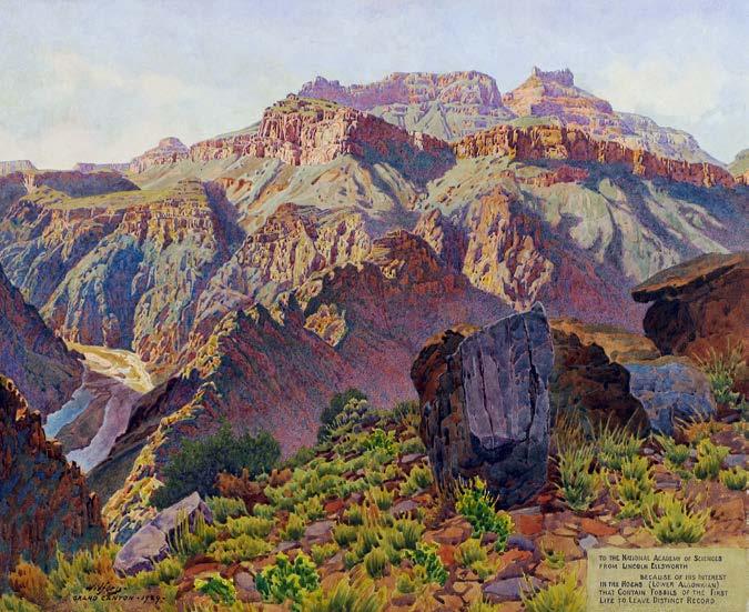
14th Annual Celebration of Art
G
unnar Widforss, known as “The Painter of the National Parks,” was a close friend of GCC founder Eddie McKee. Among numerous visits, 90 years ago in the winter of 1932, Widforss spent eight weeks at Phantom Ranch, painting masterpieces that celebrate Grand Canyon. That tradition of plein air painting lives on in GCC’s annual Celebration of Art, now in its 14th year. Join us in-person or online to view and purchase contemporary plein air art inspired by the canyon.
Plein Air at Grand Canyon Saturday, September 10–Friday, September 16, 2022 Gunnar Widforss, “The Grand Canyon,” 1929, watercolor on canvas board. Grand Canyon National Park, GRCA 13631 Photo by Terri Attridge.
Most artists prefer to paint in the morning and evening when the canyon is most vibrant. Various locations along the South Rim, Grand Canyon National Park
Artist Paint Out Friday, September 16, 2022 3:00 p.m.–7:00 p.m. Between Verkamp’s Visitor Center and Thunderbird Lodge, Grand Canyon National Park
Online Silent Auction September 2–17, 2022 A special online silent auction will feature pieces chosen by the artists. Silent auction winners will be announced Sunday, September 18.
Exhibition and Sale September 18, 2022–January 16, 2023 Kolb Studio and online at shop.grandcanyon.org
Please visit our website for information and updates at: https://www.grandcanyon.org/coa
31
CREATE A
GRAND LEGACY THROUGH PLANNED GIVING There’s no better time than now to consider a planned gift. Regardless of the size of your estate, you can make a significant impact.
How does it work?
•
Simply advise us you have designated a bequest gift made through a provision in your will or trust
•
Complete a beneficiary form to donate part or all of your unused retirement assets, such as a gift from your IRA, 401(k), 403(b), pension, or other tax-deferred plans
•
If you have a life insurance policy that has outlasted its original purpose, consider making a gift of your insurance policy
Join Bright Angel Circle today! Have you already included Grand Canyon Conservancy in your estate plans? If so, please let us know! By identifying yourself as a Bright Angel Circle member, you have the opportunity to inspire others. And you’ll receive exciting benefits that recognize the critical role you play in the park’s future, including: • Recognition in GCC’s Annual Report to donors • Your name on the Honor Wall at the Grand Canyon Visitor Center • Subscription to our printed magazine, Canyon Views, and monthly e-newsletters • Exclusive invitations to special events To learn more, visit https://grandcanyon.giftlegacy.com. GCC welcomes charitable gift plans in a variety of amounts. To discuss your vision for the future of Grand Canyon and how your gift may help, please contact Lynn Donahue at (928) 556-5298.
3 2 | C A N YO N V I E W S
Take the Trip of a Lifetime with Grand Canyon Conservancy’s Field Institute
T
he Grand Canyon Conservancy Field Institute (GCCFI) provides amazing immersive and educational adventures at Grand Canyon—all officially designed and developed in partnership with Grand Canyon National Park. Whether you’re looking for a day hike for your family, a once-in-alifetime backpacking trip, or an educational class on outdoor photography, the Field Institute has a variety of programs designed to inspire you above and below the rim of Grand Canyon. Upcoming trips include a river trip, rim-to-rim hikes, hikes along trails less-traveled (like Tanner and Grandview), and mule-assisted trips to the bottom of the canyon. We’ve also partnered with Sedona Arts Center to present “iPhoneography” classes, teaching participants to take professional quality photos with their iPhone. To learn more and to reserve your spot today, visit https://www.grandcanyon.org/classes-tours/ Photos courtesy NPS/Michael Quinn.
SHOP GRAND CANYON CONSERVANCY Shopping GCC’s stores supports Grand Canyon National Park, and GCC Members receive 15% off every purchase! Use promo code 15GCC22SP at checkout.
Grand Canyon Conservancy Bottle Sling $14 Hike smart, and carry your precious water hands free with this convenient and light weight bag. Carries most 12 oz.–64 oz. bottles. Made from 100% post-consumer recycled plastic bottles.
Grand Canyon Conservancy Clear Tritan™ Water Bottle $20 Durable Tritan™ material. Shatter, stain, and odor resistant. Stainless steel, screw-on, spill resistant lid with durable metal handle loop.
The Grand Canyon: Unseen Beauty: Running the Colorado River $50 This beautiful book captures exceptional photography work by Tom Blagden Jr. on his thrilling river raft through Grand Canyon with oarsman Roderick Nash. Explore the unique features of the canyon and be inspired to protect it for generations to come.
Grand Canyon Unisex Tee $30 Visualize the layers of Grand Canyon with this tee! Featuring a gorgeous design of Grand Canyon and the Colorado River on the back, it has a smaller one-color version of the same design on the front chest.
Grand Canyon Cap $25 Match your tee shirt and shade yourself from the sun with this unstructured, washed maroon cap, featuring a design of Grand Canyon and the Colorado River.
G R A N D C A N YO N C O N S E R VA N C Y P. O . B O X 3 9 9 , G R A N D C A N YO N , A Z 8 6 0 2 3 W E I N S P I R E G E N E R AT I O N S O F PA R K C H A M P I O N S T O C H E R I S H A N D S U P P O R T T H E N AT U R A L A N D C U LT U R A L W O N D E R O F G R A N D C A N YO N .
grandcanyon.org
I N S P I R E . E D U C AT E . P R O T E C T . | P L E A S E R E C YC L E