30 years of geospatial standards
ISO/TC 211 celebrates three decades of standardizing geographic information

How cloud computing enhances photogrammetry services
Preserving historic St. Peter’s Basilica with a digital twin
Data-gathering technology for asset monitoring
Empowering the geospatial community www.gim-international.com Issue 3 2024 Volume 38
Director Strategy & Business Development
Durk Haarsma
Financial Director Meine van der Bijl
Technical Editor Huibert-Jan Lekkerkerk
Contributing Editors Dr Rohan Bennett, Frédérique Coumans
Head of Content Wim van Wegen
Copy-editor Lynn Radford, Englishproof.nl
Marketing Advisors Myrthe van der Schuit, Peter Tapken
Circulation Manager Adrian Holland Design ZeeDesign, Witmarsum, www.zeedesign.nl
GIM International, one of the worldwide leading magazines in the geospatial industry, is published five times per year by Geomares. The magazine and related website and newsletter provide topical overviews and reports on the latest news, trends and developments in geomatics all around the world. GIM International is orientated towards a professional and managerial readership, those leading decision making, and has a worldwide circulation.
Subscriptions
GIM International is available five times per year on a subscription basis. Geospatial professionals can subscribe at any time via https://www.gim-international.com/subscribe/ print. Subscriptions will be automatically renewed upon expiry, unless Geomares receives written notification of cancellation at least 60 days before expiry date.
Advertisements
Information about advertising and deadlines are available in the Media Kit. For more information please contact our marketing advisor: myrthe.van.der.schuit@geomares.nl.
Editorial Contributions
All material submitted to Geomares and relating to GIM International will be treated as unconditionally assigned for publication under copyright subject to the editor’s unrestricted right to edit and offer editorial comment. Geomares assumes no responsibility for unsolicited material or for the accuracy of information thus received. Geomares assumes, in addition, no obligation to return material if not explicitly requested. Contributions must be sent for the attention of the head of content: wim.van.wegen@geomares.nl.


Interview with Neil Churman
Overseeing operational execution, organic growth, and mergers and acquisitions, Neil Churman is a key driving force behind Woolpert’s remarkable growth strategy and success. Recognizing Woolpert’s leading role in the geospatial field, GIM International sat down with him for an exclusive interview.

The value of accurate geospatial surveys
In today’s fast-paced world, companies procuring geospatial surveys can easily lose track of the correct survey methods, appropriate costs and the additional value of survey data, especially when faced with a wide range of quotes. Economic pressures have further driven the emphasis on selecting the cheapest survey option, often without considering the future consequences.

A revolution in structural monitoring
As infrastructure monitoring becomes more crucial, so too does the availability of appropriate technology. High-frequency automated data collection is the way forward. This article provides an overview of tilt sensors, vibration sensors, crack meters and other technologies that are revolutionizing the field of asset monitoring.


Cloud computing continues to boost photogrammetry services


Preserving St. Peter’s Basilica with a digital twin
A leading engineering firm embarked on a groundbreaking survey of St. Peter’s Basilica in Vatican City. Tasked with creating a digital twin of the iconic structure, the firm employed advanced geospatial techniques to capture every detail. This article explores the project’s blend of surveying technology and historical preservation.
Geomares
P.O. Box 112, 8530 AC Lemmer, The Netherlands
T: +31 (0) 514-56 18 54
F: +31 (0) 514-56 38 98 info@geomares.nl www.gim-international.com
No material may be reproduced in whole or in part without written permission of Geomares. Copyright © 2024, Geomares, The Netherlands All rights reserved. ISSN 1566-9076

Two decades ago, SimActive introduced a gamechanger in photogrammetry processing when it transformed methods from the video and gaming industry for use in the geoinformatics sector. Today, the company is still at the forefront of innovation, developing efficient ways to process remote sensing data into fit-for-use geospatial information.

A journey through the Dutch ‘Geospatial Valley’
Two members of the GIM International and Geo-matching team recently hit the road to explore an emerging hub of geospatial tech activity: the Dutch province of Groningen. There, they took a closer look at four different companies making waves at home and abroad, explains Wim van Wegen.


30 years of geospatial standards
ISO/TC 211 celebrates thirty years of standardizing geographic information. This article reflects on the changes over the past three decades, including the benefits of harmonization, the maturing of the standards development process, and the evolution of the outreach activities.

The impact of topobathymetric technologies in hydrography
This article explores the latest advancements in topobathymetric Lidar and sonar, highlighting their critical role in understanding and protecting our aquatic environments. From its origins to its future potential, we explore how Lidar technology illuminates the depths like never before. 12 31 18 35 23 42 28 45
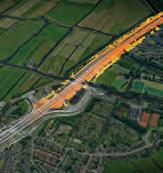
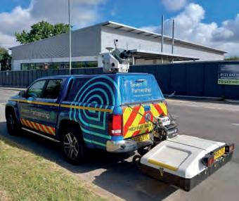
Cover story

On the front cover of this issue: A few years ago, Geomaat used its advanced mobile mapping system to scan the entire Amsterdam Ring Road (A10) in the Netherlands. Mounted on a vehicle with GPS, an IMU, a camera and two laser scanners, the system scanned the road and its surroundings, while in regular traffic, producing a highly detailed digital representation. This year, Geomaat is participating in another major infrastructure project: the construction of the new southern ring road in Groningen, a dynamic city in the north of the Netherlands. (Image courtesy: Geomaat).
3 Contents Issue 3 2024
5 Editorial 6 Headlines 11 Podcast 26 Report FIG Working Week 38 Report YellowScan LiDAR Convention 48 Report 128th OGC Member Meeting 52 Organizations
Empowering the geospatial community Volume 38 30 years of geospatial standards standardizing geographic information Preserving historic St. Peter’s Basilica with digital twin Data-gathering technology for asset monitoring How cloud computing enhances photogrammetry To subscribe to GIM International go to www.gim-international.com/subscribe


Travelling circus
Do you ever feel like you’re on a merry-go-round and want to get off it? I do! It has recently struck me that the geospatial industry is becoming something of a travelling circus. Since entering the geospatial industry in 2010, I have been on some fantastic business trips to numerous countries around the globe, and as a team we’ve physically represented GIM International on every continent (apart from Antarctica) – from Europe to North and South America, and from Australia to Africa. In May of this year, for example, our director of strategy & business development Durk Haarsma attended the FIG Working Week in Accra, the capital of Ghana. You can find his report on page 26 of this magazine. What particularly puzzles me is that everyone expected the COVID-19 years, in which we discovered just how much can actually be achieved online, to lead to a structural decline in the number of in-person events. But instead, the opposite seems to be happening: there are more and more live events being created!
Of course, visiting trade shows, conferences, and events organized by commercial partners – such as Trimble Dimensions in Las Vegas and the YellowScan Lidar Convention in France (see page 38) – is an excellent way for us to gain new insights, further expand our network and spot trends that will (or might) shape the industry. But at the same time, we must recognize the limitations, not least because we are mindful of our carbon footprint. We strive to make sustainable choices and travel by train rather than plane whenever possible, such as to Intergeo in Berlin in 2023 and Oceanology International in London earlier this year. Of
course, rail travel is not a viable alternative to flying when travelling overseas (and in terms of price and convenience, it still leads a lot to be desired within Europe, unfortunately!).
Additionally, our operational workload as publisher of not only GIM International, but also Hydro International and other titles, means it is simply not possible for us to spend the entire year travelling. One week at a trade fair in one part of the world, the next week at one in another, followed by a conference at yet another geographical location, and the backlog of calls to be made, emails to be answered and articles to be written, edited and designed soon mounts up. This is then made even more challenging by the cascade of out-of-office replies we receive from others who have similarly got caught up in the ‘travelling circus’!
I admit that I enjoy the international business travel that forms part of my role as head of content; I find it inspiring and stimulating to talk to geospatial professionals from around the world. I also admit that – despite all the options for video calls – nothing beats meeting people in real life. However, I think the time has come for some reflection. Are the reasons to be physically present at all those industry gatherings really so compelling? Or can we overcome our ‘fear of missing out’ (FOMO) and reduce the amount of travel we do? Personally, I intend to try to limit myself to six or seven carefully selected events per year from now on. And perhaps, after reading this, you’ll feel more empowered to get off the merry-go-round now and again too!
Wim van Wegen Head of content, GIM International wim.van.wegen@geomares.nl
Issue 3 2024 5 Editorial

Unrivaled UAV Imaging
Experience unrivaled image quality with Phase One, enhancing the productivity of your UAV inspection and surveying missions like never before. With our tailored UAV Payloads, capture every detail with precision and clarity, ensuring thorough assessments and streamlined workflows.

Elevate your operations to the next level with unparalleled image resolution and accuracy, empowering you to make informed decisions swiftly and confidently. Trust Phase One to deliver the exceptional quality you need for successful UAV missions, revolutionizing the way you approach inspections and surveys.

Intergeo 2024 puts UAV technology centre stage
Taking place in the southern German city of Stuttgart this September, Intergeo 2024 will showcase advancements in drone technology. As highlighted by the introduction of the ‘Unmanned Systems Stage’, the event promises to be a focal point for innovative developments in UAV technology. Themed ‘Everything that flies’, this year’s conference beckons attendees to delve into the realm of uncrewed aerial vehicles (UAVs) and glimpse the future firsthand. Drones, once the stuff of science fiction, are now transforming diverse sectors, from critical infrastructure inspections to urban logistics, and beyond. Curated by esteemed partners DVW (Society for Geodesy, Geoinformation, and Land Management), DGPF (German Society for Photogrammetry, Remote Sensing and Geoinformation) and UAV DACH eV, the Unmanned Systems event stands as an independent conference within Intergeo. It promises a dynamic platform for showcasing cutting-edge technologies, unveiling the latest workflows, and navigating the intricate legal landscape governing UAV operations.
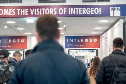
Intergeo serves as the gateway to the future of the drone market for geospatial professionals. (Image courtesy: Intergeo/Fokuspokus Media)

Inertial Labs partners with Sony for UAV-Lidar solution
Inertial Labs and Sony have joined forces to develop an advanced Lidar system tailored for Sony’s Airpeak drone. This collaboration aims to enhance drone capabilities in applications such as surveying, mapping and cinematic videography. By combining expertise in precision sensing and imaging technology, the partnership holds promise for enhancing efficiency and accuracy in aerial operations across various industries. The new Lidar system, drawing upon Inertial Labs’ expertise in sensor technology, aims to offer exceptional accuracy and detail in aerial mapping and 3D modelling. Teamed with Sony’s advanced drone technology, this collaboration is positioned to establish a significant standard in the industry. Designed with professionals in mind, this advanced Lidar system integrated into Sony’s Airpeak drone will significantly improve workflow efficiency and data accuracy, particularly Visit our website


The Lidar solution for Sony’s Airpeak drone also serves tunnel inspection purposes. (Image courtesy: Inertial Labs, Sony)
6 Issue 3 2024
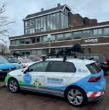
Topocart and Horus support digital georeferencing project in Brazil
Horus CityMapper is designed to help mapping companies capture and extract high-quality geospatial data seamlessly. (Image courtesy: Horus View and Explore)
Advanced coastal elevation model enhances vertical precision

Topocart has provided 360° terrestrial mobile mapping technology to support urban management in Brazil. The authorities of Maracanaú, a municipality in Ceará, have embarked on a comprehensive digital georeferencing project, which includes utilization of the advanced Horus CityMapper. The initiative is aimed at mapping 100% of the municipality’s territory. By leveraging innovative technology and strategic planning, Maracanaú is poised to become a model of modern urban management in Brazil, demonstrating the impactful use of digital mapping in enhancing public administration and community development. As part of the ‘Mapa de Maracanaú’ programme, Topocart is set to capture detailed aerial and ground-level images of the municipality by the end of this year. This includes utilizing helicopters for aerial views, and specialized vehicles equipped with advanced cameras for ground imaging. The project will encompass the entire road infrastructure, environmental resources, urban greenery, landscaping, public and urban buildings, and approximately 115,000 properties within Maracanaú. Topocart’s approach employs advanced 360° terrestrial mobile mapping technology. A vehicle outfitted with a high-end sensor captures georeferenced images in all directions. These images offer a complete view of the city’s infrastructure on a granular level, enabling public officials to effectively design and implement projects for maintenance, conservation and improvement. A key component of this project is the CityMapper mobile mapping solution, developed by Dutch company Horus. Designed with a modular approach and equipped with advanced features, the CityMapper is intended to revolutionize how mapping companies and asset managers capture and extract high-quality GIS data.
Emlid and Pix4D release mobile terrestrial scanning kit for faster data capture
Emlid, the manufacturer of Reach GNSS receivers, has launched the Pix4D & Emlid Scanning Kit. The kit combines advanced photogrammetry with RTK precision for quick data capture when documenting trenches and as-builts, performing volumetric measurements, and enriching aerial data with terrestrial scans. All this by using a smartphone, the PIX4Dcatch app and the Emlid Reach RX RTK rover. The newly released PIX4Dcatch app facilitates precise scanning for both photogrammetry and Lidar projects, while the hardware features the Emlid Reach RX RTK rover with an ergonomic handle. The Reach RX integrates seamlessly with PIX4Dcatch, offering real-time positioning via NTRIP. This integrated solution requires no additional setup or specialized surveying skills, making it accessible to anyone on the team for effective data collection. The versatile Pix4D & Emlid Scanning Kit proves invaluable across industries for applications such as underground
Scientists at Deltares have developed an impressive global coastal digital terrain model (DTM) at 1 arc-second (~30m) resolution. In their work, they extensively use elevation models as input for numerical models, but they noticed that current, freely available elevation models are not accurate enough for their purposes. The experts decided to create a new elevation model –DeltaDTM – making use of the latest remote sensing data. To model future extreme water levels due to sea-level rise, subsidence and the worsening of storm surges, high-accuracy elevation data (within 1m) for all coastal areas of the world is required. Local airborne Lidar data is sometimes used for this purpose, but is not available everywhere due to its costliness. In areas where this data is missing, for instance in southeast Asia, researchers fall back on global elevation models to assess coastal flood risk, among other factors. However, these models measure the upper part of canopy and buildings as well, and thus do not represent the bare earth and height everywhere. The differences between the model and terrain can be tens of metres for vegetated areas. The newly developed DeltaDTM is the first global coastal elevation model that has an accuracy within 1m, marking an important step in the usability of global elevation models to assess sea-level rise, for instance. Maarten Pronk, a PhD candidate at the Delft University of Technology and an elevation modelling expert at Deltares, was responsible for creating the model.
The newly developed DeltaDTM is the first global coastal elevation model that has an accuracy within 1m. (Image courtesy: Deltares)

utility documentation, construction inspection, volumetric measurements, crash reconstruction, and combined aerial and terrestrial surveys.

7 Headlines Issue 3 2024
with RTK precision for efficient data capture. (Image courtesy: Emlid)
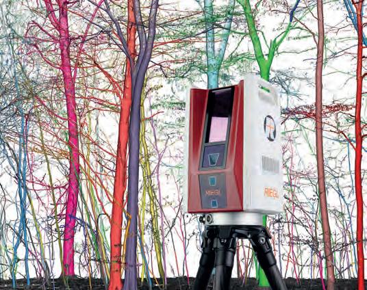

RIEGL LiDAR for high-precision measurement data in forestry
With the RIEGL VZ-600i 3D terrestrial laser scanner and the LIS TreeAnalyzer Plugin of RiSCAN PRO, measurement data at an unrivalled level of detail and accuracy is provided for a variety of forestry-relevant information:
•breast height diameter
•crown volume, tree metrics, tree height, crown coverage
•number of trees on specific areas
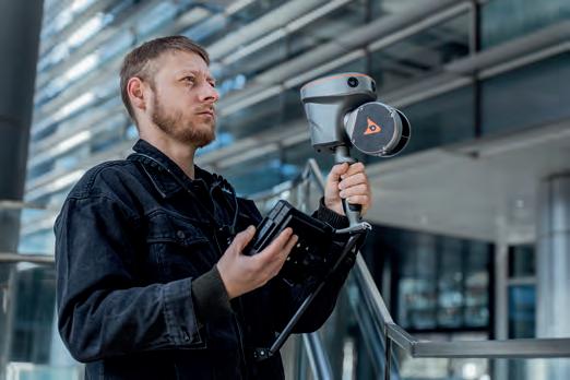
CHCNAV integrates handheld SLAM laser scanner with GNSS RTK


•single tree, stem and branch segmentation
•volume models for biomass measurements
•classification of single measurement points for applications like growth monitoring, tree height modeling, and underwood and deadfall visualization and calculation

Unlock the power of RIEGL LiDAR for your applications in forestry!


CHC Navigation (CHCNAV), a global leader in the geospatial industry, has launched the RS10 as an innovative and affordable handheld SLAM laser scanner integrated with an RTK GNSS receiver. Designed to improve efficiency across a wide range of mapping and surveying applications, the RS10 laser scanner provides professionals with a versatile, all-in-one tool for capturing rich 3D geospatial data in both outdoor and indoor environments. Combining a survey-grade GNSS RTK receiver with the handheld Lidar solution, the RS10 simplifies workflows without compromising accuracy or flexibility. The RS10 integrates a high-end GNSS smart antenna for RTK positioning accuracy even in challenging environments. Combined with the system’s high-precision Lidar and three HD cameras, it fuses RTK, laser and visual SLAM to deliver 5cm absolute measurement accuracy. From detailed architectural surveys to complex infrastructure projects, the RS10 gives professionals the tools they need to collect detailed, accurate data efficiently.

Geneq unveils advanced solution for GIS and survey field applications
Geneq has announced the introduction of SXblue GLOBE, representing a new step in innovation for GNSS positioning and GIS technology. Engineered to be employed in the most challenging field conditions, this new solution marks a new standard for performance, efficiency and reliability. With a broad array of features, SXblue GLOBE is presented as a testament to Geneq’s commitment to pushing the boundaries of technological advancement. Carrying a 448-channel GNSS board, SXblue GLOBE ensures high-level accuracy and integrity in positioning, also in highly demanding environments. One of GLOBE’s standout features is its technologies for multipath mitigation, reducing the effects of signal reflection and ensuring the integrity of positioning service. Furthermore, SXblue GLOBE incorporates an advanced anti-jamming and interference monitoring system, safeguarding against disruptions and ensuring uninterrupted operation in any scenario.

Geospatial professionals can now experience the enhanced performance and reliability of the SXblue GLOBE receiver.
(Image courtesy: Geneq)

8 Issue 3 2024 Headlines
Kentucky partners with NV5 for largest contiguous oblique imagery
collection in USA
NV5, a leading provider of geospatial software and services, has recently completed the largest single oblique imagery collection in the USA for the Commonwealth of Kentucky. Spanning roughly 100,000 square kilometres and offering rich detail at three-inch (approx. 7.5cm) scale, the project is part of the KyFromAbove initiative, which makes high-resolution imagery and geospatial data publicly available. “Working with NV5, we are democratizing access to information that has a real bearing on each Kentuckian’s quality of life. This new imagery will enhance public safety, economic development, infrastructure planning, property assessment and other critical efforts across every corner of the Commonwealth,” said Kent Anness, Kentucky’s geographic information officer. “Some Kentucky counties can afford to acquire their own oblique imagery, but many don’t have the resources to do so. This important investment will pay vast dividends by reducing duplicative spending and providing a seamless basemap for everyone. As a result, all communities, regardless of their population or tax base, will have access to the same level of data. Open access to the oblique imagery will finally level the playing field.”


Smart
Airbus expands EO constellation with Pléiades Neo Next
Airbus has launched the Pléiades Neo Next programme to expand its very high-resolution Earth observation constellation. This new programme will introduce new satellite assets and capabilities, including enhanced native resolution. As the first step for Pléiades Neo Next, Airbus is developing a new satellite that will be launched in the next few years. “The Pléiades Neo Next programme builds on the success of our existing Pléiades Neo constellation which serves government and commercial customers around the world,” said Karen Florschütz, executive vice president Connected Intelligence at Airbus Defence and Space. “This new programme will further enhance our standard of excellence in terms of quality, performance and reliability to deliver images as well as geointelligence services and applications.” The Pléiades Neo Next programme is funded, manufactured and operated by Airbus Defence and Space, with the full image capacity available for a wide range of sectors including defence and intelligence, agriculture, environment, maritime, disaster response, mapping, location-based services, civil engineering, urban planning and utilities.


Delta and Cyvl.ai partner up to offer innovative
mapping solutions
Smart Delta has entered into partnership with Cyvl.ai, combining mobile mapping experience with artificial intelligence (AI) expertise. Smart Delta views this step as a powerful new opportunity to address challenges and discover innovative solutions for both Smart Delta and Cyvl.ai clients. Smart Delta’s collaboration with Cyvl.ai opens the door to a new era of possibilities through the integration of AI technologies. Cyvl.ai, headquartered in Boston, USA, brings profound AI expertise and innovation to this partnership. By joining forces, Smart Delta and Cyvl.ai can collectively address a wide range of issues and offer unique solutions that increase efficiency and improve decision-making. Cyvl.ai specializes in infrastructure mapping and is known for its algorithm that can be applied for a broad range of applications. These include pavement condition assessments, traffic sign inventories, detecting right-of-way assets, 360° street-view imagery, Lidar scanning of the built environment, and tree inventories. Smart Delta specializes in sensor fusion to provide a comprehensive understanding of environments or systems. This technology is applicable in autonomous vehicles, drones, military operations, surveillance systems and more. By integrating and analysing data from different sensors, companies like Smart Delta can offer valuable insights for decision-making, risk reduction and performance improvement.

9 Headlines Issue 3 2024
The SmartPano 360° camera represents one of Smart Delta’s mobile mapping innovations. (Image courtesy: Smart Delta)
Pléiades Neo satellite image showing the Eiffel Tower in Paris (Image courtesy: Airbus)
publicly. (Image courtesy: NV5)

Did you know that it’s 10 years since Geo-matching was launched, as the world’s first product comparison website for surveying and mapping products? The platform was specially developed to provide industry professionals with an easy overview of products in the market, enabling them to compare specifications and contact manufacturers directly.
Since its inception a decade ago, Geo-matching has been visited by more than a million visitors from all over the world, and has been used to request more than 50,000 quotations. Today, with more than 1,200 product manufacturers and over 5,000 products, it continues to raise awareness and drive adoption of geospatial technology and solutions.
We would like to thank all our users and premium company members for their ongoing support, and we look forward to supporting the industry for many years to come!
GIM International launches exclusive podcast series in partnership with Mapping the Conversations
GIM International is proud to announce the launch of its new podcast series in partnership with geospatial scientist, author and entrepreneur Valrie Grant of Mapping the Conversations. Twice a month, she will produce exclusive episodes for GIM International that explore the crucial role of the geospatial sector in safeguarding the future of our planet.
‘Mapping the Conversations’ shines the spotlight on the intersection of geospatial technology with the delicate balance on planet Earth in the face of today’s and tomorrow’s societal challenges. In each episode, Grant takes listeners on an exhilarating journey, guiding them through the intricacies of location intelligence and data-driven insights to shape the future.
Avant-garde geospatial insights
This partnership marks an exciting collaboration between GIM International, a leading media platform in the geospatial industry, and Grant, who has emerged as a pioneering voice in exploring the applications and implications of geospatial technology.
“It is an honour to bring Valrie Grant’s insightful podcasts to our audience,” says Durk Haarsma, director of strategy & business development at Geomares, the publisher of GIM International “Her expertise and passion for the connection between geospatial technology and environmental sustainability align perfectly with our commitment to providing avant-garde insights to professionals in our field.”
Valrie Grant, the driving force behind Mapping the Conversations, expresses her enthusiasm for the partnership: “It is an excellent opportunity to collaborate with GIM International in sharing the transformative potential of geospatial technology with a wide audience across the globe. Together, we can inspire meaningful dialogue and drive positive change in how we perceive and interact with our planet. GIM International provides an excellent platform for this endeavour.” In each episode, Grant will delve into the untapped opportunities and challenges in harnessing geospatial technology for a sustainable future. Listeners can look forward to engaging discussions, expert interviews and thought-provoking insights on topics ranging from urban planning and disaster management, to biodiversity conservation and climate resilience.
The podcast series is available on the GIM International website and various podcast platforms. Two new episodes will be released per month.

Issue 3 2024 11
Valrie Grant, the driving force behind Mapping the Conversations.
More information gim-international.com/mapping-the-conversations
Screenshot of the podcast section on the GIM International website.
Interview with Neil Churman, president of Woolpert
The role of geospatial solutions, AI and talent acquisition in mapping tomorrow
By Wim van Wegen, GIM International
Overseeing operational execution, organic growth, and mergers and acquisitions, Neil Churman is a key driving force behind Woolpert’s remarkable growth strategy and success. Recognizing Woolpert’s leading role in the geospatial field, GIM International sat down with him for an exclusive interview to hear about his background and gain insights into his vision for the future.
You graduated in civil and environmental engineering. How does your educational background inform your leadership as president of Woolpert?
My undergraduate education in civil engineering at the University of Pittsburgh provided me with a fundamental understanding of how critical infrastructure projects are designed and constructed. Even more importantly, it equipped me with problem-solving, critical-
thinking and analytical skills that translate to the opportunities and challenges we address every day at Woolpert. The connection, coordination and collaboration between engineers, architects and geospatial professionals has been at the core of countless projects. My background has provided me with a tremendous foundation to support our operations and has given me a unique appreciation for what our team does to deliver for our clients every day.

Issue 3 2024 12
Woolpert defines itself not only as an architecture, engineering and geospatial (AEG) company, but also as a strategic consulting firm. How do these various disciplines and skillsets intersect to create value within the company?
Our integrated architecture, engineering and geospatial (AEG) model is what allows us to provide value in response to our clients’ most important challenges thanks to connectivity across our teams. For example, we’re positioned to work with clients to assess conditions and create a capital plan, map and model existing conditions on a highly accurate basis, and masterplan a project on the front end. We subsequently deliver architectural and engineering designs supported by world-class survey, geomatics and monitoring solutions. And then we work with them to document as-built conditions and employ and manage an asset management plan. Our integrated approach is well-suited to address clients’ needs in an environment where cost, complexity and aging infrastructure continue to grow across all of the sectors we serve.
How would you describe the present state of the geospatial industry?
Our industry could not be better positioned for the future. The need is growing every day to not only capture data on a more accurate and detailed basis, but also to turn that data into useful information. Our clients are clearly seeing the value geospatial certainty brings to their projects and programmes, and they are looking to us to provide them with better insights and tools to execute. Being progressive is one of our core values at Woolpert, and our teams embody that in the innovative work they are doing. I think we are going to continue to see geospatial requirements advance globally. Some areas of the world are more advanced than others with respect to codes and standards but, ultimately, I believe we are on a path towards fully and accurately digitizing our world.
What major progress has been made in recent years regarding the collection, analysis and processing of geodetic data, and what developments are yet to come?
I work closely with our R&D teams on a regular basis across hardware, software and workflows. Based on the advancements they are making, I see major progress in the entire value chain. For example, our teams are able to collect aerial Lidar data with higher point density flying at 10,000 feet (approx. 3,000 metres, Ed.) than we could at half that elevation just a few years ago. We’ve also been able to develop tools to collect both topographic and bathymetric data on a single flight, which gives clients greater insights into accurate conditions in a coastal environment. Additionally, we’re seeing vast improvements as we leverage artificial intelligence and other forms of machine learning, cloud computing and enhanced workflows to move from just a point cloud to an accurately referenced model of conditions with extracted features of interest. I believe that we’ll continue to see improvements in the accuracy of collection, but I see the next breakthroughs being in the analysis of geospatial information to provide automated insights and decision support tools.
Companies within the geospatial industry, such as surveyors and engineering firms, seek to secure a strong foothold in the swiftly evolving market by investing in both resources and talent. What are the primary challenges?
Both resources and talent are key to advancing our growth, and it’s our continued strong performance at Woolpert that allows us to invest in both areas. We are very focused on ensuring we have top talent that we’re providing with the best tools for the job. One of the biggest challenges is to ensure we have an adequate pipeline of trained graduates to come and develop their careers with us. We’ve
Issue 3 2024 13 Interview
put in place a number of initiatives to foster partnerships with top technical schools, colleges and universities, as well as our internship programme, to enable students entering our field to gain great experience and the skills necessary to build a career with us. It’s important that we have a strong network of educational institutions teaching these skills, particularly in areas like surveying, hydrography, GIS and other core geospatial disciplines.
Woolpert recently acquired Murphy Geospatial, a multidisciplinary geospatial solutions company headquartered in Ireland. What were the underlying strategic objectives of this acquisition?
Bringing industry-leading teams to Woolpert is key to our growth strategy, and Murphy Geospatial absolutely brings us that in Ireland, the UK and increasingly in mainland Europe too. With its broad range of geospatial solutions across infrastructure, manufacturing, property, energy, utilities and natural environment projects, Murphy Geospatial provides us with a platform for further growth in Europe, as well as new offerings that we can leverage in other regions. It also give us a great portfolio of project experience, including its work on High Speed 2, which is one of Europe’s largest infrastructure projects. More importantly, Murphy Geospatial is a great fit for our culture. We see an extremely bright future ahead with the team as part of Woolpert.
Woolpert operates on a global scale. How does your company handle cultural nuances and cater to an international array of client needs?
We’ve grown from a largely US-based firm just a few years ago to now operating across five continents, each with their own unique nuances. We look to set overarching approaches towards quality, delivery, best practices and satisfaction that set the foundation for serving our clients. We then enable our teams to tailor those to the needs of our clients across the globe. Additionally, our company’s core values guide how we work with our clients and each other across Woolpert. Ultimately, our teams have many differences in their backgrounds, experiences and the cultures in which they live. But at

the same time, we are connected by our commitment to serving our clients with energy and integrity, and supporting one another around the globe.
What types of survey projects will be crucial for your organization in the upcoming years, and how does this compare to previous years?
Survey has been part of the backbone of Woolpert for more than a hundred years, and we now have surveyors in North America, Africa, Europe, Australia and the Asia-Pacific region. We’re anticipating a continued need for aerial survey, mobile mapping and traditional survey and geomatics across critical end markets. Climate change, the energy transition, aging infrastructure and resilience are all driving more need and opportunity than we’ve seen in the past. We’re also seeing clients wanting their data to be both more accurate and accessible to them on shorter timelines, as well as wanting to see data in multiple formats, such as both Lidar and imagery in higher resolutions.
Artificial intelligence (AI) appears positioned to catalyse remarkable advancements across various sectors of life and business. To what extent has Woolpert already integrated AI and other forms of machine learning (ML) into its operations?
AI is a key tool in our toolbox to ensure fast yet accurate delivery, and something we are continually investing in. We have a number of AI/ML efforts across the company which are focused on allowing us to increase the amount we can do for clients faster and more accurately with our existing teams. We see it as augmenting our talented workforce. Notably, we entered into a strategic agreement with Allvision in autumn 2023 to gain an exclusive licence to their AI/ ML technology for Lidar processing, as well as to have members of their incredibly talented team join Woolpert. We are just scratching the surface of what AI/ML can do for us and the industry as a whole, but we need to remain cognisant that it’s our people that will advance us, not technology alone.
Looking further into the future, could surveyors potentially be replaced by robotics and AI in the next 10 or 20 years?
As just mentioned, AI/ML will absolutely perform aspects of our work. But will it be able to fully replace surveyors within that timeline?
I don’t believe so. Surveying requires experience, professional judgment and problem-solving skills that will remain critical. My view is that AI/ML is going to make surveyors’ lives easier for rudimentary and repeatable tasks, but ultimately it will be people who drive the continued evolution of our industry. I see it as being able to help our teams elevate their skills and roles in the company, while AI/ML will give them more time to focus on quality, novel solutions and strategy to give our clients the best possible solutions for their needs.
The surveying profession faces a significant challenge in attracting new students to relevant education, and skilled professionals into the industry. Which strategies do you believe could effectively tackle this issue?
I think showing incoming students the importance of our work, as well as some of the amazing and critical projects we work on, will help us attract them to the industry. We also see lots of talent coming from non-traditional backgrounds – data and computer science, engineering or other STEM (science, technology, engineering and
Issue 3 2024 14
At the helm of Woolpert as president, Neil Churman spearheads the company’s impressive growth strategy.
mathematics, Ed.) backgrounds – who are making the connection between their skills and the importance of geospatial data. Our responsibility – both as a company and as an industry – is to provide a path for personal and professional development, career growth and job satisfaction for these individuals so that they choose to bring their skills and talents to our industry. We have a big focus on that here at Woolpert and have been certified as a Great Place to Work, which is a testament to our employees seeing the value in building their future with us. We are always looking for talented, passionate professionals to join our team and believe there is a great opportunity for employees to grow with us as we grow as a company.
Do you have any concluding thoughts or insights you would like to share with our readers?
I think that the industry and Woolpert are on a great trajectory, and the opportunities for us are going to grow exponentially in the next few years. At the same time, we need to ensure we stay grounded and remind ourselves that it’s people, trained as part of a long tradition of great surveyors and geospatial professionals, that are going to carry us forward. No software or hardware is going to be able to replace listening to our customers and solving their challenges. It’s so important that we continue to show the value of what we do to the world, so the world values what we do. If we can do that, we’re going to create a virtuous cycle that carries the industry into the next generation of geospatial leaders.
About Neil Churman

Neil Churman serves as president of Woolpert, driving the development and execution of the company’s growth strategy. Leading the company’s business sectors, he oversees operational execution, organic growth, and mergers and acquisitions. Previously, Neil served as Woolpert’s chief corporate development officer, spearheading the identification, execution and integration of the company’s acquisitions. He holds an MBA from Carnegie Mellon University and a bachelor’s degree in civil and environmental engineering from the University of Pittsburgh, USA.


Issue 3 2024 15 Interview
Unlocking success in utility detection and mapping
By Matthias Twardzik
Utility detection and mapping offer surveying companies new opportunities to diversify and secure business growth in today’s ever-advancing geospatial landscape. This article charts a three-staged pathway into utility detection and mapping using illustrative examples from companies worldwide.
The field of surveying is always advancing, with the advent of new techniques and technologies emerging to produce better, faster and more accurate results. Among these, ground penetrating radar (GPR) brings a revolution by providing detailed information about underground infrastructures, ensuring safer excavation and preventing accidental damage. As such, utility detection and mapping have emerged as a dynamic area of opportunity for surveyors looking to broaden their service portfolios, boost their competitiveness, and tap into new revenue streams. They can move into utility detection and mapping by following the three-staged pathway outlined below.
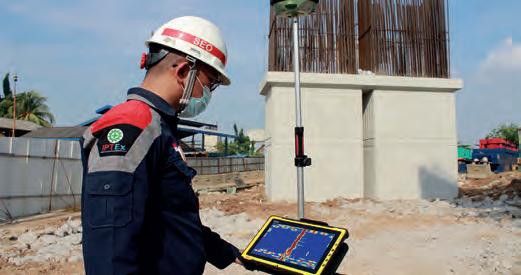
Stage 1: Entry-level solution for utility detection and mapping
The Leica DSX is an ideal entry point into utility detection with its user-friendly interface, automatic data analysis, and fast production of 3D utility maps. DSX integrates with the GNSS antenna to accurately position underground utilities. The immediate 2D/3D maps and highresolution detection results streamline on-site tasks, aid in professional reporting, and help designate secure zones to avoid damage.
Real-time utility detection for Indonesian infrastructure
As a testament to the efficiency of the Leica DSX, Waskita Karya, a leading Indonesian state company, successfully integrated it into its workflow during the construction of the Becakayu Elevated Highway. This tool enabled real-time, accurate detection of buried utilities like gas pipes and electric cables, thus facilitating safer construction and pillar placement. Additionally, the solution was easy to operate, requiring minimal staff training. As a result, the Leica DSX enabled
safer construction practices and improved project efficiency, resulting in substantial time and cost savings.
JWC’s path to safer excavations
J. Wilson Contractors Ltd (JWC) diversified its service offerings using the Leica DSX. With the DSX, JWC can detect previously untraceable materials and provide clients with exact locations and depths. This technology allows JWC to offer detailed surveys to its clients and conduct safer excavations, thereby enhancing its service offerings. DSX implementation has contributed to increased interest and orders for the company.
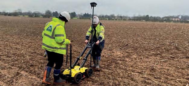
Stage 2: Growing with multichannel GPR for underground 3D mapping
As surveyors delve deeper into utility detection and mapping, multichannel GPR comes into play. Stream DP by IDS GeoRadar, a multichannel GPR solution for underground surveys, utilizes Equalized Scrambled Technology (EsT) to detect deep underground features and create exclusion zones for individual utilities. Its integration of 3D maps into machine control systems allows for precise operations and enhanced safety. Given its high productivity, efficiency and ease of use, it empowers surveyors with a competitive edge in the rapidly growing utility detection market.
Underground mapping across DACH region
Specializing in underground utility detection, SUBTERRA GMBH successfully employed Stream DP for several projects across Germany,
16 Issue 3 2024
Leica DSX in action on the Becakayu Elevated Highway project, providing real-time utility detection to improve safety and increase construction efficiency.
Leica DSX in use providing JWC with detailed, accurate 3D utility mapping to ensure safe and efficient excavations.
Austria and Switzerland. This allowed for precise mapping of underground lines, aiding the installation of fibre optic networks and transformers, and the drilling of cores in a Berlin petrol station. This technology resulted in cost savings, worker safety and efficient, non-invasive underground mapping across various terrains.
Railway underground surveys made simple In a challenging rail survey project, Boviar, an Italian engineering company, used Stream DP to effectively navigate rugged terrain, achieving up to 60% greater depth penetration than its competitors. The system’s integration with IQMaps enabled the creation of detailed, accurate 3D maps, underscoring the efficacy of GPR in rail infrastructure management. Stream DP’s lightweight design, quick setup and low energy consumption ensured optimal performance in challenging conditions.
Stage 3: Scale up with above and belowground utility mapping solution
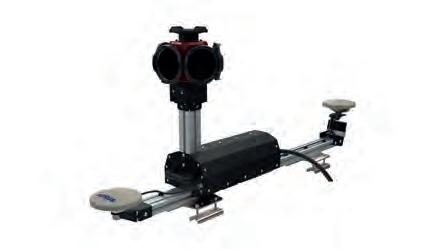
The transition to Stage 3 represents the expansion to above and below-ground utility mapping. IDS GeoRadar’s Stream UP is a handy solution designed for largescale utility mapping. This vehicle-mounted solution features a lightweight, easy-toassemble design, making it convenient
for transportation. It integrates a multifrequency, multi-channel, double-polarized sensor that enables seamless coverage of extensive regions. Stream UP combines with Leica Pegasus TRK mobile mapping systems for synchronized GPR, Lidar and camera intelligence data acquisition, facilitating large-scale infrastructure measurement and creating digital twins for above and belowground geospatial assets.
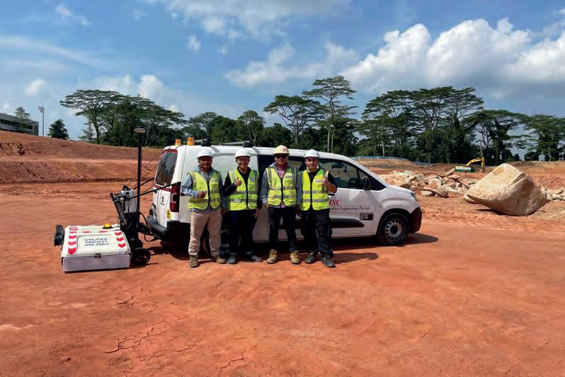
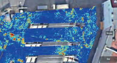
New standards in safety and efficiency in Singapore’s pipeline projects HSC Pipeline Engineering Pte Ltd adopted the lightweight Stream UP system for its pipeline projects. This system provides an accurate 3D view of subsurface utilities without disrupting city traffic. Unlike traditional trench surveys, which only cover 3.3% of the survey area, Stream UP has enabled HSC to cover 100% of the intended area without excavation. This implementation of Stream UP has resulted in significant cost savings, increased productivity and enhanced safety standards in Singapore’s utility mapping and detection services.
Maximizing ROI through GPR and mobile mapping
Through the adoption of tools like Stream UP and Leica Pegasus:Two Ultimate, Severn Partnerships – a long-established geospatial company – elevated its market standing, service precision and efficiency. The company exponentially enhanced its data collection, processing and delivery capabilities, attracting new clients and enabling a dynamic service offering with both simple 2D and sophisticated 3D deliverables. Within seven to eight months, Severn Partnerships secured contracts worth hundreds of thousands of pounds and covered the initial costs, after which it could start maximizing the return on investment (ROI). This technological transition diversified
the company’s clientele and expanded project opportunities beyond traditional surveying to include civil engineering, construction work and novel projects, such as scanning racetracks for Formula E.
The evolutionary journey of utility detection and mapping
Embracing change and innovation in surveying – through entry-level solutions like Leica DSX, multi-channel solutions like Stream DP, and advanced systems like Stream UP coupled with Pegasus TRK –paves the way for safer, faster and more precise utility detection and mapping. Realworld examples from Waskita Karya, JWC, SUBTERRA GMBH and Severn Partnerships are a testament to GPR’s transformative potential. As such, utility detection and mapping emerge as a promising domain for surveyors, unfolding opportunities for service diversification, competitiveness and new revenue streams.
Download the Growth Guide and visit the Leica Geosystems website to harness these game-changing technologies and redefine industry benchmarks for precision, efficiency and safety.


Director Hexagon Detection at Hexagon Geosystems
Sponsored article 17 Issue 3 2024
Matthias Twardzik
Stream UP, operated by HSC, facilitates fast and efficient mapping of underground utilities amidst dense urban conditions.
SUBTERRA GMBH used IQMaps software to conduct non-invasive, detailed underground utility mapping at a Berlin petrol station.
Severn Partnerships quickly maximized its ROI with Stream UP and Leica Pegasus:Two Ultimate.
An overview of data-gathering technology for infrastructure
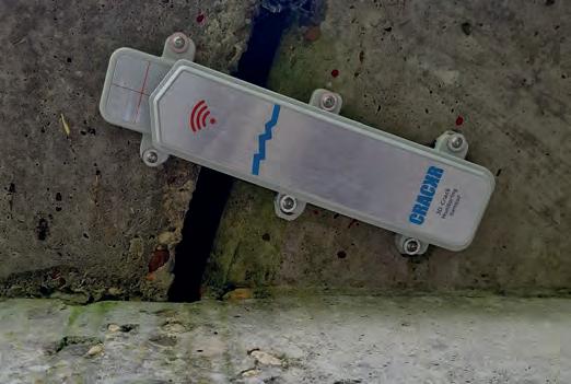
A revolution in structural monitoring
By Lars Langhorst, Sweco
As infrastructure monitoring becomes more crucial, so too does the availability of appropriate technology. High-frequency automated data collection is the way forward. This article provides an overview of tilt sensors, vibration sensors, crack meters and other technologies that are revolutionizing the field of asset monitoring.
In this day and age, data is the key to automated insights and predictive maintenance. Using structural knowledge, the right set of data can tell an engineer whether a bridge is healthy, or at the point of collapse. Continuous monitoring provides a constant check on the critical components of a structure, and serves as an early warning system. An early warning system can function on different levels: as part of a direct fail system by monitoring for a crack in a girder, for example, or as part of predictive maintenance by monitoring for things like vibrations and tilt to recognize the subtle behavioural changes of an asset over time. In both cases, the ultimate goal of an early warning system is to guarantee the safety of the public, while extending the operational life of the assets in the infrastructure.
Total stations
Traditionally, monitoring of civil structures is done through manual inspections, as well as surveys using total stations. Total stations are a staple in the surveying industry. As these surveys are focused on deformations of determined points over a long period of time with large distances between measure points, they are fundamentally distinctive from laser scans or photogrammetric models.
Total stations face several challenges when applied for structural
health monitoring. For a total station setup to work effectively, a clear line of sight is required. This is a challenge in many environments like tunnels, as well as underneath or inside large concrete bridges. Total stations as well as the (permanently installed) prisms need to be clear of dust, dirt, snow and ice in order to get a clear reading. This is especially problematic in tunnels, where prisms often get dirty and measurements become unusable. When using total stations for monitoring the structural health of a structure in (semi) critical condition, the total stations are often permanently installed as an early warning system to obtain continuous data. The frequency of measuring depends on the amount of measure points per cycle, but is often set at approximately 1 cycle every 15 minutes. In most civil structure environments, total stations have a maximum measure distance of 200m due to obstructions and to uphold the required accuracy. The measurement accuracy is generally around 1mm, but due to the large amount of measurements done, this can be substantially improved mathematically.
Alternative solutions
To gain thorough insight into the structural health of civil structures and guarantee safety for users, two things play a crucial role: structural knowledge of the asset, and obtaining the right data for
Issue 3 2024 18
Figure 1: Manual surveys not only take time, but also bring an element of risk, such as in the New NY Bridge project above the Hudson River. (Image courtesy: New York State Thruway Authority)
Figure 2: Cracks are common in tunnels, but tunnel closures are very costly. Early warning systems are applied to save money and time, while keeping the tunnel operational in a responsible manner. (Image courtesy: StabiAlert)
Tilt sensor type Accuracy Frequency range
Ball-in-cage tilt switches
Force balance sensors
Solid state sensors (MEMs)
Electrolytic tilt sensors
Capacitive tilt sensors
Moderate
High
Good
Extremely accurate for pitch and roll measurements
Good
data-driven decision-making. Knowing the structural weaknesses of a bridge, for example, allows an engineer to place dedicated sensors and gather high-frequency and high-accuracy measurements, providing insights about the structural health. Some of today’s technologies, and their benefits versus traditional surveying, are listed below.
Tilt sensing: Tilt sensors measure the inclination relative to gravity. These sensors are often compact and robust, and can provide valuable information about the movements of a structure or its individual components. These sensors are highly useful when lineof-sight is obstructed, or the environment is dusty and total stations are not an ideal option. The sensors can be placed almost anywhere, and can be applied to monitor relative movements within a structure such as a bridge. Their real-time monitoring capability makes them ideal for early warning systems, specifically when paired with assisting systems like total stations or crack meters to validate any passed thresholds. Tilt sensors can vary widely in their specifications, but high-precision models may offer accuracy within arc seconds (0.005° or better). These sensors, often accelerometers and gyroscopes, mostly use micro-electromechanical systems (MEMS) technology. MEMS provides continuous data with frequencies up to several kHz.
Low to moderate
Wide (DC to high frequency)
Moderate to high
Moderate to high
Moderate to high
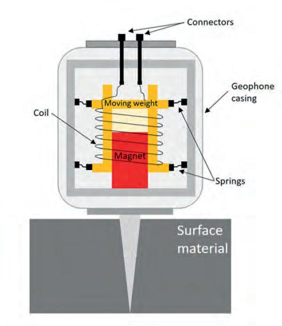
Geophones utilize an old but proven technology that is still used today due to its reliability and accuracy. (Image courtesy: StabiAlert)
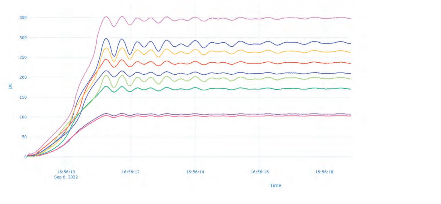
Crack meters: Crack meters are designed to monitor the opening and closing of cracks in structures. They are often used to detect movement across a crack and can be crucial in determining the structural health of concrete and masonry. Crack meters are available in both mechanical and electronic forms, with various measurement ranges and accuracies, measuring in either 1D or 3D. 1D crack meters can obtain far higher accuracies, working with technologies
such as vibrating wires being able to measure up to 1/1,000mm with 100Hz. The choice of sampling frequency depends on the expected rate of crack propagation and the need for data resolution. Lower sampling rates provide the benefit of sensors working solely on battery power. However, when the goal is to gain accurate insight into the structures movement and behaviour (e.g. the reaction of a bridge when a large lorry passes over it), high frequency can show the vibrations in the structure and provide the extra insight the structural engineer may require.
Vibration sensors: Besides having the potential to result in structural damage, vibrations are key to understanding the dynamic behaviour of structures such as bridges or high-rise buildings. There are two main technologies used in vibration sensor technology: accelerometers and geophones. Accelerometers can detect accelerations from micrometres per second upwards, and ranges above 1,000Hz. Piezoelectric, capacitive and MEMS are the most common technologies used in modern high-precision vibration sensors. Geophones consist of a coil of wire suspended within a magnetic field. When ground vibrations occur, the coil moves relative to the magnetic field, inducing an electrical current in the wire. Geophones are intrinsically simple in design, and relatively cost effective compared to accelerometers. When detection of low frequencies is key, geophones may be a suitable sensor choice.
Fibre optic sensors: Fibre optic sensors are an extremely versatile tool that can be applied in many different use cases, but most commonly they are used to measure a combination of temperature
Issue 3 2024 19 Feature
Table 1: Comparison of tilt sensor technology.
Figure 3: This is a 3D crack meter produced by StabiAlert, designed for durability, an accuracy of less than 0.1mm in all directions, and longlasting battery life. (Image courtesy: Guideline Geo)
Figure 4:
5: Fibre optic sensors installed in the length of a bridge deck. Strain in the bridge deck can be pinpointed and traced to certain events, such as opening and closing.
and strain. Contrary to other monitoring systems, modern structures often have fibre optic sensors embedded within them. In addition to providing a unique sensing capability, this also protects the sensor fibre from the outside environment. Fibres can also be installed on existing structures, either cut and glued into the structure, or on top with a supporting frame. Fibre optic sensors are immune to electromagnetic interference, offer high sensitivity, require minimal maintenance, and can be interrogated at will. This means that while the fibre installation may be permanent, the surrounding hardware can be replaced and monitoring installations altered. Fibre optic sensors such as Fiber Bragg Grating (FBG) sensors provide strain measurements with high accuracy, often within the range of ±10 microstrain or better, which can translate to 1/1,000mm. In certain scenarios (see Figure 5), the measured frequency is more than 100Hz. In combination with other sources of data, such detailed information at various points in or along a structure can provide valuable insights into structural behaviour for engineers.
Point clouds: Laser scans and photogrammetry are amongst the most common methods for obtaining point clouds. Laser scanners can achieve accuracies at levels ranging from a
Advantages of point cloud data
Highly efficient data collection
Requires less emphasis on position and angle
Raw data can be used for re-computation with improved/newer software and models, for better results
Large surface areas can be covered in scans
Can capture harder-to-reach targets and large surface areas
Disadvantages of point cloud data
Large amount of redundant data
Highly dependent on weather conditions
Classification of data dependent on processing software/methodology
Scan quality is easily affected by operator or other external influences
Single target focus is limited
Table 2: Advantages and disadvantages of point cloud data in infrastructure when using methods like Lidar scans and photogrammetry.
few millimetres to sub-millimetre, with the ability to capture hundreds of thousands and sometimes millions of points per second. This creates dense point clouds that accurately represent the surveyed structure. The range of these scanners can
Automated damage
detection using photogrammetric point clouds can greatly enhance the efficiency of human inspectors
extend from a few metres up to several hundred metres, depending on the device. Common technologies include phase-based, time-of-flight, and more. Although point clouds can provide a highly detailed view of the surroundings, the measurement is fundamentally different from surveying.
Issue 3 2024 20
Figure
Besides advantages, there are currently some disadvantages associated with point clouds (see Table 2). However, with the continued growth of big data and the ongoing advancement of artificial intelligence (AI) and technology in general, the future is bright for point clouds in infrastructure surveys. Large amounts of information can be processed faster than ever, and with more accurate analysis. Tools like automated damage detection in concrete combined with photogrammetric point clouds can greatly improve the efficiency and effectiveness of human inspectors.
Conclusion
Traditional surveying with total stations will likely remain a staple in the industry as it is flexible, cost-friendly and accurate. W hen high-frequency data is required, however, the alternative options have to be considered. Although they are a fine solution in many cases, total stations are often a fish out of water when perform ing continuous measurements. Equipment gets dirty, and moving parts break or can even get stolen. When structural knowledge is combined with the aim of data collection, dedicated robust and cheap sensors can collect high-frequency measurements. As the amount of data itself grows, the gathered data becomes more valuable, and the technology to process it improves, these types of big data collection methods could help surveyors to get the best of both worlds if they focus on selecting the right tool for the right job and leveraging each approach where it suits best.
About the author

Lars Langhorst (MSc) has a background in geomatics, and is now focusing on digitalization in the world of asset monitoring. At Sweco, Lars is working on digital solutions for the surveying industry, aimed at using data to help engineers make every decision a data-driven decision.
Further reading
The New NY Bridge project: https://www.newnybridge.com/ crucial-calculations-project-surveyors-ensure-pinpoint-accuracy/ Geophones: https://www.guidelinegeo.com/help-articles/whatdo-i-need-to-know-about-geophones/

Issue 3 2024 21 Feature

We proudly present our premium members, the ambassadors of tomorrow's geomatics!
Will you be next?


 Gold members
Silver members
Bronze members
Gold members
Silver members
Bronze members
How geospatial data solutions support early delivery
Preserving historic St. Peter’s Basilica with a digital twin
By Aude Camus, Bentley Systems
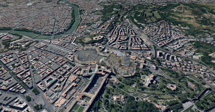
A leading Italian engineering firm took on a pioneering surveying endeavour: to map the iconic St. Peter’s Basilica in Vatican City. Commissioned to create a digital twin of the revered structure, the firm utilized advanced geospatial mapping techniques to meticulously capture every architectural detail. This article provides an in-depth exploration of the project, highlighting the fusion of innovative surveying technology with historical preservation.
St. Peter’s Basilica is one of the world’s most significant architectural and historical structures, serving as one of the holiest Catholic shrines and attracting tens of thousands of pilgrims and tourists annually. Designed by Michelangelo and Gian Lorenzo Bernini, the basilica took more than a century to construct and is renowned for its Italian Renaissance and Baroque architecture. It holds the distinction of being the largest church in the world by interior volume. Since the early Christian period, many popes have been interred there, and it is one of the Seven Pilgrim Churches of Rome. The Italian engineering firm Italferr was commissioned by the Fabric of Saint Peter – an institution of the Roman Catholic Church responsible for conserving the basilica – to create a digital twin of the structure. This may seem an unexpected match, as the company is primarily known for projects to scan transportation infrastructure such as railways and bridges rather than for heritage mapping.
The company was tasked with meticulously mapping and analysing every element of the building for continuous structural monitoring ahead of the upcoming jubilee celebrations in 2025. The project had two main objectives: to create a digital twin with comprehensive

information about the basilica, and to implement a monitoring system using digital methods and applications to protect the structure during ongoing renovation and restoration projects leading up to the Jubilee 2025. In the Catholic Church, a Jubilee or Holy Year is a special period declared by a pope to allow the faithful to benefit additionally from the spiritual treasures of the Church.
Structural monitoring system
The digital twin project was initiated to preserve this unique architectural and religious heritage for the world. Through the use of advanced algorithms, the project aimed to analyse the structure’s response to static and dynamic stresses, gain in-depth knowledge of its structural health, and develop a permanent structural monitoring system. Data from the sensor network would be integrated into the digital twin, and the processed information would be shared with the Fabric of Saint Peter for future maintenance and management of the basilica. The historical and religious significance of St. Peter’s Basilica required the digital twin to be as accurate as possible, necessitating an extensive survey campaign. Italferr’s first step was to conduct a geometric survey of the forepart, built in the 1600s, which must be closely monitored for signs of deterioration or damage.
The creation of the digital twin involved an extensive survey campaign using advanced
Issue 3 2024 23 Feature
Digitization
saved approximately 200 hours of project work.

of advanced geospatial software solutions facilitated this process.
Towards a 3D model
The firm went on a quest for software capable of converting reality data into realworld insights for high-quality 3D modelling, and ultimately digital twins to facilitate informed decisions for cultural heritage maintenance. For this purpose, Italferr chose to utilize various Bentley software solutions, including ProjectWise, iTwin Capture Modeler (formerly widely known as ContextCapture), and MicroStation. These software tools were employed to manage multisourced data and generate a digital twin shared among 30 people.
mapping technologies, including topography, laser scanning, aerial photogrammetry using drones, and georadar. Due to the lack of exhaustive drawings of the basilica, these mapping methods were crucial in creating a complete model of the structure, including information about the rooms, elevations, wall thicknesses, floors and vaults.
Terabytes of data
The goal of this phase was to reconstruct a digital model using point clouds and photos to determine the dimensions of key architectural and structural elements and obtain information not accessible with traditional surveying methods. However, this process resulted in a large amount of data that needed to be managed and processed into a reality mesh, as well as shared among multiple disciplines and stakeholders for continued monitoring. By the end of this phase, the team had acquired over 3.1TB of data for an area of 65,000m2 in plan and 240,000m2 of vertical surfaces. To address these data management challenges within a six-month timeline, Italferr needed integrated and open 3D modelling and digital twin technology. Over the following two months, both internal and external teams – employing drones and an aerostatic balloon – flew inside the basilica. They acquired all the necessary information without risking damage to the extremely precious building, capturing more than 15,000 photos (equivalent to 630 gigapixels of data). Subsequently, extensive data processing occurred over two months, facilitated by multiple processors operating in parallel, to develop the building information model (BIM) and digital twin of St. Peter’s Basilica. The use
To manage the large volume of data and promote sharing and collaboration, the team utilized ProjectWise to establish a data sharing and collaboration platform accessible to all project stakeholders. This platform allowed users to access survey data as well as geometric, informational and analytical models. The software was structured for practical use, featuring workflows and transitions between different states, supported by weekly coordination meetings and reviews. Each participant had their own login and privileges to track operations and ensure that necessary information was available in line with their role in the project. Once all the information was centralized, the next step was processing and managing point clouds. The team created a fully navigable 3D model with the correct scale and proportions, measurable by linear lengths, surfaces and volumes. The 3D model was also georeferenced with the same system used by common mobile devices for geolocation. Subsequently, the 3D modelling software laid the foundation for the implementation of the digital twin. By combining data sources housed in a central location with a single reality mesh, the team created a digital twin for real-time viewing and modification. They also created specific models that could be shared across multimedia platforms.
The advancements of going digital
By working in a collaborative digital environment, Italferr saved 50 hours in modelling time, delivering the model to the Fabric of Saint Peter 20 days ahead of schedule. In fact, the team estimate that, by going digital, they saved 200 valuable
Issue 3 2024 24
The digital twin of St. Peter’s Basilica and its surroundings was brought to life through the utilization of integrated and open 3D modelling, alongside high-end reality capture technology.
hours on the project. The implementation of the digital twin of St. Peter’s Basilica was a challenging project in terms of both time and complexity. The use of the latest software solutions made it possible to optimize not only the sharing and collaboration processes, but also the modelling processes.
According to the surveying crew that conducted this special project, using a digital twin proved to be a more efficient way to share information with stakeholders, increasing data sharing efficiency by 75% compared to traditional sharing applications. It also reduced on-site visits by 75%, allowing stakeholders to view the survey without leaving their offices. But perhaps more importantly, this digital twin serves as unique information technology that will showcase the structure’s past, present and future. It will allow the Fabric of Saint Peter to monitor and maintain the landmark site for years to come. Moreover, the implementation of a structural monitoring system for St. Peter’s Basilica – the centrepiece of the Christian faith throughout the world – is not only of extraordinary value in terms of engineering, but also in social terms. It will make it possible to preserve the full functionality of the basilica in the decades to come.
The creation of this digital twin has led to several notable uses. Primarily, the project aimed to establish a comprehensive digital record of the basilica. An important application is that real-time data from Internet of Things (IoT) sensors, including tiltmeters and accelerometers, is being utilized to prepare for restoration work. Besides the teams of engineers, designers and contractors who will rely on the digital twin in their work to preserve and protect the basilica, there are other audiences for the immersive digital model. For example, digital twins and reality capture can also be valuable tools for education. The model has tremendous applications for post-secondary students, academics and researchers of art history, architecture and engineering.
Conclusion
While it is true that reconstruction and maintenance work in historical
such data efficiently can be difficult and expensive. However, advancing methods of reality capture, as well as measuring and monitoring structures and surfaces, are making these tasks less complicated and time-consuming than in the pre-digital era. The surveying and monitoring project of St. Peter’s Basilica in Vatican City presents a great example of the power of geospatial technology in preserving cultural heritage. With the objectives of creating a digital twin enriched with centuries of accumulated information and implementing a robust monitoring system, remarkable results were achieved. The digital twin of the basilica is set to serve as a crucial resource for safeguarding this unique heritage for future generations. Leveraging high-end geospatial data and the right software not only saved valuable time, but also enhanced the efficiency. As a result, the model was delivered ahead of schedule with a significantly reduced need for on-site visits. This project underscores the importance of interdisciplinary collaboration and the vital role of geospatial data in protecting and preserving our cultural treasures.
Acknowledgment
Some of this content is based on an article titled ‘Italferr bewahrt den historischen Petersdom mit einem digitalen Zwilling,’ previously published (in the German language) in gis.Business, a German magazine for geoinformation and geo-IT.

Camus serves as Bentley Systems’ senior product marketing manager for reality modelling, roads and bridges. Having graduated from SKEMA Business School in France, she has been working in the geospatial industry for over 15 years.

25 Feature
Aude
About the author
As night falls in Rome and the Vatican City, Ponte Sant’Angelo and St. Peter’s Basilica are illuminated, creating a picturesque scene. (Image courtesy: Shutterstock)
Accra hosted an energetic FIG Working Week
By Durk Haarsma, GIM International
The annual Working Week of the International Federation of Surveyors (FIG) was held recently in Accra, Ghana. The location of the event on the African continent placed the world’s climate-related challenges – and the geospatial industry’s role in helping to solve them – in a truly international perspective. The insightful plenary and technical sessions were complemented by an exhibition and various social and networking events to foster knowledge exchange in a less formal setting. The result: an enjoyable and energetic vibe throughout the whole week.
From 19-23 May, around a thousand delegates – from member organizations, affiliates and academic institutions, as well as corporate members – from a total of 83 countries worldwide convened in numerous plenary and technical sessions at the La-Palm Royal Beach Resort and Convention Center in Accra to gain new insights and exchange knowledge. In parallel, an exhibition showcased the latest hardware and software for today’s surveying professionals. The theme for FIG Working Week 2024 was ‘Your World, Our World: Resilient Environment and Sustainable Resource Management for All’.
With Accra as the host city for this year’s FIG Working Week, the possibilities for harnessing and leveraging geospatial knowledge in the battle against climate change were placed in a truly international perspective. President Diane Dumashie emphasized the importance of this global outlook in the opening ceremony. She told the audience that the role of Africa and also South America will be pivotal in improving sustainability in context of the planet. In fact, their role will be crucial in saving the Earth. She called on the approximately one thousand delegates – including surveyors and other geospatial practitioners – to take action and build partnerships, not only during the conference, but also afterwards.
The opening ceremony in the pavilion was graced with the special attendance of the president of Ghana, Nana Addo Dankwa Akufo-Addo. The Ghanaian president urged the assembled delegates to use the days that lay ahead to discuss and consult with one another in pursuit of sustainable solutions, such as to mitigate the consequences of rapid urbanization – one development that is rapidly changing the face of the
African continent. Another hot topic that is having major effects in Africa is resource management.
Besides the president of Ghana and the president of FIG, the delegates were welcomed by the heads of the Ghanaian Institution of Surveyors (GhIS) and the Licensed Surveyors Association of Ghana (LiSAG). The opening ceremony gave the audience a first taste of the African tradition of hospitality that would continue to be felt throughout the whole week.
Plenary and technical sessions
On the first full day, during the first plenary session, traditional African leaders called for a less European or Western focus on the topic of sustainability and battling climate change. Instead, they asked for local customs, traditional views and cultural laws to be taken into account. On the second full day, the plenary session on ‘Land Tenure, Resources and Minerals: Building sustainable and resilient resource management for the planet’ highlighted various examples from Africa. Notably Nick Brown, head of office of the new UN-GGIM Global Geodetic Centre of Excellence in Bonn, Germany, advised delegates that the global chain of geodetic information is a delicate one; when hurt by outside threats, the consequences for life on Earth are enormous.
The third and final plenary session, titled ‘Your World – Our World: Inclusive Urban Geospatial Infrastructure’, showcased examples of how developments such as urbanization are affecting people and planet at a rapid pace – especially in Africa. Oumar Sylla, director of the regional bureau for Africa at UN-Habitat, painted a startling picture of the situation in sub-Saharan Africa. In absolute numbers, the urban population has increased from 32 million in 1960 to 459 million in 2020, with half of that growth happening in the last 15 years alone. Similarly, close to 50% of the total population now live in cities, whereas that figure stood at less than 15% in 1960. This immense shift is creating numerous vulnerabilities.
The plenary sessions were complemented by many technical sessions which featured countless local examples of ongoing efforts in Africa. There was strong support for the Sustainable Development Goals (SDGs), which have found some great ambassadors in the global surveying community. In particular, the Taskforce on SDGs played a prominent role in underpinning this specific role of the surveying community.
Exhibition and social events
At the small exhibition, a number of manufacturers of hardware and software seized the opportunity of being in Africa to find new customers for their products and services. Corporate FIG members Esri, Leica and Trimble were joined by other members in the exhibition pavilion tent. Besides facilitating information exchange during exhibition hours, they
Issue 3 2024 26
Focus on Africa


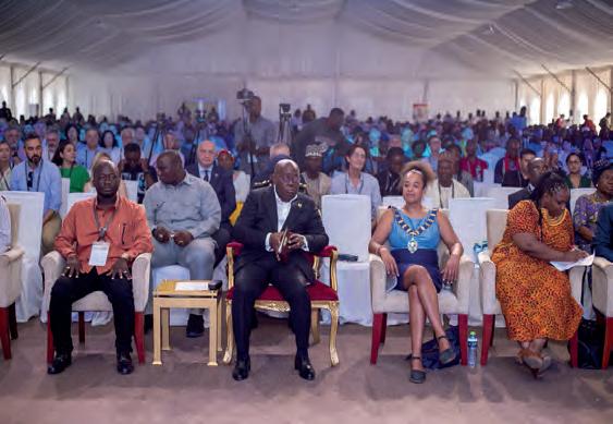


also help to sustain the work of FIG by sponsoring tea/coffee breaks and other social events like the Gala Dinner and the Ghanaian Evening. Such events contribute to an enjoyable and energetic vibe that enhances the overall experience for delegates, who were treated to traditional African dancing accompanied by food, drinks and a lot friendly smiles.
New vice-presidents
The FIG Working Week is always an excellent opportunity for the commission boards to discuss ongoing business in their respective commissions. During the second General Assembly, on Thursday 23 May, the outcome of the voting for the new vice-presidents of FIG was announced. Michail Kalogiannakis of the Technical Chamber of Greece and Qin Yan of the Chinese Society for Geodesy Photogrammetry and

Cartography received slightly more votes than German candidate Volker Schwieger and will both now join the board of FIG as vice-presidents. After the voting results had been announced, the conference concluded with a word of thanks to president Diane Dumashie and a lively presentation of the next destination: Brisbane, Australia.
Second chance
Accra was originally intended as the host for the FIG Working Week in 2021, but the COVID pandemic prevented a live event from being held at that time, so the Netherlands stepped in and organized an online event instead. The Ghanese Institution of Surveyors (GhIS) and Licensed Surveyors Association of Ghana (LiSAG) finally got a second chance this year, and they more than lived up to expectations!
Issue 3 2024 27 Report
ISO/TC 211 celebrates three decades of standardizing geographic information
30 years of geospatial standards
By Peter Parslow and Allan Jamieson, ISO/TC 211
ISO/TC 211 has been developing and maintaining a set of standards for the geospatial community for 30 years. Some standards are well known, others are used without people realizing it, and – because each standard changes over time – some do not yet fulfil their potential. This article reflects on the changes over the past three decades, including the benefits of harmonization, the maturing of the standards development process, and the evolution of the outreach activities.
ISO/TC 211 is the International Organization for Standardization’s technical committee responsible for geographic information. The vision is to support a sustainably prosperous future by developing and maintaining, in cooperation with others, a set of standards that enable better management of geographic information. ISO/TC 211 doesn’t do this alone. Key collaboration partners include the Open Geospatial Consortium (OGC) which is also 30 this year, UN agencies such as the Food and Agriculture Organization and Universal Postal Union, and professional bodies such as the International Association of Geodesy (IAG), the Committee on Earth Observation Satellites (CEOS) and Group on Earth Observations (GEO).

For example, the OGC adopts several foundational TC 211 standards as Abstract Specifications providing the framework in which they then develop implementation standards and domain-specific standards. Some of these are then fast-tracked to be ISO standards, meaning a technically equivalent specification is available as a formal ISO standard where needed. This is the basis of the ISO/OGC Co-operative Agreement in operation since 1998. Well-known implementation standards include OGC Web Feature Service (ISO 19142) and the newer OGC API Features (ISO 19168). Over the past few years, the United Nations Committee of Experts on Global Geospatial Information Management (UN-GGIM) has become an increasingly important collaboration partner, helping ISO/TC 211 understand the use of geographic information across a wider range of countries and focusing thinking on the UN’s Sustainable Development Goals (SDGs). All these inputs help to ensure that ISO/TC 211 standardizes demonstrable best practices rather than committeedriven (‘ivory tower’) thinking.
Harmonization
ISO/TC 211 standards are often model-driven, in that they are created around a Unified Modeling Language (UML) model of the data, using a subset of the Object Management Group’s UML standard. The committee’s approach to using UML is documented in two of its foundational standards: ISO 19103 Conceptual schema language, and ISO 19109 Rules for application schema. Within ISO/TC 211, several groups are focused on ensuring that the set of standards work together, by having a harmonized UML model, consistent eXtensible Markup Language (XML) schemas (where relevant) and other supporting technical tools. XML is a mature way to structure self-documenting data; some would say ‘over mature’, but it remains core to a lot of data and information processing. Of course, each standard changes over time, so this is a continual round and at any time some standards are out of step.
The standards development process has matured over the past three decades, as the communities have learned to work even better together. For example, ISO 19115 initially ran for some four years, including five rounds of voting to resolve some 1,500 comments. There were then a further four years between ISO 19115:2003 and the first XML implementation standard for it, ISO 19139:2007. Nowadays, a standard is expected to be published within two years, with implementation in the next year. In the case of OGC fast-tracked standards, there are usually implementations ready as the standard goes to publication. ISO/TC 211 has played a leading role in trialling ISO’s Online Standards Development tool, which seems likely to further reduce the publication cycle by approximately six months. Using the standards makes it easier
Issue 3 2024 28
Figure 1: United Nations building illuminated with the Sustainable Development Goals. (Image courtesy: UN Department of Public Information)
for members of the geospatial community to ensure their data harmonizes with other data within their domain and across domains. For example, the European Commission’s INSPIRE project used the ISO/TC 211 UML standards to produce data specifications across a range of themes. This resulted in substantial consistency and eased integration of data from different publishers and about different kinds of geography such as road networks, settlements and land cover.
Outreach
Standardization is only useful if people know about it, so outreach is an important part of the committee’s work. In fact, the committee’s first advisory group, established in 2001, was on outreach. A key part of the outreach programme is the biennial Standards in Action workshop, which now has an archive of presentations spreading back across most of the past 30 years. Outreach gives the committee the opportunity not just to explain what standards exist and how they can be used, but also to listen to experiences of using them – both good and bad. For example, ISO standards are considered open because it is not necessary to pay patent licence fees to implement them or to use software which does. Some of the success stories are when
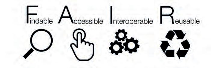
the standards themselves become invisible. For example, ISO 19125-2 Simple feature access –SQL option was published in 2004 and withdrawn in 2018 because it had become a core part of the SQL standard: ISO/IEC 13249-3:2016 Information technology - Database languages - SQL multimedia and application packages - Part 3: Spatial. ‘Spatial’ is now a normal part of relational database technology. Other invisible standards are essential to core parts of geographic information but remain invisible to almost all users. These include ISO 19161-1 International terrestrial reference system (ITRS). Previously standardized by the IERS in France, this standard (and ISO 19111) ensures that coordinates and coordinate reference systems can be used to consistently locate things.
Outreach tends to focus on the standards that communities can benefit from using, such as those which support communities in agreeing how to model and share their data. This includes foundational standards like ISO 19109 that can be used to model any object-based data, standards for coverage data, and domain-oriented standards like the ISO 19144 series for creating and managing classification systems for land cover and land use.
The open standards can help across most of the Findable, Accessible, Interoperable and Reusable (FAIR) journey. They make it easier to find data (metadata, catalogues), access the data (web services, APIs), use the data with other data (thanks to the interoperability supported by consistent
Issue 3 2024 29 Feature
Figure 2: FAIR Guiding Principles for data resource. (Image courtesy: Sangya Pundir)
Figure 3: ISO/TC 211 plays a key part in the ISO/IEC SMART project driving the evolution of machine-readable, interpretable and testable standards. (Image courtesy: ISO SMART Programme Manager)
reference systems, models and encodings) and reuse the data (clearer licence information in the metadata, and documented data-quality measures to indicate what the data is good for). Together, this means that ISO/TC 211’s most widely used standard is ISO 19115 Metadata. This has been adopted across Europe, the Americas and Australasia, by defence, meteorology, geology and the EC’s INSPIRE initiative. There are likely millions of records across thousands of servers using at least ten different software implementations. ISO 19157 Data quality follows closely, with the results of data quality assessment increasingly being available alongside the metadata. Very few of those who create or use those records will have read the standard; they rely on software implementations which have been demonstrated to comply with the standard.
ISO is on a journey from publishing paper and human-readable PDF files to machine-readable standards. ISO/TC 211 has been a trailblazing committee in the publication of machine-readable supporting artefacts. These include data models and tool configurations that can jumpstart the data modelling process, XML schema files that can help ensure that data instances conform to the standard, and a web concept dictionary of relevant terms (on Geolexica). Building on this, the committee plays a key part in ISO/IEC’s SMART project, which is working to show ISO how to provide standards that are machine readable, interpretable and testable.
Join the community!
You can save design effort by basing implementations on open standards. Your experience of working with geographic information will be important to the future development of those standards –that’s a big part of what is meant by ‘open’ in this context.
Read more about ISO/TC 211 at https://committee.iso.org/sites/tc211 , and join the community –either through your professional body, your national standards body, or one of many other liaison communities listed on TC 211’s website.
Conclusion
The growing realization of the value of good – well-structured and quality-assured – data is driving greater use of open standards for data. Increasingly, data is needed that not just people can interpret, but also that machines can be trusted to interpret. This creates the need for standards for the structure and meaning of that data which in themselves can be understood by machines. Like people, artificial intelligence can only make a useful contribution if it has good access to reliable data and information. Therefore, the ISO/TC 211 team is looking forward to many more years of standards development in support of a sustainably prosperous future.
Acknowledgements
This article contains public-sector information from Ordnance Survey 2024, released under an Open Government Licence: https://www.nationalarchives.gov.uk/doc/open-government-licence/version/3/


Peter Parslow, presently chairing ISO/TC 211, works at Ordnance Survey, the mapping authority of Great Britain, as open standards lead.
Allan Jamieson is the current convenor of the ISO/TC 211 outreach advisory group and works as data standards lead at Ordnance Survey.


Powered by a new GNSS engine with 448 channels, the SXblue GLOBE uses all in-view constellations and offers the ability to use global or local coverage of correction services (SBAS and RTK).
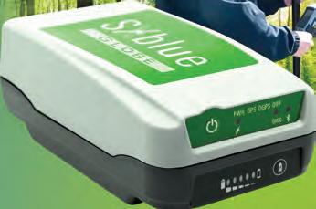
Issue 3 2024 30
info@sxbluegps.com www.sxbluegps.com
About the authors
Reinforcing the importance of accurate and appropriate geospatial surveys
By Andy Beardsley, Terra Measurement, United Kingdom
In today’s fast-paced world of technology and software innovation, companies procuring geospatial surveys can easily lose track of the correct survey methods, appropriate costs and the additional value of survey data, especially when faced with a wide range of quotes. Economic pressures have further driven the emphasis on selecting the cheapest survey option, often without considering the future consequences.
Quotations at the high end of the cost scale may reflect a carefully considered approach using best practices, advanced equipment and a comprehensive survey control network. In 2024, these surveys often focus on appropriate data delivery and usage for all project stakeholders, offering additional valuable options such as colour 3D data and visualization. In contrast, lower-cost quotations may use the fastest methods with single-use techniques like SLAM, GNSS or photogrammetry, lacking survey controls and possibly involving subcontracted drawing services overseas. To the untrained eye, quotations appear as either ‘expensive’ or ‘cheap’. Without consulting geospatial survey experts, people can assume that cheaper quotes offer the same comprehensive survey level as the more expensive ones. The true cost only becomes apparent later in the project timeline.
Geospatial surveys are quick and easy
For years, survey equipment manufacturers have promoted ‘quick and easy’ solutions without disclaimers about using proper survey principles and controls. This strategy aims to boost sales to non-geospatial companies and investors. Surveyors often accept manufacturers’ claims instead of promoting objectivity and thought leadership. Social media adds to the confusion with exaggerated claims of survey speed, and no mention of the accuracy or standards used. These factors have diluted the importance of best-practice survey principles and accurate, controlled data. The geospatial survey community must unite to provide leadership, education and clear direction, rather than relying on manufacturers.
st-practice geospatial survey is possibly the single most essential, cost-effective and budget-saving part of any project,” says Andy Beardsley.
Generalized scope and cheap price
Development and investment projects often procure geospatial surveys with a ‘quick fix’ mentality, neglecting the strategic timing and cost of essential data and the resulting drawings and models. Quantity surveyors focused solely on the bottom line fail to account for the cost overruns caused by design and geospatial errors. Geospatial survey experts are rarely consulted at project inception, leading to poorly scoped, under-budgeted surveys and a tendency to accept the cheapest quote, often resulting in inaccurate or unfit surveys. Who provides these inadequate surveys? The lack of understanding of geospatial survey
Issue 3 2024 31 Perspectives
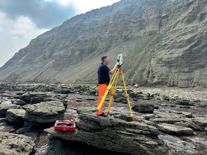
value, combined with economic pressures in the UK, drives some survey companies to cut corners, using rapid methods without best practices, compromising survey integrity and client benefits. Additionally, ‘one-stop shop’ companies with varying in-house geospatial competence and architects using 3D laser scanners without proper expertise frequently deliver poor surveys. These inadequate surveys can lead to significant problems and additional costs down the line.
How does a poor or inaccurate survey impact on a project?
Inadequate or inaccurate survey data can have a huge negative impact on construction and development projects. Why? How? I explain this in every talk and CPD presentation I give: “A best-practice geospatial survey is possibly the single most essential, cost-effective and budget-saving part of any retrofit, development, assessment or construction project, as it provides the accurate 3D spatial information that everything relates to and is constrained by”. Inaccurate or incomplete 3D information can lead to significant, costly problems that are often only identified later in the project timeline. The survey might have been conducted years before the project starts or overlooked as a crucial starting point. Project teams and quantity surveyors may not recognize that an inadequate survey is the source of expensive issues. This reflects an ingrained habit of poor geospatial survey procurement, with little reflection on past mistakes. During a 2023 discussion among survey sector peers, someone remarked: “This is the construction sector’s dirty little secret; there is rarely understanding or admission of neglect in geospatial survey procurement.”
Clients generally lack understanding of accuracy and precision in geospatial surveys, an issue worsened by the availability of detailed, colour 3D data. With the variety of equipment and software available, clients often don’t know which methods ensure appropriate accuracy and consistency. If specific advice is needed, consulting an expert is essential. Yet, despite the many problems caused by inaccurate or inappropriate surveys, geospatial experts are seldom consulted.
Which sectors are affected by
inadequate surveys?
The problem of inaccurate or inappropriate surveys applies across the range of sectors and types of geospatial survey: construction, highways, rail, minerals extraction, energy, retail and
leisure. What is the worst and most common of all? Building retrofit and heritage projects!
Around 10-15% of Terra Measurement’s turnover every year is related to reporting upon or rescuing projects from poor geospatial survey information. Some examples of the types of projects and encountered problems include:
Housing development (topographical and underground utilities surveys): Gross errors, inaccurate survey control or no survey control at all, incorrect features, missing boundaries, differing coordinate systems, misaligned previous surveys Mineral extraction (topographical surveys for minerals sectors): Gross errors on volumes, misaligned previous surveys, inaccurate setting out, features and details not updated
Large buildings for retrofit: Gross inaccuracies and alignments within 3D point cloud data, inaccurate survey control, drawings and Revit models not correlating with the 3D survey data, missing features, incorrect levels, inadequate laser scan methods and resulting data accuracy and fidelity
• Cultural heritage buildings: Inappropriate methods not adhering to Historic England’s ‘Geospatial Survey Specifications for Cultural Heritage’, no survey control, inadequate and unusable 3D point cloud data
• Construction: Inadequate or missing survey control when it comes to setting out of structure or fit out
• Retail: Grossly inaccurate GIA and NIA figures from poor survey plans.
How does a best-practice geospatial survey generate value for money and other benefits?
A best-practice geospatial survey strategy for land, buildings or heritage projects provides lasting value. Starting with accurate survey control and a single coordinate system ensures consistency and accuracy across all project elements (drawings, models, designs, etc.), creating a single source of truth for all stakeholders. This approach minimizes problems and additional survey costs due to complete parity. Having reliable data offers peace of mind. After witnessing numerous issues from cheap surveys, I am baffled why anyone would skimp on such crucial information. While challenges may still arise, a project team with accurate data,
Issue 3 2024 32
The right approach minimizes problems and additional costs down the line.
How do inadequate surveys impact on clients?
“In the realm of heritage conservation, the accuracy of surveys is paramount, yet there appears to be a concerning trend towards complacency in their execution. Often, surveys –crucial for providing a faithful representation of historical structures – seem to prioritize convenience over precision. We have encountered situations where erroneous survey data led to incorrect material quantities, which can significantly impact project costs and timelines.” – Christian Montez (RIBA), architect, heritage consultant and design engineer
“My experience is that the value of a good survey is not appreciated and the cheapest is preferred. This is understandable to a point within the quarrying industry as the tolerances are greater; a lot of the time, things don’t need to be to the nearest centimetre. It’s difficult to convince a client to change the survey provider. Something I’ve been completely ineffective in is influencing clients/colleagues to choose a more expensive option. The problem is that it’s not easy to spot a poor survey, it’s only when something significant happens that the importance of a good survey can be understood.” – Anon, principal engineering geologist
“We frequently suffer from poor-quality measured surveys provided by landlords to our clients, which result in setting out problems and design coordination clashes. A high-quality survey providing accurate dimensional information and capturing all the details of the space enables us to design, coordinate, procure and fabricate with confidence well ahead of our start on site, so we can maximize efficient working on site, reduce programme duration, minimize waste, and save money for our clients.” – Bryony Levermore, construction technical & compliance director, design manager
“When a geospatial survey done is well and aligns with the briefing requirements, it makes a huge difference with the success of a project. If sufficient data is captured and accurately drawn, it saves an enormous amount of time on site visits, on-site measures, checking, etc. A well-produced set of measured survey drawings are a joy to work on as you have confidence in them, and thus have confidence in new design and detailing. Building recording is increasingly important for posterity, condition surveys, futureproofing against climate change, structural assessment, weathering… the list goes on. Best practice is crucial.” – Andrew Coles (RIBA SCA), conservation architect
expert consultants and detailed 3D survey data will face fewer issues. For example, a £28,000 (€32,750) survey was undercut by a £18,000 (€21,000) quote. Terra Measurement was later called to fix the resulting problems, costing nearly £40,000 (€46,750). The initial survey errors ultimately cost the project almost £1 million (€1.17 million), all because of assuming the same survey quality for £10,000 (€11,750) less.
What could be done to emphasize the importance of accurate geospatial surveys?
The regulation of geospatial companies has been a longstanding topic of debate in the UK. Due to ineffective regulation and the lack of implementation, there is little emphasis on the significance and
About the author

Andy Beardsley leads Terra Measurement Limited as its founder and managing director. As an AssocRICS surveyor and a Goldman Sachs 10,000 Small Businesses alumni, Beardsley possesses a strong background in innovation and operations, and has over three decades of professional surveying experience. His company specializes in providing geospatial surveying, 3D visualization and sustainable data solutions across various sectors.
necessity of accurate surveys. The geospatial survey profession does not receive the same recognition as civil engineers, structural engineers, quantity surveyors and suchlike, and there are no quality standards. Consequently, some geospatial surveyors and users of geospatial equipment produce substandard work. The geospatial profession is also grappling with a skills shortage. Compounding the issue, academic pathways to a career in geospatial surveying are diminishing, exemplified by Newcastle University discontinuing its Geospatial Survey BEng programme. To address this challenge, new geospatial apprenticeship pathways and relevant college courses are being developed. The Survey Association (TSA) runs the commendable Survey School, offering candidates a vocational course that complements their day jobs.
Royal Institution of Chartered Surveyors (RICS), TSA, and the Chartered Institution of Civil Engineering Surveyors all play a crucial role in promoting best practices in geospatial surveys. Through training and influencing educational institutions and businesses, these organizations can enhance the understanding of geospatial survey data usage and distribution. Their collaboration will lead to improved practices, better cooperation and, ultimately, more successful projects.
Appropriate time and place
As mentioned above, today’s fast-paced world of technology –combined with the ‘smoke and mirrors’ of social media – can give the illusion that quick and easy is always the answer. In reality, there is an appropriate time and place for most methods and deliverables, and it is important to understand when they are appropriate (and when not). To spell it out: quick, cheap and easy is not suitable for the beginning of a construction or retrofit project, and not a good starting point for responsible long-term care and management of an estate, property portfolio or a listed or scheduled monument building. If in doubt, just reflect on the words above and how many non-geospatial survey professionals (architects, structural engineers, conservation consultants, etc.) can tell you of the woes, stress and additional costs they have witnessed due to poor and inaccurate geospatial survey information.
Issue 3 2024 33 Perspectives

BOOK YOUR SPOT NOW


INTERGEO Packages
Exhibitor Highlight Package
Logo on dedicated event page on website of GIM International
Logo and booth number in two extra Intergeo newsletters
Logo and booth number in GIM International Trail
1/4-page ad in Intergeo issue of GIM International
1/4-page ad in GIM International Trail for Intergeo
EUR 2,100 Including:
Online Event Package
Logo on dedicated event page on website of GIM International
Logo and booth number in two extra Intergeo newsletters
Product spotlight for 1 month on home page and dedicated event page
3 social posts before, during and after the event
Targeted remarketing campaign (>500 clicks)
Product Promotion Package
Including: Including:
EUR 1,950
Logo on dedicated event page on website of GIM International
Product spotlight for 1 month on home page and dedicated event page
Product highlight in GIM International Trail
Product highlight in extra Intergeo newsletters
EUR 1,250
Trail & Newsletter for Intergeo Package Including:
Logo and booth number in GIM International Trail
Logo and booth number in two extra Intergeo newsletters
1/2-page ad in GIM International Trail
EUR 995
gim-international.com sales@gim-international.com
LIMITED AVAILABILITY!
SimActive reflects on reduced waiting times and more sensor combinations
Cloud computing continues to boost photogrammetry services
By Frédérique Coumans, senior editor, GIM International
Two decades ago, SimActive introduced a gamechanger in photogrammetry processing when it transformed methods from the video and gaming industry for use in the geoinformatics sector. Today, the company is still at the forefront of innovation, developing efficient ways to process remote sensing data into fit-for-use geospatial information.
In early 2024, SimActive, the respected Canadian developer of photogrammetry software, released its upgraded cloud capabilities for Correlator3D. The new distributed processing capabilities mean that wasted waiting time is becoming a thing of the past. In the latest version of Correlator3D, point clouds and digital surface
models (DSMs) are generated at twice the speed of previous versions. This is the latest addition in a very long line of improvements since the brothers Philippe and Louis Simard started SimActive 20 years ago in Montreal. They introduced the first image processing engines in the photogrammetry industry based on a graphic processing unit
(GPU) – which until then was only used in gaming – for aerial triangulation and DSM generation. This enabled a manyfold increase in processing speed and convenience. Today, for example, a point cloud can be produced from 300 drone images in less than eight minutes on a single standard PC. This has led to an exponential increase in the sales of
Issue 3 2024 35 Feature
Multi-camera payloads (oblique and nadir) enable drone mappers to texturize the sides of buildings and other infrastructure.
the company’s software in the last few years. “This is great recognition for all the hard work we have done,” observes CEO Philippe Simard.
“Autocorrelation innovations in Version 10.1 allow users to expedite project delivery, as DSM and point cloud generation represent about 50% of the total processing time,” comments CTO Louis Simard when asked about the latest challenges they have tackled. Autocorrelation is a highly complex process and is often the bottleneck in any photogrammetric workflow. Regarding the role of artificial intelligence in the recent innovations, he states: “AI was not a part of the solution in that version, but we are doing R&D on its use at different levels, even though it tends to be less helpful for basic photogrammetric calculations. We redesigned our DSM generation module to work more efficiently on more images concurrently, which sped up the overall processing. We also developed a task management system that optimizes the use of the different system components during processing.”
Cloud computing
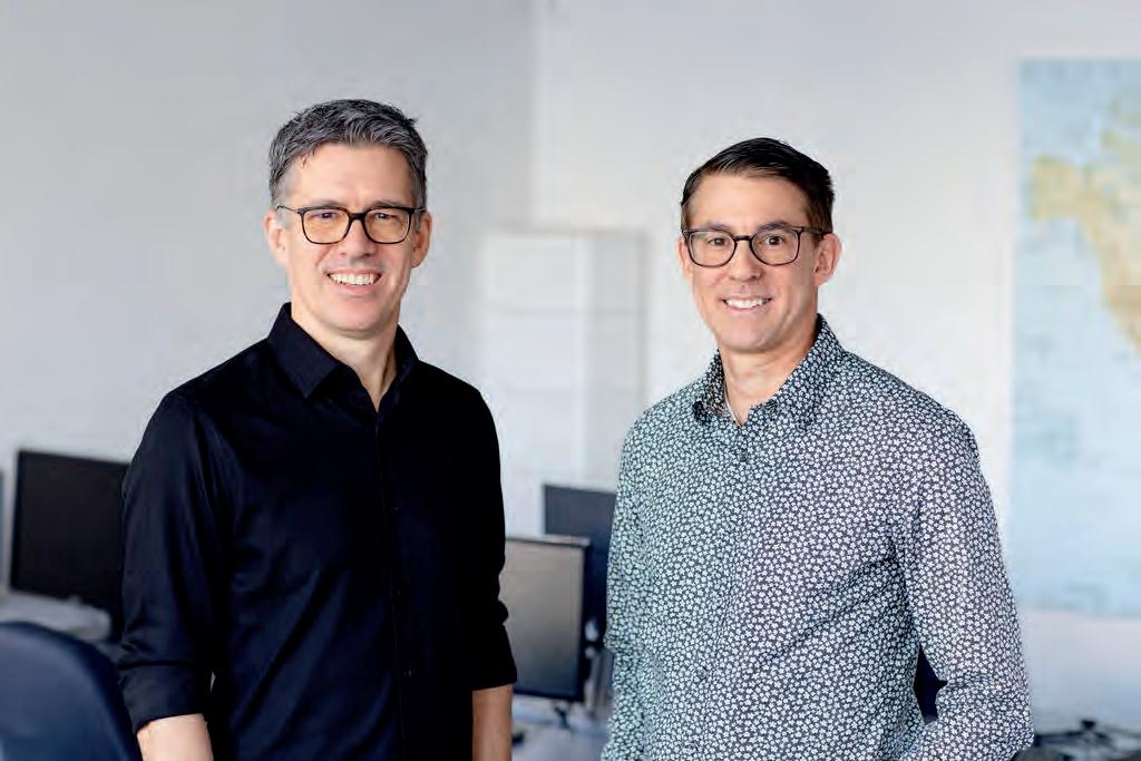
In SimActive’s view, cloud computing has transformed information-driven operations. “Cloud computing is beneficial for users that may not have the capital to invest in the hardware needed to process mapping projects currently, or those who are operating off-site but have stable internet access,” explains Philippe. “This is often the case with operators who are just starting their business or who work in remote locations. The cloud is also helpful for sporadic needs, such as users that need to process a huge project within a couple of weeks and need the additional power for a short period of time only.”
Needless to say, SimActive’s solution is not only for uncrewed aerial vehicle (UAV or ‘drone’) operations. The GPU technology and multi-core central processing units (CPUs) also power Correlator3D software to rapidly process large mapping projects that are based on aircraft and satellite imagery. It generates dense DSMs, precise digital terrain models (DTMs), point clouds, 3D models and vectorized features. In fact, SimActive positions itself as ‘the technical standard the photogrammetry industry is measured against’. The CTO underpins this statement:
“We originally developed the software for processing large-format imagery collected with metric cameras. Clients using such advanced hardware must deliver results with very high quality and accuracy, which are always validated against control. This means our Correlator3D software had to be designed from the beginning to meet the highest mapping standards. The software was later adapted for drone imagery, which means any data processed will lead to highly accurate results.”
Last year, Microsoft announced a collaboration with SimActive. The tech giant chose Correlator3D software on the Microsoft cloud platform to deliver a cloud-based solution for real-time data processing, analysis and decision-making for global defence and intelligence. “Microsoft provides one of the best cloud solutions out there,” says Philippe proudly. “As we have a growing number of clients using the Azure platform, our goal was to make sure the integration of our software in that cloud environment would be optimal. As this is a Windowsbased solution with a vast choice of hardware options, our clients can get the most out of their investment when using the cloud.”
Market development
SimActive has thousands of clients in over 100 countries. They include government entities like the United States Army Corps of Engineers, Fortune Global 500 companies like BHP Billiton, and national organizations such as the French railway SNCF. Clients turn to SimActive when they need to manage huge projects while needing fast processing and fast turnarounds. “The professional user can have full control of our processing capabilities using a hands-on, step-by-step processing approach. Furthermore, they can run the software in script mode for batch processing,” comments Louis. On the other hand, the company also explicitly offers access to high-end processing software for clients with no photogrammetry experience. For instance, drones becoming more performant has opened up the market to many smaller users. He adds: “Our software is designed to work for both novices and professionals. The novice user can run automated processing workflows without having an in-depth knowledge of photogrammetry. Clients can even upload full projects and have our photogrammetry specialists generate optimal results from their imagery, including quality control.”
Looking ahead, SimActive’s success will continue to be driven by the ability to process even larger datasets, as acquisition platforms fly farther and longer. A client’s definition of
Issue 3 2024 36
CTO Louis (left) and CEO Philippe Simard.
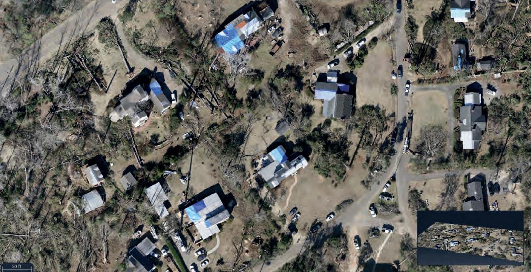
‘reasonable processing time’ moves with any available innovation on the market. The CEO states: “We position our software as a higherend photogrammetric solution, which means our challenge is to stay ahead of the competition. That’s complicated by the fact that also the number of different sensors used for mapping keeps rising, so we must constantly adapt our algorithms to work with new ones. The use of Correlator3D has recently been extended to multi-camera drone payloads. For instance, the software allows users to import oblique and nadir camera configurations to develop better 3D mapping products, enabling drone mappers to texturize the sides of buildings and other infrastructure. Correlator3D’s project setup and aerial triangulation modules take the guesswork out of importing these complex multi-camera configurations; customers are capturing five times the number of images as would be acquired with a traditional single camera setup.”
Conflicts and climate
The defence market has always been a natural fit for the company, since satellites and drones have become extremely important in conflicts. Against this backdrop, military needs have shaped some of SimActive’s products. For example, the development of the
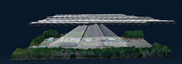
Correlator3D software was initially supported by the Canadian Forces. Recent advances, such as cameras being able to collect highresolution imagery very quickly, have led to faster data acquisition for mapping applications by defence organizations around the world. This was also one of the reasons for Microsoft to decide to work with SimActive. “We are already witnessing a rapid increase in the number of intelligence data points, and multiples of sensor feeds needing to be processed,” says Jonathon Beesley, Director Business Strategy, Worldwide Public Sector Defence and Intelligence at Microsoft. “With SimActive, we can demonstrate the integration of feeds from multiple remote and autonomous sensors.”
The continuous improvement of Correlator3D in terms of its ability to rapidly process very large projects is beneficial for civilian applications as well, of course. For example, in November 2023 the Alabama Department of Transportation (ALDOT) used the software to process drone imagery for damage assessment after a powerful tornado ripped through the city of Selma. ALDOT quickly collected more than 18,000 images of the area, and was able to process the data and deliver DSMs and orthomosaics within 24 hours. The ability to crunch such a massive dataset allowed first responders to have the necessary information as fast as currently possible. Louis is convinced that the collaboration between ALDOT and SimActive not only underscores the critical role of technology in disaster recovery, but also highlights the growing significance of drone data in rapidly assessing and responding in the aftermath of natural disasters. “As climate-related events become more frequent and severe, the use of advanced photogrammetry software emerges as an invaluable tool for informed decision-making and efficient recovery efforts,” he concludes.
Issue 3 2024 37 Feature
3D mapping from oblique cameras.
The technology supported rapid damage assessment after a tornado ripped through Alabama.
Charting the course of drone and Lidar technology
By Wim van Wegen, GIM International
GIM International was recently invited to attend the fifth edition of the two-day YellowScan LiDAR Convention. It took place on 18 and 19 April 2024 in the Mediterranean spring sunshine at the beautiful Domaine des Moures venue located near Montpellier, France. As in previous years, the event was aimed at discussing the latest developments in the geospatial industry, connecting with industry peers and gaining insight into customer needs, all in the context of UAV and mobile Lidar mapping.
The event featured an extensive two-day programme of presentations – mostly about projects carried out with YellowScan’s Lidar equipment, but also from companies
that offer uncrewed aerial vehicles (UAVs or ‘drones’) in which the equipment has been implemented. In addition, there were several demos of the technology in action. One of them had initially been scheduled to be held on the day before the event, during a meeting for YellowScan operating partners – but it had been postponed due to strong winds in the coastal region. Fortunately, the weather conditions were a lot better during both days of the convention itself. CEO Tristan Allouis kicked off the proceedings, welcoming the speakers, sponsors and guests. This was followed by an icebreaker by Morgane Selve, head of marketing & communication, which created a relaxed and positive mood and even led to some hilarity. Then, Allouis returned to the stage together with Laure Fournier, commercial director, to reflect on YellowScan’s journey and paint a picture of where the company stands in 2024. What started as a project in 2012 has grown into an established, self-financed pioneer of UAV-Lidar mapping, with over 70 employees on four continents. R&D is the beating heart of the company, they explained, and “technical support is the pillar of the company’s mindset”. This mindset has resulted in a range of high-end Lidar solutions. To illustrate what this entails, Allouis guided the attentive audience through the underlying technology.
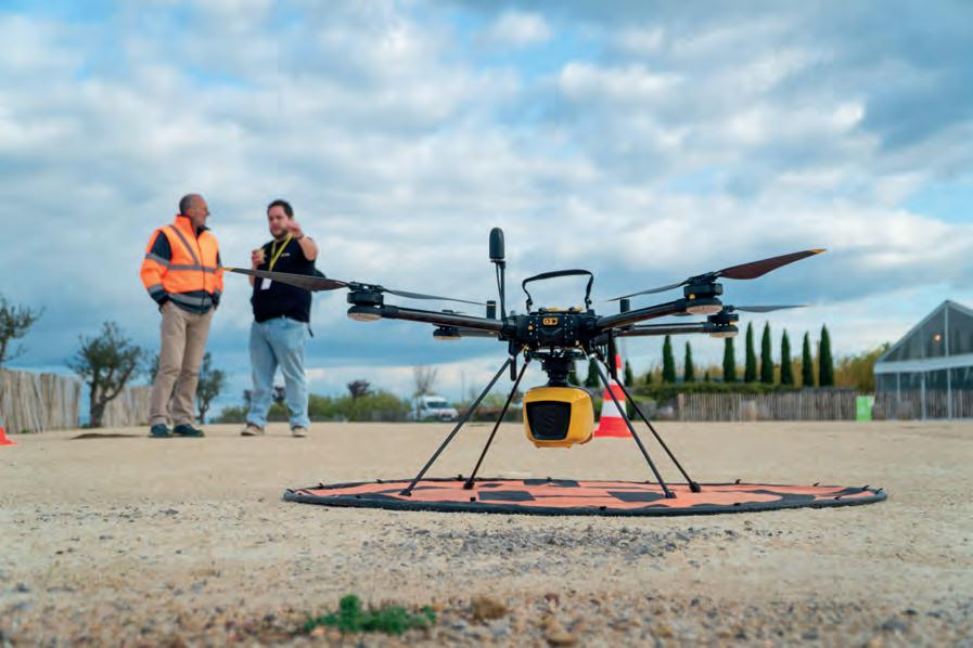
Issue 3 2024 38
A recap of the YellowScan LiDAR Convention
Various demos showcased the latest Lidar mapping technology.

The participants also received an update on the latest developments surrounding the French company’s Lidar solutions. After discussing the added value of the optional camera module – specifically true colour imagery – attention turned to the upgraded Explorer, which was developed in collaboration with major players such as Airbus. The Surveyor Ultra, equipped with a Hesai scanner, can also be mounted on a car. Software is an important enhancement to the hardware; in addition to CloudStation, which provides a complete solution to create and manipulate point-cloud data, the CloudStation Ultimate version is now available as well.
Innovation
Allouis was clearly proud of the new flagship model, the YellowScan Navigator, which covers Lidar applications on land, at sea and in the air. It has been entirely developed in-house and serves as a solution for environments where traditional technologies are impractical or costly. He emphasized that the Navigator sets the direction for YellowScan’s future endeavours. The company’s ambition is to become the global leader in the Lidar-for-drone market. Motivated by societal challenges, the strategy involves continuous investment in research and development to maintain a competitive edge.
Tristan Allouis, who began his career working with bathymetric Lidar data, has always strived to develop his own system. Mastering hardware design has enabled YellowScan to create advanced
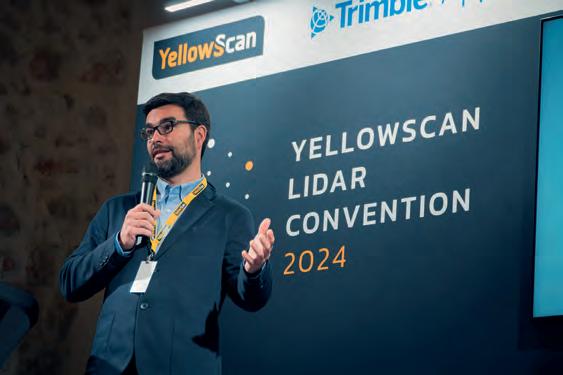

processing algorithms, pushing the system’s performance beyond existing boundaries. The Navigator is equipped with a green laser for measuring underwater topography. Given that water absorbs certain light wavelengths more than others, blueish-green light typically penetrates the most. While this may be familiar territory for experts in hydrography and related fields, it marks a significant leap forward for YellowScan, opening up new horizons by extending the mapping of the physical environment with Lidar to include underwater terrain.
When YellowScan started its development work for the Navigator, it wasn’t entirely clear how and when the product would eventually find its way into the commercial market. The story began five years ago within the company’s Research & Development department, under the name ‘Alligator’. After a long period of continuous research and rigorous testing, with a whole year being dedicated to an impressive series of tests and fine-tuning, the product finally emerged in its final version in December 2023. All those years of hard work appear to have paid off, since during coffee breaks, lunch and other networking opportunities at the event, several attendees spoke enthusiastically about the Navigator, often commenting that it “fills a gap”.
Applications
The two days of presentations and technical sessions at the YellowScan LiDAR Convention took attendees on a journey to many
Issue 3 2024 39 Report
Morgane Selve broke the ice.
Tristan Allouis zoomed in on his company’s journey and milestones so far.
The panel discussion touched on various aspects of where UAV mapping is heading.
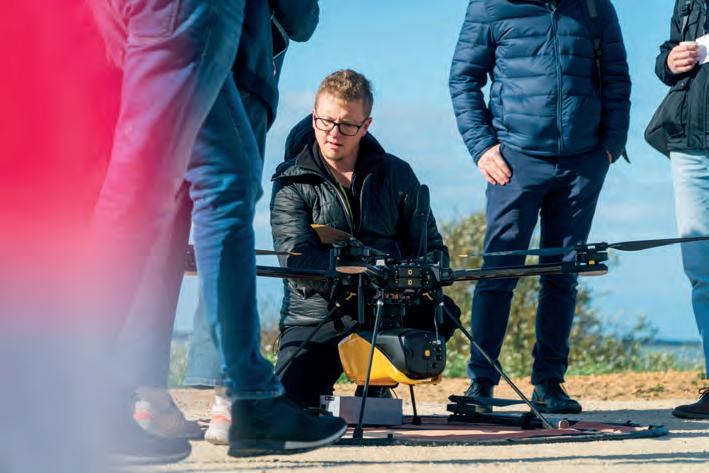
different places around the world. Moreover, the multitude of applications for UAV-based (and sometimes vehicle-based) Lidar deployment became evident. Examples of real-life applications included mapping shallow coastal waters in Japan, geophysical investigations at archaeological sites in Romania, acquiring imagery for damage assessment after the Great Vermont Floods of 2023, alpine powerline inspections in Austria, tropical forest phenology in French Guiana, and emergency response mapping after a glacier dam outburst flood in Alaska. The variety of projects showcased at the Domaine des Moures venue underlined that mounting high-end laser scanners under a drone does indeed open up possibilities for an ever-increasing number of tasks.
Collaboration
YellowScan is recognized for its numerous collaborative partnerships, as highlighted by the diverse backgrounds of participants at the event. One noteworthy partnership is with Quantum Systems, a German specialist in multi-sensor technology-equipped drones, resulting in the Qube 640. This UAV-based Lidar scanner was
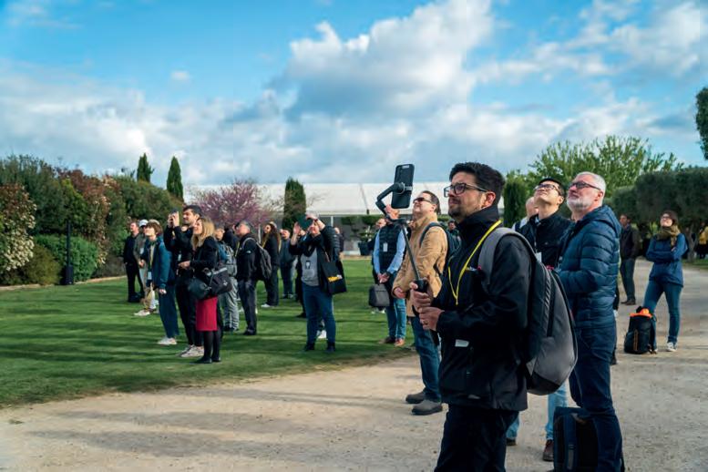
specially designed for the drone specialist’s Trinity Pro eVTOL fixed-wing drone. According to Robert Leake of Quantum Systems, whose company is striving to unlock untapped potential in the surveying world, this marks the ultimate solution for large-scale Lidar mapping. The company also performed a demo flight, including the processing of the data.
YellowScan’s partnership with Trimble Applanix demonstrates its focus on meticulously curating and deploying topnotch components for unrivalled precision in direct georeferencing. In one of the sessions, Applanix showcased Trimble RTX real-time mapping, Lidar SLAM technology, and seamless sensor integration with YellowScan systems. YellowScan first integrated Applanix’s custom GNSS-inertial solutions into its Lidar platforms in 2016. In 2024, real-time RTX mapping and Lidar SLAM technology streamline post-processing without internet access or cloud reliance, allowing near real-time field processing. Applanix’s POSPac UAV ensures the utmost accuracy in direct georeferencing of drone mapping sensors using GNSS and inertial technology. Another significant presence at the Domaine des Moures venue was SBG Systems, whose inertial navigation system called Quanta Micro powers YellowScan’s new Surveyor Ultra and Explorer Lidar mapping solutions. Furthermore, YellowScan has integrated SBG Systems’ Qinertia PPK software into its proprietary CloudStation software to further enhance its offering.
Emlid, which was also present as a partner organization, showcased its GNSS solutions providing enhanced workflow capabilities to surveying and mapping professionals. The Reach RS3 in YellowScan’s Lidar system acts as a base station during drone flights, recording RINEX data. This, combined with the drone’s trajectory, is used in Applanix POSPac to generate corrected flight trajectory files (SBET), processed with scanner data in CloudStation for geotagged point clouds.
Looking ahead
Another highlight of the event was the panel discussion featuring several UAV manufacturers. Roberto Casini, who oversees YellowScan’s drone programme, explained he is on a mission to integrate YellowScan systems with drones from various

Issue 3 2024 40
The UAV demos captured the participants’ attention.
manufacturers. Casini noted a significant market shift, citing beyond visual line of sight (BVLOS) as one example of the current challenges. Robert Leake of Quantum Systems commented that regulators are slowly making progress towards getting things done to align with the technological possibilities of BVLOS.
The emergence of artificial intelligence (AI) is another significant change affecting the industry, according to Thomas Eder, head of Nokia’s Embedded Wireless Solutions organization. Nokia is making strides in the mapping and surveying sector, including with its drone-in-a-box solution. The automated drone solution, connected over 4G/LTE and 5G, includes drones with dual gimbal cameras, docking stations and edge data processing. Eder highlighted that numerous commercial players are already developing robust AI-based object detection solutions. Nokia leverages its own AI expertise to help mapping and surveying companies solve connectivity issues, such as with predictive AI to avoid signal interruptions.
and AI’s potential in automatic drone piloting, Held highlighted legal hurdles, indicating there is still a long way to go.
Surveying with the Navigator
There was some degree of scepticism during the event. “This is not going to work in our dark and muddy waters, but we have never seen so much interest in a new product as with the YellowScan Navigator,” stated Martin Andersson of Scandinavian Drones at the start of his presentation on harbour surveying with the new UAV-based bathymetric Lidar solution. Despite initial reservations, the company organized a demo event in a harbour town in the south of Sweden. Bathymetric Lidar was new to most customers; almost no one was familiar with it. The comparison with multibeam was one of the main objectives of the demo, which was carried out with the Hexadrone Tundra 2 Endurance version as drone platform due its strong wind resistance. For mission planning, UgCS was used with the Emlid Reach RS2 as base station. The demo survey took place in winter to take advantage of the relatively clear water at that time of the year. According to Andersson, the attendees were pleasantly surprised by the results of the demo, leading to positive reactions. “We are drawing a line in the sand,” he said, referring to the Navigator’s ability to make bathymetric Lidar accessible for a large group of users. “It has enormous potential, but we still have a lot to learn. It is the start of an exciting adventure,” he concluded.
Blueprint
The YellowScan LiDAR Convention offered valuable insights into the trends shaping the future for companies in the geospatial industry. With discussions spanning various topics, from the benefits of Lidar technology to market forecasts for the upcoming years, attendees gained a comprehensive understanding of what lies ahead. With its focus on keeping things stimulating, the convention could serve as a blueprint for other events. It’s crucial to engage people’s minds, ensuring every attendee leaves with a wealth of fresh ideas and insights! YellowScan will likely organize a similar event again in two years’ time. With its biennial frequency, it has become a benchmark for the combination of drones and Lidar. It will be interesting to see which new developments will be presented in 2026.
Report
A journey through the Dutch ‘Geospatial Valley’
Groningen: a hub of innovation making waves around the world
By Wim van Wegen, GIM International
Two members of the GIM International and Geo-matching team recently hit the road to explore an emerging hub of geospatial tech activity: the Dutch province of Groningen. There, they took a closer look at four different companies making waves at home and abroad, explains Wim van Wegen.
Earlier this year, I embarked on a road trip with my colleague Peter Tapken from Geo-matching, our product comparison website for surveyors, hydrographers and other professionals who are looking for industry equipment. We headed to the province of Groningen in the northeast of the Netherlands, to take a tour of several companies driving geospatial innovation.
Georeferenced imagery
Our first stop was at Horus View and Explore, a provider of intelligent imaging solutions for mobile maps. With a strong emphasis on innovation and a vision centered around georeferenced imagery as the ultimate tool for informed decision-making, Horus has become a leading global player. In a nutshell, the company provides organizations with precise, reliable and actionable insights derived from image data, with the ambition of reshaping navigation,
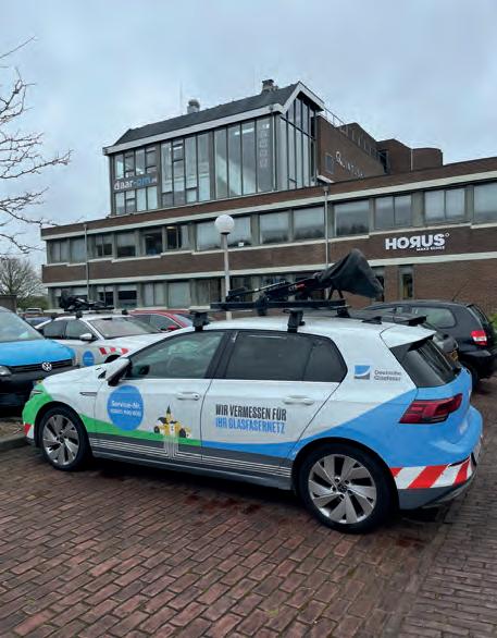
inspection, analysis and critical decision-making in various mobile mapping applications.
Managing director Dirk Aalbers gave us a warm welcome. He spoke in detail and with passion about the development that Horus has undergone in recent years. He firmly believes that his company stands as a distinguished force in the global mobile mapping market. “People are often surprised when they learn that our company is headquartered in Groningen,” he said with a chuckle. “They commonly joke that we’re in the wrong place; we should be in California, they say!”
“But we are definitely in the right place here; we’re rooted in this region, yet with a broad global perspective,” he added. “We have partnerships with NVIDIA, Teledyne, Trimble and others. In fact, the majority of our business is international. But Groningen serves as an excellent base for our operations.”
We noticed several cars parked outside the Horus building from Deutsche Glasfaser – a company that provides fibre optic to the home (FTTH) across the German states of North Rhine-Westphalia, Schleswig-Holstein, Bavaria and Lower Saxony. “They are indeed one of our significant clients,” stated Aalbers. “We integrate our compact mobile mapping system into their vehicles, allowing them to map the surrounding environment. This facilitates the calculation of fibre optic
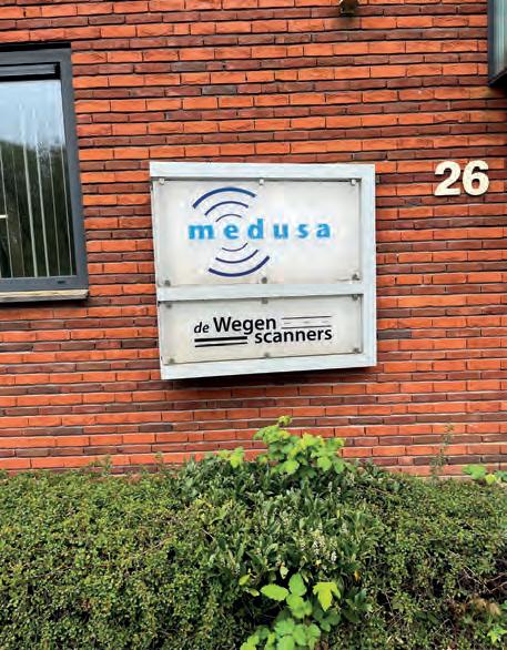
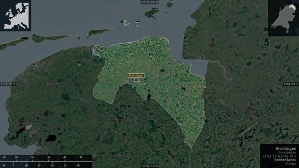
Issue 3 2024 42
Headquarters of Medusa in the city of Groningen.
A Deutsche Glasfaser mapping vehicle parked outside the Horus building.
installation costs, as factors such as surface type and obstacles are meticulously mapped out.”
The demand for mobile mapping solutions is currently growing, especially for large-scale projects. “I believe we’re strategically positioned, with our activities sitting at the intersection of hardware, AI and software,” commented Aalbers. “These three elements embody our innovative ingenuity.”
Gamma ray spectrometry
Our next destination was Medusa Radiometrics, located on the outskirts of the city of Groningen. Bart Kruizenga and Carola Kolkena took us on a tour of the company, which offers a variety of survey instruments designed for the highly accurate measurement of soil spatial variation. The gamma-ray spectrometers, which form the core of these instruments, passively detect natural radioactivity in the topsoil. “We have succeeded in making them incredibly userfriendly. That may partly explain why we are so widely represented internationally from our base here in Groningen,” said Bart Kruizenga.
If you have any suggestions for a future geospatial road trip, we’d love to hear from you! Send tips to wim.van.wegen@geomares.nl. We’re eager to explore innovative and inspiring companies – and if our trips happen to take us through scenic surroundings, it’s an added bonus!
Up to 99% of the clients are outside the Netherlands, and between 70 and 90% are based outside of Europe.
Currently, the company’s main focus is the mining exploration market, for example for lithium and uranium projects. One ambition is to expand the customer base beyond the mining industry. The environmental sector is one example of an area where gamma-ray spectrometry is less well known, despite its numerous potential applications. Additionally, the company has prioritized marketing its systems as alternatives or supplements to ground radar.
Medusa has a sister company that specializes in geosurveying and consultancy services, providing comprehensive soil information for diverse sectors. With a focus on climate adaptation, it leverages soil data for improved water management and landscape planning. Moreover, it conducts soil analysis for archaeology, environmental research and civil engineering projects.
System integrators
After leaving Medusa, a 15-minute drive took us from the urban bustle to a rural part of the province called the Ommelanden, full of charming old villages and towns. We treated ourselves to a delicious lunch in Bedum, known for its leaning church (which is said to lean more than the famous Tower of Pisa) and even more for being the hometown of Arjen Robben, one of the Netherlands’ finest footballers. We then made our way to the local business park to visit Smart Delta. This company is rapidly emerging as a specialist in mobile mapping, with an additional focus on safety and security markets alongside the geospatial sector.

After hooking Wim’s electric car up to a fast charger, the road trip could continue.
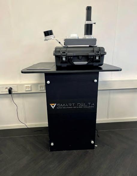
Issue 3 2024 43 Geospatial road trip
The province of Groningen is in the northeast of the Netherlands. The city of the same name is a vibrant economic hub. (Image courtesy: Shutterstock)
Demo model of one of Smart Delta’s mapping solutions.
We were welcomed by René Bolhuis, CEO/CTO, and Jan Wierenga, chief commercial officer. “I often get asked what exactly it is that our company does, especially by people less familiar with high-tech and geospatial products. At Smart Delta, we specialize in sensor fusion technology. We blend data from different sensors to give us a complete picture of what’s happening around us or within a system,” explained Bolhuis while the coffee was being served.
“We have many customers who collect geodata in rural areas. One application is utility mapping, but there’s also a landscaping company that uses one of our systems in their work. Our solutions can be utilized in numerous ways to gather data, whether it’s from boats for water and road management, to keeping railways free from vegetation, or aiding in disaster recovery management – which is an area where we excel and truly enjoy,” added Wierenga. “What sets us apart is our ability to deliver work ranging from the basic to the most sophisticated. Designing tailored mapping solutions is our strength. We pride ourselves on crafting solutions that precisely meet our customers’ needs, no matter the complexity. This adaptability has secured us a diverse clientele, spanning local regions up to global markets,” Bolhuis elaborated. By then, the friendly company dog – a laidback retriever – had strolled over for some attention.
Street-mapping specialists
After bidding farewell to the gentlemen (and dog) at Smart Delta, we travelled towards our final destination of the day, situated near Hoogkerk on the western outskirts of Groningen. The town is renowned for its sugar refinery, where vast quantities of sugar beet have been turned into sugar over the years.
But besides sugar, the town is also home to Geomaat, a leading surveying engineering firm specializing in the measurement, collection, analysis and processing of geodetic data within the spatial domain. Unlike the other three businesses visited during this road trip, this company’s activities are primarily based in the Netherlands, with occasional projects abroad. “In 2008, we were among the first in Europe
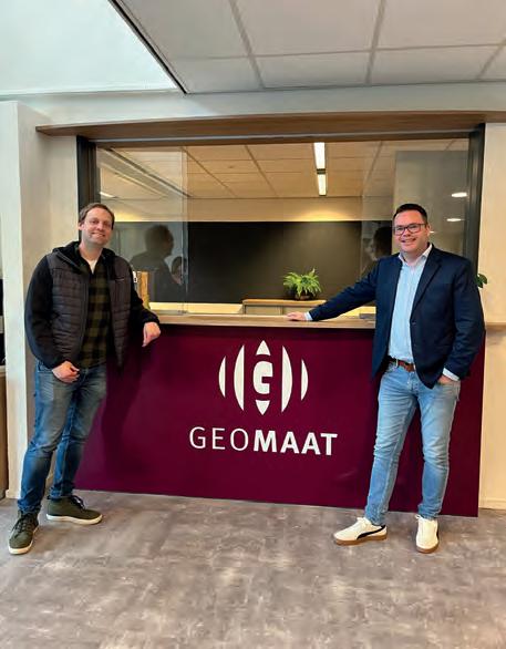
to recognize the potential of a new camera technology developed in England (by StreetMapper, developers of 3D laser mapping, Ed.). We designed our own software to complement that technology, and we continue to benefit from that early advantage today,” explained Geomaat’s Liesbeth Dijkstra during her company presentation.
Geomaat uses a specially developed van equipped with an advanced camera system mounted on the roof, similar to street-view technology but significantly more sophisticated. This setup captures a vast amount of data while travelling at speeds of 80-100km/h. Additionally, the device can be deployed from a train or boat.
The company has been involved in some impressive infrastructure projects, such as scanning the entire Amsterdam Ring Road (A10 motorway), and mapping 100 railway stations across the Netherlands, including objects in the vicinity of the rail network that were not visible from the air. Geomaat is currently engaged in an ambitious, multi-year ‘home-game’ project, mapping the southern stretch of the Groningen ring road in order to collect the essential geospatial data necessary for streamlined project execution.
She continued: “In 2017, we scanned the Groningen ring road for the first time using our Streetmapper-IV and created a digital terrain model. In 2020, we scanned it again, mapping all trees in detail, including their diameters and crowns.” This terrain model is continuously updated and includes all phases and temporary roads. Geomaat compared the scans from 2017 and 2020 to create a difference map in QGIS. One scan serves multiple applications, so the company is collecting once for multiple uses! That’s sustainable work, right?
At the end of the afternoon, we headed home filled with new knowledge, inspiration and lots of coffee. We had enjoyed truly insightful visits to four local companies, and we can think of several others that would be worthy of a visit in the future. With such a vibrant landscape of geospatial innovation, we firmly believe that the province of Groningen deserves to be called the Dutch ‘Geospatial Valley’!

Issue 3 2024 44
Peter Tapken (left) and Wim van Wegen at Geomaat’s headquarters in Groningen.
The spring sunshine was an added bonus during the road trip to visit four innovative and inspiring companies in the Dutch ‘Geospatial Valley’.
How drones and sensor miniaturization are revolutionizing topobathymetric applications
The impact of topobathymetric technologies in hydrography
By Salman Bashit and Narcisa Pricope
In the quest to unravel the mysteries beneath our planet’s water bodies, topobathymetric technologies emerge as a beacon of innovation. Among them, Lidar and sonar sensors mounted on uncrewed aerial systems (UASs) are pushing the boundaries of what is possible. Offering unprecedented precision in mapping underwater landscapes, these technologies are revolutionizing hydrography, environmental monitoring and coastal management. This article delves into the latest advancements in topobathymetric Lidar and sonar, highlighting their critical role in understanding and protecting our aquatic environments. From its origins to its future potential, we explore how Lidar technology illuminates the depths like never before.
Bathymetry, the study of underwater topography, plays a crucial role in various fields by mapping the seafloor to support navigation, scientific research and environmental management. It involves collecting data to create detailed charts used in navigation, to study seafloor profiles for biological oceanography, to assess coastal erosion and to monitor sea-level rise. This data is vital for safely managing natural hazards such as floods and river erosion, ensuring navigable waterways, and aiding in the design and maintenance of ports, harbours and urban planning. Topobathymetric data, which merges topographic and bathymetric information, further enhances our understanding of both terrestrial and aquatic environments.
Trending bathymetric
surveying technologies
Numerous techniques have been used over the years to collect bathymetric data. These include hydrographic surveys, ship/boat-based sonar, airborne topobathymetric Lidar, satellite-derived bathymetry (SDB), advanced topographic laser altimeter systems (ATLAS) and, more recently, UAS bathymetric Lidar and UAS bathymetric echosounder/sonar. Moreover, marine vessels are equipped with sonar systems featuring both multibeam echosounder (MBES) and single-beam echosounder (SBES) configurations. Significantly, advancements in
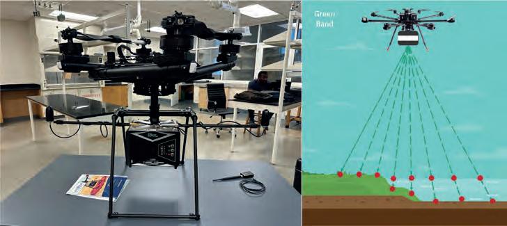
acoustic seabed mapping now involve the use of multifrequency multibeam sonars, allowing for the simultaneous collection of submerged bottom data at various frequencies within a singular survey. This technological capability significantly augments the precision and thorough characterization of underwater terrains, especially in deep water bodies. Moreover, autonomous underwater vehicles (AUVs), underwater remote-operated vehicles (ROVs) and unmanned surface vehicles (USVs) have also been utilized to collect bathymetric data. Sonar technologies excel in deepwater surveys due to their superior water penetration and detailed data collection capabilities. However, options for reliable and accessible technologies in shallowwater environments are limited. Emerging technologies such as UAS-Lidar and UASsonar are addressing this gap, offering promising advancements for shallow-water data collection.
Pros and cons of the technologies
Various bathymetric data collection technologies offer their own set of advantages and challenges. Manual hydrographic surveys, while accurate, are labour-intensive and prone to human error, making it difficult to cover large areas effectively. Ship- or boat-based sonar, ideal for large surveys,
Issue 3 2024 45 Feature
Figure 1: UAS-mounted green band Lidar sensor. (Photo and illustration by the authors)
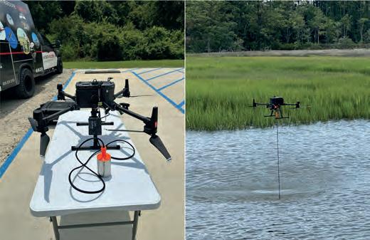
publications, showing the US with the highest number of publications among the top nine countries. A larger circle represents a higher number of publications.
faces limitations in shallow waters, involves high costs and requires specialized training. Airborne topobathymetric Lidar allows for quick data collection but demands clear water for effectiveness and is constrained by accessibility and cost issues, particularly in coastal area surveys. Additionally, SDB provides wider spatial coverage and is mostly suitable for coastal water but it has less depth accuracy than MBES and SBES and is highly dependent on prediction algorithms. ATLAS’s nearshore bathymetric mapping with ICESat-2 shows nearly one Secchi depth mapping up to 38 metres, highlighting its potential in bathymetry surveys1. However, this technology requires enhancements in the geolocation capabilities of the data.
AUVs are perfectly suited for exploring challenging environments, such as deep-sea hydrothermal vents or areas beneath polar ice sheets, due to their autonomous operational capabilities. They fill the crucial gap in spatial resolution between systems that require vessels, such as multibeam echosounders and sidescan sonars, and those mounted on ROVs, enhancing overall data collection capabilities. Capable of diving up to 6,000 metres, deep-water AUVs are pivotal in scientific exploration, providing unmatched spatial resolution and navigation precision near the ocean floor, outperforming traditional surface or towed survey equipment such as sidescan sonars2 and cameras. Although AUVs, or ROVs, provide real-time data collection, they are expensive and complex to operate.
Advances in UAS-green band Lidar and UAS-echosounder technologies is significantly enhancing shallow-water bathymetric surveying capabilities. When leveraging drone technologies, greenband Lidar offers an efficient and cost-effective means for mapping underwater landscapes, although its effectiveness is contingent on water clarity and depth penetration capabilities, which are still being optimized. Conversely, the UAS-echosounder, which is under development, promises to revolutionize underwater data collection with its lightweight design and superior water penetration abilities, potentially outperforming the UAS-green band Lidar.
Many countries, universities, governments and non-governmental organizations are actively involved in bathymetric research, as shown in Figure 3, which highlights countries where bathymetric research is being published the most, following a systematic literature review3
Current state of UAS bathymetric survey technologies
The CZMIL (Coastal Zone Mapping and Imaging Lidar) is a comprehensive Lidar-imagery hardware-software suite that fulfils the technical requirements of the USACE National Coastal Mapping Program (NCMP) in the United States. Its experiments showcase the capabilities of a single aircraft system equipped with a topobathymetric Lidar sensor, digital camera and hyperspectral imager3. The results show that the system accurately measures depths of 7–8m in murky water and up to 41m in clear water.
CZMIL stands out as a leading green-band airborne Lidar system in the market. However, integrating CZMIL with UAS systems faces challenges due to the platform’s weight. Despite this, there is a clear movement towards making green-band Lidar technology more compact for UAS and drone applications. Some notable examples include the Mapper4000U system, TDOT GREEN, VQ-840-G, photon-counting bathymetric Lidar, the ASTRALiTe EDGE Lidar, and YellowScan’s newly released Navigator Lidar sensor. Green-band Lidar is notable for its ability to collect topobathymetric data in a single scan, avoiding the need for separate data integration. Water quality has a big impact on UAS-green band Lidar, and water properties such as turbidity and clarity significantly impact how well this technique works. Remarkably, most UAS-topobathymetric Lidar systems have not been able to assess water depths deeper than 5–10m to date.
A new technology under development is the UAS-sonar/ echosounding system. For example, the University of Florida has created an innovative drone-based system for underwater mapping called Bathydrone. This system features a drone connected to a small vessel equipped with a sophisticated sonar unit, capable of performing down-scan, sidescan and chirp functions. It logs GPS-referenced sonar data in real time, enhancing underwater exploration and mapping capabilities. Given that it is a lightweight surface vehicle, it has difficulty in deep-water wave environments. SPH Engineering is developing technology that integrates an echosounder with a commercially available UAS system. The UASechosounder developed by SPH Engineering is recognized for its high-quality data output. However, it still requires extensive research, development and accuracy evaluation. Compared to UAS-green band Lidar, this technology boasts superior water penetration capabilities,
Issue 3 2024 46
Figure 2: UAS-mounted sonar data collection using SPH Engineering’s echosounder probe at the Intracoastal Waterway, Wilmington NC. (Photo by the authors)
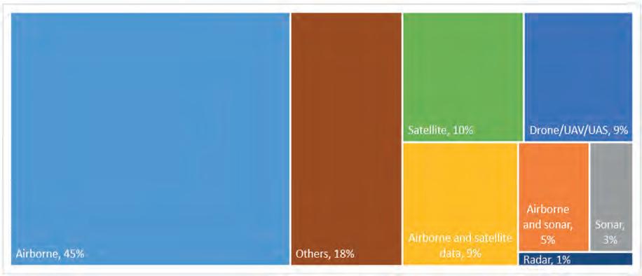
offering a significant advantage in underwater exploration and mapping.
Pricope and Bashit3 conducted a systematic literature review of hundreds of article and surmised that, in the realm of topobathymetric survey technologies, airborne methods lead with a 45% usage rate, while radar is the least utilized at 1%. Drones, UAVs and UASs account for 9%, highlighting the growing significance of unmanned aerial vehicles in this field. Additionally, the ‘Others’ category represents 18%, indicating a variety of innovative and hybrid approaches beyond the main technologies, showcasing the diversity in survey methods.
The future of topobathymetric mapping
The advent of UAS/drone-mounted echosounders and Lidar represents a significant leap in bathymetric data collection, offering unparalleled flexibility and efficiency. These technologies enable the deployment of compact yet powerful sensors for swift and precise mapping of underwater topographies, presenting a cost-effective alternative to conventional survey methods. Moreover, drones facilitate access to challenging or dangerous areas, enhancing data collection speed, accessibility and safety across aquatic environments. Importantly, the real-time data transmission feature of these tools underscores their value in modern bathymetric applications, highlighting the critical role of interdisciplinary collaboration and data sharing in advancing topobathymetric mapping efforts.
Conclusion
The exploration of bathymetric data’s essential role in maritime safety, infrastructure and flood protection has spotlighted recent advancements in UAS-green band Lidar and UAS-echosounder technologies. We highlight both the advantages and challenges of current bathymetric survey methods, underlining the progress and miniaturization trends of tools such as CZMIL. Researchers worldwide working in this field envision a transformative future for UAS-mounted technologies in hydrography, poised to redefine underwater mapping with unprecedented efficiency and precision. This evolution promises a new era of enhanced marine safety and swift, accurate terrain mapping, heralding significant advancements for hydrological applications and research.
Figure 4: Distribution of topobathymetric technologies based on a review of the literature (see Pricope and Bashit, 2023).
References
1Parrish, C. E.; Magruder, L. A.; Neuenschwander, A. L.; Forfinski-Sarkozi, N.; Alonzo, M.; Jasinski, M. Validation of ICESat-2 ATLAS Bathymetry and Analysis of ATLAS’s Bathymetric Mapping Performance. Remote sensing 2019, 11 (14), 1634.
2Murton, B. J.; Rouse, I. P.; Millard, N. W.; Flewellen, C. G. Multisensor, deep-towed instrument explores ocean floor. Eos, Transactions American Geophysical Union 1992, 73 (20), 225-228.
3Pricope, N. G.; Bashit, M. S. Emerging trends in topobathymetric LiDAR technology and mapping. International Journal of Remote Sensing 2023, 44 (24), 7706-7731.
This article was originally published in Hydro International, Issue 1, 2024.
About the authors


MD Salman Bashit, an urban planning graduate from Khulna University in Bangladesh, is currently furthering his education in Geoscience at Mississippi State University. His academic and professional journey is marked by a deep-seated interest in geoscience, with a specialization in remote sensing technologies such as Lidar and UASsonar.
Narcisa Pricope is an associate vice president for research in the Office of Research and Economic Development at Mississippi State University and a professor in the Department of Geosciences.
Issue 3 2024 47 Feature
Exploring GeoBIM for the built environment
A recap of the OGC Member Meeting in Delft
By Scott Simmons, chief standards officer, Open Geospatial Consortium
The OGC Member Meeting held in Delft, the Netherlands, from 25-28 March 2024 was the 128th edition and the biggest ever. Themed ‘GeoBIM for the Built Environment’, it attracted over 300 attendees and a record number of motions for votes on new standards.
Two records were broken in the Dutch city of Delft from 25-28 March this year. Firstly, OGC’s 128th Member Meeting was
the biggest ever, with over 300 representatives from industry, government and academia attending in person (and over 100 virtually). Secondly, the meeting saw a record number of motions for votes on new standards, highlighting the very productive activities undertaken by the OGC community in recent months. The 2024 OGC Member Meeting brought together global standards leaders and geospatial experts looking to learn about the latest happenings at OGC, to advance geospatial standards, and to see what’s coming next. Hosted by TU Delft and sponsored by Geonovum with support from GeoCat and digiGO, the overarching theme for the meeting was ‘GeoBIM for the built environment’. As well as the many meetings of the various working groups for standards and domains, the 128th Member Meeting also included a Land Administration Special Session, a Geospatial Reporting Indicators ad hoc, a Data Requirements ad hoc, the OGC Europe Forum, an Observational Data Special Session, two Built Environment sessions subtitled ‘The Future of LandInfra’ and ‘What Urban Digital Twins Mean to OGC’, a public GeoBIM Summit, and a Quantum Computing ad hoc.
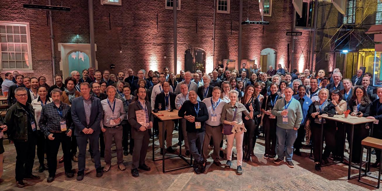
Issue 3 2024 48
Attendees of the Wednesday night dinner at OGC’s 128th Member Meeting.

As usual, the social programme included the Monday evening reception and networking session, and the Wednesday night dinner. The dinner was held at the historic Museum Prinsenhof Delft, former residence of William of Orange and – grimly – where he was assassinated. On a lighter note, Ecere Corporation, represented by Jérôme Jacovella-St-Louis, received an OGC Community Impact Award during the dinner for the company’s tireless work in driving OGC Standards forward.
Opening session
The week opened with a welcome from Friso Penninga, CEO of Geonovum, who outlined not only the work of Geonovum, but also the culture of Delft. Following this, Prof Jantien Stoter of 3Dgeoinfo, TU Delft, previewed Wednesday’s GeoBIM Summit and highlighted activities at TU Delft in this area. Pieter van Teeffelen of digiGO then presented a Dutch platform for digital collaboration in the built environment. Lastly, Jeroen Ticheler of GeoCat explained challenges in social welfare and the work of the GeoNetwork to address them.
Next, it was time to settle a long-running dispute within OGC: who has the better chocolate, Switzerland or Belgium? After a blind taste test, the audience voted Belgium as the winner. So is the debate now settled? Only time – and perhaps people’s taste buds – will tell. The chocolate contest was followed by a demonstration of the Dutch geodata platform called Publieke Dienstverlening Op de Kaart (PDOK), which integrates a number of published and draft OGC API Standards. Special tribute was then paid to two instrumental figures in OGC’s history who sadly passed away in November 2023: Jeff de la Beaujardiere (OGC Gardels and Lifetime Achievement Awards recipient) and Jeff Burnett (former OGC Chief Financial Officer).
Today’s innovation, tomorrow’s technology, future directions
As always, the popular ‘Today’s Innovation, Tomorrow’s Technology, and Future Directions’ session ran unopposed on the schedule so that all meeting participants could attend. This year, the session was presented by Marie-Françoise Voidrot and Piotr Zaborowski of OGC’s Collaborative Solutions and Innovation (COSI) programme. The session focused on several projects in which OGC is participating, fostering the development of capabilities that will be of use to all
Piotr Zaborowski, senior director of OGC’s Collaborative Solutions and Innovation programme, presented some of the EU-funded projects that OGC is involved with.
members. Many of these projects are sponsored by the European Union to advance interoperable science and data management and are supporting OGC resources such as the OGC RAINBOW registry, GeoBIM integration, and learning and developer resources such as the Location Innovation Academy.
Issue 3 2024 49 Report
Friso Penninga, CEO of Geonovum, opened the week with an introduction to Geonovum and Delft.
Prof Jantien Stoter of 3Dgeoinfo, TU Delft, offered a preview of Wednesday’s GeoBIM Summit during the opening session.
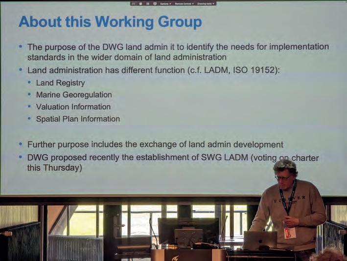
Special sessions
The Land Administration Special Session was dedicated to updating OGC members on the progress of land administration activities amongst members and in ISO/TC 211, where the Land Administration Domain Model (LADM) is managed. A new Land Administration Domain Model Standards Working Group (SWG) is being considered to create Part 6 of LADM: the encoding of Parts 1-5 in one or more formats. Geospatial reporting indicators have been discussed in the OGC Climate Resilience Domain Working Group (DWG) in the context of land degradation. However, the means to exchange indicator information reporting the degree of land degradation (or influencing factors) is not standardized in the community. OGC members are therefore proposing a new SWG to develop such standardized reporting indicators, possibly as extended functionality of work in Analysis Ready Data (ARD).
An ad hoc session on geospatial data requirements was held to assess the chartering of a new SWG. The purpose of this proposed SWG is to develop a standard for describing what geospatial data a project or task needs to collect, store, analyse and present to achieve the project objectives.
The OGC Europe Forum met on Tuesday with presentations focused on data spaces: understanding the European Commission principles of data spaces and how OGC members can engage in the topic. The forum featured speakers from the International Data Spaces Association (IDSA), ISO/TC211, and the European Commission’s Joint Research Centre (JRC) as well as an open panel discussion.
The Observational Data Special Session was organized to identify the various OGC Working Groups that are building standards or assessing the collection and use of observational data. The session clarified the commonalities between these WGs so they can be
considered in future development of observational data standards. Two sessions were held to discuss and prioritize the next steps for OGC activities concerning standardization in the built environment. The first of these sessions focused on the future development of the LandInfra suite of standards: whether priority should be made on new encodings, new parts, or other tasks. The second session considered the topic of what urban digital twins mean to OGC. Presentations on human engagement as sensors and the place for digital twins in data spaces were followed by a preview of the OGC Urban Digital Twins Discussion Paper and a panel of OGC specialists to discuss where urban digital twins are most important in OGC.
The public GeoBIM Summit emphasized the theme of this year’s meeting. There is a great amount of continuity between the geospatial and building information modelling (BIM) communities and their respective technologies and practices. Numerous rapid presentations highlighted activities using OGC and BIM standards and use-cases for interoperability. The Quantum Computing ad
Issue 3 2024 50
Peter van Oosterom, from TU Delft and the co-chair of the OGC Land Administration DWG, presented during the Land Administration Special Session.
hoc session included open discussion from OGC members working with or researching the application of quantum computing technology on geospatial issues. Future ad hoc meetings are planned to move towards the development of an OGC Quantum Computing Working Group.
Closing plenary
The closing plenary normally includes two sessions: an open discussion of important things suggested by members, followed by motions, votes and presentations from members to advance the work of the consortium. However, with the Member Meeting being compressed down to four days (as Friday was a regional holiday), the ‘important things’ discussion was not held. Instead, the closing plenary by Scott Simmons opened with a rapid, sevenminute summary of the entire meeting week, which included slides and content from a large number of the week’s Working Group sessions. The closing plenary also included a record number of motions for votes on new standards, highlighting the very productive activities of OGC members in recent months.
Thank you
The 128th Member Meeting was the OGC’s biggest yet, bringing together hundreds of OGC members to discuss, collaborate and drive technology and standards development forward. The organizers would like to say a sincere thank you to those members for investing their time and energy, as well as their dedication to making OGC the world’s leading and most comprehensive community of location experts.
Preparations began immediately for the 129th Member Meeting, scheduled to take place at Centre Mont-Royal in Montreal, Canada, from 17-21 June 2024.
Some technological highlights
AR browsers
One highlight of the meeting was a demonstration of interoperable augmented reality (AR) browsers by members of the OGC GeoPose and POI Standards Working Groups (SWGs) in collaboration with the Open AR Cloud team and XR Masters, and with support from Geonovum. The two AR browsers (one native app, MyGeoVerse by XR Masters, and spARcl, a WebXR-based browser) were able to share/see the same POIs while being geolocalized using the Augmented City Visual Positioning Service (VPS). The VPS receives requests from (and returns) GeoPoses to any OGC-compliant app that has implemented the GeoPose standard.
Data spaces
There has lately been a dramatic increase in the number of discussions on data spaces, both in and outside of OGC, as the concept becomes more commonplace in European projects and policy. According to the European Union Data Spaces Support Centre, a data space is defined as “an infrastructure that enables data transactions between different data ecosystem parties based on the governance framework of that data space”. In other words, the ‘space’ in a data space defines a context for which the data is useful: a container, governance and access. Given the ubiquitous use of geospatial data, directly and indirectly, an understanding of the data space ecosystem may be key to participate in emerging data infrastructures.
Transition from OGC Web Services to OGC API
The full set of capabilities offered by the OGC Web Services Standards (e.g. Web Map Service (WMS), Web Feature Service (WFS), etc.) is now reflected in OGC API Standards that have either been published, are approaching final approval vote, or are being actively developed. Over the coming months, OGC will establish a process and resources to aid in the transition to the more modern standards, while ensuring that the user community recognizes that the legacy web services are still functional and valuable.
Further reading
https://portal.ogc.org/meet/?p=default&mid=94
GeoPose/POI: https://www.openarcloud.org/oscp/poi (plus YouTube video: https://www.youtube.com/watch?v=DohDw773UYk)
Presentations and recordings via OGC portal (members only): https://portal.ogc.org/index.php
Presentations and recordings will also soon be made available to the public on the GeoBIM Summit event page: https://www.ogc.org/ogc-events/special-summit-on-geobim/
OGC News: www.ogc.org/news
Issue 3 2024 51 Report


FIG General Assembly 2024
In the warm and welcoming atmosphere of Ghana, the FIG General Assembly 2024 was held on 19 and 23 May. It was attended by 60 out of the 103 member associations along with affiliate, academic and corporate members and observers, totalling around 300 people.
The General Assembly was held as part of the FIG Working Week in the vibrant city of Accra, which attracted almost 1,000 surveyors, geospatial experts and other related professions from nearly 90 countries. The agenda included several key items such as the induction of new association members to FIG, the appointment of a new Honorary Member, and the election of two new Vice Presidents for the term 2025-2028. The General Assembly approved six new member associations, while the FIG Council welcomed six new corporate members, four affiliate members and two academic members. Thew addition of 18 new members within a year is a promising indicator of FIG’s ongoing development.
Surveyor Enrico Rispoli from Italy was honoured for his extensive contributions to FIG over many years and was appointed Honorary Member of FIG. He served as the conference director for the FIG Working Week 2012 in Rome, Italy, and has chaired FIG Commission 3. In addition, he has done
extensive work to encourage and help young surveyors in particular, e.g. through summer schools, and is now one of the board members of the FIG Foundation.
Involvement and diversity.
Building on the FIG Council work plan (agreed in 2023), FIG President Diane Dumashie presented and updated the implementation activities and suggested to expand the Council with two ex-officio members: one representing the Young Surveyors, and a representative from the Corporate Members of FIG. This links to the FIG strategic work plan pillar aligned to ‘People’ and will achieve more involvement and diversity in the Council. This proposal was welcomed by the General Assembly. The FIG Young Surveyors Network has an evergrowing number of active members from all around the world who are undertaking impressive projects and activities. Further to this, FIG leadership is keen on getting Young Surveyors involved in the work of the Commissions and Networks and keeping these promising young people central in the development of FIG.
This year, according to the statutes, there should have been election of the ten Commission chairs who would serve as Commission chairs elects for 2025-2026
and thereafter as chairs in 2027-2030. However, the current chairs felt that starting a succession plan so shortly after their own terms began was premature. Consequently, FIG Council proposed to the General Assembly to postpone the Commission chair elections until 2025 and the General Assembly agreed to that proposal.
Tight elections
Nevertheless, there were other elections throughout the Working Week. Since 2021, elections have taken place online which gives the option for all members to take part in the voting, although it is preferable for members to see and meet the nominated candidates face-to-face. This year, there were five excellent candidates for two positions which resulted in four rounds of voting. All elections were very tight. Elected were Michail Kalogiannakis, Technical Chamber of Greece, and Qin Yan, Chinese Society for Geodesy Photogrammetry and Cartography CSGPC, China. FIG President Diane Dumashie extended her heartfelt thanks to all candidates and the associations who nominated them.
By Louise Friis-Hansen
More information www.fig.net
52 Issue 3 2024
Delegates at the FIG Working Week 2024 enjoyed a warm and hospitable atmosphere.

A year full of opportunities for cartography
With the emergence of artificial intelligence and ever more digitalization in all parts of society and our lives, maps function as instruments that bring some kind of order to complex phenomena. Besides helping us to gain spatial awareness and understanding, maps attract attention by providing illustrative information intuitively, and their role as a trustworthy information source is becoming more important than ever. Therefore, the year 2024 is full of opportunities for cartography and ICA.
The digital information era is fundamentally changing science and society. Maps and other cartographic means that communicate information tailored to human users through various media play a key role in this era. It is clear for all to see that we are currently producing more spatial data than ever before. Numerous sensors of all kinds are available; they measure values and store the results in databases, which are linked to other databases being embedded in spatial data infrastructures based on standards and accepted rules. It is also clear that there is no shortage of new and increasingly advanced technologies for all parts of the spatial data handling process, including data acquisition (e.g. UAVs), data modelling (e.g. serviceoriented architectures, AI), data visualization and dissemination (e.g. augmented reality), allowing us to acquire, store, link and process more and more data.
Often, the problem is not that we do not have enough data, but rather that we have too much. It takes an increasing amount of effort to deal with all that data efficiently,
mining the relevant information and linking and selecting the appropriate information for a particular scenario. Ultimately, this should support the effective and efficient usage of data in a trustworthy manner. All of this creates a key role for maps and cartography, as cartography works with abstraction, narrations and holistic views to allow for efficient and effective interfaces between data and humans.
The International Cartographic Association (ICA) seeks to proactively foster research, education and exchange in the domain of cartography and GIScience through all its channels, such as the commissions, publication instruments and conferences, in order to contribute and steer research in the related areas. In this context, 2024 offers a number of excellent opportunities to meet, exchange ideas, present new insights and maps, and learn from scholars.
Two key events supported by ICA in 2024
• 9-11 September, Vienna (Austria): EuroCarto 2024 (https://eurocarto2024.org/)

• 8-10 December, Hong Kong (China): AsiaCarto 2024 (https://asiacarto.org/2024/)

International Cartographic Conference 2025
Looking further ahead, the International Cartographic Conference 2025 will take place in Vancouver, Canada, from 18-22 August next year. This will be a true festival of cartography and GIScience, offering scientific sessions, panels, discussions and networking. In addition, there will be map exhibitions for adults and children, cartographic social events (such as orienteering), technical tours and a gala dinner - and all of this in a vibrant, attractive city. The conference theme of ‘Mapping the Future: Innovation, Inclusion, and Sustainability’ couldn’t be more fitting to
the current topics of concern!


For all of these conferences, the call for submissions is currently open or will open soon. They each offer excellent opportunities to network, learn, exchange ideas and further advance our discipline. I look forward to meeting you at one or more of these events in the coming months!
By Prof Georg Gartner, president, ICA
More information www.icaci.org
53 Issue 3 2024


The ‘From forests to 3D digital models: training new generations on 3D geodata surveying and analysis (3DForTrain)’ ECBI is being conducted at multiple universities in Italy, Spain and China. Work involves merging terrestrial laser scanning (TLS) and uncrewed aerial vehicle (UAV or ‘drone’) Lidar data into a single, dense 3D model (~5,000 points/m2) to extract 3D geometry, single trees and other features. These can be converted into dry mass through density with the support of AI models. The same trees will later be felled and weighed to develop conventional allometric equations to estimate the total above-ground biomass and develop models for components such as stem, bark, branches and leaves.
ISPRS Education and Capacity Building Initiative awards fund seven projects
Last year, ISPRS announced awards of up to CHF10,000 for each of seven one-year projects called Scientific Initiatives (SIs). In the even years, ISPRS offers similar funding for Education and Capacity Building Initiatives (ECBIs). According to ISPRS regulations, these projects “… include initiatives to strengthen the Society’s educational activities undertaken by the Technical Commissions and/or related structures and organizations, as well as new publicity and management issues”.
The seven projects chosen for ECBI awards this year, and their principal investigators, were:
• SUNRISE (Seashore and UNderwater documentation of aRchaeological herItage palimpSests and Environment) Summer School – second edition, Lorenzo Teppati Losé (Italy)
• EDU-UAV photogrammetry: current online educational landscape, Yolla Al Asmar and Bashar Alsadik (the Netherlands)
• POSER: an oPen sOurce Simulation platform for tEaching and tRaining underwater photogrammetry, Fabio Menna, Erica Nocerino and Filiberto Chiabrando (Italy)
• From forests to 3D digital models: training new generations on 3D geodata surveying and analysis (3DForTrain), Francesco Pirotti and Erico Kutchartt (Italy)
• Empowering education and capacity building focusing on natural disasters based on geoAI and computer vision, Saied Pirasteh (China), Laurent Polidori (Brazil), Kaveh Madani (USA), Jonathan Li (Canada)
• Development of VR/AR applications to support geospatial education, Dimitrios Bolkas (USA)
• Innovative training unit for civil engineers on remote sensing for construction impact assessment, Roman Shults (Saudi Arabia).
Scientific Initiatives 2025
The call for SI2025 proposals will be posted in autumn 2024 and the winners announced around the end of the year. The SIs “… further improve ISPRS’s international status in the fields of photogrammetry, remote sensing and spatial information sciences, and benefit all ISPRS members. [They] strengthen the Society’s scientific activities undertaken by the Technical Commissions”.
In addition to SIs and ECBIs, which are awarded biennially, ISPRS’s philanthropic arm, The ISPRS Foundation, provides travel grants in support of students and early-career researchers. The grants enable them to present their work at ISPRS and ISPRS-sponsored events, such as the ISPRS Symposia in 2024, Geospatial Week in Dubai in April 2025 and the XXV ISPRS Congress in Toronto in July 2026.
By Jiang Jie, secretary-general, ISPRS
More information
https://www.isprs.org/society/ecbi/default.aspx Anon, 2023. ISPRS 2023 Scientific Initiative Awards: Seven international projects boosted by ISPRS funds, GIM International, 37(4+5): 50.
54 Issue 3 2024

Meet Planet Insights Platform
Bringing together comprehensive analysis-ready data products, analytics, and tools, the platform provides insights that drive confident decisions, and action. The all-in-one place for multidimensional Earth insights. With Planet Insights Platform you can:
Centralize your Earth data and analytics
Increase observation capacity
Scale and expedite analysis
Distribute insights across environments Discover more: Planet.com
•
•
•
•
SMART SUBSEA SOLUTIONS
• Delivering data in most adverse conditions: underwater acoustic modems with advanced communication technology and networking
• Accurate USBL, LBL and hybrid positioning of underwater assets, navigation for divers
• Modem emulator and multiple cost-saving developer tools
• Sonobot 5 - the autonomous surface vehicle for bathymetry, monitoring, search & rescue, and AUV support
• Quadroin - the novel bionic AUV for surveys and monitoring


sales@evologics.com sales-us@evologics.com
EvoLogics.de NEW DIVER NAVIGATION SYSTEM AVAILABLE NOW
