13 minute read
New Geospatial Sector Standard for Imagery


RICS GuIdanCe note ImpRoveS aeRIal data InteRopeRabIlIty
New Geospatial Sector Standard for Imagery
Interoperability is a major issue for geospatial professionals and clients. A new RICS guidance note takes a major step forwards on imagery and aerial data interoperability by going back to the basic principles of how understanding accuracy and control can bring several sub-sectors of aerial surveying together.
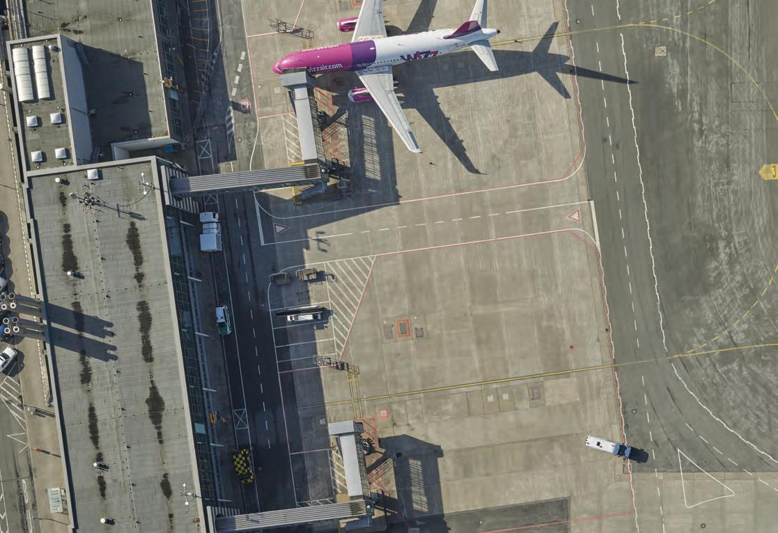
Recent years have seen an enormous increase in the availability and use of all kinds of geospatial data – from the advent of accessible Earth observation and satellite systems such as Copernicus and the rapid development of Lidar, to the evolution of UAV systems and the revolution of hybrid sensors. Aerial survey capabilities have been further extended by enhanced digital processing, improved navigation and control systems as well as increasingly accurate GNSS use in ground/airborne control. This is an exciting and fast-moving sector of geospatial surveying and is increasingly used in applications such as environmental and land management, topographic mapping, site surveys, construction and infrastructure, coastal management, building condition reports and much more. Interoperability is a major issue for geospatial professionals and clients. Different platforms, different capabilities and different outputs can lead to confusion, and the mixing and matching of inappropriate geospatial datasets with often widely differing accuracies and uses can have unforeseen consequences. A new RICS guidance note takes a major step forwards on imagery and aerial data interoperability by not only recognizing these issues, but by actually going back to the basic principles of how understanding accuracy – and, crucially, control – helps to bring several sub-sectors such as unmanned aerial vehicles (UAVs or ‘drones’), aerial imagery (from helicopters/aircraft) and Earth observation together. The new edition also focuses on potential restrictions of use and legal compliance with national and international aviation codes and legislation. The Royal Institution of Chartered Surveyors (RICS) took a lot of time to finalize and get sector consensus on key terms, which can often vary across geographies and even within the sector. The sixth edition highlights the importance of consistent terminology and use. Some of the other important elements of the document are examined below.
Data capture platforms
Choosing an appropriate geospatial data capture platform is a critical part of the process. The choice needs to be based on a deep understanding of client needs, capabilities and achievable output. The use case for the aerial survey will determine the most appropriate type of data:
• Aerial photography is the most common type of data as it aligns most closely with
an riCs guidance note is independent in view and is based on the expert opinion, commentary and advice of expert professional surveyors and sector specialists. in this case, the core expert technical author allan Jamieson FriCs was aided by a very strong and diverse expert peer review group. a broad international consultation process further honed the document as further commentary and debate on accuracy, uaVs, lidar, bathymetry and interoperability continued. the final document has been endorsed by eaasi, the survey association, Chartered institution of Civil engineering surveyors, rsPsoc and Historic england with extensive input from arPas, the environment agency, Hs2 ltd, network rail, ordnance survey, technical university Dublin (tuD) and universiti teknologi Mara (uitM). the final best practice guidance note is now available for use by surveyors, sector specialists, clients and other professionals. it can be downloaded at https://www.rics.org/ uk/upholding-professional-standards/sector-standards/land/earth-observation-andaerial-surveys-6th-edition-global-guidance-note/.
the client’s view of reality, albeit from a different perspective. Most modern sensor systems have the capability to collect four-band red, green and blue (RGB), and near-infrared (NIR) imagery.
• Lidar is a good source of height information and has found numerous applications in modelling the built and natural environments, including the depth of shallow water in coastal and riverine areas and forest canopy detail.
• Multispectral, hyperspectral and thermal data, sensing outside the visible part of the electromagnetic spectrum, can be particularly useful in detecting the health of different plant species.
Use case
Project extent Data type
National mapping Large Aerial photography City Modelling Large Aerial Photography (nadir and oblique) Lidar Heritage recording Small Aerial photography
Forestry Intertidal mapping, near-shore and river Large Lidar Large Bathymetric Lidar
Accuracy Data capture platform
High Manned fixed wing High Manned fixed wing
High UAV, manned helicopter Medium Manned fixed wing Medium Manned fixed wing
Infrastructure, civil engineering Small / medium Aerial photography / Lidar High UAV / Manned Helicopter
Land classification Large Multispectral imagery Low Satellite
Precision agriculture Small Multispectral imagery
High UAV Table 1: The relationship between use case, project extent, data type, accuracy, resolution and data capture platform.
Platform
UAV UAV 30 122
m Height AGL
100 400
Ft Achievable accuracy (m) Achievable
Plan X,Y Height Z resolution – GSD (m)
+/- 0.01 +/- 0.015 0.005 +/- 0.04 +/- 0.06 0.02
• Synthetic Aperture Radar (SAR) data is captured using an active microwave sensor, creating high-resolution imagery of the Earth’s surface independently of the availability of daylight or in the case of poor visibility due to bad weather.
Frequently, more than one data type is commissioned for a particular use case. For example, aerial photography and Lidar are frequently commissioned together, with the photography providing a view of reality and the Lidar data the third dimension.
Issues of accuracy and area of interest (AOI) also have a bearing on the data platform, as do potential restrictions and aviation code
compliance. Table 1 shows examples of how data types can be matched to data capture platforms in eight common use cases. In practice, there are many other successful combinations. Helicopter 319 Helicopter 638 Fixed wing 1,200 Fixed wing 2,250 Fixed wing 4,500 Fixed wing 7,500 1,047 2,093 3,937 +/- 0.03 +/- 0.04 0.02 +/- 0.06 +/- 0.08 0.04 +/- 0.06 +/- 0.08 0.04
7,382
+/- 0.11 +/- 0.15 0.08 14,764 +/- 0.23 +/- 0.30 0.15 24,606 +/- 0.38 +/- 0.50 0.25 Table 2: Achievable accuracy and resolution values for aerial photography.
year and – for bathymetry – tidal information). The sixth edition states that “The starting point for any survey should always be a georeferenced digital file supplied by the client showing their area of interest. This should be accompanied by a specification document providing details of the target imagery GSD, point density (in the case of Lidar), accuracy
requirements and the deliverable products to be created.”
The important issue of control is dealt with in Section 3.4 and is a ‘must read’ for all involved in aerial survey: “Independent GCPs are required to support the data processing and verify the accuracy of the final product. If onboard survey-grade global navigation satellite system (GNSS) and inertial measurement unit (IMU) airborne control is used, there may be no need for full ground control; however, ground verification points should still be established.” If there is one thing that professional surveyors bring to imagery and aerial data (especially UAV surveys), it is an innate understanding of geospatial ‘control’.
project planning
The section of the guidance note on aerial survey project planning underlines the need to collate and verify information on the project, from the basics of time/date to other types of necessary information (such as time of
aerial photography
Another section of the guidance note explores aerial photography in depth and delves into technical aspects of flight lines, image footprints, ground sample distance (GSD), focal length, instrument calibration and an understanding of achievable accuracies. “Imagery acquired using a UAV and intended for SfM processing will normally require the higher figure of 80% forward overlap and a 60% side-lap and may benefit from additional oblique imagery. In coastal areas where a run crosses the shoreline, the forward overlap can be increased to 90%. The increase in overlap should include at least three photo centres over land.”
Flying and coverage is dealt with extensively. Understanding coverage (and much else besides) is critical to understanding the economics and costing of aerial survey projects. The section also contains an updated accuracy table as a new and
important ‘rule of thumb’ for professionals in this sector.
the rise of liDar
Lidar technologies have established themselves as the predominant method of obtaining accurate 3D data from aerial surveys. Lidar offers advantages over photogrammetric methods, such as the ability to capture data at night, during the winter, under trees and irrespective of solar angle. The Lidar section in the guidance note brings together land and bathymetric data capture into one chapter. It continues to recognize the fundamental differences between the two techniques, but also emphasizes the similarities: “Lidar data is scanned line by line as opposed to being captured in a single frame. The scanner head position should be accurately and directly georeferenced. All Lidar instruments should have an integrated GNSS/IMU navigation system.” Flying, coverage, achievable accuracies and resolutions are outlined, together with a suggested set of acceptance quality limits (AQLs) from which to judge the captured data quality.
The section finishes by outlining Lidar deliverables and proposed metadata: “The basic deliverable is the Lidar point cloud, which is made up of individual laser data points that are fully georeferenced in 3D in the client’s choice of coordinate system and usually cut into 1km squares. LAS (or the compressed version, LAZ) is the most frequently used format for Lidar data.”
thermal, multispectral anD hyperspectral
Aerial survey sensors operating in the non-visible parts of the electromagnetic spectrum offer a rich source of data from which to extract information through sophisticated spectral analysis. In recent years, the use of UAVs for precision agriculture has been an important factor in driving the development of small-format multispectral and hyperspectral cameras. The new guidance note explores each of the techniques and focuses on ground sample distance (GSD), calibration, georeferencing, flight times and acceptable quality limits: “When using hyperspectral, multispectral and thermal imaging sensors, improving the spatial and spectral resolution can increase the amount of noise in the signal. It is therefore not uncommon for GSDs of 0.5m or even 1m to be used, with the emphasis on feature identification and condition.”
earth observation
The RICS has included Earth observation (EO) in a guidance document together with aerial surveys for the first time. EO geospatial data is much more accessible than before and is often cited by clients as potentially usable or even preferable in a project. Visible, radar and multispectral sensors are the most common sensors used on satellite platforms. Radar imaging relies on an active sensor emitting electromagnetic radio waves. Unlike optical methods that measure the wave amplitude, radar sensors measure the phase of the backscattered active radio waves and can therefore operate in the dark and in all weather conditions.
Modern satellite sensors offer spatial resolutions of between 0.35m and 1.5m GSD for panchromatic sensors, and from 1m to 6m GSD in the multispectral bands. Active radar sensors can offer imagery resolutions of between 1m and 5m. The guidance note includes a detailed discussion of coverage, accuracy and resolution, and a review of EO products.
The final section of the sixth edition looks at future developments such as sensor
Platform
UAV 30
UAV
122 Helicopter 260 Helicopter 400 Fixed wing 500 Fixed wing 725 Fixed wing 1,300 Fixed wing 2,600 Fixed wing 5,000
m Height AGL
100 400 853
Ft Achievable accuracy RMSE (m) Achievable
Plan X,Y Height Z resolution (ppm2)
+/- 0.02 +/- 0.02 208 +/- 0.06 +/- 0.05 51 +/- 0.03 +/- 0.03 100
1,312 1,640 2,379 4,265 8,530
+/- 0.04 +/- 0.03 48 +/- 0.04 +/- 0.03 30 +/- 0.06 +/- 0.04 20 +/- 0.10 +/- 0.05 8 +/- 0.20 +/- 0.10 2 16,404 +/- 0.39 +/- 0.15 1 Table 3: Achievable accuracy and resolution values for Lidar sensors.
Platform Height Achievable accuracy (m) Example survey types/uses m Ft Plan X,Y Height Z UAV 30 100 0.01 0.02 • imagery and Lidar for heritage recording and construction monitoring • multispectral imagery for precision agriculture. Helicopter 319 1,047 0.03 0.04 High-accuracy imagery and Lidar for engineering design: • road • rail • power networks. Helicopter 638 2,093 0.06 0.08 Imagery and Lidar • engineering asset management • mapping telecommunications networks.
Fixed wing 1,300 4,265 0.06 0.08 • BIM for infrastructure • imagery for cadastral mapping • Lidar for forestry • multispectral for biomass mapping and monitoring the health of plants and crops • hyperspectral for tree species mapping and tracking soil moisture content.
Fixed wing 2,600 8,530 0.14 0.18 • imagery for urban mapping and 3D city models • imagery and Lidar for coastal management • thermal mapping for energy efficiency surveys and detection of pollution.
Fixed wing 4,500 14,764 0.23 0.30 • imagery for rural mapping • imagery and Lidar for river catchment flood risk management.
Fixed wing 7,500 24,606 0.38 0.50 • imagery for upland area mapping • environmental impact assessments.
Satellite 450–770 km 279–478 mi 3–4m (CE90)
3–4m (LE90) • satellite imagery for land cover classification • multispectral satellite imagery for environmental monitoring and vegetation index mapping. Table 4: Combined platform, altitude, data type and achievable accuracy table.
miniaturization and fusion, beyond visual line-of-sight (BVLOS) UAV operation, Lidar developments, high-altitude pseudo satellites and developments in satellite technology: “True BVLOS fl ights should occur once UAVs are able to communicate autonomously with other airspace users and automatically sense and avoid other fl ying objects. The benefi ts of BVLOS will be fully realized once the fl ight times of UAVs are increased with improved battery technologies.”
The appendices of the guidance note contain an extensive list of further reading and resources, an expanded glossary, several basic sample specifi cations and an accuracy table that brings all of the aerial survey platforms into one combined format based on achievable accuracy. In the accuracy table, the achievable accuracies are quoted in RMSE fi gures relative to ground control, apart from for satellite imagery. These are quoted as circular and linear errors (CE and LE) at a 90% confi dence level. It is envisaged that this groundbreaking table will be integrated with an updated accuracy table for measured surveys (topographic, building, utility) within the forthcoming revision of the RICS guidance note on measured surveys of land, buildings and utilities.

conclusion
The new guidance note is intended for use by land, sea, engineering and environmental professionals who are acting in an advisory capacity, and by survey-knowledgeable clients who specify their own surveys. It is also intended to be used by Earth observation and aerial survey specialists. It will help clients communicate their goals and what they expect to receive in terms of the types of data, accuracy and resolution, the level of survey detail and the fi nal deliverables required. It will also help both parties clarify issues such as the major project constraints, related costs and timescales.
about the authoRS
james Kavanagh is director of the riCs land Group and chair of the ilMs Coalition. He is a chartered land surveyor and chartered geographer with over 25 years of experience in civil engineering, land issues and surveying. He has worked on some of the largest civil engineering projects in europe and spent several years mapping Palestinian refugee camps in the Middle east while working for the united nations.
allan jamieson is a chartered land and hydrographic surveyor (FriCs), with 27 years’ experience in the geospatial industry. He has experience in managing projects in a wide range of geospatial disciplines, including land survey, mobile scanning, satellite imagery, aerial photography, photogrammetry and lidar, in 20 countries worldwide. He is currently the Data standards lead at ordnance survey. He is the lead author of the sixth edition of the riCs global guidance note on earth observation and aerial surveys.
IGI UrbanMapper-2P