20 minute read
Airborne Lidar Bathymetry in Close Up
RIEGL tested the performance of its topo-bathymetric airborne laser scanning system in a transition zone context along the French Mediterranean coast. Initially planned as a UAV survey, tests were conducted using a fixed-wing aircraft due to the restrictions placed on operations by the ongoing coronavirus pandemic. The results are encouraging, and the next step will be drone operations in more challenging sea conditions.
Topo-bathymetric airborne laser scanning (a field of airborne laser bathymetry, or ALB) is known for its efficiency in seamlessly surveying hybrid landscapes. It is therefore used in hydrography and the maritime cartography of shallow water areas, with the advantage of capturing topographic and bathymetric data in one single mission. These transition zones, which are difficult to cover by shipborne means or by land-based acquisition only, typically accommodate a large diversity of natural habitats and artificial structures, settlements or infrastructure. Consequently, they carry a high inherent risk due to terrain change, both offshore and onshore. These changes have to be monitored rigorously. The survey tasks are manifold, and include habitat preservation and protection, for example in areas that are exposed to flooding, land shrinkage or coastal erosion. Surveys are also used for infrastructure maintenance and to ensure coastal navigation safety. As a non-intrusive surveying method, ALB supports all of these tasks without impacting the environment and without putting surveyors at risk.
Lidar in Bathymetry
The specific requirements and limitations of Lidar in the context of bathymetry have to be taken into account. After all, it involves light and water, and for all the beauty that these two evoke when they mingle, it means a meticulous balancing of the gain-and-loss ratio in Lidar technology. ALB systems are usually employed from manned aircraft at an operating altitude of > 1500ft (457m) AGL. They utilize green wavelength lasers, typically with a beam divergence of > 1mrad for reasons of eye safety, which is broader than that of the near infrared (IR) lasers used in purely topographic Lidar systems. The resulting laser footprint diameter on the ground surface is around 50cm. As a consequence, the planimetric resolution of the data is limited.
Turbidity further limits the usability of ALB. A coarse measure for the turbidity is the Secchi depth, which refers to the depth that a white or black and white disc can be lowered into the water before it disappears to an observer on the surface. By using powerful lasers as well as large and sensitive receivers, it is possible to acquire data in multitudes of the Secchi depth. However, in turbid waters this can still mean quite poor penetration.
When the laser beam interacts with the water, it is not only scattered and attenuated due to absorption but its direction and velocity of propagation also change at the air/water interface due to refraction. Correcting for the effects of refraction requires accurate knowledge about the location where the laser beam hits the water, which can be determined by classifying the water surface points and generating a water surface model. These additional processing steps can be timeconsuming and require experience on the part of the processing team.
Comparison of point density: red points (right picture half) are LITTO3D data on land and on the seafloor (no water surface data shown), multicolour points are data acquired with RIEGL VQ-840-G (water surface and seafloor).
topo-Bathymetric Lidar at Low fLying aLtitUdes
Over the last decade, the use of unmanned aircrafts (miniature or midsized) as carrier platform for cameras and all kinds of surveying equipment has been well established and has revolutionized the surveying sector. The availability of both UAS (unmanned aerial systems) and high-quality miniaturized sensors has enabled a new survey dimension in terms of perspective, flexibility and degree of detail.
Based on this experience, recent research and industrial development have begun to focus on equally adapted sensor systems for hydrography.
While it is undisputed that bringing Lidar closer to the water surface restrains the swath width, and that the limited airspeed further reduces overall efficiency with respect to area coverage, this downscaling leads to a considerable gain in data quality concerning spatial resolution and potential depth performance. Expectations were especially high for complex, small area applications or the detailed mapping of riverine landscapes, which are underserved by high-altitude ALB.
RIEGL presented a first bathymetric Lidar profiler for UAS integration in 2016, followed by a first commercially available small-sized topo-bathymetric scanning system, the RIEGL VQ-840-G, in 2018. The core part of this system is a fully integrated compact airborne laser scanner for combined topographic and bathymetric surveying. The instrument can be equipped with an integrated and factorycalibrated IMU/GNSS system and with an integrated industrial camera. Compact and lightweight, at just 12 kg, it can be installed on various platforms, including UASs. The laser scanner comprises a frequency-doubled IR laser, emitting pulses with a roughly 1.5ns pulse duration at a wavelength of 532nm and at a PRR (pulse repetition rate) of 50–200kHz. At the receiver side, the incoming optical echo signals are converted into an electrical signal, amplified and digitized at a digitization rate of close to 2G samples/s. The VQ-840-G comes with special parametrization features allowing adaptation to the survey situation at hand. One option is to select the beam divergence between 1mrad and 6mrad to maintain a constant energy density on the ground and therefore balance eye-safe operation with spatial resolution. Also, the receiver’s iFOV (instantaneous field of view) can be chosen between 3mrad and 18mrad. For topographic measurements and very clear or shallow water, a lower setting is suitable, while for turbid water it is better to increase the receiver’s iFOV in order to collect a larger amount of light scattered by the water body.
The VQ-840-G employs a Palmer scanner generating an elliptical scan pattern on the ground. The laser beam consequently hits the water surface at an incidence angle with low variation. The onboard distance measurement is based on time-of-flight measurement through online waveform processing of the digitized echo signal. A real-time detection algorithm identifies potential targets within the stream of the digitized waveform and feeds the corresponding sampling values to the signal processing unit, which is capable of performing system response fitting (SRF) in real time at a rate of up to 2.5 million targets per second. These targets are represented by the basic attributes of range, amplitude, reflectance and pulse shape deviation and are saved to the storage device. Besides being fed to target detection and online waveform processing, the digitized echo waveforms can also be stored for subsequent offline full waveform analysis.
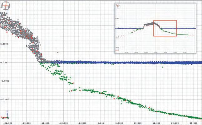
Profile of superposed Lidar data from LITTO3D (red points) and VQ-840-G (grey for topography, blue for water surface, green for seafloor). The two point clouds match perfectly. Differences (in the steep slope) might indicate a change in terrain or vegetation between the two acquisition campaigns. Wide-area Lidar (LITTO3D) outperforms in coverage and depth penetration capacity, near-surface Lidar (VQ-840-G) excels in complexity and detail.
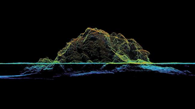
VQ-840-G high-resolution point cloud: view of Les Deux Frères rock formation and seafloor terrain, maximum depths achieved 17.5m.
After a series of successful test projects on various inland water bodies, with the VQ-840-G integrated both on manned helicopters and on two different models of electrical multirotor UAVs, an experiment by means of a manned
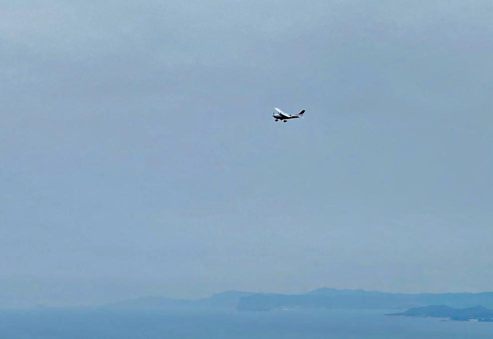
fixed-wing aircraft was carried out in March 2021 on the French Mediterranean coast. The choice of carrier platform was due to the current pandemic situation. Initially, the project had been planned as a UAV survey, but this had to be postponed throughout 2020. As travel and dispatch of personnel continue to be subject to restrictions, the crew was better off in the air. And after all, it was a good occasion to evaluate the performance of the system operated from a manned aircraft. A Cessna T206H, OE-KRI, was used for the mission, at a mission flight altitude of 150m AGL and flying at 110kts, resulting in a point density of about 6-8 points/m² at the measurement rate of 50kHz that was used for maximum performance. Of course, the flight dynamic of a manned fixed-wing aircraft is very different from the manoeuvring agility of a drone. And certainly, compared to typical drone flight parameters (e.g. 75m altitude; 20–30kts speed), the point density and performance was reduced, but this was offset by the flexibility and the possibility to cover a lot of ground in a short trip.
On 2 March 2021, the morning air was cool and calm as the Cessna T206 took off from Avignon-Provence airport for a first survey mission in the Camargue region west of Marseille. However, it had already started to rain in Montpellier further south-west and so another scheduled project there had to be cancelled in-flight. The OE-KRI crew decided to refuel in Avignon before continuing with the experiment in the rocky area of Cap Sicié and then continuing for more data acquisition towards the FrenchItalian border before returning to the home airfield in Austria in time. Ground handling was limited to the strictly necessary in order to minimize Covid-related risks for the crew.
Arriving at Cap Sicié shortly after 10:00 with an easterly wind at force 4, the sea state was slight. The waves reached 1-1.3m in significant height with a rather weak swell from the south-east. Cap Sicié is a cliff off the bay of Toulon and La Seyne sur Mer in the French Provence area of Var. The cape is known because – in contrast to the sheltered bay area – the wind, in particular the Mistral and Levant, can be particularly strong. The highest point at 352m offers a panoramic view of Toulon Bay and, when the air is especially clear, much farther to the Côte d’Azur islands. To the east, an eye-catching twin rock formation, ‘Les Deux Frères’, served as a focus for the data acquisition.
Located just below the cape, Amphitria is a wastewater treatment plant, an astonishing architectural structure embedded smoothly into the steep cove. The building is exposed to both hazards from land and water, and therefore
subject to continuous security measures, in order to ensure a safe working space for on-site personnel. The restricted accessibility due to topographic characteristics and protection of the natural habitat needed to be considered, serving as an example of the potential use of non-contact, yet close to surface, surveying methods.
comparing the resULts with reference data
The test area (approx. 1152ha) was covered in 12 overlapping flight strips, resulting in a total of 60,864,774 single measurement points. For a
Cessna T206 OE-KRI at Cap Sicié.
point density check, only data from a single flight strip was taken into account. A first analysis of the Lidar data showed that the topographic parts provided reliable multi-echo coverage, thus well capturing terrain beneath vegetation. The seafloor in the measurement area is composed of sand, which provides good reflectance due to its colour yet causes water turbidity when disturbed.
In order to reference and validate the results, the data was compared with existing, publicly available ALB Lidar data carried out by SHOM (the French Naval Hydrographic and Oceanographic Service). In the national Litto3D programme, a digital altimetric reference model of the French coast for a littoral zone up to 10m isobath and up to 6 nautical miles offshore has been generated.
The acquired data was superposed onto the Litto3D data to obtain a visual impression of the two datasets. An excellent match was obtained of the point clouds both on dry ground and also the seafloor. While the Litto3D data extends to greater depth, the VQ-840-G’s data provides a more detailed view due to its higher spatial resolution. At the seafloor, the Litto3D data is specified to have 0.04 pts/m2 , on dry ground this is 1 pt/m2. In the area investigated, it is even slightly higher for both contexts. The VQ-840-G provided a resolution above and below the water surface of 7 pts/m2 . These results might therefore perfectly complement wide-area survey data in regions of particular interest.
The brief field trip to the French coast provides insight about the VQ-840-G’s performance in a maritime context, operated from a manned aircraft. The results achieved are a motivation for taking the next challenge, which is to operate from a drone and a higher sea state. A test series to further fine-tune the system for different survey applications is planned.
acknowledgement
The authors would like to thank the local air traffic control service Base d’aéronautique navale de Hyères Le Palyvestre for flight coordination and Bateau-ecole de la Mediterrannée à Toulon for advice.
Ursula Riegl is assistant to the CEO at RIEGL Laser Measurement Systems GmbH located in Horn, Austria. A trained PPL pilot, she is responsible for aviation admission procedures for UAV missions. In RIEGL’s bathymetry sector she is coordinator for experimentation and demo projects.
Beatriz López García successfully completed her Bachelor’s degree in Technical Survey Engineering and a Master’s degree in Geodetic and Cartographic Engineering at the University of Jaén. Since April 2015, she has been working as a support engineer in the field of airborne and mobile laser scanning, software and data processing at RIEGL Laser Measurement Systems.
Dr Martin Pfennigbauer holds a PhD in engineering from Vienna University of Technology. He has been employed by RIEGL Laser Measurement Systems since 2005, presently as director of research and intellectual property. He is also business division manager for hydrographic laser scanning systems. His special interest is the design and development of Lidar instruments for surveying applications, with a focus on rangefinder design, waveform processing and point cloud analysis.
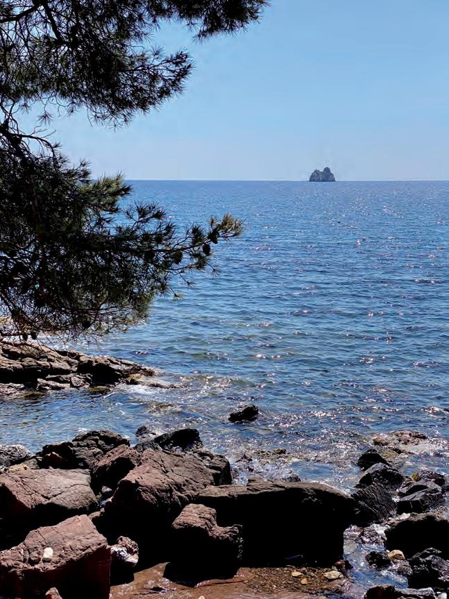
Les Deux Frères seen from the shore of Mar Vivo, La Seyne sur Mer.
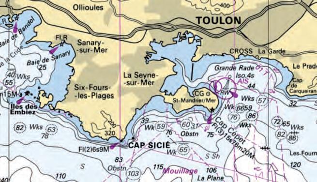
Marine area chart. (data source: SHOM, https://diffusion.shom.fr)
Transitioning to a 4.0 Industry by Tackling Environmental and Societal Challenges
Remote Hydrography
Hydrography is undergoing dramatic change. The current pandemic has made it very difficult to go to sea and mobilize vessels and crews, while the use of traditional research vessels is rapidly becoming obsolete as environmental regulations are introduced that are increasingly difficult to meet financially. At the same time, the blue economy is booming. International initiatives like Seabed 2030 are being implemented, and never before was there such a need to monitor not only seabed dynamics, but seabed ecosystems and water columns too. This involves collecting, processing, interpreting, plotting and archiving a massive amount of data in a more efficient and cost-effective manner. All of this requires a global change in the way that hydrography is conducted. And, while technology has evolved in that direction in the past decades, with major breakthroughs made in the fields of subsea monitoring and mapping systems, covering large areas of our seas and oceans in a timely fashion and within budget remains a challenge. This can now be solved with the advance of new purpose-made supervised autonomous platforms and remote hydrographic operations, which make it possible to use sensors to the best of their capabilities, providing ideal acquisition environments through enhanced stability, speed and reduced radiated noise.
ObligatiOns and RespOnsibilities
In addition to the environmental responsibilities that the hydrographic industry has, it is also important for its societal role to be taken into consideration. Keeping surveyors out of harm’s way must indeed be a permanent goal, just like keeping the environment that we are serving safe from irreversible impacts. The transition towards the use of uncrewed surface platforms brings just that. Not only do such platforms reduce human exposure to hazardous environments, but they also enable more sustainable operations by consuming less fuel than traditional survey vessels, reducing greenhouse gas emissions. The rise of autonomous platforms also allows operators to either enhance the capability of their exploited assets by acting as force multipliers, or to benefit from a single low investment and low operating costs for those who cannot afford large investments. The hydrographic industry’s societal role also extends to granting easier and less expensive access to assets and acquired hydrospatial data for a larger community, including scientists (e.g. marine biologists, oceanographers, archaeologists, geologists), fishermen and other actors in the blue economy. This should be among the industry’s priorities, and can now be met through the increased deployment of advanced autonomous survey platforms that widen operating windows, enabling much larger amounts of data to be collected.
sOlutiOns and Challenges
Thanks to the advances taking place in these newly developed autonomous platforms, hydrography is now accelerating its revolution towards a 4.0 industry. With the deployment of uncrewed surface vessels that remotely conduct recurrent tasks such as data collection, human skills and expertise can now be put to better use exploiting and qualifying the collected data, all from the safety of a remote control centre, either on a mother vessel, or at an onshore location. This evolution not only involves technology, but also requires rethinking the whole concept of the hydrographic ‘operation’. Greater progress will indeed be made once developers and service providers adapt their survey methodology to the use of these new remotely supervised platforms. Autonomy is key in the response to the previously made observations. Making use of purpose-built platforms, the design of which is based purely on their end function (data acquisition), plays a big role in this transition. Leveraging purely hydrodynamic designs that do not have to be constrained by human presence onboard the vessel, uncrewed surface platforms benefit from high stability that allows them to work at greater speeds and in higher sea states than traditional
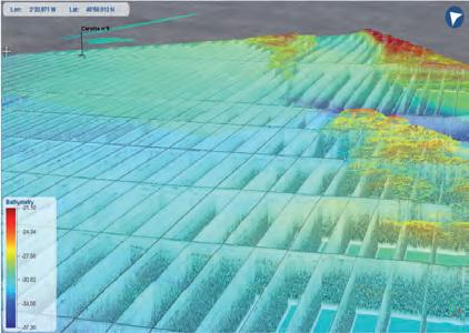
3D representation of simultaneous MBES and SBP data collection using the iXblue DriX USV.
survey platforms, while still acquiring higher quality data. Among the possibilities brought about by uncrewed vessels, modular gondolas – such as the ones developed by iXblue for the DriX USV – indeed provide unique low noise environments away from hydrodynamic acoustic turbulence, and guarantee cleaner acoustic data. Developing an ecosystem around autonomous platforms is also key to the smooth transition towards remote autonomy, as it enables efficient deployments and successful missions without creating new operational constraints. Aware of this challenge, iXblue is developing a full ecosystem around its DriX USV, consisting of functional launch and recovery systems, as well as purpose-made towing tools, gondola adaptations and shallow water support tools. Overall, uncrewed survey platforms, which are able to cover extensive areas at a fraction of the time and costs of traditional survey methods and keep downtime to a minimum, have become a leading-edge survey technology that force-multiplies data acquisition and helps optimize survey productivity, efficiency and safety as a whole, defining the essence of remote hydrography itself.
supeRvised autOnOmy
Supervised autonomy is defined as the ability to operate unmanned survey platforms autonomously to achieve high-level mission goals while they are supervised by a remote operator who can take over control whenever circumstances require. In the context of hydrography, mission goals are usually defined by an area to be surveyed, as well as by measurement objectives (e.g. coverage, measurement density). A mission consists of the sequential execution of autonomous behaviours that represent elementary tasks. Most uncrewed platforms operate with deterministic behaviours, such as following run lines or predefined survey patterns. One of the challenges to reach the next level in terms of autonomy will be to develop reactive autonomous behaviours that use the data collected by the payload to optimize the platform mission plan. The need for supervision is driven by the technology readiness and societal acceptance. As with self-driving cars, the path towards full autonomy will consist of multiple steps. Of course, autonomous systems use advanced communication systems to provide pilots with a high level of situational awareness, and communication in the maritime environment remains a challenge, as the performance of marine communication systems can vary greatly depending on the environmental conditions. Uncrewed surface vessels have to rely on a wide range of communication infrastructures, depending on the operation scenarios (Wi-Fi, radio, LTE or satellite). Managing the User QoE (Quality of Experience) also remains a significant challenge. To respond to the challenge of optimizing the use of available communication channels, iXblue has been working on an adaptive strategy in terms of managing the transfer, remote processing and access to data according to user priorities. Another choice made by iXblue to offer an adaptive strategy is its developments on the DriX USV command and control. Built as an open platform, it supervises third party software to use onboard data
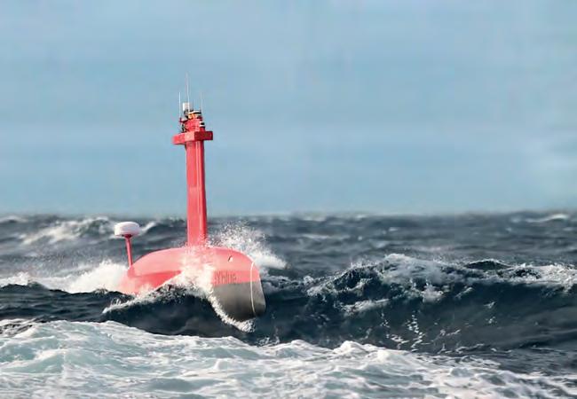
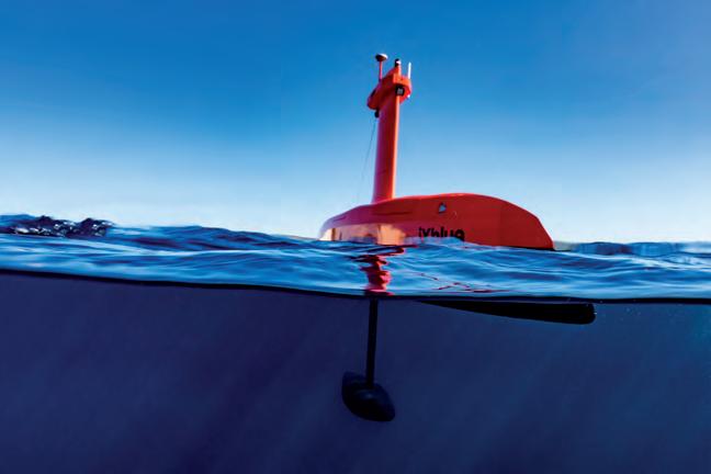
iXblue DriX USV acquiring data meeting exclusive order criteria in sea state 5 off the coast of La Ciotat, Mediterranean Sea.
Radical design choices made possible by uncrewed platforms lead to highly hydrodynamic and stable platforms that excel in complex and constrained environments. iXblue DriX USV can for instance conduct surveys at speeds ranging from 4 to 14 knots and in weather conditions up to sea state 5 without impacting data quality.
processing and management to its best capabilities, while continuously accessing and integrating the right amount of data required to make decisions that support supervised autonomous operations. The flexibility provided by this kind of open platform allows the best adaptation to the constraints linked to communication channels to support supervised autonomy, while maintaining a very high level of onboard autonomy and responsiveness to potential working environment and situational changes.
OppORtunity fOR new geneRatiOns Of sailORs and sCientists
Overall, the transition to remote hydrography will call for a new generation of marine technicians and scientists that will need to be trained to support uncrewed platform mobilization, operation and maintenance, as well as to support the increasing need to interpret the massive amount of data collected. While traditional survey vessels were crewed with sailors in charge of navigation and deck operations, as well as with onliners and offliners for data acquisition, mission planning, data processing, pre-interpretation and charting, uncrewed survey platforms will now require a smaller team of a new kind of technicians. True specialists in autonomous platforms and remote operations, they will organize field mobilizations, liaise with local authorities and communities, and be able to maintain autonomous platforms. And because autonomous survey platforms provide higher data quality – iXblue DriX’s latest remote operations have indeed shown a reduction by a factor of ten of the required cleaning and processing of hydrographic data – more time will be given to onliners and offliners to concentrate on much added-value QC, interpretation and charting tasks. Globally, using uncrewed vessels such as the iXblue DriX USV supported by a strong ecosystem will not only save precious time during these phases, but also during all other stages of the survey operation, including mobilization, thanks to smaller pre-calibrated and normalized platforms, and during the operation itself, thanks to the development of efficient mission planning algorithms and autonomous data acquisition. All of this allows onliners and offliners to work remotely on multiple assets and missions at the same time, bringing much added value to the industry.
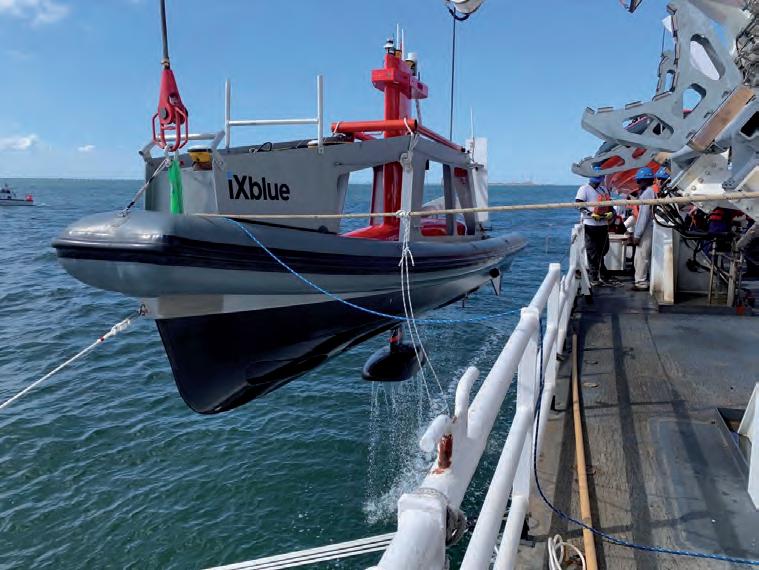
DriX being deployed from NOAA’s Thomas Jefferson hydrographic survey vessel.
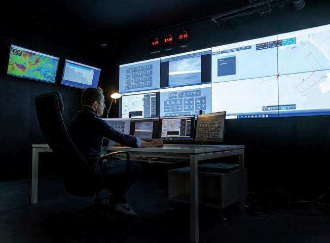
Multi-DriX USV operation conducted from iXblue onshore control centre. David Vincentelli is a Cat. A hydrographer with a Master’s degree from ENSTA Bretagne Engineering School. After seven years at sea conducting a wide range of survey operations in the Arabian Gulf, northern Europe and Mediterranean regions, he joined iXblue in 2012 as a business developer for the sea operations division. In 2020, he was appointed co-director of the division and now coordinates the iXblue transition towards remote hydrographic services. Vincentelli is also involved in pro-bono activities. As president of the Francophone Hydrographic Association, he works actively to promote francophone hydrographic expertise, supporting the creation of a francophone hydrographer certification scheme and participating in IHO and IFHS technical working groups.
