
Shaping tomorrow’s ocean mapping education Prehistoric landscapes of the North Sea Impact of sound from offshore wind farms Shining a spotlight on Irish Sea shipwrecks Maritime history comes alive in two evocative World War I shipwreck bathymetric images Empowering the subsea survey industry www.hydro-international.com Issue 2 2024 Volume 28


DRIX O-16, A NEW TRANSOCEANIC USV
A unique combination of speed, endurance, and payload capabilities.
•30+ days endurance
•Full ocean depth payload sensors
•Dual hybrid propulsion
•ROV, ROTV launch & recovery
•Redundant architecture


Director Strategy & Business Development: Durk Haarsma
Financial Director: Meine van der Bijl
Editorial Board: Huibert-Jan Lekkerkerk, Mark Pronk, BSc, Marck Smit, Auke van der Werf
Head of Content: Wim van Wegen
Copy Editor: Serena Lyon
Marketing Advisors: Myrthe van der Schuit and Peter Tapken
Circulation Manager: Adrian Holland Design: ZeeDesign, Witmarsum, www.zeedesign.nl
Hydro International is an independent international magazine published by Geomares. The magazine and related e-newsletter inform worldwide professional, industrial and governmental readers of the latest news and developments in the hydrographic, surveying, marine cartographic and geomatics world. Hydro International encompasses all aspects, activities and equipment related to the acquisition, processing, presentation, control and management of hydrographic and surveyingrelated activities.
Subscription
Hydro International is available on a subscription basis. You can subscribe at any time via https://www.hydro-international.com/ subscribe. Subscriptions will be automatically renewed upon expiry, unless Geomares receives written notification of cancellation at least 60 days before the expiry date.
Advertisements
Information about advertising and deadlines are available in the Media Planner. For more information please contact our marketing advisor (myrthe.van.der.schuit@geomares.nl) or go to www.geomares-marketing.com.
Editorial Contributions
All material submitted to the publisher (Geomares) and relating to Hydro International will be treated as unconditionally assigned for publication under copyright subject to the Editor’s unrestricted right to edit and offer editorial comment. Geomares assumes no responsibility for unsolicited material or for the accuracy of information thus received. In addition, Geomares assumes no obligation for return postage of material if not explicitly requested. Contributions must be sent to the head of content wim.van.wegen@geomares.nl.
Geomares
P.O. Box 112, 8530 AC Lemmer, The Netherlands
T: +31 (0) 514-56 18 54 F: +31 (0) 514-56 38 98 info@geomares.nl hydro-international.com
No material may be reproduced in whole or in part without written permission of Geomares. Copyright © 2024, Geomares, The Netherlands All rights reserved. ISSN 1566-9076
10

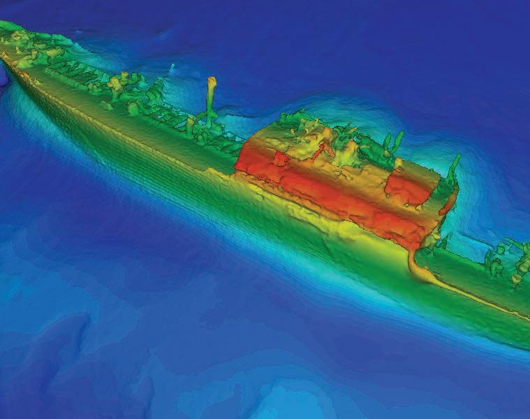
Shining a spotlight on Irish Sea shipwrecks
The data for the images of the sunken vessels SS Tiberia and RMS Leinster was captured during seabed mapping. These and a multitude of other wrecks speak to the need for ongoing monitoring, both for heritage preservation and to manage potential environmental risk.


27
Shaping tomorrow’s ocean mapping education
In the summer of 2023, three marine organisations teamed up to prepare Canadian ocean mapping students to become ‘hydrographers of the future’. The internship programme focused on providing technical skills and knowledge that are new, rapidly evolving, and not yet widely taught in college programmes.


14

Impact of sound from offshore wind farms
Despite 30 years of offshore wind farm operation in European waters, our understanding of their impacts on marine ecosystems during their operational lifetimes is limited. Various institutes have united their skills and expertise in the PURE WIND project, funded by the JPI Oceans initiative ‘Underwater Noise in the Marine Environment’.

Topobathymetric Lidar for adaptive management
Topobathymetric Lidar technology has become an indispensable tool in environmental management, particularly for monitoring and preserving fragile ecosystems. In central Nebraska, along the Platte River, it plays a pivotal role in ensuring habitat suitability for endangered and threatened species.

International recognition as a Certified Hydrographic Surveyor Graduates of IBSCrecognized Category S-5A (Cat A) or S-5B (Cat B) programmes with relevant hydrographic experience can apply to become Certified Hydrographic Surveyors. Those with other geospatial degrees and relevant experience may also apply. This article debunks the myth that Cat A or Cat B graduates are automatically certified.
Cover Story
19 23

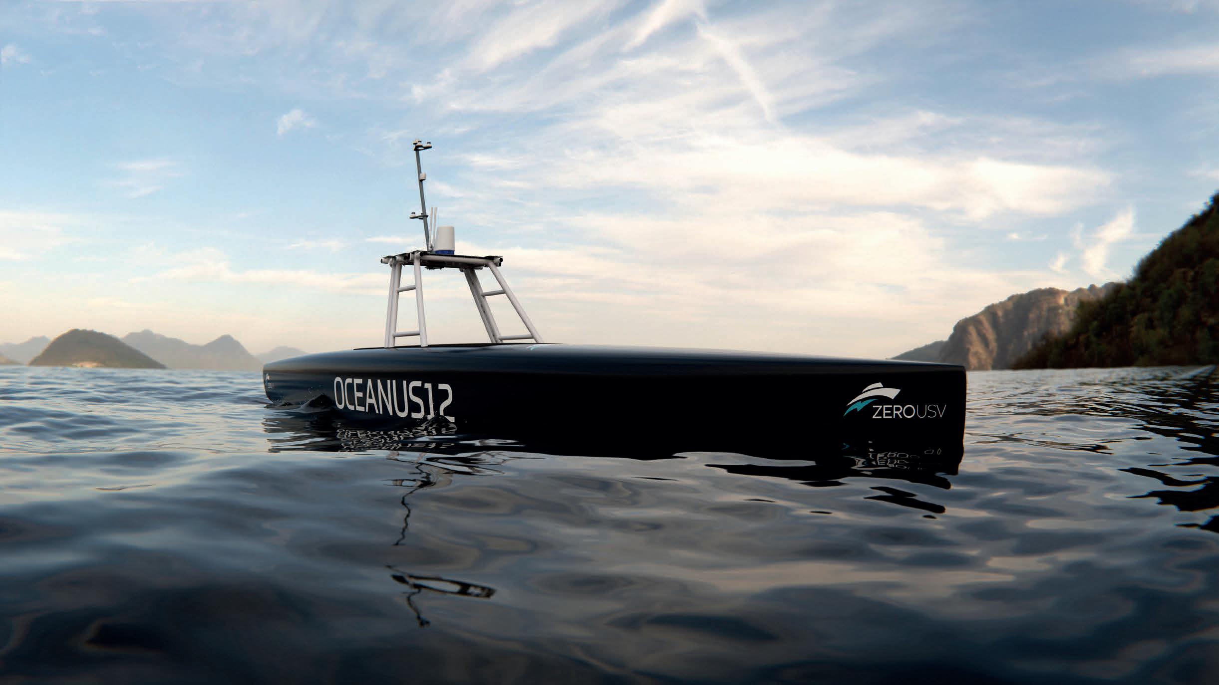
‘Mission-agnostic USV’ Before long, it will be possible to send a USV to sea to carry out offshore and deep-sea surveying and monitoring over distances of more than 2,000 nautical miles. It will even keep working when satellite communication is down. Oceanus12 is the name registered by Zero USV for its class of 12m-aluminium vessels.


Prehistoric landscapes of the North Sea
As Dutch fishermen have known for decades, the North Sea region was once a barren landscape populated by large mammals long extinct. The fishermen frequently find the remains of these mammals – woolly mammoths, rhinos, aurochs, Irish elk (giant deer) and reindeer – in their nets. Artefacts made of bone or antlers and even human remains are also sometimes part of the by-catch.

Research icebreaker Polarstern returns from East Antarctica
After more than six months, the research icebreaker Polarstern has returned to its home port of Bremerhaven, Germany, after a successful Antarctic season. The expeditions to the southern hemisphere and the transit there focussed on the oceanography and geology of East Antarctica as well as student training.
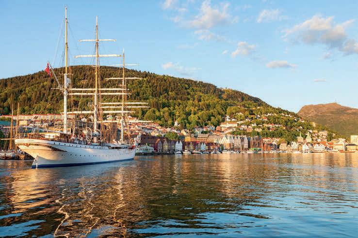
Dawn on Belfast Lough, an intertidal sea lough at the mouth of the River Lagan in Northern Ireland. This cover image accompanies the article on pages 10-13 about the SS Tiberia, torpedoed by German submarine U-19 on 26 February 1918, roughly 2.5km east of Blackhead. The SS Tiberia and nearby wrecks, used for many years in the calibration of AFBI’s MBES, have been covered in multidisciplinary surveys. (Image courtesy: Stephen Lavery /Shutterstock)
Issue 2 2024 3 Contents Shaping tomorrow’s ocean mapping education Prehistoric landscapes Impact of sound from Shining a spotlight on Irish Sea shipwrecks Maritime history comes alive in two evocative World War shipwreck bathymetric images Empowering the subsea survey industry
5 Editorial 6 Headlines
31 19 38
Explore Shipwrecks Like Never Before
Struggling to capture every detail?
Introducing the Teledyne RESON SeaBat T51 800 kHz multibeam echosounder.
Drive efficiency onboard with rapid data throughput, clear data and precise imagery.
See for yourself: Witness our survey of the HMS Hood wreckage. SCAN TO WATCH


Off the beaten track


Achieving a good and preferably balanced mix of content is a challenge for every issue of Hydro International. Not that there is an insufficient supply of articles, on the contrary, but the aim is of course to serve the entire target group and to take all areas of interest into account. There is also the dividing line between need-to-know stories and the niceto-know variant. And every now and then, we allow ourselves a side road into a theme that perhaps has less to do with hydrography or related fields. This then leads to an article that seems to be a bit of an odd one out in our content mix, but to which we often receive positive responses. Such an odd one out this time is the article ‘Prehistoric landscapes of the North Sea’ (see page 34), which highlights the discovery of remains of mammoths, rhinos and human artefacts by fishermen and collectors. It also describes the steps taken under Dutch law to assess and preserve archaeological sites in development activities. Moreover, it discusses the challenges and methodologies of offshore archaeological research, with an emphasis on understanding submerged prehistoric landscapes and the reconstruction of aquatic and terrestrial environments by examining sedimentary layers, environmental conditions and microfossils. The article underscores the importance of ongoing geoarchaeological research in unveiling the hidden past of the North Sea region. Is this of relevance for hydrographic professionals? At Hydro International, we certainly believe so! Hydrographic professionals often work with data related to the seafloor and underwater environments. This article provides insights into the geological and archaeological aspects of submerged landscapes, which can inform
hydrographic surveys and mapping efforts. Knowledge of the prehistoric features beneath the seabed can aid in interpreting bathymetric data and identifying potential hazards or points of interest. In the realm of offshore development, hydrographic professionals play pivotal roles in projects spanning oil and gas exploration, wind farms and submarine cable installations. Their awareness of potential archaeological sites or sensitive geological features, as discussed in the article, is essential for project planning, environmental protection and regulatory compliance. When it comes to data collection techniques, the article offers a comprehensive exploration of a variety of methods, including sediment sampling, microfossil analysis and geological dating. These techniques, similar to those utilized in seabed mapping and environmental monitoring, broaden the horizons of hydrographic professionals, enhancing their ability to collect and analyse data effectively. Moreover, the article stresses the worth of interdisciplinary collaboration, exemplified by partnerships between geologists, archaeologists and other experts. Such collaborations are increasingly vital in hydrography, fostering comprehensive understanding and effective management of marine environments through shared expertise and insights. Hopefully, we can continue to publish these types of articles every now and then. If you, as an extremely valued reader, have any specific ideas about this, we certainly look forward to hearing them! That is also the beauty of the hydrographic sector – there are connections with many other areas, and hydrographic surveyors and marine researchers are active in an environment that is full of stories and history!
Wim van Wegen Head of content, Hydro International wim.van.wegen@geomares.nl
5 Editorial Issue 2 2024
Micro AUV discovers shipwreck off Western Australia coast
Advanced Navigation, known for its expertise in AI robotics and navigation technology, is making strides in ocean exploration with
Oceaneering Freedom AUV successfully completes challenging demonstration
Oceaneering International has announced that its Subsea Robotics segment recently completed a successful one-week autonomous underwater vehicle (AUV) demonstration for the U.S. Navy and Defense Innovation Unit (DIU) at Oceaneering’s subsea autonomy testing facility in Norway. During the test week, Oceaneering showcased its full range of capabilities in designing, engineering, operating and maintaining the Freedom AUV. The Freedom AUV was selected to evaluate the platform’s capabilities for potential future development of a large displacement unmanned undersea vehicle (LDUUV) prototype. The demonstration included several days of at-sea testing where Oceaneering successfully showcased many of the autonomous features of the Freedom AUV, such as undocking, docking, obstacle avoidance, precision payload placement, surveying and transit.
The demonstration of Oceaneering’s Freedom AUV represents an important milestone in the advancement of U.S. defence capabilities for maritime defence and preparedness. (Image courtesy: Oceaneering International)

its underwater drone, Hydrus. This innovative device recently explored the challenging depths of the Rottnest ship graveyard in the Indian Ocean, near Western Australia’s coast. The team was excited to discover that Hydrus had detected a 64-metre shipwreck on the seafloor – a remarkable find considering it is more than twice the size of a blue whale, the largest marine animal. Small and agile enough to be deployed by a single person, the Hydrus micro AUV utilized its advanced navigation and communication sensors to capture 4K video and imagery simultaneously. Once it had surfaced, the team analysed the data and was thrilled to confirm Hydrus’s exploration of a 64-metre shipwreck. Armed with the wreck’s precise coordinates, the team deployed two Hydrus units for three missions, completing the full survey in just under five hours. Such efficiency is crucial for underwater exploration, where costs can escalate rapidly.

Crown Prince Haakon joins One Ocean Expedition as goodwill ambassador
His Royal Highness Crown Prince Haakon of Norway has agreed to serve as a goodwill ambassador for Statsraad Lehmkuhl’s upcoming major expedition, the One Ocean Expedition 2025-2026.
This expedition involves a voyage around the world aboard the Norwegian tall ship Statsraad Lehmkuhl. Supported by Kongsberg, one of the main partners, the ship will be equipped with the newest technology from Kongsberg Discovery, transforming the vessel into a floating training facility. The primary objective of the expedition is to raise awareness and share knowledge about the essential role of the ocean in global sustainable development. Crown Prince Haakon, renowned for his dedication to ocean conservation, hopes that the One Ocean Expedition 2025-2026 will inspire a significant international commitment to improving the health of our oceans.
“Human life and the future of the planet depend on us taking care of the ocean. I hope the One Ocean Expedition 2025-2026 will contribute to a major international commitment to improving the ocean’s health,” said Crown Prince Haakon.

6 Issue 2 2024
Tall ship Statsraad Lehmkuhl, captured in this archive photo, enters the port of Bergen, Norway. (Image courtesy: Shutterstock)
Immersive 3D model of the discovered shipwreck with historical annotations. (Image courtesy: Advanced Navigation)
Fujitsu shaping tomorrow’s underwater world with pioneering technology
Fujitsu has presented a pioneering technology that harnesses Lidar and AI to capture high-resolution 3D data of organisms, coral
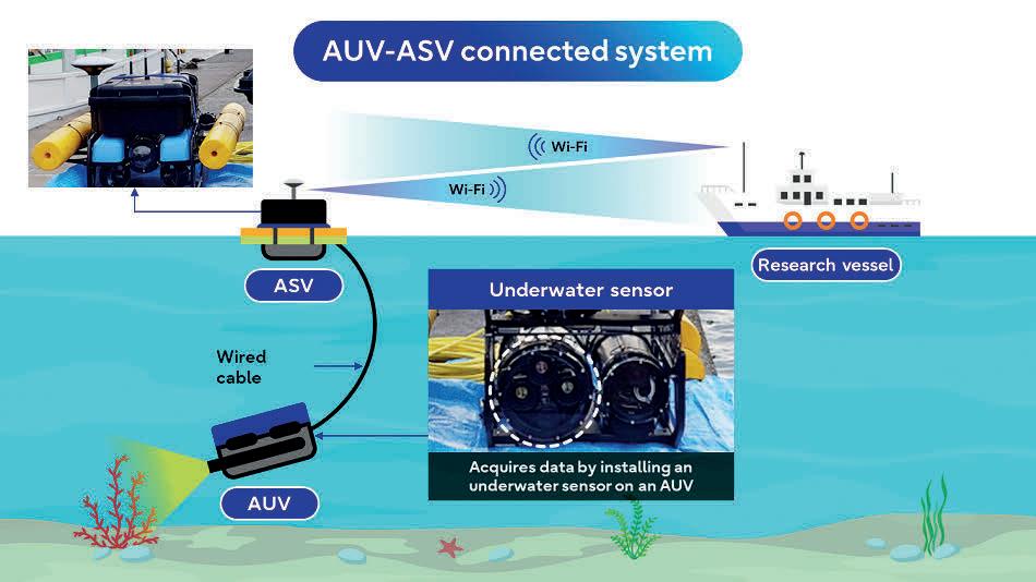
Fujitsu integrated an advanced underwater sensor, incorporating both camera and Lidar technologies, into the AUV-ASV connected system developed by the Japanese National Maritime Research Institute, facilitating real-time 3D measurements. (Image courtesy: Fujitsu)
reefs and man-made structures such as off shore wind turbines using autonomous underwater vehicles (AUVs). This innovation is a pivotal part of Fujitsu’s research and development endeavours aimed at constructing ocean digital twins. These digital twins off er researchers precise replicas of underwater ecosystems, enabling them to forecast environmental changes and simulate the potential outcomes of conservation eff orts.
This technology builds upon a real-time measurement technique initially developed for the company’s ‘Judging Support System’, a collaboration with the International Gymnastics Federation to aid gymnastics judging. Even in challenging conditions such as rough currents and waves, this technique enables mobile AUVs to conduct scans seamlessly. Moreover, Fujitsu’s AI technology enhances images by correcting colours and clarifying details, facilitating accurate identifi cation and measurement of targets, even in murky waters, down to several centimetres.

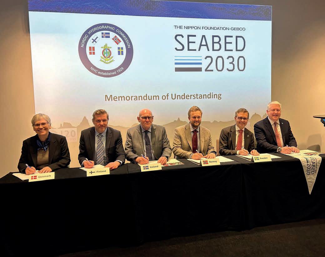
Nordic Hydrographic Commission pioneers partnership with Seabed 2030
The Nippon Foundation-GEBCO Seabed 2030 Project recently entered a partnership with the Nordic Hydrographic Commission (NHC). This signifi cant memorandum of understanding (MOU), formalized at the NHC's annual meeting in Sweden, represents a groundbreaking moment as the fi rst Regional Hydrographic Commission to align formally with Seabed 2030, advancing the project’s mission to deliver a comprehensive map of the ocean fl oor by the decade’s end. Established in 1929 in Stockholm, Sweden, the NHC comprises the Kingdom of Denmark, Finland, Iceland, Norway and Sweden and aims to harmonize Nordic practices on hydrographic issues. As one of 15 Regional Hydrographic Commissions contributing to the International Hydrographic Organization’s (IHO’s) work, the NHC becomes the inaugural signatory to the Seabed 2030 project. Seabed 2030, a collaboration between The Nippon Foundation and the General Bathymetric Chart of the Oceans (GEBCO), endeavours to fully map the world’s ocean by 2030, consolidating all data into
EMPOWERING
World leading electric underwater robotics
Seaeye eM1-7 Electric Manipulator
the freely available GEBCO Ocean Map. Endorsed as a Decade Action of the UN Ocean Decade, Seabed 2030 operates under the auspices of GEBCO, a joint programme of the IHO and the Intergovernmental Oceanographic


7 Headlines Issue 2 2024
Eelume teams up with Exail to equip AUVs with navigation systems
The Eelume S-Series is seen as a step towards a new era of all-terrain autonomous underwater vehicles (AUVs), designed specifically for mapping and operating in challenging underwater environments. (Image courtesy: Eelume)
Exail, a global leader in subsea navigation, has been chosen by Eelume, a recognized provider of innovative underwater technology, to provide its Phins Compact C3 Inertial Navigation System (INS) for Eelume’s new S-Series all-terrain autonomous underwater vehicles (AUVs). The Eelume S-Series represents a new generation of allterrain AUVs specifically engineered for mapping and operating in challenging underwater environments. The AUVs offer 360° manoeuvrability in both roll and pitch, providing versatility and sustainability in accessing previously inaccessible areas. The Phins Compact C3 INS will provide highly accurate and robust navigation data, enhancing Eelume AUV capabilities for efficient exploration, inspection and monitoring in complex environments such as hillsides, under-ice areas, vessels and harbours. Its compact OEM form factor ensures easy integration into the AUVs, facilitating swift deployment and streamlining operations.

World's deepest under-ocean sinkhole found by researchers
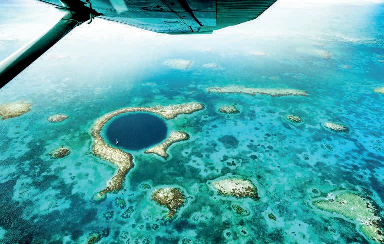
Researchers have discovered the deepest sinkhole known on Earth, located underwater near the border of Mexico and Belize. Previously believed to be the seconddeepest of its kind, the Taam Ja’ Blue Hole (TJBH) is now recognized as the deepest known blue hole, with its bottom still uncharted. A recent paper published in the journal Frontiers in Marine Science suggests that the TJBH plunges to at least 420 metres below sea level. The blue hole called Taam Ja’ (‘deep water’ in Yucatec Maya) in Chetumal Bay, Mexico, has posed measurement challenges for scientists. Initially measured at about 274 metres deep using echosounder mapping, it was considered the second-deepest blue hole globally. However, echosounder accuracy is hindered by factors such as water density variations and complex cave shapes. Recent measurements using a CTD profiler have revealed depths of over 420 metres, establishing Taam Ja’ as the world's deepest known blue hole. The study also discovered multiple water layers within the blue hole, indicating links to other water bodies, such as the Mesoamerican Barrier Reef System.

Ireland on track to complete ambitious sea mapping project by 2026
Geological Survey Ireland (GSI) and the Marine Institute (MI) aim to complete Ireland’s seabed mapping within two years, by 2026. Since 1996, GSI and MI have been conducting deep-water
hydrographic and geophysical survey operations in Irish waters. This comprehensive effort will make Ireland the first country in the w orld to achieve such detailed mapping, providing crucial data for coastal and inshore developments. Through GSI and MI’s Integrated Mapping for the Sustainable Development of Ireland’s Marine Resource (INFOMAR) project, Ireland’s seabed is being meticulously mapped to enhance navigation safety and identify suitable locations for offshore renewable energy installations.
The data gathered will also facilitate the protection of marine habitats and selection of cable and pipeline routes and aid in the delivery of national marine spatial planning. Furthermore, it supports local tourism by providing information on shipwrecks, detailed 3D maps, story maps and charts for coastal areas around Ireland.

8 Issue 2 2024
The Taam Ja’ Blue Hole even outstrips the iconic Great Blue Hole in Belize, as pictured here. (Image courtesy: Shutterstock)
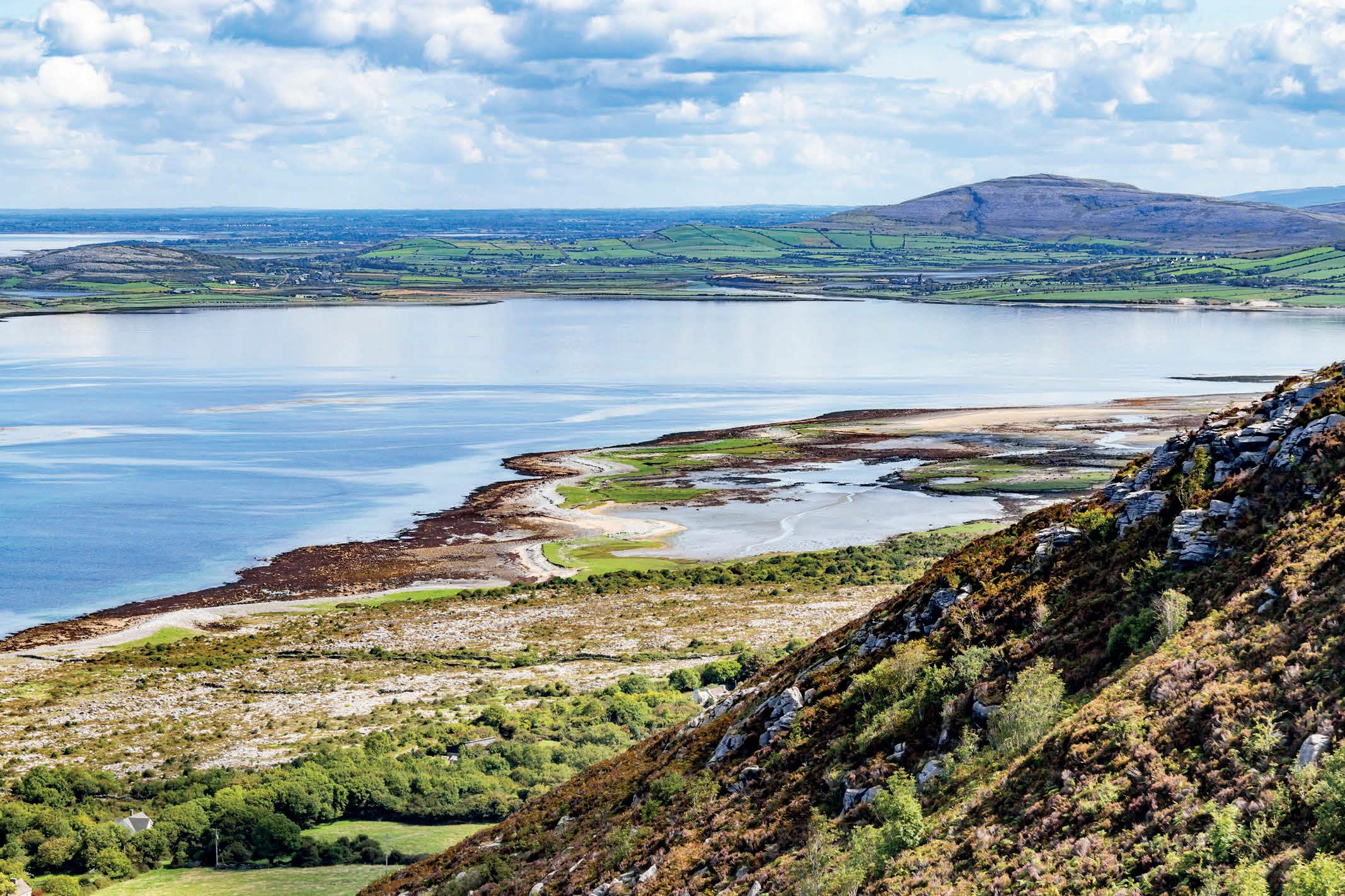
Overlooking Galway Bay, Ballyvaughan is situated on the west coast of Ireland, along the Atlantic. (Image courtesy: Shutterstock)
EuroGOOS designated implementing partner of UN Ocean Decade
EuroGOOS has been endorsed as an implementing partner of the UN Ocean Decade. As a designated partner, EuroGOOS is set to be fully committed to advancing ocean research, observation and

EuroGOOS spearheads oceanographic priorities, fosters cooperation and promotes operational oceanography to sustain observations in Europe’s seas, while providing tailored products and services for marine and maritime users. The accompanying image shows the Baily Lighthouse in Howth, Ireland, with a beautiful view of the Irish Sea. (Image courtesy: Shutterstock/Peter Krocka)
Rear Admiral Okafor honoured with Alexander Dalrymple Award
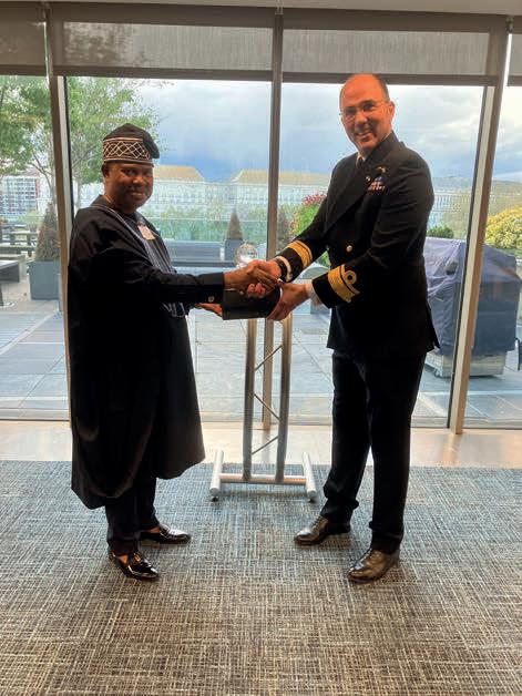
Ebenezer Okafor, former National Hydrographer of the Nigerian Navy (left), receiving the 2023 Alexander Dalrymple Award from Rear Admiral Angus Essenhigh, UK National Hydrographer (right).
sustainable management in alignment with the objectives of the Decade.
Launched in January 2021, the United Nations Decade of Ocean Science for Sustainable Development (2021–2030), known as the Ocean Decade, provides a convening framework for a wide range of stakeholders across the world to engage and collaborate outside their traditional communities to trigger nothing less than a revolution in ocean science. EuroGOOS, as an Ocean Decade Implementing Partner for Europe, plays a crucial role in supporting this initiative and ensuring that its activities effectively con tribute to the Decade’s aims.
EuroGOOS is an esteemed international non-profit organization headquartered in Brussels, comprising national governmental agencies and research organizations. With a steadfast commitment to advancing European-scale operational oceanography within the framework of the intergovernmental Global Ocean Observing System (GOOS), the association is an important factor in leading stakeholder engagement efforts within European Union initiatives and projects.

Elevate Offshore offers MSc hydrography scholarship at University of Plymouth
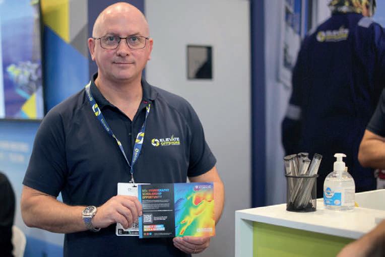
Andrew Blears, managing director of Elevate Offshore, with the scholarship opportunity brochure. (Image courtesy: Elevate Offshore)

The UK Hydrographic Office (UKHO) has awarded Rear Admiral Chukwuemeka Ebenezer Okafor, former Hydrographer of the Nigerian Navy, the 2023 Alexander Dalrymple Award for his exceptional services to international hydrography. Rear Admiral Okafor received the award during a ceremony led by UK National Hydrographer Rear Admiral Angus Essenhigh OBE at the headquarters of the International Maritime Organization in London. The event was attended by the Nigerian High Commissioner to the UK, Cyprian Heen, as well as close family and friends. The Alexander Dalrymple Award committee recognized Rear Admiral Okafor’s significant contributions and advancements at the Nigerian Navy Hydrographic Office (NNHO) during his tenure. Under his leadershi p, the NNHO became the first West African Hydrographic Office to operate its own hydrographic survey fleet. Rear Admiral Okafor’s achievements have highlighted the strategic importance of hydrography in Nigeria, paving the way for substantial economic and social benefits, not only nationally but also regionally. His leadership serves as an example for other West African countries to follow.
Elevate Offshore, a leading provider of survey, ROV, geotechnica l and inspection personnel for the offshore oil and gas, renewable energy, telecoms and power sectors, has introduced a significant scholarship initiative in collaboration with the University of Plymouth. This scholarship aims to provide aspiring hydrographers with a valuable opportunity by fully covering the tuition fees for the MSc in Hydrography programme, beginning in September 2024. In addition to covering the degree fees, Elevate Offshore is set to offer mentorship from their experienced staff surveyors. This mentorship programme aims to provide the recipient with invaluable guidance and insight into the industry, fostering a path towards a successful career in hydrography. Furthermore, the recipient will have the opportunity to participate in networking events hosted by Elevate Offshore, enabling them to establish meaningful connections within the industry.

9 Headlines Issue 2 2024
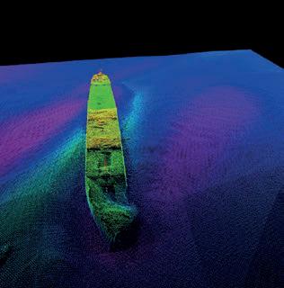
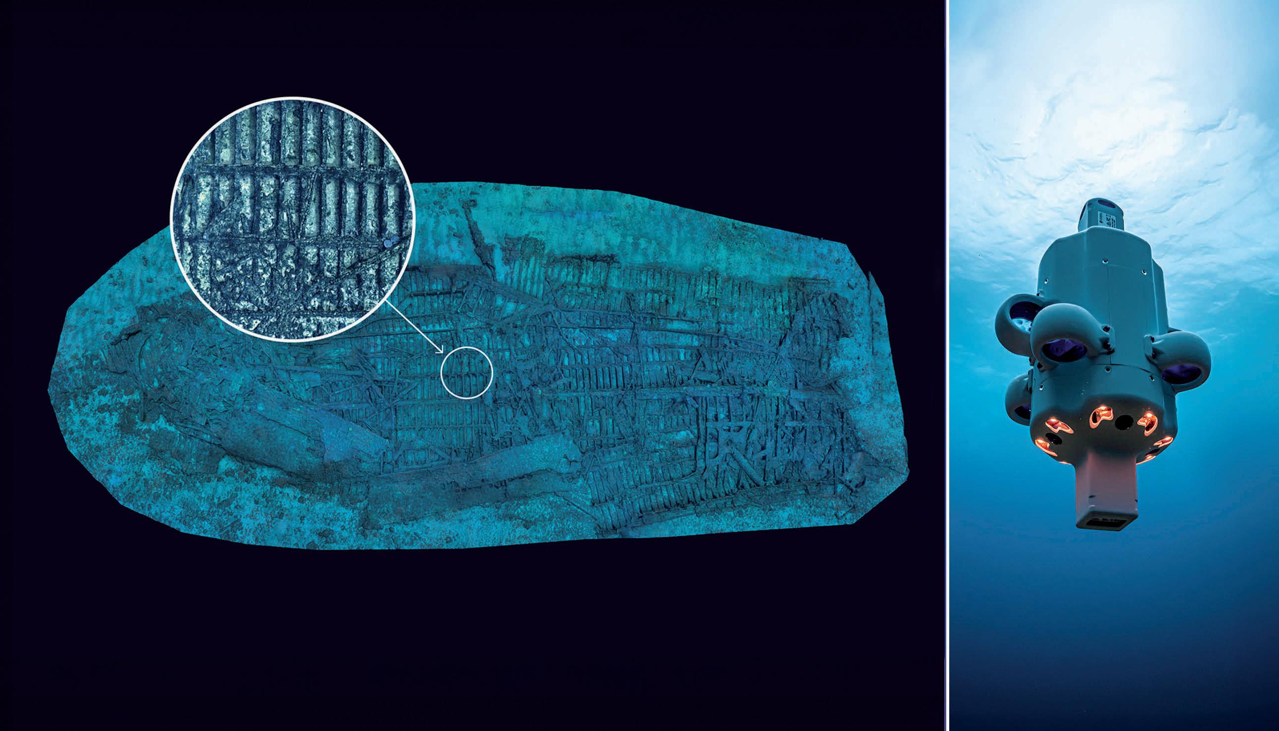
Maritime history comes alive in two evocative World War I shipwreck bathymetric images
Shining a spotlight on Irish Sea shipwrecks
By Fabio Sacchetti and Alexander Callaway
The data for the images of the sunken vessels SS Tiberia and RMS Leinster, submitted as entries to the Kongsberg Discovery Multibeam Image Contest 2023, was captured during seabed mapping carried out by the Agri-Food and Biosciences Institute (AFBI) in Belfast and by the Irish Marine Institute in collaboration with Ulster University, respectively. These and a multitude of other wrecks speak to the need for ongoing monitoring, both for heritage preservation and to manage potential environmental risk.
The Kongsberg Discovery Image Contest was established in 2014 and is open to all professional users of the company’s family of single and multibeam echosounders (MBES). Images are not required to date to the current competition year. Of the 70-plus entries in the 2023 contest, the images of SS Tiberia (Figure 3) and RMS Leinster (Figure 4) were among the top three winners – providing an excellent platform to highlight the cultural relevance of wrecks and the need for appropriate management. We would also like to highlight the enduring collaboration between our institutions and Kongsberg Discovery, of which these images are a result.
Shipwrecks abound
According to UNESCO, beyond the known shipwrecks worldwide there are an estimated three million undiscovered wrecks dotting our ocean floors. These man-made artefacts are now recognized as an integral part of our submarine landscape, ocean ecosystem and
cultural heritage. Shipwrecks have multiple values, providing a unique snapshot of the past and hotspots of biodiversity in seabed locations that can often be comparatively featureless.
Shipwreck protection
In the Republic of Ireland, legislation such as the National Monuments Act (1987) gives blanket protection to all wrecks more than 100 years old. There is no such protection for shipwrecks in Northern Ireland (NI); however, as part of the UK it has adopted the rules set out in the Annex to the 2001 UNESCO Convention on the Protection of the Underwater Cultural Heritage as best practice and continues to pursue ratification. In addition, under the Historic Monuments and Archaeological Objects NI Order (1995), Protection of Wrecks Act (1973) and Protection of Military Remains Act (1986), wrecks in NI waters may be scheduled for protection. The Marine and Coastal Access Act NI (2009) also offers some protection to
Issue 2 2024 10
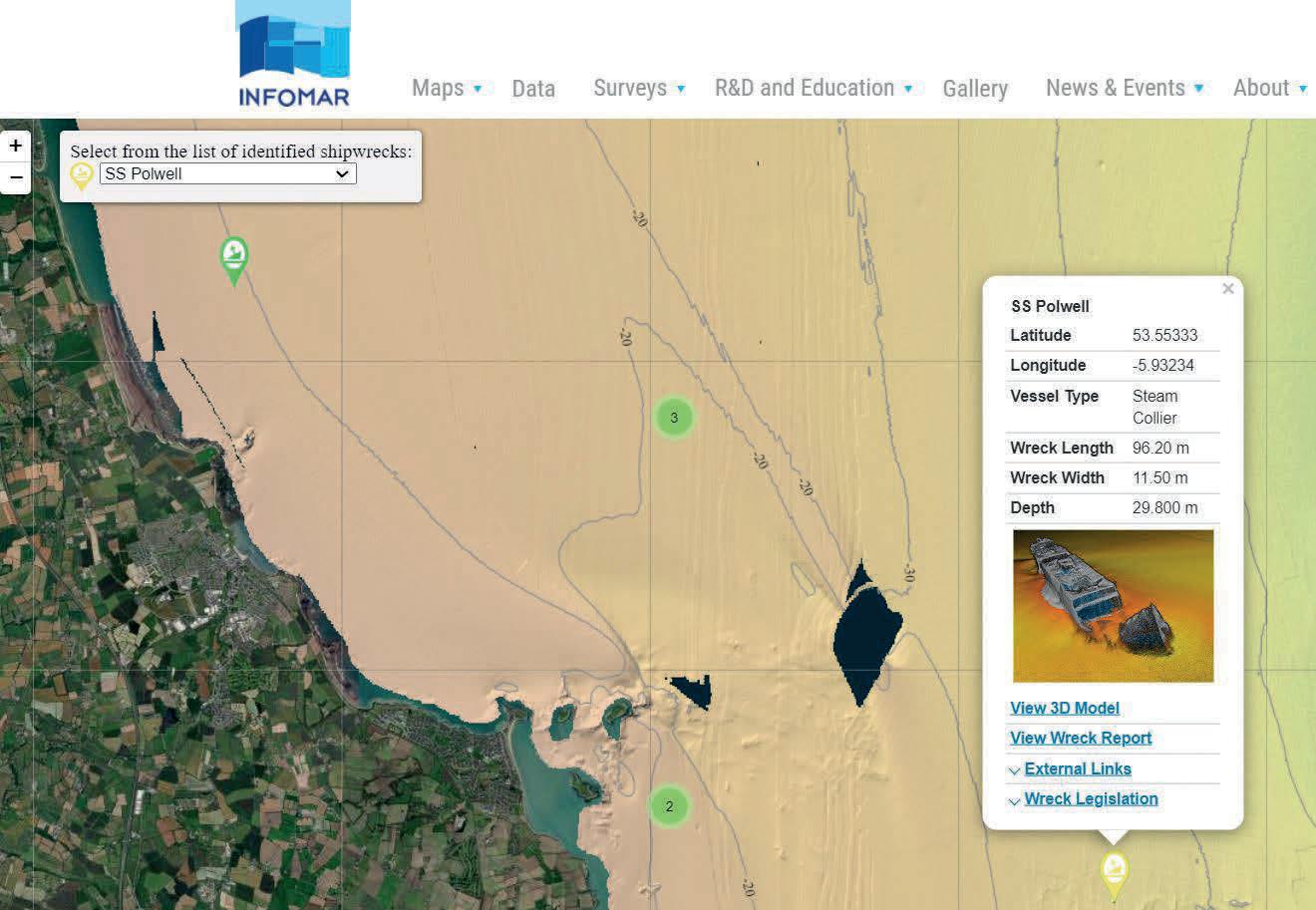
Figure 1: INFOMAR’s dedicated shipwreck map viewer (left) and 3D modelling function.
shipwrecks through control of disturbance and salvage. This is particularly important because many wrecks still contain large quantities of dangerous materials such as explosives and fuel, which under certain circumstances can pose a serious threat to the marine and coastal environment.
Mapping, preserving and monitoring required
Pivotal action is required to manage such challenges. Firstly, national efforts must be in place to survey as many wrecks as possible, with adequate spatial resolution to establish comprehensive databases for future monitoring initiatives. The Irish Marine Institute has been pursuing this goal for the last 25 years through the former Irish National Seabed Survey and the ongoing INFOMAR National Seabed Mapping Programme, whose ultimate aim is to complete mapping of the Republic’s entire offshore territory by 2026. During this time, more than 500 shipwrecks – over half of them previously unidentified or uncharted – have been successfully and meticulously mapped. There are over 20,000 recorded wrecks in UK waters, rendering targeted monitoring of each of them unfeasible. Although wreck monitoring is not one of AFBI’s direct responsibilities, data is often acquired from wreck sites during surveys with other priorities.
The Fisheries and Aquatic Ecosystems Branch (FAEB) of AFBI has a long history of seabed mapping and is a member of the UK Centre for Seabed Mapping (UKCSM), which has a dedicated Wreck Mapping Working Group tasked with improving co-ordination and investigations of UK wrecks.
‘Collect once, use many times’
SS Tiberia and other nearby wrecks have been used for many years as part of the calibration process of the AFBI’s MBES due to their proximity to Belfast, and have been covered during multidisciplinary surveys undertaken for the FAEB’s Seabed Mapping project. With the passage of time, many older wrecks are beginning to decay and break up, which has consequences for historical and marine archaeological perspectives as well as for pollution management. Although not
originally intended for this purpose, the ‘collect once, use many times’ approach means that this survey data provides an important resource for informing multiple disciplines.
Disseminating this extensive resource among the broader community, supporting research and public engagement, requires dedicated tools and sharing infrastructure. To meet this need, INFOMAR has pioneered a shipwreck Web Map Viewer and Sketchfab channel, enabling the visualization of over 200 models in 3D (Figure 1). Much of the data acquired in UK waters is available to download through the Admiralty’s Bathymetry Data Service.
The second action point is to develop long-term management strategies for wrecks that have either historical relevance or those that contain potentially dangerous materials.
Wreck preservation
The UNESCO Convention strongly advocates the in situ preservation of shipwrecks where possible. This includes assessments of local environmental characteristics that can be used to determine long-term stability, enabling an appropriate management and risk mitigation strategy to be devised accordingly.
Understanding the historical context of wreck sites and surrounding seabed processes is crucial in determining such strategies. Seabed mapping using high-resolution MBES is often the fastest and most reliable method of providing data for characterizing these sites in a non-intrusive manner. However, this data only offers a snapshot of seafloor and wreck morphology at the time of collection. Wreck preservation is a long-term process, often involving repeated timelapse surveys, photogrammetry and laser and video investigations to assess change over time.
The role of CFD
To fully understand the stability and lifespan of shipwrecks, it is fundamental to analyse the complex hydrodynamic processes
Issue 2 2024 11 Feature
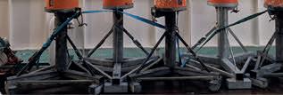
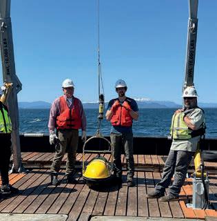
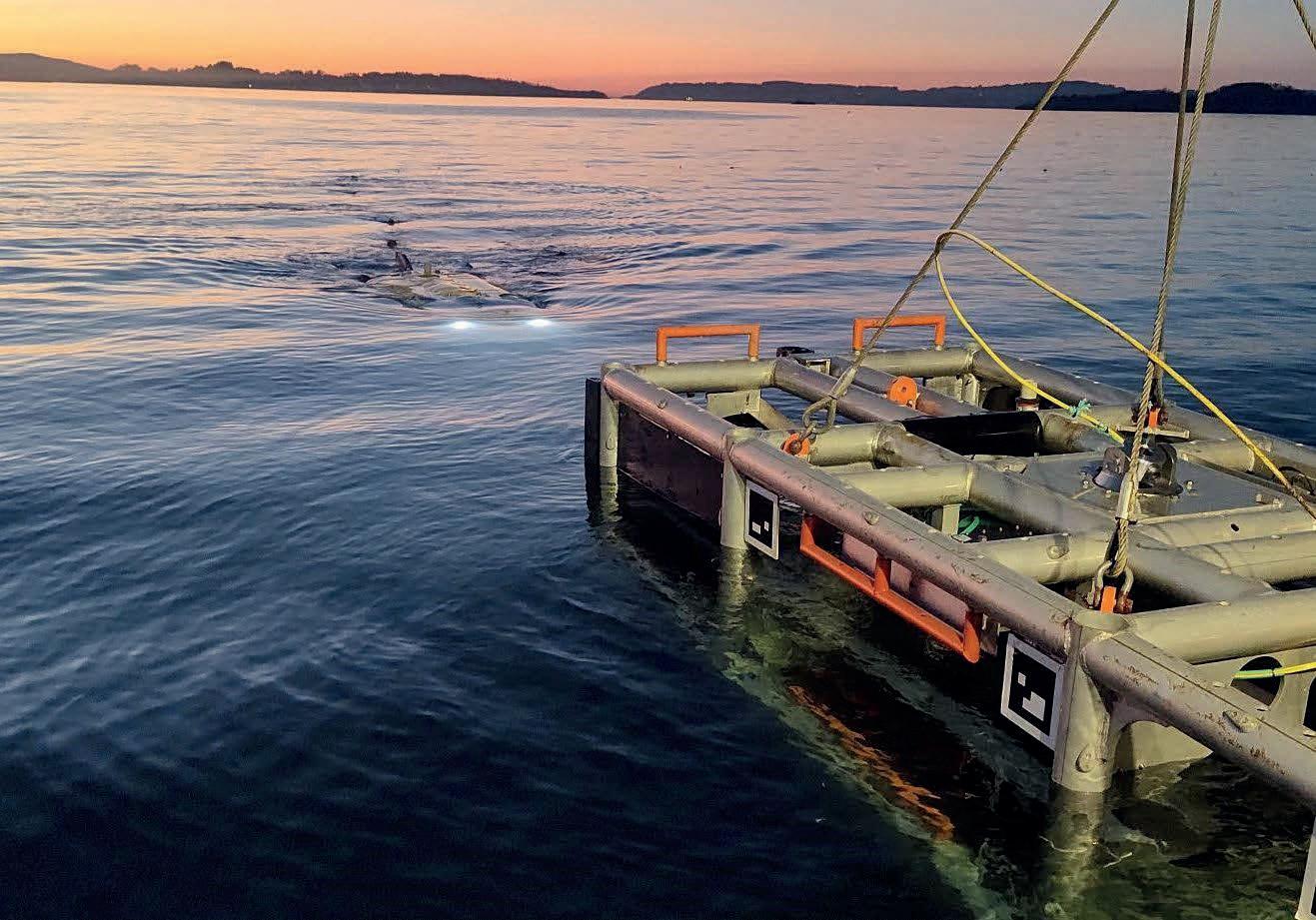
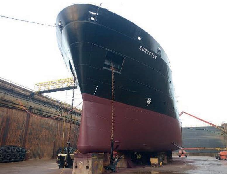
Figure 2: Fitting a Kongsberg Discovery EM 2040 Mk II single RX MBES system to RV Corystes.
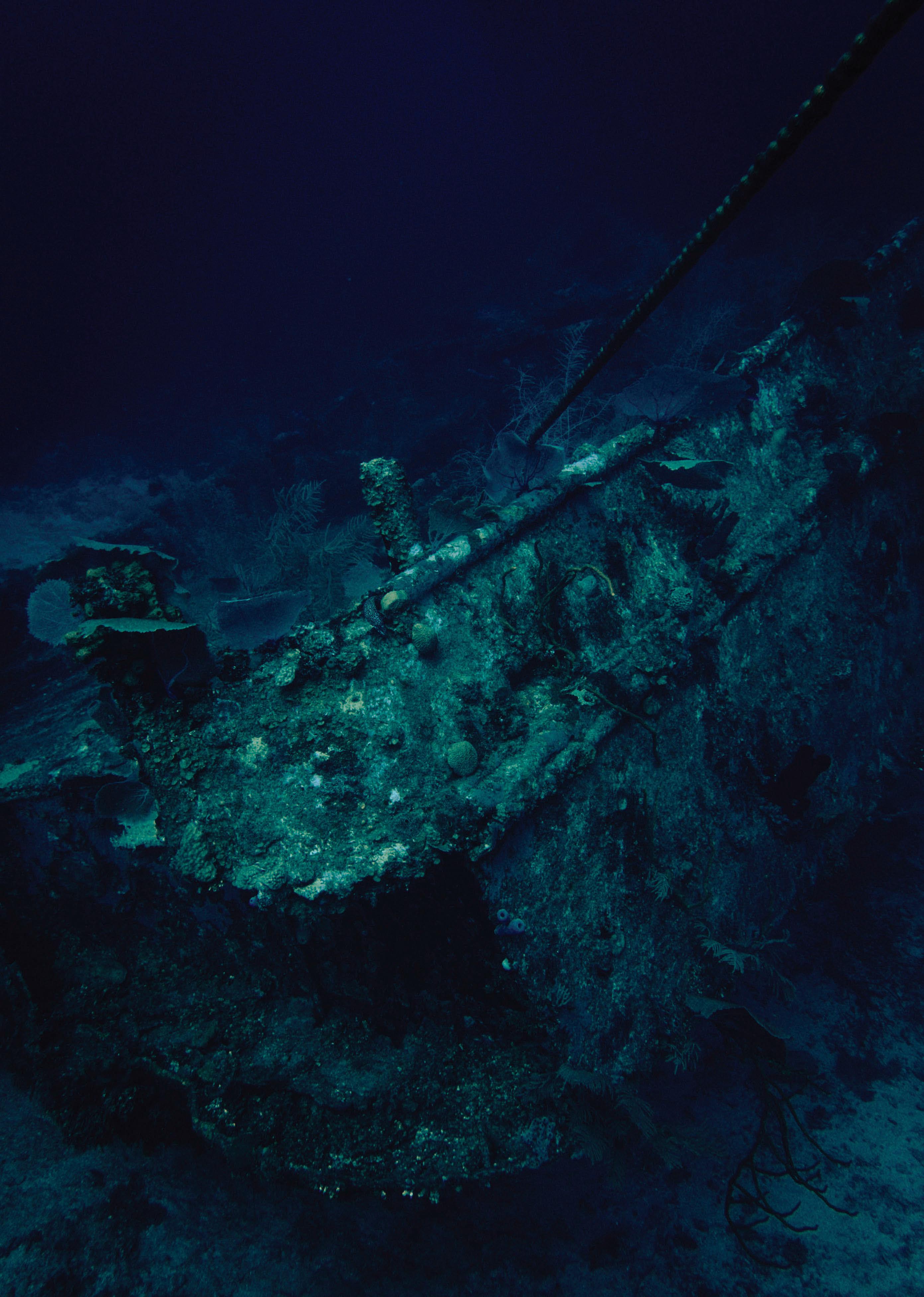
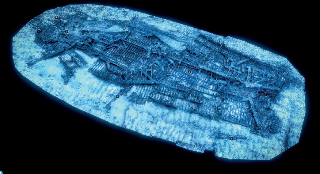
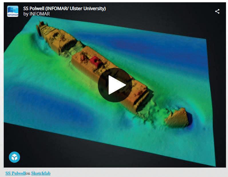
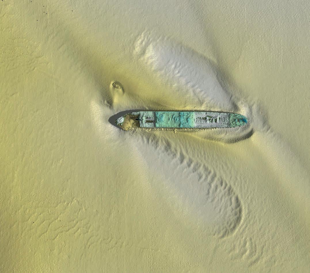
Figure 3: SS Tiberia, top winner of the KD image competition.
acting upon them. Recent studies conducted at Ulster University (Northern Ireland) have shown how computational fluid dynamics (CFD) modelling has the potential to reconcile vortex shedding and quantify shear stress that generate scouring and erosion in the vicinity of complex obstacles. The results of these forces can cause stress on wreck superstructures, potentially causing instability and disintegration (e.g. Quinn & Smyth, 2017; Majcher et al., 2022). In addition, CFD can be used to track pollution dispersion in complicated environments and is a critical tool for emergencyresponse exercises that AFBI supports NI government departments in enacting.
Maximizing survey equipment
A key element of the Marine Institute-Ulster University survey in 2015 (which generated the data for the RMS Leinster image, Figure 3) was the selection of equipment settings and survey plan strategies chosen specifically to optimize data quality (Wesley, 2019) and to ‘squeeze’ everything out of the available survey equipment. Survey strategies included using the shortest available pulse lengths, employing highly sensitive bottom tracking algorithms, maximizing data density settings while minimizing swath width, and strategically planning survey lines in every possible direction to thoroughly map even the most challenging parts of the superstructure of sunken vessels. This was complemented by meticulous compensation of oceanographic conditions, achieved through regular sound velocity profiling and use of top-of-the-line inertial measurement unit (IMU) and differential GNSS (DGNSS) solutions, ensuring precise positioning of all soundings and effectively compensating for vessel motion and tidal changes. Millions of soundings were collected per wreck, providing unparalleled data density and quality, enabling the creation of accurate 3D models then used for archaeological research and public dissemination.
Exceptional MBES data quality
SS Tiberia and RMS Leinster, in 65 and 30 metres of water, respectively, are part of a larger selection of World War I shipwrecks
regularly monitored by various organizations. These include the Irish Marine Institute, which originally mapped them with MBES over two decades ago; Ulster University, which conducted two dedicated survey campaigns in 2015–2016 (Westley, 2019) using a Kongsberg Discovery EM 2040-07 dual RX mounted on the research vessel Celtic Voyager; and AFBI, which generated data for the SS Tiberia image in 2022 during patch testing as part of the sea acceptance test following installation of a Kongsberg Discovery EM 2040 Mk II single RX MBES system 0.4 TX / 0.7 RX mounted on the AFBI research vessel Corystes
Unique marine monuments
The two wrecks are historically important for both countries but provide different perspectives on the sinking of vessels. One resulted in catastrophic loss of life, while the other occurred with no casualties. As a well-preserved wreck, SS Tiberia is a popular site for scuba divers who can visit without the risk of disturbing a maritime grave.
SS Tiberia was torpedoed by German submarine U-19 1.5 miles east of Blackhead at the mouth of Belfast Lough on 26 February 1918 while on voyage from Glasgow to New York carrying general cargo. All hands survived the attack through a combination of the ship’s lifeboats and rapid assistance from shore (Irish Wrecks Online, 2020) as there were many witnesses on land. The data used in the winning image shows how the shipwreck is still well preserved, sitting upright on the seabed with some of the masts and smaller structures still visible. This data is the latest in a time series that will allow continued monitoring and inform management of the wreck into the future.
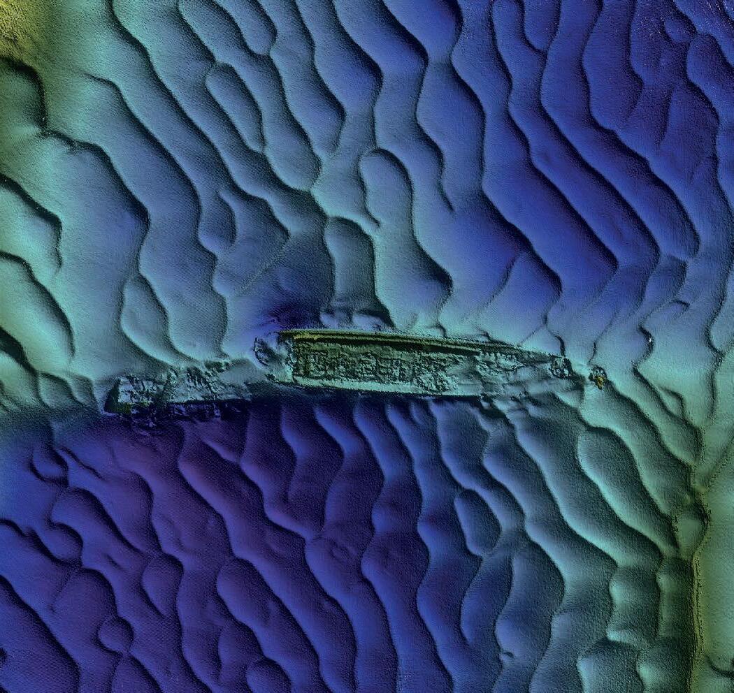
The opposite can be said for the RMS Leinster, a Royal Mail Ship torpedoed by German U-boat UB-123 in the Irish Sea on 10 October 1918. The ship, carrying civilians, military personnel and mail, sank within 12 minutes. Of the 771 people onboard, 501 perished during the attack, making it the largest single loss of life in the Irish Sea. Among the casualties was the ship’s captain, William Birch. The ship sank just outside Dublin Bay, roughly four nautical miles (7.4 kilometres) east of the Kish Bank Lighthouse. The U-boat crew also perished shortly afterwards when their submarine struck a mine.
Conclusion
With the most significant shipwrecks on the Irish continental shelf already catalogued and mapped with some level of detail, questions now arise regarding the next logical steps to assess how to preserve and monitor these resources. One thing is certain: although undergoing gradual disintegration, some shipwrecks pose an increasing risk to the environment due to corrosion that can breach sealed compartments, potentially releasing large quantities of oil and other pollutants. Various projects, such as the North Sea Wrecks, Remarco and the Endure underwater heritage programme, have already begun to pave the way, examining shipwreck degradation, pollution spillage risks and methods for preserving these sites for future generations using advanced techniques such as photogrammetry surveys and virtual museums. Meanwhile, in terms of calibration targets, there is a wealth of data not collected for any specific survey purpose that could be used for archaeological and monitoring assessment. The repeated nature of calibration across years makes this data a good source for monitoring the condition of – and identifying any change at – targeted wrecks. Efforts by the likes of the UKCSM’s Wreck
Issue 2 2024 12
Figure 4: RMS Leinster image from Ulster University survey in 2015 (EM 2040 dual RX).
Mapping Working Group to co-ordinate survey effort, data sharing and knowledge exchange between disparate organizations will enhance the value of this data and increase available resources for sites of national interest and importance. Further surveys, research and studies to ensure the responsible management of this vast underwater legacy by the respective national authorities would be most welcome.
Acknowledgments
The authors would like to credit the hard work of the captains and crews of the research vessels that assisted in the collection of the Irish National Seabed Survey, INFOMAR, Ulster University and AFBI
References
Irish Wrecks Online. (2020). SS Tiberia. Retrieved 24 April 2024, from http://www.irishwrecksonline.net/details/ Tiberia778.htm
Quinn, R., Smyth, T.A.G. (2017). Processes and patterns of flow, erosion, and deposition at shipwreck sites: a computational fluid dynamic simulation. Archaeol Anthropol Sci, 10, 1–14.
Majcher, J., Quinn, R., Smyth, T., Plets, R., Mcgonigle, C., Westley, K., Sacchetti, F., & Coughlan, M. (2022). Using difference modelling and computational fluid dynamics to investigate the evolution of complex, tidally influenced shipwreck sites. Ocean Engineering, 246, 110625.
Westley, K., Plets, R., Quinn, R., McGonigle, C., Sacchetti, F., Dale, M., McNeary, R., & Clements, A. (2019). Optimising protocols for high-definition imaging of historic shipwrecks using multibeam echosounder. Archaeol Anthropol Sci, 11, 3629–3645.
datasets. INFOMAR is the Department of Environment, Climate and Communications (DECC)-funded Irish National Seabed Mapping Programme, jointly managed and delivered by Geological Survey Ireland and the Irish Marine Institute. Ulster University research was supported by the Irish Marine Institute’s ship-time programmes APP-CV15021, CV16031: World War I shipwreck in the Irish Sea: commemoration, visualization and heritage management. Thanks also go to Colin Dunlop (Department of Agriculture, Environment and Rural Affairs of Northern Ireland) and Anthony Firth (Historic England) for advice on current legislation.

Fabio Sacchetti is a senior hydrographer and team leader for INFOMAR. He also coordinates various research projects focused on marine remote sensing, sedimentology, geomorphology, underwater archaeology and offshore glacial processes.
Alexander Callaway is the AFBI FAEB Seabed Mapping project leader and has contributed to multiple seabed mapping projects in the UK and UK overseas territories, carrying out baseline data acquisition and providing scientific advice for the management and monitoring of MPAs.
Issue 2 2024 13 Feature
About the authors
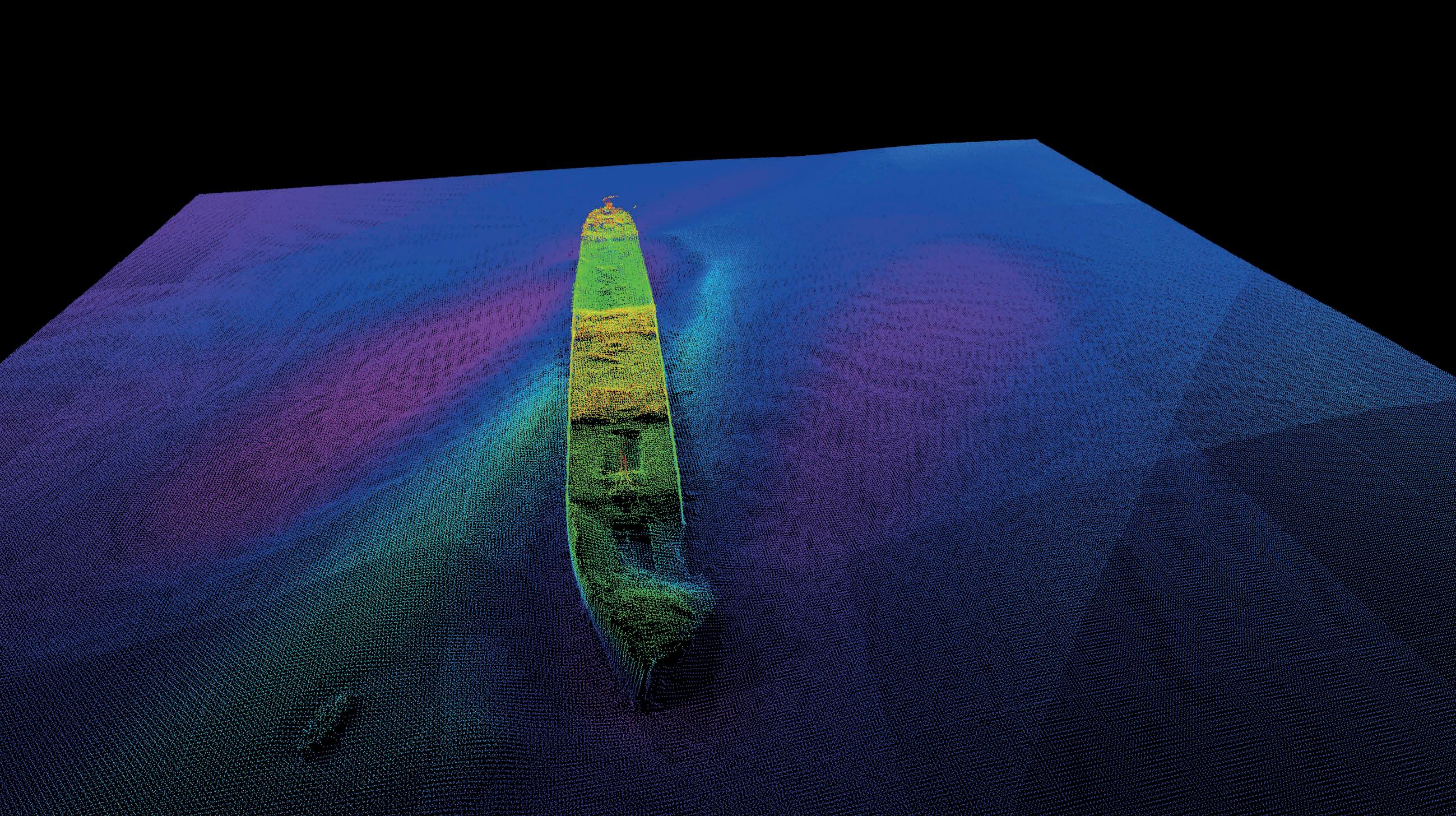
Figure 5: Point cloud representation of the SS Tiberia, highlighting the detailed structural features discernible through MBES. (Image courtesy: Ulster University)
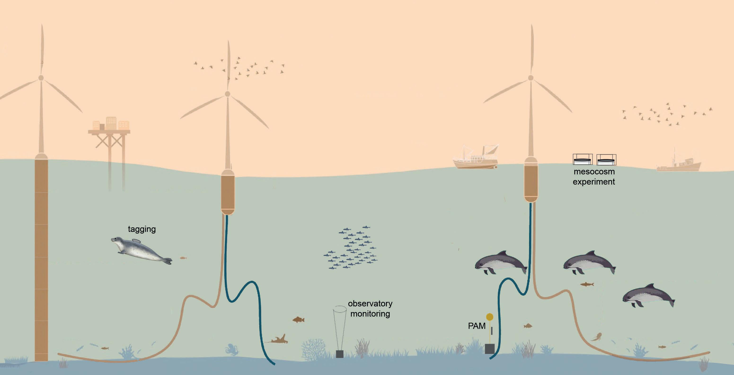
Enhancing our understanding of the impacts of operational noise from offshore wind farms on the marine environment
Impact of sound from offshore wind farms
By Sara Pensieri and Ana Širović, PURE WIND consortium
Sounds from offshore wind farms are among the main contributors of anthropogenic noise to the marine environment. Despite 30 years of offshore wind farm operation in European waters, our understanding of their impacts on marine ecosystems during their operational lifetimes is limited. Eleven institutes from seven countries united their skills and expertise in the PURE WIND project, funded by the JPI Oceans initiative ‘Underwater noise in the marine environment’. Our goal is to expand our knowledge of the radiated noise and the biological consequences of these operations and to place them in appropriate regulatory contexts.
The sustainable blue economy provides an important contribution to the mitigation of the causes of climate change. In one implementation, there is growing interest in the rapid development of offshore turbines. Offshore wind farms (OWFs) can provide clean and renewable energy by exploiting the force of wind, which reaches a higher and more constant speed in the open sea than on land thanks to the absence of barriers. It is important that this does not negatively impact marine biodiversity. Current technological development, however, has exceeded our ability to reliably assess environmental impacts. This makes it necessary to test for unwanted effects of the noise caused by the installation and operation of turbines in the marine ecosystem.
PURE WIND
PURE WIND aims to analyse in depth the impacts of OWFs on the marine ecosystem in the medium and long term, including on the lowest components of the food web, and in turn the top predators. To achieve this, researchers will analyse historic passive acoustic measurements and wind statistics available from OWFs in the offshore areas of Northern Europe as well as data acquired specifically within the project to analyse the impact of the construction and installation of floating parks in the Canary Islands as a test site.
The analysis of data obtained from operational wind farms allows for verification of the long-term patterns of traditional wind platforms (fixed turbines), while new data acquisition will make it possible to establish the impact of new technologies on local soundscapes.
This data is fundamental for the development of a model based on wind intensity to predict the environmental noise generated by the turbines. In turn, this will enable us to establish the levels of sound pressure on the biota in the environment. The analysis will be conducted in various marine areas, including the basins of Northern Europe and the Canary Islands, which are characterized by the presence of operational wind farms, and the Mediterranean Sea and Norway, where there are no wind turbines.
Acoustic impacts on the food web
The impact of underwater noise on the marine ecosystem has mainly been studied with regard to the effects on marine mammals and fish, which represent the apex of the trophic food chain. Arguably, studies focused on possible impacts on organisms lower in the food web, starting from zooplankton, are still in their infancy. The researchers involved in PURE WIND will attempt to observe the impacts of marine environmental noise on the food webs that connect zooplankton to the top predators and fishing activities, both in areas not disturbed by industrial activities and in areas where wind farms are operational offshore, which can act as artificial reefs, providing new habitats and possibly impacting fisheries resources. Construction of wind farms in the open sea can affect local hydrographic regimes and it is not yet fully established how these changes influence upwelling/downwelling episodes and, therefore, phytoplankton blooms and zooplankton abundance.
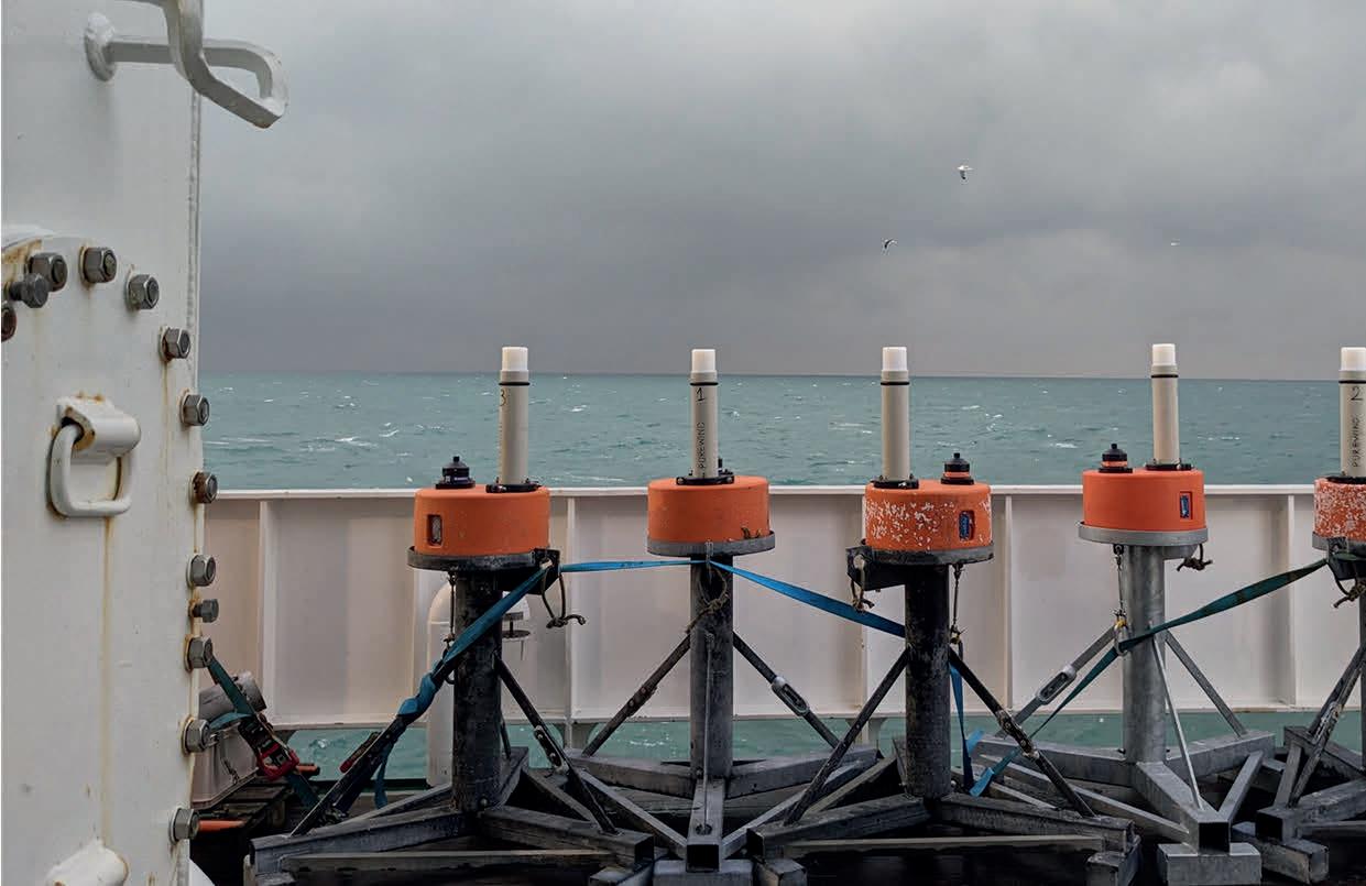
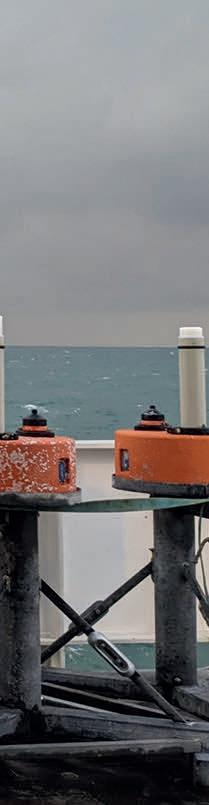
PURE WIND researchers will analyse underwater environmental noise data acquired from hydrophones installed on subsurface moorings
Issue 2 2024 14
or other existing research infrastructure. This data will be acquired near the wind farms currently operating in Northern Europe and the prototypes being tested in the Canary Islands, as well as in areas where the environmental noise is mainly made up of natural sources (wind, rain, marine animals) and marine traffic, such as the Ligurian Sea and the Norwegian fjords.
The temporal evolution and statistical characteristics of environmental noise in both conditions (presence and absence of wind farms) will be compared with biomass data derived from acoustic backscatter observations to highlight the zooplankton behaviours corresponding to different wind regimes and sound level thresholds. Specifically, variations in the depth of the zooplankton, the daily migration cycle and abundance will be analysed.
Modelling
The study of the impact of underwater noise produced by OWFs requires the ability to predict the characteristic features of the anthropogenic sound spectrum and its pressure levels with regard to specific wind turbine type and local meteorological conditions, in particular the random variables wind speed and direction. To achieve this, we intend to build a model based on acoustic data acquired by the project partners using statistical learning techniques capable of predicting the acoustic impact as the wind regime varies.
The underwater noise generated by wind turbines during their operation is characterized by several components. The largest of these is the vibrations produced by movement of the mechanical
parts and induced by the wind on the pylon or the mooring lines that keep them in place. However, noise is also produced by the blades when rotating close to the sea surface and by whistles created by wind against the superstructure.
The spectrum, which is the distribution of energy as a function of frequency for a particular sound source, has particularly meaningful contents concentrated at low frequencies, especially below 1kHz, composed of a continuous component (called broadband noise) to which tonal components positioned at the rotation frequencies of the various mechanical parts and their harmonics are added. This means that the shape of the spectrum is influenced by the size of the turbine, the wind speed, the type of pylon or mooring line and the foundations that support the entire generation plant, in the case of a fixed OWF.
In recent years, underwater noise generated by turbines has been measured and characterized on several occasions. Unfortunately, the different measurement conditions and the absence of common protocols have made it difficult to compare specific features of the turbines and to develop common models. The increasing wide availability of acoustic measurements taken at sea for long periods, accompanied by the corresponding environmental data, allows the development of a black box model based on machine learning (ML) algorithms. ML techniques, thanks to their generalization and interpolation capabilities, have already been successfully used in similar problems, such as linking variables related to the behaviour of an energy transformation plant to its operating conditions.
Issue 2 2024 15 Feature
Schematic of the approaches to study the impacts of offshore wind farm operations across the marine food web. (Adapted from Maxwell et al., 2022)
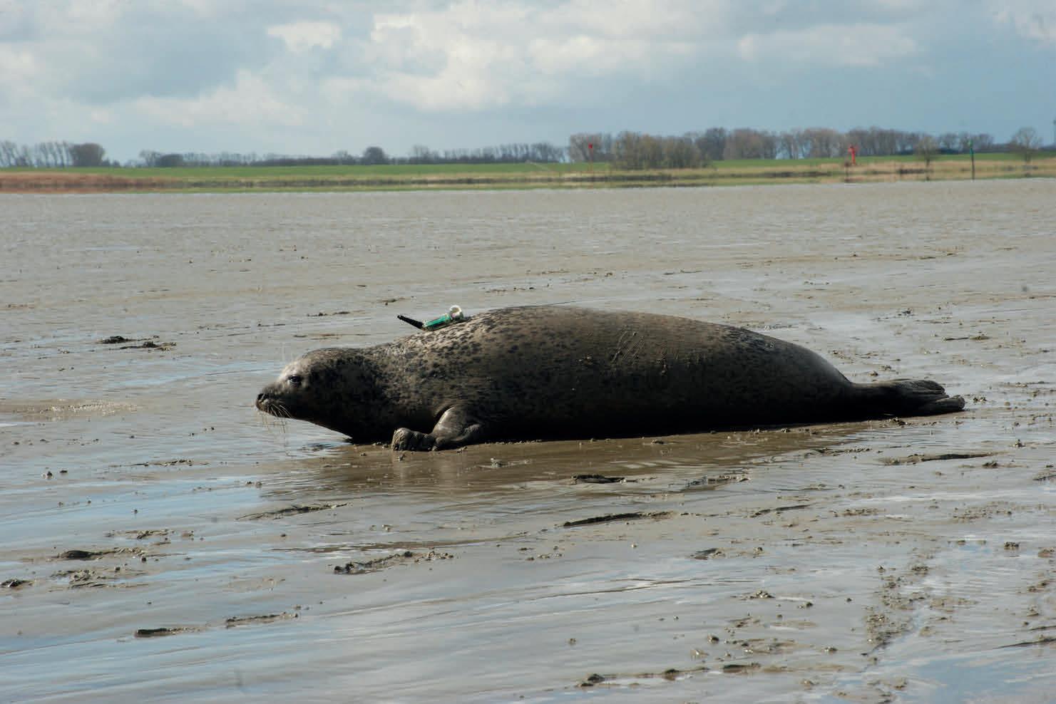
Tag deployed on a harbour seal to track its movements and investigate its foraging behaviour in areas occupied by OWFs. (Image courtesy: D. Nachtsheim, ITAW)
Seal tagging
As OWF roll-out accelerates across the North Sea and beyond, we need a better understanding of how the operational phase of these infrastructures affects habitat use and foraging success of small odontocetes, seals and other marine fauna. A variety of field efforts to address this question continue in the North Sea. In one, harbour and juvenile grey seals in the German North Sea will be tagged using GPS phone tags. They will be deployed on individual seals to determine spatial use of the North Sea over periods of up to four months, recording surfacing positions and foraging behaviour. In combination with previous tagging data, this will enable the calculation of the level of occupancy of OWF areas. Long-term passive acoustic monitoring of harbour porpoises will also continue, to evaluate their foraging behaviour within operational OWFs.
Mesocosm experiment
About the authors


Dr Sara Pensieri works at the Institute for the Study of Anthropogenic Impacts and Sustainability in the Marine Environment, National Research Council of Italy. Her primary interests lie in marine technology and innovative methods for monitoring the marine environment using unmanned platforms and observatories. Her expertise ranges from operational oceanography to underwater acoustics, focusing on physical processes at the air-sea interface.
Professor Ana Širović, a marine bioacoustician, is affiliated with the Department of Biology, Norwegian University of Science and Technology. She is interested in new methods to study exploited and endangered marine species, focusing on the impact of noise on marine life using acoustic tools to address ecological and populationlevel questions concerning the management of animal resources, particularly whales and fish.
An in situ mesocosm experiment will be conducted in an open water environment without operational OWF noise at Trondheimsfjorden, Norway. Mesocosms are experimental, (semi-)enclosed systems that allow investigations on pelagic and benthic species and communities under near natural but controlled conditions. Biotic and abiotic conditions can be manipulated, thus allowing simulations of disturbance and impacts of external drivers on biological interactions and processes. Mesocosm approaches are considered an ideal tool to tackle ecological causes and consequences of global change, because external drivers such as temperature, dissolved carbon dioxide, nutrients, light or sound fields can be manipulated, and the
There is a growing need for a better understanding of how the operational phase of offshore wind farms affects habitat usage
responses of species and communities analysed over time. Playback experiments will be conducted to identify the response of the plankton community to operational wind farm noise.
Conclusions
PURE WIND intends to study the impacts of infrastructure for the exploitation of offshore wind energy on the marine ecosystem, with sometimes cumulative effects through: 1) analysis of the impacts of noise produced by wind farms on the behaviour of different taxa in the food web (from zooplankton to large predators); and 2) the simulation using mathematical models of the contributions of wind energy generation processes, which will be considered within the different marine reporting units that spatially define specific marine areas. These results will then be compared with in situ measurements.
The project also intends to contribute to the policy development process by producing recommendations based on past experiences and knowledge gained through this project to achieve an ecosustainable development (green economic development).
Issue 2 2024 16
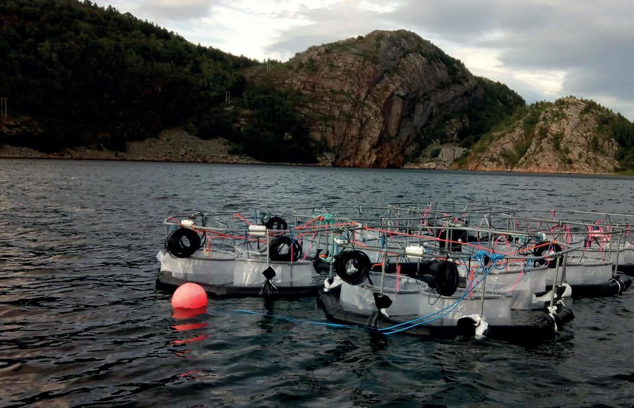
Mesocosms set-up at the NTNU research site in the Hopavågen Bay. (Image courtesy:Tanguy Soulié, MARBEC)
Acknowledgments
The PURE WIND consortium acknowledges the principal investigators and the researchers of each involved institution: Ana Širović, Justine Sophie Emilie Courboules and Nicole Aberle-Malzahn (Norwegian University of Science and Technology); Sara Pensieri and Roberto Bozzano (Consiglio Nazionale delle Ricerche); Silvana Neves, Eric Delory and José Antonio Díaz (Oceanic Platform of the Canary Islands); Benedikt Niesterok, Carina Juretzek, Christian Krueger, Isabella Kratzer and Maria Boethling (Federal Maritime and Hydrographic Agency of Germany); Shauna Creane, Andrew Millar and David O’Sullivan (Gavin and Doherty Geosolutions); Alain Norro, Bob Rumes, Silvia Paoletti and Sofya Aoufi (Royal Belgian Institute of Natural Sciences); Patricia Caro Ruiz, Alonso Hernández Guerra and Ion Urtiaga Chasco (University of Las Palmas de Gran Canaria); Andrea Trucco (University of Genoa); Gerry Sutton and Jessica Giannoumis (University College Cork); Joseph Schnitzler, Tobias Schaffeld, Nina Maurer and Dominik André Nachtsheim (University of Veterinary Medicine Hannover, Foundation); Aliaksandr Lisimenka (Gdynia Maritime University).
PURE WIND is a project supported by the JPI Ocean Initiative ‘Underwater noise in the marine environment’ and by the national funding bodies of the consortium.
Further reading https://www.ntnu.edu/web/biology/research/marine-sciences/pure-wind

Hydrographic Software Solutions
HYPACK, a Xylem brand, is a leading producer of hydrographic software solutions used in various hydrographic applications including surveying, dredging, and environmental analysis. We support an extensive variety of survey tools including multibeam, single beam, side scan, sub-bottom, ADCP, magnetometer, and LiDAR, and are compatible with simple boats, unmanned vehicles, and large survey ships with complex networked systems. Design surveys, collect precise measurements, process data, and generate final products all within HYPACK®, allowing your team to efficiently handle survey projects.

By regularly partnering with device manufacturers, HYPACK is committed to providing solutions that support cutting-edge technology and improved processes.


Issue 2 2024 17 Feature
Visit our website
Passive acoustic monitoring devices ready to be deployed to detect mammal click characteristics on the deck of the research vessel Belgica. (Image courtesy: S. Paoletti, RBINS)


Preservation of endangered species habitats along the Platte River
Using topobathymetric Lidar for adaptive management
By Mischa Hey (NV5) and Justin Brei Headwaters Corporation, USA.
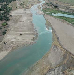
Topobathymetric Lidar technology has become an indispensable tool in environmental management, particularly for monitoring and preserving fragile ecosystems. In central Nebraska, along the Platte River, it plays a pivotal role in ensuring habitat suitability for endangered and threatened species such as whooping cranes, piping plovers and pallid sturgeon. This article delves into how the Platte River Recovery Implementation Program (PRRIP), in collaboration with NV5, is using state-of-the-art topobathymetric Lidar to monitor sediment dynamics, providing actionable insights for adaptive habitat management and conservation efforts.
Habitats in and along the Platte River in central Nebraska serve an important purpose in the life cycle of three endangered and threatened species – whooping cranes, piping plovers and pallid sturgeon. But changes in geomorphology, including erosion and deposition, which are eliminating shallow areas of water and creating deeper, fast-moving channels, are threatening the suitability of the river to support these species.
Since 2007, PRRIP – a collaboration between Nebraska, Colorado, Wyoming and the U.S. Department of the Interior – has focused on the efficient and effective management of water and riverine habitats for these species. To achieve its goals, PRRIP requires a detailed understanding of the area’s
geomorphology. It needs to know how water flows impact the topography, bathymetry and riparian vegetation, as well as the changes resulting from both anthropogenic pressures and natural processes. Leveraging high-resolution topobathymetric Lidar data, PRRIP has gained valuable insights across the geography year-over-year, enabling adaptive management of sediment augmentation efforts to ensure the area remains suitable for the whooping crane and other species inhabiting the area.
Actionable intelligence from topobathymetric Lidar
To get an accurate look at sediment volume dynamics and to determine how habitat management work impacts water flows, PRRIP contracted NV5 to conduct multi-temporal acquisitions of topobathymetric Lidar. The survey posed several challenges, since it covered a 90-mile swath of the Platte River floodplain comprising a complex shallow river system with thousands of channels and low-gradient gravel bars.
Issue 2 2024 19 Feature
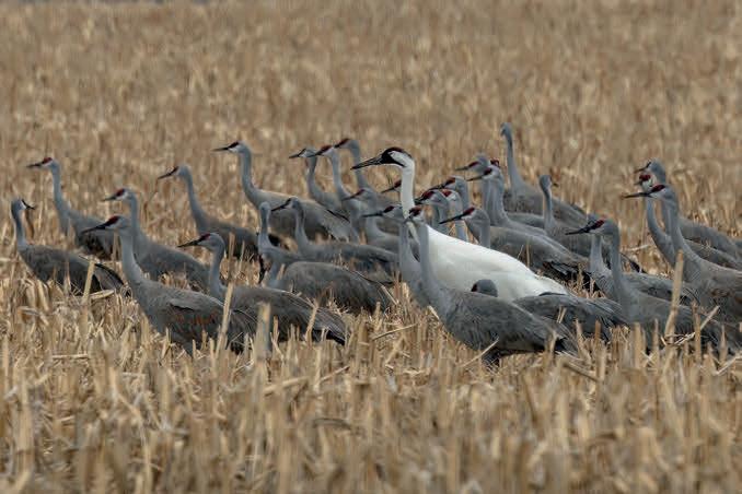
Endangered whooping crane with sandhill cranes in a Nebraska cornfield. (Image courtesy: Colleen Childers)
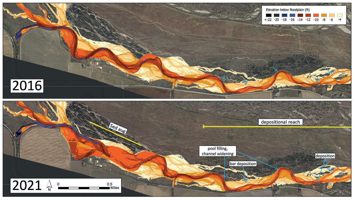
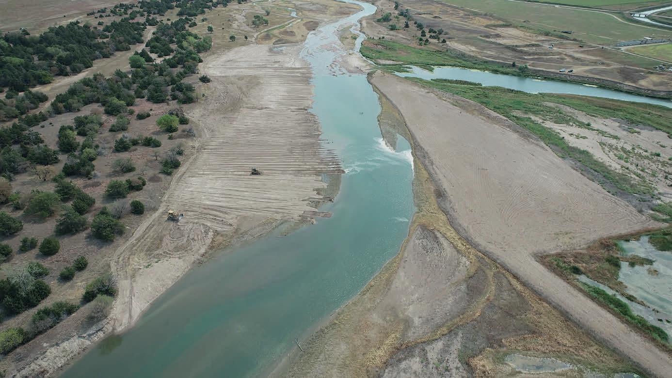
Relative elevation model derived from topobathymetric Lidar showing progression of incision and deposition downstream of augmentation. (Image courtesy: Platte River Recovery Implementation Program)
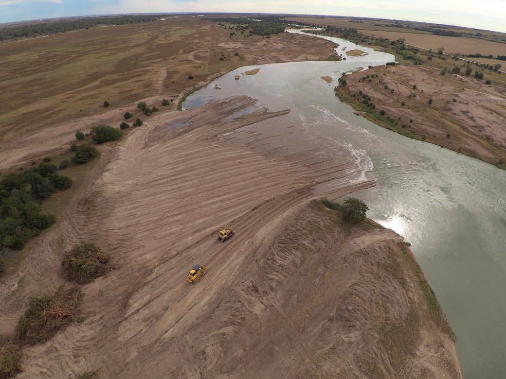
Beginning in 2016, NV5 conducted annual aerial surveys using cutting-edge technology that combined hydrographic and topographic Lidar sensors. This sensor package can deliver the high pulse rate and narrow beam divergence needed to accurately map
About the authors
Mischa Hey lives in Corvallis, OR and serves as analytics practice lead for NV5 Geospatial, with over 20 years of direct experience developing applied remote sensing and GIS solutions. Mischa holds a BS in Natural Resources from the University of Massachusetts and an MS in Wildlife and Fisheries Biology from the Spatial Analysis Lab at the University of Vermont. His current focus includes forestry, hydrologic network and wetland mapping, and terrestrial and benthic habitat modelling.
Justin Brei is a licensed professional civil engineer in Nebraska and Colorado with experience in design, permitting, bidding and construction administration for wetland restoration and creation and riverine endangered species habitat creation and maintenance. Justin has working knowledge of several spatial and civil design software packages, such as ArcGIS, AutoCAD Civil 3D and Global Mapper. He also has experience in managing large spatial datasets, including specifications and acquisitions for aerial imagery and Lidar elevation data.
the complex river morphology of braided channels and shallow landwater interfaces.
To provide PRRIP with the most accurate data, NV5 developed proprietary processes for water surface modelling and refraction correction. When this data was anchored to hundreds of fieldsurveyed control points distributed throughout the site, the spatial accuracy and thus the year-to-year comparability was improved. This level of accuracy and comparability is critical for PRRIP to have meaningful insights into precise sediment volume analyses of aggradation and degradation. While error rates of 15 centimetres are the accepted standard accuracy specification, this project pushed the limits of the technology to deliver vertical accuracies of around five centimetres.
Through this multi-year project, NV5 data has provided PRRIP with valuable insights into the Platte River floodplain, allowing it to optimally plan the use of land, water and fiscal resources to achieve the long-term goal of improving and maintaining target species habitats.
Sediment augmentation
A recent application of the data focused on a whooping crane habitat along the central Platte River. In that area, there is a wellknown historical sediment deficit downstream from a hydroelectric plant. PRRIP was concerned that the river was deepening and narrowing because of the mining of sediment from the channel bed downstream by the hydropower return flows. It also worried that these changes would continue to migrate downstream and impact protected areas used by whooping cranes and other species.
Before the inception of PRRIP, there had been efforts to quantify the magnitude of the sediment deficit and develop plans to correct the issue. In 2017, PRRIP began a full-scale sediment augmentation experiment immediately downstream of the hydropower return. An average of 65,000 tons of sediment per year were augmented annually from 2017 to 2022 at a cost of as much as US$250,000 per year. During the same period, NV5 conducted regular aerial topobathymetric surveys to assess changes to the landscape. Using this data, PRRIP could analyse the effectiveness of sediment
Issue 2 2024 20
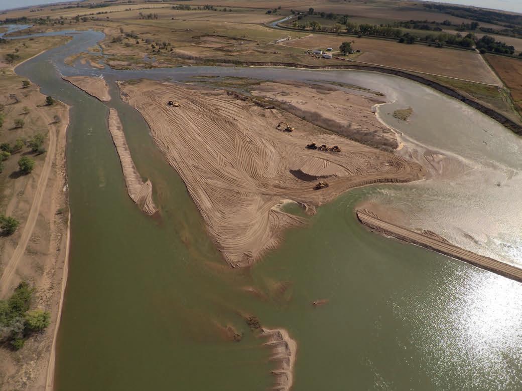
Sand being augmented to a higher velocity pilot channel. (Image courtesy: Platte River Recovery Implementation Program)
Bulldozers pushing historic river terraces into incised river channel. (Image courtesy: Platte River Recovery Implementation Program)
been degrading at a rate of 0.8 to 1.1 inches per year, averaged across the entire area. After augmentation, the rate of bed erosion upstream of the bridge decreased between 45% and 60% to 0.4 inches per year. Downstream of the bridge the bed elevations have remained stable.
Adaptive management
While the recovery programme has made commendable progress, the repeat data collected by NV5 supports adaptive management. After analysing the performance of sediment augmentation over five years, PRRIP managers can now refine the plan more effectively to meet future goals.
augmentation and determine whether its investments were helping to increase habitat suitability for whooping cranes, while not causing detrimental effects downstream in pallid sturgeon habitats.
Spatial comparisons were made using year-to-year bathymetry datasets along the targeted area. PRRIP discovered that while erosion was still occurring, it had lessened as a result of its efforts. Upstream of the Overton Bridge, the channel bed had
In addition to sediment augmentation, PRRIP uses topobathymetric Lidar and associated imagery from NV5 for various other purposes, including the annual quantification and monitoring of riparian vegetation type and structure. This vegetation mapping aids in monitoring endangered species habitats across the 13,000-acre protected area, enabling the evaluation of habitat needs and usage and the success of management efforts.
Geospatial data, including topobathymetry and aerial imaging, plays a crucial role in large-scale projects undertaken by PRRIP. Investing in the collection of highly accurate data enables programme managers to make informed decisions based on scientific knowledge and to adapt as they gain a better understanding of the evolving landscape.


Issue 2 2024 21 Feature
Sediment augmentation under construction near Lexington, NE. (Image courtesy: Platte River Recovery Implementation Program)


The world’s oceans are vast and largely unexplored, filled with submerged secrets waiting to be discovered. Notably, there are over 3 million shipwrecks around the globe, with 1,819 that have been identified off the coast of Western Australia (WA). The task of exploring these underwater sites can be daunting.
Deep-sea exploration involving the use of divers or ROVs demands extensive resources, such as large vessels, expert crews and specialised equipment – not to mention deep pockets. In Australia, for example, shallow dives start at USD $13,000 and escalate well over USD $66,000 for deeper expeditions.


That’s changing with Hydrus, a cutting-edge micro-AUV by Advanced Navigation, which is reducing costs by as much as 75%*. Additionally, its intuitive design facilitates easy operation with minimal training, allowing for single-user deployment and more time spent on gathering data.
As seen on...


Exploring a Shipwreck Graveyard with the Hydrus Micro-AUV


Hydrus recently embarked on a mission into WA’s Rottnest Ship Graveyard, where it uncovered a 200 ft deep, 100-year old shipwreck, identified by the WA Museum as a historical clipper vessel. Upon spotting the wreck, Hydrus used its advanced sensors and 4K camera to capture high-resolution images with georeferenced data. This intelligence was then processed to produce an incredibly detailed 3D photogrammetry replica.
“This is the clearest and most comprehensive data set the WA Museum has received from this particular wreck.”
- Dr. Ross Anderson, Curator at the WA Museum.-

This mission success with Hydrus proves high quality underwater data can now be gathered without incurring exorbitant costs. Besides encouraging more comprehensive subsea data collection, Hydrus also has the potential to expand the scope of ocean exploration. Whether hunting shipwrecks, monitoring coral reefs, or inspecting offshore infrastructure, Hydrus can deliver the vital insights once out of reach.
*Cost estimates are based on a shipwreck expedition in Western Australia in 2024.
Read whitepaper to learn more
Oceanus12 provides full over-the-horizon autonomy
‘Mission-agnostic USV’
By Frédérique Coumans, senior editor, Hydro International
Before long, it will be possible to send an uncrewed surface vessel (USV) to sea to carry out offshore and deep-sea surveying and monitoring over distances of more than 2,000 nautical miles. It will even keep working when satellite communication is down. Oceanus12 is the name registered by Zero USV for its class of 12m-aluminium vessels.
Zero USV managing director Matthew Ratsey: “A sophisticated sensor suite aids situational awareness and obstacle detection and avoidance with an accuracy of below 1mm and is able to pick up objects as small as lobster pot markers.”
Simon Baldwin, Ultrabeam Hydrographic’s project manager, is keen to be the first to check Oceanus12 out.
Oceanus12 will form a new class of high-endurance charter USVs. This is a first in marine autonomy: a fully autonomous – not remotely controlled – turnkey package complete with all the requisite marine sensor technology and AI for design and build, right through to operation and support. Oceanus12 was conceived by Zero USV (UK), formed by the same companies that helped build the Mayflower (the USV that navigated autonomously across the Atlantic Ocean in 2022). Zero USV’s managing director, Matthew Ratsey: “We are on track to have the first two vessels on the water by autumn 2024 and available for immediate charter following the successful conclusion of trials.”
Ratsey, a naval architect, is intrinsically involved in the design, specification and build of the Oceanus12 series. The principles he set out to meet are to offer a charter solution as a versatile platform, with a very wide range of potential applications from surveys and monitoring of critical assets to safety. “Effectively, a mission-agnostic vessel.”
The markets that will benefit from Oceanus12 are vast, and include geophysical surveying and mapping, offshore oil & gas exploration, renewables exploration and maintenance, border control, fisheries science and defence. Zero USV has reached exclusive supply arrangements with Hexagon, who is providing an LD900 GNSS receiver and a survey-grade inertial measurement unit (IMU), and with RAD Propulsion, who is supplying its state-of-the-art RAD 40 electric propulsion systems, including RAD batteries.
Challenges
The barriers to successful operation of over-the-horizon USVs for offshore hydrographic and geophysical survey are rapidly being overcome. Practical concerns are being mitigated, regulatory codes of practice are being developed, and forward-thinking manufacturers such as Zero USV are coming up with technical solutions to historical hurdles. The company tackled several challenges, including cross-border regulations, but the biggest challenge was to provide full autonomy.
Matthew Ratsey explains: “Much of what already exists on the market is only operated by remote control, so we have supplied a vessel that will continue to be operational, avoiding all shipping, and without any outages should there be an issue with satellite communications. Due to significant advancements in GPU technology over the past few years, the AI software that controls Oceanus12 can be deployed ‘on the edge’, which means on the AI GPU’s mounted on the boat. These are relatively small machines, the size of an A5 box – not a server rack installation. By doing this, we will build enough intelligence into Oceanus12 to carry on without having to rely on an ‘always on’ satellite communication. I cannot go into specifics
Issue 2 2024 23 Feature
here – our competitors read onal too – but the electric hybrid power train that we have developed with our various partners solves the issues around reliability and power optimization.”
The AI software is named GuardianAI and was also developed by Zero USV. Using AI significantly reduces human error and risk, in what can often be challenging and dangerous environments. “While the idea isn’t to replace people fully, the feeding of data back to a manned station, with autonomy guided by world class marine radar sensor technology, increases productivity and efficiency, at the same time offering payload flexibility in harsh or hard to reach environments,” outlines the managing director. He needs no external data to train GuardianAI. “We are ingesting data the entire time, and whether it is object data from the computer vision system or data from the radar and/or AIS, all of it can be used to train the AI datasets and curate these for improvements in the field.”
Trial
Assembled in May 2024, the first vessels are ready for testing and commissioning of the
mechanical and electrical systems, followed by the software. Zero USV is partnering in the trial phase with Ultrabeam Hydrographic (UK), which also develops USVs.
Simon Baldwin, project manager at Ultrabeam, is keen to be the first to check Oceanus12 out: “We have worked successfully with the founders of Zero USV on several military R&D projects to create autonomous amphibious vehicles. It is a natural step to continue to collaborate on the real-world survey use of their autonomous surface vessel. We carry out a wide range of hydrographic and geophysical projects for customers in the fields of offshore energy production, subsea cables and national infrastructure. Over the past decade, there has been a significant market-driven focus on decarbonizing offshore operations, making them more cost effective and removing personnel from harsh offshore environments wherever possible. Advances in artificial intelligence and satellite communications now make this possible. Unmanned vehicle operations are a fundamental part of our business, and we are keen to test true, over-the-horizon offerings that can offer our customers genuine benefits.”
Baldwin, educated as a geophysicist, is in his element when exploring innovative methods to acquire high-resolution data. He lists his aims for the trial: “How much does this autonomous surface vehicle, performing the role of a survey platform for offshore hydrographic and ge ophysical surveys, reduce net carbon emissions compared to a traditional manned vessel? How significant are the cost savings compared to a traditional survey vessel capable of accommodating, feeding and supporting a full complement of survey staff? What are the experiences of people who may now be able to conduct surveys completely isolated from the survey vehicle, from the comfort of their desks? That’s what I want to establish.”
Safety
Over-the-horizon applications with unmanned autonomous cars, drones or vessels risk collateral damage; a risk that in theory also exists for Oceanus12. “In theory, yes. But in practice, highly unlikely,” says Matthew Ratsey. “The main reason that this technology is so transferable
Issue 2 2024 24
and useful in the marine environment is that the speeds at which events occur are far slower and generally less catastrophic than on land or in the air. For example, we may pick up a target 15 miles away from us while travelling at ten knots, which means that our intercept is several hours ahead – not seconds or minutes. The ocean is a big place and is relatively uncluttered. The challenge is in harbour or in port, but that can be dealt with by providing local support vessels to escort as necessary. In addition, we are assisted by a sophisticated sensor suite, including a Navtech high-definition radar operating in the W-band, which significantly aids situational awareness and obstacle detection and avoidance with an incredible accuracy of below 1mm, and which is able to pick up objects as small as lobster pot markers.”
On the market
The first Oceanus12 USVs are being constructed in the UK. They are built from aluminium, which is fully recyclable. “We are not producing more plastic boats for landfill,” smiles Ratsey. At just under 12 metres, the Oceanus12 class will fit neatly into a 40ft container, allowing it to be quickly and easily transported anywhere in the world at very short notice. Also, being constructed from a kit of laser-cut aluminium parts and components, Zero USV can build anywhere in the world if customers require it to be built in their own country.
The business model chosen by Zero USV is for USVs only to be available for charter. Why not for sale? Matthew Ratsey is confident that they have made the right choice, based on feedback from the market: “The reality is that there are very few companies with the necessary
skills and experience to bring together the design and build of a USV with the levels of engineering, technology and regulatory compliance required. Plus, there are the financial commitment and significant lead times involved in pulling a project like this off. Our business model to charter makes the costs a simple line item on a project costing sheet. It gives our customers the advantage that they do not have to make any capital outlay or significant investment. The vessels can be leased for any period on a sliding scale from one day to three years or more. When you consider that there is no crew to be paid and that no provisions or stores are required, we will be offering the various industries exceptional value for money. In fact, I think the problem we will face is keeping up the build schedule to match demand from customers wanting to charter.”

Frédérique Coumans is senior editor for GIM International and Hydro International. For more than 25 years, she has been covering all aspects of spatial data infrastructures as editor-in-chief of various magazines on GIS, data mining and the use of GIS in business. She lives near Brussels, Belgium.
Issue 2 2024 25 Feature
About the author
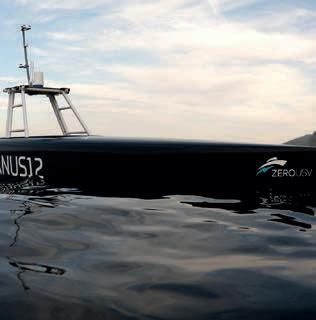
Oceanus12, a new class of high-endurance, fully autonomous USVs (Image courtesy: Zero USV).


The latest evolution in bathymetric measurement Density corrected depth data directly from one instrument sales@valeport.co.uk | +44 1803 869292 | valeport.co.uk
Bathy2
Bathy2
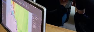
Canadian summer internship programme trains hydrographers of the future
Shaping tomorrow’s ocean mapping education
By Kevin P. Corbley, contributing editor
Three marine organizations teamed up in the summer of 2023 to prepare Canadian ocean mapping students to become ‘hydrographers of the future’. The first-of-its-kind internship programme focused on equipping the students with the technical skills and knowledge that are increasingly required in the hydrography profession but are not yet taught in many college programmes because they are so new and evolving at such a rapid pace.
“The hydrographer of the future must still understand traditional marine science and ocean survey practices, but in addition will need training in automated marine and airborne sensor systems, satellite-based Earth observation platforms and artificial intelligence applications,” said Kyle Goodrich, president of TCarta Marine, the Colorado firm that spearheaded the programme.
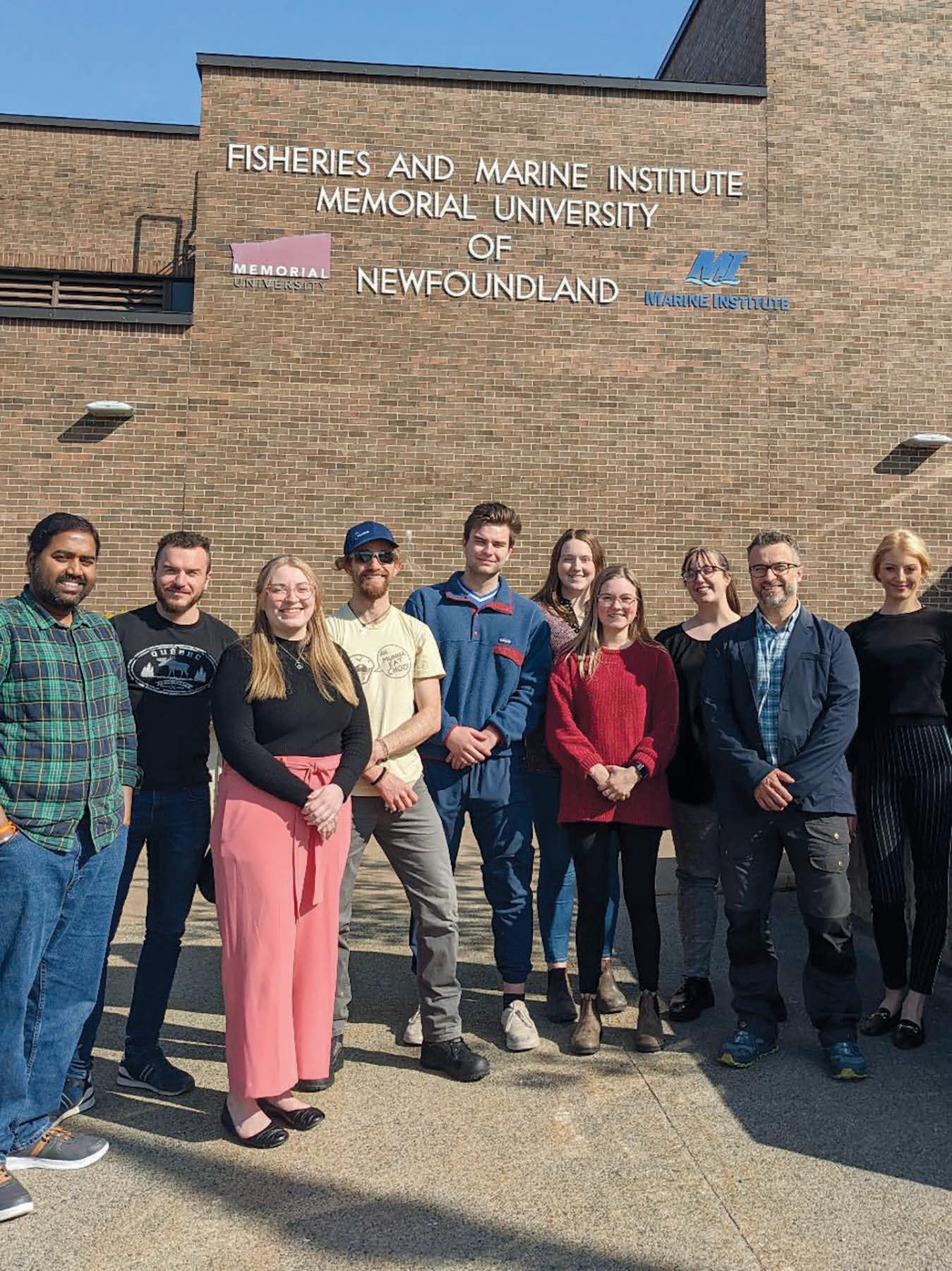
Six undergraduate and two graduate students participated in the summer-long paid internship co-sponsored by, and held at, the Marine Institute (MI) of Memorial University in St. John’s, Newfoundland. All eight students were enrolled in the MI Ocean Mapping programme. Mobilization of the programme was shared among TCarta, Memorial University and The Nippon Foundation-GEBCO Seabed 2030 Project, which seeks to inspire the complete mapping of the seafloor by 2030.
“Field work will remain a key part of hydrography, but hydrographers will also have to be data scientists,” said Paul Elliott, academic director and instructor in the MI Master of Applied Ocean Technology programme.
“There is so much data being collected from many different technologies, and hydrographers must know what to do with it.”
Another objective of the internship was to make hydrography more attractive as an academic pursuit and profession at a time when
the need for trained ocean mappers is expanding. This demand is being driven by increased offshore hydrocarbon exploration, renewable energy siting and coastal development, all of which require detailed seafloor mapping.
The reactions from the students on completion of the hands-on course were overwhelmingly positive. Each had a slightly different experience, but the most common takeaways were excitement about acquiring additional employable skills, surprise at discovering new facets of the hydrography profession, and enthusiasm in playing a part in the Seabed 2030 initiative. “I’ve definitely learned skills that I otherwise wouldn’t have learned in the classroom,” said Kaitlin Power, a third-year MI Ocean Mapping student.
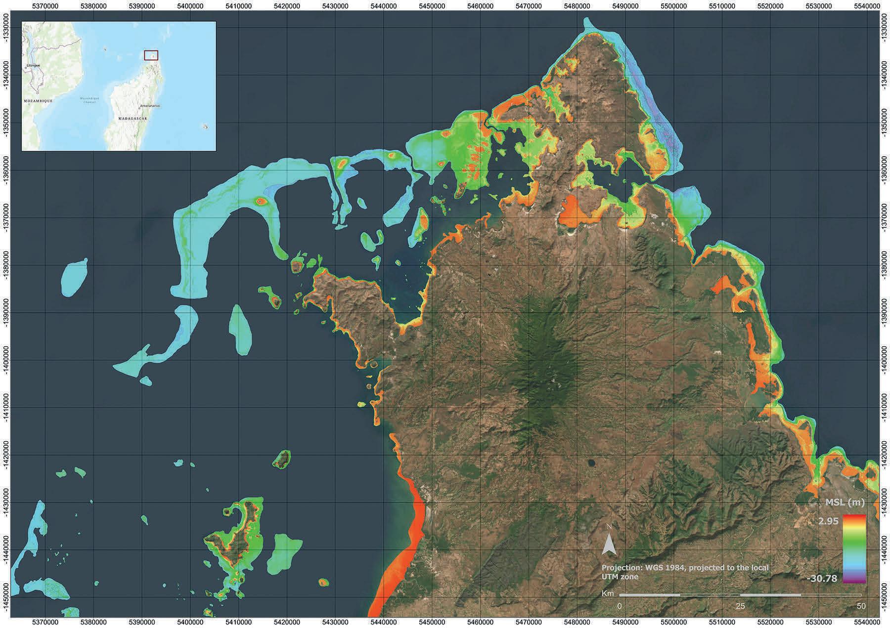
Interns surveyed the entirety of Madagascar, producing 14,555 square kilometres of ten-metre resolution SDB from Sentinel-2 multi-image composites via an ICESat-2 informed machine learning method. The complete Madagascar dataset was submitted to Seabed 2030.
Issue 2 2024 27 Feature
The internship delivered these experiences in a real-world work environment. Spending eight-hour days in the MI computer laboratory, the students received traditional instruction from TCarta personnel followed by intensive collaborative work on seafloor mapping projects. Some datasets were delivered to TCarta customers as commercial products, while others were provided to Seabed 2030 for inclusion in the global GEBCO grid.
Instruction in integrated technologies
The 2023 curriculum focused on training the students in the application of satellite derived bathymetry (SDB), a technique that derives seafloor depth in shallow water, usually in coastal zones, through analysis of multispectral satellite imagery. SDB served as an ideal instructional tool because it integrates multiple state-of-the-art technologies, many new to hydrography. “SDB fills the gap in shallow-water data collection where it’s too risky to operate traditional bathymetric survey technology,” said Elliott.
Dating from the days of the U.S. Landsat mission in the 1970s, SDB is a less expensive and safer method of measuring bathymetry in the near-shore environment than traditional shipborne, or even airborne, techniques. SDB achieved mainstream status in 2020 when the U.S. National Oceanic and Atmospheric Administration (NOAA) and the UK Hydrographic Office adopted the technology as an official hydrographic survey method. Numerous international ocean mapping agencies followed. In 2021, Seabed 2030 specifically requested SDB data as a cost-effective technique for near-shore mapping.
Over the past decades, the quality of SDB mapping increased as spatial resolution of satellites improved, although the core processing algorithms remained the same. It was widely agreed that the technology needed an overhaul. TCarta applied for funding from NOAA and the National Science Foundation to upgrade the entire SDB workflow with state-of-the-art processing capabilities and expand its applicability to deeper, murkier waters, especially in Arctic regions.
Through the SDB training, the interns were introduced to dozens of new technologies and skills, some that are outside the typical course curricula for most hydrography students. Although technologies such as satellite imaging and artificial intelligence may be unique to the SDB workflow for now, TCarta is confident that they will soon be integrated into other ocean mapping methodologies.
Key capabilities
Students were taught many key capabilities during the summer. For instance, they were introduced to the variety of satellite imagery available for SDB and studied the strengths of each for certain project types. For example, no-cost coarse-resolution ESA Sentinel-2 A/B satellite data was used for broad geographic coverage, while high-resolution Maxar WorldView imagery was processed for targeted, site-specific applications.
TCarta also instructed the interns on how to use a pre-processing tool to prepare in situ data from sonar or Lidar as calibration datasets for processing the satellite images. Furthermore, they learned how to apply an enhanced version of a traditional band ratio algorithm along with a newly devised machine learning random forest algorithm in iterative processes to derive water depth measurements from individual image pixels.
Another capability taught was how to harness the power of cloud computing to apply the SDB algorithms to stacks of multi-temporal Sentinel images acquired for the same location at dozens of different times. The interns also used an artificial intelligence-based QA/QC tool to apply Lidar data from the NASA ICESat-2 satellite to evaluate and validate the SDB outputs. FMABE 3D point cloud software developed by the U.S. government was also employed to edit hydrographic datasets to produce final deliverables.
“Having these skills puts us at an advantage over other students who will be looking for work in the future,” said Maggie Lewis, also a thirdyear ocean mapping student.
Creating real world products
For Will Edwards, an MI Ocean Mapping student, part of the internship’s attraction was working on SDB products that would be deliverables for real end users, especially the Seabed 2030 endeavour, which is considered the highest profile seafloor mapping project in the world right now. “I am really happy to get the opportunity to provide data to Seabed 2030…I had been waiting a few years to do that,” said Edwards. “I’m glad the data [we produced] was accurate enough to be used.”
“The SDB datasets provided by the students of the summer internship are instrumental in supporting the global effort underway to deliver a complete map of the ocean floor by 2030,” said Seabed
Issue 2 2024 28
The Seabed 2030 supported summer intern programme included six undergraduate students and two graduate students of the Ocean Mapping programme at the Fisheries and Marine Institute of Memorial University of Newfoundland. Pictured from left to right: Venkata Yadavalli, David Bautista, Michaela Barnes (Marine Institute alum and general manager, TCarta), Remy Ouellet, William Edwards, Kaitlyn Power, Maggie Lewis, Jenna Ryan, Kyle Goodrich (president and founder, TCarta) and Amanda Steele.
2030 Director Jamie McMichael-Phillips. “We are delighted to support this collaborative internship co-sponsored with our partners Memorial University and TCarta, enabling students to acquire cutting edge hydrospatial skill sets and equipping them for their future careers as modern hydrographers.”
In total, the interns created more than 21,125 square kilometres of SDB coastal products during the 12-week session. Key datasets included:
• the entire Newfoundland coastline and three Arctic regions for MI research;
Timor Island in Asia and New Hanover Island in Papua New Guinea for Seabed 2030; and
• the entire Madagascar coastline off the coast of Africa for a TCarta client.
“The students took what they learned in the classroom and applied it to real projects with actual data and deadlines. They learned what they have to do to get a project completed,” said Elliott. “They therefore know what will be expected from them when they join the workforce.”
MI’s success at educating hydrography students has put it at the top of ocean mapping programmes worldwide. The Master’s programme has been recognized by the International Hydrographic Organization as one of the few to receive the S-5A standard of competence.

and evaluation using multiple tools and resources such as nautical charts, and 3D point cloud editing.
Success and what’s next
The internship programme succeeded on many levels. Among the most important was resetting the students’ expectations of what a future career in hydrography might look like. MI hydrography instructor, Olga Telecka, explained: “Hydrography has traditionally been a profession in which most data collection work was conducted on a ship. For many, the prospect of spending weeks or months on a boat away from home eliminated hydrography as a professional choice. But now that so much data is being collected remotely and with data analysis being performed in onshore labs, the profession offers opportunities for both maritime enthusiasts and land lovers.”
“What [the students] learned in the internship is that hydrographers don’t necessarily need to go on a vessel to have a career in this industry, which for some is very important,” continued Telecka. “This programme opens the horizon.”
Telecka added that for MI, the course reinforced the value of academic-industry partnership. Working professionals can expose students to cutting edge technologies already being used in the commercial world before they find their way into textbooks. Based on the positive experience with TCarta, MI is considering other technologies to feature in future internships.
TCarta is working closely with MI to refine the SDB programme and sponsor it again next summer. “The programme showed us that a non-distracted group of new-to-SDB people could take a new technology in a short time period and produce solid, professional work – as students,” said TCarta’s Goodrich. “The students performed better than we anticipated, impressing us with their eagerness and interest in improving the new processes they were learning.”
The internship organizers hope that the internship format will provide a template for other academic programmes and private sector companies to introduce hydrography students to the latest technologies, helping them to understand the full breadth of the profession and making it more appealing in the process. While the internship succeeded in preparing students to become hydrographers of the future, Goodrich noted, the hydrography industry still has much work to do in attracting more students to the discipline. He challenges private sector colleagues and academics to do more in promoting hydrography and ocean mapping to young people long before they reach university.
For universities, the key is collaboration. MI’s Elliott recommended that academic institutions look for partners in the commercial world to partner with, as his did with TCarta to help make the transition to the working world easier for the students.
About the author

Kevin Corbley is a business development consultant with more than 30 years of experience in the geospatial profession. He is based in Colorado, USA.
Issue 2 2024 29 Feature
TCarta SDB summer interns learned and deployed an entire suite of SDB skills and workflows, including ICESat-2 selection for calibration and validation, SDB production

LONG ENDURANCE, LOW CARBON HYDROGRAPHIC SURVEY

Saildrone is at the forefront of advancing autonomous technology to provide fully managed mission solutions delivering data in real time.


With over 1M nm sailed and 32,000 days at sea, our record reflects unparalleled endurance and capability for hydrographic survey applications.
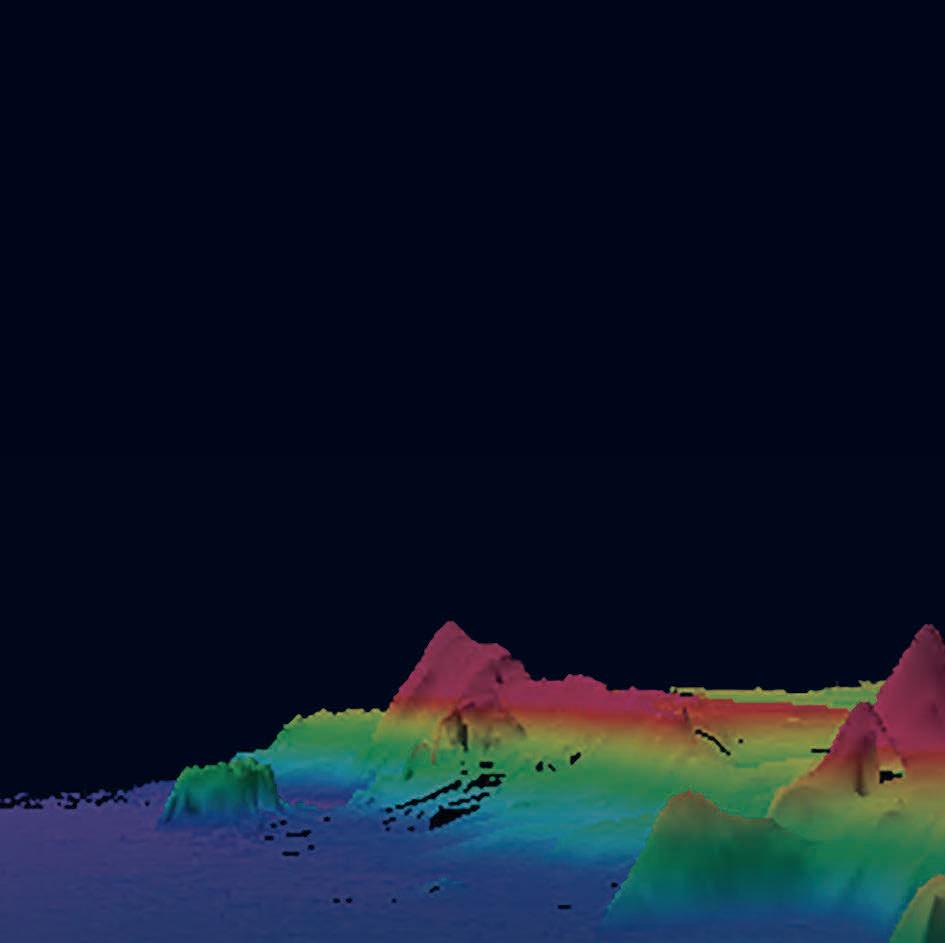
c Multibeam seafloor mapping meeting the strictest data requirements
c From near shore to the high seas
c Real-time data access and visualization
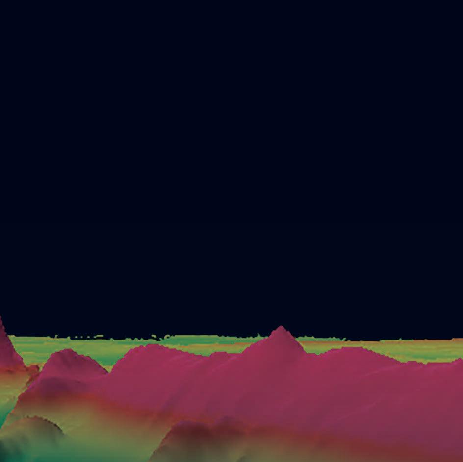
c Proven reliability at sea
c ABS commercially classed USVs
c Powered by renewable energy for a minimal operational carbon footprint


The future of seafloor exploration is now. Learn more at saildrone.com


Calling all Cat A & Cat B hydrographic surveyors (and others): get certified!
International recognition as a Certified Hydrographic Surveyor
By Denis Hains, Rebecca Cusack, Jasbir Randhawa, Derrick Peyton, Huibert-Jan Lekkerkerk and Jon Dasler
If you are a graduate from an IBSC-recognized Category S-5A (Cat A) or S-5B (Cat B) academic programme with relevant hydrographic experience, you can apply to become a Certified Hydrographic Surveyor. Graduates of other geospatial degree programmes with relevant hydrographic experience may also apply. This short article is intended to debunk some myths, one of which is that successful graduates with a Cat A or Cat B certificate from an IBSC-recognized academic programme are automatically Certified Hydrographic Surveyors. While this is not true, they have met the Cat A or Cat B academic requirements and are on a path to certification, but cannot call themselves a Cat A or Cat B “certified” hydrographer until they have been certified under an IBSC-recognized individual certification scheme.
Getting closer to certification
As you may know, successfully obtaining a BSc in Engineering or a Bachelor’s in Finance does not make you a Professional Engineer (PEng) or a Certified Professional Accountant (CPA), although it does provide you with the required knowledge to become one. Similarly, in hydrography you need to take an extra step to become a Certified Hydrographic Surveyor in the vast hydrospatial domain While lack of certification does not mean you are not sufficiently competent, without it you do not have independent recognition from an individual certification scheme.
If you meet the criteria, you can apply by submitting the required documents. The certifying body then checks your education, skills, experience and references against defined criteria. This ensures that all who are certified have been benchmarked against a consistent set of standards – increasing public confidence in the occupation. The successful completion of
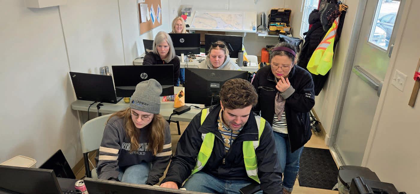
a Cat A or Cat B IBSC-recognized training programme in one of the many institutions and organizations in the world is a great accomplishment that you must be proud of and brings you one step closer to becoming a Certified Hydrographic Surveyor, but you are not there yet!
There is a fundamental difference between graduating from an educational institution that is recognized by an international review board as upholding standards of competency and obtaining individual certification in a specialized domain. To be allowed to use a certified title, you are required to submit proof of knowledge, experience and ongoing continuous professional development and take a solemn oath to uphold the code of ethics of an association. Furthermore, to be held accountable and subject to disciplinary action, a professional must be a member of the regulating association.
The IHO/FIG/ICA International Board on Standards of Competence (IBSC) for Hydrographic Surveyors and Nautical Cartographers is the overarching authority for recognition of hydrographic and nautical cartographic training programmes, as well as professional certification or individual recognition schemes for hydrographic surveyors. As a collaborative board between the International Hydrographic Organization (IHO), the International Federation of Surveyors (FIG) and the International Cartographic Association (ICA), the IBSC leads the development and maintenance of international training standards for hydrography and nautical cartography.
Issue 2 2024 31
Perspectives
Students on the Cat S-5B programme obtaining the knowledge required on the pathway to individual hydrographic certification. (Image courtesy: IIC Academy)
Which organizations may certify hydrographic surveyors?
Only four organizations are currently permitted by the IBSC to certify individuals to become Certified Hydrographic Surveyors, although others may apply for such recognition:


Geospatial Council of Australia (GCA) Australasian Hydrographic Surveyors Certification Panel (AHSCP) Certification Scheme, recognized since 2012 and renewed in 2019.
Association of Canada Lands Surveyors (ACLS) International Hydrographer Certification Scheme (IHCS) for Certifying and Recognizing the International Competency of Individuals as Hydrographic Surveyors, recognized since 2016 and renewed in 2022.

The International Federation of Hydrographic Societies (IFHS) Hydrographic Professional Accreditation Scheme (HPAS), recognized since 2022.
National Society of Professional Surveyors in association with The Hydrographic Society of America (NSPS-THSOA) U.S. Hydrographer Certification programme, recognized since 2023
In essence, those seeking certification in hydrographic surveying should aim for accreditation from an IBSC-recognized organization. It is recommended that candidates apply to the certification body nearest to their intended work location to streamline the process. However, applicants may apply to
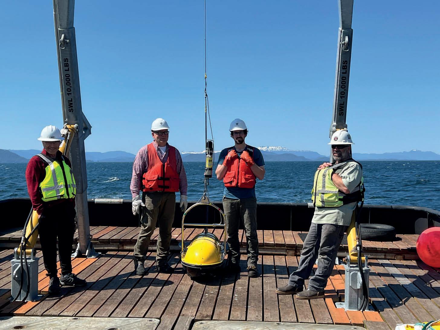
Hydrographers deploying a combined sidescan sonar and sub-bottom profiler with an ultra-short baseline (USBL) transponder for tow fish positioning on a 700-metre-deep cable route survey in SE Alaska, USA. (Image courtesy: David Evans and Associates, Inc.)
any recognized certification organization. Upon successful completion, they obtain a globally recognized certification. Mutual recognition agreements (MRAs) are either established or in progress to facilitate the acknowledgment of Certified Hydrographic Surveyors and labour mobility worldwide. While there may be slight variations in the certification levels offered by different organizations, they typically align with Levels 0, 1 and 2 and the certified hydrographic surveyors in training (students) level.
Why should I become a Certified Hydrographic Surveyor?
Becoming a Certified Hydrographic Surveyor is the natural progression from successful completion of a Cat A or Cat B hydrographic surveying training programme or an alternative pathway. Certification recognizes your education and training, as well as your level of knowledge and your practical competencies, and ensures that you are enrolled in a process of continuing professional development (CPD). It elevates you to a higher level within the
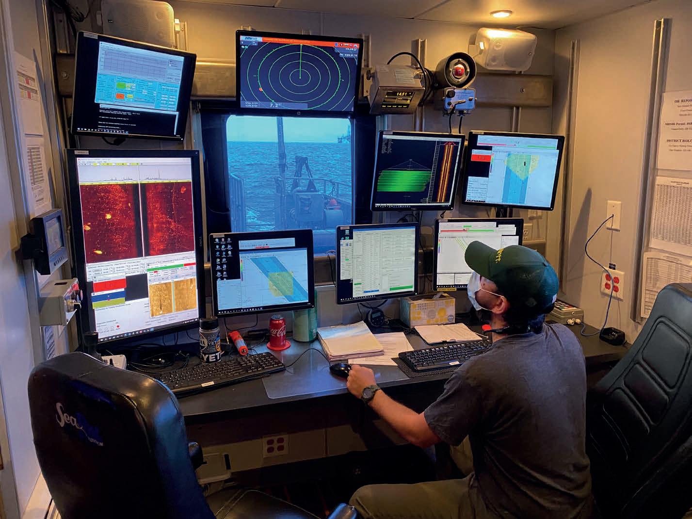
Hydrographer monitoring and processing sidescan sonar imagery and multibeam bathymetry to open critical shipping lanes to Lake Charles, Louisiana, USA, following Hurricane Laura. (Image courtesy: David Evans and Associates, Inc.)
Issue 2 2024 32
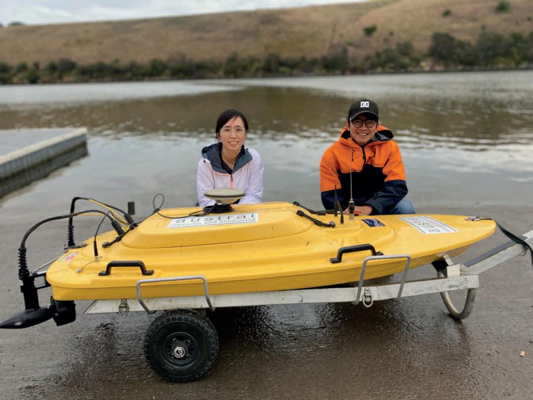
industry and provides an internationally recognized benchmark for your experience and skills.
Assessment and recognition by a credible panel of peers ensures that standards are upheld and expertise is duly recognized within the field. It instils confidence both in the individual and those who rely on accurate hydrographic data. Such recognition also fosters a sense of accountability and trust, which are essential elements in maintaining the integrity of hydrographic surveying practices.
Governments, port authorities and private entities increasingly require that Certified Hydrographic Surveyors are used to procure hydrographic services. Getting certified sooner rather than later will therefore help you to prove that you have the required academic credentials and work experience to support your labour mobility through MRAs. It will also reassure clients, such as national hydrographic offices, that you work in accordance with the strictest competency standards and current best practices. Furthermore, it will protect the safety and welfare of the public and ensure that your work is environmentally responsible and technically correct, all of which are essential for safety and efficiency of navigation and protection of lives and the environment.
Certification will therefore undoubtedly improve your global recognition value and marketability to obtain work as a competent hydrographic surveyor in the vast and emerging hydrospatial domain.
We therefore recommend that you carefully follow the instructions of your selected individual certification/recognition scheme, as it will take time to build your body of evidence to support your application and ensure a solid and complete file for submission. Hold off on applying if you do not have sufficient knowledge and experience, but do not hesitate if you do, and apply as soon as possible! The certifying organizations are there to encourage the recognition of your competencies as a pathway towards professional certification and are there to help. If you have any questions, do not hesitate to get in touch with your chosen hydrographic surveyor individual certification/recognition scheme – they are always happy to answer your questions so that you can get certified.
Sciences, is president & CEO at H2i. A former Hydrographer General of Canada, he leads global hydrospatial efforts and contributes on a pro bono basis to esteemed organizations.
Rebecca Cusack (BA, MA, MCOMM, GAICD), Australian Hydrographic Office (AHO), assistant director international relations & AHSCP secretary. Rebecca has over 20 years of experience in business management and corporate governance at the AHO.
Jasbir Randhawa (FGCA (CPHS 1), Cat A HS), Australian Hydrographic Office (AHO), assistant director external relations & AHSCP Secretary (1994-2023). He has over 30 years of experience in secretariat support to national committees convened by the AHO.
Derrick Peyton, CEO of IIC Technologies. He holds an MBA and an MSc in geomatics engineering. He has PEng, CLS Commission and Level 0 Cat A certification.
Huibert-Jan Lekkerkerk is a contributing editor to Hydro International, a freelance hydrographic consultant, an author of various publications on GNSS and hydrography, and the principal lecturer in Hydrography at Skilltrade (Cat B) and the MIWB (Cat A).
Jon L. Dasler (PE, PLS, CH), David Evans & Associates senior VP, has 38 years of experience in hydrographic & marine projects and chairs the NSPS-THSOA Hydrographer Certification Board. He specializes in marine navigation surveys.
Issue 2 2024 33
Cat S-5B students learning to operate a hydrographic autonomous surface vehicle on their pathway to individual hydrographic certification. (Image courtesy: IIC Academy)
Perspectives
Presentation of AHSCP Certificate – Level 2 at GCA Hydrographic Seminar, Fremantle, Australia, 2023. (Image courtesy: AHSCP and GCA)
The hidden past beneath the waves and sands
Prehistoric landscapes of the North Sea
By Robert van Lil, Periplus Archeomare, the Netherlands
As Dutch fishermen have known for decades, the North Sea region was once a barren landscape populated by large mammals long extinct. The fishermen frequently find the remains of these mammals – woolly mammoths, rhinos, aurochs, Irish elk (giant deer) and reindeer – in their nets. Artefacts made of bone or antlers and even human remains are also sometimes part of the by-catch. These finds prove that migrating hunter-gatherer communities populated the vast North Sea area at the end of the last Ice Age (some 13,000 years ago) and the Early Holocene (11,650 to 8,700 years ago). Remains are also found due to other activities such as sand extraction for beach replenishment along the Dutch coastline. Collectors scouring the beaches for fossils and hidden artefacts recently found hyena coprolites (fossilized faeces) and a 50,000-year-old Neanderthal tar-hafted flint tool.
Under Dutch law, a developer of an area must determine whether remains of potential archaeological value are affected by the planned activities. Archaeological research is conducted in successive steps, starting with a desk study and followed by field surveys to explore, map and valuate archaeological sites. This stepwise approach applies to both onshore and offshore research, yet there are some marked differences.
Onshore, a wealth of historic, archaeological and geological information is available to build a detailed predictive archaeological model. Field surveys generally focus on the tracing and mapping of pre- and proto-historic settlements. Simple tools such as an Edelman hand auger and a gouge auger suffice to meet this objective, after which the archaeological site can be valuated by digging trial pits. Offshore, our knowledge of the shallow geology is limited. Although last century’s geologists did a tremendous job by producing geological maps utilizing seismic data, the amount of borehole data to ground truth this is too limited to reach the level of accuracy and detail needed for geoarchaeological research. Research programmes are currently being carried out and cooperation sought by the Geological Survey of the Netherlands at the European level to fill the knowledge gaps.
Submerged prehistoric landscapes
In the early stages, offshore archaeological research primarily focused on the tracing of historic wreck sites and WWII aircraft. That has changed. The Dutch Cultural Heritage Agency (RCE) has placed the research of submerged prehistoric landscapes high on its agenda, underscoring the importance of gaining a better
understanding of “an important and sometimes overlooked element of the maritime cultural heritage of the southern North Sea.”
Prehistoric hunter-gatherer campsites are generally small, featuring a sparse array of flint artifacts and hazelnuts, for instance. Such sites are extremely difficult and costly to trace in the subsurface of the North Sea area. Offshore, the primary aim of archaeological research is therefore not to trace settlements but to search for the specific parts of the landscape in which hunter-gatherer campsites are found. Sand dunes and ridges, outcrops of boulder clay and higher grounds along fresh-water brooks are the preferred locations. It is therefore imperative to obtain a picture of the prehistoric landscapes that are hidden beneath the seafloor.
Abundant detailed information of the subsurface is collected during seismic and geotechnical surveys carried out for the development of offshore wind farm zones. Commissioned by RVO, Periplus Archeomare used this data to assess the submerged prehistoric landscapes of IJmuiden Ver Wind Farm Sites alpha and beta (IJVWFS alpha & beta).
Layers and sediments
Figure 1 shows a cross-section of IJVWFS alpha and beta, based on seismic data acquired by GEOxyz. In Figure 1, we see that Unit A consists of Holocene mobile sands of the Bligh Bank Member. Sand ridges and dunes are part of this unit, which has a planar erosional base. In the southern Brown Bank area, Unit A is absent. Here, Unit C is exposed at depths below 34m LAT. Unit C consists of Early Glacial lagoonal and shallow marine deposits of the Brown Bank Member,
Issue 2 2024 34
with laminae and layers of very fine sand, silt, clay and detritus. According to the Flemish Bight geological map, the top of the Pleistocene sequence consists of the Brown Bank Member, with locally a less than onemetre-thick cover of the Boxtel Formation. Unit B has a thickness of some 5.5 metres and a highly irregular base that sharply truncates underlying Unit C, the Brown Bank Member. Unit B appears to have been formed by the deposition of homogenous sediments in a high-energy environment with strong erosion of the then existing landscape. According to the geological maps of the area, Unit B is initially interpreted as Early Holocene tidal deposits of the Naaldwijk Formation.
A channel feature can be seen in the north-eastern part of the cross-section, shown in plan view in Figure 2. The channel incises both Unit B and Unit C and is therefore younger than these units. Peat is found locally in the upper parts of Unit B and the channel infill. The presence of a channel feature and peat bed raises several questions. Has the channel feature formed through incision by a fresh-water brook in a terrestrial landscape or a tidal channel in a near-coastal marine environment?
What is the age of the peat? What is the timing of incision and infill? What did the surrounding landscape look like? What is the age, depositional environment and lithostratigraphy of the units that are incised by the channel? To answer these questions, the sampling strategy focused on the channel feature and its surrounding landscape. Three vibrocore locations were selected at three locations (nine in total) to sample the channel infill and sediments of the bordering landscape. Sediments of Units B, C and D were sampled at three other locations to obtain optimal vertical coverage of the sedimentary sequences in the area.
Evolution of landscapes
The description of vibrocores is not limited to the lithology. Special interest is paid to sedimentary structures to assess the depositional environment, the character of layer boundaries (erosive versus nonerosive), and phenomena that point to secondary processes such as soil formation, rooting, ripening and decalcification of clay, bioturbation and cryoturbation.
The aim of the research is to picture the evolution of aquatic and terrestrial
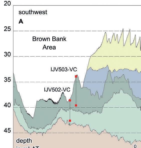
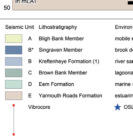
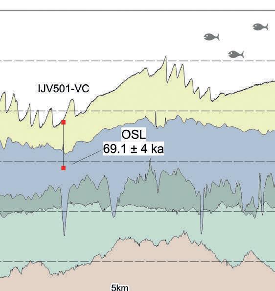
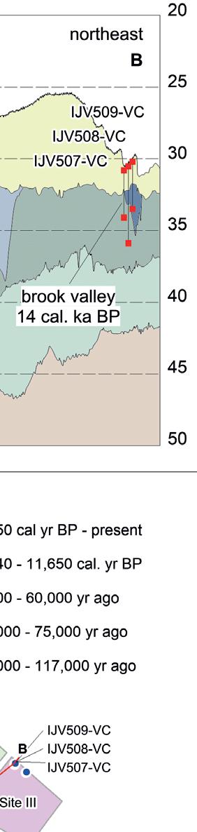
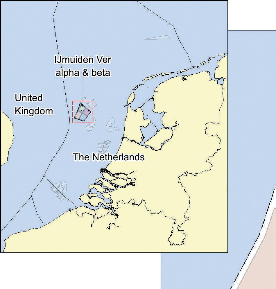
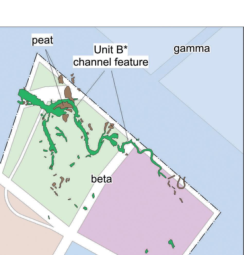
Issue 2 2024 35 Feature
Figure 1: Cross-section based on seismic data, including six vibrocore locations.
Figure 2: Plan view of a channel feature hidden below mobile sands of the Bligh Bank Member.
landscapes. To meet this objective, microfossils (foraminifers and ostracods), diatoms and palynomorphs (pollen, spores, algae, fungal parts and insect remains) were extracted from selected sediment samples for detailed research.
Ostracods, foraminifers and diatoms are microorganisms that live in aquatic environments. The fossilized remains of these organisms are found in sediments. Environmental variables including substrate, water depth, temperature, salinity, organic matter and dissolved oxygen
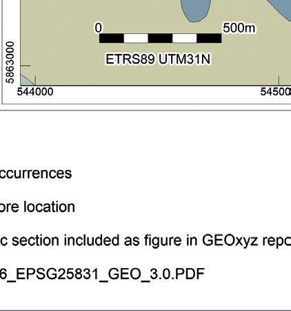
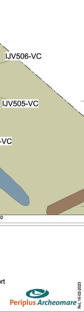
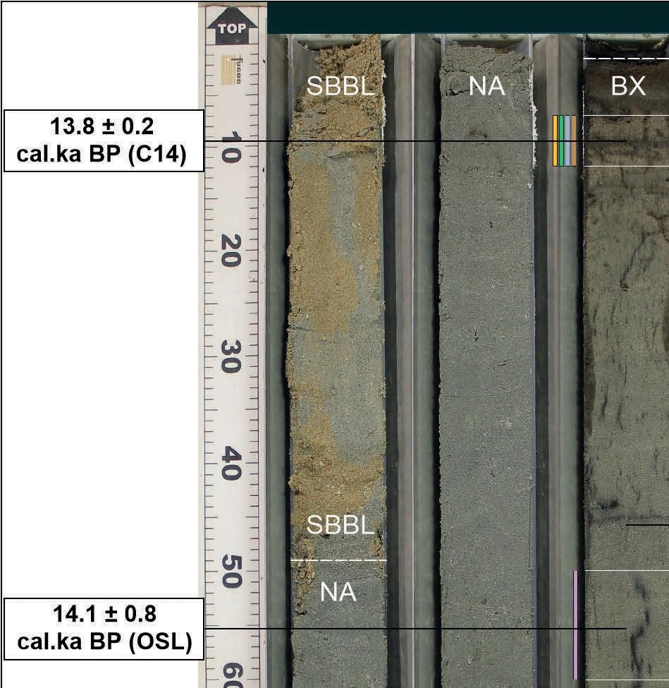
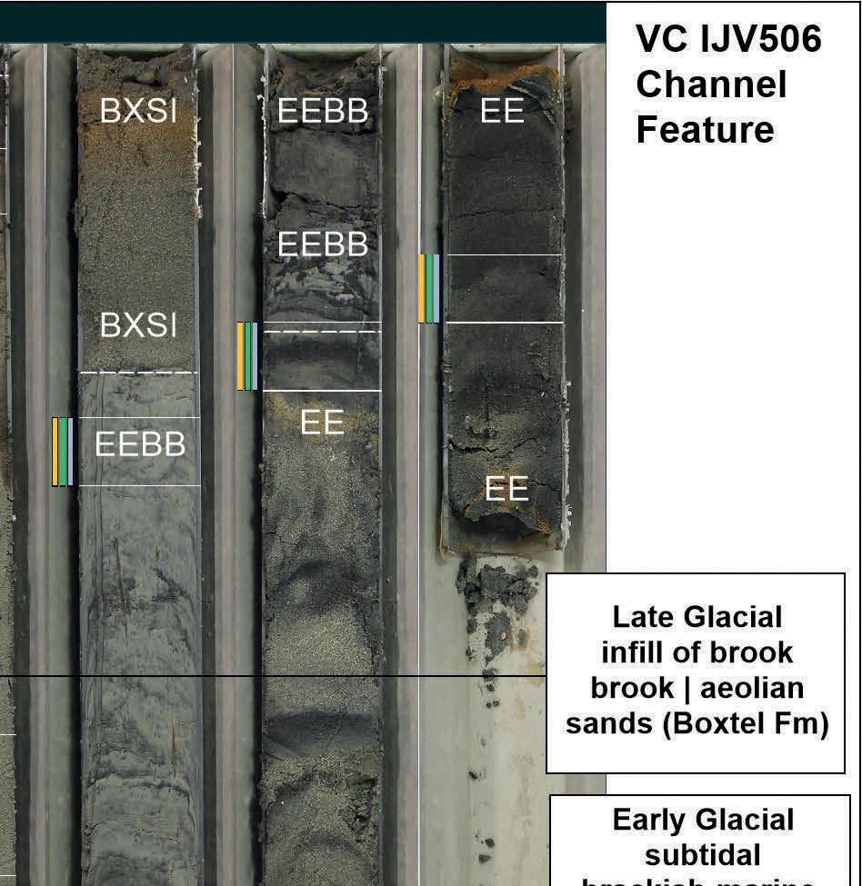

determine whether the habitat is fit for different species of ostracods, foraminifers and diatoms. From the diversity and abundances of the identified species, the aquatic environment can therefore be deduced.
Airborne pollen and spores are deposited on land or at the bottom of lakes, lagoons, brooks, salt marshes or the seabed. The different types of pollen found in a sample give an impression of the vegetation of the surrounding landscape and climatic conditions during deposition. The pollen distributions are correlated with known pollen zones, to judge whether the pollen distributions fit the initial lithostratigraphic interpretation.
Plant remains, peat and molluscs are collected from the sediments for radiocarbon dating. As radiocarbon dating is restricted to sediments that are younger than 50,000 years, optically stimulated luminescence dating (OSL) is used to date sandy sediments that include sands older than 50,000 years. This works as follows: quartz grains that are covered by other sediments after deposition store the energy that is emitted by surrounding natural radioactive minerals in their crystal lattice. The amount of energy stored in a single quartz grain is therefore equivalent to the time that has passed since its burial, provided the grain is not exposed to light. OSL uses this characteristic of quartz to determine the time of deposition.
Figure 5: The base of Unit B projected on the Early Pleniglacial paleogeographic map (Peeters et al. (2015). Fluvial evolution of the Rhine during the last interglacial-glacial cycle in the southern North Sea basin: A review and look forward. Quaternary International, 357, 176–188).
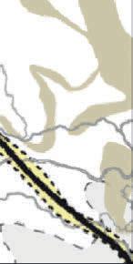
Issue 2 2024 36
Figure 3: The locations of vibrocores that target a channel feature and the adjacent landscape.
Figure 4: Photograph of vibrocore IJV506 (channel feature); seabed = top left, deepest part of core (5.35m) = middle right.
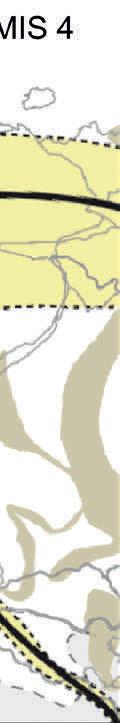
Vibrocore IJV506 sampled the central part of the channel feature (see Figure 3).
From 2.07m to 3.22m, the infill consists of non-calcareous silty fine sand (see Figure 4). The rooted sands are interpreted as Late Glacial fresh-water brook deposits of the Singraven Member | Boxtel Formation. Radiocarbon (13.8 ± 0.2 cal ka BP) and OSL dating (14.1 ± 0.8 cal ka BP) support the inferred Late Glacial age, pointing to deposition during ‘warm’ Bølling-Allerød interstadials. The Early Holocene climate warming led to a rise in sea level and inundation of the North Sea area. Groundwater was pushed up in bordering coastal zones and fens, marshes and swamps developed in which peat was deposited. A bed of such peat (Basal Peat Bed | NIBA) is found at 1.90m to 2.07m, covering the Pleistocene sands of the Boxtel Formation (BX). Brackish water clay (Velsen Bed | NAVE) that conformably covers the peat mirrors the first marine ingression in the area. Peat and organic clay were deposited between 9.4 and 9.0 cal ka BP, when an open landscape with pine, birch, grasses and sedges transformed into a more densely forested landscape with mixed pine-birch-oak-hazel woods.
Conclusions
The outcome of the IJV506 vibrocore analysis has major implications for the geogenesis of the area. Evidently, the Late Glacial brook is younger than the deposits of Unit B which it incised. The inferred Holocene age is therefore ruled out for Unit B. On geological maps, the Brown Bank Member forms the top of the Pleistocene sequence. However, the semi-transparent seismic facies of Unit B do not fit the Brown Bank Member, whereas the plan-parallel sub-horizontal strata of Unit C do. The deposits of Unit B post-date the Early Glacial Brown Bank Member and predate the Late Glacial Singraven Member. The top view of the base of Unit B shows a morphology that resembles that of a braided river system. Correlation with palaeogeographical maps of the North Sea area results in a light bulb moment. During the cold Early Pleniglacial, the westward extent of the Rhine catchment area appears uncertain (see question marks in Figure 5). The scarcely vegetated landscape and peak discharges during the summer months turned the Rhine into a braided river, which transported large quantities of meltwater and sediment to the North Sea area. It now seems likely that a northern tributary of the Rhine crosscut the IJVWFZ during the Early Pleniglacial. The high-energy braided river deposited poorly sorted sands (Unit B) and incised the then exposed Early Glacial Brown Bank Member (Unit C).
A sand sample from Unit B (IJV501) reveals an OSL dating of 69 ka, which supports the Early Pleniglacial age. The Geological Survey of
the Netherlands plans to analyse the heavy mineral assemblages in the sand, to test whether the sands indeed were deposited by the Rhine. If so, Unit B will be mapped as the Kreftenheye Formation instead of the Brown Bank Member.
The geoarchaeological analysis of 12 vibrocores has changed our view on the evolution of prehistoric landscapes in this part of the North Sea area. The research findings cast archaeological finds in the Brown Bank area in a new light. In 2005, a fisherman found a decorated bison bone in his nets, south of the Brown Bank. The artefact was dated 13.5 cal ka BP, which proves that modern humans lived in the area at the end of the last Ice Age. The fresh-water brook in the northern part of the research area dates from that same period, making it tempting to imagine that the brook valley was visited by the man or woman who produced this artefact. The presence of the Rhine in this part of the North Sea during the Early Pleniglacial impacts the possible landscape use by humans, with a Neanderthal skull fragment and tar-hafted flint artefact both found in the context of Pleistocene Rhine deposits. Future geoarchaeological research for offshore developments will, bit by bit, aid our understanding of the evolution of prehistoric aquatic and terrestrial landscapes in the North Sea area.
Robert van Lil is a geologist specializing in the geoarchaeological research of prehistoric landscapes. In 2009, he joined the Amsterdambased research and consulting firm Periplus Archeomare. Robert is passionate about using geophysical and geotechnical techniques to unravel the geological constellation of the North Sea region and understand how landscapes, now hidden under the seabed, developed in prehistoric times. His research has led to surprising new insights into the genesis of the North Sea.
Issue 2 2024 37 Feature
About the author
Figure 6: Detail of Figure 5 with an example of a braided river system in New Zealand. (Image courtesy: Findley Watt, stock.adobe.com)
Research icebreaker Polarstern returns from East Antarctica
After more than six months, the research icebreaker Polarstern returned to its home port of Bremerhaven, Germany, after a successful Antarctic season. The expeditions to the southern hemisphere and the transit there focussed on the oceano-graphy and geology of East Antarctica as well as student training. Because of this special study area for the Polarstern, there was a change of personnel in Hobart, which was the first port call in Australia in her more than 40-year history.
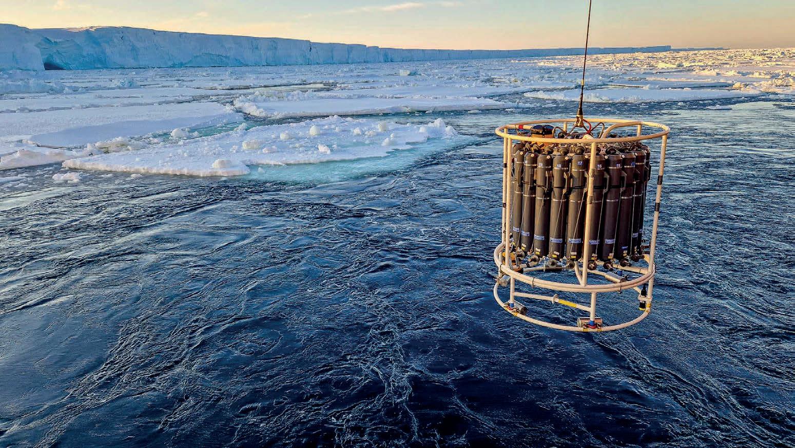
The glaciers of East Antarctica are considered to be relatively stable compared to those in the west. However, in the course of global warming, not only the sea ice cover but also the ocean currents are changing. While the former is easily visible through satellite observations, for example, the latter is best investigated on site through direct measurements in the water column and deployment of buoys or moorings. During the last Antarctic season, scientists used the Polarstern to investigate current conditions and the composition of the water masses in great detail as part of the EASI expeditions. They also took samples from the seabed, as these sediment cores contain information about the flow conditions in the Earth’s history.
Water column and sediment samples
From the Denman Glacier in East Antarctica (position about 66° South, 100° East), the Polarstern travelled about 2,000 kilometres north to 45° South. Approximately every 100 nautical miles (185 kilometres), the expedition participants took water samples at a total of ten stations and determined the oxygen content and salinity, depth and temperature of the ocean from the surface to the sea floor. They then took sediment cores. “To my knowledge, such a long section with regular high-resolution samples from the water column and sediment through almost all climatically important areas of the Antarctic Circumpolar Current has never before been obtained from this part of the Indian Ocean,” said Dr Marcus Gutjahr, oceanographer at the GEOMAR Helmholtz Centre for Ocean Research, Kiel, and leader of the EASI-2 expedition.
“From the sediment cores, we can describe the position of the Antarctic Circumpolar Current in East Antarctica over the past
800,000 years,” added Dr Oliver Esper, marine geologist at the Alfred Wegener Institute, Helmholtz Centre for Polar and Marine Research (AWI) and co-chief scientist of the expedition. This is particularly relevant because the fronts of the Antarctic Circumpolar Current tend to shift northwards in cold periods and southwards in warmer ones. “We were able to confirm that warm water is already reaching the Denman Glacier and melting it from below, which is leading to a rise in global sea levels. This is a condition that climate models predict for other areas in East Antarctica as global warming progresses in the coming decades. From the sediment cores, we will be able to estimate how quickly the ocean currents have shifted in the Earth’s history after the laboratory analyses that are now pending. This will enable us to improve forecasts of future sea-level rise.”
Recording the Earth’s crust
Following the EASI-2 expedition, the EASI-3 expedition led by Prof. Sebastian Krastel traveled from Hobart to Walvis Bay. This expedition focused on the geology of East Antarctica, examining ancient glacier retreats with geophysical methods. By studying sediment layers, researchers explored over 50 million years of Earth’s history. A TU Dresden team used GNSS to precisely measure Earth’s crust movements, reflecting ice mass changes. Combined with geophysical data, this aids in understanding East Antarctica’s internal structure and deformation.
Led by Simon Dreutter, Polarstern mapped the seabed for the GEBCO Seabed 2030 project on its Atlantic return. Last autumn, AWI trained students in handling these soundings. After unloading sediment cores, Polarstern will undergo maintenance at Lloyd Shipyard before departing for the Arctic in June.
Issue 2 2024 38 Expeditions
Conducting oceanographic measurements along the East Antarctic coast. (Image courtesy: Marcus Gutjahr)


SMART SUBSEA SOLUTIONS
• Delivering data in most adverse conditions: underwater acoustic modems with advanced communication technology and networking
• Accurate USBL, LBL and hybrid positioning of underwater assets, navigation for divers
• Modem emulator and multiple cost-saving developer tools
• Sonobot 5 - the autonomous surface vehicle for bathymetry, monitoring, search & rescue, and AUV support
• Quadroin - the novel bionic AUV for surveys and monitoring
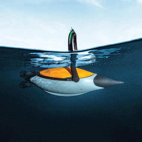
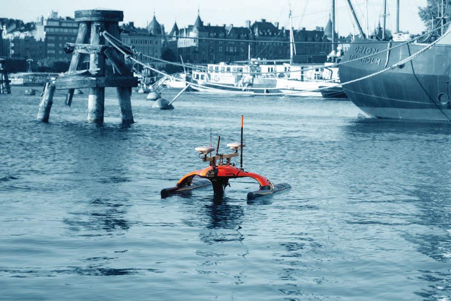
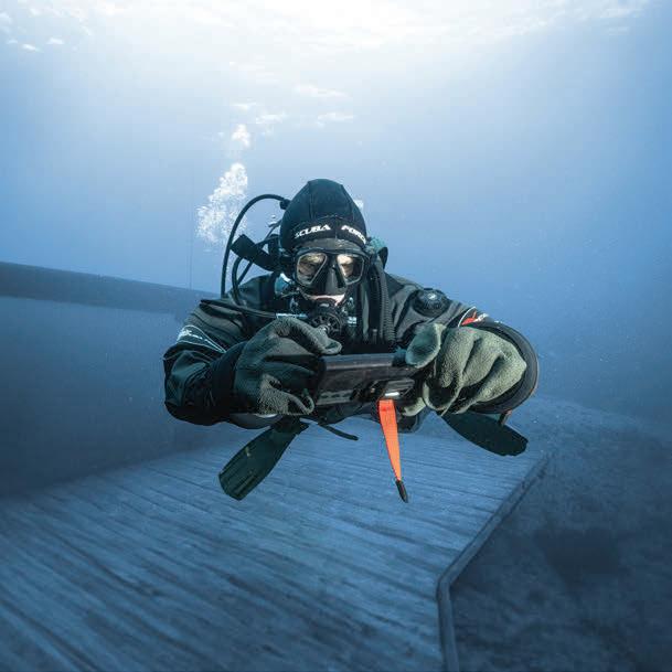
sales@evologics.com sales-us@evologics.com
EvoLogics.de NEW DIVER NAVIGATION SYSTEM AVAILABLE NOW
