As Open-Source Data takes centre stage, mapping and location intelligence becomes more vital than ever before. But without standardization, interoperability, and widespread reach, its true potential cannot be realized.
Recouping Farmers Loss Pg 10
Data That Binds: Open Source Mapping For a Better Tomorrow? Pg 14
Boundless Geo Possibilities: Turning Point - Fourth Industrial Revolution Pg 22
March-April 2023 » Volume 02 » Issue 02 » www.geospatialworld.net For Private Circulation only
INSIDE
DO AMAZING THINGS WITH GEOGRAPHY


Esri India is the leading provider of Geographic Information System (GIS) software, location intelligence, and mapping solutions in India.



Since 1996, Esri India has been leading the growth and adoption of location technology among government, businesses, academia, and NGOs in India.

Today, more than 6,000 organizations rely on Esri’s technology to plan and manage their operations based on informed, data-driven decisions.

esri.in Copyright © 2023 Esri. All rights reserved. Esri, the Esri globe logo, and esri.com are trademarks, registered trademarks, or service marks of Esri in the United States, the European Community, or certain other jurisdictions. Other companies and products mentioned herein may be trademarks or registered trademarks of their respective trademark owners.
VOLUME: 02 / ISSUE: 02
Nibedita Mohanta
Sub Editors
Sachin Awana
Richa Tyagi
Jeffy Jacob
Chief Designer
Subhash Kumar
Visualizer
Pradeep Chauhan
Saurabh Srivastava
Circulation
Harender Rawat
Vijay Singh

/ 35 / Satpalda 51 / Roter Group
COVER 30 / Geospatial for Climate Resilient Bihar Dr CN Prabhu, Joint Director, Technical, Bihar Mausam Seva Kendra 36 / Geo-enabled Digitalization Transforming Mining in India Dr. Santanu Bhattacharjee Deputy Director General, Geological Survey of India 02 / Esri India 05 / Survey Of India 13 / NeoGeo Technologies
Disclaimer
CASE
Geospatial Artha does not necessarily subscribe to the views expressed in the publication. All views expressed in this issue are those of the contributors. Geospatial World is not responsible for any loss to anyone due to the information provided. Owner, Publisher & Printer: Sanjay Kumar


List of Advertisers GEOSPATIAL ARTHA Volume 02 » ISSUE 02
45 / Geospatial for Sustainable Forest Management
/ Mitigating GHG Emissions Using Geo Data
/ Hazard Risk Mapping for Disaster Prone Areas
/ Leveraging Marine Geospatial Data for Coastal Areas
/ Geospatial Data for Sustainable Agro Management
/ Capacity Building for Professionals
/ Boundless Geo Possibilities Turning Point - Fourth Industrial Revolution DATA INSIGHT SPECIAL FEATURE 04 / Editorial
46
47
48
49
50
22
Cities? 06 / News REGULAR FEATURES
33 / Why the Hype on
Digital
CITY FOCUS
STUDIES
Editors
Editor-in-Chief Sanjay Kumar Managing
Prof. Arup Dasgupta Sanjay Singh
Associate Editor Aditya Chaturvedi
Assistant Editor
Printed at All Time Offset Printers, F-406 Sector 63, Noida - 201 301, Noida (UP) India Publication Address A - 145, Sector - 63, Noida, India, Geospatial World: The edition contains 56 pages including cover. Geospatial Media and Communications Pvt. Ltd. A - 145, Sector - 63, Noida, India Tel + 91-120-4612500, Fax +91-120-4612555/666 26 / Transforming Unstructured Data into Actionable Insights 38 / The High Tide: Harnessing India’s Blue Economy 10 / Recouping Farmers Loss 19 / Earth Observation Enabling SocioEconomic Development in North East Dr. SP Agarwal, Director, NESAC DATA
SOURCE MAPPING
BETTER TOMORROW
THAT BINDS OPEN
FOR A
STORY
Open source mapping refers to creating free and open geographical data, which promotes broad community participation in a collaborative manner, thus creating critical data resource. So what is the status of open source mapping in India and how much work is left to be done? 14 POLICY FOCUS INTERVIEWS EPOCHAL CHANGE
Decoding the Data Puzzle
It is a well-known fact that most projects stub their toes on data. The causes might be availability and accessibility, or issues of standardization, reliability and accuracy. It results in extension of project duration and poor quality of analysis due to lack of time, which ultimately impacts the project outcomes.
Prof. Arup Dasgupta arup@geospatialworld.net Managing Editor
In this context, Open Data for Mapping seeks to find answers to these fundamental problems. At its core, open data is that data that is freely available, reusable, redistributable and meant for universal participation.
Open data can be used by any person, on any platform, and at any time and place. It should be accessible with a very limited amount of control, may be just a process of registration. It should also be usable directly without the need of an elaborate Extract, Transform, and Load module. In short, it must be interoperable.
Data has been considered as the new oil. There is a fallacy in this statement. Once consumed, oil is converted into energy and byproducts which include pollutants. Nothing remains to be reused. Data on the other hand can be used and re-used any number of times without losing its value. Data un-used is opportunity lost, with the expense of collection, curation and storage falling on the debit side of the ledger.
There is an enormous amount of data in government archives as well as in the digital vaults of NGOs and consulting firms. The value of such data is never realized beyond the immediate use for which it is collected. Data mining is one of the techniques for extracting knowledge from such curated and stored data.
Big Data Analytics is another technique that not only uses such data but also combines it with other current and real-time datasets to better understand the applications context. Meteorologists use these techniques for long-term weather prediction. Security agencies use it to trace fraud. Insurance agencies use it to determine risks.
Open Data is also being used to realize Open Government by creating a common database which can be accessed by any department of the government to verify that a plan by one department does not clash with other departmental activities.
For example, a road should not be laid before a pipeline across the road is laid, thus avoiding duplicate expenditure of laying, cutting and relaying. It can also be accessed by citizens to understand the changes in their local environment and to make submissions to their local governments on issues requiring attention.
However, it should also be realized that open data can also be misused when it comes to individual privacy. Identity theft is a major issue, with e-commerce, e-governance, online banking including online money transfer, individuals leave a huge identity trail that can be accessed by unauthorized entities. The protection of personal data in an open data, open government ecosystem is paramount.
Open data therefore requires a new model of governance that includes a mechanism for monitoring creation, utilization and storage of data which is interoperable and universally accessible while protecting individual privacy.
EDITORIAL NOTE
4 GEOSPATIAL ARTHA Volume 02 » ISSUE 02
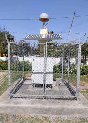
CONTINUOUSLY OPERATING REFERENCE STATIONS (CORS) NETWORK:
Pan India CORS Network is being established by Survey of India, to achieve centimetre level accuracy position in real time.
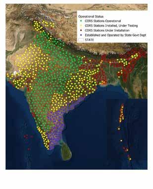
Total 1008 Continuously operating stations will be established in entire country, which will be capable of providing better than 3 cm accuracy in Real Time.
CORS Network in state of Uttar Pradesh, Uttarakhand, Haryana, Punjab, Karnataka and Maharashtra is operational and services are available on SoI service Portal.
Real-time and Precision positioning services by SoI’s CORS Network, are being offered on No charge basis for 3 months from 1st June, 2022 to all citizens in the state of U.P., Uttrakhand, Haryana, N.C.R., Maharashtra and Karnataka.
http://cors.surveyofindia.gov.in
CHENNA MUMBAI DELH KOLKATA
Office of the Surveyor General of India, Hathibarkala Estate, Dehradun, PIN - 248 001 +91-135-2747051-58, Ext 4360, +91-135-2744064, 2743331 Email: sgo.soi@gov.in
SURVEY OF INDIA
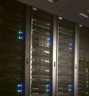
KARNATAKA GOVT TO INVEST INR 590 CR TO SET UP CLOUD-BASED DATA CENTRE
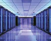
The Karnataka government has proposed to establish a cloud-based state data centre for various departments and public sector undertakings. The announcement was made at the 2023 state budget presenta-

IIT GUWAHATI DEVELOPS INNOVATIVE SYSTEMS FOR TELECOM INDUSTRY
Indian Institute of Technology
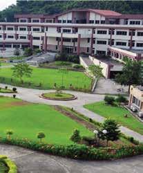
Guwahati has completed the Transfer of Technology (ToT) of a novel free-space optical communication system to the telecom industry. The advanced communication system uses wavefront modulated light beams for wireless error-free data transmission through free space rather than through optical fibre.
The technology has been developed by Prof. Bosanta Ranjan Boruah, Department of Physics, IIT Guwahati, and Santanu Konwar, Assistant Professor, Department of Physics, Abhayapuri College, Assam.
The technology has been granted with US patent dated June 2, 2020, a Japanese patent dated 23 December, 2021, and Korean patent dated 28 December, 2022.
tion by Chief Minister Basavaraj Bommai. An investment of ₹590 crore will be made to set up this data centre.
Bommai added that ensuring the security of the administrative system would be given extreme priority. To this end, a 24X7 Cyber Security Operation Centre (CSOC) will be established. Cyber experts will be roped in to incorporate modern technology to ensure the safety of government websites, online services, and data, said Bommai, who also holds the finance portfolio.
In April 2022, the state cabinet cleared the Data Centre Policy 2022 for Karnataka. With this, Karnataka joined the league of states like Maharashtra, Uttar Pradesh, Telangana, Tamil Nadu, and West Bengal that have an exclusive policy for the sector.
The team of researchers has experimentally demonstrated the distortion-free transmission of text messages and images in laboratory environment even in the presence of turbulence. The communication system can also be used for high speed and secured communication between two remote sites in the line of sight with virtually no possibility of any unauthorised interception.
US LOCATION TECH FIRM ACQUIRES GOA-BASED STARTUP
Precisely acquired Transerve, a Location Intelligence company with expertise in spatial data handling, processing, and analysis. Headquartered in Goa, India, Transerve provides nimble spatial analytics SaaS solution for enterprise and midsize companies enabling fast time to value using cloud-native location intelligence and data library with curated datasets.
Transerve incorporates simple yet powerful, combination of geospatial artificial intelligence (AI), machine learning (ML) and geoprocessing that supports data democratization by making location analysis and data enrichment available to data-centric employees without requiring the need for geographic information system (GIS) expertise.
The acquisition accredits Precisely to add new SaaS location intelligence capabilities which will allow users to leverage data and analytics and derive new insights about their business without specialized knowledge or skill. Customers in various sectors will benefit from a complete and contextual picture of data that informs decision-making including, but not limited to, market potential, risk assessment, site selection and optimization, and more.
NEWS
6 GEOSPATIAL ARTHA Volume 02 » ISSUE 02
IN-SPACE INAUGURATES NEW SPACE DESIGN LAB IN AHMEDABAD
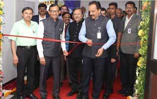
IN-SPACe, a single window nodal agency under Department of Space, for the promotion of private sector, has established a Design Lab equipped with high-end simulation tools required from mission planning to RF, structural and thermal design, and analysis of space systems.
This will enable start-ups to get access tools operating on high performance computing systems for carrying out their mission specific simulations and analysis.
Speaking at the inauguration, Dr Pawan Goenka, Chairperson, IN–SPACe, Dr. Pawan Goenka, Chairperson, IN–SPACe, said that IN-SPACe is carrying forward the work of ISRO through simulation.
Rajeev Jyoti, a distinguished scientist from IN-Space, welcomed the guests and said that the lab has co-working space where start-ups and other stakeholders can work together. For the ease of doing business, no contract or agreement is required to avail the facility of the lab.
TECH MAHINDRA TO OPEN DATA, AI CLOUD CENTER IN SAUDI ARABIA
Tech Mahindra will establish a data and artificial intelligence, and cloud centre of excellence (CoE) in Saudi Arabia’s Riyadh. The company signed a memorandum of understanding (MoU) with the Saudi government’s ministry of communications and information (MCIT) on February 8. This initiative aims to provide project development and training programs to 2,500 Saudi nationals in AI and cloud technologies.
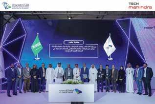
Under the partnership, Tech Mahindra will also host hackathons and design thinking workshops around data, AI, and Cloud technologies. This partnership is in line with Tech Mahindra’s NXT.NOW framework, which aims to enhance the ‘Human Centric Experience’, and focuses on investing in emerging technologies and solutions that enable digital transformation and meet the evolving needs of the customer. The centre will work within the ethical AI guidelines to drive digital transformation and contribute to Saudi Arabia’s Vision 2030 goals.
SKYE AIR LAUNCHES TRAFFIC MANAGEMENT SYSTEM FOR DRONES
navigation and risk assessment to all drone and other aerial mobility operators.
It is a cloud-based aerial traffic management system that stitches unmanned air traffic with the manned aviation airspace. Skye UTM has supported more than 300 successful BVLOS (Beyond Visual Line of Sight) drone flights till now.
Gurugram based drone delivery company, Skye Air Mobility, has launched an unmanned air traffic management system called Skye UTM. The system will provide situational awareness, autonomous
Skye UTM captures 255+ parameters of UAV movements and stores them into its 'Blackbox', which is a published systematic description of the entire flight. The platform offers the first 3-Dimensional view of the drone airspace along with operations and regulations mapping servers, which offer the latest airspace status, verified paths, and display real-time UAV movements.

NEWS
7 GEOSPATIAL ARTHA Volume 02 » ISSUE 02
GEOSPATIAL TECHNOLOGY TO PLAY PIVOTAL ROLE IN CAPACITY BUILDING
Union Minister Jitendra Singh said Geospatial Technology will be key to civil servants capacity building. The NIGST (National Institute of Geo-Informatics Science & Technology) with its various facilities and courses, are well equipped to augment the civil service training ecosystem with capabilities and role-based education many areas. These areas include Basic GIS, Drone Survey and Mapping, GIS Analysis, Land Surveying, Cadas-
tral Mapping, GNSS Surveying, Digital Mapping, LIDAR Mapping, Utility Mapping, 3D-City Mapping, Geoid Modelling and CORS Network.

Further elucidating the National Geospatial Policy (NGP) 2022 under PM Modi’s leadership, online courses on geospatial science and technology areas are to be made accessible through iGoT Karmayogi platform. The principal framework places emphasis on developing geospatial skill and knowledge standards across the country with NIGST developing into a Centre of Excellence (CoE) to meet the growing demand for Geospatial professionals.
DRAGANFLY SIGNS DRONE AGREEMENT FOR INDIAN MARKET
Bill Gates, Microsoft co-founder highlighted the rapid growth in digital connectivity at ‘Promise of Digital Public Infrastructure’ event hosted by G20 Sherpa Amitabh Kant on 1 March 2023. In commendation to great digital network in the country, he stated that the high percentage of people using smart phone coupled with digital connectivity being very

good and reliable yet cheapest in the world, given the highly competitive private market activity, is a clear indicator to India being the cheapest 5G market. He, then, stated there is a scope of duplicating India’s low-cost digital public infrastructure models across some of the developing nations like Kenya and Brazil, where the costs of such deliveries continue to be high.
Gates met Prime Minister Narendra Modi calling it the highlight of his India trip that made him optimistic about the country’s potential to make strides in the fields of health, climate change, and technology.
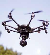
Draganfly, announced that Remote Sensing Instruments (RSI), a longstanding Geospatial Technology company in India working in the field of Remote Sensing and Geographic Information System (GIS), has entered into a strategic agreement with Draganfly for the development of manufacturing, distribution, and sales of Draganfly products in India. A core component of this agreement is to manufacture Draganfly drones in India under the AatmaNirbhar Bharat (Made in India) program. Cameron Chell, President and CEO of Draganfly said, that it is significant for Draganfly to have been pulled into one of the largest, drone markets in the world with the opportunity to be manufacturing and distributing in the Indian market providing a potential scale that is years ahead of schedule from what was initially thought possible. Ramana Kumar Buragadda, CEO of RSI stated that, the agreement will enable them to expand their distribution and manufacturing capabilities, furthering the investment in the Indian market under AatmaNirbhar Bharat.
INDIA WILL BE THE CHEAPEST 5G MARKET, SAYS BILL GATES
8 GEOSPATIAL ARTHA Volume 02 » ISSUE 02 NEWS
IIT TIRUPATI AND AGI SIGN MOU FOR GEOSPATIAL ADVOCACY, INNOVATION, AND RESEARCH
India’s Geospatial industry body – the Association of Geospatial Industries (AGI), and the Indian Institute of Technology (IIT) Tirupati’s technology innovation hub – the Navavishkar I-Hub Foundation, have signed a Memorandum of Understanding for collectively elevating the adoption of Geospatial technologies and applications in the country.
A growing interest in Geospatial adoption is being shown by governments across the nation, as evidenced by favorable policies, public-private collaborations, and tech-first development efforts.
To realize this vision, it is important to address the significant innovation challenges within the Indian Geospatial sector, including low number of startups engaged in Geospatial product development, gaps between technology innovation and industry demand, and lack of in-depth understanding of cross-sectoral Geospatial applications.
NASA, ISRO CO-DEVELOP SATELLITE TO MONITOR EARTH’S SURFACE
An earth-observation satellite jointly developed by NASA and ISRO that will help study Earth’s land and ice surfaces in greater detail is all set to be shipped to India for a launch in September.
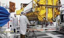
ISRO Chairman S Somanath said the mission will be a powerful demonstration of the capability of radar as a science tool and help study Earth’s dynamic land and ice surfaces in greater detail than ever before. The SUV-size payload will be moved into a special cargo container for a 14,000-kilometer flight to the U. R. Rao Satellite
Under their MoU for innovation-centric cooperation, AGI and IITTNiF will undertake multiple joint efforts to accomplish these objectives. AGI and its diverse member ecosystem, together with IITTNiF will also strive to jointly identify areas requiring targeted interventions, develop in-depth research reports, and organize such activities as workshops, training programmes, seminars, etc. that serve the common purpose.
NEXT-GEN AI TO EMPOWER CITIZENS, SAYS IT MINISTER
Centre in Bengaluru. ISRO and NASA joined hands in 2014 to build the 2,800 kg satellite.
The NISAR spacecraft will be integrated into the satellite bus at the U R Rao Satellite Centre for launch within the next year. The satellite will help researchers detect slow-moving variations of a land surface that can precede earthquakes, landslides, and volcanic eruptions.
Union Minister of State for Electronics and IT Rajeev Chandrasekhar has a clear vision to make India a global powerhouse of AI by building next-generation of AI-based innovations to empower billions of citizens.
Chandrasekhar emphasized that artificial intelligence (AI) is a "kinetic enabler" of the digital economy and the government will infuse more of this disruptive technology into its 'India Stack'.
He also underlined how AI will transform the digital economy and grow the business economy in the country. He talked about launching the INDIAai Programme which will see more AI use cases via the India stack of Aadhaar, Unified Payments Interface (UPI), DigiLocker, and CoWIN.
The Bhashini team at the IT Ministry aims to build a National Public Digital Platform for languages to develop services and products for citizens by leveraging the power of AI and other emerging technologies.
9 GEOSPATIAL ARTHA Volume 02 » ISSUE 02 NEWS
Recouping Farmers Loss
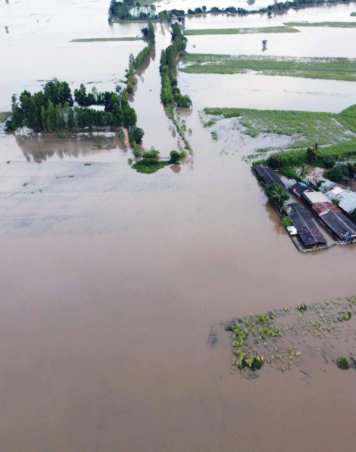
GIS plays a crucial role in crop insurance today, minimizing risks and maximizing benefits for farmers. With the help of recent tech advances, the field is rapidly changing and contributing to increased income-security and financial stability for the stakeholders.
Indian farmers are greatly dependent on the vagaries of nature. Any calamity adversely affects their finances. With over 58% of the population engaged in agriculture, securing farmers' income and insuring them against seasonal crop losses is a key priority as well as a social need.
Farmers deal with a great deal of uncertainty at all stages of cultivation. Crop insurance, aided by technology solutions, help them manage weather-related risks and forestall heavy losses.
The Beginnings
For nearly a century, crop insurance has been discussed in
By Jeffy Jacob
India as an important tool of risk management. By and large, most of these attempts never materialized and the adequate spread of risks could not be secured since the areas covered were too small.
One of the earliest endeavours related to crop insurance in India was led by J S Chakravarthi in erstwhile Mysore State. Between 1912 and 1920, he worked on the rainfall index as a mechanism to compensate for crop losses, publishing technical papers and books on how the index could be used to guarantee payouts to farmers
In Independent India, the Pilot Crop Insurance Scheme (PCIS),
10 GEOSPATIAL
Volume 02 » ISSUE 02 AGRO WATCH
ARTHA
initiated in 1979 by Professor V. M. Dandekar, was a systematic attempt to cover a wide range of crops including cereals, millets, oilseeds, cotton, potato, gram and barley. Professor Dandekar is often regarded as the ‘Father of Crop Insurance in India’
Role of GIS
The government-led NAIS (National Agricultural Insurance Scheme), the flagship insurance scheme, is currently implemented by 25 States and two Union Territories and annually insures close to 25 million farmers cultivating crops on over 35 million hectares. More than 50 different crops are covered under the scheme at present, including almost all the food crops grown in the country Acute geospatial data greatly helps advance this scheme, benefiting vast stakeholders all across.
“Despite the NAIS being in existence for 23 years, less than one-fifth of the farmers in the country are insured, with a few notable exceptions such as Rajasthan, where approximately half of the farmers or holdings are insured, and in states like Andhra Pradesh, Gujarat, Karnataka, Madhya Pradesh, and Orissa, about one-fourth of the farmers are insured under the scheme,” says Vandana Chawla, Deputy Manager at AIC (Agriculture Insurance Company of India).
“Unfortunately, the scheme has not proven to be a significant risk mitigation tool for farmers in many regions, as crop insurance statistics indicate a clear bias towards a few regions and crops,” she adds.

The emergence of GIS has been a boon for achieving desired growth rates, and India has effectively utilized it in various areas for sustainable agricultural development and management. These areas include
cropping system analysis, agroecological zonation, quantitative assessment of soil carbon dynamics and land productivity, soil erosion inventory, integrated agricultural drought assessment and management, and the Integrated Mission for Sustainable Development (IMSD).
GIS can provide data analytics for crop valuation and soil degradation. This can offer information, education, and awareness programs for farmers and other stakeholders about climate change and its impact on the sector. Land use can be implemented at the grassroots level or by introducing the western model of corporate farming.
Agricultural expertise can be leveraged for proper crop patterns aligned with land use. IT applications can be developed for supply chain management, with the beneficiary being the farmer. Data analytics can be used to align crop valuation with quality parameters, and national and global demand.
This is achieved through Data Collection by first identifying the location map of the region. Then the Land Use information can be obtained from the Nagar Nigam office which is the local governing body responsible for managing the civic services in an area and can provide valuable insights into the types of land use in the study area. Then the exact location coordinates of various features in the study area are obtained using GPS devices such as I Finder or H2O GPS Receiver.
This information can be used to create accurate maps and to identify the location of different features in the study area. Further on, the road network information is identified, which relays the information related to the road network in the study area, including the location, length, width,
11 GEOSPATIAL ARTHA Volume 02 » ISSUE 02 AGRO WATCH
and condition of the roads. A field survey is done, collecting data on-site by visiting the field area. This is enabled by interviewing the farmers, conducting manual surveys and photographing the study area with the help of drones to gather information.
Proper Planning
One of the major challenges for farmers is that the cropping pattern needs to be planned in a way that ensures profitability. Water availability of water for irrigation, and soil degradation due to intensive farming practices are growing concerns. Climate change with an increased frequency of extreme weather events such as droughts, and floods is another environmental challenge. Infrastructure is another obstacle, as many farmers lack access to basic amenities such as irrigation, electricity, storage facilities, and raw materials such as seeds.
This impedes the productivity of farmers and makes it difficult for them to store and transport their produce. Improper land use due to the traditional land-holding pattern is another predicament because of the huge fragmentation of land, reducing the profitability of farming. Lastly, skill development for the farmers and availability of labor are significant challenges as the robust young population moves away from farming, leaving the ageing workforce in the rural areas.
Geo Fixes
While the problems that plague may be many, the implementation of information technology and geographical information systems can address these issues. Information technology can herald e-Governance into farming, providing a range of services to farmers, insurers, bankers and other stakeholders in this sector.
Web portals at all levels can aid farmers by providing them eServices, along with monitoring and tracking application for fund utilization. Information technology can facilitate awareness programs for agriculture sector stakeholders, and GIS can provide analytics for planning irrigation networks across. A portal can be developed as a dashboard to track various infrastructures for particular areas and help local authorities make informed decisions. Farmers can access these services through eGovernance programs.
Schemes such as the Pradhan Mantri Fasal Bima Yojana (PMFBY) and the Weather Based Crop Insurance Scheme (WBCIS), have been designed to cater to the diverse needs of farmers and to promote the adoption of improved agricultural practices. They provide coverage for a wide range of crops and are available at affordable premiums. These crop insurance schemes financially protect Indian Farmers.
Innovative Initiatives
A new initiative, launched by
the government in Rajasthan is allowing farmers to self-evaluate the damage caused to their crops by natural disasters and report it to the revenue authorities for release of adequate compensation. An online process is being developed through a mobile phone application for this purpose.
Currently, the Revenue Department undertakes this exercise through a process called ‘girdavari,’ wherein a village-level official records the crop loss and enters the necessary information in the documents, including the details of the owner of agricultural land, source of irrigation, and name of the cultivator. Based on this report, the State government decides on the compensation amount in each district.
According to state Revenue Minister Ramlal Jat, this new online system will bring transparency to the complete process and will benefit agriculturists during the harvesting of rabi crops.
Initiatives like the above are the need of the hour, and India must leverage technology, data, and location-based analytics for decision support.
Agro-geointelligence or the use of location information, geospatial data and data acquisition through drones makes managing crop life cycles highly effective. There is an urgent need for the commodification of GIS technologies so that a large section of farmers can access them easily.
Jeffy Jacob
Sub Editor, Geospatial World Jeffy@geospatialmedia.net

A new initiative, launched by the Rajasthan state government allows farmers to self-evaluate the damage caused to their crops by natural disasters and report it to the revenue authorities
12 GEOSPATIAL ARTHA Volume 02 » ISSUE 02 AGRO WATCH
System
India’s Fastest Growing Geospatial Solutions Provider
India’
Reseller for Maxar Satellite Imagery & Services
Superior
() FormerlyknownasGeoinfosysTechnologies NeoGeoInfoTechnologiesPvt.Ltd. M M M ap odel anage www.neogeoinfo.com Info@neogeoinfo.com
Customer Value
Years Navigate Geospatial World Confidently First & 5 Successful Statewie CORS Implementations in India The First Property Tax Revenue Optimization Project in India 120+ Engineers with 2000+ Man Years Experience, across Gurgaon, Hyderabad & Kolkata
Creating
Over 15
Integrator providing Engineering solutions across PowerTransmission,Telecom, Highways,Gas&WaterNetworks
of Choice for Trimble, ESRI, Hexagon & Here
Partner
Data Acquisition: Drones, LiDAR, GPR, Edge Devices
Master
Started as GeoInfosys Technologies CMM Level 3, ISO 27001 & 9000 Certified 20+ Industry Awards 150+ Marquee Clients across Govt & Corporate sectors
DATA THAT BINDS
OPEN SOURCE MAPPING FOR A BETTER TOMORROW
Geospatial data is a critical component in policy-making, resource planning, surveying land and water bodies, disaster mitigation, and monitoring infrastructure. It is also crucial in defencesecurity, and agriculture operations among other things.
In India, many big-ticket government projects such as SVAMITVA, GatiShakti, Smart Cities Mission etc. rely on accurate location and mapping data.
The journey to enable the economic progress of rural households through the flagship SVAMITVA scheme, under the Ministry of Panchayati Raj, is also possible only due to accurate location and mapping data.
Nibedita Mohanta
Open source mapping refers to creating free and open geographical data, which promotes broad community participation in a collaborative manner, thus creating critical data resources. So what is the status of open source mapping in India and how much work is left to be done? By
With the help of drones, all the
14 GEOSPATIAL ARTHA Volume 02 » ISSUE 02 COVER STORY
lands are being surveyed and mapped to digitally empower rural India. The land data is then processed by Survey of India to generate and update GIS ready Land Parcel Maps, where all information related to the land owner is linked to and made available online.
To make a nation sustainable, its infrastructure plays a significant role, which is why the PM GatiShakti National Master Plan (NMP) came into existence. Recently, Prime Minister Narendra Modi said, "GatiShakti National Master Plan is going to change the face of India's infrastructure and its multimodal logistics."

Under this plan, 1900 GIS data layers of infrastructure mapping from different Ministries and State Governments have been incorporated and made available through the PM GatiShakti NMP platform.
The NMP is a digital platform which contains all the data including mapping details of infrastructure and logistic facilities. The data also includes land records, forest, wildlife, water resources, soil type seismicity, flood map, power transmission and distribution, mining areas, roads, pipelines, sewer lines, eco-sensitive zones, Coastal Regulation Zone, etc.
“Geospatial technology is critical to the Digital India Mission as it enables the collection, analysis, and visualization of geographic data, which can help in taking informed decisions and improve the delivery of government services. This directly ties in with the government’s vision of achieving Sustainable Development Goals (SDGs),” states Sajid
STATUS OF OPEN-SOURCE DATA IN INDIA
Open-source mapping in India has made significant progress in recent years. The Government of India has taken several initiatives to promote open-source mapping for the country's development. Few of the key developments are:
National Geospatial Policy

In 2022, the Government of India announced a National Geospatial Policy that aims to promote the development of geospatial technology and data in the country. The policy promotes open access to geospatial data, encourages data sharing between different agencies, and establishes standards for data quality and interoperability.
Bhuvan
Bhuvan is an open-source mapping platform developed by the Indian Space Research Organisation (ISRO). The platform provides satellite imagery, topographic maps, and other geospatial data for various applications such as disaster management, agriculture, and urban planning.
Bharat Maps
Bhuvan is an initiative by National Informatics Centre (NIC) for providing map data. NIC has developed automated map service dissemination application which consists of 32 layers.

GeoSadak
GeoSadak portal is developed by Centre for Development of Advanced Computing (C-DAC), which provides open map data.
OpenStreetMap
OpenStreetMap is an open-source mapping project that aims to create a free and editable map of the world. In India, there are several communities involved in mapping various regions of the country. These communities also conduct training and capacity-building programs to promote open-source mapping.

MapMyIndia

MapMyIndia is a private company that provides digital mapping and location-based services in India. The company uses its own mapping technology and also collaborates with other organizations to provide opensource mapping services.
Smart Cities Mission

The Smart Cities Mission is a Government of India initiative to promote sustainable urban development in India. The mission encourages the use of geospatial technology for urban planning and management, and several smart cities in India have implemented open-source mapping solutions for various applications such as traffic management, waste management, and citizen engagement.

15 GEOSPATIAL ARTHA Volume 02 » ISSUE 02 COVER STORY
Malik, Chairman and Managing Director, Genesys International Corporation.
Apart from that, many businesses, NGOs, researchers, academia and the people's daily life also rely heavily on geospatial data. There is a growing need for interoperable open map data to strengthen mapping services across the country.
But many questions arise here related to the scope, accuracy and distribution of data.
Is mapping data available for free? How can it be made available for all? How can it be better utilised? Who are the primary users of the available free data? Is the data updated regularly? What is the quality of the available data? How accurate are these free data? Is it easy-to-use?
Power of Open-source Data
The usage of open map data varies from routing, navigation, and GIS analysis, to planning and delivery of utilities — from sending rescue efforts to a
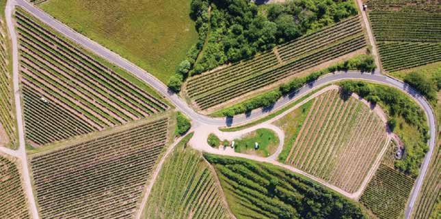
disaster-hit area to mitigation efforts. Be it redevelopment, finding natural resources to protecting endangered animal species, mapping is ingrained in the people's daily lives.
Dr. Manoj Khare, Senior Director, HoD - Emerging Solutions and e-Governance (ES&EG) Group, C-DAC | Ministry of Electronics & Information Technology, Government of India states, “GIS maps are very important for infrastructure planning and decision-making. Open-source maps, which are available easily and free of cost, can play a significant role in various applications which are very important for a nation's development.”
Dr. Khare points out that India can harness the power of open-source mapping to drive its development agenda through Collaboration, Data sharing, Standardization and Community engagement
Constraints
Rapid urbanisation has pushed the cities to expand and
encroach on the neighbouring village areas, thus the boundaries between cities and villages have blurred. Besides, Indian villages have their boundaries marked as per revenue record and the census data was updated last in 2011, which is still being followed.
In many areas, boundaries are so blurry that issues such as crime reporting, employment opportunities, ration distribution etc. arise for people living on the outer border of the village or taluk. Itinerant communities often get neglected their basic amenities in life.
Collecting map data is easy but not enough, it needs to be accurate, updated timely, and rich in quality. This is because the physical form of land areas is prone to changes – the rivers change their course, terrains undergo environmental and sometimes man-made shifts and new infrastructures often replace natural habitats and old structures.
The government of India has a dedicated GIS portal for all the
16 GEOSPATIAL ARTHA Volume 02 » ISSUE 02 COVER STORY
states and UTs but there is no confirmation on how accurate or updated the information is.
Many states and UTs such as Kerala, Gujarat, Odisha, Maharashtra, Jammu, and Kashmir also have their geo-portal sites, run by the respective state governments.
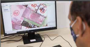
I. Prabhu, Joint Director, C-DAC | Ministry of Electronics & Information Technology, Government of India states, “India has made significant progress in developing open-source maps over the past few years. However, there are several challenges that need to be addressed to fully realize the potential of opensource maps for the country's development.”
Some of the existing challenges include data availability, quality, lack of resources, standardization, and intellectual property rights.
Development Data Lab (DDL), a non-profit that produces freely accessible big data resources for policy-makers, researchers and civil society has developed a platform called SHRUG, the Socioeconomic High-resolution Rural-Urban Geographic Platform for India.
The maps available in India have limitations. According to DDL, "The maps are stitched together from multiple opensource maps, all of which were incomplete and quite confusing. We linked the sources through common location codes, georef-
erenced when necessary, and geometrically harmonized them."
DDL found out that every village map (open or proprietary) that they came across had at least 0-1 Km of measurement error in the representation of their boundary. Besides they found out that a number of locations in India appear to be represented in official data only as points, not as polygons like in the case of forest areas and the northeast region. They validated some boundaries using external sources like satellite imagery.
Way Forward
Even though government programs carry out surveys and conduct periodic censuses, it is crowdsourced geospatial data that help fill data gaps at the micro level to provide insights into the progress of any government projection on a near realtime basis.
It is also crucial monitor the lives and livelihood of the local communities, whether they are reaping the benefits of the government schemes meant for them, like the healthcare-related schemes, pension schemes, land mapping projects and those meant for their economic benefit, employment generation.
In order to analyse how far the work has penetrated into their lives, the local community has to be empowered to use geospatial so that they can geo-locate key community assets, vulnerabilities and
help decision-makers to gauge coverage, gaps and risks at the hyper-local level.
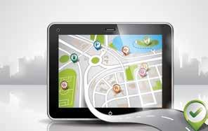
“The challenges facing open-source maps in India can be overcome by investing in technologies for data collection, providing funding and support to organizations involved in open-source mapping, establishing guidelines for data standardization, and establishing a framework for licensing geospatial data,” states Prabhu.
Dr. Khare points out that the way forward for open source maps in India includes key actions like strengthening data infrastructure, ensuring the quality of data, promoting standardization, encouragin private sector participation and developing user-friendly applications. He further emphasizes that the Government of India
Open mapping refers to creating free and open geographical data, which promotes broad community participation, thus creating critical data resources
Open map data enables user to access data of their village/city from anywhere in India.
The goal of open sourced map data is to ensure interoperability, so that the stakeholders as well as the public can utilise the data for common good.
17 GEOSPATIAL ARTHA Volume 02 » ISSUE 02 COVER STORY
Source: SVAMITVA
should focus on collaboration with other countries and international organisations, where best practices can be shared, and adopted. Countries could learn from each other, develop common standards, and promote open-source mapping for sustainable development.
One such organization is the UNGGIM, which provides guidelines for generating frameworks to produce and share opensource map data. The Government of India and many other countries are adhering to these UNGGIM guidelines to achieve the UN’s Sustainable Development Goals.
The goal of open-sourced map data is to ensure interoperability so that the stakeholders as well as the public can utilise
the data for common good.
This will encourage innovations, services, and meet user needs as well as make the system demand-driven rather than supply-driven. The availability of open map data will empower developers and map creators to build new compelling applications.
Community Empowerment
Open mapping refers to creating free and open geographical data, which promotes broad community participation collaboratively, thus creating critical data resources. The National Geospatial Policy is expected to give a boost to the dissemination of open-source data in the country, driving innovation across verticals and enhancing the utility of spatial data.
Digital India aims to create a Digital Twin of major cities and towns of the country by 2035, which will only depend on the accurate and real-time updated mapping data. The data will be gathered using the technologies such as sensors, LiDARs, drones, satellites and mobile devices, collected from various sources like buildings, infrastructures, people and automobiles.
Many governmental, private and commercial enterprises depend on software solutions, which are built solely on opensourced map data. These enterprises will ultimately benefit and facilitate the ongoing, self-sustainable, Atmanirbhar Bharat mission, which is why making quality data open for all is the only solution at hand.
A common platform where the map data of the entire country is available as well as where users can freely share their issues and grievances, for immediate action may have seemed utopian just a few years ago, is possible today because of actionable geospatial data.
Nibedita Mohanta
Assistant Editor, Geospatial World Nibedita@geospatialmedia.net

The goal of opensource map data is to ensure interoperability so that the stakeholders as well as the public can utilise it for common good
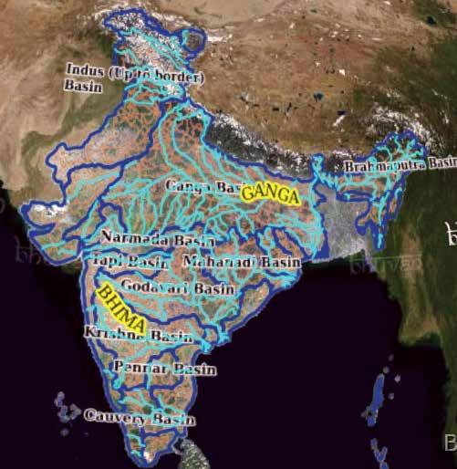
Bhuvan app shows the 3D data layers of infrastructures (rail & road), rivers and basins on the India map. It is being managed by NRSC/ISRO.
Source: Bhuvan App
18 GEOSPATIAL ARTHA Volume 02 » ISSUE 02 COVER STORY
Earth Observation Enabling SocioEconomic Development in North East

Established in 2000, under the Department of Space, the North Eastern Space Applications Center (NESAC) focuses on multiple sectors including natural resource management, infrastructure planning, disaster management support, and facilitating satellite communications.
It works in close collaboration with different stakeholders and local partners across the region to deploy satellitebased imagery. The center also undertakes a lot of research, training, and capacity-building programs.
"Satellite data provides us with day-to-day mapping
What are some of the key projects of the NESAC?
One of our flagship programs is for flood risk management in NER, which gets inundated during the monsoon season. We have created a flood early warning system for the Northeast region. For the past ten years, we have been working with the government of Assam. We send them alerts 24-36 hours in advance for flood predictions.
We are also engaged in building a remote sensing application for a forest working plan.
and monitoring, but it alone is not sufficient. The data needs to be backed with thorough analytics for intelligent decision-making. This is where geospatial technology is crucial." Dr. SP Agarwal, Director, NESAC, in an interview with Geospatial World.
With the help of satellite imagery and space data, we provide them with crucial inputs such as total timber volume, carbon stock , and health of the forest etc. This helps them in forest management.
Weather forecasting is another crucial project for us. Another very important project is the early warning lightning system, which we provide currently on experimental basis, which tells the possibility of lightning in a three by three kilometer grid. This is going to be very crucial. We also provide
19 GEOSPATIAL
Volume 02 » ISSUE 02 INTERVIEW
ARTHA
UAV services in the region during disasters, especially floods and landslides. UAV provides the required type of images directly, and this helps in relief and rescue missions during flood time as well as landslide time.
We are also doing several other projects, like horticulture expansion, area estimation, increasing the agriculture intensity, etc.
What role does Earth Observation and Remote Sensing play in solving the many socio-economic and developmental challenges in the Northeast?

North East faces multiple challenges, owing to rugged terrain and hilly topography. There are mountains in Sikkim, and Arunachal Pradesh, hills in Nagaland, Manipur, and Mizoram, and plateaus of Meghalaya. Each state has different problems and challenges, especially when it comes to developmental or socio-economic activities.
Disaster management, education and the health sector are the three important challenges. NESAC is working on all these areas, alongside topography, terrain, and land cover mapping, monitoring and early warning systems. Using satellite imagery, we can spot what are the gaps across particular areas. This is extremely important.
Technology adoption is another key challenge. People are usually reluctant to adopt new technology, especially when it comes to the proper utilization of space-based applications. To resolve this, we engage in a lot of community
building and outreach activities. We talk to the officials about how they can best utilize space and geospatial technology for advancing developmental activities in the region.
North East grapples with connectivity challenges and difficulty of access due to remote terrain. What is NESAC doing to bridge this gap?
NESAC is playing a very important role in boosting physical as well as cyber-connectivity in the North East. We provide cyber
support to all eight states. We have mapped the entire road network in the region, not just the national, state and district highways, but also the city and village roads. We have even mapped bullock cart roads. By mapping health centers and educational institutions in all regions, we try to figure out and fix the gaps to enhance connectivity.
I am hopeful that upon the completion of this project, the government will look into crucial insights and use it to
Image 1: UAV Remote Sensing in Agriculture
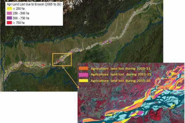
Image 2: Agricultural land lost due to bankline Erosion (2005-2020)
20 GEOSPATIAL ARTHA Volume 02 » ISSUE 02
INTERVIEW
enhance connectivity and access to primary requirements such as health, education, and water supply.
Due to hilly terrain and inaccessible topography, mobile and internet connectivity in large parts of the region are often patchy. Satellite imagery and geospatial data can play a major role in improving network range and access.
We are planning to use the ISRO GSAT-29 satellite for providing broadband connectivity. These days, a lot of companies are coming up with satellite-based internet programs. Similar programs will be of great help to the North East.
North East has a sensitive ecology with a repository of diverse flora and fauna, which risk being threatened due to a lot of factors ranging from unrestricted human activities in forested areas to global warming. In order to preserve it, what is the sustainability roadmap of NESAC?
We provide inputs for the conservation and scientific management of forests. We also map biodiversity hotspots in the region. Using satellite data, we prepare biodiversity hotspot at landscape level, assessing human-elephant conflict, vegetation phenology, etc.
To conserve the unique flora and fauna in the region, we did a backland change detection,
which includes Dipor Bil lake in Guwahati, and Loktak lake in Manipur. With the 2030 SDGs mandate, as well as the resources available in the Northeast region, space technology is going to play a very important role.
How can the combine power of satellite data and geospatial analytics boost economic growth?
Satellite data provides us with day-to-day mapping and monitoring, but it alone is not sufficient. The data needs to be backed with thorough analytics for intelligent decision-making. This is where geospatial technology is very crucial.
We should have intelligent decision-making, which will certainly help to further improve not only the social activities, but economic activities, and developmental activities of the region.
Who are some of the major local partners of your organization in the region? We work in collaboration with all major stakeholders in this region. Our primary partners are statelevel remote sensing application centers. They support us in statelevel mapping and monitoring. We also have a collaboration with the Department of Science and Technology.
Apart from this, we work in cooperation with all major line departments of all the states –for example, the Department of Agriculture, Department of Forest and Environment, Department of
Water Resources, Department of Urban Planning, Revenue, and Department of Disaster Management.
What do you think are some of the impediments to furthering digitalization in far-flung regions, and how can spatial thinking make it more impactful and socially inclusive?
Digitalization and its benefit have reached every corner of the region, including the remote ones. Today, almost everybody understands its importance. Para break after this. In fact, the COVID pandemic forced the population to adopt the digital world at a fast pace. The Digital India campaign of the Government of India has created a ecosystem and a conditioned environment for digitalization.
However, there is ample opportunity, and the necessity to improve the scenario compared to the urban centers of our country. The major hurdles, I believe, towards furthering digitalization in far-flung areas are the lack of knowledge of digital technology.
Poor internet connectivity is another challenge. Many times, people want to get aware, but they are unconnected.
Erratic power supply is another hurdle. I am hopeful that the farflung areas of NE region shall have a better digital footprint very soon.
Interviewed by: Aditya Chaturvedi
Due to hilly terrain and inaccessible topography, mobile and internet connectivity in large parts of the North East is often patchy. Satellite imagery and geospatial data can play a major role in improving network range and access
21 GEOSPATIAL ARTHA Volume 02 » ISSUE 02 INTERVIEW
Boundless Geo Possibilities
Turning Point - Fourth Industrial Revolution

The upcoming age of industrial revolution would be characterized by more than just confluence of technologies and processes, redefining everything with geospatial at the core. By Aswani
Akella
Introduced in 2015, the phrase “Fourth Industrial Revolution (4IR)”, coined by Prof Klaus Schwab caught the attention of world by storm. Eight years later, while the big picture is yet to emerge, sketchy contours visible so far seem to be asserting “a lot can happen”. Touted as an opportunity to create a human centered future, 4IR looks beyond convergence of technologies to find ways for creating a positive impact that is inclusive and sustainable.
In the times challenged by global uncertainties, geopolitics and climate change concerns, governments, business, and communities have already started embracing agendas that are inclusive and sustainable.
Uniquely characterized by the fusion of physical, digital, and biological worlds, the size, speed, and scope influence of 4IR driven by the Cyber-Physical Systems (CPS), Internet of Things (IoT) and Cloud Technologies is expected to be profound and fuel unprecedented shifts in the economy, business, and society. As sustainability takes centerstage in hyper-connected world, it is not only changing the “what” and the “how”, but also ”who” we are.
4IR can become transformative only when they are able to solve economic, social, and environmental problems contextually, sustainably and inclusively. Consumers and
Everything that happens, happens somewhere and sometime.
22 GEOSPATIAL ARTHA Volume 02 » ISSUE 02 EPOCHAL
CHANGE
citizens are increasingly vying for better experiences, that are personalized to their individual preferences and environs. Under pressure to meet expectations, improve efficiencies and reduce costs, governments and businesses are fast realizing that “one size does not fit all“ and hyper-localization of the approaches is need of the hour.
As the innovations in connectivity, data, and computational power; analytics and intelligence; human-machine interaction; and advanced engineering drive the 4IR agenda, need for understanding the geographic context of the problem, its relationships, and dependencies within and outside the ecosystems becomes paramount. Contextualizing and personalizing approaches spatially and temporally is the only way forward.
Organizations are fast acknowledging that geospatial technologies aka GIS are not just maps but can offer much more to unlock “somewhere” in the context of “sometime”. By contextualizing and personalizing operations and deliverables to their target segments and markets, they can be better empowered to address stakeholder expectations, operational contingencies, efficiencies, and costs while avoiding data traps. As we navigate our way from “intelligence age” to “imagination age”, increasingly spatial talent, intellect and knowledge comes to fore and will define the future course.
Infinite Geospatial Possibilities
4IR is giving shape to new imagination in forms that were never heard before. Governments and businesses in India are increas-
TRANSFORMATIVE OPPORTUNITIES FOR 4IR
Prescriptive Personalized Services
With consumer behaviour being reshaped towards gratifying personalized experiences, prescriptive hyper-localization of shopping, travelling, gaming, and navigating with virtual walkthroughs and immersive experiences.
Virtual Terrains
HD Virtual-Terrains will increasingly mark their presence in defining contextualization and personalization. As a gateway for “metaverse”, immersive experiences provided by these “digital frameworks” and “virtual models” will become a common denominator across the sectors.
Agriculture and Food Security
4IR driven Precision Agriculture and Precision Farming will drive Sustainable Climate-Smart-Agriculture along with Farm Mechanization/Agro-Robotics, Agro-Productivity Optimization, Agro-Supply Chain Automation, Tailored Agro-Financing and Agro-Insurance, Disaster Risk Reduction.
Energy and Net Zero
Smart Energy Management including Energy Balancing, Distributed Energy Resource Management, Reducing Carbon Emissions, Contextualized Smart Grids, Generation, Distribution, And Transmission, Rapid Emergency Response, and Increasing Resilience.
Healthcare
Body Area Networks (BAN) for Remote Healthcare Monitoring, Assisted Living and Telemedicine, Personalized and Precision Medicine, IntegratedIntelligent-Resilient Healthcare Systems, Digital Twins—Symbiotic Simulations, Internet of Medical Things (Iomt), Health Monitoring Systems and Wearables, Decision Support Systems for Disease Surveillance, Monitoring and Intervention Management.
Rural Development
Smart Village Ecosystem Management, Smart Natural Resource Management, And Smart Disaster Risk Reduction.
Transport and Logistics
Smart Traffic and Road Systems (STRS), Green Transportation, Data Driven Mobility, Integrated Intelligent Transport Systems, On-Demand Mobility Services, Low Carbon Transport Systems, Intelligent Traffic Flow Management, Automated Logistics and Supply Chain Management, Automated Freight Flow and Rail System Management.
Urban Development
Smart Cities, Integrated Waste Management, Water Quality Management, Smart Emergency Response Systems, Adaptive Urban Management, Automated Disaster Risk Management, Proactive and Reactive Security Intelligence, Adaptive Energy Distribution Solutions.
Utilities
Intelligent Utility Networks, Intelligent Sensor -Based Grid Management, Advanced Distribution Management Systems, Self-Healing Utility Networks, Demand Based Energy Management, Decentralized Renewable Energy Systems, Advanced Energy Storage Networks, Operations Optimization, Asset Monitoring and Management, Clean Energy Distribution and Accessibility, Pattern Recognition, Use Modelling and Forecasting.
23 GEOSPATIAL ARTHA Volume 02 » ISSUE 02 EPOCHAL CHANGE
Technology Requirements
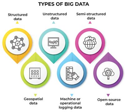
1. Effective and efficient management of geospatial bigdata including structured, semi-structured and unstructured data.
2. Seamless workflows from ingestion of geospatial data to actionable analytics on-the- fly.
3. Need for advanced ELT (Extract Load Transform) tools along with on-demand analytics.
4. Out-of-the-box spatial analytics tools, machine learning algorithms, and artificial intelligence techniques for modelling and predictive analysis
5. Advanced spatial visualizations which are hardware friendly and enrich immersive and interactive map experiences that are photo-realistic.
6. Need for robust interoperable platforms that can support FAIR principles and manage data from multiple initiatives for integration of GIS with leading data management technologies.
ingly embracing digital agenda that revolves around agility, sustainability, and resilience. With 5G rollout revolutionizing geo-data exchange, faster connectivity, ultra-low latency, and reliability has markedly changed the way geospatial data is handled. Digital Transformation (DT) initiatives in recent times have started focusing on establishing linkages to exploit data and insights by demystifying interconnections and interdependencies on a “common geospatial frame”.
Setting stage for a radical change in the behavior, spatial thinking and contextualization is redefining problem solving across the ecosystems. Harnessing location intelligence in real-time to improve business processes horizontally and vertically has become much easier than before.
CXOs are keen to exploit the
untapped location potential to contextualize and personalize their subjects.
Ease of geospatial integration with enterprise IT and new age technologies like big data, artificial intelligence, and machine learning/deep learning, complemented by faster geo-computing, on-demand geo-processing and cloud based geo-content management, are fostering rapid hyper-localization of exponentially increasing data volumes.
Opportunities Ahead
Not spoken often, geospatial is one of those few technologies that has “something for everyone”.
Be it assisting a common person on the street to reach a point, or solving complex problems governments and businesses face today, geospa-
tial has an authoritative and irreplaceable role to play in 4IR. Geo-enabled 4IR promises a wide range of contextualized benefits centered around automation, optimization, and cost reduction. Arrival of intelligent “digital twins” are bringing about a new way of people interacting with their environment has the potential to transform every aspect of governance and business.
Foreshocks of geo-enablement of 4IR technologies can already be felt. Early adoptions of drones, cloud, edge, Internet of Things (IoT) and spatial analytics, though scattered have started demonstrating their value and impact. Newer opportunities to capitalize geo-information leveraging on convergence of 4IR technologies are rapidly emerging along with emergence of new markets and growth opportunities.
Road Ahead
By highlighting unmatched capabilities of the geospatial technologies to a) facilitate convergence of ecosystems for contextualized and personalized experiences, b) provide intelligence for informed decisions, c) provide tools for operational improvement and cost reduction and d) facilitate platforms for collaboration, sharing and dissemination, this is a great opportunity for the Indian geospatial industry to Evangelize, Empower and Enable 4IR.
Recent government notification relaxing erstwhile restrictions on geospatial data and National Geospatial Policy 2022 (NGP2022) outlining a roadmap for enhanced commercialization with ease of doing business has made harnessing power of geospatial easier than ever.
24 GEOSPATIAL ARTHA Volume 02 » ISSUE 02
By setting stage for radical behavioral change, spatial thinking and contextualization is redefining problem solving across ecosystems
EPOCHAL CHANGE
With interest and adoptions gaining traction there is an urgent need to position geospatial affirmatively in the 4IR architectures.
Poor Awareness: While we have come long way, the perception of geospatial being restricted to map creation and visualization still dominates. There is an urgent need for evangelizing the “real” potential of geospatial technologies across the spectrum to enable people to think spatially while they contextualize and personalize their subjects.
Policy: While NGP 2022 outlines a grand scheme of things covering various aspects for the geospatial industry, the pace of implementation and institutionalization of these guidelines will define the ability of the industry to translate them into value. With PNT technologies serving as backbone, there is an urgent need for a robust PNT policy framework.

Geospatial Infrastructure: While some may call strengthening of nation’s geospatial infrastructure a work in progress which takes time, the pace at which 4IR is moving ahead, if we don’t act in time, geospatial industry is bound to be left behind.
Education: The geospatial education in the country continues to be medieval and needs to be brought in sync with the current times. University
curriculum and infrastructure need an urgent revamp to reflect the emerging priorities that can foster advanced learning and high-end innovation.
Technology: Exploding data volumes and complex multisystem integrations call for better data management capabilities for value extraction. Current processes of data acquisition to data consumption are time consuming and geospatial industry should realize that in the age of 4IR customers cannot afford to wait.
Research and Innovation: 4IR calls for players in the industry to move up the value chain to support the geo-enabled automations in the context of large enterprises which warrant dedicated research and innovation. As the 4IR matures, the need for geo-innovation too will exponentially increase.
Partnerships and Collaborations: Given the sheer size and complexity, no single entity will be able to deploy 4IR on their own. It must be a collaborative and collective effort and for that value-based partnerships will be inevitable.
Startup & Entrepreneurship: It is rather unfortunate that most of the geospatial start-up’s continue to mushroom in the low and middle end of the value chain. With entry barriers being low, startups should look at the
higher end of the value chain and spearhead geo-innovation.
Funding – Lastly but importantly innovation and advancing technology calls for investments and funding. In the absence of which geospatial industry will not be able to make any headway.
Conclusion
Heralded by 4IR, the future is undoubtedly about excelling in contextualizing and managing information in a hyper connected world - for deriving intelligence that is actionable, relevant and timely. There is no doubt that spatial intellect has a critical role to play in demystifying “somewhere” and “sometime” of the complex problems governments and businesses are trying to address. And this hyper-localization would be next to impossible without geospatial technologies. No doubt that “Geo-Possibilities are unlimited”.
Having said, road ahead is fraught with challenges for the geospatial industry which need to be addressed on war-footing. Notwithstanding delivery of geospatial to solve complex problems in an impactful way, success of geo-enabled 4IR hugely rests on its evangelism and acceptance. Dogged with myopic approach of addressing siloes in a reactive manner is only going to push players to the brink.
While “a lot can happen”, it is high time that all the thought leaders come together and chart a way forward to “make it happen”. We cannot afford to miss the bus this time.
Ease of geospatial integration with enterprise IT and new age technologies like big data, AI, and ML/deep learning, are fostering rapid hyper-localization of exponentially increasing data volumes
25 GEOSPATIAL ARTHA Volume 02 » ISSUE 02
Aswani Akella is a GIS & Remote Sensing Consultant with over three decades of experience. His focus is on enterprise geo-enablement.
EPOCHAL CHANGE
Transforming Unstructured Data into Actionable Insights
Making sense of reams of data, and gaining insights from it, is a task that requires cutting-edge tech solutions.
By Atanu Sinha
The overwhelming deluge of structured and unstructured reports flooding intelligence agencies and defence organizations include critical location-based information, making processing and analysis an enormous and time-consuming task, often resulting in missed vital data points.
An innovative approach and solution are necessary to act as a decision support system, capable of efficiently reading, comprehending defence-spe-
cific terminology, acronyms, and jargon, and performing change detection, temporal, and predictive analysis.
A New Solution
The need for a "Geo-Int" solution has become increasingly apparent as organizations seek to transform unstructured data into actionable insights. However, analyzing this type of data can present challenges as it is not organized in a predefined manner.
Creating effective translation and visualization strategies is
crucial to converting unstructured data into actionable insights. This involves using natural language processing and machine learning algorithms to structure the data, enabling it to be analyzed. The importance of leveraging advanced technologies, such as artificial intelligence and machine learning, cannot be overstated, as they can automate the process of structuring and analyzing unstructured data.
Location analytics play a vital role in the visualization
26 GEOSPATIAL ARTHA Volume 02 » ISSUE 02 DATA
INSIGHT
strategy, ensuring that the actionable insights have effective visualization techniques that are relevant and show the prevalence of the incident/information in a geographical aspect. Effective visualization strategies involve using data visualization tools in a common frame and dashboard with a complete geo-enabled interface to create meaningful and insightful visual representations of the data. This results in a robust integrated "Geo-Int" platform.
Overall, advanced technologies like NLP, AI, ML, and Deep Learning are valuable resources that can be used to identify patterns and insights in the data that would be difficult or impossible to detect through manual analysis. Organizations seeking to leverage unstructured data to gain valuable insights and drive organizational efficiency should consider adopting these tools and techniques.
Traditional Challenges
There are several traditional challenges involved in building a platform that integrates and analyses diverse sources of geographic data. Some of these challenges include:
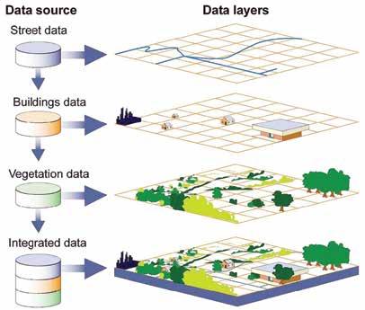
The integration of geographic data from diverse sources such as satellite imagery, IoT sensors, and business data poses a challenge due to variations in data formats, structures, and quality levels necessitating advanced data processing techniques that encompass data normalization,
cleaning, and transformation; successful integration requires sophisticated data processing techniques.
As a logical next step, we need to look at the scalability of the system. To accommodate the massive amounts of geographic data generated, particularly when using high-resolution satellite imagery or IoT sensor data. To handle this data at scale, the platform must be designed to scale dynamically to accommodate increasing volumes of data over time. This requires a distributed architecture that can distribute processing across multiple servers and storage systems as needed.
When working with geographic data, it's important to keep in mind that data quality can be a major concern. Geographic data is often prone to issues such as inaccuracies, incomplete data, and inconsistencies, which can all affect the reliability and usefulness of the data.
When integrating geographic data from multiple sources, these quality issues can become even more challenging to manage, as each data source may have its own unique issues and characteristics. As such, it's essential to take a careful and systematic approach to assessing and addressing data quality.
When it comes to data
27 GEOSPATIAL ARTHA Volume 02 » ISSUE 02 DATA INSIGHT
Location analytics play a vital role in visualization strategy, ensuring that actionable insights have effective techniques that are relevant and show the prevalence of the incident/ information in a geographical aspect
security, location data poses a unique challenge. This type of data can be highly sensitive, especially when it contains information about critical infrastructure or individuals. Therefore, it is crucial to implement robust security measures to protect it. Whether the data is being transferred between different systems or stored in databases, security must be a top priority to prevent unauthorized access or theft of sensitive information.
Data Analysis and specifically
Big Data in sync with Unstructured Data is complex and resource-intensive, requiring significant computing power and storage. Analysing geographic data has become an increasingly important task. However, it requires advanced analytical techniques, such as machine learning, artificial intelligence, and deep learning, to effectively extract insights and patterns
from the data. Furthermore, the accuracy of the analysis depends on the quality of the data, which can be challenging to collect and manage. As a result, effective geographic data analysis requires a combination of technical expertise, powerful computing resources, and a deep understanding of the underlying data.
Desired Outcomes
The desired outcomes of a location and behavioural data platform are varied and numerous. Interactive dashboards provide a high-level view of key performance indicators (KPIs) and trends, while predictive models use historical data to forecast future outcomes. Heat maps help visualize patterns and trends in geographic data, while data reports provide a detailed view of specific metrics and trends.
Change detection is a primary strategy of Geo-Int,
allowing organizations to understand changes in statistical, behavioural, and geospatial data. Mobile applications provide real-time access to relevant data, and edge analytics allow for data collection and processing to occur near the location where the data is created or consumed.
Finally, natural language processing (NLP) enables machines to understand and extract meaningful insights from unstructured text data, making it possible to convert unstructured data into structured and actionable insights. These innovations in transforming unstructured data into actionable insights are rapidly changing the field of data analysis and visualization.
With interactive dashboards, users can identify patterns, trends, and outliers quickly, empowering them to make data-driven decisions with greater speed and accuracy. By providing a high-level view of data, interactive dashboards are an invaluable tool for organizations looking to leverage their data assets to gain a competitive advantage.
These dashboards can be customized to meet the specific needs of different stakeholders, providing them with insights that are most relevant to their roles and responsibilities. Whereas, Predictive models are an essential tool for any organization seeking to gain a competitive advantage through data analytics. These models are built using historical data to forecast future trends and outcomes.
Predictive models can help organizations identify potential risks and opportunities before they occur, providing valuable
28 GEOSPATIAL ARTHA Volume 02 » ISSUE 02 DATA INSIGHT
insights into future outcomes. By leveraging predictive analytics, organizations can make more informed decisions, allocate resources more effectively, and optimize their operations for maximum efficiency.
The process of understanding change is a crucial component and strategy of Geo-Int. Changes can occur in statistical, behavioral, and/or geospatial data, and can be detected through various means. Statistical data is collected from various sources and then transformed into a structured format for analysis.
With IoT Devices taking prominence in 5G Network, Edge Analytics is growing . The idea that data collection and data processing can be performed near the location where the data is either being created or consumed is primary to any time bound, result oriented actionable intelligence. And hence, it forms an integrated part of the workflow in digital transformation.
This makes mobile applications becoming increasingly important deliverable of geographic data platforms. These applications provide users with real-time access to relevant data, allowing them to make informed decisions on the go.
Driving Results
In today's data-driven world, organizations are constantly collecting vast amounts of data from various sources. However,
much of this data remains unstructured and therefore, difficult to analyse and extract insights from. To tackle this challenge, a combination of advanced technologies that can help convert unstructured data into structured and actionable insights. Innovations in the field of transforming unstructured data into actionable insights is quickly undergoing change.
According to experts, Natural Language Processing (NLP) is a key technology that can enable machines to understand, interpret, and generate human language. NLP can identify sentiment, key phrases, entities, and other important information from text data, making it possible to convert unstructured data into structured and actionable insights.
Another critical technology is Image Recognition. By using computer vision algorithms, Image Recognition can identify objects, faces, species, and other important information from visual data such as images and videos.
Graph databases, another essential technology are ideal for storing and processing complex data relationships between different data points. By using graph databases, organizations can uncover hidden patterns, relationships, and insights that are difficult to identify using traditional data analysis methods. Data visualization tools enable organizations to create visual representations of data, making
it easier to identify trends, patterns, and relationships within unstructured data.
Cloud Computing is another crucial technology that provides organizations with the processing power and storage capacity needed to handle large volumes of unstructured data. Cloud-based tools and platforms provide scalable and flexible data processing and storage solutions, making it easier to convert unstructured data into actionable insights.
Finally, Augmented Analytics combines AI and machine learning technologies with data visualization tools, making it easier for analysts and data scientists to generate insights from unstructured data. By using machine learning algorithms, Augmented Analytics platforms can identify patterns and relationships within unstructured data, providing valuable insights that can help organizations make data-driven decisions.
It is recommended for a combination of advanced technologies such as NLP, Image Recognition, Graph Databases, Cloud Computing, Data Visualization Tools, and Augmented Analytics to convert unstructured data into structured and actionable insights.
Atanu Sinha is the Founder of Altz Technologies. Previously, he served as Board Member and Managing Director of Intergraph in India, and Vice President of Hexagon’s Geospatial Division where he managed South Asia Operations

Cloud-based tools and platforms provide scalable and flexible data processing and storage solutions, making it easier to convert unstructured data into actionable insights
29 GEOSPATIAL ARTHA Volume 02 » ISSUE 02 DATA INSIGHT
Geospatial for Climate Resilient Bihar
In a conversation with Geospatial World, Dr CN Prabhu, Joint Director, Technical, of Bihar Mausam Seva Kendra, a center under the Planning and Development Department, Government of Bihar discusses the use of geospatial in disaster management in a flood-prone state.
What is the mission of Bihar
Mausam Seva Kendra?
The mission of our organization is to take weather information and advisories to the end-users in a simple and comprehensible manner.
The climate is changing very rapidly and will continue to do so in the future, which is why we want to create a sustainable society across the country.
What geospatial technologies does your department use?
Currently, we are using Esri India’s product ArcGIS along with other available tools. With all the data that is coming through our research field, we are using various geospatial technologies to process and create products out of these datasets.
The weather information and
data are spread across many regions and are available at different spatial resolutions. This makes data collection slightly complex. We always try to collect the data at the finest resolution possible. Then, the GIS technology helps us in analyzing the data and giving us an exact replica of the ground.
Otherwise, the data captured in the form of tabular or graphs are not of any use to us since they do not provide a spatial perspective. However, if that map is interactive and has some tools to scan the data in multiple ways, it becomes more beneficial for us.
Given the nature of our job, we cannot limit ourselves to one particular region and analyze the data we receive from there alone. The neighbouring regions are equally important. Unless we visualize what is happening in that area on a geographical platform, it's difficult to get a hold of the weather data.
To manage the change in weather conditions, the collection, processing, and visualization of data in a customized way is important. This is where we use GIS.
Since rural communities are often not tech-savvy, what are the challenges that you face in creating awareness or technical installations? The perception of the general public not being able to get along with advanced technology which they have never seen brings about hesitation in providers as well as end-users. The first challenge is to break this barrier. It is a matter of making these advanced techs available to rural communities
30 GEOSPATIAL ARTHA Volume 02 » ISSUE 02 INTERVIEW
and from there on they can get a hang of it and it becomes easier to break the barrier.
That kind of awareness is very little. Another reason is such things are not taught in the curriculum. It's only in the very specialized field that they are introduced only to the basics.
How can you expect even the graduates to know about GIS? Once we create that kind of awareness, certainly people are going to appreciate it.
How are you procuring the data for weather forecasting?
Our organization does not physically procure the data. Instead, we have installed a set of sensors at different geographical layers from where we collect the ground data.
To be precise, we have a rain gauge in Bihar every three square kilometers and in every 150 square kilometers, we have a weather station.
The disparity between the weather station and rain gauge system is because weather conditions do not change as much as rainfall. So we have put up the weather sensors at the block level, and the rain gauge sensors at the panchayat level.
We directly take the data coming through these stations into our server through the GPRS network with other very high temporal resolutions. We collect the data every 15 minutes.
For other data like remote sensing, we have collaborated with ISRO. We also collaborate with private companies, when needed, for developing tools on the GIS platform for analysis, developing
custom dashboards, or creating a GIS-based application.
Apart from these, most of the things we do with in-house capacity. We have scientists, and engineers that carry out these tasks in our team of about 10-15 people, doing for the entire state.
Climate change is a burning issue right now and Bihar has faced inundation for many years. Are you using geospatial data to manage the situation better?
Until recently, we had a very limited number of sensors to monitor the rain gauge. Now, with the government of Bihar investing resources and money
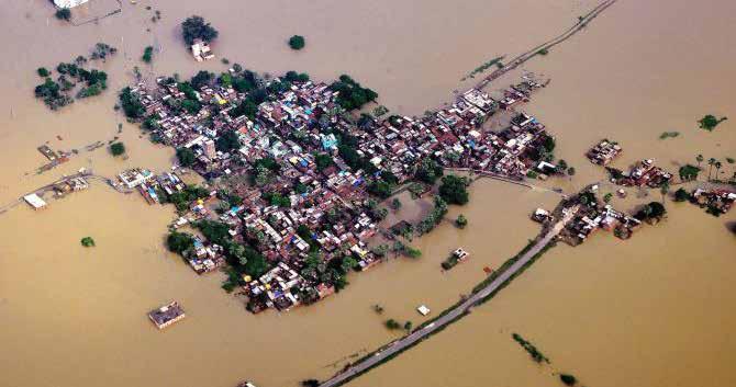 Around 13 of the 38 districts in Bihar has been affected by floods. The crisis has forced thousands of people to evacuate from their homes.
31 GEOSPATIAL ARTHA Volume 02 » ISSUE 02 INTERVIEW
To manage the change in weather conditions, the collection of data is one important thing, but processing and visualizing it in a customized way is altogether a different thing. That is where we are using the GIS technology
into it, we’ve grown to have 8,400 sensors at the panchayat level. This gives us a clear picture of the place, intensity, and amount of rainfall at any given place.
With this information only, we are managing the flood situa-
tion in Bihar. There are different sources of water, one is water coming through river channels, streams from outside, or rainfall. Unless we measure both of them properly, we will not be able to manage the flood properly. So we are measuring the rainfall at a very fine scale, and the water
coming from outside is also being measured as well as what will be the cumulative effect at any point of place down the stream.
This data is fed to the GIS platform, from where we can see where it is raining and with what intensity. When the intensity is increasing, we can calculate what would be the surface runoff, depending on the land use pattern there, and whether that can lead to flood or inundation in that area. Or if not there, down the line, along this stream, anywhere in the banks.
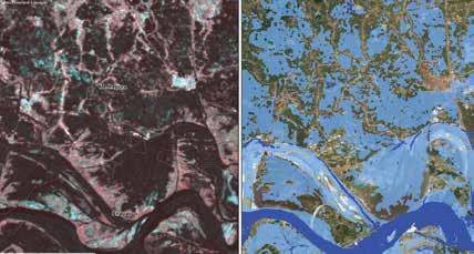
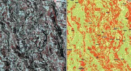
With a lot of lead time, we will be able to caution the downstream people. By looking at what is happening upstream, we will be able to caution the downstream when and how it is approaching. We are trying to do this in Bihar at the moment, which is going to bring a lot of change in flood management in Bihar.
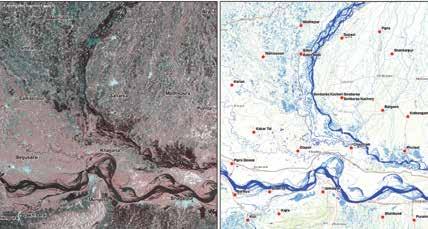
Does your agency engage or collaborate with users or geospatial technology private providers to develop a better understanding of the evolving user demands? We engage with private agencies in a formal way through a proper process. It's not just outsourced, we work on a day-to-day basis with them. We provide them with the task, give guidance, and very periodically, methodically, we verify and do the corrections. So that, we are able to develop the tools or the applications, the way we want them.
Demand is coming from the end users, we take it, squeeze it into a workable format, and take the help of private players to develop that application.
Mapping crop damages in Araria district of Bihar, India
Mapping inundation extent for Madhepura and Bhagalpur districts of Bihar
Mapping inundation extent for Nepal and Indian state Uttar Pradesh
32 GEOSPATIAL ARTHA Volume 02 » ISSUE 02
Interviewed by: Nibedita Mohanta
INTERVIEW
Why the Hype on Digital Cities?
Digital Cities has become a commonplace term bandied everywhere, but what does it actually mean for the citizens in the context of urbanization, and what lies beyond needs to be elaborated.
By Sanjay Singh
Digital cities represent a connected community that combines broadband communications infrastructure; a flexible, service-oriented computing infrastructure based on open industry standards; and innovative services to meet the needs of governments and their employees, citizens’, and businesses.

By 2031, five billion people are projected to live in cities. This figure is likely to go up to 70 percent of the world’s population by 2050.
India's urban population is projected to increase to 600
million by 2031, and the urban sector would contribute around 70 percent to the country’s GDP by that time. Urban sector will also contribute 85 percent to all tax income of the country, and 70 percent to all new employment generated in the country.
The digital transformation of the cities happen in various phases. The first phase is digitization, where conversion of information from analogue to digital happens. This can result into changes in existing business models to provide value to stakeholders.
Digitalisation helps cities apply technologies to optimise existing urban processes by achieving a more resourceful coordination between smart services by creating additional citizen value through improved services.
Digital transformation impacts citizens, stakeholders, as well as city operations, going beyond digitalisation by changing simple urban processes and tasks.
Benefits of Digital Transformation in Cities
Now, the question arises as to why digital transformation is needed? What are the advantages of these transformation? The first advantage is the more effective, data-driven decision-making. A well-designed
data analytics strategy gives city officials the ability to access and analyze a massive amount of information from where they can easily glean meaningful and actionable insights.
Second advantage is the enhanced citizen and government engagement. Expanding digital services in communities make smart cities a more attractive place for residents to live and promote a connected citizen experience.
Digital transformation in cities result in reduced environmental footprint. Energy-efficient buildings, air quality, sensors, and renewable energy sources are providing cities with new tools to shrink their ecological impact.
It also leads to improved transportation. Connected transportation systems have some of the greatest potential to drastically enhance efficiencies throughout a city with reduced pollution.
Digital transformation leads to efficient public utilities. With a limited supply of natural resources available to meet human demand, smart technologies are giving cities the tools needed to effectively conserve and reduce the inadvertent wastage of water and electricity.
33 GEOSPATIAL ARTHA Volume 02 » ISSUE 02 CITY FOCUS
CITY FOCUS
EMERGING TECHNOLOGIES
Artificial Intelligence
Software algorithms automate complex decisionmaking tasks to mimic human thought processes and senses.
Blockchain
Digital database that uses software algorithms to record and confirm transactions with reliability and anonymity.

Drones
Unmanned flying machines controlled remotely using sensors and GPS navigation

Internet of Things
Network of devices embedded with sensors that enable them to collect, exchange, and act on data.
Automation & Robotics

Offers enhanced sensing, control, and intelligence to automate, augment or assist human activities.
Virtual Reality
Computer-generated simulated experience that creates an artificial three-dimensional image or environment.
3D Printing

Creates three-dimensional objects based on digital models by layering or “printing” successive layers of materials.
Another advantage of digital cities is improved infrastructure.
Smart technology can provide cities with predictive analytics to identify areas that need to be fixed before there is an infrastructure failure.
Geospatial and 4IR Driving Digital Transformation
Smart cities world over are becoming webs of Information and Communication Technologies (ICT), integrating the Fourth Industrial Revolution (4IR) tech-

nologies like Location information, Internet of Things, Artificial Intelligence, sensors, etc.

The most important part of this ICT structure is an intelligent grid of connected devices that transmit data through the cloud. This cloudbased network of devices receives, manage, and analyze real time data which is extremely useful for municipalities and urban authorities in decision making.
Geospatial technology
provides the underlying foundation and the fabric upon which solutions designed to cater the need of citizens is built upon. Geospatial technology allows decision makers to pinpoint exactly on the location of their assets, source of the problem, availability of resources, inter-linkages between different factors that enhance problem solving, as well as a platform to predict and apply possible solutions and precautionary measures in times of need.
Augmented reality is driving the digital transformation. Augmented reality has been defined as visual or audio “overlay” on the physical world using a smart display to provide contextualised digital information that augments a user’s real-world view.

Integrated GIS and BIM Solutions
Integrated geographic information system (GIS) and building information modeling (BIM) solutions facilitate a data-driven approach to project life cycle management, which is crucial for sustainable project outcomes.
Work-hour are spent managing rework and handling conflicts. Integrated GIS and BIM help in planning and designing of the building, where site analysis and structural design evaluation are done with the help of this technology.
It also helps in city asset management where sustainable asset operation and infrastructure asset upgrading are heavily dependent on this technology. GIS and BIM are particularly useful in construction & engineering industry, where it helps in on site coordination and clash detection.
It is used in Building Energy Management, where it helps in tracking energy consumption at
34 GEOSPATIAL ARTHA Volume 02 » ISSUE 02
different scales of the city.
The integrated geographic information system and building information modeling solutions also facilities management by building management system and helps in operations and maintenance by doing utility management system and efficient resource planning. It also helps in operations and maintenance by doing virtual inspection and predictive maintenance.
Last but not the least, it helps in developing control and regulations by ensuring compliance with development regulations.

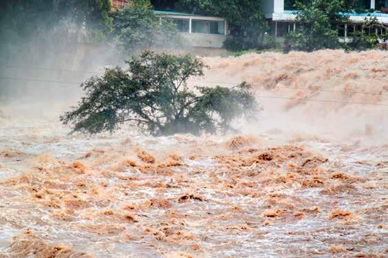
Digital Twins for Cities
Digital twins are the virtual representation of the entire city, which integrates geospatial technology with interactive 3D models.
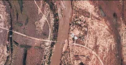
city with each and all assets and processes. Digital Twins have Intelligent Network Systems consisting of cloud computing, big data, sensors and microchips. It also has Industrial Internet of Things (IoT) consisting of geospatial infrastructure, AI & machine learning, XR technologies.
The Digital Twin solution was used to capture nationwide 3D data and cloud-based visualization in Netherlands where collaboration platform for geospatial data and services were used.
Technologies like digital twin, LiDAR, and cloud were used for transforming Netherlands into a digital city. The advantages of this process were the visualisation of projects for public review, allowing the virtual collaboration and improved work processes
Another city in point is Hong Kong, where the digital design was used for the establishment of the Kwu Tung North, New Development Area. 3D modelling, real-time visualization, BIM, geospatial and digital twins were some of the technologies that were used in the digitization process.
It resulted in save in time of the project, reduced cost and labor, direct implementation of changes in the mod However, this exercise of digital transformation is not devoid of challenges. Lack of technological awareness, unscalable and complex IT infrastructure, lack of collaboration, financial constraints and data security and privacy are some of the major challenges facing this transformation.
 Sanjay Singh
Managing Editor-cum-Senior Vice President, Geospatial World singhsanjay@geospatialmedia.net


35
CITY FOCUS
Geo-enabled Digitalization Transforming Mining in India
In a conversation with Geospatial World, Dr. Santanu Bhattacharjee, Deputy Director General (Information Technology), Geological Survey of India (GSI), talks about using geospatial for mining, metallurgy, and geological exploration, the automation drive, and the impact of new geospatial policy.

What is the mission of your organization?
We identify mineral deposit to boost the country's economy. Our priority aligns with those of the Ministry of Mines, and in this aspect, the geologists, geophysicists, chemists strive hard. The geologists go to field and produce maps. The geophysicists detect the data, which is integrated and then based on the integrated data it is interpreted and the mineral deposits are identified.
Major objective of GSI, is to identify the mineral deposits. GSI also works in the field of engineering division, landslide monitoring, geotechnical, that is identification of dam sites, all these are directly related to the development of the country as well as to help the common people of India.
How GIS aids geological exploration?
Geologists prepare maps using Esri’s ArcGIS platform. As per the latest geospatial policy, the
data can be downloaded free of cost and it is hassle-free. Anyone can register and download from our portal.
We have observed from the data downloads, that most of the users are students, researchers, private entrepreneurs and other stakeholders. Our geologists use the data for research purposes as well. After approval from the ministry, we provide data on mineral deposits for research projects.
New technologies such as AI/ML are being integrated into conventional mining practices. How is GIS enabling this digital transformation?
Geological survey agencies around the world started with traditional ways of locating and assessing minerals. But lately, most of them shifted to advanced technologies with the advent of AI/ML.
Until now, in India especially in the field of Earth science, AI or data mining techniques, have not yet been applied. We have to work more in this area.
However, if and when AI is applied in the field of Earth science, then we can identify more deposits and use them sustainably. This would also help in environmentally friendly extraction, hitherto not possible.
The burning topic right now is climate change and global warming, and mining is
Geological survey agencies around the world started with traditional ways of locating and assessing minerals. But lately, most of them shifted to advanced technologies with the advent of AI/ML
36 GEOSPATIAL ARTHA Volume 02 » ISSUE 02 INTERVIEW
one of the factors which contributes to it. How can GSI make mining sustainable in the long term?
We need to think sustainable ways of mining but until then mining cannot be stopped. Mining has to be there, otherwise there cannot be development of the country. But there definitely should be an alternate way of thinking of sustainable development and protection of environment.

We have to think in that direction and develop new ways because in that field, separate research has to be developed by the country people. But mining should not be stopped.
Do you think there is a need for upskilling existing manpower and look for ways to get more trained human resource?
There is considerable amount of stress in the industry because of the lack of skilled resources and those who are there, need an upgradation.
People from different fields, a physicist or geologist or chemist are not familiar with the modern or evolving technologies, but are familiar in their own subject, which is why they should definitely get upgraded, and in regular intervals. Otherwise, complete benefit from this cannot be obtained.
Moreover there is a big lack of skilled resources, hence I think new skilled generation needs to be put in place that can be done through effective skill
training in school and university level.
What are your views on the National Geospatial Policy?
The National Geospatial policy is a very good initiative by the Government of India, because earlier getting data was very tedious and the procedure was very lengthy. So that has been reduced. Even if somebody has to pay some amount and get it downloaded, that also is okay, but the data should be available. So in this policy, that has been made sure that the data is available to the general public.
Besides, the difference between the restricted and unrestricted, has been removed. Earlier, there were restrictions on resolution data. Now since that has been removed, this high resolution data one can use and definitely it'll be helpful for the research.
There are still many of the organizations, who have not shared the data. First thing is all should agree upon it and share the data. If only a few organizations share the data and not the remaining ones, then it becomes inadequate.
Remote sensing is equally important, like our physical maps. So if remote sensing is not integrated with this ground map, then it is half done. We should strive hard in convincing all the organizations to share data.
Interviewed by: Nibedita Mohanta
37 GEOSPATIAL ARTHA Volume 02 » ISSUE 02 INTERVIEW
The High Tide
Harnessing India’s Blue Economy
Formalizing and streamlining the country’s oceanic economy offers a lot of opportunities for multiple sectors, contributing to economic growth, boosting security, and facilitating social dividends.
Oceans constitute 72% of earth surface. However, while Indians are aware of land resources, not much is known about contribution from oceans that provide countless benefits like feeding mankind with food, regulating weather and climate, generating most of the oxygen humans breathe. If one has to know the climate of a region beyond seven days, one has to depend upon ocean.
Ocean is the largest carbon sink on the earth. It provides living and non-living resources in terms
By Sanjay Singh
of minerals and metals, water, and energies. It also provides tourism and recreation, shipping, maritime transport, security (natural and artificial) and coastal protection.
Indians know little about coastal ocean, but awareness of deep ocean is missing. India needs to explore deep ocean for the betterment of the mankind. Considering this, the United Nations has termed the period from 2021 to 2030 as UN Decade of Ocean Science for Sustainable Development. What is the Science needed for the ocean
will be the theme for next one decade. UN’s STG 14 also aims at life below the water for sustainable development.
What’s Blue Economy?
New development paradigm steers development process on a higher growth trajectory. Scientific use of marine resources for achieving larger development goals. While there are traditional ocean activities, such as fisheries, tourism and maritime transport, blue economy entails emerging industries including renewable energy, aquaculture, seabed extractive activities and blue
38 GEOSPATIAL ARTHA Volume 02 » ISSUE 02 SPECIAL FEATURE
biotechnology and bio prospecting.
Blue economy also entails embracing ocean ecosystem services such as carbon sequestration, coastal protection, and waste disposal. Blue economy is indispensable for addressing many of the challenges such as food security, climate change, provision of energy, water, medicines, oil and gas, minerals etc.
Envisioning Growth
There is need for a framework for proper measurement of blue economy activities and their contribution to the national income. Spatially oriented planning along with scientific assessment of resources and their replenishment is needed.
Investment in financial, physical, natural, and human capital to harness the potential of the blue economy and optimize GDP and employment growth are other requirements. There should be innovation to ensure zero wealth, low carbon technologies that yield economic dividend for large sections of the population. The nation should aim at ocean security and balanced international engagements.
What is the contribution of blue economy in nation’s economy and what can we do to increase that share? What are the development activities we need to plan to increase the share of blue economy to national GDP. The answer to this question lies that India should invest in financial, physical, natural, human, and financial capital to harness the potential of the blue economy. India also needs to plan the optimal employment growth and the share of blue economy to GDP.
India needs to have environment-friendly sustainable approach towards ocean and blue economy.
When we talk of blue economy in India, we consider all economic activities of the oceans, seas, and coasts.
Significance for India
Blue Economy means all economic activities of the oceans, seas, and coasts. India has developed a working definition of the blue economy as, “Blue economy refers to exploring and optimizing the potentials of the oceans and seas which are under India’s legal jurisdiction for socio-economic development while preserving the health of the oceans.”
The government of India’s vision for new India by 2030 highlights the blue economy as one of the ten core dimensions of the growth.
Average global contribution from blue economy to GDP is around 3-5%, which varies from country to country. It goes up to 20% in some countries.
India has a unique maritime position with a coastline of 7500 KM. Twelve major and 187 minor ports handle 1400 metric tons of cargo per year. Around 95% of India’s trade by volume transits by sea. Exclusive Economic Zone (EEZ) is 2.24 M sq.km. Four million fishermen and other coastal communities are engaged in this sector.
Durable Policy Framework
Following components should be kept in mind while drafting policy for blue economy: The draft of the blue economy policy covers seven sectors. Seven sectors
Ocean State Forecasting
Ocean Resources – Living and Non-living

Coastal Zone Management
Coastal and Ocean Environment
Mangroves and Coral Reefs
Optimum Ship Routing, Navigation
Climate Change and Simulation Modelling
Warming Oceans and Sea level rise
Aquaculture
Coastal and Maritime tourism
Marine biotechnology
Renewable energy
Mineral resources
Maritime transport
Fisheries
Shipbuilding and repair
Offshore Oil & Gas
which will require different ministries and industries to carry out the work.
The first is the Accounting Frameworks, which defines the areas which come under blue economy. For example, fishing, but it is important to know as up to what level. Will deep fishing also come under it? Accounting framework is a new dimension where there is a need to bifurcate each of the economic activity from ocean. Ocean account enables countries to monitor three critical changes. First is the change in ocean wealth including produced assets (e.g ports, shipping, and tourism) and non-pro-
EMERGING SECTORS OF THE BLUE ECONOMY:
39 GEOSPATIAL ARTHA Volume 02 » ISSUE 02 SPECIAL FEATURE
BLUE ECONOMY SECTORS
duced assets (eg. mangroves, coral reefs etc).
Second is the ocean related income and welfare for different groups of societies (income from fisheries, aquaculture etc for local communities)
Third is ocean based economic production (e.g mining, desalination, marine biotechnologies, ocean energy etc.)

The second sector is the Coastal Marine Spatial Planning (CMSP) in which India needs to understand coastal areas as to where the country needs to put up industries and of which type. It is a science-based tool of analysis that regions or coastal states in a country can use to address ocean management issues and challenges, and advance their goals for inclusive and sustainable growth, sustainable development, employment generation and conservation of marine resources.
CMSP is a process of analysing and allocating the spatial and temporal distribution of human activities in marine areas to achieve economic, ecological, and social objectives that have been specified through a political process.
CMSP can have significant economic, social, and environmental benefits. Some of the environmental benefits are identification of biological and ecologically important areas, and allocation of space for biodiversity and future conservation.
Some of the economic benefits are greater access to desirable for new private sector investments, identification of compatible uses within the same area of development, and promotion of the efficient use of resources and space.
The present infrastructure available is also taken into consideration before deciding.
Based on space data, we need to take an informed decision. Where do we need to plant mangrove and where coral reefs.
Mangroves and coral reefs act as fish nurseries and provide grounds for many other marine organisms to live in and breed, increasing the availability of food for local communities. They can also be a source of derivatives for medicinal purposes, support timber production and provide freshwater. The Ministry of Environment, Forest and Climate Change will be leading in this area.
Coastal Marine Spatial Planning is integrated Ocean Management platform where analysis of how to use ocean and coastal boundaries for common people come.
Secretary, Ministry of Earth Sciences M Ravichandaran said, “Norway is totally dependent on Blue Economy. They are good in marine planning. India also needs to work closely with countries like Norway. What are the remote sensing technologies have been identified for use in blue economy. We also need to implement it.”
The third is Marine Living Resources in which fisheries, aquiculture, seal beach cultivating, ornamental fisheries come. Ministry of Fishery will lead this. That is the present strength and where we need to augment. We are still lagging in some of the areas. India lacks in deep fishing activity.
40 GEOSPATIAL ARTHA Volume 02 » ISSUE 02 SPECIAL FEATURE
CMSP is a process of analysing and allocating the spatial and temporal distribution of human activities in marine areas to achieve economic, ecological, and social objectives that have been specified through a political process
Fourth is the Manufacturing & Industries and fifth is Logistics and Shipping. Sixth is non-living resources and the seventh is Ocean Security and International Interface.
These are the seven sectors which have been planned for various ministries and industries.
India has chosen Puduchchery and island station Lakshadweep for monitoring. Satellite monitoring will help in identifying coastal degradation.
Marine Spatial Planning (MSP) is a public process of analysing and allocating the spatial and temporal distribution of human activities in coastal and marine areas to achieve ecological, economic and social objectives that are usually specified through a political process.
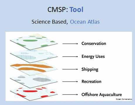
India needs to use various remote sensing techniques for integrated coastal area management and marine spatial planning.
“We have taken Puducherry and Lakshwadeep as a pilot project and we are preparing marine special planning with the help of various countries. We have already started collecting various data on these two island states. Satellite Monitoring for island mapping will help in knowing the conditions of these coasts like where the erosion is happening etc. This will be used for better planning of the coastal regions,” said M Ravichandaran.
Tourism is another area where the new draft policy will focus. Foreign tourists are increasing over a rate of 7% in the 2005-15 period. In 2015, India earned USD 147.7 billion from foreign tourists, which rose to USD 418.9 billion in 2022.
India’s big coastal line is dotted with several attractive beaches. India should try to have maximum blue flag standard certification. The country now has 12 'blue' beaches, a certificate awarded by the prestigious international programme of cleanliness and environmental sustainability run by the global nonprofit Foundation for Environmental Education.
The country needs to improve infrastructure for activities like angling, swimming, water skiing, surfing, scuba diving and beach front resorts, apart from marine tourism. It is also important to integrate principles of sustainable development and environmental objectives.
The country has never used the water currents for the development of tourism in India. Elaborating on this aspect of blue economy, Ravichandaran said, “If we put log of wood in the river in Kolkatta between October and March, it will reach Chennai without any effort with the help of current. Same is the case when
we leave that log in Chennai between April and September.”
The secretary said that India needs to use such opportunities of river currents to its advantage and all these aspects are being considered while formulating the policy.
India also needs to have coastal tourism. “I am happy that the Space Department is going to use ship for transporting rockets to Thiruvananthapuram to Sriharikota,” Ravichandaran added.
“We have also started getting information about rip currents for beach safety. This means where it is dangerous to venture and where not. This information will be used for coastal tourism”, he said.
Marine Living Resources
The main source of the marine living resources is the Indian Ocean which provides food to 100 M people and contribute to the livelihoods of coastal communities. The nation must ensure food security, poverty alleviation and potential for business opportunities in the Indian Ocean.
41 GEOSPATIAL ARTHA Volume 02 » ISSUE 02 SPECIAL FEATURE
Port Modernization
De-bottlenecking
Existing Ports
Capacity Improvements at Existing Ports
New Ports
Connectivity Enhancements
Highways
Railways
Inland Waterways
Pipelines
Multimodal Logistics Hubs
Port-led Industrialization
Industrial Clusters
Industrial Corridors
Coastal Economic Zones
Coastal Community Development
Skill Development
Coastal Tourism Development
Marine Fisheries Development
India’s fish production is only 6% of global production, and its contribution is only 1% to the national GDP. India’s fish demand, which is 11 M metric tonnes at present, is likely to go 18 M metric tonnes by 2030. Indians fish only on the coast, hence deep-sea fishing and deep ocean fishing and aquiculture need enhancements. Deep sea fishing (200 to 2000 m depth) needs better technology and gadgets.
Mariculture, sub-set of aquacultures, pharma, pearl etc are the emerging section of the blue economy. Blue revolution would be further expanded by promoting aquaculture, deep sea fishing, cage culture, seaweed, algae harvesting and sustainable marine culture by adopting an eco-system approach.
Cage Culture
It is also good for the health of the ocean. The health of the ocean will improve by doing these activities. Sea beach and sea grass are not only important for human beings but also for the card.
Oceanic fronts are associated with zones of elevated primary and secondary productivity and fishery grounds. Upwelling zones, eddies and rings are known to be rich in nutrients leading to higher productivity. Persistence ocean features are relatively good for fishing for longer duration.
PFZ Activity in Mission Mode & Modes of Dissemination
With the help of the geospatial technology, the nation can provide information to the fishermen as to where fish are in abundance. Fishermen can reach the location in a short time. This technique is already being used in Hyderabad for some specific variety of fish. The aim is to extend this information for other variety of fish.
Remote Sensing for Algal Blooms
Ocean colour data from OCM and MODIS has been used to monitor Noctiluca Bloom in the Arabian Sea. Nitrogen fixing Trichodesmium bloom in the Arabian Sea occurs in April-May. This bloom is captured using ocean colour data.
Ocean Primary Productivity
Oceanic Primary Production is important for oceanic carbon cycle, carrying capacity of marine eco-system and climate change studies.
Operational column primary production estimates are generated using OCM data.
New production using satellite PP images and modelled f-ratio based on in-situ data. Bio geographic provinces have been identified for carbon source and sinks.
Marine Manufacturing
Marine manufacturing is a relatively untapped field of blue economy. It covers a range of activities such as ship building development of marine compounds and drugs, manufacturing equipment and instruments, marine ICT, exploration of material for deep sea mining, net making, boat making, fish processing, aquaculture tools etc.
Most of these things, although simple, are not manufactured in India, but are imported from outside. It is important to have the regulations to enhance ease of doing business (EODB) and the flow of private investments while applying time-tested paradigms.
The performance of Indian ports on most parameters has been low. However, with renewed focus on port infrastructure development and EODB measures, ships calling at Indian ports are turning around faster and benefiting from higher birth productivity.
India needs to have fuel and ship building capabilities to attract foreign ships. Most of the ships do not prefer Indian ports. India needs to have facility to fuel ships and ship building capabilities.
Blue Biotechnology
It is basically drugs from sea. Marine plants and animals are important source of new medicines developed to treat cancer, arthritis, human bacterial infections, Alzhemer’s disease, heart disease, viruses and other diseases.
42 GEOSPATIAL ARTHA Volume 02 » ISSUE 02
SPECIAL FEATURE
India being a tropical country, endowed with great diversity of marine micro algal species, combined with optimal environmental conditions, provides great opportunities for commercial scale algal reduction, which has applications in the food, nutritional, cosmetic, pharmaceutical and biofuel industry. India needs to go more and more for research and development in this area.
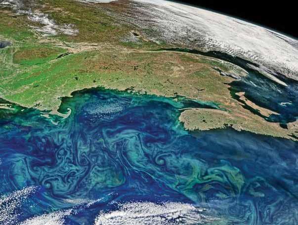
Logistics and Shipping
Seaport and maritime transport sector are one of the important sectors under the blue economy. India sits a side busy International Shipping lines with >1,20, 000 ships per year. Global cargo movement increases 4.4% average every year. India ranks 16 th in ownership of mercantile fleet (1.5% of Global share) and only 0.15% of global ship building and repair is from Indian shipyards.
Considering 95% of the country’s trade (by volume) transits by sea, which puts the Indian Maritime sector at an advantageous position and potential destination of shipping and trans-shipping in the future.
India has 28 shipyards and needs investments in financial, physical, natural, and human capital to harness the potential of the blue economy.
Healthy, resilient, and productive marine environment, ocean governance, technology research and development, business development, investment and finance, maritime surveillance & enforcement, infrastructure, education, and capacity building.
Non-Living Resources
Non-living resources like energy,
minerals, and water are also in abundance. India has been recognised as first pioneer investor and is presently having an area of 75,000 sq km. Estimated quantity of 380 MMT, which includes Copper, Nickel, Cobalt and Manganese. The total cost of these non-living mineral is estimated to be 116 billion US Dollars.
India also has a 15-year contract on exploration of hydrothermal sulphides over the South
Indian Ocean. These regions are enriched with iron, copper, zinc, silver, gold, and platinum. These contracts will open new opportunities for resources of commercial and strategic value in an area beyond national jurisdiction.
Ocean Technology
The aim is to develop technology in ocean related field for harnessing of ocean energy (wave, hydrokinetic, thermal) and generating fresh water from sea water.
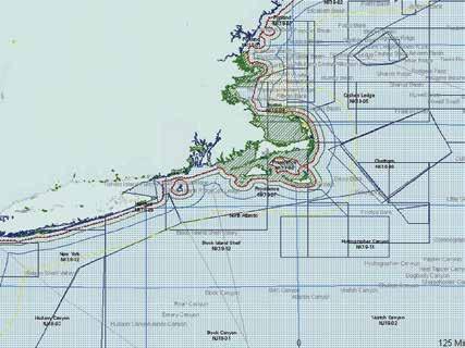
43 GEOSPATIAL ARTHA Volume 02 » ISSUE 02 SPECIAL FEATURE
The idea is to establish desalination plants for meeting drinking water needs of Lakshadweep islands. It also aims to provide beach restoration and sustainable coastal protection.
The aim is to provide exploration and exploitation of deep ocean mineral resources and new observation system for ocean applications for underwater acoustic transducers and passive acoustic monitoring systems.
The new blue policy also aims to provide marine algal biotechnology, marine microbial biotechnology, open sea cage culture and ballast water treatment technologies. Testing of prototype systems, validation of indigenously developed marine systems in the ocean environment.
Maritime Transportation
Maritime transport is critical for the economic development of a country. It influences the pace, structure, and pattern of devel-
opment. India has 12 major and 187 minor ports that carry nearly 95% of India’s volume of trade. Cargo traffic at Indian ports has doubled to 1 billion tonnes per annum over the last decade (FY 2005-2015) and is expected to reach 1.7 billion tonnes per annum by 2022.
To meet the increasing demand, there is a need to develop deep water ports for handling heavy vessels and the need for a improve cargo handling facility at existing ports.
Maritime Security
India will engage holistically with all relevant international parties and platforms to further blue growth, protect marine biodiversity and safeguards its strategic interests.
A well calibrated approach would be taken to ensure that the country’s interests are protected in the Commission of the Limits of the Continental Shelf (CLCS), UNCLOS/ISA.
Coastal and marine security would also be strengthened for which a comprehensive plan would be formulated and implemented in partnership with the states.
Maritime security should be seen as a complement to terrestrial security. The prerequisite for a strong naval capability is a sound and well-developed industrial base.
Maritime security must be seen in a wholistic manner by including civilian maritime domain, state police and ports
trusts, which if not adequately addressed, can lead to adverse effects on maritime security.
Deep Ocean Mission
The policy intends to have ocean technology, ocean resources (Living & Non-Living) and climate advisories. Manned submersible for 6000 m water depth for under water exploration. Deep Sea Mining System for extraction of polymetallic nodules.
With all these features, India will become the first country to demonstrate deep sea mining technology beyond 5000m depth. The country will be able to do sustainable harnessing of ocean resources (water, minerals, biodiversity, and energy). India will join select club of five nations to have manned submersible for ocean exploration.
Blue economy is the future of the country. India will have to invest, both in understanding, R&D and industry. Space technology is an integral part of blue growth. In all these seven sectors, the country will have to invest in coastal states for the blue, geospatial and GDP growth.
Note: This article is based on the Vikram Sarabhai Memorial Lecture delivered by Secretary to the government of India, Ministry of Earth Sciences M Ravichandaran,at Second UNWGIC in Hyderabad, October 2022.
Sanjay Singh
Managing Editor-cum-Senior Vice President, Geospatial World singhsanjay@geospatialmedia.net

Maritime security should be seen as a complement to terrestrial security. The prerequisite for a strong naval capability is a sound and well-developed industrial base
44 GEOSPATIAL ARTHA Volume 02 » ISSUE 02 SPECIAL FEATURE
Geospatial for Sustainable Forest Management
Objective
1. To prevent and discourage illegal timber logging while making it easier and simpler for legal timber farming to be continued as per compliant procedures.
2. To develop and implement an IT-based tool to simplify the process of application, verification, and issue of permits by the Forest Department under notified & non-notified areas for tree cutting and transportation, and bleeding with appropriate technology for the movement of timber.
3. To provide information through an interactive dashboard to all the stakeholders viz. Forest Department, Timber Owners, Sawmills, and other Buyers in the supply chain.
In India, one-in-four people directly rely on forests for sustenance. However, more than 40% of forests in the country are facing degradation and depletion of resources such as quality of air, soil and water. The flow of forest products and services for equitable economic growth is very important.
In response to this, the Ministry of Environment, Forests and Climate Change (MoEFCC), Government of India and the U.S. Agency for International Development (USAID) have partnered for a five-year initiative – the Forest PLUS 2.0 Programme. The program focuses on developing the tools and techniques
to encourage sustainable forest landscape management.
The vision of the program is to develop and implement a tool to track timber movement and activity, with the aim of preventing illegal timber logging and encouraging sustainable forestry practices.
Stakeholders Involved
The Kerala Forest and Wildlife Department, Government of Kerala, State IT Dept, Government of Kerala, USAID, Timber Owners, Sawmills, and other Buyers in the supply chain.
Geo-Tagging Timber Supply
A geospatial tool called
“TiGRAM” was developed by USAID to geotag the timber (assets). This allowed authorities to track timber movements while in transit and trace and monitor them through the logging process. The tool also provides online approval at different administrative levels and a Dashboard for viewing by stakeholders.
The timber (assets) was geotagged at the origin points and QR codes were generated for unique identification and easy tracking. The assets were then smoothly traced at various checkpoints to ensure compliance and lawful transit of timber from source to immediate destination.

Disclaimer: These case studies have been extracted from the Integrated Geospatial Information Framework report.
45 GEOSPATIAL ARTHA Volume 02 » ISSUE 02 CASE STUDY
40% of forests in the country are facing degradation and resource depletion
Mitigating GHG Emissions Using Geo Data
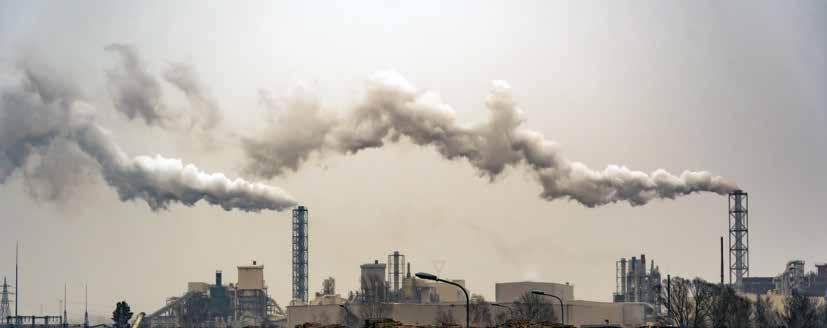
For over a decade, Google Geo has helped NGOs, scientists, academicians, researchers, and communities understand the earth better. With the increasing availability of data, Google’s vision is to leverage Geo’s understanding of climate data to catalyse social and environmental change at scale toward building sustainable cities and communities.
Stakeholders Involved
Aurangabad Smart City, Bruhat Bengaluru Mahanagara Palike, Pune Municipal Corporation, Greater Chennai Corporation, C40, ICLEI (International Council for Local Environmental Initiatives), World Resources Institute India (WRI), Urban Management Center.
Solution and Implementation Plan
Google partnered with C40 Cities and WRI to understand the transport emission levels in Bangalore and Chennai. By leveraging EIE computational process, it established a baseline emission target and started understanding the current transport emissions footprint by transit mode.
In its effort to help city authorities plan sustainable transport and reduce emissions, Google
Objective
1. To help cities and regions measure emission sources, and identify strategies to reduce emissions, thereby creating a foundation for effective action
2. To leverage Environmental Insights Explorer (EIE)’s exclusive data sources and modelling capabilities to reduce transport emission levels in 4 cities across India
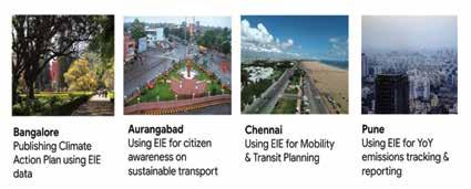
leveraged its proprietary geospatial technology to-
Anonymize and aggregate user movement/location insight data in a privacy-safe way to provide mobility insights to city authorities.
Generate ML/AI models applied to real-world geo data like road type and bus schedules to provide insights on ‘trips and distance’ travelled by citizens for each transit mode.
Combined activity data with emission factors to estimate total transport emissions for the city.
City Municipal Corporations and research organizations have used the data to develop Climate Action plans and Urban Mobility documents to encourage citizens to adopt a more sustainable mode of transit (cycling, metro, etc.) while providing data-backed insights to the government to enhance the public transit system in these areas. Pune and Aurangabad, in their “Race to Zero” mission is also using EIE data to track YoY progress towards their commitment and to educate citizens about their carbon footprint.
Disclaimer: These case studies have been extracted from the Integrated Geospatial Information Framework report.
Fig. EIE Data Outputs
46 GEOSPATIAL ARTHA Volume 02 » ISSUE 02 CASE STUDY
Hazard Risk Mapping for Disaster Prone Areas
Climate change, uncertainty and associated risks are prominent at present and likely to be more profound in future scenarios. The two most notorious climate change impacts, i.e., flood and heatwave, happen due to extreme rainfall or temperature.
Flood-related disaster risk in Uttarakhand flood 2013 and extreme heat-related risk in NCT Delhi in 2001 and 2017, caused severe damage through infrastructural reparations, economic and life loss, ultimately hindering the nation’s growth.
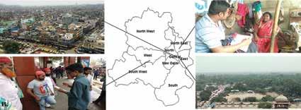
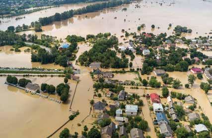
The frequency and intensity of these two climatic events are becoming more common. To avoid loss and damage from these climate disasters, better
Objective
1. To delineate maximum flood extents along the stretch of the Bhagirathi River to identify flood risk areas
2. To map comprehensive heat risk and find optimum land use for heat-resilient city planning
3. To determine the role of anthropogenic activities in triggering disasters
4. To critically discuss governance issues of existing policy and its gap for addressing sustainable development and risk control
Some snapshots from the field survey. A) dense urban landscape near Jamma Masjid in Old Delhi; conducting field survey B) near Uttam Nagar metro station in West Delhi; C) near Preet Vihar in East Delhi; D) abundance of urban green space near Red Fort. Source: Pramanik et. al., (2022)
preparation and coordination across national, regional, state, and local institutions and administrations are needed. For reducing disaster risk, it is necessary to prepare a comprehensive hazard-specific risk map for better management and planning.
The Centre for the Studies of Regional Development, Jawaharlal Nehru University, is actively involved in researching domains such as sustainable urbanization, water sustainability, climate change, climate vulnerability and disaster risk mitigation using geospatial information and statistical data effectively.
The vision is to use Geospatial technology and tools for
The two most notorious climate change impacts, i.e., flood and heatwave, happen due to extreme rainfall or temperature
preparing a comprehensive hazard-specific risk map for improved disaster management and planning.
Stakeholders Involved
Civil society interaction in the form of public consultation for field surveys, and interactions with government officials for understanding the governance system at the ground level.
Disclaimer: These case studies have been extracted from the Integrated Geospatial Information Framework report.
47 GEOSPATIAL ARTHA Volume 02 » ISSUE 02 CASE STUDY
Leveraging Marine Geospatial Data for Coastal Areas
Coastal and marine spatial data serve as wheels that drive the blue economy and open new doors for investment, revealing new insights about the coastal ecosystem.
For more than two decades, the National Centre for Coastal Research (NCCR) under the Ministry of Earth Sciences, Chennai, has been collecting, collating, and analysing marine geospatial data for the benefit of the society and environment.
Solution and Implementation
Web GIS-based applications and mobile apps developed under NCCR’s Ocean-Services, Modelling, Application, Resources and Technology (O-SMART) programme:
National Shoreline Assessment System (NSAS), an open-source Web-GIS decision support system, was developed to create maps of the entire Indian coast capturing the shoreline changes and erosion accretion trends since 1990, in different formats, including digital maps, infographics, reports, etc.
Integrated Flood Warning Systems (i-Flows), an operational early warning system used to tackle coastal
flooding was developed for Chennai and Mumbai.
Disaster Risk Reduction Apps

Objective
1. To understand coastal processes through monitoring, modelling, and prediction.
2. To develop shoreline management plans assisting state governments in implementing shore protection strategies for the Indian coast.
3. To provide real-time information on water quality and the status of coastal waters.
4. To assess, protect and preserve the coastal ecosystem and understand the health of the coastal critical ecosystem such as mangroves, corals, and seagrass in terms of productivity. Thooondil, an android-based app and dashboard developed for Tamil Nadu as an operational disaster risk reduction tool to aid the coastal fishing community during a time of hazard.
Climate Changes Risk Information System (CRIS) is deployed to study the vulnerability of the coastal areas to various coastal hazards such as tsunamis, storm surges, sea level rise etc.
Coastal Pollution Dashboard is used to study coastal water pollution and predict coastal water quality across the Indian coast. The datasets are stored in a Geo-database, are analysed and the results are displayed using spatial dashboards.
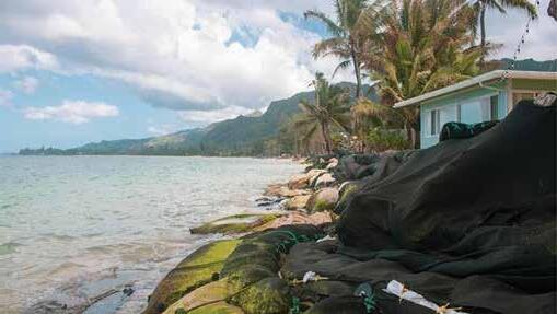 Fig. 1: Android app developed for Govt of Tamil Nadu
Fig. 2: APP and Dashboard in connection with the coastal clean-up activities of Govt of India
Fig. 3: Digital Coast – India (DCOIN) – a warehouse of spatial data and applications related
Fig. 4: G2G Solutions
Disclaimer: These case studies have been extracted from the Integrated Geospatial Information Framework report. 48 GEOSPATIAL ARTHA Volume 02 » ISSUE 02 CASE STUDY
Geospatial Data for Sustainable Agro Management

The Agro-Climatic Planning and Information Bank (APIB) was created with Agriculture reform through new technology being the need of the hour. Space and geospatial technologies can aid Information and communication technology to help establish agricultural management systems for efficient and sustainable agricultural planning.
APIB provides single-window access to all agricultural-related information and decision support to users of agricultural and allied sectors. Its comprehensive database structure contains information on both spatial and non-spatial elements, such as soil quality, fertilizers use, plant protection, seeds/seedlings, climatological data, credit/insurance schemes available, infrastructure for processing and marketing, and demographic details.
Multiple parameters have been studied and recorded on the APIB using Geospatial tools and technologies, that includes Soil Mapping, Dominant Crop Types, Land use, Land degradation, Geomorphology, Groundwater Potential, Irrigated / unirrigated land areas, soil physicochemical
properties, terrain characteristics, and agro-meteorological data.
Solution and Implementation
In a GIS environment, a study of different field areas was carried out using ground maps, field observation, and high-resolution IRS multispectral and multi-temporal images.
Large-scale mapping (1:10,000) was deployed for mapping spatial features in agricultural areas, and 1:50,000 scale maps for forest and steep hilly areas.
This was followed by the generation of a Natural Resources databank at the respective scales for 18 themes. The final land use land cover maps of the area were generated by GIS-based integration of two seasons’ land use maps.
Visual Analysis of Satellite False Colour Composite (FCC) for Soil resource mapping is carried out following a sample strip approach supported with high-intensity soil observation. Characterization of soils in the study area with respect to physio-chemical properties was done by laboratory chemical analysis of model profiles and soil
Objective
1. To prepare agriculture and natural resources inventories by analysis of temporal satellite data.
2. To collect agro-climatic and agricultural data for agro-ecological characterization and regional planning.
3. To develop a GIS-based database for all agriculture-related information, including practices, resources and demographics.
samples collected during the field survey.
On GIS, soil maps and soil characteristics are linked leading to the generation of digital soil and soil attributes maps. The land degradation map of the study area was then prepared by visual analysis of multi-spectral data. 28 categories of land degradation were considered, identified, and mapped, including different kinds of eroded lands; open/degraded forest; waterlogged; steep sloping barren areas; landslide-affected areas; and scrub lands.
Stakeholders Involved
Farmers, Financial Institutions, Agro-based industries and traders, extension officials, researchers/consultants/journalists, state, and ground-level administration in the districts of Champawat, Dehradun and TehriGarwal of Uttarakhand, India.
Disclaimer: These case studies have been extracted from the Integrated Geospatial Information Framework report.
49 GEOSPATIAL ARTHA Volume 02 » ISSUE 02 CASE STUDY
Capacity Building for Professionals
Objective
1. To strengthen capacity building in teaching, research & development, and use of geospatial technologies.
2. To promote the use of open-source Geographic Information Systems
3. To promote interactions and networking among government, academic, research and industrial organizations.
4. To recognize, encourage, and nurture innovation among the country’s youth towards larger socioeconomic development goals.
uniformity in educational practices. The focus was first on identifying key stakeholders and relevant institutions and on standardising the capacity-building program content, ensuring delivery through opensource software, use of expert inputs as well as provision for a wide range of teaching-learning resources.
The Geospatial capacity-building initiative was aimed at empowering cross-sectoral Indian professionals with the right geospatial data, tools, products, and services. It was designed and implemented by the National Geospatial Program (NGP) of the Department of Science and Technology (DST), Government of India, in collaboration with the Project Management Unit (PMU) at the Bharati Vidyapeeth Deemed University, Institute of Environment Education and Research, Pune (BVIEER).

Solution and Implementation
The Geospatial Capacity
Building program emphasizes solely on the use of opensource Geospatial software for training. A standardized curriculum and readily available teaching modules with step-by-step instructions and data were initiated in 2013. The program designed a set of 32 modules using open-source GIS software Quantum GIS and SAGA for remote sensing. These modules focused on building and upgrading skills stepwise on foundational data building, analysis, and modelling using data from the Indian subcontinent.
A centralised approach to identify training needs, across the entire Geospatial value chain in order to ensure
The capacity building program was designed to have four components: Assessment, Design, Implementation, and Feedback. The focus was on aligning and boosting innovation in the Geospatial ecosystem in line with improved governance, system efficiency, and widespread adoption across sectors for greater economic and social value.
Stakeholders Involved
Faculty Members, Scientists, Technologists, Researchers from Academia, personnel from national institutions of research, smart city cells, municipal corporations, and other government departments as well as non-government organizations.
Disclaimer: These case studies have been extracted from the Integrated Geospatial Information Framework report. GEOSPATIAL ARTHA Volume 02 » ISSUE 02 CASE STUDY 50
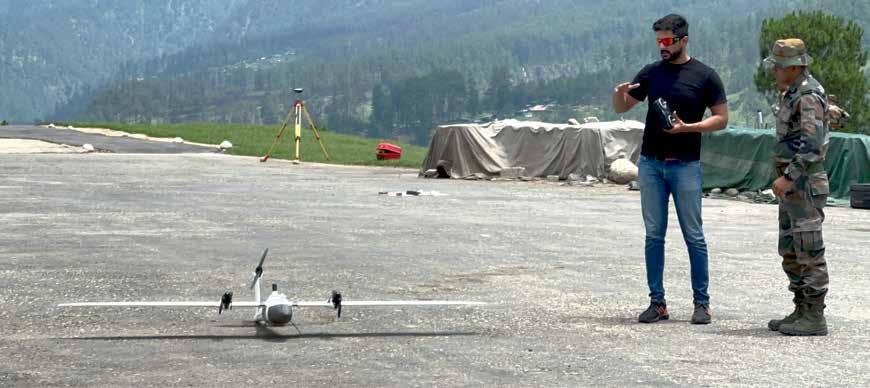




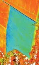
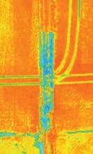
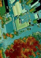
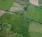






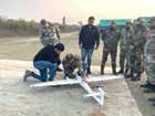
Save The Dates GW EVENTS CALENDAR 2023

Year after year, the Geospatial World Conferences maintain their reputation as the ‘must attend thought leadership’ events. Come see what everyone’s talking about!


www.geospatialworld.net
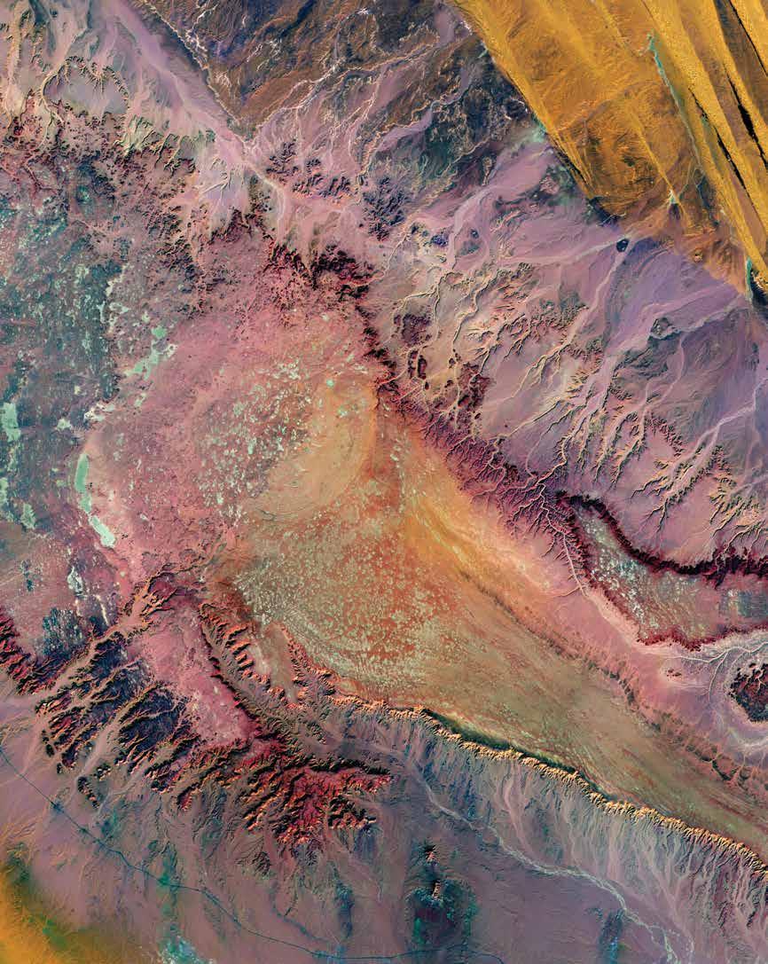
Produced By
Monterey, USA 6-8 March Rotterdam, The Netherlands 4-5 May Virginia, USA 6-8 September Hyderabad, India 16-19 October New Delhi, India 6-7 June Rotterdam, The Netherlands 2-5 May New Delhi, India 22-23 August
Global Geospatial Ecosystem
Connecting


 Around 13 of the 38 districts in Bihar has been affected by floods. The crisis has forced thousands of people to evacuate from their homes.


 Sanjay Singh
Managing Editor-cum-Senior Vice President, Geospatial World singhsanjay@geospatialmedia.net


 Fig. 1: Android app developed for Govt of Tamil Nadu
Fig. 2: APP and Dashboard in connection with the coastal clean-up activities of Govt of India
Fig. 3: Digital Coast – India (DCOIN) – a warehouse of spatial data and applications related
Fig. 4: G2G Solutions


