8 minute read
AI to Strategically Reshape Global Security Landscape


Professor V.S. Subrahmanian is a leader in design, analysis and application of AI-based models for real world problems that helps governments and companies in optimal decision-making.
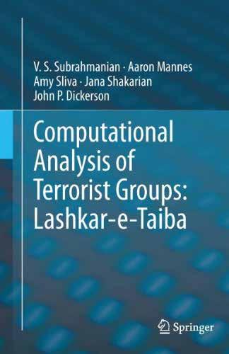
He is the Walter P. Murphy Professor of Computer Science at the McCormick School of Engineering, Northwestern University and Buffett Faculty Fellow at the Northwestern Roberta Buffett Institute for Global Affairs. He has also coauthored books on terrorist outfits Lashker-e-Toiba and Indian
Mujahideen.
In an exclusive interview with Geospatial World, he discusses the evolving global security configuration, emerging cyber challenges, and the utility of AI and satellite imagery in countering multiple threats.
What are your views on the future of the geopolitical situation in view of the ongoing Russia-Ukraine war? It looks currently as though the Ukraine-Russia conflict will continue at a perhaps lower level of engagement on a daily basis than we saw in the first few months of the war. But we expect it to continue in the coming months. This will have very significant repercussions for the rest of the world, as opposed to just that local geography.
The one major issue geopolitically is oil and gas. We've been seeing prices going up, at least in the US and the West. And this winter, Europe is likely to be severely affected by the shortage of gas that they import from Russia for heating purposes.
One of the good things that will come out of this conflict is that it'll open up more sources of oil and natural gas from around the world. It has forced some European countries to rethink their dependence on Russia for oil and natural gas.
The second is that we are seeing a significant realignment of global partnerships. We are seeing a closer relationship between Russia and China than we had seen in previous years. China needs friends and allies, and having Russia more strongly in its corner will reshape global geopolitics.
As China carries out increasingly aggressive cross-border activities with India, Japan, Taiwan, and other countries such as the Philippines, we can expect no condemnation from Russia, and at the very worst, active support for those kinds of missions, as a sort of quid-pro-quo payback for Chinese help during this RussiaUkraine conflict.
That'll have repercussions in how the world, which is already gearing up to combat these kinds of incursions by China, will bring India, Australia, Japan, the United States, New Zealand, and some of the countries in East Asia, such as Singapore, closer together. I expect a coalition of countries to come together more strongly than they've done in the past to combat that Chinese aggression.
You recently released a paper on China's incursion into India. So how do you see the SinoIndian border dispute in the long term? In the long term, both India and China have strong positions on where the border should be. The actual de facto border has not really changed a lot in the last few
decades. China has aggressively tried to grab pieces of territory over and over again but, nonetheless, any territorial gains by China have been small, one at a time but these aggregated seizures of small amounts of territory start adding up to something more.
India has taken very strong steps to combat this in the past few years, which include beefing up the surveillance and troops along the border, building better roads, air bases, and tunnels along the border. All these efforts are very significant defenses and deterrents to China.
This needs to be beefed up even more. The development and use of autonomous vehicles and weapons, which are capable of navigating the harsh terrain along the India-China border and the harsh weather, is critical.
When I say autonomous vehicles, I really mean drones and land vehicles, both for surveillance and offensive purposes, which is the way forward in terms of mitigating the risk to humans and human life. Some kind of ground vehicles and aerial vehicles that can Chinese aggression in these harsh conditions are going to be needed.
Tell us about the newly launched Northwestern Security and AI Lab (NSAIL), and the technologies that were used. How can policymakers make the right use of cyber forensics to help in preventing terrorist attacks? The Northwestern Security and AI Lab is a new lab which is jointly housed between the McCormick School of Engineering at Northwestern (the technology development arm of the lab) and the Buffett Institute for Global Affairs.

We are focused on using AI to reshape the landscape strategically and tactically. Most counterterrorism agencies have been proactive in gathering managing intelligence about attacks, but they have not been proactive in taking the battle to the attackers, regardless of whether they're cyber attackers or whether they are terrorists.
Part of what we are doing in the NSAIL is to imagine what the next wave of attacks will be, as advanced technology comes out. This is all about being ahead of the curve, instead of constantly being behind the curve.
And of course, once we know how we expect the attackers to attack us, we can come up with better defenses. For example, right now, we are working on a research paper and a demonstration, which will come out in February 2023 titled “Drone Urban Cyber Defense Testbed (DUCK)”. DUCK looks at drone attacks with swarms of on cities and urban areas, because drones are pretty cheap today. We have come up with techniques to simulate how adversaries might use swarms of drones to target cities even before they do so. We
Digital Terrain Elevation Data (DTED) maps tell us about the elevation of every part of the world. One can buy them off the internet at pretty reasonable prices and these maps tell you with granularity how the terrain changes in terms of elevation
will come up with multiple defensive methods to guard against that.
We are also working on a system called Tread, which is intended to combat terrorist groups. As an example, in my book on Lashkar-e-Taiba (2012), one of the big findings was that as long as Lashkar-e-Taiba is squabbling internally, fighting amongst themselves, the probability of terrorist attacks goes down dramatically, almost to zero. So, as a counterterrorism strategy, inducing conflict between leaders of Lashkar-e-Taiba is very desirable. So we've been developing deepfake technology with the use of AI, to put words in the mouths of these terrorists, intended to sow such conflict within the group.
We're looking at this nexus of AI and how terrorists might use it, and how we can get ahead of them.
What roles do remote sensors play in predicting terror activities? Terrain and weather play a huge role in terror attacks. During terrorist attacks, when they look at target selection, the first question is, "What is the value of the target?" The value could be along many different dimensions:
Will a lot of people be killed? Or will certain groups of people be killed, such as in the attack on the Indian parliament in 2001.
The second is, "Can it be done?" Terrorists might wish to attack certain targets, but it may or may not be doable. So what is the probability that they can succeed in an attack?
Then the third is backlash.
For the second question, "Is this target attackable," remote sensing and geospatial information play a huge role. If you look at a major target, there are multiple layers of security around it, which are situated in space and time. For example, there's a checkpoint here, or a convoy there and, after an hour, it may be somewhere else. Understanding the nature of the defences of a target is completely embedded in geospatial and temporal domains.
The probability of an attack on a location depends upon several things like, “What is the terrain like?” for example, to traverse one kilometer, a soldier might have to go through a steep downhill or climb uphill in forbidding terrain, hence, understanding the nature of the terrain at a specific point in time is critical.
There are things called Digital Terrain Elevation Data (DTED) maps, which tell us about the elevation of every part of the world. One can buy them off the internet at pretty reasonable prices and these maps tell you at fairly finegrain granularity how the terrain changes in terms of elevation.
We have collected maps from NASA satellites which are also publicly available that tell us about vegetation, drainage and the presence of water, etc. The channels of water change the traffic-ability of that entire geography, because the parts that were walkable or can be crossed with the help of a vehicle this year may not be doable next year. You need to understand static assets, such as where are the roads, the military encampments, the border posts, or the airfields.
At the same time, you also need to understand, how people are moving across the terrain. This is where satellite imagery is extremely valuable. The airfields are not changing location, they only come up once in a while, but people are changing their location every day. Their patrolling pattern, checkpoints and deployments are changing every day.
For example, it is possible, using AI, to use probes (that is, autonomous vehicles) to review China's defenses. We can send some autonomous vehicles across to see what the Chinese do, and whether they are paying attention or not.
There are both passive methods and active methods where the satellite imagery data is collected, analysed, and all of them live in geography.
Interviewed by: Nibedita Mohanta


