Gracie Meek
Design Portfolio 2022
Harvard Graduate School of Design
Cornell University
Nature Oriented Development
A Two-Speed Landscape
Groundscapes + Watermarks
The Community’s Cruiser
Articulating the Shoreline Villa Giulia Facade Analysis
Where Solid Meets Void Aithêr: An Elemental Daycare
The Expansion Anti-Mansion [au] Workshop Internship | Maintenance Bridge
Building Together | NYC x Design
For India Today | Street Cart Attachment
Articulated Design of the Detail | Book
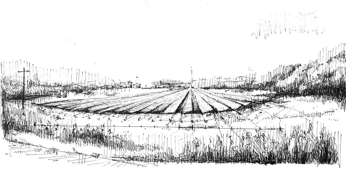
On-Site Sketching
Thesis | Future Afterlives of an Extractive Landscape: Sweetwater County
1 4 6 8 10 13 14 16 17 18 19 20 21 22 23 Contents | Design across scales
Landscape Urban Micro Architecture Scale
Nature Oriented Development
Fall 2021, Cornell University
B. Arch Expanded Practices Option Studio
Instructor: Anna Dietzsch
Rehydrating the landscape productively
Once a lush ecosystem in the cerrado biome of Brazil, the project addresses the extracted and desertified landscape of Canarana depleted by extensive monoculture agribusiness infrastructure.
Nature Oriented Development reverses the effects of typical agribusiness infrastructure using the logic of natural systems as a productive infrastructure to argue that infrastructure and the ideas of development, modernization, and progress do not have to be environmentally destructive.
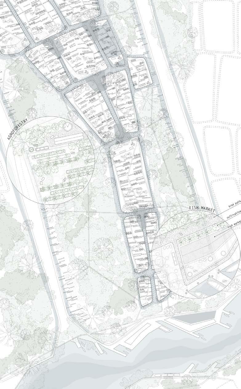
The proposed infrastructure rehydrates the landscape through retention ponds and agroforestation to produce a regenerative cycle, engaging with ecological cycles of the region. It utilizes the river as an access, maintenance, and recreation corridor to not only benefit the environment, but also to socially and economically benefit Canarana by decentralizing food production and stimulating the economy. N.O.D. becomes a new logic for urbanization to redefine what is urban versus rural.
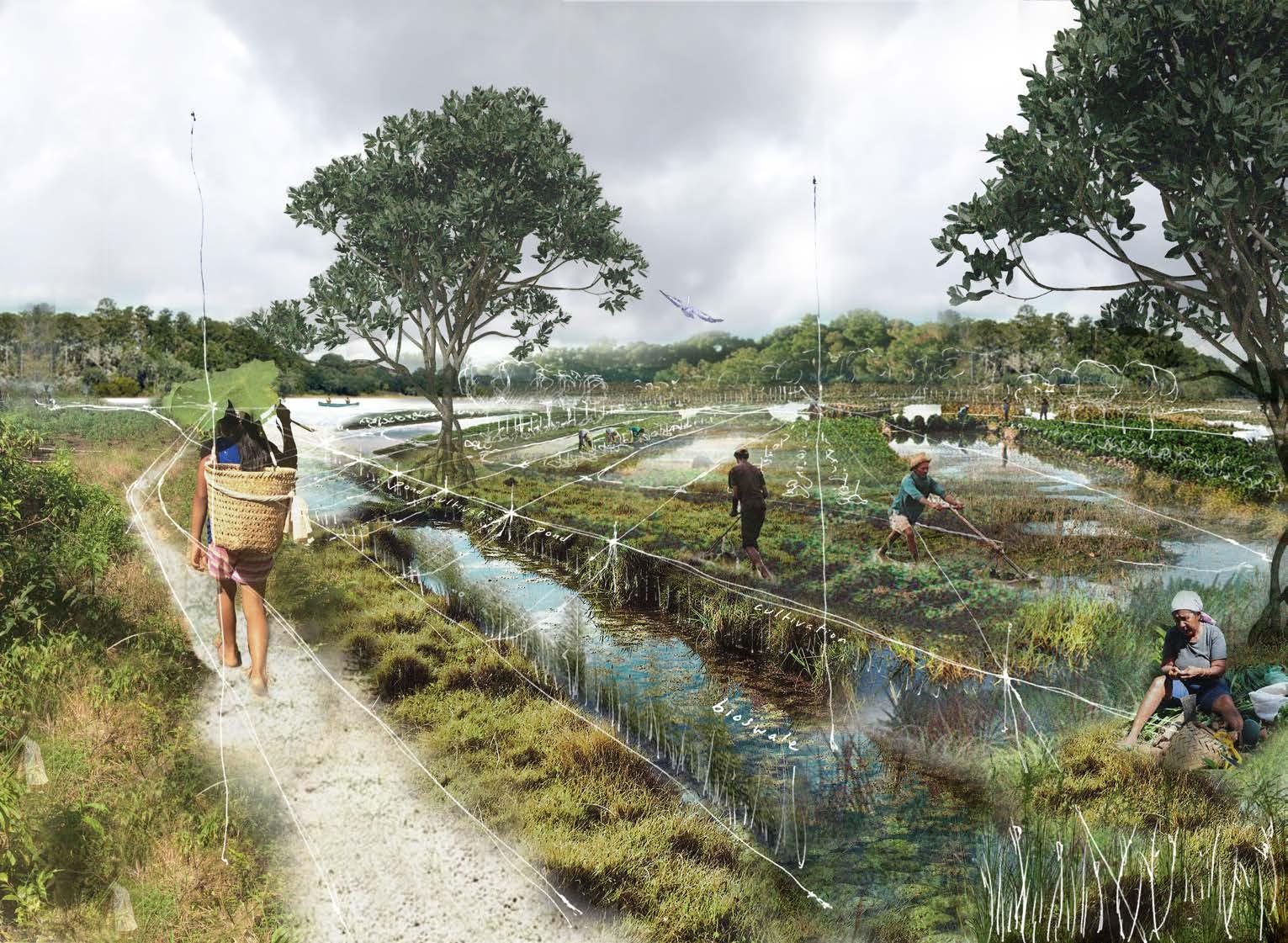 Rehydration pond and bioswale landscape defining agroforestry parcels
1
In collaboration with Jessica Lee (M.Arch’22) and Yvette Wang (M.Arch’22)
Analysis


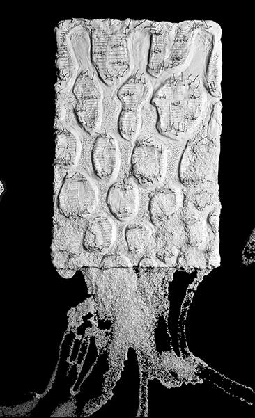
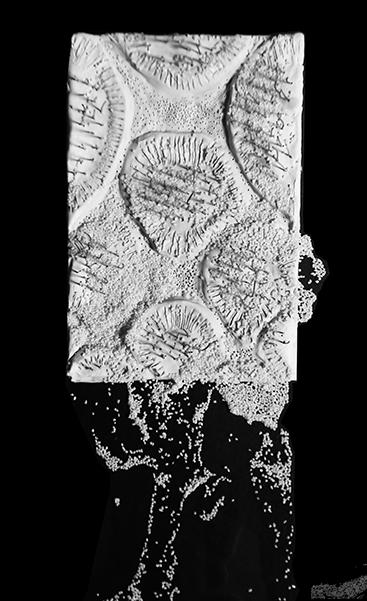
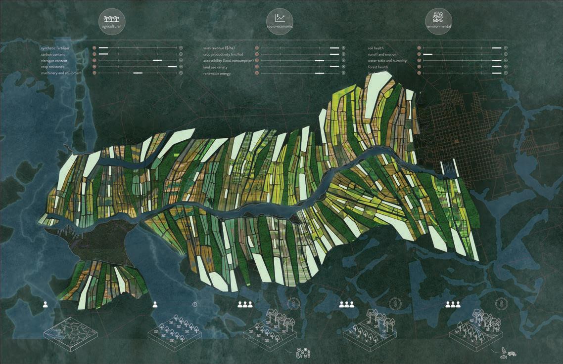
 of existing regional condition
3 iteration 4 Nature
Development
Proposed
reparcelization
iteration 1 Form-finding experimental clay models by testing amounts of soil deposition iteration 2 iteration
Oriented
permaculture is only 28% of the cost of monocrop cultivation
proposed required ratio of vegetation to infrastructure in order to receive funding

Program node: Maintenance
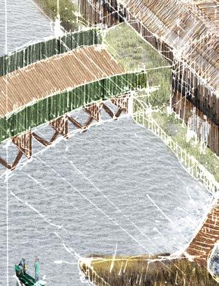
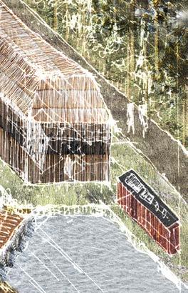
Hydroelectric energy production, bridge, and wearhouse occur every 1km
Program node: Economic
Food market and seed storage adjacent to permaculture
A B C
Cost per hectare analysis comparing monoculture and permaculture Linear park programmatic nodes

Program node: Recreation

Viewing tower for wildlife observation and bike path
2



A B C Nature Oriented Development
Year 0-1
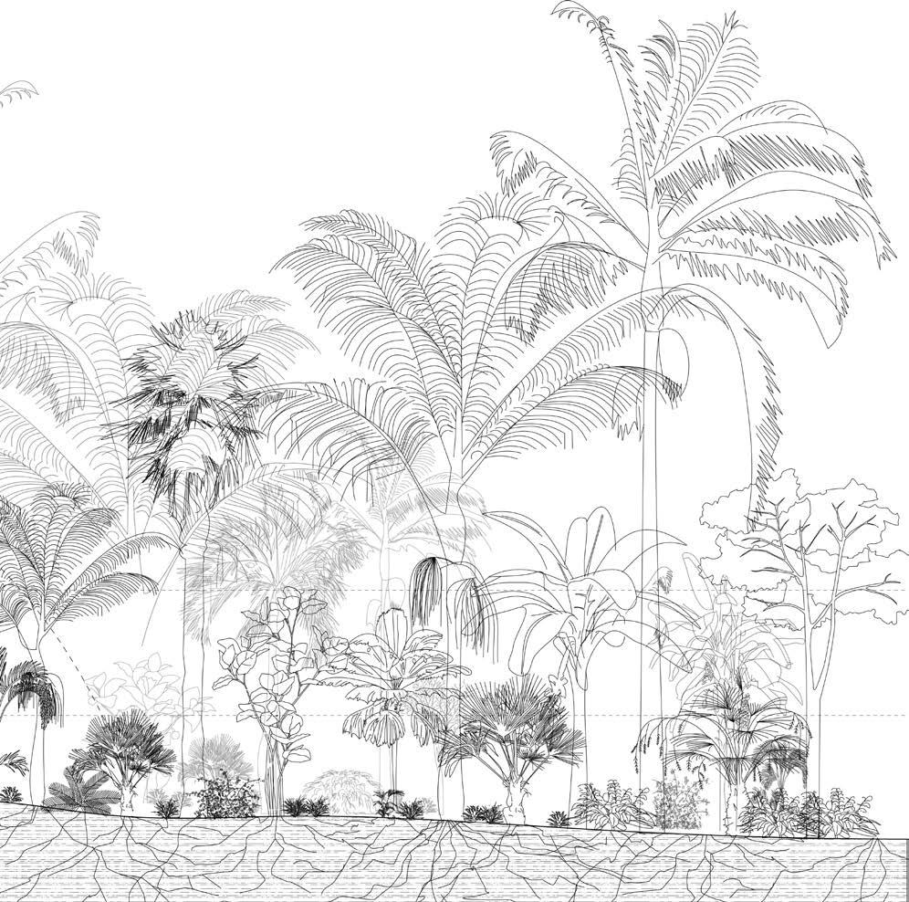
Cycle proposed, monoculture overturned, rehydration pond construction Emergent Layer


Year 1-2
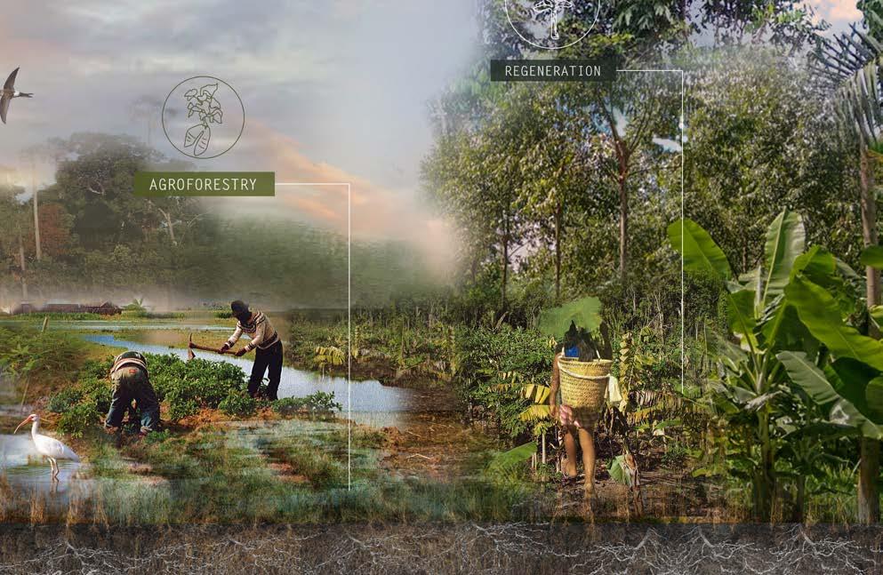
First cycle agroforestation planting and preparation:
Rice, corn, legumes, pumpkin, sunflower, lupine black oat
Year 2-3
Agroforestation for food production, trimmings as fertilizer: Cassava, pineapple, ginger, banana, papaya, maracuya
mycorrhizal system restored
Canopy
Year 3-15
Agroforestation for Orange, peach pepper, coffee
trimmings = fertilizer
Fruit
Nature Oriented Development
replenished for future crops
Understory Shrubs Mycorrhizal Soil
compost
3
Year 20 Biodiversity, better soil health, groundwater rehydration: Breadfruit, cocoa, avocado, mahogany
Zoom-in of agroforestry parcels and bioswale path network leading to fish market
 Nature Oriented Development
for fruit cycle planting: palm, Nature Oriented Development
A Two-Speed Landscape
Fall 2022, Harvard Graduate School of Design MLA Core III Studio
Instructor: Danielle Choi
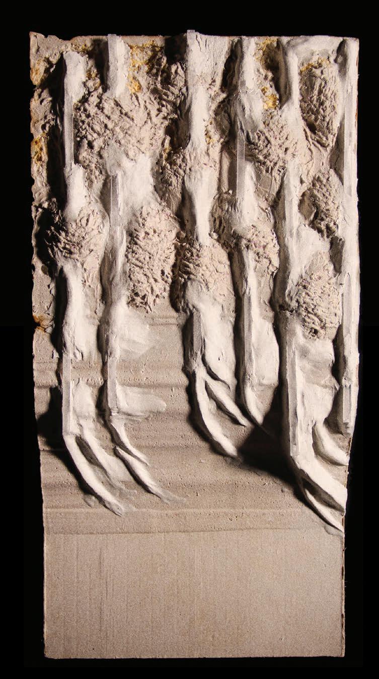
Catalyzing sediment exchange
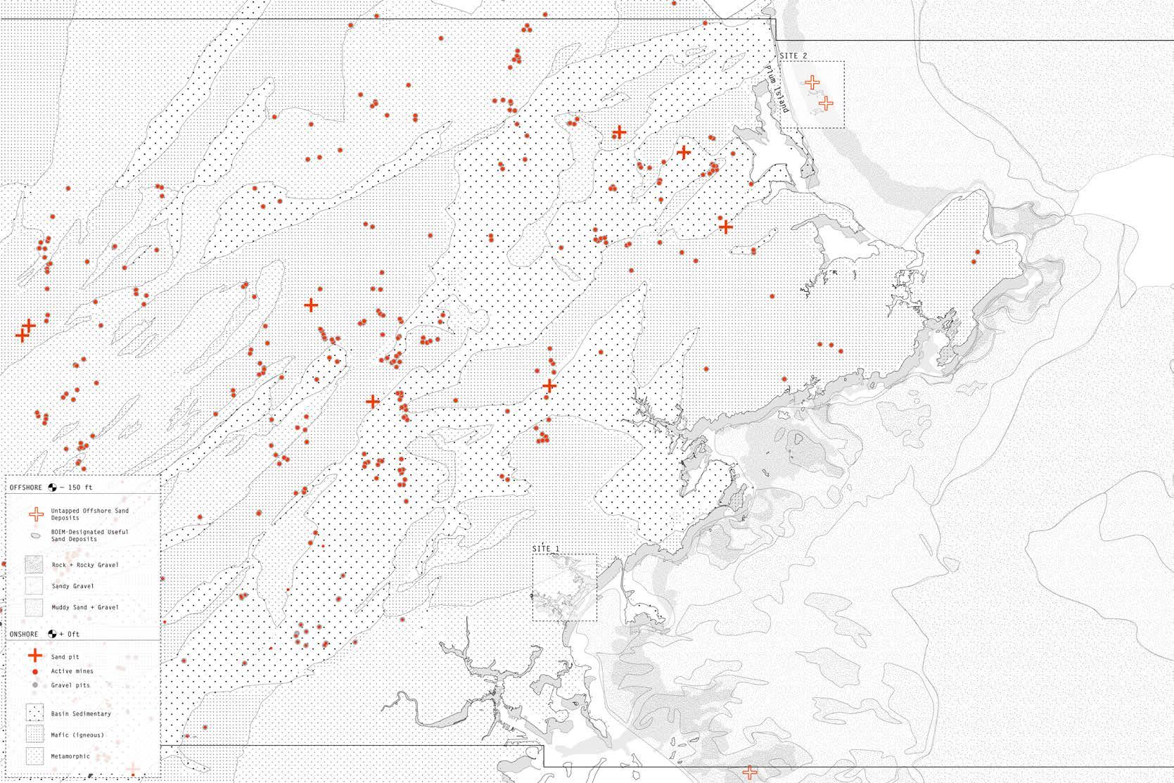
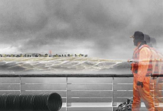
A Two-Speed Landscape balances prolonging with a sense of urgency. Humans operate at the scale of geologic agents. This change takes place at a faster pace than it does through natural processes. The project investigates the idea of this “two-speed” landscape, where sediment is anthropogenically displaced at a much quicker rate than it’s being naturally replenished.
Because sediment flows to the salt marsh are highly compromised, the project recalibrates the engineered and natural flows of sand and silt. The project catalyzes a metabolic sediment exchange between Site 1, the salt marsh/Revere beach, and Site 2, a wildlife refuge. The project’s goal is to prolong the process of sediment depletion to allow time for communities to make buyout decisions in the midst of sea level rise and re-establish an eroding Site 2. The strategic activation of sand dispersion processes throughout time reminds inhabitants of the connection between extracted materials and their uses.

Site 2
A
Site 1
B C
4
Proposed
sand distribution schemes across Sites 1 and 2
Site 2: Plum Island
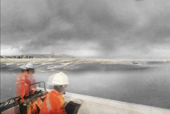
Erosion of Plum Island wildlife refuge, sand debt repayment, and sediment accumulation on framework year 0 year 50 year 10
Site 1: Revere Beach
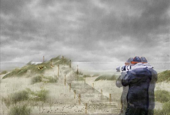
Buying out of Revere Beach to become a wetland; eventual full erosion of beach to reveal the landfill behind year 0 year 50 year 10
Site 1: Marsh
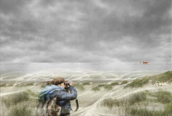
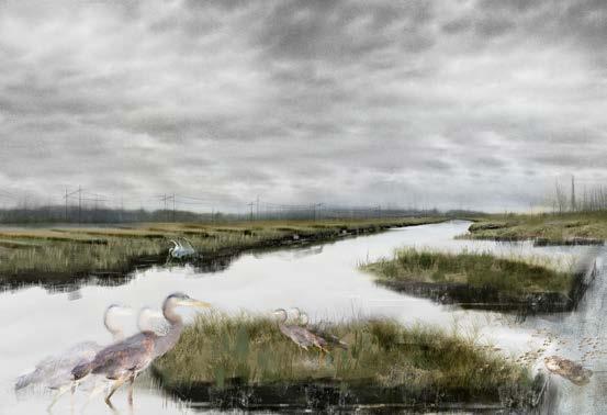

Systematic slicing of human-made berm to allow tidal flow and natural sediment dispersal


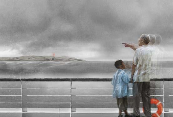
Simultaneous speeds of natural and anthropogenic sand flow over time on Sites 1 and 2
A Two-Speed Landscape
year 0 year 50 year 10
Proposed (red) and natural (white) sediment flows on Sites 1 and 2 Metabolic exchange of sand between Sites 1 and 2


Site 1:
+
Site 2:
1:
+
Site 2:
A Two-Speed
Revere Beach
Marsh
Plum Island Site
Revere Beach
Marsh
Plum Island
Landscape
5
Revere Beach Plum Island



A
Two-Speed Landscape
4 5 6
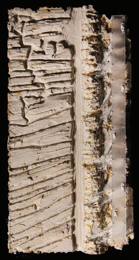
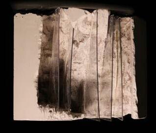
Models cataloging sediment dynamics at scales from 1:10,000 to the microscopic 1 2 3
Groundscapes + Watermarks
Fall 2020, Cornell University
B. Arch Expanded Practices Option Studio
 Instructor: Tao DuFour
Engaging a cultural artifact
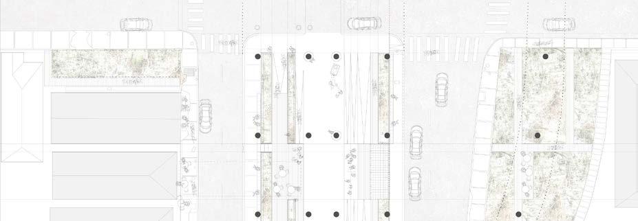
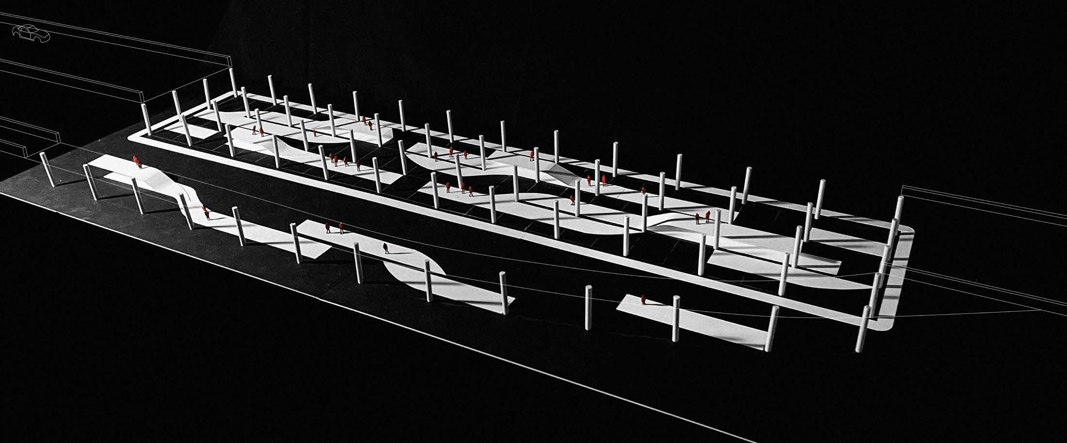
The project engages with the infrastructural landscape of New Orleans to reclaim space under the I-10 expressway and the adjacent vacant greens sliced by exit ramps. Despite the violence of the expressway overhead, the underhighway space currently supports lively Mardi Gras parades and funeral processions in what is the widest neutral ground in New Orleans - an informal underhighway parking lot. Groundscapes + Watermarks turns the narrative of violent infrastructure into one of empathy.

The main goals of the project are to support the spontaneous uses of the space under the expressway and to make an aggressive effort to address stormwater to accommodate flooding by linking existing drainage infrastructure. Divided into two major zones: exit ramp residual space transformed into bioretention ponds parks and an underhighway elevated groundscape, the intervention is both precise and indeterminate. It takes the surrounding specific city context and pulls it under the underpass.
Multi-scalar operation of groundscape
1st Runner Up: International Young Visionary Architects Competition
bioretention pond bioretention pond bus stop
6
bioretention pond raised platform basketball performance


Interstate - 10 N. Claiborne Ave. Interstate - 10 Highways Major roads Project N Canals and drainage Wide neutral ground with mature oak trees Wide neutral ground with mature oak trees in reference to Claiborne I-10 construction begins; neighborhoods and businesses razed I-10 construction continues New underhighway space as neutral zone for public use Underhighway space as festival; Treme Arts and Culture Festival Residual exit ramp space as wetland park Highway predicted to be removed; columns with murals remain as monument Groundscapes + Watermarks
Physical model of public groundscape and wetland park in residual underhighway space
Historical narrative of I-10 and N. Claiborne Ave


Groundscapes + Watermarks
Mundane Plantings Festival
Synthesis: Spatial, legal, and social ambiguity Forensic site analysis Program relationship with adjacent buildings Plantings in residual exit ramp space
1 2 3 4 7
Spontaneous emancipation of groundscape from initial programming based on changing external conditions Groundscape programming derived from existing context
Cutaway frontal axonometric of groundscape and exit ramp landscape

Groundscapes + Watermarks
The Community’s Cruiser
Spring 2021, Cornell University
B. Arch Expanded Practices Option Studio
 Instructor: Gesa Büttner Dias
Merging speeds to engage local everyday life
Whether it be a freshly licensed teen driver aimlessly cruising down Van Nuys expressing her newfound freedom, frantic parents in traffic needing to drop their kids off for school before running to a 9-5, or an uncle taking his nephew for a ride to the mini mart in his 1967 Corvette, South LA has autocentered pit stops and an asphalt landscape ubiquitous to everyone who lives there.
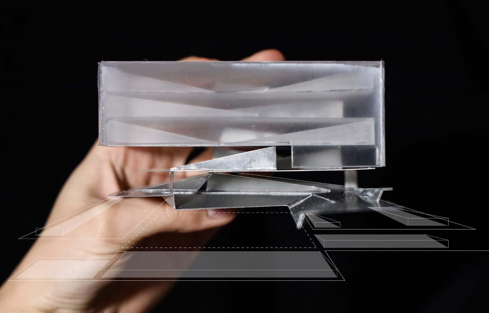
The Community’s Cruiser seeks to draw in locals from wherever they are around South LA, so the project learns from the celebrated car culture of Los Angeles to create a transmodal transportation hub typology that engages local everyday life.
In addition to the main site transportation hubs, interventions are acupuncturally inserted into car washes, gas stations, and auto maintenance shops. These form an interconnected asphalt landscape of auto sites commonly used every day that allow South LA citizens to acess the Community coalition’s mission wherever they are in the city during their typical routines.
8
Aluminum and acrylic model of parking landscape weaving through transparent volume
Site 1: Bus stop, busy car intersection Site 2: Bus stop, green bike path, nearby metro

Site constellation; network of satellite auto sites


Industrial flight of auto businesses in South LA from 1970-1990
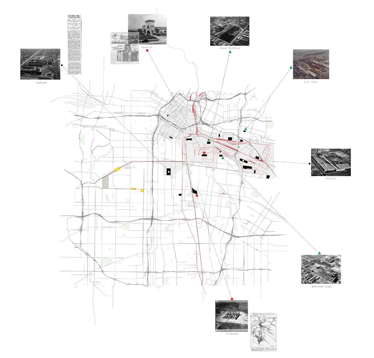
Industrial closings 1970-1990
CoCo: The Community’s Cruiser
Sites Industrial railways
Initial study models of how parking weaves into existing brick building


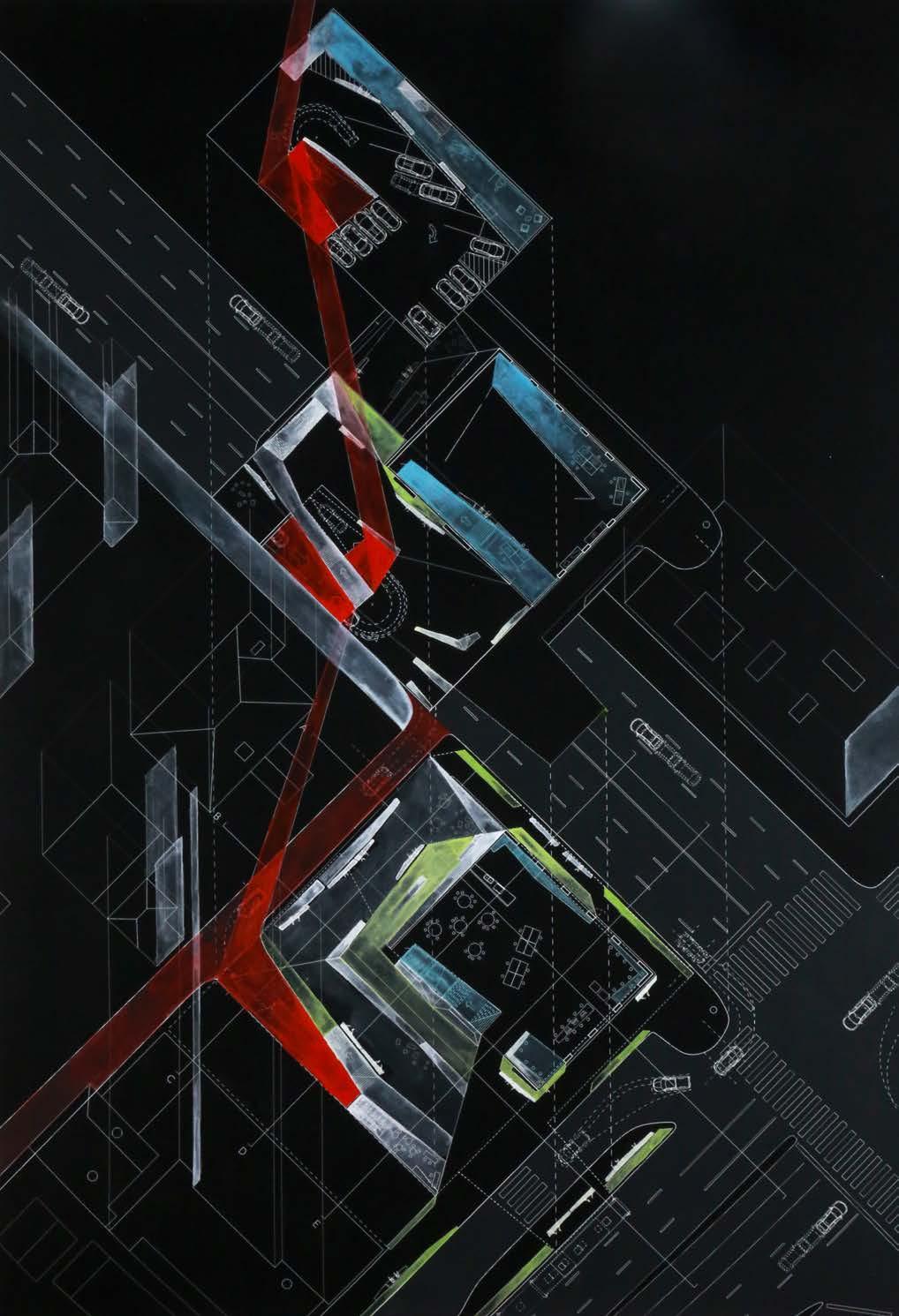

CoCo: The Community’s Cruiser
Parking landscape woven into existing brick building gouache painting, 27 x 20in
9
Stop Turn
Plantings for heat relief
Vehicular vertical circulation
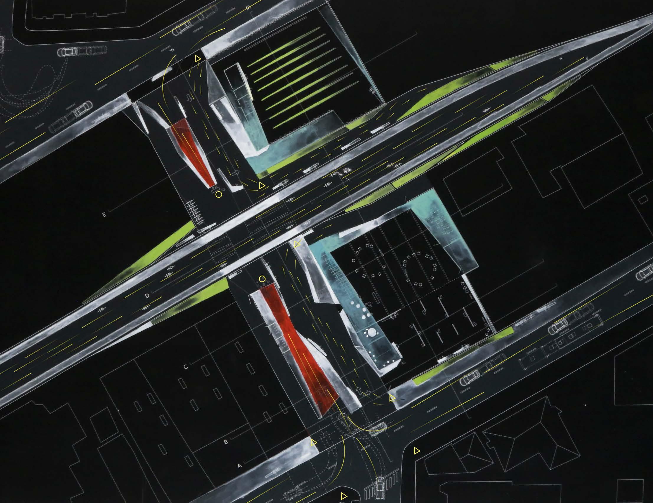
Transmodal interaction between pedestrian, bike, and car
Transmodal transportation hub serving different speeds: walking, biking, and driving gouache painting, 20x30in
CoCo: The Community’s Cruiser
Articulating the Shoreline: A Landscape Promenade
 Spring 2020,
Cornell
University B. Arch Third Year Housing Studio Instructor: Lily Chi
Embracing indeterminacy
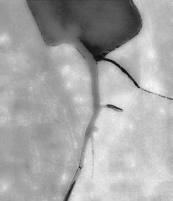
Formerly a natural marsh, the site in Ithaca, NY is subject to severe flooding from both an adjacent canal and high groundwater levels. In order to ensure its persistence over time, the public housing framework was tested through three different economic and environmental conditions. By anticipating and accommodating temporal change, the landscape negotiates between large-scale fluctuations and everyday life. It takes responsibility for the edge condition by utilizing edge-stabilizing green columns as a buffer zone for intense flooding of the canal, and the remaining site as a sponge to protect heightened areas.
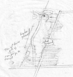
The design alleviates flooding concerns with a network of bioswales that account for both the threat of flooding and high groundwater levels. The swale wetland works in concert with and serves as a prompt for future city building. To secure future construction zones, swales in lower, wetter grounds amplify higher, dryer ground.
Year X: Businesses infill amplified land ensured by swales graphite on canvas, 7 x 10 in

10
Cayuga Lake
Housing
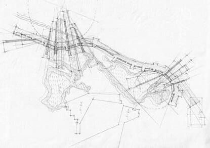

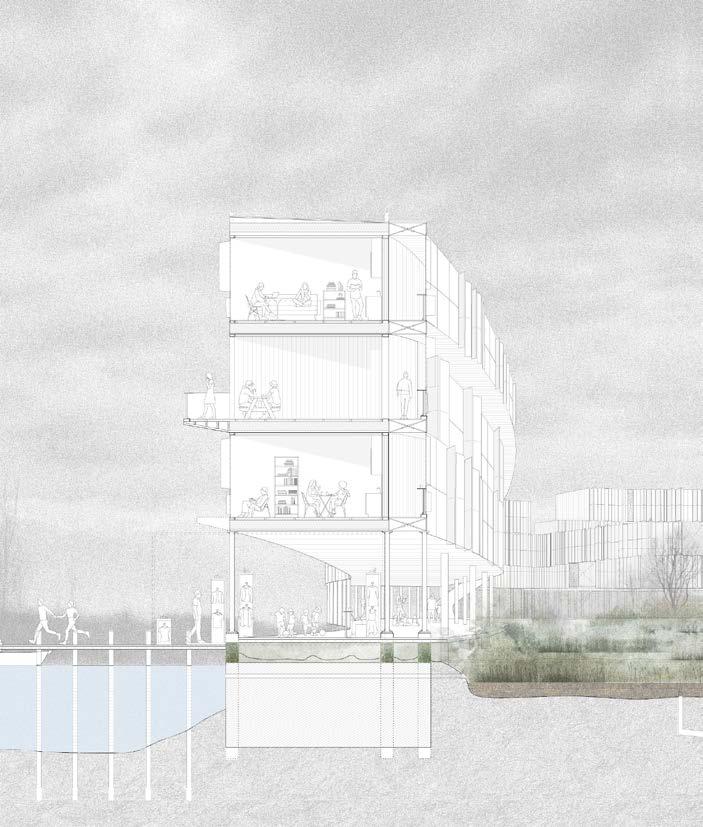

Swale network as prompt for future city building, alleviating flood concerns Domestic boardwalk as interface between canal, shoreline, and swale wetland
+ lake level Swale system + adaptable housing
Year 1: domestic
Year X: economic
Year X’: permanent
rise
Articulating the Shoreline: A Landscape Promenade Major channels Shallow channels Flooding Groundwater Canal
framework
boardwalk
boom
lake level
Bioswale network Edge-stabilizing green columns
Articulating the Shoreline: A Landscape Promenade


Year 1: Apartment units and domestic boardwalk
Year X: Economic boom: Businesses infill amplified higher dry ground ensured by swales, pop up shops appear on boardwalk
Year X’: Rise of lake level: Ground-based constructions no longer operate, apartment units removed, skeleton of building supports a wind farm and vertical gardening units
Transformation of framework according to economic and environmental fluctuations
20XX 20XX
2020
11
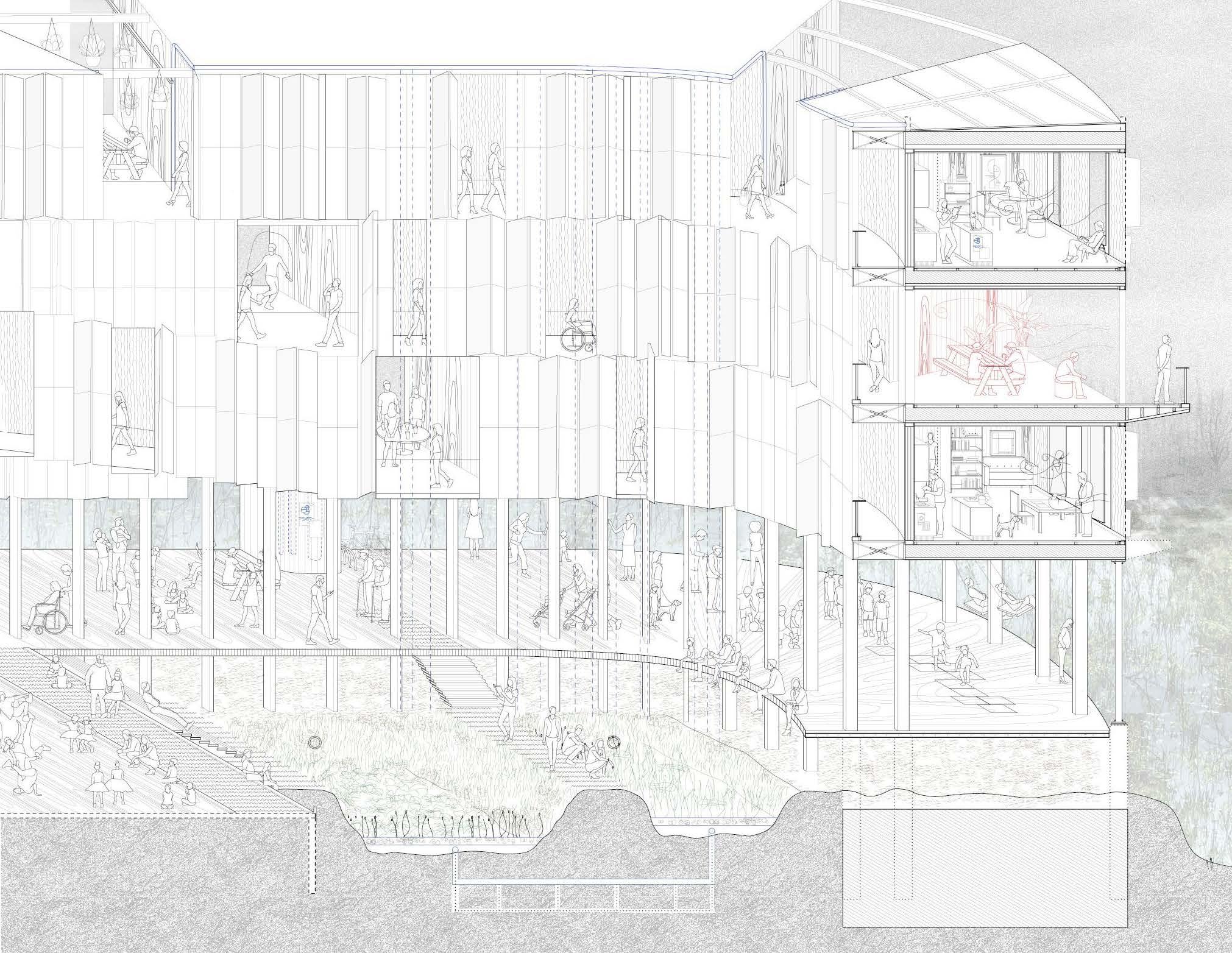
YEAR 1 | People’s everyday interactions with apartment units and domestic boardwalk
 Articulating the Shoreline: A Landscape Promenade
Farmer tends plants hanging from building structure


Girlfriend [angry] finds out boyfriend is cheating on her because he forgot to close his facade shades
Local art dealer attracts passers-by on the boardwalk

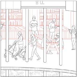
Young adults browse books in temporary book stand on the boardwalk
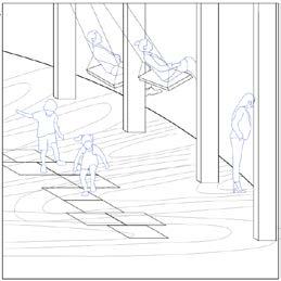
Parents enjoy scenic view from swings hanging from structure while children play hopscotch
Farmer waters hanging plants while watching workers below
Exploitation of curve for unit distinction Articulating the Shoreline: A Landscape
Living Movement Service Common balcony / possible expansion (1 Bed) 10.5’ 10.5’ 10.5’ 10.5’ 10.5’ 10.5’ 10.5’ 10.5’ 10.5’ 20’ 20’ 20’ 20’ 4.5’ 8’ 2.5’ 1
4 5
Promenade exploitation of curve for unit distinction
1 2 3
6
4 5
Community
architecture Design
apartment framework to shoreline bedrooms
base unit strategy Living Movement Service Common balcony / possible expansion (1 Bed) 10.5’ 10.5’ 10.5’ 10.5’ 10.5’ 10.5’ 10.5’ 20’ 20’ 20’ 20’ 4.5’ 13’ living movement service 12
2 3
6
interactions facilitated and provoked by
affordances allowing unit tranformation over time adaption of
replace balconies
YEAR X’ | apartment units removed, skeleton of building supports a wind farm and vertical gardening units
 Articulating the Shoreline: A Landscape Promenade
Villa Giulia Facade Analysis
Fall 2019, Cornell University B. Arch Third Year Studio in Rome
“Designing in reverse”
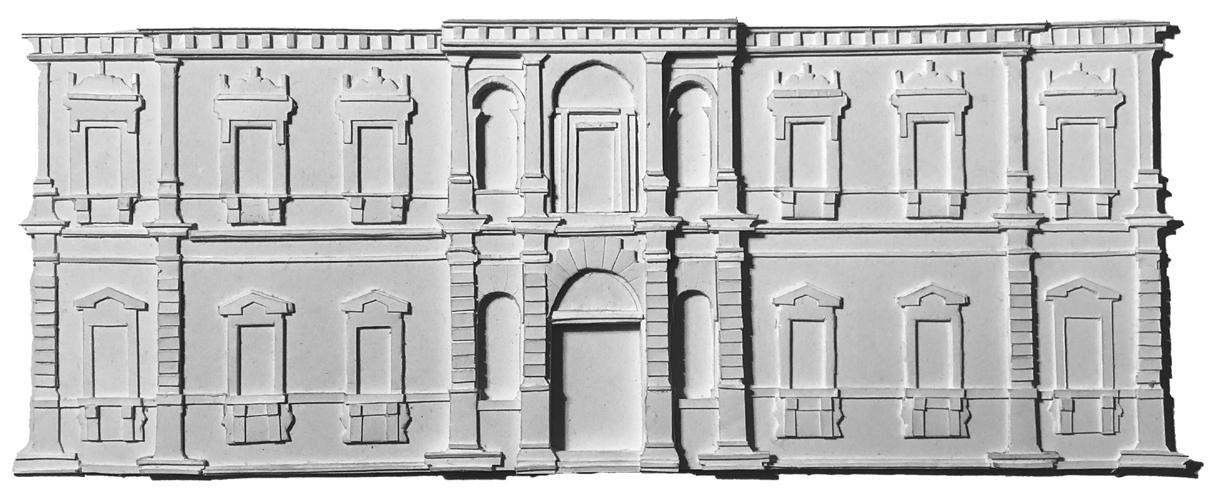
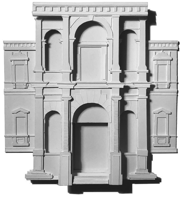
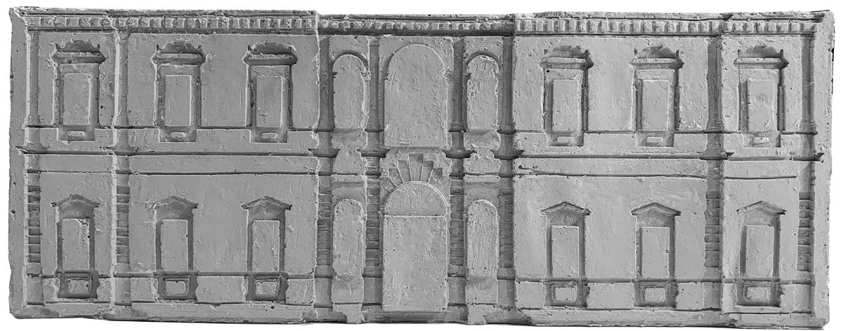
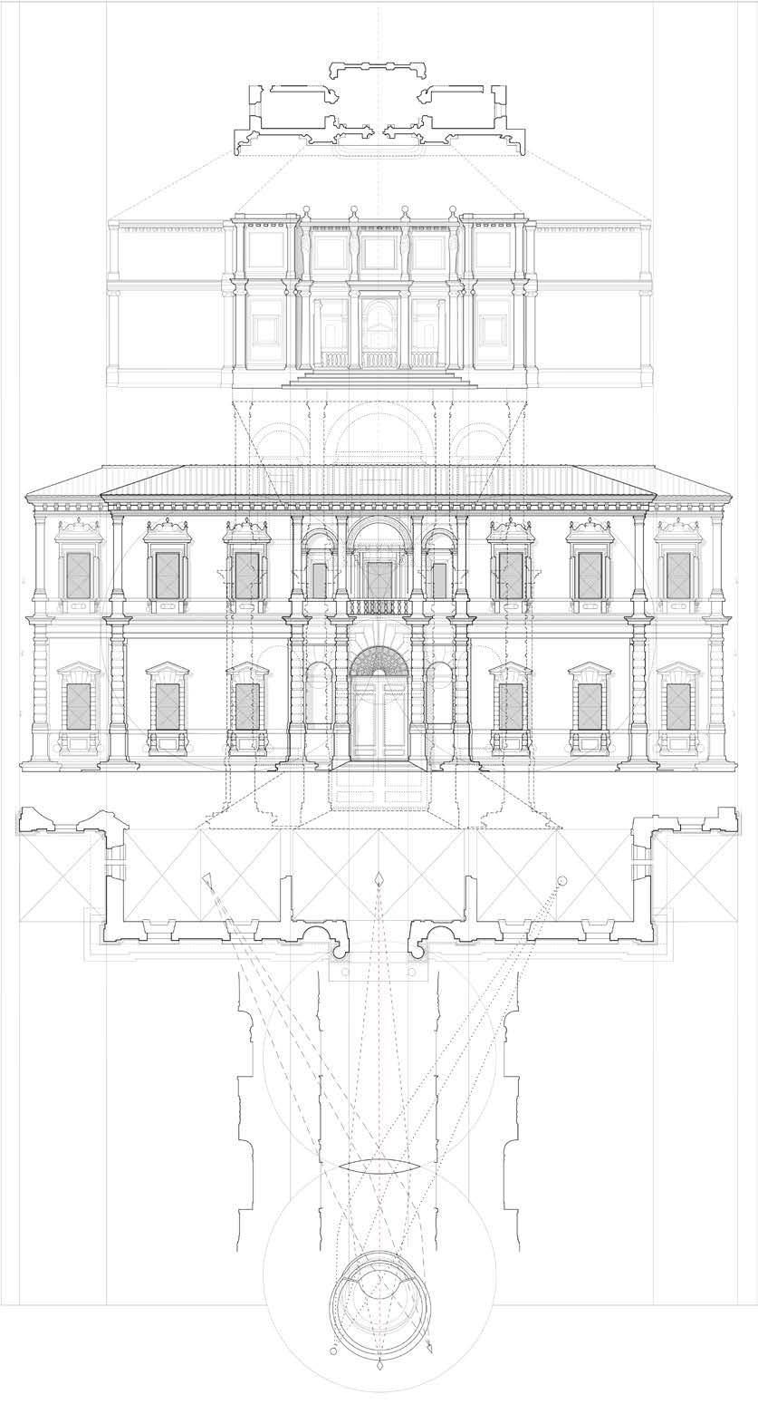
Villa Giulia in Rome, designed by Vignola, was analyzed as a case study to see how a facade’s composition can extend through a building’s different layers: phenomenologically, structurally, and proportionally. Knowledge gained from this excercise was employed in the preceeding studio project, Where Solid Meets Void.
“Death
Mask” plaster facade cast
Paper
model of facade
layers Paper model exploring projection of cenral facade upon approach
a b 1/2 a 1/2 a 1/2 a 1/2 a a a a Horizontal Axis Analysis Vertical Axis Analysis 1. square 2. golden section 3. golden rectangle center 4. vertical line at center of golden rectangle 5. line from corner of square passing through center of golden rectangle 6. vertical line from end of previous line, establishes “A” dimension 7. re ect a 1. Golden section a b 1/2 a 1/2 a 1/2 a 1/2 a a a a Horizontal Axis Analysis 1. square 2. golden section 3. golden rectangle center 4. vertical line at center of golden rectangle 5. line from corner of square passing through center of golden rectangle 6. vertical line from end of previous line, establishes “A” dimension 7. re ect a Approach Analysis 2. Vertical line establishes “A” dimension a b 1/2 a 1/2 a a a Horizontal Axis Analysis 4. vertical line at center of golden rectangle 5. line from corner of square passing through center of golden rectangle 6. vertical line from end of previous establishes “A” dimension 7. re ect a Approach Analysis 3. Reflect
Instructors: Jerry Wells and Daniele Durante In collaboration with Duncan Xu (B.Arch’22)
13
Sight lines from center of Villa Giulia nymphaeum projecting geometries throughout entire building

Perceived projection of facade upon approach and extension of regulating lines throughout entire building
Villa Giulia Facade Analysis
Where Solid Meets Void | Facade Projection
Fall 2019, Cornell University
B.
Arch Third Year Studio in Rome
Instructors: Jerry Wells and Daniele Durante
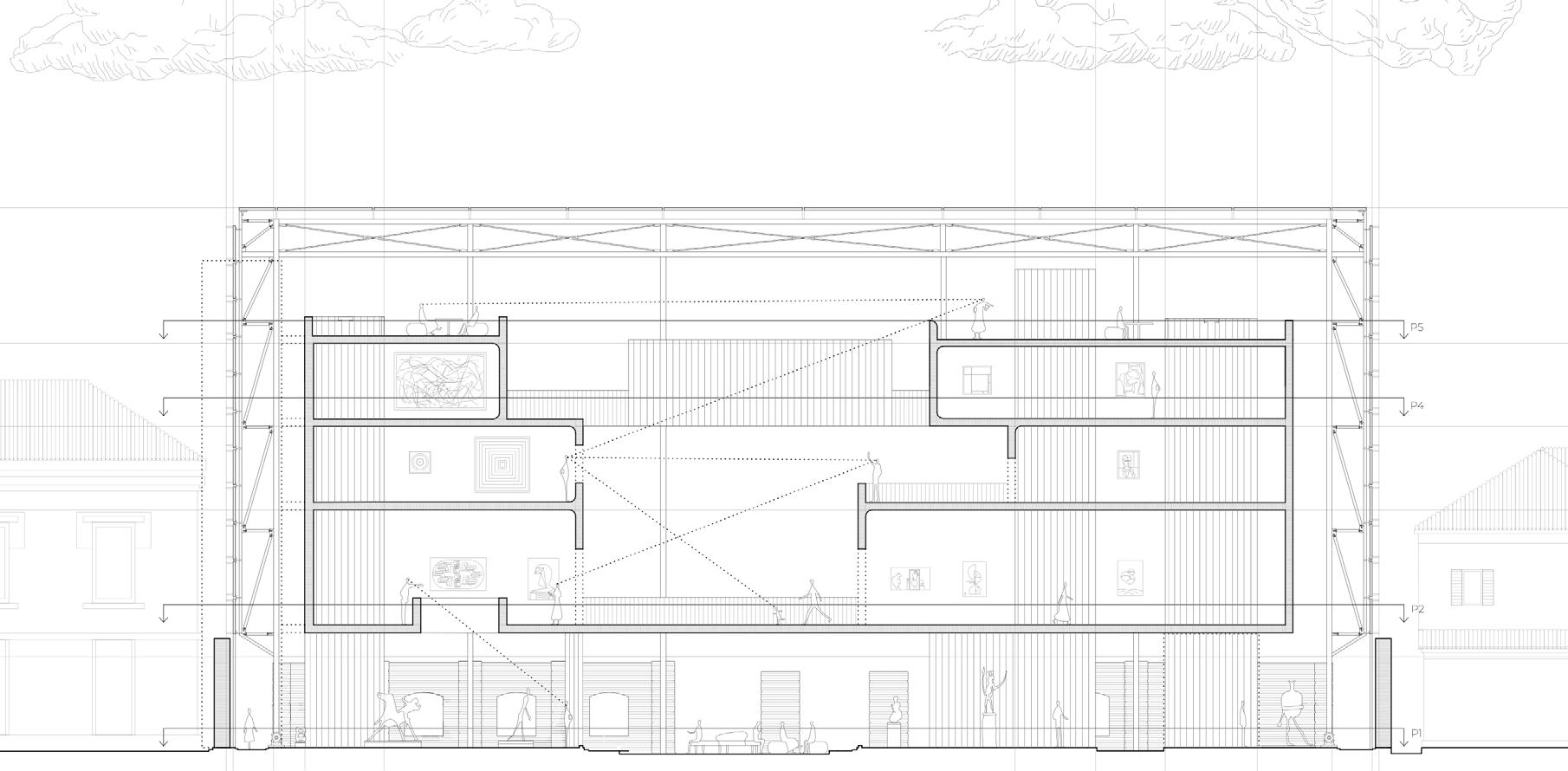
A dialogue between the old and the new Palazzo Venier dei Leoni, the 18th century palazzo in Venice that now houses the Peggy Guggenheim Collection, was never fully constructed. Due to structural issues, only the first level of the facade facing the Grand Canal was completed. The existing facade was used as a compositional device to design a new addition to the museum.
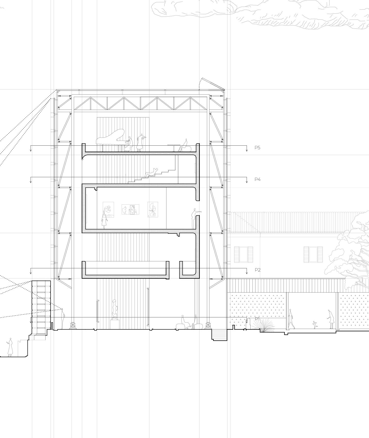
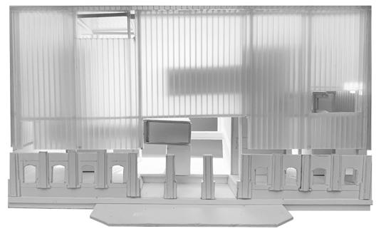
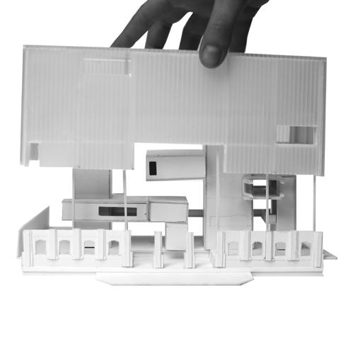
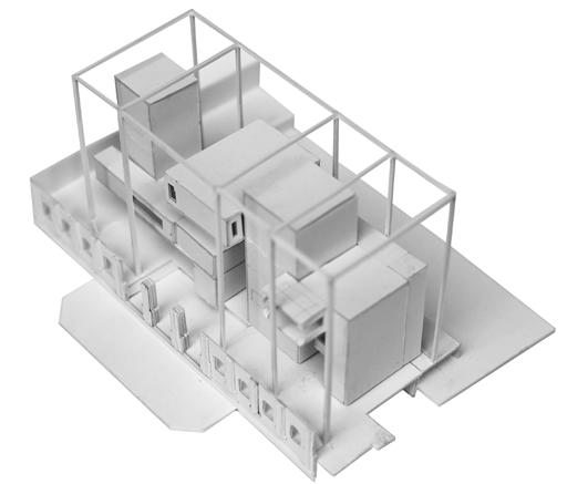
The regulating lines of the project were derived from the existing facade in both elevation and plan. In order to respect the existing facade, the new facade is set behind the existing plane. The museum space was developed as a solid concrete volume inside a lightweight container. This highlights the contrast between the two vastly different structural methods: a light truss supporting the exterior glass facades and heavy, gravity fighting mass inside.
Space flows freely around concrete masses so one can experience one space within another space. Three vertical circulation cores act as structural load bearing walls of which the masses branch off. The joints that attach the facade to the structure are colored to create a matrix that maps the 3-D space of the interior on the two-dimensional vertical plane.
 Facade joinery as colored matrix that maps the space behind
Gold-colored structural cores visible through windows from Grand Canal
Existing museum facade
Proposed facade addition and building within
14
Facade relief model


P1 P2 P4 P5 Where Solid Meets Void
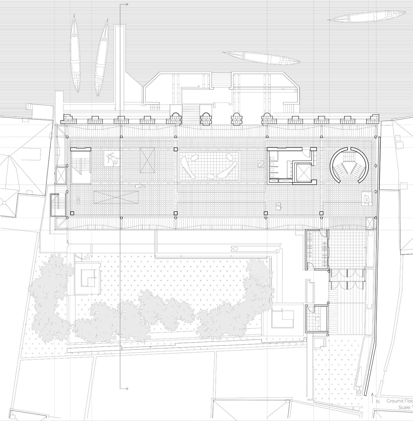
to respect existing facade, new facade is suspended behind by tensile structure
structural cores as vertical circulation and service
grooves in pavement choreograph canal water into garden when tide rises
entry through tight crevice
Ground floor plan showing occupiable structural cores
Where Solid Meets Void
15
The facade as a vertical screen that expresses the interior volumes behind
Process models showing solid concrete volume inside a lightweight container
Where Solid Meets Void
Aithêr: An Elemental Daycare
Spring 2019, Cornell University
B. Arch Second Year Studio in Rome


 Instructor: Rubén Alcolea
The weather inside
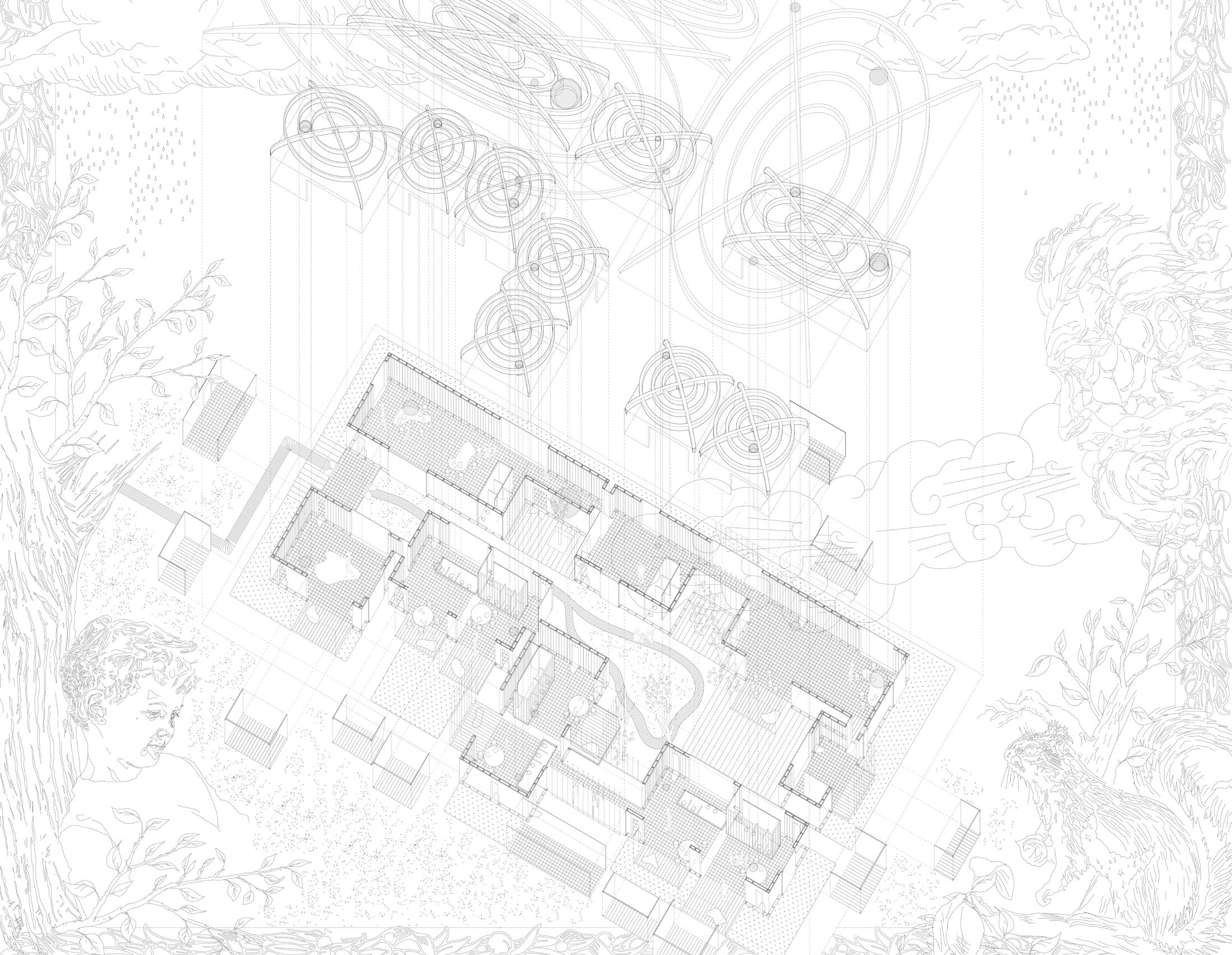
Designed to hypersensitize children to their environment and to heighten their experience with the natural forces, the daycare systematically allows the elements to enter indoors. Structural oculi illuminate and warm intimate reading spaces, wires connecting a transparent dome to the ground catch autumn leaves and allow icicles to grow, and gutters and water channels direct rainwater and snowmelt through a central courtyard. Between classes, the children squat to gaze at tadpoles swimming in a pond and create pathways for toy trucks in sandboxes. As the daycare changes with the seasons it heightens the children’s sense of curiosity and exploration. It embraces Ithaca’s harsh, cold winter and turns it into a weather and environment based pedagogy.
Aithêr: The primeval god of the shining light of the blue sky. He was conceived of as the substance of light, a layer of bright mist which lay between the dome of heaven and the lower air which surrounded the earth.
Aithêr through the seasons
Structural roof model: 36”x24”
16
Illustrated axon 60”x60”
Light transparent roofs float to the gods of weather and friendly creatures accompany the solid, grounded volumes.
Aithêr: An Elemental Daycare
The Expansion Anti-Mansion (TEAM)
Fall 2020
Finalist: International Nonarchitecture Unbuilt Architecture Competition
Finalist: International Nonarchitecture Unbuilt Urban Competition
Shortlisted: International Bee Breeders Architecture Competition: Modular Housing Competition

Shortlisted: London International Creative Competition

• $15,0001. That’s really it.
• Stop living paycheck to paycheck.
• Start long-term saving.
• 92% cheaper than the average house.
• 70% cheaper than the average tiny house.
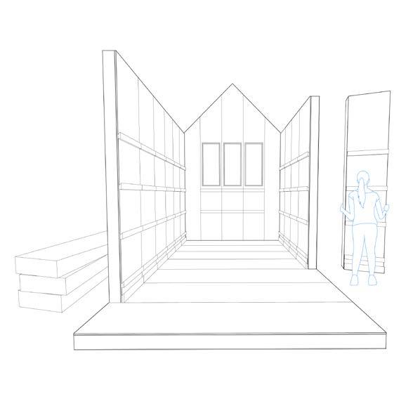
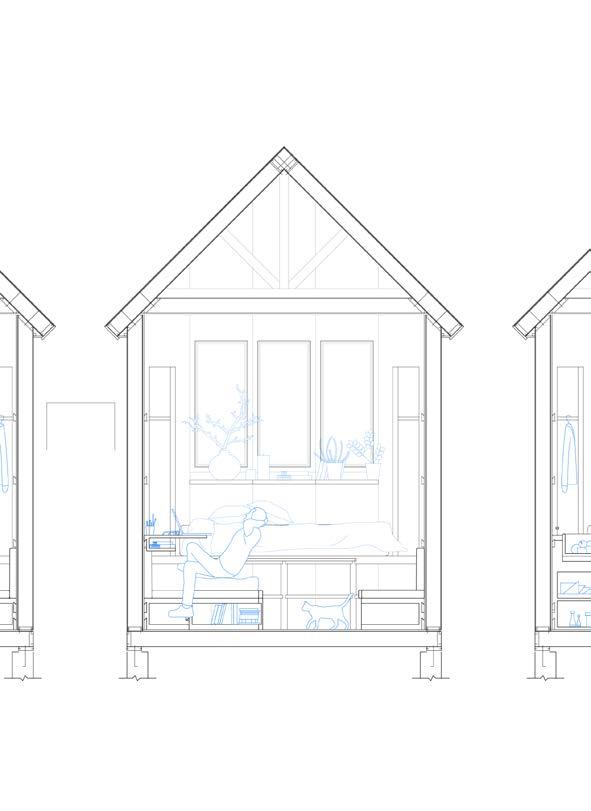
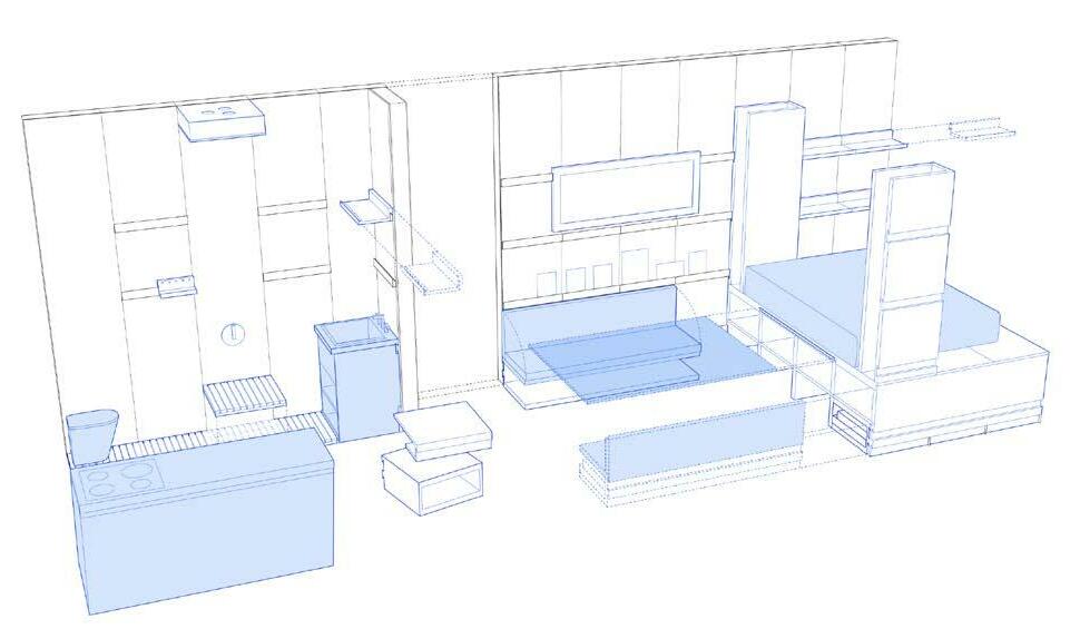
TEAM is an 250sqft affordable house that reduces the cost of a home to $15,000. Use as a crutch to get on your feet and start longterm saving or as your permanent home that can expand in size with your home life.
In collaboration with Lauren Lam (B.Arch’23), Aishah Alhady (B.Arch’23), and Kyrie Graham (B.Arch’23)
1 Normal House: $397,000 Tiny House: $45,000 TEAM: $15,000
Pricing 2
1 Rent Burden
30% of salary goes to rent Leftover $ spent on food
4 3
1. Self Assembled.
All parts fit in a UHAUL. Convenient, easy, affordable.
TEAM: Escape the renting cycle. $384 / month for 3 years with Afterpay 17

2. No-Screw Walls.

As easy as legos with Camlock tech. 70 lb panels, easily carryable by 1 person.
3. Lock-In Furniture.
Easy customizability with french cleat joints. All pieces nest in the storage by the bed.
Saving is difficult.
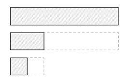
4. Grows With You.
Expandable over time. Add space as you add to your home life.


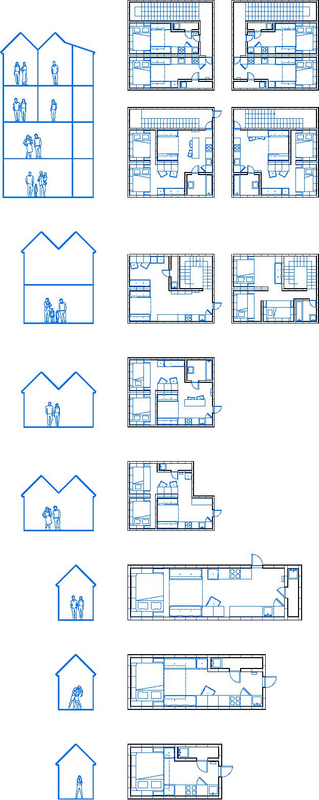
10’ 2’ 6” 2’ 2’ 2’ 2’ 2’ 25’ 2’ 2’ 2’ 2’ 2’ 2’ 6” The Expansion Anti-Mansion (TEAM) 10’ 5’ 16’ 6’ 6’
[au]workshop Internship | Maintenance Bridge
Summer 2019
Fort Collins, CO
Designed built maintenance bridge
From sketch to reality
In the summer of 2019 I interned with [au]workshop (architects+urbanists) in Fort Collins, Colorado. I was heavily involved with Confluence, a mixed use project that was in the process of construction next to the [au] workshop studio space.

I designed and drew technical details for a maintenance bridge connecting two Confluence residential towers. The bridge was built during my internship, which gave me experience working with the structural engineers and contractors on site.
With an active [au]workshop construction site next to the studio, I was also tasked with measuring placements of pipes as they were being built to confirm the accuracy of construction documents
Alongside the design leads, I met frequently with contractors to evaluate the quality of construction and design details.
Confluence construction site next to [au] workshop studio space
use 1
2
3
4
5
6 1 2 3 4 5 6 N
Mixed
Existing [au]workshop studio
New [au]workshop studio
Residences
Maintenance bridge
Residences
18

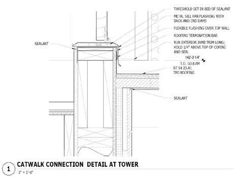
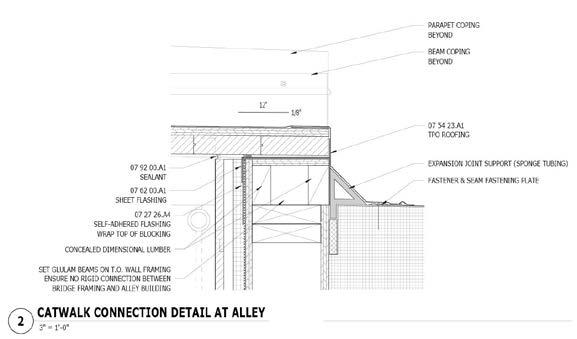

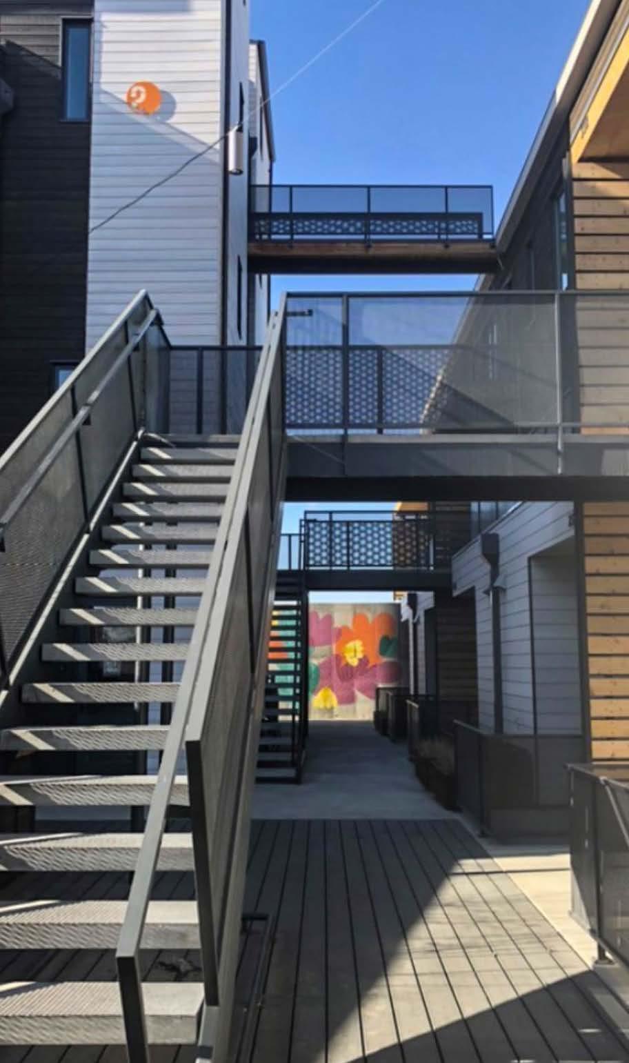
During construction Completed 1 3 2 Maintenance bridge design and construction [au] Workshop Internship | Maintenance Bridge
Building Together | NYC x Design
University
Syntax of Parts+Aggregations
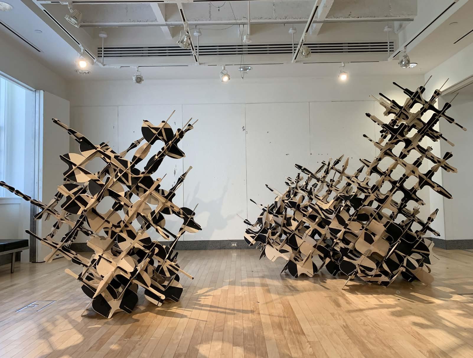
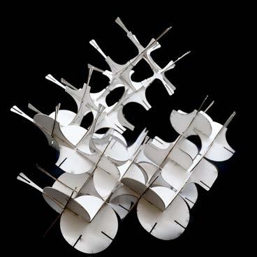
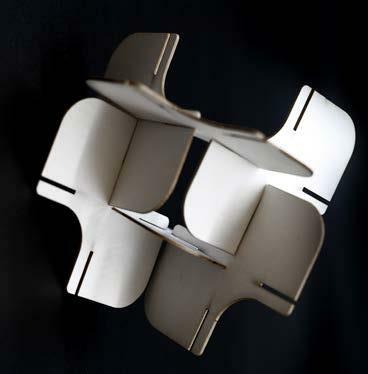
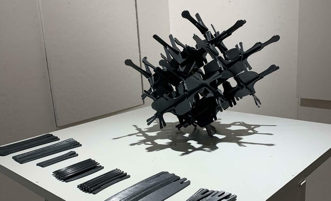
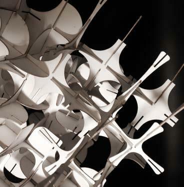
Building Together was a research project and exhibition conducted in collaboration with students in Cornell University’s Department of Design and Environmental Analysis. It was presented at NYCxDESIGN 2021 to investigate community engagement through participatory modes of making. The two “final” constructions were one of several that invited play and collaboration in the making of an open-ended public structure.
Community engagement through small-scale models was central in the pursuit of exploring different configurations. An inner logic of joinery and a syntax of Part shapes created an underlying design language that allowed the construction to aggregate in an infinite number of ways.
 Spring 2021, Cornell
Exhibited in Martha Van Rensslear Gallery, Cornell University
In collaboration with Lee Brunco (‘21), Julia Kan (‘21), and Arleigh Parr (‘21)
Last configuration of Parts 19





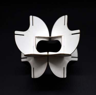
Building Together | NYC x Design
Painting of Parts to disrupt reading of form
B C D E F G H A B C D E F G H
of
parts for visitors to experiment with their own
Shaving off volume for Part distinction, leaving only essential joinery A
Testing
Parts aggregation “Toy”
aggregations
Summer 2020
Designed built Covid relief structures
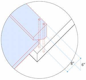
Ephemeral Covid relief interventions
I designed low-cost, easilyassembled structures in reaction to the COVID-19 pandemic in collaboration with Center for Human Habitat and Alternative Technology and students from Cornell University and Harvard GSD. These ephemeral structures can be adapted to different uses over time. The team built long-term solutions for post-lockdown stages and re-imagined spaces of social congregation such as malls, theatres, food courts and schools.
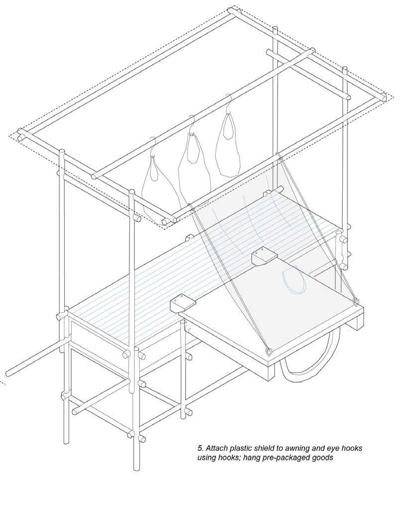
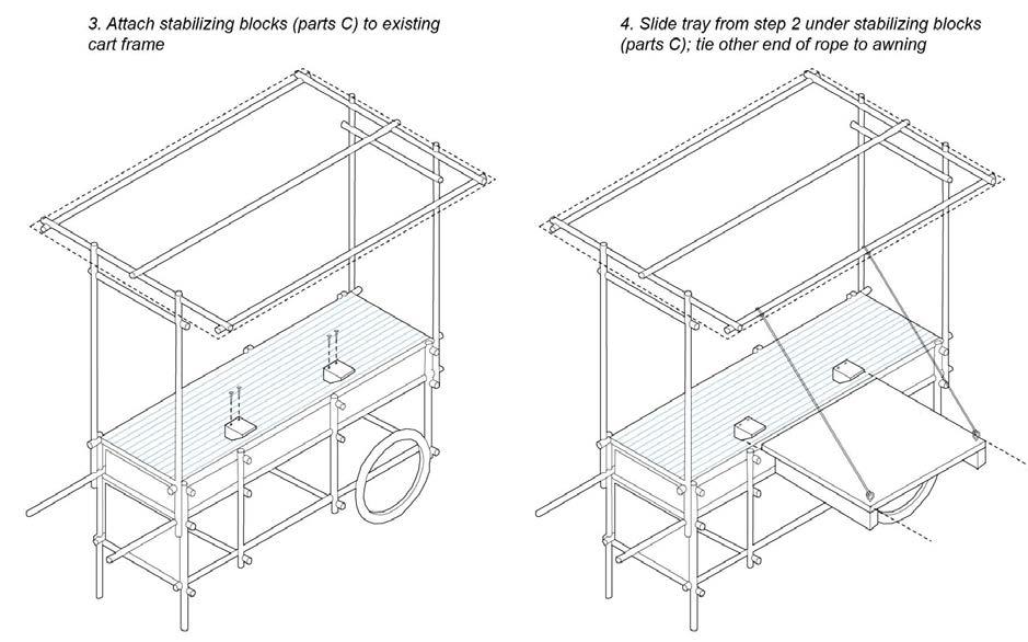
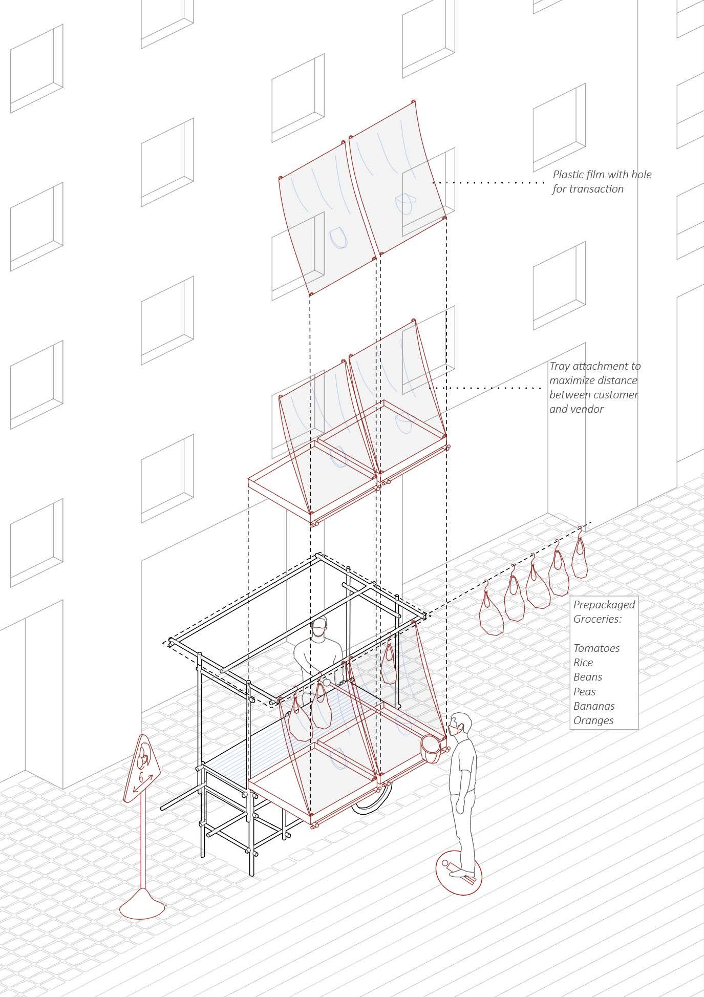
I collaborated with a 2-person design team to create 7 design tool kits for allowing communities to quickly build and unbuild. One of the tool kits, shown here, is a street cart attachment designed to minimize interaction between the vendor and customer. The street cart attachment utilizes the existing street cart structure as support and can work with different cart shapes and sizes. Held in tension by ropes attached to an awning frame, the tray also maximizes the surface area of the cart to display more goods even after the pandemic ends.
B A E D C
A - Plywood tray
B - Wood block
C - Wood block
D - Hardware
E - Rope
1. Gather toolkit
3. Attach stabilizing blocks (parts C) to existing cart frame

Variable
A length - 6” 3’
2x 2x 2x
Stability block Removable pegs Tray
In collaboration with For India Today and CHHAT Foundation for site execution
2. Attach parts B to bottom of part A; screw in eye-hooks; tie end of ropes to eye hooks
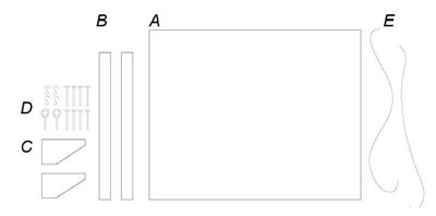
4. Slide tray from step 2 under stabilizing blocks (parts C); tie other end of rope to awning
5. Attach plastic shield to awning and eye hooks using hooks; hang pre-packaged goods
For India Today | Street Cart Attachment
Assembly
technical drawings
20
Activation of streetcart attachment in urban setting
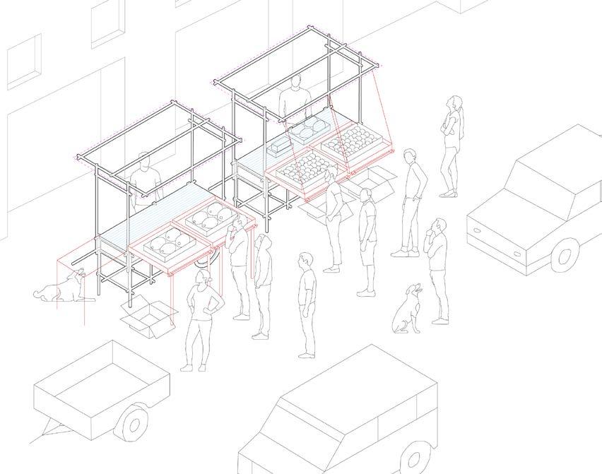
 Post-Covid Activation
For India Today | Street Cart Attachment
Covid Activation
Articulated Design of the Detail


Spring 2020, Cornell University Bookmaking Art Studio


Instructor: Gregory
Exhibited
Page
Examining Renaissance expression
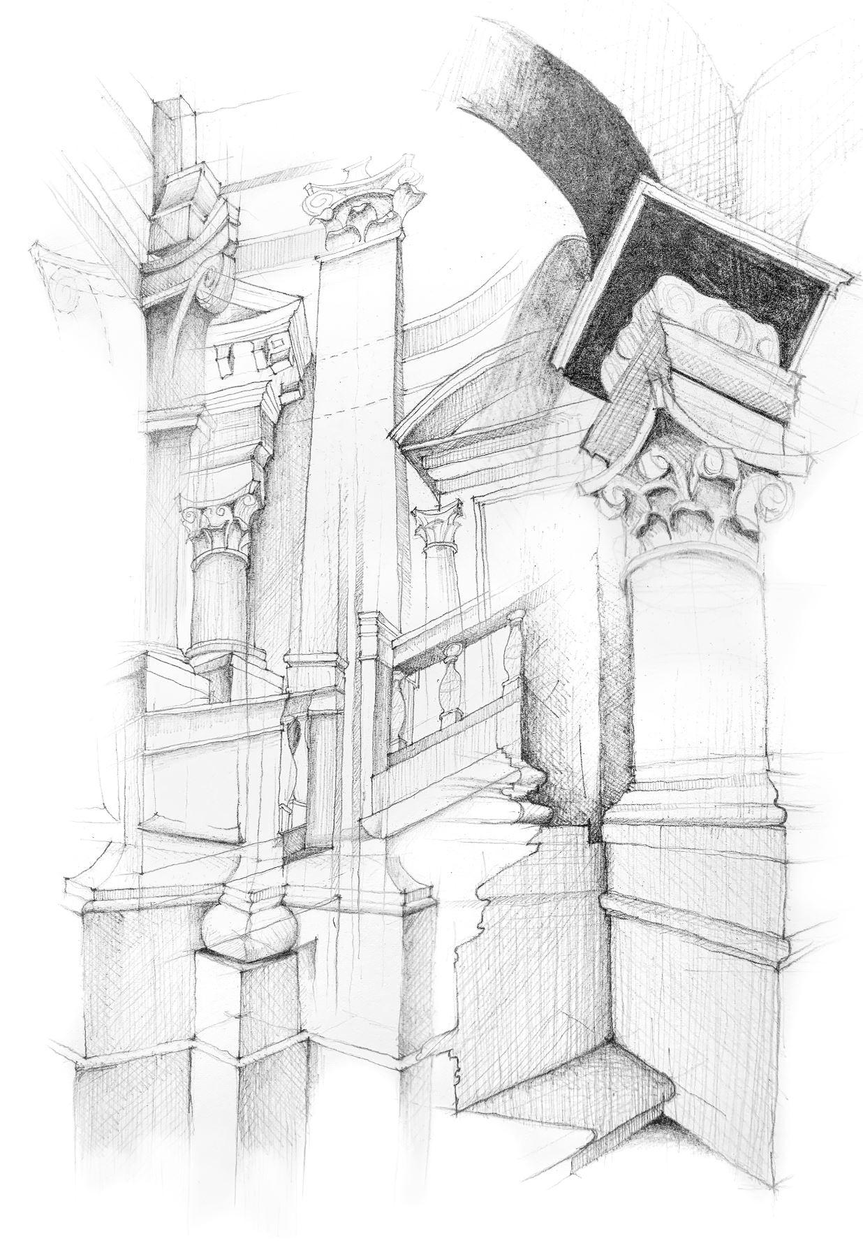
Examining architectural details is critical to the integrity of a building and its context. Architectural concepts (materials, rhythms, and geometries) are carried throughout the constructed system. Intricate joinery in the meeting of corners, labyrinths of grooves on pediments, and the winding profile of cornices define the building’s theoretical expression and technical character. The moment in which interrelated parts of a structure are read as whole becomes visible. The details become a method of organizing things, like individual musical notes harmonizing.
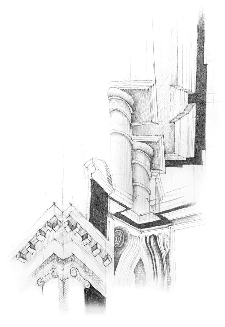
Drawings composed of collaged architectural elements begin to construct surreal, fantastical spaces composed of infinite stairways, blocked passages, and labyrinths of cornices. The drawings were then constructed into a series of three accordion books, each documenting the elements used to compose the drawings. The books were exhibited in Cornell University’s Herbert F. Johnson Museum as part of their artist’s book exhibition in 2021.

I. II. III.
 in Herbert F. Johnson Art Museum
Awarded the Cornell Priscilla and Robert Joy ‘72 Travel Grant in Architecture
21
Initial on-site sketchbook of details at the Tempietto and Palazzo Barberini, Rome Capriccio
3: Dark Trail Book III.


of the Detail
Capriccio 1: Ascension to Portal Articulated Design
Capriccio 2: Corner Labyrinth Book II.
On-Site Sketching

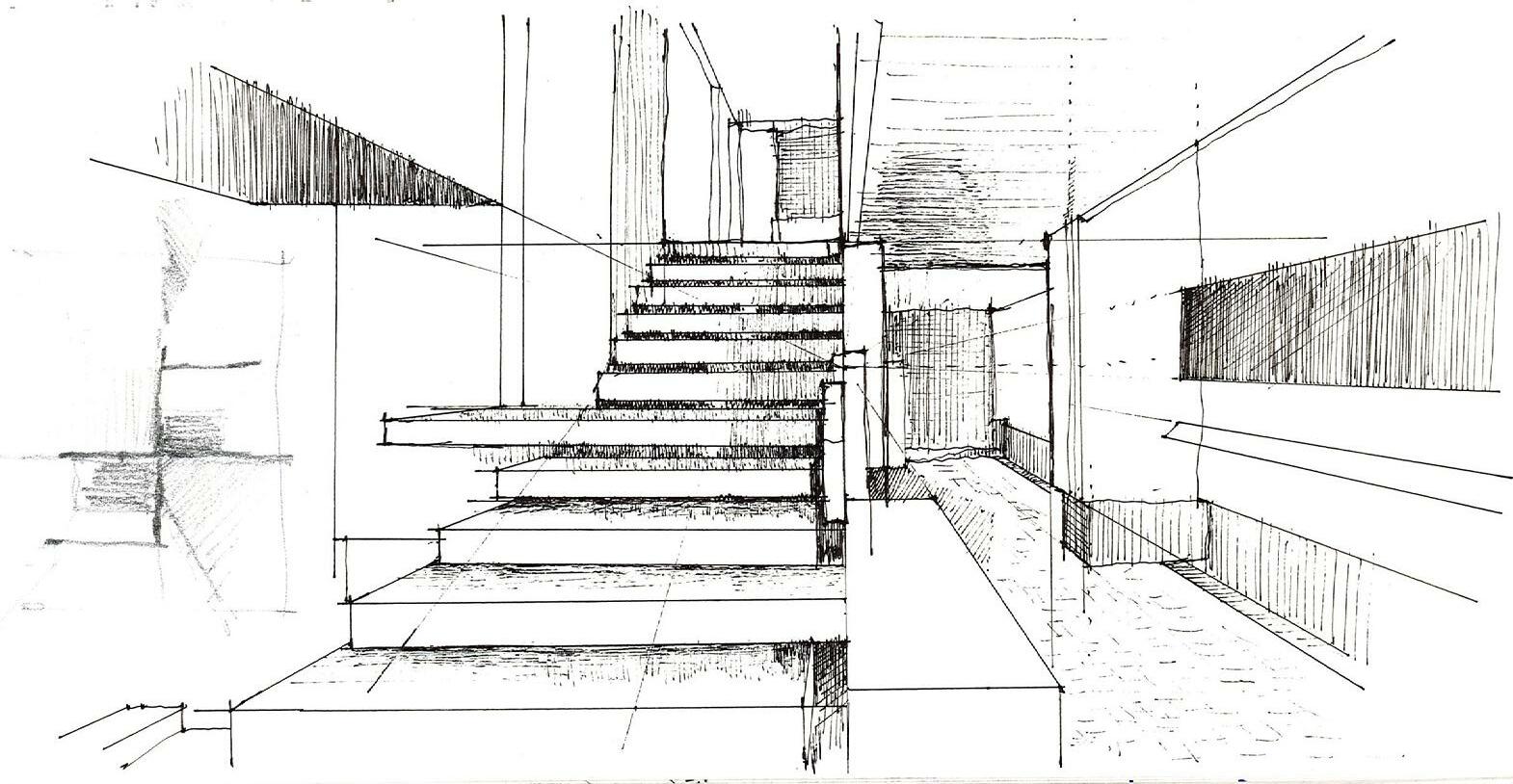
Sketching as a ritual
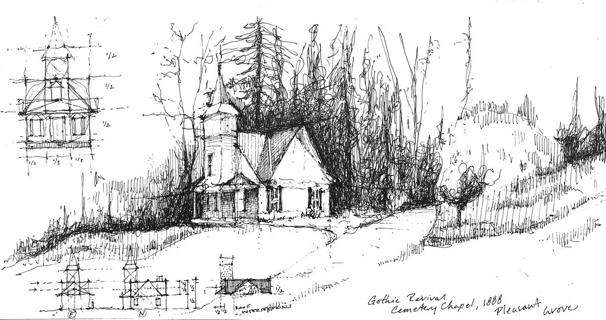
Never without a sketchbook in hand, I use the ritual of sketching to observe, interpret, dissect, and understand the world around me. The ritual consists of first taking in my surroundings with my senses with sight, smell, touch, and hearing to permanently record my perception of the environment. My Pentel hybrid technica pen hits the paper, and I begin by drawing regulating and perspective lines to compose the scene, working my way to the details at the end. This method carries through in my design process to immerse myself in and envision my projects. It becomes a meditation.
During the pandemic when traveling was not an option, I led and participated in remote livestream sketching sessions in an international online urban sketching hobby group to inspire creativity and promote camaraderie through analog drawing. When architecture school at Cornell started up in-person again, I taught a workshop with 7 students in onsite architectural and landscape sketching strategies with the goal of recording spatial experience, but also to demonstrate the importance of analog drawing in the creative process.
Independent
Analysis of Negozio Olivetti Showroom, Venice, IT
22
Analysis of Museum of the Earth, Ithaca, NY


On-Site Sketching
Pleasant Grove Cemetery Chapel, Ithaca, NY
Rice farm, Japan (completed during virtual live-sketch with hobby group)
Analysis of Grace Farms, CT
Future Afterlives of an Extractive Landscape: Sweetwater County, WY
B. Arch Thesis
Spring 2022, Cornell University
Advisors: Tao DuFour and Lily Chi
Sites of stewardship
Modern economies and progress rely heavily on energy in various forms. The provision of energy involves processes of extraction and production that leave behind wideranging effects at multiple scales— from landscapes and environments, to towns and cities, and to lives and livelihoods. How might this be rethought and repaired as we go forward with the energy transition of today?
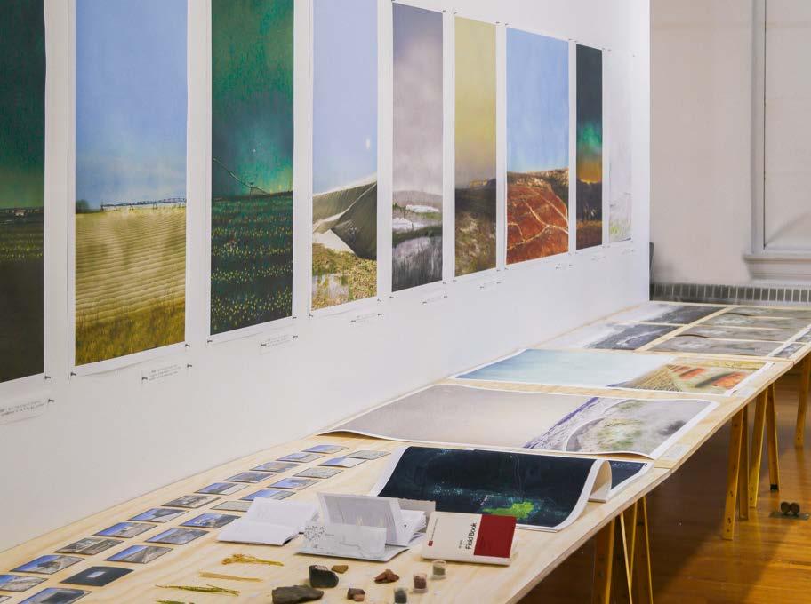
Future Afterlives of an Extractive Landscape: Sweetwater County, WY asks how processes of extraction can be reimagined to account for what is usually forgotten to render visible, cultural, and remediative what is typically hidden while also involving environmental actants.
In doing so, the thesis explores how architecture might anticipate in advance future afterlives in our changing energy landscape to ultimately make these extractive landscapes matter to more people.
23
Forming a narritive of the territory’s extractive histories through field collections exhibit John Hartell Gallery, Cornell University
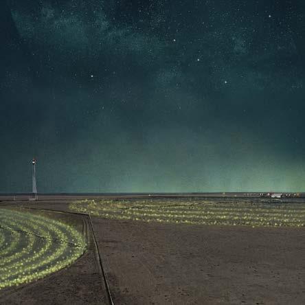
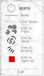
Site 1: Pivot
Disued center pivot agriculture infrastructure as seed dispersal to prevent dust storms
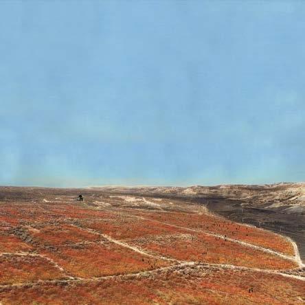
Site 2: Wrinkle Litmus test and measuring device for lithium contamination spread
Center pivot agriculture Lithium mine
Cattle range
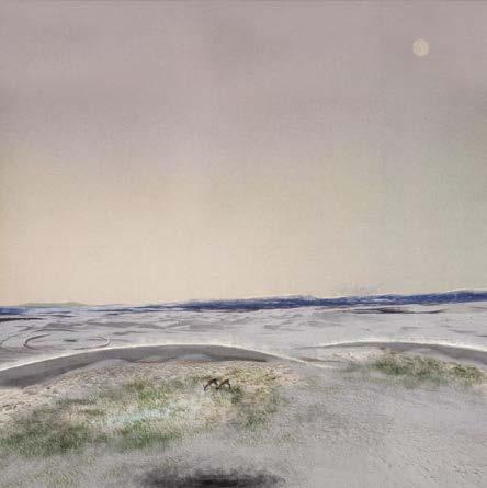
Site 3: Swoop
Riparian sand dunes remediate disused fracking boreholes and catch wind-borne lithium salt

Site 4: Superior
Commemorating Superior’s coal mining history as a warning to future extractive practices
Rock Springs
Sand dunes
Superior
Field Condition: Four infrastructural typologies Landform field conditions render visible extractive histories, preemptively remediate future effects of the lithium mine, and reveal processes of lithium extraction.
 Thesis | Future Afterlives of an Extractive Landscape: Sweetwater County
Site 1: Pivot

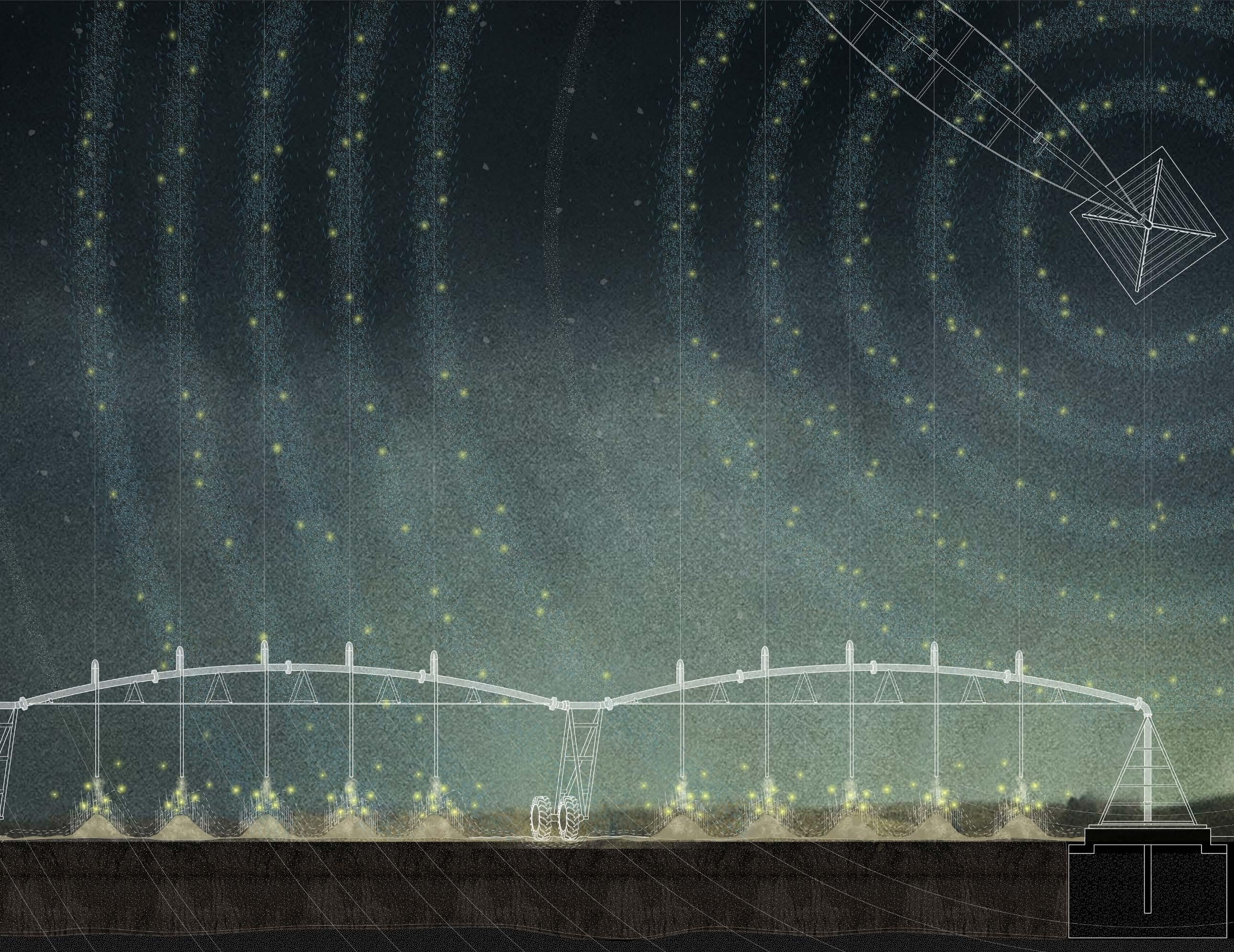
Retrofitted center pivot irrigation systems deposit initial fine sediment and blue grama grass seeds. The grass attracts fireflies in the summer and structures the earth to prevent dust storms in the newly dry landscape.
 Thesis Future Afterlives of an Extractive Landscape: Sweetwater County
24
utilization of leftover center pivot irrigation systems
annual spreading of blue gramma grass seeds attracts summer fireflies simultaneous spreading of alfalfa seeds to remediate exhaused soil 32 dropping points deposit fine sediment from lithium mine excavation
native grass structures earth to prevent dust storms
 Thesis | Future Afterlives of an Extractive Landscape: Sweetwater County
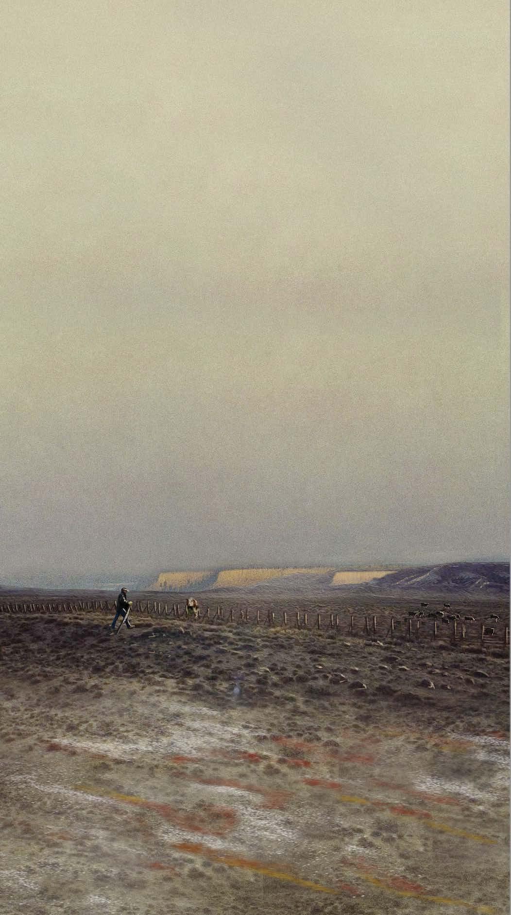
Site 2: Wrinkle

Red, orange, and yellow sediments excavated from the lithium mine’s construction are layered at the base of the landforms. It is a litmus test in the landscape to register the amount of erosion caused by summer rainfall and wind, and correspondingly, the spread of lithium waste.
 Thesis Future Afterlives of an Extractive Landscape: Sweetwater County
25
cattle fenceposts used as measuring device for soil content litmus test
sediment layers wash out in different layers, rendering visible sediment movement via wind and rain
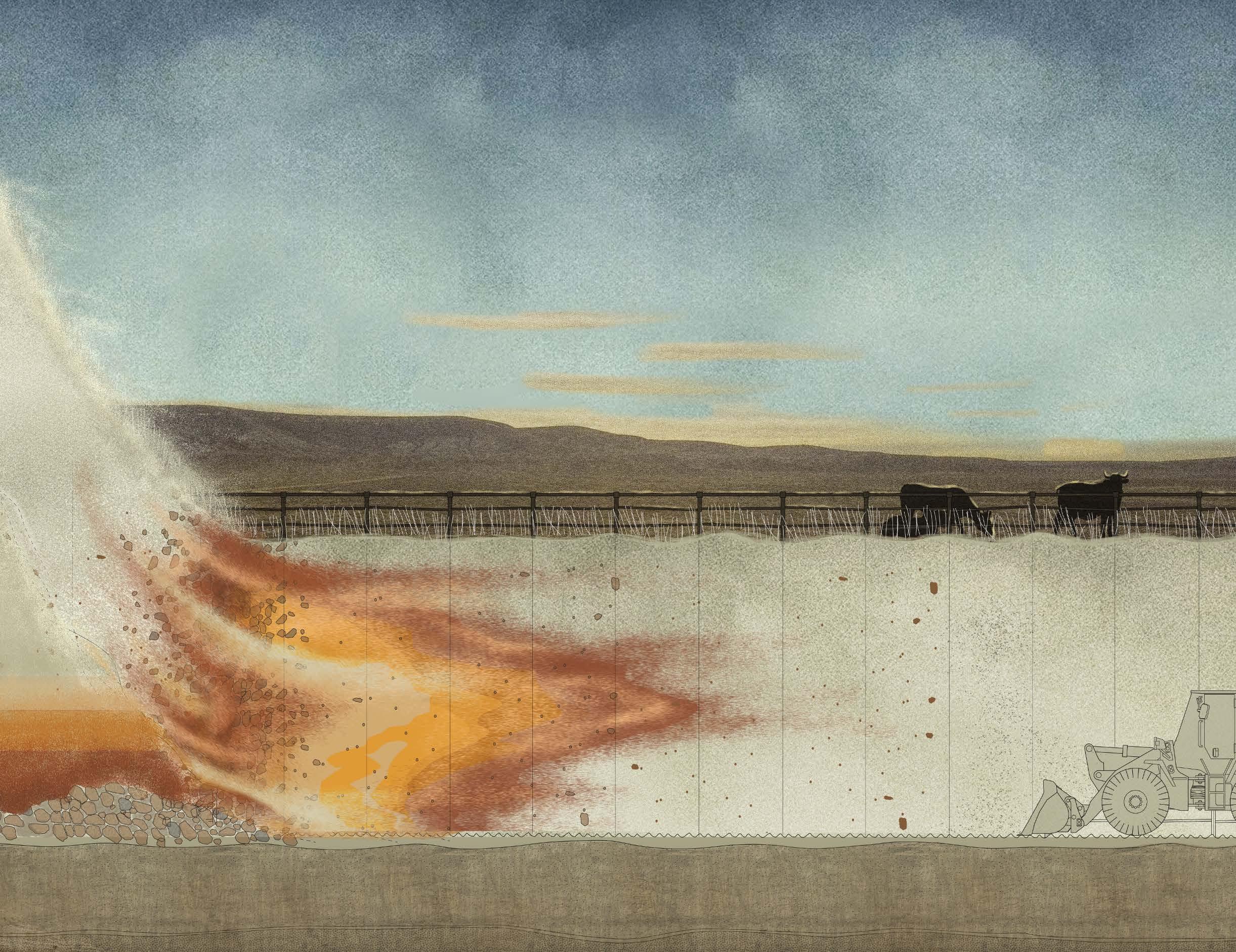
colored sediment from lithium mine excavation layered at base of landform
bulldozer from lithium mine construction reused in landform building to expose extraction processes
Thesis | Future Afterlives of an Extractive Landscape: Sweetwater County
Gracie Meek
Design Portfolio 2022
Harvard Graduate School of Design Cornell University Scale


 Rehydration pond and bioswale landscape defining agroforestry parcels


 of existing regional condition


 Nature Oriented Development


 Instructor: Tao DuFour


 Instructor: Gesa Büttner Dias


 Spring 2020,


 Articulating the Shoreline: A Landscape Promenade


 Articulating the Shoreline: A Landscape Promenade


 Facade joinery as colored matrix that maps the space behind
Gold-colored structural cores visible through windows from Grand Canal
Existing museum facade
Proposed facade addition and building within


 Instructor: Rubén Alcolea


 Spring 2021, Cornell
Exhibited in Martha Van Rensslear Gallery, Cornell University
In collaboration with Lee Brunco (‘21), Julia Kan (‘21), and Arleigh Parr (‘21)


 Post-Covid Activation


 in Herbert F. Johnson Art Museum
Awarded the Cornell Priscilla and Robert Joy ‘72 Travel Grant in Architecture


 Thesis | Future Afterlives of an Extractive Landscape: Sweetwater County

 Thesis Future Afterlives of an Extractive Landscape: Sweetwater County
 Thesis | Future Afterlives of an Extractive Landscape: Sweetwater County

 Thesis Future Afterlives of an Extractive Landscape: Sweetwater County
