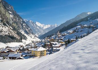
Großarl Europadorf/Town of europe Die Marktgemeinde Großarl ist der Hauptort des Großarltales, etwa in der Mitte des Tales und zugleich der Startpunkt der Skischaukel GroßarltalDorfgastein, inmitten von Ski amadé. Hier erwartet Sie ein umfangreiches Sport- und Freizeitangebot auf und abseits der Piste. The town Grossarl is the main place of Grossarltal in the middle of the valley. It is also the starting point of the ski area Grossarltal-Dorfgastein in ski amadé. You can find a wide range of sport- and leisure activities on and off the slopes here. Zahlen & Fakten/Numbers & Facts: Höhenlage Tal/High meters above sea level Höchste Erhebung/Highest spot Einwohner/Population Gästebetten/Guest beds Fläche/Area size
924 m Gamskarkogel 2.467 m 3.811 4.669 129,25 km²
Informationen Großarltal / Information Grossarltal
Hüttschlag Nationalparkgemeinde/Nationalpark-village Die Gemeinde Hüttschlag liegt 8 km taleinwärts von Großarl und hat seit dem Jahr 1991 Anteil am Nationalpark Hohe Tauern, dem größten Nationalpark der Alpen mit einem einzigartigen Wanderangebot. Seit 2008 zählt Hüttschlag auch zum erlesenen Kreis, der nach strengen Kriterien ausgewählten „Bergsteigerdörfer“, einem Projekt des Österreichischen Alpenvereines. Hüttschlag is located 8 km from Grossarl and is part of the nationalpark “Hohe Tauern” since 1991 – the biggest nationalpark of the Alps. Since 2008 Hüttschlag is also one of the “Bergsteigerdörfer” – a project from the Austrian alpine club. Zahlen & Fakten/Numbers & Facts: Höhenlage Tal/High meters above sea level Höchste Erhebung/Highest spot Einwohner/Population Gästebetten/Guest beds Fläche/Area size
Großarl 4
1.020 m Keeskogel 2.884 m 889 474 95,18 km²
Hüttschlag


