THE DANGERS BELOW


Welcome to our first edition of The Dangers Below, an e-magazine focusing on the issues that locators have when trying to locate the assets of our Utility owners, but we also want to involve all who break the ground as part of their jobs.
This has been on the drawing boards for a long time, unfortunately resources, or lack thereof, work commitments, developing, writing and adding courses to our RTO, has prevented the necessary time required to launch this.
Our aim is to provide an insightful presentation that adds to the educational and skills base that technicians in Australia currently have. We want to focus on Australian conditions, issues and solutions. That said, we would very much like to emulate the excellent publication put out by the team at Staking University, Underground Focus and Planet Underground in the USA. Mike Parilac, owner of the afore mentioned has assembled an
exceptional team of subject matter experts, and over many years has provided quality editorial material to the industry.
I make this promise in this our first edition. The Dangers Below, will not be filled with advertisements; we will not be trying to sell your anything. We will be there as a vehicle for education and enlightenment. Will we have advertisements and content from manufacturers and suppliers; of course, we will BUT it will be of secondary importance, and be aimed at education, rather than a sales pitch.
As an organisation, Locating Unlimited has always embraced and acted upon constructive feedback and suggestions. A business can only advance by continually improving what they are doing. So please, if you have any feedback, suggestions, issues that you would like to see addressed or an article that you would like to contribute, please drop us a note.
thedangersbelow@locatingunlimited.com.au

Location-based intelligence company provides applications for construction and engineering.
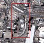


The geospatial industry is transitioning from static mapping to dynamic monitoring. Next-generation Earth Observation (EO) satellites offer on-demand tasking and higher revisit rates to return images to customers quickly, allowing for real-time insight into the current situation on the ground.
Satellite imagery is already used in the construction and engineering sector but competes with airborne imaging from aircraft and drones. However, new providers are now offering disruptive technology that give users more direct control in acquiring satellite imagery. New cloud-based platforms with fully automated processes, underpinned by Machine Learning (ML) and Artificial Intelligence (AI) technology, are fundamentally altering how we obtain and consume satellite imagery.
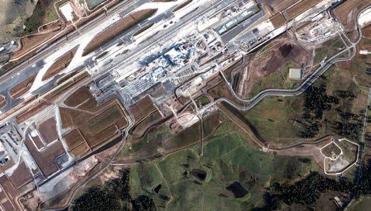
End users depend on current and accurate data to make correct decisions. On-demand imagery, which has been captured and delivered within hours of requesting, offers significant advantages
to organizations across many industries. Utility companies use monitoring to observe pipelines, powerlines, and railways, and can benefit from quick access to imagery to monitor construction progress or disruptions. For emergency response teams, fast access to imagery offers real-time situational awareness and analytics before, during, or after emergency events
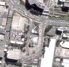 Western Sydney Airport BlackSky, 6 Dec 2022 BlackSky, 5 Aug 2022
Figure 1: Current construction progress and change detection at new Western Sydney Airport Monitoring at intervals of monthly, weekly, or even multiple times per day is possible. The company designs and owns a, time-diverse.
In the construction and engineering sector, companies benefit from current and regular imagery during both the planning and building stages to monitor construction progress systematically and automatically over multiple major sites. Current and on-demand imagery is useful to become aware of brand-new developments, such as subdivisions, new roads all of which will likely not yet be visible in Google, or on commercial aerial imagery base maps as those often only get updated quarterly, or at even longer intervals. Current satellite imagery also supports environmental impact studies and allows stakeholders to monitor contractor compliance during the construction phase. On-demand imaging permits decision makers like planners, engineers, and surveyors to take a first look before deciding on a more targeted deployment of other mapping technologies – such as drone imagery and precision surveying equipment – which are often more expensive, involved and time consuming.
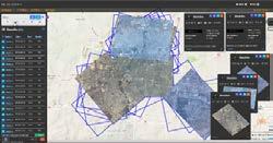
a U.S.-listed location-based intelligence company with presence in Australia, is leading the way. The company designs and owns a, time-diverse, dawnto-dusk satellite constellation that is optimized to cost-efficiently capture space-based imagery when and where customers need it, delivered within hours – not days or weeks. This is achieved through a fully automated workflow where customers can task BlackSky satellites directly from their desktop or via mobile device, using BlackSky’s powerful Spectra AI platform. Unlike many traditional forms of data capture, there is no human intervention or handling involved from tasking to delivery.
In summary, BlackSky offers fast, flexible, and affordable access to a powerful platform that has the capacity to image over two thousand high value targets every day, and therefore is most suitable for applications where a customer has multiple sites, in a region, nationally or world-wide, that need to be systematically monitored.
Author | Contact: Maurice Borer Regional Manager – Oceania mborer@blacksky.com www.blacksky.com

When it comes to dynamic monitoring, BlackSky,
 Figure 3: BlackSky allows monitoring of sites multiple time per day, or any other user defined longer intervals
C.R.Kennedy is the solutions provider for the surveying, construction, mining, mapping and wider geospatial industries. A significant aspect of our offering is that we have access to partners around the world where we can source the latest in high tech spatial measuring equipment and related software solutions. The list includes land surveying equipment, unmanned aerial vehicles (UAV’s), high-definition 3D scanners, machine control, mobile mapping tools, underground service locators, ground penetrating radar, geospatial information systems (GIS) and an extensive array of software packages to suit the equipment and the application.
C.R.Kennedy is the sole and exclusive distributor in Australia for Swiss giant Leica Geosystems (now a Hexagon company) and distributor for other leading manufacturers and brands such as SmartNet Aus, Geolantis, Riegl Laser Systems, Vivax Metrotech, Amberg Rail, DJI, Scientific Aerospace, Uaver, Myzox, Pentax, Optech, Tajima, Tuf Lasers, Intuicom, Satel, and many more.
Local Government, utility providers, mining companies, builders, surveying professionals, construction and geospatial industries all rely on C.R.Kennedy to deliver a level of service that matches the calibre of
the brands we carry. Not only do we sell the leading surveying instruments, but we also offer a complete national after sales service network, including training, service and repairs, technical support, hire equipment and customer care agreements.
To support our valued clients and customers C.R. Kennedy now employs over 300 people across all divisions. All our product specialists, qualified surveyors, support staff and factory trained service technicians can advise on the best solutions and provide customers with the very best equipment for their needs. Customers have support and service from an unmatched national network.
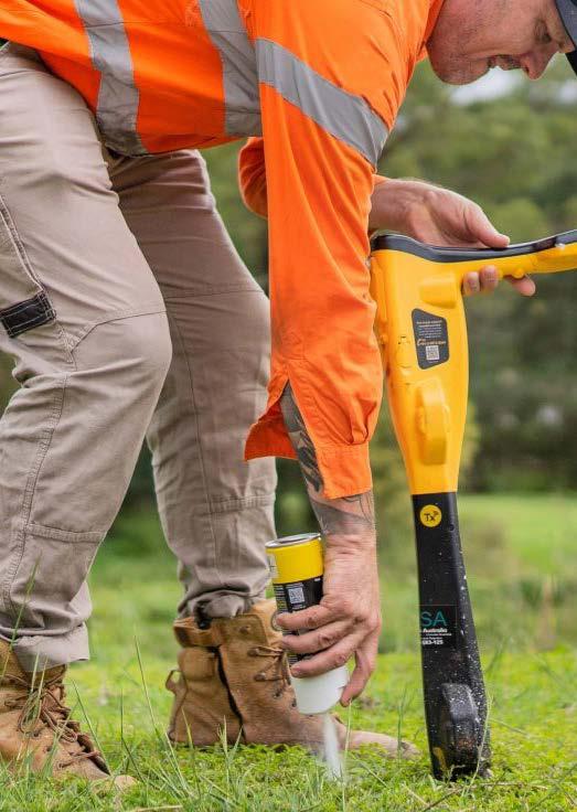
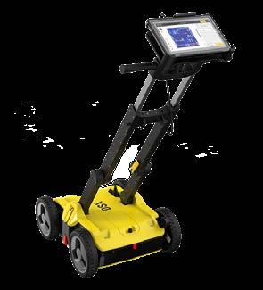
Our leading Utility locator products include the Vivax Metrotech V Loc 3 Pro utility Locator and the Leica DD130 Avoidance Locator. While the Stream DP 3D GPR, IDS DS2000 GPR, IDS C Thrue concrete scanner and Leica DSX GPR lead the way in our GPR and concrete scanning portfolio.


After almost 40 years of protecting Australians and underground infrastructure from harm and damage, Dial Before You Dig (DBYD) has transitioned into a new national organisation known as Before You Dig Australia (BYDA).
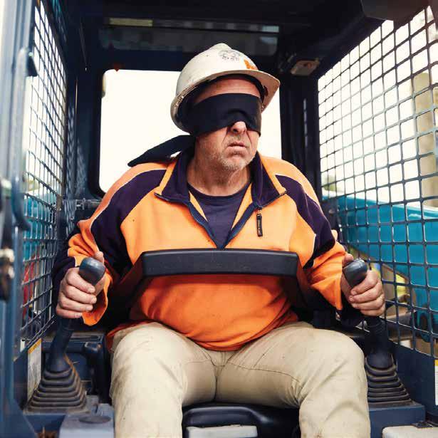
BYDA is an essential safety partner and continues to provide the free referral service that protects workers and vital infrastructure. BYDA also provides free damage prevention awareness sessions, so there is no excuse for digging blind.
What to do Before You Dig?
Safety is a fundamental aspect of any project that involves digging or excavating, so using the BYD service should always be your first task before starting work.
How do you access the service?
The service is free for users and is accessible via the new BYDA website or the iPhone and Android apps.
What happens after you lodge an enquiry?
You will receive plans and safety guidelines via email from infrastructure owners indicating the presence of their underground assets. However, the plans indicate the presence of underground infrastructure only and not their exact location. Therefore, you should only use them as a guide. Should you require further information or assistance or have not received plans, please contact the asset owner directly using the contact details supplied in your enquiry confirmation email. Do NOT proceed until you have received the relevant information from all asset owners affected by your project.
Dial Before You Dig (DBYD) has transitioned into a new national organisation known as Before You Dig Australia (BYDA). The transition from DBYD to BYDA began in 2019 with state DBYD Board members agreeing to streamline the organisation. BYDA emerged on 1 July 2022 as a new single organisation and continues to provide the free referral service for the Australian community via the new BYDA website and iPhone and Android apps.
BYDA data highlights a worrying trend that in %70 of underground infrastructure damages, a BYD enquiry was not completed, or the plans and information were not passed on to the team onsite.

BYDA is keen to work closely with our members and partners to reduce these statistics, keep workers safe, and together as an industry, move towards our shared goal of Zero Damage, Zero Harm.
BYDA provides free damage prevention awareness sessions
Help us share the importance of safe digging practices in the community. If you have clients who may benefit from a toolbox talk or in-depth session covering the free BYD
referral service, we have a BYDA awareness flyer available for you to share with them so they can stay informed and up to date. Our Damage Prevention and Awareness Officers in each state and territory can deliver free sessions online or onsite.
To find out more, visit the BYDA website.

In July 2018, CASA updated the advisory circulars that provide advice about the commercial operation of RPA - Remotely Piloted Aircraft (affecting both certified and Excluded RPA operators). In particular, AC 01-101 (RPAS –licensing and operations) and AC 10-101 (Excluded RPA) have been updated.
This article will discuss the changes and highlight areas that may affect your operations. Please note, this article should be read in conjunction with CASA’s advisory circulars and the current aviation legislation.
We will discuss the major changes only, and not the advisory circular as a whole. This article should be read in conjunction with the advisory circulars and CASR 101 to gain a full understanding of Australia’s unmanned aircraft legislation.
CASA has developed advisory circulars (ACs) to provide advice and expanded guidance to explain the regulatory requirements of the Civil Aviation Safety Regulations (CASRs). As per their name, ACs are advisory only, and illustrate CASA’s interpretation on how to comply with
the regulations. As CASA explains, “advisory circulars are intended to provide advice and guidance to illustrate a means, but not necessarily the only means, of complying with the regulations, or to explain certain regulatory requirements by providing informative, interpretative and explanatory material. Alternative procedures demonstrating an equivalent or greater level of safety may be acceptable on a case-by-case basis”.
CASA have released version 4.0 of “Remotely piloted aircraft systems - licensing and operations» Advisory Circular.
This AC was developed by the Civil Aviation Safety Authority (CASA) to provide guidance to RPA operators, remote crew, manufacturers, and maintainers. It describes the categorisation of RPA and general requirements for use of RPAS. It also provides guidance to operators and crew on the safe and legal operation of RPA in all classes of airspace.
Although this AC may be of interest to all operators of unmanned aircraft, it is essential that operators of excluded RPA operate in accordance with the applicable regulations and read the guidance contained in AC 10-101 and the Micro and excluded RPA Plain English Guide. Model aircraft/ recreational operators please read and follow the guidance in AC 03-101
Download Advisory Circular AC 01 -101 V 4.0 RPASLicensing and Operations
For all Drone related enquiries, contact Chief Pilot Officer –Laurie Radcliffe email: laurie@drone-operations.com.au


The legal consequences of not demonstrating your duty of care are real and are played out in various court cases across the nation. Unfortunately, it is a common mistake of not following the duty of care in major asset damage investigations. The duty of care is one of the critical pillars in the avoidance and prevention of damage to assets. It is the basic building block of an expert report on critical damage incidents, and it is heavily relied on by the legal profession to determine liability.
The basic element of the duty of care is what you could have done in your profession and capacity that would have prevented the damage to assets from occurring in the first place. The duty of care plays a large role in the proportionate liability determination by your level of involvement in the project were the asset got damaged (irrespective if you were or were not the physical damager).
The two common regularly occurring themes in damages investigation with respect to the duty of care are: Partial fulfilment of your duty of care and the total outright refusal to follow up on the elements of the duty of care. Partial fulfilment of your duty of care has an impact on your insurance claim and the ability to get re-insured by the same insurer or others. The outright refusal to follow your duty of care - carries the risk of avoiding your insurance

policy, and thus, you been forced into bankruptcy, if you cannot afford to settlement the monetary value of the claim.
Luckily, Otrem Engineering offers training on this version of the duty of care, as it is implied in court cases and can be found at our webpage (www.otrem.com.au). The duty of care training is a two-hour presentation solely focusing on the main building blocks elements of the duty of care and how they should be implemented in the scopes of planning, designing and actual physical work onsite by the various professions that work around critical services. All material presented are extracted from the actual real cases that have been investigated throughout the years and the presentation is tailored for the audience.
Otrem Engineering was established in 1999 . It is a %100 Australian owned family business. The focus of the business is to provide up to date educational information for the building, civil and construction industries on damage avoidance to the community’s vital services. Part of the role is: the investigation of damages and expert witness reports, the analysis of major damages data to underground services for the purposes of damage avoidance and the creation of presentations and case studies for educational purposes.
The ability to deliver more thorough and detailed reports is becoming a frequent request in the GPR industry. This involves compiling information sourced from multiple devices and technologies.
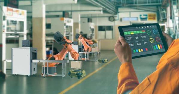
There is increasing demand from customers requiring deliverables in digital format, with both above and below ground assets located and geotagged.
The term “Digital Twin” is a more commonly used term in recent times, but the name alone does not fully explain what the expected outcome actually consists of.
A Digital Twin is defined as a virtual model designed to accurately reflect a physical object.
In the case of utilities and other underground assets, this is usually defined as a 3D model of an underground network or structure. This can be achieved by a variety of systems, each outputting a separate piece of the digital puzzle, which can then be compiled into a single model using dedicated modelling software such as 12D or AutoCAD.

Asset Identification
The quality of the data captured will determine the overall quality of the final model produced. Having the right equipment for the job is the first critical step.
Remember, quality acquisition is always better than quality post-processing.
Like all technology-based business sectors, there is increased pressure for Utility Location companies to embrace and adapt to new technology. This presents a new set of requirements and opportunities for companies. While there will always be a place for single/dual channel GPR’s, and basic EML locates, there is great opportunity for locating companies to provide ongoing training and support to upskill their employees and invest in new technology and equipment that supports their customers’ needs and expectations.
Is your business ready for this next evolution in technology?
Subsurface Consulting can assist with upskilling your staff, equipment upgrades, workflows, and data processing.

Contact us to discuss your business needs.
Daniel Beech, Director 499 816 0466
daniel@subsurfaceconsulting.com. au
The data required to compile a digital twin model is obtained from any or all of the following sources:
For over 33 years Jan Francke has been at the top of the tree, regarding Ground Penetrating Radar investigations. Called upon by mining conglomerates in 108 countries, on six continents to carry out GRP field investigations and data analysis, Jan is one of the most experienced GPR practitioners in the world.
Dr Francke holds a BSc from the University of British Columbia, a MSc from the University of Canterbury, and a PhD from Kings College London, all focusing on mineral exploration applications of GPR.
He runs Groundradar, which designs and deploys custom GPR systems, as well as Geolitix, a cloud based GPR and geophysics processing platform. He has authored dozens of papers on the application of GPR to mining and geotechnical problems and frequently lectures at Universities and Conferences on managing expectations with GPR technology.

Locating Unlimited is thrilled to be able to announce that Jan has agreed to provide a limited number of Australian GPR users the opportunity of spending two days learning from the best. Numbers are strictly
limited, and sessions (for this trip) are only possible in Sydney on Monday the 6th and Tuesday the 7th of February and in Melbourne on Thursday the 9th and Friday the 10th of February 2023.
▷
A full understanding of the principles of GPR
▷ What to look for when considering GPR or evaluating performance claims
▷ The future of GPR technology, ranging from large array systems to drones and autonomous driving vehicles
▷ How GPR data is collected in different environments, ranging from large mineral exploration projects to scanning of concrete slabs
▷ How to process and interpret GPR data using provided sample datasets as well as data collected on site
▷
Access to a comprehensive cloud-based geophysical processing platform (Geolitix) for two months.
▷ How to compile and present Reports to projectbased clients
It is anticipated that these two sessions will sell out quickly. To be a part of the experience of training with the world’s best, register your interest NOW –studentservices@locatingunlimited.com.au
Founded in Bristol, UK in the 1970’s, Radiodetection was the originator of the electro-magnetic technology that is used in the locating industry globally to find, avoid and survey buried utilities.
In the early days, Radiodetection’s Cable Avoidance Tools (CATs) became a key safety tool for anybody that was excavating in for all kinds of construction, utility and civil engineering activities.

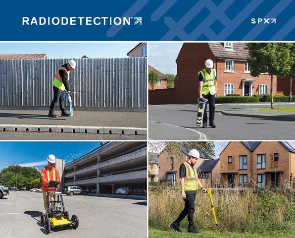
As time moved on, so did the technology and Radiodetection drove significant industry change by launching its more sophisticated ranges of precision locators and transmitters; the newest versions of these (the RD7200 & RD8200) were launched as recently as 2021. Precision locators take the basic capabilities of a CAT and extend them to make a range of tools suitable for a wide range of survey and utility professionals worldwide. Precision locators are designed for the safe and accurate location of buried metal utilities, such as power and telecom cables as well as metal water, gas and oil pipes. The equipment is often used to complete detailed surveys, find faults and to build asset maps.
As the need to find more underground has become increasingly, critical Radiodetection has added further technology to the organisation. Sensors & Software, a leading Canadian designer and manufacturer of GPR (Ground Penetrating Radar) equipment and related software, joined the family through acquisition in late 2020. GPR is an emerging technology that is well suited for finding buried utilities and is especially useful for locating plastic pipes and fibre optic cables that a traditional locator won’t usually find.
Completing the picture is Radiodetection’s range of metal locators which includes both Schonstedt magnetic locators and traditional metal detectors. Metal detectors are especially useful in the water industry where they are used to uncover manhole covers that have become hidden by dirt or plant growth. Schonstedt magnetic locators meanwhile are designed for the accurate location of ferrous metals, including survey pins, water and gas valves and even Unexploded Ordinance (UXO).
As utility locating experts, Radiodetection is proud to offer the broadest range of location technology to cover all industry requirements.

With the introduction of the Nationally Accredited GPR Concrete Scanning course through Locating Unlimited, we have been able to have many meaningful discussions with professionals who are passionate about what they do, scan concrete. These discussions, and future ones have and will provide an opportunity to seek industry support in the development of best practices and industry standards for concrete scanners. With many things, the standardisation of practices and the development of methodologies for the best way that things should be done, strengthen the industry and creates advancements in skill level within the cohort.
Many of you may be thinking that, why do we need to change, we have been doing it this way for dozens of years without too many problems, and I can understand this, however if there is sufficient support, from you guys, I firmly believe that there will be industry benefits in having fully documented Best Practices and Standards.
This philosophy Is what ISO 9000 Quality Management Systems is based on. Part of Quality Management systems is to document what and how you do things
and then ensure all staff follow the process. It helps organizations ensure they meet customer and other stakeholder needs within statutory and regulatory requirements related to a product or service.
I am more than happy to ask the questions, gather information, put it in a usable form and then present it for comment. Just so that we are straight up, there is nothing in it for me, I do not want payment, reimbursement or any sort of compensation. I am happy to do it because I can see industry benefits and skill advancement.
From initial discussions, it seemed that having an industry standard colour and marking system had merit. The utility locating industry has a standard colour marking system, and it was felt that it could be beneficial in this industry.
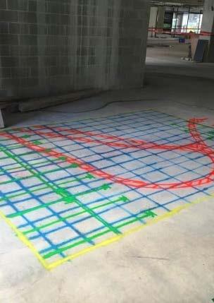
So why don’t we use this as our starting point, I have set up a landing page on my website, where we seek your input. There are a couple of questions there and a section to upload a sample of your existing marking and colour use system, I have also put a sample of the Westfield requirement for marking at their locations.
Simply click here.
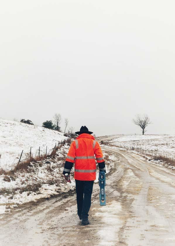
Subsurface Mapping Solutions Pty Ltd is an Australianbased company, situated on the Gold Coast, in sunny Queensland that specializes in providing a range of innovative solutions for subsurface mapping. With many years of experience, Subsurface Mapping Solutions has become one of the most trusted names in the industry for delivering reliable and accurate results with their advanced technologies. They are committed to helping clients achieve their goals by finding new ways to explore beneath the surface. Whatever the project, Subsurface Mapping Solutions provides comprehensive solutions that can meet any challenge. With a team of experienced professionals dedicated to innovation and customer satisfaction, Subsurface Mapping Solutions Pty Ltd is your go-to source for all things related to subsurface mapping.
Subsurface Mapping Solutions Pty Ltd (SMS) is a leader in the field of subsurface mapping, providing clients with comprehensive solutions to their underground exploration needs. With cutting-edge technology and experienced professionals dedicated to innovation and customer satisfaction. Their services extend beyond traditional utility detection and include subsurface services to detect and map geophysical and archaeological assets including voids, geological and archaeological features and other subsurface assets. All of our utility technicians are experienced, qualified and have attended specific training to hone their skills.
Our niche service offering extends to all types of CCTV condition assessments, trenchless pipe repair technology and concrete scanning.
Experienced team members who’ve worked in partnership with defence organisations, government agencies and approved contractors.
▷
RAAF Amberley Redevelopment.
▷ Gallipoli Barracks Communications Upgrade.
▷ Swartz Barracks Oakey.
▷ Damascus Barracks Building Works.
Transport
Our team has provided end to end support on some of Southeast Queensland›s largest transport projects.
▷ ARTC.
▷ City of Gold Coast Recycled Water network.
▷ Eastern Transitway.
▷ Gold Coast Light Rail.
Infrastructure
Proven track record on a variety of major infrastructure projects including various road & highway upgrades & large-scale condition assessment of sewer and stormwater infrastructure for various local councils.
▷ Coomera Connector.
▷ Pacific Motorway Eight Mile Plains to Daisy Hill Upgrade.
▷ Prince Charles Hospital Upgrade.
▷ Bundaberg stormwater rehabilitation.
▷ Byron Bay sewer rehabilitation.
Whatever the project, wherever the location, the team from Subsurface Mapping Solutions can offer a full range
of services for any size project.
Their dedicated team can provide services including: ▷

Utility Consulting ▷
Project & Asset Management ▷
Engineering Certification ▷
Infrastructure Design ▷
Construction Auditing ▷
Utility Locating ▷
Ground Penetrating Radar ▷ 2D and 3D mapping capabilities ▷ Concrete Scanning ▷
Non-Destructive Digging – potholing ▷ CCTV Pipe Condition Inspections
Trenchless Pipe Repairs
Are you looking for a professional team to help take your project to the next level? Look no further than Subsurface Mapping Solutions Pty Ltd. They provide comprehensive services, advanced tools, access to state-of-the-art technology that makes exploring beneath the surface easier. With Subsurface Mapping Solutions you can expect faster turnaround times on projects while also enjoying cost savings and increased accuracy in data collection.
Phone: 0408839723
Email: admin@subsurfacems.com.au Address:38/36 Kendor Steet ARUNDEL, QLD 4214
Andrew Watson is an ambitious and dedicated individual who has worked hard to achieve success in life. He is the driving force behind Subsurface Mapping Solutions Pty Ltd, which he founded 2020 and has been leading it ever since.
His vision was to provide quality services to the Civil Construction industry that would benefit businesses and his leadership has helped turn Subsurface Mapping Solutions into a thriving enterprise with a loyal customer base. Andrew›s commitment to excellence has allowed him to cultivate an innovative environment where employees are encouraged to think outside of the box, ultimately helping propel Subsurface Mapping Solutions forward.
A leader in this space for over 20 years, Andrew Identified a need and has provided solutions to the difficulties major projects encounter when working around underground utilities. Andrew is a firm believer in arming his staff with the most up-to-date equipment available. The most recent example is his investment in the IDS Stream DP Ground Penetrating Radar (GPR) from C.R. Kennedy. This multichannel GPR array solution for real-time 3D mapping of underground utilities and features, is the first in Australia.
