a look back waterfalls 2022


Fall into Sapphire
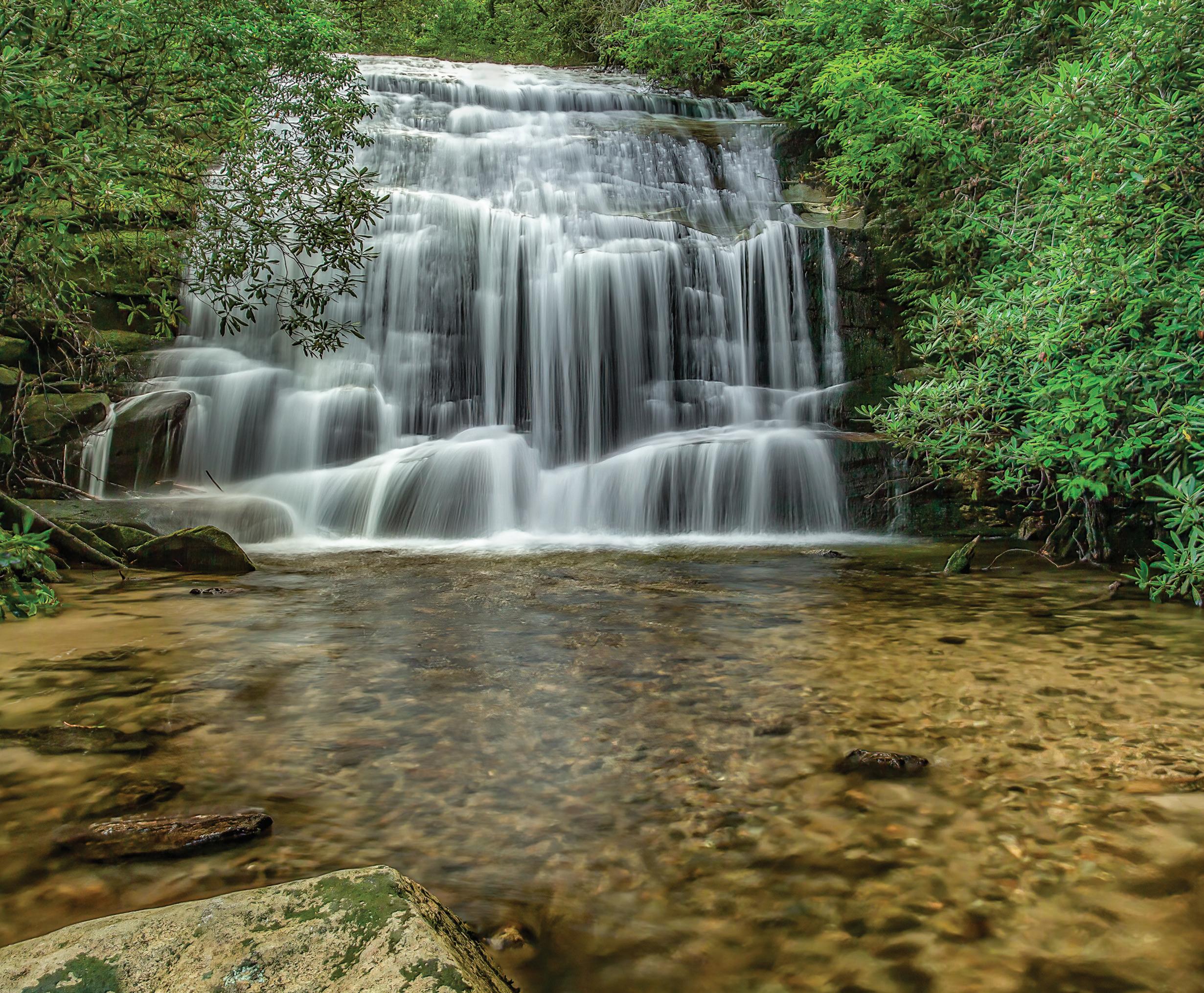
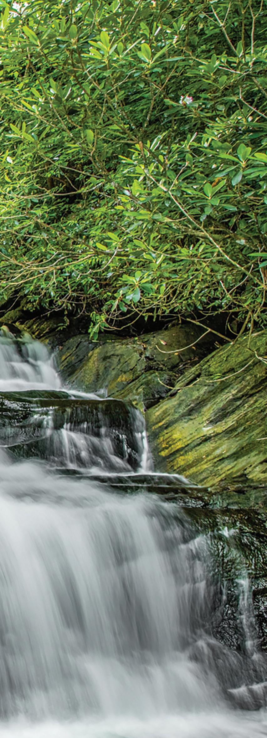
John’s Jump and Dew Falls are a pair of jewels discreetly tucked away in Sapphire.
Not far from Sapphire, you can visit John’s Jump and the nearby Dew Falls. They are both very close to the road requiring short hikes of less than a tenth of a mile each.

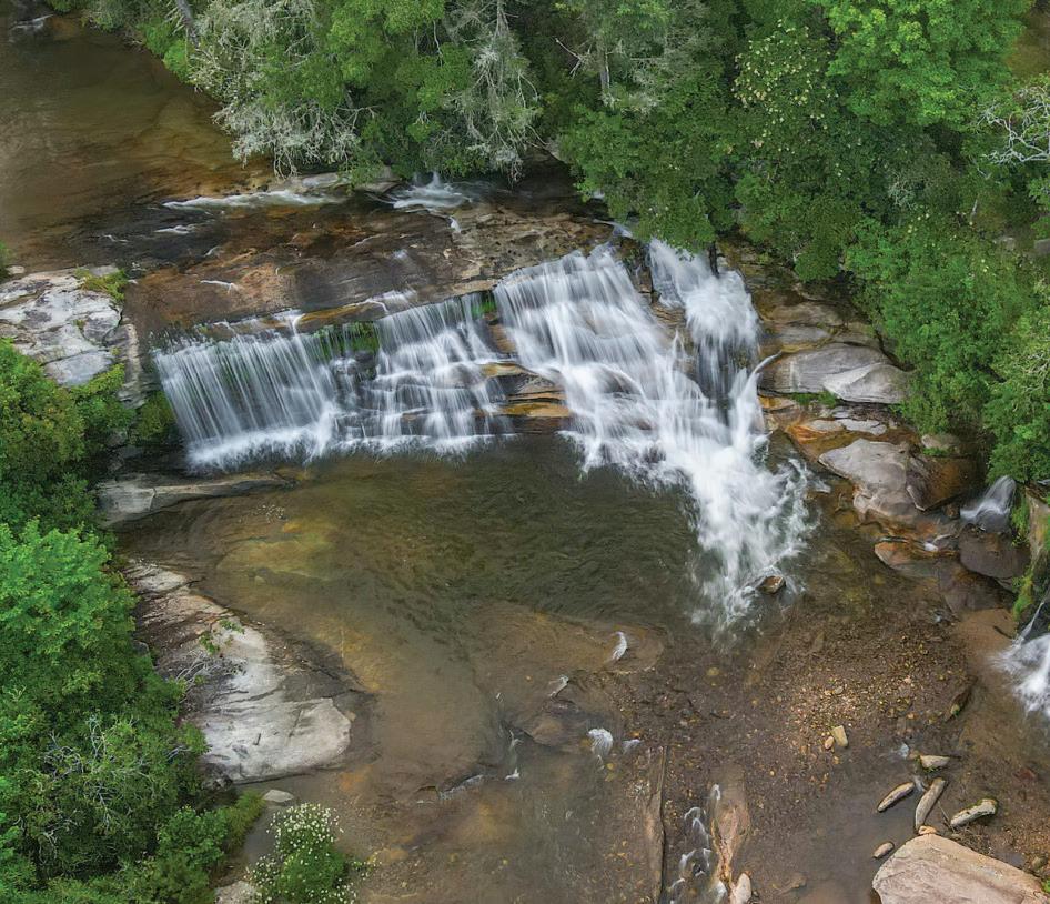
At 25 feet in height, John’s Jump is the tallest of the two. Despite the fact that it is less than 100 yards from the road, the hike to John’s Jump is more difficult than Dew Falls. A short scramble down a relatively steep path to the base of John’s Jump is required. For the agile the descent is not terribly difficult but we like to tie off a rope at the top and use it for stability to reach the bottom and to return to the top. The unmarked trailhead is at the north end of the grassy parking
area described below. We have viewed the falls when the water was flowing at an average pace and found it to be quite beautiful. Dew Falls is only about 10 feet in height but don’t let that stop you from making the 0.1-mile trek. The trail is mostly flat with some downhill close to the base of the falls. Be careful of exposed roots, especially when approaching the falls. Be aware that in wet periods there may be muddy spots along the way. The unmarked trailhead is at the closed gate described in Directions. Dew Falls is much easier to reach than John’s Jump Falls but equally as beautiful.
Directions
2 MAY 2022 | THELAURELMAGAZINE.COM OUTDOORS
Dew Falls
John’s Jump Falls
From Sapphire, drive east US 64 to Highway 281 and turn right. Go approximately five miles to an unmarked grassy area on the left and park. At the north end of the parking area, you will find the unmarked trail to the falls. You should hear the falls from the parking area. Due to the steepness of the trail, it is not recommended for small children.
Dew Falls
The unmarked trailhead to Dew Falls is a very short distance from the John’s Jump Falls parking area. From the parking area drive back north for about 0.1 mile. On the left side of the road find a closed gate. Park there and locate the trailhead behind the gate. Happy Trails.
 by Ed and Cindy Boos
View Highlands Cashiers Waterfall Guide
John’s Jump Falls
Happy Trails at Mud Creek
Only a few steps from the road, Mud Creek is 1,000 miles from the stresses of the 21st century.
Sky Valley, Georgia is the home to the beautiful Mud Creek Falls. This multilayered waterfall is approximately 100 feet high. The hike to Mud Creek Falls is short and easy. The waterfall is only about 100 yards from the parking area. It is a good place for a picnic as there are two picnic tables at the base of the falls.
As an added bonus, the Mud Creek Falls trail can be accessed at the falls. The trail follows Mud Creek for approximately one mile to

North Carolina Highway 106 close to the Dillard Georgia overlook. Of course, you could park at the overlook and hike the one mile to the falls as an option.
Directions
From the intersection of NC 106 (Dillard Road) and US 64 in Highlands, drive 10 miles and turn left on Old Mud Creek Road. There is a replica of a water wheel mill at the turn. Drive 1 mile and
4 JUNE 2022 | THELAURELMAGAZINE.COM OUTDOORS
turn
At a Glance Waterfall Guide
HIGHLANDS
Bridal Veil Falls
From NC 106 in Highlands, drive 2.3 miles west on US 64; Waterfall GPS: N35.07180
W-83.22910
Difficulty: You can park your car in a little parking area and walk 50 feet.
Dry Falls
From NC 106 in Highlands, drive 3.15 miles west on US 64 to a parking area on the left; Waterfall GPS: N35.06884 W-83.23869
Difficulty: There are lots of steps you must go down to get behind Dry Falls.
Bust Your Butt Falls
From NC 106 in Highlands, drive 6.35 miles west on US 64 to the pullout on the left; Waterfall GPS: N35.09268 W-83.26573
Difficulty: Don’t stop on the road itself!
Glen Falls
From the junction of US 64 and NC 106 in Highlands, drive 1.75 miles south on NC 106 and bear left at the sign for Glen Falls. Take Glen Falls Road, not Holt Road. Drive 1.05 miles to the parking area. Waterfall GPS: N35.03128 W-83.23829
Difficulty: There’s some climbing involved here.
Upper Middle Creek Falls
From the intersection of NC 106 and US 64, follow NC 106 South for 9.3 miles. Exactly 1 mile before you reach the Georgia state line, and about 0.3 miles after NC 106 crosses Middle Creek, a yellow School Bus Stop sign will be on the right. Park on the right side of the road right at the sign. Waterfall GPS: N35.00714 W-83.32916
Difficulty: The four-tenths of a mile hike is not strenuous but it can be confusing.
CASHIERS
Silver Run Falls
Happy Trails!
by Ed and Cindy Boos
From US 64 in Cashiers, head south on NC 107 from 4.05 miles – there’s a pullout area on the left. Waterfall GPS N35.06599 W-83.06558
Difficulty: No difficulty.
Whitewater Falls
From US 64 west of Lake Toxaway, take NC 281 for 8.5 miles and turn left at the sign for Whitewater Falls into a parking area.
Difficulty: Not strenuous, though the paved path is a bit uneven.
Cashiers Sliding Rock
Cashiers Sliding Rock, a million miles from the cares of the 21st century, is easy to get to. From the Cashiers Crossroads, travel south on NC 107 to Whiteside Cove Road. Head down the road for 2.6 miles to where the road crosses the Chattooga River and pull over just across the bridge.
Difficulty: A piece of cake.
Spoonauger Falls
From Cashiers, travel on NC 107 8.2 miles. The name changes to SC 107 – travel for 4.9 miles. Turn right onto Burrells Ford Road. Drive approximately 2.0 miles to the Chattooga Trail parking area on the left (look for the Forest Service Bulletin Board) Hike north on the Chattooga Trail, which roughly parallels the Chattooga River for 0.25 mile, then cross Spoonauger Creek. Immediately on the right will be a side trail.
Difficulty: There’s nothing tricky.
Schoolhouse Falls
From US 64, take NC 281 North for 0.85 mile and bear left on Cold Mountain Road. Stay on the road. When it becomes unpaved, travel about 0.1 mile. Take the road on the right and travel for 0.1 mile to a parking area. Take the trail to the right of the information kiosk. At the intersection, proceed straight on Panthertown Valley Trail. Turn left onto Little Green Trail. Schoolhouse Falls is about 0.15 mile ahead. Waterfall GPS N35.16330
W-83.00674
Difficulty: The hike isn’t challenging.
5 June 2022 | THELAURELMAGAZINE.COM OUTDOORS
Enjoy this sampling of area waterfalls, for a deep dive visit thelaurelmagazine.com/recreation.
right into Sky Valley Resort. Drive another half mile and turn right on Tahoe Lane leading to the falls.
Scan for interactive map of waterfalls in the Highlands and Cashiers area.
Capturing a Midnight Waterfall
With some precautions and the correct equipment, waterfalls at night can boost your portfolio with stunning images.
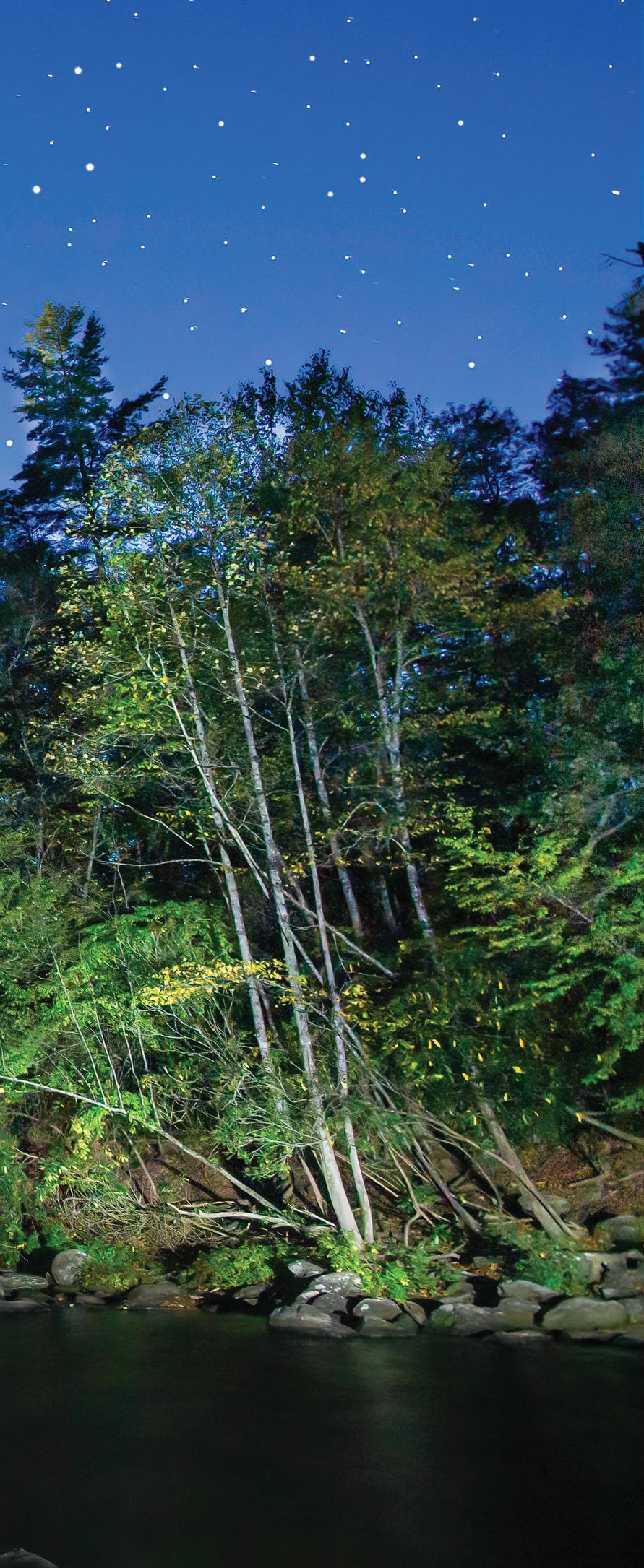
Photographing waterfalls at night may not be your cup of tea but, although challenging, it can be quite rewarding. Without a doubt, hiking to waterfalls at night can be very hazardous for obvious reasons. We would not attempt to hike to a waterfall in the dark without first scouting it out during the day.
Most waterfalls can be shot at night but we prefer a setting that includes a clear night sky with visible stars to make the scene more interesting. We also prefer
a night with no moonlight, although it’s possible to have success with some moonlight.
Appropriate gear is important – include an SLR camera, wide angle lens, a sturdy tripod, and a good LED flashlight with an adjustable beam.
About five years ago there was a TV series that included an episode on photographing waterfalls at night that explains the techniques quite thoroughly. It can be viewed by going online and entering
“Night Photography Waterfalls-Wild Photo Adventures” in the address bar.
The waterfall shown here is Silver Run Falls which is located close to Cashiers. The shot was taken during a dry spell, so the water was flowing lighter than normal. Ironically, it’s the same waterfall shown in the TV series mentioned above.
There are two viewpoints at the falls. The first is short, a few hundred yards, and easy. The second, where our photo was taken, is a short distance further down the trail. It

6 JULY 2022 | THELAURELMAGAZINE.COM OUTDOORS
is more difficult due to the many roots encountered. Caution is advised here during the day or night.
Trailhead Directions
From the intersection of US 64 and NC 107 in Cashiers, go south on NC 107 for about four miles. Look for the small parking area on the left.
by Ed and Cindy Boos
At a Glance Waterfall Guide
HIGHLANDS
Bridal Veil Falls
From NC 106 in Highlands, drive 2.3 miles west on US 64. Waterfall GPS: N35.07180 W-83.22910
Difficulty: You can park your car in a little parking area and walk 50 feet.
Dry Falls
From NC 106 in Highlands, drive 3.15 miles west on US 64 to a parking area on the left. Waterfall GPS: N35.06884 W-83.23869
Difficulty: There are lots of steps you must go down to get behind Dry Falls.
Bust Your Butt Falls
From NC 106 in Highlands, drive 6.35 miles west on US 64 to the pullout on the left. Waterfall GPS: N35.09268 W-83.26573
Difficulty: Don’t stop on the road itself!
Glen Falls
From the junction of US 64 and NC 106 in Highlands, drive 1.75 miles south on NC 106 and bear left at the sign for Glen Falls. Take Glen Falls Road, not Holt Road. Drive 1.05 miles to the parking area. Waterfall GPS: N35.03128 W-83.23829
Difficulty: There’s some climbing involved here.
Upper Middle Creek Falls
From the intersection of NC 106 and US 64, follow NC 106 South for 9.3 miles. Exactly 1 mile before you reach the Georgia state line, and about 0.3 miles after NC 106 crosses Middle Creek, a yellow School Bus Stop sign will be on the right. Park on the right side of the road right at the sign. Waterfall GPS: N35.00714 W-83.32916
Difficulty: The four-tenths of a mile hike is not strenuous but it can be confusing.
CASHIERS
Silver Run Falls
From US 64 in Cashiers, head south on NC 107 from 4.05 miles – there’s a pullout area on the left. Waterfall GPS N35.06599 W-83.06558
Difficulty: No difficulty.
Whitewater Falls
From US 64 west of Lake Toxaway, take NC 281 for 8.5 miles and turn left at the sign for Whitewater Falls into a parking area.
Difficulty: Not strenuous, though the paved path is a bit uneven.
Cashiers Sliding Rock
Cashiers Sliding Rock, a million miles from the cares of the 21st century, is easy to get to. From the Cashiers Crossroads, travel south on NC 107 to Whiteside Cove Road. Head down the road for 2.6 miles to where the road crosses the Chattooga River and pull over just across the bridge.
Difficulty: A piece of cake.
Spoonauger Falls
From Cashiers, travel on NC 107 8.2 miles. The name changes to SC 107 – travel for 4.9 miles. Turn right onto Burrells Ford Road. Drive approximately 2.0 miles to the Chattooga Trail parking area on the left (look for the Forest Service Bulletin Board) Hike north on the Chattooga Trail, which roughly parallels the Chattooga River for 0.25 mile, then cross Spoonauger Creek. Immediately on the right will be a side trail.
Difficulty: There’s nothing tricky.
Schoolhouse Falls
From US 64, take NC 281 North for 0.85 mile and bear left on Cold Mountain Road. Stay on the road. When it becomes unpaved, travel about 0.1 mile. Take the road on the right and travel for 0.1 mile to a parking area. Take the trail to the right of the information kiosk. At the intersection, proceed straight on Panthertown Valley Trail. Turn left onto Little Green Trail. Schoolhouse Falls is about 0.15 mile ahead. Waterfall GPS N35.16330 W-83.00674
Difficulty: The hike isn’t challenging.
7 July 2022 | THELAURELMAGAZINE.COM OUTDOORS
Enjoy this sampling of area waterfalls, for a deep dive visit thelaurelmagazine.com/recreation.
Scan for interactive map of waterfalls in the Highlands and Cashiers area.
Bust Your Butt Falls
Bust Your Butt Falls is the perfect photo opportunity. But make note of that name – No Shenanigans!
Bust your Butt Falls, also known as Quarry Falls, is a popular summer roadside stop along the Cullasaja River. The waterfall stands about 25 feet in height. It’s a nice place to rest on the large rocks and enjoy the beauty of the falls or wade in the water at the base of the falls.
People have been known to slide down the falls. Doing so can be dangerous, particularly during times when the water flow is rapid, and is not recommended, as some have busted more than

their butt.
Directions
From Highlands, drive 5.5 miles west on US 64. There is a pull-off on the left that will accommodate several cars.
by Ed and Cindy Boos
8 AUGUST 2022 | THELAURELMAGAZINE.COM OUTDOORS
At a Glance Waterfall Guide
HIGHLANDS
Bridal Veil Falls
From NC 106 in Highlands, drive 2.3 miles west on US 64. Waterfall GPS: N35.07180
W-83.22910
Difficulty: You can park your car in a little parking area and walk 50 feet.
Dry Falls
From NC 106 in Highlands, drive 3.15 miles west on US 64 to a parking area on the left. Waterfall GPS: N35.06884 W-83.23869
Difficulty: There are lots of steps you must go down to get behind Dry Falls.
Bust Your Butt Falls
From NC 106 in Highlands, drive 6.35 miles west on US 64 to the pullout on the left. Waterfall GPS: N35.09268 W-83.26573
Difficulty: Don’t stop on the road itself!
Glen Falls
From the junction of US 64 and NC 106 in Highlands, drive 1.75 miles south on NC 106 and bear left at the sign for Glen Falls. Take Glen Falls Road, not Holt Road. Drive 1.05 miles to the parking area. Waterfall GPS: N35.03128 W-83.23829
Difficulty: There’s some climbing involved here.
Upper Middle Creek Falls
From the intersection of NC 106 and US 64, follow NC 106 South for 9.3 miles. Exactly 1 mile before you reach the Georgia state line, and about 0.3 miles after NC 106 crosses Middle Creek, a yellow School Bus Stop sign will be on the right. Park on the right side of the road right at the sign. Waterfall GPS: N35.00714 W-83.32916
Difficulty: The four-tenths of a mile hike is not strenuous but it can be confusing.
CASHIERS
Silver Run Falls
From US 64 in Cashiers, head south on NC 107 from 4.05 miles – there’s a pullout area on the left. Waterfall GPS N35.06599 W-83.06558
Difficulty: No difficulty.
Whitewater Falls
From US 64 west of Lake Toxaway, take NC 281 for 8.5 miles and turn left at the sign for Whitewater Falls into a parking area.
Difficulty: Not strenuous, though the paved path is a bit uneven.
Cashiers Sliding Rock
Cashiers Sliding Rock, a million miles from the cares of the 21st century, is easy to get to. From the Cashiers Crossroads, travel south on NC 107 to Whiteside Cove Road. Head down the road for 2.6 miles to where the road crosses the Chattooga River and pull over just across the bridge.
Difficulty: A piece of cake.
Spoonauger Falls

From Cashiers, travel on NC 107 8.2 miles. The name changes to SC 107 – travel for 4.9 miles. Turn right onto Burrells Ford Road. Drive approximately 2.0 miles to the Chattooga Trail parking area on the left (look for the Forest Service Bulletin Board) Hike north on the Chattooga Trail, which roughly parallels the Chattooga River for 0.25 mile, then cross Spoonauger Creek. Immediately on the right will be a side trail.
Difficulty: There’s nothing tricky.
Schoolhouse Falls
From US 64, take NC 281 North for 0.85 mile and bear left on Cold Mountain Road. Stay on the road. When it becomes unpaved, travel about 0.1 mile. Take the road on the right and travel for 0.1 mile to a parking area. Take the trail to the right of the information kiosk. At the intersection, proceed straight on Panthertown Valley Trail. Turn left onto Little Green Trail. Schoolhouse Falls is about 0.15 mile ahead. Waterfall GPS N35.16330
W-83.00674
Difficulty: The hike isn’t challenging.
9 August 2022 | THELAURELMAGAZINE.COM OUTDOORS
Enjoy this sampling of area waterfalls, for a deep dive visit thelaurelmagazine.com/recreation.
for
Scan for interactive map of waterfalls in the Highlands and Cashiers area. info.
Scan
more
Mill Shoals Falls
The twin streams leading to Mill Shoals Falls give this hidden jewel its own charm, setting the stage for the seductive beauty of nearby Bird Rock Falls.
About 28 miles east of Cashiers, you’ll find Mill Shoals Falls.
Mill Shoals is unique as it consists of two waterfalls. This is where Shoal Creek and the north fork of the French Broad River meet side by side and drop 15 feet into the river below. At the base of the falls, stands an old red mill that is part of the Living Waters Ministry.
What Mill Shoals lacks in size it makes up for in beauty.
As a bonus, you can also visit the nearby Bird Rock Falls. As you
leave Mill Shoals you will see an obvious trail to the right. Walk down the trail for about five minutes to Bird Rock.
Along the way, you will see a few cascades. At the base of the trail is a large sloping rock that you may be tempted to venture out upon. Caution is advised as it is typically slippery and can be dangerous, particularly when the water is high and moving rapidly.
Directions
From Cashiers, drive about 20 miles east to Highway 215. Turn
10 SEPTEMBER 2022 | THELAURELMAGAZINE.COM OUTDOORS
left and drive 7.7 miles to Living Waters Ministries on the left. Please do not park in their parking lot. Limited parking is available along the road. A short path, beginning at the road on the south side of buildings, will lead you to the waterfalls.
by Ed and Cindy Boos
At a Glance Waterfall Guide
HIGHLANDS
Bridal Veil Falls
From NC 106 in Highlands, drive 2.3 miles west on US 64. Waterfall GPS: N35.07180
W-83.22910
Difficulty: You can park your car in a little parking area and walk 50 feet.
Dry Falls
From NC 106 in Highlands, drive 3.15 miles west on US 64 to a parking area on the left. Waterfall GPS: N35.06884 W-83.23869
Difficulty: There are lots of steps you must go down to get behind Dry Falls.
Bust Your Butt Falls
From NC 106 in Highlands, drive 6.35 miles west on US 64 to the pullout on the left. Waterfall GPS: N35.09268 W-83.26573
Difficulty: Don’t stop on the road itself!
Glen Falls
From the junction of US 64 and NC 106 in Highlands, drive 1.75 miles south on NC 106 and bear left at the sign for Glen Falls. Take Glen Falls Road, not Holt Road. Drive 1.05 miles to the parking area. Waterfall GPS: N35.03128 W-83.23829
Difficulty: There’s some climbing involved here.
Upper Middle Creek Falls

From the intersection of NC 106 and US 64, follow NC 106 South for 9.3 miles. Exactly 1 mile before you reach the Georgia state line, and about 0.3 miles after NC 106 crosses Middle Creek, a yellow School Bus Stop sign will be on the right. Park on the right side of the road right at the sign. Waterfall GPS: N35.00714 W-83.32916
Difficulty: The four-tenths of a mile hike is not strenuous but it can be confusing.
CASHIERS
Silver Run Falls
From US 64 in Cashiers, head south on NC 107 from 4.05 miles – there’s a pullout area on the left. Waterfall GPS N35.06599 W-83.06558
Difficulty: No difficulty.
Whitewater Falls
From US 64 west of Lake Toxaway, take NC 281 for 8.5 miles and turn left at the sign for Whitewater Falls into a parking area.
Difficulty: Not strenuous, though the paved path is a bit uneven.
Cashiers Sliding Rock
Cashiers Sliding Rock, a million miles from the cares of the 21st century, is easy to get to. From the Cashiers Crossroads, travel south on NC 107 to Whiteside Cove Road. Head down the road for 2.6 miles to where the road crosses the Chattooga River and pull over just across the bridge.
Difficulty: A piece of cake.
Spoonauger Falls
From Cashiers, travel on NC 107 8.2 miles. The name changes to SC 107 – travel for 4.9 miles. Turn right onto Burrells Ford Road. Drive approximately 2.0 miles to the Chattooga Trail parking area on the left (look for the Forest Service Bulletin Board) Hike north on the Chattooga Trail, which roughly parallels the Chattooga River for 0.25 mile, then cross Spoonauger Creek. Immediately on the right will be a side trail.
Difficulty: There’s nothing tricky.
Schoolhouse Falls
From US 64, take NC 281 North for 0.85 mile and bear left on Cold Mountain Road. Stay on the road. When it becomes unpaved, travel about 0.1 mile. Take the road on the right and travel for 0.1 mile to a parking area. Take the trail to the right of the information kiosk. At the intersection, proceed straight on Panthertown Valley Trail. Turn left onto Little Green Trail. Schoolhouse Falls is about 0.15 mile ahead. Waterfall GPS N35.16330
W-83.00674
Difficulty: The hike isn’t challenging.
11 September 2022 | THELAURELMAGAZINE.COM OUTDOORS
Enjoy this sampling of area waterfalls, for a deep dive visit thelaurelmagazine.com/recreation.
Scan for interactive map of waterfalls in the Highlands and Cashiers area.
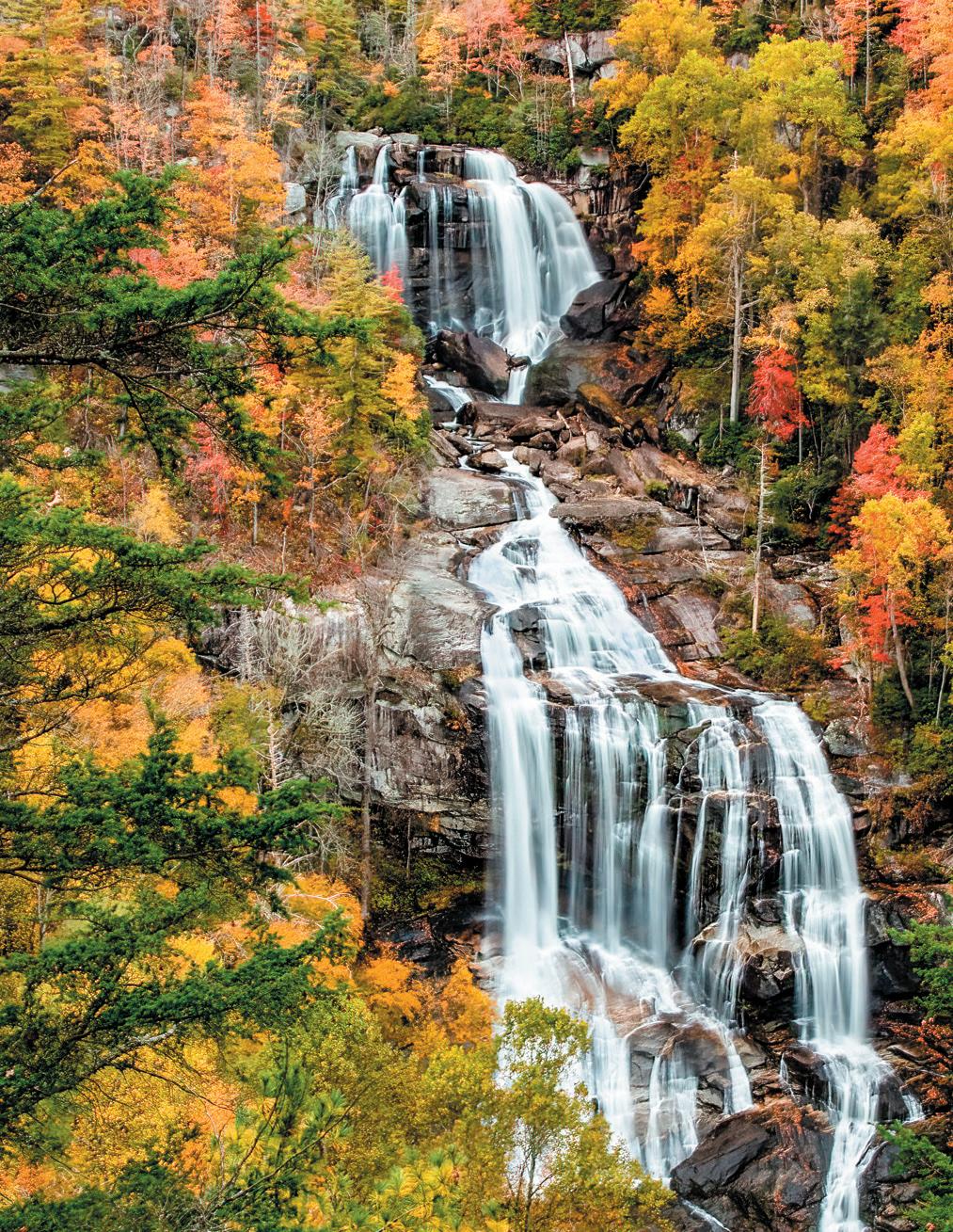
Whitewater Falls
Even if you’ve lived on the Plateau your entire life, a visit to Whitewater Falls is still an occasion of Wonder.

According to the United States Forest Service, Whitewater Falls, a multi-drop waterfall, plunges 411 feet onto the valley below making it the tallest waterfall east of the Rockies. A quarter mile paved trail leads to the upper view of the falls. From there you may descend 154 steps to reach the lower view. Taking the steps to the lower deck is well worth the effort as it is considered the
better view. A high volume of people visit Whitewater Falls making the morning and evening the best times to venture to the falls.
Directions
From Cashiers, NC, drive 8 miles south on Highway 107 to South Carolina. Continue on SC 107 for another 1.1 miles to Wigington Road and make a sharp left. Drive 2.2 miles to Whitewater Falls Road
12 OCTOBER 2022 | THELAURELMAGAZINE.COM OUTDOORS
At a Glance Waterfall Guide
HIGHLANDS
Bridal Veil Falls
From NC 106 in Highlands, drive 2.3 miles west on US 64. Waterfall GPS: N35.07180 W-83.22910
Difficulty: You can park your car in a little parking area and walk 50 feet.
Dry Falls
From NC 106 in Highlands, drive 3.15 miles west on US 64 to a parking area on the left. Waterfall GPS: N35.06884 W-83.23869
Difficulty: There are lots of steps you must go down to get behind Dry Falls.
Bust Your Butt Falls
From NC 106 in Highlands, drive 6.35 miles west on US 64 to the pullout on the left. Waterfall GPS: N35.09268 W-83.26573
Difficulty: Don’t stop on the road itself!
Glen Falls
From the junction of US 64 and NC 106 in Highlands, drive 1.75 miles south on NC 106 and bear left at the sign for Glen Falls. Take Glen Falls Road, not Holt Road. Drive 1.05 miles to the parking area. Waterfall GPS: N35.03128 W-83.23829
Difficulty: There’s some climbing involved here.
Upper Middle Creek Falls
From the intersection of NC 106 and US 64, follow NC 106 South for 9.3 miles. Exactly 1 mile before you reach the Georgia state line, and about 0.3 miles after NC 106 crosses Middle Creek, a yellow School Bus Stop sign will be on the right. Park on the right side of the road right at the sign. Waterfall GPS: N35.00714 W-83.32916
Difficulty: The four-tenths of a mile hike is not strenuous but it can be confusing.

CASHIERS
Silver Run Falls
From US 64 in Cashiers, head south on NC 107 from 4.05 miles – there’s a pullout area on the left. Waterfall GPS N35.06599 W-83.06558
Difficulty: No difficulty.
Whitewater Falls
From US 64 west of Lake Toxaway, take NC 281 for 8.5 miles and turn left at the sign for Whitewater Falls into a parking area.
Difficulty: Not strenuous, though the paved path is a bit uneven.
Cashiers Sliding Rock
Cashiers Sliding Rock, a million miles from the cares of the 21st century, is easy to get to. From the Cashiers Crossroads, travel south on NC 107 to Whiteside Cove Road. Head down the road for 2.6 miles to where the road crosses the Chattooga River and pull over just across the bridge.
Difficulty: A piece of cake.
Spoonauger Falls
From Cashiers, travel on NC 107 8.2 miles. The name changes to SC 107 – travel for 4.9 miles. Turn right onto Burrells Ford Road. Drive approximately 2.0 miles to the Chattooga Trail parking area on the left (look for the Forest Service Bulletin Board) Hike north on the Chattooga Trail, which roughly parallels the Chattooga River for 0.25 mile, then cross Spoonauger Creek. Immediately on the right will be a side trail.
Difficulty: There’s nothing tricky.
Schoolhouse Falls
From US 64, take NC 281 North for 0.85 mile and bear left on Cold Mountain Road. Stay on the road. When it becomes unpaved, travel about 0.1 mile. Take the road on the right and travel for 0.1 mile to a parking area. Take the trail to the right of the information kiosk. At the intersection, proceed straight on Panthertown Valley Trail. Turn left onto Little Green Trail. Schoolhouse Falls is about 0.15 mile ahead. Waterfall GPS N35.16330 W-83.00674
Difficulty: The hike isn’t challenging.
13 October 2022 | THELAURELMAGAZINE.COM OUTDOORS
Enjoy this sampling of area waterfalls, for a deep dive visit thelaurelmagazine.com/recreation.
Scan for interactive map of waterfalls in the Highlands and Cashiers area.
and turn left. Continue approximately 5 miles to the entrance of Whitewater Falls on the right.
by Ed and Cindy Boos


 by Ed and Cindy Boos
View Highlands Cashiers Waterfall Guide
John’s Jump Falls


