12 minute read
MAPS AND ATlASES
Lots 30 - 56
33 36
30 ALLARD, CAREL Recentissima Novi Orbis sive Americae Septentrionalis et Meridionalis. [Amsterdam, c. 1700].
Copper-engraved map of America, hand-colored, engraved cartouche. Center fold reinforced on the verso; some chipping to edges; otherwise fine. 20 x 24 inches. Property from a Private Collection, Louisville, Kentucky $400-600
31 BACHIENE, WILLEM A. A group of three engraved maps of America, handcolored. [Amsterdam, c. 1785].
(1)Nieuwe en Algemeene Kaart van America. 14 1/2 x 18 inches. Depicts America and the Iberian peninsula. (2)Kaart van het Zuidelyk Gedeelte der Vereenigde Staaten van Noord Amerika. 9 1/2 x 13 inches. Depicts the eastern coast of the United States from Virginia to Georgia. Dark spot in lower right corner and along bottom left edge. (3)Kaart van Nieuw Mexiko, met het Noordelyk Gedeelte van oud Mexiko of Nieuw Spanje. 9 x 14 inches. Depicts the southern coast, Mexico and a portion of the Yucatan peninsula. Repaired diagonal tear to top right corner. Property from a Private Collection, Louisville, Kentucky $200-400
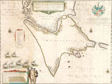
32 BELLIN, JACQUES A group of two hand-colored maps of eastern North America, eighteenth-century, both hand-colored. Paris, c. 1757, comprising Carte de la nouvelle Angleterre, Nouvelle Yorcke et Pensilvanie and Carte de la Caroline et Georgie pour servir a l’histoire generale des voyages. Size of Largest 8 1/2 x 12 inches. Property from a Private Collection, Louisville, Kentucky $100-200 33 BLAEU, (WILLEM) Tabula Magellanica, qua Tierrae del Fuego, cum celeberrimis fretis a F. Magellano et I. Le Maire detectis novissima et accuratissima descriptio exhibetur. [Amsterdam, 1650].
Copper-engraved map of the Straights of Magellan, hand-colored in outline, historiated scale, title cartouche, and engraved coat of arms of D. Constantino Hugenio, from a French edition of Bleau’s Le Theatre du Monde. The map bears Willem Blaeu’s signature, but it was published by his son, Johannes. French text to verso. Wear to scale cartouche in bottom right with some loss at borders, professionally repaired to the verso with archival tape; browning along left side; some light tape repair to verso of fold; minor offsetting to verso; otherwise sound. 15 x 20 1/4 inches. Property from a Private Collection, Louisville, Kentucky $150-250
34 BOWEN, EMANUEL Nieuwe en Naukeurige kaart des geheelen Aardbodems, opgemaakt uit de echste beschryvingen en de beste heedendaagsche land en zeekaarten en nordre gebragt volgens sterrekundige waarnccmingen. [Amsterdam,] 1744.
Copper-engraved map, hand-colored in outline. From a later edition of Bachiene’s, Atlas tot opheldering der hedendaagsche historic beschreeven door cen gezelschap van gelccrde mannen in England. Even foxing; otherwise fine with no tears. 15 x 18 inches. Property from a Private Collection, Louisville, Kentucky $100-200 35 BOWEN, EMANUEL A New & Accurate Map of all the Known World, Drawn from the latest & most Authentic Surveys, assisted by the best & most approved Modern Maps and Charts, &c., Wherein all the Discoveries & Improvements are carefully Delineated. The whole being Regulated by Astron. Observations. [London, 1752]. From A Complete Atlas, or Distinct View of the Known World, plate 4.
Engraved double-hemisphere map, uncolored, central title within ornamental frame, four engraved vignettes representing the continents and a globe at the bottom center. In the large top margin, extensive notes in a later eighteenth-century hand, describing post-1752 discoveries of Cook, Kerguelen and Du Fresne. Transcription available upon request. Laid down with Japanese tissue; a few closed marginal tears; some toning to edges; otherwise fine. $200-400
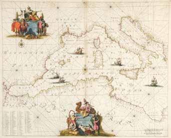
36 DE WIT, FREDERICK Occidentalior Tractus Maris Mediterranei. Wester gedeelte van de Middelandse Zee. [Amsterdam, c. 1680].
Copper-engraved map, hand-colored in outline with hand-colored cartouches. Some light soiling and darkening; minor chips at the side edges; some reinforcement to verso; otherwise fine. 19 x 22 1/2 inches. Property from a Private Collection, Louisville, Kentucky $800-1,200
38
45 37 (DIDEROT, DENIS AND JEAN LE ROND D’ALEMBERT) Carte de la Californie suivant I. La carte manuscrite de l’Amerique de Mathieu Neron Pecci olen dresse a Florence en 1604; II. Sanson 1656; III. De L’Isle Amerique Sept. 1700; IV. le Pere Kino Jesuite en 1705; V. La Societe des Jesuites en 1767 . . . [Paris, c. 1770].
Engraved map from Diderot’s Encyclopedia, showing five different seventeenth and eighteenth-century maps of California. Reinforced along the center fold on verso; otherwise fine. 13 1/2 x 16 inches. Property from a Private Collection, Louisville, Kentucky $100-200
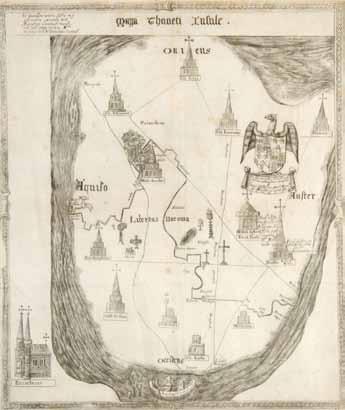
38 DUGDALE, WILLIAM Mappa Thaneti Insule (Map of the Isle of Thanet). [London, 1655].
Engraved map from the first edition of Monasticon Anglicanum, by Sir William Dugdale, vol. 1, p. 84. Some minor foxing; 3 inch tear along the left edge; otherwise fine. 16 3/4 x 14 inches. Property from a Private Collection, Louisville, Kentucky $100-200
39 GUSSEFELD, FRANZ LUDWIG Charte der XV Vereinigten Staaten von Nord-America. Weimar: Industrie Comptoirs, 1800.
Engraved map of the 15 states, hand-colored in outline. Reflects one-time state of “Franklin” formed out of western North Carolina in 1784 with John Sevier appointed Governor. Reinforced to center fold on verso; some offsetting to verso from hand-colored outline; otherwise fine. 22 x 19 inches. Property from a Private Collection, Louisville, Kentucky $200-400
40 GUSSEFELD, FRANZ LUDWIG; HOMANN HEIRS Charte uber die XIII Verenigte Staaten von Nord-America. [Nuremberg,] 1784.
Engraved map of the 13 colonies, hand-colored, detailed geographical features, cities, towns and locations of tribes. Large dampstain along the lower left edge and browning to the right; dampspotting along the upper right and top edge, mainly marginal; otherwise fine. 18 1/2 x 24 inches. Property from a Private Collection, Louisville, Kentucky $300-500
41 HOMANN HEIRS Americae Mappa Generalis Secundum Legitimas Projectionis Stereographicae Regulas ... Concinnata et Delineata ab Aug. Gott Boehmio Phil. Magistro. In Lucem Proferentibus Homannianis Heredibus A MDCCXXXXVI. Nuremberg, 1746.
Copper-engraved map, hand-colored. With large uncolored pictorial cartouche depicting Native Americans, Africans, birds, two volcanos, and a pot of gold. 2 inch crescent-shaped tear to lower edge; marginal foxing, soiling and light dampstaining; center fold reinforced; otherwise fine. 19 1/2 x 22 inches. Property from a Private Collection, Louisville, Kentucky $300-500
42
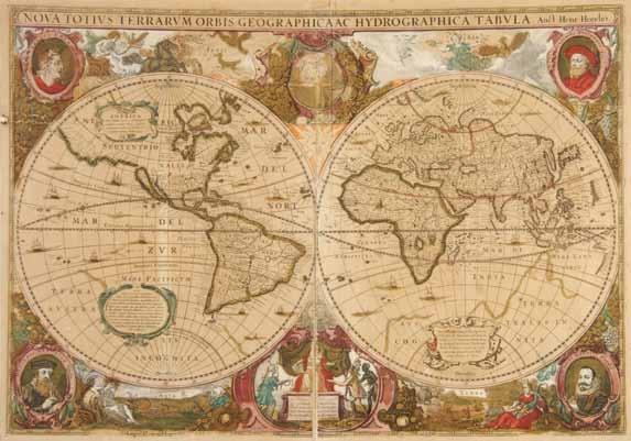
42 HONDIUS, HENRICUS Nova totius terrarum orbis geographica ac hydrographica tabula. [Amsterdam:] Hondius, 1630.
Copper-engraved double-hemisphere map of the world, hand-colored. French text to verso. First state of Hondius’ world map from Atlas or Geographicke description of the regions ... of the World. Set in double-hemispheres and embellished with engraved cartouches, allegorical figures of the four elements, sea and ship scapes, and portrait medaillions of Caesar, Ptolemy, Mercator and Hondius.
Marginal loss on all edges; even browning; large 4 inch tear along upper right and left edges and a 2 inch tear in upper right corner, repaired on the verso; center fold split and repaired on the verso. 15 1/2 x 22 inches. Property from a Private Collection, Louisville, Kentucky $4,000-6,000
43 L’ISLE, GUILLAUME DE, et al. Carte d’Amerique divisees en ses principales parties. Amsterdam: Covens & Mortimer, 1774.
Copper-engraved map of the Americas, handcolored in outline. Very light marginal soiling and light dampstaining; 2 inch tear to left edge; otherwise fine. 21 x 24 inches. Property from a Private Collection, Louisville, Kentucky $400-600 44 L’ISLE, GUILLAUME DE Hemisphere Septentrional pour voir plus distinctement les terres . . . Amsterdam: Chez Jean Covens et Corneille Mortier, [1714 or later].
Engraved map, hand-colored. The map went through several revisions to reflect later discoveries. This edition shows California as a peninsula with a dotted line and with the Northwest coast and Alaska completely absent. Later editions depicted the Northwest Passage. Wide margins. Center fold split and reinforced at the verso; some light toning to margins; otherwise fine with fine hand-coloring. 20 1/4 x 20 inches. Property from a Private Collection, Louisville, Kentucky $100-200
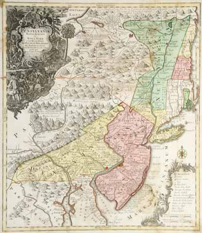
45 LOTTER, (TOBIAS CONRAD) Pensylvania Nova Jersey et Nova York cum Regionibus ad Fluvium Delaware in America sitis. Augsburg, [c. 1745 or later].
Engraved map of the Northeast, hand-colored regions of New Jersey, Pennsylvania and New York and along the borders, after De L’Isle. Decorative cartouche in the upper left corner depicts William Penn purchasing lands from the Native Americans. A highly inaccurate depiction of the coastline, with New York City situated on the main land, from which Long Island is separated by a small channel. Some brown spotting along the upper right margin, upper left portion of New York, Mare Virginianum and over Burlington; otherwise fine. 20 x 23 inches. Property from a Private Collection, Louisville, Kentucky $800-1,200 46 LOTTER, TOBIAS CONRAD America Septentrionalis, Concinnata juxta Observationes Dnn Academiae Regalis Scientiarum. [Augsburg, c. 1750].
Copper-engraved map of North America, fully hand-colored, with large cartouche featuring a Native American and a ship’s captain. After Guillaume De L’Isle’s map of North America, with English settlements east of the Mississippi only. Lotter follows De L’Isle’s depiction of California as a peninsula, but leaves a gap at the tip of the Gulf of California, thus not completely rejecting the island theory. Thick paper with some soiling; center fold separated at bottom half with repair to verso; some soiling and two large creases; otherwise fine. 23 1/2 x 19 inches. Property from a Private Collection, Louisville, Kentucky $400-600
47
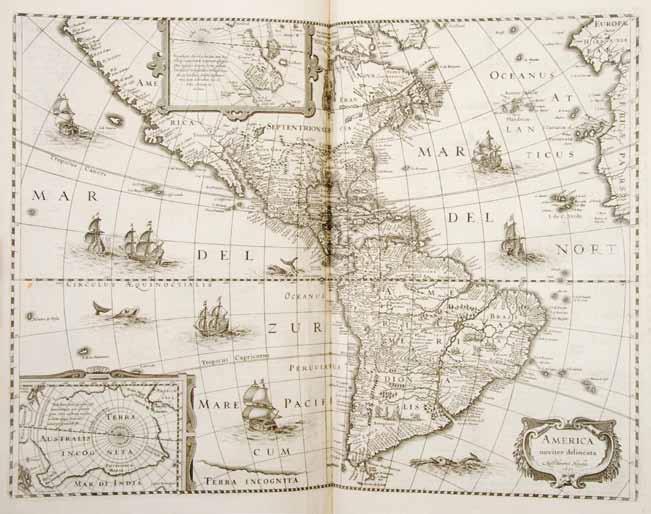
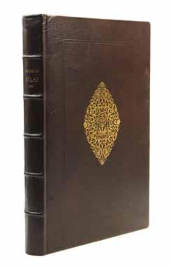
47 MERCATOR, (GERARD) [Atlas; or, A Geographicke Description of the Regions, Countries and Kingdomes of the World, through Europe, Asia, Africa, and America. Represented by New & Exact Maps. Translated by Henry Hexham, Quarter-Master to the Regiment of Colonell Goring.] [Amsterdam: Henry Hondius and Iohn Iohnson, 1636].
2 vols. Atlas folios, worn calf. Rare First English edition. With 195 (of 196, lacking Transylvania) double-page maps, uncolored, one map from German edition to vol. 1. Some maps trimmed slightly in both vols.; wear to binding with hinges detached but present and spine detached; hinges reinforced on some maps; minor foxing; repaired tears 1-4 inches on some maps.
Vol. 1: 80 maps, one from German edition. Lacking half-title, engraved title page (earlier edition title page pasted down), 4 pp. laudatory poems, pp. 45-46 and map Tabula Islandiae tipped in from German edition, and lacking pp. 203-204 “Description of Transylvania” and map Transylvania, Sibenburgen. Vol. 2: 115 maps. Lacking engraved title page (earlier edition title page pasted down), pp. 301-312 misbound after p. 388. Property from a Private Collection, Louisville, Kentucky $30,000-50,000
48* (MERCATOR, GERARD) Atlas sive cosmographicae meditationes. Facsimile. Zurich, Stuttgart and Wien: Coron-Verland, (1985).
Folio, full gilt-stamped leather, slipcase. Hinges slightly tender; otherwise fine. Property from the Estate of Dr. Warren G. Smirl, Waukesha, Wisconsin $80-120
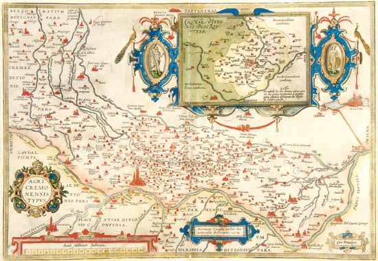
49 ORTELIUS, ABRAHAM Agri Cremonensis Typus. [Antwerp: Plantin, 1612].
Copper-engraved map, elaborately hand-colored, with inset and cartouches, including scale. From the rare Spanish edition of Abraham Ortelius’ Theatrum Orbis Terrarum. Text in Spanish to verso, with handcolored historiated initials. Center fold split but professionally repaired on verso with archival tape; worm traces along lower edge of center fold; slight browning and spotting; otherwise fine with fine hand-coloring. 14 x 20 inches. Property from a Private Collection, Louisville, Kentucky $200-400
48
49
50 ORTELIUS, ABRAHAM Tartariae sive Magni Chami Regni typus. [Antwerp: Plantin, 1598].
Copper-engraved map, elaborately hand-colored in wash and outline, with two large cartouches. Map shows Tartary and China, an uncommon projection of Japan and an early depiction, possibly one of the first, of California, labelled “C. Californio.” French text to verso. Small hole to center lower margin; minimal marginal soiling and foxing; otherwise a fine map with bright colors. 15 x 19 inches. Property from a Private Collection, Louisville, Kentucky $100-200
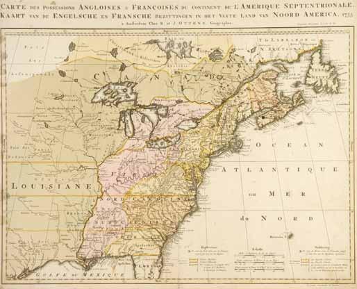
51 OTTENS, REINER AND JOSUA Carte des Possessions Angloises & Francoises du Continent de L’Amerique Septentrionale. Amsterdam, 1755.
Copper-engraved, hand-colored. Slight separation at the bottom of the fold; some minor soiling; light dampstaining along left edge; some repair to the verso of center fold; edges trimmed slightly; otherwise fine. 18 1/2 x 22 1/2 inches. Property from a Private Collection, Louisville, Kentucky $600-800
52 RAMUSIO, GIOVANNI BATTISTA Sumatra. [Venice, 1565].
Woodcut map of the island from the second edition of Ramusio’s Delle navigationi et viaggi. The second edition was the same as the first edition (1556) in pagination, but all of the woodcuts and maps were re-engraved since those used in the first edition were destroyed by fire in 1557. Center fold reinforced with archival tape to verso; chipping along edges; minor soiling with darkening at the fold; otherwise a dark impression. 11 1/4 x 15 inches. Property from a Private Collection, Louisville, Kentucky $100-200
55
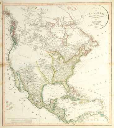
53 REICHARD, CHRISTIAN GOTTLIEB Charte von Nord America nach den Neuesten Bestimmungen und Entdeckungen von C. G. Reichard. Weimar: Industrie Comptoine, 1802.
Copper-engraved pre-Lewis & Clark map of North America, hand-colored in outline. With key to hand-coloring to lower left corner. Some minor brown spotting; 1 inch tear along horizontal fold; otherwise fine. 21 1/2 x 24 inches. Property from a Private Collection, Louisville, Kentucky $200-400
54 SEALE, R. W. A Map of North America, With the European settlements & whatever else is remarkable in ye West Indies, from the latest and best Observations. [London, 1745].
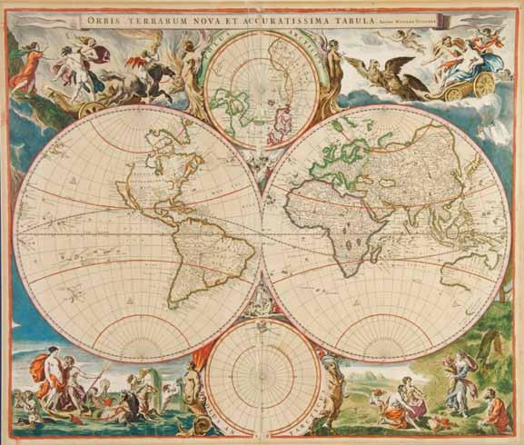
Engraved map of North America, hand-colored. One of the last maps to portray California as an island. Center crease reinforced at the verso; some light spotting; otherwise fine. 16 x 19 inches. Property from a Private Collection, Louisville, Kentucky $400-600 55 VISSCHER, NICHOLAS Oribis terrarum nova et accuratissima tabula. [Amsterdam, c. 1658 or later].
Copper-engraved double-hemisphere map of the world with inset polar hemispheres, hand-colored, framed by four mythological scenes doubling as allegorical representations of the elements (Persephone kidnapped by Hades - Fire, Poseidon - Water, Zeus and Hera - Air, Demeter - Earth), after Nicholas Berchem, from an early edition of Nicolas Visscher’s Atlas minor. California is shown as an island, the Great Lakes as one singular body of water, and the Mississippi is completely absent. A possible island to the north of California is called “Arian.”
Browning along the margins; split at the fold and repaired to the verso, slightly affecting the south polar projection and South America; a few marginal tears not affecting the image; some minor spotting; otherwise fine with bright coloring. 19 3/4 x 22 1/2 inches. Property from a Private Collection, Louisville, Kentucky $600-800
56 WEILAND, C. F. Sudliche und Noerdliche Halbkugel der Erde nach den neuesten Entdeckungen. Weimar: Geographische Institut, 1812.
Engraved double-hemisphere map, hand-colored. Northern and Southern hemispheres with regions of volcanic activity. Chipping along edges with small tears to bottom edges; some very light foxing; center fold reinforced to the verso; minor soiling; otherwise a fine impression. 20 x 24 1/2 inches. Property from a Private Collection, Louisville, Kentucky $200-400


