1 minute read
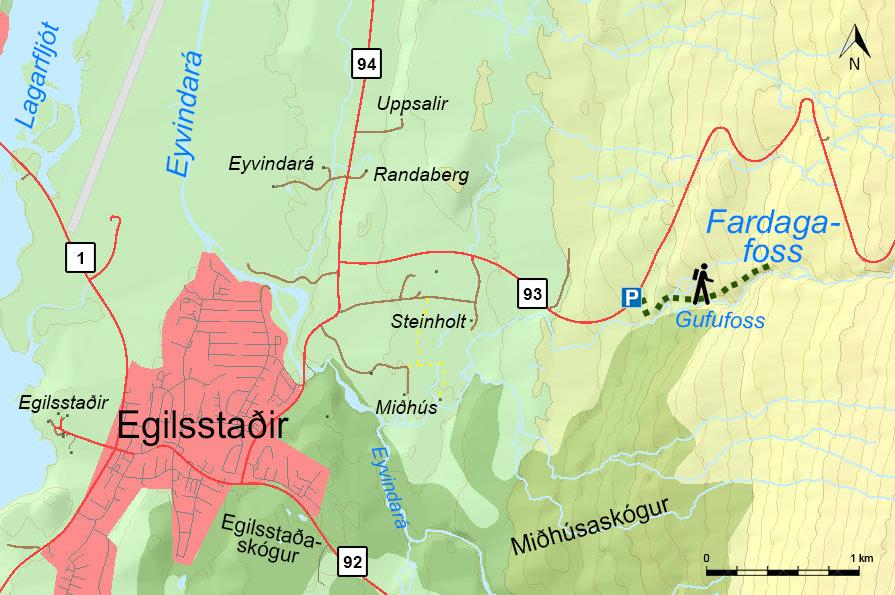
#4 Fardagafoss


(N65°16.06-W14°19.96) // 2 km // 148 m
Walk from the parking area up along the river on the north bank until you get to the Gufufoss-waterfall. When you get to the ravine you will find a chain linked to the cliffs for support. One can get behind the waterfall. A cylinder with visitors’ log book and stamp can easily be found up there. You can start this hike in Egilsstaðir town. Walk across the old bridge crossing Eyvindará-river and then turn on to the old gravel road, cross the driveway to Miðhús-farm up towards the parking area.