3 minute read
01. The Weaving Culture


— Cultural Heterogeneity Urban Design at Willets Point
Location: Willets Point, Queens, New York
Advertisement
Type: Team Work Members: Minghui Li, Jamie Chen, Huiyuan Xue, Zhicheng Liu
Contribution: 3D Model 70%, Diagram 50%, Video Clips 30%
Instructor: McLain Clutter, Alina Nazmeeva Fall 2022
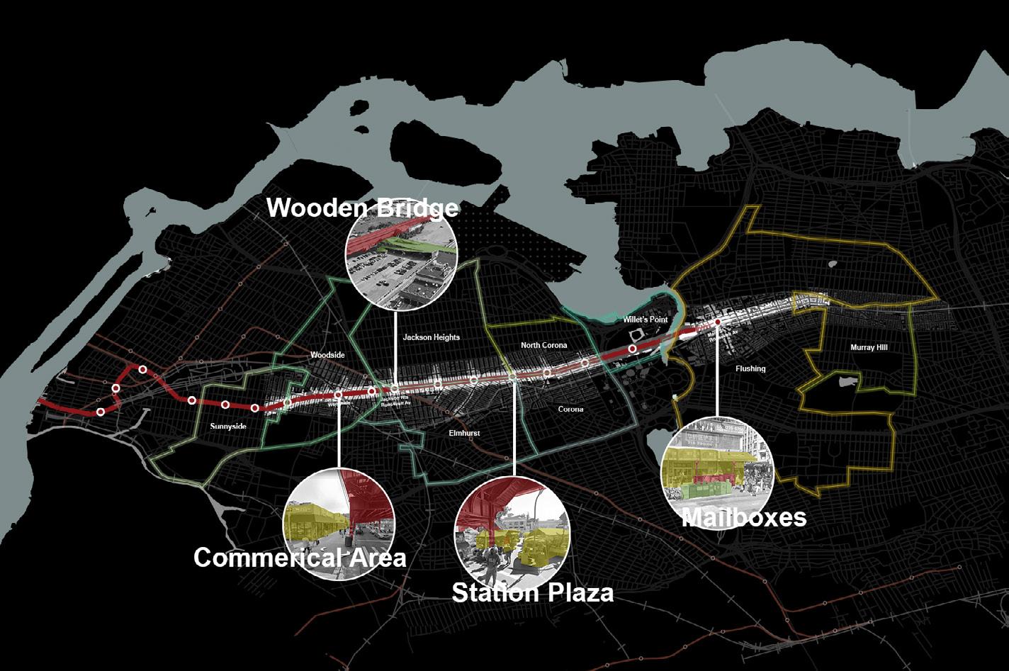
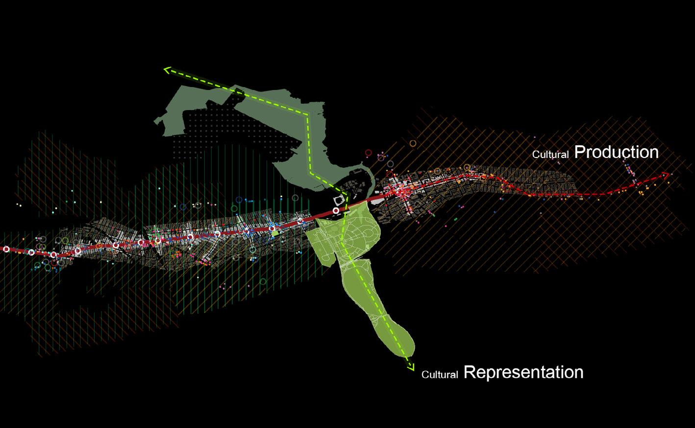
Queens, NY is one of the most diverse places in the world. Through our research on demographics and people’s choice on public transportation, we found that the area along the 7 line is the most energetic and dynamic place for heterogeneity because different ethnicities live along the 7 line and use the 7 line to commute. We also found park system with World Fair History extended from the south to the north. We identified them as Culture Production and Culture Representation. Our Site is right at the intersection of the two systems so we decide our topic as the Weaving Culture. We learned from current typologies and recomposed our new urban fabric to achieve the new featured weaving system.
Radical Culture Heterogeneity Along The 7 Train

Cultural production means where cultures are made and utilized in physical ways, like food and churches. It is the urban fabric along the 7 train with residential and commercial functions, creating a vibrant lifestyle.

Cultural Representation means that culture is represented by iconic cultural buildings and public arts in the context of the landscape. These two findings and strategies run through our program.


CULTURE PRODUCTION & CULTURAL REPRESENTATION CRASHED TOGETHER
DESIGN CONCEPT- THE WEAVING TWO SYSTEMS

CURRENT BLOCK TYPOLOGY
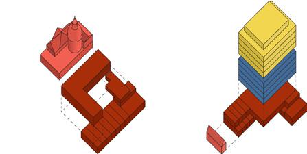


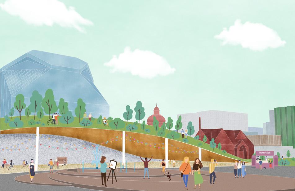
We mashup building prototypes and block typology to form the weaving urban fabric in Willets point. We weaved these urban fabrics along the cultural production and cultural representation to form our master plan: weaving culture. There are two main cultural production corridors along the vertical local road, and three secondary cultural production corridors inside the blocks. At the same time, cultural representation corridors use cultural buildings, plazas, and pedestrian streets to weave with cultural production corridors.
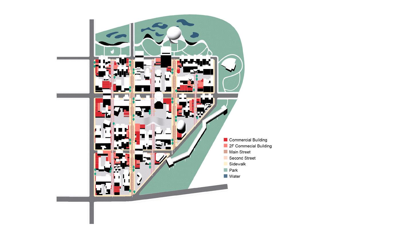

Culture Production
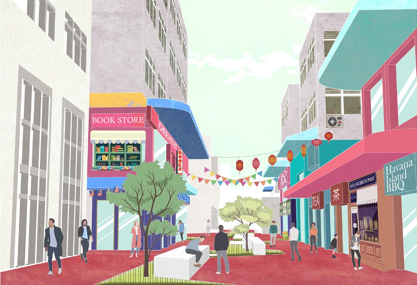
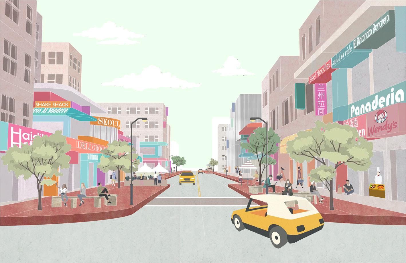
The roads extended from 7 Line are commercial streets that simulate Roosevelt Avenue. These are Cultural Production including two main traffic roads and three secondary pedestrian paths. The same direction of circulation contracts the difference between the front and the back side of commercial streets.
Commercial Walking Street
Cultural representation is the green pedestrian paths focusing on how the the cultural buildings and public art represent in the context of the landscape. The cultural buildings along the corridors include museums, artist studios, religious buildings, etc. These three corridors extend from Citi field to the ecological corridor. And those scattered in the landscape are monumental buildings.


California has experienced raging wildfires over the past few decades. Physical and human factors contribute to the trigger and destruction of wildfires. Physical factors like weather, fuel accumulation aggravate fires. However, social vulnerability factors lead to greater fire damage. Such as lack of transportation, inconvenient information exchange and worse resistance of vulnerable communities. We focus on social factors and want to increase the resilience of those groups to fire through the union of communities. When the fire comes, we can do better.
02. The Urburn Collective
— Collective Housing Design in the Wildfire Hazard Zone
Location: Clearlake, Lake County, California
Type: Team Work Members: Beatriz Tzung, Indu Nair, Pallavi Salecha, Minghui Li
Contribution: 3D Model 70%, Diagram 30%, Video Clips 50%, Render 30%
Instructor: Jeffrey Inaba, Shaun McCallum
Winter 2021- Spring 2022
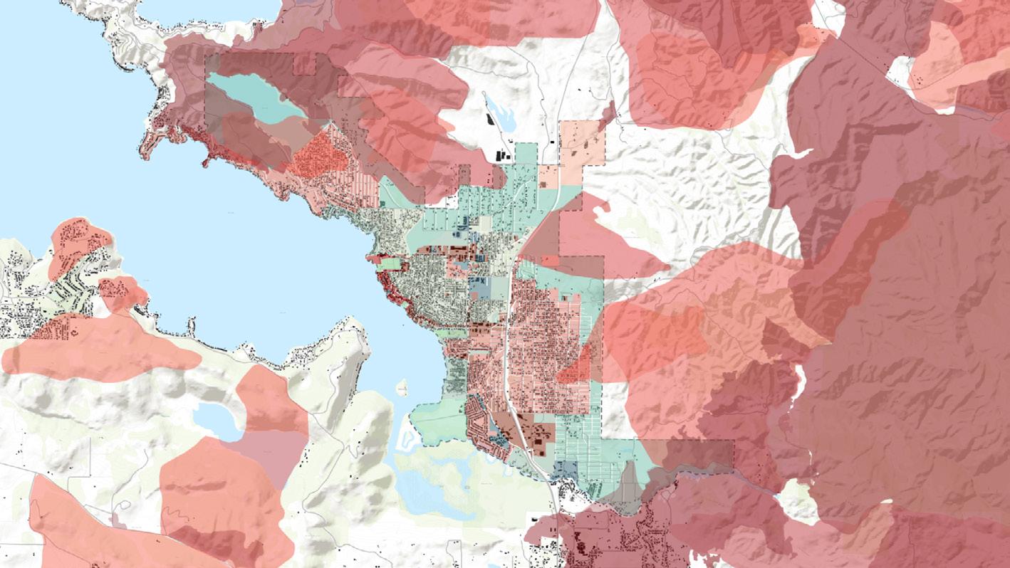
Here is the situation we investigated in Lake County. After comparing social vulnerability indicators, such as median household income, poverty rate, median age, etc., we chose the city of Clearlake as our design site, which has higher social vulnerability and high fire risk.


SURVEY THAT SENT OUT TO CLEARLAKE RESIDENTS

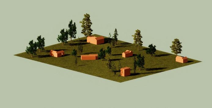
Fire Hazard And Land Use
The site chosen for the architectural project was picked considering the land use zoning and WUI boundaries, considering the fire risk and the wind direction. According to the zoning of Clearlake, the site is meant for future residential expansion.
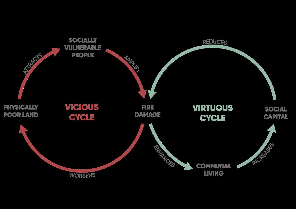
VICIOUS CYCLE AND VIRTUOUS CYCLE
We came to the insight that physically poor land attracts more socially vulnerable people, which amplifies fire damage and worsens the land. By introducing communal living into this vicious cycle, we can increase social capital, which can reduce fire damage and enhance day-to-day life.
Form Exploration


Social Vulnerability
Physically Poor Land
Attracts More Socially Vulnerable People
Commual Living
Given the context of Clearlake, we see that the physically poor land attracts more socially vulnerable people, which amplifies fire damage and worsens the land. By introducing communal living into this vicious circle, we can increase social capital, which can reduce fire damage and enhance communal living.